
By the 1880s, Newcastle Upon Tyne was one of the most industrially active cities in England. Shipyards lined the River Tyne, coal from the Northumberland and Durham seams fueled its factories, and engineering workshops filled the gaps between. The city’s population was growing fast, pulling workers in from surrounding towns and countryside in search of steady wages.
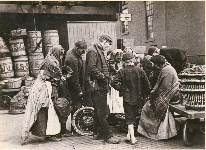
The Quayside was the beating heart of daily trade. Fish sellers, merchants, and laborers crowded its cobbled stretches, and barges loaded with grain, coal, and provisions moved steadily along the Tyne. Streets near the river were dense with commerce at every level, from large trading houses down to individual street sellers.
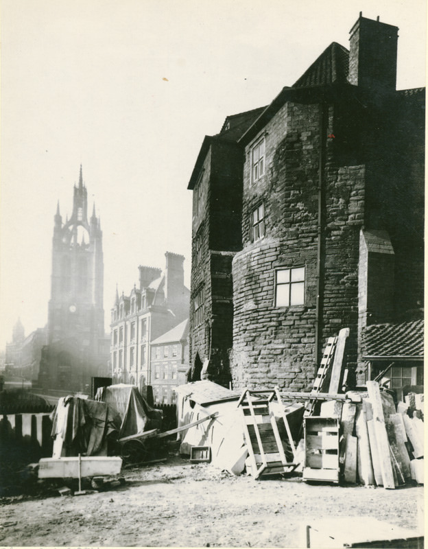
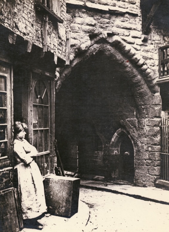
The medieval Black Gate still stood in the 1880s, its stone archway framing a view north toward St Nicholas Cathedral. By this point, small shops occupied parts of the old structure, and everyday life played out right against its ancient walls. The city’s medieval past and its industrial present existed side by side.
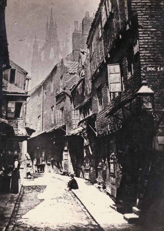
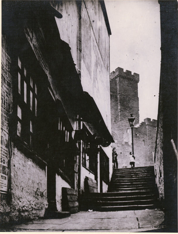
Castle Garth Stairs was known for its concentration of clogmakers’ shops — a trade essential to working-class Newcastle, where wooden-soled clogs were standard footwear for factory and mine workers. The Castle Keep loomed at the top of the climb, a Norman remnant towering over a neighborhood very much alive with Victorian trade.
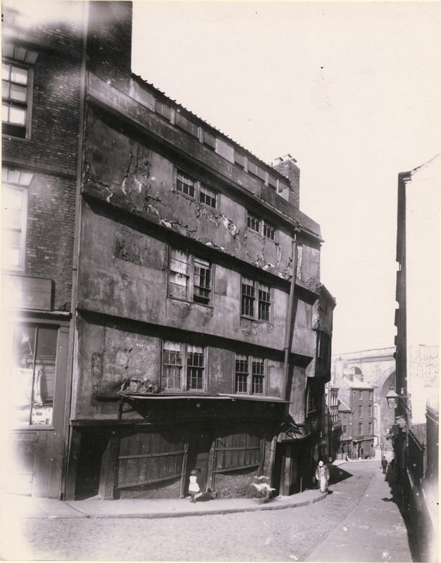
The Side was one of Newcastle’s older thoroughfares, steeply sloping toward the Quayside. Number 86 marked the birthplace of Admiral Cuthbert Collingwood, who commanded the British fleet at Trafalgar after Nelson’s death. By 1880 the street was a busy commercial corridor, its historic buildings given over to shops and business premises.
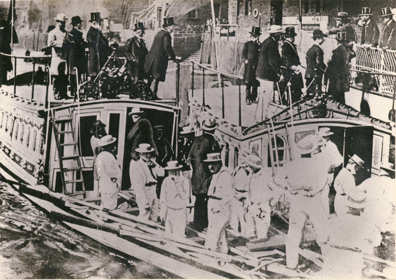
Barges at Mansion House Quay loaded and unloaded continuously. The River Tyne was the city’s main artery for moving bulk goods, and the quayside infrastructure — cranes, warehouses, and mooring points — supported a vast network of river trade that connected Newcastle to ports across Britain and beyond.
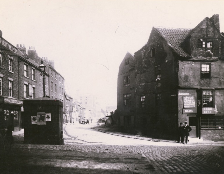
Sandgate, running east along the riverfront, met the Milk Market at its corner. The Three Bulls Heads pub at number 12 served the dock workers and traders who filled the area each day. Streets like Sandgate were crowded, noisy, and central to the working life of the city’s lower districts.
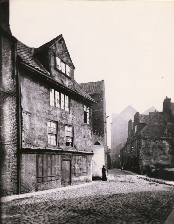
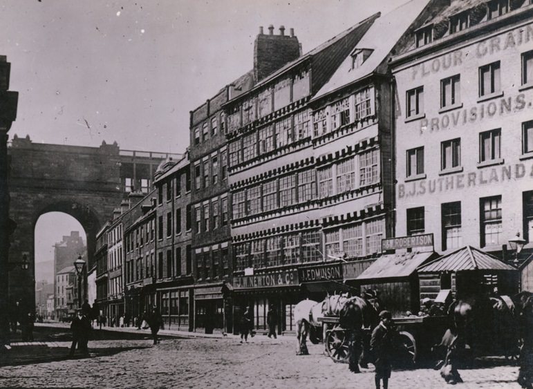
Sandhill offered a clear view of the railway viaduct that cut across the city skyline. Its buildings housed a mix of businesses — flour and grain merchants, hay and straw dealers, a hairdresser, a corn and salt dealer, and even an india rubber merchant. The variety on a single block reflects how densely commercial central Newcastle had become.
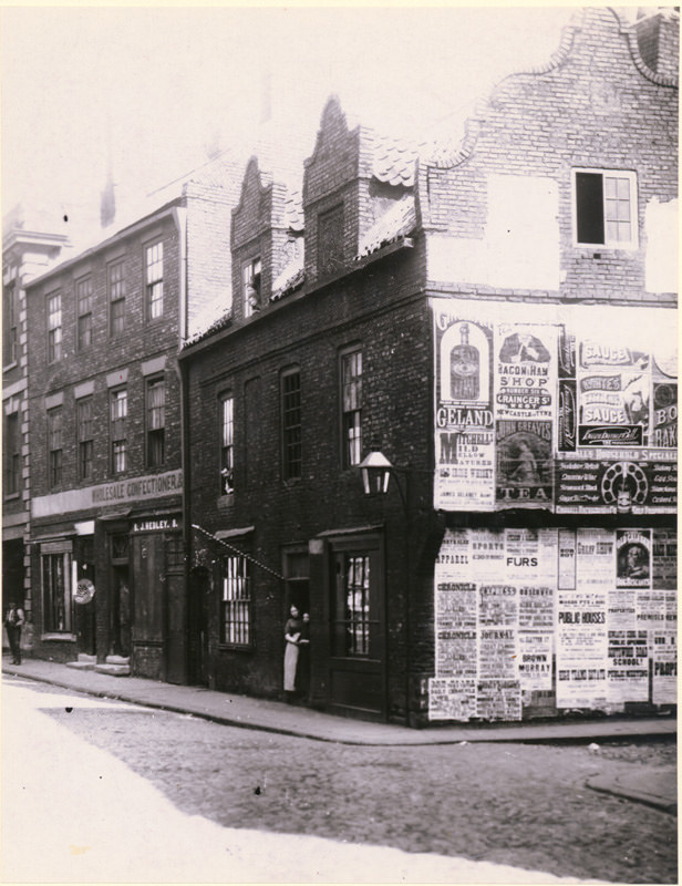
Percy Street ran south through a retail district that served the city’s growing population. Johnson Hedley’s wholesale confectionery at number 38 supplied sweet goods to shops across the region. Streets like this catered to a working and middle-class clientele whose spending power was gradually rising alongside the city’s industrial output.
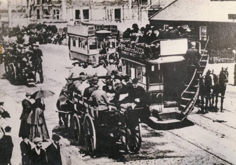
Gosforth High Street drew large crowds on race days at the nearby racecourse. Horse racing was one of the most popular public events in the region, cutting across class lines and drawing people from across Tyneside. On race days, the high street filled with spectators, traders, and visitors, turning a quiet suburban road into a temporary fairground.




