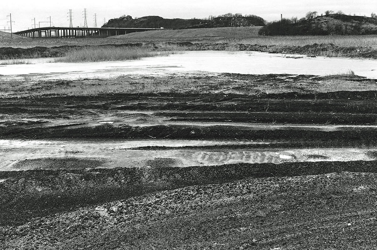
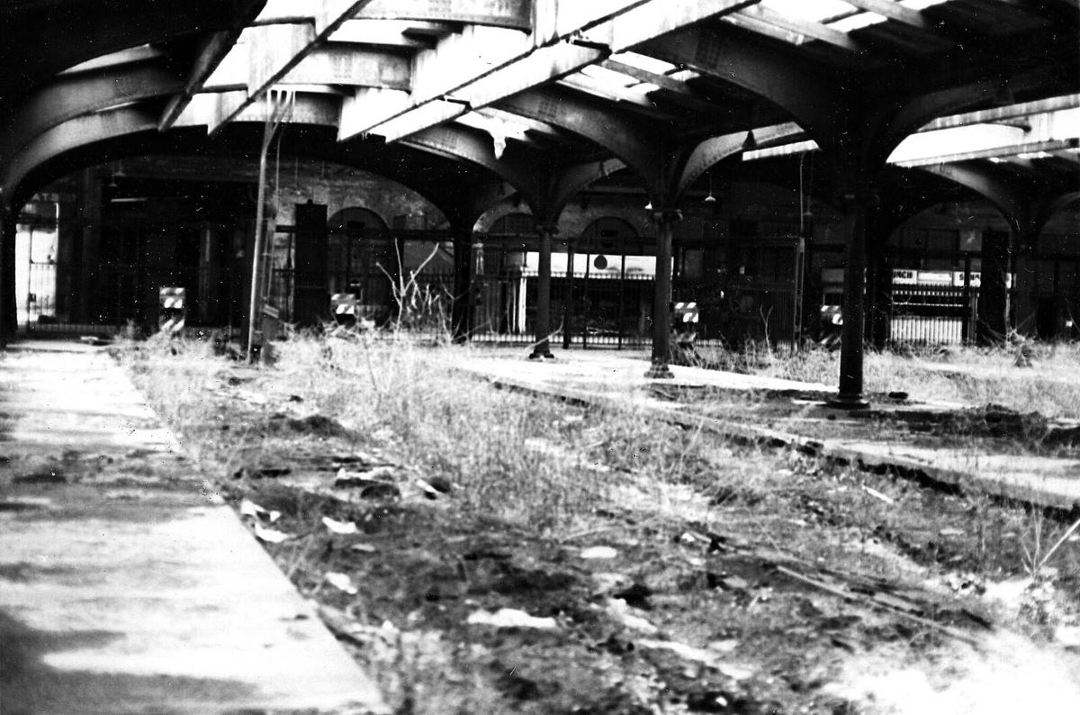
By the time the 1970s arrived, Jersey City was deep in the middle of one of the most dramatic industrial collapses in New Jersey history. The waterfront, which had once been one of the busiest freight corridors on the East Coast, was now a wasteland. The Pennsylvania Railroad and the Lehigh Valley Railroad — two giants that had defined the city’s economy for decades — were both bankrupt. Cargo shipping had shifted north to newer port facilities in Newark and Elizabeth. What remained along the Hudson River were miles of rotting wooden piers, rusting cranes, and empty rail yards stretching as far as the eye could see.
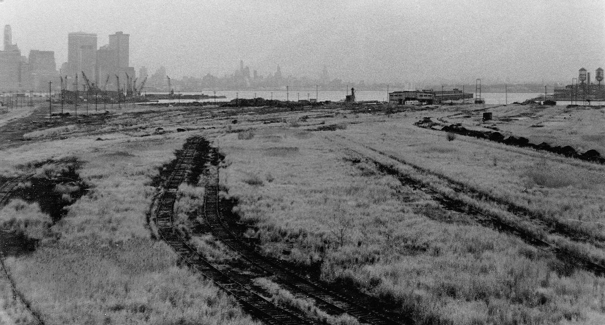
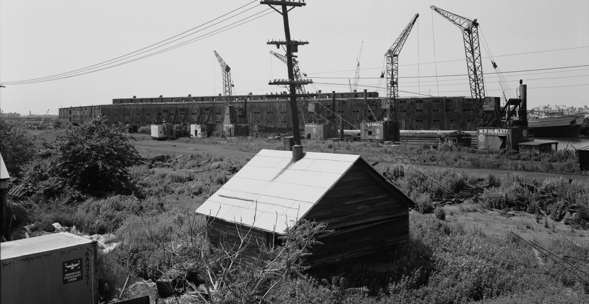
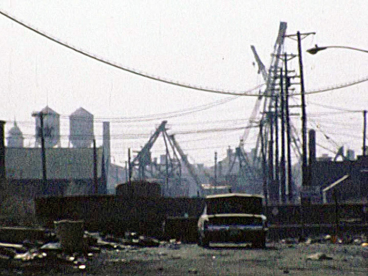
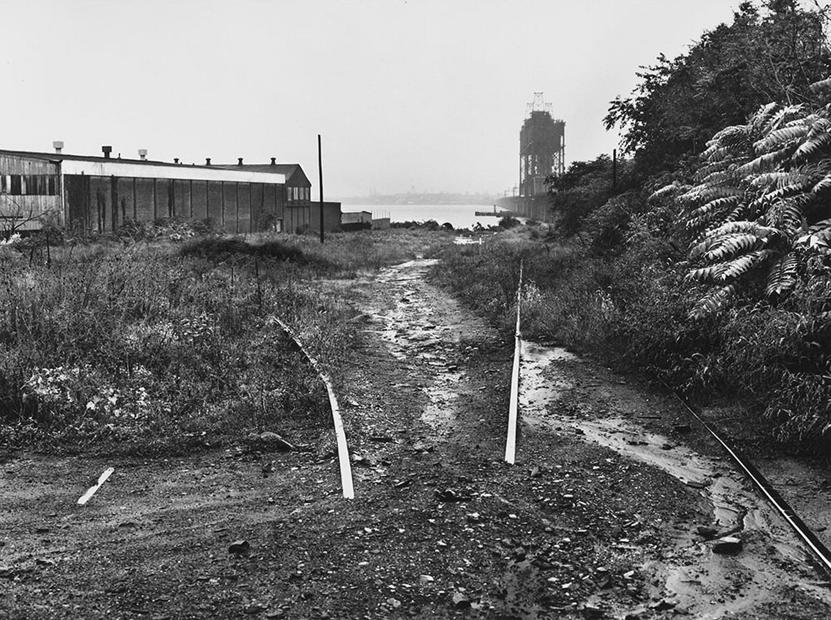
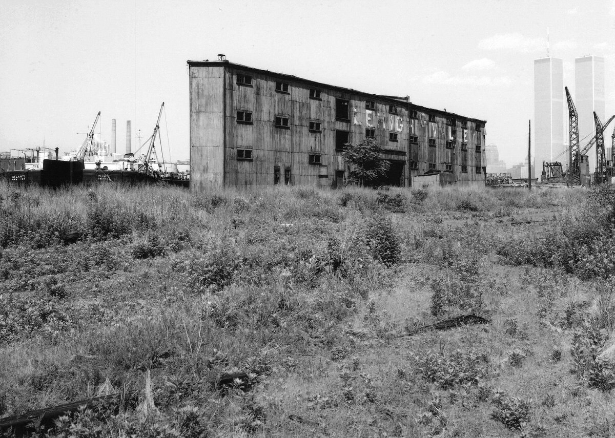
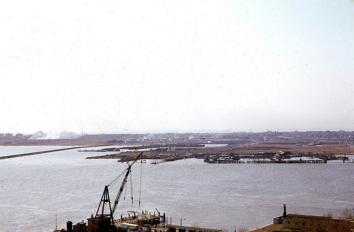
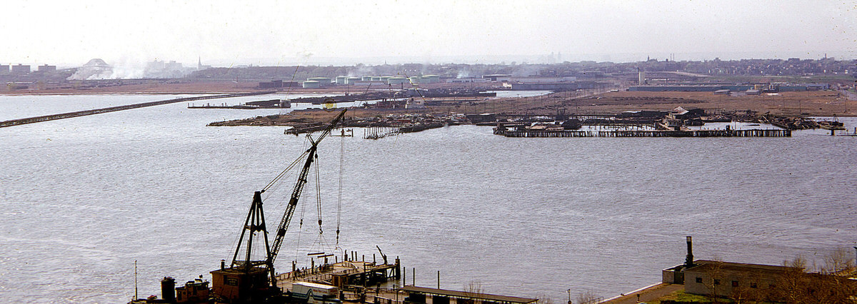
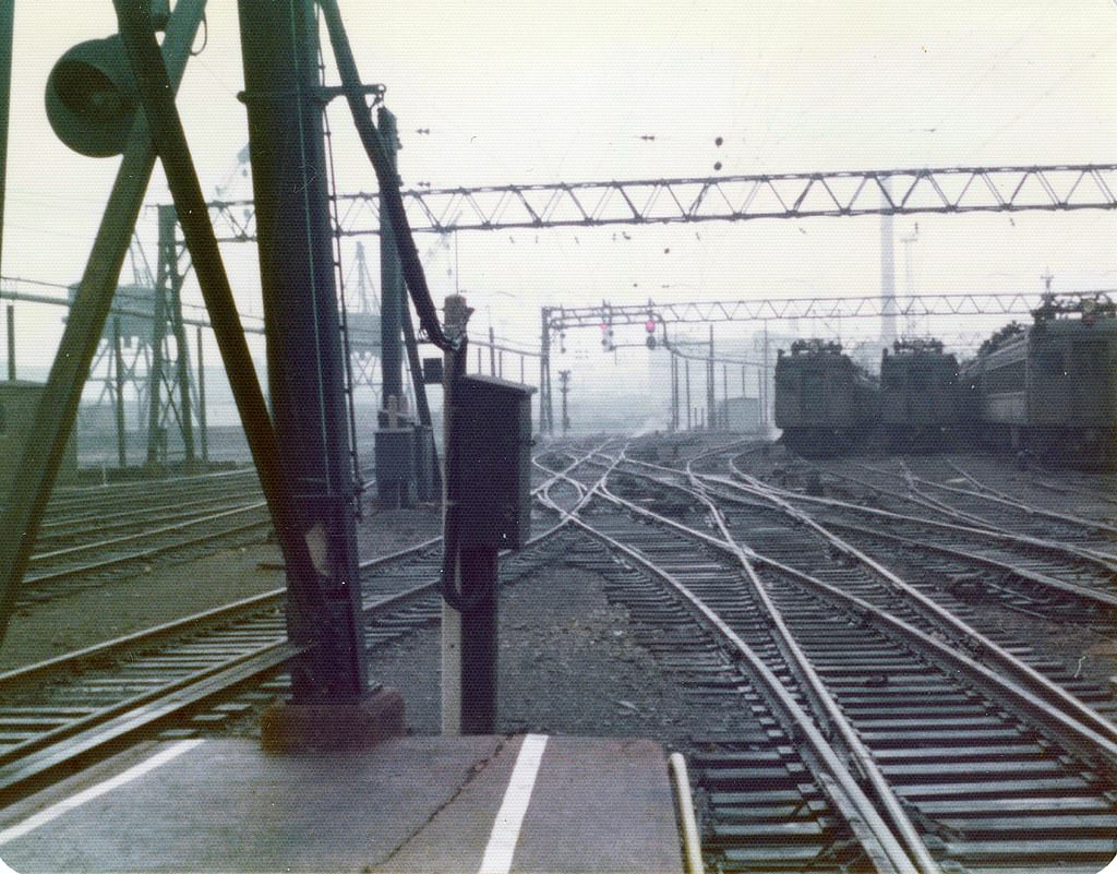
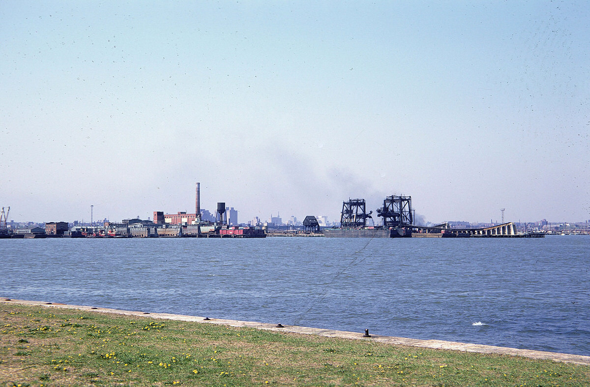
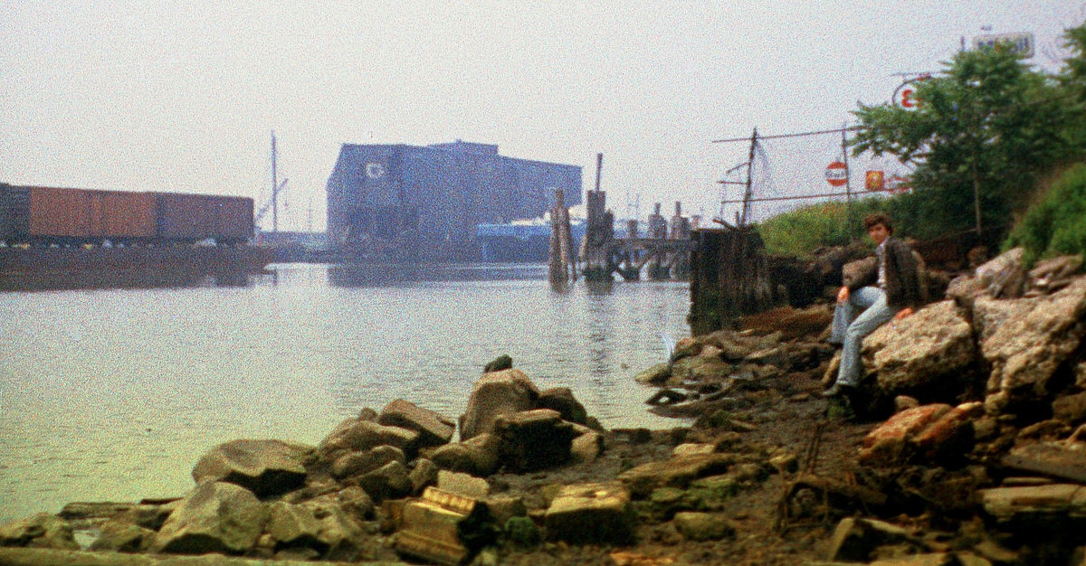
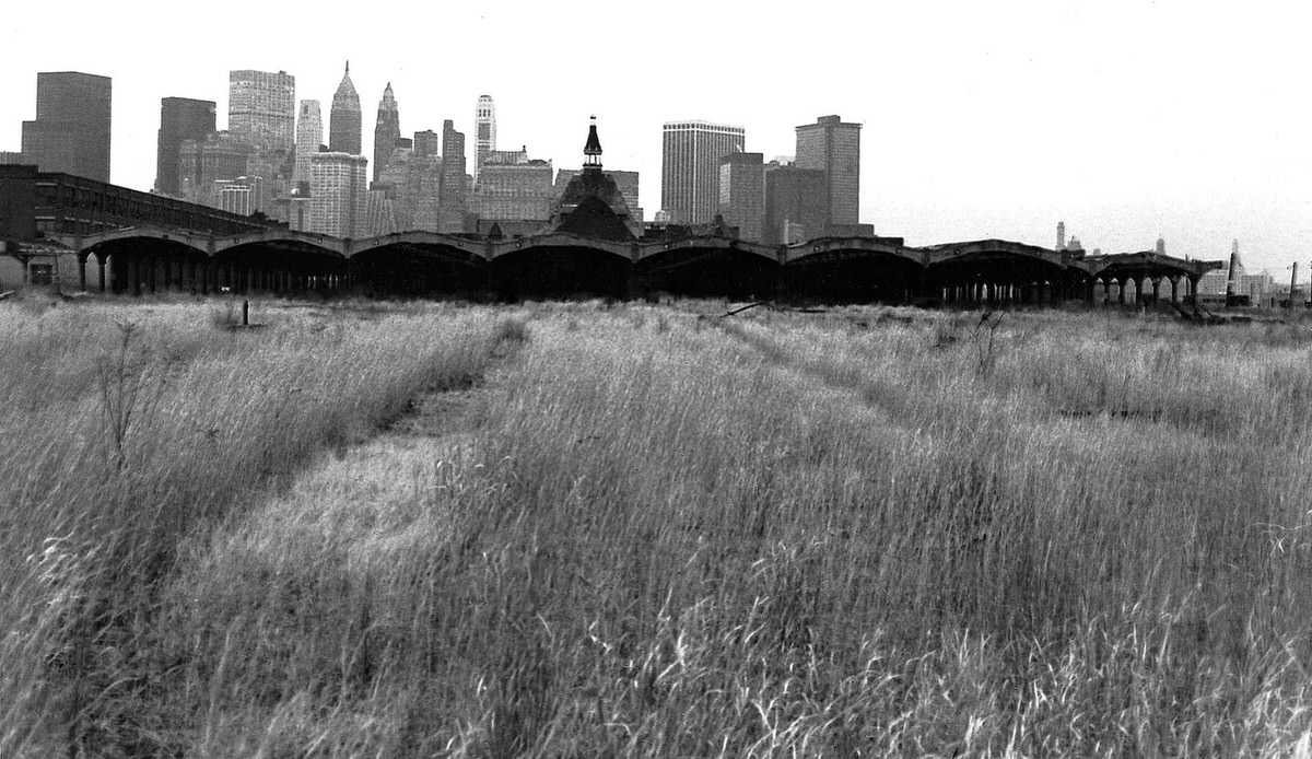
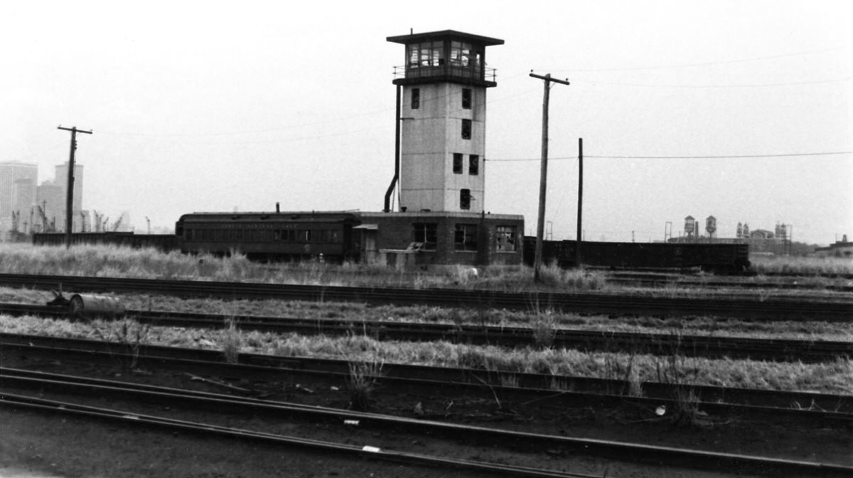
The Lehigh Valley Railroad’s Black Tom Island yard sat silent, its tracks overgrown and its structures deteriorating year by year. The scene was typical of dozens of sites along the Jersey City waterfront during this period.
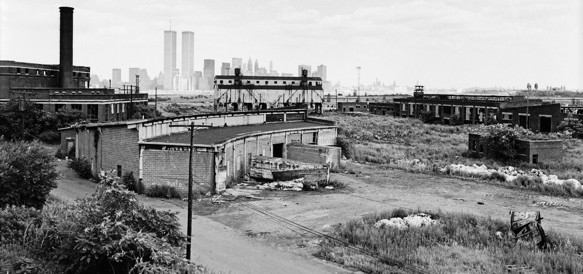
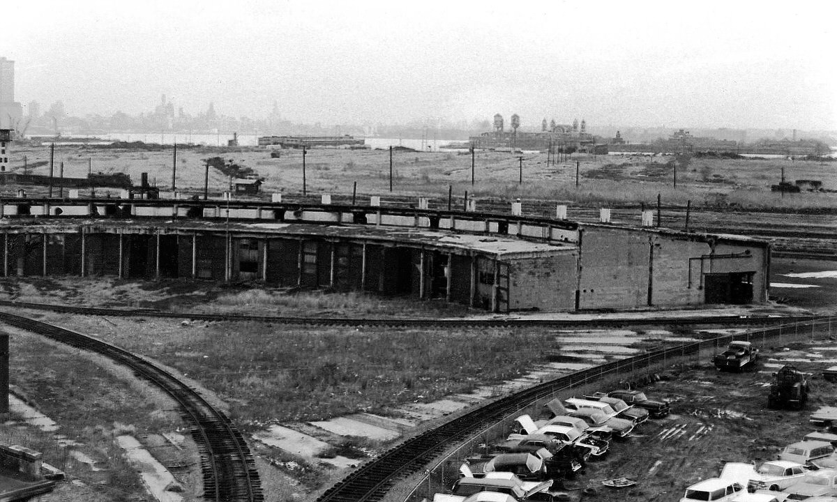
The Central Railroad of New Jersey had once been a vital link between Manhattan and the interior of the country. Its Jersey City terminal handled thousands of commuters and tons of freight every day. By the early 1970s, that operation was finished. The maintenance plant, the roundhouse, the train sheds, and the ferry slips all stood empty, slowly falling apart.
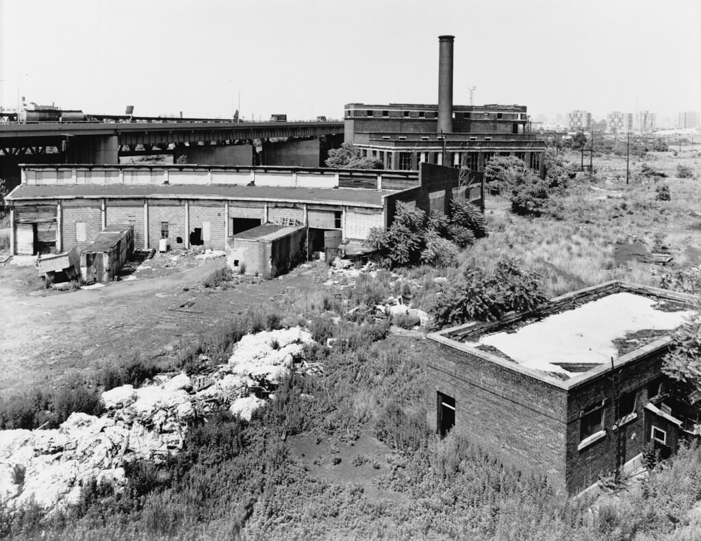
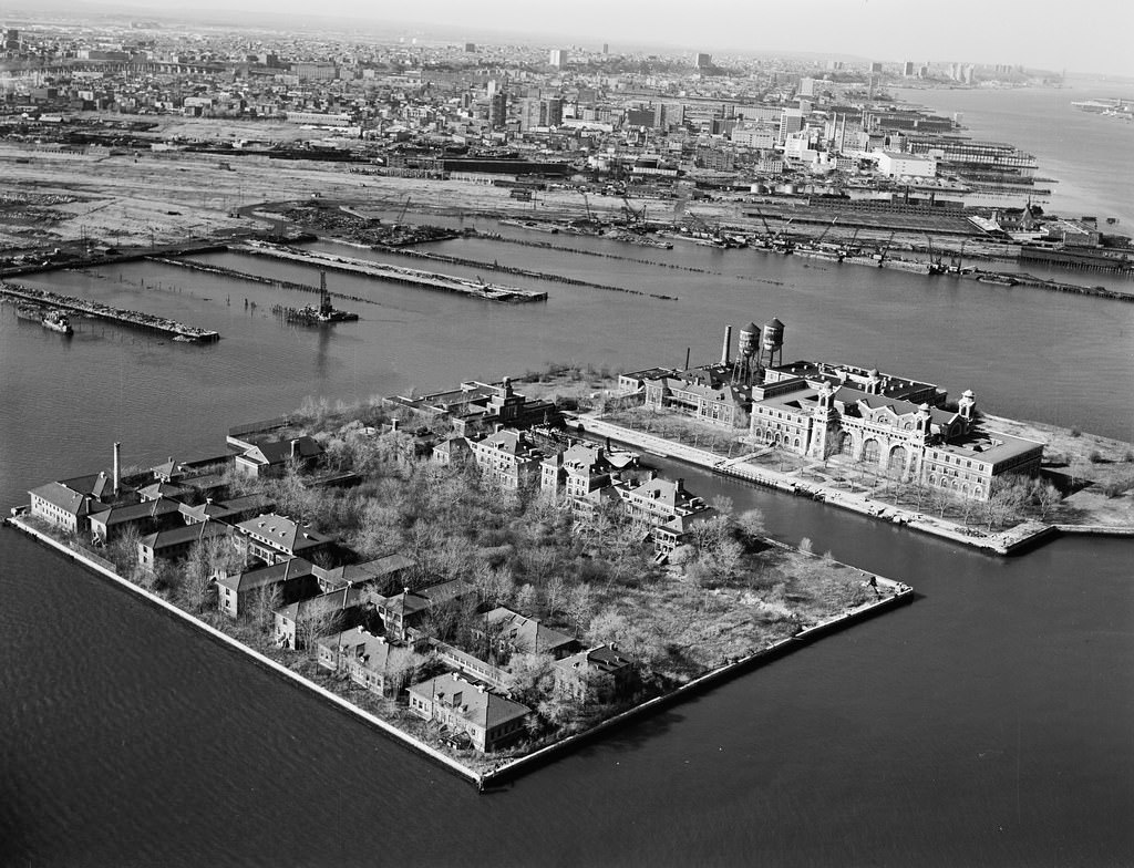
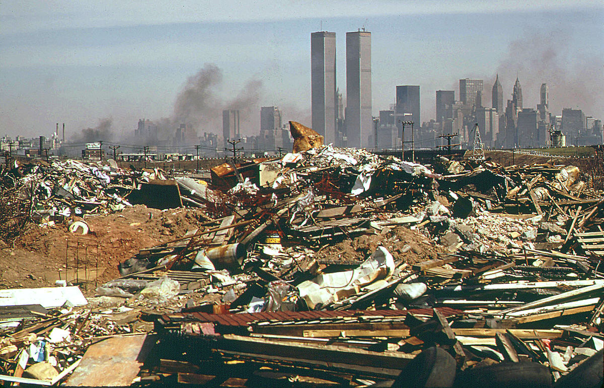
The land that would later become Liberty State Park was, through most of the decade, a contaminated mess. Polluted soil, discarded railroad equipment, and decades of industrial dumping covered the ground. Weeds pushed up through cracked asphalt. The waterfront that generations of immigrants had once crossed on their way to Ellis Island was now inaccessible to the public.
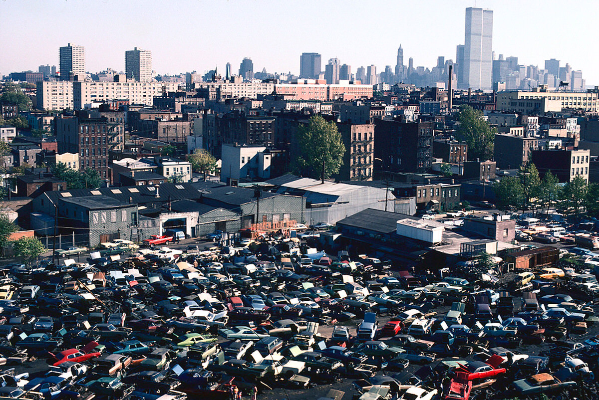
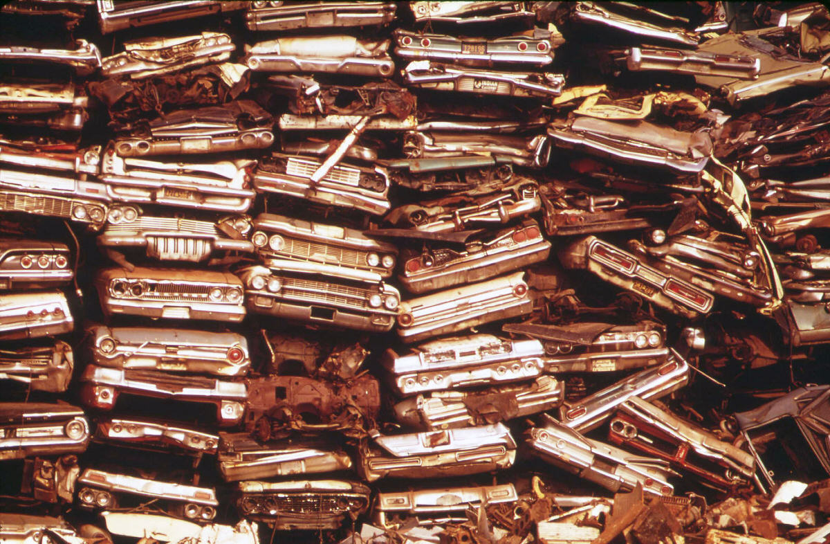
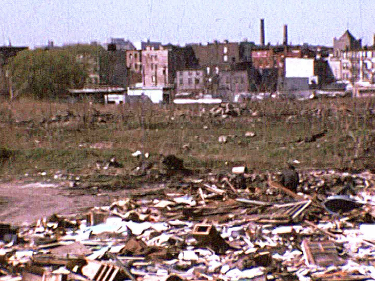
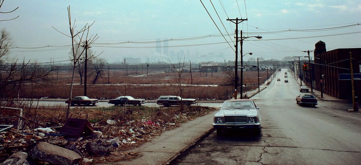
The decay wasn’t limited to the waterfront. Inland neighborhoods showed the same signs of economic collapse. Near Cornelison Avenue and Johnston Avenue, junk-filled lots sat between shuttered factories. The Morris Canal, which had once carried barges loaded with coal across the state, was now lined with junkyards and stripped cars. Telephone poles leaned at odd angles. Garbage fires burned near the New Jersey Turnpike.
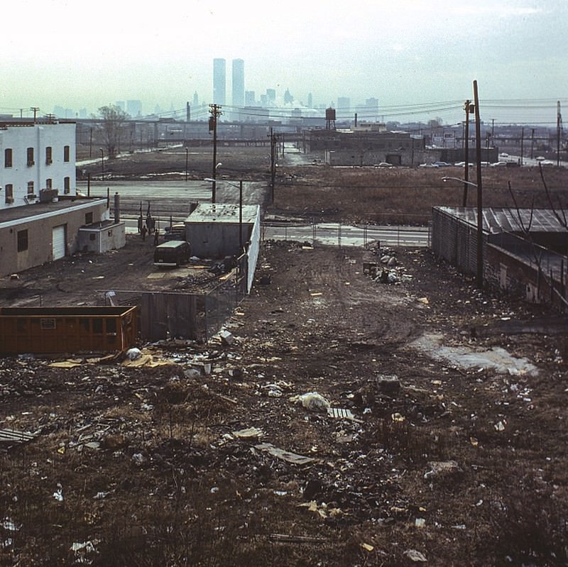
Abandoned tracks and crane graveyards covered large sections of the city’s waterfront zone. The cranes had once unloaded ships. Now they sat rusting, surrounded by overgrown rail beds. Some had been partially dismantled for scrap. Others just waited in silence as the decade passed.
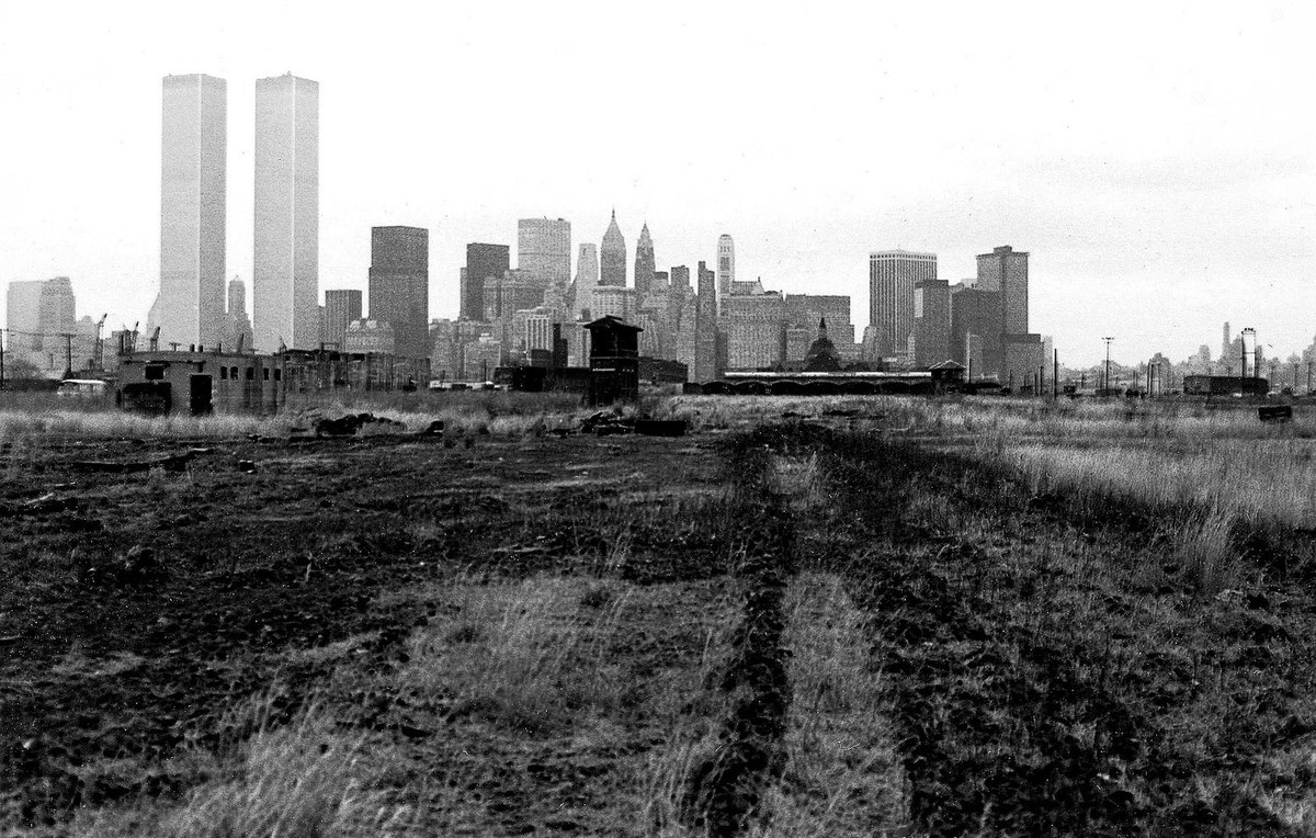
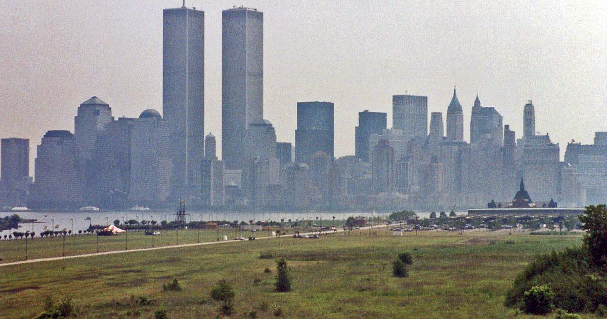
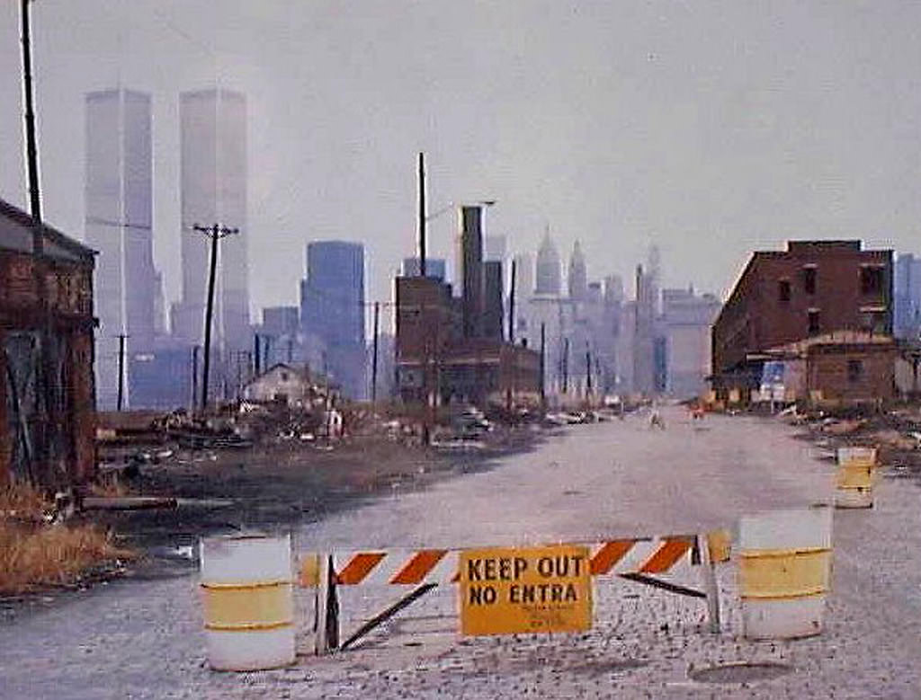
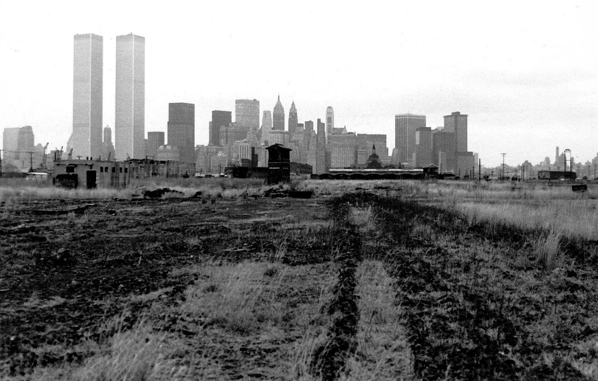
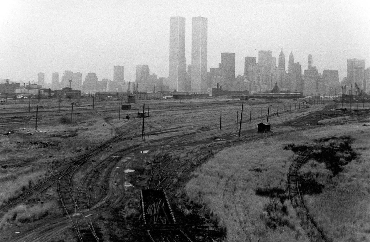
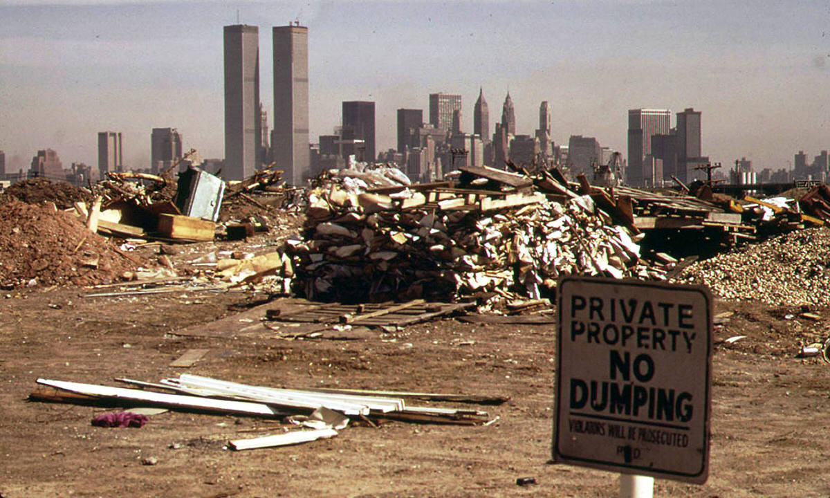
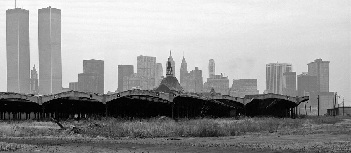
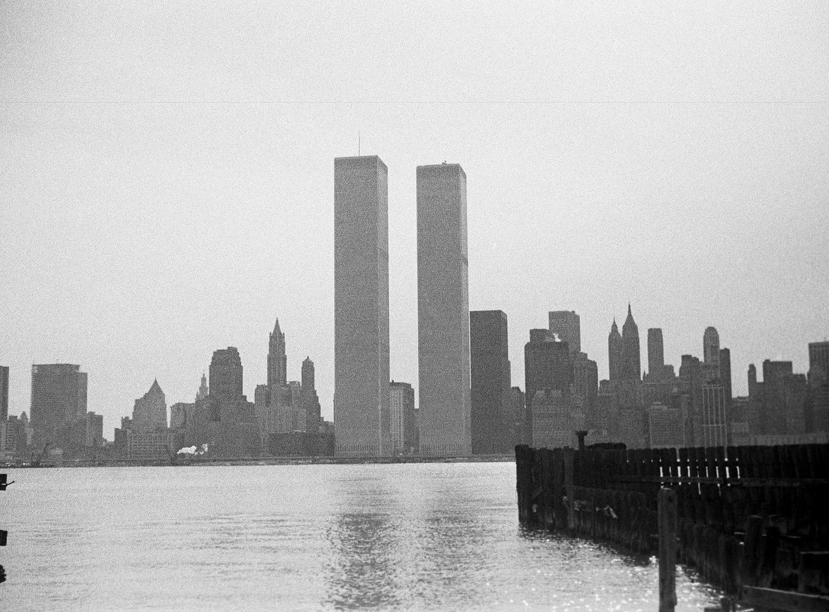
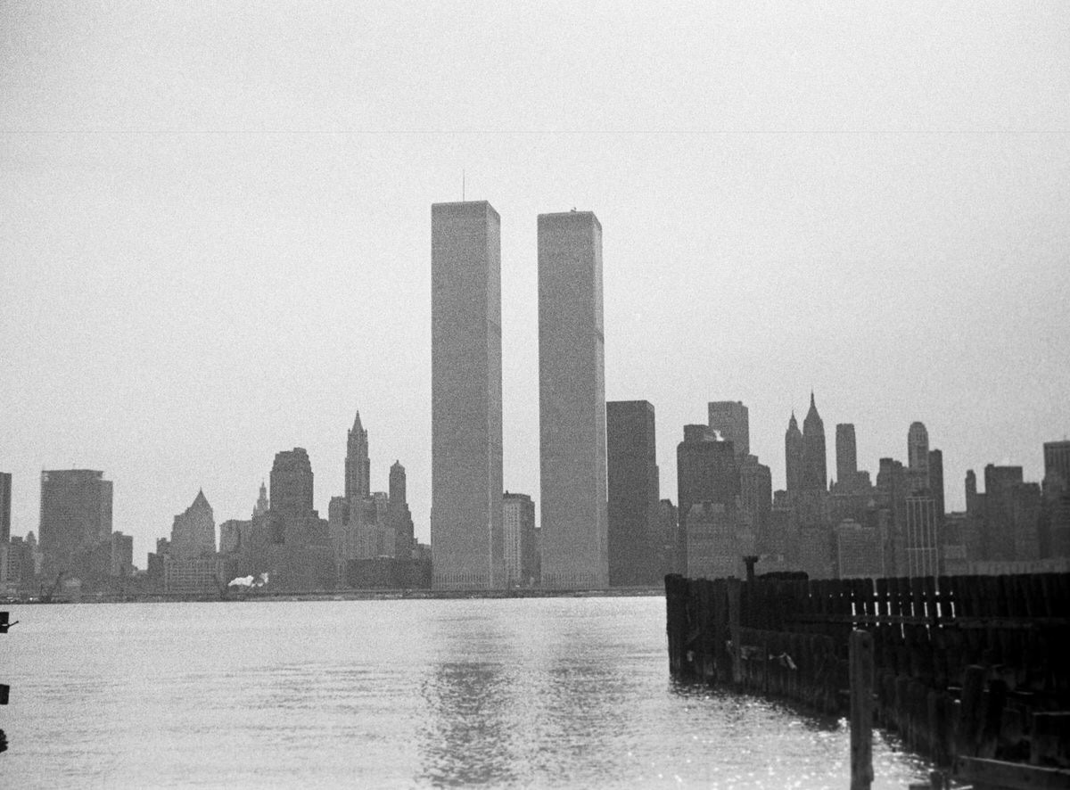
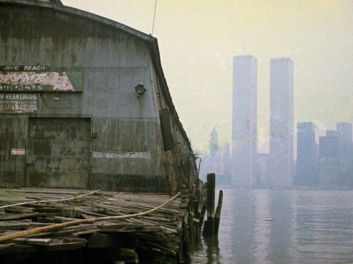
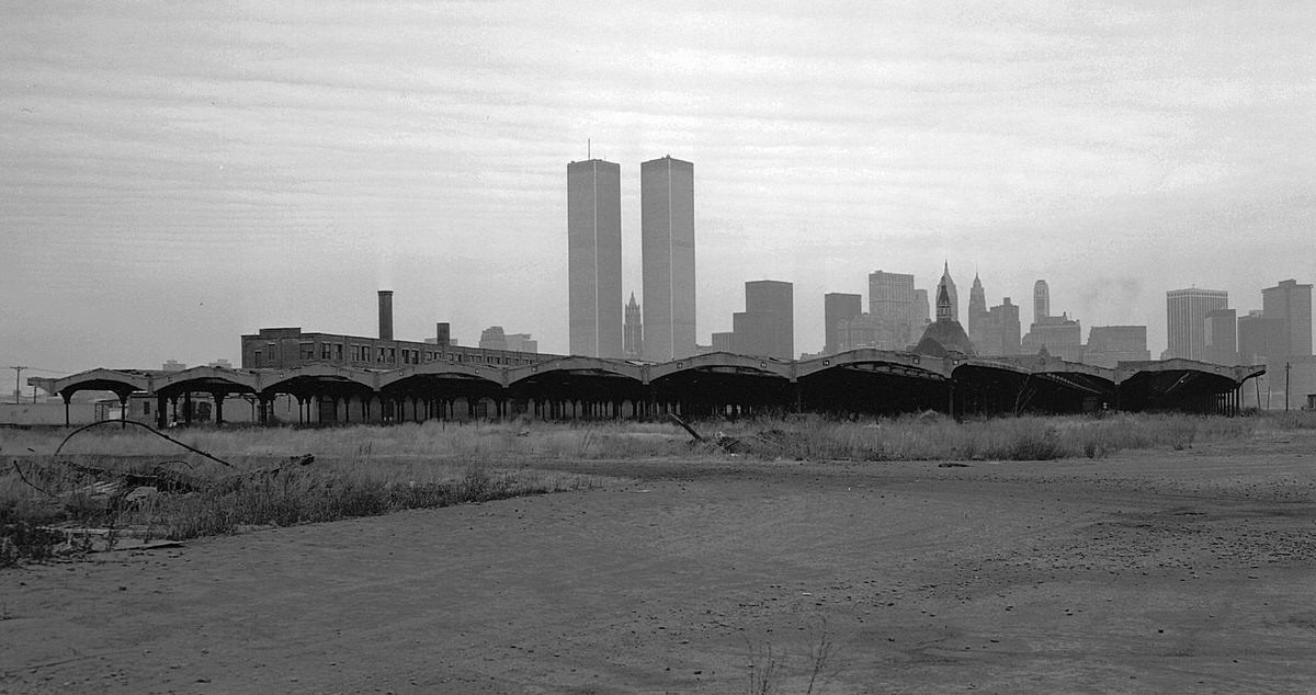
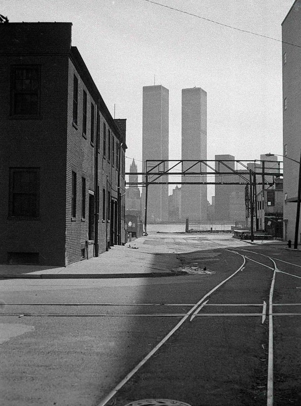
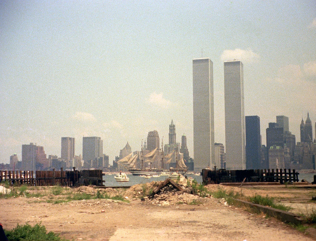
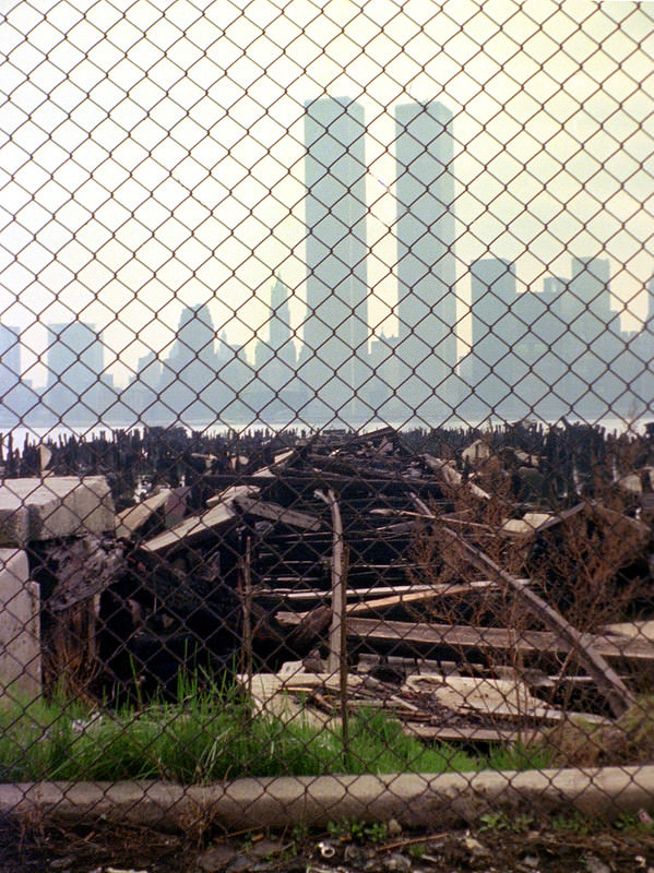
From across the river, the contrast was jarring. The newly completed World Trade Center towers rose above lower Manhattan while the Jersey City shoreline directly opposite them lay in ruins. The Central Railroad of New Jersey terminal — a grand Beaux-Arts structure built in 1889 — sat abandoned just across the water from the tallest buildings in the world.
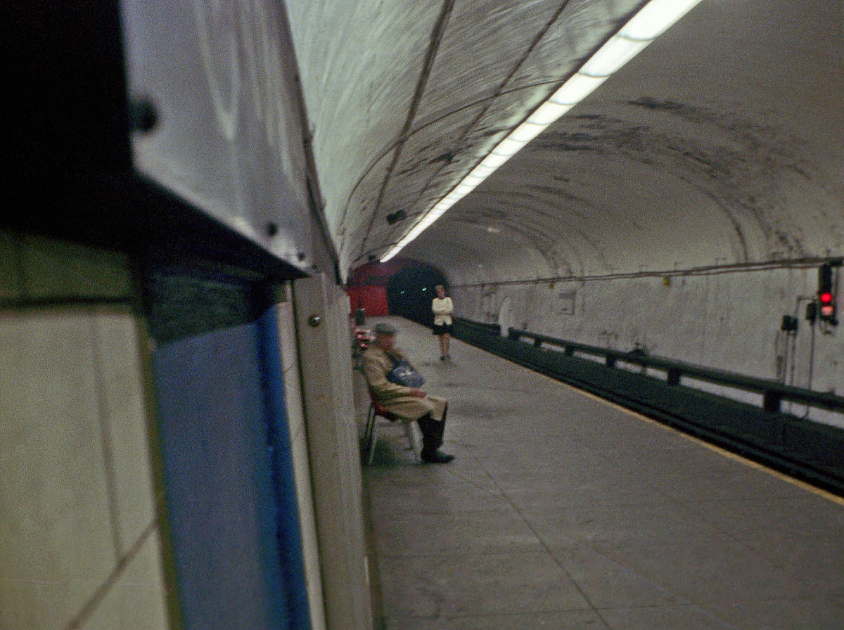
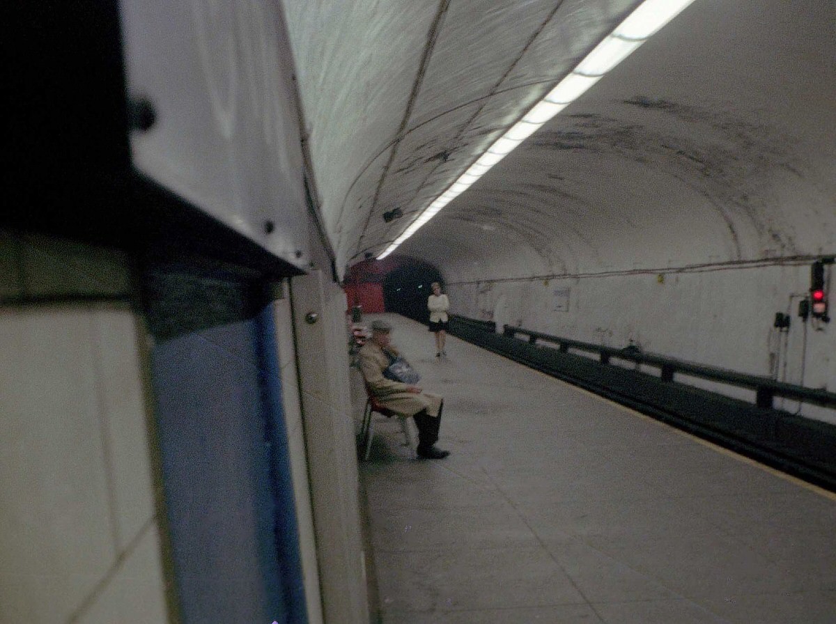
Despite the surrounding desolation, the PATH train system kept moving. The Exchange Place station served commuters who crossed under the Hudson River to reach jobs in Manhattan every morning. In 1974, the Journal Square Transportation Center opened, connecting PATH with dozens of bus routes under one concrete roof. It became the nervous system of daily movement in the city.
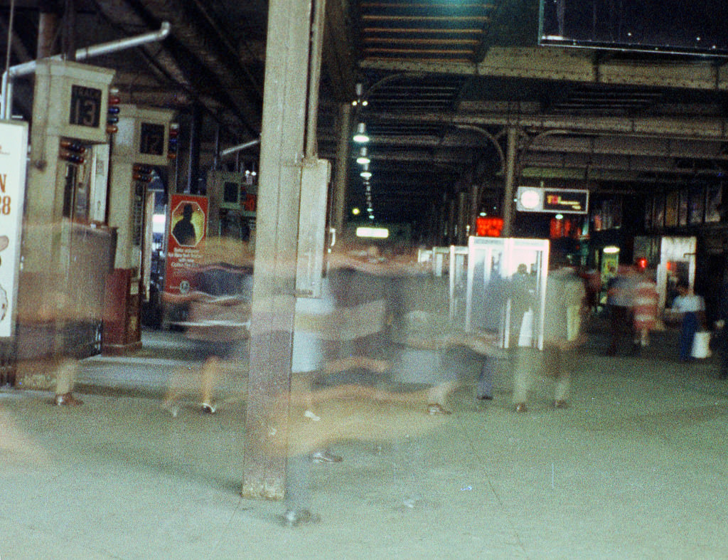
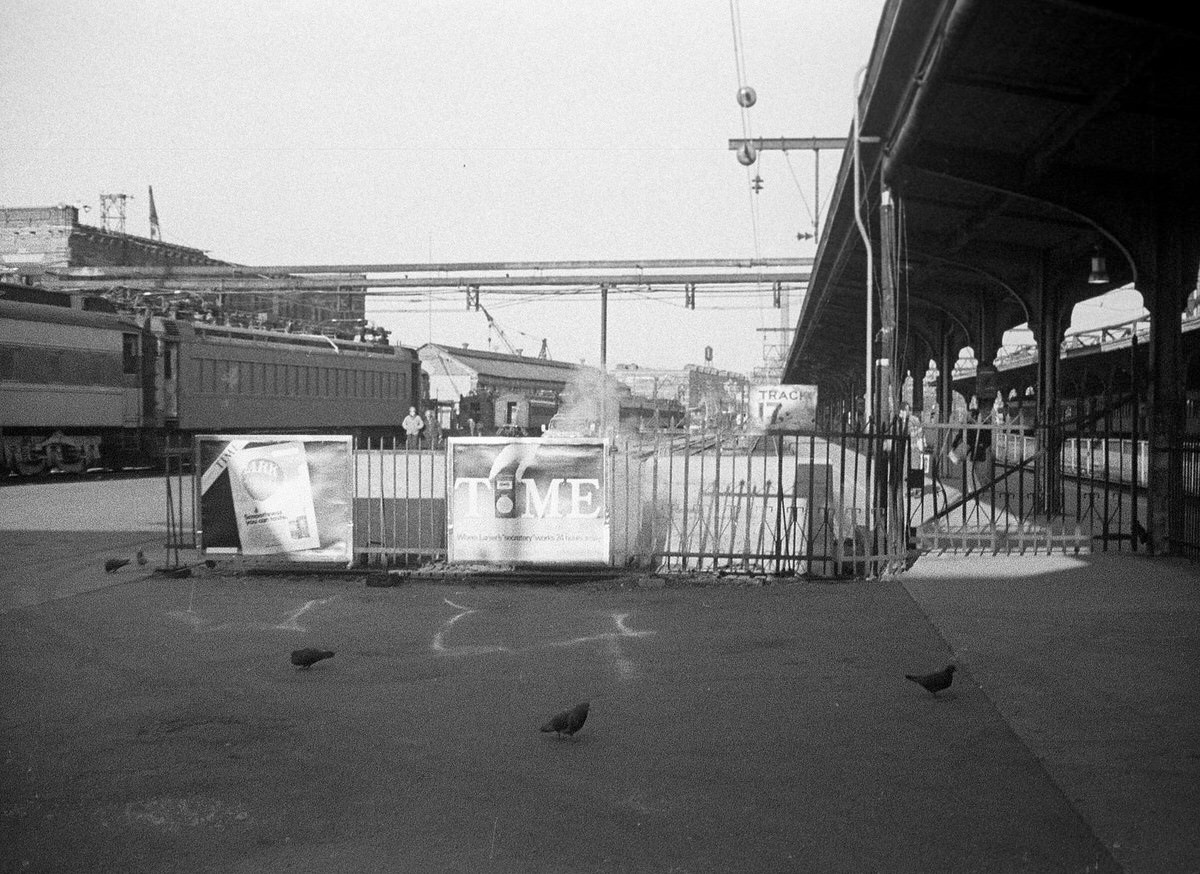
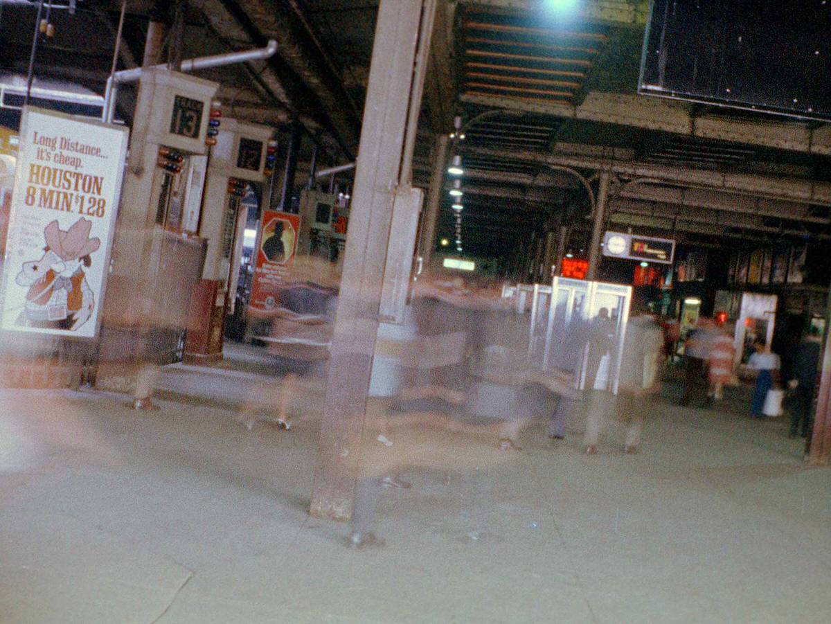
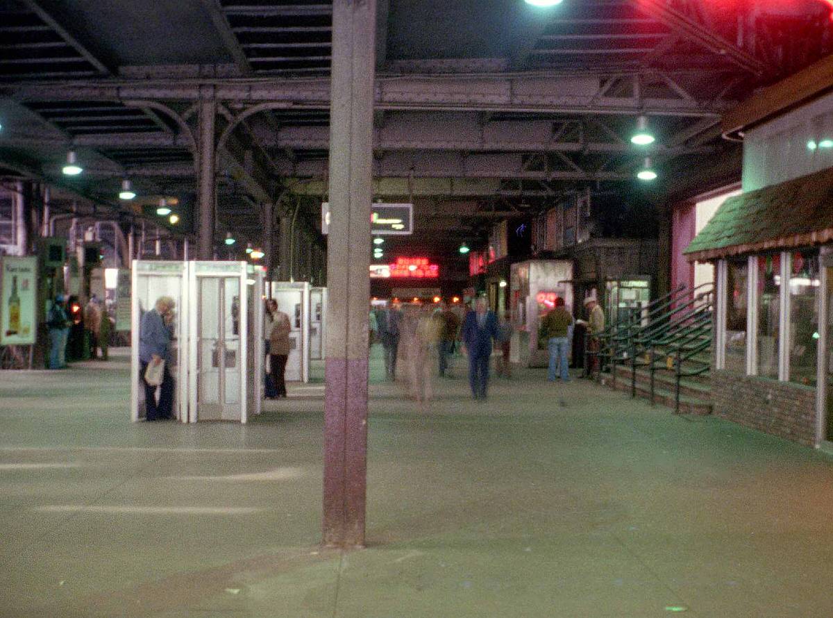
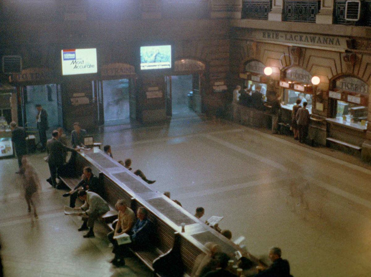
Across the river in Hoboken, the Erie Lackawanna Terminal was still functioning. Its train shed sheltered commuters heading into and out of the city. The waiting room retained much of its original early 20th-century character. Commuters packed the platforms each morning, surrounded by vintage trains and cigarette advertisements on the walls.
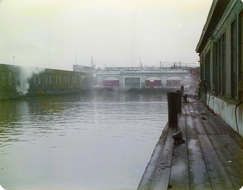
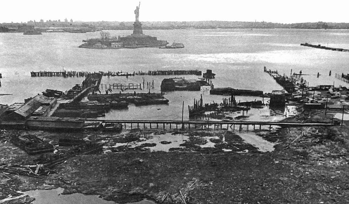
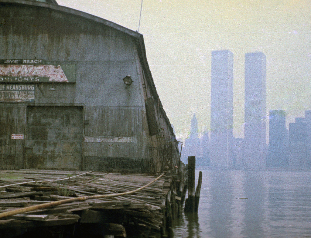
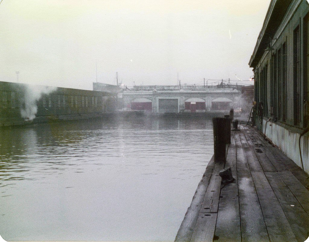
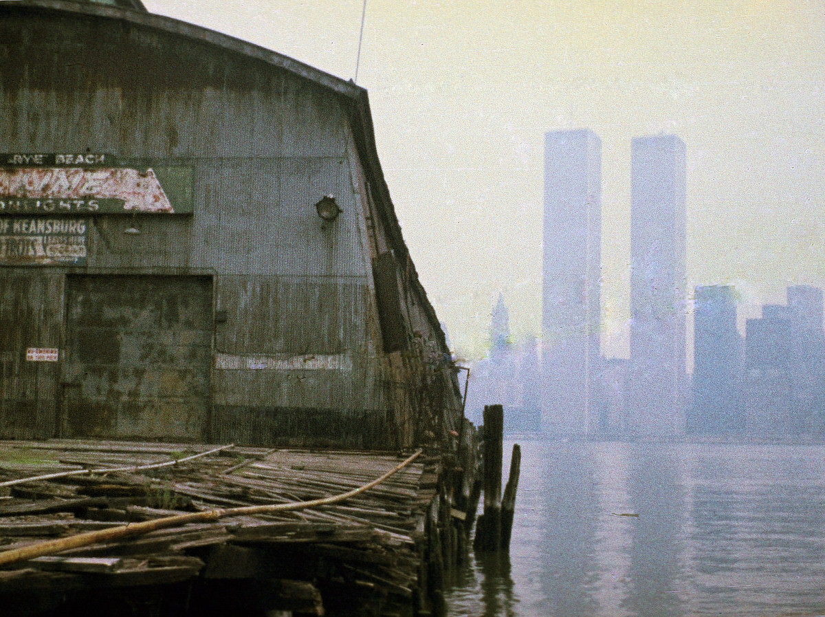
The ferry slips along the Jersey City waterfront had once carried hundreds of thousands of passengers between New Jersey and Manhattan each year. By the mid-1970s, most of them were completely abandoned. The wooden decking rotted away. Seagulls nested in the iron framework. The piers at Exchange Place and near the Central Railroad terminal became quiet monuments to an earlier era of transit.
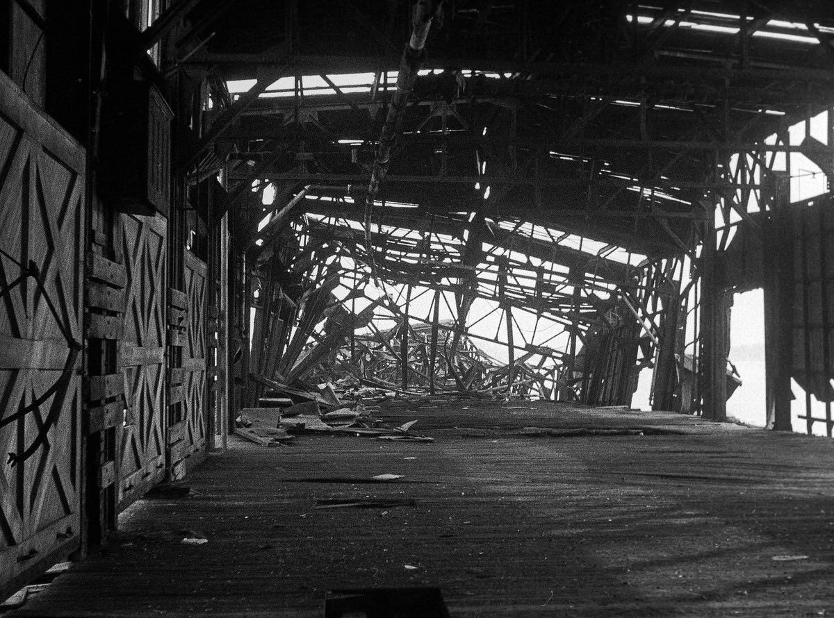
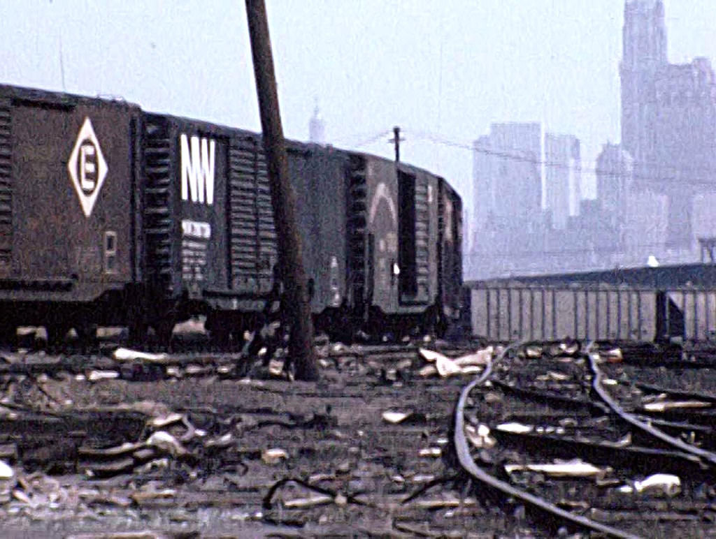
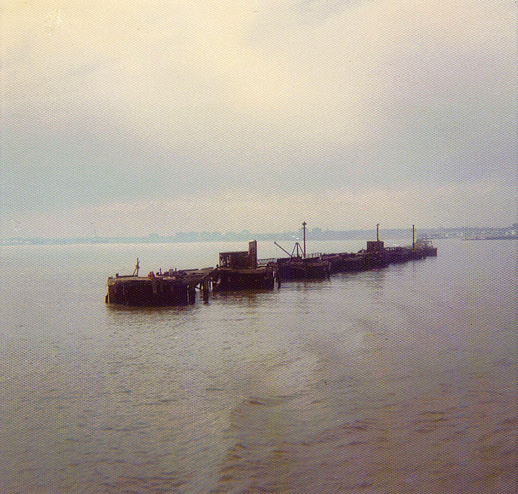
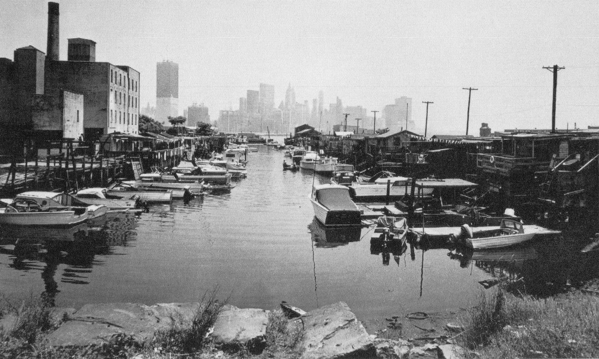
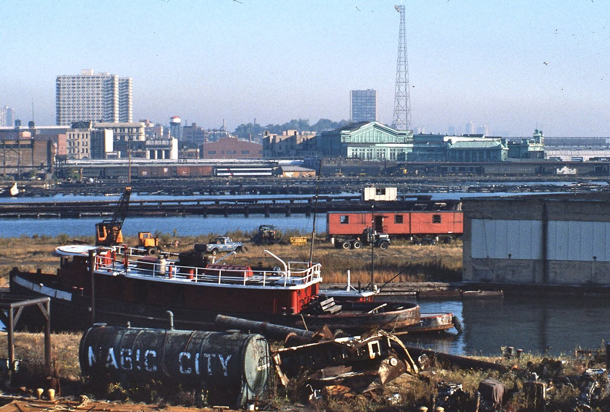
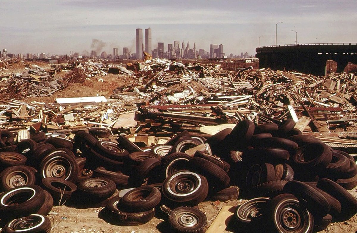
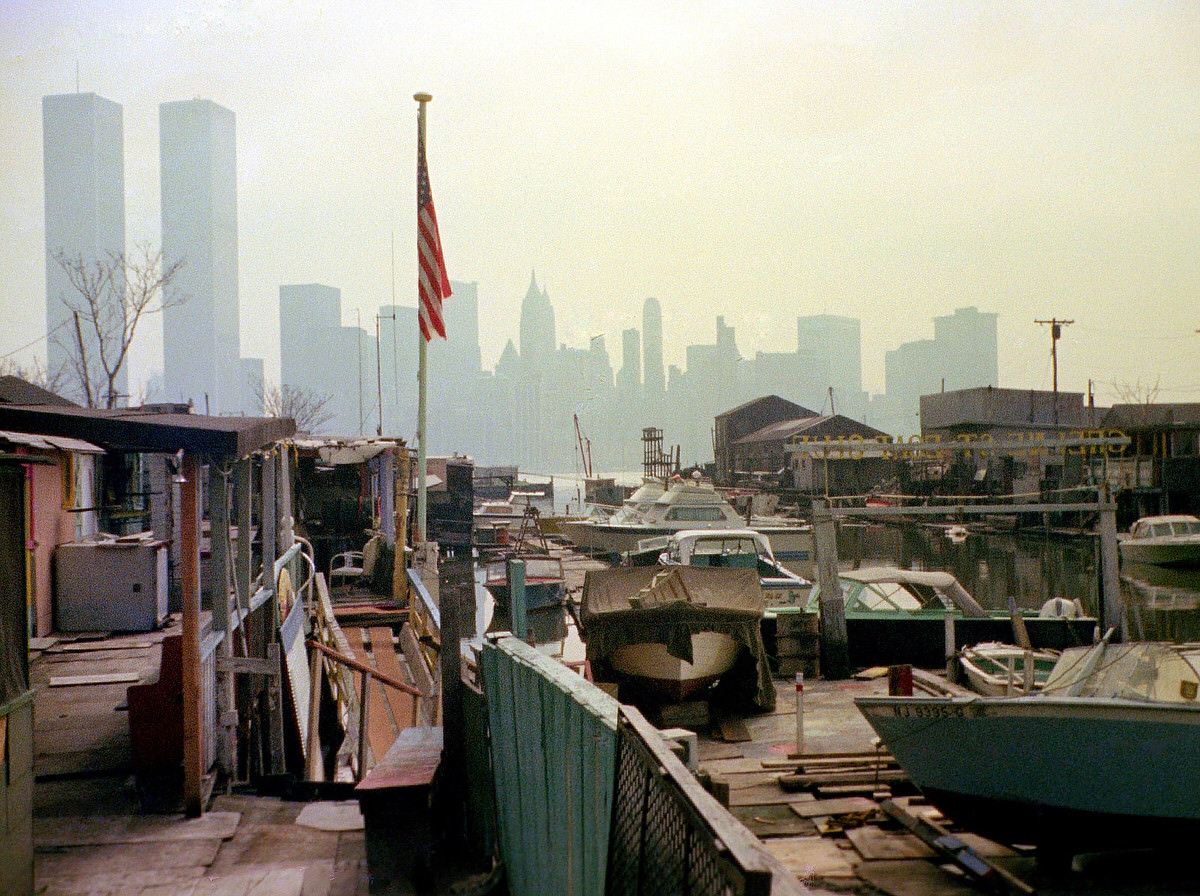
The Morris Canal basin was one of the most visually striking areas of industrial ruin in the city. Stripped cars, chemical drums, and scrap metal sat along its banks. The Greene Street Boat Club operated near the small basin, one of the few signs of active civilian use in an otherwise desolate stretch of waterfront.
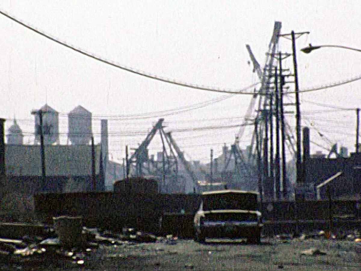
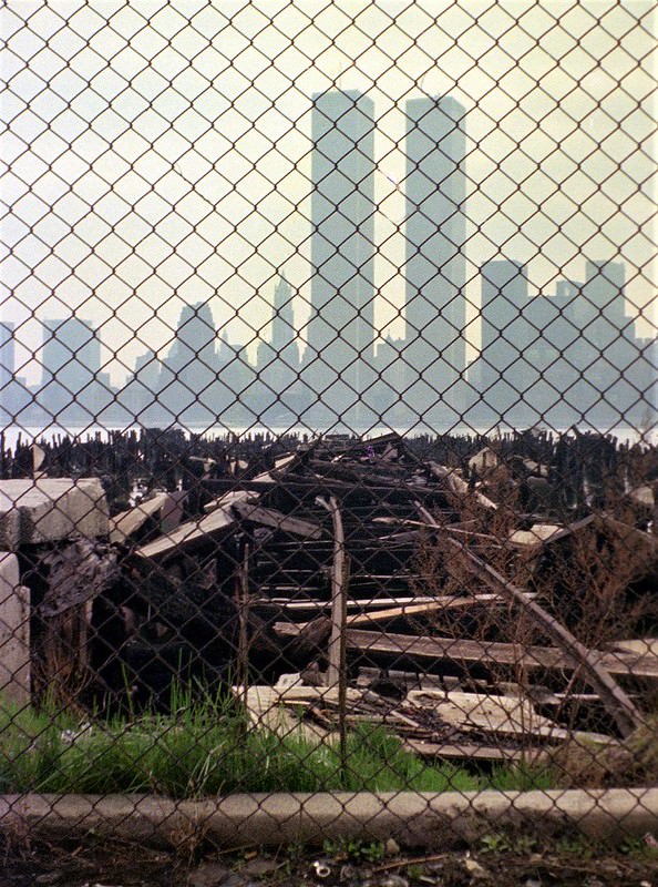
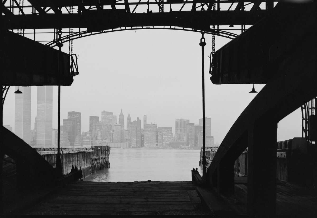
From the pier ruins at Exchange Place, the lower Manhattan skyline filled the horizon. The World Trade Center’s twin towers dominated the view, framed by broken concrete and rusted steel on the Jersey City side. Photographers who documented this landscape captured one of the most dramatic visual contrasts of 1970s urban America.
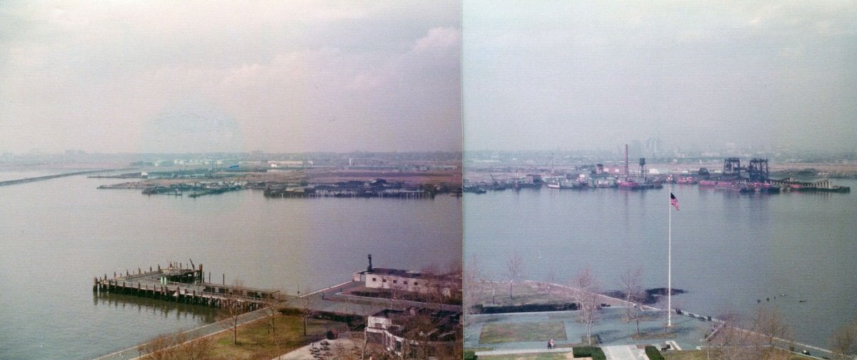
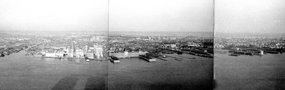
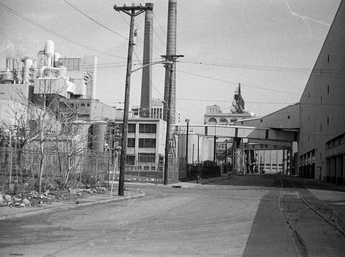
One constant in all of this change was the Colgate-Palmolive plant. The factory on the waterfront continued operating through the entire decade, manufacturing soap and toothpaste around the clock. Its giant octagonal clock — one of the largest clocks in the world — was visible across the river from Manhattan. The clock became one of the most recognizable landmarks in the entire harbor area.
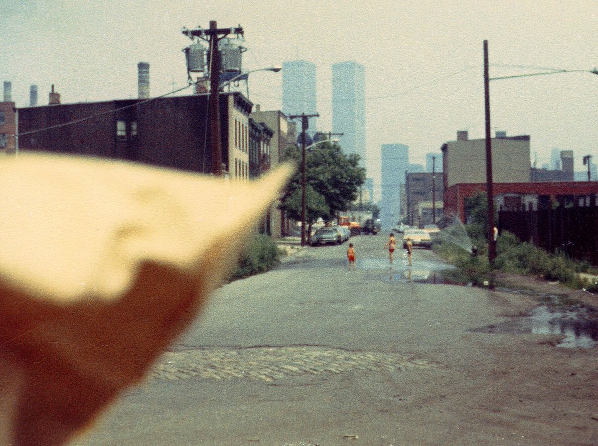
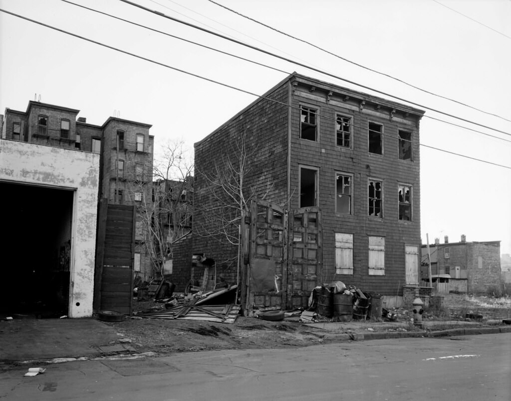
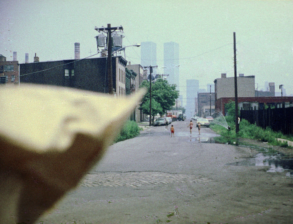
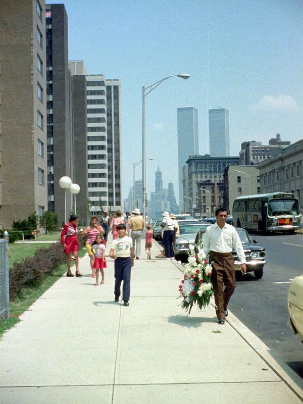
Life continued in the residential neighborhoods. On Dudley Street, children cooled off in the spray from open fire hydrants during the summer heat. The street-level reality of Jersey City in the 1970s was one of tight-knit blocks, three-story wooden houses, and brick apartment buildings — often located just a short walk from enormous stretches of industrial wasteland.
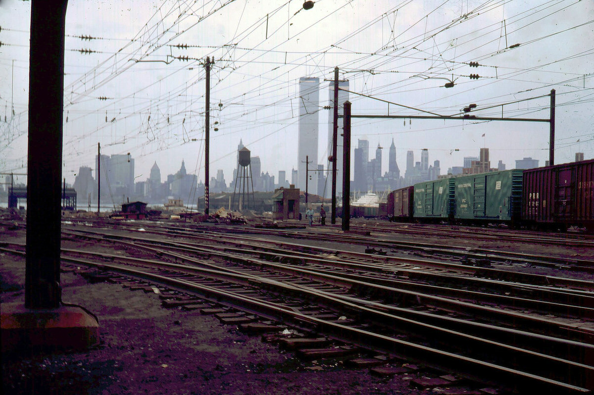
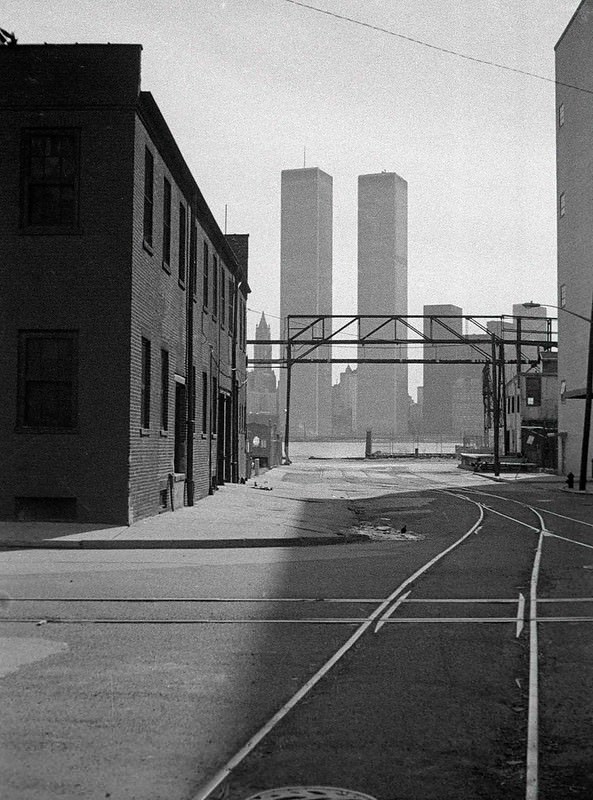
At the start of the decade, the World Trade Center was still under construction. Photos from 1970 show its rising steel framework visible in the distance behind the Greene Street Boat Club and the Greenville rail yards. By 1975, the towers were complete and fully open. They became a constant presence in nearly every photograph taken from the Jersey City waterfront during the decade.
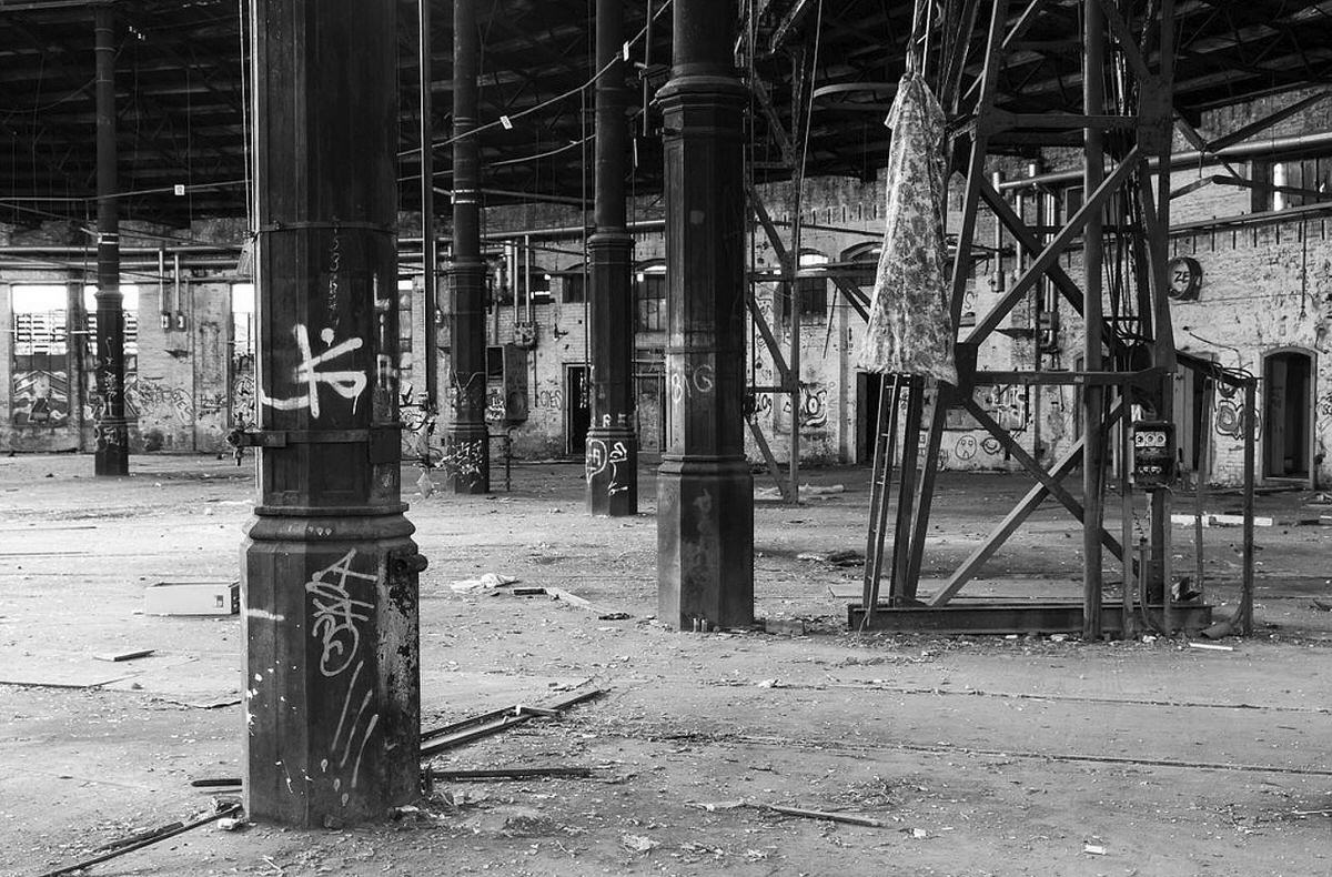
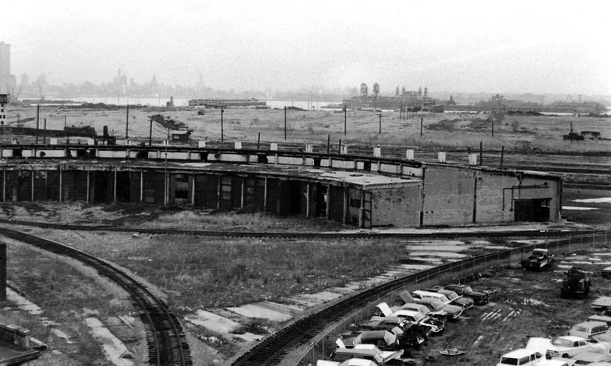
Inside the abandoned Central Railroad of New Jersey roundhouse, the scale of industrial abandonment was clear. The circular repair facility — designed to service locomotives — had been emptied out and left open to the elements. Its iron roof structure still stood, but everything else was stripped away.
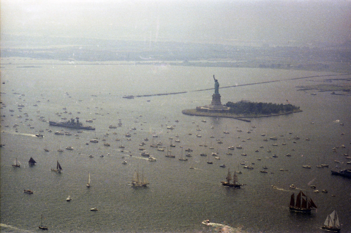
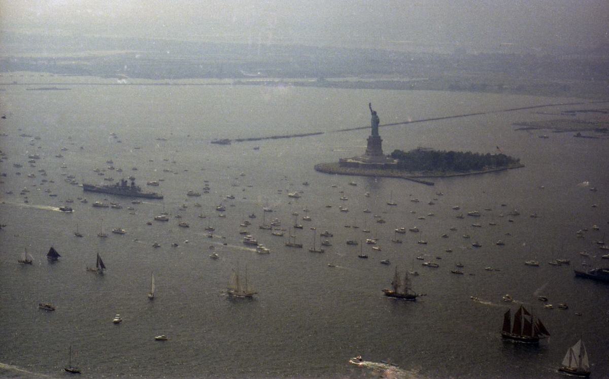
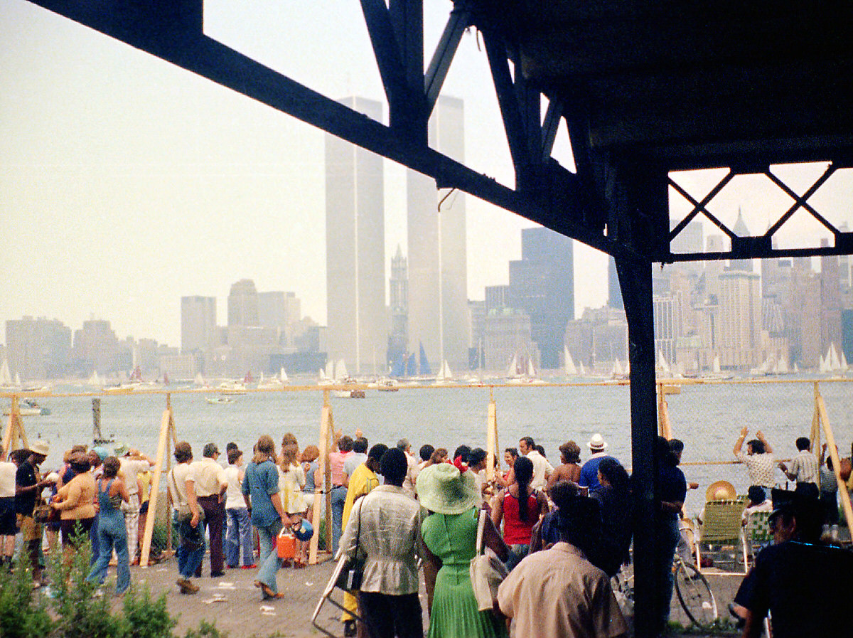
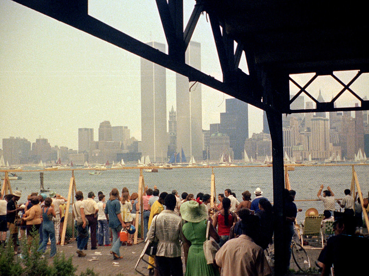
On July 4, 1976, New York Harbor filled with tall ships from around the world for Operation Sail, the centerpiece of America’s Bicentennial celebration. From the ruins of the Caven Point Pier, Jersey City residents watched the fleet pass. The harbor that had once been defined by freight barges and railroad ferries now hosted a spectacle of historic sailing vessels.
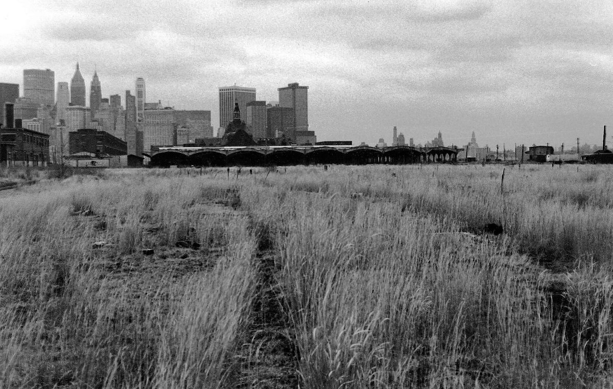
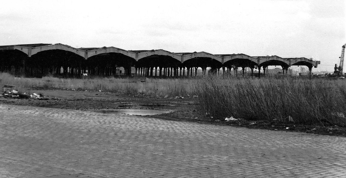
The land set aside for Liberty State Park had been an off-limits industrial zone for most of the century. In 1975, it still looked like a war zone — overgrown fields, crumbling train sheds, and a direct view of the abandoned Ellis Island buildings just offshore. Workers began clearing the site in preparation for the park’s opening on July 14, 1976, as part of the Bicentennial.
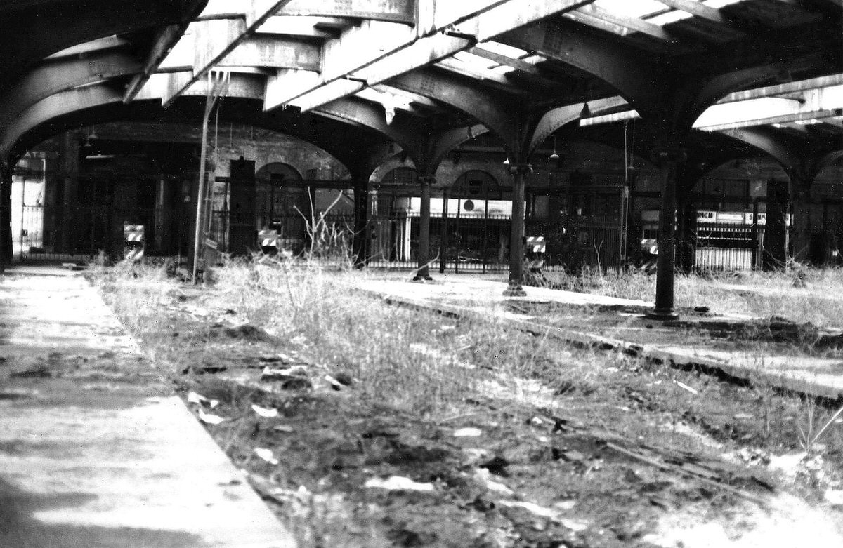
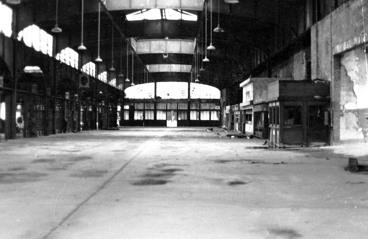
The interior of the Central Railroad terminal told its own story. The waiting room, once packed with passengers boarding ferries to lower Manhattan, was silent. Dust covered every surface. The ornate architectural details — arched windows, decorative ironwork — remained intact but completely unused.
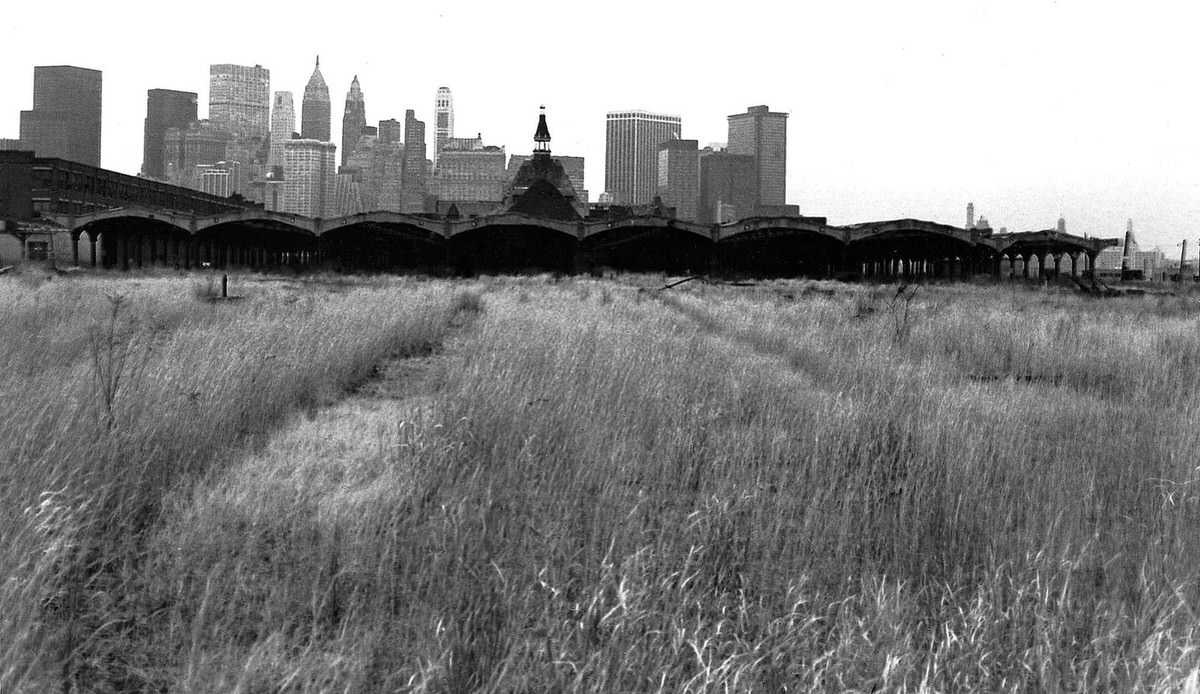
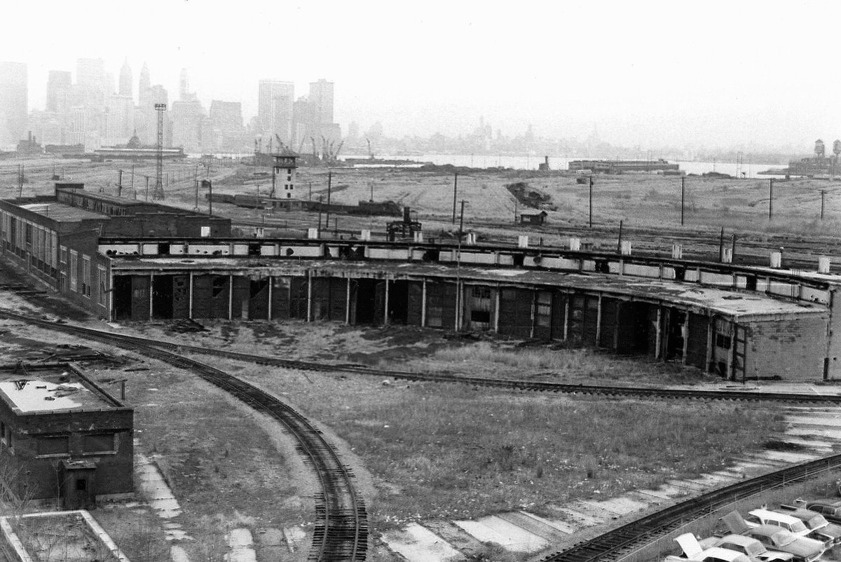
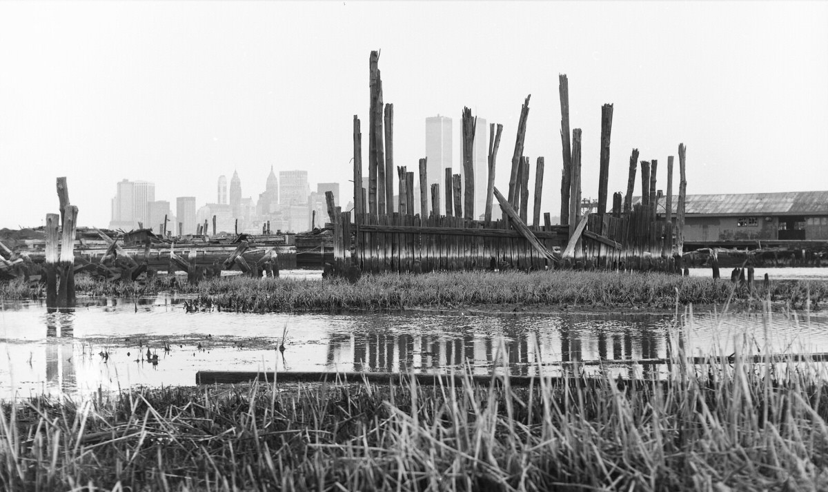
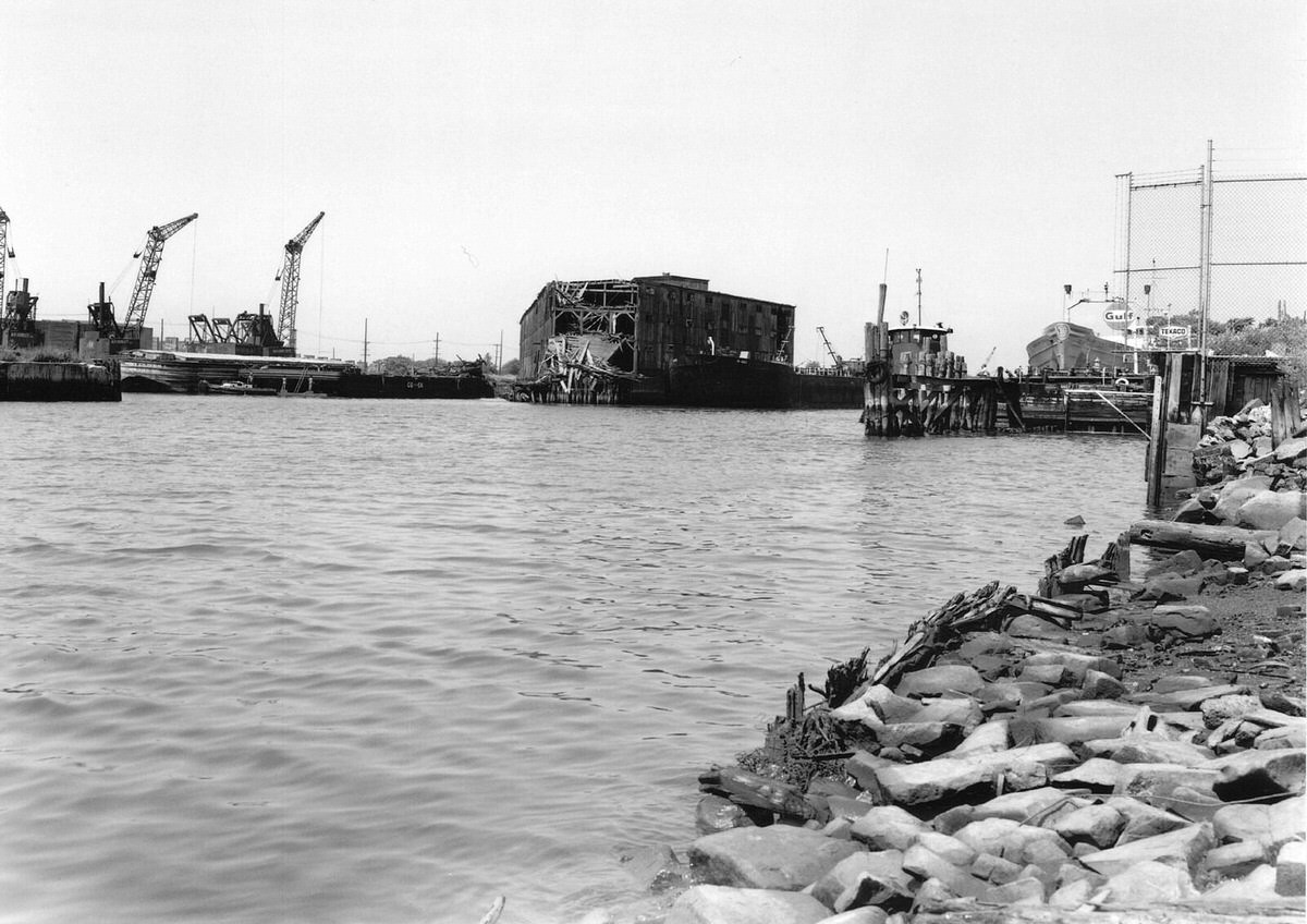
The Pennsylvania Railroad’s ferry piers near the Morris Canal Small Basin deteriorated throughout the decade. Rotting wood and collapsed sections marked what had once been active loading docks. The entire stretch from Exchange Place down to Black Tom was lined with this kind of wreckage.
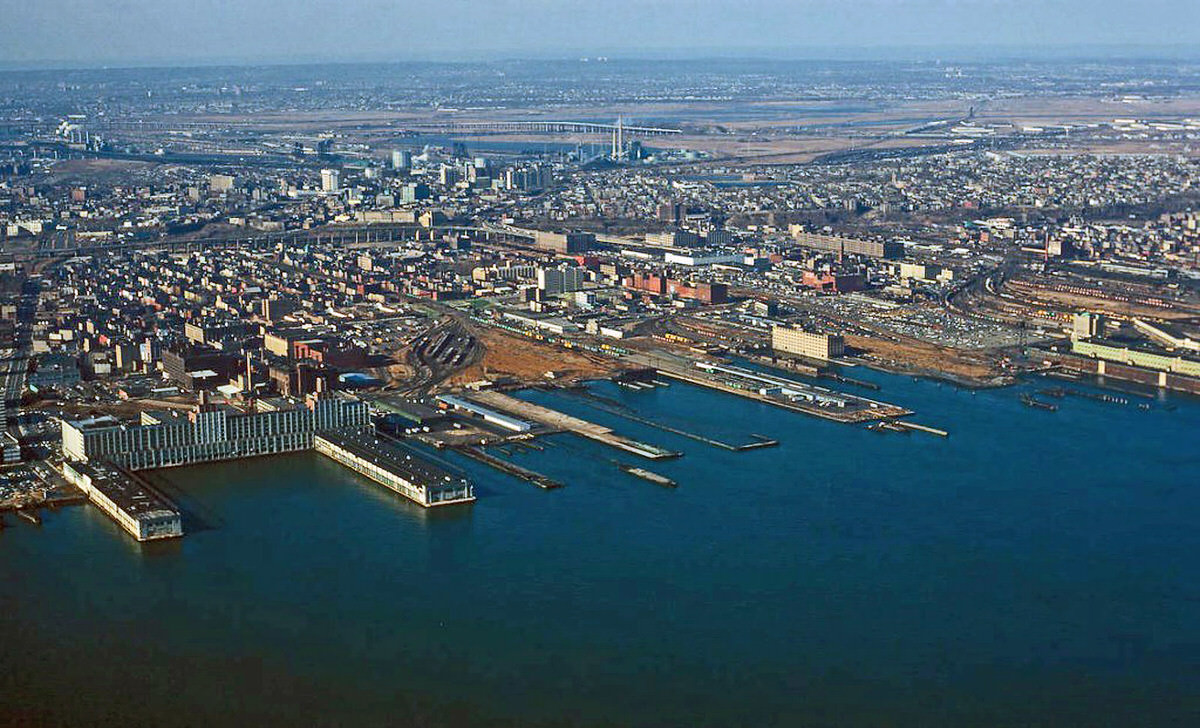
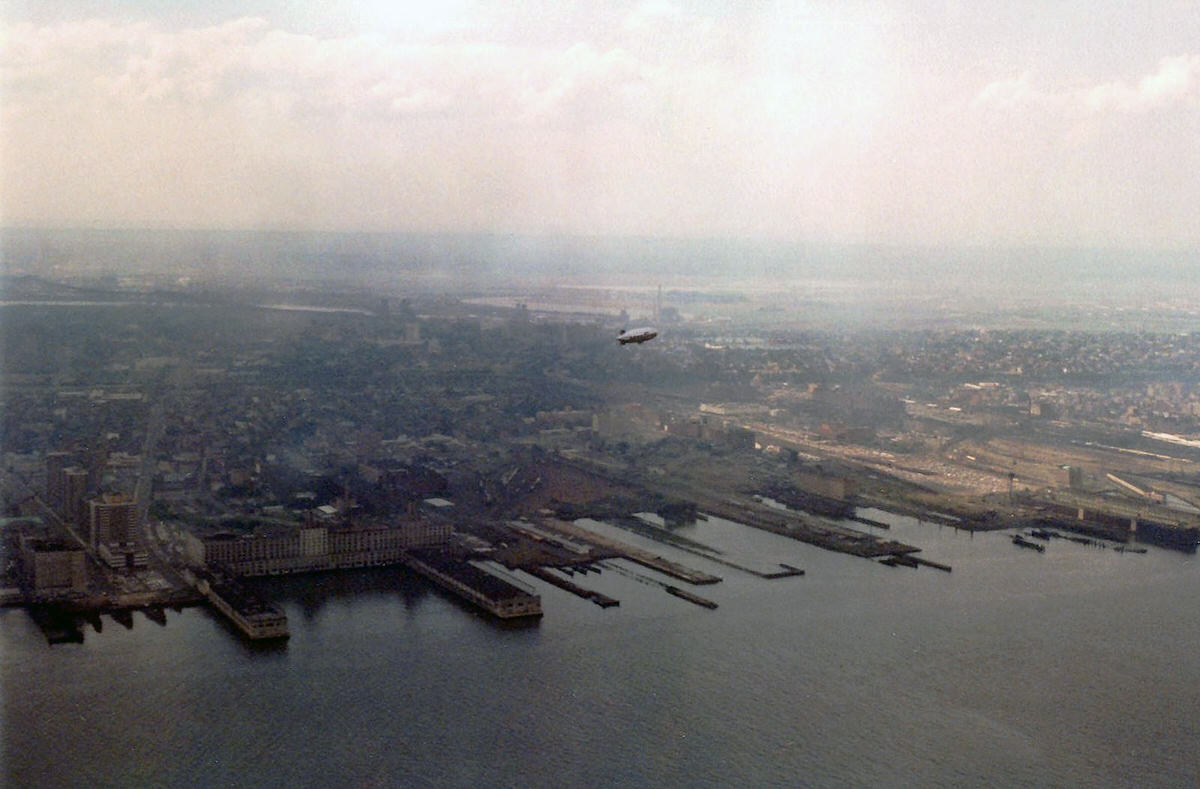
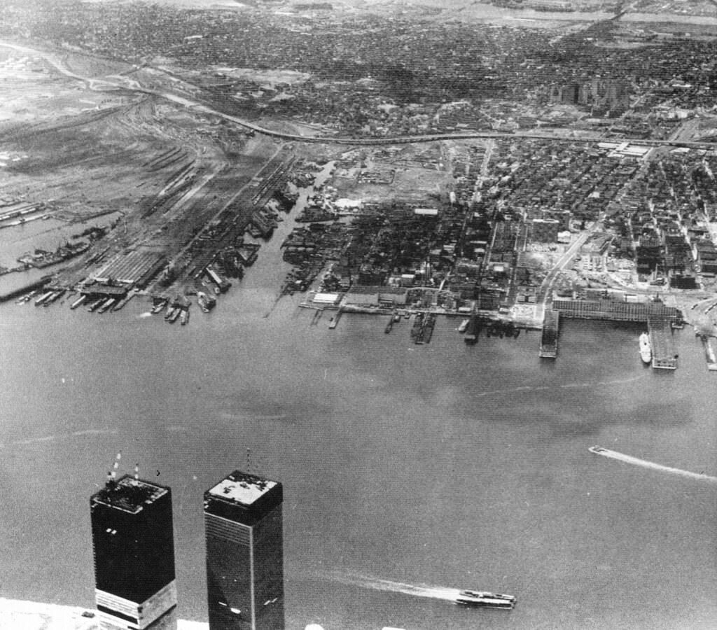
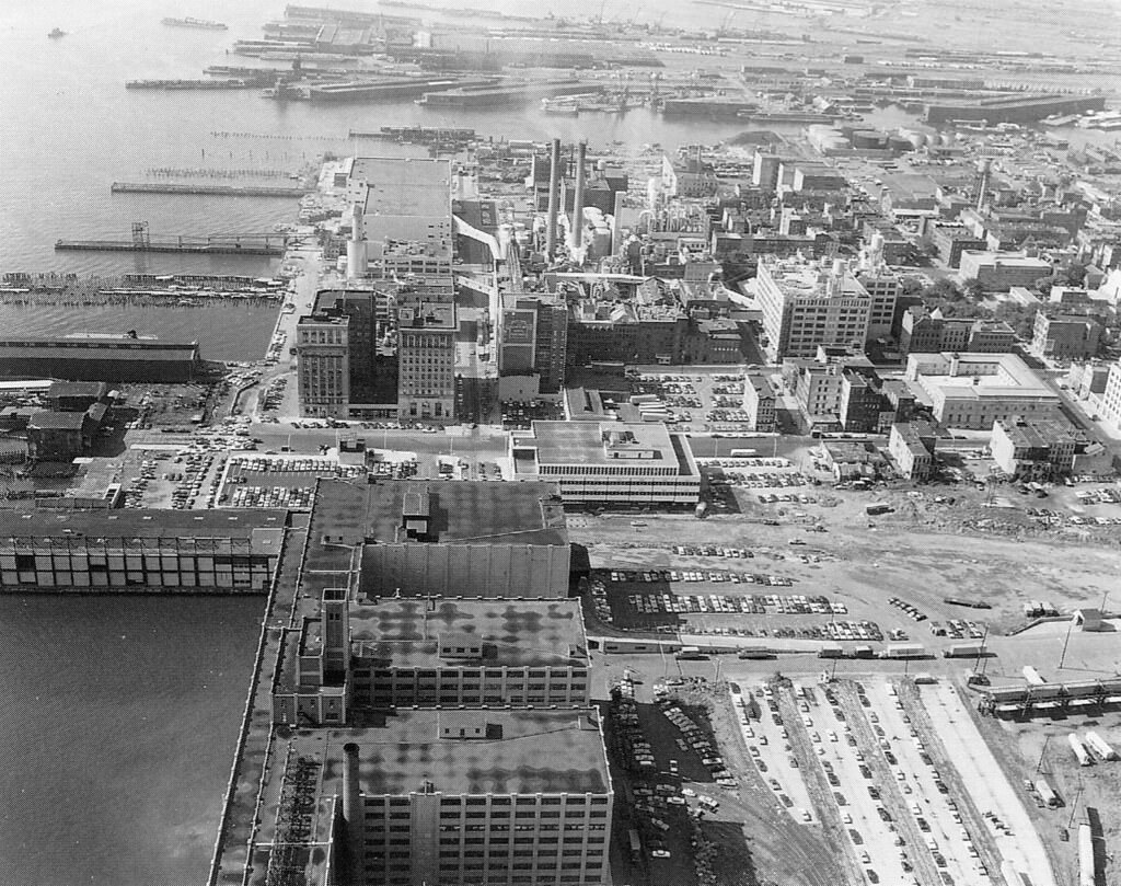
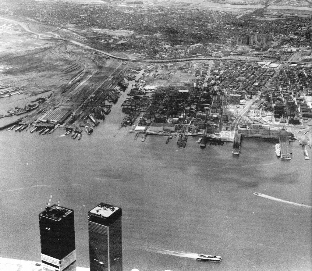
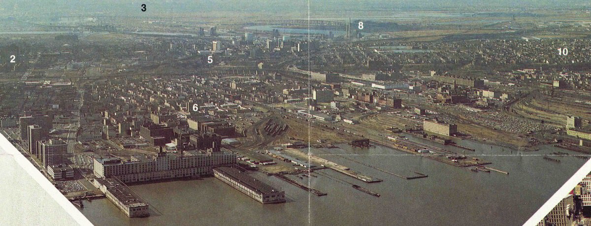
At the start of the decade, aerial views of the waterfront showed the full scope of the abandoned landscape. The Colgate plant and the Harborside Terminal were the only active industrial operations visible along a shoreline that had once been one of the most productive freight zones in the country.
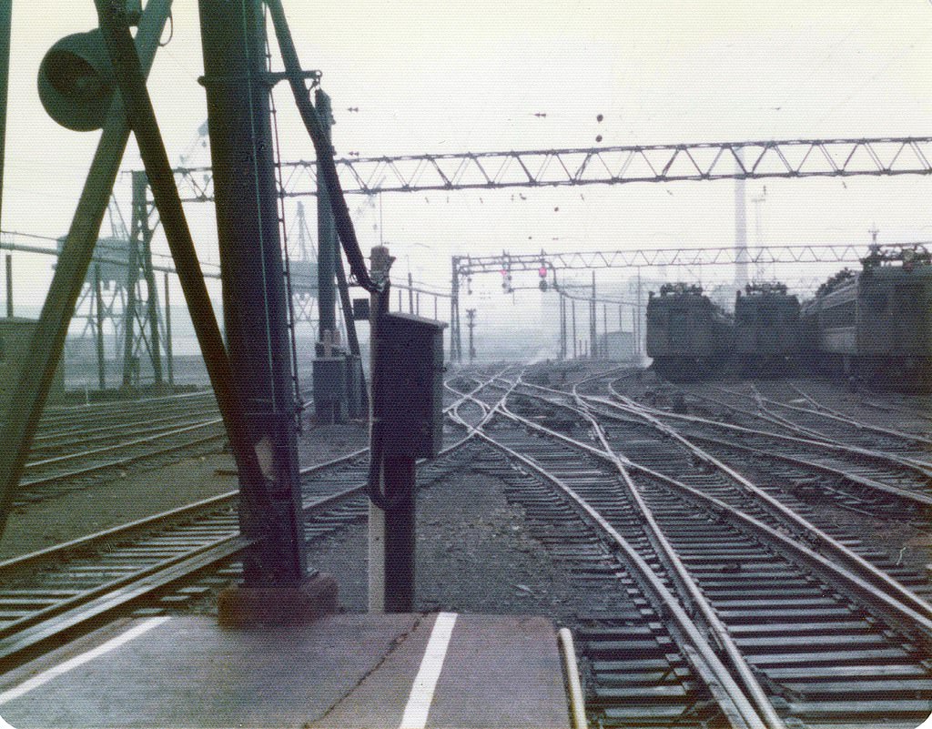
The Hoboken Erie Lackawanna Terminal kept its vintage character throughout the decade. Trains sat on the numbered tracks inside the iron-and-glass shed. The terminal’s waiting rooms retained their early 20th-century woodwork and signage. Commuters moved through this space every day, surrounded by a building that felt frozen in an earlier time.
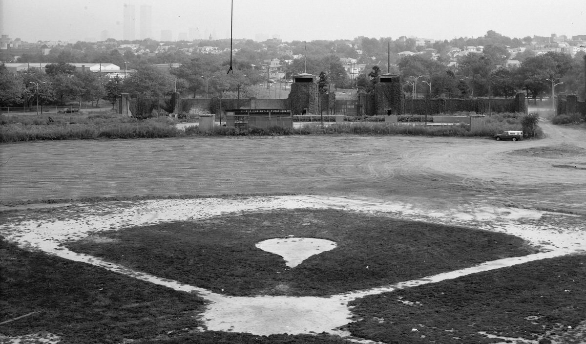
Roosevelt Stadium at Droyer’s Point near the Hackensack River was the city’s main entertainment destination during the decade. It hosted major rock concerts — the Grateful Dead performed there multiple times — as well as shows by the Beach Boys and Alice Cooper. High school football games and professional boxing matches also took place on the same field. The concrete structure was aging, but it drew enormous crowds.
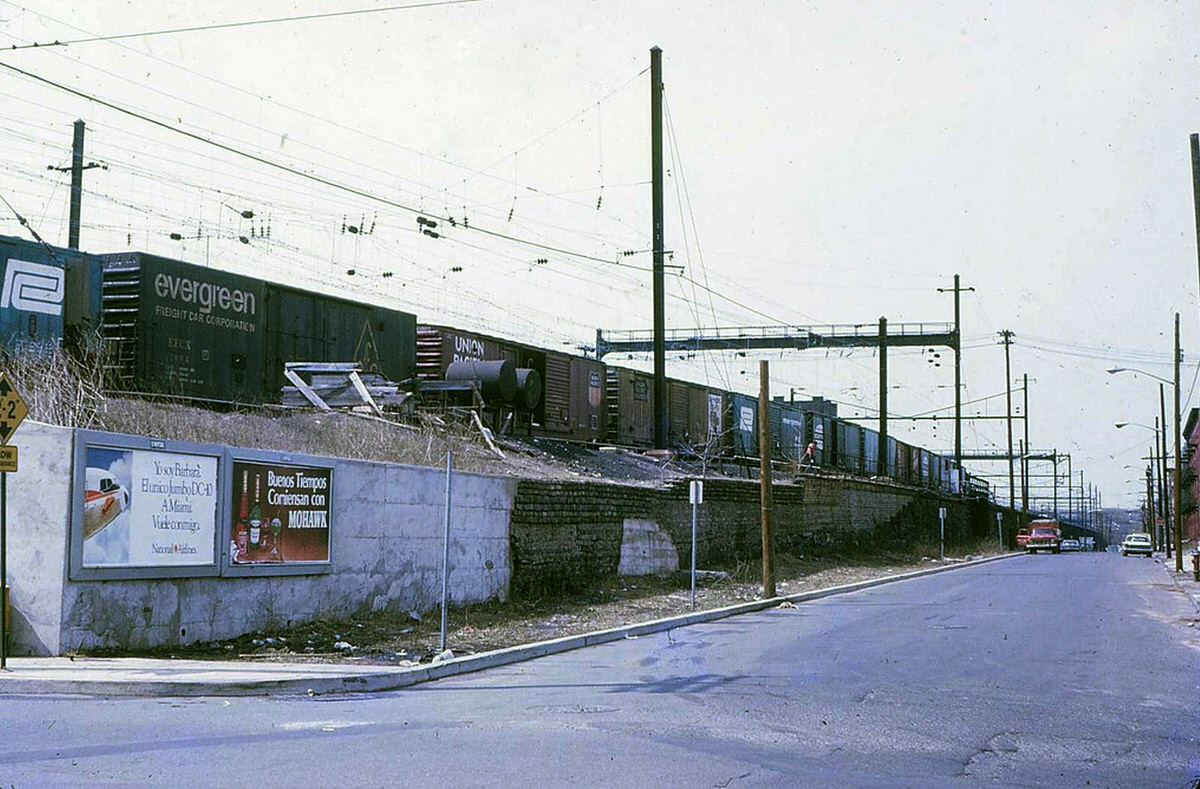
The Pennsylvania Railroad’s 6th Street Harsimus Stem Embankment cut through the interior of the city. This raised rail structure, built in the 19th century, ran along Henderson Street and remained standing throughout the decade, even as the tracks on top of it went unused. It towered above the surrounding streets as a physical reminder of the railroad era.
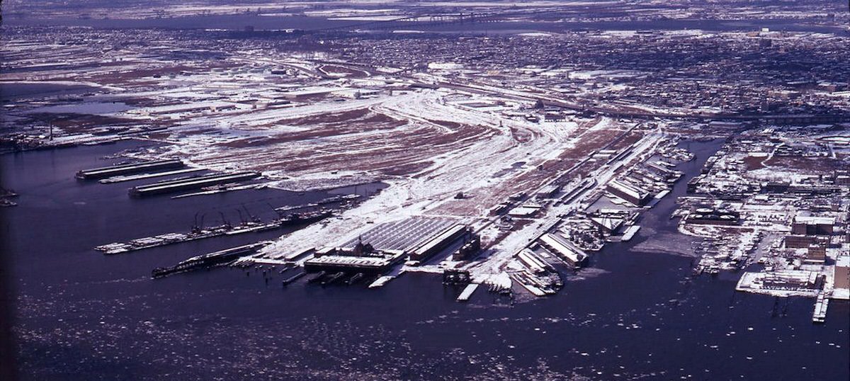
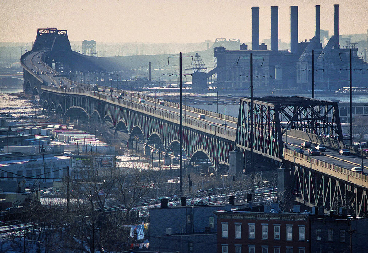
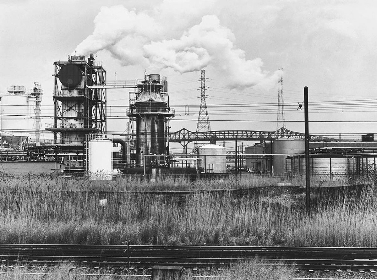
The Pulaski Skyway carried drivers above the industrial marshes between Jersey City and Newark. On smoggy days, the view from the Skyway showed a landscape of power plants, refineries, and rail infrastructure stretching across the flat terrain. The PATH system ran alongside portions of this same corridor, offering riders a ground-level view of the same industrial scenery.
Seen from Pier A at the southern tip of Manhattan, the Jersey City shoreline looked like a photograph of industrial collapse. Crane graveyards and abandoned terminal buildings stretched along the waterfront. The visual gap between Manhattan’s dense skyline and Jersey City’s open ruins told the full story of the economic shift that had taken place.
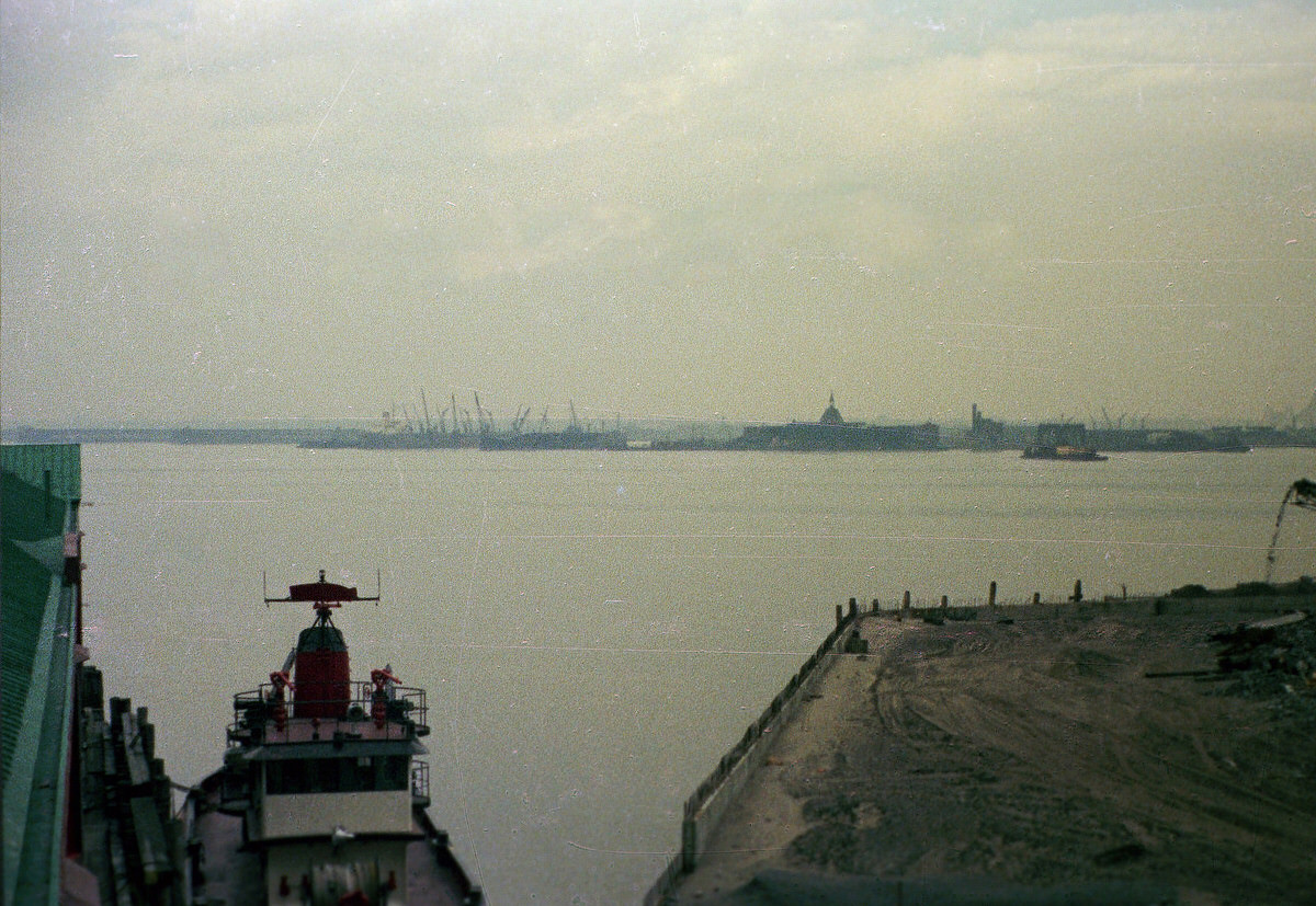
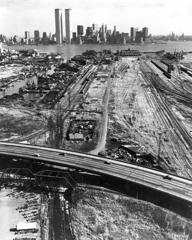
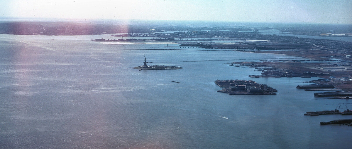
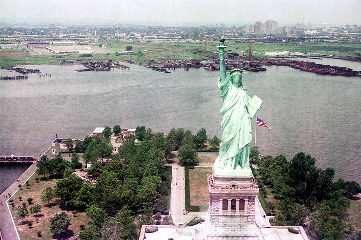
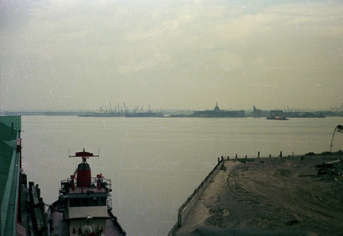
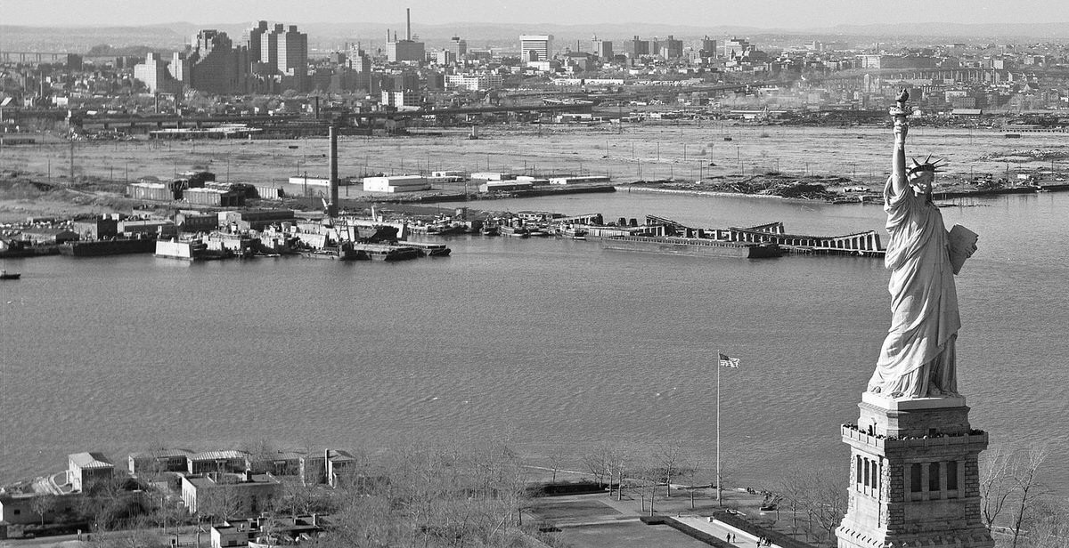
From the Statue of Liberty, the full scale of Jersey City’s post-industrial landscape came into view. The Greenville yards, the Black Tom area, and the abandoned waterfront stretched across the entire horizon. What the Statue’s visitors saw in 1973 and 1975 was a city in the middle of a slow, painful economic contraction.
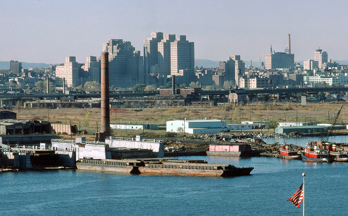
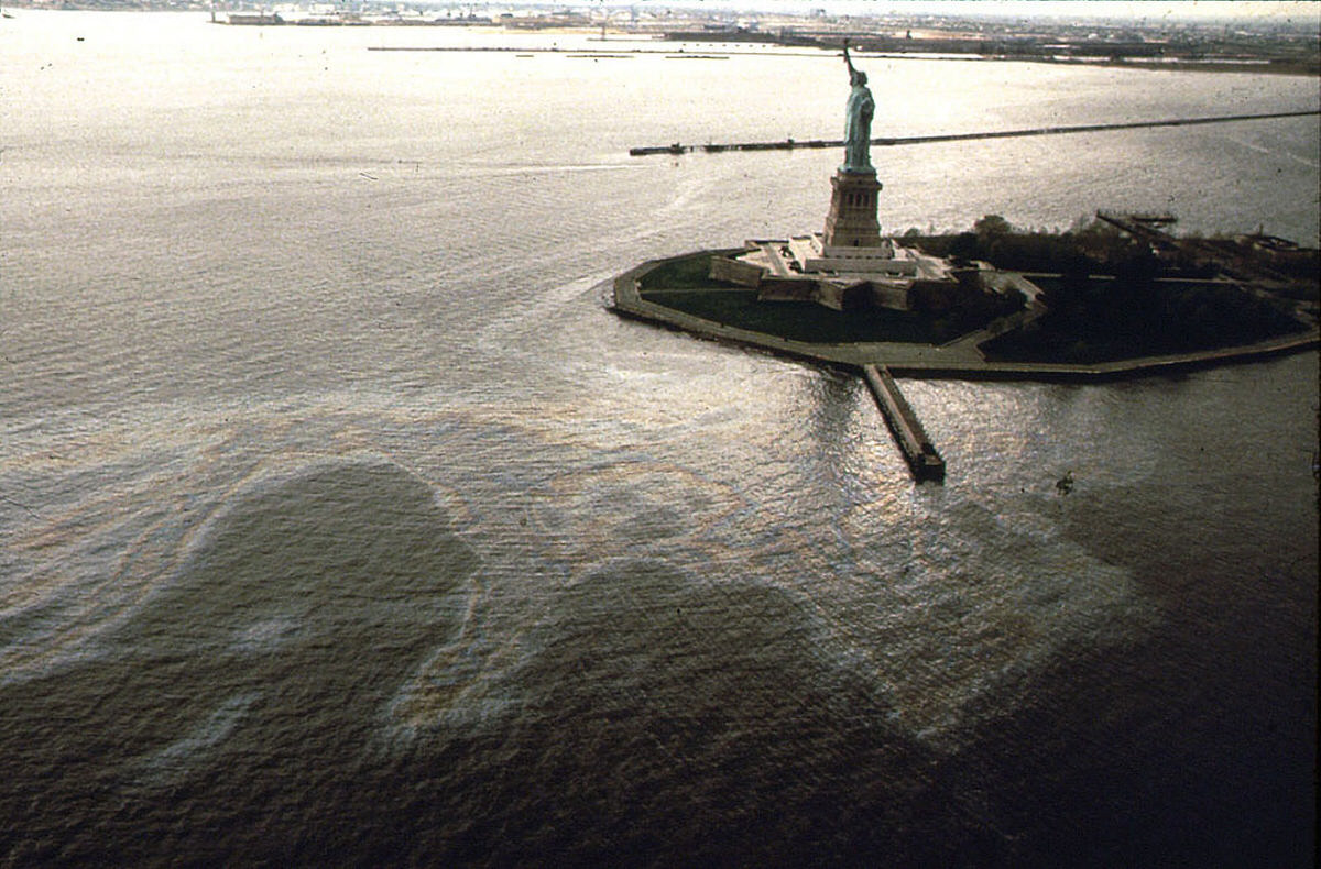
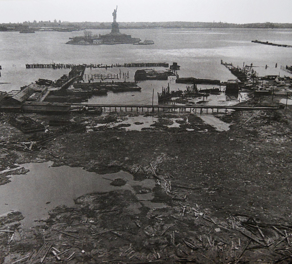
Environmental hazards were visible throughout the industrial zone. In 1972, a ruptured pipeline at the Exxon facility near Black Tom released a gasoline spill that spread across the ground and into the water. The area around Black Tom already carried a dark history — it had been the site of a massive explosion during World War I — and the 1970s brought new environmental damage to the same land.
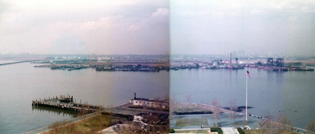
By 1979, Liberty State Park had opened and parts of the old railroad land were being transformed. The Jersey Central Railroad ferry terminal still stood within the park’s boundaries, now surrounded by new paved paths and green space. The transformation of this area from a restricted industrial dump to a public waterfront park was one of the most significant changes Jersey City saw during the entire decade.
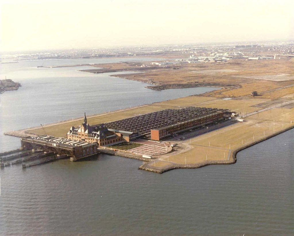
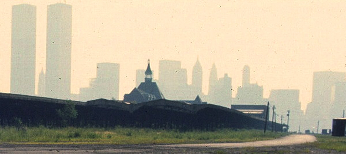
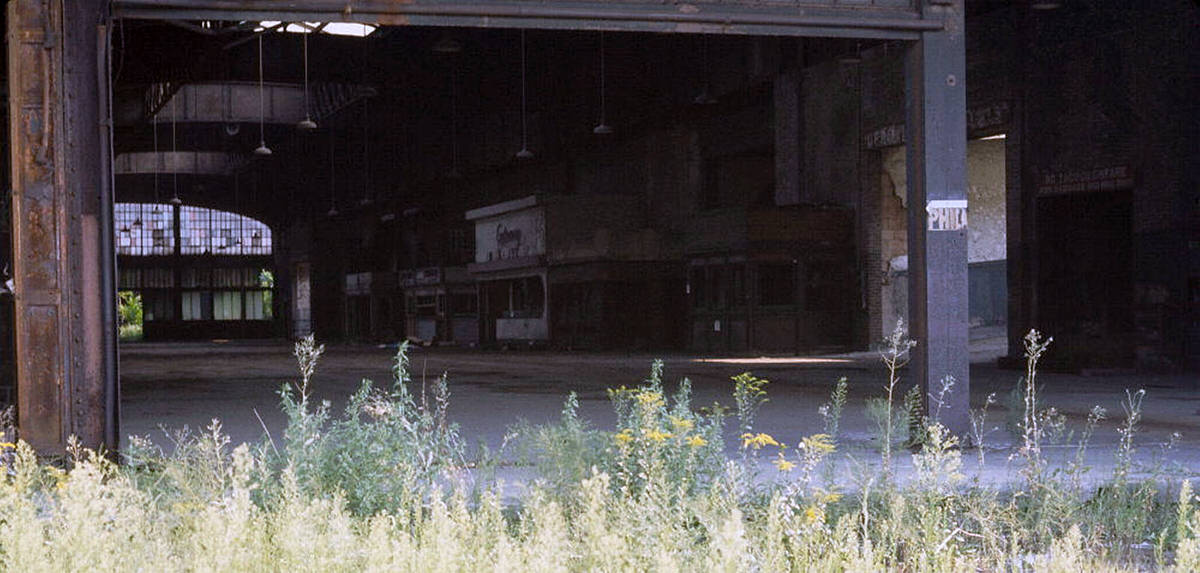
The Central Railroad terminal’s interior continued to decay throughout the decade. By 1976, the building’s train shed and waiting areas had been without regular use for years. The view from inside the terminal looking out toward the New Jersey Turnpike showed just how isolated this once-busy structure had become from the rest of the city.
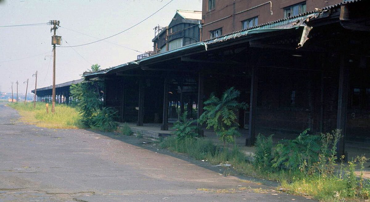
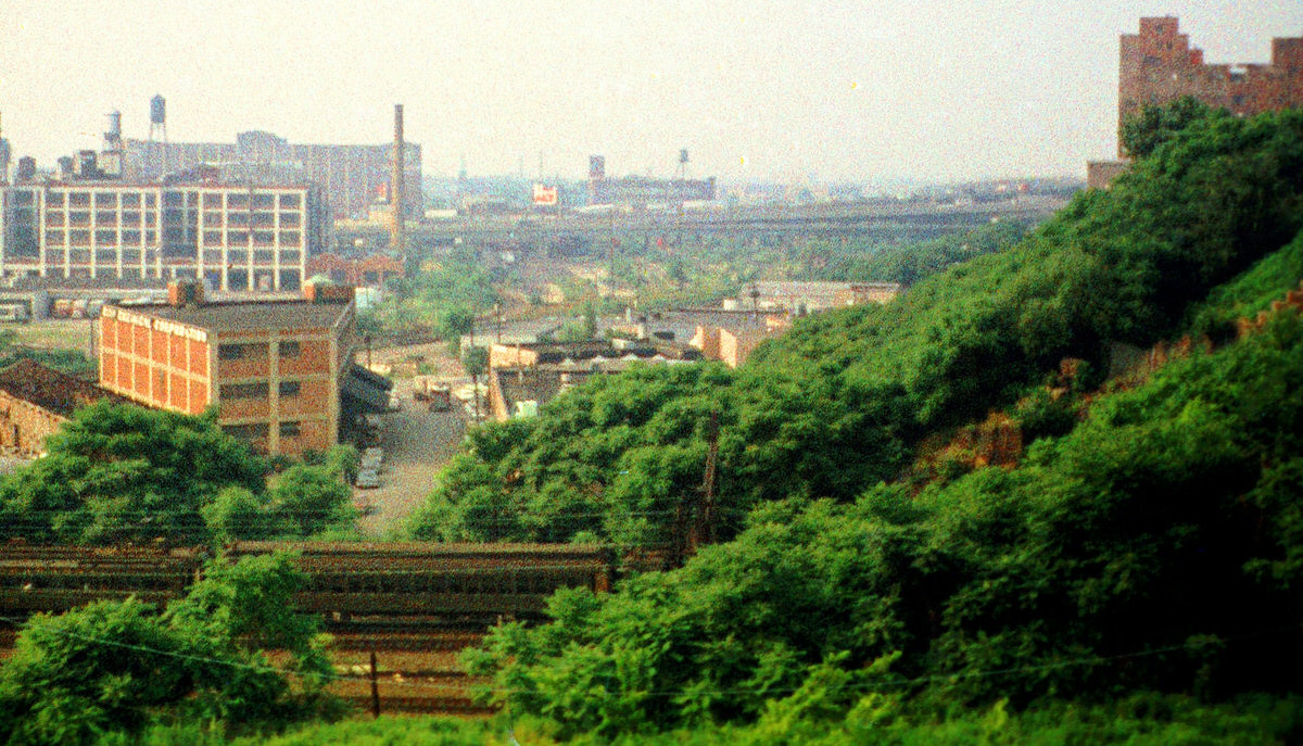
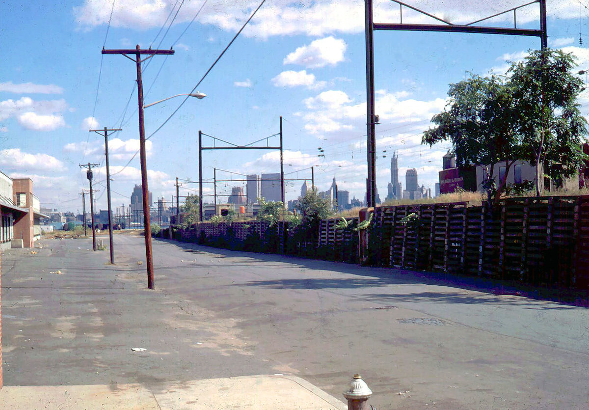
The New Jersey Turnpike extension cut through the old rail yard territory in the late 1970s, adding new infrastructure to a landscape that was losing its old industrial function entirely. Abandoned train yards flanked the new highway on both sides. The Greenville yards, once essential to freight operations, were completely dormant by this point.
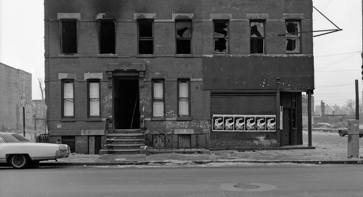
Residential blocks in the interior of the city reflected the same economic stress as the industrial zones. At the corner of Montgomery and Monmouth Streets, urban decay was visible in the crumbling storefronts and empty lots. Entire blocks near the Lafayette and Greenville neighborhoods had been hollowed out by factory closures that eliminated jobs and pushed residents out.
By 1978, the ruins of the Central Railroad terminal had become a well-documented symbol of the city’s decline. Photographers repeatedly returned to the site to document how further it had deteriorated. The World Trade Center, visible across the water in the background, served as a constant counterpoint — new construction and economic energy on one side of the river, collapse and abandonment on the other.
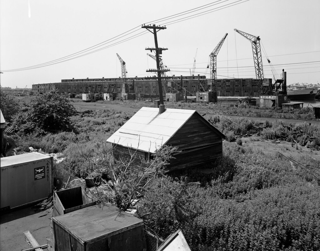
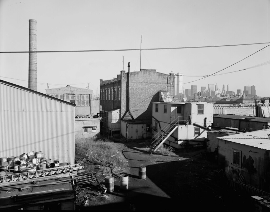
On Pier No. 19 at the Central Railroad of New Jersey site, chemical drums were found abandoned alongside collapsed buildings. The pier, like so many others along the waterfront, had been used for purposes beyond rail freight — and whatever remained after operations ceased became part of the environmental burden the city carried through the decade.
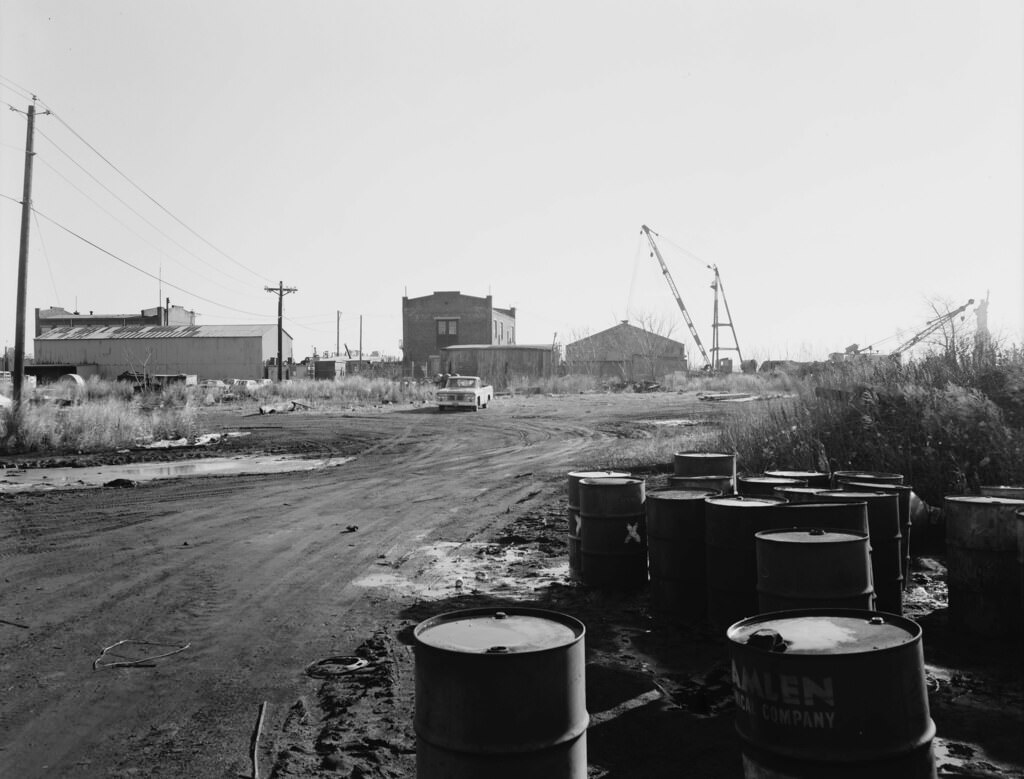
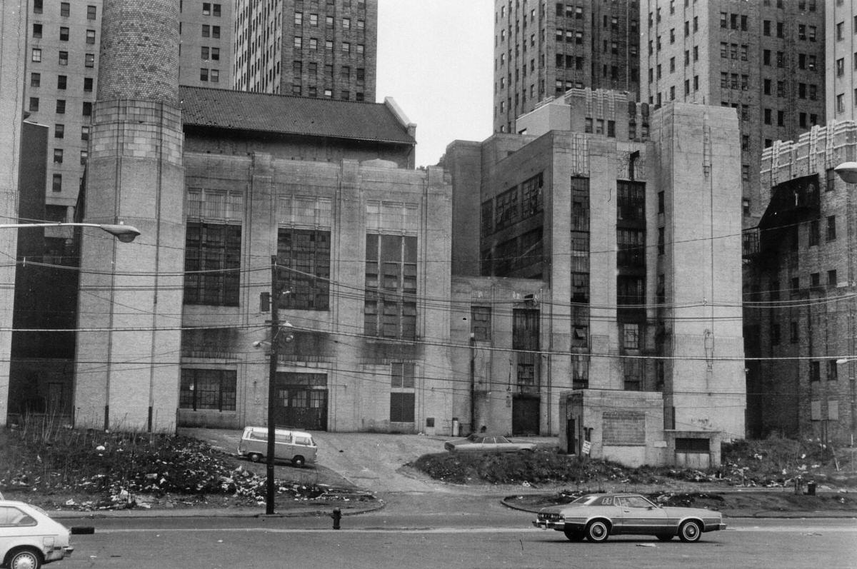
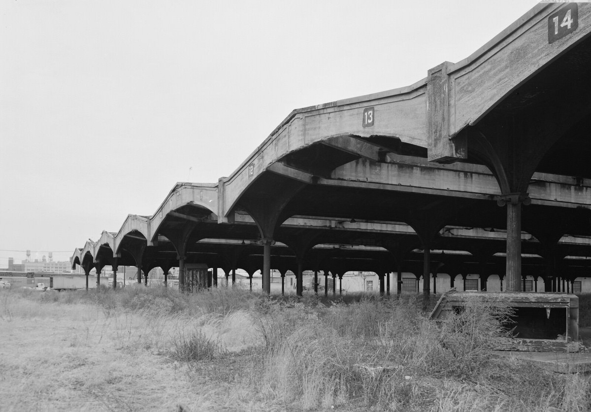
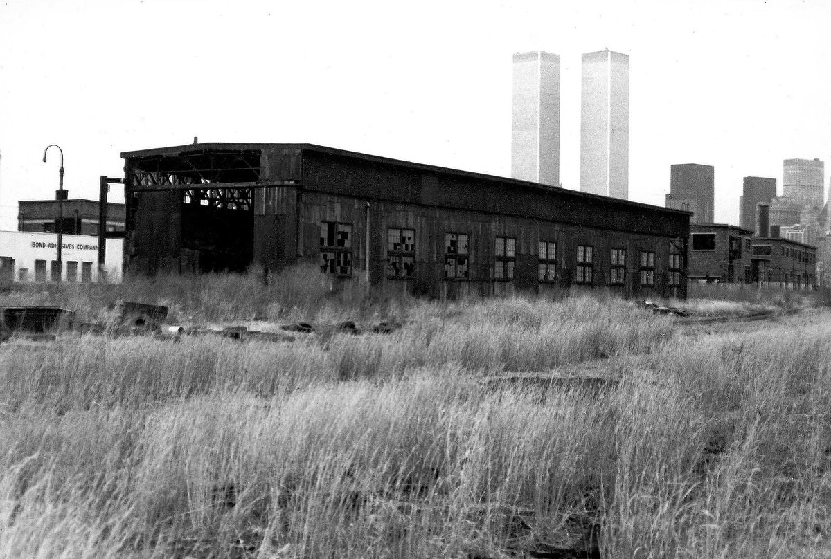
The engine terminal at the Jersey Central Railroad site was still photographable in 1979, though every structure in the complex was far beyond any practical use. The frames of the sheds stood against the sky, stripped of their original machinery and left open to weather and vandalism.
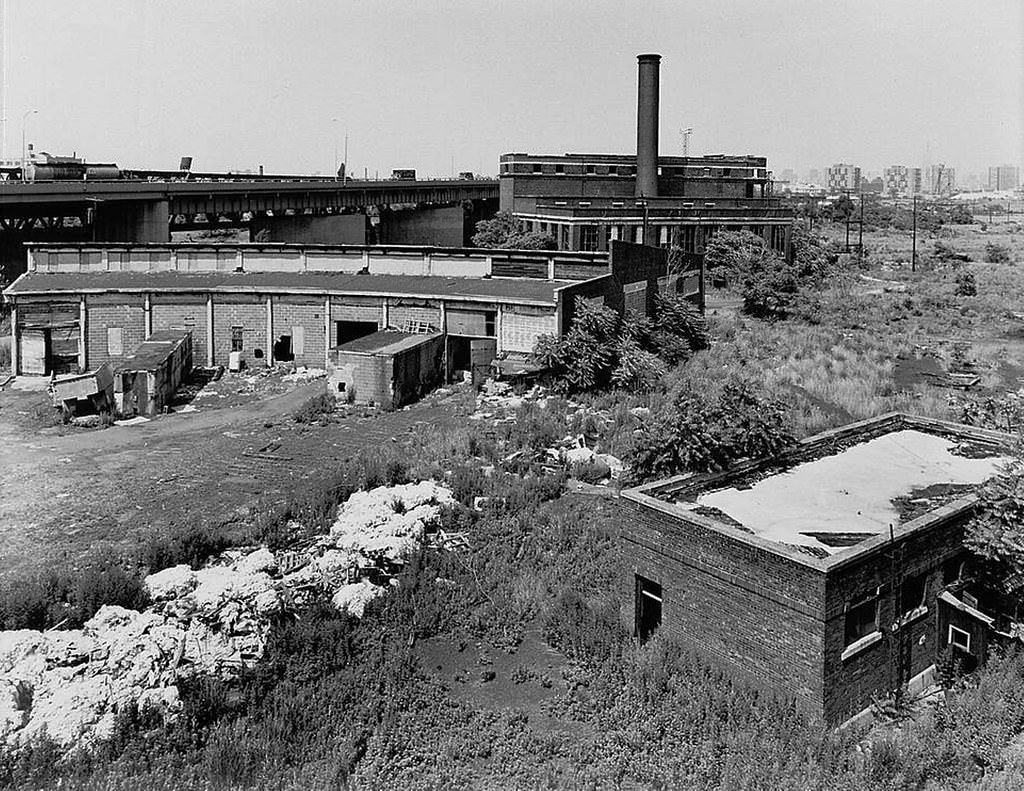
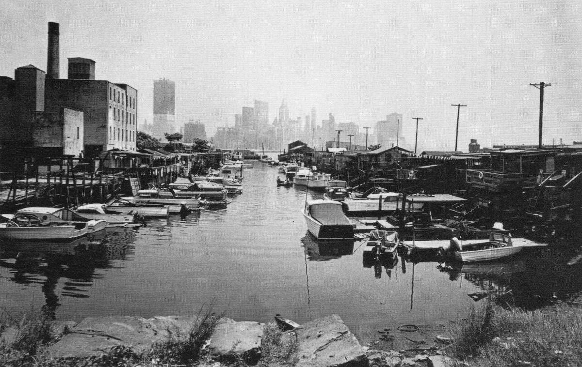
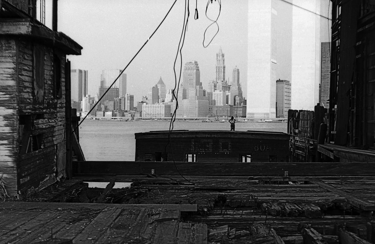
Aerial photographs from 1970 show the Harborside Terminal and the Exchange Place area still partially active. The Colgate plant occupied a prominent place along the waterfront, its distinctive clock visible even from the air. The contrast between the active factory and the empty land surrounding it highlighted how few major employers remained on the waterfront by that point.
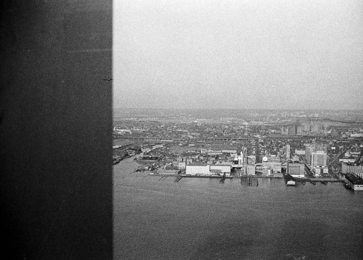
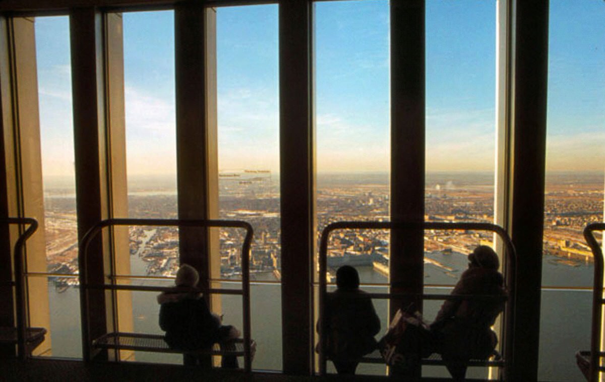
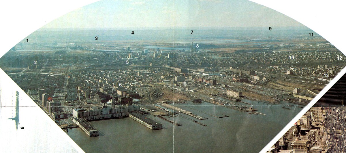
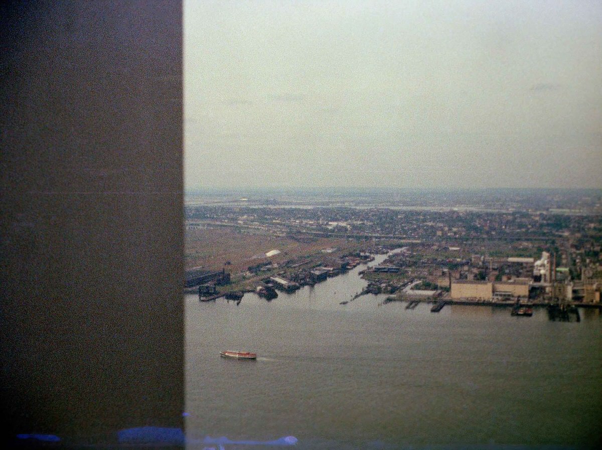
Views from the 58th floor of the World Trade Center’s North Tower gave photographers an unobstructed look at the full extent of Jersey City’s post-industrial landscape. The vast stretches of empty land between the waterfront and the residential neighborhoods — land that had once been filled with tracks, freight cars, and factory buildings — were now open and largely unused.
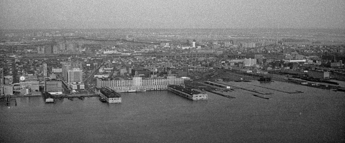
The Colgate-Palmolive plant and its giant clock remained one of the most photographed landmarks in Jersey City throughout the decade. Workers at the plant operated on shifts around the clock, keeping the factory running continuously. The plant was one of the few major manufacturing employers left on the waterfront after the railroads collapsed.
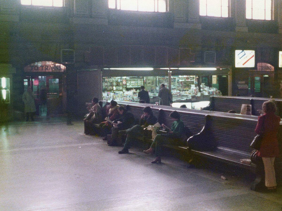
The Hoboken Erie Lackawanna Terminal offered a different atmosphere. Unlike the ruins to the south, the terminal was still in daily use, filled with commuters, cigarette advertisements, and the rumble of departing trains. Phone booths and bus signs lined the main hall. The building had the feel of a place that time had not quite caught up with yet.
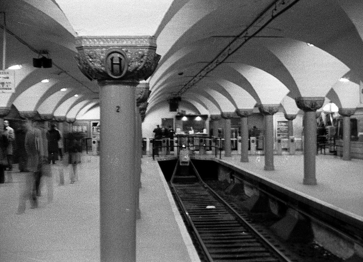
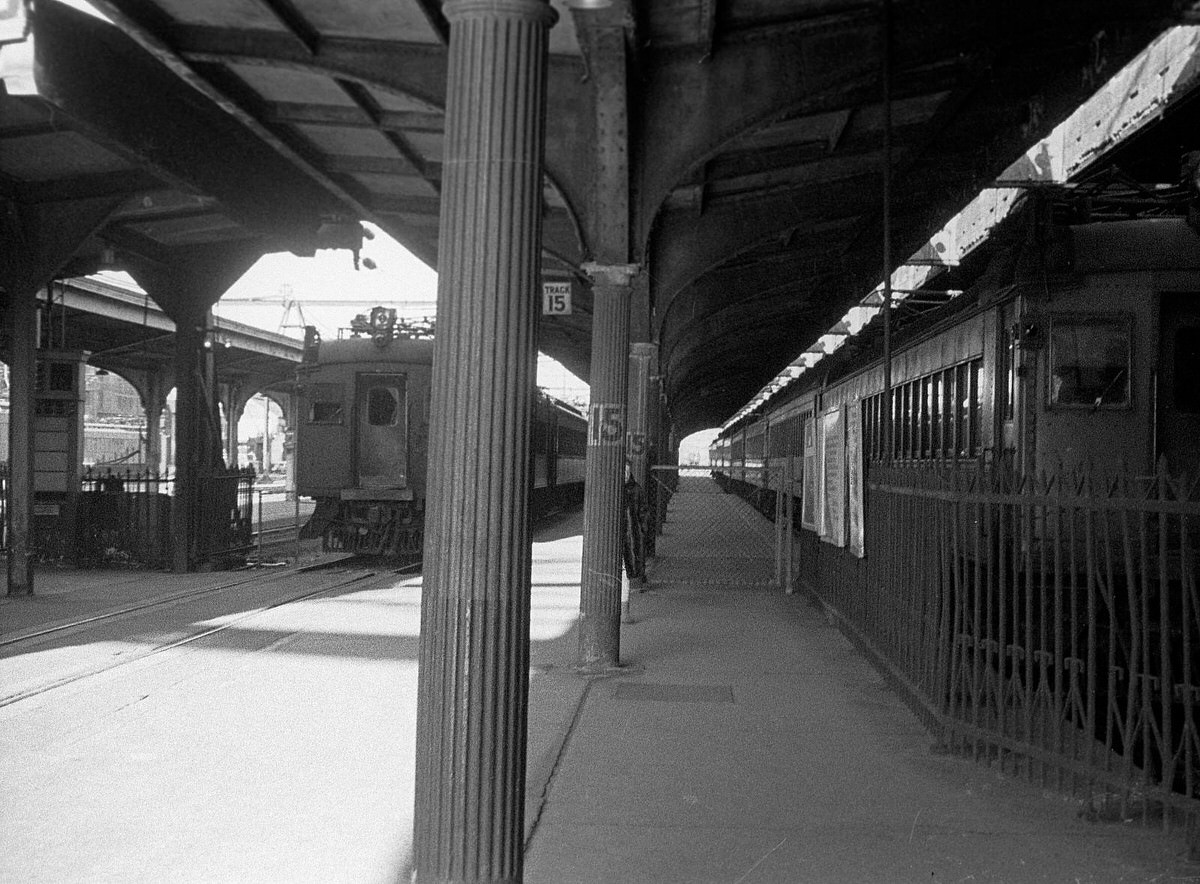
The abandoned Central Railroad terminal ruins attracted photographers year after year. Each image from a different angle told a slightly different story — the collapsed train shed from Johnston Avenue, the empty roundhouse floor, the silent ferry building. Together, these photos document the complete lifecycle of one of the most important railroad facilities in American history.
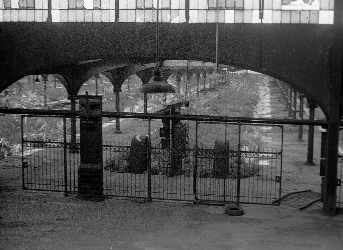
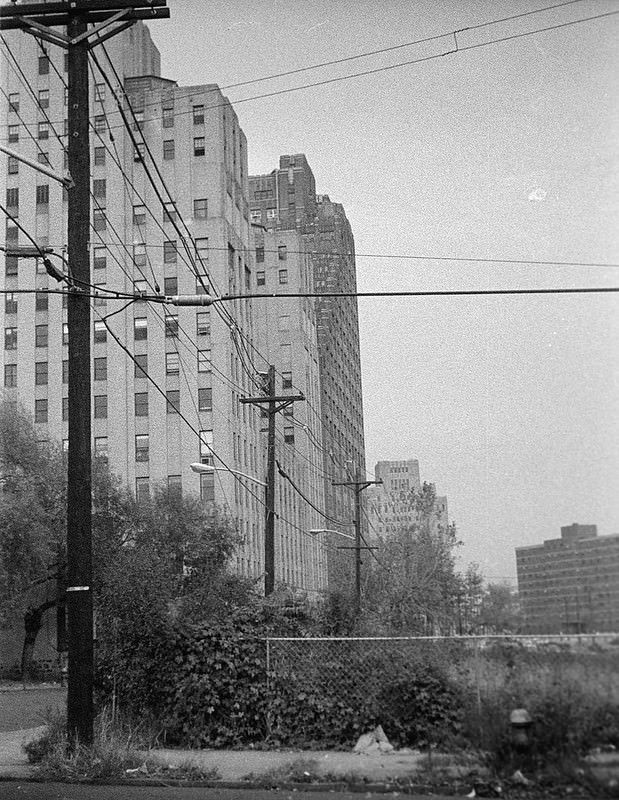
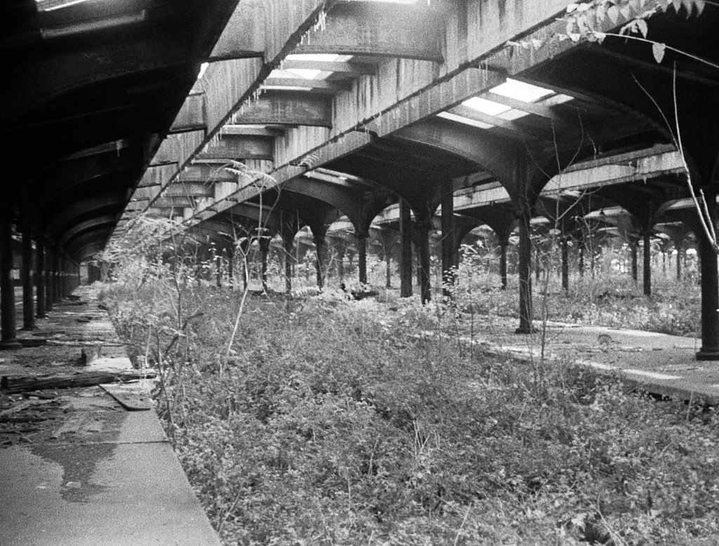
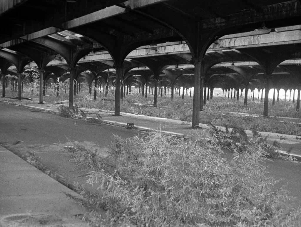
Johnston Avenue was a major artery running through the industrial zone. By 1975, sections of the street were flanked on both sides by abandoned railroad land. The contrast between the active road and the silent, overgrown lots alongside it summarized the situation in much of the city’s industrial district.
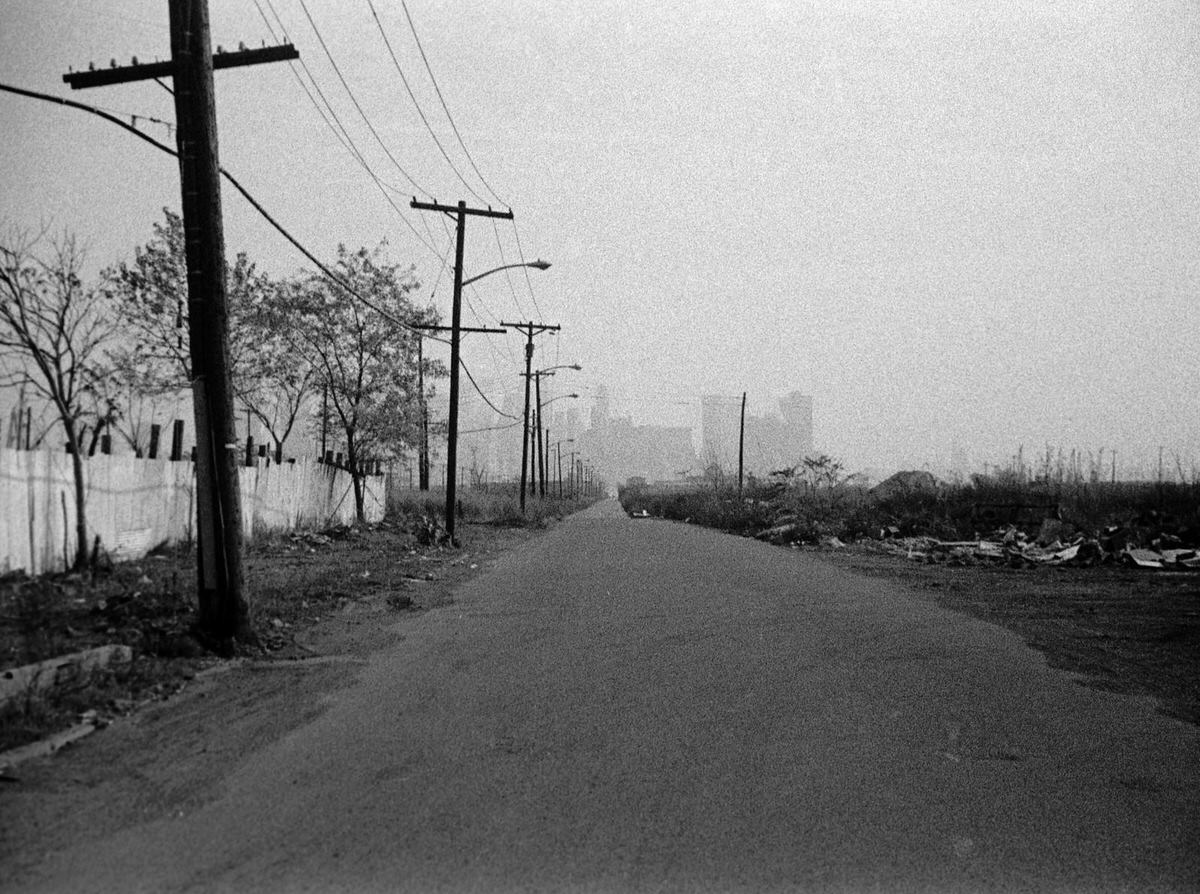
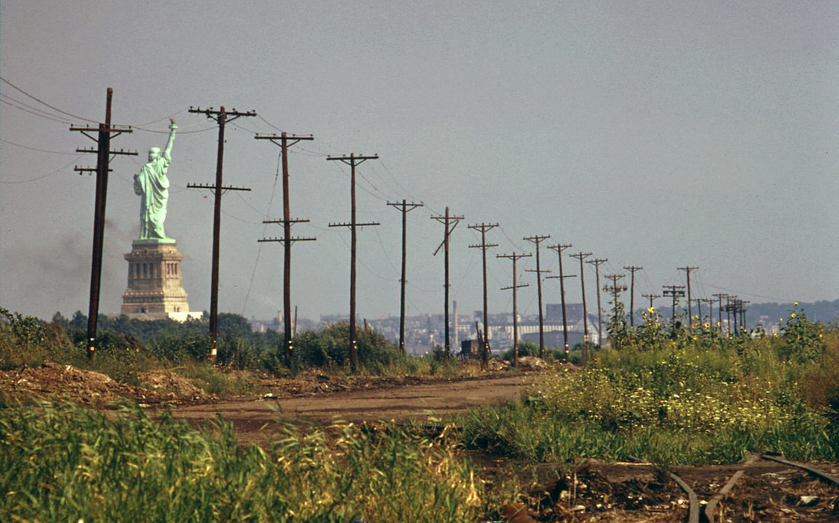
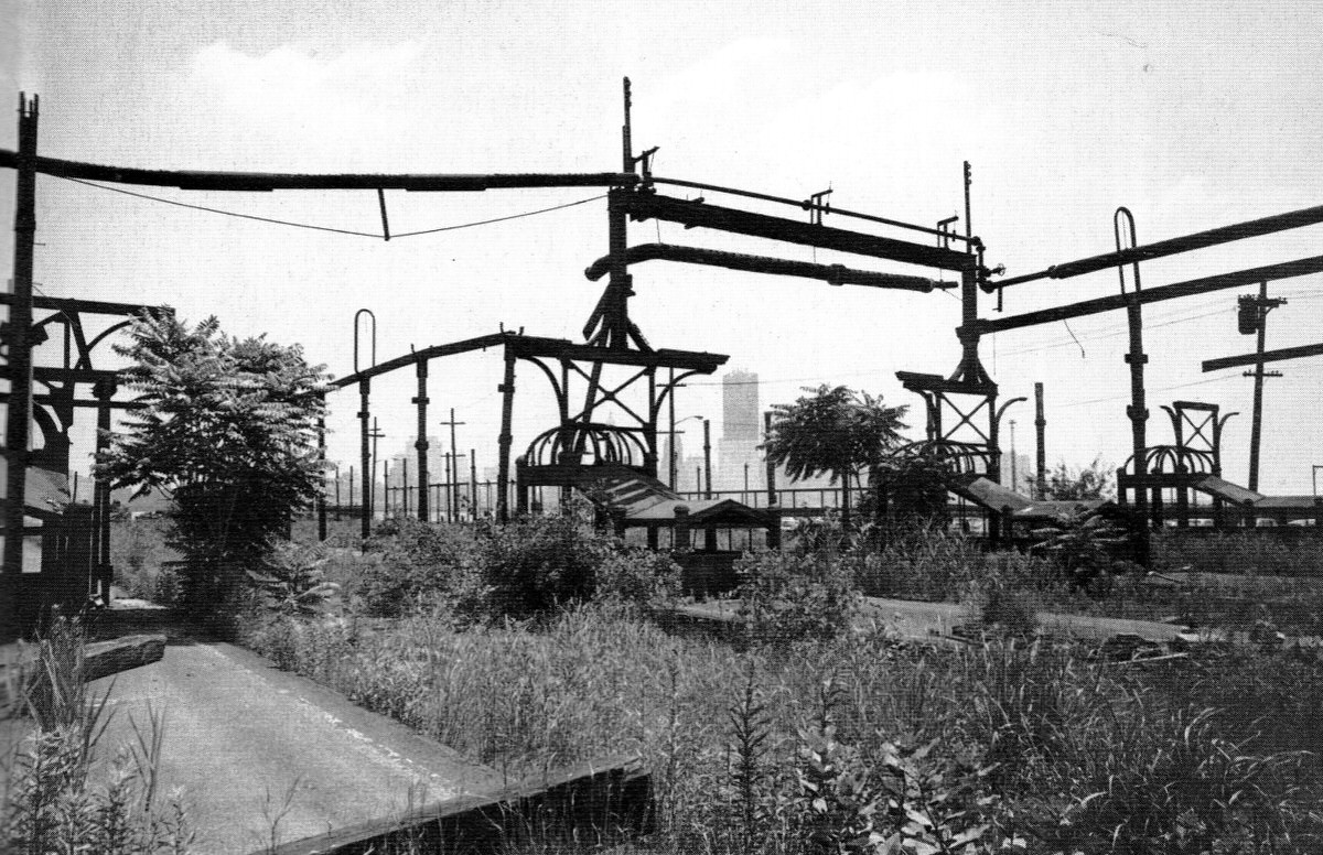
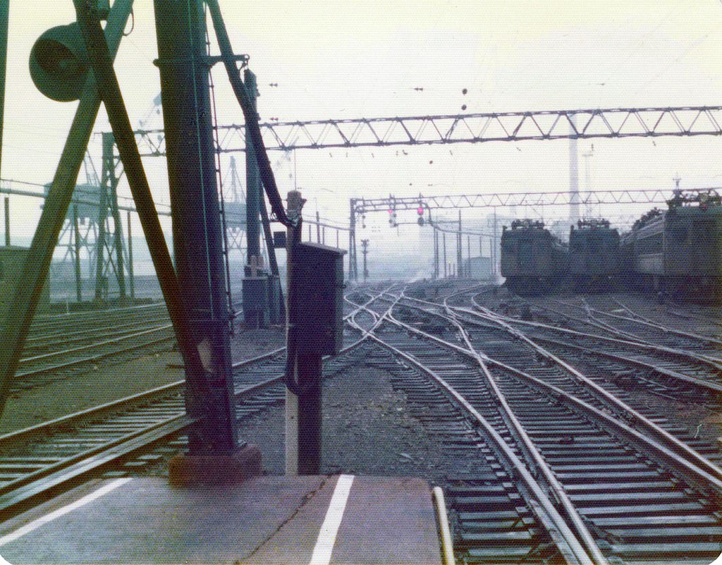
The Greenville rail yards in the southern part of the city were completely dilapidated by 1976. This was one of the largest rail yard complexes in New Jersey, and its closure removed hundreds of jobs. The photographs taken here show weeds growing through the tracks and entire rows of buildings with their windows gone.
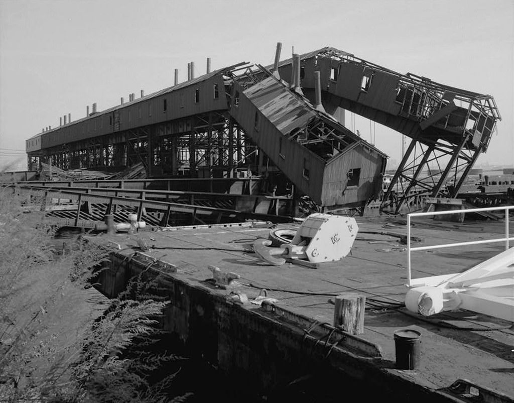
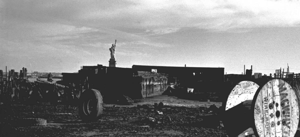
The Erie Railroad piers at Exchange Place decayed steadily through the decade. By 1975, the pier structure had collapsed in sections, leaving only iron framework and broken concrete above the waterline. The World Trade Center was fully visible from this spot, just across the river.
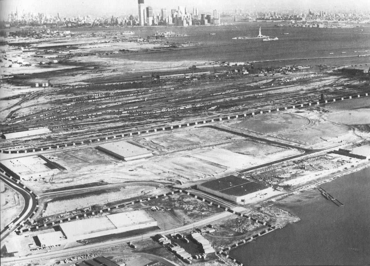
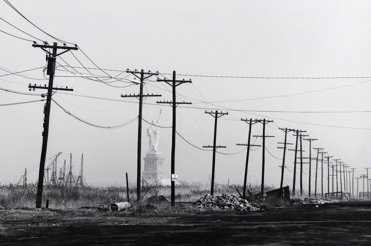
Black Tom, on the southern edge of the Jersey City waterfront near the Statue of Liberty, showed some of the most dramatic abandonment on the entire shoreline. Railroad ruins, an Exxon tank farm, and the remains of industrial structures covered the peninsula. The Statue of Liberty stood directly offshore, creating a stark visual pairing of American symbolism and American urban decay.
Summer in the residential neighborhoods meant fire hydrants opened up on the side streets. On Dudley Street in 1975, children played in the spray just as they had in earlier decades. The hydrant ritual was a fixture of working-class city life, and Jersey City’s residential blocks maintained that rhythm even as the industrial base around them fell apart.
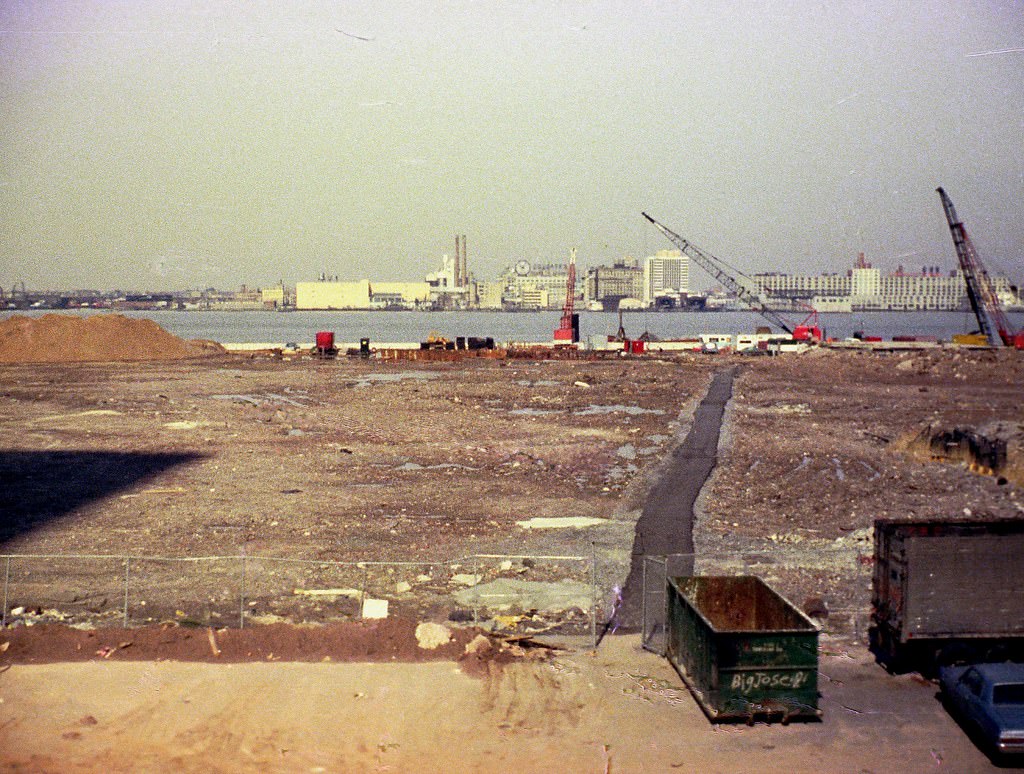
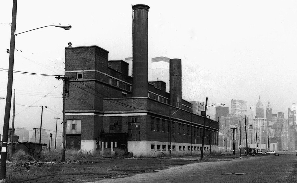
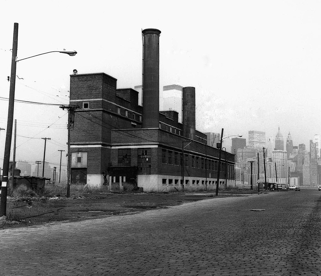
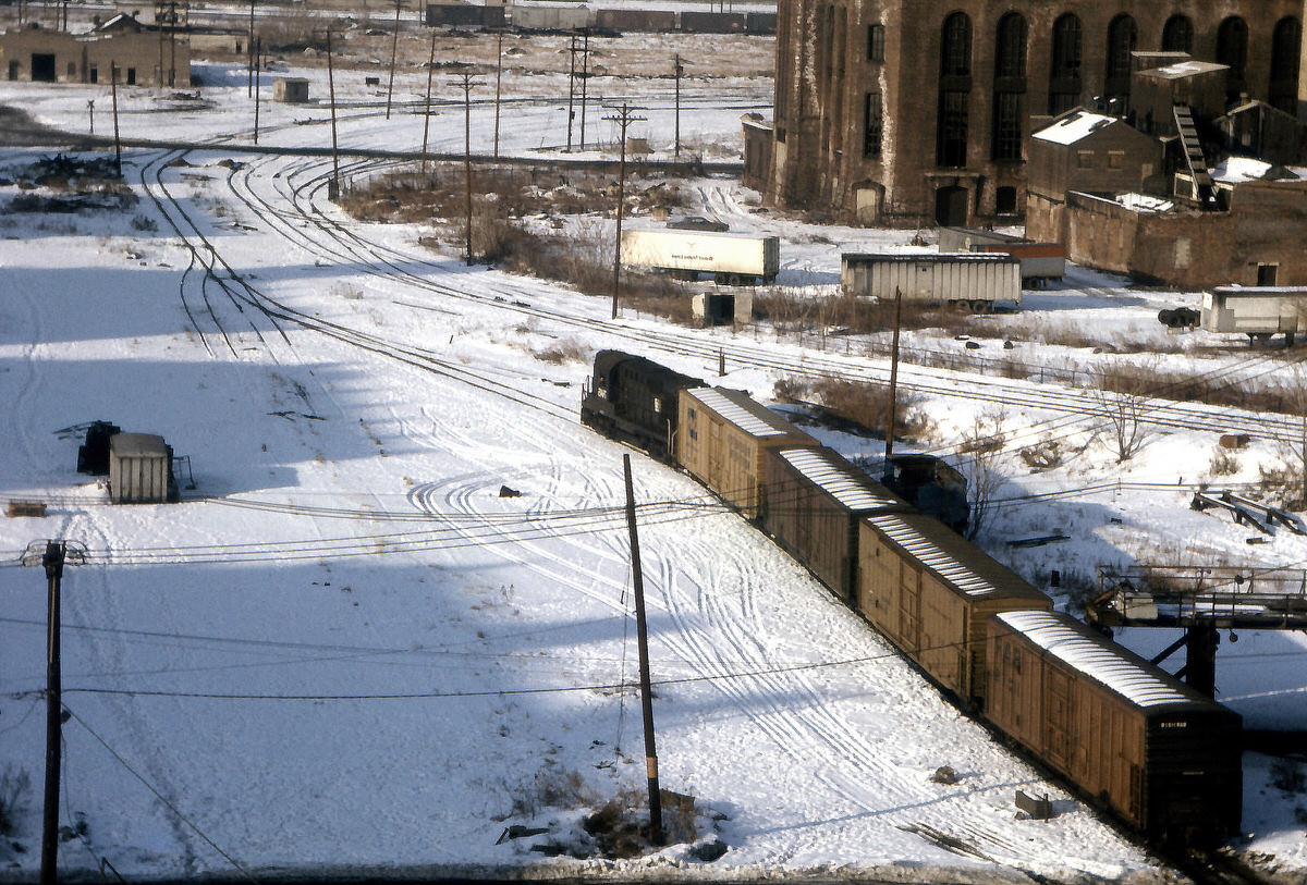
Winter brought a different quality to the industrial ruins. The Hudson and Manhattan Railroad powerhouse, a massive brick structure on the Jersey City waterfront, sat surrounded by abandoned buildings in the snow. The powerhouse had originally supplied electricity to the Hudson Tubes — the forerunner of today’s PATH system — and its scale made it one of the most imposing ruins in the entire city.
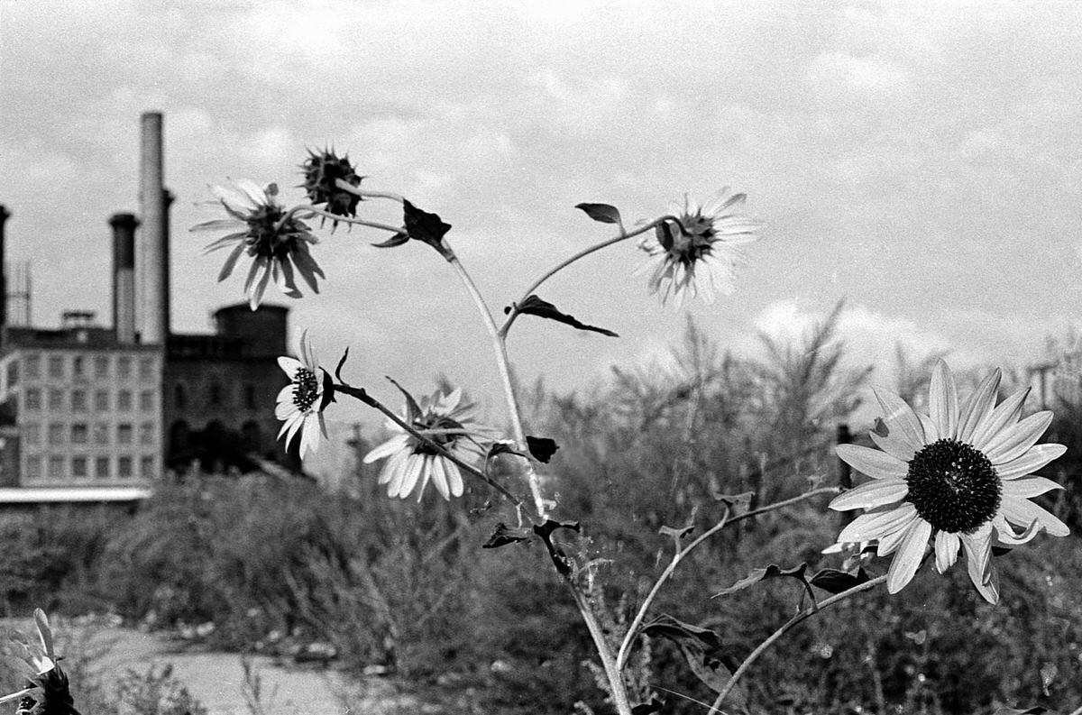
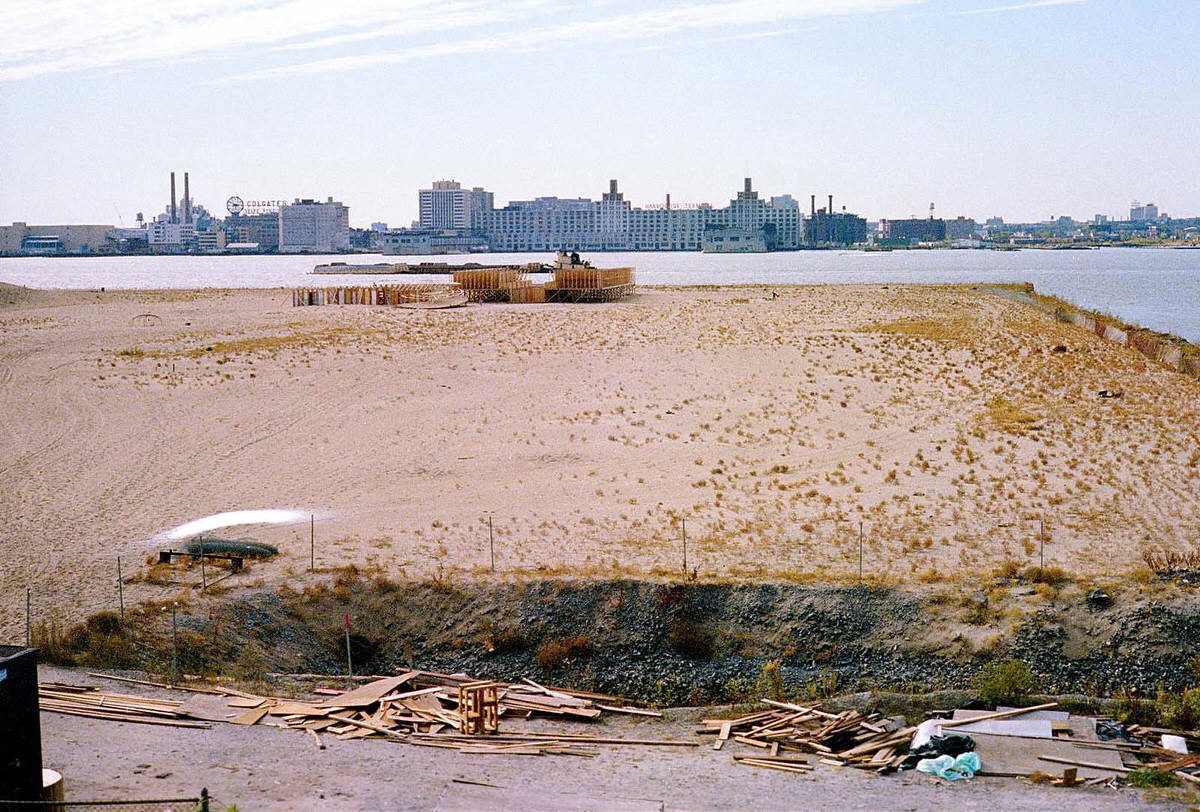
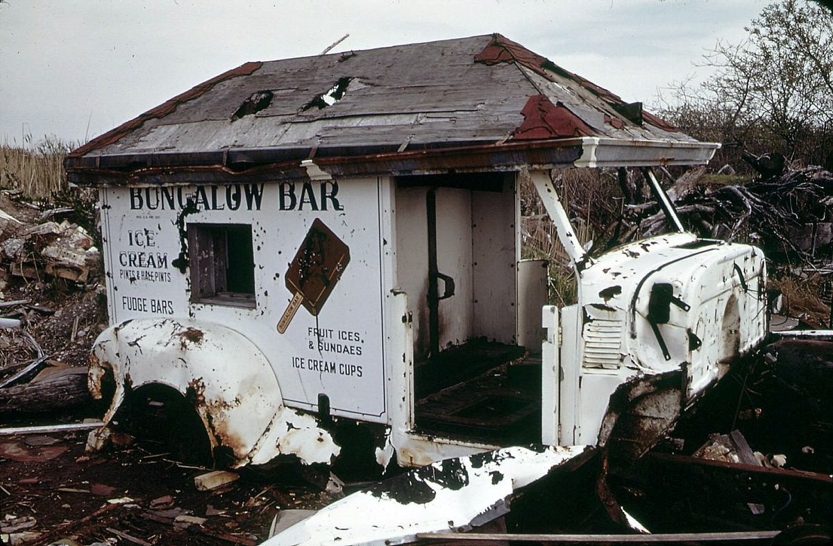
The Communipaw waterfront, in the heart of what would become Liberty State Park territory, contained some of the most unusual abandoned objects in the city. An old ice cream truck, left behind and slowly sinking into a swamp, became one of the more surreal images from this era of Jersey City photography.
The Bicentennial brought one of the most dramatic maritime spectacles in American history directly to Jersey City’s doorstep. On July 4, 1976, tall ships from around the world sailed through New York Harbor. Residents watched from the waterfront as the fleet passed. For one day, the harbor that had been defined by industrial decline was the center of the country’s attention.
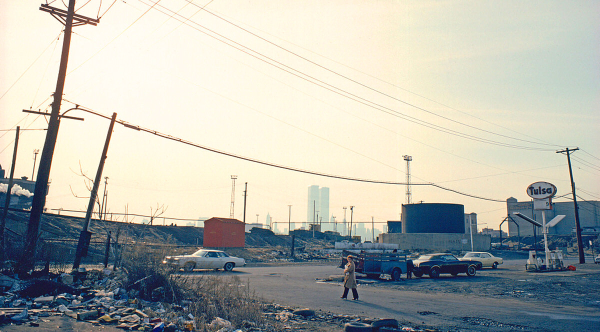
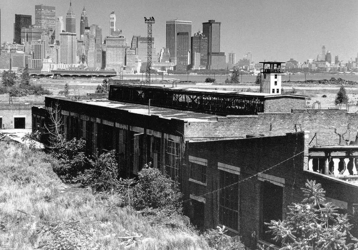
The Central Railroad terminal ruins by 1977 and 1978 showed accelerating structural deterioration. Sections of the roof had fallen in. Walls were cracked and stained. The contrast with the World Trade Center visible in the background remained as stark as ever — one structure defined by its newness, the other by the speed of its collapse.
Inside the Hoboken Erie Lackawanna terminal’s train shed, the numbered tracks held vintage commuter trains throughout the decade. Track No. 4 and Track No. 15 were photographed multiple times, capturing the last years of a railroad terminal culture that was already fading across the northeastern United States.
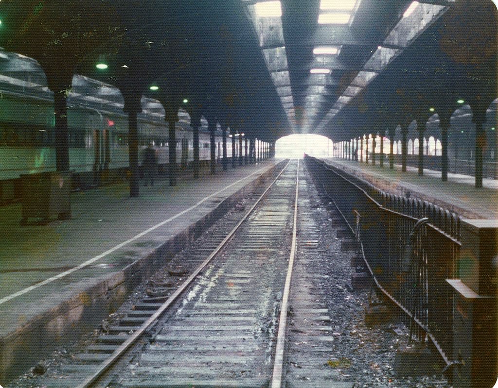
On foggy mornings, the Erie Lackawanna terminal shed took on an almost cinematic quality. Light filtered through the end of the train shed in soft bands. The same structure that bustled with commuters at rush hour became nearly atmospheric in the early morning quiet.
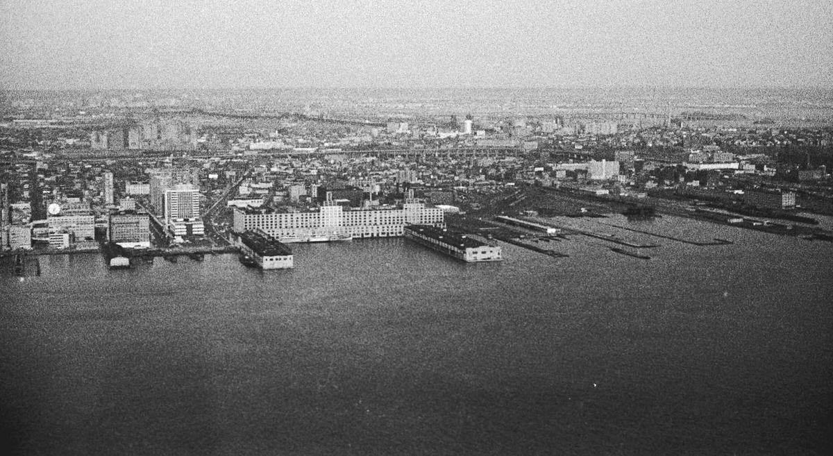
Panoramic photographs taken from the 58th floor of the World Trade Center in 1974 and 1975 showed Jersey City as a patchwork of residential blocks, empty industrial lots, and scattered active businesses. The Colgate plant, the Morris Canal basin, and the Harborside Terminal were visible landmarks in an otherwise fragmented cityscape.
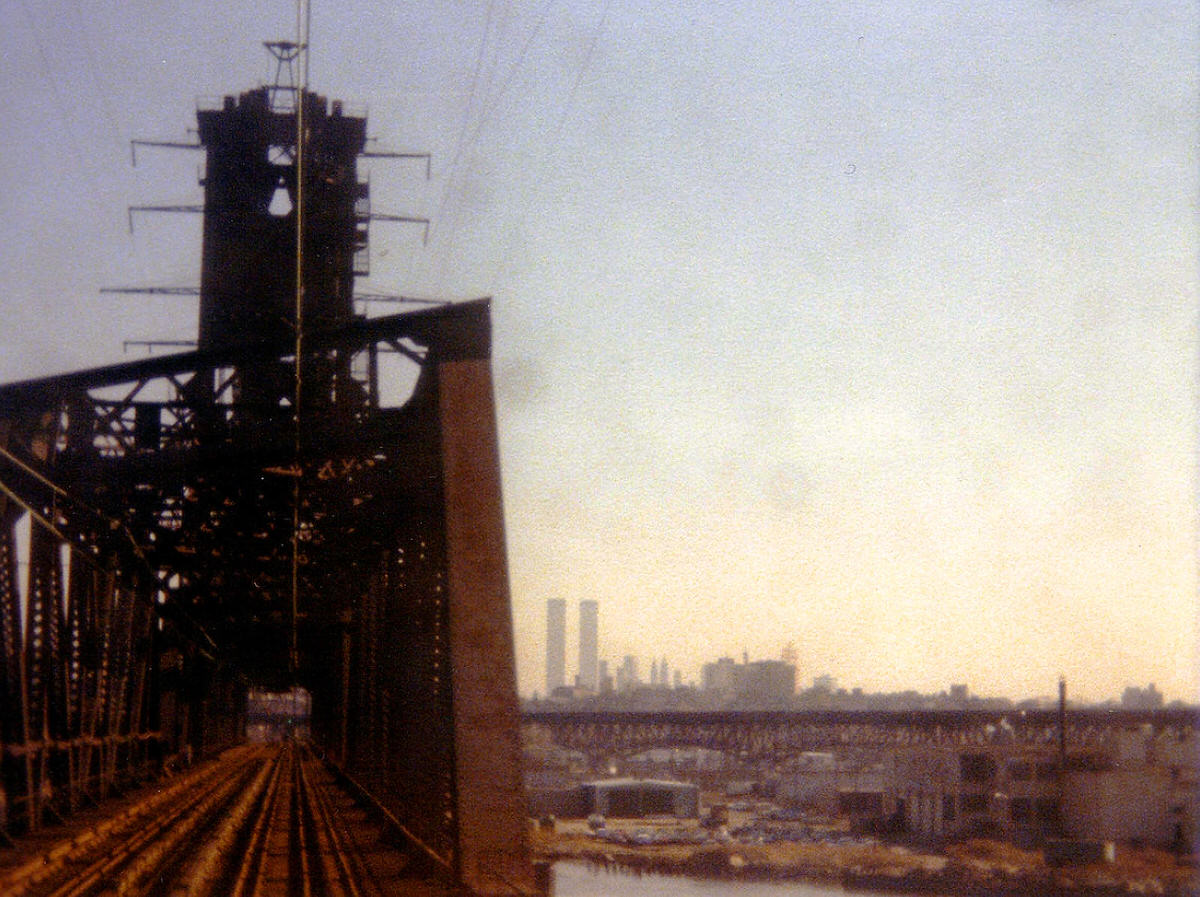
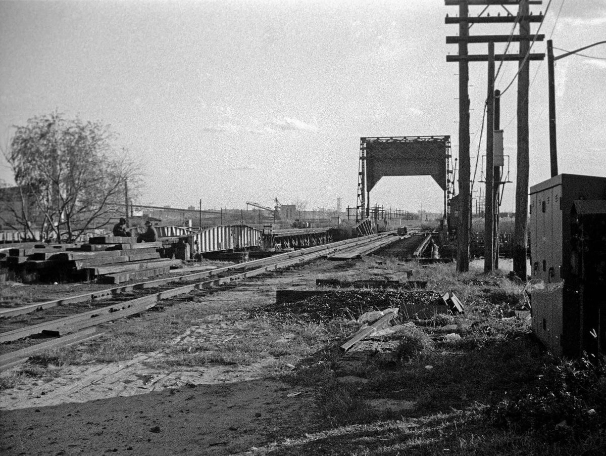
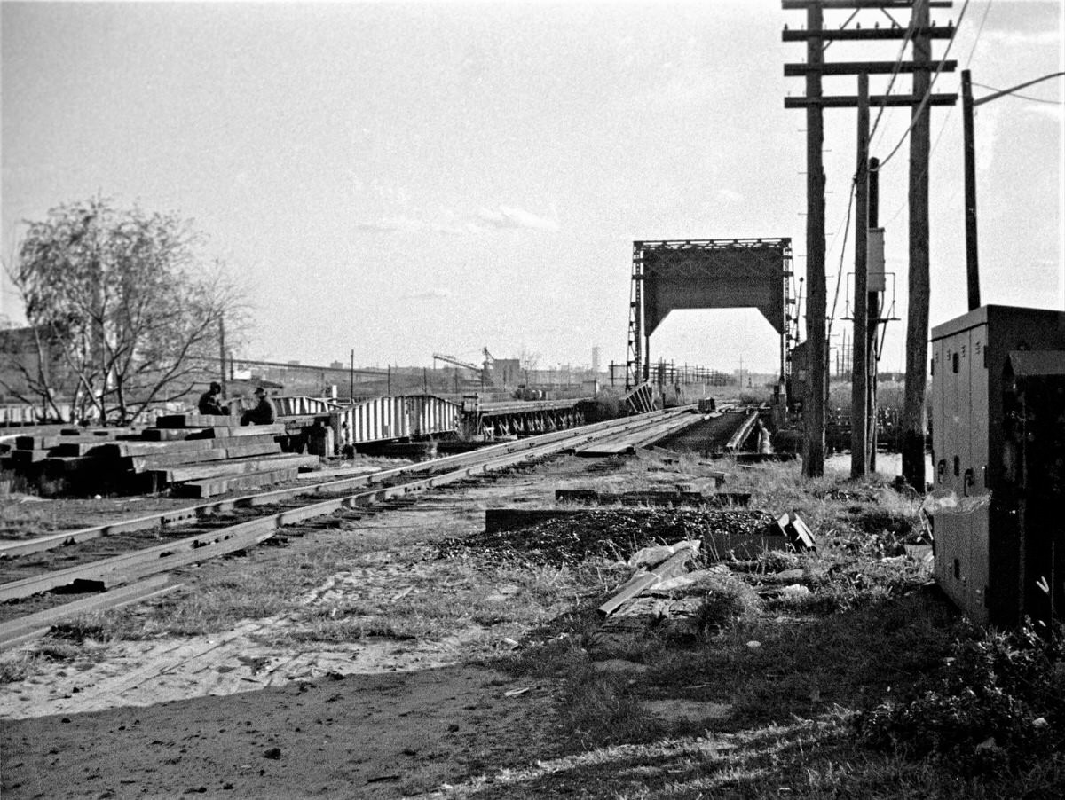
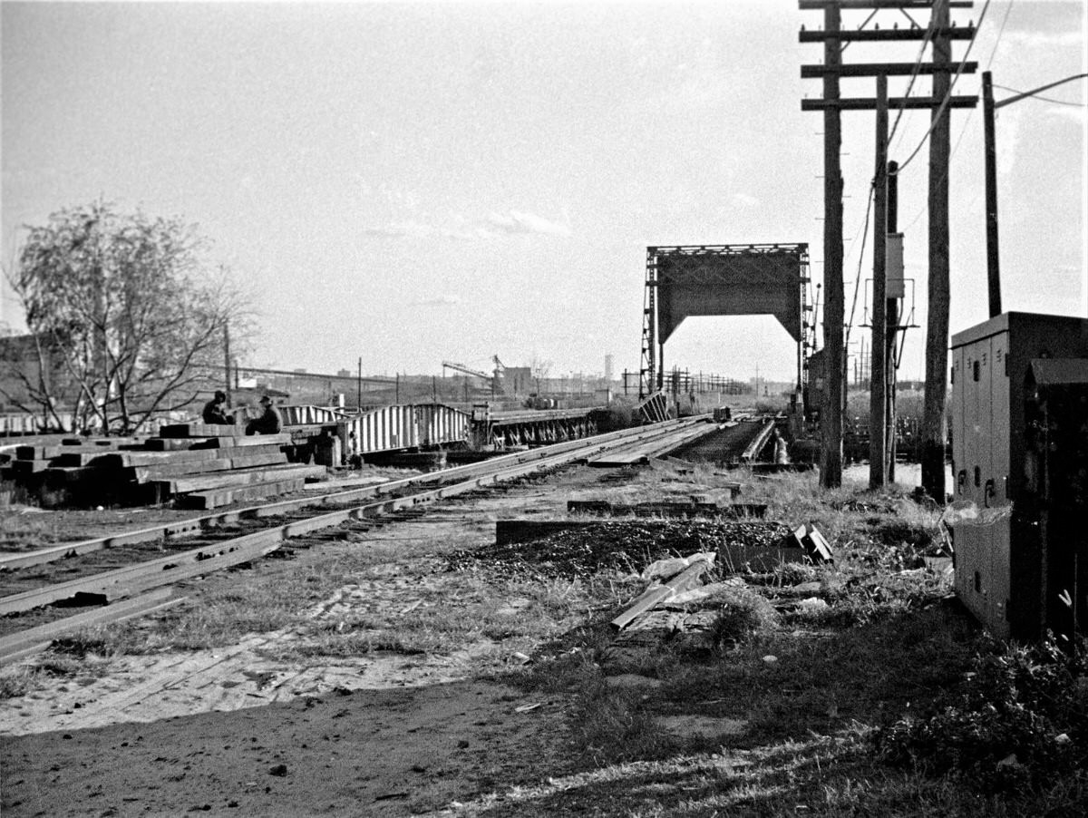
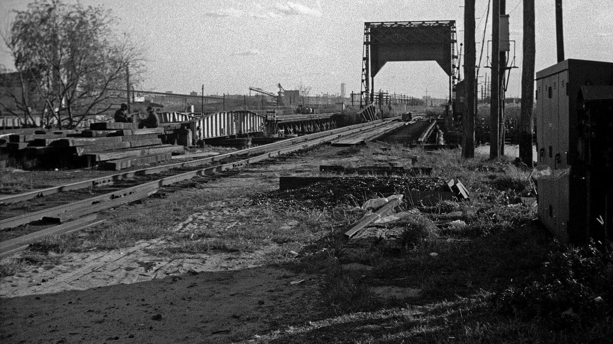
Beyond the city limits, the same pattern of industrial abandonment extended outward into the Meadowlands. Abandoned railroad bridges crossed the Hackensack River and Overpeck Creek. The World Trade Center was visible in the distance from these locations, hovering above the swamps and marshes that stretched between Jersey City and the surrounding region.
On Bicentennial Day, July 4, 1976, Exchange Place saw rare public activity. Crowds gathered near the waterfront to watch Operation Sail. The tall ships passing through New York Harbor drew observers to a stretch of waterfront that was normally empty. For a brief period, the ruins of Exchange Place became a grandstand for one of the most celebrated days in American history.
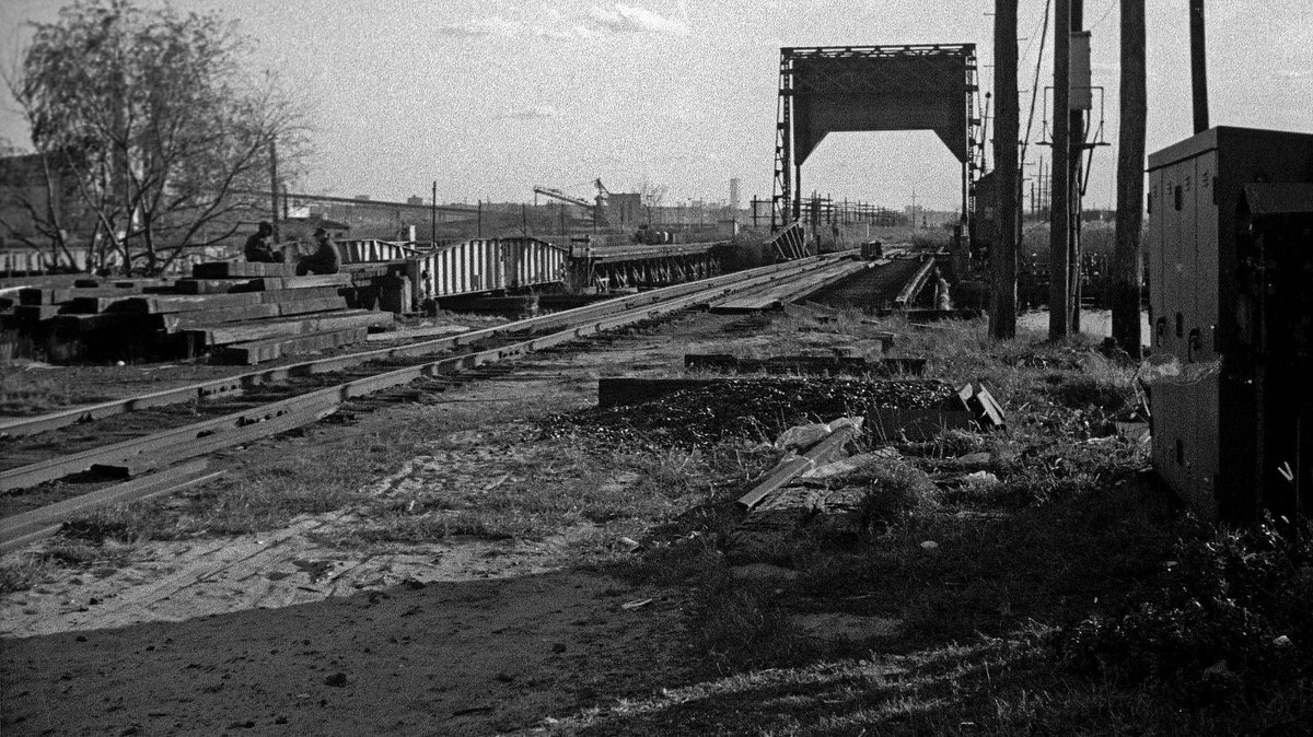
The Meadowlands rail bridges and the wider regional infrastructure told the same story as the Jersey City waterfront — an entire network of railroad infrastructure built over decades, now sitting idle as freight moved by truck and the commuter lines consolidated. Abandoned bridges over Overpeck Creek between Ridgefield and Ridgefield Park sat untouched for years.
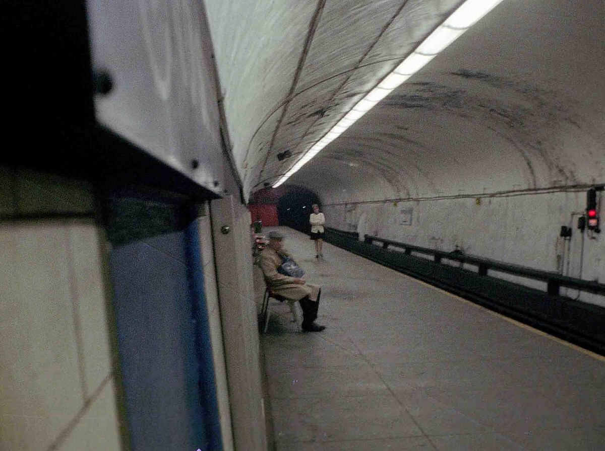
From Pier A in Manhattan, photographers documented the Jersey City shoreline repeatedly through the mid-1970s. The industrial wasteland and the Central Railroad terminal dominated the view. The images taken from this vantage point were some of the most widely circulated photographs of the post-industrial New Jersey waterfront during the decade.
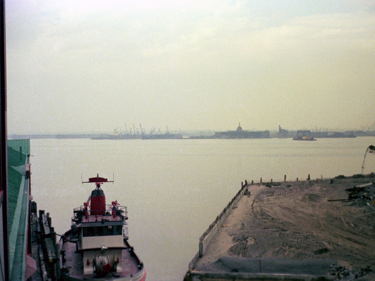
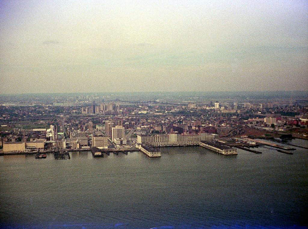
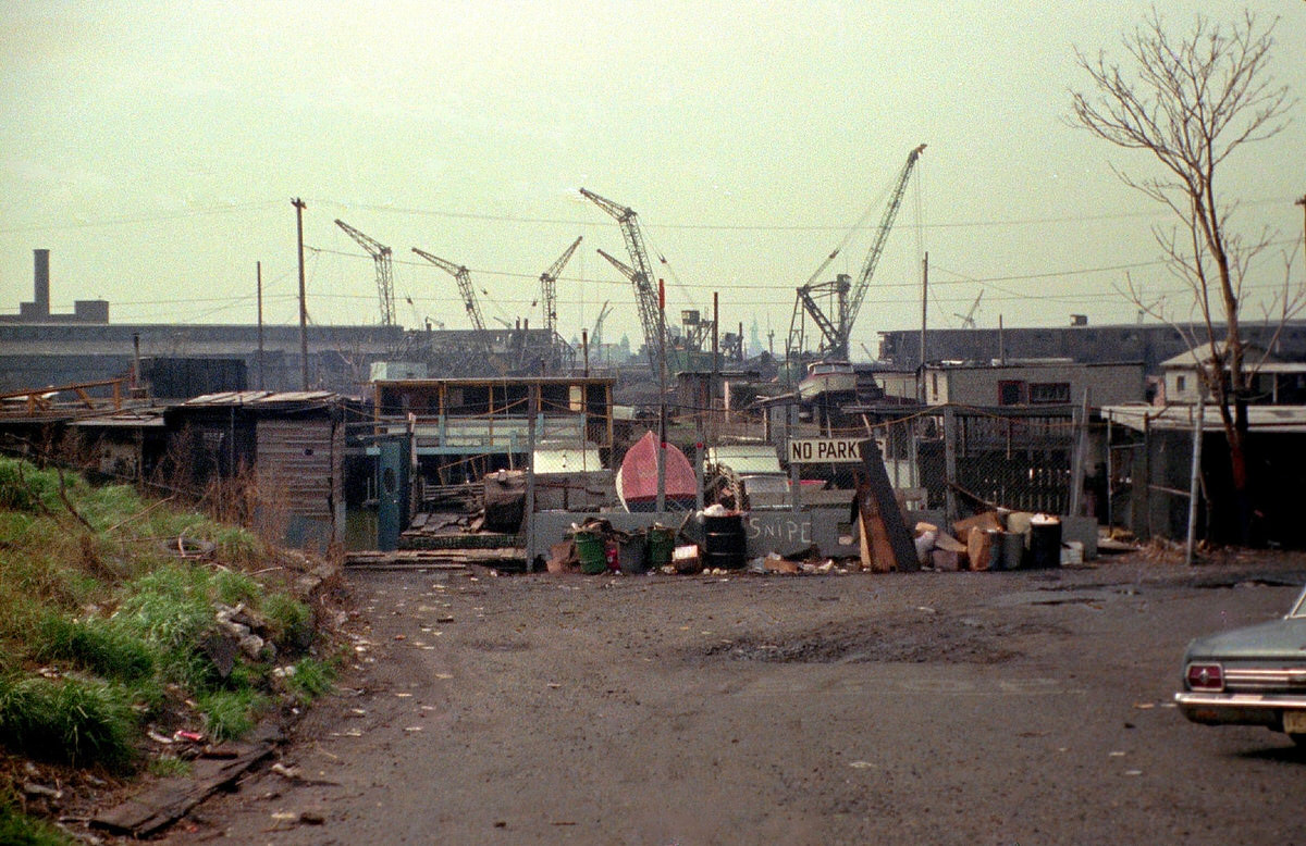
The Greene Street Boat Club at the Morris Canal’s small basin was one of the few active recreational spots near the industrial waterfront. Surrounding the club were crane graveyards and industrial ruins at the end of Greene Street. The canal itself, which had once stretched across the state from Phillipsburg to Newark, was now a stagnant channel lined with debris.
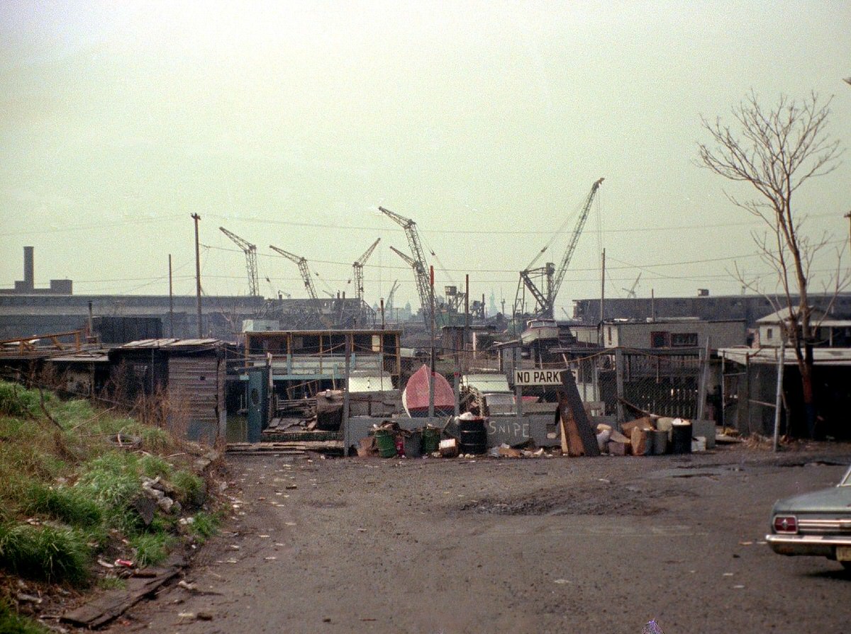
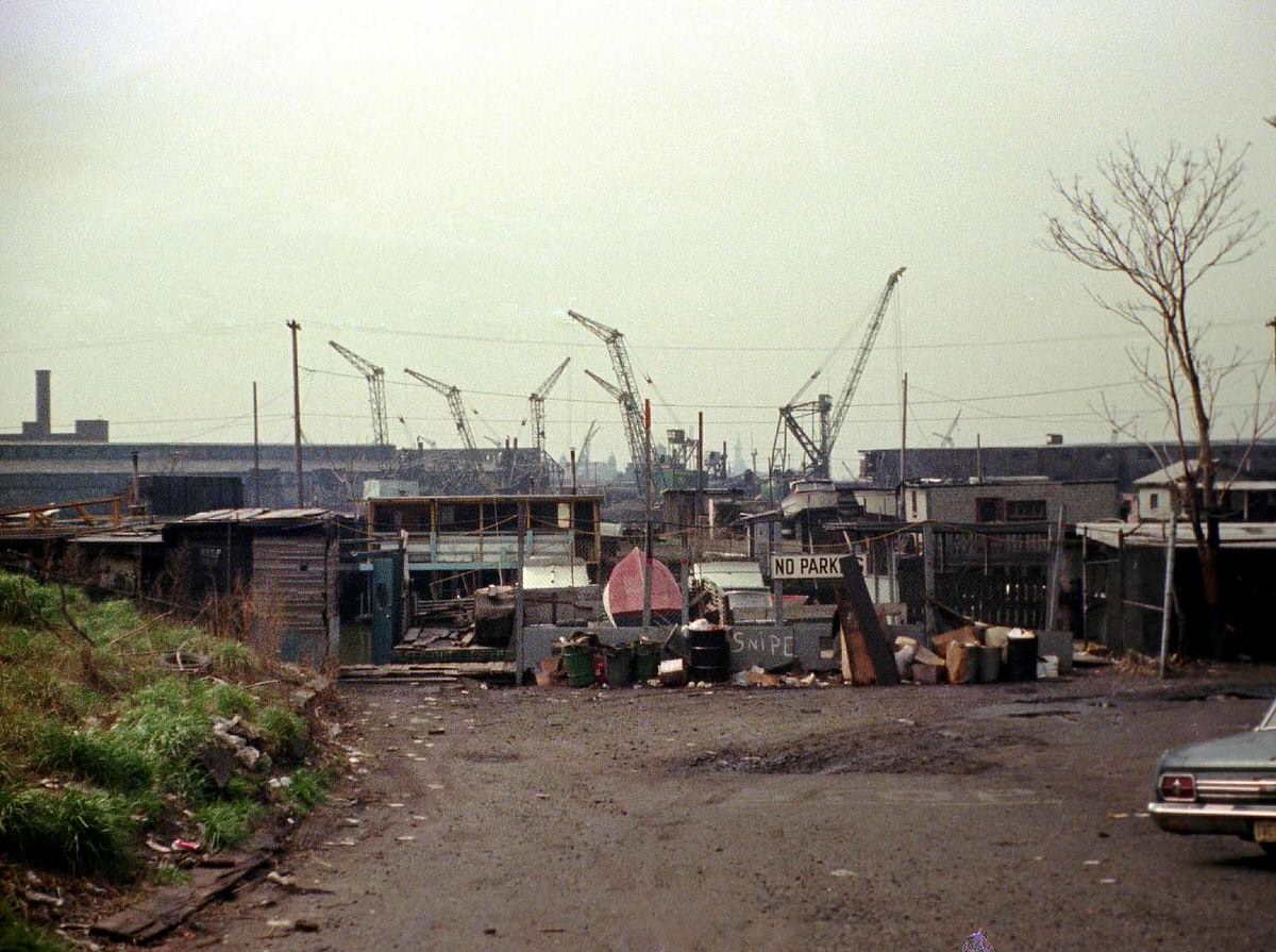
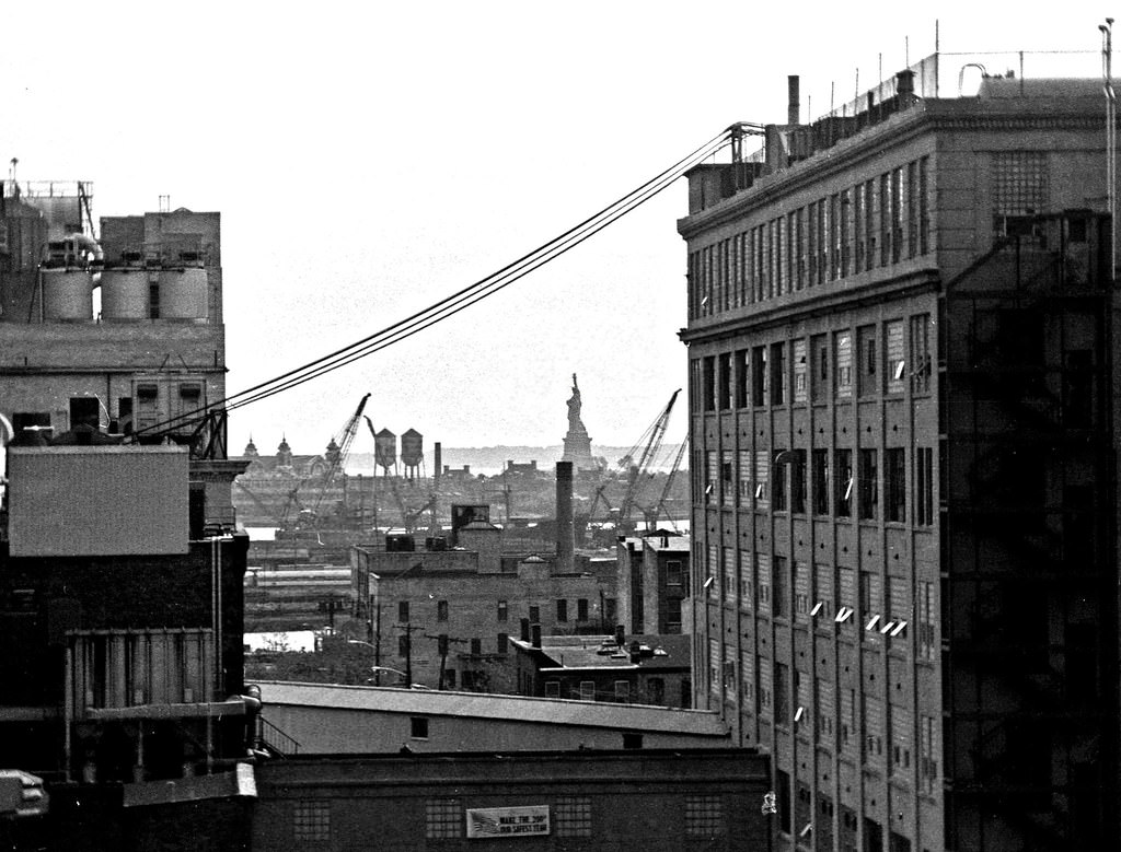
Looking down Greene Street toward the water’s end, the Statue of Liberty and Ellis Island were visible in the distance. The juxtaposition of industrial ruin in the foreground and these historic landmarks in the background appeared repeatedly in photographs from this stretch of the canal. It became one of the defining visual themes of 1970s Jersey City.
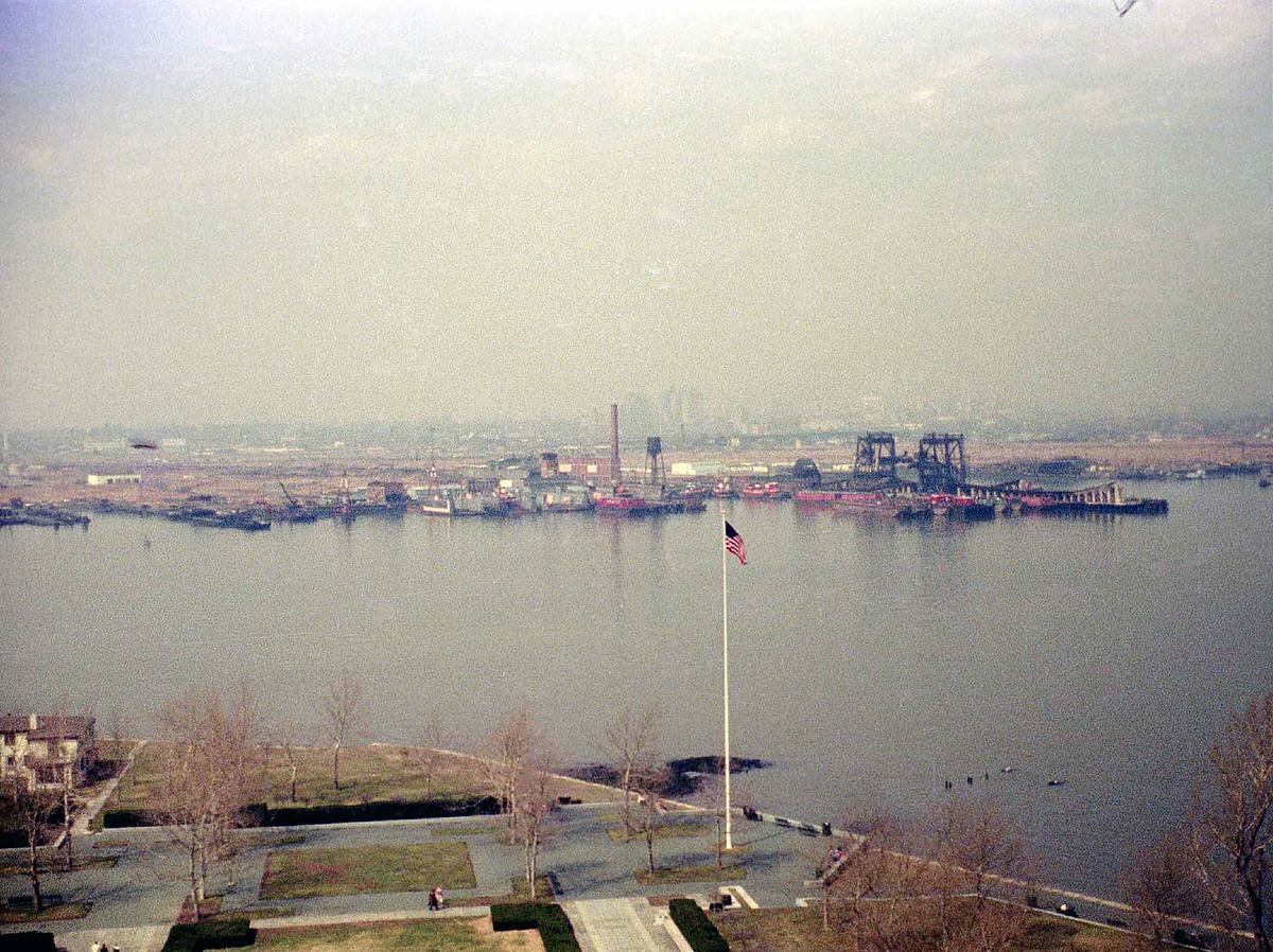
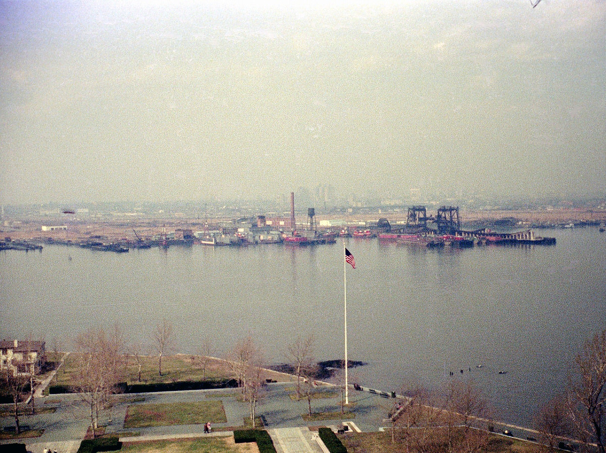
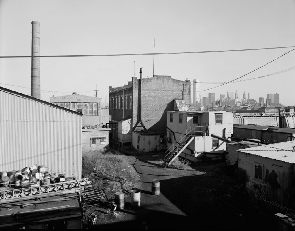
The Henderson Street industrial corridor included an asbestos factory surrounded by wasteland. The factory’s presence added a public health dimension to a neighborhood already dealing with unemployment and blight. Surrounding lots were stripped bare, with broken ground and scattered debris extending in every direction.
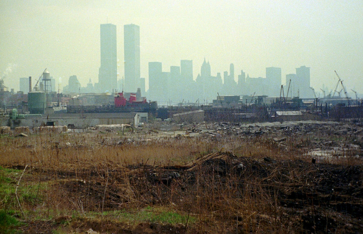
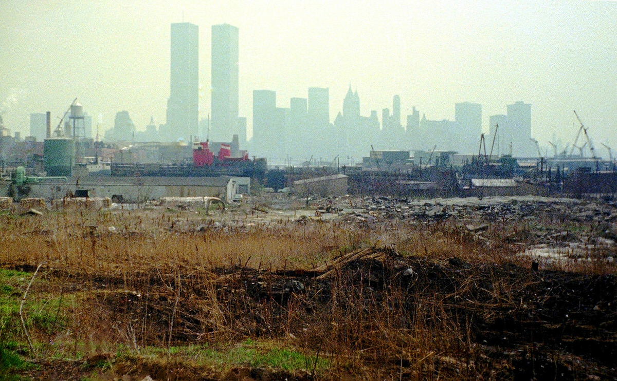
On Bicentennial Day at Exchange Place, the World Trade Center framed the celebration from across the river. Crowds filled the waterfront area, and tall ships were visible in the harbor beyond. The day brought together the old industrial waterfront, the new Manhattan skyline, and the national celebration into a single frame.
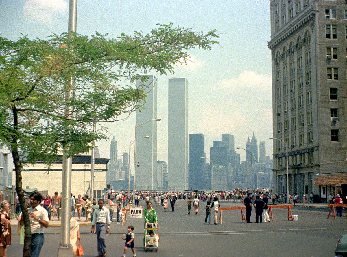
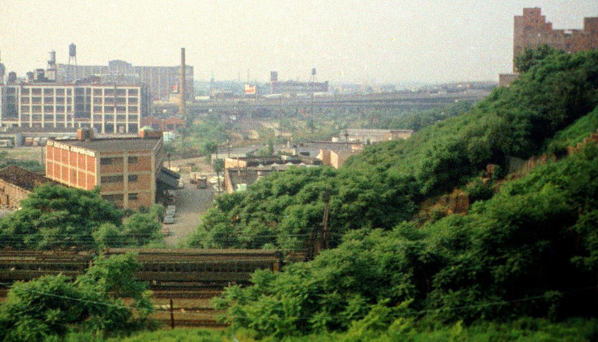
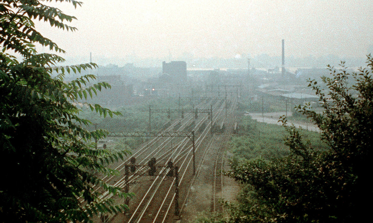
The Erie Railroad tunnel in Hoboken connected the terminal to the rail network heading west. The industrial area surrounding the tunnel entrance retained much of its 19th-century character throughout the 1970s. Nearby, the Bergen Hill vantage point offered a view of the Erie Lackawanna tracks running toward the Manhattan skyline.
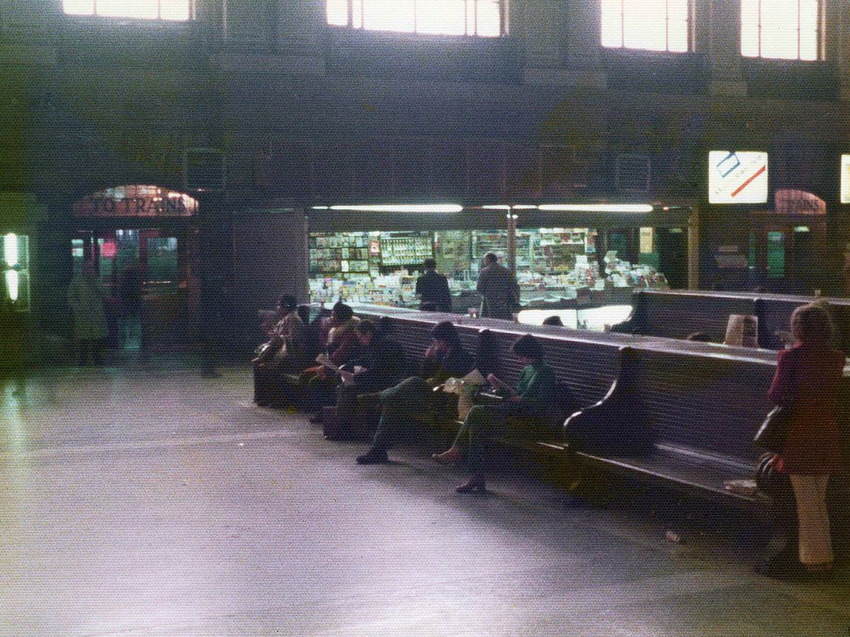
The Hoboken Erie Lackawanna Terminal’s waiting room retained its original furnishings and architectural character through the entire decade. Long wooden benches, high ceilings, and large windows defined the space. Concession stands operated near the entrance. The room was still a functioning transportation hub even as the railroad industry around it was restructuring.
The Sussex Street industrial shoreline gave photographers a ground-level view of the World Trade Center rising directly across the river. The scale of the towers was most apparent from these low vantage points, where the buildings appeared enormous against the flat, ruined landscape of the New Jersey waterfront.
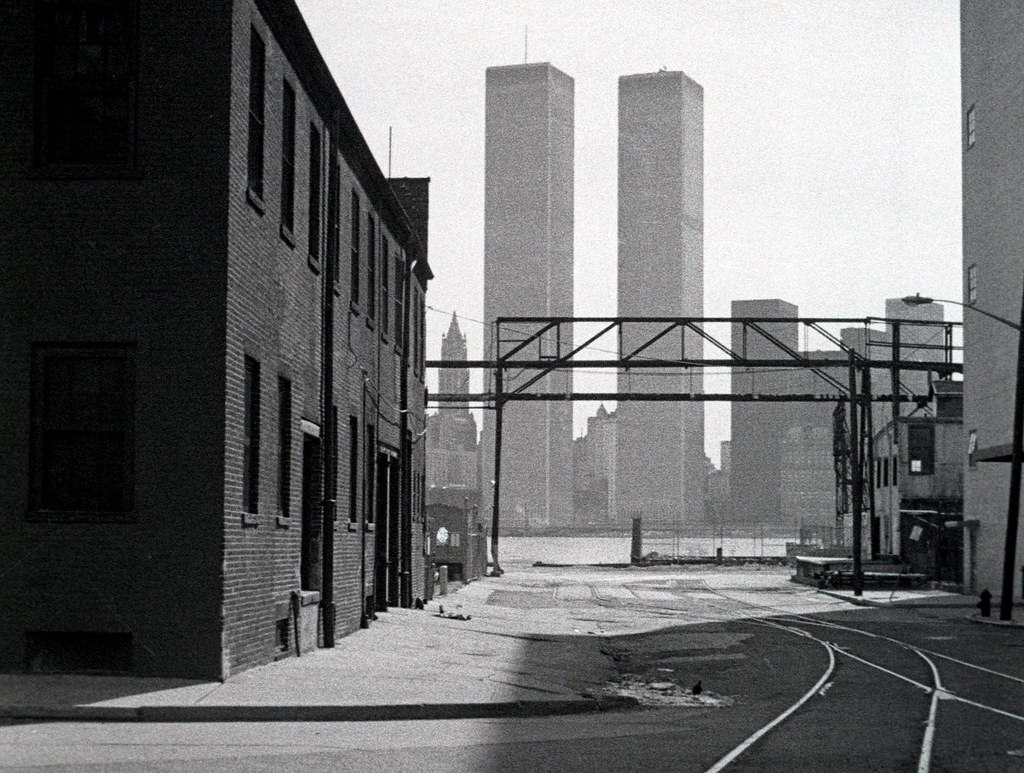
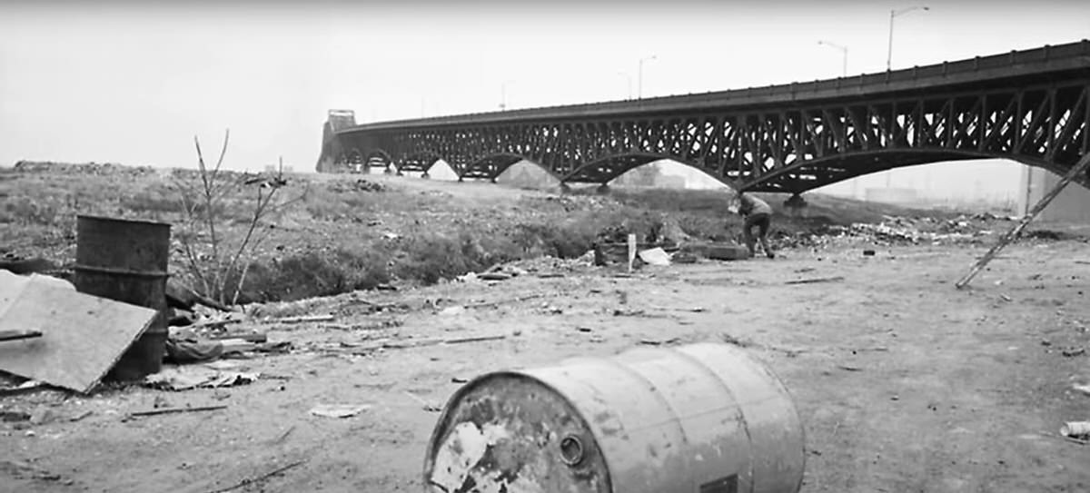
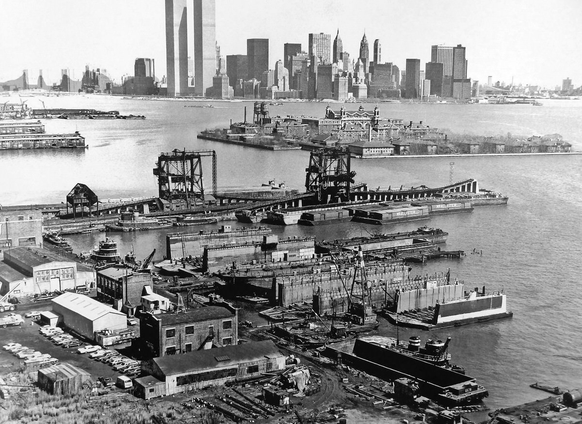
The Pavonia neighborhood in the northern part of Jersey City contained the ruins of the Erie Railroad terminal. In 1970, these ruins were already decades old, and the World Trade Center was still going up in the background. By the mid-1970s, the Erie terminal ruins had become just another section of the city’s larger landscape of industrial abandonment.
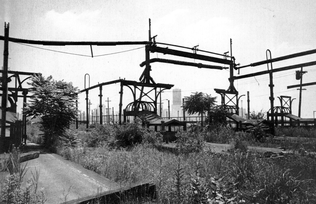
The future site of the Grove of Remembrance — a memorial grove that would be planted in honor of New Jersey residents who died in the September 11 attacks decades later — was, in the 1970s, a flat expanse of abandoned railroad land. The Central Railroad of New Jersey engine terminal occupied part of the site, and the land remained undeveloped through most of the decade.
The New York City skyline seen from the Morris Canal in 1972 showed the World Trade Center still under construction, its steel framework rising above the existing Manhattan skyline. This view from one of Jersey City’s most industrially degraded waterways gave context to how physically close the city was to one of the most dynamic construction projects in American history.
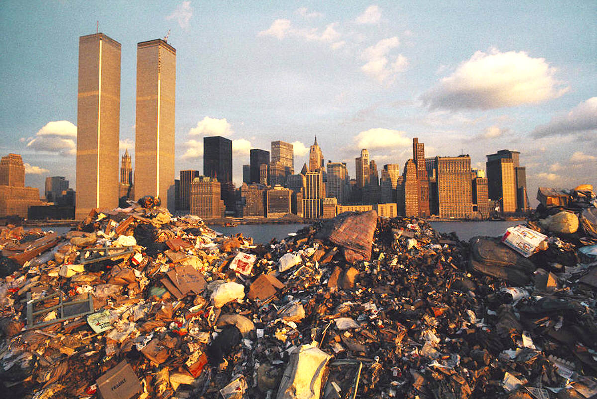
The New Jersey Turnpike and its power line corridors cut across the Meadowlands to the west of Jersey City, adding new infrastructure to a region already heavily marked by industrial use. The Meadowlands landscape in 1977 showed garbage dumps, wetlands, and power lines running alongside one of the busiest highways in the country.