

Charlotte, North Carolina changed rapidly during the 1910s. The city grew through wartime activity at Camp Greene, the expansion of the textile industry, and the development of new neighborhoods like Myers Park. The photos below capture the streets, institutions, and people that shaped Charlotte during this transformative decade.
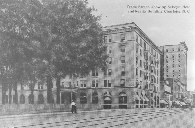
The Selwyn Hotel was located on West Trade Street. The Realty Building or Independence Building can be seen in the background. Trolley tracks are clearly visible.
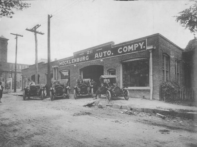
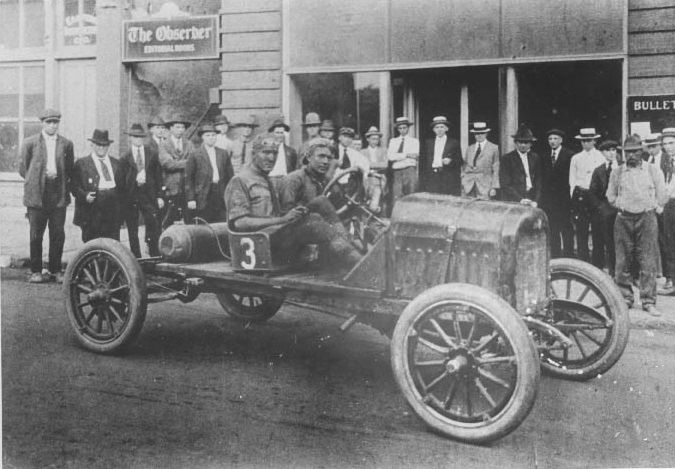
The Mecklenburg Auto Company was located at 211 South Church Street.
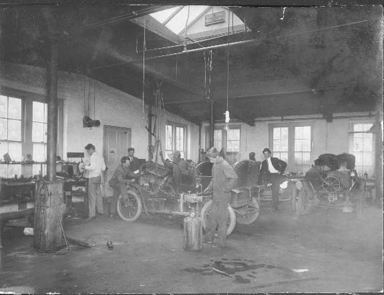
The Mecklenburg Auto Company was located at 211 South Church Street. T.E. James was the president.
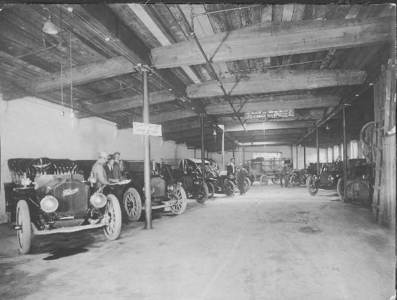
The Mecklenburg Auto Company at 211 South Church Street.
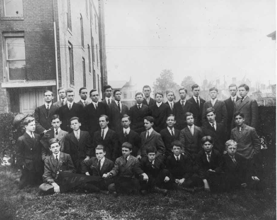
Charlotte University School was located at Sixth and North Tryon Streets. This is a school portrait of the class of 1911. Featured are Professor H.W. Glasgow, George Wearn, U, ___ McCloud, Frank Dowd, Eli Todd McNinch, Pete Crayton, Joe Mason, Graham Hunter, Pelhorn Stockton, Steve Miller, Archie Wakefield, John Berryhill, Thorne Ranson, Harry Weeks, ___ Howard, Joe Crayton, Todd Misenheimer, Neil Overman, James H. Carson, H.F. Buchanan, Tom Taliaferro, Randolph Seaver, Hamilton Anthony, Frank Patterson, Robert Cochrane, Carol King, Steve Davis, Francis Clarkson (later became Judge), Charles Guthrie, Norman Young, Courtney Overman, Jesse Shoemaker, Robert Torrance.
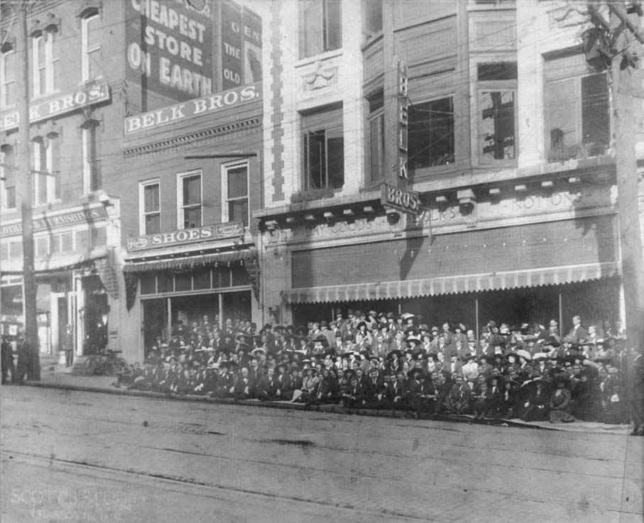
Employees of Belk Brothers in front of the entrance at 119 East Trade Street. Belk Brothers opened the Charlotte store on September 25, 1895.
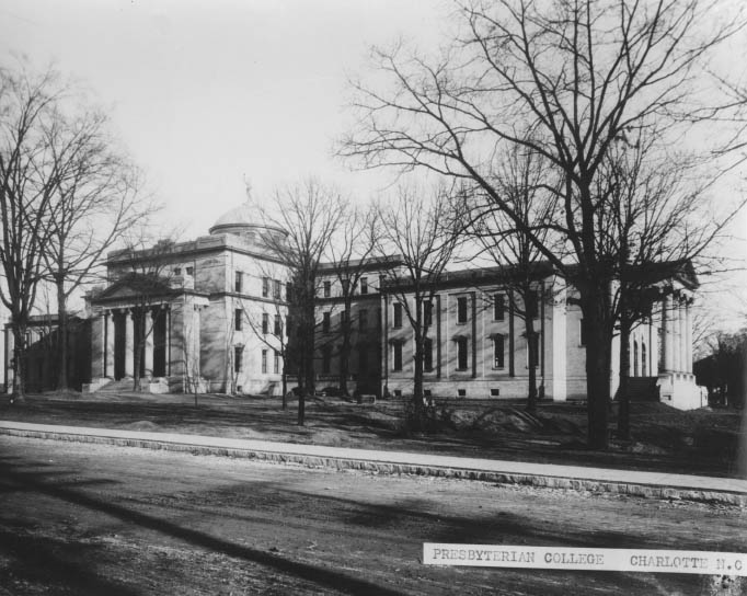
Presbyterian College was the precursor to Queens College. This building was located on the corner of College and Ninth Streets. When the school changed its name to Queens, the school moved to the Myers Park area.
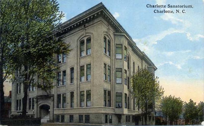
The Charlotte Sanatorium operated from 1907 to 1942. This 100-room, privately owned hospital was located at the southeast corner of Seventh and Church Streets. The building was later used for offices before being demolished in the mid-1950s.
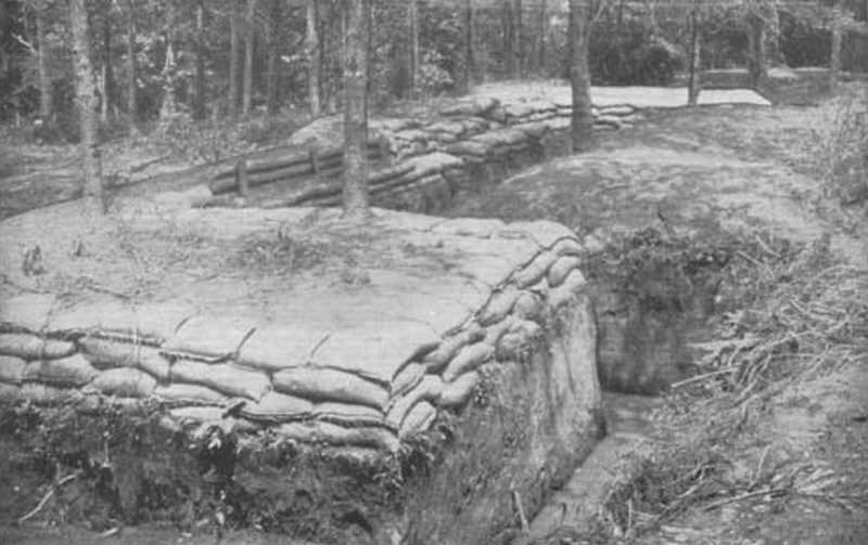
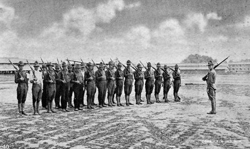
Training soldiers for trench warfare was essential at Camp Greene. Camp Greene was a World War I training camp.
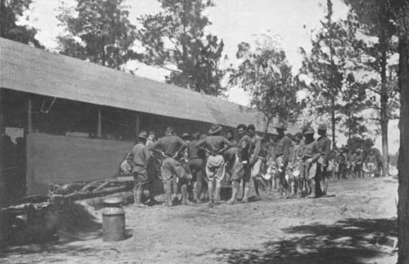
The Mess Hall at Camp Greene, the World War I military training base in Charlotte, North Carolina.
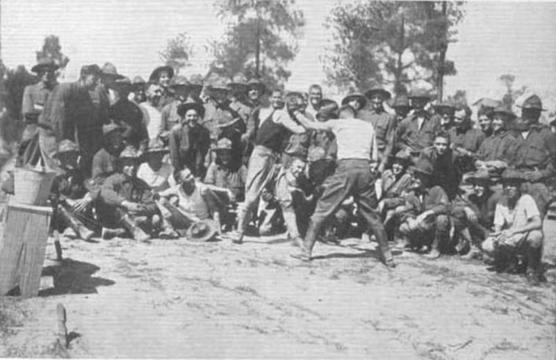
Soldiers boxing at Camp Greene, a World War I training camp in Charlotte.
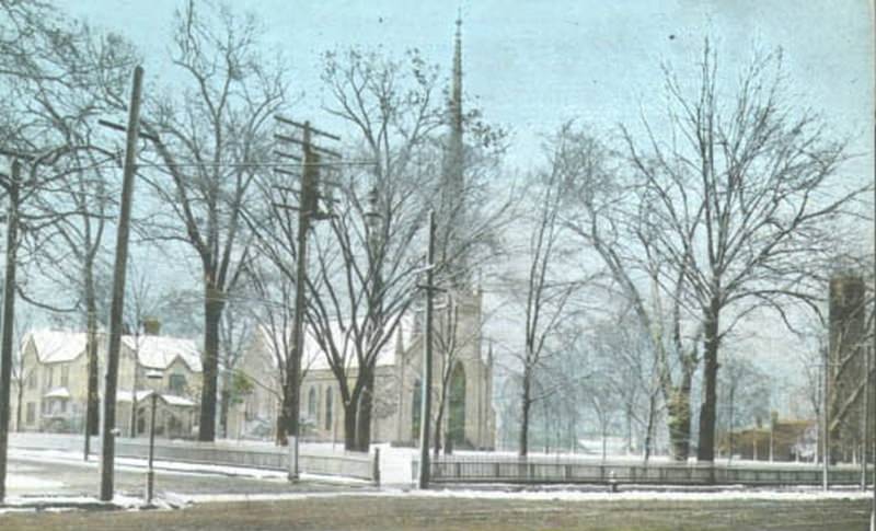
Located at Trade and Church Streets, First Presbyterian Church is the site of one of the first churches built in the city of Charlotte. The original church was completed in 1823. The current church was built in 1895. It became known as First Presbyterian Church in 1873 with the organization of Second Presbyterian Church.
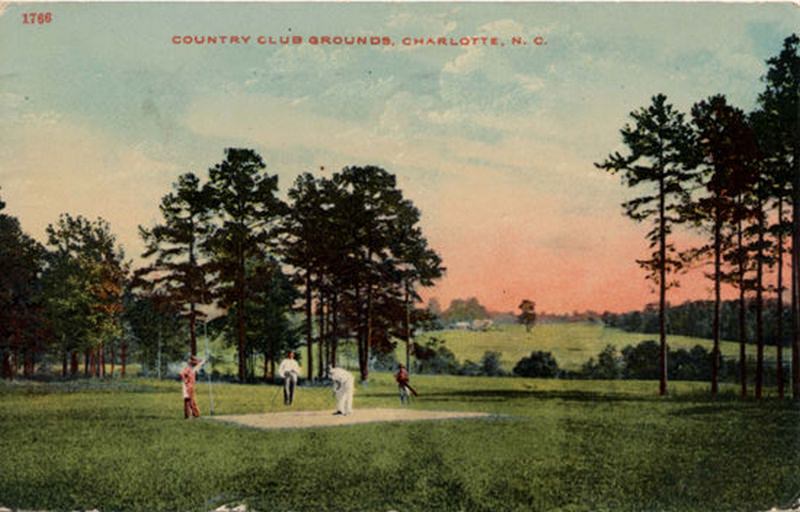
Charlotte Country Club is known for its golf course.
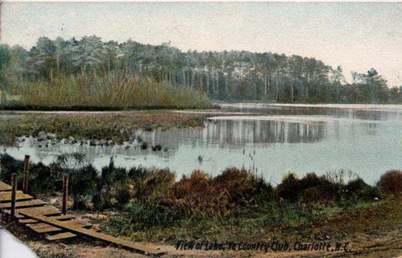
Charlotte Country Club began as The Mecklenburg Club in 1910. The first club was located west of the city, adjoining a pond on or near Stewart Creek. The activities of this early club were confined to card games, picnics, boating, and fishing. The name was changed to Charlotte Country Club in 1917. The club moved to its present location in the Plaza Midwood neighborhood in 1931.
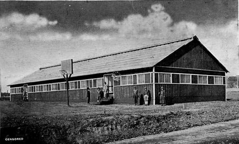
Camp Greene was a military base located near Charlotte during World War I. The camp included a hospital, library, a YMCA, and other buildings.
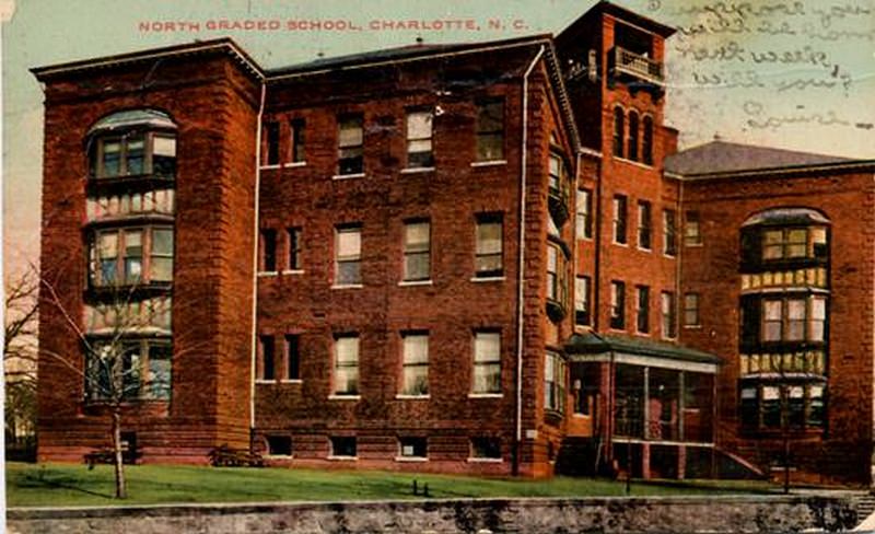
North Graded School was located at 9th and Brevard Streets. Frank P. Milburn of Washington, D.C. was the architect. The school opened in 1900.
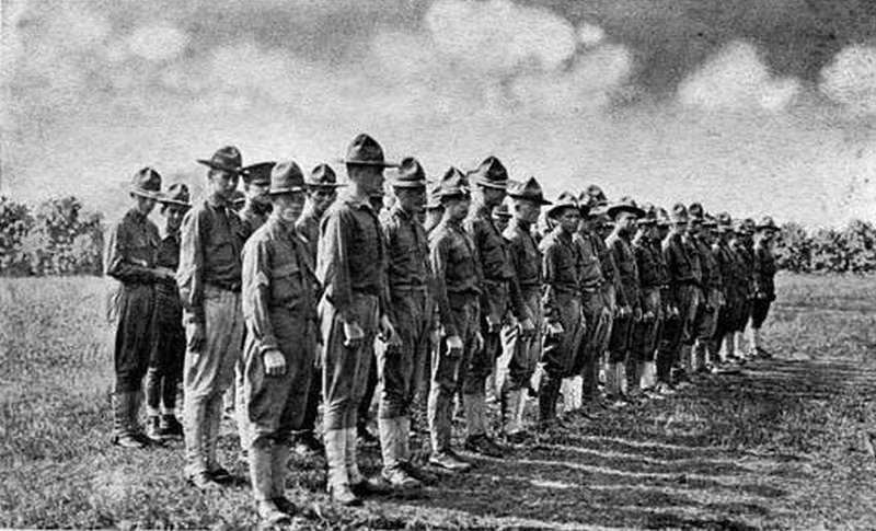
Soldiers standing at attention on Camp Greene Drill Field. Camp Greene was a World War I training facility in Charlotte, North Carolina.

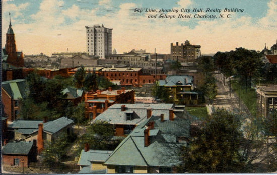
Skyline showing City Hall, Realty Building, and Selwyn Hotel, Charlotte, NC.
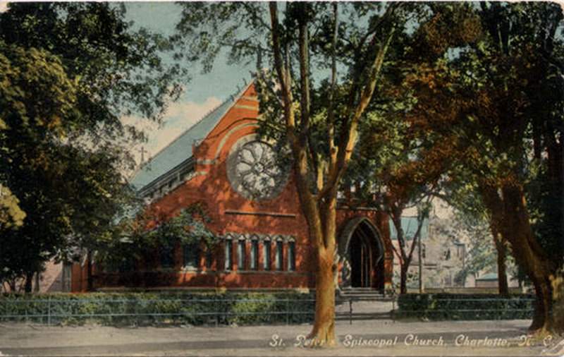
St. Peter’s Episcopal Church. This church is located in the 400 block of North Tryon and is the oldest Episcopal Church in Charlotte.
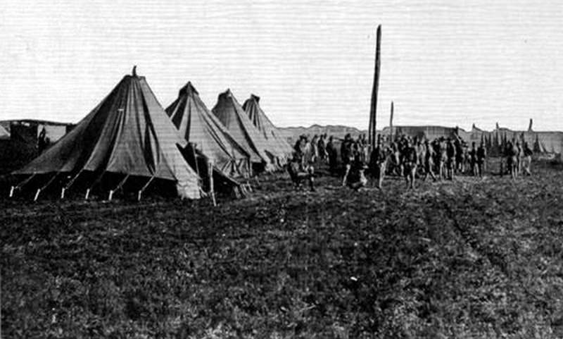
Scene at Camp Greene of men standing near their tents. Camp Greene was a World War I training base in Charlotte, North Carolina.
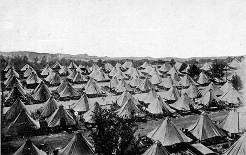
View from an airplane of Camp Greene. Camp Greene was a World War I training base in Charlotte, North Carolina.
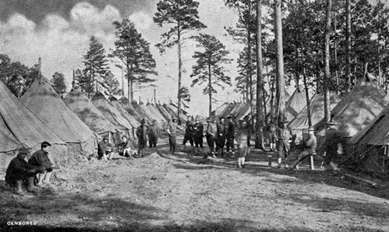
A Company Street. The Camp Greene, Charlotte, N.C. postcard is described as “censored.”
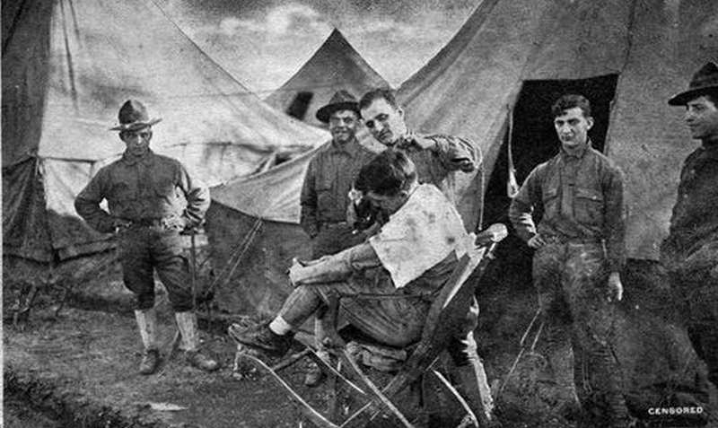
All the comforts of home at Camp Greene, Charlotte, NC. Postcard shows soldiers being shaved.
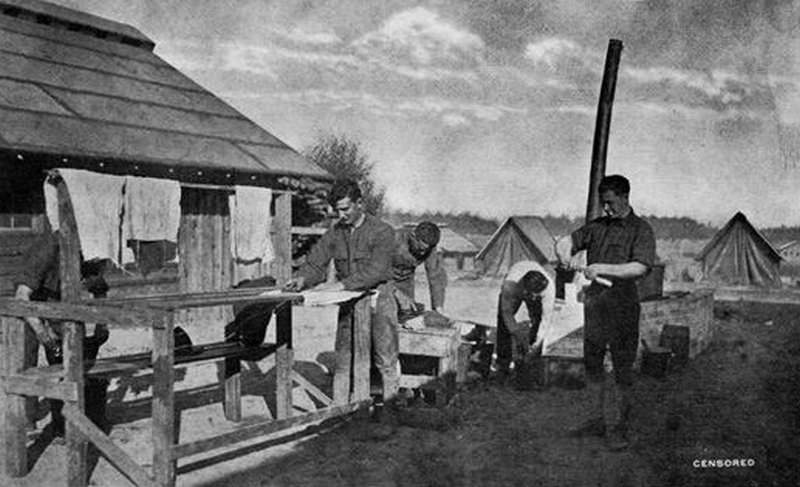
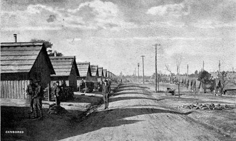
View of Regimental Street at Camp Greene, a World War I training camp located in Charlotte in 1918.
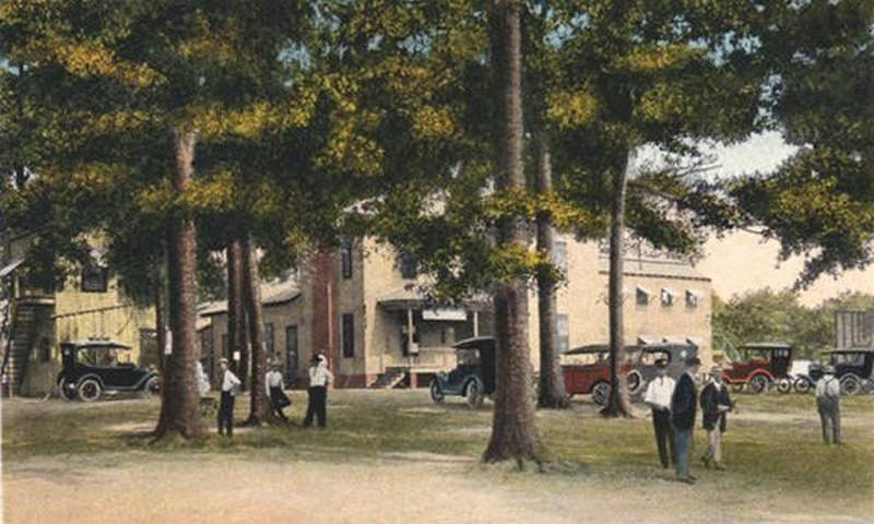
Built in 1879, this historic home was once at the center of a 250-acre farm. It was the childhood home of Willis Frank Dowd, founder of Charlotte Pipe and Foundry, and William Carey Dowd, former publisher of The Charlotte News. During World War I, the Dowd House was used as the headquarters for Camp Greene Army Training Base (1917–1919). Located at 2216 Monument Street, it is the oldest structure in West Charlotte and is now a museum. It is the only structure remaining from when the area was an Army training camp. The museum is located 1½ miles from Uptown Charlotte.
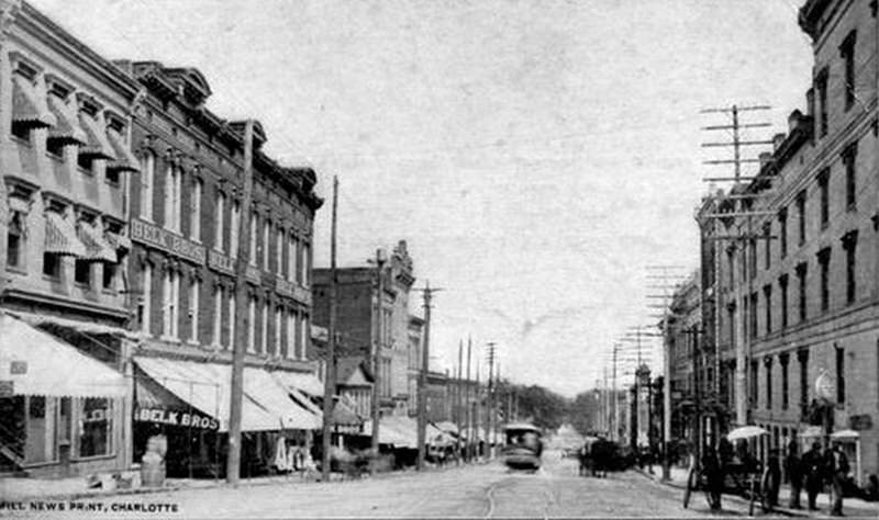
A view of East Trade Street with Belk Brothers on the left, a trolley in the middle, and a horse and carriage on the right. Physical Description: 3×5 black and white. Publisher: Stone and Barringer Publishers.
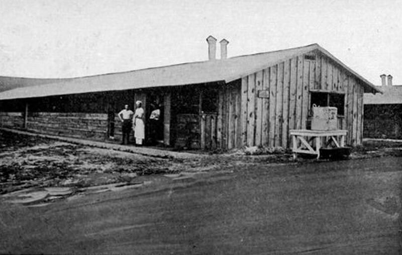
Company Mess Hall at Camp Greene with three soldiers, including one of the cooks.
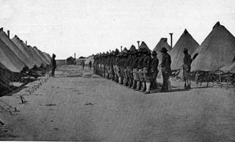
Men standing at attention for inspection in front of their tents at Camp Greene.
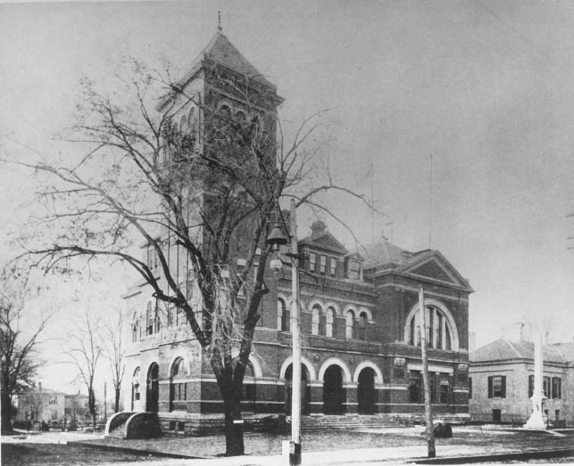
Between 1875 and 1917, the United States Post Office in Charlotte was located at West Trade and Mint Streets. A portion of the Charlotte Branch of the United States Mint is visible on the right side of the photograph.
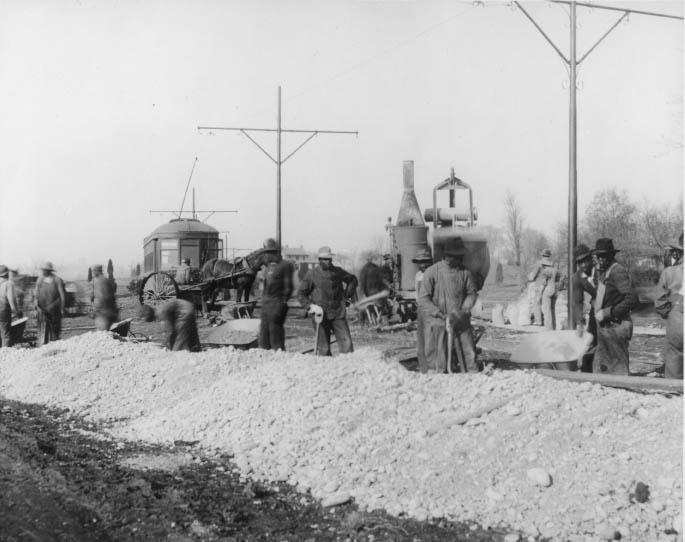
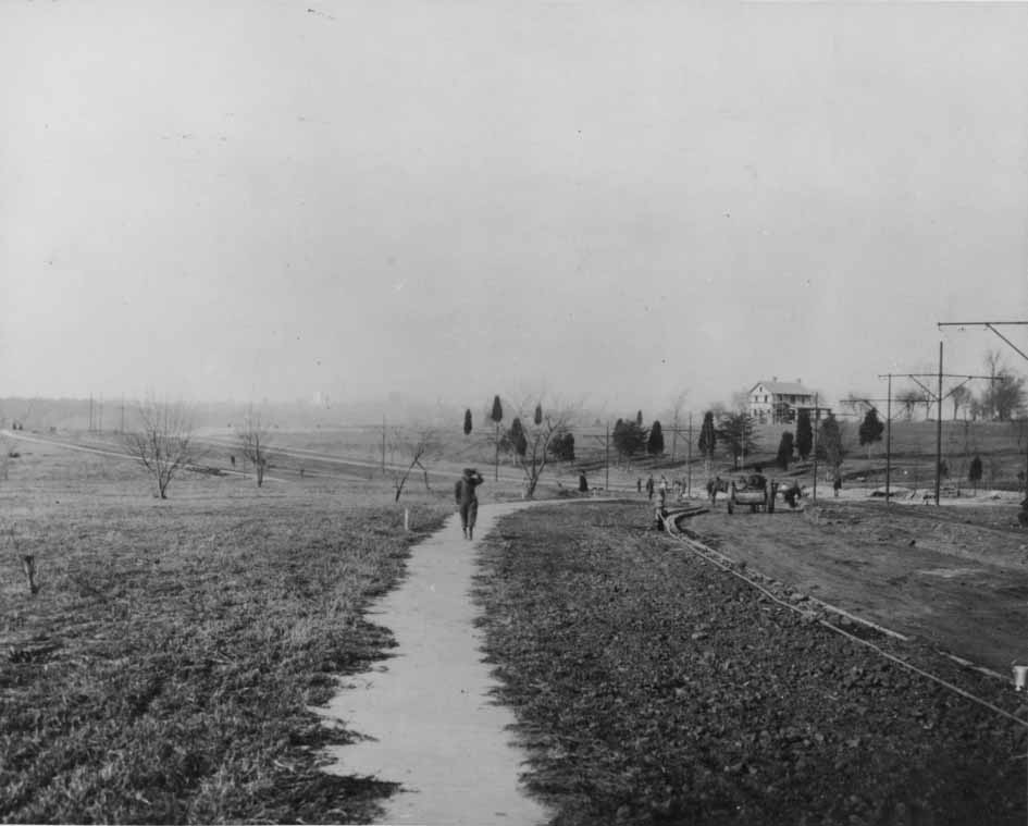
Workmen for the George Stephens Company constructing a roadbed. The streetcar that traveled from uptown Charlotte to Myers Park is in the background.
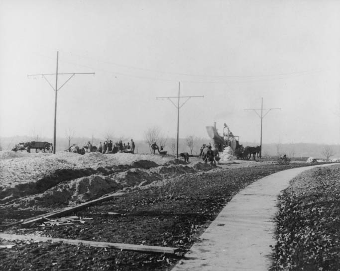
Employees of the George Stephens Company laying the tracks for the streetcars that would travel from uptown Charlotte to Myers Park.
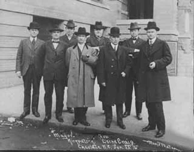
Charlotte Mayor T.L. Kirkpatrick (1877–1946) with North Carolina Governor Locke Craig (1860–1924) posed for this photograph on January 25, 1916. From left to right: Thomas L. Black (1863–1934), Justice Heriot Clarkson (1863–1942), Edmund Randolph Preston (1880–1957), Mayor Kirkpatrick, Dr. John Q. Myers (1877–1944), Governor Craig, Captain John A. Parker, and Paul Cameron Whitlock (1878–1959).
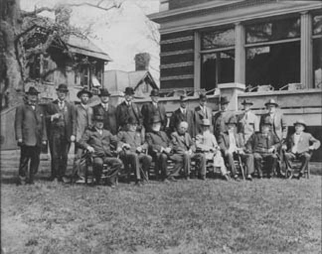
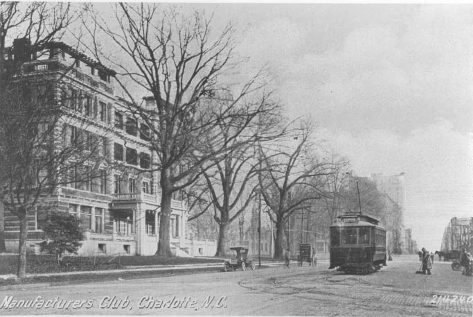
The NC State Society of the Cincinnati convened in Charlotte at the Southern Manufacturer’s Club on April 15, 1916. Sitting: Commodore W.S. Hogg, USN, Washington, DC; Brig. General Charles L. Davis, USA, Schenectady, NY; Rt. Rev. Joseph Blount Cheshire, Raleigh; Hon. Wilson G. Lamb, President of the Society; Maj. Wm. A. Smith, Ansonville; Dr. S. Westray Battle, USN retired, Asheville; Colonel Benehan Cameron, Stagville; F. Brevard McDowell, Charlotte. Standing: Heriot Clarkson, Charlotte; DeLancey Haywood, Raleigh; B.D. Nelme, Ansonville; Walter W. Watt, Charlotte; James Alson Cabell, Columbia, VA; W. Hall Harris, Baltimore, MD; Wm. E. Bush, Baltimore, MD; W.D. Carstarphen, Plymouth, MA; John Bradley Lord, Brooklyn, NY; Dr. Nelson Ferebee, USN, Oxford, NC.
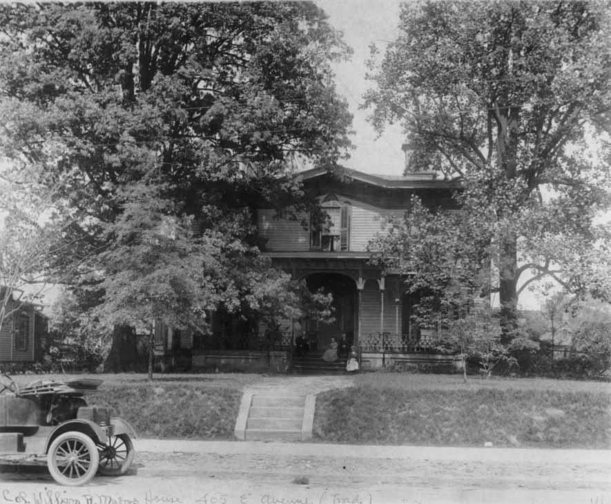
Home of Captain William R. Myers at 802 East Avenue.
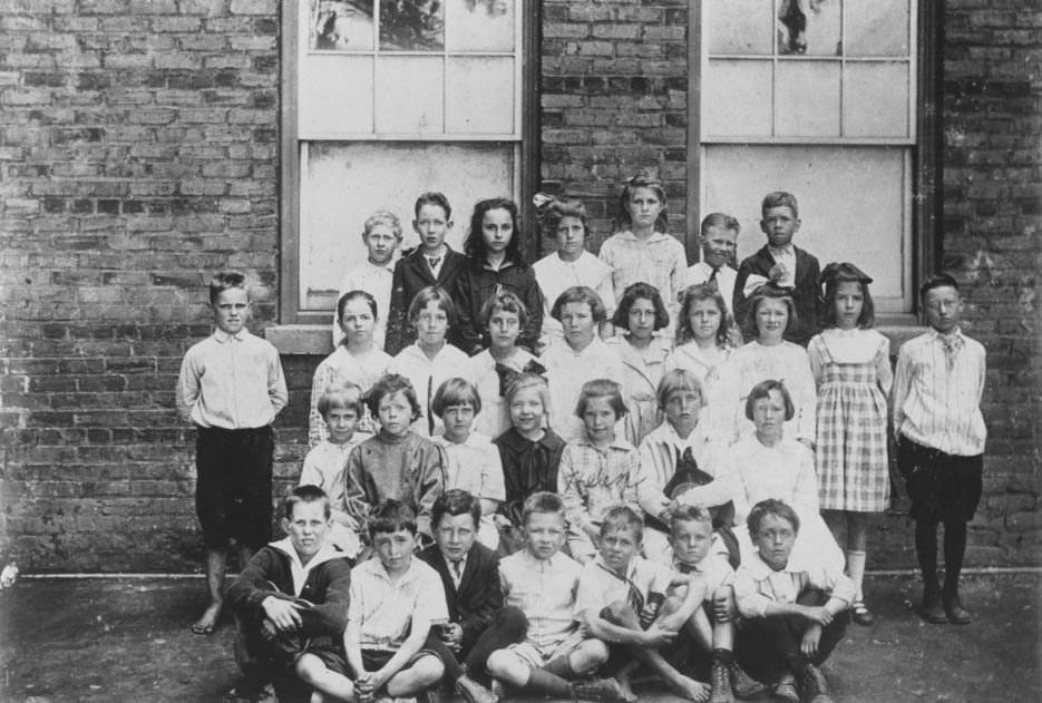
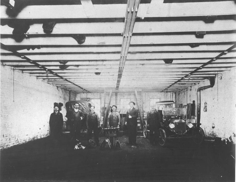
The interior of Doc Crowell’s Garage, which was located on the 200 block of North College Street.
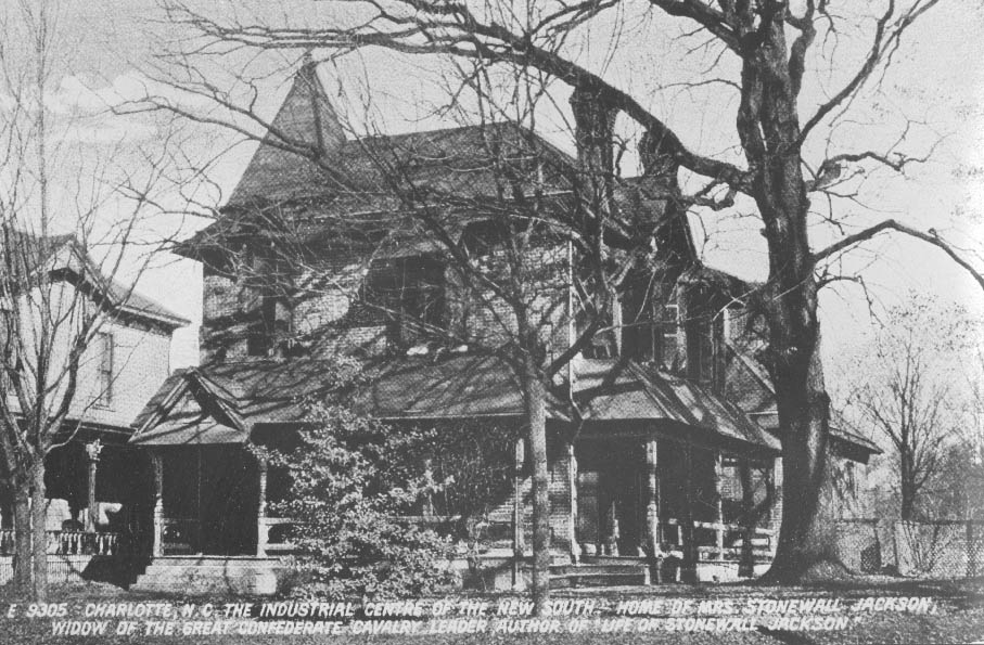
The residence of Anna Morrison Jackson on the north side of West Trade Street near the intersection with Mint Street. She was the widow of General Stonewall Jackson. This print was taken from a 1911 postcard.
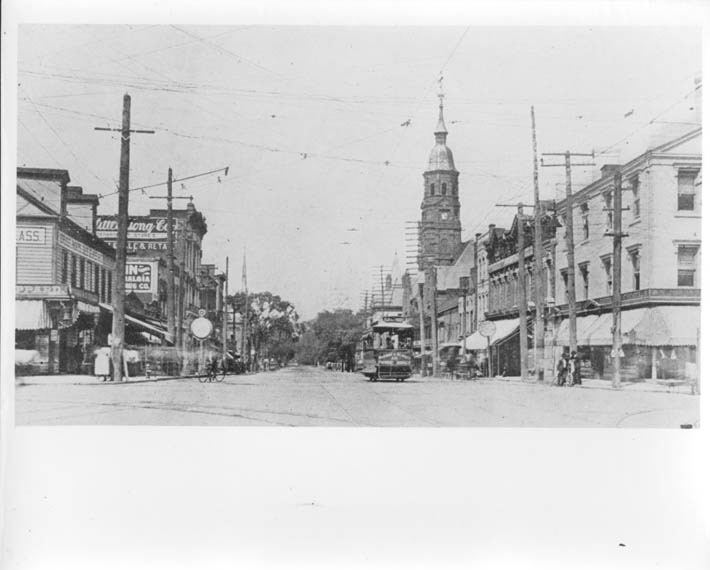
A view of North Tryon Street with local businesses and City Hall visible. A trolley can be seen on the right-hand side of the photograph.
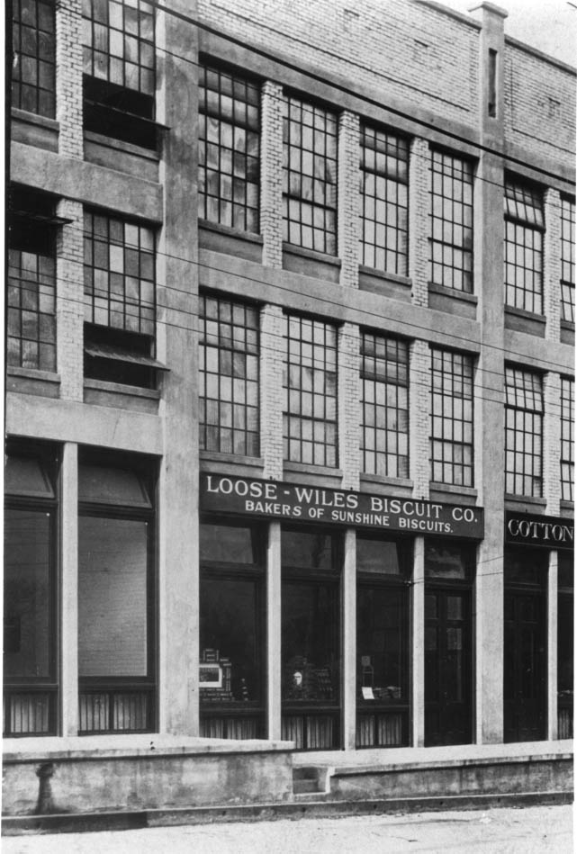
The Loose-Wiles Biscuit Company offices in the Old Merchandising Row at 212 West First Street. It opened in 1915 under George L. Sibley. He was later president of the Union National Bank and the first chairman of the Charlotte Planning Commission.
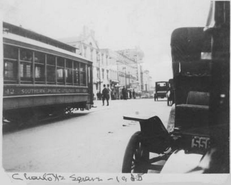
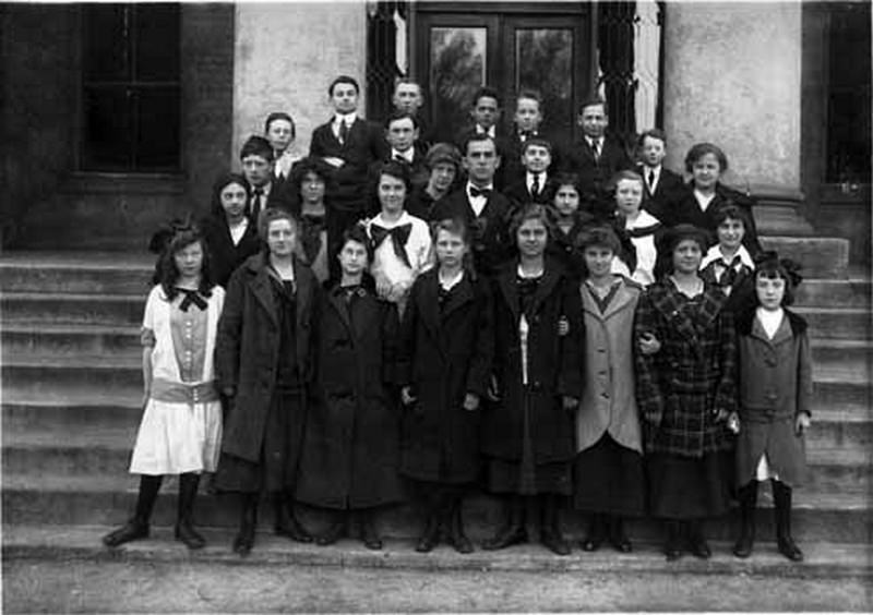
The 1915 7th grade class of College Street Elementary School. The school was located at 600–606 North College Street.
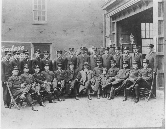
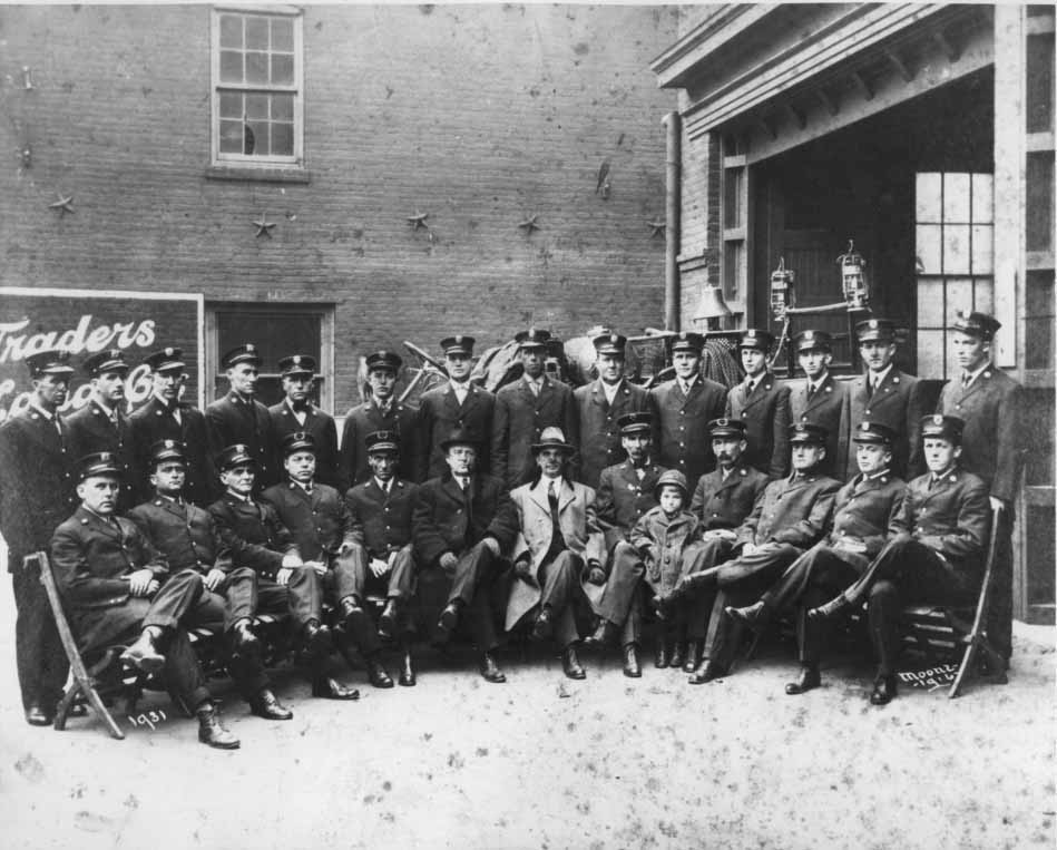
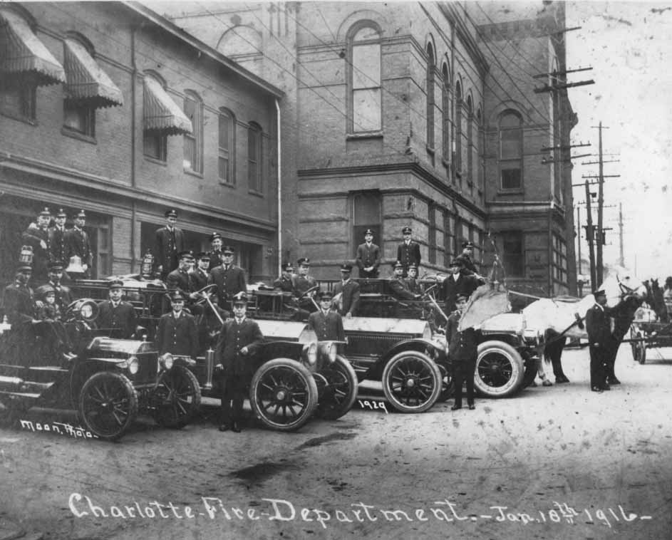
Charlotte Firemen pose for a photograph in front of the Fifth Street Firehouse, which was behind City Hall on North Tryon Street. In the center is J.A. Jones (the gentleman in the dark coat), a local contractor and fire commissioner. The man in the light coat is Mayor Frank McNinch.
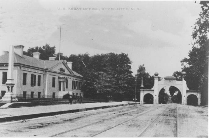
A view of West Trade Street past the US Mint toward Graham Street. The gateway to the city is on the right and marked that side of the city. The Southern Railroad Passenger Terminal was beyond the gateway.
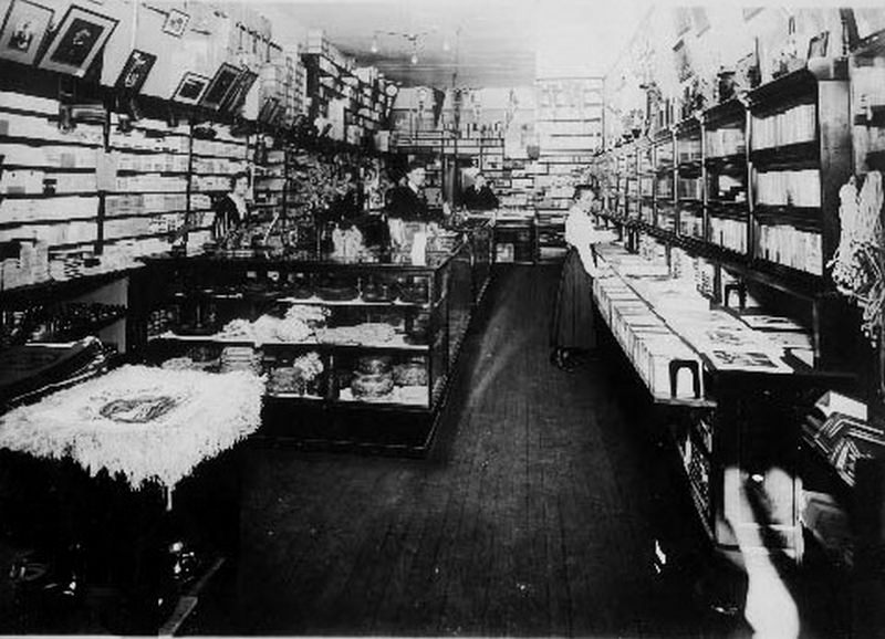
Herbert V. Brockman opened Brockman’s Bookstore in May of 1915. It was first located in the Piedmont Building, but moved to South Tryon Street in May of 1927.
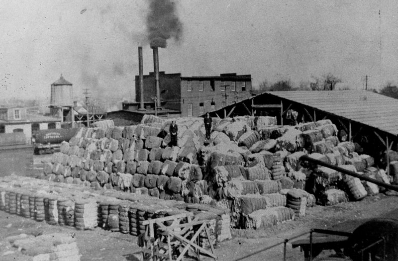
The Southern Cotton Oil Company was located on South Tryon Street at Worthington Avenue. On the back of the photo, information indicates the cotton in the foreground burned at some point.
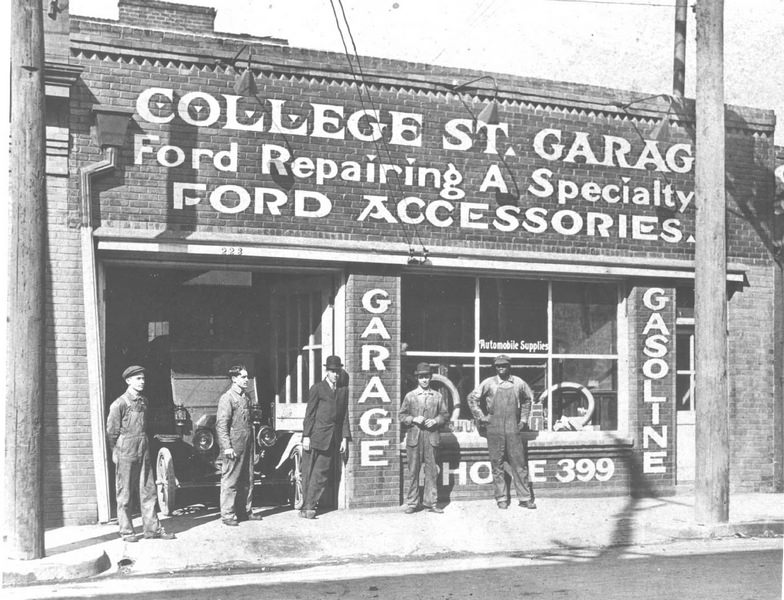
The College Street, or Doc Crowell’s Garage, at 223 College Street. It was the first Ford garage in Charlotte.
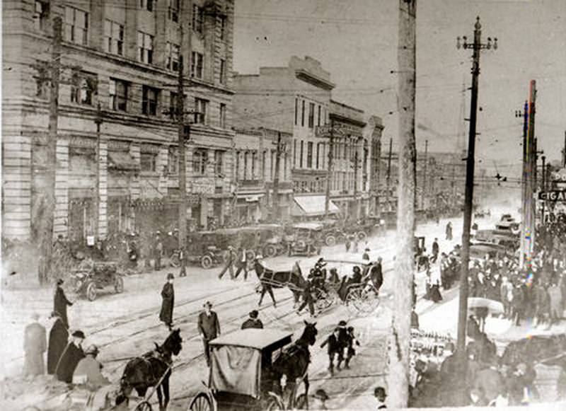
A street life scene in uptown Charlotte along North Tryon Street. The image shows great detail regarding transportation, dress, and names of local businesses.
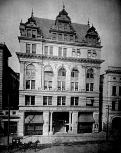
The Trust Building on South Tryon Street housed the Charlotte Opera House (1902–1922) on the first floor. A number of other businesses had offices in the Trust Building, including Southern Power Company.
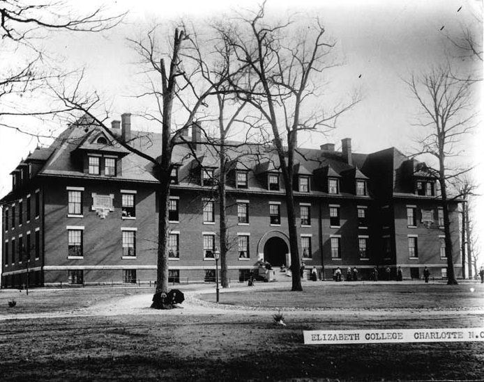
Outdoor scene of Elizabeth College with young ladies on the campus. Elizabeth College was an all-girls school located at the intersection of Elizabeth Avenue and Hawthorne Lane. Today it is the site of Presbyterian Hospital.
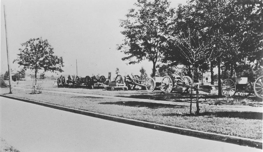
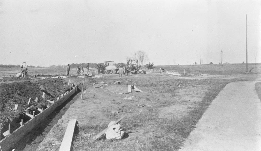
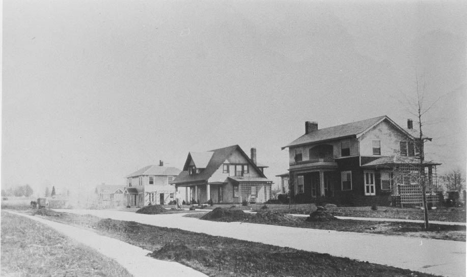
Wagons hauling materials to the Myers Park construction site. Myers Park is one of Charlotte’s oldest neighborhoods. George Stephens played an important role in the development of Myers Park in the early part of the twentieth century. The land was owned by Stephens’s father-in-law, J.S. Myers. Originally a suburb of Charlotte, the area quickly became the site of notable examples of American architecture. Landscape architect John Nolen and his assistant Earle Draper designed the curving, tree-lined streets. This collection shows the area under construction, as well as the planting of full-grown trees.
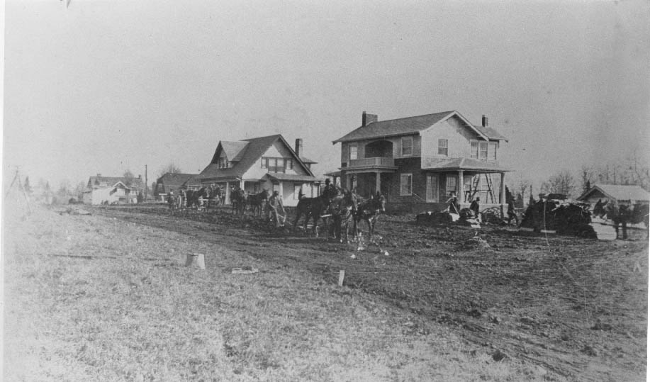
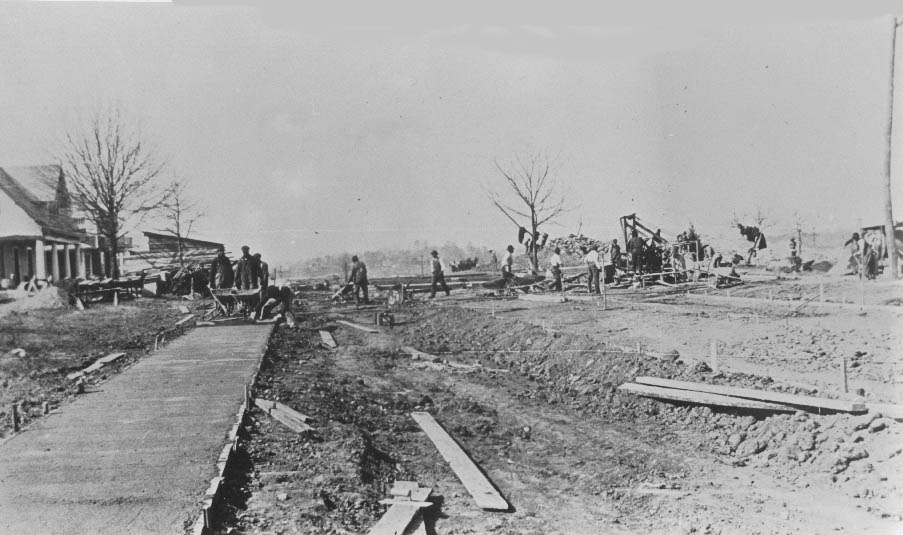
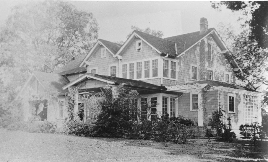
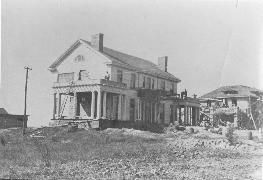
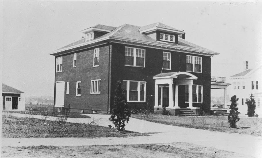
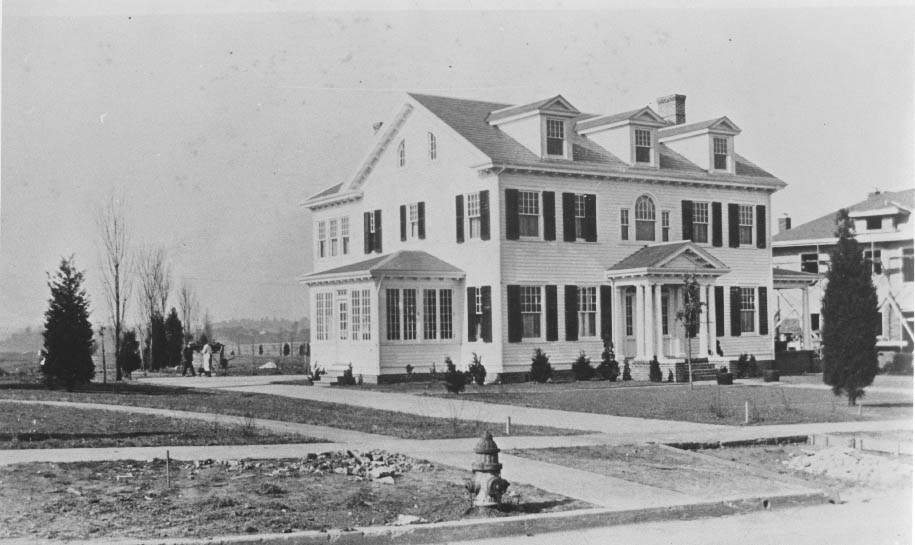
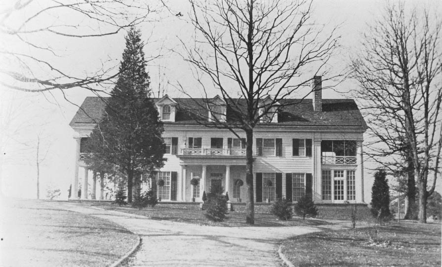
Originally built by Z.V. Taylor around 1911, the house at 400 Hermitage Road later became the residence of James B. Duke. He renovated the house and changed the name of the mansion to White Oaks in the early 1920s.
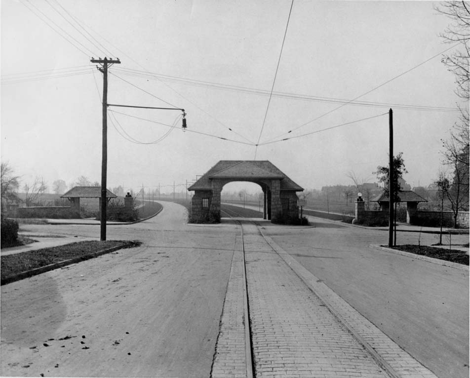
The trolley entrance gate to Myers Park was located at Fourth and Queens Road. The main gate is gone, but the side shelters remain. Designed by John Nolen and built by the Stephens Company of Winnsboro, South Carolina, the structure is made entirely of granite.
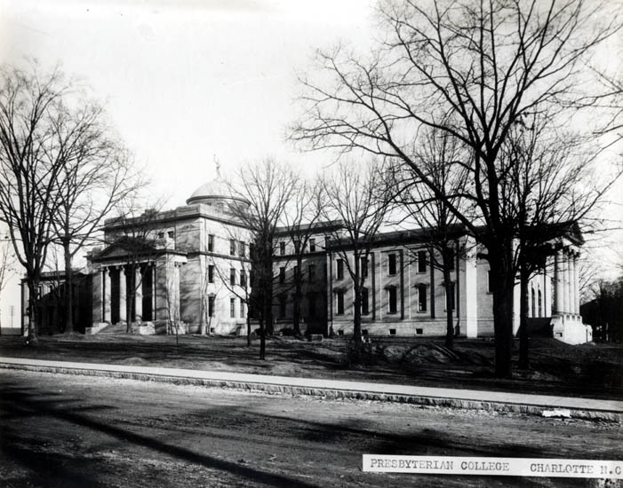
Presbyterian College was the precursor to Queens College. This building was located on the corner of College and Ninth Streets. When the school changed its name to Queens, the school moved to the Myers Park area.
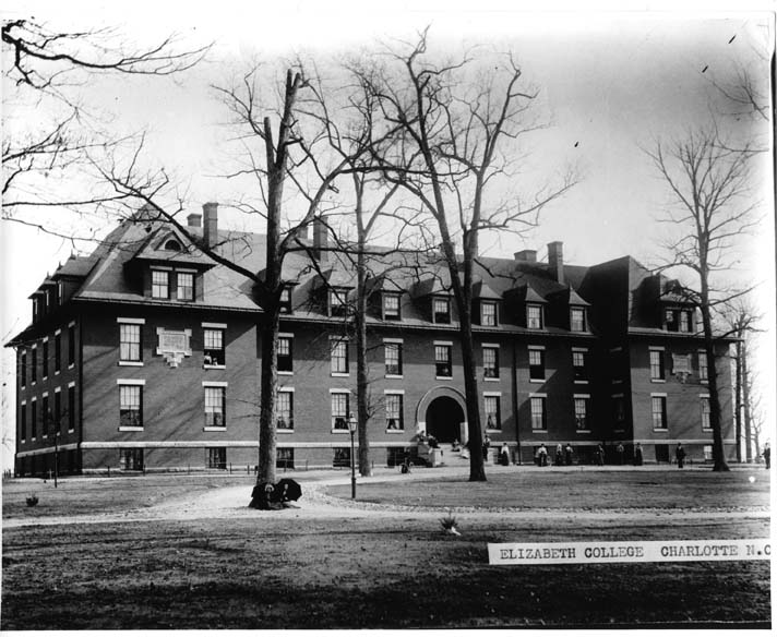
Outdoor scene of Elizabeth College with young ladies on the campus. Same as H.1999.01.082.19, but much clearer. Elizabeth College was an all-girls school located at the intersection of Elizabeth Avenue and Hawthorne Lane.
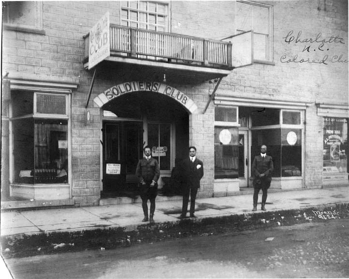
Photo from an outside street view of the Red Circle Club in Charlotte, North Carolina. The Red Circle Club was a place for Black soldiers to gather and relax away from Camp Greene, a World War I cantonment camp near Charlotte. The photo features three African American men — two soldiers and a civilian — standing in front of the club.
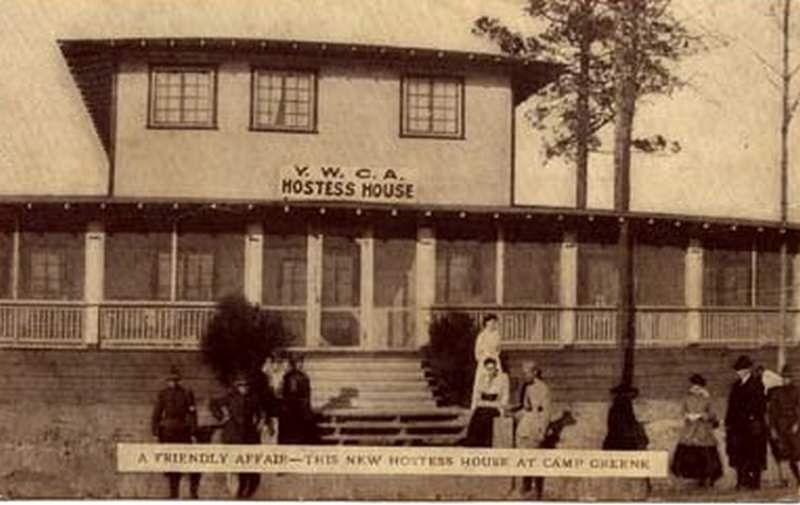
The YWCA established a facility at Camp Greene during World War I. Organized sports activities were available. The Hostess House allowed soldiers to entertain visiting family members and write letters home using YMCA stationery.
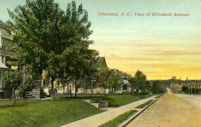
Driving down East Trade Street, the name changes to Elizabeth Avenue once crossing Kings Drive. Once lined with houses, the area has changed since the late 1920s.
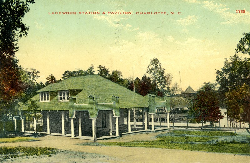
The Lakewood Station and Pavilion opened in July of 1909. Built by the Four C’s, the park expanded over time to include a rollercoaster, a merry-go-round, and other amusement rides, as well as exotic animals and a large garden. Located in West Charlotte, visitors could take a trolley to the park to enjoy a boat ride on the lake or a dance in the pavilion. During the Great Depression, the park fell into disrepair, and a flood caused the dam to burst and the lake to disappear. The remaining buildings were eventually demolished.
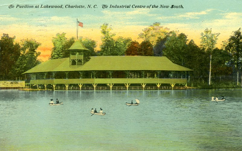
The Lakewood Pavilion opened in July of 1909. Built by the Four C’s, the park expanded over time to include a rollercoaster, a merry-go-round, and other amusement rides, as well as exotic animals and a large garden. Located in West Charlotte, visitors could take a trolley to the park to enjoy a boat ride on the lake or a dance in the pavilion. During the Great Depression, the park fell into disrepair, and a flood caused the dam to burst and the lake to disappear. The remaining buildings were eventually demolished.
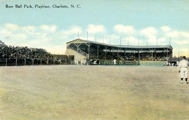
Baseball was the most popular sport in Charlotte as well as the United States at the beginning of the 1900s. In Dilworth, there were at least three ball fields. In 1902, the Four C’s granted a 10-year lease for the fairgrounds and the baseball field seen here. Located on the far end of East Boulevard, maps suggest home plate was east of Lennox Avenue. The park extended from near East Boulevard to Lennox Avenue.

Amazing photos thanks for sharing! I’m a Charlotte Native and have always been very interested in local history, I haven’t seen a lot of these.
I’d give anything to be able to travel back in time and drive around Charlotte.
Some cool photos, no doubt, but some of the dates are completely mislabeled.
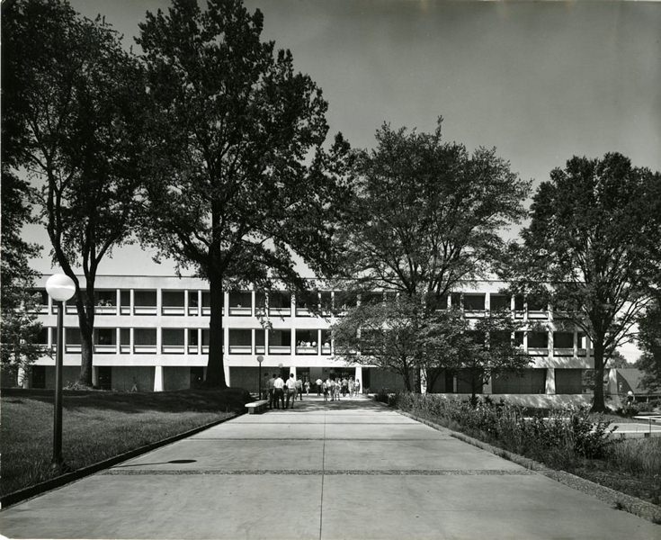
Some cool photos, no doubt, but some of the dates are completely mislabeled. Like the one showing a sign for CPCC (which wasn’t founded until 1963) or the Van Every Building, which looks way too modern for the 1910s.