On the evening of November 9, 1872, a fire broke out at the corner of Kingston and Summer Streets in Boston’s bustling commercial district. By the time the first alarm rang, the building was already fully engulfed. What followed was one of the most destructive urban fires in American history. Over the next 12 hours, the blaze tore through roughly 65 acres of downtown Boston, destroyed 776 buildings, gutted much of the financial district, and caused $73.5 million in damage. Thirty people died, among them 12 firefighters.
The fire started in a building used to store dry goods for nearby retail shops. Inside, bins of fabric and other flammable materials filled the floors. When flames reached the building’s wooden elevator shaft at the center, the fire climbed instantly from floor to floor. Within minutes, every level of the structure was ablaze, and burning embers were already jumping to neighboring rooftops.
Boston’s building codes at the time were weak and largely ignored. Structures were packed tightly together, often built from wood and other combustible materials, and routinely taller than the reach of the fire department’s equipment. Warehouse owners made the problem worse by storing unsold goods in attics and under roof eaves — items kept off the books to avoid taxes — which created dense pockets of fuel throughout the district. The city’s narrow, winding streets added yet another obstacle, making it nearly impossible for the heavy fire engines to move quickly.
One factor that crippled the fire response more than any other was a widespread equine flu outbreak sweeping across the northeastern United States that fall. Fire departments depended on horses to haul their heavy steam engines through the streets. With so many horses sick or dead, firefighters were forced to pull the equipment themselves. By the time crews reached the burning buildings, they were already exhausted.
Boston had installed a fire alarm system in 1852, but it failed the city on the night of the fire. Because false alarms had become a recurring nuisance, the alarm boxes were locked. Only a small number of trusted residents in each neighborhood held keys. When the fire broke out, many of those key holders could not be located in time, delaying the alarm and giving the fire precious extra minutes to grow.
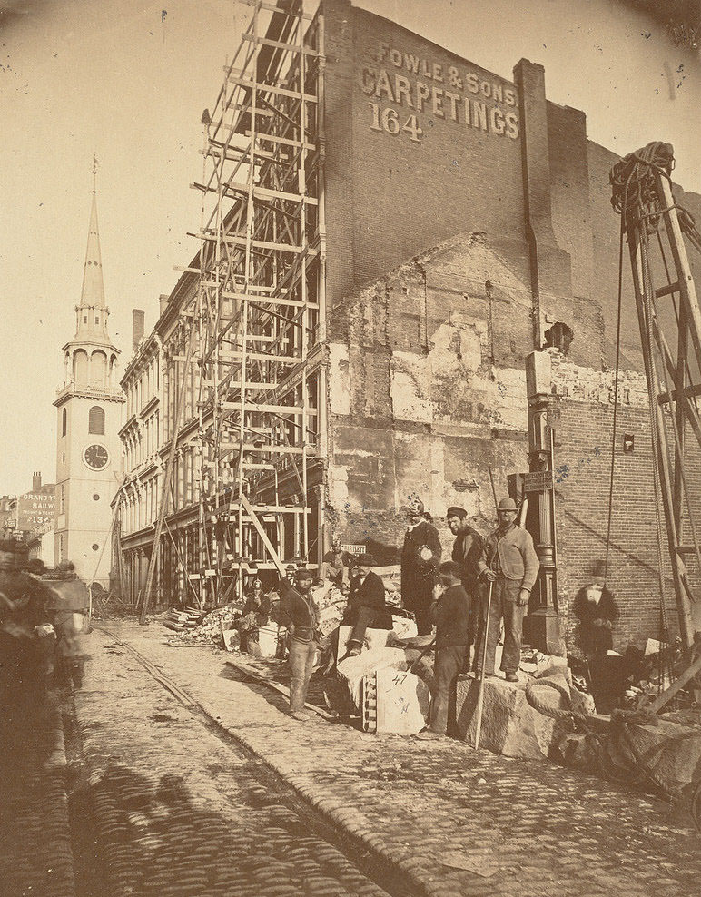
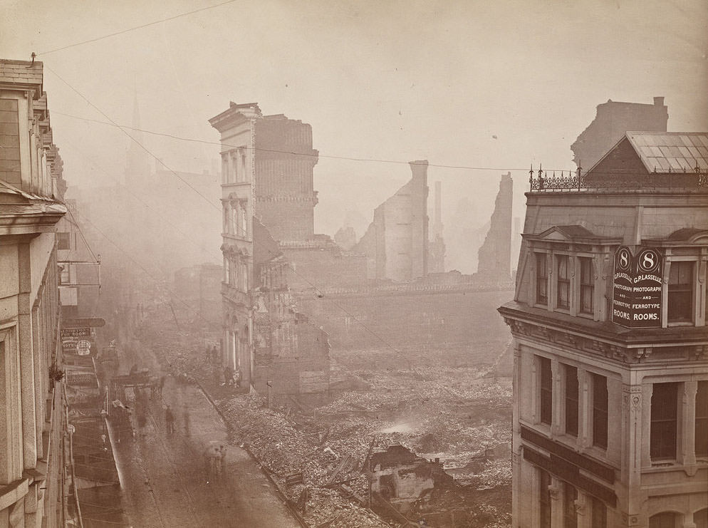
Fire Chief John Damrell called for reinforcements from surrounding towns as the fire spread from rooftop to rooftop. Crews arrived from across the region, but the combination of jammed streets, burned-out equipment, and sheer scale of the blaze made coordination extremely difficult. The fire was not brought under control until roughly 7:00 a.m. on November 10.
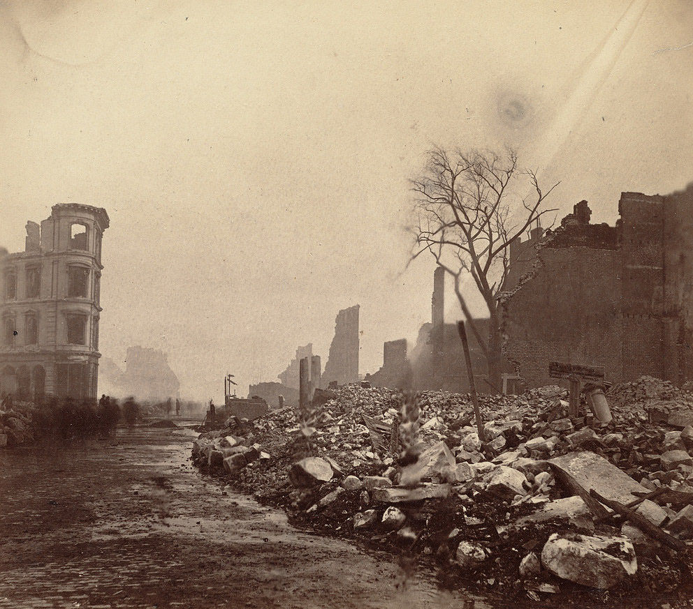
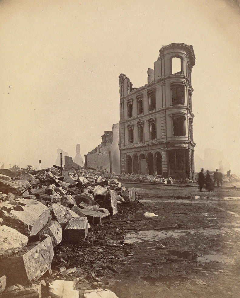
While firefighters battled the blaze, the streets of Boston filled with people. Because the affected area was almost entirely commercial rather than residential, spectators poured in from surrounding neighborhoods to watch. Estimates put the crowd at more than 100,000. Building owners rushed in to retrieve whatever valuables they could, and looters followed close behind, picking through whatever was left. Firefighters had to simultaneously fight the fire and manage the massive, chaotic crowds pressing in on all sides.
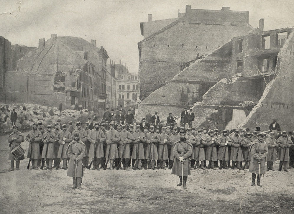
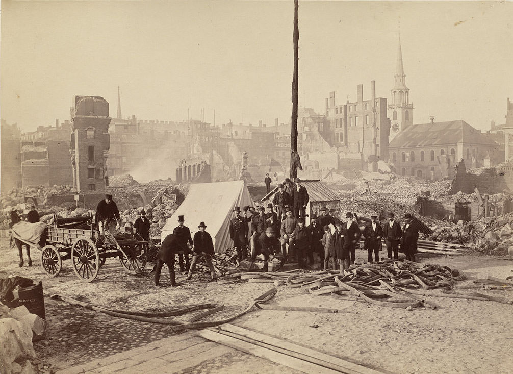
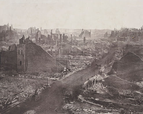
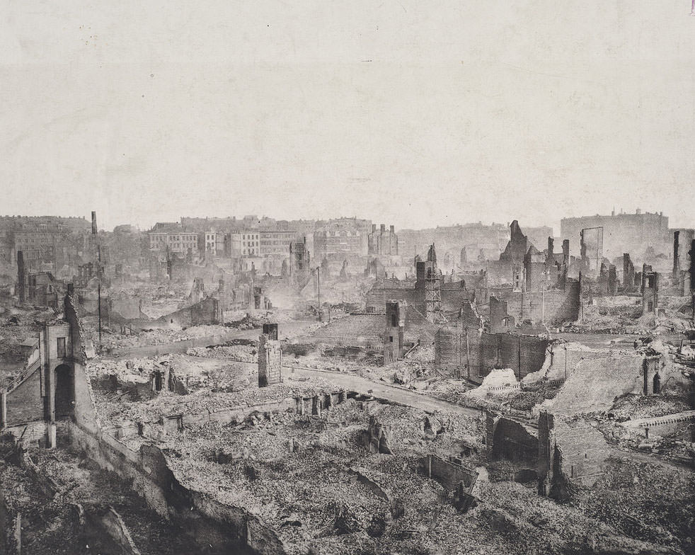
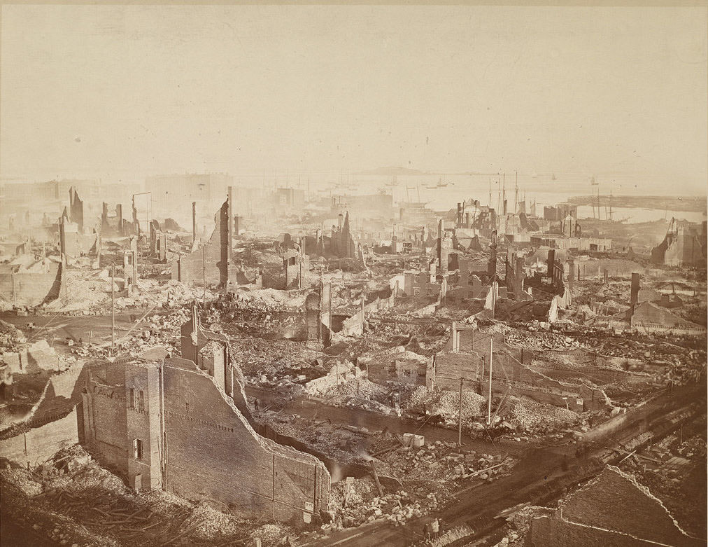
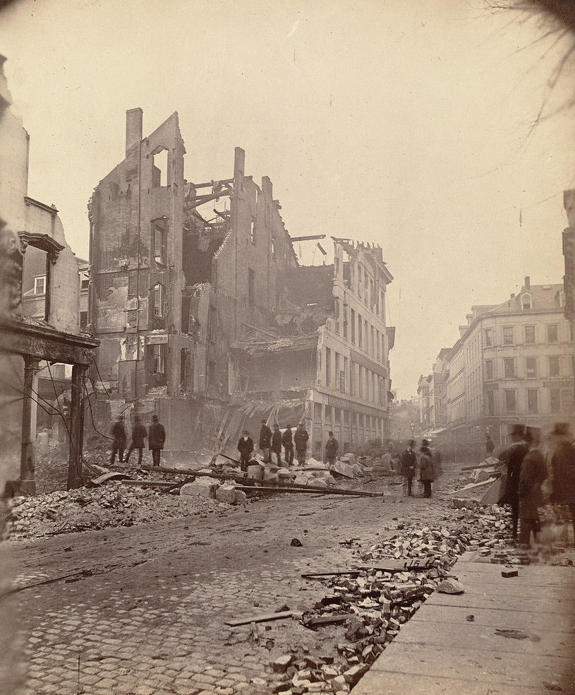
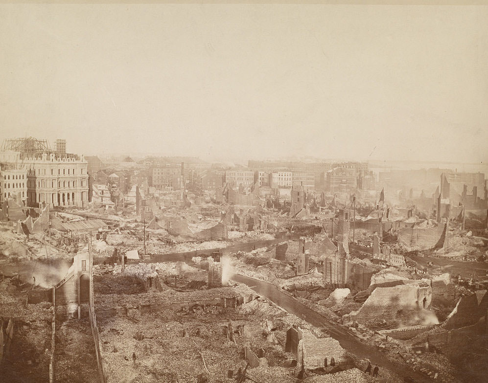
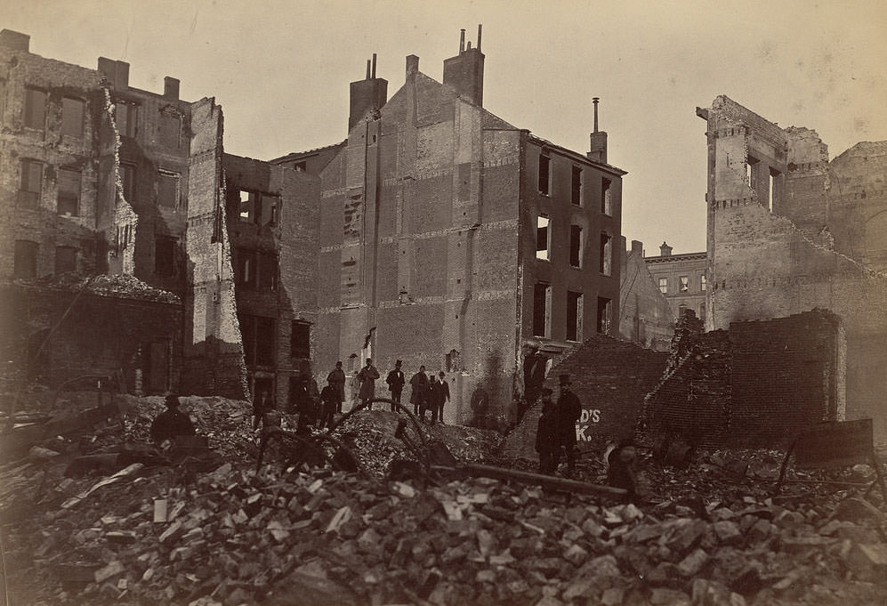
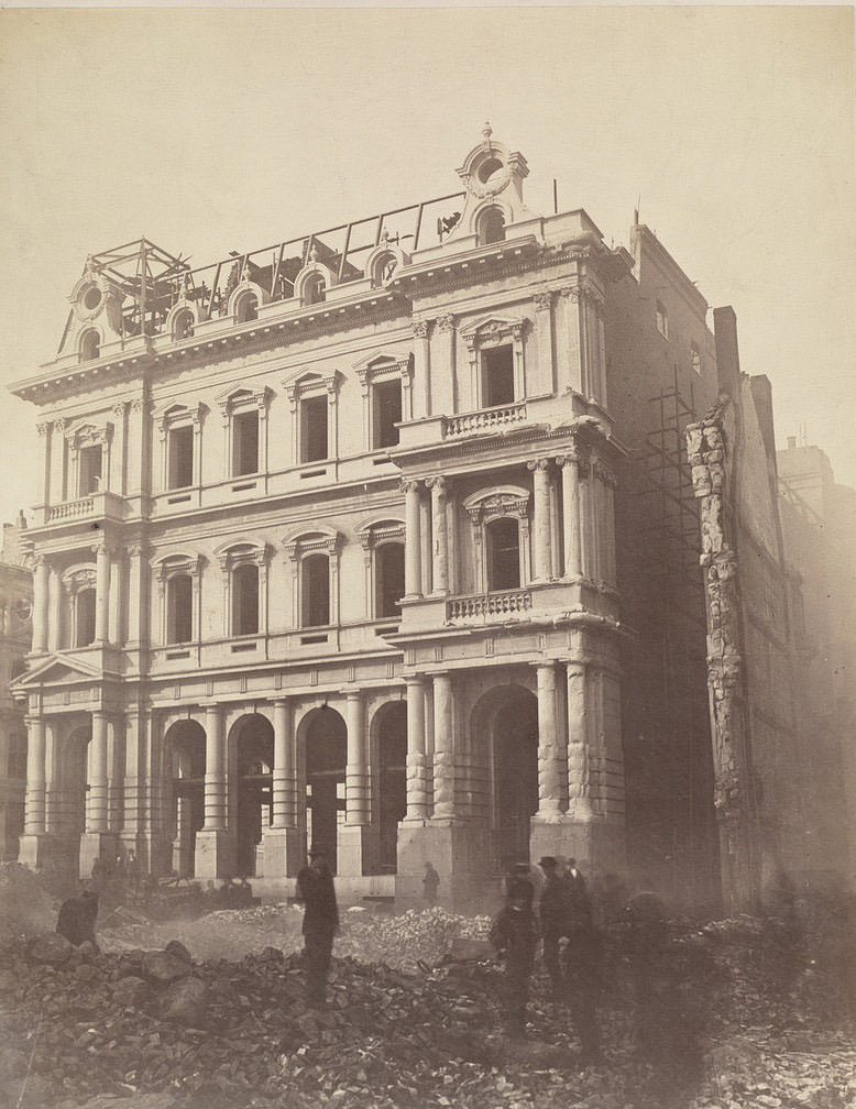
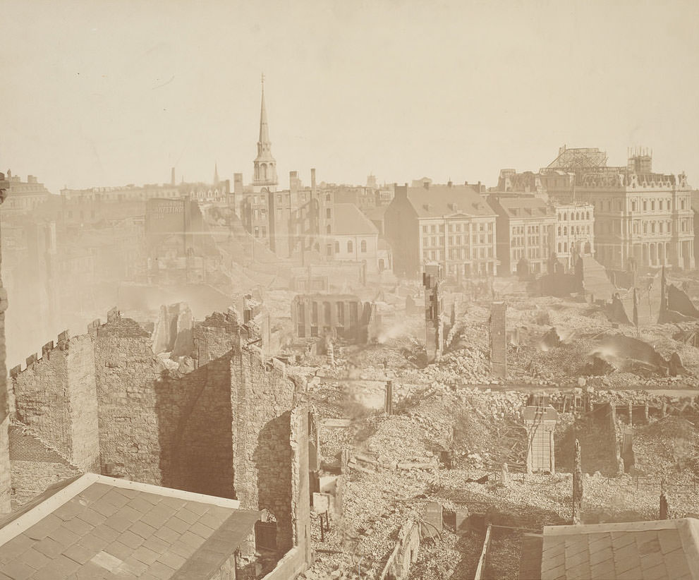
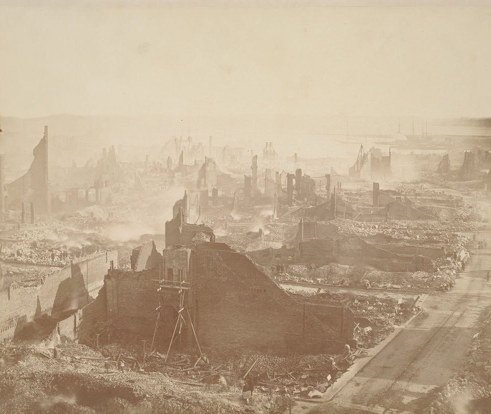
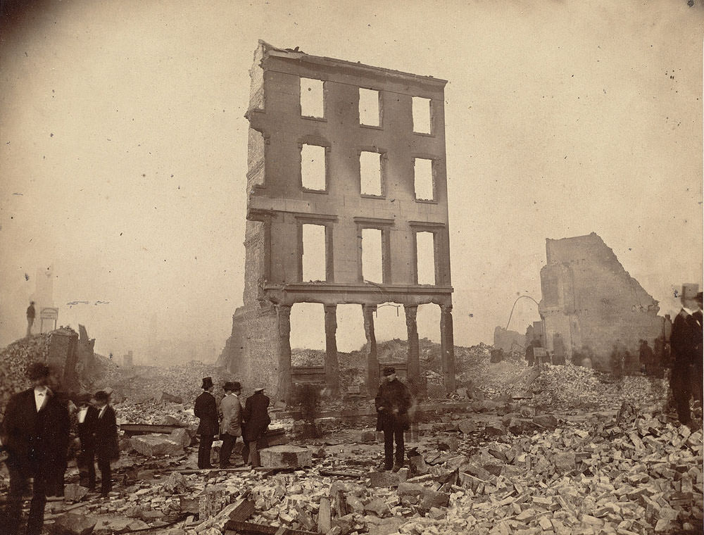
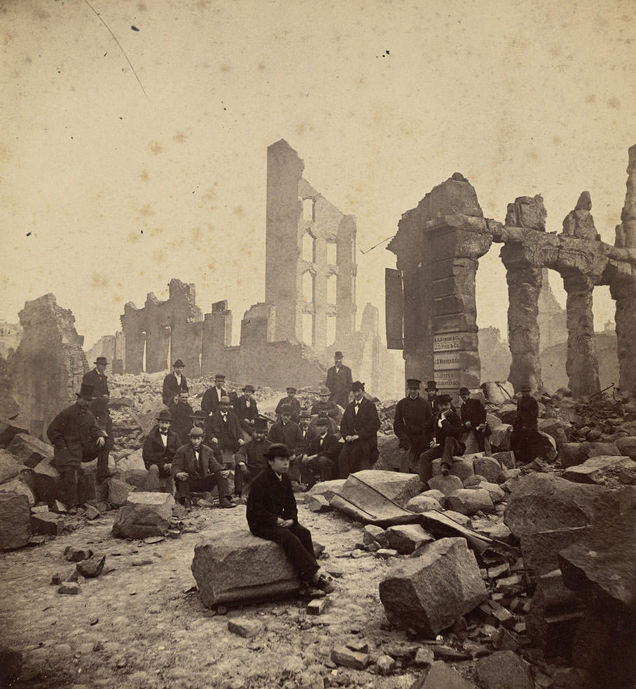
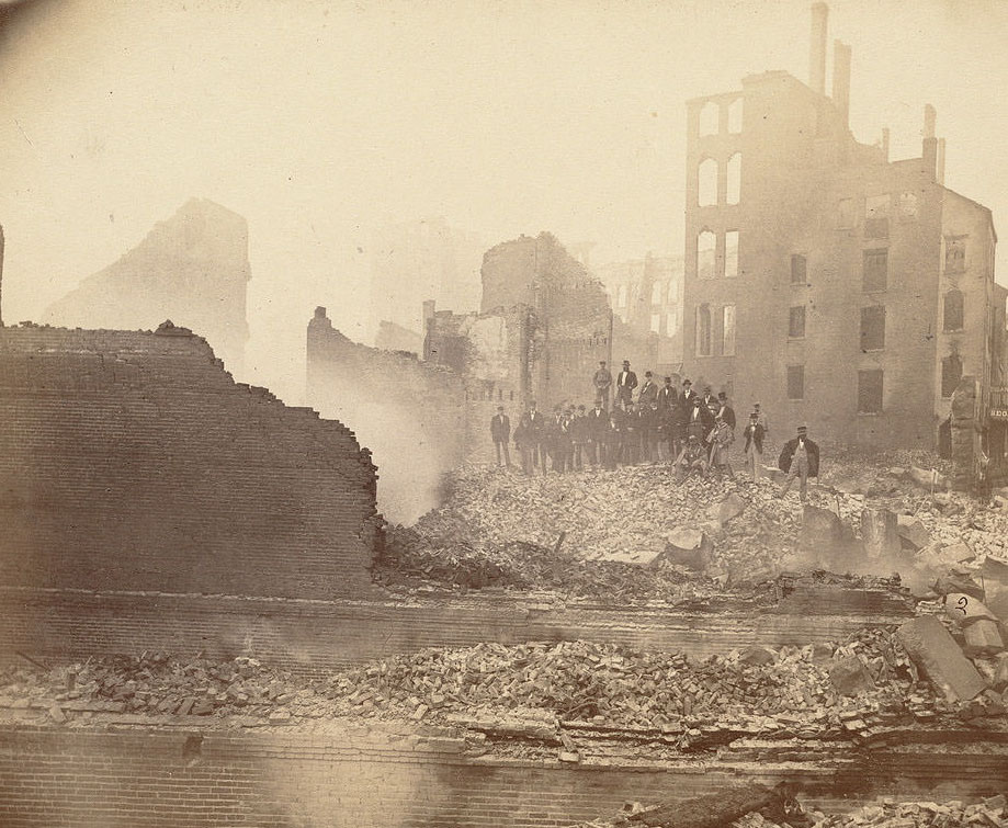
The photographs taken in the days after the fire document a district reduced almost entirely to standing walls and rubble. Entire city blocks that had held warehouses, banks, and commercial buildings were stripped bare. The images below capture the scale of what was lost across dozens of streets and landmarks throughout downtown Boston.
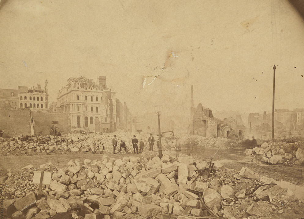
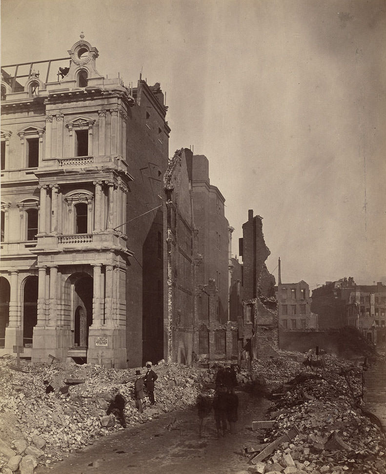
The post office and its surrounding blocks were among the most photographed sites in the aftermath. Located along Milk Street, the building had stood as a prominent structure in the heart of the commercial district. The photos from multiple angles show how thoroughly the fire altered the landscape around it, leaving familiar landmarks isolated amid wide fields of wreckage.
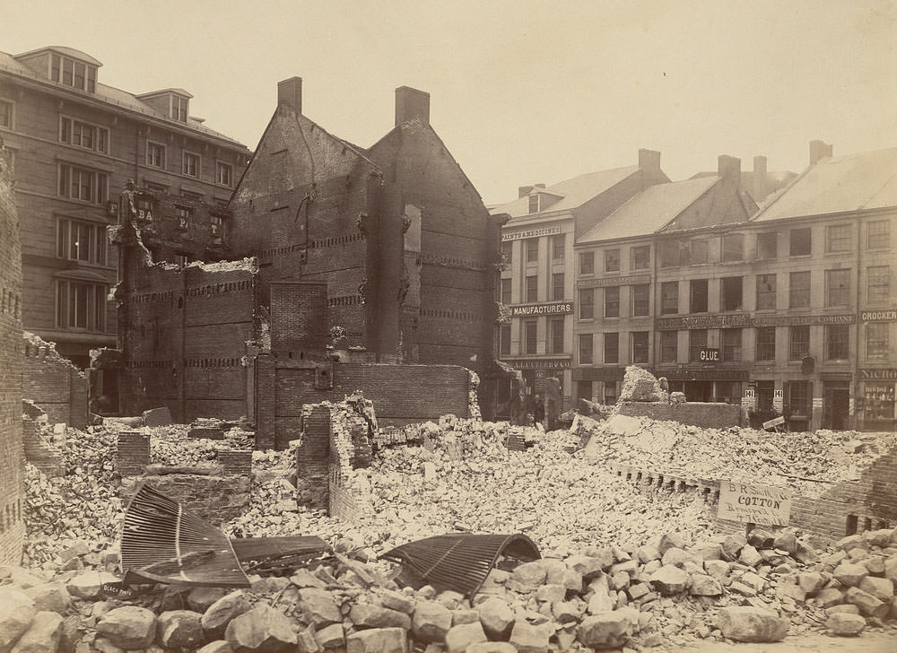
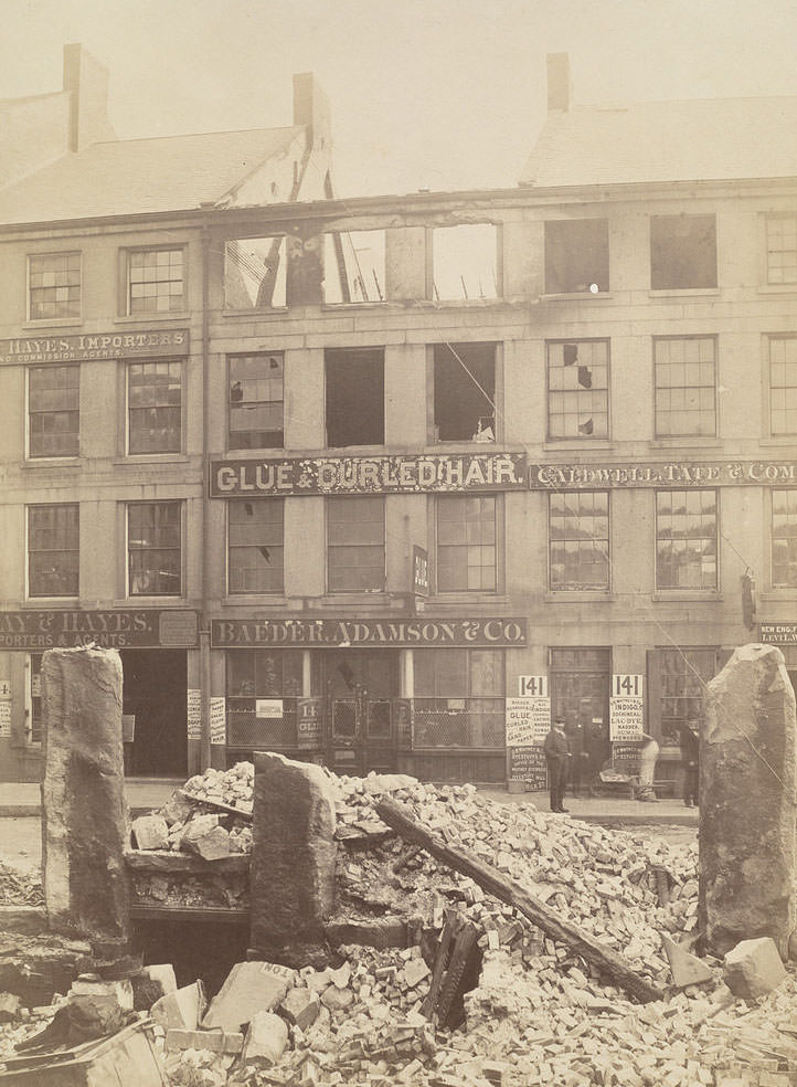
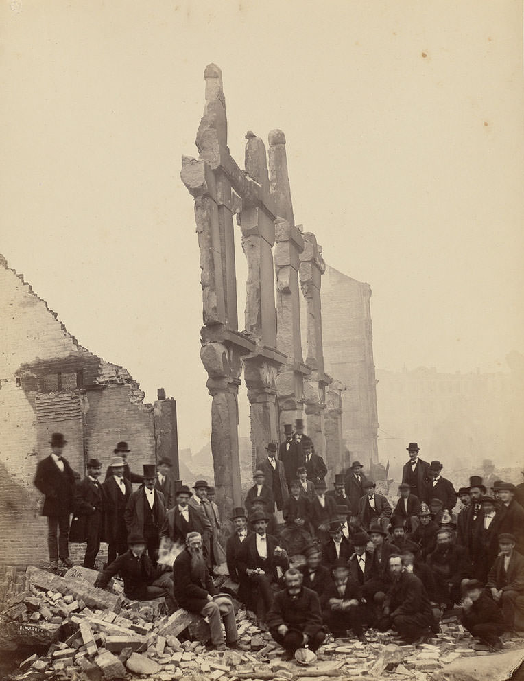
Milk Street marked one of the clearest boundaries between what the fire consumed and what it spared. Photographs taken along its length show the sharp contrast between standing structures at the edge of the burn zone and the flattened ruins just beyond. The street became a reference point for understanding exactly how far the fire had reached.
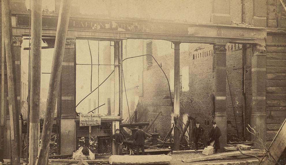
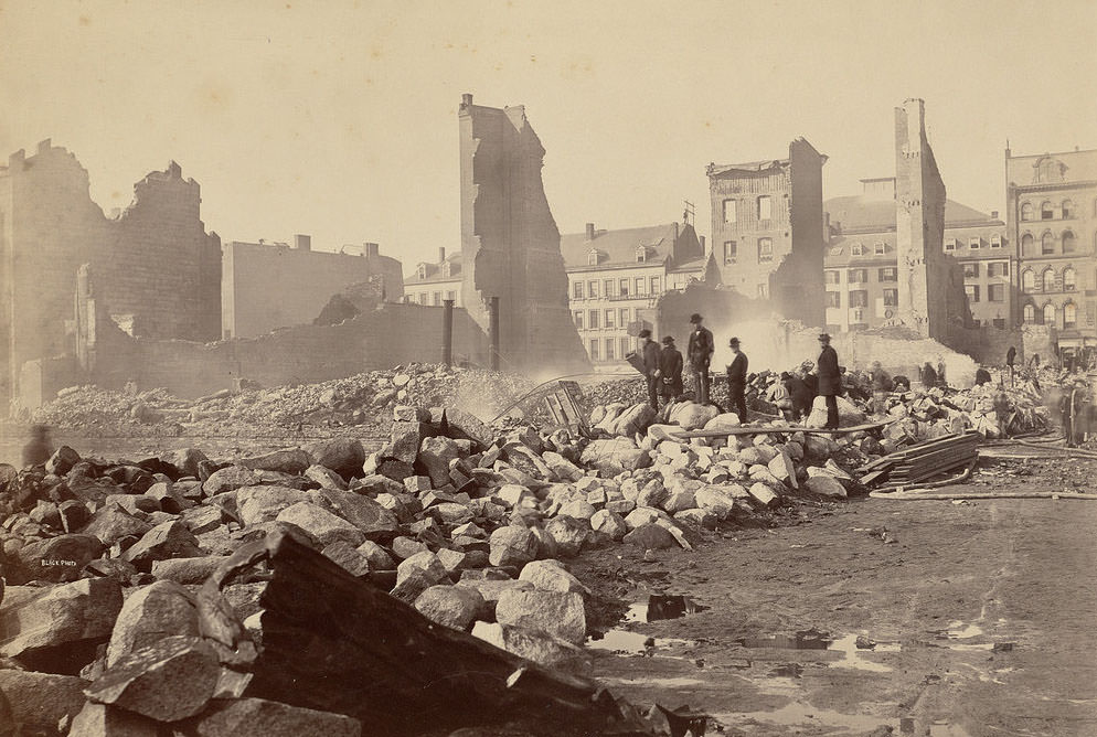
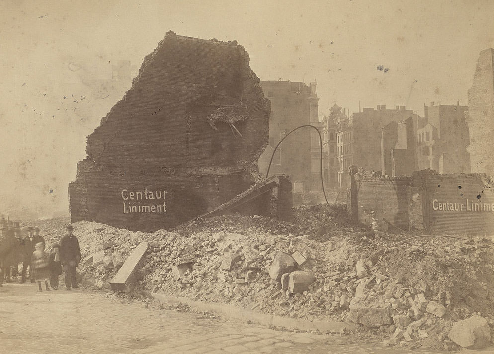
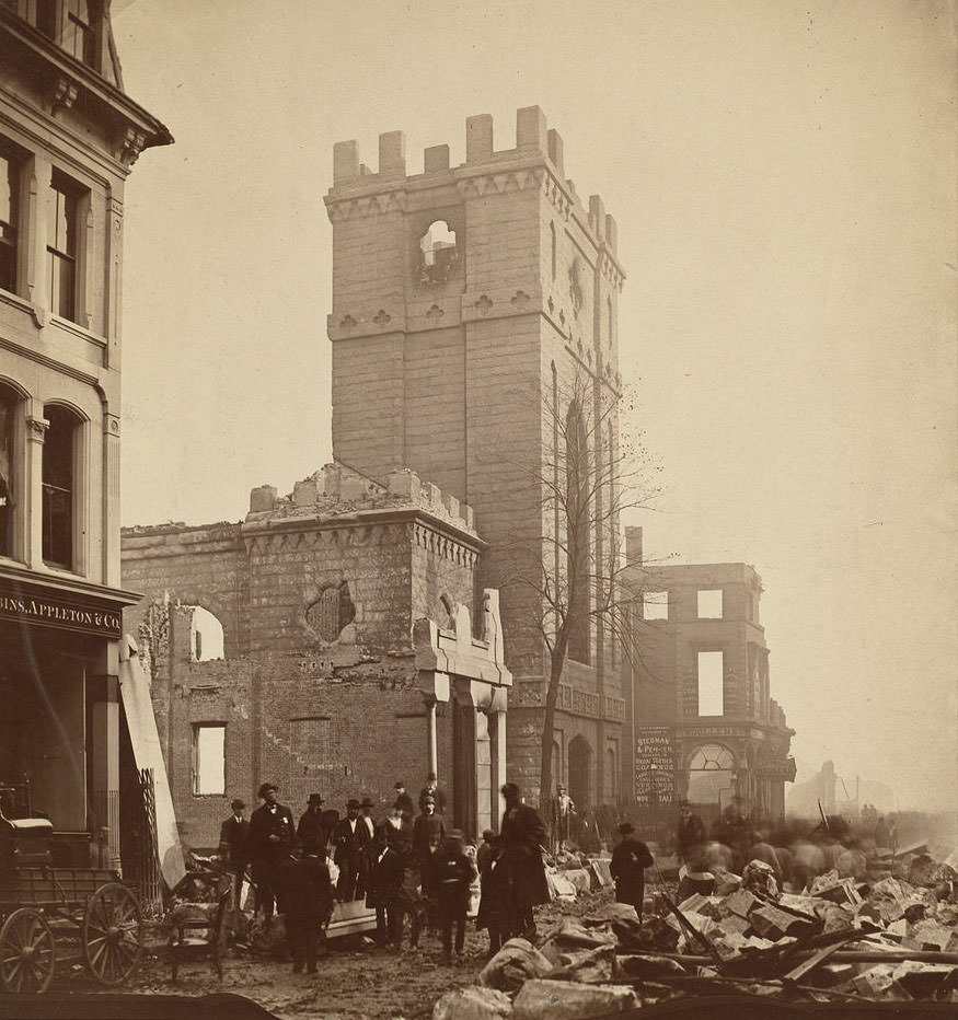
Even well-built stone and brick structures were not spared. Trinity Church, the Claflin Larrabee building, and other prominent landmarks were gutted by the heat and flame. The ruins left behind were not just piles of ash — many structures left standing walls and skeletal frames that photographers captured in striking detail, showing the full violence of the fire’s reach.
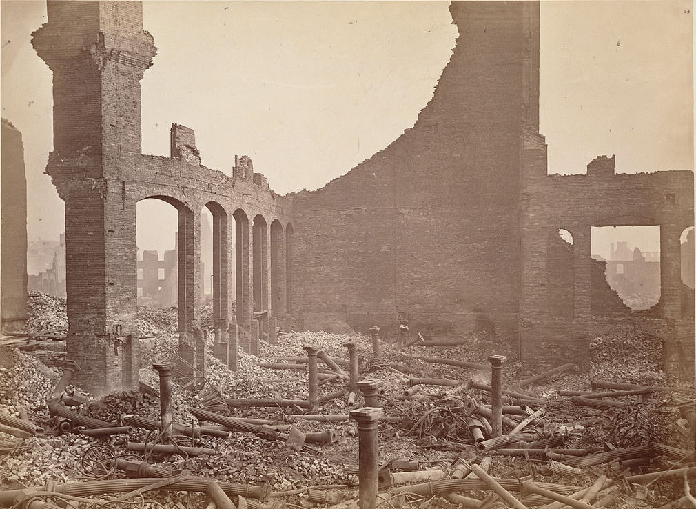
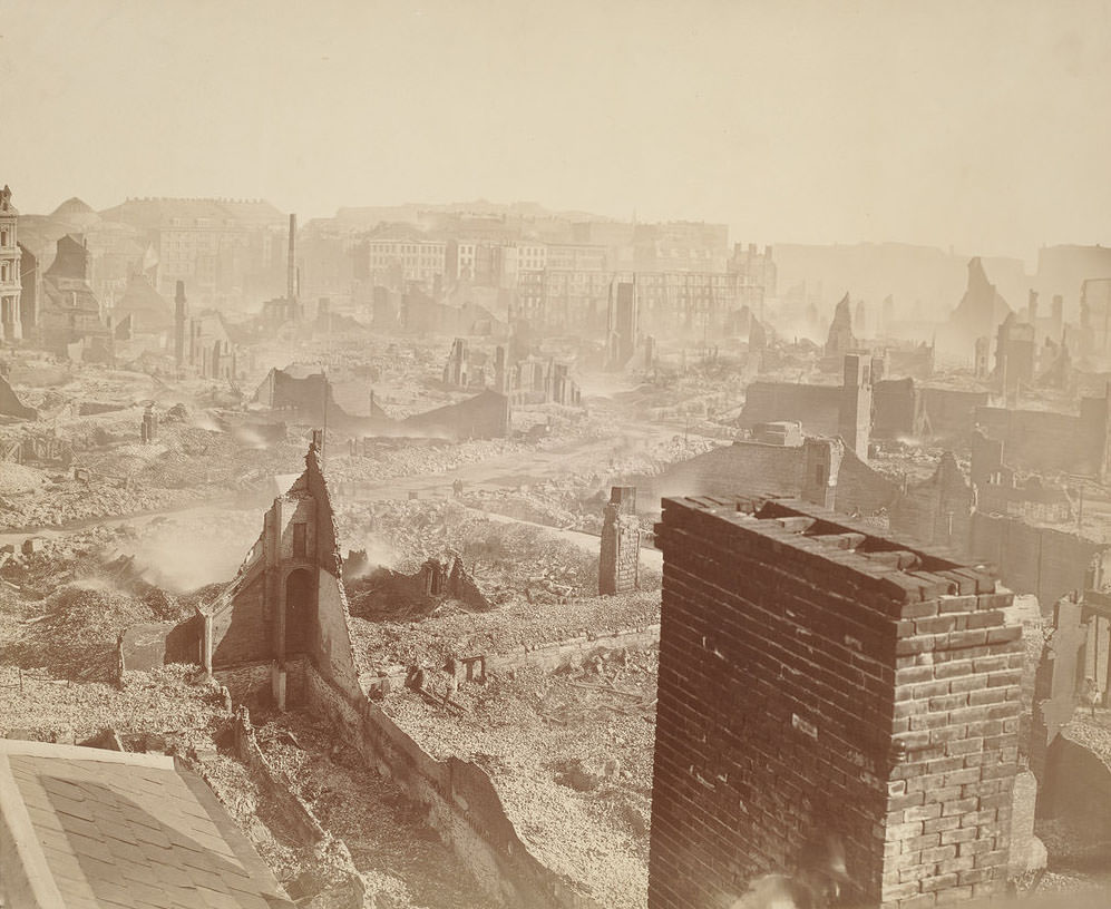
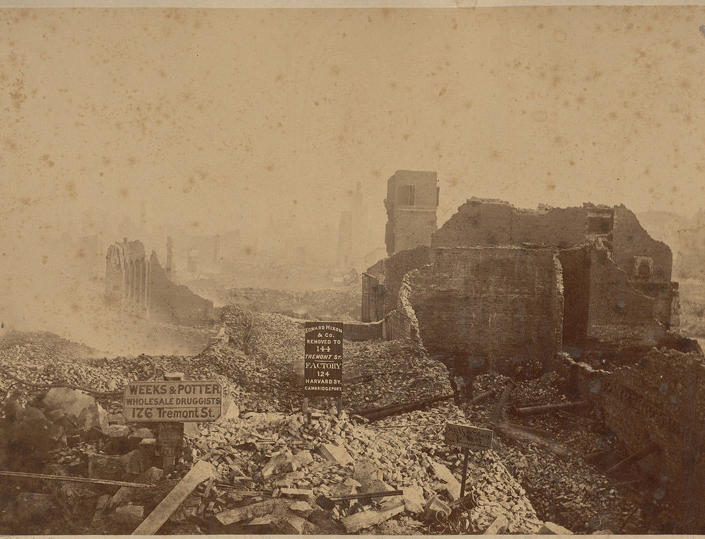
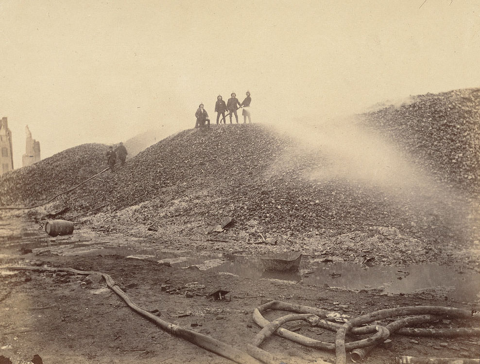
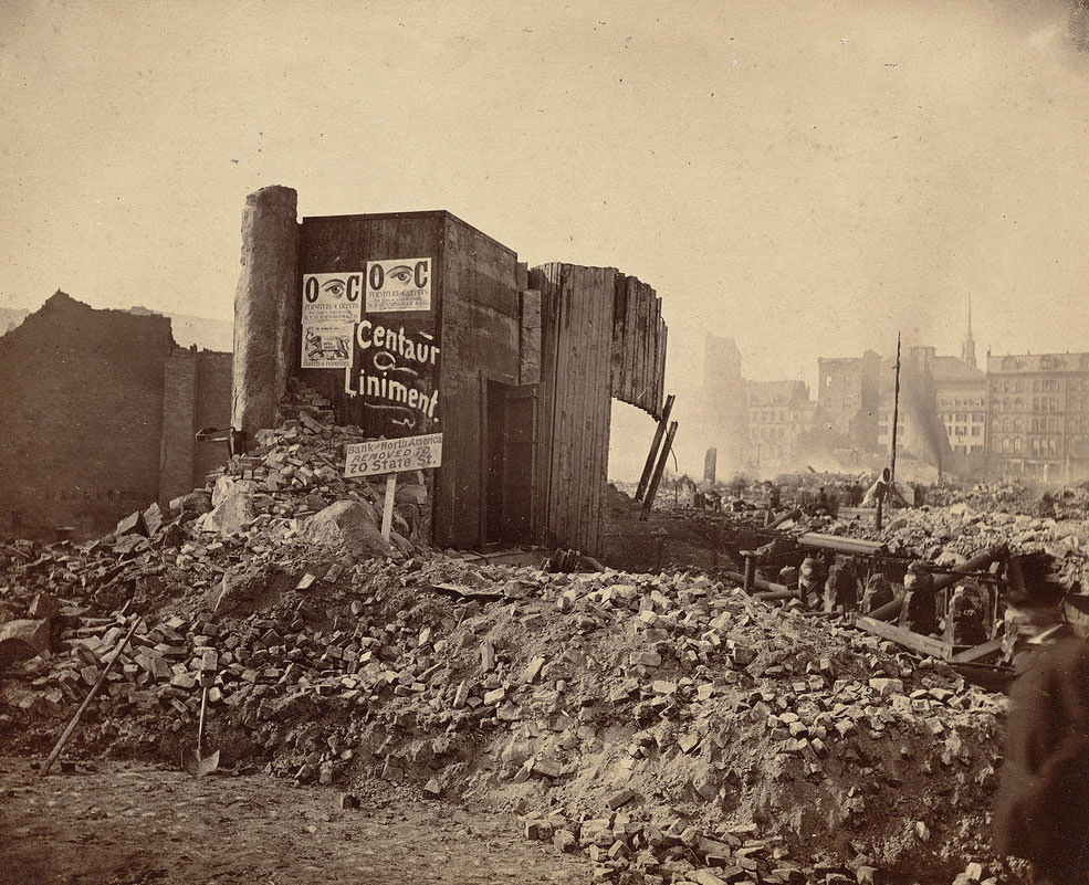
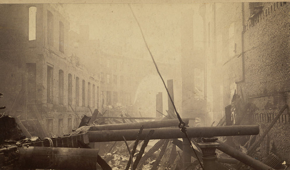
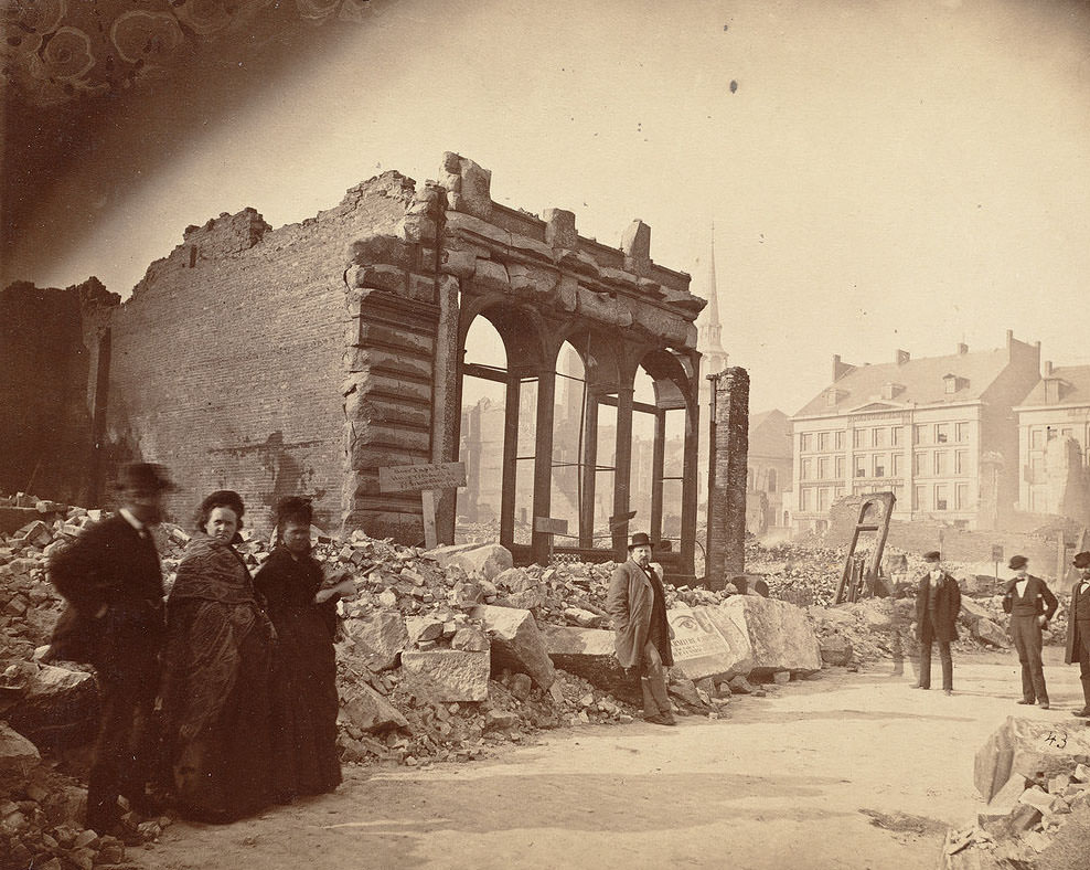
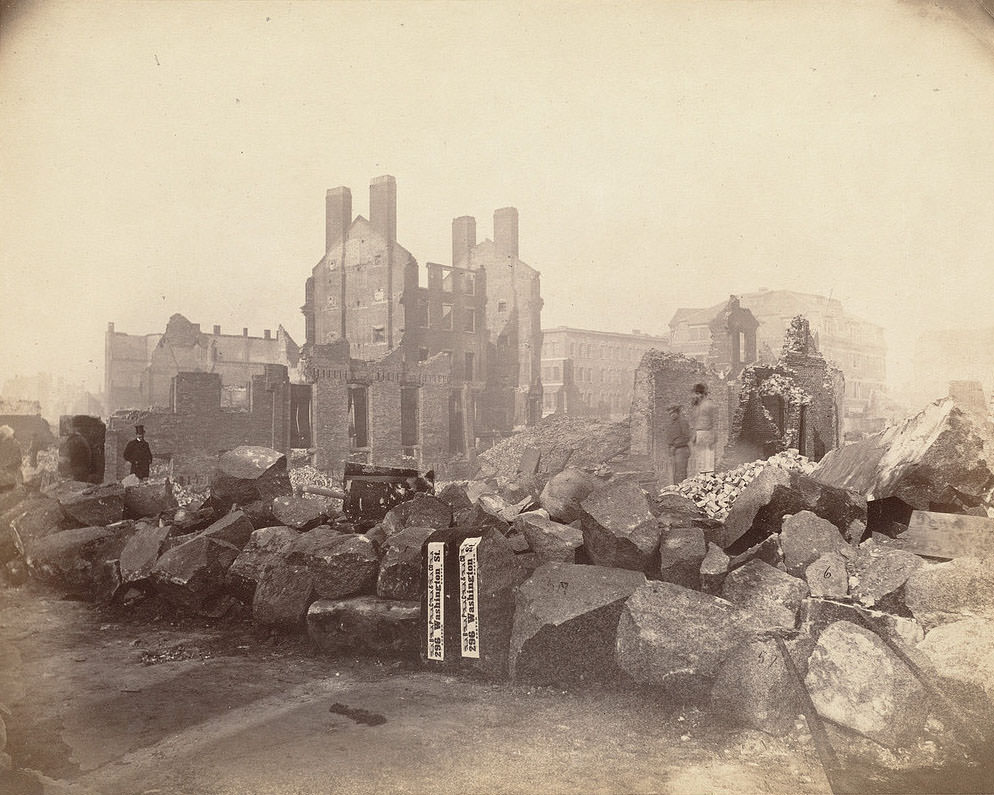
Washington Street, State Street, and the blocks along Federal Street were central to Boston’s financial and commercial life. Banks, trading houses, and major retail firms occupied these corridors. After the fire, photographs show their facades collapsed or charred down to the foundation. The Bank of North America, Burr Taft & Co. on Devonshire Street, and Bachelder’s Wharf on Federal Street each appear in the record, reduced to shells.
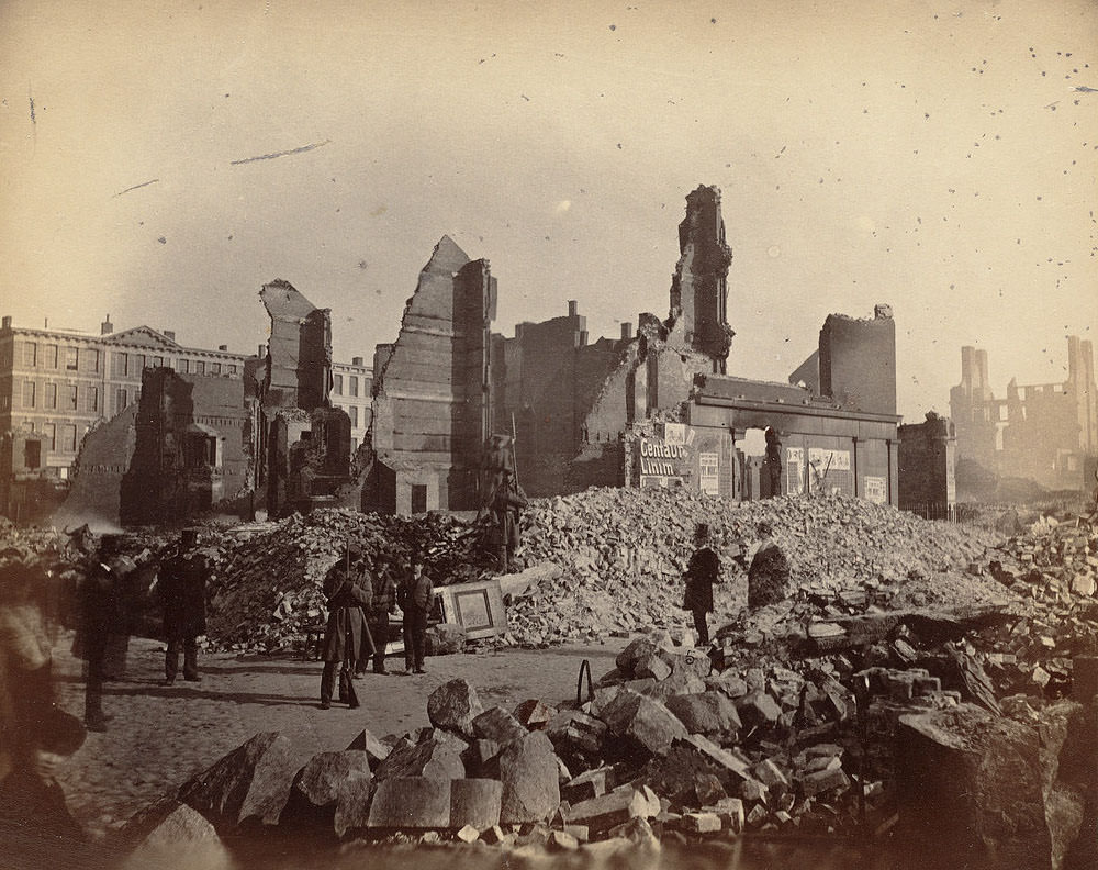
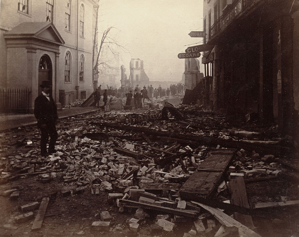
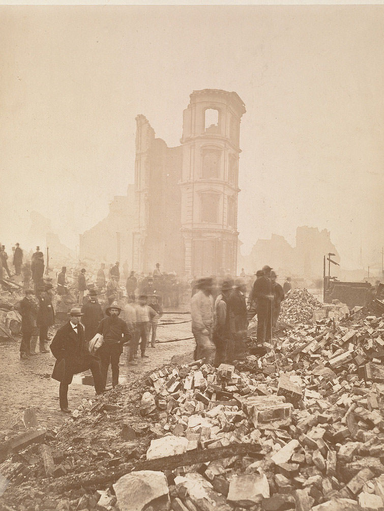
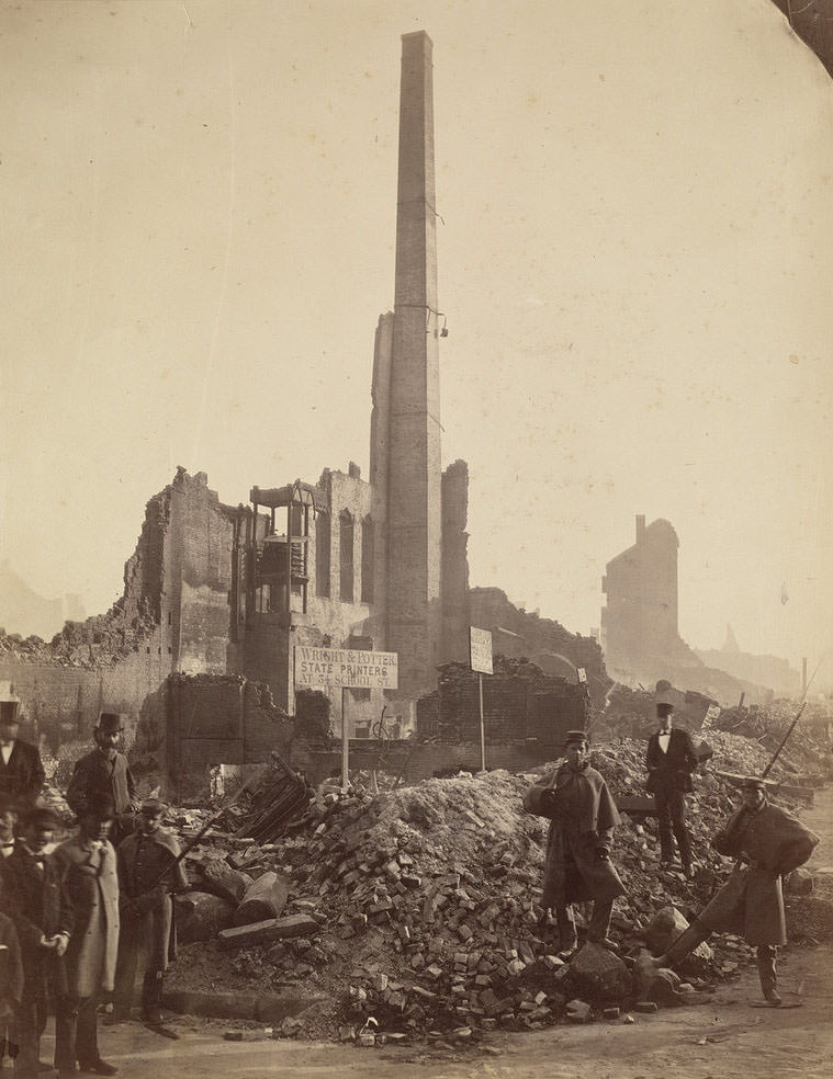
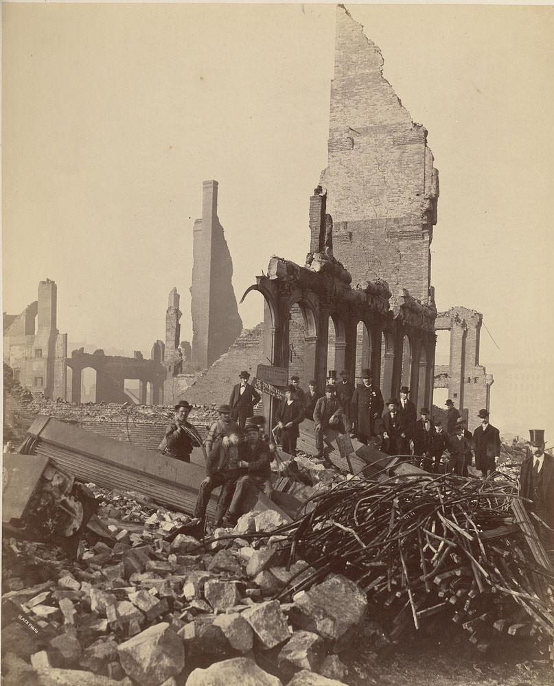
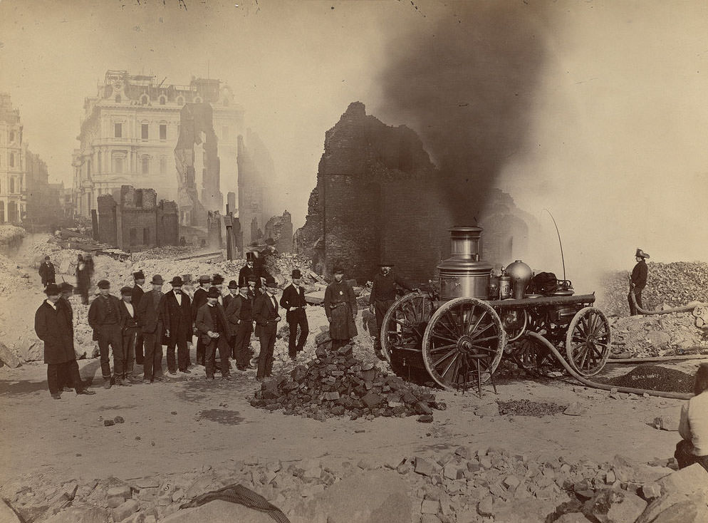
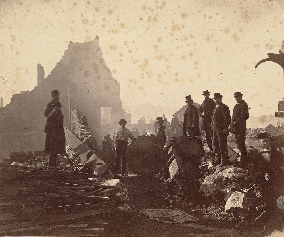
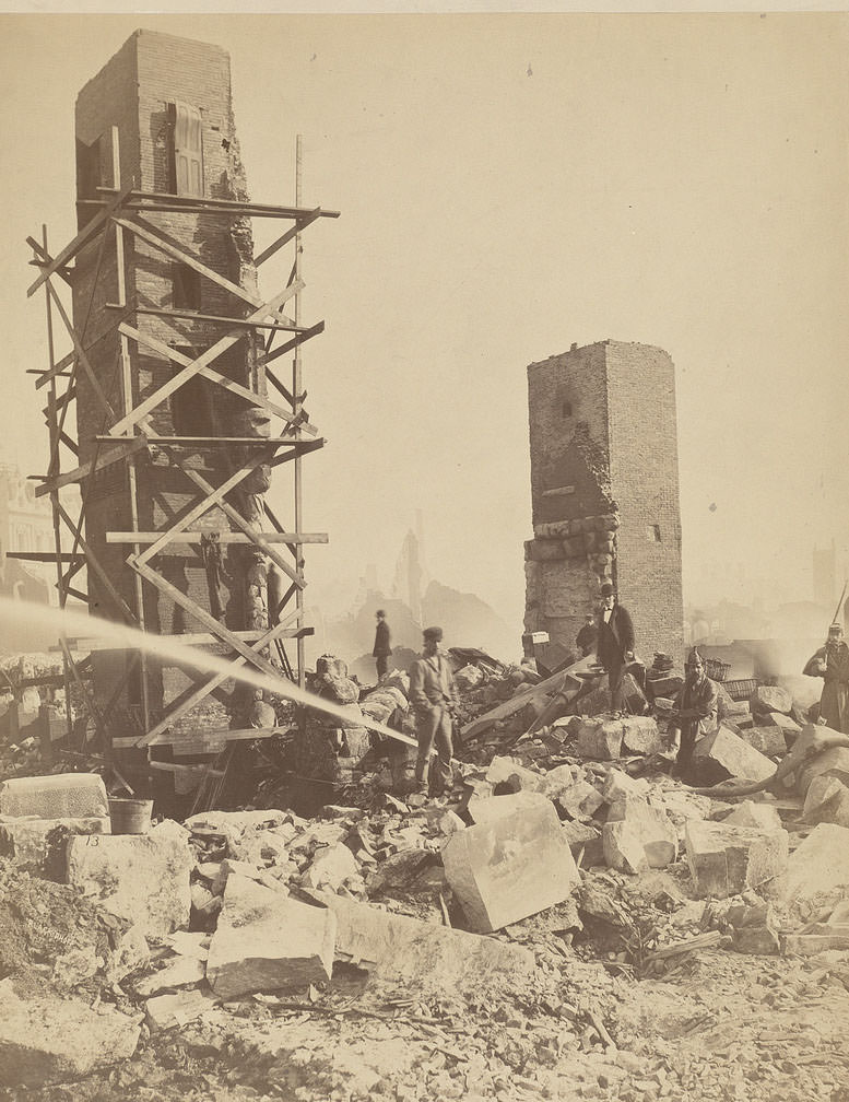
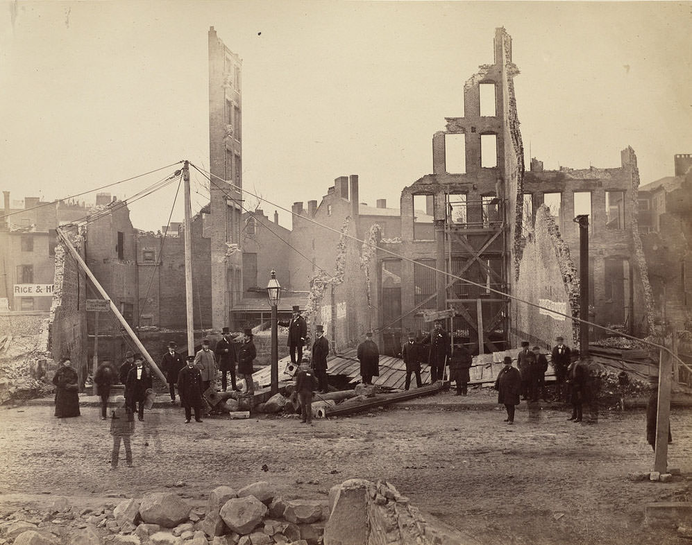
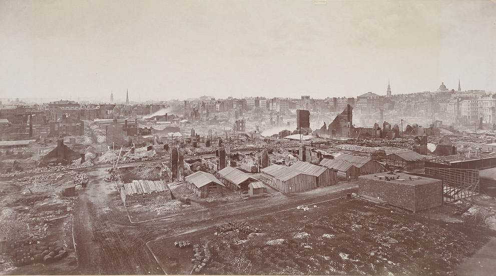
The view from the Sailors’ Home at Fort Hill gave photographers one of the clearest wide-angle perspectives of the disaster zone. From that elevation, the full sweep of destruction across Franklin Street, Federal Street, and the surrounding blocks was visible in a single frame. On the ground level, photographers recorded individual corners — Pearl and Milk, Washington and Milk, High and Summer — documenting the loss building by building.
After the fire, Boston’s citizens did not simply rebuild on the old footprint. A citizen committee pushed for a thorough redesign of the damaged area. Several downtown streets were widened and straightened to prevent a similar catastrophe. Post Office Square was created at the intersection of Milk, Congress, Pearl, and Water Streets as part of the new layout. Rubble from collapsed buildings was hauled to the waterfront and used as fill to extend Atlantic Avenue into the harbor. The city also approved significantly increased funding for the fire department.