
Oklahoma City was born in a single day. On April 22, 1889, the land that would become the state capital of Oklahoma was opened for settlement, and thousands of people rushed in at once. Within hours, a tent city had formed. Within a decade, it had become a real city. The population nearly doubled between 1890 and 1900, driven by agriculture, trade, and the ambitions of people who arrived with little and built quickly.
The city’s early economy was built on crops and cattle. Large stockyards went up to handle the livestock trade, drawing workers and businesses from across the region. Meatpacking plants followed. When the railroads arrived, they multiplied the volume of commerce moving through the city almost overnight. Oklahoma City became a regional hub, connected to markets far beyond the state.
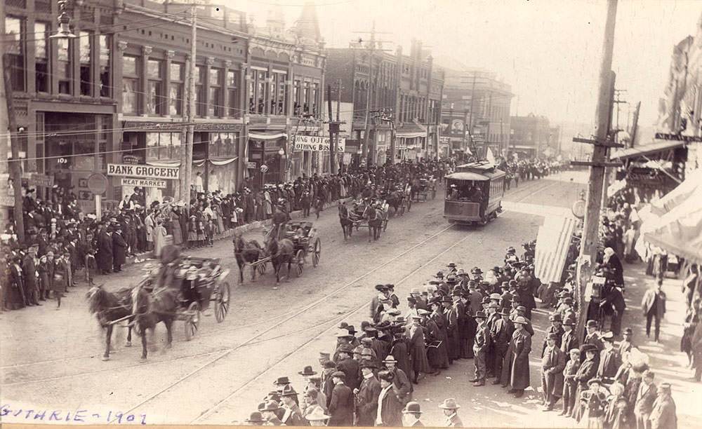
Oklahoma achieved statehood on November 16, 1907, and the celebration in Guthrie — then the territorial capital — drew enormous crowds. The parade marked the official birth of the 46th state. For Oklahoma City, statehood meant more investment, more infrastructure, and more people arriving to stake a claim in the growing economy.
One of the most transformative moments in the city’s history came in 1928, when the first oil well was discovered within city limits. The find changed everything. At the peak of the oil boom, roughly 1,400 wells were actively producing oil inside the city. Derricks rose across neighborhoods. Refineries and roadhouses appeared near the fields. The oil industry reshaped both the landscape and the daily lives of residents.
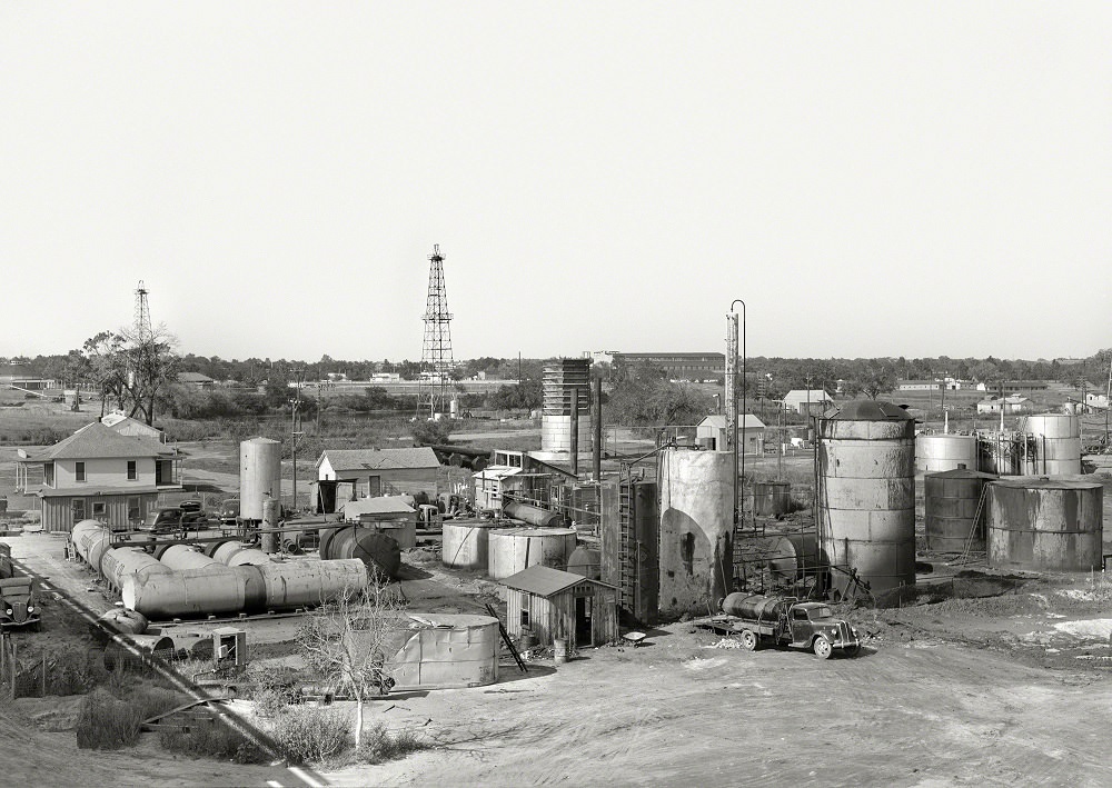
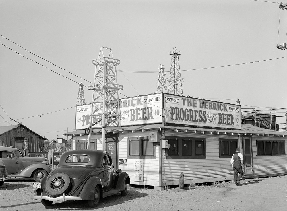
Independent refineries operated alongside the larger operations, processing crude oil and employing workers from the surrounding areas. Roadhouses like The Derrick popped up near the oil fields, serving the men who worked the rigs. These were rough, practical establishments built to meet the needs of a workforce that worked hard and lived close to the job.
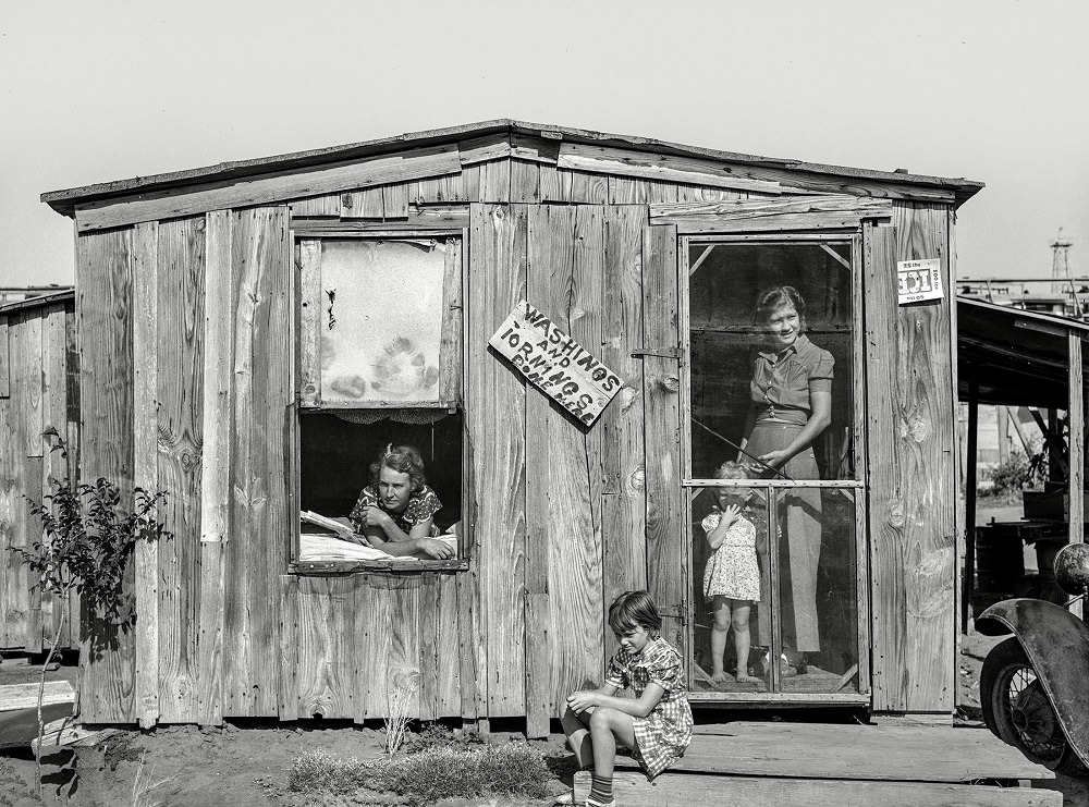
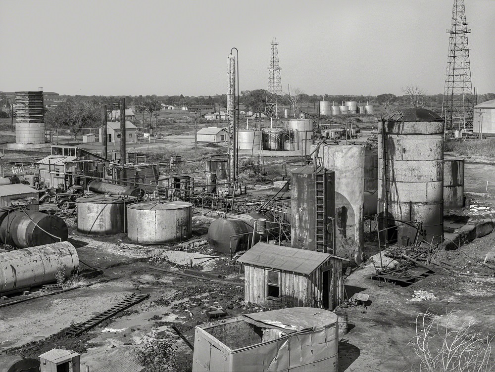
Oil field roustabouts — the laborers who handled maintenance and general work on the rigs — lived modest lives close to the fields. Their families settled in whatever housing was available, often in modest homes near the work sites. The oil economy created jobs, but those jobs rarely came with comfort or stability.
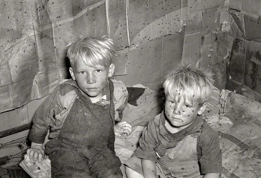
While the oil boom brought wealth to some, much of Oklahoma City’s population in the late 1930s was struggling. The Great Depression had wiped out savings and livelihoods across the country, and Oklahoma was hit especially hard. The Dust Bowl drove families off their land. Many ended up in roadside and urban camps, piecing together shelter from whatever they could find.
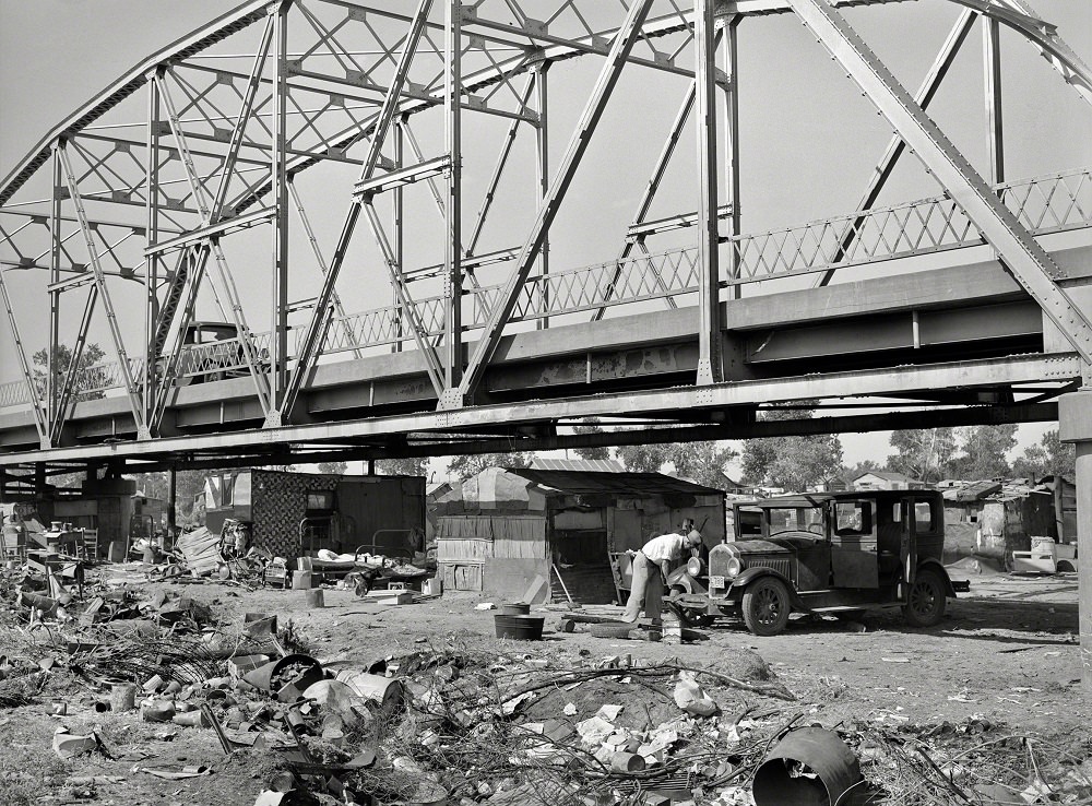
The May Avenue camp in Oklahoma City was one of these makeshift communities. It sat partially under a bridge, directly next to the city dump and a hog wallow. Families built shacks and pitched tents on the margins of the city, with almost no infrastructure and no sanitation. About a dozen families shared a single thirty-foot well for their water supply.
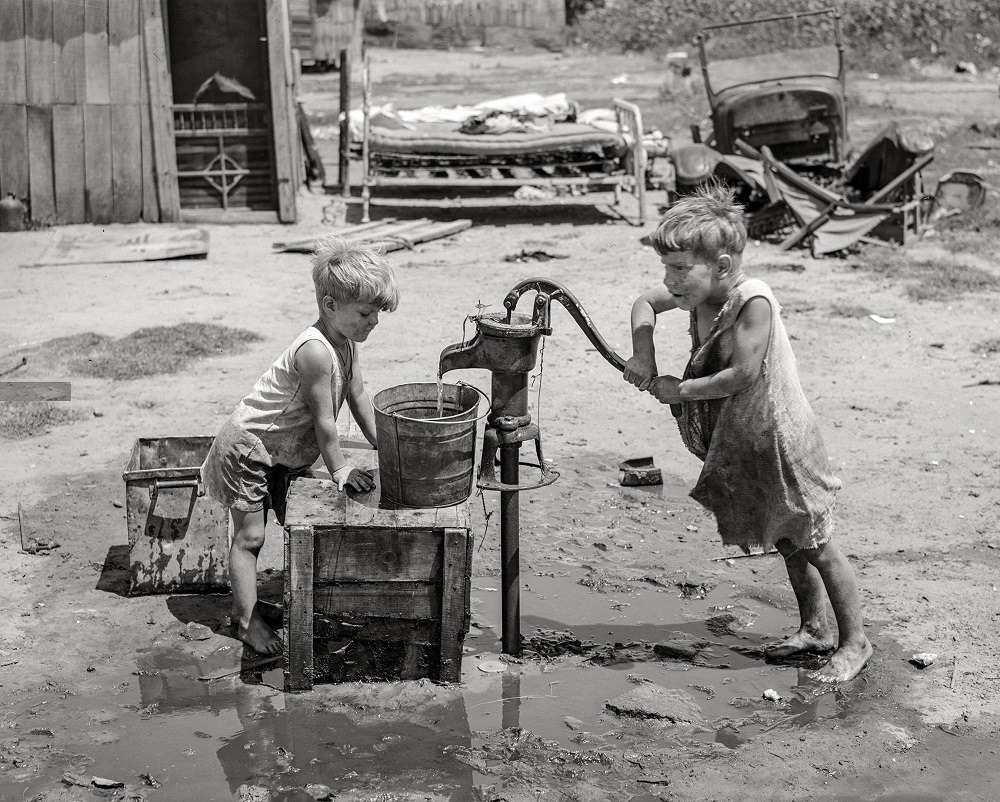
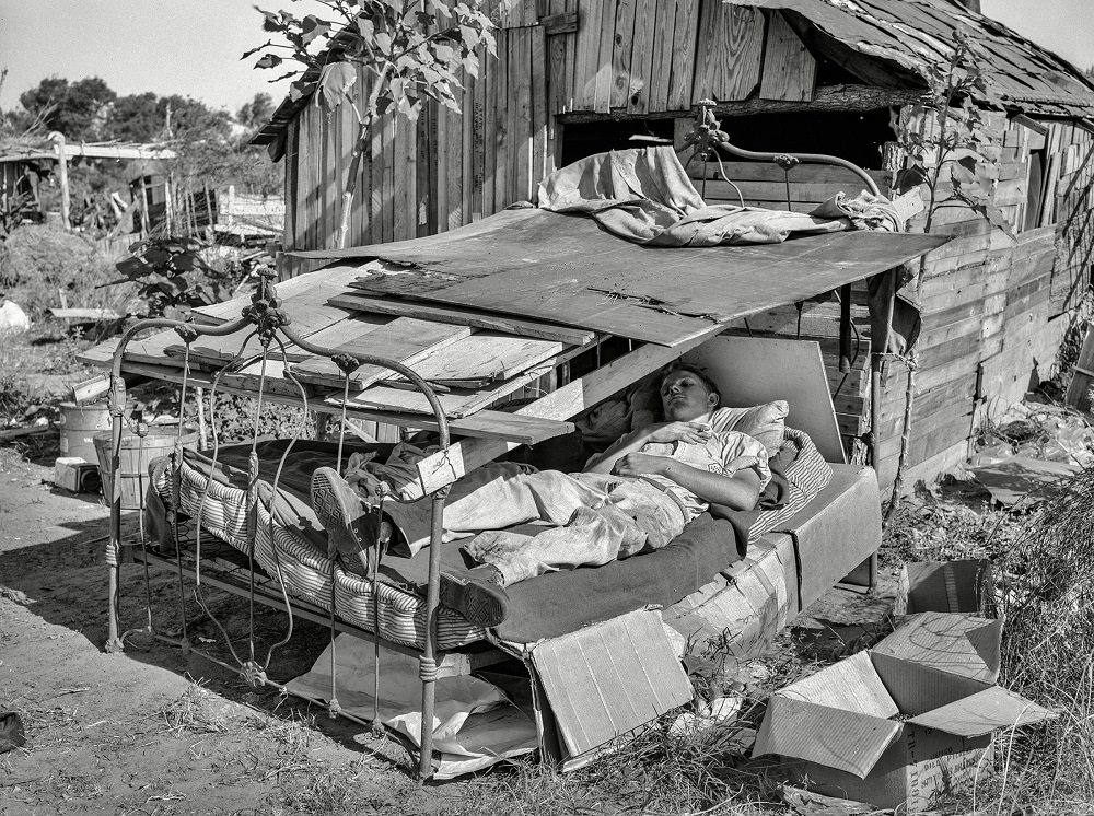
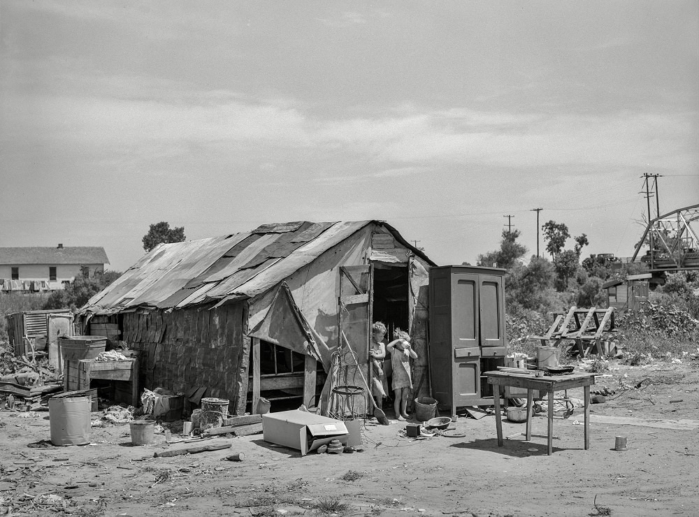
The structures in these camps were barely adequate. Some families slept under nothing more than a roof propped over a bed, open to the elements on all sides. Others built small shacks from scavenged wood and scrap metal. The photographs taken by federal photographers in July 1939 documented the conditions in stark detail, capturing faces, dwellings, and the daily realities of people with nowhere else to go.
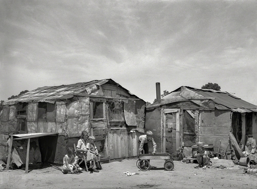
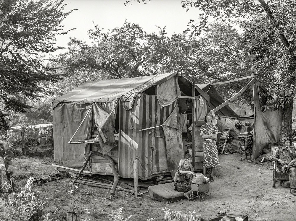
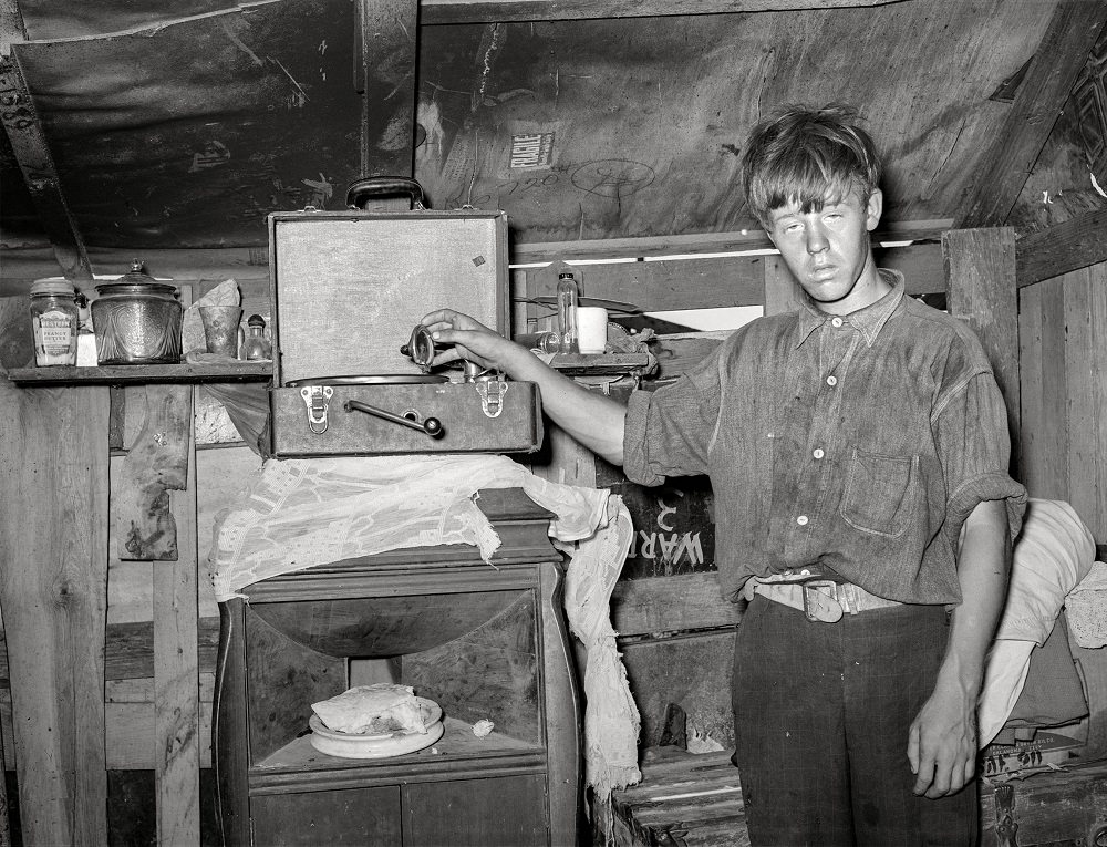
Children in the May Avenue camp grew up in these conditions. They fetched water, made do with handmade tools, and lived alongside the city dump. The photographers captured them with a directness that made the scale of poverty impossible to ignore.
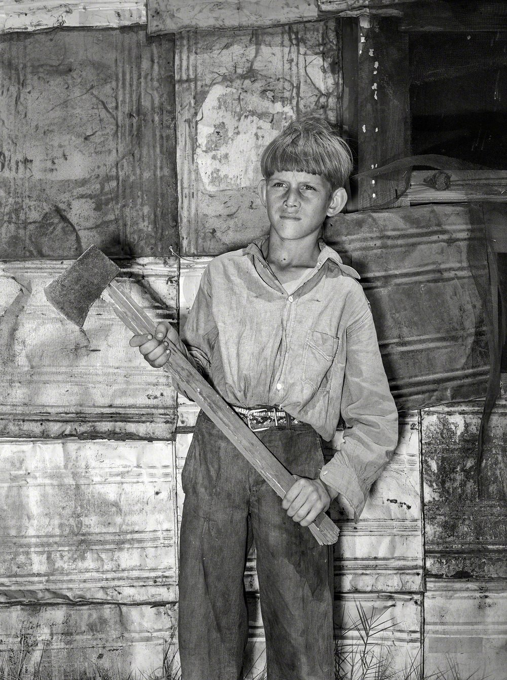
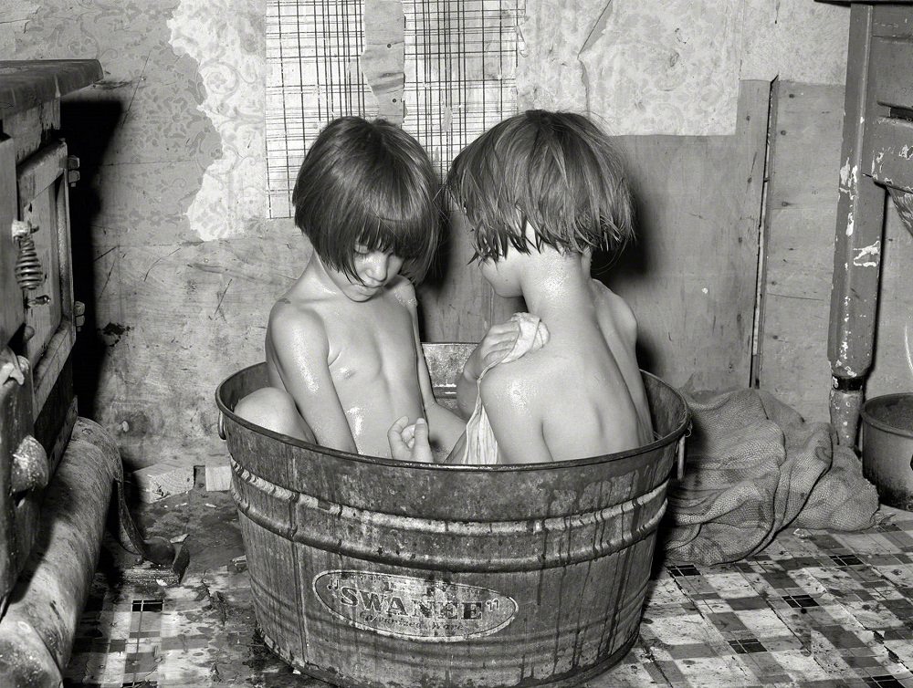
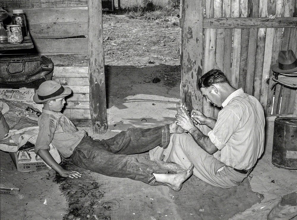
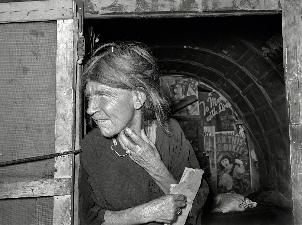
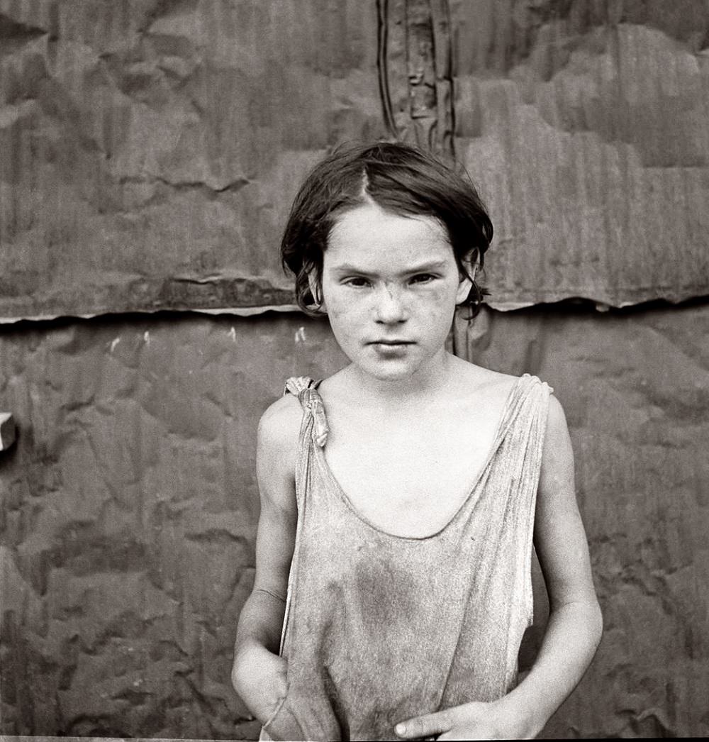
The shacktowns weren’t a new problem by 1939. A child photographed in Oklahoma City’s shacktown as early as August 1936 shows that poverty had been visible on the city’s edges long before the decade’s end. These communities existed in a gap between the city’s growing infrastructure and the people it left behind.
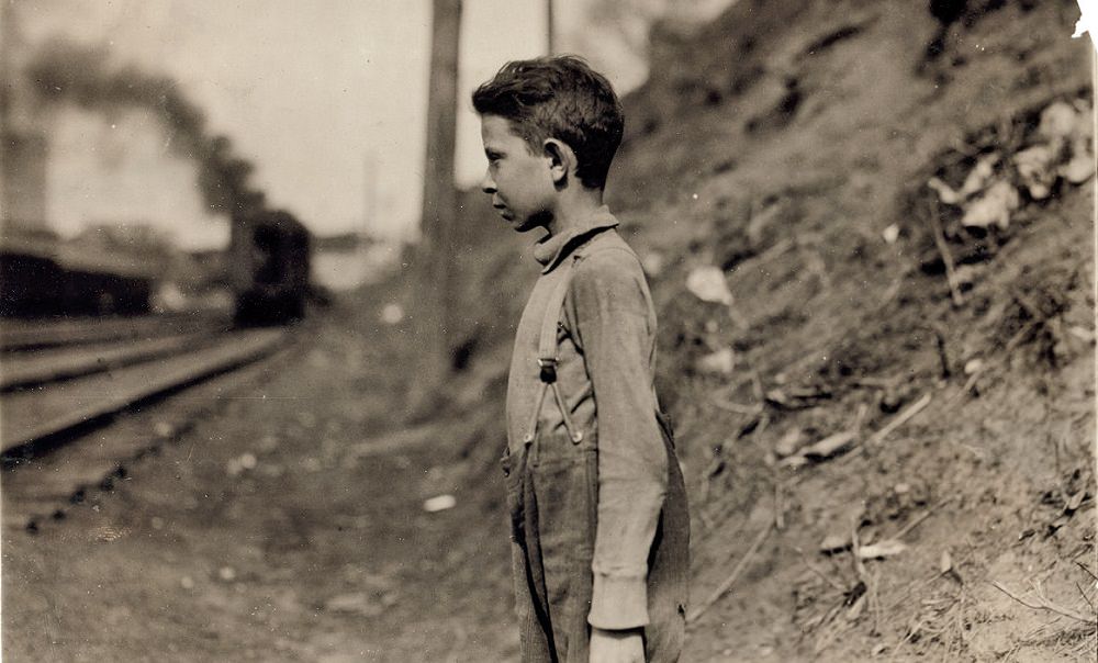
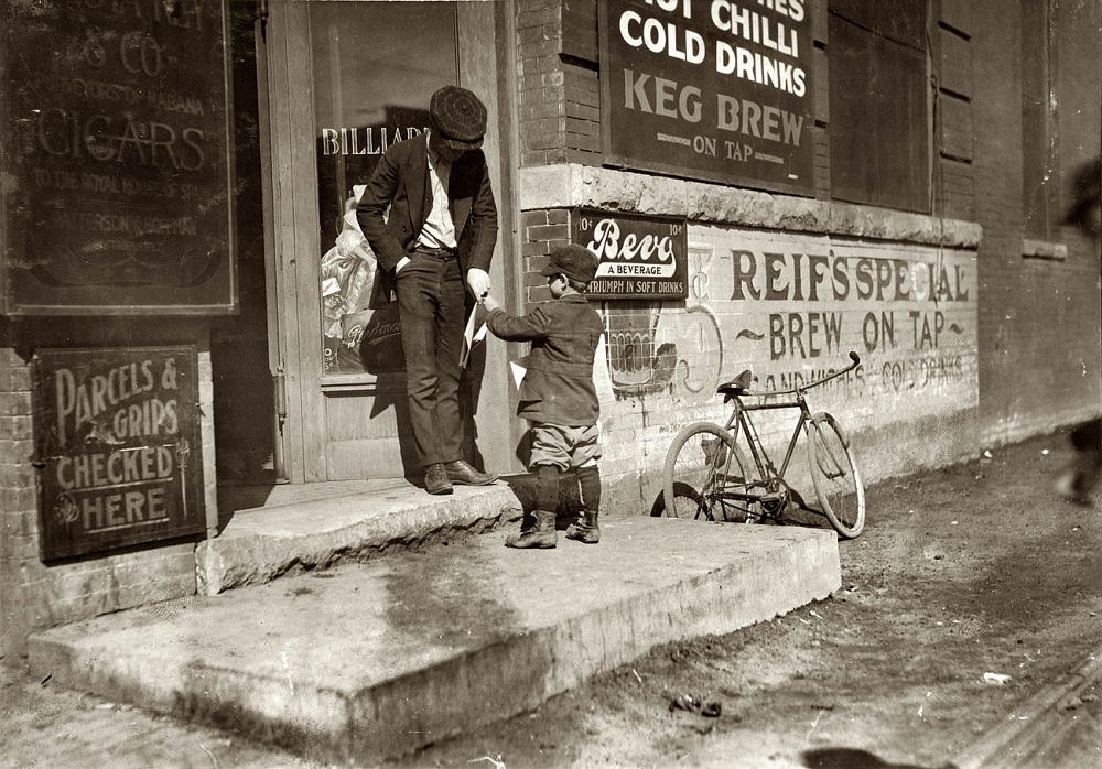
Child labor was another documented reality of early Oklahoma City. In April 1917, a federal investigator photographed eleven-year-old Glenn Dungey working at a bakery. That same month, six-year-old Jack Ryan was found selling newspapers on West Reno Street. These were not unusual cases — they were part of a broader pattern that reformers were working to document and end.
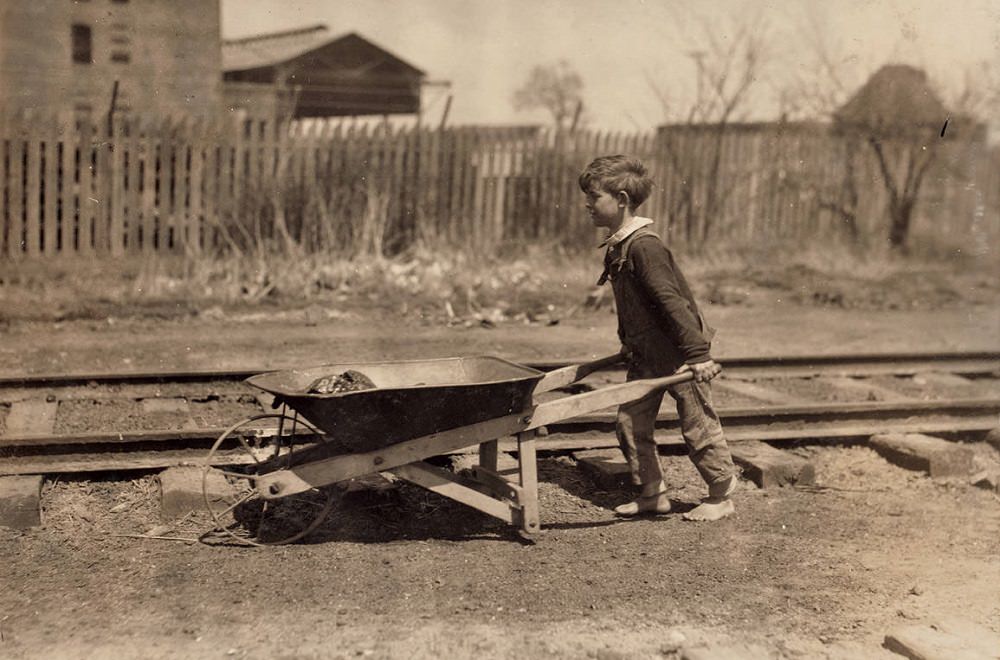
Beyond formal work, some children in 1917 resorted to stealing coal from the freight yards to help their families heat their homes. This too was photographed and documented. Boys are captured mid-act, taking lumps of coal from the rail yards — a scene that illustrated just how thin the margin of survival was for the city’s poorest families.
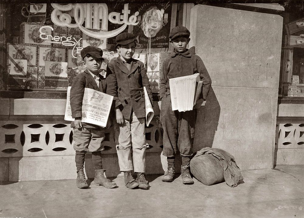
![Manley Creasson [Creason], 914 West Sixth Street, Oklahoma City, Oklahoma, March 15, 1917](https://www.bygonely.com/wp-content/uploads/2020/04/Oklahoma_City_historical_photos_18.jpg)
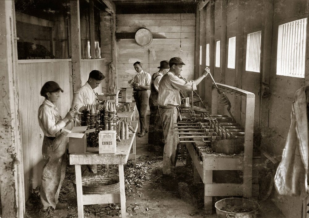
Not all workplaces in 1917 were grim. The Sanitary Ice Cream Cone Company operated a workshop on Dewey Street, producing cones at a time when ice cream parlors were becoming fixtures of American social life. The workshop photograph offers a glimpse of small commercial manufacturing in the city during the World War I era.
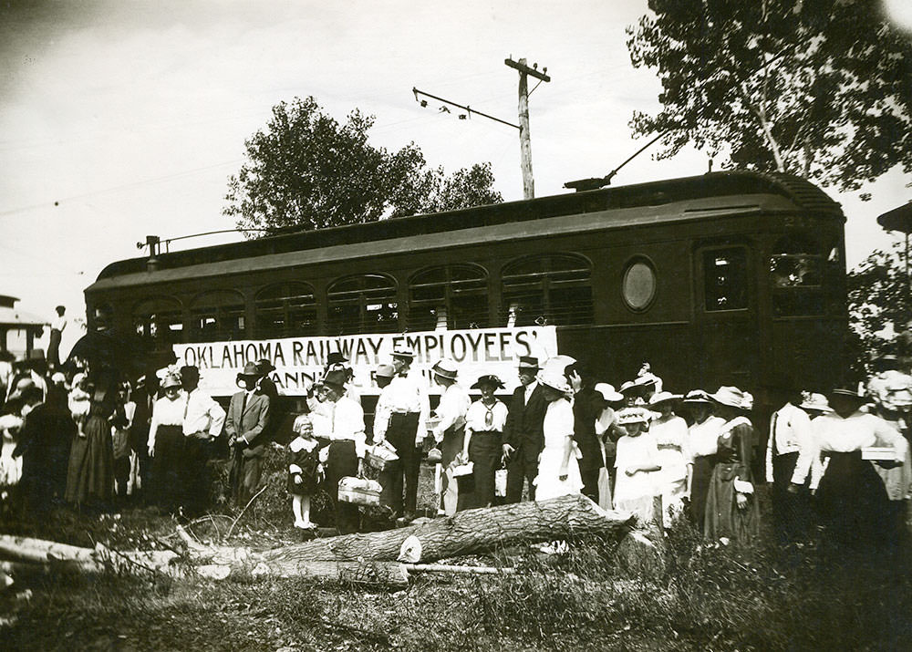
Oklahoma City’s streetcar and interurban rail system was a defining feature of urban life in the early 20th century. The Oklahoma Electric Railway Lines connected the city to surrounding towns, including El Reno and Norman, making regional travel practical for ordinary people. Tracks were laid across major streets, and the network expanded steadily through the 1900s and 1910s.
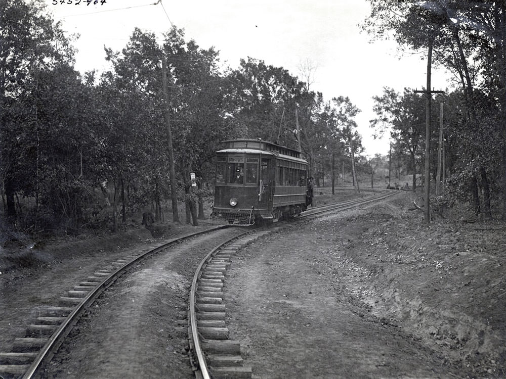
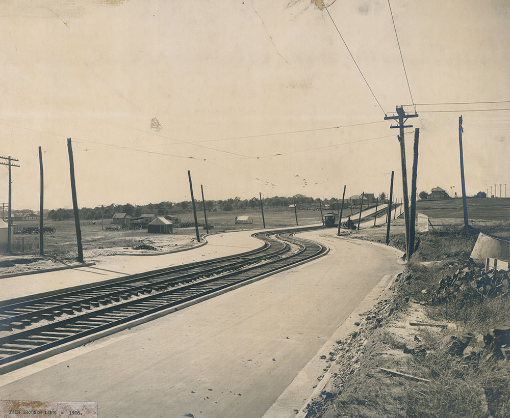
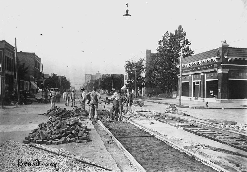
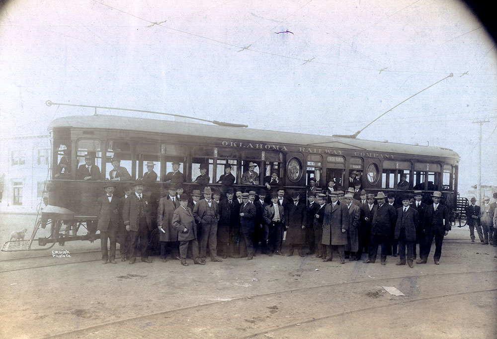
In November 1910, the first pay-as-you-enter streetcar made its inaugural run at the stockyards. This was a shift in how the city managed fare collection, moving away from conductors walking through cars to passengers paying at the door. The stockyards route was one of the busiest in the system, given the volume of workers and traders who needed to reach that part of the city daily.
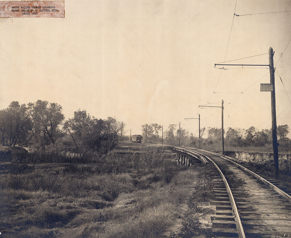
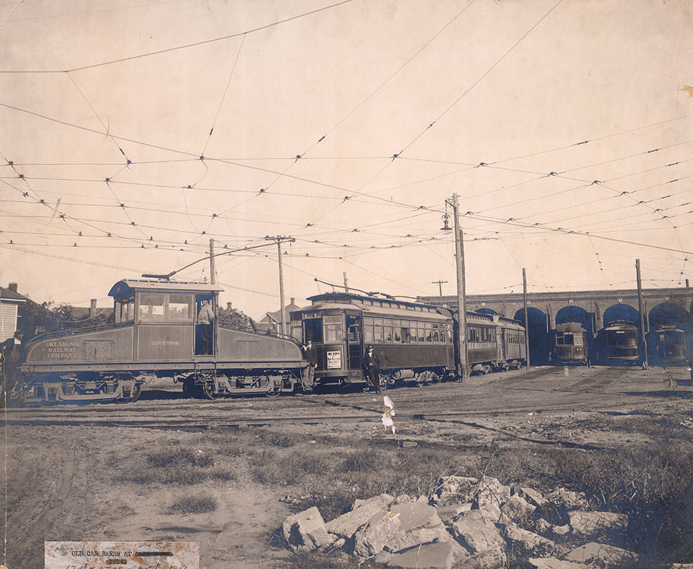
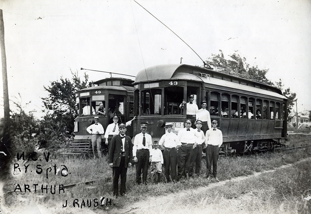
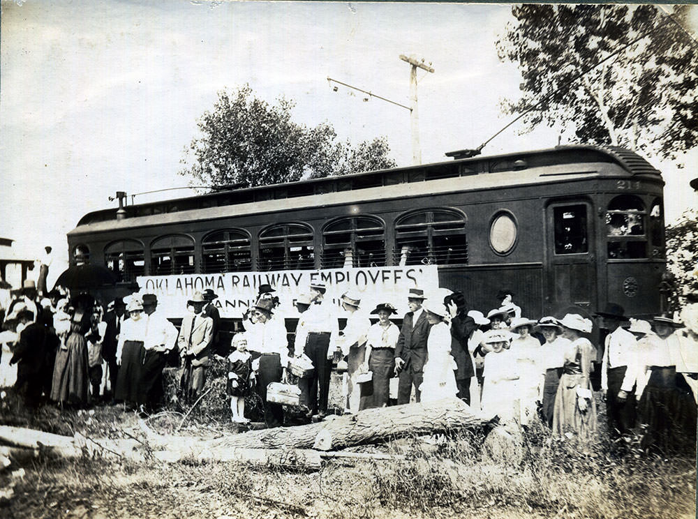
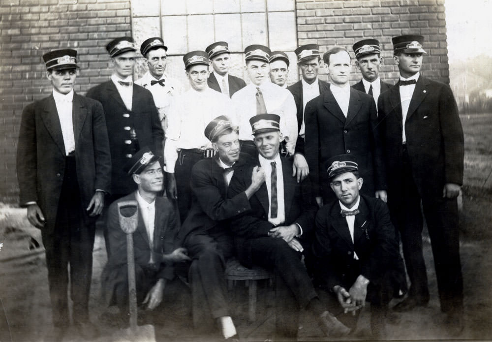
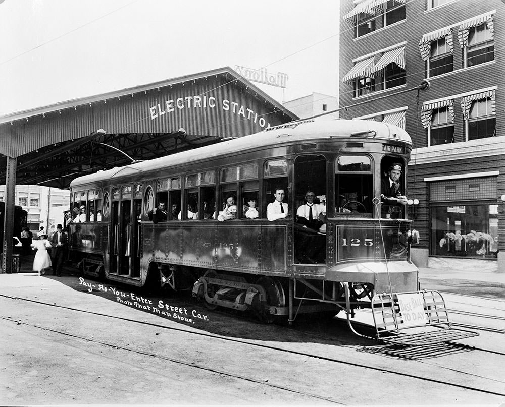
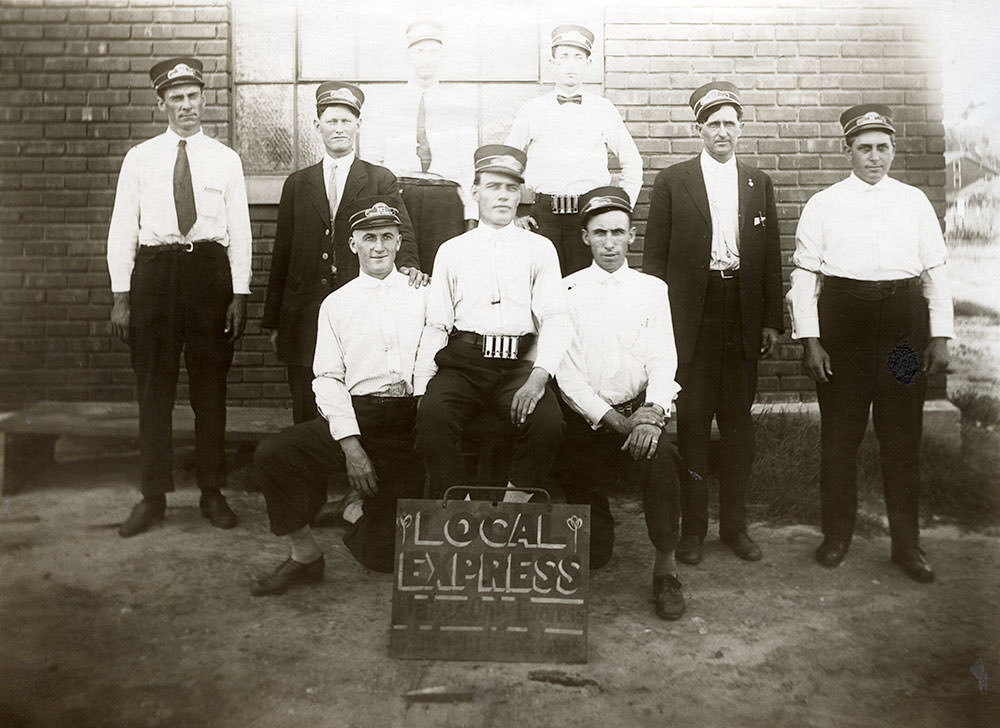
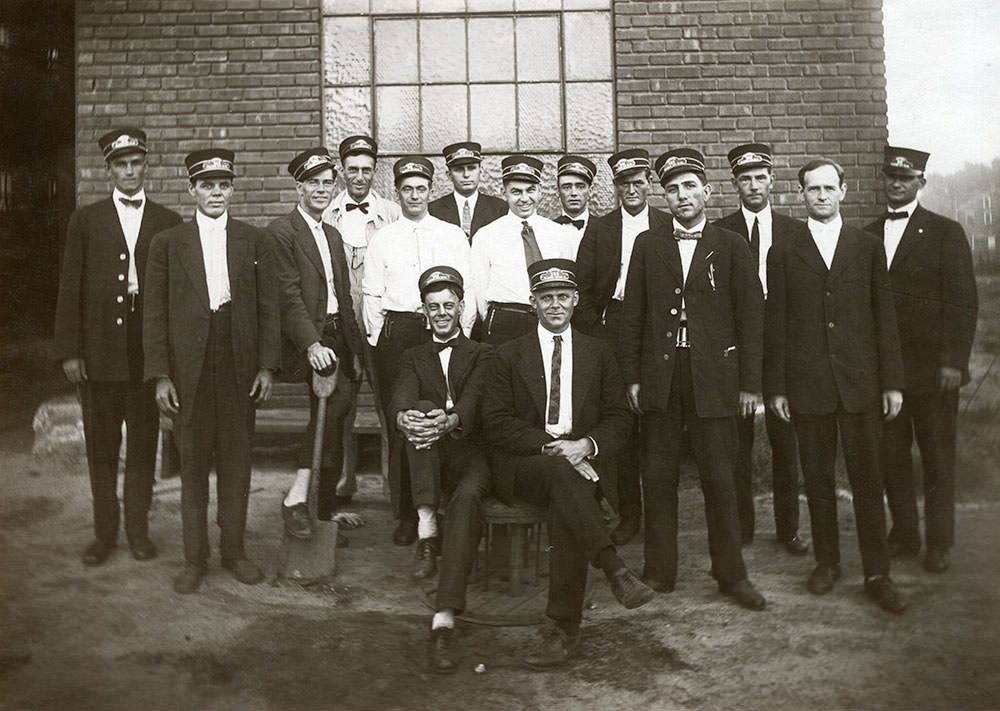
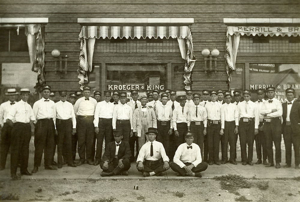
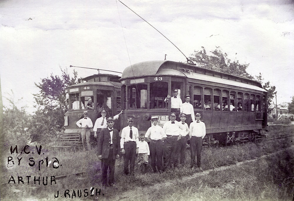
The interurban conductors were a familiar presence on the lines, managing passengers and keeping schedules on routes that stretched across the metropolitan area and into neighboring towns. The car barns at Northwest 13th Street and Santa Fe Avenue housed and maintained the fleet, serving as the operational backbone of the system.
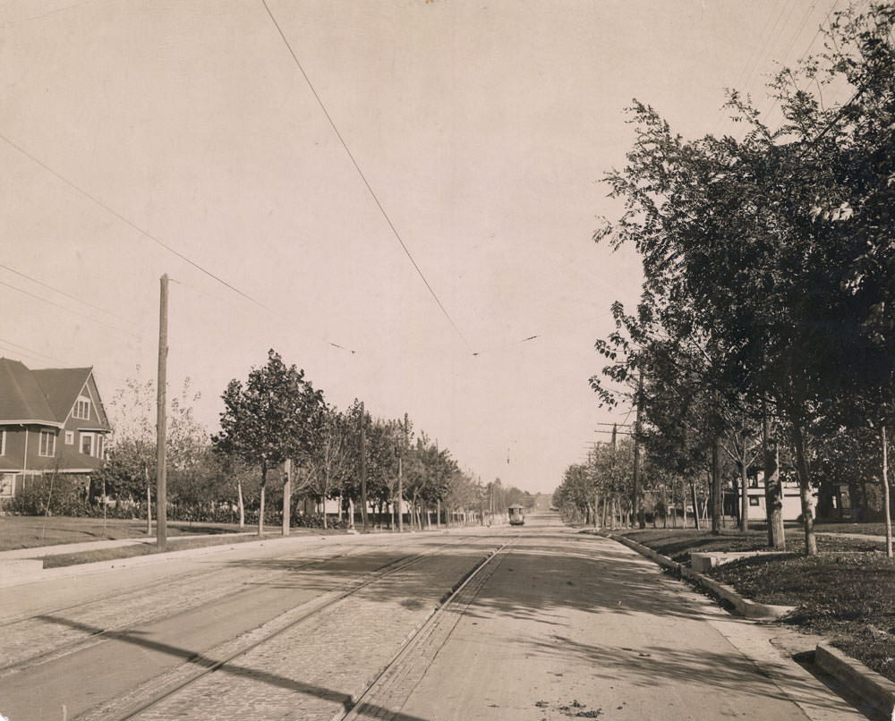
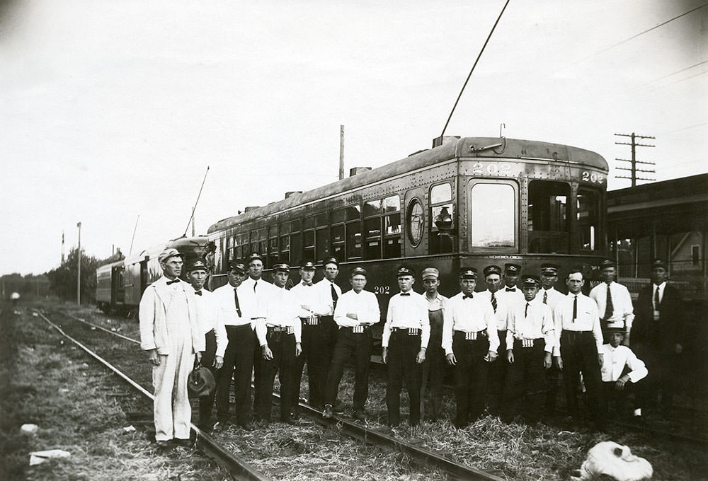
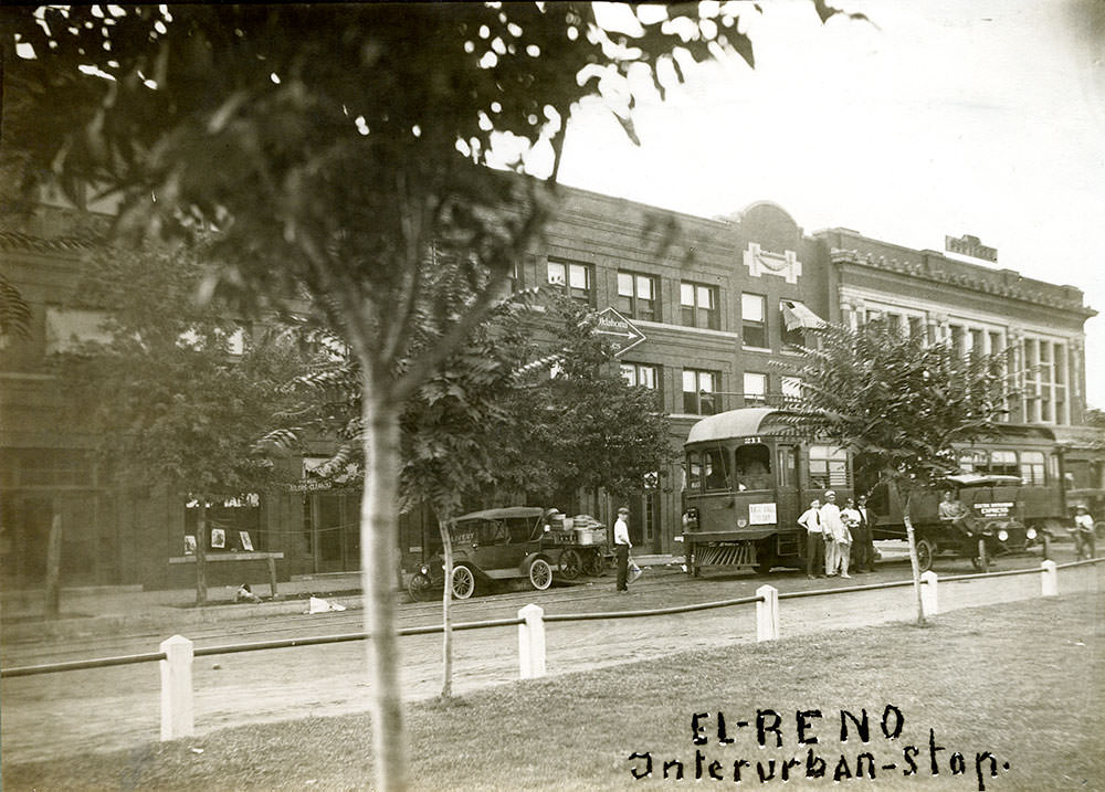
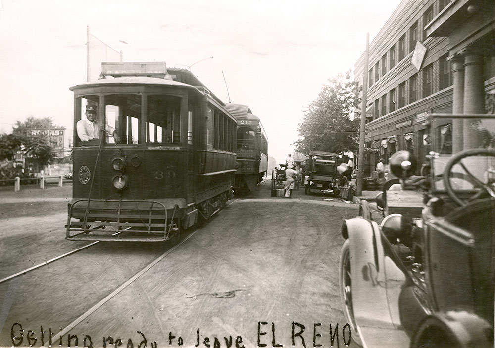
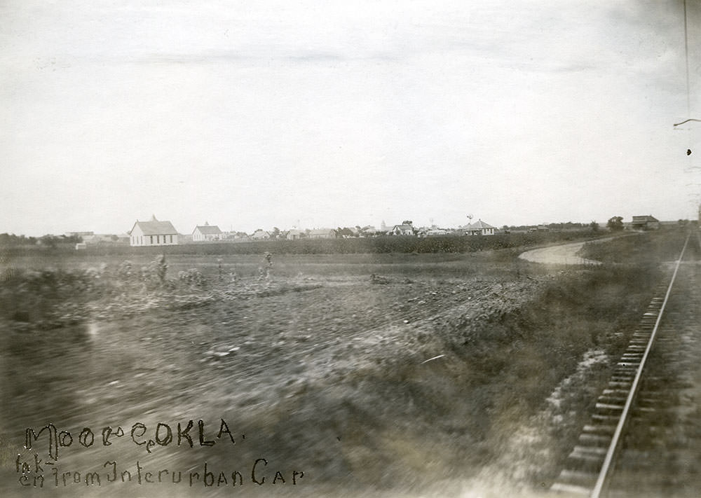
The El Reno line extended the railway network west of Oklahoma City, connecting smaller communities to the urban center. Stops like El Reno served as collection points for passengers and freight, tying the region’s economy together through rail access. The view from the interurban car looking toward Moore offered passengers a glimpse of the flat Oklahoma landscape passing by.
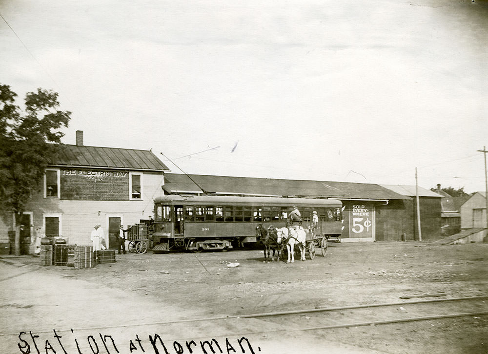
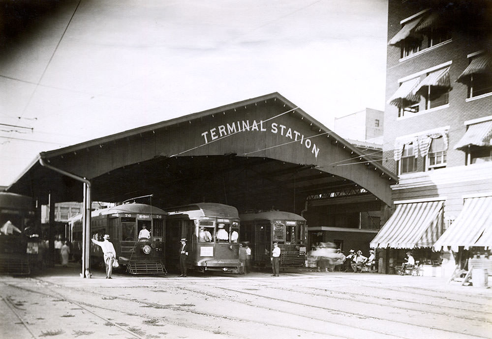
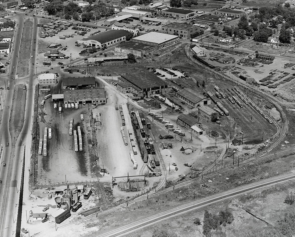
The Terminal Station on north Harvey Avenue served as the central hub for the electric railway network. Passengers arriving from Norman, El Reno, and other stops along the lines passed through this station. By 1939, the streetcar terminal was still active — but the photographs taken there that year also captured the racial segregation built into the system.
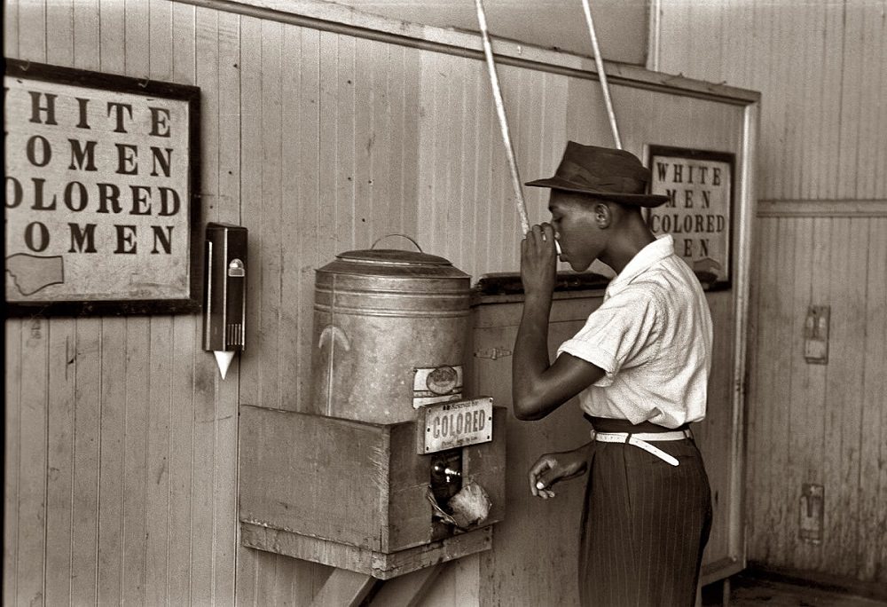
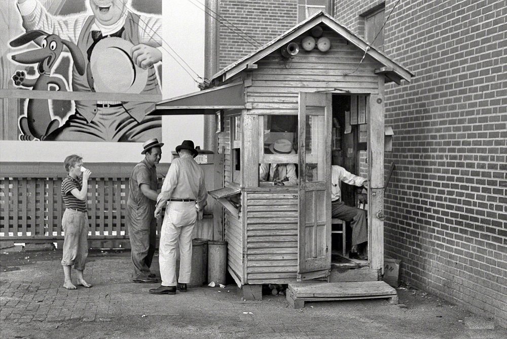
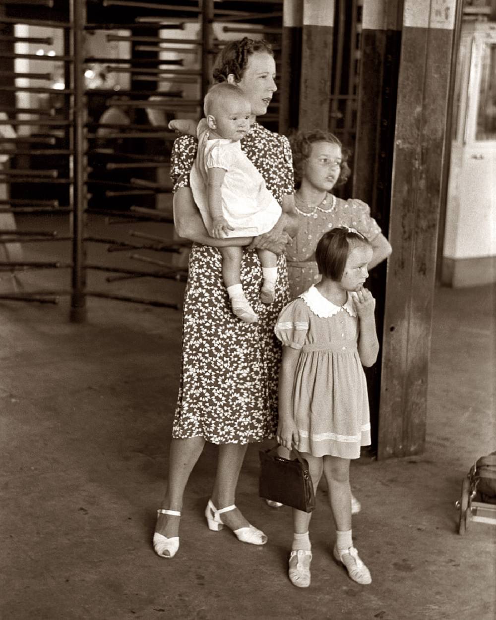
The streetcar terminal in 1939 had separate water coolers for Black and white passengers — a direct product of Oklahoma’s segregation laws. The photograph of a Black man drinking from the “colored” water cooler at the terminal is one of the most direct documents of that system in the city’s photographic record. Alongside it, images of ordinary passengers — a woman with children waiting at the terminal — show the everyday rhythms of a city moving through one of its hardest decades.
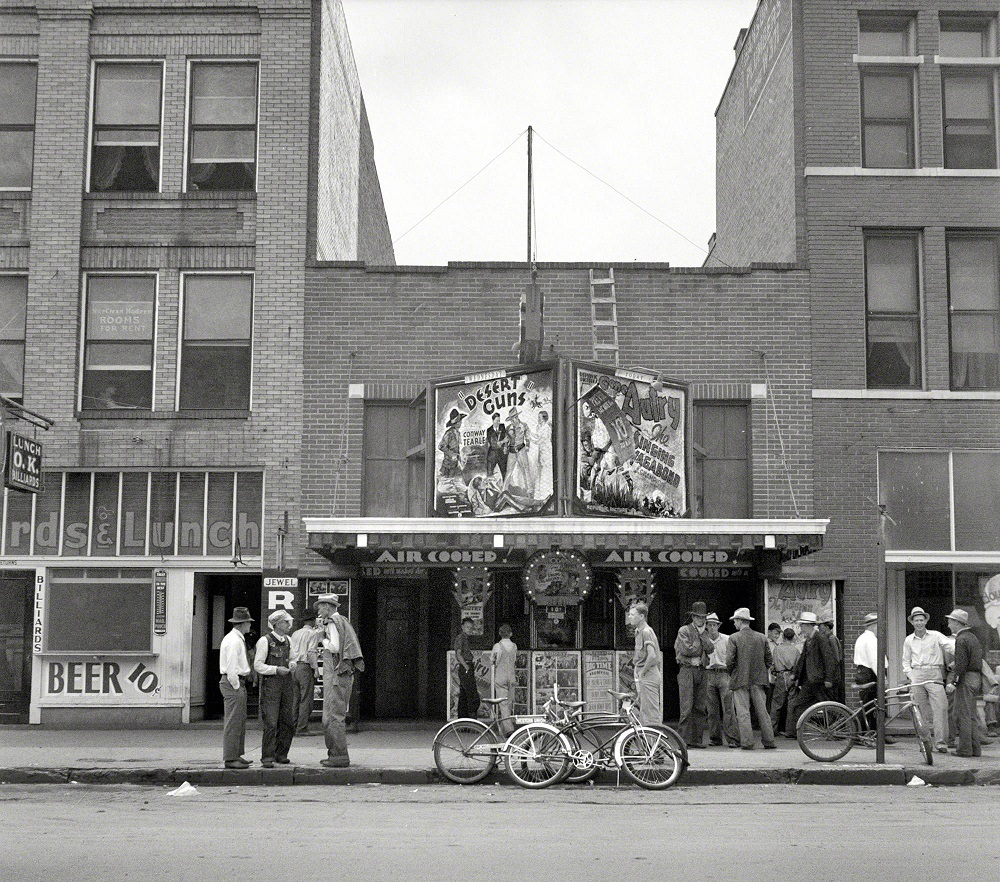
In June 1937, with unemployment still widespread, groups of men attended morning movie screenings in Oklahoma City. These were men with nowhere else to be during working hours. The movie theater offered a cheap way to pass the time, and federal photographers documented the scene as evidence of how deep joblessness ran in the city.
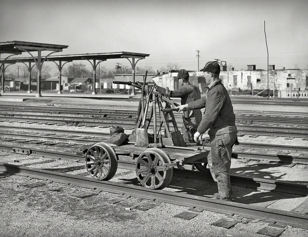

Railway workers photographed in February 1940 operated handcars along the tracks, performing maintenance on the lines that kept the city connected. By this point, World War II was approaching, and the federal government was already beginning to invest in infrastructure and industry across the country. Oklahoma City’s rail network, oil refineries, and growing workforce positioned it well for the industrial expansion that the war years would bring. The view north along Broadway from Grand Avenue captures a city that, despite the hardships of the Depression era, was very much still in motion.





Those electric cars are crazy cool! Intercity rails with these cars? Man, imagine seeing that in its heyday!
what collection did you swipe these from?
The interurban rail system would be great if it still existed.
The local trolley still runs for parades and other events. OKC used to have this kind of infrastructure. It was removed, then partially rebuilt.
Where was this May Avenue camp located? What was the cross street?
It is located between Reno and 10th May and Villa.
What happened to this encampment? Were the families relocated? Did the city develop the land and force them out? Based on our current homelessness situation, I believe it’s tough to get back on your feet once you’ve fallen that far.
It is just speculation, but the majority found permanent housing, and I am sure we don’t want to know how the rest were managed. In OKC history, the period between 1920 and 1941 is probably one of the most interesting.
I grew up on SW 9th street off of Agnew. We always called that area Packin’ Town, because of the meat packing companies in the area. Many of the old timers in my neighborhood had once lived in the Camps. The Camps at their height strung from May Avenue all the way down the river to Byers Avenue. Many of the people living there had lost their farms during the depression. The one located at May Avenue was the largest due to the fact that the city dump was adjacent to the camp. Many of those families survived from what they called ‘trashin’ rummaging thru the trash to make ends meet. Most of the camps were torn down when the Corp of Engineers built the levees from Portland to Eastern Ave. A section of the camps still existed into the late 1970’s at South Pennsylvania Ave. and the Canadian River. I went to school with many of the kids that lived there. In my neighborhood the people who lived there were often referred to as Campers.
Thanks for that. My father rode an Indian Chief as delivery for Veaseys out of 16th and Indiana in the 20s and 30s. In the late 80s I fixed residential phones in that area. You fill in a lot of gaps for what I heard from him and witnessed myself.
Thank you sharing this 😊
This guy sure does not cite his photos well for a librarian.
Guthrie was just as excellent as it is now.