
Minneapolis is the most populous city in Minnesota, and for much of the early 20th century, it was one of the most industrially active cities in the entire United States. Known widely as “Mill City,” Minneapolis earned that title through its dominance in flour production. The mills that lined the Mississippi River powered an economy that drew workers, businesses, and settlers from across the country. St. Anthony Falls, the only natural waterfall on the Mississippi, gave those mills the waterpower they needed to operate at a massive scale.
Before flour took over, lumber defined the city’s fortunes. In the late 19th century, logs floated down from the northern forests jammed the river so thick you could nearly walk across them. By the time the 20th century began, the timber supply had largely been exhausted, and Minneapolis had fully pivoted to grain. The Minneapolis Chamber of Commerce, founded in 1881, served as the central marketplace for grain trading and anchored the city’s commercial identity for decades.
The city’s population grew steadily through the early 1900s. New hotels, civic buildings, post offices, and railway stations rose across the skyline. Streets like Hennepin Avenue and Nicollet Avenue became busy commercial corridors lined with storefronts, streetcar lines, and foot traffic. St. Paul, Minneapolis’s twin city just across the river, saw its own wave of development during the same era, with grand civic structures and busy commercial streets taking shape. These photographs capture both cities at key moments in their growth.
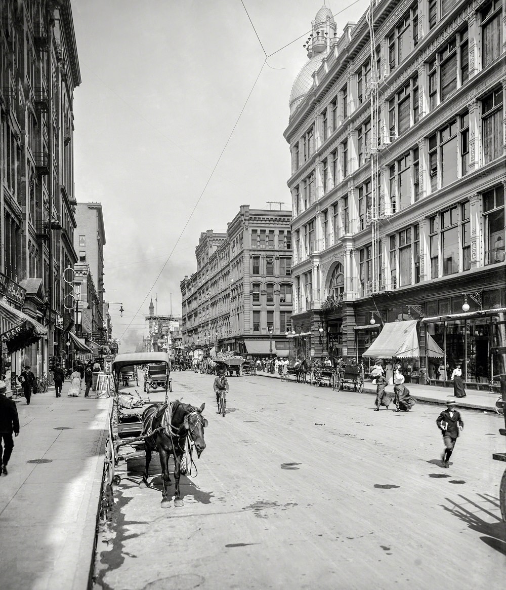
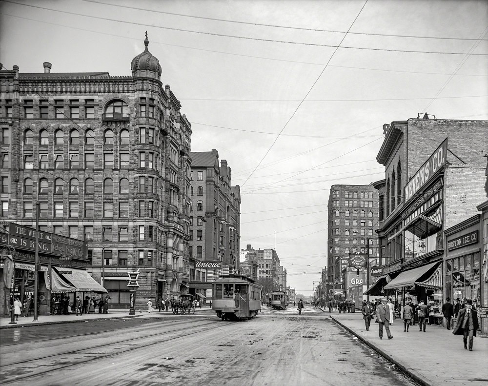
Nicollet Avenue was one of Minneapolis’s most prominent streets by the turn of the century. Hotels, shops, and financial institutions clustered along its length, making it a center of commerce and daily life. The Hotel Nicollet, located at the corner of Nicollet and Washington Avenues, was among the city’s most prestigious addresses in the early 1900s.
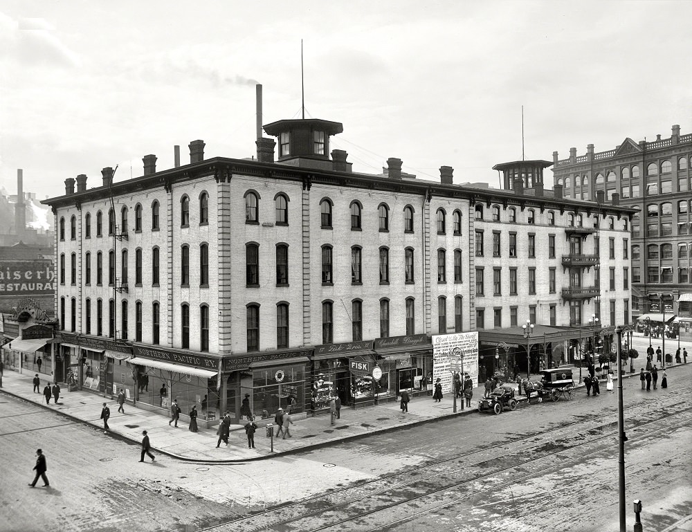
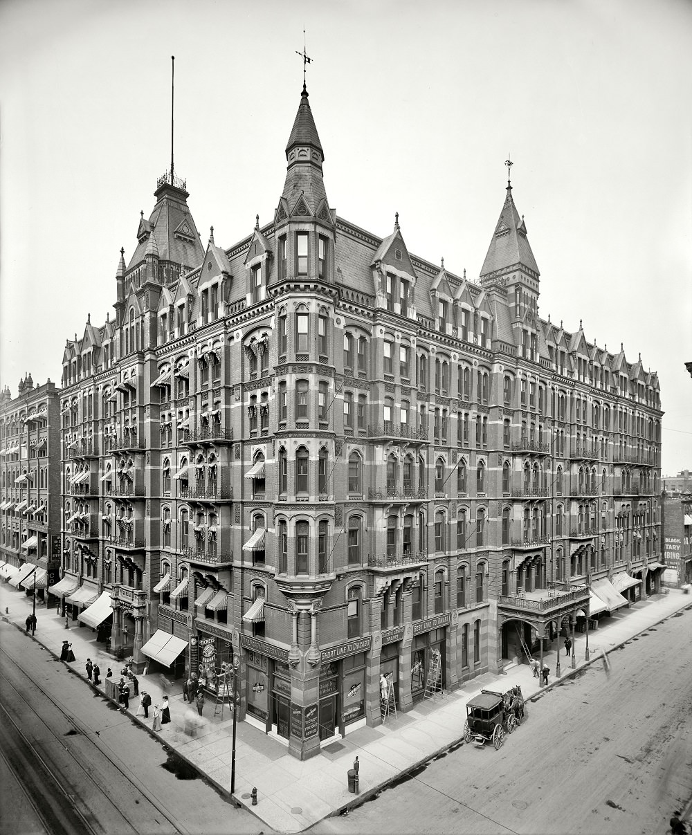
Hotels played a central role in Minneapolis’s urban identity. The West Hotel was another landmark that catered to travelers and businessmen passing through the growing city. On Seventh Street, the Hotel Radisson added to the concentration of upscale accommodations that signaled Minneapolis’s ambitions as a major metropolitan center.
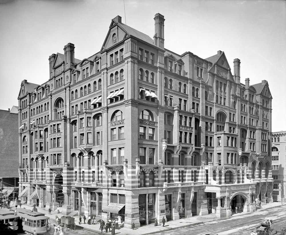
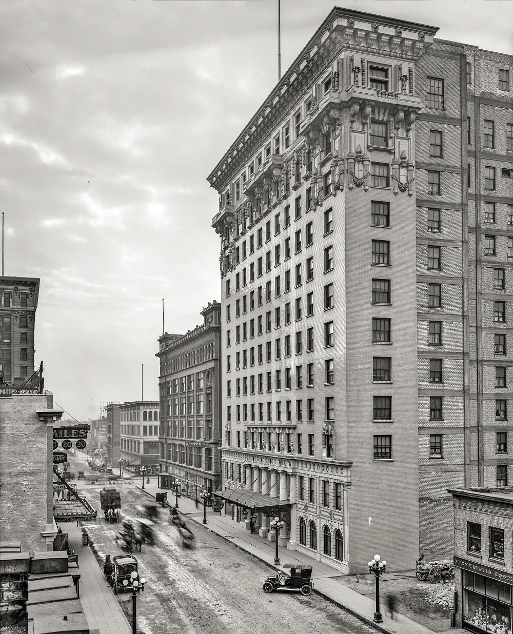
Hennepin Avenue stretched through the heart of the city and was already a major thoroughfare by 1908. Streetcars ran its length, connecting neighborhoods to the downtown core. The avenue’s mix of commercial buildings and public spaces made it one of the most photographed streets of the era.
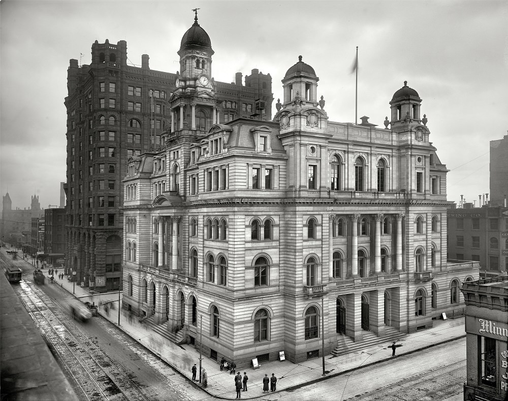
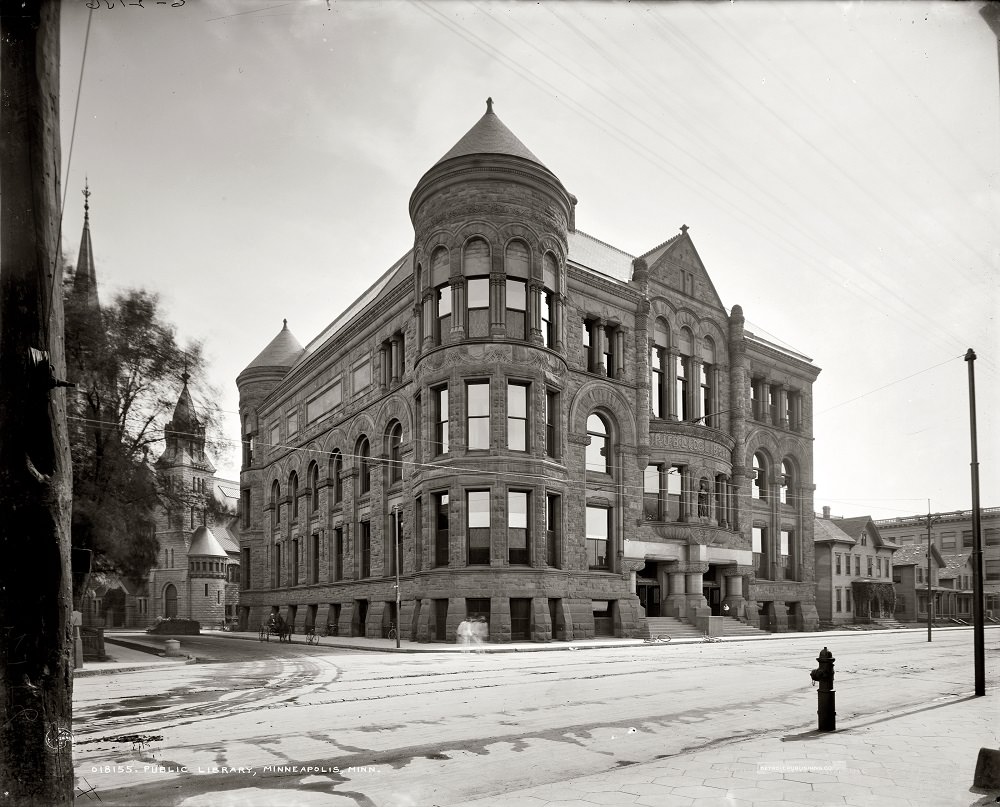
Public institutions gave Minneapolis its civic backbone. The Minneapolis Post Office on Hennepin County stood as a symbol of federal investment in the growing city. The city’s public library, built in the early 1900s, served a population that was expanding rapidly and demanded public services to match.
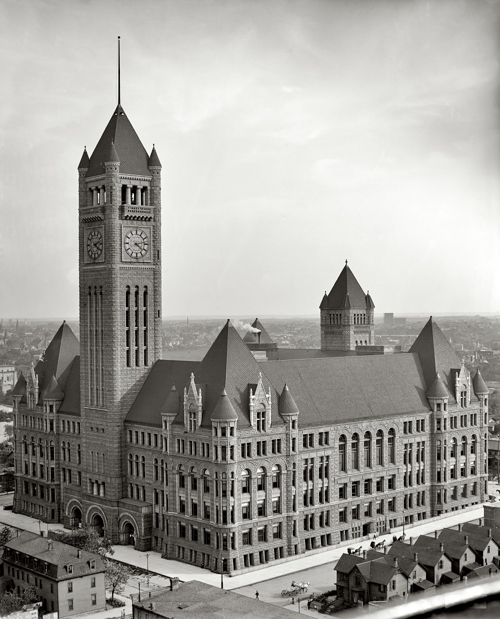
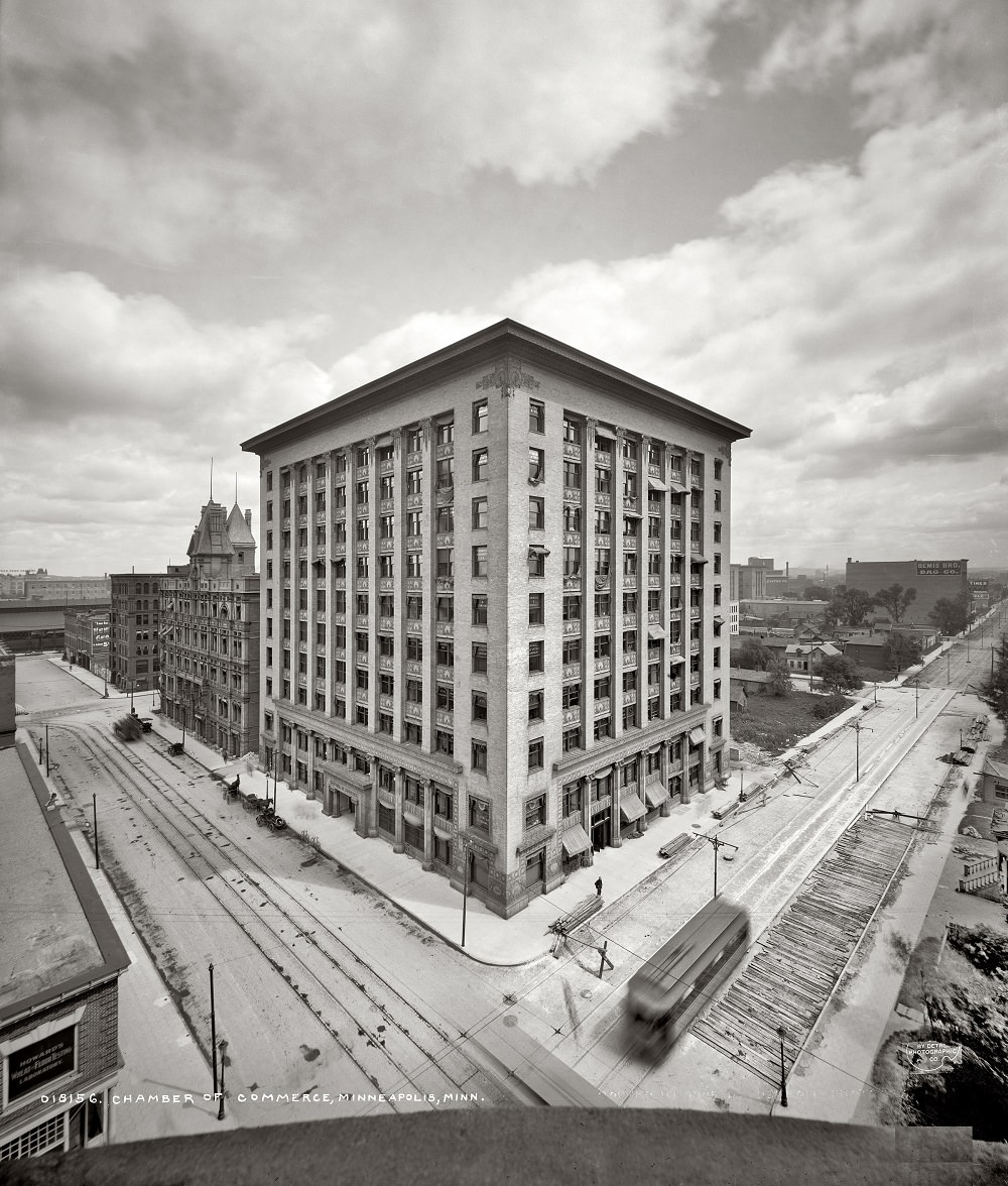
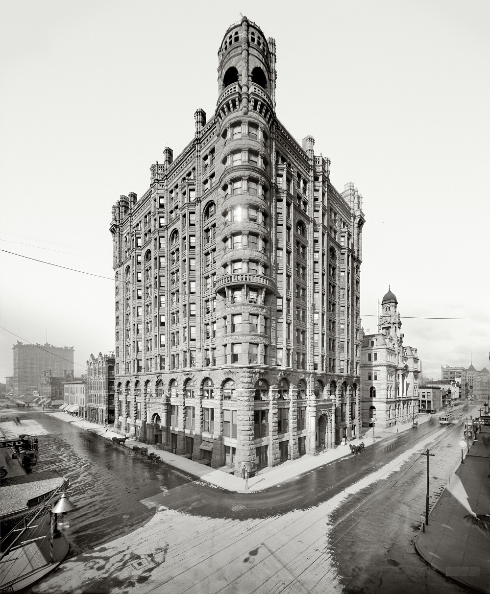
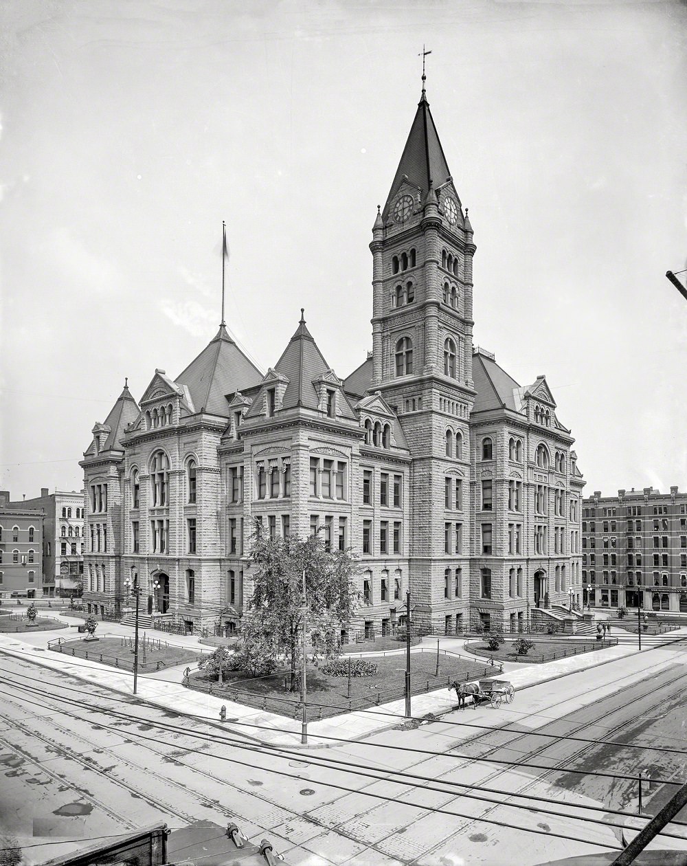
The Courthouse and City Hall in Minneapolis, along with the Chamber of Commerce building, represented the city’s institutional ambitions. The Northwestern Guaranty Loan Building, a striking example of early commercial architecture, rose above the surrounding streetscape and pointed to the city’s confidence in its own future.
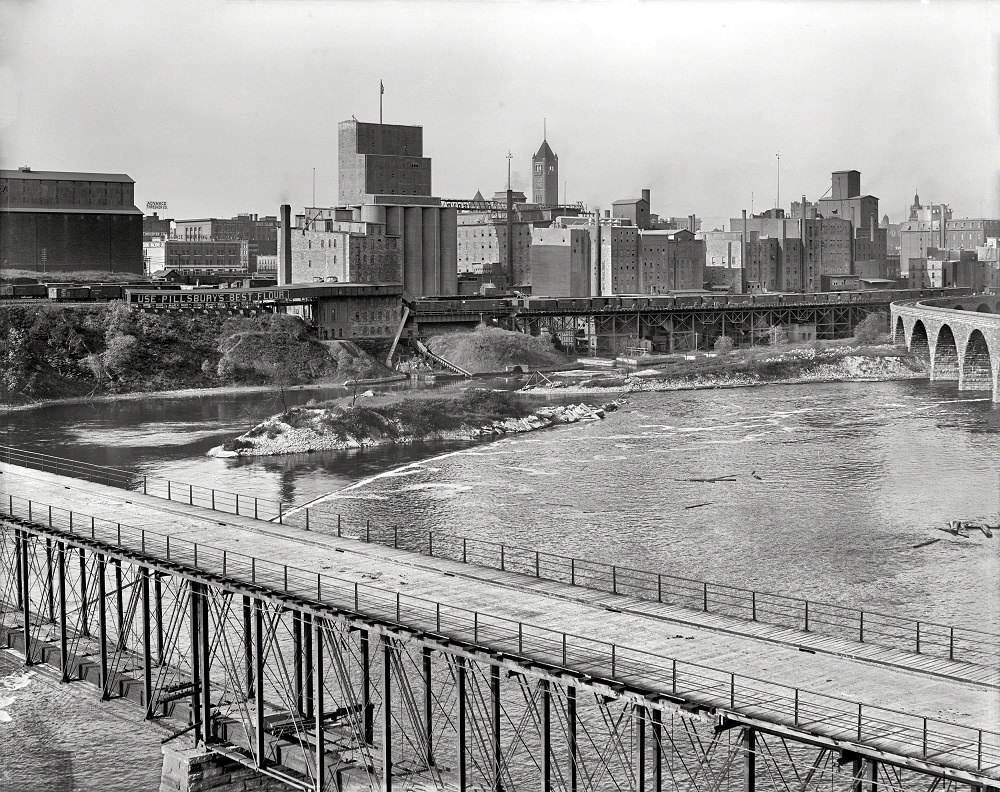
St. Anthony Falls and the milling district were the physical and economic heart of Minneapolis for generations. The falls powered the flour mills that made the city famous, and the surrounding district was packed with industrial infrastructure, warehouses, and workers.
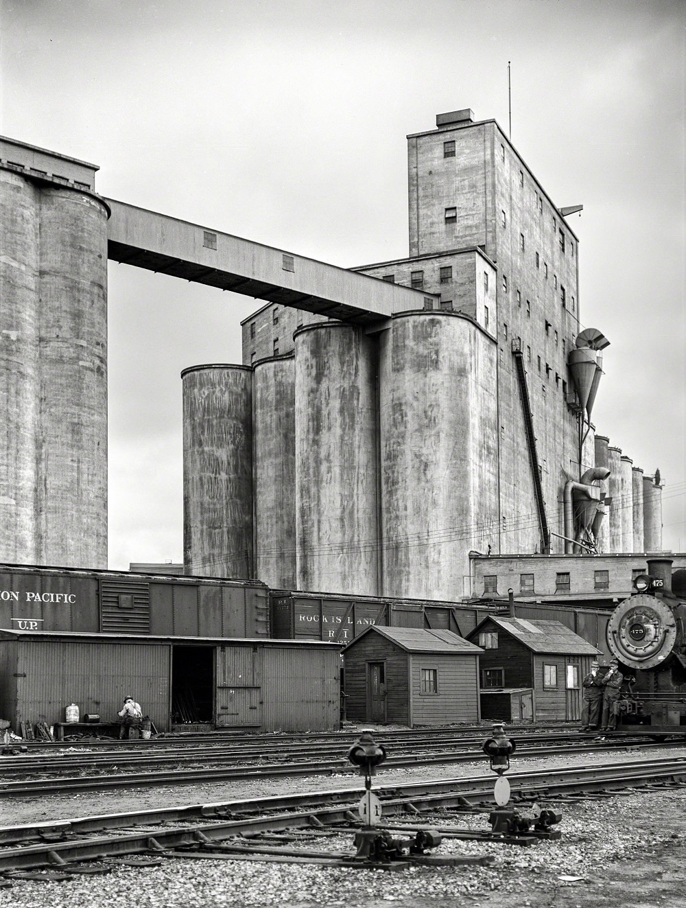
Grain elevators were a fixture of the Minneapolis landscape by the late 1930s. Towering above the surrounding buildings, they stored the massive quantities of wheat and corn that passed through the city’s trading markets. The railroad yards in the wholesale district fed directly into this supply chain, with freight moving in and out of the city around the clock.
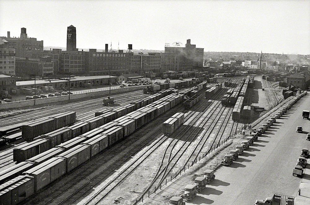
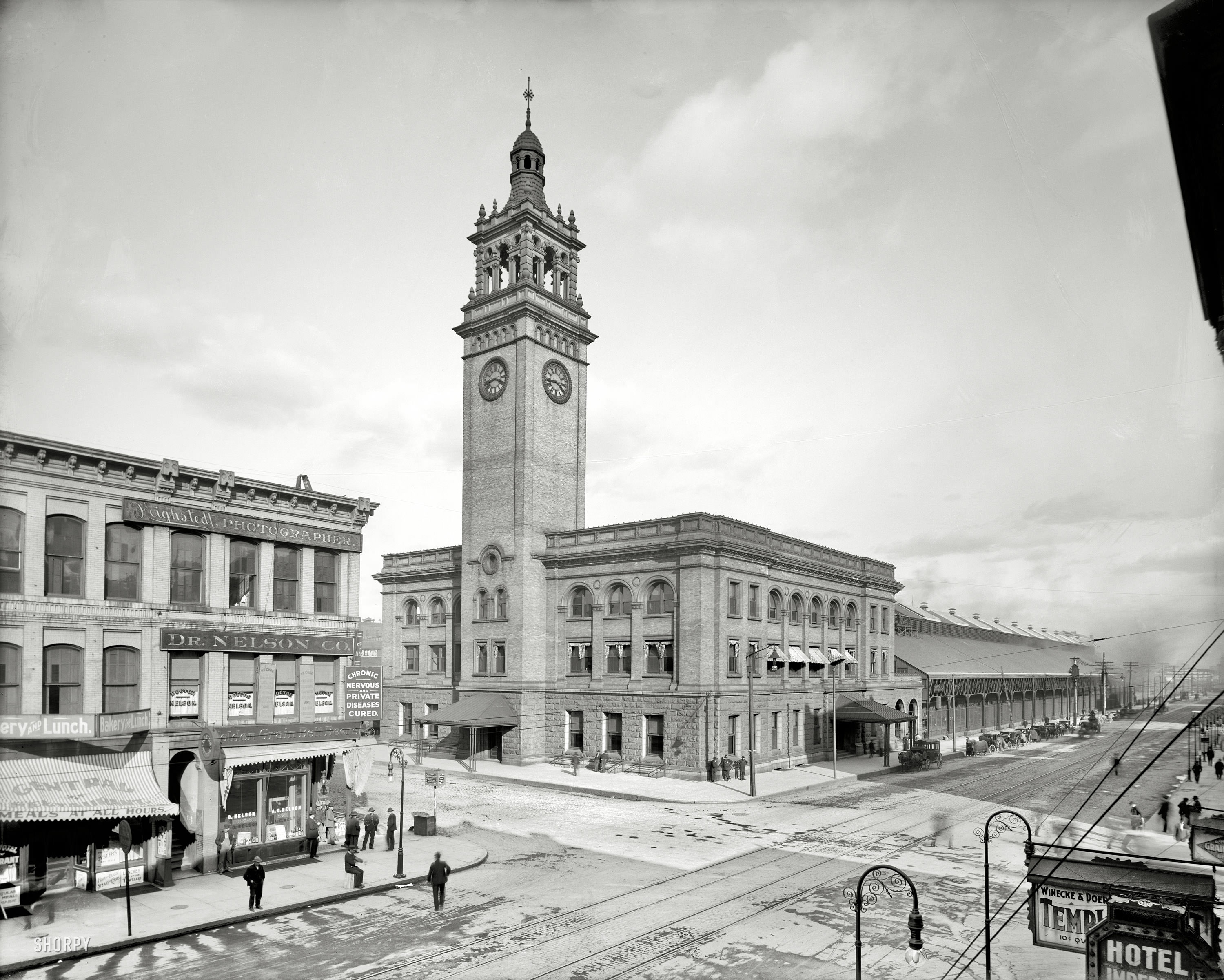
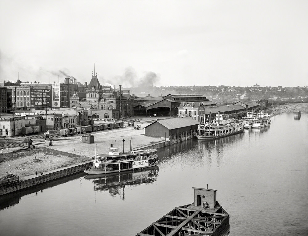
Rail transport was the lifeblood of commerce in early 20th century Minneapolis. The Chicago, Milwaukee & St. Paul Railway station served as a key hub connecting Minneapolis to regional and national freight and passenger networks. Across the river, the Union Depot and steamboat landing at the foot of Jackson Street in St. Paul handled both rail passengers and river traffic.
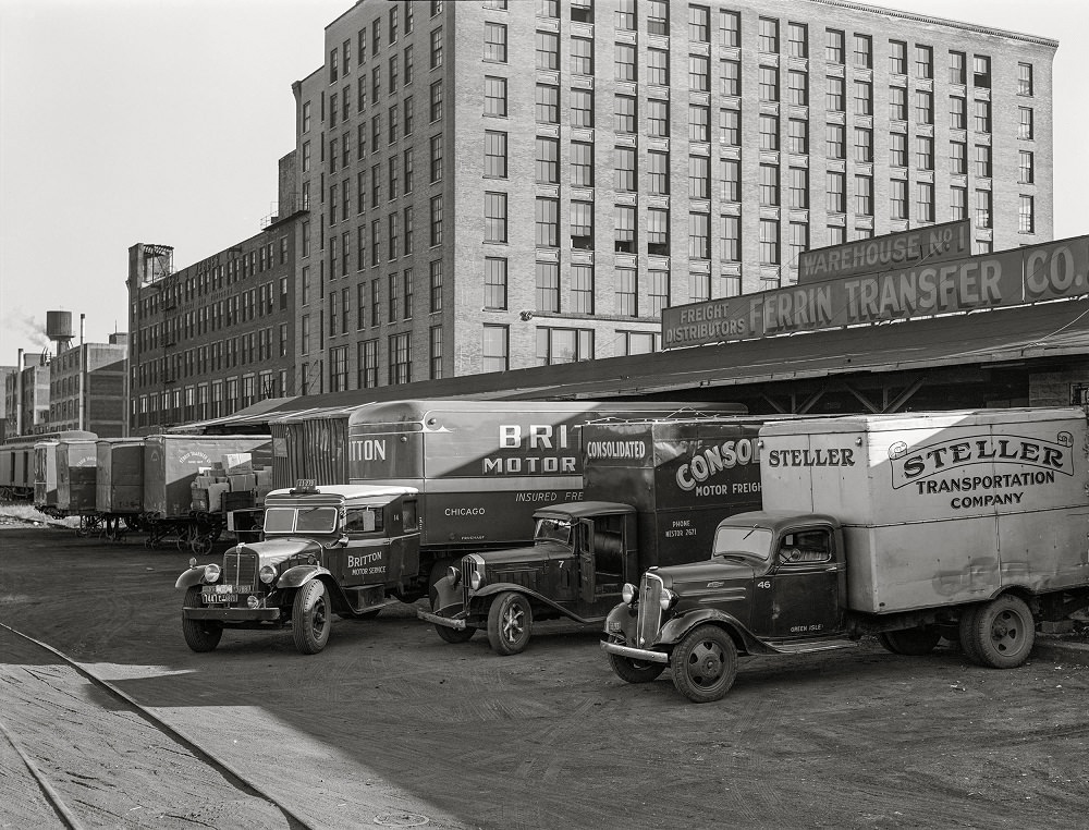
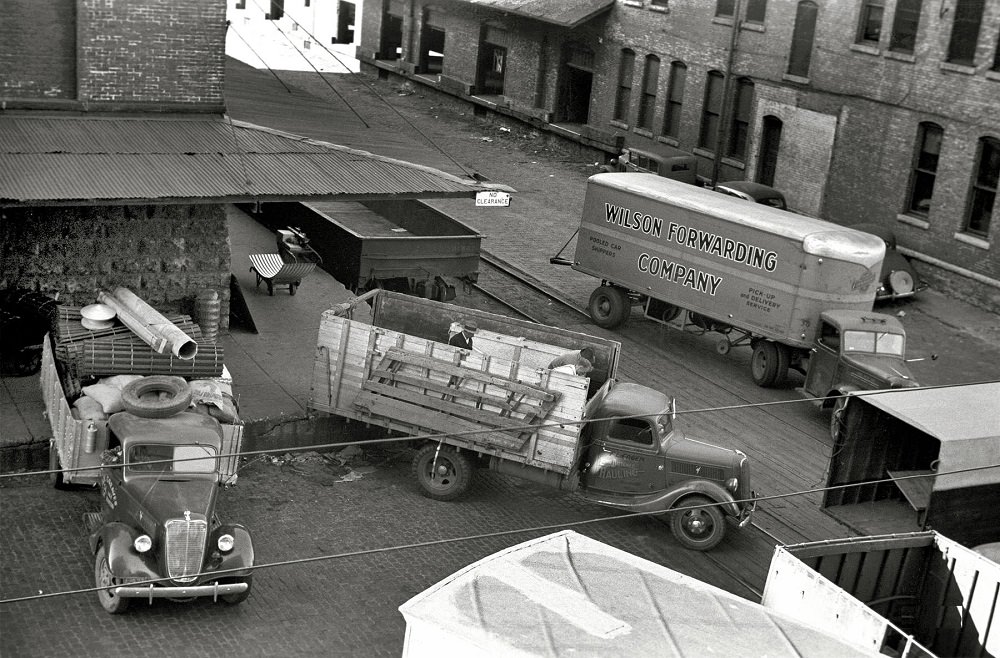
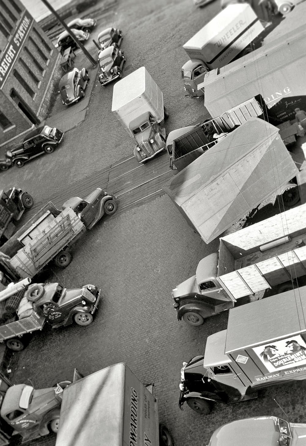
Farm implement warehouses and terminal loading docks were a steady presence in Minneapolis by the late 1930s. Trucks pulled in and out loading goods for distribution across the region. The city’s warehousing and logistics operations reflected just how deeply agriculture shaped the local economy — not just in grain, but in the tools and equipment that farmers across the Midwest depended on.
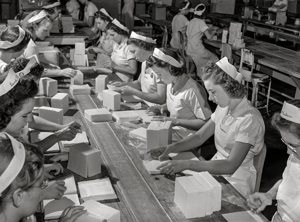
The Land O’Lakes plant in Minneapolis was one of the city’s major food processing operations. By July 1941, workers there were packing butter cut into precise squares for distribution to restaurants across the region — an example of the organized food industry that Minneapolis had built around its agricultural supply chains.
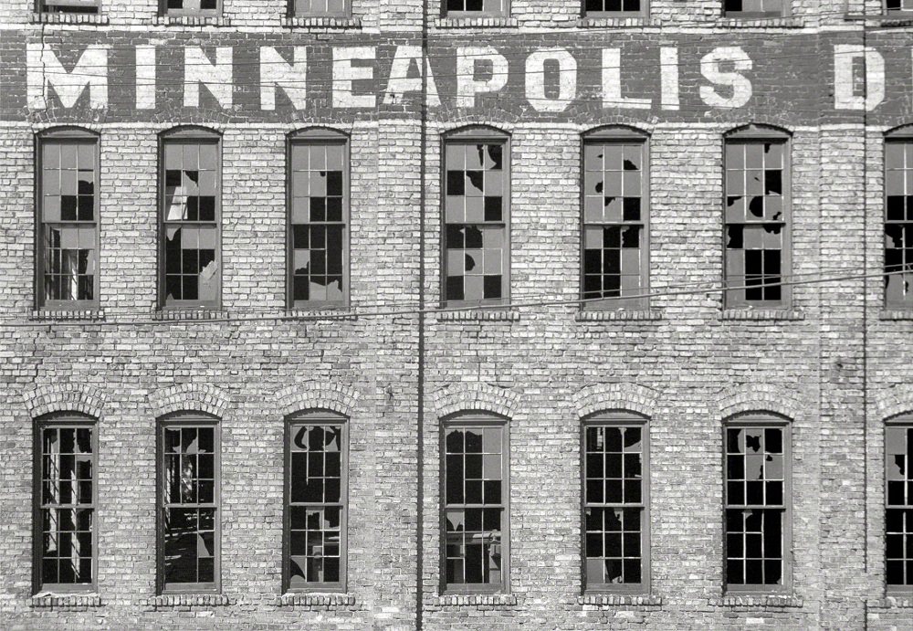
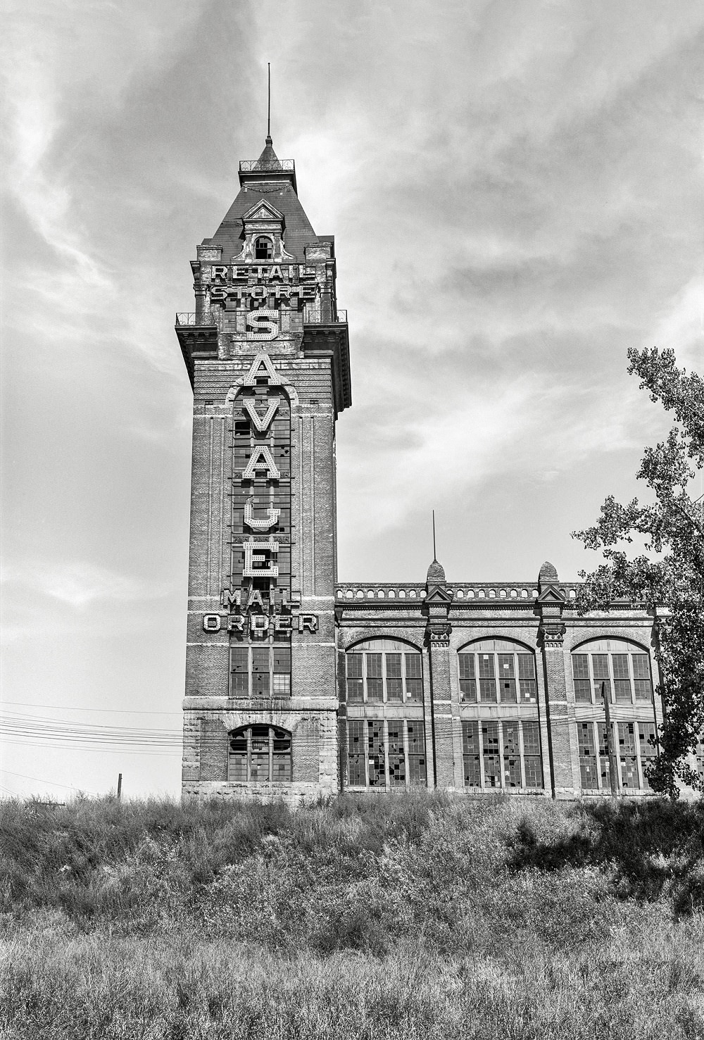
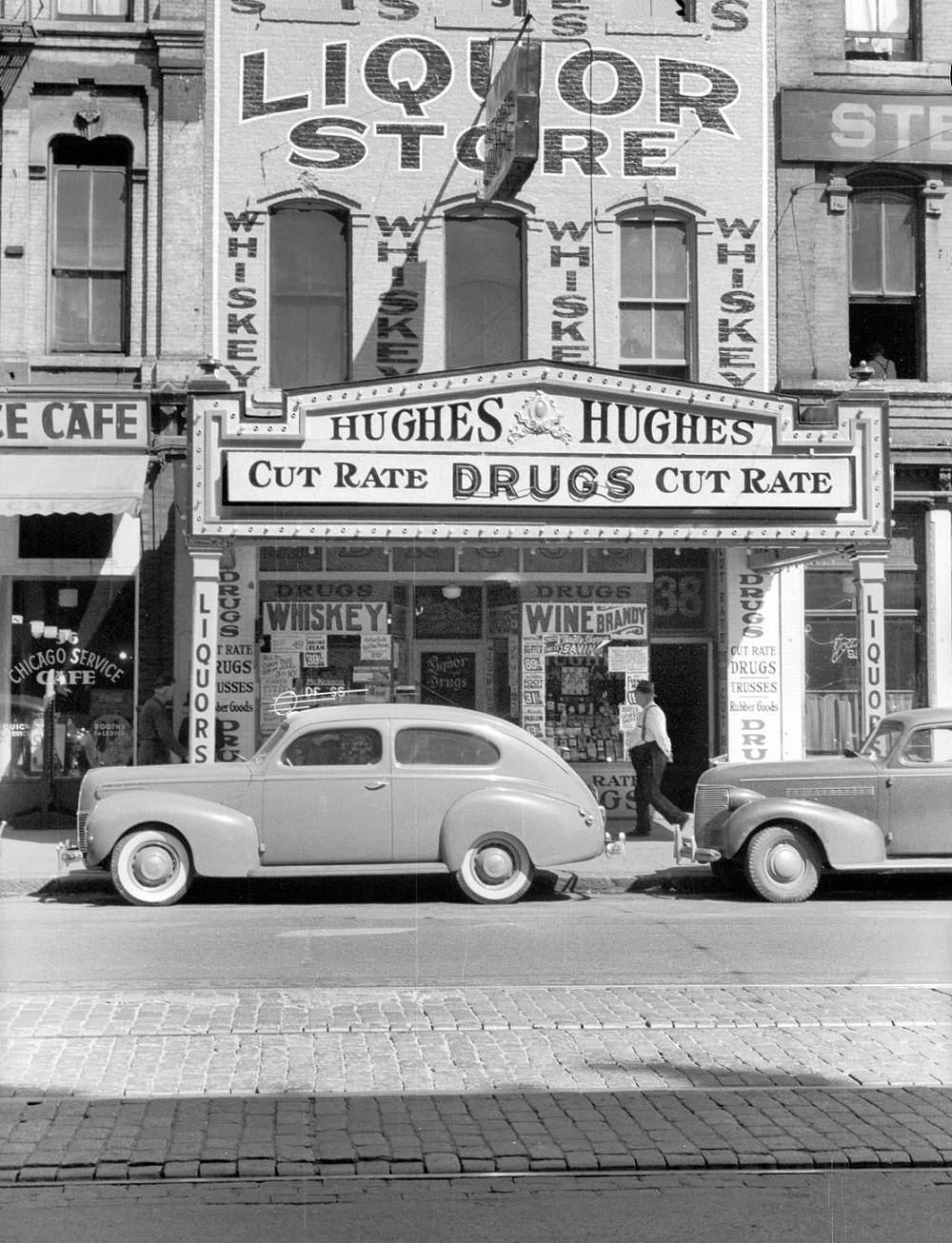
Not all of Minneapolis’s story in the late 1930s was one of growth and productivity. By 1939, the city showed clear signs of economic stress left over from the Great Depression. Abandoned factories and neglected mail-order houses stood in contrast to the busy warehouses and loading docks nearby. The Gateway District, a neighborhood near downtown, had become a skid row area by this period, home to cheap rooming houses, liquor stores, and unemployed transient workers.
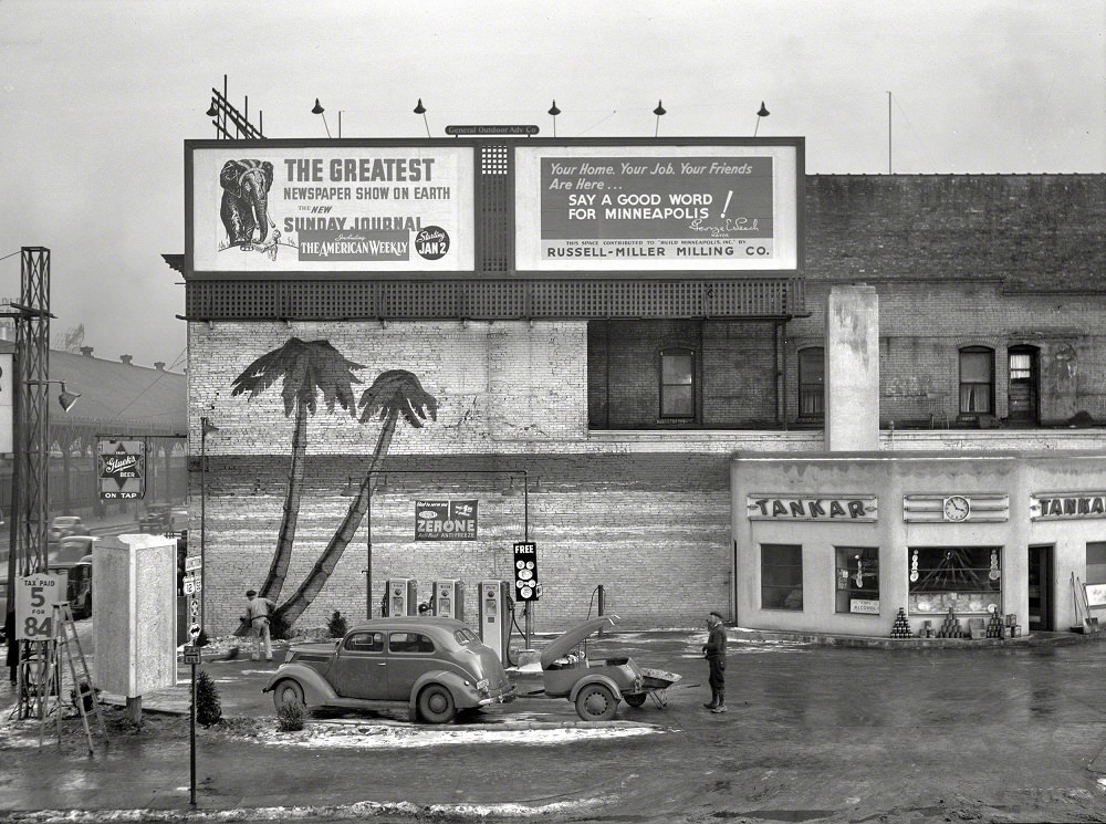
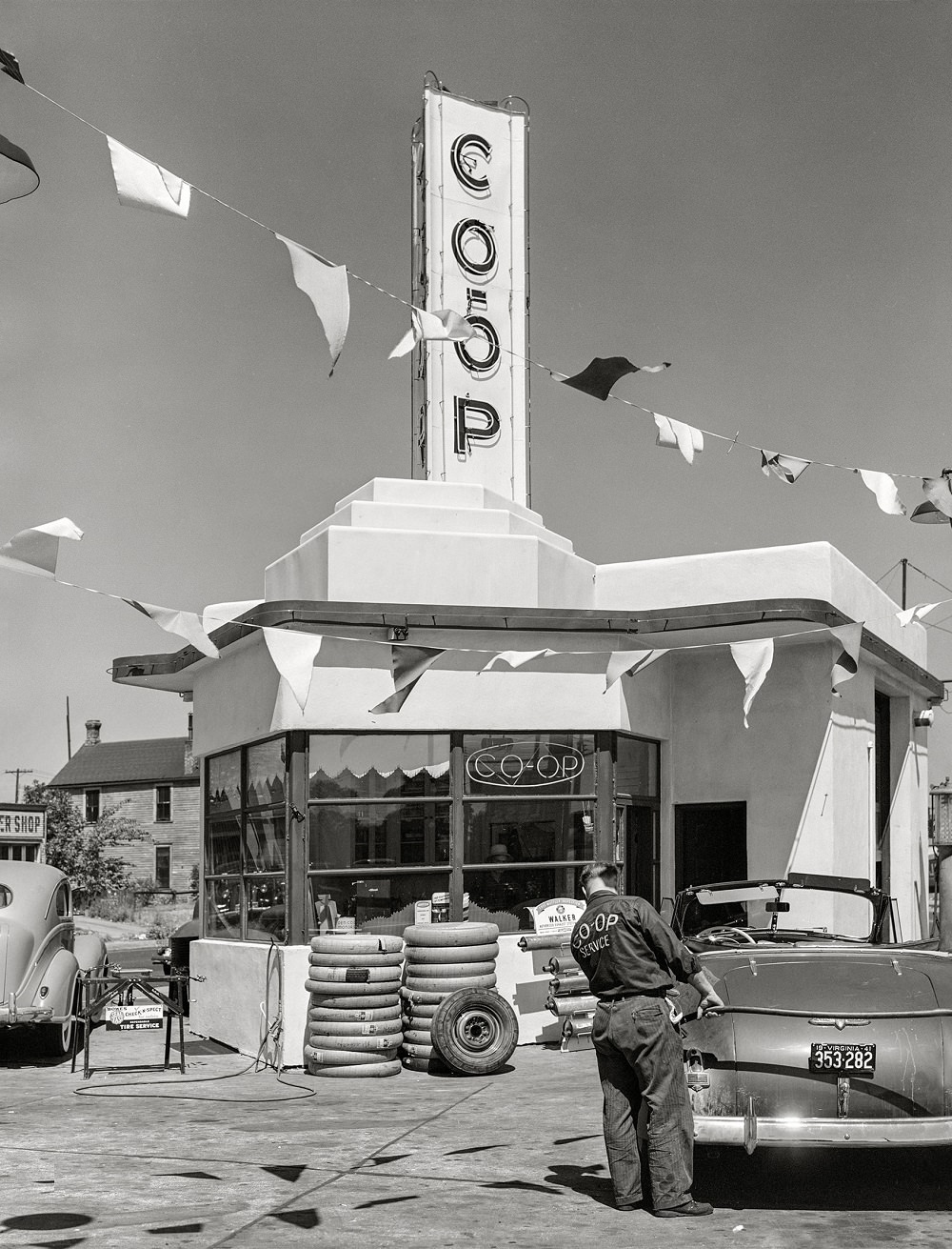
Gas stations were multiplying across Minneapolis by the late 1930s and early 1940s as automobile ownership expanded. A cooperative gas station photographed in August 1941 reflected a broader trend in which cooperative business models had taken hold in Minnesota, particularly in industries tied to agriculture and transportation.
Across the river in St. Paul, the early 1900s brought major civic and commercial development as well. Robert Street was one of the city’s busiest commercial corridors, lined with businesses including the offices of the Pioneer Press. Wabasha Street and Seventh Street at Cedar were similarly active, their storefronts and pedestrian traffic reflecting a city very much in motion.
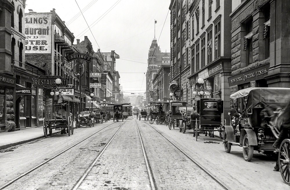
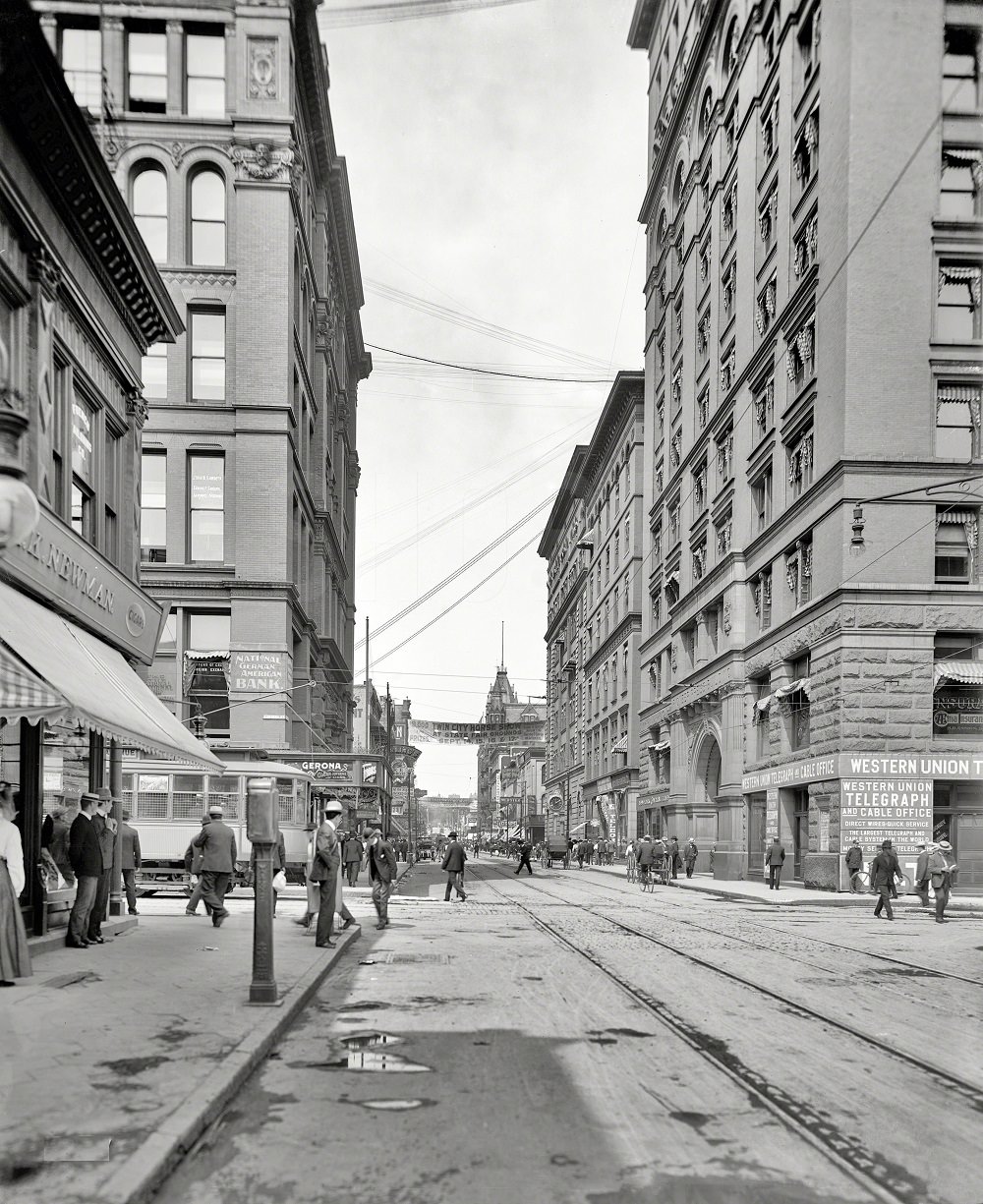
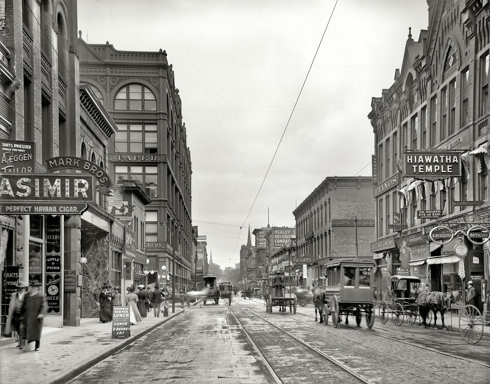
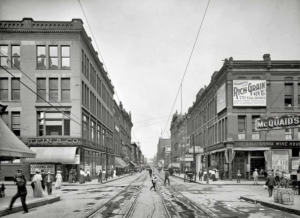
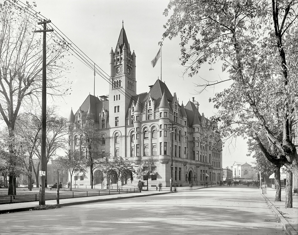
St. Paul’s civic architecture rivaled that of Minneapolis. The City Hall and Courthouse stood as an imposing government complex, and the Ryan Hotel provided the city with a grand hospitality landmark. The post office, built in the early 1900s, was a Federal-style building that handled the mail for a rapidly growing urban population.
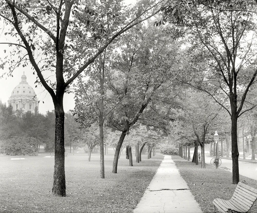
The Minnesota State Capitol dome, visible from Central Park in St. Paul in 1910, towered over the surrounding cityscape. Harriet Island on the Mississippi River provided St. Paul residents with outdoor recreational space, and photographs from around 1905 show children at play on its grounds.
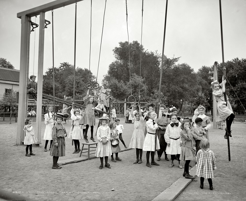
Wabasha Street in St. Paul remained a key commercial artery into the first decade of the 1900s. Meanwhile, panoramic views of Minneapolis taken around 1905 captured the full sweep of a city that had grown remarkably fast — from a mill town on the Mississippi into a major American metropolis with a defined skyline and a dense urban core.
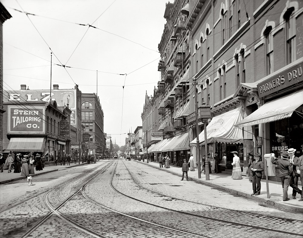
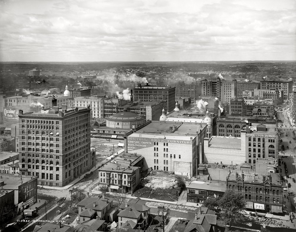
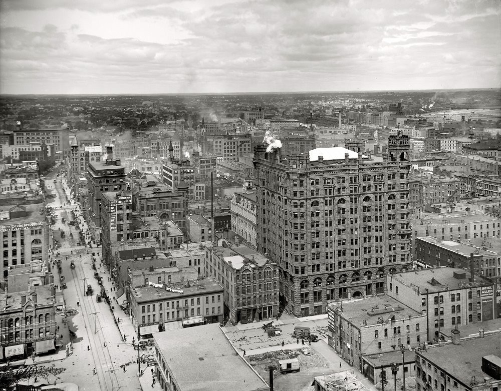
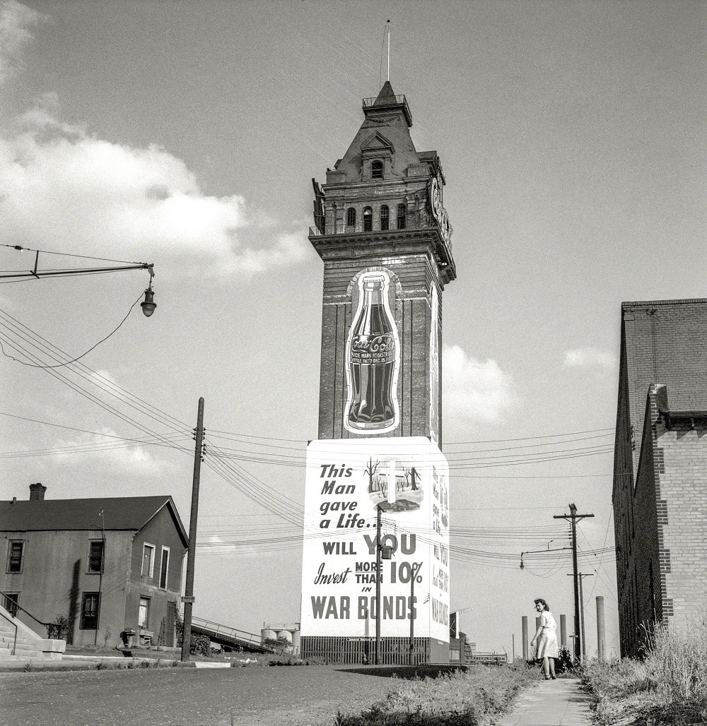
The Minneapolis Industrial Exposition Building, photographed in 1943, was one of the city’s major event and exhibition venues. By the mid-20th century, Minneapolis was in the middle of an urban renewal push that would ultimately cost the city some of its most architecturally significant buildings. Structures like the Metropolitan Building were razed to make way for new development, a decision that later historians and preservationists viewed as a serious loss to the city’s architectural heritage.
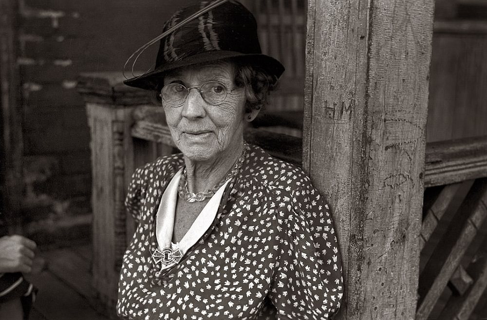
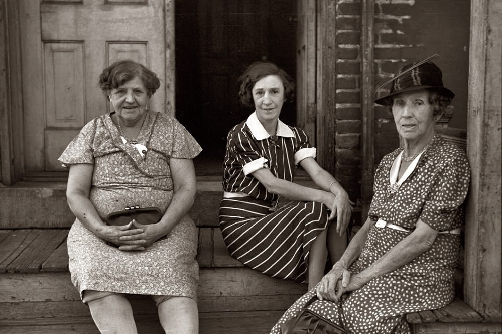
The city’s growth also came with serious social problems. Bigotry and political corruption took root in Minneapolis during the mid-20th century, and the Gateway District became a concentrated area of poverty and urban decay. Rooming houses in St. Paul housed residents — often older women living on very little — who had been left behind by the city’s economic progress.
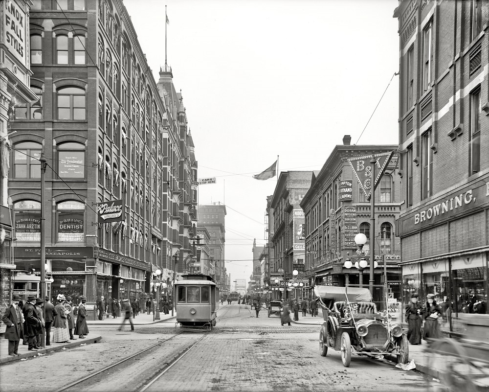
Robert Street in Minneapolis in 1908 showed a city with busy streets and developed commercial infrastructure. The Minneapolis Robert Street photograph stands alongside the earlier views of Nicollet Avenue as evidence of how quickly the city’s commercial districts matured in the space of just a few years at the start of the century.





What happened at the Minneapolis Industrial Exposition Building? And where was it? Its a strange looking building that looks out of place
Third and Main… just upriver from the the St Anthony main theater. That tower is just a small part of the original structure.
https://www.mnhs.org/mnopedia/search/index/structure/industrial-exposition-building-minneapolis