
Dublin in the 1960s was a city caught between its deep historical roots and a cautious step toward the modern world. The streets were filled with double-decker buses, horse-drawn drays, and cyclists weaving through junctions that had barely changed since the Victorian era. Yet underneath that familiar surface, the city was slowly shifting. These photographs capture Dublin at a pivotal moment — before the development boom, before the tech giants, and before much of its Georgian streetscape was lost to the wrecking ball.
Dublin’s story begins long before the 1960s. Vikings founded a settlement here in the 9th century, calling it the Norse Kingdom of Dublin. From that trading post on the River Liffey, the city grew steadily over the centuries. By the 17th century, Dublin was expanding rapidly, and it briefly held the title of second largest city in the British Empire before the Acts of Union in 1800 folded Ireland’s parliament into Westminster and shifted political power away from the capital. By the 20th century, Dublin was the capital of an independent Ireland, carrying centuries of history in every cobblestone and Georgian façade.
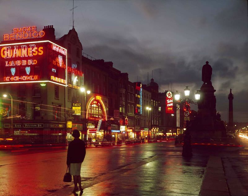
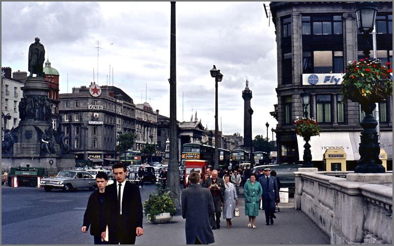
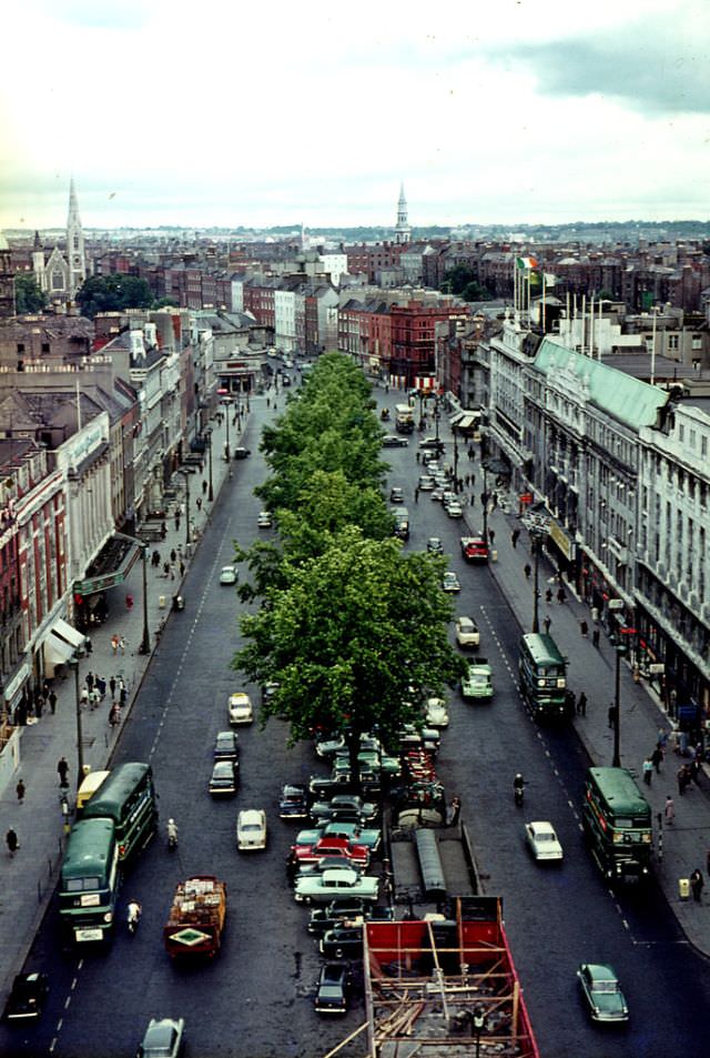
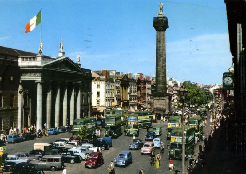
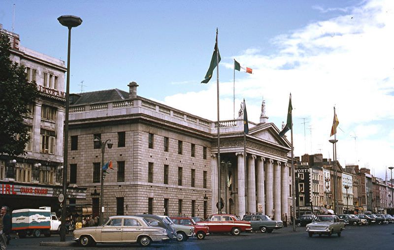
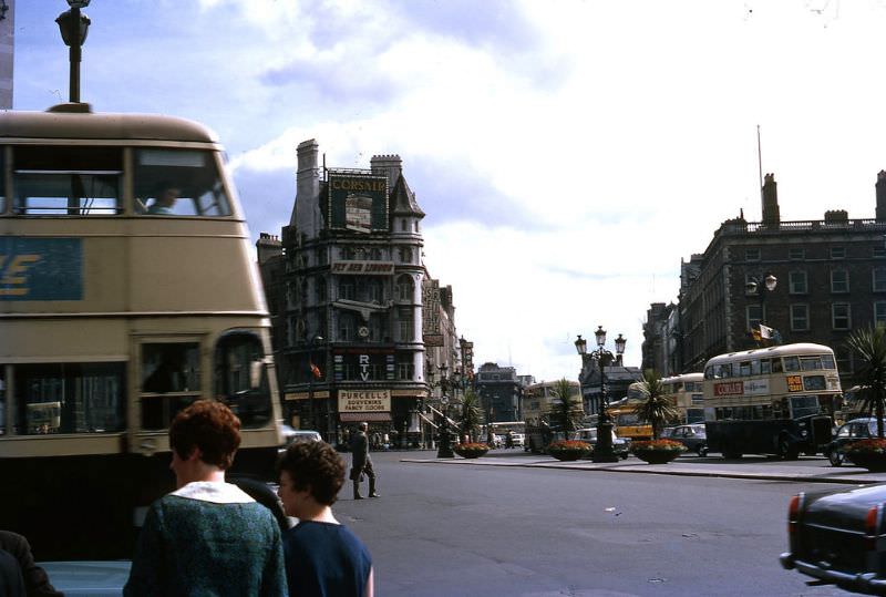
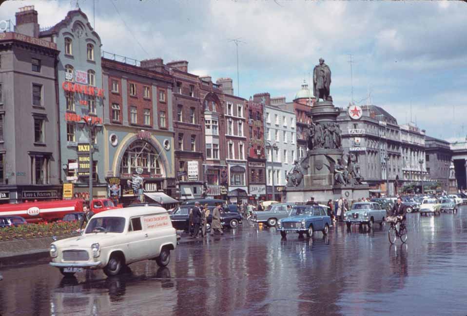
O’Connell Street was the beating heart of the city in the 1960s. Broad, busy, and lined with shops and cinemas, it was where Dubliners came to see and be seen. The street had been the site of the 1916 Easter Rising, and the scars of that rebellion had long since been rebuilt into the fabric of the city — most notably in the General Post Office, which served as the rebels’ headquarters.
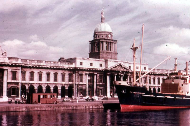
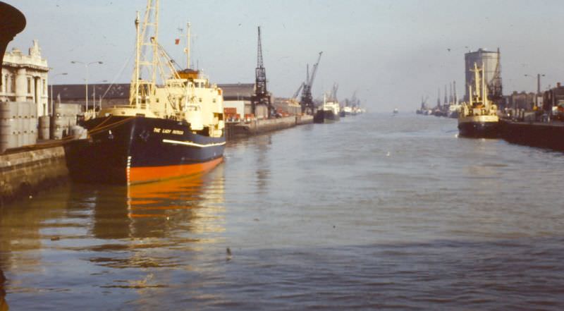
The River Liffey divided the city into its north and south sides, and along its banks sat some of Dublin’s most important buildings. The Custom House, completed in 1791, was one of the finest examples of neoclassical architecture in Ireland. By the early 1960s, the quays alongside it were still active working waterfronts, with ships docking to load and unload cargo just as they had for generations.
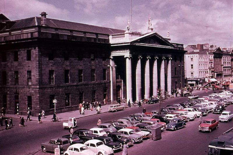
The General Post Office on O’Connell Street was more than just a postal building — it was a national symbol. Its neoclassical façade, marked by bullet holes from the 1916 Rising that were never fully erased from public memory, stood as a reminder of Ireland’s fight for independence. In the early 1960s, it continued to function as a working post office while drawing visitors who came to see the place where the Irish Republic was proclaimed.
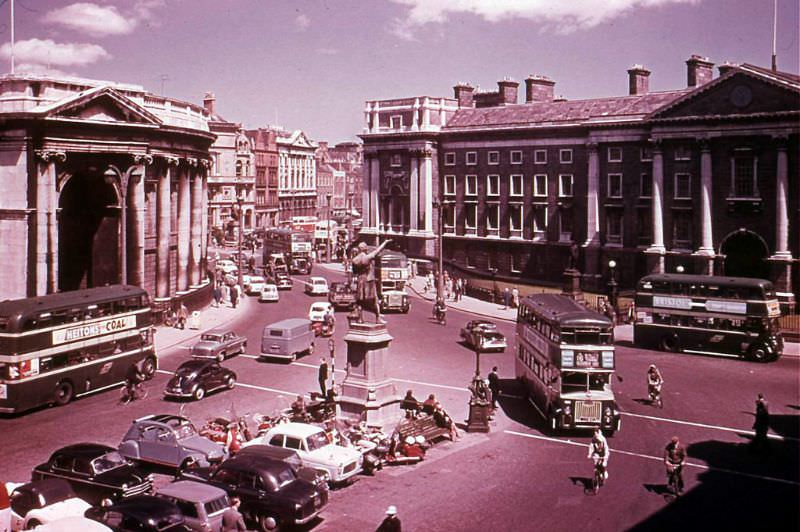
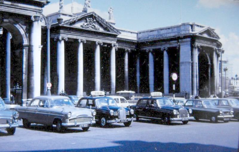
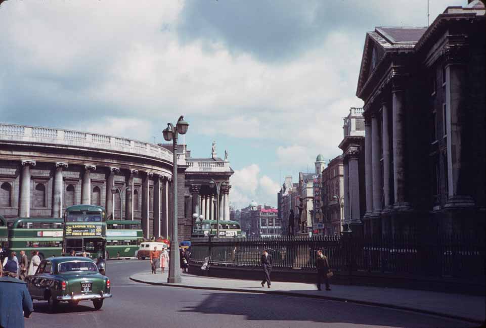
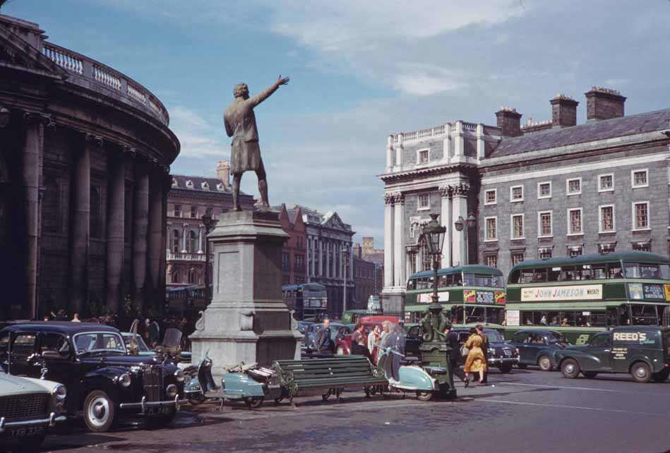
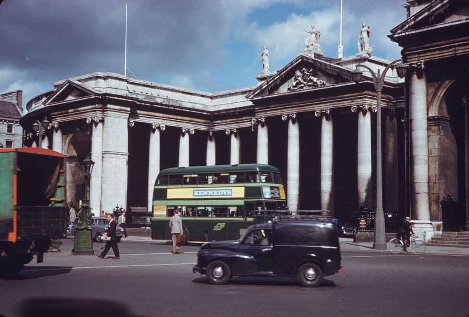
College Green, at the southern end of O’Connell Street, anchored the city’s academic and financial identity. Trinity College Dublin, founded in 1592, faced the imposing Bank of Ireland building across the street — a former home of the Irish Parliament before the Acts of Union. Together, the two buildings formed one of the most photographed corners in the city.
Away from the main thoroughfares, streets like Capel Street offered a glimpse into the working life of the city. Running north from the Liffey, Capel Street was lined with hardware shops, small businesses, and traders who had worked the same stretch for decades. It was a functional street, not a tourist one, and that’s exactly what made it so distinctly Dublin.
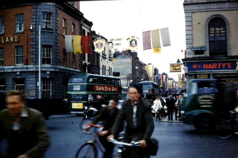
Not all of Dublin’s 1960s activity was commercial. The Royal Dublin Society Horse Show was one of the social highlights of the year. Held at the RDS grounds in Ballsbridge, the annual event drew competitors and spectators from across Ireland and abroad. Flowers and pageantry were as much a part of the show as the horses themselves.
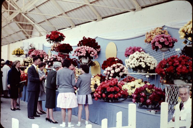
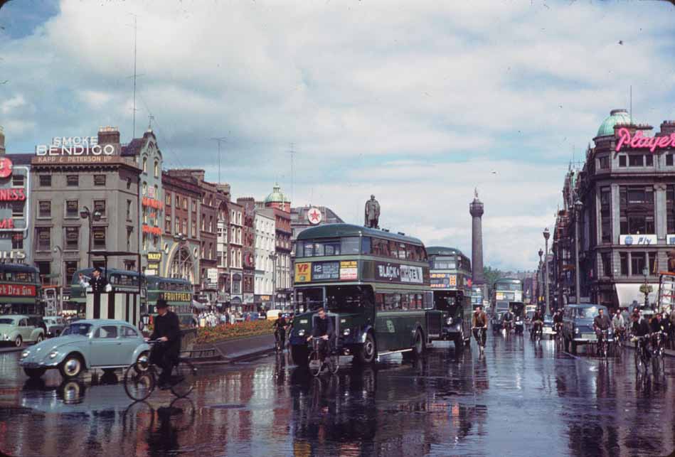
O’Connell Street appeared again and again in photographs from this decade because it was simply where life happened. Buses, trams in their final years, and pedestrians crowded the wide boulevard at all hours. Shop fronts, cinema marquees, and the occasional street vendor added to the constant movement.
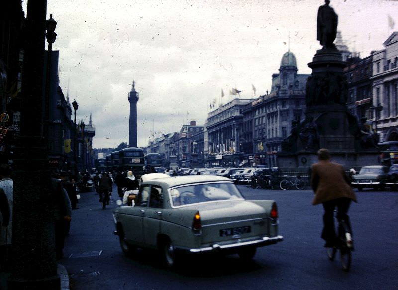
One of the most distinctive features of O’Connell Street in this era was Nelson’s Pillar — a tall column topped with a statue of British Admiral Horatio Nelson, which had stood at the center of the street since 1809. The monument was controversial among Irish nationalists, standing as it did in the heart of the capital of an independent republic. In March 1966, during the 50th anniversary commemorations of the Easter Rising, the pillar was blown up by Irish republicans. The Irish Army demolished the remaining stump shortly after. But in 1963, it still stood — a striking landmark against the Dublin skyline.
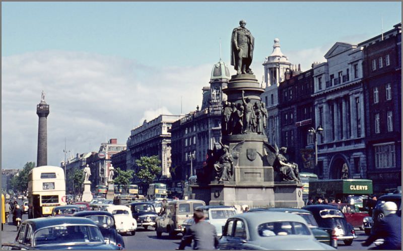
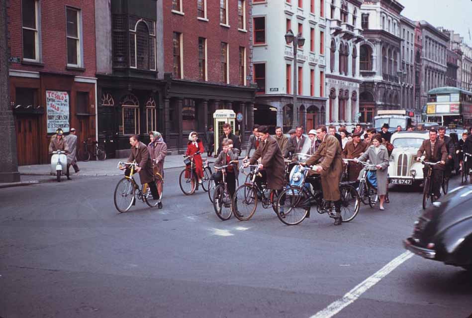
College Green in 1964 showed a city that was still largely reliant on public transport and bicycles. Private car ownership was growing but had not yet reshaped Dublin’s streets the way it would by the end of the decade. Pedestrians and cyclists still dominated many of the city’s key junctions.
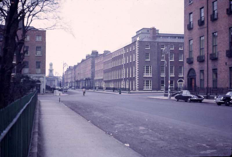
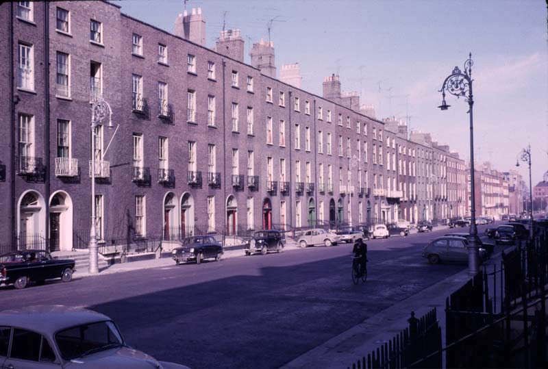
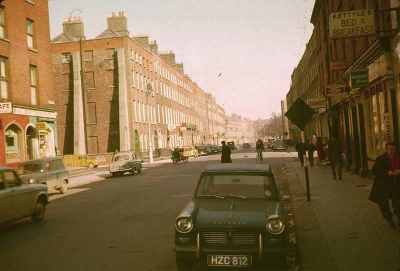
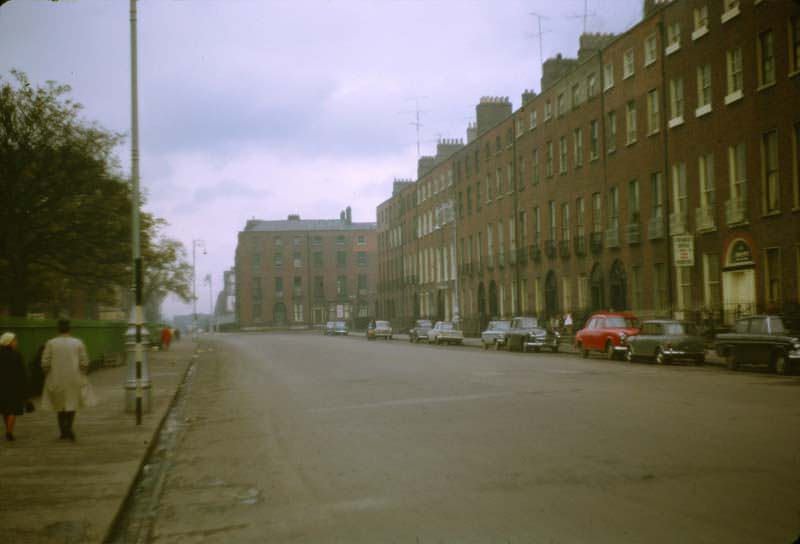
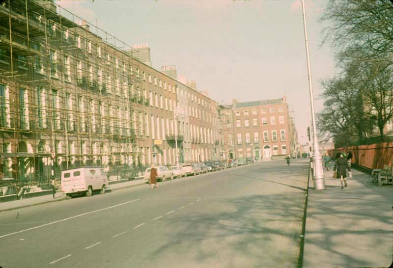
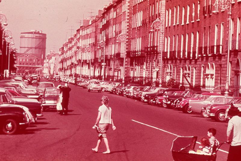
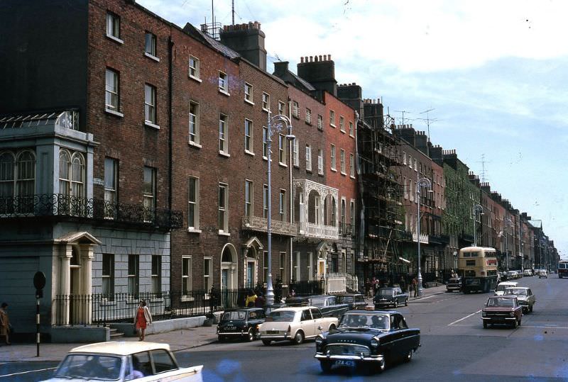
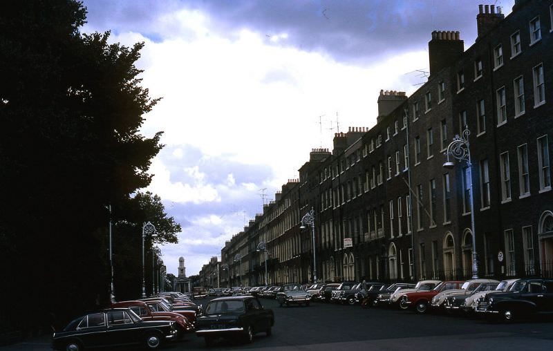
Fitzwilliam Street was part of Dublin’s extensive Georgian streetscape — long rows of red-brick townhouses with uniform sash windows, fanlights above the doors, and iron railings along the pavements. It was considered one of the longest unbroken stretches of Georgian architecture in Europe. Tragically, a significant portion of Fitzwilliam Street was demolished in the mid-1960s to make way for the Electricity Supply Board’s new headquarters, a decision widely condemned by conservationists and architects at the time.
From the top of Nelson’s Pillar, photographers captured a sweeping view north up O’Connell Street that no longer exists in quite the same way. The pillar provided a vantage point that showed the full scale of the boulevard — its width, its double row of trees, and the density of activity below.
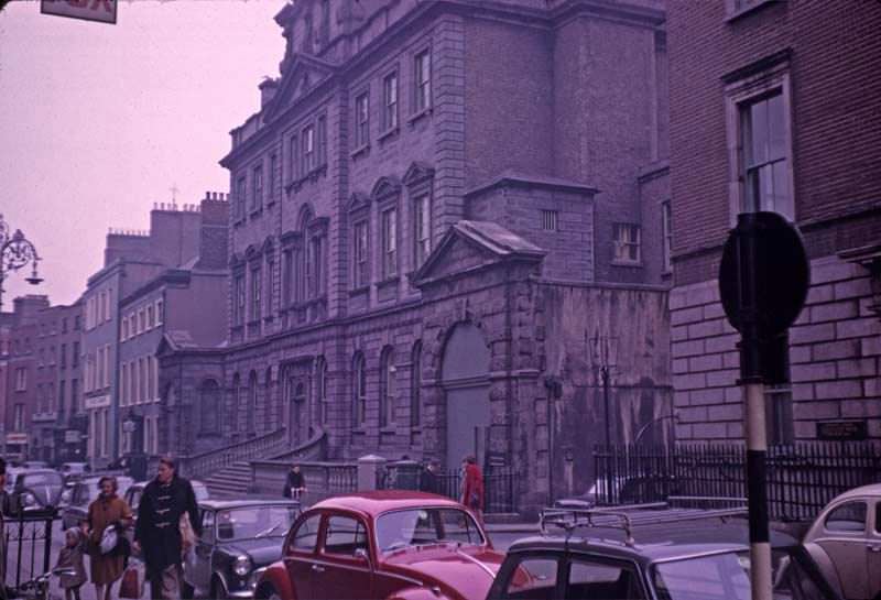
Powerscourt House in South William Street was one of Dublin’s grandest 18th-century townhouses. Built in the 1770s for Viscount Powerscourt, the building had a magnificent courtyard interior that would later be converted into a shopping centre in the 1980s. In 1964, it still retained much of its original character.
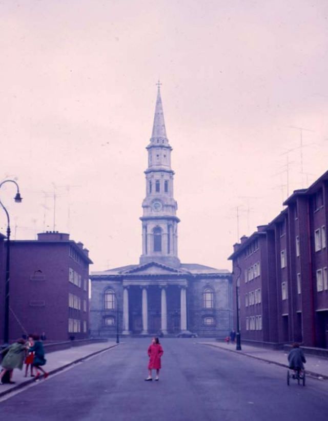
St. George’s Church on Hardwicke Street was a striking neoclassical building completed in 1814. Its tall spire was modelled on St. Martin-in-the-Fields in London and was a prominent feature of the northside skyline. By the 1960s, the surrounding neighborhood had declined considerably from its Georgian-era prestige, but the church itself remained a commanding presence.
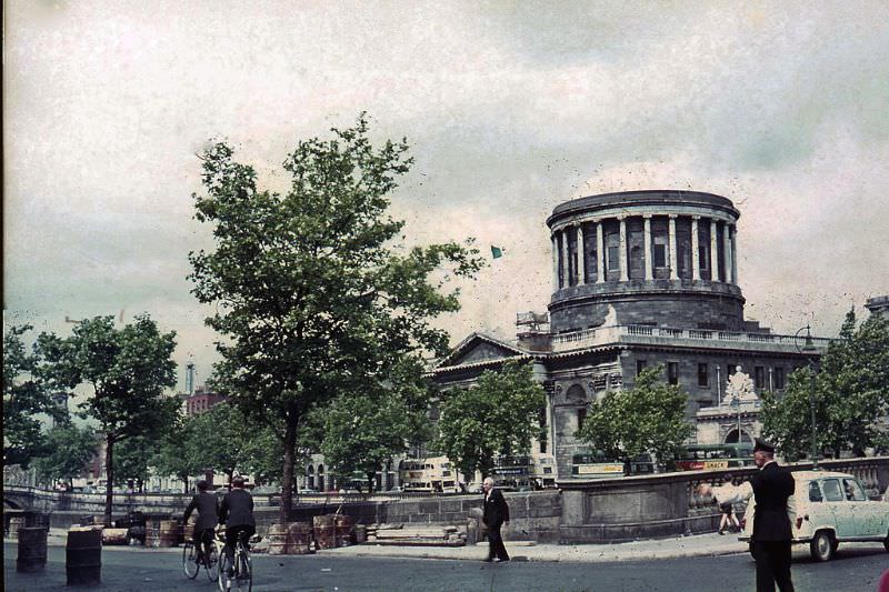
The Liberties, one of Dublin’s oldest working-class neighborhoods, sat to the southwest of the city center. Its name came from the medieval practice of granting certain areas freedom from city taxes. In the 1960s, The Liberties was densely populated, with many families still living in tenement conditions that had barely changed since the early 20th century.
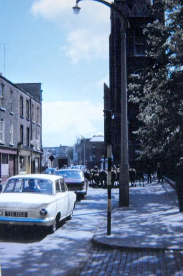
Commercial development in Dublin during the mid-1960s was accelerating, though unevenly. New office buildings and retail blocks were going up alongside untouched Georgian terraces, creating a jarring visual contrast that would define Dublin’s streetscape for decades to come.
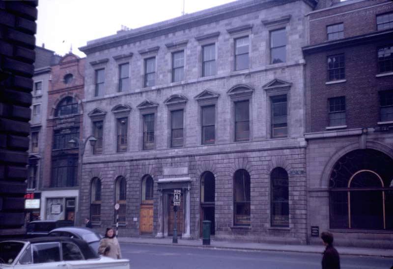
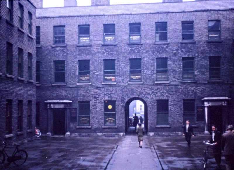
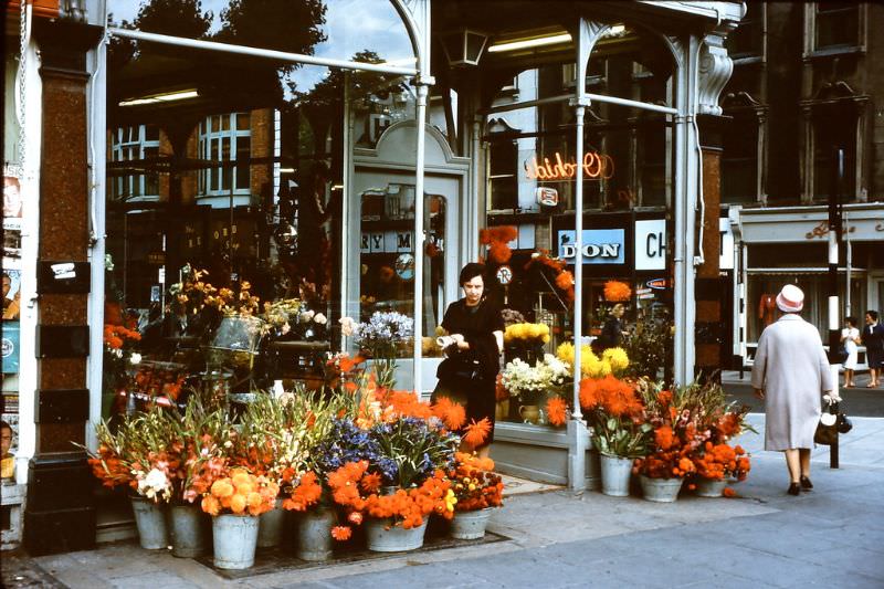
Street trading was a lively part of Dublin’s commercial culture. At the corner of St. Stephen’s Green and Dawson Street, flower sellers set up their stalls and did brisk business with office workers and passersby. These traders were a fixture of Dublin street life and operated with or without formal permission from the city.
Mountjoy Square on Dublin’s northside was one of the finest Georgian squares in the city — and by the 1960s, one of the most neglected. Built between 1792 and 1818, it had once been a fashionable address. By the mid-20th century, many of its townhouses had been subdivided into flats or allowed to fall into disrepair. Photographs from 1965 show the square’s architectural bones still largely intact, even as decay crept in around the edges.
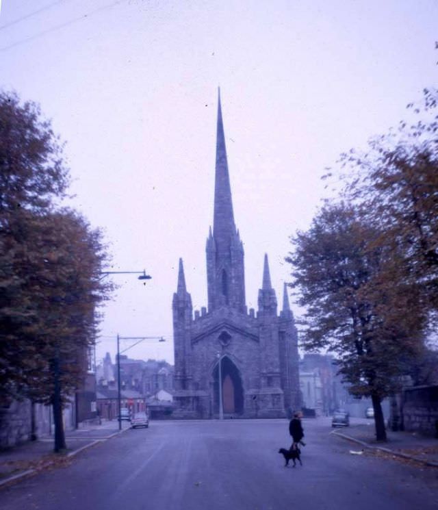
The Black Church — formally St. Mary’s Chapel of Ease — got its nickname from the dark calp limestone used in its construction. Built in 1830 in a Gothic Revival style, the church sat in the northside neighborhood of Phibsborough. Local legend held that walking around it three times at midnight would summon the devil — a story that Dubliners told with characteristic dry humor.
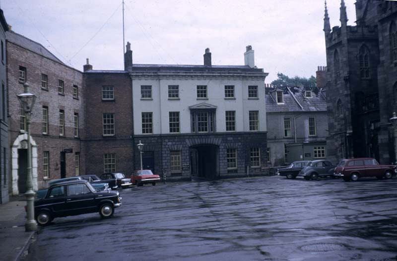
Dublin Castle had served as the seat of British rule in Ireland for over 700 years before independence in 1922. By the 1960s, it was used for state functions and government offices. Its Upper Yard, flanked by the Record Tower and the State Apartments, remained one of the most historically charged spaces in the country.
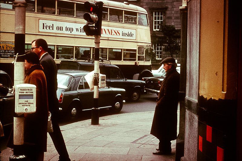
Aston Quay ran along the south bank of the Liffey and was a busy commercial stretch by 1967. Bus stops, shops, and the constant flow of traffic along the quays made it one of the city’s more chaotic but lively arteries. The view across the river from here toward the north quays showed how little the riverscape had changed since the 19th century.
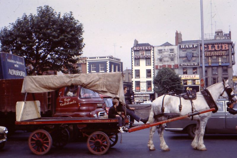
Beresford Place, running beside the Custom House, was dominated in this period by Liberty Hall — the headquarters of the Services, Industrial, Professional and Technical Union, and one of Dublin’s first modern high-rise buildings. Completed in 1965, its glass and steel tower stood in stark contrast to the neoclassical Custom House next door.
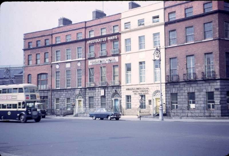
By the late 1960s, the ongoing demolition along Fitzwilliam Street had become a live controversy. Preservationists argued that the city was destroying its own heritage in the name of progress. The debate over Fitzwilliam Street helped shape Dublin’s conservation movement and led to greater scrutiny of development proposals in the Georgian core of the city.
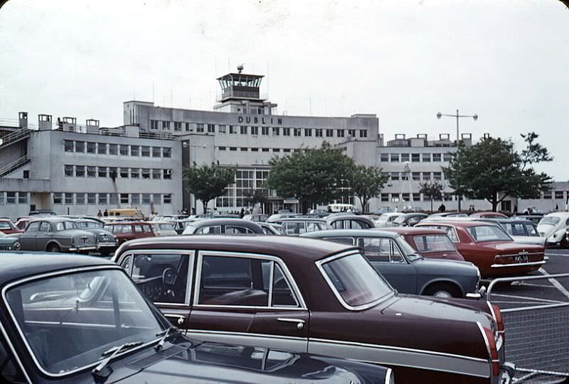
Dublin Airport in 1968 was a far cry from the international hub it would later become. The terminal building, opened in 1941, had a charming art deco style and handled a fraction of the passenger numbers it would see in later decades. Transatlantic flights and connections to European cities were growing, slowly opening Ireland to the wider world.
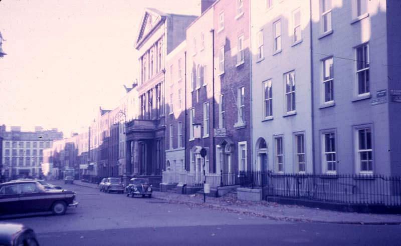
Molesworth Street connected Kildare Street to Dawson Street and ran past Leinster House, the seat of the Irish Parliament. It was a quiet, professional street of solicitors’ offices and government buildings, a contrast to the bustle of Grafton Street just a block away.
St. Stephen’s Green had been a public park since 1877, when it was reopened to the public by the Guinness family after decades as a private enclosure. In 1968, it was a popular retreat from the city’s noise — a place where office workers ate lunch on the grass and families spent Sunday afternoons by the ornamental lake.
The Bank of Ireland building on College Green had one of the most unusual histories of any building in Dublin. It was purpose-built as the Irish Parliament in 1729, then sold to the Bank of Ireland in 1803 following the Acts of Union. By 1969, it had housed the bank for over 165 years, and the old parliament chamber — the House of Lords — was preserved inside as a public display.
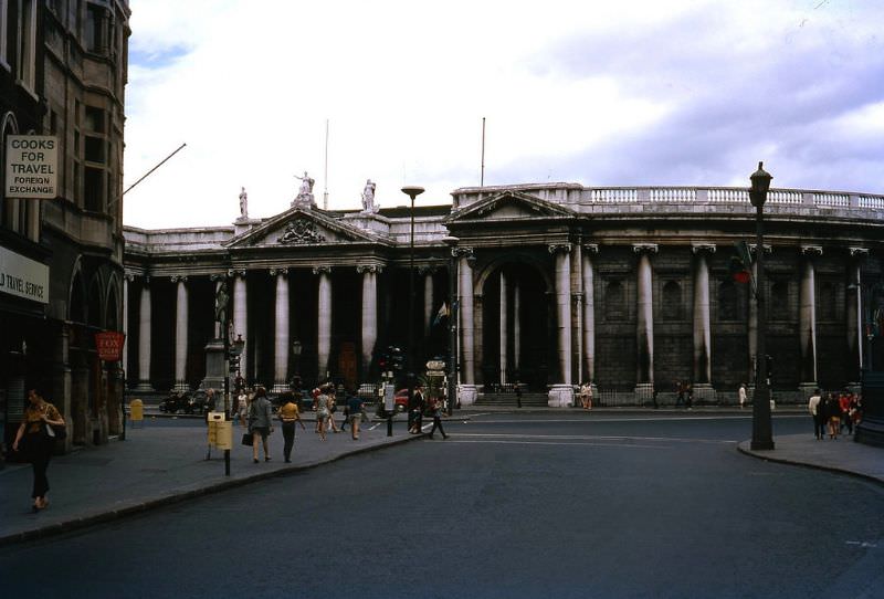
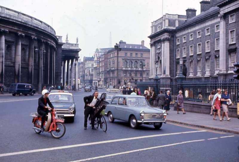
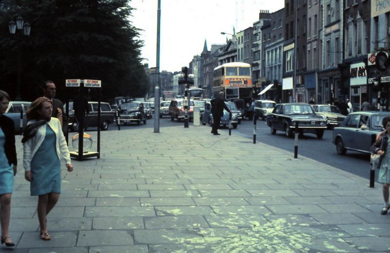
Street scenes from July 1969 captured the mix of old and new that defined Dublin at the end of the decade. Pedestrians in modern fashions passed Victorian shop fronts. Delivery vans shared the road with cyclists and buses. The city was moving forward, but it carried its past visibly and unapologetically.
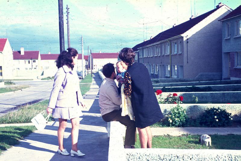
Greenhills was part of Dublin’s expanding suburban edge. As the city’s population grew and housing in the inner city remained overcrowded, local authorities pushed housing development outward into areas like Greenhills, Ballyfermot, and Crumlin. These new estates brought amenities to working-class families who had lived in tenements closer to the city center.
The Guinness Brewery at St. James’s Gate was one of the largest employers in Dublin and one of the most recognizable names in Irish commerce. Guinness operated its own fleet of ships on the Liffey well into the 20th century, transporting barrels of stout to the Dublin docks for export. The sight of Guinness ships on the river was a routine part of city life in 1969.
By 1969, Nelson’s Pillar was already gone — blown up three years earlier in 1966. But photographs from that year still showed the GPO and the surrounding streetscape where the pillar had stood for 157 years. The empty pedestal left behind became a subject of debate about what, if anything, should replace it. That debate would continue for decades.
Dublin’s residential terraces stretched across vast sections of the city, from the inner suburbs out toward the new housing estates. Red-brick rows, slate roofs, and small front gardens were the defining visual language of working-class Dublin housing. These streets housed the people who staffed the shops, drove the buses, and kept the city running day to day.
O’Connell Bridge, the widest bridge in Ireland and notable for being almost as wide as it is long, connected the north and south sides of the city over the Liffey. Looking south from the bridge toward D’Olier Street in August 1969, the view showed a city whose core infrastructure had changed little in a century — even as the wider world was changing rapidly.
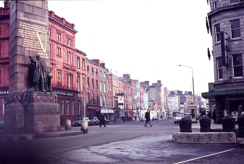
At the top of O’Connell Street stood the Parnell Monument, erected in 1911 in honor of Charles Stewart Parnell, the 19th-century Irish political leader known as the ‘Uncrowned King of Ireland.’ The monument marked the northern end of the boulevard and served as a bookend to the O’Connell Monument at the southern end — two giants of Irish political history facing each other down the length of the city’s grandest street.
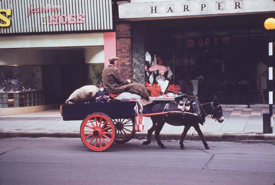
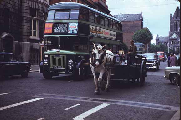
Horse-drawn vehicles had not entirely disappeared from Dublin’s streets in the 1960s. Carts and drays — flat-bed wagons used for heavy deliveries — were still a common sight in certain parts of the city. South Great George’s Street, a commercial street running south from Dame Street, was one of the areas where this older mode of transport persisted alongside motor vehicles.
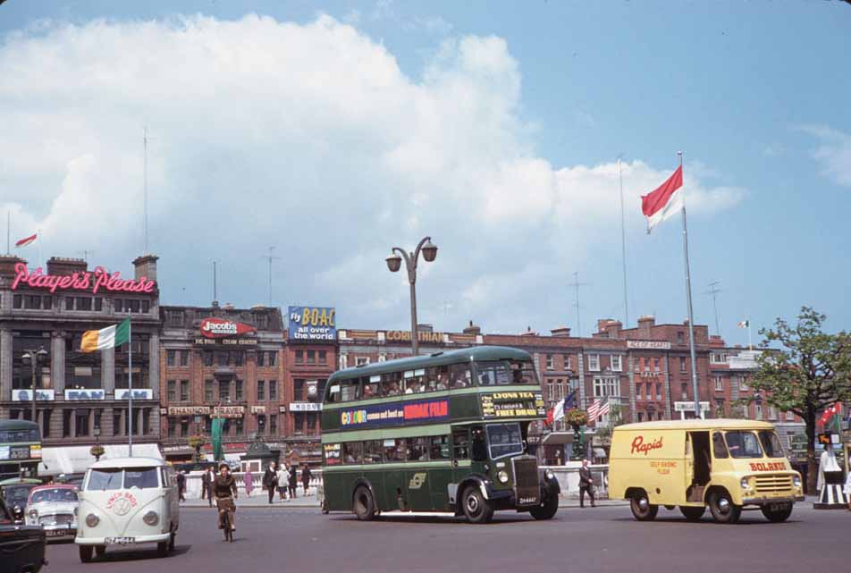
Grafton Street was Dublin’s premier shopping street, running from College Green south to St. Stephen’s Green. In the 1960s it was open to vehicular traffic, with buses and cars sharing the road with pedestrians and cyclists. Its transformation into a pedestrian-only zone would not come until 1982, but the street’s identity as the city’s fashionable retail hub was already firmly established.
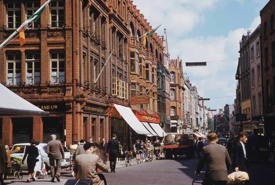
Drury Street and Fade Street formed part of the network of smaller streets behind Grafton Street that housed pubs, workshops, and small traders. These backstreets had a rougher, more workaday character than the main shopping thoroughfares and gave a more honest picture of how much of the city actually functioned.
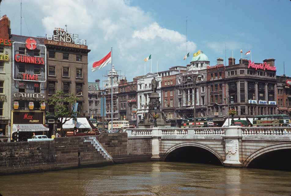
O’Connell Bridge in 1961 was as busy as ever. The junction it anchored — where O’Connell Street met the quays — was one of the highest-traffic points in the city. Double-decker buses made the crossing constantly throughout the day, ferrying commuters between the north and south sides.
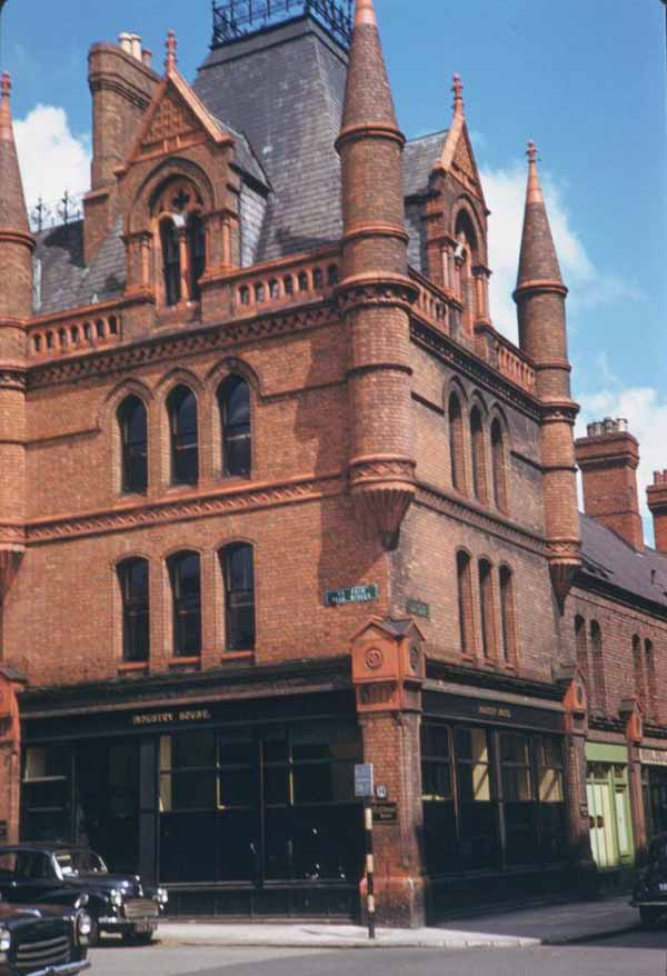
South Great George’s Street in 1961 retained much of its Victorian commercial character. The street’s red-brick buildings, many with decorative terracotta details, housed a dense mix of shops, pubs, and offices. The covered market arcade on the street, built in the 1880s, was still in operation and remained a draw for bargain shoppers.
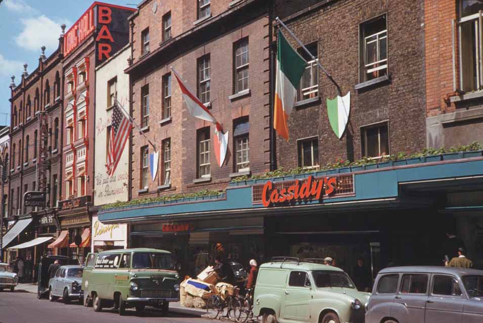
Dublin Castle’s complex of buildings ranged from the medieval Record Tower to the Georgian State Apartments. Its role as a functioning government campus gave it a different atmosphere than a purely preserved heritage site. Officials, civil servants, and tourists all moved through its gates on a daily basis.
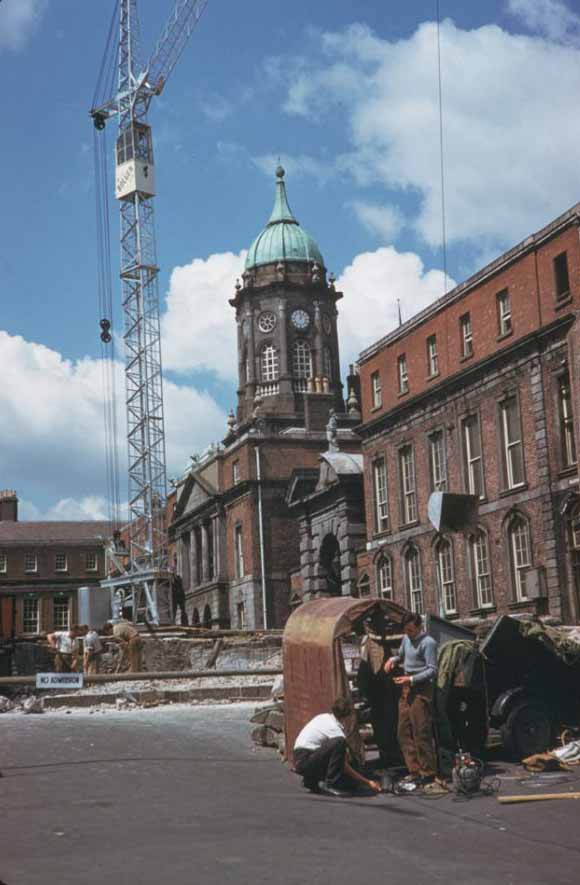
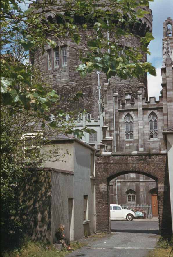
The north bank of the River Liffey, with its long stretch of quays, was among the most industrious parts of the city. Warehouses, merchant offices, and loading bays lined the north quays from the Four Courts all the way to the Custom House. The river itself carried barge and boat traffic regularly, and the quayside was rarely quiet.
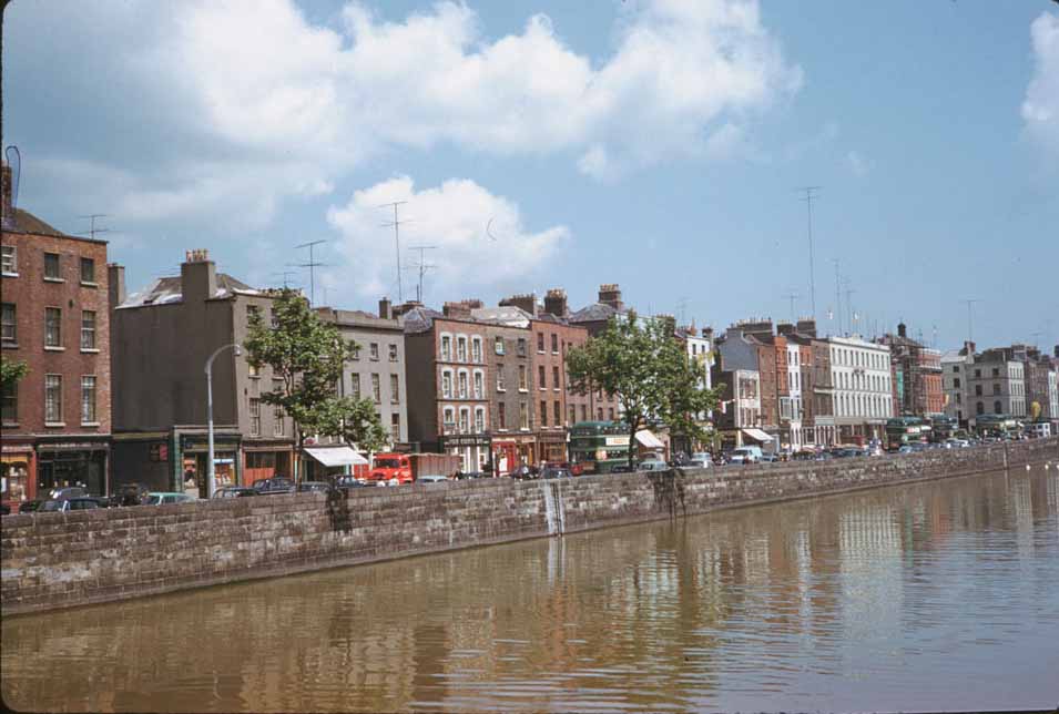

College Green was a constant focal point of city movement. Trams had run through here until 1949, and after their removal, buses and cars took over the intersection entirely. The junction’s proximity to Trinity College, the Bank of Ireland, and the start of Grafton Street made it one of the busiest pedestrian crossings in the country.
Dame Street connected College Green to Dublin Castle and was one of the city’s main east-west arteries. On darker afternoons, the street took on a particular atmosphere — delivery wagons, lone pedestrians under umbrellas, and the muffled sounds of a city continuing its business regardless of the weather. The one-horse dray was a reminder that not all of Dublin’s commerce had been mechanized.
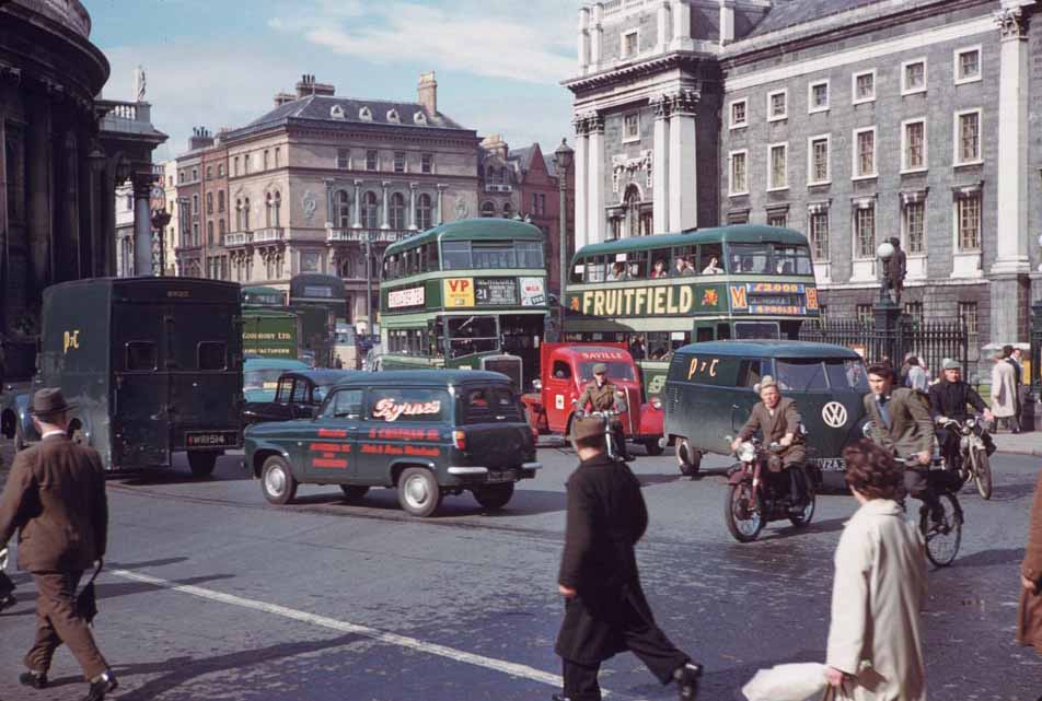
Cyclists were a major part of Dublin’s transport mix throughout the 1960s. Near City Hall, which sat at the top of Dame Street adjacent to Dublin Castle, cyclists navigated the junction alongside buses and delivery vehicles. The building itself had served as Dublin’s Royal Exchange before becoming the city’s administrative center in 1852.
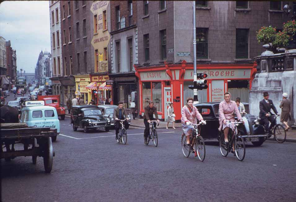
At the junction of Dame Street and South Great George’s Street, groups of cyclists gathered at traffic signals — a scene that illustrated just how central the bicycle was to everyday Dublin life. Commuters, shop workers, and students all relied on their bikes to get around a city where public transport was limited and car ownership was still out of reach for many families.
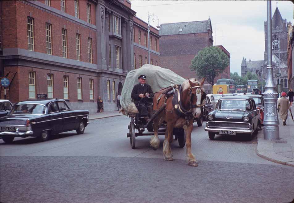
After a shower of rain, Burgh Quay along the south bank of the Liffey took on a reflective quality. The wet pavement mirrored the lights of passing buses and the glow from shop fronts, transforming a workaday stretch of road into something almost cinematic. Rain was a reliable feature of Dublin life, and the city looked different — and often better — when it was wet.
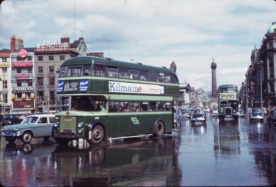
Early mornings on Dawson Street and Nassau Street showed a quieter Dublin — before the buses filled up, before the shops opened, and before the city reached its daily peak. Nassau Street ran along the southern wall of Trinity College, while Dawson Street led north from St. Stephen’s Green toward St. Ann’s Church. Together they formed a corridor of civic and commercial life that reflected the character of the city’s prosperous south side.
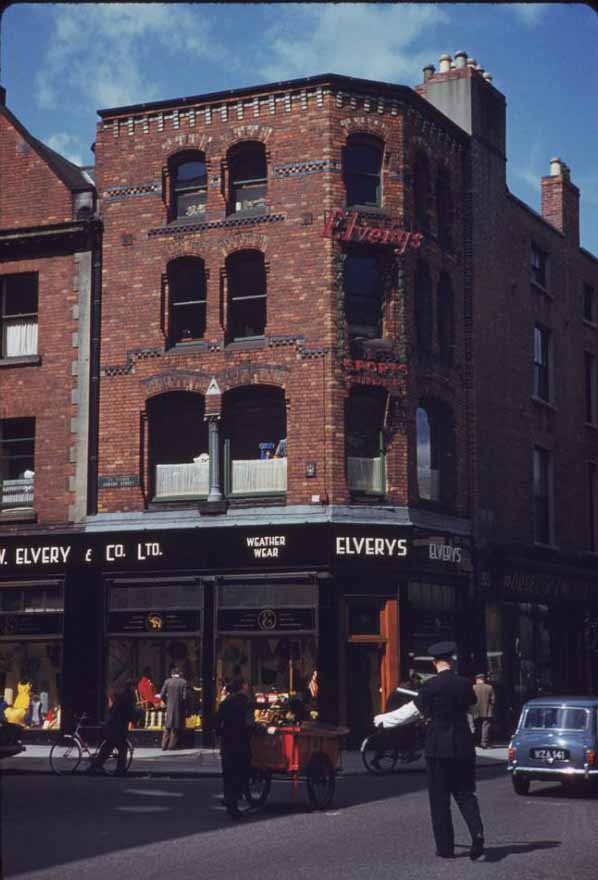





There is something aesthetically pleasing about the complete absence of street markings
Mountjoy Square looks the same 60 years later. The roads need to be narrowed in the area around the square, and the footpaths need to be widened.
Wow, it looks so clean
It looked far better back then.
Nelson’s Pillar wasn’t around in 1969. Blown up in ‘66. The Dubliners wrote a song about it.
🙂 The dates are fanciful for a lot of the others too. Bins and buses give you a fair idea of the ‘when’.
I wonder if it is that Aung Budhh person that posted it, yeah..
Its crazy just how many less people Dublin had in those days, you fan really feel it from those photos
Remarkable that there are no overweight people to be seen.
“Fascinating”