
The winter of 1936 was brutal across the American Midwest. Temperatures dropped to levels that hadn’t been recorded in decades, and the effects were felt most dramatically along the banks of the Mississippi River. By early February, one of North America’s mightiest waterways had done something it almost never does — it froze solid near St. Louis, forming a thick sheet of ice strong enough to hold the weight of a person.
On February 7, 1936, a massive ice jam locked the river in place. At the foot of Gasconade Street in south St. Louis, residents stood at the bank and looked out at something few had ever seen in their lifetimes: the Mississippi, still and white, stretching all the way to the Illinois shore.
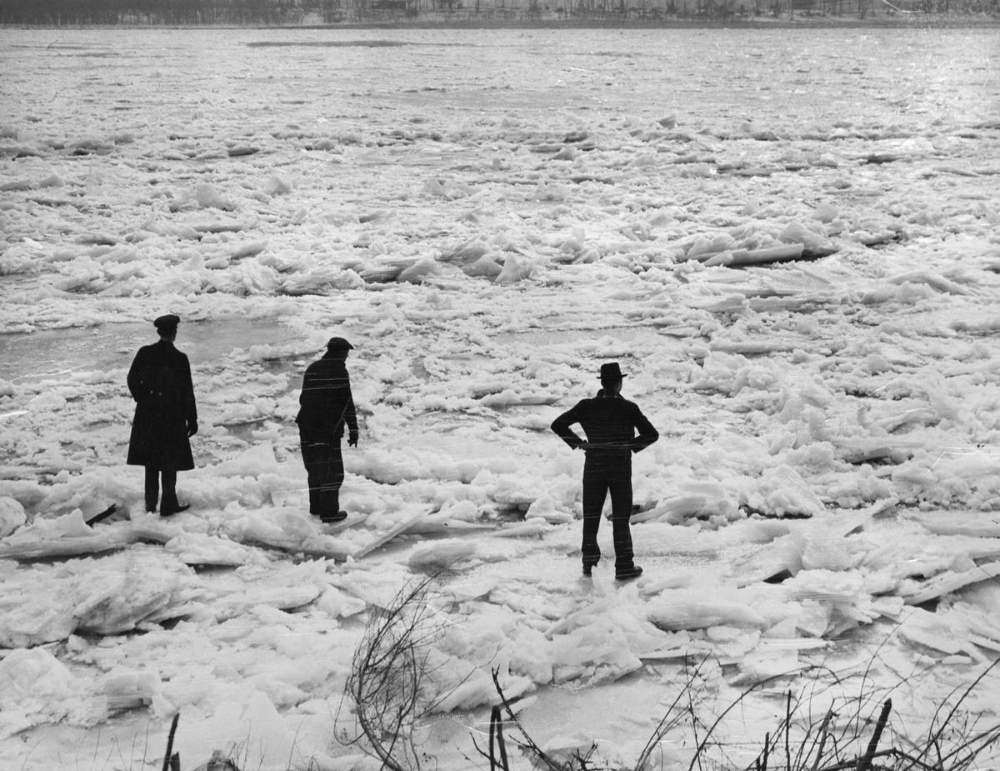
Word spread quickly. Within days, crowds were making the crossing on foot — something that was otherwise only possible by boat or ferry. The river between St. Louis and East St. Louis, normally a barrier of churning brown water, had become a public walkway. People bundled in heavy coats made the trek simply because they could, and because the opportunity was too strange to pass up.
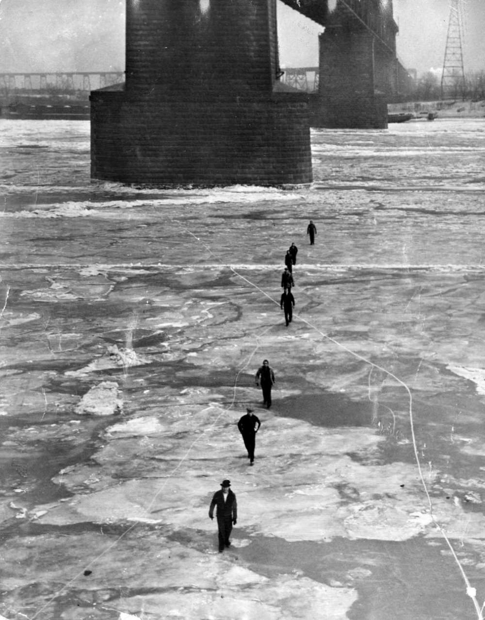
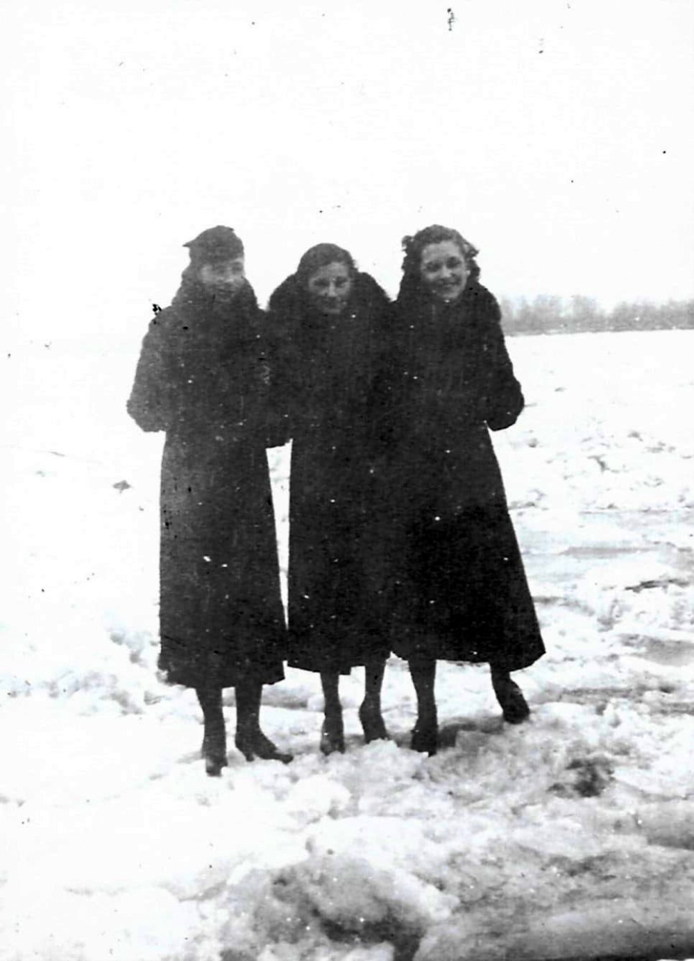
The scene drew sightseers from across the region. Families, neighbors, and curious strangers all ventured onto the ice. By February 15, groups were posing for photographs out on the frozen surface — a physical record of an event that few believed they would ever witness.
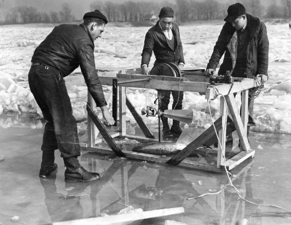
Not everyone who came to the river was there for the spectacle. Scientists and engineers from the U.S. Geological Survey arrived to take advantage of the unusual conditions and gather hard data. On February 22, survey crews set up near the foot of Davis Street in the Carondelet neighborhood of south St. Louis. Their goal was to measure the speed of the current still flowing beneath the ice — critical information for understanding how the river behaved even in extreme cold.
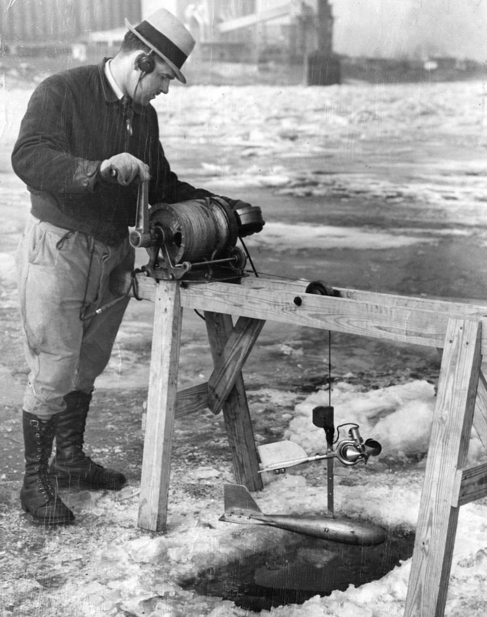
Survey engineers worked directly over the channel, lowering instruments through the ice to capture current readings below. The data collected that day gave researchers a rare look at how a major river’s flow behaves when locked under a heavy ice jam — conditions that engineers and hydrologists rarely get the chance to study firsthand.
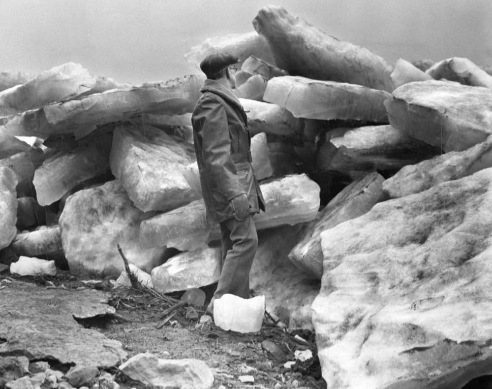
While the frozen river drew wonder and scientific interest, it also caused serious disruption. River traffic — barges, ferries, and commercial vessels — came to a halt. Communities along the Mississippi depended on the river for moving goods, and the ice jam cut off those routes entirely. Businesses that relied on river trade faced real financial losses during the weeks the river stayed frozen. By late February, temperatures began to climb, and the ice started breaking apart. On February 26, massive chunks of ice shifted and cracked along the St. Louis riverfront. The spectacle of the freeze gave way to the spectacle of the thaw.
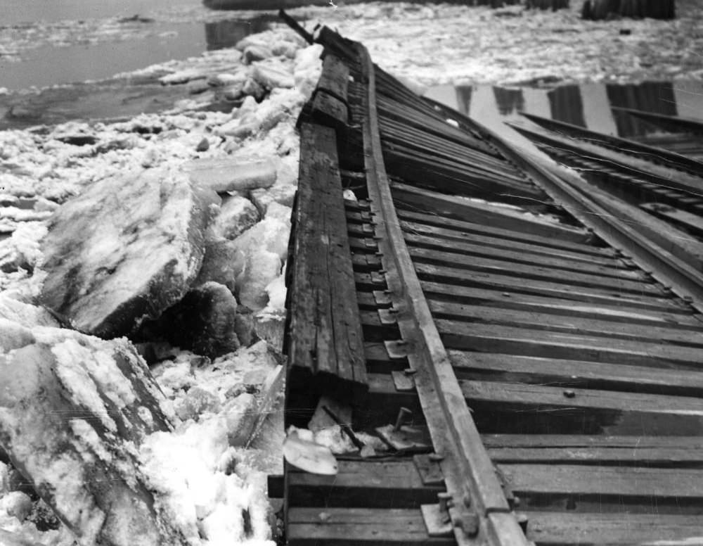
The breakup was not gentle. As the ice shifted, it tore into infrastructure along the banks. At the foot of Davis Street in Carondelet, the Missouri Pacific Railroad’s approach to a ferry landing was mangled and destroyed. The ferry at that landing had connected the St. Louis side to East Carondelet, Illinois — and the damage it suffered showed just how much raw force the moving ice carried.
The frozen Mississippi of 1936 lasted only a few weeks, but those weeks were unlike anything most people along the river had ever experienced. The combination of the coldest temperatures in a generation and one of the country’s largest rivers grinding to a halt made February 1936 a moment that photographers, scientists, and ordinary residents all felt compelled to document — and for good reason.





During the early 20th century and the end of the 19th century, the Mississippi River often froze. As a result of the amount of human infrastructure on the River, it does not freeze over as often as it used to. The channels were deepened and straightened, making the river flow faster and less susceptible to freezing. Alton’s lock and dam also keep most of the ice flows north, so the river didn’t typically freeze here, the ice flows just gathered and froze together.
If you are wondering like I was, that picture was taken at St Louis, MO.
The closest I ever saw the river to freezing was in the late 80s (89, I believe), when ice floated in the river at Natchez. I was amazed at what I saw.
I remember sometime in the late 80s, there was ice floating in the river at Natchez. It was wild seeing that.