Hey There! Before You Go. 😧
Get the best vintage content straight into your inbox!

Don't worry, we don't spam

Rising Waters: A Century of Flooding in Missouri and How It Shaped Cities, Farms, and Daily Life

Missouri sits at the meeting point of two of North America’s mightiest rivers — the Mississippi and the Missouri. For more than a century, that geography made the state a repeated target for devastating floods. Heavy rainfall, snowmelt, and rivers bursting their banks sent walls of water through towns, across farmland, and down city streets with little warning. The floods were not rare exceptions. They were a recurring part of life.
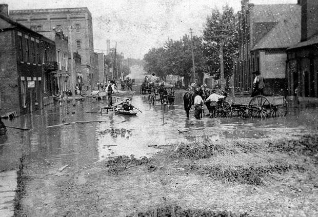
Men in boats or horse-drawn wagons navigate a flooded area of Jefferson City, Missouri, 1903

Jefferson City felt the force of flooding as early as 1903. Water swallowed streets and pushed residents to higher ground. With no motorized rescue vehicles and limited communication, horse-drawn wagons and rowboats became the primary tools for moving people and supplies through submerged neighborhoods.
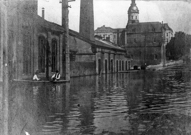
Two men float in a boat along a flooded street in Jefferson City, Missouri, with the old State Capitol building in the background, 1903
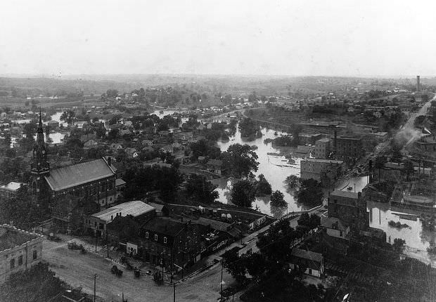
View of Jefferson City from atop the old State Capitol building shows flooding below St. Peter's Church, 1903
View of Jefferson City from atop the old State Capitol building shows flooding below St. Peter’s Church, 1903

The scale of the 1903 flooding in Jefferson City was striking enough to be photographed from the top of the old State Capitol building. The view revealed just how far the water had spread — lapping up against St. Peter’s Church and filling the low-lying streets below. Missouri would flood again in 1906 and 1909, each event reinforcing how unprepared communities were to handle rising water.
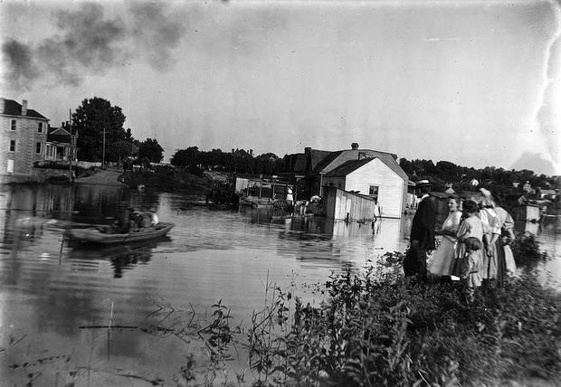
A group stands on dry land as a boat navigates a flooded area in Jefferson City, Missouri, 1906
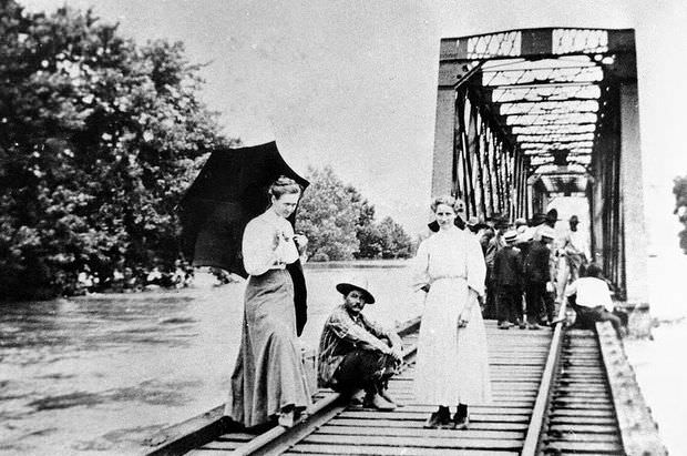
Two women and a man stand on a flooded railroad bridge, with a large group of people gathered behind them, 1909

By the mid-1920s, Missouri’s smaller river towns were also taking hits. Tuscumbia, located along the Osage River, saw significant flooding in 1926. Men on horseback surveyed damage near the town bridge as water crept through the streets. One year later, the catastrophic 1927 Mississippi River flood reached Missouri, breaking levees, submerging railroads, and wiping out entire harvests.
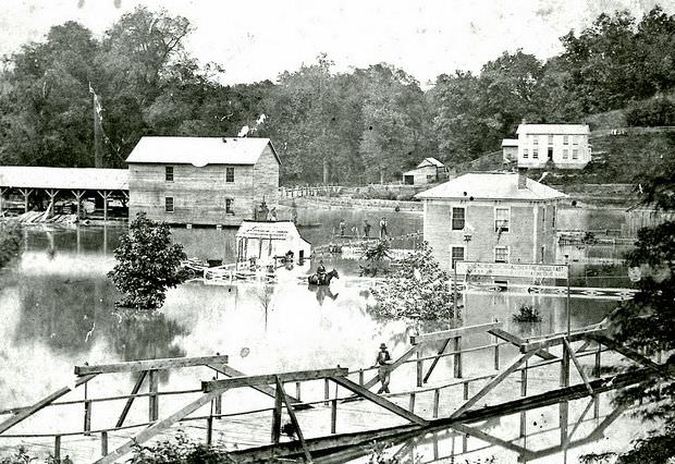
View of flooding in Tuscumbia, Missouri, with a bridge in the foreground and buildings in the back; several men, including one on horseback, survey the damage, 1926

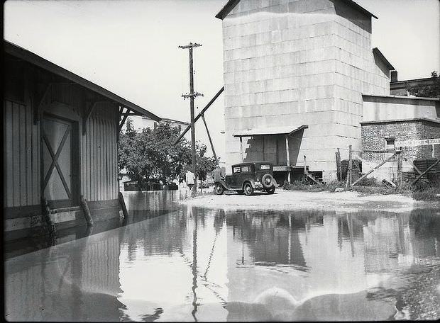
Southeast Missouri bore the brunt of repeated flooding through the 1930s. Residents navigated open fields by boat, with no roads visible beneath the water. Near Warsaw, along the Osage River, floodwaters isolated buildings and left cars stranded on makeshift islands of pavement surrounded by water on all sides.
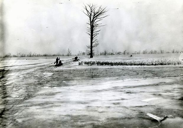
People in boats row through a flooded plain in Southeast Missouri, 1935
Car sits on an island created by flood waters between buildings near the Osage River in Warsaw, Missouri, 1935
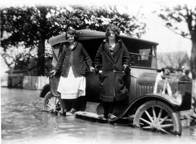
Two women and a dog stand atop an automobile mostly submerged in flood waters, 1937

Hannibal, perched on the western bank of the Mississippi, flooded repeatedly. Its riverfront was inundated in both 1947 and 1951, with water reaching commercial buildings and docking areas that normally stood well above the river’s edge.
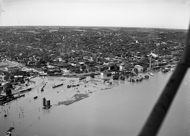
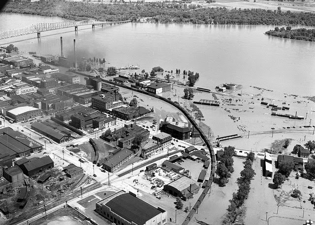
View of flooded riverfront in Hannibal, Missouri, 1947

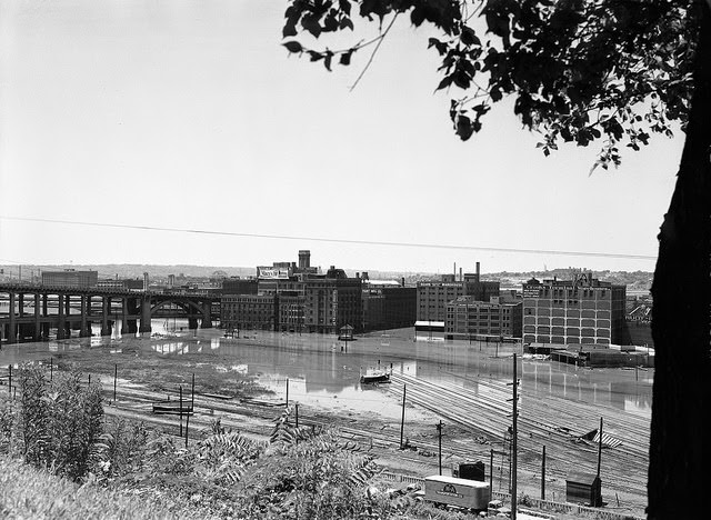
When floodwaters receded, they left behind thick layers of sand and silt deposited across fields and roads. The 1951 Missouri River flood was one of the most destructive of the century. Kansas City neighborhoods were hit hard enough that entire houses were knocked off their foundations and deposited on top of other structures. Brick buildings and railroad tracks disappeared under water across multiple towns.
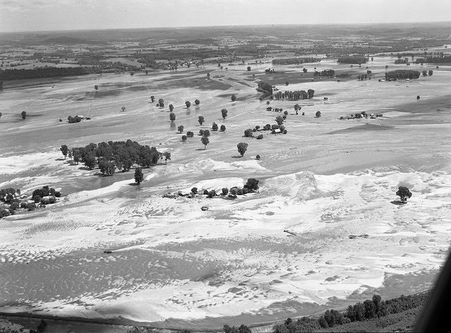
Aerial view of land covered with sand from receding flood waters, 1950
View of brick buildings and railroad tracks submerged in flood waters, 1951
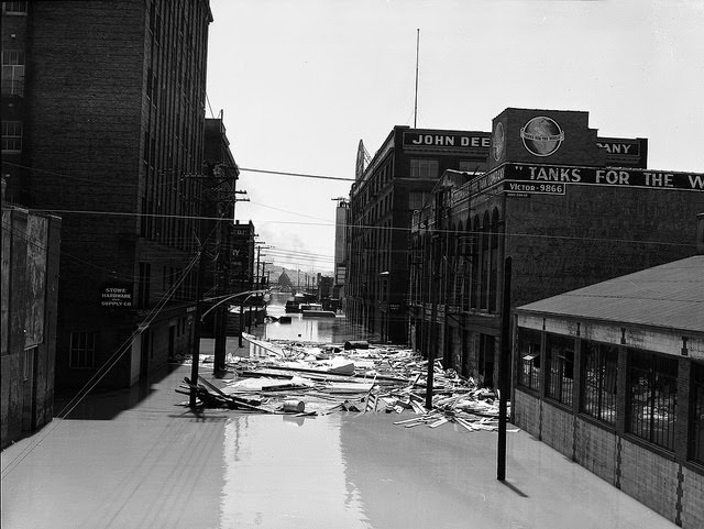
View of Hardware Company, John Deere, and other buildings on a flooded street; a large pile of debris floats in the water, 1951

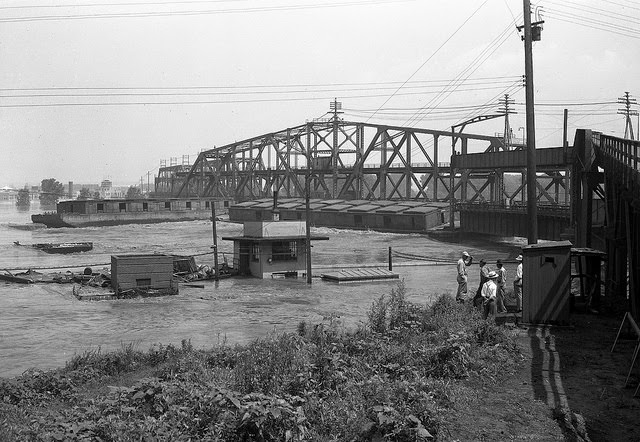
In 1951, the Mississippi ran so high at Hannibal that two barges broke free and slammed into a bridge while onlookers watched helplessly from the shore. Across the state, roads were blocked by danger signs, intersections vanished under several feet of water, and gas stations sat flooded beside grocery stores on streets that were normally packed with traffic.
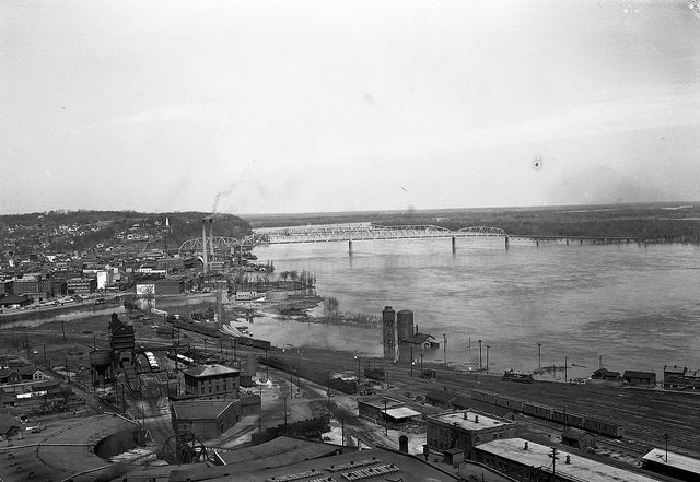
View of riverfront in Hannibal, Missouri, showing flooding and a bridge in the background, 1951
Two barges slam into a bridge due to high water on the Mississippi River as a group of men watch from shore, 1951
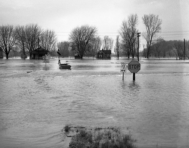
Flooded intersection shows road signs partially submerged, 1951
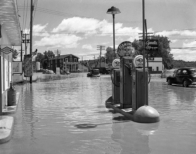
Flooding on a busy street with a gas station in the foreground, Beck's Grocery in the background, and several cars attempting to drive through water, 1951
Flooding on a busy street with a gas station in the foreground, Beck’s Grocery in the background, and several cars attempting to drive through water, 1951

Cedar City documented the 1951 flood’s aftermath on Route 63-54, where receding water left mud and debris coating a main commercial street. Bridges across the state were blocked with warning signs reading “Danger Water Over Highway,” and in Kansas City, the destruction reached a surreal scale — one house physically deposited on top of another.
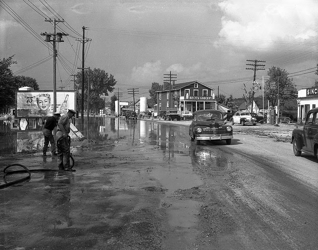
Flood damage on Rt. 63-54 shows receded water on a busy street in Cedar City, with Beck's Grocery store in the background, 1951
Flood damage on Rt. 63-54 shows receded water on a busy street in Cedar City, with Beck’s Grocery store in the background, 1951
Bridge blocked off with signs indicating "Danger Water Over Highway," 1951
Bridge blocked off with signs indicating “Danger Water Over Highway,” 1951
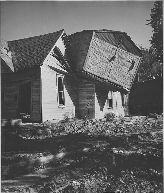
Aftermath of Kansas City flood shows one house deposited atop another house, 1951

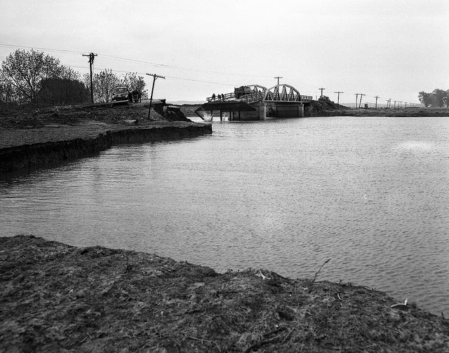
The years following 1951 brought continued damage to Missouri’s roads and bridges. Flooding in 1952 warped and cracked road concrete, and at least one bridge collapsed entirely while bystanders watched from the bank. Each disaster pushed state and federal agencies — including the Army Corps of Engineers — to reinforce levees, build floodways, and update emergency response plans. Communities filled sandbags, set up shelters in gyms and community centers, and rebuilt again and again.
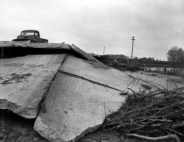
Truck parked atop road concrete warped and damaged by flood waters, 1952
Bridge washed out by flood waters collapses as people observe, 1952

The 1973 flood overflowed Missouri River tributaries and put Jefferson City and Columbia under several feet of water. Schools closed, bridges shut down, and emergency shelters opened across the state. Then came 1993 — the worst flood in Missouri’s recorded history. Both the Mississippi and Missouri Rivers overflowed at the same time. Entire counties became disaster zones. Millions of acres of crops were destroyed, thousands of homes were damaged, and roads connecting towns simply ceased to exist.


Enjoyed this post? Get new ones in your inbox.

Leave a Comment

Your email address will not be published. Required fields are marked *

Share this Post 🥺

Please take a moment to share this content. Your support is greatly appreciated! 🙌🙏

Share this Post 🥺

Please take a moment to share this content. Your support is greatly appreciated! 🙌🙏
Scroll to Top
 
Hey Friend, Before You Go.. Please like & follow for more interesting content