By the mid-19th century, India was firmly under British control. The English East India Company first arrived on the subcontinent in the early 17th century as a trading enterprise. Over the following two centuries, it steadily expanded its economic reach and political grip, exploiting divisions among India’s many regional kingdoms to consolidate power. By the 1850s, the British had conquered the entire nation.
In 1857, widespread anger at British rule exploded into the Indian Rebellion — also called the War of Independence. The uprising began in Meerut, a garrison town about 60 miles northeast of Delhi. Rebel soldiers, known as sepoys, marched on Delhi and ignited a conflict that spread across large parts of northern and central India. British forces eventually recaptured Delhi and suppressed the rebellion, reasserting full colonial control.
The economic consequences of colonial rule were devastating. At the height of the Mughal Empire, India had been the largest economy in the world. Under British administration, that wealth was systematically drained — funneled back to Britain and used to finance its global colonial projects. The result was a severe economic decline that contributed to a series of catastrophic famines. Tens of millions of Indians died from starvation across the latter half of the 19th century alone. The photographs in this collection were taken during that same period — a time of immense architectural grandeur existing alongside widespread suffering.
These images were produced using the photochrom process, a technique developed in the 1880s that used lithographic stones to apply color to black-and-white photographs. The results are vivid, detailed, and remarkably lifelike. They offer one of the most visually rich records of late 19th-century India available today. The collection spans major cities, ancient monuments, sacred sites, and scenes of daily life from across the subcontinent. We begin in Agra, home to the most recognized monument in all of India.
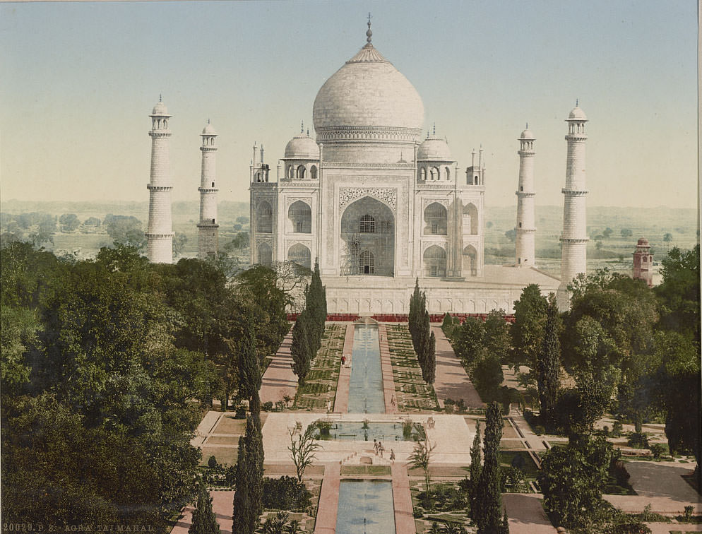
The Taj Mahal was commissioned by Mughal Emperor Shah Jahan in 1632 as a mausoleum for his wife Mumtaz Mahal. Built from white marble quarried in Rajasthan, it took roughly 20,000 workers over two decades to complete. The photochrom image shows its symmetrical gardens, reflecting pool, and the warm tones of the marble under natural light — details that black-and-white photography of the era simply could not convey. Nearby, the massive Agra Fort stood as both a military stronghold and a royal residence for Mughal emperors including Akbar, Jahangir, and Shah Jahan himself.
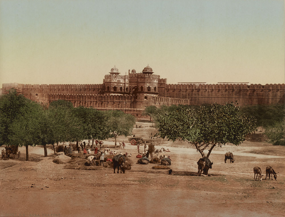
Within the fort’s walls, a complex of royal halls and administrative buildings served the empire. The Hall of Public Audience, known as the Diwan-i-Am, was where the emperor received petitions and addressed his subjects. Adjacent structures housed courts and administrative offices that governed a vast territory.
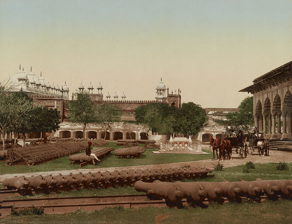
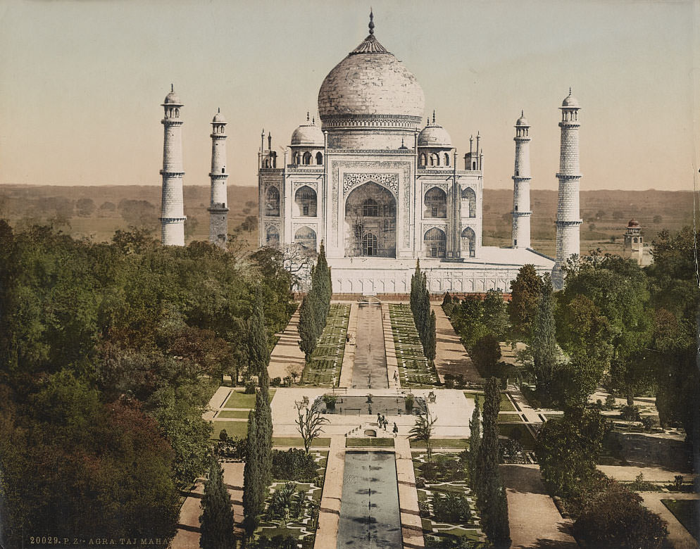
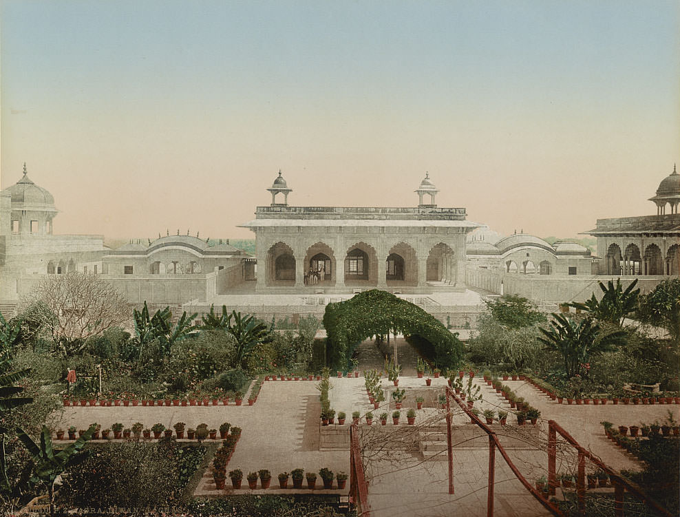
The Diwan-i-Khas, or Hall of Private Audience, was reserved for the emperor’s most confidential meetings with high-ranking officials, foreign ambassadors, and members of the court. Its ornate columns and inlaid stonework reflected the extraordinary craftsmanship the Mughals demanded of their royal spaces.
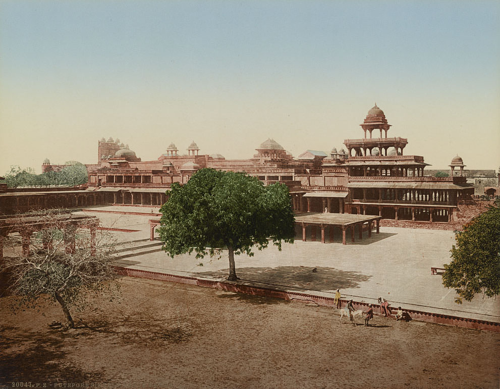
A short distance from Agra lies Fatehpur Sikri, the short-lived Mughal capital built by Emperor Akbar in the 1570s. The Panch Mahal — a five-story open pavilion — rises in a stepped pyramid shape and once served as a place of leisure for the women of the imperial household. The city was abandoned within decades of its construction, likely due to water scarcity, and stood largely intact as a ghost city by the time these photographs were taken.
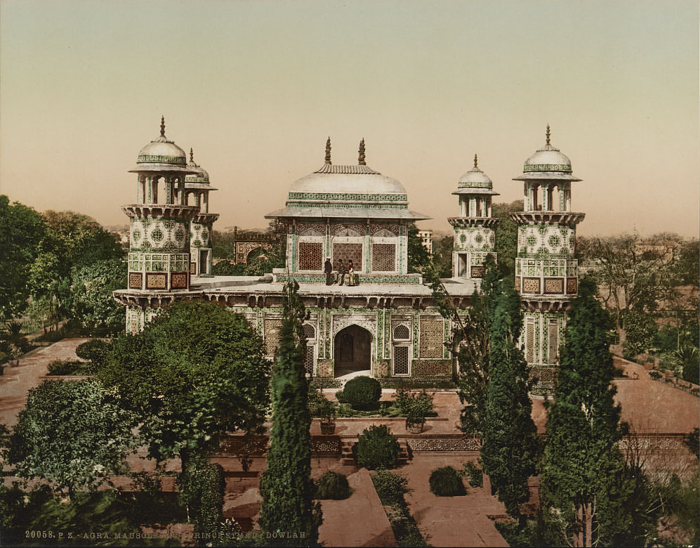
Back in Agra, the Mausoleum of Itimad-ud-Daulah — often called the Baby Taj — predates the Taj Mahal and is notable for being the first Mughal structure built entirely from white marble. It was constructed between 1622 and 1628 for Mirza Ghiyas Beg, the father of Empress Nur Jahan.
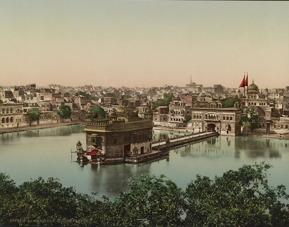
Moving north to Amritsar, the Golden Temple — formally known as Harmandir Sahib — served as the spiritual and temporal center of the Sikh faith. Completed in 1604, the temple sits at the center of a sacred pool called the Amrit Sarovar. Its lower floors are clad in white marble and its upper floors covered in gold leaf donated by Maharaja Ranjit Singh in the early 19th century.
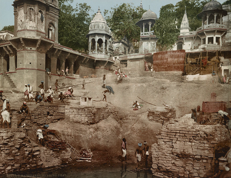
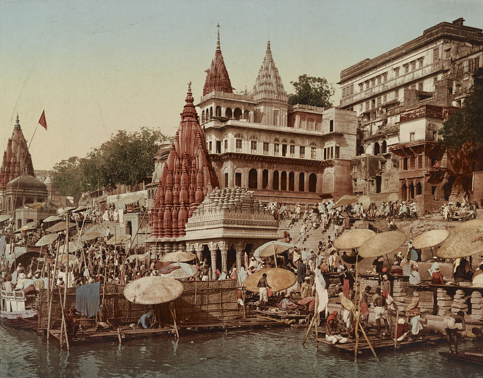
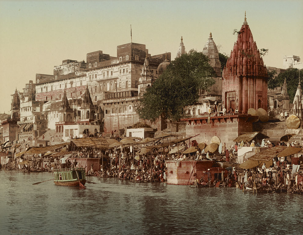
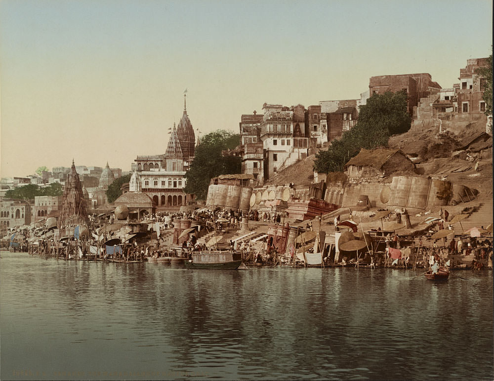
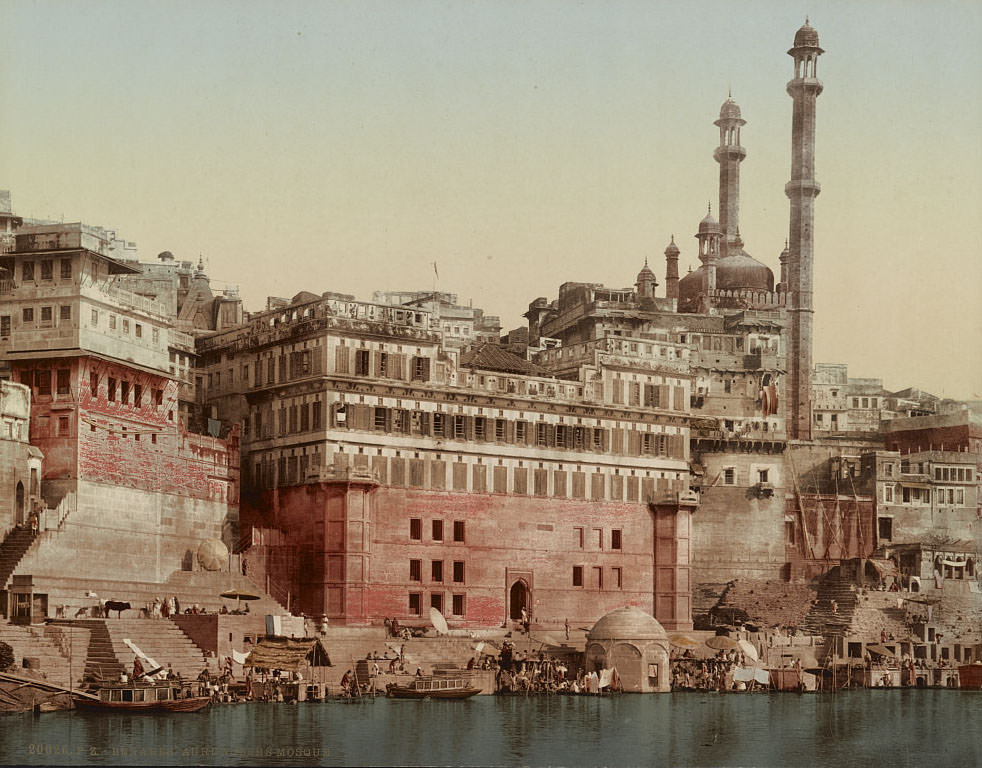
Varanasi, one of the oldest continuously inhabited cities in the world, appears across several photographs in this collection. The ghats — wide stone staircases descending to the Ganges River — were the focal point of religious life. The Burning Ghat, known as Manikarnika, was where Hindu cremations took place openly along the riverbank. Cremations at Manikarnika ran day and night without interruption, a practice that continued unbroken for centuries.
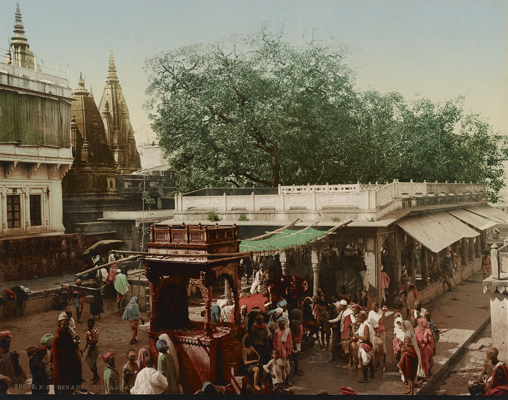
Along the ghats of Varanasi, wealthy rulers and maharajas from across India built palatial residences to be near the sacred river. The Palace of the Maharaja of Indore was among the most prominent of these riverside estates, its architecture blending Mughal and Rajput styles against the backdrop of the Ganges.
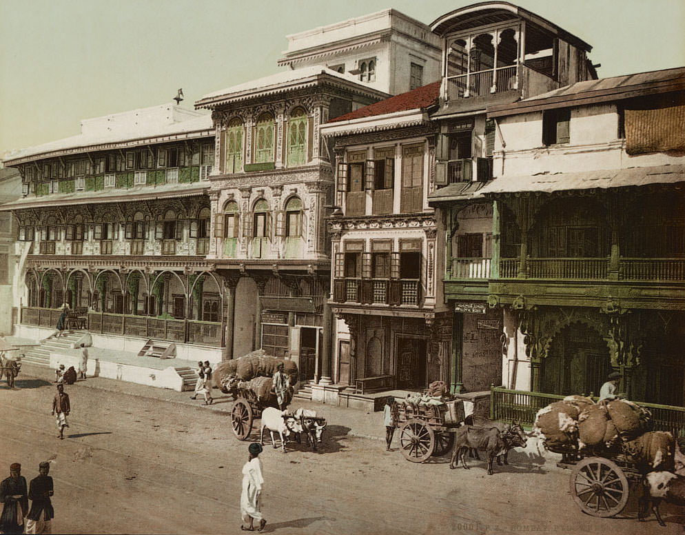
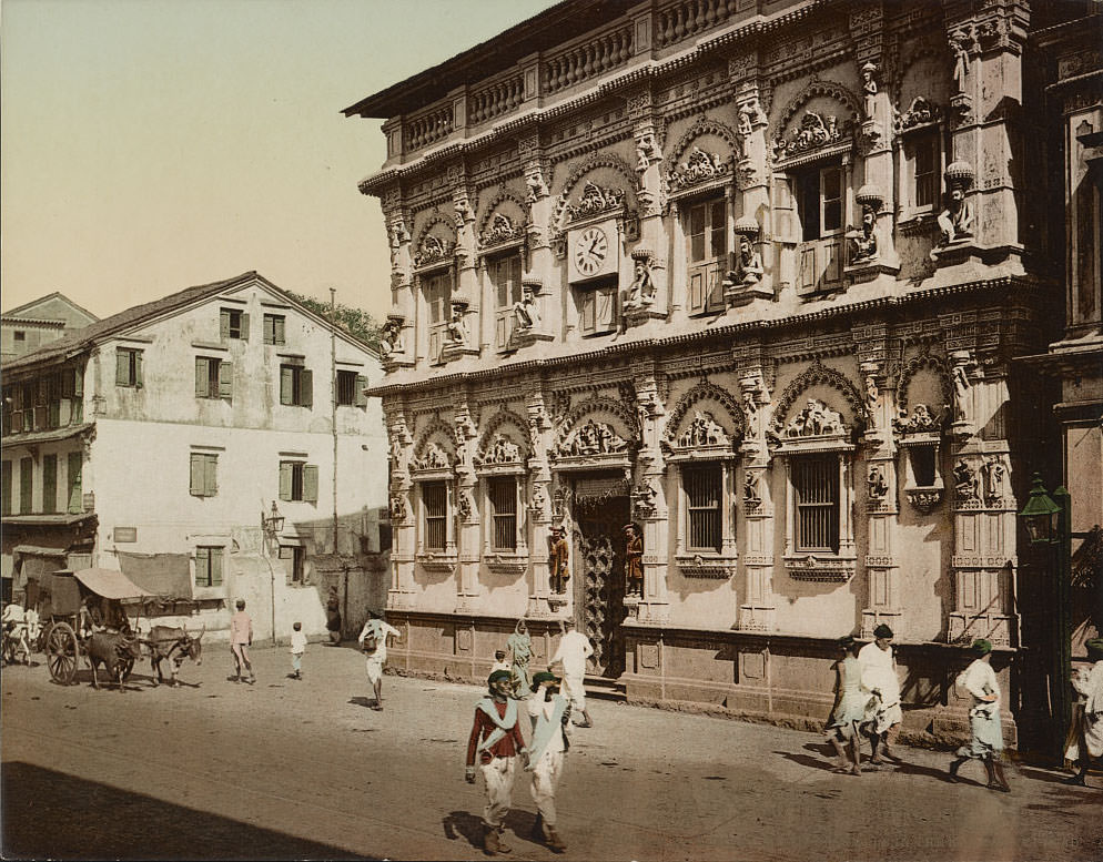
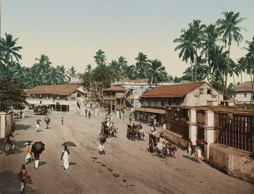
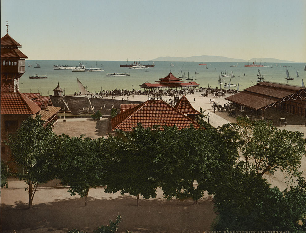
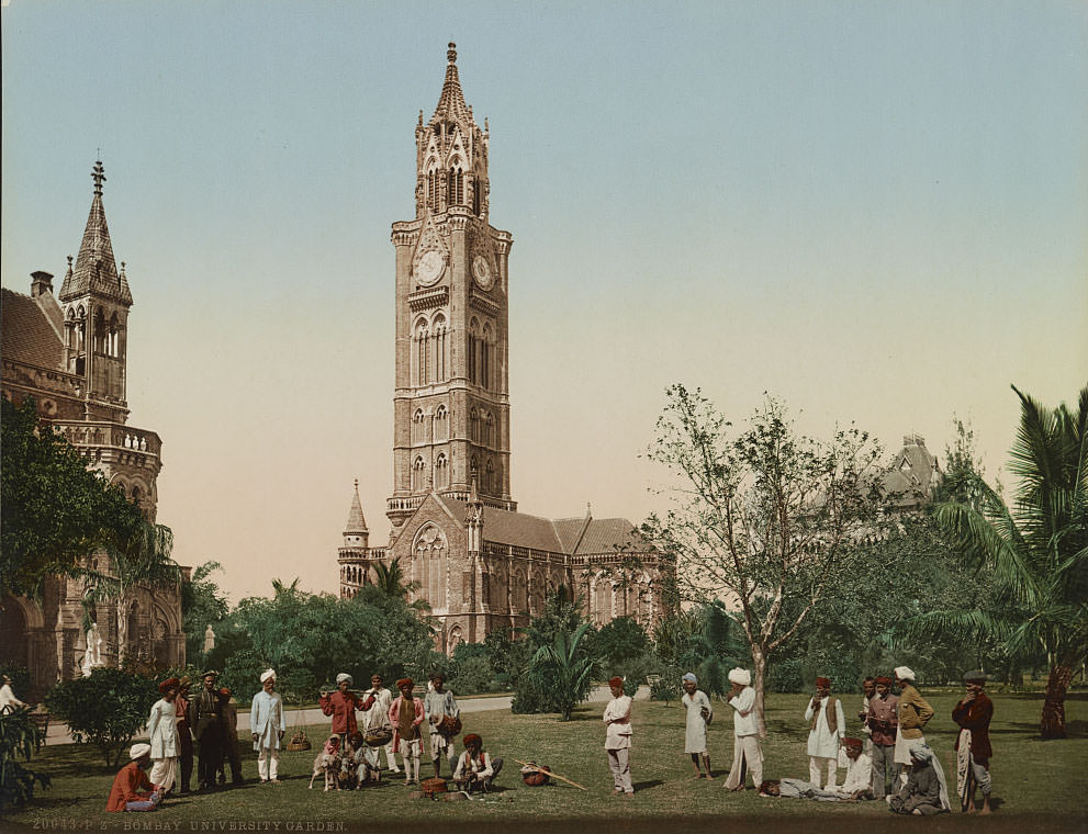
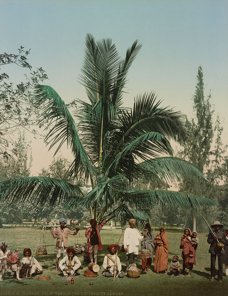
Bombay — modern-day Mumbai — was Britain’s most important commercial port on the western coast of India. By the 1890s, it was a densely populated trading hub with a mix of colonial architecture, crowded bazaar streets, and Hindu temples. Pydownee Street was one of the city’s busiest commercial thoroughfares, lined with merchants and street activity that the photochrom images capture in vivid detail.
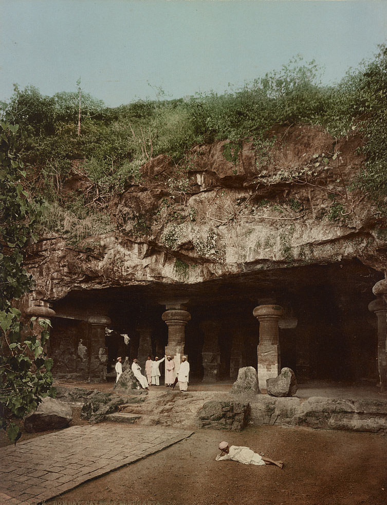
Just off the Bombay coast, carved into the basalt rock of Elephanta Island, lie the Elephanta Caves — a complex of ancient cave temples dedicated to the Hindu god Shiva. The main cave contains a colossal three-headed sculpture of Shiva known as the Trimurti, standing over 20 feet tall. The caves date back to the 5th to 8th centuries and were already considered ancient ruins by the time these images were made.
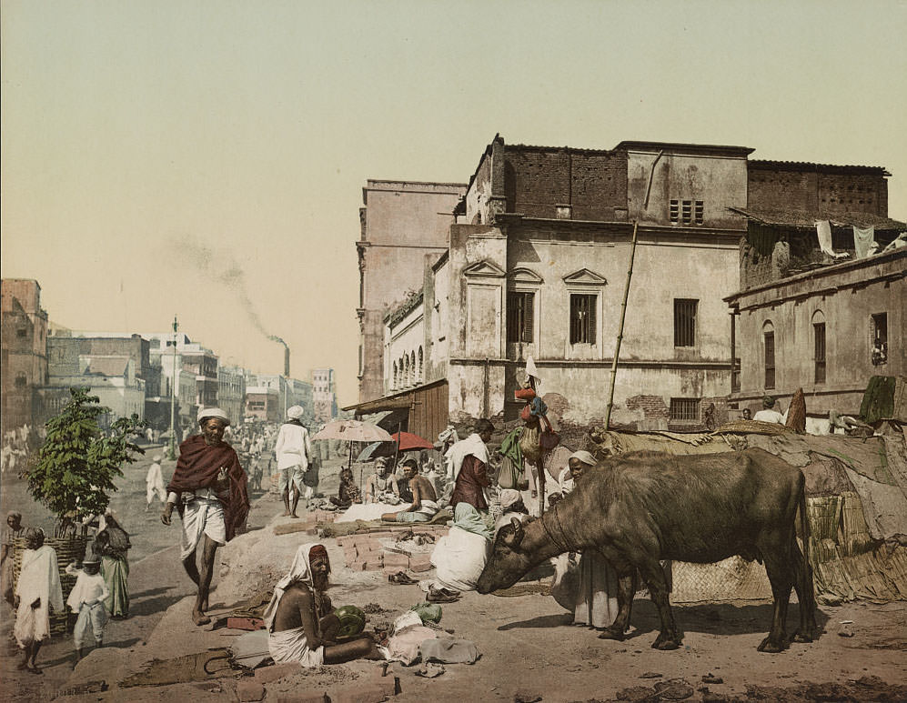
Kolkata — then known as Calcutta — was the capital of British India and the seat of the colonial government. Harrison Road was a central artery through the city, flanked by colonial-era buildings that housed banks, courts, and trading firms. The streets were busy with both European administrators and Indian residents going about daily commerce.
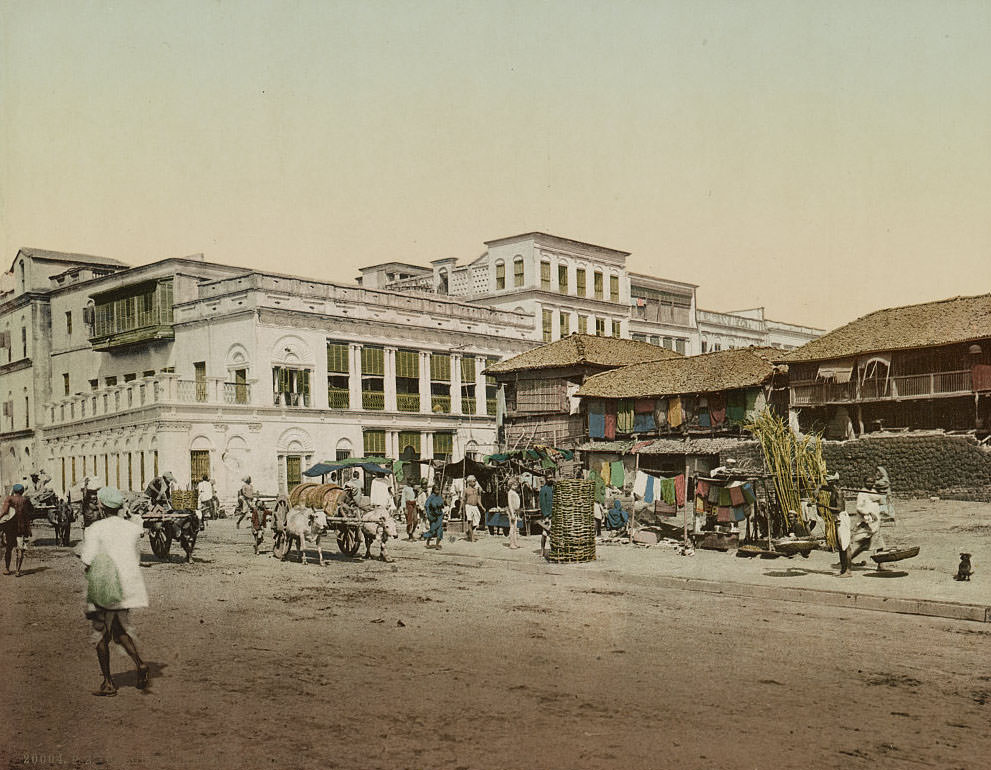
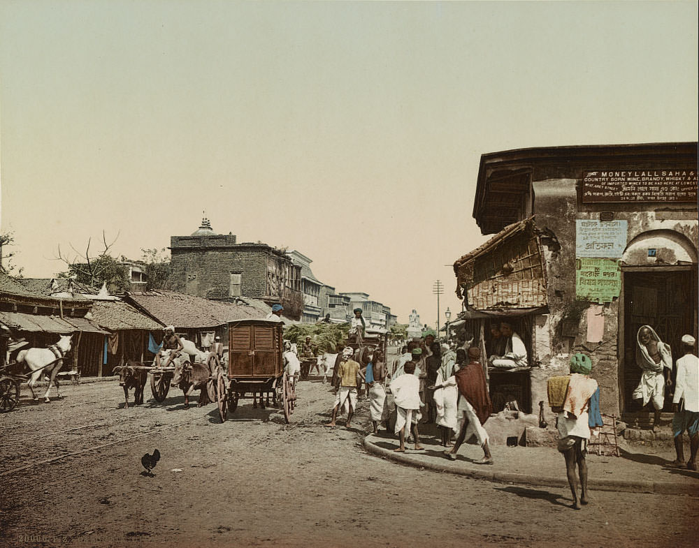
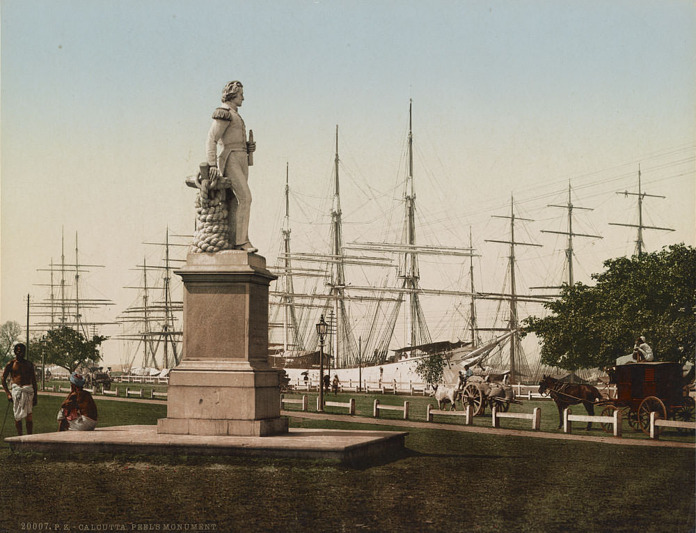
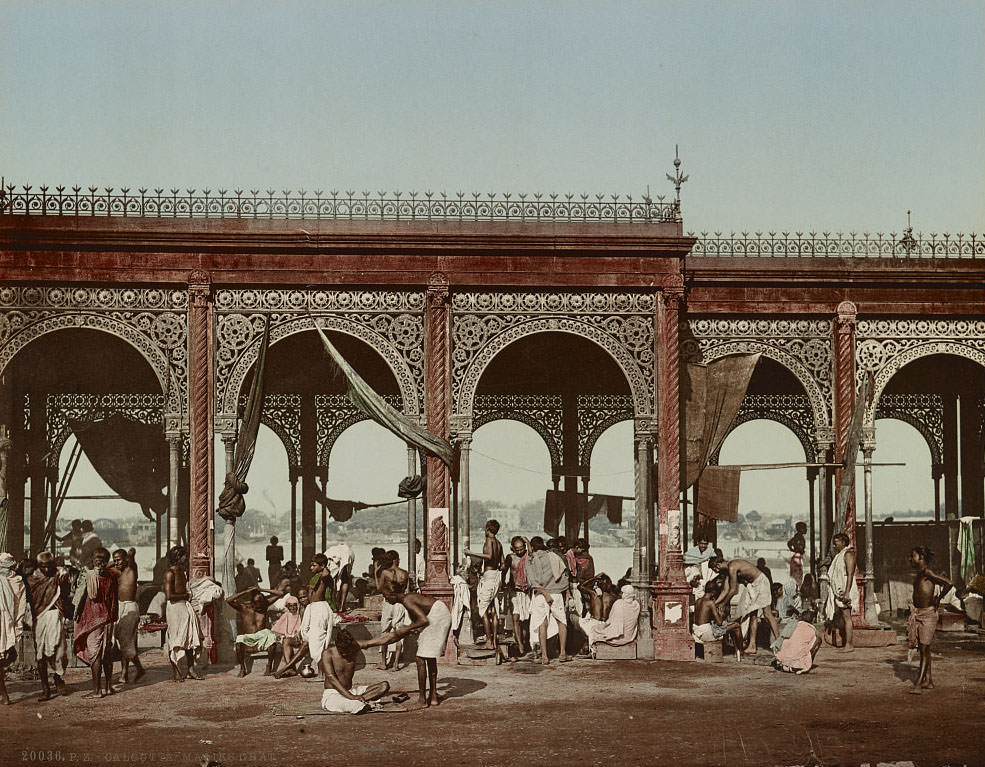
The Hooghly River, a distributary of the Ganges, ran through the heart of Kolkata and served as the lifeblood of the city’s trade. The ghats along the Hooghly were points of constant activity — steamers loaded and unloaded cargo, sailing ships anchored in the harbor, and devotees used the river steps for ritual bathing. The Kolkata harbor was one of the busiest in Asia during the 1890s.
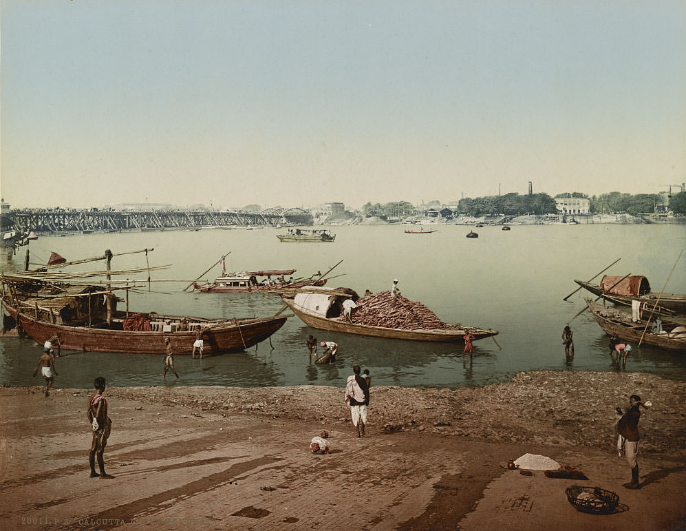
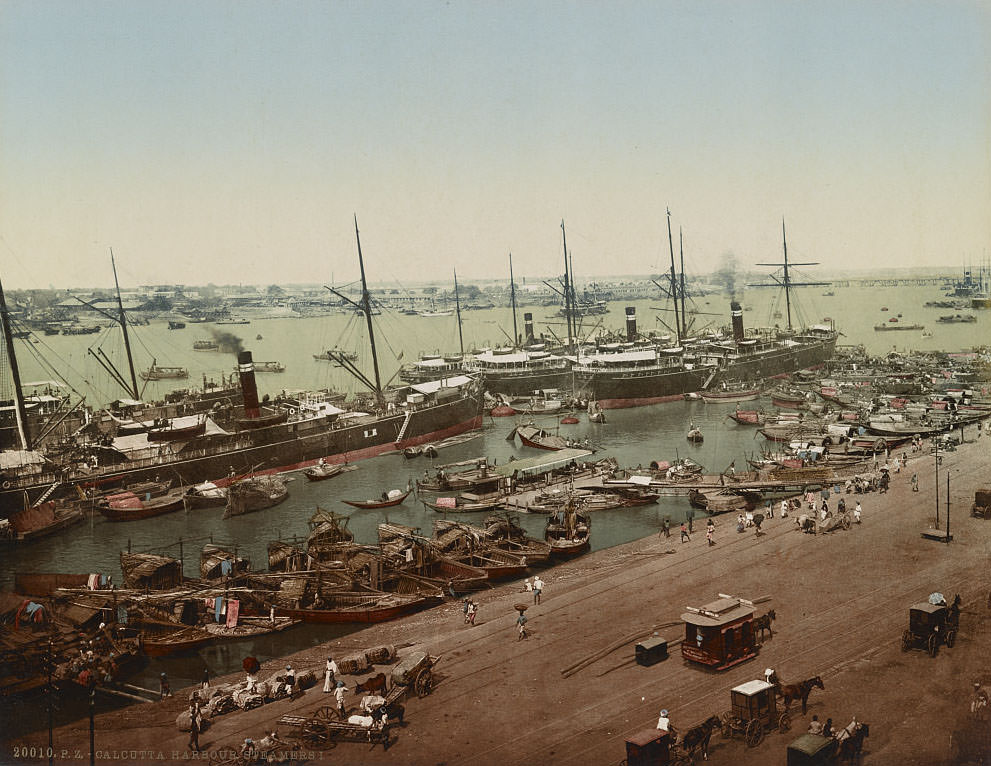
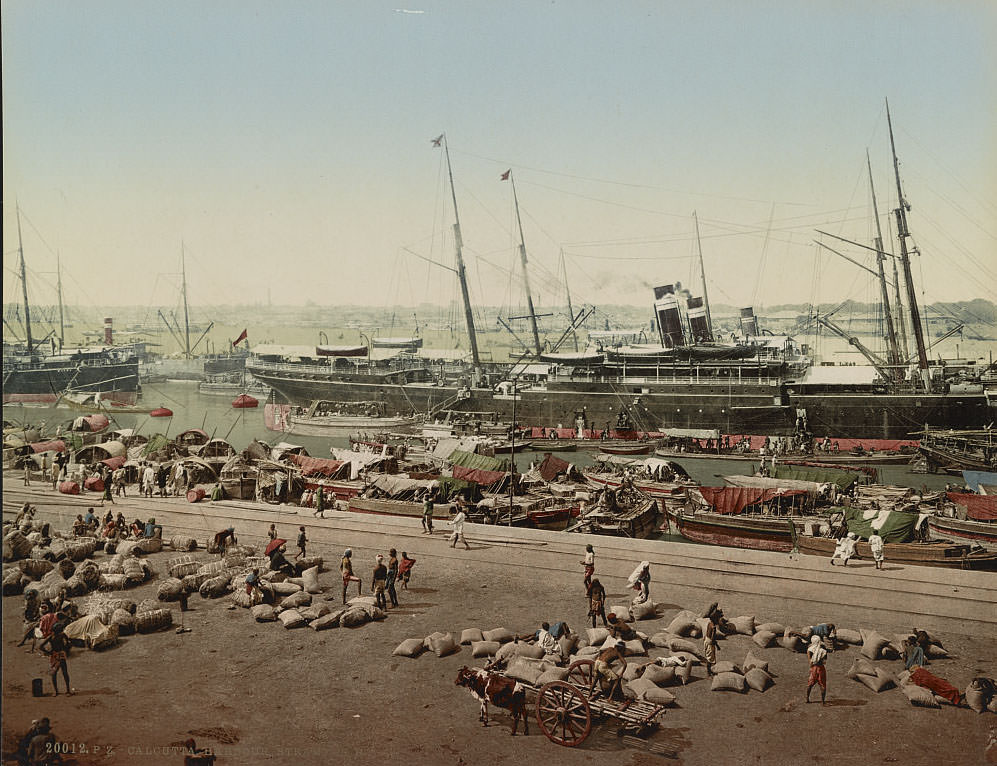
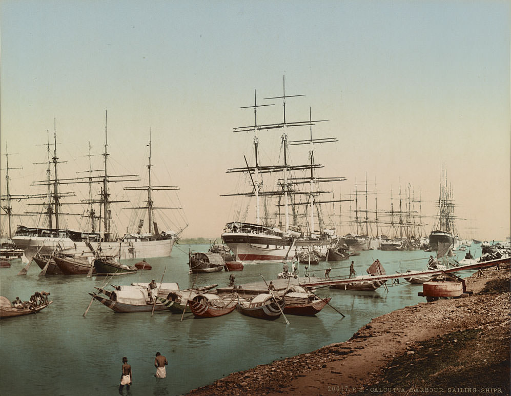
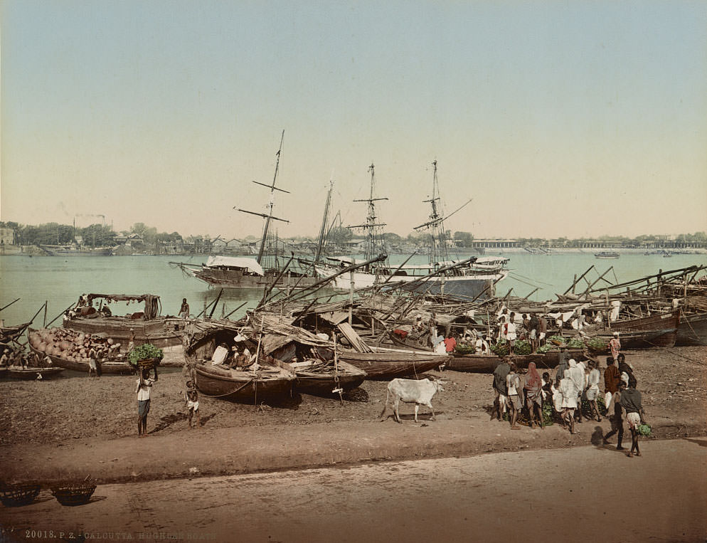
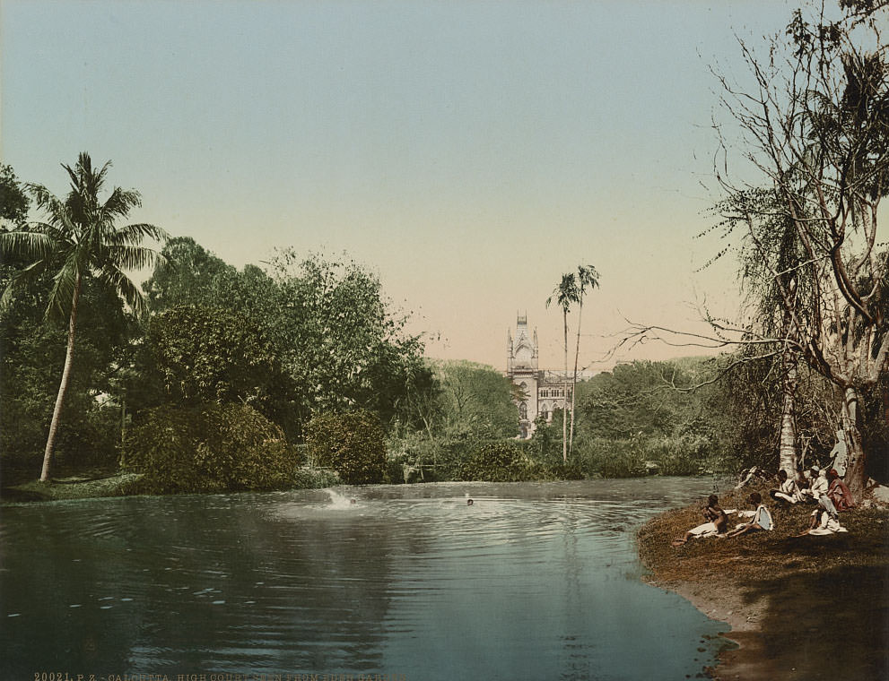
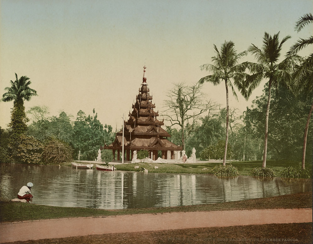
Eden Garden in Kolkata was one of the city’s most prominent public spaces, featuring a Burmese pagoda relocated there by the British in 1856. The High Court building, visible from the garden, was constructed in 1872 and modeled on the Cloth Hall in Ypres, Belgium — a deliberate architectural statement of British permanence in India.
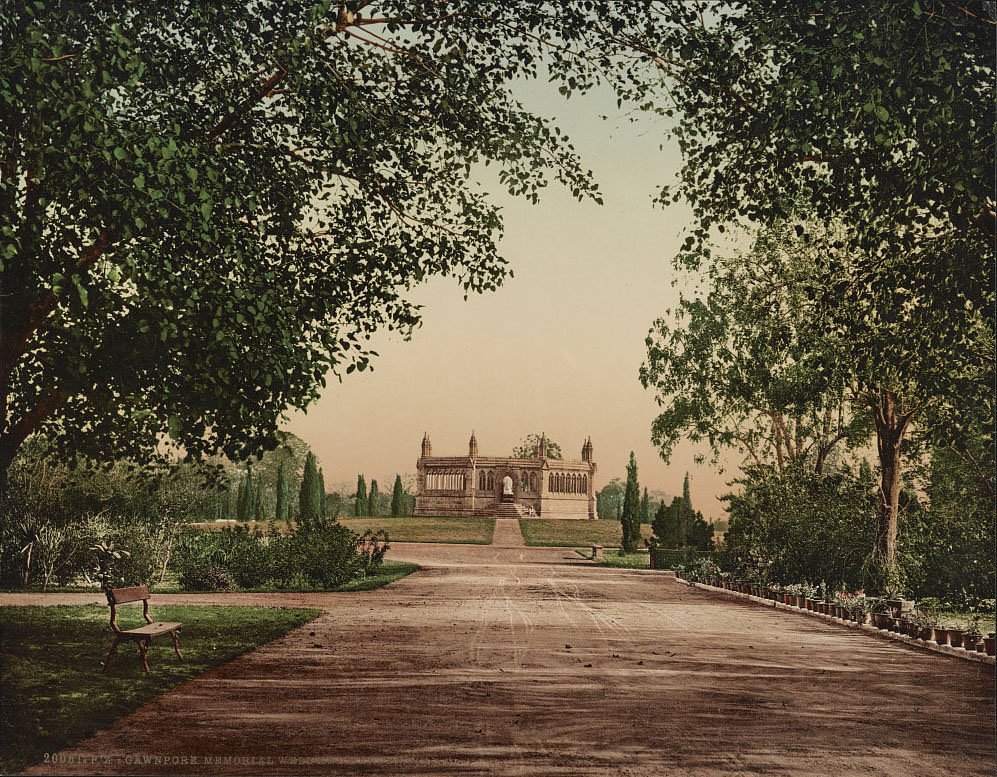
In Kanpur — then called Cawnpore — the Memorial Well and Garden marked the site of one of the most brutal episodes of the 1857 rebellion. After a prolonged siege, hundreds of British civilians, including women and children, were killed and their bodies thrown into a well. The British turned the site into a memorial garden after recapturing the city, and it became a significant site of colonial memory.
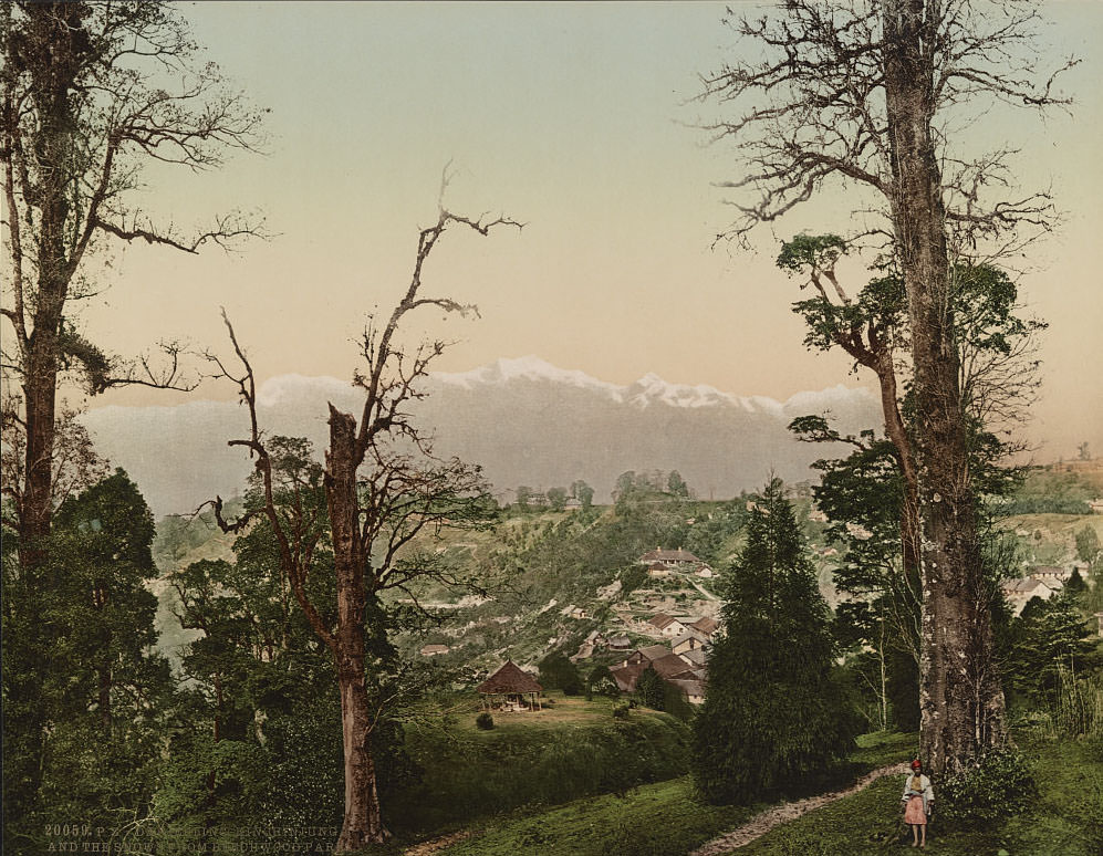
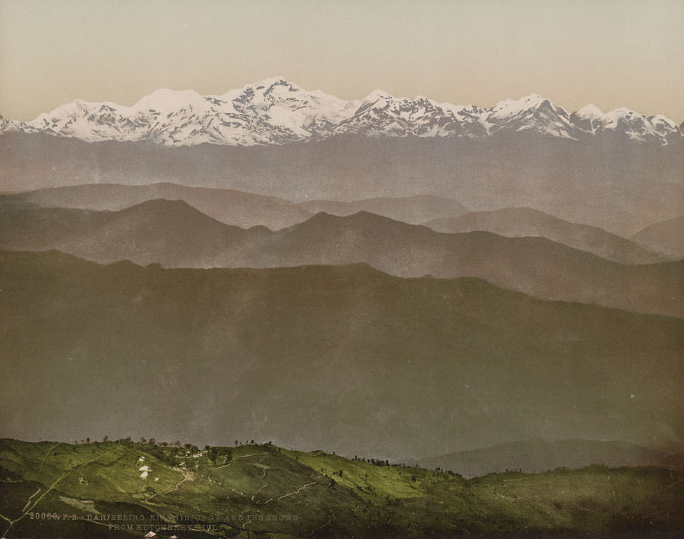
Far to the northeast, Darjeeling offered a dramatic contrast to the crowded cities of the plains. From its hillside vantage points, the snow-capped peak of Kangchenjunga — the third-highest mountain in the world at 28,169 feet — dominated the northern horizon. Darjeeling had been developed by the British as a hill station, a retreat from the heat of the lowlands, and by the 1890s was also becoming a major center for tea production.
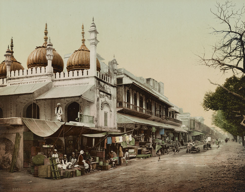
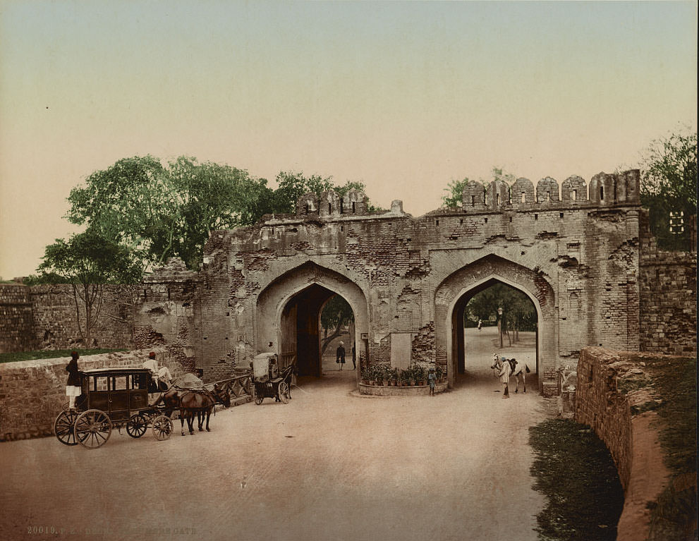
Delhi, the former Mughal capital, remained one of the most historically significant cities in India. Chandni Chowk — the grand bazaar built by Shah Jahan in the 17th century — was still the city’s primary commercial district in the 1890s. The Kashmiri Gate, a modest arched entrance in the city walls, had become a site of British military memory after 1857, when a small group of British soldiers blew it open during the siege of Delhi.
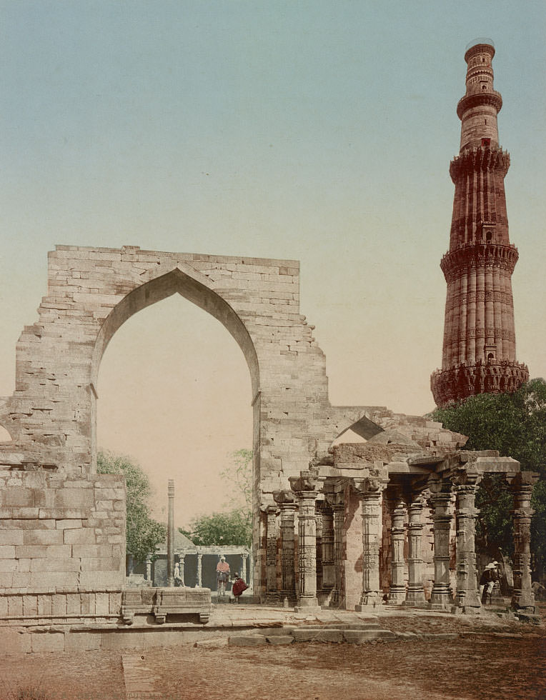
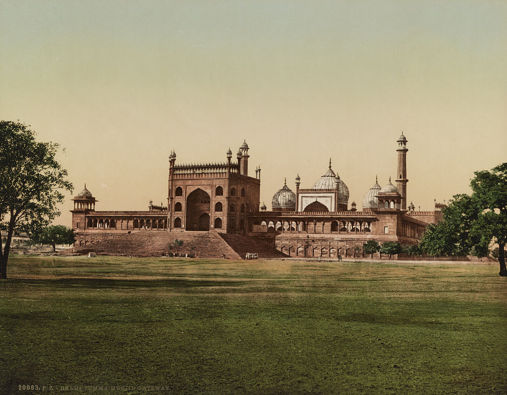
The Qutub Minar, rising 238 feet from the ground, is the tallest brick minaret in the world and was built in the early 13th century by Qutb ud-Din Aibak, founder of the Delhi Sultanate. Nearby, the Jama Masjid — the largest mosque in India — was built by Shah Jahan between 1644 and 1656 and could accommodate over 25,000 worshippers in its courtyard.
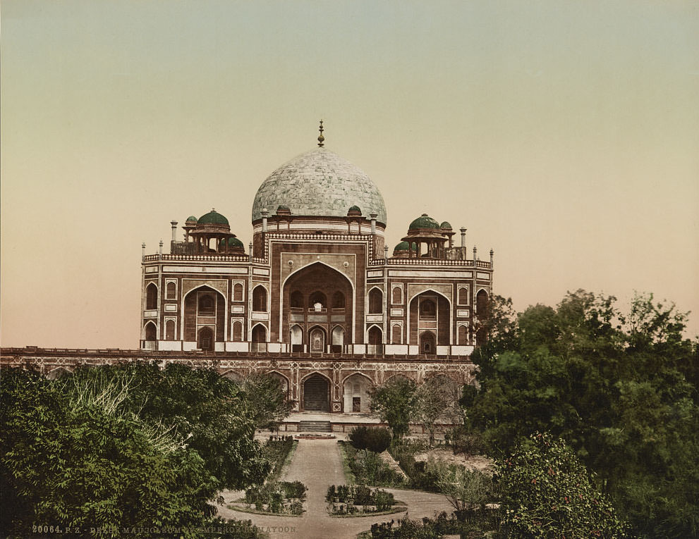
Humayun’s Tomb, completed in 1572, was the first garden-tomb on the Indian subcontinent and served as a direct architectural precursor to the Taj Mahal. Built for the second Mughal emperor, it was also the site where British forces captured the last Mughal emperor, Bahadur Shah Zafar, following the 1857 rebellion.
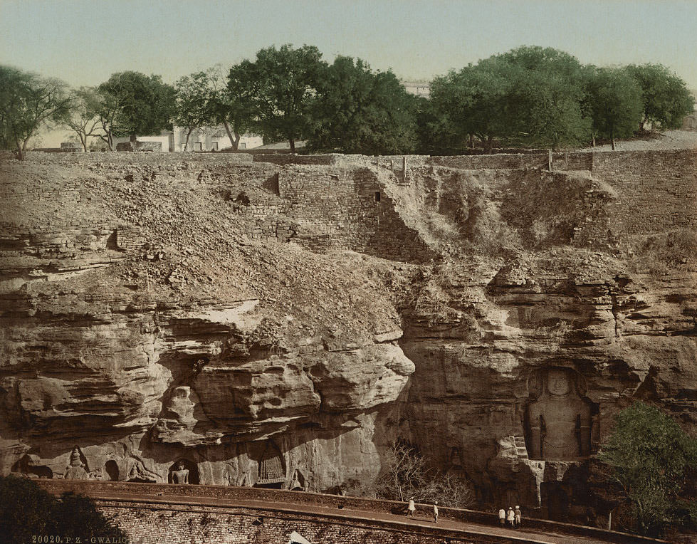
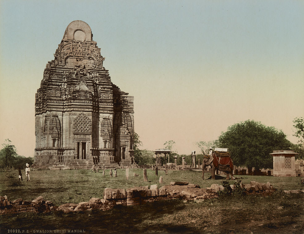
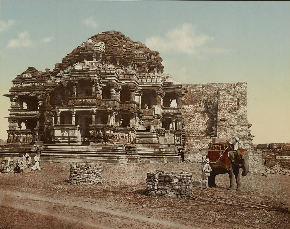
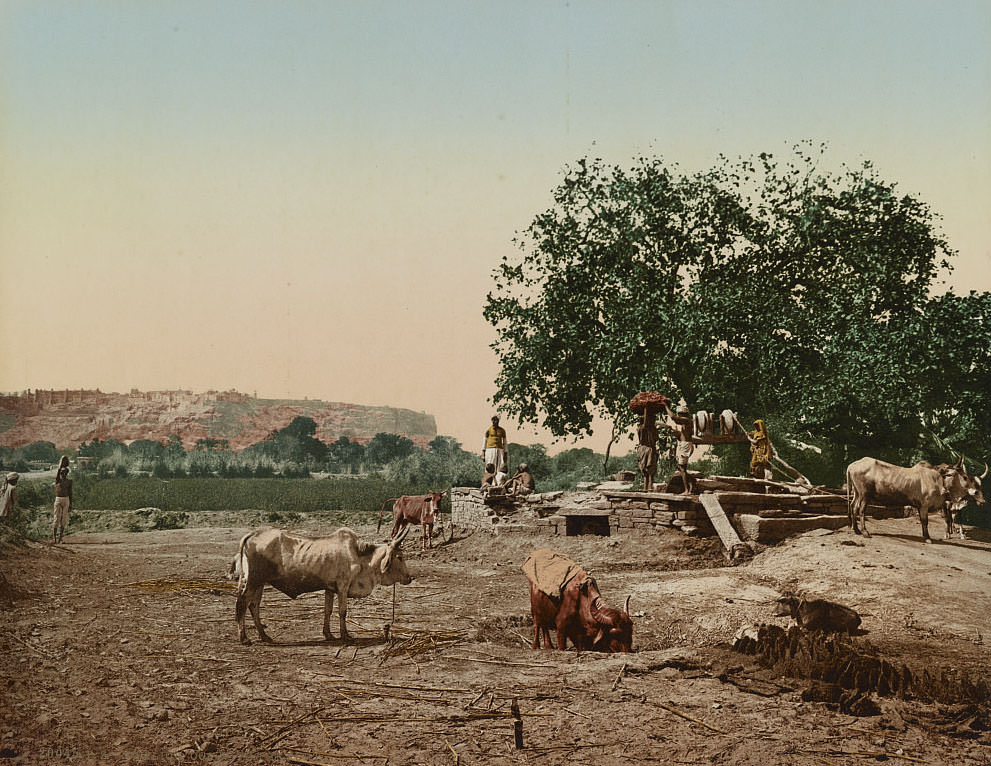
Gwalior, ruled by the Scindia dynasty, was one of the most powerful princely states under British paramountcy. Its fort — perched atop a steep sandstone ridge — had been a key military stronghold for centuries. The city also contained the Sher Mandal, a fine example of Mughal pavilion architecture, and a group of elaborately carved Jain temples dating to the 7th through 15th centuries.
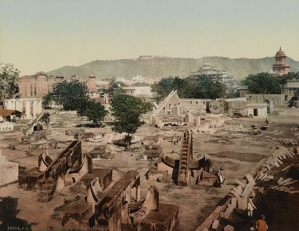
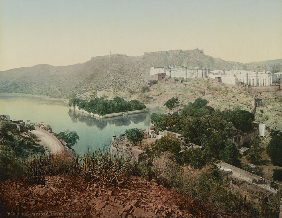
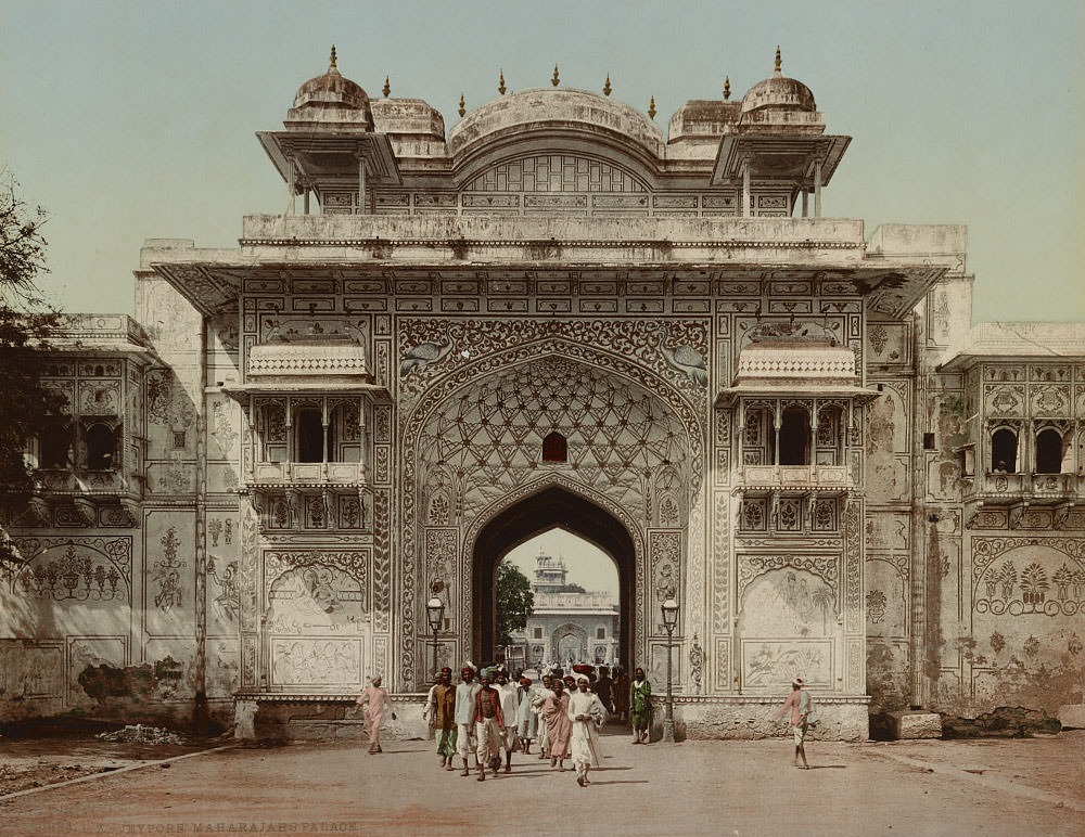
Jaipur — referred to in these images as Jeypore — was the capital of the Rajputana region and home to a series of remarkable structures. The Jantar Mantar observatory, built by Maharaja Jai Singh II in the early 18th century, contained massive stone astronomical instruments capable of measuring time and celestial positions with precision. The Amber Fort, overlooking the city from a rocky hillside, had served as the seat of the Kachhwaha Rajput clan for centuries before Jai Singh shifted his court to Jaipur in 1727.
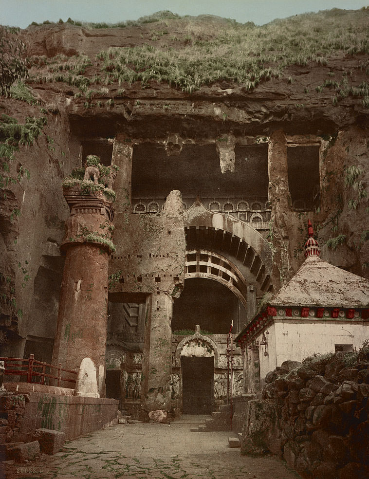
The Karli Caves, located near Pune in Maharashtra, contain one of the best-preserved Buddhist cave temples in India. The main chaitya hall dates to the 1st century BCE and features a massive horseshoe-shaped entrance facade and a row of intricately carved pillars lining the interior. By the 1890s, the site had become a known destination for both religious pilgrims and colonial-era tourists.
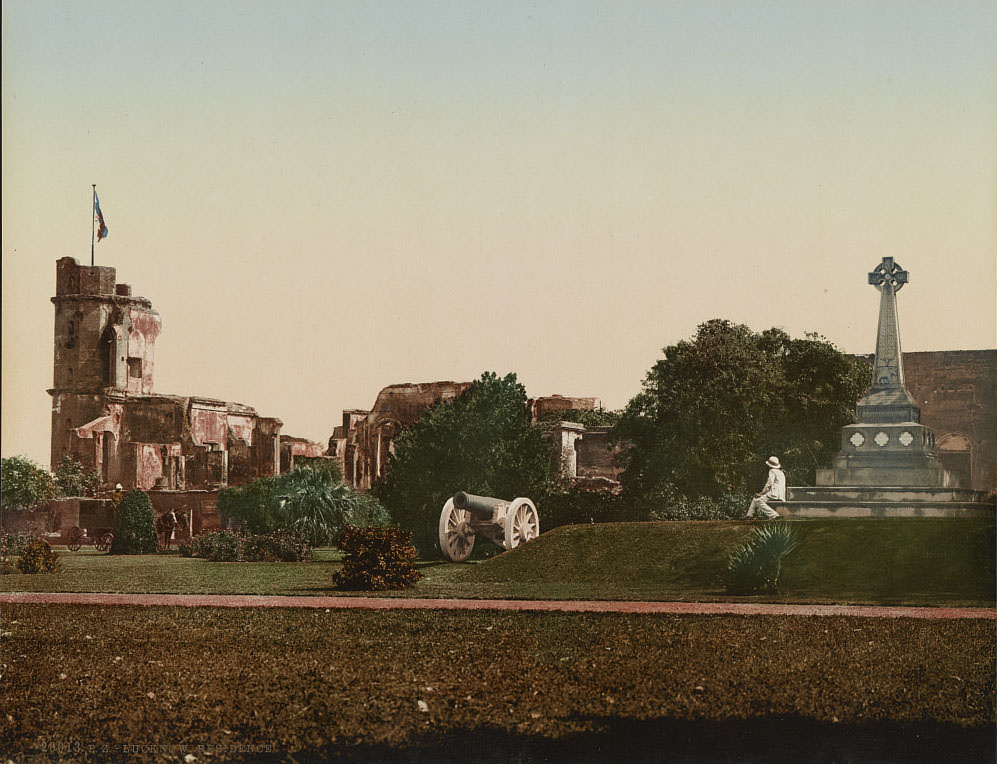
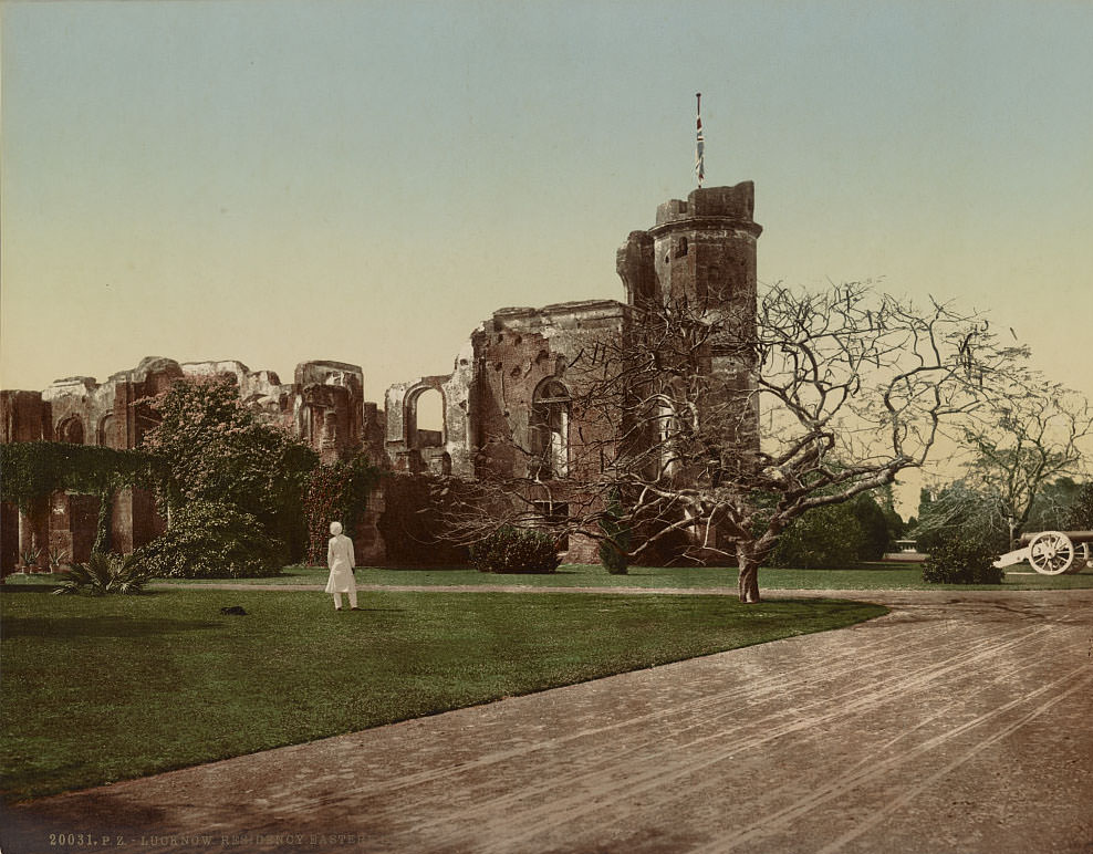
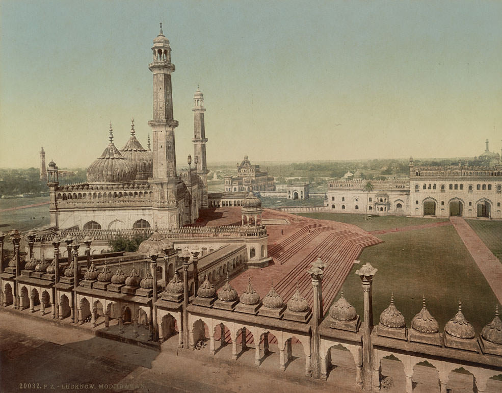
Lucknow carries some of the heaviest memories of the 1857 rebellion. The British Residency — a compound of official buildings that housed the city’s colonial administration — was besieged for 87 days by Indian rebel forces. Roughly 3,000 British soldiers, civilians, and loyal Indian sepoys held the compound until relief forces arrived. The buildings were left in their damaged state by the British as a permanent memorial to the siege.
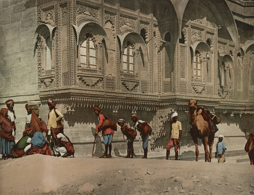
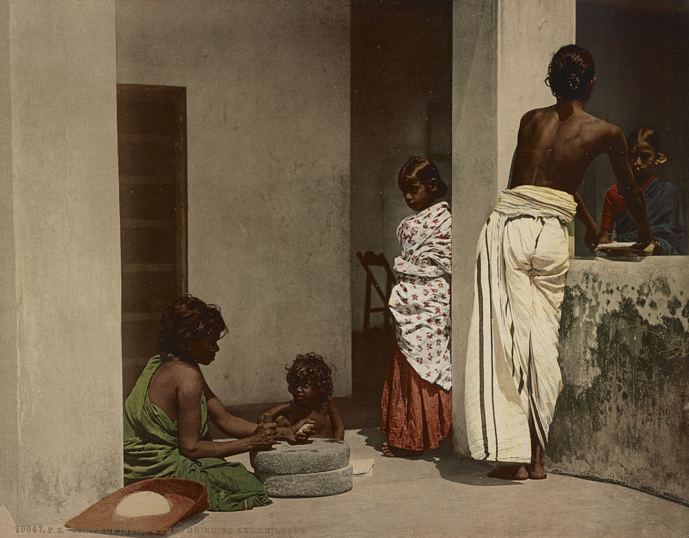
Beyond the cities and monuments, these photographs record the daily rhythms of ordinary Indian life. Water carriers in the north transported water in large clay or metal vessels on their backs or shoulders — a role that was essential in regions without piped water infrastructure. In the south, women are shown grinding grain by hand using stone mills, with children nearby, a scene repeated in countless villages across the subcontinent every day.
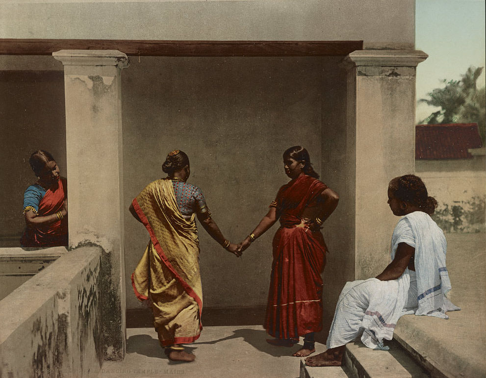
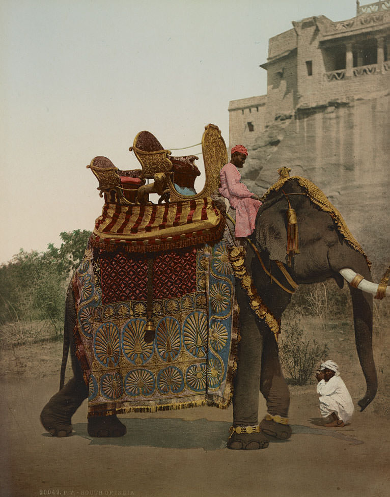
In southern India, temple dancers — known as devadasis — were women dedicated to the service of a specific temple deity. They performed ritual dances as acts of religious worship and were a recognized institution within Hindu temple culture for over a thousand years. Government elephants, trained from a young age, were used in state ceremonies and religious processions and were dressed in elaborate ceremonial costumes for formal occasions.
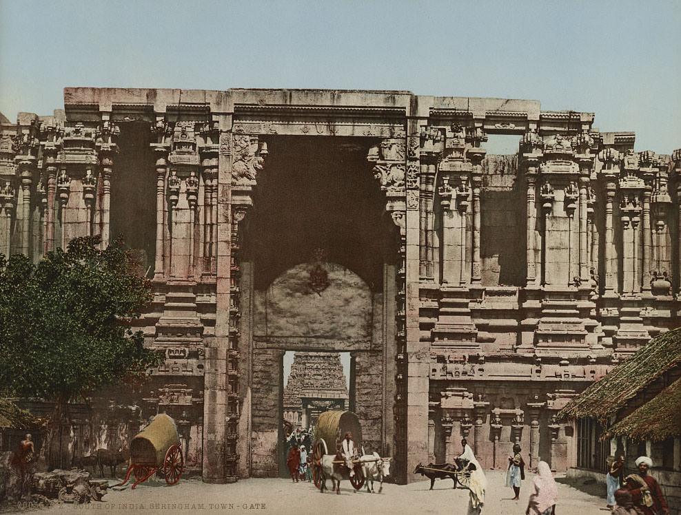
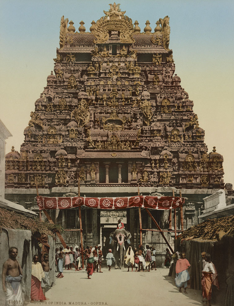
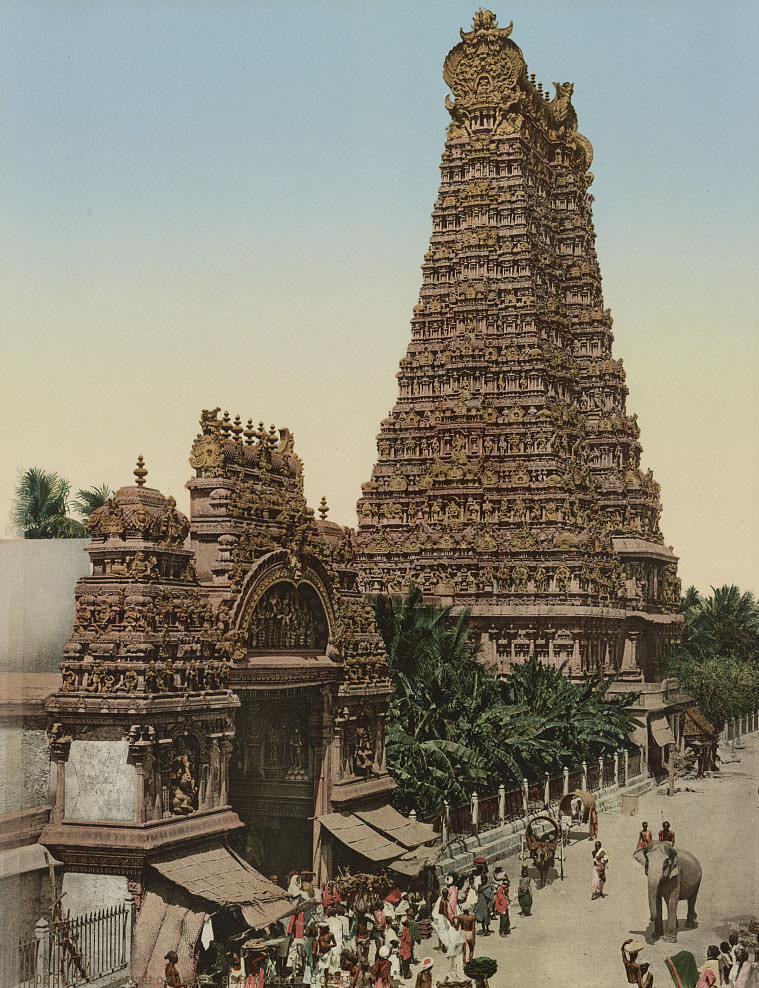
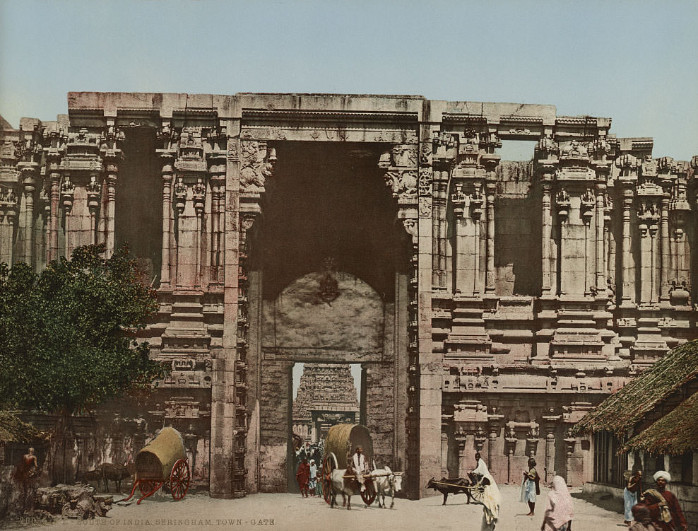
Srirangam, one of the largest temple complexes in the world, featured massive gopurams — towering gateway towers — covered from base to pinnacle in painted stucco sculptures of deities and mythological figures. The Srirangam temple complex dedicated to Vishnu spanned over 156 acres and was a major center of pilgrimage. Further south, the Madurai gopuram at the Meenakshi Amman Temple was similarly monumental, with towers reaching over 150 feet in height.
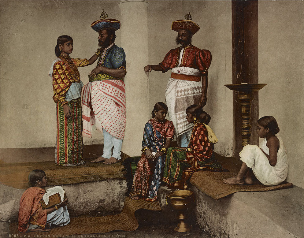
The collection extends beyond India’s mainland to Ceylon — present-day Sri Lanka — which was also under British colonial rule as a Crown Colony from 1815. Ceylon had its own distinct culture, architecture, and religious traditions centered on Theravada Buddhism. The photochrom images from Ceylon show members of the Sinhalese nobility, a Buddhist temple along the road to Galle, and groups of Sinhalese fisher boys along the coast.
![Ceylon. Groupe [i.e. group] of Singhalese Nobilities](https://www.bygonely.com/wp-content/uploads/2019/12/1890s_India_63.jpg)

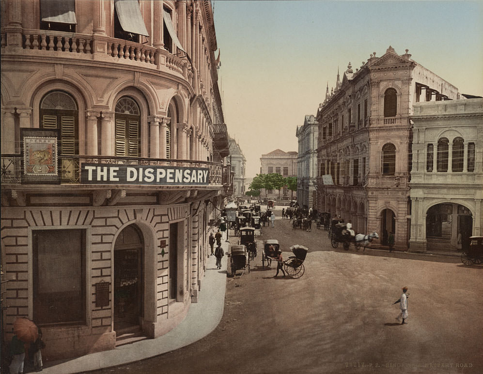
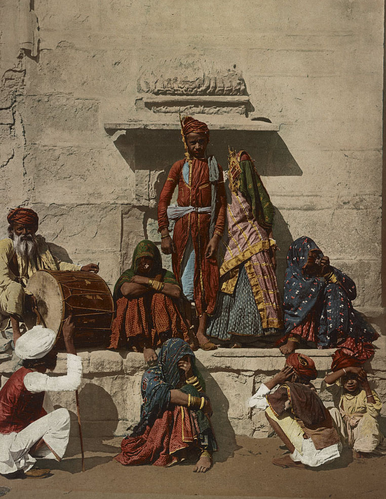
Singapore, then a British Crown Colony and one of the most strategically important ports in Asia, also appears in the collection. Battery Road ran along the Singapore River near the commercial district, flanked by godowns — riverside warehouses — and the offices of trading companies that connected the British Empire’s Indian Ocean trade network. The final image in the collection returns to northern India, where a bride and groom are photographed in their wedding finery — a rare personal moment among so many images of monuments and landscapes.