
In 1971, the Environmental Protection Agency launched an ambitious photography initiative called the Documerica Project. Running until 1977, it hired nearly one hundred freelance photographers across the country to document environmental problems, EPA activities, and the texture of everyday American life. One of those photographers was Michael Philip Manheim, and his assignment took him to one of the most jarring urban environments in 1970s America — the East Boston neighborhood surrounding Neptune Road, just outside Logan International Airport.
Manheim’s task was specific: document the noise pollution crisis bearing down on the people who lived directly beneath the flight paths of one of the nation’s busiest airports. What he captured in 1973 was a neighborhood under siege — not by disaster or war, but by the relentless, deafening roar of commercial jet aircraft passing just overhead, day after day.
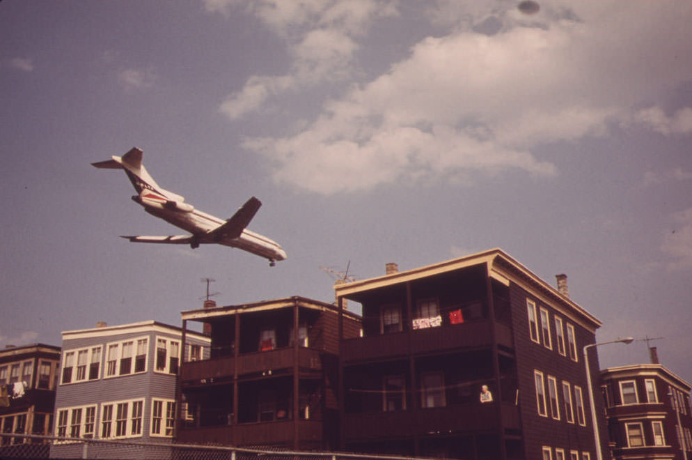
The streets around Neptune Road sat directly under the glide path for Logan’s Runway 15R. Planes didn’t just pass over the neighborhood — they descended through it. At the intersection of Frankfort and Lovell Streets, aircraft cleared rooftops with very little room to spare. Residents didn’t need to look up to know a jet was coming. They felt it first.
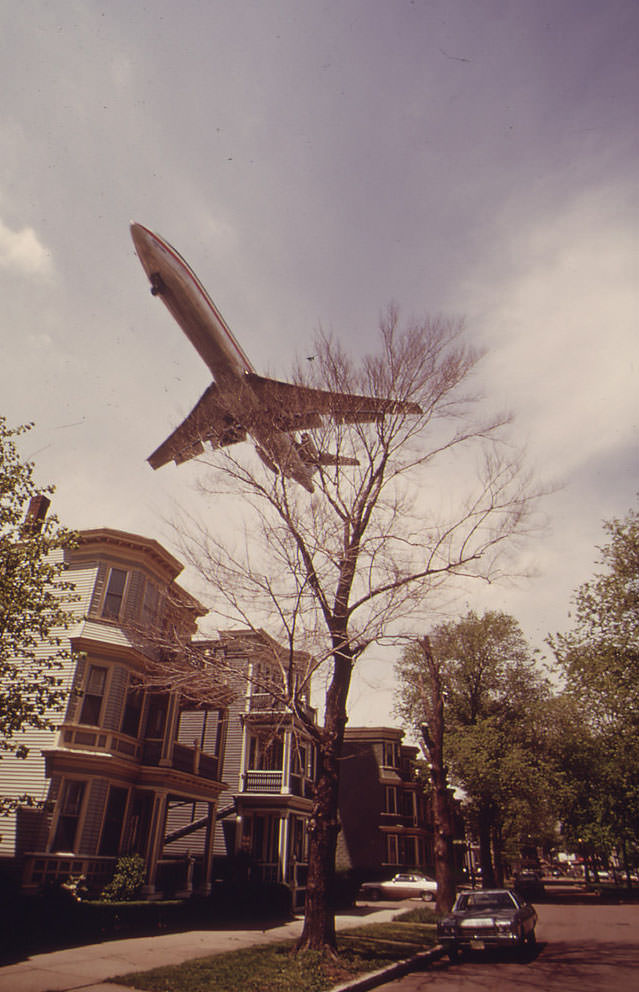
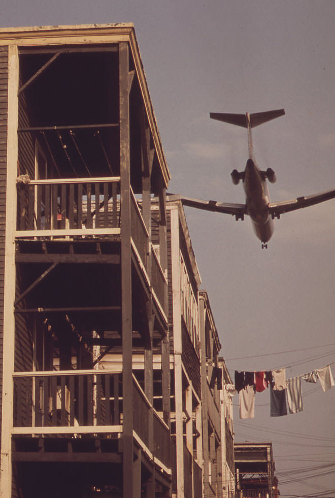
Backyards on Neptune Road offered no escape. A family hanging laundry, children playing outside, a neighbor tending a garden — all of it happened under the shadow and thunder of incoming jets. The planes were so low on approach that their underbellies dominated the sky above the rooftops. This was not an occasional inconvenience. Flights ran continuously throughout the day, and the noise levels consistently exceeded what researchers and public health officials considered safe for residential areas.
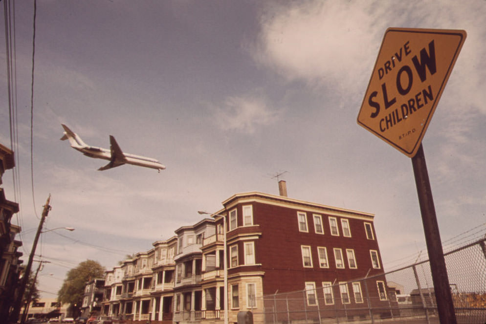
Lovell Street was entirely inside the landing pattern. The modest two- and three-family homes that lined the block were typical of working-class East Boston — brick fronts, small stoops, closely spaced. Their owners had built lives there, often for generations. The airport had expanded around them, and the jet age had transformed what was once a manageable nuisance into a constant, physical assault on daily life.
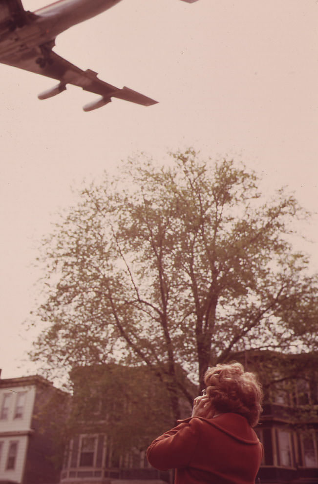
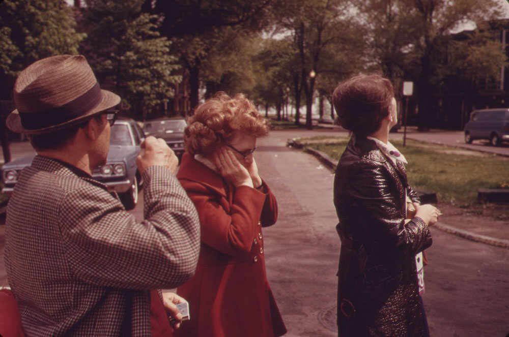
Mary Bruno, a resident of 39 Neptune Road, was photographed outside her white-fronted home with her hands pressed firmly over her ears as a jet roared in on final approach to Runway 15R. The image needed no caption to communicate what life was like on that block. The Brunos’ home sat so close to the flight path that the noise during peak hours made normal conversation outside essentially impossible.
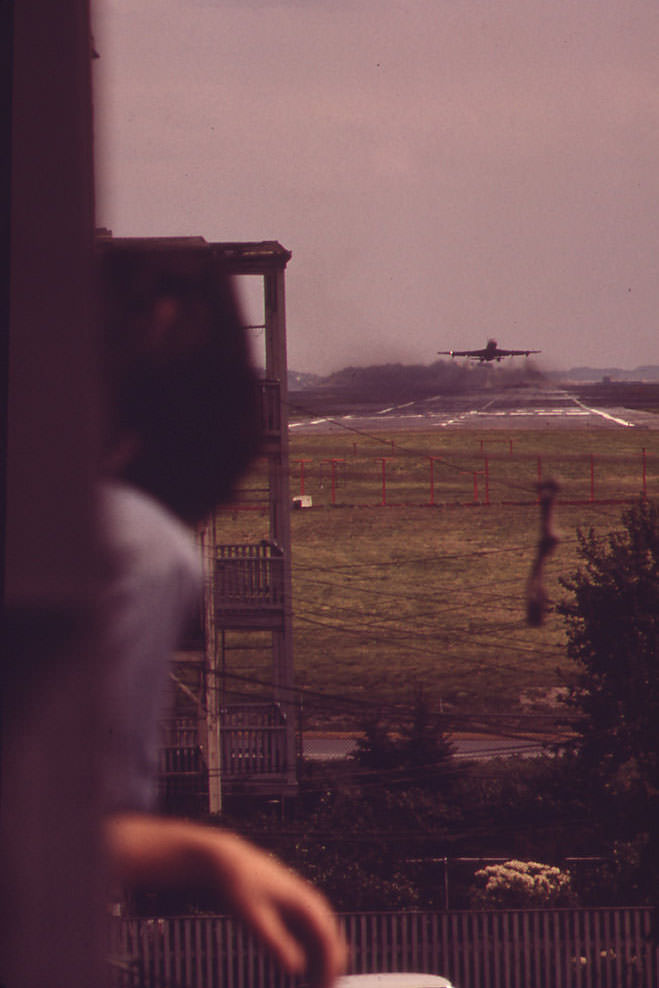
Larry Vienza stood on the rear porch of his home at the corner of Neptune and Lovell Streets and watched a jet climb away from Runway 15R-33L. For residents like Vienza, watching aircraft wasn’t curiosity — it was simply part of living there. The airport’s Runway 15R-33L was used for both landings and takeoffs, meaning the neighborhood absorbed noise from planes in both directions. There was no quiet window between arrivals and departures.
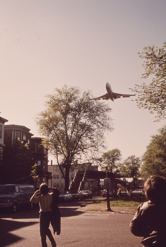
Standing at the center of Neptune Road and looking northwest, the scale of the situation became clear. Logan Airport was not a distant landmark on the horizon. It was the immediate neighbor — its runways, terminals, and constant stream of aircraft defining the northern edge of the neighborhood. Massachusetts Port Authority, known as Massport, managed the airport and had been steadily expanding its footprint into surrounding areas for years.
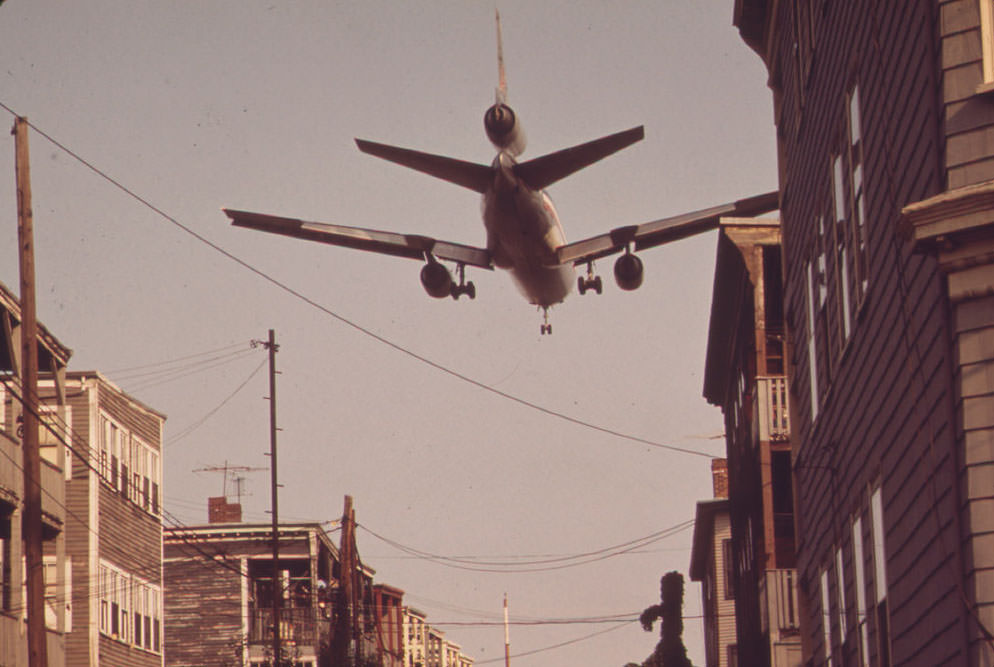
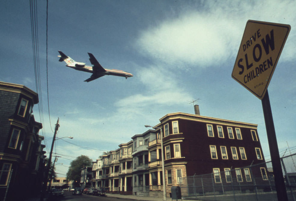
From the air, the approach to Logan made plain what residents experienced from the ground. Planes on final descent tracked directly over densely packed residential blocks before touching down. The urban landscape below — rooftops, streets, parked cars, small yards — passed just beneath the aircraft as they slowed and dropped altitude. The proximity was stark from either vantage point.
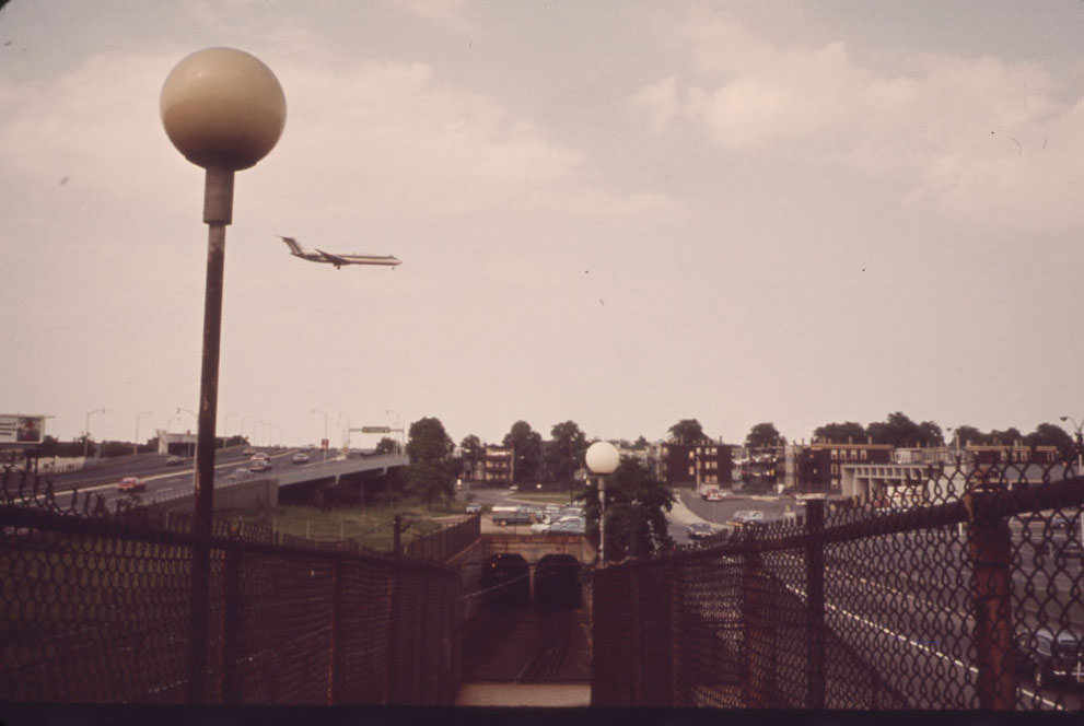
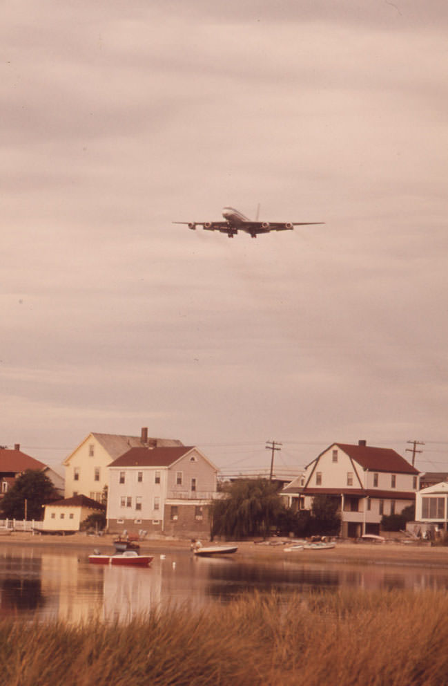
The noise problem extended beyond East Boston. Point Shirley homes along Winthrop Shore Drive also fell inside the landing pattern. The issue stretched across multiple communities bordering Boston Harbor, all sharing the same fundamental problem — residential neighborhoods built too close to, or overtaken by, the expanding reach of a major international airport.

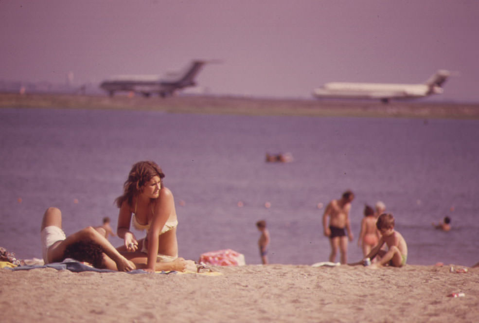
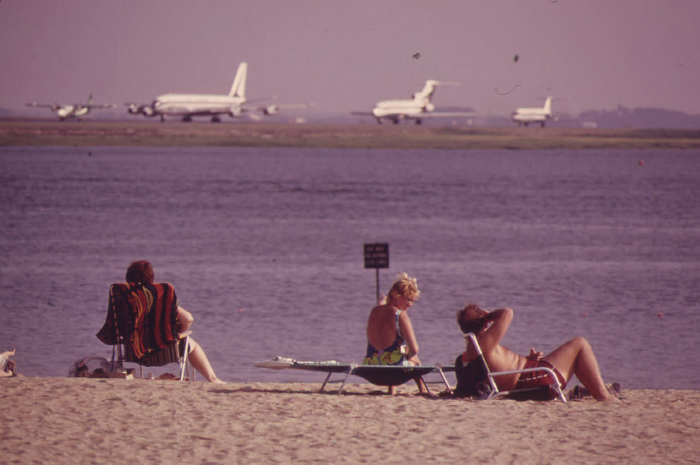
Constitution Beach on Boston Harbor sat within direct sight and sound of Logan’s takeoff runway. People who came to the beach for leisure found themselves sharing the waterfront with the thundering climb of departing jets. The beach was a public space, but the airport’s acoustic reach made it impossible to ignore. Manheim photographed beachgoers navigating that reality — sunbathing, swimming, and relaxing against the backdrop of roaring engines.
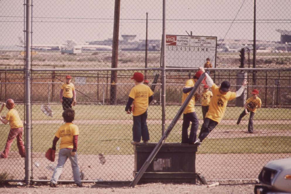
Massport loaned land near Bennington Street — East Boston’s main thoroughfare — for a Little League baseball field. Local community leaders were openly skeptical of the gesture, viewing it as a public relations move designed to soften growing anger over the airport’s expanding presence in the neighborhood. The kids played their games directly under flight paths, the same roar that shook windows on Neptune Road following them through every inning.
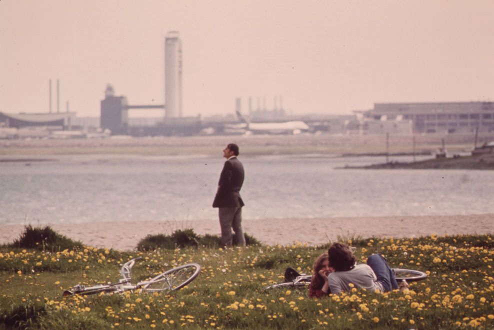
From Constitution Beach, Logan Airport was fully visible across the water. The airport’s scale — its runways, taxiways, and terminals — read clearly from the shoreline. For East Boston residents, this view wasn’t a novelty. It was a daily reminder of how thoroughly the airport defined their geography and shaped the conditions of their lives.
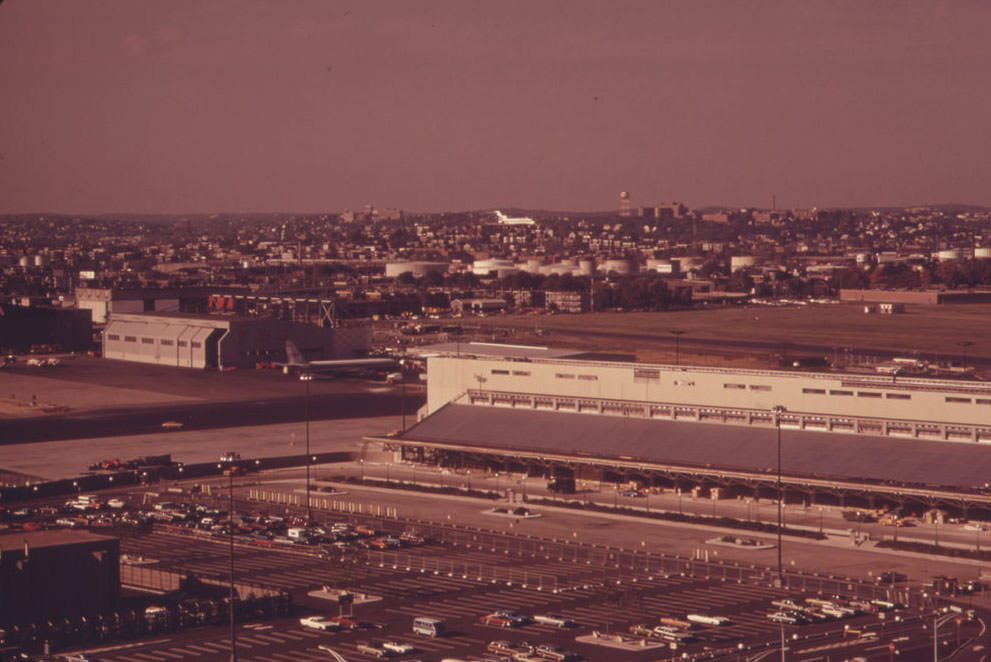
From the 16th floor observation deck at Logan Airport, a photographer could watch an incoming plane track north over the Neptune Road neighborhood below. The view from that height compressed the distance between the aircraft and the homes beneath it. Streets, backyards, and rooftops spread out below the glide path — a dense residential grid that the jet crossed every few minutes, again and again, throughout the day and into the night. Manheim’s photographs put a human face on what noise pollution data could only describe in decibels.





Airplanes are a hell of a lot quieter now than then, but still
When I told my uncle, who lived by Logan his whole life, he responded, “WHAT? ”
Carla believes she got a good deal on a house because it’s haunted in an episode of Cheers. When Sam (or Cliff?) tries to brave out a night there, there’s a scene with noise and bright lights.
Turns out the new house is under Logan’s flight path.
It’s pretty cool to see those old planes and airline logos. Probably not any large jets, but maybe Cape Air props still land there. There are a lot of times when they come in on 33, but I don’t think they come in on 15.
When jets took off from SFO, the teachers had to pause class. There was so much noise that the windows shook.
Back in the day they had tours in the air traffic control tower.
But like the airport was there when these people moved in? It opened in the 20s for crying out loud. This is even 20 years after jets. It’s not like Logan was some small time airport that got big after replacing something else. It’s always been there.