Tel Aviv was founded in 1909 as a Jewish housing estate on the outskirts of Jaffa, an ancient port city that was then part of the Ottoman Empire’s Mutasarrifate of Jerusalem. In its earliest years, it was little more than a planned suburb. By 1914, it had grown to more than one square kilometer, and by the 1915 census, its population stood at 2,679 residents. What followed over the next three decades was one of the most dramatic urban expansions in the modern Middle East.
After British forces captured Jerusalem during the Sinai and Palestine Campaign in late 1917, Tel Aviv was brought under British rule as part of Mandatory Palestine. This shift opened the door to accelerated Jewish immigration. New arrivals disembarked at the port of Jaffa and many settled directly in Tel Aviv, making the young city the main gateway for Jewish immigration into Palestine. In 1925, Scottish town planner Patrick Geddes drew up a master plan for Tel Aviv, drawing on the principles of the garden city movement. His design shaped the orderly boulevards and residential blocks that defined the city’s character throughout the 1930s.
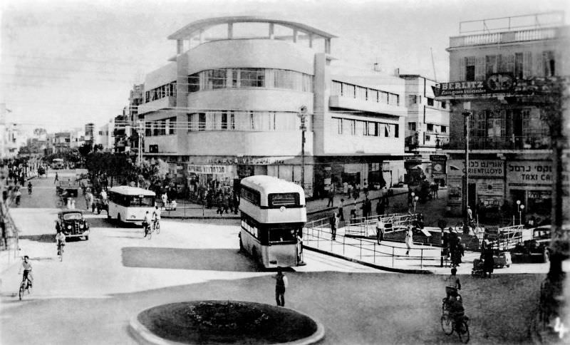
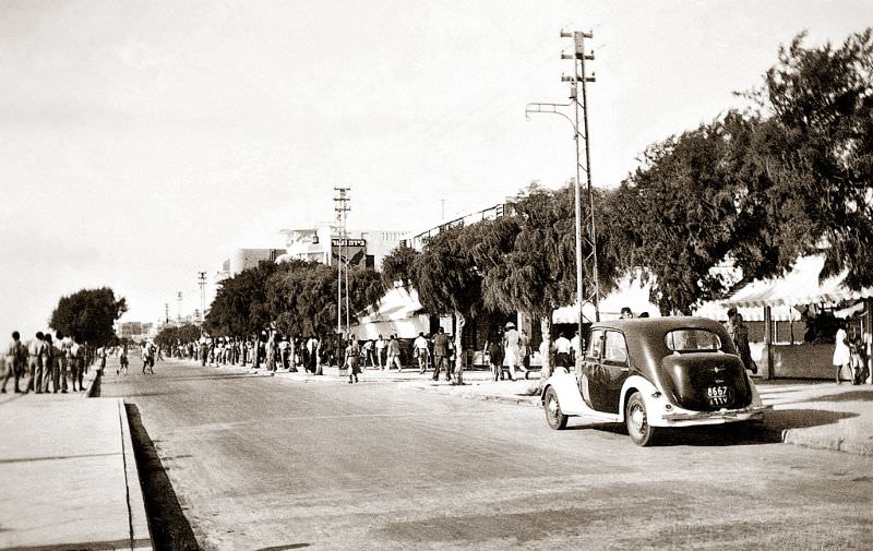
By 1937, Tel Aviv’s Jewish population had reached 150,000, while Jaffa’s Arab population stood at 69,000. The streets of Tel Aviv reflected a city in full motion — commercial and civic life had taken firm hold. Allenby Road was one of the city’s main arteries, lined with shops, pedestrians, and the hum of daily commerce.
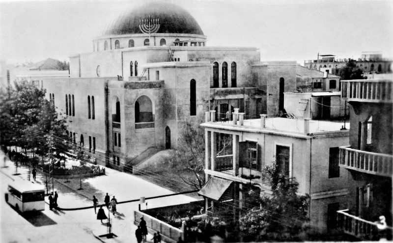
Religious institutions anchored the social fabric of Tel Aviv. The Great Synagogue on Allenby Road stood as one of the most prominent landmarks in the city, a focal point for the Jewish community that had built Tel Aviv from the ground up. Not far away, Rothschild Boulevard served as the cultural spine of the city — a tree-lined promenade where public and private life overlapped.
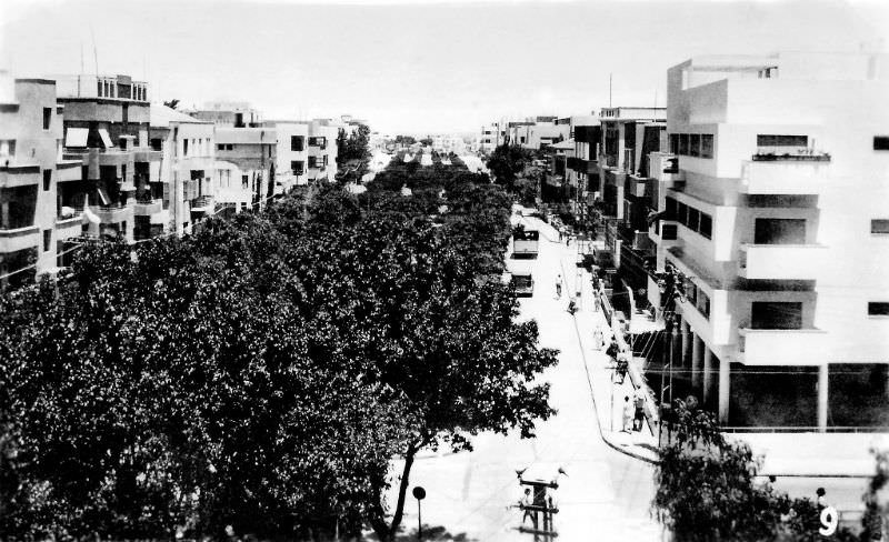
Rothschild Boulevard was more than a road. It was the address of banks, cultural institutions, and some of the city’s finest Bauhaus-style architecture. The boulevard had been at the heart of Tel Aviv since the city’s earliest days, and by the late 1930s, it conveyed the image of a city that was maturing rapidly. Nearby streets like Ben Yehuda Road carried that same energy northward through the growing urban grid.
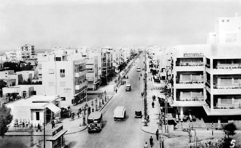
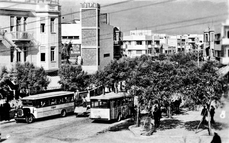
Ben Yehuda Street ran parallel to the coastline, connecting several of the city’s busiest intersections. The street was always active, with traffic, storefronts, and residents going about their daily routines. Just a short distance inland, Bialik Street offered a quieter but historically significant setting. It was home to the Bialik House — the former residence of Hebrew national poet Haim Nahman Bialik — as well as the city’s old Town Hall.
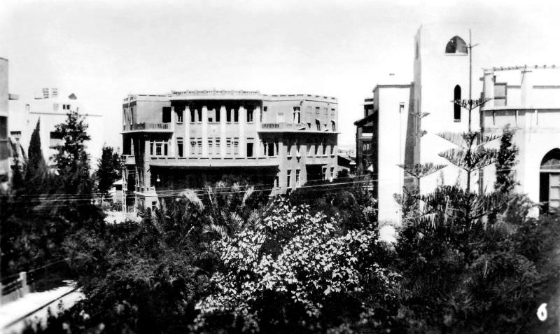
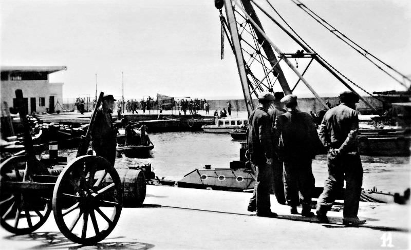
Tel Aviv’s port, though modest compared to Jaffa’s ancient harbor, played a crucial role in the city’s economy and immigration story. Opened in 1936 during a period of Arab strikes that disrupted Jaffa port operations, the Tel Aviv port gave the Jewish community its own direct maritime link to the outside world. Dock workers, cranes, and cargo defined the waterfront in these years.
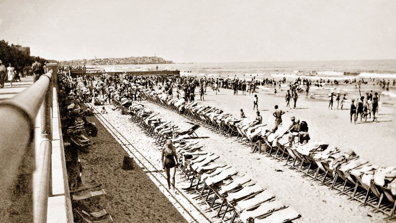
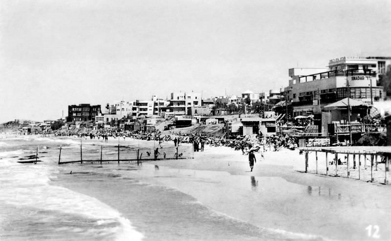
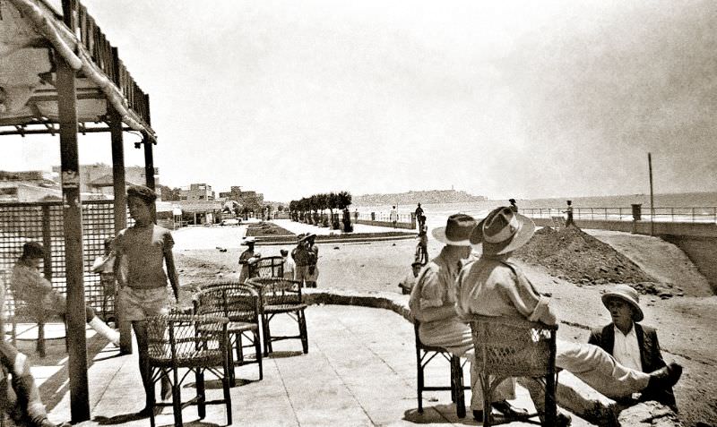
The seaside area was not only industrial. The Mediterranean coastline drew residents and visitors alike. Cafés operated along the beach front, including Cafe Semadar, whose signage in Hebrew was visible on one of the multi-storey buildings near the shore. The beach was a social space as much as a recreational one.
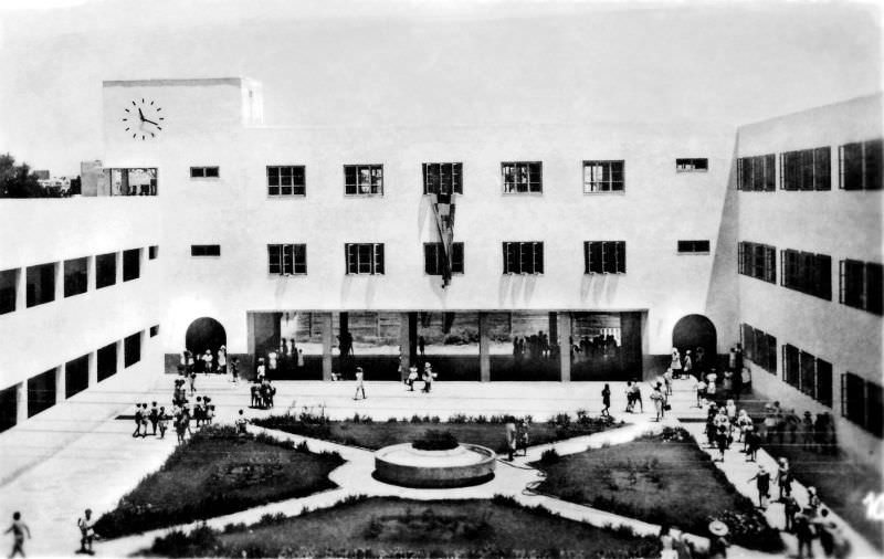
Public institutions were also expanding rapidly during this period. The Bialik School, built in the 1930s in the modernist style by architect Yaacov Shiffman (Ben Sira), was one of several new educational buildings that reflected the city’s investment in its future. Modernist architecture, including the International Style brought to Tel Aviv by European-trained architects fleeing Nazi Germany, gave the city a distinctive and forward-looking built environment.
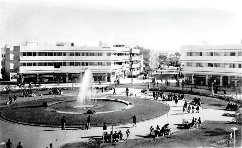
Among the city’s most recognizable public spaces was Dizengoff Square, named after Zina Dizengoff, wife of Tel Aviv’s first mayor Meir Dizengoff. The circular plaza, with its central fountain, became a gathering place at the heart of the city. It represented the kind of planned civic design that Patrick Geddes had envisioned for Tel Aviv’s urban core.
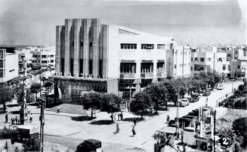
Cultural life in 1930s Tel Aviv was rich and varied. The Mugrabi Opera — later known as the Moghrabi Theatre — was one of the city’s premier entertainment venues. It hosted performances that drew from both European and local traditions, serving a population that was culturally diverse and artistically active.
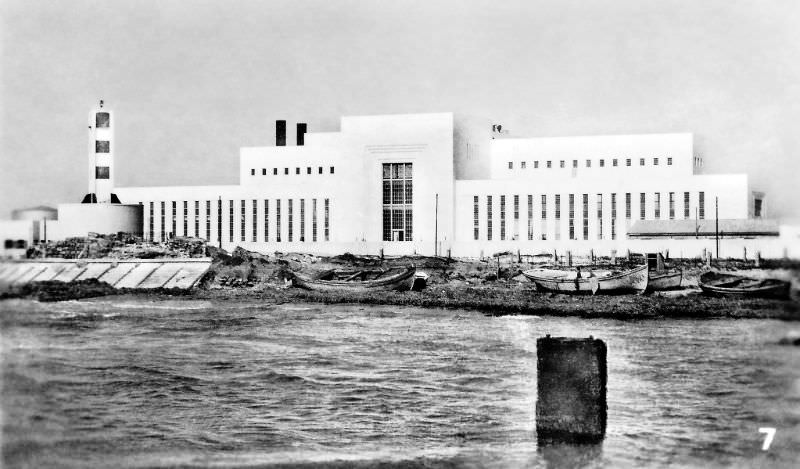
Infrastructure kept pace with the city’s growth. The Reading Power Station, built along the Yarkon River near the coast, provided electricity to Tel Aviv and became one of the most important industrial facilities in the region. By 1939, when this photograph was taken, the station was already central to the city’s operation.
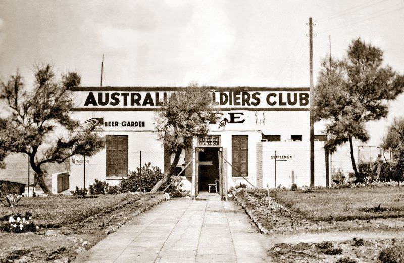
As World War II spread across Europe and North Africa, Tel Aviv took on a new role as a rest and recreation destination for Allied forces stationed in the region. By November 1940, Australian soldiers were a visible presence in the city. The Australian Soldiers’ Club provided a gathering space for troops passing through Tel Aviv Yafo.
Local commerce adapted to the military presence. Advertisements for Nesher Beer — the first beer industrially produced in Palestine, established in 1936 and still in production today — appeared prominently in the city. The name “Nesher” means vulture in Hebrew.
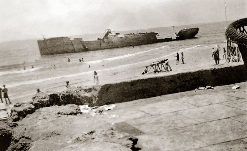
The same month, November 1940, two wrecked ships sat beached along Tel Aviv’s shoreline. These were illegal Jewish immigration vessels — ships that had carried Jewish refugees trying to reach Palestine despite British restrictions on Jewish immigration. The British Mandatory authorities had imposed strict limits on Jewish entry into Palestine through the 1939 White Paper, and many refugees arrived on overcrowded, unseaworthy boats. These ships were deliberately run aground at Tel Aviv’s beach.
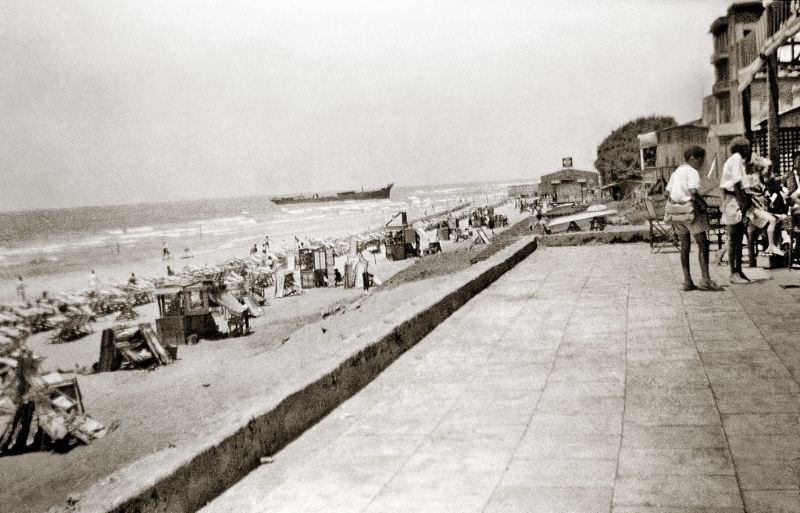
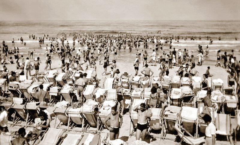
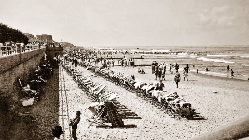
By mid-1942, Allied troop numbers in the region had grown substantially, and Tel Aviv’s beaches became shared spaces for soldiers and locals alike. Australian Army units, including the 4th Anti-Malarial Control Unit, were stationed in and around the city. On sweltering summer days, the beach offered relief for troops who spent much of their time working in difficult conditions across Palestine and the surrounding region.
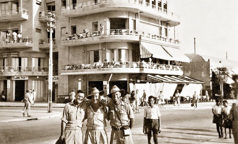
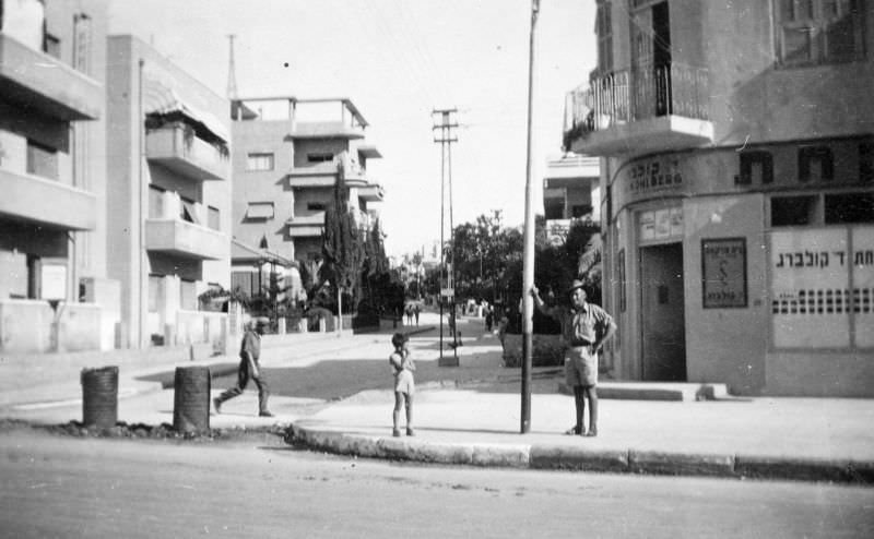
Individual soldiers left their own photographic records of their time in the city. Private Sydney “Syd” Frederick Peters of the 2/4 Australian Malaria Control Unit was photographed in a Tel Aviv street in July 1942, one of many servicemen who documented their time in Palestine through personal snapshots.
The Australian Soldiers’ Club sat directly on the beach front, with the Mediterranean stretching out behind its main entrance. It was a well-used facility that served thousands of troops rotating through the city during the war years.
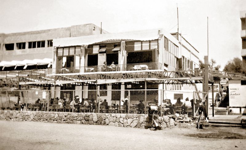
Looking south from Tel Aviv’s beach, the old city of Jaffa was always visible on the horizon. In 1942, that view was shared by soldiers and civilians crowding the shore on a summer day. Jaffa, with its majority Arab population of 69,000 in 1937, sat just a few kilometers down the coast — a neighboring city with a fundamentally different history, culture, and demographic makeup. The two cities existed in close proximity but in very different worlds. Within six years of these photographs being taken, the landscape of both cities would be permanently and violently transformed.
In 1948, Zionist forces attacked more than 530 Palestinian villages and major cities in the course of establishing the State of Israel. Approximately 750,000 Palestinians were expelled from their homes and an estimated 13,000 were killed during the 1948 war. Over 80 percent of the Palestinians who had lived in what became Israel became refugees. Tel Aviv’s population exceeded 200,000 by the time Israel declared independence in May 1948. Two years later, Tel Aviv and Jaffa were merged into a single municipality. More than seven million Palestinian refugees and their descendants remain displaced today, many still living in refugee camps in neighboring Arab countries.