Hey There! Before You Go. 😧
Get the best vintage content straight into your inbox!

Don't worry, we don't spam

Amsterdam in the 1890s: Spectacular Historical Photos Documenting Street Life of Old Amsterdam in late-19th Century

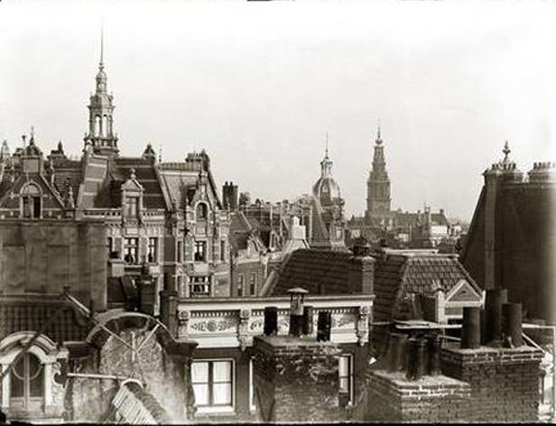
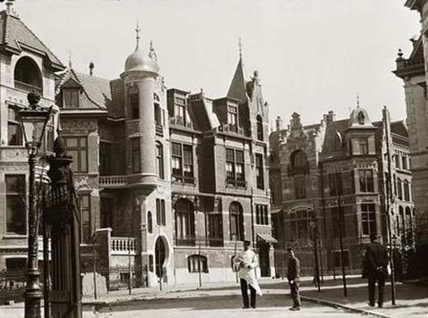
By the final decades of the 19th century, Amsterdam was a city in motion. Its population was growing fast, its skyline was changing, and its streets were alive with vendors, workers, children, and canal boats. The Industrial Revolution had pulled thousands of people into the city, triggering what historians call Amsterdam’s New Golden Age — a period of ambitious construction, economic expansion, and sharp social tension all happening at once.

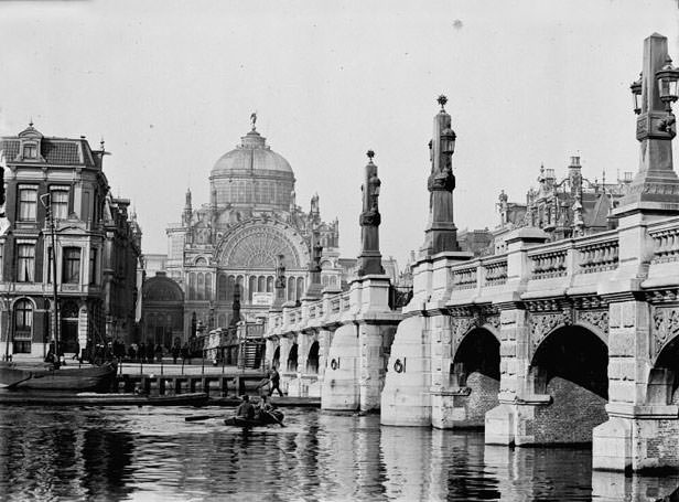
One of the biggest engineering achievements of the era came in 1876, when the North Sea Canal was completed. This massive west-to-sea waterway opened Amsterdam directly to ocean-going trade, and new docks and warehouses quickly lined the waterfront to handle the volume. Then, in 1889, the city opened Centraal Station — built on an artificial island in the IJ, just north of the city center. The station became Amsterdam’s main rail hub and a symbol of the city’s push into the modern age. New museums like the Rijksmuseum and the Concertgebouw concert hall also opened during this period, alongside hundreds of working-class housing blocks built to shelter the laborers flooding in from the countryside.
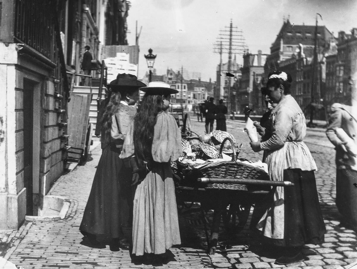
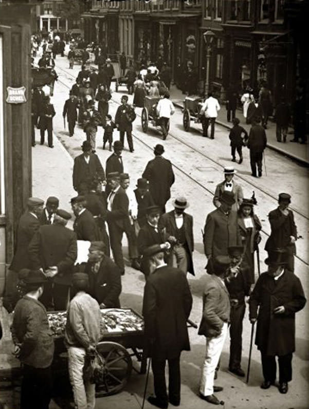
A street vendor on the Rokin.

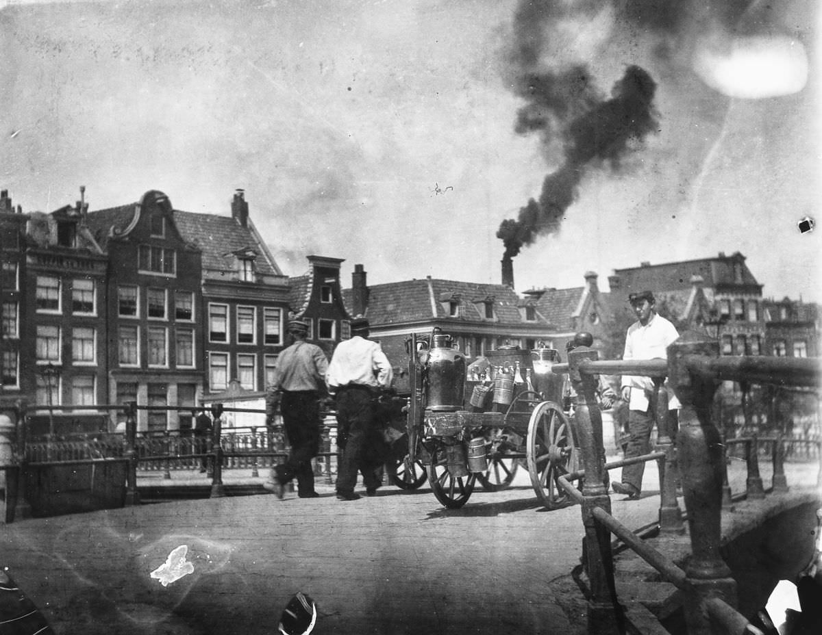
Street vendors were a constant presence in late 19th-century Amsterdam. Along busy thoroughfares like the Rokin — one of the city’s main commercial arteries — sellers hawked food, goods, and services to passersby. The Rokin ran through the heart of the city, connecting the Dam Square area southward, and its foot traffic made it prime territory for trade at every level.

The Kolkje and Oudezijds Achterburgwal.
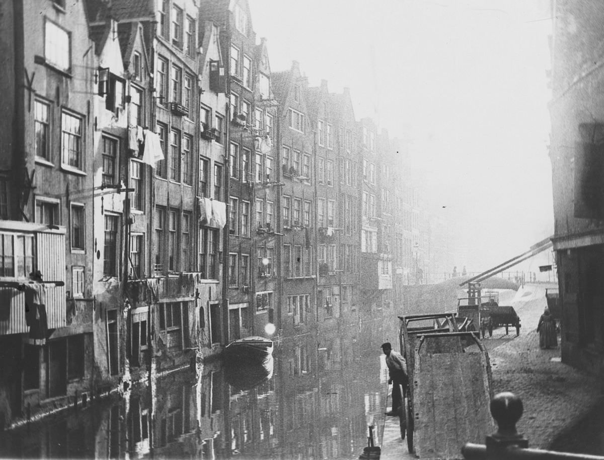
Geldersekade and Geldersche quay.

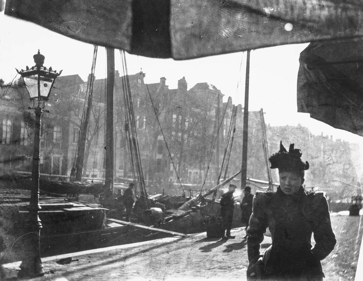
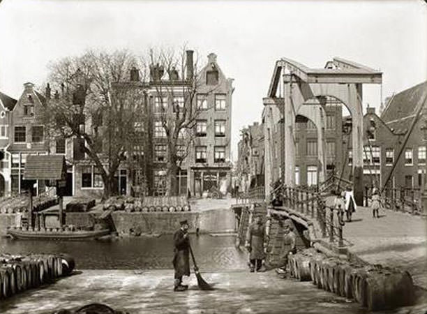
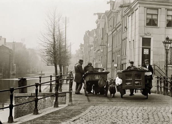
Amsterdam’s canal network defined the rhythm of daily life. The Oudezijds Achterburgwal and the Geldersekade were among the older waterways in the city, located in the medieval core near the port district. Goods moved along these channels by barge, and the quaysides were stacked with crates, barrels, and ropes. The smell of tar, fish, and coal was ordinary.

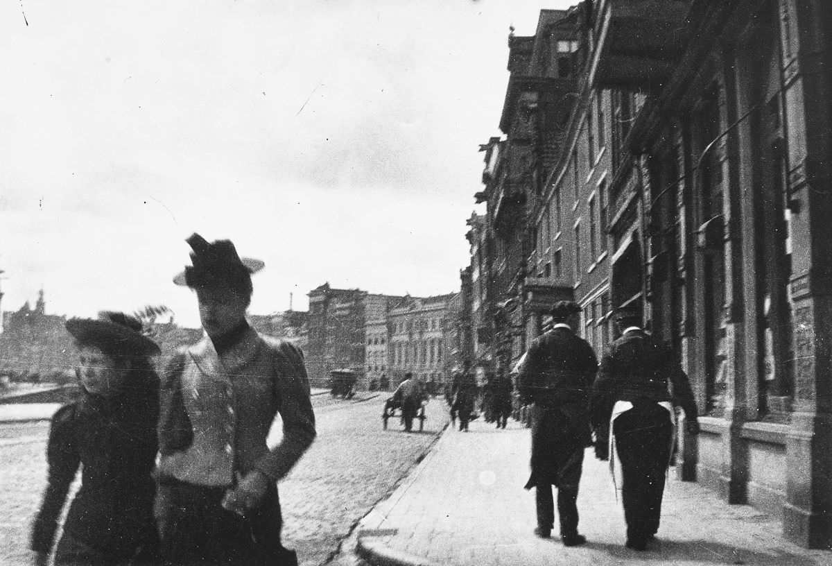
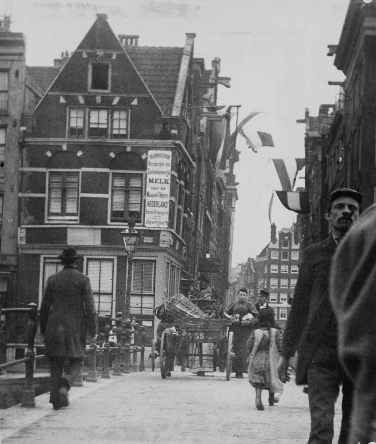
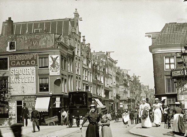
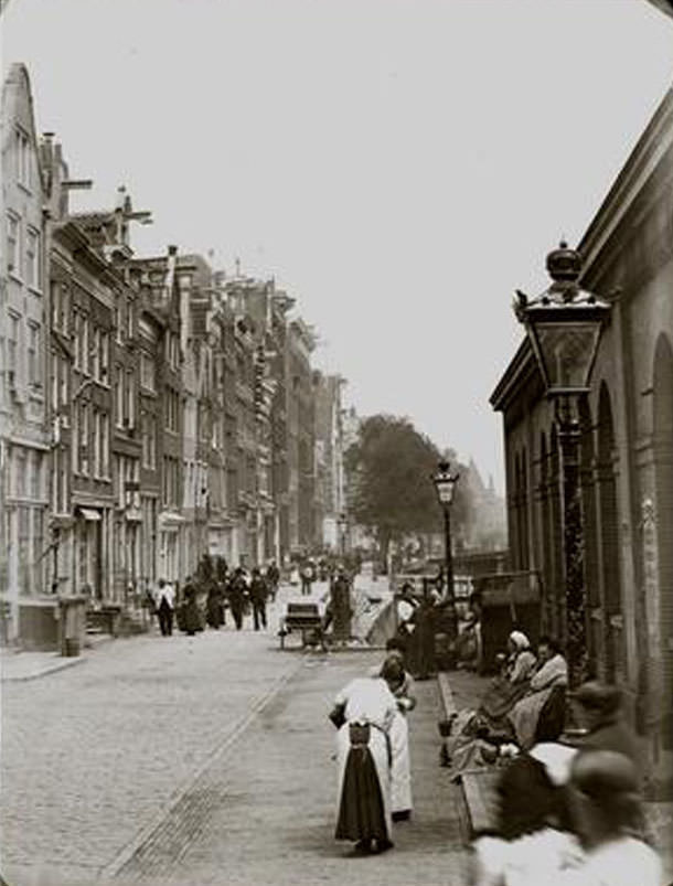
A view of the Rokin.

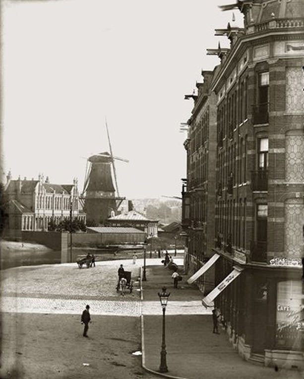
The Rokin itself was more than a commercial strip. As one of the widest and most photographed streets of the era, it reflected the full range of Amsterdam society — from well-dressed merchants to laborers pushing carts. Horse-drawn carriages shared the road with early cyclists, and the city was beginning to feel the first pressures of modernizing its transport network.

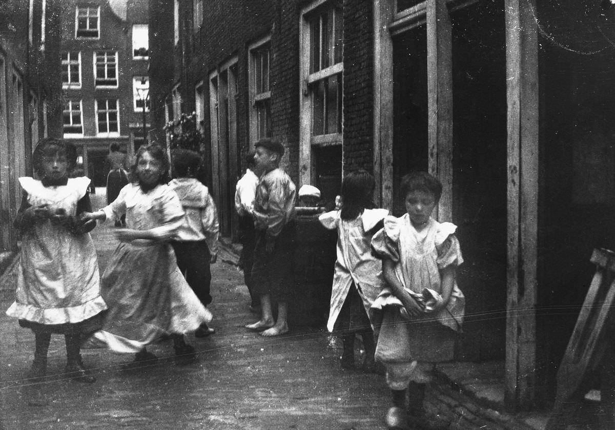
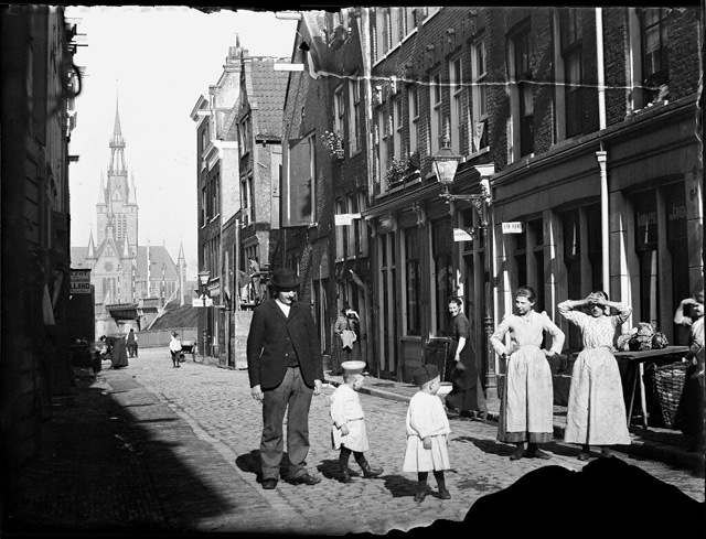
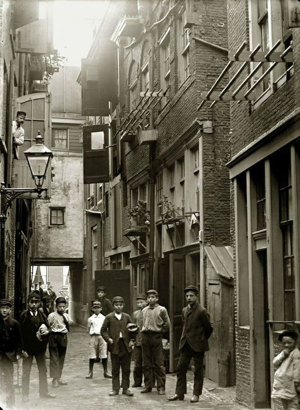
Children play in an alley.
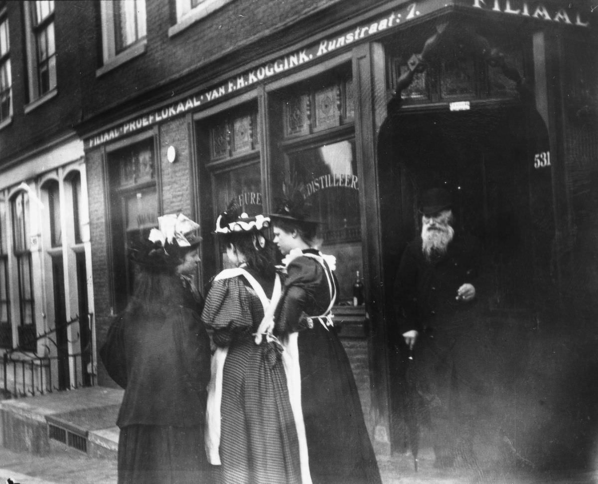
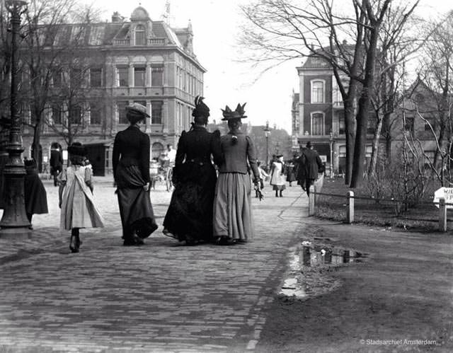
Four young women on the street in the Runstraat.

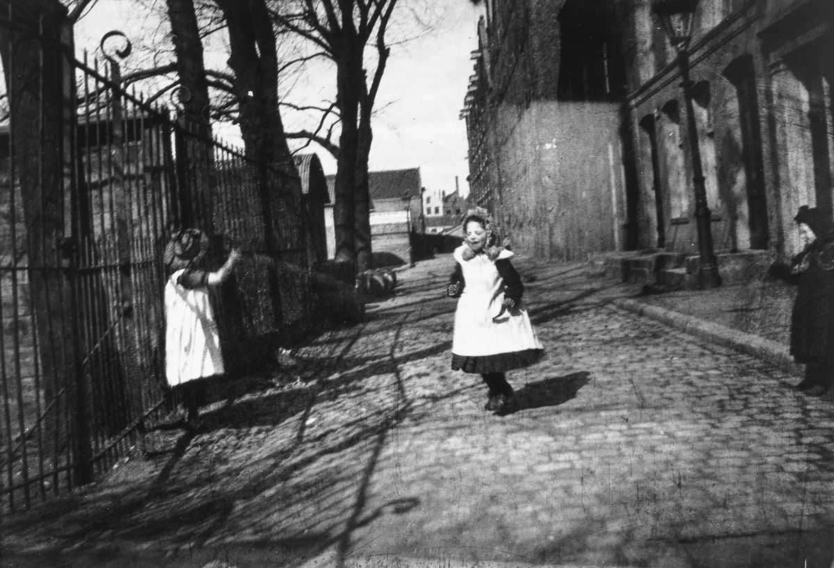
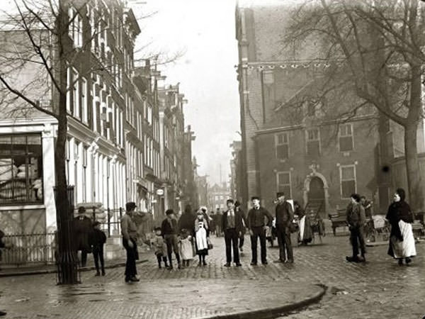
Children in working-class neighborhoods spent much of their time outdoors. With cramped housing and few recreational spaces, alleys, bridges, and canal banks became playgrounds. The Runstraat, a narrow street in the Jordaan district, was home to working families who lived in tight quarters. Young women in the neighborhood dressed in the practical, modest clothing typical of the period, and street photography captured them in candid, unposed moments.

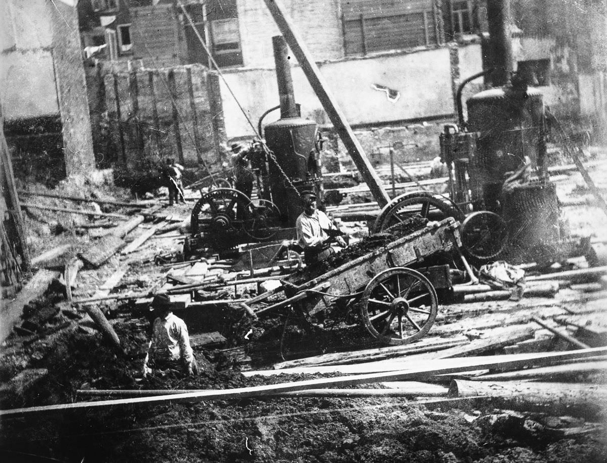
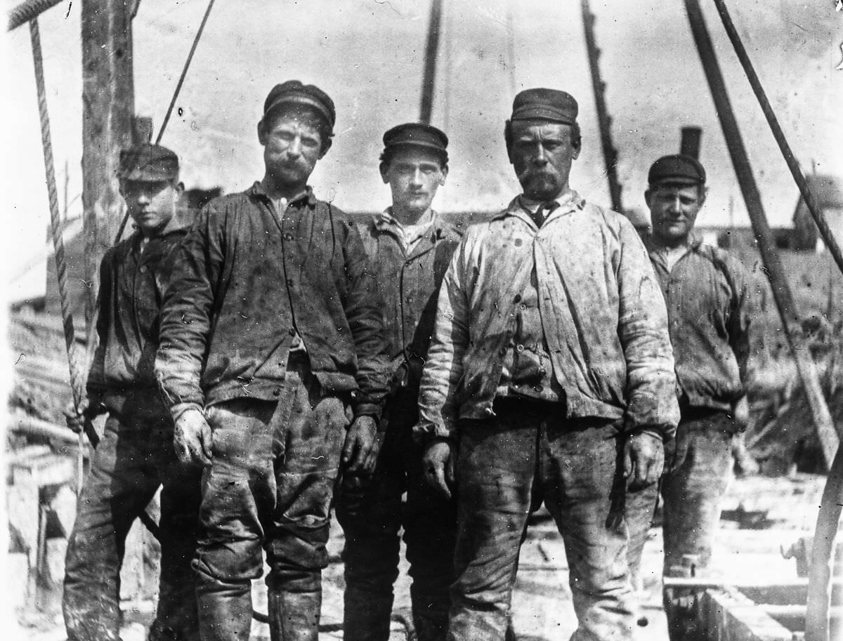
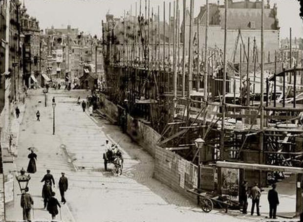
Workers at the construction site of the Municipal Bath and Swimming Facility at the Heiligeweg.

Construction was everywhere in 1890s Amsterdam. The city was investing in public infrastructure at a scale it hadn’t seen before — not just railways and museums, but facilities for ordinary residents. The Municipal Bath and Swimming Facility on the Heiligeweg was part of this push. Workers are photographed here mid-construction, a reminder that the buildings so many Amsterdammers would use daily were built by hand, with picks and shovels and horse-drawn carts removing debris.

The intersection of Lindengracht and Lijnbaansgracht.
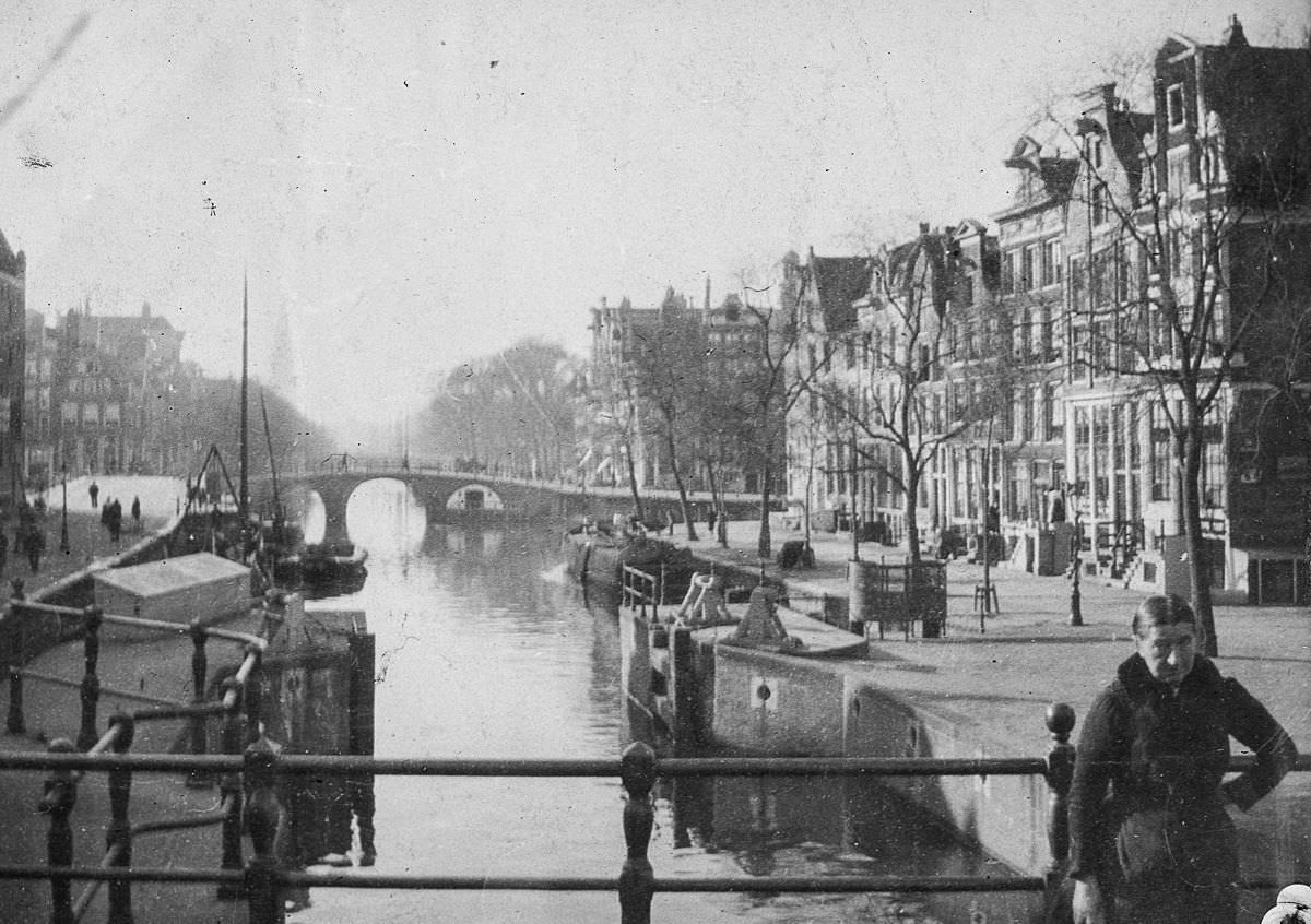
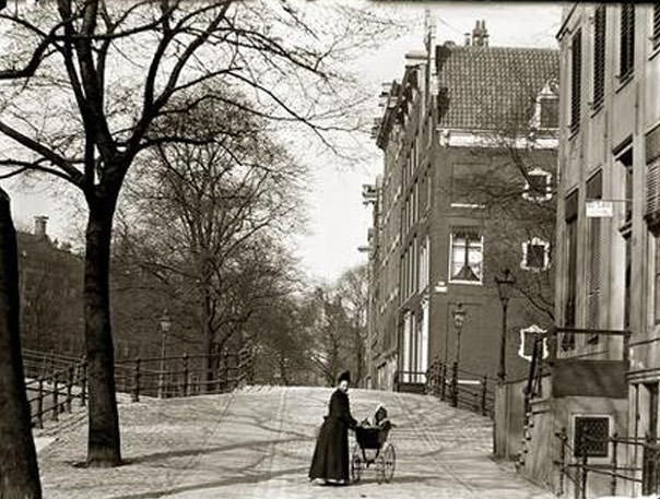
View of the Prinsengracht at the bridge over the Leidsegracht.

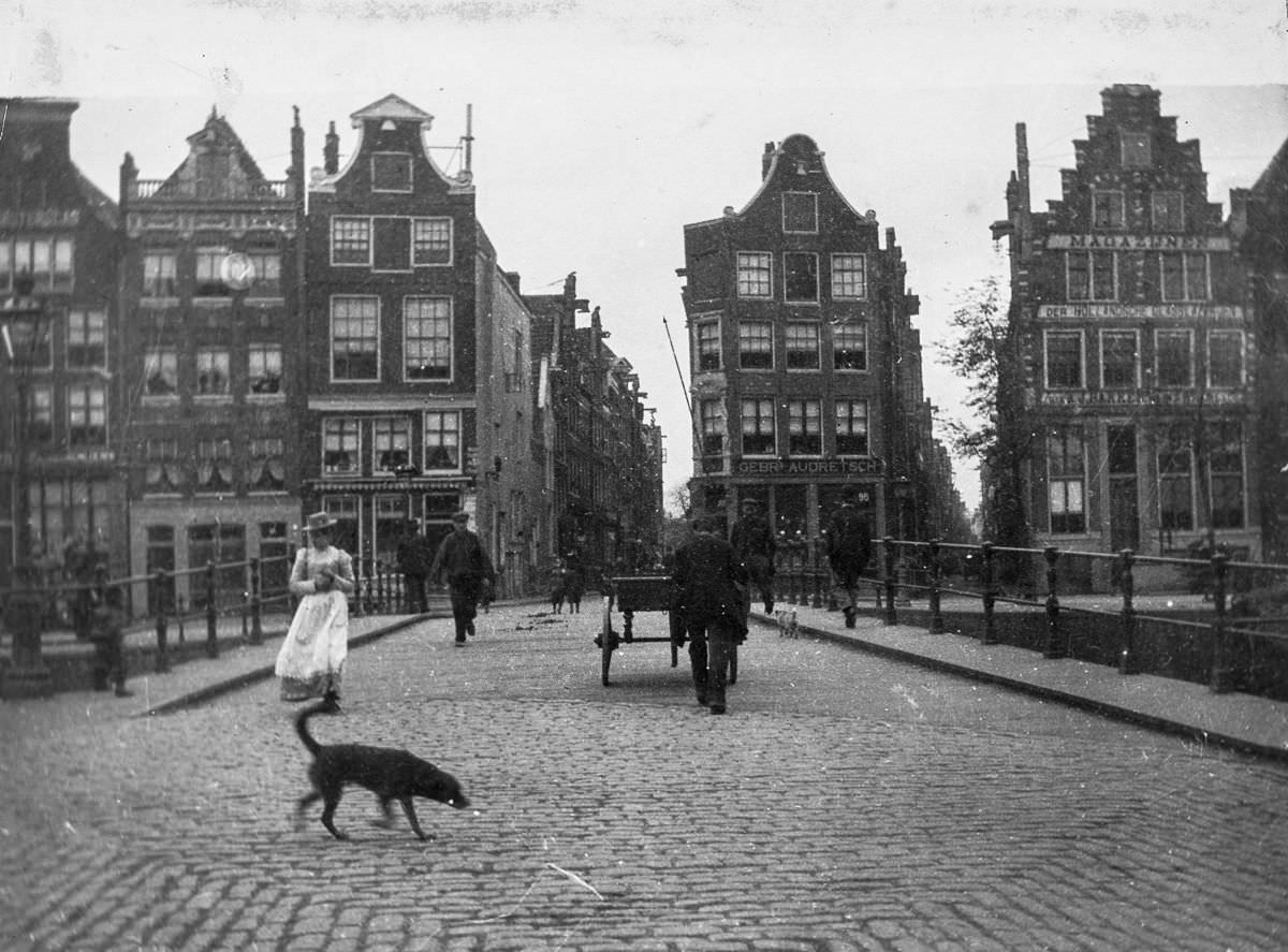
The Jordaan district, where the Lindengracht and Lijnbaansgracht met, was a densely populated working-class neighborhood. It was also the site of significant social unrest during this period. The Prinsengracht — one of Amsterdam’s famous ring canals — cut through more prosperous areas, lined with tall merchant houses whose facades reflected in the still water below.

Workers on the Van Diemenstraat.

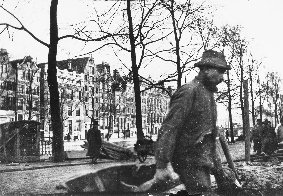
Beyond the canals and the market squares, Amsterdam’s working population kept the city running. On streets like Van Diemenstraat, laborers hauled materials, repaired roads, and serviced the infrastructure that the city’s growing middle class depended on. Their work was physical, their hours were long, and their wages were low — conditions that fed the political tensions boiling beneath the surface of city life.

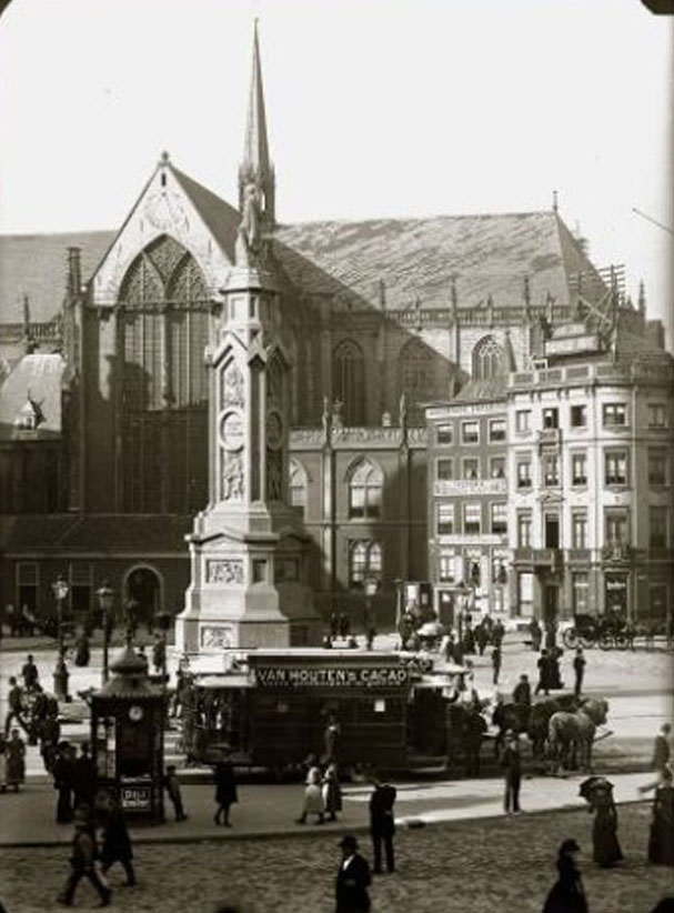
A view of the Dam.
A view of the Dam.
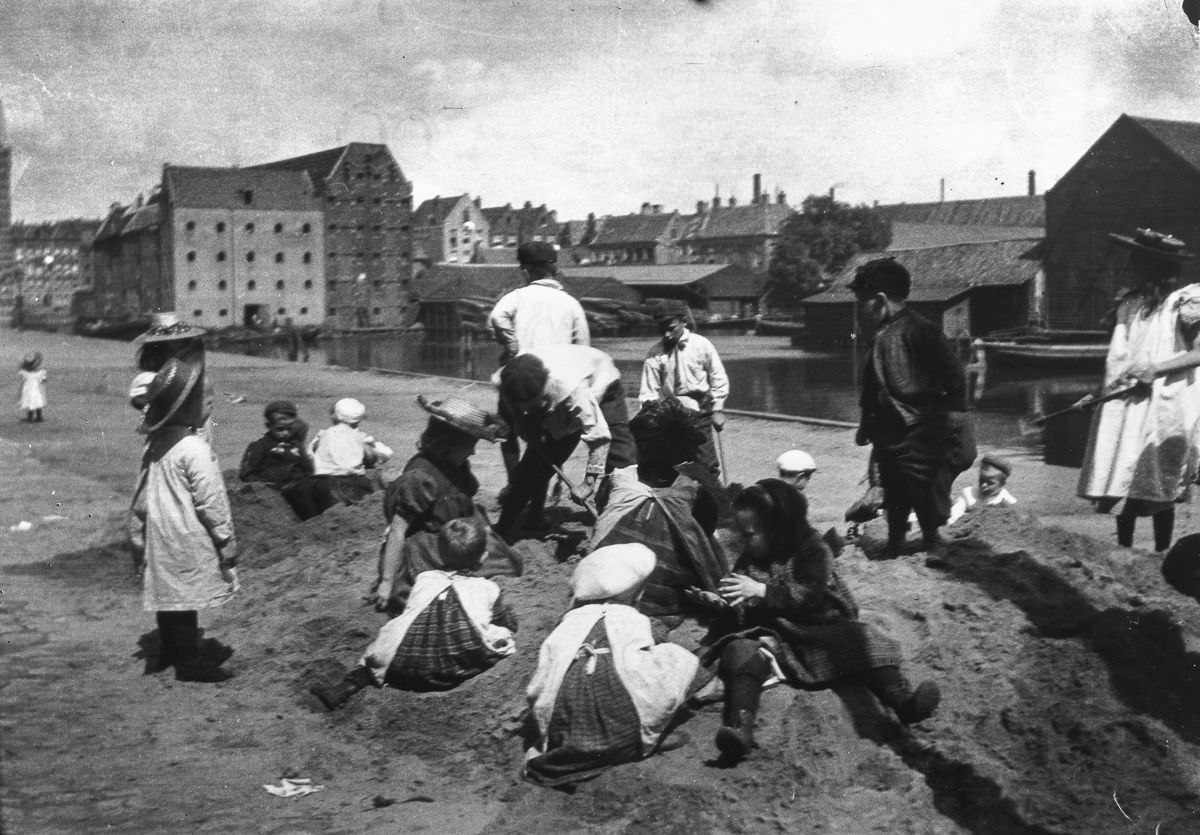
Children play in a sand dump near Prince Island.

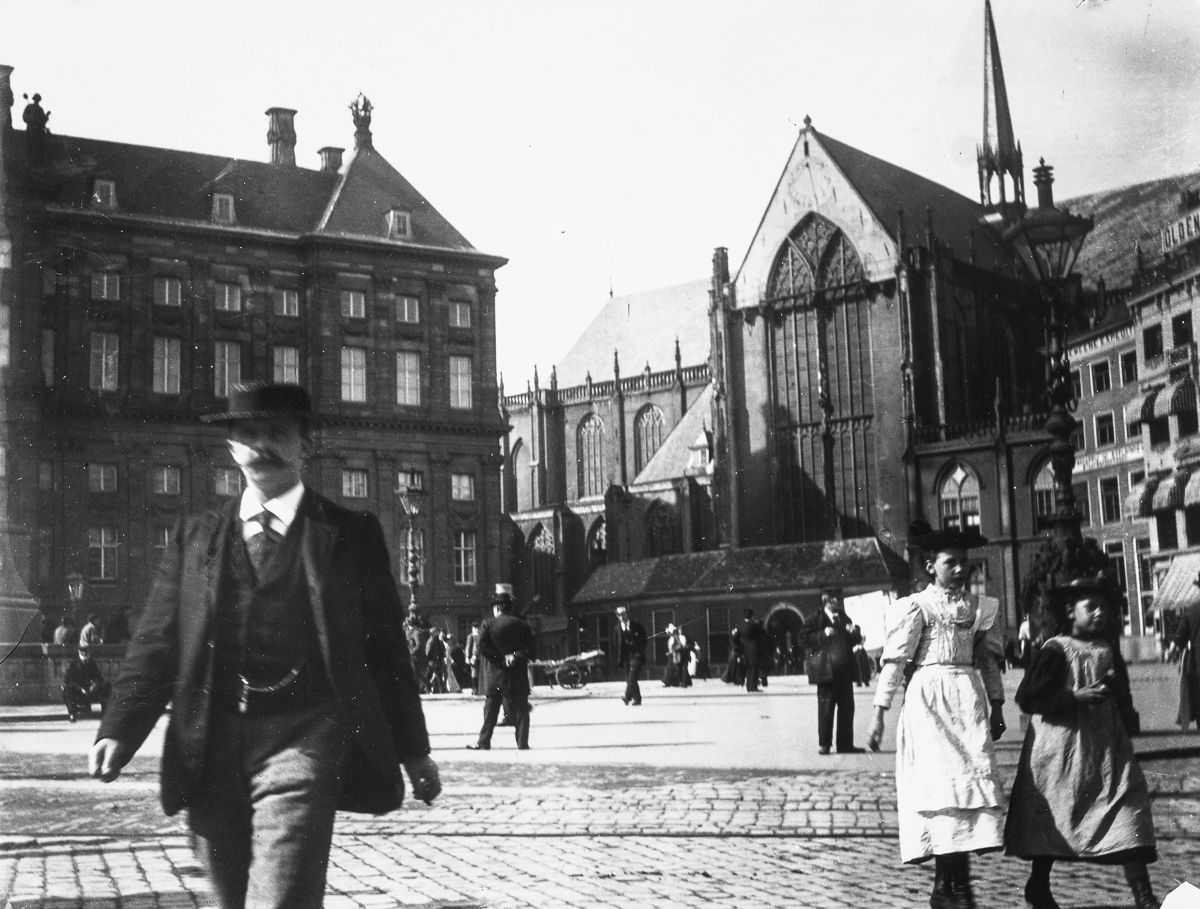
The Dam — Amsterdam’s central square — was the civic heart of the city. Carriages, pedestrians, and merchants all passed through it daily. Meanwhile, on the city’s quieter edges near Prince Island, children found their own entertainment in sand dumps left behind by construction work. For many working-class children, these rough play spaces were the closest thing to a park they had.

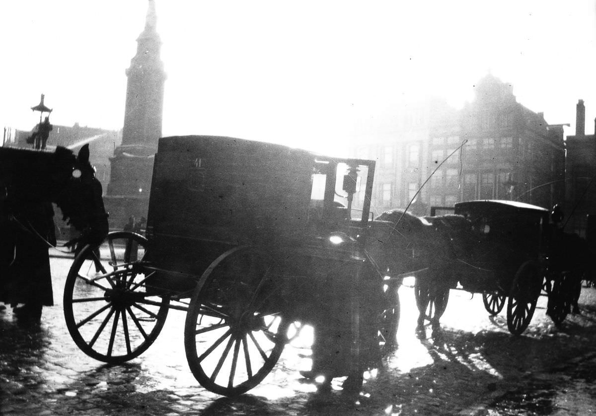
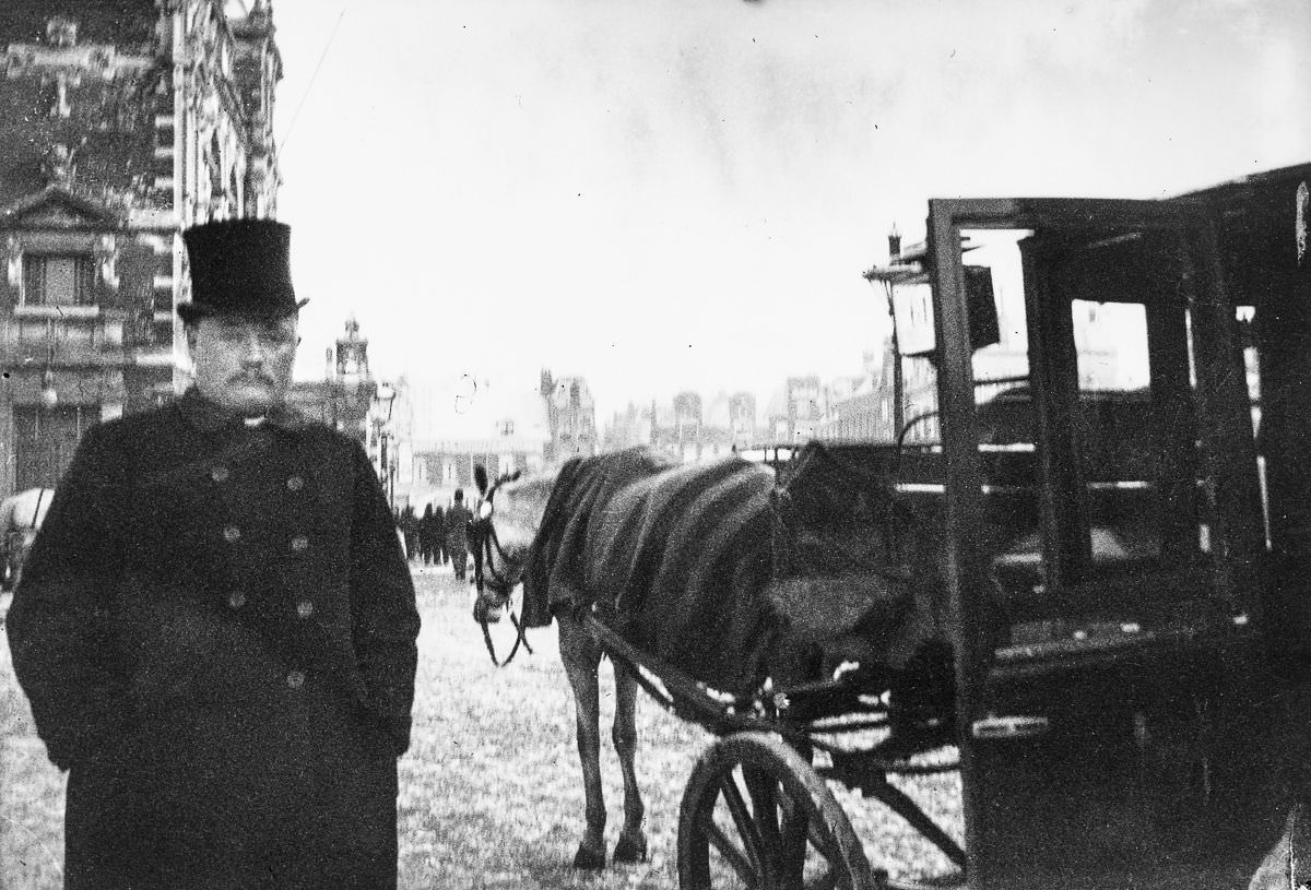
A carriage on the Dam.
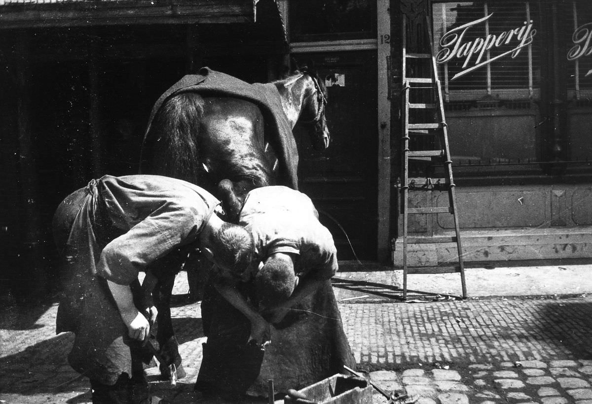
Blacksmiths work on shoeing a horse.

Horse-drawn transport dominated Amsterdam’s streets through the end of the 19th century. Carriages moved wealthy passengers across the Dam and through the city’s main squares, while working horses pulled heavy loads along the canal quays. Blacksmiths were essential to keeping this system moving. Shoeing a horse was skilled, physically demanding work, and blacksmith shops were scattered throughout the city’s neighborhoods.

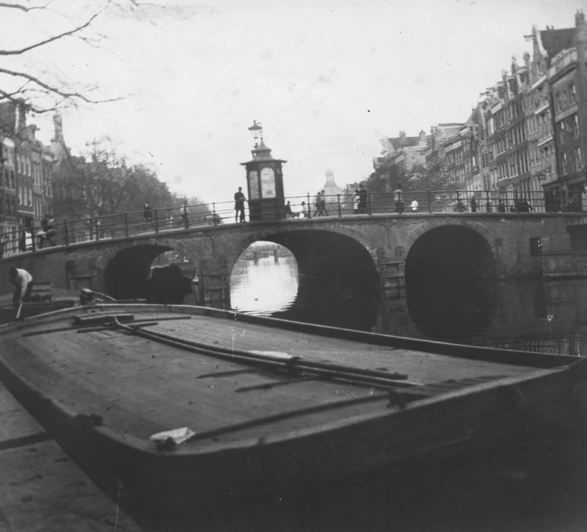
View of the Torensluis Bridge over the Singel Canal.
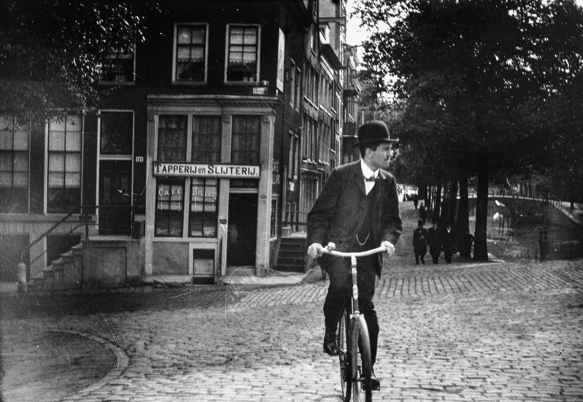
A cyclist on the Prinsengracht.

The Torensluis Bridge over the Singel Canal was one of Amsterdam’s oldest and widest bridges — wide enough that it once housed a jail in its base. By the 1890s it was a well-worn crossing point for pedestrians and cyclists alike. The bicycle was a genuinely new technology in this decade, and seeing one on the Prinsengracht was still enough to turn heads. By the end of the century, cycling would become far more common, but in these early years, it marked someone as forward-thinking.

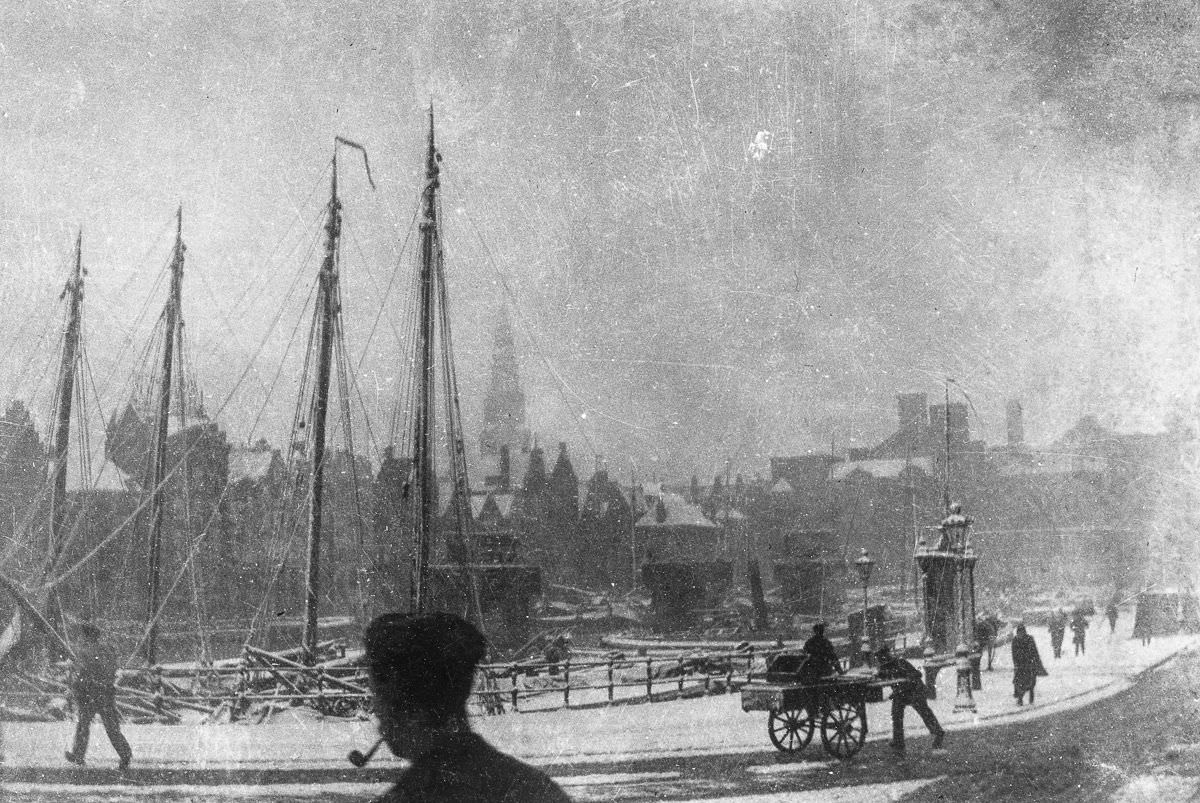
A snowy view of the Damrak.
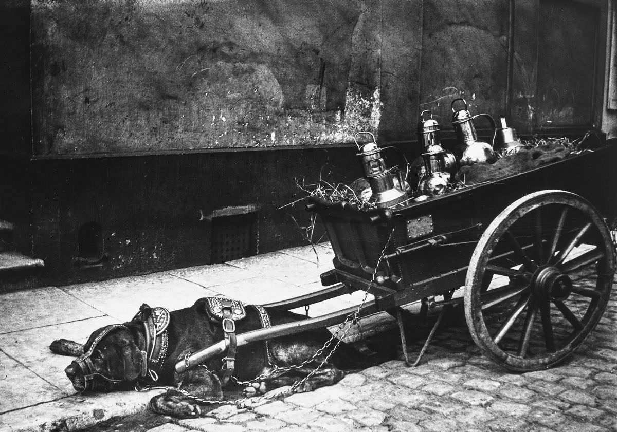
A cart dog takes a rest.

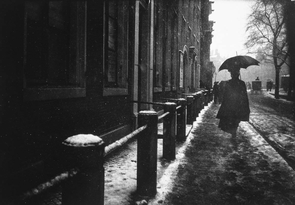
Amsterdam winters in the 1890s brought snow and ice that transformed the city’s streets and canals. The Damrak — the wide boulevard running south from Centraal Station toward the Dam — took on a muted, grey stillness under a layer of snow. Dogs were commonly used to pull small delivery carts in this period, a practice so widespread that the city eventually regulated it. A resting cart dog was a familiar sight on any Amsterdam street corner.

A carriage on the Leidseplein.
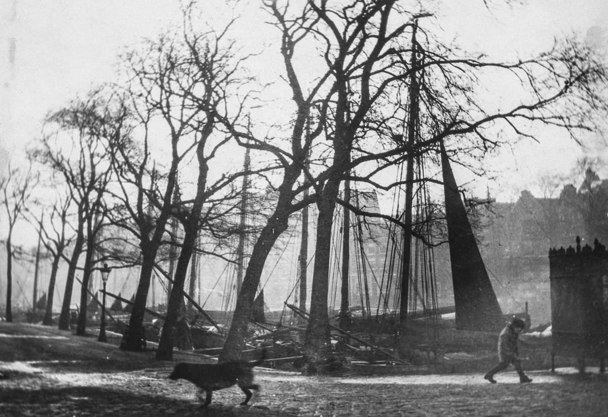
Children play near the entrance to Breitner's studio on Prince Island.
Children play near the entrance to Breitner’s studio on Prince Island.

The Leidseplein was one of Amsterdam’s busiest squares, a hub for theater-goers, café patrons, and carriage traffic. Prince Island, by contrast, was a quieter, more industrial corner of the city. It was also the location of photographer and painter George Hendrik Breitner’s studio. Breitner was one of the most important Dutch artists of the late 19th century, and he used the streets of Amsterdam as his primary subject — photographing working-class life with an unflinching eye before translating scenes into paint.

A girl crosses a bridge on Prince Island.
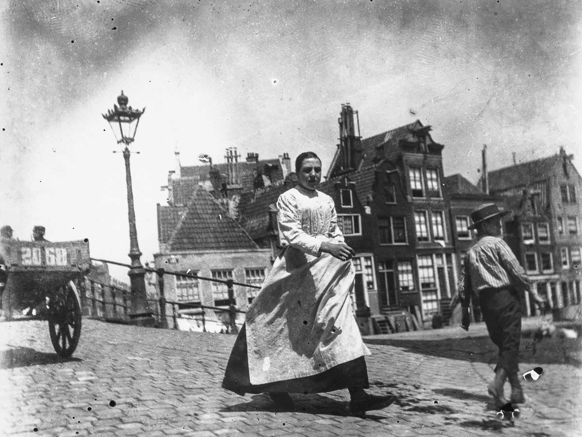
Portrait of a woman walking over the Prinsengracht.

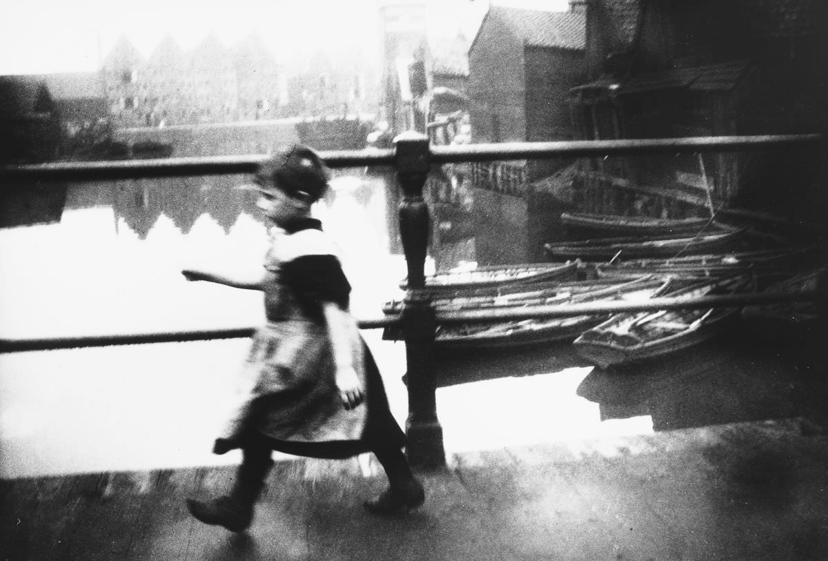
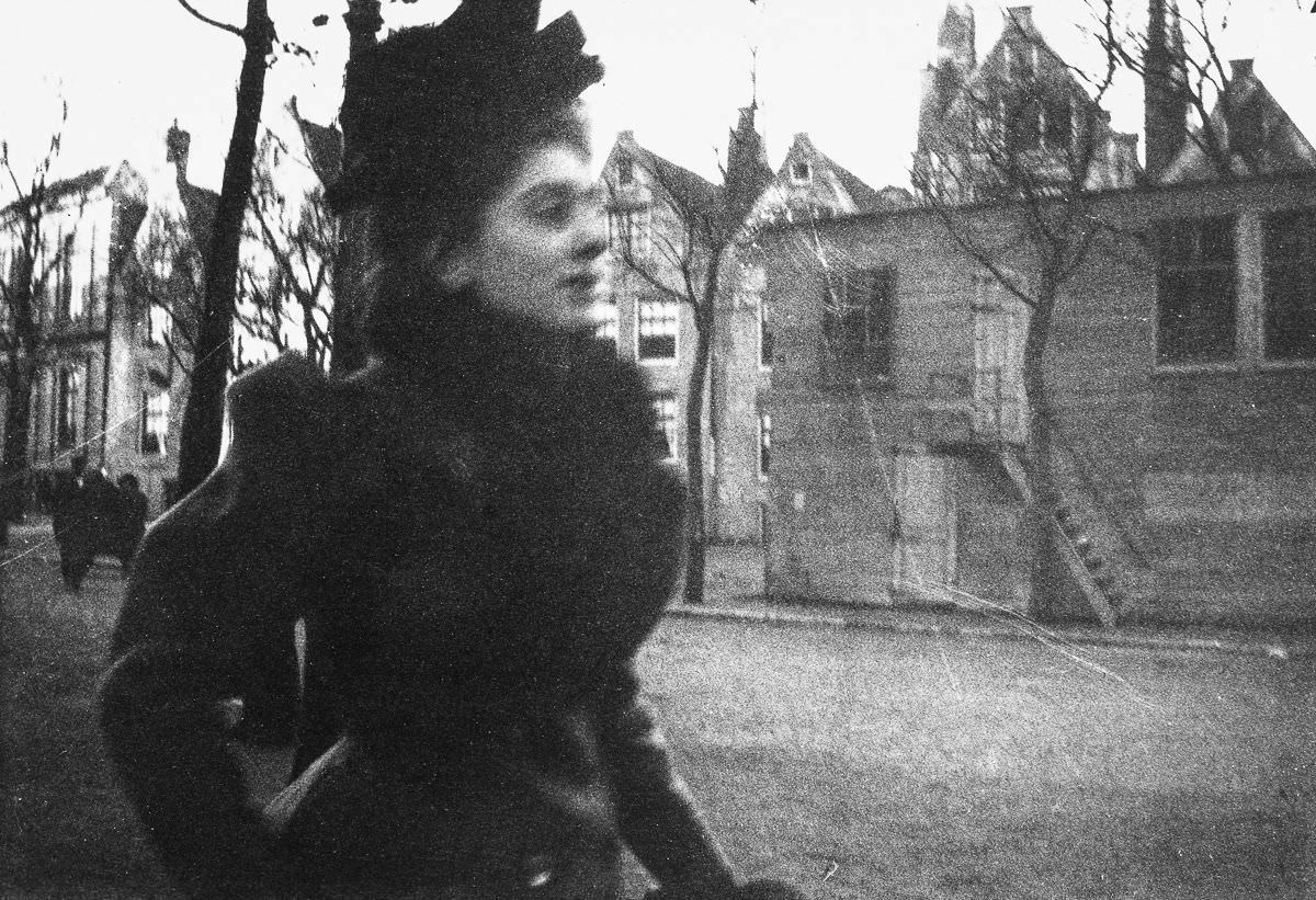
Ordinary Amsterdammers crossing bridges and walking canal-side streets appear repeatedly in the photography of this era. These images — a girl on a bridge, a woman on the Prinsengracht — were not staged portraits of the wealthy. They were documentary glimpses of everyday movement through the city, captured at a time when photography itself was still a relatively new and powerful tool.

View of the Singel on a rainy day.
A woman on the Spui.

Rain was no unusual interruption in Amsterdam — it was part of the city’s character. The Singel canal on a wet day reflected the grey sky and the bare branches of trees lining the banks. The Spui, a small square not far from the Singel, was a gathering point for booksellers and café-goers, and even in poor weather, people moved through it with purpose.

A view of the Raadhuisstraat.
View of a canal.
View of a canal.

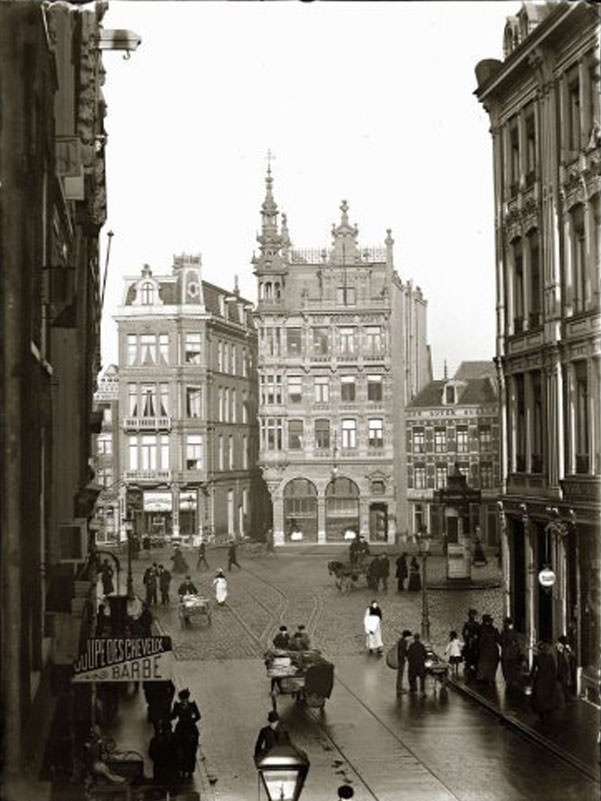
The Raadhuisstraat was one of the city’s newer streets — cut through the old fabric of the city in the late 19th century to connect the Dam to the Jordaan district and beyond. It represented Amsterdam’s effort to modernize its street plan, widening access across the canal rings. The city’s waterways, meanwhile, remained as central as ever — canals like these were not scenic backdrops but working arteries of commerce and daily movement.

View of Gasthuismolensteeg on the corner of the Herengracht.
Waalseilandsgracht seen from the Prince Hendrikkade.

The Herengracht — the ‘Gentlemen’s Canal’ — was Amsterdam’s most prestigious address, lined with tall, narrow merchant houses built during the original Golden Age. By the 1890s it retained its grandeur, though the city around it was changing rapidly. The Waalseilandsgracht, seen from the Prince Hendrikkade near the waterfront, showed a different face of the canal city — working boats, stacked goods, and men in labor clothing.

Grote Houtstraat, 21 September 1894
Utrechtsestraat, 20 June 1898

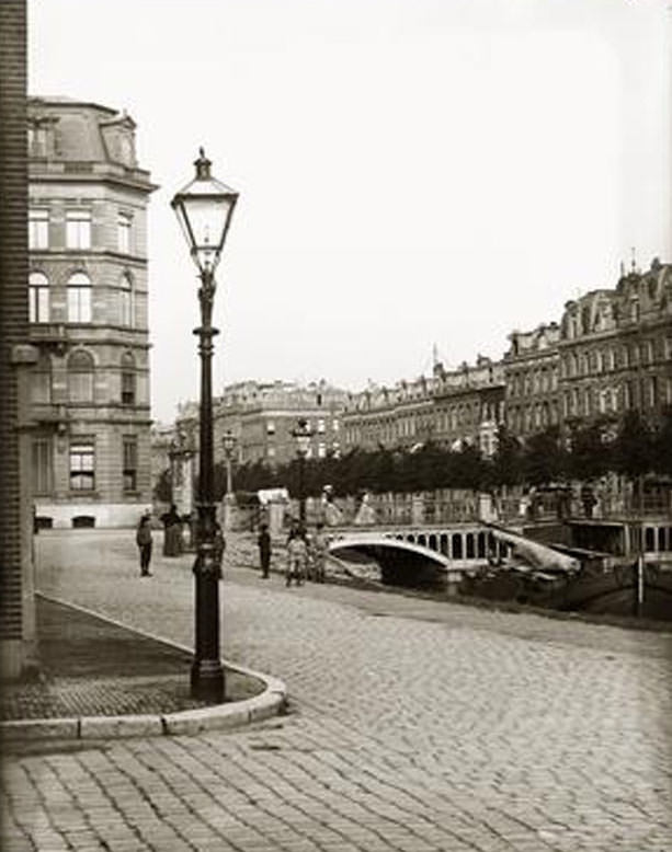
The precise dates stamped on many of these photographs — September 21, 1894; June 20, 1898 — reflect a systematic effort to document Amsterdam’s streets, likely tied to city surveys or the work of dedicated urban photographers. These images were not taken casually. They recorded specific streets on specific days, preserving the look of neighborhoods that were being rapidly altered by demolition and new construction.

Amstel, 1 April 1894
Dam Square, 1890
Dam Square, 1890

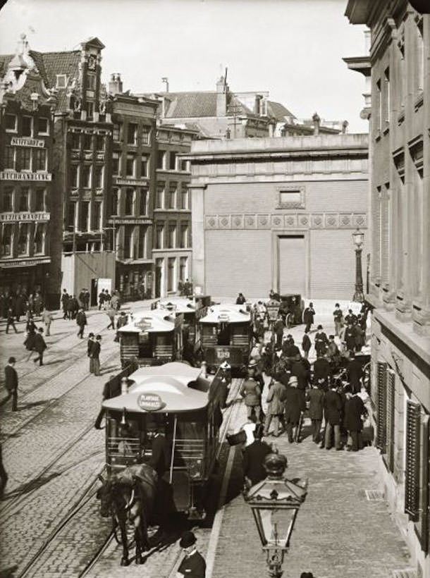
The Amstel River, from which Amsterdam takes its name, was photographed in early April of 1894 — the water still cold, the trees still bare. Dam Square in 1890 was already a busy, multi-layered public space, crowded with pedestrians, vendors, and horse traffic moving in every direction around the Royal Palace and the Nieuwe Kerk.

Dam Square, 1890
Dam Square, 1890
Frederiksplein, 1891

A second view of Dam Square from 1890 shows how much activity the space held at any given moment. Frederiksplein, photographed in 1891, was the site of the Crystal Palace — a large exhibition hall built in 1859 that hosted trade shows and public events throughout the latter half of the century. By this period it was a well-established part of Amsterdam’s civic landscape.

Gebed Zonder End, 1892
Geldersekade, 1890
Geldersekade, 1890

Gebed Zonder End — literally ‘Prayer Without End’ — was a narrow alleyway in the old city center, named for the religious institutions that once lined it. By 1892 it was a residential and commercial lane packed tightly with buildings. The Geldersekade, photographed the same year the decade opened, was one of the quays closest to the old port, where sailors, dock workers, and merchants mingled daily.

Herengracht, 30 March 1894
Jan Luijkenstraat, 4 June 1898

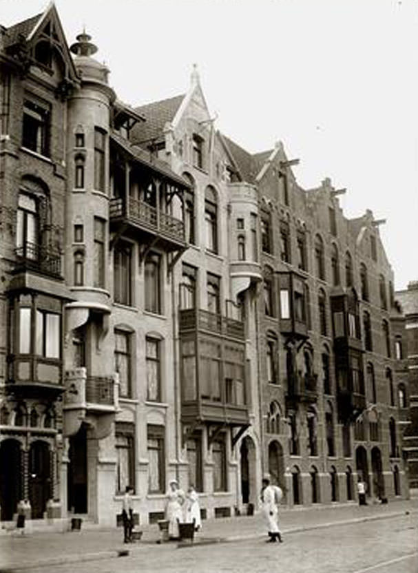
The Herengracht in late March 1894 shows the canal in early spring — still cold, the water dark, the grand facades of the merchant houses rising sharply from the canal banks. Jan Luijkenstraat, photographed in June 1898, was located in the newly developed Museum Quarter, a neighborhood built up in the 1880s and 1890s to house the Rijksmuseum and the Stedelijk Museum.

Koninginneweg, September 1893
Lijnbaansgracht, corner Reguliersgracht, 12 March 1899

Koninginneweg, photographed in September 1893, was part of Amsterdam’s southern expansion — a broader, tree-lined street built for a more modern, middle-class Amsterdam. The corner of Lijnbaansgracht and Reguliersgracht, captured in March 1899, sat at a quieter part of the canal system, where the water was calm and foot traffic thinner.

Nassaukade, 1890
Nassaukade, 1890
Nicolaas Witsenkade, 1891

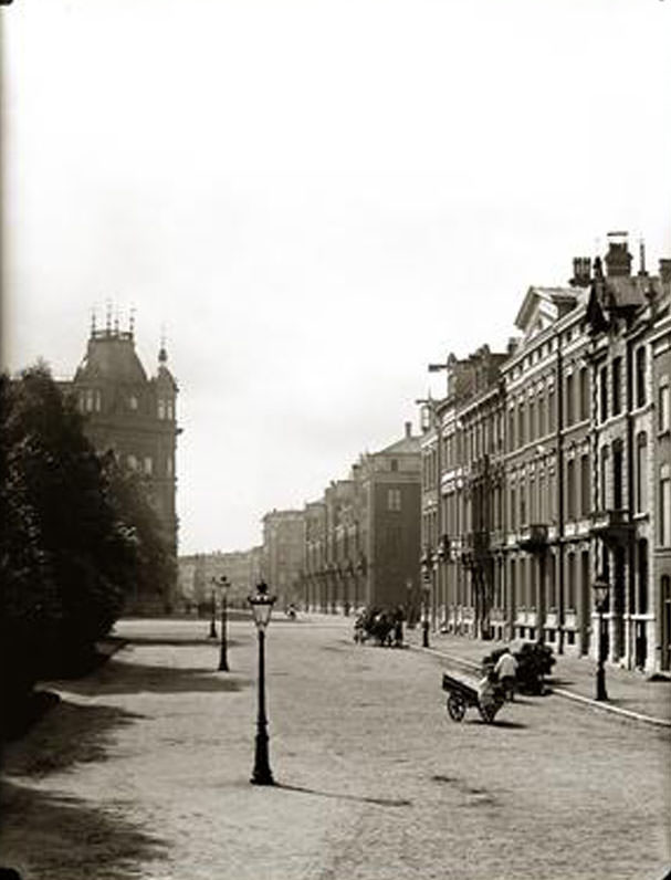
The Nassaukade ran along the western edge of the Singelgracht — the outer canal that had long defined Amsterdam’s city boundary. By 1890, the city was expanding well beyond this line. The Nicolaas Witsenkade, photographed in 1891, lay along the southern bank of the Amstel near new development zones, showing the city in the act of building itself outward.

Nieuwe Teertuinen with Sloterdijkerbrug ,1890
Nieuwezijds Voorburgwal, 6 October 1897

The Nieuwe Teertuinen — ‘New Tar Gardens’ — was a street on the western waterfront near the old tar-processing yards that once served the shipbuilding industry. The Sloterdijkerbrug bridge nearby connected this industrial zone to the rest of the city. The Nieuwezijds Voorburgwal, one of Amsterdam’s main central streets, was photographed on a day in October 1897 filled with the activity typical of a mid-week afternoon.

Noordermarkt, 30 October 1896
Oosteinde, 1890
Oosteinde, 1890

The Noordermarkt — the Northern Market — was a working market square in the Jordaan, surrounded by the Noorderkerk. On October 30, 1896, it was likely busy with the weekly market that had operated there for centuries. The Jordaan was also the neighborhood where political unrest ran deepest. In 1880s and 1890s Amsterdam, clashes between police and socialist demonstrators were a near-weekly occurrence. In 1886, the most violent episode of the decade took place just streets away: the Palingoproer, or eel riots.

The eel riots began over an outlawed street game called eel-pulling, in which a live eel was strung across a canal and men competed to grab it while rowing beneath. Police moved to break up one such game, and the crowd turned violent. When the police lost control, the army was called in. Soldiers fired on the crowd, killing 26 demonstrators. It was the deadliest episode of civil unrest Amsterdam had seen in generations, and it exposed the deep anger simmering in the city’s working-class districts.

Paulus Potterstraat, 8 November 1897
Plantage Middenlaan, 24 May 1895

Paulus Potterstraat, named after the Dutch Golden Age painter, ran through the Museum Quarter near the Rijksmuseum and the Vondelpark. By November 1897 it was a well-developed residential street in one of the city’s newer districts. Plantage Middenlaan, photographed in late May 1895, passed through the Plantage neighborhood — home to the Artis Zoo and a number of institutions, and favored by Amsterdam’s Jewish community.

Prins Hendrikkade, 30 June 1897
Reguliersbreestraat, 17 October 1899

Prins Hendrikkade ran along the waterfront directly in front of Centraal Station, making it one of the busiest streets in the city in the 1890s. Boats, trams, carriages, and pedestrians all competed for space along this stretch. The Reguliersbreestraat, photographed in October 1899, was a commercial street connecting the Rembrandtplein area westward — lined with shops and theaters.

Roemer Visscherstraat, 9 May 1895
Spuistraat, 10 July 1896

Roemer Visscherstraat, in the Oud-Zuid district near the Vondelpark, was part of the residential expansion of southern Amsterdam in this period. The street was named after the 17th-century Dutch poet and playwright. The Spuistraat, running parallel to the Singel canal through the center of the city, was a mixed street of homes, workshops, and small businesses — photographed on a summer day in July 1896.

Utrechtsestraat Street, 1893
Utrechtsestraat, 7 July 1897

The Utrechtsestraat was photographed at least twice during the decade — once in 1893 and again in July 1897 — making it possible to track how the street changed over those four years. It was a busy shopping street running south from Rembrandtplein toward the Frederiksplein, crossing several canals along the way.

Veemarkt, 1890
Veemarkt, 1890
Weteringcircuit , 20 July 1898

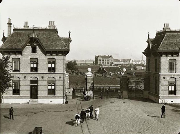
The Veemarkt — the cattle market — was one of Amsterdam’s traditional trading grounds, a place where livestock were bought and sold and the smell of animals mixed with sawdust and manure. By 1890 it was still a functioning market, though urban growth was beginning to push such working spaces toward the city’s edges. The Weteringcircuit, photographed on a July day in 1898, was a traffic circle near the Rijksmuseum — a junction where the old Amsterdam of canals and horse carts met the newer city of paved roads and expanding public transport.

Enjoyed this post? Get new ones in your inbox.

6 thoughts on “Amsterdam in the 1890s: Spectacular Historical Photos Documenting Street Life of Old Amsterdam in late-19th Century”

Leave a Comment

Your email address will not be published. Required fields are marked *

Share this Post 🥺

Please take a moment to share this content. Your support is greatly appreciated! 🙌🙏

Share this Post 🥺

Please take a moment to share this content. Your support is greatly appreciated! 🙌🙏
Scroll to Top
 
Hey Friend, Before You Go.. Please like & follow for more interesting content