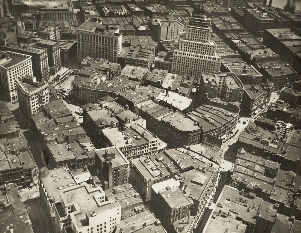
Boston in the 1920s was a city caught between two forces — forward momentum and economic strain. In the early part of the decade, the city pushed ahead with construction, infrastructure expansion, and population growth. Its streets carried trolleys, elevated railroads, and the daily rush of a major American city. But by the mid-1920s, the economic picture had darkened considerably. The textile industry, which had long been a financial backbone of the region, fell into crisis. Mills that had operated for generations either shut their doors entirely or relocated to the American South, where labor was cheaper and raw materials were easier to source. Boston’s investors, who had poured capital into those industrial centers across New England, watched decades of investment begin to unravel.
What makes this period so visually compelling is that photographers had recently gained the ability to document cities from the air. Aerial photography was still a novelty in the early 1920s, made possible largely by the surplus aircraft and trained pilots left over from World War I. The images captured over Boston during this era show a city in remarkable detail — its dense residential neighborhoods, its industrial waterfront, its parks and squares, and the early signs of modern urban planning. Each photograph is a frozen moment of a city that looked nothing like it does today, yet laid the groundwork for what Boston would become. The collection below covers the city’s neighborhoods, landmarks, and surrounding communities as they stood roughly a century ago.
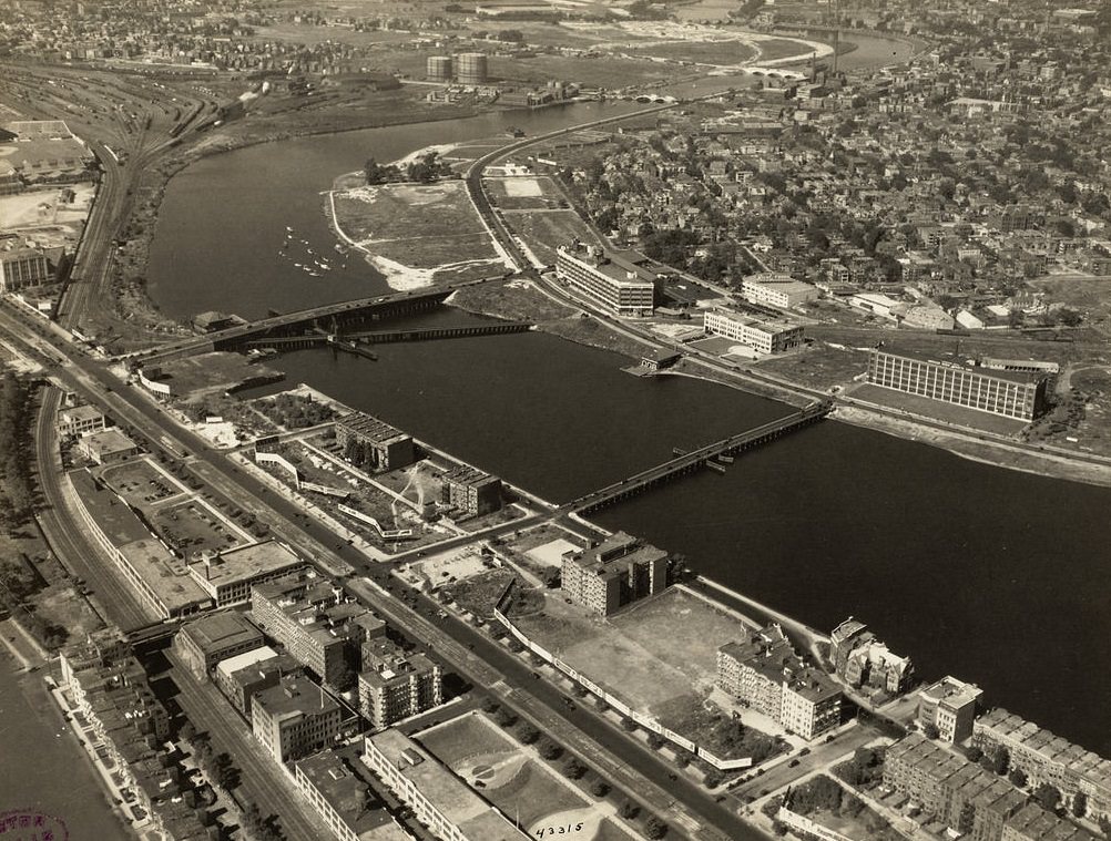
Allston and Brighton, seen from above, reveal the tight grid of residential streets that defined Boston’s western neighborhoods. These areas had grown rapidly in the late 19th century as streetcar lines made commuting practical for working-class families. By the 1920s, they were fully built out, dense with triple-decker homes and corner stores. Just across the Charles River, the Back Bay and West End told a different story — one of wealth, architecture, and civic ambition.
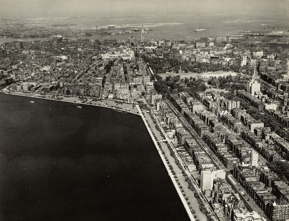
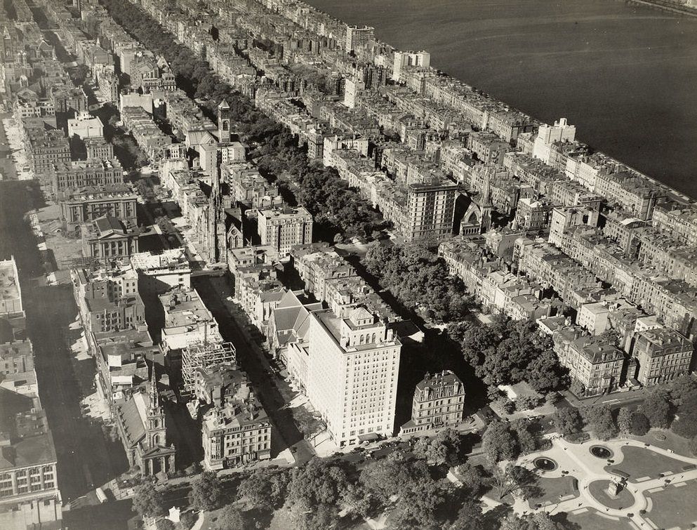
The Back Bay was one of the most ambitious urban engineering projects in American history. The entire neighborhood was built on land reclaimed from a tidal basin of the Charles River, a process that took decades and was largely complete by the early 20th century. Its wide, tree-lined streets and grand brownstones made it one of Boston’s most prestigious addresses. Looking west from the Public Garden, the ordered geometry of the neighborhood is unmistakable from the air — a stark contrast to the older, more organic street patterns of Beacon Hill and the North End.
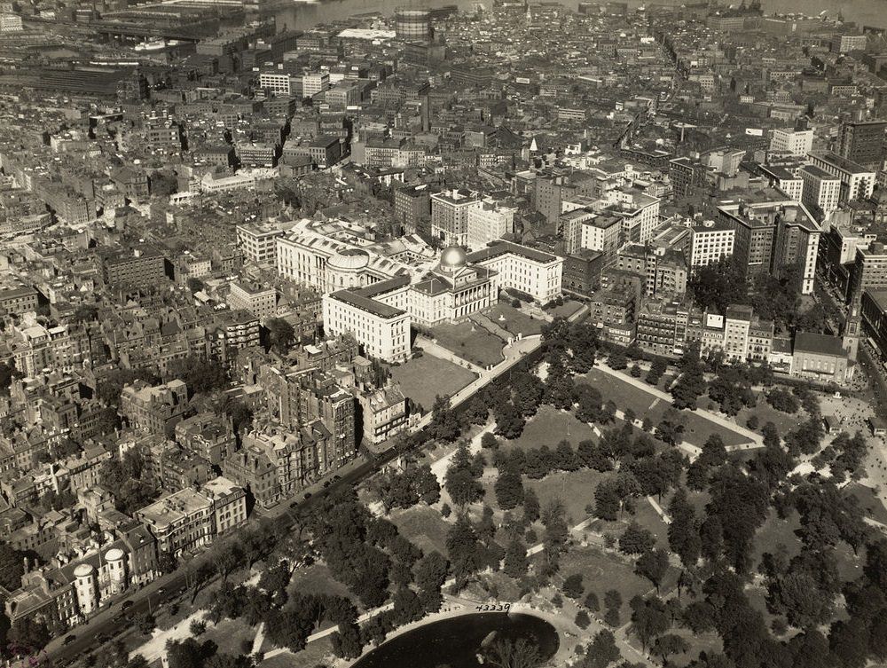
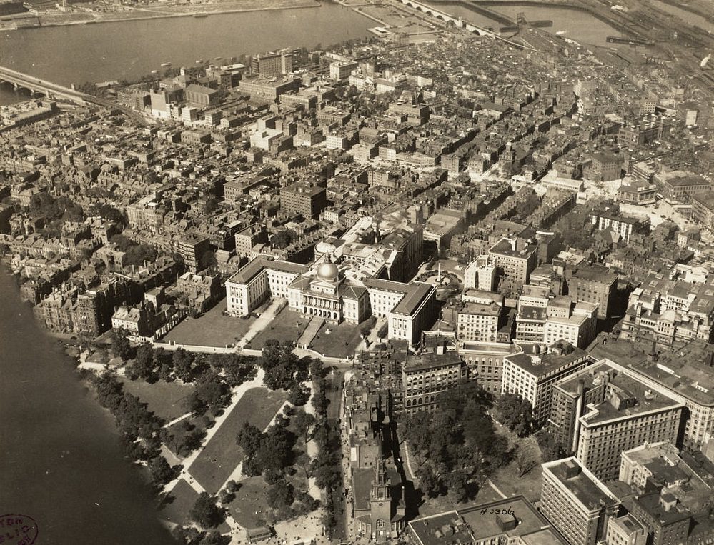
Beacon Hill was Boston’s oldest established neighborhood and one of the most recognizable from any vantage point, thanks to the gold dome of the Massachusetts State House sitting at its crest. The narrow, gas-lit streets of the Hill had changed little since the 19th century. The North End, packed tightly along the waterfront, was home to Boston’s Italian immigrant community by the 1920s and was one of the most densely populated urban areas in the entire country. Freight and commerce moved through the city’s rail yards and piers, infrastructure that was absolutely essential to Boston’s economic life.
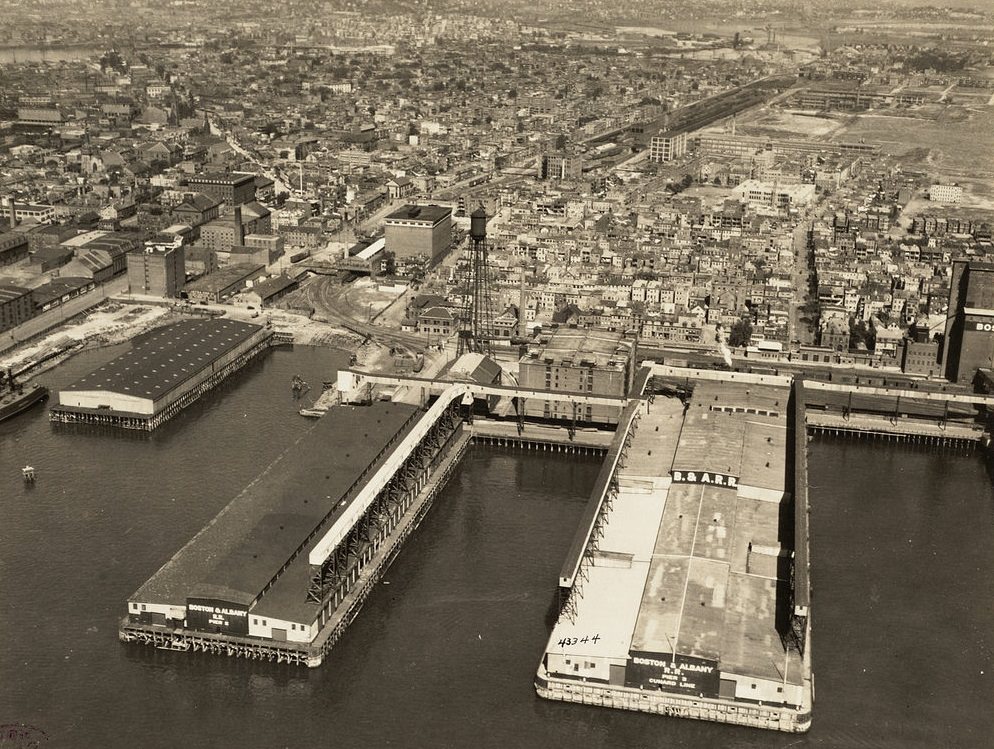
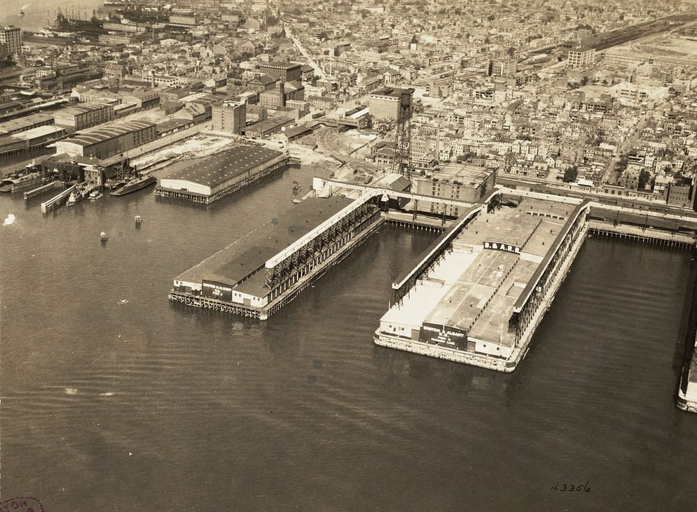
The Boston and Albany Railroad was one of the primary arteries connecting Boston to the interior of the country. Its freight yards handled massive volumes of goods moving in and out of the city, while its piers extended the network to coastal and international shipping. Rail and sea together defined Boston’s commercial geography. Culture had its own prominent footprint in the city as well, with institutions like the Museum of Fine Arts anchoring the Fenway area.
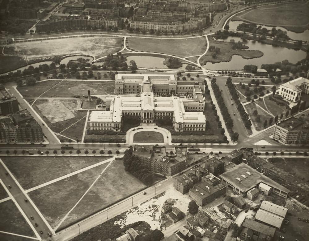
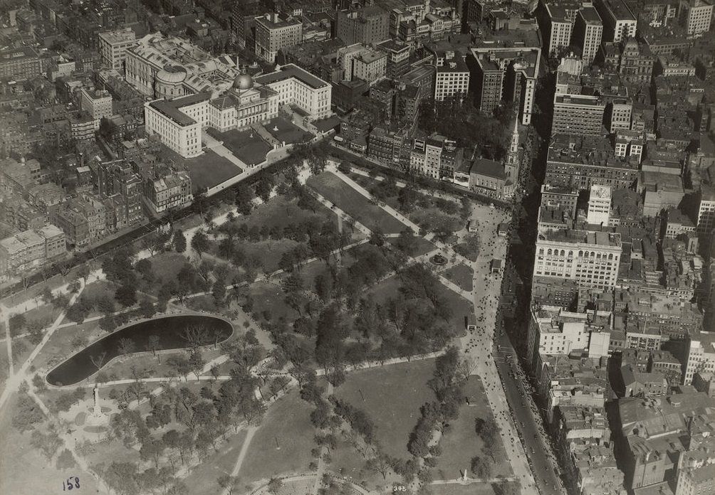
Boston Common, the oldest public park in the United States, sits at the heart of the city’s civic identity. Dating back to 1634, it served as a gathering place, a military training ground, and a public green through centuries of American history. By the 1920s it was a well-maintained urban park surrounded by the institutions of city governance. The State House, with its iconic dome, dominated the skyline just above it. Public transit stitched the whole city together, and the Boston Elevated Railroad was its most visible component.
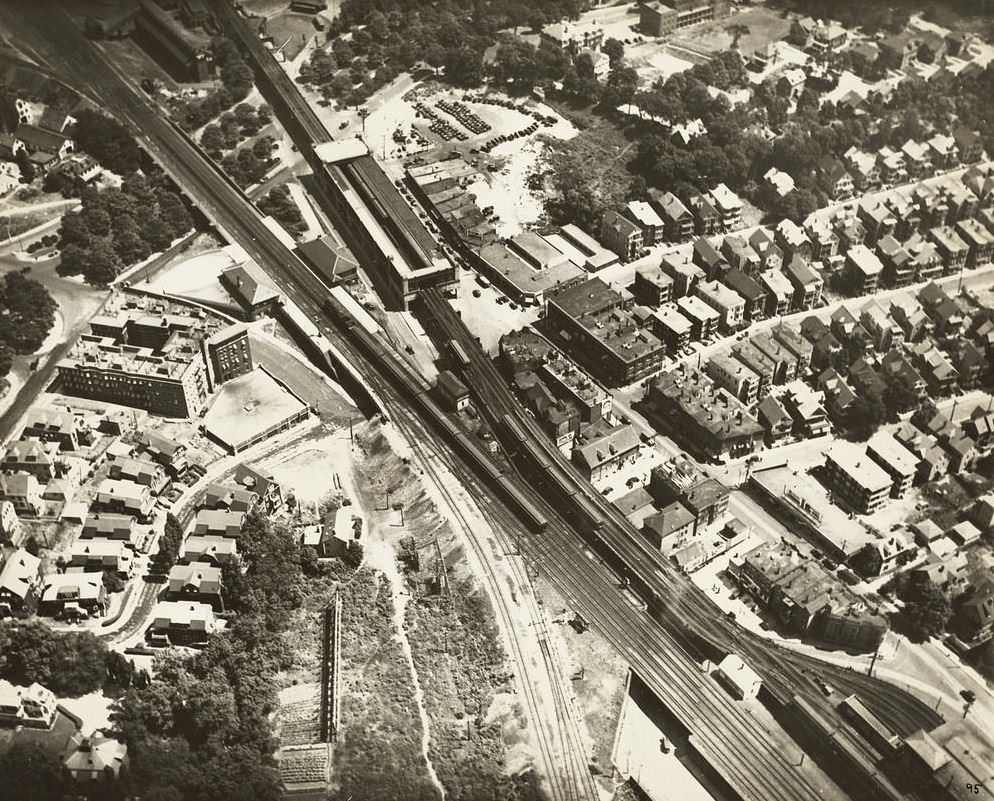
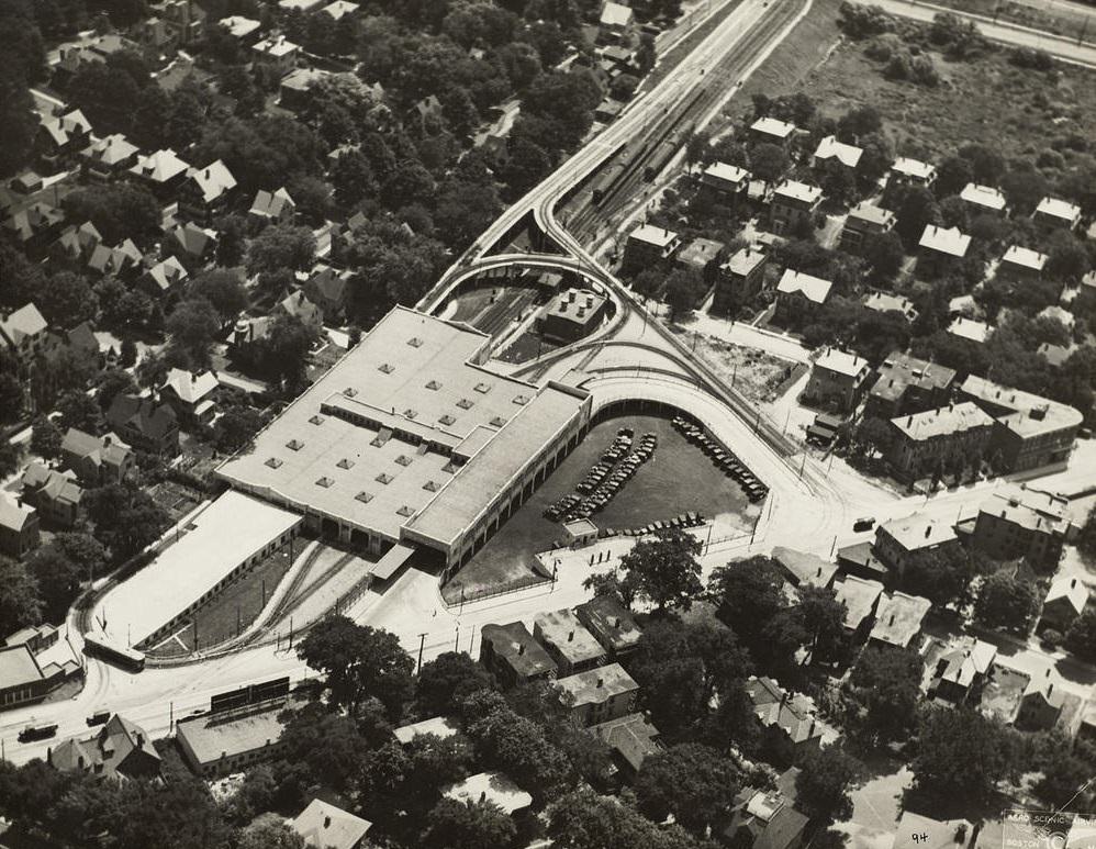
The Boston Elevated Railroad, commonly called the El, ran steel tracks on raised structures through the city’s most crowded corridors. It was loud, imposing, and absolutely central to how Bostonians moved around their city. Tens of thousands of workers depended on it daily. From the air, the elevated lines cut through the city’s rooftops in sharp, angular lines that stood out clearly against the surrounding architecture. Across the Charles River, views toward Cambridge and Kendall Square showed Boston’s relationship with the surrounding communities.
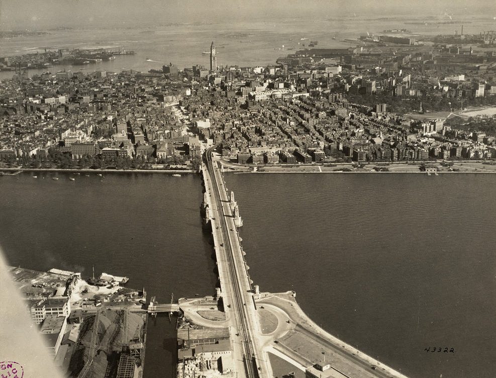
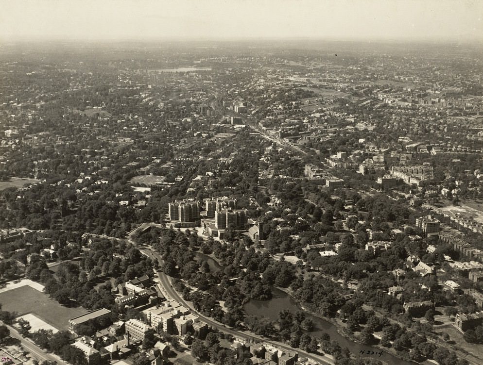
Brookline, though technically an independent town rather than a Boston neighborhood, was closely tied to the city in every practical sense. Its leafy streets and larger residential lots gave it a quieter character than the dense urban core. South Terminal Station, one of Boston’s major rail hubs, captured the scale of the city’s transportation ambitions — a vast complex handling enormous passenger traffic in an era when the train was still the dominant mode of long-distance travel. To the north, Charlestown held one of the most important historical monuments in the region.
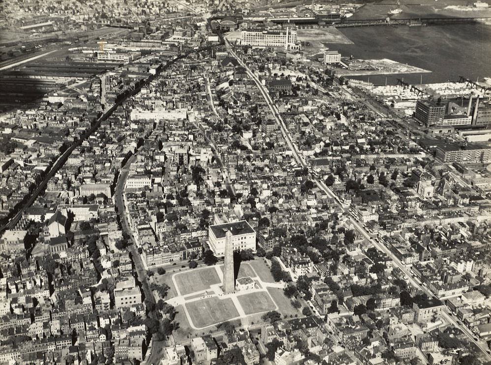
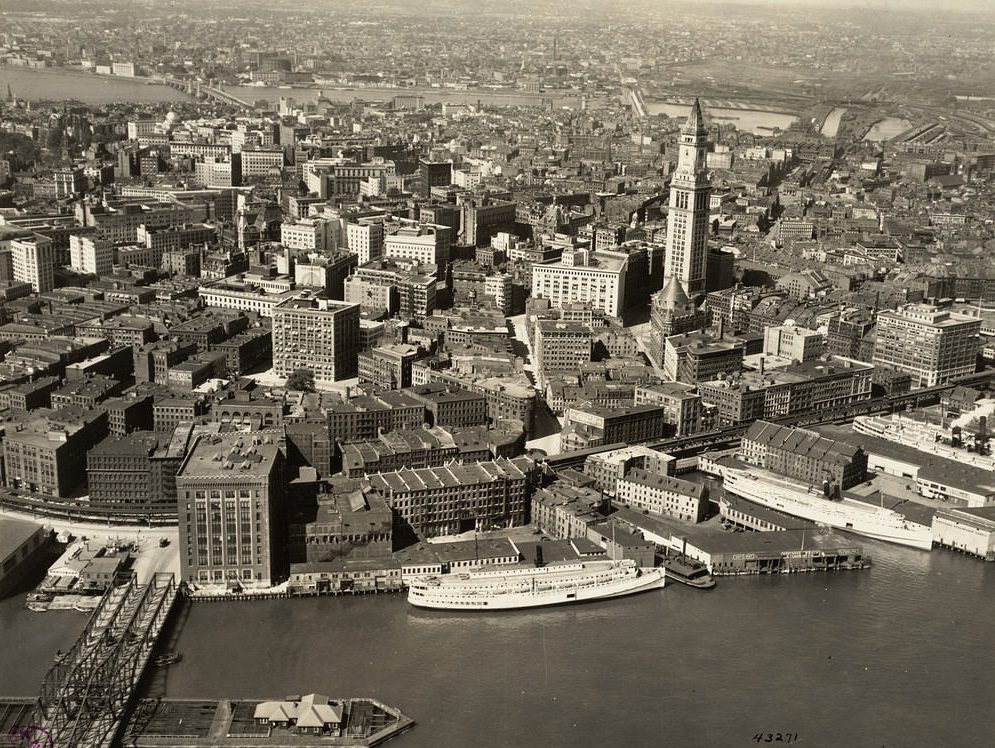
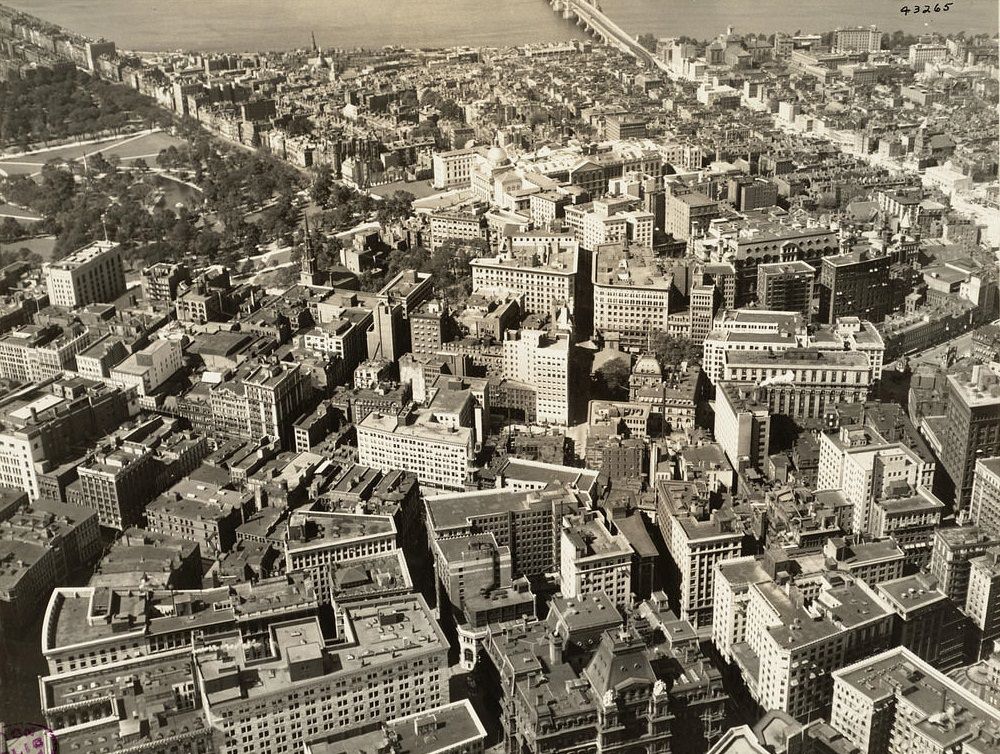
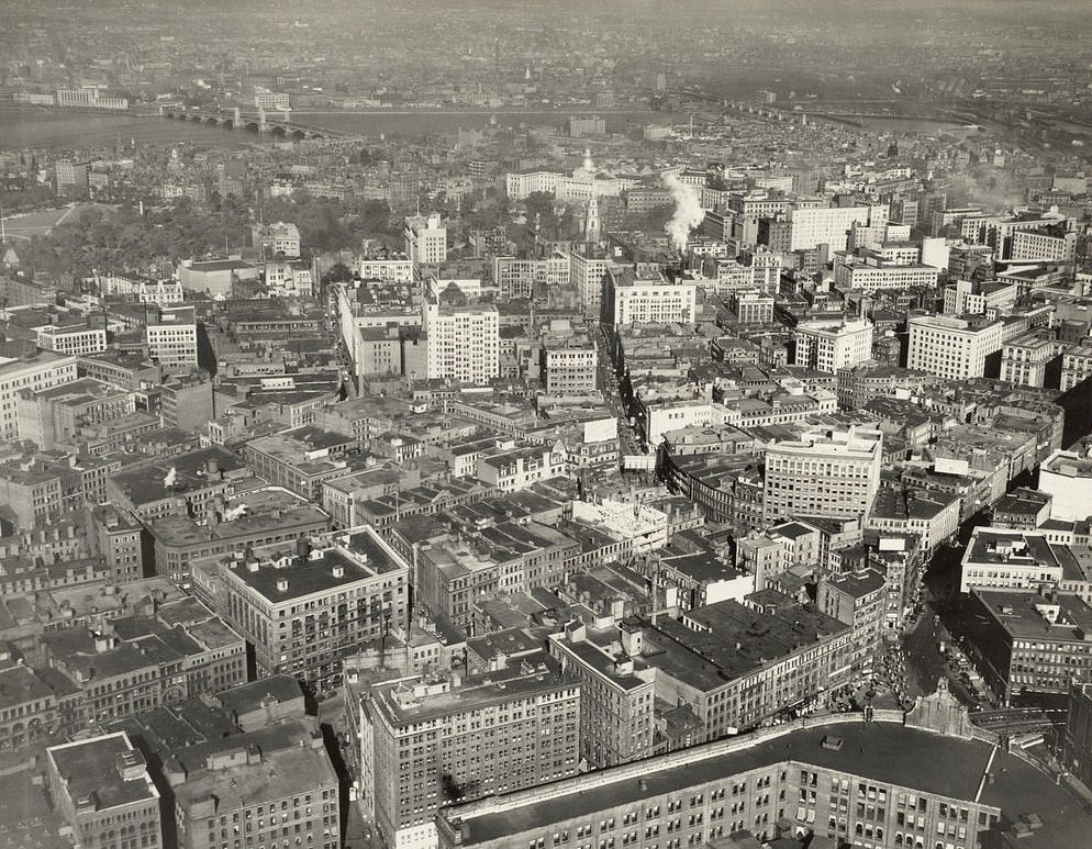
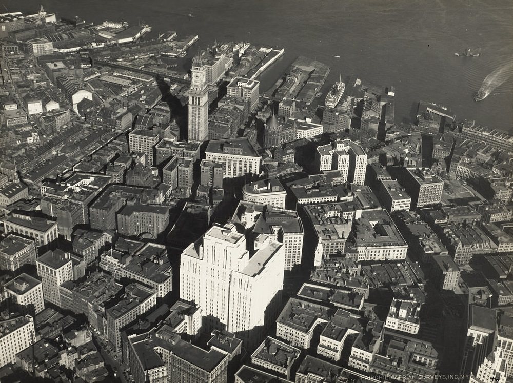
The Bunker Hill Monument in Charlestown marks the site of one of the first major battles of the American Revolutionary War, fought in June 1775. The granite obelisk, completed in 1843, rises 221 feet and was already a well-established landmark by the time these photographs were taken. Boston’s business district, captured in multiple aerial shots, shows the compact density of early 20th-century commercial architecture — low- to mid-rise buildings packed tightly together, with streets already beginning to feel the pressure of automobile traffic. The harbor provided yet another perspective on the city’s commercial scale.
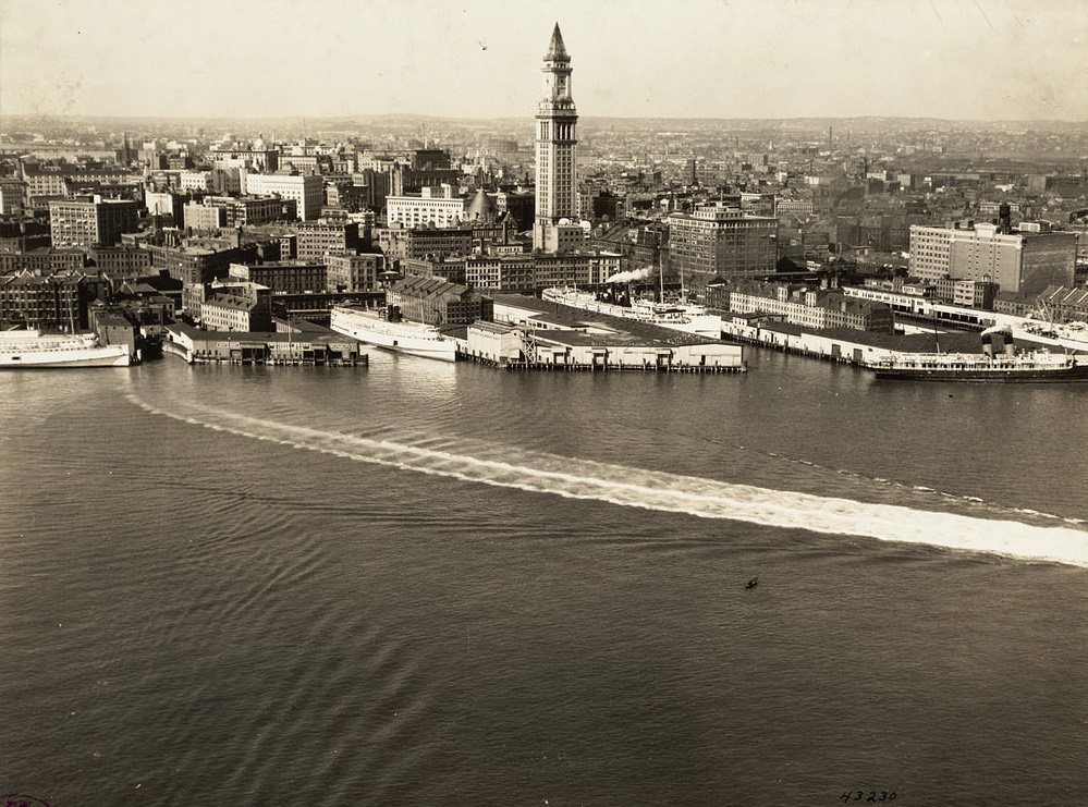
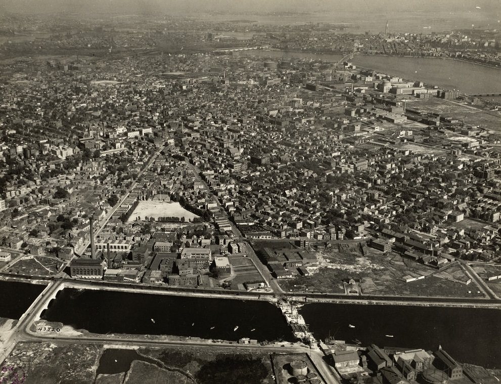
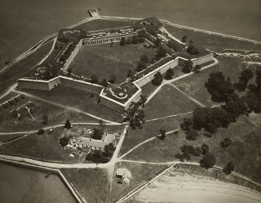
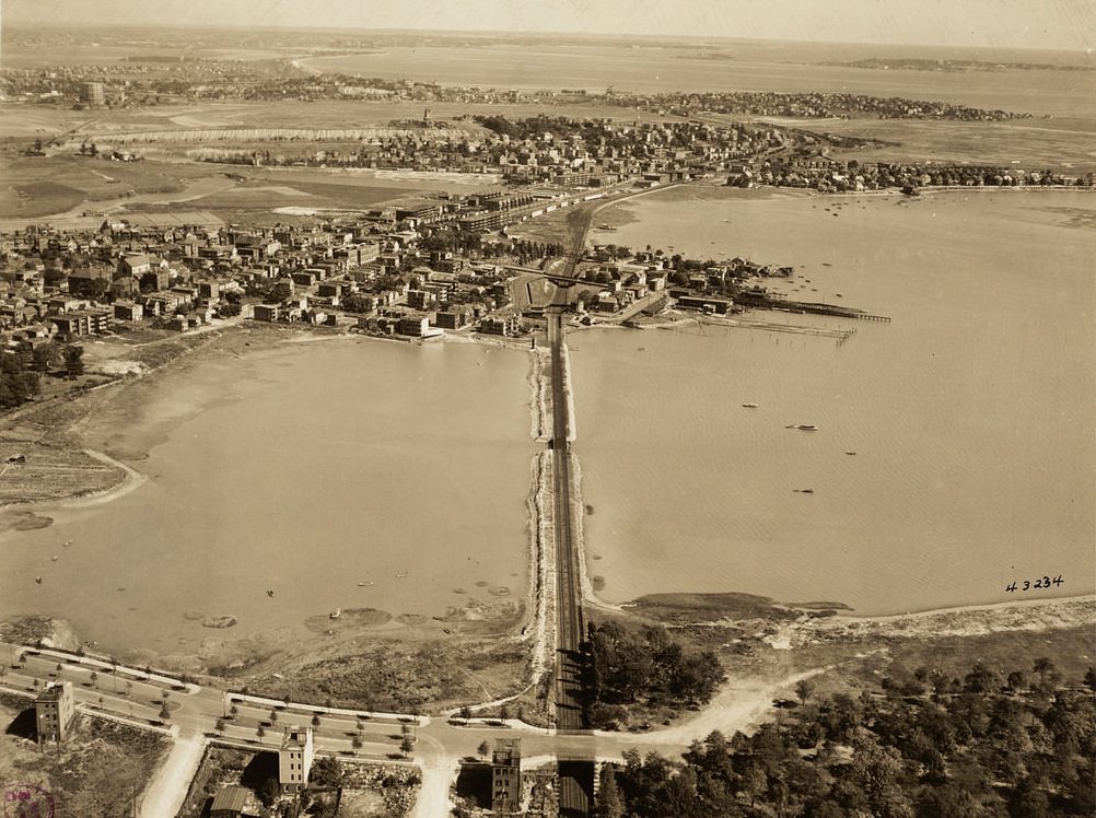
Castle Island, connected to South Boston by a narrow strip of land, had served as a military fortification since the colonial era. Fort Independence, built on the island, is one of the oldest continuously fortified sites in North America. By the 1920s it had become a public park, though the fort itself remained intact. Across the harbor, the Chelsea and Revere areas showed the spread of Boston’s metropolitan footprint beyond the original city boundaries.
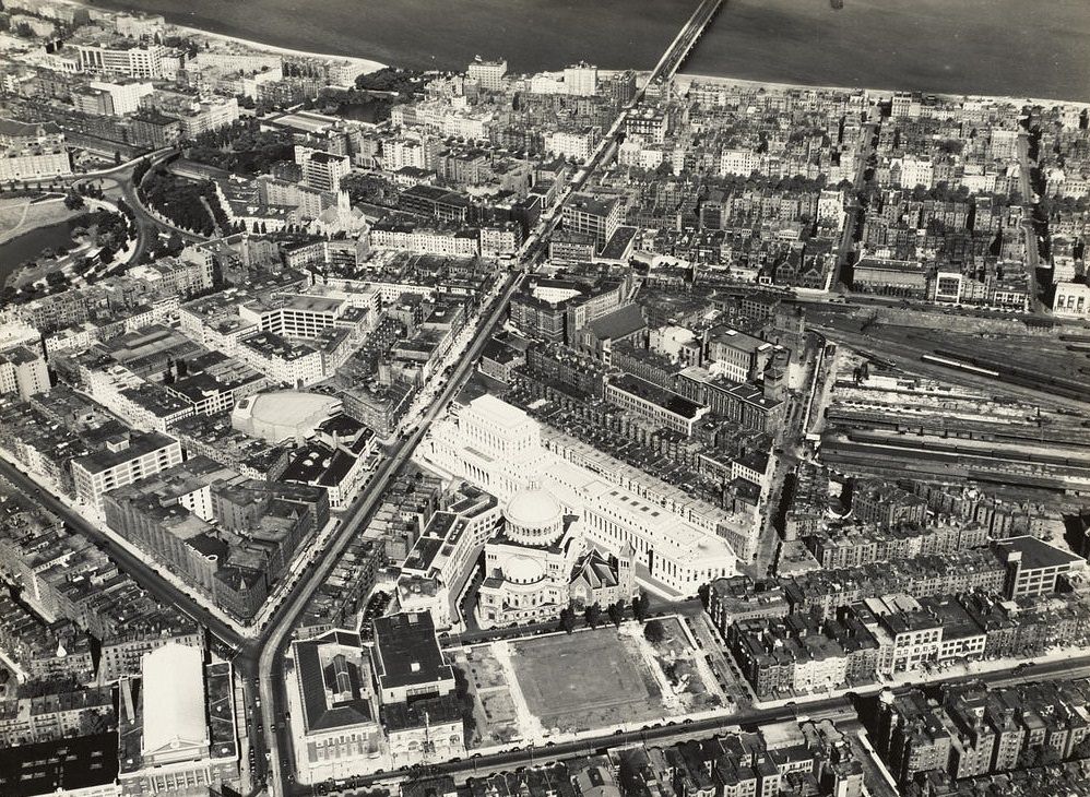
The Christian Science complex in Boston’s Back Bay was one of the most architecturally striking religious sites in the city. The original Mother Church, built in 1894, was joined by a much larger extension completed in 1906, along with the publishing house for the Christian Science Monitor newspaper. From the air, the grand scale of the complex stood out clearly against the surrounding streets. Just a short distance away, Commonwealth Avenue stretched westward — one of the most celebrated boulevards in American urban design.
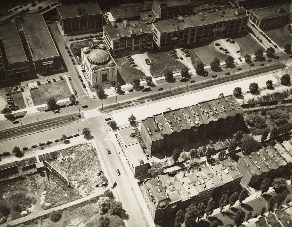
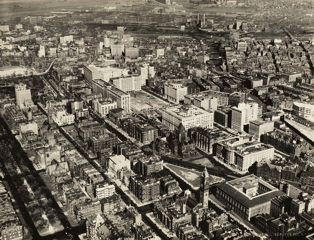
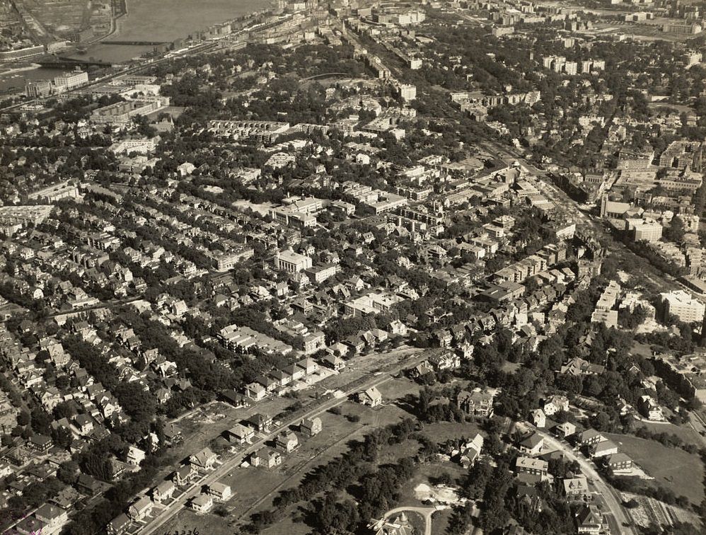
Copley Square was the cultural and architectural heart of the Back Bay. Trinity Church, built in the Romanesque Revival style and completed in 1877, faced the Boston Public Library across the square — a pairing that made Copley one of the most photographed intersections in New England. Nearby Corey Hill in Brookline offered sweeping views of the entire Boston metropolitan area, and the neighborhoods of Dorchester to the south showed just how far the city had expanded from its original colonial core.
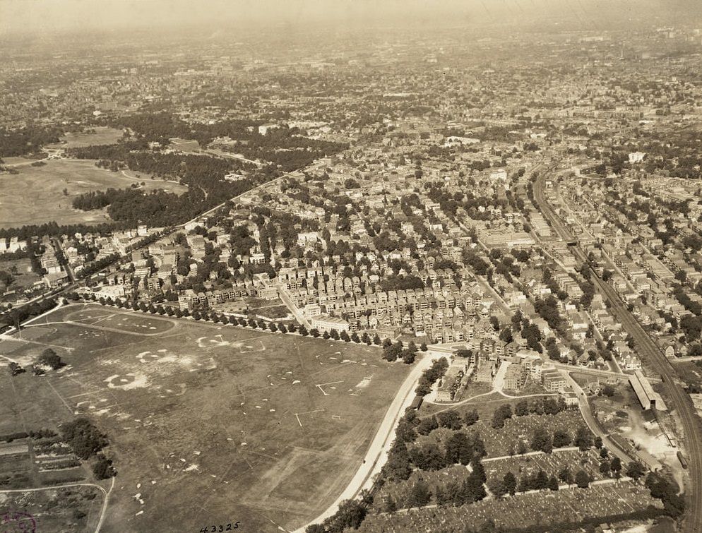
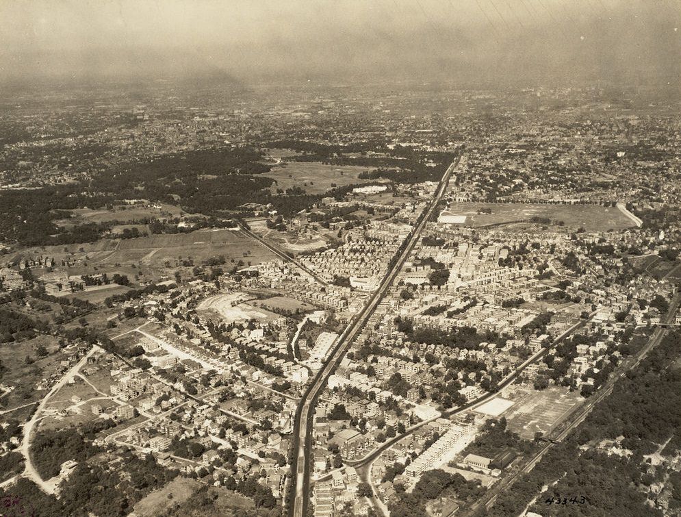
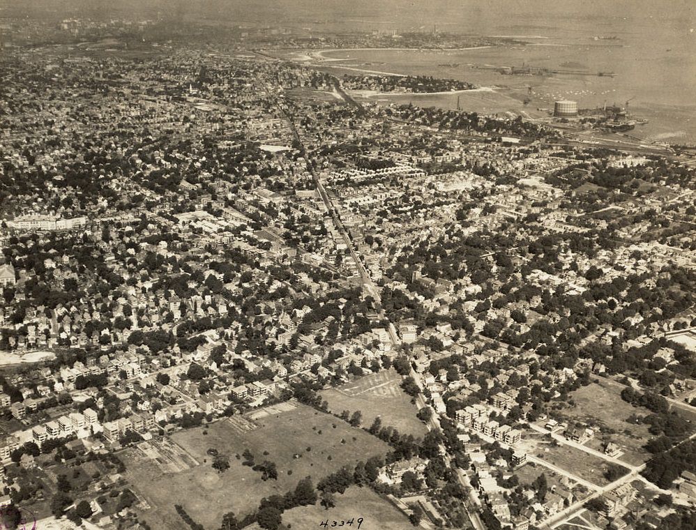
Dorchester was annexed by Boston in 1870 and became one of its largest and most populated neighborhoods. By the 1920s it was filled with working-class and middle-class families, many of them Irish and Jewish immigrants who had moved outward from the more crowded inner-city neighborhoods. Franklin Field provided open recreational space within the dense residential fabric. Meanwhile, on the East Boston waterfront, something historically significant was taking shape.
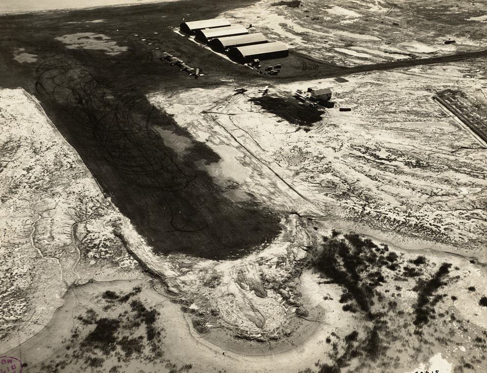
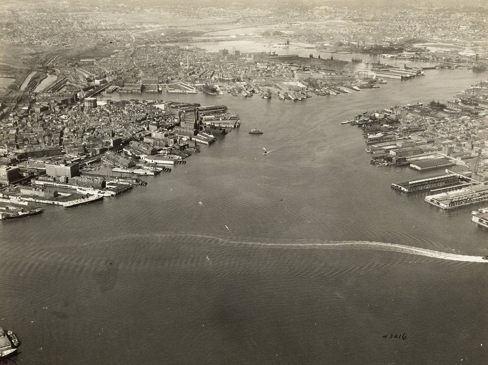
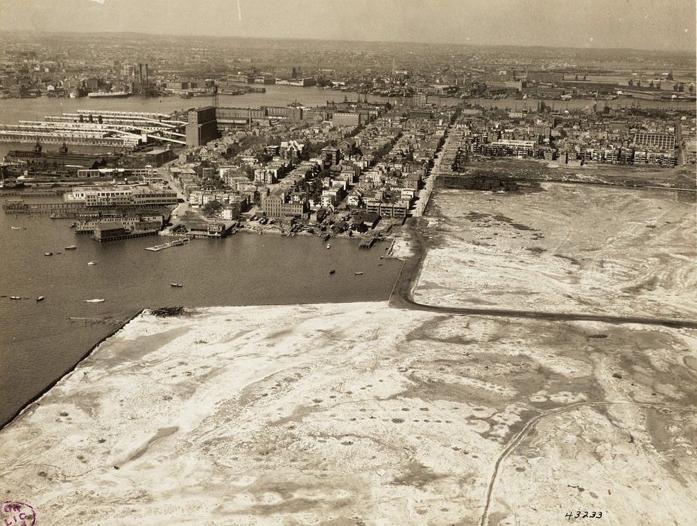
The East Boston airport — which would eventually become Logan International Airport — was in its earliest stages during the 1920s. It opened in 1923 as one of the first municipal airports in the United States, built on filled land along the harbor’s edge. Commercial aviation was still in its infancy, and the airfield was modest by any measure, but its existence signaled the beginning of a new era in transportation. Elsewhere in the city, federal institutions marked their presence in the Financial District.
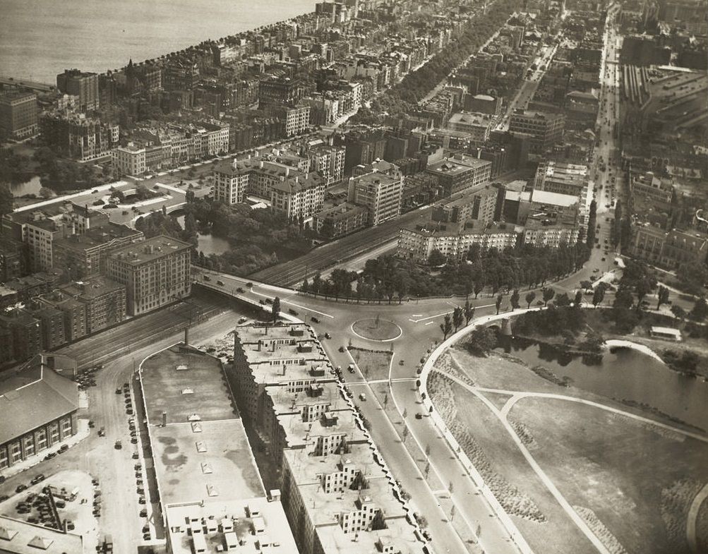
The Fenway area was a product of Frederick Law Olmsted’s Emerald Necklace — a linked chain of parks and parkways that Olmsted designed for Boston beginning in the 1870s. The Fens themselves were a reclaimed salt marsh transformed into a park system. Fenway Park, home to the Red Sox since 1912, sat at the edge of this district. Fisher Hill in Brookline represented the wealthier residential fringe of the metropolitan area, with large homes set on generous lots far from the industrial noise of the city center.
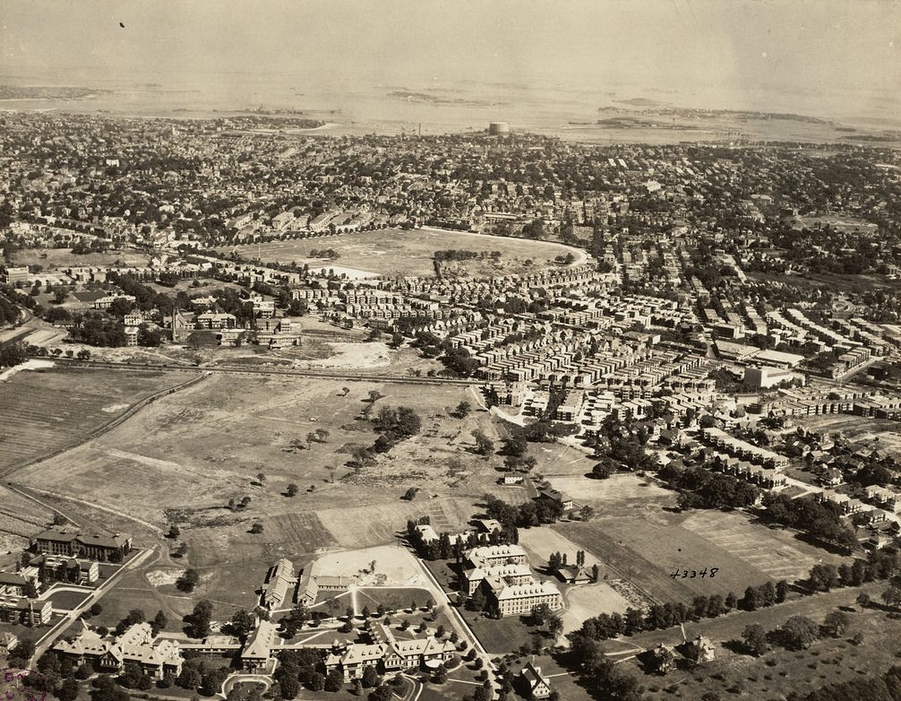
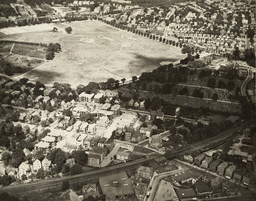
Franklin Park was the crown jewel of Olmsted’s Emerald Necklace — a 527-acre landscape in Roxbury and Dorchester designed to give city residents access to naturalistic open space. It included a golf course, a zoo, and extensive walking paths. The park’s scale is unmistakable from the air, a vast green expanse surrounded on all sides by dense urban housing. Across the river, Cambridge’s academic institutions presented their own distinct aerial character.
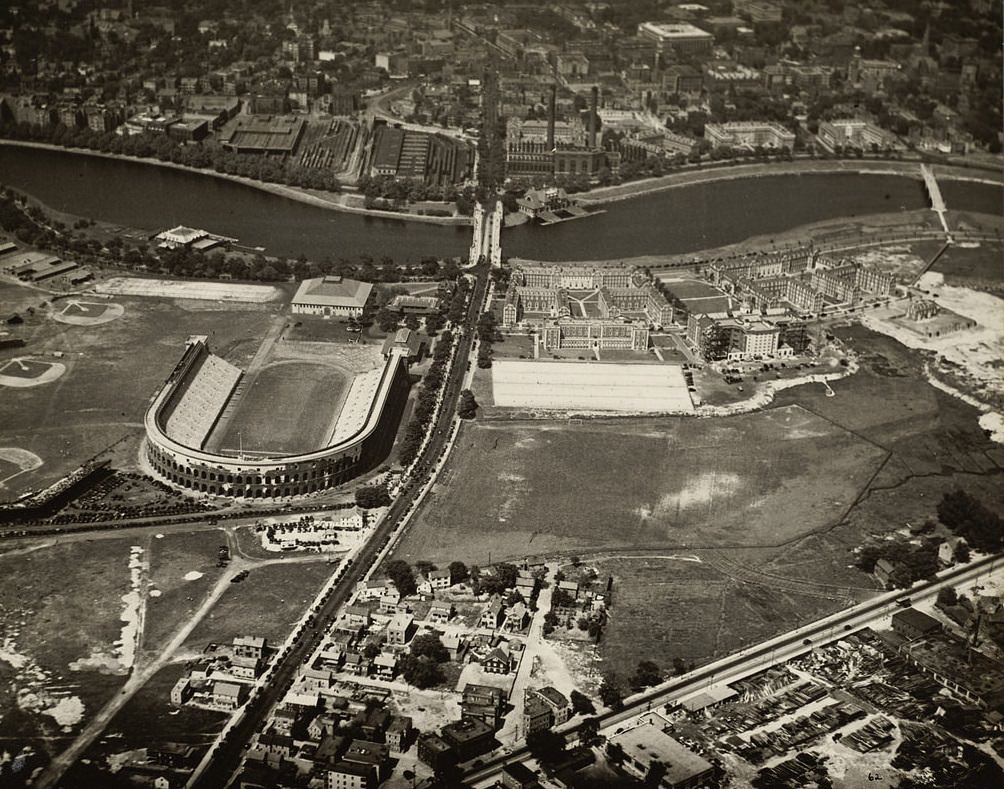
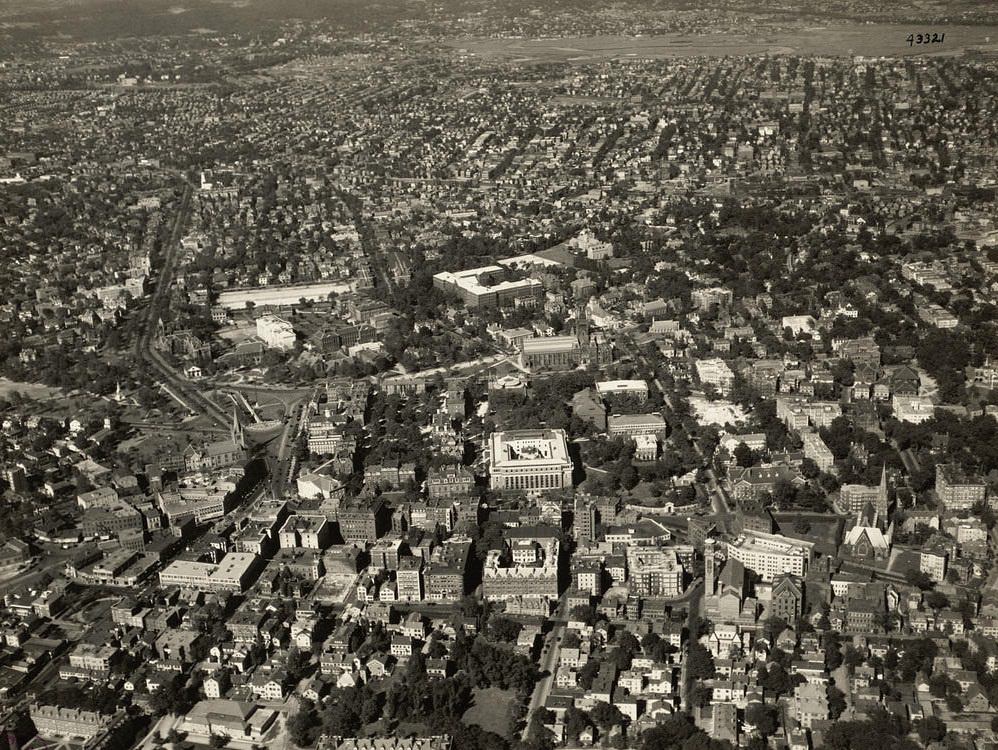
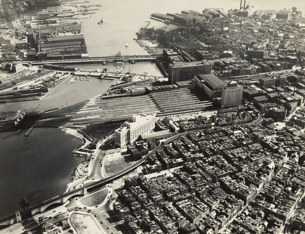
Harvard Business School’s campus on the Boston side of the Charles River was still relatively new in the 1920s — its Georgian Revival buildings were constructed beginning in 1926. Harvard Square in Cambridge was a dense commercial and academic hub, already well-established as the intellectual center of the region. The Hotel Manger, adjacent to North Station and the Boston and Maine Railroad infrastructure, reflected the hotel industry’s close relationship with rail travel in an era before widespread automobile use reshaped American cities.
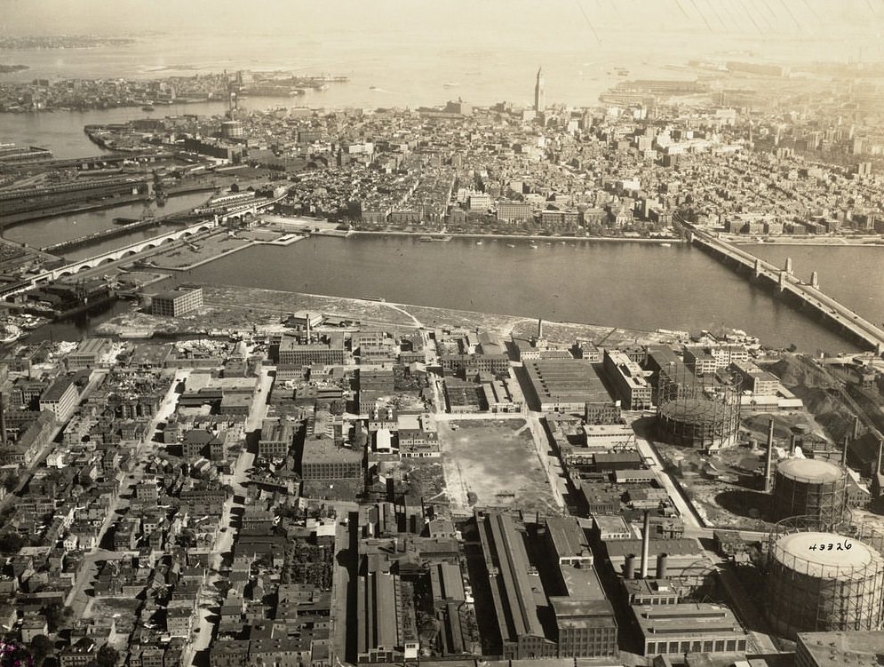
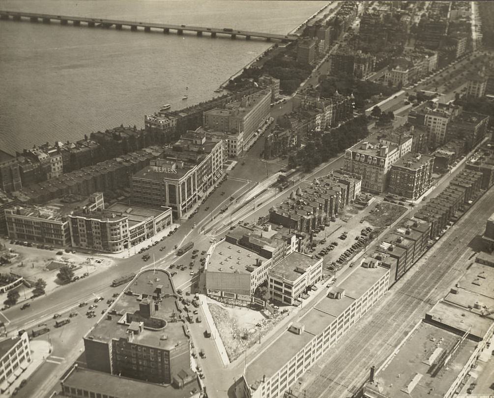
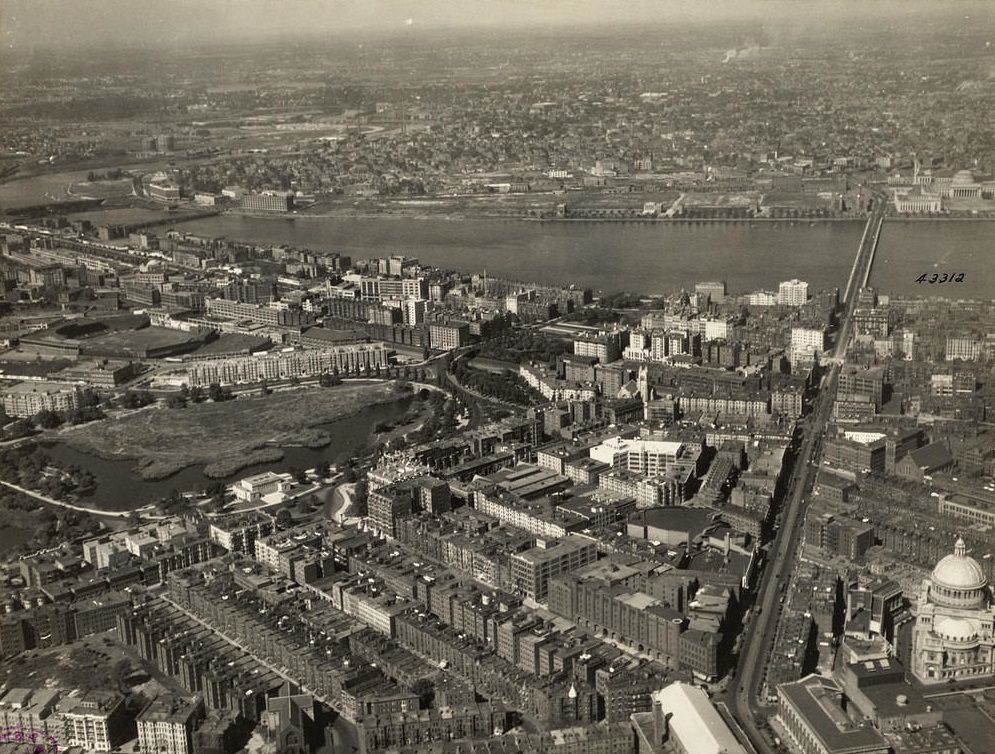
Kendall Square in Cambridge was an industrial district in the 1920s, home to factories and warehouses rather than the technology companies that fill it today. Kenmore Square served as a major transit junction where several streetcar and elevated rail lines converged, making it one of the busiest intersections in the city. Massachusetts Avenue running through the Fenway connected the academic institutions of Cambridge with the cultural institutions clustered around the museum district. Orient Heights in East Boston offered a high-ground perspective across the harbor.
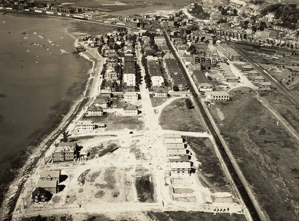
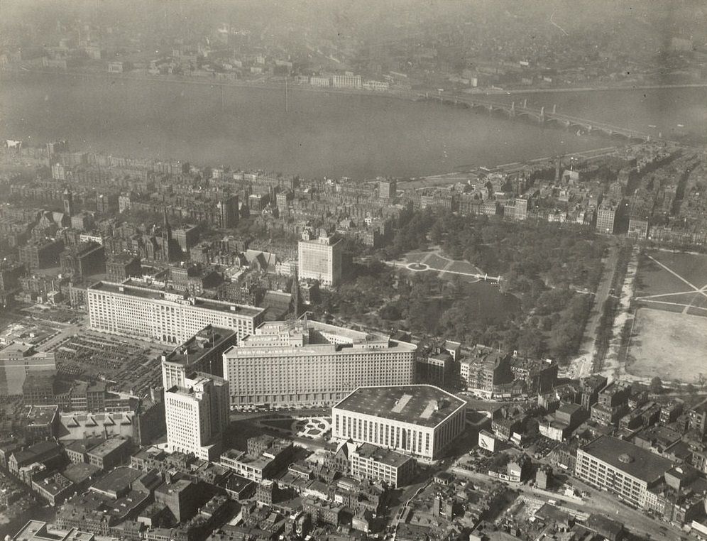
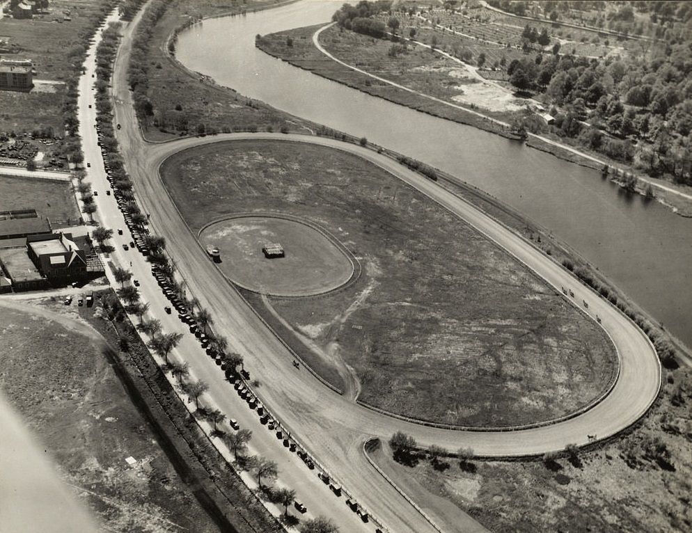
Park Square, located just south of the Public Garden, was a busy commercial and transportation hub anchored by the old Park Square Building and surrounded by hotels, theaters, and transit connections. Soldiers Field Road along the Charles River in Allston passed by a trotting park — a horse racing track used for harness racing — which spoke to the leisure culture of an earlier era that was already beginning to give way to automobile-centered recreation. South Boston, stretching along the harbor, was a tight-knit working-class neighborhood with a strong Irish-American identity.
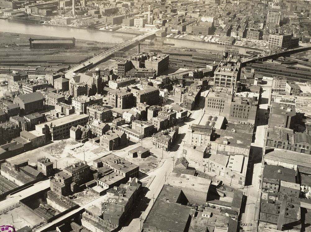
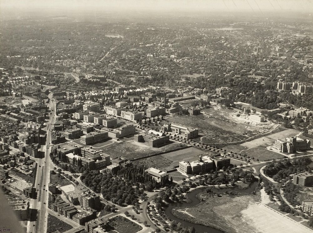
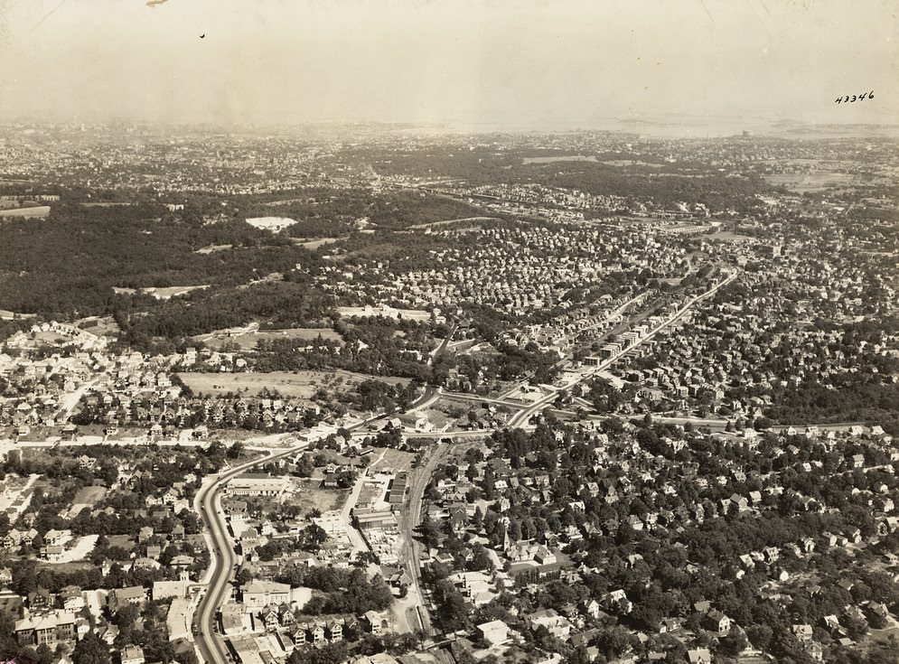
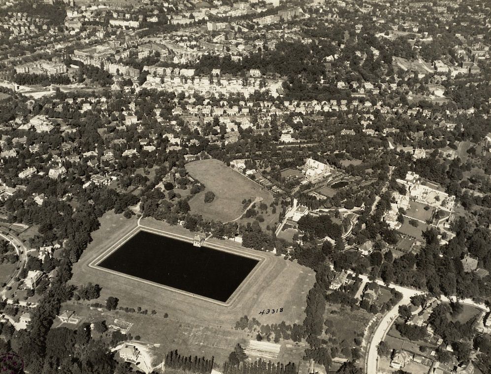
The Fenway as a neighborhood extended well beyond the park system that gave it its name, encompassing hospitals, museums, and some of the city’s most important cultural institutions. West Roxbury, at the southwestern edge of Boston, was among the city’s most residential and suburban-feeling districts — a place of single-family homes, quiet streets, and proximity to the Dedham border. The final images in this collection return to the Financial District, where the towers of commerce and federal government stood as monuments to the city’s enduring economic ambitions even as the broader regional economy struggled.