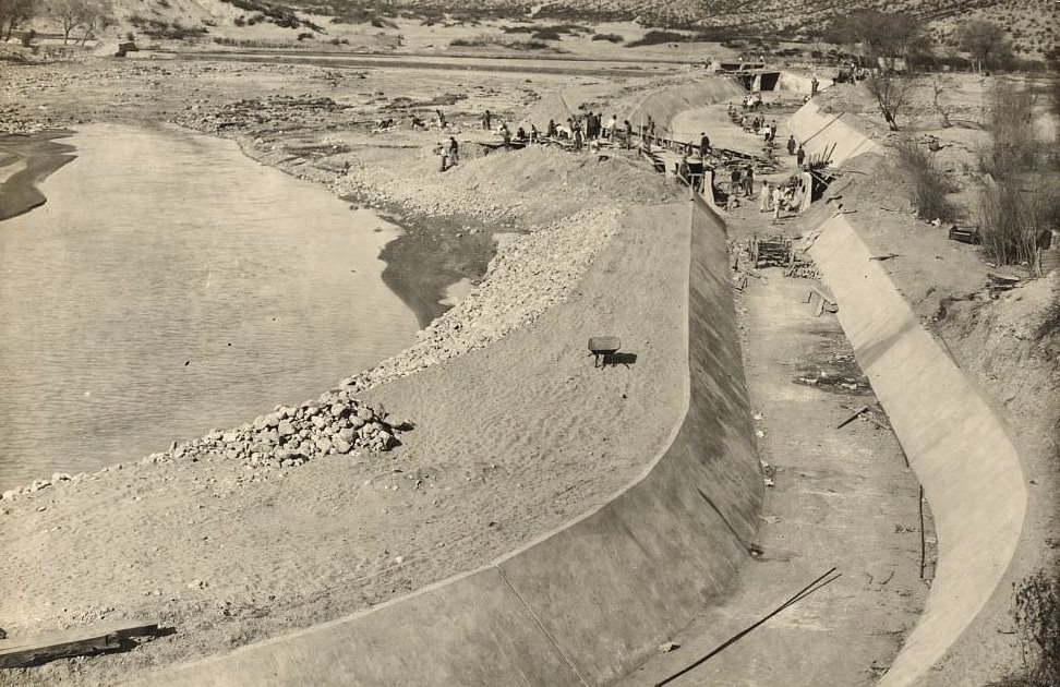
Franklin Canal, El Paso: Completing reconstruction of settling basin and concrete lining, 1907 (69/74)

Don't have an account? Register
Enter your account data and we will send you a link to reset your password.
To use social login you have to agree with the storage and handling of your data by this website. Privacy Policy
AcceptHere you'll find all collections you've created before.
After construction the canal carried irrigation water to the Lower Valley then it followed parallel the railroad tracks. When the canal reaclhed Ysleta it would change direction and then basically follow parallel to Alameda until reaching water reservoirs at Alamo Alto and Acala on the El Paso County line. Once you passed Ysleta, Alameda became US 80 today’s Texas 20. I would estimate that it was between 40 -50 miles while irrigating farmer’s fields between the sand hills and Mexico.
We went swimming there by Jefferson High School. Mostly around Val Verde and Paisano
What I want to know when did the Rio grande become so dry with hardly any water on it. What’s the reason behind that. I’m guessing they hold off the water but what’s the reasoning behind it