Hey There! Before You Go. 😧
Get the best vintage content straight into your inbox!

Don't worry, we don't spam

What Toronto looked like in the 1910s

In 1911, Toronto’s population stood at roughly 375,000 people. By 1919, that number had climbed past 500,000. The city was absorbing immigrants arriving from Europe and migrants moving in from rural Canada, all drawn by the prospect of steady work and urban life. Neighbourhoods expanded outward fast. New rows of modest brick houses went up to house working-class families, while wealthier residents built larger homes in areas like Rosedale and Forest Hill. The city’s footprint was growing in every direction.
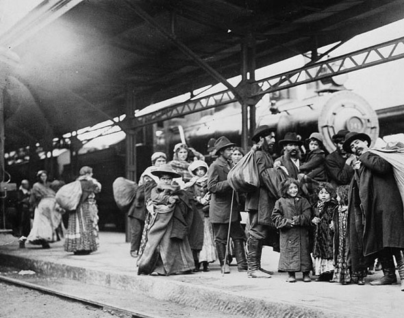
Arrival of immigrants at (old) Union Station, 1910s

The old Union Station was one of the first things many newcomers ever saw of Toronto. Thousands of immigrants passed through its doors carrying everything they owned, stepping into a city that was still figuring out how to accommodate them. The Ward — a densely packed neighbourhood roughly bounded by College, Queen, Yonge, and University — became the first stop for many of these arrivals. It was crowded, underfunded, and alive with activity.
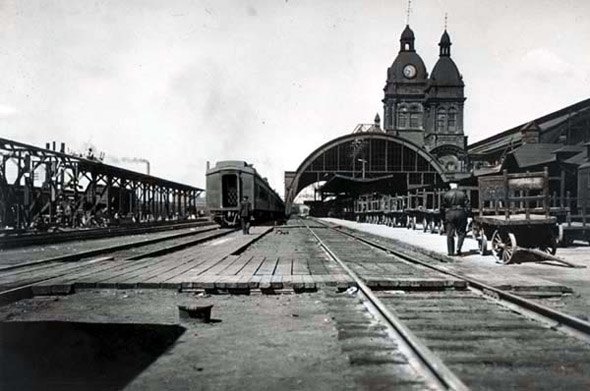
Old Union Station exterior, 1910s
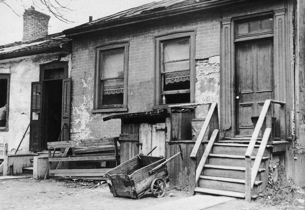
Slum house, 'The Ward', 1911.
Slum house, ‘The Ward’, 1911.

Housing in The Ward was rough. Slum conditions were common, with families crowded into structures that were poorly built and worse maintained. City photographers documented the area extensively in the early years of the decade, producing a stark visual record of poverty in the middle of a prospering city.
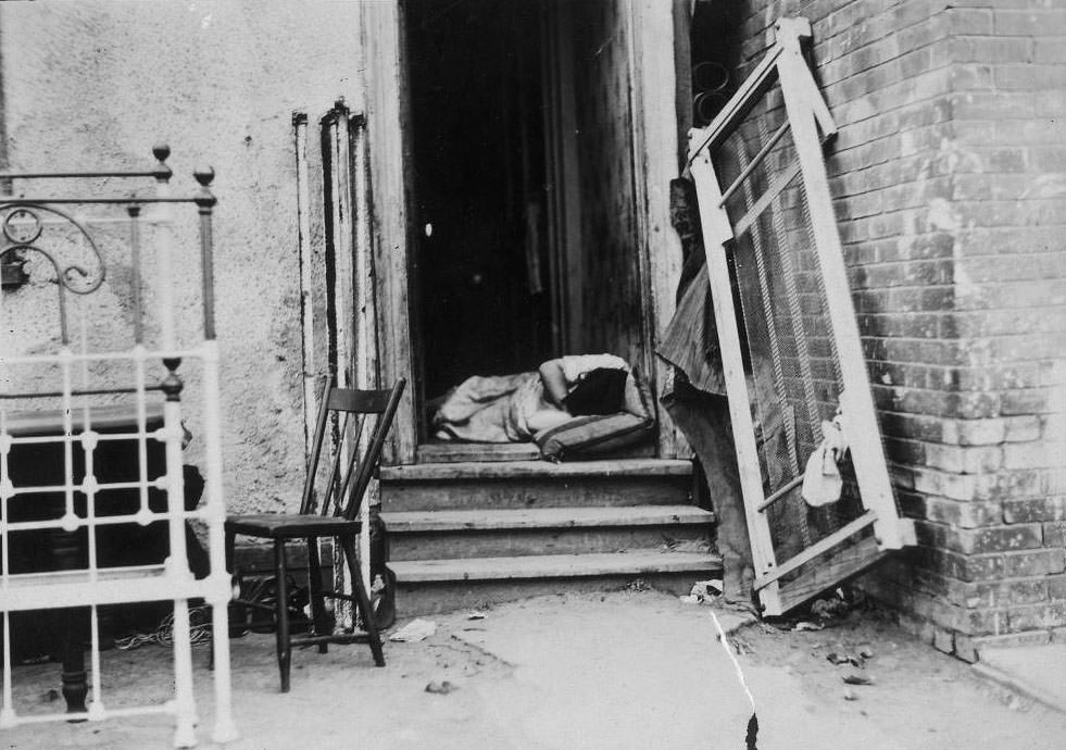
Sleeping in doorway on a hot summer night, The Ward, 1910.
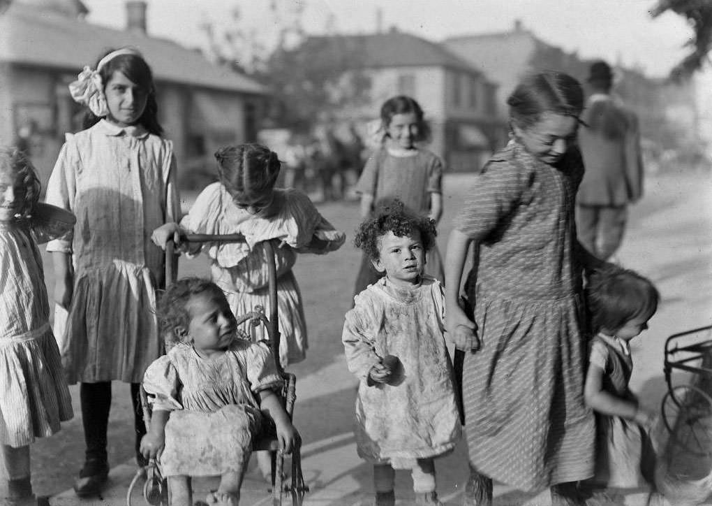
Children of The Ward, 1911.

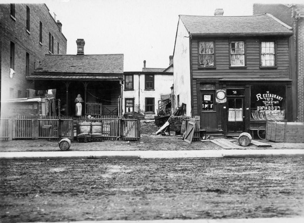
Children grew up in The Ward’s streets and alleyways. The neighbourhood had its own economy — small warehouses, food merchants, and street-level trade kept things moving day to day.
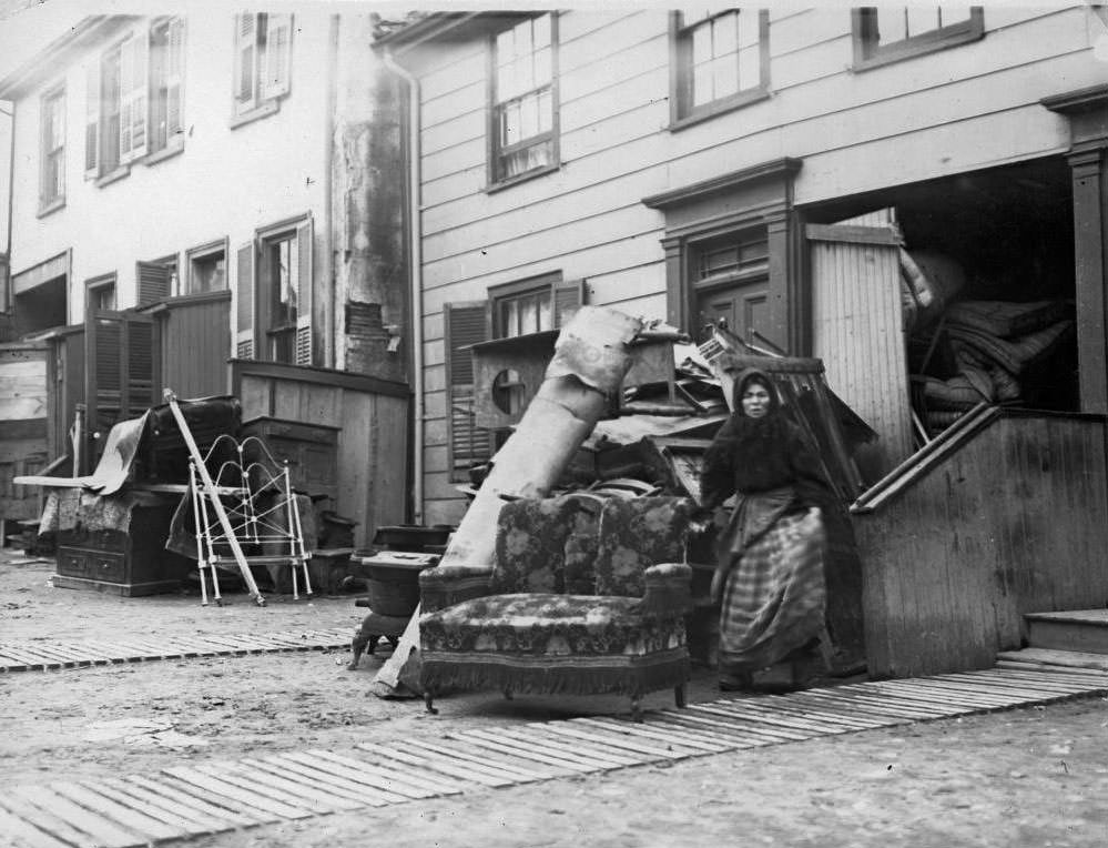
Furniture warehouse, 'The Ward', 1910.
Furniture warehouse, ‘The Ward’, 1910.
Chicken warehouse, Agnes Street (Now part of Dundas St. W.), 1910.
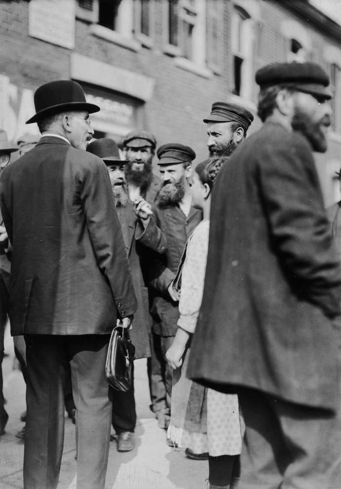
Jewish missionary Henry Singer in 'The Ward', 1912.
Jewish missionary Henry Singer in ‘The Ward’, 1912.

Religious and community organizations were active in The Ward. Jewish missionaries, settlement workers, and church groups worked among the neighbourhood’s residents, many of whom were recent arrivals still learning English and navigating a new country. The Beach Hebrew Institute, built further east, was one example of how immigrant communities invested in permanent institutions of their own.
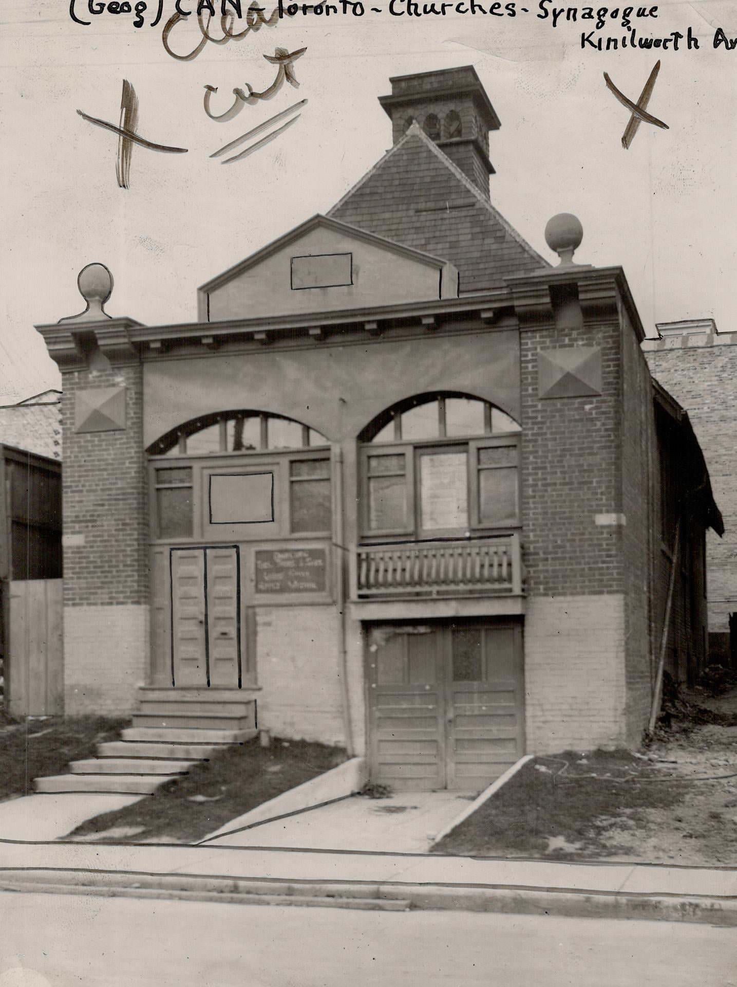
Beach Hebrew Institute, Kenilworth Avenue, east side, south of Queen Street East, 1919

Outside The Ward, Toronto’s commercial streets were busy and changing fast. King Street West was lined with storefronts, horse-drawn vehicles, and early automobiles sharing the same road. The mix of old and new transport was visible everywhere in the city during these years.
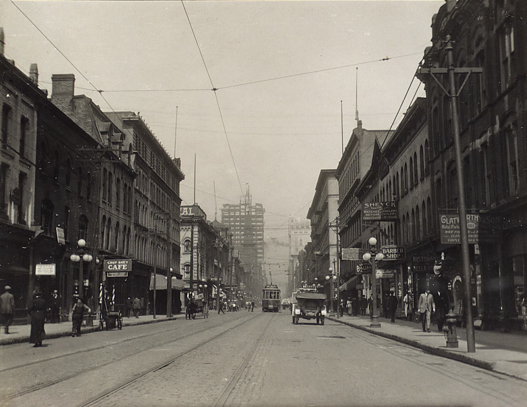
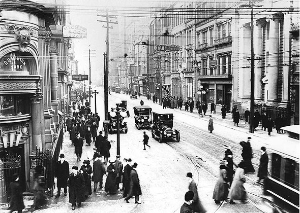
King Street West, looking east from west of York Street, 1914.
King looking west from Yonge Street, 1910s
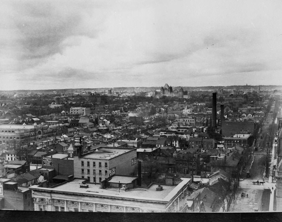
Looking northwest from Queen and Bay streets, 1910.

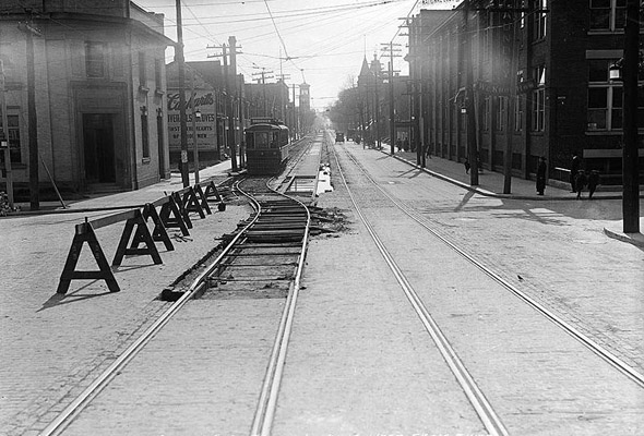
The streetcar network was the backbone of how people moved through the city. Tracks ran across most major streets, and the system kept expanding throughout the decade. Workers laying and repairing those tracks were a constant presence on Toronto’s roads.
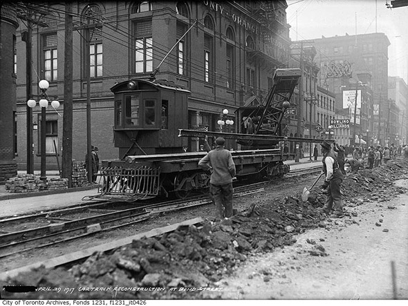
Streetcar track work at Queen and Bond streets, 1910s
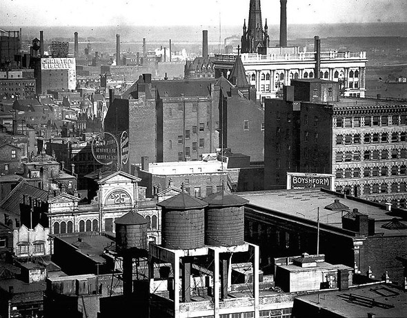
Looking south from Richmond and Bay streets, 1910s

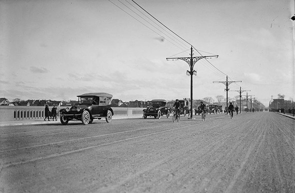
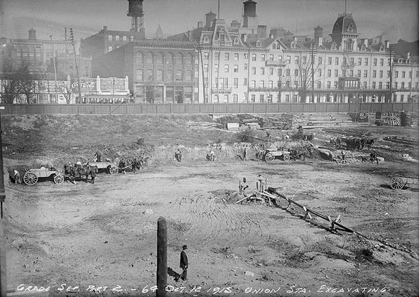
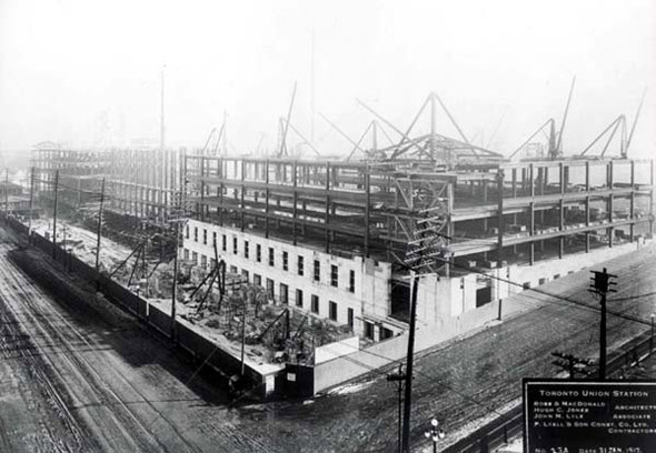
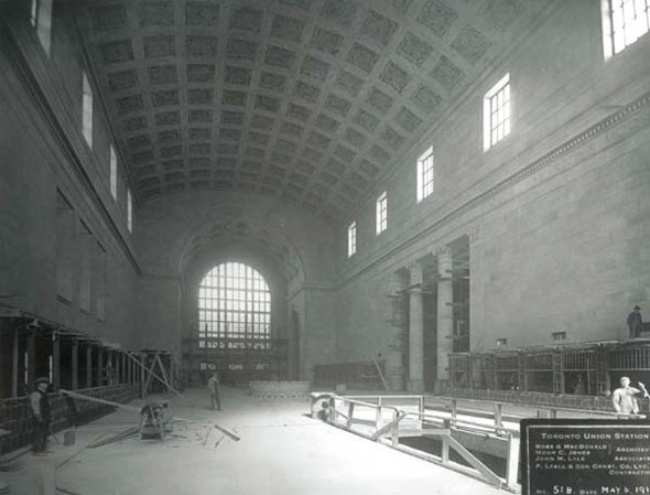
Beyond streetcars, Toronto was building in every sense. The Bloor Street Viaduct — a massive bridge project connecting the east end of the city across the Don Valley — was under construction during this period. Work on the new Union Station also began in the 1910s. These were not small undertakings. They required years of labour and reshaped how the city connected to itself.
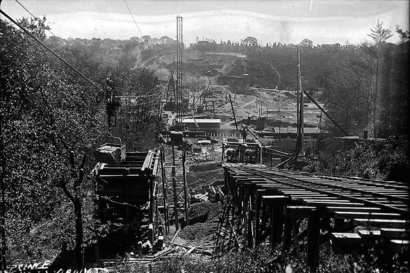
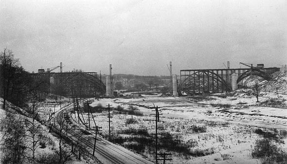
Bloor Viaduct Construction, 1910s
Bloor Street Viaduct construction, 1910s
Bloor Viaduct complete, 1910s
Construction begins on New Union Station, 1910s
Union Station construction, 1910s

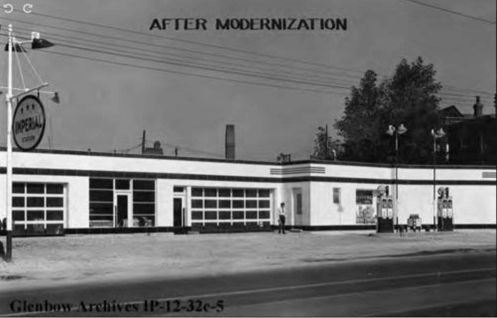
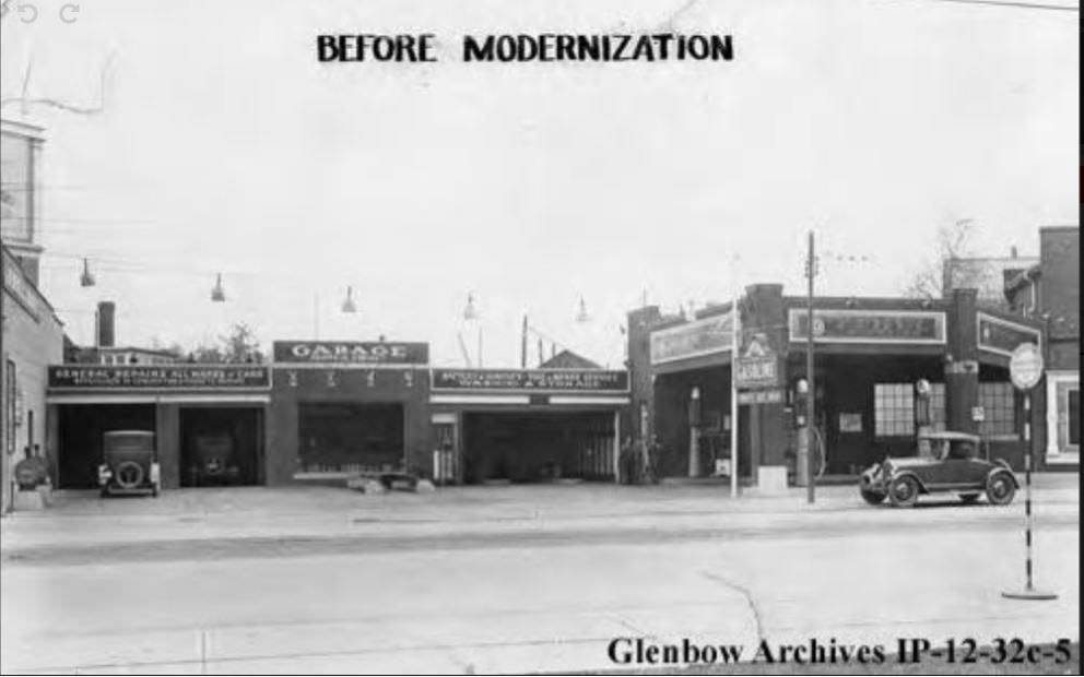
The automobile was starting to appear on Toronto streets, though most working families still couldn’t afford one. Mr. Darroch riding on Jarvis Street in 1911 with his horse named ‘Majestic’ represented one kind of transport. The Imperial Oil service station at Danforth and Broadview, which opened in August 1918, represented another. The city was caught between two eras of transportation.
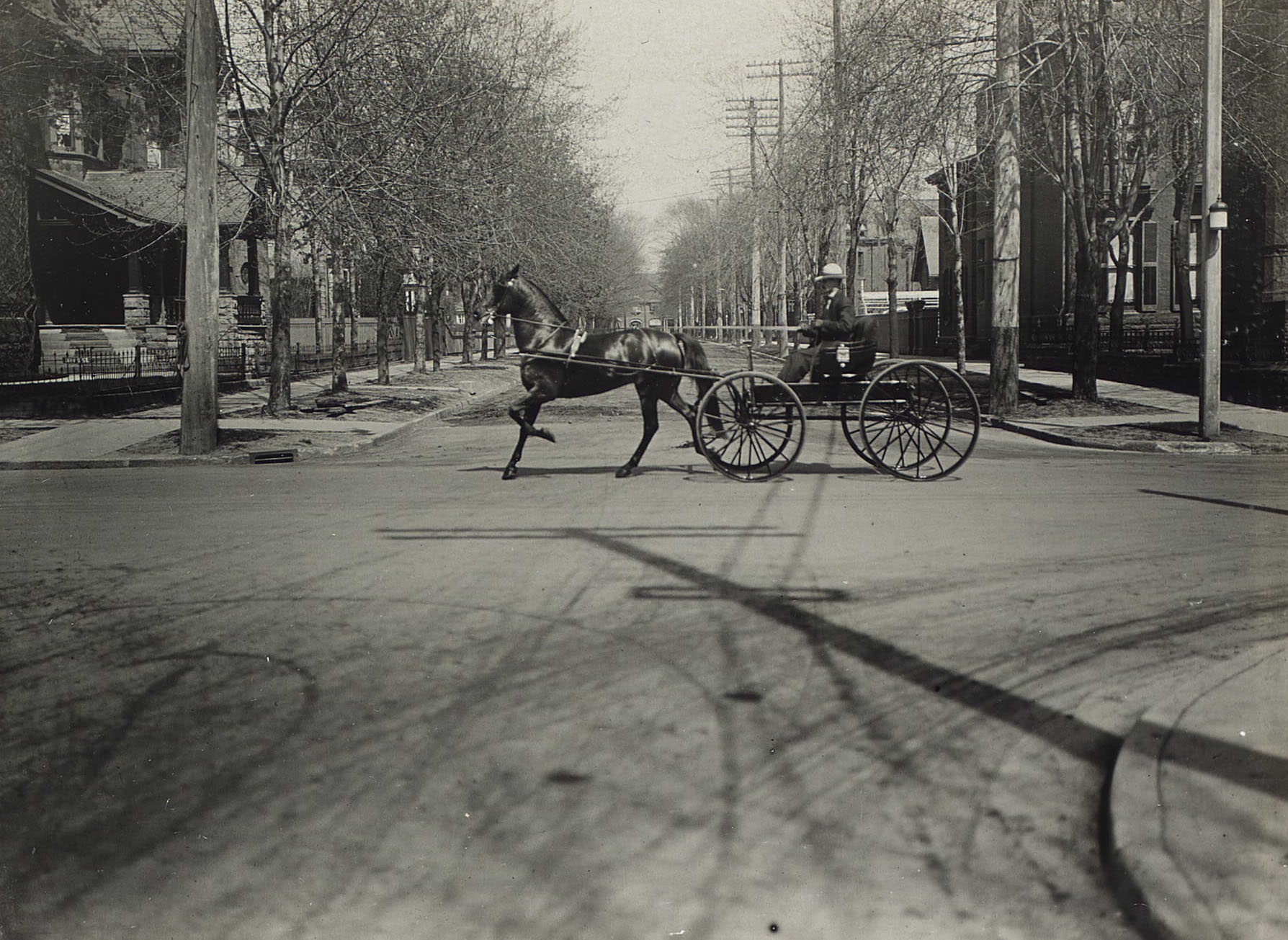
Mr. Darroch and 'Majestic"; Black 4 yr.g., driving on Jarvis Street, 1911.
Mr. Darroch and ‘Majestic”; Black 4 yr.g., driving on Jarvis Street, 1911.
Imperial Oil service station before modernization, Toronto, 1918
Imperial Oil service station after modernization, Toronto, Ontario. Station opened in August, 1918. Located at Danforth and Broadview. Where at Broadview & Danforth.
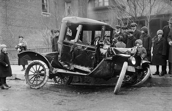
Car accident on Bloor Street near Walmer Road, 1910s

Electricity was transforming the city as well. The Toronto Electric Light Company, whose employees like Ted Dodd kept the system running, had been the first company to string and power 50 street lights in Toronto, running from their steam-powered generation plant at the foot of Scott Street on the Lake Ontario waterfront. By the 1910s, electric lighting was spreading rapidly across the city’s streets and buildings.
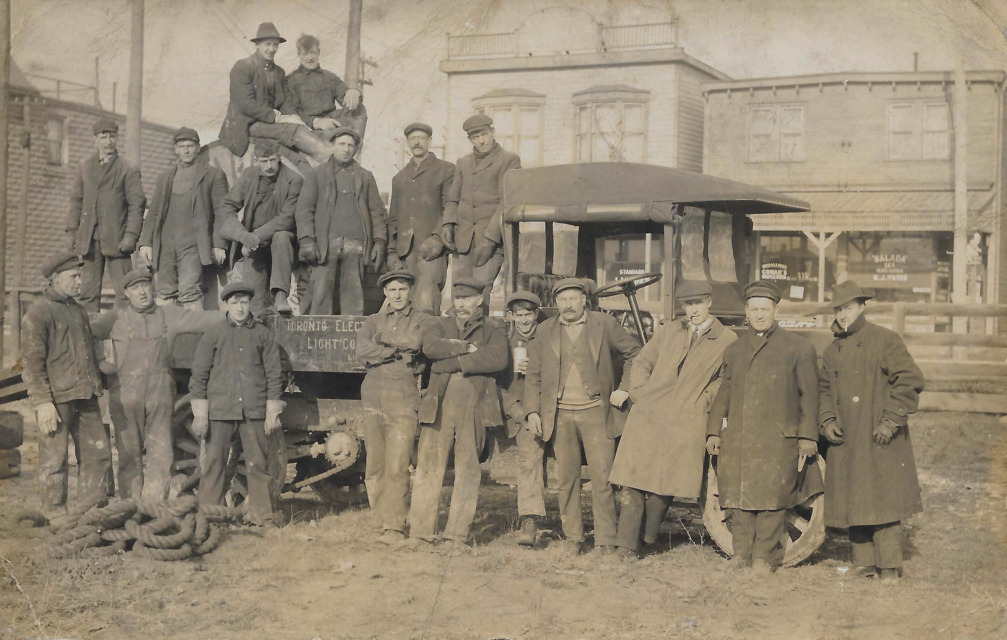
Ted Dodd an employee of the Toronto Electric Light Company, 1918.

Industrial Toronto was concentrated in districts like the Junction and the Don Valley. Factories producing food, textiles, and machinery ran long shifts with minimal oversight. The Gooderham and Worts Distillery was among the established industrial landmarks of the era. Coal companies, ironworks, and manufacturing yards employed thousands.
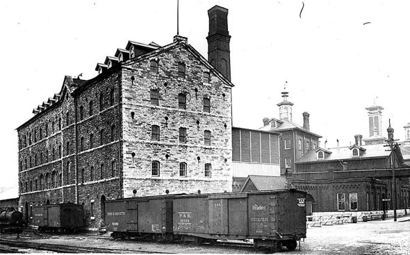
Gooderham Worts Distillery, 1910s
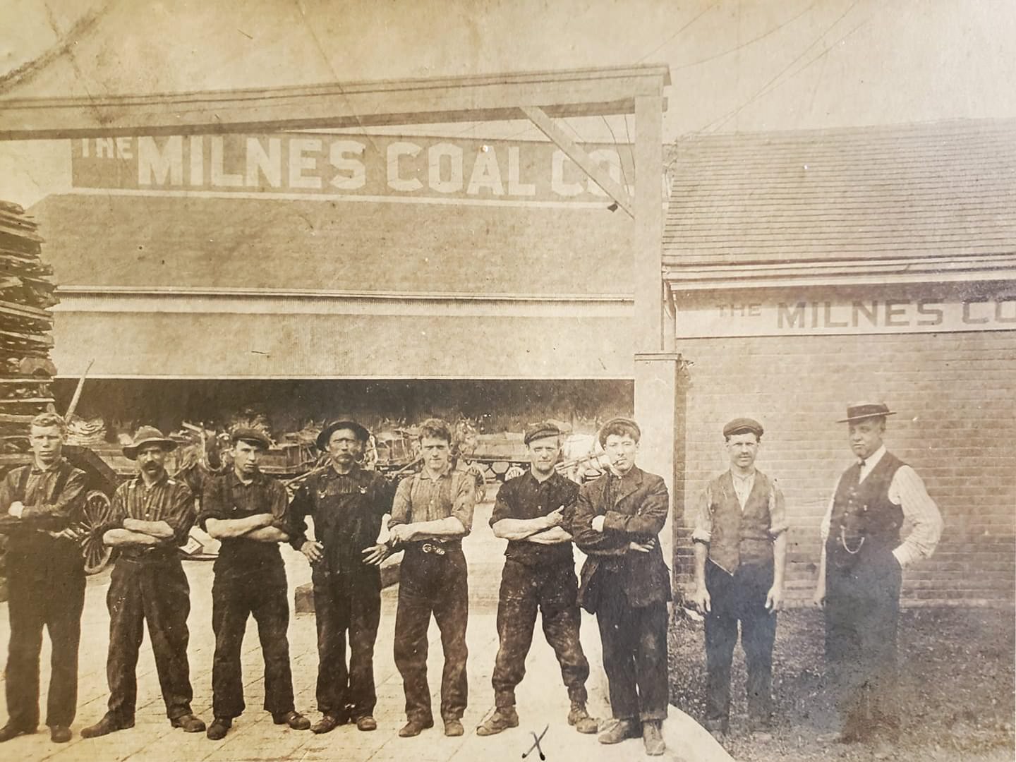
A photo of the gents at Milnes Coal Co. Limited, it was on Esplanade East between Church & Market, 1910s.

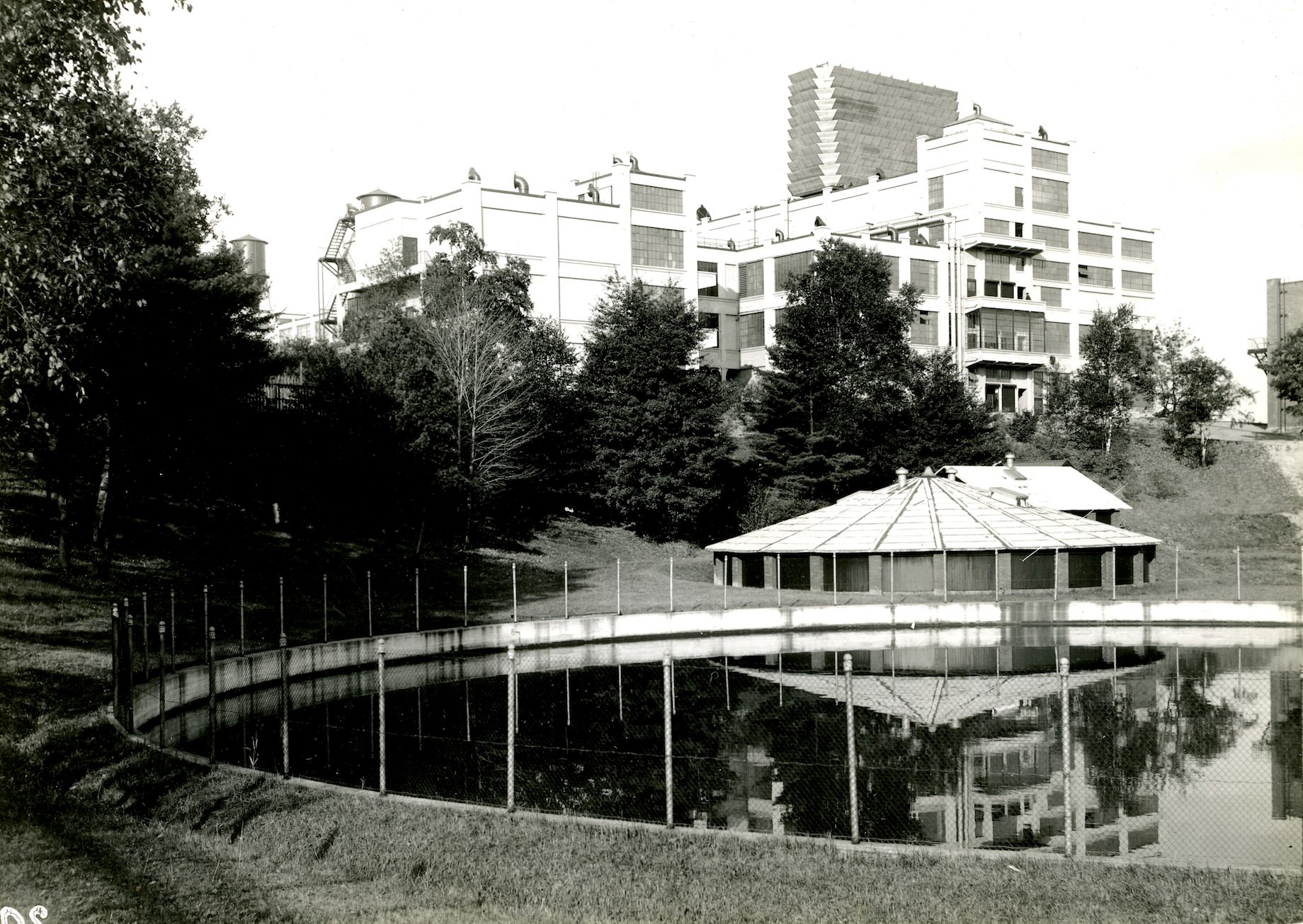
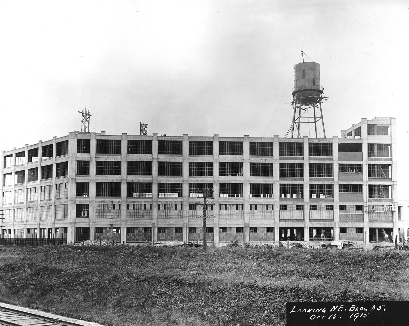
One of the most significant industrial developments of the decade was the construction of Kodak Heights in Mount Dennis, at Eglinton Avenue West and Weston Road. Kodak of Canada built its Canadian headquarters there, with construction beginning in 1914 and continuing through the war years. The site included full manufacturing facilities, office buildings, and even its own pond.
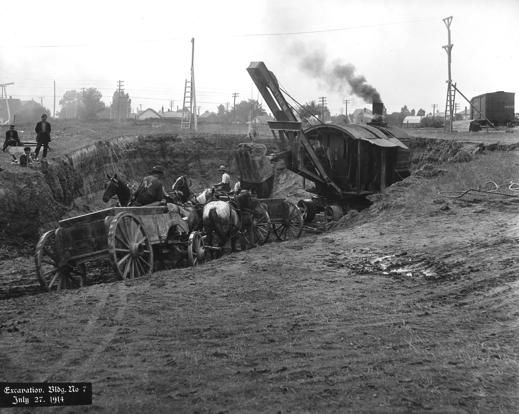
Workers in horse-drawn buggies excavate building 7 of Kodak Heights, Mount Dennis, Toronto. (Eglinton Ave. W. & Weston Rd.), July 27, 1914
'Kodak Heights' factory construction, looking NE, Building 5, Mount Dennis, Toronto. (Eglinton Ave. W. & Weston Rd.), October 15, 1915
‘Kodak Heights’ factory construction, looking NE, Building 5, Mount Dennis, Toronto. (Eglinton Ave. W. & Weston Rd.), October 15, 1915
Kodak Heights Pond, 1916. Kodak of Canada headquarters, Eglinton Ave. W. & Weston Rd., Mount Dennis, Toronto.
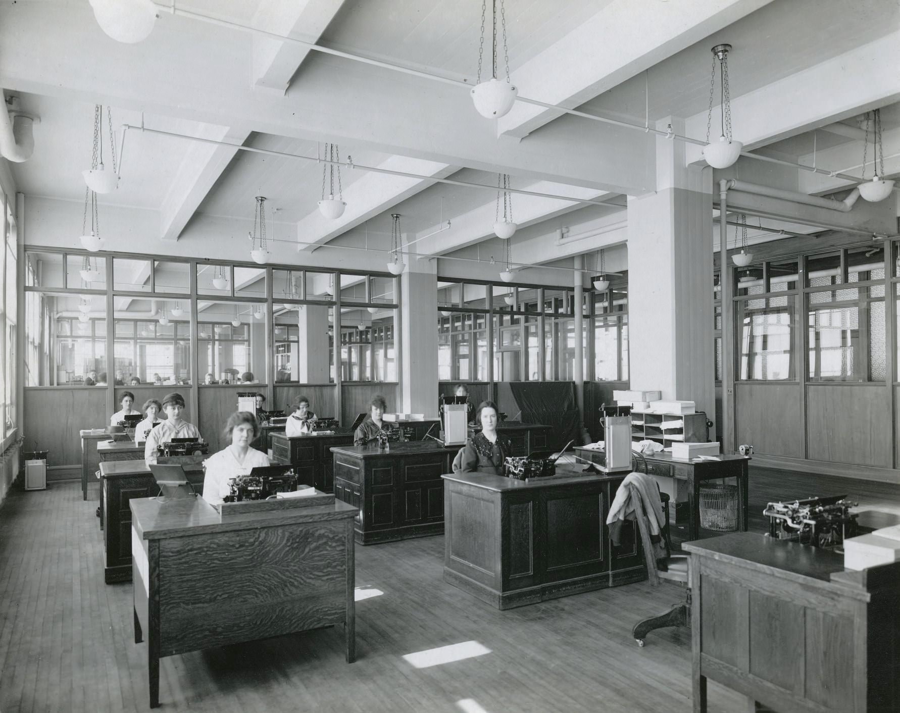
Billing and entering office, 'Kodak Heights' 1917. Kodak of Canada headquarters, Eglinton Ave. W. & Weston Rd., Mount Dennis, Toronto.
Billing and entering office, ‘Kodak Heights’ 1917. Kodak of Canada headquarters, Eglinton Ave. W. & Weston Rd., Mount Dennis, Toronto.

The Polson Iron Works shipyard on Toronto’s waterfront was another site converted for wartime production. By 1917, the yard was fitting out six minesweepers — the Festubert, St. Eloi, St. Julien, Vimy, Ypres, and Messines — all named after battles where Canadian soldiers had fought and died. The names on those ships made clear what the work was for.
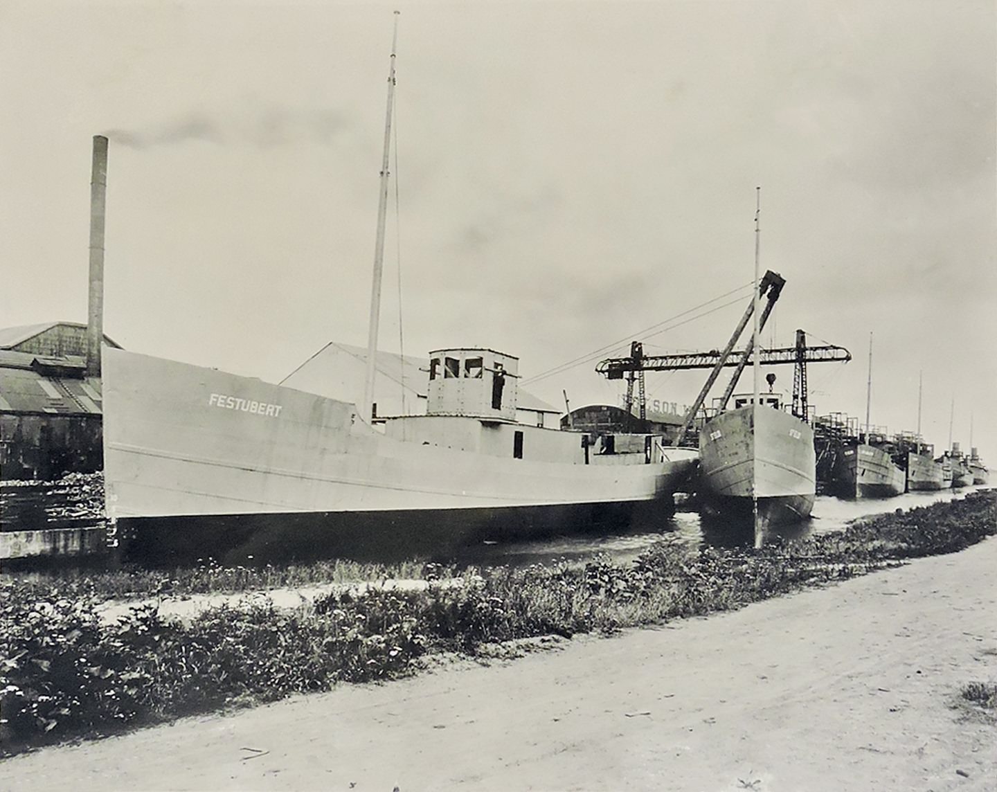
Polson Iron Works Shipyard in Toronto, 1917. View shows six mine sweepers being fitted out for use in WWI, including the Festubert, St. Eloi, St. Julien, Vimy, Ypres and Messines.

The working conditions behind all this industrial output were harsh, and workers knew it. The Toronto Street Railway Strike of 1912 saw streetcar workers walk off the job demanding better wages and conditions. It wasn’t the only labour action of the decade. Unions were growing, and workers were increasingly organized. Strike meetings at Massey Hall drew large crowds as the decade wound down.
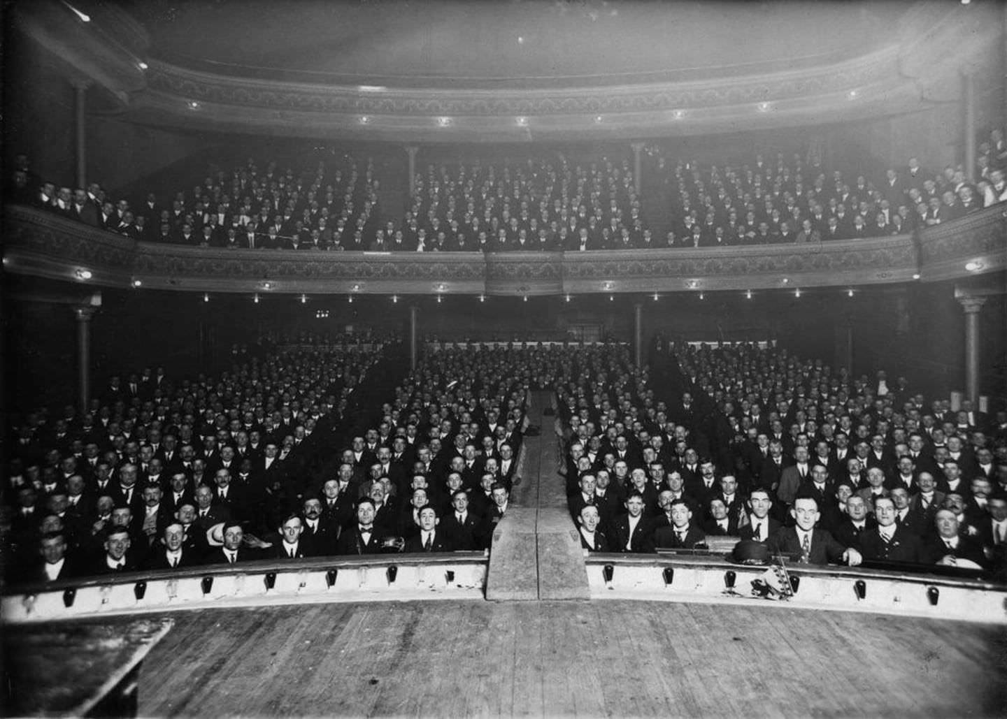
Street railway strike meeting, Massey Hall, 1919.

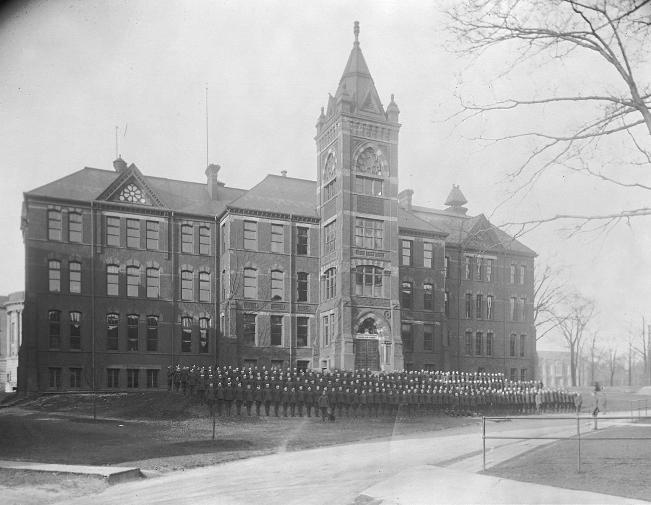
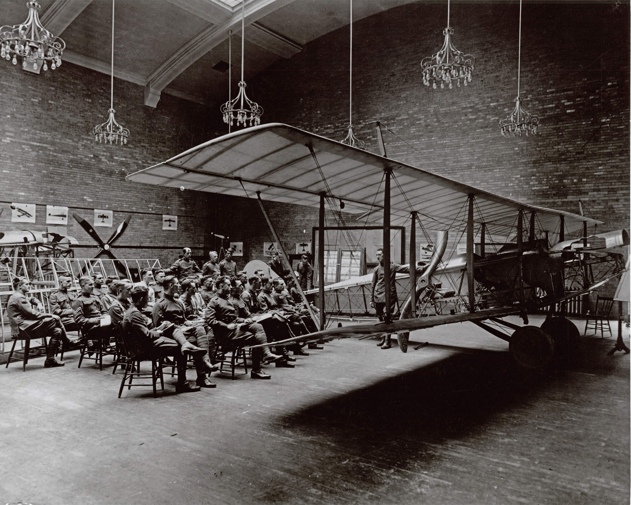
When Canada entered World War I in 1914, Toronto responded immediately. The 19th Battalion trained at the Exhibition Grounds before shipping overseas. The University of Toronto hosted the Royal Flying Corps’ No. 4 School of Military Aeronautics, where men learned the basics of airmanship before advancing to flight training. The campus became a military training facility for much of the war.
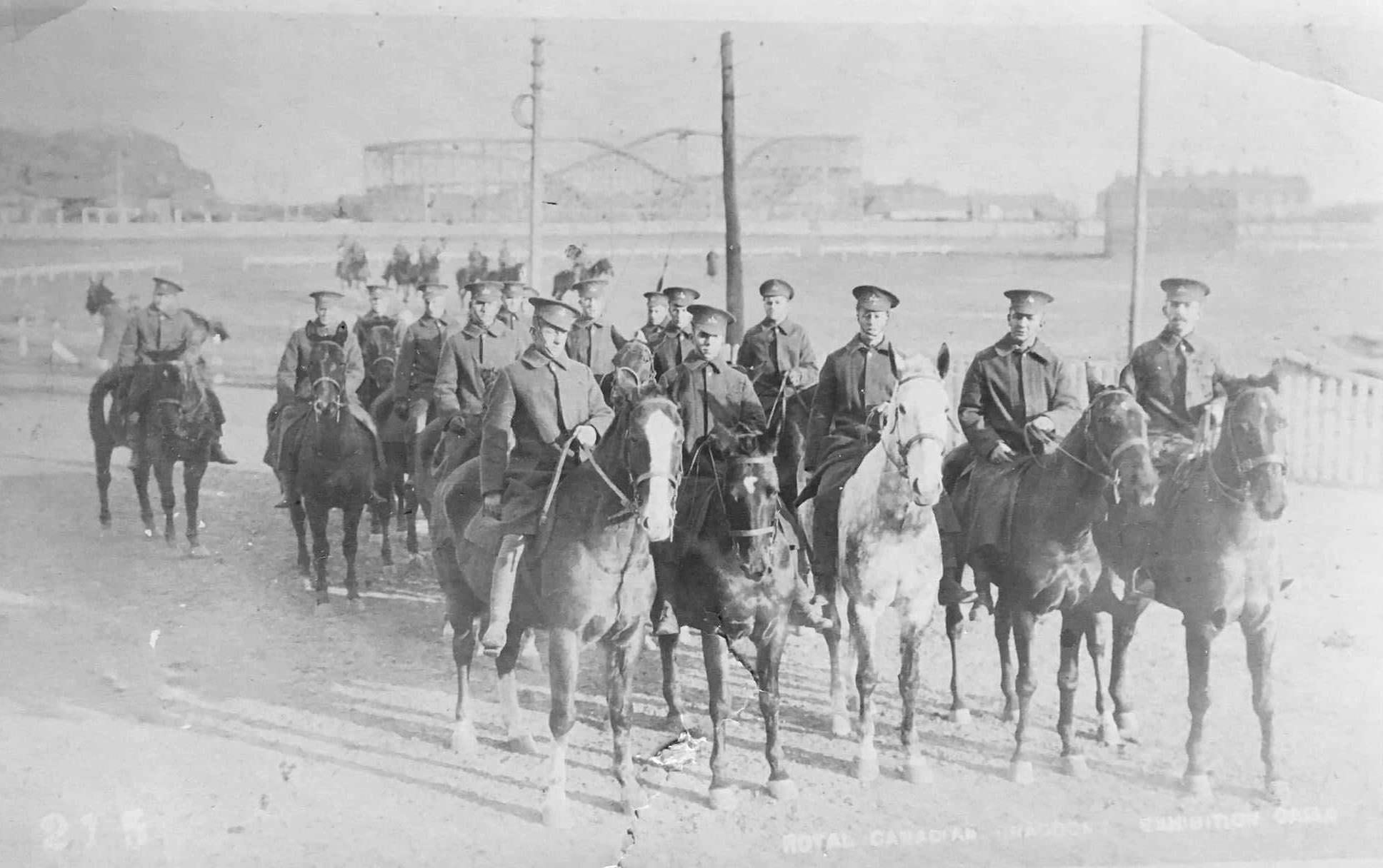
The 19th battalion somewhere between August 1914 and May 1915.  This is at the exhibition grounds where they trained prior to shipping out in Toronto, Ontario
The 19th battalion somewhere between August 1914 and May 1915. This is at the exhibition grounds where they trained prior to shipping out in Toronto, Ontario
Royal Flying Corps Canada. Lecture on airmanship, No. 4 School of Military Aeronautics, University of Toronto, 1915
Royal Flying Corps in front of the School of Practical Science (Engineering Building) at UofT, 1917.
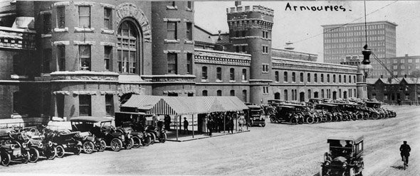
Toronto Armouries, 1910s

Recruitment was a public affair. Tents went up, men enlisted, and then they boarded trains at Union Station. The departures drew crowds. For many of the men leaving, it was the last time their families would see them.
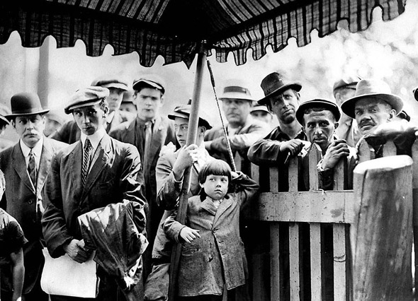
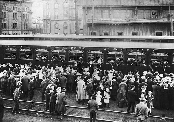
Men at the recruiting tents, 1910s
Soldiers leaving from Union Station, 1910s

Flight training came with real danger. At Camp Leaside, located at Laird Drive and Wicksteed Avenue in what is now the Leaside neighbourhood, accidents were part of the training process. A Royal Air Force Canada training plane photographed in 1918 shows a broken tail — one of many incidents recorded at the camp during the war years.
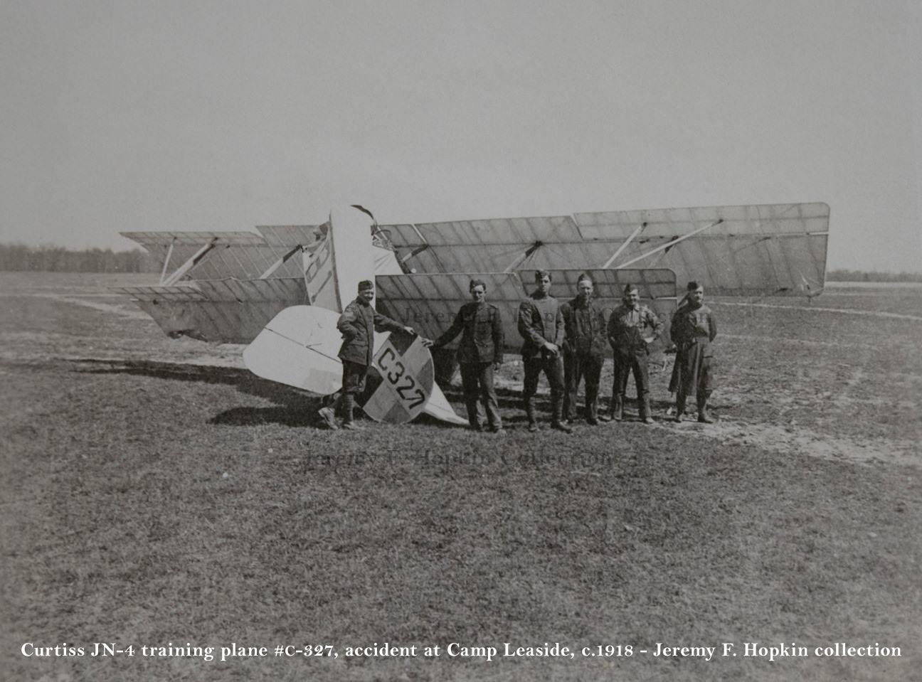
R.A.F. (Canada) training plane C327, its tail broken during an accident at Camp Leaside, 1918. The camp was located at Laird Drive & Wicksteed Ave., within today's Leaside neighborhood in Toronto.
R.A.F. (Canada) training plane C327, its tail broken during an accident at Camp Leaside, 1918. The camp was located at Laird Drive & Wicksteed Ave., within today’s Leaside neighborhood in Toronto.

By October 1917, six months after the Battle of Vimy Ridge, wounded and recovering veterans were a visible presence back home. A photograph taken that month shows veterans gathered at the southwest corner of Yonge and College Street — a spot known as Shrapnel Corners. These were men who had survived the fighting but came back permanently changed.
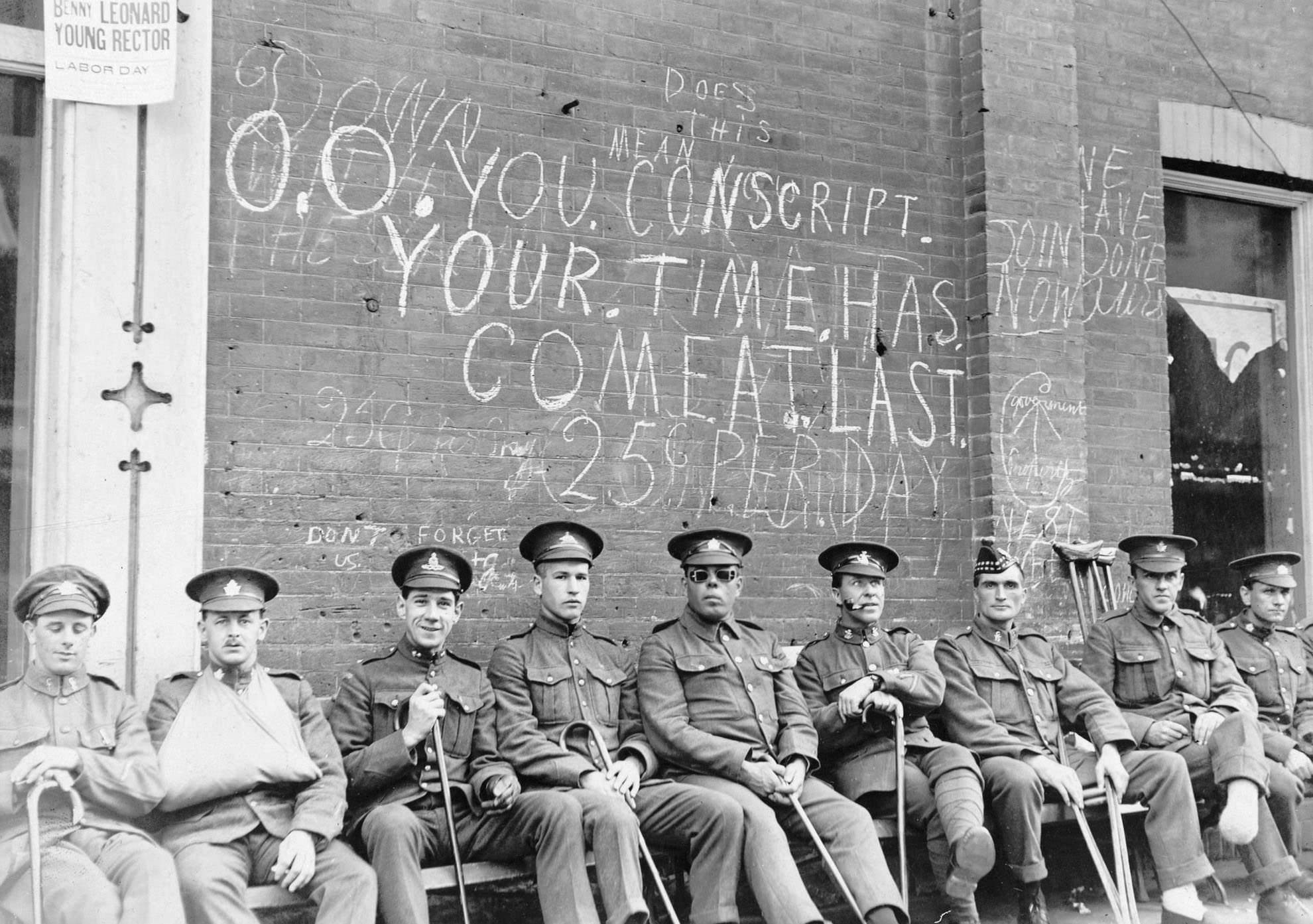
April 9 is Vimy Ridge Day. Six months after that battle, in October 1917, this photograph captured recuperating veterans gathered on the southwest corner of Yonge and College Street, referred to as Shrapnel Corners.

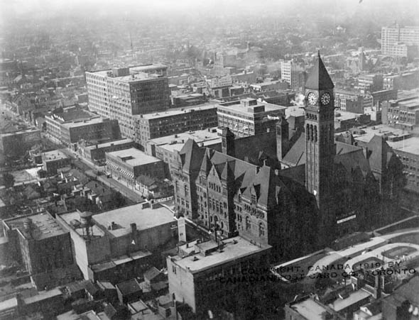
Victory Loan parades moved through the city’s streets as the war continued, raising funds for the war effort. These public events kept the war present in daily civilian life. Old City Hall, photographed from the air in 1919, was decorated to welcome home the 75th Battalion — a regiment whose soldiers would have been returning to the Mississauga area. Notably, the familiar war memorial that would later stand outside Old City Hall was not yet there.
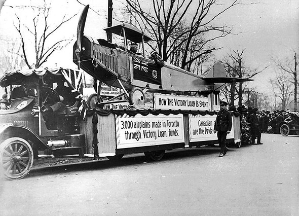
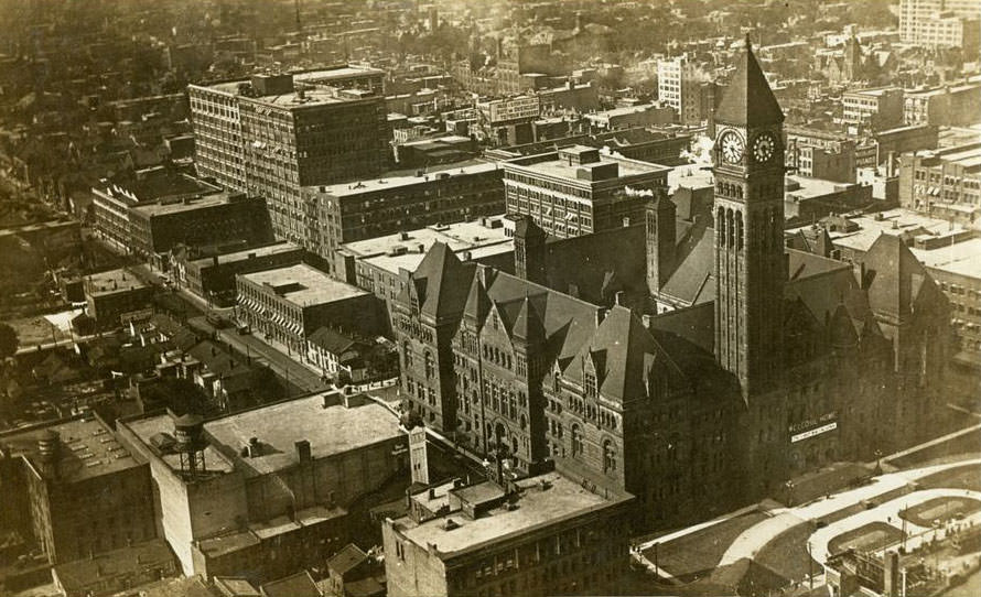
Victory Loan Parade, 1910s
Here is a view of the Old City Hall as it looked from the air in 1919.

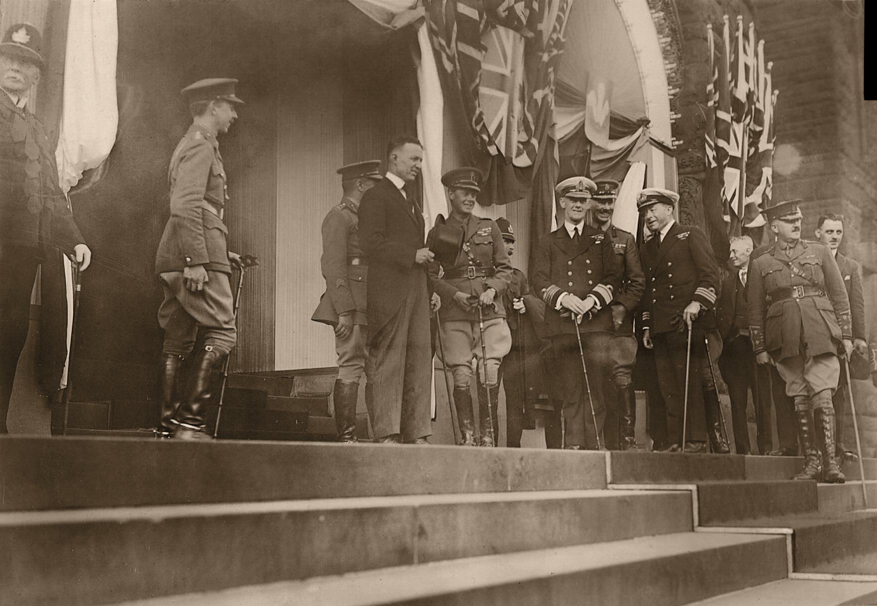
The end of the war brought the Prince of Wales to Toronto in the fall of 1919. The Royal Canadian Dragoons provided his escort through the city, and Mayor Church stood with the Prince and other dignitaries at City Hall. The visit was a moment of celebration in a city that had spent five years in the shadow of the war.
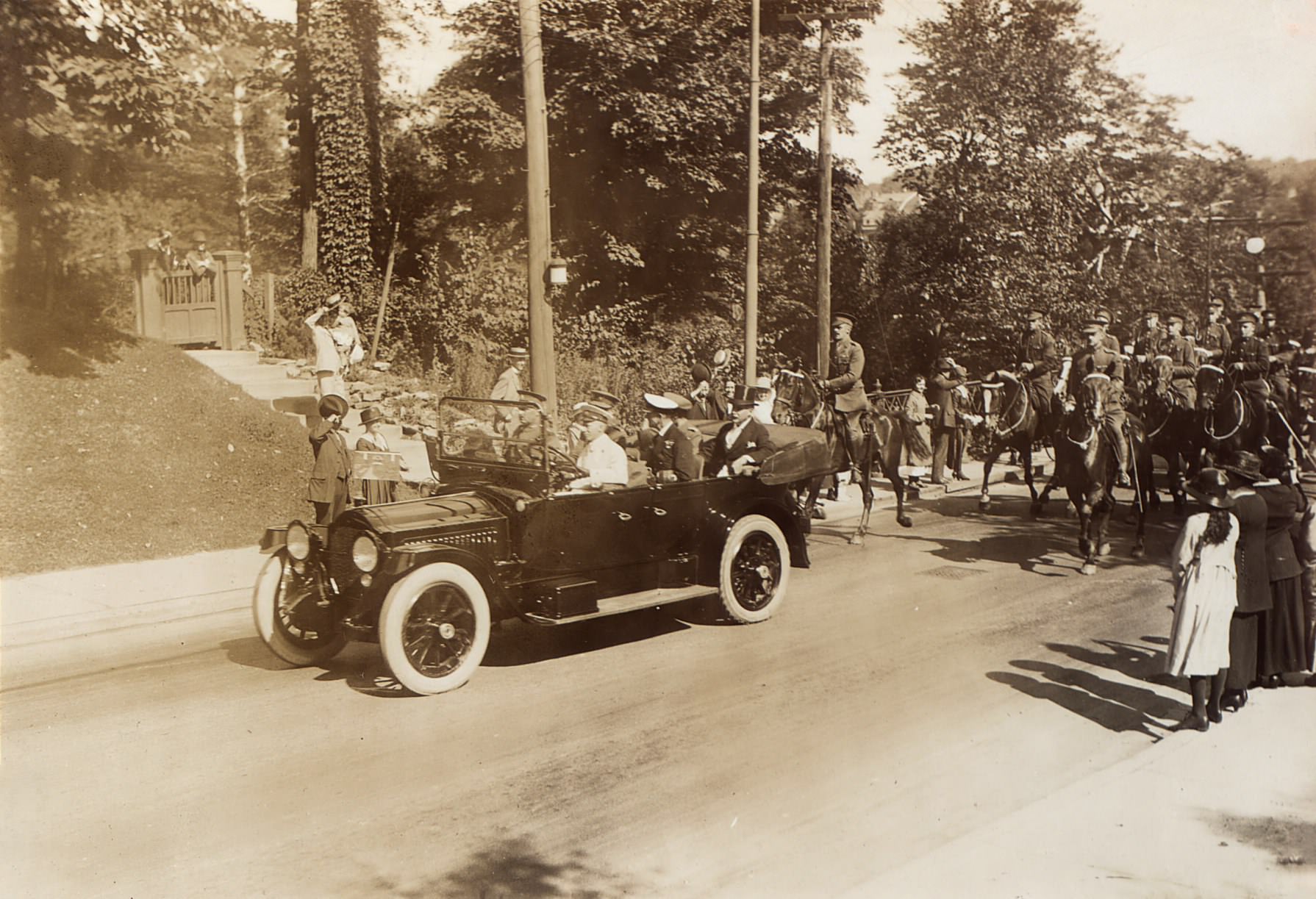
The Royal Canadian Dragoons Escort the Prince of Wales as he visits Toronto, Fall 1919.
Mayor Church standing with the Prince of Wales and other dignitaries at Toronto's City Hall, 1919.
Mayor Church standing with the Prince of Wales and other dignitaries at Toronto’s City Hall, 1919.

Ontario introduced Prohibition in 1916, banning the sale of alcohol. Hotel bars and taverns that had operated openly for years were suddenly shut down. The bartenders at places like St. Charles Hotel had been a familiar part of the city’s social fabric. With Prohibition, that world closed — at least officially. Underground bars and bootlegging operations quickly filled the gap, and organized crime began establishing itself in Toronto.
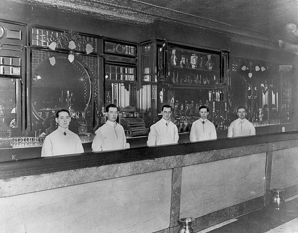
St. Charles Hotel bartenders, 1910s
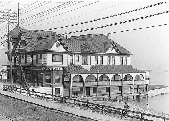
Meyer's Hotel, 1910s
Meyer’s Hotel, 1910s
The Queen's Hotel, 1910s
The Queen’s Hotel, 1910s

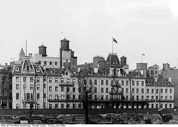
The Prince George Hotel on the southeast corner of King and York streets — originally known as the Rossin House — was one of the city’s prominent establishments during this period. It would stand until 1969, when it was demolished to make way for the TD Centre.
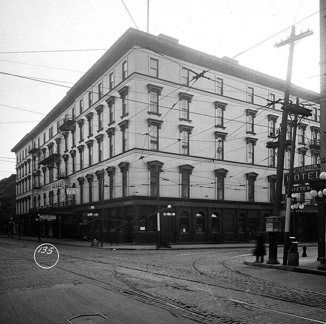
The Prince George Hotel in 1919. Located on the SE corner of King & York streets, it was originally named the Rossin House. The building was demolished in 1969 to make way for the TD Centre.

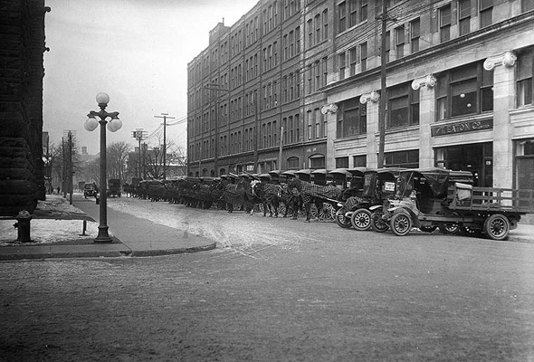
Eaton’s department store was an anchor of commercial life in the city. On Labour Day 1919, crowds lined up early outside the store waiting for the doors to open for bargain sales. Eaton’s delivery wagons were a daily sight on Toronto streets, moving goods across the growing city.
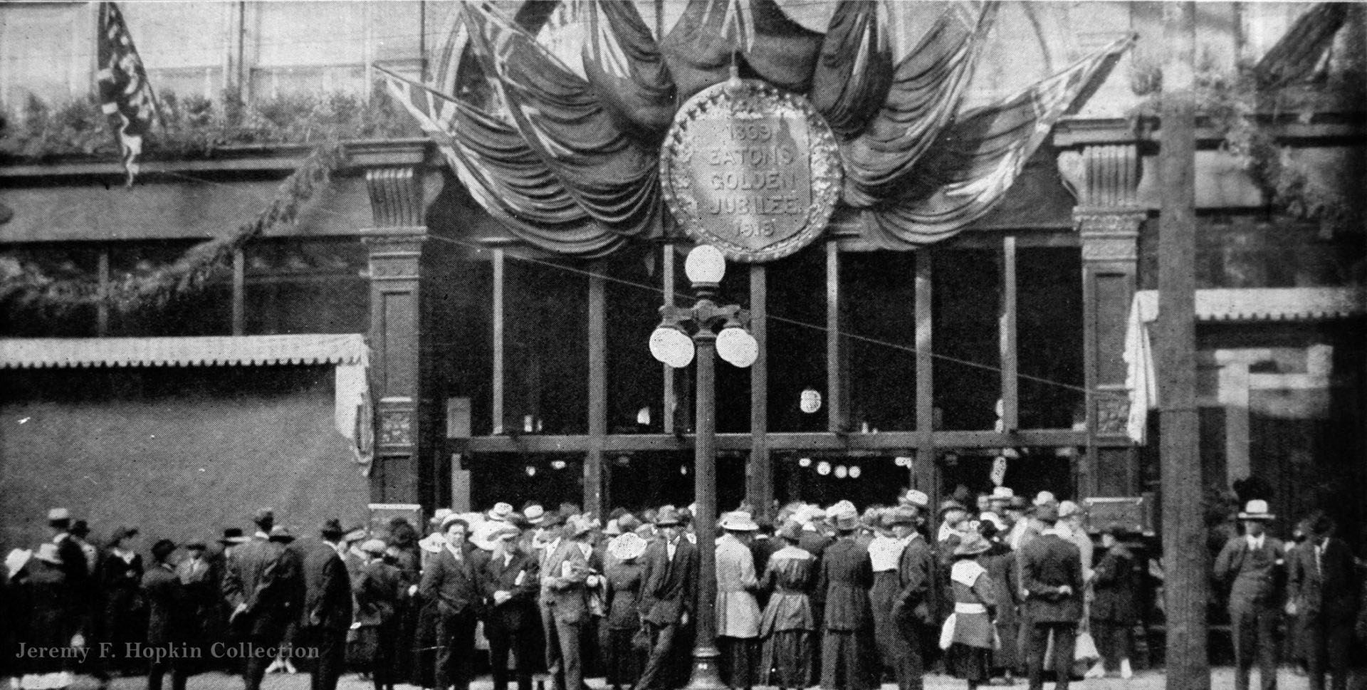
"Early bargain" crowds waiting for the Eaton department store doors to open, Labour Day 1919.
“Early bargain” crowds waiting for the Eaton department store doors to open, Labour Day 1919.
Eaton's Delivery Wagons, 1910s
Eaton’s Delivery Wagons, 1910s

Toronto’s architecture in the 1910s mixed the Victorian-era brick and stone buildings that had defined the city’s earlier decades with newer construction. Stonecutters working on the north wing of the Ontario Legislative Building at Queen’s Park in 1913 were adding intricate carvings to one of the city’s landmark structures. The building itself, opened in 1893, was receiving new detailed work nearly two decades later.
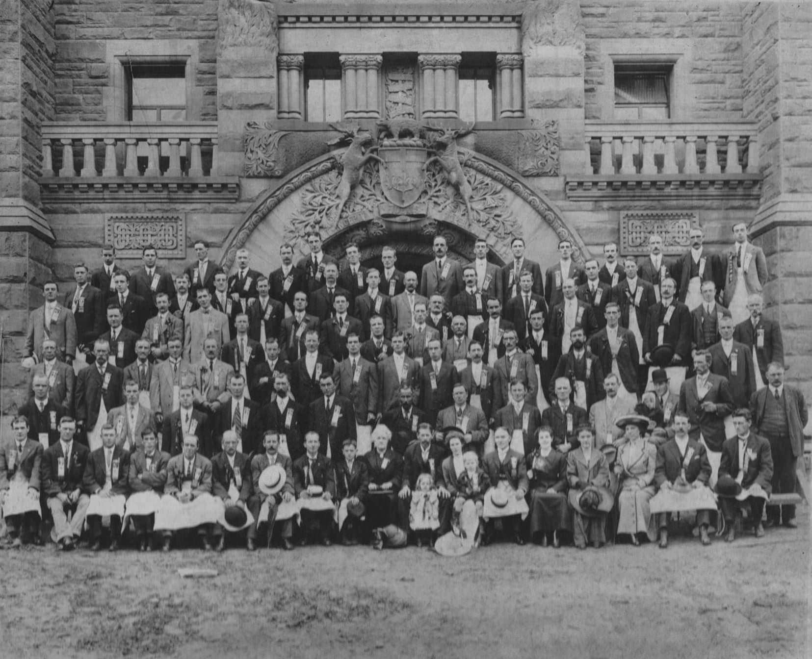
Stonecutters commemorative photo of those involved in creating the intricate carvings on the north wing of the Ontario Legislative Building in Queens Park, Toronto, 1913
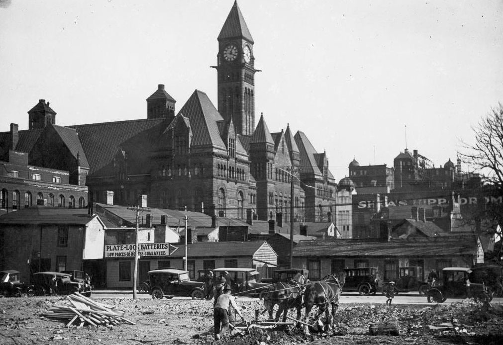
Old City Hall, 1910s
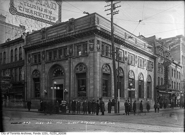
Bank of Montreal Building at Yonge and Queen streets, 1910s

The interior of industrial buildings told a different architectural story. At 363 Sorauren Avenue, owned by Columbia Graphophones in 1913, wood pillars and overhead support beams held up wide-open factory floors lit entirely by gas lamps. The building has since been converted into lofts, but those original structural elements remain.
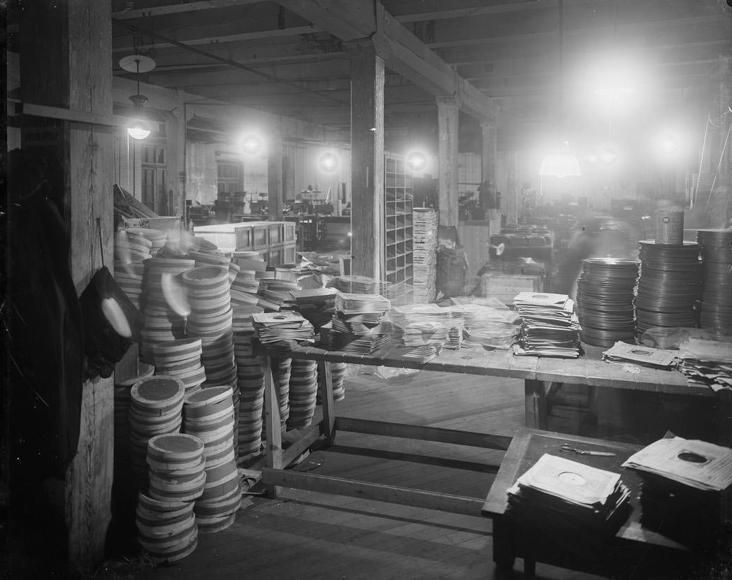
Inside of 363 Sorauren Ave., 1913.

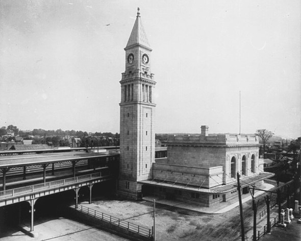
Rail connections were critical to the city’s growth. The Grand Trunk Railway’s West Toronto station, the North Toronto CPR Station, and the South Parkdale Station all served different parts of the city. The railway network moved people, goods, and troops throughout the decade.
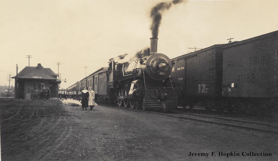
Two ladies have their picture taken beside a train at the Grand Trunk Railway's West Toronto station, 1910s.
Two ladies have their picture taken beside a train at the Grand Trunk Railway’s West Toronto station, 1910s.
North Toronto CPR Station, 1910s
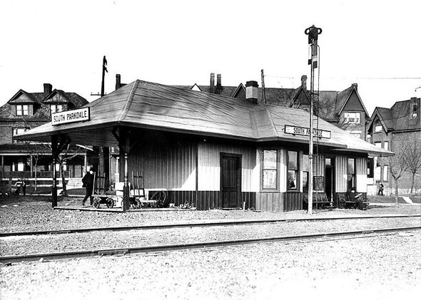
South Parkdale Station, 1910s

Toronto’s criminal justice system was also evolving. The Toronto Municipal Farm for Men opened in 1912 at Falstaff — now Thornhill — and operated until 1939. Despite looking more like a collection of farm buildings than a correctional facility, it housed short-term inmates who worked the land during their sentences. The site was later converted into a hospital.
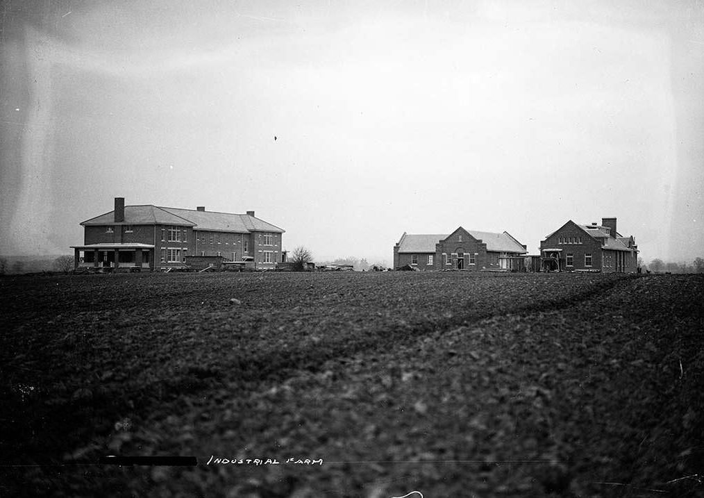
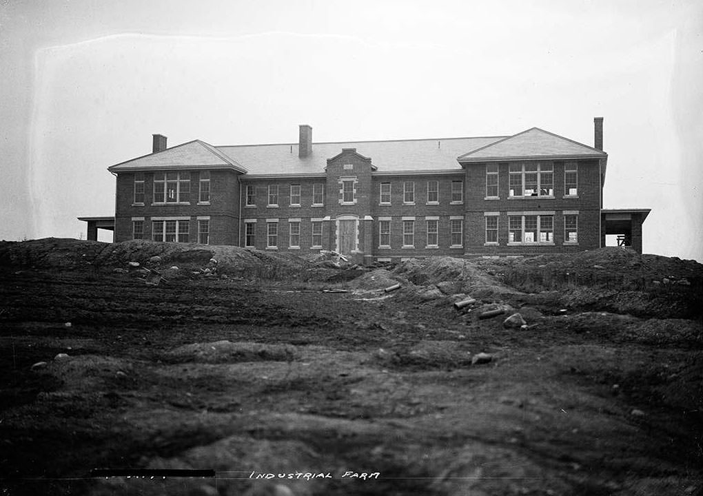
They may not look it, but these buildings are a jail. Toronto Municipal Farm for Men opened at Falstaff (now Thornhill) in 1912 and closed in 1939 (it was converted to a hospital). It housed short-term inmates who worked on the farm during their sentences
Toronto Municipal Farm for Men opened at Falstaff (now Thornhill) in 1912

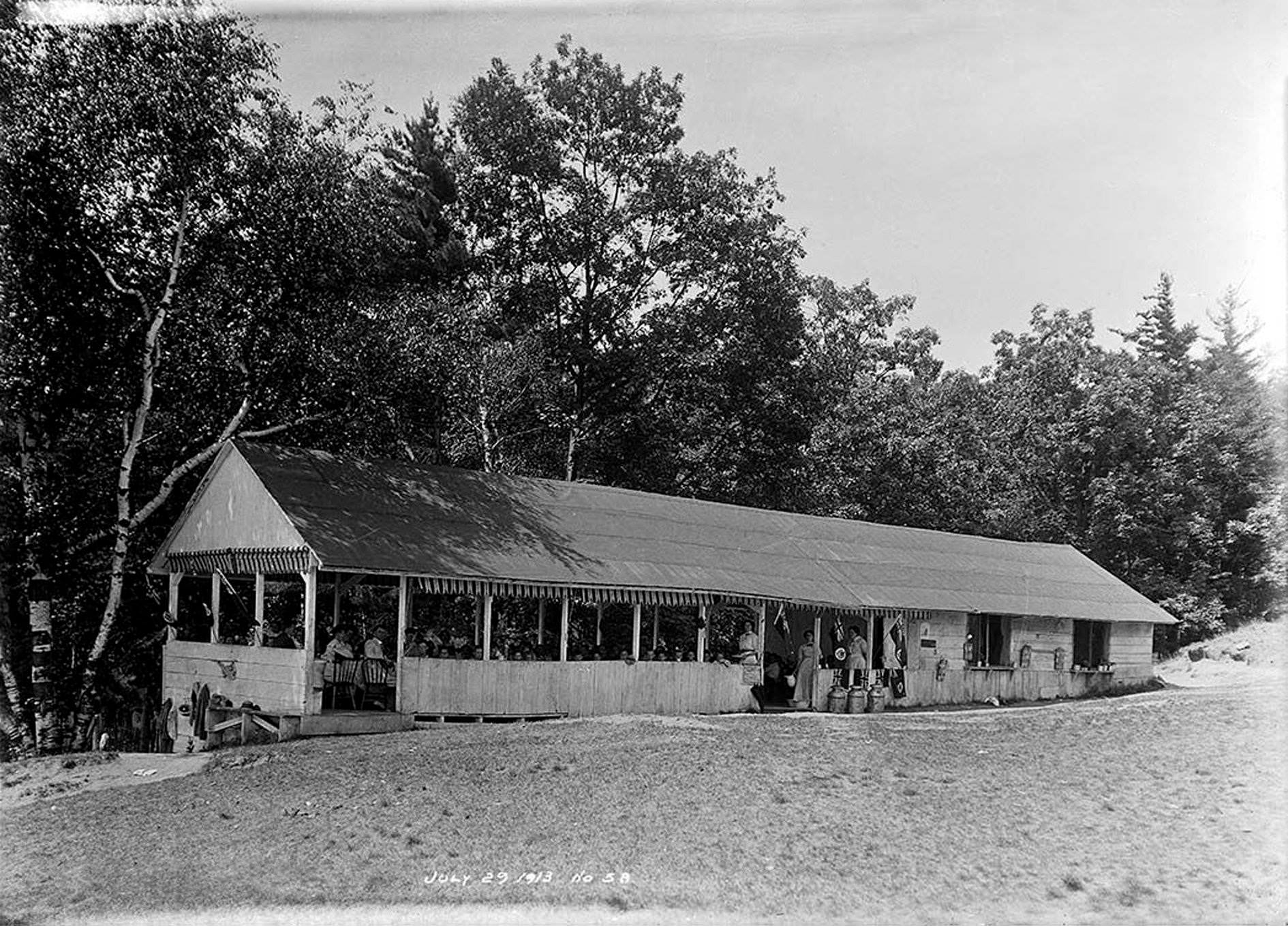
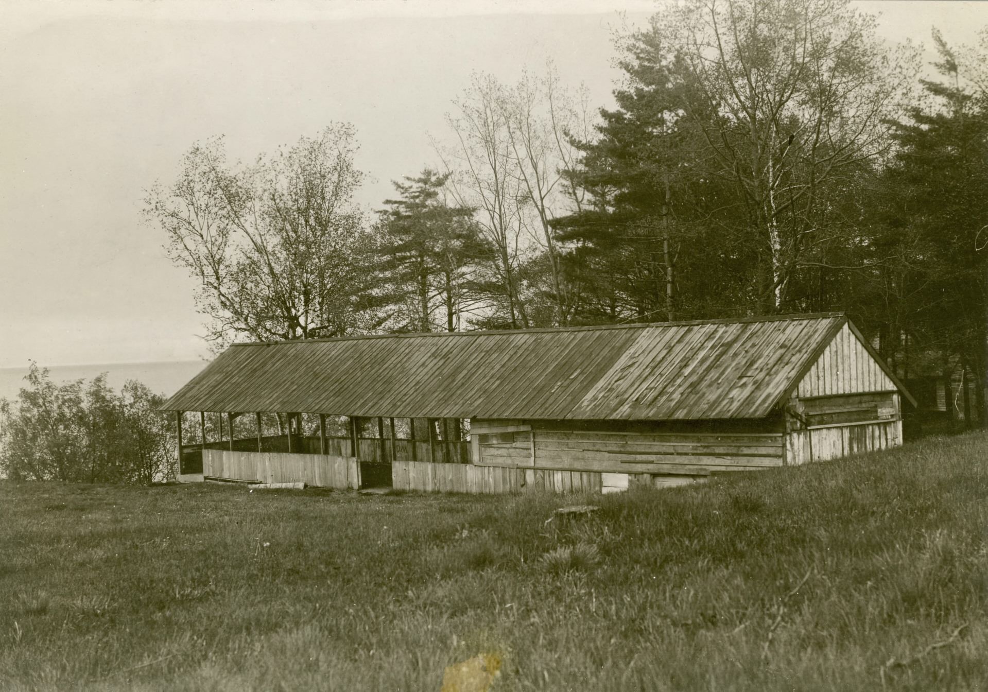
Public life in Toronto found expression in parks, schools, and entertainment venues. The Victoria Park Forest School held outdoor sessions through the summer, with children learning in open-air settings. The school’s mess hall was a repurposed building originally built for the Victoria Park amusement park, and by 1910, it was already showing its age.
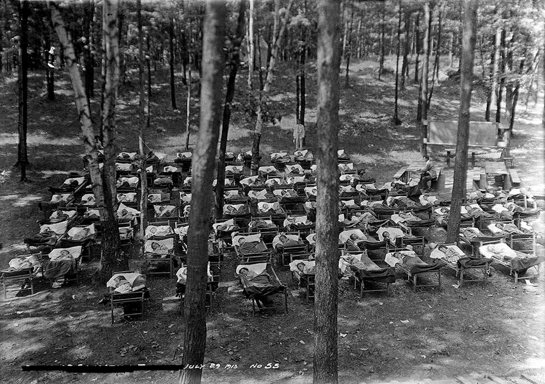
Victoria Park Forest School, July 29, 1913.
The former mess hall of the Victoria Park Forest School was looking rough around the edges by the time this photo was taken in 1910. A repurposed building that was originally created for Victoria Park amusement park.
Victoria Park Forest School, Mess Hall, July 29, 1913. A repurposed building, originally created for Victoria Park amusement park.
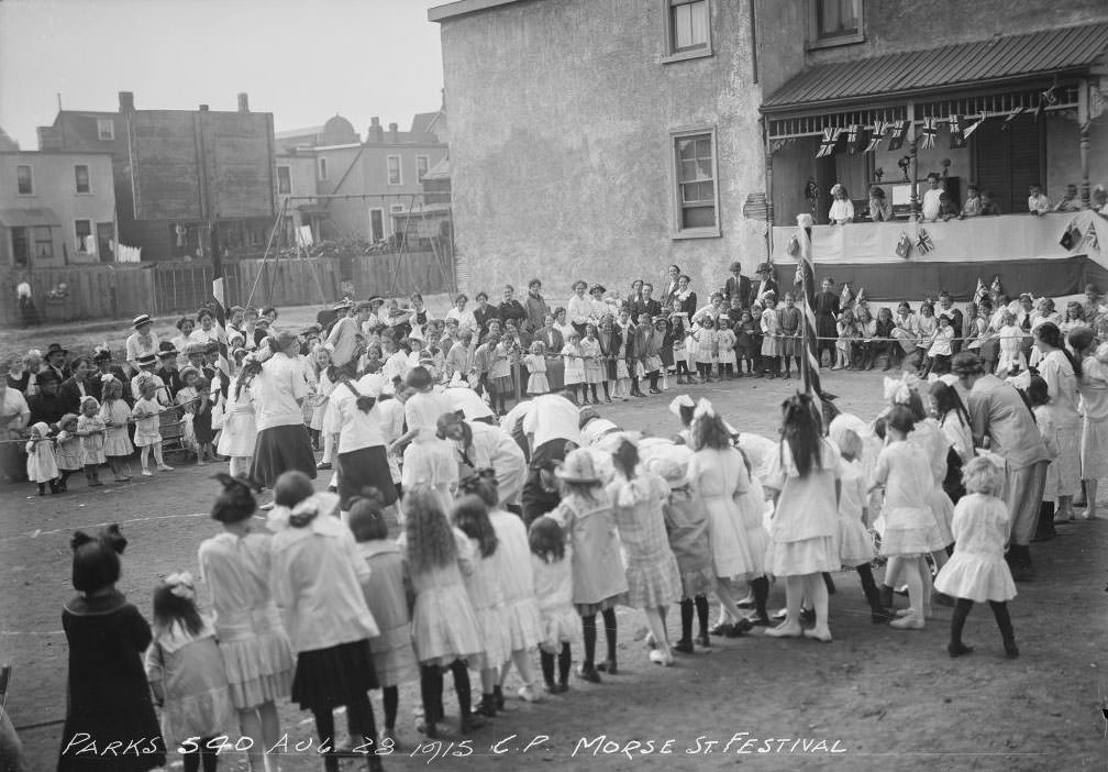
Morse Street Playground — Festival - August 28, 1915
Morse Street Playground — Festival – August 28, 1915

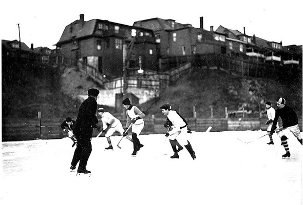
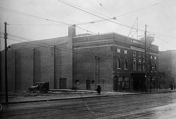
Entertainment in 1910s Toronto ranged from vaudeville shows and movie houses to sporting events. The Auditorium Theatre and Allen’s Theatre on the Danforth were part of the city’s growing entertainment scene. Hockey was already deeply embedded in Toronto life — games at Christie Pits drew dedicated crowds long before there was a Maple Leafs franchise to speak of.
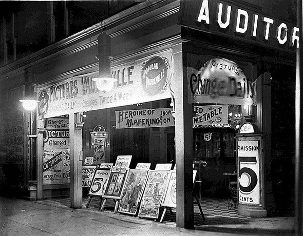
Auditorium Theatre, 1910s
Allen's Theatre on the Danforth, 1910s
Allen’s Theatre on the Danforth, 1910s
Pro hockey at Christie Pits, 1910s

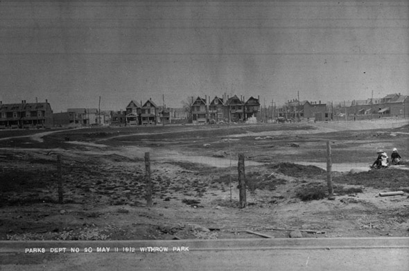
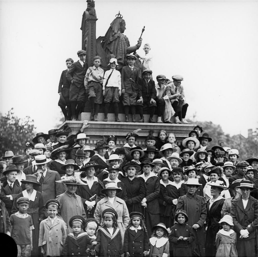
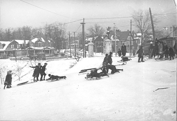
Parks played a central role in public life. High Park had mineral baths on Bloor Street West, and in the winter, residents used the park’s hills for tobogganing. Withrow Park served the east end of the city. Queen’s Park hosted public gatherings, including the annual celebration around the statue of Queen Victoria on Victoria Day.
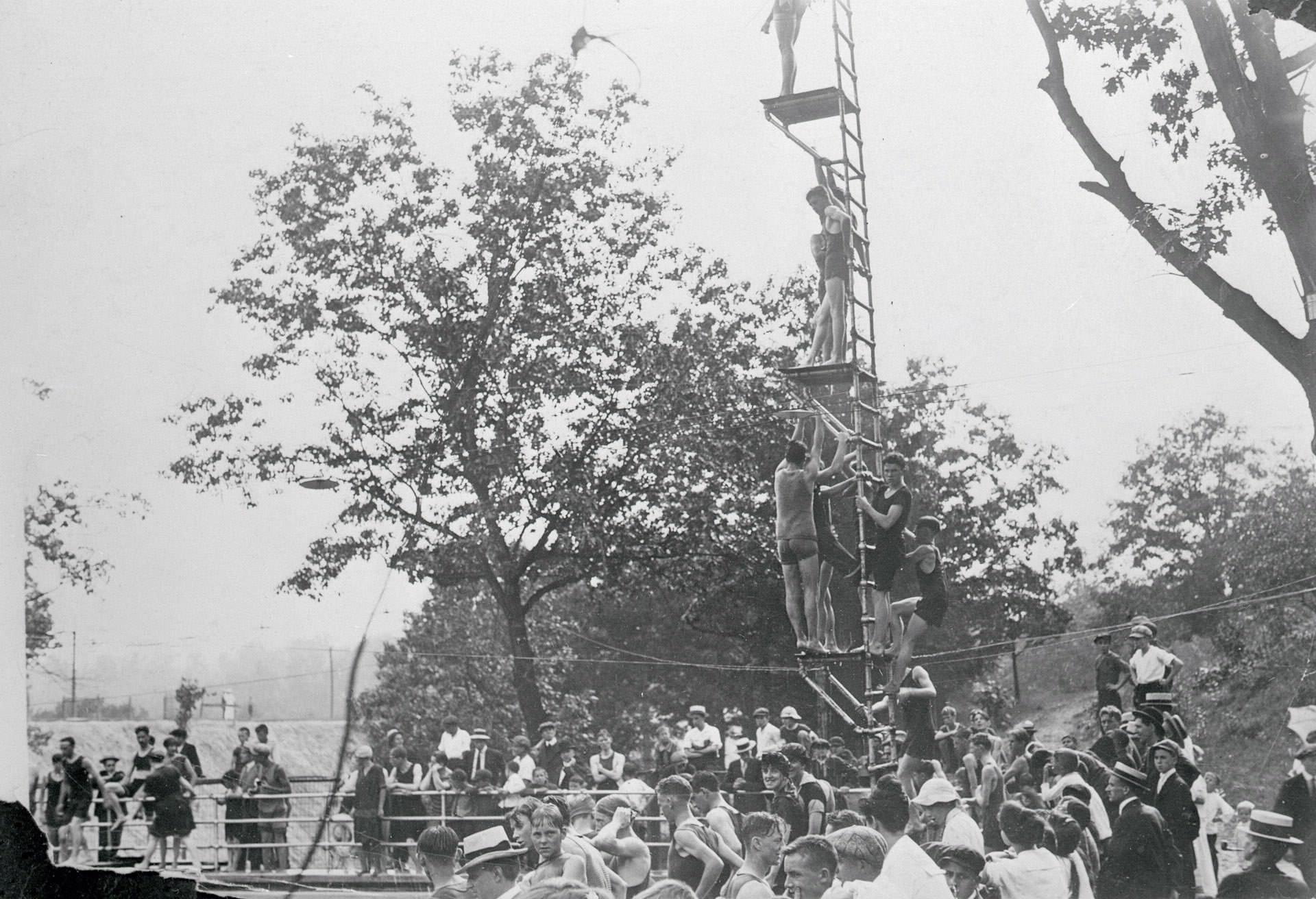
High Park Mineral Baths, Bloor St. W., n. side, e. of Parkview Gardens, 1916
Tobogganing in High Park, 1910s
Withrow Park from Logan Avenue, 1910s
Happy Victoria Day! Group at statue of Queen Victoria, Queen's Park, 1912.
Happy Victoria Day! Group at statue of Queen Victoria, Queen’s Park, 1912.

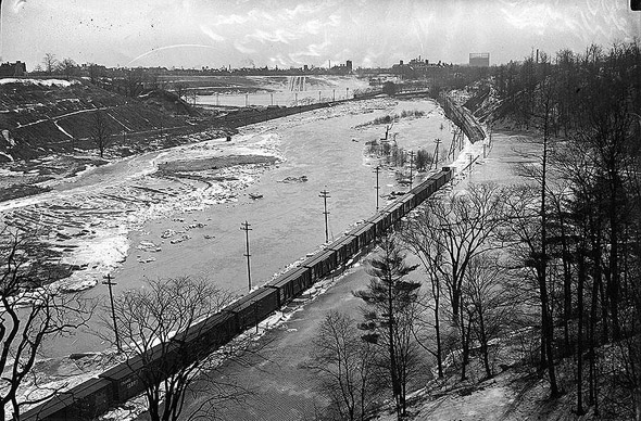
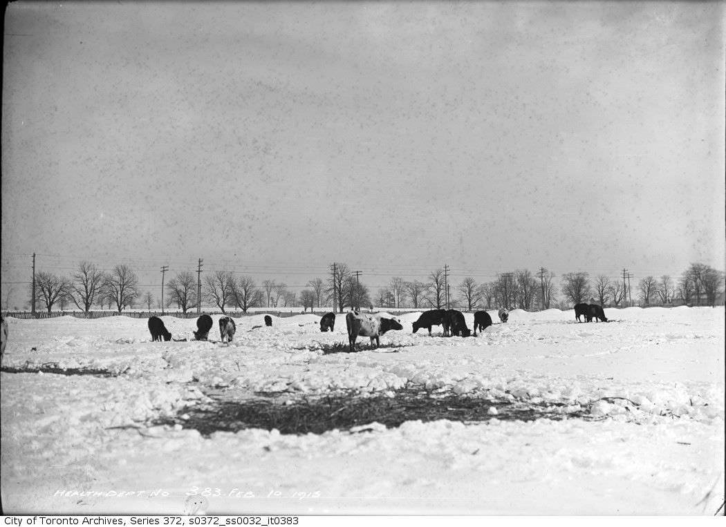
The city’s outer reaches in the 1910s were still partially rural. Hogg’s Hollow, photographed from the air, showed a quiet, wooded ravine. The Robinson dairy farm in Newtonbrook, west of Yonge Street near Steeles Avenue, had cattle standing in the snow in February 1915 — a scene that would have been unrecognizable as Toronto to anyone seeing the same location today. The Don River, running through the city’s eastern edge, flooded regularly, a persistent problem that the growing city had not yet found a way to fully control.
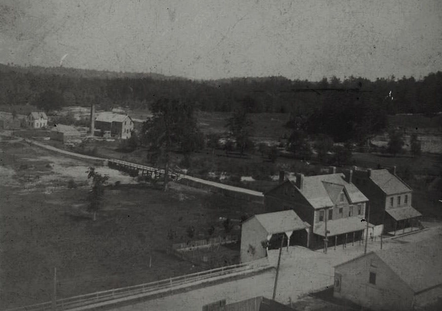
Oblique aerial view of Hogg's Hollow, which was taken by the Simpson Bros, 1910s
Oblique aerial view of Hogg’s Hollow, which was taken by the Simpson Bros, 1910s
Cattle in the snow at Robinson dairy farm in Newtonbrook, located west of Yonge St, south side of Steeles Ave, Feb 10, 1915.
Flooded Don River, 1910s, 1910s

The decade ended with the Spanish Flu tearing through Toronto in 1918. Hospitals were overwhelmed. Schools, theatres, and public gathering places were shut down. Thousands of residents died. It was a grim close to a decade that had already been defined by war, labour conflict, and dramatic change. The city that came out the other side of the 1910s was fundamentally different from the one that had entered them.
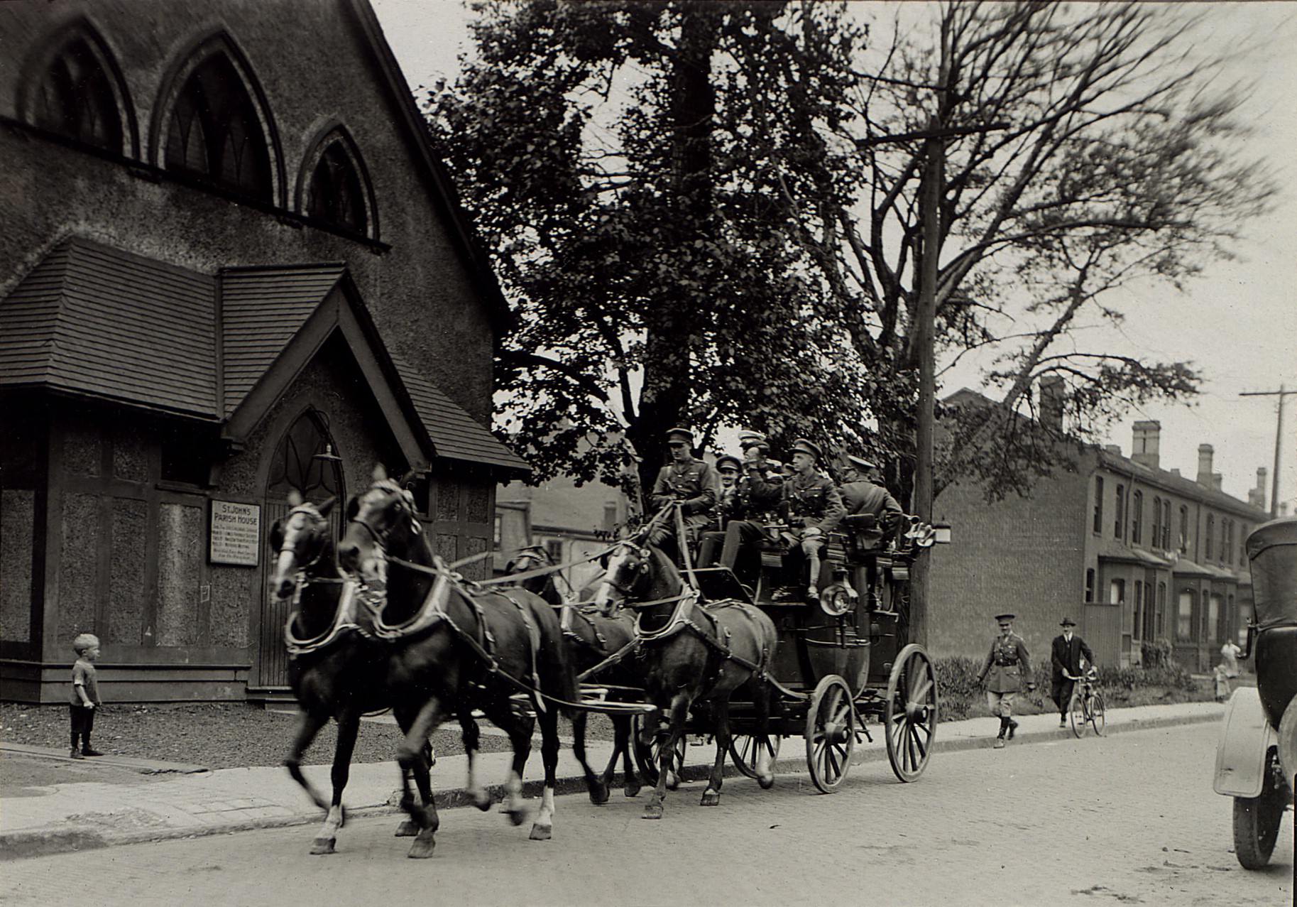
Going to Major Moss' wedding at the Garrison Church, 1919. Location is Stewart Street west of Portland, south side, looking west.
Going to Major Moss’ wedding at the Garrison Church, 1919. Location is Stewart Street west of Portland, south side, looking west.
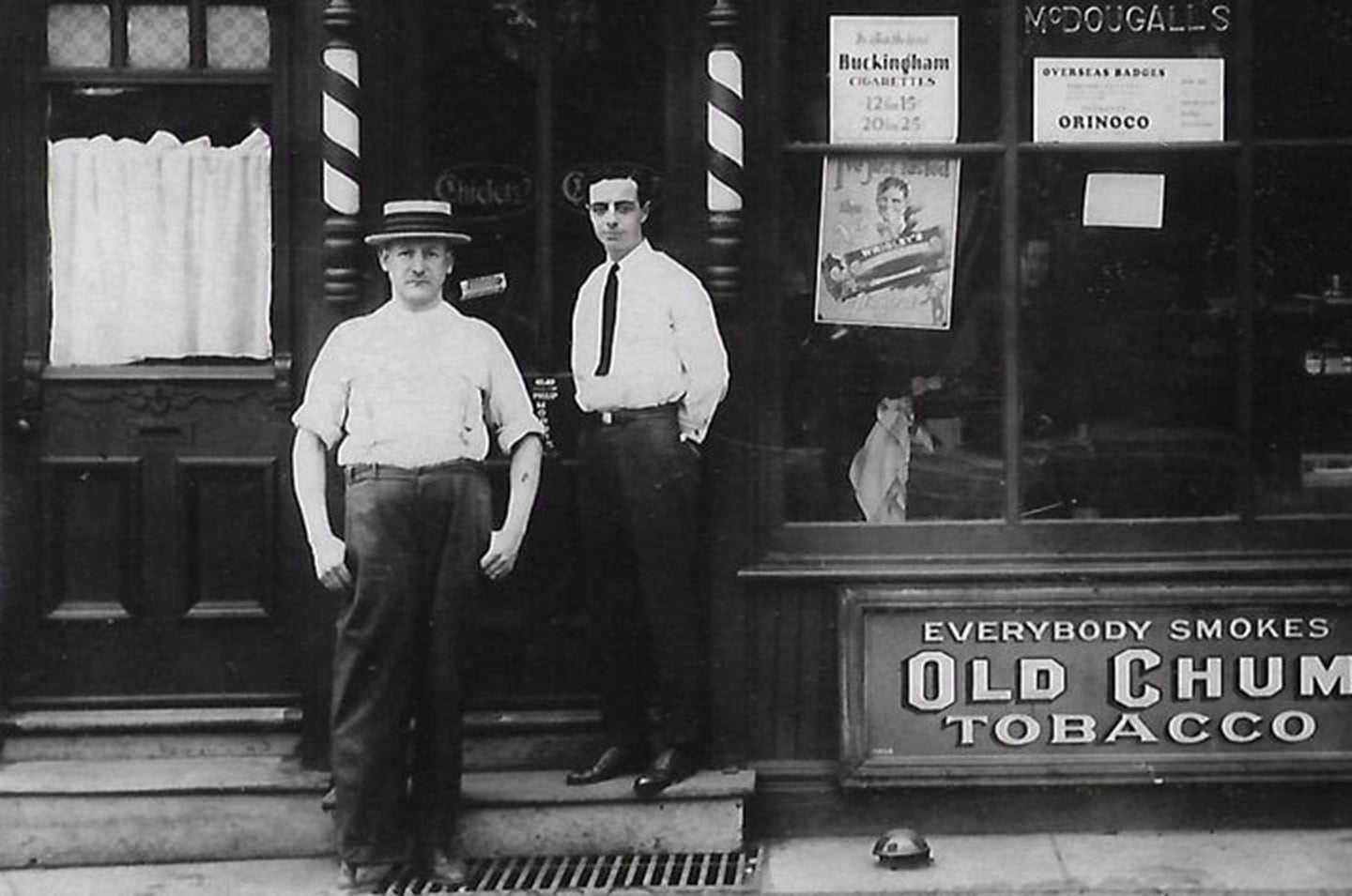
Daniel McDougall and Bobby Mitchell outside barber shop at 625 Gerrard Street East, sometime just after 1912.
Bay and Albert streets, view looking southeast, 1918.
299 Queen Street West, as it appeared back in 1919.
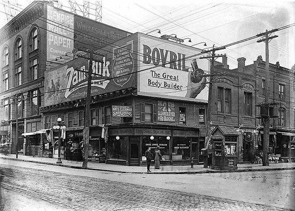
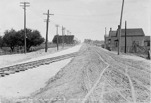
Danforth Ave., Toronto 1910
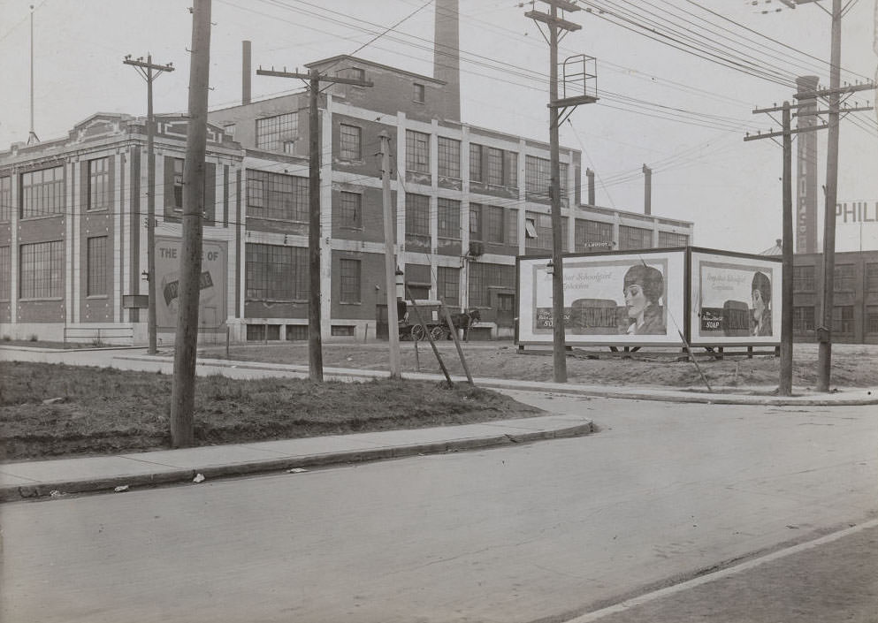
Palmolive Soap ad in somewhere Toronto, 1919
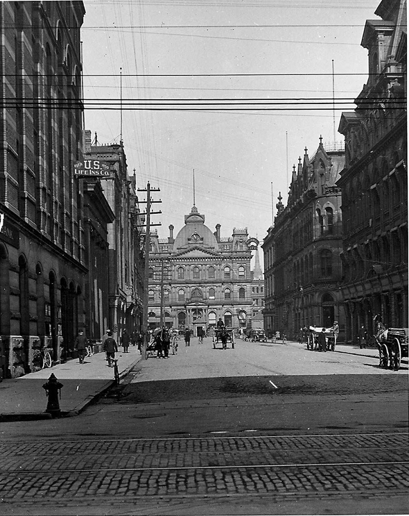
Toronto Street, 1910s
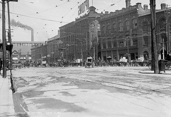
Church and Wellington streets, 1910s
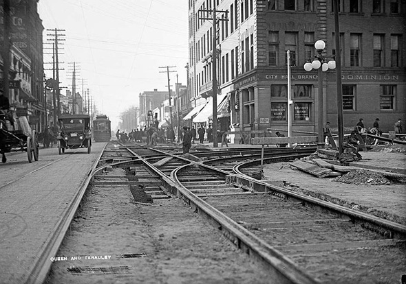
Queen and Terauley streets, 1910s
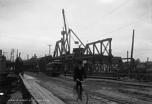
Queen Street Viaduct under construction, 1910s
Northeast corner of Yonge and Shuter streets, 1910s
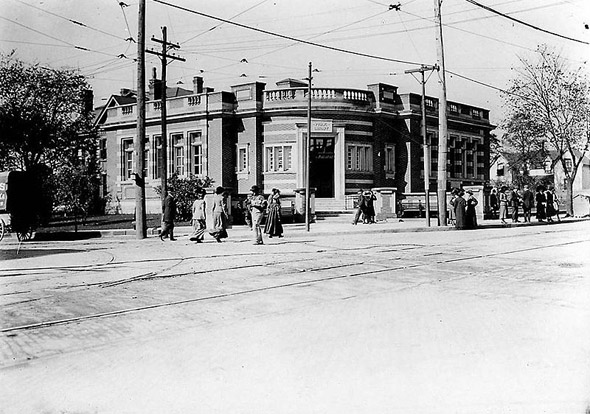
Public Library at Broadview and Gerrard street, 1910s
Yonge and Eglinton, 1910s
Danforth looking east from Pape, 1910s
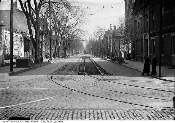
Carlton street looking east from Yonge Street, 1910s
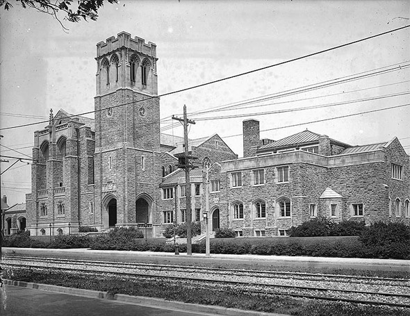
Timothy Eaton Memorial Church on St. Clair Avenue West, 1910s
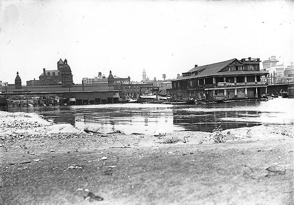
Toronto Waterfront at York Street, 1910s
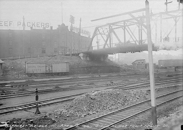
Bathurst Street Bridge, 1910s
Mount Pleast Street near Merton Street, 1910s
Queen Street looking West from River Street, 1910s
Merton Street, 1910s
299 Queen Street West, 1910s
Union Station Interior, 1910s
Enjoyed this post? Get new ones in your inbox.

14 thoughts on “What Toronto looked like in the 1910s”

Leave a Comment

Your email address will not be published. Required fields are marked *

Share this Post 🥺

Please take a moment to share this content. Your support is greatly appreciated! 🙌🙏

Share this Post 🥺

Please take a moment to share this content. Your support is greatly appreciated! 🙌🙏
Scroll to Top
 
Hey Friend, Before You Go.. Please like & follow for more interesting content