Hey There! Before You Go. 😧
Get the best vintage content straight into your inbox!

Don't worry, we don't spam

What Columbus looked like in the 1950s through these Fascinating Vintage Photos

Columbus, Ohio in the 1950s was a city in motion. The post-war years brought a surge in population, new construction, and a confidence that showed up in every corner of the city. Families were settling into new neighborhoods, downtown was growing taller, and the roads were filling with shiny new cars. The decade left behind a rich visual record, and these vintage photographs capture it in remarkable detail.
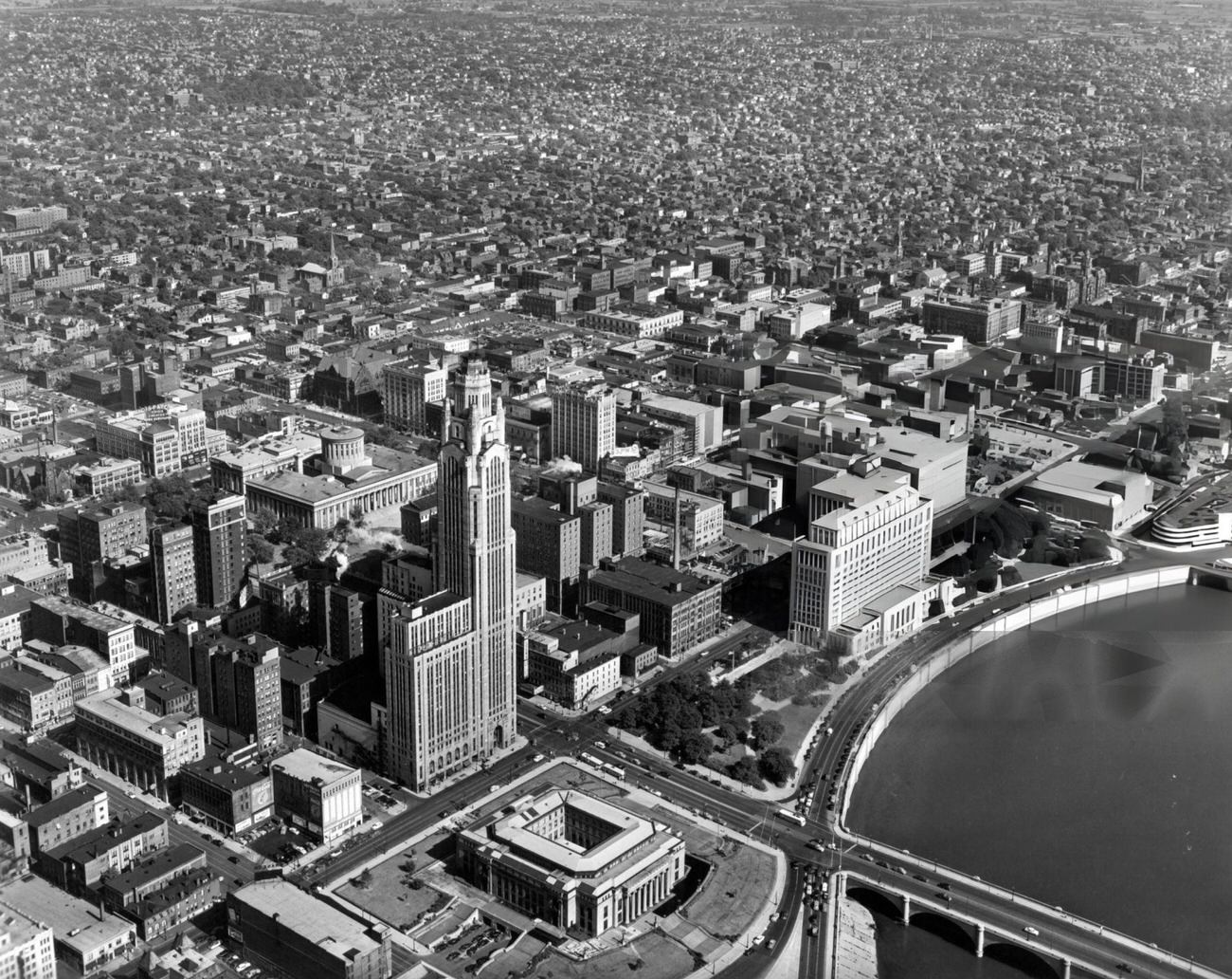
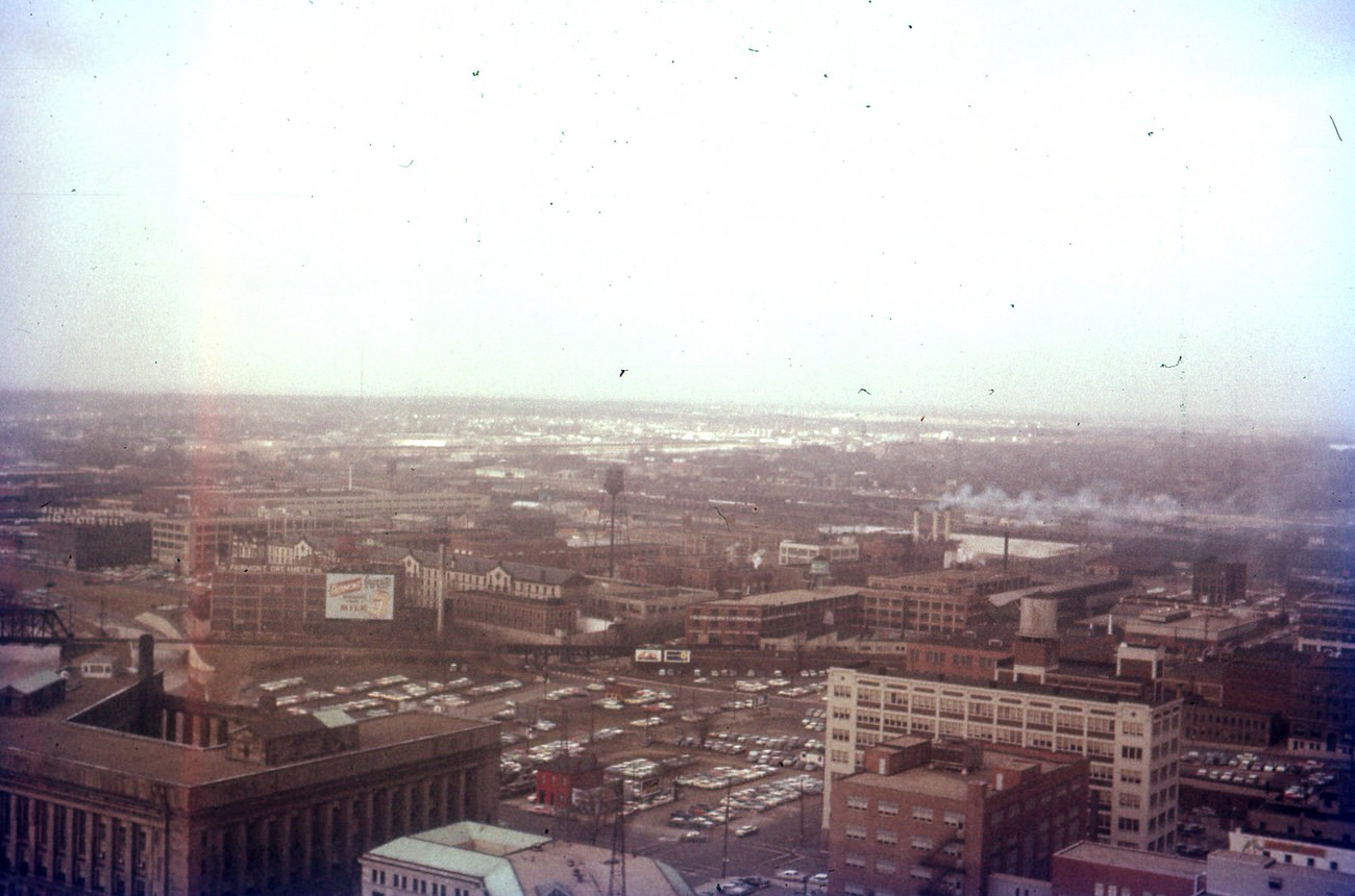
Aerial view of downtown Columbus, Ohio, looking southeast with City Hall, LeVeque-Lincoln Tower, and Departments of State Building in the foreground, 1955

From the air, downtown Columbus told the story of a city growing into itself. The LeVeque-Lincoln Tower still dominated the skyline, but it was no longer alone. The Ohio Departments Building had joined it, and more construction was on the way. City Hall anchored the civic core, surrounded by streets that buzzed with foot traffic, streetcars, and the constant hum of commerce.
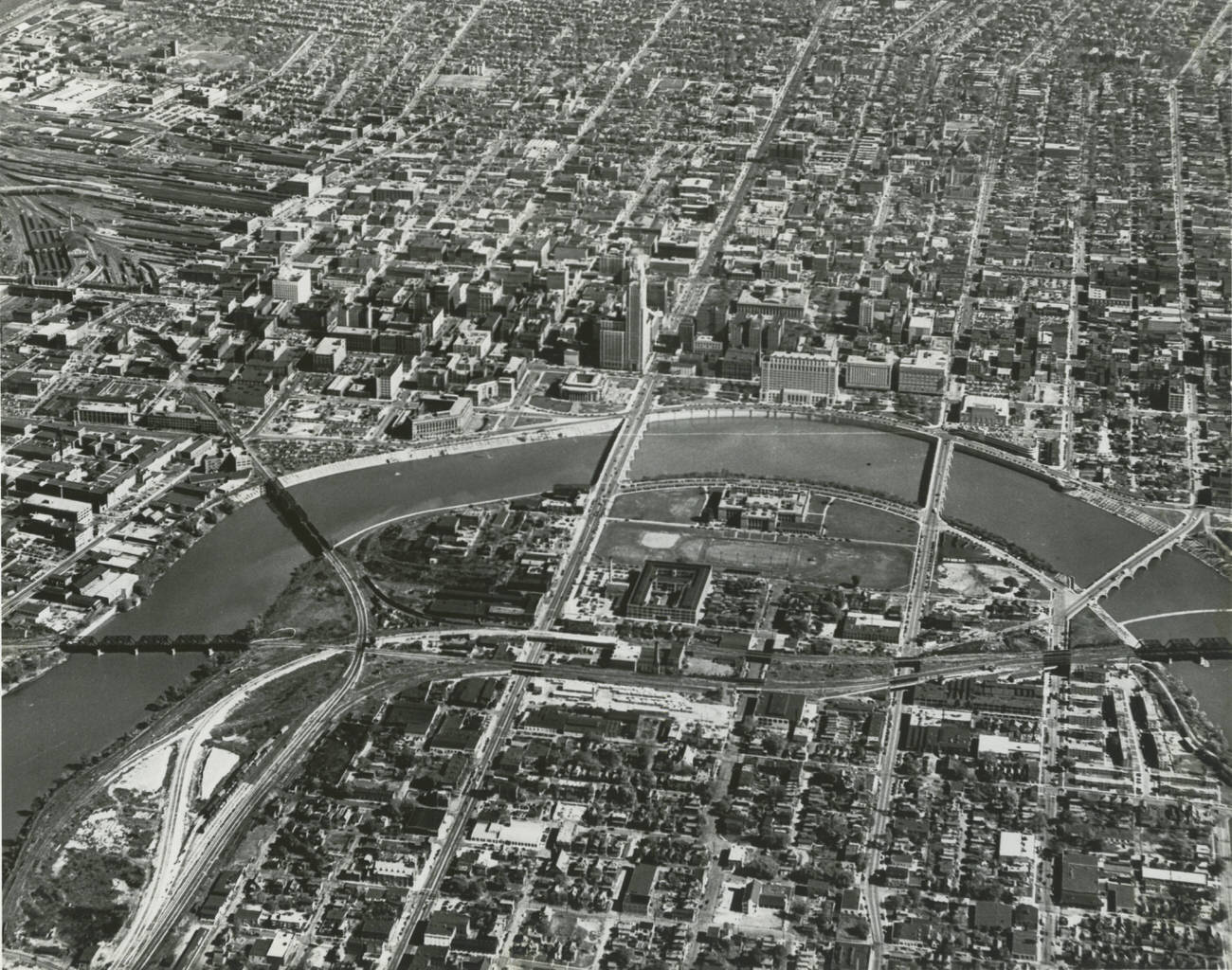
Aerial view of Columbus, looking east across Franklinton, the Scioto River, and downtown, circa 1950.

High Street was the heartbeat of downtown. Department stores like F&R Lazarus and Morehouse-Fashion drew shoppers with elaborate window displays and well-stocked floors selling everything from furniture to appliances. The Woolworth’s lunch counter was a go-to spot for a quick meal. The Ohio Theatre, built in a Spanish-Baroque style with a richly decorated interior, packed in audiences looking for a glamorous night out.
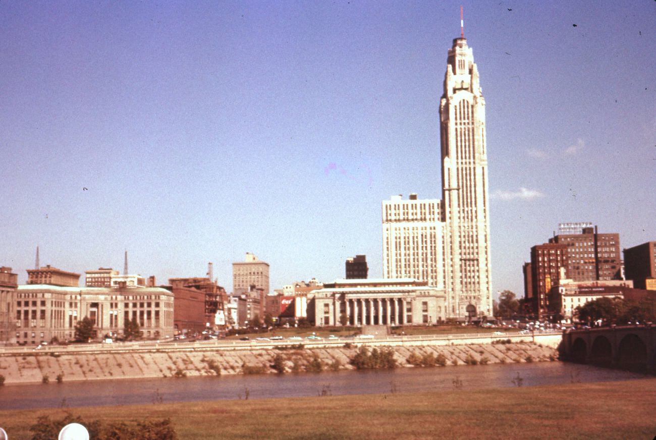
Columbus Skyline from the Lower Scioto Greenway, featuring landmarks, 1957.

The William McKinley statue stood watch at the state capitol, a familiar landmark for anyone passing through downtown. These civic monuments gave Columbus a sense of permanence even as construction crews were reshaping streets and bridges all around them.
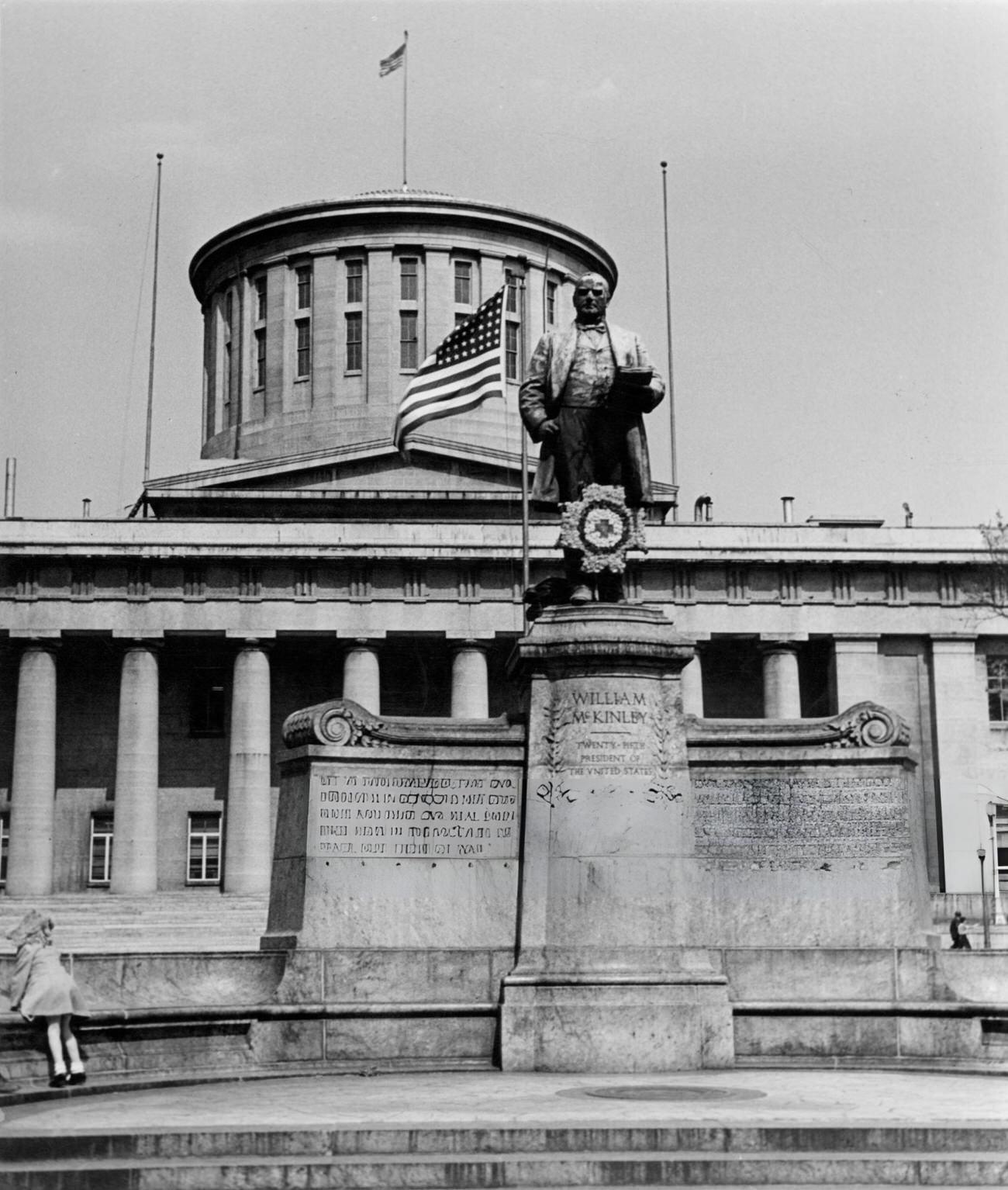
William McKinley Statue at the state capitol in Columbus, Ohio, 1955

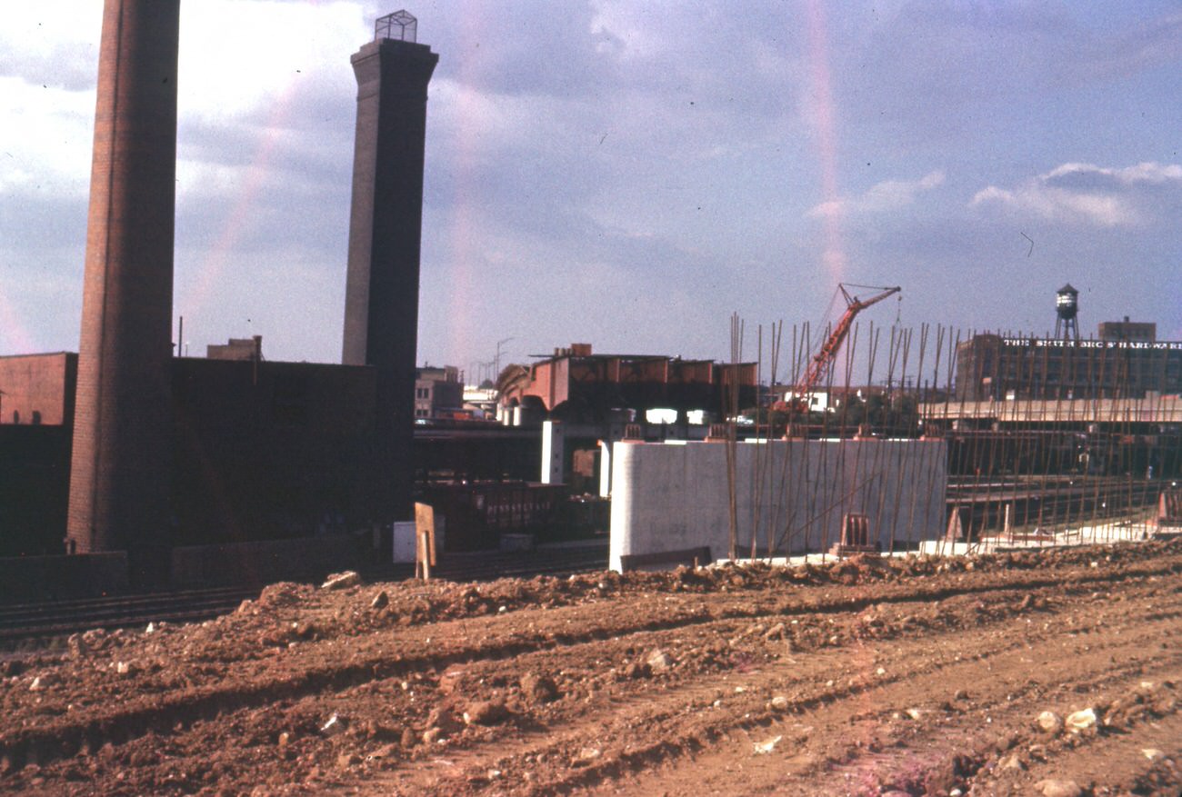
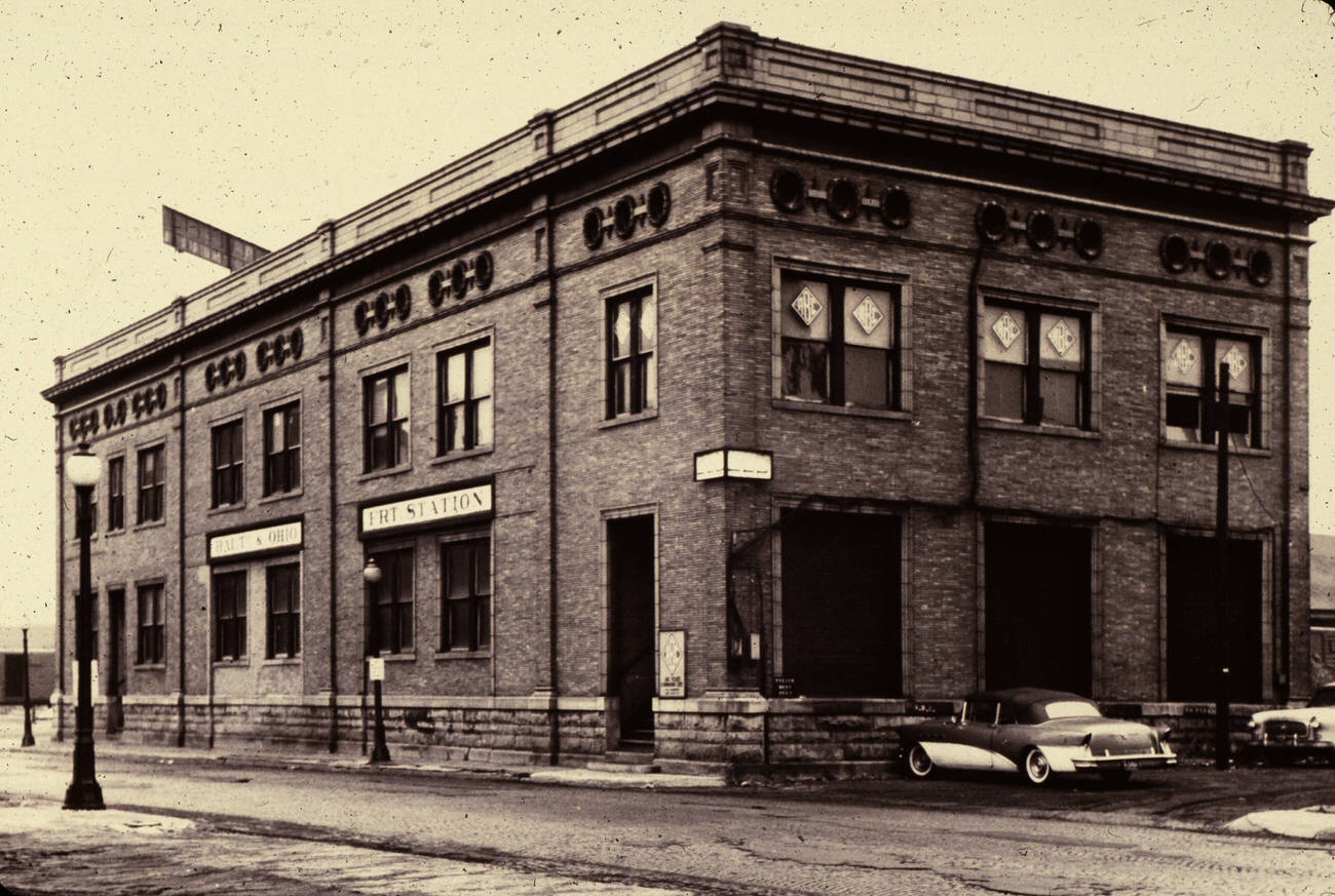
One of the decade’s biggest infrastructure projects was the 3rd Street Viaduct. Workers broke ground while the city watched the steel framework rise piece by piece over the railroad lines below. The B&O Railroad freight station on Naghten Street, a fixture of the area for years, was demolished to make room for the new structure.
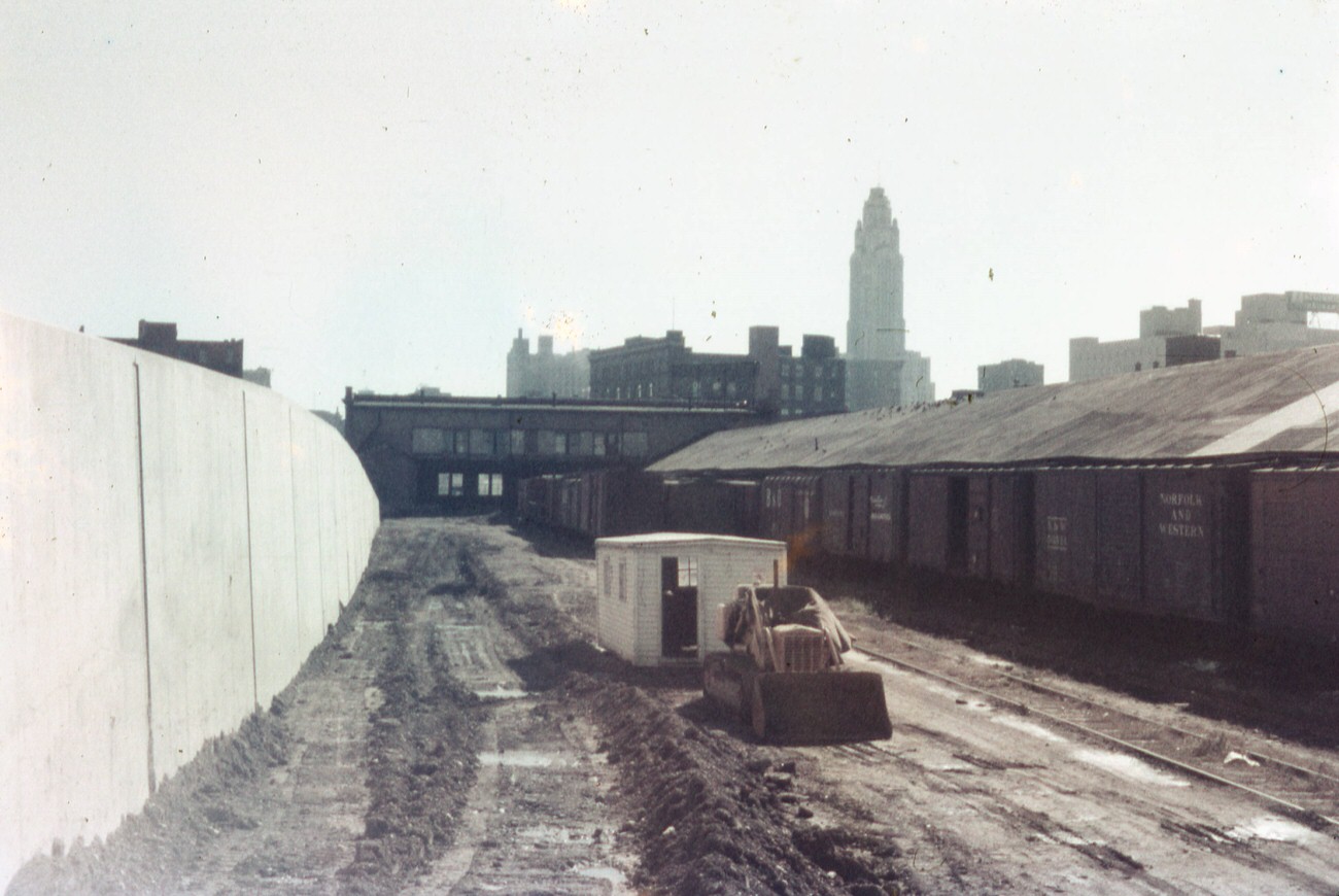
3rd Street viaduct under construction along the railroad line, 1958.
B&O Railroad freight station on Naghten Street, demolished for 3rd Street viaduct, 1959.
Nearly completed 3rd Street Viaduct from Goodale leg of Expressway, 1959.
End of steel construction of 3rd Street Viaduct, 1959.

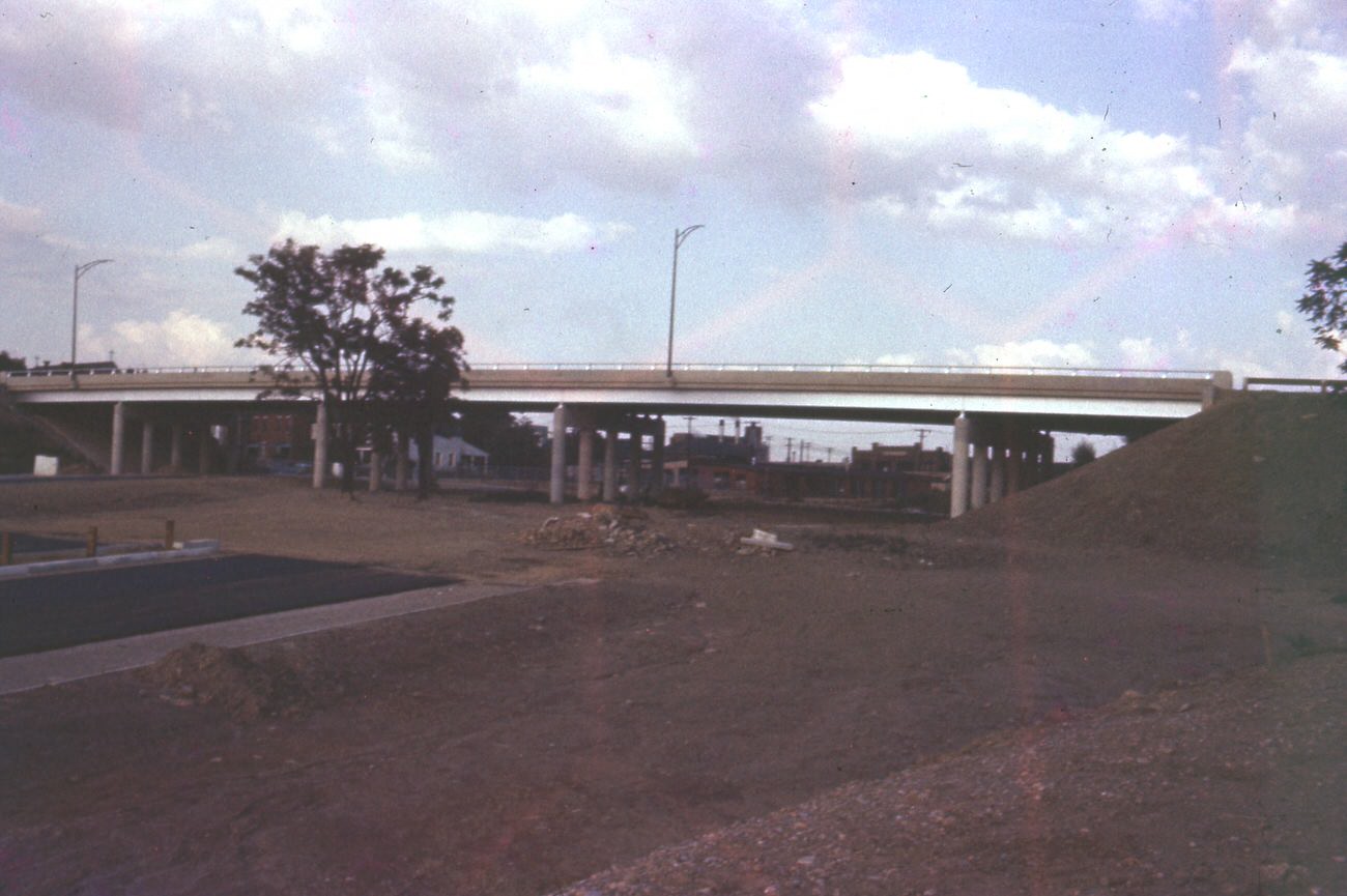
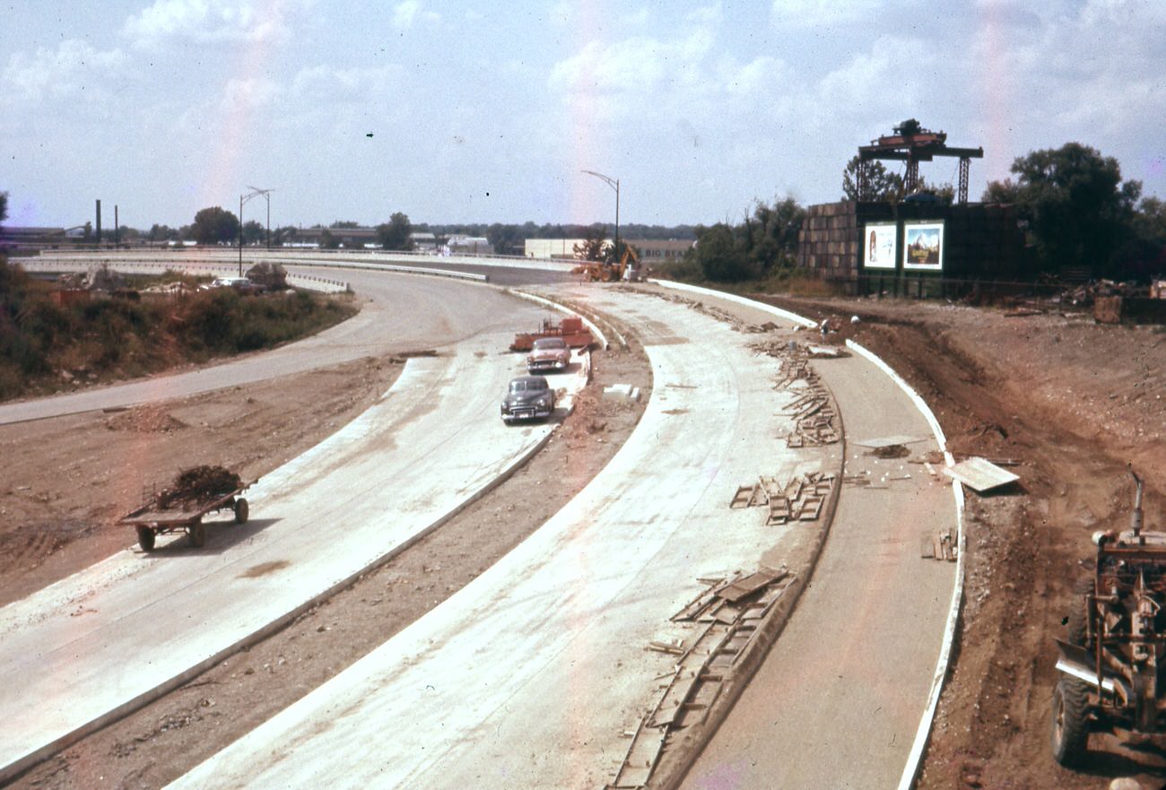
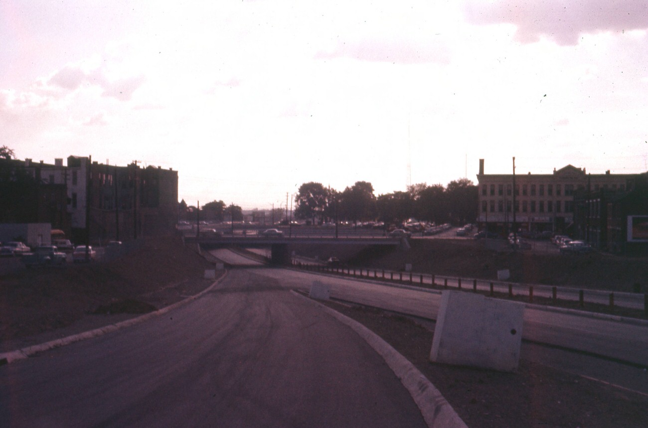
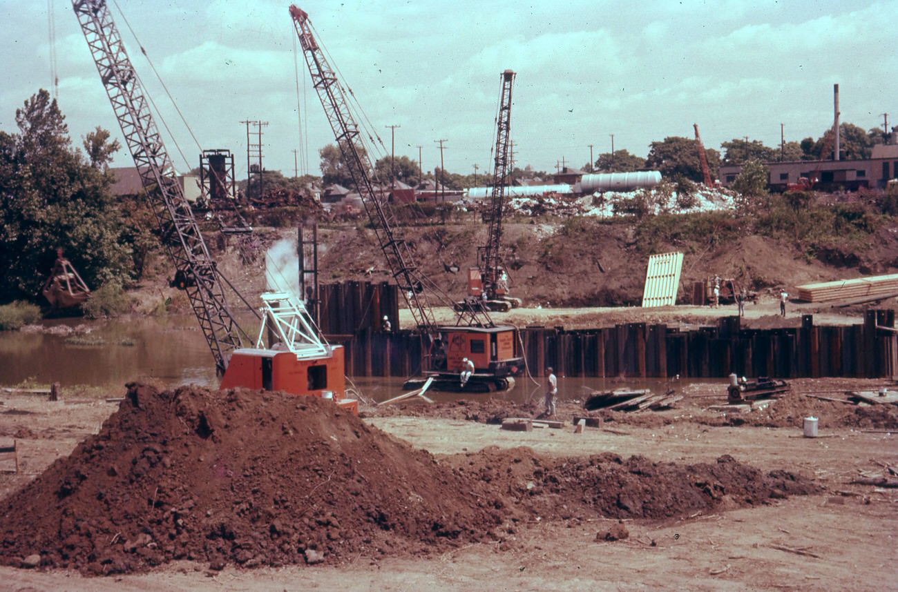
The Goodale Expressway, later designated I-670, was another major undertaking reshaping the city’s layout. Workers pushed the freeway westward through neighborhoods, clearing land and building interchanges that would eventually connect Columbus to a broader highway network. These construction sites were a constant presence throughout the late 1950s.
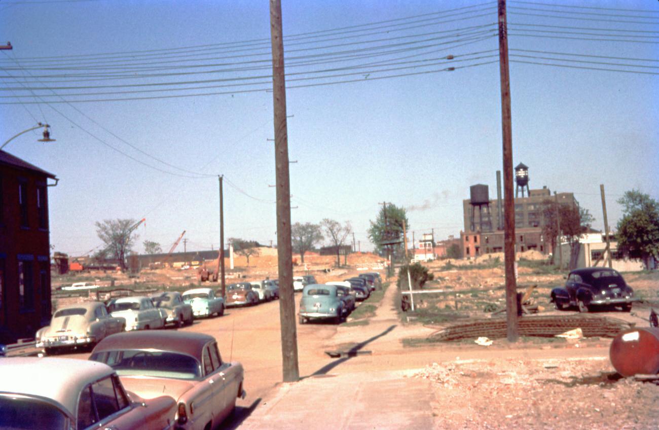
Goodale leg of freeway looking east from N High Street at Poplar Avenue, May 13, 1958.
Construction of Expressway bridge site north of W Goodale Street, August 14, 1957.
Goodale Freeway (670) looking west from railroad bridge, September 8, 1959.
Goodale Leg of Expressway (670) from Goodale ramp looking west, September 25, 1959.

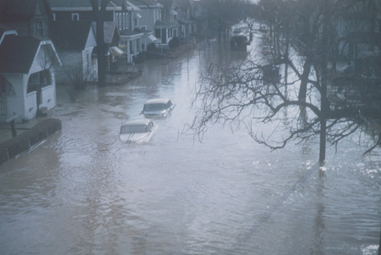
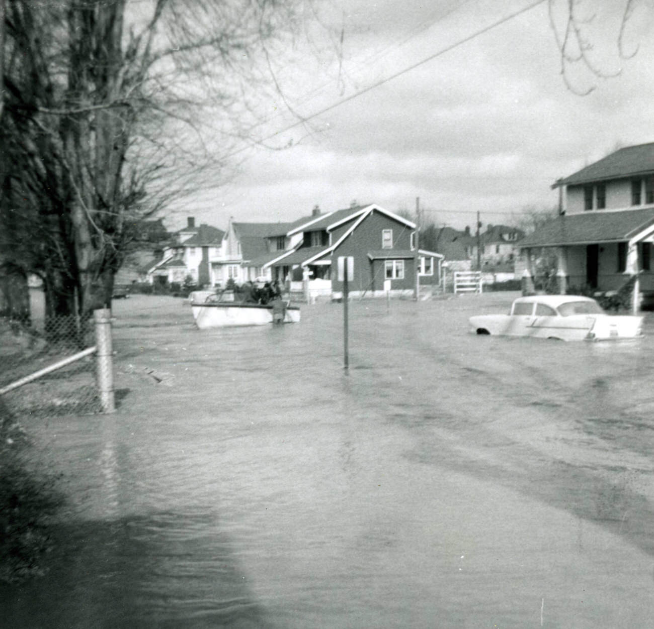
Not everything in the decade was progress and prosperity. In January 1959, the Scioto River flooded, sending water through Franklinton and into the streets near City Hall. The damage was extensive. Photographs taken from the LeVeque Tower, City Hall’s corners, and ground level in Franklinton showed just how deep the floodwaters ran through some of Columbus’s oldest neighborhoods.
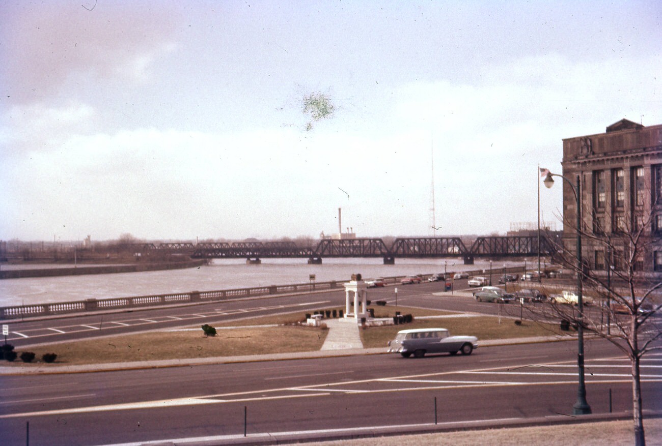
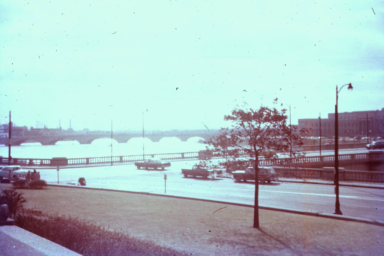
View of the 1959 flood from the northwest corner of city hall, January 1959.
View of the 1959 flood from the southwest corner of City Hall, January 1959.
View of the 1959 flood from Leveque Tower, January 1959.
Views of the 1959 flood in Columbus in the Franklinton area, 1959.
Views of the 1959 flood in Columbus from 257 South Central Avenue, 1959.

Neighborhoods like Clintonville were expanding steadily through the decade. Dutch Colonial homes with steep rooflines and wide lots lined streets like West Dunedin Road. These were the houses families moved into as the city spread outward, each block a reflection of the optimism that defined postwar American life.
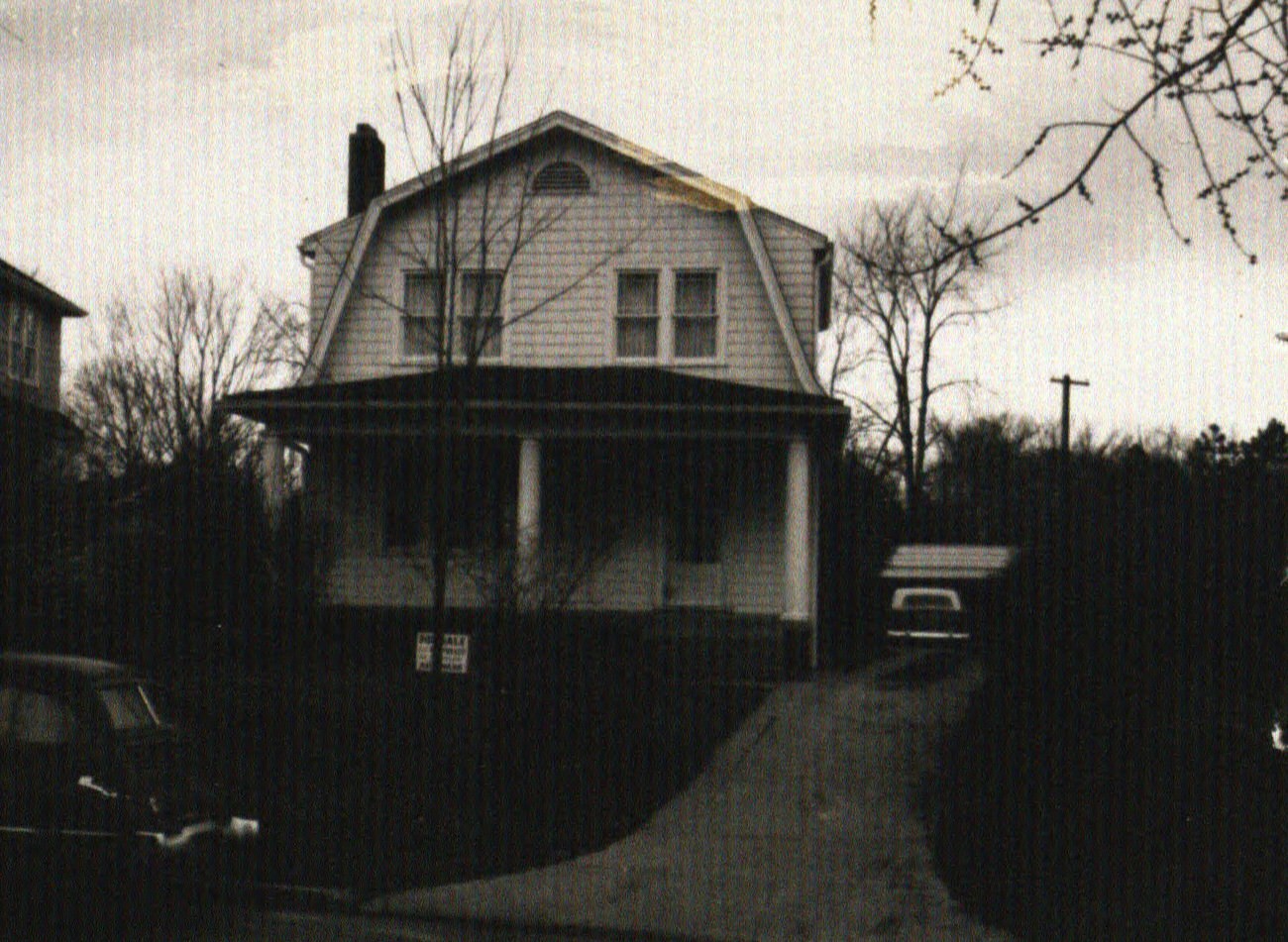
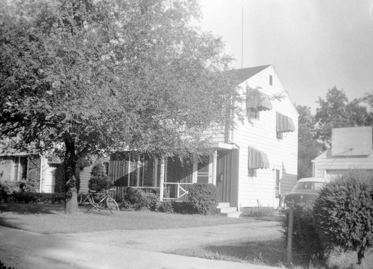
Clintonville Dutch Colonial home at 249 West Dunedin Road, 1950s
House at 525 Meadoway Park, circa 1955.

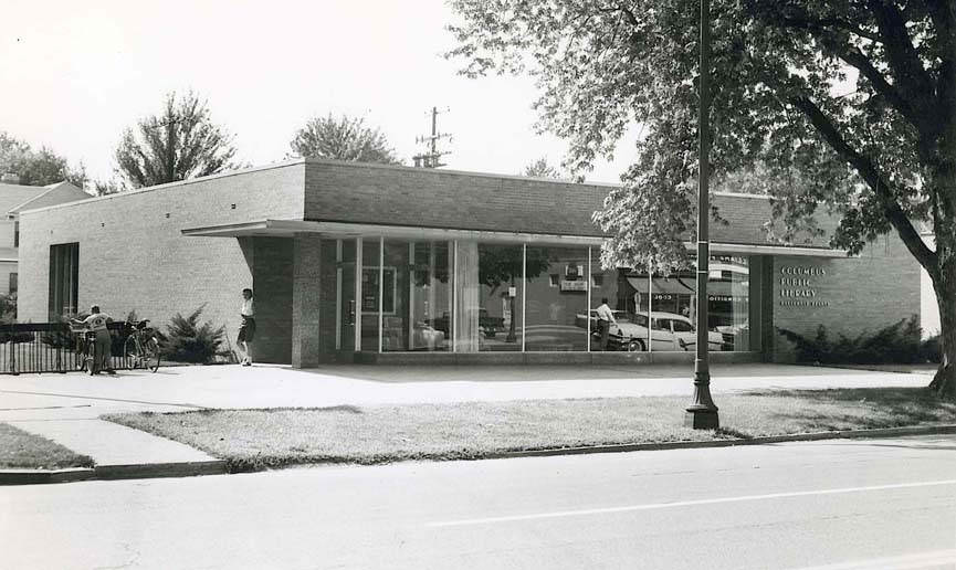
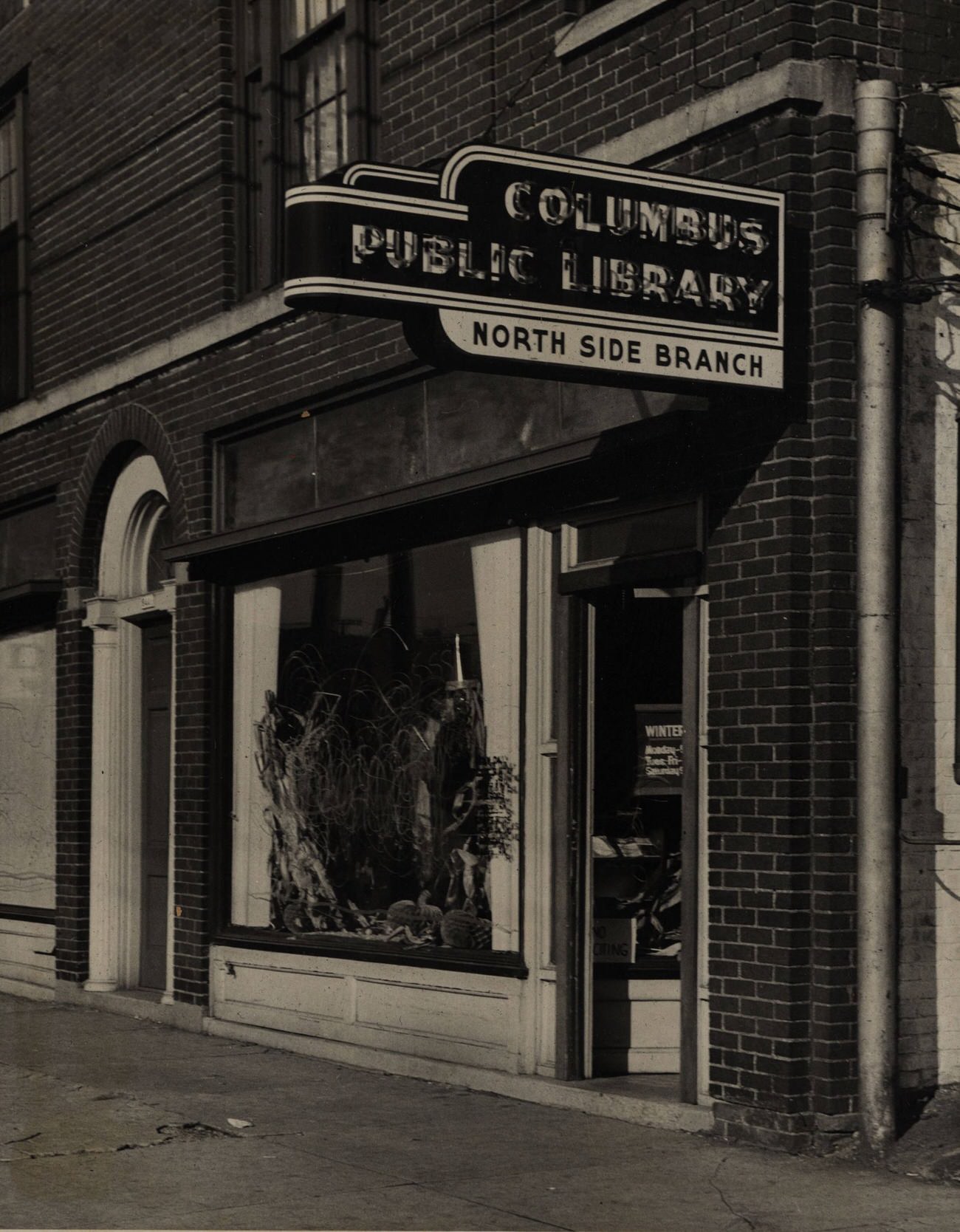
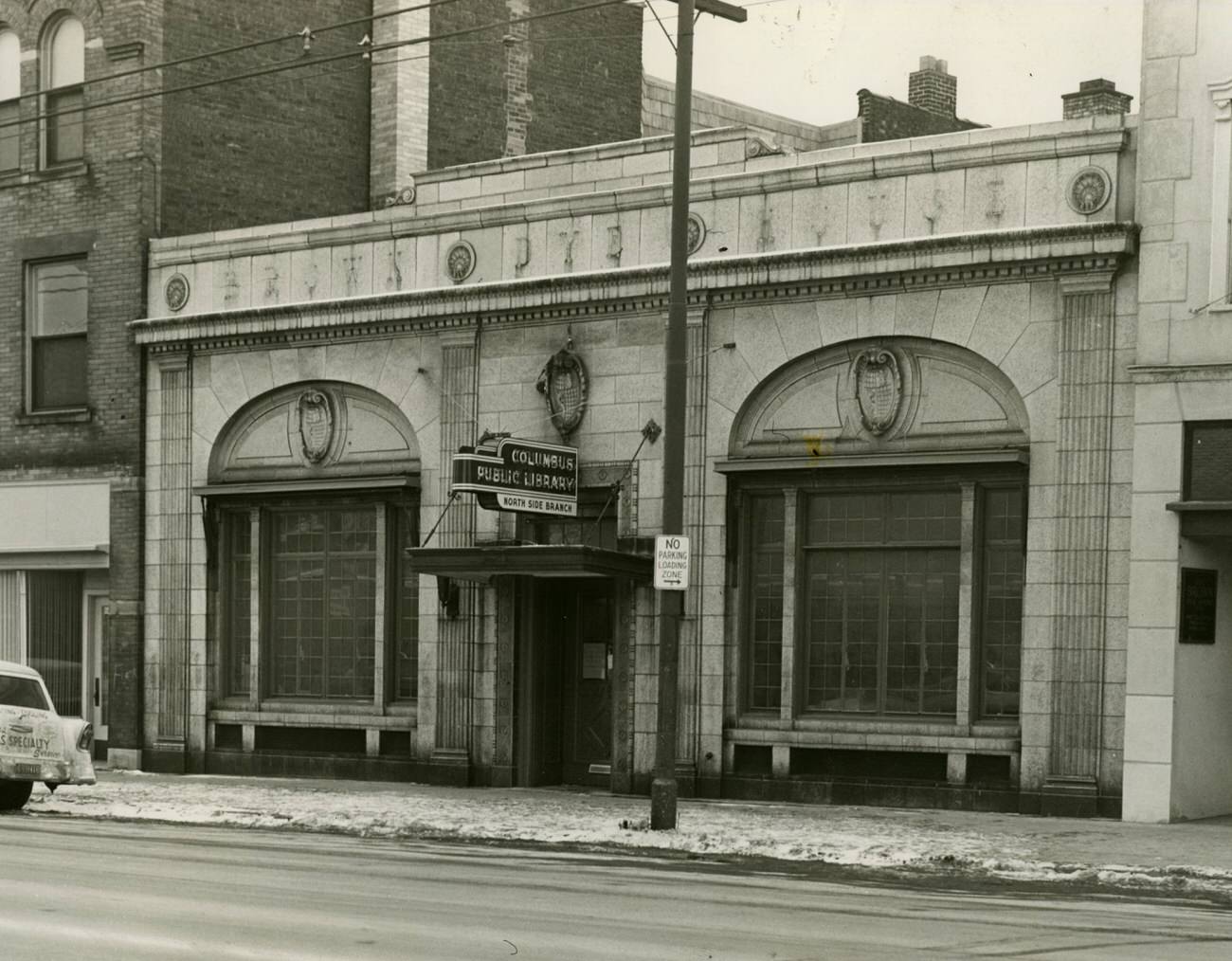
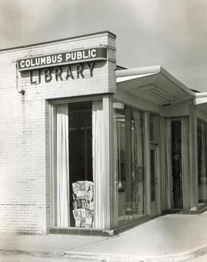
The Columbus Metropolitan Library was growing right alongside the population. Bookmobiles labeled “Franklin County Bookmobile” and operated by the Columbus Public Library rolled out starting in 1950, bringing books to residents across the county. New branches were opening throughout the decade, including the Beechwold Branch in 1954 and the second Northside Branch in 1958.
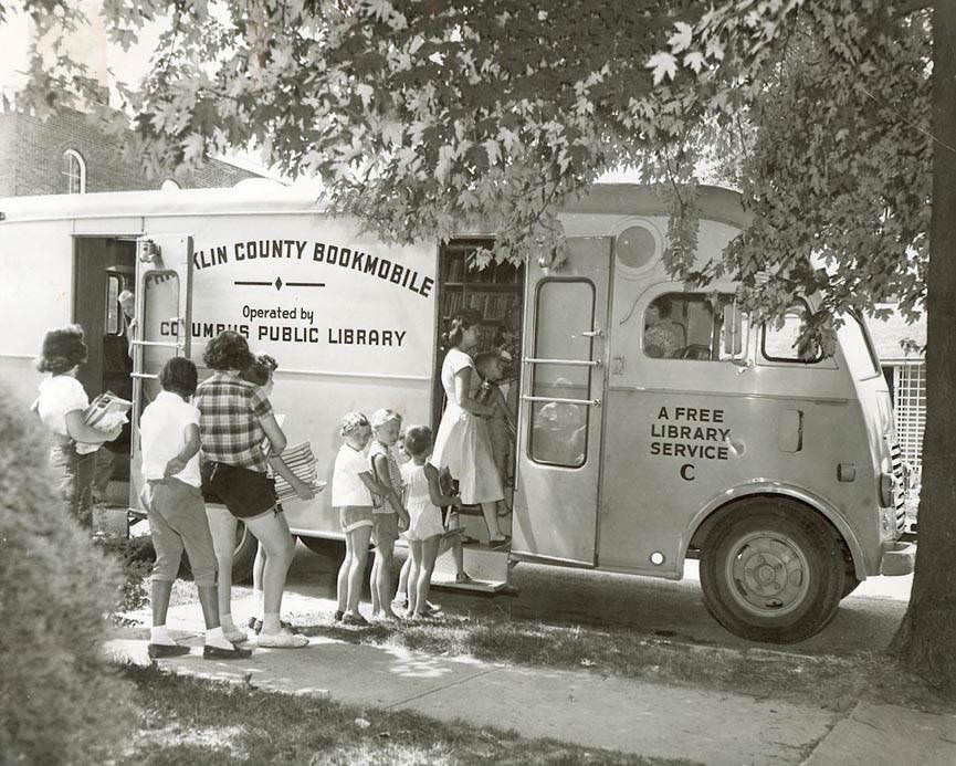
Columbus Metropolitan Library bookmobiles, first entered service in 1950, bookmobile labeled "Franklin County Bookmobile" and "Operated by the Columbus Public Library," 1950s
Columbus Metropolitan Library bookmobiles, first entered service in 1950, bookmobile labeled “Franklin County Bookmobile” and “Operated by the Columbus Public Library,” 1950s
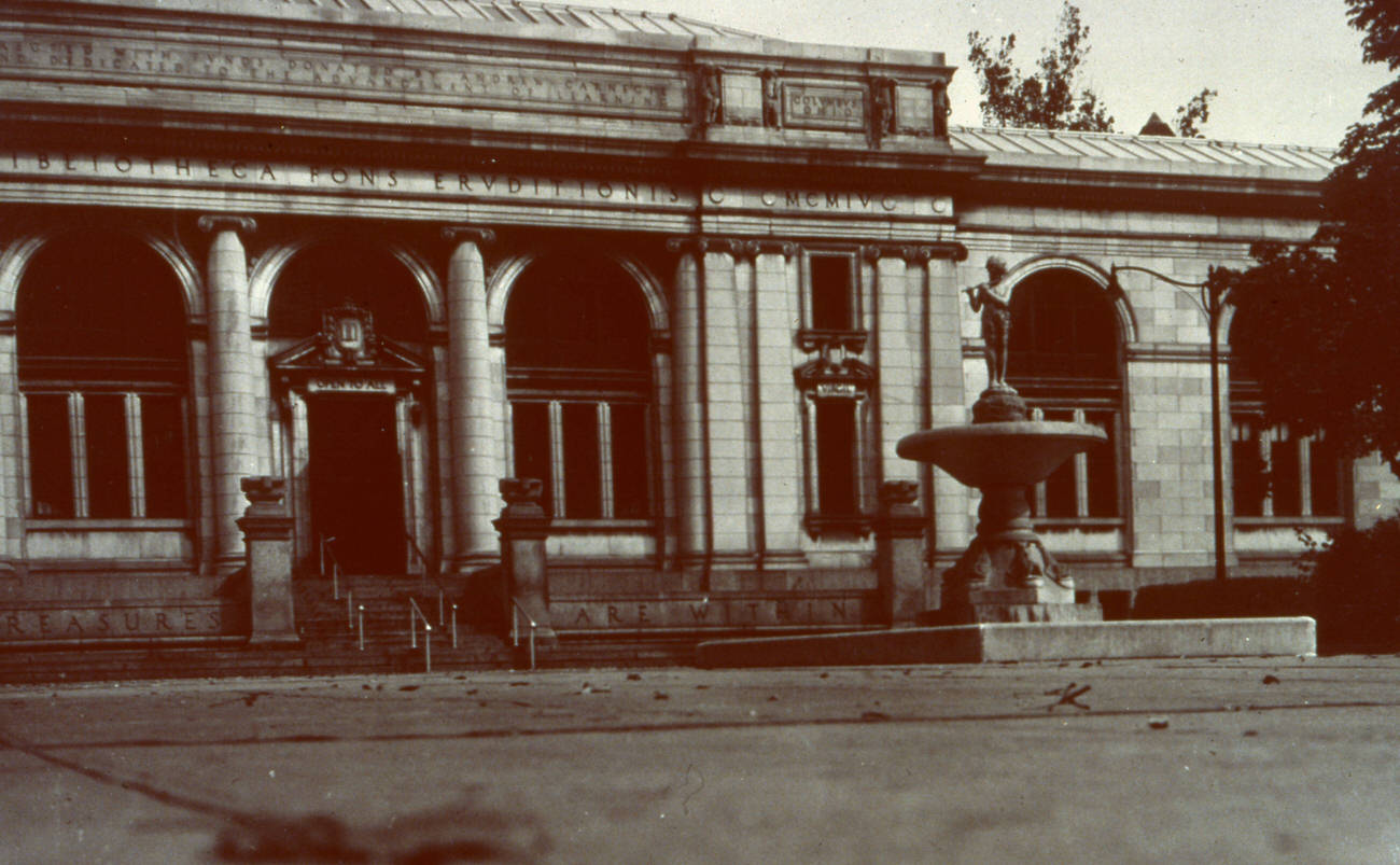
Columbus Metropolitan Library, Peter Pan welcoming children, located at 96 South Grant Avenue, 1950s
Columbus Metropolitan Library Beechwold Branch, exterior and interior views, opened October 10, 1954, merged with Clintonville Branch to form Whetstone Branch on September 21, 1985, photographs from 1950s
First Northside Branch Library of the Columbus Metropolitan Library, 1951
Photograph of the second Northside Branch Library of the Columbus Metropolitan Library, opened in 1958, replaced in 1975, December 17, 1958.
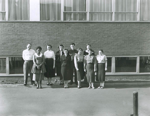
Columbus Metropolitan Library staff photographed outside the Main Library, December 1955.
Columbus Metropolitan Library's Town and Country Branch, 1950s
Columbus Metropolitan Library’s Town and Country Branch, 1950s

The Ohio State Fair was one of the biggest annual events on the Columbus calendar. The fairgrounds northeast of East 11th Avenue drew enormous crowds each summer. Families like Al and Gail Shirk made the fair a regular tradition, and aerial photographs from the early 1950s show just how large the fairgrounds complex had become by mid-decade.
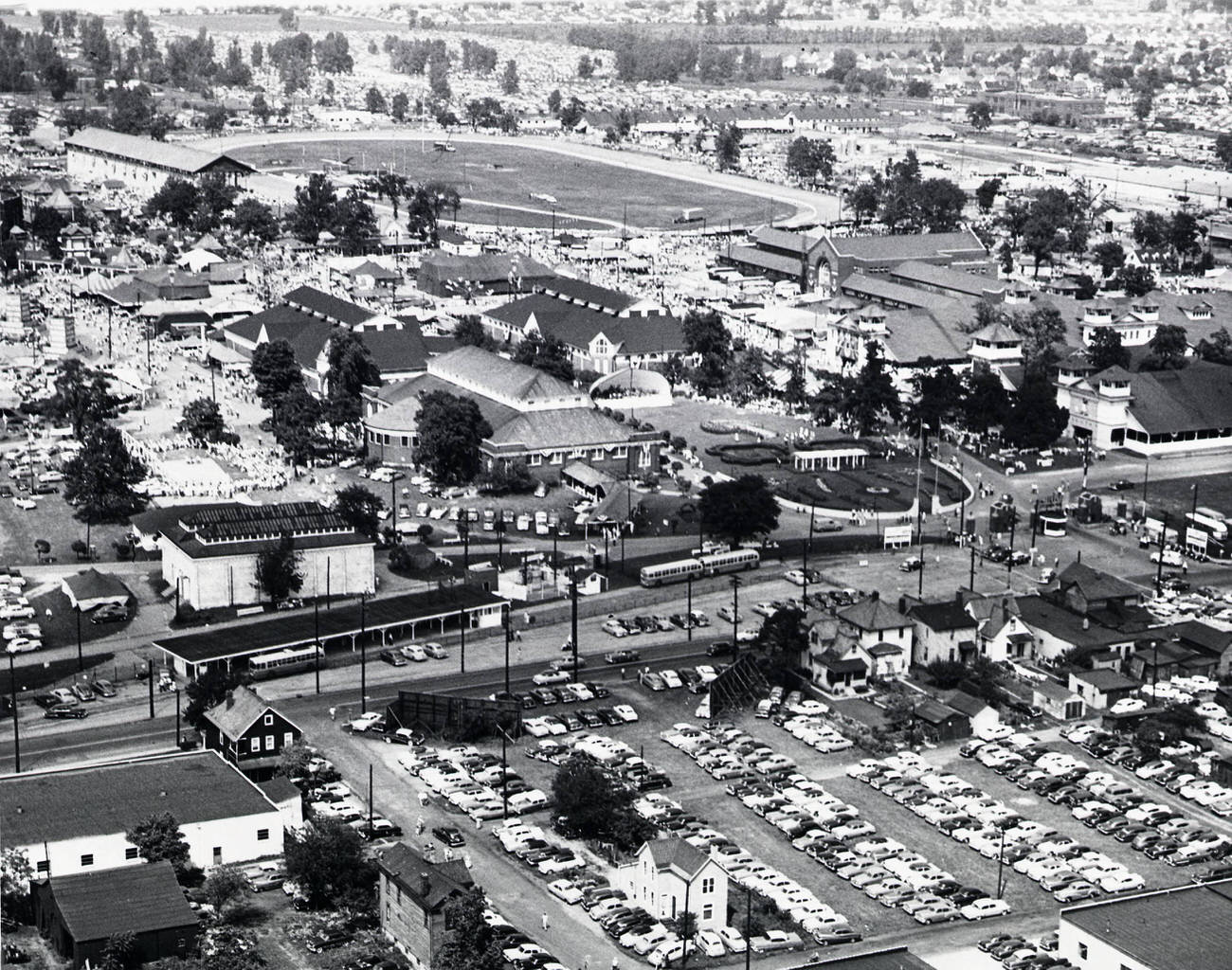
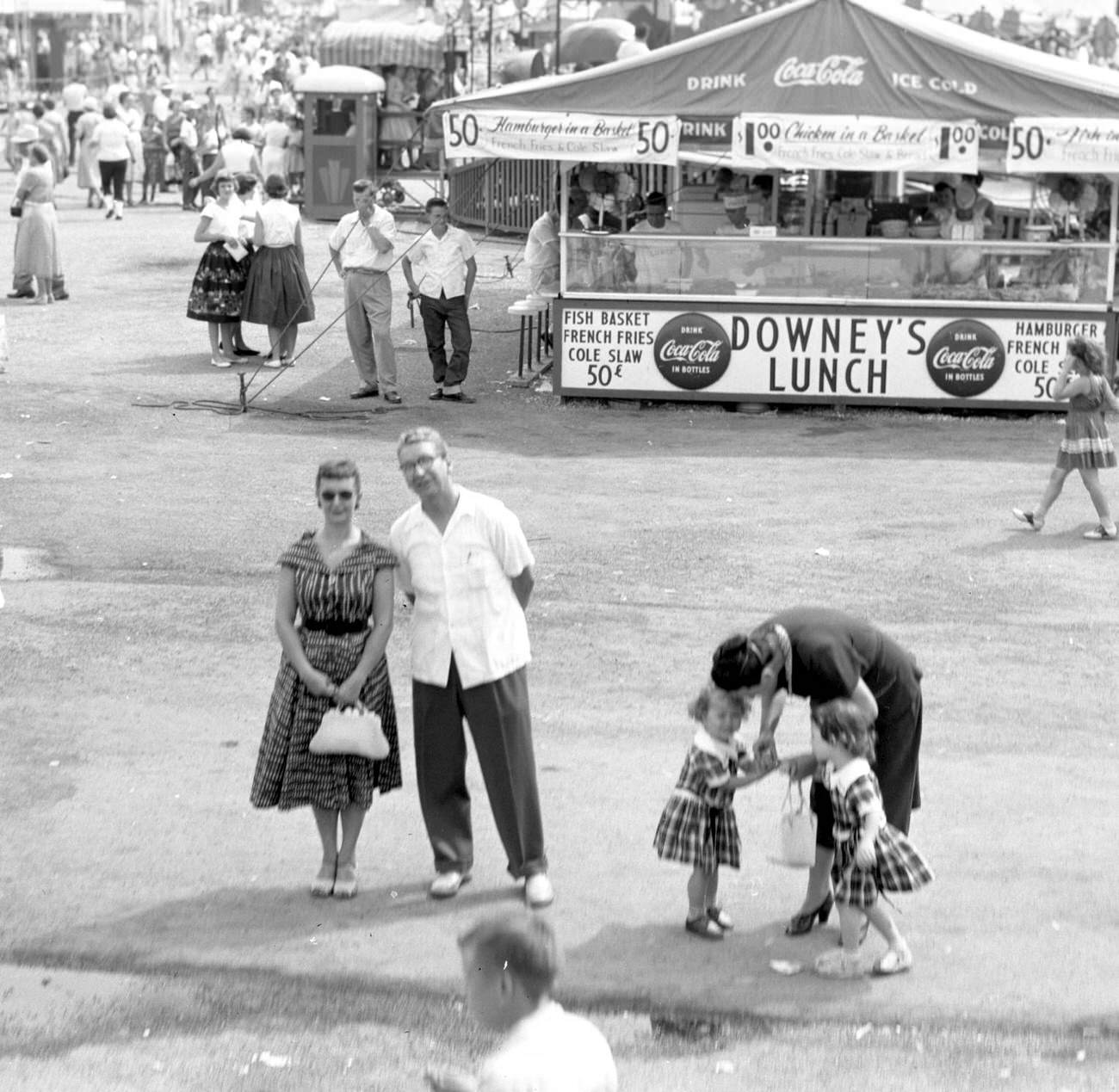
Aerial view of the Ohio State Fairgrounds, looking northeast from near East 11th Avenue, early 1950s.
Al and Gail Shirk at the Ohio State Fair, circa 1955.

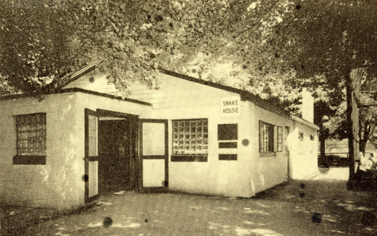
The Columbus Zoo was another popular destination for families. In 1953, the zoo’s barn and Snake House were both documented in photographs that show the modest, practical facilities that housed the zoo’s collection at the time. A day at the zoo often meant picnics on the open grounds and hours spent observing animals that most visitors had never seen in person.
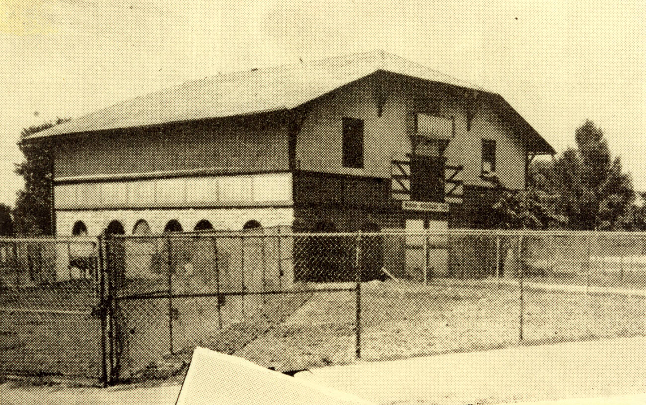
Black and white photograph of a barn at the Columbus Zoo, 1953.
Snake House at the Columbus Zoo, 1953.

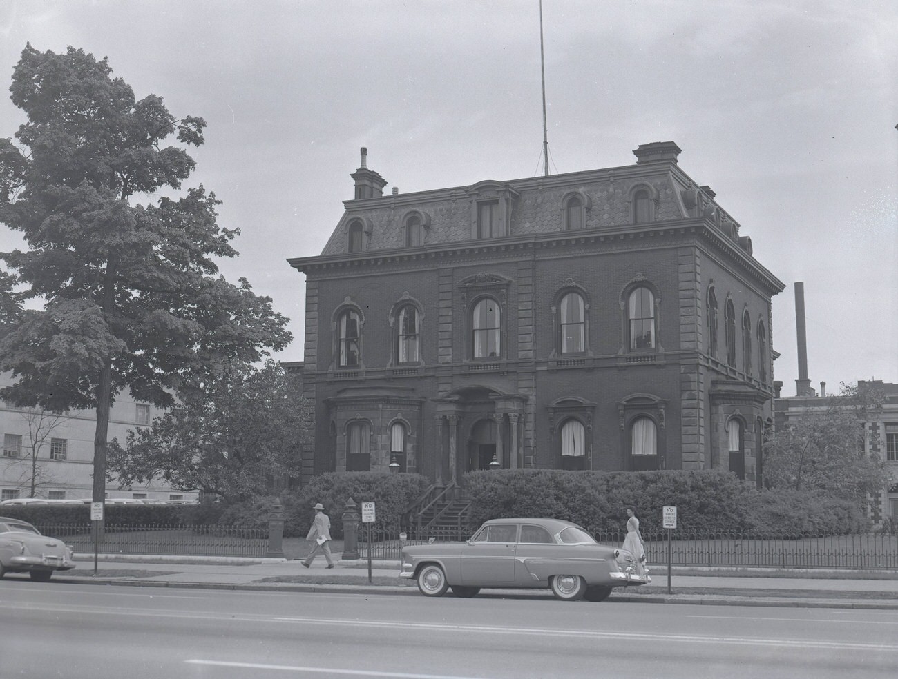
Downtown’s commercial and civic institutions remained central to daily life. The Columbus Dispatch headquarters, which opened on its site on November 23, 1925, continued to operate as the city’s main newspaper through the decade. The Columbus Club, housed in a building that dated back to around 1870, stood on the southeast corner of East Broad Street and South Fourth Street as a gathering place for the city’s business community.
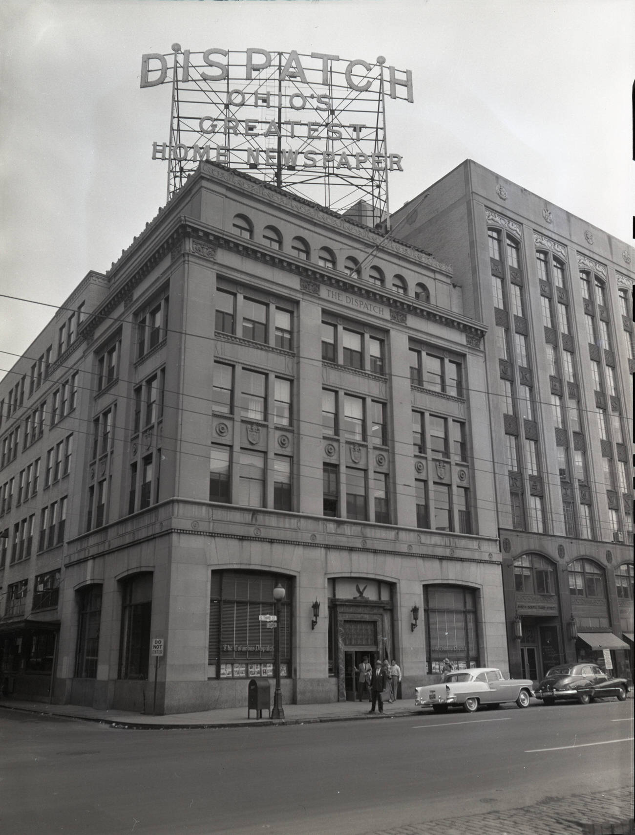
Columbus Dispatch headquarters, opened on this site on November 23, 1925, photograph from 1955.
Columbus Club exterior, located on southeast corner of East Broad Street and South Fourth Street, building originally constructed circa 1870, bought by Columbus Club in 1887, photograph from 1955.
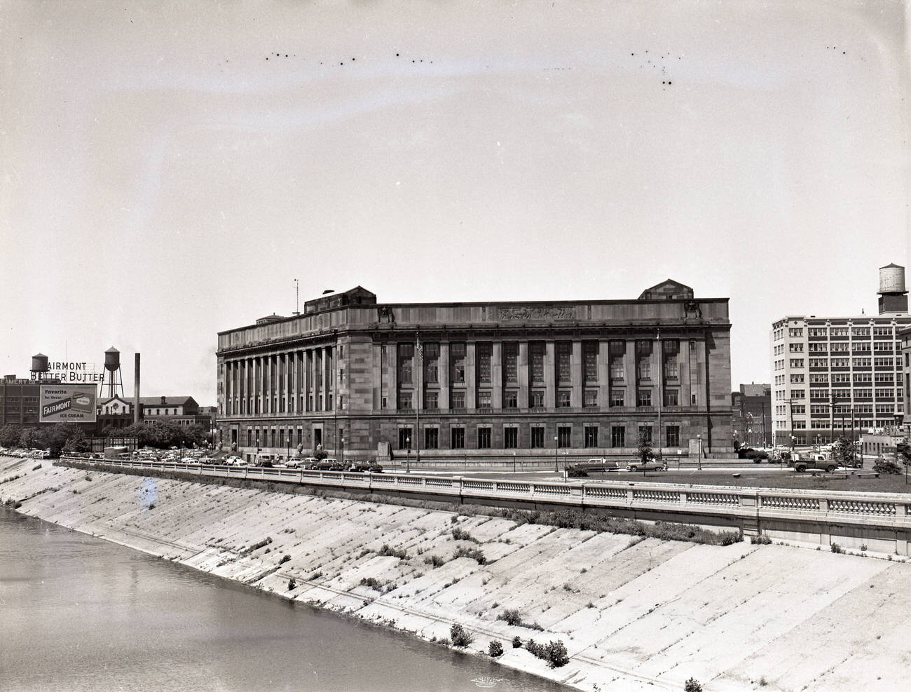
Former United States Post Office and Courthouse, dedicated October 17, 1934, Circa 1955.

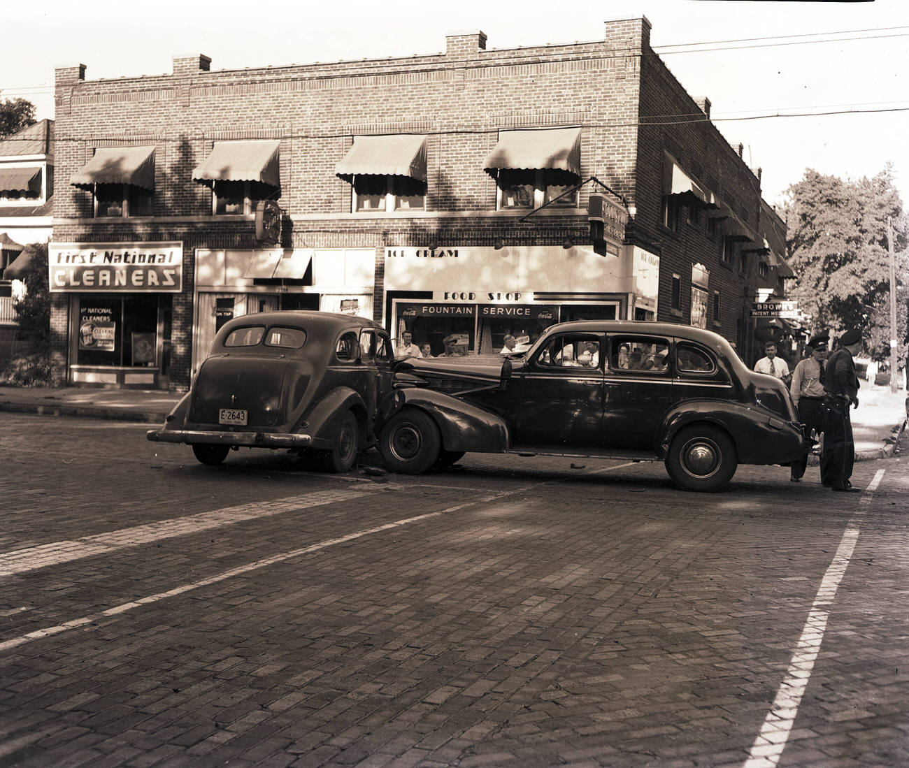
Car culture was everywhere in 1950s Columbus. Broad Street was lined with automobiles, and businesses like Columbus Auto Parts catered to a population that depended on their vehicles for everything. A traffic accident at 2336 Summit Street in 1951 was routine enough to be photographed and filed — a sign of how common automobiles had become on city streets.
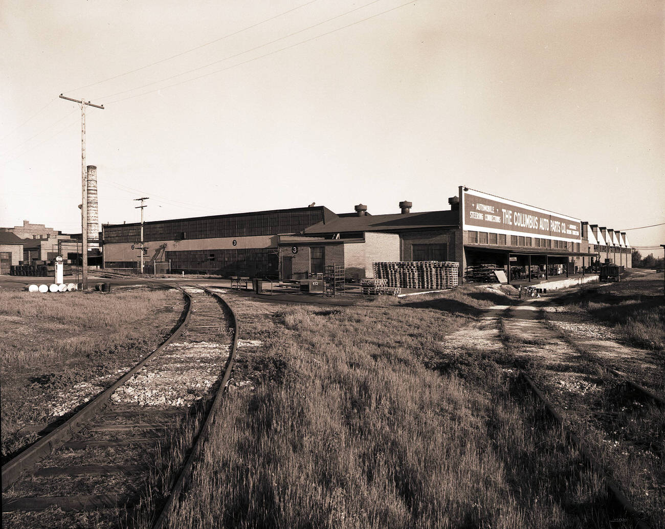
Columbus Auto Parts, 1958.
Automobile accident at 2336 Summit Street, 1951.

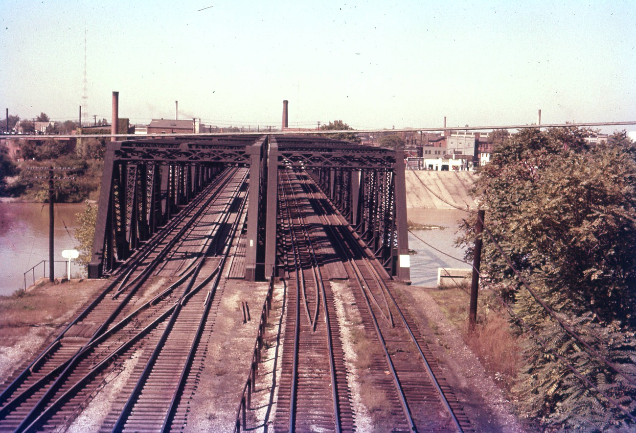
Canal boats and warehouses near Main Street were still part of the cityscape in the early part of the decade. The Jackson-Guldan Violin Company, visible in the background of a 1954 photograph, shared the area with a working waterfront that had once been far more active. The Chesapeake and Ohio Railroad truss bridge over the Olentangy River offered another reminder of how rail and water shaped Columbus’s geography.
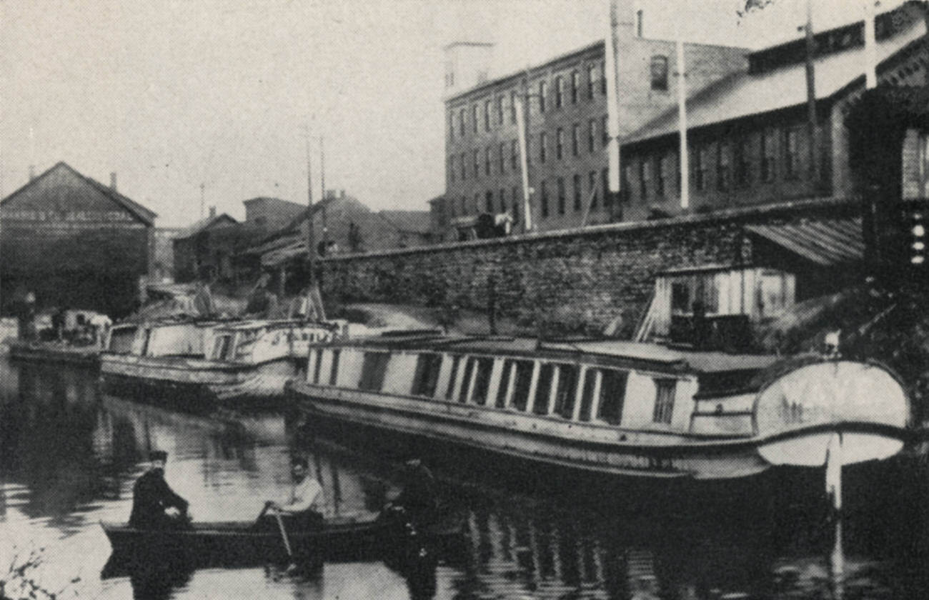
Canal boats and warehouses near Main Street, Jackson-Guldan Violin Company in the background, 1954.
Chesapeake and Ohio (C&O) railroad truss bridge over the Olentangy River, looking east to downtown, September 1957.

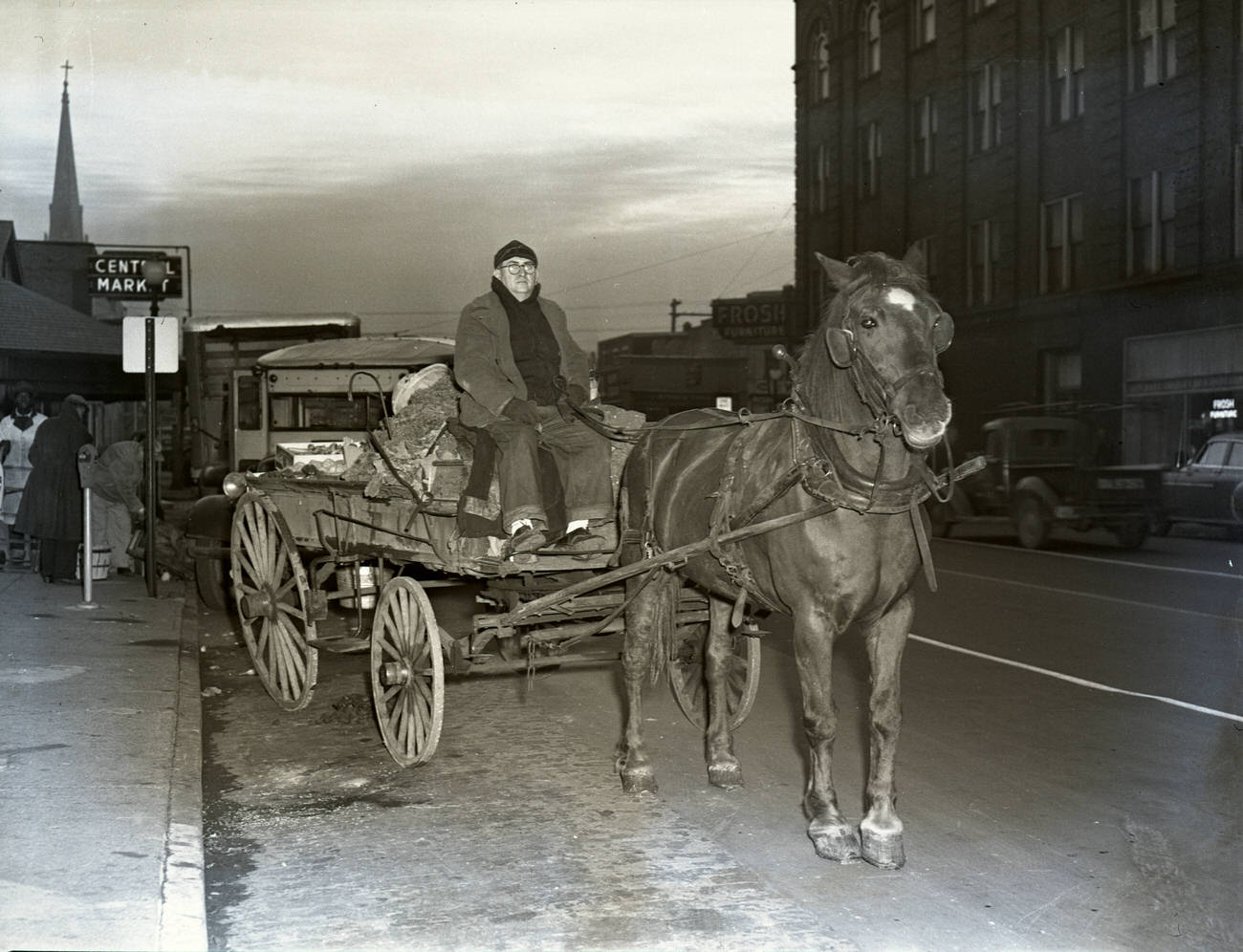
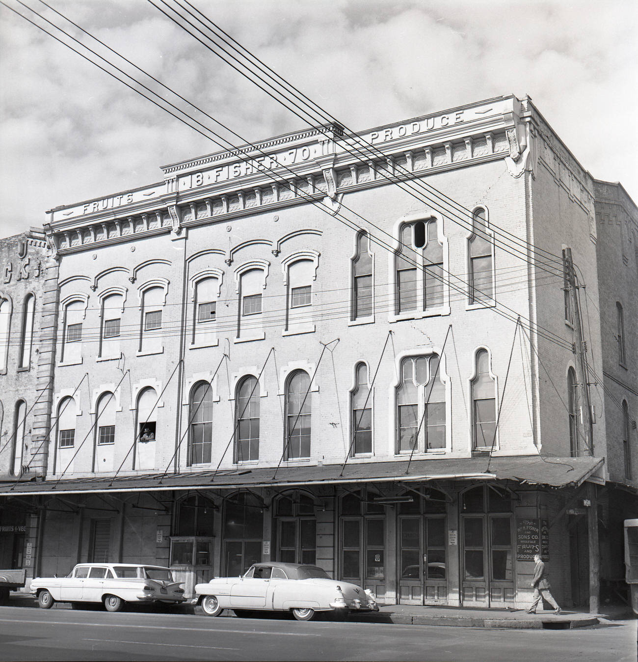
Street-level commerce filled in the gaps between the big institutions. The H&M Thrift Shop sat at the corner of Mt. Vernon Avenue and North Twentieth Street around 1950. The Fisher family ran a wholesale produce business in 1955. A horse-drawn fruit cart still made its rounds at Central Market. These small operations were the texture of daily life in Columbus, the kind of businesses that don’t make headlines but keep a city running.
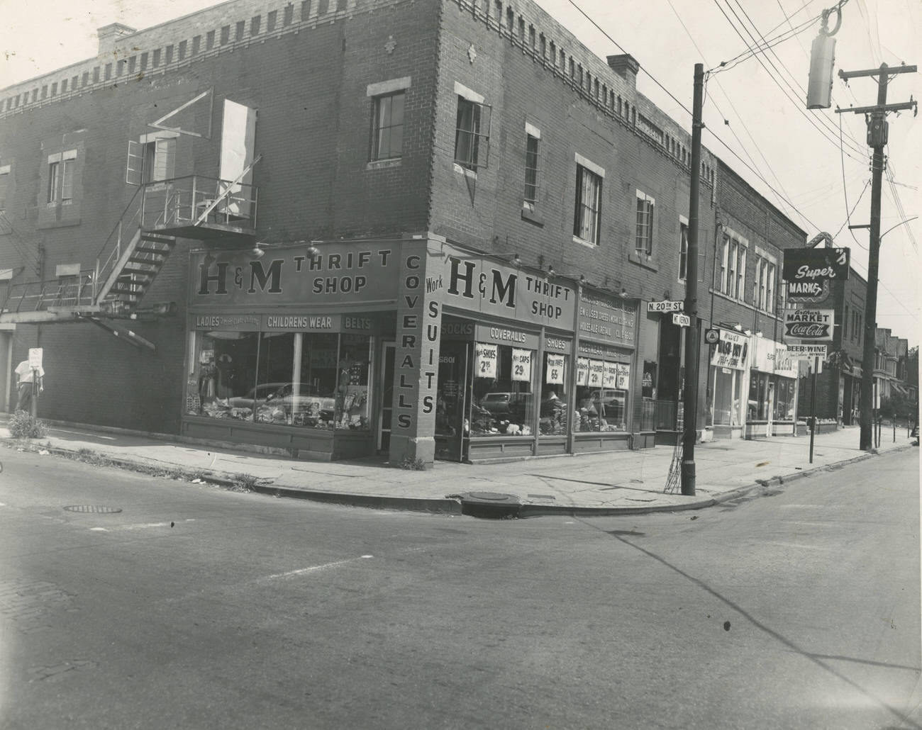
H & M Thrift Shop at the corner of Mt. Vernon Avenue and North Twentieth Street, circa 1950.
Fisher family wholesale produce business, 1955.
Horse Drawn Fruit Cart at Central Market, 1950s

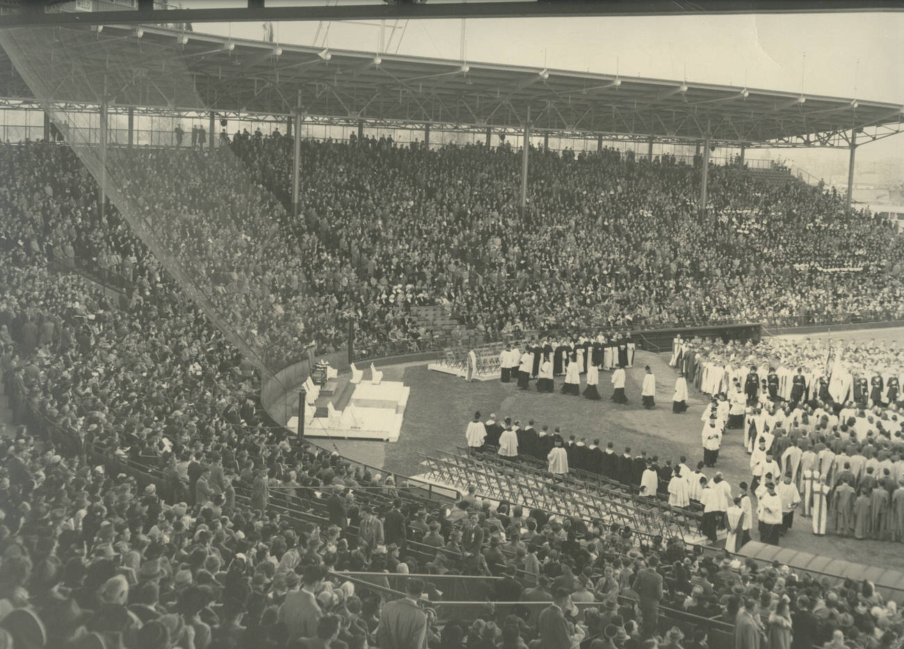
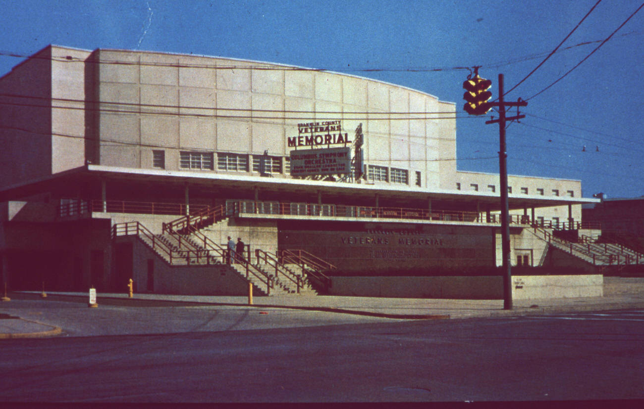
Public gatherings brought the community together throughout the decade. The Franklin County Sesquicentennial Parade rolled down West Broad Street in 1953, drawing large crowds to the sidewalks. The dedication of the Franklin County Veterans Memorial in 1955 marked a solemn civic occasion, honoring those who had served in the wars that were still fresh in the memory of most residents. A Holy Name Rally at Red Bird Stadium in 1952 drew a packed crowd of thousands.
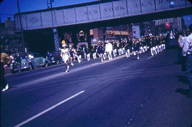
Franklin County Sesquicentennial Parade on West Broad Street, 1953.
Franklin County Veterans Memorial dedication, 1955
Holy Name Rally at Red Bird Stadium, 1952.

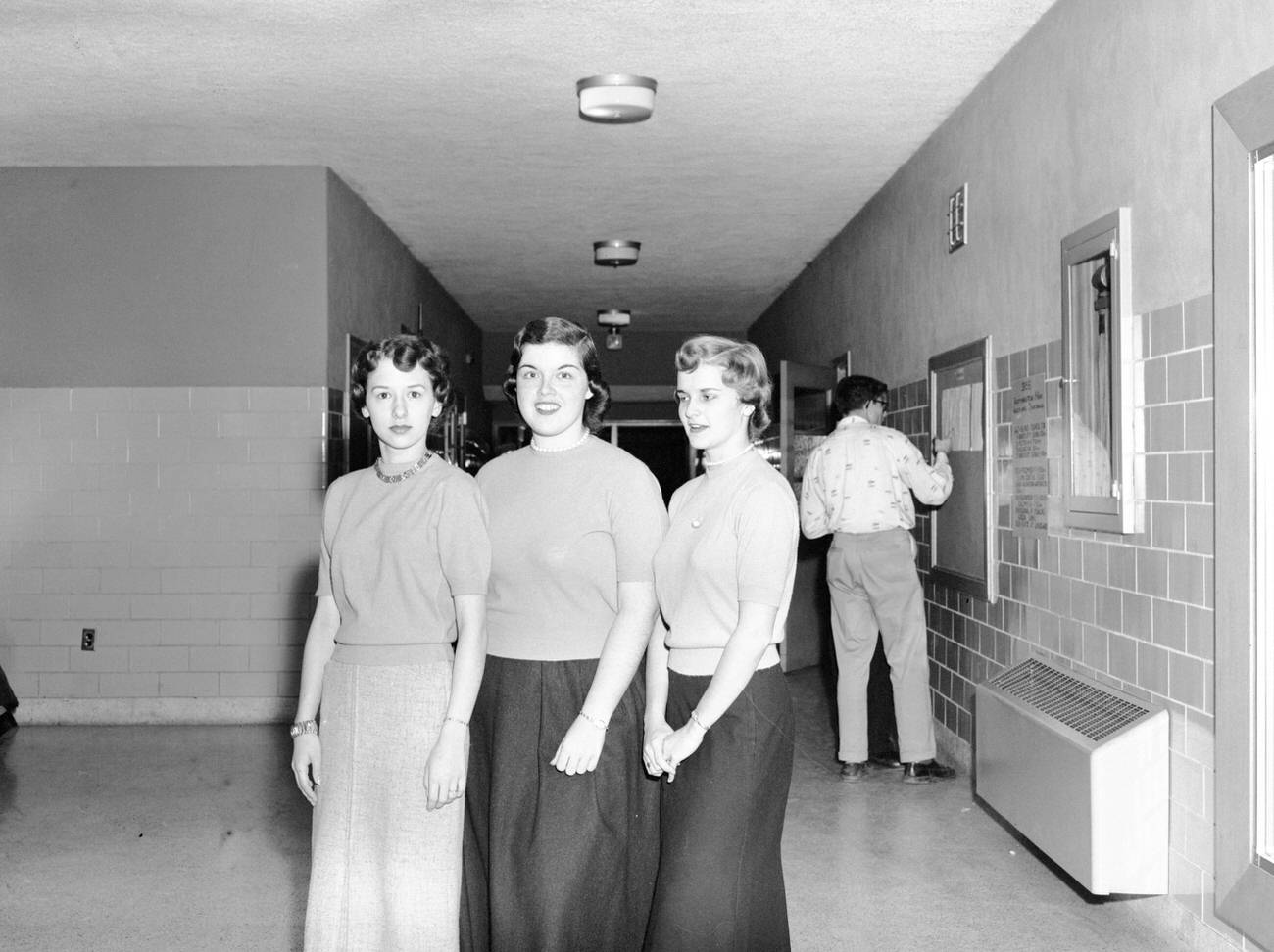
Ohio State University remained a defining presence on the north side of the city. The Armory and Gymnasium on campus, photographed around 1957, stood as one of the university’s older buildings at a time when OSU’s enrollment was climbing steadily. Worthington, just north of Columbus, had its own schools and community life, captured in a photograph of three female students at Worthington High School around 1955.
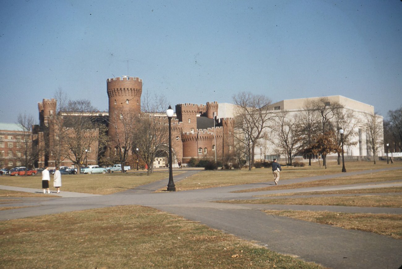
The Armory and Gymnasium at Ohio State University, circa 1957
Three female students at Worthington High School by A. V. Shirk, circa 1955.

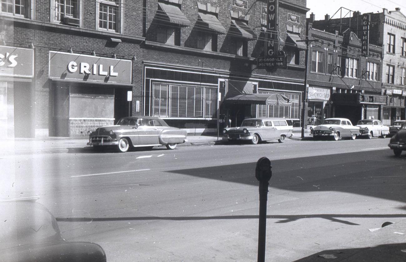
Aerial photographs from 1957 show the city spreading outward in every direction. Looking east from Olentangy River Road and Goodale Boulevard, the dense grid of streets and rooftops stretched toward the horizon. The intersection of North High Street and Poplar featured the Hi-Goodale Recreation center alongside other storefronts — a snapshot of neighborhood commercial life before the expressway changed everything nearby.
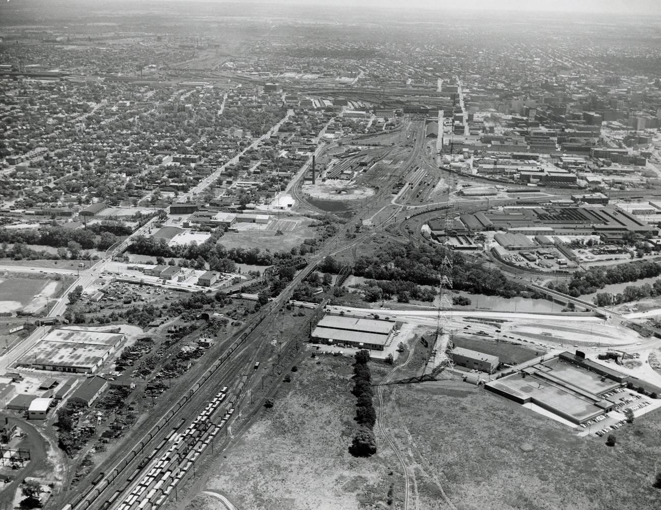
Aerial photograph looking east from Olentangy River Road and Goodale Boulevard, 1957.
Intersection of N High and Poplar, featuring Hi-Goodale Recreation and other businesses, 1957.
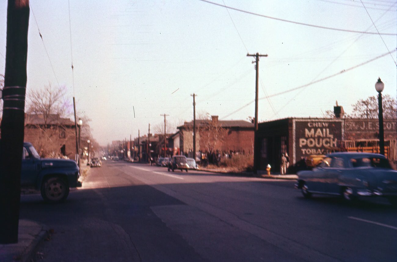
Goodale Street looking east from Michigan Avenue, featuring J.E. Scott Cup Company, November 18, 1956.
Gowdy Field, former garden, athletic field, and landfill, viewed from Goodale Interchange, November 18, 1956.
Former Jai Lai location near Goodale leg of expressway, Columbus, 1958.

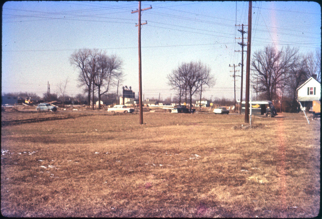
The Hudson Interchange and nearby infrastructure took shape in the late 1950s as the city’s highway ambitions came together. The Pennsylvania Railroad bridge near Beulah Road was completed in June 1958, and the Hudson Interchange itself was photographed in 1959. These projects, taken together, fundamentally rerouted how traffic moved through Columbus.
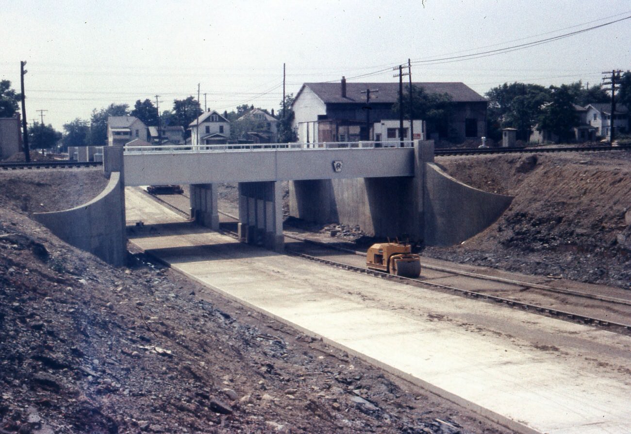
Hudson Underpass near Beulah Road, during Pennsylvania Railroad bridge completion, June 29, 1958.
Hudson Interchange, 1959.
I-670 Interbelt, showing Olentangy River Rd exit, 1957

Industrial and contracting firms like the Gibson Stewart Company kept the city’s construction economy moving in the early part of the decade. Photographed in 1952, the firm specialized in contracting and industrial equipment — exactly the kind of business that benefited from the endless stream of infrastructure projects underway across Columbus throughout the 1950s.
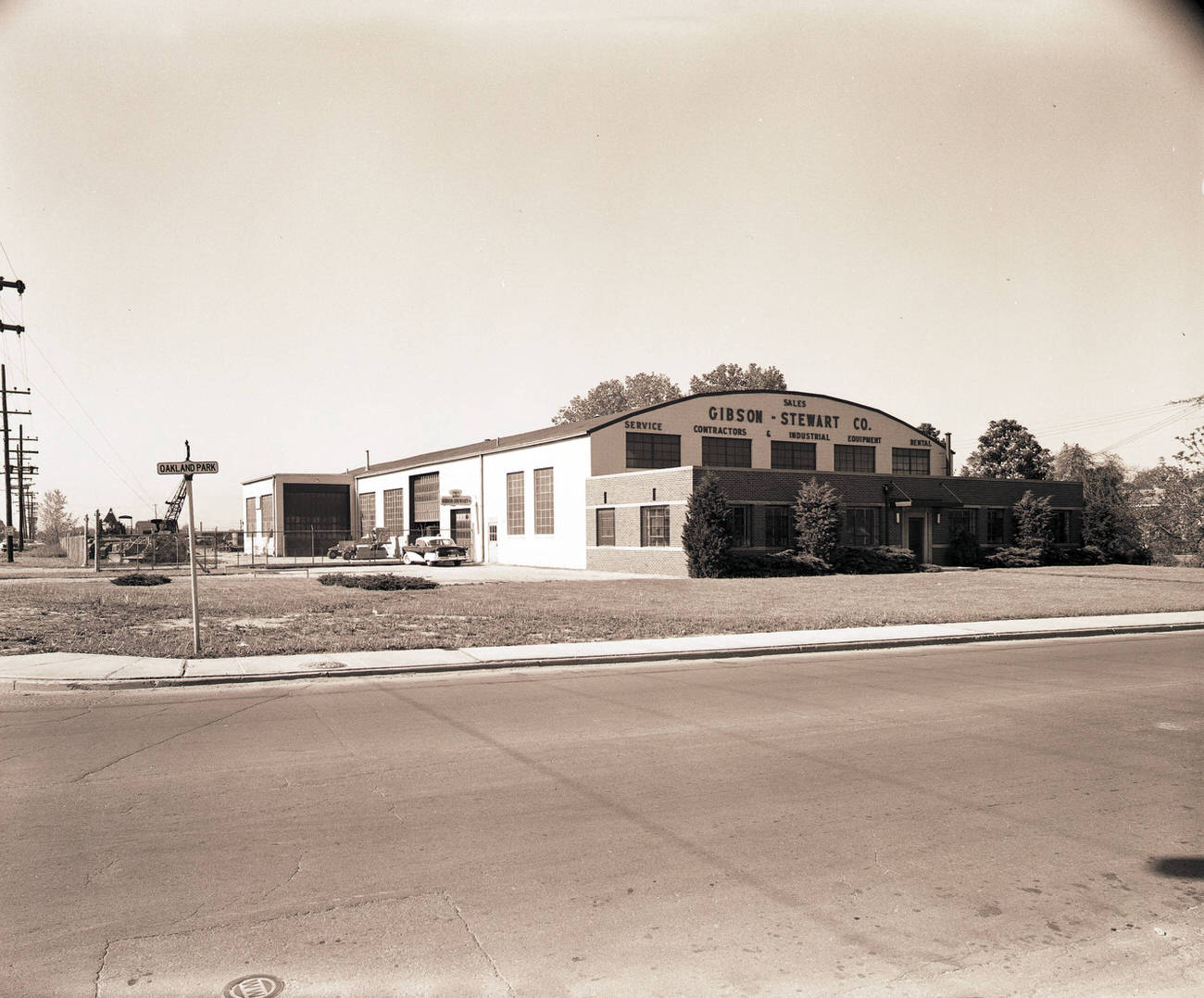
Gibson Stewart Company, a contracting and industrial equipment firm, 1952
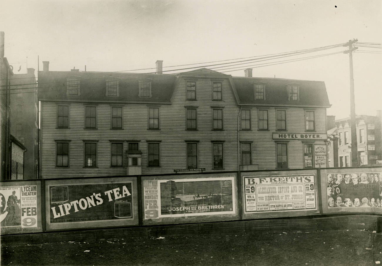
Hotel Boyer, early frame hotel and boardinghouse, 1950s

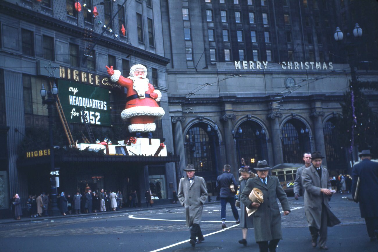
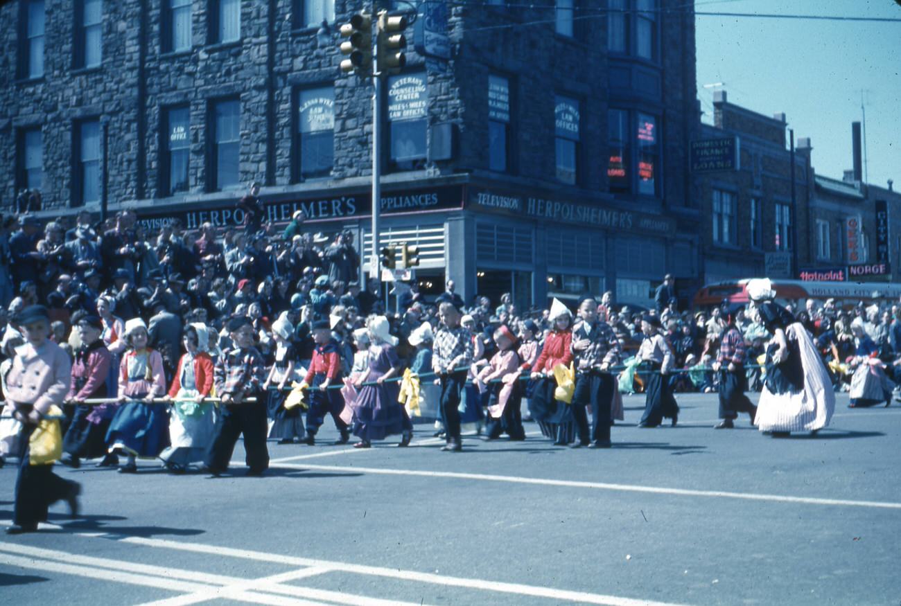
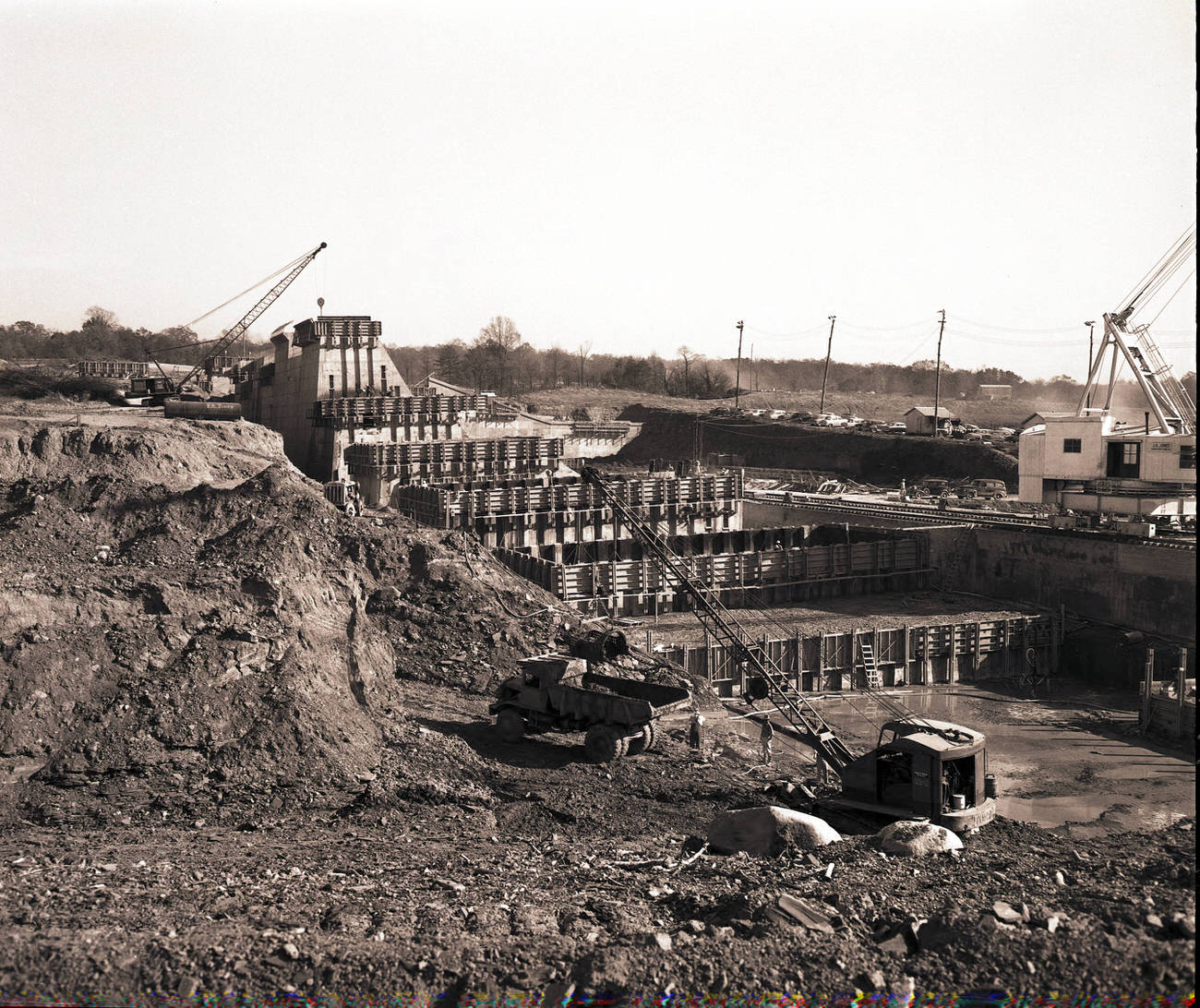
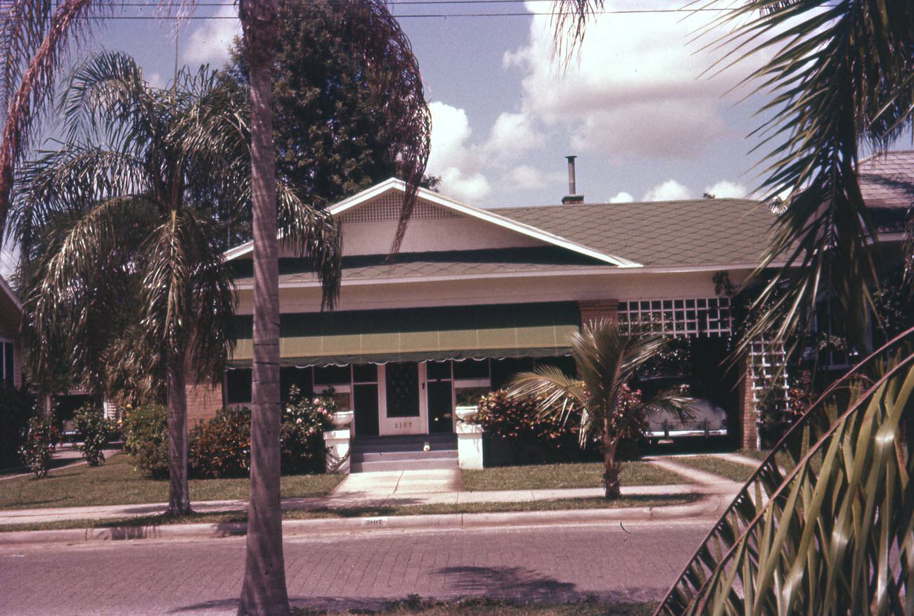
These photographs also captured scenes from beyond Columbus proper. A view of 143 Gill Avenue in Galion, Ohio from 1957 shows a quiet street corner. A Florida home on West Southview Avenue in Tampa, photographed in August 1957, and a Higbee’s Department Store Christmas display in Cleveland from 1952 round out the broader context of mid-century American life. A parade in Holland, Michigan featuring children in Dutch costume and Hoover Dam construction in 1953 also appear among the collection — widening the lens beyond any single city.
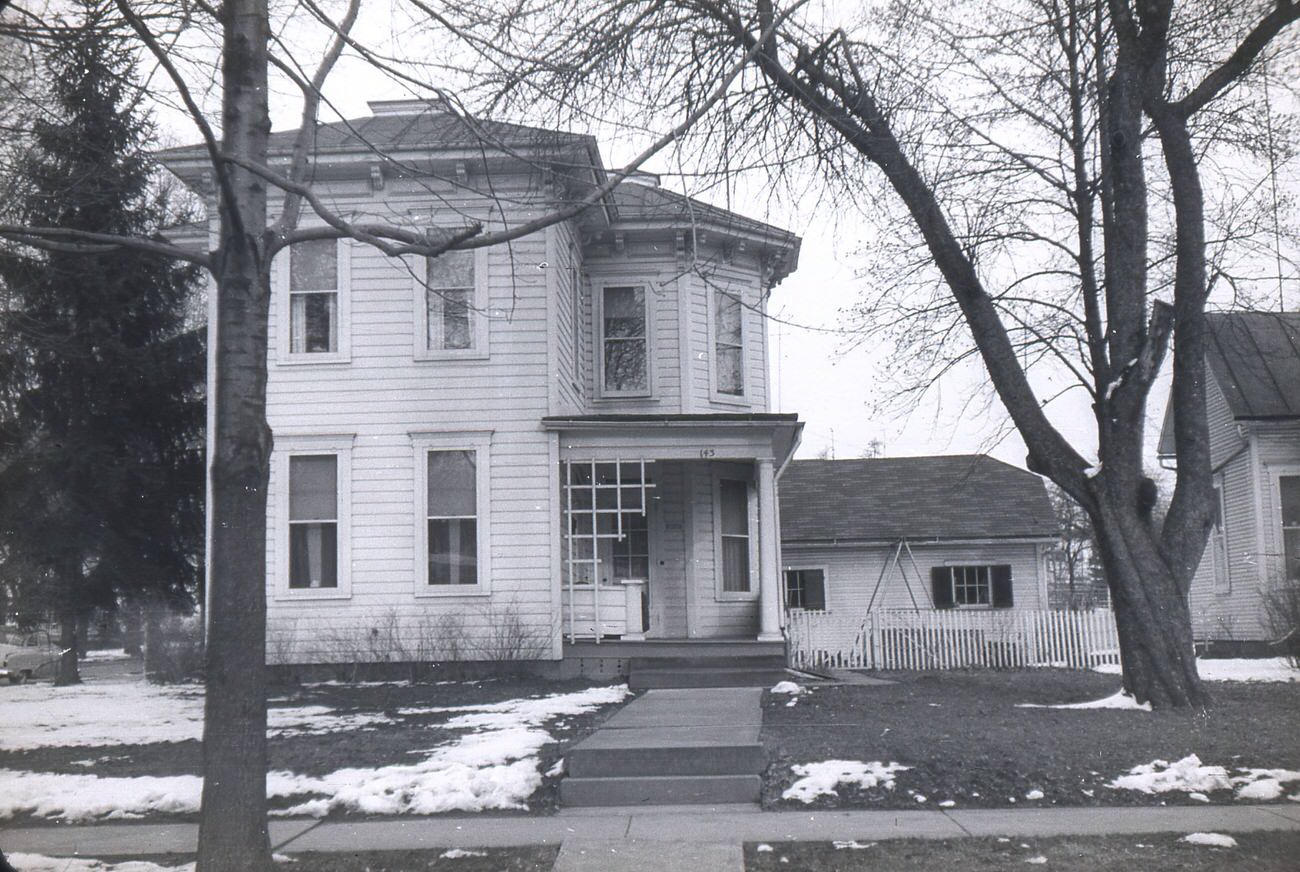
View of 143 Gill Avenue at the corner of W. Church Street and Gill Avenue in Galion, Ohio, 1957.
Palm trees and a home in Tampa, Florida on W Southview Avenue, August 23, 1957.
Exterior Christmas display at Higbee's Department Store in Cleveland, by Clifton James Warren, 1952.
Exterior Christmas display at Higbee’s Department Store in Cleveland, by Clifton James Warren, 1952.
Parade in Holland, Michigan, featuring children in Dutch costume, 1950s
Hoover Dam Construction, 1953.
Enjoyed this post? Get new ones in your inbox.

Leave a Comment

Your email address will not be published. Required fields are marked *

Share this Post 🥺

Please take a moment to share this content. Your support is greatly appreciated! 🙌🙏

Share this Post 🥺

Please take a moment to share this content. Your support is greatly appreciated! 🙌🙏
Scroll to Top
 
Hey Friend, Before You Go.. Please like & follow for more interesting content