Hey There! Before You Go. 😧
Get the best vintage content straight into your inbox!

Don't worry, we don't spam

1970s San Francisco: Fascinating Vintage Photos Show Street Scenes And Everyday Life

San Francisco in the 1970s was a city in full motion. Cable cars rattled up steep hills. Neon signs lit up building fronts after dark. Theaters packed block after block. At Fisherman’s Wharf, vendors sold fresh crab and lobster right on the street. The city was one of the most photographed places in America, and for good reason — almost every corner held something worth seeing.

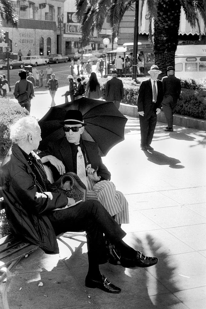
Two men sitting on park bench sheltering from the sun under an umbrella, San Francisco California, 1970.

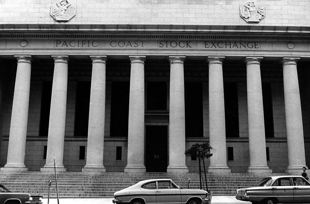
The financial heart of the city was centered on Pine Street, where the Pacific Coast Stock Exchange handled the region’s most important business. Suits and briefcases moved through those blocks every weekday, a world away from the barefoot crowds gathering a few miles west in Golden Gate Park.

The Pacific Coast Stock Exchange, Pine Street, the centre of the financial area for San Francisco. January 1970.
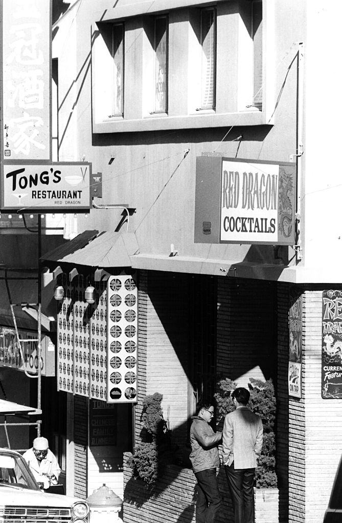
Chinatown was one of the most densely populated urban neighborhoods in the country. Chinese restaurants lined the streets, drawing in locals and tourists alike. Grocers displayed their goods on the sidewalk. The Grant Avenue corridor in particular buzzed with commercial life, from produce stands to small markets packed tightly between apartment buildings.

Tong's Restaurant, one of the many chinese restaurants in Chinatown, San Francisco, 1970.
Tong’s Restaurant, one of the many chinese restaurants in Chinatown, San Francisco, 1970.
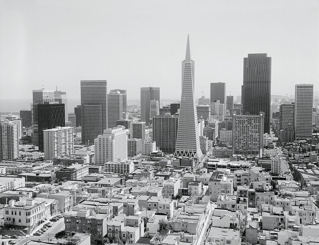
San Francisco skyline, with Trans America Building. 1970

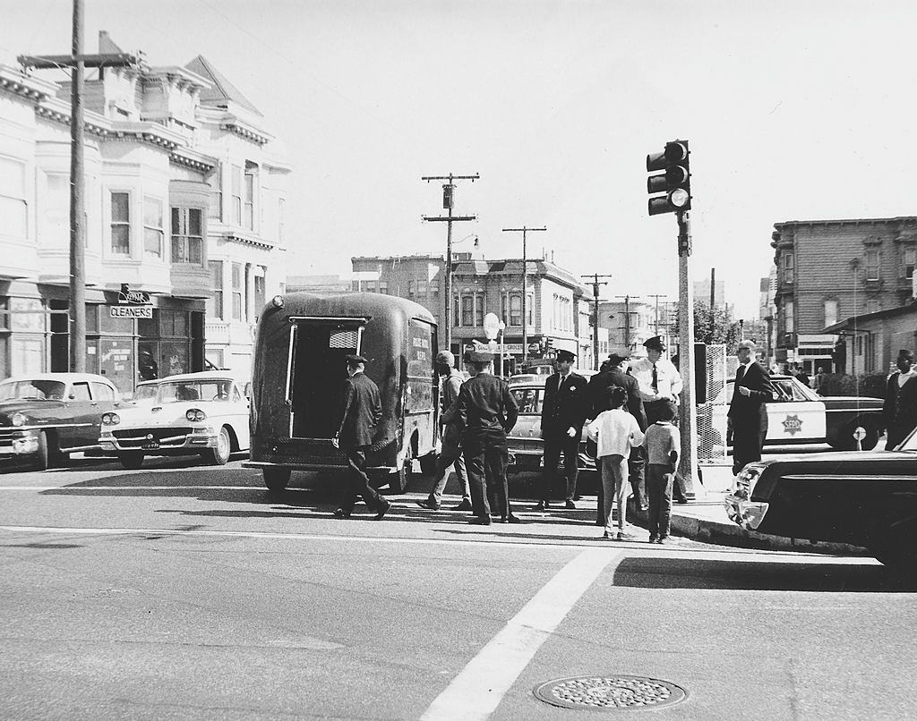
The Transamerica Pyramid, completed in 1972, was still under construction as the decade began. The skyline in 1970 still looked relatively open compared to what it would become. But the city was not peaceful. The Vietnam War was still being fought, and San Francisco was one of the loudest centers of protest in the country. Police regularly confronted demonstrators in the streets.

Police officer arresting protestors in a street, San Francisco, 1970.
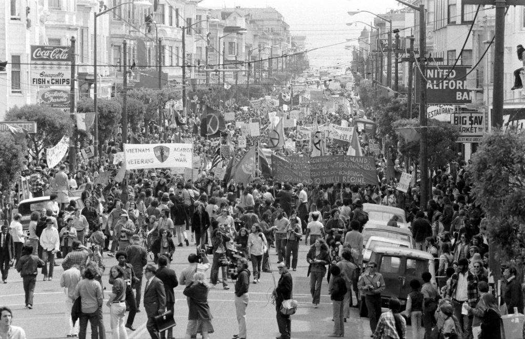
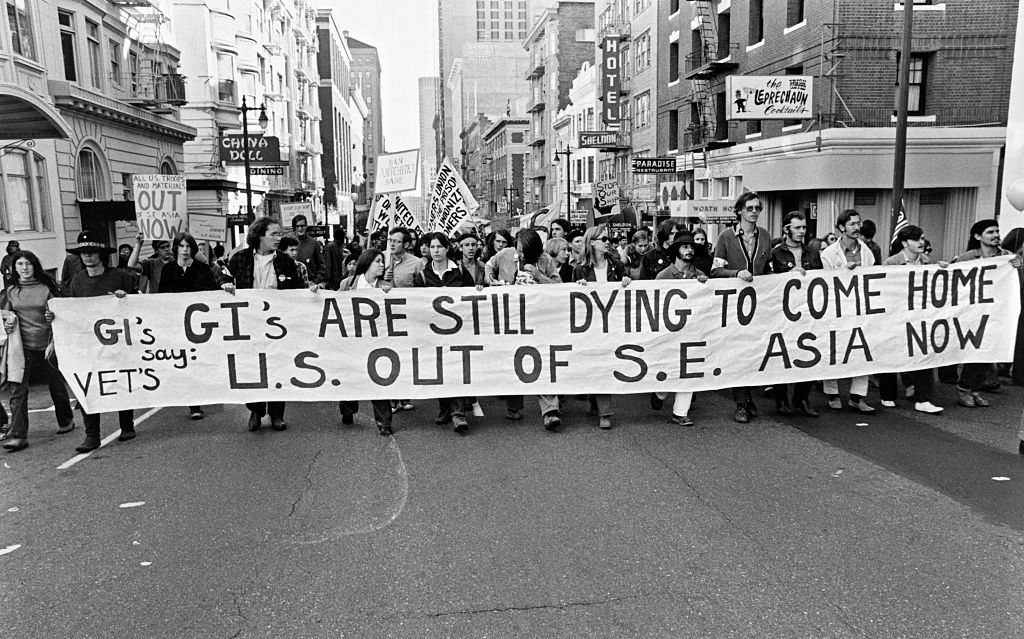
An anti-Vietnam War peace march up Post Street, San Francisco, 1970.

Anti-war marches were a regular sight on San Francisco’s streets in 1970. Thousands turned out for organized demonstrations, filling major thoroughfares like Post Street. The marches were largely peaceful but carried enormous emotional weight — many participants had friends or family members serving overseas.

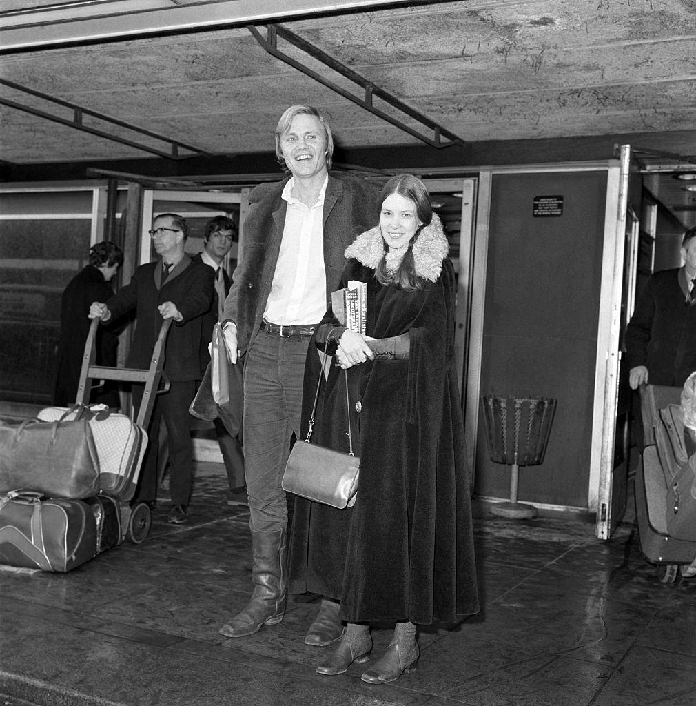
John Voight with his girlfriend Jennifer Salt at San Francisco's airport, 1970.
John Voight with his girlfriend Jennifer Salt at San Francisco’s airport, 1970.

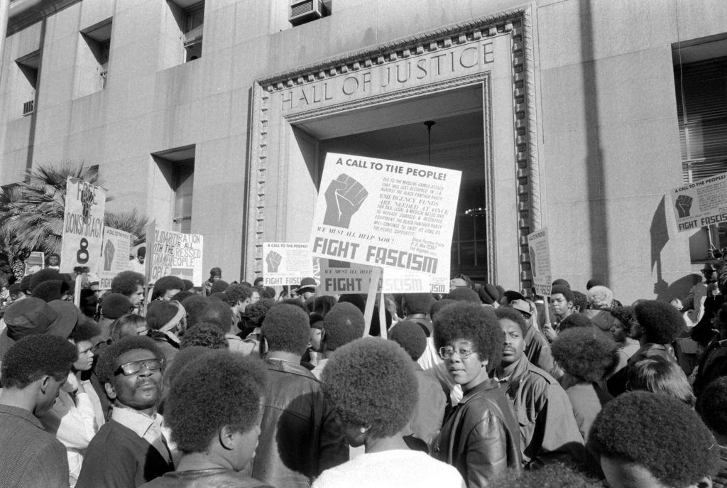
San Francisco attracted celebrities as well as activists. The city’s airport saw its share of famous faces passing through. Meanwhile, across town, political movements were making their own kind of history. The Black Panther Party, founded in nearby Oakland in 1966, maintained a strong presence in San Francisco and staged public protests against racial injustice.

Black Panther Party stages a protest against racism in San Francisco, 1970.

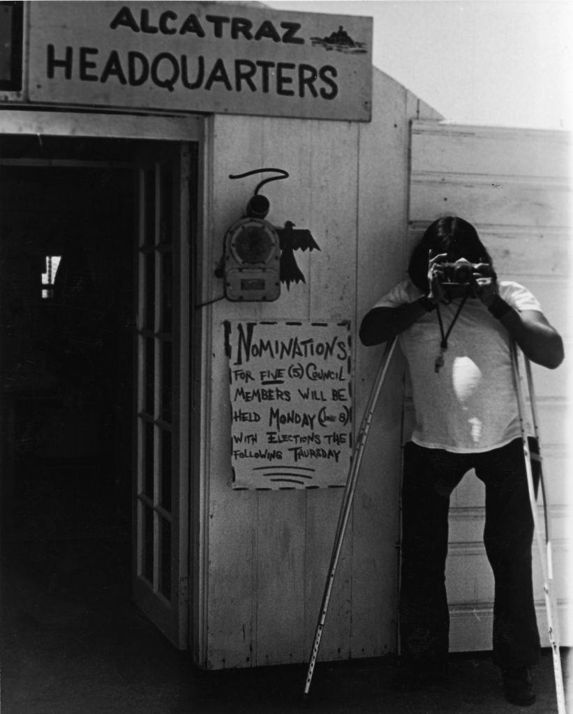
One of the most significant political actions of the era happened just off the San Francisco coast. A group of Native Americans occupied Alcatraz Island beginning in November 1969, and the occupation lasted until June 1971. They claimed the island under a federal treaty that granted Native Americans rights to surplus federal land. The occupation drew national attention to Indigenous land rights and sovereignty.

A Native American man on crutches takes a picture during a takeover of Alcatraz Island by a group of Native Americans, San Francisco, June 1970.
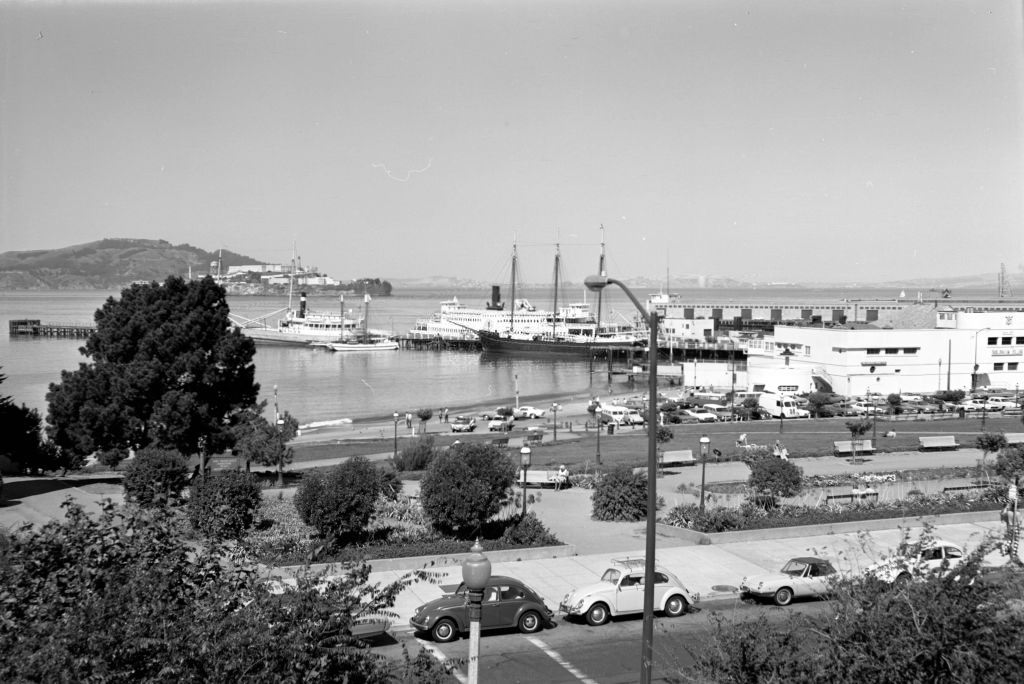
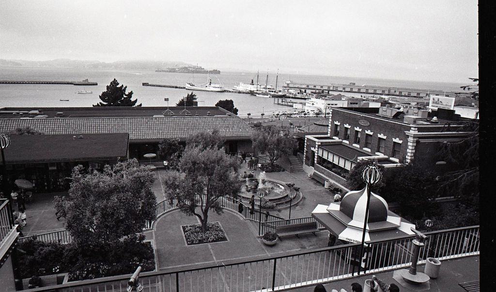
San Francisco Bay from Ghirardelli Square, 1970.

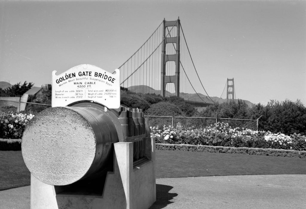
Ghirardelli Square, converted from a chocolate factory into a retail and dining complex in 1964, had quickly become one of the city’s most popular destinations. From its terraces, visitors looked out over the bay toward Alcatraz and Marin County. Not far away, the Golden Gate Bridge remained one of the great engineering landmarks of the 20th century.

Cable section from bridge cable in front of Golden Gate Bridge on September 25, 1970 in San Francisc.

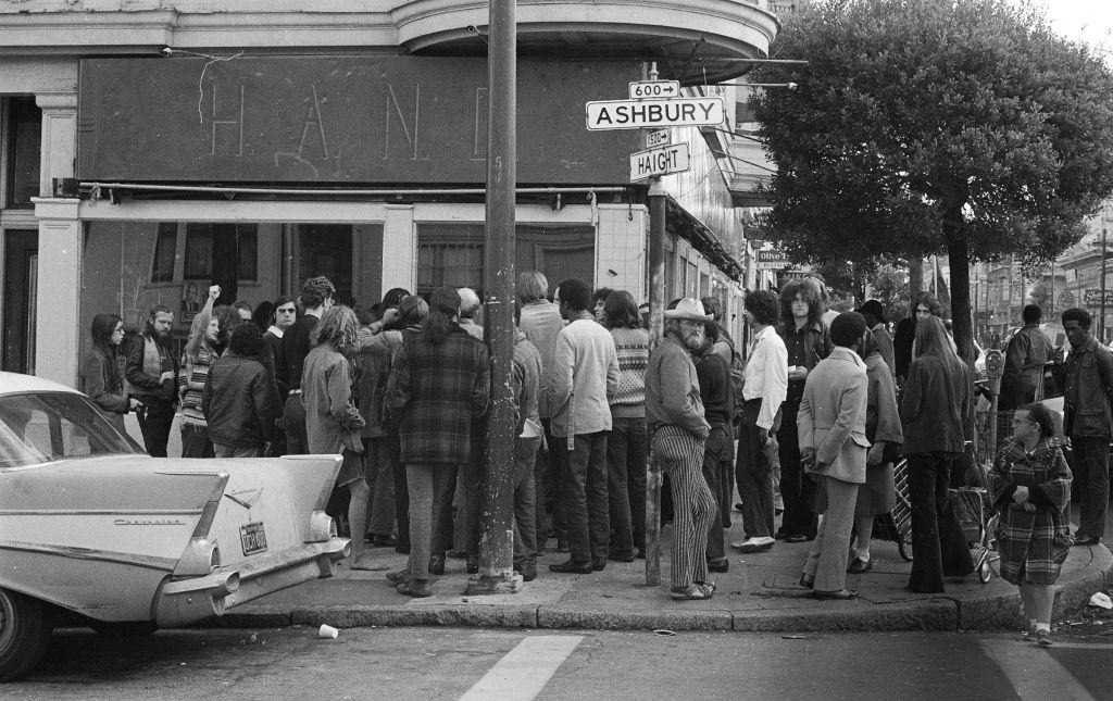
Haight-Ashbury had been the beating heart of the counterculture since the Summer of Love in 1967. By 1970, it was still a hub of political organizing and communal living, but the neighborhood was also showing real signs of strain. Overcrowding, drug use, and neglect left parts of it run-down. Protest meetings still gathered at the corner of Haight and Ashbury, but the utopian energy of the late 1960s had given way to something harder and more complicated.

A protest meeting is seen on the corner of Haight and Ashbury streets on October 22, 1970 in San Francisco.
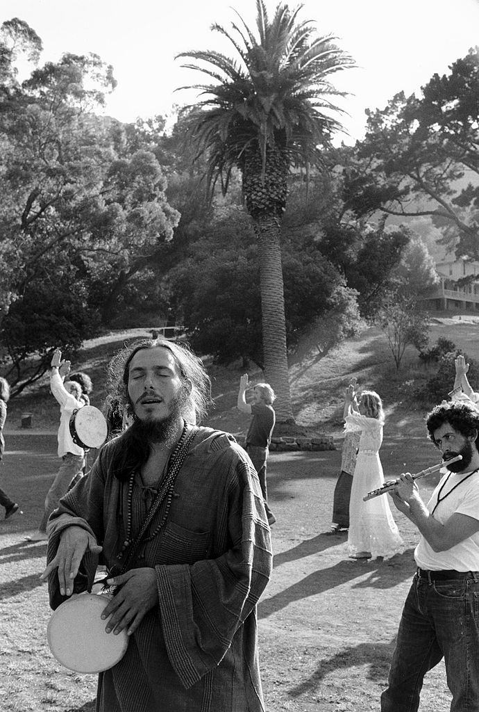
By 1972 and 1973, the city government moved in to clean up Haight-Ashbury, clearing encampments and addressing the deterioration that had accumulated over several years. But in 1971, communal life was still very much alive in pockets of the city. Hare Krishna devotees and other spiritual groups held public gatherings, singing and playing instruments in the open air.

Devotees singing ang playing instruments in a hippy commune, San Francisco, 1971.
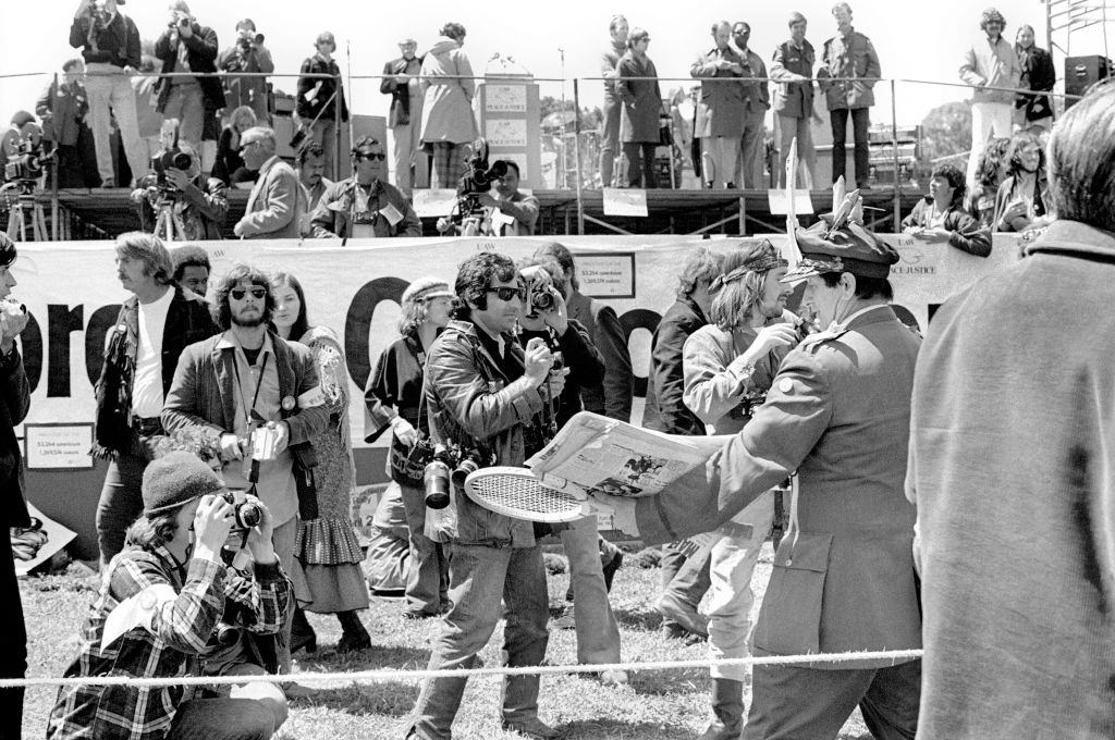
Anti War Rally at Golden Gate Park circa 1971 in San Francisco.
Golden Gate Park served as the city’s great outdoor gathering space. Anti-war rallies drew enormous crowds there, with speakers and musicians sharing the same grass fields where hippies had camped just a few years earlier. Nudity in the park was not uncommon during this period — it was considered a form of personal and political expression by many in the counterculture.

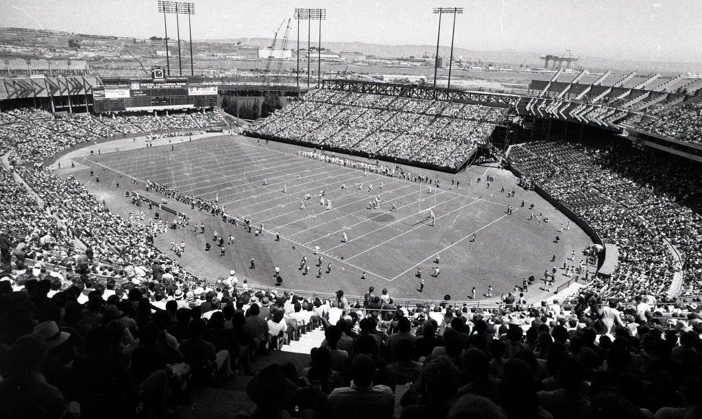
An estimated 40,000 fans saw the first 49ers football game played at Candlestick Park in 1971.

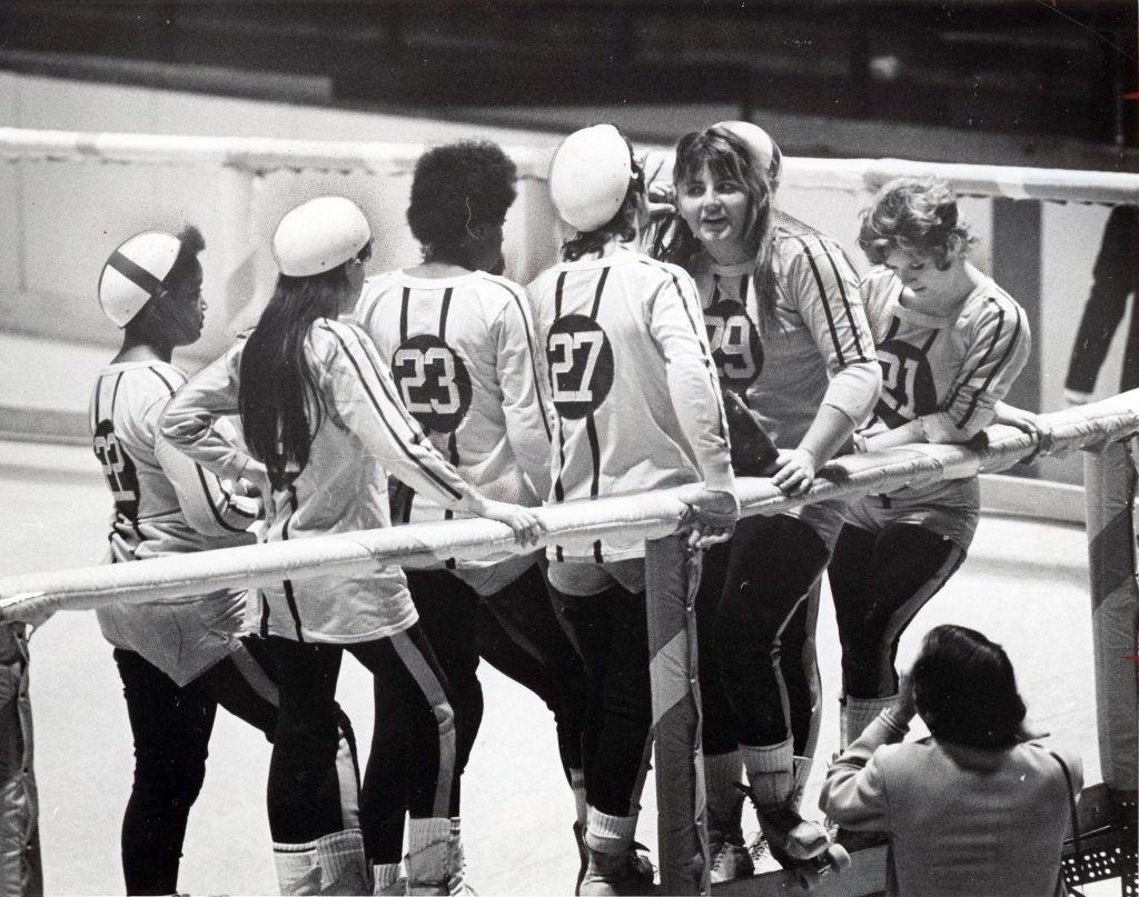
Not everything in 1970s San Francisco was political. Sports and entertainment drew massive crowds. When the San Francisco 49ers played their first game at Candlestick Park in 1971, an estimated 40,000 fans packed the stadium. Roller derby was another popular spectacle of the era, drawing rowdy, passionate audiences.

Roller derby at Madison Square Garden in 1971.
Ghirardelli Square and Fisherman's Wharf, July 27, 1971
Ghirardelli Square and Fisherman’s Wharf, July 27, 1971

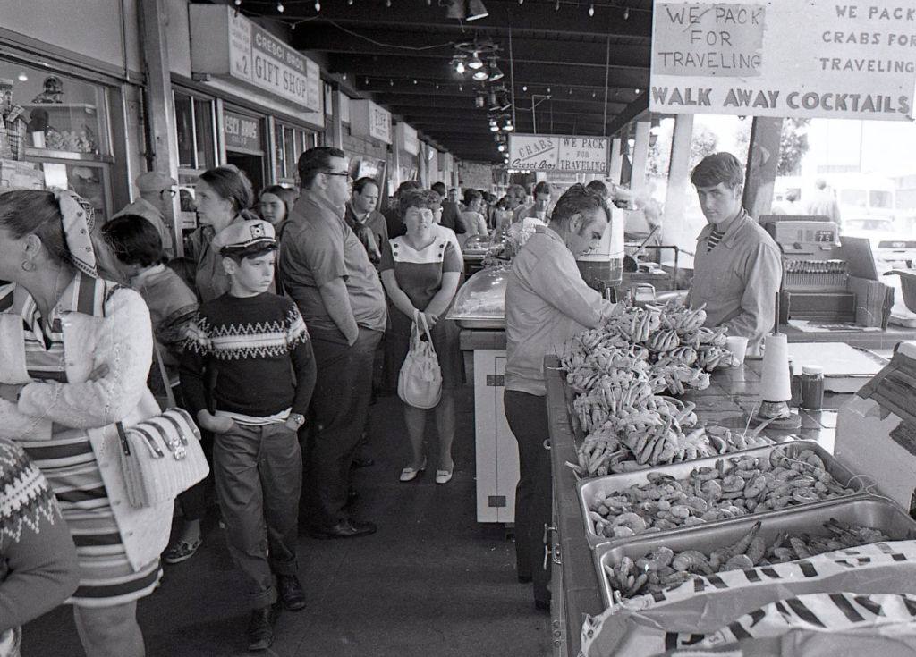
Fisherman’s Wharf and Ghirardelli Square anchored the northern waterfront. The wharf had been a working fishing pier for generations, but by the 1970s tourism had become just as important as the catch. Seafood stalls, souvenir shops, and restaurants filled every available space along the docks.

Fisherman's Wharf, July 27, 1971.
Fisherman’s Wharf, July 27, 1971.

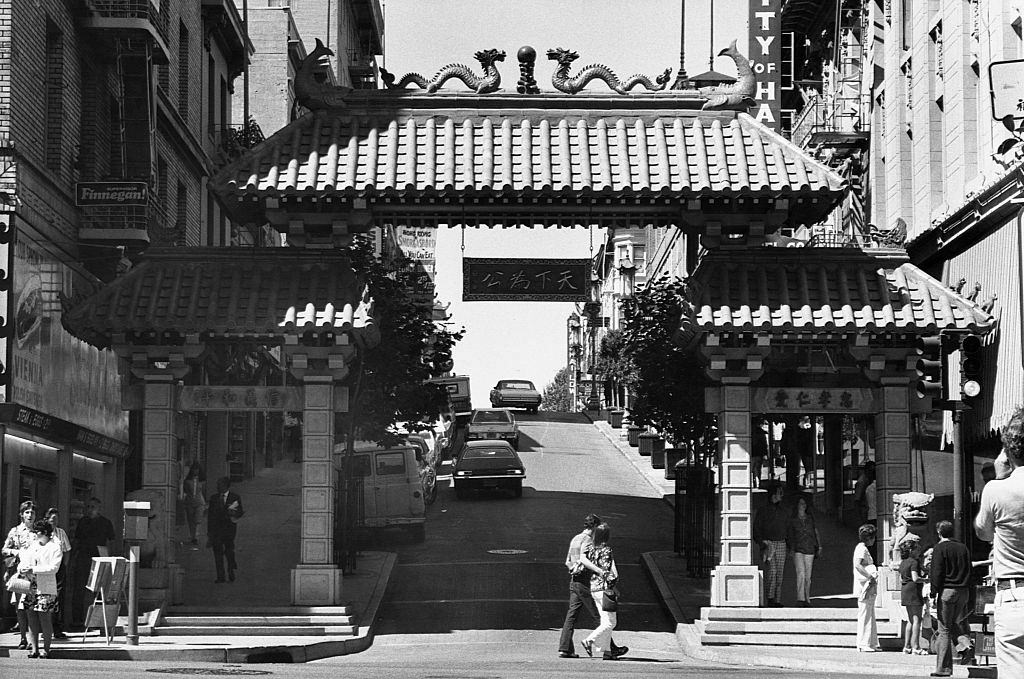
The Chinatown Gate on Grant Avenue marked the entrance to one of the oldest Chinese communities in the United States. By the early 1970s, San Francisco’s Chinatown was a fully self-contained neighborhood — complete with its own schools, newspapers, banks, temples, and social organizations. The gate, installed in 1970, quickly became one of the most photographed spots in the city.

Chinatown Gate in San Francisco, 1972.

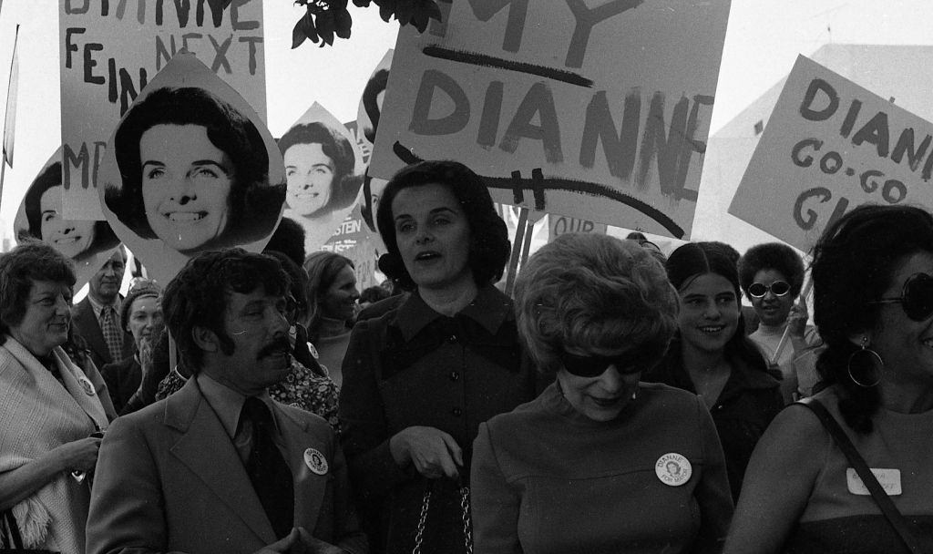
San Francisco politics were shifting rapidly in the early 1970s. Dianne Feinstein, then a city supervisor, ran for mayor in 1971. She did not win that year, but her political career was already gaining momentum. The city was entering a period of significant political change that would define much of the decade.

Supervisor Dianne Feinstein running for Mayor, October 6, 1971
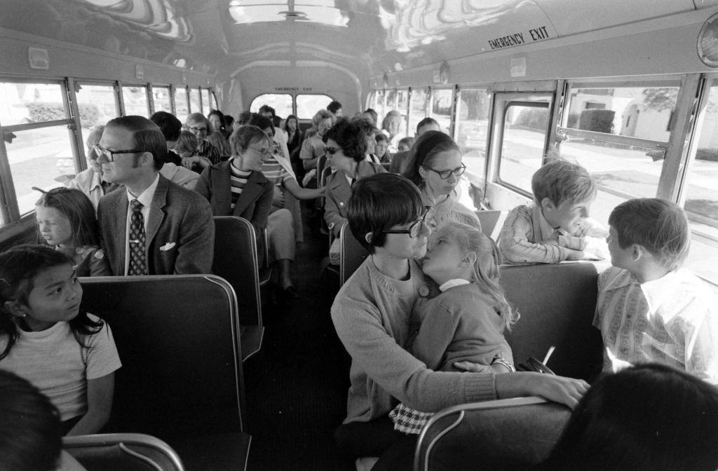
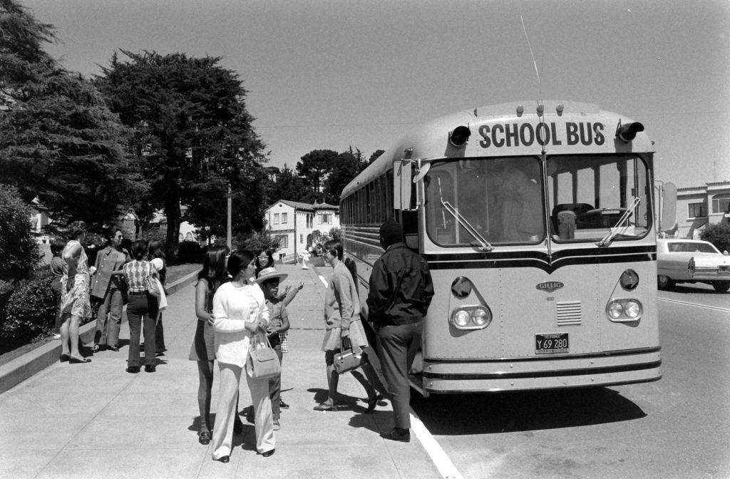
Le Conte Elementary School students, riding a bus in San Francisco, California, 1972

School busing was a major issue across American cities in the early 1970s. San Francisco implemented a desegregation busing program that transported students like those from Le Conte Elementary School across district lines. The program was controversial, drawing both support from civil rights advocates and fierce opposition from some communities.

Berkeley Students striking on the street in San Francisco, California, 1972
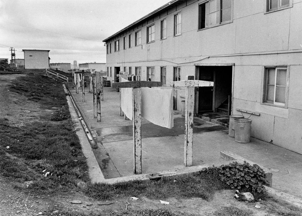
Hunters Point old wartime sheet rock holding. January 20, 1972.

Hunters Point was a neighborhood that had grown around a naval shipyard during World War II. By the early 1970s, the wartime infrastructure was aging and the area was home to a largely African American community that faced significant poverty and neglect. The dilapidated wartime structures stood as a reminder of how little had been invested in the neighborhood since the shipyard’s peak.

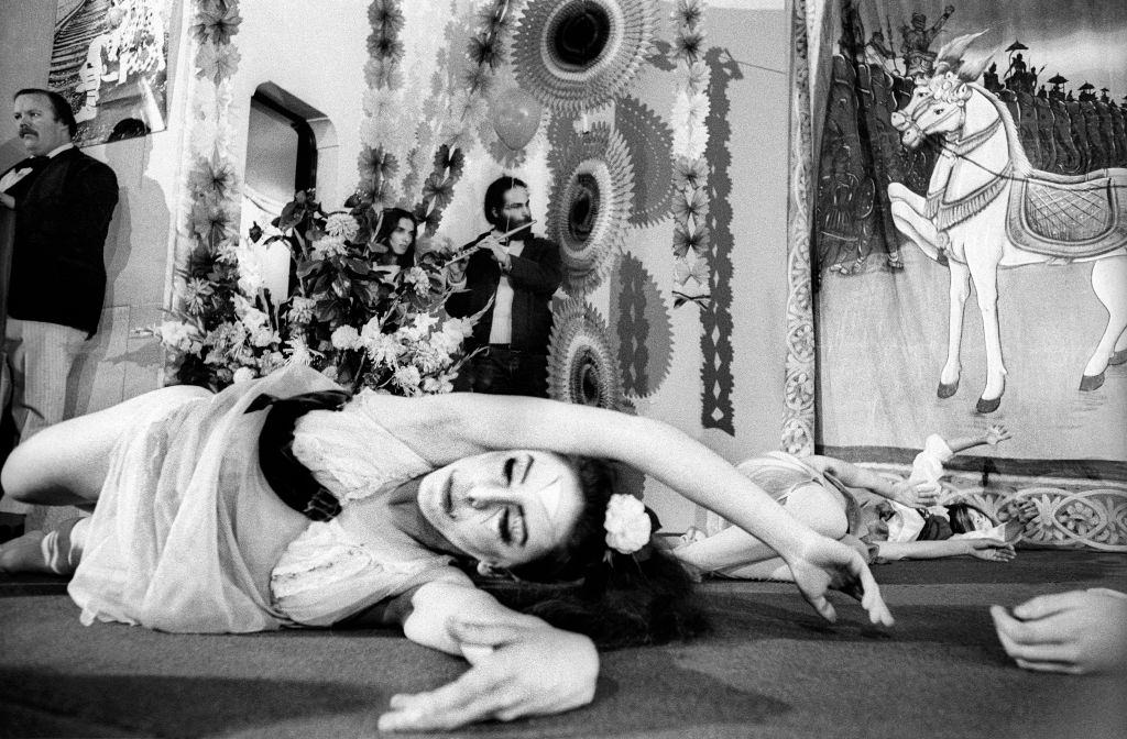
Ballet women perform before the Marriage of Raggedy Robin to Raggedy Jane at the First Unitarian Church on May 1, 1971 in San Francisc.

The city’s cultural life was extraordinarily varied. Ballet performances took place alongside street protests. Formal arts events shared space with informal gatherings in parks and on sidewalks. San Francisco’s acceptance of unconventional lifestyles made it a destination for artists, performers, and anyone who felt out of place elsewhere in America.

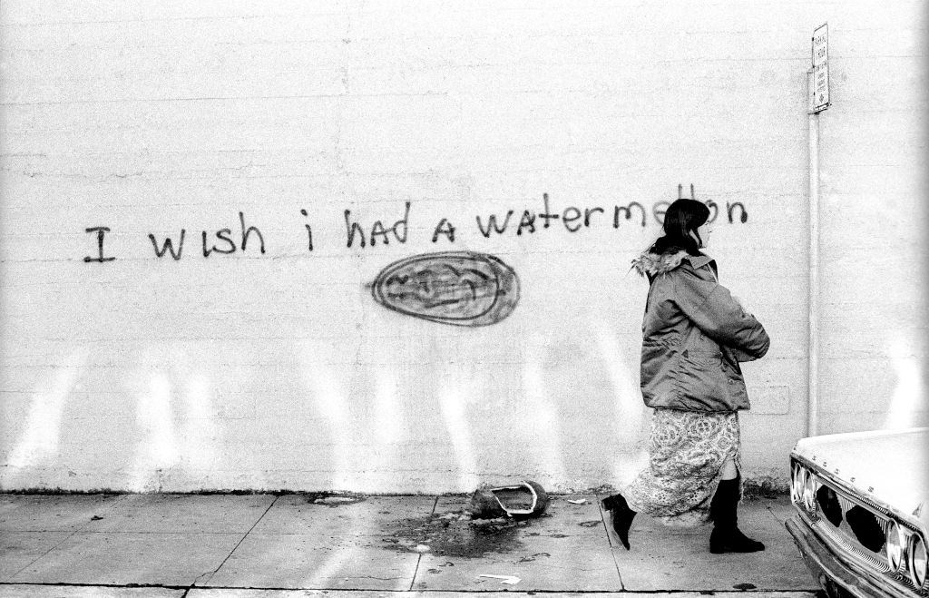
A woman walking by a message that says "I wish I had a Watermelon" with a crushed watermelon lays on the ground circa January, 1972.
A woman walking by a message that says “I wish I had a Watermelon” with a crushed watermelon lays on the ground circa January, 1972.
Le Conte Elementary School, riding a bus in San Francisco, California, 1972

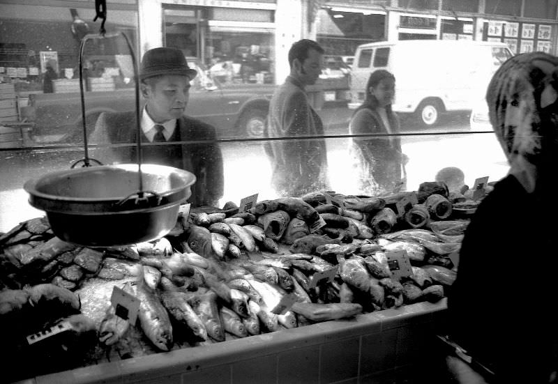
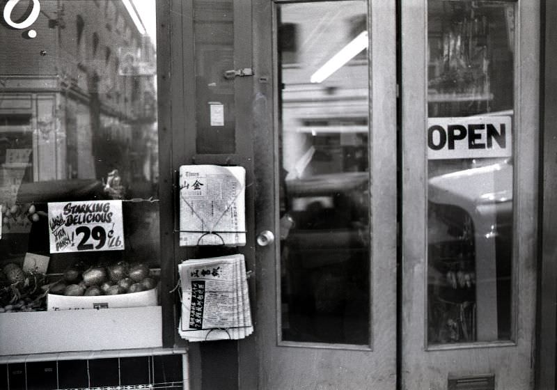
Chinatown’s commercial life was visible on every block. The DuPont Market at Grant and Pacific was a neighborhood fixture, selling groceries to the dense residential population nearby. Just down the street, other small shops and stalls kept the community supplied with everything from fresh produce to dry goods.

DuPont Market, Grant and Pacific, Chinatown San Francisco, 1970
Grant Street grocery, Chinatown-North Beach district, San Francisco, 1970

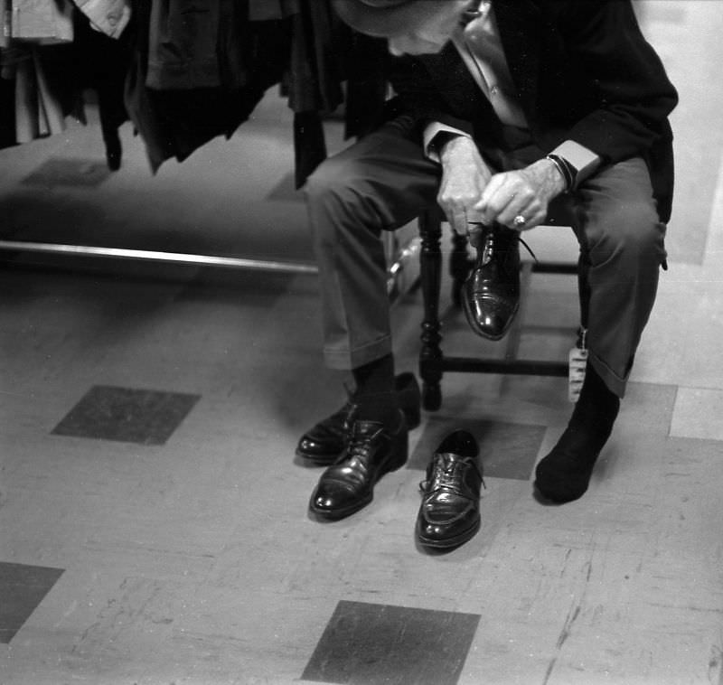
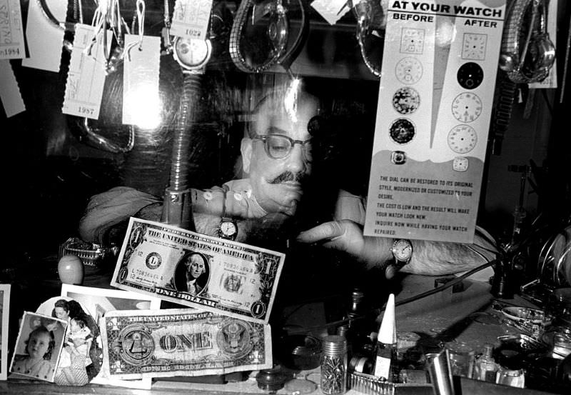
Thrift was a way of life for many San Franciscans in the 1970s. The Salvation Army store on Howard and 6th Street served the Tenderloin and SoMa neighborhoods, where working-class residents and the poor depended on secondhand goods. Small tradesmen like watch repairmen worked out of tiny storefronts on Polk Street, keeping the neighborhood economy ticking.

Man trying on shoes at the Salvation Army store on Howard and 6th Street, San Francisco, 1970
Watch repairman, Polk Street, Tenderloin, San Francisco, 1970

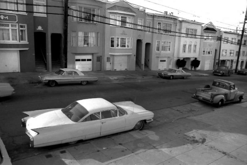
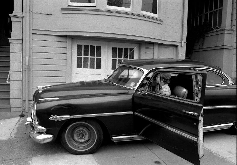
The Richmond district, stretching west from downtown toward the Pacific Ocean, was a quieter part of the city. Its broad avenues were lined with small businesses and residential buildings. American-made cars from the 1950s and 1960s were still common sights on the street well into the mid-1970s.

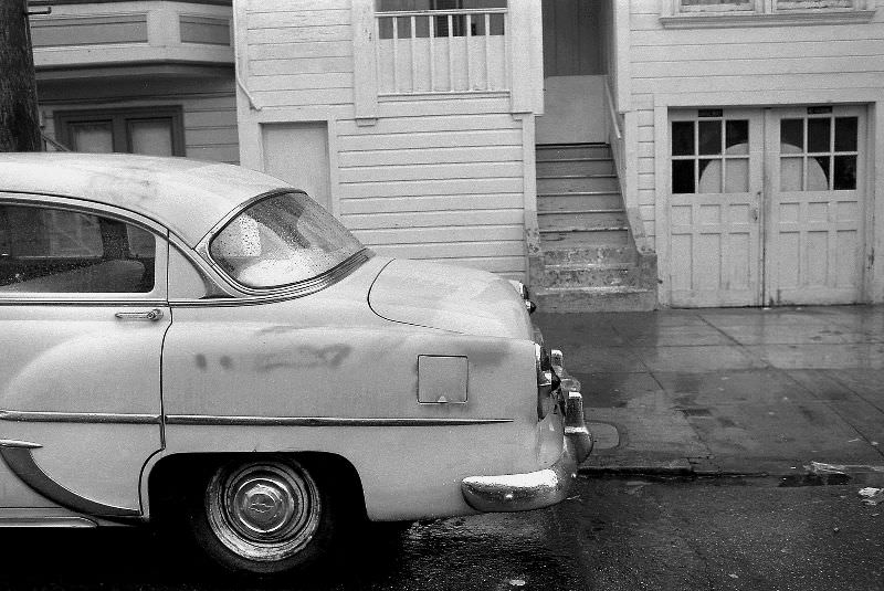
A 1960 Cadillac Coupe Deville on 8th Avenue, Richmond district, San Francisco, 1974
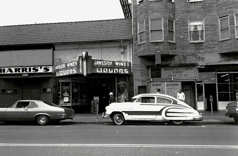
Lakeside Liquors, Mission district, San Francisco, 1974

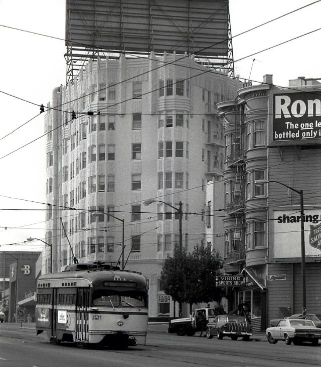
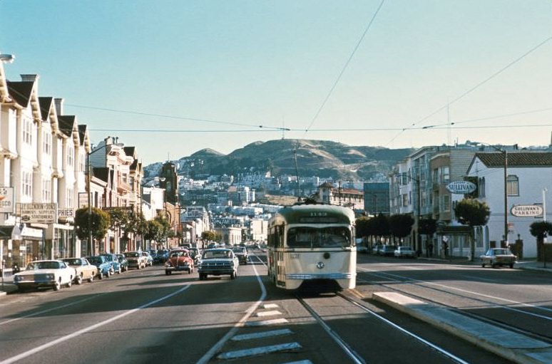
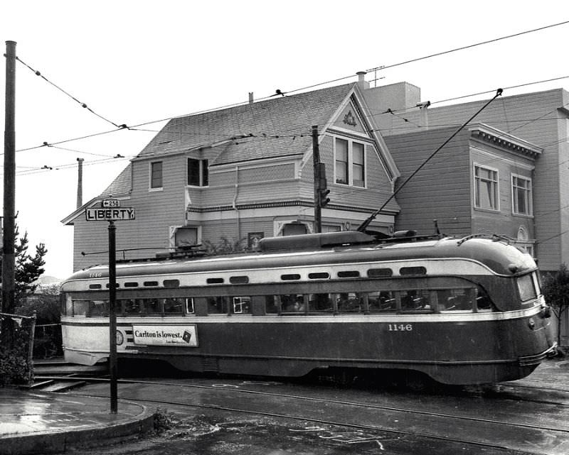
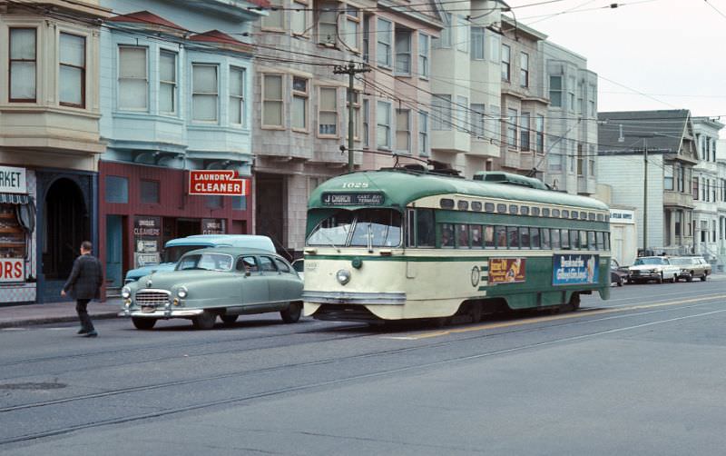
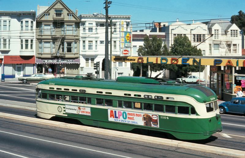
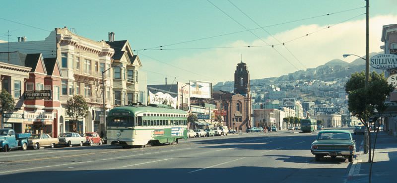
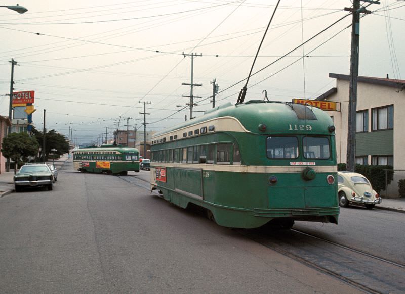
The Mission district was one of the city’s most vibrant and densely populated neighborhoods. Its streetcar lines carried residents up and down the district’s long, flat avenues. The MUNI J-Church line was a fixture of everyday life, rattling past corner stores, laundromats, and apartment buildings.

MUNI J-Church line streetcar, 21st Street, Mission district, San Francisco, 1974
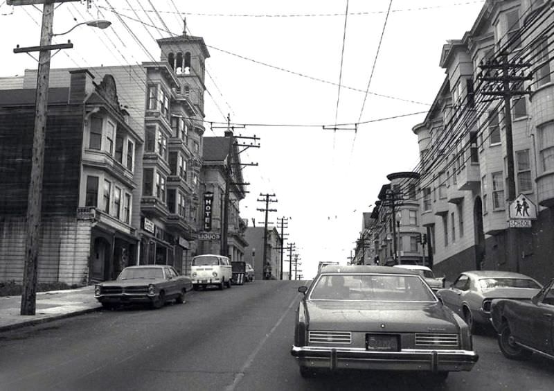
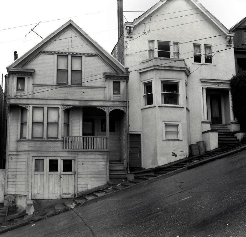
Page Street near Fillmore, Lower Haight, San Francisco, 1974
San Francisco Municipal Railway, 1974

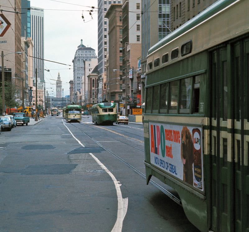
San Francisco’s public transit system was one of the busiest in the western United States. The Municipal Railway — known as MUNI — operated cable cars, streetcars, and buses across the city. By 1974, the system was aging but still essential. Hundreds of thousands of residents depended on it every day.

8th Avenue, Richmond district, San Francisco, 1976

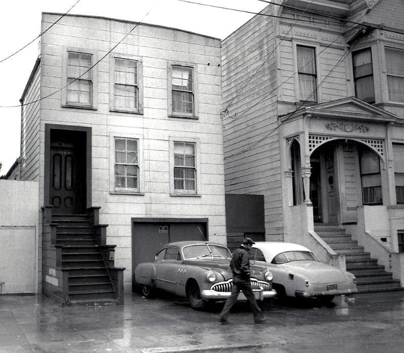
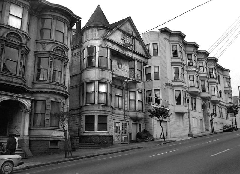
By 1976, the Richmond district’s 8th Avenue had a settled, unhurried character. The McAllister Street blocks of the Western Addition told a different story — that neighborhood had been dramatically reshaped by urban renewal projects that demolished large sections of Victorian housing starting in the 1950s and 1960s, leaving behind a fragmented streetscape that was still healing.

1300 block McAllister Street, Western Addition, San Francisco, 1976
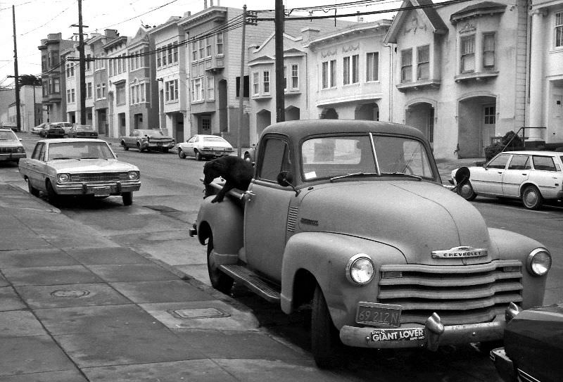
1951 Chevrolet pickup truck, 8th Avenue, Richmond district, San Francisco, 1976

July 4, 1976 marked the United States Bicentennial — 200 years since the Declaration of Independence. San Francisco held a major parade through Golden Gate Park, drawing large crowds of spectators. It was one of the biggest public celebrations the city had hosted in years.

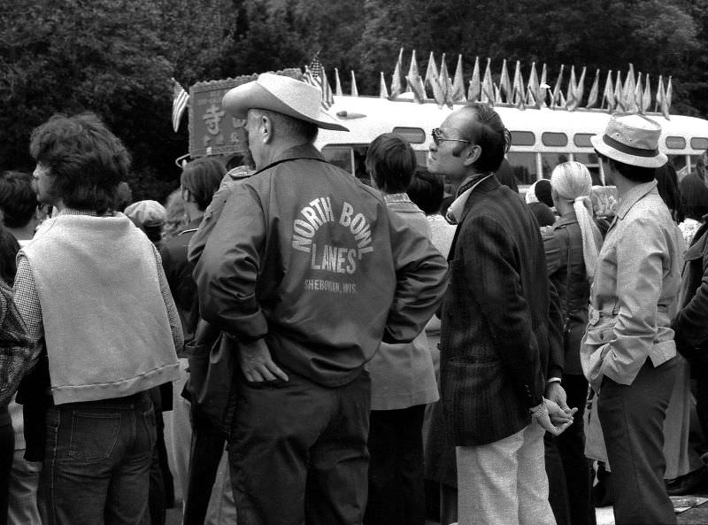
Bystanders at the Bicentennial parade, Golden Gate Park, San Francisco, July 1976
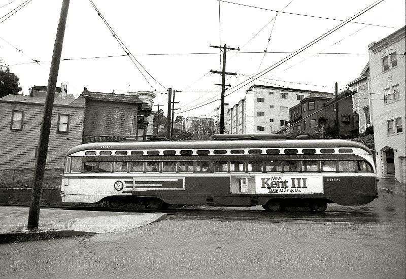
MUNI J-Church line, PCC car no. 1018, Liberty Street, Mission district, San Francisco, 1976

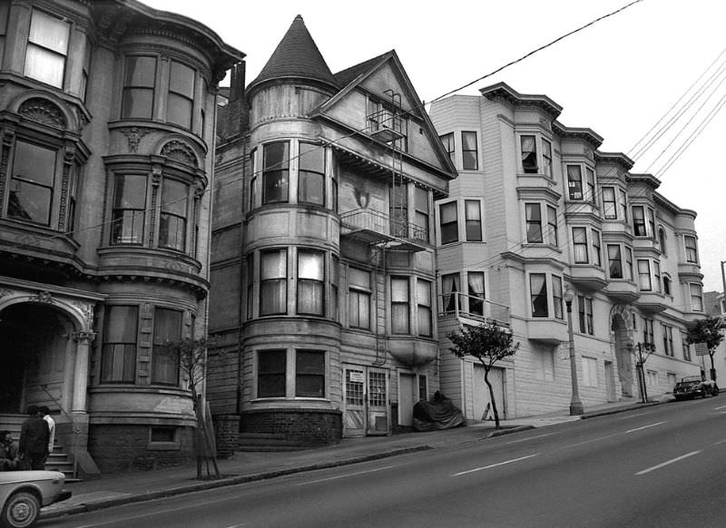
The Western Addition’s Fillmore Street had once been called the “Harlem of the West” for its thriving jazz scene in the 1940s and 1950s. By the mid-1970s, urban renewal had cleared much of the old neighborhood, but some buildings survived. Restoration efforts were underway on certain blocks by 1976, preserving Victorian-era structures that had narrowly escaped demolition.

This building has been restored and now sits at 1720-1722 Fillmore near Sutter, Western Addition, San Francisco, 1976
Valencia and 15th, Mission district, San Francisco, 1976
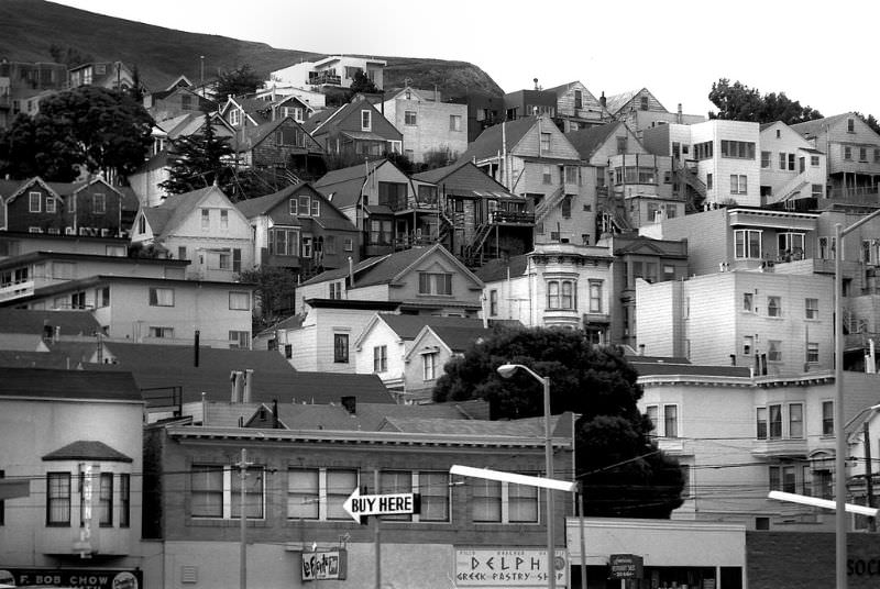
Western Addition, San Francisco, 1976
Woodward and Duboce, Mission district, San Francisco, 1976
Woodward between 14th Street and Duboce, Mission district, San Francisco, 1976

The Mission district’s streets in the late 1970s were a mix of Latino-owned businesses, corner bars, auto repair shops, and apartment buildings. Alabama Street and the surrounding blocks gave the neighborhood a gritty, working-class texture that photographers documented thoroughly during this period.

Alabama Street, Mission district, San Francisco, 1977

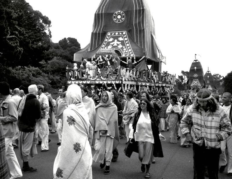
Golden Gate Park continued to host large religious and cultural gatherings. The annual Hare Krishna gathering in 1977 drew devotees from across the Bay Area, with chanting, music, and communal feasting. These events were a continuation of the open, public spiritual life that had characterized the park since the late 1960s.

Annual Hare Krishna gathering, Golden Gate Park, San Francisco, 1977

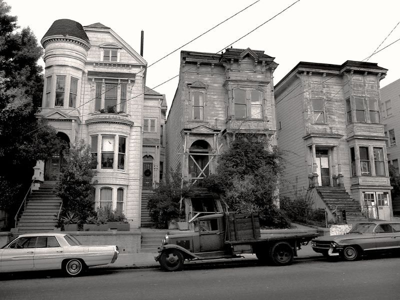
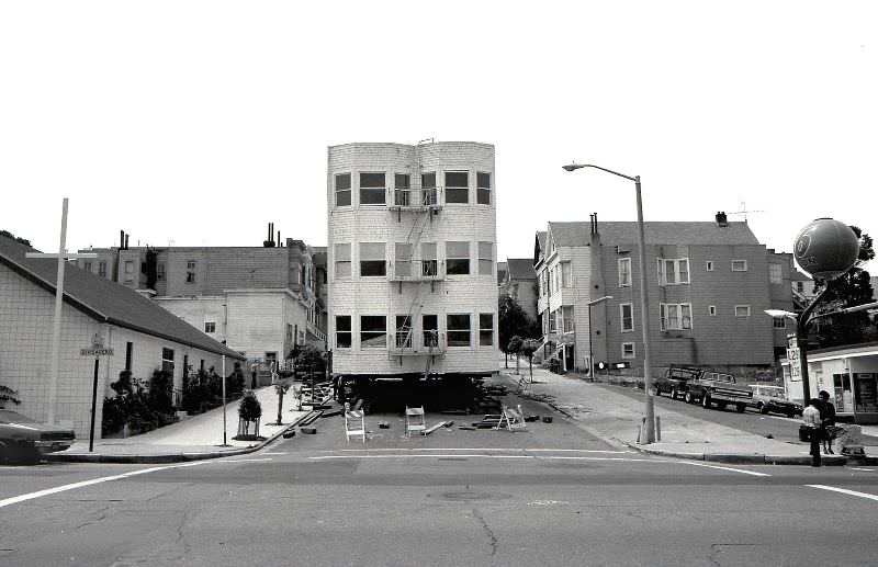
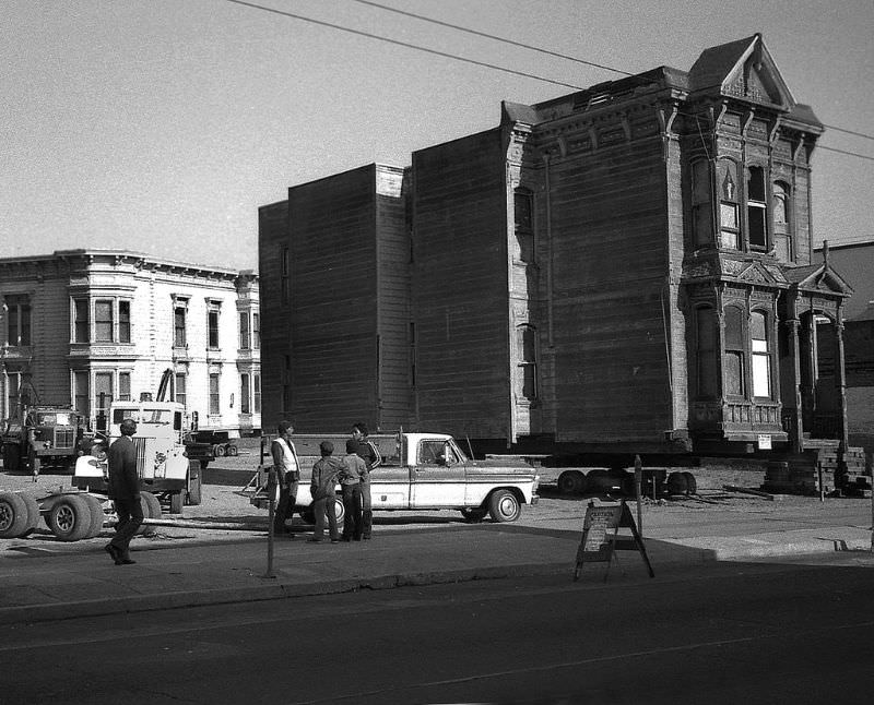
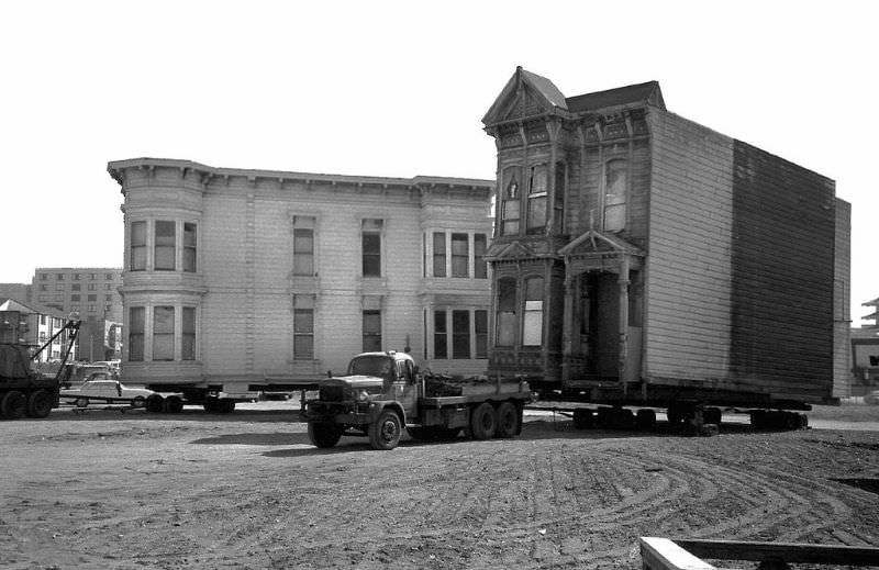
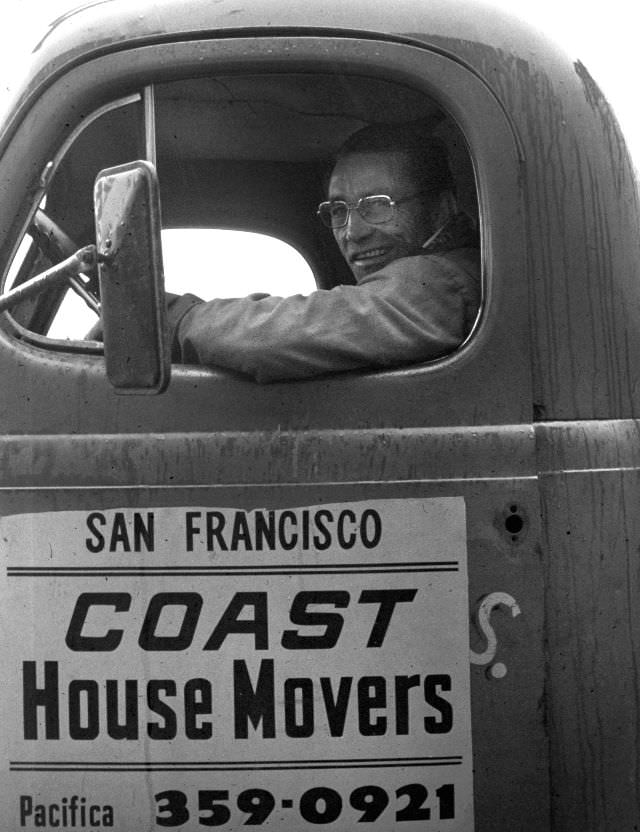
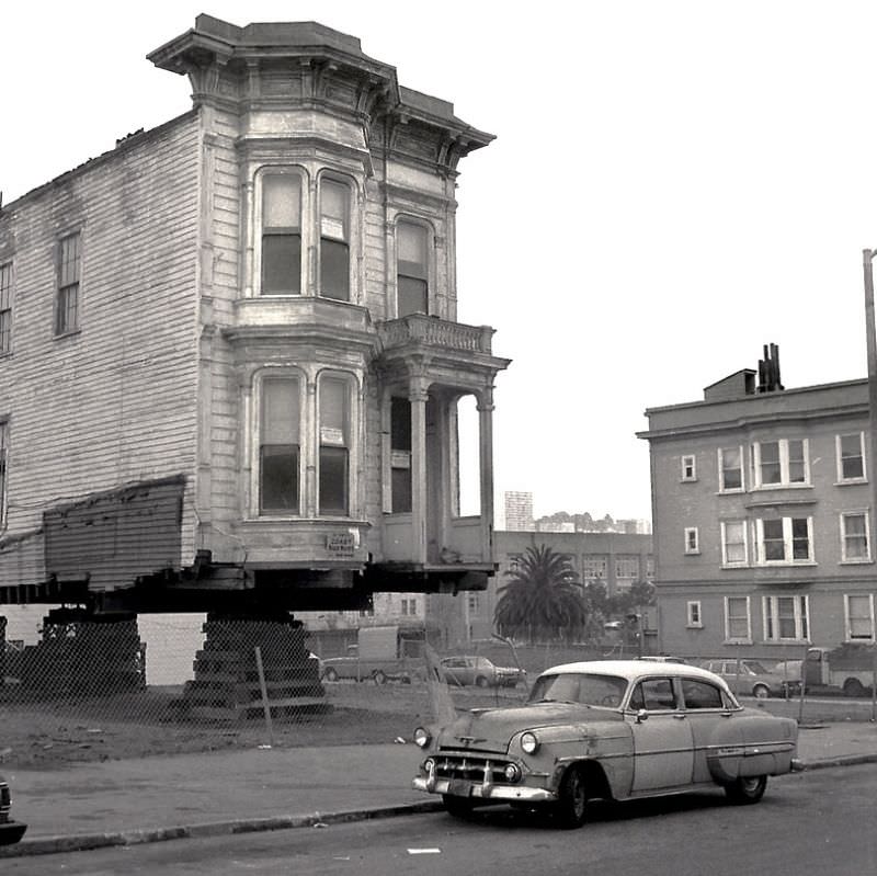
One of the more unusual sights in the Western Addition in 1977 was the physical relocation of entire apartment buildings. Coast House Movers operated in the city, lifting Victorian-era structures off their foundations and hauling them down the street to new lots. The practice preserved buildings that would otherwise have been demolished, though it required remarkable coordination to move them through the city’s narrow streets.

Apartment building being moved to it's new location, Ellis and Divisadero, Western Addition, San Francisco, 1977
Apartment building being moved to it’s new location, Ellis and Divisadero, Western Addition, San Francisco, 1977
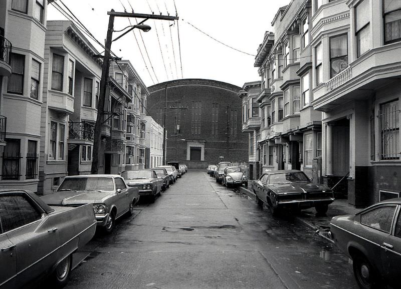
Ellis Street, between Scott and Divisidero, Western Addition, San Francisco, 1977
Driver for Coast House Movers, Western Addition, San Francisco, 1977
Foreground is Mission Street near Fair, Bernal Heights district, San Francisco, 1977

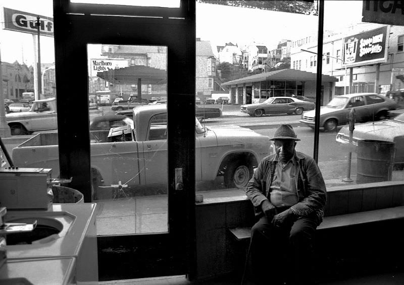
The Western Addition’s laundromats were neighborhood anchors where residents gathered as much out of necessity as habit. The attendant at the Fulton and Divisadero location was a familiar face in the community. A few blocks away on Market Street, the city’s main commercial artery pulsed with foot traffic, transit lines, and storefronts.

Laundromat attendant, Fulton and Divisadero, Western Addition district, San Francisco, 1977
Market Street, San Francisco, 1977
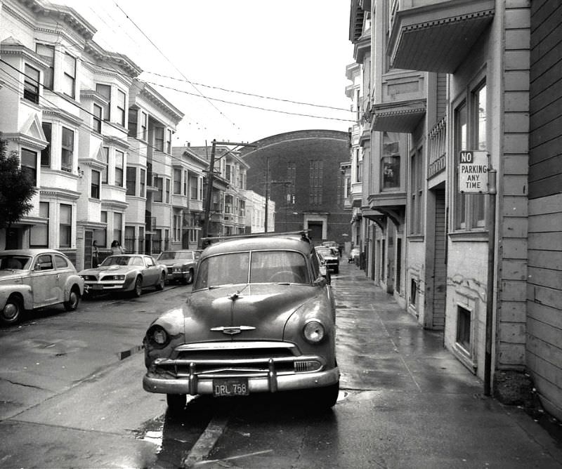
Mission district rainy afternoon, San Francisco, 1977
Mission district, San Francisco, 1977

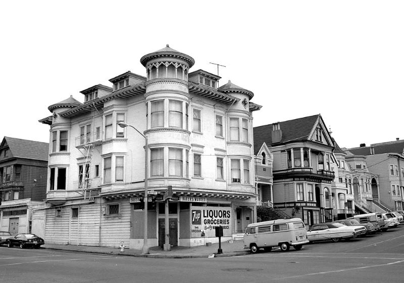
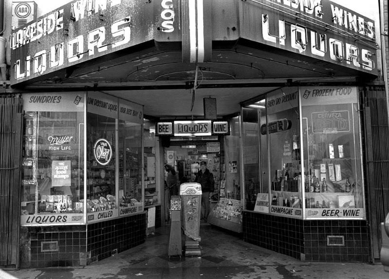
By 1978, the Mission and Western Addition districts had developed their own distinct commercial ecosystems. Baker’s Market at Fulton and Baker served the Western Addition. Lakeside Liquors at 2188 Mission Street was a neighborhood staple. These small businesses defined the texture of daily life far more than any landmark or tourist attraction.

Baker's Market, Fulton and Baker Streets, Western Addition, San Francisco, 1978
Baker’s Market, Fulton and Baker Streets, Western Addition, San Francisco, 1978
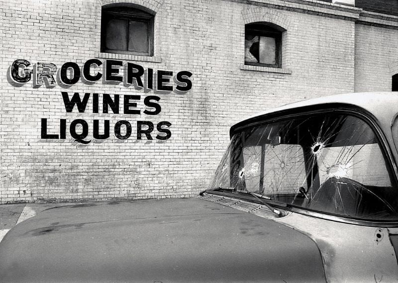
Lakeside Liquors, 2188 Mission Street, Mission district, San Francisco, 1978

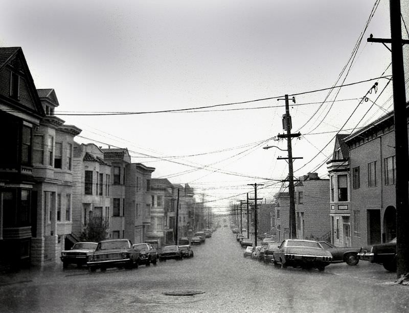
Winter rainstorms rolled in off the Pacific and soaked the Mission district’s streets. The intersection of 23rd and Hampshire was typical — wet pavement reflecting storefronts, empty sidewalks, and the quiet that settled over the neighborhood when the weather turned hard.

Looking west at 23rd and Hampshire in the Mission district during a winter rainstorm, San Francisco, 1978
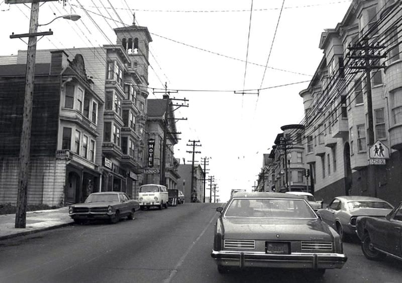
Public housing projects, Turk Street, Western Addition district, San Francisco, 1978

Public housing on Turk Street represented the Western Addition’s urban renewal legacy at its most concentrated. High-rise towers had replaced the Victorian row houses demolished in earlier decades, and by 1978 the towers themselves were struggling with overcrowding and disinvestment.

1970s San Francisco: Fascinating Vintage Photos Show Street Scenes And Everyday Life

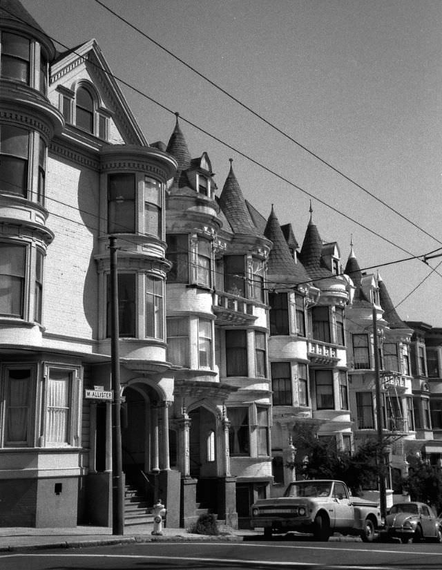
The streets of 22nd Street between Church and Sanchez captured the residential character of the inner Mission — a stretch of attached Victorian and Edwardian houses that had survived both urban renewal and the 1906 earthquake. These blocks remained densely populated throughout the 1970s.

Houses on 22nd Street between Church and Sanchez, San Francisco, 1979
1970s San Francisco: Fascinating Vintage Photos Show Street Scenes And Everyday Life

The intersection of Mission and 18th Street was one of the busiest commercial corners in the neighborhood. Storefronts lined both sides of the street, and the foot traffic from the surrounding residential blocks kept business steady. The Mission district in 1979 was overwhelmingly Latino, shaped by waves of immigration from Central America and Mexico over the previous two decades.

Intersection of Mission and 18th Street, Mission district, San Francisco, 1979
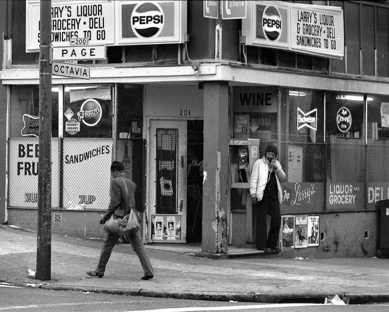
Larry's Liquor, 201 Octavia Street, Western Addition district, San Francisco, 1979
Larry’s Liquor, 201 Octavia Street, Western Addition district, San Francisco, 1979
Market and Octavia, San Francisco, 1979

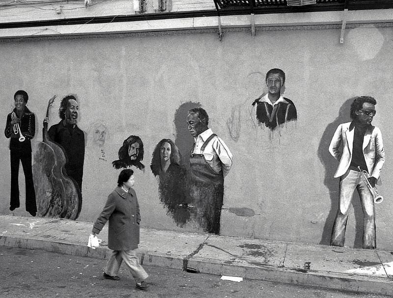
North Beach, the city’s Italian-American neighborhood and longtime arts hub, was home to clubs and performance venues. The Keystone Korner was a prominent jazz club, and in 1979 a large mural was being painted on its exterior wall — a public artwork visible to anyone passing through the neighborhood.

Mural painting in progress on the side of the Keystone Korner, North Beach, San Francisco, 1979

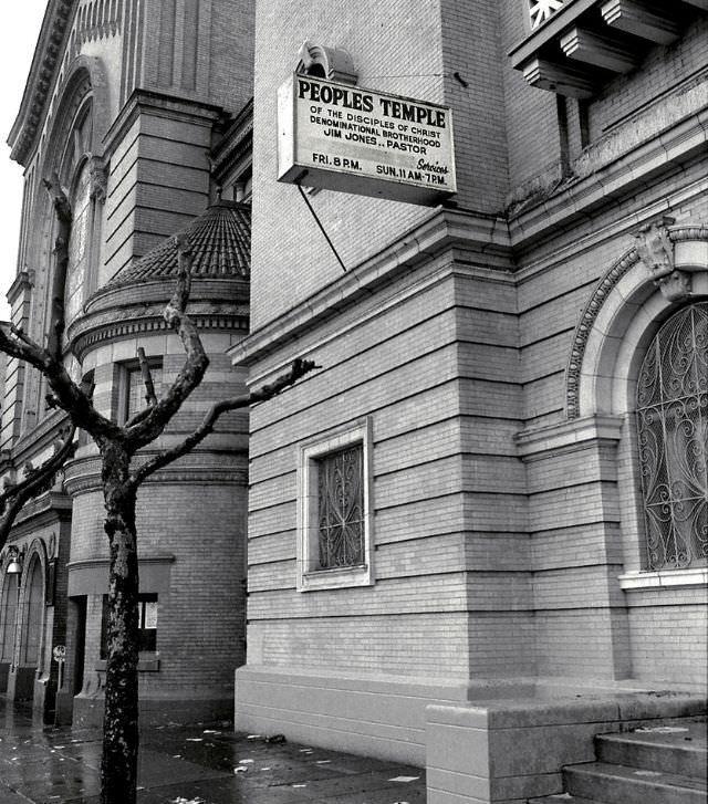
People’s Temple had a significant presence in San Francisco throughout the 1970s. Its founder Jim Jones cultivated strong ties with local politicians and built a large congregation drawn heavily from the city’s African American community. In November 1978, 918 members of People’s Temple died in a mass murder-suicide in Jonestown, Guyana — the largest such event in American history. The San Francisco building stood as a physical remnant of the church’s time in the city.

People's Temple, San Francisco, 1979
People’s Temple, San Francisco, 1979
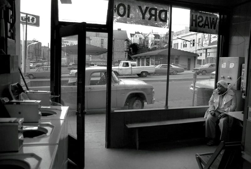
Wash Dry 10 Cents Laundromat, 806 Divisadero Street, Western Addition district, San Francisco, 1979
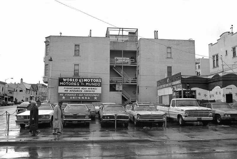
World Motors, 18th and Valencia Streets, Mission district, San Francisco, 1979

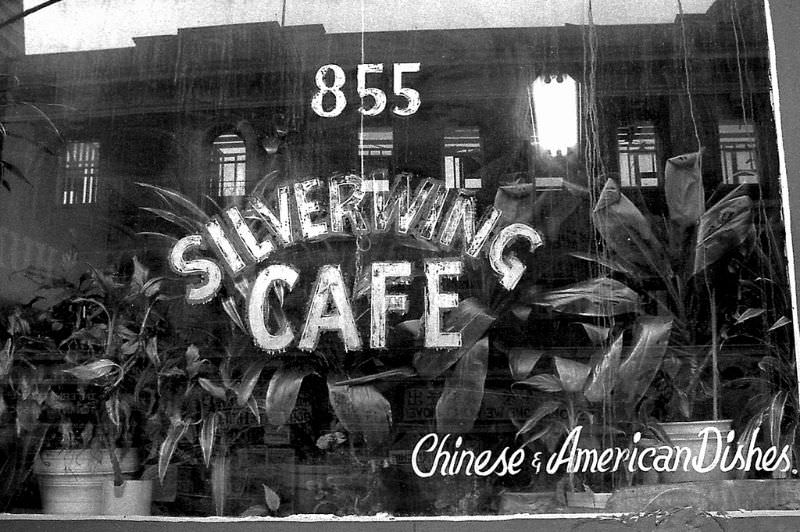
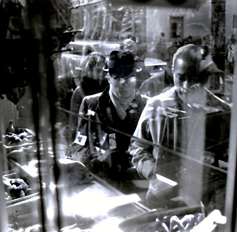
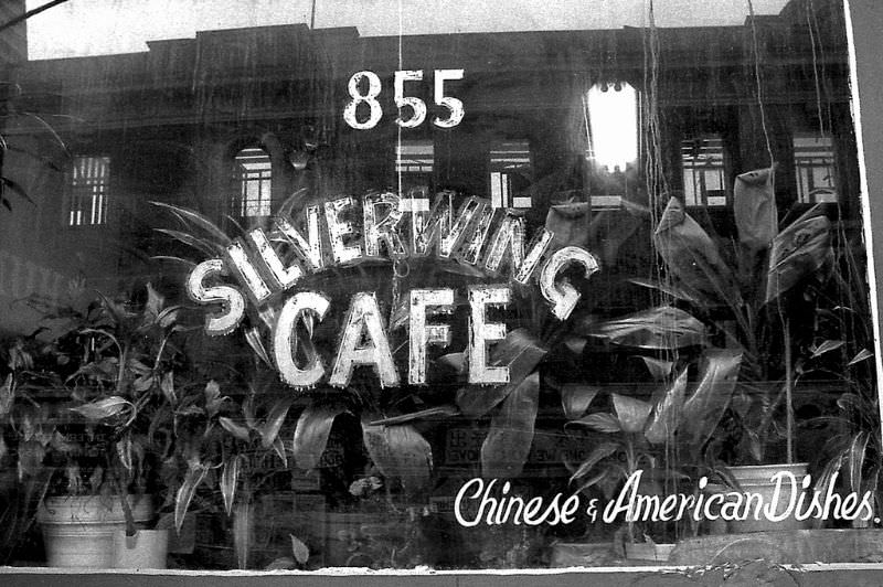
Chinatown’s Kearny Street corridor held the old International Hotel, a residential building that had been at the center of a decade-long displacement battle. Filipino and Chinese tenants fought eviction from 1968 until the building was finally demolished in 1979. A photograph taken in 1978 from the Silverwing Cafe shows the hotel’s reflection in the window — a ghost of a building that was nearly gone.

Silverwing Cafe on Kearny Street, old International Hotel can be seen in the window reflection, 855 Kearny Street, Chinatown, San Francisco, 1978
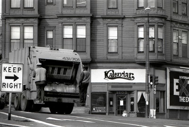
Fell Street between Fillmore and Steiner, Western Addition district, San Francisco, 1979
Fillmore Street, San Francisco, 1979

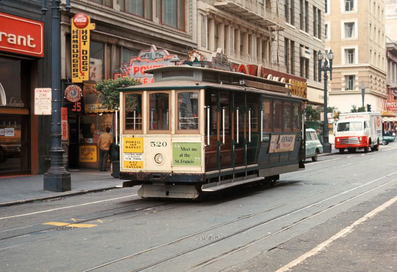
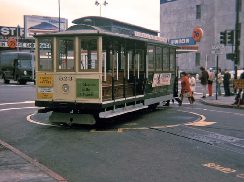
The cable car lines were among the city’s most enduring institutions. The Powell-Mason route swung around its turntable at Bay Street. The California Street line climbed through the Financial District between Kearny and Grant. These routes carried tourists and commuters alike, and their distinctive clanging bells were as much a part of San Francisco as the fog rolling in off the bay.

Powell-Mason cable car route on the Taylor Street turntable at Bay Street, 1970
California Street cable car route. View northeast on California Street between Kearny Street and Grant Avenue, 1970

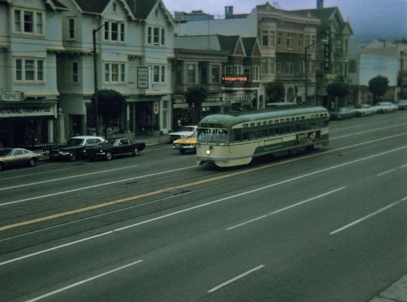
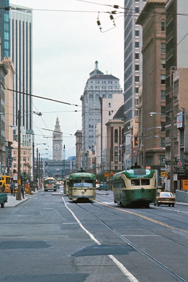
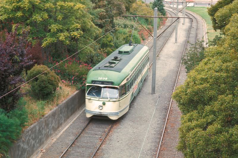
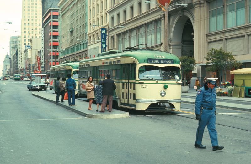
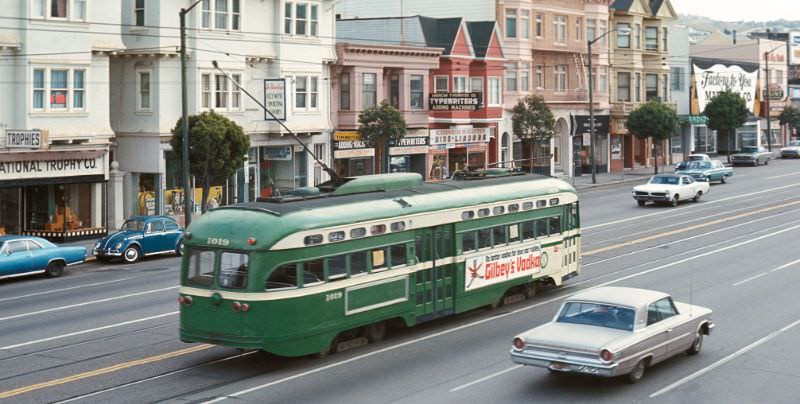
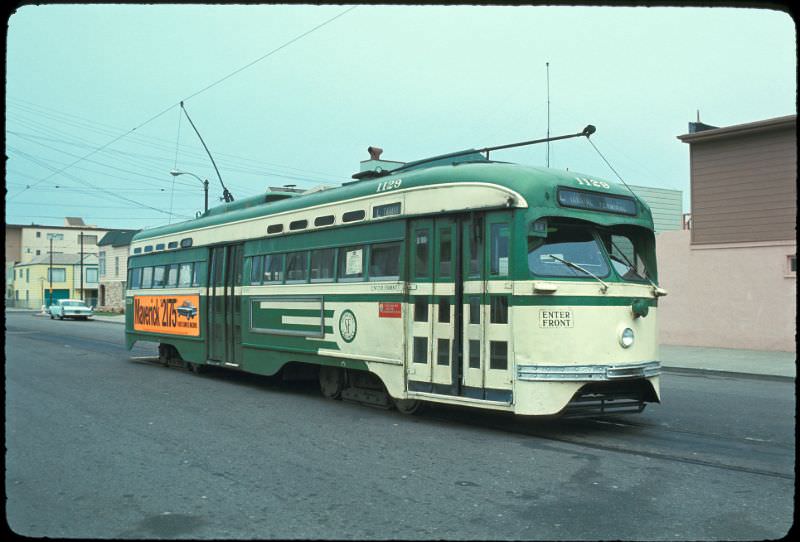
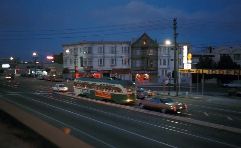
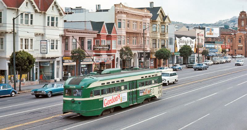
Market Street was San Francisco’s main artery, and the PCC streetcars that ran along it were a constant presence. On foggy evenings the cars moved through the mist between Noe Street and Sanchez Street, their headlights cutting through the grey. These Presidents’ Conference Committee cars — PCC cars — had been in service since the 1940s and were still running strong in the early 1970s.

PCC heading downtown on Market Street between Noe Street/16th Street and Sanchez Street/15th Street on a foggy early evening, 1970
Church Street at Market Street on the J-Line looking east, 1971

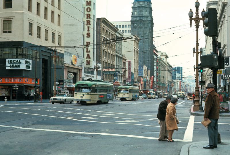
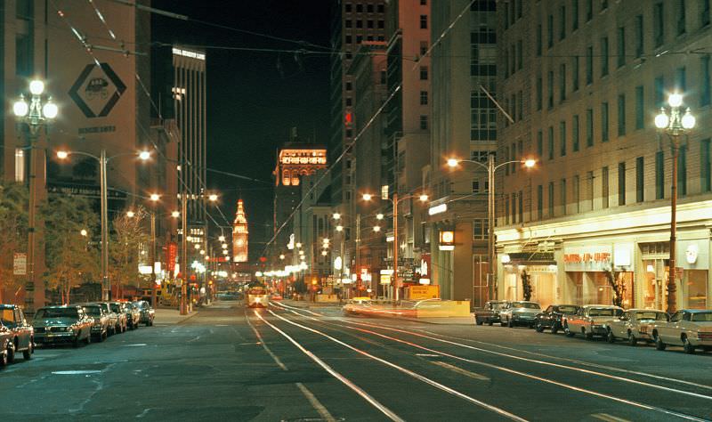
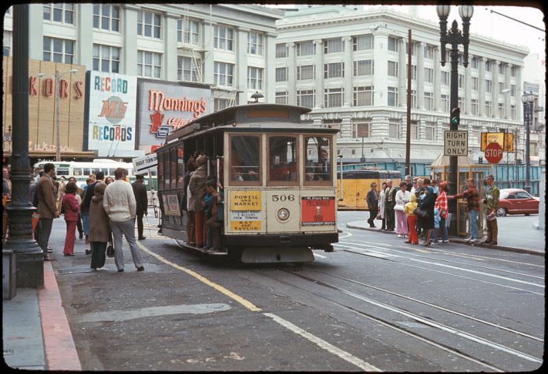
Market Street at 3rd and Geary was one of the busiest transit intersections in the entire city. Streetcars crossed in multiple directions, and the Powell Street turntable at Market was a landmark used by cable car operators to reverse direction at the end of each run. At night, the intersection lit up with storefront signs and the headlights of passing transit cars.

Market Street at 3rd Street_Geary Street looking northeast, 1971
Market Street at 3rd Street/Geary Street looking southwest, 1971
Market Street at 5th Street/Eddy Street/Powell Street looking east, 1971
Market Street at Sanchez Street/15th Street in early evening
Market Street between Noe Street/16th Street and Sanchez Street/15th Street, 1971
Night view of Market Street at 3rd Street/Geary Street looking northeast, 1971

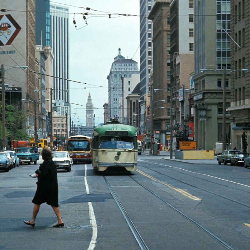
The PCC cars on Market Street were photographed extensively in 1971, and the record they left behind is remarkable. Car after car heading downtown, captured from different angles and in different light conditions — early evening fog, full daylight, the glow of storefronts at night. The streetcar system defined how people moved through the city and what the streets looked like at any given hour.

PCC heading downtown on Market Street approaching Sanchez Street/15th Street, 1971
PCC heading downtown on Market Street between Noe Street/16th Street and Sanchez Street/15th Street, 1971
PCC heading southwest on Market Street at 3rd Street/Geary Street looking northeast, 1971
PCC on Market Street between Noe Street/16th Street and Sanchez Street/15th Street, 1971

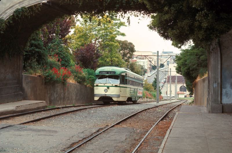
The J-Line ran through Dolores Park, where a pedestrian walkway crossed above the tracks at 19th Street. The PCC cars passed beneath it on their way through the Mission district. Further out, the L-Line terminated on Wawona Street near the ocean — a quiet, residential endpoint a long way from the noise of Market Street.

PCC on the J-Line about to pass under the pedestrain walkway in Dolores Park at 19th, 1971
PCC on the J-Line about to pass under the pedestrain walkway in Dolores Park at 19th Street looking north, 1971
PCC on Wawona Street at the end of the L-Line looking northwest, 1971
Powell Street at the end-of-line turntable at Market Street, 1971

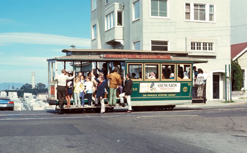
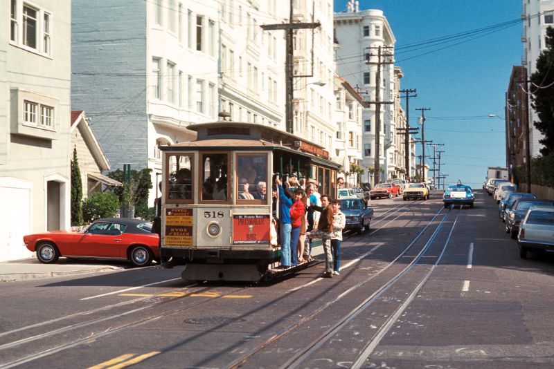
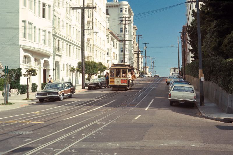
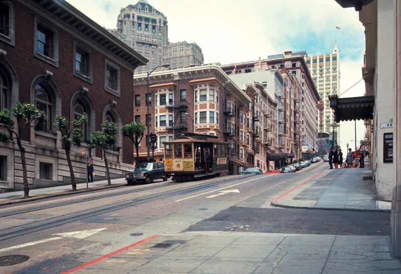
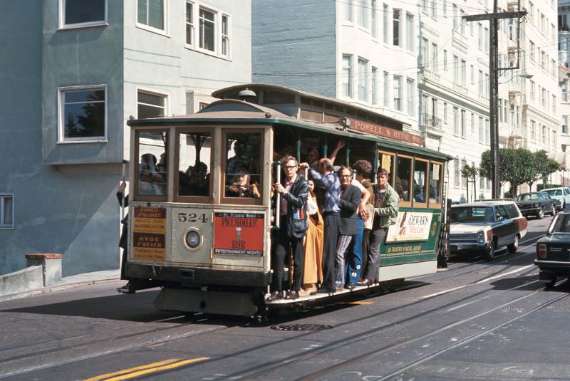
The Powell-Hyde cable car route climbed from Market Street up through the city’s steepest hills, crossing Lombard Street at Hyde — one of the most photographed intersections in San Francisco. Looking east from Hyde Street, the view of Lombard’s sharp curves, flanked by hydrangeas, was one the city’s defining images. Looking south from the same corner, the bay stretched out in the distance.
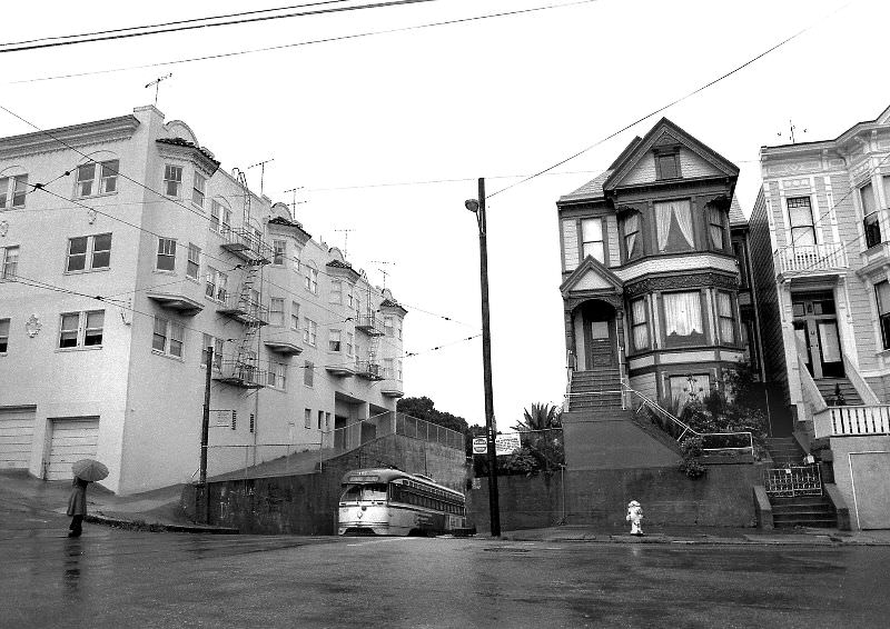
Powell-Hyde cable car route. View east on Lombard Street at Hyde Street, 1971
Powell-Hyde cable car route. View south on Hyde Street at Lombard Street, 1971
Powell-Hyde cable car route. View south on Hyde Street from Lombard Street, 1971
Powell-Hyde cable car route. View southeast on Hyde Street at Lombard Street, 1971

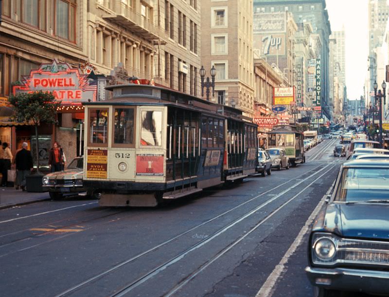
Powell Street north of Market was one of the city’s busiest pedestrian corridors. Department stores, restaurants, and hotels lined both sides. Cable cars passed through constantly, their grip men hauling on the levers that clamped onto the underground cables running beneath the street. The whole system — unchanged in its basic mechanics since the 1870s — kept running through every decade.

View north on Powell Street between Bush Street and Sutter Street, 1971
View north on Powell Street just north of Market Street, 1971
Wawona Street at the end of the L-Line looking east, 1971
Enjoyed this post? Get new ones in your inbox.

Leave a Comment

Your email address will not be published. Required fields are marked *

11 Comments

Load more comments

Share this Post 🥺

Please take a moment to share this content. Your support is greatly appreciated! 🙌🙏

Share this Post 🥺

Please take a moment to share this content. Your support is greatly appreciated! 🙌🙏
Scroll to Top
 
Hey Friend, Before You Go.. Please like & follow for more interesting content