
Toronto in 1900 was a city on the move. With a population of around 210,000, it was the largest city in Canada and a major hub for trade and commerce. Immigrants were arriving in large numbers, filling new neighborhoods and shaping a city that was growing faster than almost anywhere else in the country. Streets that had been dirt paths a generation earlier were now lined with storefronts, streetcar lines, and the beginnings of a modern skyline.
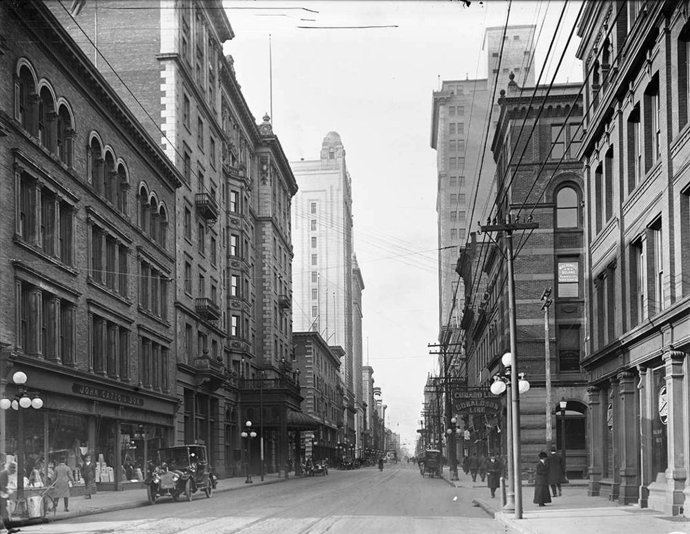
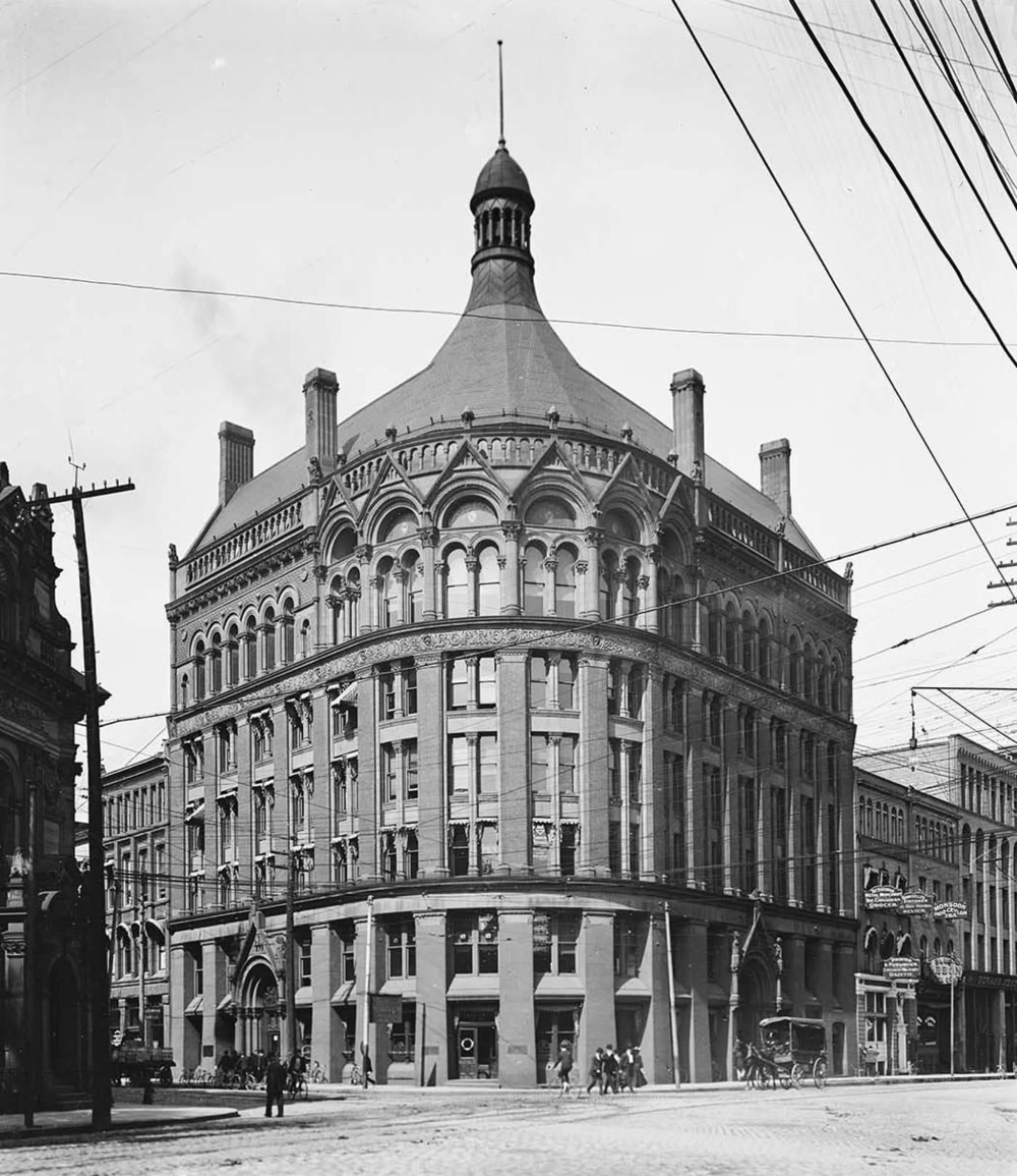
The commercial heart of Toronto had shifted west from the original Town of York by this point. The new downtown took shape west of Yonge and King Streets, and the city’s Board of Trade stood as a symbol of Toronto’s growing financial ambitions. Several major banks and financial institutions had set up headquarters in the city, making it one of the most important money centers in the country.
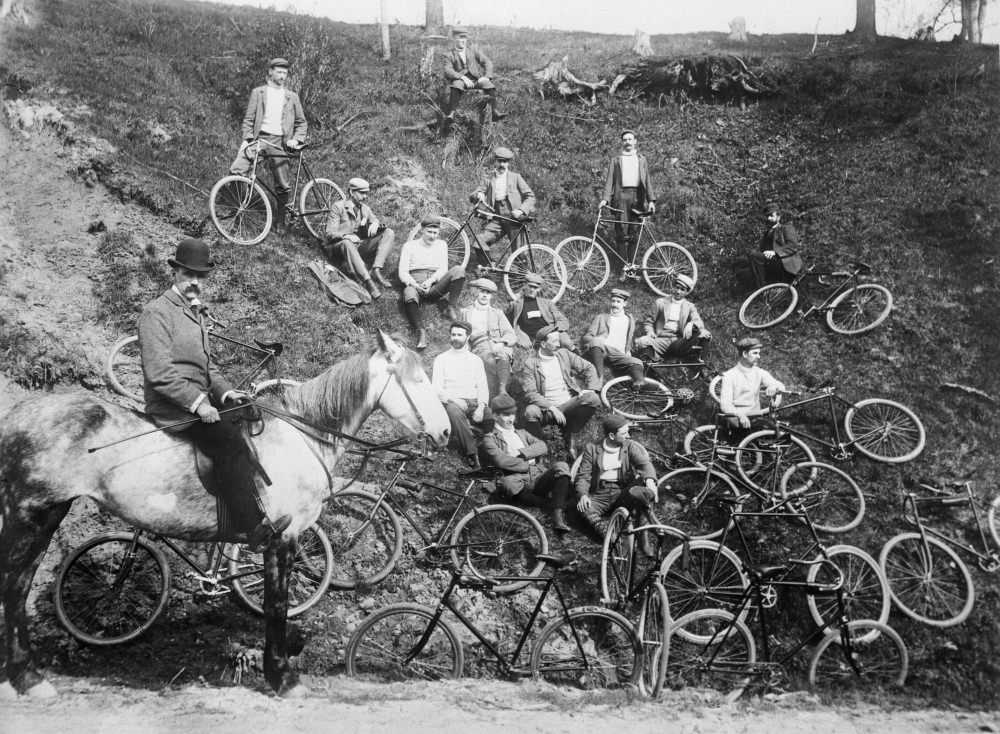
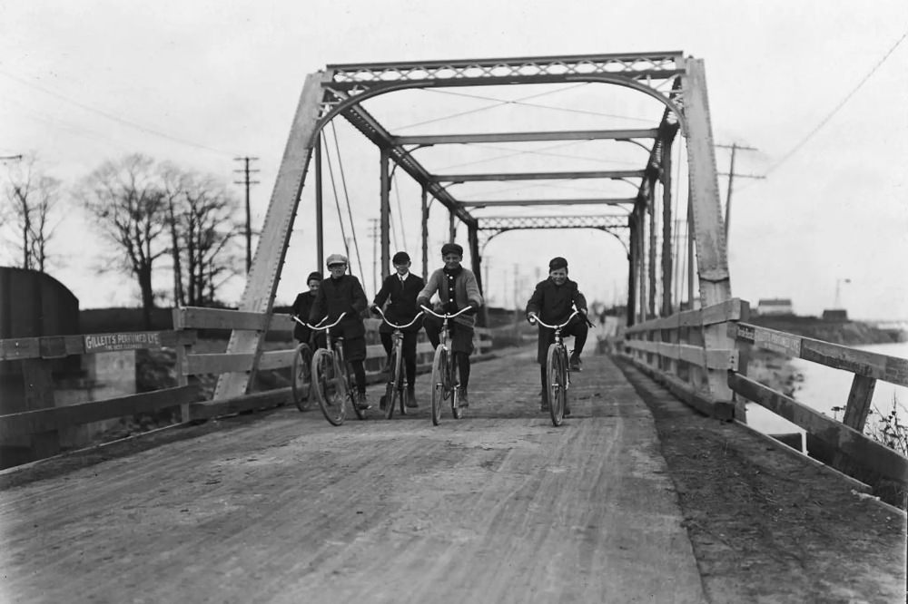
Life on the streets mixed old and new. Horses and carriages were still everywhere, but cycling had taken hold as a popular pastime and practical mode of transport. Clubs formed around the activity, and riders took to the city’s roads on weekends and after work hours.
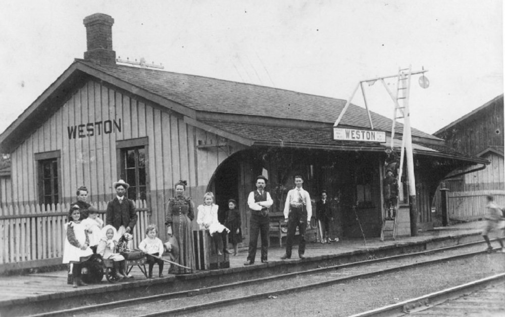
The railway was the backbone of Toronto’s connection to the rest of Canada. Stations like Weston served not just passengers but also the movement of goods that kept the city’s factories running. Toronto’s location on the shores of Lake Ontario gave it a busy port as well, and together with the rail network, it made the city an essential transportation node for the entire region.
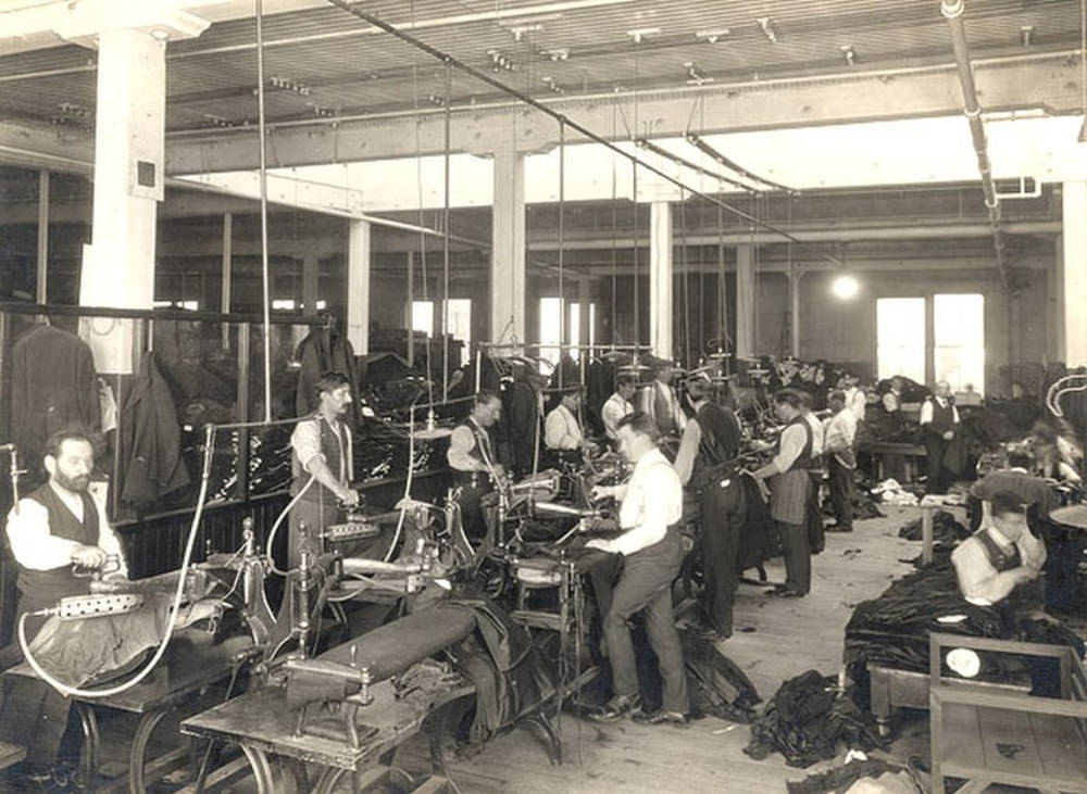
Manufacturing was the engine of Toronto’s economy. Textiles, clothing, and food processing were among the biggest industries. Few companies represented this industrial scale better than Eaton’s, which operated massive factory floors employing hundreds of workers. The Eaton’s operation was more than a department store — it was a vertically integrated retail and manufacturing empire that touched nearly every part of daily life in the city.
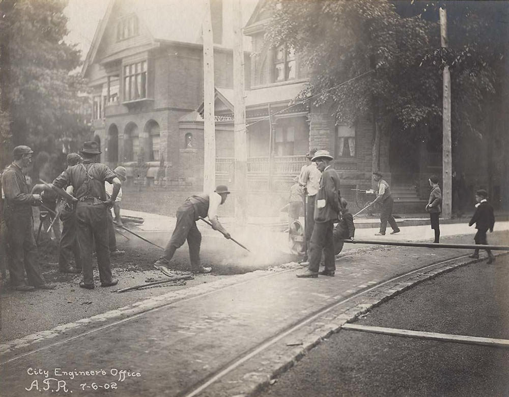
The city was also investing in its own infrastructure. Streets were being paved with asphalt, replacing the older, rougher surfaces that had made travel difficult. This kind of public works effort was visible across Toronto’s expanding residential neighborhoods as the city pushed outward in every direction.
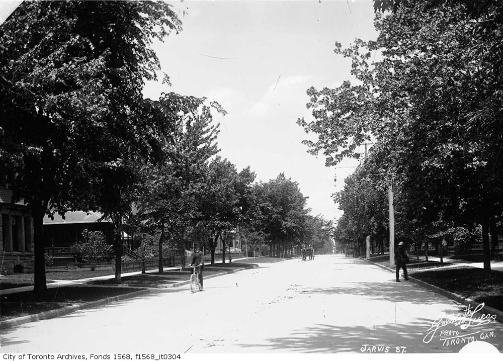
Jarvis Street in the early 1900s was one of Toronto’s most prestigious addresses. Large homes lined the street, and the area projected wealth and stability. The contrast between streets like Jarvis and the crowded immigrant neighborhoods nearby was sharp — Toronto in this era was a city of significant inequality.
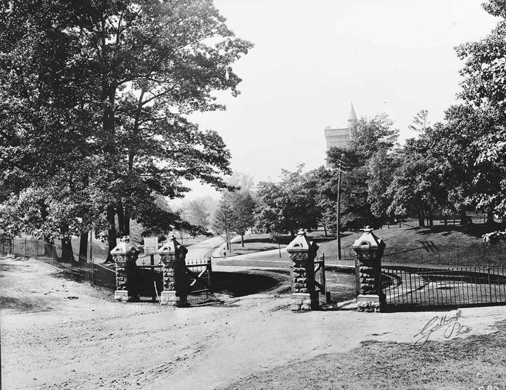
The University of Toronto was already well established by 1903, and its campus entrance signaled the city’s commitment to education and civic identity. The university drew students from across the country and added to the cultural weight of the growing metropolis.
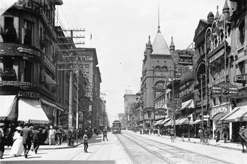
Yonge Street was the city’s main artery, running from the waterfront northward through the heart of Toronto. Looking north from Temperance Street in 1903, you could see the energy of the commercial district — storefronts, pedestrians, and streetcars all competing for space on one of Canada’s most storied streets.
On the night of April 19, 1904, a fire broke out in a neckwear factory on Wellington Street West. Within hours, it had torn through nearly the entire main business district of downtown Toronto. The Great Toronto Fire of 1904 destroyed 122 buildings across 20 acres. About 6,000 workers lost their jobs overnight. No human lives were lost, but the financial damage was enormous — estimated at roughly $10 million, the equivalent of hundreds of millions today.
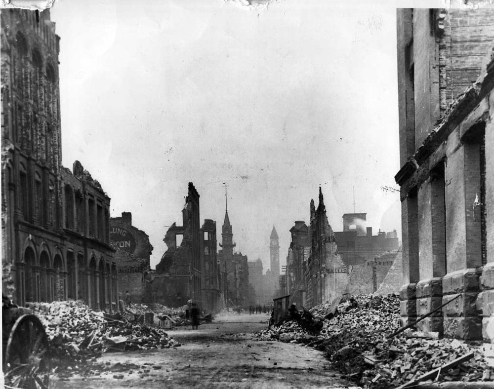
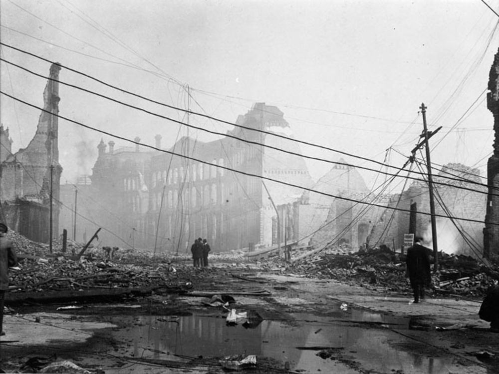
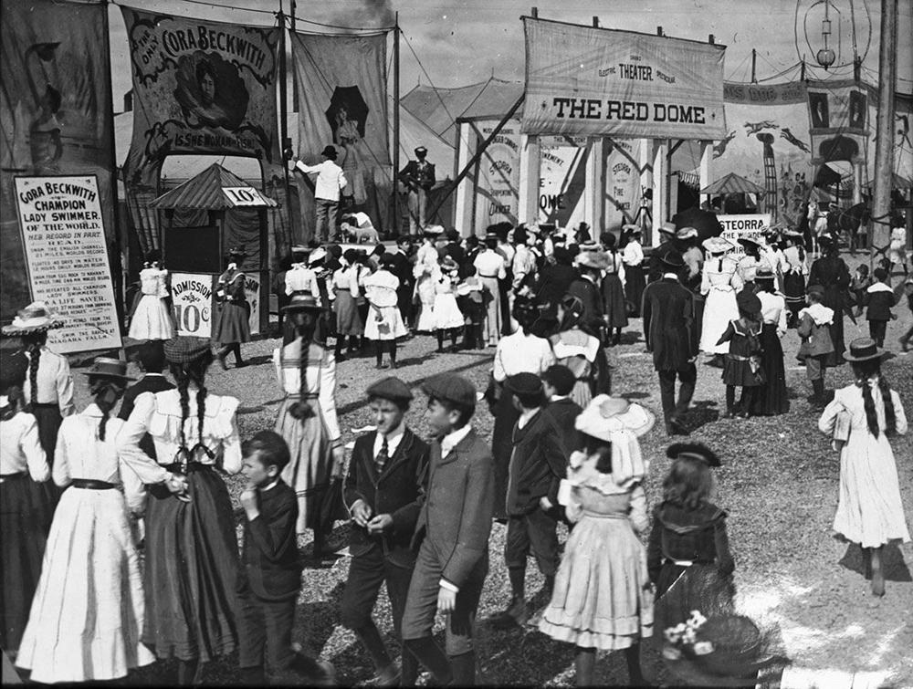
Despite the devastation, the city rebuilt quickly. Even in the immediate aftermath, life carried on in Toronto. The Canadian National Exhibition, a beloved annual event, continued drawing crowds to its midway that same year. The CNE had been a fixture of Toronto summers since 1879 and showed that the city’s spirit was not easily extinguished.
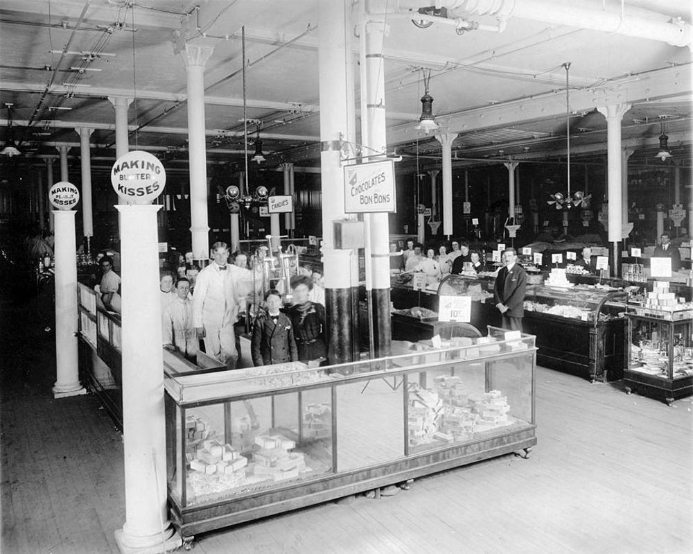
Inside Eaton’s flagship store, shoppers could find nearly anything. The candy department was a popular destination, stocked and staffed in a style that reflected the department store’s reputation for quality and presentation. Eaton’s had become a cultural institution — shopping there was an experience unto itself.
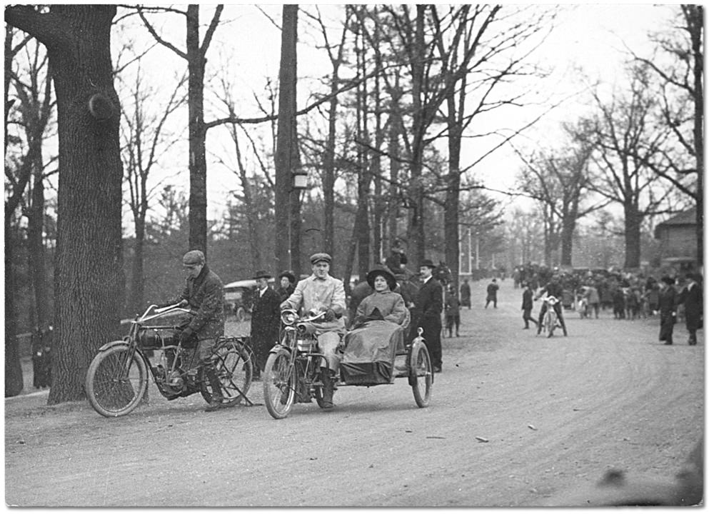
Not everything in early Toronto was about industry and commerce. High Park, donated to the city by John Howard in 1873, was already a beloved green space where families spent their leisure hours. The park offered a genuine escape from the noise and density of the city streets.
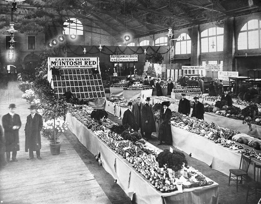
St. Lawrence Market has been at the center of Toronto’s food supply since the 1800s. By 1904, it was a busy, working market where vendors sold fresh produce, meat, and goods to both everyday shoppers and the city’s growing restaurant trade. The market building itself was an architectural landmark, anchoring the older, eastern part of the downtown.
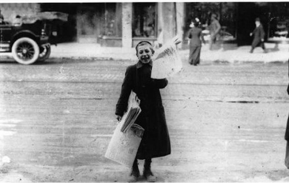
Child labor was a fact of life in early 1900s Toronto. Newsboys — young boys who sold newspapers on street corners — were a common sight throughout the city. They worked long hours in all weather, hawking papers for a few cents a copy. It was one of many jobs held by working-class children who helped support their families at a time when few social protections existed.
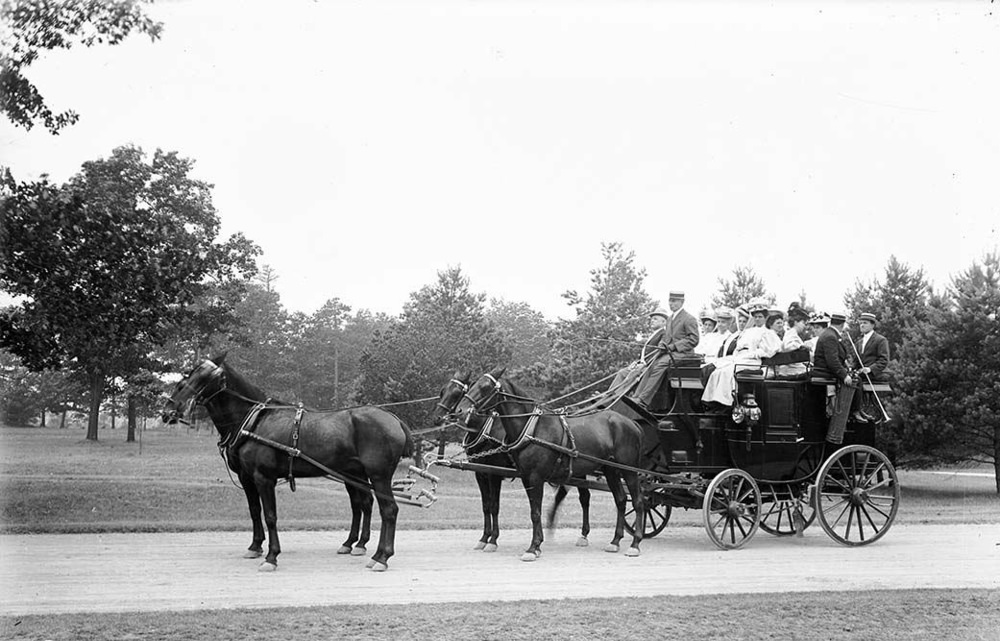
Tourism was growing in the city. Tally Ho coaches — large horse-drawn carriages — carried visitors through the streets on guided tours, showing off the landmarks of a city increasingly proud of what it had built. By 1905, Toronto had enough to show that it was worth seeing.
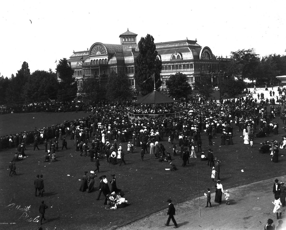
The Crystal Palace, which stood at the Exhibition grounds, was one of the city’s notable structures in the early 1900s. Built as a large exhibition hall, it hosted events and displays that drew thousands of visitors each year — until fire claimed it, as it did so many of Toronto’s wood and iron-framed buildings of the era.
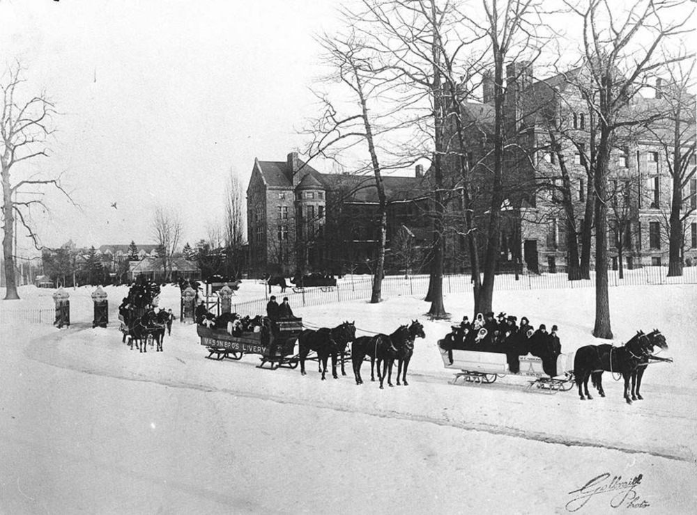
Winter in Toronto was not something people simply endured — it was something they embraced. Sleighing at Queen’s Park was a popular winter activity, and the sight of horse-drawn sleighs gliding across the snow-covered grounds near the provincial legislature was a normal part of the winter season.
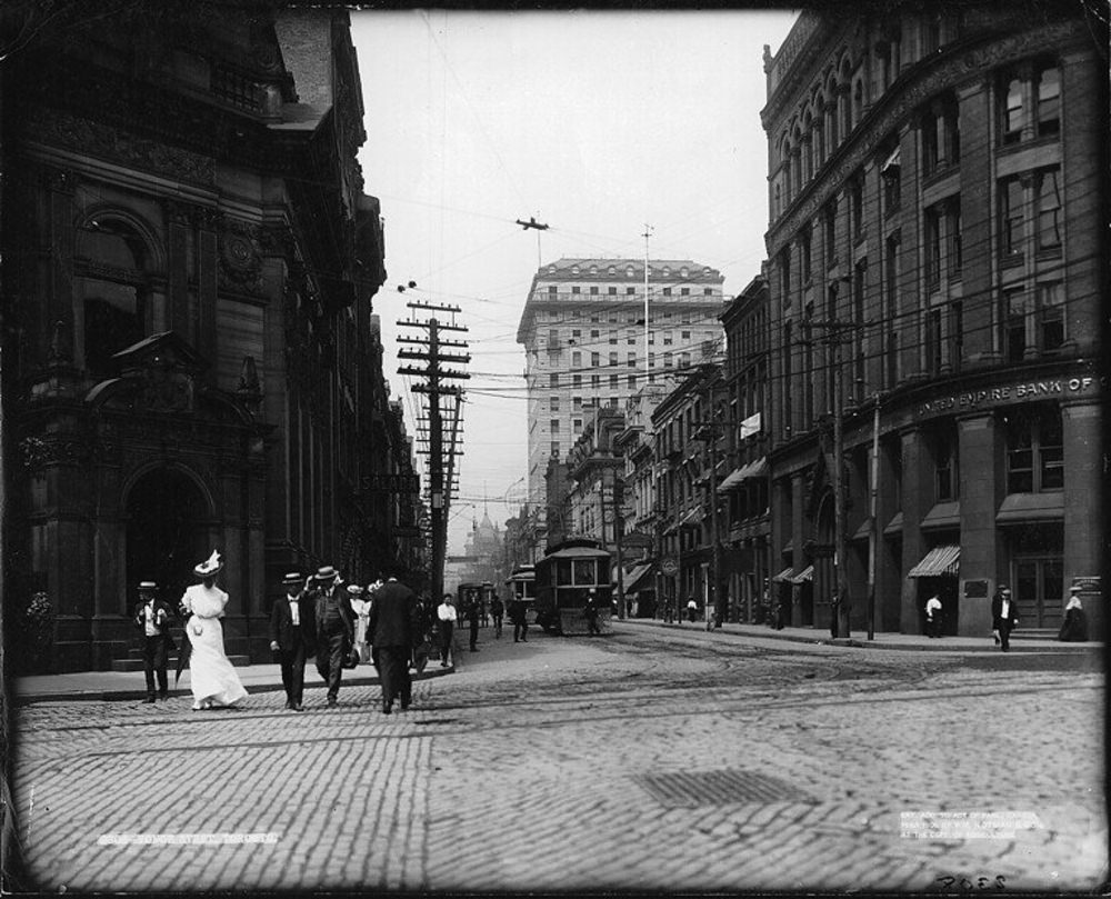
The intersection of Yonge and Front Streets was one of the busiest corners in the city in 1906. Positioned near the waterfront and the main rail terminals, it saw a constant flow of workers, merchants, and travelers. The area anchored the commercial connections between Toronto’s port, its rail links, and its downtown retail core.
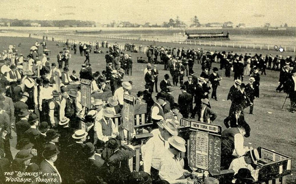
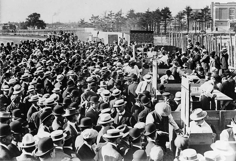
Horse racing was a major form of entertainment. Woodbine Race Track drew large crowds, and bookmakers openly took bets from attendees. The original Woodbine, located in the east end of the city, was the center of Toronto’s racing culture in this era, drawing gamblers and spectators from across the region.
Horse-drawn carriages remained the dominant form of private transportation well into the decade. Automobiles were beginning to appear on Toronto’s streets, but they were rare and expensive. For most residents, a carriage ride was still the way to travel in comfort and style.
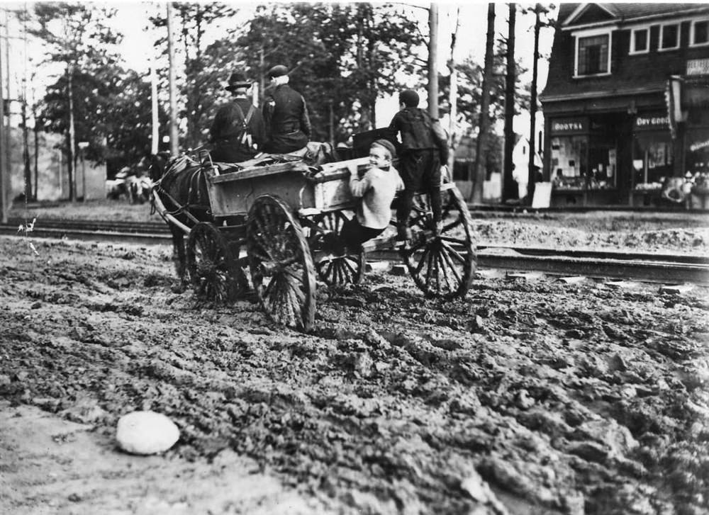
Cycling extended well beyond the city’s core. Out in Mimico, riders took to the roads as the activity continued to grow in popularity throughout the Toronto area. The bicycle offered a level of independence and mobility that resonated with people of all backgrounds.
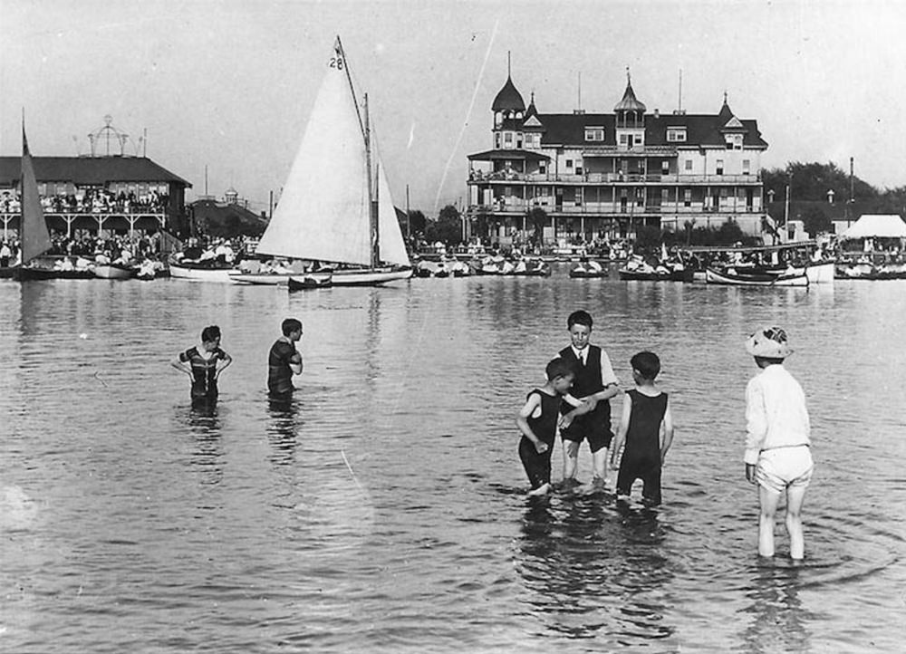
Hanlan’s Point on Toronto Island was one of the city’s great entertainment destinations. The hotel and regatta grounds drew visitors by ferry from the mainland, offering amusements, boat races, and a waterfront atmosphere that was unlike anything available in the city itself.
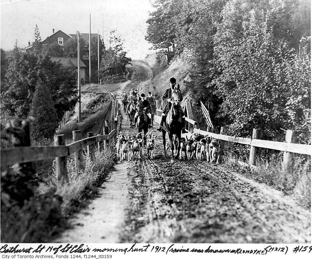
Bathurst Street north of St. Clair in 1907 shows a Toronto that was still expanding into what had recently been farmland. Streets were being cut through, homes were going up, and the city was steadily consuming the surrounding countryside as its population swelled.
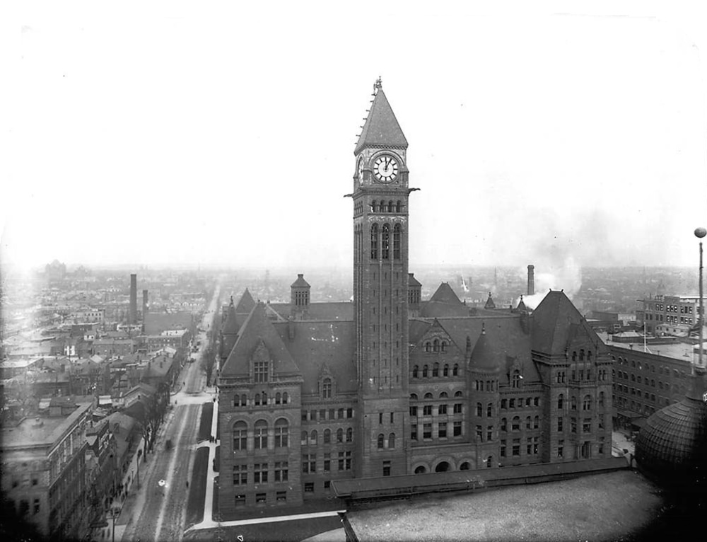
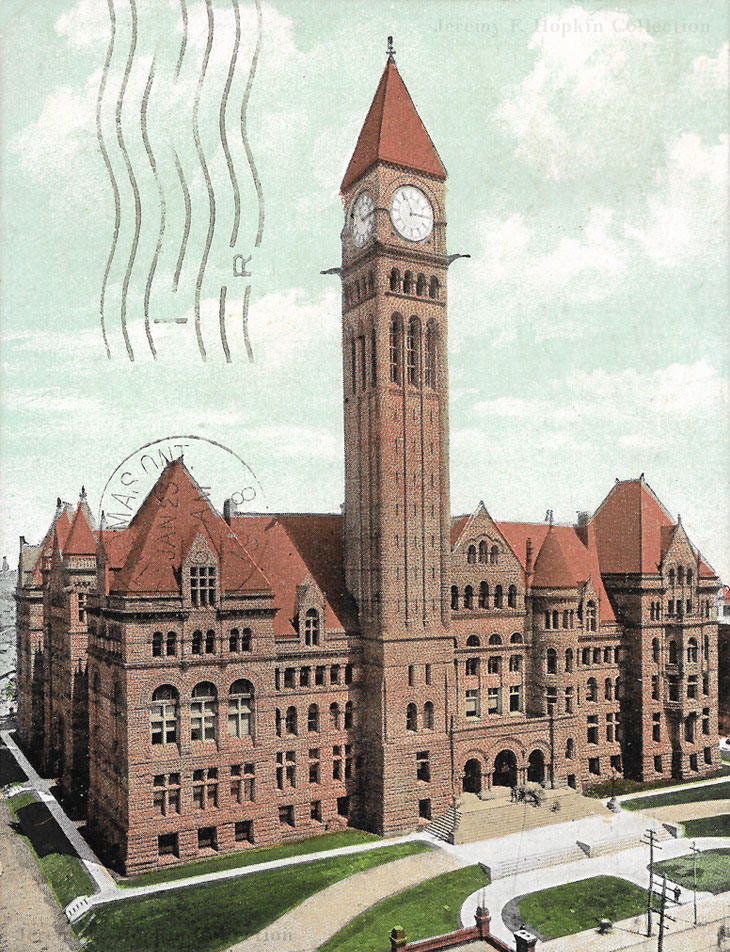
The City of Toronto moved into its new City Hall at the intersection of Bay and Queen Streets at the end of 1899. The building — a grand Romanesque Revival structure — became the seat of city government and one of Toronto’s most recognizable landmarks. It served the Toronto City Council from 1899 all the way through to 1966.
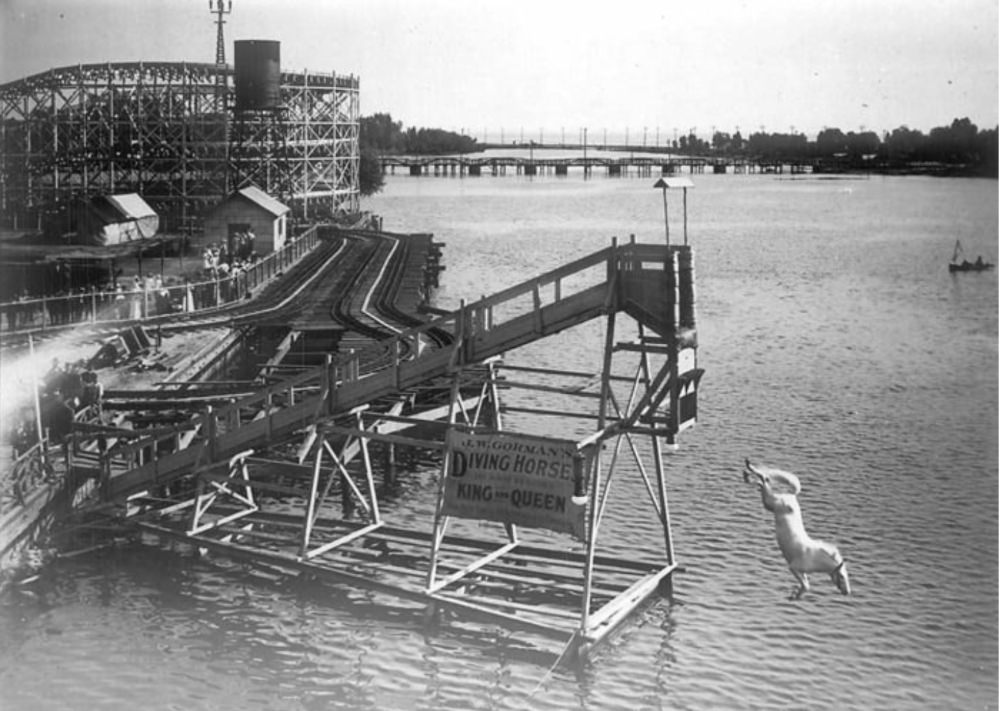
Hanlan’s Point was also home to some of the more unusual attractions of the era. A diving horse act — in which a horse and rider plunged from a high platform into a pool of water — was staged at the grounds and drew curious crowds. These kinds of spectacles were common at amusement parks of the time.
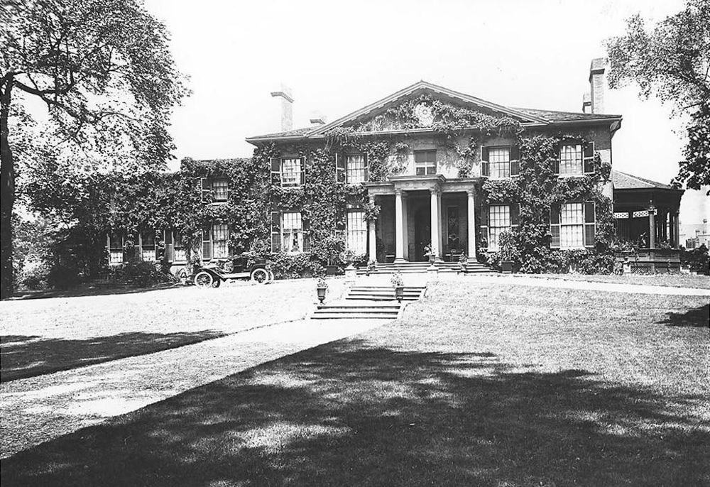
The Grange, one of Toronto’s oldest surviving homes, stood as a reminder of the city’s earlier history. Built in 1817, it had once been the home of prominent Toronto families and by the early 1900s had been given to the Art Museum of Toronto, which would eventually become the Art Gallery of Ontario.
The Confederation Life Building was among the most impressive commercial structures in early 1900s Toronto. Its elaborate stonework and height signaled the confidence of Toronto’s financial sector. Buildings like this one showed that the city was not just growing in size — it was growing in ambition.
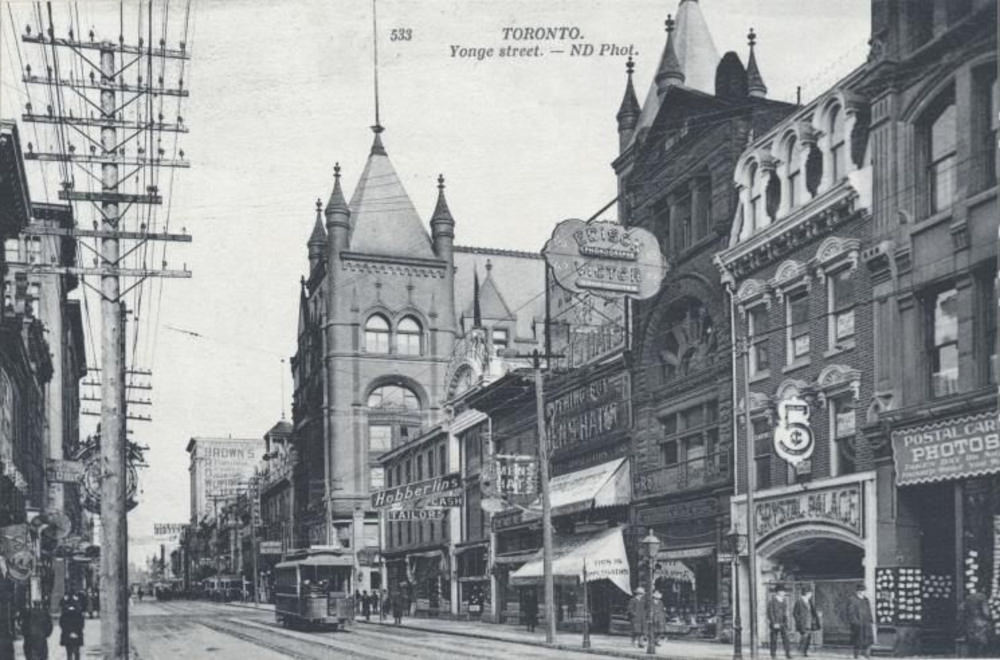
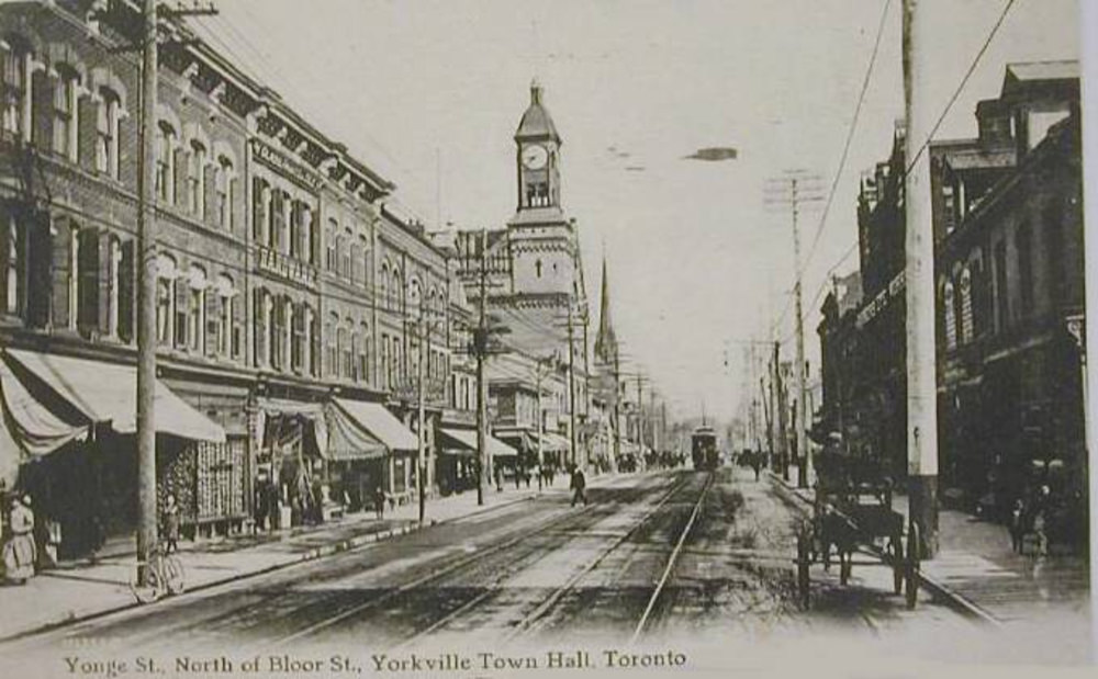
Yonge Street north of Bloor in 1907 looked quite different from the downtown stretch. Residential homes and smaller shops defined this part of the street, which was still very much a neighborhood thoroughfare rather than a commercial corridor. The city’s growth was spreading northward, but slowly.
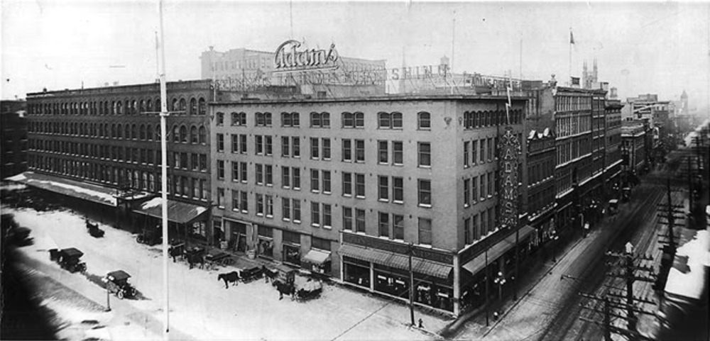
The corner of Queen and James in 1908 was part of the rebuilt downtown core that had risen from the ashes of the 1904 fire. The reconstruction had happened with remarkable speed, and by 1908 most of the destroyed blocks had been replaced with newer, more fire-resistant brick and stone structures.
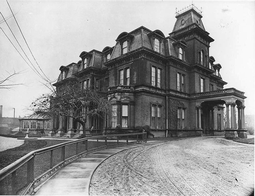
Government House served as the official residence of Ontario’s Lieutenant Governor. The building reflected the formal, British-influenced sensibility of Toronto’s governing class. In the early 1900s, it was a center of official social life in the city.
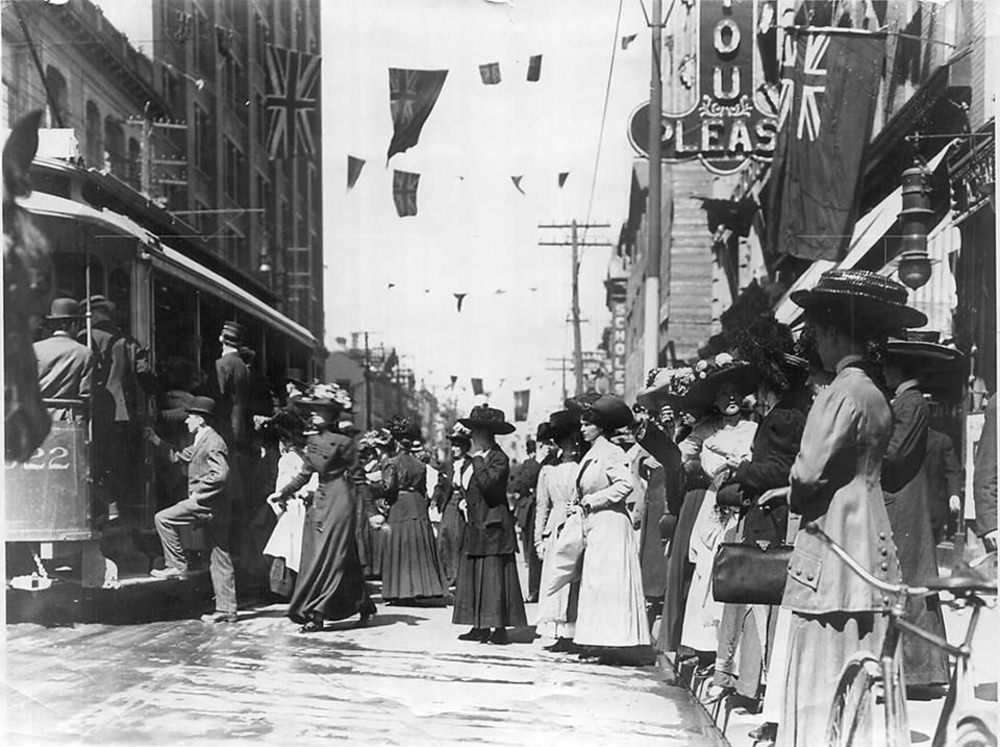
Yonge and Queen was one of the most photographed intersections in early Toronto. Streetcars, pedestrians, commercial signs, and horses all competed for space at this central junction. It was the meeting point of the city’s two main axes — and it remains one of Toronto’s most recognizable corners today.
Dufferin Racetrack was another venue where Torontonians gathered to watch horse racing. It operated alongside Woodbine and served a somewhat different clientele. Racetracks in this era were important social spaces as much as sporting venues — places where people from different parts of the city mixed over a shared interest.
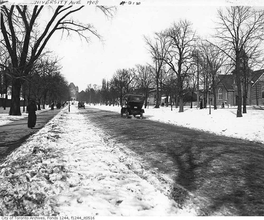
University Avenue cut a wide, formal path northward from the downtown toward Queen’s Park and the Ontario Legislative Building visible in the distance. The avenue was lined with institutions — hospitals, government buildings, and professional offices — and it gave Toronto a sense of formal civic grandeur.
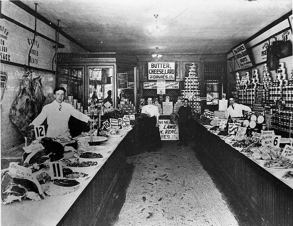
The William Davies Store was connected to one of Toronto’s most important food processing businesses. William Davies had built a pork packing empire that shipped products across Canada and to Britain. His name was attached to both the meatpacking trade and the retail grocery business that helped feed the city’s growing population.
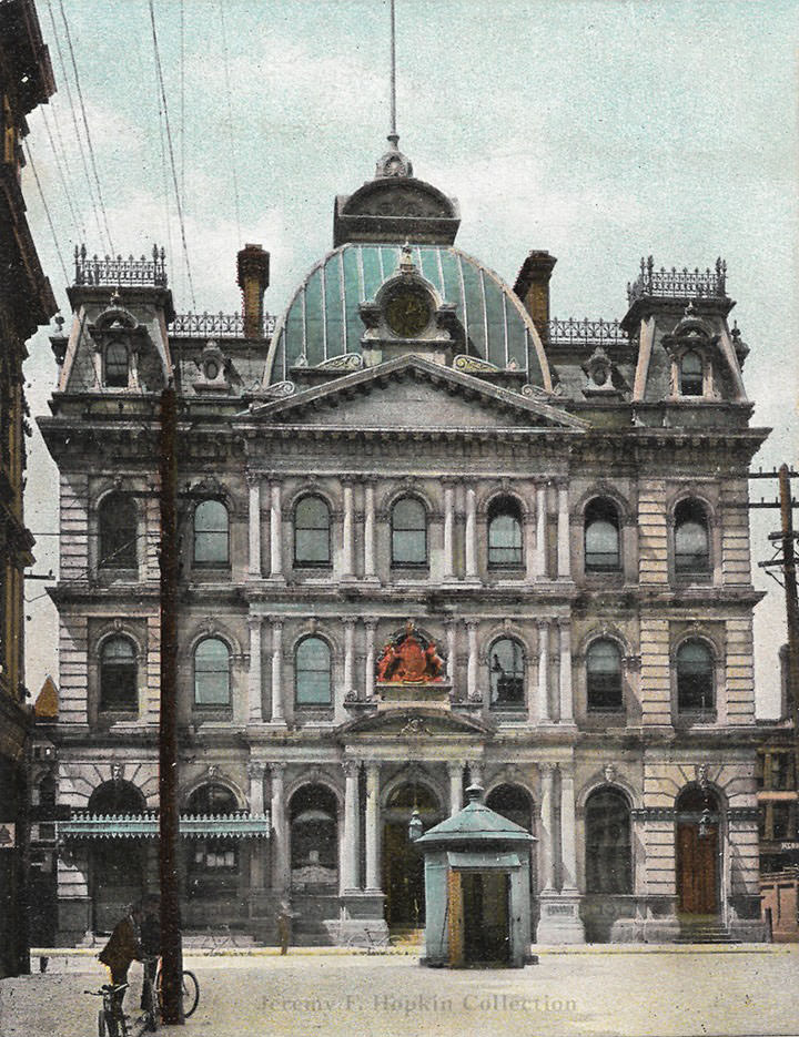
Toronto Street, running just off Yonge in the financial district, was home to some of the city’s most elegant architecture. The Post Office building on Adelaide Street East, serving the city from 1873 through 1960, anchored this part of the downtown and handled the enormous volume of mail that flowed through a city connected to a national postal network.
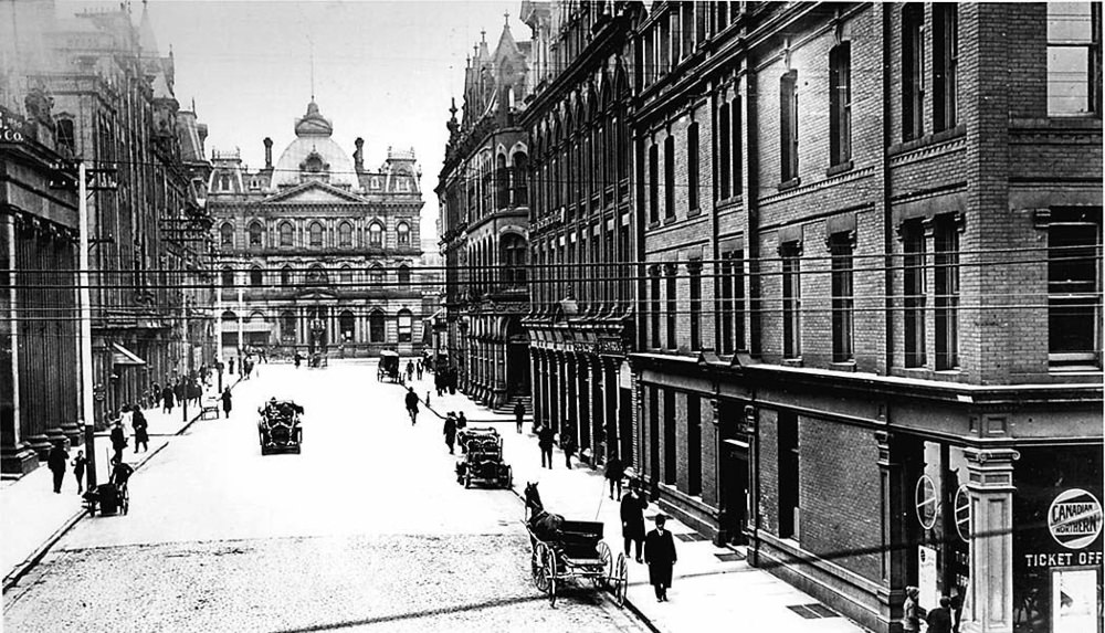
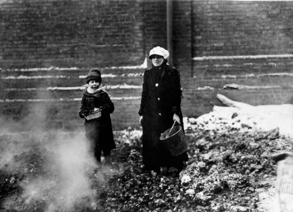
Coal was the primary fuel used to heat Toronto’s homes and power its industries. Collecting and delivering coal was hard, physical work carried out by laborers — often recent immigrants — who worked in all weather to keep the city warm through its harsh winters.
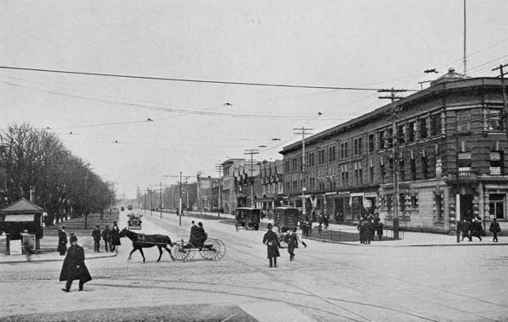
Queen and Spadina in 1909 marked the boundary between the downtown core and the neighborhoods to the west. Spadina Avenue was already a commercial street serving the garment trade and the immigrant communities that had settled nearby. The area had a distinct character shaped by its mix of working-class residents and small business owners.
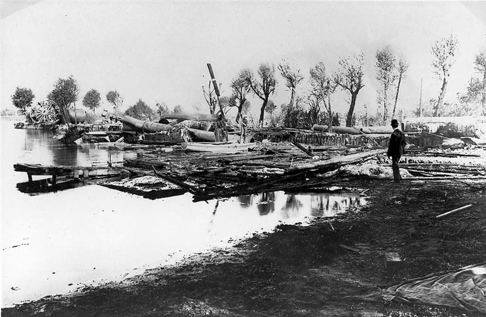
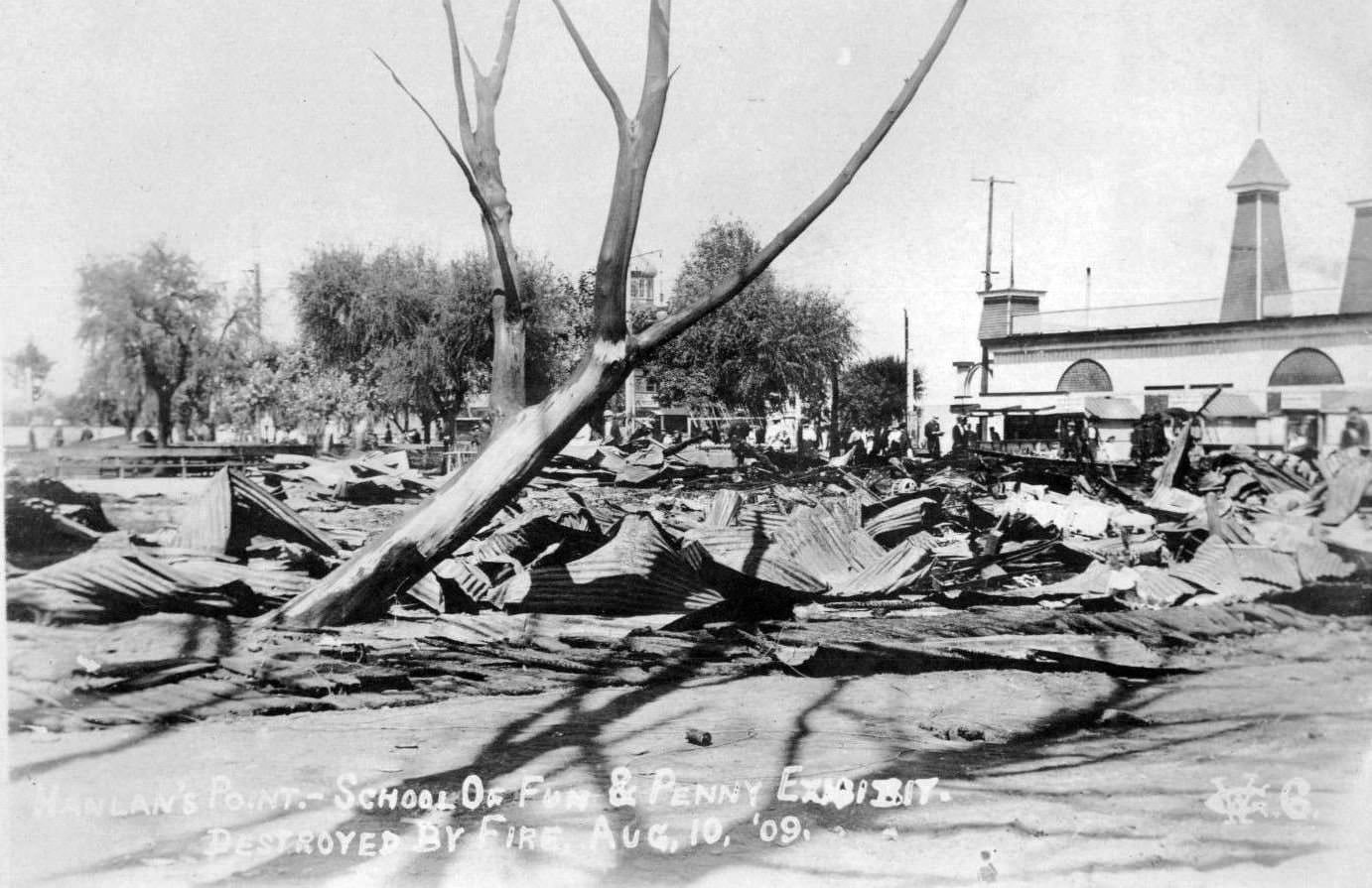
Fire struck Hanlan’s Point again in 1909, destroying the hotel that had been a landmark of the island entertainment district. The ruins were a stark reminder of how vulnerable wood-framed buildings were to fire in this era — a lesson Toronto had already learned at great cost in 1904.
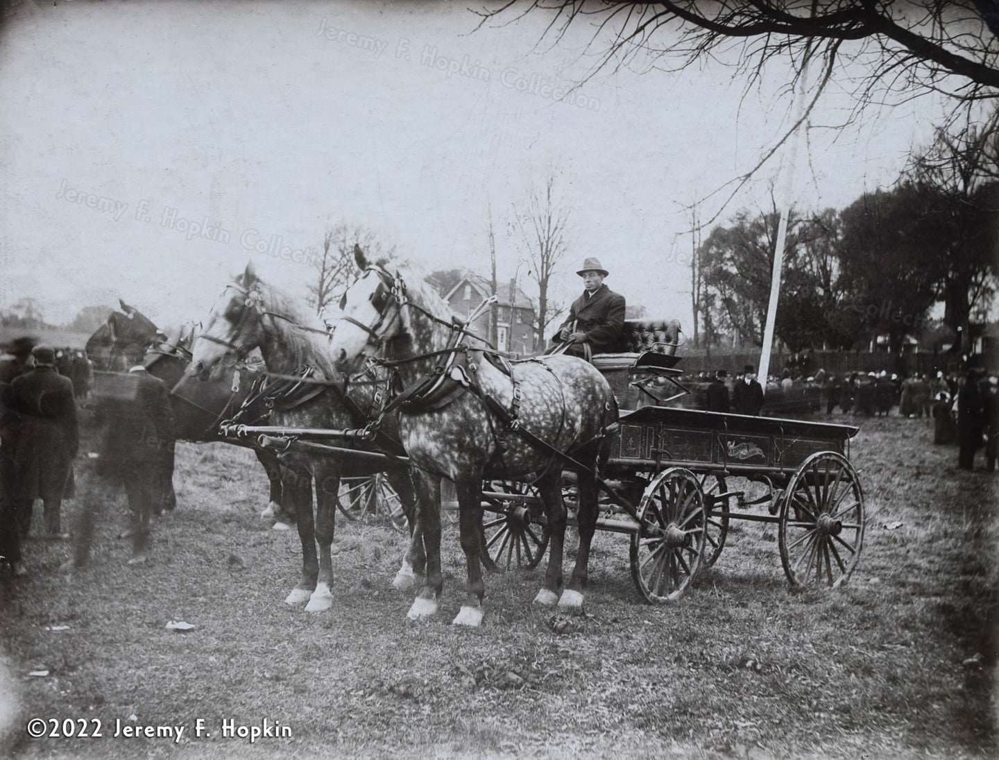
Horses remained deeply embedded in the working life of the city throughout the decade. Farmers and tradespeople from the surrounding townships regularly brought their teams into Toronto for market days and large events. Daniel Ramsay of Downsview was one of many rural operators whose livelihood depended on working horses.
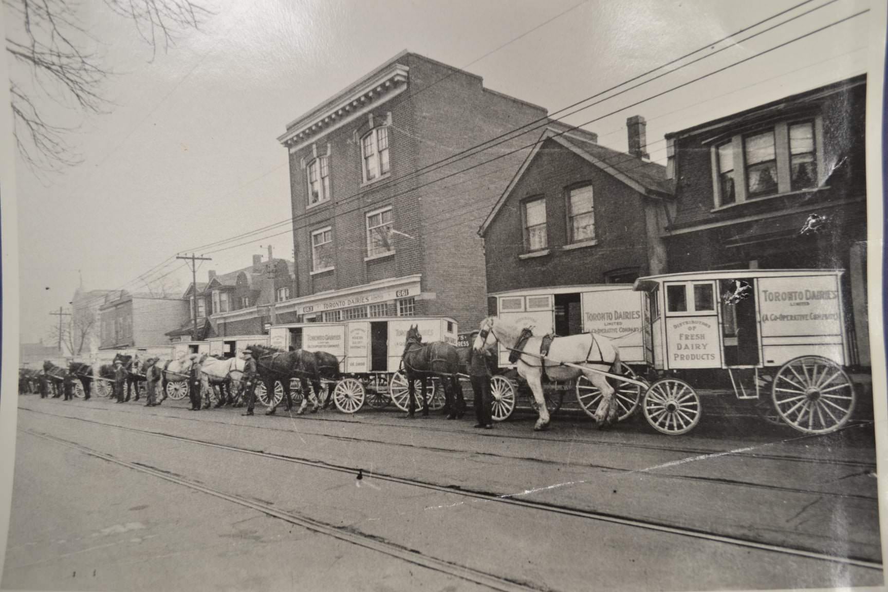
The residential streets of Toronto’s east end showed the density of working-class housing that had developed to accommodate the city’s growing population. Streets like Gerrard were lined with modest row houses and small shops, each block tightly packed with families, many of them recent arrivals to Canada.
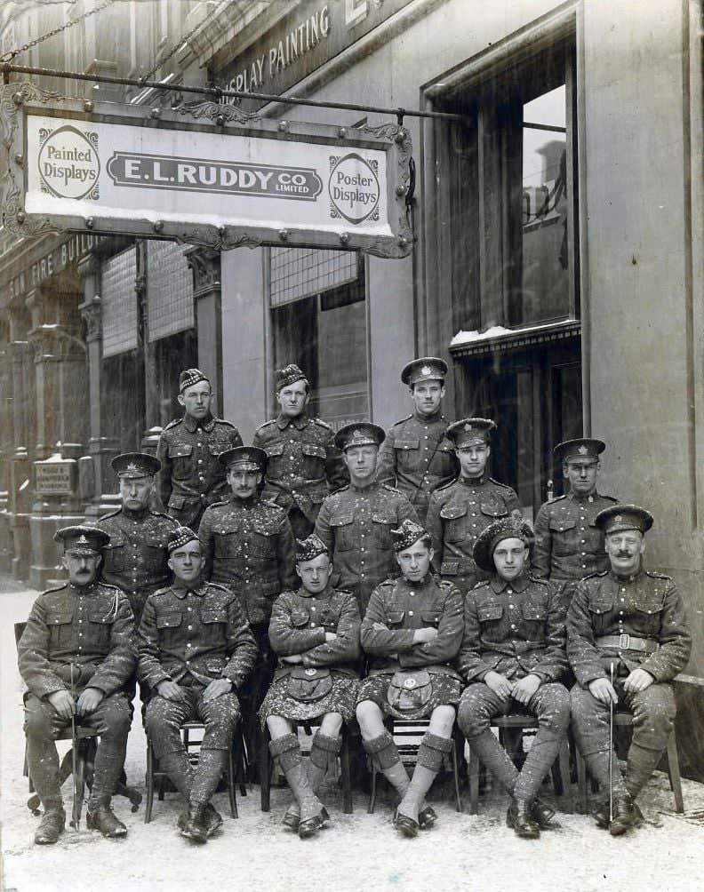
Military presence was part of the urban landscape in early 1900s Toronto. Soldiers posed in front of commercial buildings during a snowstorm, a reminder that Canada’s military was active during this period — including its significant contribution to the Boer War, which had concluded in 1902.
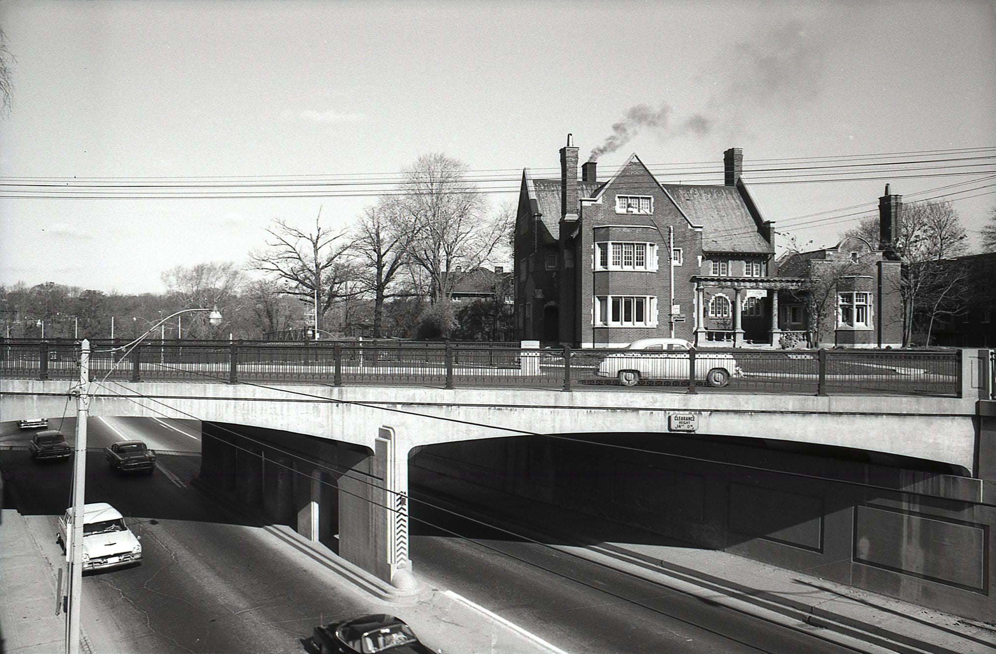
In the wealthier parts of the city, homes were built to impress. The Baillie House, designed in 1902 by the architectural firm Sprott and Rolph, was one example of the quality of residential construction in upscale neighborhoods like Rosedale and Moore Park. These homes were built to last — and many of them did.
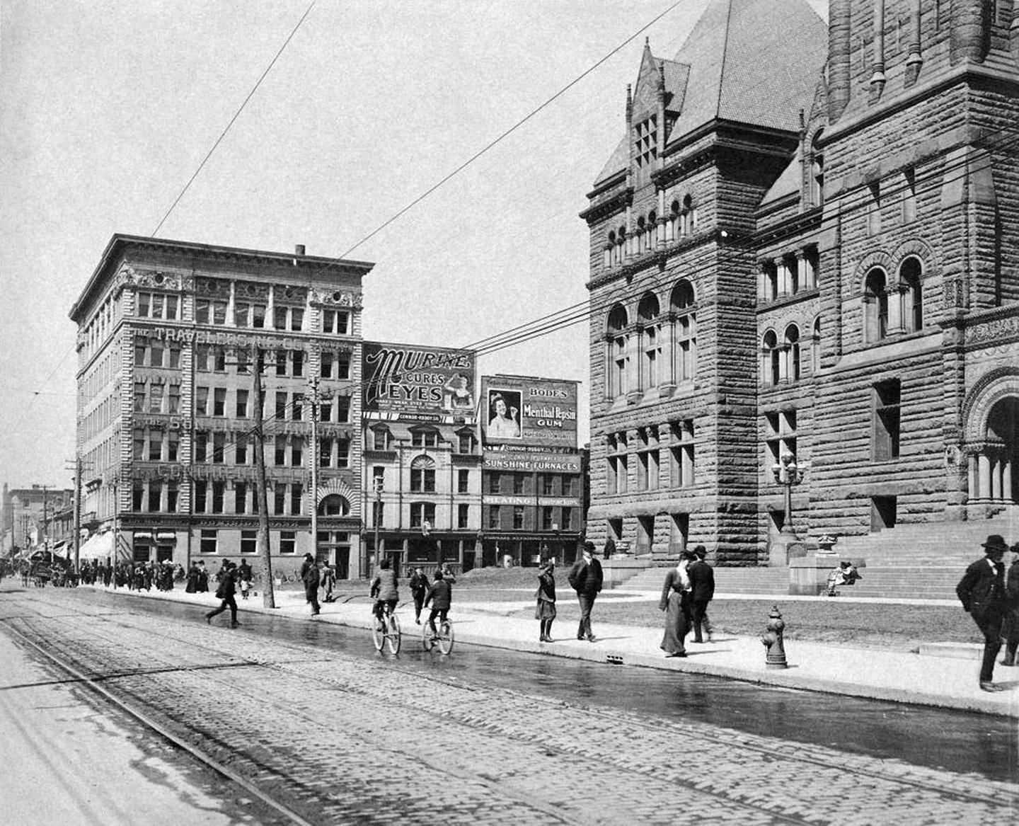
Looking northwest on Queen Street West in front of Old City Hall in 1906 shows a fully functioning downtown street. The wide sidewalks, electric streetcar lines, and commercial storefronts all signal a city that had recovered from the fire and rebuilt with confidence.
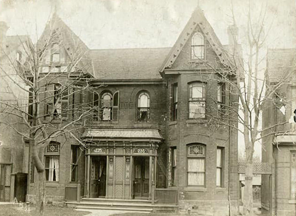
Huron Street in 1904 offered a glimpse of the city’s residential fabric just west of the university. These homes were solidly middle-class — well-maintained, with modest architectural detail, set back from the street with small front yards. They housed the professionals, clerks, and tradespeople who made the city function.
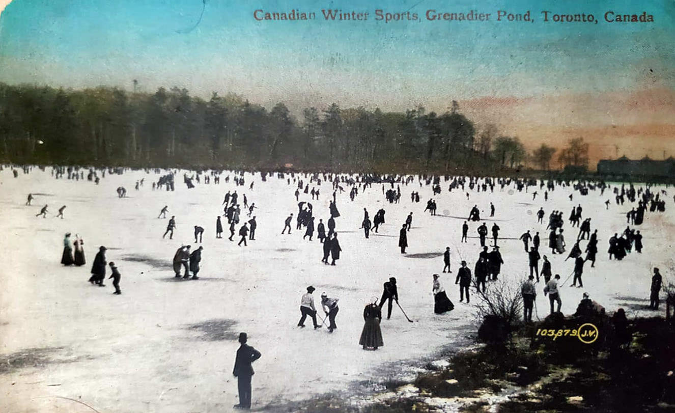
Grenadier Pond in High Park was one of the city’s natural features that drew residents in every season. In winter, it froze solidly enough for skating. In summer, it was a quiet spot for walking. The pond sat within High Park’s large green expanse, providing a sense of wilderness within the growing city.
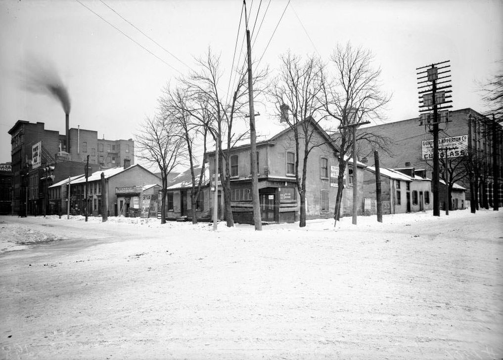
The intersection of Terauley Street — later renamed Bay Street — and Albert Street in 1909 sat at the edge of one of Toronto’s most contested areas. Just to the east lay The Ward, a dense immigrant neighborhood that was also home to some of the city’s most impoverished residents. The contrast between the ordered civic buildings nearby and the crowded back streets of The Ward was impossible to ignore.
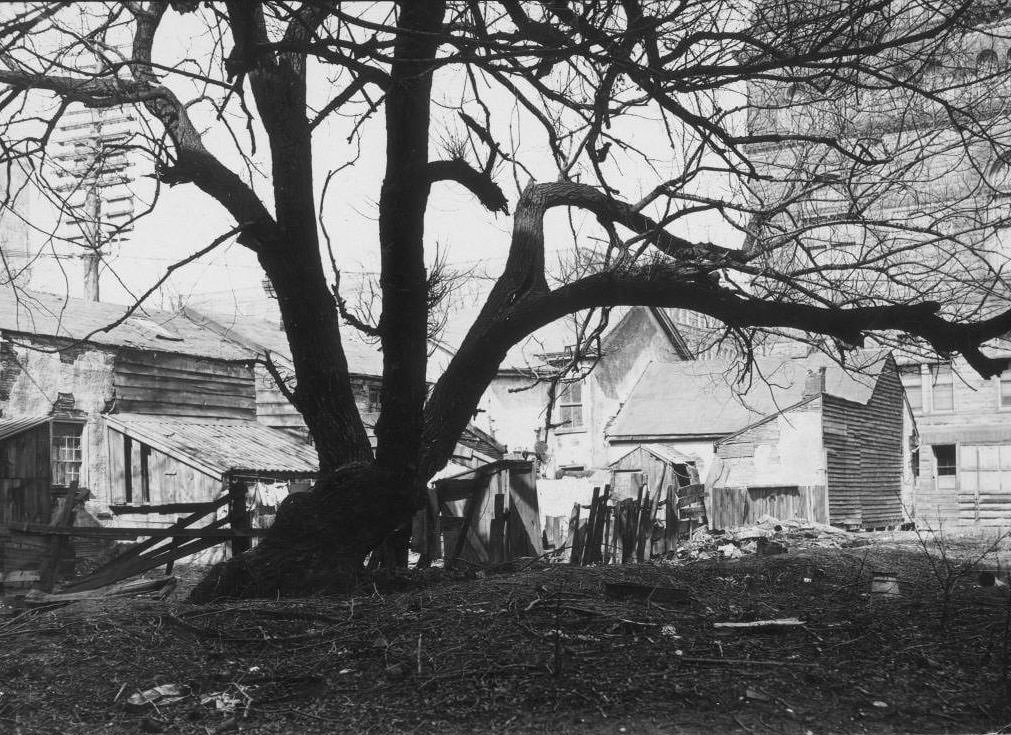
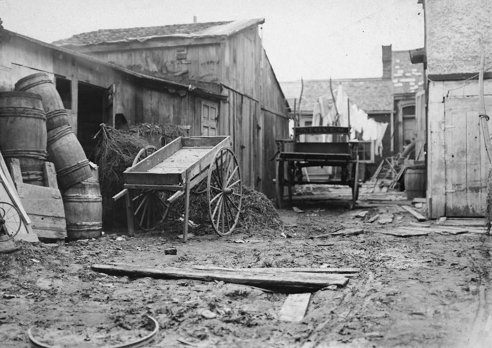
The back yards of Albert Street in 1908 document the realities of slum housing in early Toronto. The Ward — the neighborhood bounded roughly by College, Queen, Yonge, and University — was packed with immigrant families living in crowded, poorly maintained housing. Back yards were shared spaces with outhouses, sheds, and debris. City health inspectors repeatedly cited the area for poor sanitation and overcrowding.
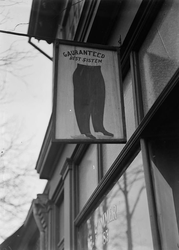
Advertising signs in The Ward reflected the immigrant communities living there. A misspelled sign — reading ‘Gauranteed best sistem’ — captured the struggles of new arrivals trying to conduct business in a language they were still learning. The Ward was home to Jewish, Italian, Chinese, and Eastern European immigrants who had come to Toronto seeking work and stability.
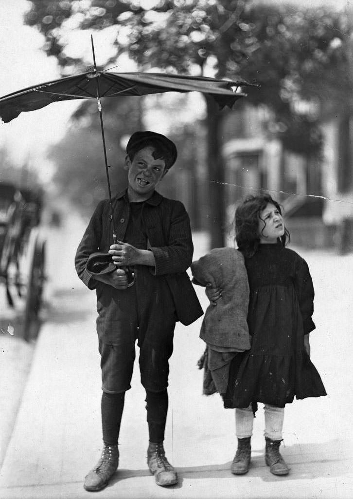
Children in The Ward grew up in conditions far removed from those of their peers in Rosedale or Cabbagetown’s better streets. They played in laneways and crowded yards, attended nearby public schools, and often worked from a young age to help their families. These photographs, taken as part of city health and social reform surveys, documented conditions that reformers used to push for improved housing and services.
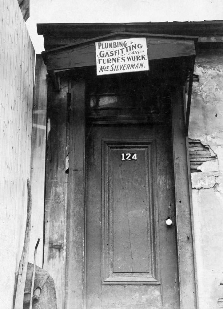
Business signs along Agnes Street — later renamed Dundas Street West — reflected the commercial life of The Ward’s Jewish community. Max Silverman’s sign was one of dozens along this corridor, where small shops selling goods and services catered to the neighborhood’s dense immigrant population. The street was a lively commercial artery driven by the energy of newcomers building their lives from scratch.
Stable yards within The Ward housed the working horses used by local tradespeople and small business owners. Horses were still central to the movement of goods through the city’s streets, and even in the most crowded urban neighborhoods, stables were a necessary part of daily commerce.
Fire continued to threaten Toronto’s entertainment venues. On August 10, 1909, the School of Fun and Penny Exhibit at Hanlan’s Point on Toronto Islands burned to the ground. The blaze destroyed a popular amusement building at a time when the islands were at the height of their popularity as a summer destination for city residents.
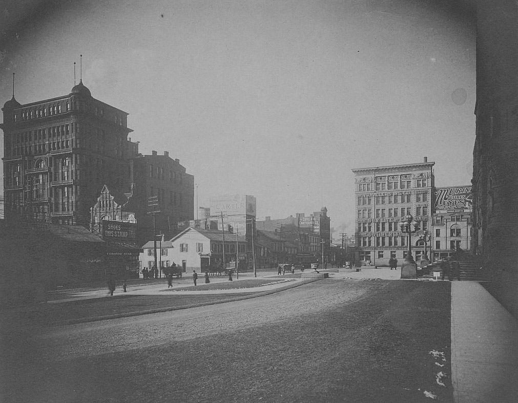
Looking northwest toward Bay and Queen in 1906 shows the full visual weight of Old City Hall dominating the streetscape. The building’s clock tower rose above the surrounding blocks, visible from a considerable distance and serving as a navigational landmark for anyone moving through the downtown.
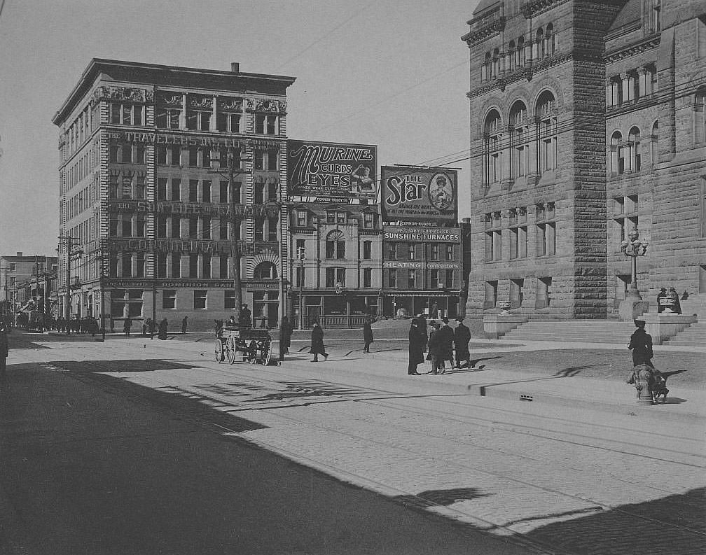
The view looking west down Queen Street from City Hall in 1906 shows a street alive with commerce and transit. Electric streetcars ran along the tracks embedded in the road, sharing the pavement with horse-drawn wagons and pedestrians crossing at every corner. This stretch of Queen was one of the most active in the entire city.
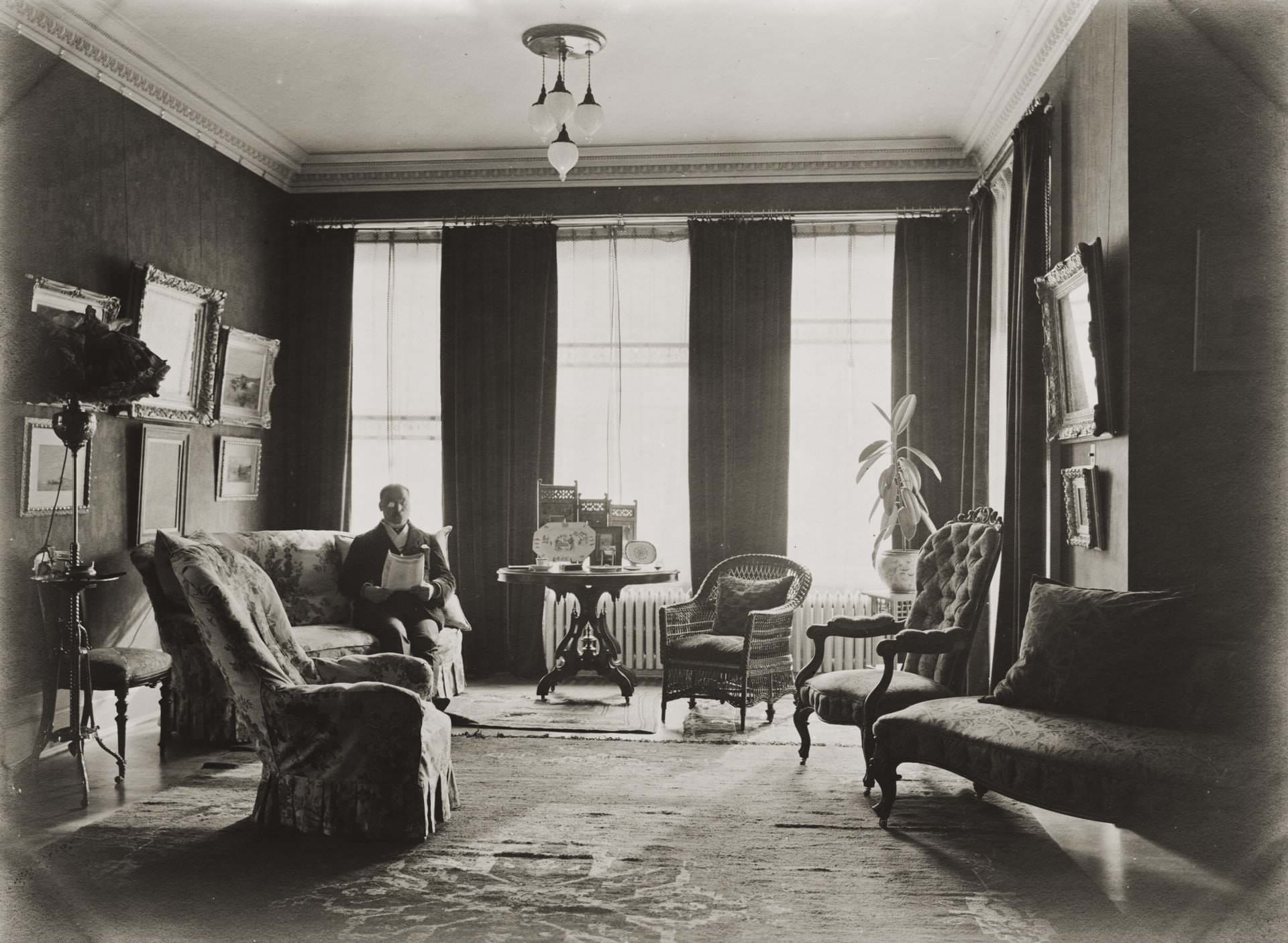
Wealth in early Toronto was on full display in the drawing rooms of Sherbourne Street’s fine homes. Daniel Wilkie’s house at 432 Sherbourne Street was furnished in the style expected of a prominent Torontonian of the era — heavy drapes, upholstered furniture, framed art, and decorative objects arranged to signal status and taste.
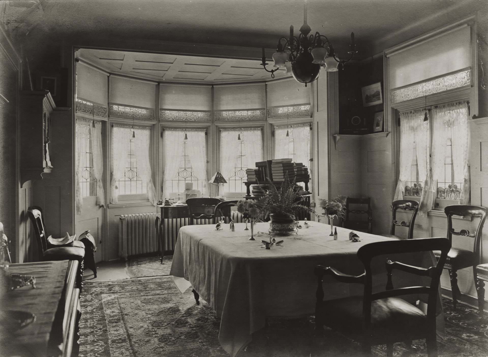
The dining room of the same Sherbourne Street home reflected the formal entertaining culture of Toronto’s upper class. Large tables set with fine china, polished silverware, and crystal glassware were the standard for households of this standing. These domestic spaces were as much a social statement as a functional room.
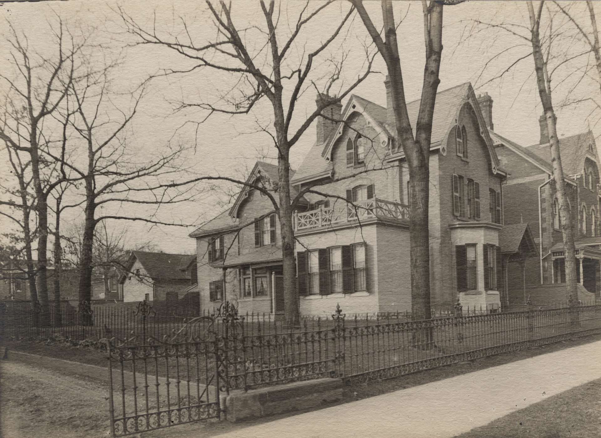
The exterior of the Wilkie house on Sherbourne Street showed the solid, prosperous architecture favored by Toronto’s professional class. Sherbourne Street in this era was lined with homes of similar character — brick-built, multi-storey, and set back slightly from the street with small front gardens.
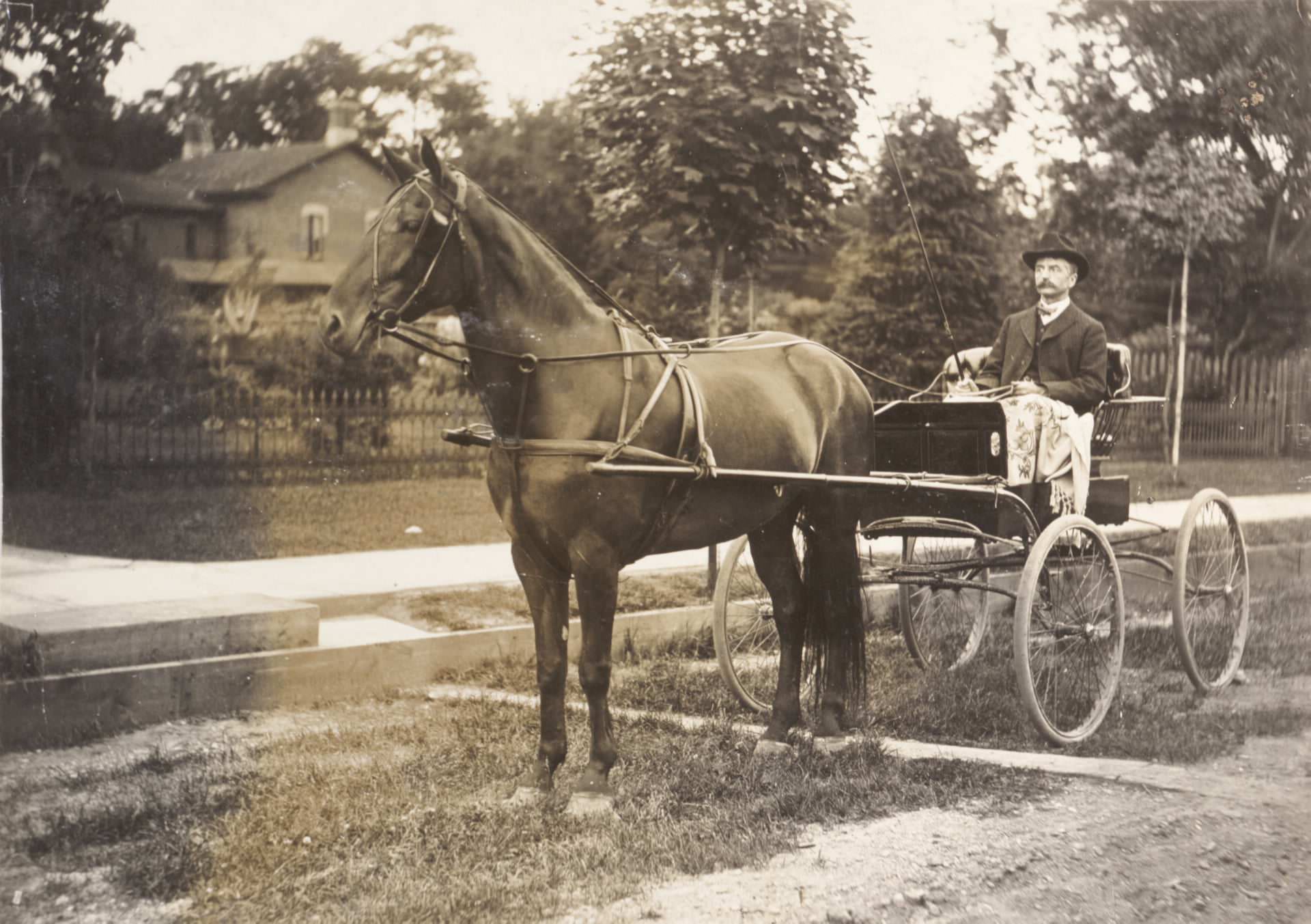
William Pearson of Weston, Ontario, was photographed in 1905, representing the agricultural communities that still surrounded Toronto at the time. Weston was a separate town northwest of Toronto that had its own economy, institutions, and identity — though the expanding city would eventually absorb it entirely.
Weston High School on King Street stood as evidence of the educational infrastructure being built in the communities around Toronto. Schools were seen as central to the development of stable, productive citizens, and investing in school buildings was a civic priority in both the city and the surrounding townships.
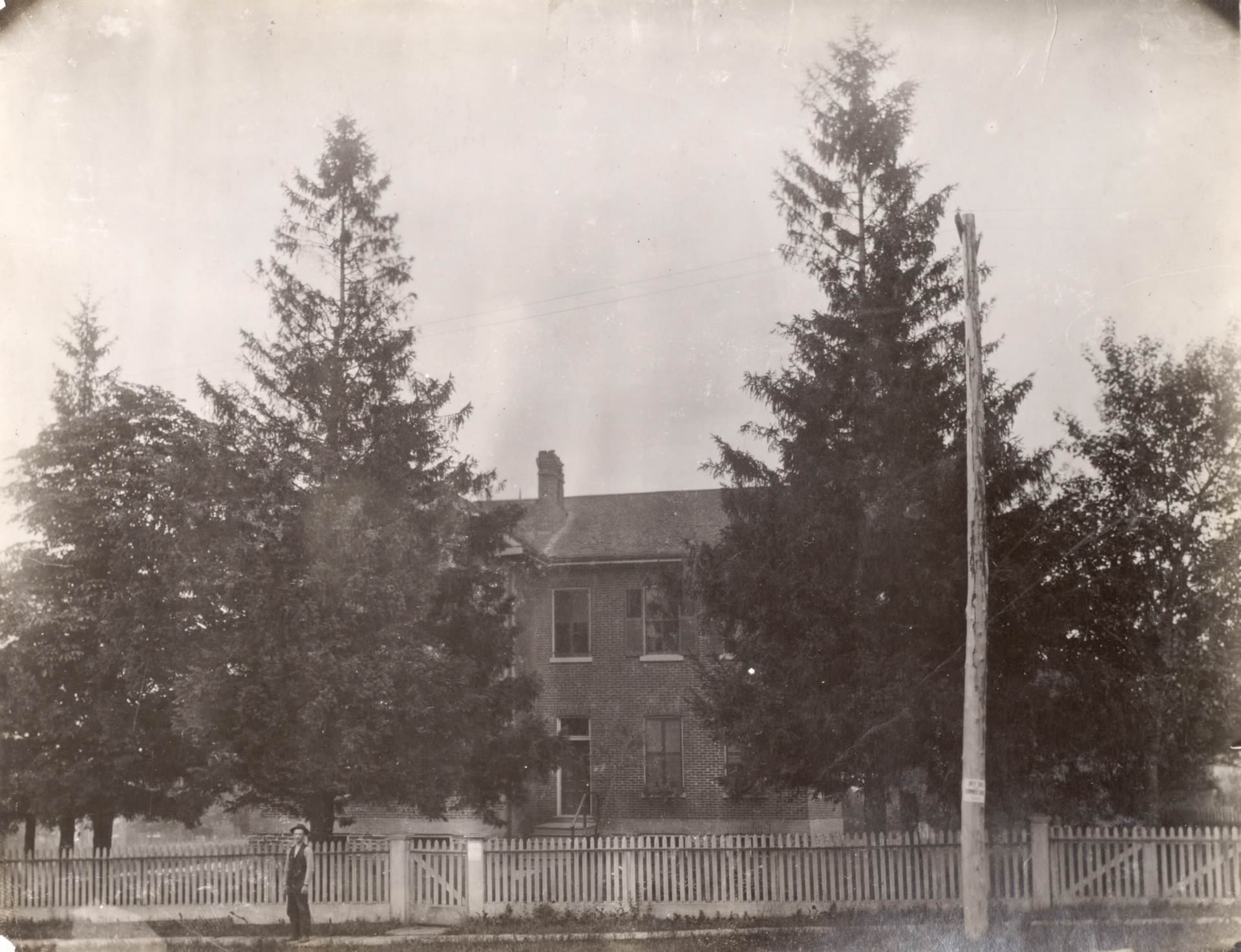
Toronto Bay was a working waterway. The steamship Cayuga, which entered service in 1907, was one of the vessels that carried passengers on Lake Ontario routes, including the popular Toronto to Niagara run. A traditional schooner photographed alongside her in the eastern gap of the bay shows the transition underway between sail-powered and steam-powered transportation on the Great Lakes.
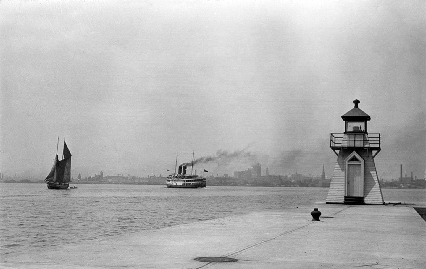
Spadina House, the grand estate at 285 Spadina Road, was still a private residence in 1905. Built in 1866 for James Austin, a financier and first president of the Dominion Bank, the house and its grounds sat at the top of Spadina Avenue and offered a commanding view south toward the lake. The property stood as one of the finest private estates in the city.
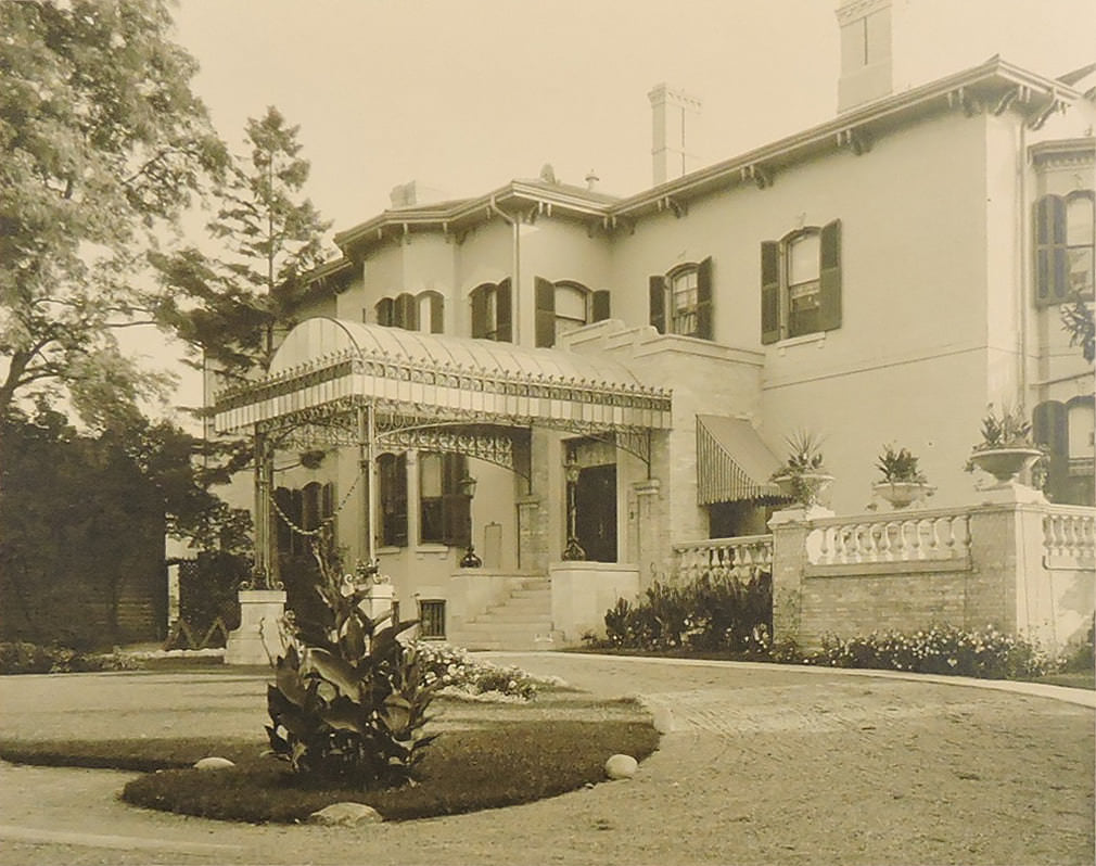
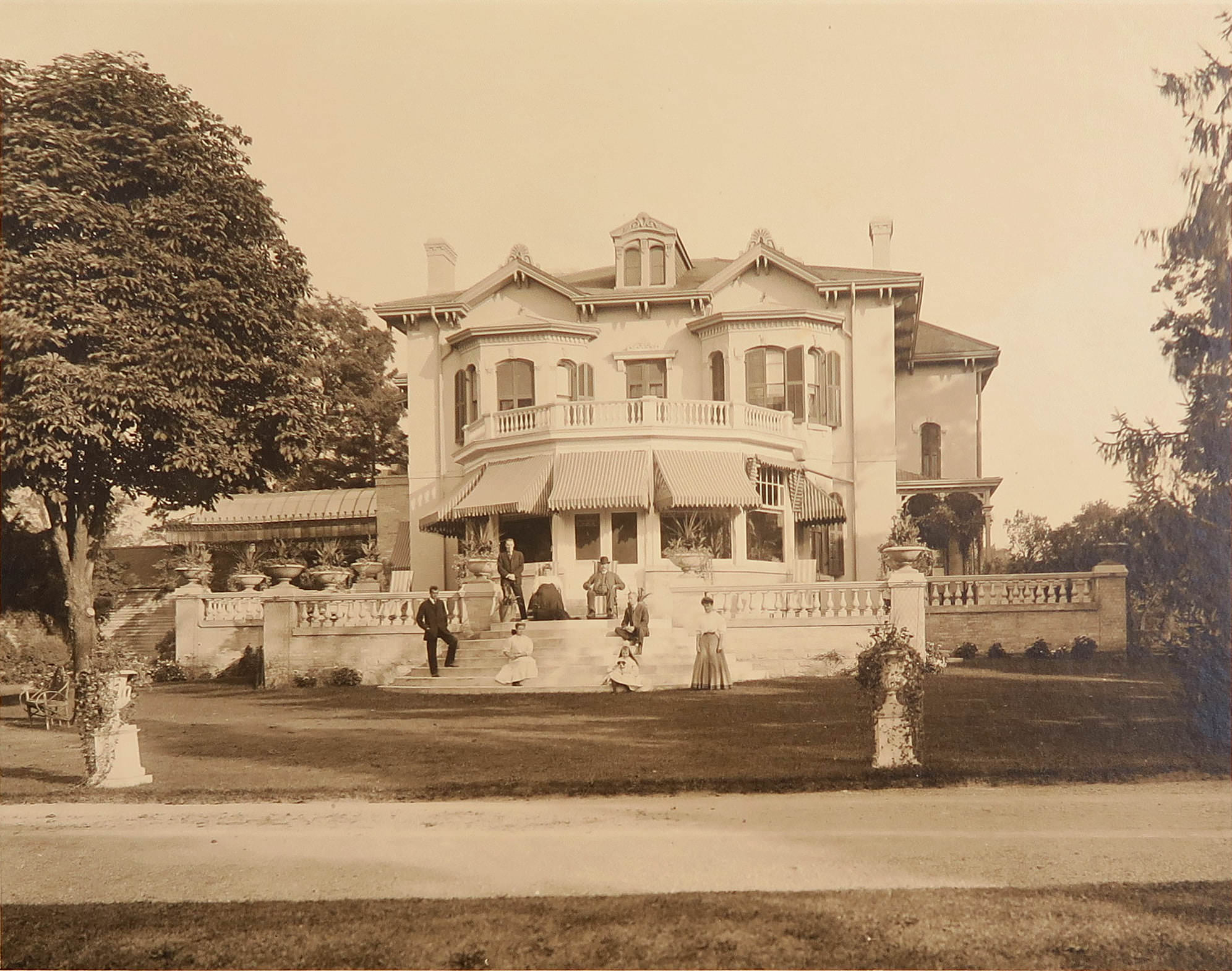
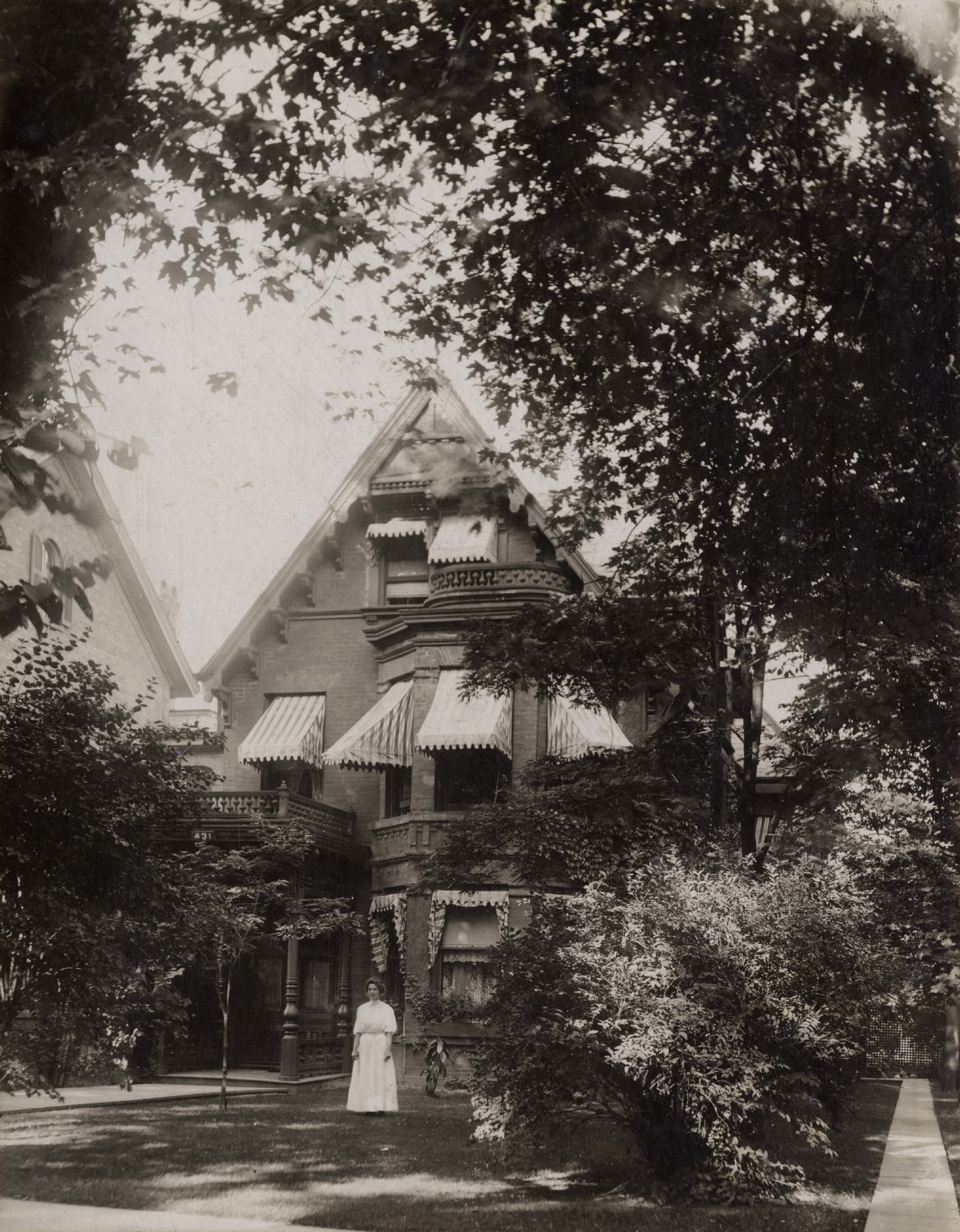
The Alexander Gemmel house on Jarvis Street in 1900 was a typical example of the grand Victorian homes that lined this prestigious street. These houses were built in the decades after Confederation by Toronto’s merchant and professional class, and they gave Jarvis Street a character that was distinctly residential and upper-class before commercial development began to encroach.
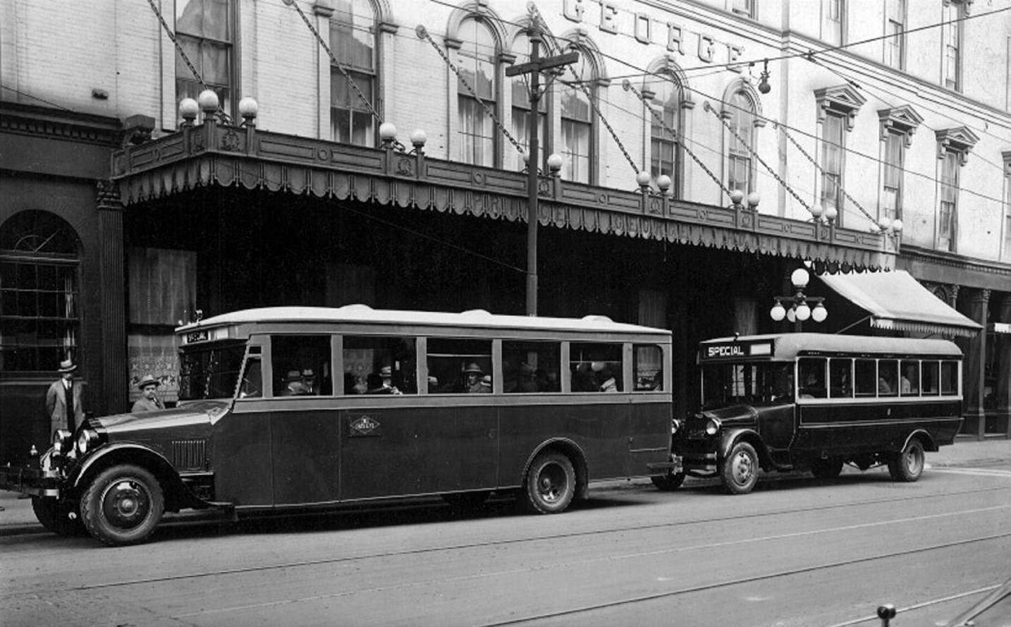
The Prince George Hotel at King and York Streets, originally opened in 1857 as the Rossin House Hotel, was renamed in 1909. By this time it was one of the city’s established hotels, catering to business travelers and visitors arriving by rail. A Gray Line sightseeing coach parked outside the hotel connected arriving guests to the broader experience of the city.
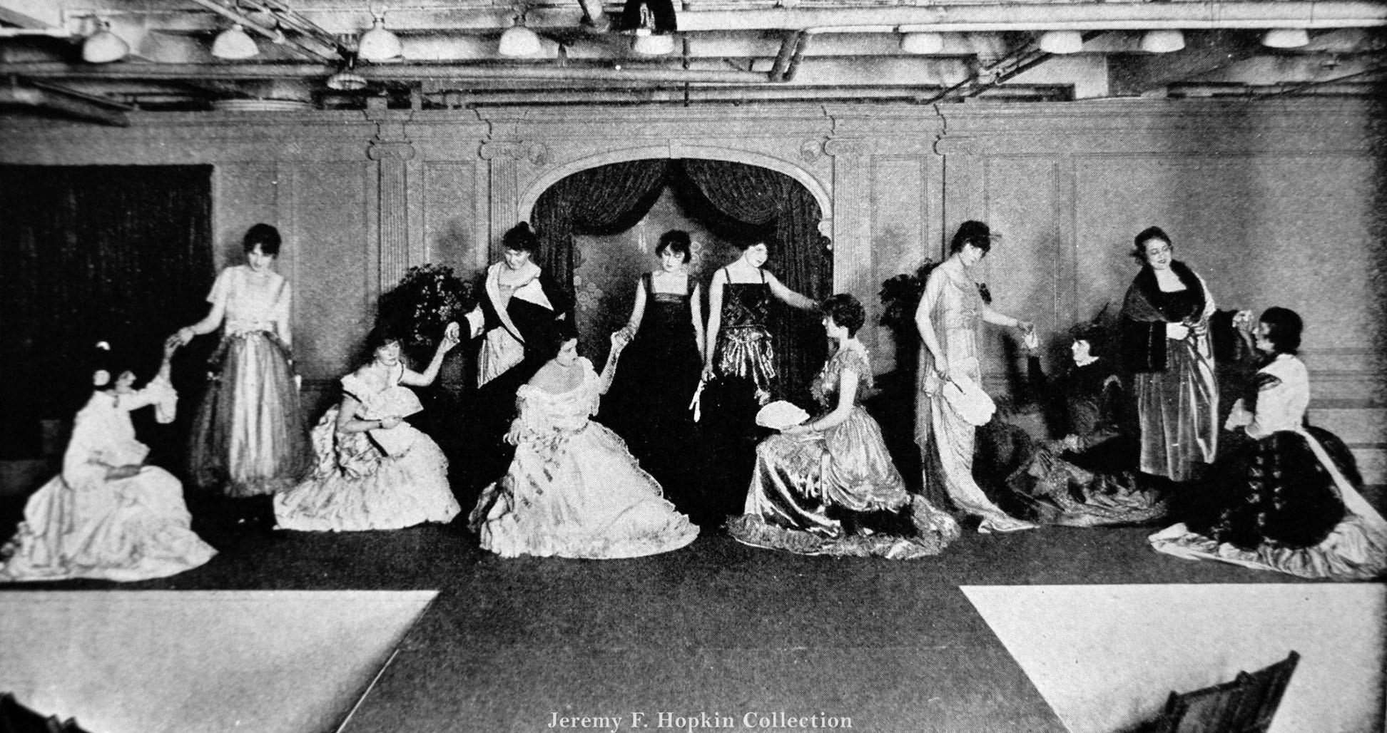
Eaton’s was more than a place to buy goods — it shaped how Torontonians understood fashion, domestic life, and consumer culture. Fashion comparisons printed in the company’s catalogues and promotional materials showed customers how Eaton’s could outfit them from head to toe. The company’s reach extended far beyond Toronto through its massive mail-order catalogue operation.
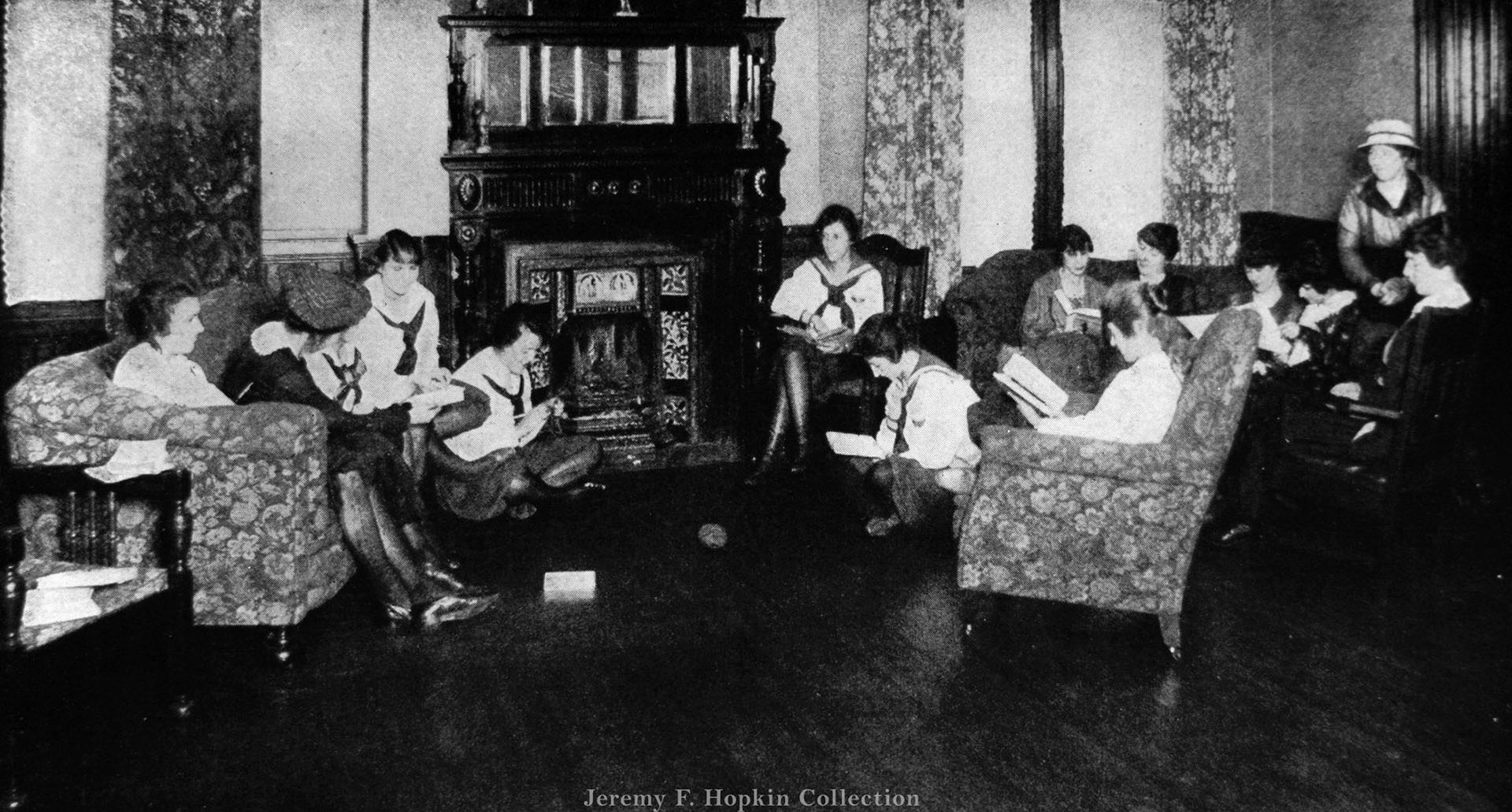
Eaton’s operated social spaces for its female employees, including the Eaton Women’s Club. The large sitting room offered a comfortable space where women working at the company could relax during breaks. This kind of paternalistic provision of amenities was a hallmark of Eaton’s corporate culture — it positioned the company as more than just an employer.
Eaton’s Toyland at Christmas was one of the great annual events in Toronto’s retail calendar. The arrival of Santa Claus at the store’s toy department drew crowds of children and parents, turning shopping into an experience tied to seasonal celebration. Eaton’s understood the emotional power of the event and invested heavily in making it spectacular.
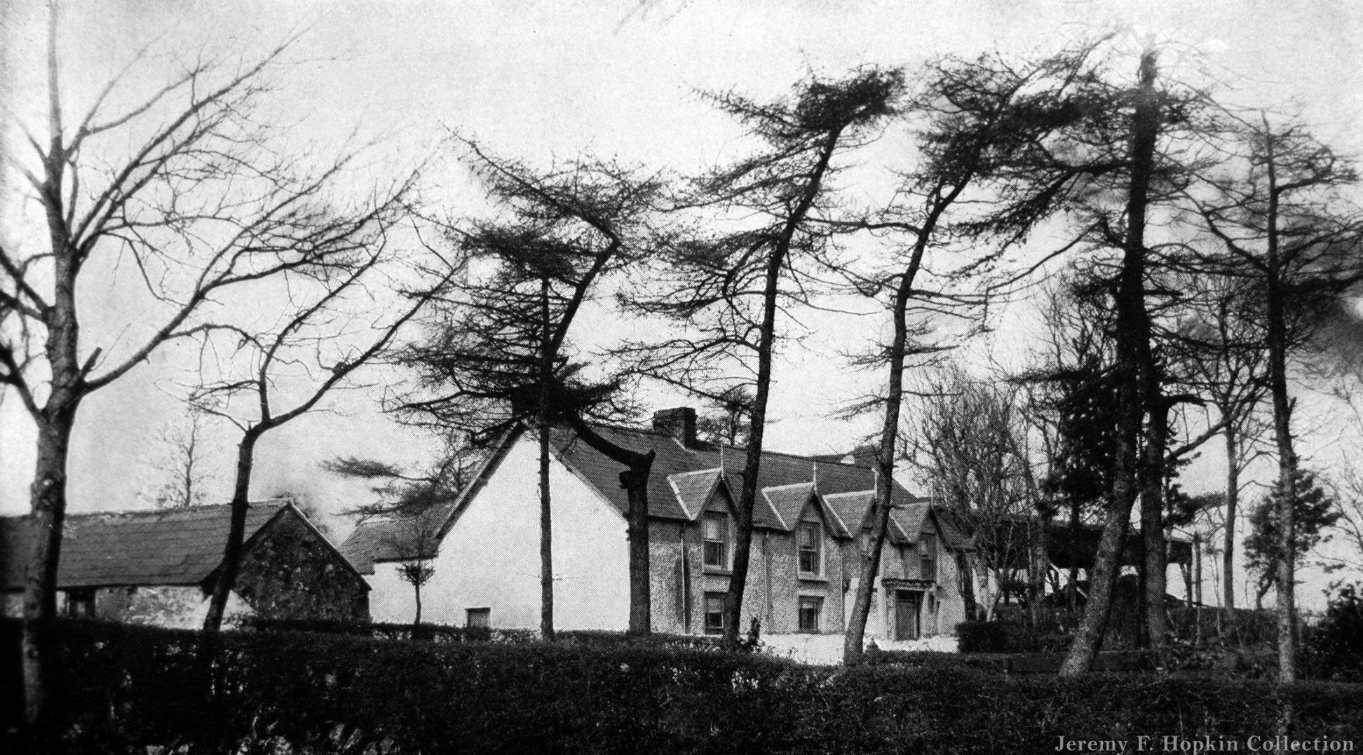
The Eaton family’s origins traced back to Ireland, near Ballymena in County Antrim. Timothy Eaton had emigrated to Canada in 1854 and opened his first Toronto store in 1869. By the 1900s, the family business he had built was one of the largest retail operations in North America, and photographs of the old Eaton homestead in Ireland served as a symbol of the remarkable distance the family had traveled.
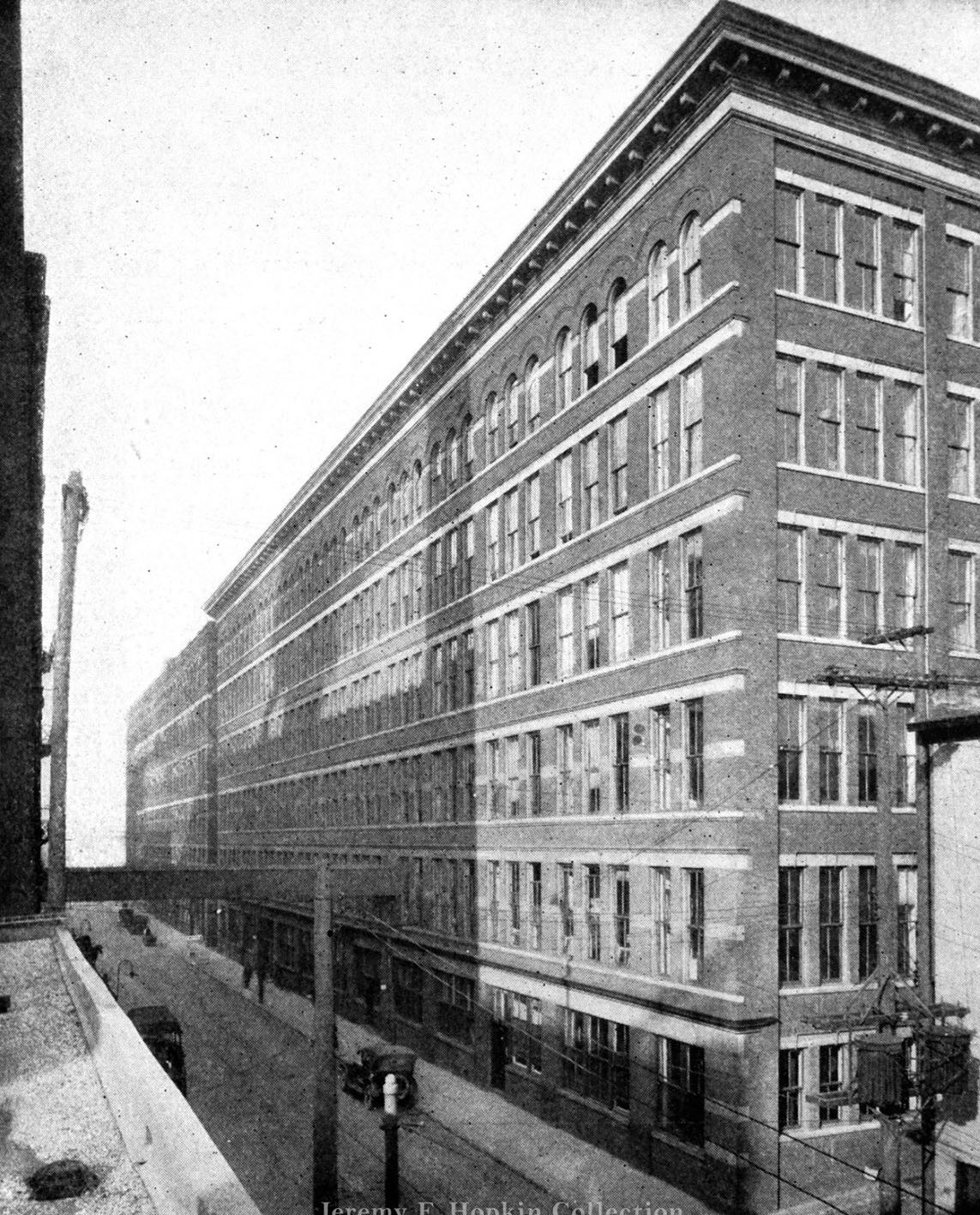
Eaton’s mail-order building on Louisa Street handled the enormous volume of catalogue orders that flowed in from across Canada. Rural customers who had no access to a city store could order nearly anything from the Eaton’s catalogue and have it delivered by mail. The operation required a large building and a significant workforce dedicated solely to processing and shipping orders.
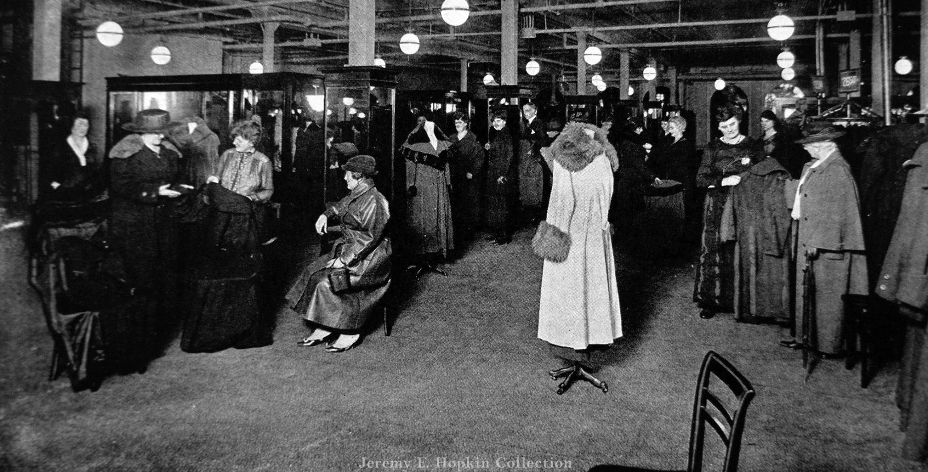
Inside Eaton’s Toronto store, the Women’s Coat Department displayed the kind of organized retail environment that the company was known for. Rows of garments, well-lit display areas, and attentive staff created a shopping experience that was deliberately designed to feel refined and trustworthy. Eaton’s had built its reputation on fixed prices and the guarantee of quality — a departure from the haggling culture of earlier retail.
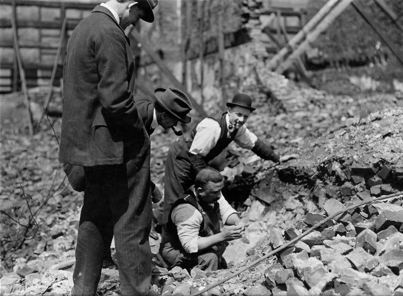
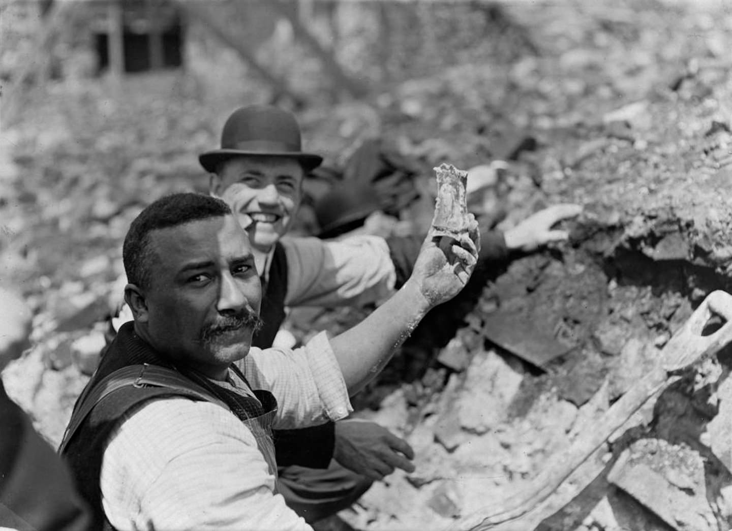
After the Great Fire of 1904, the ruins became a destination in their own right. Curio seekers picked through the rubble looking for objects fused or distorted by the extreme heat of the fire. It was morbid sightseeing, but it was also a way for Torontonians to process the scale of the disaster and reckon with what had been lost.
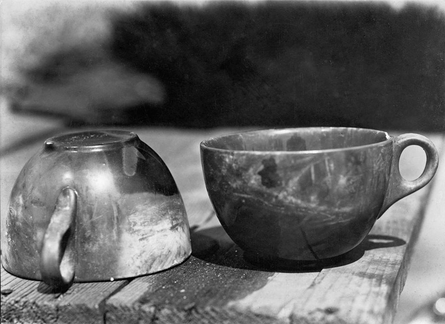
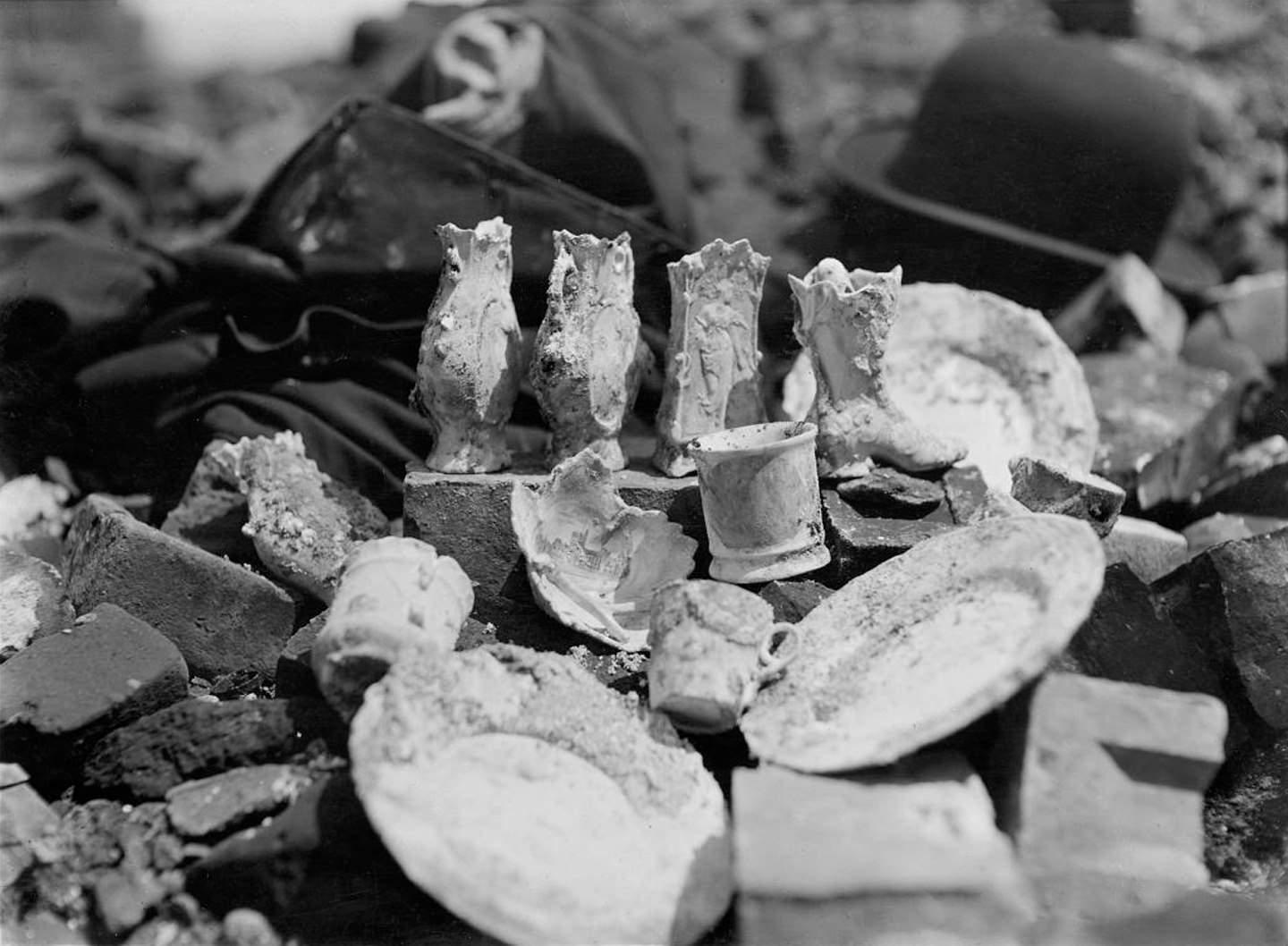
Pottery recovered from the ruins showed how intense the fire’s heat had been. Ceramic objects that would normally survive intact were warped, cracked, and discolored by temperatures that melted iron and fused metal together. These objects were collected as souvenirs and documented as evidence of the fire’s ferocity.
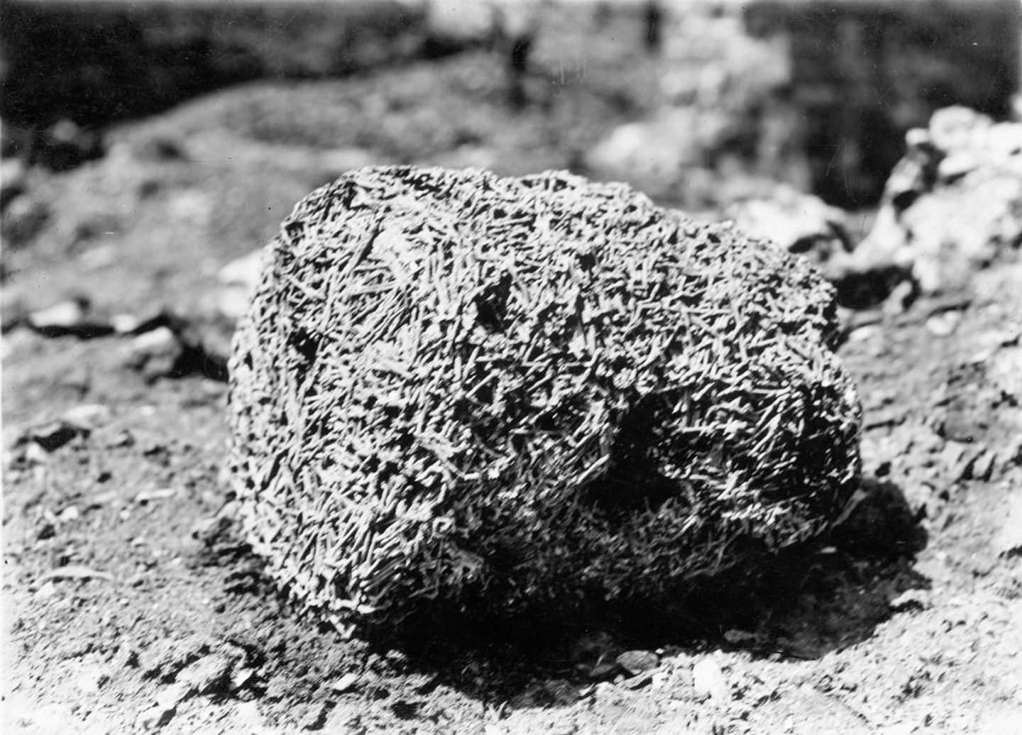
One of the most striking artifacts recovered from the fire’s ruins was a pile of nails completely fused together. Discovered among the rubble in 1906 — two years after the fire — the mass of metal illustrated just how hot the fire had burned. Iron nails require temperatures exceeding 1,500 degrees Celsius to fuse, giving some sense of the inferno that tore through downtown Toronto in April 1904.
Old City Hall was celebrated enough in its early years to appear on postcards sold to visitors and residents alike. A Valentine and Sons postcard postmarked January 22, 1908 shows the building as a point of civic pride — a landmark worth preserving and sharing. The hall was Toronto’s third, and it was built to make a statement about the city’s stature.
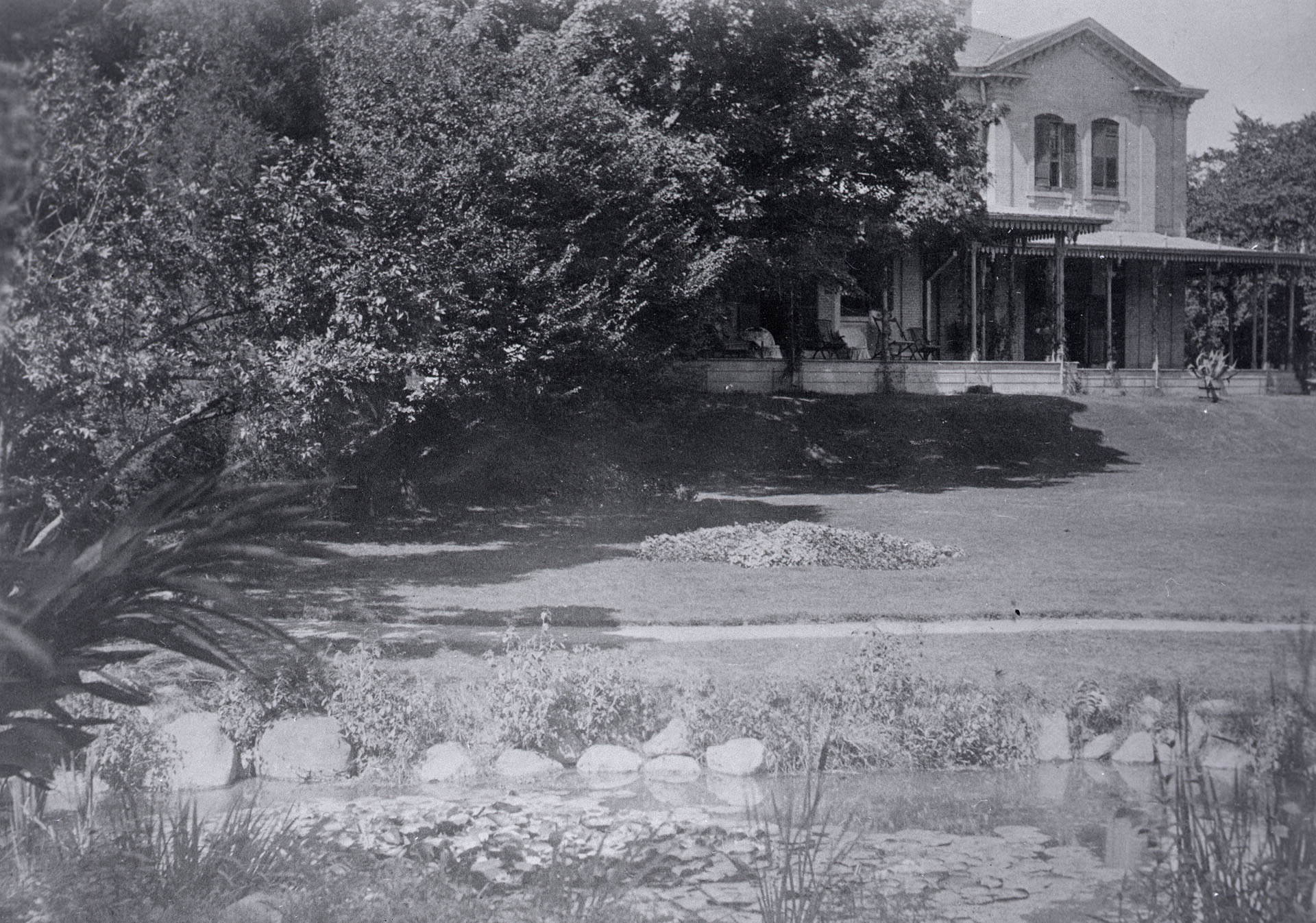
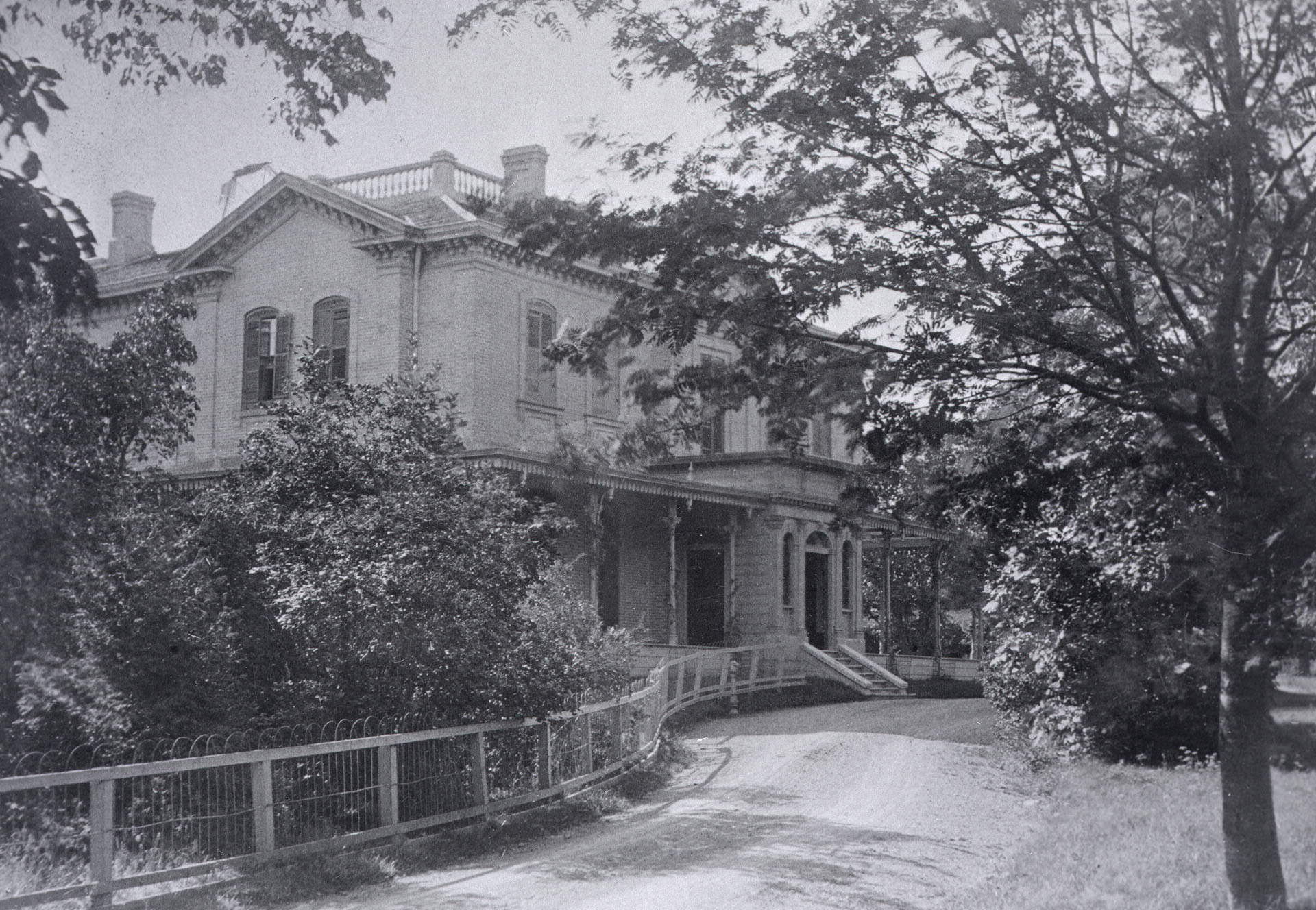
The Beatty house on Queen’s Park Crescent West in 1900 was a fine example of the prosperous residential architecture that surrounded the university and provincial legislature. The grounds were large and well-tended, and the house itself spoke to the affluence of the city’s legal and professional community. William Henry Beatty was a prominent Toronto lawyer closely tied to Osgoode Hall.
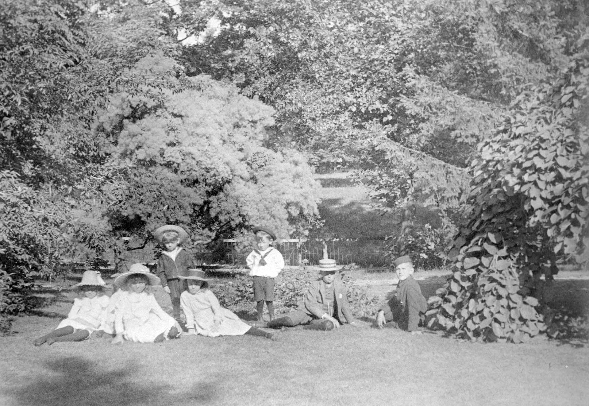
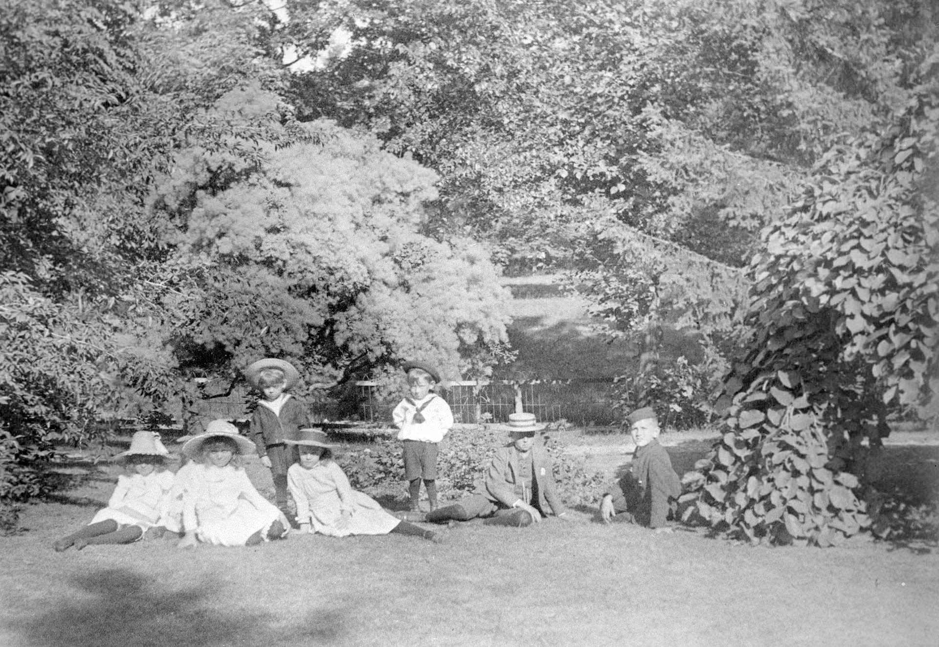
Children lounging in the yard of the Beatty property on Queen’s Park Crescent offered a rare moment of domestic informality in a series of otherwise formal architectural photographs. The image captures summer leisure in a privileged household — a sharp contrast to the children photographed in The Ward the same decade.
The Post Office on Adelaide Street East served Toronto from 1873 through 1960. A postcard published by W.G. MacFarlane in the 1900s shows the building as a confident piece of Victorian public architecture — its elaborate facade a statement about the importance of postal communication in connecting the city to the country and the world.
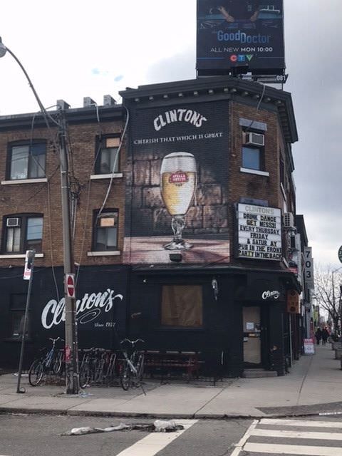
Clinton’s was one of the local establishments that served Toronto’s neighborhoods in the early 1900s — a neighborhood fixture of the kind that gave each street and community its own character. Small businesses like this one formed the backbone of daily life for most Torontonians who rarely ventured to the grand department stores downtown.
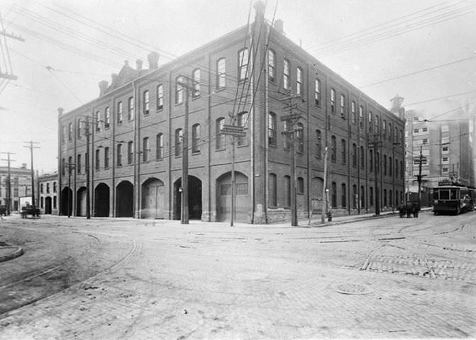
The Toronto Railway Company operated the city’s streetcar network, and its carhouse buildings served as the home base for the vehicles and crews that kept the transit system running. The streetcar was the primary mode of public transit in early 1900s Toronto, and the carhouse was a busy, functional building at the heart of the city’s transportation infrastructure.
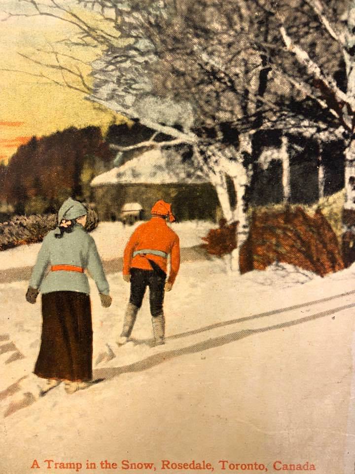
Even in June, Rosedale could see snow — as this photograph from June 1st, 1909 documents. A lone figure described as a tramp makes his way through a snow-covered street in one of Toronto’s wealthiest neighborhoods. The image is a reminder that Toronto’s climate was as much a part of daily life as its buildings and its commerce.





I’d love to know more about that Diving Horse.
So it was just a show… watching a horse jump from twenty to thirty feet in the air? People do weird stuff when they’re bored.
We demolished a lot of the older buildings; they had a lot of character
Many of the more significant, iconic buildings in these photos still exist today. The Toronto Board of Trade Building, Government House, and Crystal Palace were destroyed by fire. It’s incredible how razed when the new City Hall was built, but most of these architectural gems are still standing today.
Damn, Crystal Palace was pretty cool; too bad about the fire.
A diving horse?! WTH?!
I wish we could turn back time.
queen and Spadina hasn’t changed much
When Woolner avenue was called Scott avenue.
Yonge and Queen, 1908
Mostly Panamas, but you can spot one guy with a top hat (silk or beaver?). I’m assuming he is carrying bags of money.