
The Chao Phraya River is the spine of Bangkok. It has shaped the city’s geography, its economy, and the daily lives of the people who have lived along its banks for centuries. Long before Bangkok became a sprawling modern capital, the river was already driving decisions about where people settled and how they survived.
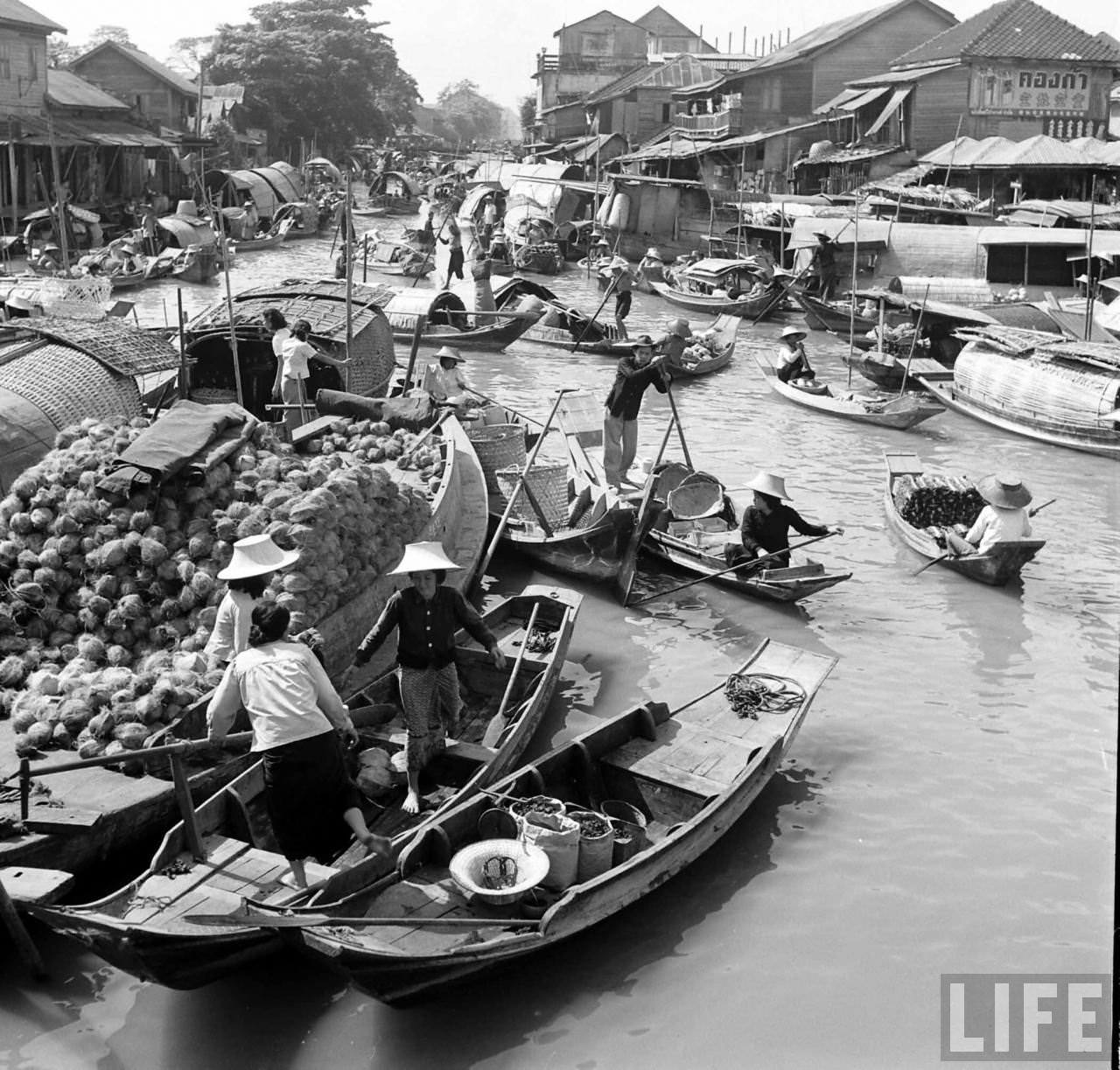
The river’s importance stretches back to at least the 15th century. Settlers were drawn to the area now known as Bangkok because of its fertile land — the ground was once swampland — and its position close to the river’s mouth, which made trade and defense easier to manage. That combination of soil and strategic location made it one of the most valuable spots in the region.
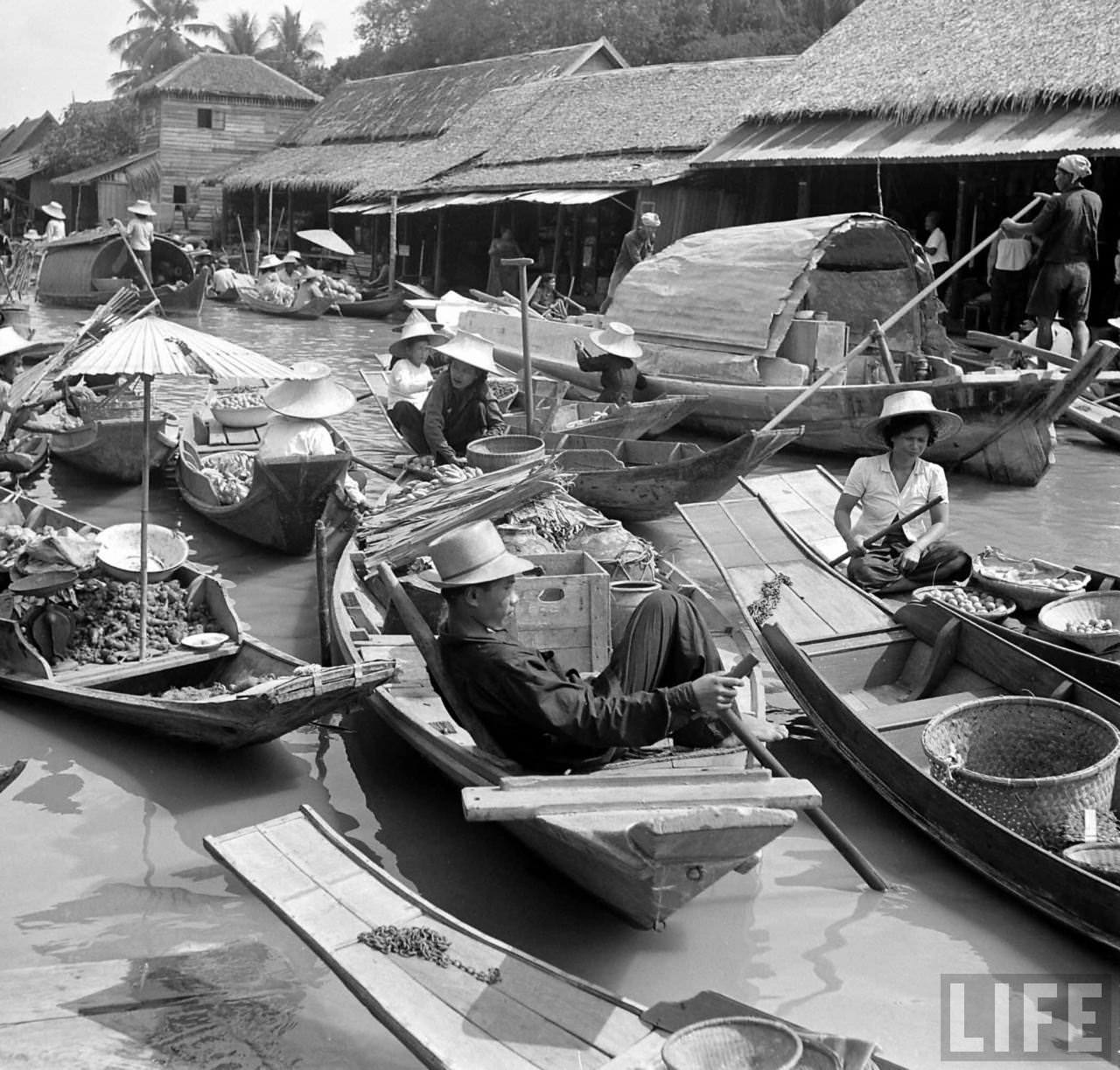
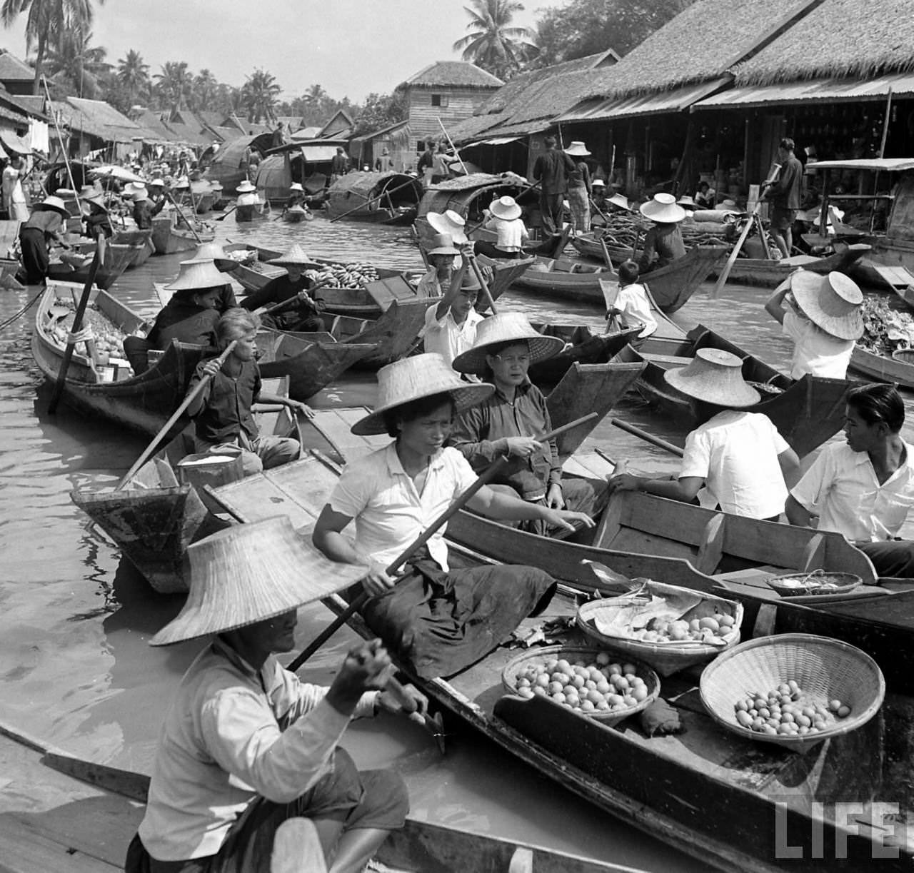
When the Thai capital moved from Ayutthaya, it first landed on the western bank of the Chao Phraya — the area now called Thonburi. It later shifted to the eastern bank. Over time, both settlements grew into each other and merged into a single capital. Thais call it Krung Thep. The rest of the world knows it as Bangkok.
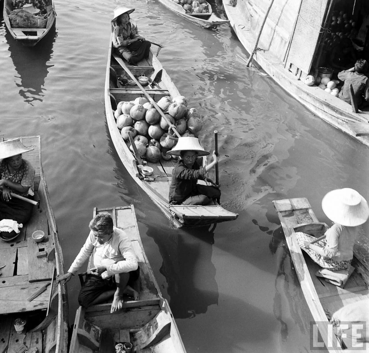
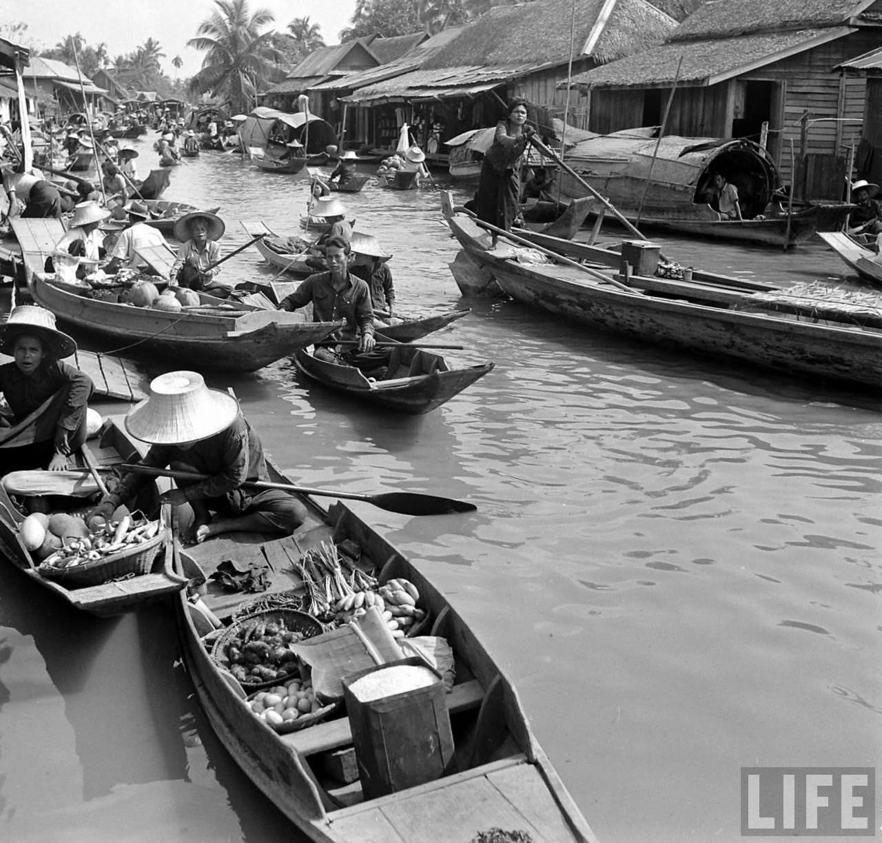
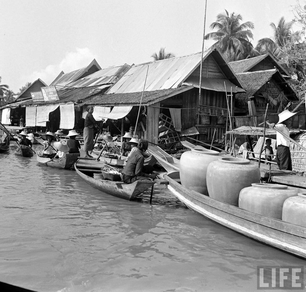
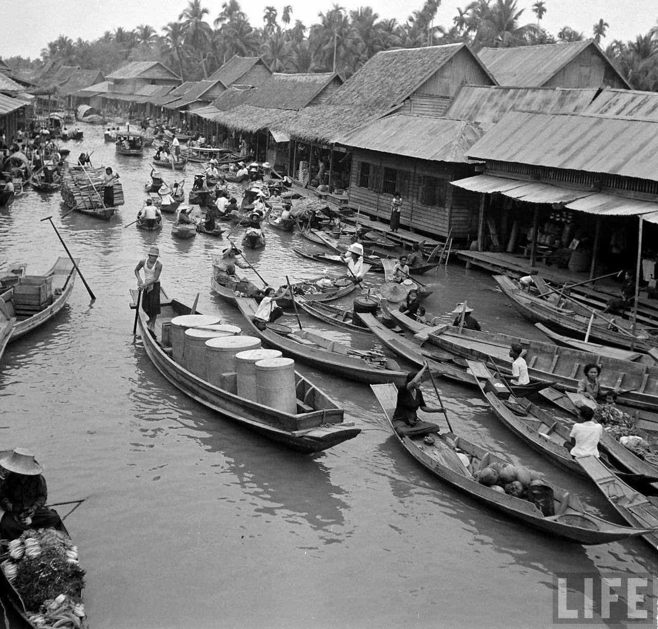
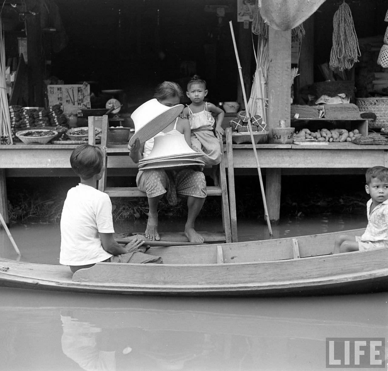
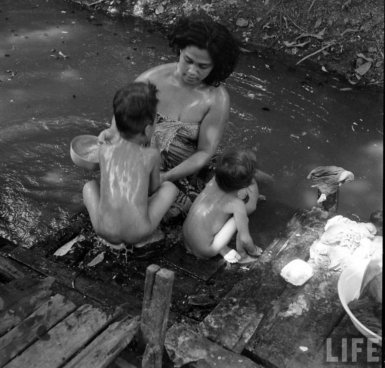
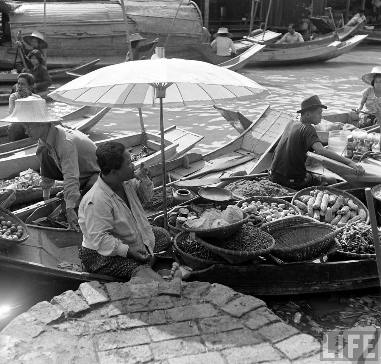
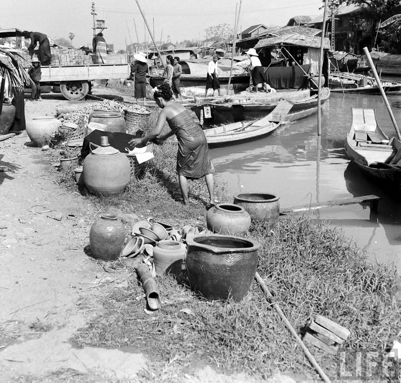
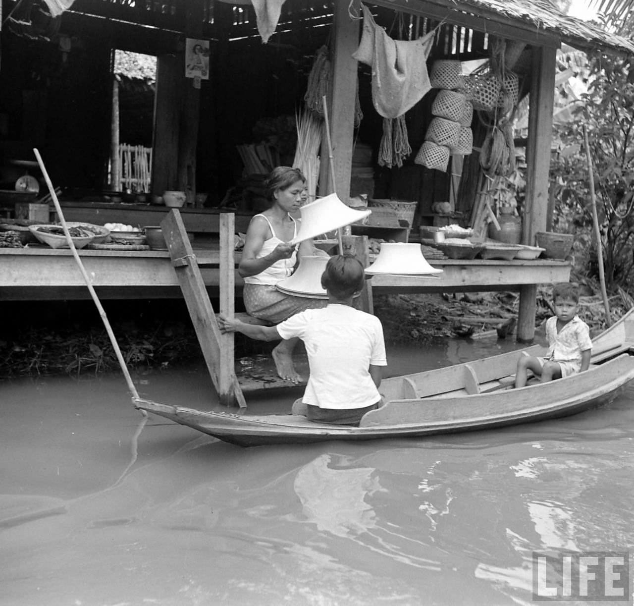
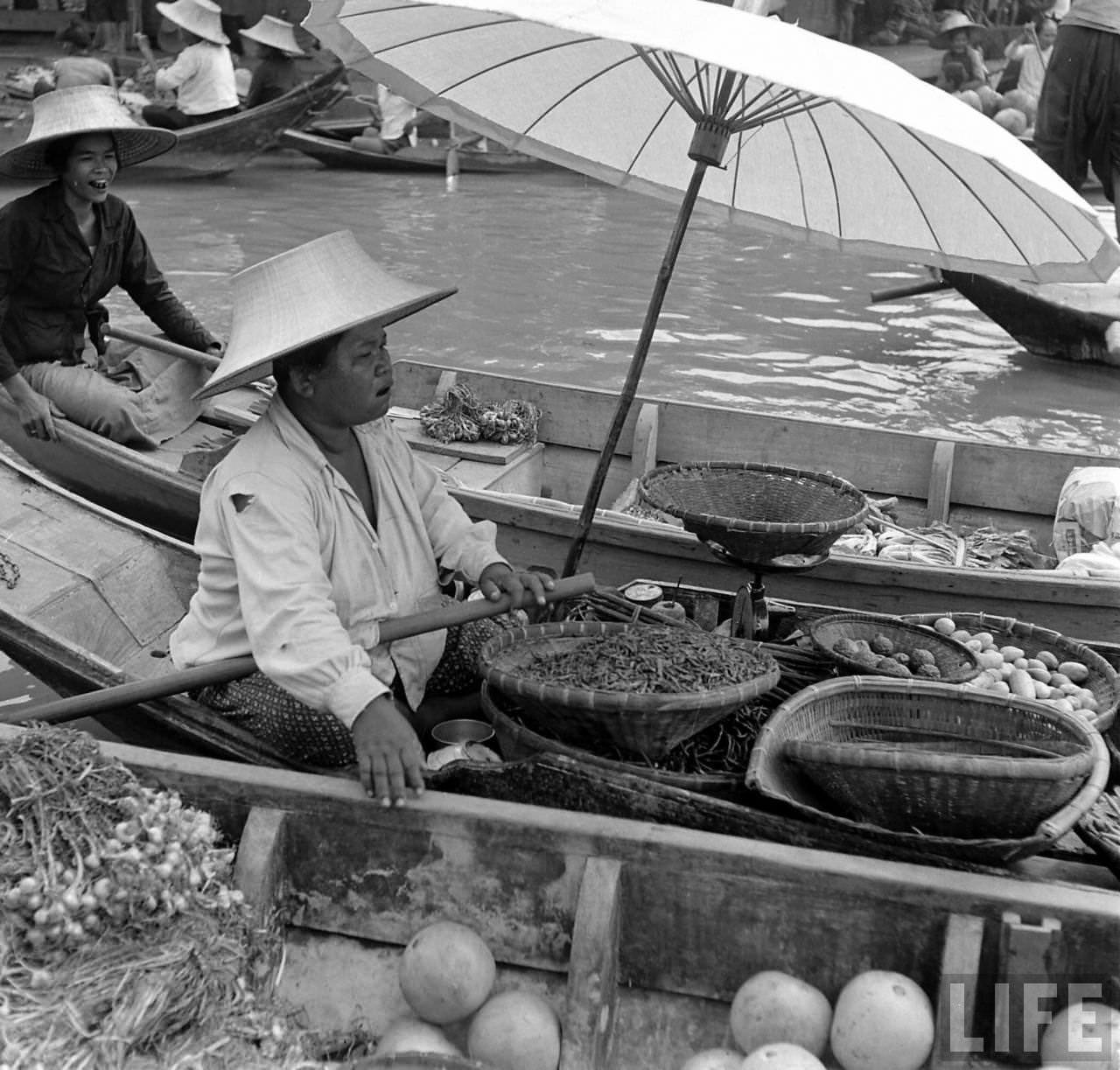
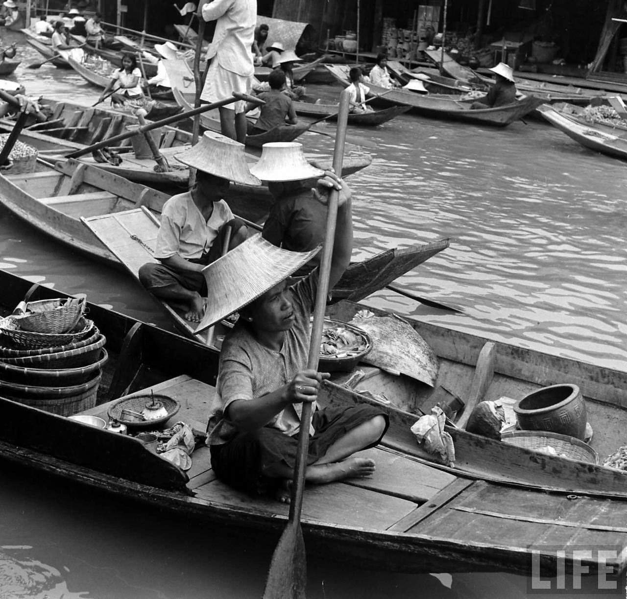
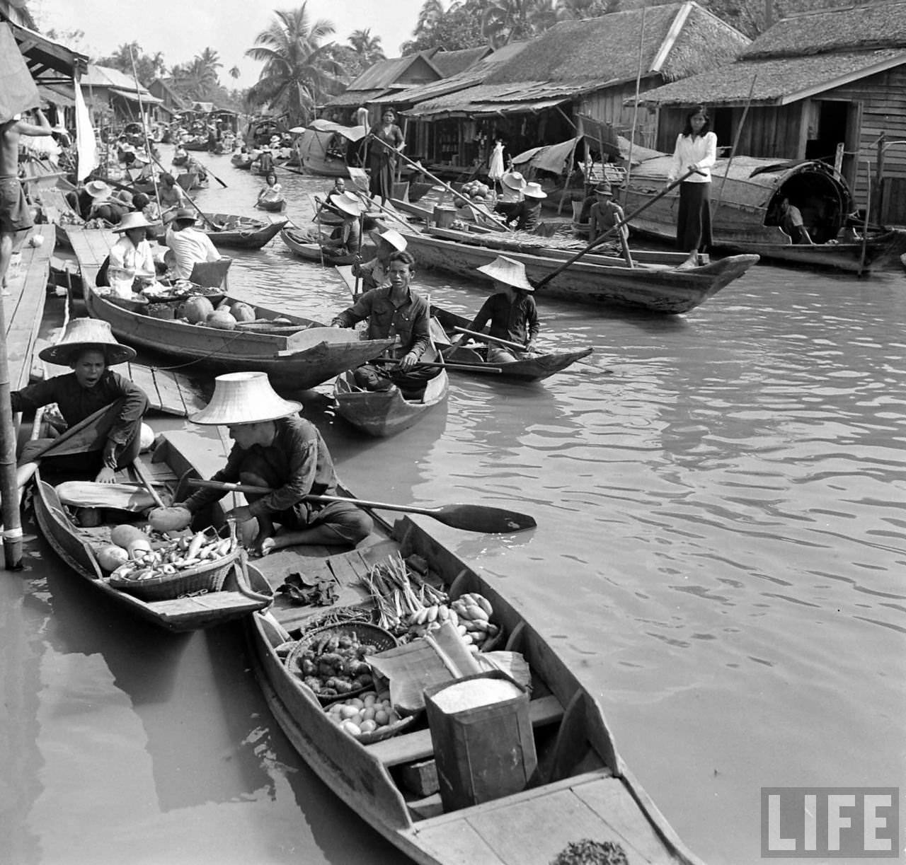
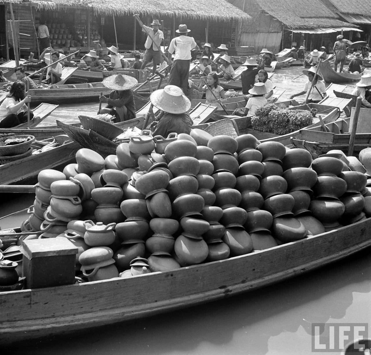
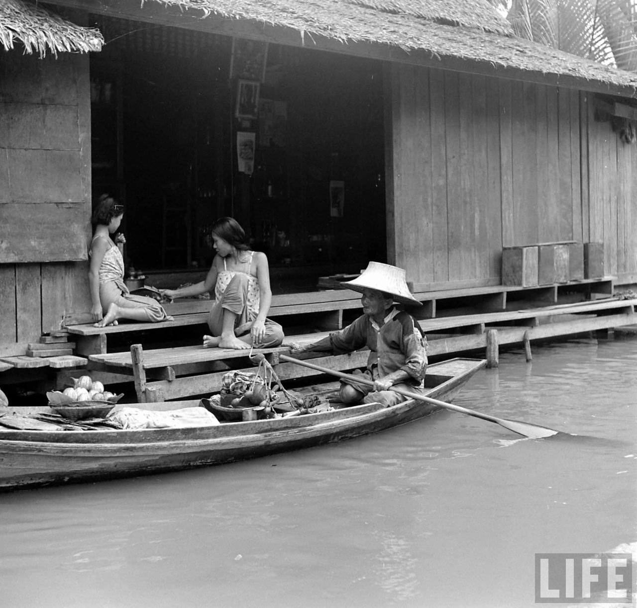
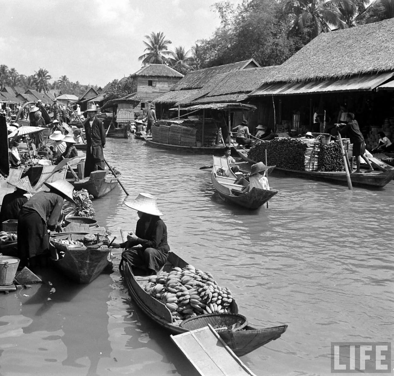
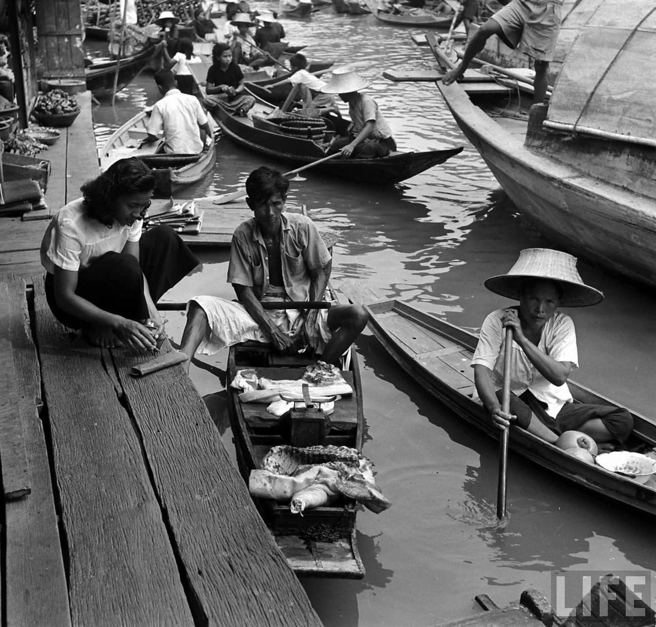
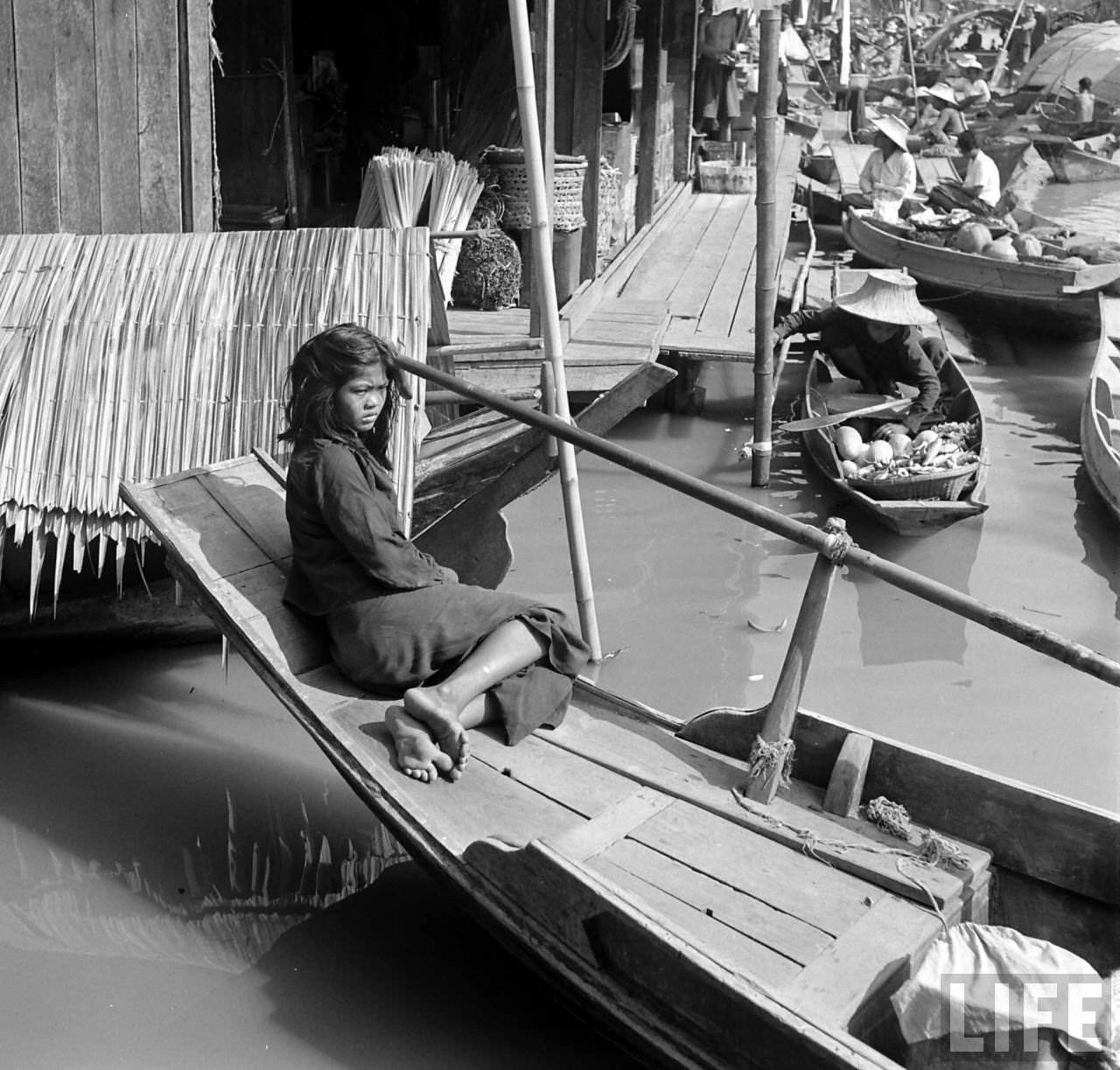
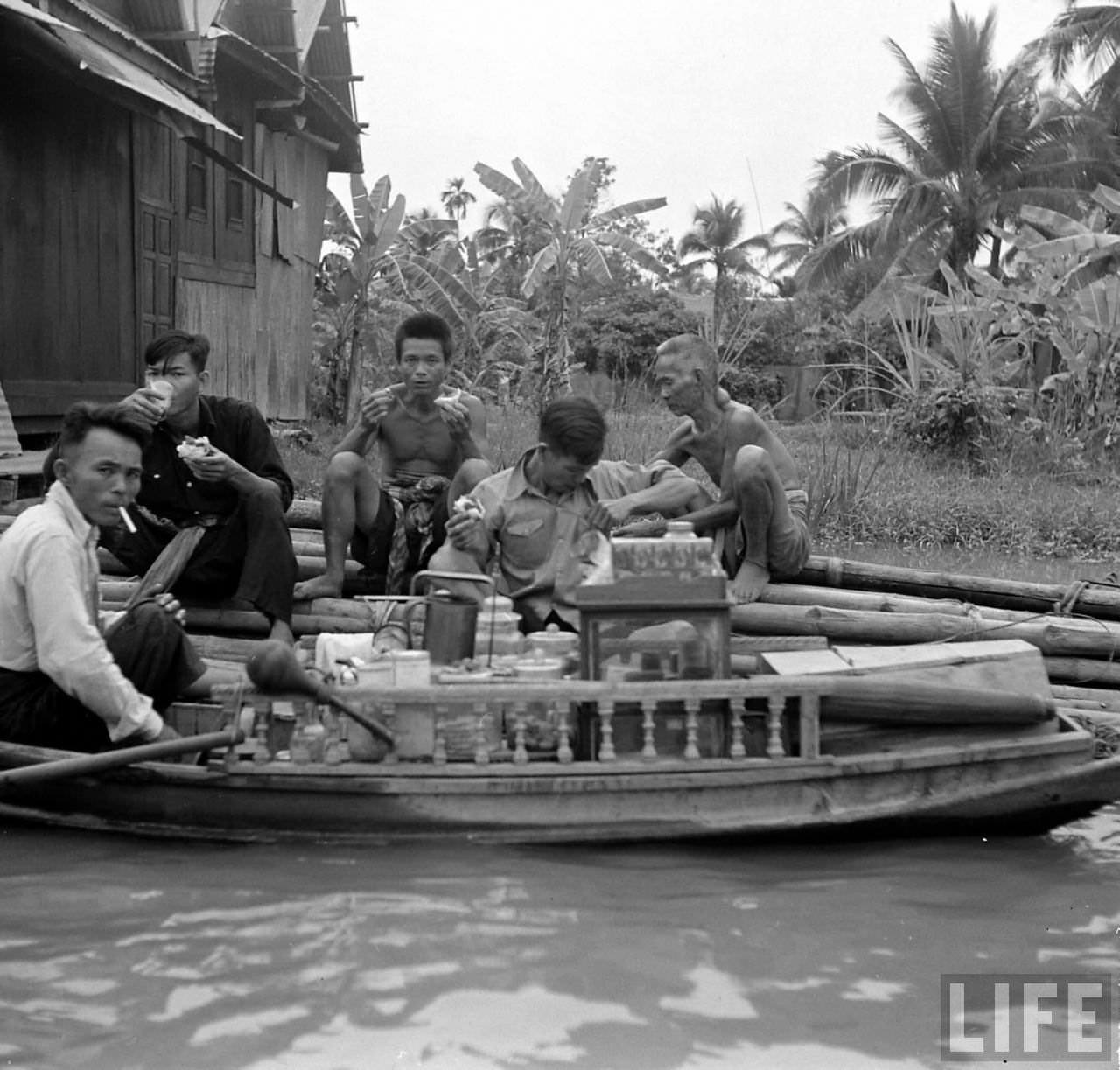
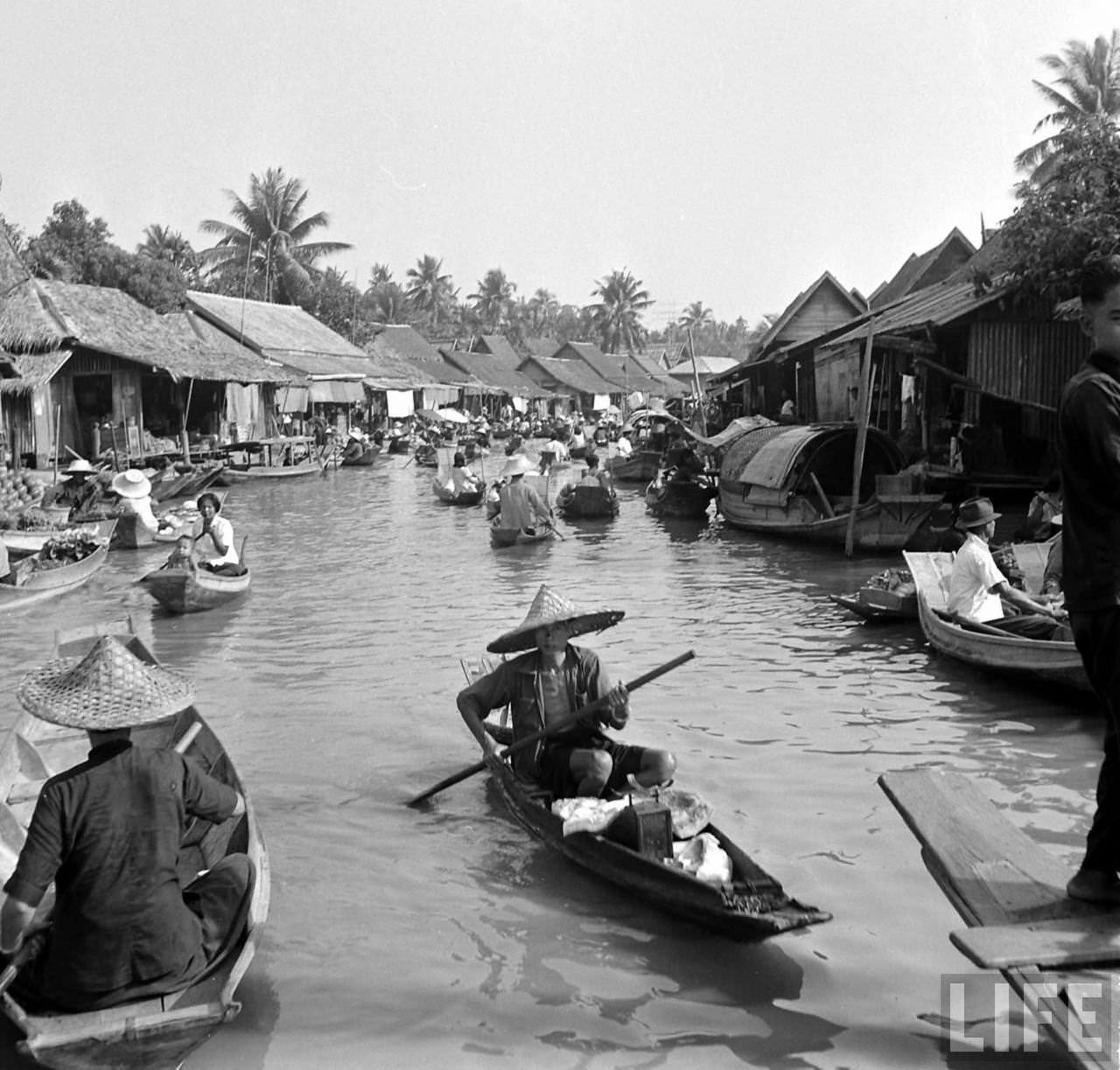
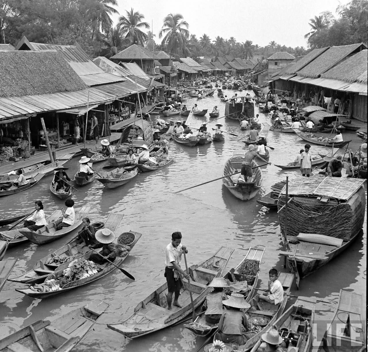
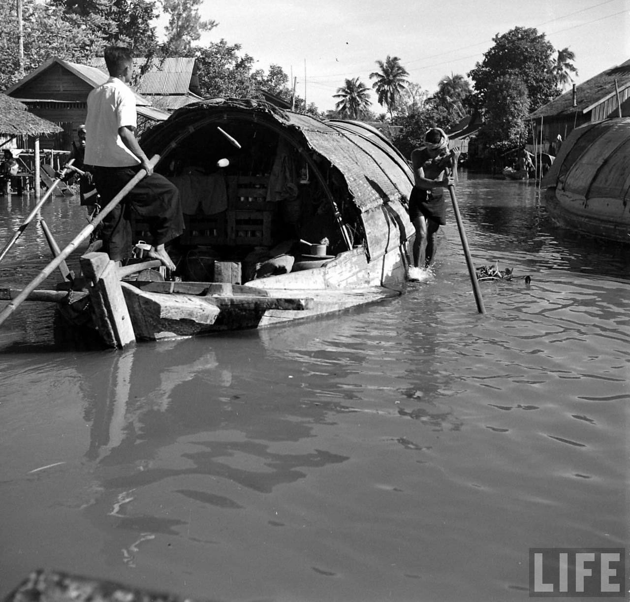
In the early 1950s, photographer Dmitri Kessel traveled to Bangkok on assignment for LIFE magazine. What he captured along the Chao Phraya was a world built almost entirely around water. Families lived on the river, worked on the river, and moved through the city by the river. The photographs he took remain some of the most vivid records of that era.
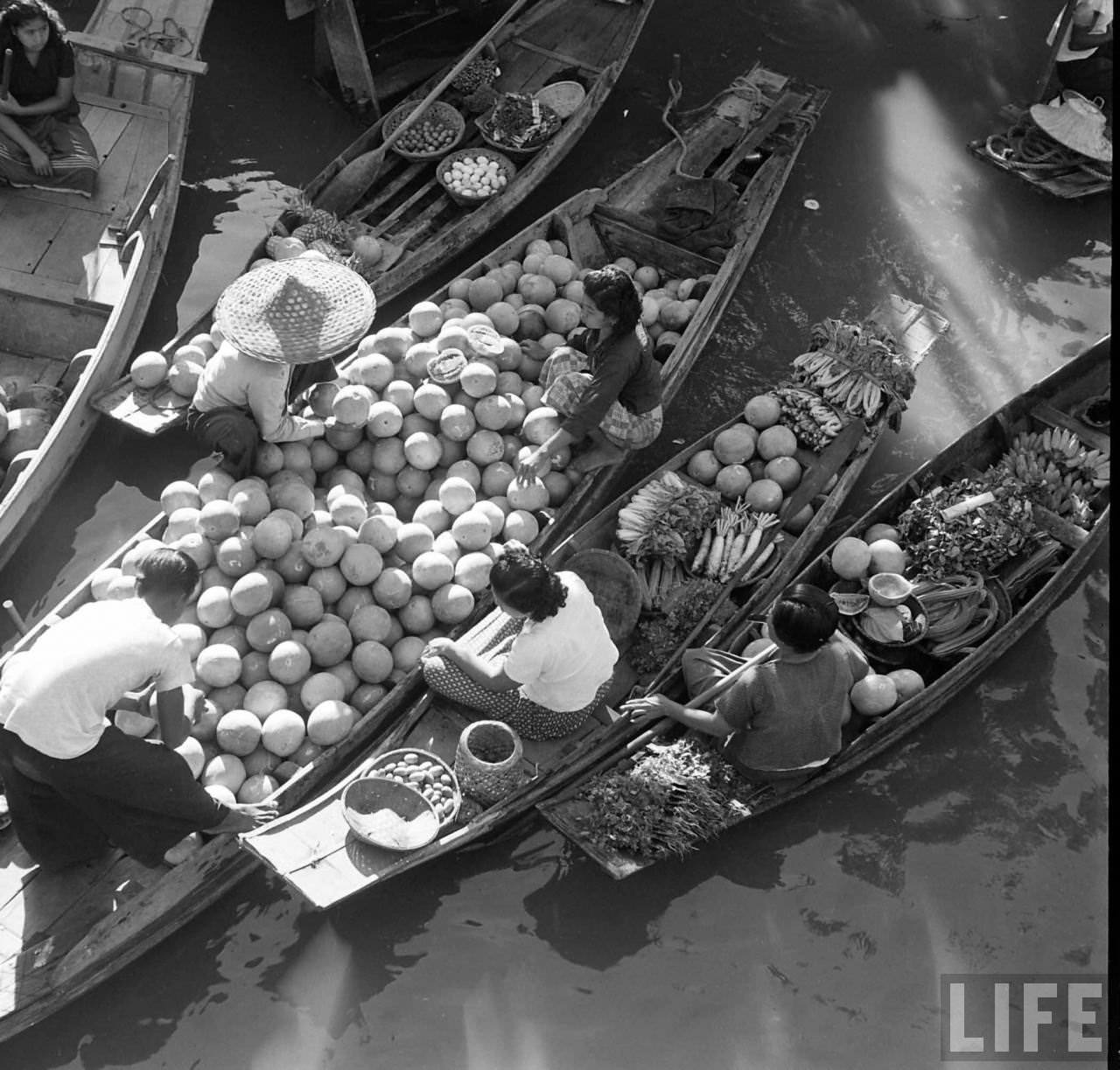
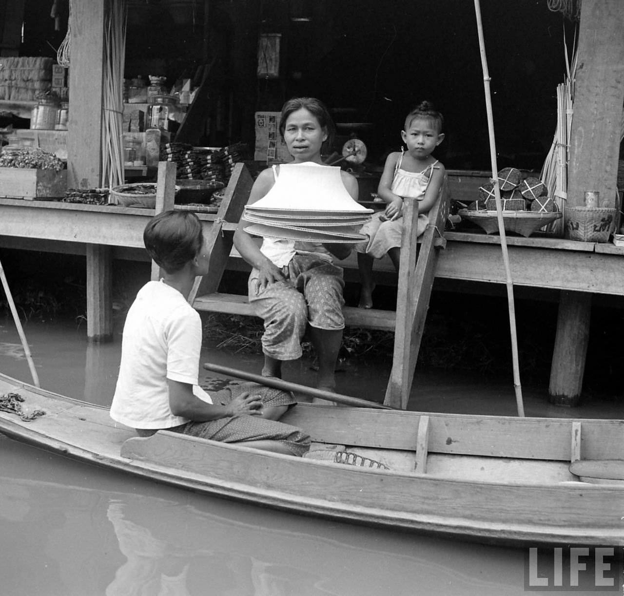
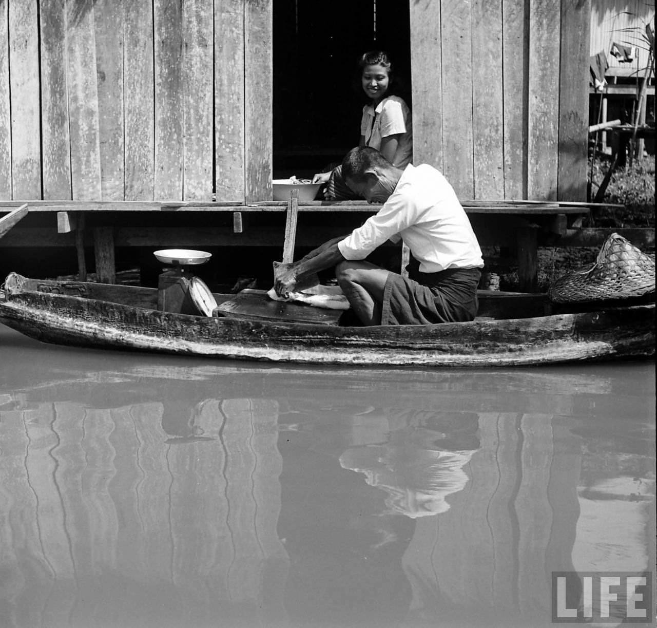
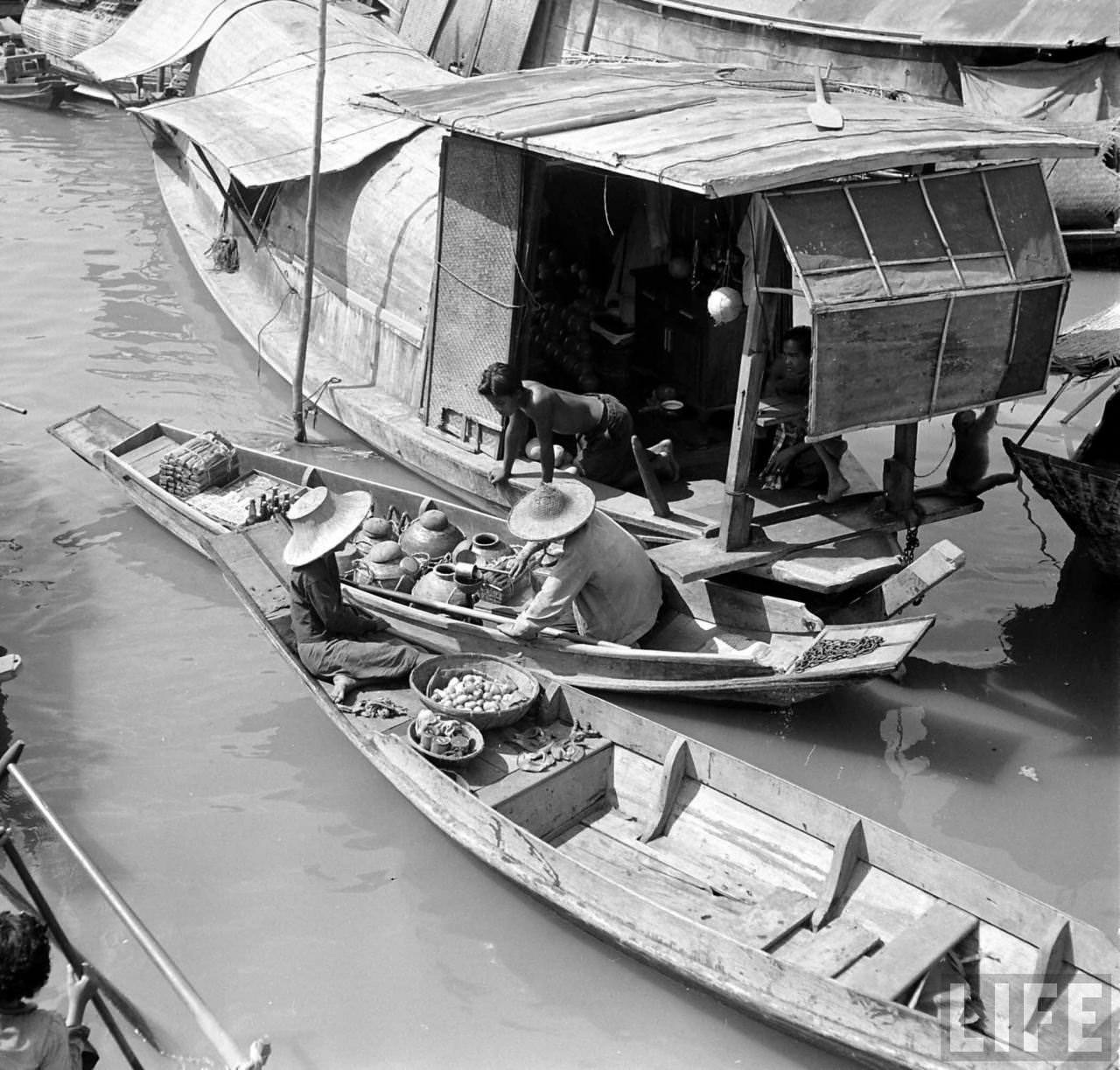
At that time, the river was far more than a backdrop. It was a working waterway where boats carried goods, vendors sold food, and communities clustered along its edges in tightly built wooden structures. Life moved at the river’s pace.
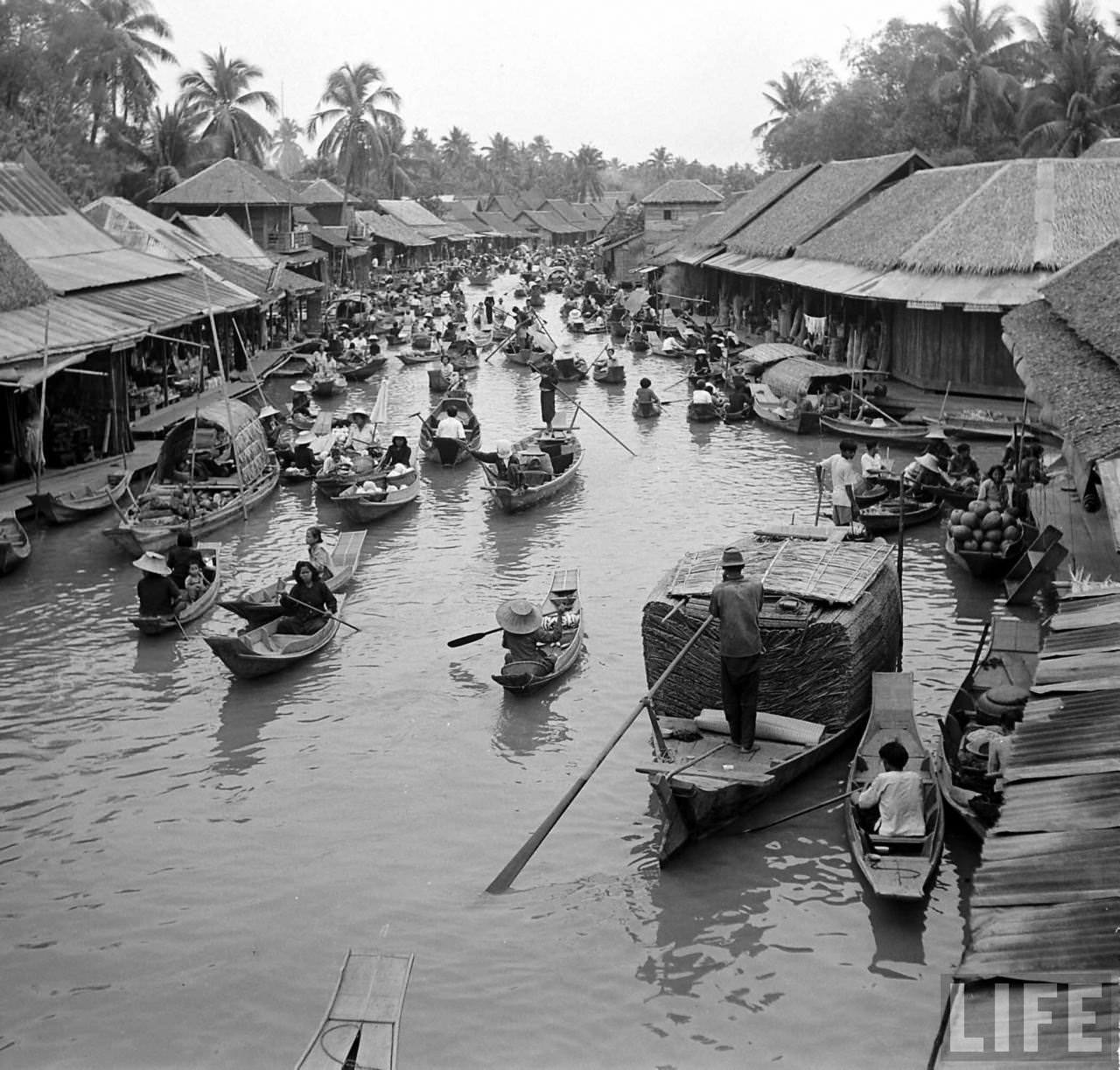
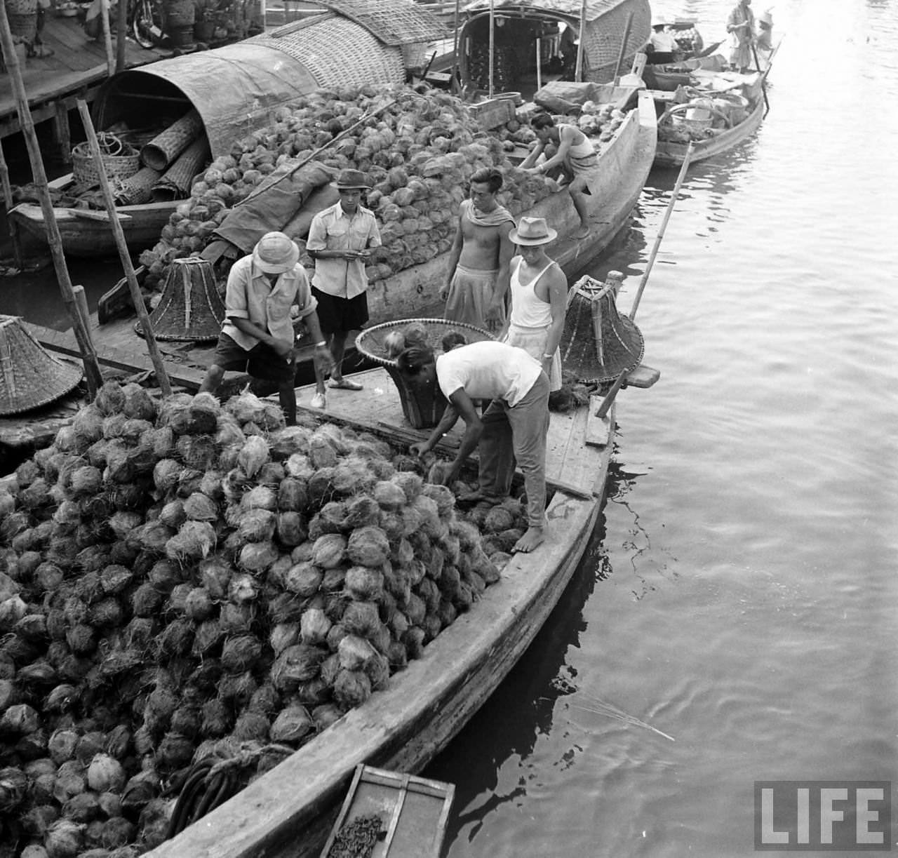
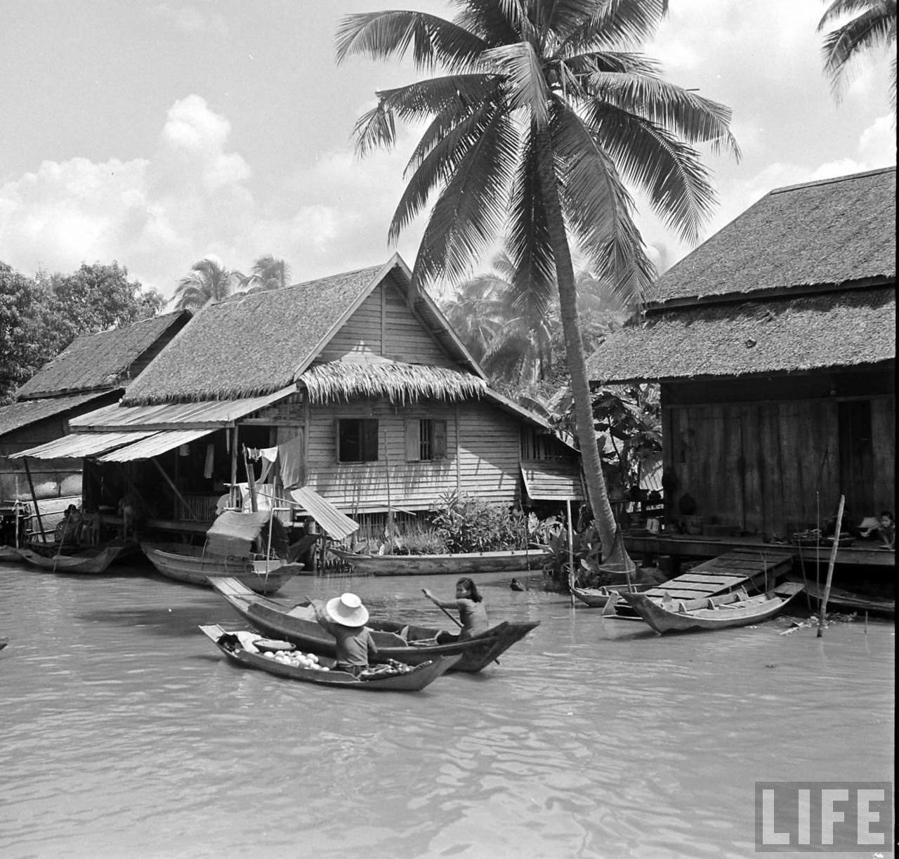
Kessel’s images show the texture of that life in sharp detail. The Chao Phraya in the 1950s was dense with activity — long-tail boats cutting through brown water, monks accepting alms from vessels, children playing near the water’s edge, and market traders navigating narrow channels between larger ships.
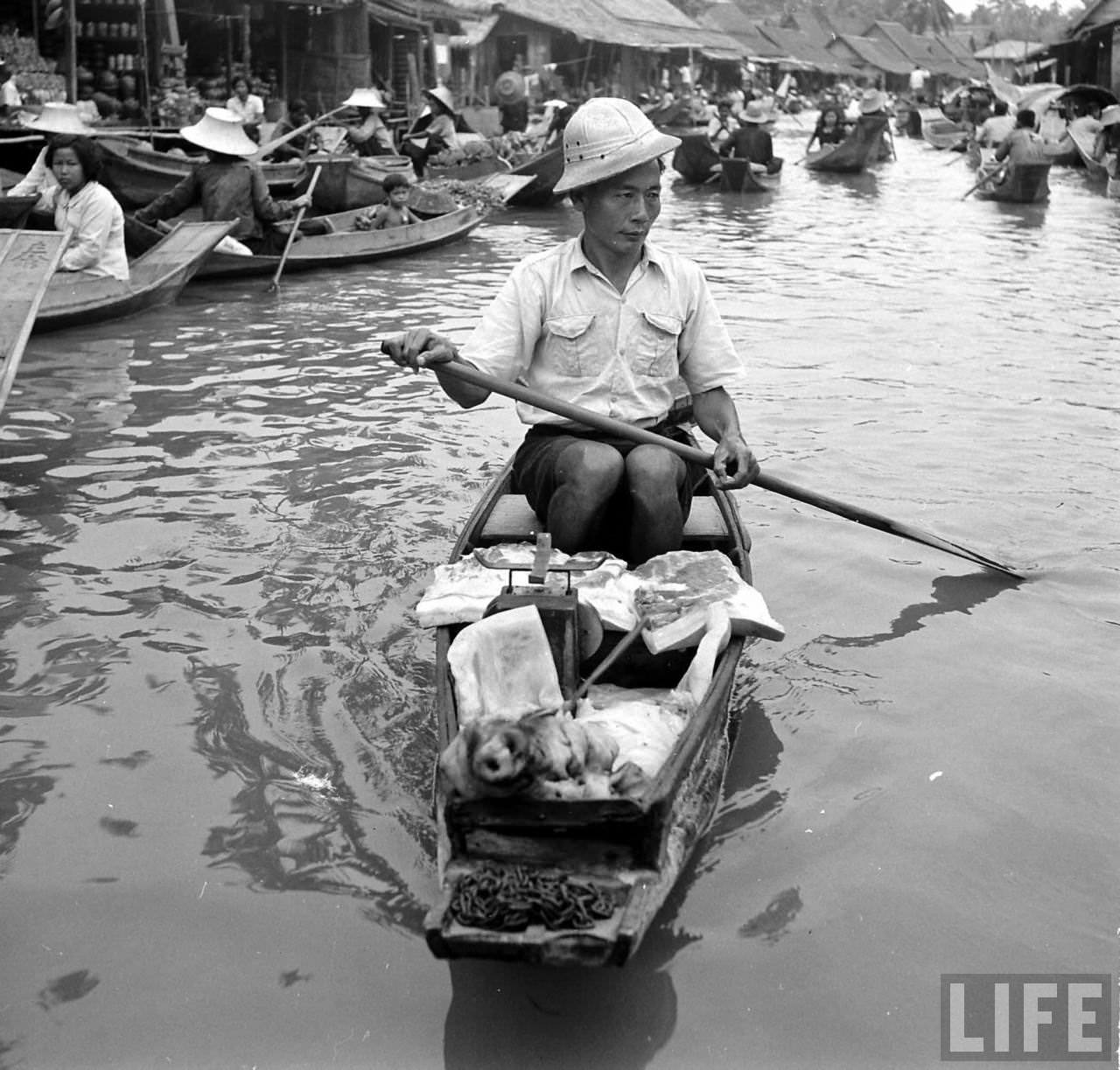
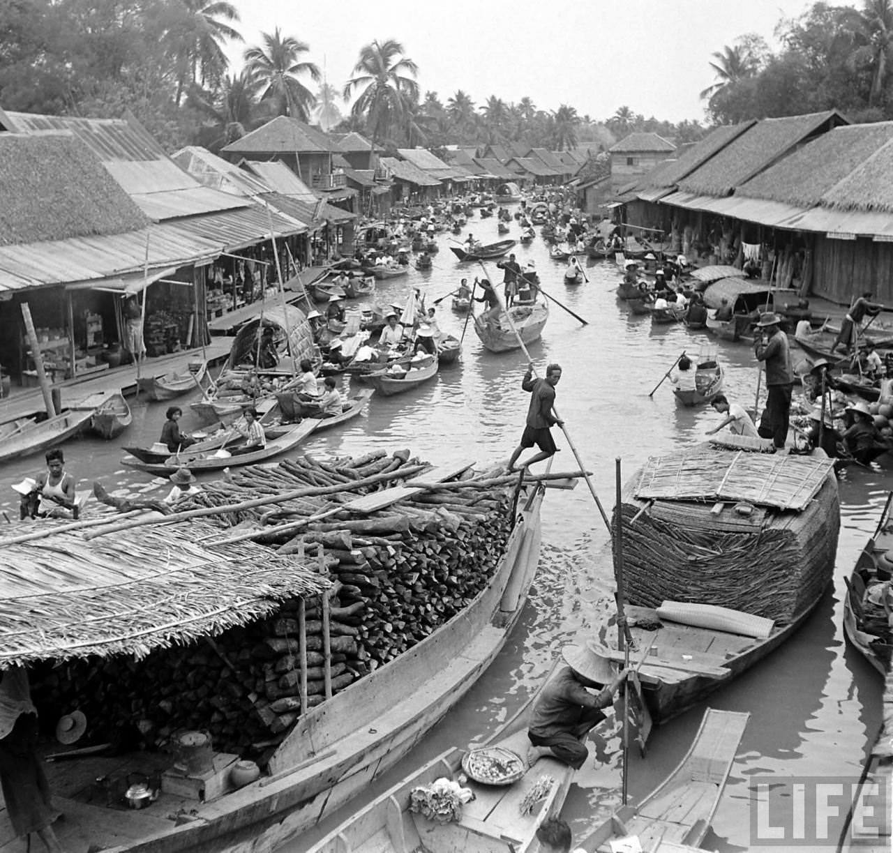

The river connected Bangkok to Thailand’s provinces far to the north and south. Cargo boats moved rice, teak, and other goods downstream toward the Gulf of Thailand. The Chao Phraya was, in practical terms, the country’s main artery for trade and transport during this period.
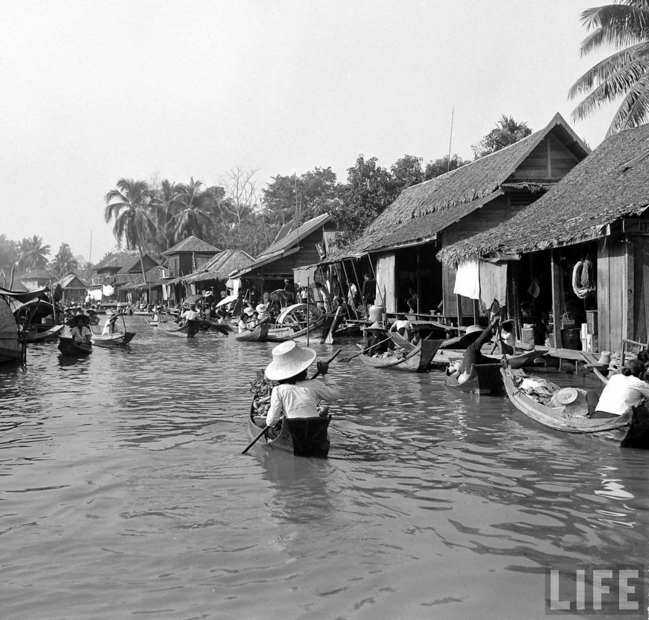
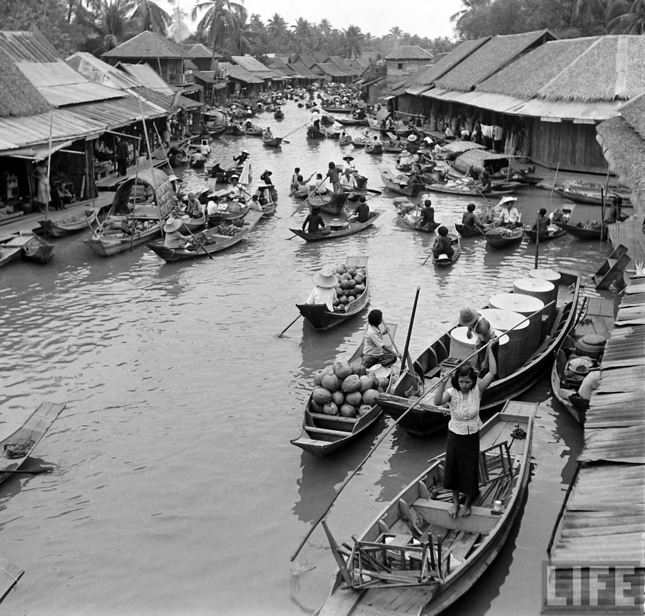
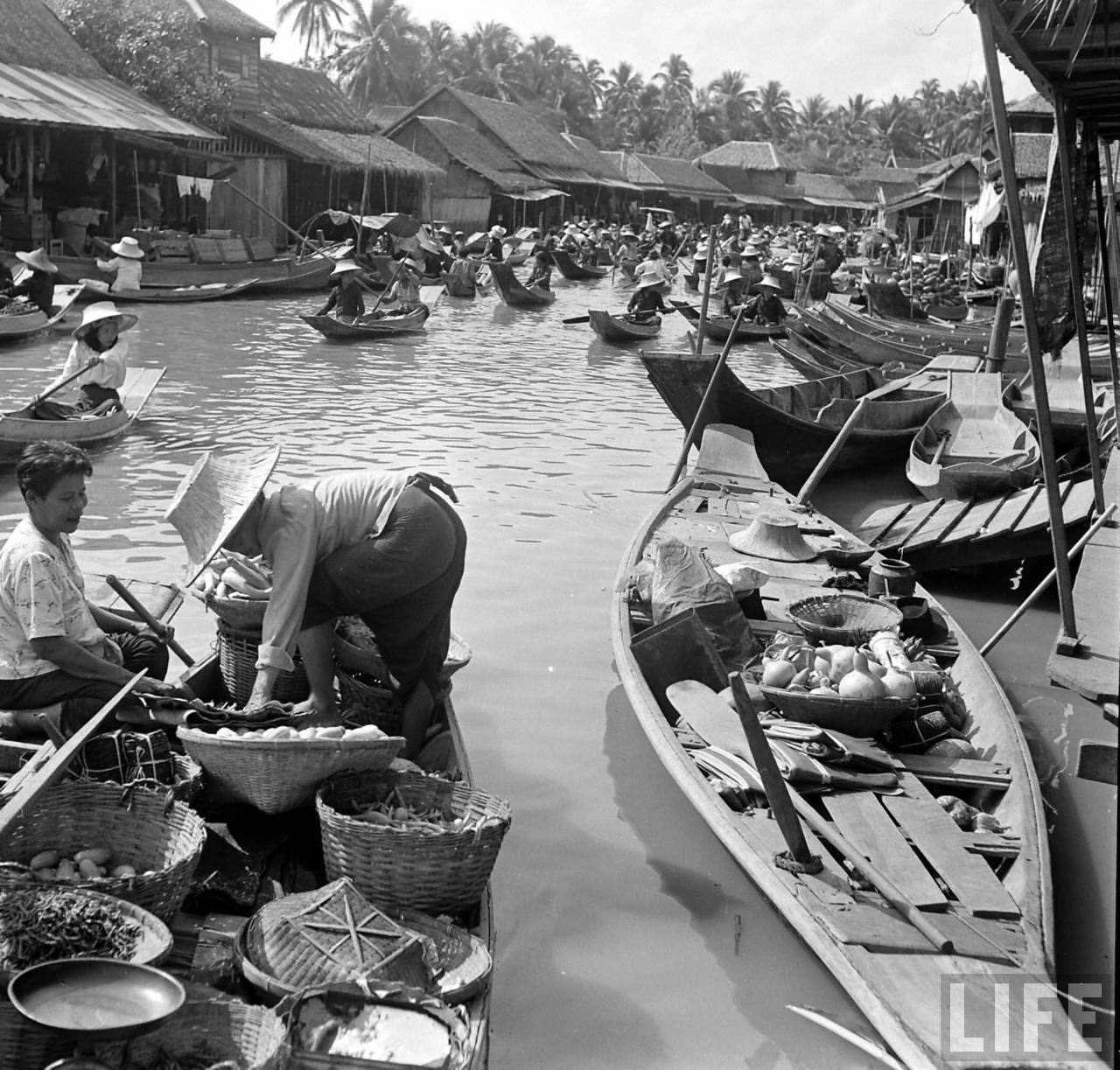
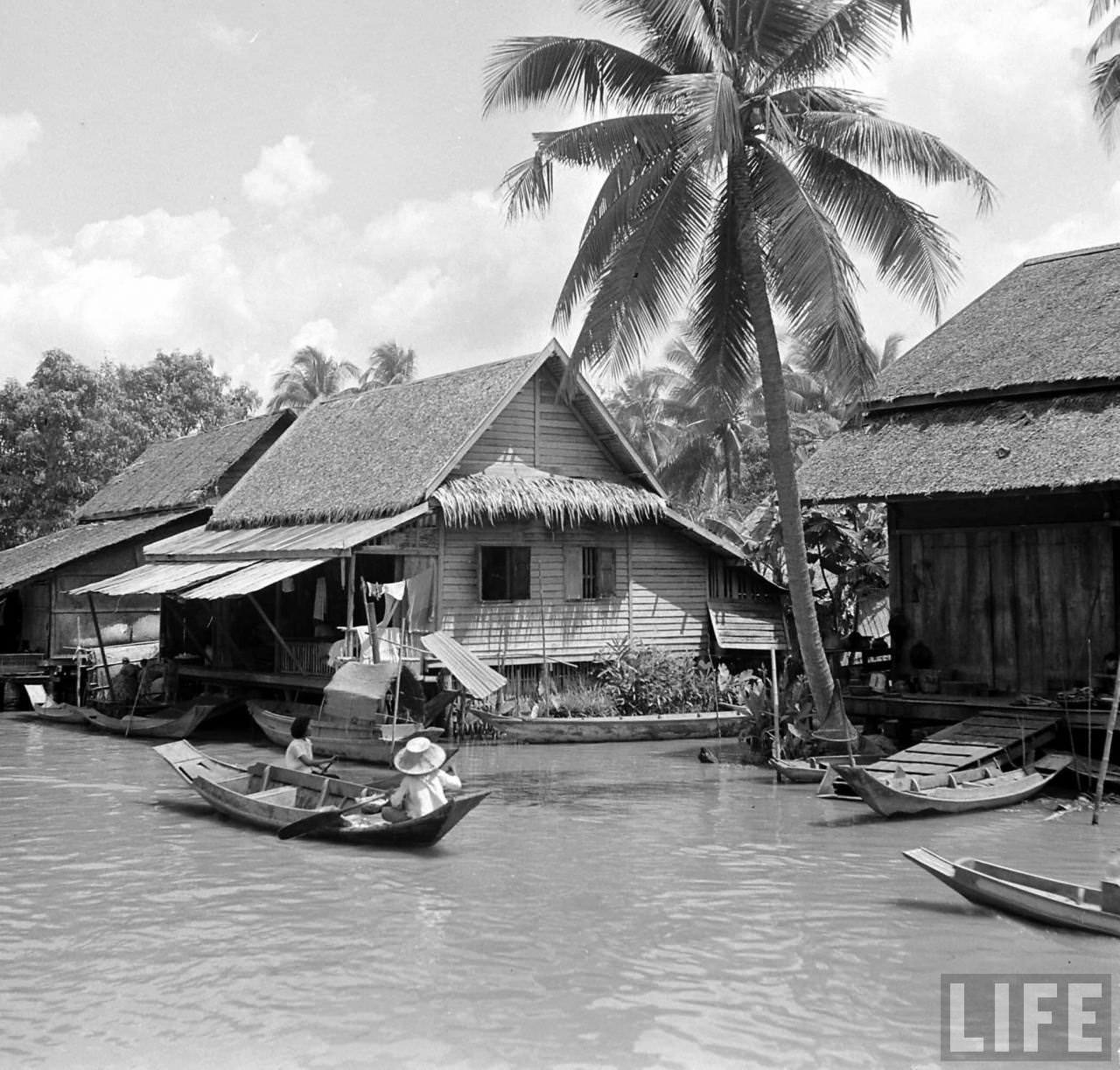
Communities along the riverbanks built their homes on stilts or on floating platforms, adapting to the river’s seasonal rises and falls. These weren’t temporary shelters — they were established neighborhoods with their own rhythms and routines, some of which had existed for generations.
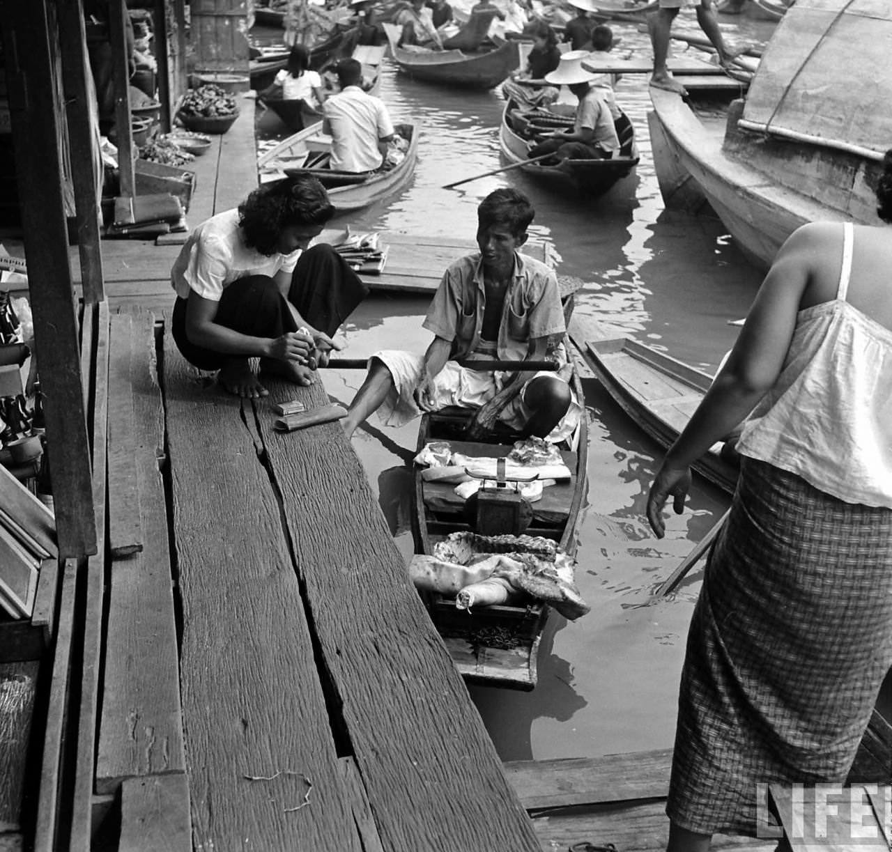
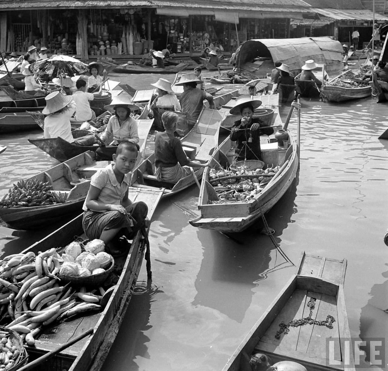
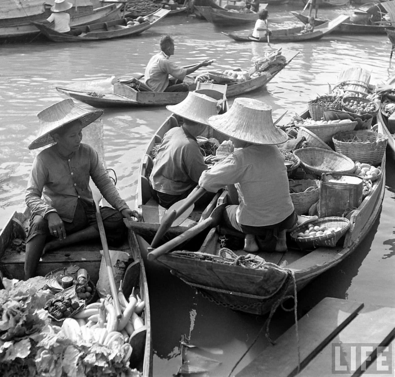
Kessel photographed this world with a documentary eye, recording the ordinary alongside the striking. His frames include both quiet domestic scenes and the busier commercial stretches of the river where trade dominated the view.
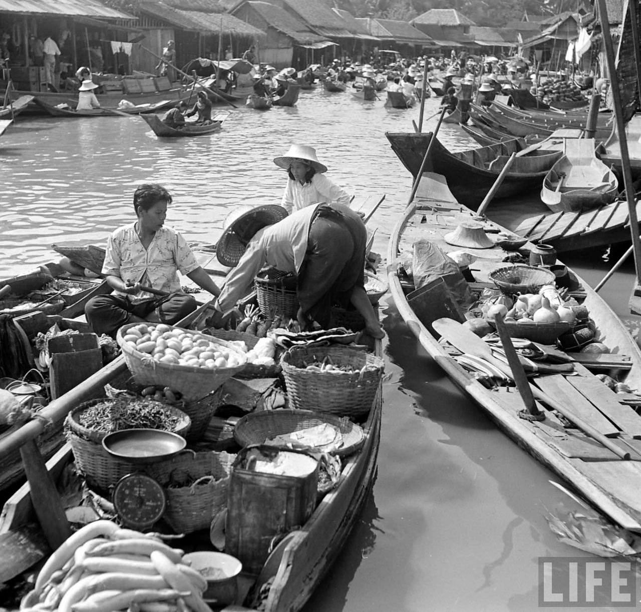
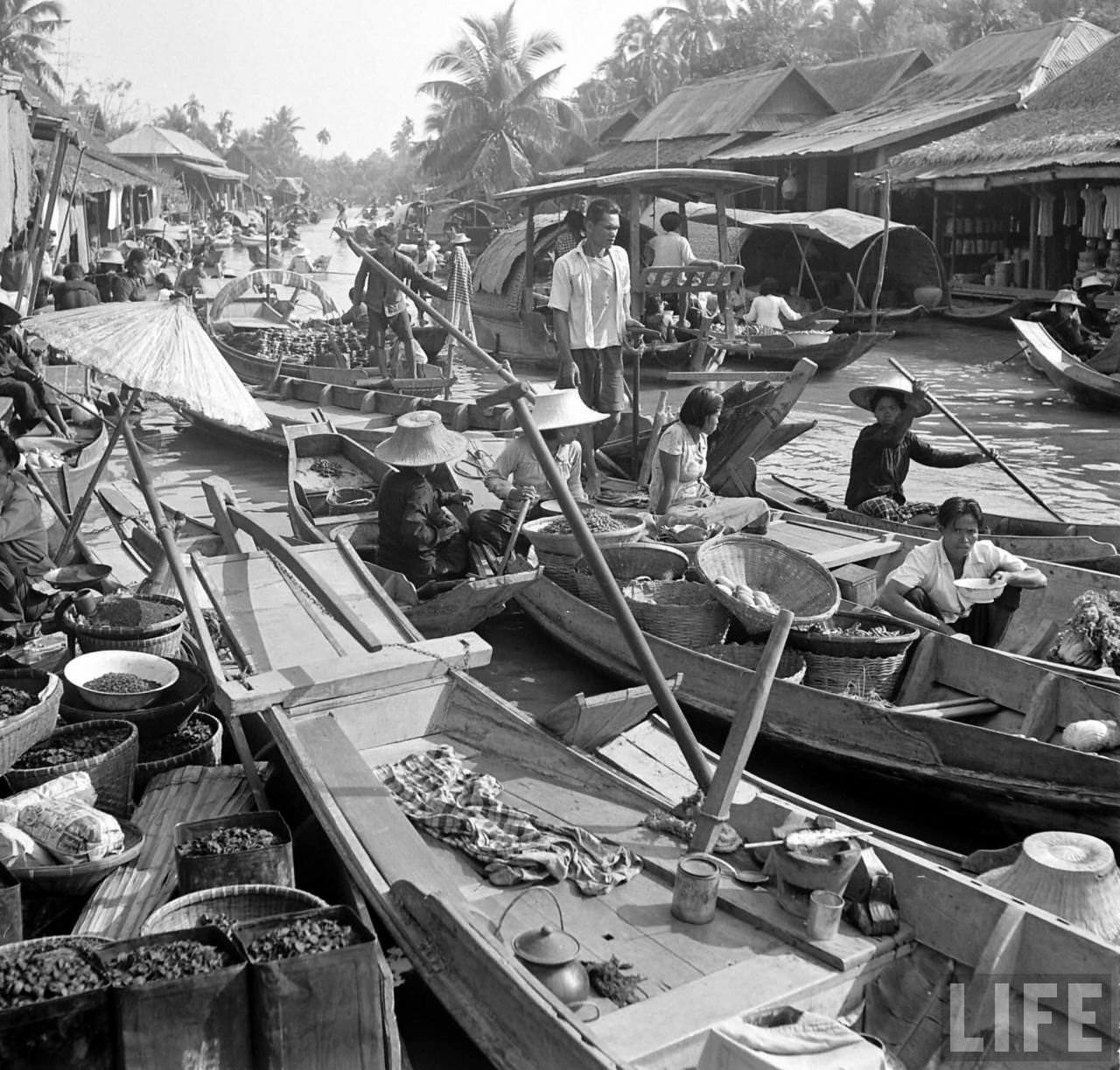
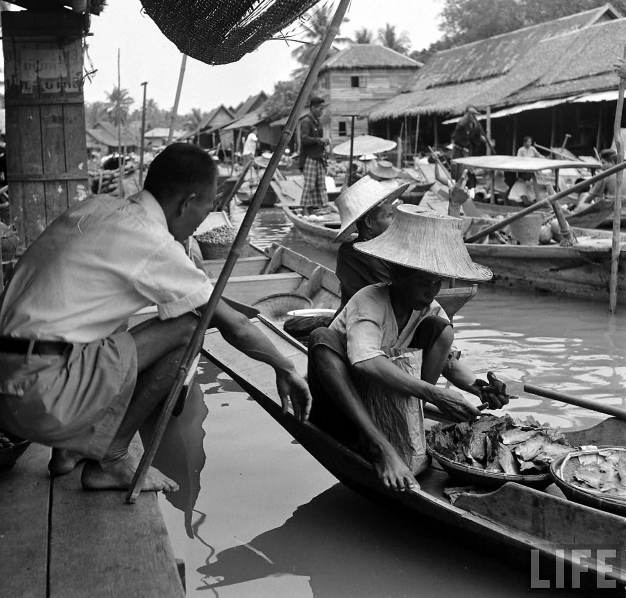
In the decades that followed his visit, Bangkok changed dramatically. Road networks expanded, the city spread outward, and the Chao Phraya’s role as the primary route through the capital diminished. Modern development reshaped the riverbanks, and many of the communities Kessel photographed were displaced.
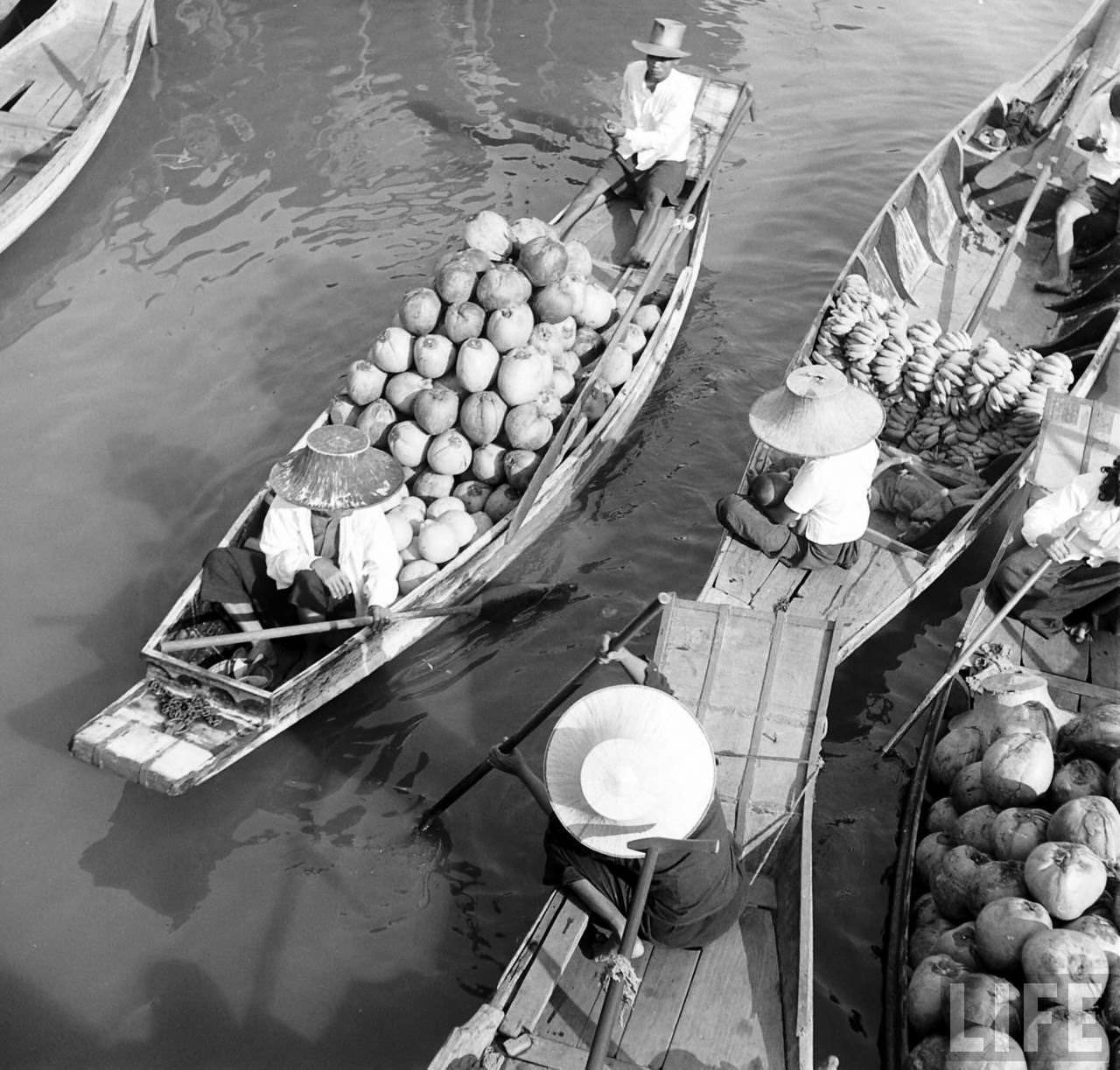
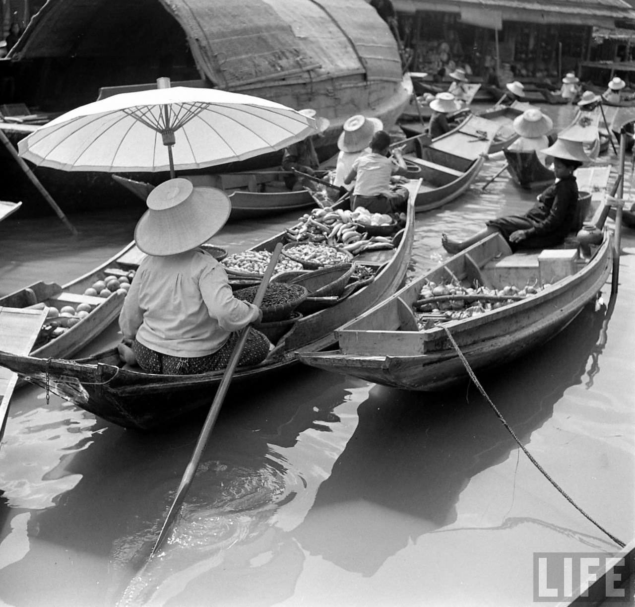
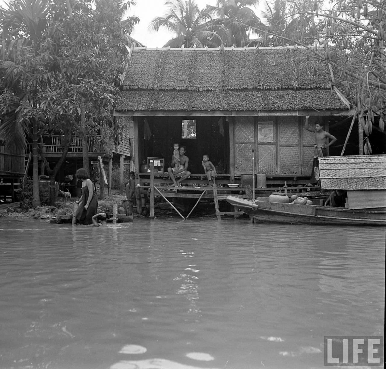
In recent years, Bangkok authorities have evicted numerous riverside communities, citing illegal land occupation. The evictions are connected to plans for a riverside promenade running from the Rama 7 Bridge in the north down to the Phra Pinklao Bridge in the south — a development project that has drawn significant controversy.
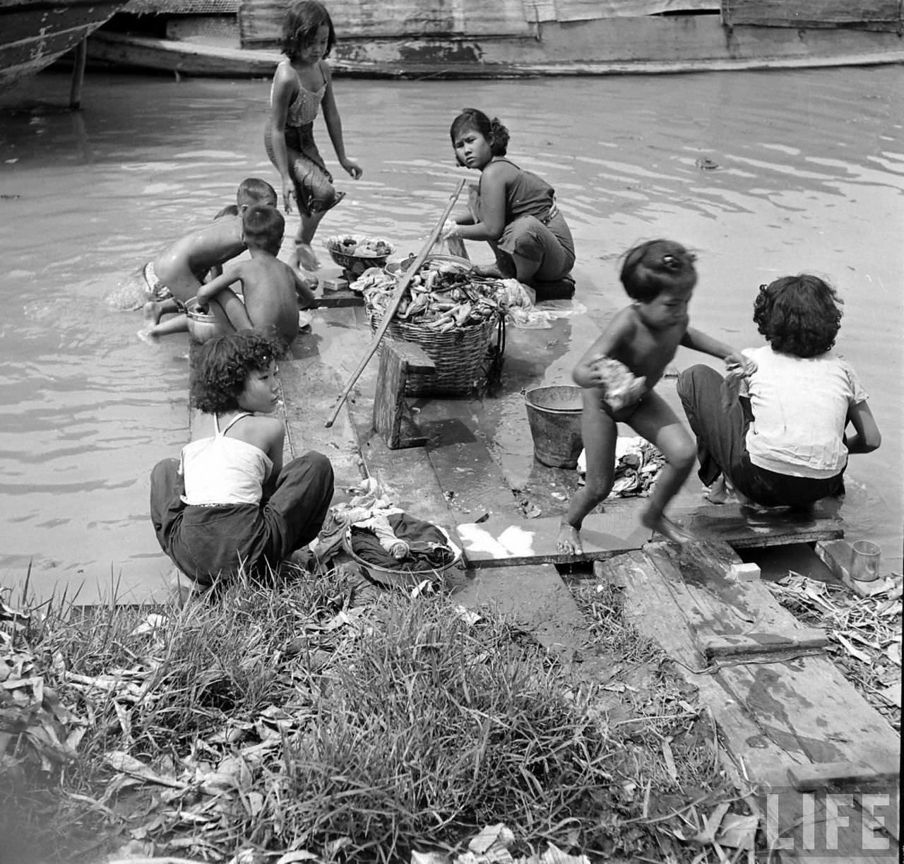
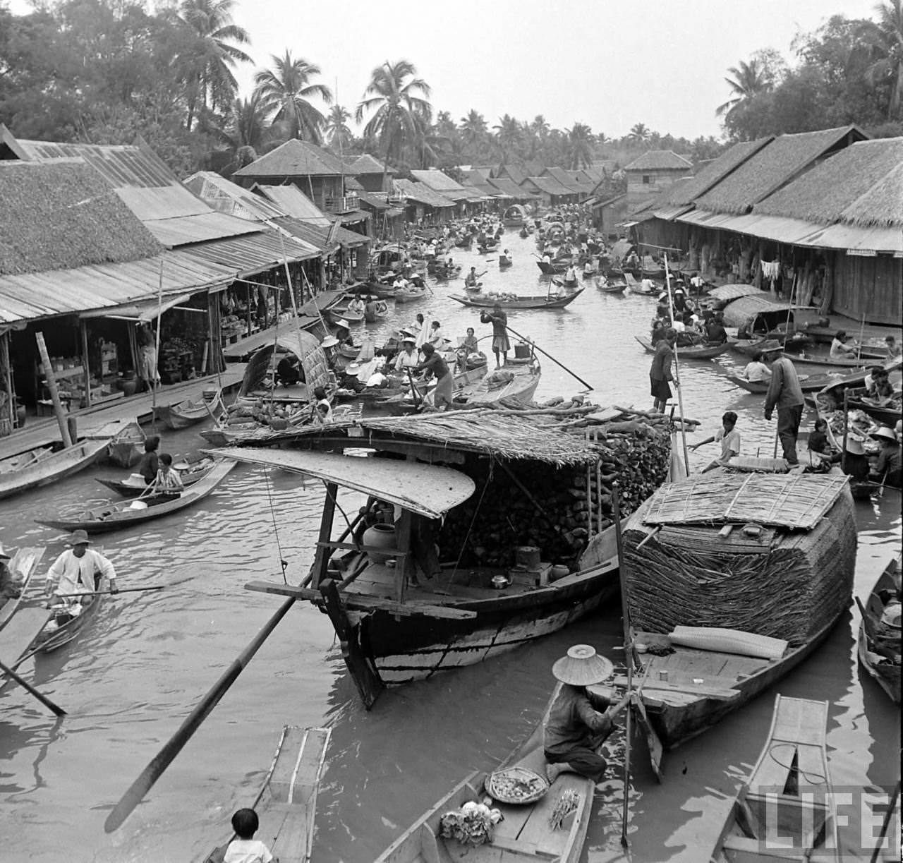
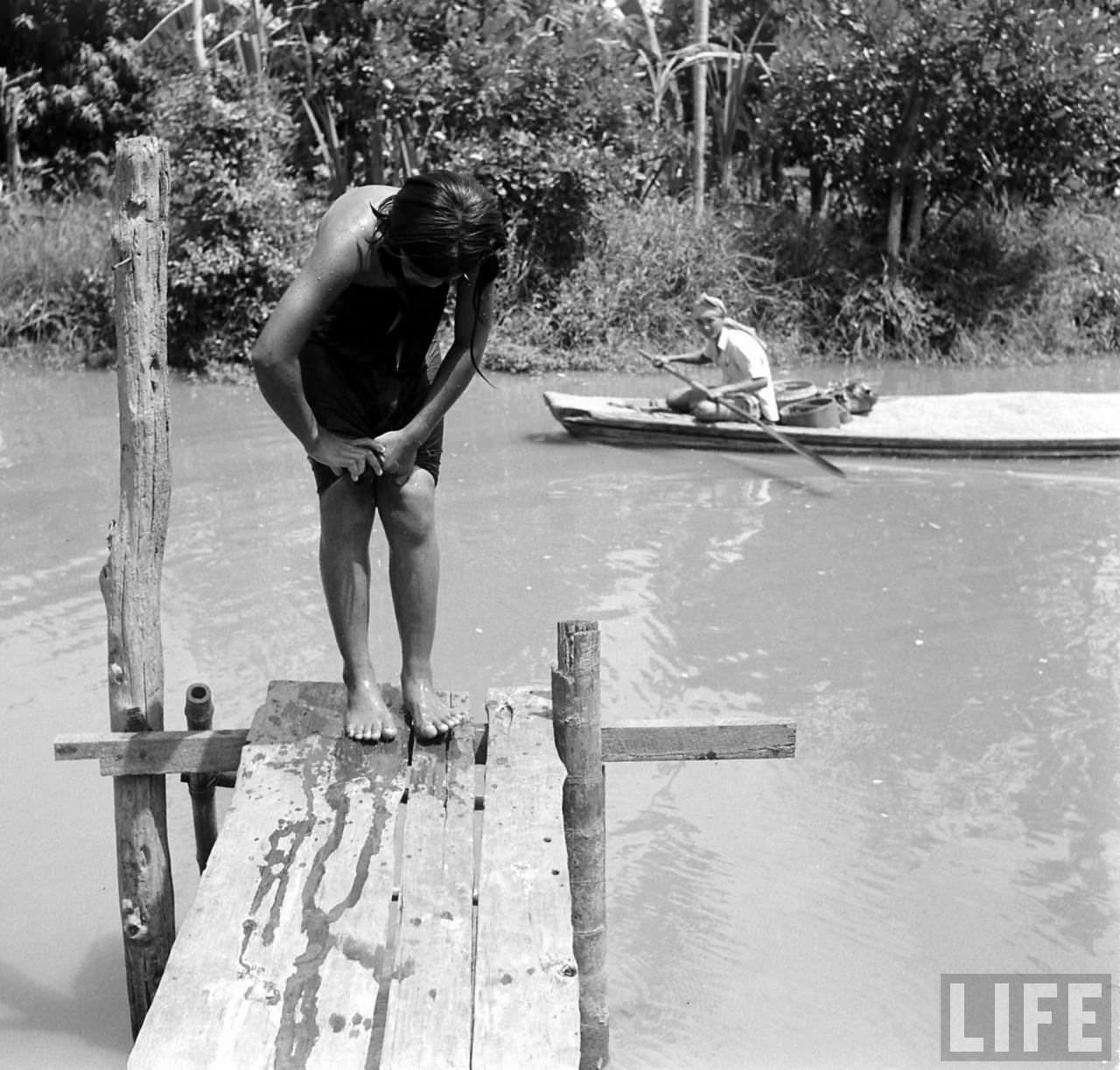
That contrast — between what Kessel documented in the 1950s and what the river looks like today — makes his photographs especially valuable. They show a Bangkok that no longer exists in the same form, a city that once organized itself almost entirely around its great river.





I recall they still had 1m wide and 1.5 meter open drains around near paragon early 2000s
First scent of BKK in those Saen Saep drainage ditches near Central Chidlom and Paragon were less covered back then. It really got into your nose.
Fascinating, really cool pics.