in

Capturing the Untamed Land: Timothy H. O’Sullivan’s Remarkable Images of the American West in the Late 1800s

Timothy H. O’Sullivan had already seen the worst of American warfare through his camera lens before he ever set foot in the West. After documenting the Civil War’s battlefields, he joined government-sponsored expeditions into territories that most Americans had never seen. His job was to photograph what the survey teams found — the land, the people, the geology, and the sheer scale of it all. What he produced was a visual record unlike anything that existed before.
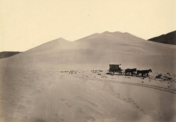
Timothy O'Sullivan's darkroom wagon, pulled by four mules. Taken in the Carson Sink part of Nevada's Carson Desert in 1867.
Timothy O’Sullivan’s darkroom wagon, pulled by four mules. Taken in the Carson Sink part of Nevada’s Carson Desert in 1867.

Photography in the 1860s and 1870s was physically demanding work. O’Sullivan used the wet collodion process, which required glass plates coated with chemicals to be prepared, exposed, and developed before they dried — all within about ten minutes. He hauled a darkroom wagon pulled by mules across deserts, through mountain passes, and along river canyons. Every shot demanded precise timing under brutal conditions.
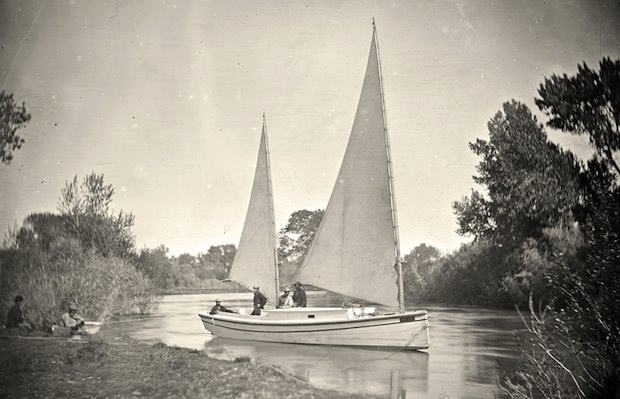
The "Nettie," an expedition boat on the Truckee River in western Nevada. Taken in 1867.
The “Nettie,” an expedition boat on the Truckee River in western Nevada. Taken in 1867.

Between 1867 and 1869, O’Sullivan worked with the King Survey, which mapped the terrain along the 40th parallel from California to Wyoming. The expedition covered mountains, alkali flats, and volcanic landscapes. One of his earliest stops was the Nevada desert, where strange geological formations rose from the water and sand.
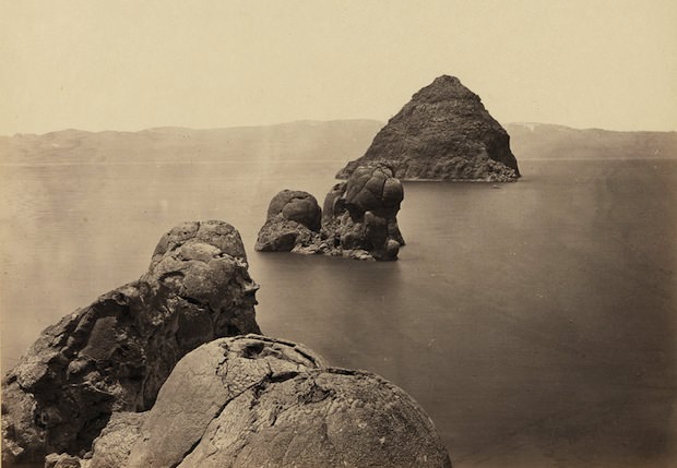
The Pyramid and Domes, a line of dome-shaped tufa rocks in Pyramid Lake, Nevada. Taken in 1867.

The survey team itself appeared in several of O’Sullivan’s frames, often looking small against the vast terrain surrounding them. These images were not just documentation of the land — they showed the human effort required to cross and measure it.
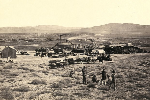
Members of Clarence King's Fortieth Parallel Survey team, near Oreana, Nevada. Taken in 1867.
Members of Clarence King’s Fortieth Parallel Survey team, near Oreana, Nevada. Taken in 1867.

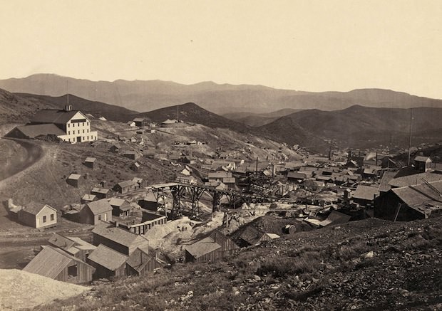
The Comstock Lode in Virginia City, Nevada, gave O’Sullivan a different kind of subject. He descended 900 feet underground to photograph miners at work by magnesium flash light — one of the first photographers to document underground mining in the United States. Above ground, the boomtown itself told another story of the West’s rapid transformation.
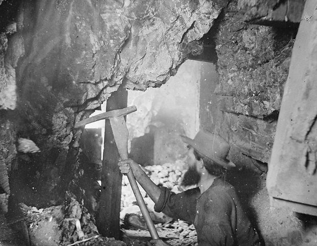
Miner working nine hundred feet underground at the Savage and the Gould and Curry mines on the Comstock Lode in Virginia City, Nevada. Taken in 1867.
The mining town of Gold Hill, just south of Virginia City, Nevada. Taken in 1867.

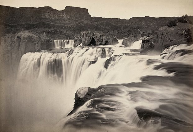
O’Sullivan’s photographs of waterfalls and canyon systems captured natural features that eastern audiences had only read about in expedition reports. Shoshone Falls on the Snake River in Idaho — taller than Niagara — was one of the most dramatic subjects he encountered.
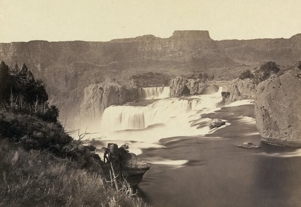
Shoshone Falls, near present-day Twin Falls, Idaho. Taken in 1868.
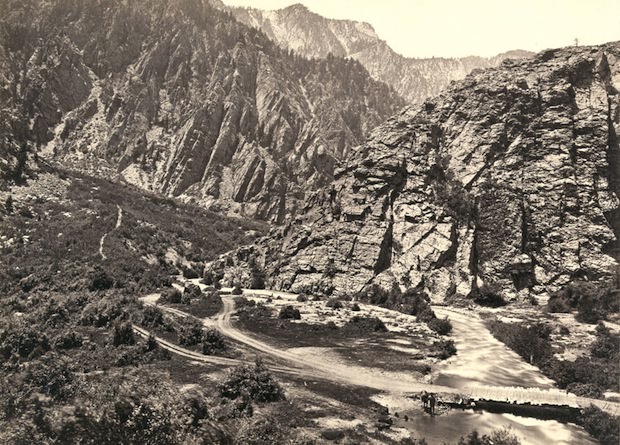
Big Cottonwood Canyon, Utah. Taken in 1868.

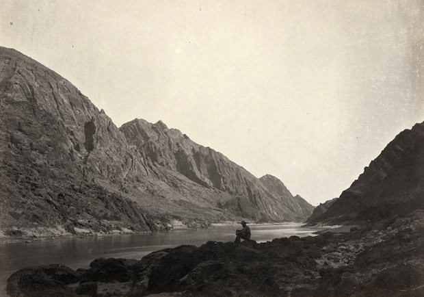
From 1871 to 1874, O’Sullivan joined the Wheeler Survey, which explored territories west of the 100th meridian in the American Southwest. The landscapes shifted — red rock canyons, dry plateaus, and ancient ruins replaced the mountain terrain of the King Survey. He photographed the Colorado River from boats, capturing the canyon walls rising hundreds of feet above the water.
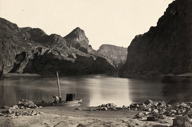
Man in a wooden boat on the edge of the Colorado River in the Black Canyon, Mojave County, Arizona. Taken in 1871.
Man sitting on a rocky shore beside the Colorado River in Iceberg Canyon, on the border of Mojave County, Arizona and Clark County, Nevada. Taken in 1871.

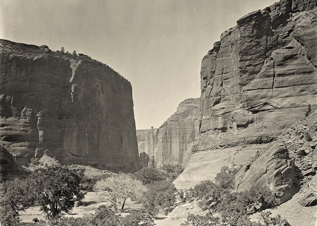
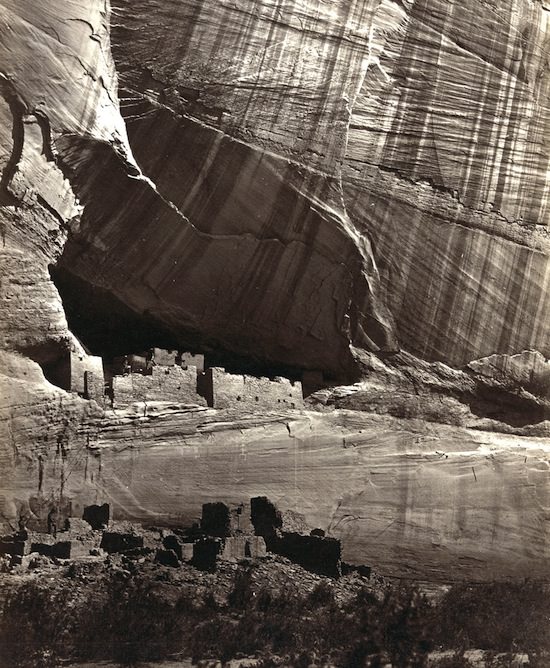
The Wheeler Survey brought O’Sullivan into the Canyon de Chelly in Arizona, where towering sandstone walls enclosed a landscape that had been home to the Ancestral Pueblo people for centuries. Ruins still clung to the canyon walls, and O’Sullivan photographed them with the same precision he applied to geological formations.
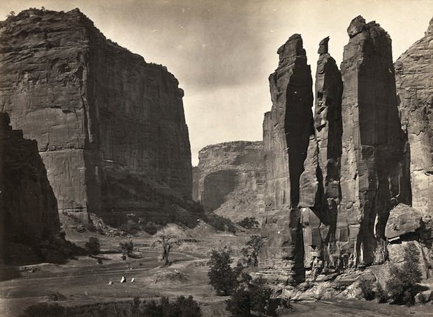
"Camp Beauty," rock towers and canyon walls in the Canyon de Chelly National Monument, Arizona. Taken in 1873.
“Camp Beauty,” rock towers and canyon walls in the Canyon de Chelly National Monument, Arizona. Taken in 1873.
View of the White House, Ancestral Pueblo Native American (Anasazi) ruins in Canyon de Chelly, Arizona. Taken in 1873.
The head of Canyon de Chelly in Arizona. Taken in 1873.

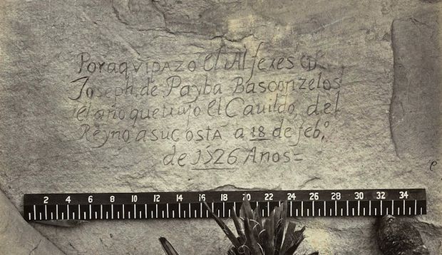
Inscription Rock in New Mexico — a sandstone bluff that Spanish explorers, soldiers, and settlers had carved their names and dates into for centuries — was another Wheeler Survey subject. O’Sullivan photographed both the broad face of the rock and individual inscriptions up close, preserving details that time and weather would eventually wear away.
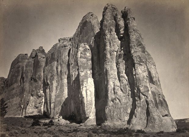
The south side of Inscription Rock (now El Morro National Monument), in New Mexico. Taken in 1873
A close-up view of a Spanish inscription carved into the sandstone at Inscription Rock in New Mexico in 1726. Translation: "By this place passed Ensign Don Joseph de Payba Basconzelos, in the year in which he held the Council of the Kingdom at his expense, on the 18th of February, in the year 1726."
A close-up view of a Spanish inscription carved into the sandstone at Inscription Rock in New Mexico in 1726. Translation: “By this place passed Ensign Don Joseph de Payba Basconzelos, in the year in which he held the Council of the Kingdom at his expense, on the 18th of February, in the year 1726.”

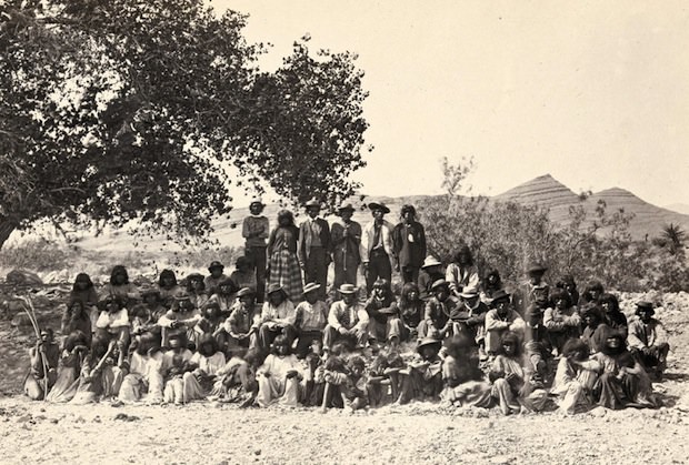
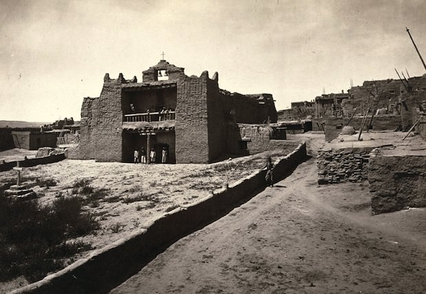
O’Sullivan also photographed the Indigenous peoples living across these territories. The Paiute, Navajo, and Zuni communities he encountered were documented alongside the land itself, placing them firmly in the visual record of the West at that moment in time.
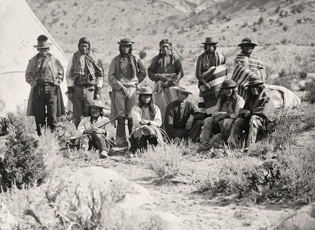
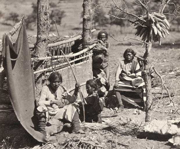
Pah-Ute (Paiute) Indian group, near Cedar, Utah. Taken in 1872.
Aboriginal life among the Navajo Indians. Taken near old Fort Defiance, New Mexico, in 1873.
Native American (Paiute) men, women and children posing under a tree near Cottonwood Springs (Washoe County), Nevada. Taken in 1875.
Old Mission Church, Zuni Pueblo, New Mexico. Taken in 1873.

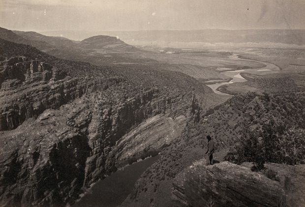
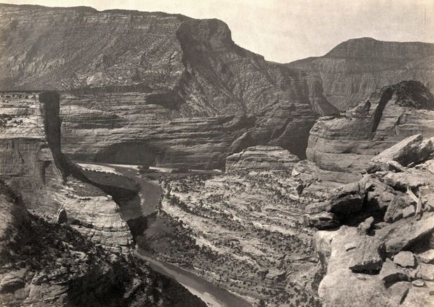
The Colorado River basin gave O’Sullivan some of his most striking compositions. He photographed canyon junctions, river corridors, and remote valleys where expedition members appear as small figures against walls of rock that dwarfed everything around them.
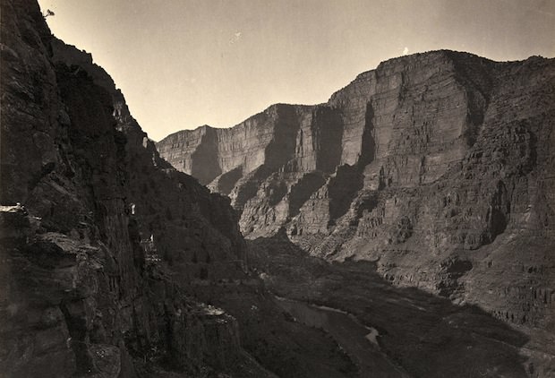
The Canyon of Lodore in Colorado. Taken in 1872.
The junction of the Green and Yampah Canyons in Utah. Taken in 1872.
Browns Park, Colorado. Taken in 1872.

Beyond the canyons, O’Sullivan documented the wide-open plains and buttes of Wyoming and Utah, as well as the unusual volcanic and mineral formations that scientists on the expeditions were cataloging. These photographs served as scientific evidence — they showed geologists and politicians back east exactly what the surveys had found.
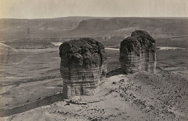
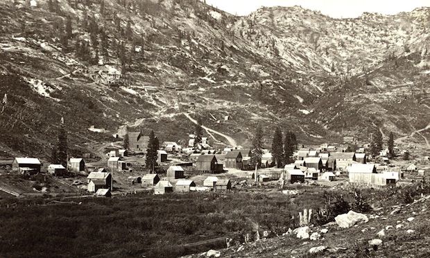
Twin buttes near Green River City, Wyoming. Taken in 1872.
Water Rhyolites, near Logan Springs, Nevada. Taken in 1871.
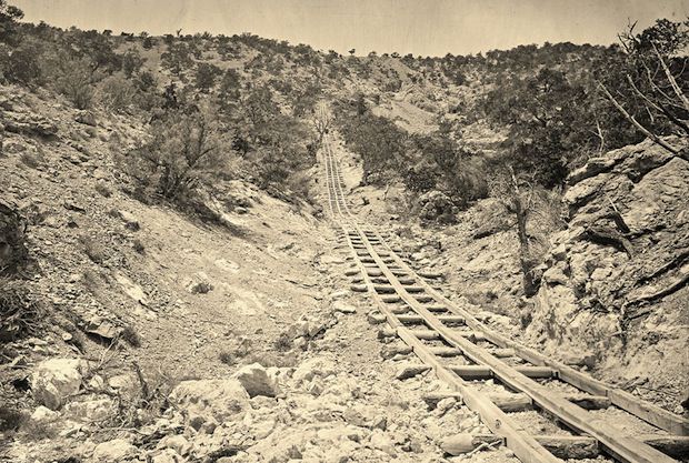
A wooden balanced incline used for gold mining. Taken at the Illinois Mine in the Pahranagat Mining District in Nevada in 1871.

By the mid-1870s, O’Sullivan had photographed hot springs, river crossings, mountain ranges, mining operations, pueblo ruins, and desert expanses across a vast stretch of the American West. Each image was made under difficult field conditions, with equipment that left no room for error.
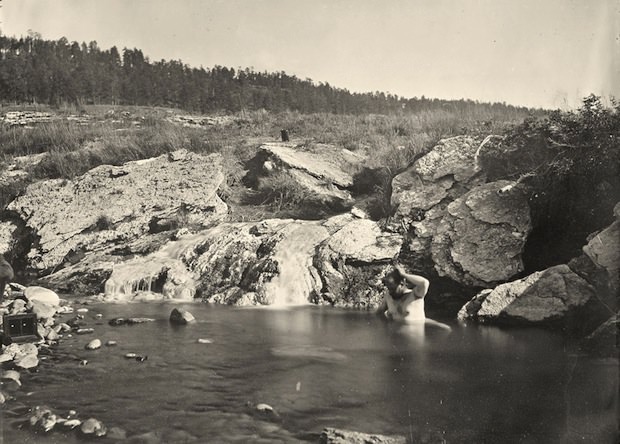
Man bathing in Pagosa Hot Spring, Colorado. Taken in 1874.
The view across Shoshone Falls, Snake River, Idaho. Taken in 1874.
Enjoyed this post? Get new ones in your inbox.
Avatar of Kevin Clark

Written by Kevin Clark

Kevin Clark is a historian and writer who is passionate about sharing the stories and significance behind historical photos. He loves to explore hidden histories and cultural contexts behind the images, providing a unique insight into the past.

Leave a Reply

Your email address will not be published. Required fields are marked *