Hey There! Before You Go. 😧
Get the best vintage content straight into your inbox!

Don't worry, we don't spam

A Look Back at the Wild West: Stunning Historic Photos of Life in the Late 1800s

Between 1887 and 1892, photographer John C.H. Grabill produced one of the most complete visual records of frontier life in the American West. He worked across the Dakota Territory, Wyoming, and surrounding regions, capturing everything from ox-drawn freight wagons to gold stamp mills to U.S. Army camps. His photographs, later deposited with the Library of Congress, show a world that was rugged, fast-changing, and often violent. Grabill didn’t photograph the romanticized West of dime novels. He photographed the real one.

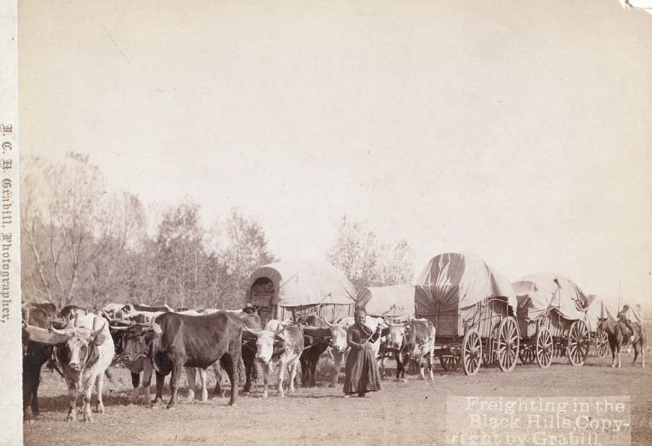
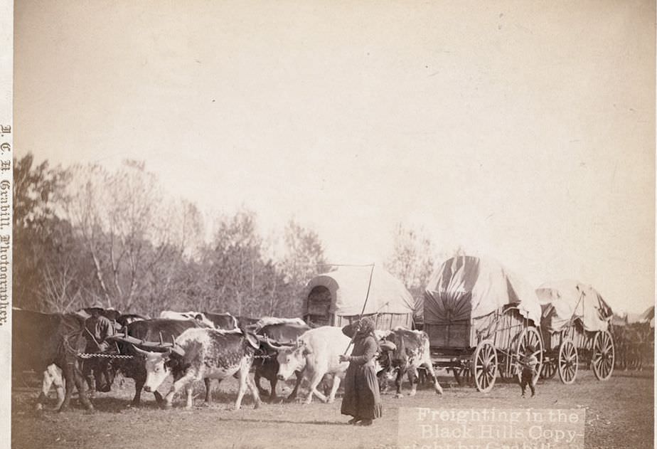
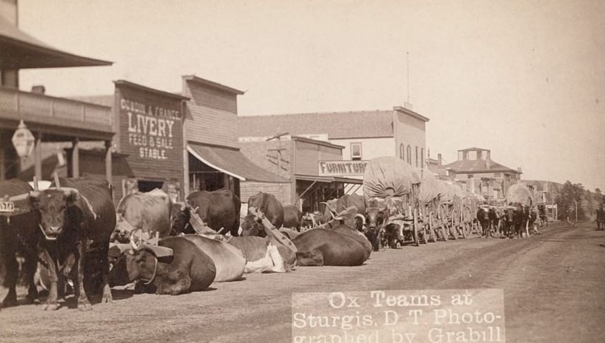
Moving goods across the Black Hills in the late 1800s was slow, backbreaking work. Before the railroads pushed deep into the region, bull trains — long lines of oxen pulling heavy freight wagons — were the primary way to transport supplies. These convoys carried everything settlers and miners needed: food, tools, machinery, and building materials. The terrain was brutal, and the distances were enormous.
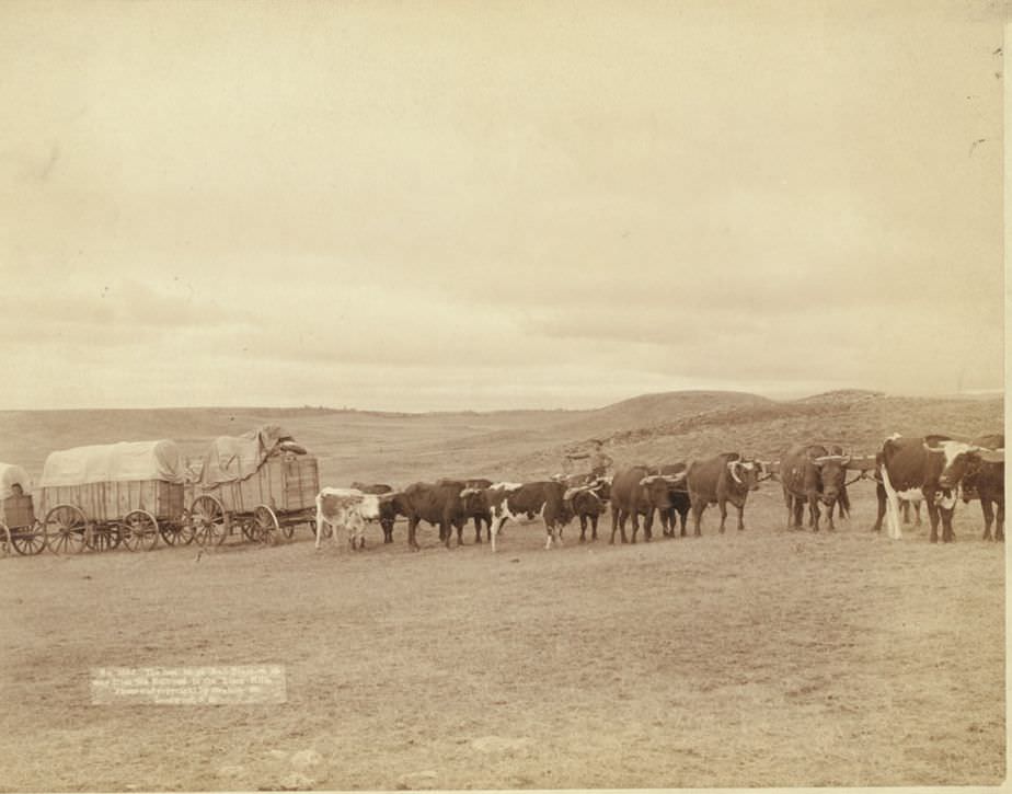
The last large bull train on its way from the railroad to the Black Hills, 1890.
Ox teams at Sturgis, Dakota Territory, 1890s.

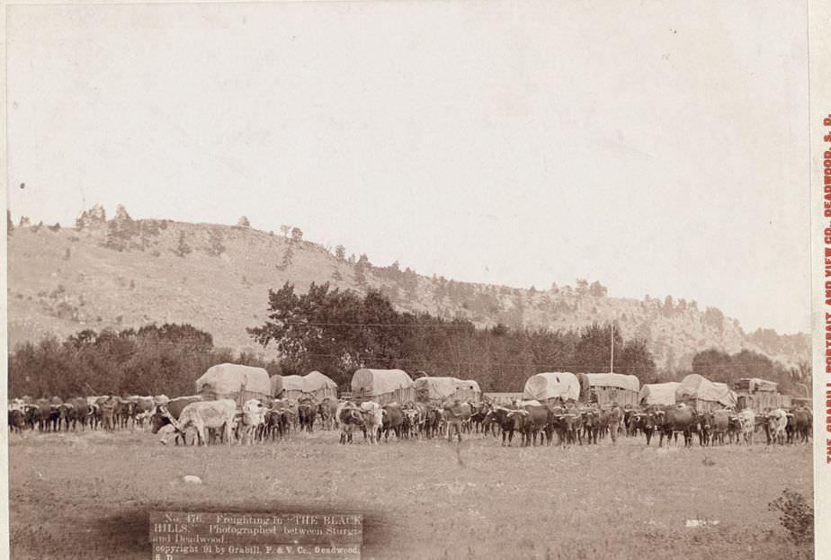
Grabill photographed freighting operations across the Black Hills region extensively, documenting the drivers, animals, and wagons that kept supply lines open. The routes between towns like Sturgis and Deadwood were heavily traveled, and the work was constant.
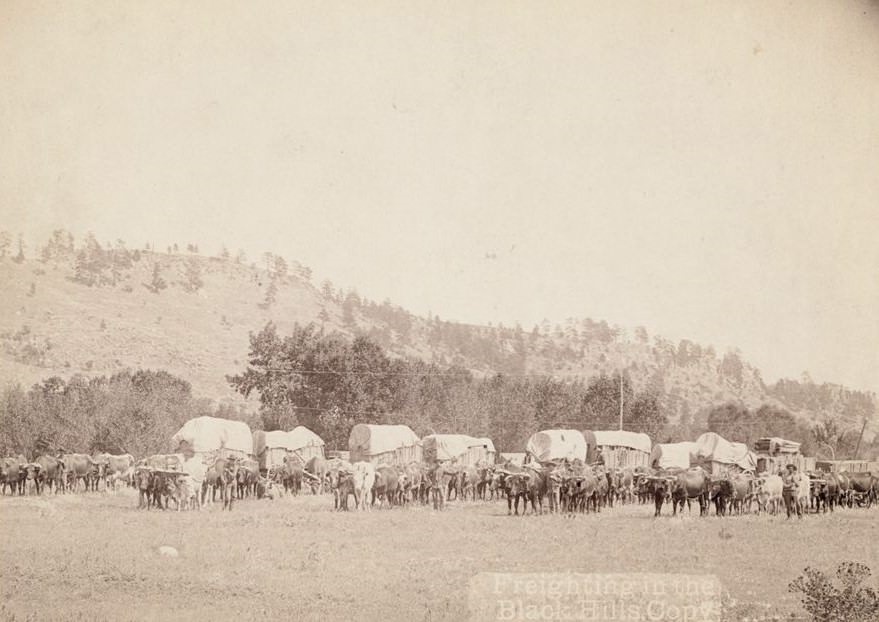
Freighting in the Black Hills, 1890s.
Freighting between Sturgis and Deadwood in the Black Hills, 1891.
Freighting in the Black Hills, 1890s.

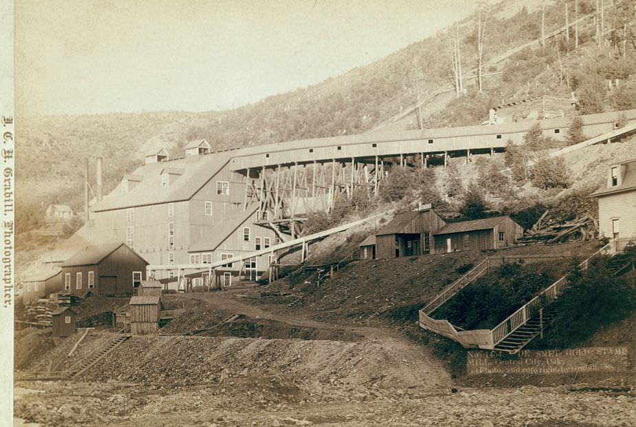
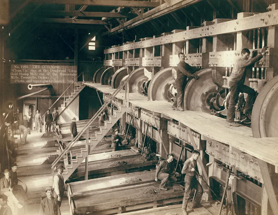
Gold was the engine driving much of the Black Hills economy. Stamp mills crushed ore around the clock, and “clean up” days — when workers collected the processed gold — were significant events. The scale of the operations at places like Terraville and Central City was industrial, not the lone prospector image that popular culture tends to favor. These were large, mechanized facilities employing dozens of workers.
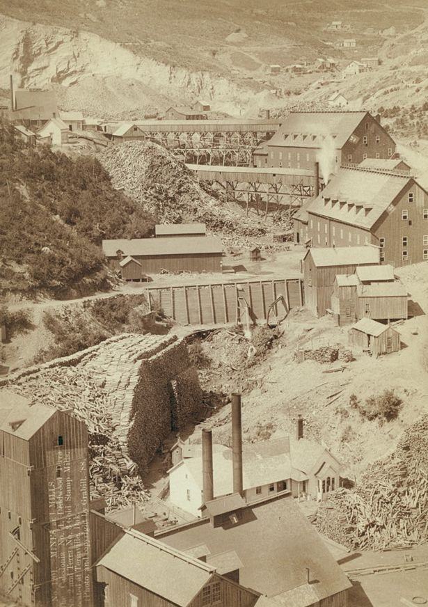
The Caledonia No. 1, Deadwood Terra No. 2, and Terra No. 3 Gold Stamp Mills, Terraville, Dakota, 1888.
"Clean Up" day at the Deadwood Terra Gold Stamp Mill, Terraville, Dakota, 1888.
“Clean Up” day at the Deadwood Terra Gold Stamp Mill, Terraville, Dakota, 1888.
De Smet Gold Stamp Mill, Central City, Dakota, 1888.
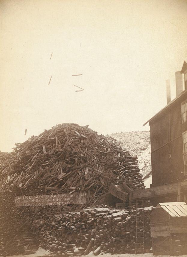
Wood shooting in the air at De Smet Mill, Center City, Dakota, 1888.
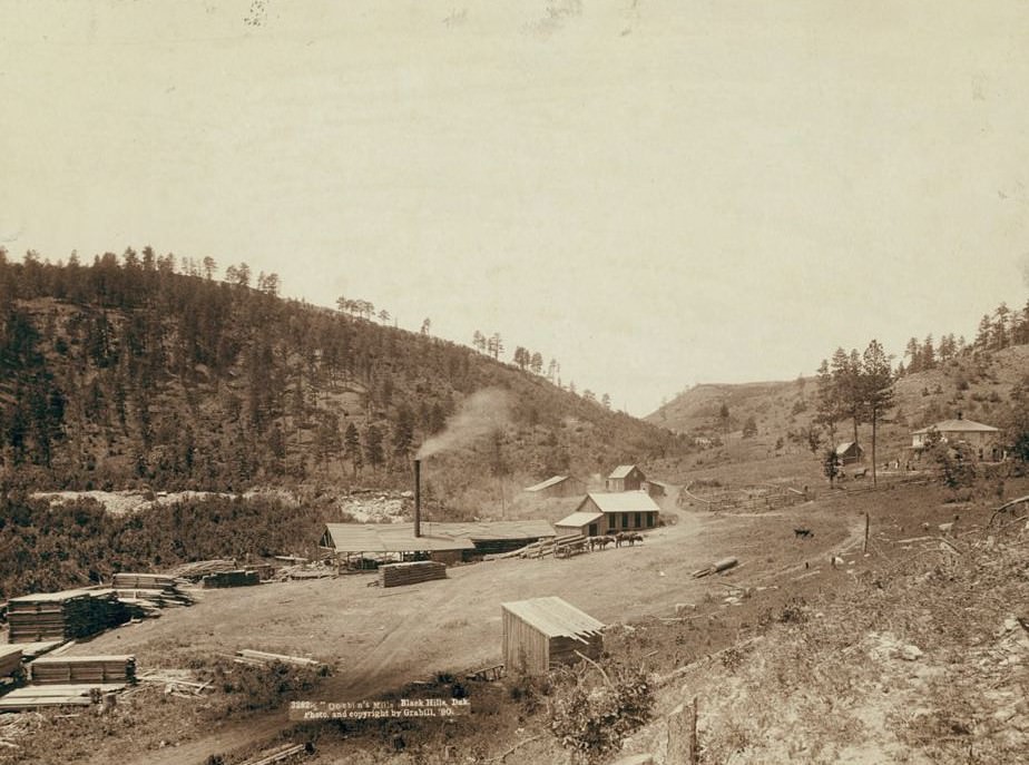
Dobbin's Mills, Black Hills, Dakota, 1890.
Dobbin’s Mills, Black Hills, Dakota, 1890.

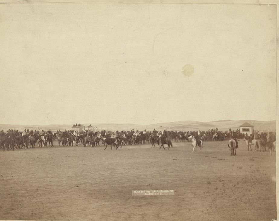
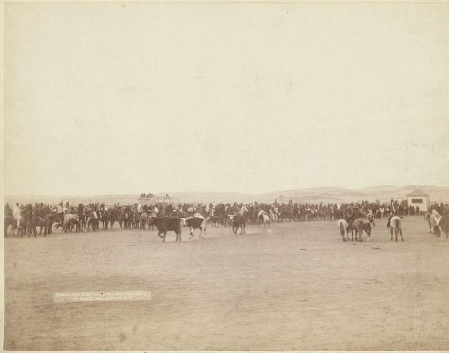
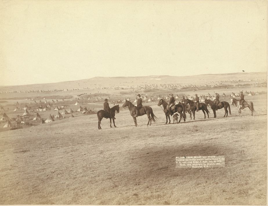
By 1890 and 1891, tensions between the U.S. government and Native American tribes in the region had reached a breaking point. Grabill was on the ground near Pine Ridge, South Dakota, during this period, photographing military commanders, Indian chiefs, interpreters, and the aftermath of conflict. General Miles personally surveyed what was described as the largest hostile Indian camp in the United States. These images are not abstract history — they show specific people at specific moments of profound tension.
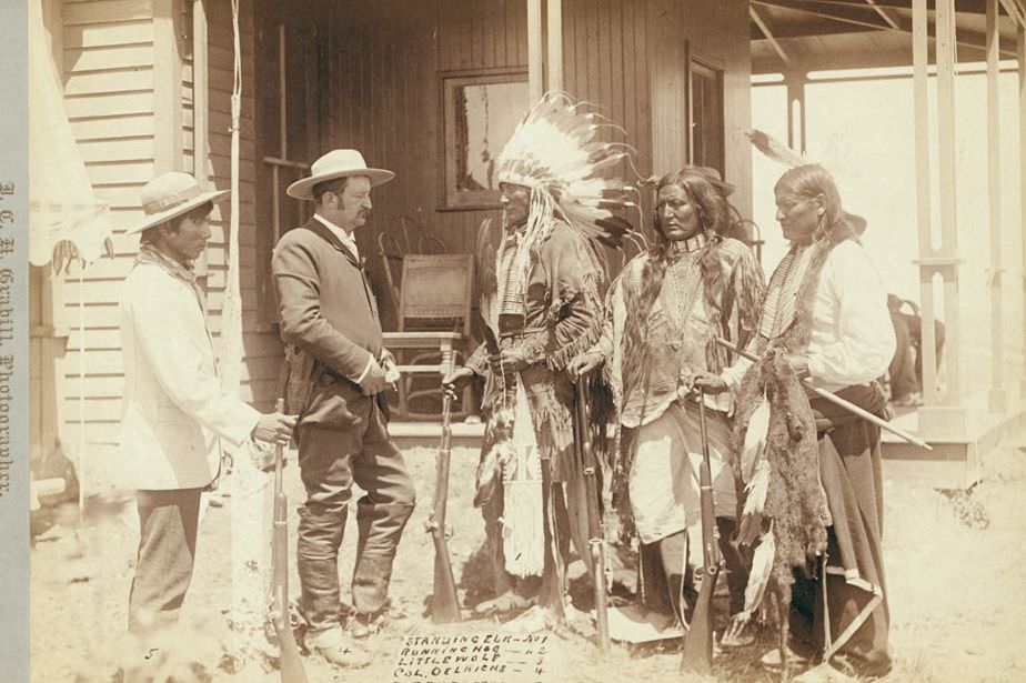
Standing Elk, Running Hog, Little Wolf, Col. Oelrich, and Interpreter, 1890s.
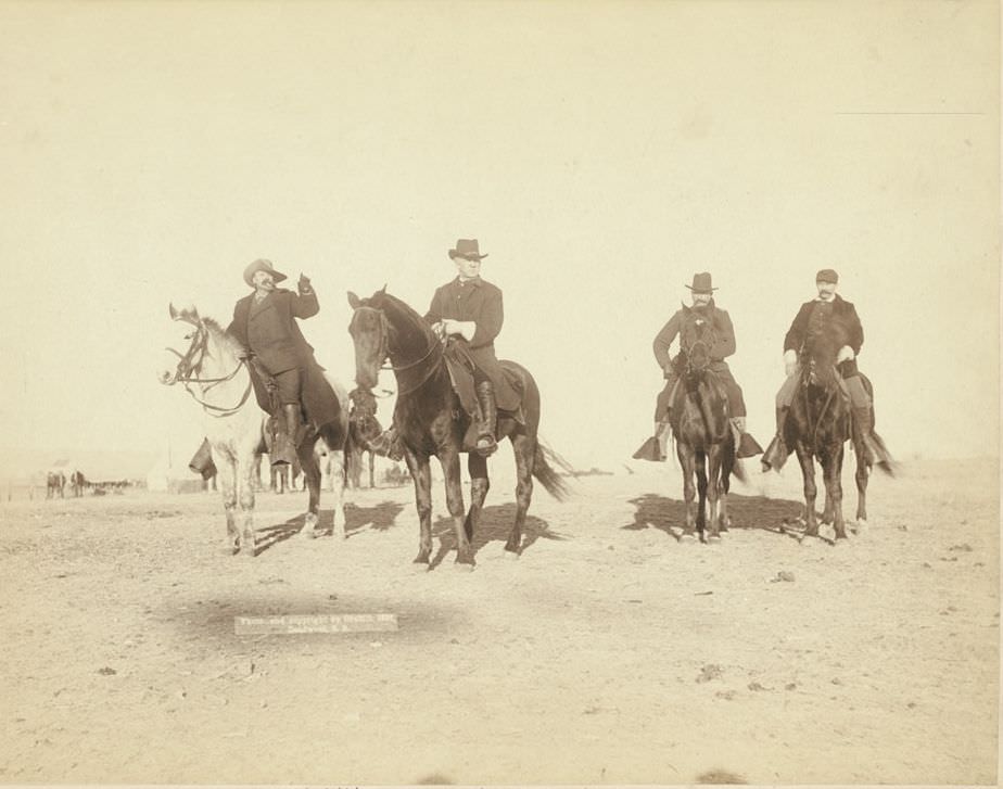
Gen. Miles and staff viewing the largest hostile Indian Camp in the U.S., near Pine Ridge, South Dakota, 1891.
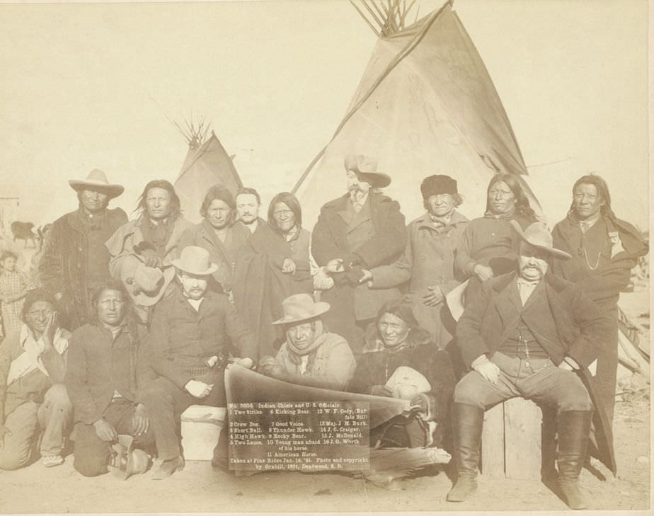
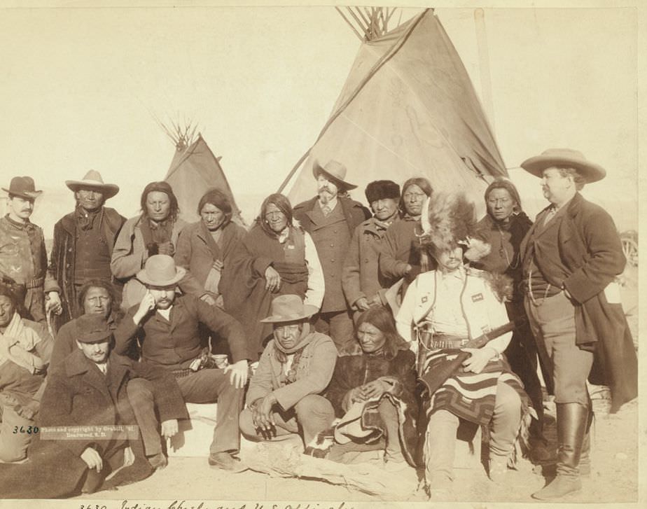
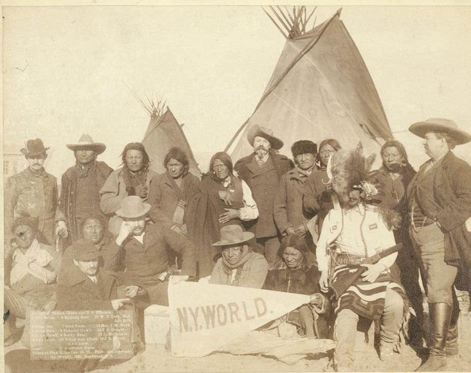
Indian chiefs and U.S. officials at Pine Ridge, 1891.
Indian chiefs and U.S. officials at Pine Ridge, South Dakota, 1891.
Indian chiefs and U.S. officials at Pine Ridge, 1891.
Capt. Taylor and 70 Indian scouts, 1891.

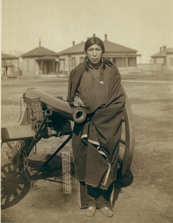
One of the most striking individual portraits Grabill made near Pine Ridge was of Tasunka Ota, known by the alias Plenty Horses. He was the man who killed Lieutenant Edward Casey in January 1891, shortly after the Wounded Knee Massacre. Plenty Horses was later tried in federal court but was acquitted — the court ruled that because a state of war had existed, the killing was a lawful act of war. Grabill photographed him twice.
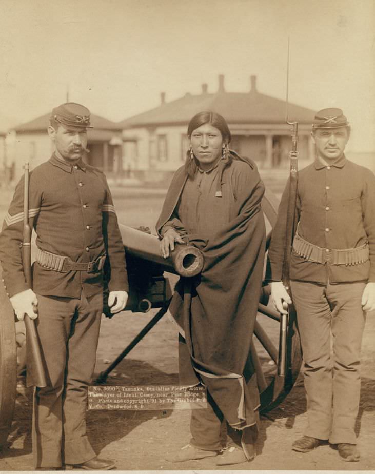
Tasunka, (alias Plenty Horses), the slayer of Lieut. Casey, near Pine Ridge, South Dakota, 1891.

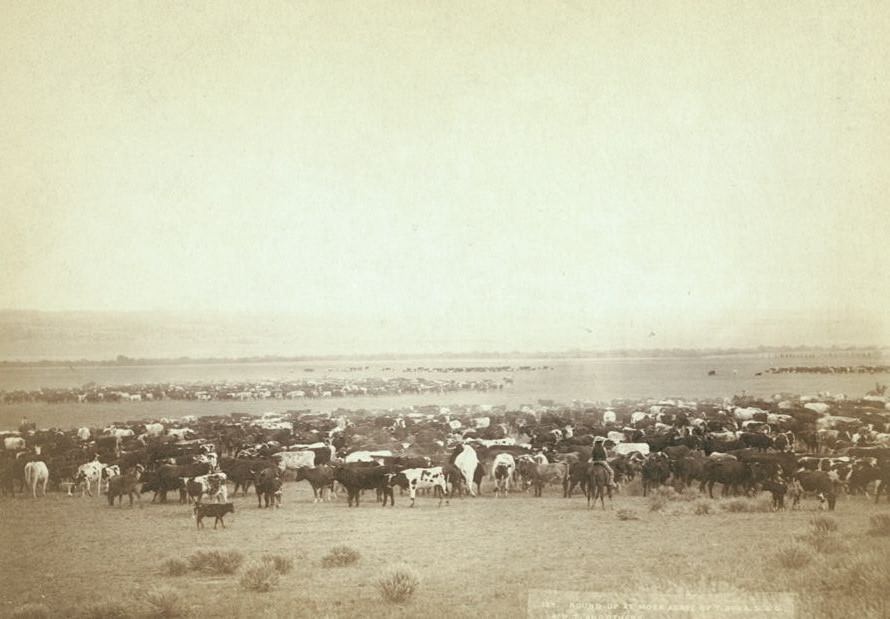
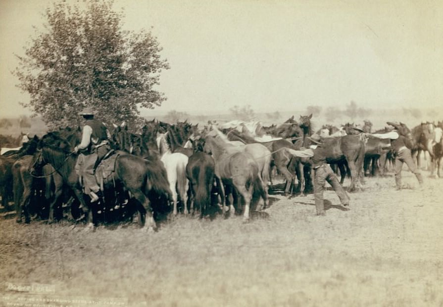
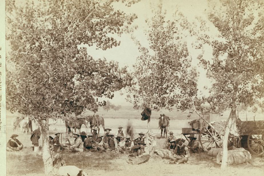
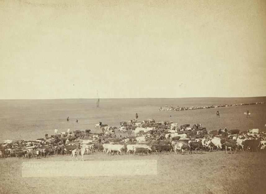
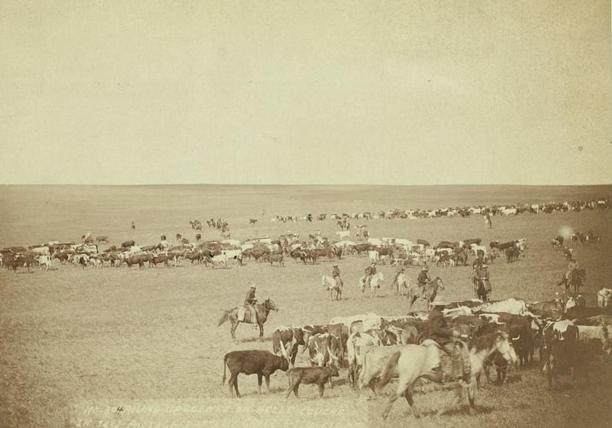
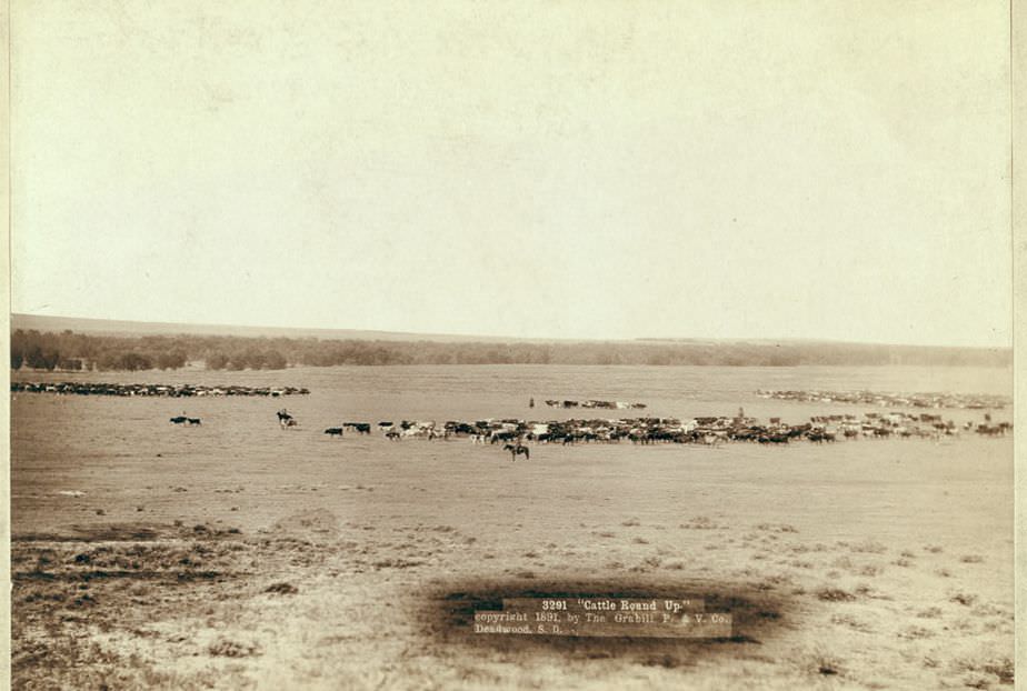
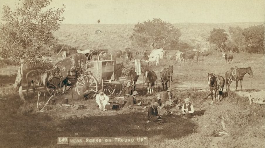
Away from the military tensions, cattle ranching defined huge stretches of the western plains. The annual roundup was a massive, coordinated effort. Cowboys from multiple outfits worked together to gather, brand, and sort cattle spread across open range. Grabill photographed roundup operations along the Cheyenne River, on the Belle Fourche, and at locations across Wyoming and Dakota Territory, capturing both the labor and the moments of rest between it.
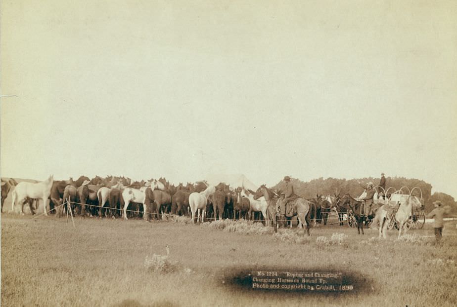
Roping and changing horses on round up, 1890.
Mess scene on "round up", 1890s.
Mess scene on “round up”, 1890s.
Round-up at Moss Agate of T. 999 A.S. & G., A.U.T. and others, 1890s.
Roping and changing scene at --T Camp on round up of --T. 999 --S. & G., A.U.T. and others on Cheyenne River, 1890s.
Roping and changing scene at –T Camp on round up of –T. 999 –S. & G., A.U.T. and others on Cheyenne River, 1890s.
Dinner scene, 1890s.

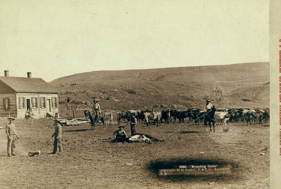
Wolves were a constant threat to cattle herds on the open range. Cowboys occasionally roped them when the opportunity arose. Grabill captured one such moment in Wyoming in 1887. Branding calves was a more routine part of roundup life, marking ownership before cattle were released back onto shared grazing land.
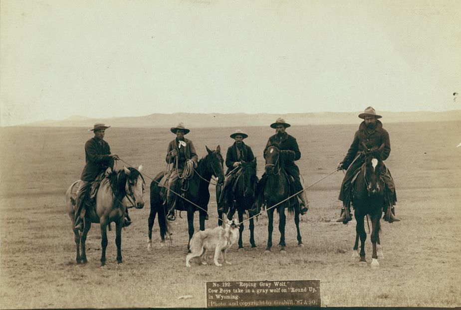
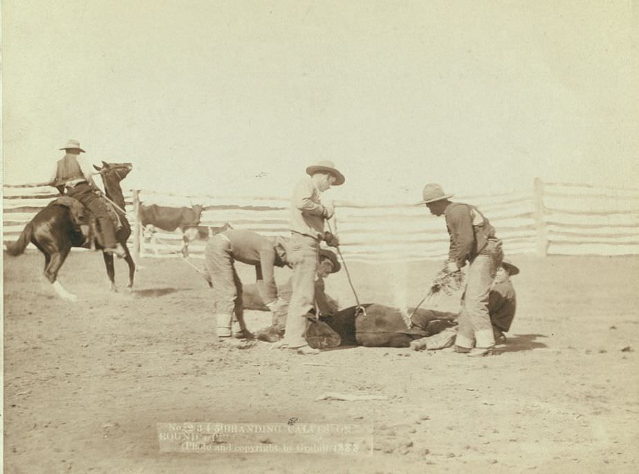
Cowboys rope a gray wolf on "Round up" in Wyoming, 1887.
Cowboys rope a gray wolf on “Round up” in Wyoming, 1887.
Branding calves on roundup, 1888.
Round-up scenes on Belle Fourche in 1887.
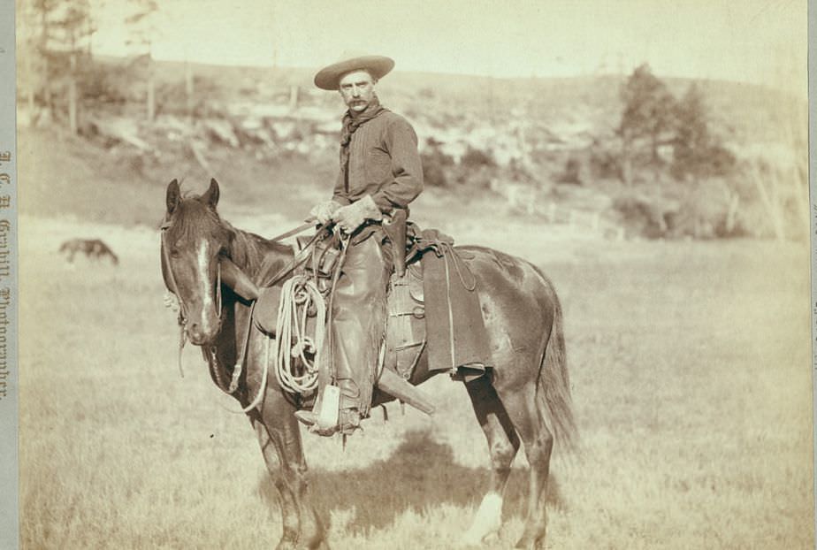
"The Cow Boy", 1888.
“The Cow Boy”, 1888.
Branding cattle, 1891.
Cattle round up, 1891.

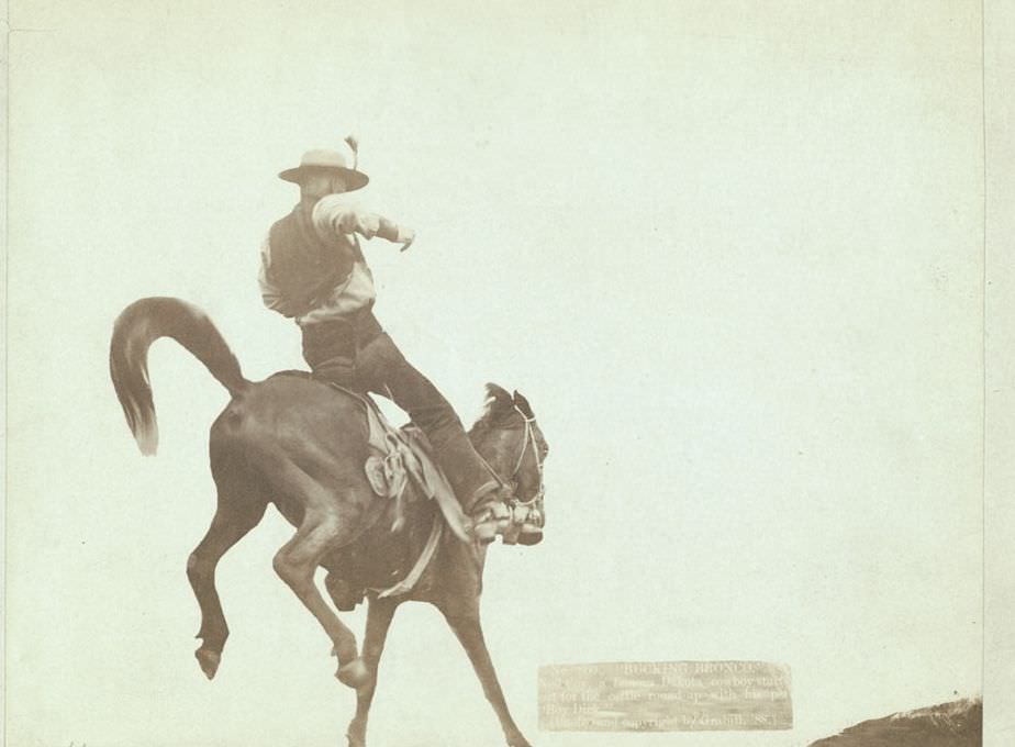
By the late 1880s, the great bison herds that had once covered the plains in the tens of millions had been nearly wiped out. The few remaining animals were curiosities. Cowboys roping a buffalo on the plains, as Grabill photographed, was a spectacle rather than a regular practice. Meanwhile, individual cowboys like Ned Coy — photographed with his horse “Boy Dick” — became known figures in their communities.
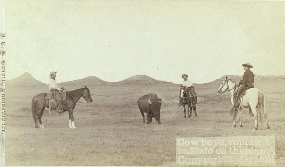
Cowboys roping a buffalo on the plains, 1890s.
"Bucking Bronco": Ned Coy, a famous Dakota cowboy, with his pet "Boy Dick", 1888.
“Bucking Bronco”: Ned Coy, a famous Dakota cowboy, with his pet “Boy Dick”, 1888.

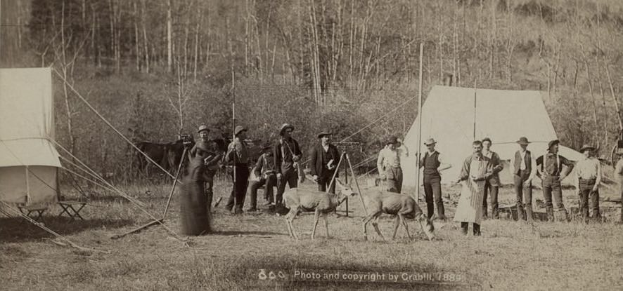
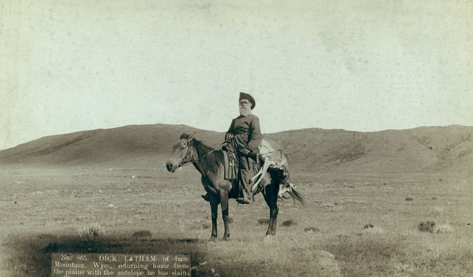
Hunting was both a livelihood and a source of fresh food for miners and settlers living in isolated areas. Grabill photographed miners McMillan and Hubbard with deer they had taken near Deadwood in winter, and Dick Latham of Iron Mountain returning with antelope. These weren’t staged trophy shots — they were documentation of how people fed themselves in a region with limited access to goods.
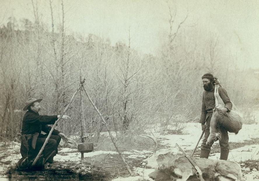
"Hunting Deer": Miners McMillan and Hubbard with their game near Deadwood in winter, 1888.
“Hunting Deer”: Miners McMillan and Hubbard with their game near Deadwood in winter, 1888.
Dick Latham of Iron Mountain, Wyoming, returning home with antelope, 1888.

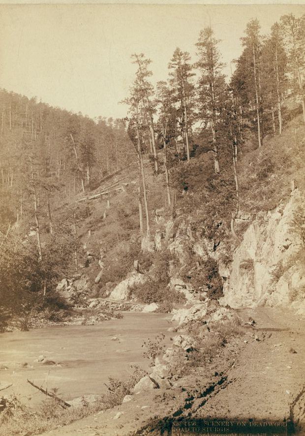
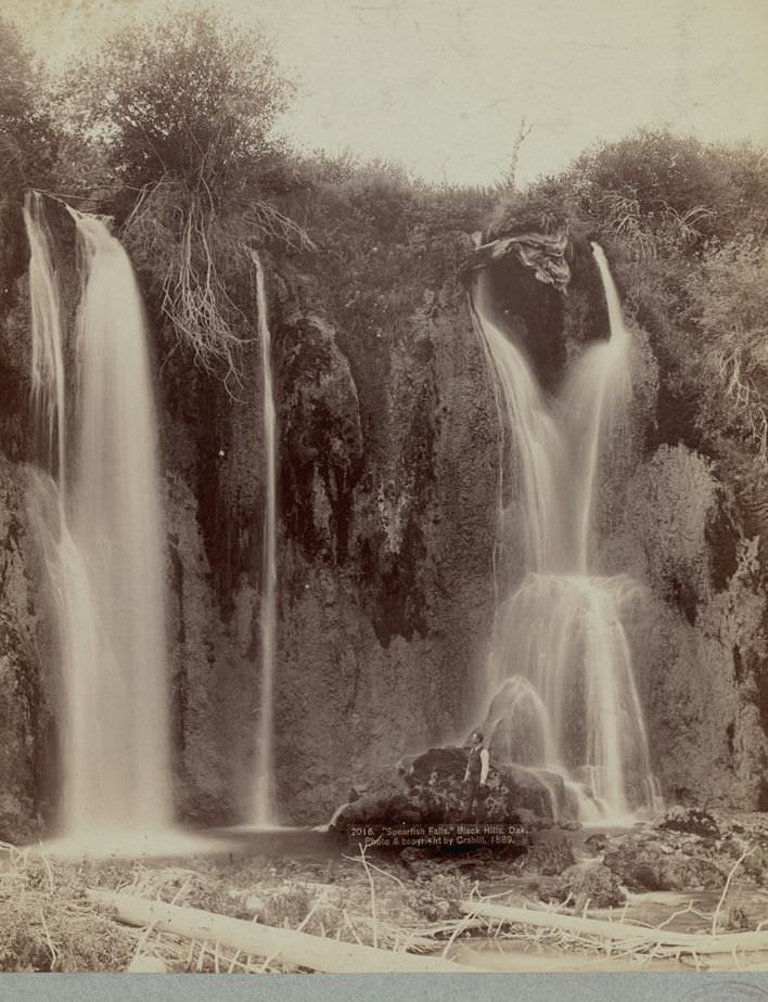
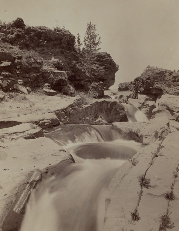
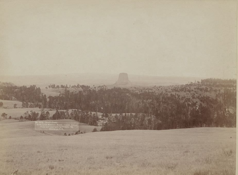
The landscape of the Black Hills and surrounding territories was dramatic. Grabill photographed Devil’s Tower from multiple angles, documented the roads between Deadwood and Sturgis, and captured Spearfish Falls in the Black Hills. These images weren’t purely scenic — they also showed the land that settlers, miners, and Native American tribes were all competing to control.
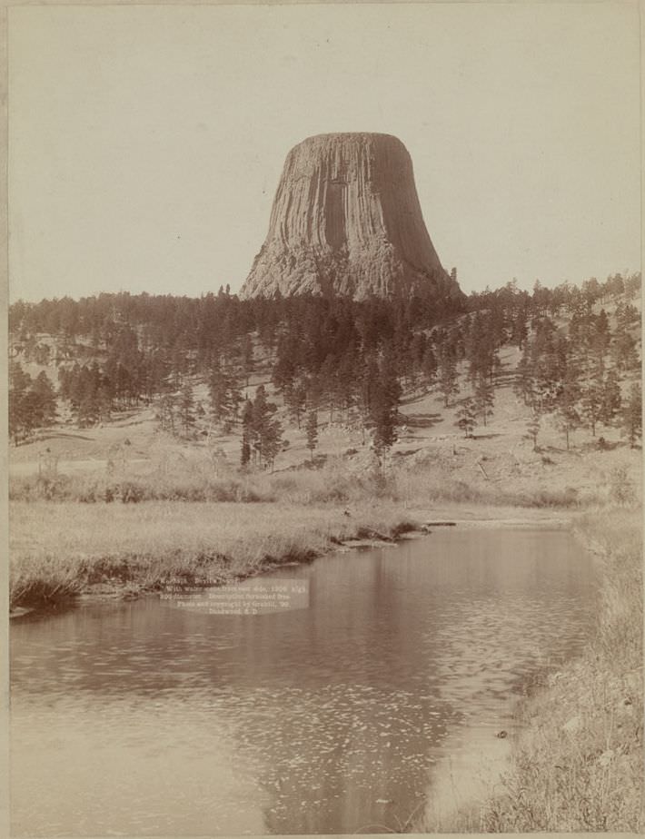
Devil's Tower from the east side, 1890.
Devil’s Tower from the east side, 1890.
Devil's Tower from Little Missouri Buttes, 1890.
Devil’s Tower from Little Missouri Buttes, 1890.
Scenery on Deadwood Road to Sturgis, 1888.
Spearfish Falls, Black Hills, Dakota, 1889.

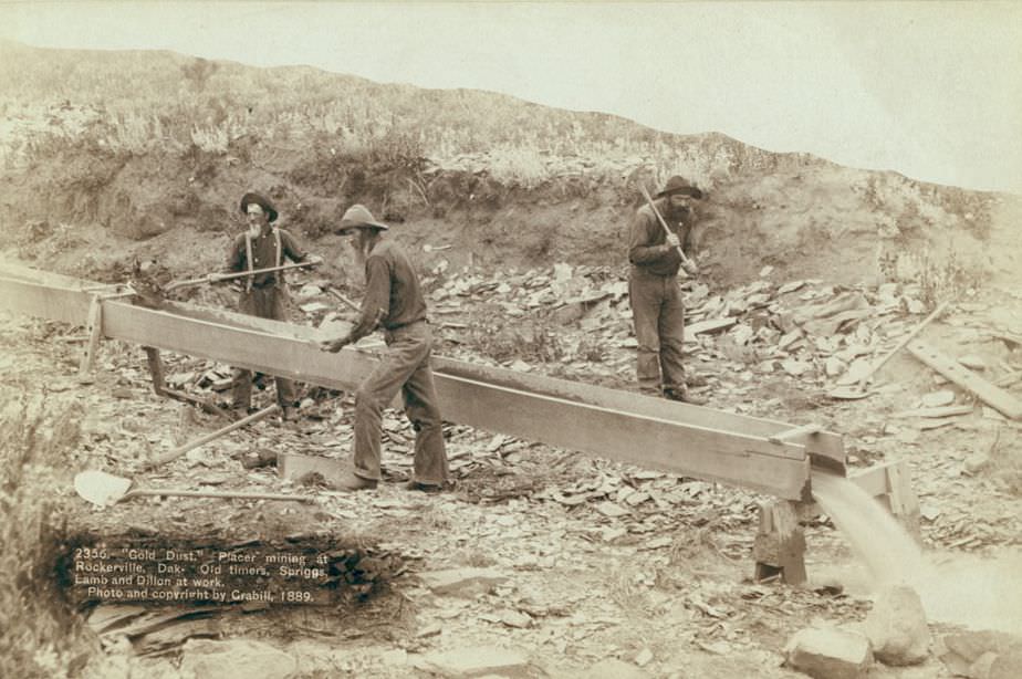
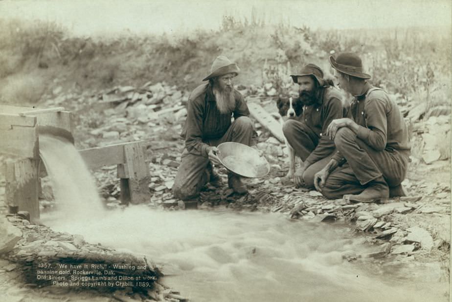
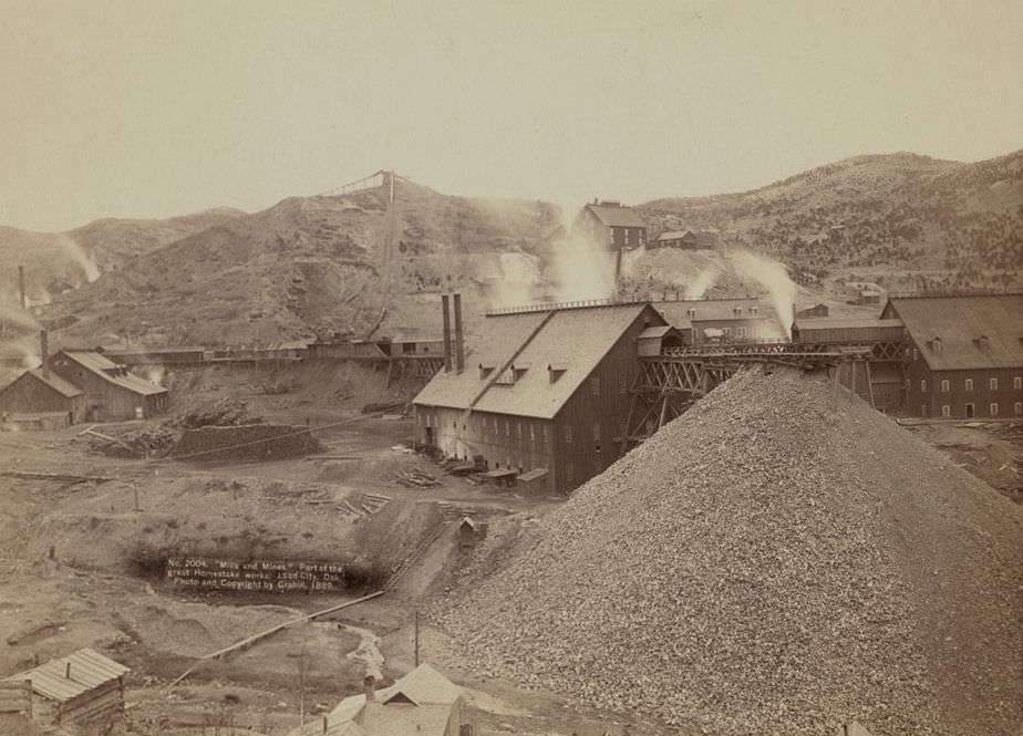
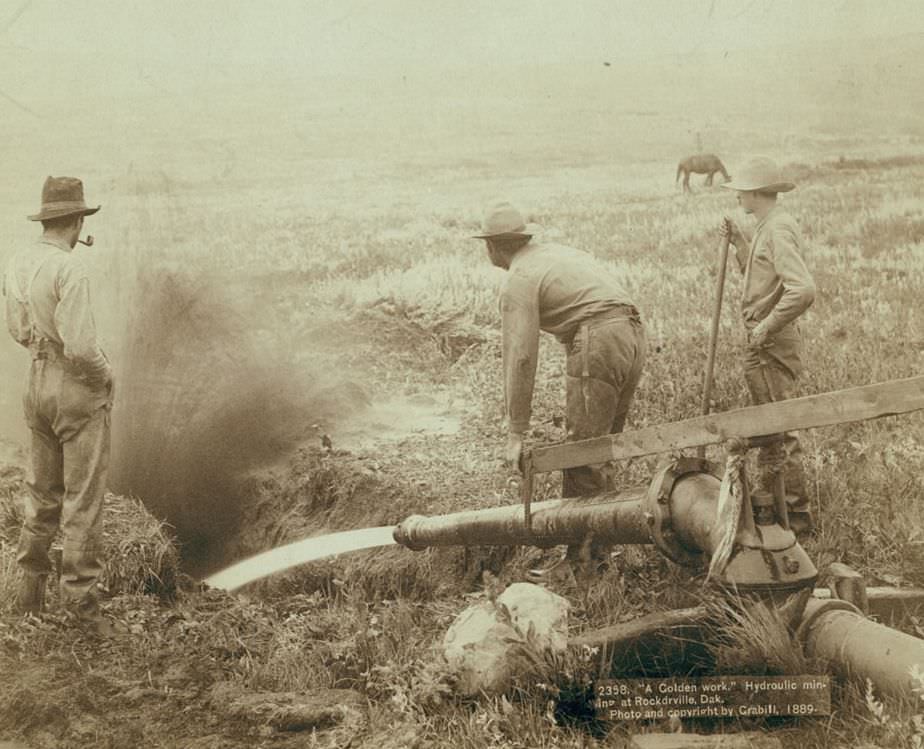
The promise of gold drew thousands of prospectors into the Black Hills and surrounding regions throughout the late 1880s. Grabill photographed groups heading out to new gold fields, placer mining operations at Rockerville where men panned directly in streambeds, hydraulic mining that blasted hillsides with high-pressure water, and the massive industrial infrastructure that processed the ore at places like the Homestake works in Lead City.
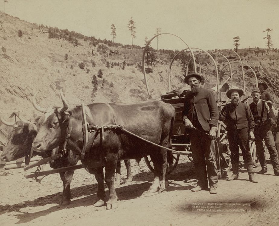
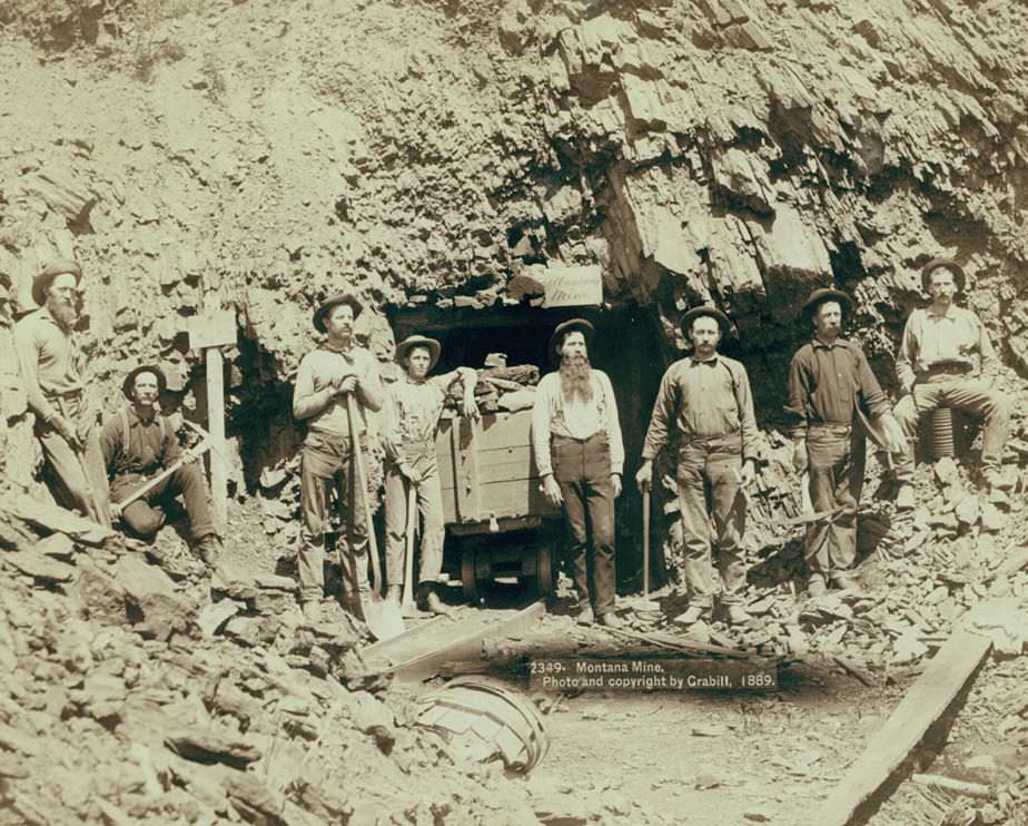
Prospectors going to the new Gold Field, 1889.
Montana Mine, 1889.
Montana Mine, 1889.
"Gold Dust": Placer mining at Rockerville, Dakota, 1889.
“Gold Dust”: Placer mining at Rockerville, Dakota, 1889.
"We have it rich": Washing and panning gold at Rockerville, Dakota, 1889.
“We have it rich”: Washing and panning gold at Rockerville, Dakota, 1889.
Part of the great Homestake works, Lead City, Dakota, 1889.
"A Golden work": Hydraulic mining at Rockerville, Dakota, 1889.
“A Golden work”: Hydraulic mining at Rockerville, Dakota, 1889.

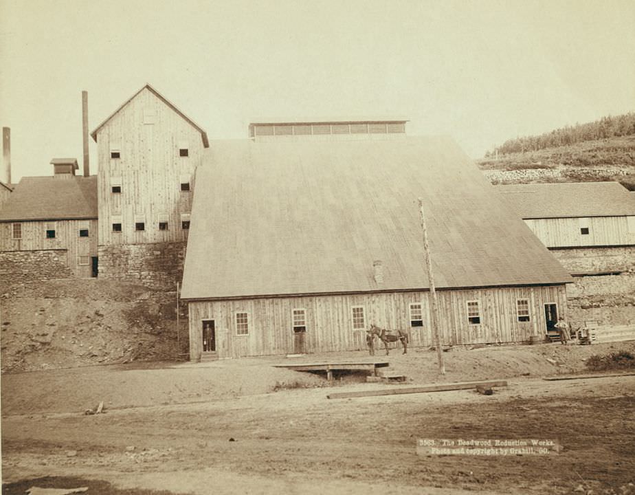
Once gold and silver ore was extracted, it had to be processed. Deadwood became home to smelters and reduction works that handled ore from across the region. Grabill documented both the Deadwood and Delaware Smelter and the Deadwood Reduction Works in 1890, capturing the industrial scale of what the gold rush had built.
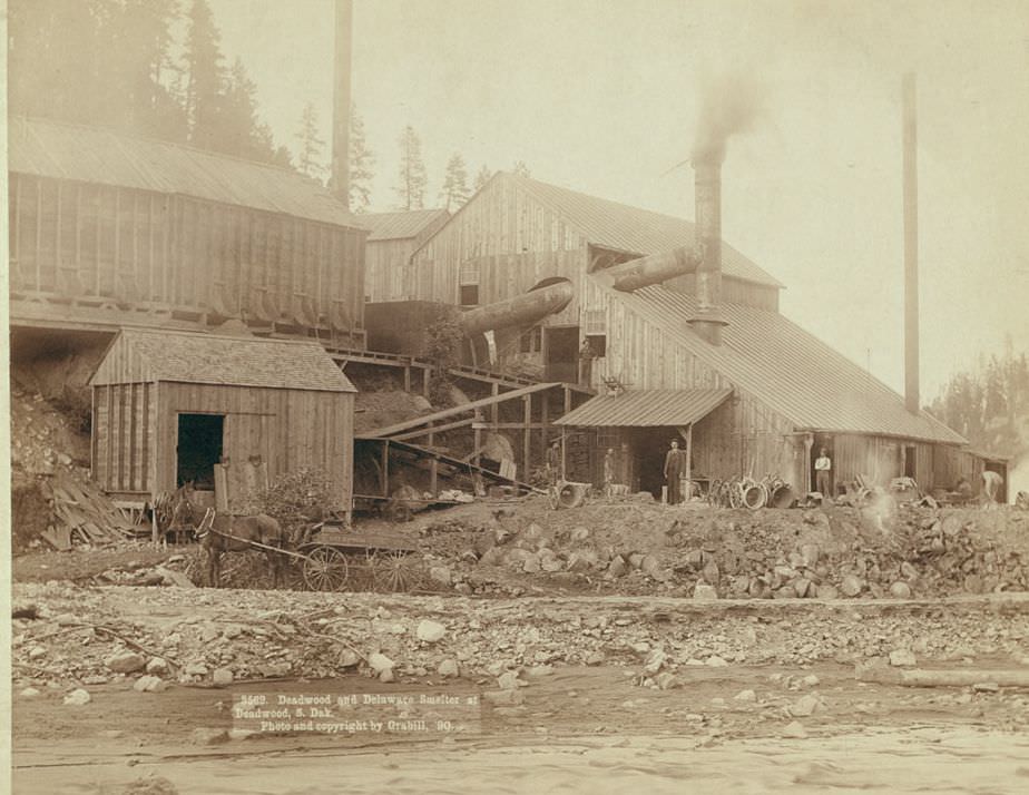
Deadwood and Delaware Smelter at Deadwood, South Dakota, 1890.
The Deadwood Reduction Works, 1890.

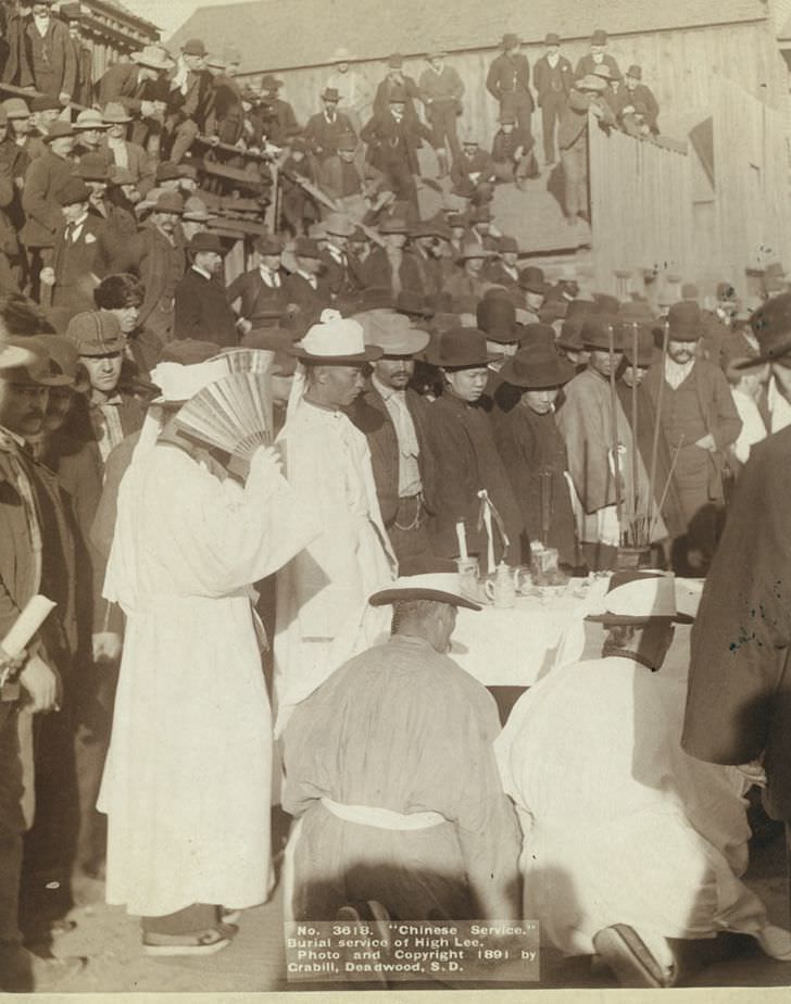
Deadwood’s population was diverse. Chinese immigrants had come to the region in significant numbers, working in mining, laundry, and other trades. Grabill photographed the champion Chinese hose team — a firefighting competition team — in 1888, as well as a Chinese burial service for a man named High Lee in 1891. These images are a reminder that the frontier West was far more multicultural than it is often portrayed.
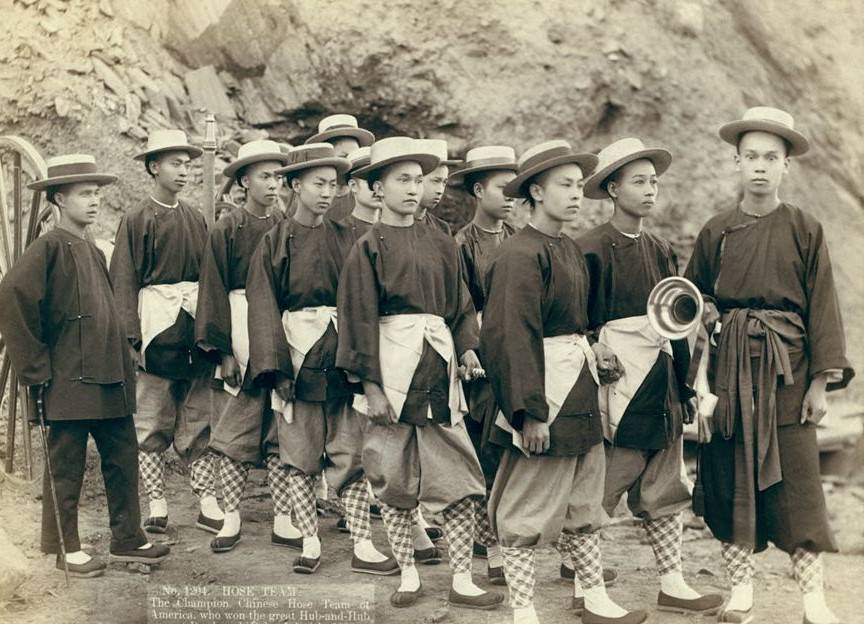
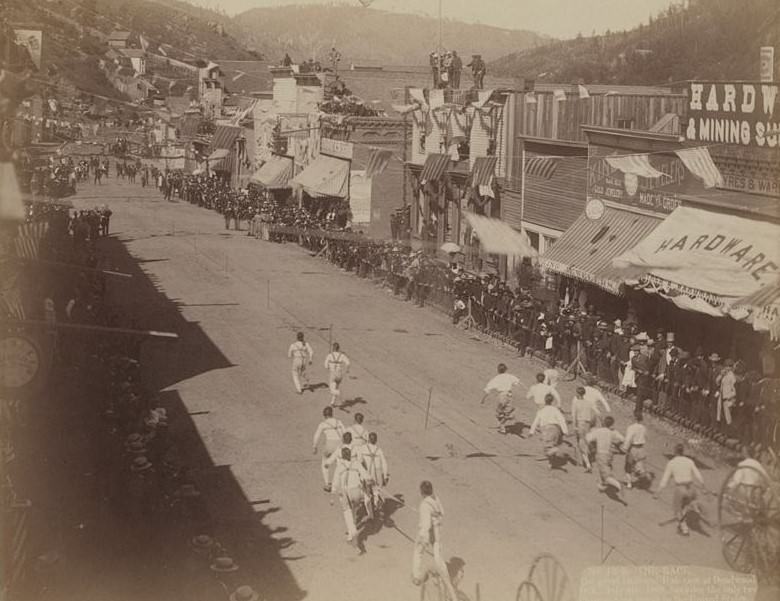
The champion Chinese Hose Team of America at Deadwood, Dakota, 1888.
The great Hub-and-Hub race at Deadwood, Dakota, 1888.
Chinese burial service of High Lee, 1891.

The U.S. government issued beef rations to Native American tribes on reservations, a system that replaced their traditional hunting economy after the bison were gone. Grabill photographed the beef issue process at Pine Ridge in 1891 in detail — from the skinning of cattle to the distribution of meat to tribal members. These images document a system of enforced dependency that followed the destruction of the Plains tribes’ food supply.
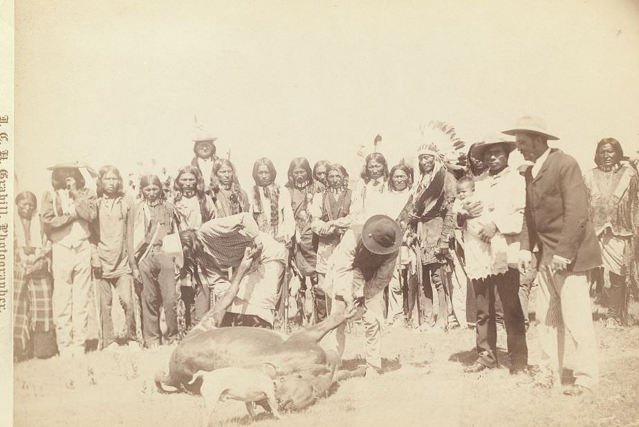
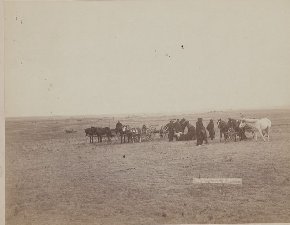
Skinning Beef, 1890s.
Skinning beef at beef issue, 1891.
Beef issue to Indians, 1891.
Beef issue to Indians at Pine Ridge, 1891.

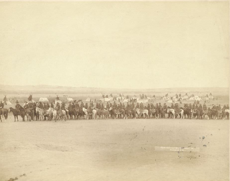
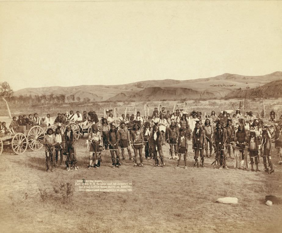
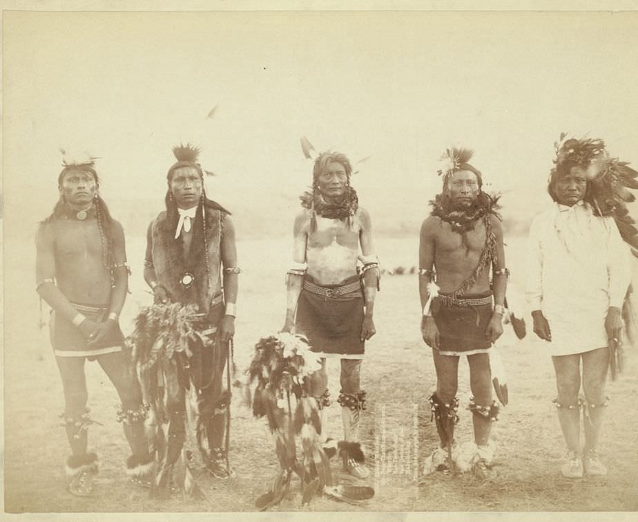
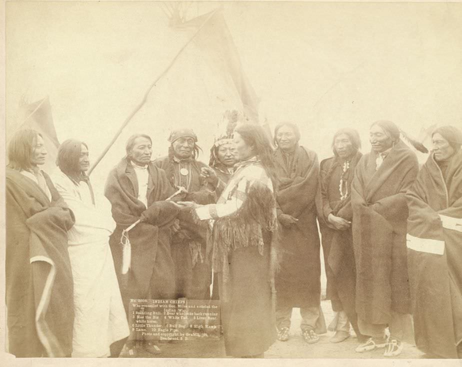
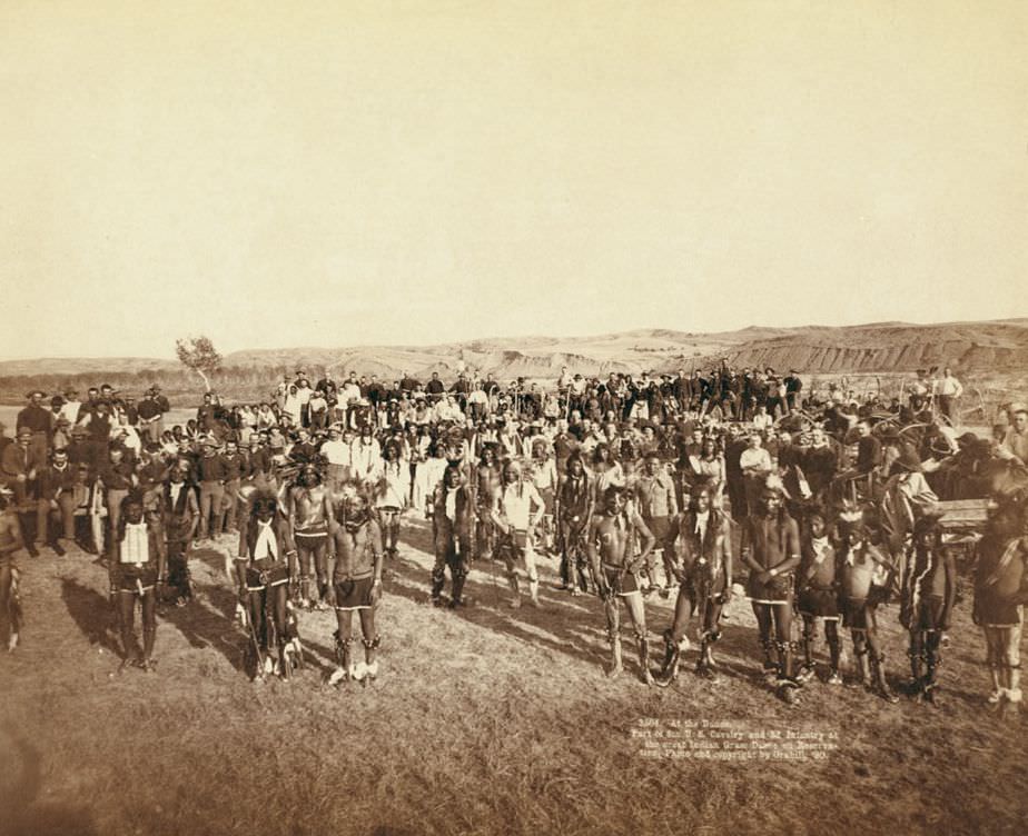
After the hostilities around Pine Ridge were brought to a close, Grabill photographed the chiefs who had negotiated with General Miles to end the conflict. He also documented U.S. military units present during the period, including parts of the 8th Cavalry and 3rd Infantry who attended a Lakota grass dance on the reservation in 1890.
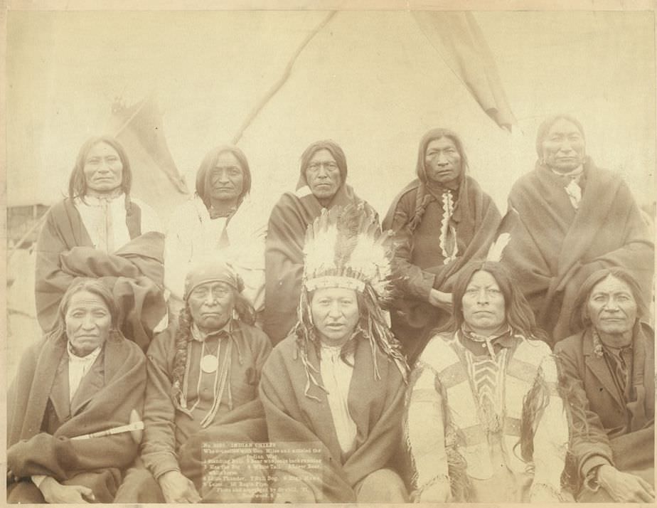
Indian chiefs who counciled with Gen. Miles and settled the Indian War, 1891.
Part of the 8th U.S. Cavalry and 3rd Infantry at the great Indian Grass Dance on Reservation, 1890.
Part of the 8th U.S. Cavalry and 3rd Infantry at the great Indian grass dance on reservation, 1890.
Indian Warriors, 1890.

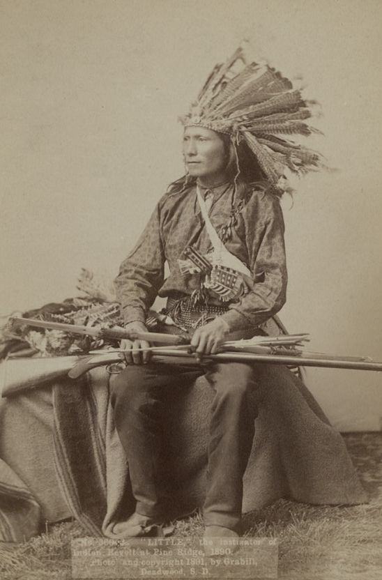
Grabill photographed a man identified as “Little,” described as the instigator of the Indian revolt at Pine Ridge, multiple times in 1890. These portrait-style photographs placed specific individuals at the center of historical events, giving faces to names that otherwise exist only in written records.
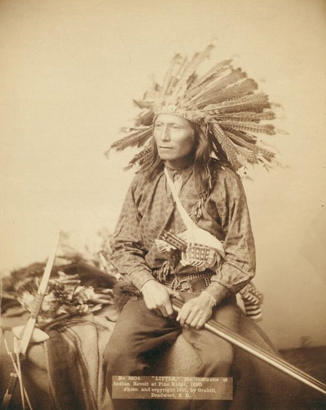
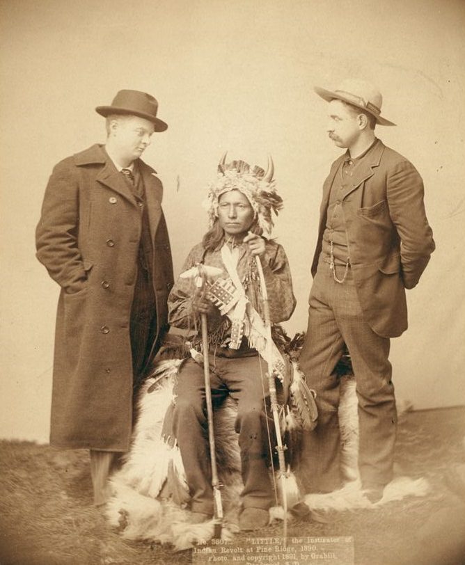
Little, instigator of Indian revolt at Pine Ridge, 1890.
Little, the instigator of Indian Revolt at Pine Ridge, 1890.
Indian chiefs who counciled with Gen. Miles and settled the Indian War, 1891.
Little, the instigator of Indian revolt at Pine Ridge, 1890.

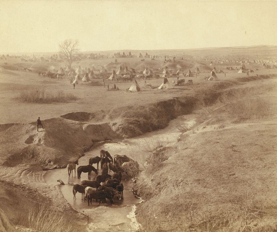
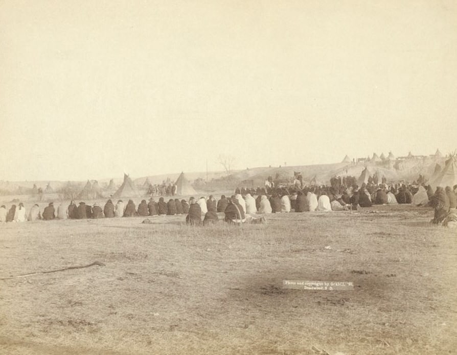
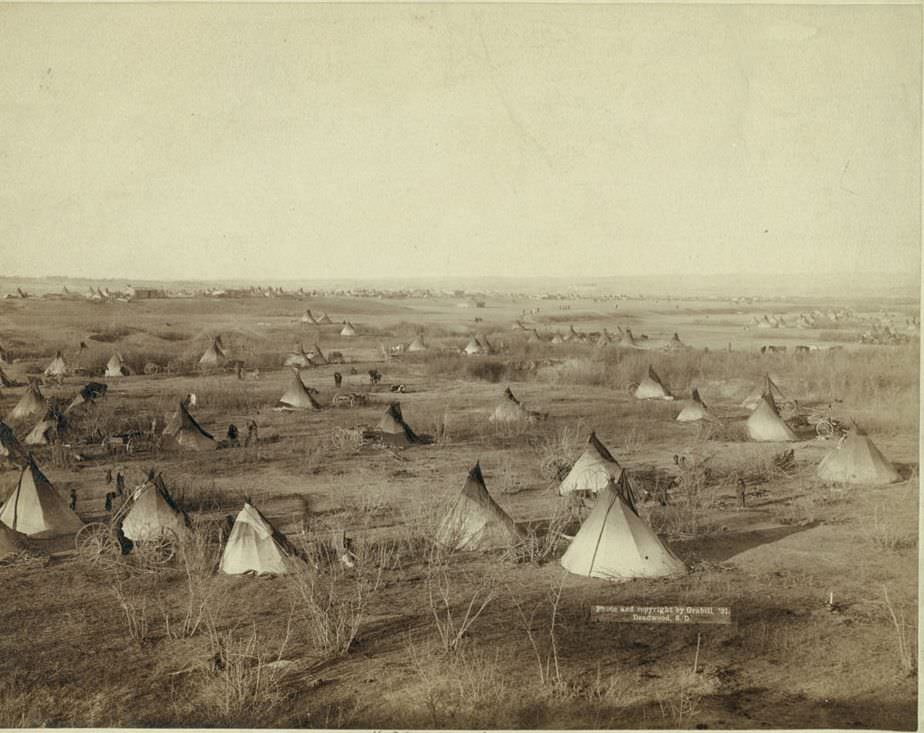
The Villa of Brule — a large Lakota camp near Pine Ridge — appears in several of Grabill’s photographs from 1891. These images show the scale of the encampment and the conditions in which people were living during an extremely tense and militarized period. Big Foot’s band, survivors of the Wounded Knee Massacre of December 29, 1890, were also photographed by Grabill the following year. The Wounded Knee Massacre killed at least 250 Lakota men, women, and children. Grabill’s photograph of what remained of Big Foot’s band stands as one of the starkest records of that event’s aftermath.
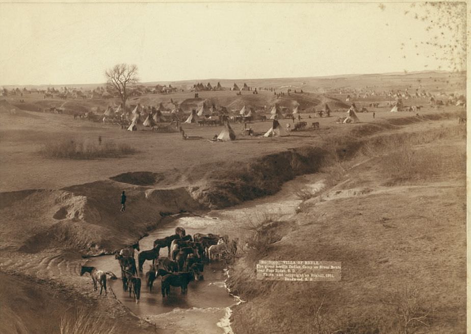
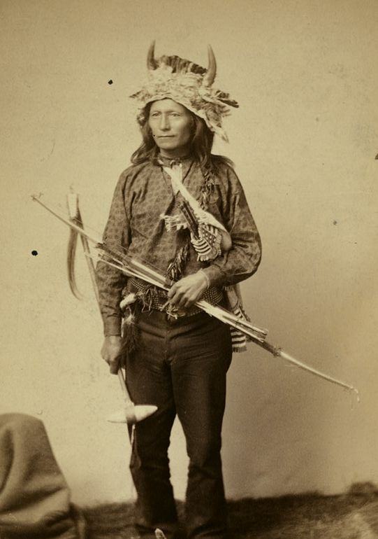
Villa of Brule the great hostile Indian camp on River Brule near Pine Ridge, South Dakota, 1891.
Little, instigator of Indian Revolt at Pine Ridge, 1890.
Villa of Brule, 1891.
What's left of Big Foot's band, 1891.
What’s left of Big Foot’s band, 1891.
Indian Council in Hostile Camp, 1891.
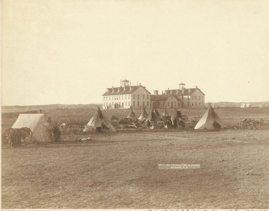
U.S. School for Indians at Pine Ridge, South Dakota, 1891.
The Great Hostile Camp, 1891.
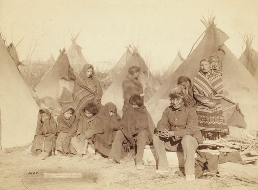
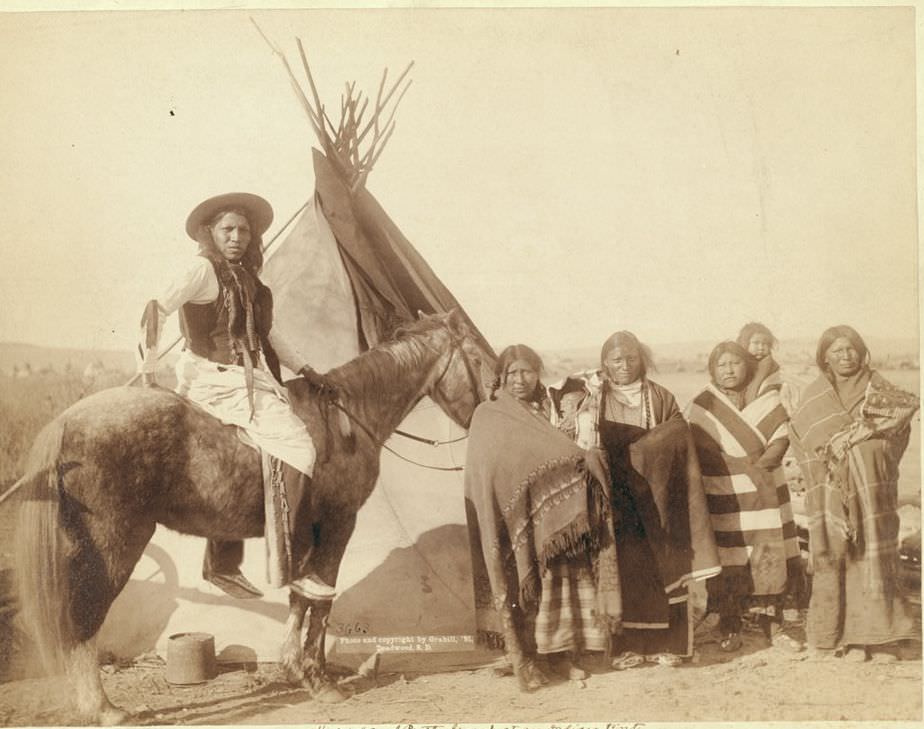
A group at an Indian tent, 1891.
Tasunka, Ota (alias Plenty Horses), the slayer of Lieut. Casey, near Pine Ridge, South Dakota, 1891.

Among the most recognized Lakota leaders Grabill photographed were Red Cloud and American Horse, two chiefs who had both fought the U.S. government at various points and later navigated the difficult politics of reservation life. Their portrait together in 1891 captures two men who had survived decades of conflict and dispossession.
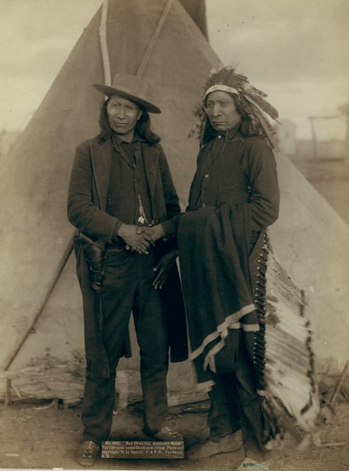
Red Cloud and American Horse, two noted chiefs, 1891.

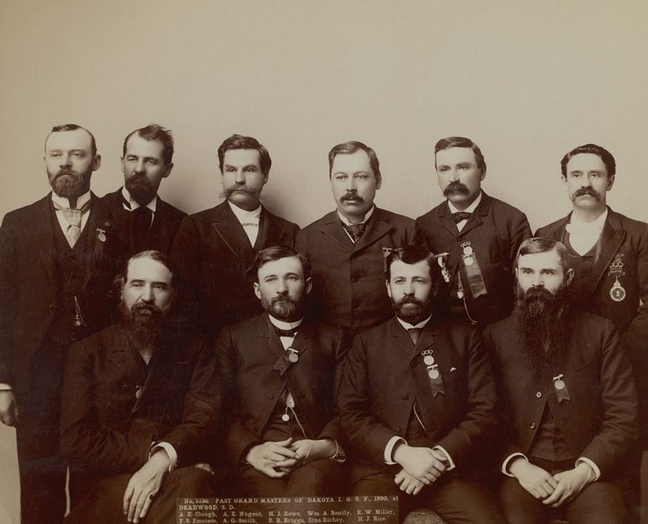
Life in Dakota Territory wasn’t only defined by conflict and mining. Grabill photographed a shepherd moving a flock along a railway line, fraternal organization gatherings in Deadwood, and recreational scenes at Hot Springs. These quieter images fill out the picture of what daily social life looked like in newly settled communities.
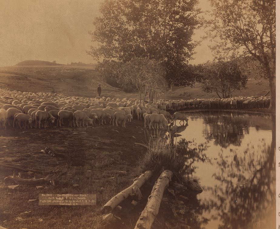
Shepherd and flock on F.E. & M.V. Railway in Dakota, 1891.
Past Grand Masters of Dakota I.O.O. F. at Deadwood, South Dakota, 1890.
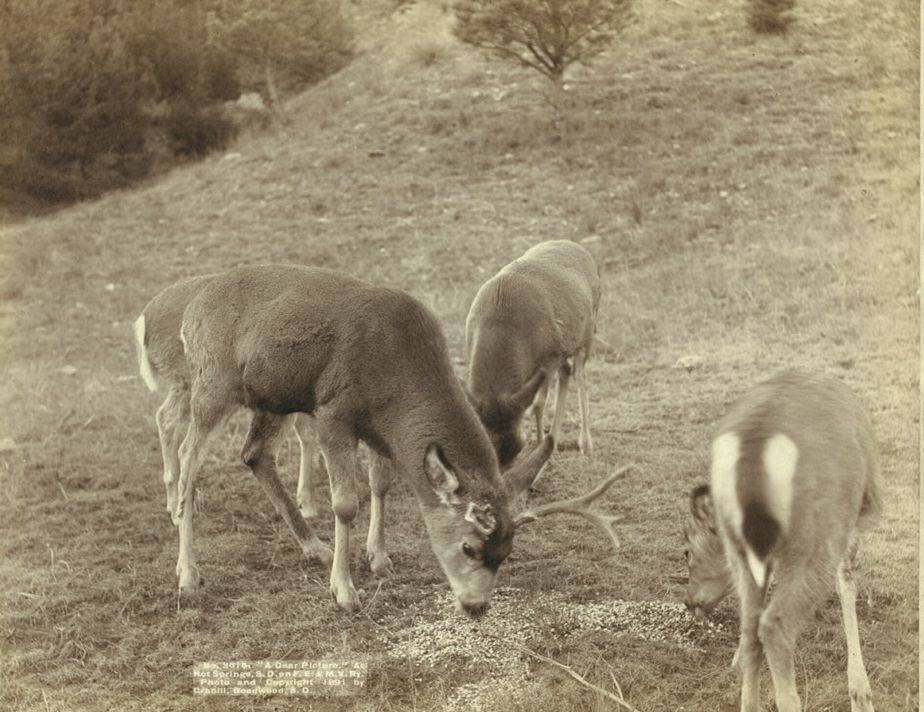
"A Dear Picture" at Hot Springs, South Dakota, 1891.
“A Dear Picture” at Hot Springs, South Dakota, 1891.

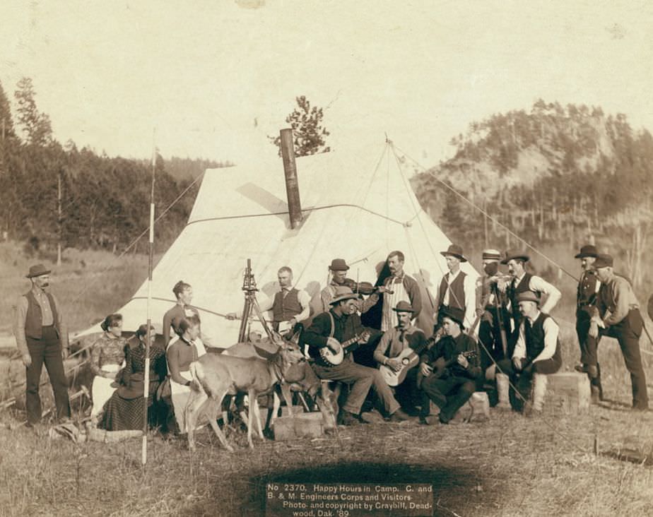
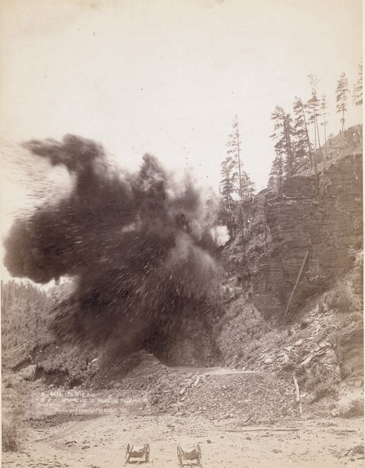
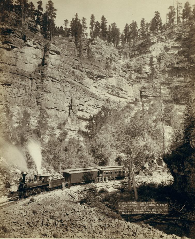
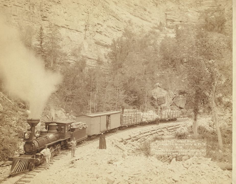
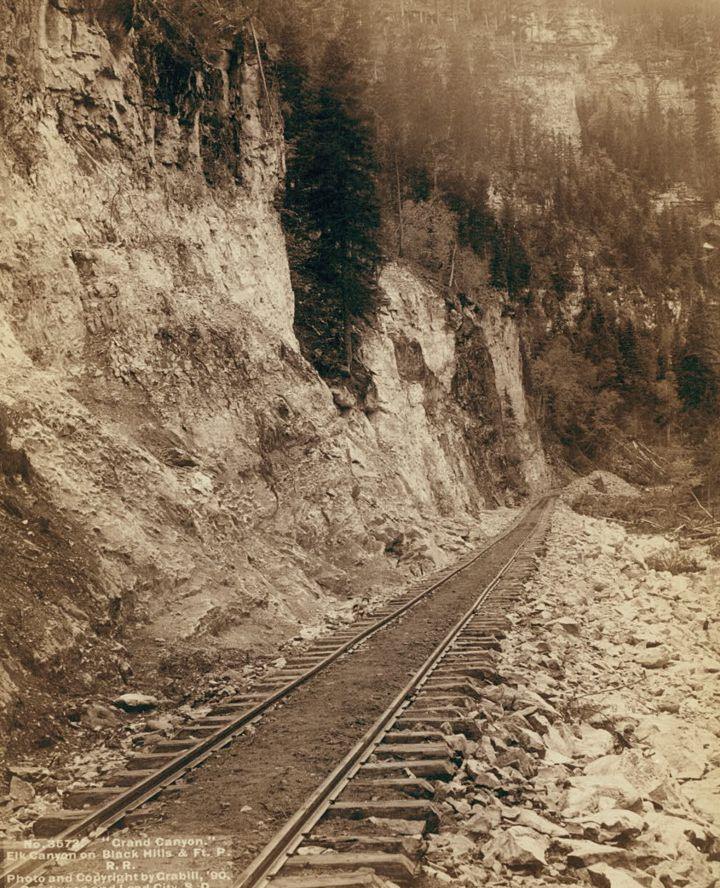
Railroad construction was transforming the Black Hills region during this period. Grabill documented engineering corps teams at work and at rest, including a dynamite blast during the construction of the railroad to Deadwood. The routes carved through Elk Canyon and along the Horseshoe Curve near Custer City required enormous effort and showed just how seriously investors and settlers were committed to connecting these remote mining towns to the wider national economy.
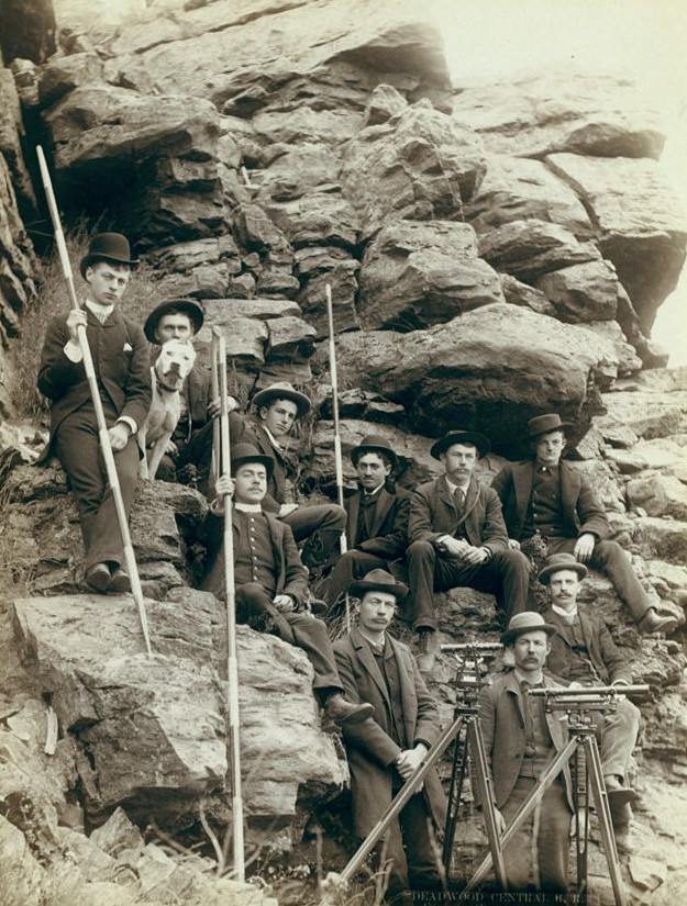
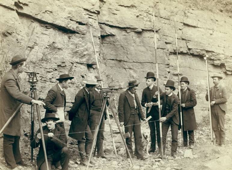
Deadwood Central R.R. Engineer Corps, 1880s.
Deadwood Central R.R. Engineer Corps, 1888.
Happy Hours in Camp: G. and B.&M. Engineers Corps and Visitors, 1889.
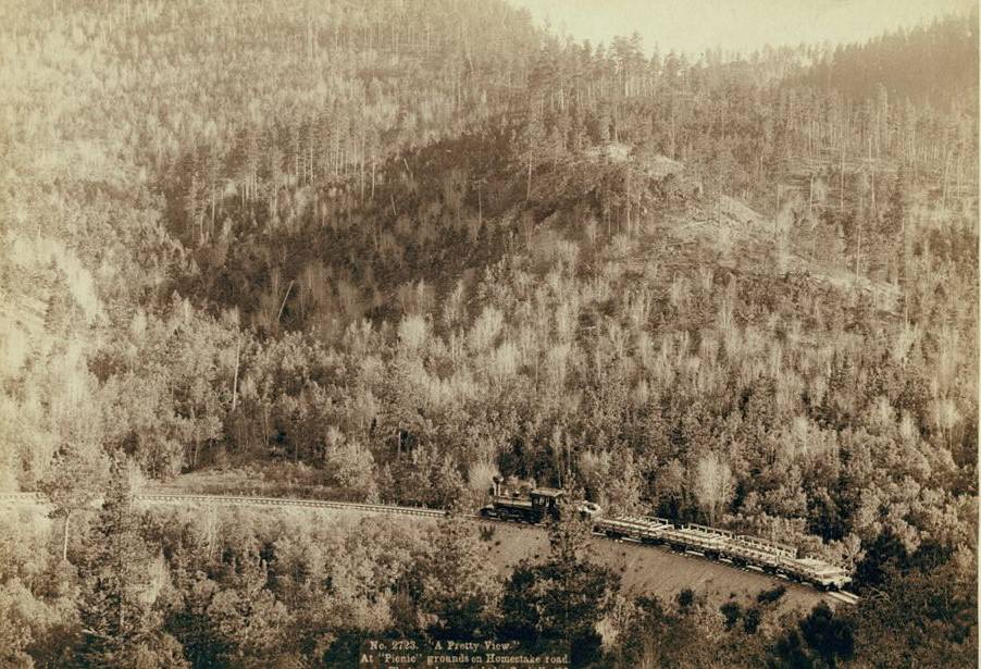
"A pretty view" at "picnic" grounds on Homestake Road, 1890.
“A pretty view” at “picnic” grounds on Homestake Road, 1890.
A blast in building railroad to Deadwood, 1890.
Giant Bluff, Elk Canyon on Black Hills and Ft. P. Railroad, 1890.
Grand Canyon, Elk Canyon on Black Hills and Ft. P. Railroad, 1890.
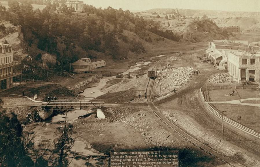
Hot Springs, South Dakota from the Fremont, Elkhorn and M.V. Railway bridge, 1891.
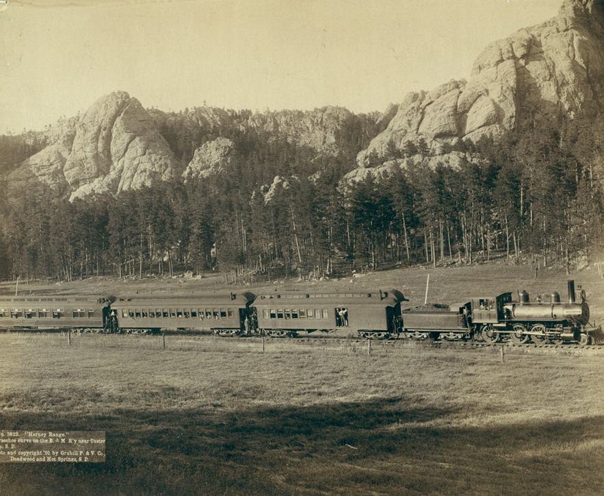
Harney Range, Horseshoe Curve on the Burlington and Missouri River Railway near Custer City, South Dakota, 1891.
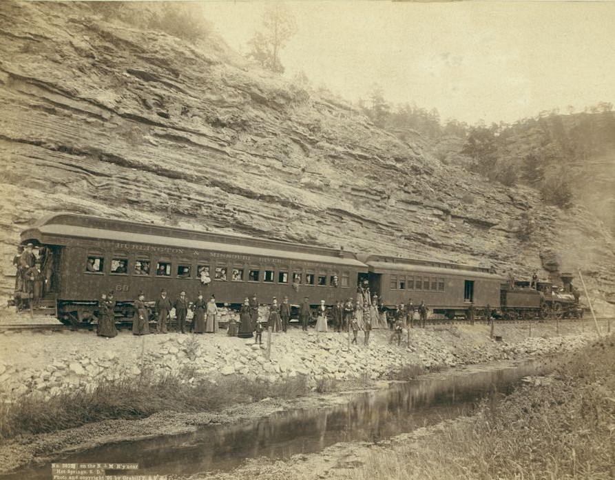
On the Burlington and Missouri River Railway near "Hot Springs, South Dakota", 1891.
On the Burlington and Missouri River Railway near “Hot Springs, South Dakota”, 1891.
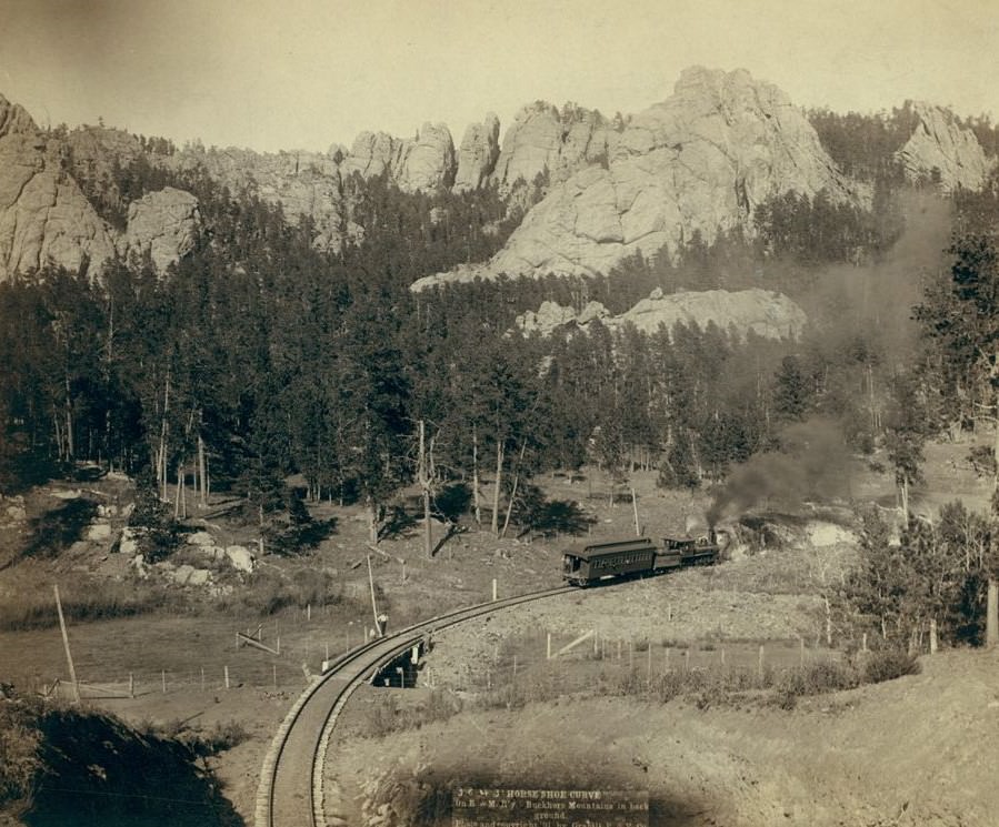
Horse Shoe Curve on Burlington and Missouri River Railway, Buckhorn Mountains in background, 1891.
Engineers Corps camp and visitors, 1889.

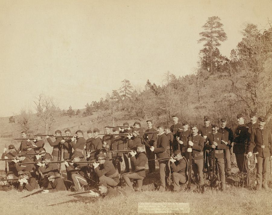
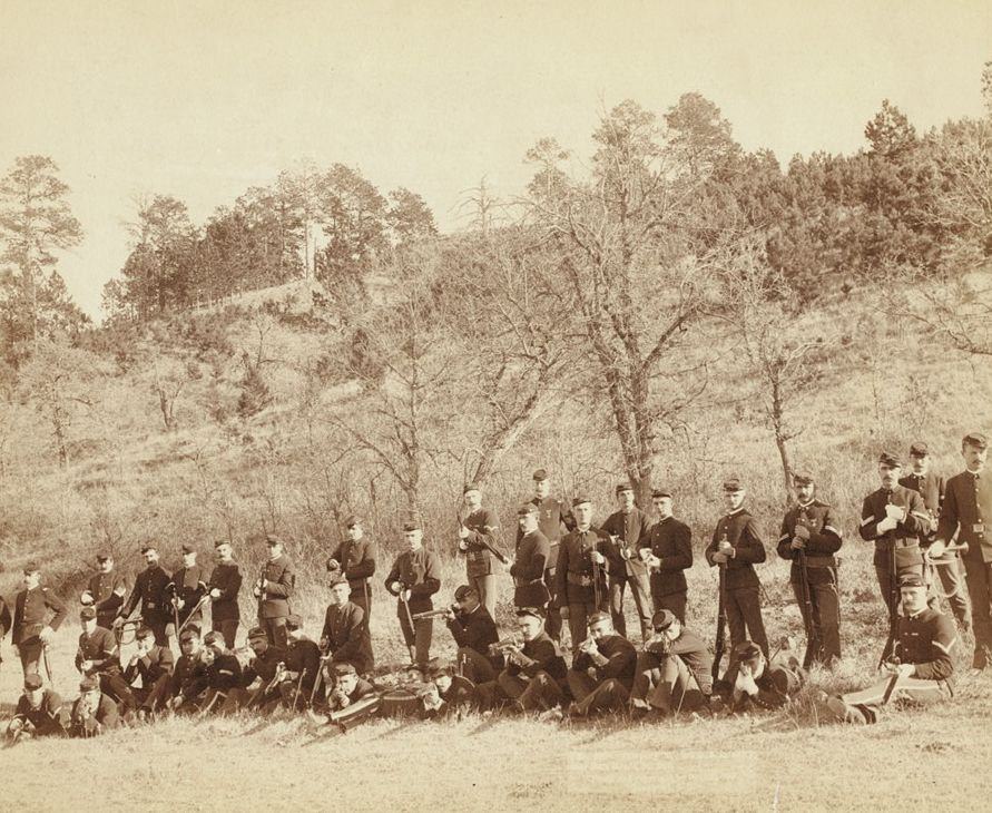
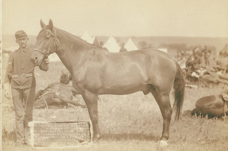
The U.S. military maintained a significant presence in the Black Hills region through posts like Fort Meade. Grabill photographed cavalry and infantry units stationed there, including “I” Troop of the 8th Cavalry and Company C of the 3rd U.S. Infantry. One of the most historically charged images in his collection is his 1887 photograph of Comanche — the horse that survived the Battle of Little Bighorn in 1876 and became a living symbol of that engagement.
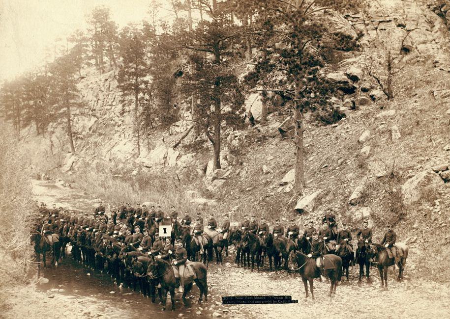
Near Fort Meade: "I" troop, 8th Cavalry, 1889.
Near Fort Meade: “I” troop, 8th Cavalry, 1889.
Comanche, the only survivor of the Custer Massacre, 1887.
Company "C," 3rd U.S. Infantry near Fort Meade, South Dakota, 1890.
Company “C,” 3rd U.S. Infantry near Fort Meade, South Dakota, 1890.
Company "C," 3rd U.S. Infantry near Fort Meade, South Dakota, 1890.
Company “C,” 3rd U.S. Infantry near Fort Meade, South Dakota, 1890.
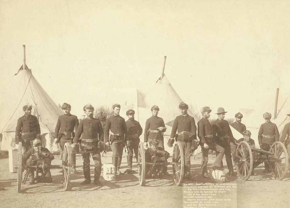
Famous Battery "E" of 1st Artillery and the fighting 7th, 1891.
Famous Battery “E” of 1st Artillery and the fighting 7th, 1891.
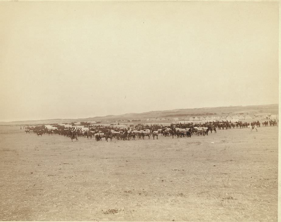
Grand review, 1890s.
Viewing Hostile Indian Camp, 1891.
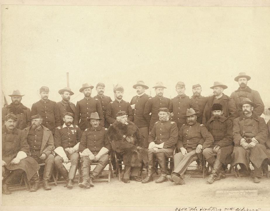
The fighting 7th officers, 1891.
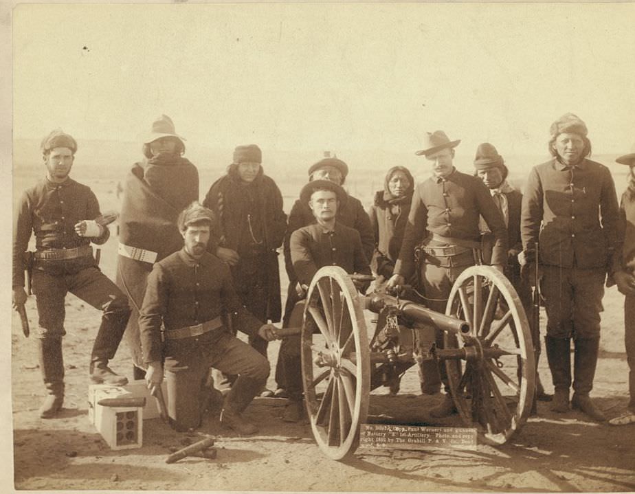
Copr. Paul Weinert and gunners of Battery "E" 1st Artillery, 1891.
Copr. Paul Weinert and gunners of Battery “E” 1st Artillery, 1891.
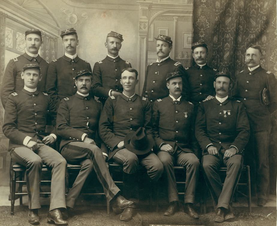
Officers of the 9th Cavalry, 1891.

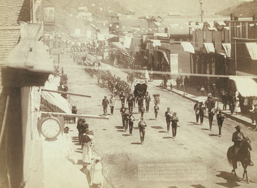
Towns like Deadwood marked their milestones with public celebrations. Grabill photographed crowds gathering to celebrate the completion of a railroad line, the construction of the D.O.R.R. road to Lead City, and the opening of what was called the largest gold and silver ore reduction works in the world — all in 1888. These events show communities proud of their growth and optimistic about the future.
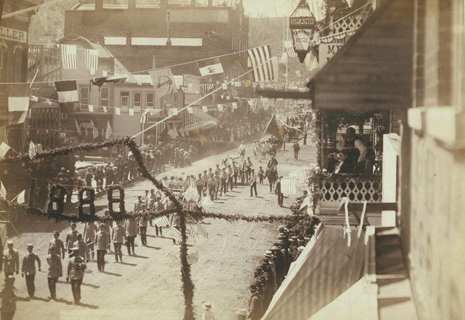
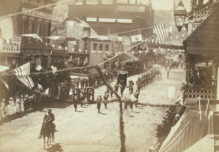
People of Deadwood celebrating completion of railroad, 1888.
Jollification: Deadwood people celebrating the building of D.O.R.R. road to Lead City, 1888.
Celebrating the building of the largest reduction works for gold and silver ores in the world, Deadwood, 1888.
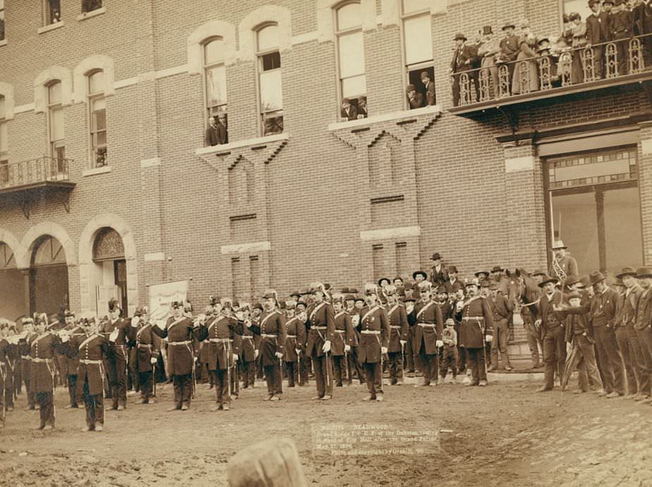
Deadwood: Grand Lodge I.O.O.F. of the Dakotas after the Grand Parade, 1890.
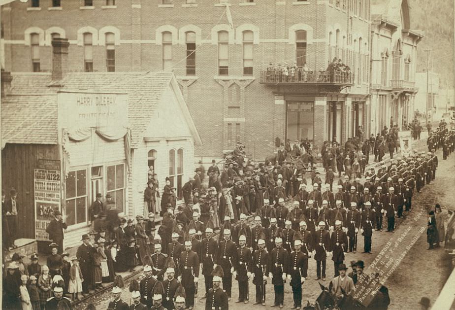
Deadwood: Grand Lodge I.O.O.F. of Dakotas Street Parade, 1890.
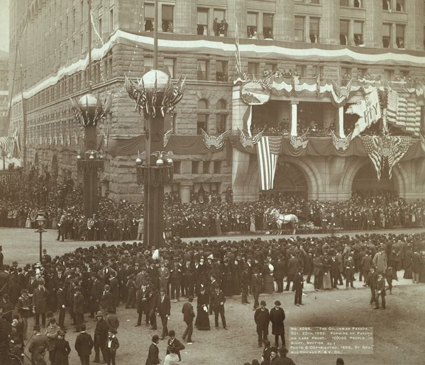
The Columbian Parade forming on lake front, 1892.

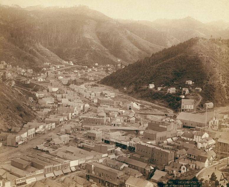
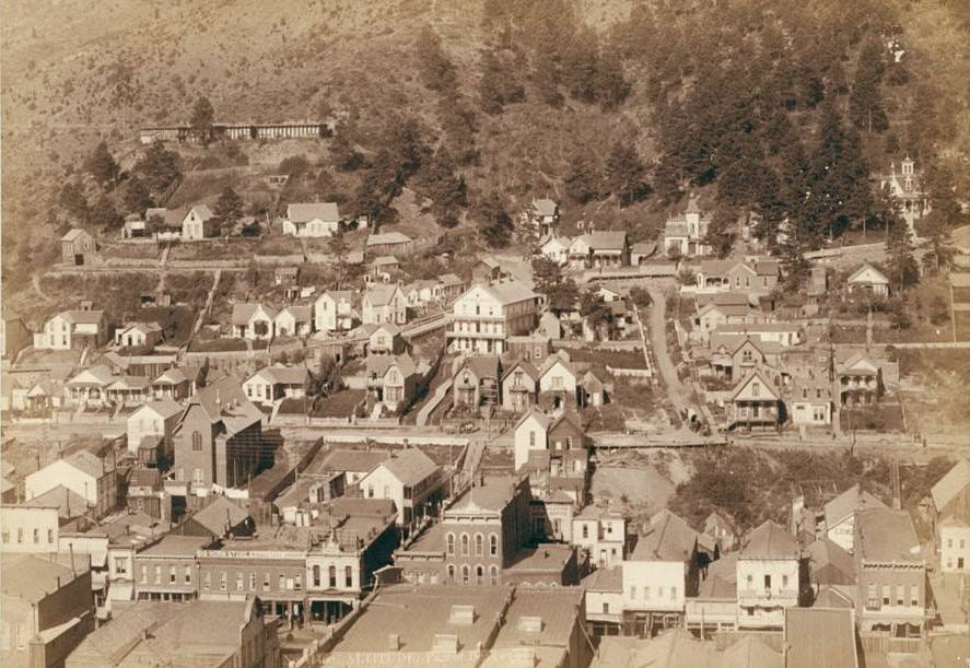
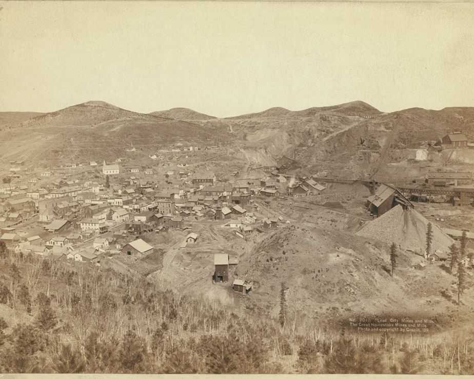
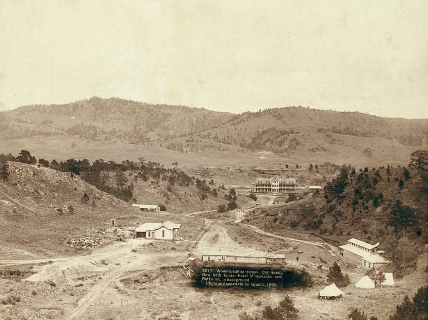
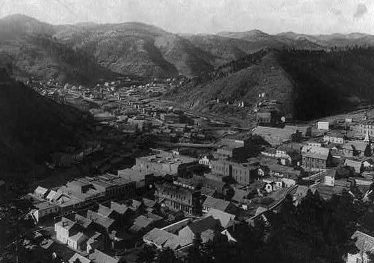
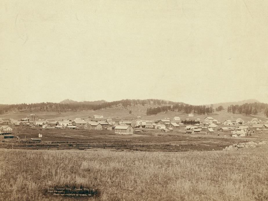
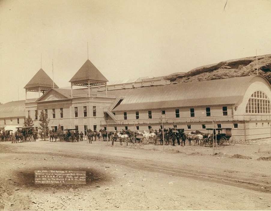
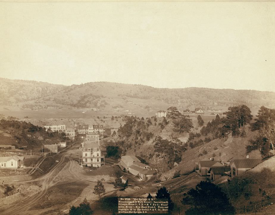
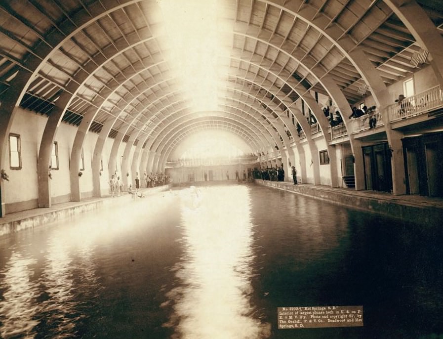
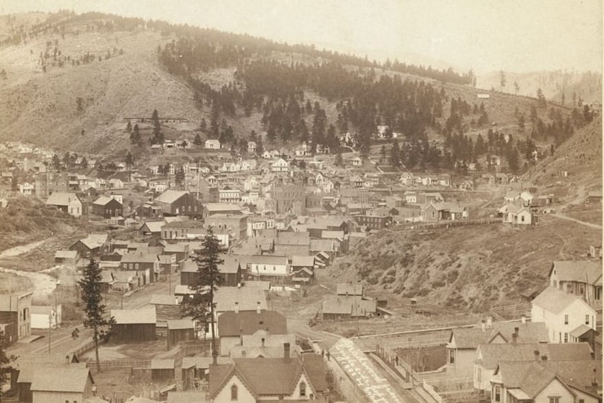
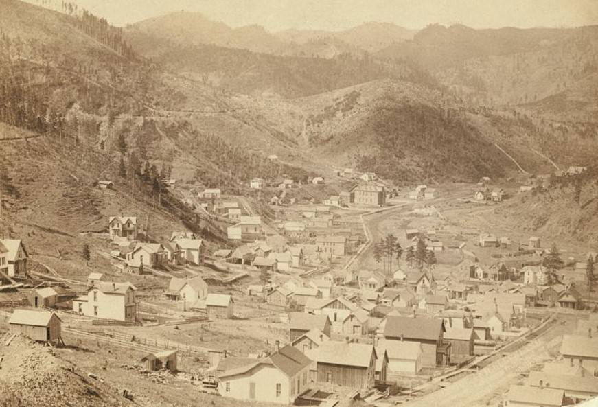
Grabill also captured the physical face of the growing towns themselves. Deadwood, photographed from multiple vantage points including McGovern Hill and Mount Moriah, shows a densely packed mining town cut into steep terrain. The Homestake Mine complex at Lead City was enormous. Hot Springs, South Dakota, was developing as a resort destination, complete with the largest plunge bath house in the United States at that time.
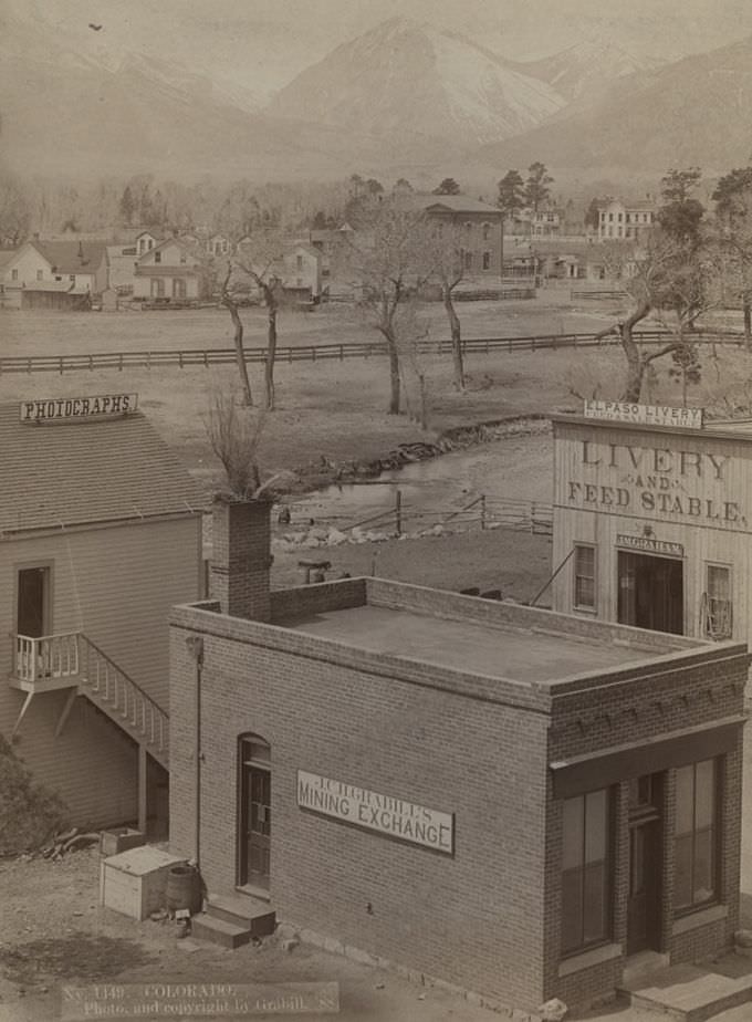
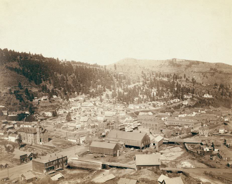
Colorado, 1888.
Colorado, 1888.
Deadwood, South Dakota from McGovern Hill, 1888.
Deadwood from Mt. Moriah, 1888.
Part of Deadwood from big flume, 1890s.
Lead City Mines and Mills: The Great Homestake Mines and Mills, 1889.
Wi-wi-la-kah-ta canon with Old hotel, new bath house, Hotel Minnekahta and Battle Mt., 1889.
No. 1973. Part of Deadwood Dakota from Forest Hill, 1890.
Custer City, Dakota from the east, 1890.
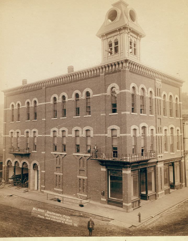
Deadwood's pride: The elegant City Hall, 1890.
Deadwood’s pride: The elegant City Hall, 1890.
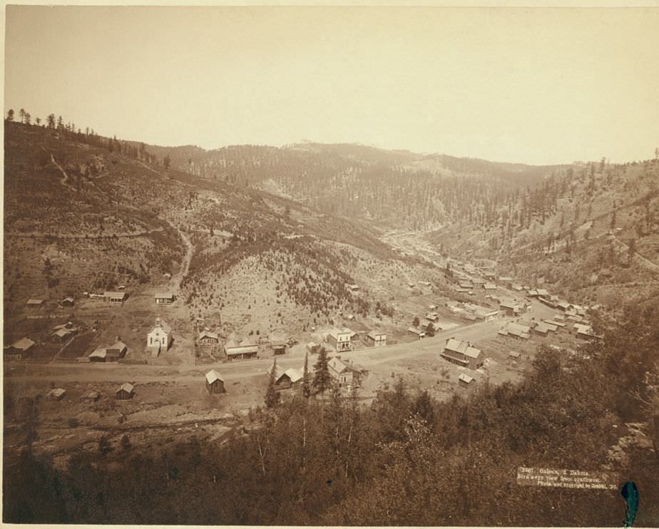
Galena, South Dakota bird's-eye view from southwest, 1890.
Galena, South Dakota bird’s-eye view from southwest, 1890.
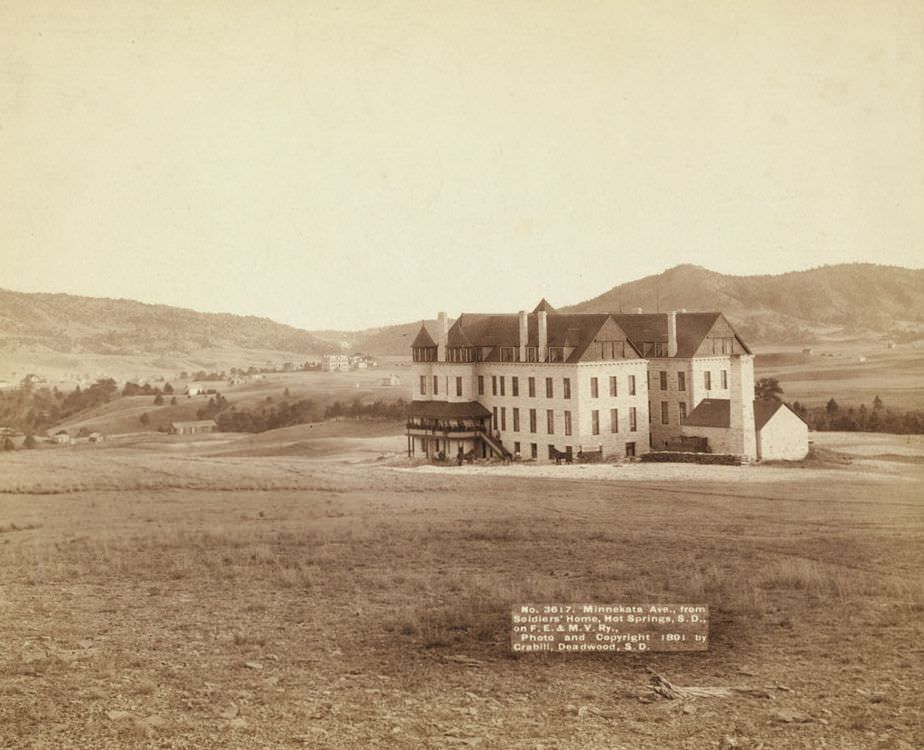
Minnekata Ave., from Soldiers' Home, Hot Springs, South Dakota, 1891.
Minnekata Ave., from Soldiers’ Home, Hot Springs, South Dakota, 1891.
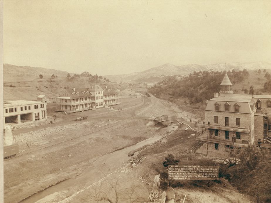
Hot Springs, South Dakota from Club House Hill, 1891.
Hot Springs, South Dakota: Exterior of largest plunge bath house in U.S., 1891.
Hot Springs, South Dakota: Minnekahta Ave. Bath house, Sanitarium, Gillespie House, and New bank block, 1891.
Hot Springs, South Dakota: Interior of largest plunge bath in U.S., 1891.
Deadwood, South Dakota from Engleside, 1888.
Engleside and Cleveland from east of Deadwood, 1888.

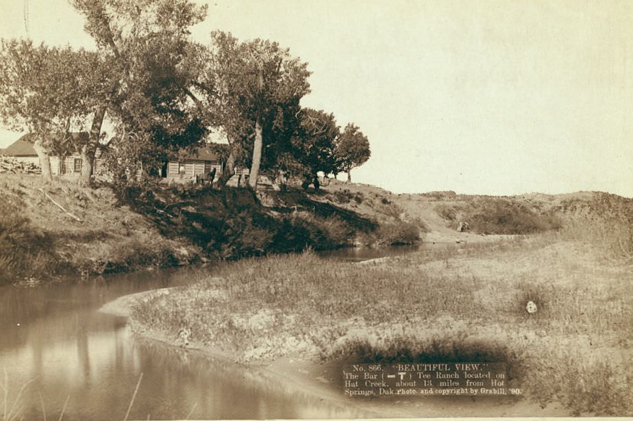
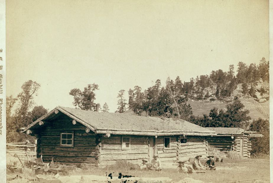
Ranch houses and homesteads dot Grabill’s collection as well. These structures — some modest log cabins, others more developed ranch operations — show the range of living conditions on the frontier. The Bar-T Tee Ranch on Hat Creek near Hot Springs represented a more established operation, while simpler old cabins reflected the earliest stages of settlement.
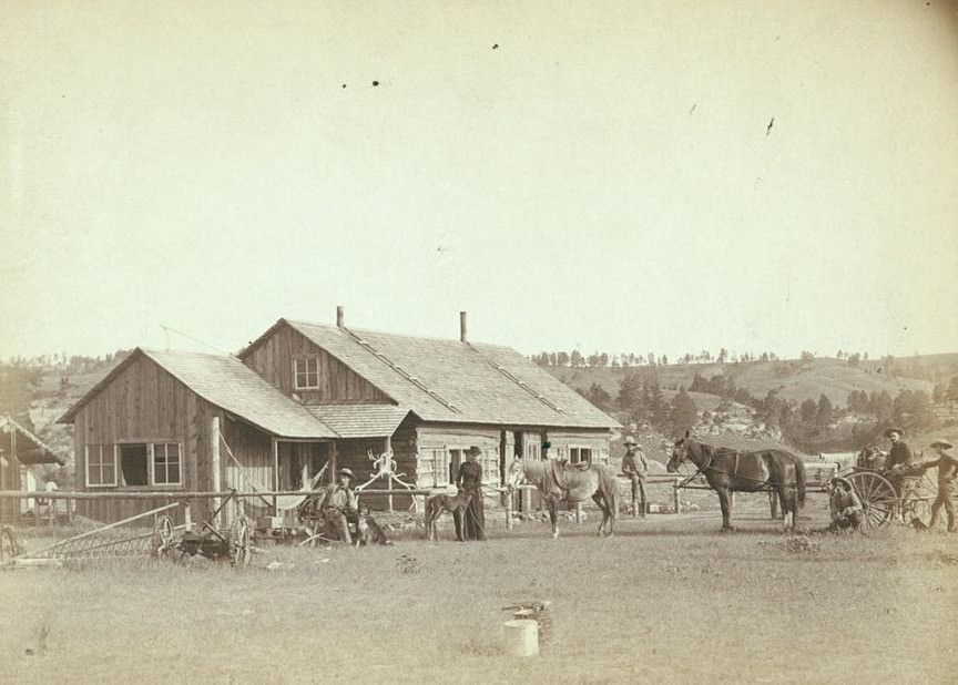
Western Ranch House, 1888.
The old cabin home, 1890s.
Beautiful view of The Bar (-T) Tee Ranch on Hat Creek near Hot Springs, Dakota, 1890.

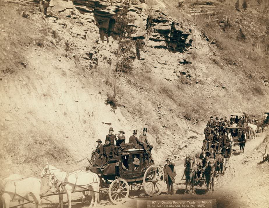
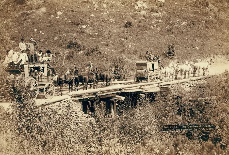
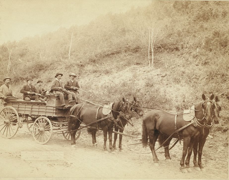
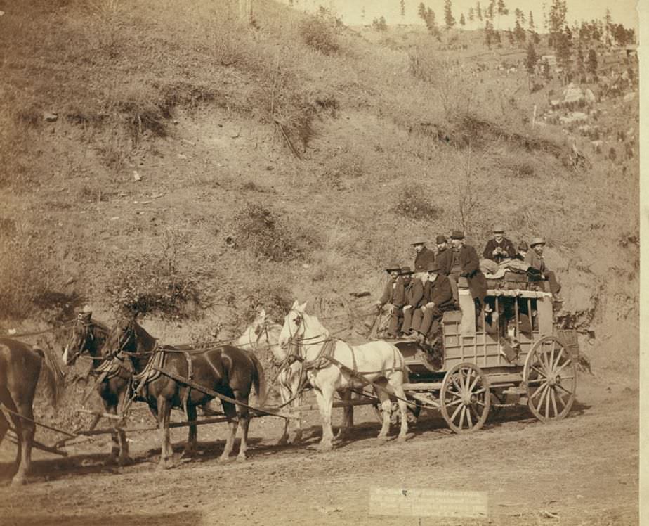
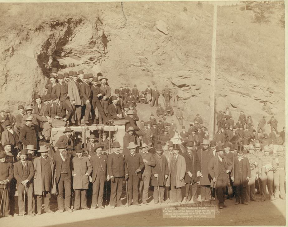
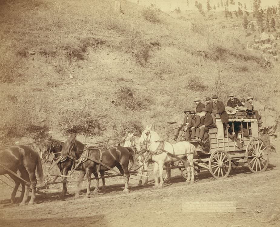
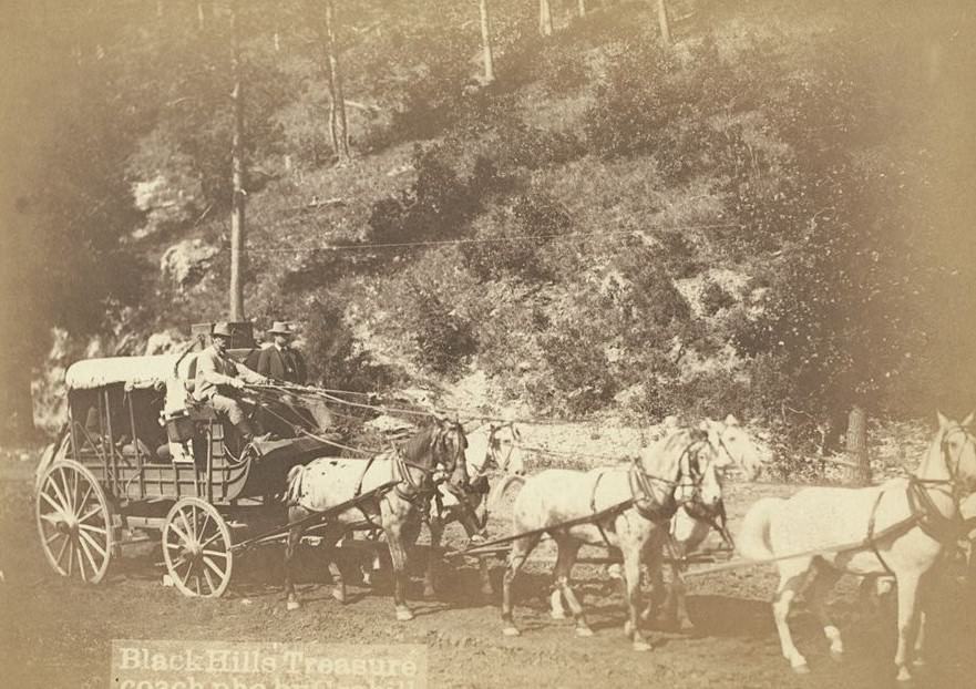
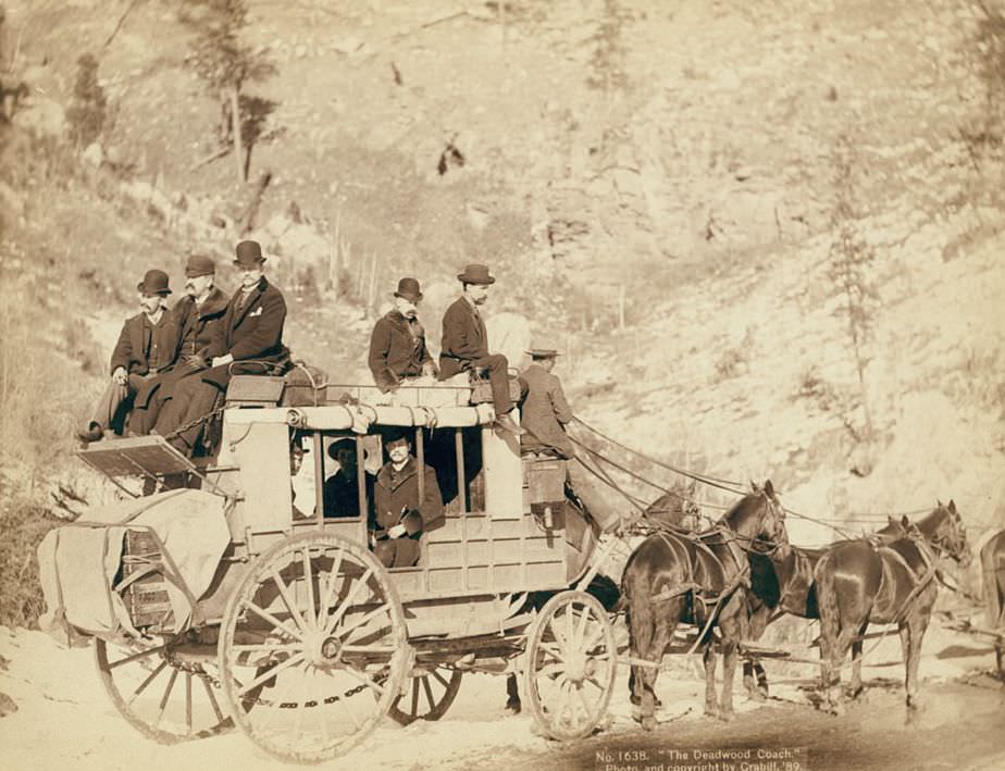
Before the railroads made it obsolete, the Deadwood Coach was one of the most famous stagecoach routes in the West. Wells Fargo used heavily guarded wagons to transport gold bullion from the Homestake Mine in Deadwood. Grabill photographed the Wells Fargo treasure wagon with its armed guards, and documented the last trips of the famous Deadwood Coach in 1890 as railroad service replaced it. The U.S. Paymaster also traveled the road between Deadwood and Fort Meade with a military escort — gold in the Black Hills moved with serious protection.
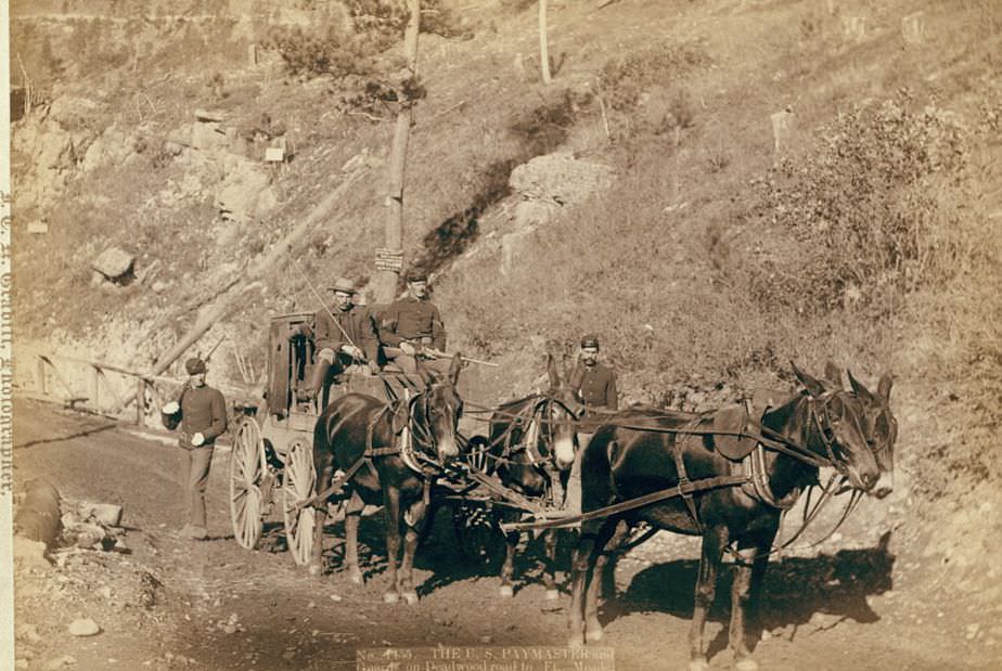
The U.S. Paymaster and Guards on Deadwood road to Ft. Meade, 1888.
The Deadwood Coach, 1889.
Omaha Board of Trade in Mountains near Deadwood, 1889.
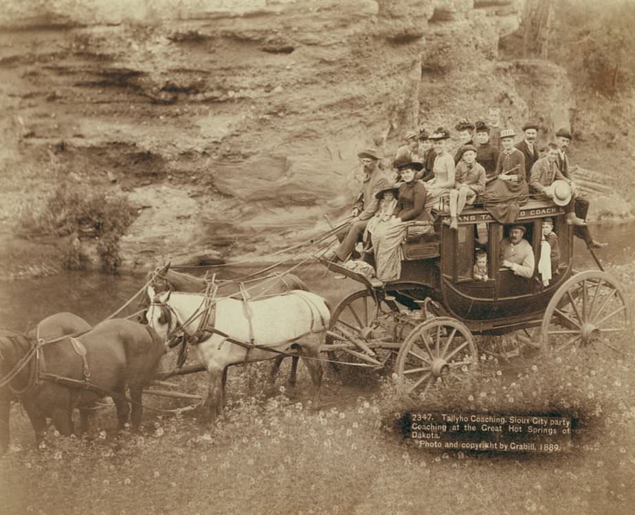
Tallyho Coaching: Sioux City party Coaching at the Great Hot Springs of Dakota, 1889.
The Deadwood Coach, 1889.
Wells Fargo Express Co. Deadwood Treasure Wagon and Guards with gold bullion from the Great Homestake Mine, Deadwood, South Dakota, 1890.
The Last Deadwood Coach, 1890.
Last trip of the famous Deadwood Coach, 1890.
The last Deadwood Coach, 1890.
Black Hills treasure coach, 1890s.

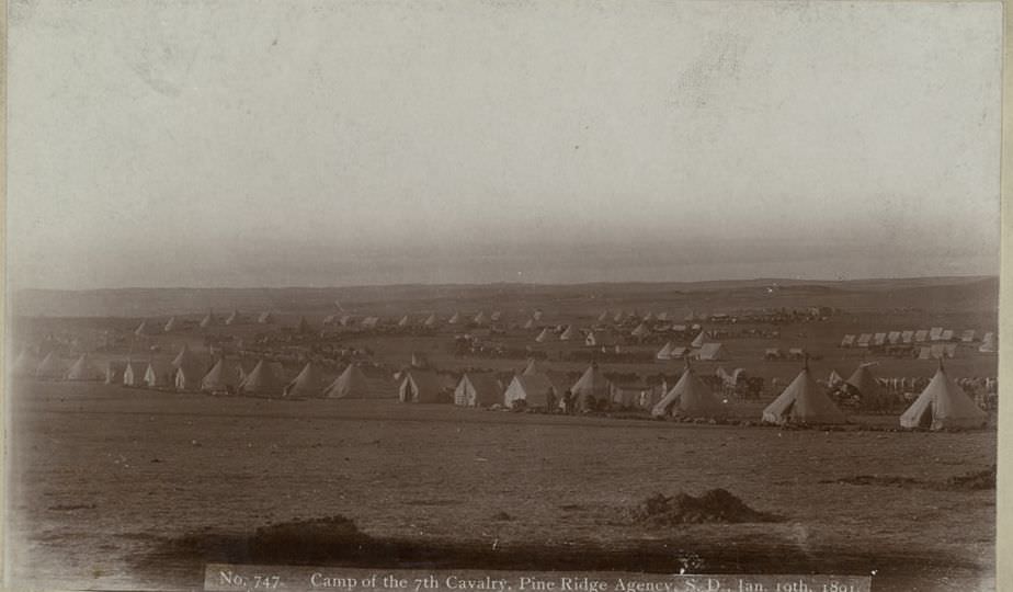
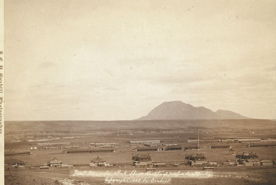
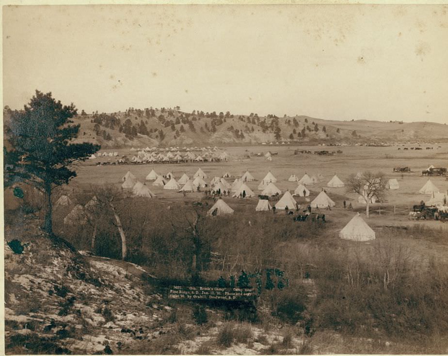
Fort Meade anchored the military presence in the region. Grabill photographed the officers’ quarters along the fort’s main line, General Brook’s camp near Pine Ridge, and the camp of the 7th Cavalry at the Pine Ridge Agency. These images, taken in the immediate aftermath of Wounded Knee, show an army still deployed in large numbers and a region that was anything but settled.
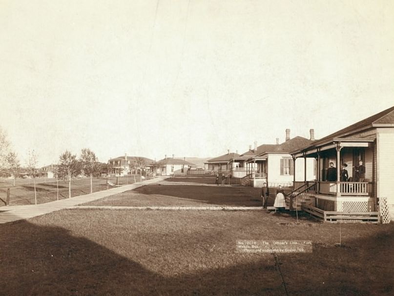
The Officers' Line, Fort Meade, Dakota, 1889.
The Officers’ Line, Fort Meade, Dakota, 1889.
General Brook's Camp near Pine Ridge, South Dakota, 1891.
General Brook’s Camp near Pine Ridge, South Dakota, 1891.
Camp of the 7th Cavalry, Pine Ridge Agency, South Dakota, 1891.
Fort Meade, Dakota with Bear Butte in distance, 1888.
Minnekahta Falls near Hot Springs, Dakota, 1889
Enjoyed this post? Get new ones in your inbox.

3 thoughts on “A Look Back at the Wild West: Stunning Historic Photos of Life in the Late 1800s”

  1. Those are great. I’ve seen most of them, but there were a few news ones to me in there also. My family homesteaded on the eastern side of the state. I’ve been in the hills for almost 30 years. 18 years in Hot Springs now.

Leave a Comment

Your email address will not be published. Required fields are marked *

Share this Post 🥺

Please take a moment to share this content. Your support is greatly appreciated! 🙌🙏

Share this Post 🥺

Please take a moment to share this content. Your support is greatly appreciated! 🙌🙏
Scroll to Top
 
Hey Friend, Before You Go.. Please like & follow for more interesting content