Hey There! Before You Go. 😧
Get the best vintage content straight into your inbox!

Don't worry, we don't spam

St. Louis 1930: A Captivating Journey Through Time, Uncovering the Life, Architecture, and Culture of a Historic City

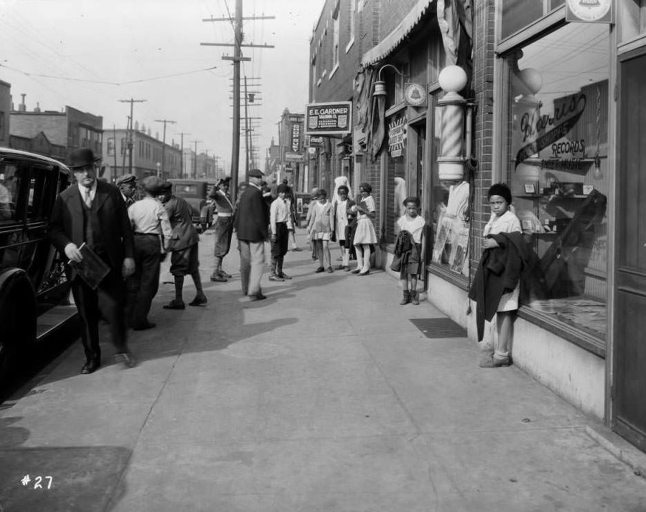
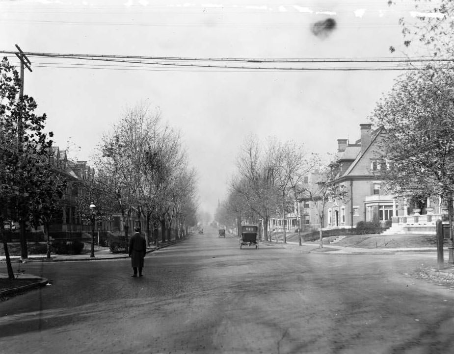
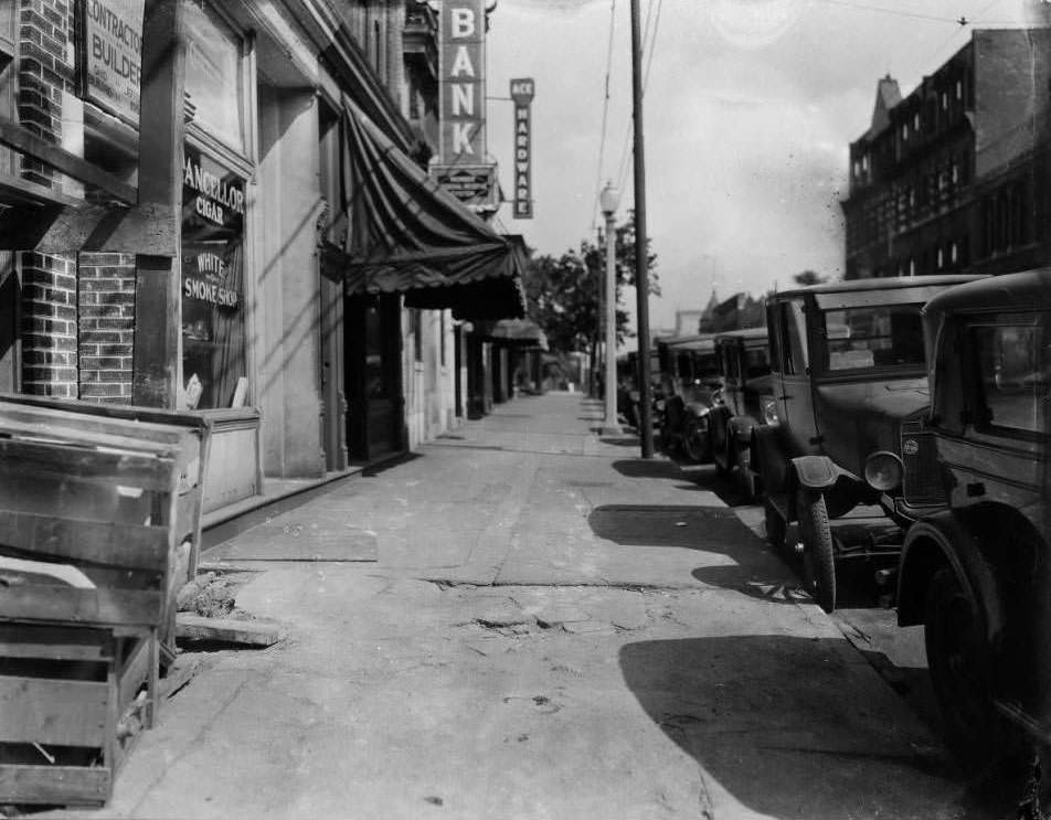
In 1930, St. Louis was a city in motion. The Great Depression had begun to tighten its grip across the country, but the streets of St. Louis still hummed with commerce, construction, and community. Grocers stocked their shelves. Workers tuckpointed brick walls. Children played on sidewalks. Streetcars rattled past corner drugstores and furniture showrooms. These photographs — taken by city surveyors, municipal workers, and everyday observers — preserve a remarkably detailed portrait of urban life at a defining moment in American history.
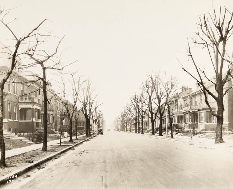
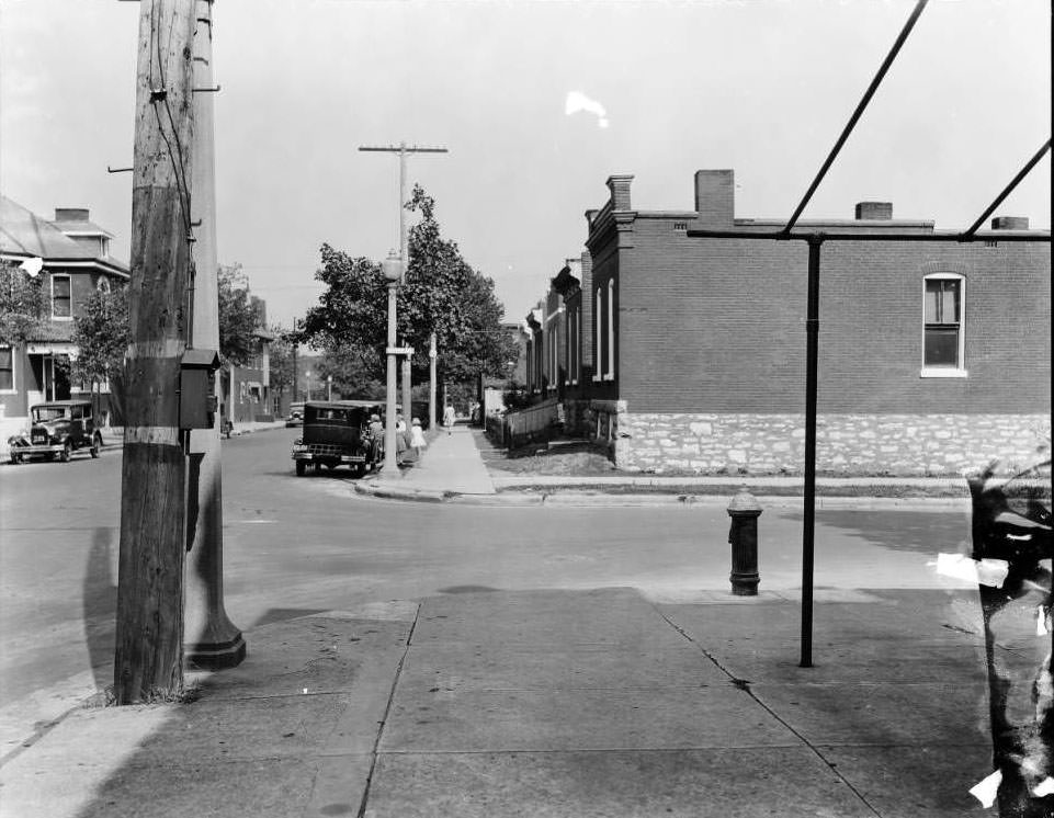
Residential street in St. Louis, with a child in a white outfit running along the sidewalk, 1930

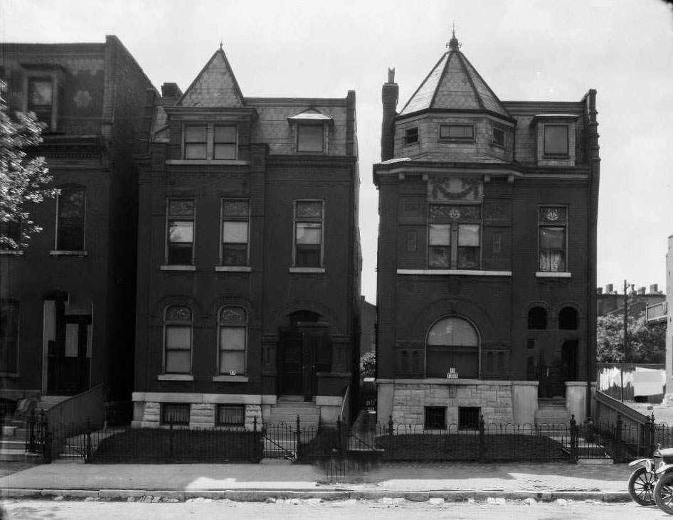
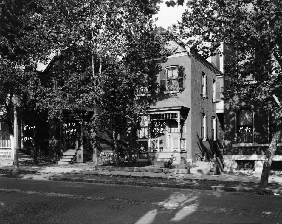
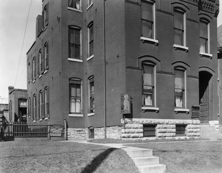
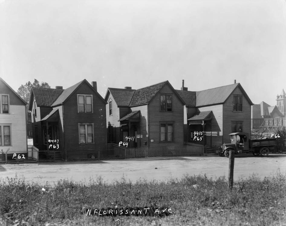
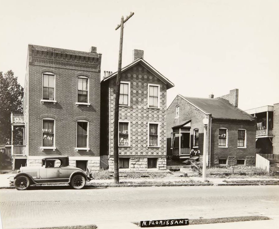
Residential St. Louis in 1930 spanned a wide range of housing styles. From single-family frame homes to dense multi-family brick buildings, the city’s neighborhoods each had their own character. North Florissant Avenue alone tells this story block by block — wood-sided houses at 4407, 4411, and 4415 sat near multi-family brick dwellings at 4304, 4306, and 4308. Families lived close together, often sharing walls and stoops, their daily lives unfolding within steps of each other.
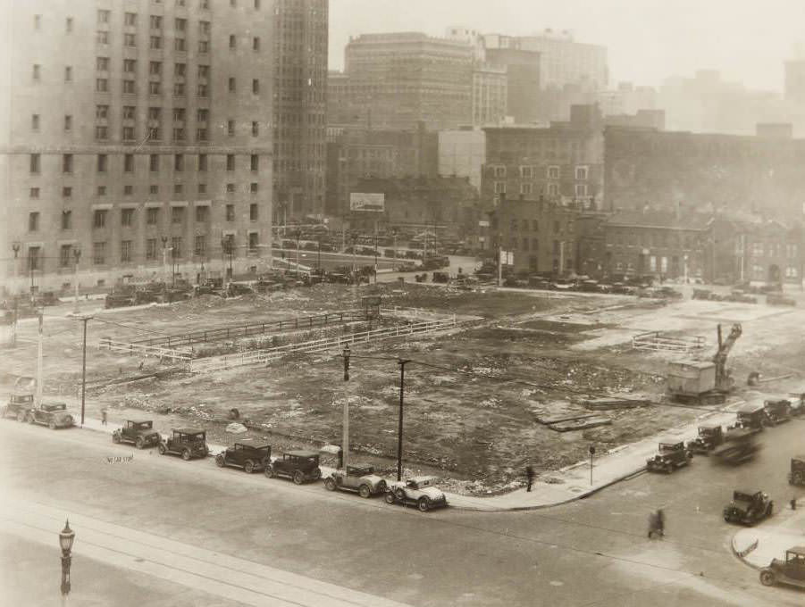
Empty lot south of the Civil Courts Building on 12th Street between Market and Walnut, presumably taken during the early stages of construction of the U.S. Court House and Custom House, 1930

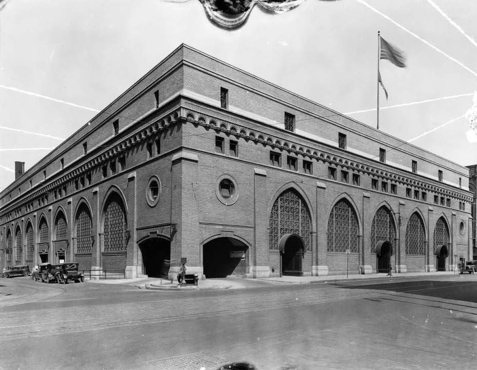
Downtown St. Louis was actively reshaping itself in 1930. The Civil Courts Building stood at the northeast corner of Market and 12th streets, with the Southwestern Bell Building rising to its north. Nearby, an empty lot between Market and Walnut on 12th Street marked the early stages of construction for the U.S. Court House and Custom House. These were not small projects — they signaled that despite economic hardship, the city was still investing in its public infrastructure.
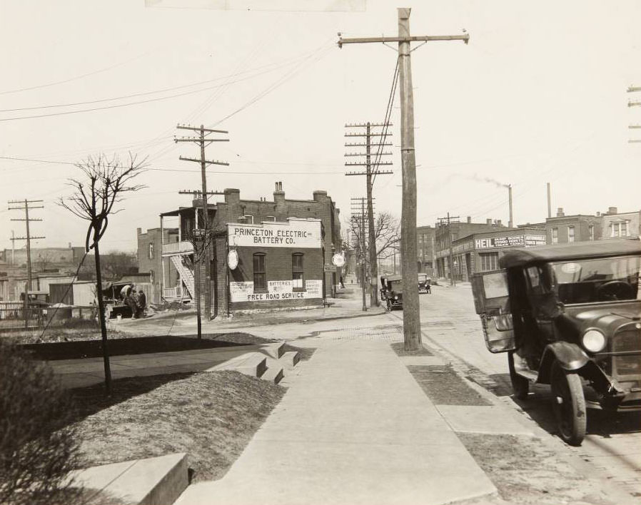
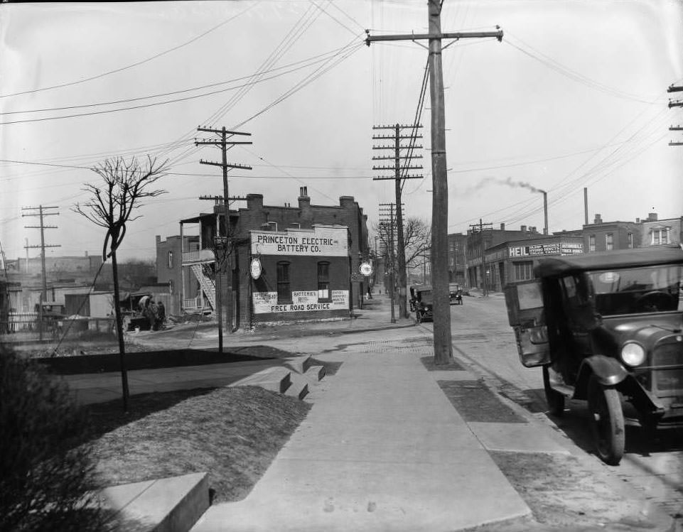
Cars parked along the street at 3127 Gravois, near its intersection with Juniata. The Princeton Electric Battery Co. can be seen at 3115 Gravois, and the Kranz Automotive Body Co. was located at 3034 Gravois, 1930

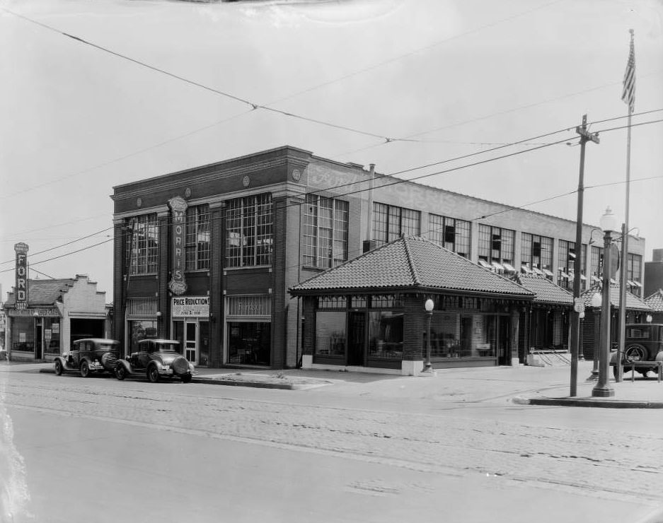
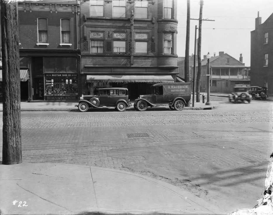
The automobile had become a permanent fixture of St. Louis life by 1930. Auto-related businesses lined key corridors throughout the city. The Princeton Electric Battery Company at 3115 Gravois and Kranz Automotive Body Co. at 3034 Gravois were part of a broader ecosystem of garages, repair shops, and dealerships spreading across the city. Walker Brothers ran an auto repair garage at Grand and Penrose. Gardner Motor Co. operated at the corner of Main, 1st, and Rutger streets. Morris Motor Company sold Fords at South Grand and Caroline.
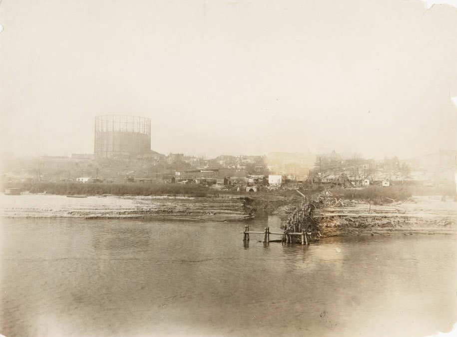
Mississippi riverfront at Gasconade Street, in what would become the Marine Villa neighborhood, with a gasometer on a hill in the distance, 1930

The Mississippi River defined St. Louis geographically and economically. At the riverfront near Gasconade Street — in what would become the Marine Villa neighborhood — a gasometer loomed on a distant hill, a reminder of the industrial infrastructure that kept the city running. Spanning the river itself was the St. Louis Municipal Bridge, then the largest double-deck steel span bridge in the world. Rail lines, warehouses, and the steady flow of commerce connected the city to the rest of the country through this vital artery.
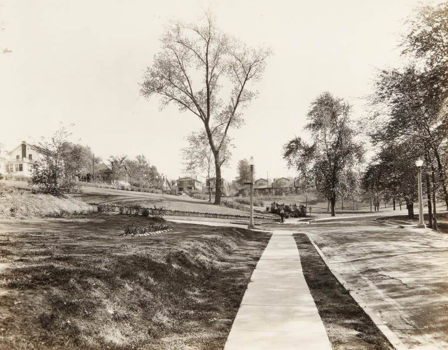
Boy in rollerskates standing in a new addition to the Clifton Heights neighborhood, 1930

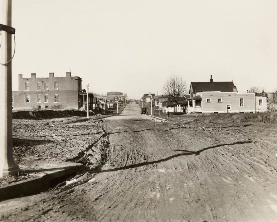
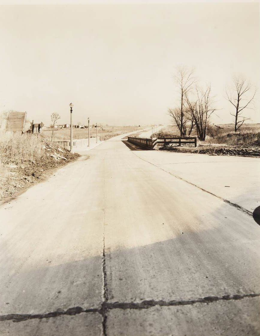
St. Louis was still growing outward in 1930. New streets were being cut, and fresh additions to neighborhoods like Clifton Heights offered open space and opportunity. Children claimed these new blocks as their own, rollerskating on freshly poured sidewalks. Meanwhile, small bridges and newly constructed roads pushed the city’s boundaries further into undeveloped land, connecting older neighborhoods to newer ones.
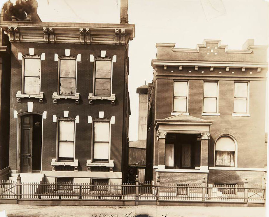
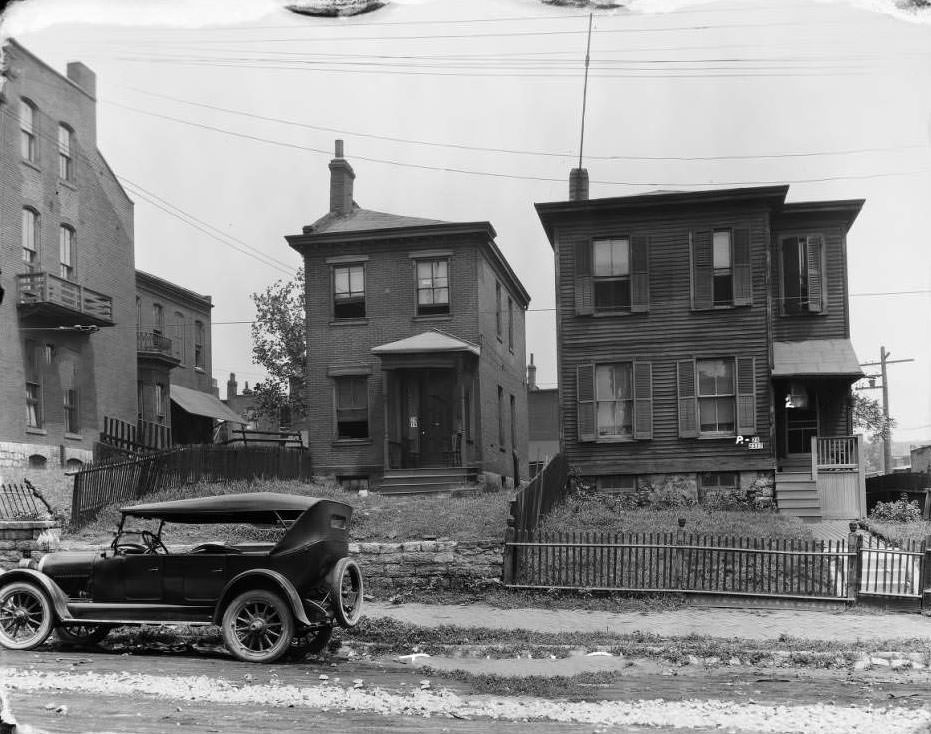
Two houses located at 1119 and 1121 Hickory Street in the La Salla Park neighborhood, 1930

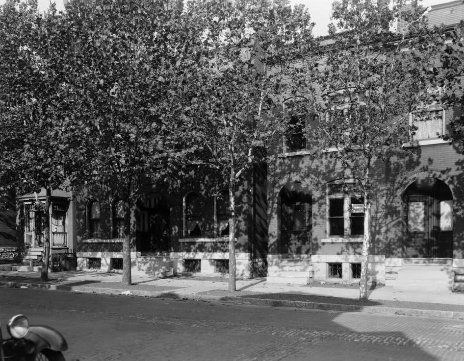
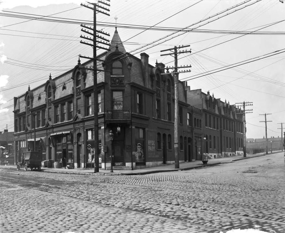
Across St. Louis’s dozens of distinct neighborhoods, housing varied from block to block. In La Salle Park, two houses on Hickory Street stood quietly among similar homes. In Hyde Park, multi-family buildings along North Florissant Avenue housed multiple families under one roof. In Tower Grove South, row houses on Wyoming Avenue at 3721 through 3727 lined up in uniform brick. Each neighborhood had its own texture, its own density, its own mix of working-class families and small business owners.
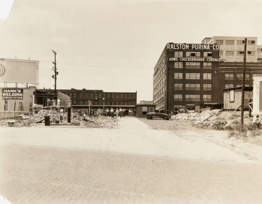
Workers clearing debris from a partially collapsed building near 835 S. 8th Street. Buildings for the Ralston Purina Co., 8th Street Scale, and Hank's Welding can be seen, 1930
Workers clearing debris from a partially collapsed building near 835 S. 8th Street. Buildings for the Ralston Purina Co., 8th Street Scale, and Hank’s Welding can be seen, 1930

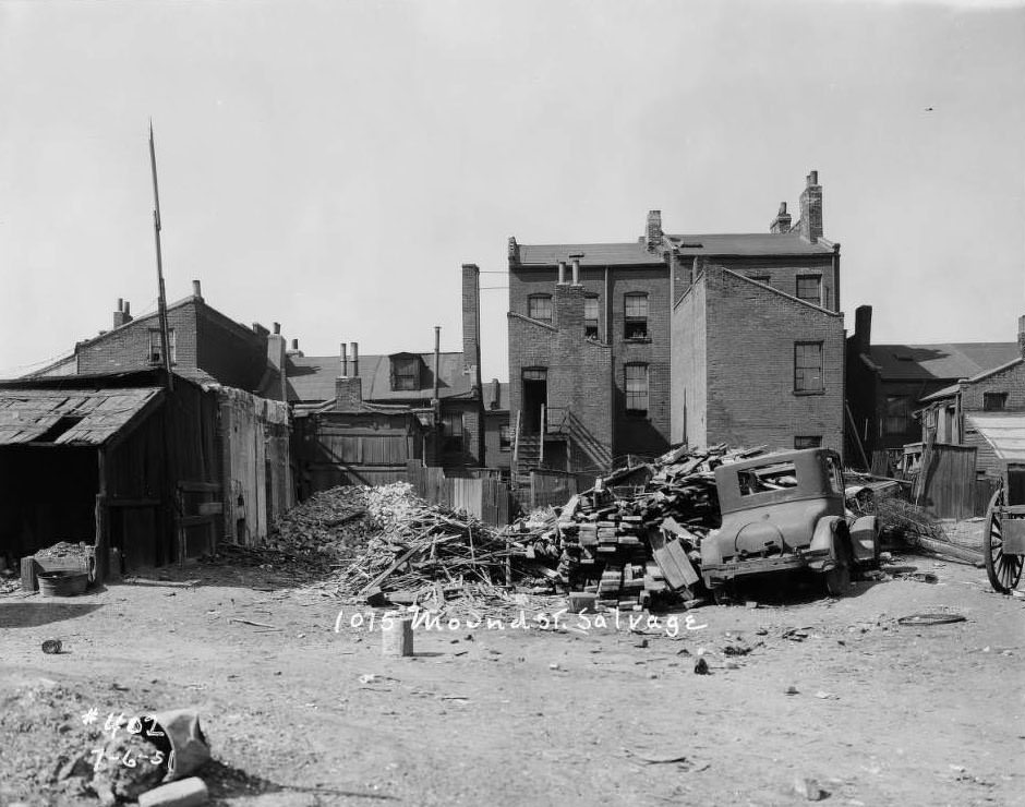
Alongside new construction, demolition and salvage were constant features of the urban landscape. Near 835 South 8th Street, workers cleared debris from a partially collapsed building, with Ralston Purina Co., the 8th Street Scale, and Hank’s Welding visible nearby. At 1075 Mound Street, a salvage site was photographed. At South 8th and Chestnut, the back of a warehouse painted with “Herkert & Meisel Trunk Co.” faced the alley. The city constantly tore down and rebuilt itself.
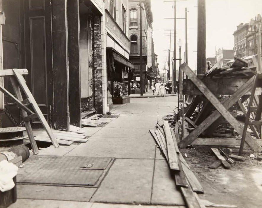
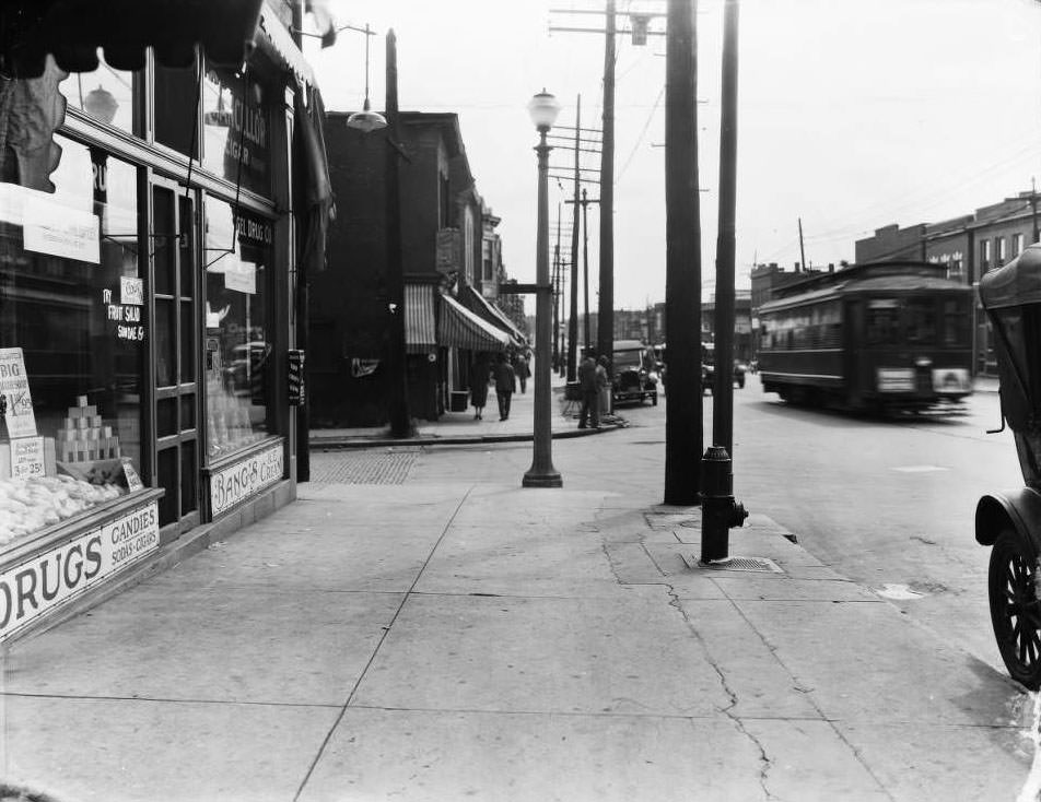
Sidewalk repair on South Broadway near its intersection with Lafayette. The sign and storefront for the Heitmeyer Drug Co. can be seen in the background, 1930

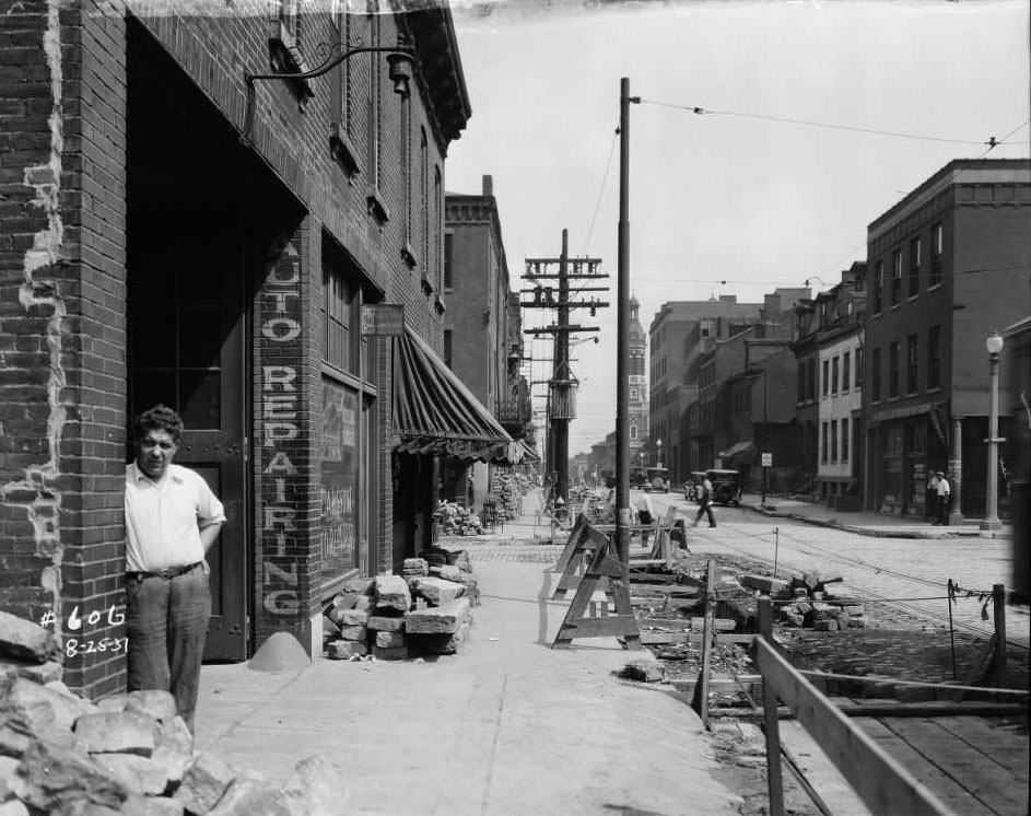
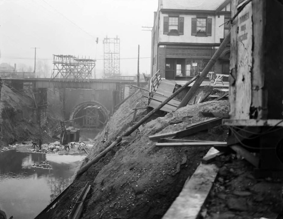
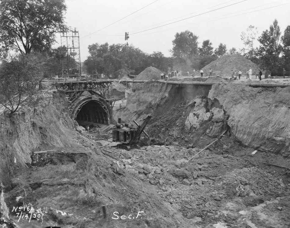
Public works crews were a constant presence on St. Louis streets in 1930. Sidewalk repairs, sewer installations, and street resurfacing projects kept the Department of Streets and Sewers busy across the city. Near South Broadway and Lafayette, workers repaired the sidewalk while Heitmeyer Drug Co. operated just behind them. Streetcar track repairs were underway at other locations, and sewer work along the River Des Peres required large-scale excavation. The city’s infrastructure demanded continuous attention.
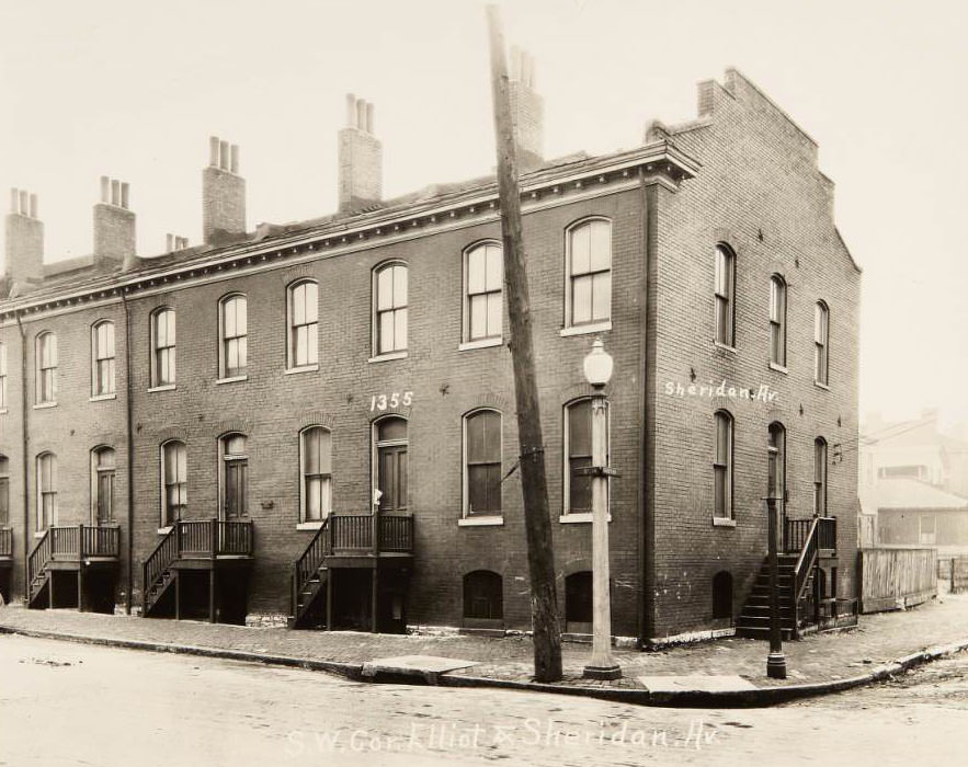
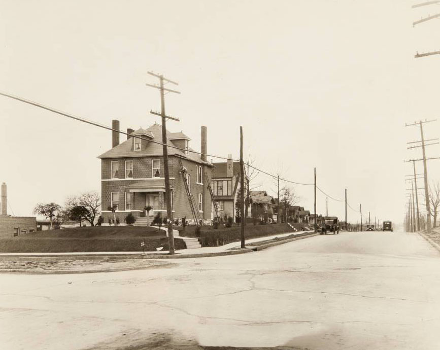
Row house on the 1300 block of Elliot, near the current location of the St. Louis Fire Department headquarters, 1930
Men working on the tuckpointing of a house on the corner of Fyler Avenue and Watson Road in the Lindenwood Park neighborhood, 1930

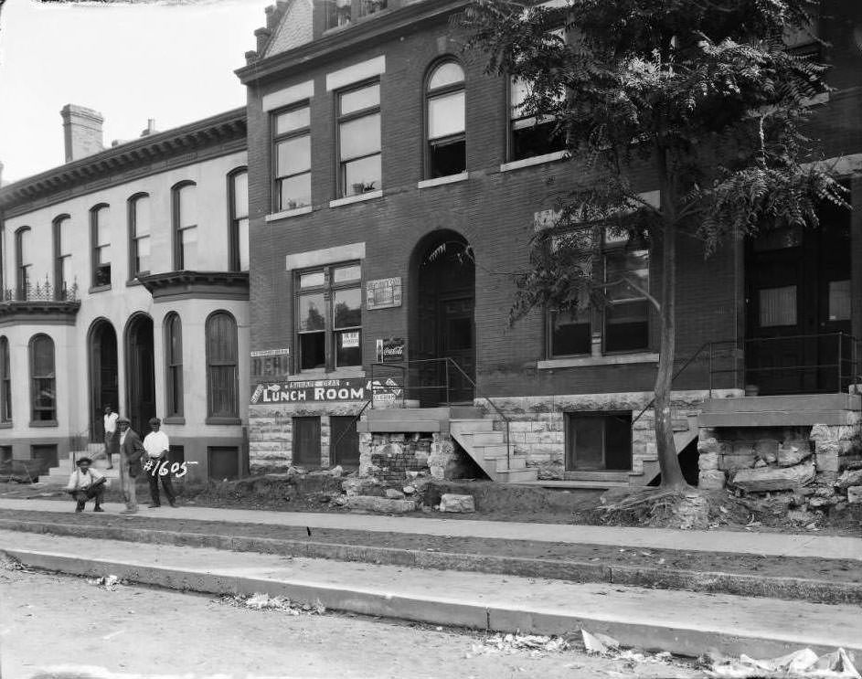
Brick masonry was the dominant building material in St. Louis, and keeping it in good condition was ongoing work. In the Lindenwood Park neighborhood, men tuckpointed a house at the corner of Fyler Avenue and Watson Road — carefully replacing worn mortar between bricks to keep the structure sound. This kind of skilled maintenance work was common across the city’s older residential blocks, where buildings had stood for decades and required regular upkeep.
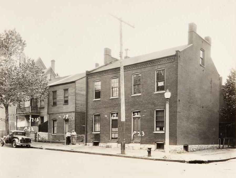
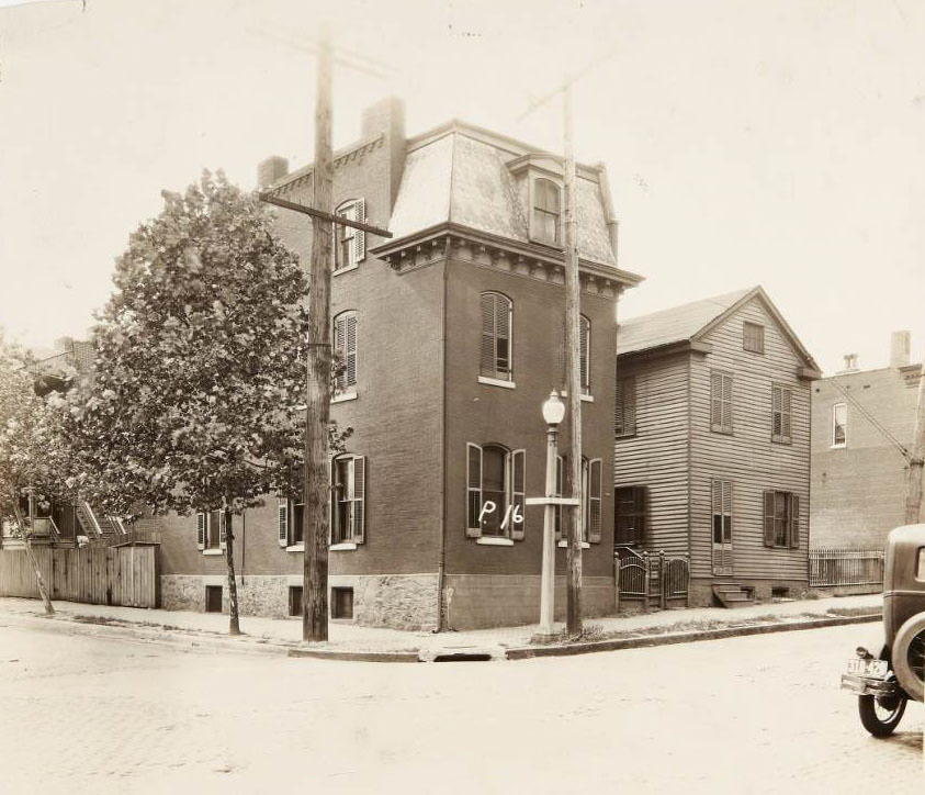
Multi-family houses at 3715 - 3721 North Florissant Avenue in the Hyde Park neighborhood, 1930
Multi-family houses at 3715 – 3721 North Florissant Avenue in the Hyde Park neighborhood, 1930
Few houses on the 3500 block of North Florissant, 1930

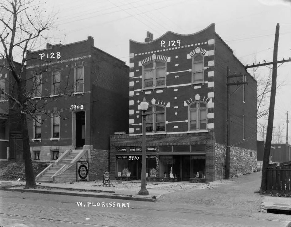
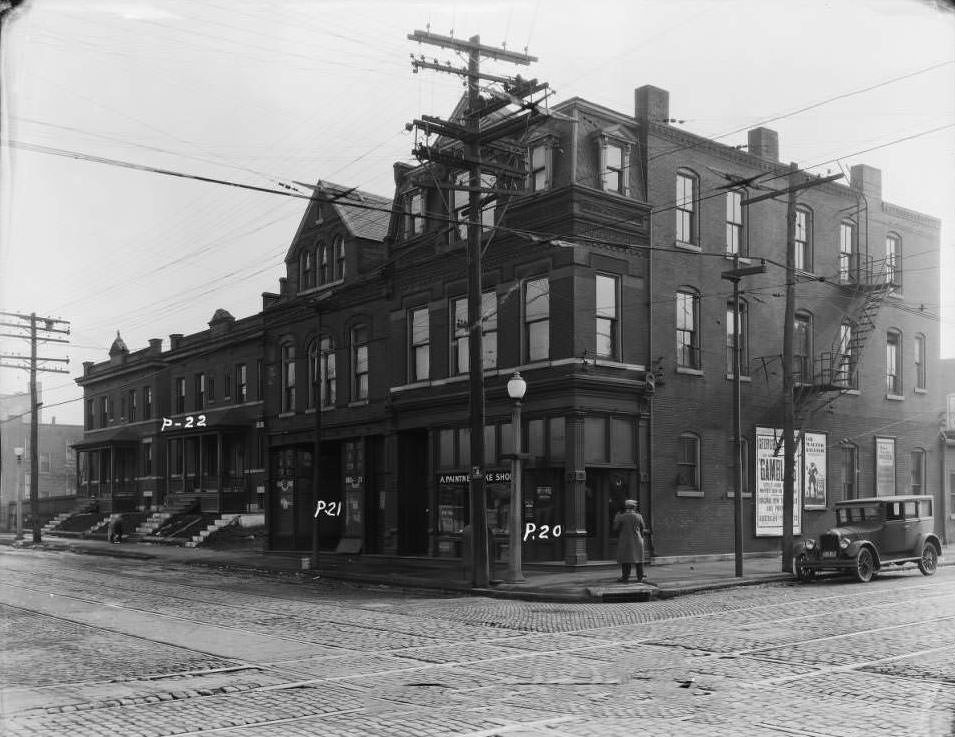
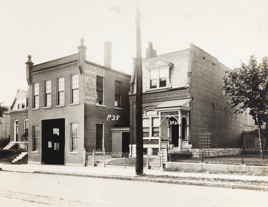
North Florissant Avenue was photographed extensively in 1930, block by block from the 3400s through the 4400s. The images reveal a street in transition — some blocks dense with multi-family brick buildings, others lined with modest frame houses set back on small lots. The Henry Rau family ran an auto repair shop next to their home at 3931 North Florissant, a common arrangement where commerce and residence overlapped on the same property.
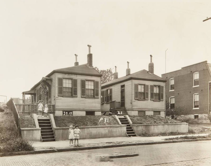
Group of children standing in front of homes at 3919 and 3921 North Florissant Avenue, 1930
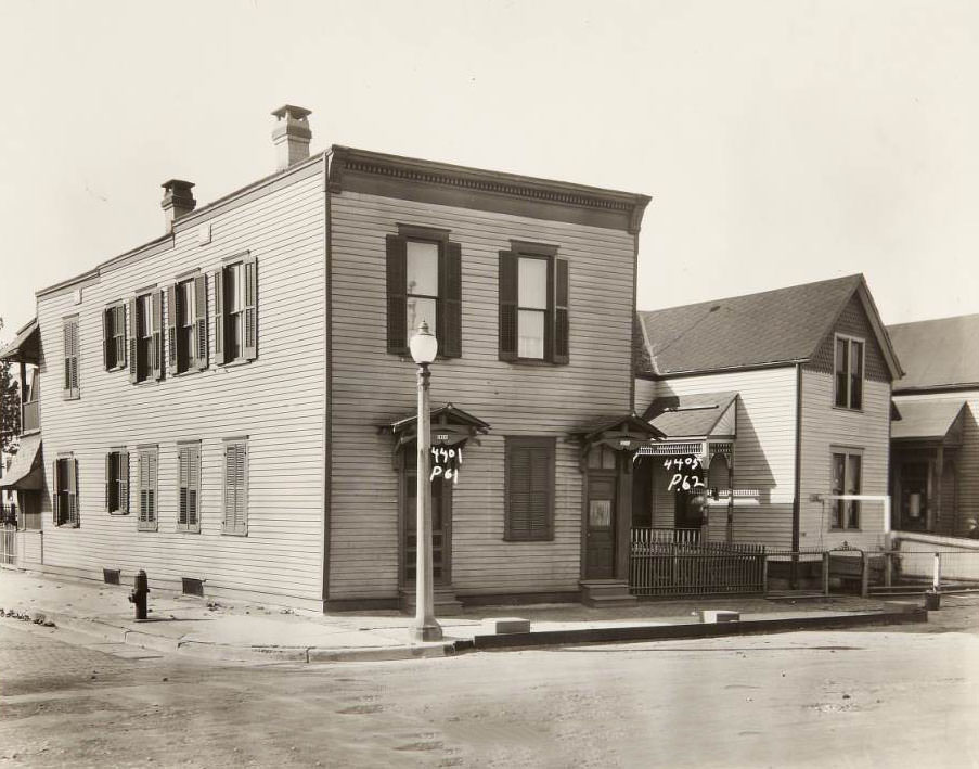
Two houses located at 4401 and 4405 North Florissant Avenue, 1930

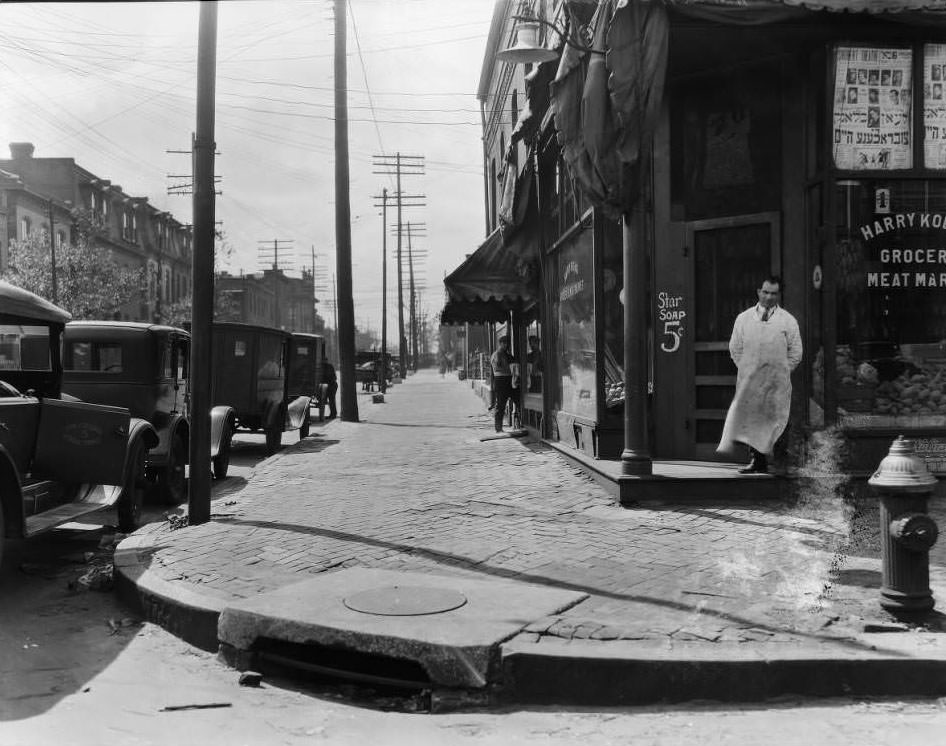
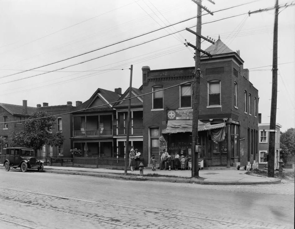
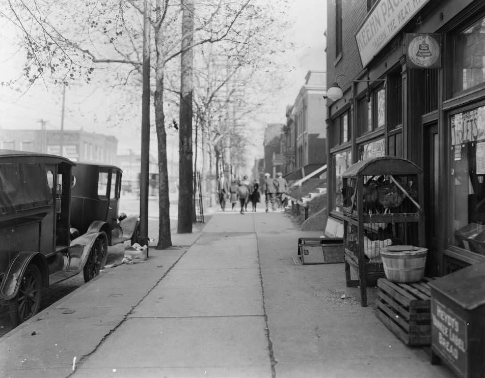
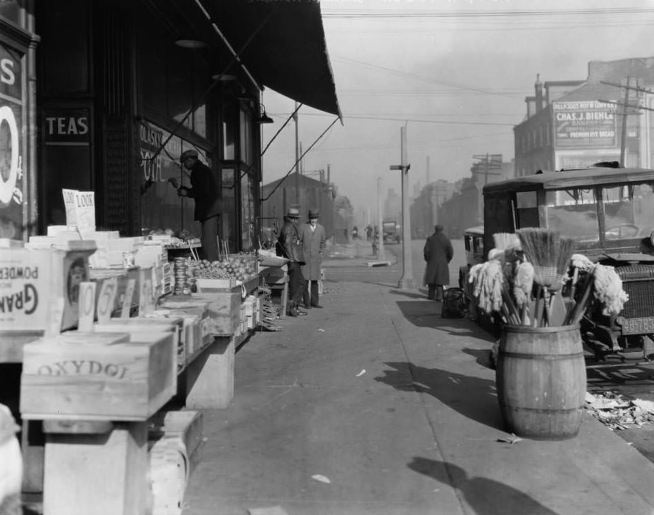
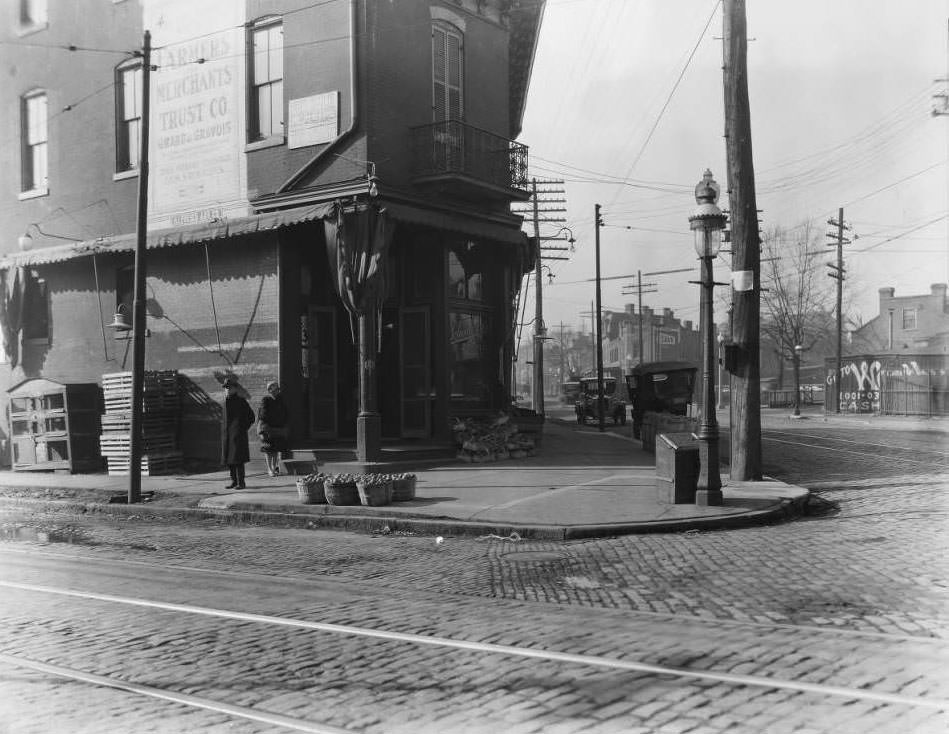
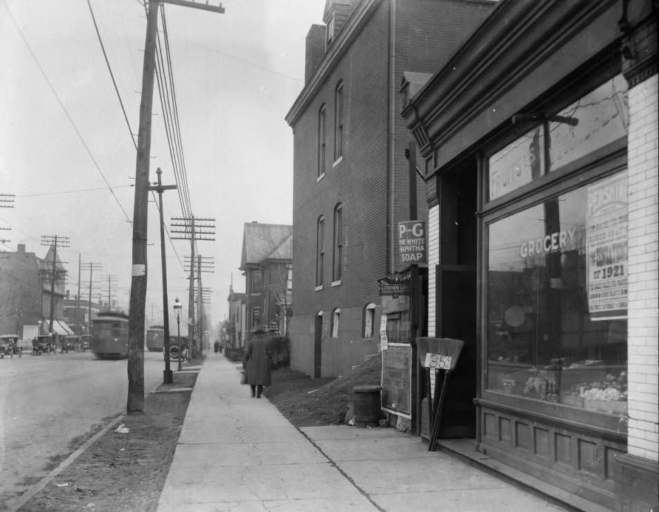
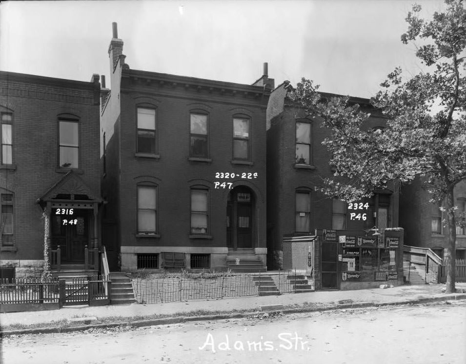
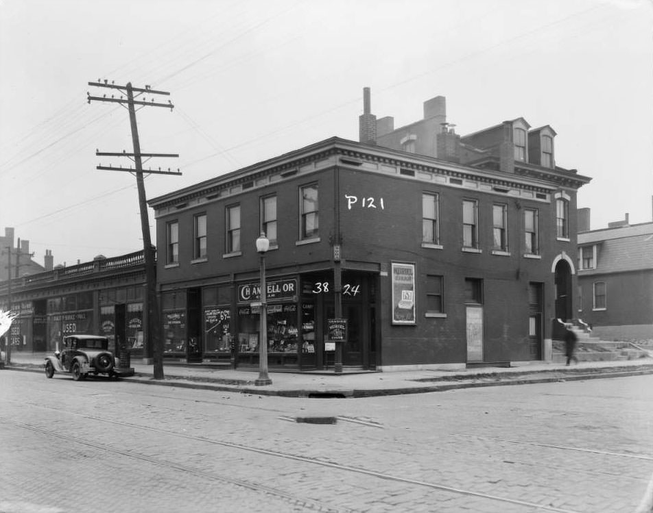
The commercial life of St. Louis in 1930 was intensely local. Grocery stores anchored nearly every neighborhood — Harry Koenig’s at 1701 Carr, the Adams Grocer at 2324 Adams Street, Molasky Grocery near North 13th and O’Fallon, Toroian Brothers on the 7500 block of North Broadway, and dozens more. Many were family operations. The Keehn brothers, August and Frank, ran Keehn’s Market at 1270 South Broadway. These stores served their immediate blocks, and customers walked.
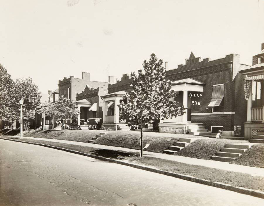
Row of houses along the 4200 block of North Florissant Avenue, 1930
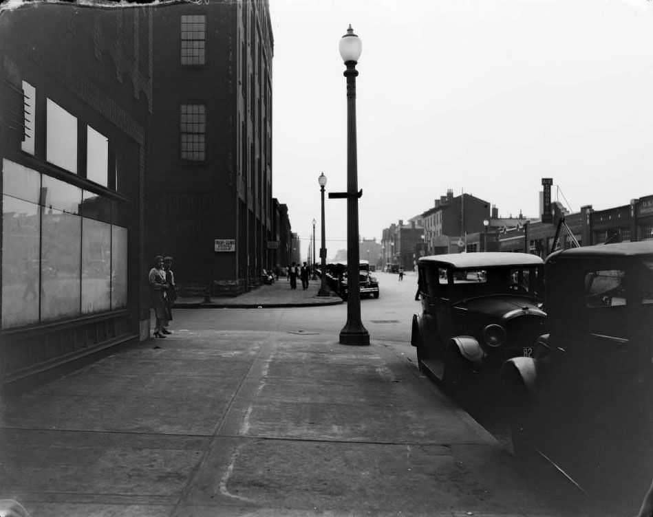
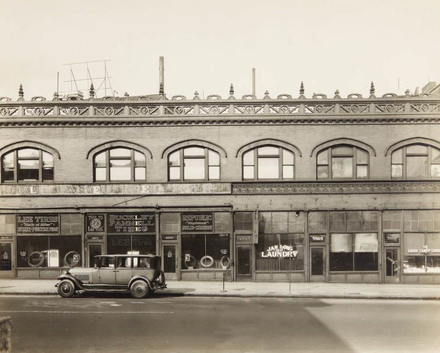
Storefronts along the 3500 block of Lindell Boulevard, including the Buckley-Pannell Tire Company, Jan Long Laundry, and the Union Candy Company, 1930

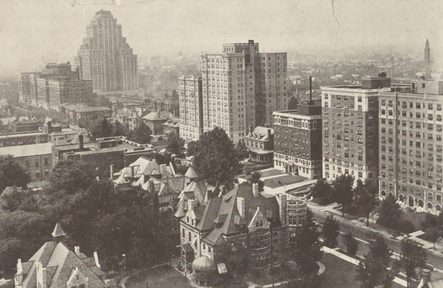
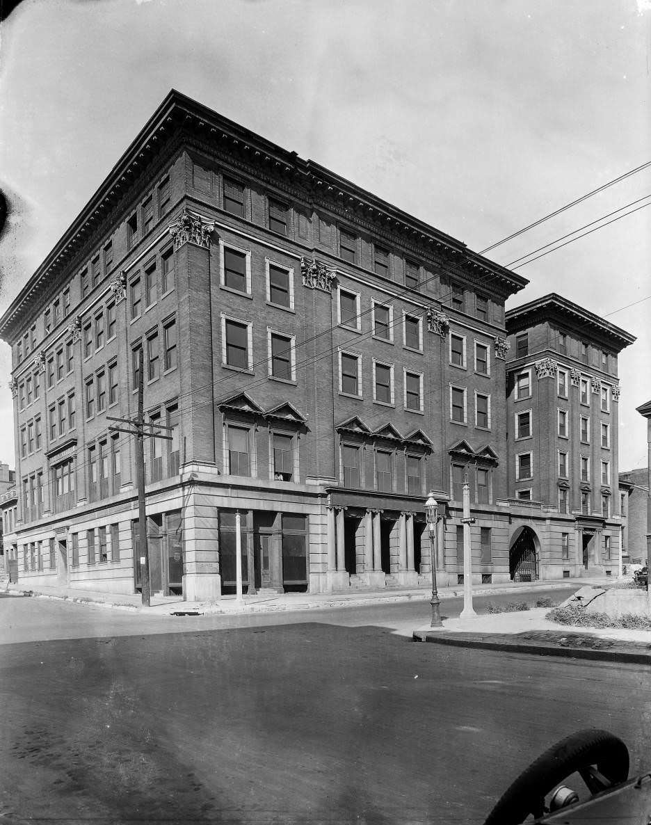
Lindell Boulevard carried a mix of residential and commercial uses in 1930. The 3500 block held the Buckley-Pannell Tire Company, Jan Long Laundry, and the Union Candy Company side by side. Row houses at 3505 through 3511 Lindell stood nearby. The Commodore apartment building at 5316 Pershing Avenue, just off Lindell, represented a grander scale of residential life — a six-story building catering to tenants who wanted modern urban living. An aerial photograph looking west from Taylor Avenue showed how Lindell stretched as a wide, tree-lined corridor deep into the city’s West End.
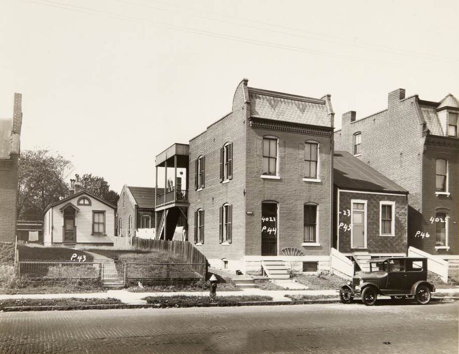
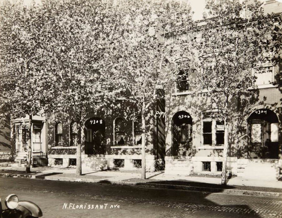
Number of homes along the 4000 block of North Florissant, including houses at 4021, 4023, and 4025, 1930
Few multi-family houses on the 4300 block of North Florissant Avenue, including houses at 4304, 4306, and 4308, 1930

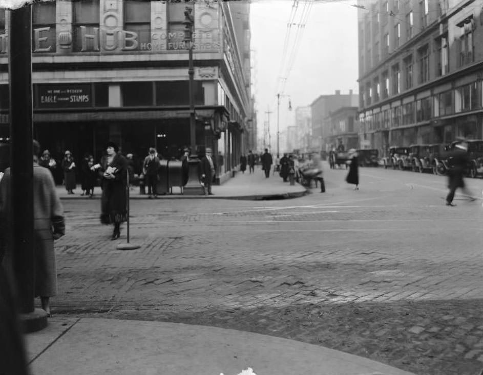
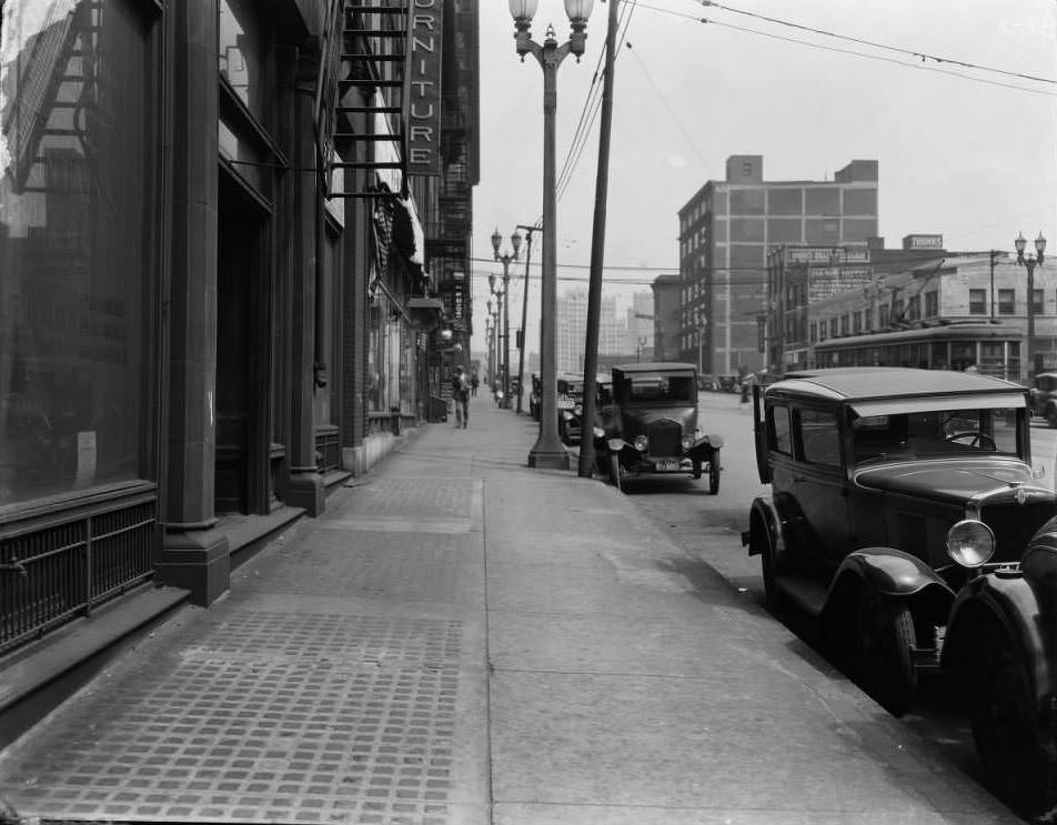
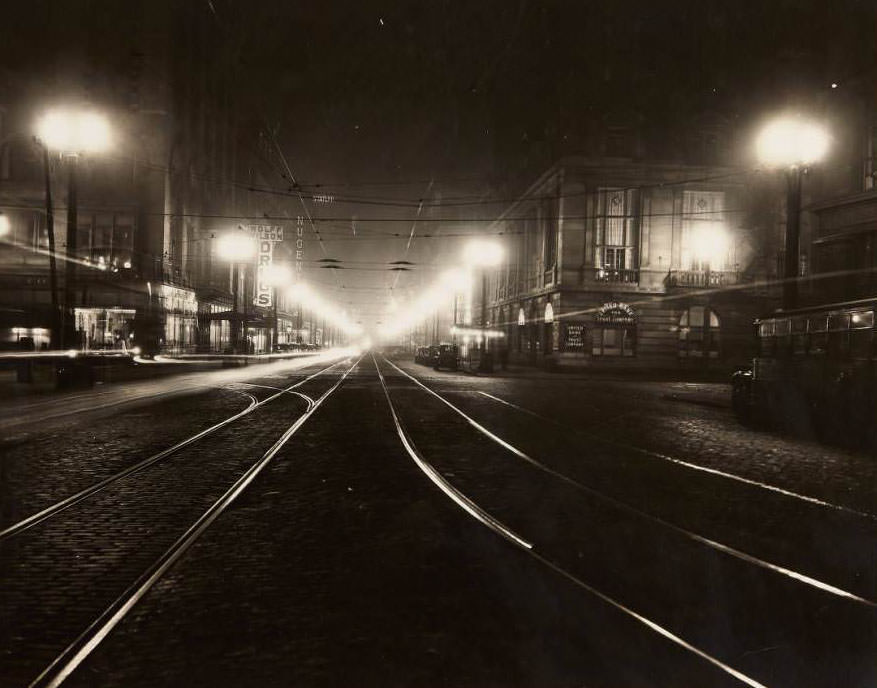
Washington Avenue was one of St. Louis’s most commercially active streets. A nighttime photograph looking west from Third Street captured it lit by electric signage, the street alive with activity after dark. By day, the avenue was lined with furniture showrooms, clothing manufacturers, and wholesale businesses. The Hub, Complete Home Furnishers, operated at 701 Washington Avenue. Louis Goldberg Furniture Co. held the corner at 1401–05 Franklin Avenue. Hecht-Lears Clothing Manufacturers posted signage at Morgan and 17th Street.
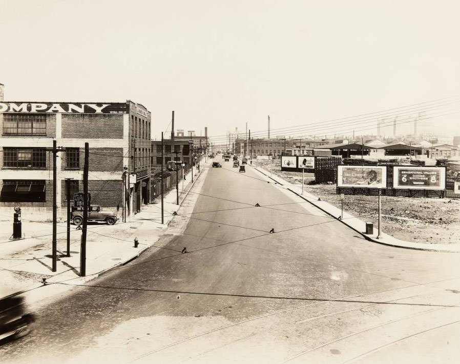
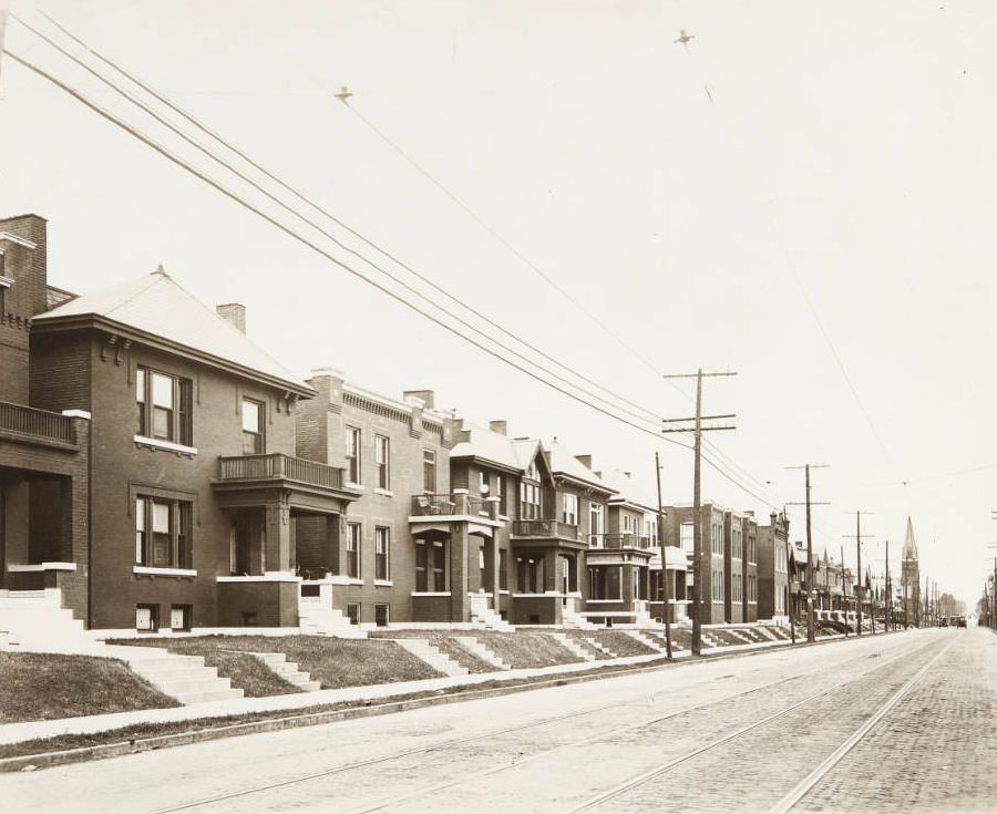
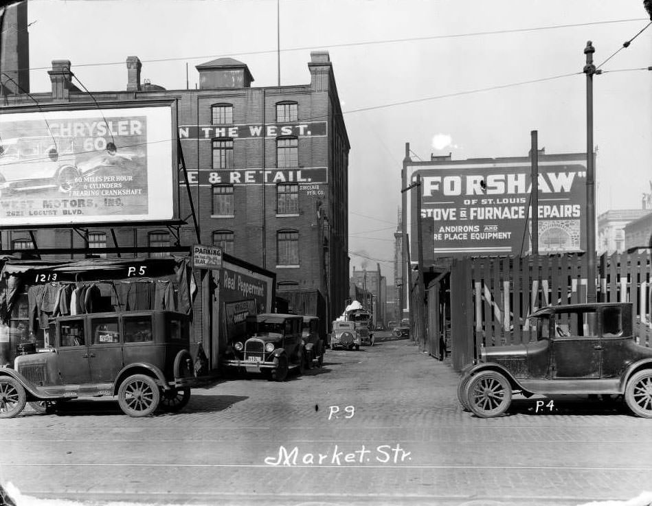
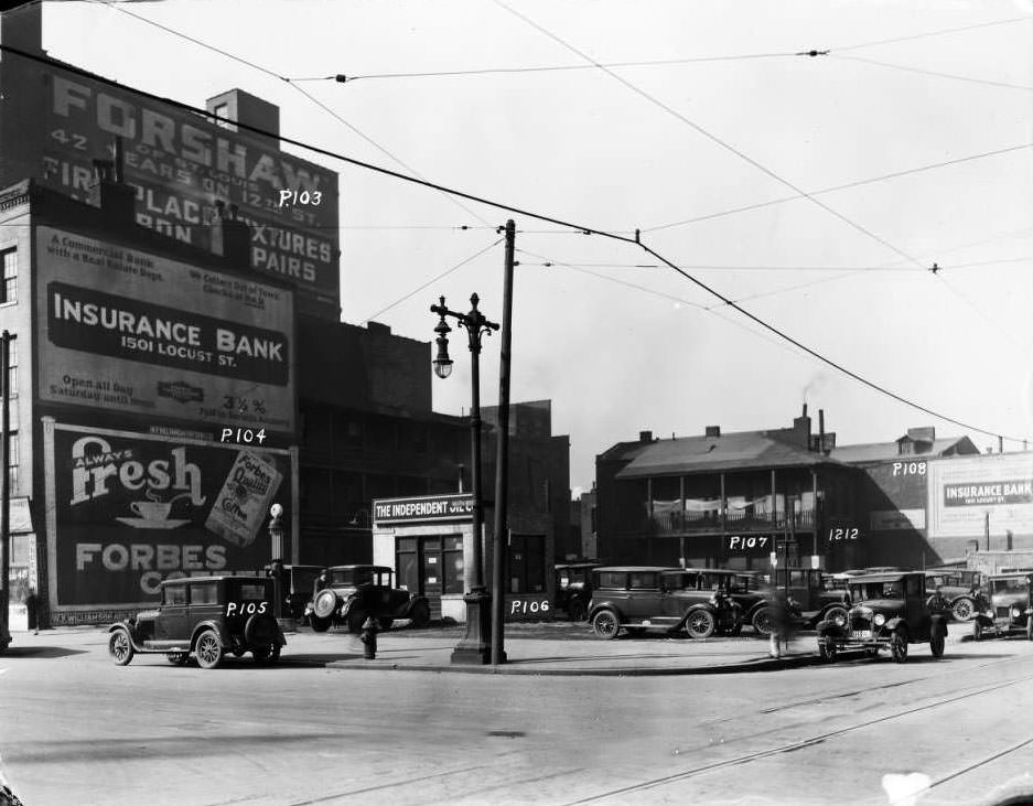
Buildings and billboards near the intersection of Market and Vandeventer, with the Firmin Desloge Hospital in the far distance and the building for the Globe Union Manufacturing Co. in the foreground, 1930
Row of houses along the 3900 block of Natural Bridge Road, just west of its intersection with Vandeventer Avenue, with Fairground Park to the immediate north, 1930

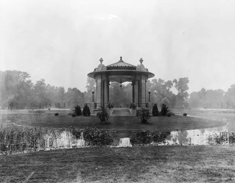
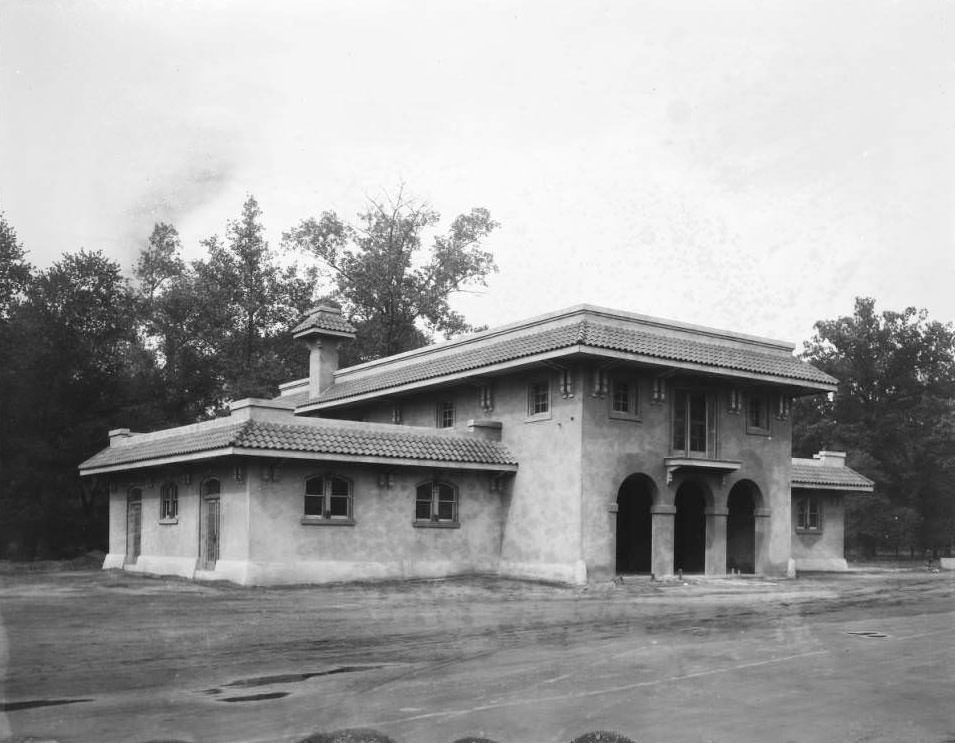
Parks played an active role in St. Louis life in 1930. Fairground Park bordered the 3900 block of Natural Bridge Road, offering green space to the surrounding residential blocks. Forest Park, the city’s largest, contained the Park Guards’ Headquarters, the newly completed Nathan Frank Bandstand near the Municipal Opera, and the Forest Park Highlands amusement area. The Highlands featured The Pike — a concession area where male and female employees staffed booths — and The Pagoda, a distinctive structure within the amusement grounds.
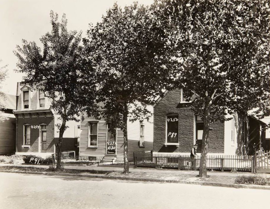
Three houses on the 4200 block of N. Florissant Ave. at 4250, 4252, and 4254, 1930
House at 3931 N. Florissant Ave. next to the auto repair shop operated by Henry Rau and his son, Gottfried, 1930

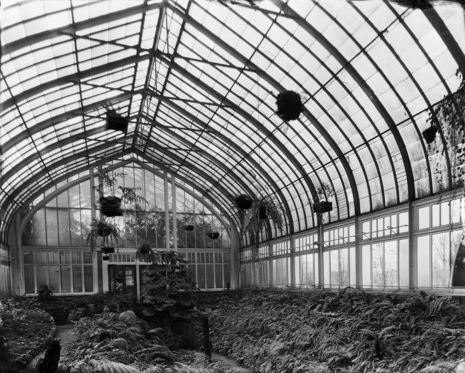
Missouri Botanical Garden — known to locals as Shaw’s Garden — offered another kind of respite. Inside the Fern House, a lush interior space housed exotic plant species in a glass-enclosed environment. Outside the garden’s walls, the city carried on: streetcars ran, construction crews dug trenches, and merchants opened their doors. The contrast between such cultivated spaces and the working-class streets surrounding them was a defining feature of St. Louis in 1930.
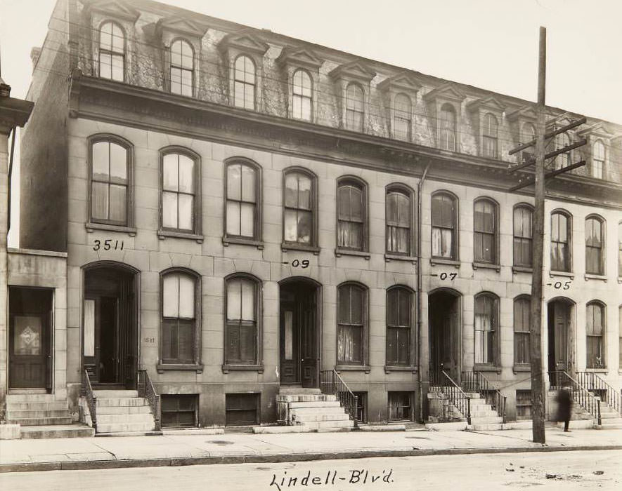
Row house on the 3500 block of Lindell Blvd. covering addresses 3511 to 3505, 1930
Intersection of Kingshighway and Harney Ave. in the Mark Twain neighborhood before improvement, 1930

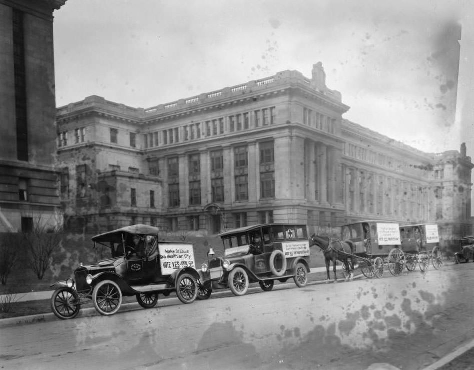
Medical and public health infrastructure was visible across the city. City Hospital No. 2 at 2945 Lawton — housed in the old Barnes Medical College building — served African-American patients under the segregated system of the time. The Robert Koch Hospital on Koch Road, formerly a quarantine facility, still operated a ward and infirmary building with solarium end walls. The Division of Health maintained a fleet of vehicles and horse-drawn wagons, photographed assembled in front of the Municipal Courts Building on Market Street.
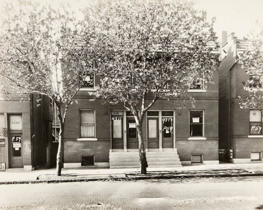
Multi-family residence at 4311 and 4313 N. Florissant Ave, 1930
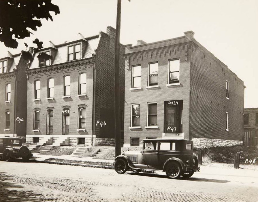
Houses on the 4000 block of N. Florissant Ave., specifically 4033 and 4037, 1930

Religious life was woven into the city’s physical fabric. St. Pius V Catholic Church stood at Grand Avenue and Utah Street, its rectory visible on the right when viewed from the east. Grace Evangelical Lutheran Church anchored the view east down St. Louis Avenue at North Garrison Avenue. The Congregation Sharis Sfard Synagogue appeared at the intersection of North 15th Street and Washington Avenue, with Carr Square nearby. St. Barbara Catholic Church — later St. Augustine — stood at Minerva and Hamilton on the 5900 block of Minerva Avenue.
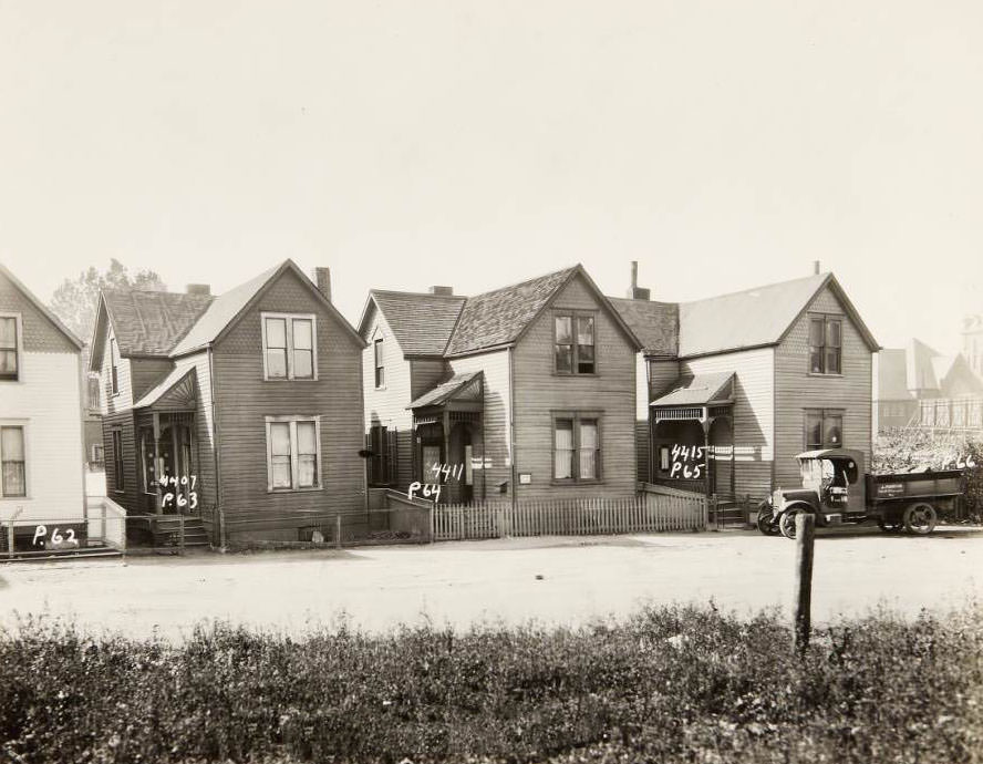
Wood-sided homes on the 4400 block of N. Florissant Ave. at 4407, 4411, and 4415. J. Martin's truck is parked in front of 4415, 1930
Wood-sided homes on the 4400 block of N. Florissant Ave. at 4407, 4411, and 4415. J. Martin’s truck is parked in front of 4415, 1930
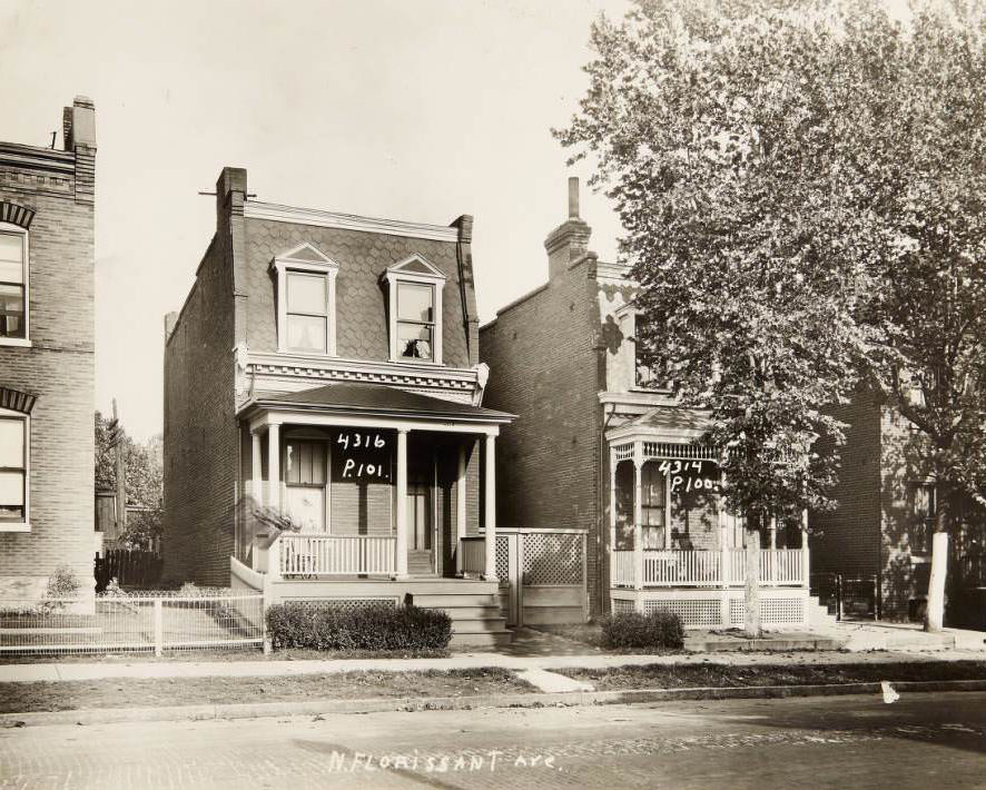
Houses at 4316 and 4314 N. Florissant Ave, 1930

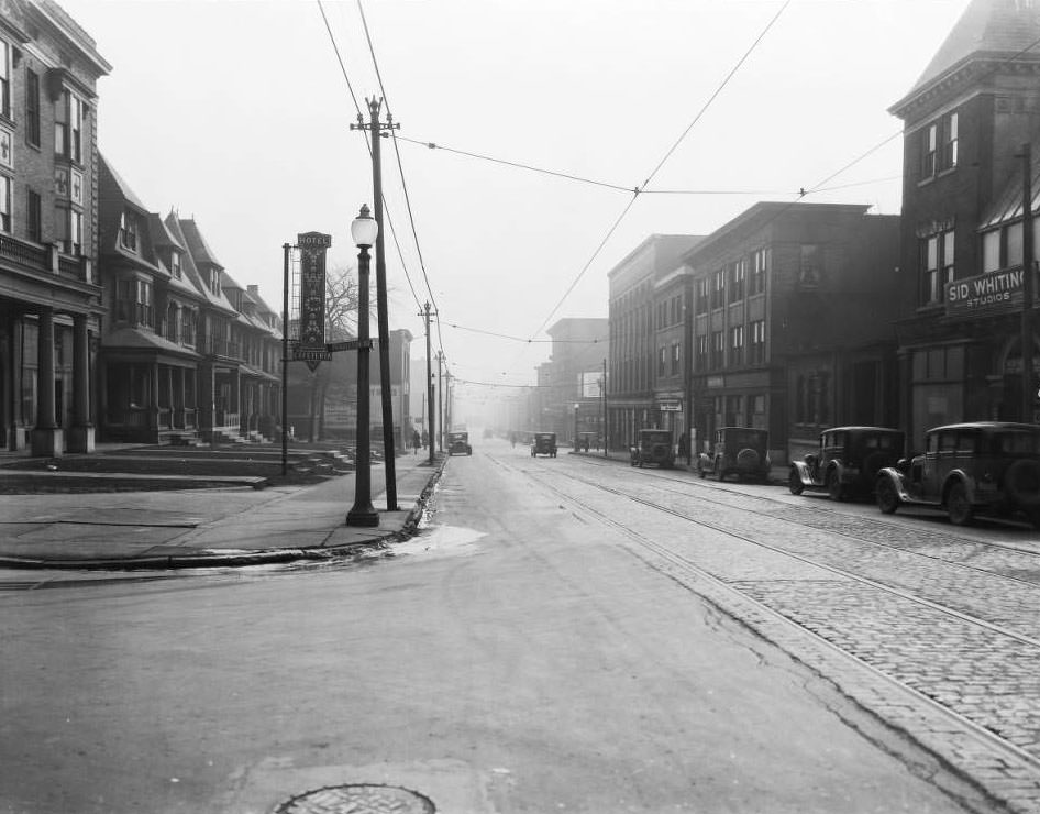
Olive Street was one of the city’s busiest commercial corridors in 1930. Looking west from 18th Street, the Century Electric Co. works building dominated the south side. Further east at Ninth Street, pedestrians crossed in front of the Old Post Office building. Near Pendleton Avenue, the Y.W.C.A. Hotel and Cafeteria served women in need of affordable accommodation. Sid Whiting Studios operated in the same block. Quirk Luggage, the Paris Hotel, Draper Drug Company, and Walker-Armstrong House Furnishing Company all clustered along the same stretch west of 18th Street.
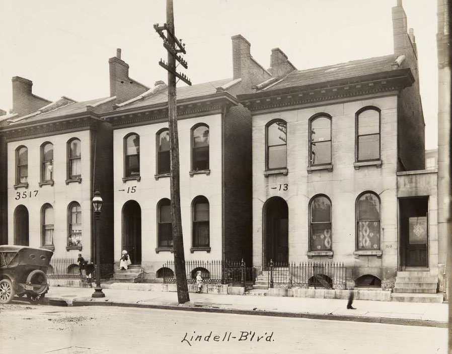
Residential buildings on Lindell Blvd. covering addresses 3517 to 3513, 1930
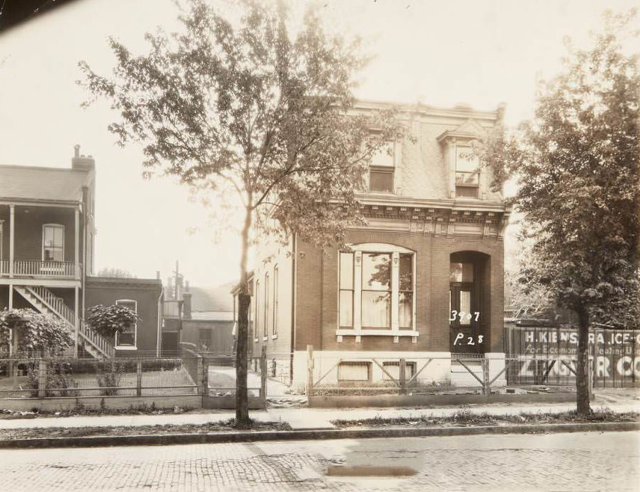
House located at 3907 N. Florissant Ave. in the Hyde Park neighborhood, 1930

At the intersection of Easton Avenue and 5801, the Goedde-Igel Drug Co. anchored a busy commercial corner. Looking east from there, the photograph captured foot traffic, parked automobiles, and streetcars sharing the road simultaneously. Easton Avenue held Boekler Lumber Co. at 4072, P.J. Farrington & Sons’ Furniture at 4519, and Harry Duel’s Grocery at 5438. The street was a working artery, not a showpiece — practical, dense, and constantly active.
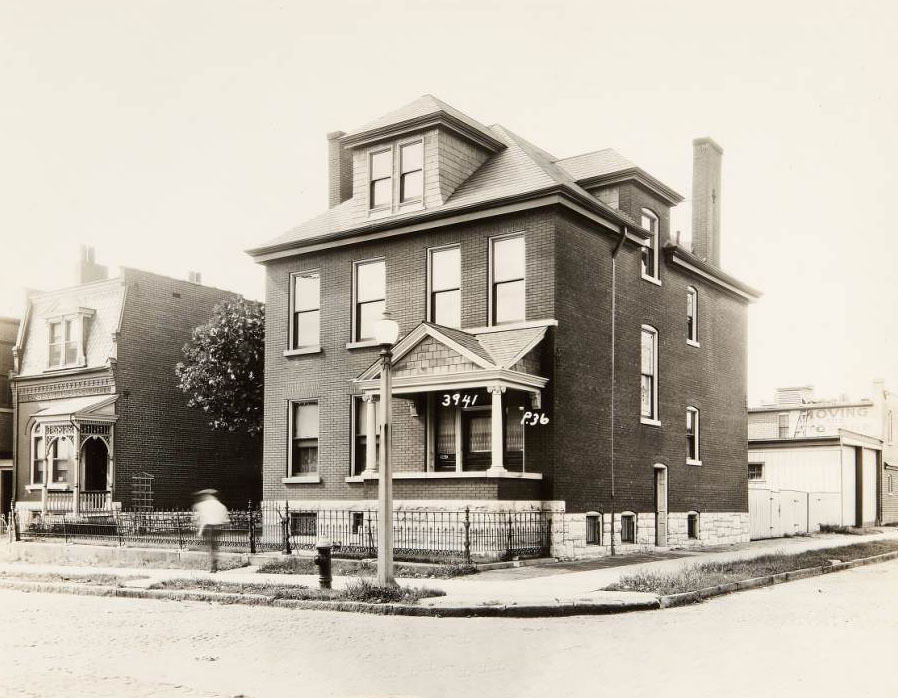
House at the southeast corner of N. Florissant and Newhouse Ave. at 3941 N. Florissant Ave, 1930
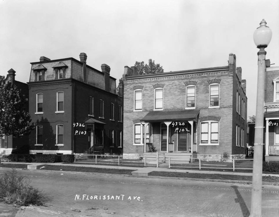
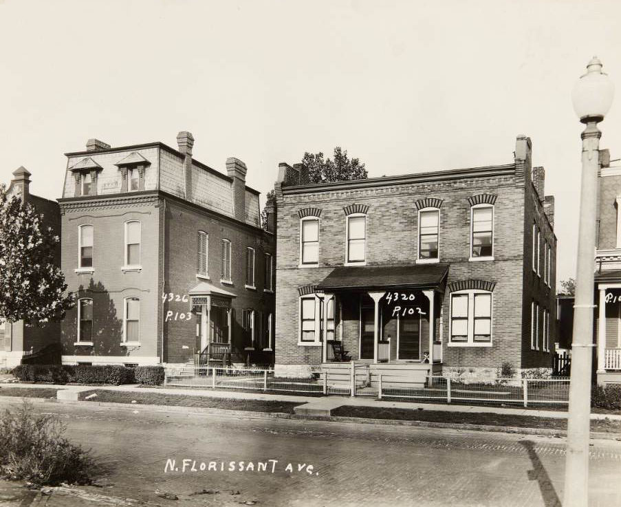
Houses at 4326 and 4320 N. Florissant Ave, 1930

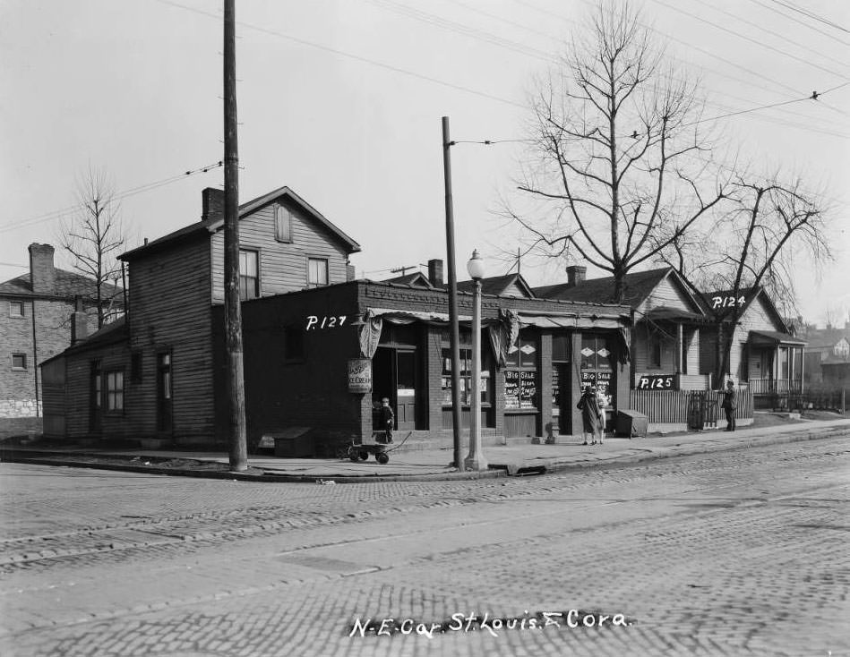
Corner confectioneries and small markets served as informal gathering spots throughout the city. At 4633 St. Louis Avenue, Joseph Pollard ran a corner confectionery where a boy was photographed standing nearby, while two women chatted next door at Michael Nolan’s grocery at 4631. At 3800 West Florissant, three boys posed in front of Fred H. Gerling’s store, which advertised chicken and frog legs. Louis Lum Chop Suey at 1014 North Sarah drew a busy sidewalk crowd. These photographs document the social life of the street, not just the buildings.
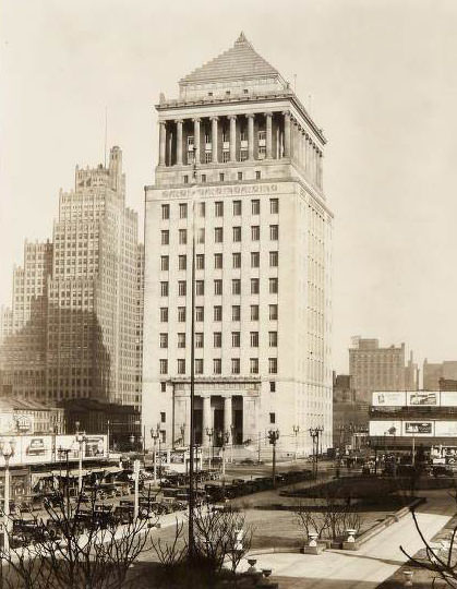
Civil Courts Building on the northeast corner of Market and 12th streets. The Southwestern Bell Building is visible to the north, 1930
Three houses on the 4000 block of N. Florissant Ave., between Newhouse Ave. and Angelica St. with a parked car in front, 1930

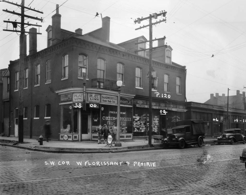
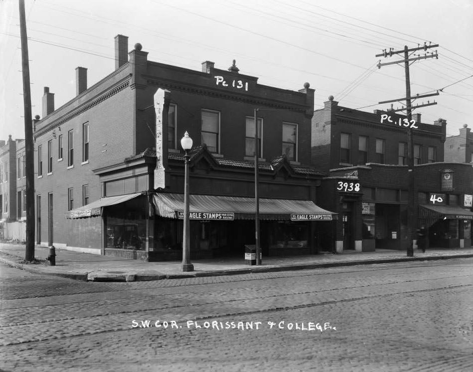
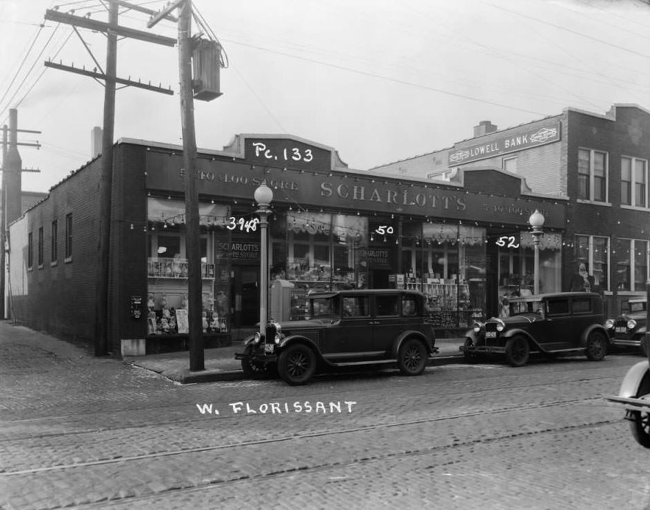
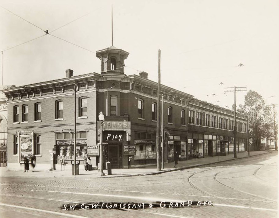
West Florissant Avenue had its own commercial identity. The Grand-Florissant Drug Co. occupied the southwest corner of West Florissant and Grand Avenue. Scharlott’s 5-cents-to-1-dollar store sat at 3948–3952 West Florissant next to Lowell Bank. Kling and Katch Men’s Furnishings operated at 3934–3936, while the Florissant Leader, a ready-to-wear clothing store, held the corner at College Avenue. Buildings on the southeast corner of West Florissant and DeSoto rounded out a street that mixed dry goods, banking, and clothing retail within a few blocks.
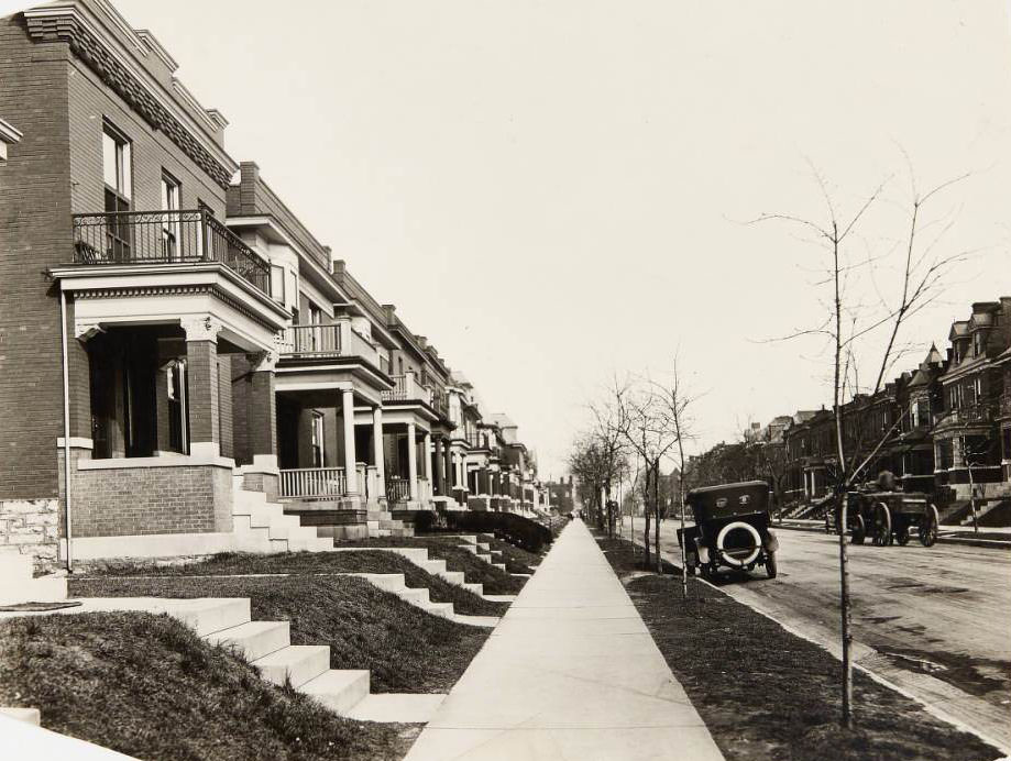
Row of houses on Wyoming Ave. in the Tower Grove South neighborhood at 3721, 3723, 3725, and 3727, 1930
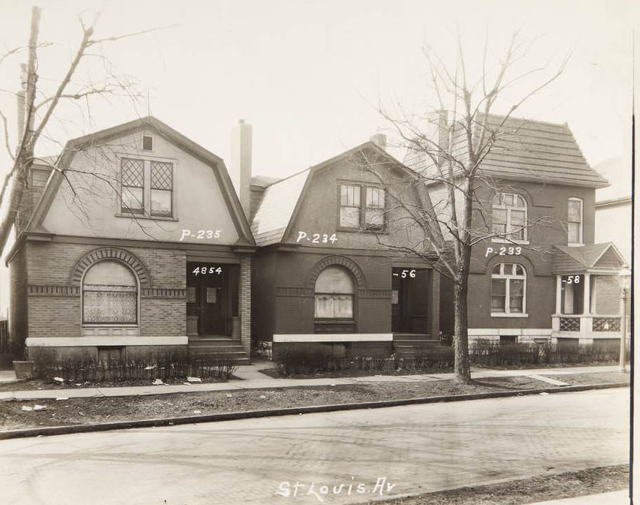
Three houses at 4854, 4856, and 4858 St. Louis Ave, 1930

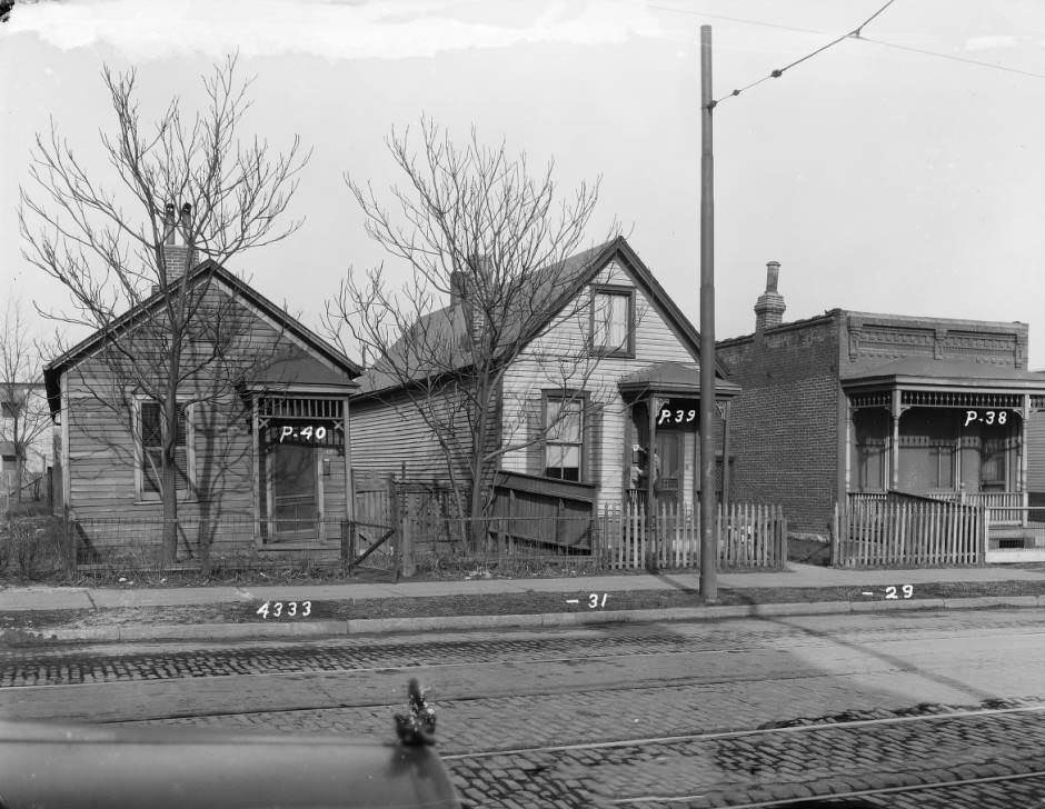
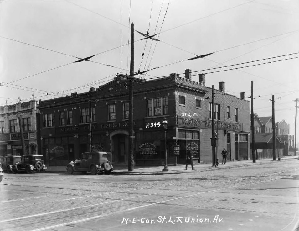
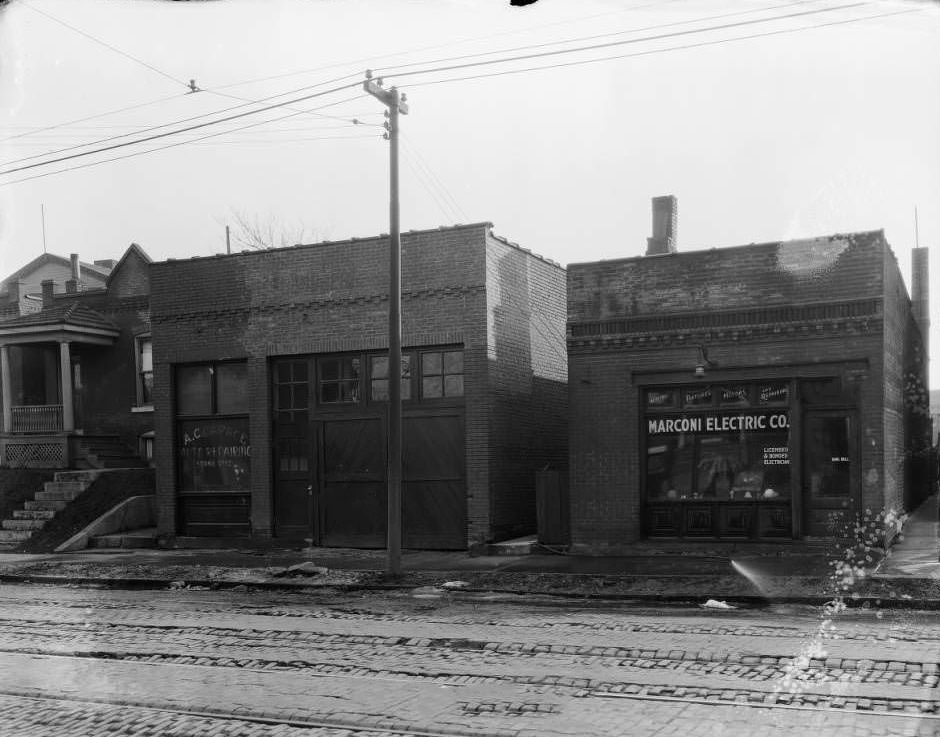
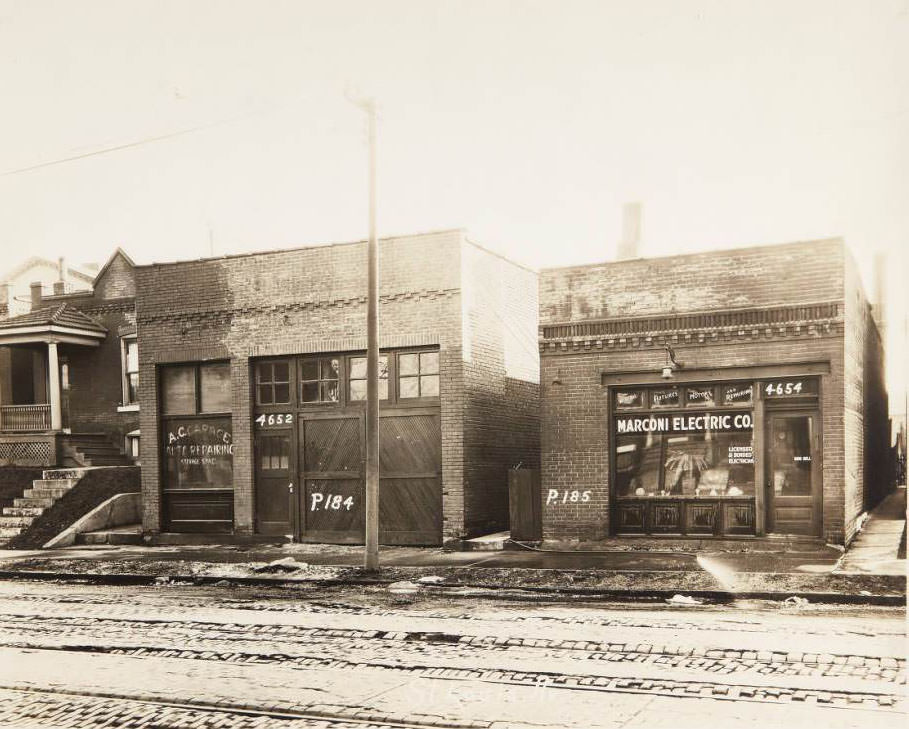
St. Louis Avenue was thoroughly documented in 1930. Photographs captured individual buildings at nearly every hundred-block increment — from the 4300s through the 4800s. A three-house stretch at 4329–4333 St. Louis Avenue showed a mailman making his delivery rounds at 4331. At 4600, the A.C. Garage Auto Repairing and Storage Space at 4652 sat next to the Marconi Electric Co. at 4654. The Mound City Trust Co. and Peters Shoes occupied the large commercial building at Union and St. Louis Avenues.
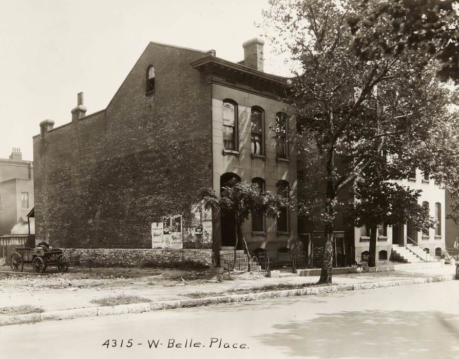
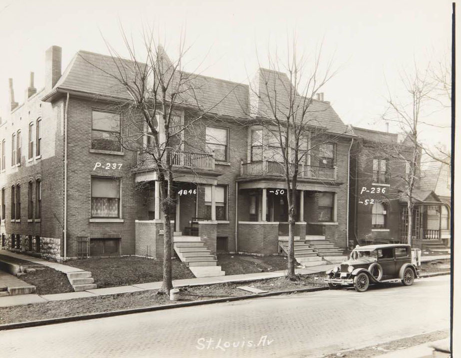
House at 4315 W. Belle Place in the Vandeventer neighborhood, 1930
Large multi-family house and another house located at 4846, 4850, and 4852 St. Louis Ave, 1930

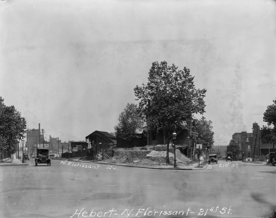
The JeffVanderLou neighborhood appeared in several 1930 photographs. The intersection of Sarah Street and Easton Avenue showed the Boekler Lumber Co. warehouse at 4072 Easton. Multi-family brick dwellings at 2926 Sheridan Avenue captured the dense residential character of the area. The wedge-shaped block created by the convergence of Hebert Street, North Florissant Avenue, and 21st Street was another local landmark, its unusual geometry the result of old survey lines meeting at an angle.
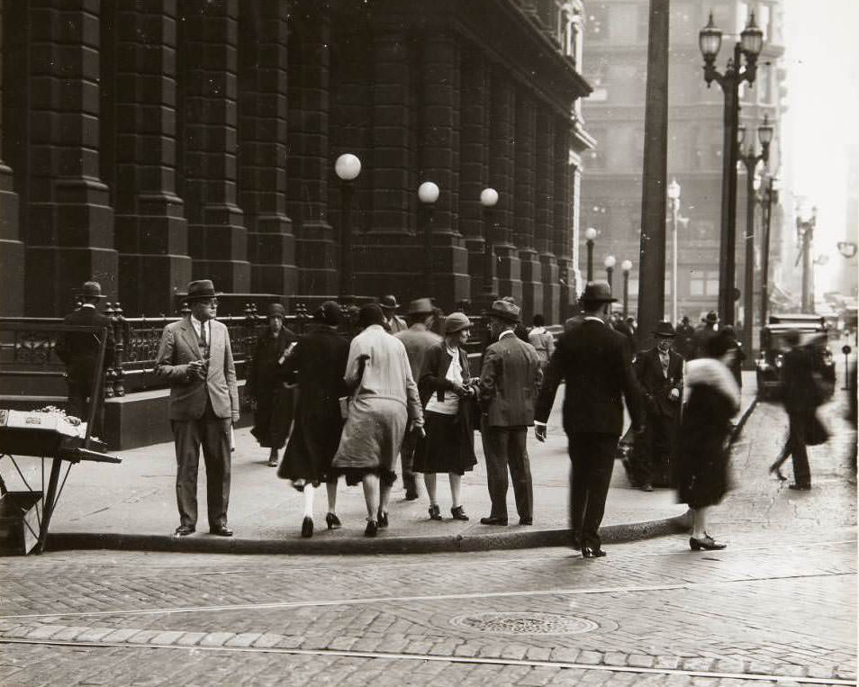
Pedestrians crossing Olive St. at Ninth St. with the Old Post Office building visible in the background, 1930
Grand-Florissant Drug Co. building at the southwest corner of W. Florissant and Grand Aves, 1930

North Broadway served as the spine of commerce for the city’s north side. The Union Market building stood at 701 North Broadway. The 100 block of North Broadway held the Ramona Cigar Co. at number 104. Looking south at East Carrie Avenue, trolley tracks turned into the St. Louis Public Service Co.’s Broadway and Taylor Car Station — a central hub for the city’s streetcar network. Further north, O’Fallon Park bordered the roadway on the right.
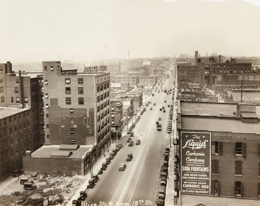
View of Olive St. looking west from 18th St. with the Century Electric Co. works building visible on the south side, 1930
View of Washington Ave. at night looking west from its intersection with Third St, 1930

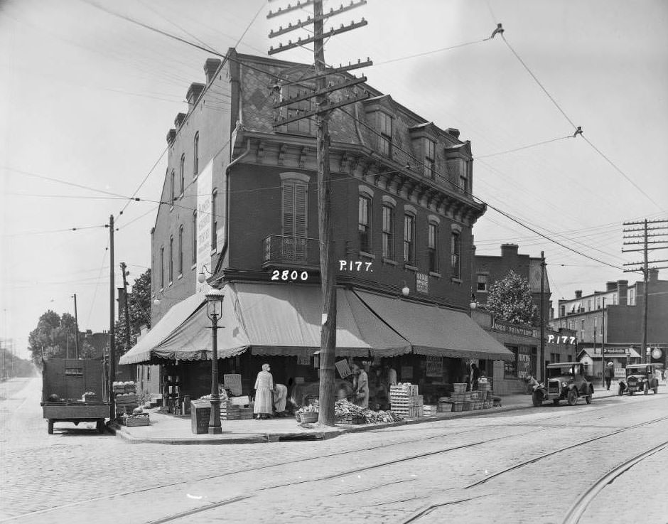
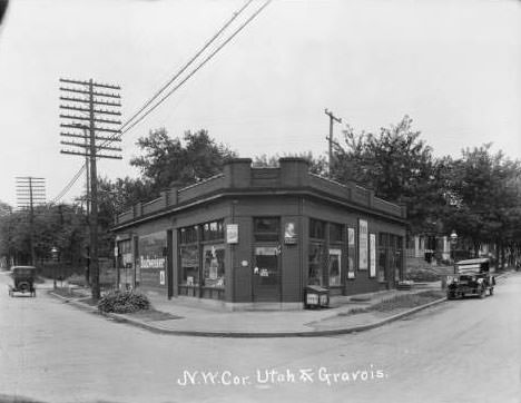
The city’s south side had its own distinct commercial clusters. Schenberg’s Market appeared at both the southwest corner of California and Gravois and at 2800 Gravois — possibly two locations, possibly the same business photographed from different angles. The one-story wedge-shaped building at Utah and Gravois held a grocery at 3287 Gravois. At the northeast corner of South Broadway and Geyer Avenue, Max Soldz’s Ladies Ready-to-Wear occupied 1832 South Broadway. These south-side streets held a dense mix of specialty shops and daily-need retailers.
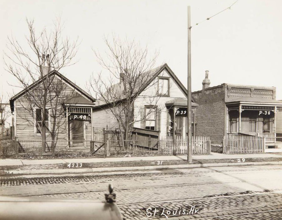
Three small houses at 4333-4329 St. Louis Ave. with a mailman delivering at 4331, 1930
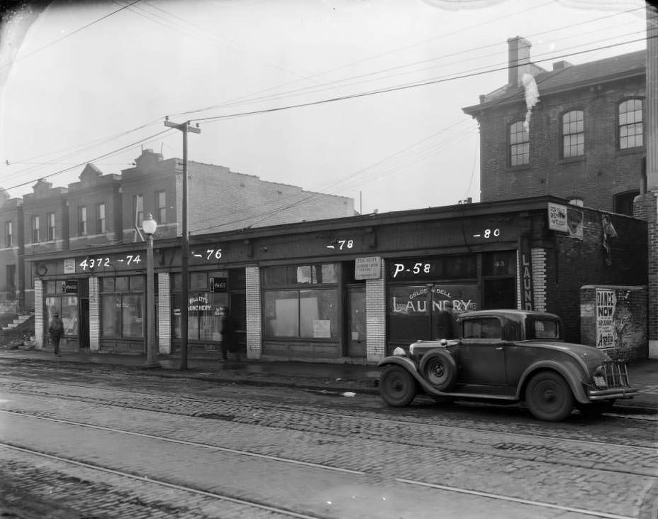
Two buildings located on the 4600 block of St. Louis Ave. A.C. Garage Auto Repairing Storage Space was at 4652 and the Marconi Electric Co. at 4654, 1930

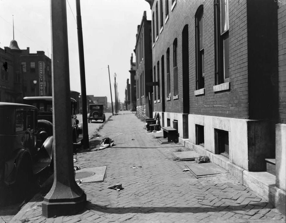
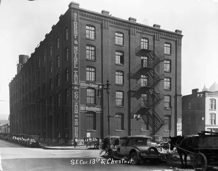
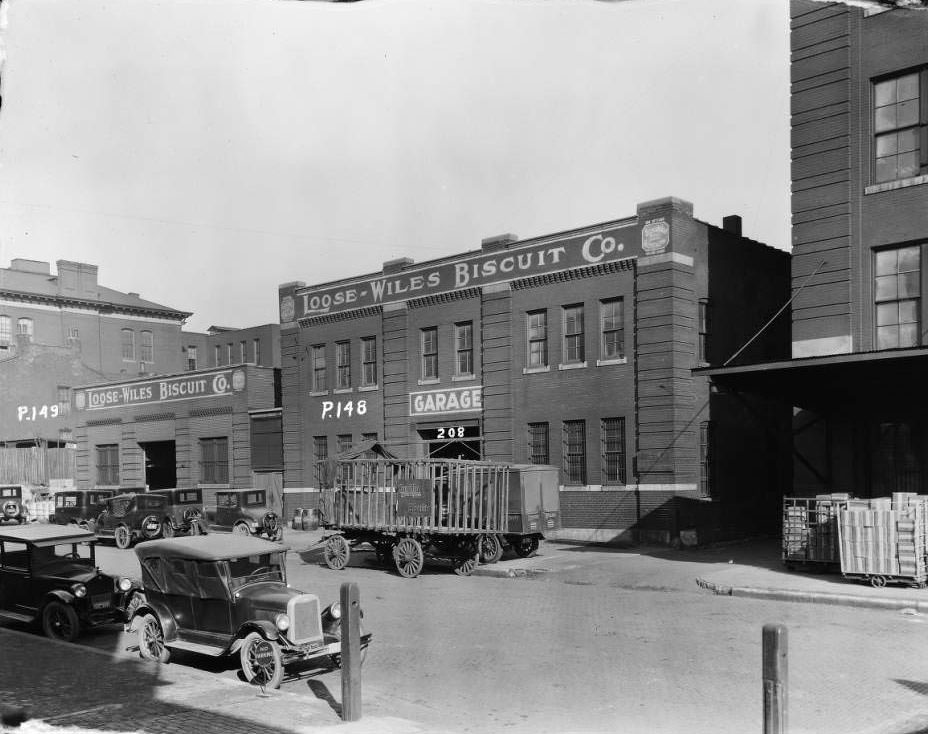
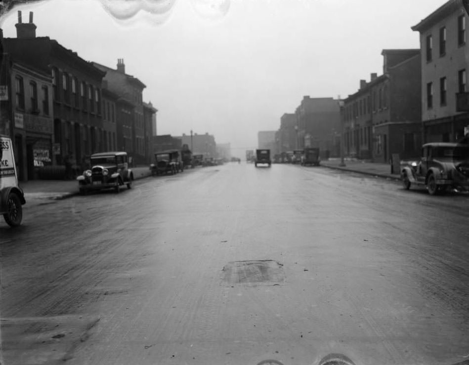
Large industrial and wholesale operations anchored St. Louis’s economy alongside its retail storefronts. The Loose-Wiles Biscuit Co. occupied buildings at 202 and 208 South 15th Street near Walnut. Ralston Purina’s facilities were visible near South 8th Street. The Herkert & Meisel Trunk Co. warehouse at 1216–1218 Chestnut bore its name in large painted letters across the rear wall. The Connely Manufacturing Co. building stood on the 2000 block of Walnut Street, visible in the distance of a street-level photograph.
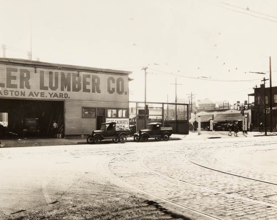
Intersection of Sarah St. and Easton Ave. in the Jeff Vanderlou neighborhood with the Boekler Lumber Co. warehouse located at 4072 Easton, 1930
Small bridge, 1930 - A small bridge and newly constructed road.
Small bridge, 1930 – A small bridge and newly constructed road.

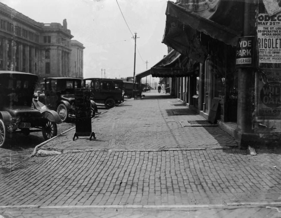
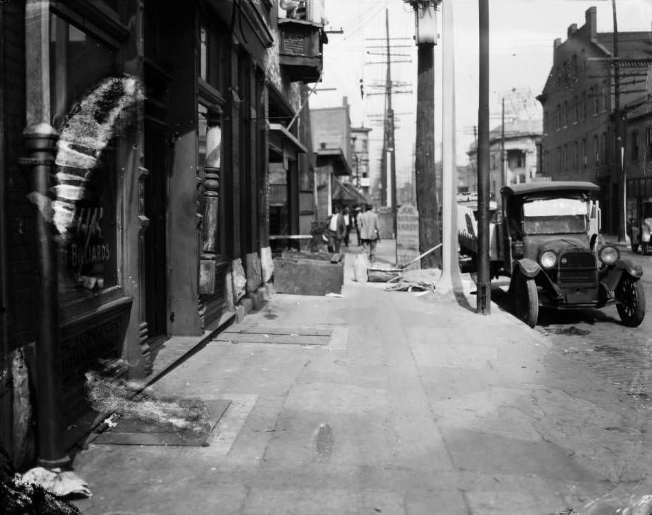
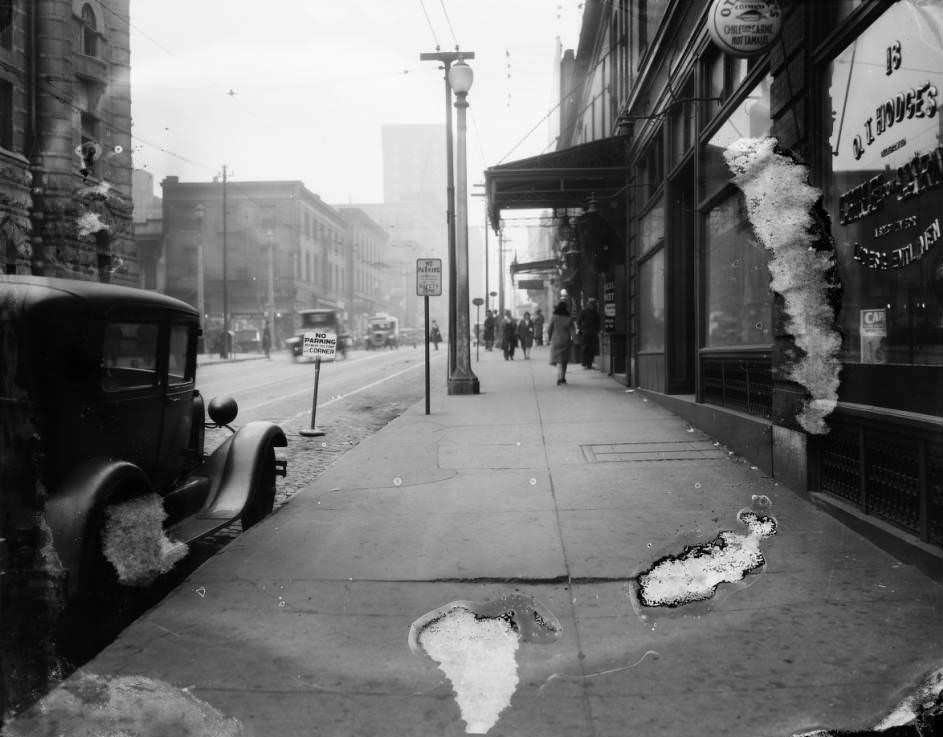
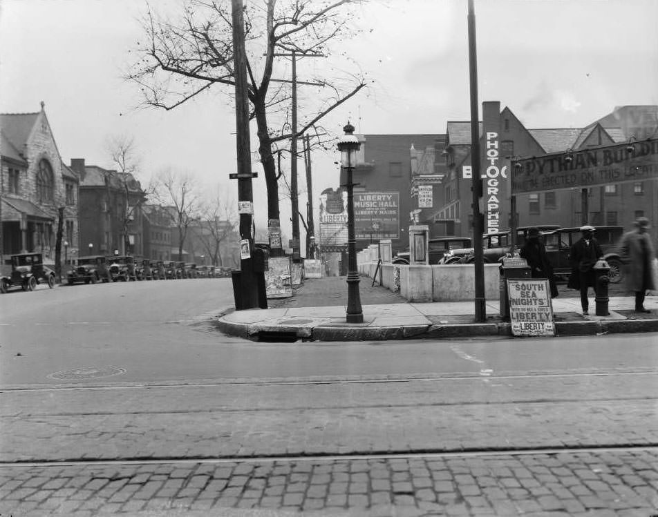
Entertainment options in 1930 ranged from the grand to the humble. Liberty Music Hall on North Grand — now known as the Sun Theater — was visible looking from Grand toward Grandel Square. The O.T. Hodges Chile Con Carne and Hot Tamale Restaurant at 18 South 18th Street offered working-class dining on a downtown sidewalk. Rock Springs bar operated alongside J. Westerman Market. The Forest Park Highlands amusement park drew crowds with its rides and concession booths, while the Municipal Opera provided outdoor performances in the park itself.
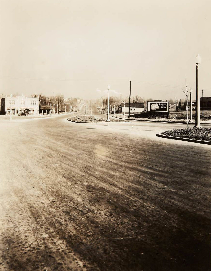
Riverview Blvd. at Saloma, 1930 - Intersection of Riverview Blvd. and Saloma Ave. looking north on Riverside. Abraham Frank operated a candy store at 5907 Lillian Ave.
Riverview Blvd. at Saloma, 1930 – Intersection of Riverview Blvd. and Saloma Ave. looking north on Riverside. Abraham Frank operated a candy store at 5907 Lillian Ave.
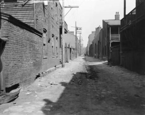
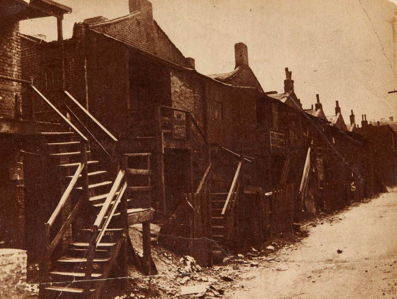
Tenement row, 1939 - Rear of a tenement row north of the downtown retail district.
Tenement row, 1939 – Rear of a tenement row north of the downtown retail district.

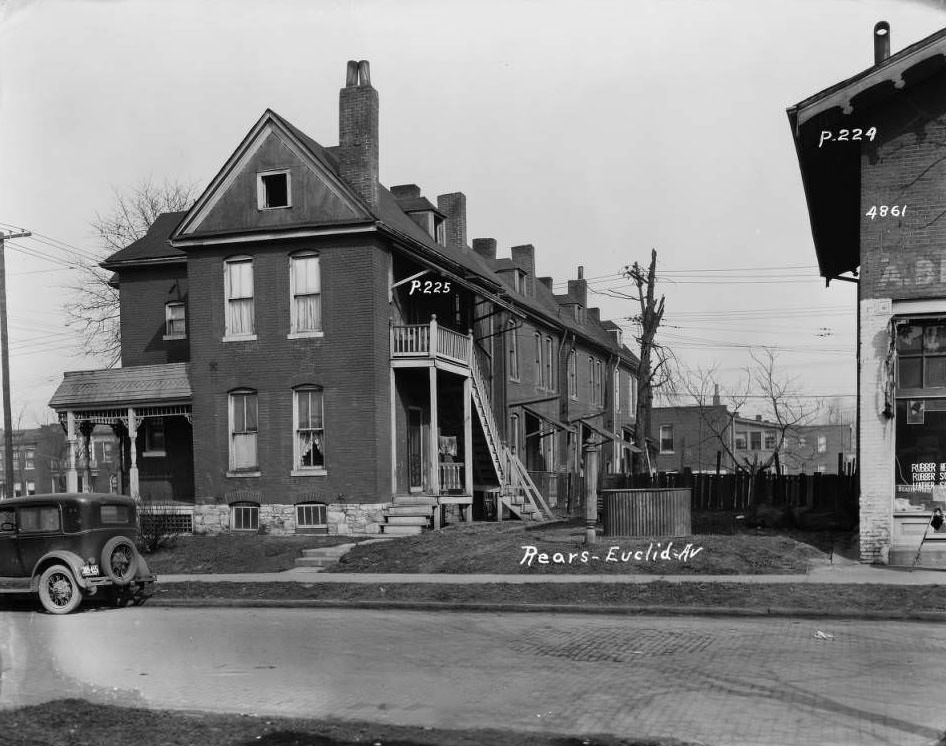
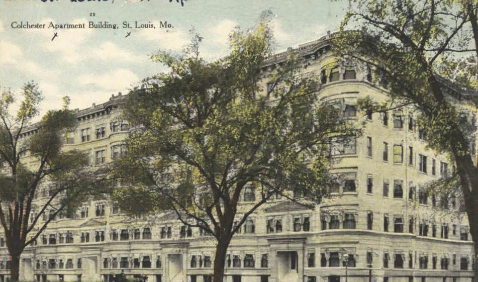
Housing conditions across St. Louis were uneven. While some neighborhoods featured well-maintained brick residences and new apartment buildings like the Colchester Apartments on North Kingshighway Boulevard, other areas showed signs of strain. Tenement rows north of the downtown retail district housed families in crowded rear-facing units. Backyards and back porches of homes on Euclid Avenue, photographed from St. Louis Avenue, revealed the cramped conditions that many working-class families lived in during the Depression years.
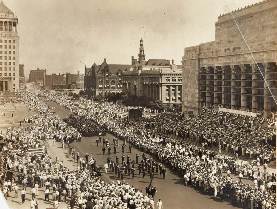
N.R.A. Parade, 1933 - Parade in honor of the National Recovery Administration marching west on Market from 12th Street past City Hall and the Municipal Auditorium.
N.R.A. Parade, 1933 – Parade in honor of the National Recovery Administration marching west on Market from 12th Street past City Hall and the Municipal Auditorium.
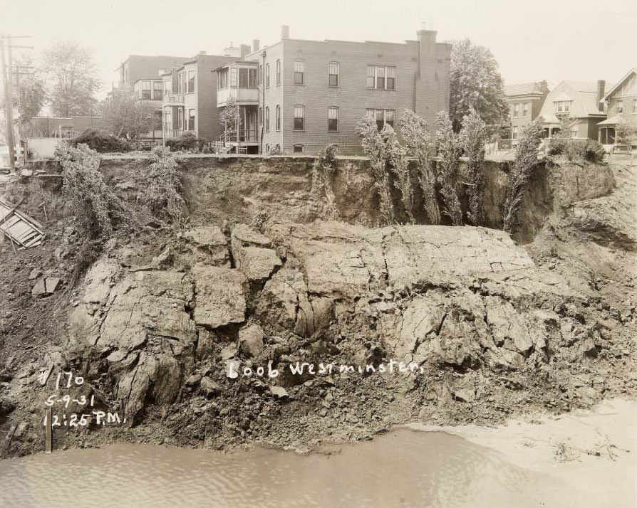
6006 Westminster, 1931 - Presumably a sinkhole on the 6000 block of Westminster.
6006 Westminster, 1931 – Presumably a sinkhole on the 6000 block of Westminster.

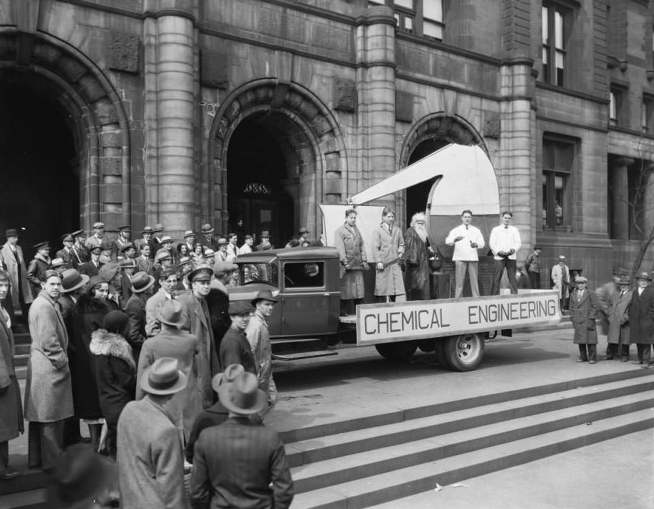
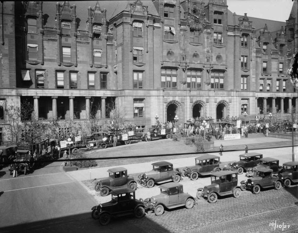
City Hall served as a focal point for civic life. Workers were photographed outside it with signage for Anton Beffa & Sons Wrecking and Supply Co., insured by Many-Bland Insurance Agency. A truck decorated for a Chemical Engineering parade was parked in front of the building. Across Market Street in the alleyway on the 1200 block — now Poelker Park — a photographer looked north through the narrow urban passage. The old Municipal Courts Building at 1300 Market Street appeared in a side view from 14th Street, its stone facade unchanged.
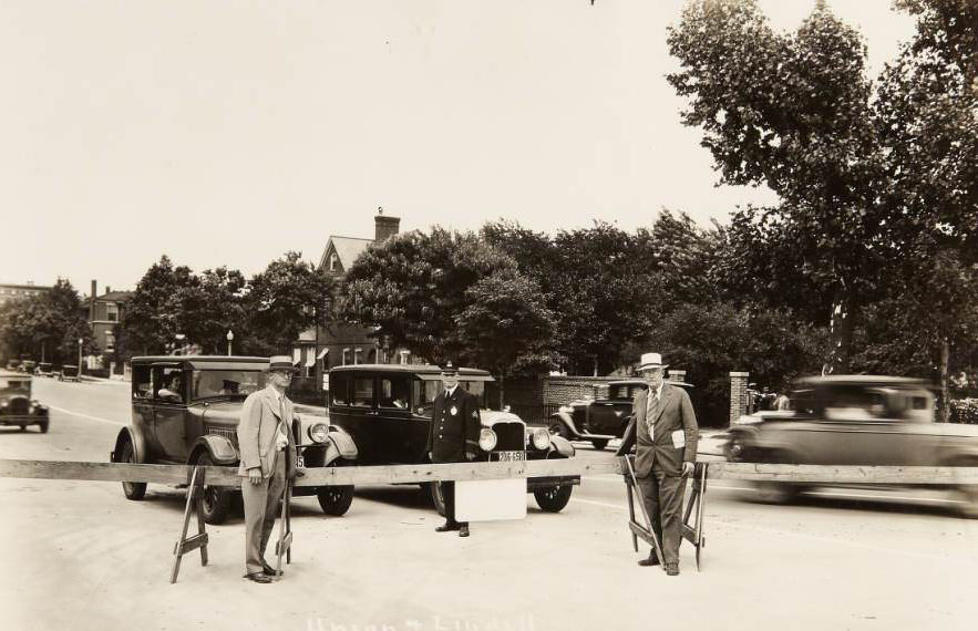
Union and Lindell boulevards, 1931 - A police officer and two other men standing next to a wooden traffic barricade at the intersection of Lindell and Union boulevards.
Union and Lindell boulevards, 1931 – A police officer and two other men standing next to a wooden traffic barricade at the intersection of Lindell and Union boulevards.
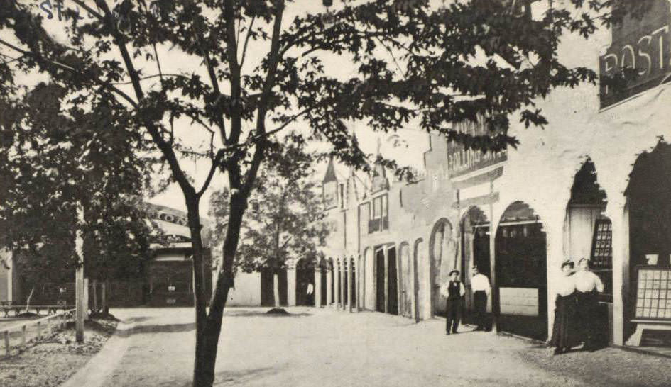
The Pike, Forest Park Highlands, St. Louis, 1930 - Photograph of The Pike, the concession area, at Forest Park Highlands. Several male and female employees stand by their booths.
The Pike, Forest Park Highlands, St. Louis, 1930 – Photograph of The Pike, the concession area, at Forest Park Highlands. Several male and female employees stand by their booths.

Traffic management was becoming increasingly necessary as automobiles multiplied across St. Louis. A police officer and two other men stood at a wooden traffic barricade at the intersection of Lindell and Union boulevards. Street intersections throughout the city were being documented for improvement — the corner of Kingshighway and Harney Avenue in the Mark Twain neighborhood was photographed specifically “before improvement,” indicating that road upgrades were planned. The city’s infrastructure was struggling to keep pace with the growth in vehicle traffic.
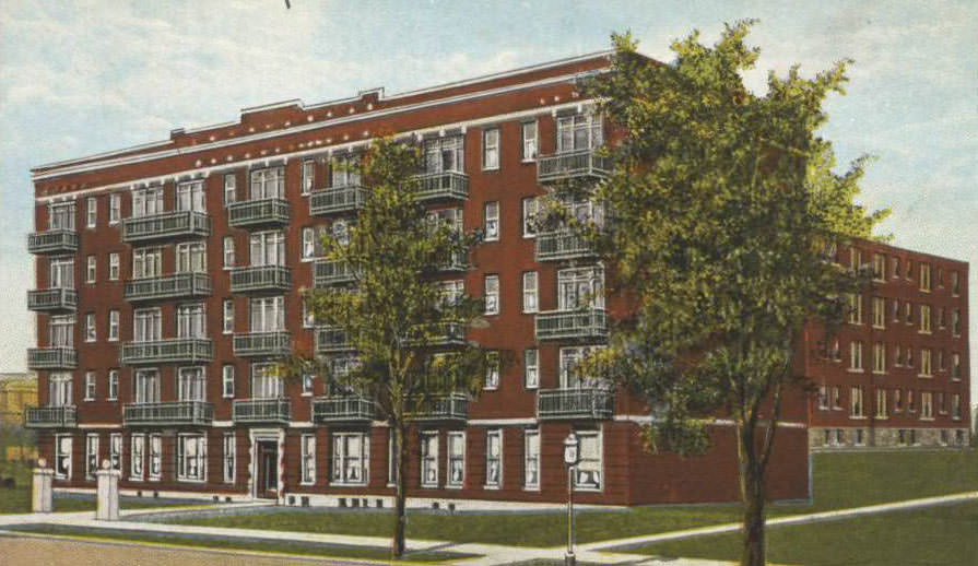
Commodore Apartments, 5316 Pershing Avenue, St. Louis, Mo., 1930 - The Commodore apartment building at 5316 Pershing Avenue, St. Louis, Missouri.
Commodore Apartments, 5316 Pershing Avenue, St. Louis, Mo., 1930 – The Commodore apartment building at 5316 Pershing Avenue, St. Louis, Missouri.
Lindell Boulevard, St. Louis, Mo. 1930 - An aerial view of Lindell Boulevard, St. Louis, Missouri, looking to the west from Taylor Avenue.
Lindell Boulevard, St. Louis, Mo. 1930 – An aerial view of Lindell Boulevard, St. Louis, Missouri, looking to the west from Taylor Avenue.

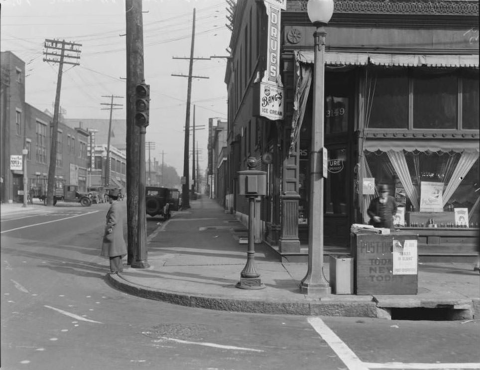
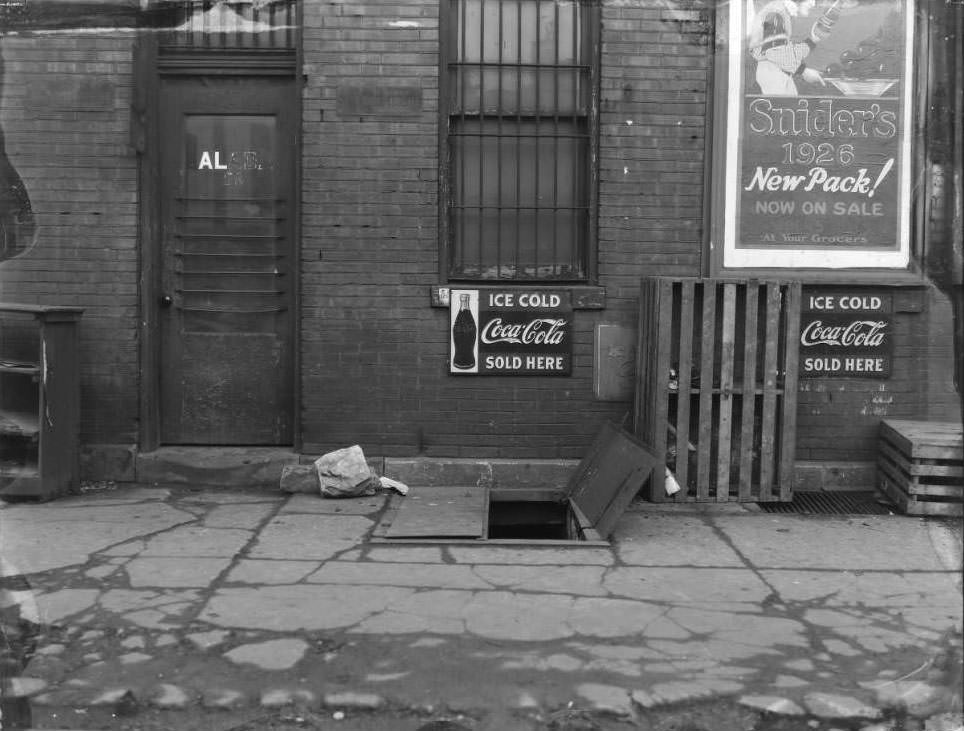
Pharmacies and drug stores were anchor tenants on commercial streets throughout the city. Heitmeyer Drug Co. operated near South Broadway and Lafayette. The Goedde-Igel Drug Co. served the Easton Avenue corridor. Draper Drug Company appeared on Olive Street. The Grand-Florissant Drug Co. occupied a prime corner at West Florissant and Grand. At 21st and Chestnut, behind a grocery store, an open cellar door was photographed alongside advertising for Coca-Cola and Snider’s ketchup — small details that give a precise sense of the commercial environment of the era.
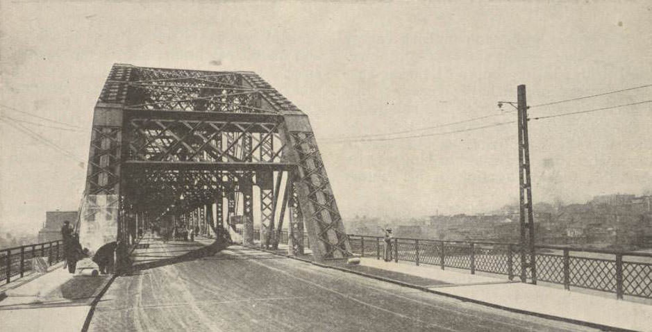
Municipal Free Bridge, largest double deck steel span bridge in the world, 1930 - The St. Louis Municipal Bridge across the Mississippi River, the largest double-deck steel span bridge in the world at the time.
Municipal Free Bridge, largest double deck steel span bridge in the world, 1930 – The St. Louis Municipal Bridge across the Mississippi River, the largest double-deck steel span bridge in the world at the time.
Colchester Apartment building, St. Louis, Mo., 1930 - Exterior of the Colchester Apartments, North Kingshighway Boulevard, St. Louis, Missouri.
Colchester Apartment building, St. Louis, Mo., 1930 – Exterior of the Colchester Apartments, North Kingshighway Boulevard, St. Louis, Missouri.

The Dutchtown neighborhood on the south side showed up in photographs of Walsh Street, looking northwest from near South 38th Street, and Osceola Street at South Compton, where a woman and child were captured walking away from the camera. These quiet residential scenes contrast sharply with the busy commercial corridors elsewhere in the city. Dutchtown’s brick row houses and tree-lined streets gave it a settled, stable appearance even as the rest of the city navigated economic uncertainty.
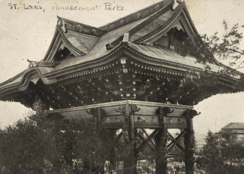
The Pagoda, Forest Park Highlands, St. Louis, Mo, 1930 - Photograph of The Pagoda, Forest Park Highlands, St. Louis, Missouri.
The Pagoda, Forest Park Highlands, St. Louis, Mo, 1930 – Photograph of The Pagoda, Forest Park Highlands, St. Louis, Missouri.
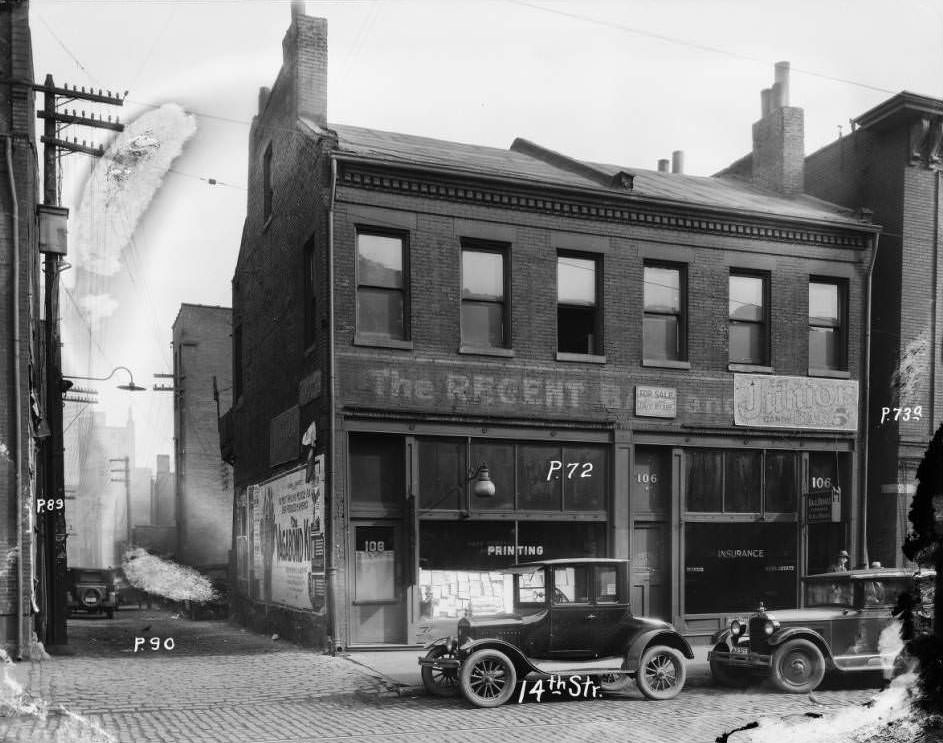
14th St., 106, 1930 - 106 14th Street.
14th St., 106, 1930 – 106 14th Street.

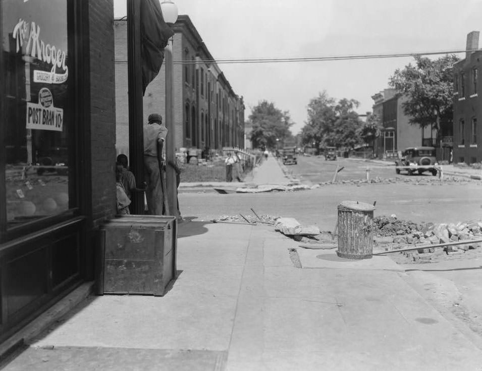
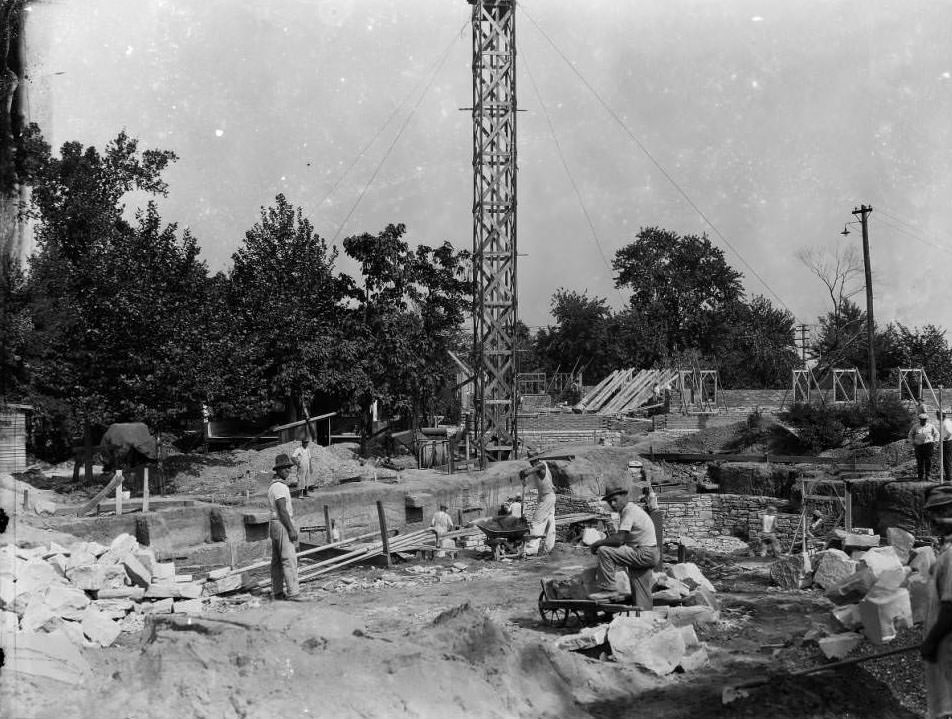
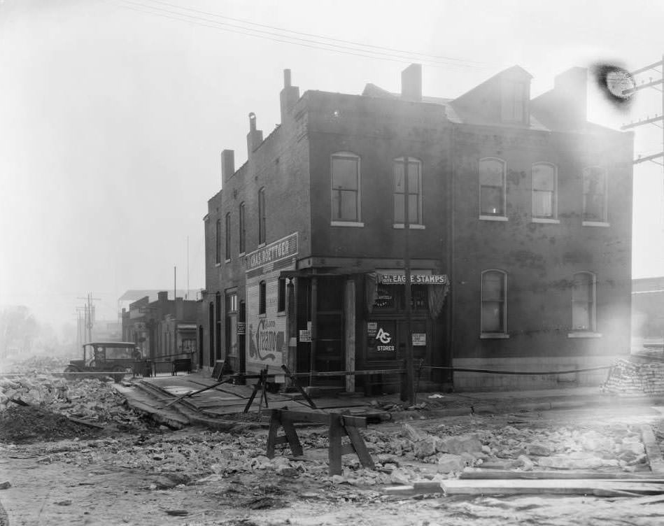
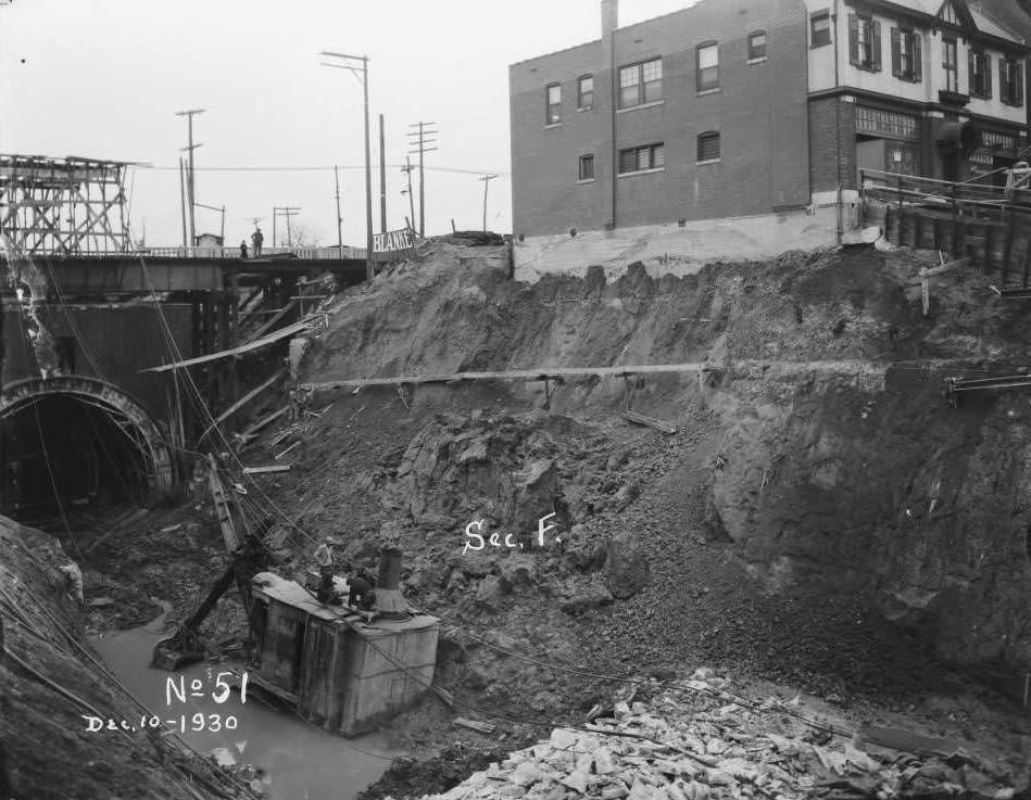
Construction workers appeared in multiple photographs throughout 1930, documenting active job sites across St. Louis. A large building site with several workers was photographed at an unspecified downtown location. Sewer installation crews worked in what was labeled “Section F,” digging deep trenches through city blocks. Street work crews appeared near Kroger Market at Cote Brilliante and North Newstead avenues, and in front of Chas. Roettger AG Stores at the corner of Sullivan and Prairie. These were Depression-era workers — their jobs, when they had them, were often municipal contracts.
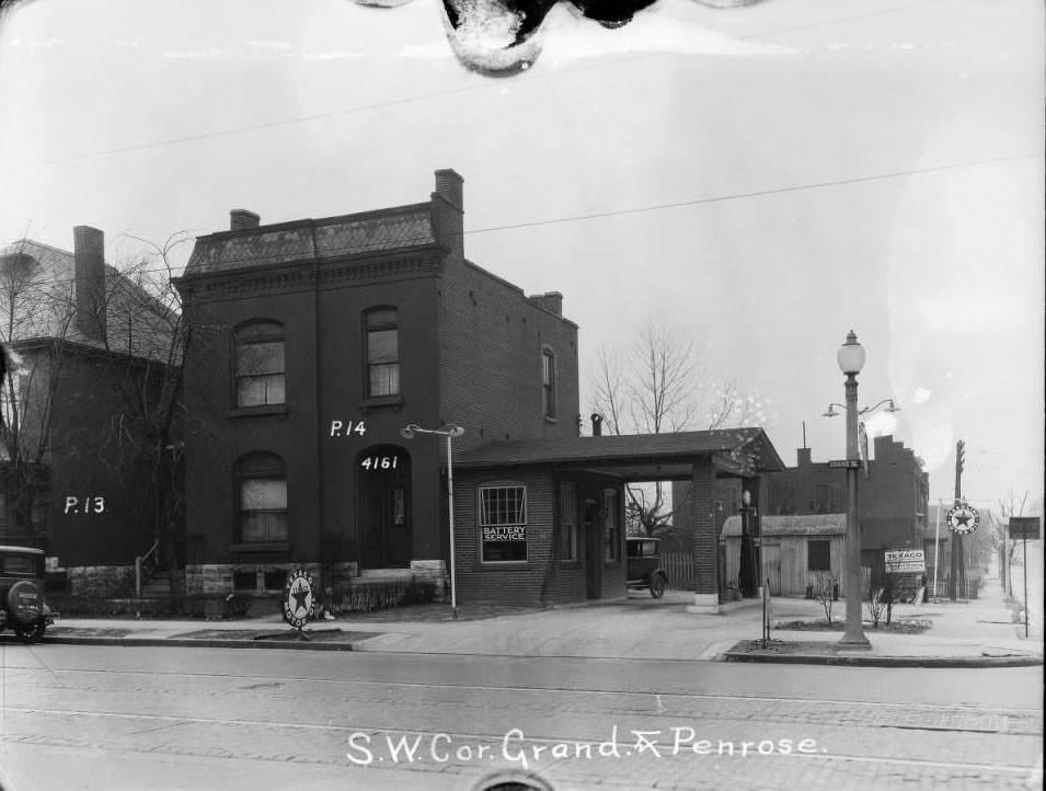
N. Grand and Penrose, 1930 - View of southwest corner of Grand and Penrose. Walker Brothers auto repair garage.
N. Grand and Penrose, 1930 – View of southwest corner of Grand and Penrose. Walker Brothers auto repair garage.
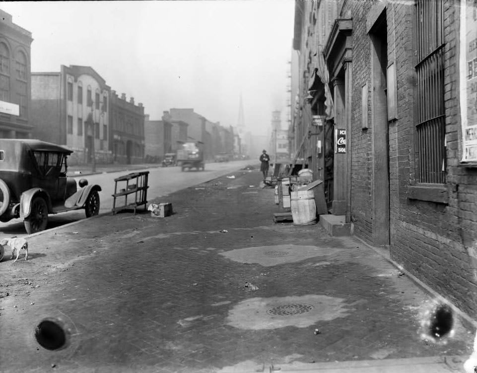
21st and Chestnut, 1930 - View of an open cellar door behind a grocery store. Advertising for Coca-Cola and Snider's ketchup are hung on the building.
21st and Chestnut, 1930 – View of an open cellar door behind a grocery store. Advertising for Coca-Cola and Snider’s ketchup are hung on the building.

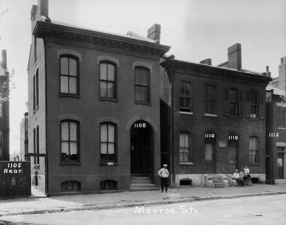
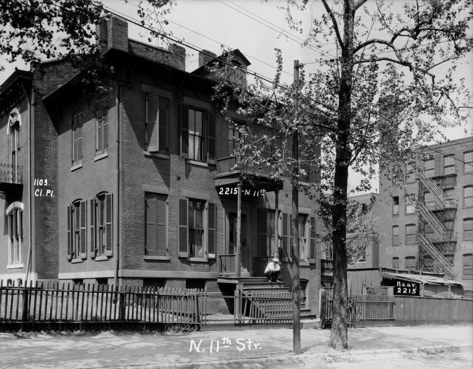
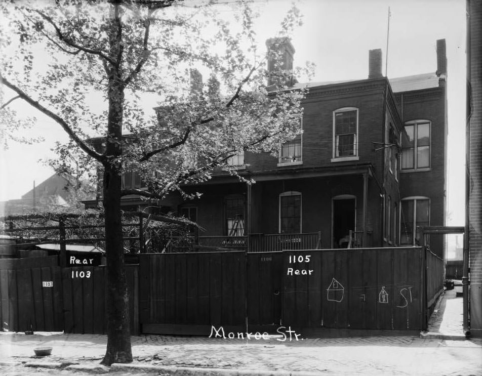
The Old North St. Louis neighborhood was home to dense residential blocks. Homes on the 1100 block of Monroe Street stood near Webster School. Row houses at 1418–1420 Dodier Street were photographed from the street. A large home on North 11th Street between Clinton Place and Monroe appeared with a man sitting on the porch — a rare human presence in what were largely architectural survey photographs. The rear views of houses on Monroe Street at 1103 and 1105 offered a look at how these homes were organized around shared alleys and rear yards.
Rock Springs bar, 1930 - View of Rock Springs bar and J. Westerman Market.
Rock Springs bar, 1930 – View of Rock Springs bar and J. Westerman Market.
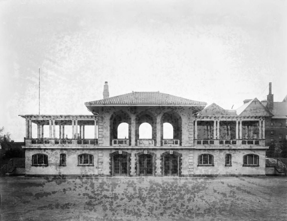
Park Guards' Headquarters at Forest Park, 1930 - Exterior view of Park Guards' Headquarters at Forest Park.
Park Guards’ Headquarters at Forest Park, 1930 – Exterior view of Park Guards’ Headquarters at Forest Park.

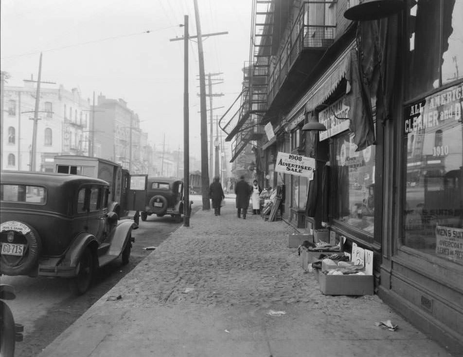
Laundry services, shoe repair shops, and dry cleaners occupied small storefronts throughout residential St. Louis. At 1232 and 1234 Morgan Street, a laundromat and shoe repair shop stood side by side, three people visible in front of nearby billboards. Frank Kembleger’s dry cleaning business at 1910 South Broadway served the neighborhood near Geyer Avenue. Jan Long Laundry operated on the 3500 block of Lindell Boulevard. Two buildings on the 3900 block of West Florissant housed a laundry and a hat shop respectively — the kind of specialty retailers that defined the era before chain stores.
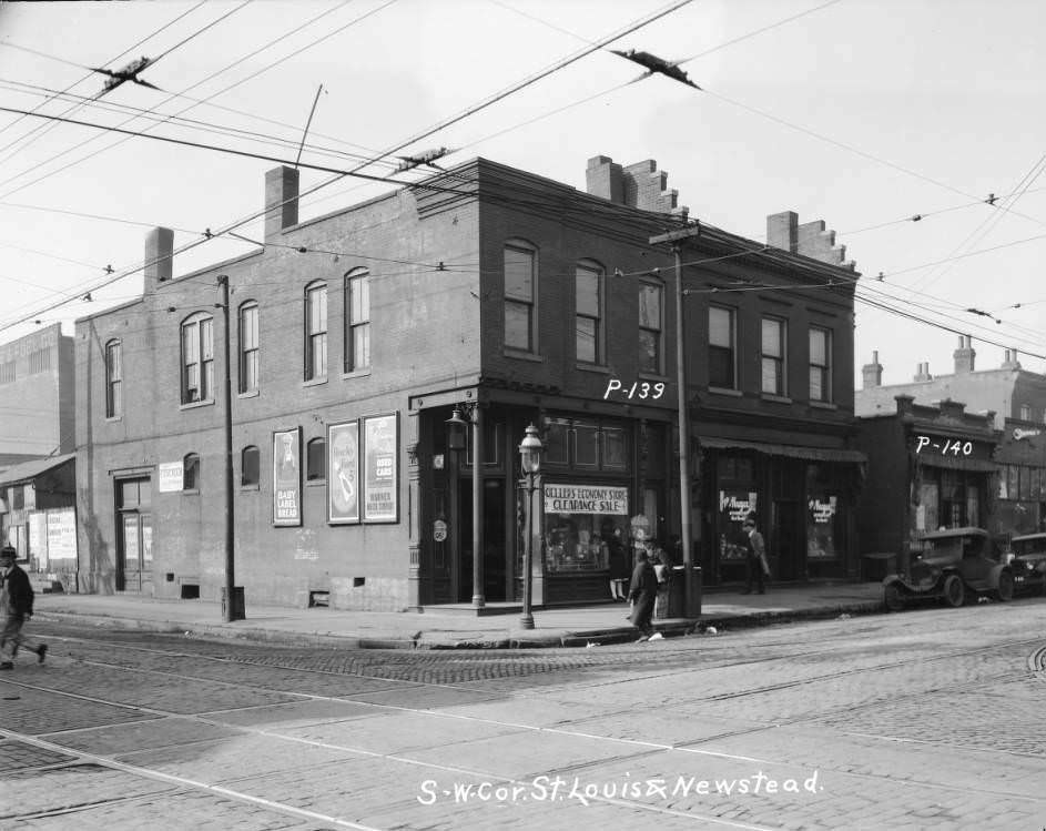
Geller's Economy Store, 1930 - South west corner St. Louis Avenue and Newstead.
Geller’s Economy Store, 1930 – South west corner St. Louis Avenue and Newstead.
City Hospital No. 2, 2945 Lawton, 1930 - View of the Barnes Medical College building, which was City Hospital No. 2 for African-American patients at the time of this photograph.
City Hospital No. 2, 2945 Lawton, 1930 – View of the Barnes Medical College building, which was City Hospital No. 2 for African-American patients at the time of this photograph.

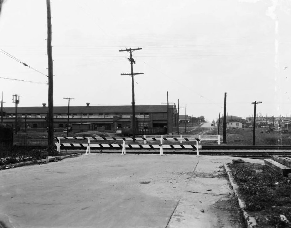
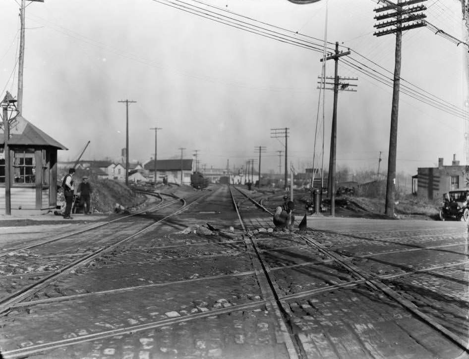
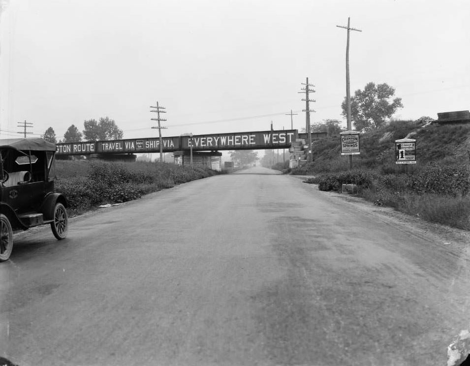
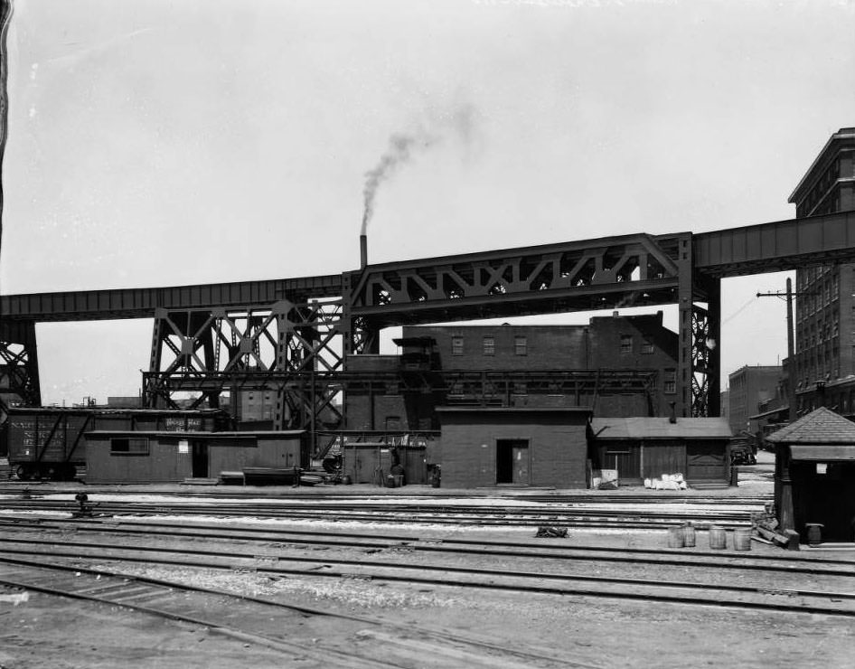
Railroads remained central to St. Louis commerce in 1930. A railroad overpass on Riverview Boulevard was painted with the Burlington Route’s slogan: “Travel Via, Ship Via, Everywhere West.” The rail overpass at South Main Street, First Street, and Chouteau Avenue was photographed looking west. Near Chouteau, a railyard building and trestle were captured from street level. The city’s position as a major rail hub meant that freight movement shaped land use across entire neighborhoods, with warehouses and industrial facilities clustering near rail lines.
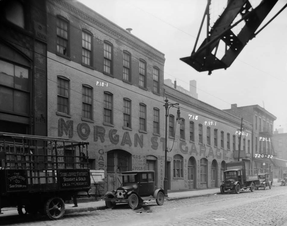
Morgan Street Garage, 1930 - 718, 720 - 722 Morgan Street. Large building painted: Morgan Street Garage.
Morgan Street Garage, 1930 – 718, 720 – 722 Morgan Street. Large building painted: Morgan Street Garage.
North Grand near Grandel Square, 1930 - View from North Grand towards Liberty Music Hall, now known as the Sun Theater.
North Grand near Grandel Square, 1930 – View from North Grand towards Liberty Music Hall, now known as the Sun Theater.

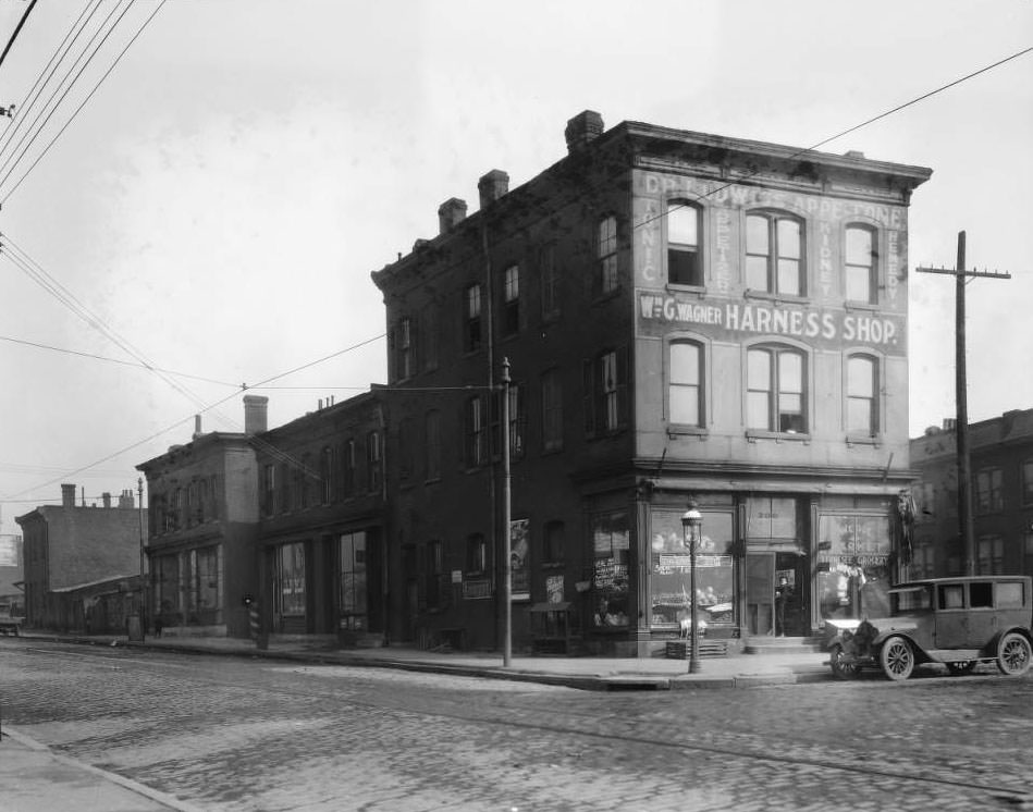
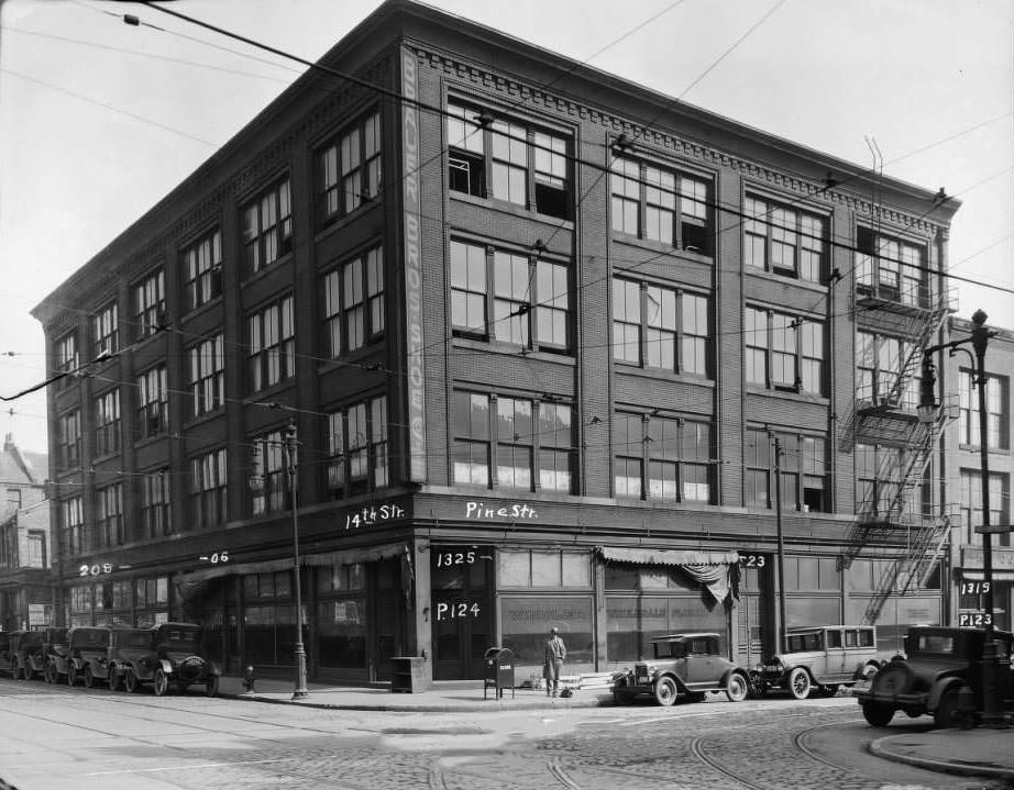
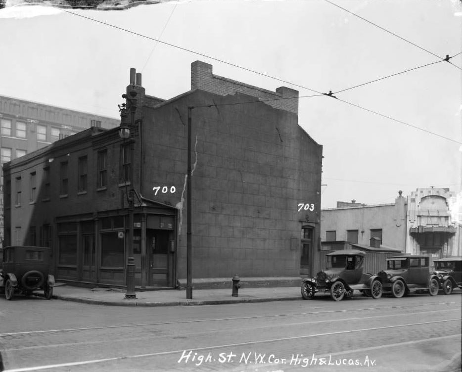
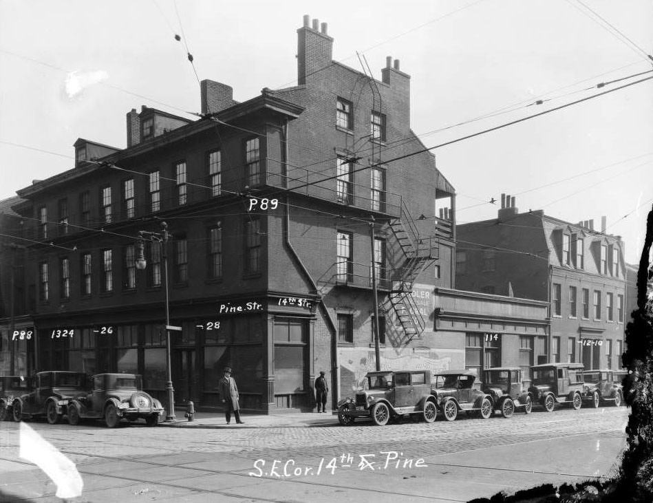
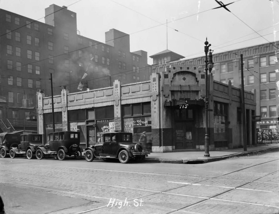
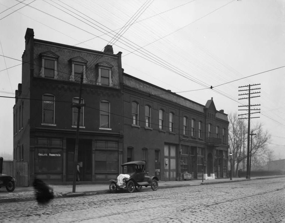
Signage told much of the story of St. Louis commerce in 1930. The windows at the northeast corner of 14th and Pine carried signs for Windler Wholesale Floral Co. At 3347 California Avenue, Litsch & Litsch Chiropractors advertised on their building’s exterior. Obelite Products posted signage at 3811 North Market. The building at Tucker and Lucas — formerly High Street, formerly 12th — carried commercial signs for multiple tenants. Painted building advertisements were everywhere, turning brick walls into billboards for everything from butter to biscuits.
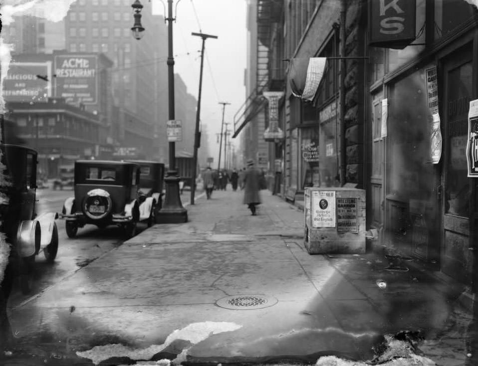
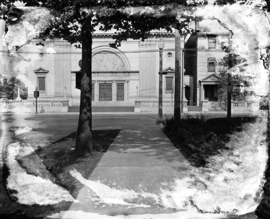
N. Broadway, 100 block of, 1930 - View of 100 block of N. Broadway. Ramona Cigar Co. at 104 N. Broadway.
N. Broadway, 100 block of, 1930 – View of 100 block of N. Broadway. Ramona Cigar Co. at 104 N. Broadway.
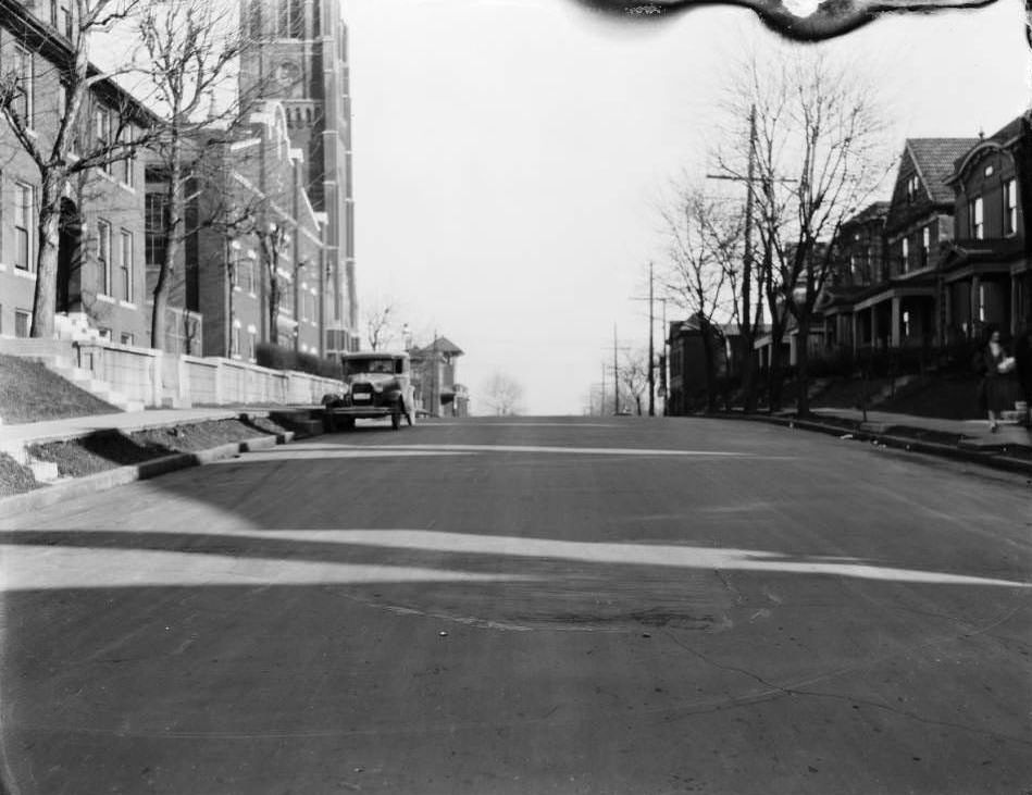
St. Pius V Catholic Church at Grand Ave. and Utah St. View is east from Utah St. Church's rectory is on the right, 1930
St. Pius V Catholic Church at Grand Ave. and Utah St. View is east from Utah St. Church’s rectory is on the right, 1930

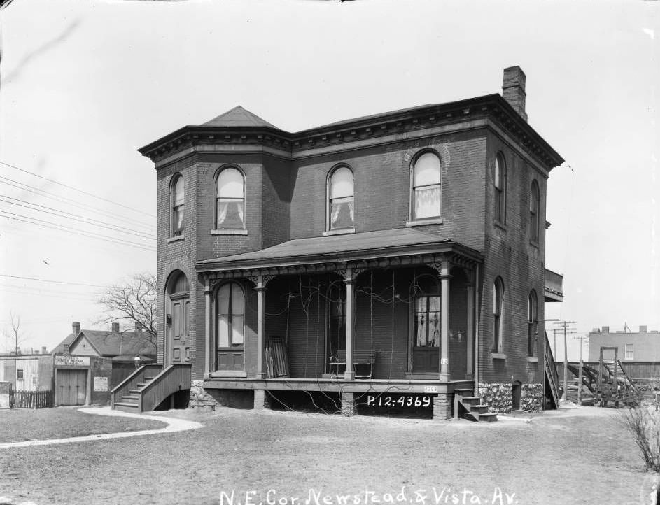
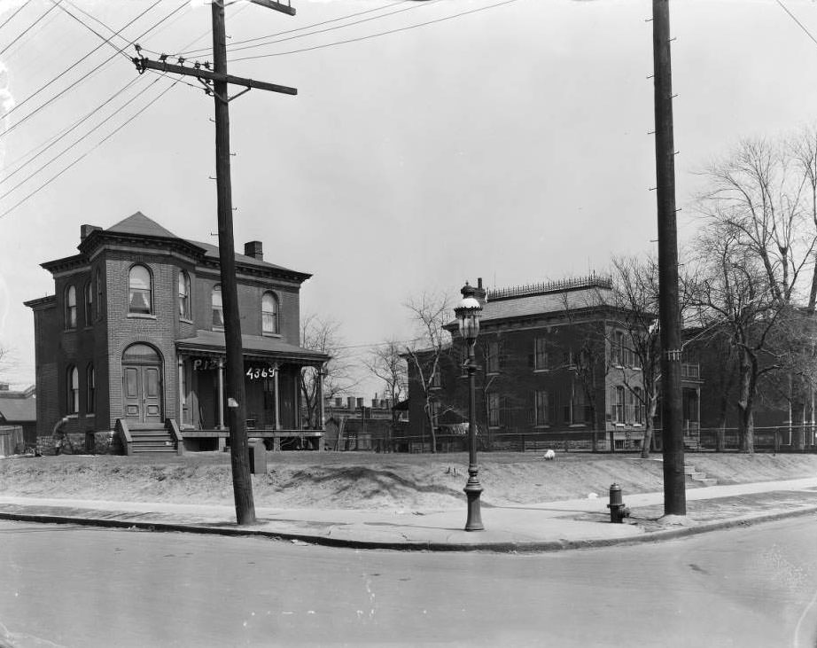
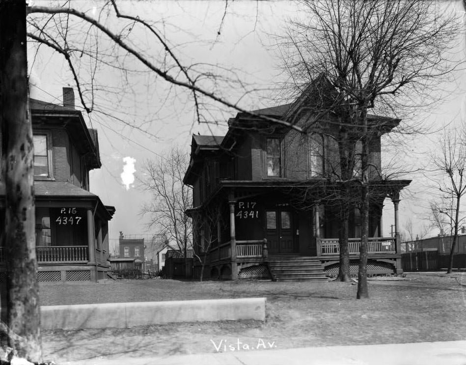
The Forest Park Southeast neighborhood, also documented in 1930, featured homes along Vista Avenue that would later be absorbed into Adams Park near the Boys & Girls Clubs of Greater St. Louis. Homes at 4341, 4347, 4361, and 4369 Vista Avenue appeared in photographs taken that year. A large home with a courtyard and pergola was also captured, suggesting that not all of St. Louis’s residential neighborhoods were dense and crowded. Some blocks retained spacious, middle-class homes with private outdoor spaces.
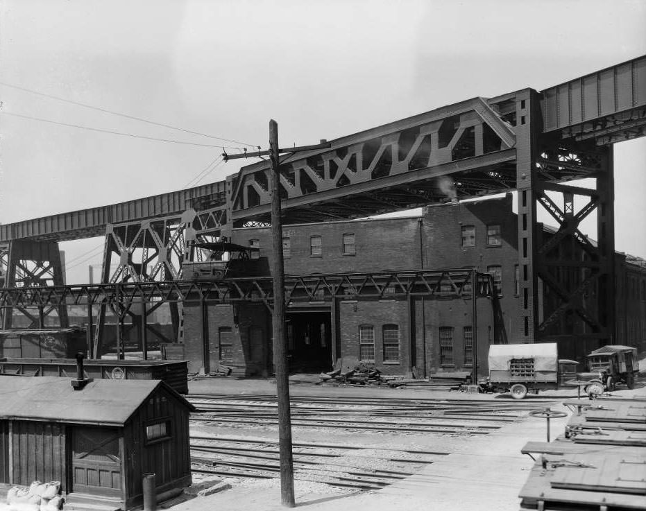
View west at the railroad overpass at South Main St, First St. and Chouteau Ave, 1930
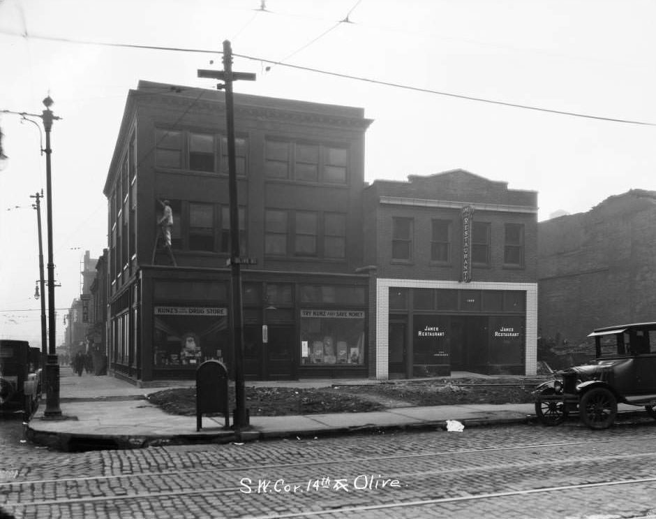
View of southwest corner of 14th and Olive St, 1930

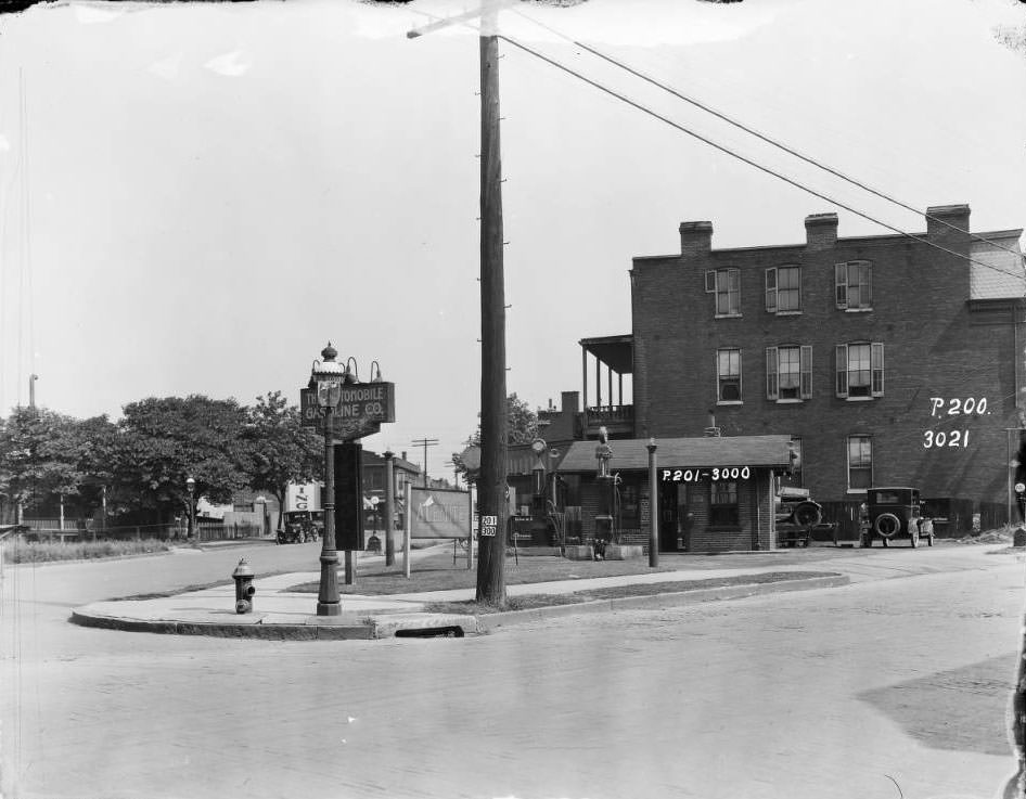
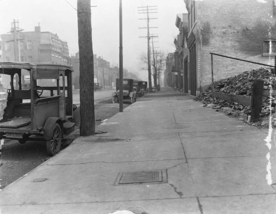
The intersection of Olive and North Compton, photographed looking north toward Locust Street, showed Standard Auto Parts visible in the distance. The Standard Oil filling station sign appeared on a quiet residential stretch of 4403 Laclede Avenue. These scattered fuel and auto service points reflected how deeply the automobile had penetrated every corner of the city by 1930, not just the major commercial corridors but the quieter residential blocks as well.
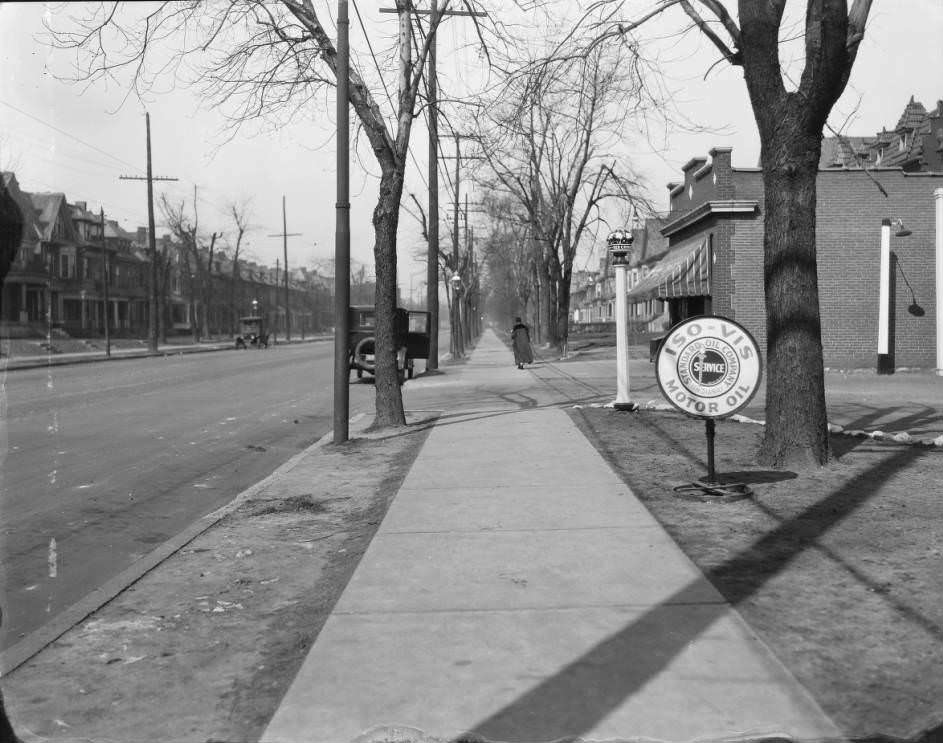
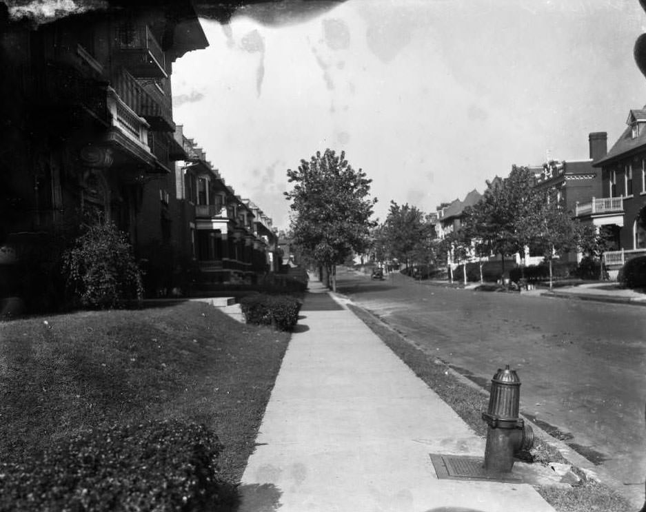
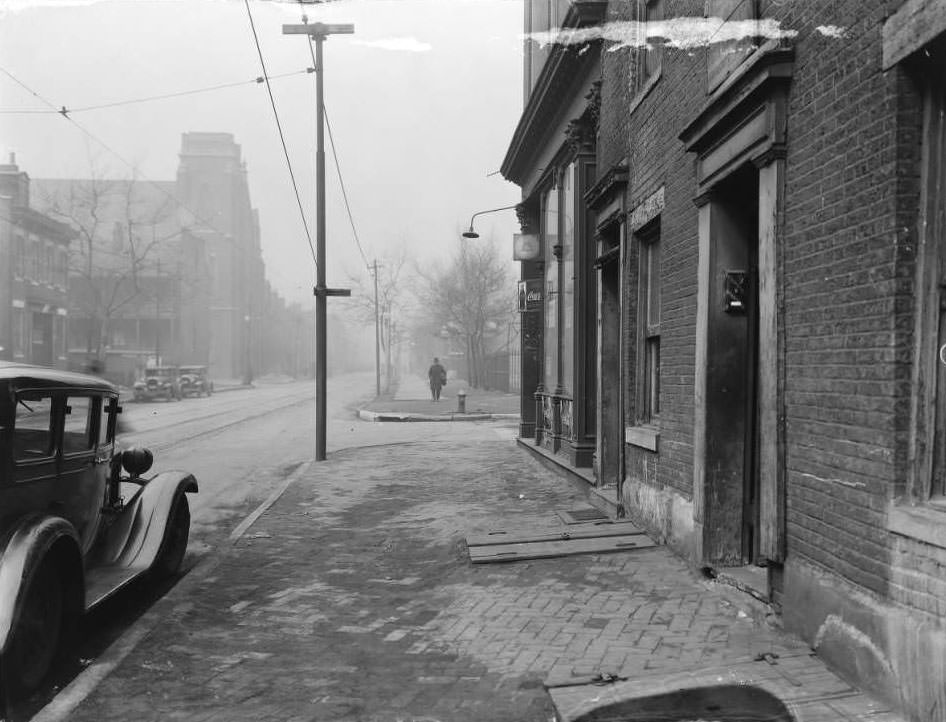
View of sidewalk and residential street. Standard Oil filling station sign is visible. 4403 Laclede, 1930
View of one-story wedge-shaped business building at Utah and Gravois. Grocery was at 3287 Gravois, 1930

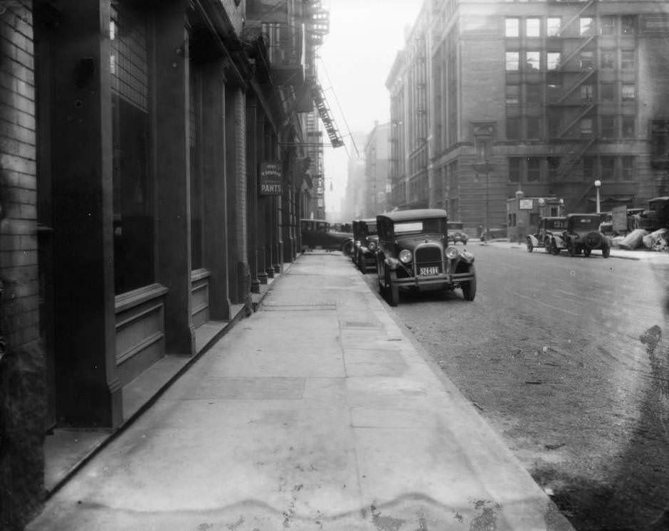
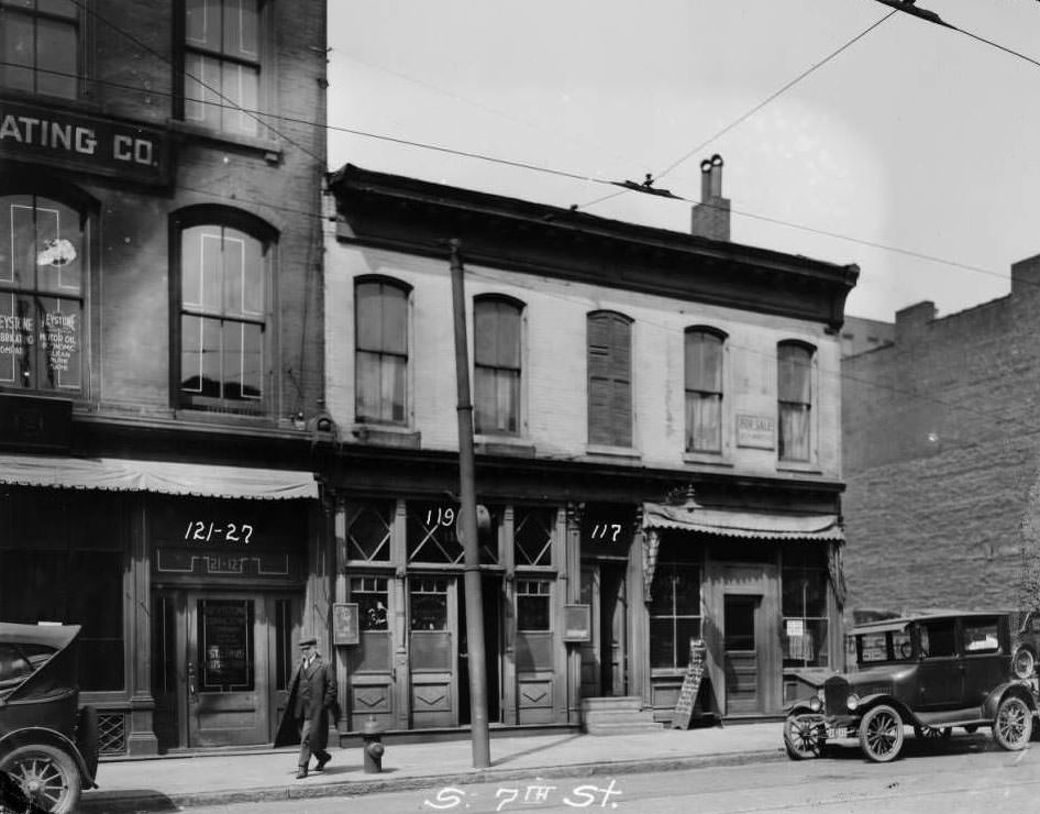
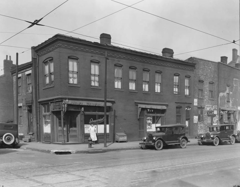
Lucas Avenue held a concentration of retail and professional businesses in the blocks approaching downtown. Looking east toward 9th Street, H. Siegfried Fine Pants and the Lammert Furniture Building were both visible. On Franklin Avenue, Louis Goldberg Furniture Co. anchored the 1401–05 block. The Imperial Restaurant occupied 717–727 High Street. The Keystone Lubricating Company, St. Louis Wholesale Drug Company, and James Robinson’s restaurant shared the 100 block of South 7th Street between Walnut and Elm — a single block holding industrial supply, wholesale pharmacy, and food service.
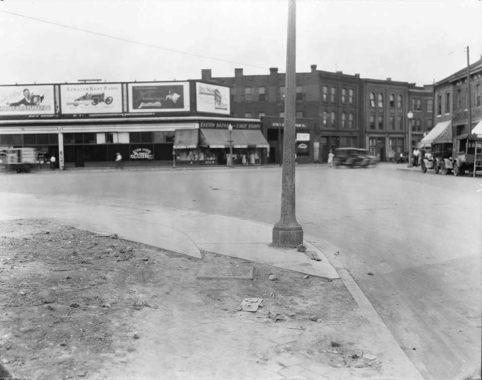
Northeast corner of South Broadway and Geyer Ave. Max Soldz' Ladies Ready-to-Wear was on the corner at 1832 South Broadway, 1930
Northeast corner of South Broadway and Geyer Ave. Max Soldz’ Ladies Ready-to-Wear was on the corner at 1832 South Broadway, 1930
Looking west from Thomas St., Easton Ave., and N. Compton Ave. intersection. Filling station and Easton Bazaar are visible, 1930

Across St. Louis in 1930, the photographs document a city managing the tension between growth and decline. New roads were being poured. Sewers were being extended. The Municipal Free Bridge connected the city to Illinois. New apartment buildings offered modern housing. At the same time, debris was cleared from collapsed structures, tenements housed families in crowded conditions, and sinkholes opened on residential streets. The city was neither simply thriving nor simply failing — it was doing both at once, block by block, in a way that these photographs capture with unusual precision.
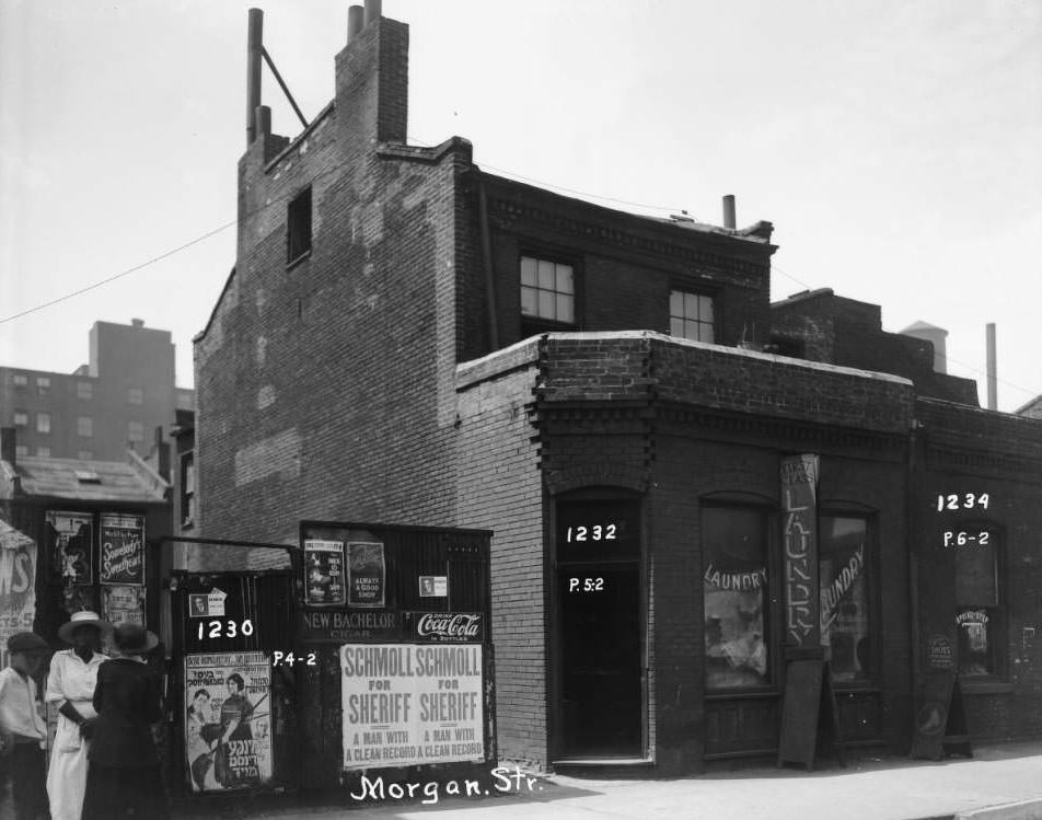
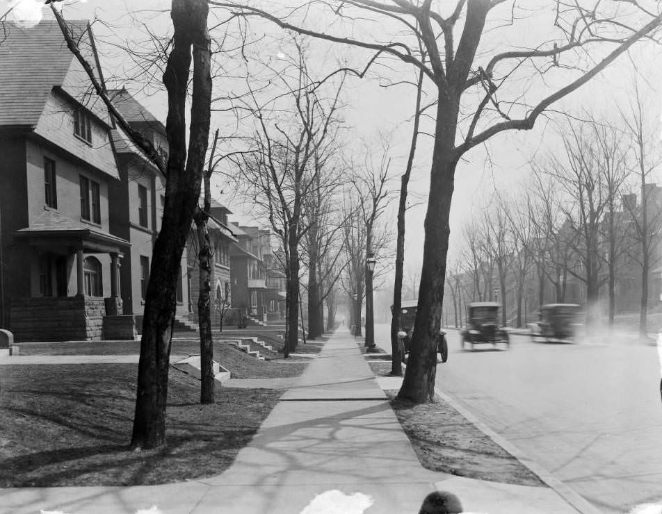
Exterior view of a laundromat and shoe repair shop with three people standing in front of billboards. 1232 and 1234 Morgan St, 1930
View of Washington Ave. from Newstead Ave. Houses on the left are along the north side of the block, 1930
View of 3509 -3511 - 3515 N. Florissant, 1930
View of 3509 -3511 – 3515 N. Florissant, 1930
View of the alleyway between South Grand and Grace looking north toward Potomac. IOOF temple at 3502 Grace is visible, 1930
View of the 1200 block of Blackstone Ave. looking north from 5701 Julian Ave, 1930
View of the 5900 block of Minerva Ave. St. Barbara Catholic Church (now St. Augustine is visible at Minerva and Hamilton, 1930
Street view of Louis Lum Chop Suey at 1014 North Sarah and other businesses. Several people are on the busy sidewalk, 1930
View of three three-story residences on the 1300 block of Dillon near Park Ave, 1930
View of 2000 block of Walnut St. Connely Manufacturing Co. building at 2038 Walnut in the background, 1930
View of houses on the 4300 block of N. Florissant Ave, 1930
View of three one-story frame houses at 4333 - 4331 - 4329 St. Louis Ave, 1930
View of three one-story frame houses at 4333 – 4331 – 4329 St. Louis Ave, 1930
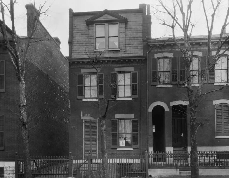
View of the 1418 - 1420 Dodier St, 1930
View of the 1418 – 1420 Dodier St, 1930
View of the wedge-shaped block created by the convergence of Hebert St., N. Florissant Ave., and 21st St, 1930
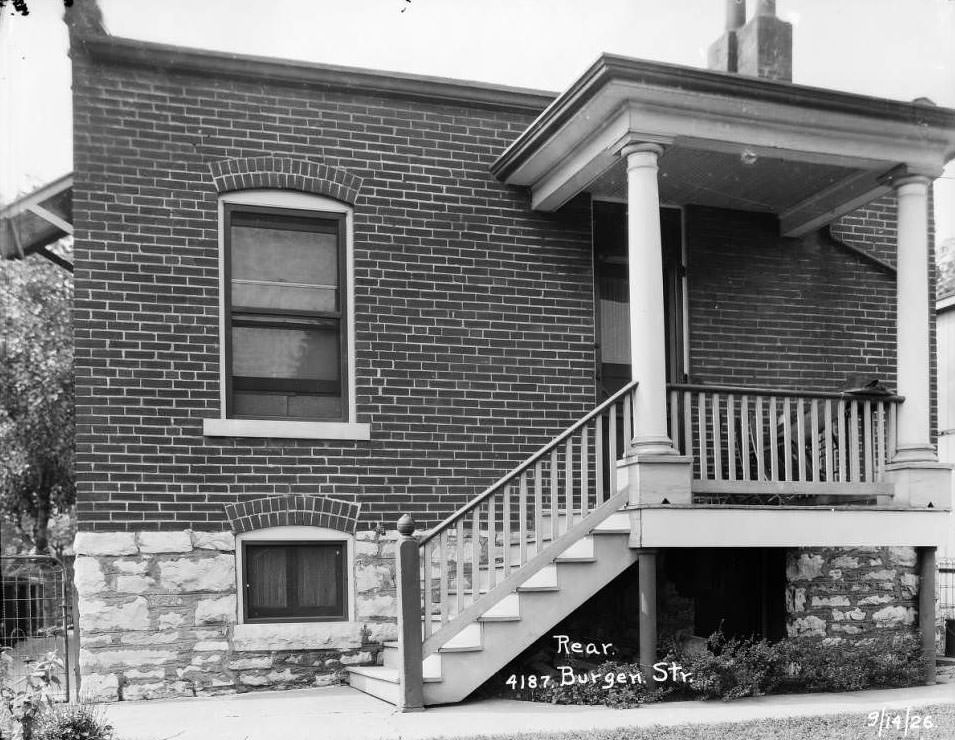
Rear view of house at 4187 Burgen St, 1930
Ward and infirmary building with solarium end walls at the Robert Koch Hospital (formerly Quarantine Hospital on Koch Road, 1930
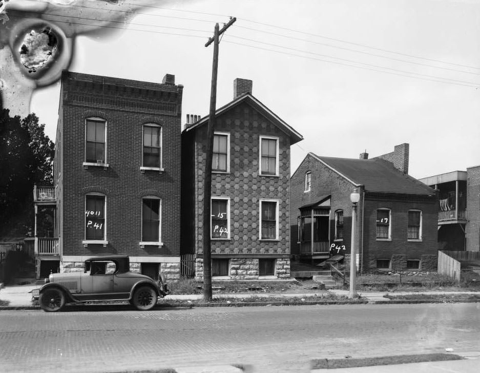
View of 4011 - 4015 - 4017 N. Florissant, 1930
View of 4011 – 4015 – 4017 N. Florissant, 1930
Boy at Joseph Pollard's corner confectionery, 4633 St. Louis Ave. Two women chat next door at Michael Nolan's grocery store at 4631, 1930
Boy at Joseph Pollard’s corner confectionery, 4633 St. Louis Ave. Two women chat next door at Michael Nolan’s grocery store at 4631, 1930
View of the home at 4369 Vista Ave. in Forest Park Southeast neighborhood, now Adams Park near Boys & Girls Clubs of Greater St. Louis, 1930
Looking north up the alleyway on the 1200 block of Market Street, across from City Hall, now Poelker Park, 1930
View from the street of Harry Koenig's grocery store at 1701 Carr, 1930
View from the street of Harry Koenig’s grocery store at 1701 Carr, 1930
Back view of the warehouse at 1216-1218 Chestnut, painted with "Herkert & Meisel Trunk Co." (1930
Back view of the warehouse at 1216-1218 Chestnut, painted with “Herkert & Meisel Trunk Co.” (1930
View of houses on the 4300 block of North Florissant Ave, 1930
View of The Hub, Complete Home Furnishers storefront at 701 Washington Ave, 1930
Looking east on Franklin Ave. towards 14th St. Louis Goldberg Furniture Co. at 1401-05 Franklin Ave, 1930
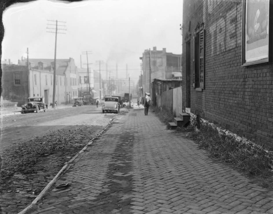
View of alley of O'Fallon between 9th and 10th streets, 1930
View of alley of O’Fallon between 9th and 10th streets, 1930
View of Larsson Auto Repair at 931 N. 11th St. & Anton Riggio's Grocery store at 1000 N. 11th St, 1930
View of Larsson Auto Repair at 931 N. 11th St. & Anton Riggio’s Grocery store at 1000 N. 11th St, 1930
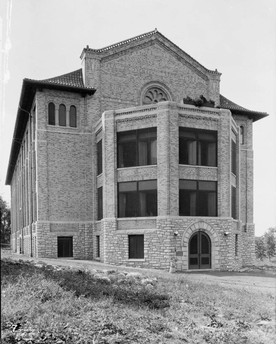
Field House at Buder Playground, 1930
View of residences on the 1100 block of Monroe St. near Webster School in the Old North St. Louis neighborhood, 1930
People gathered outside Toroian Brothers grocery store on the 7500 block of North Broadway, 1930
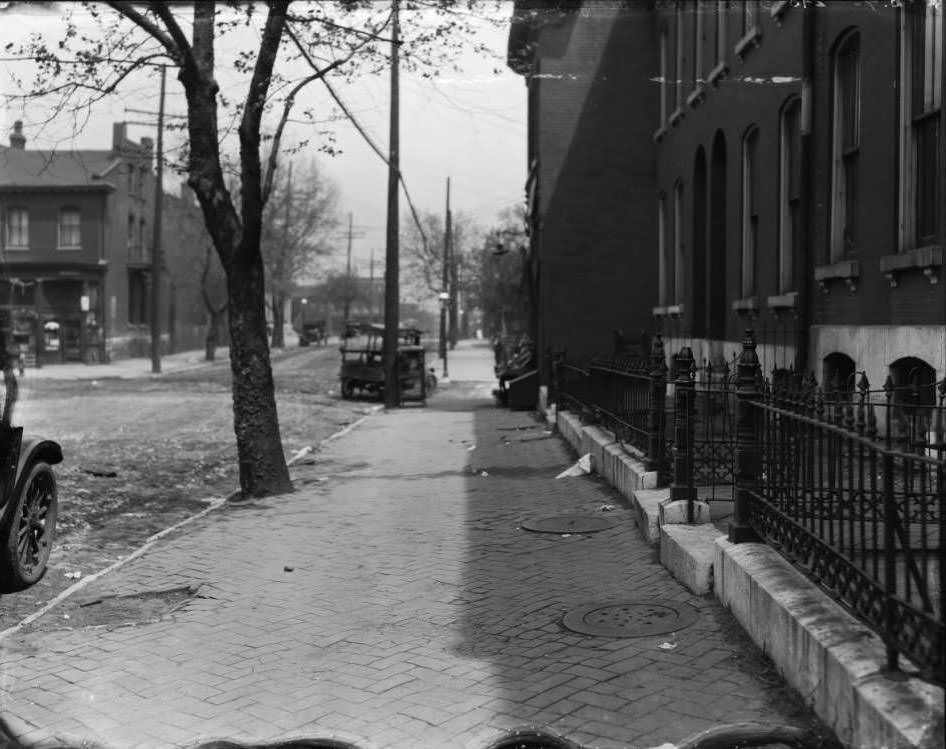
Looking northwest on Walsh St. from just west of South 38th St. in Dutchtown neighborhood, 1930
View of streetcar tracks and street repair. Locations unknown, 1930
View of Wedge Market Grocery Store at 200 S. Compton, 1930
View of Keehn's Market at 1270 S. Broadway run by August and Frank Keehn, 1930
View of Keehn’s Market at 1270 S. Broadway run by August and Frank Keehn, 1930
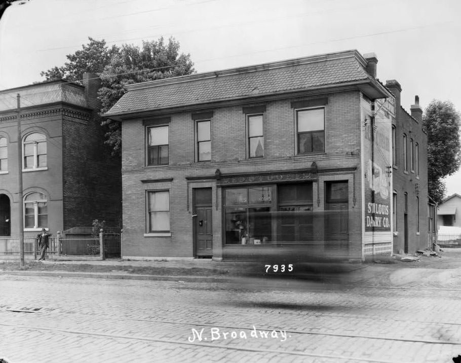
View of residence at 7935 N. Broadway, 1930
Three boys pose in front of Fred H. Gerling store at 3800 West Florissant that advertised chicken and frog legs, 1930
View of Gardner Motor Co. at the northeast corner of Main St, 1st St. and Rutger St, 1930
View of the southwest corner of 12th & Pine, 1930
Fleet of Division of Health vehicles and horse-drawn wagons in front of the Municipal Courts Building, 1930
View of residences at 2317-2319-2325 Randolph St, 1930
View east down St. Louis Ave. at North Garrison Ave. showing Grace Evangelical Lutheran Church, 1930
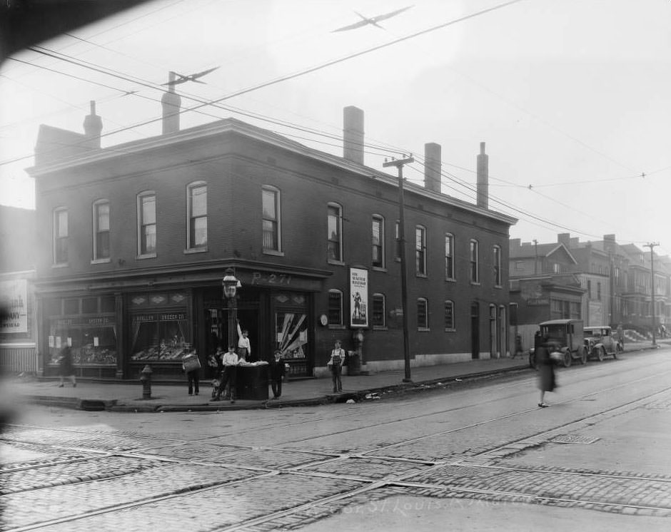
View of Molasky Grocery Store near the intersection of N. 13th and O'Fallon St. with a barrel of brooms and a man painting on the window, 1930
View of Molasky Grocery Store near the intersection of N. 13th and O’Fallon St. with a barrel of brooms and a man painting on the window, 1930
Loose-Wiles Biscuit Co. buildings at 202 and 208 15th St. near Walnut, 1930
Homes at 4369 and 4361 Vista Ave. near S. Newstead in Forest Park SE neighborhood. Now Adams Park near Boys & Girls Clubs and Adams School, 1930
Houses on 4300 block of N. Florissant Ave, 1930
View of intersection at N. 15th St. and Wash Ave. with Congregation Sharis Sfard Synagogue and Carr Square visible, 1930
View looking east from Goedde-Igel Drug Co. at 5801 Easton with bustling foot traffic, cars, and streetcars, 1930
Houses on 4300 St. Louis Ave, 1930
Building that housed Schenberg's Market at southwest corner of California and Gravois with James Printery next door, 1930
Building that housed Schenberg’s Market at southwest corner of California and Gravois with James Printery next door, 1930
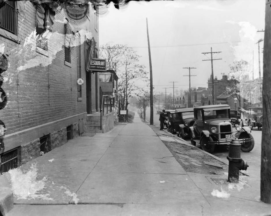
View down 4100 block of Virginia Ave. from northwest corner of Virginia Ave. and Meramec St. with "Restaurant Ladies Entrance" on 3301 Meramec's awning, 1930
View down 4100 block of Virginia Ave. from northwest corner of Virginia Ave. and Meramec St. with “Restaurant Ladies Entrance” on 3301 Meramec’s awning, 1930
Side view of old Municipal Courts Building at 1300 Market St. from 14th St, 1930
View looking north down Grand Ave. from northeast corner of South Grand Blvd. and Fillmore St. with various buildings visible, 1930
Intersection at Morgan (now Delmar and 17th St. with signage for Hecht-Lears Clothing Manufacturers and various other businesses visible, 1930
Interior of Fern House at Shaw's Garden (Missouri Botanical Garden, 1930
Interior of Fern House at Shaw’s Garden (Missouri Botanical Garden, 1930
View of backyards and backporches of homes on Euclid Ave. from St. Louis Ave, 1930
Signs for Windler Wholesale Floral Co. on window at N.E. Cor. 14th & Pine, 1930
View looking east from intersection of 20th St. and Morgan St, 1930
View of railroad overpass on Riverview Blvd. with "Burlington Route, Travel Via, Ship Via, Everywhere West" painted on it, 1930
View of railroad overpass on Riverview Blvd. with “Burlington Route, Travel Via, Ship Via, Everywhere West” painted on it, 1930
View down southside of Carroll St. at intersection with Seventh St. with South Broadway visible, 1930
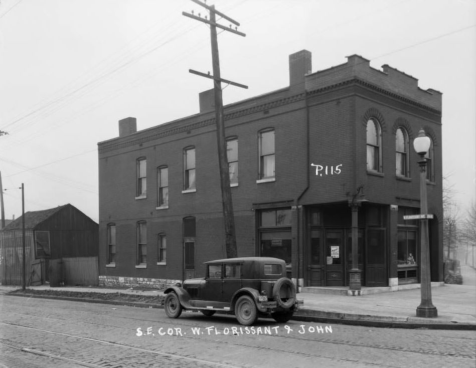
Corner storefront at 4338 John Ave. that was home to Joost's Market with advertisement for Krey's Head Cheese on the door, 1930
Corner storefront at 4338 John Ave. that was home to Joost’s Market with advertisement for Krey’s Head Cheese on the door, 1930
View east down Lucas Ave. towards 9th St. with H. Siegfried Fine Pants store and Lammert Furniture Building visible, 1930
View south on N. Broadway at intersection with East Carrie Ave. with trolley tracks turning into St. Louis Public Service Co. Broadway & Taylor Car Station, 1930
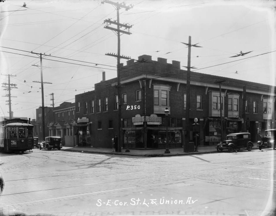
View of large two-story commercial building at Union and St. Louis Aves. that housed Mound City Trust Co. and various tenants, 1930
Evans near Grand, 1930
Salvage site at 1075 Mound St, 1930
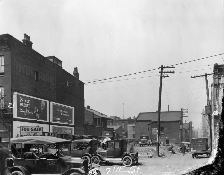
View down alley between #21 and #13 South 7th St. with empty lot and William Goertzen's Bar visible, 1930
View down alley between #21 and #13 South 7th St. with empty lot and William Goertzen’s Bar visible, 1930
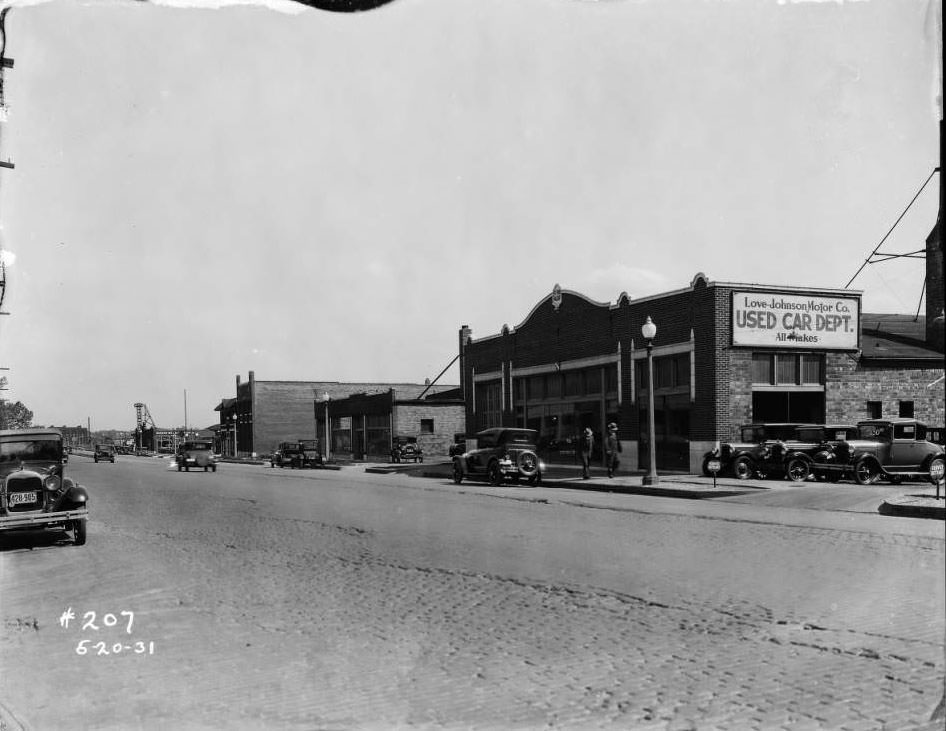
View of Love-Johnson Motor Co. Used Car Dept. building at 5236 Natural Bridge with Warner-Walsh Chevrolet Company building in the distance, 1930
Street view of J. Mueller Grocer Company at 2829 Marcus Avenue, 1930
View north on 13th Street from Cass Ave. Six-story Robert, Johnson & Rand Shoe Co. building and Independent Evangelical Protestant Church are visible, 1930
View of two-story building at Tucker and Lucas (formerly High Street, formerly 12th, 1930
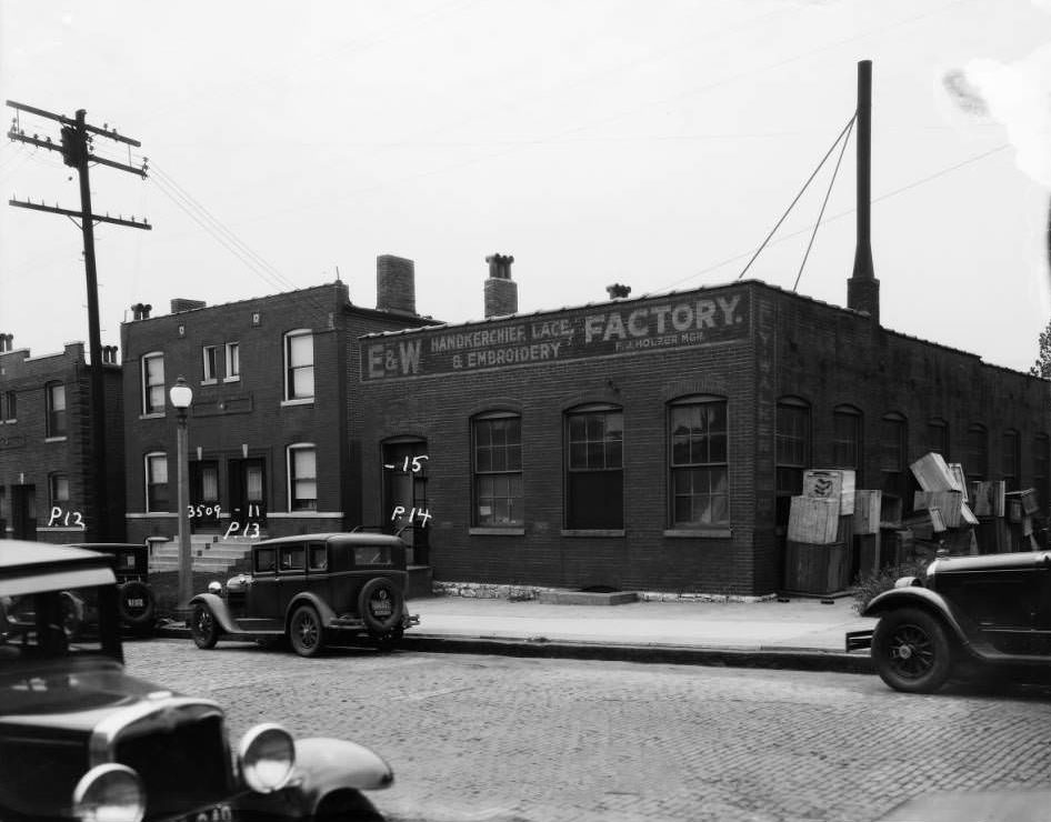
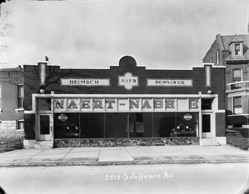
View of Naert-Nash Co. in the Heimsch Auto Repair Co. building on 2819-2323 South Jefferson between Lynch and Pestalozzi, 1930
Street work near Kroger Market. View west down Cote Brilliante Ave. at the intersection with North Newstead Ave, 1930
View of Northeast corner of Gravois and Michigan Ave, 1930
Looking west on Easton Ave at Deer Ave. P.J. Farrington & Sons' Furniture store occupied 4519 Easton, 1930
Looking west on Easton Ave at Deer Ave. P.J. Farrington & Sons’ Furniture store occupied 4519 Easton, 1930
View looking east down Olive from west of 18th Street. Several businesses including Quirk Luggage, Paris Hotel, Draper Drug Company, and Walker-Armstrong House Furnishing Company are visible, 1930
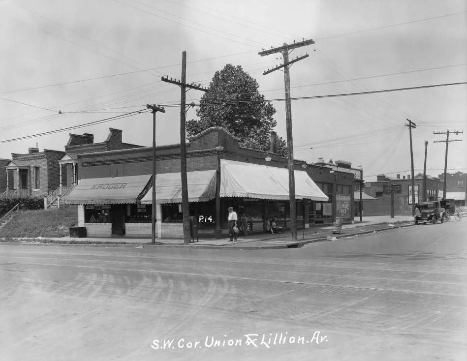
View of Kroger store at 5300 Lillian with sign for Joseph Siegel's dry goods store at 5310 Lilian Avenue in the shot, 1930
View of Kroger store at 5300 Lillian with sign for Joseph Siegel’s dry goods store at 5310 Lilian Avenue in the shot, 1930
View of two buildings on the 3900 block of West Florissant which housed a laundry and hat shop respectively, 1930
St. Louis Dept. of Streets and Sewers, 1930
View of several storefronts on the 100 block of South 7th Street between Walnut and Elm. Keystone Lubricating Company, St. Louis Wholesale Drug Company, and James Robinson's restaurant are visible, 1930
View of several storefronts on the 100 block of South 7th Street between Walnut and Elm. Keystone Lubricating Company, St. Louis Wholesale Drug Company, and James Robinson’s restaurant are visible, 1930
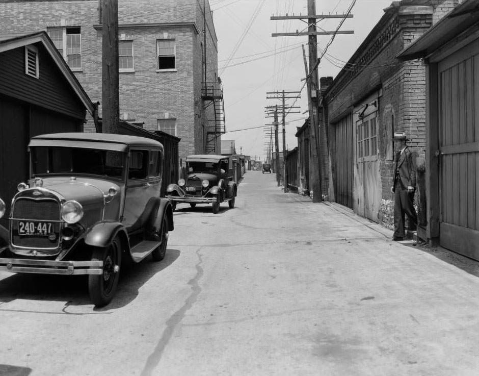
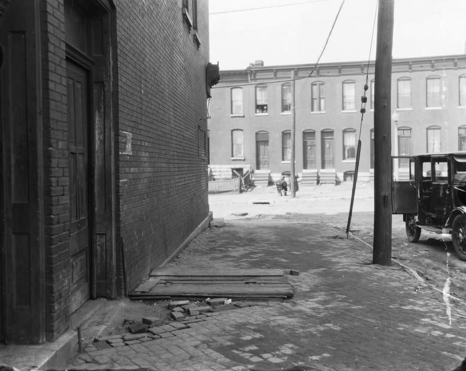
View of a garage and rears of multi-family residences, 1930
View of Southeast corner of 14th & Pine, 1930
View of a large home on North 11th Street between Clinton Place and Monroe with a man sitting on the porch, 1930
View east down Olive Street at the intersection with Pendleton Ave. Y.W.C.A. Hotel and Cafeteria and Sid Whiting Studios are visible, 1930
View of a large home, courtyard, and pergola, 1930
View looking east down Osceola at South Compton in the Dutchtown neighborhood with a woman and child walking away from the camera, 1930
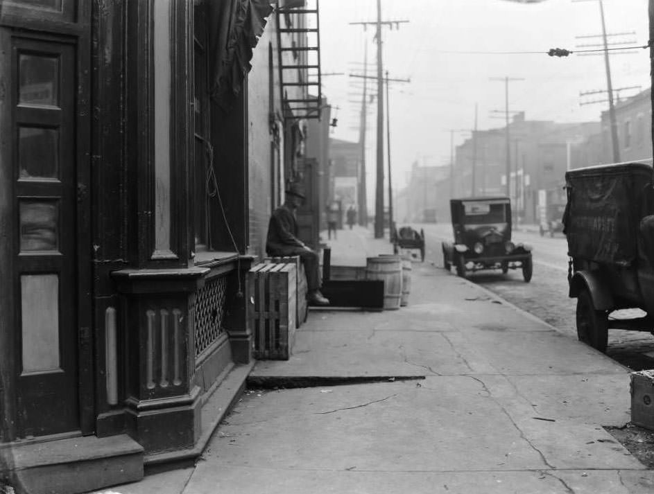
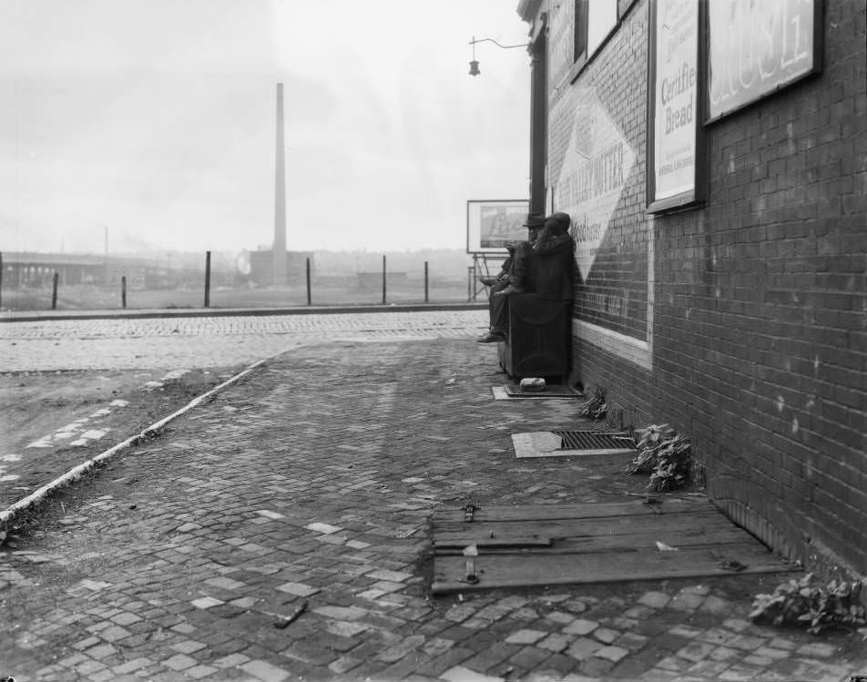
View of two men sitting on a cupboard beside a building at Leonard Street and Market Street. Blue Valley Butter sign is visible, 1930
View of Schenberg's market at 2800 Gravois, 1930
View of Schenberg’s market at 2800 Gravois, 1930
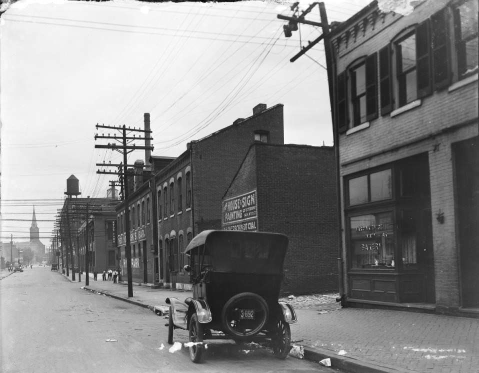
View of St. Louis Avenue at Spring where Anton Paintner operated a bakery at 3648 Spring, 1930
View looking North from the corner of Olive and N. Compton toward Locust Street. Standard Auto Parts is visible in the distance, 1930
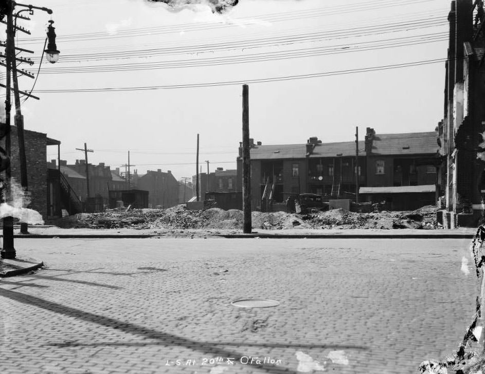
View of L-S at 20th & O'Fallon, 1930
View of L-S at 20th & O’Fallon, 1930
View of several construction workers on a large building site, 1930
View of storefronts on the 800 block of North Jefferson between Morgan and Franklin. Sign for Joseph Berzon's tailor shop and other businesses are visible, 1930
View of storefronts on the 800 block of North Jefferson between Morgan and Franklin. Sign for Joseph Berzon’s tailor shop and other businesses are visible, 1930
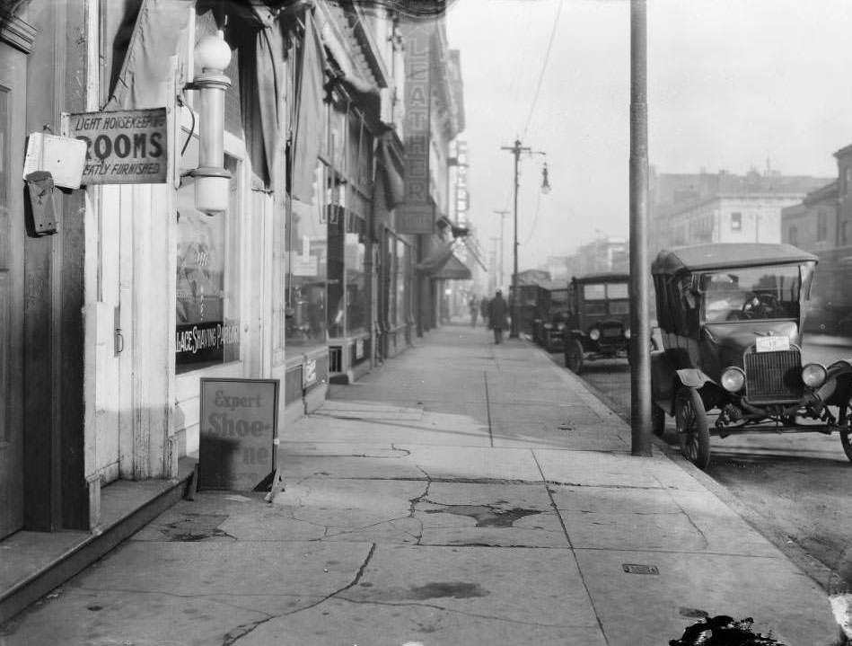
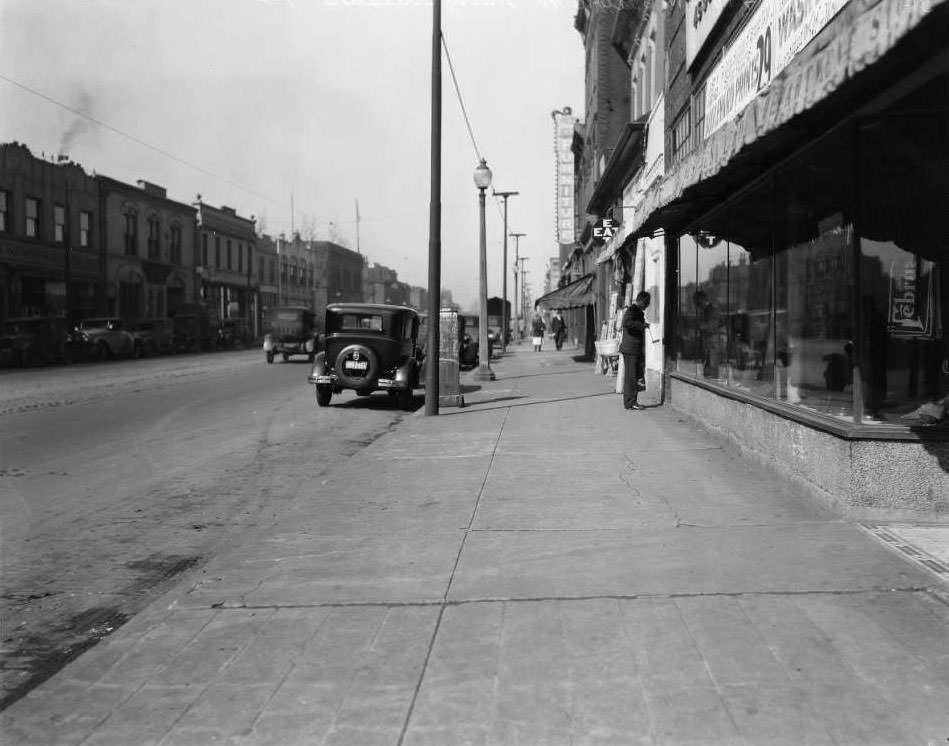
Downtown sidewalk view including O. T. Hodges Chile Con Carne and Hot Tamale Restaurant at 18 South 18th Street, 1930
Street work in front of Chas. Roettger AG Stores. Corner of Sullivan and Prarie, 1930
Two-story storefronts at the 3900 block of West Florissant at College Avenue. Kling and Katch Men's Furnishings at 3934-3936. Florissant Leader, Ready to Wear Clothing at the corner, 1930
Two-story storefronts at the 3900 block of West Florissant at College Avenue. Kling and Katch Men’s Furnishings at 3934-3936. Florissant Leader, Ready to Wear Clothing at the corner, 1930
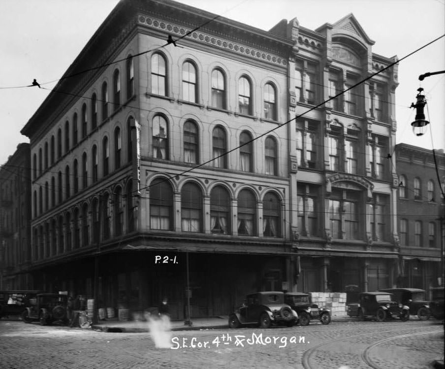
Southeast corner of 4th and Morgan Street. Frisco Poultry Co. at 800 4th, 1930
Morris Motor Company Ford dealership at South Grand and Caroline, 1930
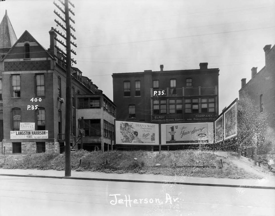
Offices of J. H. Roberts, lawyer, and Dr. J.S. Dorsey. Elroy Manufacturing Co. at the 400 block of Jefferson Ave, 1930
Centenary Methodist Church steeple visible at the north down 16th Street at approximately Walnut Street, 1930
View north up Glasgow Ave. from in front of 1354 Glasgow Ave. Sheridan Ave. is the next intersection, 1930
Large commercial building at Union and St. Louis Avenues, home to Peters Shoes and Mound City Restaurant, 1930
View looking South from 22nd Street at Papin towards Chouteau, 1930
View east down Cass Ave. from the intersection with North Jefferson Ave. The first building on the right is 2500 Cass Ave, 1930
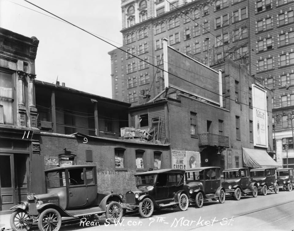
Exterior view of buildings and parked automobiles at the rear southwest corner of 7th and Market Street, 1930
Southside of Scott Ave., 25' from the intersection with Ewing Ave. The view is looking west, 1930
Southside of Scott Ave., 25′ from the intersection with Ewing Ave. The view is looking west, 1930
View east down Easton Ave. from in front of 5438 Easton Ave. Location of Harry Duel's Grocery, 1930
View east down Easton Ave. from in front of 5438 Easton Ave. Location of Harry Duel’s Grocery, 1930
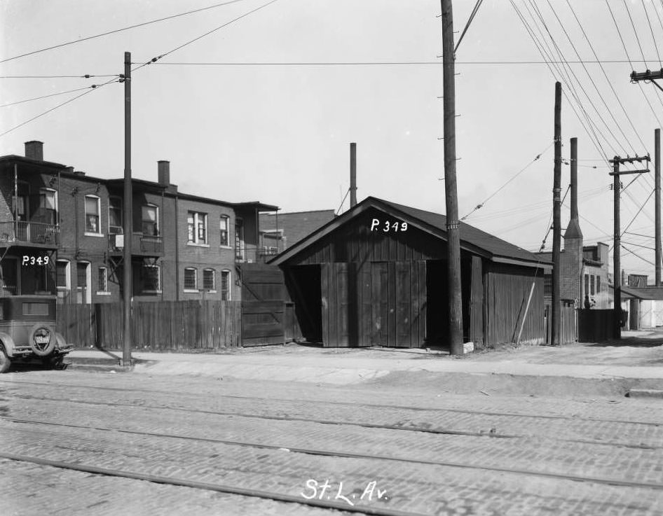
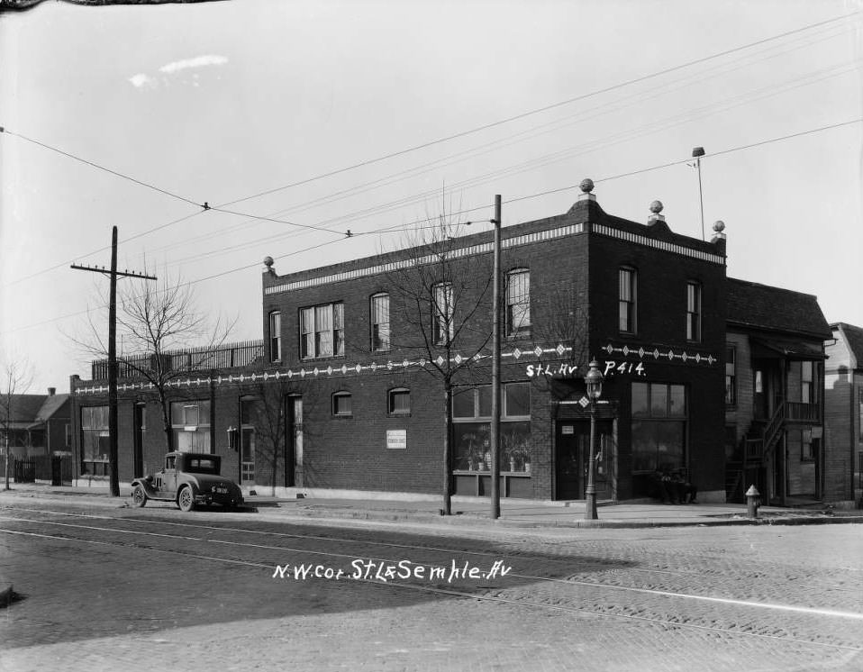
Northwest corner of St. L. and Semple Ave, 1930
A truck and five men decorated for a parade with a Chemical Engineering sign parked in front of St. Louis City Hall, 1930
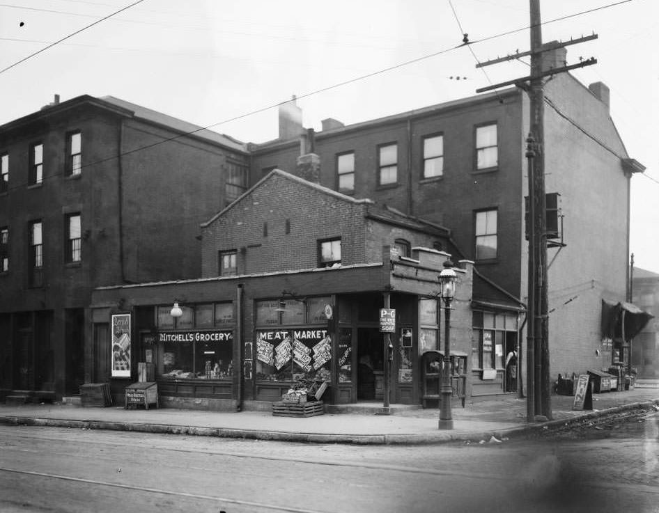
Mitchell's Grocery and Meat Market and Star Shining Parlor at the southeast corner of Laclede Ave. and South Leffingwell Ave, 1930
Mitchell’s Grocery and Meat Market and Star Shining Parlor at the southeast corner of Laclede Ave. and South Leffingwell Ave, 1930
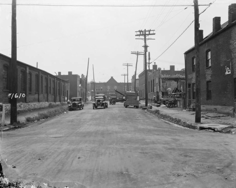
View of sewer installation and construction in Section F, 1930
Workers outside St. Louis City Hall. A sign reads: Many - Bland Ins. Agency Insures the Operations of Anton Beffa & Sons Wrecking and Supply Co, 1930
Workers outside St. Louis City Hall. A sign reads: Many – Bland Ins. Agency Insures the Operations of Anton Beffa & Sons Wrecking and Supply Co, 1930
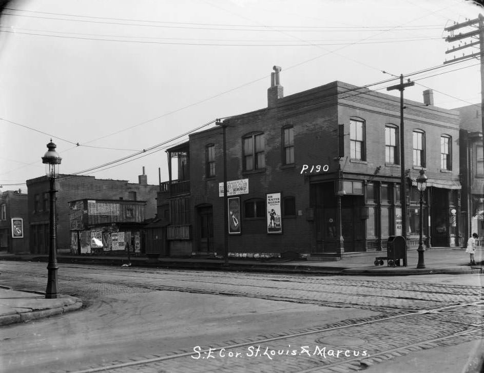
Southeast corner of St. Louis and Marcus, 1930
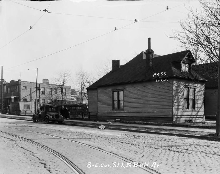
Southeast corner of St. L. and Belt Av, 1930
Phil Becker Grocery on the left at Etzel and Goodfellow, 1930
Scharlott's 5 cents to 1 dollar store at 3948-3952 West Florissant. Next to Lowell Bank, 1930
Scharlott’s 5 cents to 1 dollar store at 3948-3952 West Florissant. Next to Lowell Bank, 1930
View south down Broadway at the intersection with East Carrie Ave. O'Fallon Park is on the right, 1930
View south down Broadway at the intersection with East Carrie Ave. O’Fallon Park is on the right, 1930
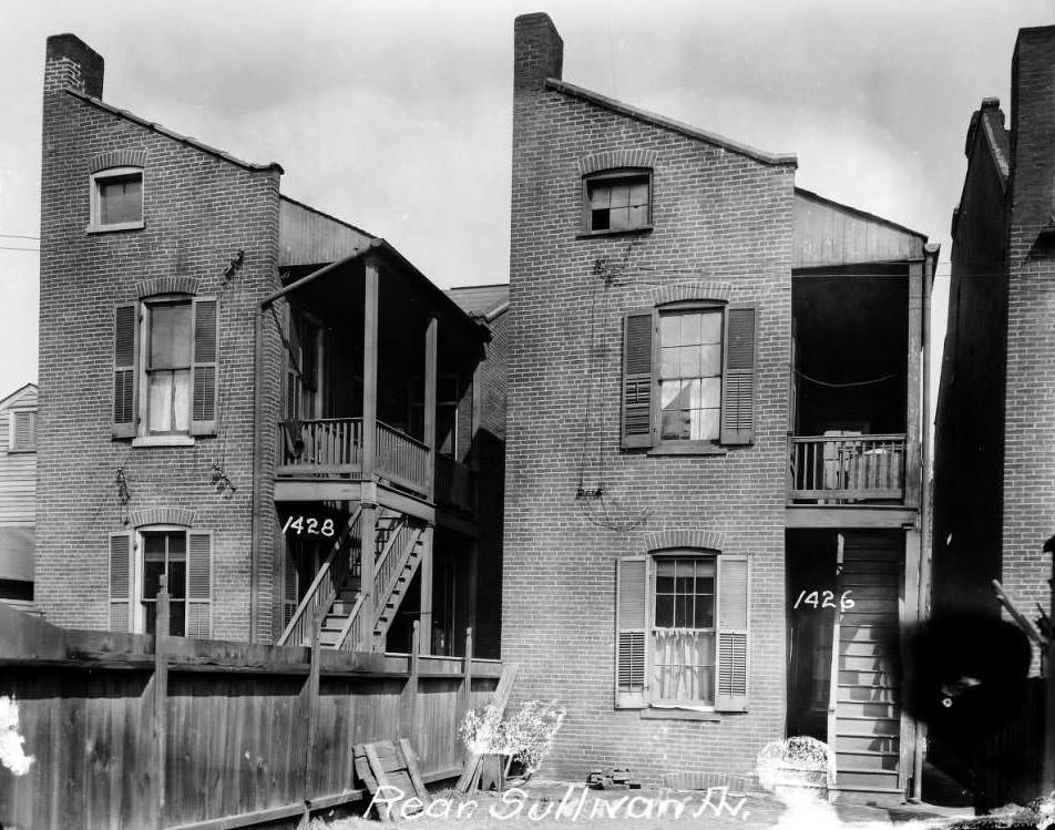
Rear of houses on 1400 block of Sullivan, 1930
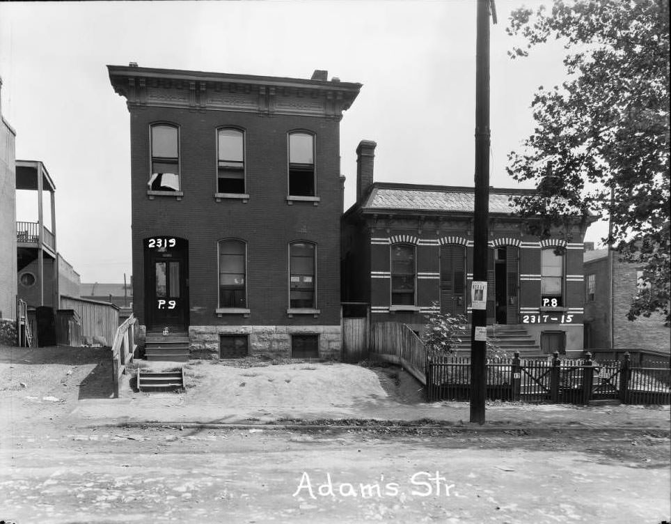
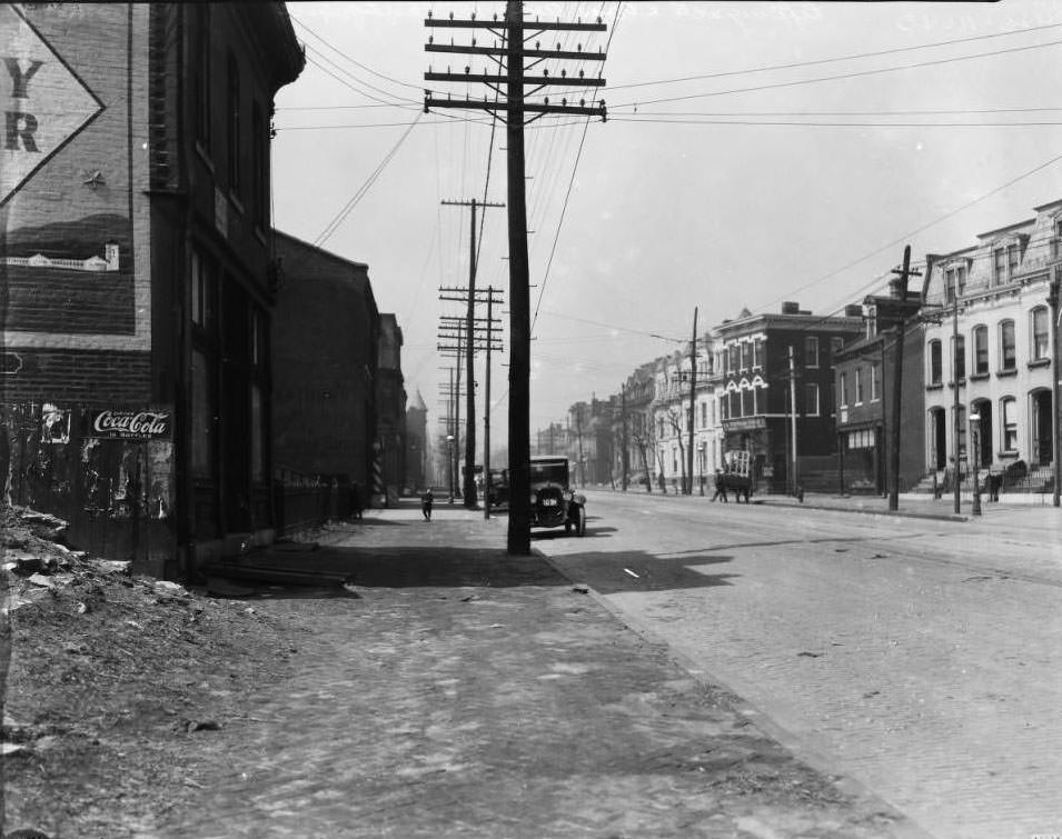
View of 2300 block of Adams Street, 1930
View of railyard building and trestle. Near Chouteau Ave, 1930
Rear 1103, Rear 1105 Monroe Str, 1930
View of 2300 block of Adams St. Adams Grocer in front of 2324 Adams, 1930
View of Cass Avenue near Leffingwell and Elliot. F.H. Portmann Storage Company visible on right, 1930
Building at Tucker and Linden St. in downtown St. Louis, 1930
Two buildings at 4341 and 4347 Vista Avenue, 1930
View of 1900 block of S. Broadway near Geyer Ave. Dry cleaning business at 1910 owned by Frank Kembleger visible, 1930
View of two small commercial buildings at 4652-4654 St. Louis Ave, 1930
Sign for Litsch & Litsch Chiropractors at 3347 California Ave, 1930
Sign for Obelite Products at 3811 North Market, 1930
Residential neighborhood at Washington Place and Lake Ave, 1930
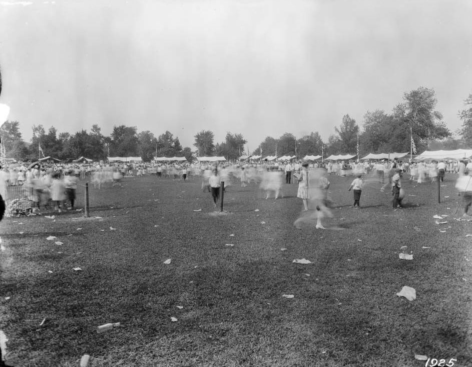
Children on field from Saint Louis Dept. of Streets and Sewers, 1930
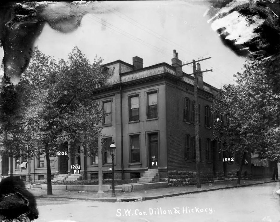
Large corner residential building at 1201-1203-1205 Dillon, 1930
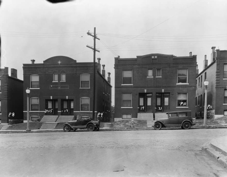
Buildings on 3400 block of North Florissant at 3415-3417-3419-3421, 1930
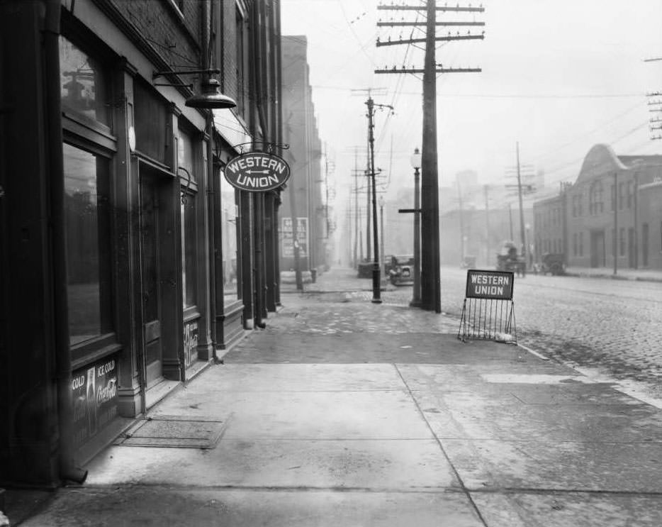
View of North Broadway and Monroe Street. Western Union office at 2221 N. Broadway visible, 1930
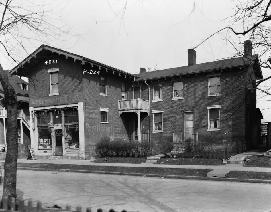
View of 4861 St. Louis Ave, 1930
Completed Nathan Frank Bandstand near the Muny in Forest Park, 1930
View of multi-family brick dwellings including 2926 Sheridan Ave. in the JeffVanderLou neighborhood, 1930
Buildings on the southeast corner of West Florissant and DeSoto, 1930
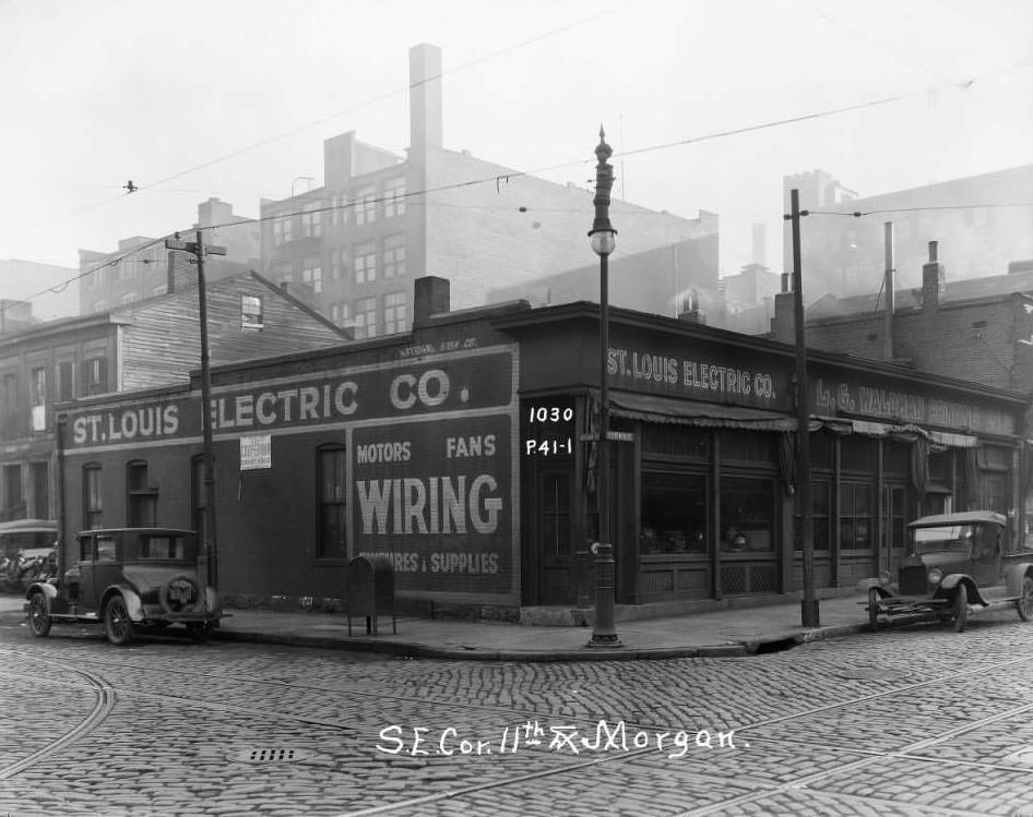
View of southeast corner of 11th and Morgan Street. St. Louis Electrical Co. visible, 1930
Four two-story frame homes on the 4400 block of North Florissant Avenue, 1930
View of Union Market building at 701 N. Broadway, 1930
View of River Des Peres sewer work, 1930
One-story brick homes on the 2800 block of Utah at the intersection with Oregon, 1930
View of south St. Louis intersection including businesses, Princeton Electric and Battery Company at 3115 Gravois and Heil Company, 1930
View of several buildings on the 4000 block of Olive Street between Vandeventer and Sarah, 1930
View of northwest corner of High Street, home to the Imperial Restaurant at 717-727, 1930
View of sewer installation and construction, 1930
Enjoyed this post? Get new ones in your inbox.

Leave a Comment

Your email address will not be published. Required fields are marked *

Share this Post 🥺

Please take a moment to share this content. Your support is greatly appreciated! 🙌🙏

Share this Post 🥺

Please take a moment to share this content. Your support is greatly appreciated! 🙌🙏
Scroll to Top
 
Hey Friend, Before You Go.. Please like & follow for more interesting content