
Manhattan is the beating heart of New York City. It sits on an island surrounded by the Hudson, East, and Harlem rivers, and it has served as the city’s cultural, financial, and governmental center for centuries. Long before skyscrapers defined its skyline, the land was home to the Lenape people, who lived along its rivers and forests for thousands of years. By the early 20th century, the New York City Subway was up and running, and new bridges to Brooklyn tied Manhattan tighter to the rest of the city. Then came the 1920s, when a massive wave of African Americans arrived in Harlem as part of the Great Migration from the South, reshaping entire neighborhoods and planting the seeds of a cultural explosion. But it was the 1930s that truly tested the city. The Great Depression cast a long shadow over Manhattan’s streets, and the photos from that decade capture a city that was gritty, alive, and never short of character.
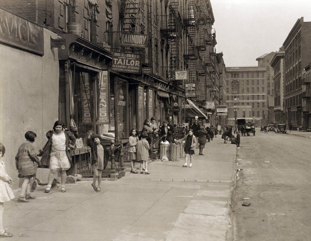
The residential streets of lower and mid-Manhattan in the early 1930s were lined with brick tenements, corner stores, and the everyday motion of working-class life. Pushcarts, delivery trucks, and pedestrians competed for space on narrow roads that hadn’t changed much since the previous century. The street grid was a constant hum of commerce and survival.
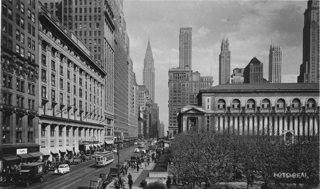
By the late 1930s, 42nd Street had already earned its reputation as one of the most electric corners in the world. Movie theaters, restaurants, and shops packed the blocks near Sixth Avenue, drawing crowds from every corner of the city. Even during the Depression, Midtown Manhattan buzzed with foot traffic and neon signs.
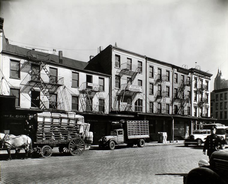
West Street ran along the Hudson River waterfront, and in the mid-1930s it was one of the city’s busiest industrial corridors. Warehouses, shipping offices, and freight operations lined the blocks, feeding the docks just steps away. The waterfront was the economic backbone of lower Manhattan, moving goods in and out of the city around the clock.
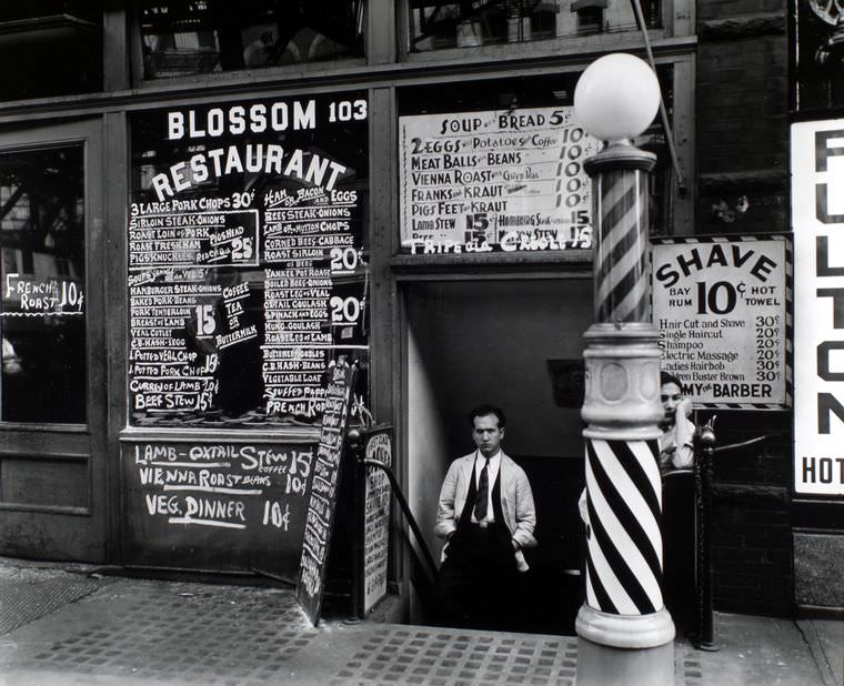
The Bowery was one of Manhattan’s oldest and most storied streets. By 1935, it was a strip of cheap lodging houses, small restaurants, and pawnshops that catered to the city’s working poor and unemployed. The Blossom Restaurant at 103 Bowery was one of dozens of modest eateries that offered affordable meals to people scraping by during the Depression years.
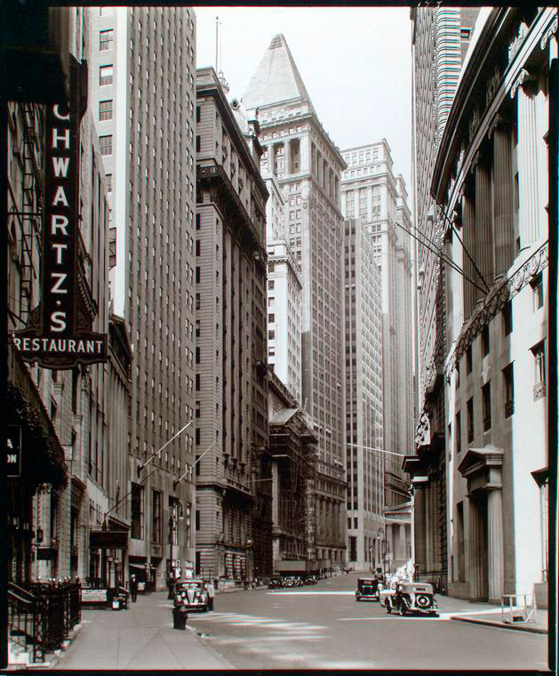
Broad Street, leading straight toward Wall Street, was the symbolic nerve center of American finance. Even in 1936, years into the Depression, the towering stone facades of banks and trading houses projected an air of permanence and power. The street itself was narrow, hemmed in by tall buildings that turned it into a canyon of commerce.
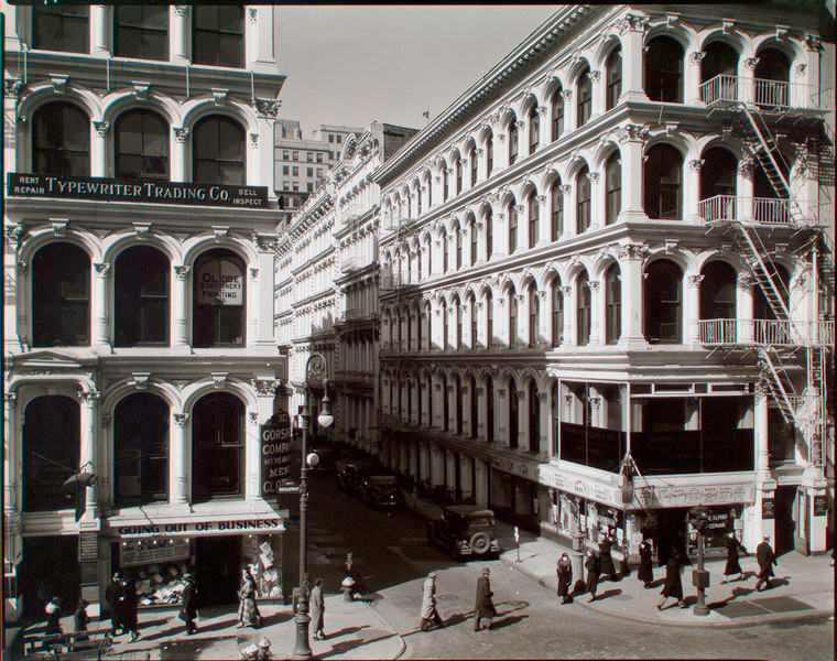
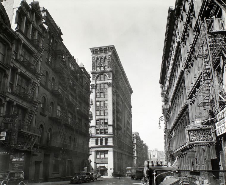
Lower Broadway in the mid-1930s was a different world from the bright lights of Times Square further north. Near Broome Street, the avenue was lined with manufacturers, textile dealers, and small wholesalers operating out of older cast-iron buildings. Street-level storefronts displayed goods in hand-lettered windows, and the sidewalks carried a steady flow of workers and delivery men throughout the day.
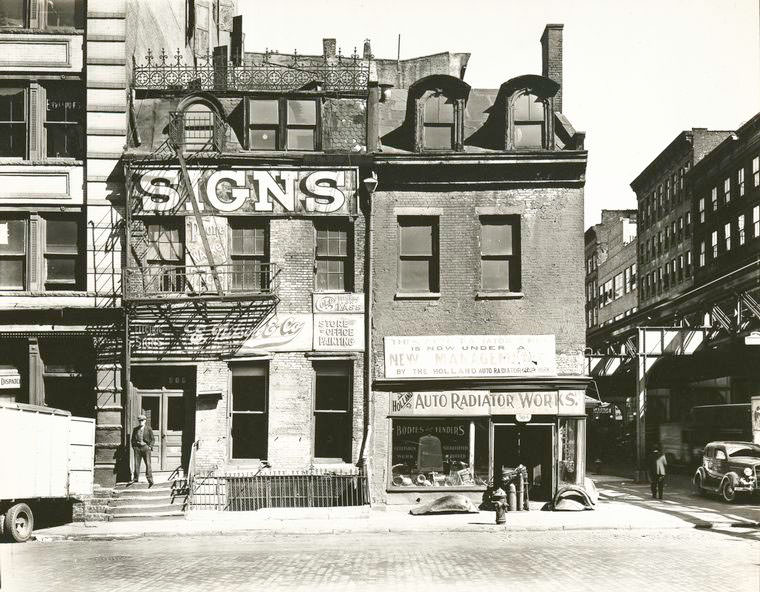
Broome Street cut through one of Manhattan’s densest neighborhoods, where immigrant families from Italy, Eastern Europe, and China had settled in tightly packed tenements. By 1935, those communities had been there for decades, giving the street a layered character that blended old-world habits with the rhythms of a modern American city.
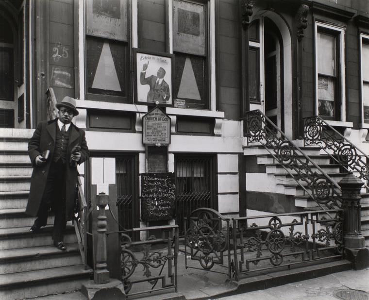
In Harlem, churches were far more than places of worship. They served as community anchors, political meeting grounds, and social support networks for the thousands of African Americans who had relocated there from the South. The Church of God on East 132nd Street was part of a dense spiritual landscape that made Harlem one of the most church-rich neighborhoods in the entire country.
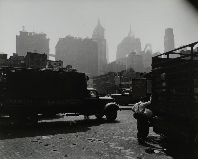
Looking east from West Street in 1938, Manhattan’s skyline was already a dense vertical forest of towers and rooftops. The view captured a city in transition — still scarred by the economic collapse of the early 1930s, but beginning to find its footing again as the decade drew to a close.
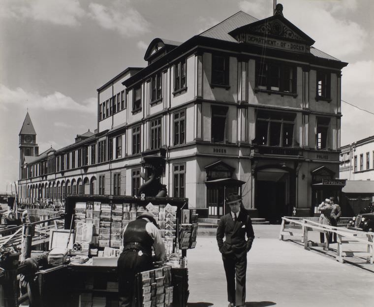
Pier A at the mouth of the North River housed both the Department of Docks and a police station, making it one of the most important administrative points along Manhattan’s waterfront. The pier controlled the flow of maritime traffic into one of the world’s busiest ports, and the police presence there reflected just how much money and cargo passed through those waters every day.
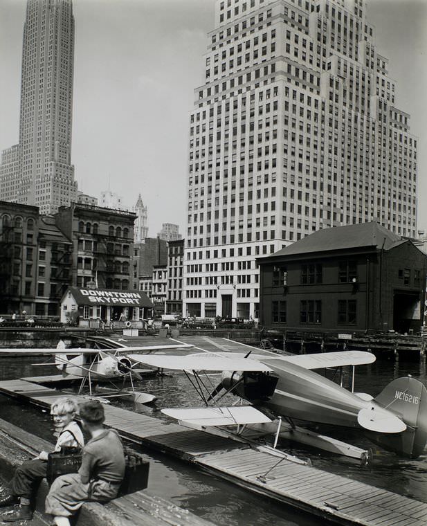
In the mid-1930s, seaplanes were a genuine mode of transportation for those who could afford them. The Downtown Skyport at Pier 11 on the East River was a base for flying boats that connected Manhattan to destinations up and down the East Coast. It was a striking sight — aircraft lifting off directly from the river in the shadow of the financial district.
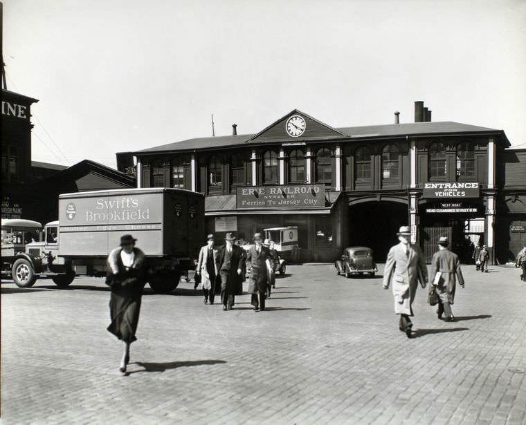
Before bridges and tunnels dominated cross-river travel, ferries were an essential part of daily life in Manhattan. The Chambers Street ferry terminal connected Manhattan to the other side of the Hudson, carrying commuters, workers, and freight back and forth across the water. Even in 1936, the ferries remained busy, especially for those who couldn’t afford or didn’t need the newer fixed crossings.
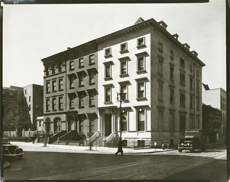
Fifth Avenue in 1936 was already Manhattan’s most famous street. Even during the Depression, the avenue maintained its reputation as a showcase of elegance, lined with luxury shops, grand hotels, and landmark buildings. The sidewalks were wide, the storefronts polished, and the contrast with the poverty visible just a few blocks away was sharp and undeniable.
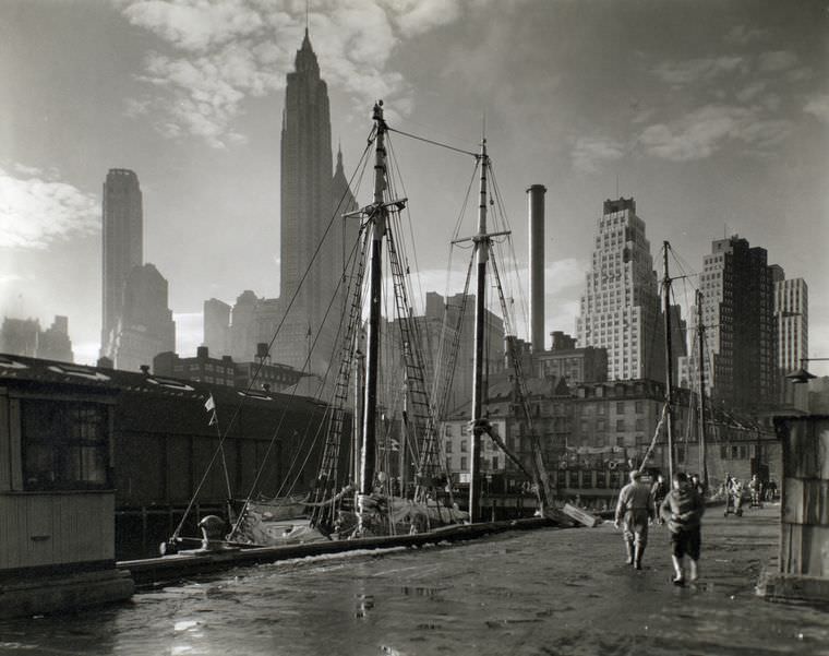
The Fulton Street Dock was one of the oldest and most active points along the East River waterfront. By the mid-1930s, it served both commercial shipping and the famous Fulton Fish Market, which had been operating nearby since 1822. Fishermen, buyers, and workers moved through the area before dawn, making it one of the earliest-rising spots in the entire city.
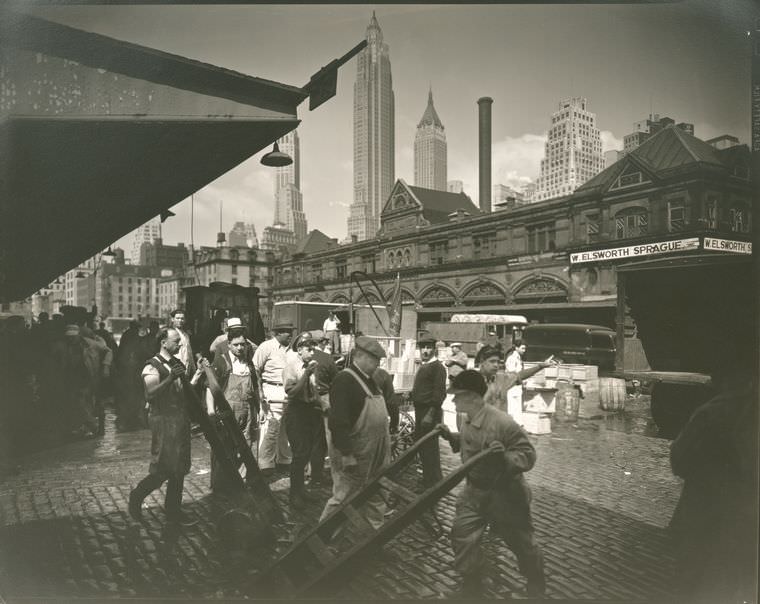
The Fulton Fish Market was a raw, loud, and pungent operation that supplied restaurants and retailers across the city. Each morning, boats unloaded their catches directly onto the docks, and buyers haggled over prices in the open air. The smell carried for blocks, and the noise started well before sunrise. It was one of the most chaotic and essential operations in Depression-era Manhattan.
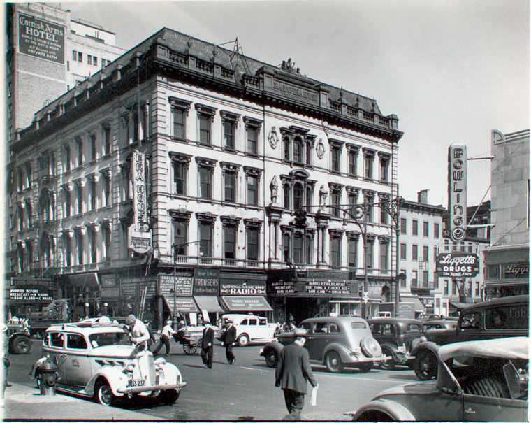
The Grand Opera House at 23rd Street and Eighth Avenue had a storied history by the time this photo was taken in 1937. Originally built as a performance venue, it had cycled through various uses over the decades. By the 1930s, the building’s grand exterior still stood as a reminder of an earlier, more theatrical era of Manhattan life, even as the neighborhood around it had changed dramatically.
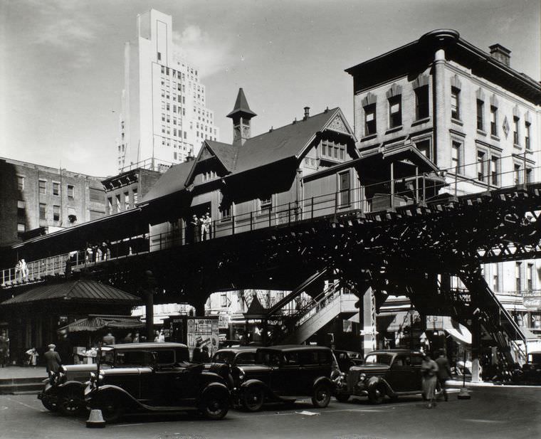
Hanover Square sat in the heart of lower Manhattan’s financial district, a small open space surrounded by the offices of trading firms, commodity brokers, and shipping companies. In the 1930s, it was one of the few places downtown where a worker could sit outside during a lunch break, removed — just barely — from the noise of the surrounding streets.
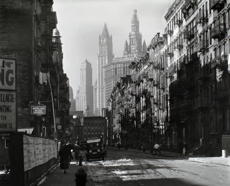
Henry Street on the Lower East Side was a center of immigrant working-class life. The Henry Street Settlement, founded by Lillian Wald in 1895, continued operating through the Depression years, offering healthcare, social services, and education to the neighborhood’s struggling residents. The street itself was a dense mix of tenements, small businesses, and the constant activity of a neighborhood fighting to stay afloat.
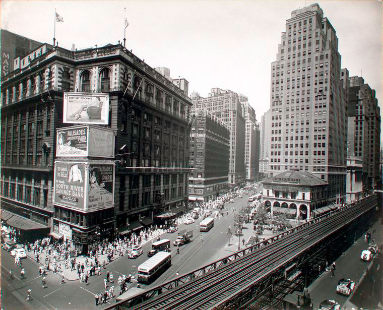
Herald Square, where Broadway crossed 34th Street, was one of Manhattan’s great commercial crossroads. Macy’s department store anchored the corner, and the surrounding blocks were packed with shops, theaters, and transit connections. In the summer of 1936, the square was alive with shoppers and office workers despite the economic hardship that still gripped much of the city.
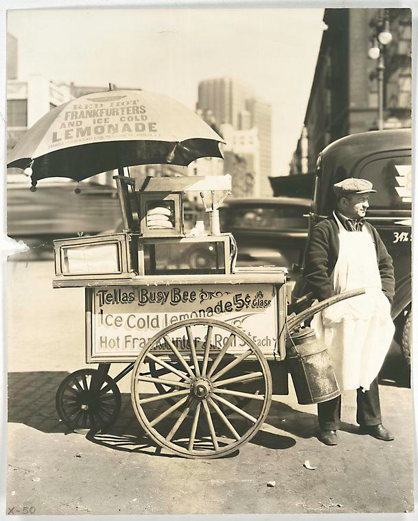
Street food vendors were a fixture of Depression-era Manhattan. A hot dog stand at the corner of West Street and North Moore served dockworkers, truck drivers, and passersby who needed a quick and cheap meal. These carts and stands were a lifeline for both their owners, who scraped together a living from small sales, and their customers, who couldn’t afford a sit-down meal.
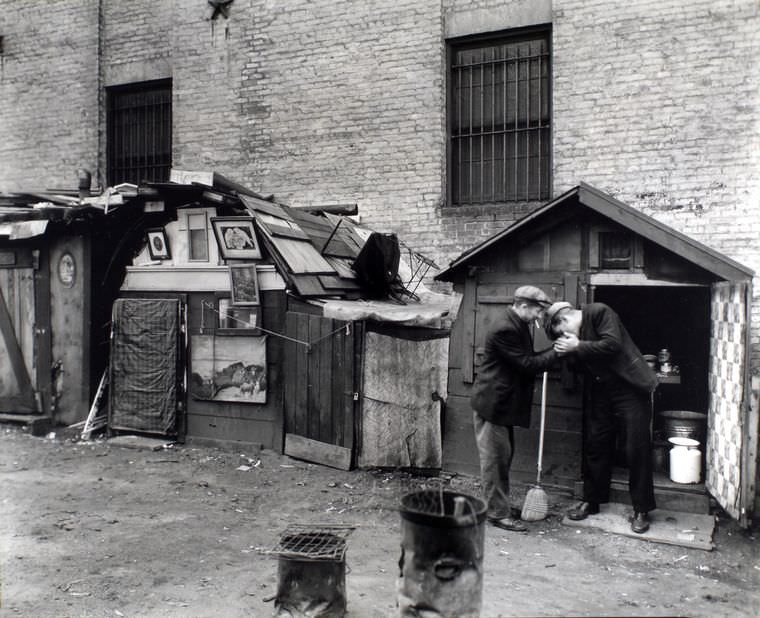
The Depression left thousands of New Yorkers without homes or steady work. In lower Manhattan, makeshift encampments appeared on vacant lots and along neglected streets. At West Houston and Mercer Street in October 1935, men who had lost their jobs and housing built crude shelters from scrap wood and salvaged materials, living in the open in one of the world’s wealthiest cities.
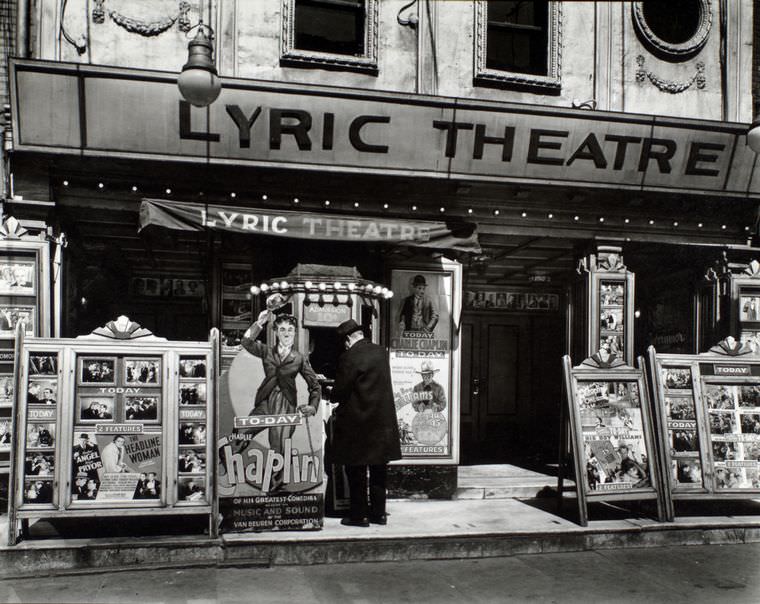
Movie theaters and small performance venues like the Lyric Theatre on Third Avenue provided one of the few affordable escapes from hard times. A nickel or dime could buy a few hours of entertainment, and theaters across Manhattan stayed busy even as other businesses struggled. For many New Yorkers, the local theater was as essential as any grocery store.
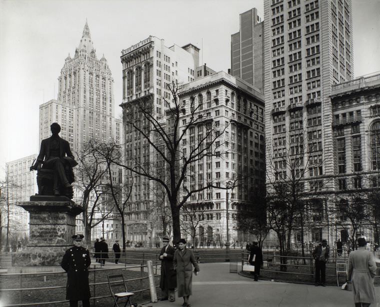
Madison Square, at the intersection of Fifth Avenue and Broadway near 23rd Street, had been one of Manhattan’s most fashionable addresses in an earlier era. By 1936, the surrounding neighborhood had shifted, but the square itself remained a public green space where office workers and locals gathered. The Flatiron Building loomed nearby, a constant landmark above the treetops.
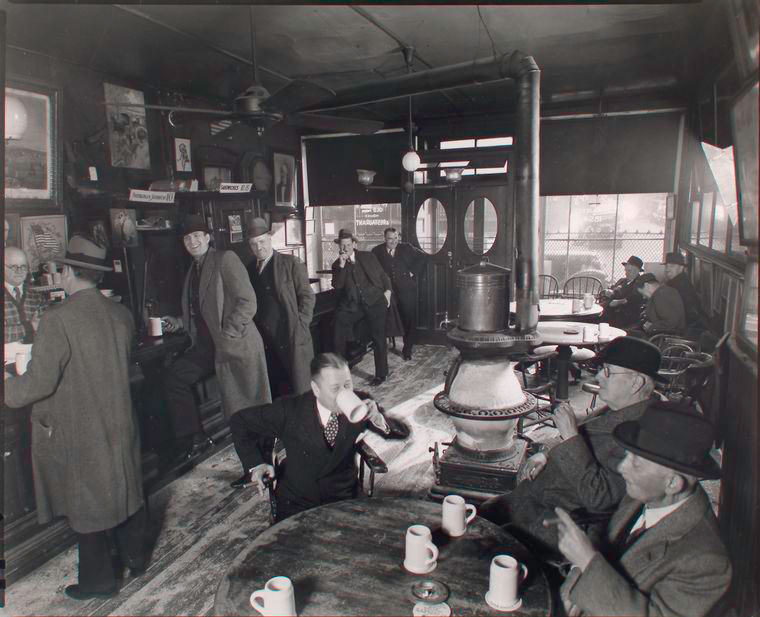
McSorley’s Old Ale House on East 7th Street was already one of Manhattan’s oldest bars by the time this photo was taken in 1937. Founded in 1854, the tavern had served generations of New Yorkers and kept most of its original interior intact, including gas lamps, old newspaper clippings on the walls, and sawdust on the floor. It was one place in the city where time moved very slowly.
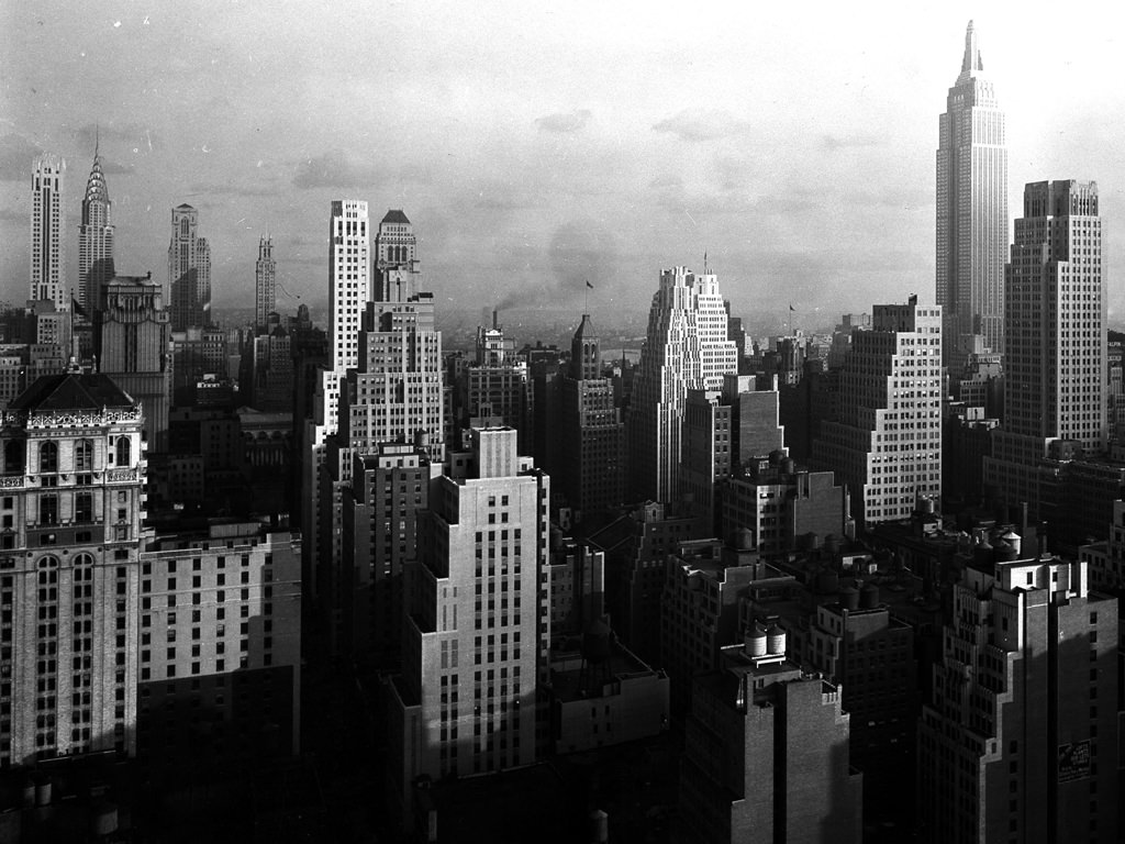
Taken from the McGraw-Hill Building in 1931, this view of Midtown Manhattan showed a skyline that had been radically reshaped over the previous decade. The Empire State Building had just opened that year, and the Chrysler Building stood gleaming nearby. Even with the Depression underway, the physical growth of Midtown told the story of the 1920s boom that had transformed the city.
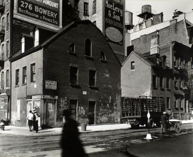
The corner of Mulberry and Prince Streets sat at the edge of Little Italy, one of Manhattan’s most tightly knit immigrant neighborhoods. Italian families had been settling there since the late 19th century, and by 1935 the area had a full ecosystem of bakeries, butcher shops, social clubs, and churches. The street corner was a social hub as much as a geographic one.
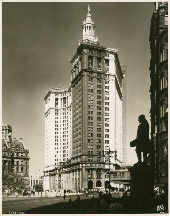
The Municipal Building, completed in 1914, was the administrative heart of New York City government. Its massive frame straddled Chambers Street, and its tower, topped with the gilded statue of Civic Fame, rose above the surrounding streets of lower Manhattan. By 1936, thousands of city workers passed through its doors every day, managing everything from marriage licenses to public works projects.
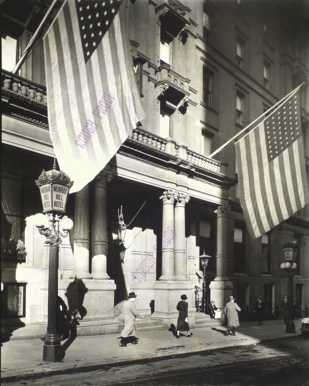
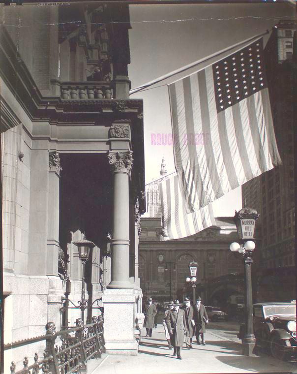
The Murray Hill Hotel, photographed twice on the same November day in 1935, was a surviving relic of 19th-century Manhattan hotel life. It had hosted presidents and prominent figures in its heyday, but by the mid-1930s the building was aging and its neighborhood had changed around it. These two photographs together capture the hotel from different angles, revealing both its scale and its faded grandeur.
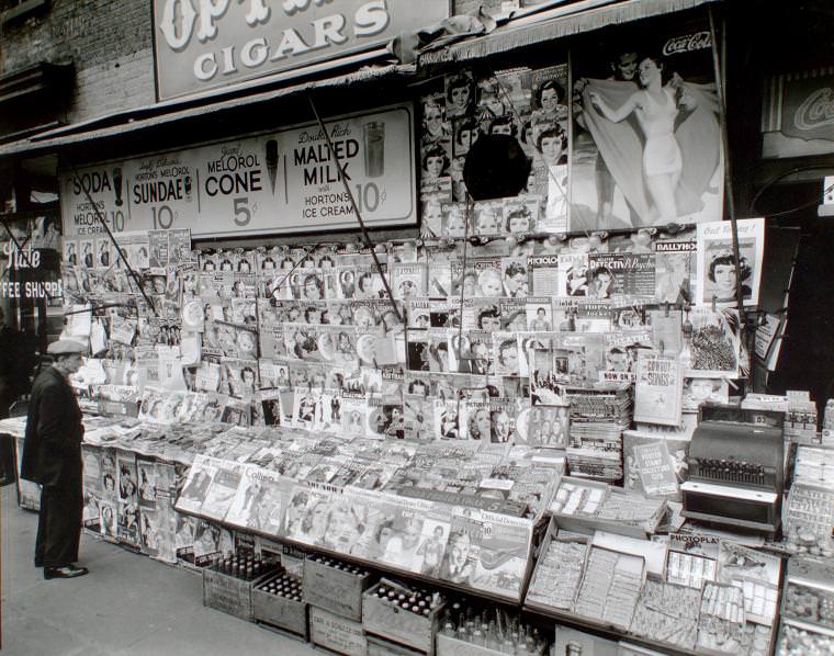
Newsstands were everywhere in 1930s Manhattan. At corners like 32nd Street and Third Avenue, they sold daily papers, weekly magazines, and racing forms to a public hungry for information and distraction. During the Depression, New Yorkers followed news of bank closures, government programs, and overseas events with close attention, and the newsstand was often the first stop of the day.
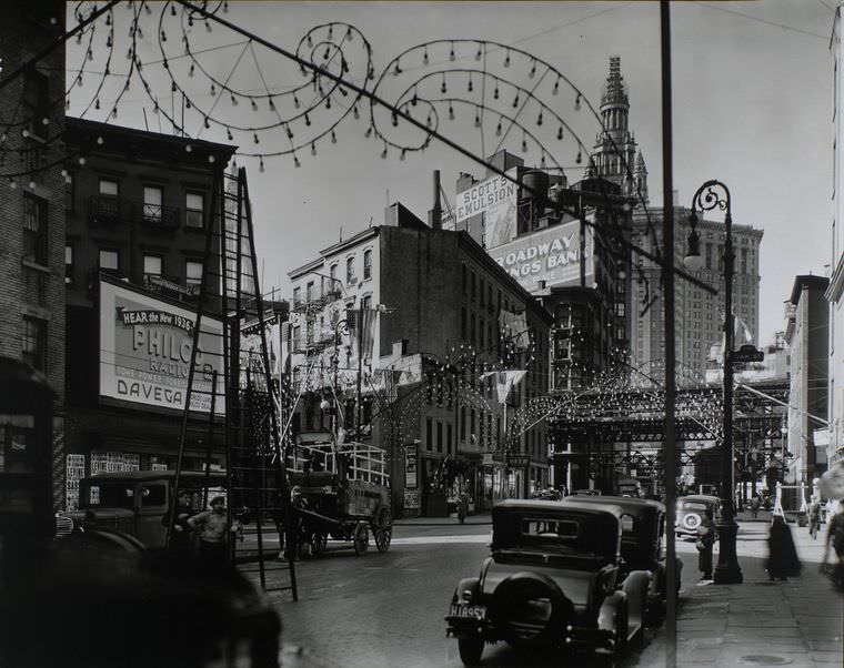
The blocks near Oak and New Chambers Streets in lower Manhattan were a dense mix of government buildings, small businesses, and older tenement structures. This part of the city sat close to the courts and city offices, giving it a particular character — lawyers, clerks, and municipal workers filled the sidewalks during business hours, while the side streets remained quiet by night.
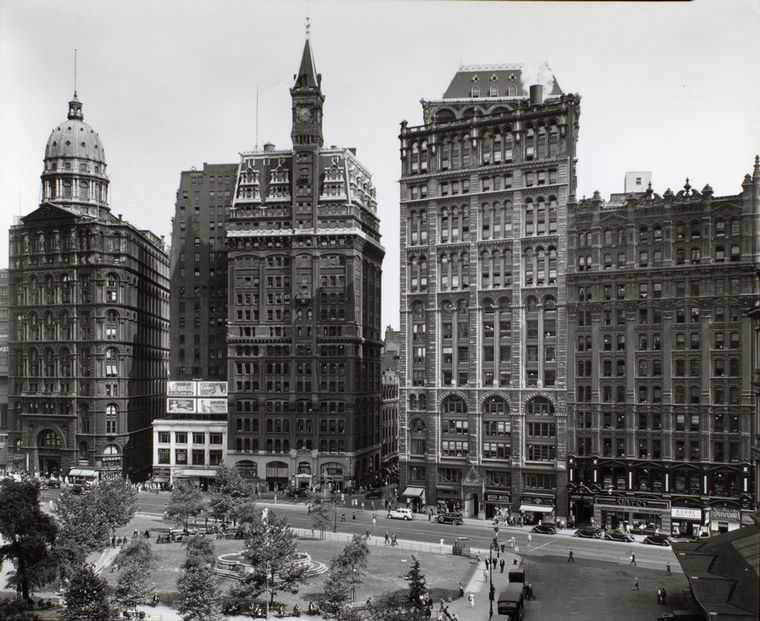
Park Row was once the center of New York’s newspaper industry, lined with the offices of the city’s major dailies. By 1936, many of those papers had moved uptown, but the street retained its identity as a place of print and public information. The elevated train tracks that ran along nearby streets cast the sidewalks below in shadow and noise throughout the day.
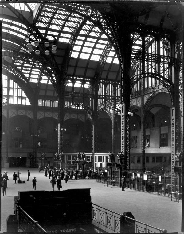
Pennsylvania Station in the 1930s was one of the great architectural achievements of the 20th century. Its enormous waiting room, modeled after the ancient Roman Baths of Caracalla, could hold thousands of travelers at once. During the Depression, the station saw a constant flow of people moving in and out of the city — some leaving in search of work, others arriving with the same hope.
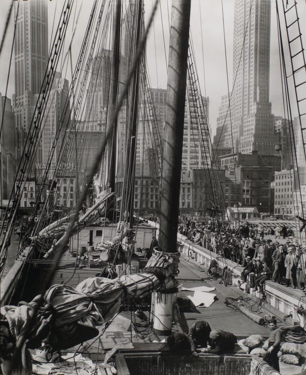
The piers along the East River in lower Manhattan were working industrial spaces in the 1930s. Freight boats, ferry lines, and small commercial vessels docked and departed throughout the day. The waterfront smelled of salt water, rope, and diesel, and the noise of loading and unloading echoed off the buildings behind the piers.
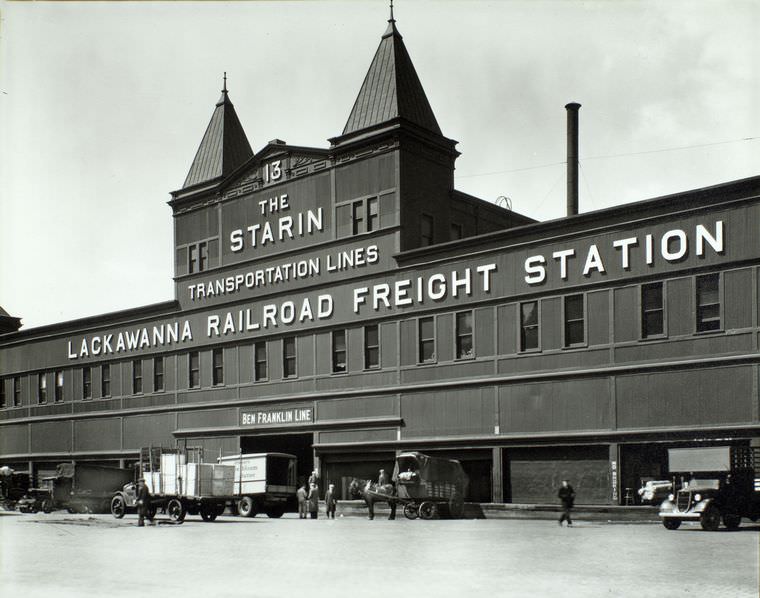
On the Hudson River side of Manhattan, the North River piers handled a different scale of shipping than their East River counterparts. Large ocean liners and transatlantic cargo ships docked along the Hudson, making the North River piers a global entry point into the city. Pier 13 was one node in that vast maritime network that kept Depression-era New York connected to the rest of the world.
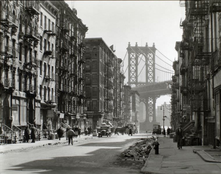
The corner of Pike and Henry Streets on the Lower East Side was deep in one of Manhattan’s most densely populated neighborhoods. Jewish immigrants and their American-born children had long dominated this area, and by 1936 the streets were still full of the delicatessens, synagogues, and pushcart markets that had defined the neighborhood for generations.
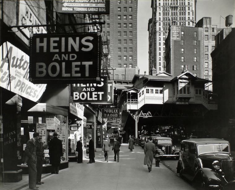
Cortlandt Street, known as Radio Row, was Manhattan’s hub for surplus electronics, radio parts, and second-hand equipment. Vendors stacked receivers, tubes, wires, and components in bins and on tables that spilled out onto the sidewalk. Hobbyists, repairmen, and small electronics dealers from across the city made regular pilgrimages to Cortlandt Street to find parts they couldn’t get anywhere else.
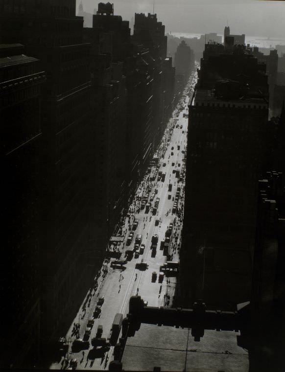
Seventh Avenue south of 35th Street ran through the heart of Manhattan’s garment district, which dominated this stretch of midtown in the 1930s. Racks of clothing moved along the sidewalks on wheeled carts, pushed by workers delivering goods between cutting rooms, showrooms, and freight pickups. It was a chaotic, fast-moving industrial zone embedded right inside the city.
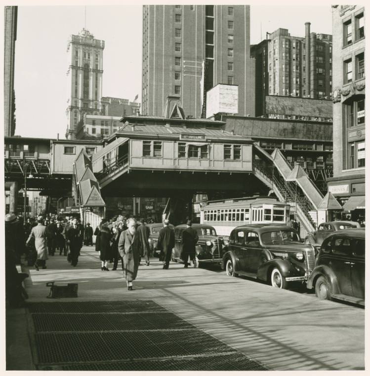
The elevated train line that ran along Sixth Avenue cast a constant shadow over the street below. At 42nd Street, the intersection was one of the busiest in the city, with foot traffic, vehicle traffic, and train traffic all competing for space. The elevated structure itself was already aging by the 1930s and would be demolished before the decade was out.
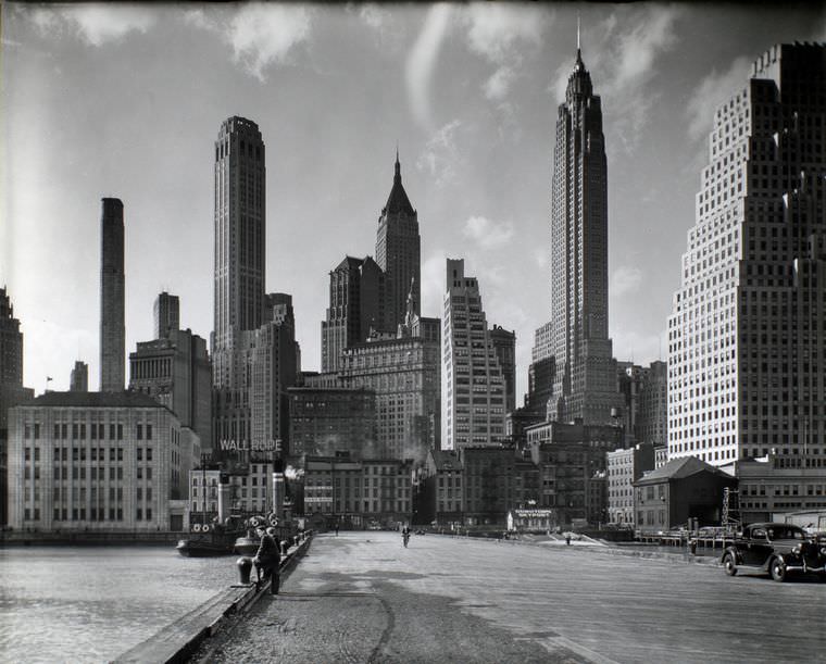
South Street ran along the southeastern edge of Manhattan, separated from the East River only by the piers. The stretch near Jones Lane was part of the old merchant waterfront, where 19th-century counting houses and warehouses still stood alongside the newer infrastructure of 20th-century shipping. The area had a worn, salt-weathered quality that spoke to centuries of maritime trade.
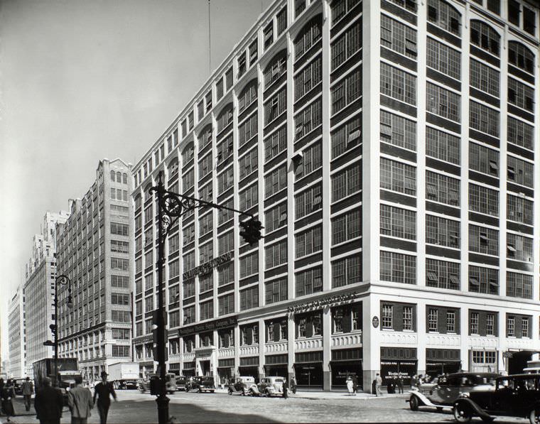
The corner of Spring and Varick Streets in lower Manhattan sat on the edge of what would later become SoHo, though in 1935 the area was strictly industrial. Printing companies, light manufacturers, and small warehouses occupied the cast-iron buildings, and the streets were busy with trucks and workers during daylight hours.
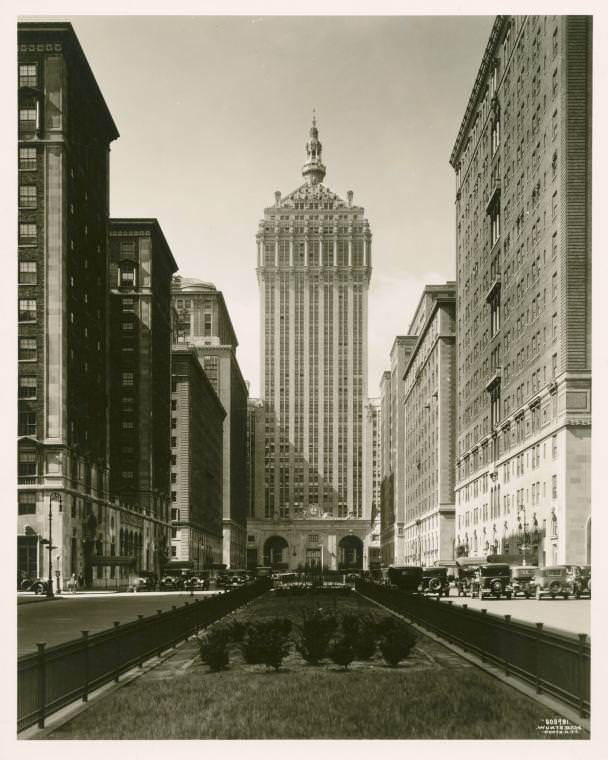
The New York Central Building at 230 Park Avenue was a landmark of Midtown Manhattan, rising above the rail yards of Grand Central Terminal. Completed in 1929, it sat at the intersection of Park Avenue and 45th Street, its distinctive copper roof and twin archways making it immediately recognizable on the skyline. In the 1930s, it stood as one of the most prestigious business addresses in the city.
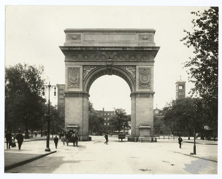
The Washington Arch at the foot of Fifth Avenue in Greenwich Village was one of Manhattan’s most beloved public monuments. Built in marble and completed in 1895, it marked the northern boundary of Washington Square Park. In the 1930s, the park around it remained a gathering place for students, artists, unemployed workers, and chess players who made up the varied social fabric of the Village.
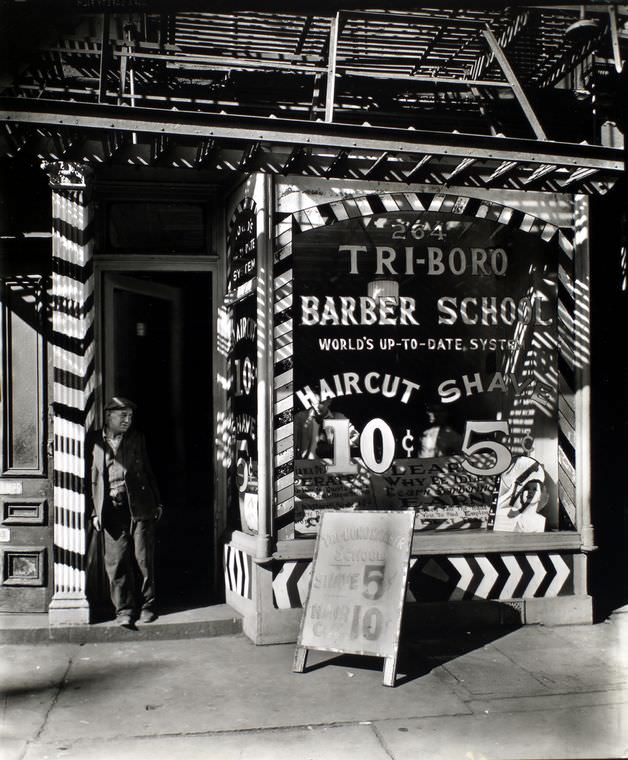
Trade schools like the Tri-boro Barber School on the Bowery served a practical function during the Depression: they trained people for work in a trade that couldn’t be outsourced or eliminated. Barbering required no factory, no large capital investment, and offered a service that people needed regardless of economic conditions. The Bowery was lined with institutions like this that offered practical skills to men trying to rebuild their working lives.
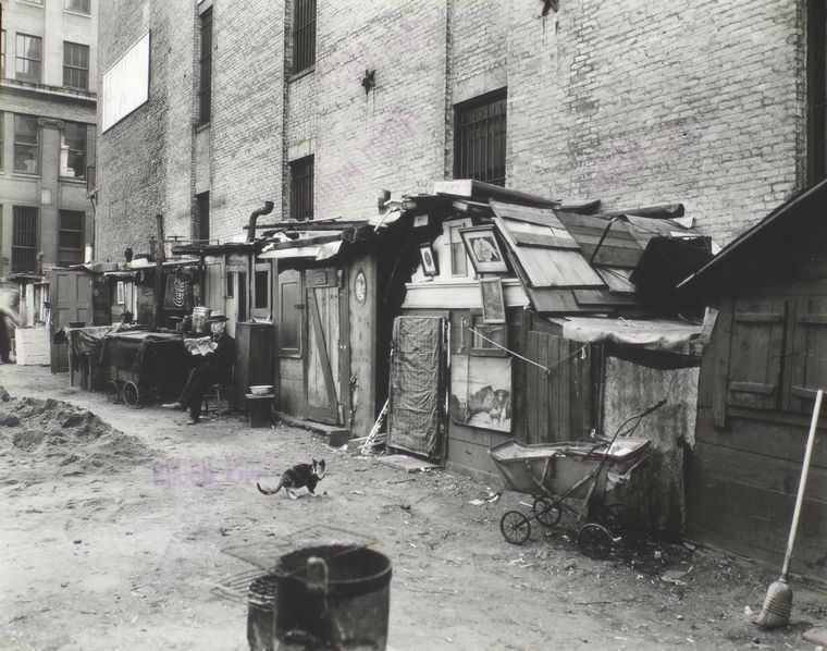
Along Mercer Street, groups of unemployed men built rough shelters on open ground and waited out the Depression with few options available to them. These Hoovervilles, as they were called across the country, were a direct result of mass unemployment and the collapse of the formal housing market for the poor. They existed in the shadows of one of the world’s great cities, visible proof of how deep the economic collapse had reached.
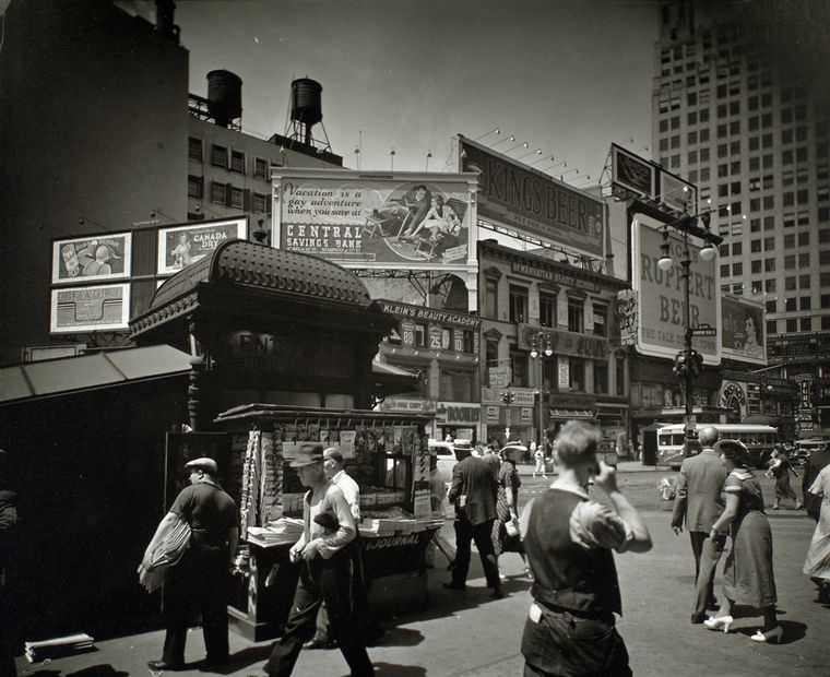
Union Square at 14th Street and Broadway was Manhattan’s most politically charged public space in the 1930s. Labor rallies, Communist Party meetings, and Depression-era protests drew massive crowds to the square throughout the decade. It was also a commercial center, surrounded by department stores and office buildings, which gave it a dual identity as both marketplace and meeting ground.
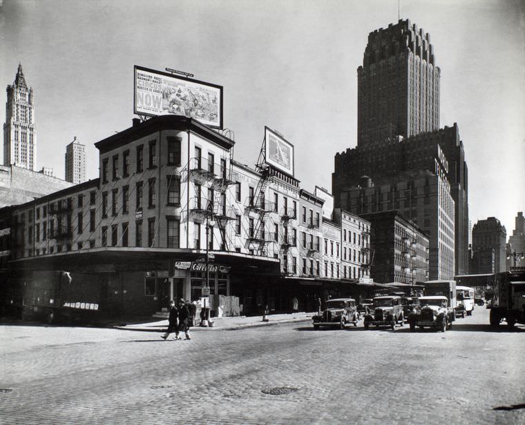
The blocks around Warren and Murray Streets in lower Manhattan were occupied by wholesale suppliers, print shops, and small office operations that served the larger businesses of the financial district nearby. The streets had a workmanlike character, functional rather than grand, and the buildings showed the wear of decades of heavy commercial use.
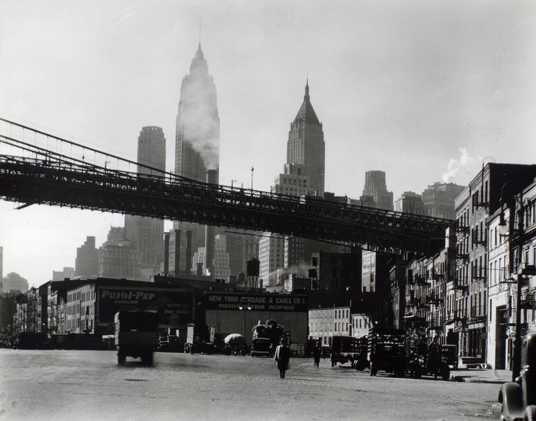
The South Street waterfront in October 1935 showed the full texture of Manhattan’s working shoreline. Old sailing ship masts still occasionally mixed with the funnels of steam-powered vessels, and the docks themselves were weathered and patched from constant use. The waterfront was loud, physical work — loading, unloading, hauling, and securing — and the men who worked it did so in all weather.
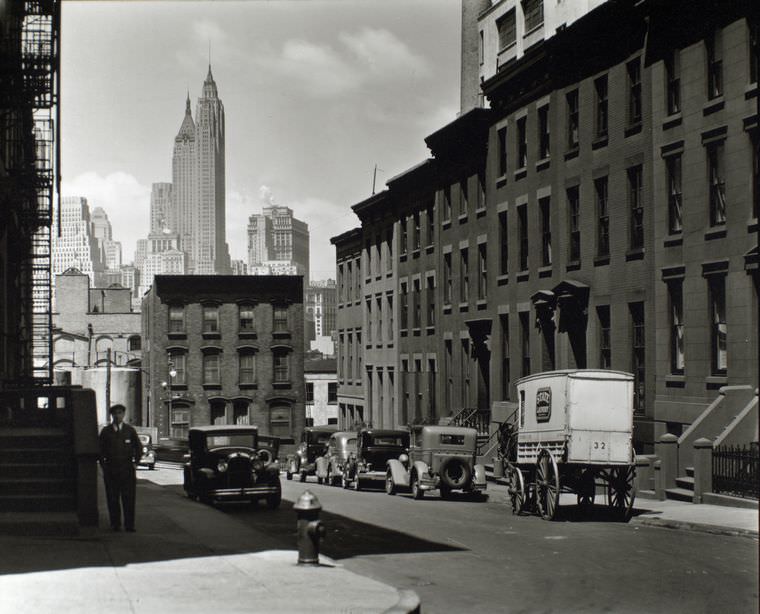
Willow and Poplar Streets captured a quieter, more residential side of Manhattan’s streetscape in 1936. Away from the commercial corridors and industrial waterfronts, these blocks showed the neighborhoods where everyday New Yorkers lived — modest buildings, tree-lined sidewalks, and the ordinary routines of city life that continued regardless of what was happening in the headlines.





I am saddened by what happened to the original Penn Station.
#13 is the view down Henry Street, not Monroe Street. The church is the Presbyterian Church on the corner of Henry and Market.