in

What Honolulu, Hawaii looked like in the 1960s Through these Fascinating Vintage Photos

When Hawaii became the 50th U.S. state in 1959, Honolulu entered a new era. Commercial air travel made the islands reachable in hours rather than days, and tourism quickly became the backbone of the city’s economy. Defense spending and agricultural exports added to the growth, but it was the steady flow of visitors that reshaped the city’s skyline, shoreline, and neighborhoods throughout the 1960s.

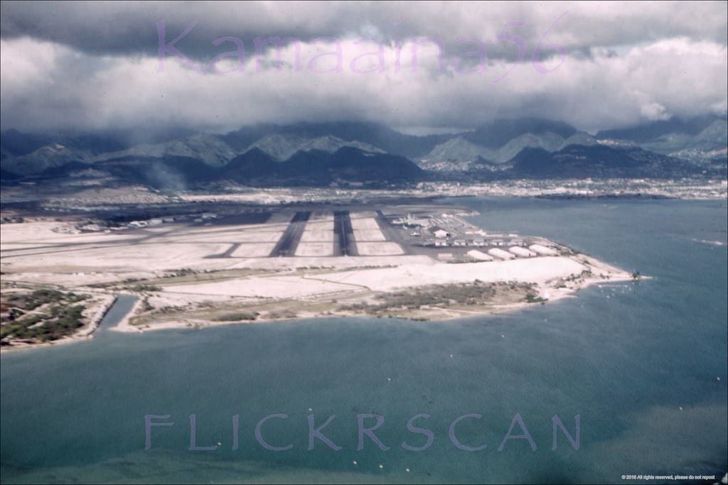
Most travelers arrived at Honolulu International Airport, which had been named after Commander John Rodgers in 1932. Rodgers made history in 1925 as the first person to fly from the mainland to Hawaii. Cruise ships still docked at the harbor, and inter-island travel ran on commercial airlines. The decade itself was shaped by volcanic eruptions, tsunamis, political change, and growing environmental awareness. These vintage photographs capture what Honolulu actually looked like during those years.
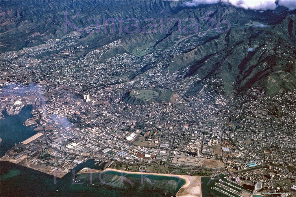
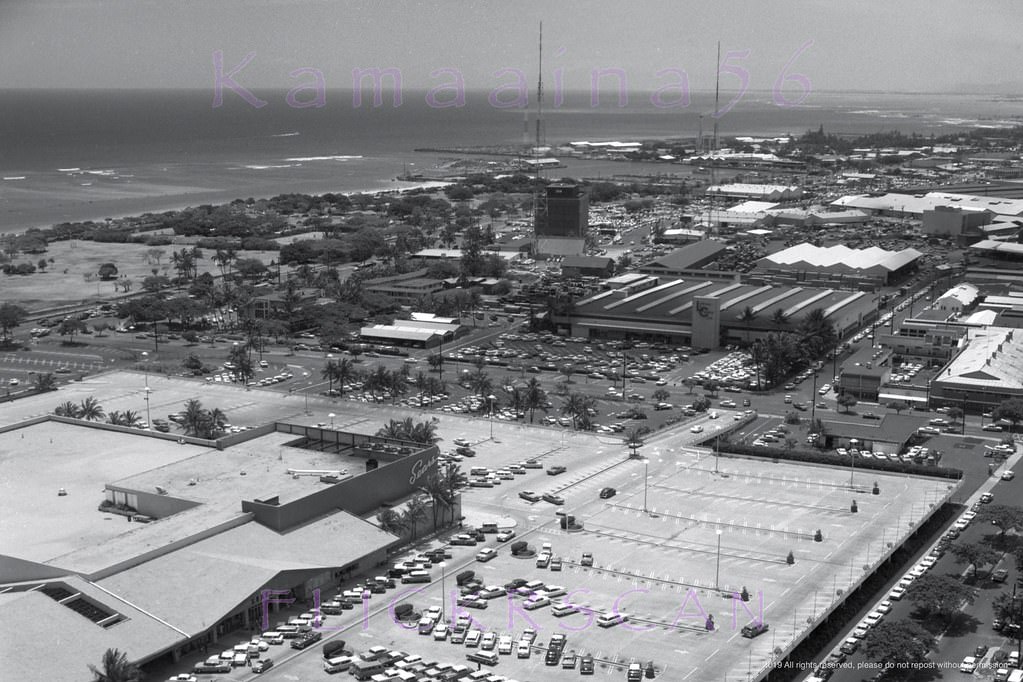
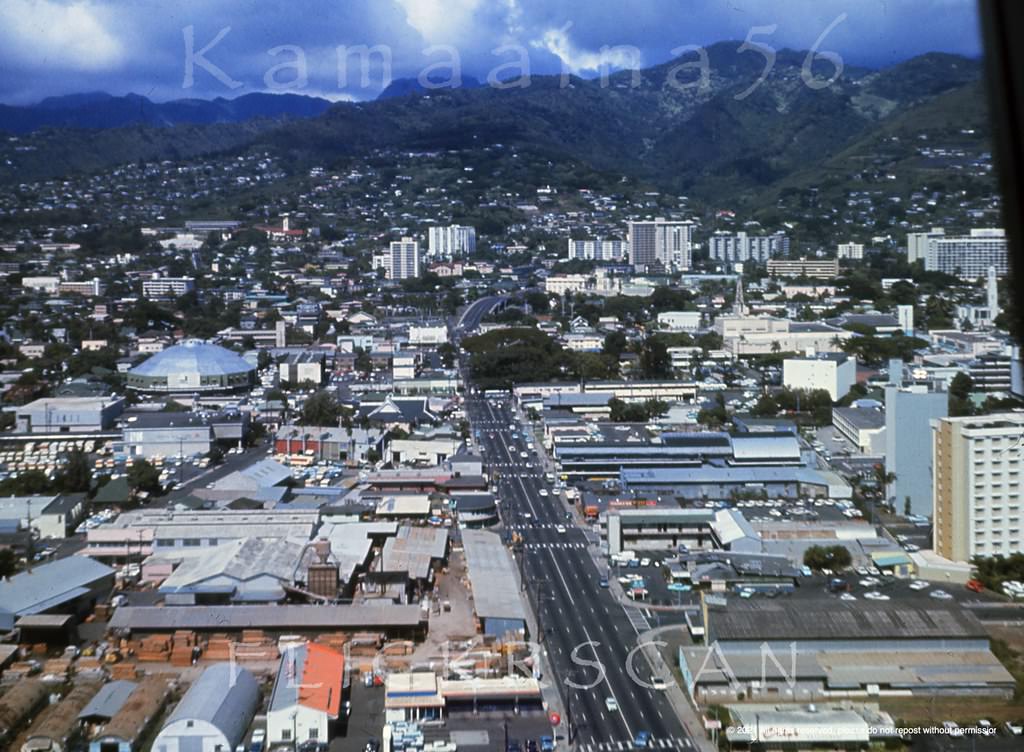
Ala Moana Honolulu Birdseye, 1964

From the air, Honolulu’s layout in the early 1960s told the story of a city in transition. The smoke rising from the Hawaiian Electric power station near Honolulu Harbor marked the industrial edge of the city, while residential neighborhoods spread inland toward the mountains. The Ala Moana area sat between the working harbor and the leisure zones of Waikiki, and aerial views from this period show that contrast clearly.
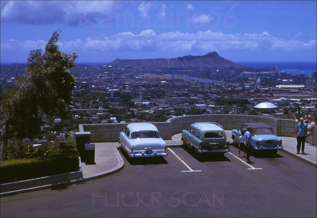
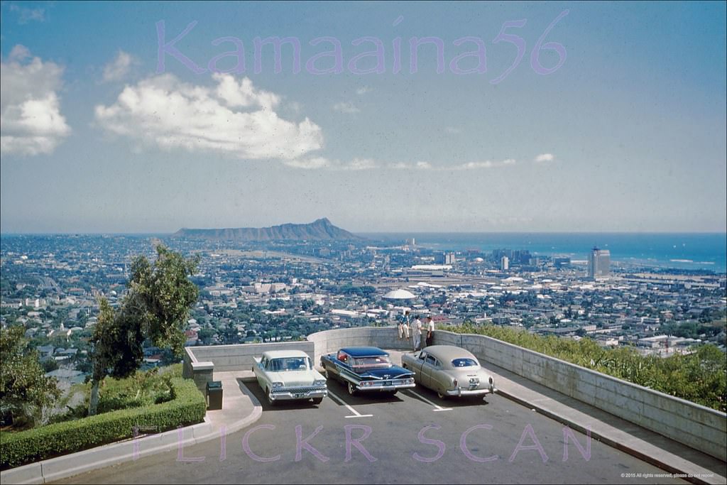
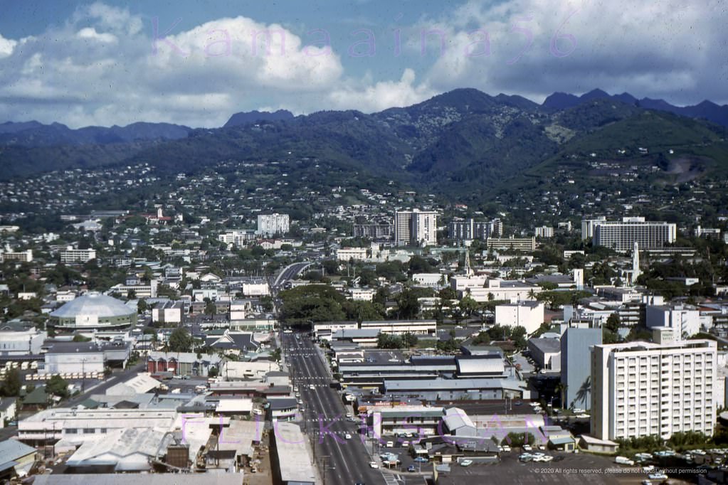
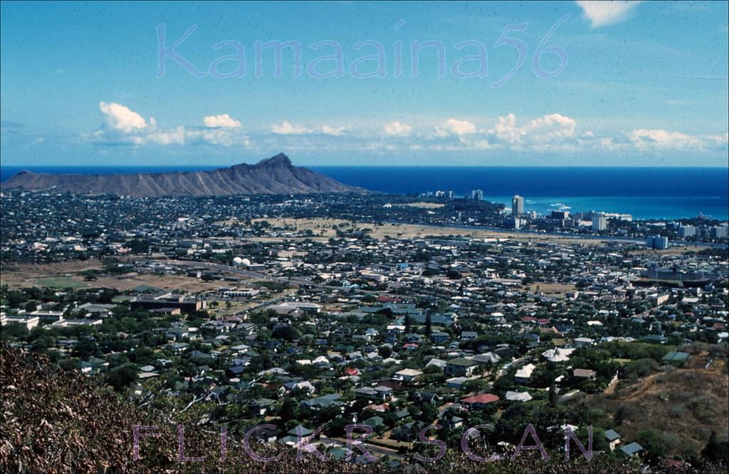
Looking east to Diamond Head over Honolulu. Vintage slide marked, 1961
Looking Diamond Head over Honolulu from the old lookout at Punchbowl Crater, 1961.

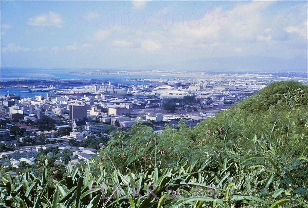
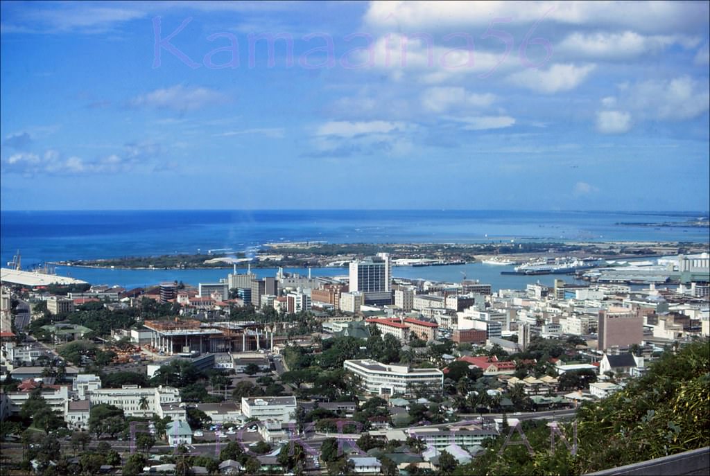
Punchbowl Crater offered one of the best vantage points in the city. The extinct volcanic tuff cone sits about 500 feet above downtown, and from its rim you could see south to the harbor, east toward Diamond Head, and west out over the Ewa plain. Photos taken from this spot in 1961 show a city that was still relatively low-rise, with only a handful of tall buildings breaking the skyline.
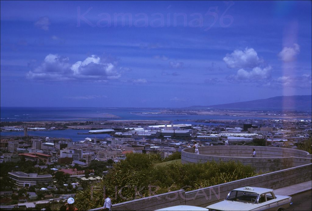
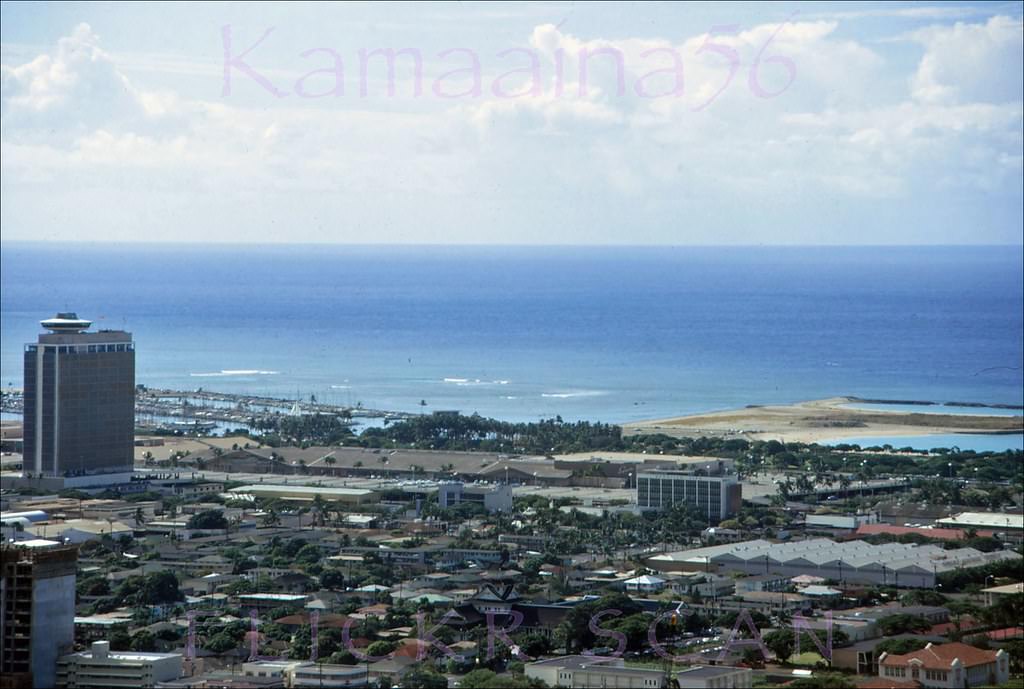
Overlooking Honolulu south to the harbor and west out to the Ewa plain, 1961
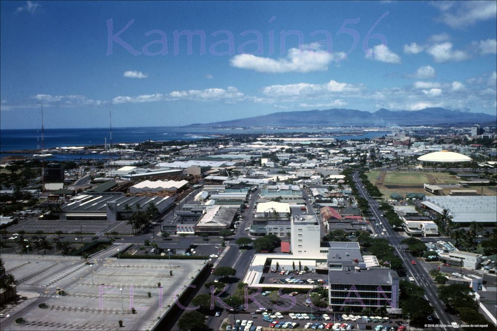
Ala Moana Birdseye, 1966
Downtown Honolulu and the harbor area viewed from Punchbowl Crater, 1967

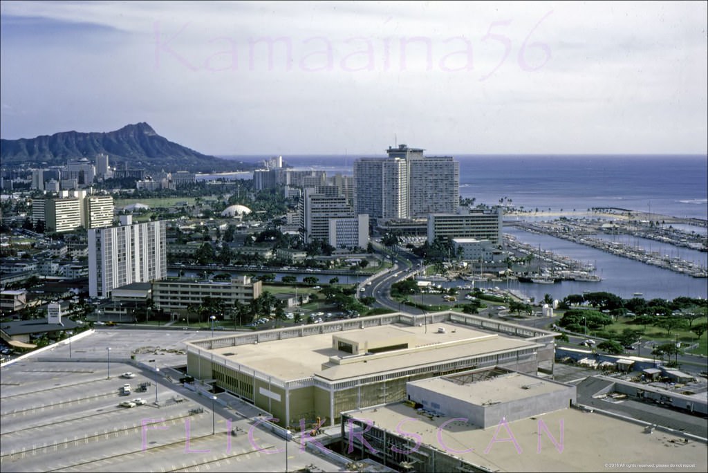
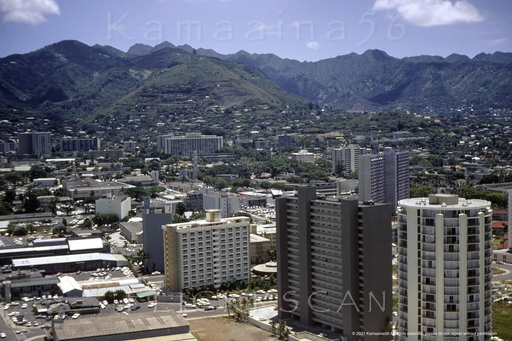
By the mid-1960s, development had visibly accelerated. New buildings had filled in gaps along the waterfront and Kapiolani Boulevard. The Ala Moana neighborhood, in particular, grew fast. The 1959 Ala Moana Shopping Center anchored the area, and the 23-story Ala Moana Tower that opened in 1961 gave residents and visitors a new bird’s-eye view of the city from the LaRonde revolving restaurant at its top.
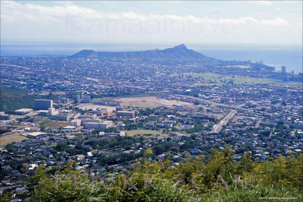
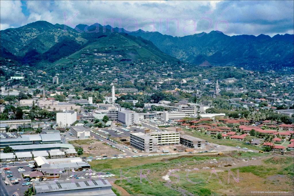
UH Manoa Birdseye Honolulu, 1960s
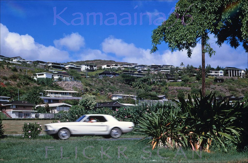
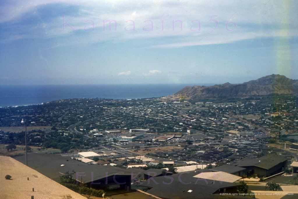
Birdseye view from Halekoa Drive on Waialaie Nui Ridge (then known as Waialae Uplands), 1965
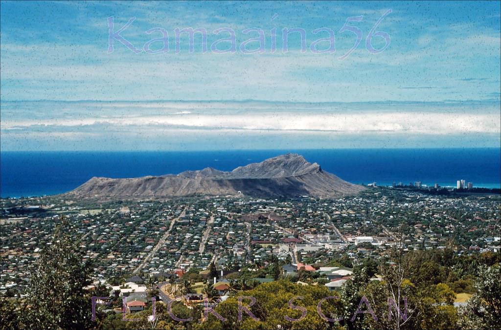
View is from Halekoa Drive on Waialaie Nui Ridge (then known as Waialae Uplands) looking Diamond Head, 1965
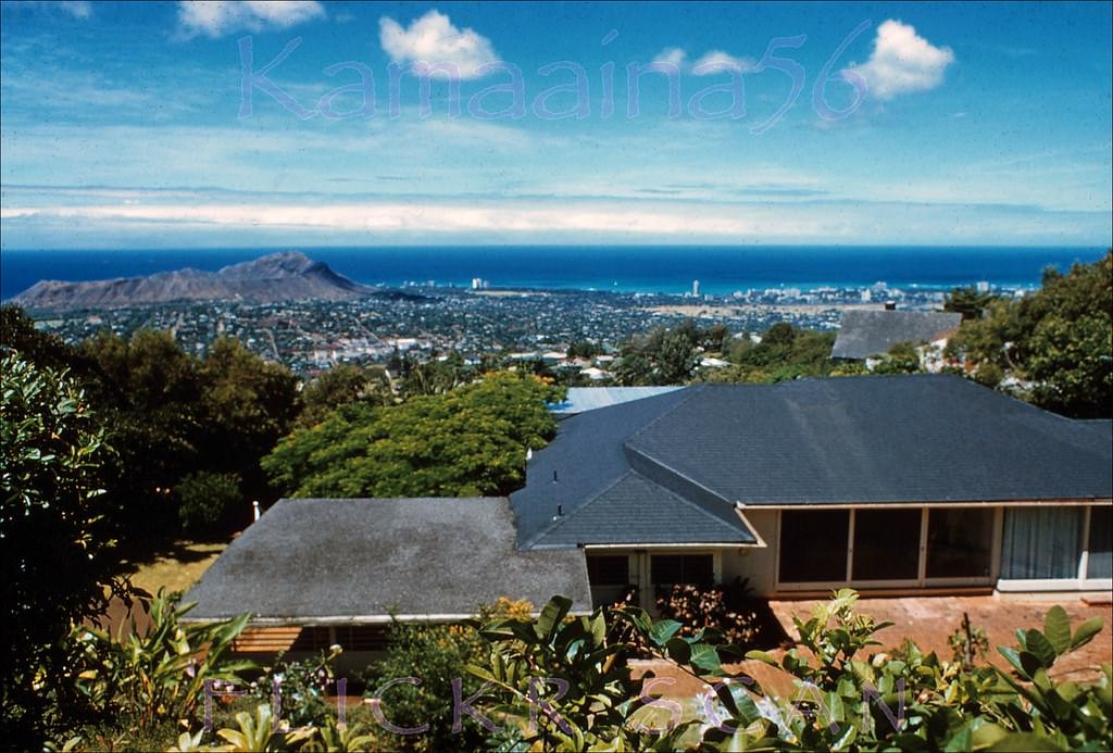
Birdseye view from Halekoa Drive on Waialaie Nui Ridge (then known as Waialae Uplands) looking Waikiki, 1965

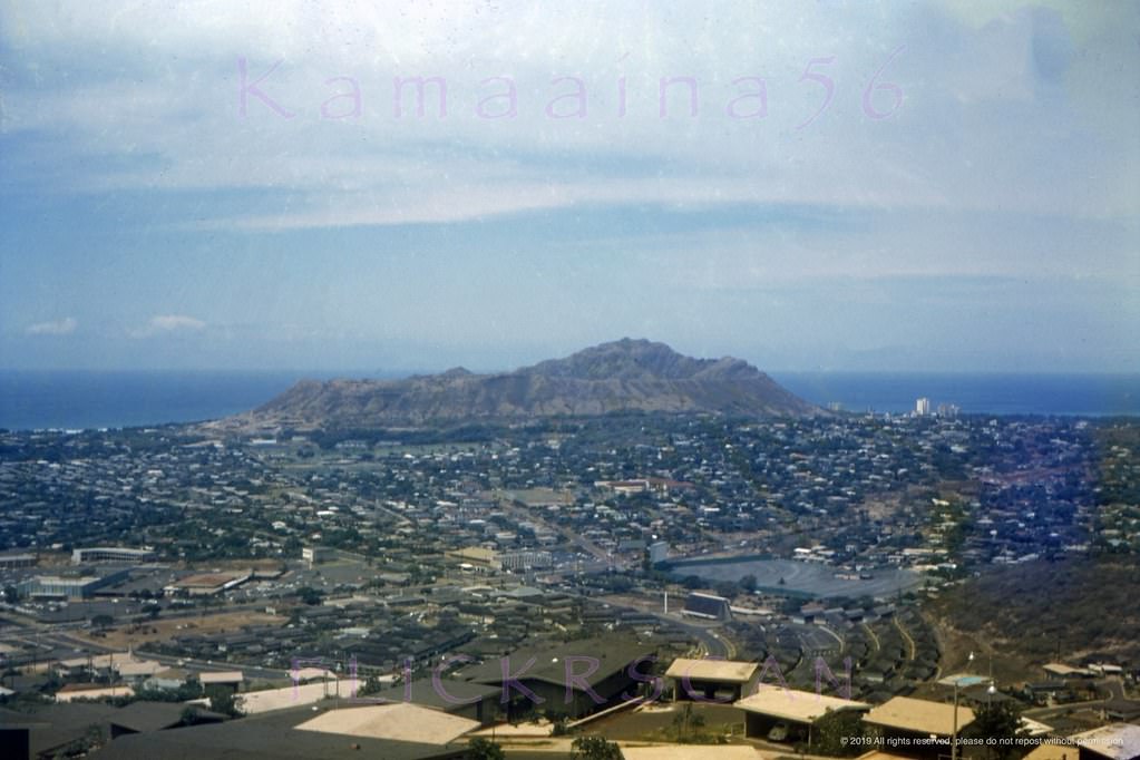
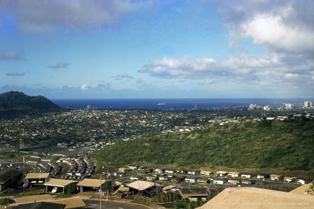
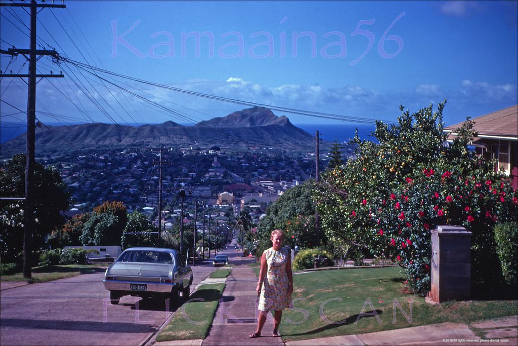
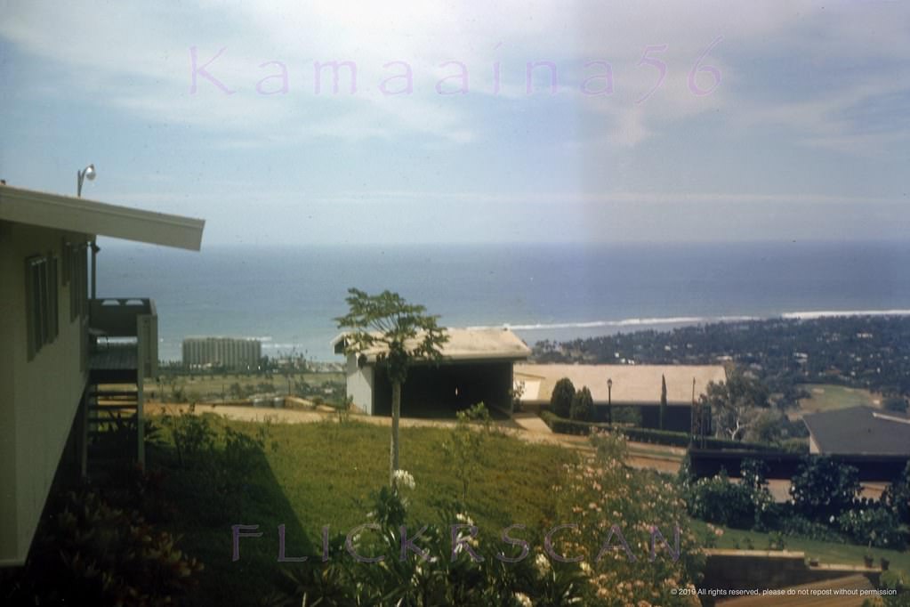
The Waialae Uplands — now known as Waialaie Nui Ridge — provided sweeping views toward both Diamond Head and Waikiki. Photos from Halekoa Drive in 1965 show a city that was spreading up into the hills. Neighborhoods that had been mostly undeveloped just a decade earlier were filling in with homes, and the roads connecting them to the flatlands below were still relatively quiet.
Diamond Head Wilhelmina, 1962
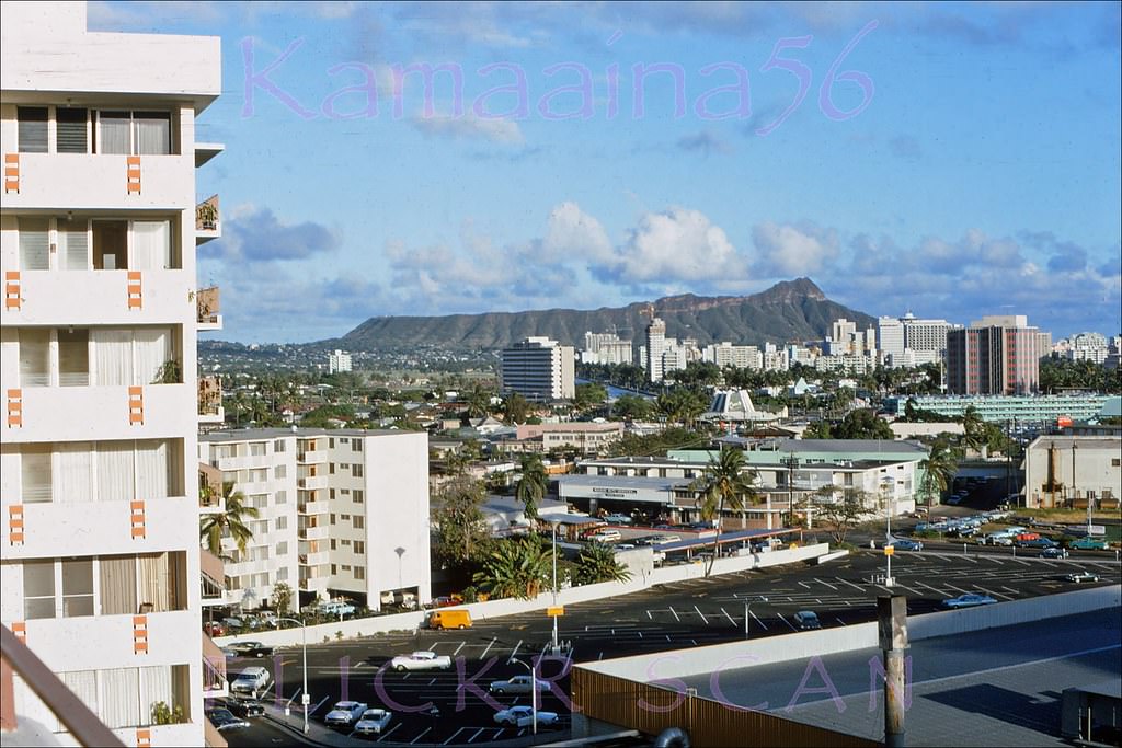
Waikiki from Wilhelmina Rise, 1962
Looking towards Punchbowl Crater and Honolulu Harbor, 1962
Looking makai along Wilhelmina Rise above the Honolulu neighborhood of Kaimuki, 1968

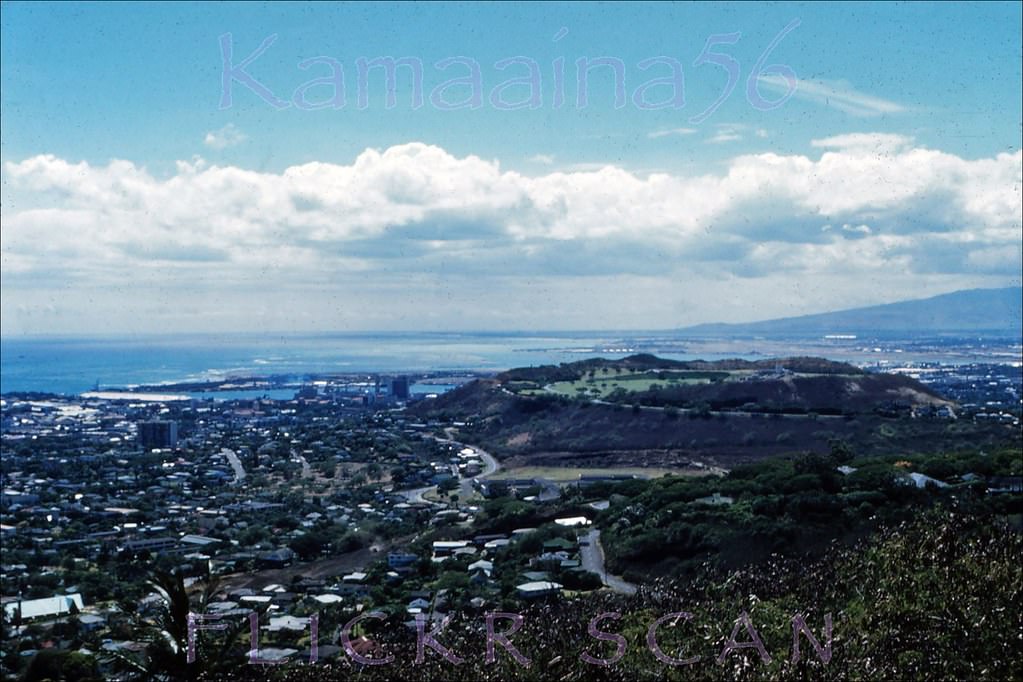
Wilhelmina Rise, the ridge road above Kaimuki, gave a clear line of sight down toward Waikiki and the Pacific. The Kaimuki district below was a working neighborhood of small businesses and residential streets. Looking makai — the Hawaiian direction meaning seaward — from this elevation shows how the city’s grid pushed right up to the ocean’s edge.
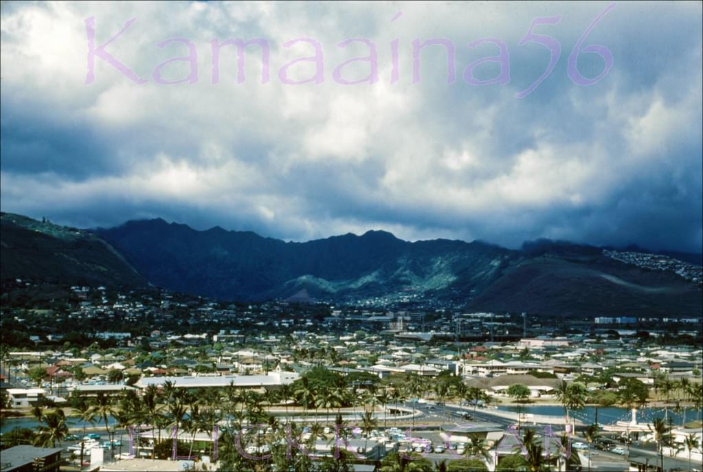
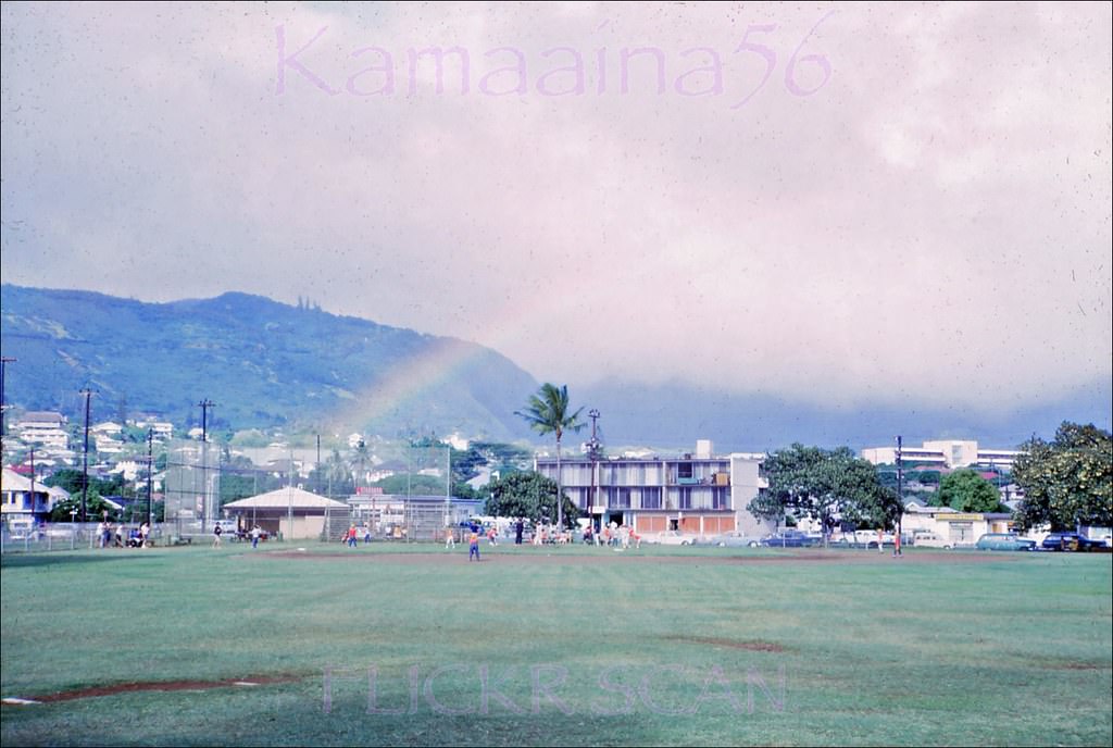
Birdseye view looking mauka towards Manoa Valley from the McCully Street bridge over the Ala Wai Canal that connects Waikiki with the rest of Honolulu, 1960
Moilili Rainbow Honolulu, 1967
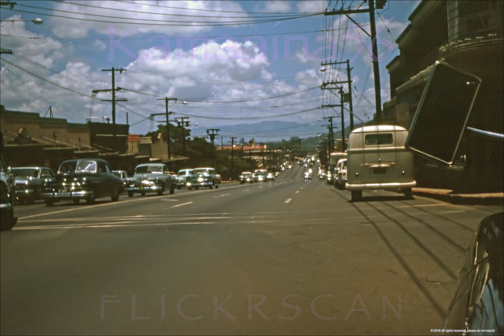
Honolulu's University Avenue near the intersection with South King Street in Moiliili, 1968
Honolulu’s University Avenue near the intersection with South King Street in Moiliili, 1968

The Ala Wai Canal is a man-made waterway that separates Waikiki from the rest of Honolulu. Built in the 1920s to drain the wetlands that once occupied the Waikiki area, the canal became a defining boundary of the city. The McCully Street bridge crossing it was one of the main connectors between Waikiki and the Moiliili and Manoa neighborhoods to the north. University Avenue, just inland from the canal, was a busy commercial corridor by the late 1960s.
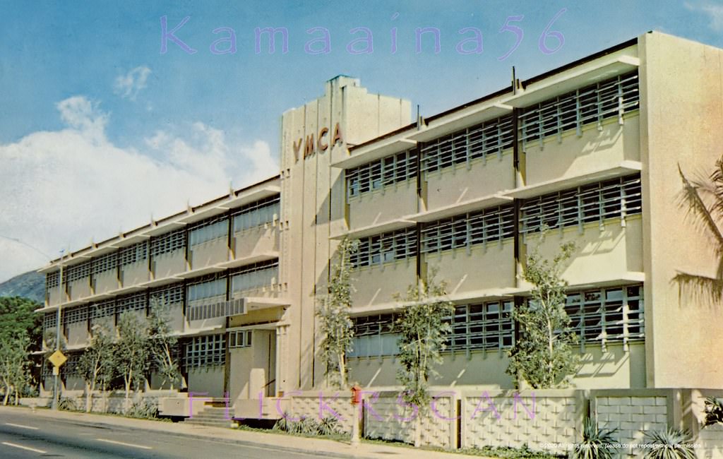
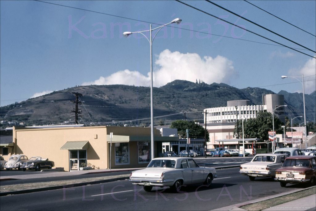
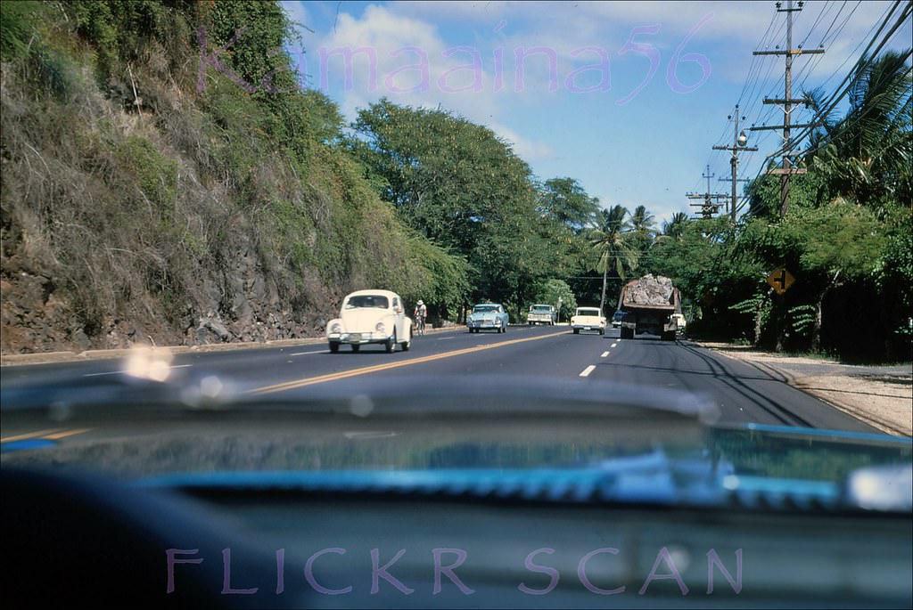
On Pali Highway at Vineyard, built 1963 and still there today looking much the same, 1960s

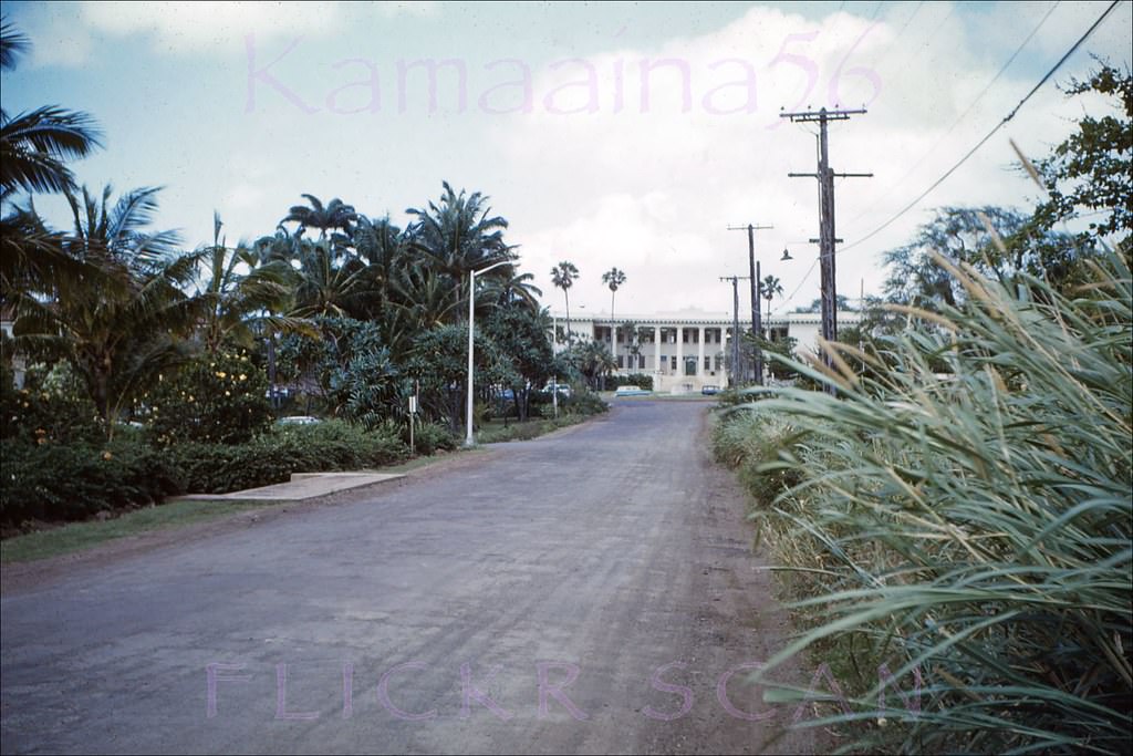
The University of Hawaii’s Manoa campus was a major presence in the city. Founded on its current site in the early 20th century, the campus expanded significantly in the postwar years. Hawaii Hall, built in 1912, remained the most recognizable structure on campus — a Colonial-style building fronted by the 1934 Varney Circle fountain. Photos from 1961 show it standing much as it does today.
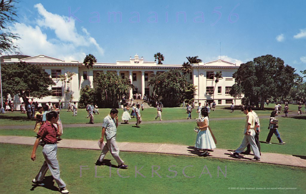
Hawaii Hall UH Manoa, 1961
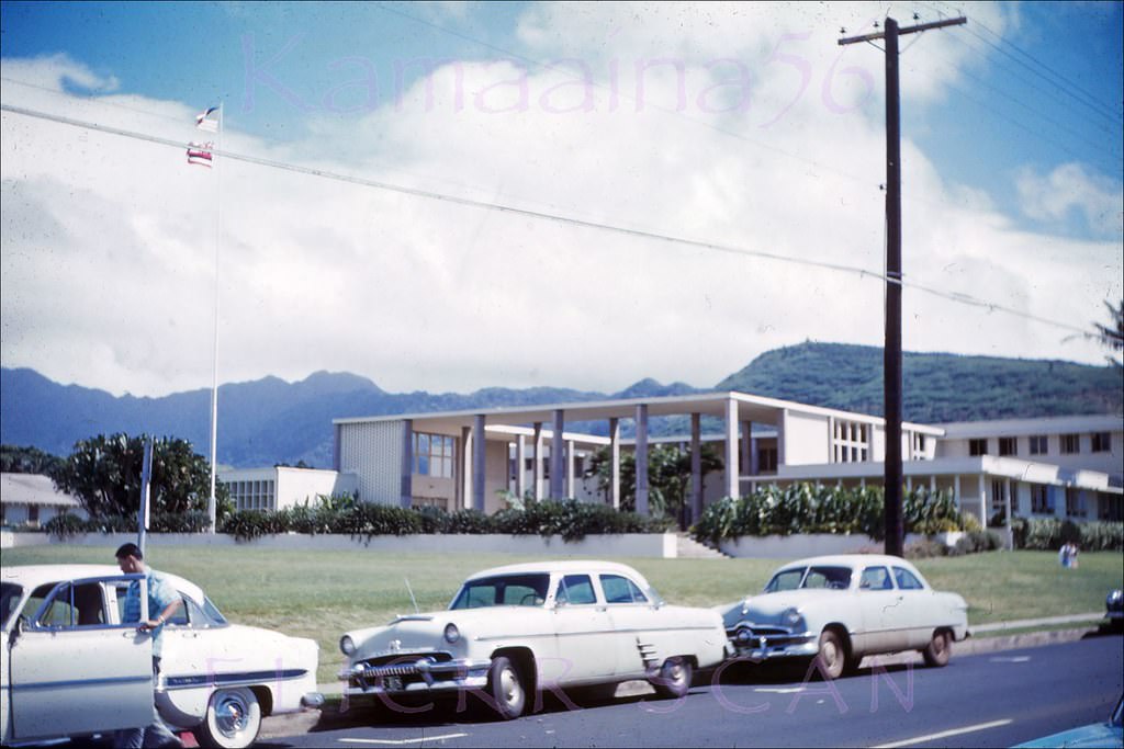
The University of Hawaii's 1949 administration building viewed from Dole Street near University Avenue, 1961
The University of Hawaii’s 1949 administration building viewed from Dole Street near University Avenue, 1961
UH Hawaii Hall McCarthy Road, 1961

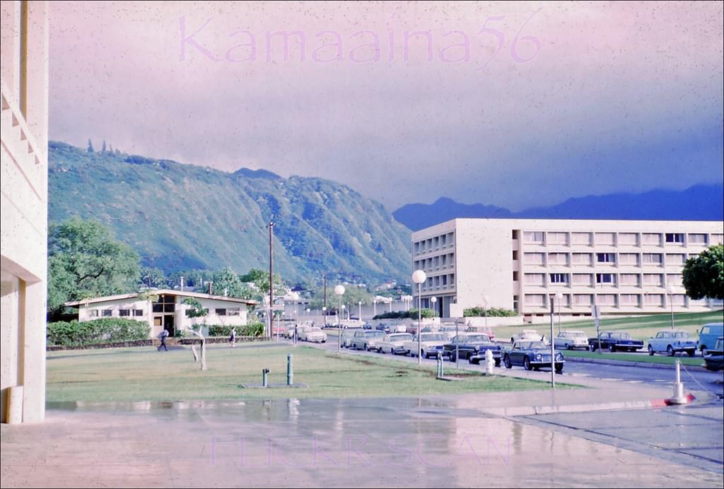
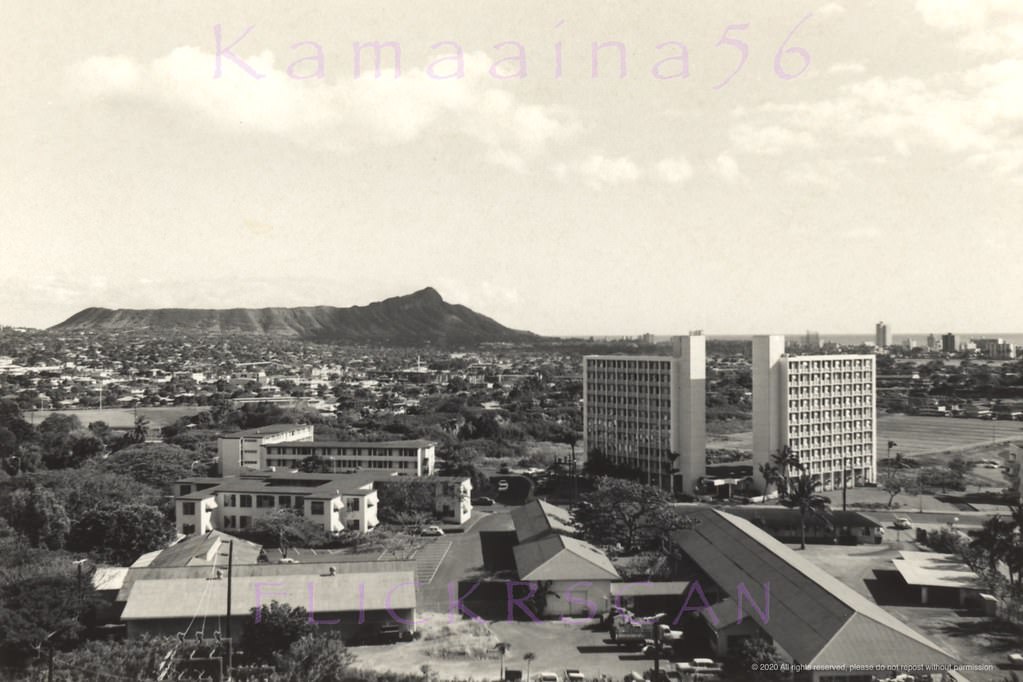
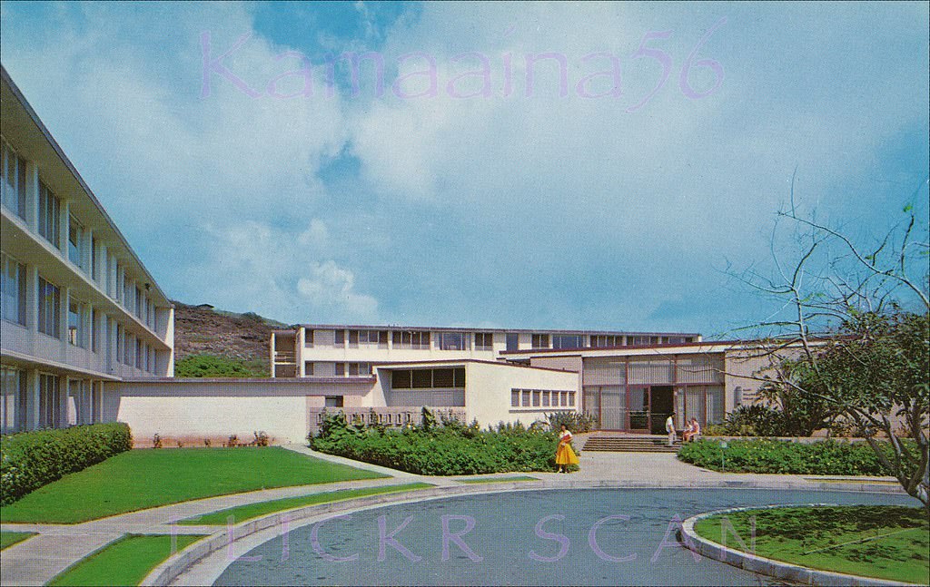
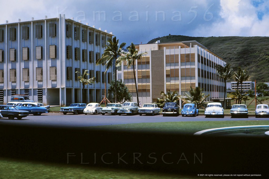
New dormitories and academic buildings went up on the Manoa campus throughout the decade. Webster and Snyder Halls were completed in 1962, adding student housing on the mauka (inland) side of campus with views deep into Manoa Valley. Mary Dillingham Frear Hall, the oldest women’s dormitory on campus, was still standing and in use in 1961 when these photos were taken.
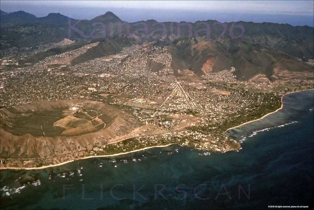
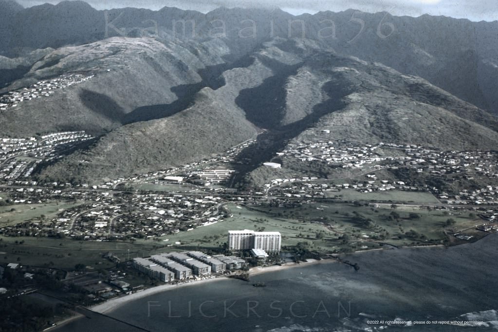
Nice detailed airplane view of the east Honolulu neighborhood of Waialae Kahala, 1967.
Exterior view of Mary Dillingham Frear Hall, the oldest women's dormitory at the University of Hawaii's Manoa Valley campus, 1961
Exterior view of Mary Dillingham Frear Hall, the oldest women’s dormitory at the University of Hawaii’s Manoa Valley campus, 1961
Webster and Snyder Halls (built 1962) at the University of Hawaii's Manoa Campus in Honolulu, 1963
Webster and Snyder Halls (built 1962) at the University of Hawaii’s Manoa Campus in Honolulu, 1963
Looking mauka along East-West Road at the University of Hawaii's Manoa Campus in Honolulu, 1967
Looking mauka along East-West Road at the University of Hawaii’s Manoa Campus in Honolulu, 1967
Looking more or less south over the University of Hawaii's Manoa Valley Campus towards Honolulu and Waikiki with Diamond Head Crater in the distance, 1960s
Looking more or less south over the University of Hawaii’s Manoa Valley Campus towards Honolulu and Waikiki with Diamond Head Crater in the distance, 1960s

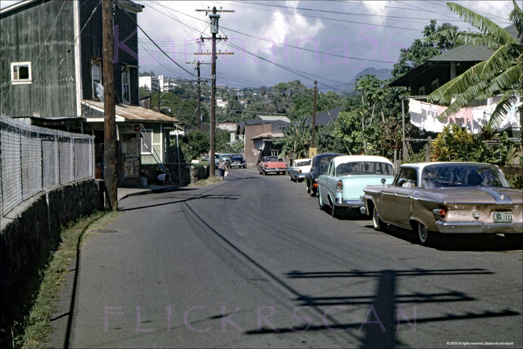
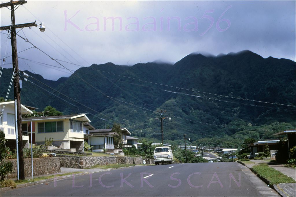
Upper Manoa Valley, just beyond the university, was a quiet residential area of tree-lined streets and modest homes. Pawaina Street and Oahu Avenue in 1968 show a neighborhood that had changed little since the postwar years — peaceful, green, and removed from the tourist energy of Waikiki just a few miles away.
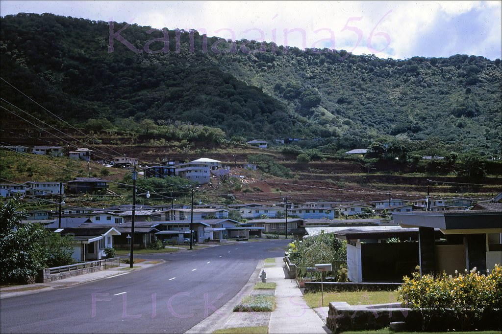
Pawaina Street in upper Manoa Valley, Honolulu, with Pinao Street on the left, 1968
Oahu Avenue in upper Manoa Valley, Honolulu, 1968
Kapiolani Palms Honolulu, 1960

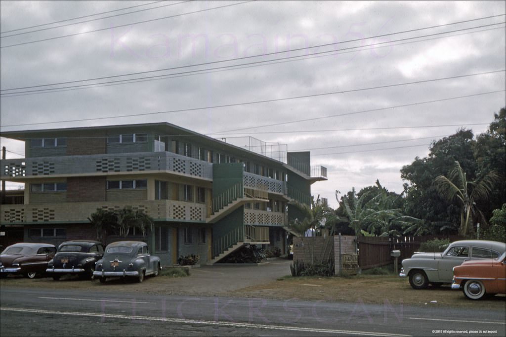
The old Dillingham Estate on Diamond Head became La Pietra School for Girls in 1964. The school occupied a grand property overlooking the ocean, and by 1968 it was well established on its hilltop site. The Kapiolani Palms Apartments on Kapiolani Boulevard, built in 1960, represented the newer, more modern kind of residential development spreading across the city at the same time.
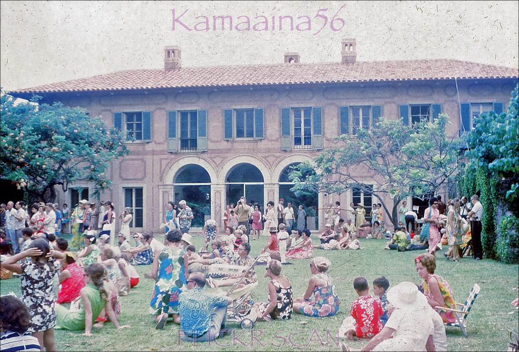
La Pietra School Hawaii, 1968
McCully at Ala Wai Honolulu, 1961

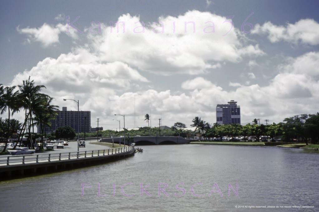
The Ala Wai Canal and its surrounding area were photographed extensively during this period. Looking along the canal from McCully Street in 1961, the water runs straight toward the harbor mouth, with low-rise apartments and palms lining both banks. By 1965, the Ala Wai Yacht Harbor at the canal’s western end had grown into a full marina with a clear view from the newly opened Ilikai Hotel.
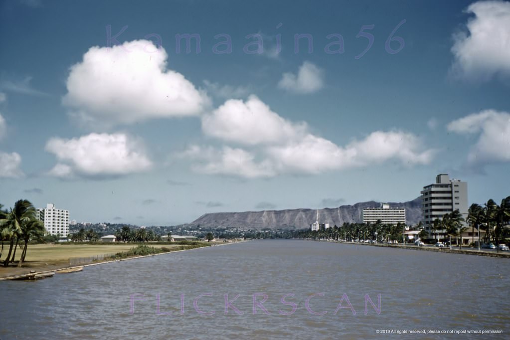
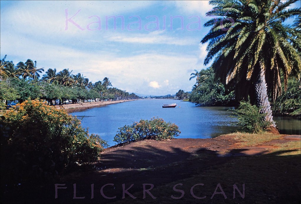
Ala Wai Canal Honolulu, 1961
Looking ewa along the Ala Wai Canal between Waikiki on the left and the Kapahulu neighborhood in Honolulu, 1960
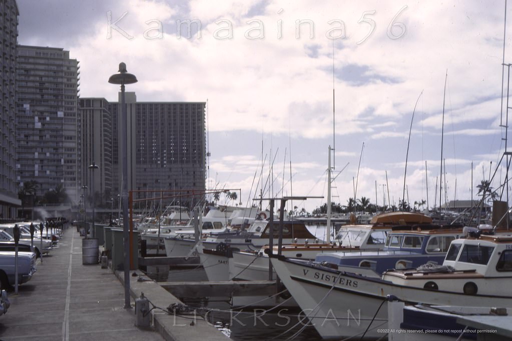
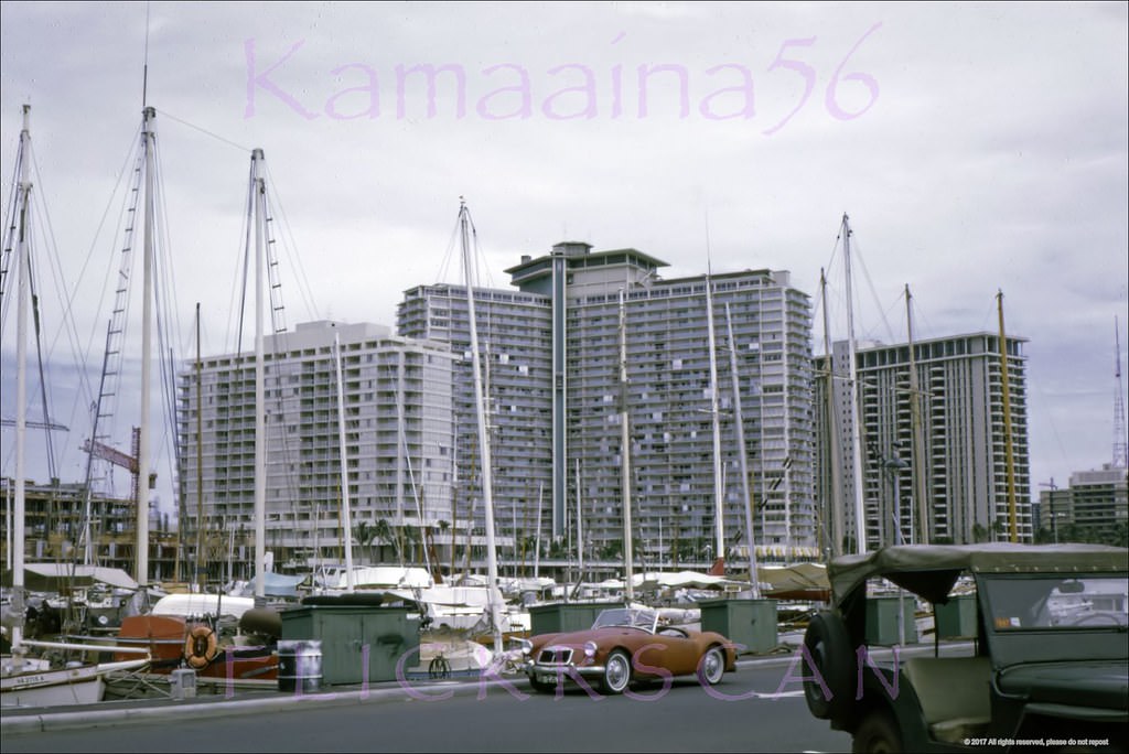
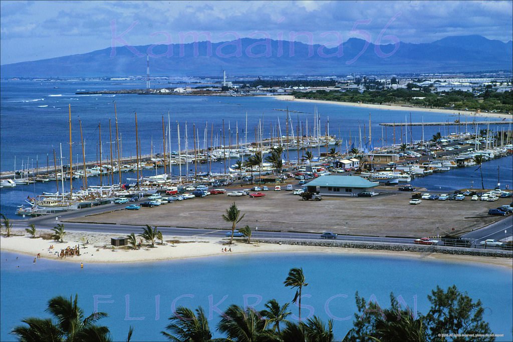
Ala Wai Yacht Harbor on south shore Oahu viewed from the Ilikai Hotel deck, 1965
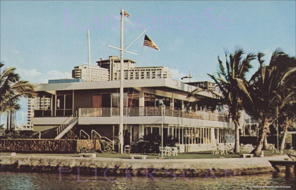
Hawaii Yacht Club Ala Wai, 1965
likai HHV Towers Ala Wai, 1968
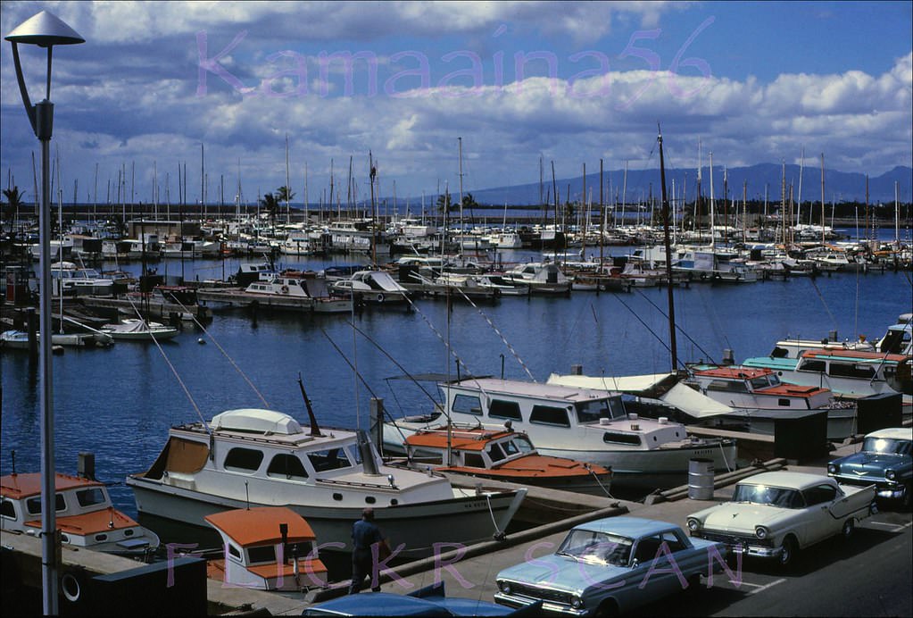
The waterfront at Ala Wai Yacht Harbor on Oahu's south shore, 1967
The waterfront at Ala Wai Yacht Harbor on Oahu’s south shore, 1967
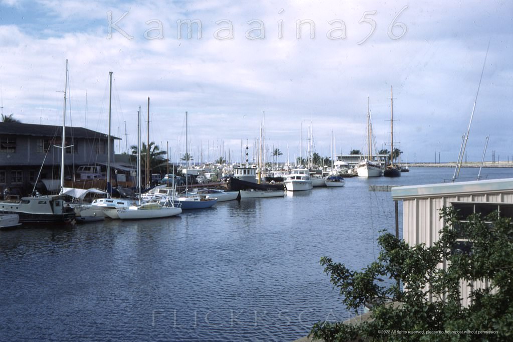
Makai (seaward) view of Ala Wai Yacht Harbor at the mouth of the Ala Wai Canal which divides Waikiki from the rest of Honolulu, 1968

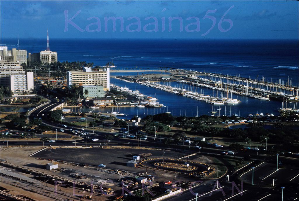
Before the marina expansion and hotel towers, Ala Wai Harbor looked very different. A 1961 photo taken from an upper floor of the 1957 Ocean Tower at the Hawaiian Village Hotel shows the harbor with far fewer boats and a much more open waterfront. By the late 1960s, both the yacht club and the surrounding towers had transformed the area into the marina-front scene still recognizable today.
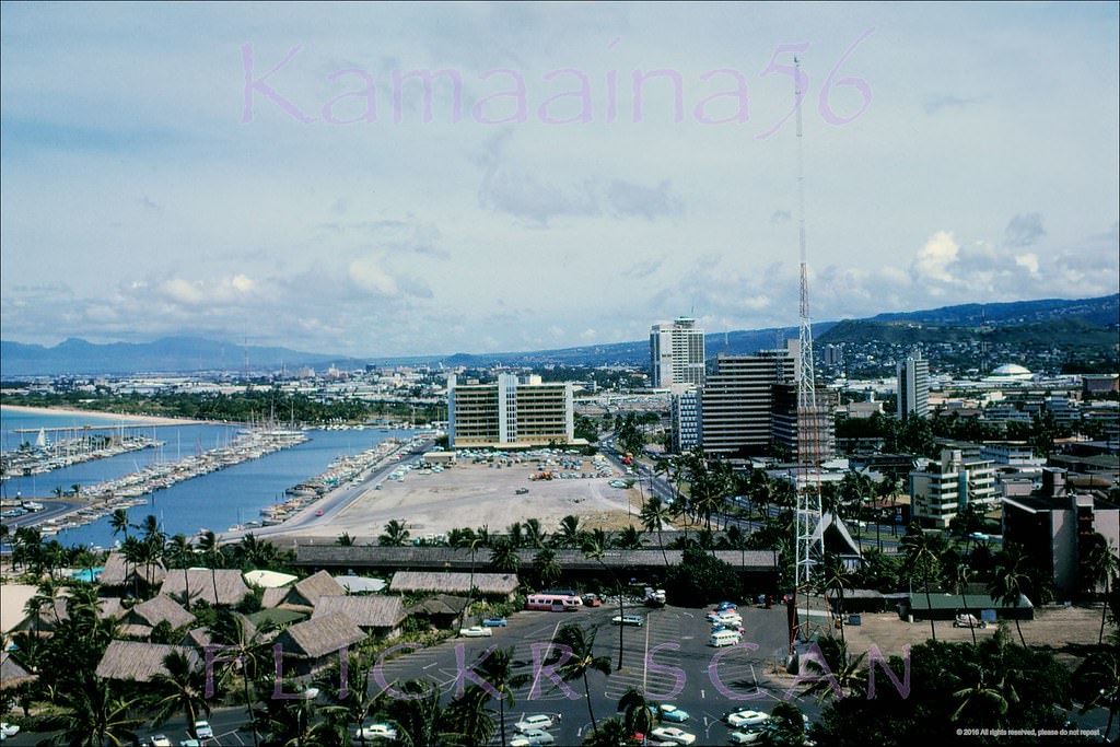
Ala Wai Harbor Birdseye, 1961
Ala Wai Harbor Ewa View, 1961

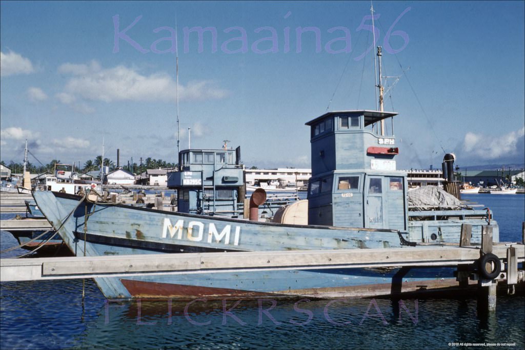
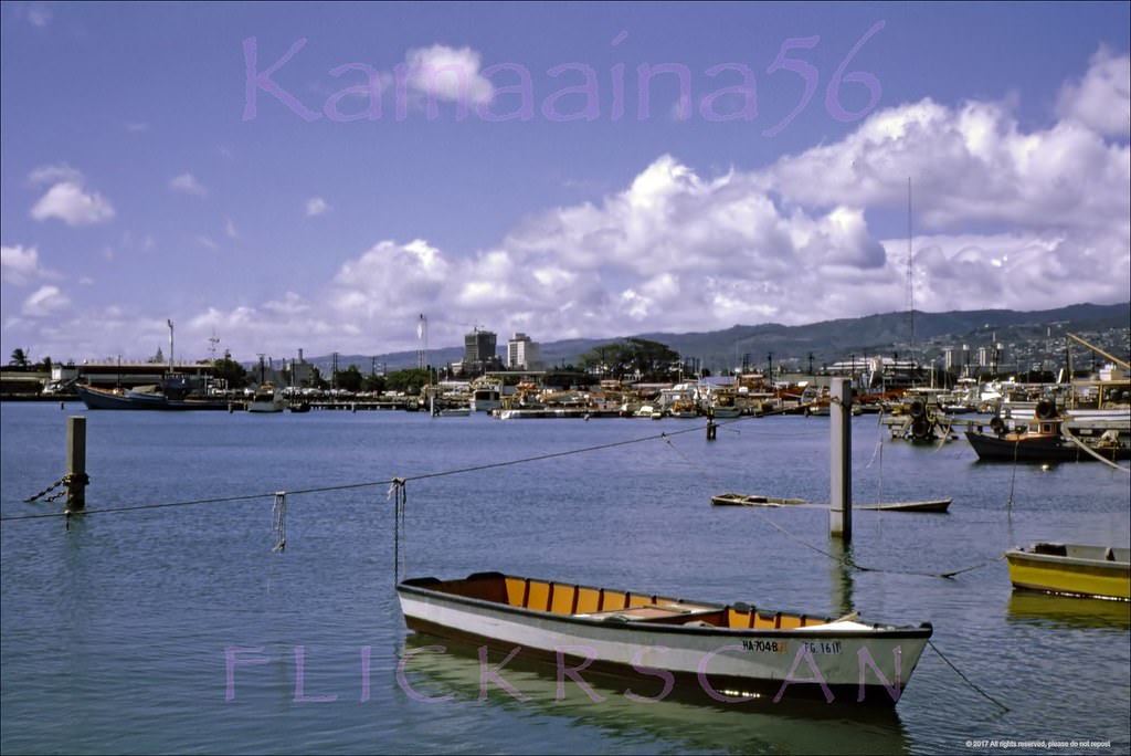
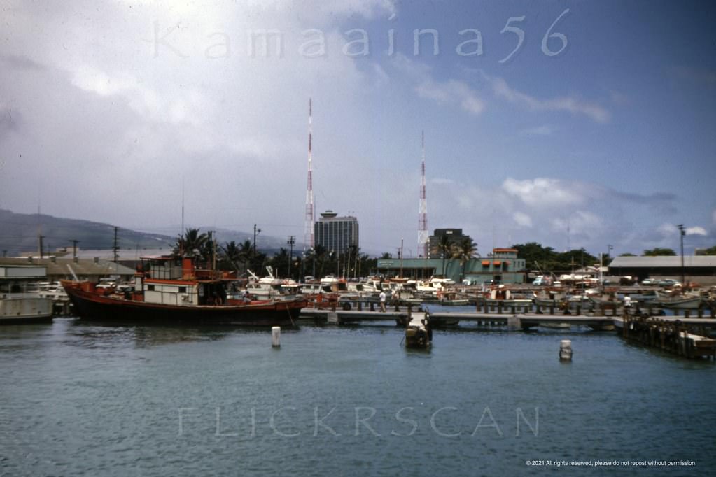
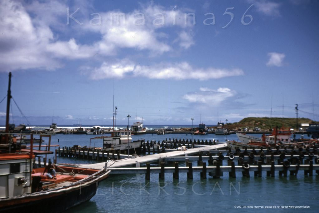
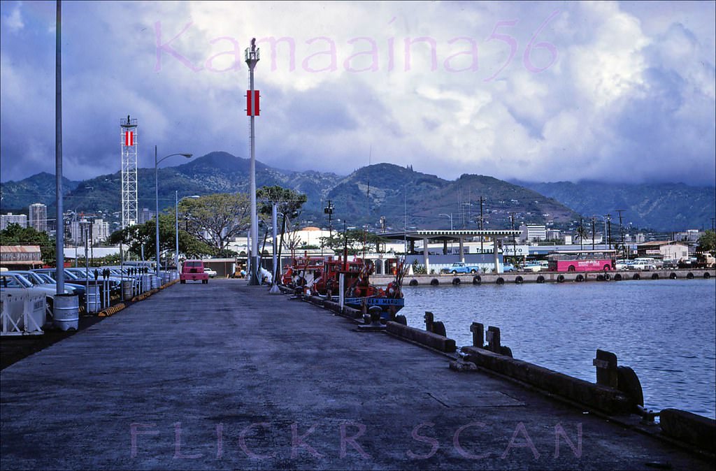
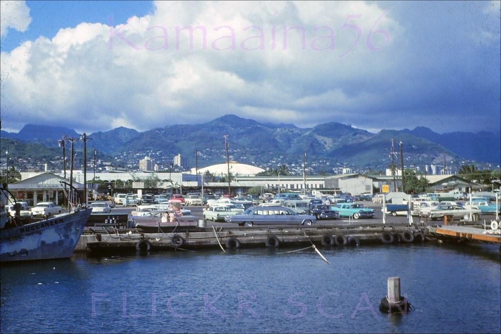
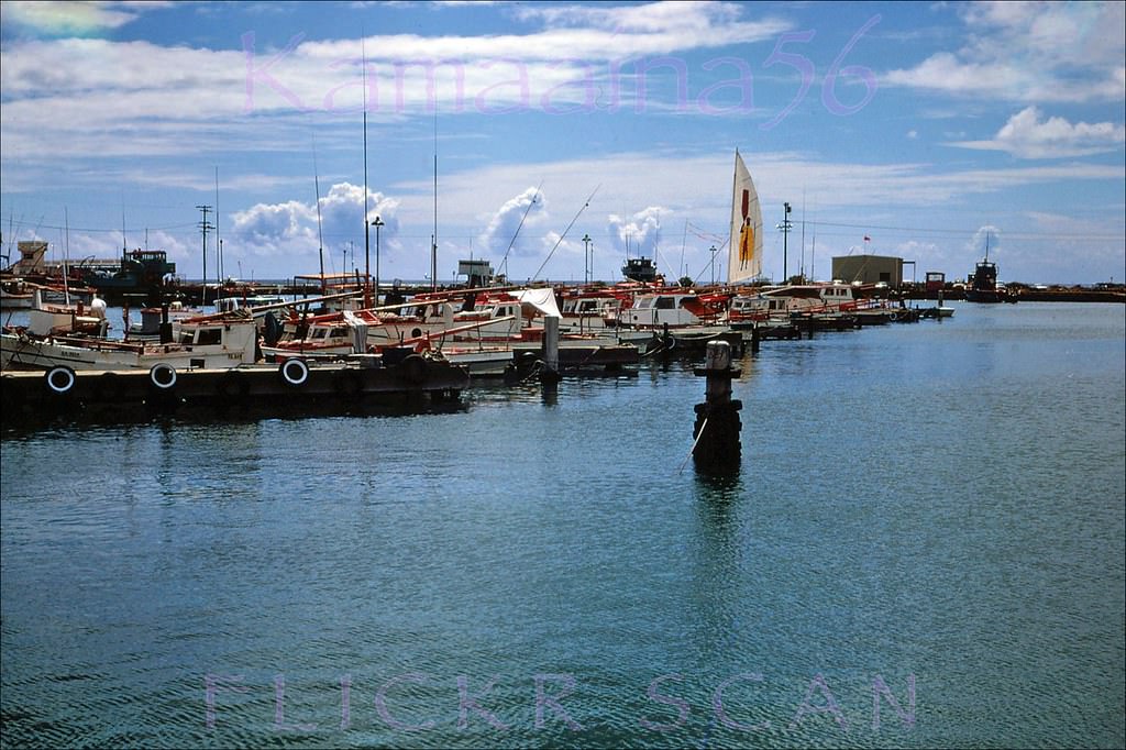
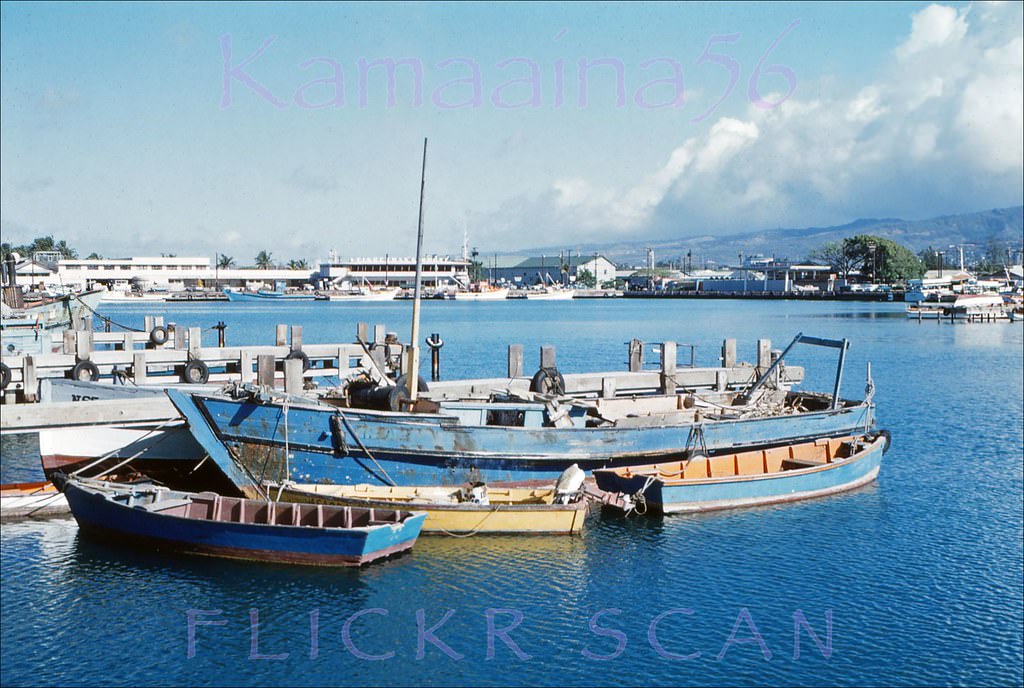
Kewalo Basin, just west of Ala Moana, was Honolulu’s working fishing harbor throughout the 1960s. Wooden sampan tuna boats — built in the Japanese fishing tradition and long used in Hawaii’s tuna industry — filled its docks. The boats went out for skipjack tuna, known locally as aku, and their daily routines gave the basin a steady rhythm of activity.
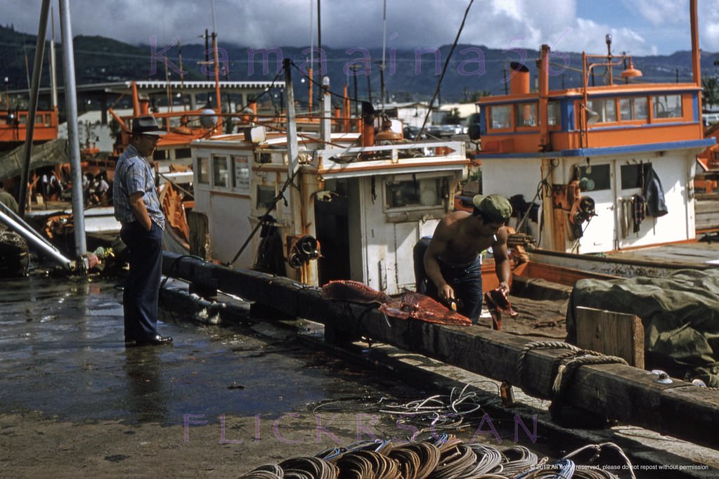
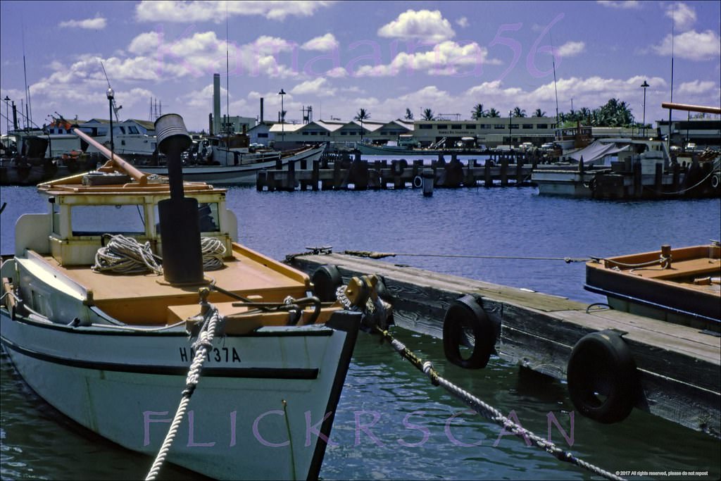
Wooden "sampan" tuna boats docked at Fisherman's Wharf on Kewalo Basin in Honolulu, 1960
Wooden “sampan” tuna boats docked at Fisherman’s Wharf on Kewalo Basin in Honolulu, 1960
Aku Boats Kewalo Basin, 1967
Kewalo Aku Boats Honolulu, 1960

The old Fisherman’s Wharf restaurant overlooked the basin and was a fixture of the waterfront scene. Morning light on the calm water of Kewalo Basin made for a tranquil contrast to the busy commercial activity that would follow. The 1955-built manmade peninsula at the basin’s entrance, now Kewalo Basin Park, was already a feature of the harbor by this time.
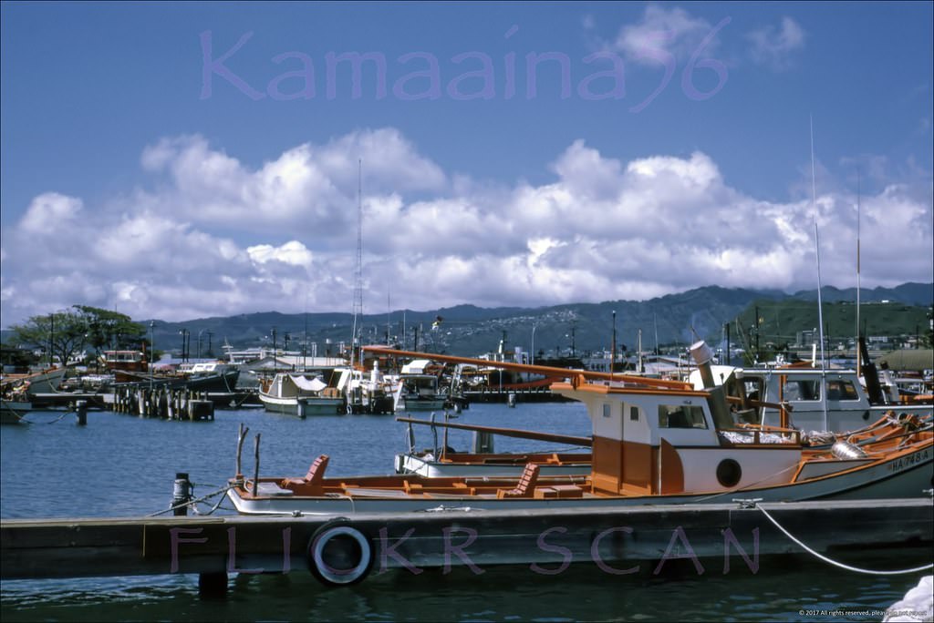
Still Life Kewalo, 1960
Kewalo Sampans Honolulu, 1967
Fisherman's Wharf Kewalo, 1967
Fisherman’s Wharf Kewalo, 1967
McWayne Marine Honolulu, 1963
Aku Boats at Kewalo Basin, 1963
Kewalo Basin Peninsula, 1963
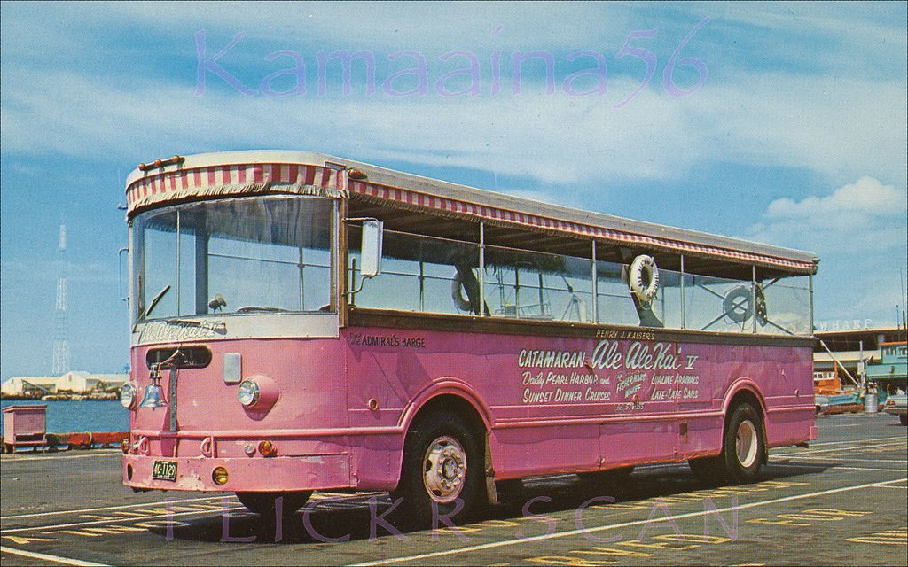
Admiral's Barge Kewalo, 1960s
Admiral’s Barge Kewalo, 1960s

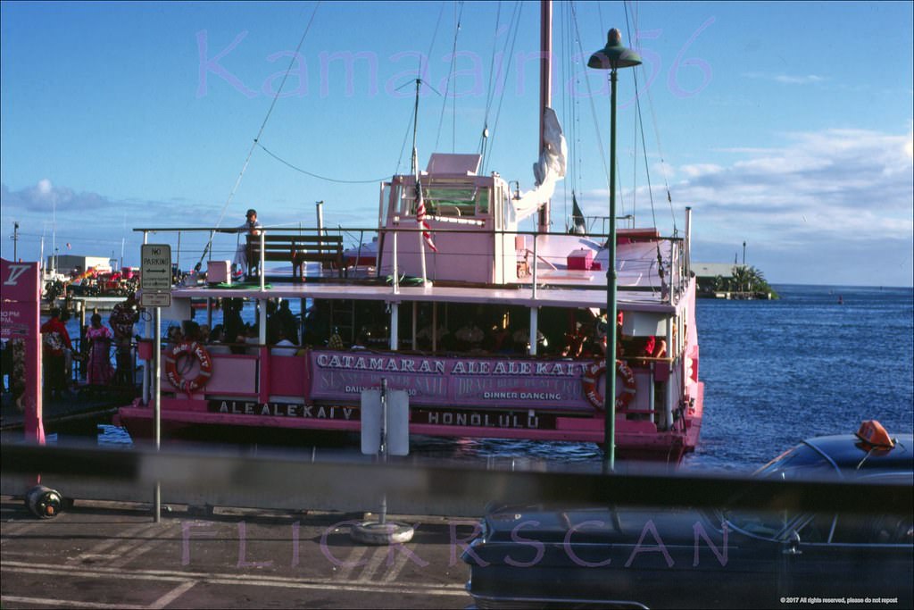
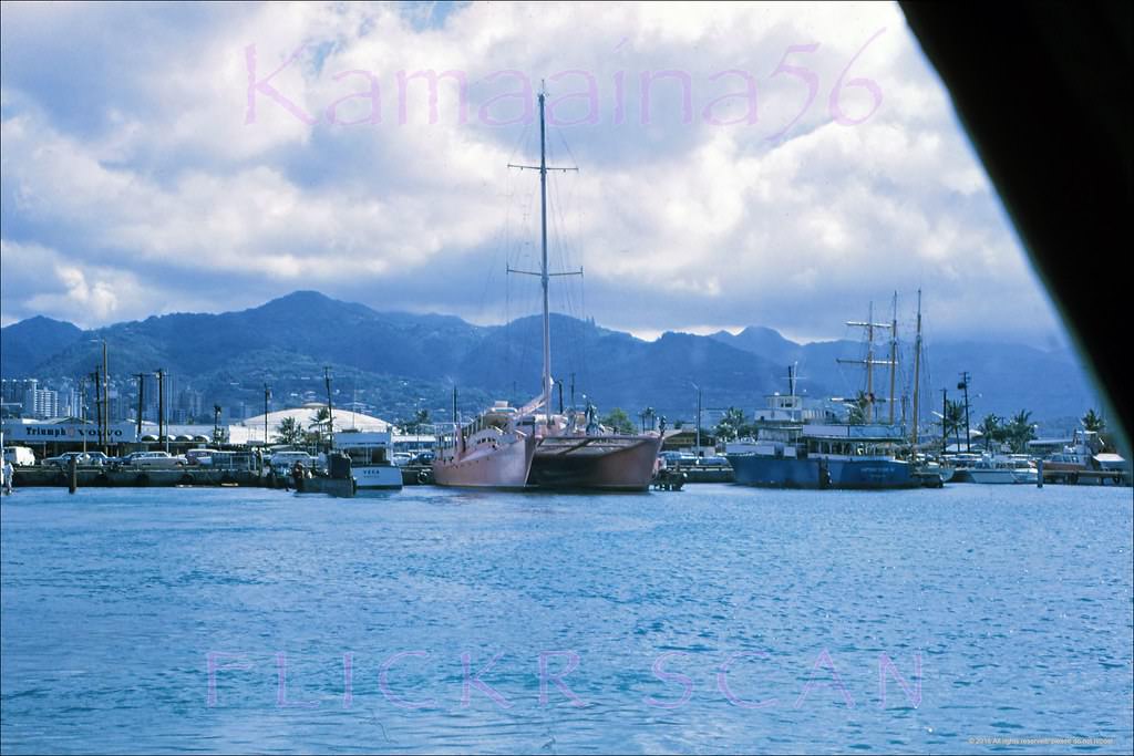
One of the most eye-catching vessels at Kewalo Basin in the 1960s was the Ale Ale Kai V, a large pink catamaran owned by industrialist Henry J. Kaiser. Kaiser, who had helped finance the Hawaiian Village Hotel in Waikiki, built the catamaran in late 1957. It operated sightseeing and dinner cruises out to Waikiki and to Pearl Harbor throughout the 1960s. The boat ran until it was demolished in early 2018.
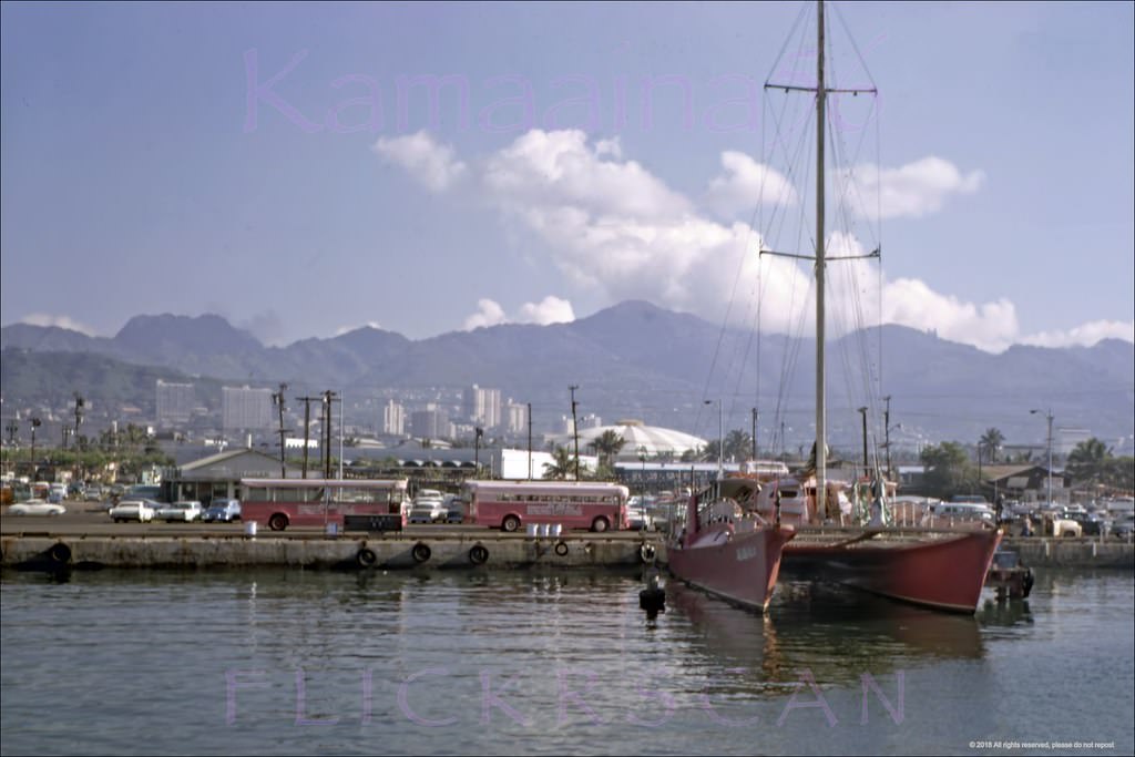
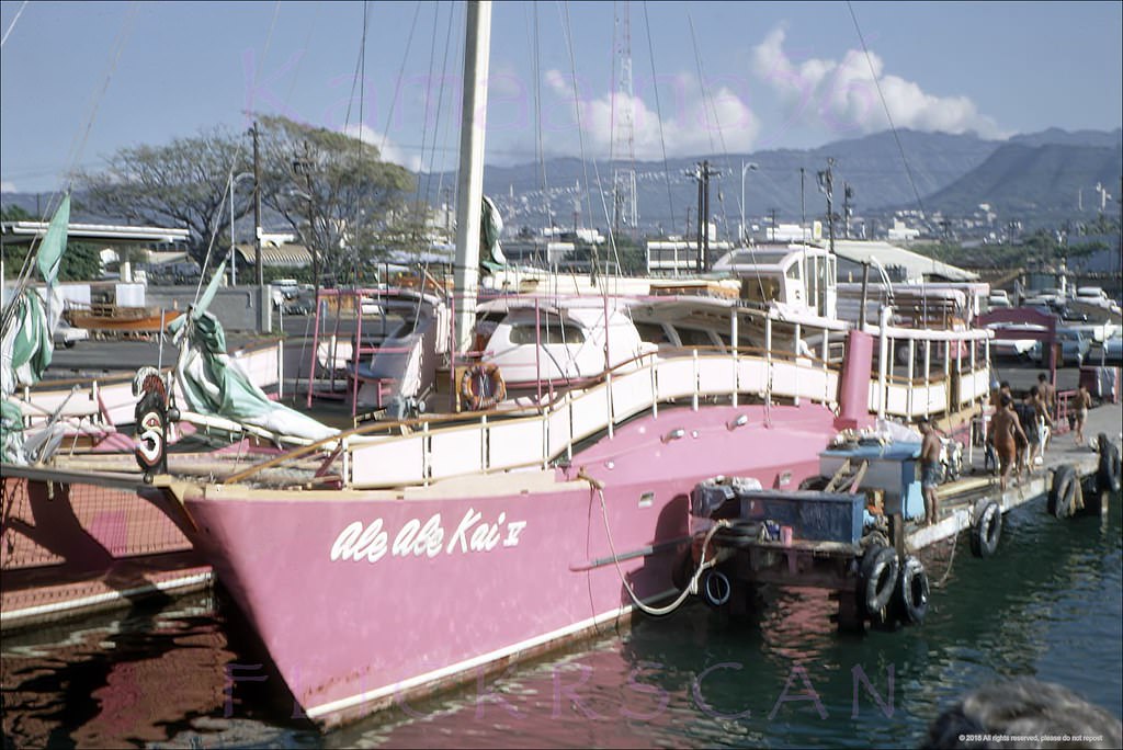
Industrialist Henry J. Kaiser's big pink catamaran Ale Ale Kai V moored in Kewalo Basin on south shore Oahu, 1968
Industrialist Henry J. Kaiser’s big pink catamaran Ale Ale Kai V moored in Kewalo Basin on south shore Oahu, 1968
Ale Ale Kai Cat Kewalo, 1968
Sunset Dinner Sail Kewalo, 1962
Ale Ale Kai Kewalo Honolulu, 1962
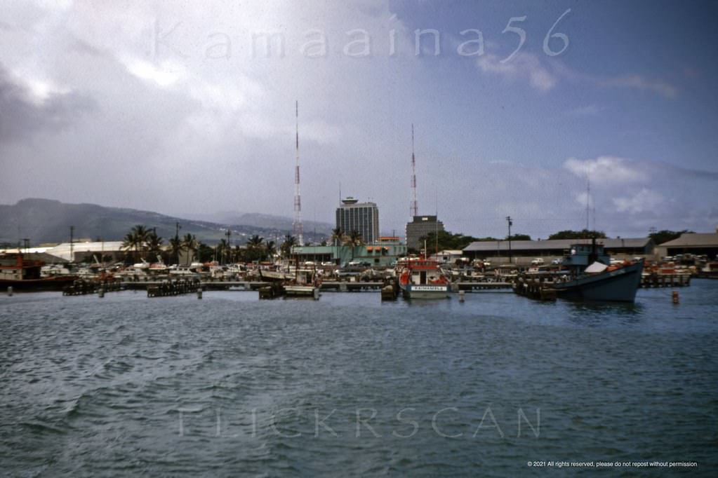
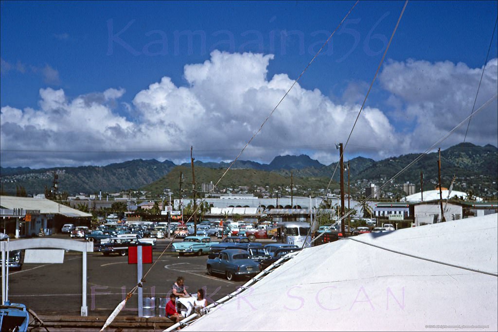
Looking mauka (inland) from a tourist boat docked at Kewalo Basin on Oahu's south shore, 1964
Looking mauka (inland) from a tourist boat docked at Kewalo Basin on Oahu’s south shore, 1964
Kewalo Basin, Honolulu, in front of the old Fisherman's Wharf Restaurant out of the frame to the left, 1968
Kewalo Basin, Honolulu, in front of the old Fisherman’s Wharf Restaurant out of the frame to the left, 1968
Kewalo Waterfront Mauka, 1965
Catamaran Ale Ale Kai Kewalo, 1969
Sampans moored at Kewalo Basin in Honolulu, 1968
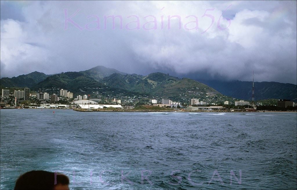
Looking inland from a boat leaving Kewalo Basin on Oahu's south shore, 1960
Looking inland from a boat leaving Kewalo Basin on Oahu’s south shore, 1960
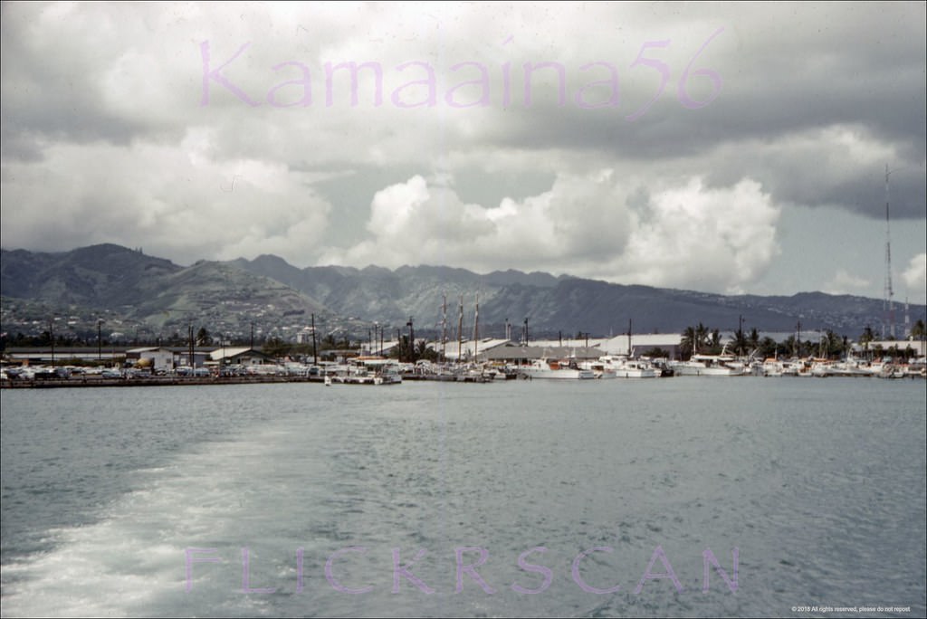
Mauka (inland) view from a cruise boat leaving Kewalo Basin on Oahu's south shore probably headed for Pearl Harbor or possibly Waikiki, 1968
Mauka (inland) view from a cruise boat leaving Kewalo Basin on Oahu’s south shore probably headed for Pearl Harbor or possibly Waikiki, 1968

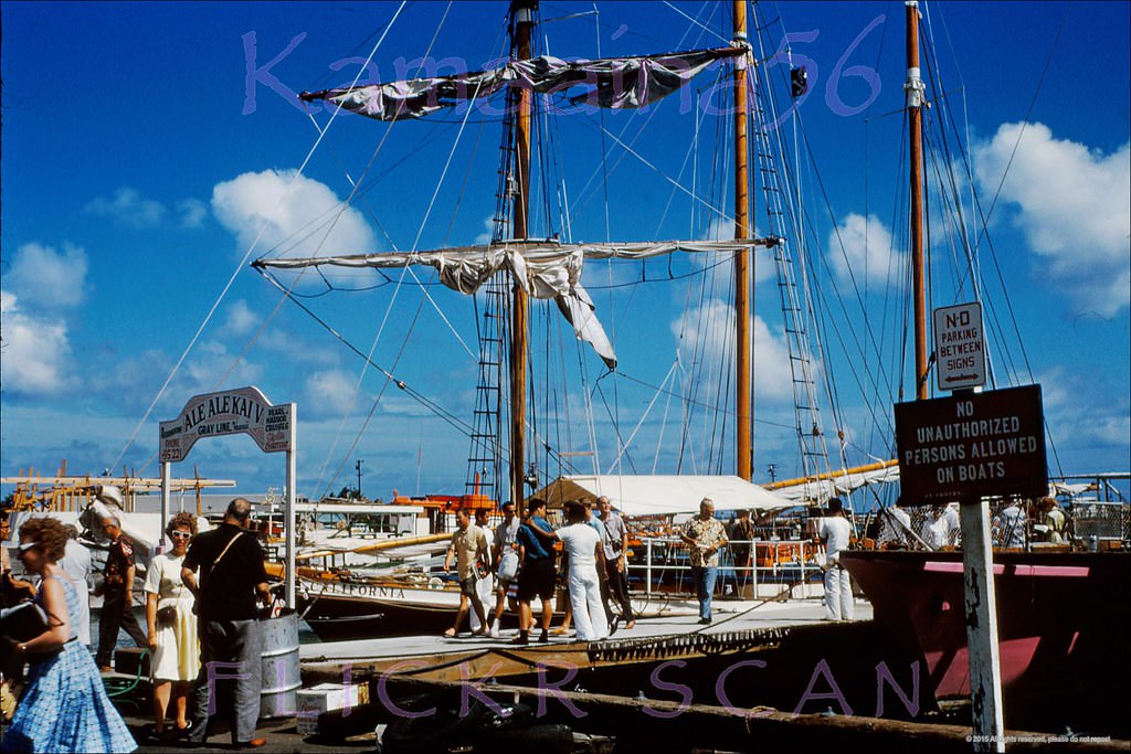
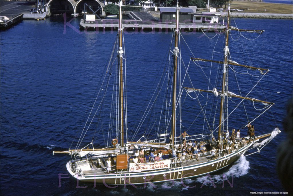
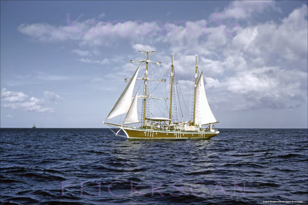
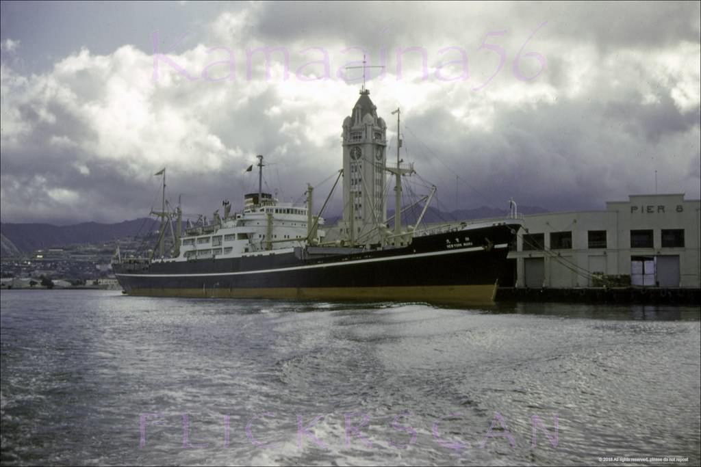
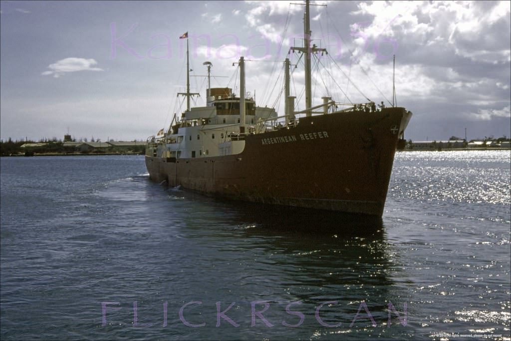
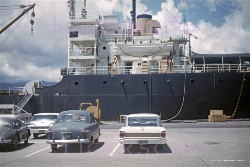
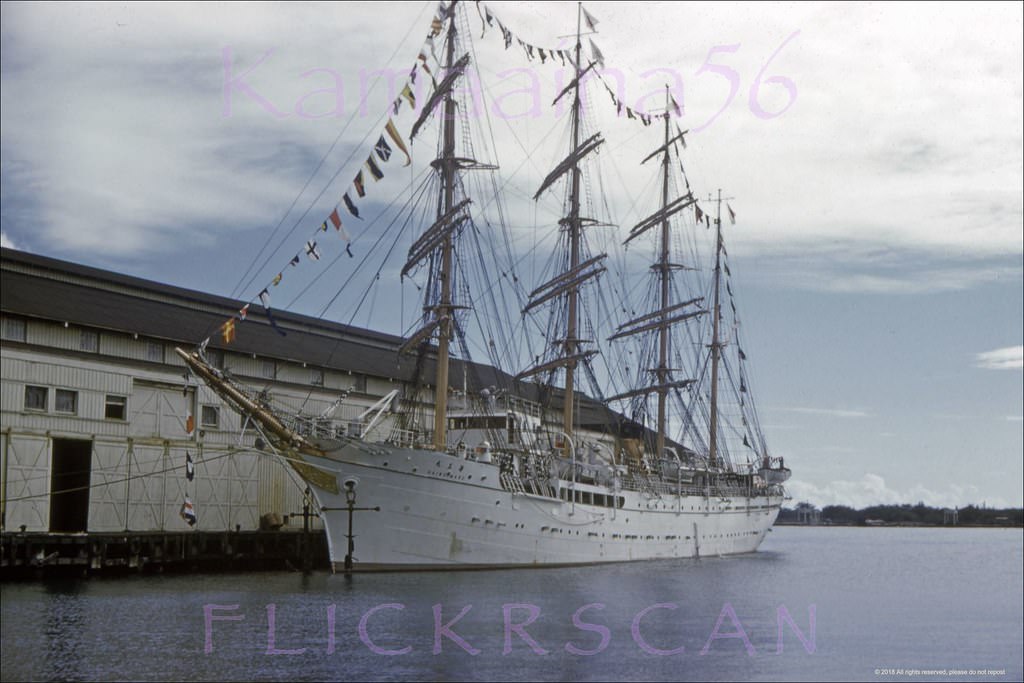
Commercial shipping at Honolulu Harbor told its own story of the city’s connections to the wider Pacific. Vessels from Japan, Argentina, and the U.S. mainland all docked here. The Barkentine California, a sailing ship that operated harbor and sightseeing cruises, was a familiar sight in 1960. The 10-story Aloha Tower, built in 1926, still dominated the harbor skyline and served as the main landmark for arriving ships.
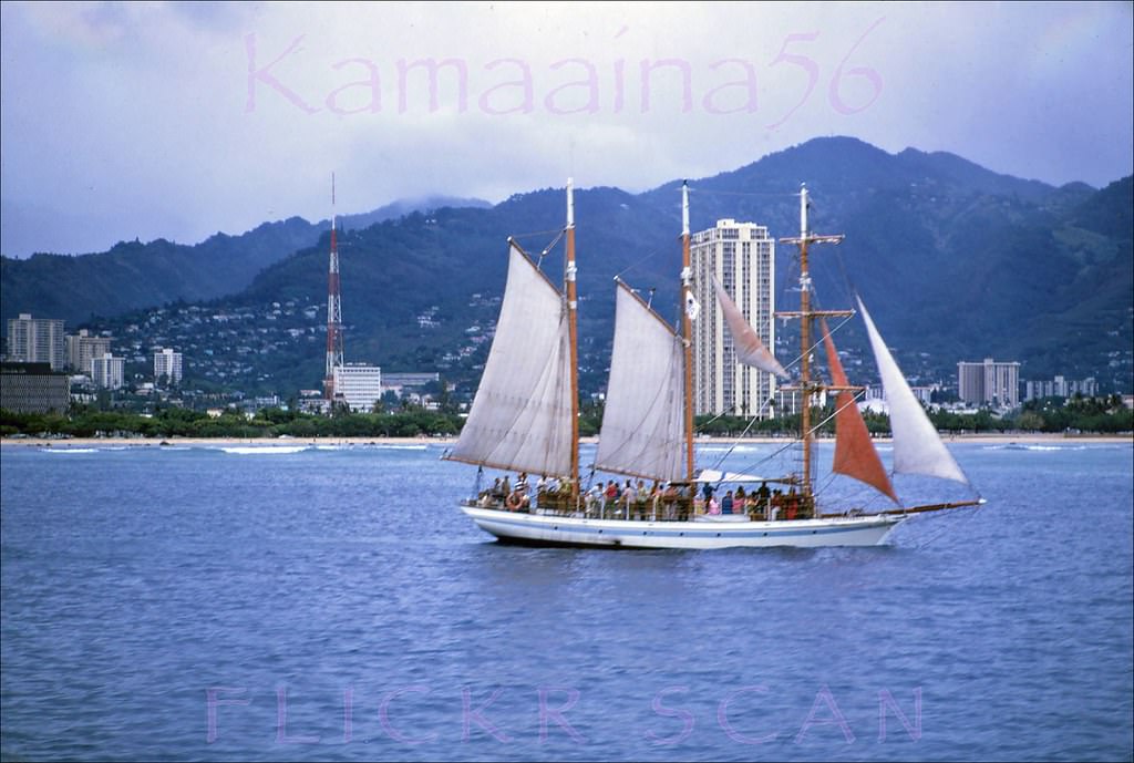
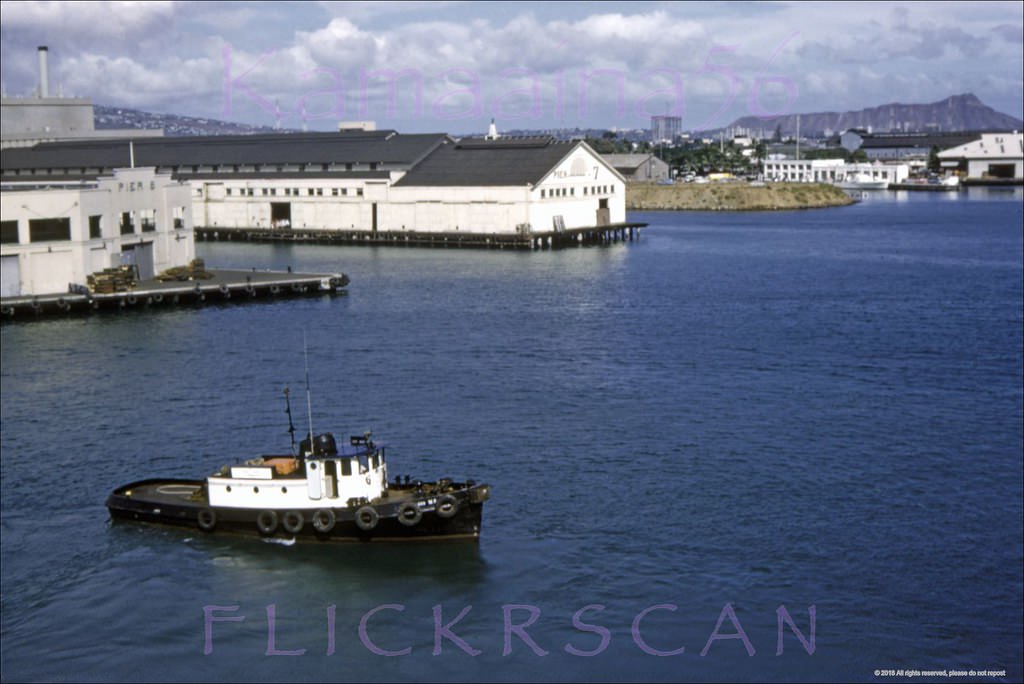
Barkentine California Offshore, 1968
Honolulu Harbor from Lurline, 1960.
Barkentine California Harbor, 1960
Barkentine California Sails Up, 1960
New York Maru Honolulu, 1960
Argentinean Reefer Honolulu, 1960
Freighter at Honolulu Harbor, 1963
Kaiwo Maru Pier 6 Honolulu, 1960

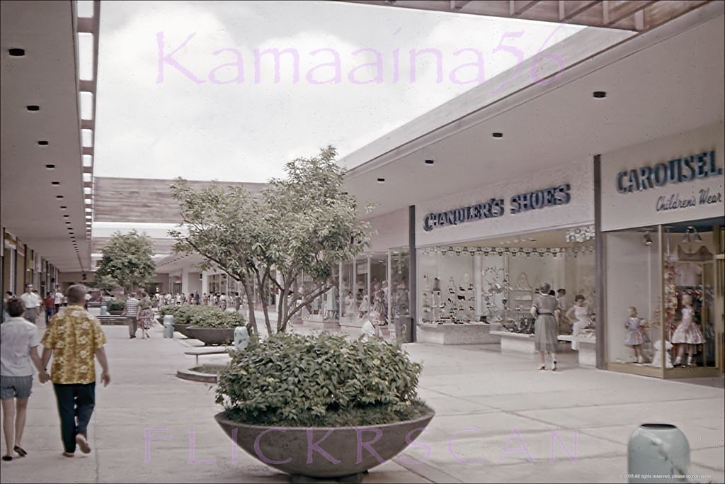
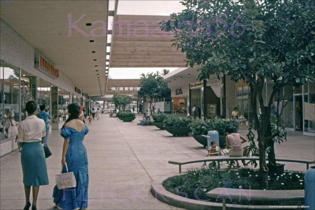
Ala Moana Shopping Center opened in 1959 and became the retail center of the city almost immediately. Built as an open-air mall on reclaimed land along Ala Moana Boulevard, it was one of the largest shopping centers in the United States at the time. Early photos from 1960 show its wide corridors nearly empty — a stark contrast to the crowds it would draw within just a few years.
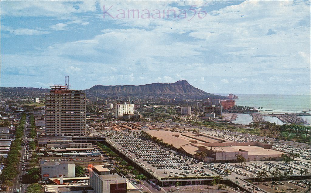
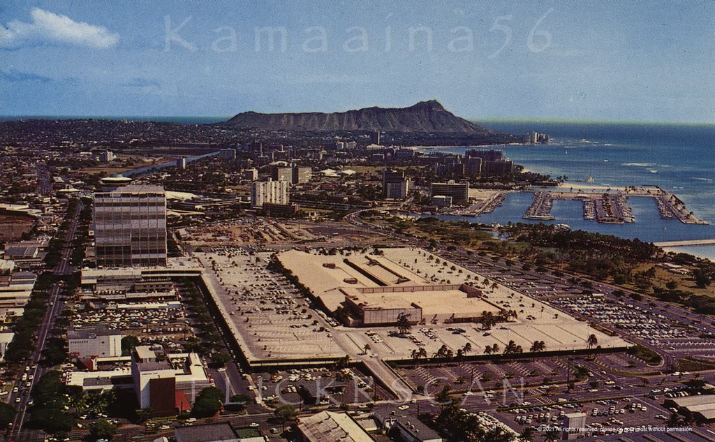
Honolulu's 1959 Ala Moana Shopping Center seen from above the intersection of Kapiolani Blvd and Piikoi Street, 1960
Honolulu’s 1959 Ala Moana Shopping Center seen from above the intersection of Kapiolani Blvd and Piikoi Street, 1960
Ala Moana Center Piikoi, 1962
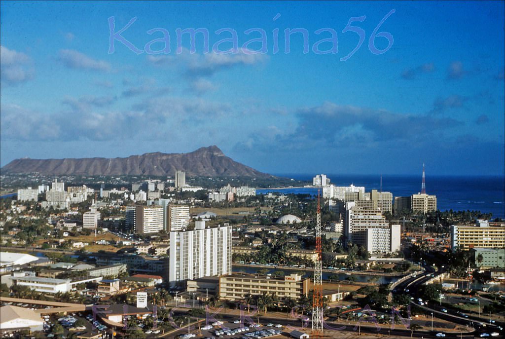
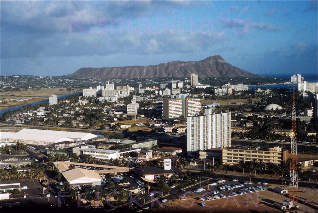
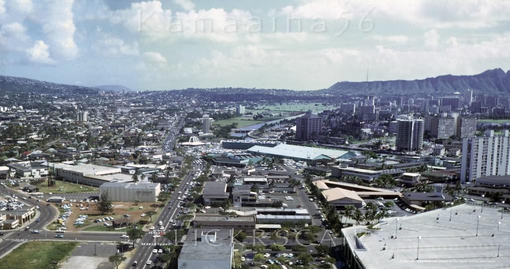
Slightly shifted birdseye view of Waikiki and Diamond Head apparently from the 23-story 1961 Ala Moana Towe, 1962
Birdseye view of the Ala Moana area of Honolulu and Waikiki looking Diamond Head from the LaRonde revolving restaurant atop the 23-story 1961 Ala Moana Tower, 1962
Ala Wai Harbor Panorama, 1962
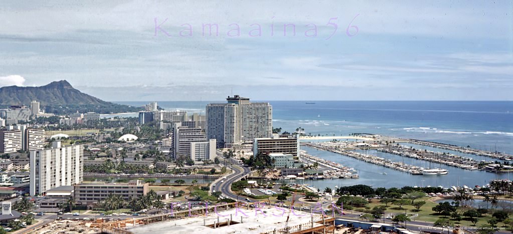
Detailed panoramic view of Honolulu and Waikiki looking Diamond Head from La Ronde revolving restaurant atop the 23-floor Ala Moana Building at Ala Moana Shopping Center, 1965
Liberty House Ala Moana BEV, 1965

The LaRonde revolving restaurant on the 23rd floor of the Ala Moana Tower was one of the most popular dining spots in the city. Opened in 1961, it completed a full rotation every hour, giving diners views of Diamond Head, the Koolau Mountains, the harbor, and the open Pacific. Photos taken from its windows throughout the decade document Honolulu’s growth almost year by year.
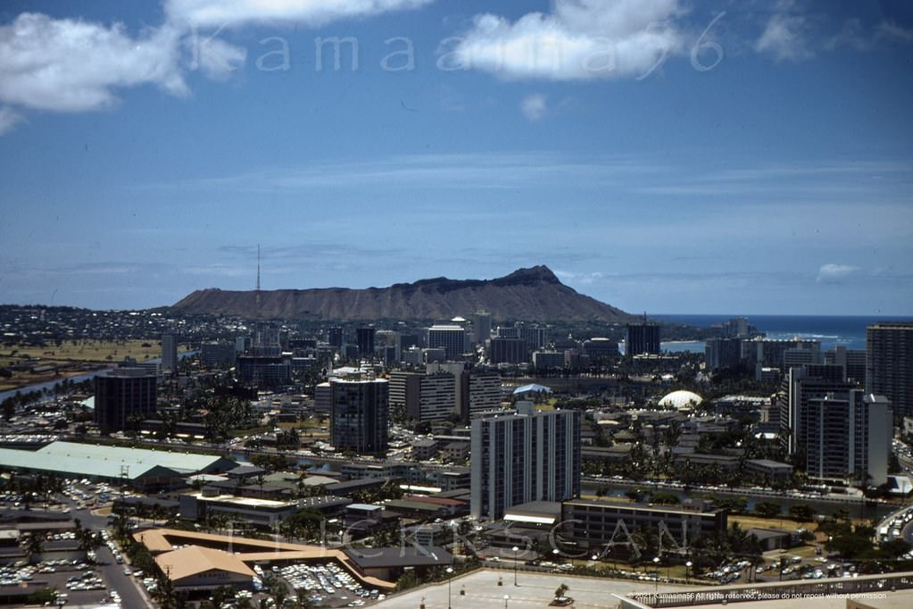
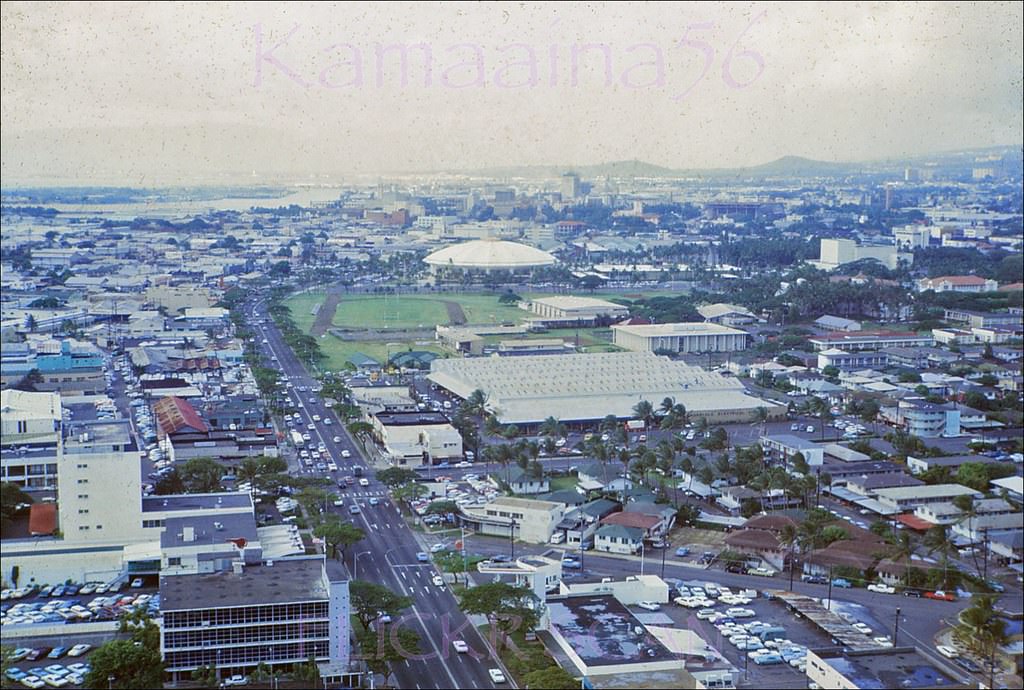
La Ronde Ala Moana Birdseye, 1967
Honolulu from La Ronde, 1967
Ala Moana Birdseye, 1962
La Ronde Ewa Birdseye, 1964
Coco's Honolulu BEV, 1960s
Coco’s Honolulu BEV, 1960s
Rainbow Rollerland Birdseye, 1967
Keeaumoku Aerial La Ronde, 1967
La Ronde Mauka Honolulu, 1962
La Ronde Panorama Honolulu, 1967
La Ronde Honolulu Birdseye, 1967

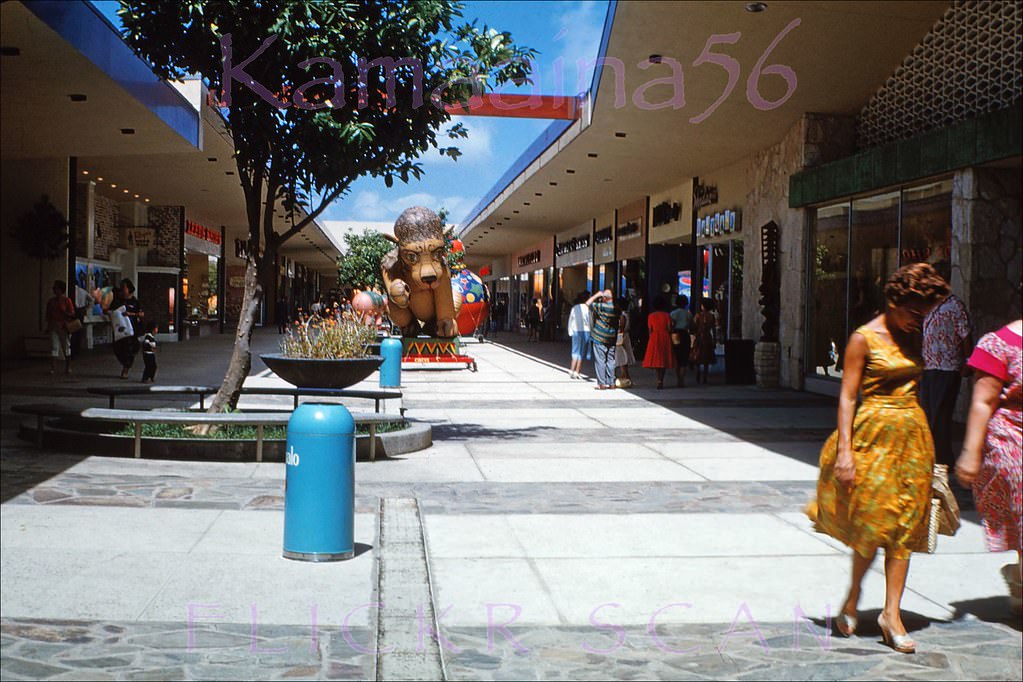
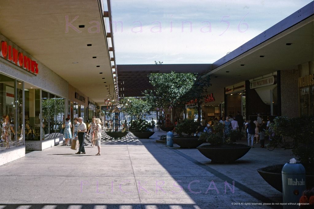
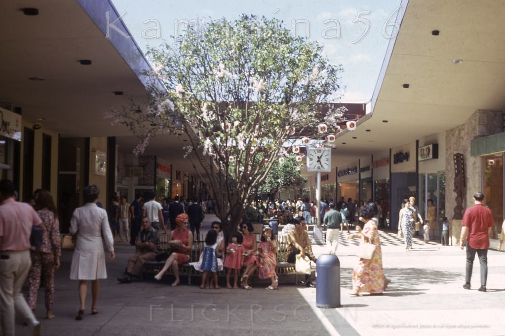
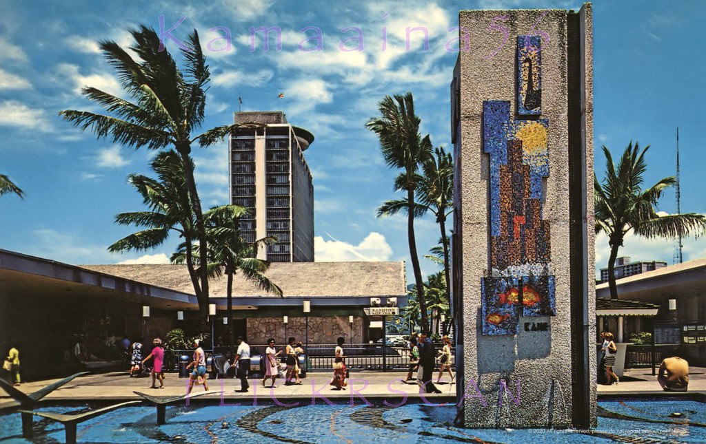
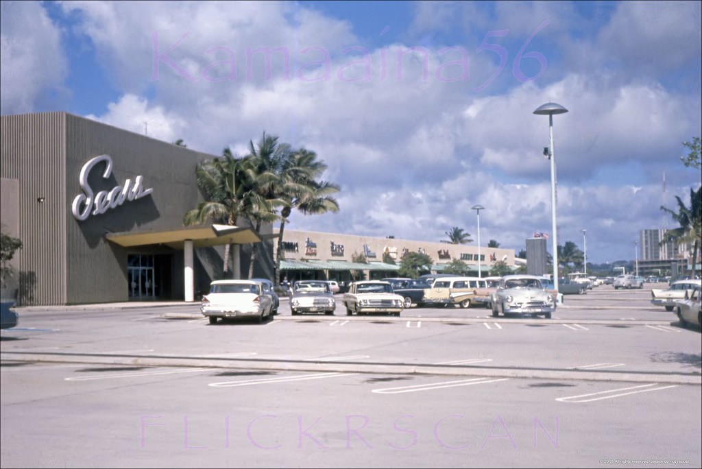
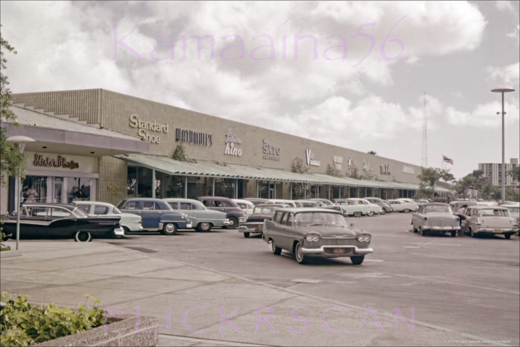
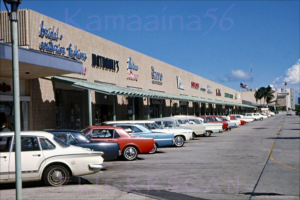
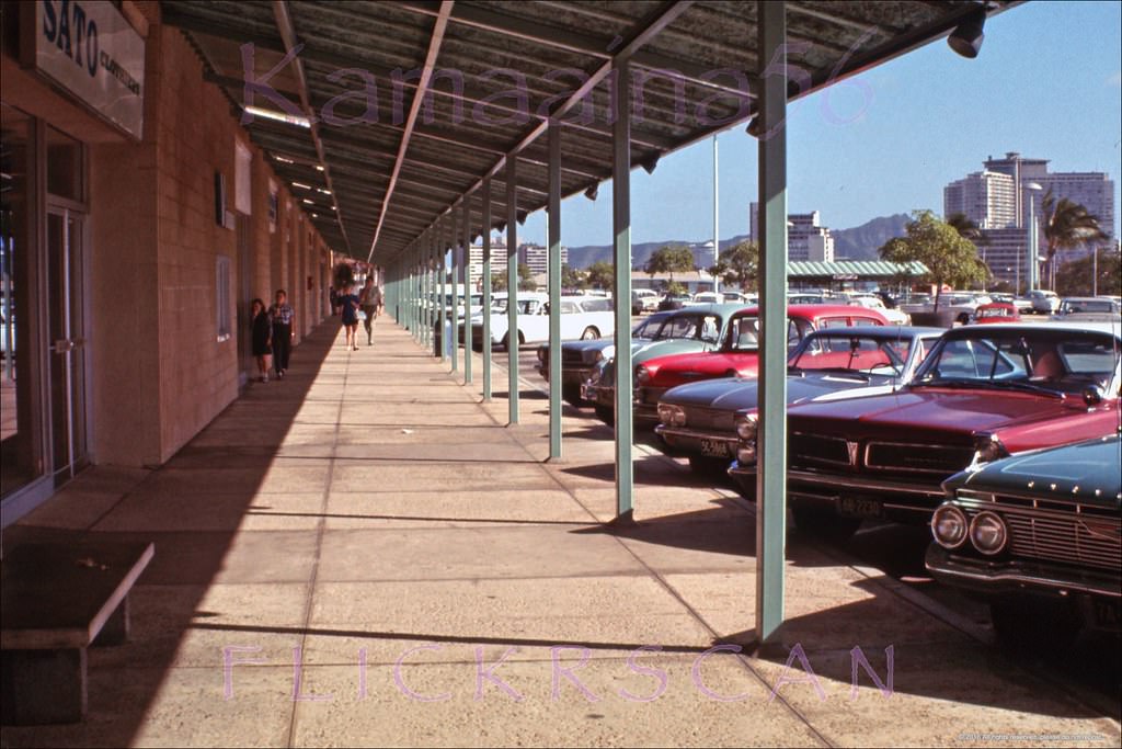
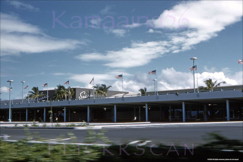
On the ground level at Ala Moana, the shopping experience was distinctive for its open-air design. The upper mall level featured a central courtyard, ocean-facing storefronts, and a Sears anchor at the western (ewa) end. A standout feature was the “Fountain of the Gods,” sculpted in 1959 by noted Hawaii artist Bumpei Akaji (1921–2002). The fountain stood near the escalators on the mall level and was eventually demolished during the center’s third-level expansion in 1990.
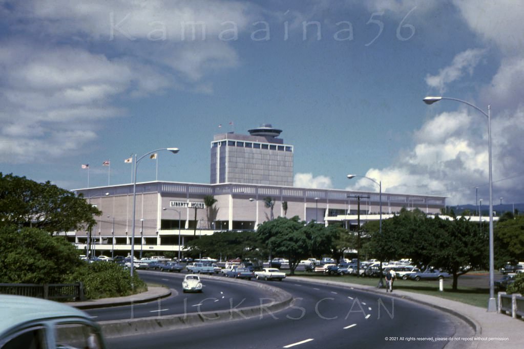
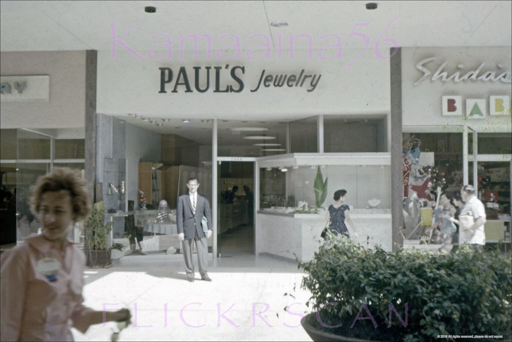
Ala Moana Shopping Center seen from Ala Moana Blvd just Ewa (west) of the Ala Wai Bridge, 1967
Ala Moana Mall Level Stores, 1960
Early days at Honolulu's 1959 Ala Moana Shopping Center, 1960
Early days at Honolulu’s 1959 Ala Moana Shopping Center, 1960
Ala Moana Mall Level Stores, 1960
Ala Moana Upper Level, 1961
Honolulu's 1959 Ala Moana Shopping Center looking Diamond Head (more or less east) along the interior of the upper level, 1963
Honolulu’s 1959 Ala Moana Shopping Center looking Diamond Head (more or less east) along the interior of the upper level, 1963
Mall Level Shops Ala Moana, 1967
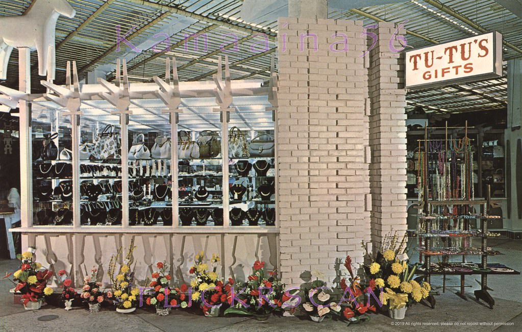
Tutu's Gifts on the street level of the 1959 Ala Moana Shopping Center, 1963.
Tutu’s Gifts on the street level of the 1959 Ala Moana Shopping Center, 1963.
Ala Moana Fountain of Gods, 1960s
Sears Ala Moana Honolulu, 1963
Ala Moana Upper Deck Makai, 1960
The ocean-facing storefronts along the upper level at Ala Moana Center, 1967
Upper level makai side at Ala Mona Center looking Diamond Head, 1966
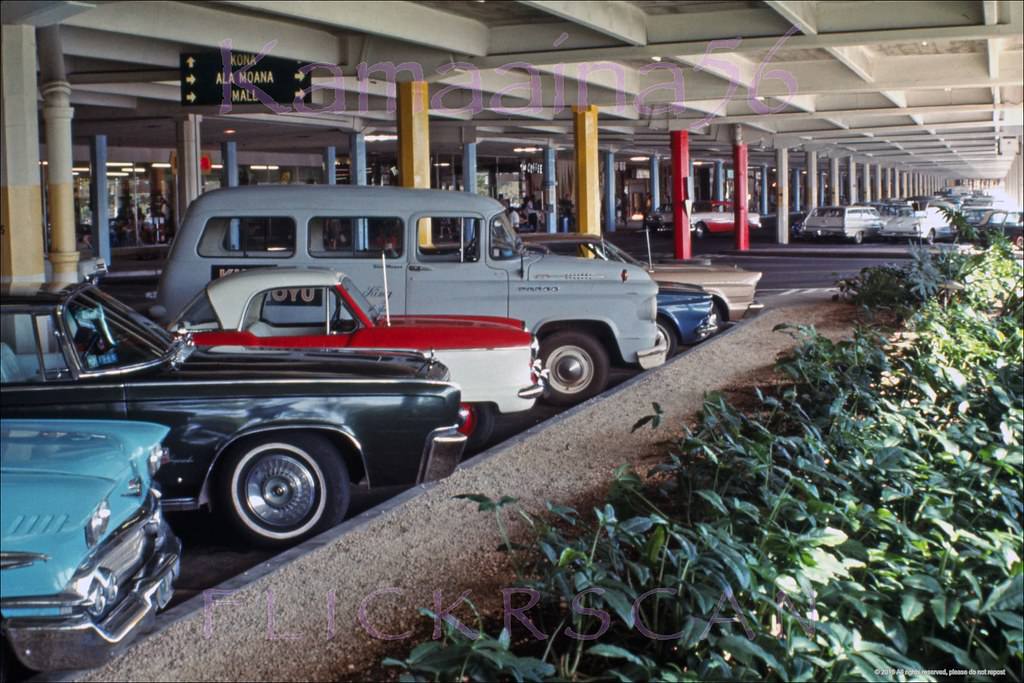
Kind of unusual to see a photo of the parking garage at Ala Moana Center, 1966
Ala Moana Center Drive-by, 1960

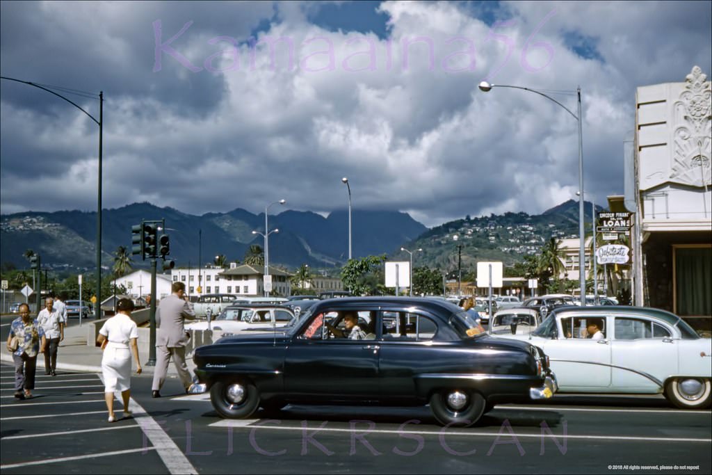
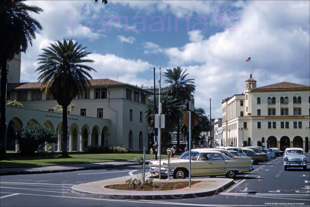
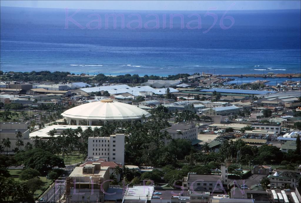
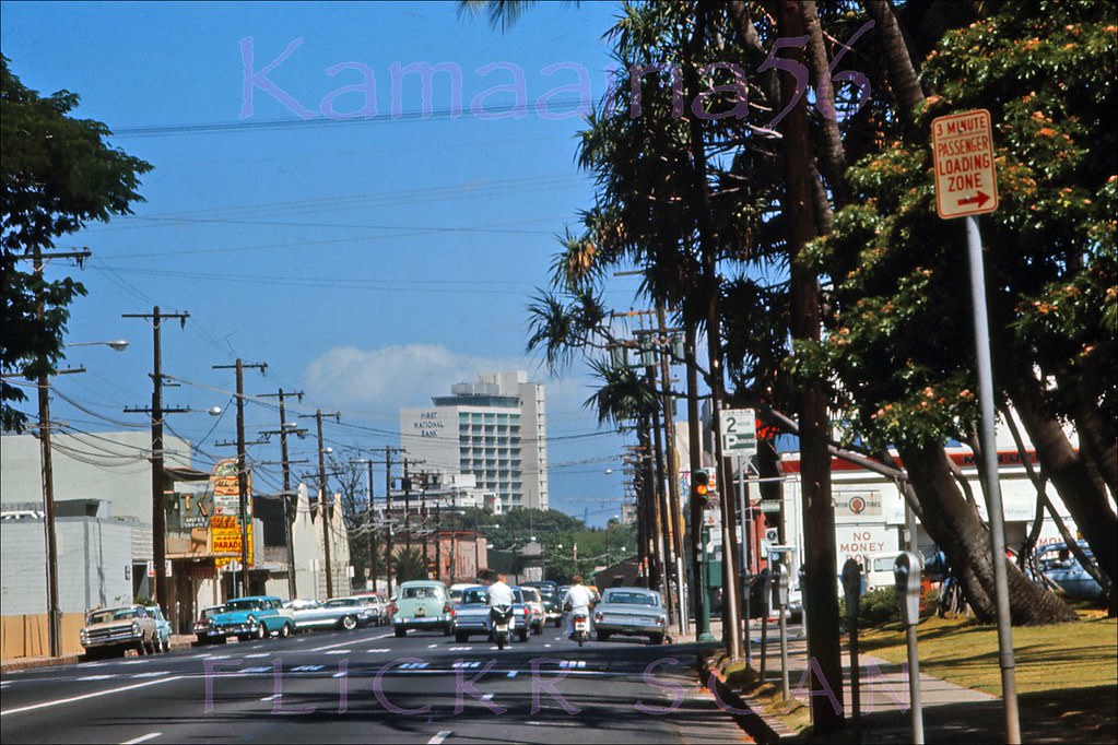
The Honolulu International Center on Ward Avenue opened in 1964. Its striking saucer-shaped arena was one of the most architecturally distinctive buildings in the city. It was later renamed the Blaisdell Center in 1984 to honor Mayor Neal S. Blaisdell, who served the city from 1955 to 1969. A few blocks away, the new Hawaii State Capitol was under construction in 1966, visible from the Punchbowl overlook, its modernist circular design rising above the older buildings of downtown.
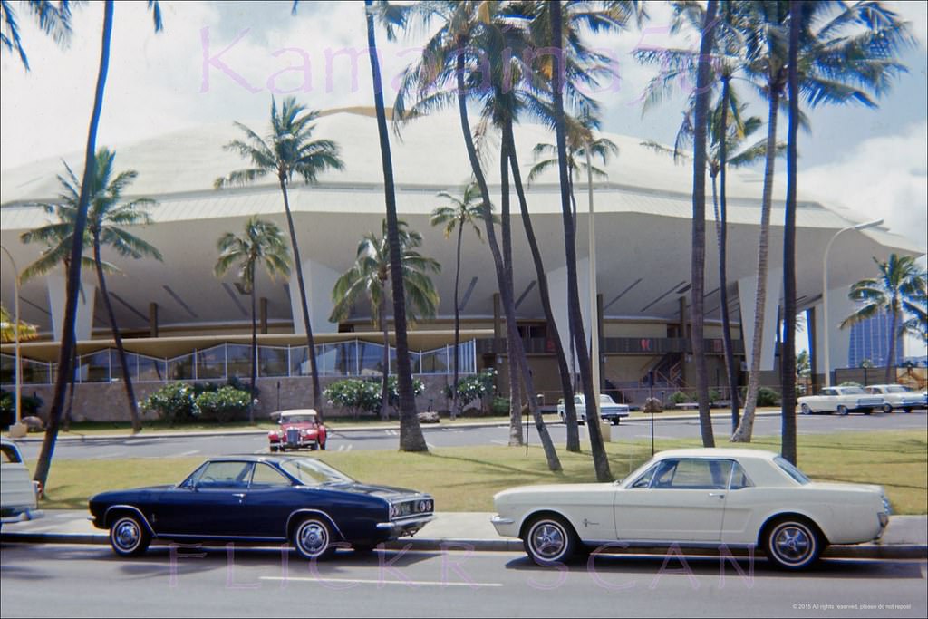
Honolulu International Center, 1965
Beretania Street at Ward Ewa, 1966

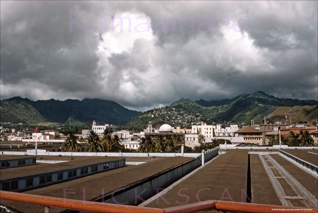
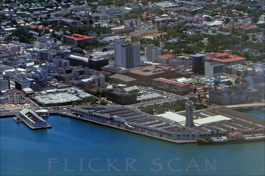
Downtown Honolulu’s harbor area anchored the commercial core of the city. The 10-story Aloha Tower, which opened in 1926, was the tallest structure in Hawaii for decades and served as a landmark for ships arriving at Pier 9. Looking inland from its observation deck in 1960, the grid of downtown streets spread toward the Ko’olau Mountains. By 1965, newer office buildings were beginning to challenge the tower’s prominence on the skyline.
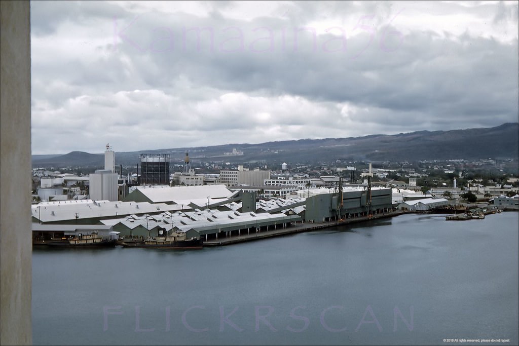
Honolulu Harbor Mauka, 1960.
Honolulu Harbor Downtown, 1965.
Honolulu Harbor Mauka, 1961.

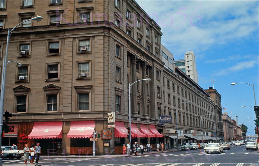
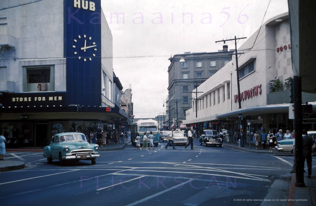
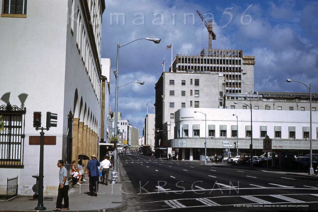
Bishop Street was downtown Honolulu’s financial hub. The street ran from the harbor straight through the city’s most important bank buildings and offices. By 1966, the corner of Bishop and King Street still had the character of a mid-century business district — ground-floor retail, modest signage, and steady foot traffic. The old Alexander Young Hotel at Bishop and Hotel Streets housed the 1955 Hob Nob restaurant, a well-known downtown lunch spot.
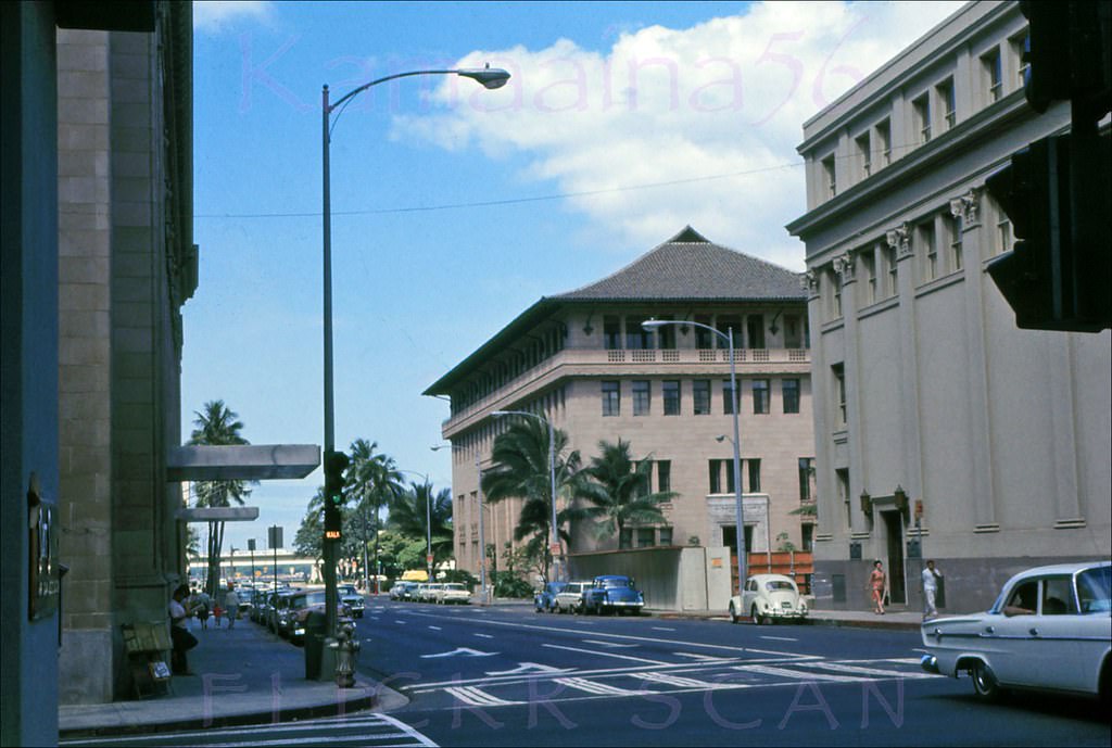
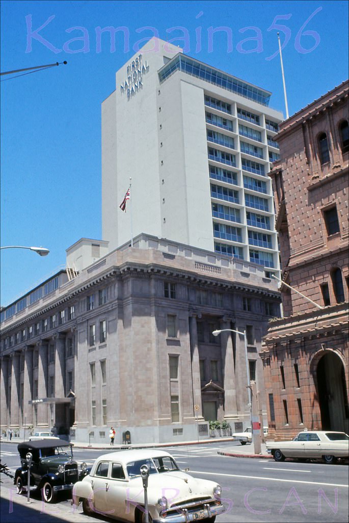
Looking towards the harbor along Bishop Street at the intersection with South King Street in downtown Honolulu, 1966.
Bishop St at Merchant Mauka, 1966.
Merchant Street at Bishop, 1966.
Hob Nob Bishop St Makai, 1966.

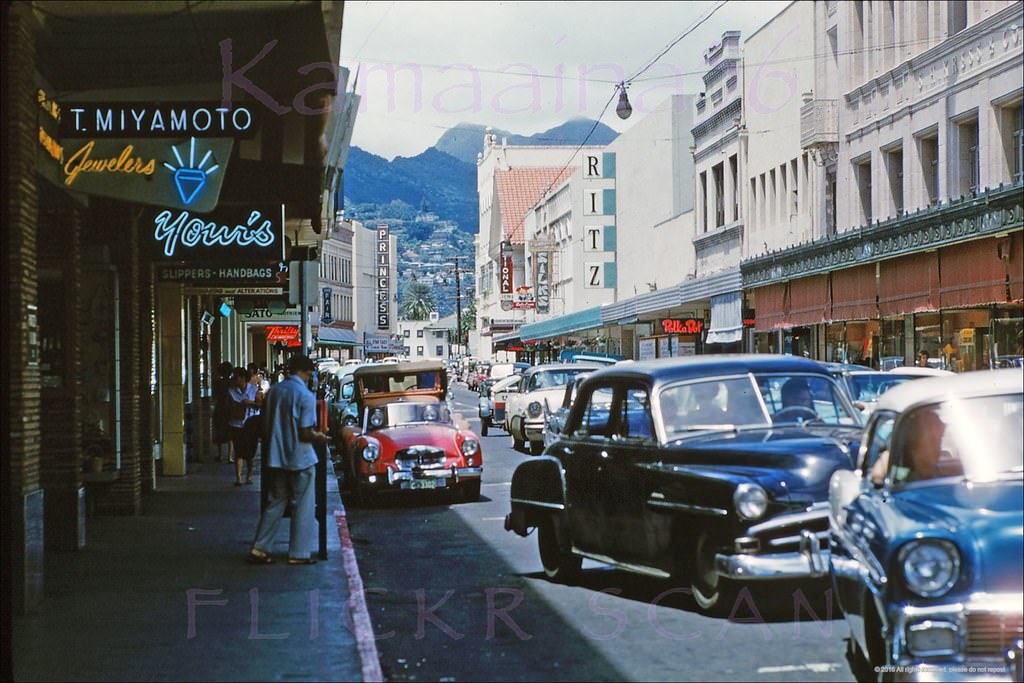
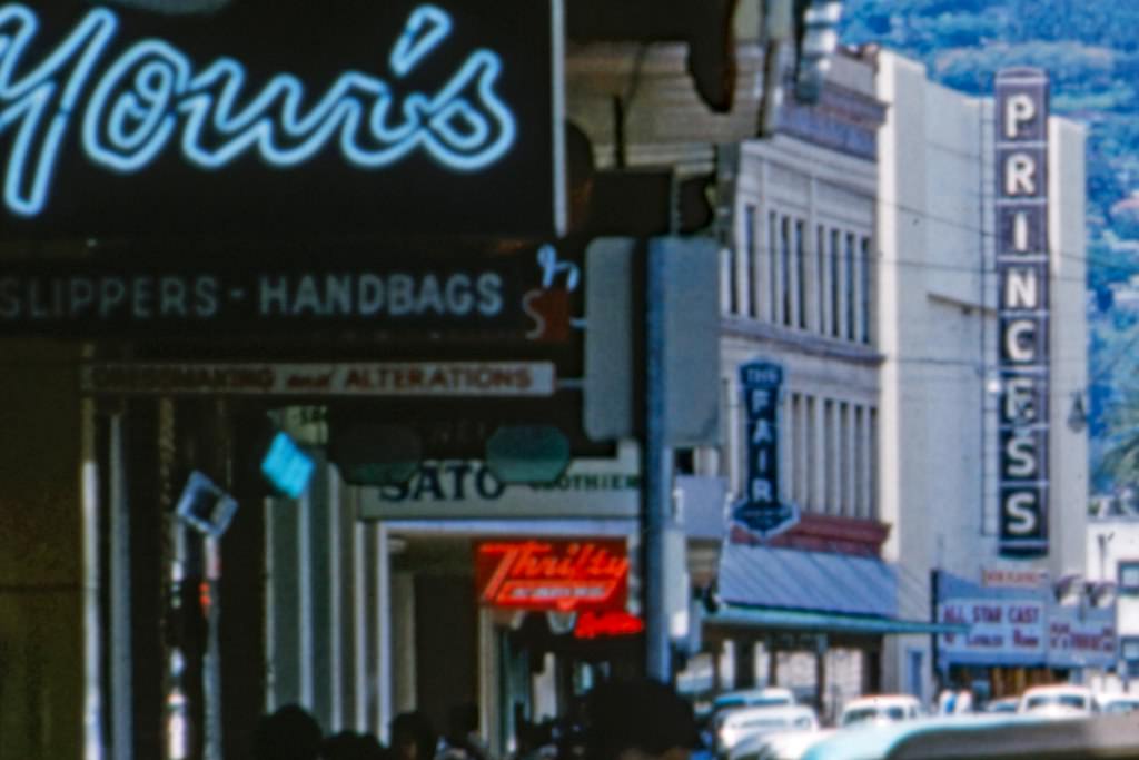
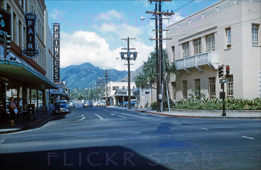
Fort Street was one of downtown’s busiest pedestrian corridors. Photos from 1960 and 1961 show it full of shoppers and street activity, with cars and buses sharing the road. That would change: Fort Street became a pedestrian mall in 1968, one of the earliest such conversions of a major downtown street in the United States. The 1922 Princess Theater, visible along Fort Street, was still drawing audiences in the early 1960s.
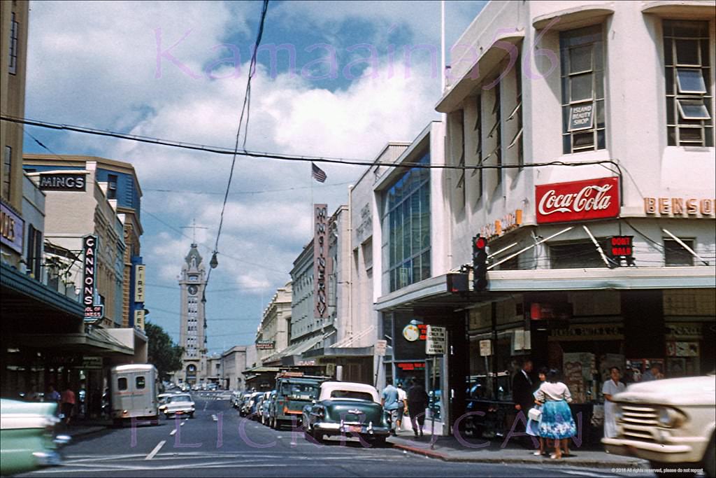
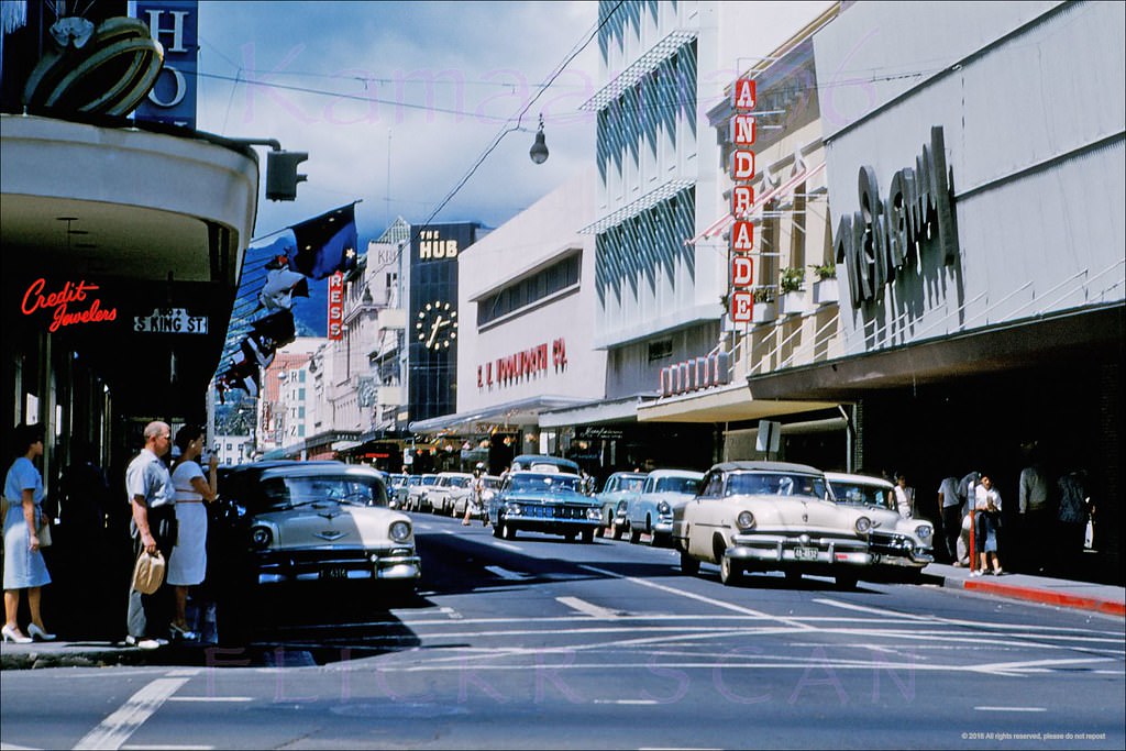
Fort Street at King Makai, 1960.
Busy Fort St at King Honolulu, 1961.
Looking mauka along Fort Street in downtwon Honolulu from just above the Hotel Street intersection, 1961
Princess Theater Honolulu, 1961
Looking mauka (inland) along Fort Street from Beretania Street towards the 1922 Princess Theater in downtown Honolulu, 1960
Hotel Street at Fort Honolulu, 1960.

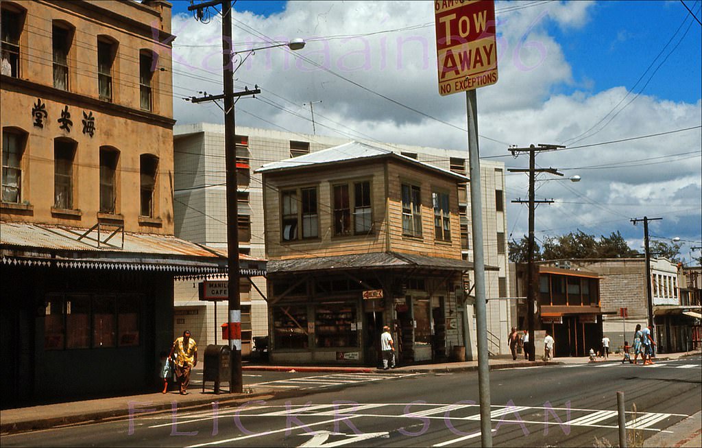
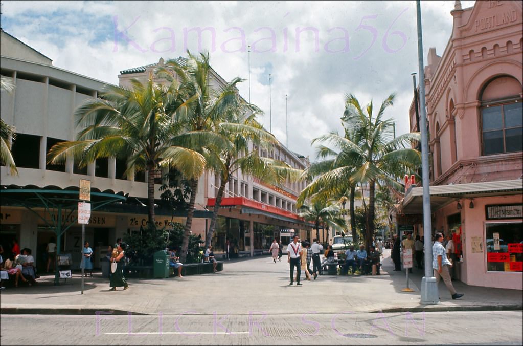
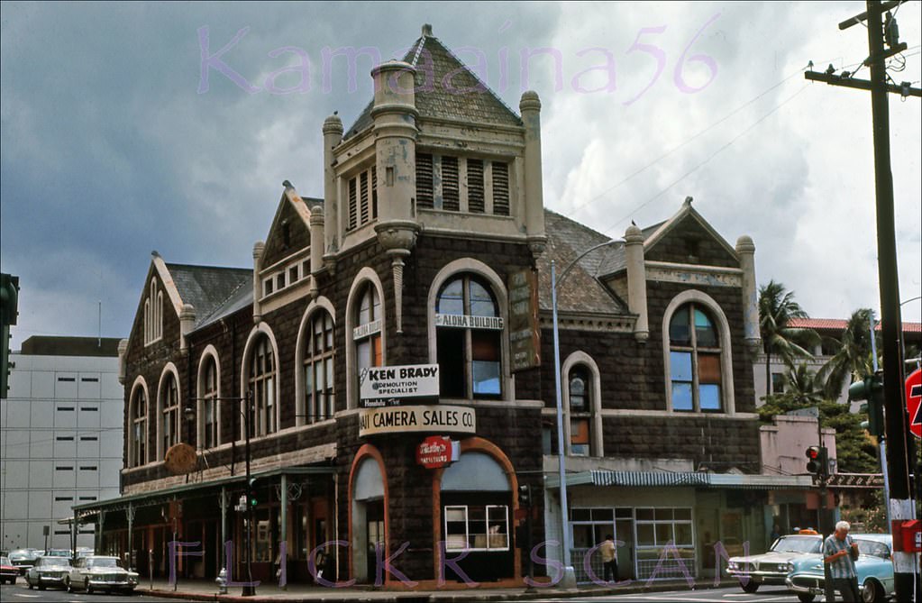
Hotel Street and its surrounding blocks formed a dense commercial neighborhood. The Kress store on Union Street, with its red awning, was a fixture of the area. The 1893 Masonic Temple on Alakea Street was already facing demolition by 1966 — a sign going up on the building reads “Ken Brady Demolition Specialist.” Chinatown, just a few blocks away, retained its pre-war character well into the decade, with its Chinese-character storefronts and the street activity visible at the Maunakea and North Beretania intersection.
Union Mall Kress Honolulu, 1966.
Masonic Temple on Alakea, 1966.
Manila Cafe Chinatown, 1966
Beretania & Pali Hwy Honolulu, 1960.
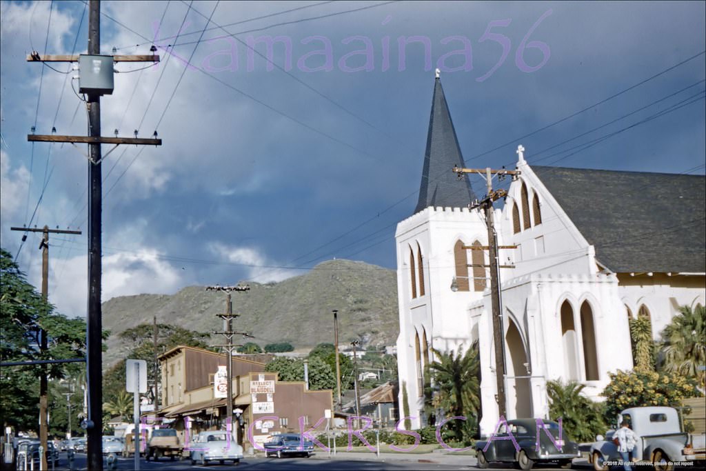
Queen Emma Street Honolulu, 1960.
Auld Lane Kapalama Mauka 1961.

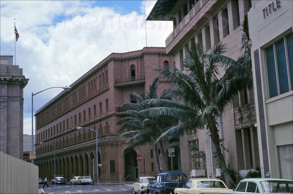
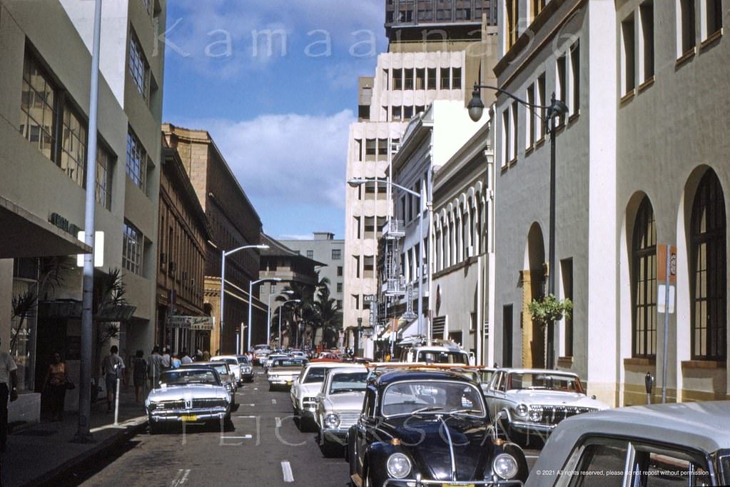
The King Kamehameha Statue in front of the 1874 Hawaii Judiciary Building was one of downtown’s most iconic landmarks. The statue stands across South King Street from Iolani Palace, and the surrounding blocks of Merchant and Richards Streets showed the city’s older civic architecture still intact in the late 1960s. The imposing HECO (Hawaiian Electric Company) Building stood at the corner of King and Richards.
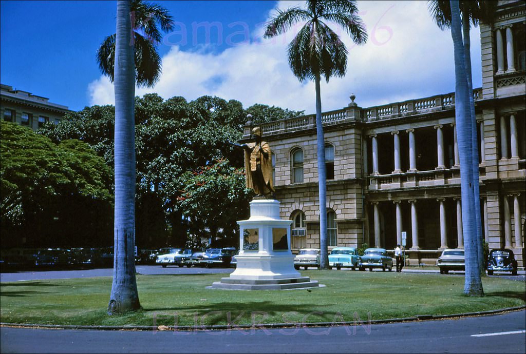
Courthouse Kamehameha, 1963.
Merchant & Richards Honolulu, 1969.
Merchant Street Honolulu, 1960.
King St at Richards Honolulu, 1969.

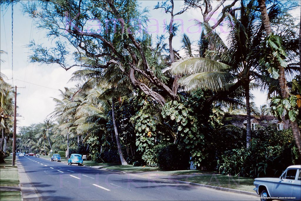
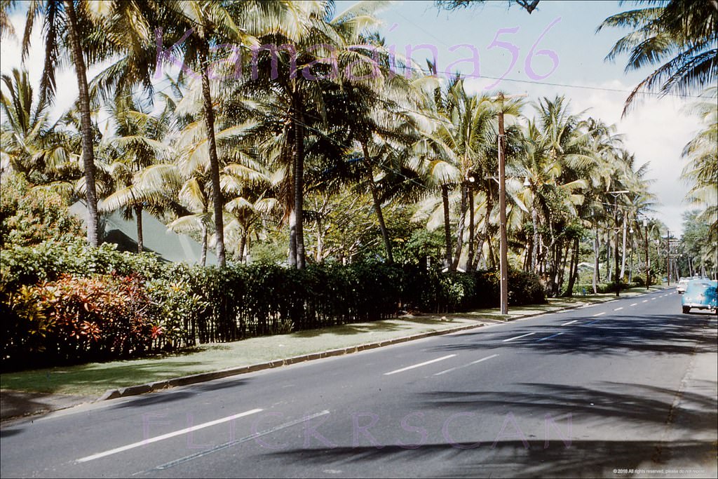
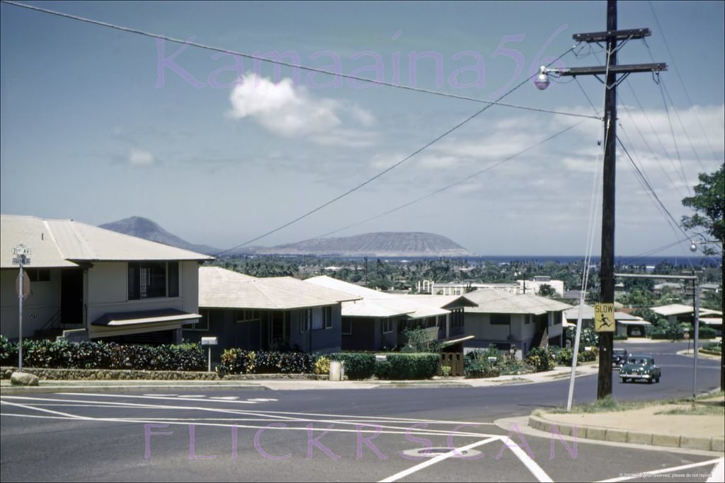
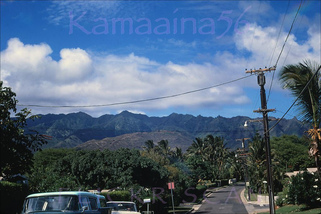
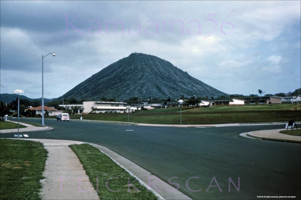
East Honolulu — the neighborhoods of Kahala, Waialae, Kaimuki, and Portlock — ranged from wealthy beachfront enclaves to inland working-class suburbs. The Kahala Hilton opened in 1964 on what had been the Waialae Golf Course site, bringing luxury tourism to the quieter east shore. Black Point’s Paterson Cottages and the residential streets of Portlock reflected a different pace entirely, with Koko Crater’s 1,200-foot profile dominating the view from the Maunalua Bay side of Koko Head.
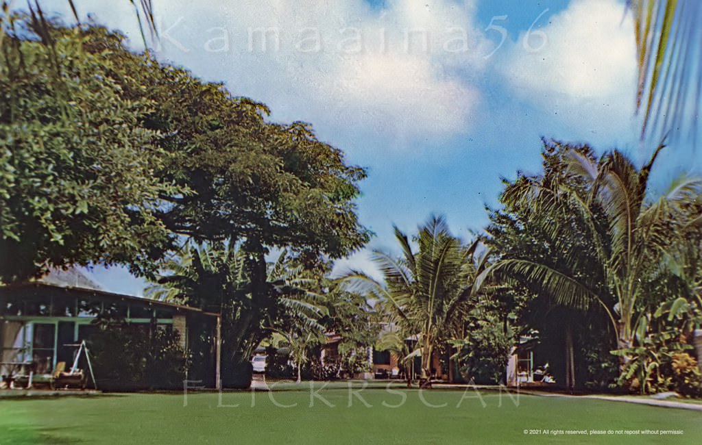
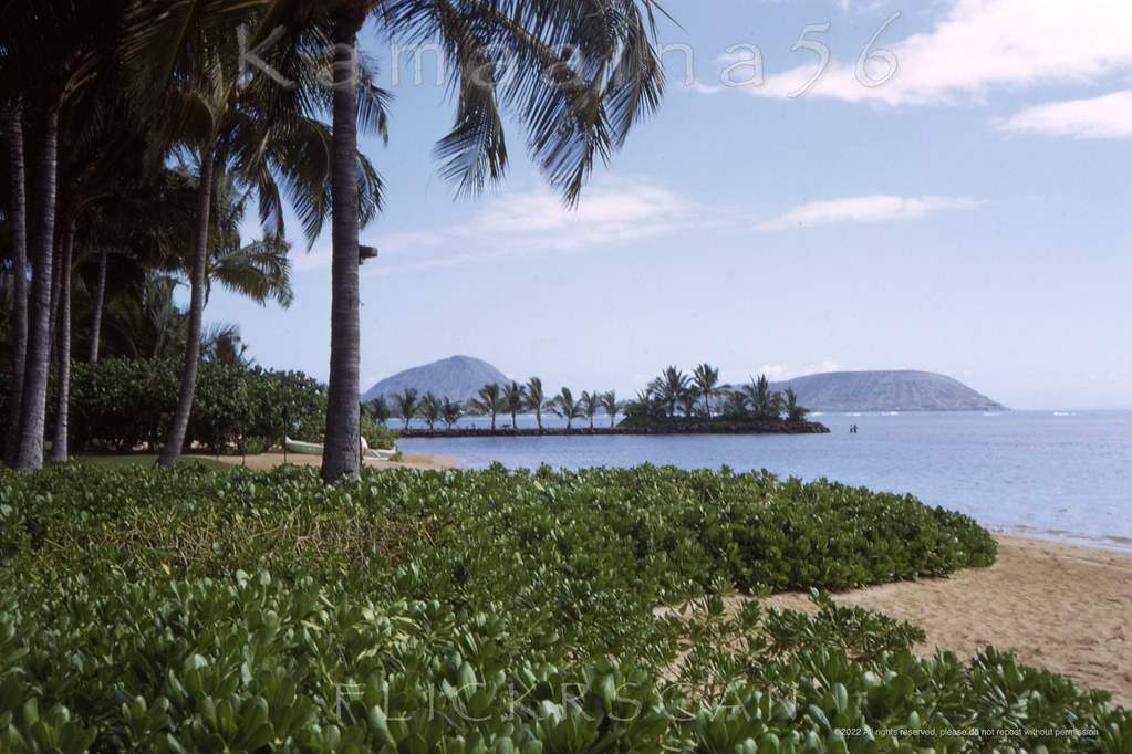
Paterson Cottages Black Point 1960s.
Kahala Hilton Beachfront, 1968.
Kahala Ave at Royal Makai, 1960.
Kahala Ave at Royal Mauka, 1960.
Waialae Avenue Kaimuki Ewa, 1963.
Harding Ave at 21st Kaimuki, 1960.
Kalanianalole Hwy Waialae Iki, 1968
Kalanianaole Hwy East Oahu, 1968.
Portlock Road at Lawai, 1968.
Koko Crater from Portlock, 1960s.
Slightly shaky airplane view over south shore Oahu looking inland at the east Honolulu neighborhoods of Waialae, Kahala, and Kaimuki, 1961
Ahua Approach, Honolulu, 1960..
Looking across lower Manoa towards Waikiki and Diamond Head, 1962.
New Capitol Bldg Honolulu 1966
Kewalo Basin Old Piers, 1966
Waialae Kahala Hilton BEV, 1965
Enjoyed this post? Get new ones in your inbox.
Avatar of Aung Budhh

Written by Aung Budhh

Husband + Father + librarian + Poet + Traveler + Proud Buddhist. I love you with the breath, the smiles and the tears of all my life.

Leave a Reply

Your email address will not be published. Required fields are marked *

6 Comments

  1. Thank you for sharing your great photos of Honolulu, similar to my memory in the later 60s. Wow it was like just yesterday and now these photos bring back those memories so wonderfully. Much Aloha, from the Kakaako Kid.