
Long before Colorado became the 38th state in 1876, people had called this land home for more than 13,000 years. Native Americans built entire civilizations here — among cliffs, canyons, and alpine meadows — centuries before European explorers arrived. The land changed hands between France and Mexico before the United States finalized Colorado’s borders in 1850. What followed was one of the most dramatic periods of transformation in American history, compressed into just a few decades.
By the 1890s, Colorado was a state in full motion. Mining camps had become towns. Wagon roads wound through passes at 11,000 feet. Cowboys drove cattle across open plains while miners carved silver and gold out of mountains that seemed to touch the sky. The collection of color photographs below captures all of it — the raw geography, the working lives, and the places that made Colorado unlike anywhere else in the American West.
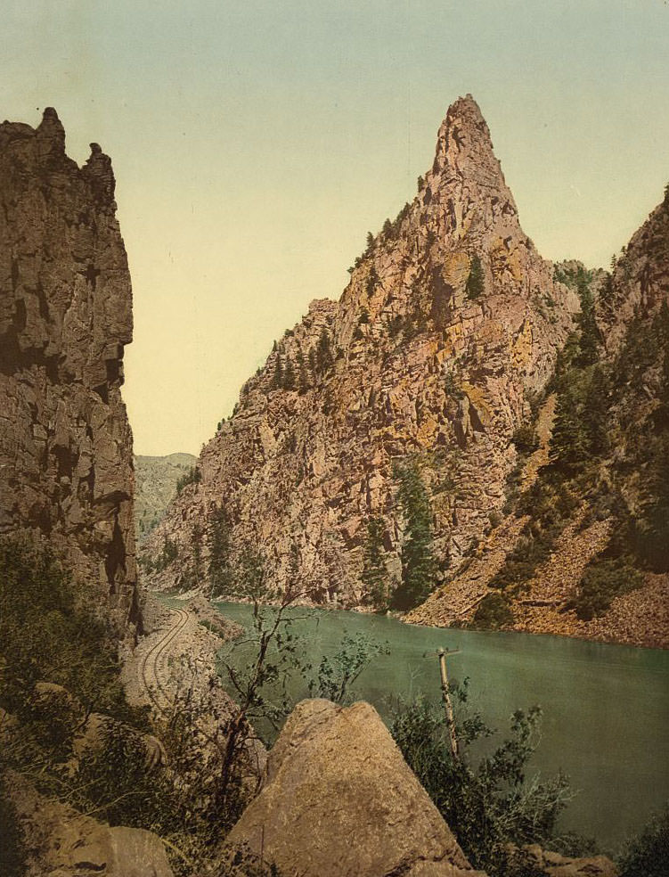
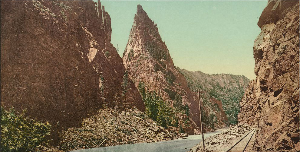
The Curecanti Needle is a 700-foot spire of volcanic rock rising from the Black Canyon of the Gunnison. In the 1890s, the Denver and Rio Grande Railroad ran right past it, and passengers on the narrow-gauge line had a front-row seat to one of Colorado’s most striking geological features. It became one of the most photographed landmarks in the state during this era.
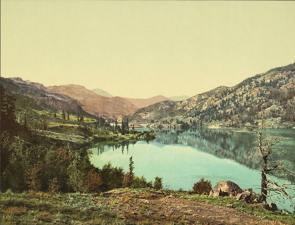
Lake San Cristobal sits in the Lake Fork valley near the town of Lake City. It is Colorado’s second-largest natural lake, formed thousands of years ago by a massive landslide known as the Slumgullion Earthflow. By the 1890s, the surrounding area was a hub of silver mining activity, and the lake offered a striking contrast — deep blue water framed by peaks that still held snow well into summer.
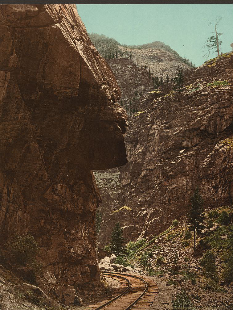
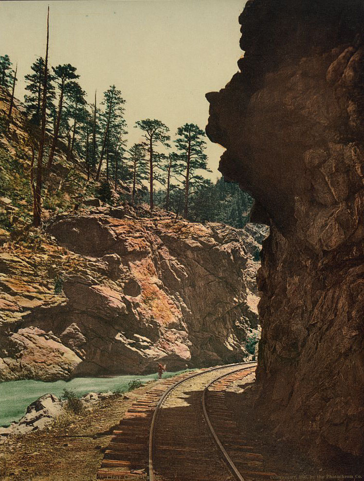
Clear Creek Canyon carved a dramatic corridor through the Front Range, and the Denver and Rio Grande rail line followed it closely. Rock formations like Hanging Rock and Mother Grundy Peak loomed over the tracks, making the journey through the canyon an event in itself. Travelers described the gorge as one of the most impressive stretches of railroad in the entire country.
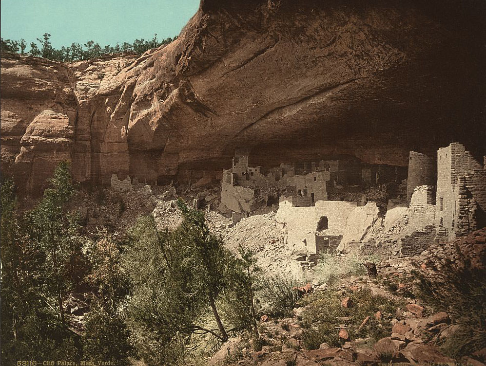
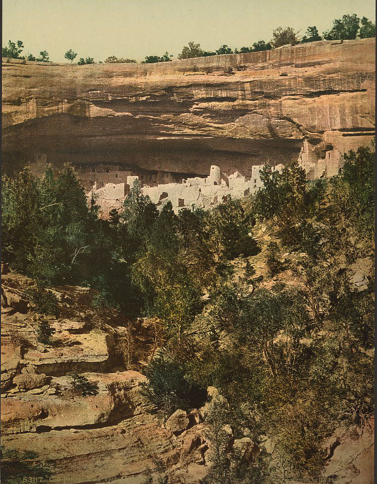
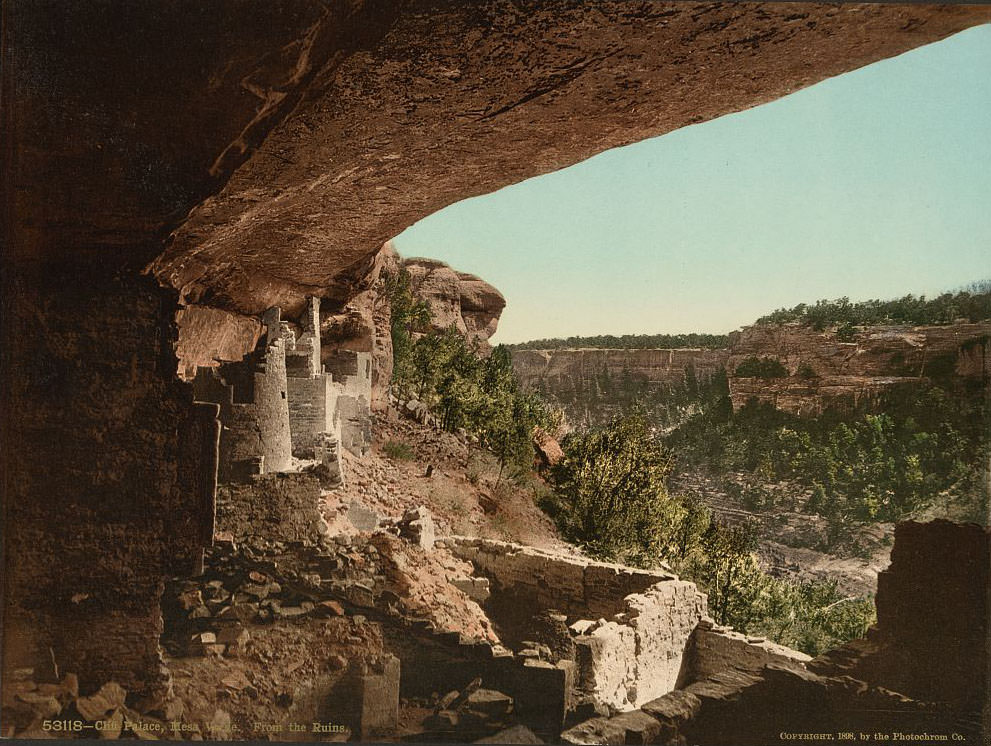
High above the canyon country of southwestern Colorado, the ancient cliff dwellings of Mesa Verde had stood untouched for centuries. The Ancestral Puebloans built Cliff Palace — the largest cliff dwelling in North America — sometime around 1190 CE. It contained more than 150 rooms and 23 kivas, all constructed under a massive sandstone overhang. Anglo-American ranchers only rediscovered the site in 1888, just a few years before these photographs were taken.
The town of Cimarron sat at the eastern end of the Black Canyon, serving as a supply point for the surrounding mining and ranching communities. Small towns like this one were the backbone of Colorado’s economy in the 1890s — places where goods arrived by rail and were distributed by mule and wagon into the surrounding wilderness.
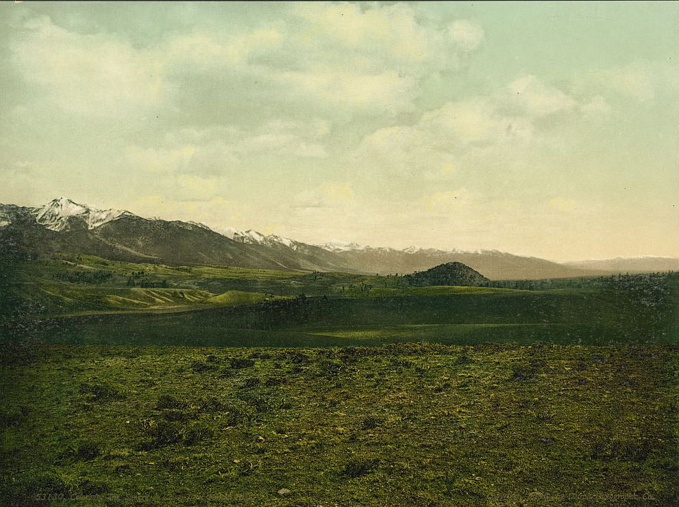
The Sangre de Cristo range stretches more than 200 miles along the eastern edge of the San Luis Valley. Spanish explorers named the mountains after seeing their peaks glow deep red at sunset — “Blood of Christ.” From Poncha Pass, the entire southern sweep of the range comes into view, a wall of 14,000-foot peaks rising sharply from the valley floor below.
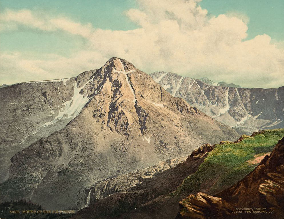
Mount of the Holy Cross earned its name from a natural cross formed by two snow-filled couloirs on its northeastern face. The cross measures roughly 1,500 feet tall and 700 feet wide. Photographer William Henry Jackson captured it famously in 1873, and by the 1890s the mountain had become a pilgrimage destination. Thousands of people hiked the surrounding peaks each year just to see it.
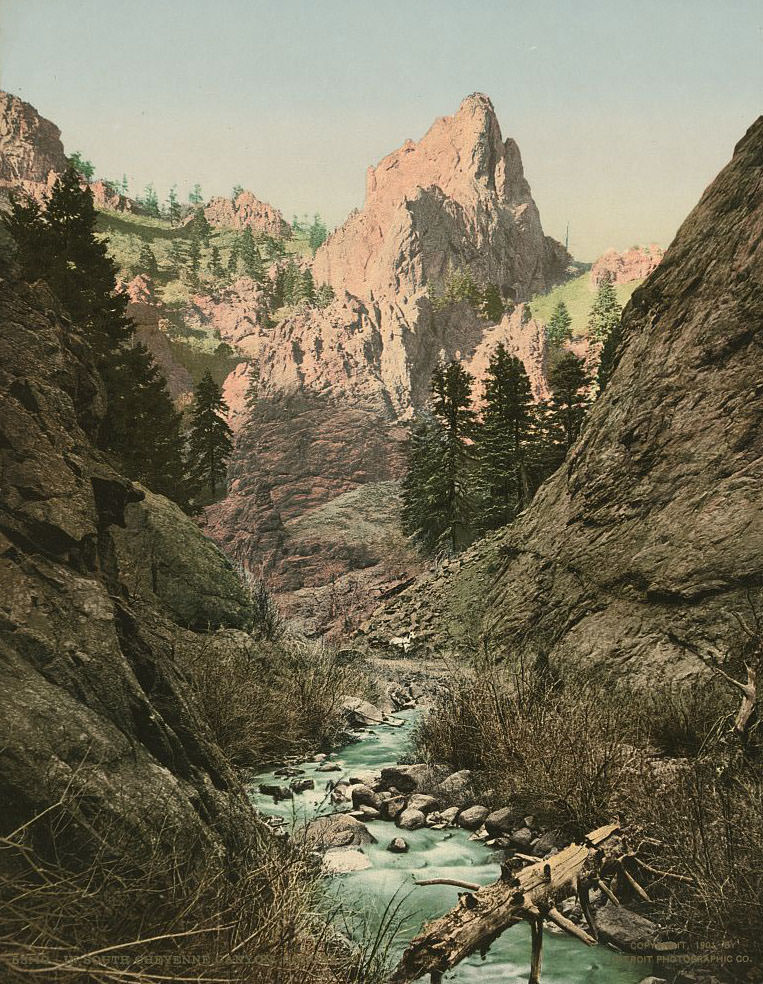
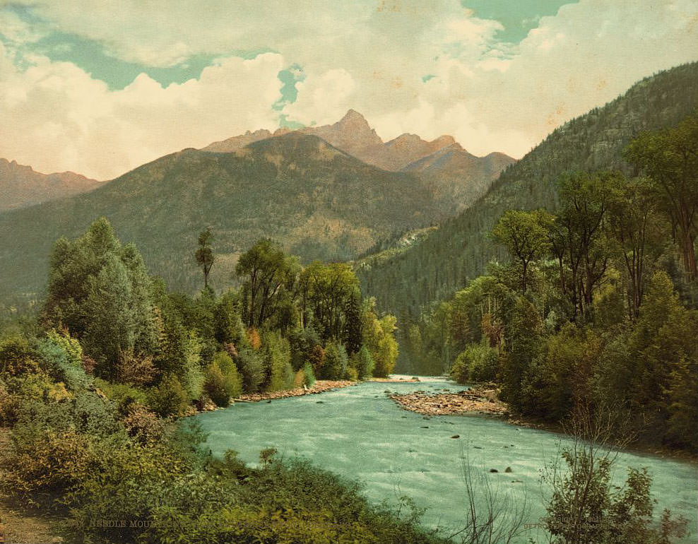
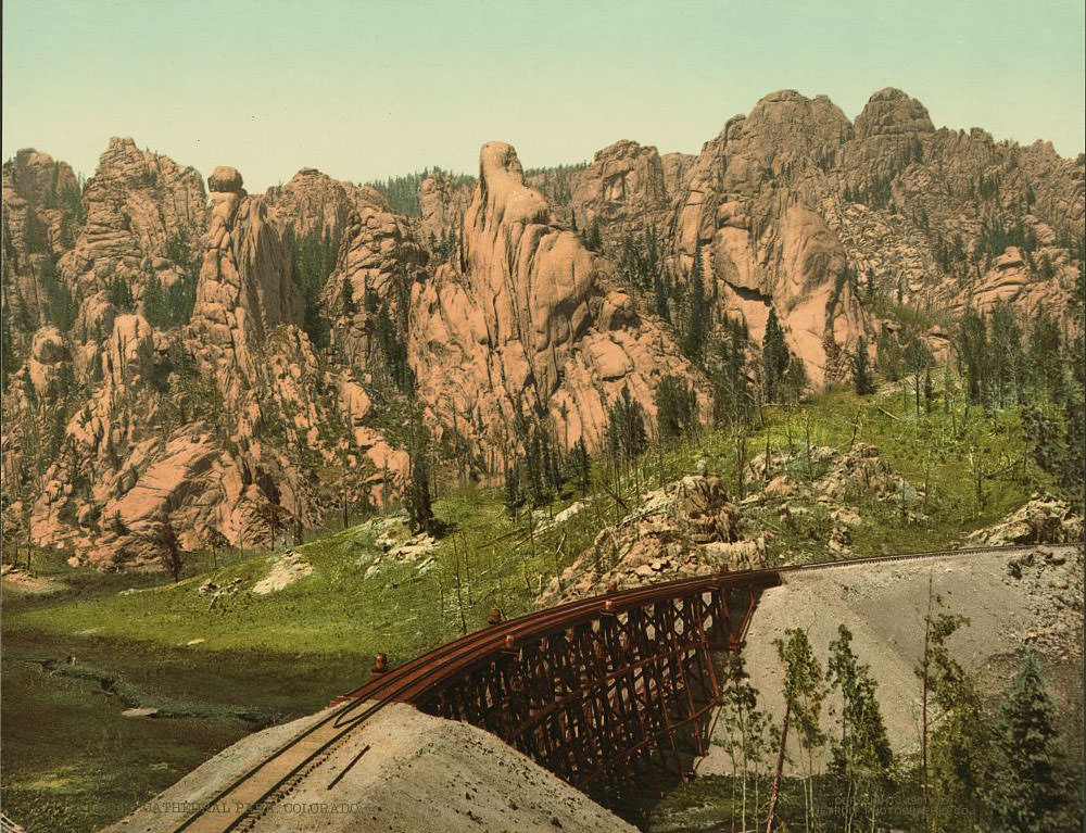
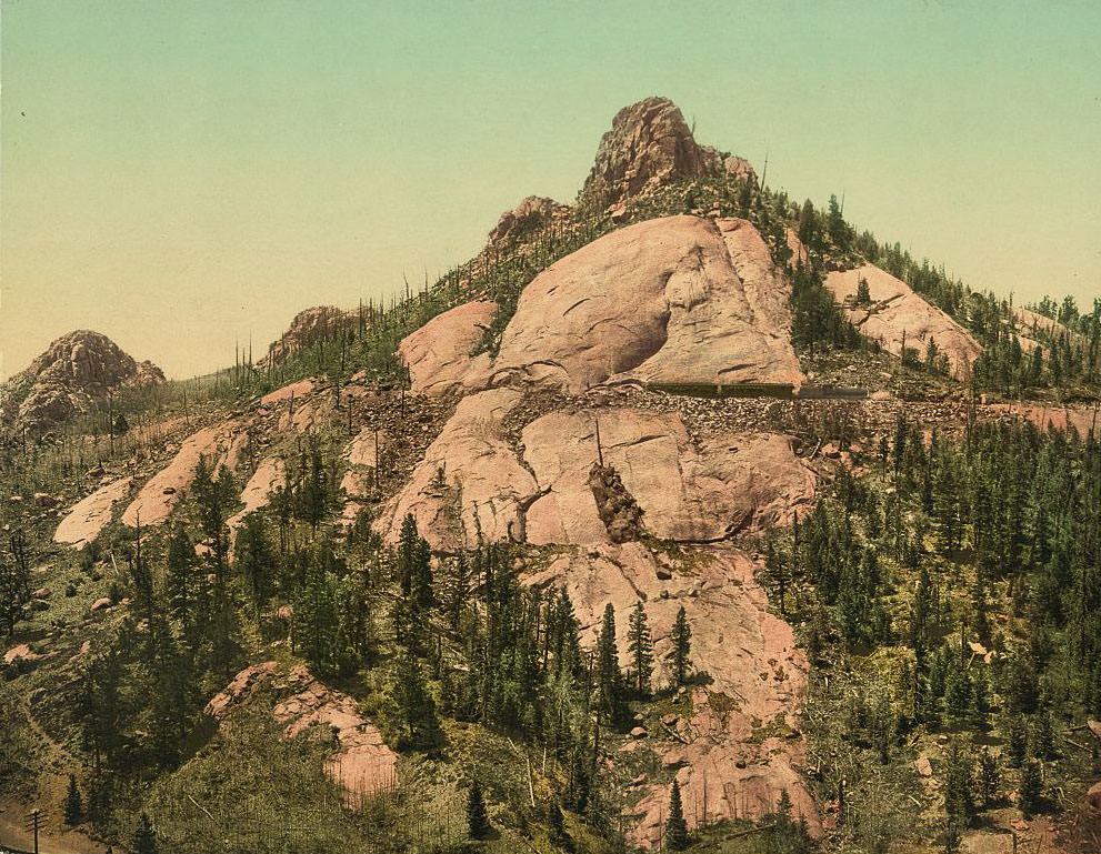
South Cheyenne Canyon near Colorado Springs was a popular destination for tourists arriving by rail in the 1890s. The canyon’s granite walls, waterfalls, and shaded trails offered a sharp contrast to the open plains just miles to the east. The Needle Mountains to the southwest were a different world entirely — remote, jagged summits in the San Juan range that few people reached without serious effort.
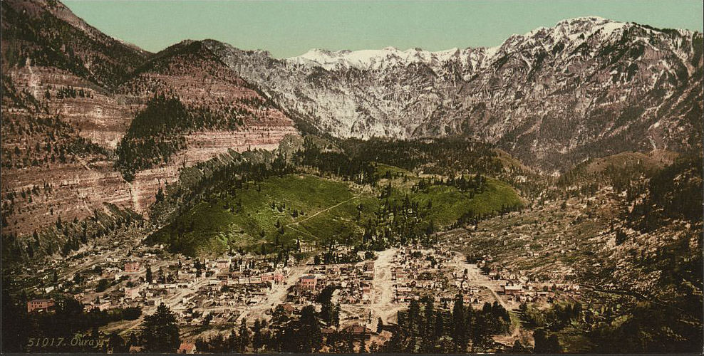
Ouray, tucked into a natural bowl surrounded by 13,000-foot peaks, was one of Colorado’s most visually striking mining towns. Silver discoveries in the 1870s sparked its growth, and by the 1890s the town had hotels, opera houses, and a reputation for hot springs that drew visitors year-round. The surrounding mountains made every approach to the town feel like a dramatic arrival.
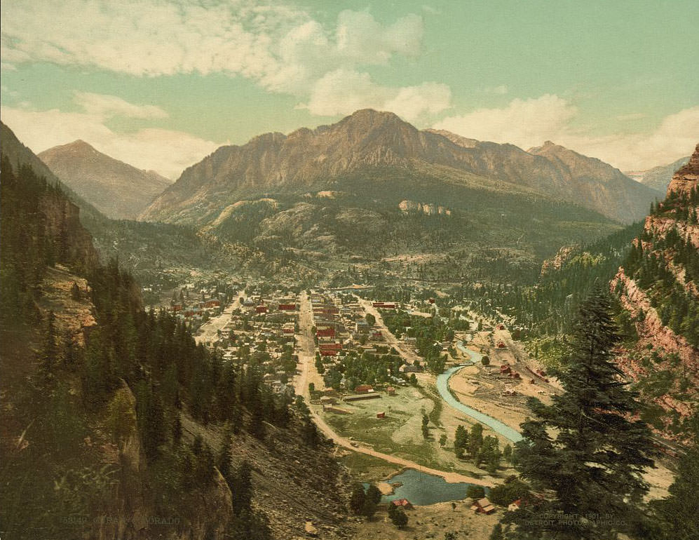
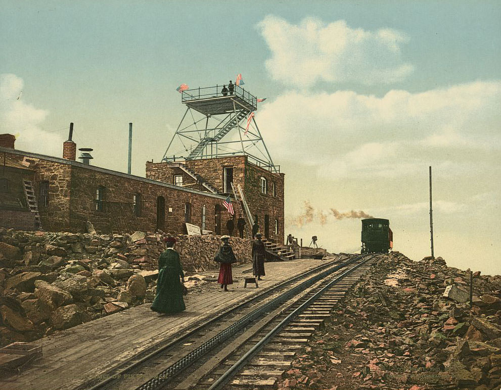
Pikes Peak rises to 14,115 feet and stands apart from the main Rocky Mountain spine, making it visible from the plains more than 100 miles away. By the 1890s, a cog railway was under construction to carry tourists to the summit. The views from the top — looking east across the Great Plains and west into the heart of the Rockies — inspired Katharine Lee Bates to write “America the Beautiful” after her visit in 1893.
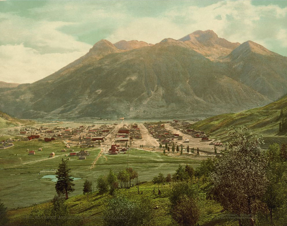
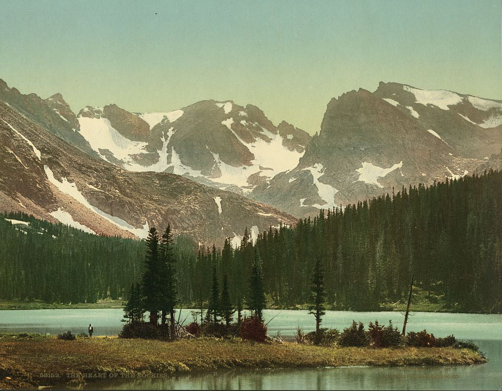
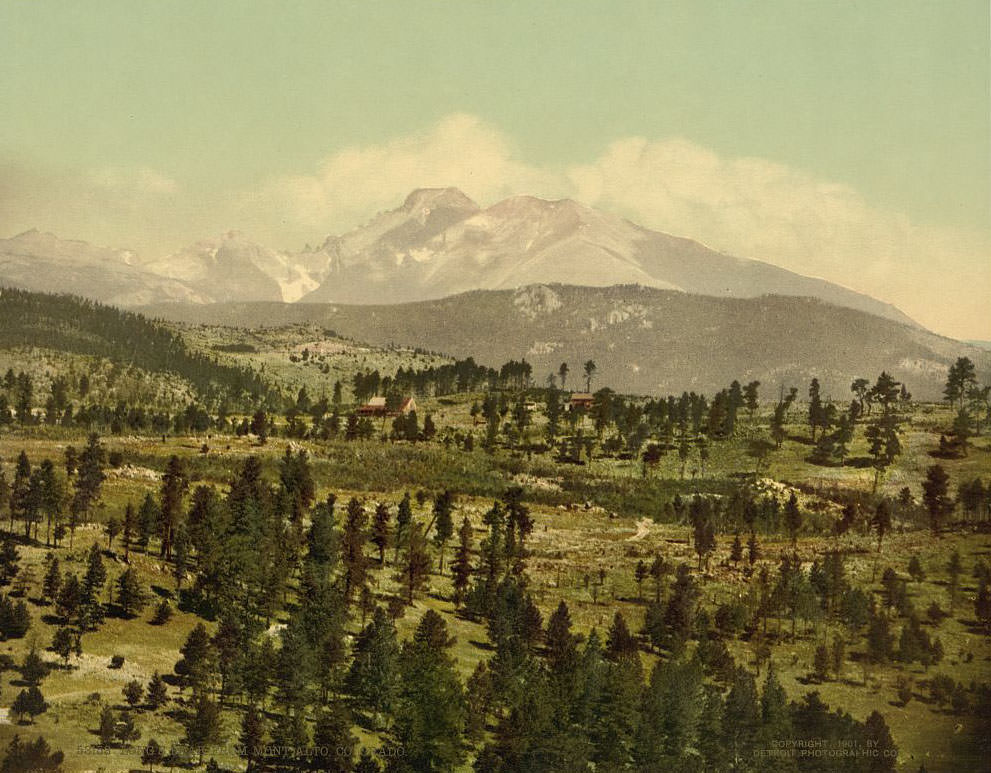
Longs Peak, at 14,259 feet, is the northernmost of Colorado’s fourteeners and one of the most recognizable mountains in the state. Its flat-topped summit is visible from the northeastern plains on clear days. Sultan Mountain, near Silverton, towers over the mineral-rich Animas River valley and was surrounded by active mining claims throughout the 1890s.
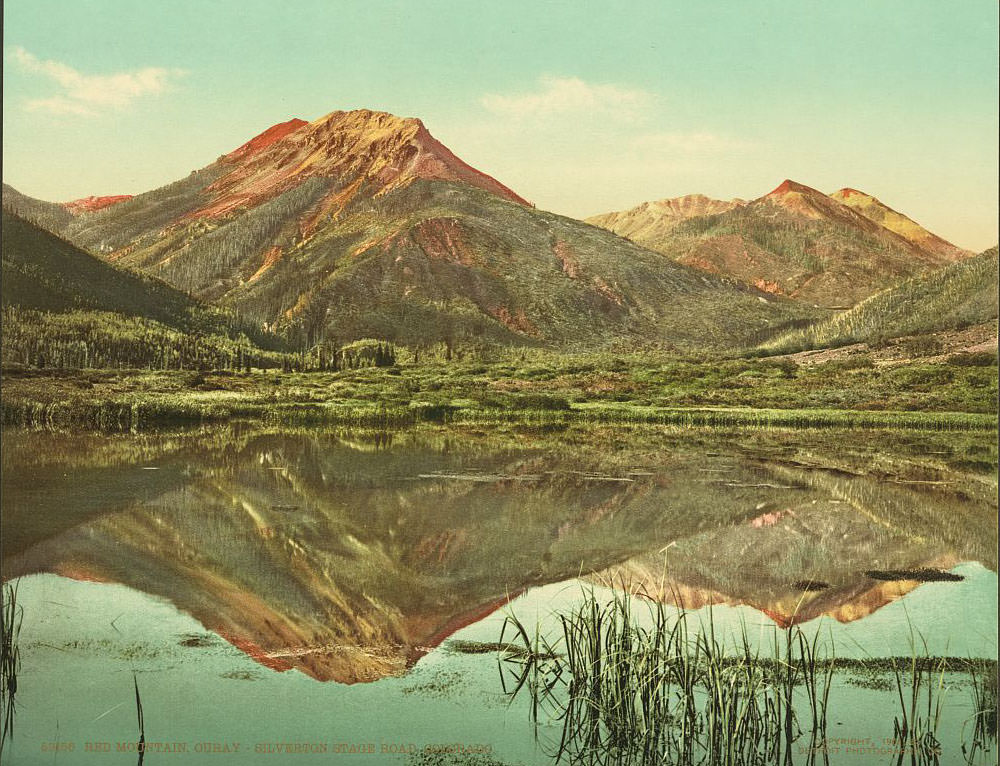
The stage road between Ouray and Silverton was one of the most dangerous in Colorado. It clung to the sides of cliffs thousands of feet above the Uncompahgre River, with no guardrails and barely enough room for two wagons to pass. Red Mountain, named for the iron oxide that stains its slopes a vivid rust color, marked the high point of the route at over 11,000 feet.

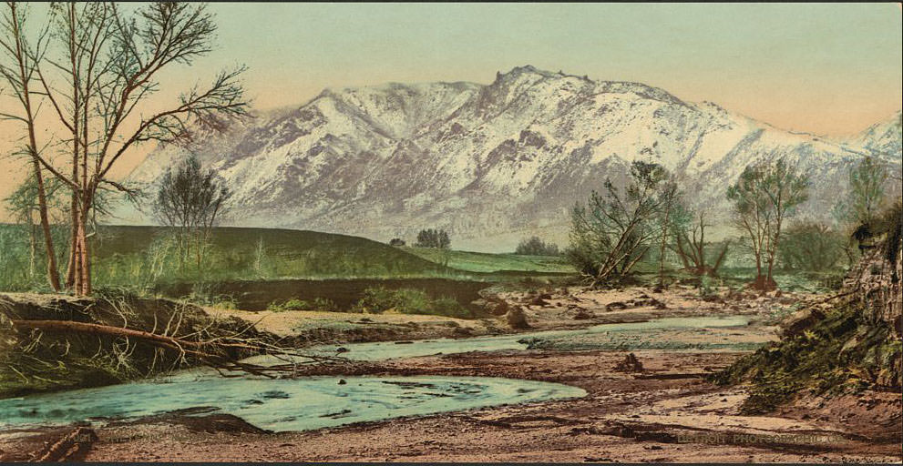
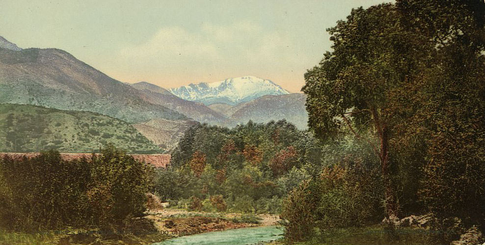
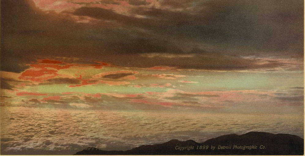
Colorado City, just west of Colorado Springs, sat at the base of Pikes Peak and served as a gateway town for those heading into the mountains. Cheyenne Mountain, rising directly south of Colorado Springs, formed a dramatic backdrop for the growing resort city below. By the 1890s, Colorado Springs was actively marketing itself as a destination for wealthy tourists and health-seekers from the East.
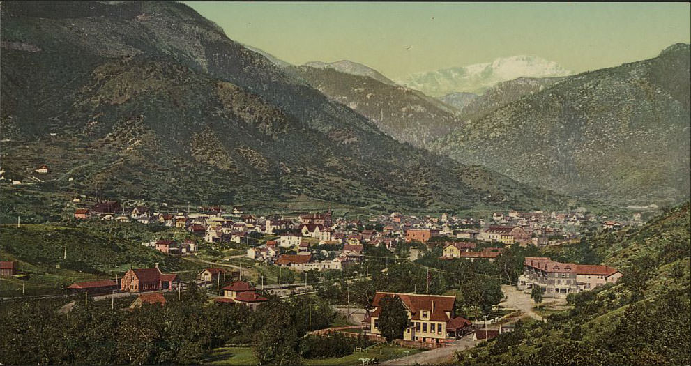
Manitou Springs sat just below the entrance to Ute Pass and was famous for its naturally carbonated mineral springs. The Ute people had long considered the springs sacred. By the 1890s, the town was a full resort community, with bathhouses, hotels, and a brisk tourist trade. Visitors came to drink from the springs, believing the mineral water had healing properties.
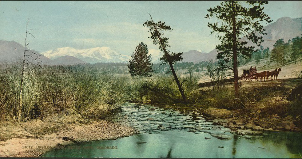
Estes Park, nestled in a high valley at the edge of what would later become Rocky Mountain National Park, was already drawing visitors in the 1890s. Upsilon Peak and the surrounding peaks of the Front Range gave the valley a spectacular natural frame. Estes Park had become a destination for summer camping and wilderness tourism, particularly for visitors arriving on the new rail lines from Denver.
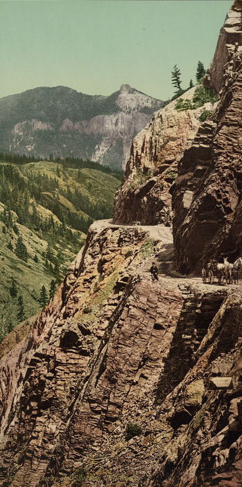
The toll road connecting Ouray and Silverton was a private enterprise — travelers paid to use it, and the fee was well worth the alternative of navigating the raw terrain on foot. Ore wagons, supply trains, and stagecoaches all used this route. In winter, the road became nearly impassable, and isolated mining camps relied entirely on what they had stocked before the first heavy snow.
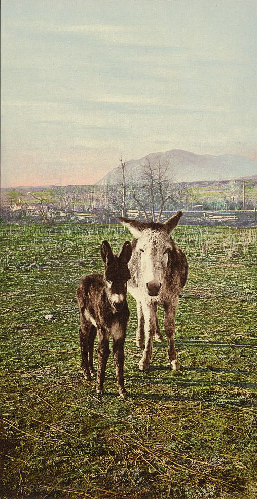
“Rocky Mountain Canaries” was a nickname for burros — the small, sure-footed pack animals that were absolutely essential to Colorado’s mining economy. They carried ore, tools, lumber, and supplies up grades and along ledges that no wheeled vehicle could manage. A good burro was worth serious money in a mining district, and the animals were treated accordingly.
![Dome Rock, Platte Canon [Cañon], 1890s](https://www.bygonely.com/wp-content/uploads/2020/01/1890s_Colorado_33.jpg)
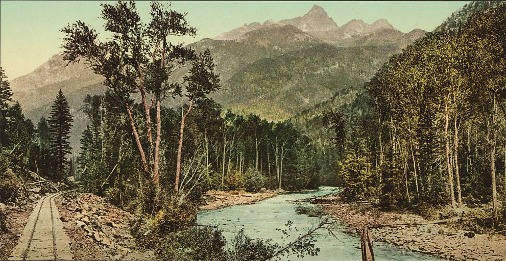
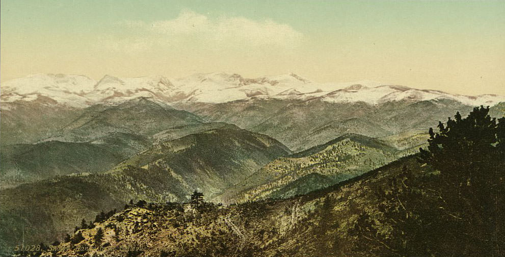
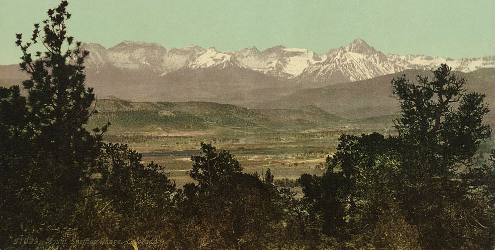
The Mount Sneffels Range, rising above Ouray and the Uncompaghre Valley, was the center of some of the richest silver mining in Colorado. Mount Sneffels itself reaches 14,158 feet and was surrounded by active mines throughout the 1890s. The Snowy Range to the north and the Needle Mountains to the south completed a landscape of almost unbroken high-country terrain that stretched for hundreds of miles.
![Box Canon [Cañon], Ouray, 1890s](https://www.bygonely.com/wp-content/uploads/2020/01/1890s_Colorado_38.jpg)
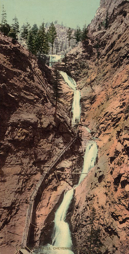
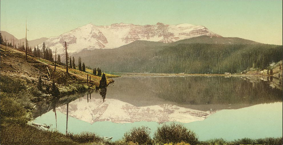
Seven Falls in Cheyenne Canyon drops a total of 181 feet in a series of cascading tiers, all within a narrow granite chasm. It was already a tourist attraction in the 1890s, with a wooden staircase built to allow visitors to climb alongside the falls. Trout Lake, near Telluride, sat at over 9,700 feet and was a fisherman’s destination surrounded by peaks that held snow year-round.
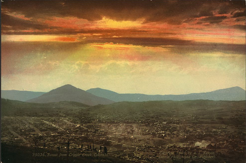
Cripple Creek was one of the last great gold rush towns in American history. Gold was discovered there in 1890, and within a few years the district was producing tens of millions of dollars in gold annually. By the mid-1890s, Cripple Creek had a population of more than 10,000 people, electric lights, and a stock exchange. The sunsets over the surrounding hills looked down on one of the busiest boomtowns in the West.
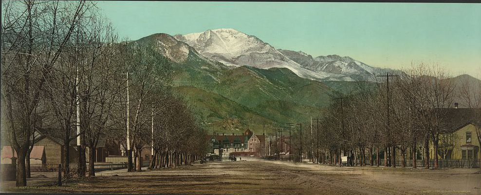
Pikes Peak Avenue was Colorado Springs’ main commercial street, running east toward the open plains with the mountain rising behind the city to the west. Colorado Springs had been founded in 1871 as a planned resort city by General William Jackson Palmer, and by the 1890s it had paved streets, a streetcar system, and a reputation as the most refined city between Denver and the Pacific Coast.
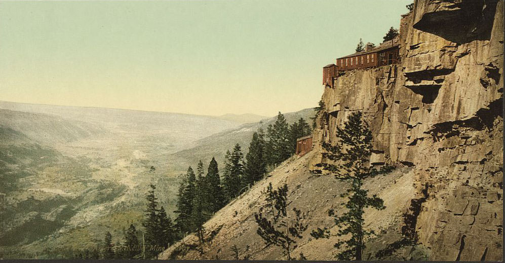
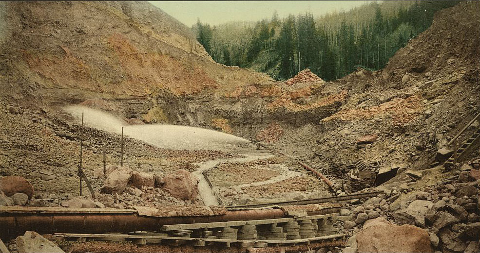
Colorado’s mining industry in the 1890s operated at two very different scales. Large operations like the American Nettie mine at Gold Hill near Ouray used heavy equipment, stamp mills, and dozens of workers to extract ore from deep underground. Placer mining, by contrast, was a simpler process — workers sluiced stream gravel to separate out gold dust and nuggets deposited by moving water. Both methods shaped the landscape and the lives of the men who worked them.
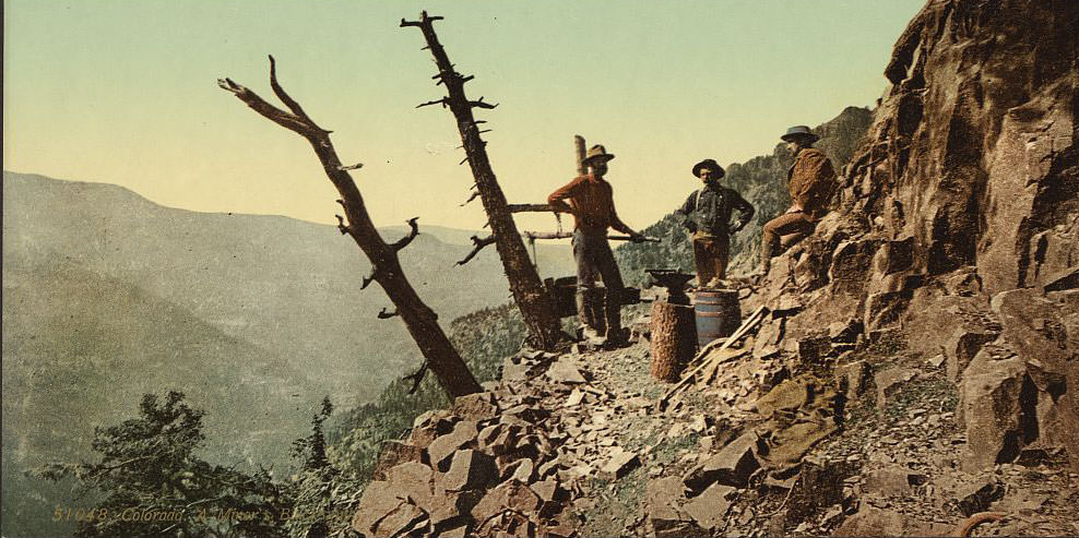
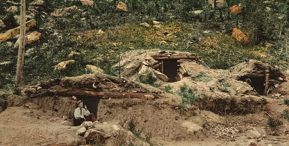
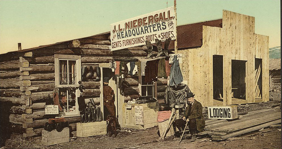
The blacksmith was as important to a mining camp as the miners themselves. Every pick, drill bit, and piece of machinery eventually needed repair or reshaping, and the blacksmith’s forge ran day and night in active camps. Dugout cabins — built partly into hillsides for insulation against mountain winters — housed miners who had no time or money for proper construction. A pioneer merchant with a well-stocked store could become the wealthiest person in a camp without ever setting foot in a mine.
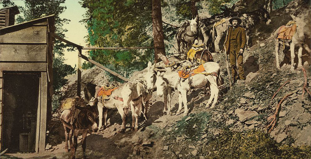
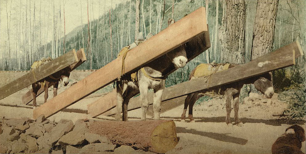
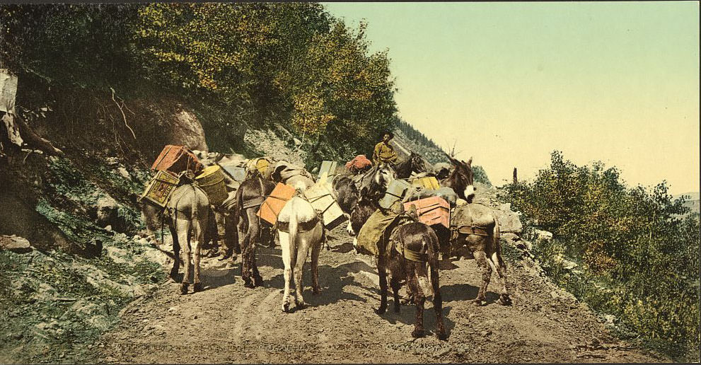
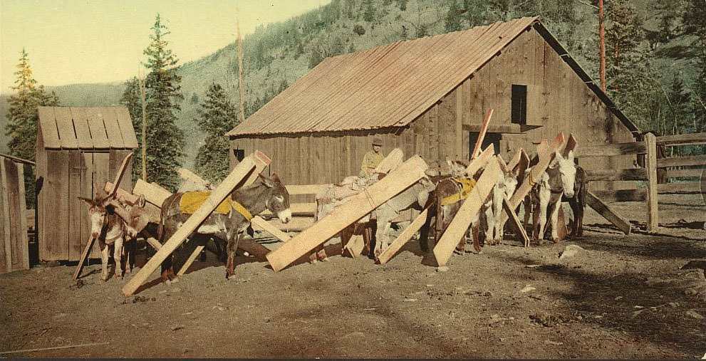
Lumber was a constant need in the mining districts — for shoring tunnels, building structures, and fueling boilers. Pack trains carried it up mountain roads where wagons couldn’t go, with burros loaded with planks and beams stacked high on their backs. A loaded pack animal on a narrow mountain trail was a common sight throughout the San Juan Mountains and the Front Range mining districts of the 1890s.
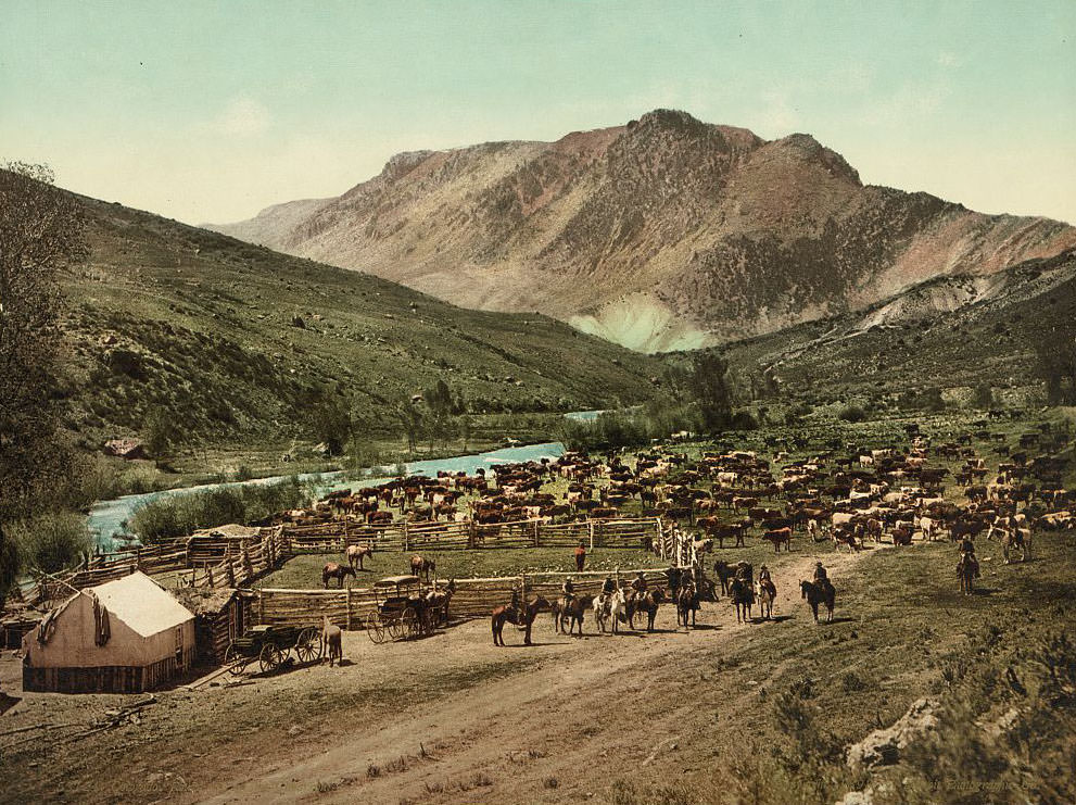
Away from the mines, Colorado’s eastern plains and river valleys supported a vast cattle industry. The annual roundup was the defining event of the ranching calendar — a weeks-long operation where cowboys from multiple outfits worked together to gather, brand, and sort cattle spread across thousands of acres of open range.
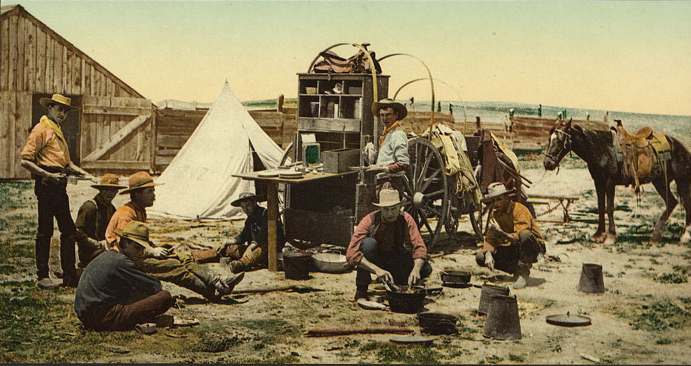
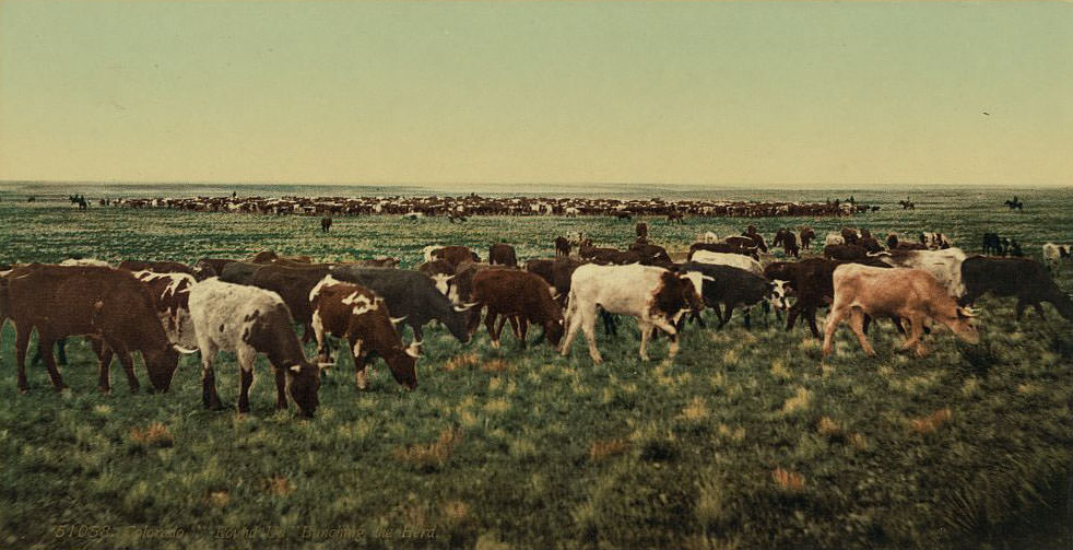
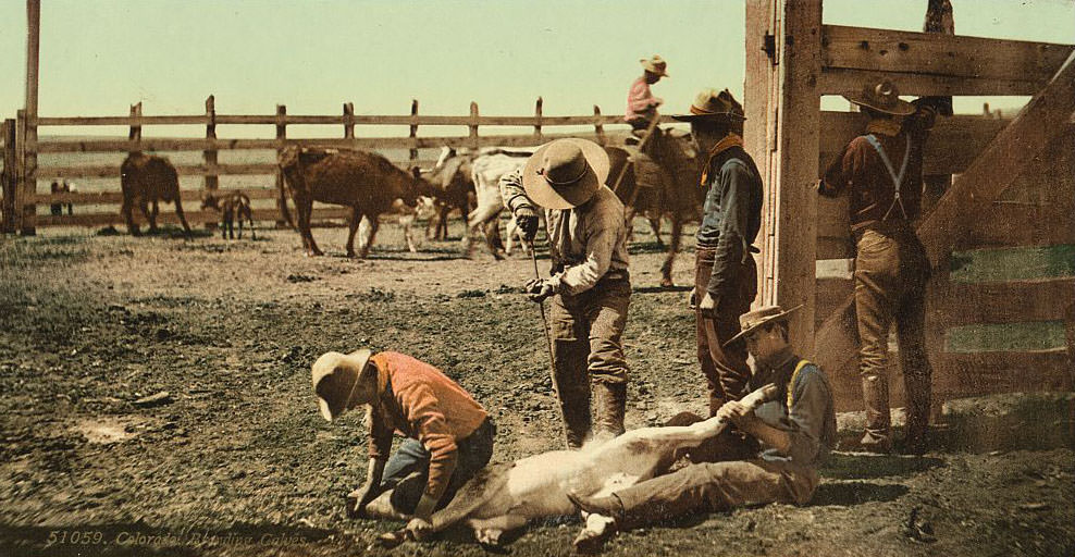
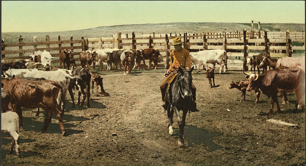
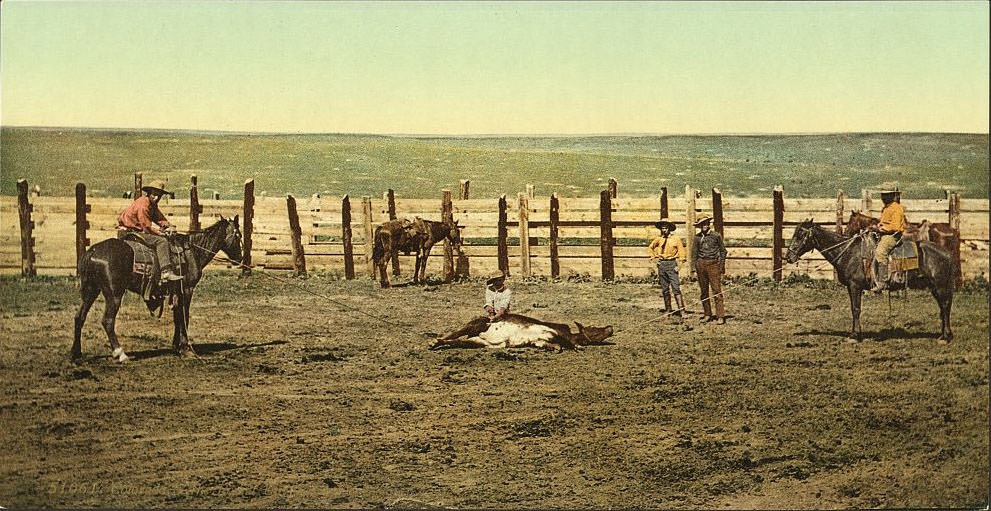
The “grub pile” was the chuck wagon call to eat — cowboys gathered around the cook’s wagon three times a day, fueling the hard physical work of herding, roping, and branding. Calves were branded with hot irons to mark ownership, a process that was fast and deliberate. Roping a steer required skill developed over years of practice, and the best ropers in a roundup crew were respected men.
![The "Queen of the Canon" [Cañon], Cascade Canon [Cañon], 1890s](https://www.bygonely.com/wp-content/uploads/2020/01/1890s_Colorado_57.jpg)
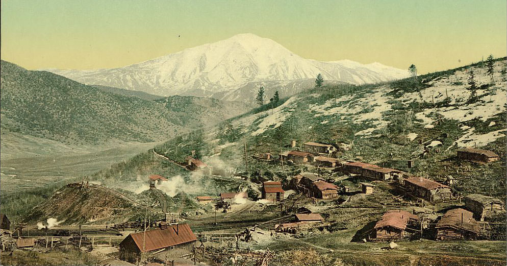
Mount Sopris rises to 12,965 feet above the Crystal River Valley near Carbondale. From the Spring Gulch Mine, the mountain’s twin summits formed a constant backdrop for the miners working below. Colorado’s mountains were never simply scenery — they were the terrain that workers, travelers, and settlers had to navigate every single day.
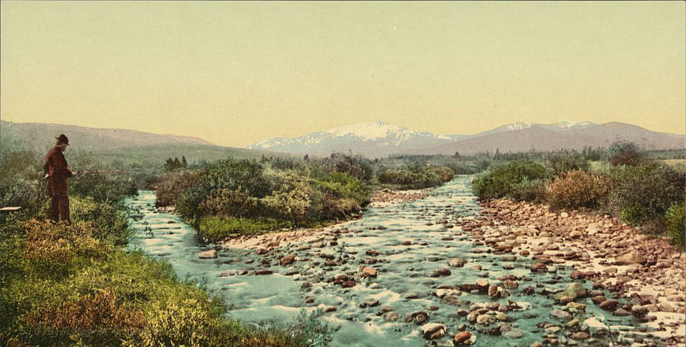
Middle Park, a high mountain valley in Grand County, was prime fishing country. Williams Fork ran cold and clear through the valley, holding native cutthroat trout in numbers that drew fishermen from across the state. For the people living in and around Colorado’s mountain communities in the 1890s, fishing was both a practical source of food and one of the few genuine leisure activities available.
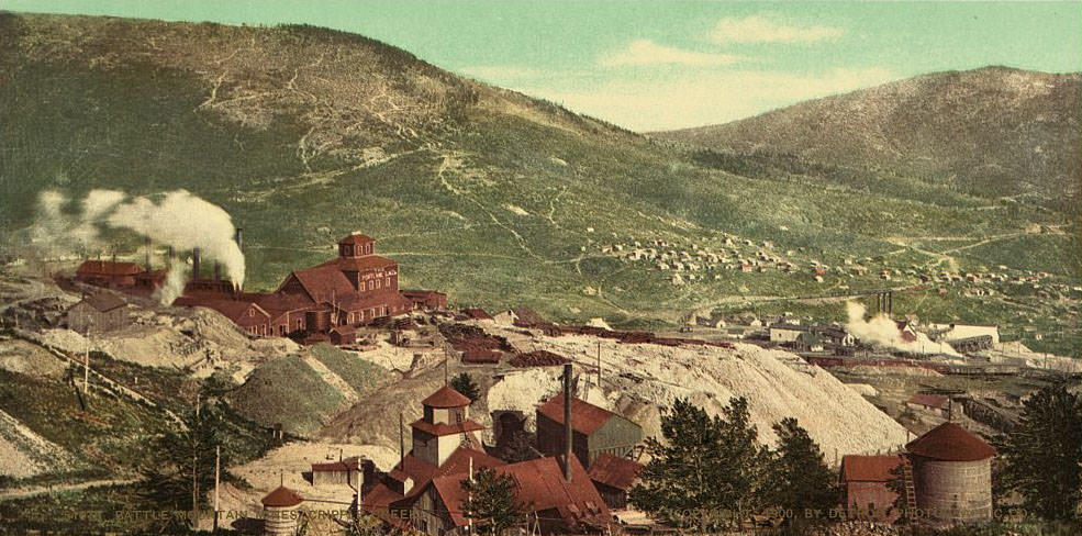
The Battle Mountain mining district was the heart of the Cripple Creek gold fields. Mines like the Portland, the Independence, and the Strong clustered on its slopes, producing ore that made their owners millionaires. The district operated around the clock, with headframes, ore dumps, and processing mills covering terrain that just a few years earlier had been empty ranch land. In 1893 — the same year Colorado became the first state to grant women the right to vote through a popular referendum — the Cripple Creek gold rush was just hitting its stride, adding another layer to one of the most eventful decades in the state’s history.




