Hey There! Before You Go. 😧
Get the best vintage content straight into your inbox!

Don't worry, we don't spam

What San Jose, California Looked like in the 1860s Through Rare Historical Photos

San Jose was founded by the Spanish in 1777 to supply food to military settlements in San Francisco and Monterey. Its nearby water sources made it an ideal settlement site. Americans began arriving in the early 1840s, drawn by fertile land. By 1849, San Jose was named California’s first capital, before Sacramento later took that role. It was officially chartered in 1850 and quickly became a key trading hub east of Sacramento, serving the goldfields.
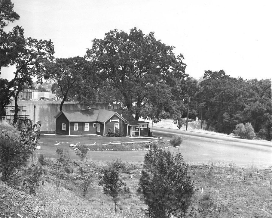
San Jose Turnpike Toll House, 1860

During the first half of the 19th century, San Jose was a small town surrounded by cattle and horse ranches. The streets were often unpaved and muddy, and most commerce was tied to agriculture. The tollhouse and livery stables were fixtures of daily life, reflecting a town still very much shaped by its frontier roots.
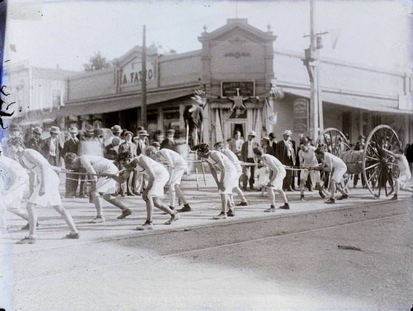
Young men pulling a hose in what appears to be a parade, with a Lodge building in the background, 1860
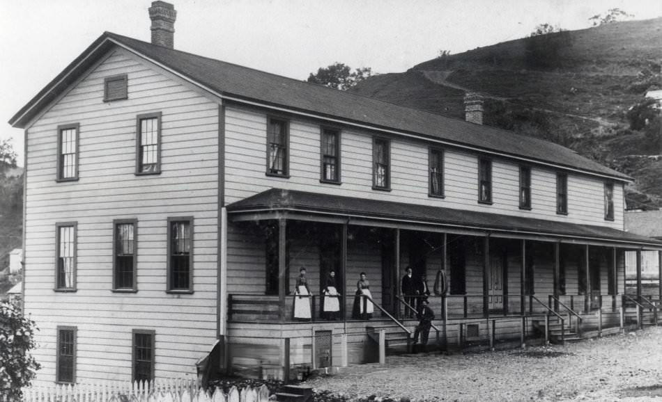
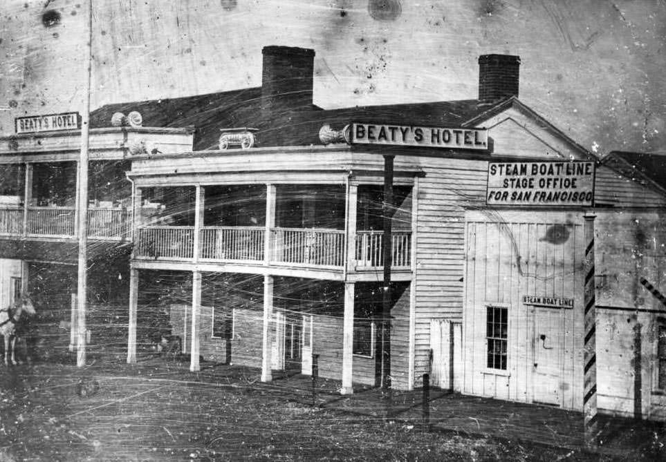
Beaty's Hotel, San Jose, 1860
Beaty’s Hotel, San Jose, 1860

Market Street was one of the city’s busiest corridors, lined with businesses, hotels, and gathering places. Hotels like Beaty’s served travelers and merchants passing through the growing town.
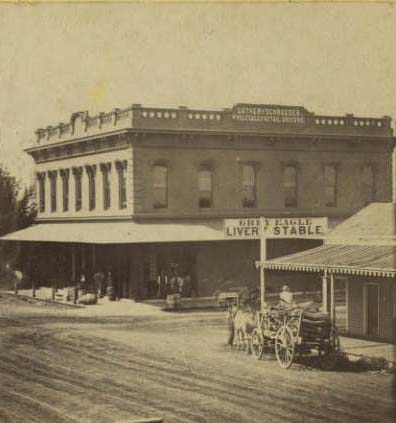
Businesses on Market Street, 1860

A major turning point came in 1864 when the San Francisco & San Jose Railroad opened, connecting the region’s farms to Bay Area markets. This made it far easier to ship agricultural products north and helped transform the Santa Clara Valley into a center for orchards and fruit processing.
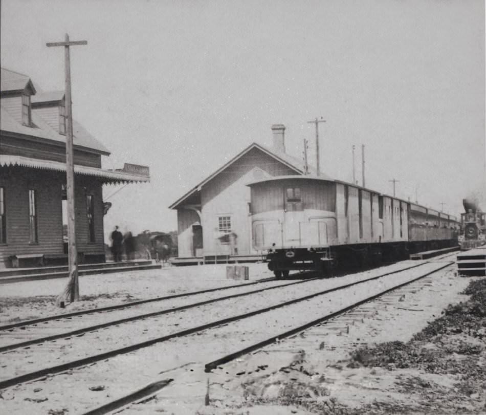
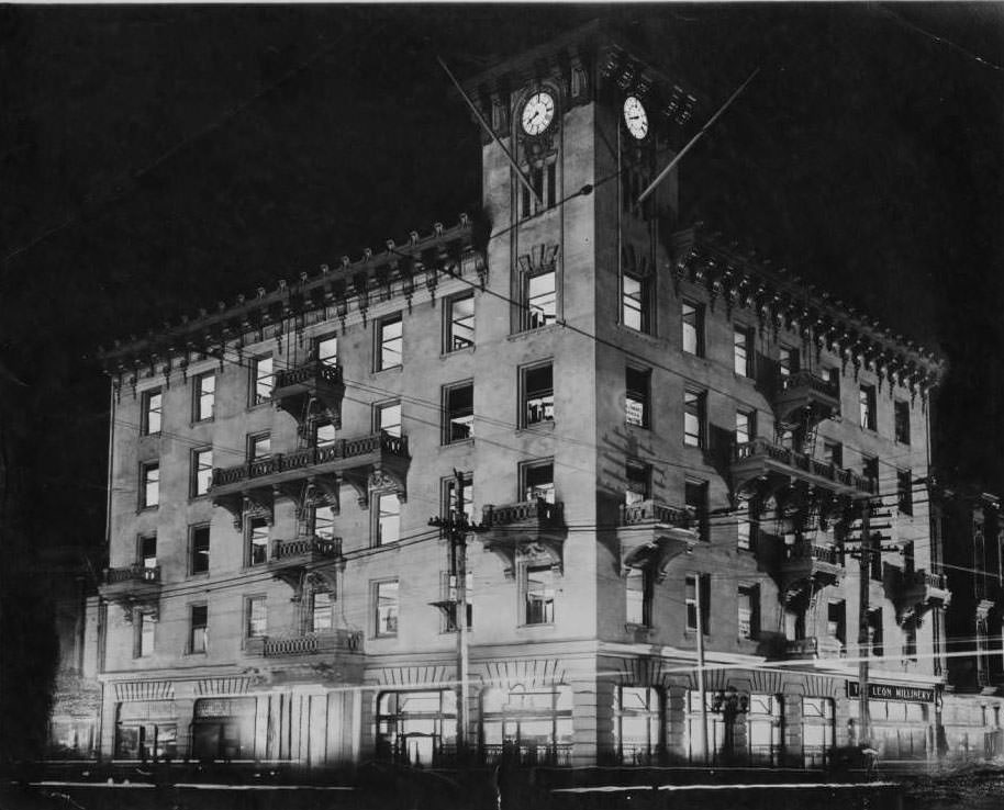
San Jose Depot and San Jose Railroads, showing the depot with a tall chimney that was replaced in the 1870s; the flat-top railroad cars date the image between 1864 and 1870, and the freight house on the far left stood on the site until the 1960s, 1864
The Bank of San Jose on the northeast corner of Santa Clara and First Streets, 1866

Financial institutions like the Bank of San Jose reflected the city’s growing commercial confidence. As trade expanded, brick storefronts and permanent businesses replaced earlier makeshift structures throughout the downtown core.
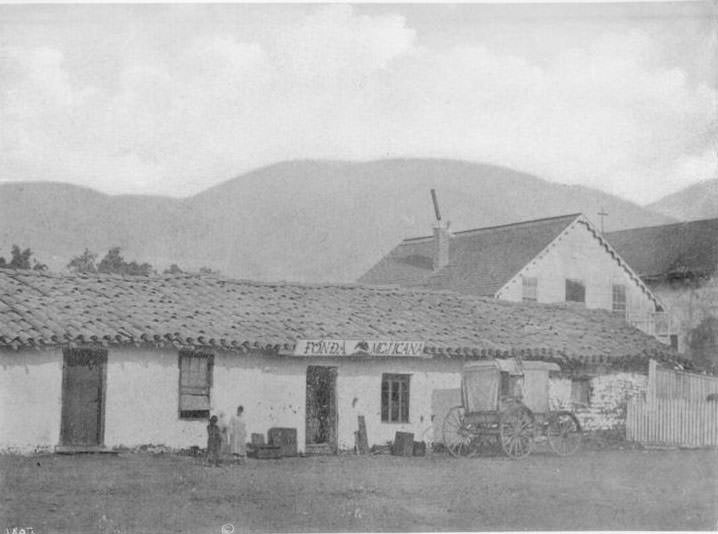
Fonda Mexicana, one of the outbuildings of Mission San Jose de Guadalupe, 1867

The Spanish colonial presence remained visible throughout the region. Mission San Jose de Guadalupe and its surrounding structures stood as reminders of the city’s origins more than 80 years before these photographs were taken.
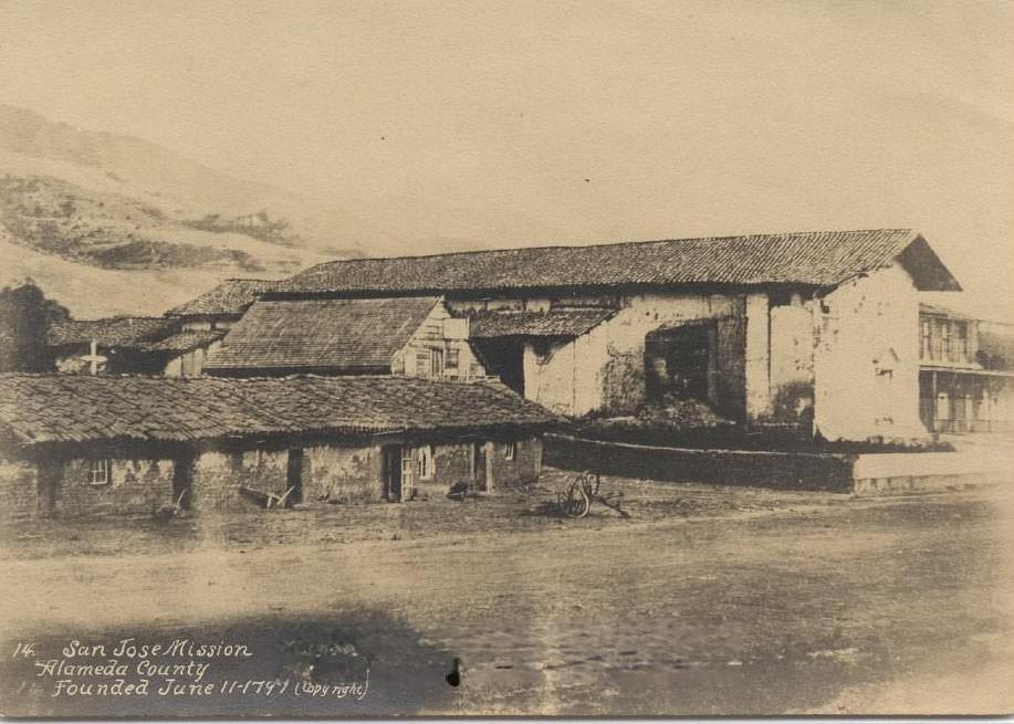
San Jose Mission, Alameda County, 1860s
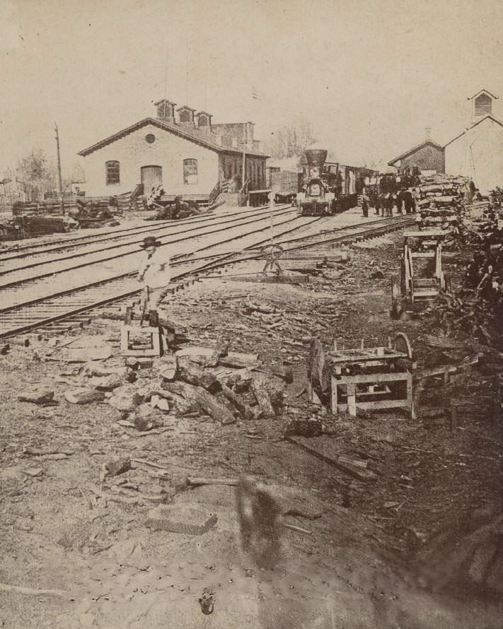
San Jose railyard of the San Francisco & San Jose Railroad, 1860s

The railyard became one of the most active sites in the city after 1864. Goods moved in and out rapidly, and the railroad infrastructure expanded to meet the demands of a growing regional economy.
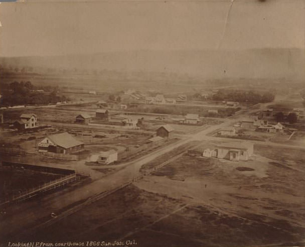
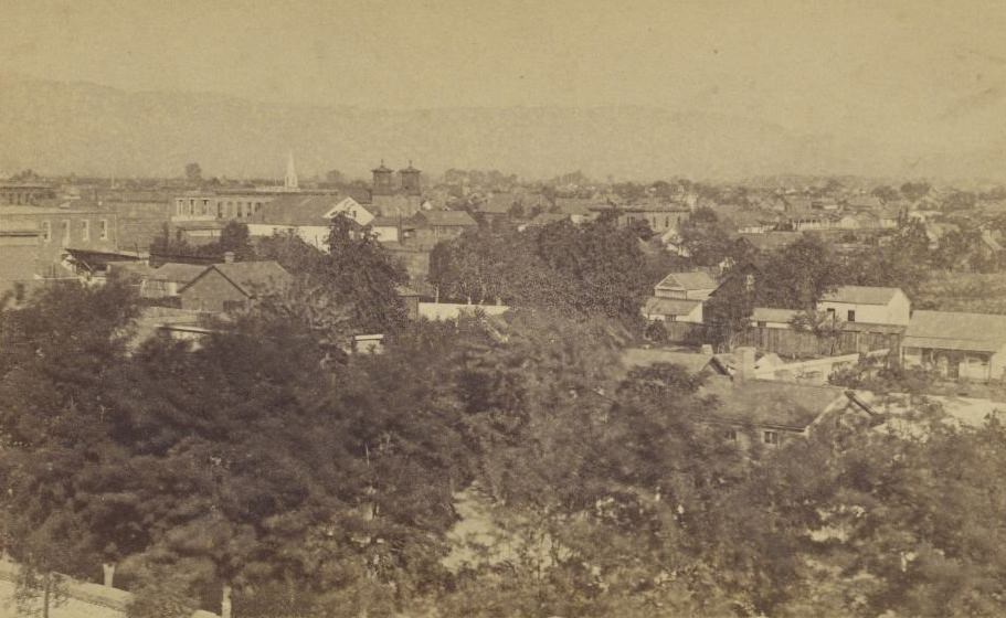
View looking northeast from the Courthouse, San Jose, 1866
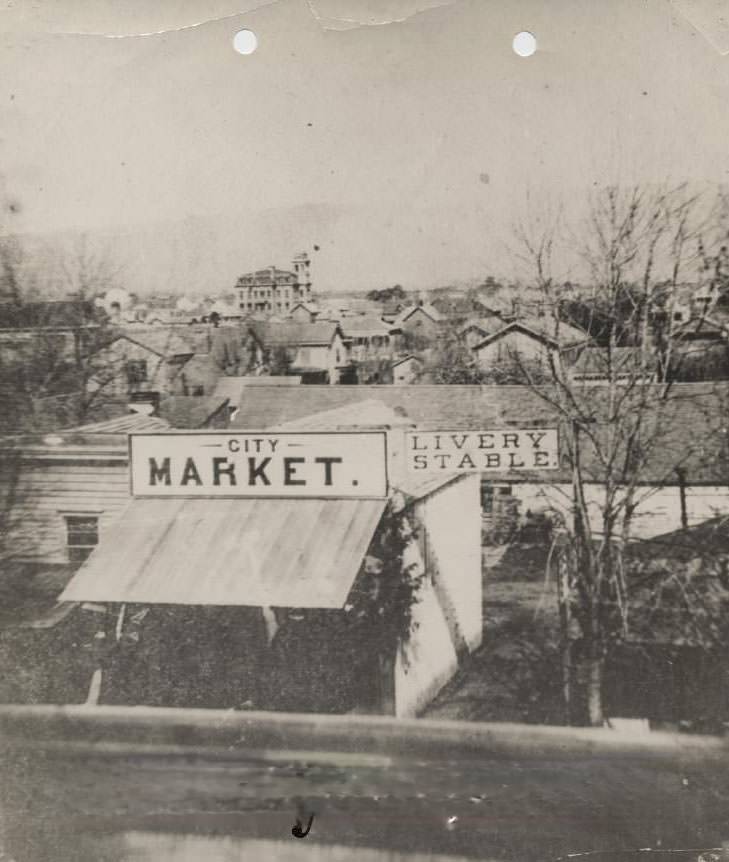
City Market and Livery Stable, South First Street, 1860

South First Street hosted essential services like the City Market and Livery Stable, catering to both residents and the steady flow of travelers. Horses and wagons were the primary means of transport, making livery stables a central part of city commerce.
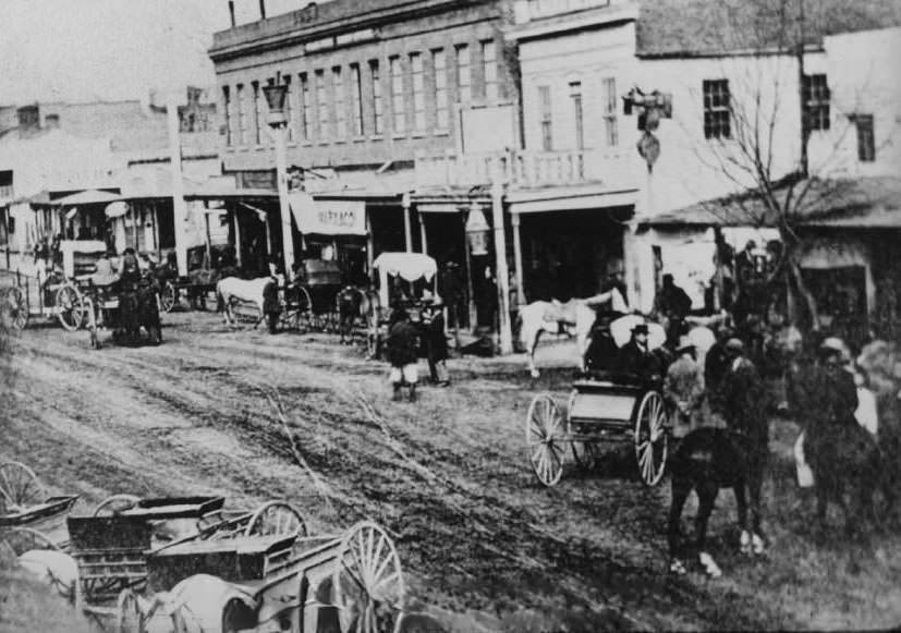
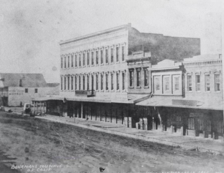
First Street, San Jose, unpaved and muddy, 1868
San Jose Hotel, 1865

By the mid-1860s, San Jose supported a noticeable Chinatown on Market Street. Towers of the McKenzie Iron Foundry, the San Jose Brewery, and the city waterworks formed the skyline behind it — a mix of industry, commerce, and community.
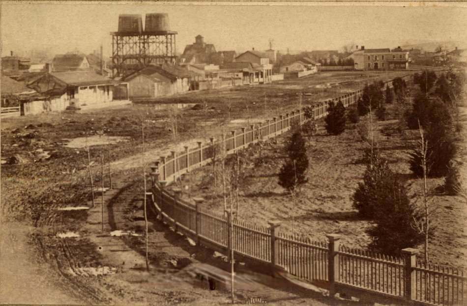
Market Street Chinatown, with the towers of McKenzie Iron Foundry, San Jose Brewery, and San Jose Waterworks visible in the background, 1866
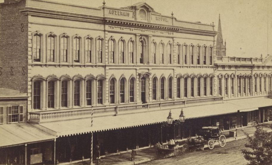
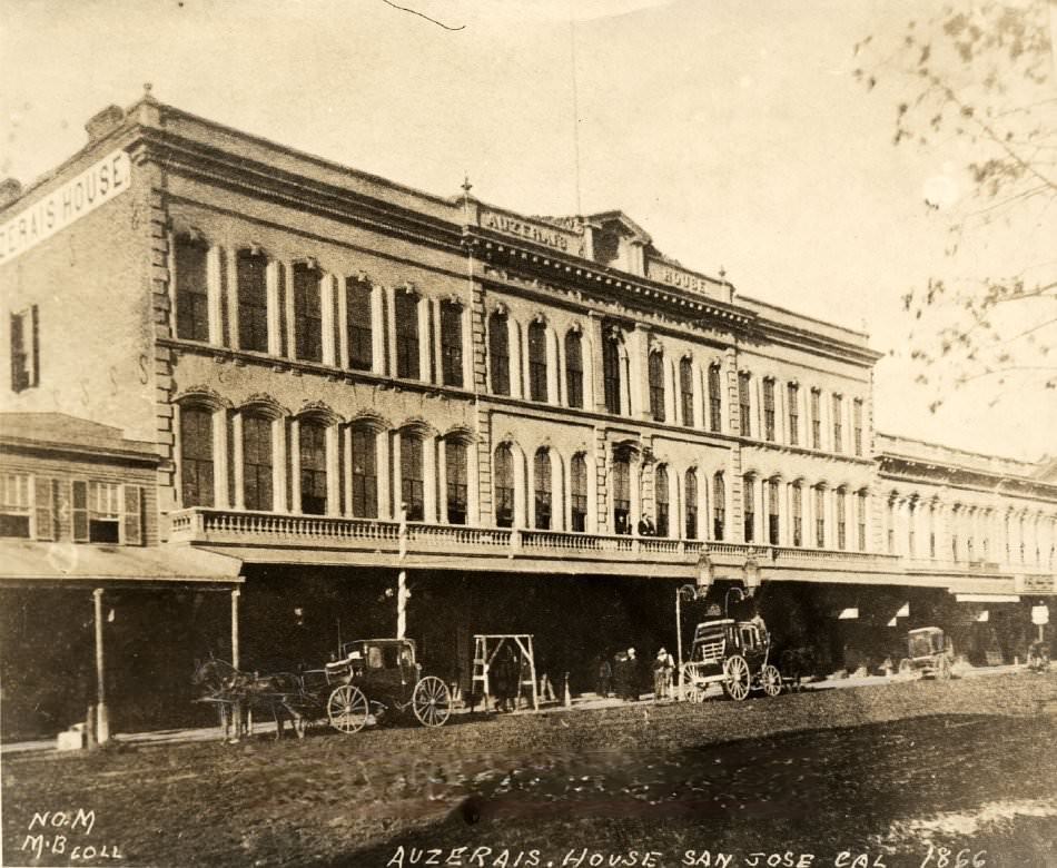
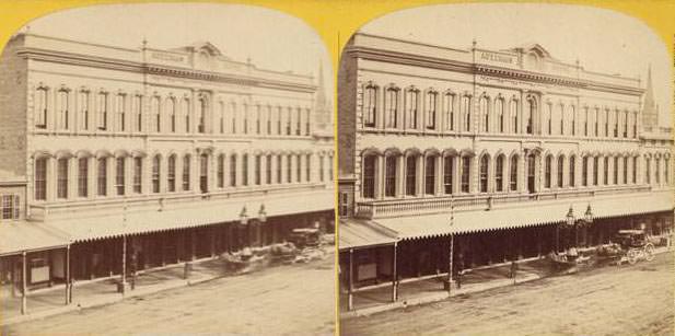
Auzerais House on Santa Clara Street near First Street, San Jose, 1866

The ranching tradition that had defined the region for decades was still active in the 1860s. Land grants from the Mexican era, like Rancho Santa Teresa, remained intact and continued operating as large cattle-raising properties south of the city.
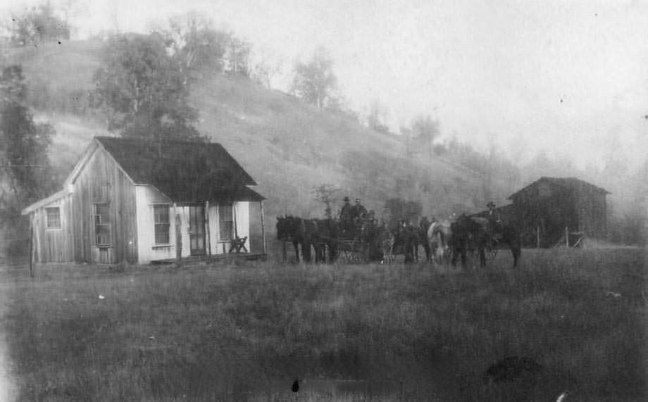
Rancho Santa Teresa, south San Jose, Bernal land grant, 1860
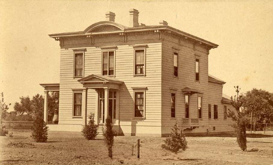
T. Ellard Bean's home, San Jose, 1867
T. Ellard Bean’s home, San Jose, 1867

Some of San Jose’s most historically significant structures stood within view of one another by 1868. Captain Thomas Fallon, who raised the American flag over San Jose in 1846, had his home near the Peralta Adobe — the only pre-1800 structure still standing in the city. Nearby stood the home and City Gardens Nursery of Louis Pellier, the site of today’s Pellier Park.
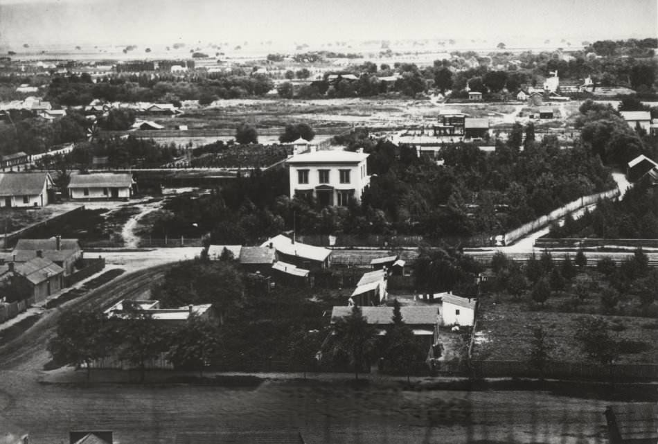
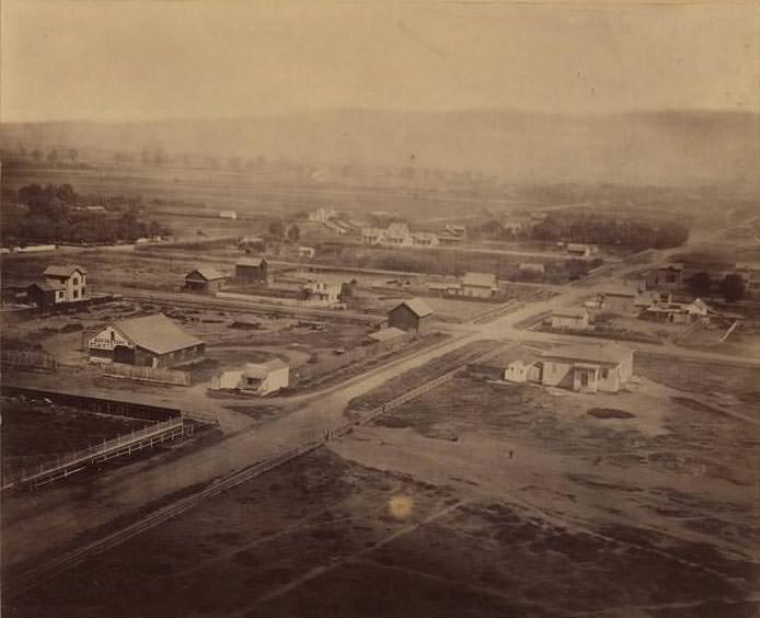
Fallon House in the distance, with the Peralta Adobe to the left and the Louis Pellier home and City Gardens Nursery to the right, San Jose, 1868
St. James Park and surroundings, San Jose, 1866

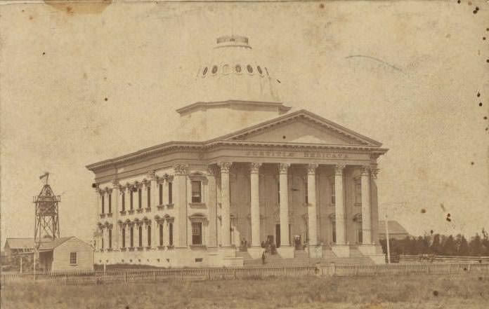
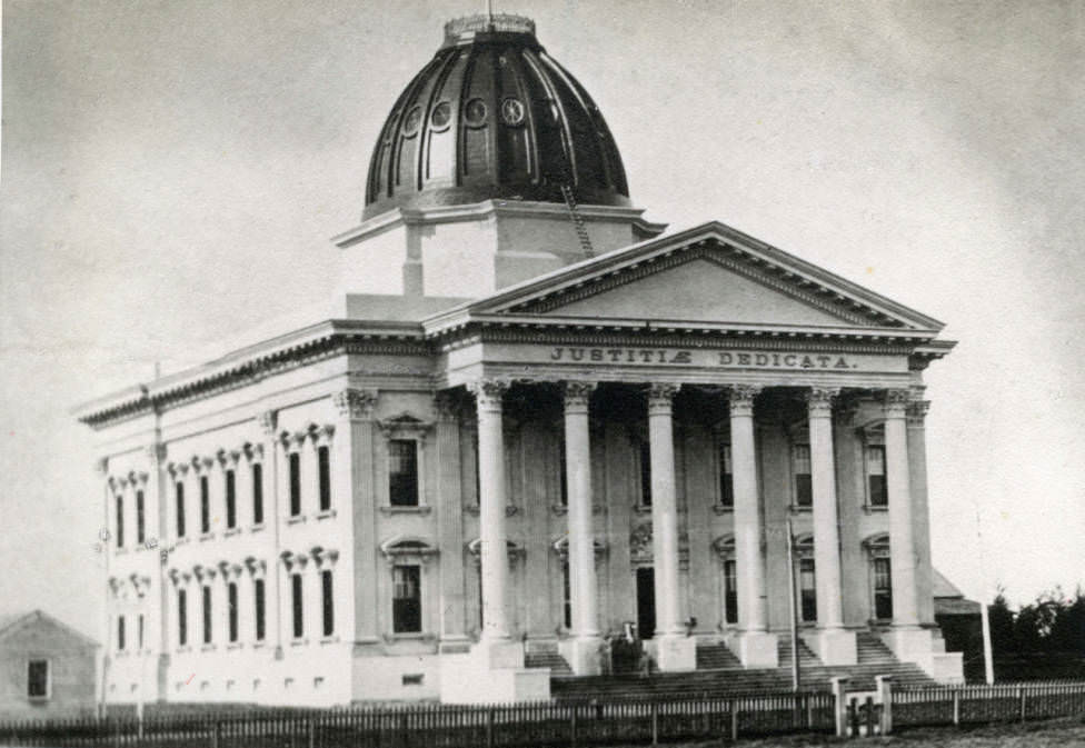
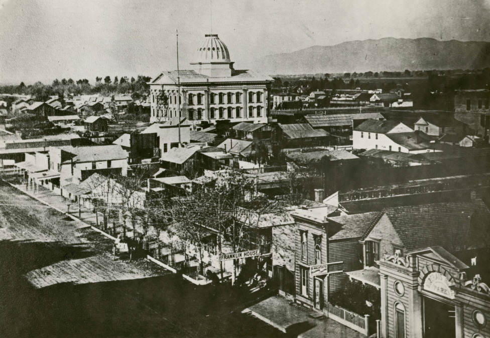
The Santa Clara County Courthouse, completed in 1869, was designed by local architect Levi Goodrich at a cost of $200,000. It featured one large courtroom beneath a 135-foot dome, with a small residence, water tower, and windmill positioned beside it.
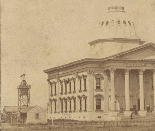
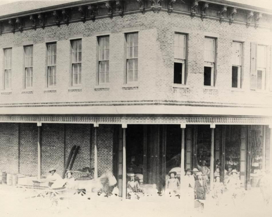
Santa Clara County Courthouse, designed by architect Levi Goodrich at a cost of $200,000, featuring a single courtroom beneath a 135-foot dome and a small residence with a water tower and windmill beside it, 1869
Mariposa Store, 1861

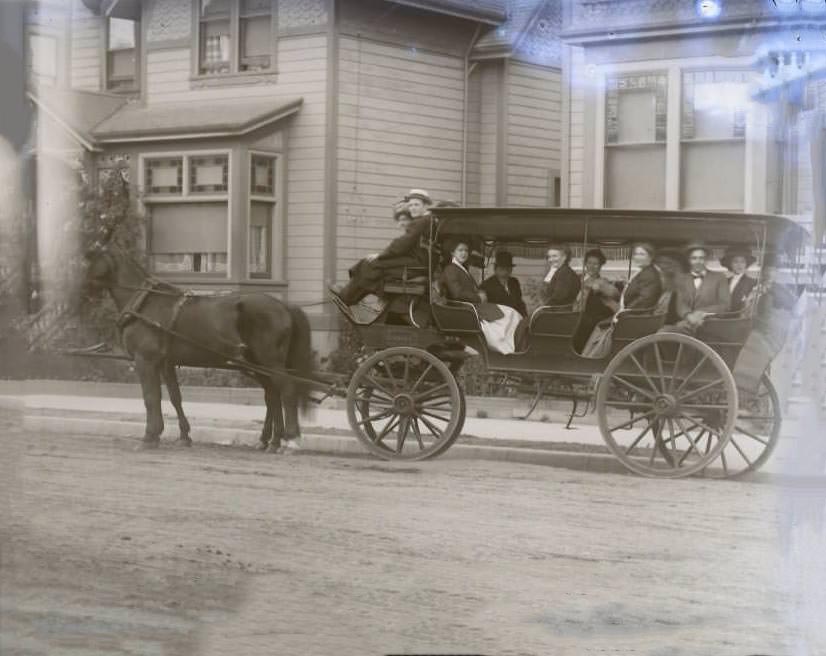
Wagons were the lifeblood of commerce across the valley, hauling farm produce, supplies, and passengers between ranches, towns, and the railroad depot.
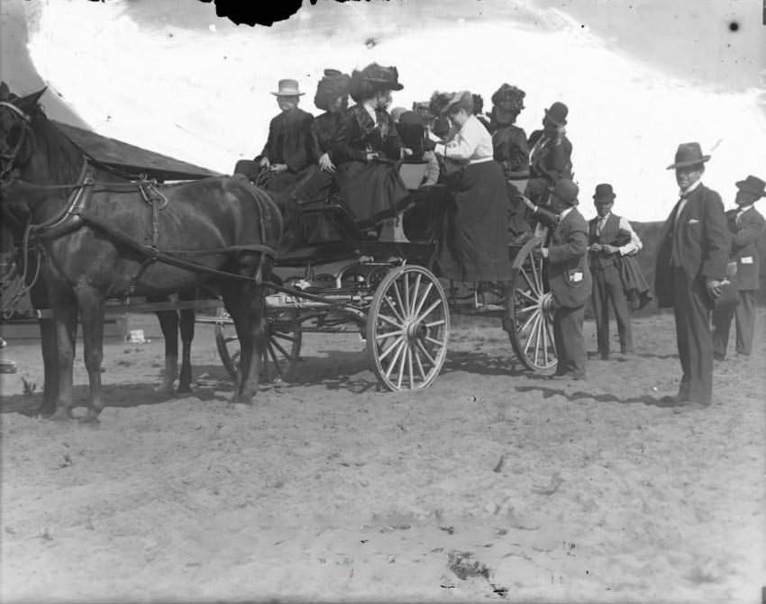
Loading a wagon with people, 1860s
Auzerais House, San Jose, Santa Clara County, 1868
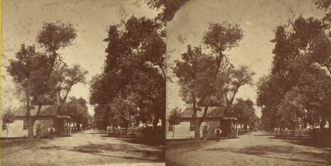
The Alameda Road between San Jose and Santa Clara, 1865

The Alameda was the main road connecting San Jose to Santa Clara, lined with willows that provided shade for travelers making the journey by horse and carriage. Education was also taking hold, with institutions like the San Jose Institute and Commercial College established by the late 1860s.
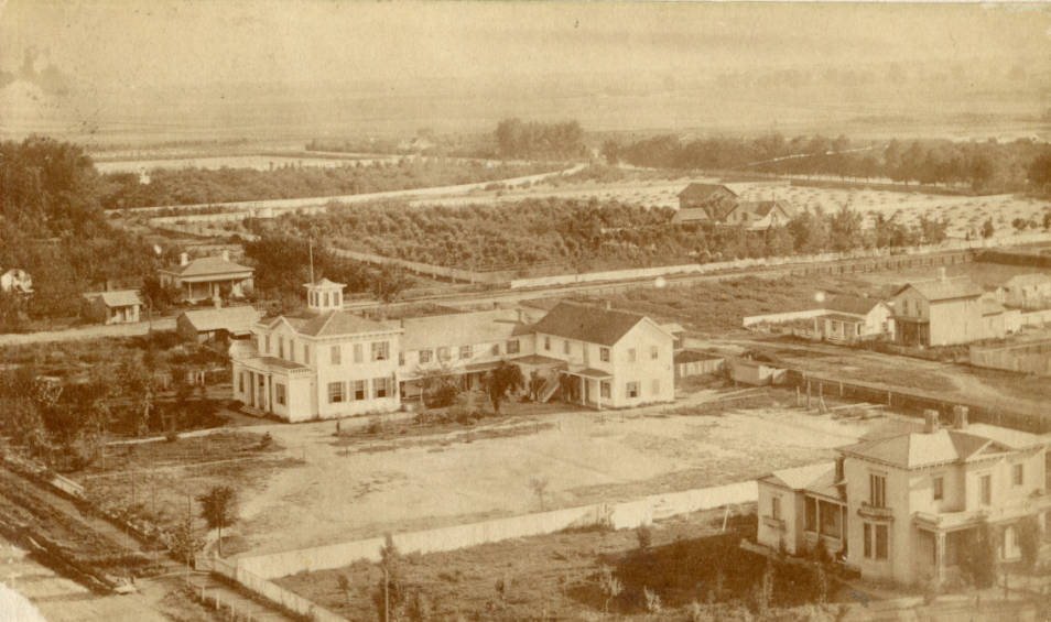
San Jose Institute and Commercial College, 1869

Boarding trains in winter was a muddy ordeal, prompting the construction of an overhead arcade structure above the tracks at the San Francisco & San Jose Railroad depot. Built west of San Pedro Street next to the freight house, the structure was short-lived and does not appear on 1870 maps. This photograph is the only known image of it.
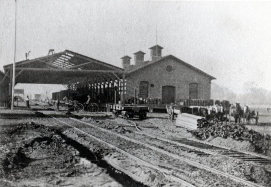
Construction of an overhead arcade structure above the tracks of the San Francisco & San Jose Railroad depot, built west of San Pedro Street adjacent to the freight house, 1864
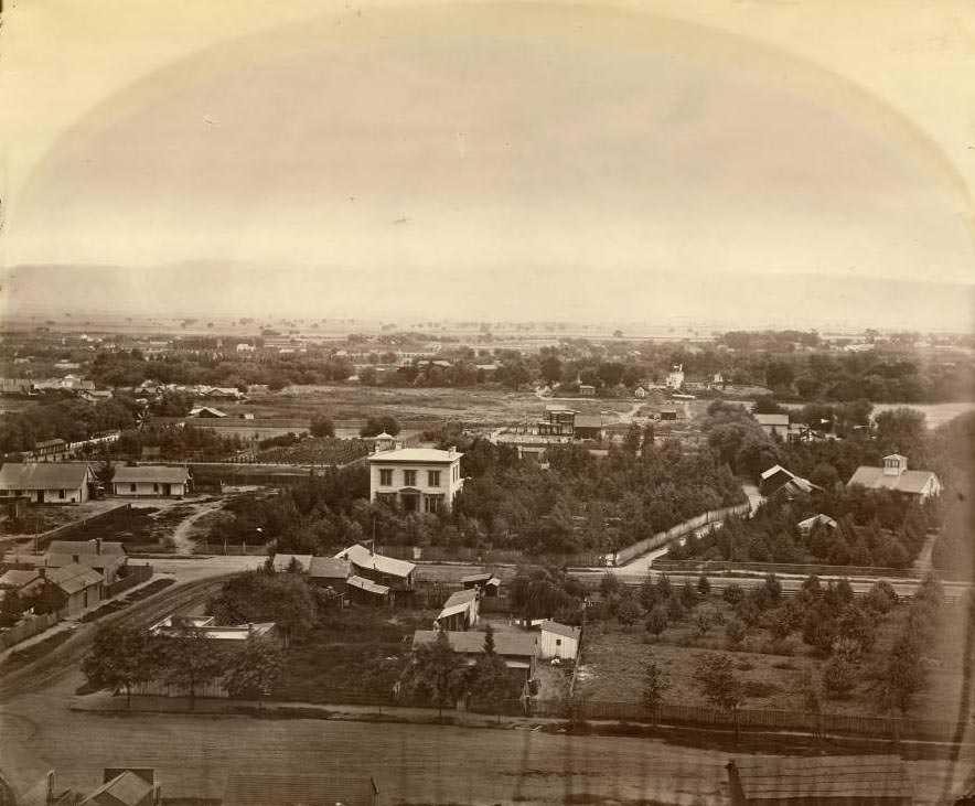
Aerial view of San Jose taken from the roof of Hensley House, 1868

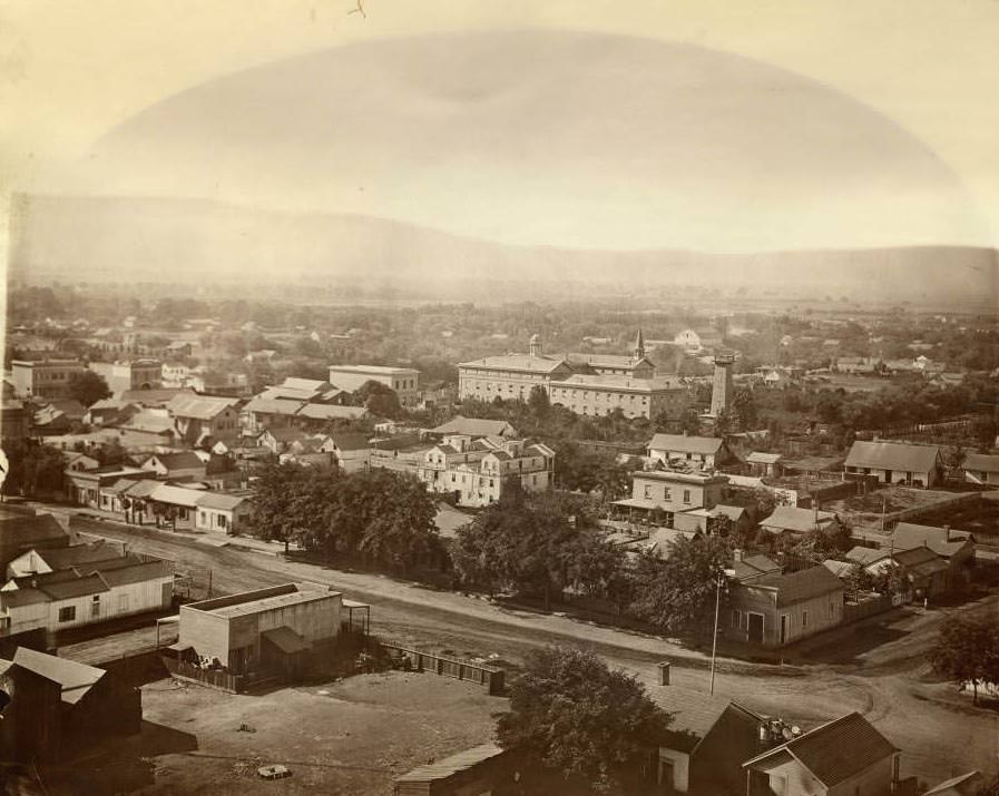
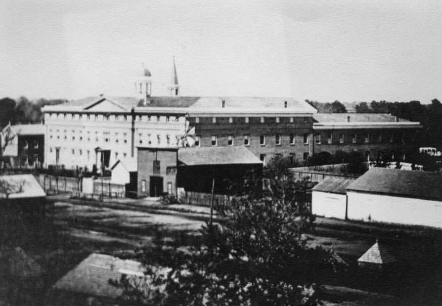
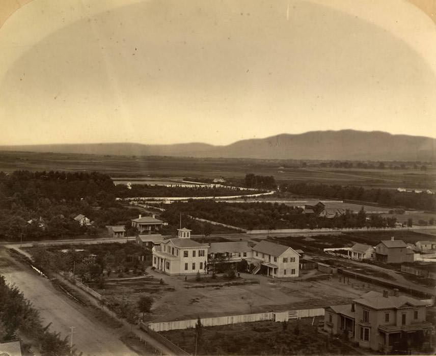
Views taken from elevated points — rooftops and the courthouse dome — reveal a city still spreading outward, with open land beyond its core. The San Jose Institute and Business College stood prominently at the center, with First Street extending toward the left.
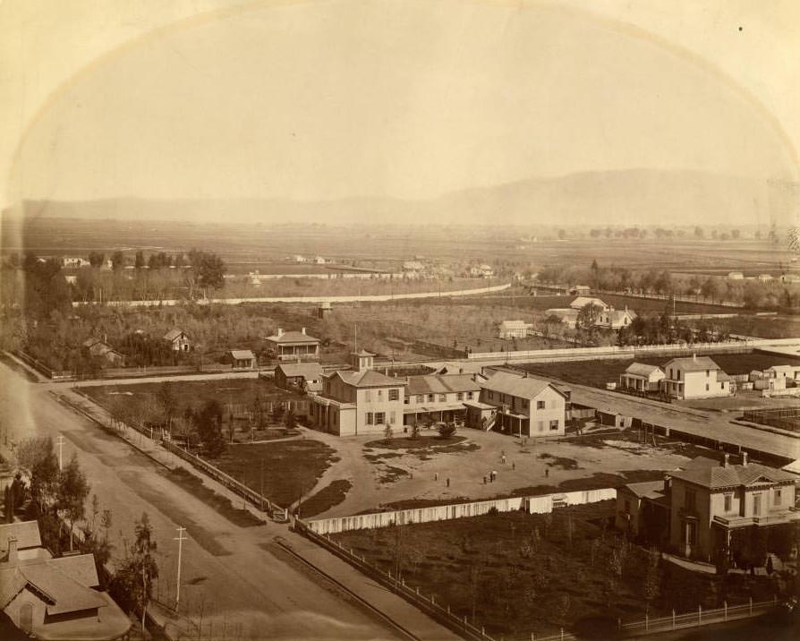
San Jose from the dome of the courthouse, with the San Jose Institute and Business College at center and First Street running from center to left, 1868

Street-level scenes from the 1860s show a city that was organized but still rough. The militia drilled on Market Street, merchants operated from storefronts, and residents navigated unpaved roads in all weather.
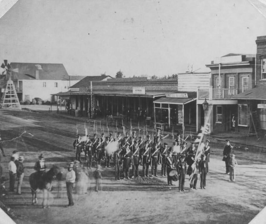
San Jose Militia in formation on Market Street, with a flag bearer, drum player, uniformed men, and a horse, 1860
San Jose, with the San Jose Institute and Business College at center and First Street running from center to left, 1868
San Jose, showing Fallon House from the Santa Clara County Courthouse, with the Peralta Adobe, nursery of Louis Pellier, San Pedro Street, and Chaboya Alley also visible, 1868
Notre Dame Academy on West Santa Clara Street before construction of the dining hall and connecting bridge built after the 1868 earthquake, 1868
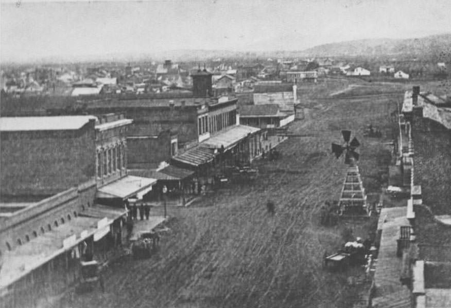
Market Street looking south from Santa Clara Street, showing businesses, Saint Joseph's Church, a windmill, and open land beyond, 1868
Market Street looking south from Santa Clara Street, showing businesses, Saint Joseph’s Church, a windmill, and open land beyond, 1868
South Market Street, San Jose, 1864
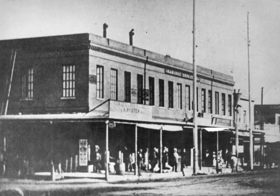
Adolf Pfister's General Store, San Jose, 1867
Adolf Pfister’s General Store, San Jose, 1867

General stores like Pfister’s, built in 1858 on the corner of First and Santa Clara Streets, sold hardware and general merchandise and were central to neighborhood commerce. Residential life existed alongside these commercial hubs, with farmhouses and private homes scattered throughout the city’s edges.
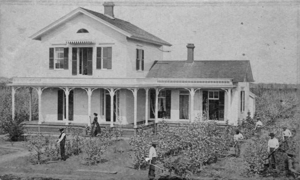
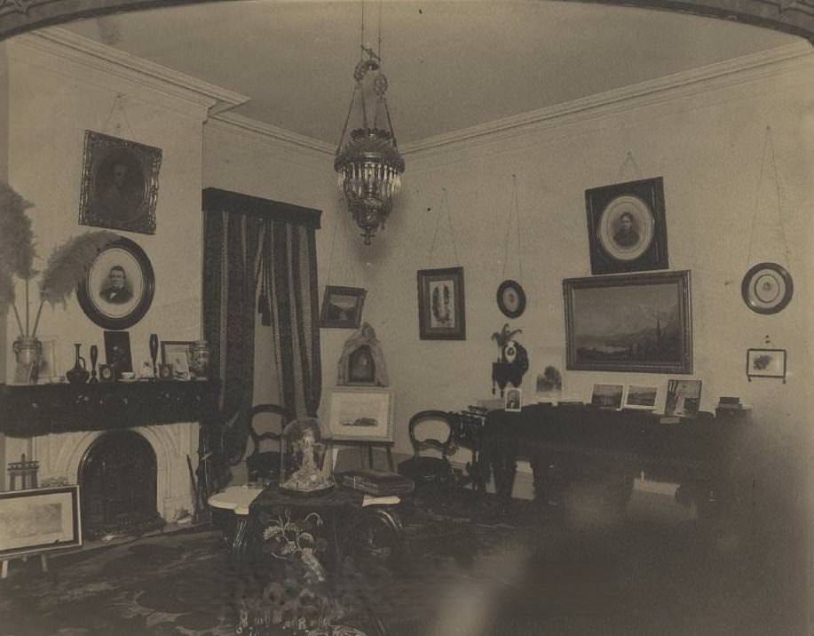
Adams residence, a two-story farmhouse with several men tending small trees out front and a woman near the front porch, San Jose, 1860
Grandmother Bray's living room, 1860
Grandmother Bray’s living room, 1860

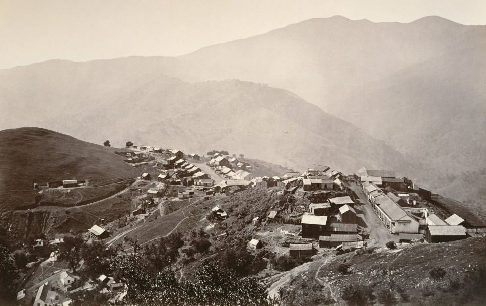
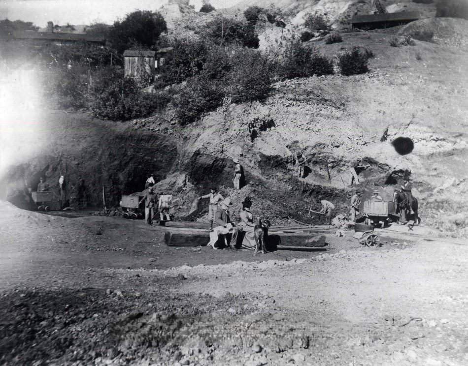
Just south of San Jose, the New Almaden mercury mine was an industrial operation of significant scale. Workers excavated hillsides while mine offices oversaw operations from higher ground, supplying a material vital to gold and silver processing during the era.
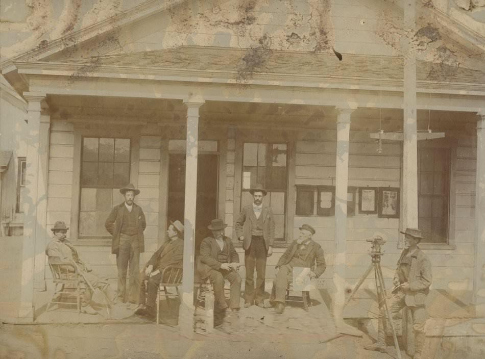
Mine Office on the Hill, New Almaden, 1865
New Almaden, workers excavating a hillside, 1860
New Almaden, large two-story building, 1860
Santa Clara County Courthouse, 1869
College of Notre Dame, 1863

Religious institutions were established early in the region’s history. Mission San Jose and the College of Notre Dame were prominent landmarks, serving both spiritual and educational roles in the community.
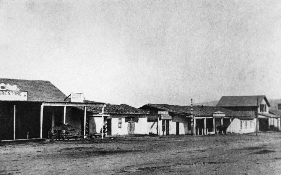
Mission San Jose, 1867
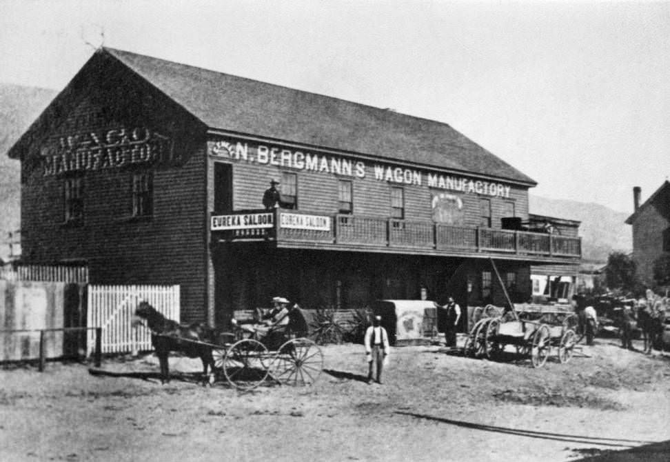
Nicholas Bergmann's Wagon Manufactory at Mission San Jose, with a corner sign reading "Eureka Saloon," carriages parked out front, a man on the second-floor balcony, and several men standing in the street, 1867
Nicholas Bergmann’s Wagon Manufactory at Mission San Jose, with a corner sign reading “Eureka Saloon,” carriages parked out front, a man on the second-floor balcony, and several men standing in the street, 1867

The Alameda, lined with willows, connected San Jose and Santa Clara and was one of the most traveled roads in the county. Its shaded path made it a practical and pleasant route for daily movement between the two cities.
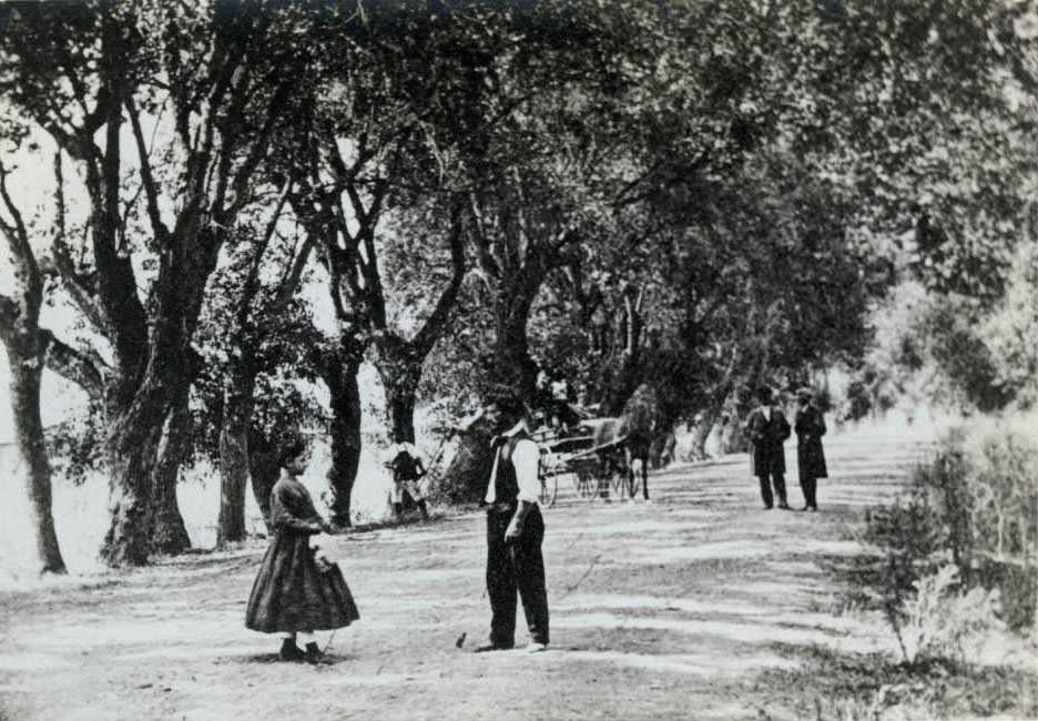
The Alameda, the main road between San Jose and Santa Clara, lined with willows and traveled by men, a girl, and a horse and carriage, 1860
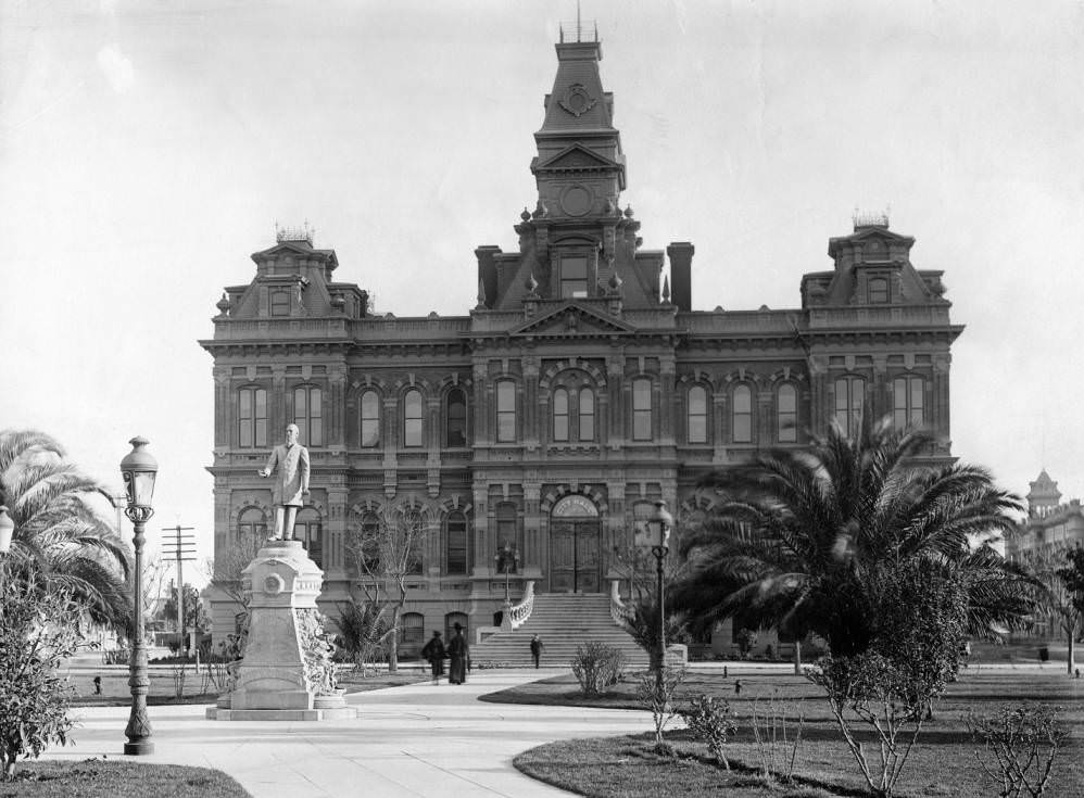
Main entrance to San Jose's Old City Hall, built before 1849 and demolished in 1958, which stood in Plaza Park and housed city offices and the police department; the statue in the foreground is of Dr. Henry D. Cogswell, atop a drinking fountain he donated to the city, 1860s
Main entrance to San Jose’s Old City Hall, built before 1849 and demolished in 1958, which stood in Plaza Park and housed city offices and the police department; the statue in the foreground is of Dr. Henry D. Cogswell, atop a drinking fountain he donated to the city, 1860s
Santa Clara County Courthouse, 1868

Pfister’s General Store at First and Santa Clara Streets was one of the city’s earliest and most recognizable commercial buildings, constructed in 1858. Horse-drawn wagons and buggies gathered out front, making it a hub of daily activity.
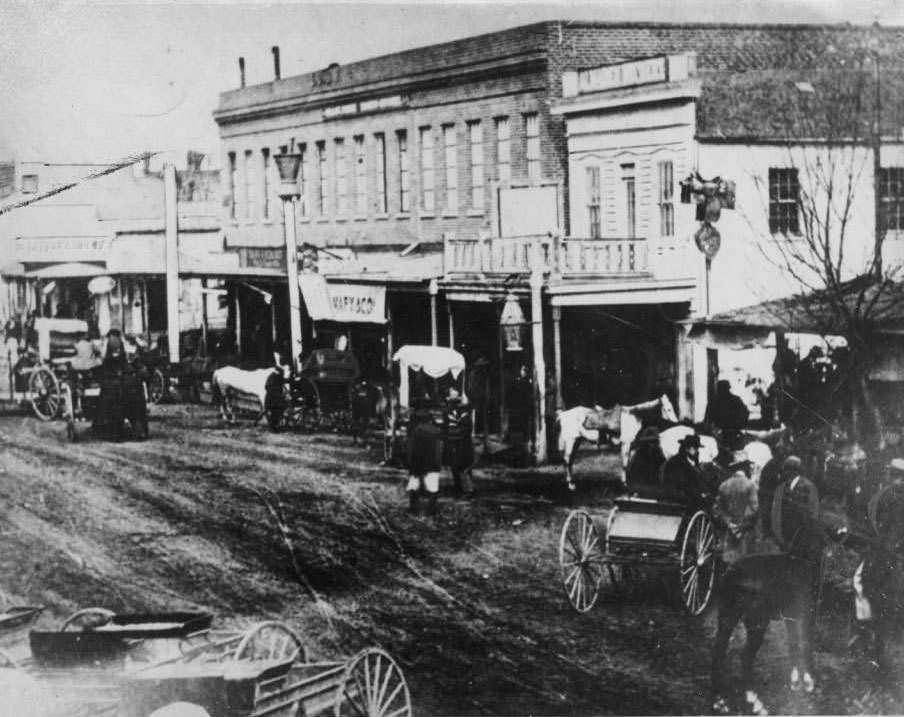
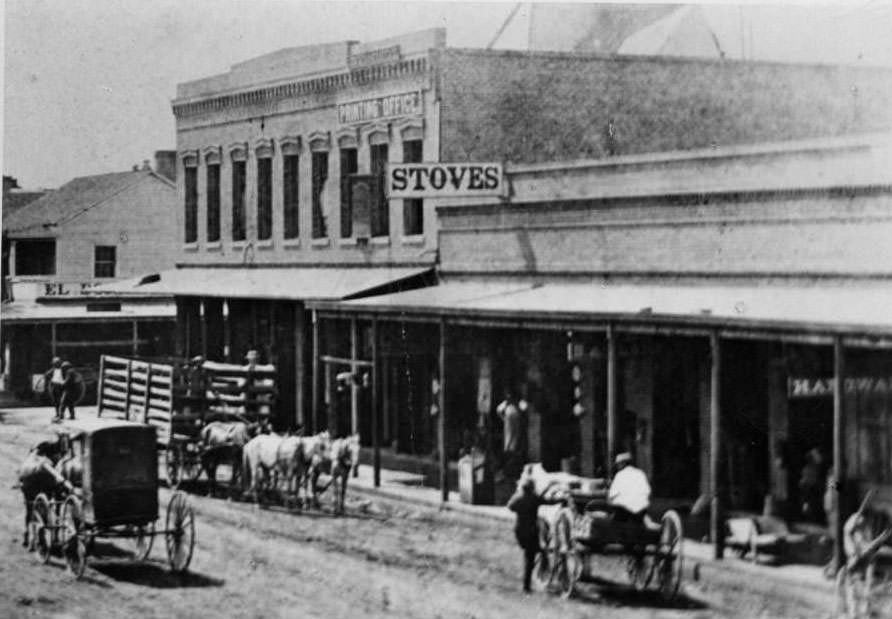
Pfister's General Store on the southeast corner of First Street and Santa Clara Street, built in 1858 by Adolf Pfister and selling hardware and general merchandise, with people, horse-drawn wagons, and buggies visible, 1860
Pfister’s General Store on the southeast corner of First Street and Santa Clara Street, built in 1858 by Adolf Pfister and selling hardware and general merchandise, with people, horse-drawn wagons, and buggies visible, 1860
Intersection of First Street and El Dorado Street, San Jose, 1862

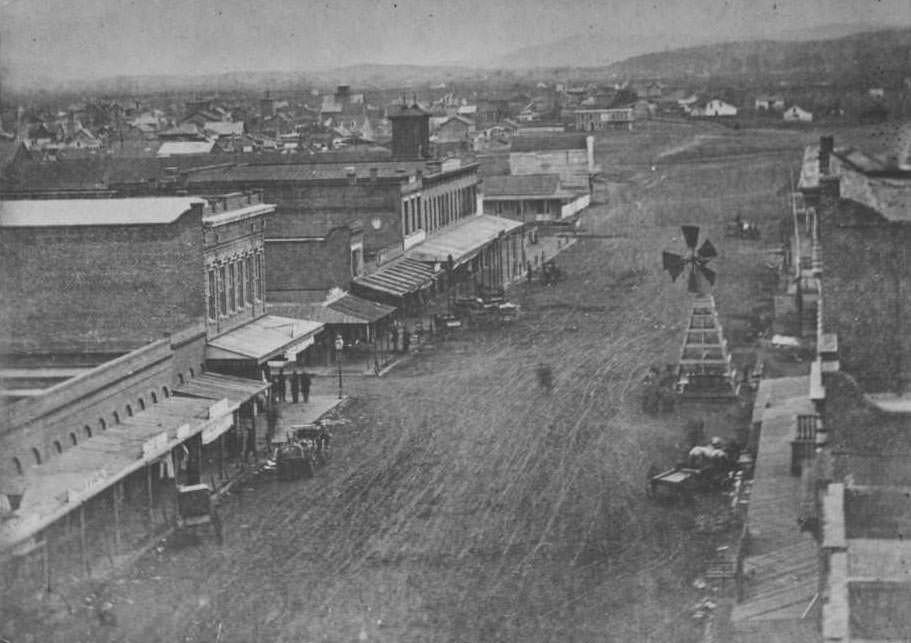
A photograph taken from the top of Hensley House in 1862 shows Market Street heading south, with the black towers of Saint Joseph’s Church rising at center — a church that would burn in 1875. A windmill stood at the corner of Market and El Dorado Streets.
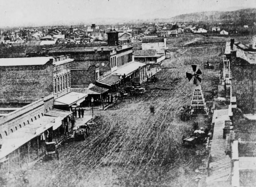
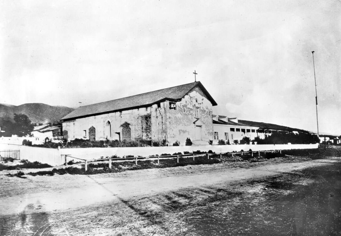
Market Street looking south, taken from the top of Hensley House at Market and Santa Clara Streets, with a windmill at the corner of Market and El Dorado and the towers of Saint Joseph's Church, which burned in 1875, visible at center, 1862
Market Street looking south, taken from the top of Hensley House at Market and Santa Clara Streets, with a windmill at the corner of Market and El Dorado and the towers of Saint Joseph’s Church, which burned in 1875, visible at center, 1862
Mission San Jose de Guadalupe, showing the two-story adobe with its main entrance on the broad left side, a cross affixed to the roof peak, a post-and-rail fence, and an unpaved road in front, 1865
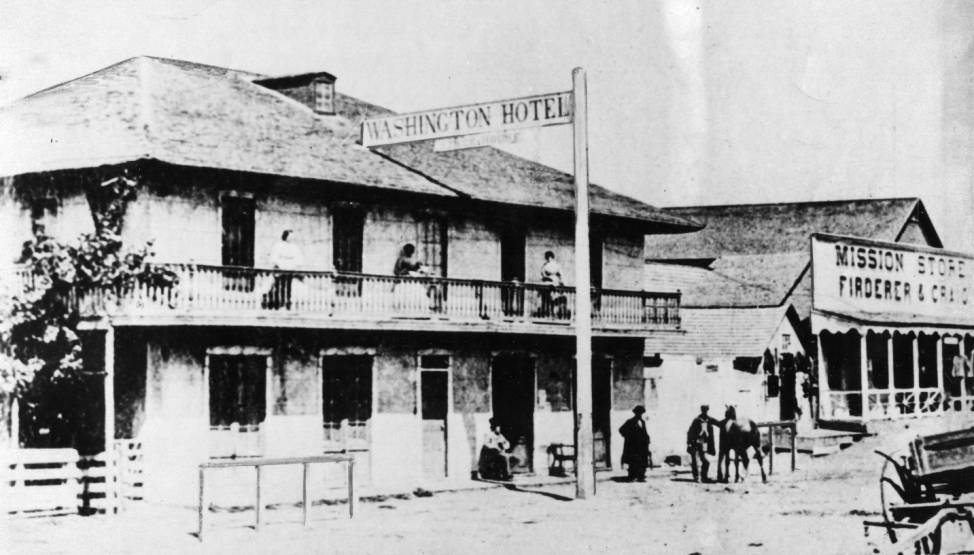
Washington Hotel, Mission San Jose, 1860
Auzerais House, San Jose, 1865
The Town on the Hill, New Almaden, 1860s
San Jose from Convent Notre Dame, 1867
Vendome carriage in front of houses, 1860s
Enjoyed this post? Get new ones in your inbox.

1 thought on “What San Jose, California Looked like in the 1860s Through Rare Historical Photos”

  1. Thank you for time spent and for showing rare pictures. Please redouble effort by correcting some mistakes made in dating events , naming people , and writing structure/grammer. Also if possible adding more details to photos would be welcome. As life long San Joser seeing many photos for first time here on your site was delightful then dreadful regarding mistakes as time moves forward those follwing this lead in memory preservation will be mislead and future seekers of our shared san jose history will be strayed away from true pioneers who have great stories of their own and who are misnamed here. Several redundancies could be fixed easily,dates better placed . Work and effort obviously done with love so please find this comment encourages and begs your pardon . Feel free to contact me if unable to discern mistakes. For we only have memory of that once bustling country town whose pace was monterey and pulse san francisco and notice how time makes this place more fragile ,forgotten , a beautiful san jose as it was before demolished or covered over by ‘progress’.

Leave a Comment

Your email address will not be published. Required fields are marked *

Share this Post 🥺

Please take a moment to share this content. Your support is greatly appreciated! 🙌🙏

Share this Post 🥺

Please take a moment to share this content. Your support is greatly appreciated! 🙌🙏
Scroll to Top
 
Hey Friend, Before You Go.. Please like & follow for more interesting content