
San Francisco in the 1860s was a city in overdrive. Just a decade earlier, it had been little more than a small port settlement. The California Gold Rush of 1849 changed everything. Tens of thousands of people flooded into Northern California chasing fortune, and San Francisco became their gateway. By the time the 1860s arrived, the city had already grown into the undisputed financial and commercial capital of the American West — and it was still accelerating.
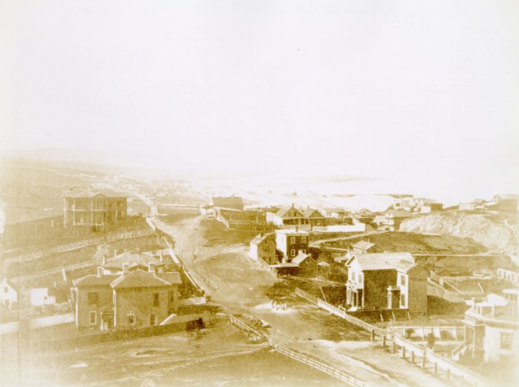
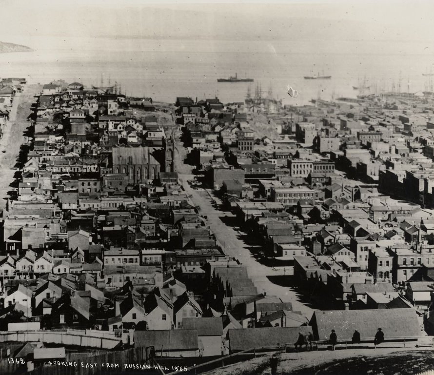
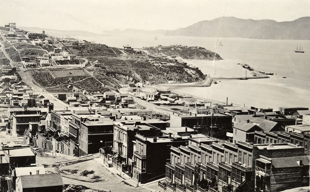
The hills of San Francisco told the story of the city’s rapid expansion. Neighborhoods climbed steep terrain that would have been considered unbuildable in most cities, and residents carved out homes on slopes with sweeping views of the bay. Russian Hill, one of the city’s most prominent ridges, was already dotted with residences by the mid-1860s, offering a window into how quickly the city had filled out beyond its original downtown core.
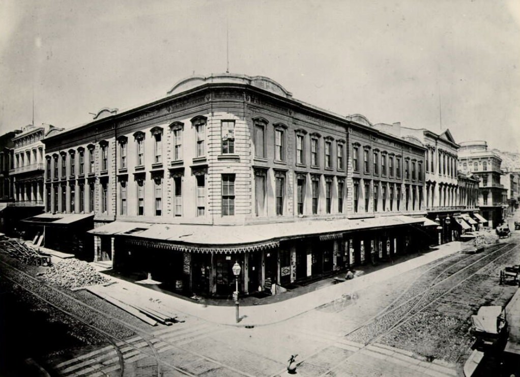
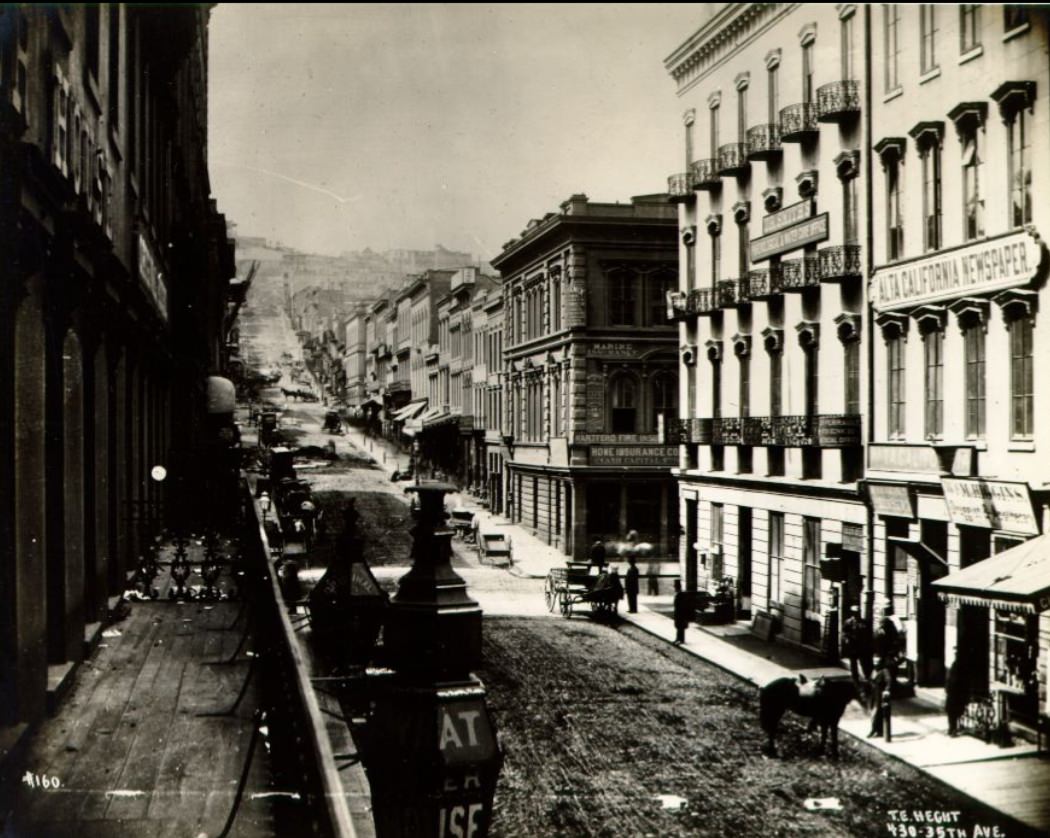
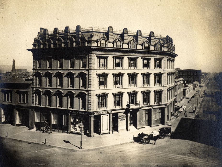
Montgomery Street was the beating heart of San Francisco’s financial life. Banks, exchanges, and trading houses lined its sidewalks, and the street hummed with the energy of merchants, brokers, and businessmen. The Washington Street Exchange Building was one of the key institutions anchoring this corridor, and photographs from the decade show a street that already looked like a serious commercial district — brick storefronts, horse-drawn carriages, and well-dressed crowds moving with purpose.
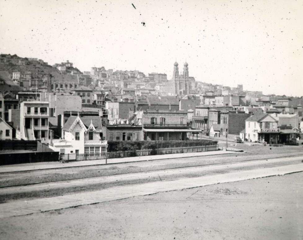
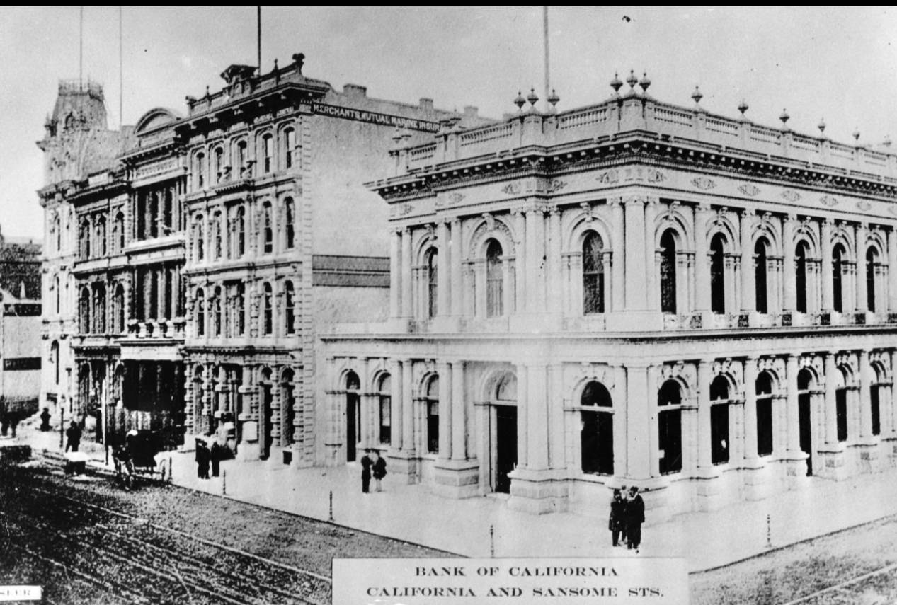
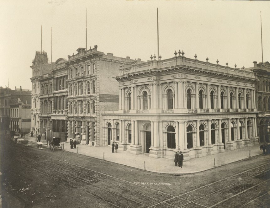
The Bank of California, founded in 1864, stood as one of the most powerful financial institutions on the West Coast. Its presence at California and Sansome Streets placed it at the center of the city’s banking district. By 1868, the bank was financing mining operations, trade, and infrastructure projects across the region. The building itself was a statement — solid, imposing, and built to signal permanence in a city that was still very much proving itself to the rest of the country.
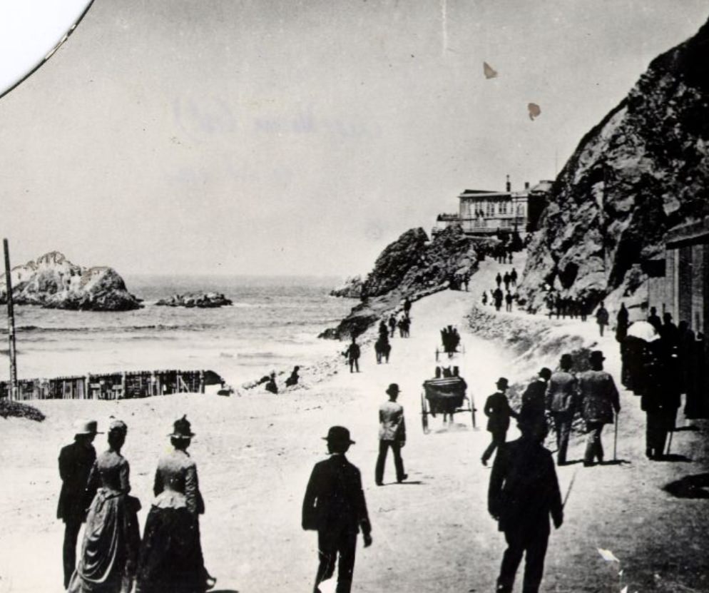
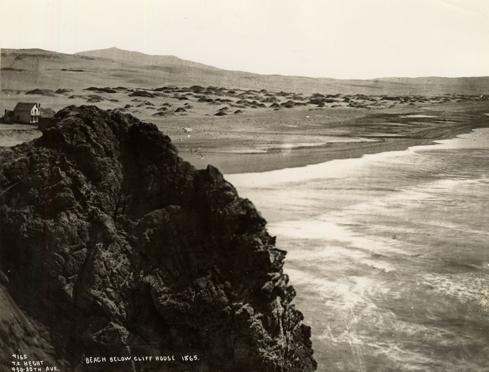
Not all of San Francisco’s energy in the 1860s was commercial. The city also developed leisure spaces for its growing population. The first Cliff House opened in 1863 on the rugged bluffs above Ocean Beach, offering a restaurant and views of the Pacific. It quickly became a destination for San Franciscans looking to escape the dense downtown streets, and horse-drawn coaches carried visitors out to the coast along rutted roads.
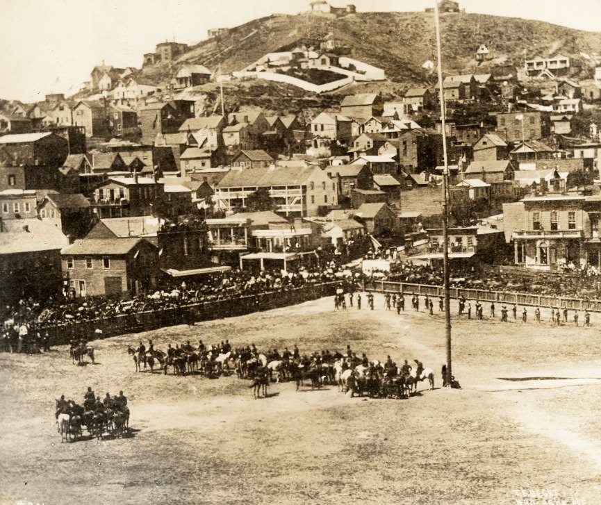
Public life in 1860s San Francisco played out in open squares and broad streets. Washington Square, located in the North Beach neighborhood, served as a gathering place for residents from many different communities. On holidays like the Fourth of July, the square filled with crowds celebrating American milestones — even as the Civil War cast a long shadow over the nation throughout much of the decade. San Francisco’s loyalties lay firmly with the Union, and public demonstrations of patriotism were common.
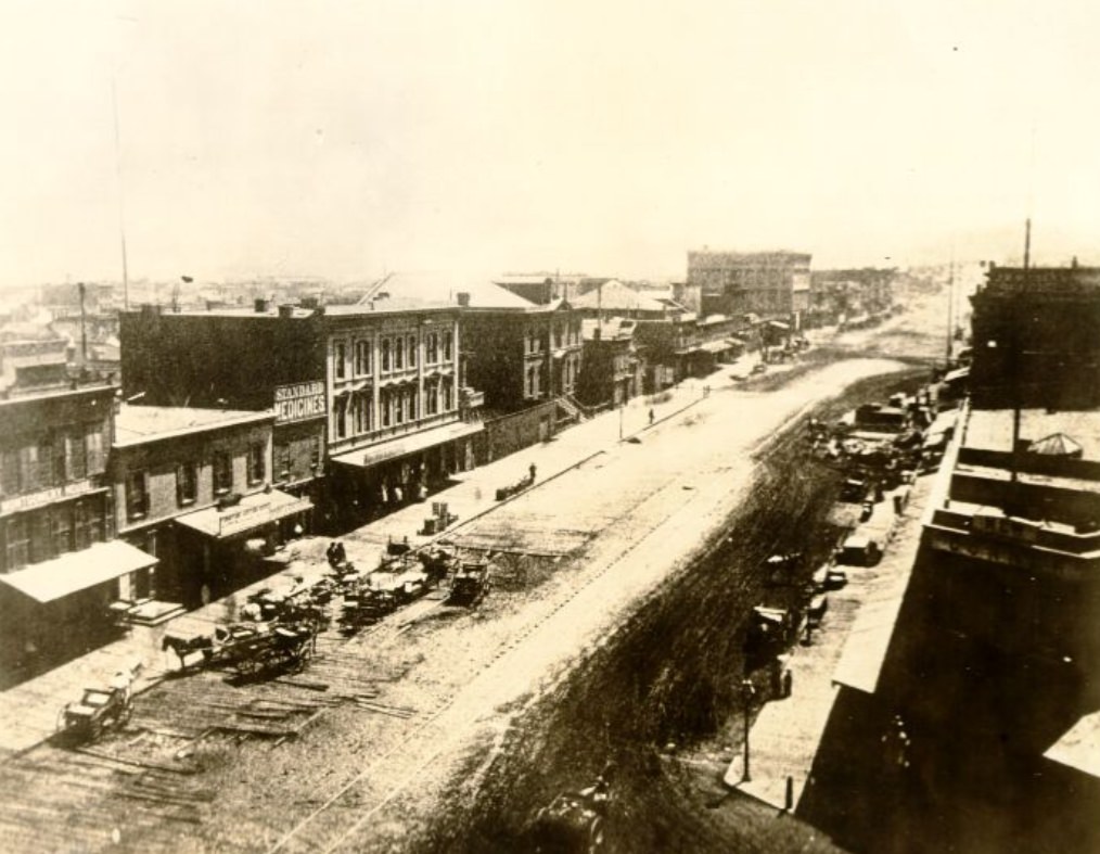
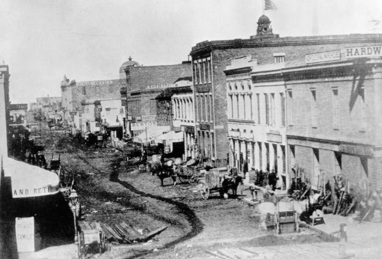
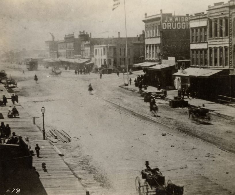
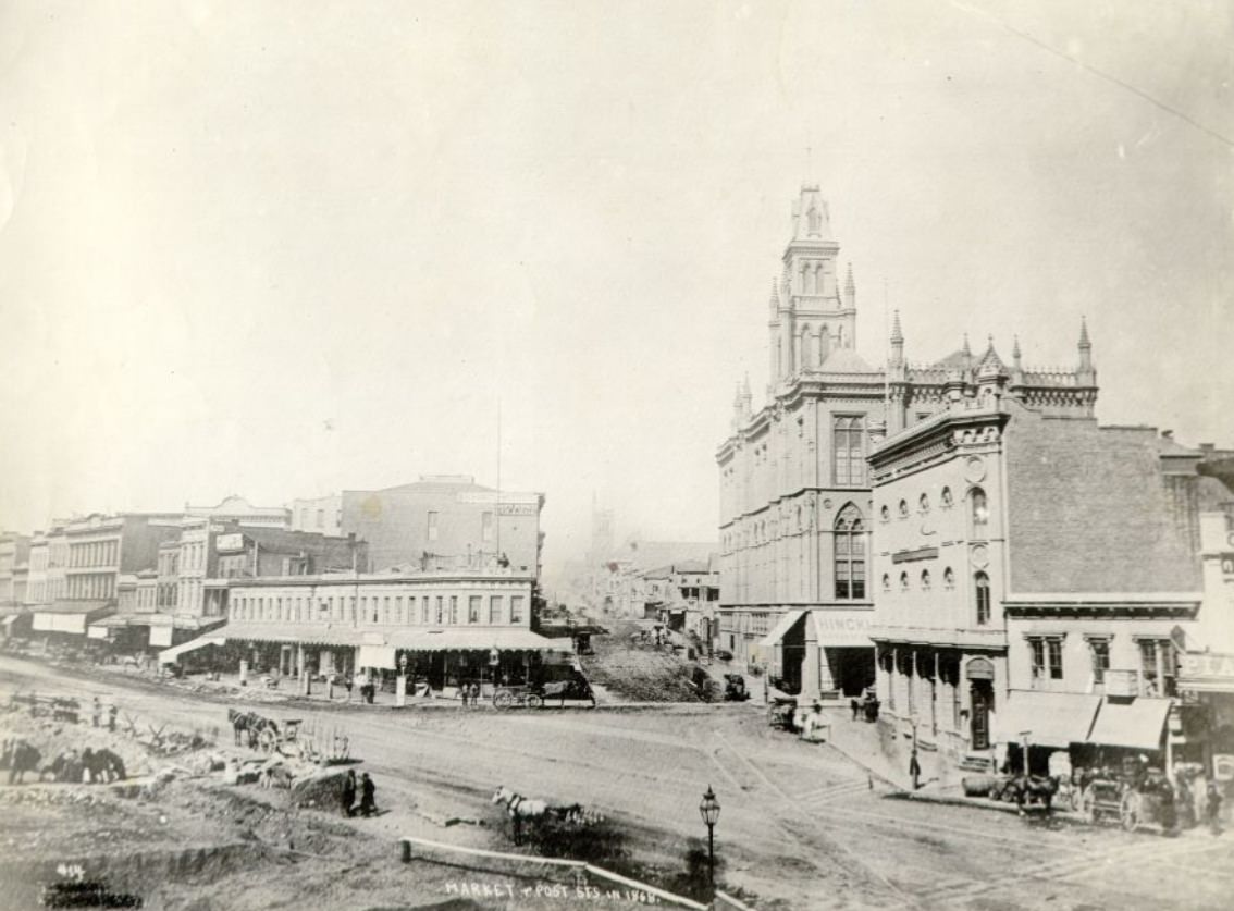
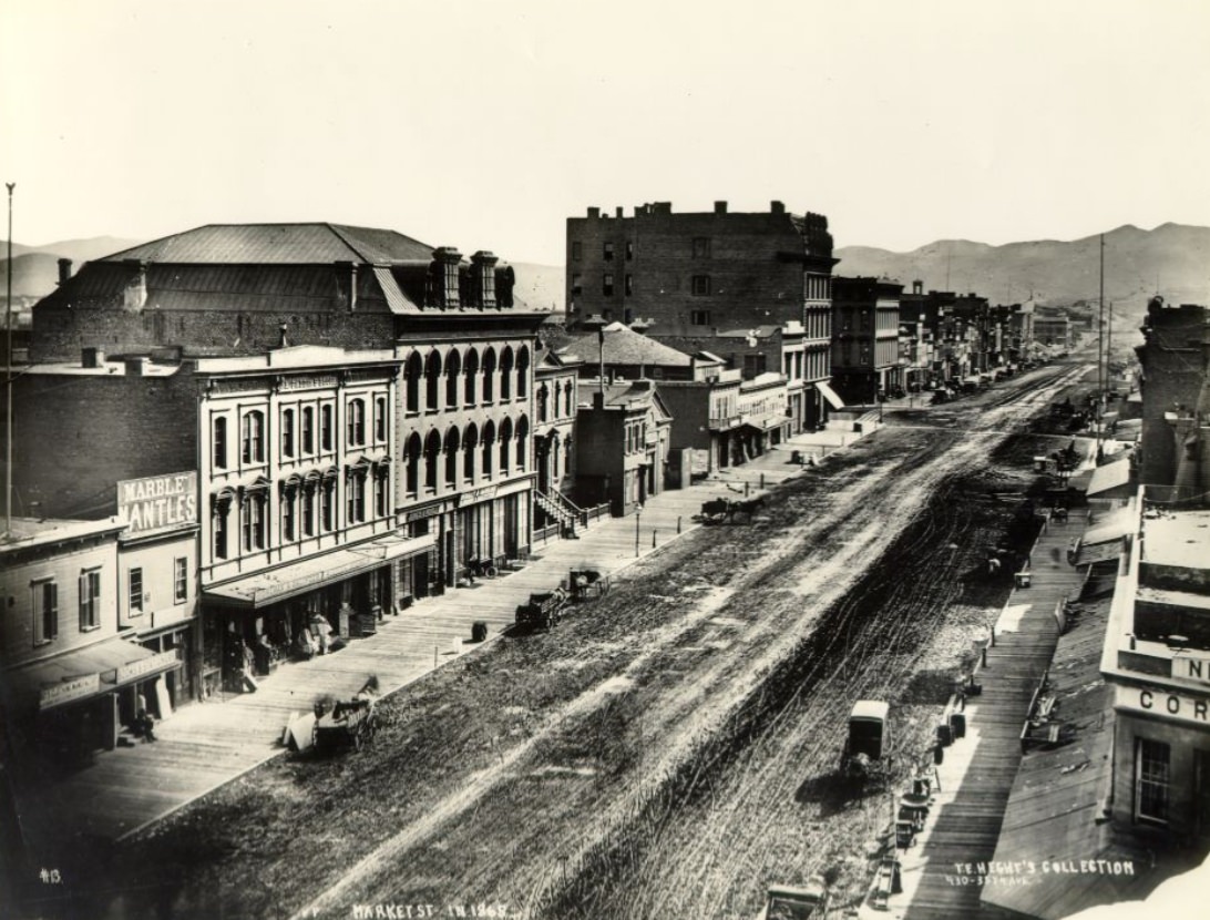
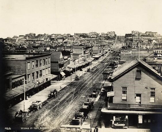
Market Street was San Francisco’s main artery — a wide diagonal boulevard that cut across the city’s street grid and connected the waterfront to the expanding inland neighborhoods. By 1866, it was already one of the busiest streets in the American West. Photographs from the period show a mix of brick buildings, wooden storefronts, street vendors, and horse-drawn traffic moving in both directions. The street was a cross-section of the city’s social and economic life all at once.
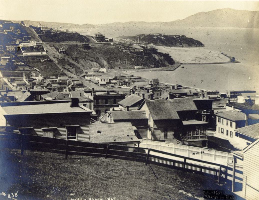
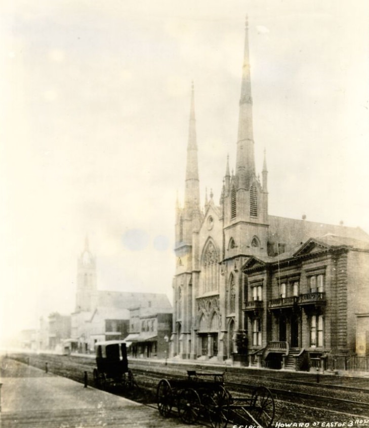
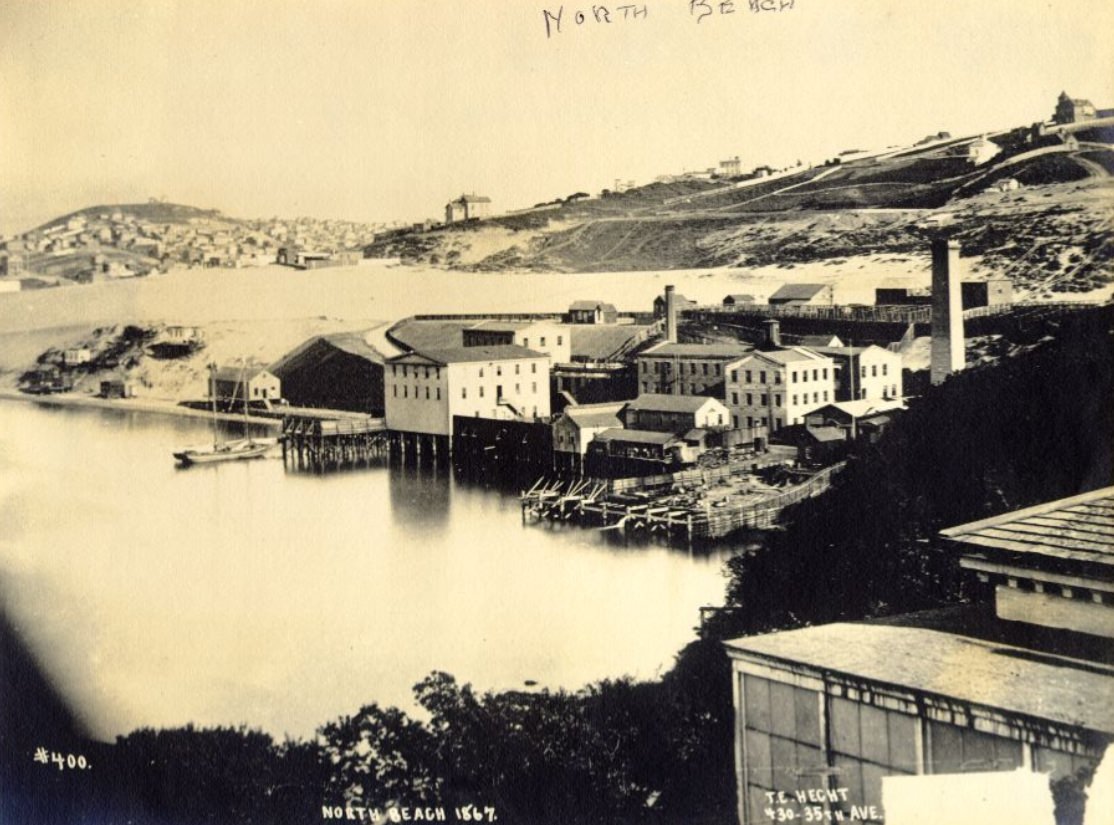
North Beach was one of San Francisco’s most densely populated neighborhoods by the 1860s. The area attracted large numbers of Italian and Irish immigrants, who built tight-knit communities along its sloped streets near the waterfront. Howard Street, meanwhile, captured the city’s industrial and working-class side — wider blocks, warehouses, and the kind of commercial infrastructure that kept a port city running. Together, these neighborhoods showed just how varied San Francisco’s urban landscape had become within a single decade.
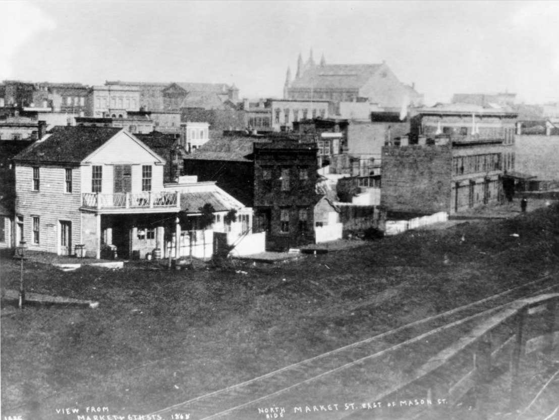
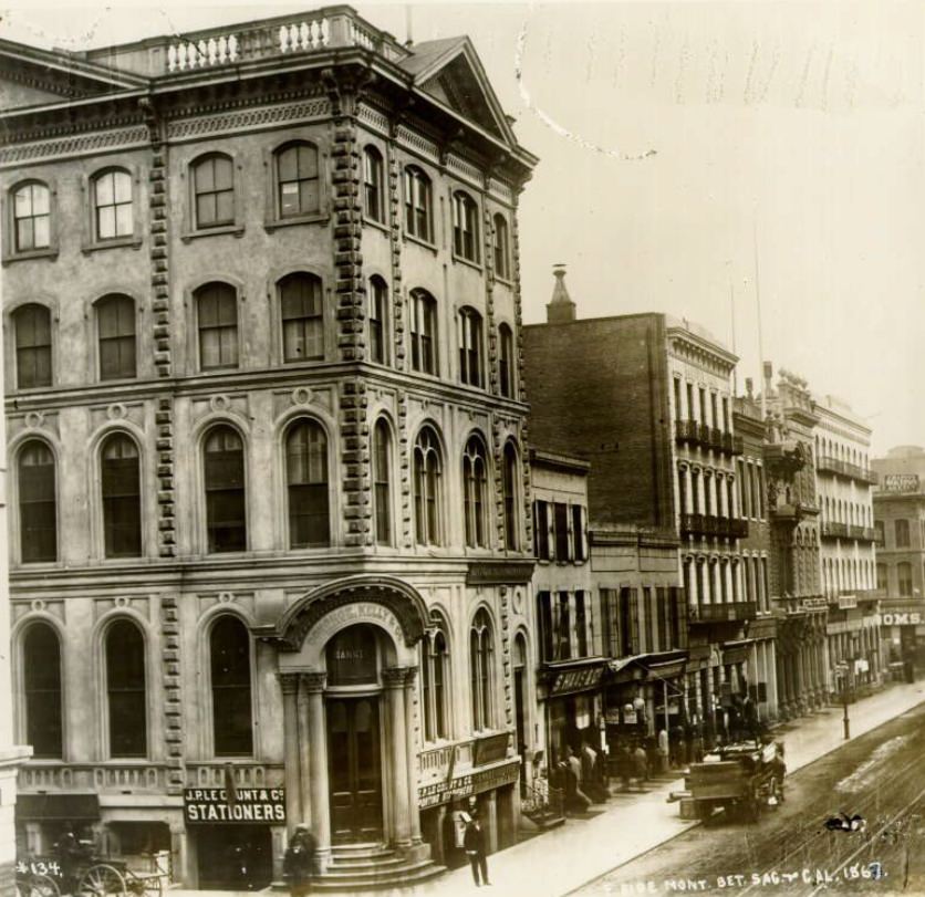
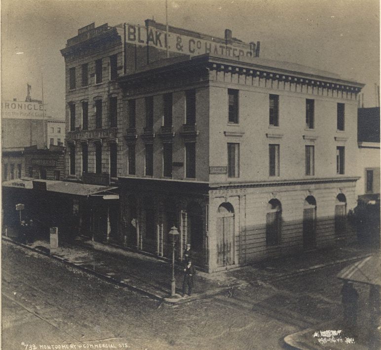
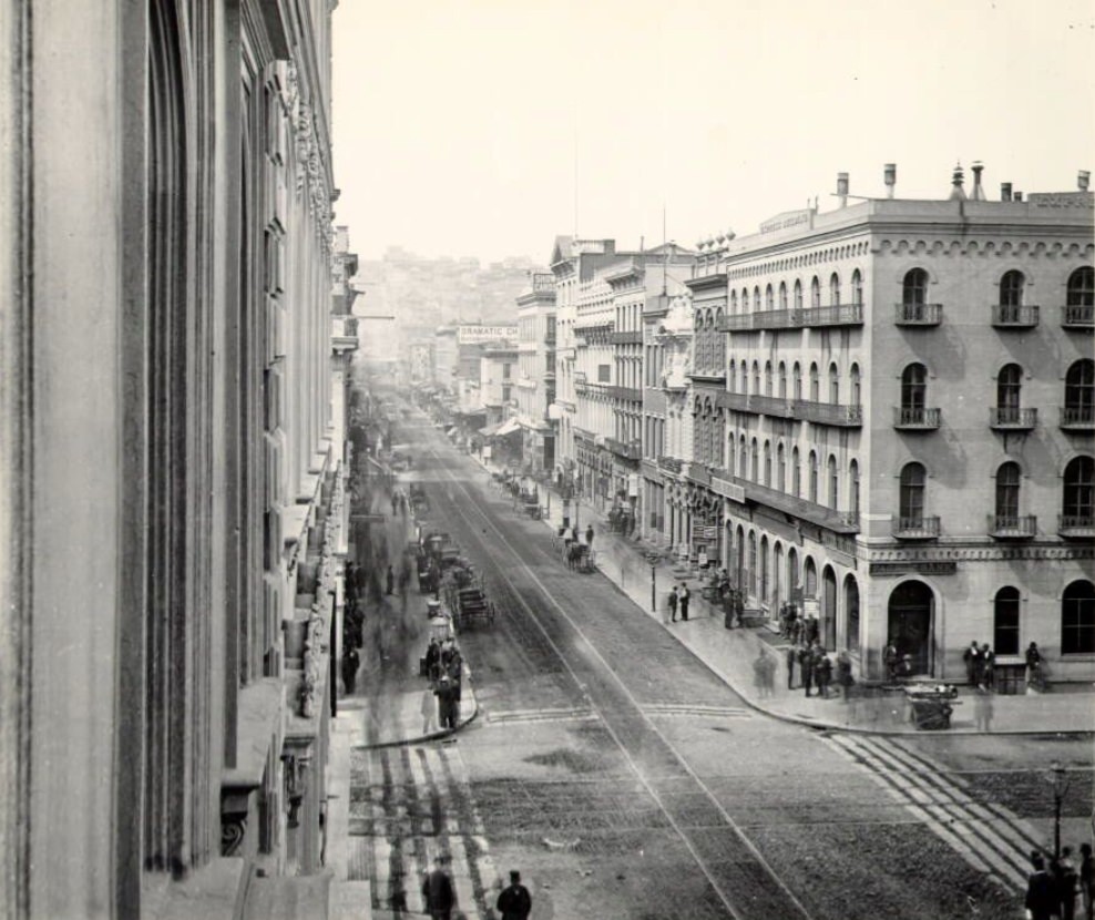
Montgomery Street appeared in photographs again and again throughout the decade because it was where the action was. The stretch between Sacramento and California Streets was packed with importers, law offices, financial firms, and trading companies. These were not modest operations — by the late 1860s, San Francisco was processing enormous volumes of trade between Asia, the American West, and the eastern United States. The storefronts along Montgomery reflected that wealth, with ornate facades and signage that advertised the reach of the city’s commercial networks.
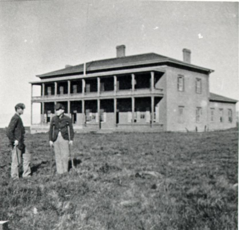
The Presidio, the old military post at the northern tip of the San Francisco Peninsula, remained an active U.S. Army installation throughout the 1860s. The Civil War kept the military presence relevant, and the Presidio Hospital served both soldiers and, at times, the broader civilian population. The facility was a reminder that San Francisco was not just a commercial city — it was also a strategic military post on the Pacific Coast, one that the federal government kept a close eye on.
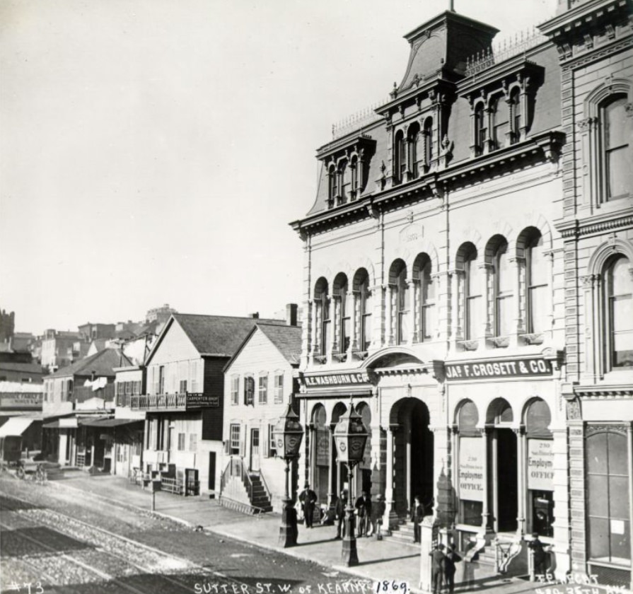
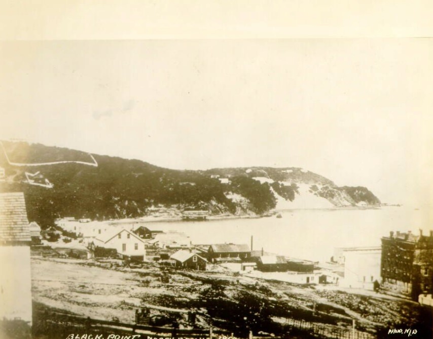
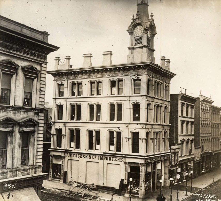
Comparing photographs of North Beach from 1860 to those taken just a few years later shows how fast the neighborhood changed. What appeared as open lots and scattered wooden structures in 1860 gave way to denser blocks and more permanent construction by the middle of the decade. Sutter Street, running parallel to the main commercial corridor of Montgomery, developed its own identity as a mixed-use street with retail shops, hotels, and residential buildings packed tightly together.
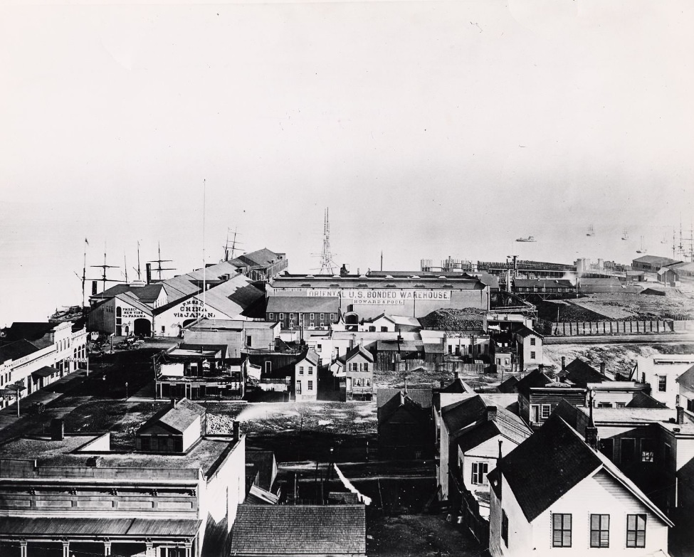
The waterfront was San Francisco’s economic engine. Ships arrived constantly from around the Pacific and beyond, offloading goods that fed the city’s markets and warehouses. The port connected San Francisco to China, Australia, Mexico, and the eastern United States via the long route around Cape Horn. Photographs of the waterfront in the 1860s show a busy tangle of masts, wharves, and warehouses — a port operating at full capacity and expanding to meet the demands of a growing city.
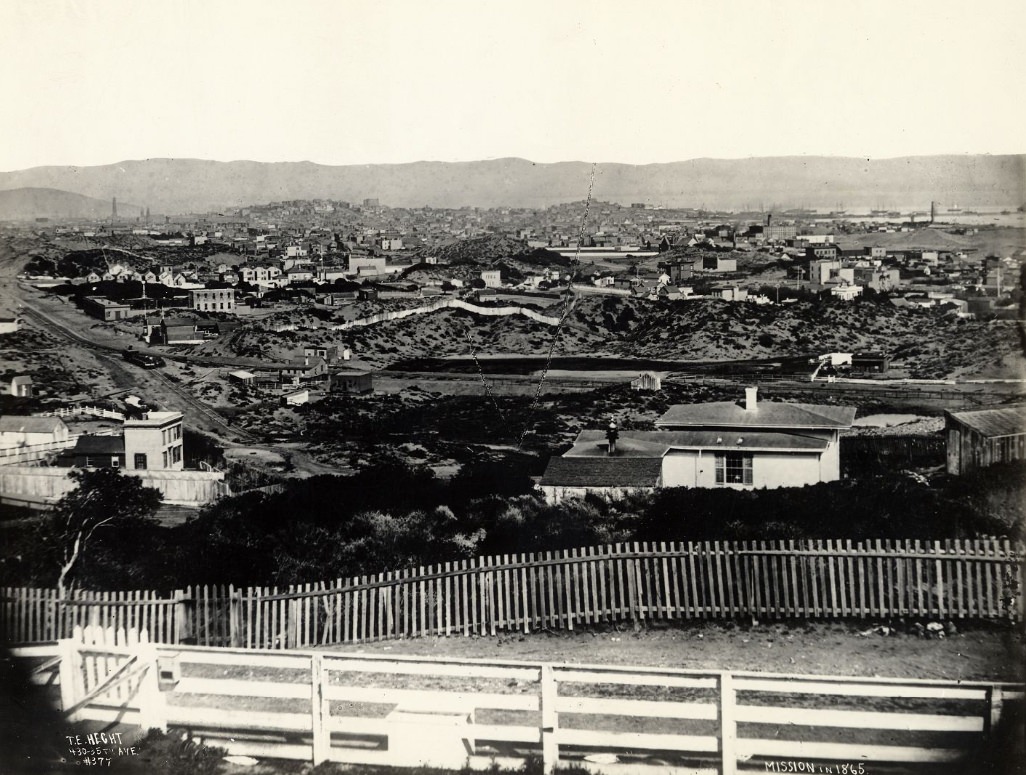
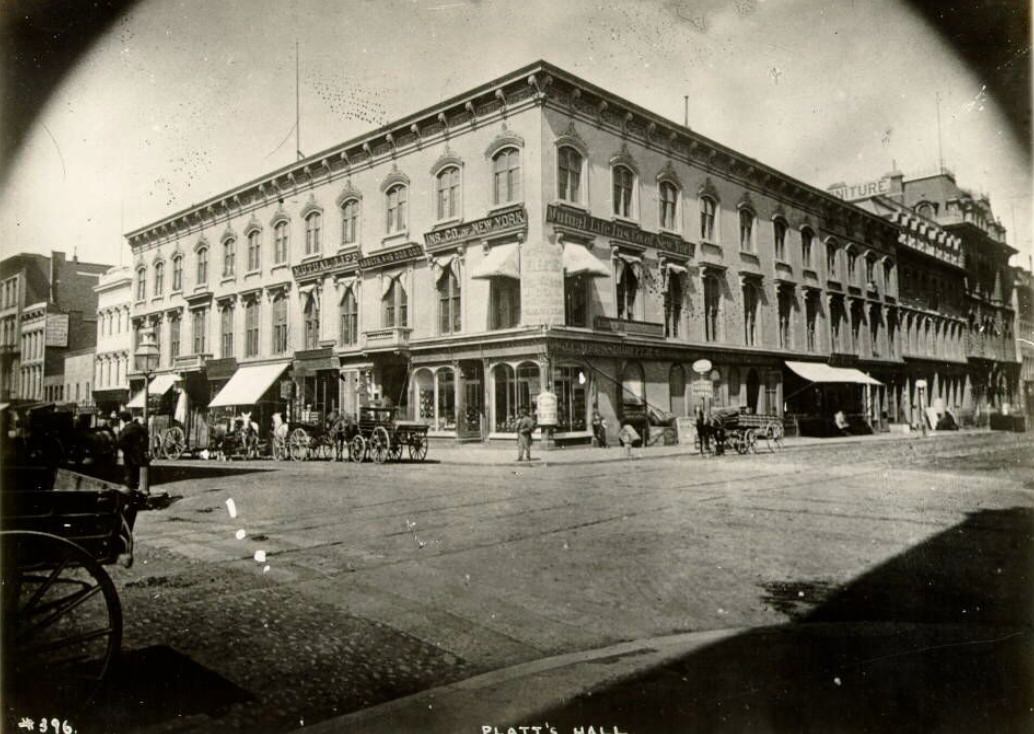
Platt’s Hall on Montgomery and Bush was one of San Francisco’s premier venues for public lectures, concerts, and civic events in the 1860s. The city was hungry for culture as well as commerce. Speakers, performers, and political figures passed through its doors, and the hall reflected the ambitions of a city that wanted to be seen as more than a rough mining town. The Mission District, by contrast, showed a quieter and older side of San Francisco — rooted in the Spanish colonial past and still largely open land by the 1860s.
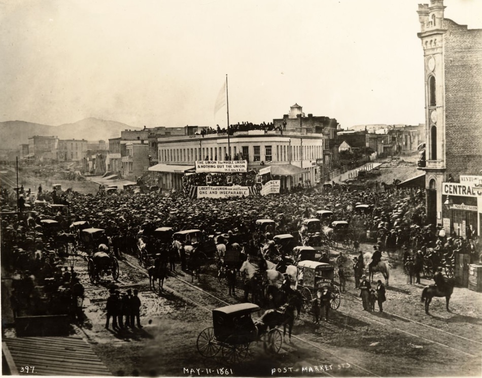
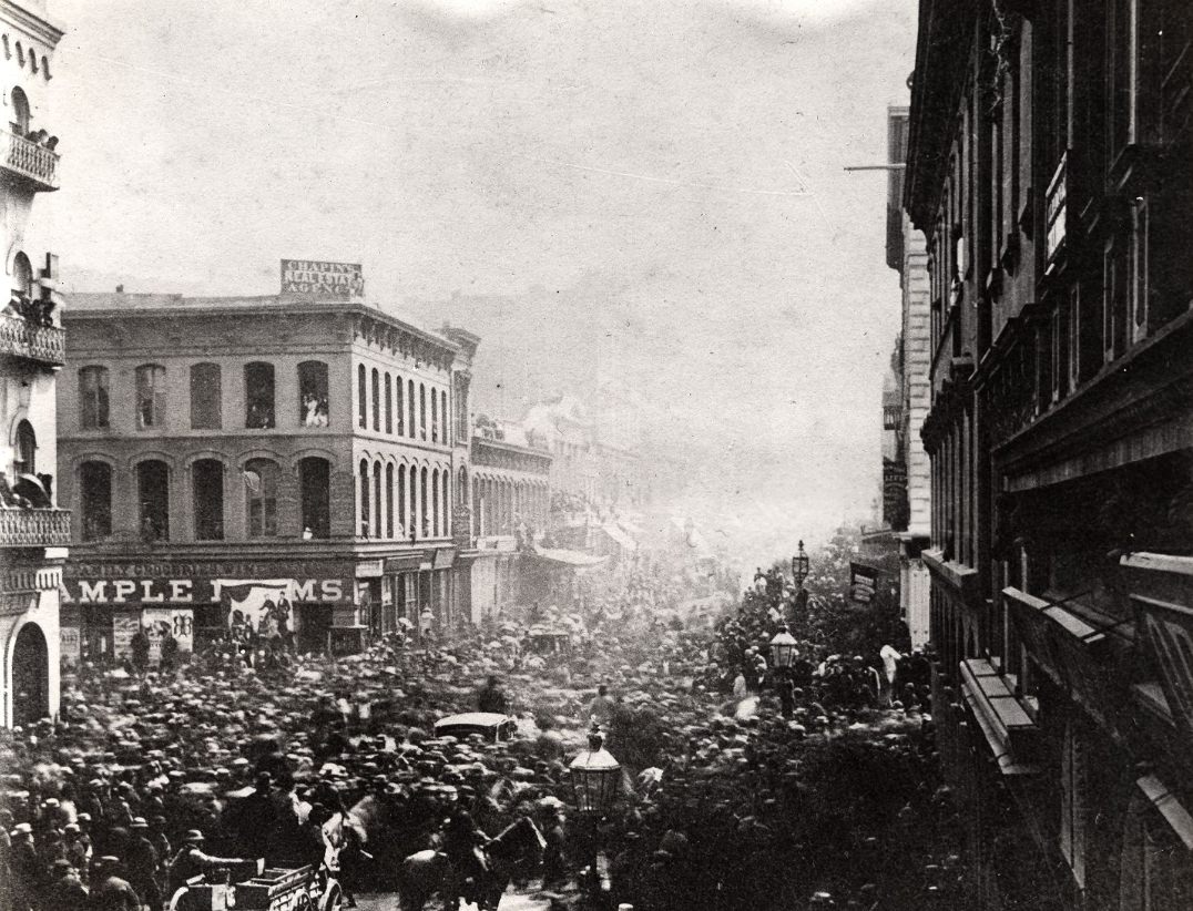
In February 1861, as Southern states seceded and the nation lurched toward civil war, San Francisco held a massive Union demonstration near Post, Montgomery, and Market Streets to mark Washington’s birthday. Thousands of residents turned out to declare their loyalty to the federal government. The city’s financial ties to the East and its large Northern-born population made Union sentiment strong, and these public displays helped solidify California’s position as a Union state throughout the war years.
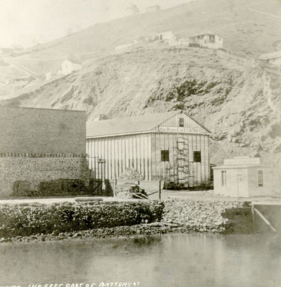
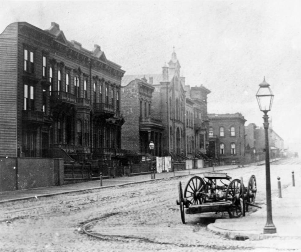
Street infrastructure in 1860s San Francisco was a work in progress. Some streets were cobblestoned, like Geary Street west of Stockton, while others remained unpaved and turned to mud in the wet winter months. The city invested steadily in paving and grading its roads throughout the decade, but the geography — steep hills, a patchwork street grid, and constant growth — made the work slow and expensive. Telegraph Hill’s east face showed the raw, rocky character of the city’s terrain before it was fully built out.
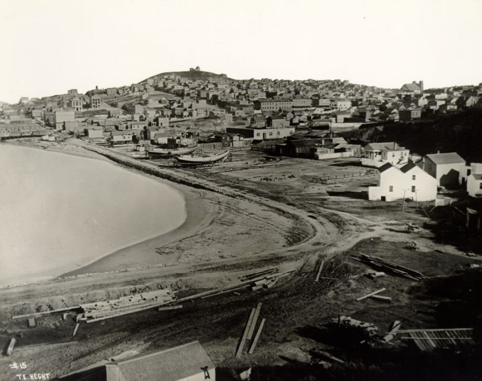
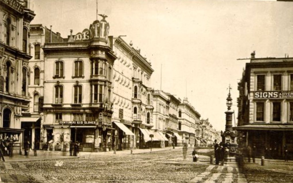
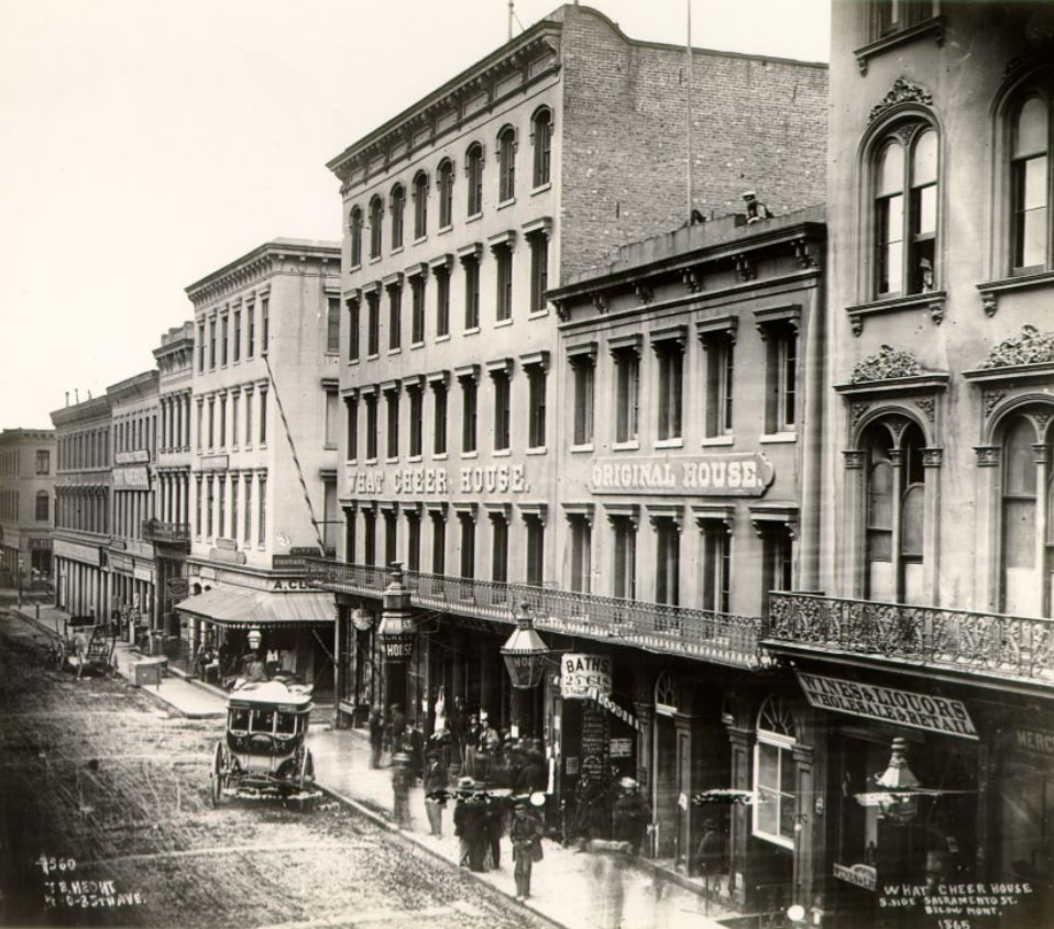
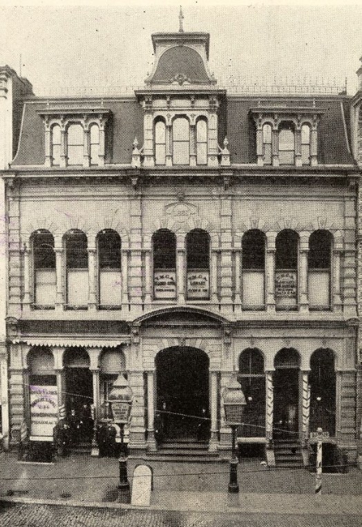
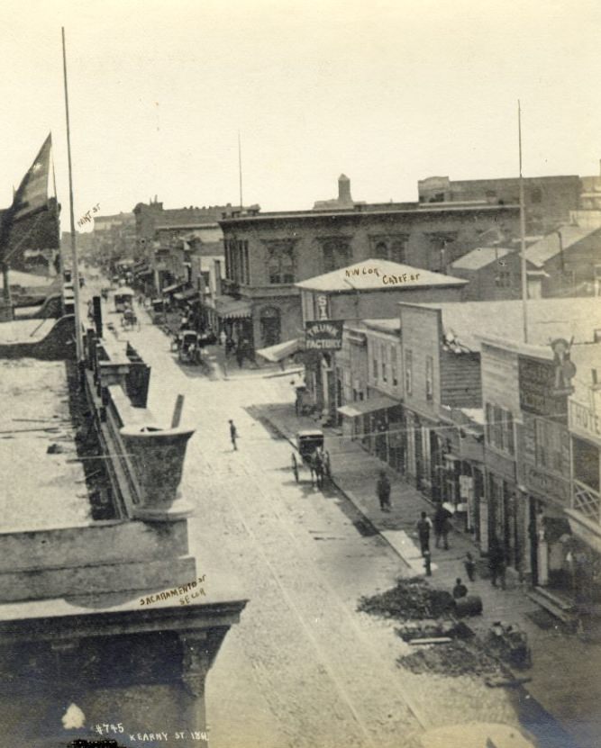
The What Cheer House on Sacramento Street was one of San Francisco’s best-known hotels and boarding houses during the 1860s. It operated as a men-only establishment, offered rooms at modest prices, and famously maintained a library and small museum for its guests. The hotel catered to the working men and travelers who passed through the city in large numbers, and its no-alcohol policy set it apart from most establishments of its kind. Kearny Street, nearby, ran through a dense commercial and residential corridor that grew busier with each passing year.
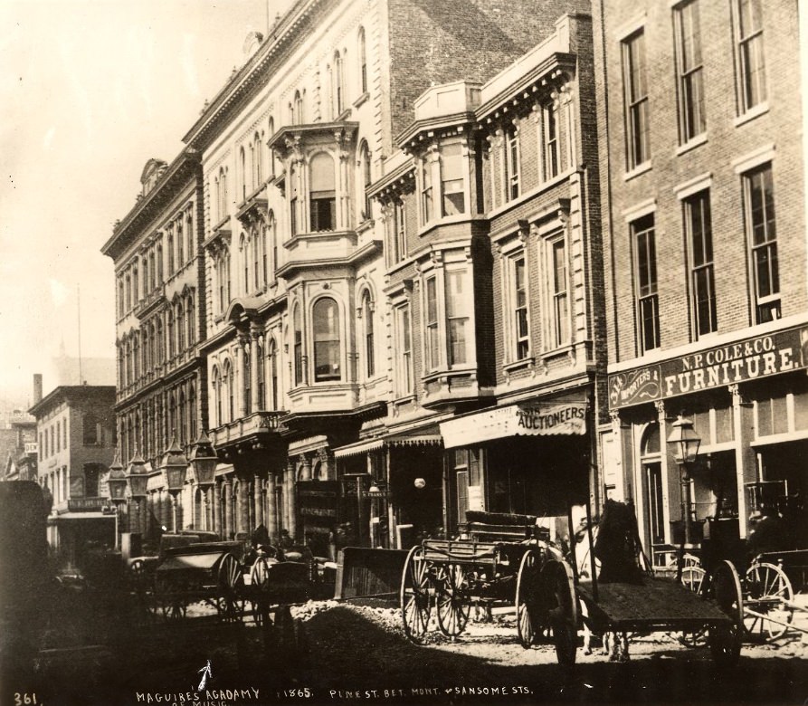
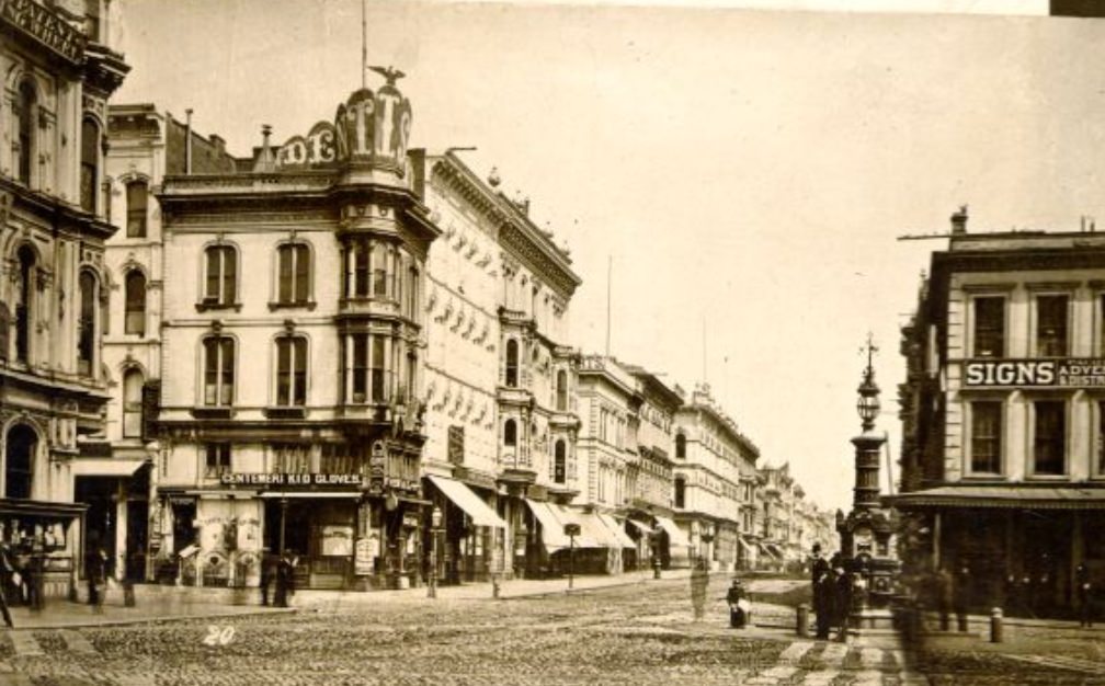
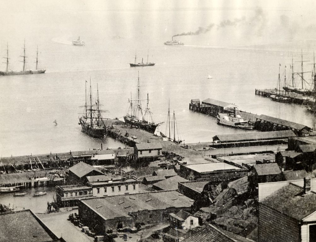
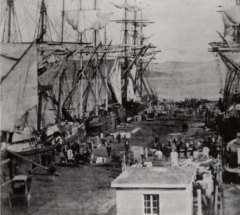
The Vallejo Street wharf was one of many wharves that extended into San Francisco Bay, giving ships direct access to the city’s warehouses and loading docks. In 1860, the bay was still crowded with the hulks of ships abandoned during the Gold Rush, left to rot as their crews deserted for the mines. By the mid-1860s, however, the waterfront had been cleared and organized into a functioning port system that handled millions of dollars in cargo annually.
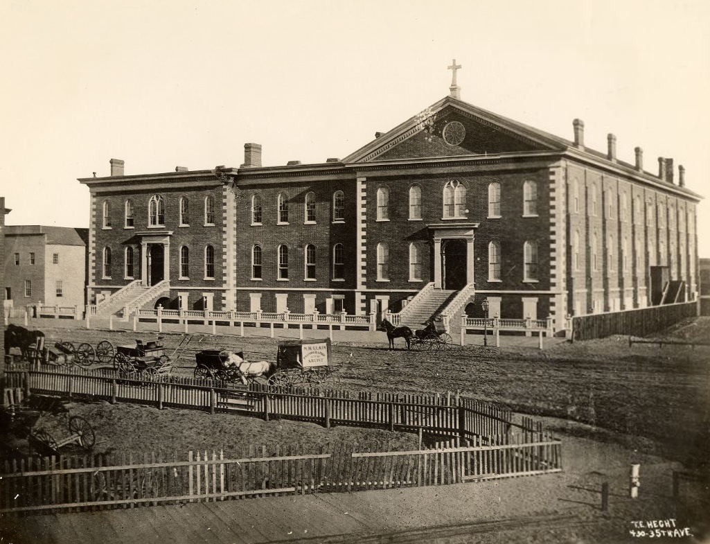
St. Ignatius College, founded by the Jesuits in 1855, had established a visible presence at 4th and Market Street by 1863. The institution offered higher education to San Francisco’s growing population and reflected the Catholic Church’s deep roots in the city, especially among Irish and Italian immigrant communities. Education was a priority in 1860s San Francisco. The city was not content to simply extract wealth — its residents were building institutions meant to last.
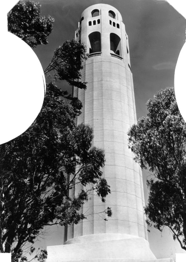
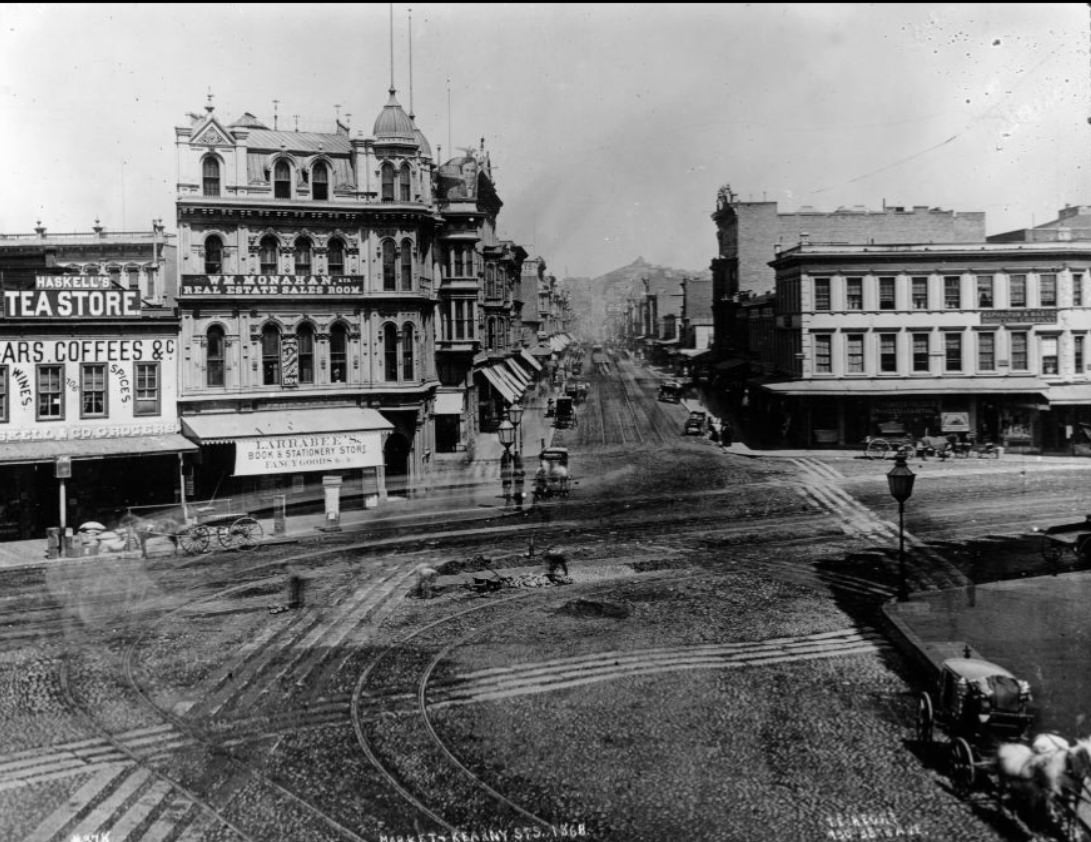
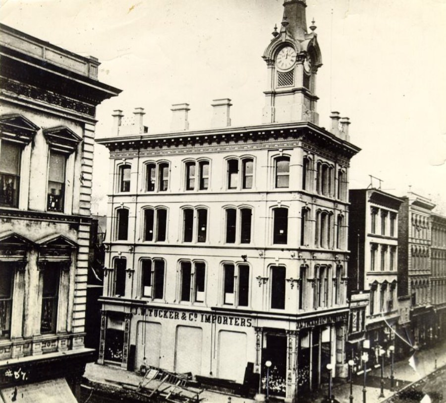
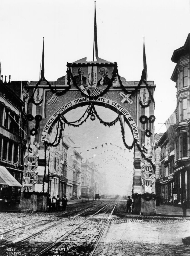
Import businesses like J.W. Tucker & Co. at Sutter and Montgomery were a central feature of 1860s San Francisco commerce. The city’s position as the West Coast’s main port meant that goods from Asia, Europe, and South America all flowed through its warehouses. Importers occupied prime street corners and operated at large scales, supplying merchants throughout California and the interior West. Looking down Kearny Street from Market Street in 1868, the density and energy of the city’s commercial district is plain — blocks of multi-story buildings, active sidewalks, and the constant movement of goods and people.
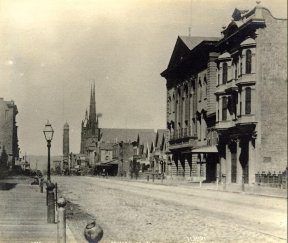
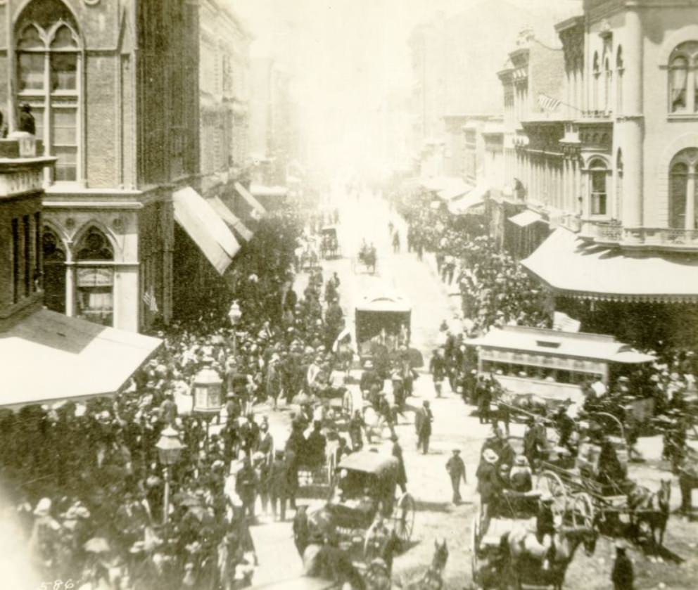
Howard Street in the South of Market area developed as one of the city’s key industrial and working-class corridors. Comparing photographs from 1863 to those taken in 1868 shows a street that filled in rapidly, with more permanent structures replacing earlier makeshift buildings. Montgomery Street in 1864 was already a well-established commercial boulevard, its sidewalks flanked by brick buildings that signaled the city’s confidence in its own future. San Francisco was building for permanence, not just for the boom.
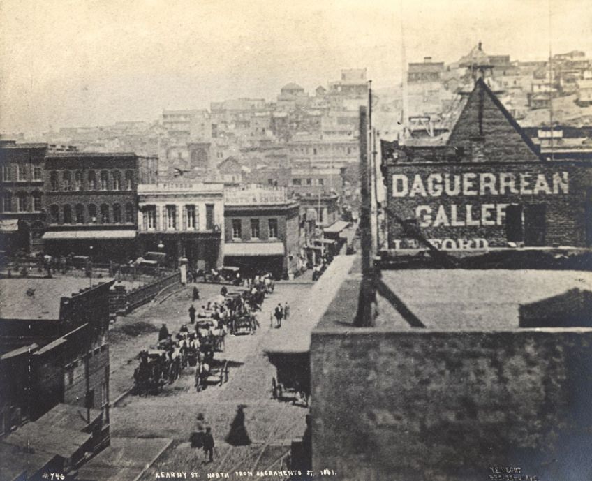
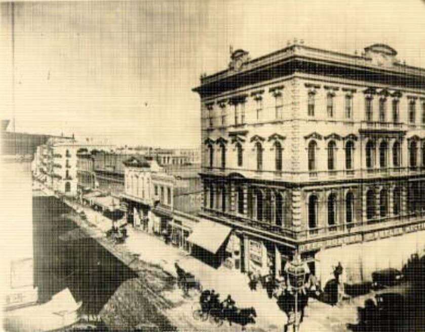
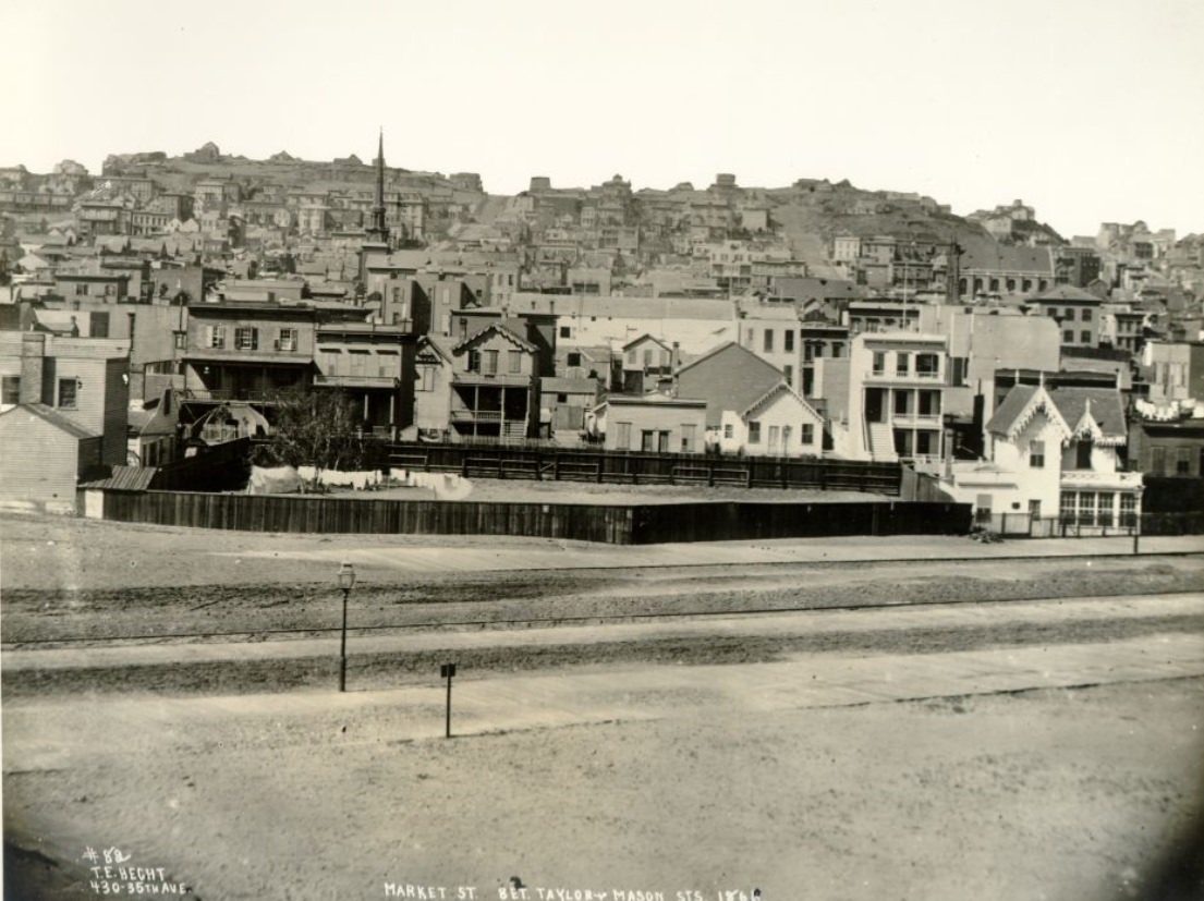
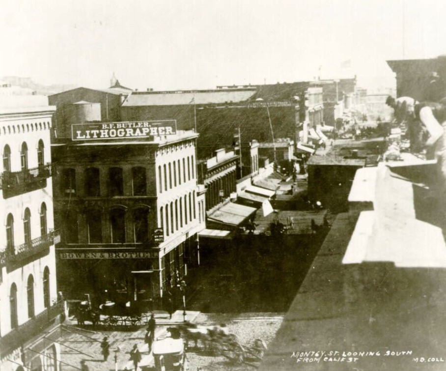
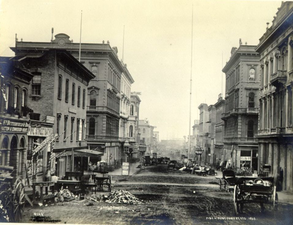
The early 1860s photographs of Montgomery and Kearny Streets show a city already well into its urban adolescence. By 1862, Montgomery looking south from California showed several stories of brick construction on both sides of the street. By 1865, the intersection with Pine was a busy node of commercial activity with offices and shops. Market Street, seen between Taylor and Mason in 1866, showed the avenue stretching out toward the western reaches of the city, still partly undeveloped but with clear signs of expanding settlement.
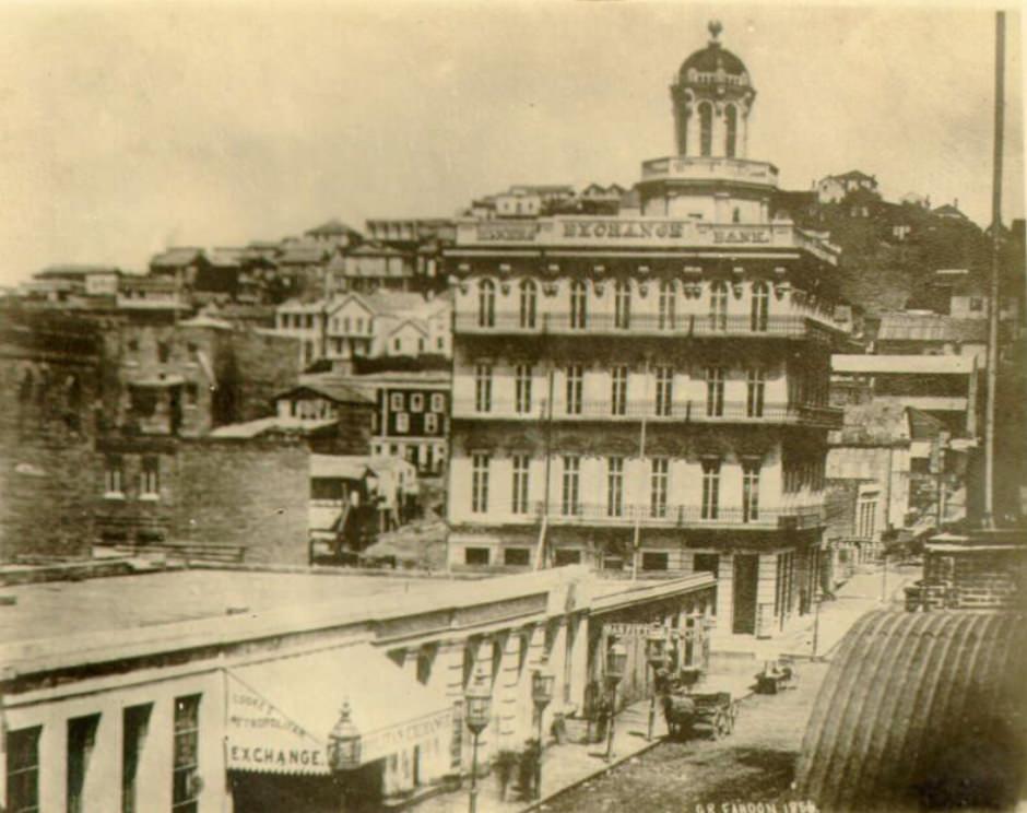
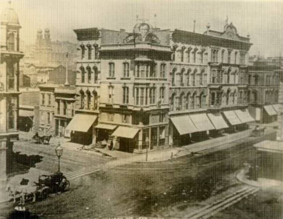
A photograph of Montgomery Street from 1856 — just before the decade captured in most of these images — makes the pace of change even clearer. The street was already active, but the built environment was rougher, with more wooden structures and fewer of the substantial brick buildings that define the 1860s photographs. By 1864, the intersection of Geary and Kearny had taken on the look of a mature city block, with substantial buildings and a level of commercial density that would have been hard to predict just fifteen years earlier.
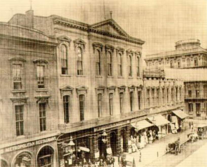
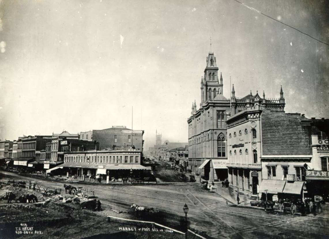
By 1869, San Francisco was still actively building. Excavation work at Market and Post Streets for the Grand Hotel showed a city that had not stopped expanding even after two decades of explosive growth. The Grand Hotel, when completed, would be one of the finest hotels in the American West. Construction projects like this were a regular feature of the San Francisco streetscape throughout the 1860s — cranes, piles of earth, and half-finished facades sitting alongside finished commercial blocks.
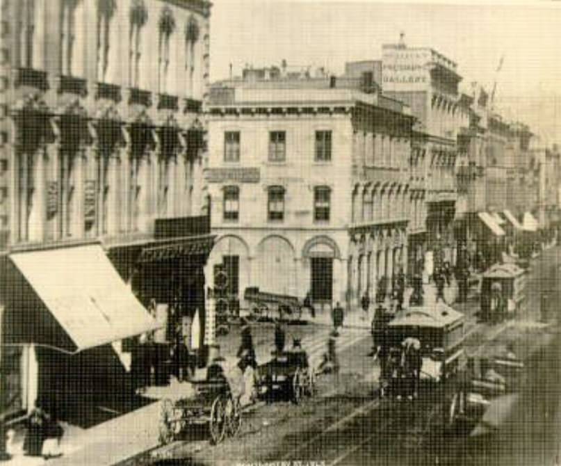
Transit was already a concern in 1860s San Francisco. The steam dummy — a small steam-powered vehicle designed to look like a passenger car to avoid frightening horses — appeared on Market Street at Kearny as early as 1864. Horse-drawn street railways also operated along several corridors, and the city debated how best to move its growing population across a geography defined by steep hills and long distances. These transportation systems were primitive compared to what would come, but they represented real attempts to manage urban mobility in a city that had outgrown its own street plan.
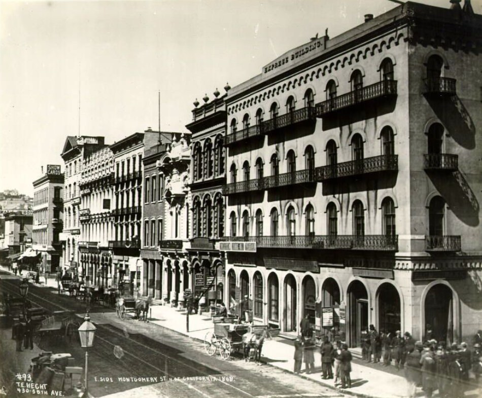
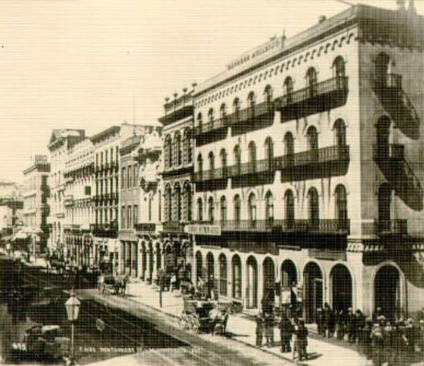
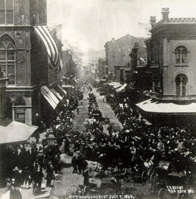
Montgomery Street on July 4, 1864 was decorated with flags and filled with crowds. Independence Day was a major civic event in San Francisco throughout the Civil War years, serving as both a celebration of the nation’s founding and a show of Union solidarity. The photographs taken along the east side of Montgomery, north of California, in 1865 and again in 1868 show the same block changing over time — taller buildings, more signage, and a streetscape that reflects the city’s accumulating wealth and ambition.
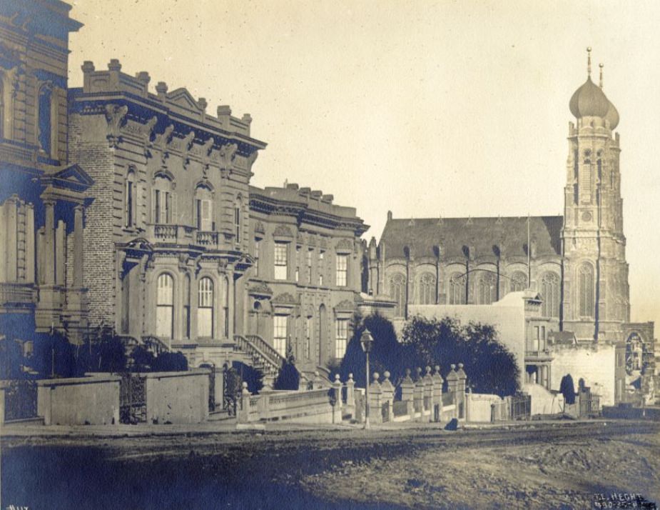
San Francisco’s Jewish community was well-established by the 1860s, and Temple Emanu-El on Sutter Street was its most prominent institution. The synagogue, located between Powell and Mason, served a congregation that had grown significantly during the Gold Rush era and continued to expand through the decade. The building’s presence on a prominent downtown street illustrated the degree to which San Francisco’s Jewish community had become a visible and permanent part of the city’s life — commercially, culturally, and religiously.
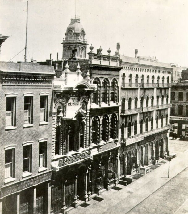
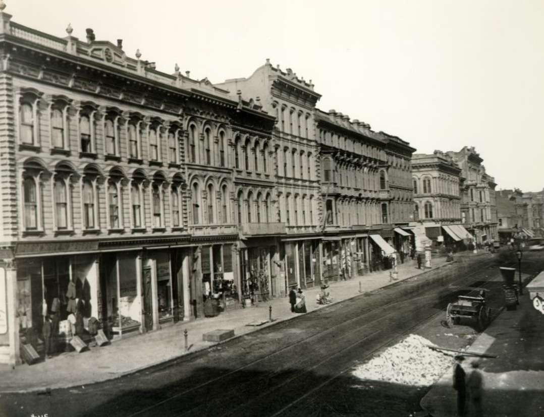
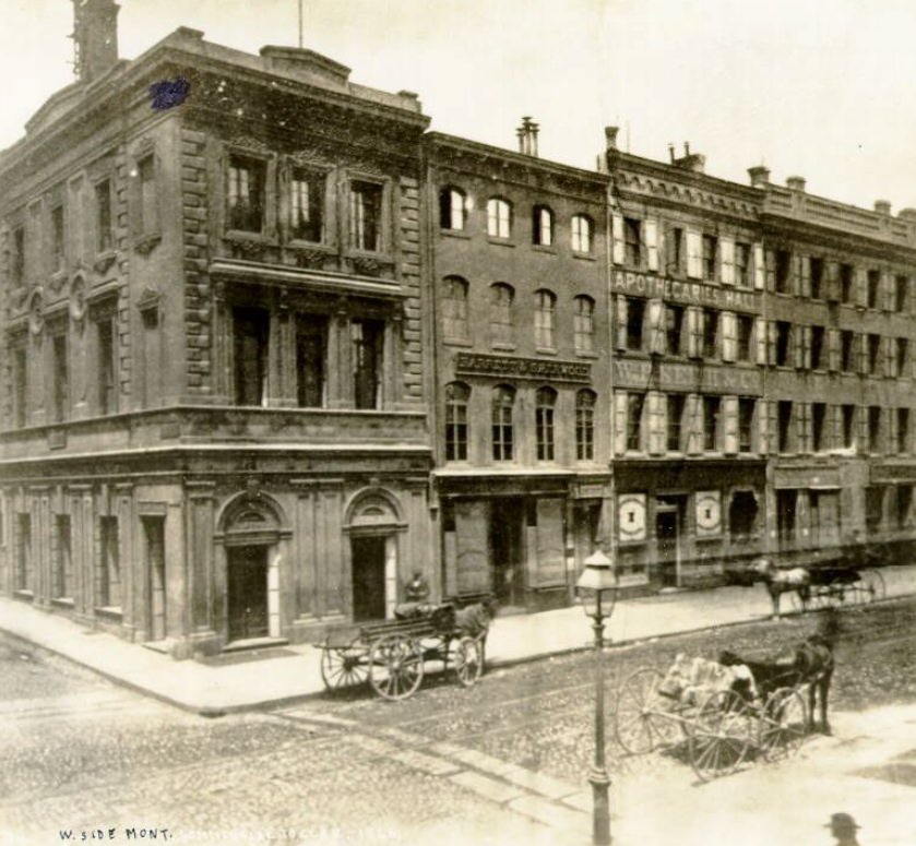
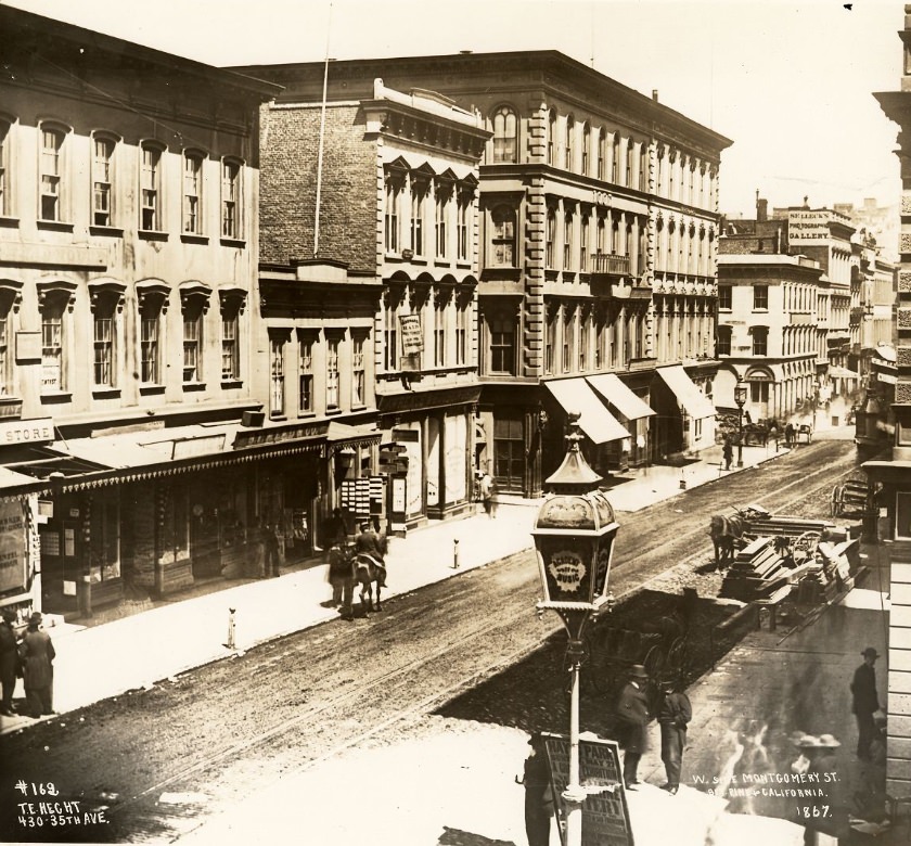
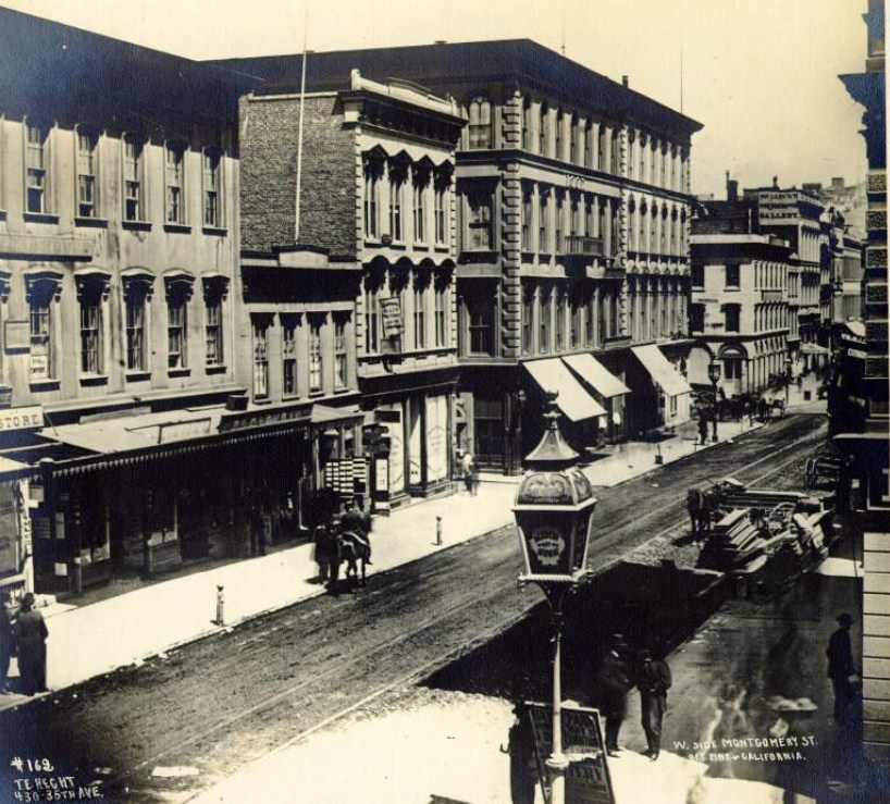
The repeated photography of Montgomery Street from multiple angles and across multiple years was no accident. Photographers of the era recognized it as the definitive street of 1860s San Francisco — its buildings, businesses, and pedestrian traffic offering a concentrated portrait of the city’s character. The block between California and Sacramento, the stretch from Commercial to Clay, and the segment between Pine and California all show the same consistent pattern: dense, brick, commercially active, and perpetually busy.
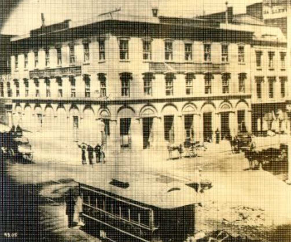
The cable car system that San Francisco would become famous for was still years from its official 1873 launch, but transit experiments were already underway by the late 1860s. Photographs from California and Montgomery Streets in 1867 capture early street railway vehicles navigating the city’s commercial core. The challenge of moving people up and down the city’s steep hills drove years of engineering experimentation before Andrew Hallidie’s cable car system finally offered a practical solution.
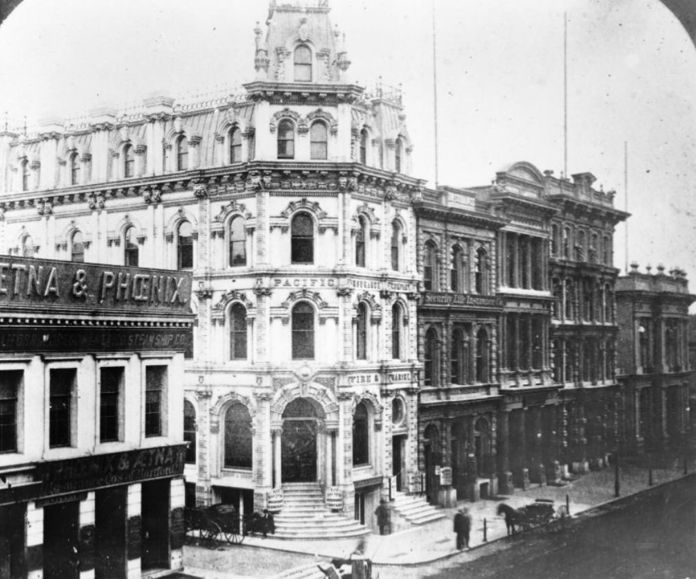
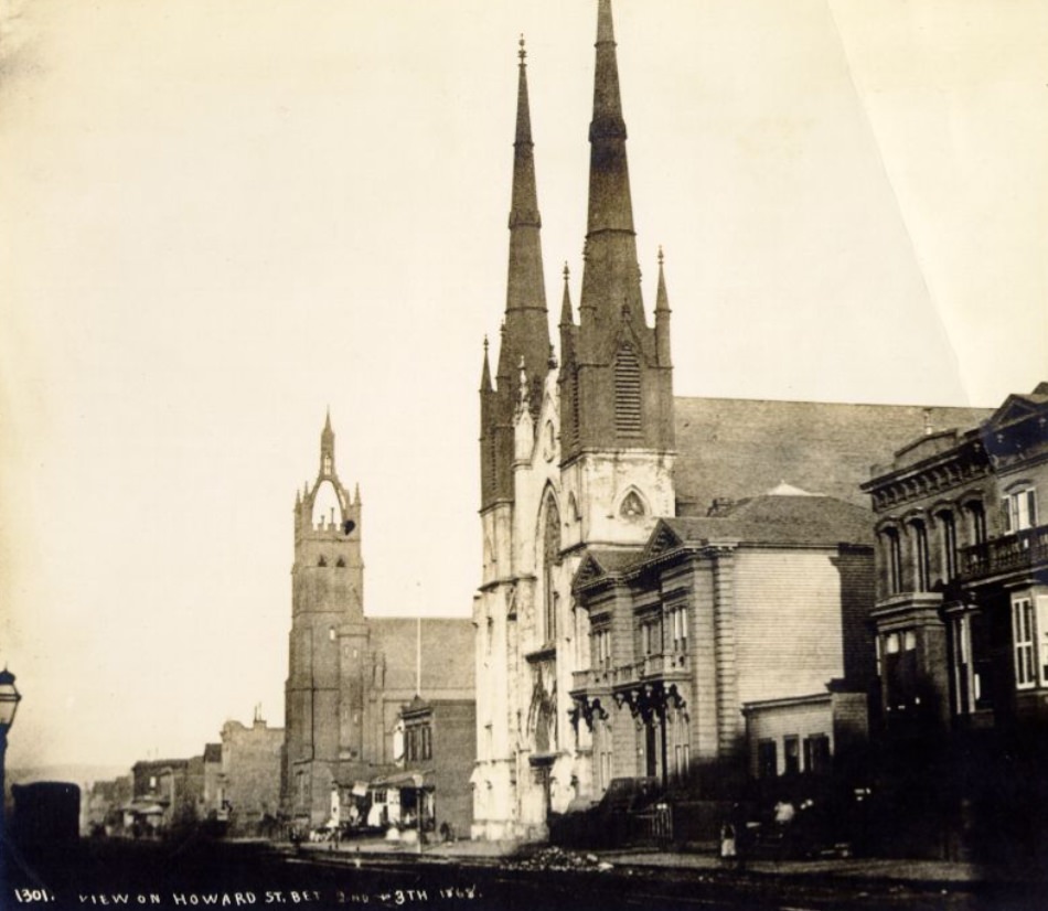
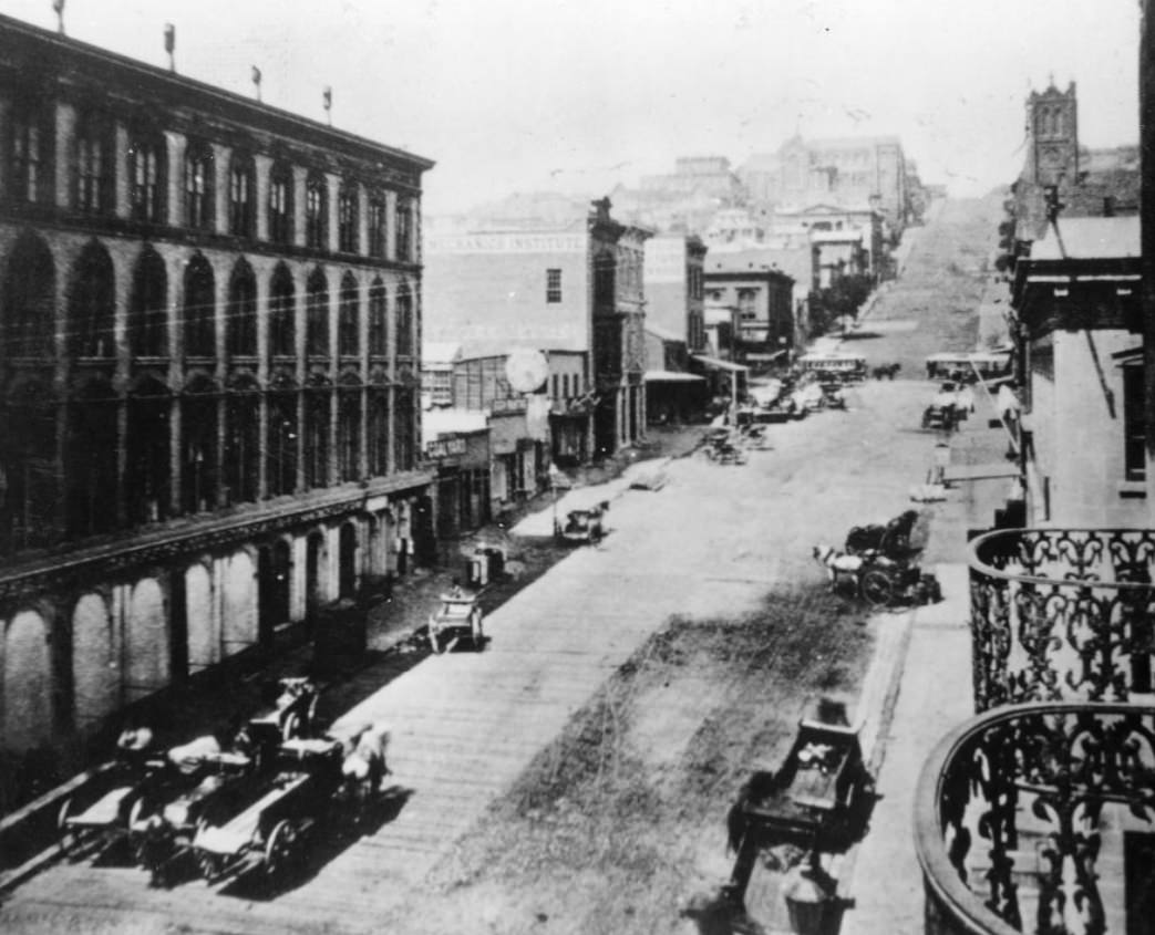
California Street was the address of choice for the city’s wealthiest institutions. The stretch between Montgomery and Sansome, and the blocks west of Montgomery, housed banks, insurance companies, and law firms. The Bank of California at California and Sansome was the anchor of this corridor. Howard Street, in contrast, belonged to a different San Francisco — the South of Market district where manufacturing, hauling, and industrial trades dominated. Both streets were essential to how the city functioned, even if they served completely different economic roles.
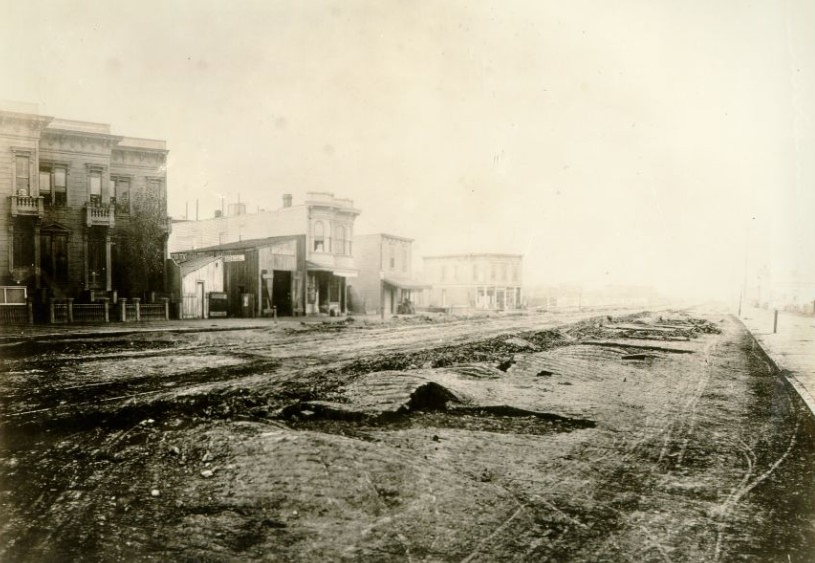
On October 21, 1868, a major earthquake struck the San Francisco Bay Area — an event sometimes called the “Hayward Earthquake” for the fault that caused it. The quake damaged buildings across the city and left visible damage to the brick pavement of Market Street east of Van Ness Avenue. The warped and buckled surface photographed in the aftermath offered a sobering reminder that San Francisco sat on unstable ground. The 1868 earthquake killed at least thirty people and caused widespread property damage, forcing the city to confront its geological vulnerability even as it continued to build at a breakneck pace.
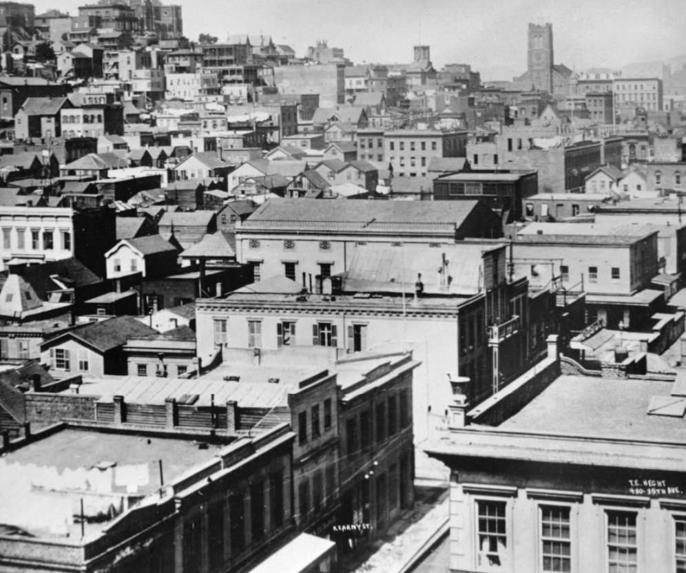
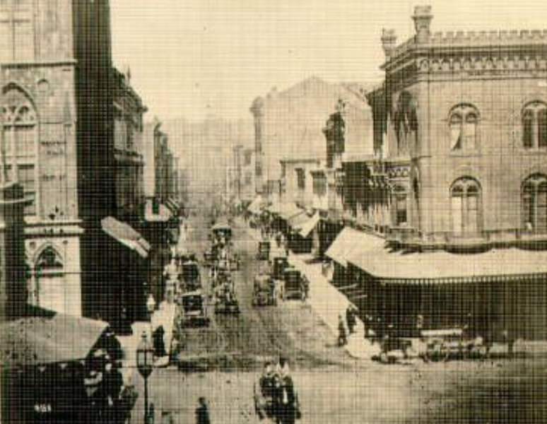
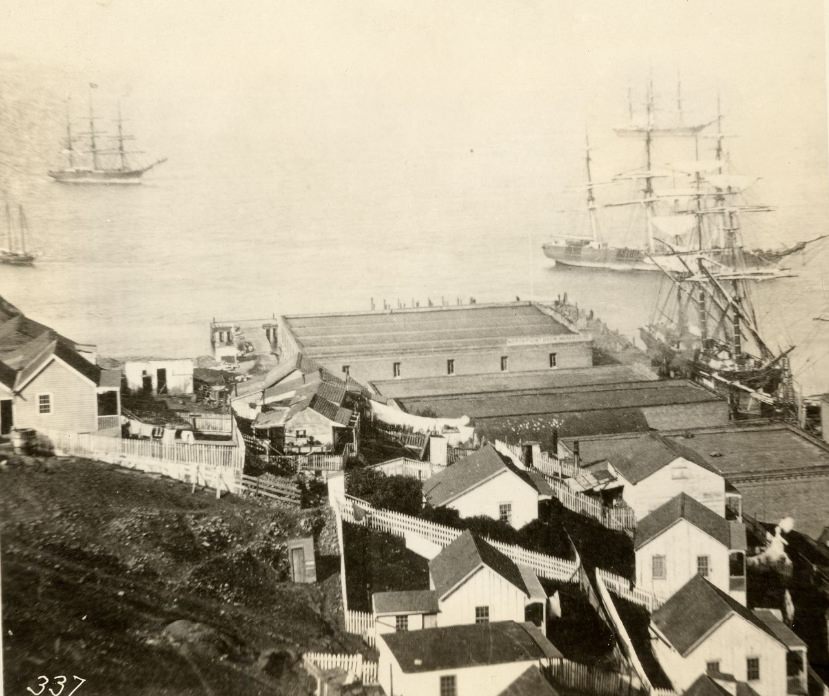
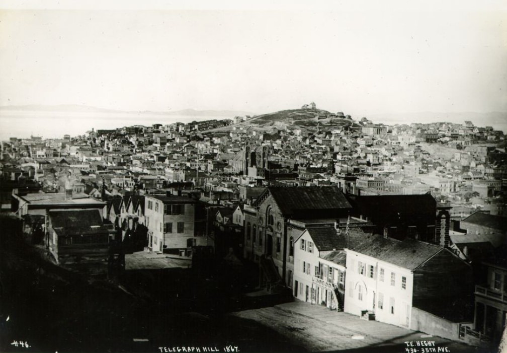
Aerial views of Kearny Street from elevated vantage points show a city that had filled in its grid with remarkable speed. The warehouses clustered at the foot of Telegraph Hill in the early 1860s served the nearby waterfront, storing goods that moved in and out of the port. Telegraph Hill itself was one of the most distinctive landmarks in the city — a steep promontory that in the 1850s had been used to signal incoming ships and that by the 1860s was becoming a densely settled residential area on its lower slopes.
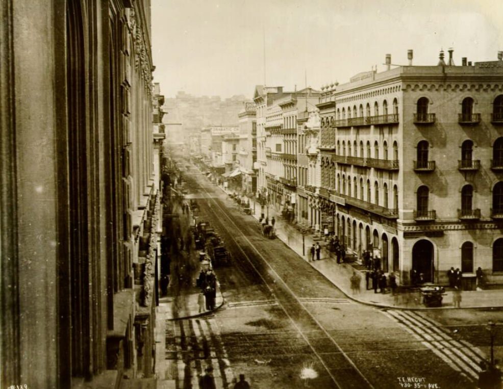
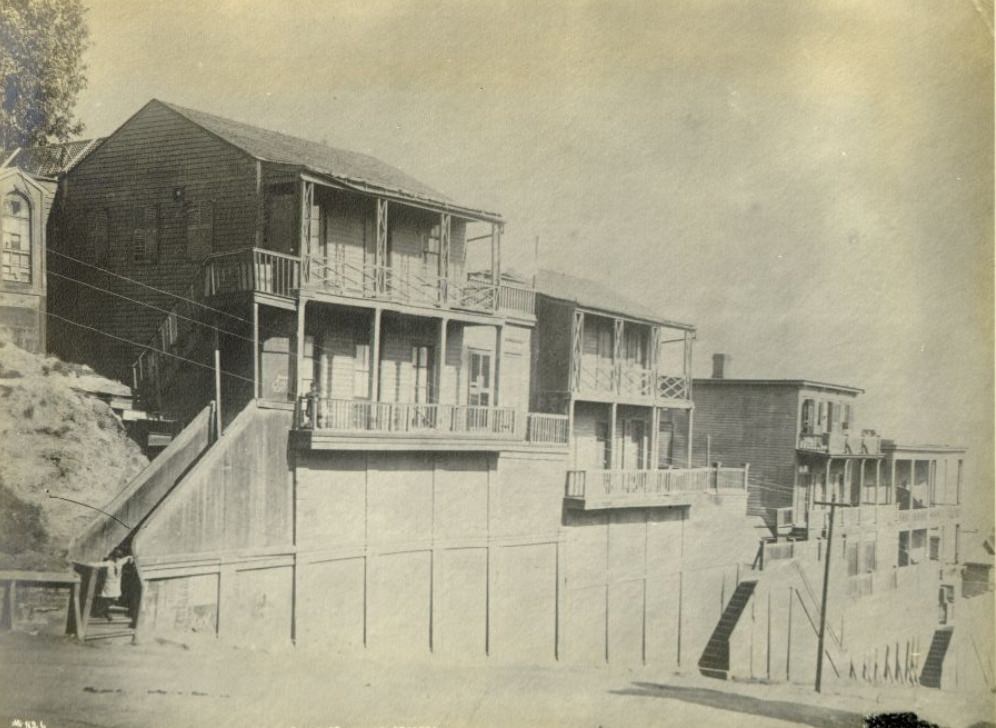
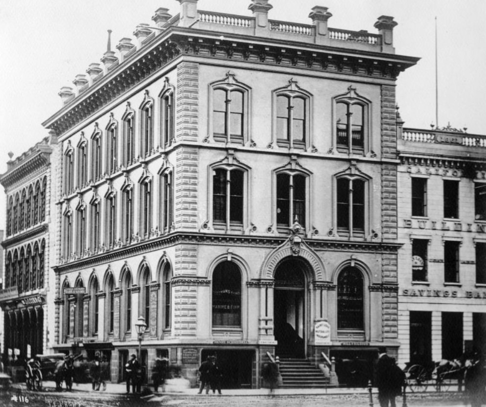
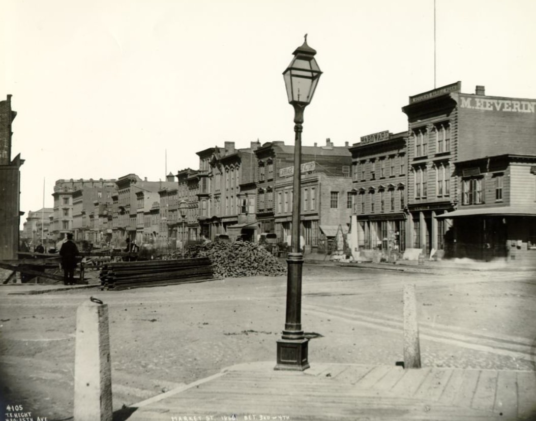
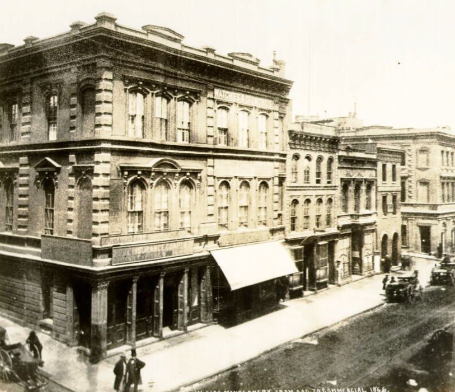
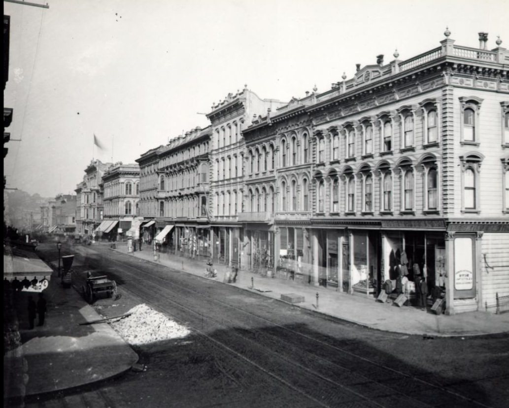
The mid-1860s saw San Francisco’s main commercial streets reach a level of density and permanence that marked the end of the city’s frontier phase. Market Street between 3rd and 4th Streets, the west side of Montgomery from Sacramento to Commercial, and the California and Sansome corner all showed substantial multi-story brick construction by 1866 to 1868. These were not temporary structures — they were built by investors who believed San Francisco was here to stay, and they were right.
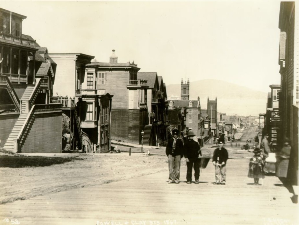
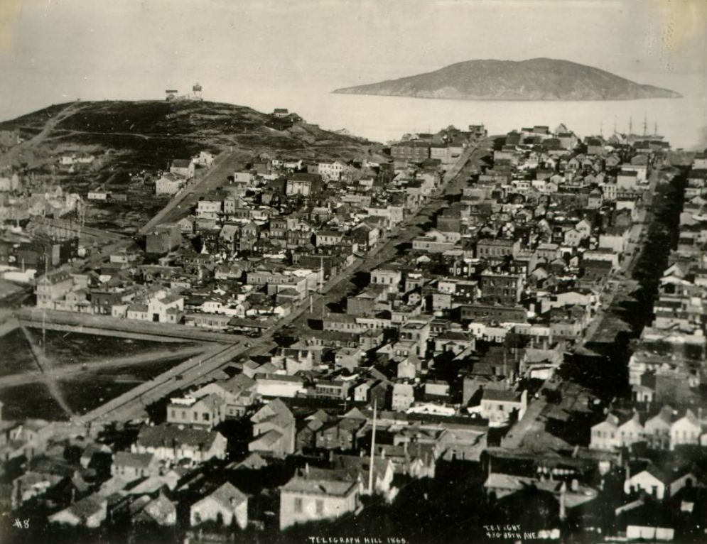
Telegraph Hill in 1865 still retained much of its rocky, open character on its upper slopes, even as the neighborhoods below it had grown dense. The hill was home to Irish and Italian immigrant families who built modest homes on its steep sides. Quarrying operations on the eastern face of the hill had begun cutting into the rock by the 1860s, gradually altering its profile. Powell and Clay Streets, in a different part of the city, showed a quieter residential character — San Francisco had room for neighborhood streets that felt almost serene compared to the chaos of Montgomery or Market.
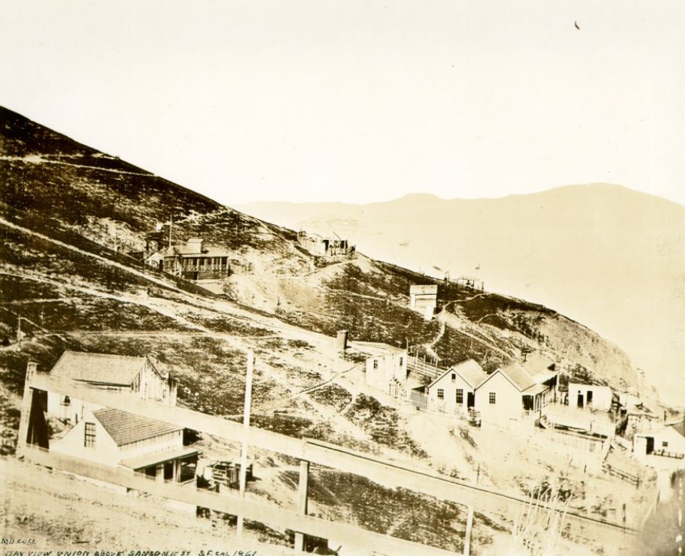
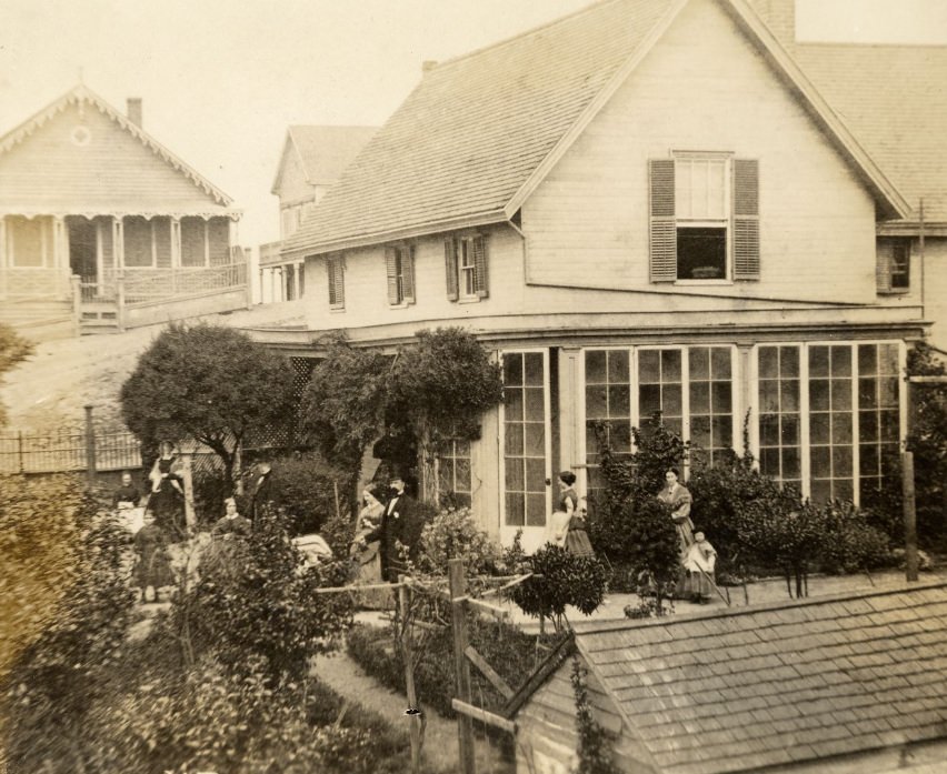
A photograph of a residence and garden on Telegraph Hill taken on July 4, 1862 shows a side of 1860s San Francisco that is easy to overlook — domestic, green, and surprisingly peaceful. Behind the city’s commercial frenzy, families were planting gardens and building homes meant to endure. The Bay View Union photograph from 1861, taken above Sansome Street, provides one of the earliest elevated views of the city’s northern waterfront district, capturing a landscape that was simultaneously industrial and beautiful.
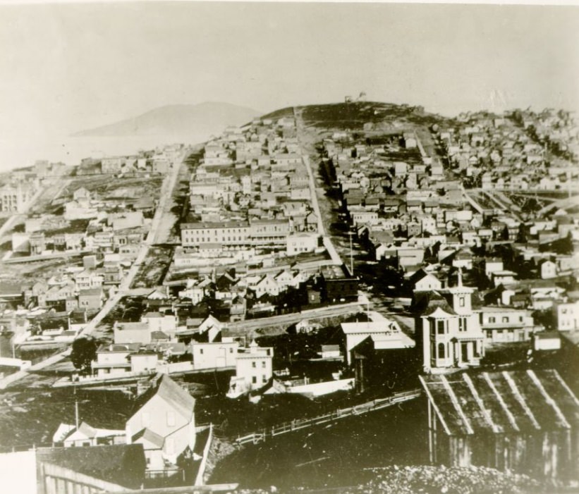
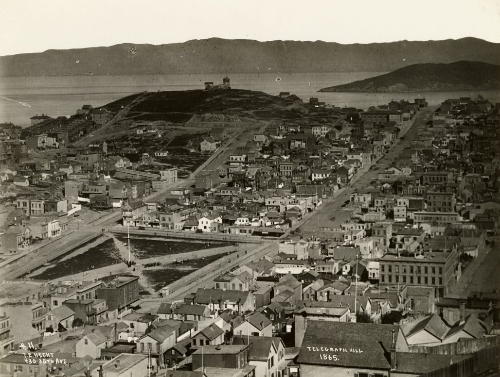
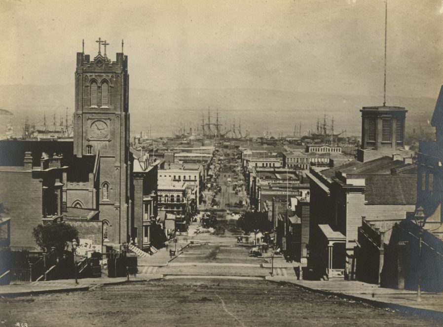
California Street facing the bay in 1863 offered one of the city’s iconic viewpoints — a straight line from the financial district all the way down to the waterfront, with the bay shimmering in the distance. Telegraph Hill, photographed from Russian Hill in 1869, shows how the hilltop had changed across the decade — more structures, more quarry cuts, and the beginnings of the densely built neighborhood that would define it in later years.
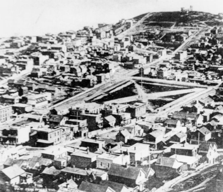
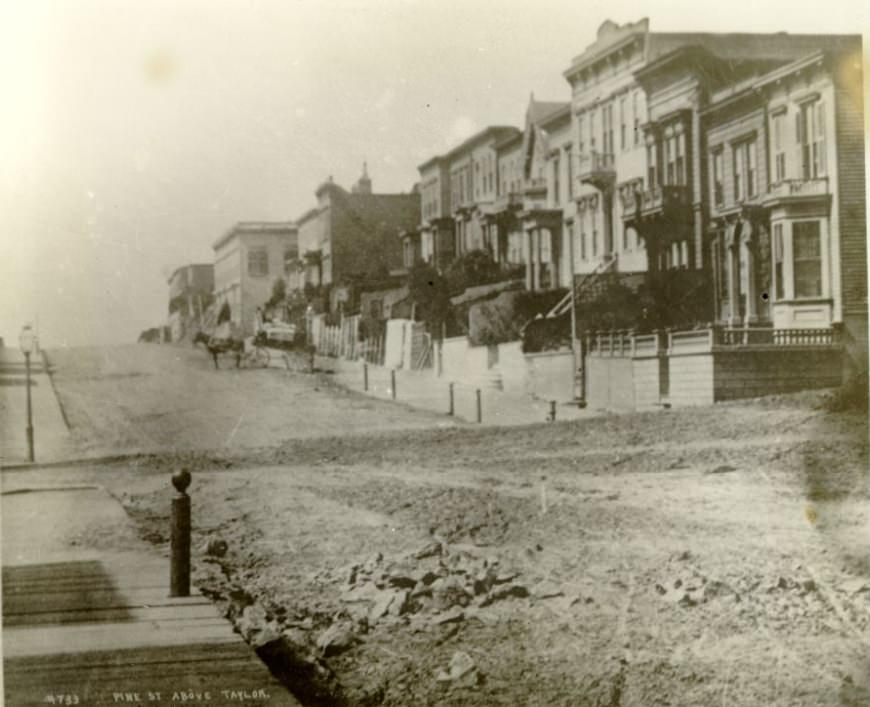
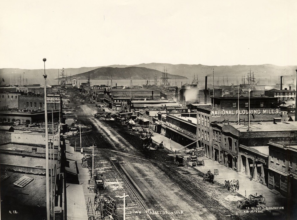
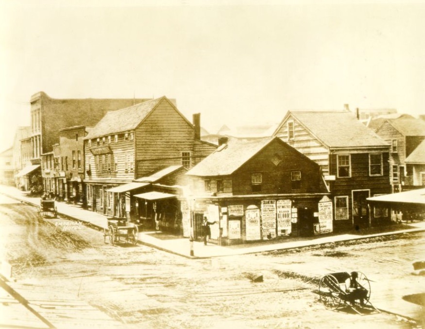
Market Street in 1868, viewed looking down its length, shows a wide and busy boulevard that was the commercial spine of the city. The mix of pedestrians, horse-drawn vehicles, and street-level commerce captured in these photographs reflects the texture of daily life in 1860s San Francisco. Pine Street at Taylor, and the southwest corner of Pine and Montgomery in 1860, document how quickly even secondary streets developed real urban character across the decade.
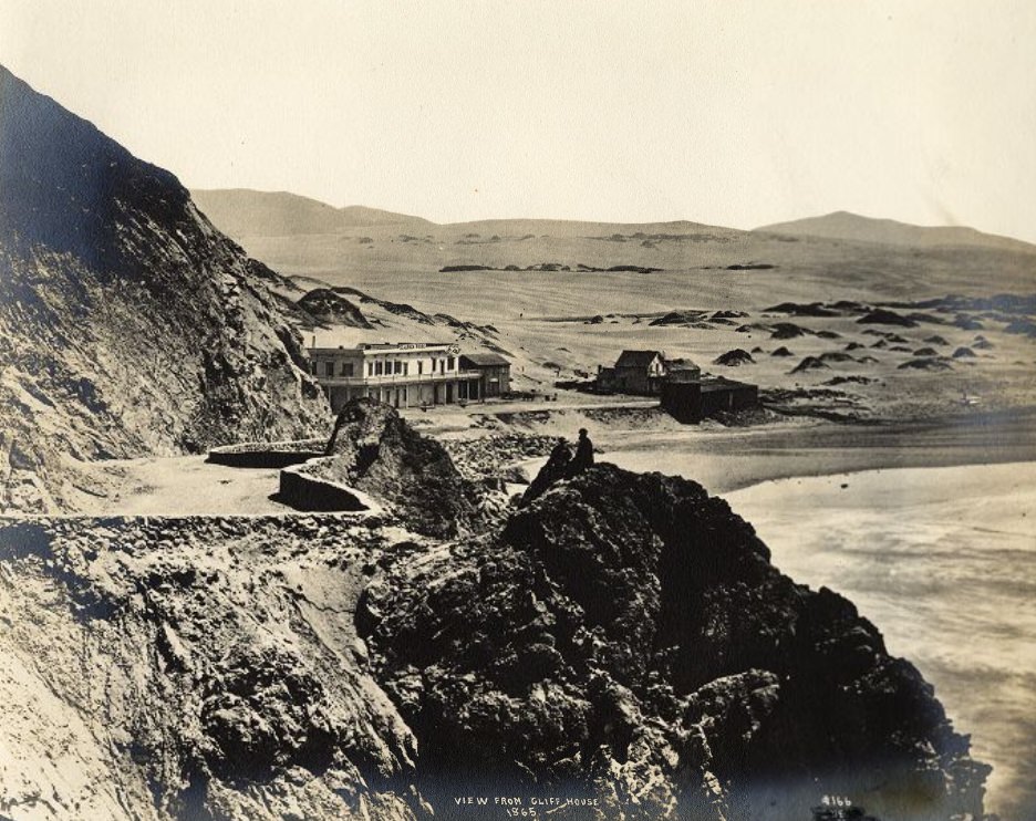
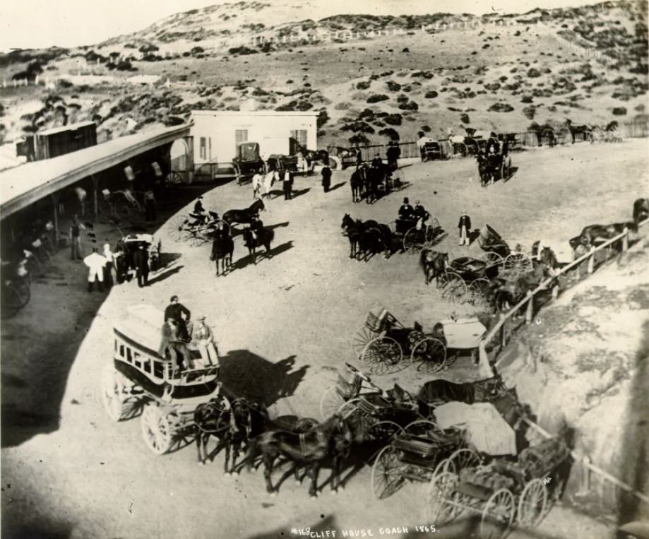
The view from Cliff House in 1865 looked out over a stretch of Pacific coastline that was wild and largely undeveloped, a sharp contrast to the packed city streets just a few miles to the east. Coaches carried passengers out to the Cliff House from downtown San Francisco, making the trip a fashionable outing for residents who could afford the time. The route was rough, but the destination — a restaurant perched above the crashing surf — made it worth the journey.
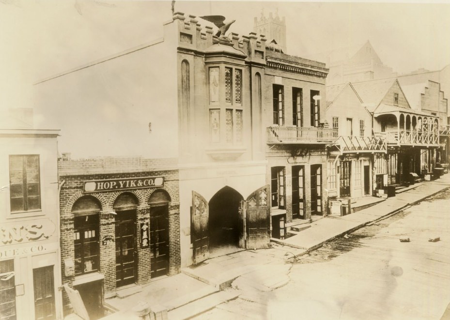
Fire was a constant threat in 1860s San Francisco. The city had burned catastrophically multiple times in the early 1850s, and the memory of those fires shaped how the city thought about fire protection. Volunteer fire companies like Broderick Engine Co. No. 1 on Sacramento Street played a critical role in keeping the city safe. These companies were also social institutions — membership conferred status, and their engine houses were neighborhood landmarks. By 1865, San Francisco’s fire department was one of the most developed in the American West.
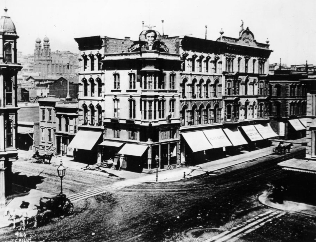
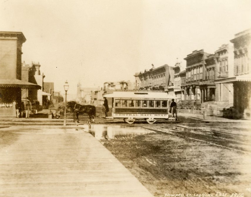
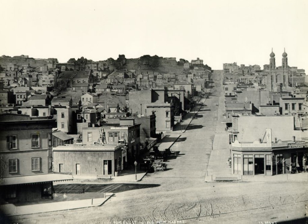
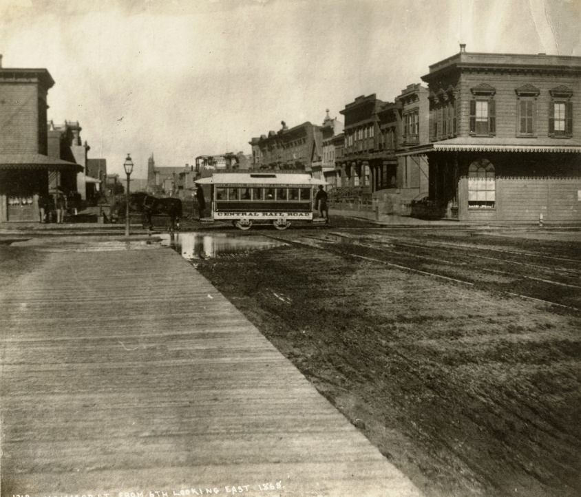
Horse cars — street railways pulled by horses — were a regular feature of San Francisco’s streets by the mid-1860s. Howard Street looking east from Sixth Street in 1866 shows one of these vehicles navigating the South of Market corridor. Powell Street from Market in the same year shows a different kind of street — narrower, quieter, and climbing toward Nob Hill, which would later become the address of the city’s railroad millionaires. The contrast between different streets captured in these photographs shows how diverse 1860s San Francisco’s urban geography really was.
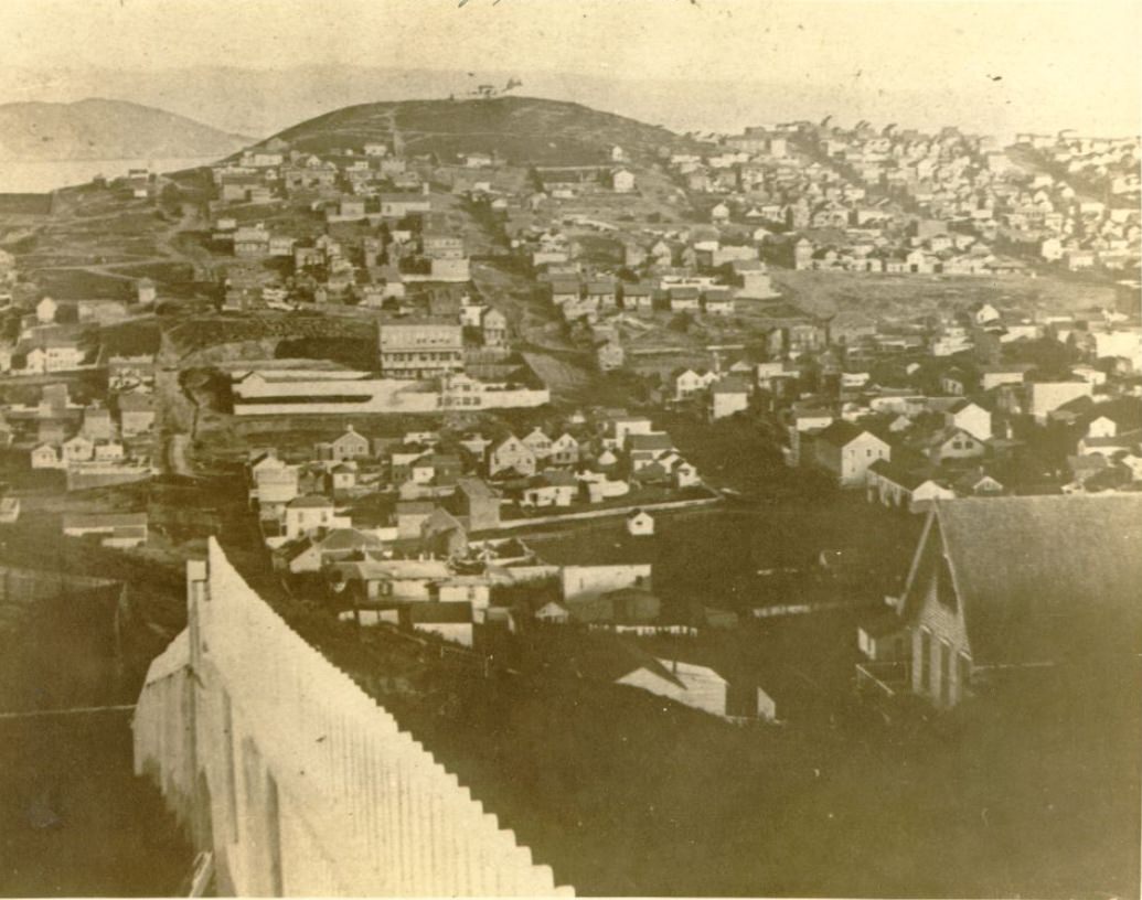
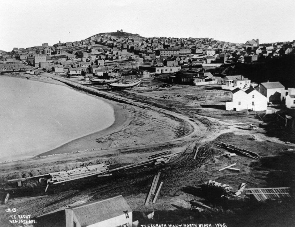
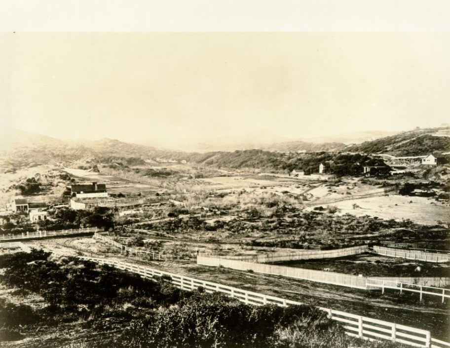
Lone Mountain, visible from 15th and Market Street in 1865, rose on the western edge of the settled city. At this point, it was surrounded by cemeteries — San Francisco had placed its main burial grounds on the western hills, away from the dense urban core. The mountain’s isolation from the city’s built fabric illustrated how much of San Francisco’s western half was still open land in the mid-1860s, even as the eastern neighborhoods and waterfront were fully developed. Telegraph Hill as seen from North Beach in 1865 shows the hill’s dramatic east face above the crowded neighborhood streets below.
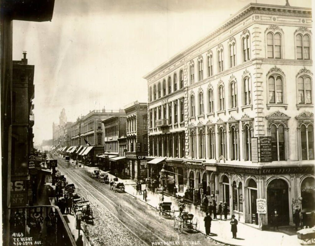
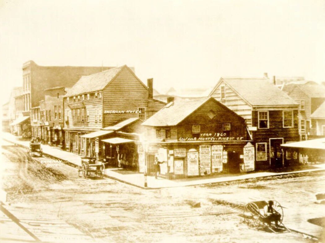
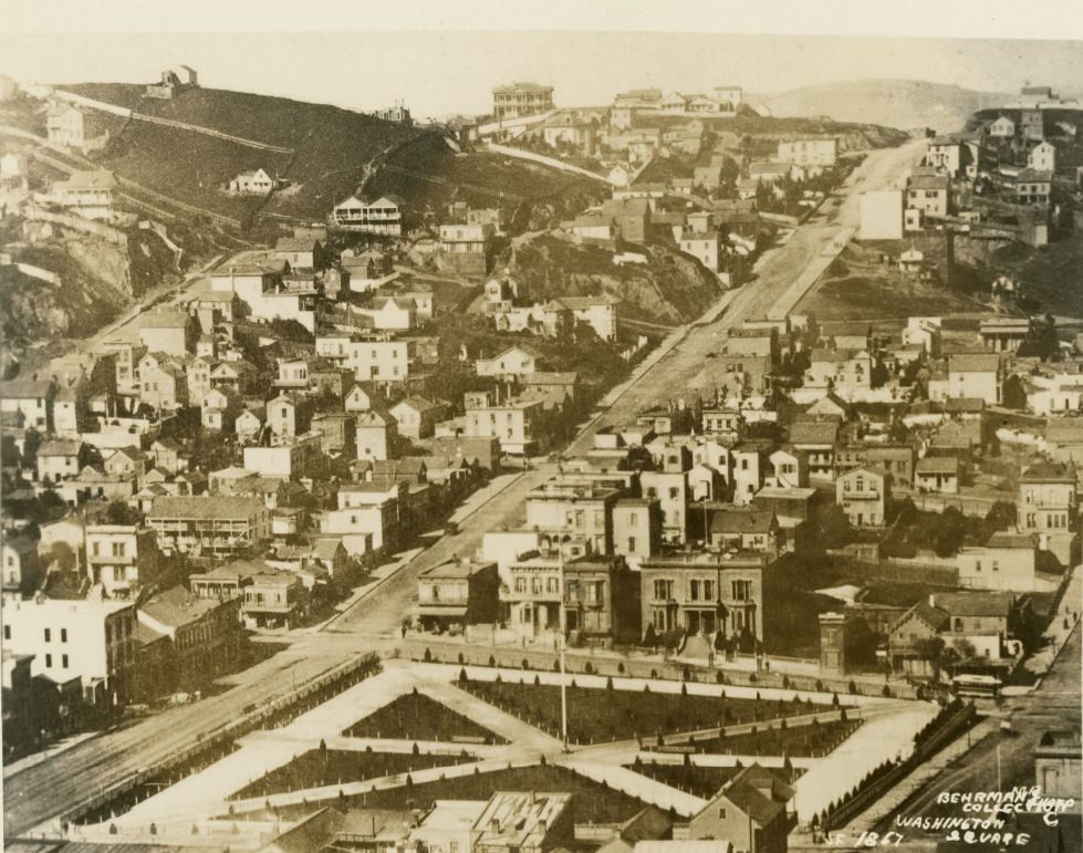
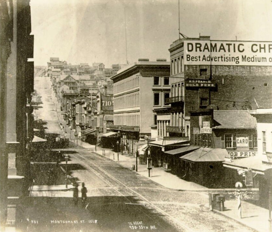
Washington Square in 1867 shows the park as a quiet open space in the middle of North Beach — a breathing room in a neighborhood that was otherwise tightly packed. The square’s proximity to Union Street and Powell gave it an accessible location that drew residents from the surrounding blocks. Montgomery Street, photographed north from Clay in 1868, shows the full length of a block lined with commercial buildings that barely resembled the rougher, sparser streetscape of 1860 at the same corner.
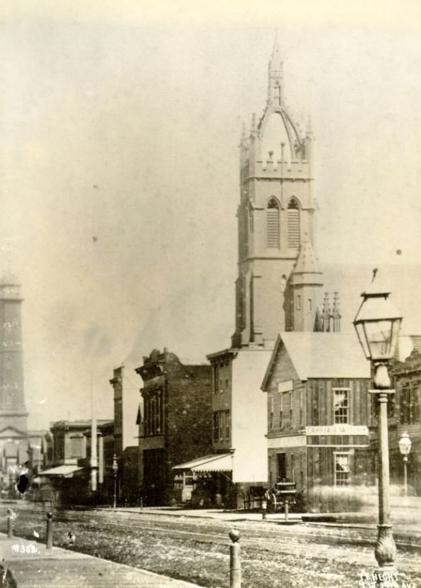
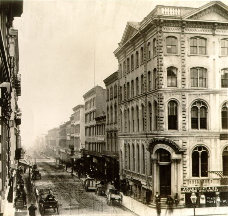
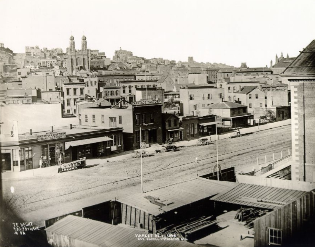
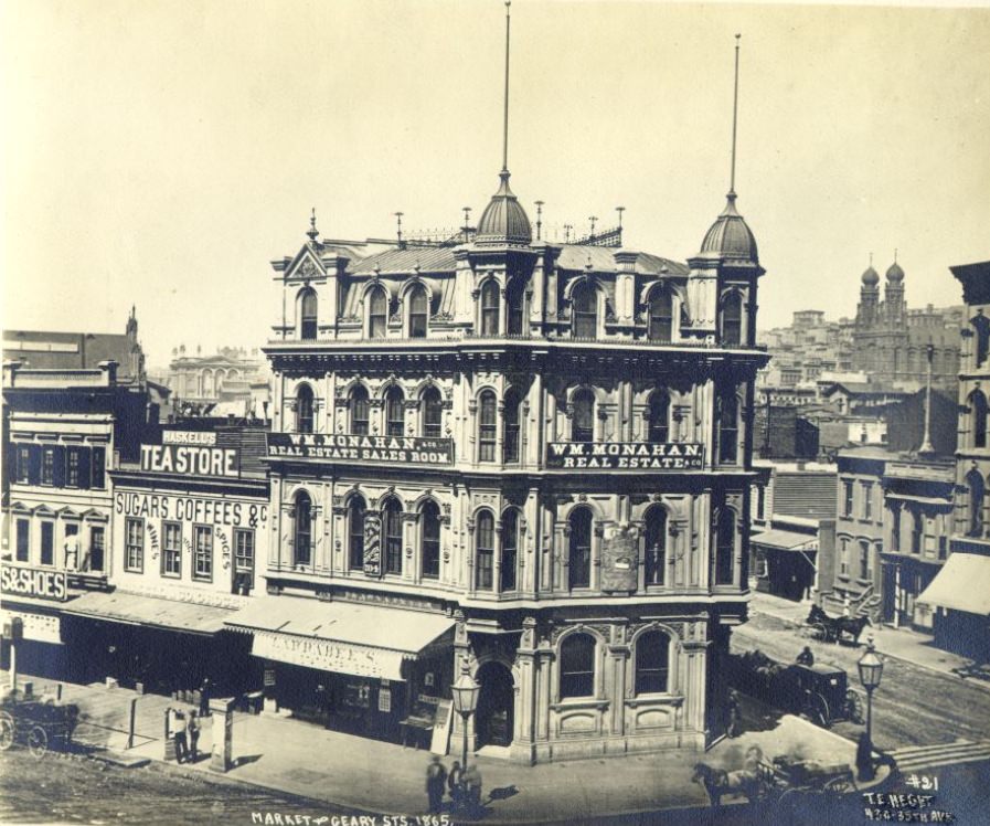
Sacramento Street below Montgomery in 1867 ran through one of the city’s busiest commercial zones, connecting the financial district to the waterfront. Market Street between Powell and Stockton in 1866 showed the avenue in its mid-decade state — developed but still with gaps and open lots that would fill in over the following years. Howard Street in 1867 continued to anchor the South of Market district’s commercial and industrial character, its wide blocks and modest storefronts serving a working-class clientele.
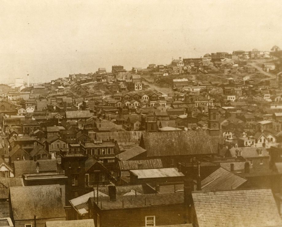
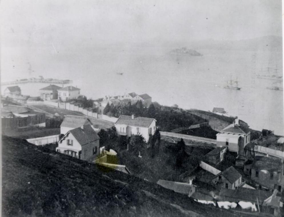
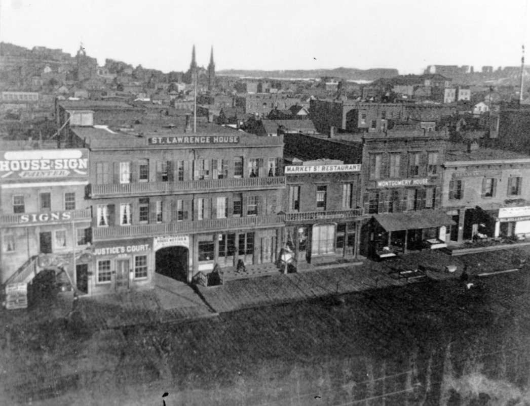
In 1863, a new extension of Montgomery Street was cut south from Market Street, creating what became known as New Montgomery Street. The photograph showing this excavation work from Market looking south documents a moment of deliberate city-planning — an attempt to extend the financial district’s main artery into new territory. North Beach, viewed toward Greenwich Street in 1864 and again in 1865, continued to show a neighborhood in motion, with new construction visible on the hillsides and along the flat streets nearest the waterfront.
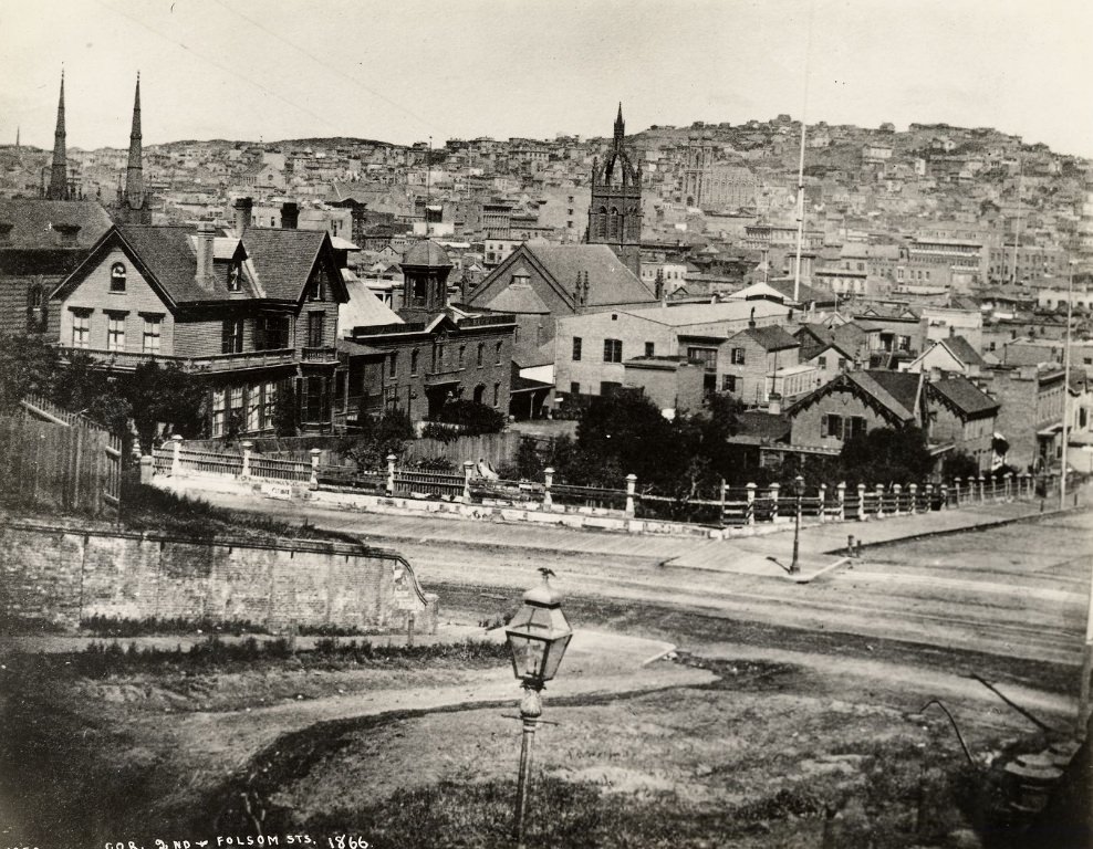
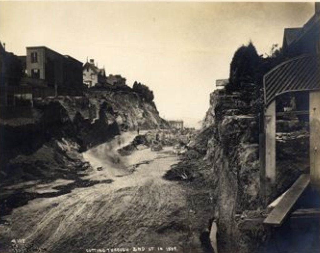
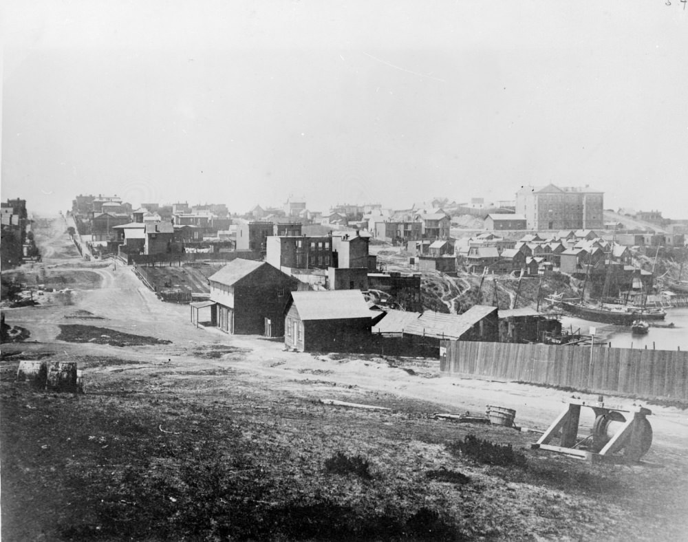
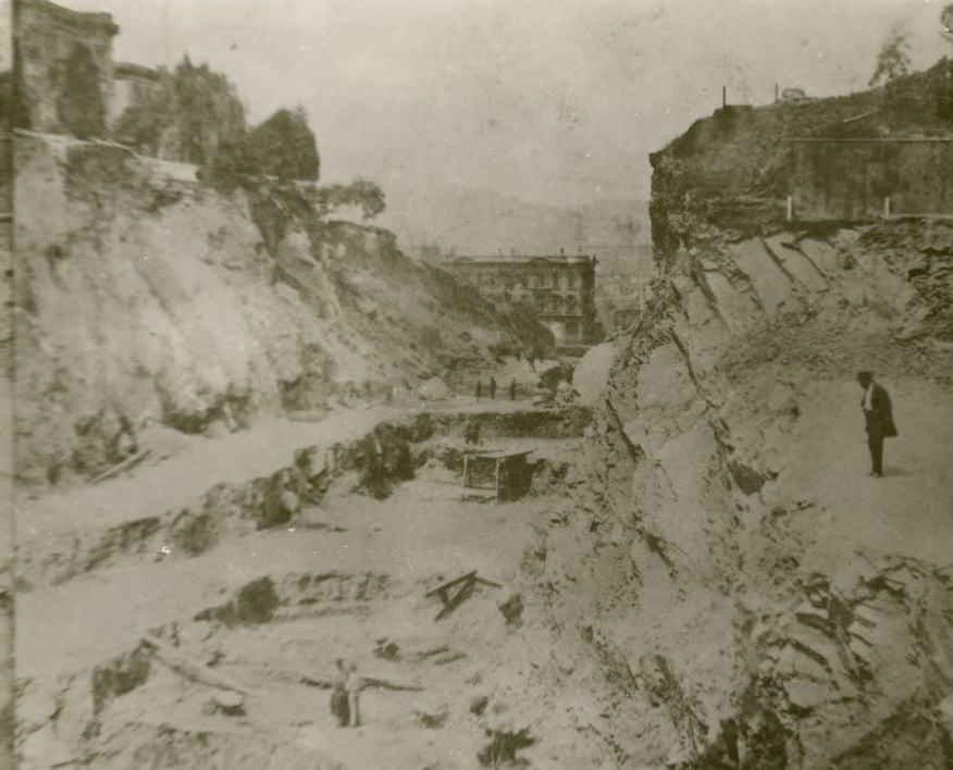
One of the most dramatic infrastructure projects of 1860s San Francisco was the cutting of Second Street through the Rincon Hill neighborhood in 1869. Rincon Hill had been a fashionable residential district in the 1850s, perched above the South of Market area with fine views of the bay. When the city decided to cut Second Street through the hill to improve access to the growing industrial waterfront to the south, it sliced through the hill with picks and shovels, leaving steep cliffs on either side of the new roadway. Photographs of the Second Street cut show the raw exposed earth and the dramatic scale of the excavation. The project essentially destroyed Rincon Hill as a desirable address, sending its wealthy residents fleeing to Nob Hill and other neighborhoods. It was a decisive and irreversible act of urban engineering — a sign that in 1860s San Francisco, commerce and infrastructure almost always won.





Thanks for sharing; it’s fun looking back at what was there.
Fantastic collection, some duplicates in there.
Classy old town!
Really enjoyed scrolling through these
This is an excellent collection. I had not seen most of these before.
What a trip, how time flows and things change…..thanks for the post
Pretty amazing growth considering most of that wasn’t there less than 20 years earlier.