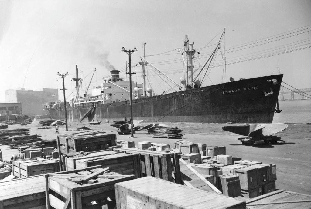
Oakland entered the 1940s as a city on the edge of enormous change. The Great Depression had battered much of the United States through the 1930s, but World War II brought an economic surge that hit Oakland harder and faster than almost anywhere else in Northern California. The city’s port — the largest seaport in Northern California — and its position at the end of major rail lines made it one of the most strategically valuable industrial centers on the West Coast.
Shipbuilding and canning operations ran at record speeds to meet wartime demand. New jobs drew workers from across the country, and Oakland’s population exploded. Between 1940 and 1945, nearly 100,000 people moved to the city. A special census taken in 1945 counted 405,301 residents — a dramatic jump from just five years earlier.
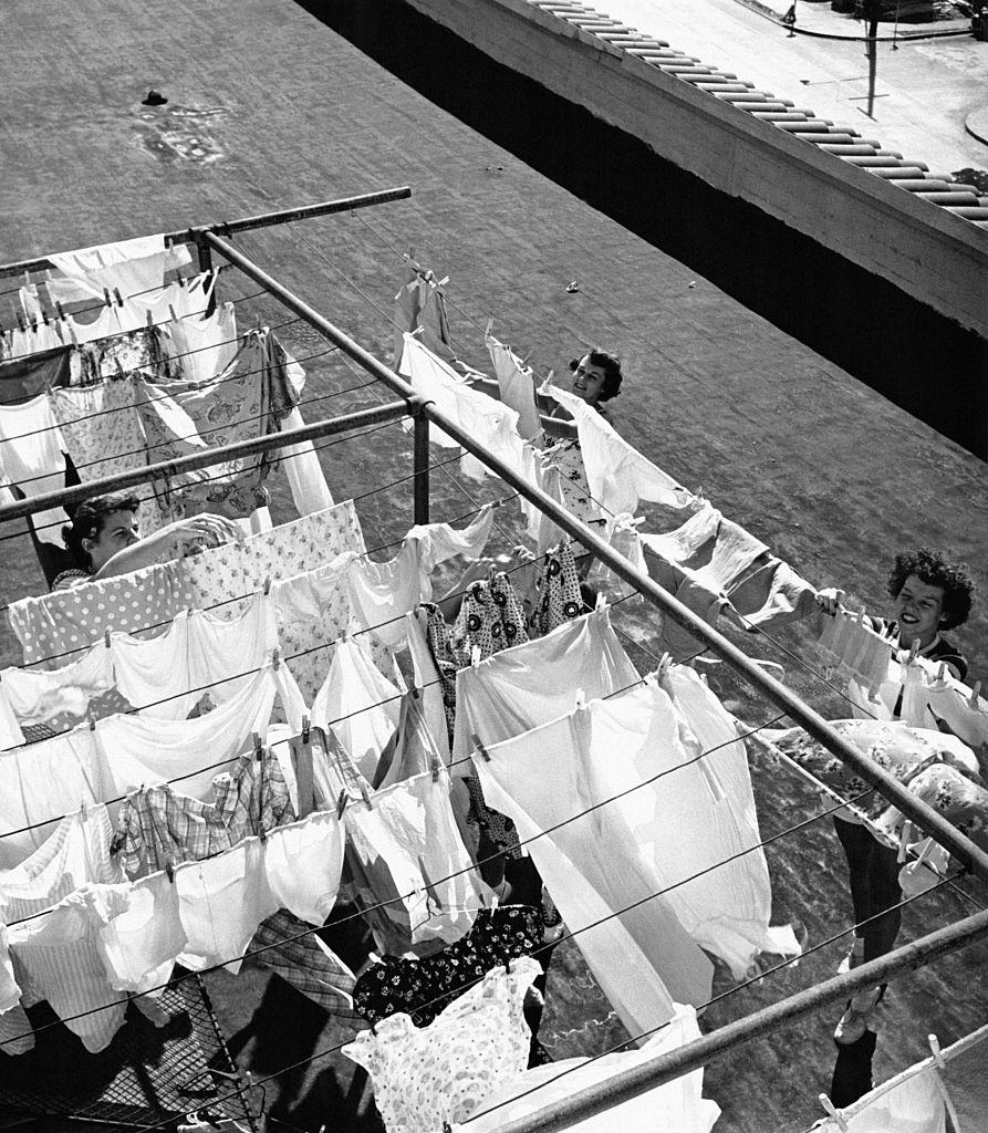
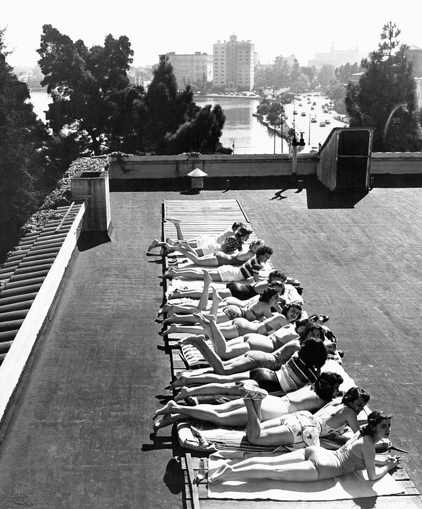
Young women hanging out their laundry on the roof of the YWCA (Young Woman Christian Association) ‘Blue Triangle Club’ in Oakland, 1940s.Young women sunbathing on the roof of the YWCA (Young Woman Christian Association) ‘Blue Triangle Club’ in Oakland, 1940s.
The war years reshaped Oakland’s racial makeup in a fundamental way. Before the war, Black residents made up just 3% of the city’s population. The massive influx of Black and white shipyard workers from the Deep South pushed Oakland’s African-American population to 12% of the total. That demographic shift was permanent. After the war ended and shipbuilding jobs dried up, white residents with higher incomes moved to neighboring suburbs, but the Black population continued to grow as a share of the city.
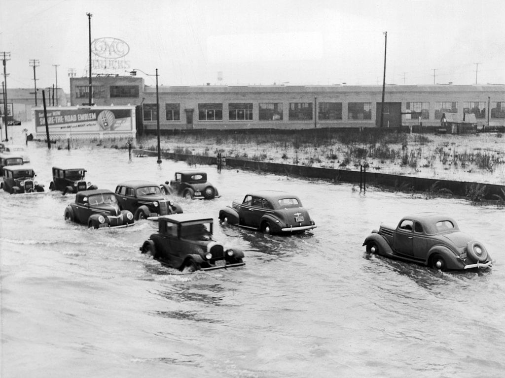
Car Traffic on a Flooded Road in Oakland, 1940s.
Along with workers came attitudes from the Deep South. Segregationist practices associated with Jim Crow spread into parts of California that had largely been free from them. Racial tensions rose sharply in Oakland during this period. Many white officers in the Oakland Police Department were openly racist in the late 1940s, and their repressive tactics worsened an already strained situation.
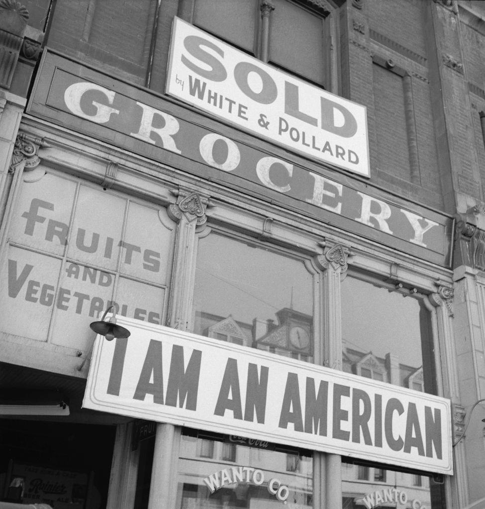
Oak Knoll Hospital in Oakland, 1942.I Am an American’ posted above a grocery store, Oakland, 1942.
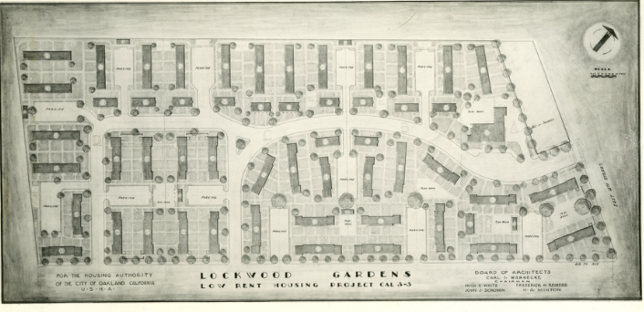
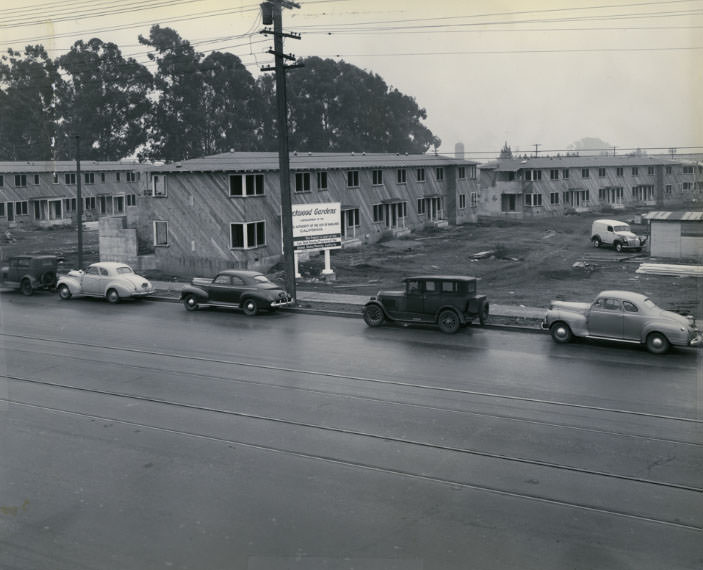
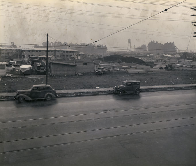
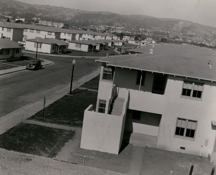
The federal government poured resources into the East Bay to house the flood of war workers. More than 30,000 public housing units were built in the region, sheltering roughly 90,000 people. Lockwood Gardens was among the developments constructed during this period, and its construction and completion were documented closely.
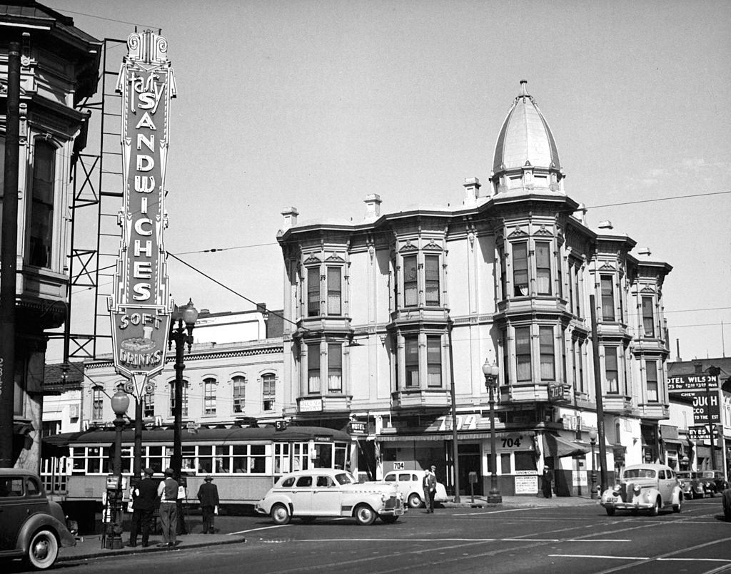
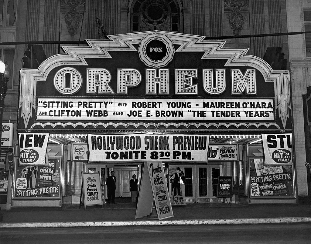
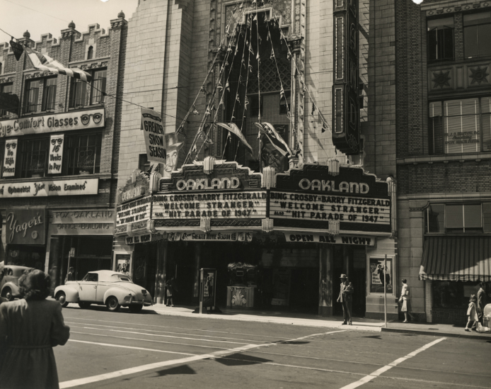
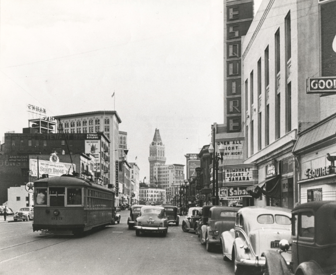
7th Avenue and Broadway in Oakland, 1942.The Fox Orpheum Theater in Oakland featuring a sneak preview of ‘Sitting Pretty’ and ‘The Tender Years,’ Oakland, 1948.
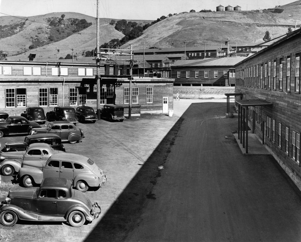
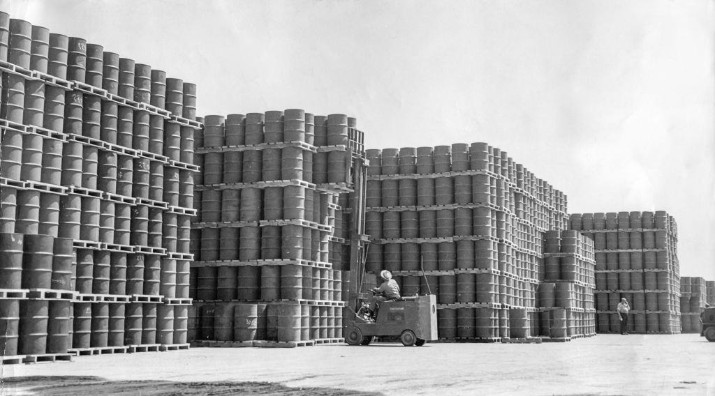
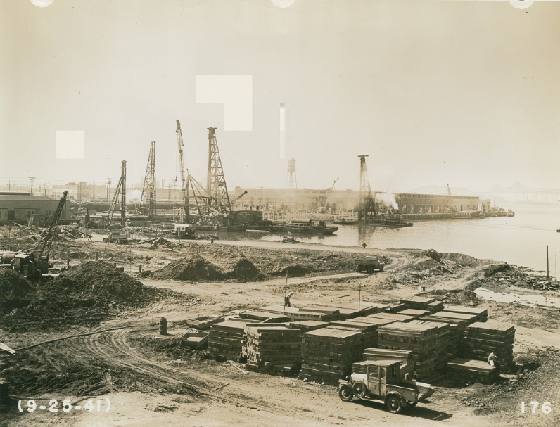
The Naval Supply Depot was a key part of Oakland’s wartime operation. Oil barrels were palletized and stacked in large quantities, and the depot itself was built out rapidly to support the Pacific theater. The Port of Oakland’s Outer Harbor handled staggering volumes of incoming and outgoing freight throughout the war and into the postwar years.
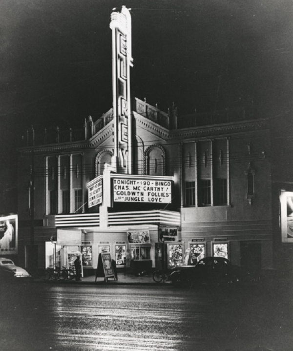
Stacks of oil barrels palletized at the Naval Supply Depot in Oakland, 1943.Incoming and outgoing freight is piled high on the wharf of the Port of Oakland Outer Harbor, 1947.El Rey Theatre at 3520 San Pablo Avenue in Oakland, California, 1940s
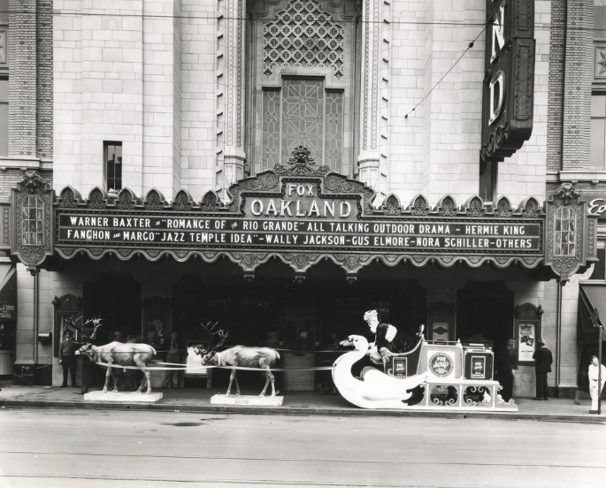
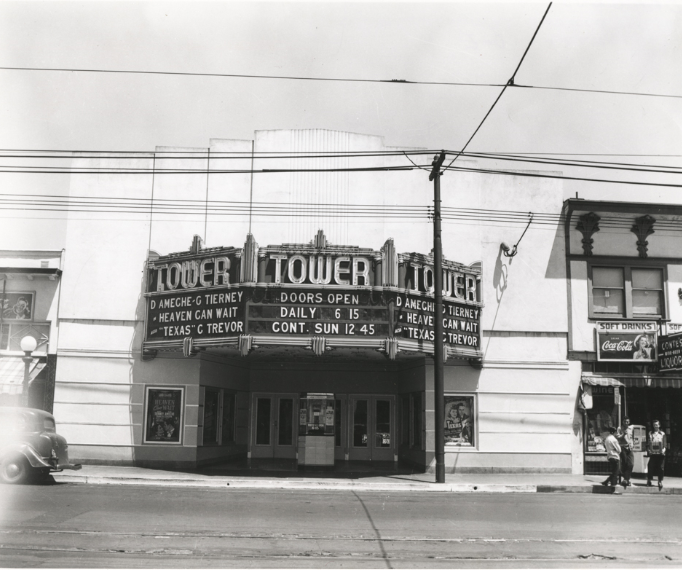
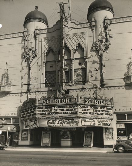
Beyond the industrial zones, everyday Oakland carried on. Theaters lined major streets like Telegraph Avenue and San Pablo Avenue. The Fox Oakland, the Paramount, the Tower, the Senator, and the Esquire all served audiences throughout the decade. These venues were a central part of city life, and their ornate interiors and bold marquees defined the look of commercial Oakland.
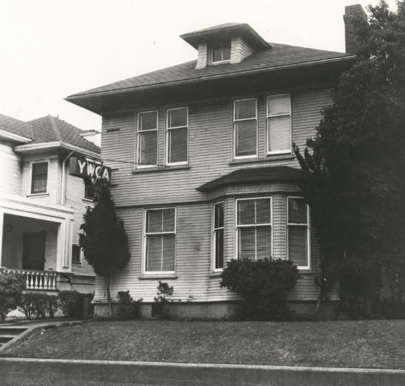
Construction of the Oakland Naval Supply Depot, 1940sLinden branch of the YWCA in Oakland, California, 1940sFox Oakland Theater on Telegraph Avenue in Oakland, California showing banners, 1940sEntrance of Fox Oakland Theatre on Telegraph Avenue in Oakland, California, 1940s
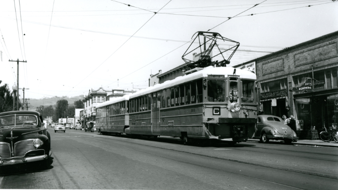
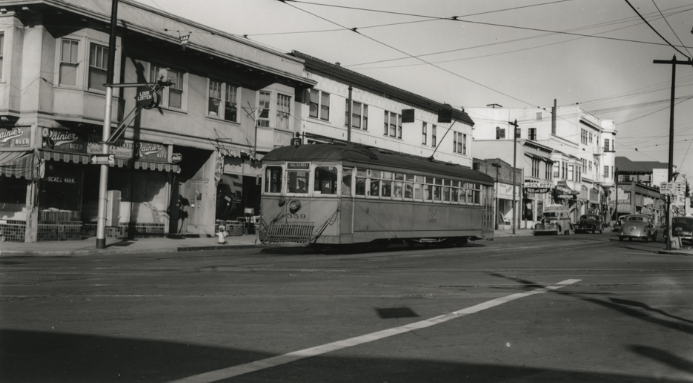
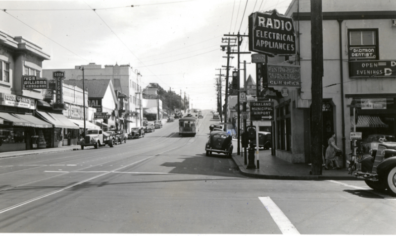
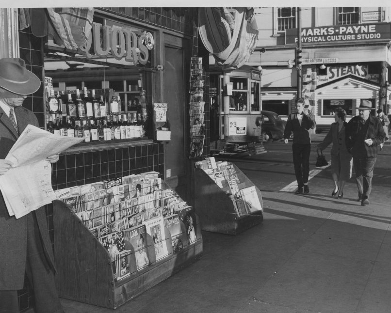
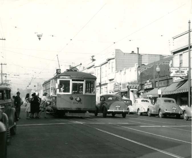
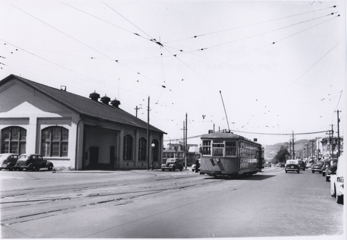
Street-level Oakland in the 1940s was a grid of commercial blocks, residential neighborhoods, and public institutions. The Key System streetcar network connected districts across the city, running along College Avenue, Piedmont Avenue, and 38th Avenue. Riders boarded at stops throughout the neighborhoods, and the streetcars remained a primary mode of transport until the system was eventually dismantled.
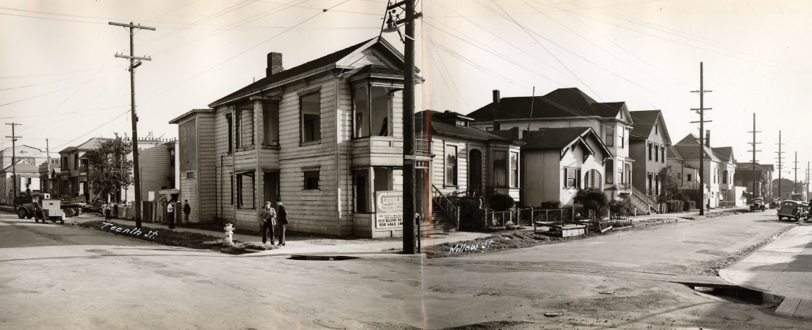
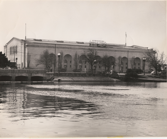
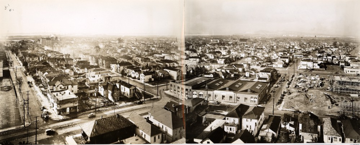
Looking SE from Willow and 10th Streets, January 10, 1940View of Oakland Municipal Auditorium from Lake Merritt, 1949Looking SW from 13th and Poplar Streets, 1940s
In December 1946, Oakland workers joined a General Strike alongside workers in five other cities across the country. The strike was a direct response to fears that management would use the same union-busting tactics that followed World War I. It became one of the most significant labor actions in American history, and it reflected the economic anxiety gripping the city as wartime industries shut down and jobs disappeared.
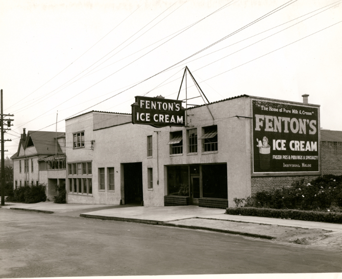
Fenton’s Ice Cream, 195 41st Street, near Howe Street, 1940sExterior of Tower Theatre at 5110 Telegraph Avenue in Oakland, California, 1940sSenator Theater at 3856 Telegraph Avenue in Oakland, California, 1940sExterior of Esquire Theatre on San Pablo Avenue in Oakland, California, 1940s
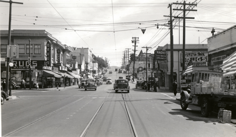
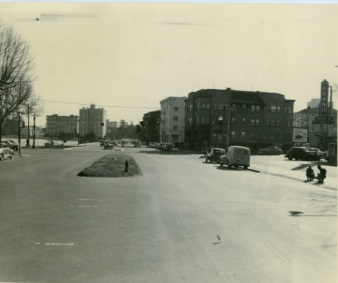
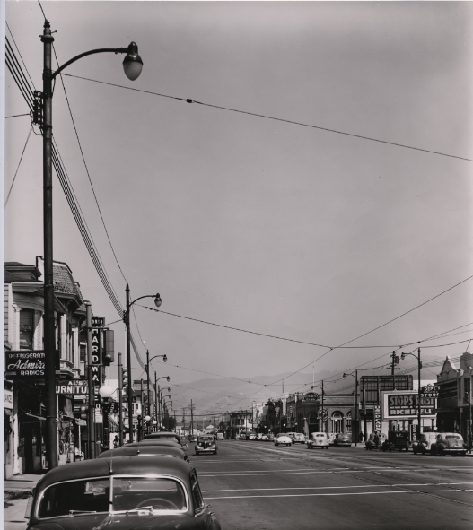
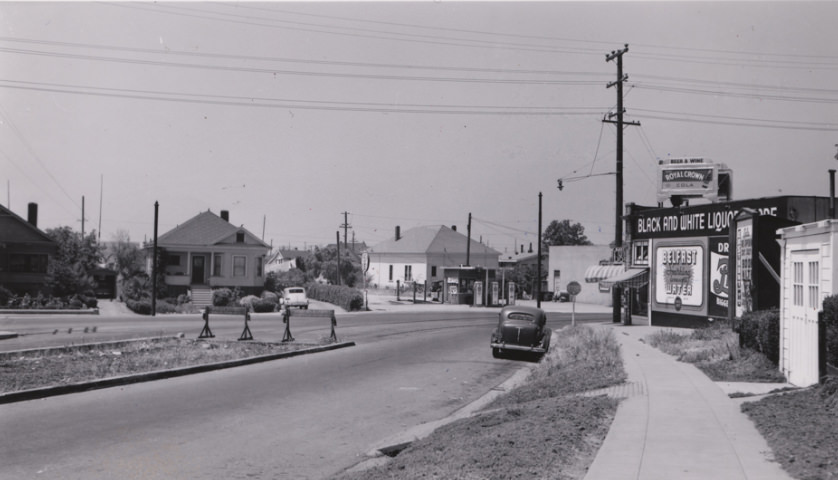
Oakland’s neighborhoods ranged from busy commercial corridors to quieter residential blocks climbing toward the hills. Park Boulevard near Beaumont Avenue showed the tree-lined streets heading east. The Temescal district, the Adams Point neighborhood, and the Fairfax and San Antonio districts each had their own distinct character, captured clearly in street-level photographs from the decade.
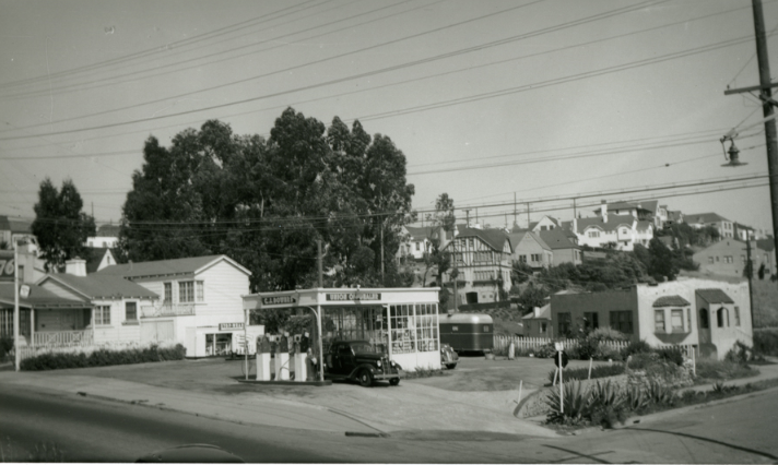
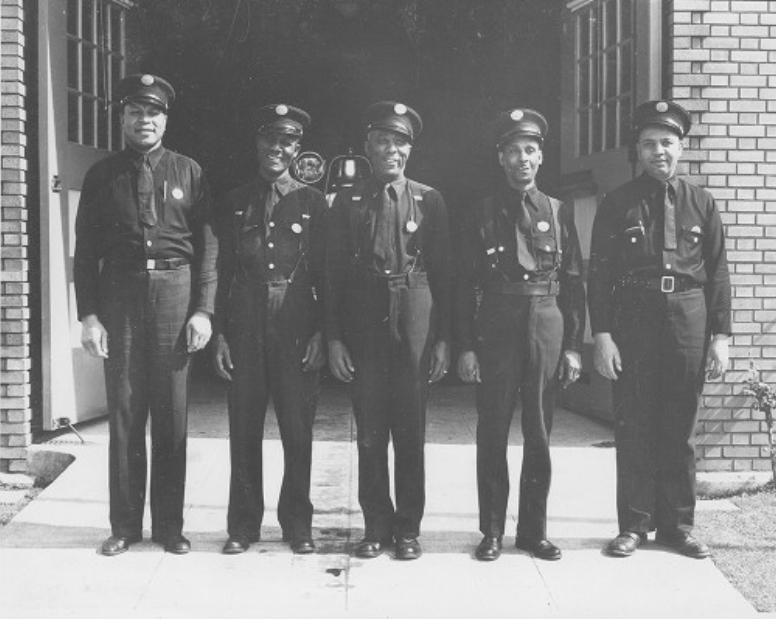
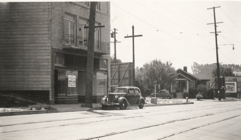
Park Boulevard near Beaumont Avenue looking east toward the hills, 1940sC.J. Bowers Union Oil service station, possibly at 3761 Park Boulevard, 1940sSW corner of 12th and Washington, 1940sEngine Company 22, Oakland Fire Department, 1940sKey System “C” line streetcar on Piedmont Avenue near Ridgeway Avenue, 1940sVacant storefront with parked car on College Avenue near Kales Avenue, 1940sKey System streetcar #359 heading south into the Rockridge district along College, 1940sKey Streetcar #993 heading south College Avenue between Hudson Street and Lawton, 1940s
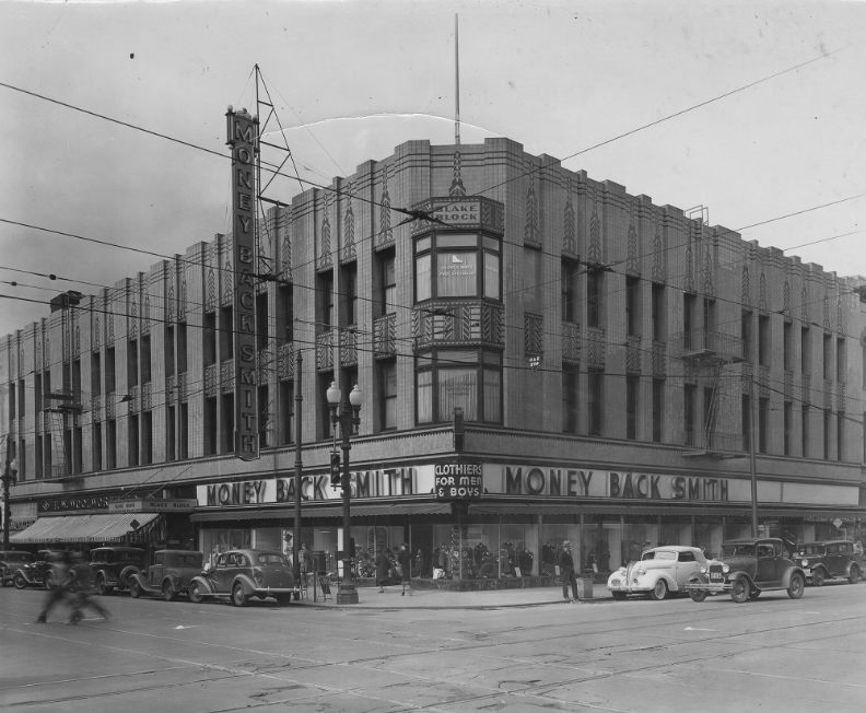
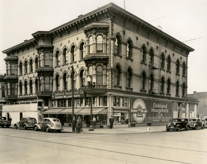
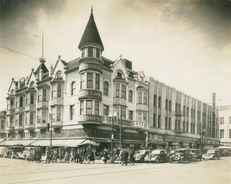
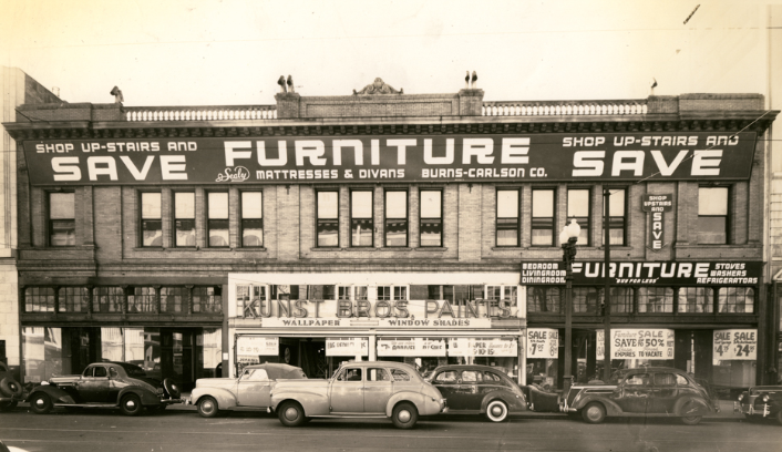
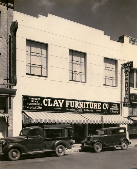
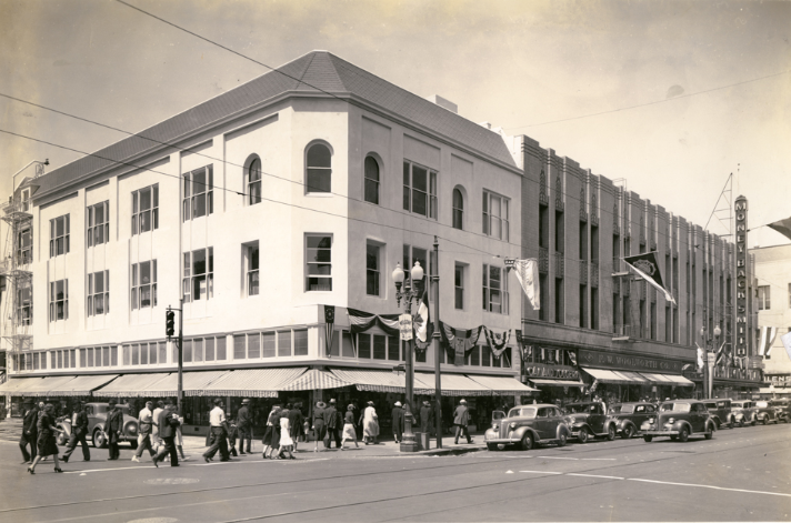
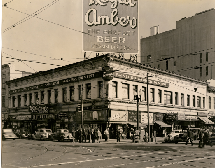
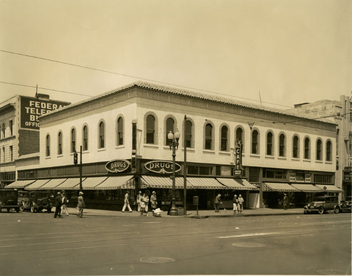
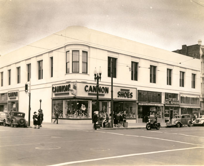
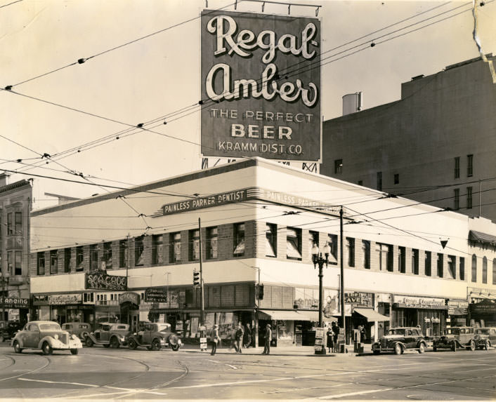
Downtown Oakland’s commercial core was dense with named buildings, retailers, and storefronts. Washington Street, Broadway, and 12th Street formed the heart of the shopping district, lined with buildings like the Borland, the Lurie, the Moise-Schlessinger, and the W.T. Grant Co. Department stores, furniture retailers, and service businesses occupied corner lots throughout this stretch.
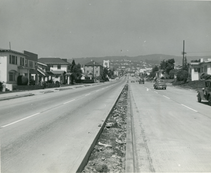
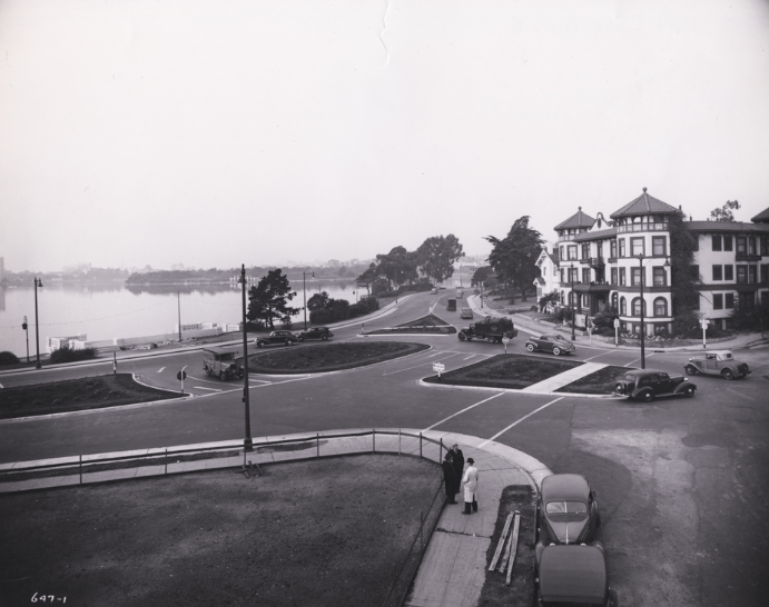
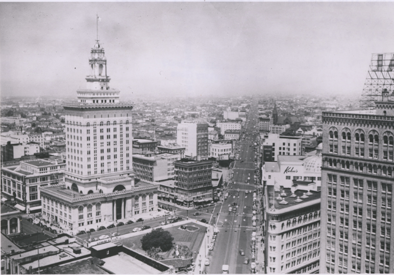
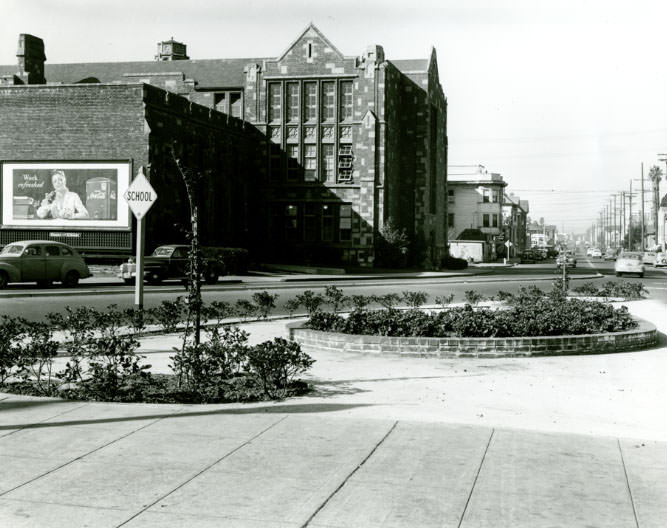
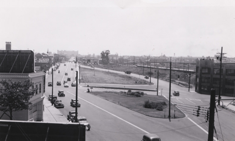
Southwest corner of Washington and 9th Streets in downtown Oakland, 1940sHopkins Street/US Route 50 (later MacArthur Boulevard) looking east towards intersection, 1940sHarrison Street at Grand Avenue in the Adams Point district of Oakland, 1940sElectric streetcar heading south on 38th Avenue at Allendale Avenue, 1940sTemescal Avenue looking north from around 47th Street in the Temescal district, 1940sNewly completed channelization islands ease the flow of traffic at East 18th, 1940sOakland City Hall with view of San Pablo Avenue, 1940s
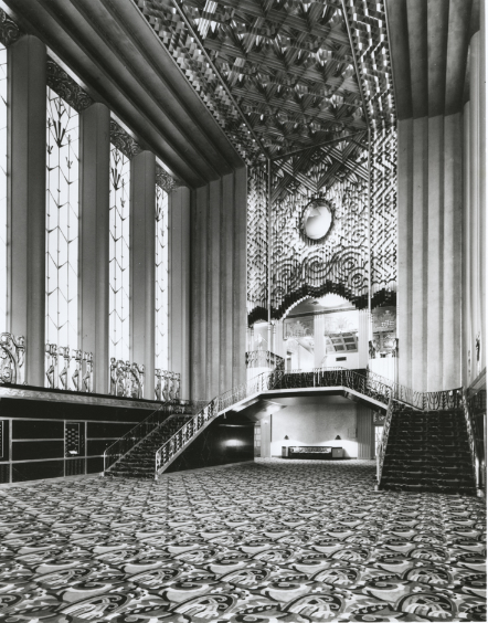
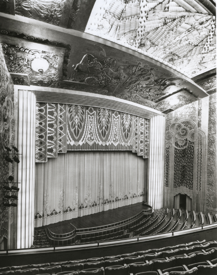
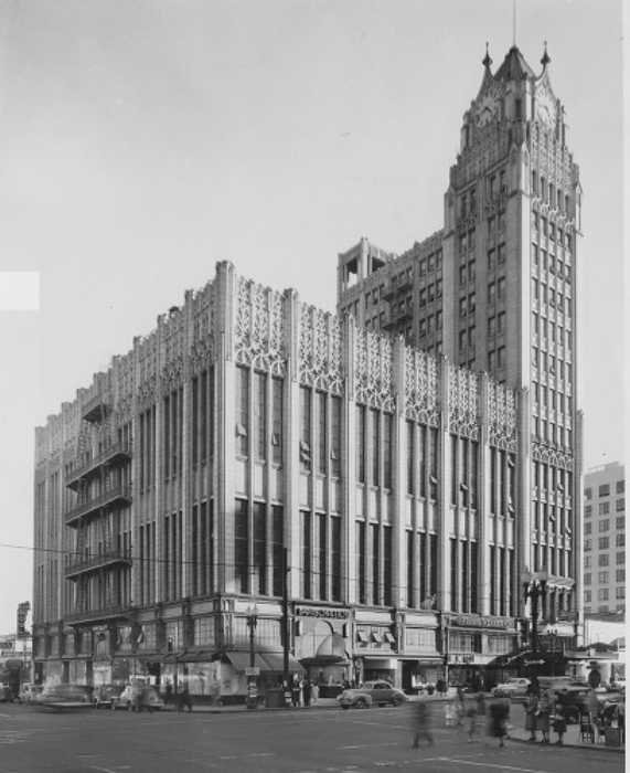
The Paramount Theatre on Broadway stood as one of Oakland’s most striking public spaces. Its lobby and stage were grand in scale, reflecting the ambition of the city’s architectural peak. Photographs from inside the theater show the attention to detail that defined the building, from the decorated lobby floor to the view of the stage from the balcony.
Lobby of Paramount Theatre on Broadway in Oakland, 1940s
Stage of the Paramount Theatre in Oakland, California as seen from balcony, 1940s
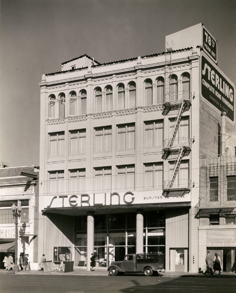
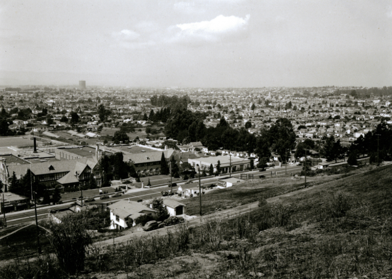
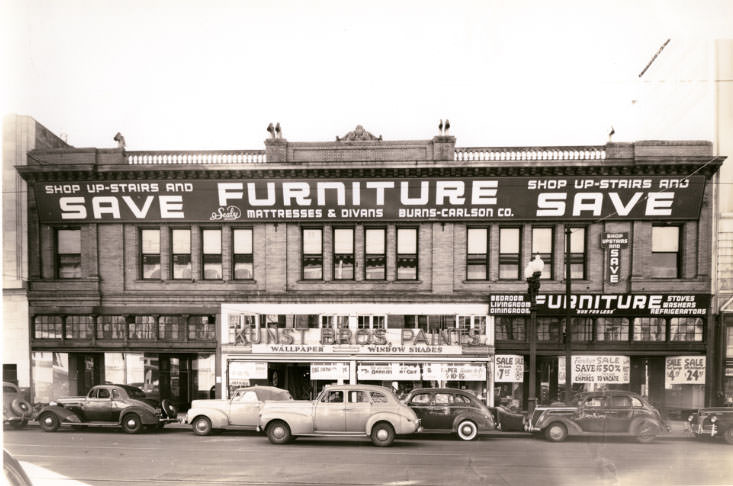
Sterling Furniture, west side of Broadway between 17th and 19th Streets, 1940sCastlemont High School and East Oakland looking west from an adjacent hill, 1940sApartment block, Seventh St., West Oakland, 1940s
The public housing developments built to accommodate war workers were not small projects. Lockwood Gardens in the Havenscourt neighborhood was planned carefully, with architectural drawings laying out the full scope of the complex before construction began. Photos from the construction phase through to completion show a large-scale residential development going up quickly to meet urgent demand.
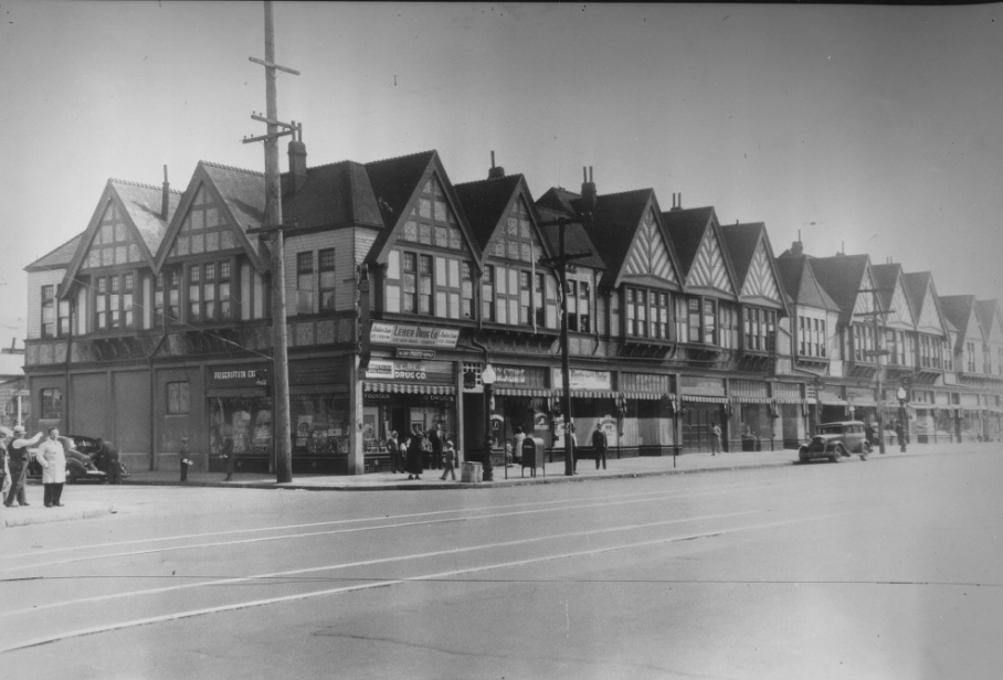
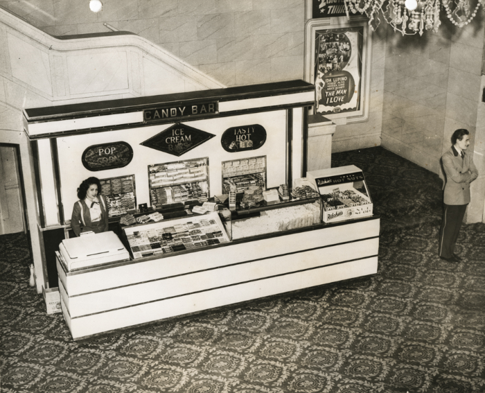
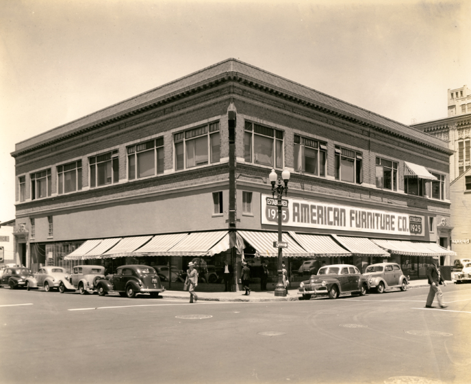
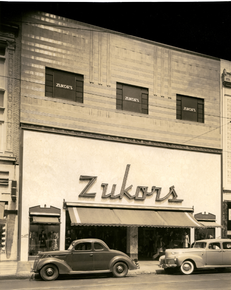
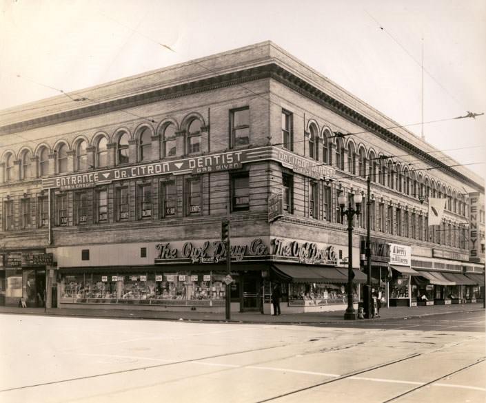
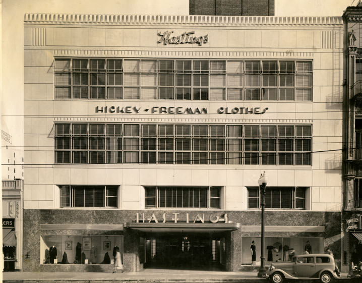
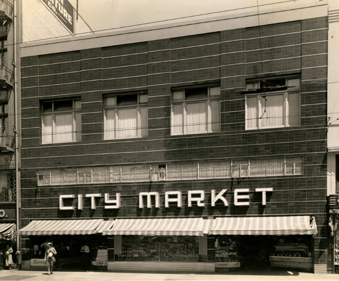
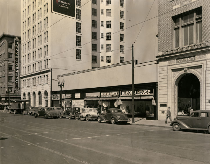
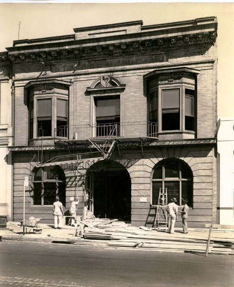
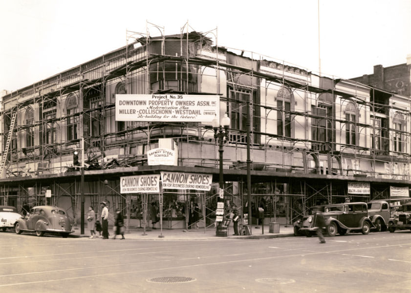
Architectural drawing showing the planned layout of the Lockwood Gardens public housing, 1940sHotel Carillon, 1940sInterior of Fox Oakland Theatre in Oakland, California with candy bar attendant, 1940sCorner of Fruitvale Avenue and Hopkins Street/US Route 50 (later MacArthur Boulevard), 1940sDowntown Oakland, c.1945, on the corner of 14th and Webster Streets, 1940sN. W. Corner, 11th and Washington, 1940sPassengers boarding the Key System number 10 streetcar on Piedmont Avenue, 1940sA street car rolls past the East Bay Street Railways Ltd. car, 1940sW. T. Grant Co. building, south side of 13th Street between Washington, 1940sFarnham building, west side of Clay Street between 10th and 11th Streets, 1940sMoise-Schlessinger building, northwest corner of 11th and Washington Streets, 1940sBorland building, southeast corner of 12th Street and Broadway in downtown Oakland, 1940sAmerican Furniture Co. building, northwest corner of Clay and 11th Streets, 1940sZukor’s, Inc. building, west side of Washington Street between 13th and 14th, 1940sOwl Drug Co. (J.C. Penney Co.) building, southeast corner of 12th, 1940sHastings building, east side of Broadway between 15th and 16th Streets in …Northwest corner of Broadway and 11th Streets in downtown Oakland, 1940sMiller-Collsichonn-Westdahl building, southeast corner of 11th and Washington Streets, 1940sBorland building, southeast corner of 12th Street and Broadway in downtown Oakland, 1940sCity Market building, east side of Washington Street between 12th and 13th, 1940sLurie building, north side of 12th Street between Broadway and Franklin Streets, 1940s
Cochran and Celli building, south side of 12th Street between Alice, 1940s
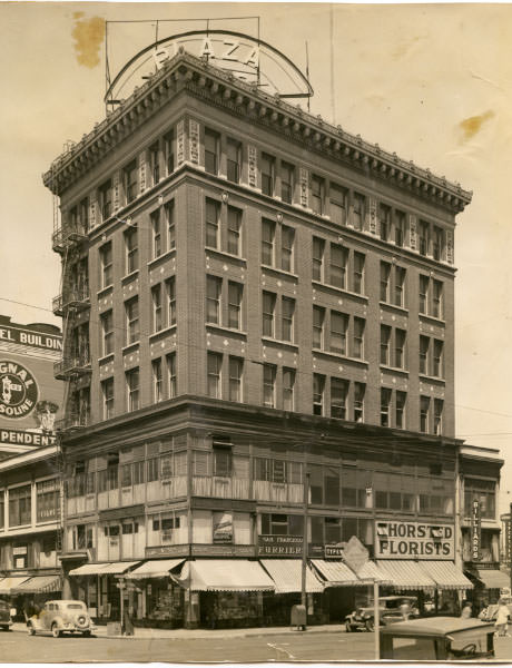
Plaza building, northwest corner of 15th and Jefferson Streets in downtown Oakland, 1940s
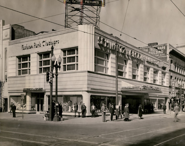
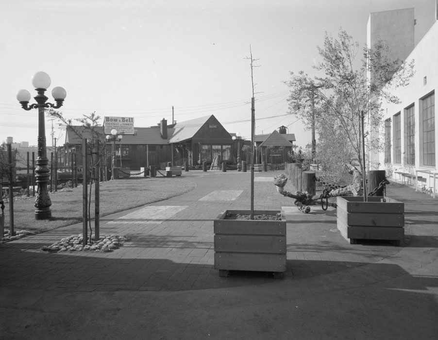
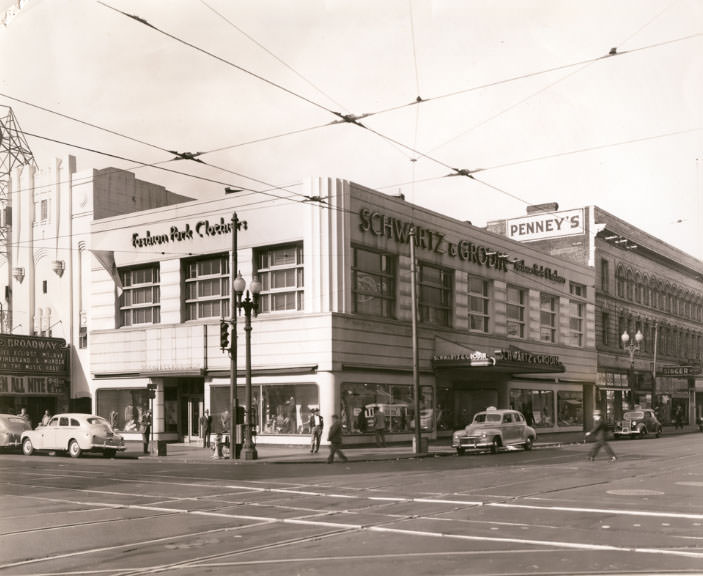
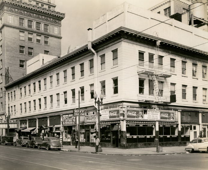
Schwartz & Grodin building, southwest corner of 12th Street and Broadway, 1940sFoot of Broadway entrance to “Bow & Bell”, 1940sSouthwest corner of 12th Street and Broadway, 1940Northwest corner of 12th and Franklin Streets, 1940Southeast corner of 11th and Washington Streets, 1940North side of 12th Street between Washington and Clay Streets, 1940
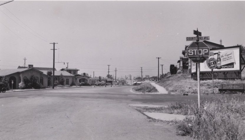
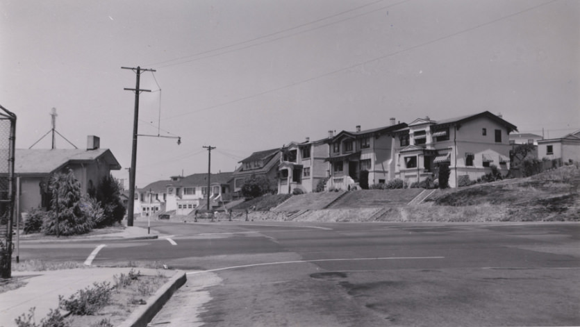
The outer neighborhoods showed a different face of the city. Foothill Boulevard near 22nd Avenue in the San Antonio district, Courtland Avenue in the Fairfax district, and East 12th Street in the Clinton neighborhood were all working residential areas. Streets were lined with modest homes, small businesses, and corner lots that served the daily needs of residents.
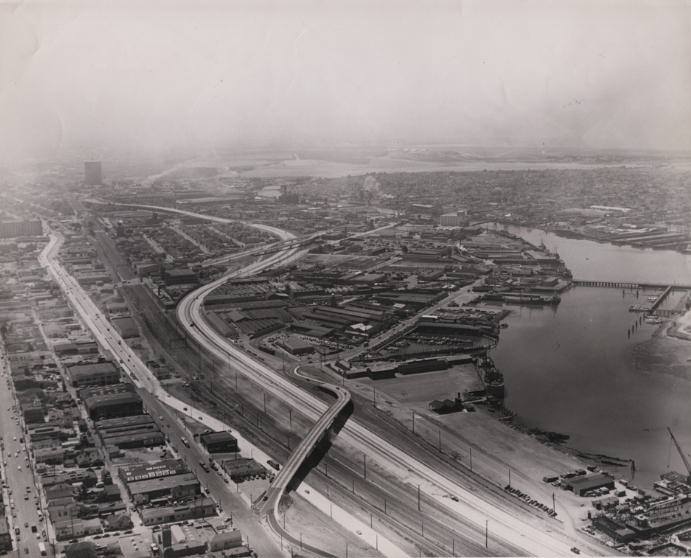
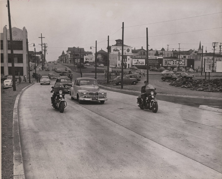
Foothill Boulevard near 22nd Avenue in the San Antonio district of Oakland, 1940sLockwood Gardens public housng development under construction in the Havenscourt, 1940sClausen House at 88 Vernon Street in the Adams Point district, 1940sLockwood Gardens public housng development under construction, looking south east, 1940sNewly constructed Lockwood Gardens public housing development in the Havenscourt, 1940sCourtland Avenue looking toward Foothill Boulevard in the Fairfax district of Oakland, 1940sLooking east along East 12th Street at 14th Avenue in the Clinton, 1940sAerial view, looking south from around 16th Avenue, of the Nimitz Freeway, 1940sLooking down Courtland Avenue from the corner of High Street and Ygnacio, 1940sLooking at houses on Courtland Avenue from the corner of High Street, 1940sTwo policeman on motorcycles escort cars eastbound on East 12th Street, 1940s
Consequently, Oakland built ships and manufactured automobiles. I wonder what industries they are known for today. Does the majority of the population live there and commute to other cities for work? I only go to Oakland for concerts.
The Port. Also a fair number of government offices and nonprofits because office space is relatively inexpensive (BART, AC Transit). But yes many people commute to SF or UC Berkeley.
Very cool old pics!, I was born in Oakland in 1961, my Mom was born at Highland Hospital in 1933, worked at the Fox Oakland from 1950 to ’55, thanks for the great look back in time, BTW, I still live here! lol
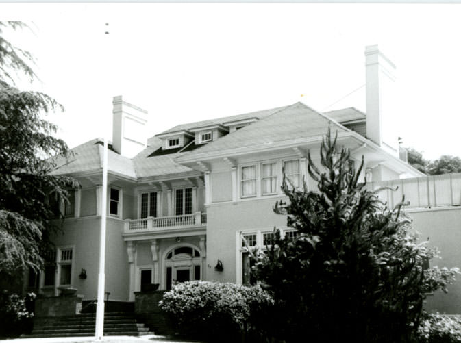
Does anyone know why all the old houses in Oakland are enormous? Were they originally built as SFH, or to be used as boarding houses? There’s some truly gigantic old Victorians around.
I think most were built as single-family homes, but in a time when the expectation was much larger families – more kids on average, some intergenerational living, and potentially a live-in maid/nursemaid or other help. Plus some old architectural/design features that have mostly become additional bedrooms or living spaces but originally served specific purposes, like sleeping porches, infirmaries, butlers’ pantries, attached carriage houses, etc.
And many of the old houses in the hills or anywhere it’s at all hilly look like they have an entire extra story, because they were just built into the side of the hill instead of leveling the lot. Some near me look like they’re 4 stories but really are just two or three bedrooms, plus a garage and a half basement – still big houses but not quite as big as they look from the outside.
Does anyone know why all the old houses in Oakland are enormous? Were they originally built as SFH, or to be used as boarding houses? There’s some truly gigantic old Victorians around.
I think most were built as single-family homes, but in a time when the expectation was much larger families – more kids on average, some intergenerational living, and potentially a live-in maid/nursemaid or other help. Plus some old architectural/design features that have mostly become additional bedrooms or living spaces but originally served specific purposes, like sleeping porches, infirmaries, butlers’ pantries, attached carriage houses, etc.
And many of the old houses in the hills or anywhere it’s at all hilly look like they have an entire extra story, because they were just built into the side of the hill instead of leveling the lot. Some near me look like they’re 4 stories but really are just two or three bedrooms, plus a garage and a half basement – still big houses but not quite as big as they look from the outside.
Does anyone remember the librarian who worked at the small library on 41st Street near Piedmont Ave (now a store) ? She was bent over with scoliosis but was such a nice lady. Does anyone know her name and when she died? I remember her fondly. She was so kind to me as a kid.

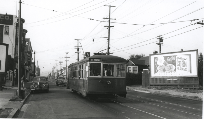
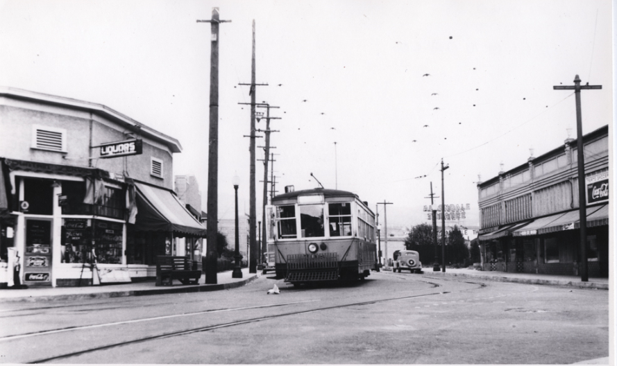





It is interesting how public transit has regressed since then. It now takes me longer to get to SF than it did 80 years ago.
Correct.. that’s why it’s a tragedy we lost the key system and the right of ways
Fenton’s used to be on 41st near the post office. It was founded in that location in 1894 (!) and moved to Piedmont Ave. in 1961.
Consequently, Oakland built ships and manufactured automobiles. I wonder what industries they are known for today. Does the majority of the population live there and commute to other cities for work? I only go to Oakland for concerts.
The Port. Also a fair number of government offices and nonprofits because office space is relatively inexpensive (BART, AC Transit). But yes many people commute to SF or UC Berkeley.
This was awesome to look at thanks for sharing!
So much less crime then.
My, we’ve certainly made a lot of progress since then haven’t we. I guess progress includes a progressive increase in crime too lol.
The harder it is to earn a living the more attractive crime looks. That’s just human nature.
Very cool old pics!, I was born in Oakland in 1961, my Mom was born at Highland Hospital in 1933, worked at the Fox Oakland from 1950 to ’55, thanks for the great look back in time, BTW, I still live here! lol
Man. They really destroyed parts of Oakland with weird bits of freeway and mid-century brutalist turds of buildings.
Does anyone know why all the old houses in Oakland are enormous? Were they originally built as SFH, or to be used as boarding houses? There’s some truly gigantic old Victorians around.
I think most were built as single-family homes, but in a time when the expectation was much larger families – more kids on average, some intergenerational living, and potentially a live-in maid/nursemaid or other help. Plus some old architectural/design features that have mostly become additional bedrooms or living spaces but originally served specific purposes, like sleeping porches, infirmaries, butlers’ pantries, attached carriage houses, etc.
And many of the old houses in the hills or anywhere it’s at all hilly look like they have an entire extra story, because they were just built into the side of the hill instead of leveling the lot. Some near me look like they’re 4 stories but really are just two or three bedrooms, plus a garage and a half basement – still big houses but not quite as big as they look from the outside.
It’s a tragedy to have lost the Key System 😭
Some great pics here including some that I have never seen.
Man. They really destroyed parts of Oakland with weird bits of freeway and mid-century brutalist turds of buildings.
Does anyone know why all the old houses in Oakland are enormous? Were they originally built as SFH, or to be used as boarding houses? There’s some truly gigantic old Victorians around.
I think most were built as single-family homes, but in a time when the expectation was much larger families – more kids on average, some intergenerational living, and potentially a live-in maid/nursemaid or other help. Plus some old architectural/design features that have mostly become additional bedrooms or living spaces but originally served specific purposes, like sleeping porches, infirmaries, butlers’ pantries, attached carriage houses, etc.
And many of the old houses in the hills or anywhere it’s at all hilly look like they have an entire extra story, because they were just built into the side of the hill instead of leveling the lot. Some near me look like they’re 4 stories but really are just two or three bedrooms, plus a garage and a half basement – still big houses but not quite as big as they look from the outside.
It’s a tragedy to have lost the Key System 😭
Some great pics here including some that I have never seen.
Does anyone remember the librarian who worked at the small library on 41st Street near Piedmont Ave (now a store) ? She was bent over with scoliosis but was such a nice lady. Does anyone know her name and when she died? I remember her fondly. She was so kind to me as a kid.