Hey There! Before You Go. 😧
Get the best vintage content straight into your inbox!

Don't worry, we don't spam

Mexico in the Late-19th Century: Fascinating Historical Photos Show Mexico Under the Porfirio Díaz Rule

Mexico’s late 19th century was shaped by foreign invasions, political upheaval, and a long stretch of authoritarian rule that transformed the country’s economy while leaving most of its people behind. These photographs capture that era in remarkable detail — from ancient ruins and colonial plazas to bustling ports and railroad stations that were just beginning to stitch the country together.

To understand the Mexico seen in these images, it helps to start a few decades earlier. In 1862, France invaded Mexico with the goal of installing a puppet government. Mexican forces dealt the French an initial defeat, a moment still celebrated as Cinco de Mayo. But the French pushed back and eventually overpowered the Mexican Army, placing Archduke Maximilian of Austria on the throne. The French-backed monarchy governed from the National Palace in Mexico City.

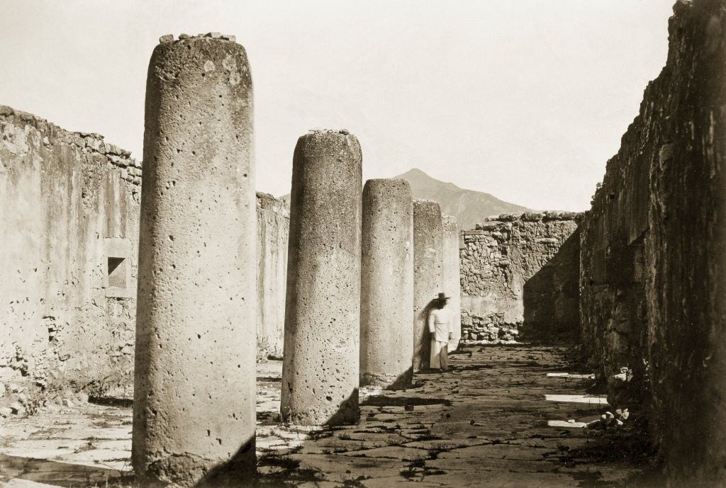
Mitla Great Palace, Mexico, 1860.

The ancient ruins at Mitla, photographed in 1860, stood as a reminder of Mexico’s deep pre-colonial roots — roots that existed long before European monarchs had any claim to the land. The Zapotec people built Mitla as a major religious center, and its geometric stonework was unlike anything else in Mesoamerica.

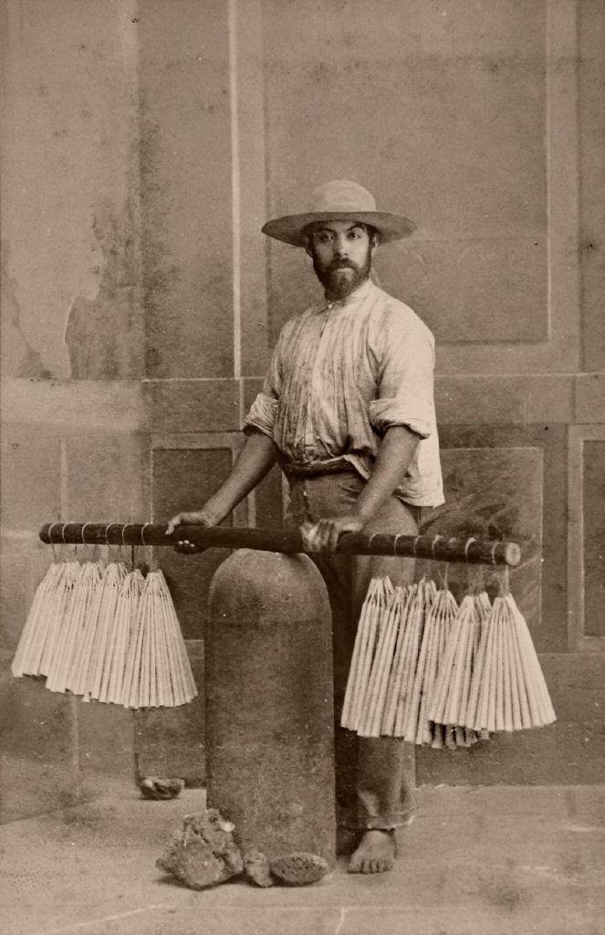
Candle merchant, Mexico, 1860.

Everyday commerce continued amid the political chaos. Street vendors like this candle merchant were a common sight in Mexican towns and cities throughout the 19th century. Candles were a daily necessity, used in homes, churches, and public ceremonies across the country.

The French occupation didn’t last. The Mexican expedition was never financially profitable for France, and after the American Civil War ended, the United States pressured France to withdraw its troops. France complied, but Emperor Maximilian refused to abandon his throne and return to Europe. He stayed — and paid for that decision with his life. He was captured by republican forces and executed by firing squad in 1867, along with two Mexican generals who had supported him.
The Place of the Execution of Emperor Maximilian I of Mexico, 1867.

The hill of Las Campanas in Querétaro is where Maximilian met his end on June 19, 1867. This photograph documents the actual site of the execution — a rare visual record of one of the most decisive moments in Mexican republican history. With Maximilian gone, the republic was restored and Benito Juárez was reelected as president.

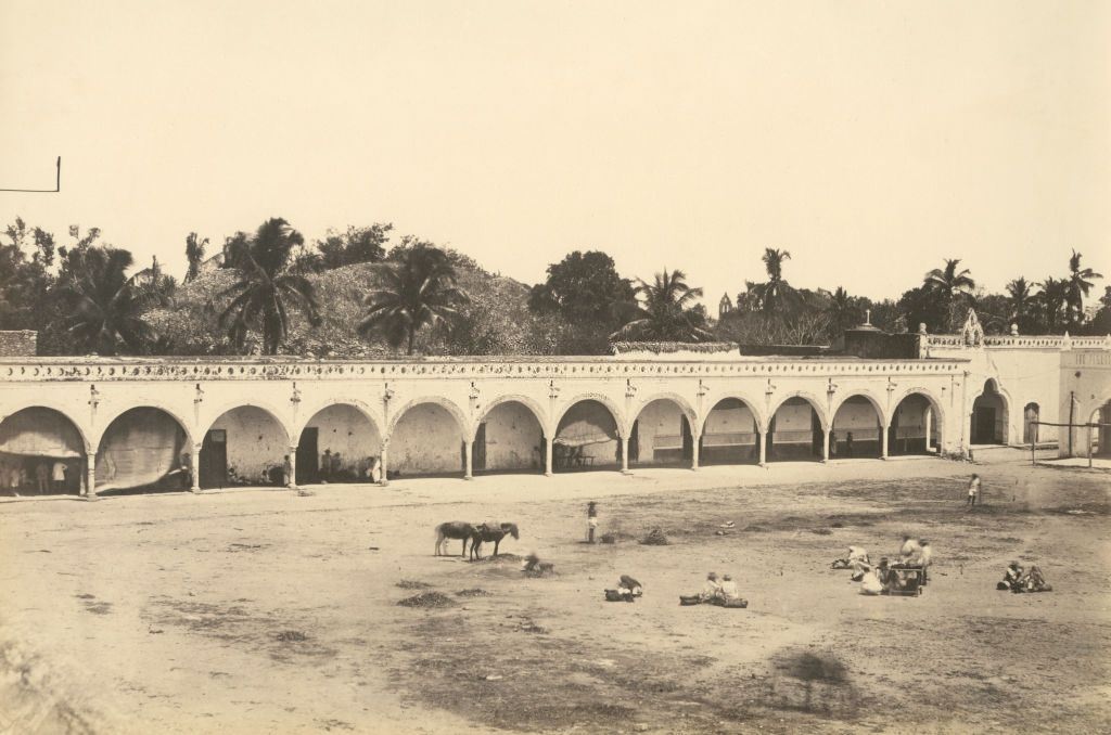
Central square and arcade along the side, Izamal, Mexico, 1870.

By 1870, Mexican towns like Izamal — a city in Yucatán entirely painted yellow — showed the architectural blend of indigenous and Spanish colonial heritage that defined so much of the country. The arcade-lined central square seen here was the social and commercial heart of the town.

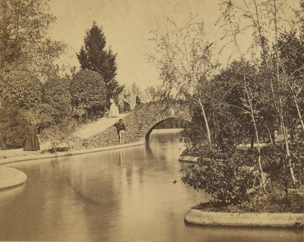
Garden of the Tivolie de San Cosme, Mexico, 1873

Public gardens and leisure spaces in Mexico City reflected the European influences that the upper classes of the era enthusiastically adopted. The Tívoli de San Cosme was a popular entertainment venue where Mexico City’s wealthier residents spent their afternoons.

Grounds of William Barron, Tacubaya, Mexico, 1873.

The grounds of William Barron in Tacubaya illustrate a broader reality of late 19th-century Mexico: foreign nationals owned significant portions of the country’s wealth and land. By the end of the century, the largest businesses in Mexico were controlled mostly by Americans and British investors — a source of deep resentment among ordinary Mexicans.

Porfirio Díaz took power in 1876 and held it, with one brief interruption, until 1909. His rule — known as the Porfiriato — brought roads, railroads, telegraph lines, and foreign investment pouring into Mexico. Cities modernized. Trade expanded. But the benefits flowed almost entirely to the wealthy elite and foreign business owners, while peasants and workers saw little improvement in their lives.

Vistas Mexicanas. Mexico, 1883
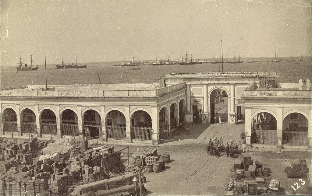
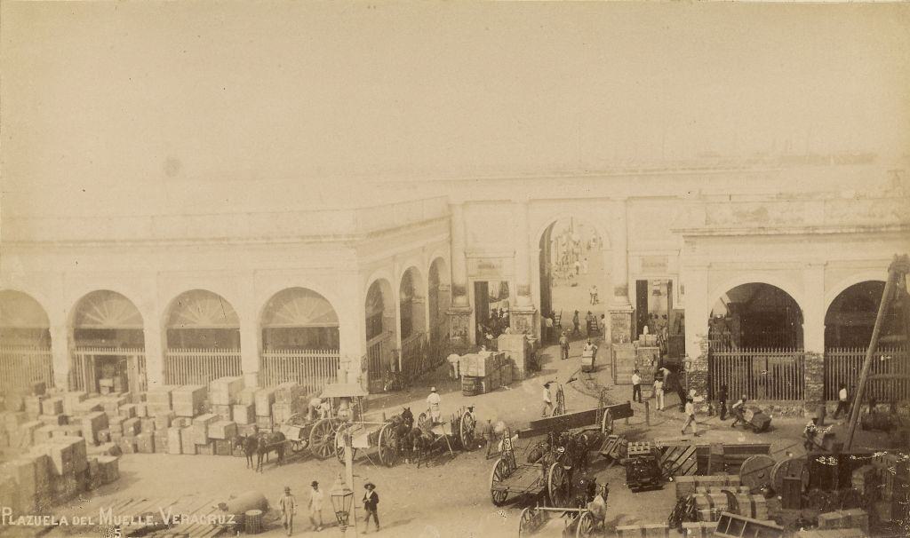
Plazuela del Muelle. Veracruz, Mexico, 1880s

Veracruz was one of Mexico’s most important port cities throughout the 19th century. The Plazuela del Muelle — the dock plaza — was the entry point for imported goods, foreign travelers, and new ideas arriving from Europe and North America. The port’s activity reflected just how integrated Mexico had become with global trade under Díaz.

Vistas Mexicanas. Mexico, 1883.

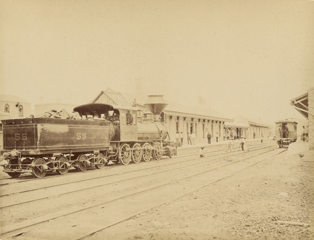
One of Díaz’s most ambitious projects was the expansion of Mexico’s railroad network. Railroads connected remote regions to major cities, moved agricultural goods to export ports, and brought foreign companies deeper into Mexican territory. The Apizaco Station, photographed in 1883, sat at a key junction in the Mexican Railroad system in the state of Tlaxcala.

The Apizaco Station, Mexican Railroad, 1883
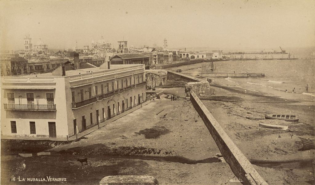
La Muralla. Veracruz, Mexico, 1883

La Muralla — the old city wall of Veracruz — was a colonial-era defensive structure that still stood in the 1880s. It was a physical remnant of the Spanish colonial period, still defining the edges of a city that was rapidly modernizing around it.

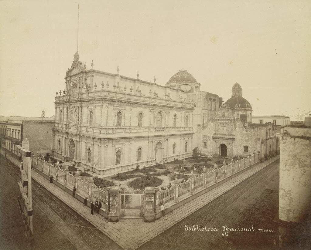
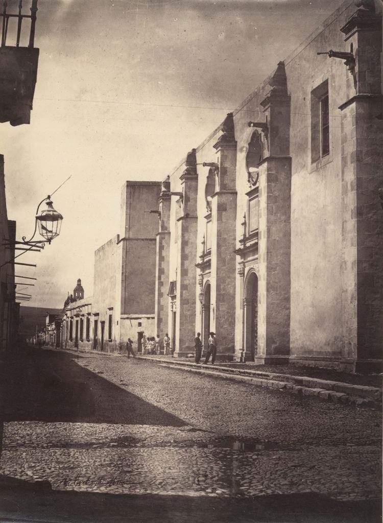
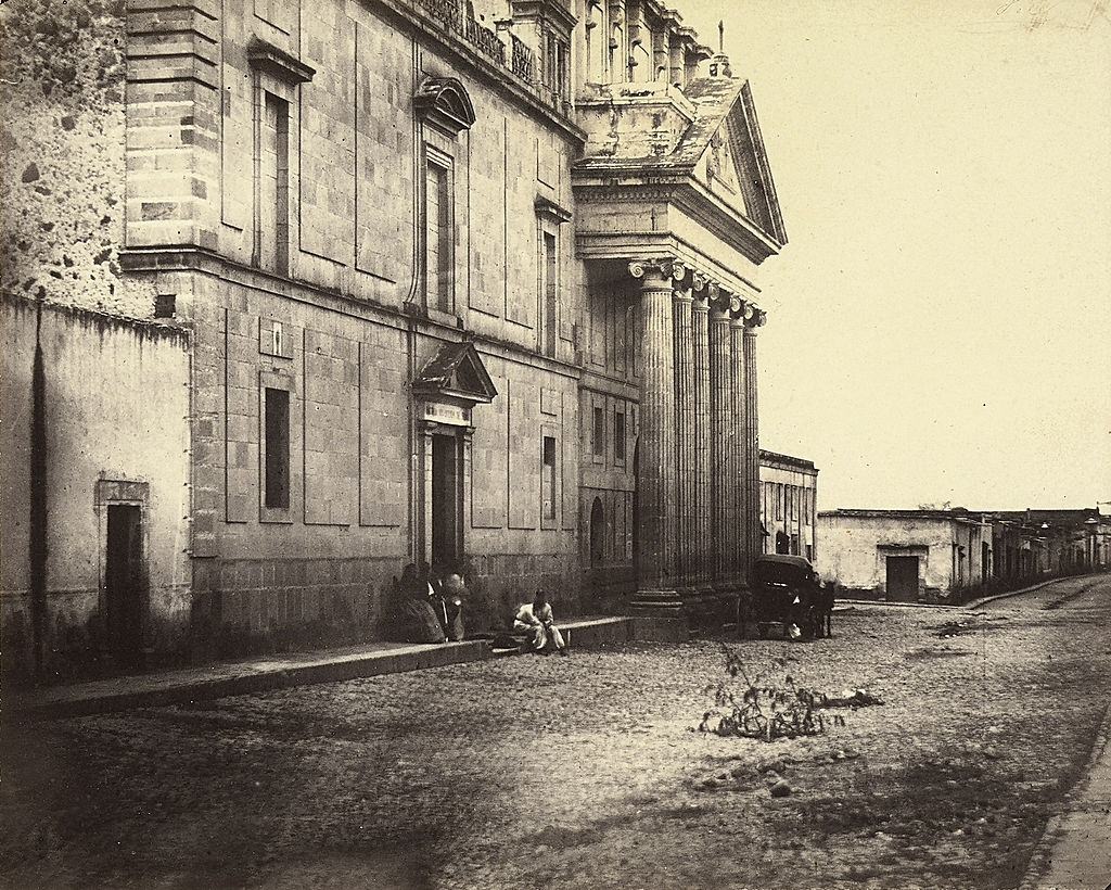
Mexico City itself held a concentration of the country’s most significant institutions, many of which were photographed extensively during this era. The former Church of Saint Augustine had been converted into the National Library, part of a broader effort during the Reform period and later under Díaz to secularize public institutions.

National Library (Church of Saint Augustin), Mexico City, 1855
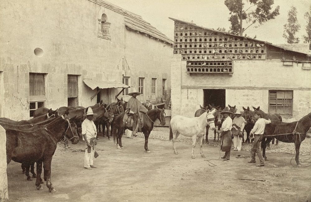
Shoeing the Mules (Mexican Village Scene), 1855

Away from the capital, rural life moved at a different pace. Mules were essential working animals throughout Mexico — used for transport, farming, and hauling goods across mountain terrain that no railroad had yet reached. Scenes like this one played out daily in villages across the country.

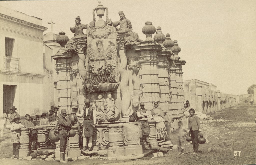
Cascade Fountain, 1855.
Mexico in the Late-19th Century: Fascinating Historical Photos Show Mexico Under the Porfirio Díaz Rule
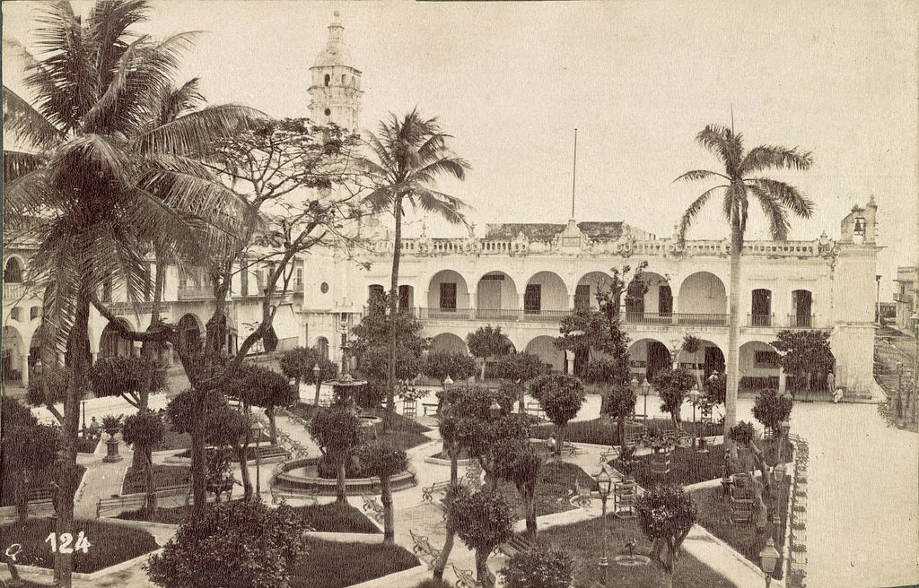
Palace and Square, Veracruz, 1855.

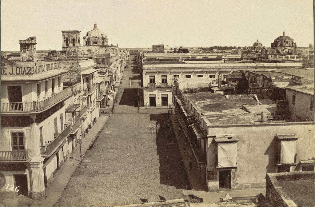
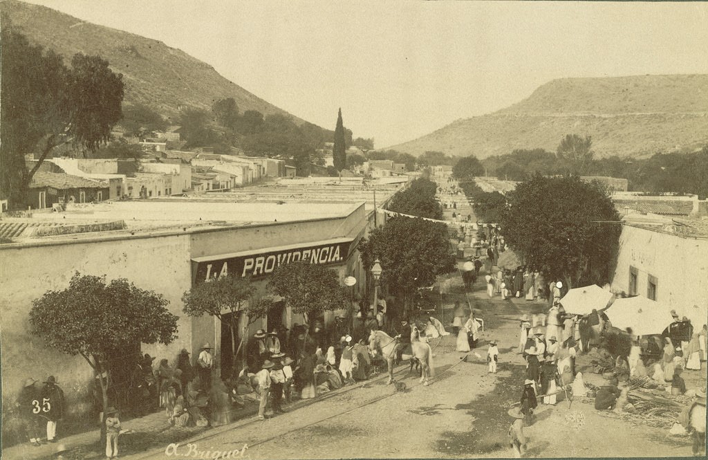
The Palace and Square of Veracruz formed the civic core of the city. Government buildings, churches, and commercial arcades surrounded central plazas in nearly every Mexican city — a layout inherited from Spanish colonial urban planning that made the plaza the center of public life.
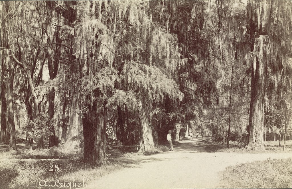
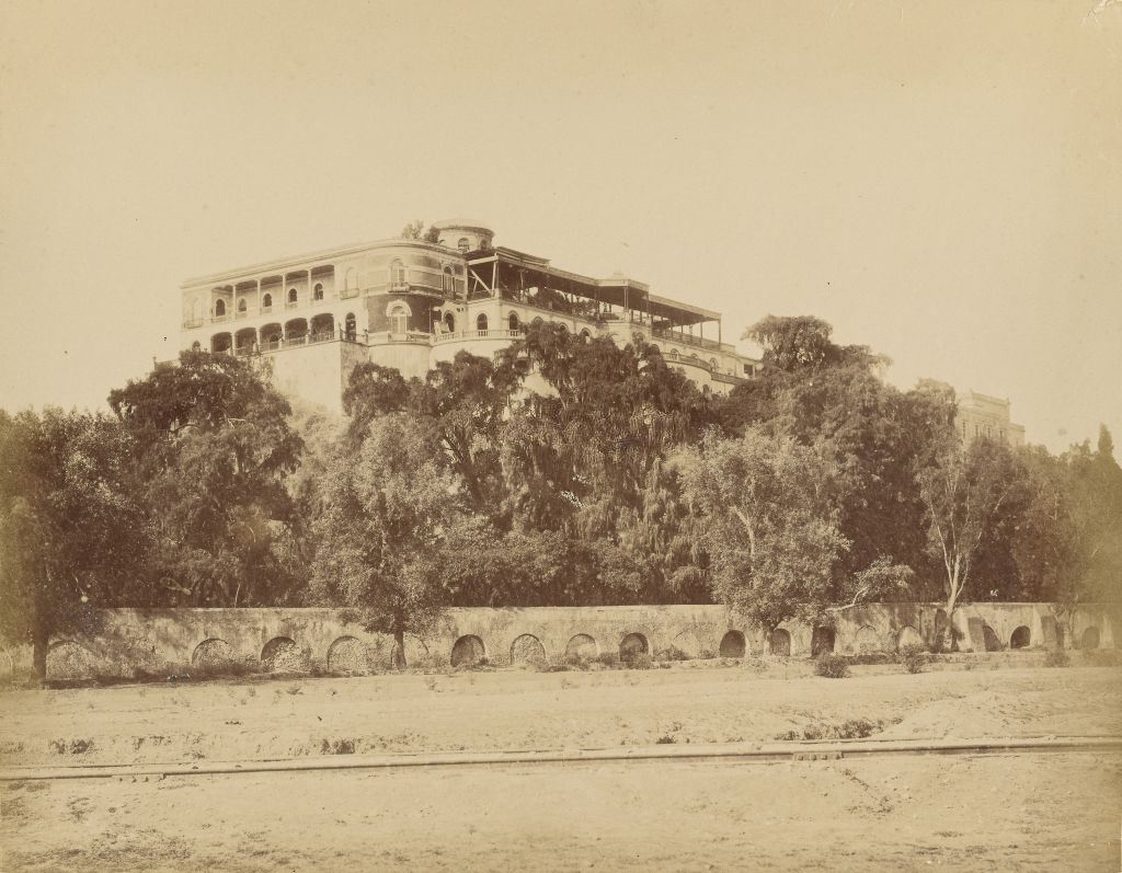
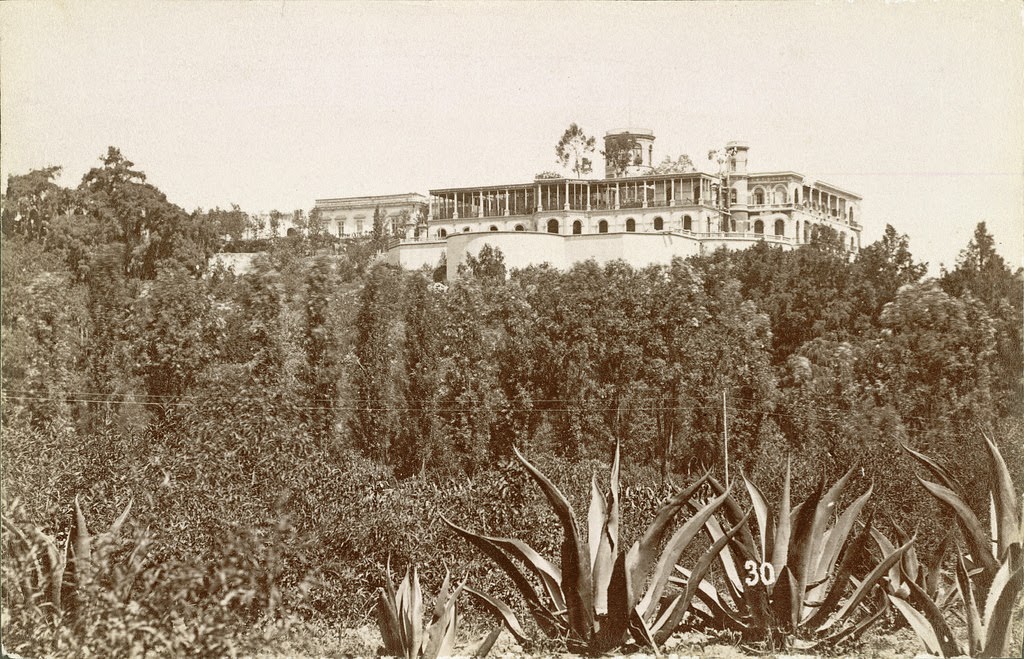
Mexico City, Chapultepec Grove, 1855

Chapultepec — meaning ‘grasshopper hill’ in Nahuatl — was both a forested park and the site of a castle that served as the official residence of Maximilian and his wife Carlota during the French-backed empire. After the republic was restored, Díaz later used it as the presidential residence.

Veracruz Harbor, 1855.
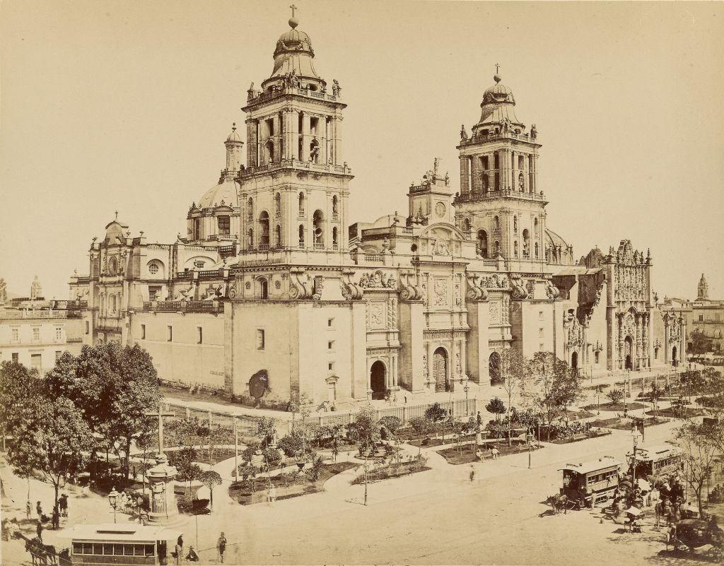
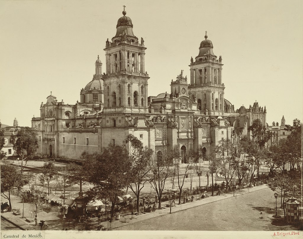
Metropolitan Cathedral. Mexico, 1855.

The Metropolitan Cathedral in Mexico City is the largest cathedral in the Americas. Built over nearly three centuries starting in 1573, it stands on the northern edge of the Zócalo — the main plaza — and was the religious centerpiece of the country throughout the colonial and post-independence periods alike.

Chimalapa Pueblo. State of Mexico, 1855.
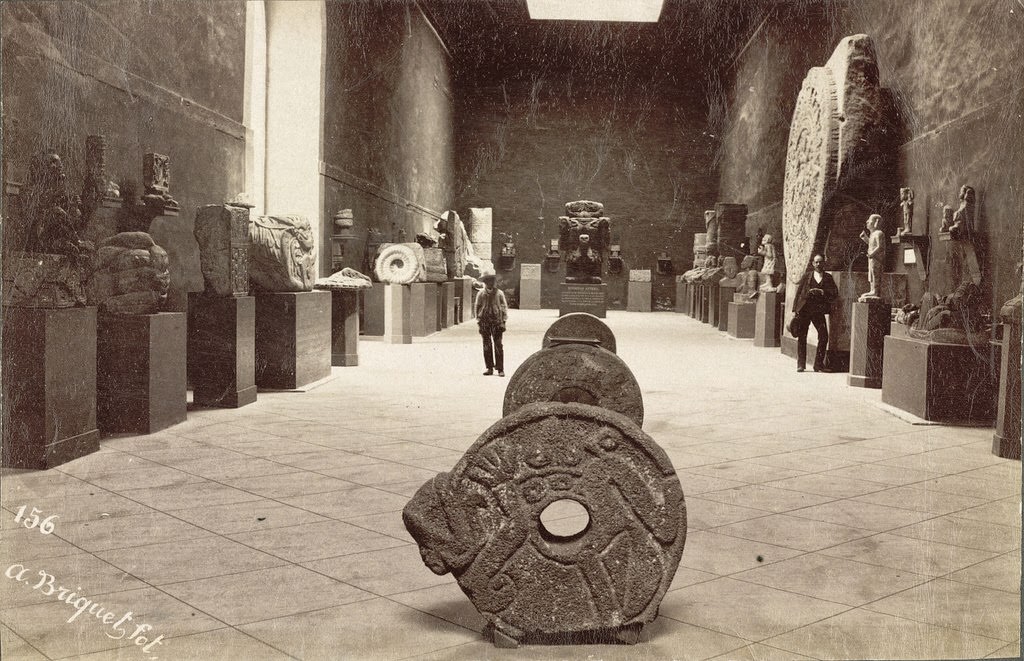
Archaeological Museum. Mexico City, 1855.

Mexico’s Archaeological Museum in the mid-19th century held artifacts from Aztec, Maya, and other pre-Columbian civilizations. Interest in Mexico’s indigenous past grew steadily during this period, even as indigenous people themselves remained largely excluded from political and economic power.

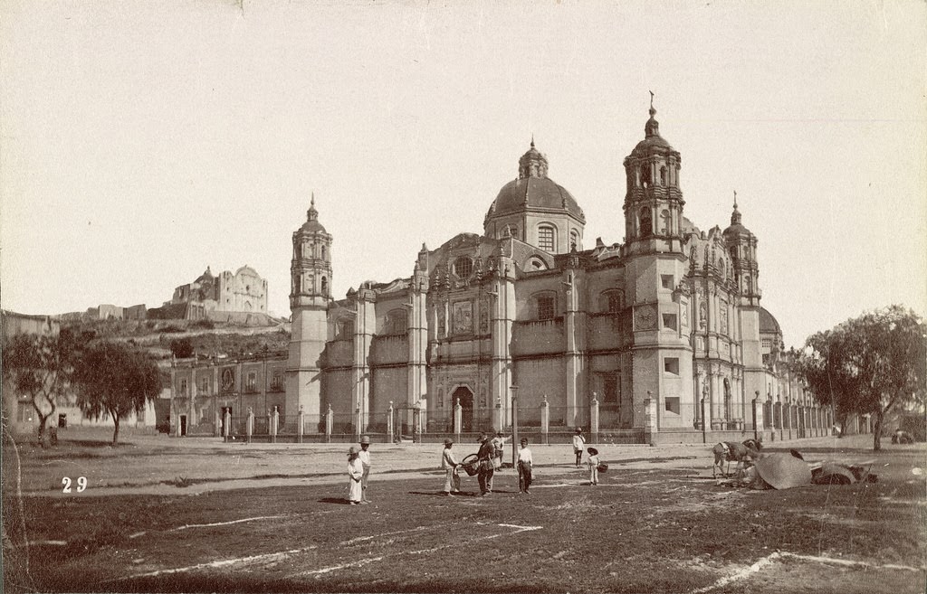
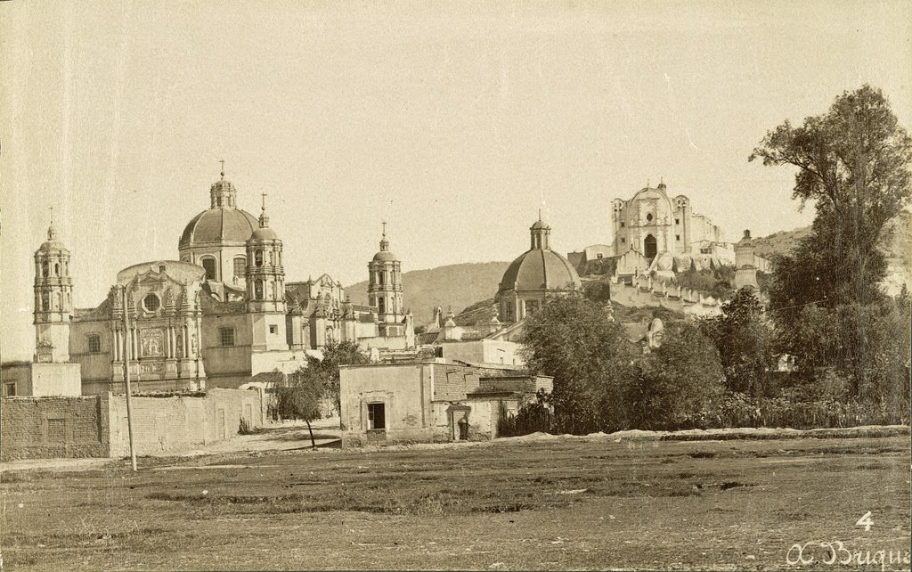
The Basilica of Our Lady of Guadalupe. Mexico City, 1855

The Basilica of Our Lady of Guadalupe was — and remains — the most visited Catholic pilgrimage site in the world. Located just north of Mexico City, it drew millions of faithful from across Mexico and beyond throughout the 19th century.

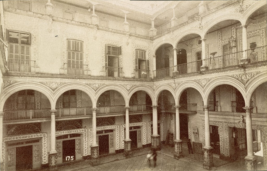
Courtyard of the Hotel Iturbide. Mexico City, 1855
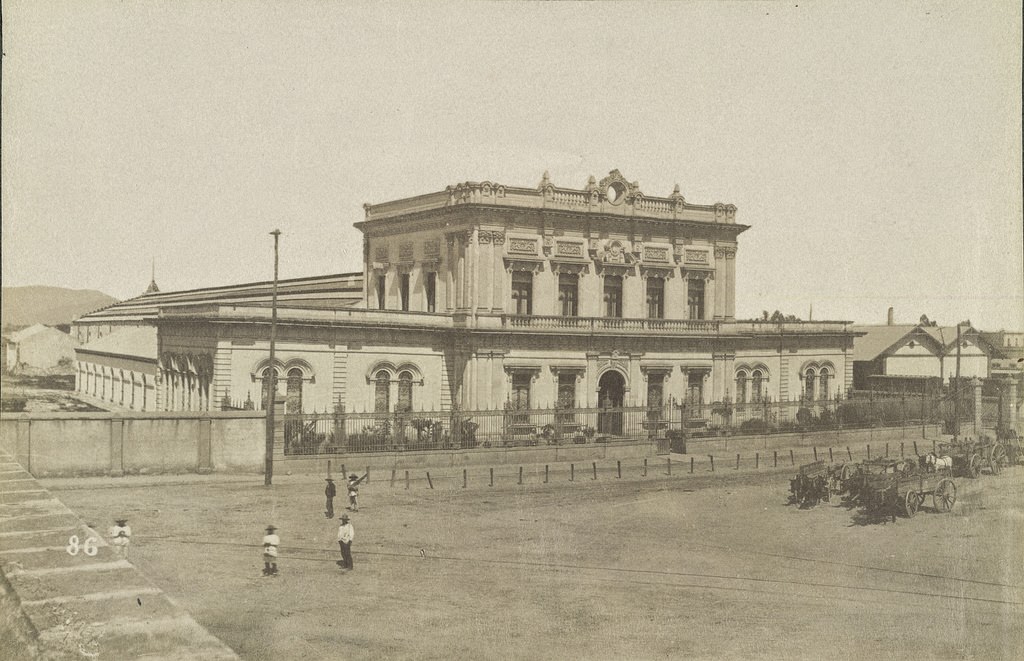
Train Station. Mexico City, 1855

Mexico City’s train station reflects just how early the country embraced rail infrastructure. Though Díaz dramatically expanded the network, railroad development in Mexico began in the 1850s, connecting the capital to Veracruz — the country’s primary port — long before his presidency.

Chapultepec Castle. Mexico City, 1855
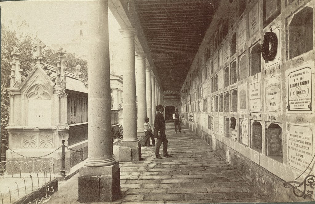
San Fernando Cemetery. Mexico City, 1855

San Fernando Cemetery in Mexico City holds the graves of some of the country’s most important 19th-century figures, including Benito Juárez. It was one of the first non-church cemeteries in Mexico, established as part of the Reform Laws that separated church and state.

Village and Basilica of Guadalupe. Mexico City, 1855
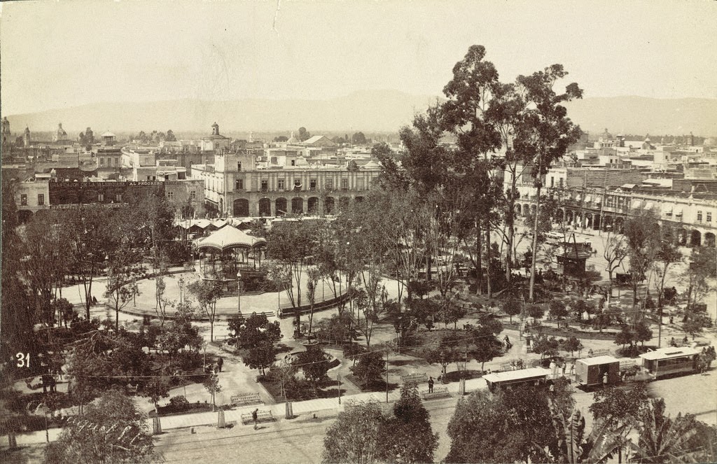
Zócalo Square. Mexico City, 1855

The Zócalo — formally the Plaza de la Constitución — was the beating heart of Mexico City. Surrounding it were the Metropolitan Cathedral, the National Palace, and government buildings. Political power, religious authority, and daily life converged in this single open space.

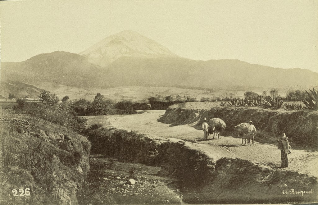
Mount Popocatepetl seen from near Amecameca. Mexico City, 1855

Popocatépetl — one of Mexico’s most active volcanoes — looms over the Valley of Mexico at over 17,000 feet. Its snow-capped peak was visible from Mexico City on clear days and had been a sacred site for indigenous peoples for thousands of years before the Spanish arrived.

Street Scene, Veracruz, 1855.
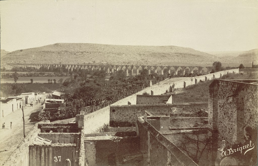
The Queretaro Aqueduct, 1855

The Querétaro Aqueduct, built in the 18th century, stretched nearly a mile and carried water into the city through 74 arches. It was still in use in the mid-19th century and remained one of the most impressive pieces of colonial engineering in Mexico.

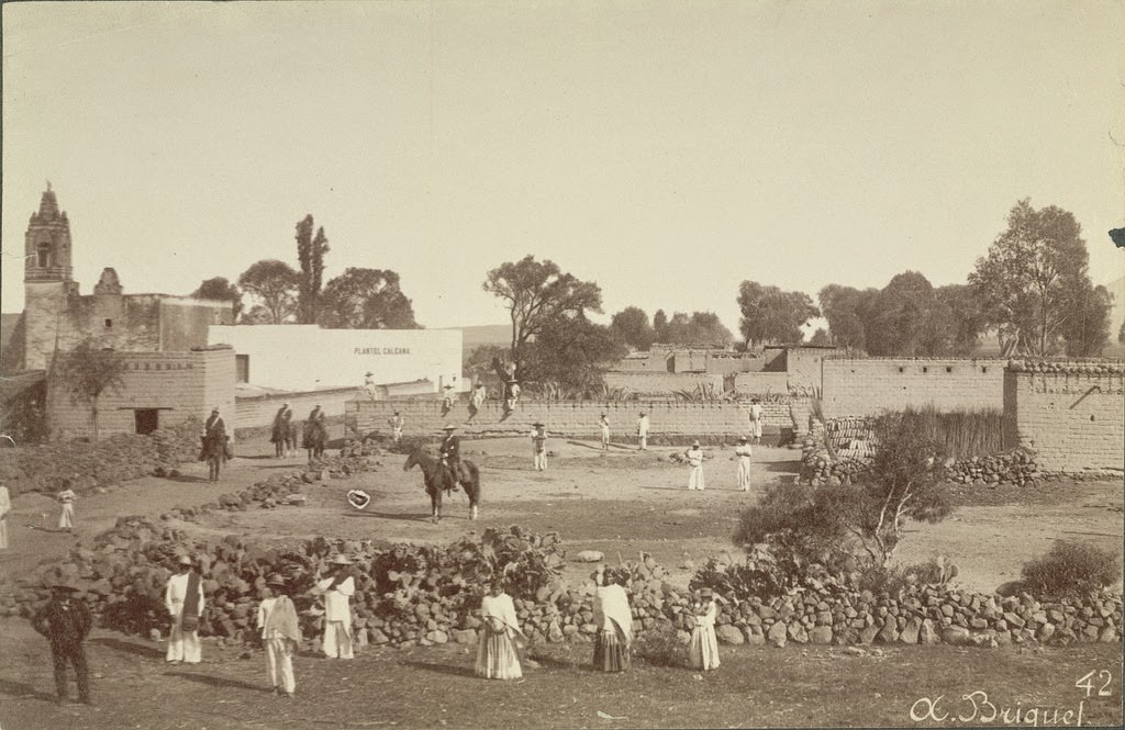
Provincial Scene, Mexico, 1855.
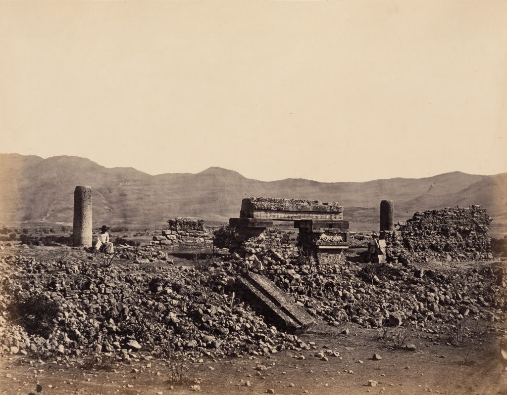
Second Palace at Mitla. Mexico, February 1860.

The ruins at Mitla drew early photographers and explorers who recognized the site’s extraordinary stonework. The Second Palace, like the Great Palace, features intricate mosaic fretwork built without mortar — an engineering achievement that made Mitla one of the most studied archaeological sites in Mexico by the mid-19th century.

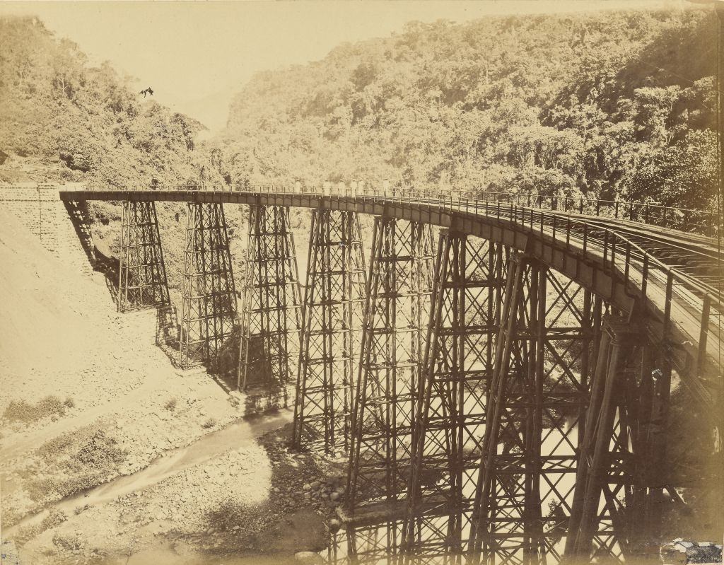
The Metlac Viaduct was one of the most celebrated engineering feats of the Mexican Railroad. It carried trains across a deep ravine in the state of Veracruz, linking the coast to the central highlands. The railroad this bridge served was largely financed by American capital — a concrete example of how foreign investment physically reshaped Mexico during the Porfiriato.

Metlac Viaduct, Mexican Railroad, 1883.
The Mexican convent of S.Severa,1867.

By 1867, convents like S. Severa existed in a Mexico where the Reform Laws had already stripped the Catholic Church of most of its property and political power. Some convents were converted into schools, barracks, or government offices. Others continued to operate, but with far less influence than they had held during the colonial era.

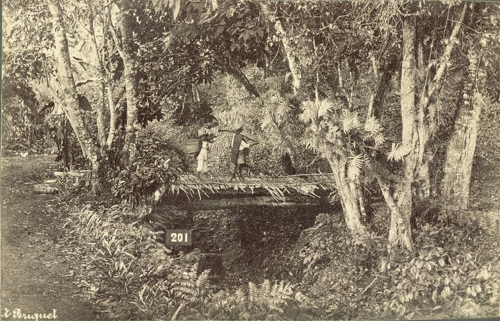
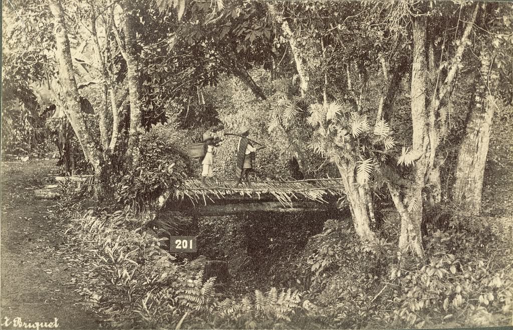
Mexican Rainforest Scene, 1855.

Beyond the cities and their politics, Mexico’s landscape ranged from volcanic peaks and high deserts to dense tropical rainforests along the Gulf Coast and in the south. This diversity of terrain meant that while railroad construction was transforming some parts of the country, other regions remained largely isolated from the economic changes reshaping urban Mexico. The growing inequality between those who benefited from modernization and those who didn’t became impossible to ignore — and by 1910, it ignited the Mexican Revolution.

Enjoyed this post? Get new ones in your inbox.

Leave a Comment

Your email address will not be published. Required fields are marked *

Share this Post 🥺

Please take a moment to share this content. Your support is greatly appreciated! 🙌🙏

Share this Post 🥺

Please take a moment to share this content. Your support is greatly appreciated! 🙌🙏
Scroll to Top
 
Hey Friend, Before You Go.. Please like & follow for more interesting content