Hey There! Before You Go. 😧
Get the best vintage content straight into your inbox!

Don't worry, we don't spam

Historical Photos Of Little Rock, Arkansas In The Early 20th Century

Little Rock has been Arkansas’s capital and largest city since its earliest days. French explorer Bernard de la Harpe named the area “Little Rock” in 1722, using it as a navigation landmark along the Arkansas River. The city was officially incorporated on November 7, 1831. After the Civil War, its population grew quickly, and the city invested in major infrastructure. A public water system went in during 1884, and electricity followed just two years later.

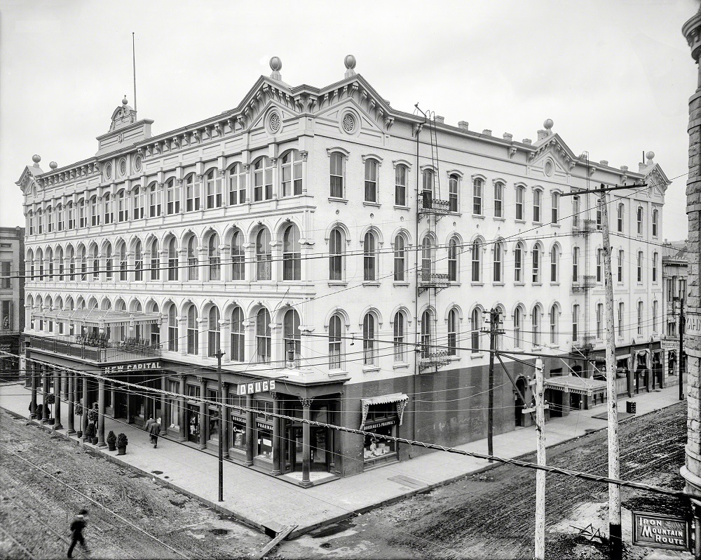
By the early 1900s, Little Rock was transforming into a modern city. One of its most notable downtown addresses was the New Capital Hotel on Markham Street, which stood as a symbol of the city’s growing prosperity.

New Capital Hotel, Markham Street, Little Rock, Arkansas, circa 1910

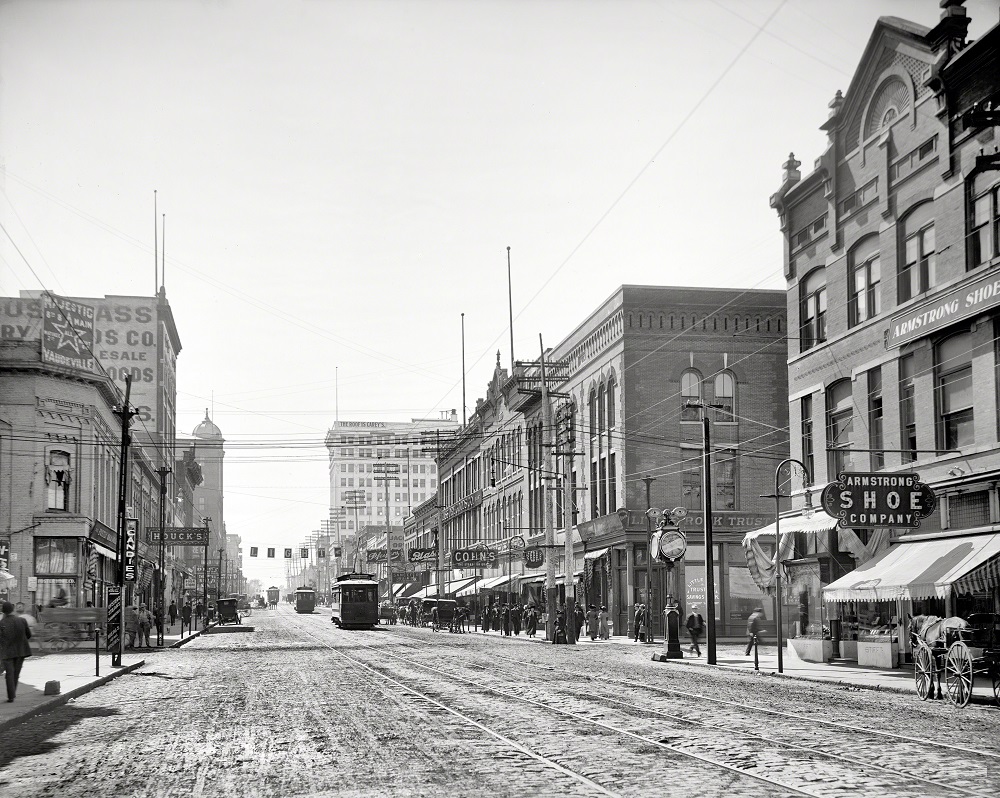
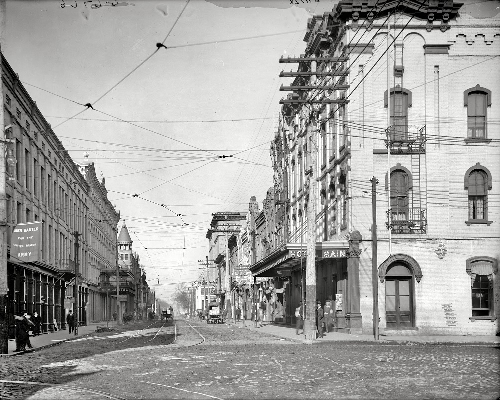
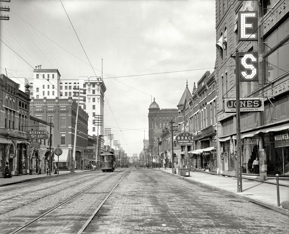
Main Street was the commercial heart of Little Rock during this era. Storefronts, horse-drawn vehicles, and early automobiles all shared the same stretch of pavement, reflecting a city caught between two ages of transportation.

Main Street, Home to a number of intriguing juxtapositions, Little Rock, Arkansas, circa 1910

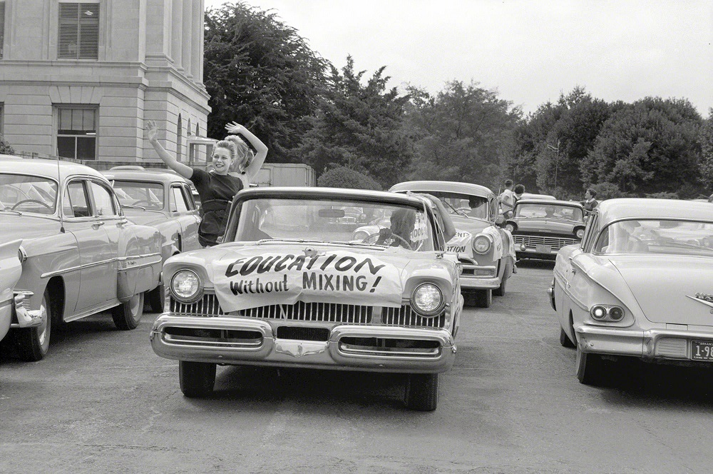
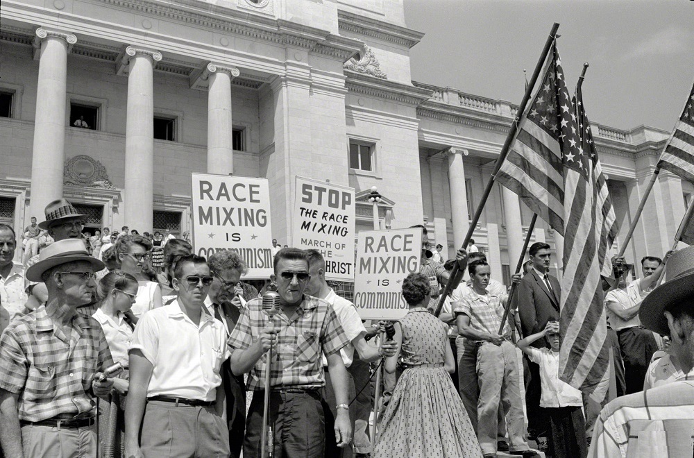
Not all of Little Rock’s early 20th-century history was peaceful progress. In 1958, the city became the center of a national conflict when Arkansas Governor Orval Faubus used the National Guard to block Black students from entering Central High School. President Eisenhower responded by sending federal troops to enforce the Supreme Court’s desegregation ruling, and the confrontation drew worldwide attention.

In the midst of that city's school integration crisis, Little Rock, Arkansas, in 1958
In the midst of that city’s school integration crisis, Little Rock, Arkansas, in 1958

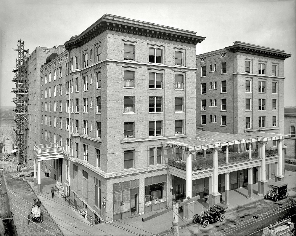
Downtown Little Rock was home to several grand hotels in the early 20th century. The Hotel Marion, opened around 1908, was among the most prominent. It served guests for decades before being demolished in 1980.

Hotel Marion, Little Rock, Arkansas, circa 1908. It was Demolished in 1980,

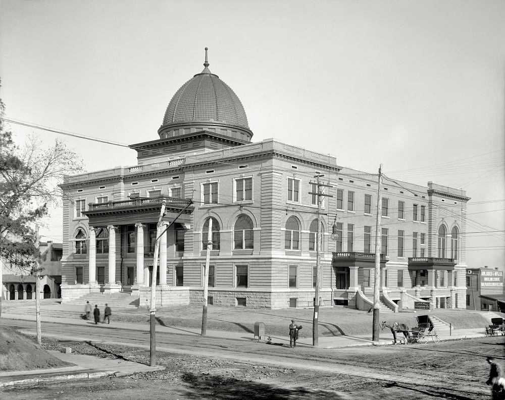
The year 1908 also saw the opening of Little Rock’s City Hall at the corner of Markham and Broadway Streets. The building anchored the civic center of town and featured the kind of ornate streetscape details typical of the era.

City Hall, With a sampler of interesting signage, and an elaborately rigged street light, Little Rock, Arkansas, 1908

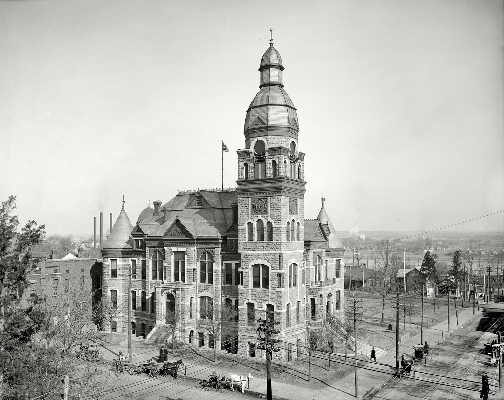
The Pulaski County Court House served as a key seat of local government. The town of Pulaski Heights was incorporated in 1903, and county institutions like the courthouse reflected the administrative growth happening across the region.

Pulaski County Court House, Little Rock, Arkansas, circa 1905

Street-level views of Little Rock around 1910 capture a city still being built. Utility poles, paved roads, and brick storefronts were gradually replacing the rougher landscape of earlier decades.

Wrapping up our tour of Little Rock, Arkansas, circa 1910

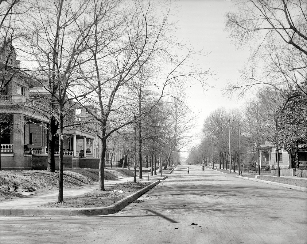
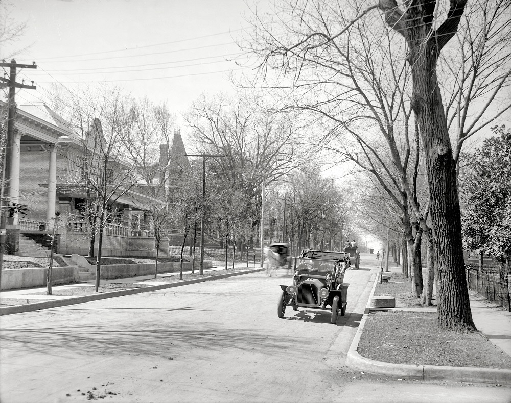
Residential neighborhoods were also developing quickly. West 2nd Street featured rows of homes that reflected the modest but sturdy domestic architecture common in Southern cities at the time.

West 2nd Street residences, Little Rock, Arkansas, circa 1910

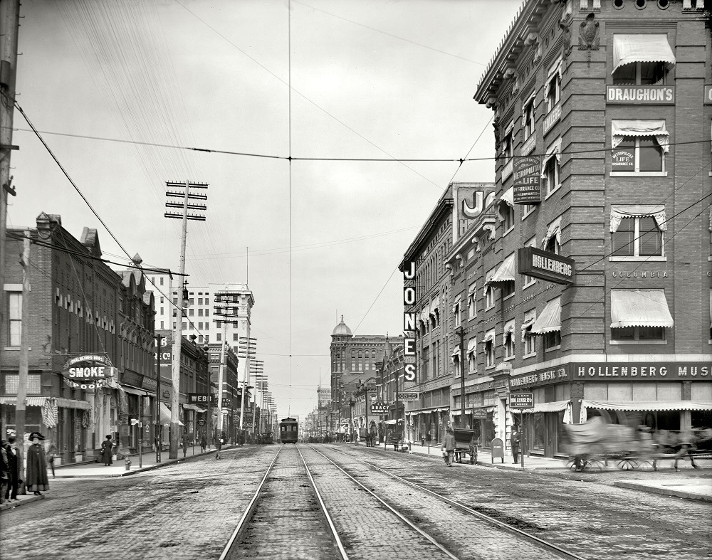
Main Street looking north from Sixth Street gives a clear picture of Little Rock’s urban density by 1910. Multi-story commercial buildings lined both sides of the road, and street traffic was a mix of pedestrians, wagons, and early motor vehicles.

Main Street north from Sixth, Little Rock, Arkansas, circa 1910

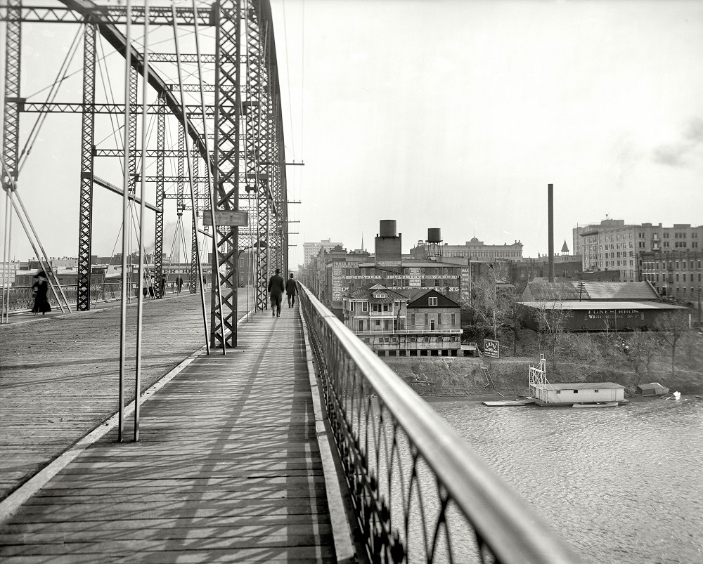
The Arkansas River defined much of Little Rock’s geography and commerce. Views from the Free Bridge show the river as a constant presence in city life, and it was this waterway that eventually made Little Rock a river port in 1969 after a system of locks and dams was completed.

View from the Free Bridge, Little Rock, Arkansas, circa 1910
Main Street north from Sixth, Little Rock, Arkansas, circa 1910

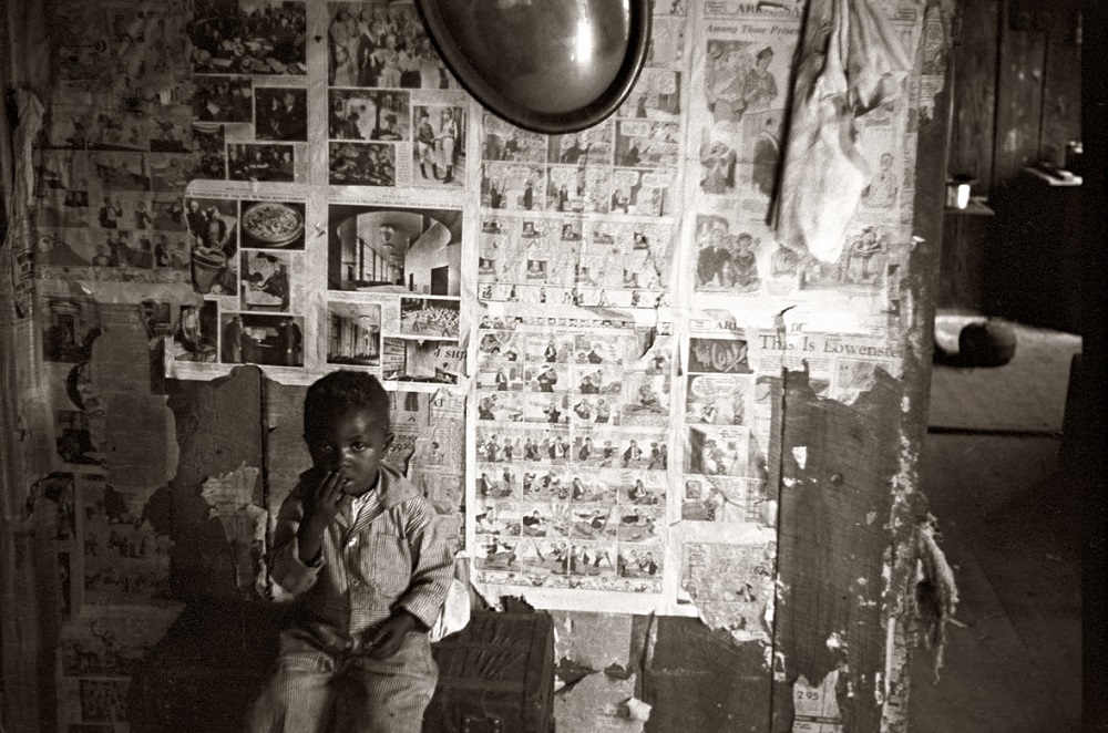
Away from the city’s commercial core, rural life in the Little Rock area told a different story. By the mid-1930s, tenant farming was widespread in Arkansas, and many families lived in sparse, uninsulated homes with few possessions. A 1935 photograph of a tenant farmer’s home interior documents these conditions plainly — bare walls, minimal furniture, and evidence of deep poverty during the Great Depression.

Interior of tenant farmer home, Little Rock, Arkansas, October 1935
Enjoyed this post? Get new ones in your inbox.

19 thoughts on “Historical Photos Of Little Rock, Arkansas In The Early 20th Century”

  1. It’s incredible how things remain the same no matter how much things change. What do these “Race Mixing be Communism!” signs mean? We still see the same concept today. It doesn’t matter what it is. Whenever they disagree with something, it’s communism or socialism.

    1. Why did you feel the need to say that? Are you afraid to admit that ALL Black people have been mistreated for hundreds of years? You have to let everyone know that SOME white people also had it tough? Jesus Christ.

    1. The reason the dome was removed is unknown to me, but there have been plans to reconstruct it in the past. The Little Rock City Hall building is relatively tiny for a city of its size.

  2. I think it’s funny that people downvoted the last two pics, like that changes the sentiment in LR at the time. It’s a picture capturing the moment. A bad moment. A good representation of that moment in time though.

  3. I have some old photos from when my family moved here back in the 50s. It’s always bothered me that in those old photos of Main Street the street itself is very wide, like 5 cars could drive side-by-side down main street. But now the buildings look like they are literally closer together. I had thought maybe it was the focal length of the lens in my photos, but the second photo on this page looks the same way.

    1. Back in the early 1900s, 2nd and especially 3rd between Broadway and the train station were some of the nicest neighborhoods in LR.

      If you had money, you built a house on 3rd, now Markham. Folks in the street car to Hillcrest could see your big house as they went by.

      They decided to kill the streetcars, and 3rd was turned from a residential street into a four lane. Most of those houses were torn down soon after. A few still exist.

      1. Yea I just reazlied google maps took me to some weird old section of West 2nd in southeast Little Rock for some reason.

        That’s a shame but I get it. That real estate is probably better suited for commercial use.

Leave a Comment

Your email address will not be published. Required fields are marked *

Share this Post 🥺

Please take a moment to share this content. Your support is greatly appreciated! 🙌🙏

Share this Post 🥺

Please take a moment to share this content. Your support is greatly appreciated! 🙌🙏
Scroll to Top
 
Hey Friend, Before You Go.. Please like & follow for more interesting content