
In the 1890s, Danish physician and photographer Thomas N. Krabbe traveled through Greenland and documented what he found with his camera. His photographs captured the towns, the people, and the daily routines of one of the world’s most remote and unforgiving places. Both Danish Greenlanders and indigenous Inuit people appear in his work, offering a rare visual record of life in the Arctic at the close of the 19th century.
Greenland’s human history stretches back thousands of years. Arctic peoples inhabited the island long before any European set foot there. Norse explorer Erik the Red arrived in the 10th century and established Viking settlements along the southwest coast. Those settlements lasted roughly 450 years before vanishing — their fate still debated by historians. The ancestors of today’s Greenlandic Inuit arrived around 1200 CE from the northwest, adapting their society to an increasingly harsh climate. For several centuries, they were the only people living on the island.
Denmark-Norway sent a missionary expedition in 1712, finding no trace of the lost Viking colonists but encountering Inuit communities along the coast. The Danes established trading colonies as part of their broader colonization of the North Atlantic. By the time Krabbe visited in the 1890s, a network of small towns and settlements dotted Greenland’s coastline, each shaped by the demands of the sea, the ice, and the seasons. The Ammassalik region in southeastern Greenland was one of the most active areas he photographed.
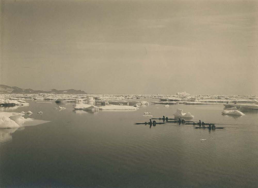
The kayak was far more than a simple boat in Greenlandic Inuit culture — it was the primary tool for hunting and travel across icy coastal waters. Krabbe photographed kayakers near Ammassalik, a settlement on Greenland’s isolated east coast. The region had only recently come into sustained contact with European outsiders when Krabbe visited, making his photographs especially valuable as a record of life there.
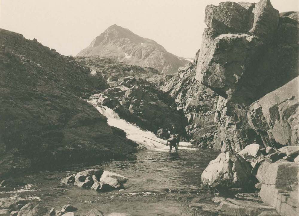
Fishing was a cornerstone of survival in Greenland. The rivers and fjords around Ammassalik were rich with trout, and Krabbe captured residents working the water for their catch. Food security in the Arctic depended on making full use of whatever the land and sea could provide across each season.
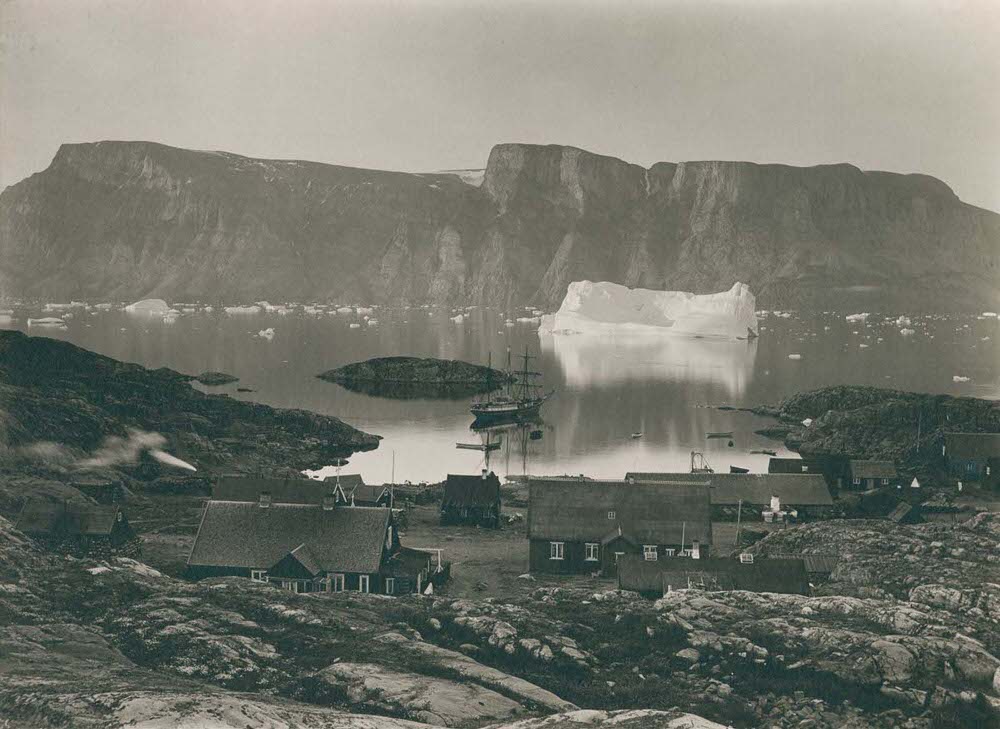
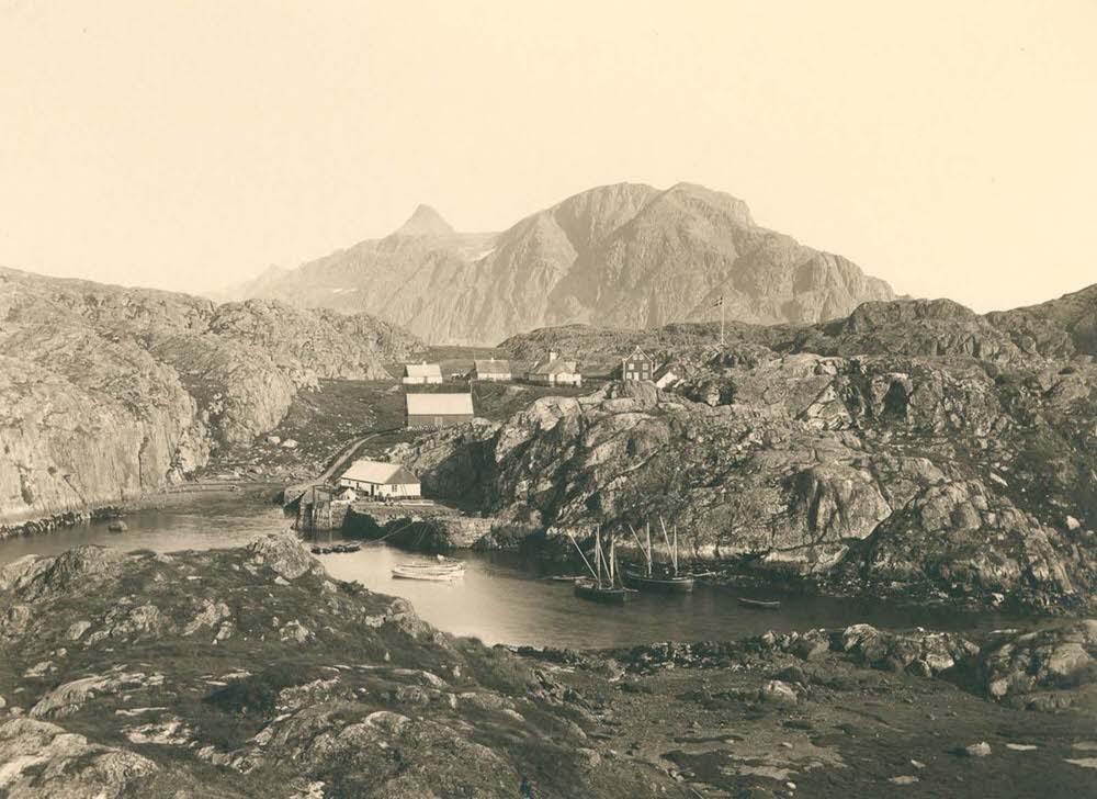
Along the west coast, Krabbe moved from town to town, photographing the settlements that had grown up under Danish colonial administration. Uummannaq, perched on a rocky peninsula in western Greenland, sat beneath its distinctive heart-shaped mountain. The town served as a regional hub, and Krabbe captured it from a distance to show its dramatic setting against the Arctic landscape.
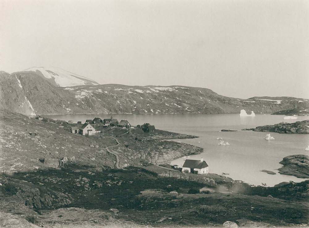
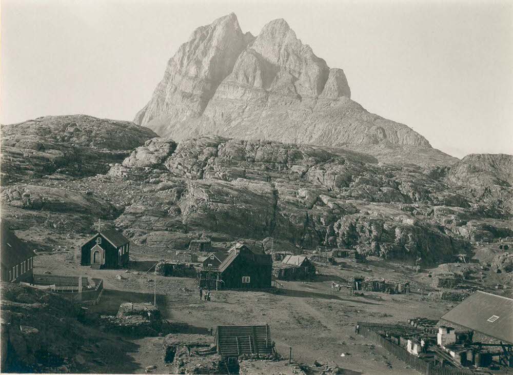
Upernavik, located further north, was one of the most northerly towns in Greenland at the time. Its position made it a stopping point for Arctic expeditions heading toward the polar regions. American explorer Robert Peary used northern Greenland as a staging ground for his polar attempts in the 1890s and early 1900s, and settlements like Upernavik were essential supply points along the way.
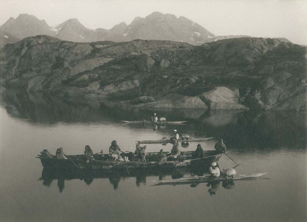
By the 1890s, the waters near Ammassalik carried both traditional Inuit kayaks and European-style boats, reflecting the two worlds that had begun to overlap along the coast. Krabbe documented this mix of old and new, showing a community in contact with the outside world but still deeply rooted in its own traditions. The photograph of a larger boat alongside paddling kayakers shows exactly that dynamic.
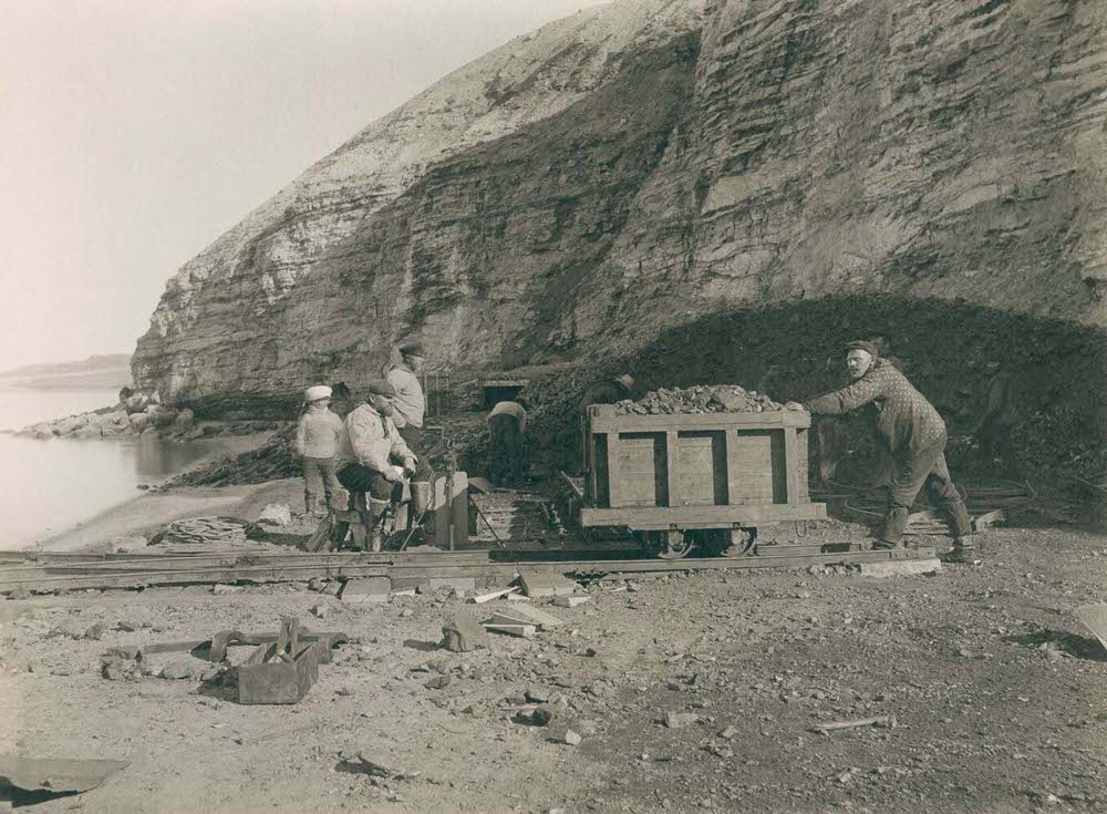
Not all of Greenland’s economy was built on fishing and hunting. Krabbe photographed miners standing outside the coal mine at Qaarsuarsuk, evidence of early industrial extraction on the island. Mining operations like this one were part of how Denmark sought to make its Arctic territory economically productive. The cryolite quarry at Ivittuut was another major extraction site Krabbe visited.
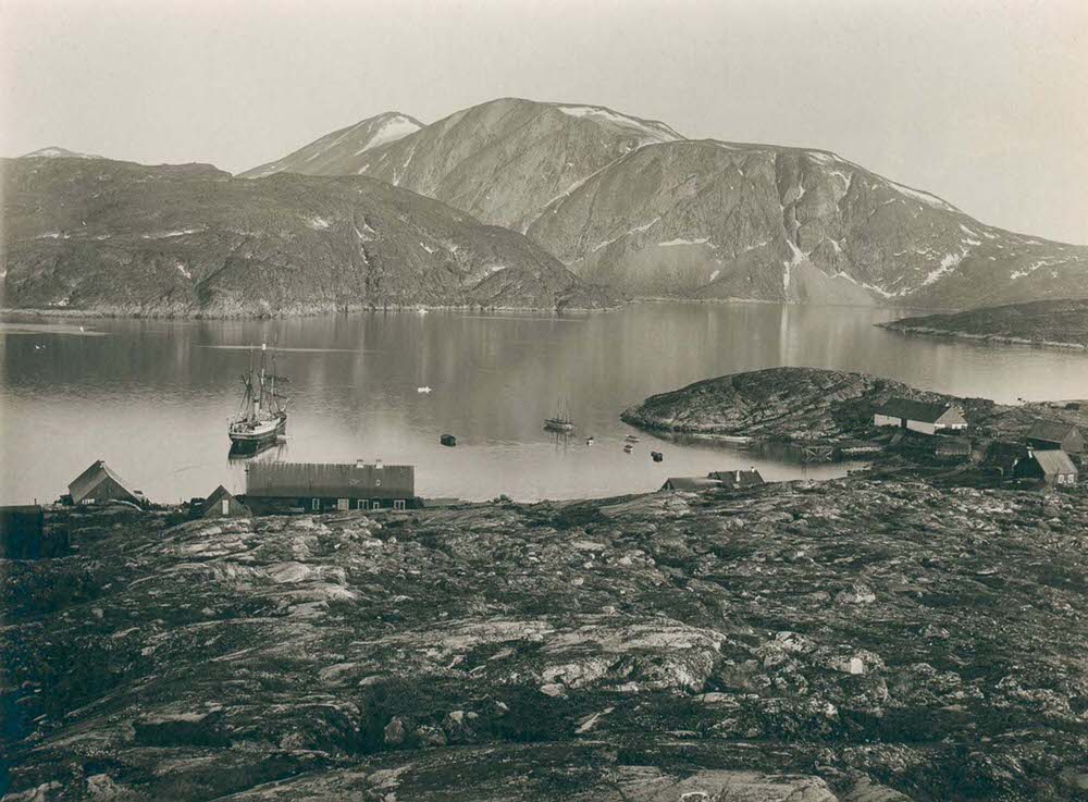
Qeqertarsuaq, situated on Disko Island in the Disko Bay, was one of the most established towns in western Greenland. It had long served as a center for trade and administration in the region. Krabbe’s photograph of the town shows the modest but organized layout typical of Danish colonial settlements along the coast.
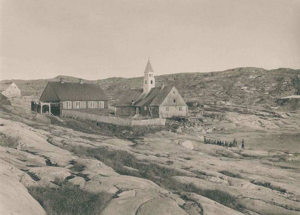
The church and the doctor’s residence in Ilulissat stood as symbols of the two institutions Denmark used most to extend its presence across Greenland: religion and medicine. Missionaries had been active in Greenland since the early 18th century, and by the 1890s, churches were a fixture of even small coastal communities. As a physician himself, Krabbe would have had a particular interest in documenting the medical infrastructure of the towns he visited.
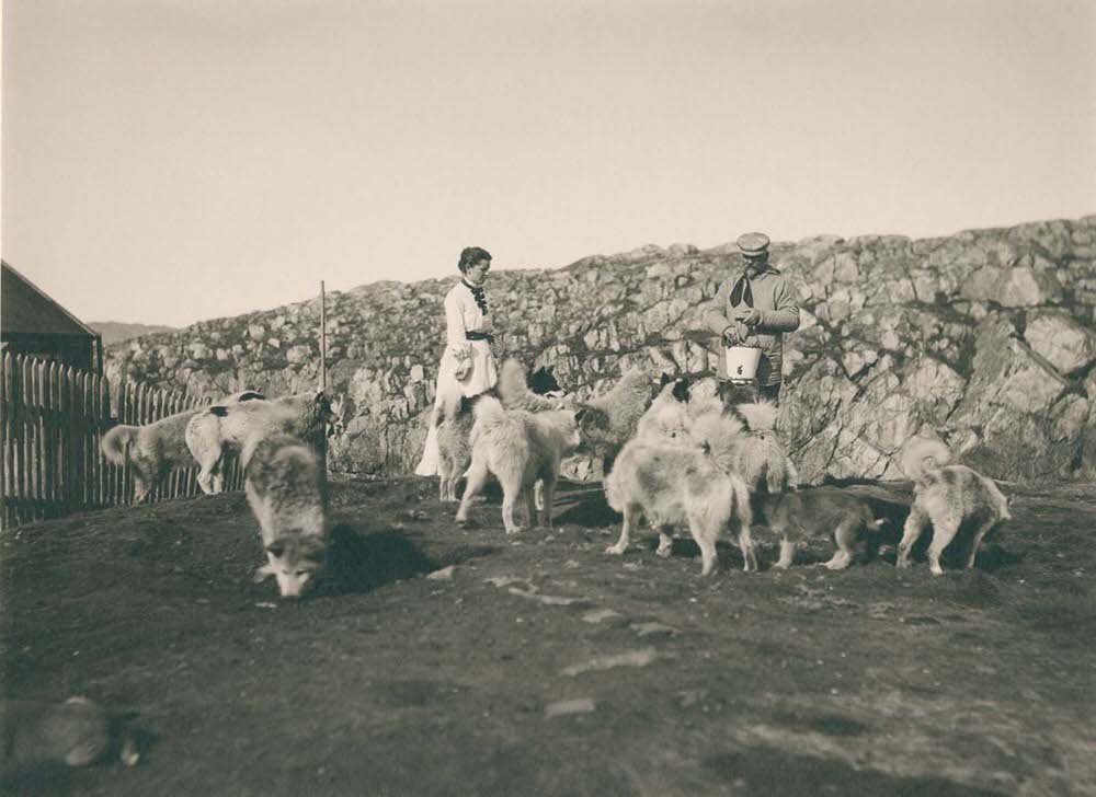
Sled dogs were essential to daily life in Greenland. They pulled supply sleds across the ice in winter and needed regular feeding and care year-round. In Aasiaat, Krabbe photographed a couple tending to their dogs — a glimpse into an ordinary moment that reveals how central these animals were to the community. Without dogs, overland travel in the Arctic was nearly impossible during the long winter months.
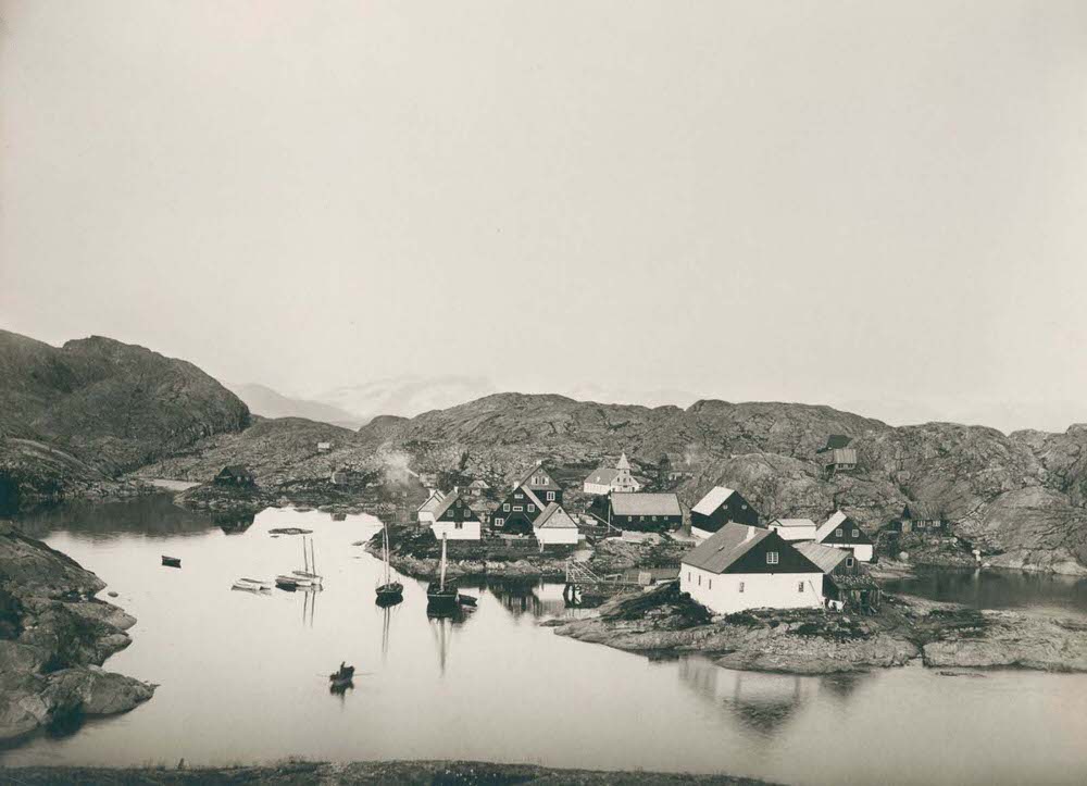
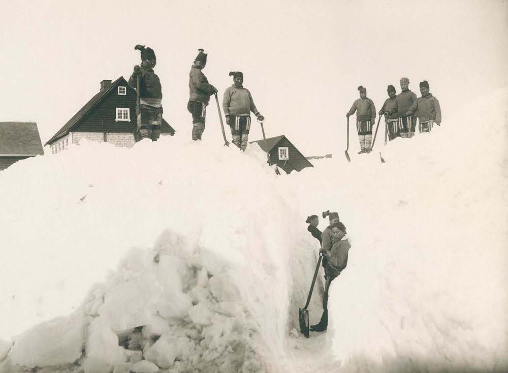
Nuuk, known to the Danes as Godthåb, was Greenland’s administrative capital and its largest settlement. Krabbe spent considerable time there, photographing multiple scenes of town life. Residents are shown clearing snow from the streets — a constant and necessary task in a place where heavy snowfall could disrupt movement and commerce for days at a time.
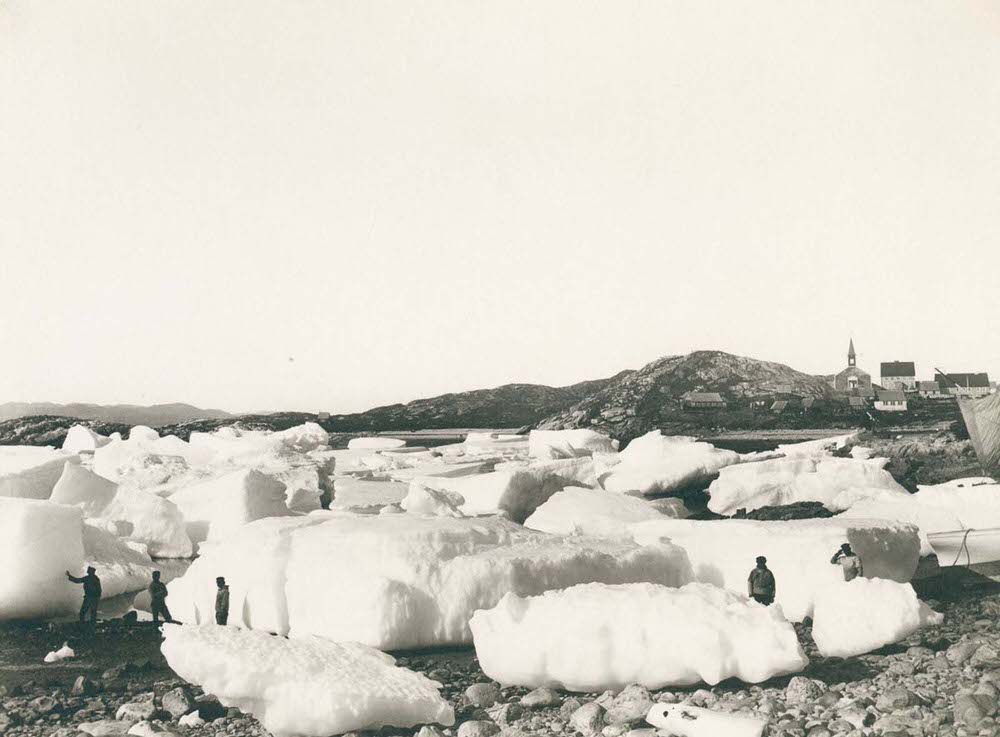
Ice was a defining feature of life in Greenland’s coastal towns. Ice floes drifting outside Nuuk were both a navigational hazard and a seasonal reminder of how directly the Arctic environment shaped everything about life on the island. Ships had to time their arrivals carefully, and residents understood the rhythms of the ice in ways that took outsiders years to learn.
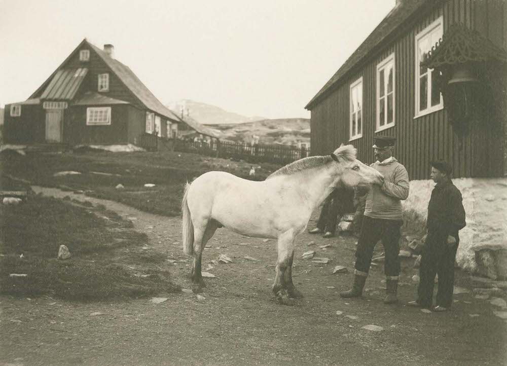
One of the more striking images Krabbe captured in Nuuk was of the town’s only horse. Horses were almost entirely absent from Greenland — the terrain, the climate, and the cost of bringing and keeping large animals on the island made them impractical. The single horse in Nuuk was a curiosity, and the fact that Krabbe photographed it suggests it was well known to residents as something out of the ordinary.
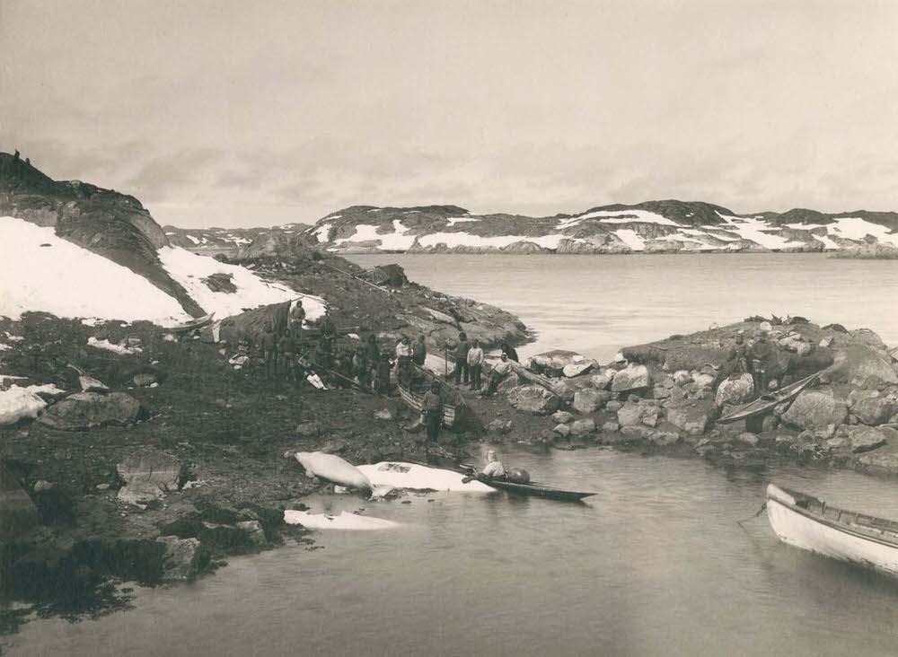
Whaling was a major industry along the Greenlandic coast, pursued by both Inuit hunters using traditional methods and European whalers operating larger vessels. Near Nuuk, Krabbe photographed whalers dragging their catch onto shore — a physically demanding process that involved the entire community. Whale meat and blubber provided food and fuel, and the industry drew considerable outside interest from European and American whaling fleets.
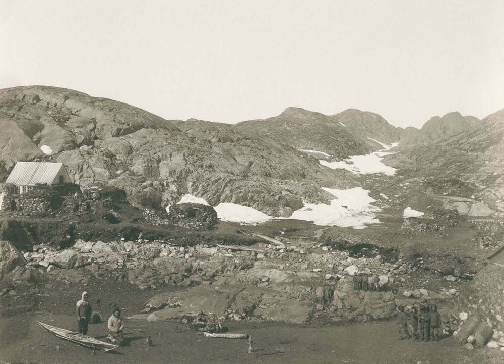
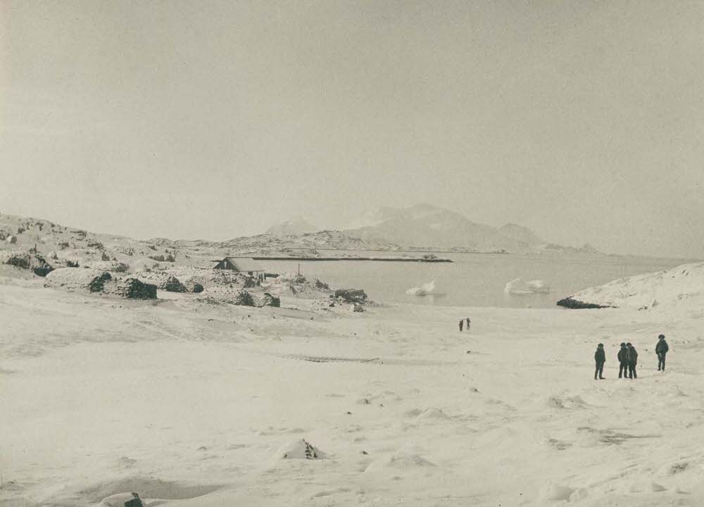
Traveling south, Krabbe documented smaller, more isolated settlements. Kangeq was a modest community near Nuuk, while Arsuk sat further down the southwestern coast near the cryolite mining operations at Ivittuut. Both offered sweeping views of the fjords and rocky coastline that defined southern Greenland’s landscape.
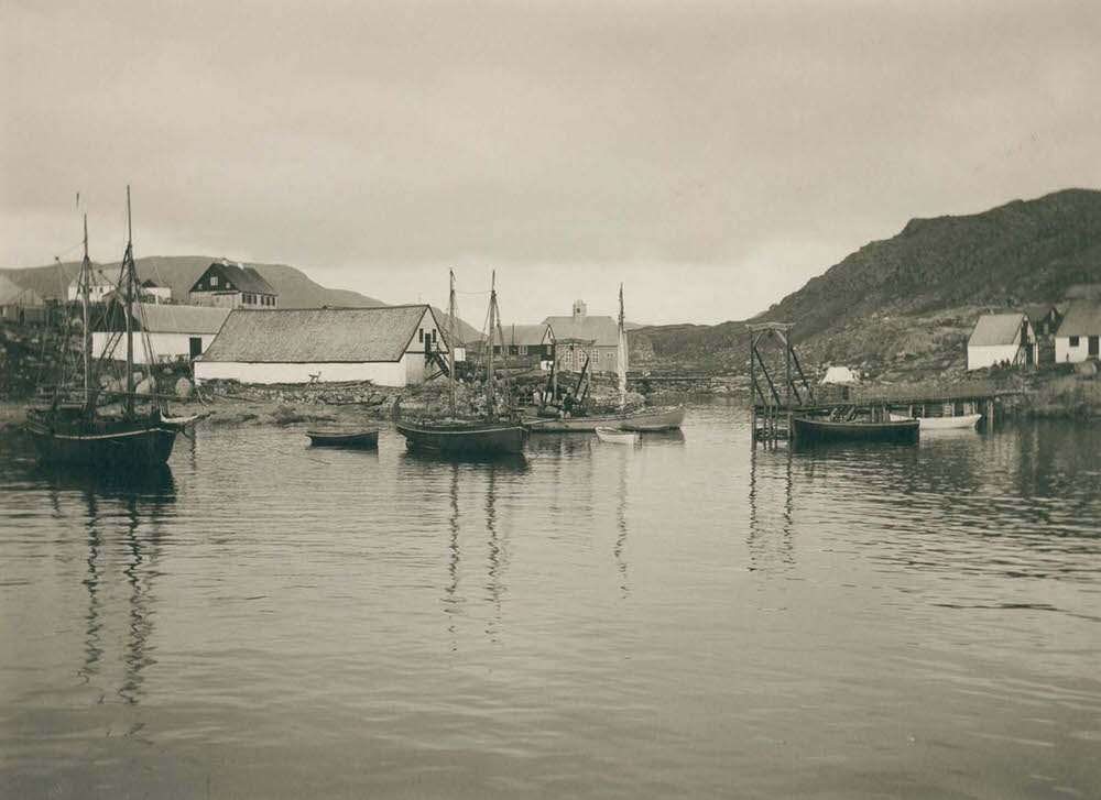
Qaqortoq, the largest town in southern Greenland, had a busy harbor that served as a trading and administrative center for the region. Its location in the more temperate south meant a slightly longer growing season and conditions more suitable for some forms of agriculture — something almost unthinkable in the north.
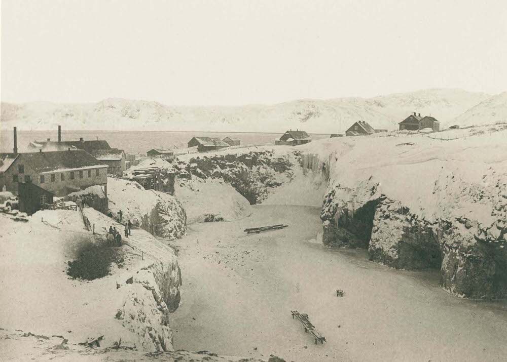
The cryolite quarry at Ivittuut was one of the most economically significant sites in Greenland during the 19th century. Cryolite, a rare mineral used in the production of aluminum and glass, was found in large quantities only at Ivittuut. The quarry attracted significant investment and a steady workforce, making it one of the most industrialized spots on the island.
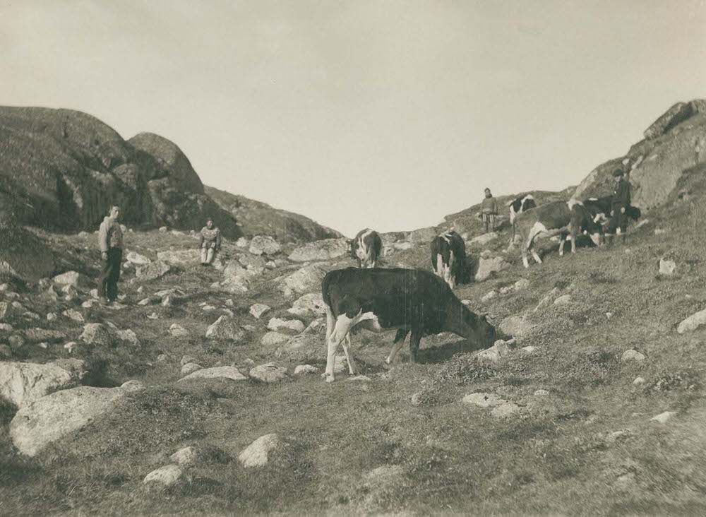
The milder climate of southern Greenland allowed for limited livestock farming. Krabbe photographed cows near Qaqortoq, which was a relatively rare sight on an island where most food came from the sea. The presence of cattle in the south reflected how different the conditions were compared to the frozen communities further up the coast.
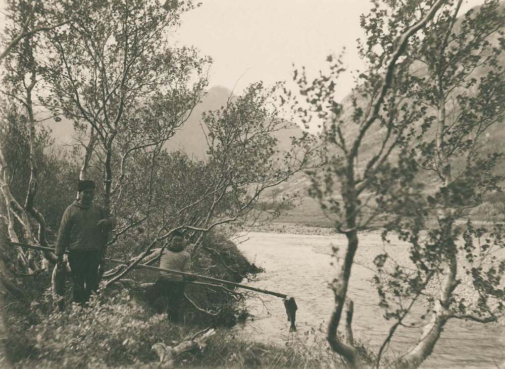
The Qinngua valley in southern Greenland is one of the island’s most unusual landscapes — a sheltered valley with a small forest of rowan and birch trees, a striking contrast to Greenland’s typically treeless terrain. The river running through the valley supported healthy trout populations, and Krabbe photographed fishermen working its banks, just as he had done further north at Ammassalik.
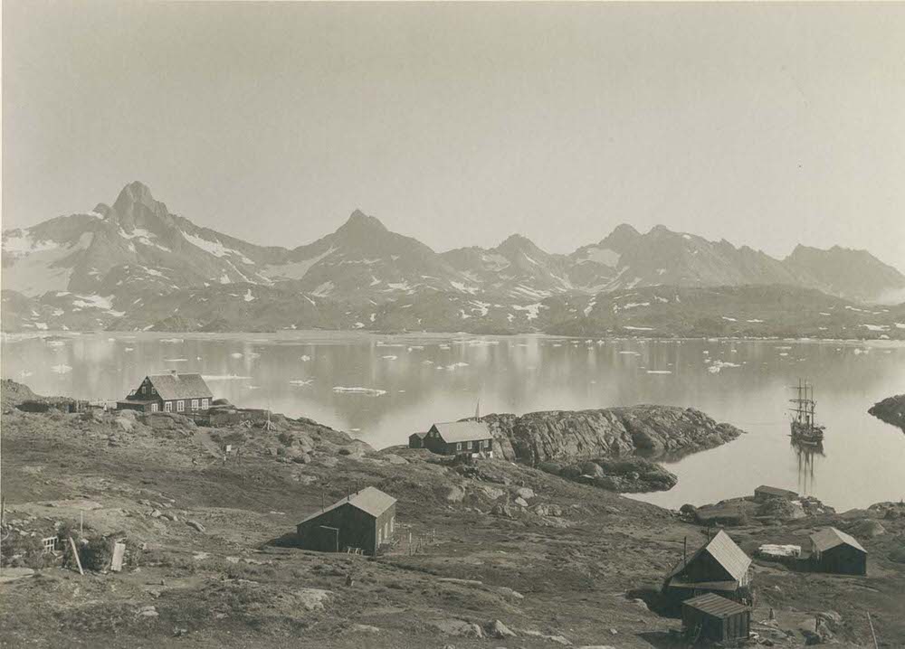
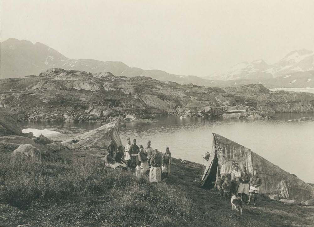
Krabbe returned his lens to Ammassalik multiple times throughout his travels. The east coast settlement was geographically cut off from the rest of Greenland for much of the year, and its inhabitants had developed ways of living that were more self-contained than those of the west coast towns. His photographs of the settlement show its layout against the backdrop of fjords and mountain ridges — a community built to survive at the edge of the accessible world.
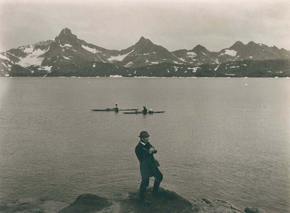
Krabbe left behind one image of himself — a self-portrait taken above Tasiusaq Bay. He stands looking out over the water, the landscape stretching wide behind him. By 1911, Greenland’s total population had grown to just over 14,000 people, scattered across those southern shores he had spent years photographing. His camera had moved through towns that most people in Europe would never see, recording a way of life shaped entirely by ice, water, and the short Arctic summer.




