
Barcelona sits on the northeastern coast of Spain, facing the Mediterranean Sea. It is the capital of Catalonia and Spain’s second most populated city. By the 1870s, it had already lived through centuries of political struggle, foreign occupation, and economic transformation — and the city’s streets showed all of it. These rare photographs capture Barcelona during one of the most active periods of its modern history, when old stone buildings stood next to newly paved boulevards, and a city once held back by political suppression was beginning to grow at full speed.
To understand what Barcelona looked like in the 1870s, it helps to know what the city had just gone through. In 1714, Bourbon troops captured Barcelona after a long siege. Catalonia lost its rights, its institutions, and much of its political identity. For over a century, the region struggled. Then, in the mid-1800s, the textile industry began to take off, and with it came money, new buildings, and a cultural revival. The Renaixença — a movement that brought the Catalan language back as a serious literary language — was in full swing by the time these photos were taken. The streets you see in these images were streets in the middle of a comeback.
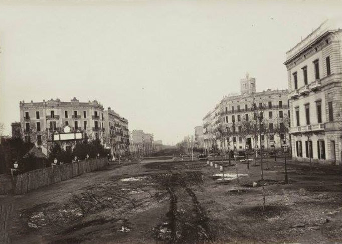
The Gran Via de les Corts Catalanes was one of the great symbols of Barcelona’s urban expansion. Running across the city from east to west, it was part of the Eixample district’s broader design — a plan by engineer Ildefons Cerdà to break Barcelona out of its old walled boundaries and build a modern, organized city. In the 1870s, much of that construction was still underway, and photos of the Gran Via show a wide, partially developed avenue beginning to take shape.
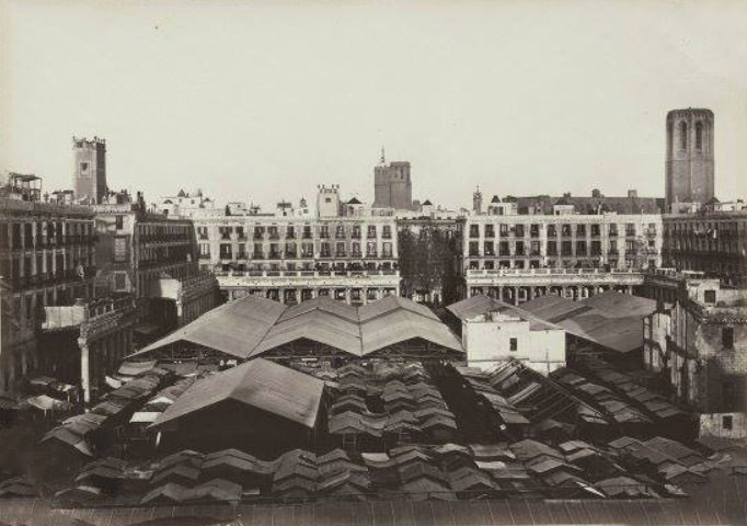
La Boqueria — officially the Mercat de Sant Josep de la Boqueria — was already one of the city’s busiest market spaces by the 1870s. Located just off La Rambla, it had been functioning as a market since the early 13th century, though a proper iron-and-stone structure was built in the 1840s. By the time this photo was taken, it was a central hub of daily life in Barcelona, where vendors sold fruit, fish, meat, and vegetables to residents from across the city.
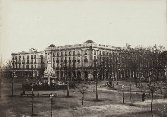
The Porxos d’en Xifré, built in the 1830s, was one of the first buildings in Barcelona to use a neoclassical arcade design. It was commissioned by Josep Xifré, a wealthy merchant who had made his fortune in Cuba. The building stood near the port and quickly became one of the most fashionable spots in the city, housing restaurants and businesses that catered to Barcelona’s merchant class.
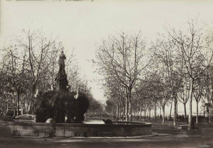
The Passeig de Sant Joan was one of the main boulevards cut through the Eixample district. Wide, lined with trees, and designed for both pedestrian and carriage traffic, it represented the kind of grand urban planning that was reshaping Barcelona in the second half of the 19th century. In the 1870s, the passeig was still being built up, and photographs from this period show a street that mixed finished buildings with open lots.
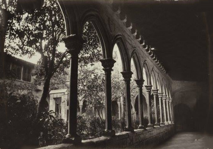
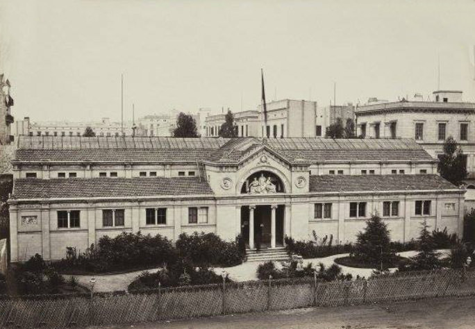
Barcelona’s artistic life was well-established long before the modernist movement of the late 19th century. The city’s Bellas Artes — fine arts — institutions trained painters, sculptors, and architects who would go on to define the city’s visual identity. The cloisters of Santa Ana, a Romanesque church dating back to the 12th century, stood as a quiet reminder of medieval Barcelona just steps from the busy Ramblas.
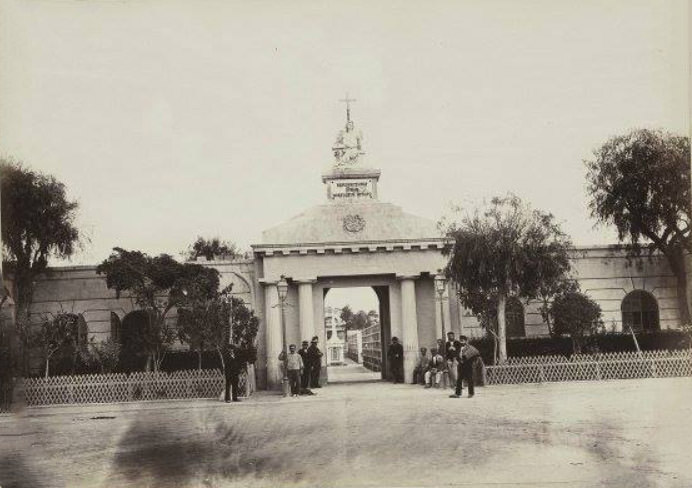
The Cementiri del Poblenou — also known as the Cemetery of the East — was founded in 1775 and was the main burial ground for Barcelona’s population. By the 1870s, it held an enormous number of elaborate tombs and neoclassical monuments. Its grand entrance gate, captured in this photograph, reflected how seriously 19th-century Barcelona took the architecture of death. Wealthy families commissioned ornate mausoleums that turned the cemetery into an open-air gallery of funerary sculpture.
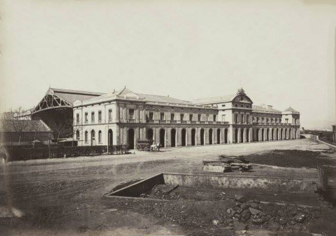
Rail travel was transforming cities across Europe in the 19th century, and Barcelona was no exception. The Estació del Nord served as one of the city’s major train stations, connecting Barcelona to the rest of Catalonia and beyond. The station was a symbol of industrial-age ambition — a building designed to handle the growing movement of people and goods that came with economic expansion.
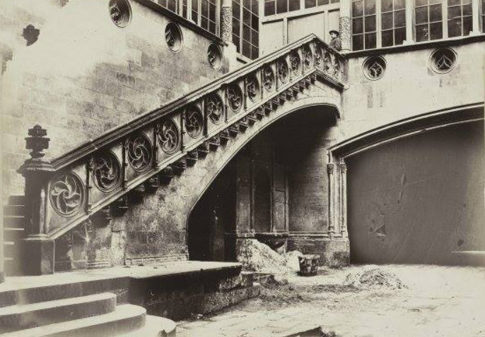
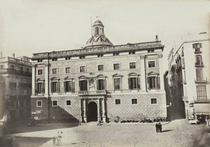
The Palau de la Generalitat is one of the most historically significant buildings in all of Catalonia. It has served as the seat of the Catalan government since the 15th century. In the 1870s, despite Catalonia’s suppressed political status, the palace still stood at the heart of Barcelona’s civic life. Its Gothic and Renaissance architecture made it one of the most photographed landmarks in the city.
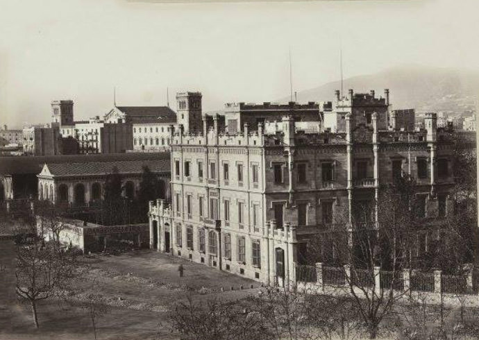
Plaça Catalunya was still under development in the 1870s. The large public square that today serves as the geographic center of Barcelona had not yet been fully completed — that would come at the turn of the century. But buildings like the Casa Gibert were already defining its edges. These early structures give a clear picture of how the square was taking shape during Barcelona’s period of rapid urban growth.
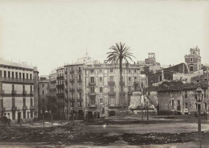
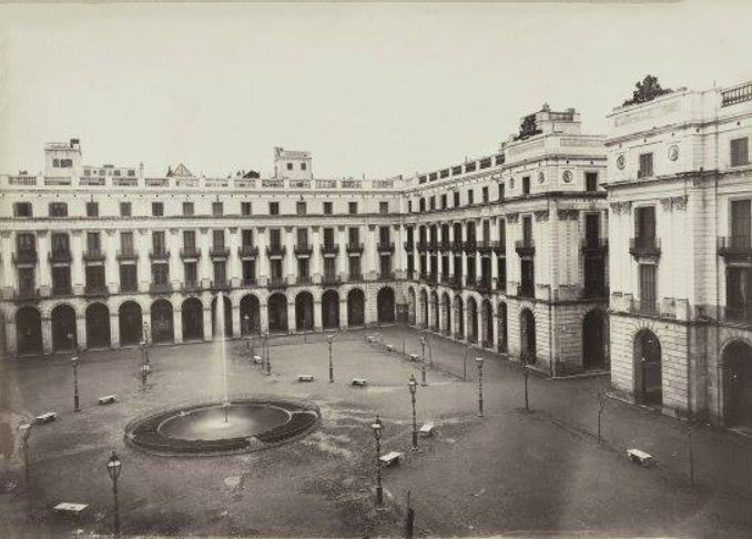
The Plaça Reial was completed in 1848 and quickly became one of the liveliest squares in the city. Designed by Francesc Daniel Molina, it featured a neoclassical layout with uniform colonnaded buildings surrounding a central fountain — the Fountain of the Three Graces. By the 1870s, the square was already packed with cafés, taverns, and street activity, making it a social center for people from all walks of life.
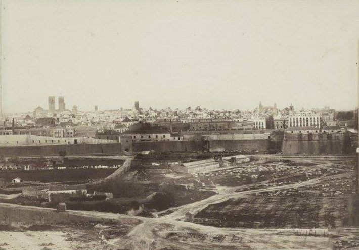
From the hilltop of Montjuïc, photographers in the 1870s could capture sweeping views of the city below, including the old city walls — the Muralla — and key gates like the Portal de Santa Madrona. These walls had long defined Barcelona’s limits, but by this era they were being demolished to make way for the Eixample expansion. Photos taken from Montjuïc document Barcelona’s transition from a walled medieval city to an open, modern one.
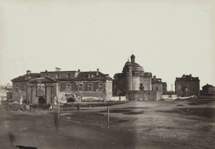
La Ciutadella had a complicated history. The fortress was built by Philip V after the 1714 siege specifically to control the local population — it was not a defensive structure against foreign enemies, but a military tool to keep Barcelona’s own citizens in check. By the 1870s, the fortress had been demolished, and the land was being converted into a public park. The 1888 Universal Exhibition would later be held here, but in the 1870s, the transformation was already well underway.
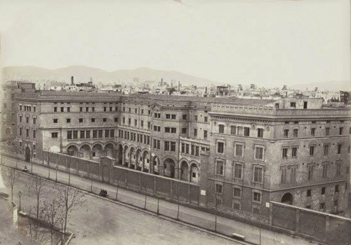
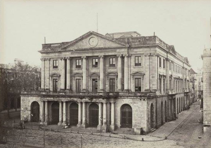
La Llotja de Mar — the Maritime Exchange — was one of Barcelona’s most important commercial buildings. Originally built in the 14th century to house the city’s merchant exchange, it was redesigned in the neoclassical style in the late 18th century. By the 1870s, it also housed the School of Fine Arts, where a young Pablo Picasso would later study. The building connected Barcelona’s trading past with its growing artistic ambitions.
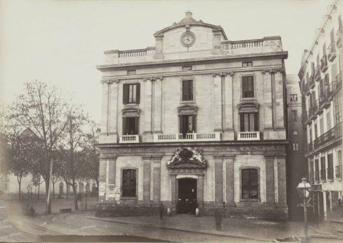
The Banc de Barcelona was founded in 1844 and was the first modern bank in Spain. By the 1870s, it was one of the most powerful financial institutions in the country, directly tied to Barcelona’s booming textile trade and its commercial connections to Spain’s colonies. Its building reflected the confidence and wealth of the city’s merchant and industrial class.
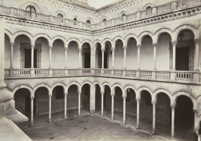
The University of Barcelona’s main building was constructed between 1863 and 1882, meaning it was still relatively new in the 1870s. Its cloisters — open-air arcaded walkways surrounding a garden — became one of the most photographed spaces on the campus. The building was designed by Elies Rogent in a Romanesque revival style, and it remains one of the finest examples of 19th-century academic architecture in Spain.
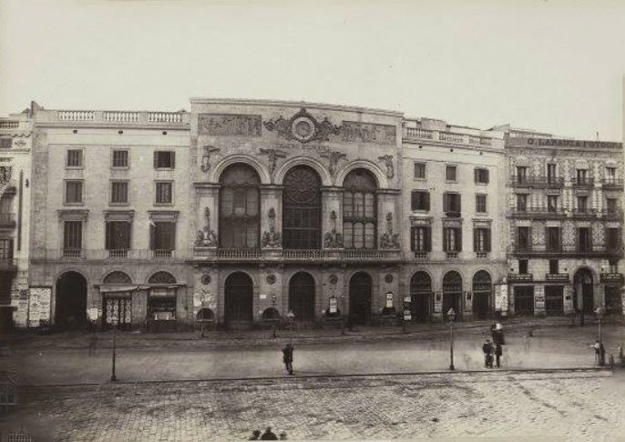
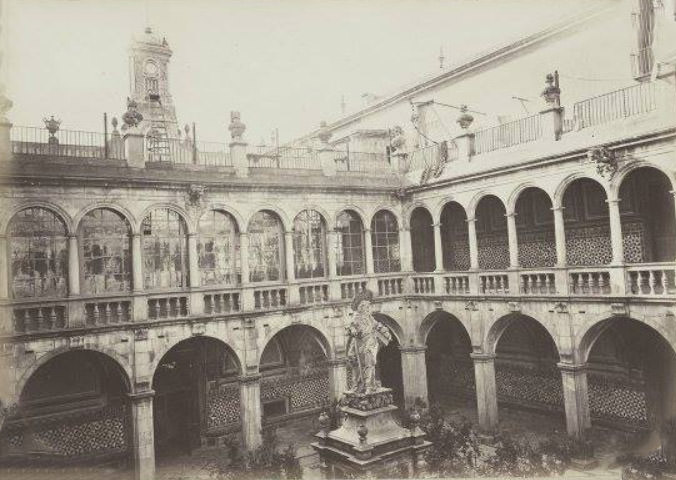
The Hospital de la Santa Creu was Barcelona’s main hospital for centuries. The Casa de Convalescència — the convalescent house attached to it — featured one of the most beautiful tiled courtyards in the city, decorated with elaborate ceramic panels depicting the life of Saint Paul. By the 1870s, the hospital complex was still in active use, treating the city’s sick and poor. The Teatro Principal, nearby, was one of Barcelona’s oldest theaters, hosting performances that drew audiences from across the city.
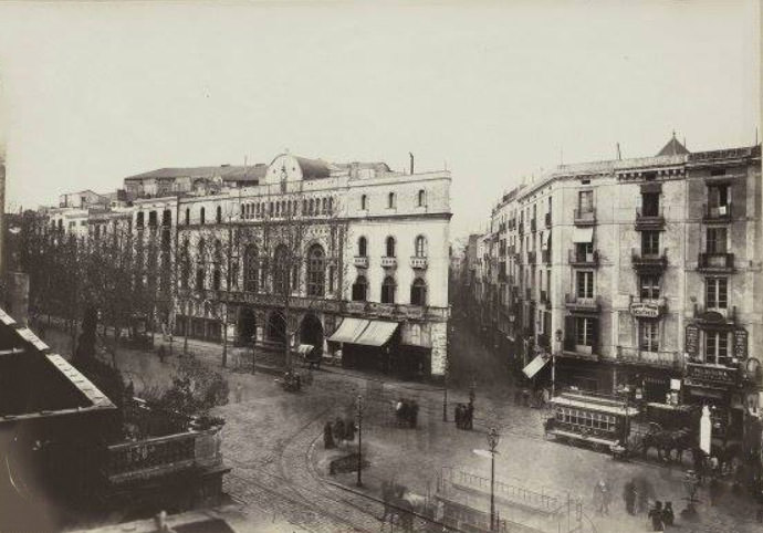
The Gran Teatre del Liceu opened in 1847 and immediately became the cultural crown jewel of Barcelona. Located on La Rambla, it was one of the largest opera houses in Europe. The Liceu was a place where Barcelona’s wealthy elite came to see and be seen, but it also held a complicated social history — in 1893, an anarchist threw two bombs into the audience during a performance, killing 20 people. In the 1870s, however, it stood as a symbol of the city’s cultural ambitions.
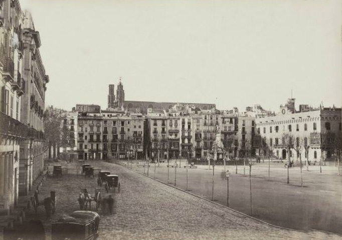
The Pla de Palau was one of the key open spaces near Barcelona’s port. It served as a major commercial hub, with the old customs house and the Porxos d’en Xifré forming its edges. Carriages, merchants, and travelers passed through constantly, and the square connected the activity of the port to the commercial center of the city. Several photos in this collection capture the Pla de Palau from different angles, showing just how central this space was to daily life.
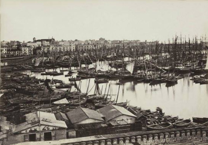
The Port of Barcelona was the economic engine of the city. In the 1870s, it handled goods arriving from and departing to Spain’s colonial territories, as well as trade with the rest of Europe. Ships carrying cotton, textiles, wine, and manufactured goods filled the harbor. The port’s activity directly fed Barcelona’s industrial growth and funded much of the building boom that was reshaping the city during this period.
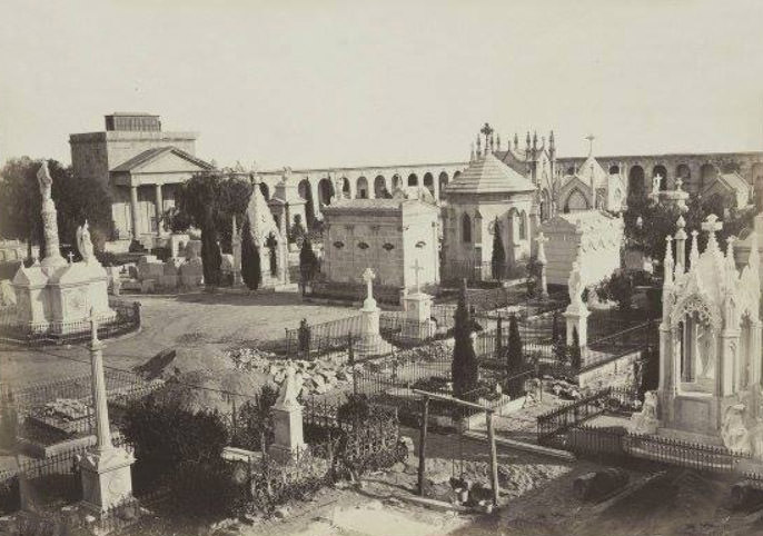
Poblenou was Barcelona’s industrial heartland in the 19th century. Sometimes called the ‘Manchester of Catalonia,’ it was packed with factories, workshops, and working-class housing. In the 1870s, it sat outside the old city boundaries and had its own distinct character — dense, industrial, and alive with the constant movement of workers and machinery. It was here that the textile and manufacturing industries that powered Barcelona’s economic recovery were concentrated.
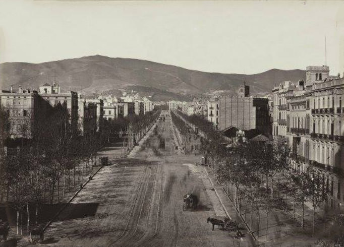
The Passeig de Gràcia is today famous as the showpiece boulevard of Barcelona’s Eixample district, lined with modernist masterpieces. But in the 1870s, it was still a wide, tree-lined promenade connecting the old city to the town of Gràcia, which had not yet been absorbed by Barcelona. Wealthy residents and families used it for afternoon strolls, and early photographs show a boulevard that was elegant but far less built-up than it would become by the early 20th century.
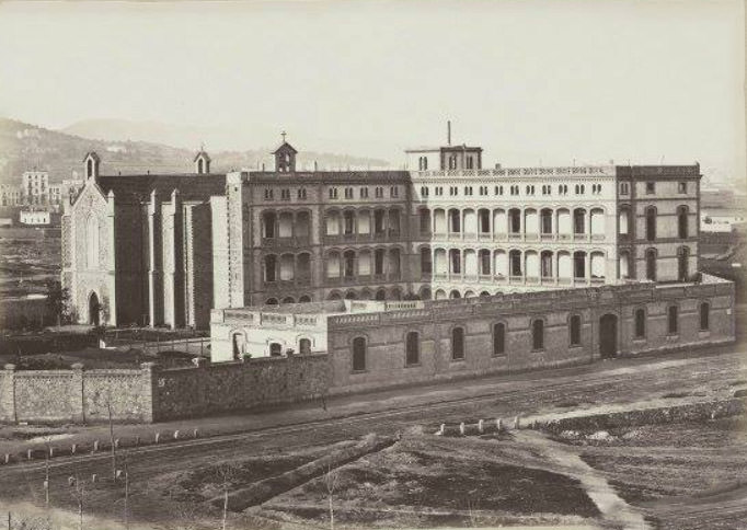
The Germanetes dels Pobres — Little Sisters of the Poor — ran an asylum for elderly and destitute residents of Barcelona. The institution reflected the role that the Catholic Church played in providing social services in 19th-century Spain. For the city’s poorest residents, Church-run institutions like this one were often the only source of shelter and care available.
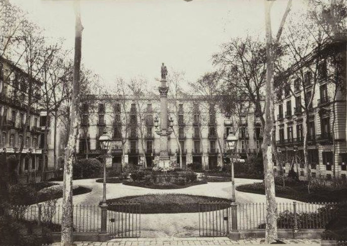
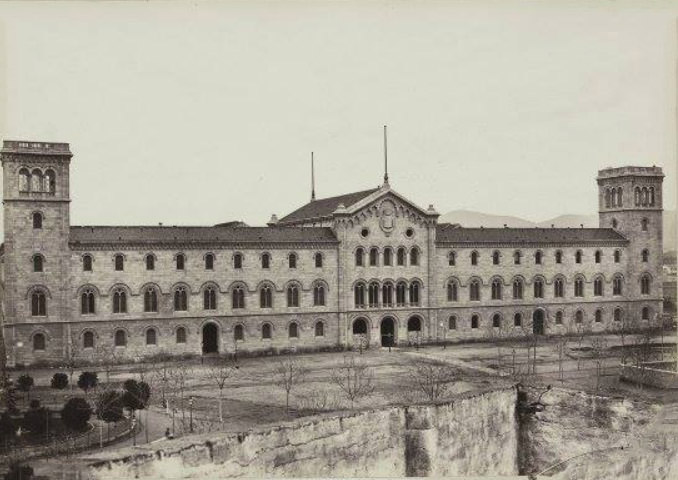
The main facade of the University of Barcelona was one of the most impressive architectural achievements of the era. Elies Rogent’s design blended Romanesque and Renaissance elements into a building that felt both historic and modern. When it was built, it signaled Barcelona’s commitment to education and intellectual life at a time when the city was working to reassert its cultural identity after decades of political suppression.
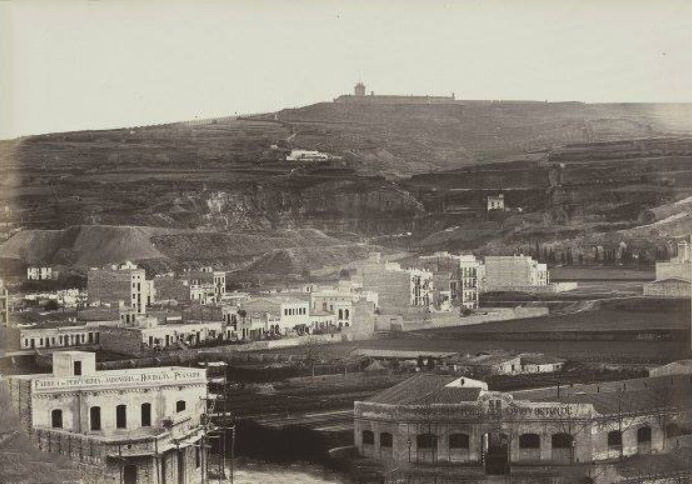
Montjuïc hill overlooked the entire city and the port. In the 1870s, it was dominated by a military fortress that had been used — like La Ciutadella — as a tool of political control. The hill had been the site of executions and imprisonments throughout its history. Yet it also offered the best panoramic views of Barcelona, and photographers made the climb regularly to document how the city was changing.
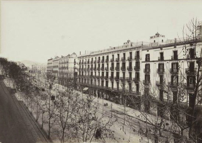
La Rambla dels Estudis was one of the upper sections of the famous Ramblas, the long pedestrian boulevard that runs from Plaça Catalunya down to the sea. This section took its name from the university — the ‘estudis’ — that once stood nearby. By the 1870s, the Ramblas as a whole were already the social spine of the city, crowded with vendors, newspaper stands, flower sellers, and people from every level of Barcelona society.
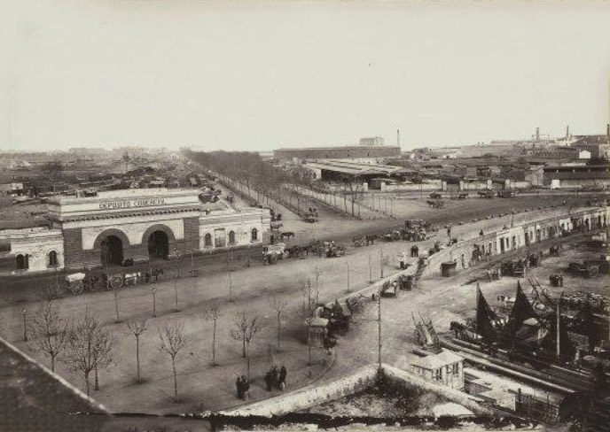
The Portal de Mar — the Gate of the Sea — was one of the main entrances through Barcelona’s old city walls, leading directly toward the port. As the city’s walls were being torn down in the 1870s to allow for expansion, gates like the Portal de Mar were among the last remaining pieces of medieval Barcelona’s defensive structure. Photographs of it from this period document a city actively dismantling its own past to build a new future.
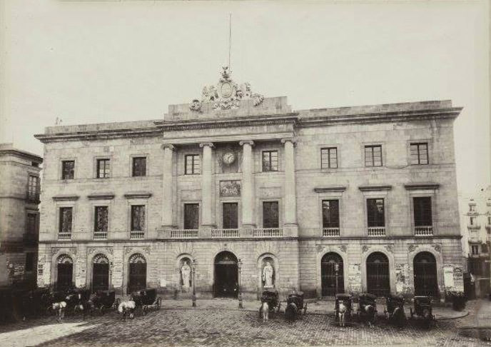
The Ajuntament de Barcelona — Barcelona’s City Hall — sat at the heart of the Gothic Quarter, facing the Plaça de Sant Jaume. The building had served as the seat of city government since the medieval period, and its neoclassical facade, added in the early 19th century, gave it a more formal, institutional look. In the 1870s, the city government was managing one of the most ambitious urban transformation projects in Europe — the Eixample expansion — from within these walls.
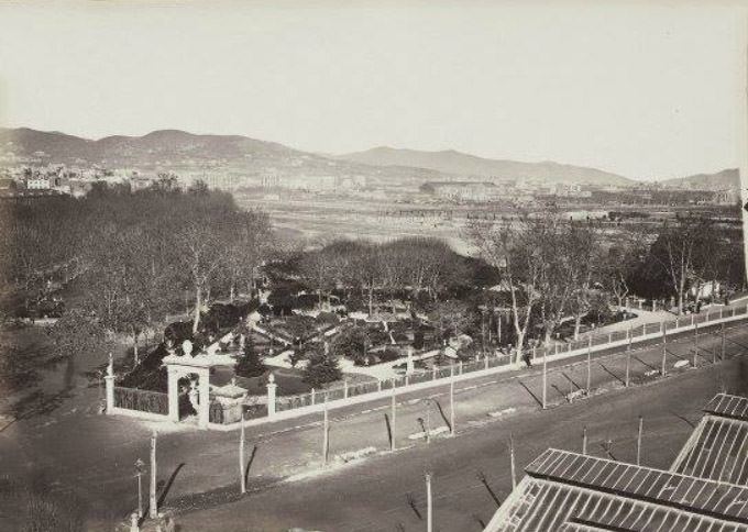
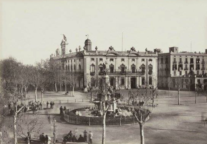
Multiple photographs from the 1870s focus on La Ciutadella and the Pla de Palau, and for good reason. These two spaces captured the tension between Barcelona’s past and its future. La Ciutadella, once a symbol of military oppression, was being turned into a public green space. The Pla de Palau, just steps from the waterfront, remained a commercial crossroads. Together, they show a city reconciling where it had come from with where it was going.
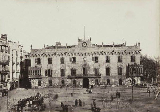
Barcelona in the 1870s was a city in motion. New boulevards were being carved through old neighborhoods. Industrial districts were expanding. Centuries-old institutions — hospitals, churches, markets, theaters — were still operating at full capacity. These photographs freeze a specific decade in the life of a city that had survived political collapse, foreign occupation, and economic hardship, and was now building itself into something entirely new. Every image in this collection is a document of that transformation.





Only one thing remains unchanged: entrance to Poblenou cemetery – it looks absolutely the same 🙂
Looks like the Mapfre tower and Hotel Arts