
Savannah, Georgia holds the distinction of being the state’s oldest city, founded in 1733 along the banks of the Savannah River. By the early 20th century, the city was in the middle of a major economic transformation. The Civil War had devastated its trade through naval blockades, leaving the economy in ruins. The Reconstruction period that followed was slow and painful. But by 1900, Savannah was pushing forward again, driven by cotton and agriculture, and rapidly expanding into new industries including shipbuilding, chemical manufacturing, and the export of resin and lumber.
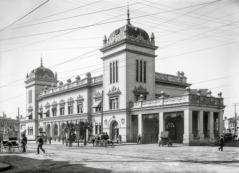
The city’s railway connections were central to that growth. Union Station served as a key hub for passengers and freight moving through the region, a symbol of Savannah’s ambitions at the dawn of the new century.
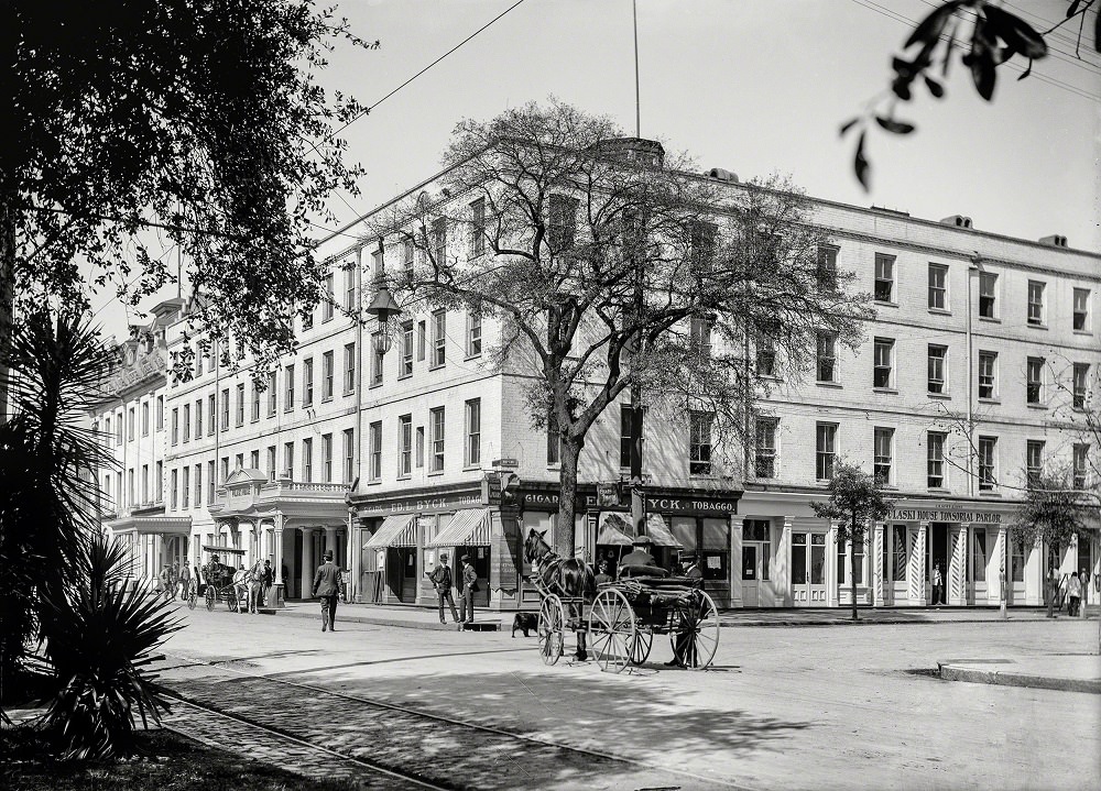
Downtown Savannah in the early 1900s was a layered mix of commerce, hospitality, and civic life. Hotels and boarding houses catered to travelers and businessmen passing through. The Pulaski House, located at the corner of Bull and St. Julian Streets, was one of the city’s well-known establishments of that era.
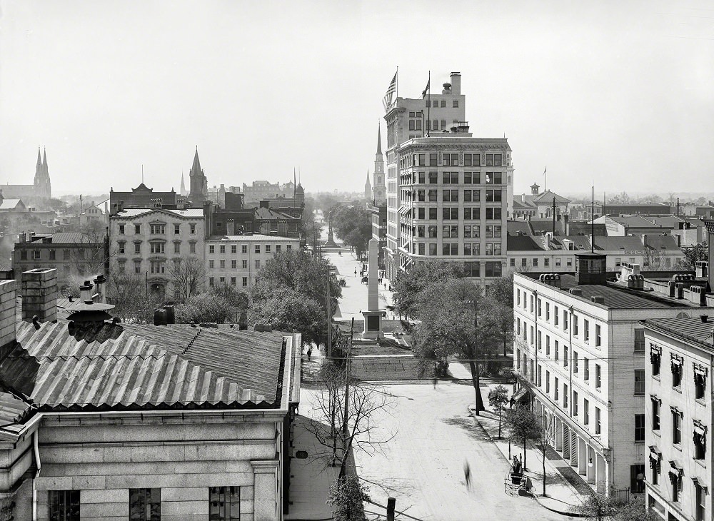
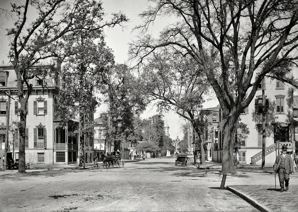
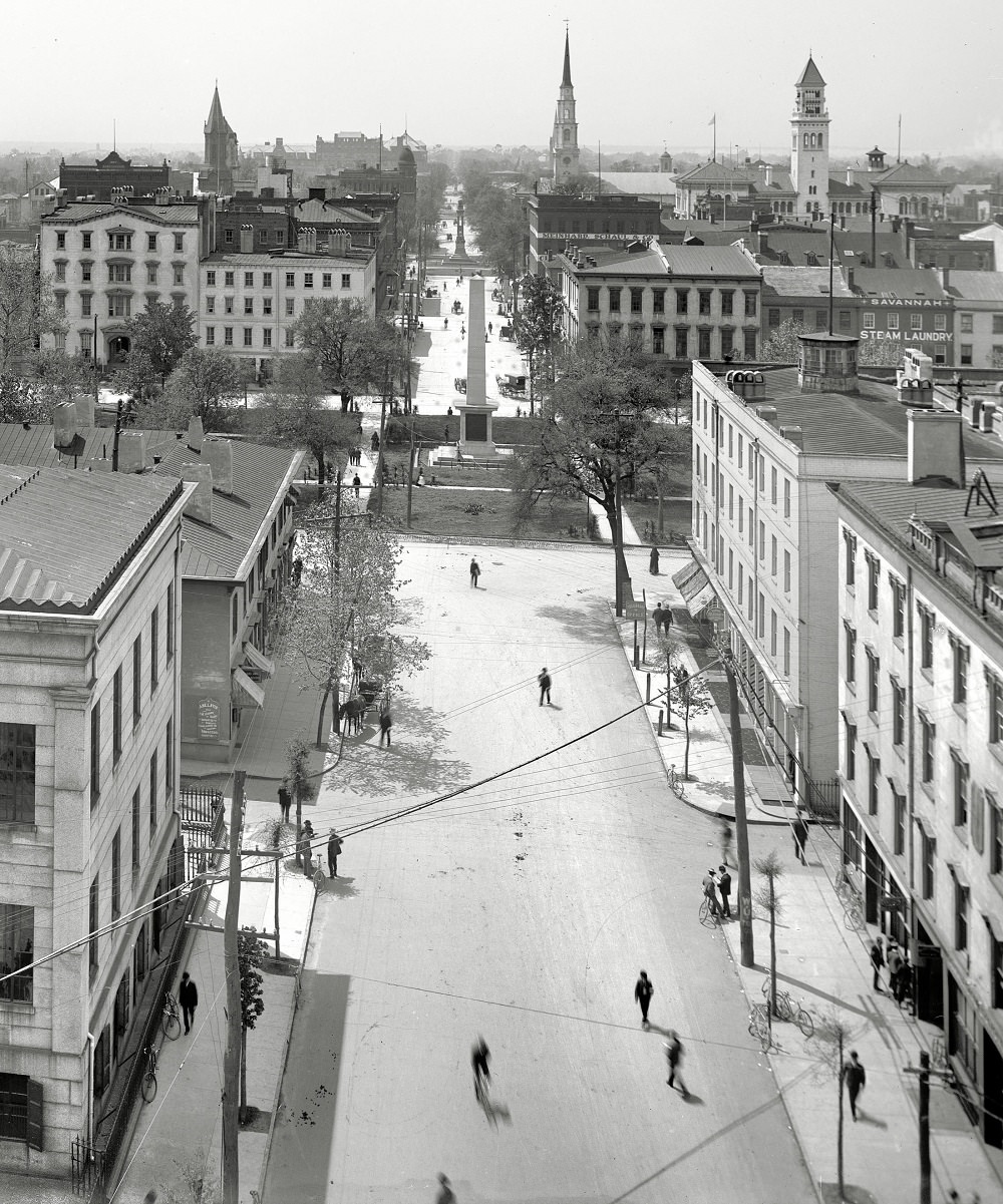
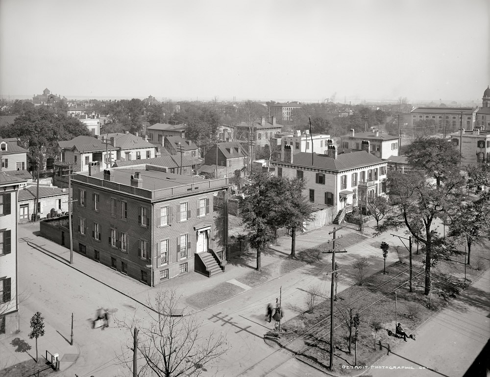
Bull Street was the backbone of Savannah’s public life. It ran through the heart of the city’s famous squares, connecting neighborhoods and commerce in a way that few other streets could. Johnson Square, the oldest and largest of Savannah’s squares, sat right along this corridor and remained a gathering point for residents throughout the early 1900s.
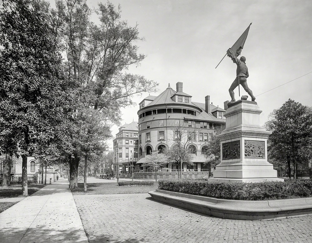
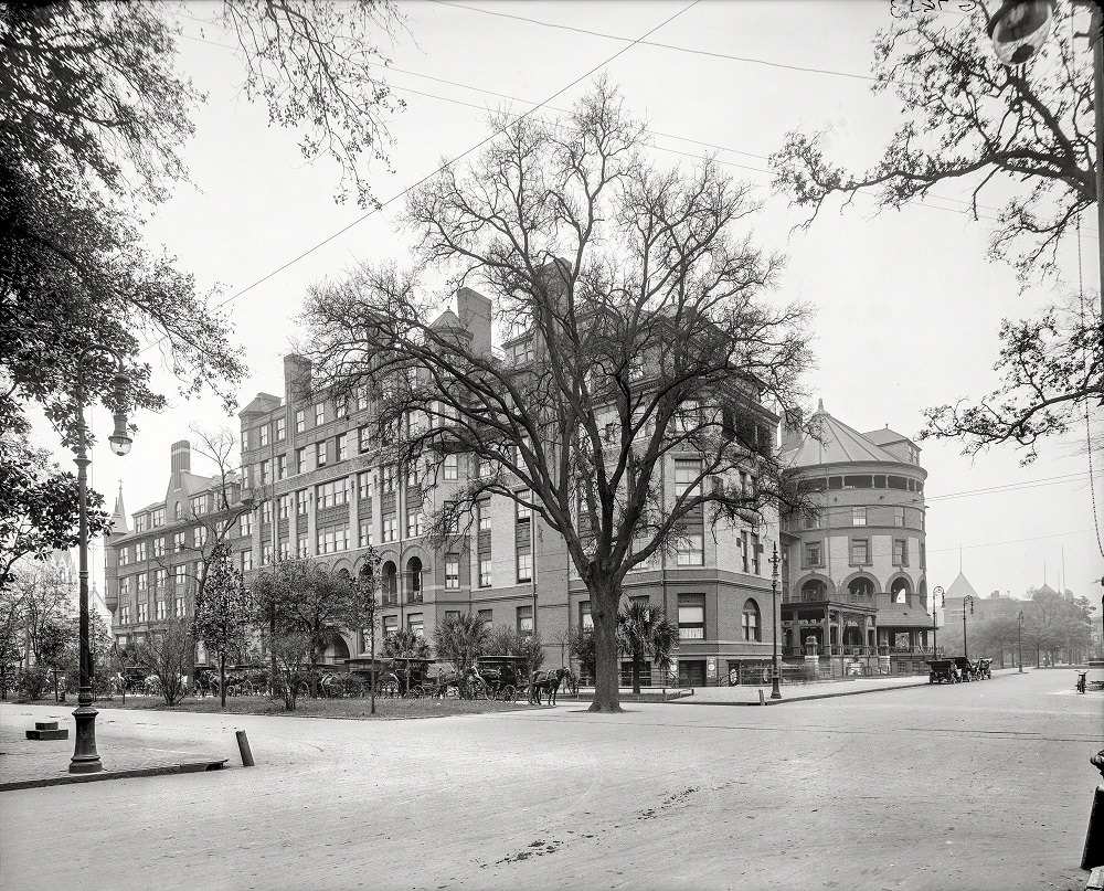
Madison Square was another of Savannah’s central green spaces, anchored by the monument to Sergeant William Jasper, a Revolutionary War hero. The Hotel DeSoto overlooked the square and stood as one of the grandest buildings in the city. Built in 1890, it attracted wealthy visitors and hosted major social events for decades.
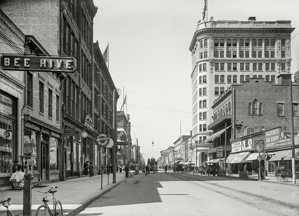
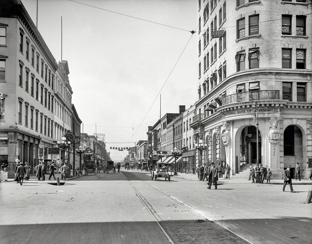
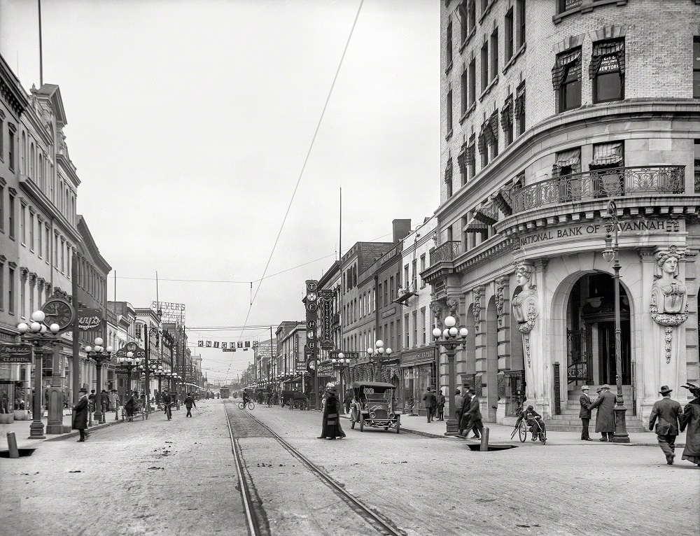
Broughton Street was Savannah’s main commercial artery. Shops, banks, and businesses lined both sides of the street, and the sidewalks were busy with pedestrians, horse-drawn vehicles, and, by the mid-1900s, automobiles. These photos taken between 1905 and 1907 capture the street at a moment of transition — old architecture still standing, new commerce filling every storefront.
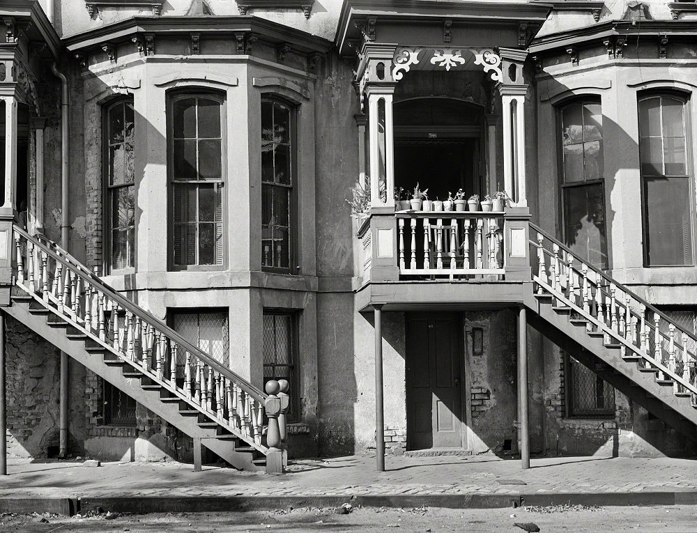
Savannah’s residential streets told a different story from its commercial center. East Charlton Street, like many blocks in the historic district, was lined with attached townhouses built in the 19th century. By 1941, when this photograph was taken, many of these structures were aging but still occupied, showing both the durability and the gradual wear of Savannah’s older housing stock.
At the intersection of Bull Street and Liberty Street stood City Hall, one of the most recognizable civic buildings in Savannah. Its golden dome made it visible from several blocks away. This 1906 photograph shows the building in its full context, surrounded by the street life and architecture of a busy Southern city.
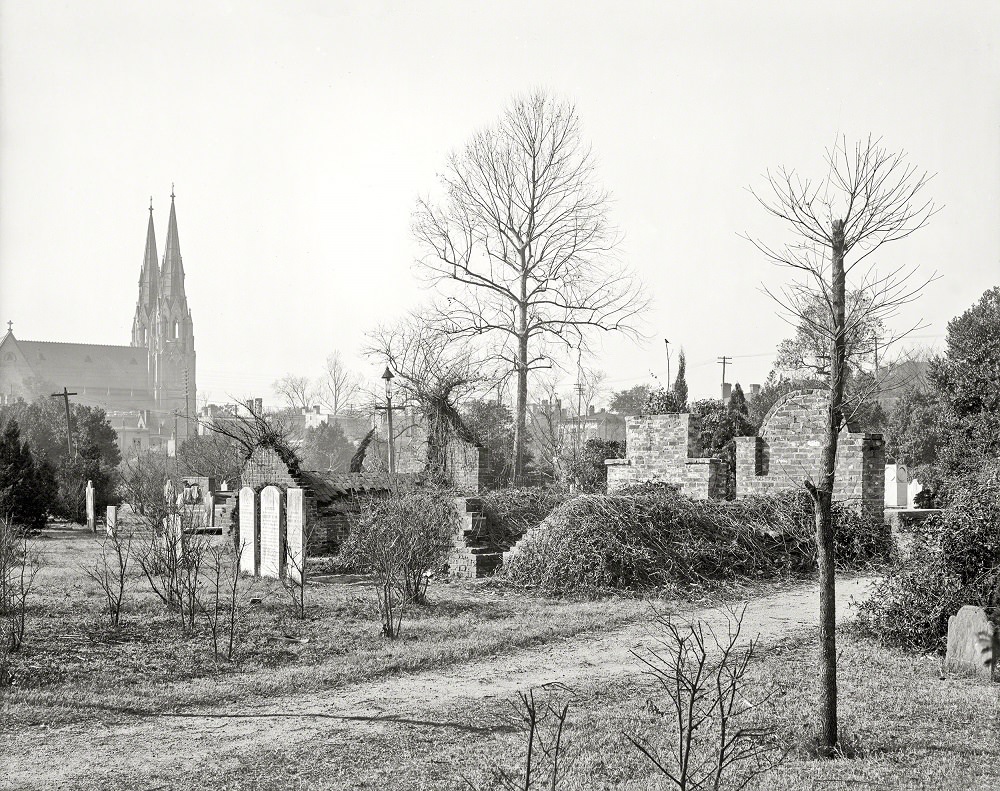
Savannah’s cemeteries are among the most photographed sites in the city, and for good reason. Colonial Park Cemetery, established in 1750, contains the remains of many of Georgia’s earliest settlers, Revolutionary War soldiers, and victims of the 1820 yellow fever epidemic. By the early 1900s, it had become both a historic landmark and a quiet park within the city grid.
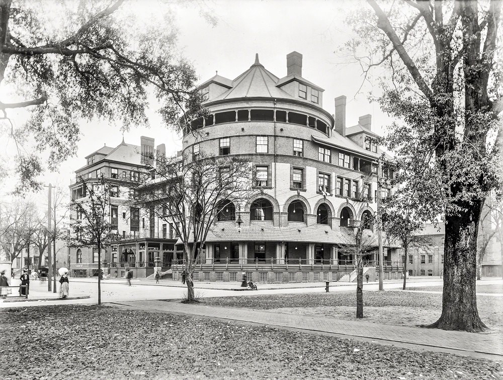
The Hotel DeSoto appeared in multiple photographs from this period, reflecting its prominence in the city. At the turn of the century, it was considered one of the finest hotels in the entire South, known for its architecture and its role as a social center for Savannah’s elite.
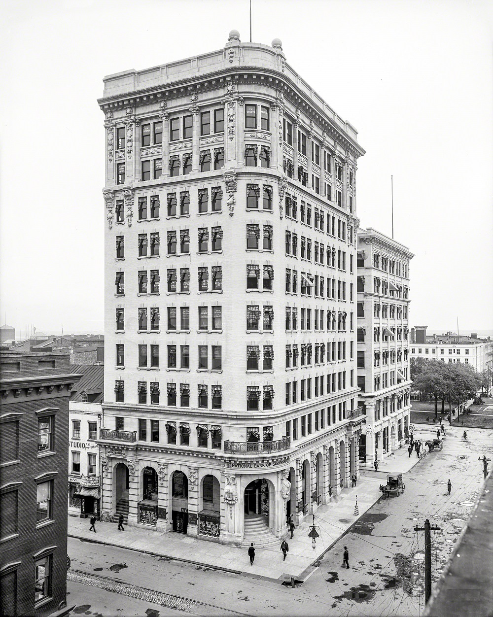
Banking and finance were growing sectors in early 20th-century Savannah. The National Bank of Savannah on Bull Street was a prominent institution that served the city’s merchants, cotton traders, and exporters. Its presence on Bull Street placed it at the center of Savannah’s commercial activity.
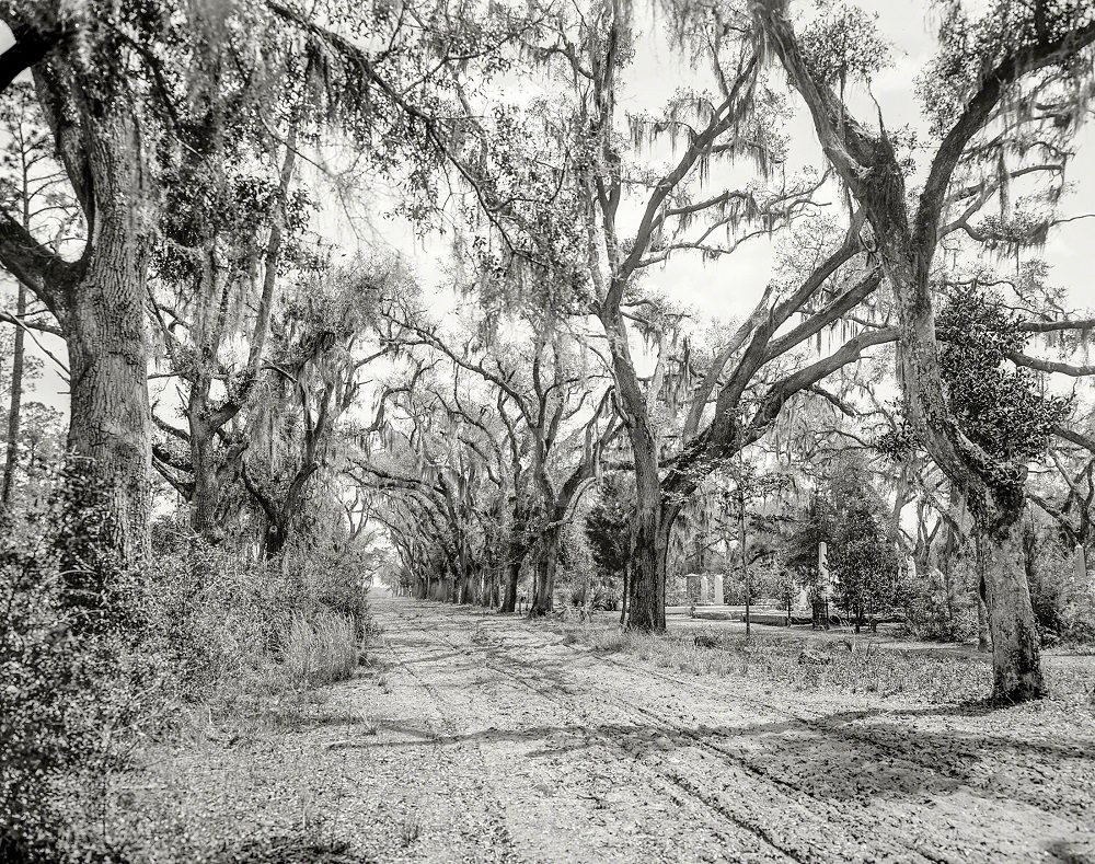
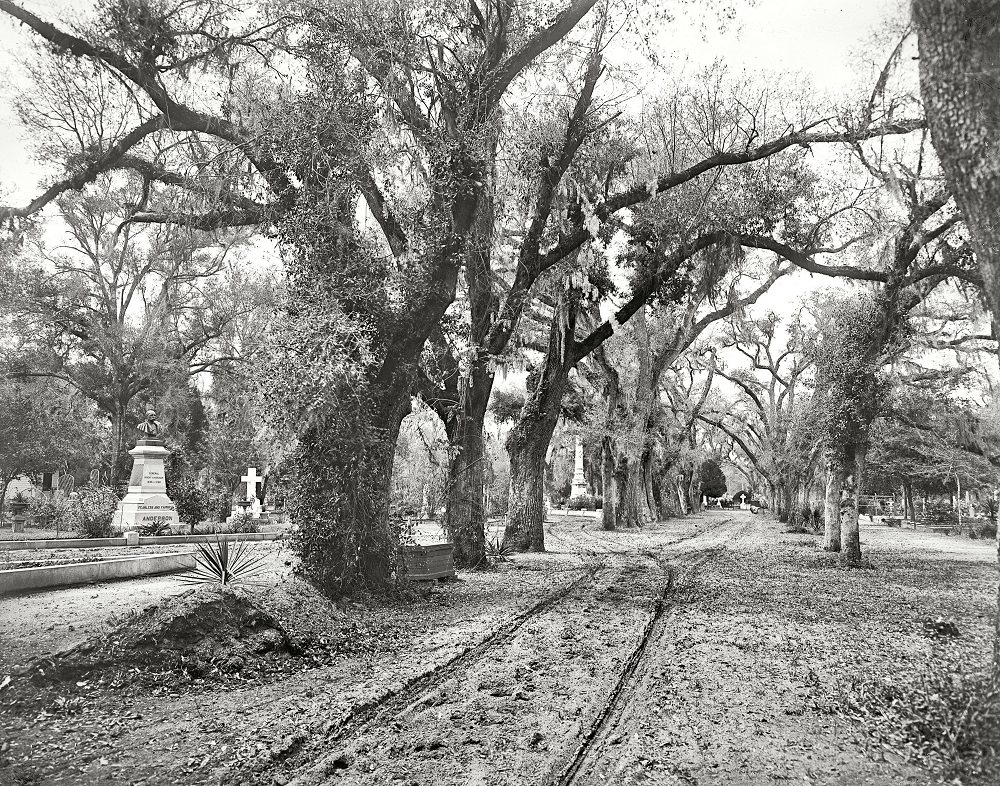
Bonaventure Cemetery, located east of the city along the Wilmington River, was one of the most visually striking burial grounds in the American South. Established in the late 18th century on a former plantation, it was known for its ancient oak trees draped in Spanish moss and its elaborate Victorian-era monuments.
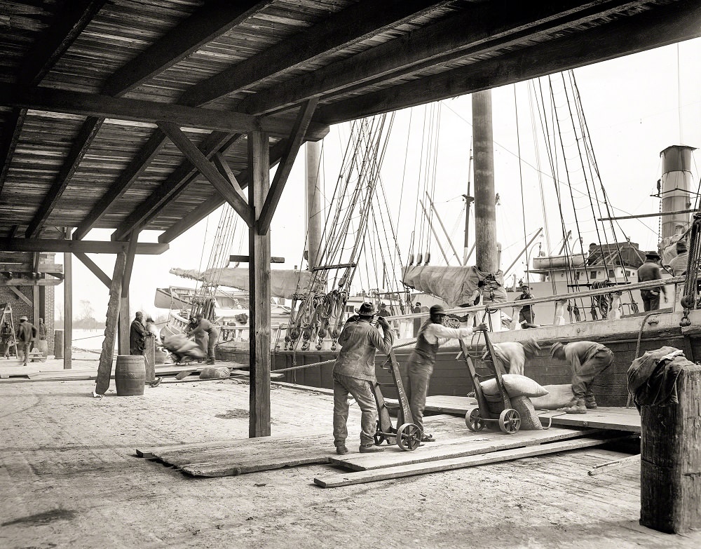
Cotton was not just grown and traded in Savannah — it was shipped out in enormous quantities. The city’s port facilities handled a constant flow of agricultural goods heading to markets in the Northeast and in Europe. This 1906 photograph captures workers loading a phosphate schooner at the Savannah docks, a scene that played out daily along the riverfront.
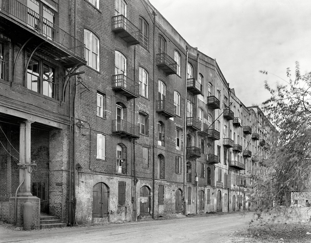
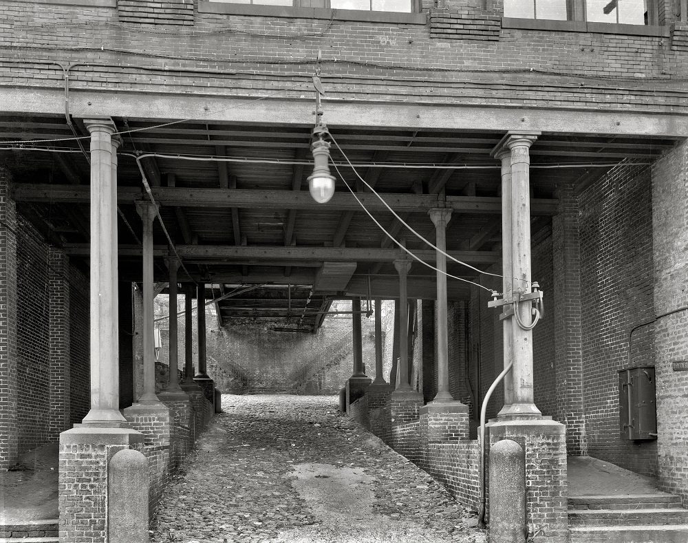
Factors Walk and River Street formed the commercial spine of Savannah’s waterfront. Cotton factors — brokers who arranged the sale and shipping of cotton on behalf of planters — operated from the multi-story warehouses built into the bluff above the river. By the late 1930s, when these photographs were taken, the buildings were still in use but the cotton trade had sharply declined following the boll weevil outbreak of the 1920s.
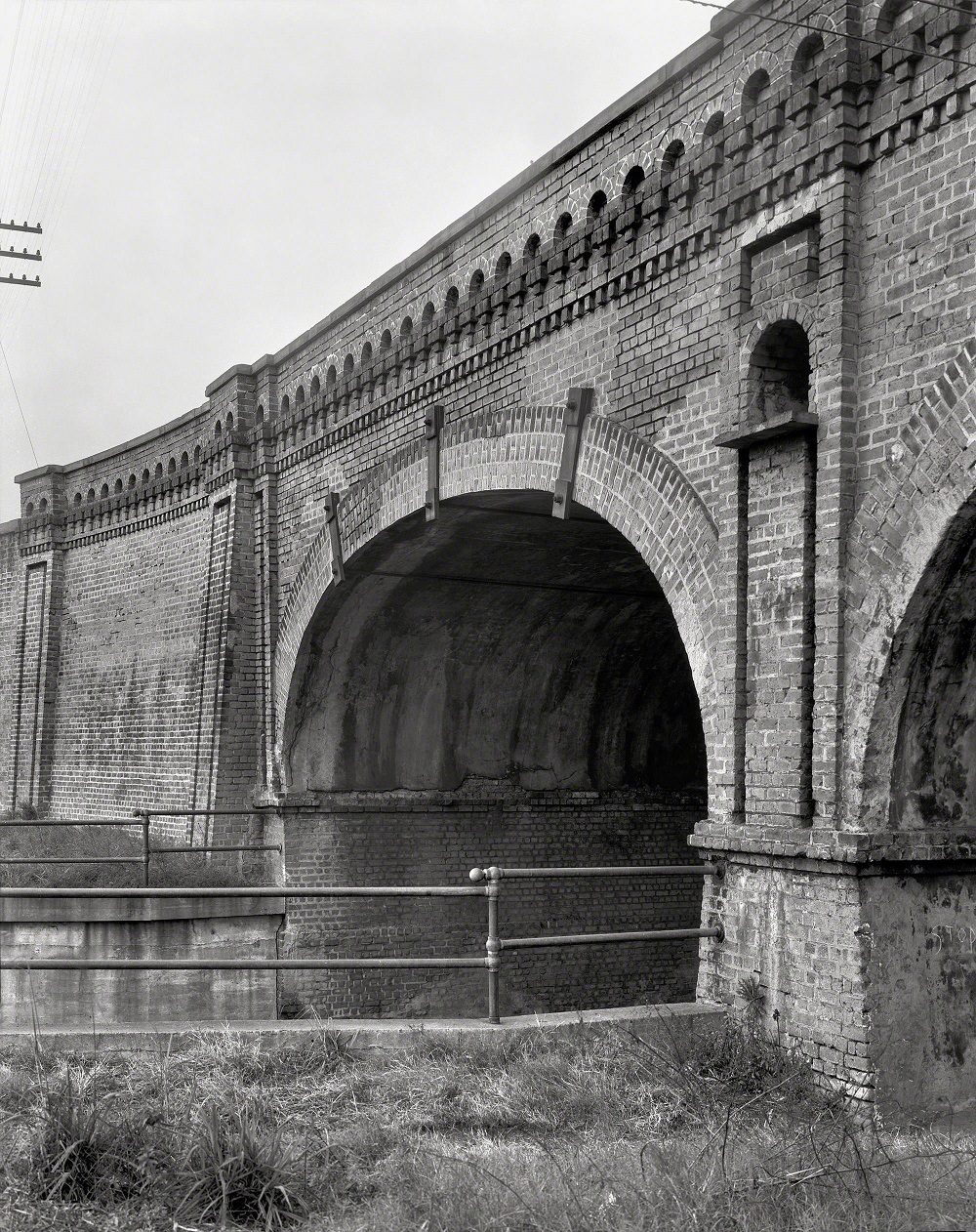
Rail infrastructure was critical to Savannah’s role as an export hub. The Georgia Central Railway Bridge connected rail lines across the river, allowing goods to move efficiently between Georgia’s interior and the port. This 1939 photograph documents the bridge as it appeared just before World War II shifted the city’s industrial focus to shipbuilding.
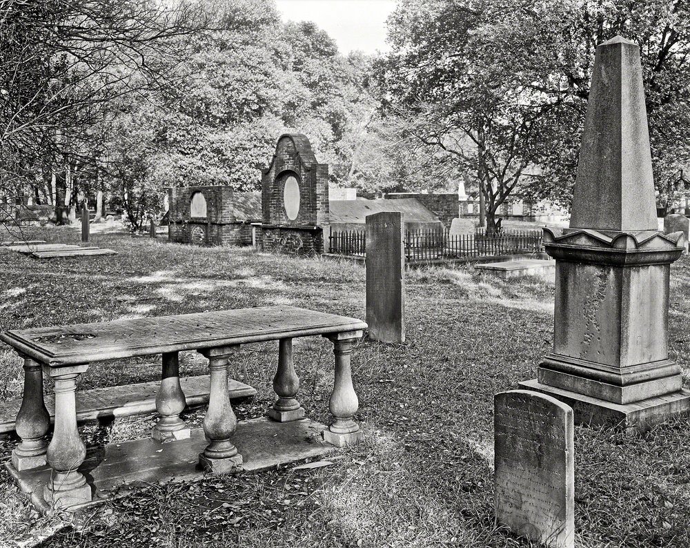
Colonial Park Cemetery, originally called South Broad Street Cemetery, held a significant place in Savannah’s history. By 1939, its stone monuments and brick vaults had weathered nearly two centuries of Georgia heat and humidity. The cemetery had officially closed to new burials in 1853, leaving it as a preserved record of the city’s colonial and antebellum past.
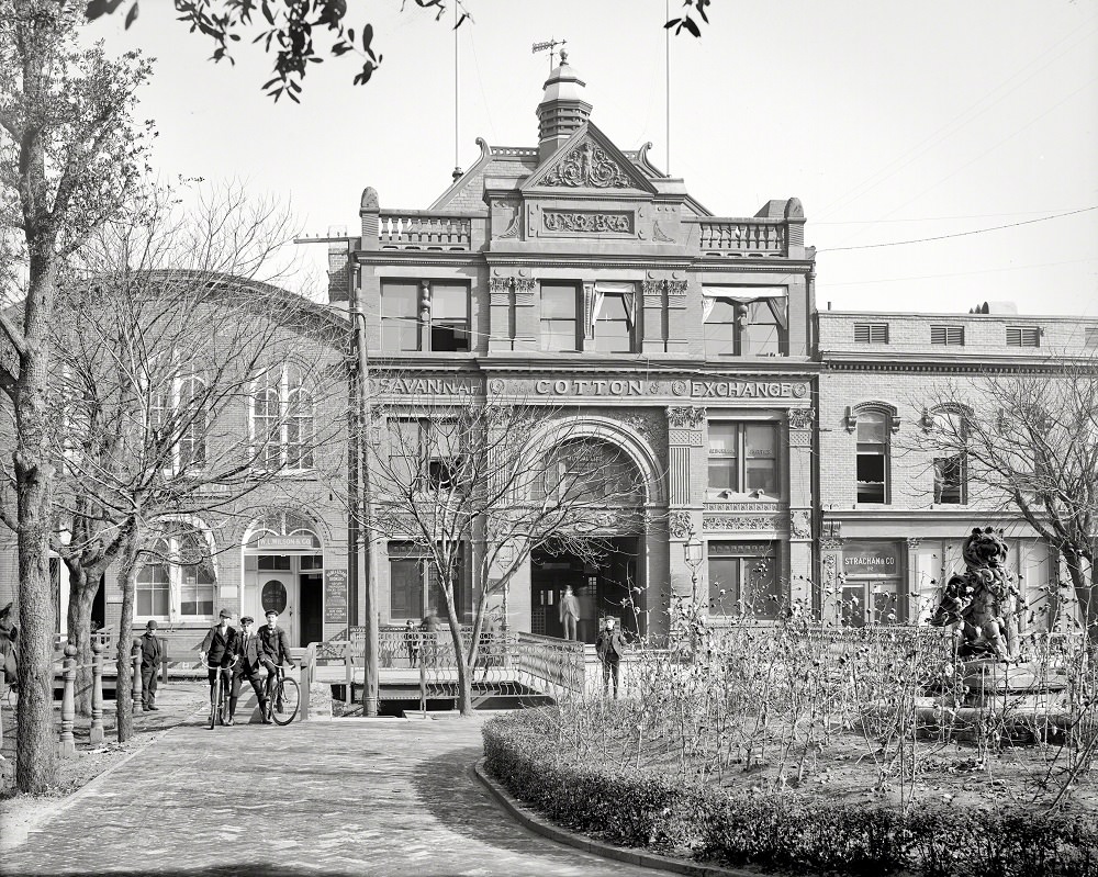
The Savannah Cotton Exchange, built in 1886, was the nerve center of the city’s most important industry. It set cotton prices for markets across the country and connected Savannah’s traders to global commodity markets. The cotton-themed fountain and decorative landscaping outside the building reflected how deeply the crop was tied to the city’s identity.
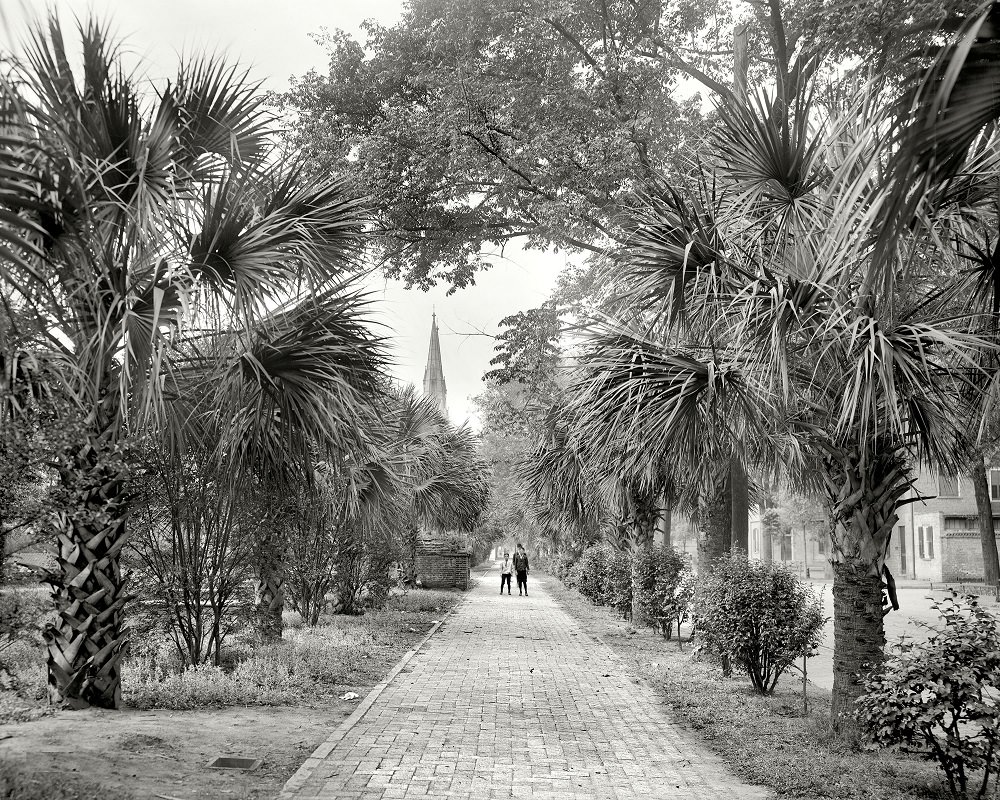
Bull Street at the turn of the century offered a clear picture of Savannah’s urban character. Tree-lined and wide, it connected some of the city’s most important squares and institutions. Pedestrians, streetcars, and horse-drawn carriages shared the road, moving through a city that was growing fast but still firmly rooted in its 19th-century layout.
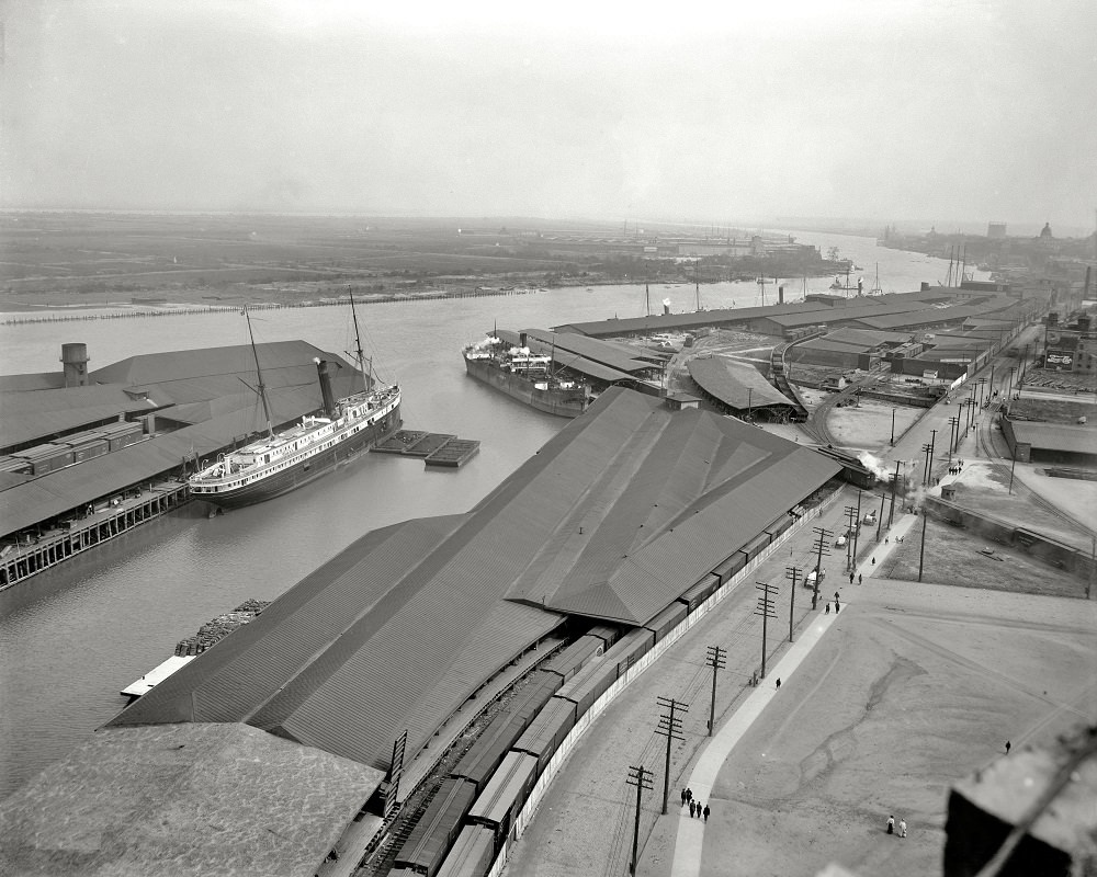
The docks at Savannah in 1905 were a hive of activity. Ships from up and down the Atlantic coast called at the port regularly, loading timber, cotton, naval stores, and phosphate. Savannah’s position on the river gave it a natural advantage as a port city, and the early 1900s marked one of the busiest periods in its maritime history.
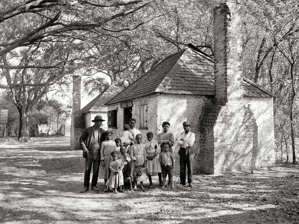
Beyond the commercial districts and public squares, everyday life in Savannah unfolded in the homes, yards, and neighborhoods that rarely appeared in formal photographs. This circa 1907 image from the Hermitage estate documents a Black family in Savannah during the Jim Crow era, a period marked by strict racial segregation across the city and the entire South.
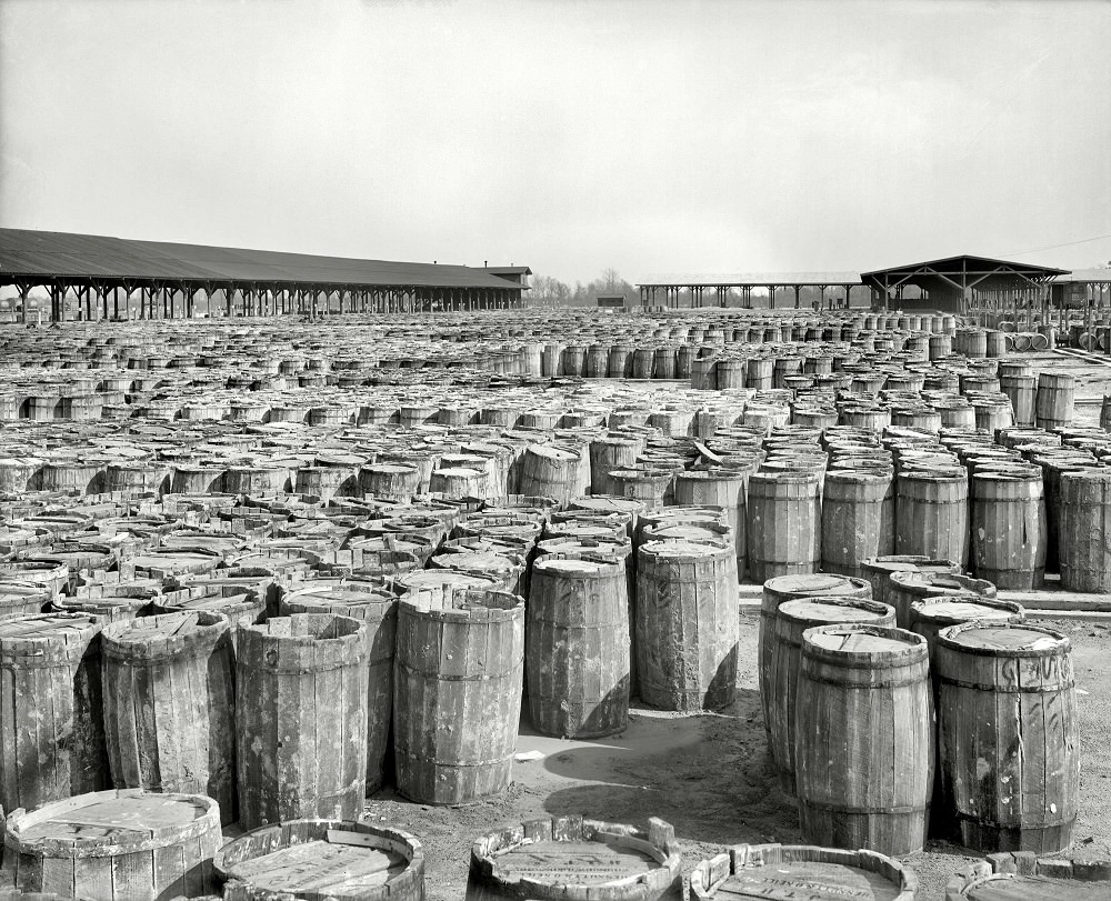
Naval stores — a category that included turpentine, resin, tar, and pitch derived from pine trees — were a major export from Georgia throughout the 19th and early 20th centuries. Savannah served as a key distribution point for these products. The firm of Chesnutt & O’Neill, photographed in 1904, was one of the businesses that handled this trade.
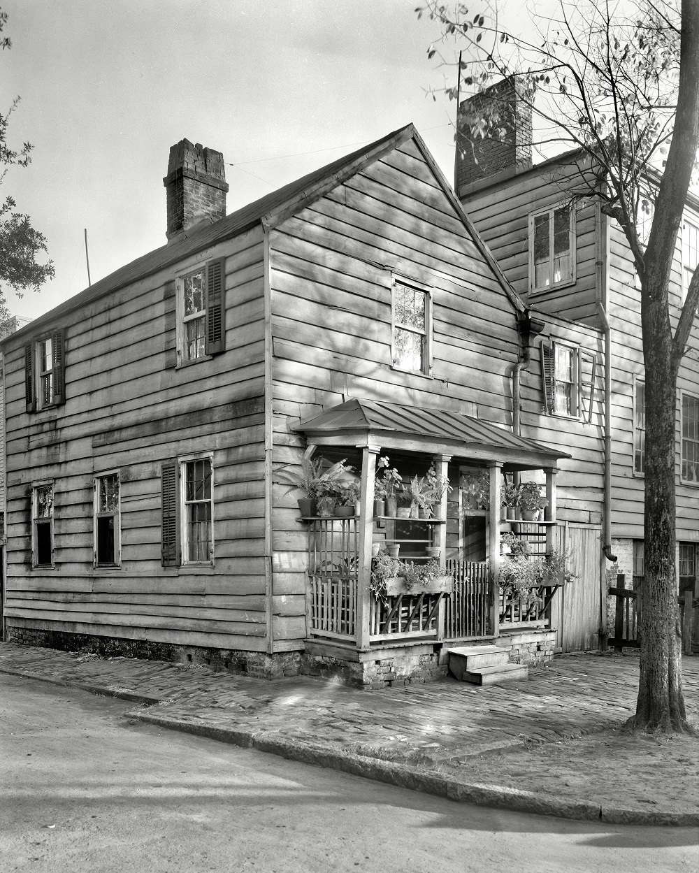
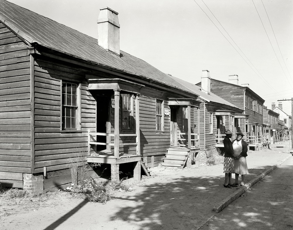
By the late 1930s, federal surveyors and photographers were documenting conditions in older urban neighborhoods across the country. In Savannah, this work captured small dwellings and tenement structures in various states of upkeep. These images are now an important record of working-class housing in the city before large-scale urban renewal changed many of these blocks permanently.
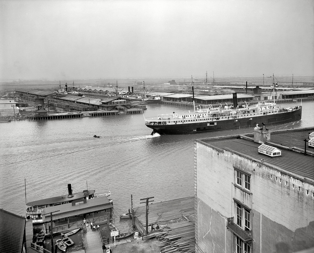
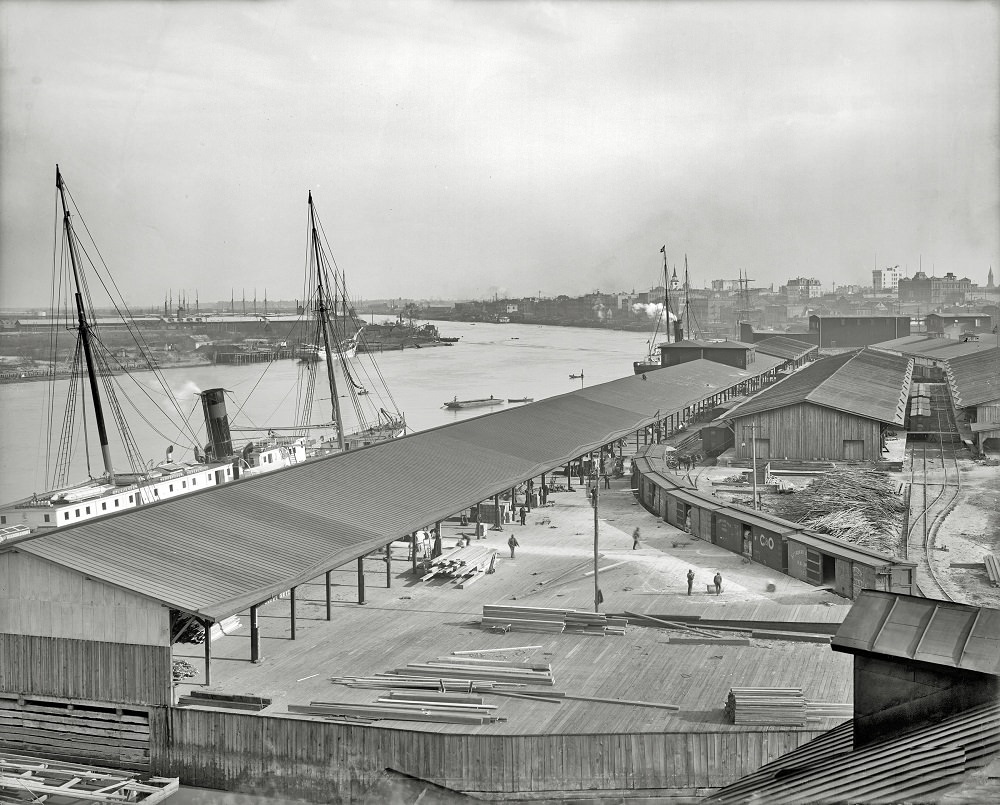
The Seaboard Air Line Railway operated docks at Savannah that connected the city’s rail network directly to its shipping lanes. Around 1910, these facilities were handling significant volumes of freight moving between Georgia’s agricultural interior and the Atlantic coast trade routes.
Gaston Street in the late 1930s reflected the kind of stately residential architecture that Savannah had accumulated over more than a century. Many of these homes dated to the antebellum period, built during the decades when cotton money flowed freely through the city. By 1939, some were well-maintained, while others showed the strain of decades without major investment.
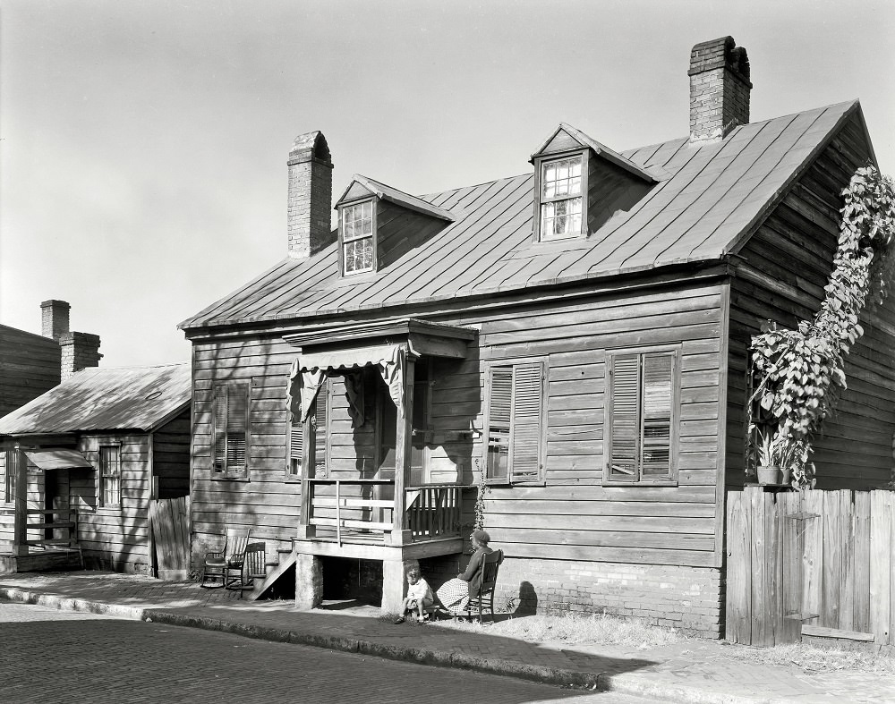
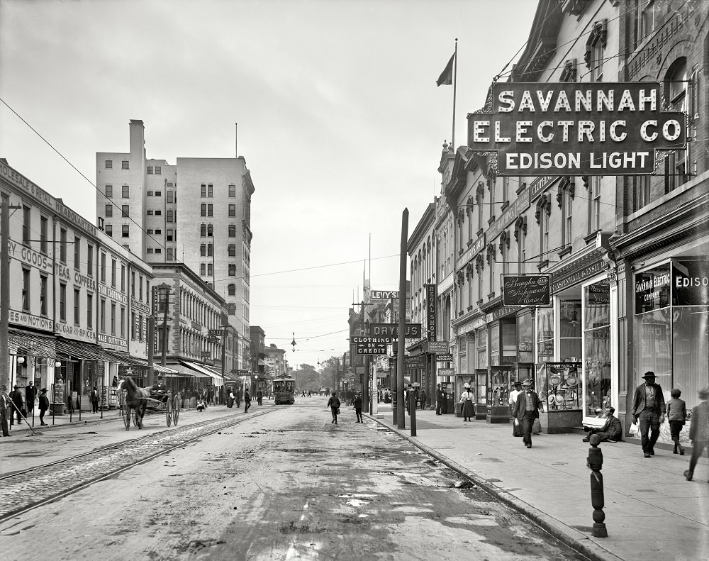
The Isaiah Davenport House on Columbus Square is one of the finest examples of Federal-style architecture in Savannah. Built in 1820 by master builder Isaiah Davenport, it survived into the 20th century largely intact. By 1937, when this photograph was taken, the building had seen significant changes in use, but its structural character remained a testament to early American craftsmanship.
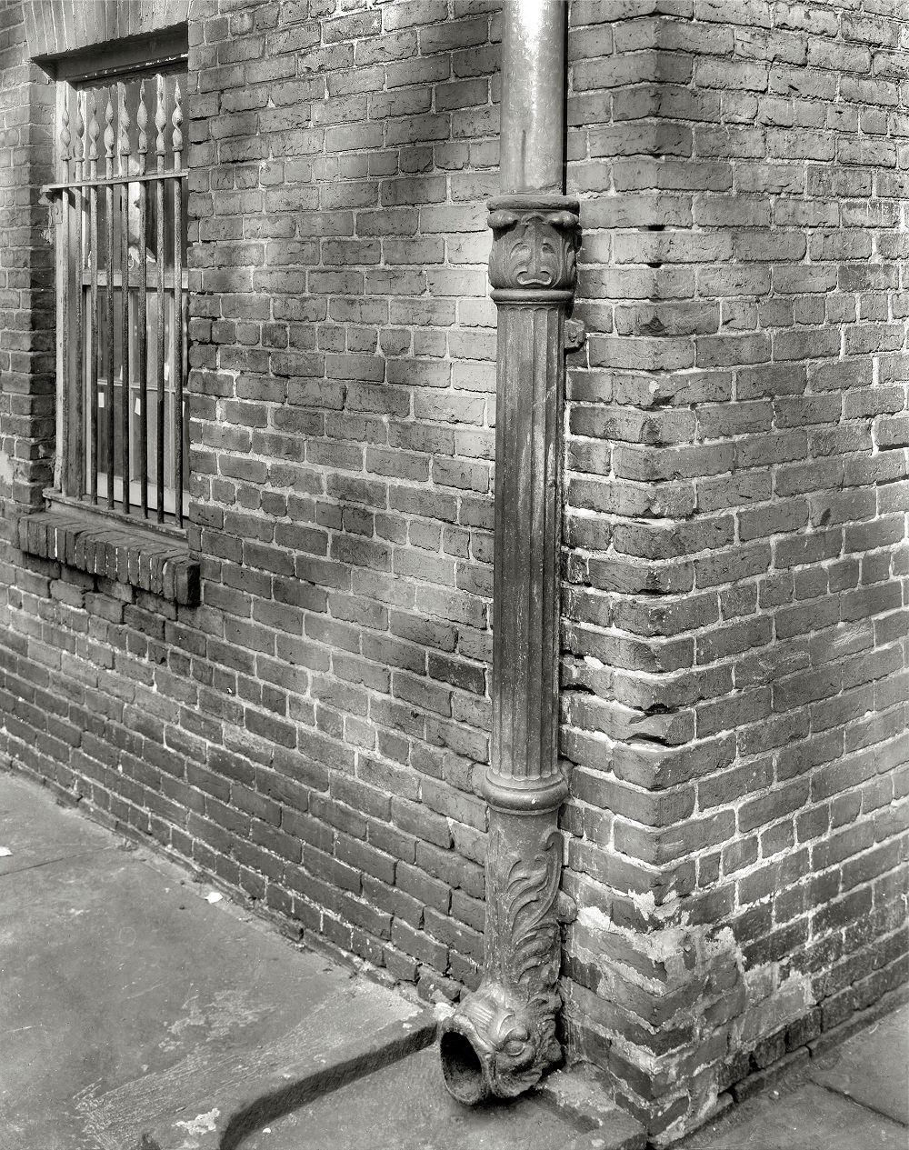
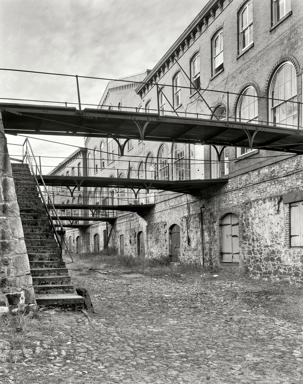
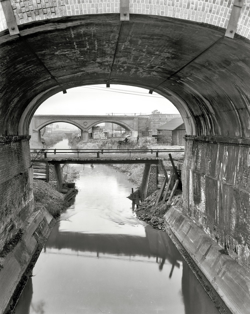
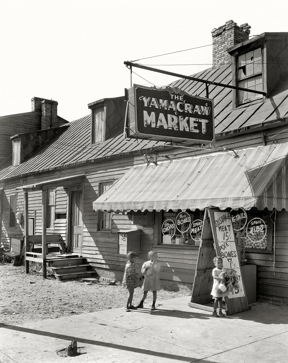
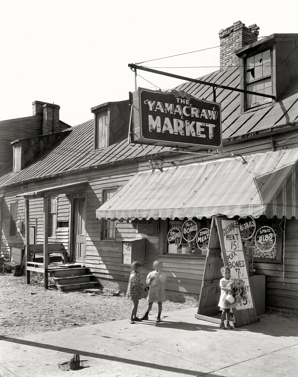
Fahm Street on Savannah’s west side was a working-class neighborhood documented extensively by surveyors in 1939. The photographs show a mix of older wooden houses and small storefronts that served the surrounding community. These images capture a part of Savannah that was already facing demolition pressure as the city sought to modernize its downtown core.
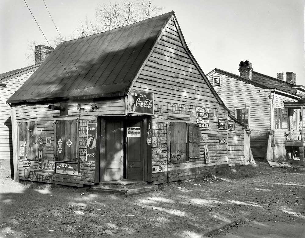
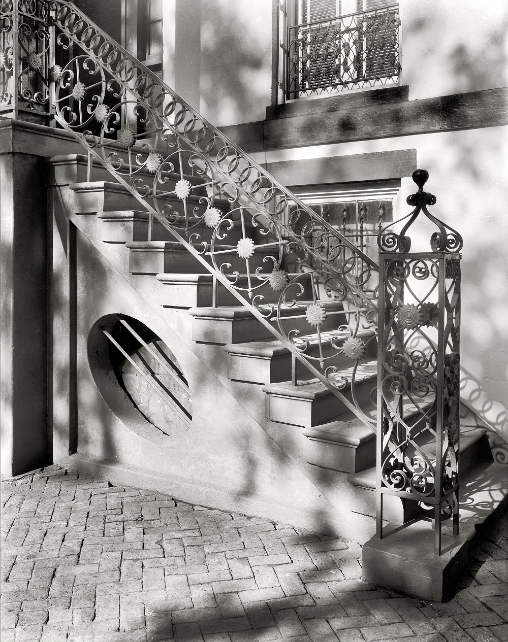
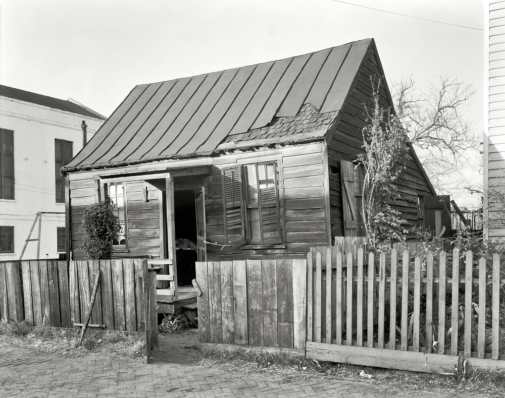
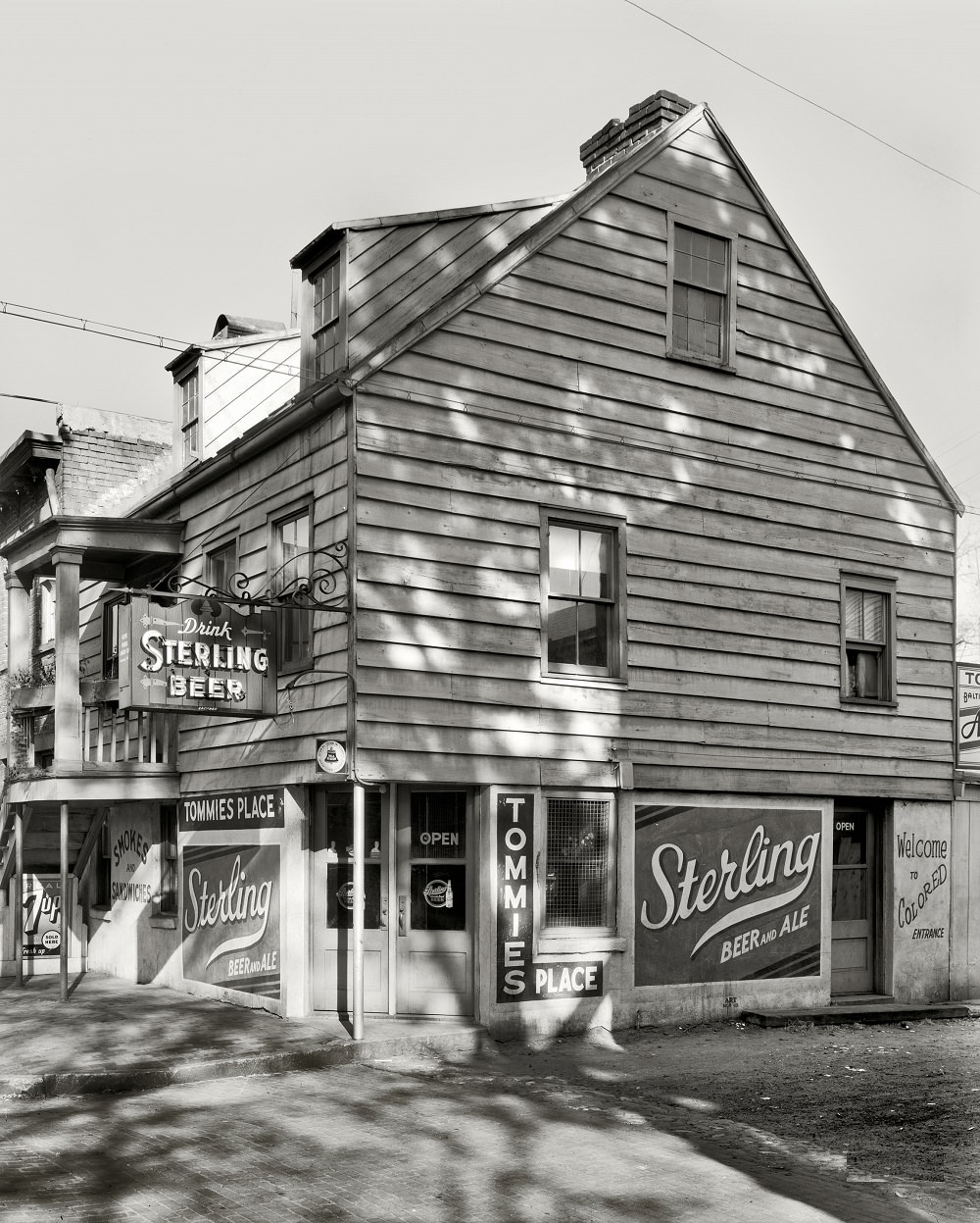
Price Street in Savannah’s eastern neighborhoods contained a mixture of residential structures that ranged from well-kept row houses to properties in serious disrepair. The 1937 and 1939 surveys documented 38 Price Street in detail, capturing the texture of a neighborhood that was home to many of Savannah’s lower-income residents during the Depression era.
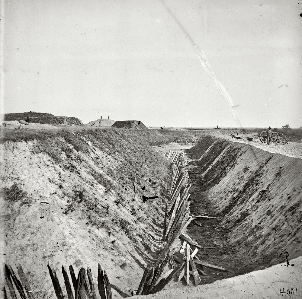
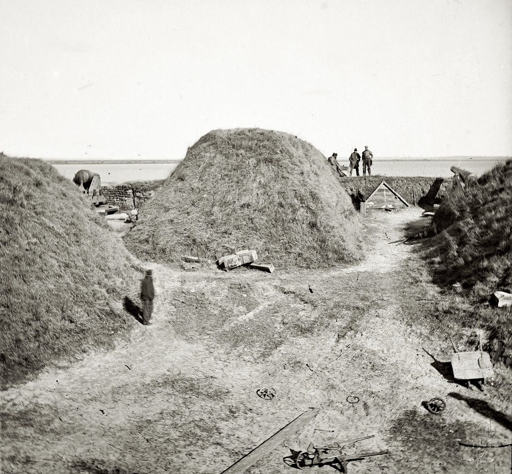
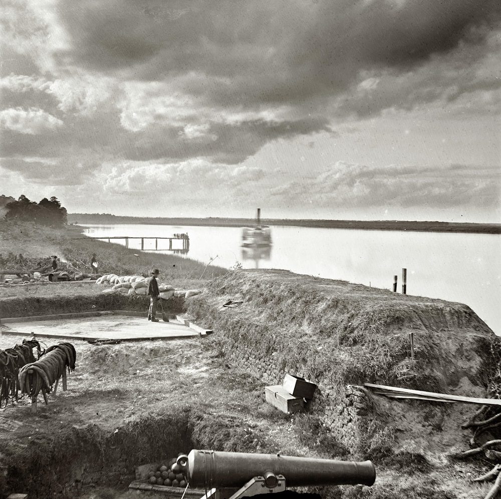
Fort McAllister, situated on the Ogeechee River south of Savannah, played a decisive role in the Civil War. Confederate forces held the earthwork fort against repeated Union naval bombardments before it finally fell to General Sherman’s army in December 1864. These photographs taken in 1864 and 1865 document the fort’s condition in the immediate aftermath of the war, showing both its construction and the damage it sustained.
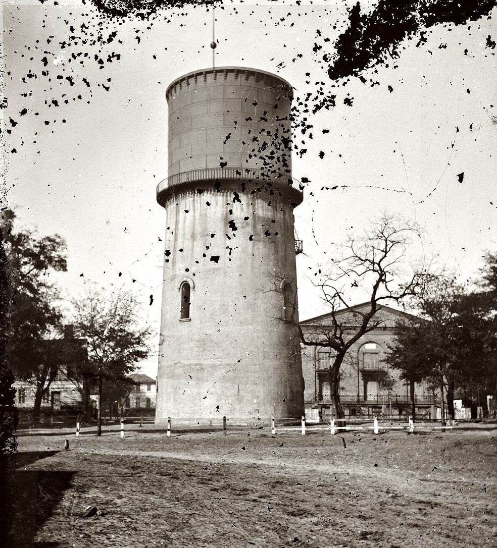
The reservoir photographed in 1865 served the city’s basic water infrastructure needs during and after the war. Savannah’s public works, like many systems in Southern cities, were strained by the conflict and the economic collapse that followed. Images like this one document the city’s built infrastructure at one of its most difficult moments.
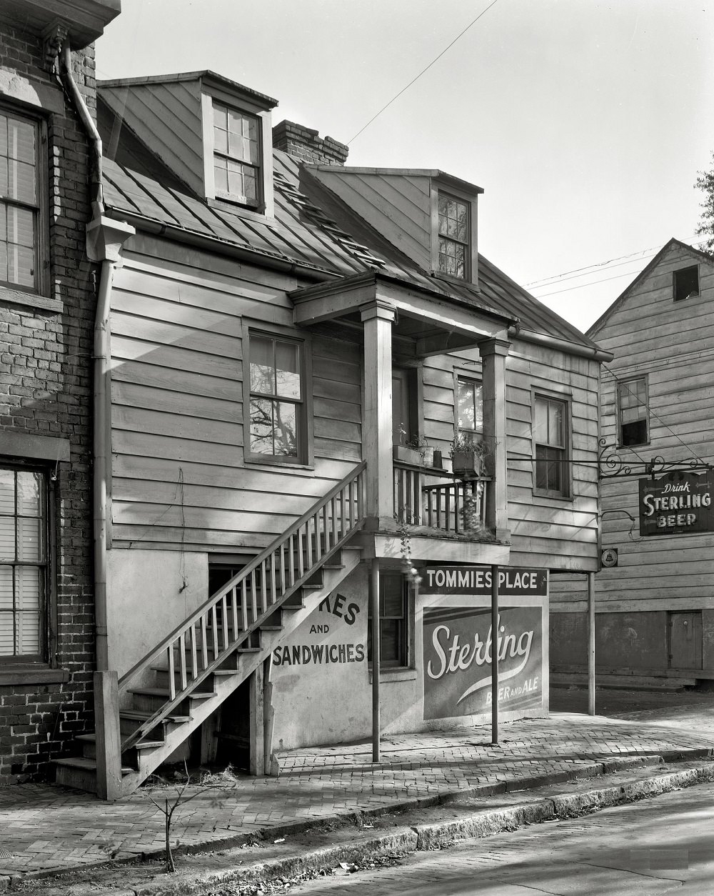
Chatham County, which contains Savannah, was surveyed in detail during the late 1930s as part of broader federal documentation efforts. These surveys captured not just urban Savannah but also the rural and semi-rural areas surrounding the city, recording a landscape that was changing quickly as agriculture declined and industry grew.
The Yamacraw neighborhood along Fahm Street was one of Savannah’s oldest African American communities. The market on Fahm Street served local residents and reflected the self-contained commercial life that many Black neighborhoods maintained during segregation. By 1939, Yamacraw was already being eyed for urban renewal projects that would eventually displace much of the community.





Thank you for this post; I love all these old photos!