
Sacramento in the 1880s was a city in motion. Railroads reshaped trade, agriculture was being reinvented, and the streets were filling with businesses, newspapers, churches, schools, and social clubs. The Sacramento River remained the city’s commercial lifeline, while the Central Pacific and Southern Pacific railroads pushed the city’s reach across California and beyond. These photographs capture that decade in remarkable detail — the waterfront, the downtown blocks, the private homes, the public institutions, and the everyday life that made Sacramento one of California’s most important cities.
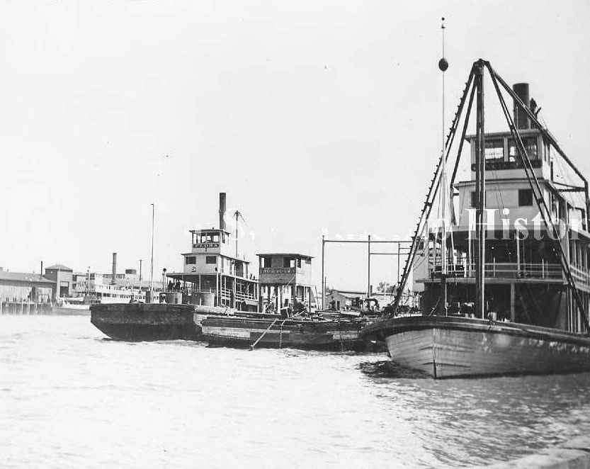
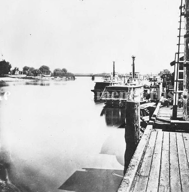
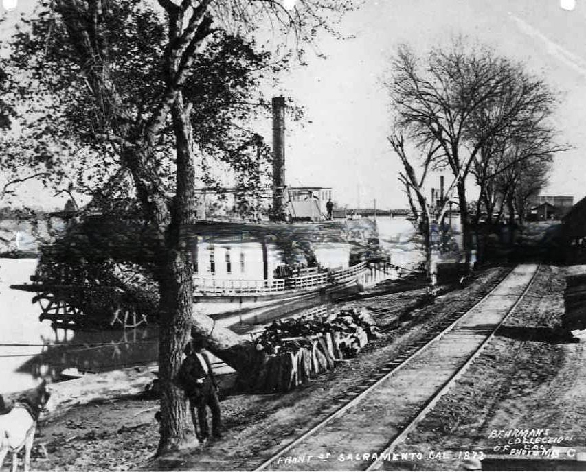
The Sacramento River was the backbone of the city’s economy. Steamboats like the San Joaquin and Flora moved goods and passengers between Sacramento and San Francisco, while barges like the Rio Vista carried bulk cargo along the waterways of the Central Valley. The river and the railroad worked hand in hand, with freight offloaded from boats directly into the rail network.
Agriculture in Sacramento was undergoing a dramatic shift in the 1880s. Wheat had long been the dominant crop, but falling prices — driven in part by new railroad connections opening up broader markets — made grain farming increasingly unprofitable. Between 1883 and the turn of the century, large grain ranches began to fail. Their owners died or sold off, and the land passed to a new generation of farmers who saw a different opportunity.
Fruit became the new cash crop. The railroad made it possible to ship perishable goods quickly, and refrigeration technology meant that fruit could travel long distances without spoiling. Hundreds of thousands of acres were irrigated by new fruit ranchers who flooded into the region, transforming Sacramento’s landscape from grain fields into orchards. The first fast fruit train left Sacramento in 1886, marking a turning point in how the city connected to national markets.
Despite the agricultural boom, Sacramento’s growth was affected by the Chinese Exclusion Act of 1882. Chinese laborers had been central to building the transcontinental railroad and working Sacramento’s farms and businesses. The Act barred Chinese workers from entering the United States, cutting off a significant portion of the agricultural labor force at exactly the moment when the fruit industry was expanding its demand for workers.
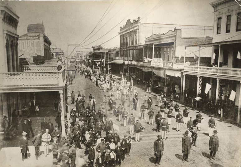
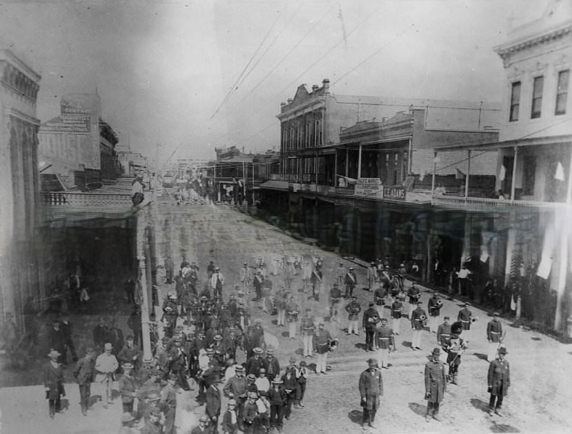
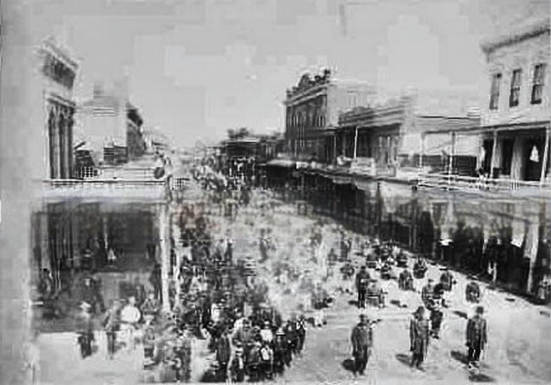
Sacramento’s streets hosted more than commerce in the 1880s. Social and civic organizations were a major part of city life, and the Turn Verein — a German-American athletic and cultural association — held festivals and parades in Sacramento throughout the decade. The group gathered in June 1885 for a multi-day event, marching down J Street with a full band and drawing crowds from across the region.
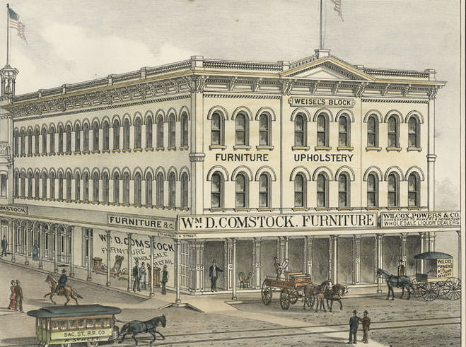
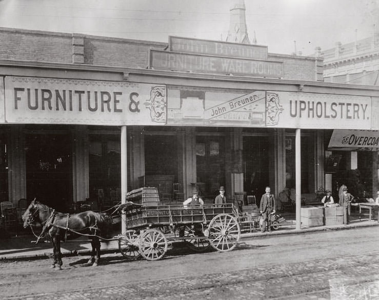
The commercial districts along J and K Streets were dense with shops and services. Weisel’s Block at the corner of K and 5th Streets housed a furniture dealer and a wholesale liquor company in a three-story building, with horse-drawn streetcars running past the covered sidewalk where furniture was displayed. Buildings like this one defined the scale and character of downtown Sacramento in 1880.
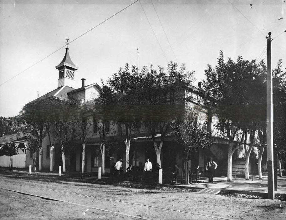
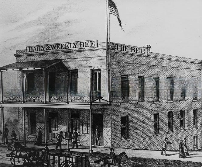
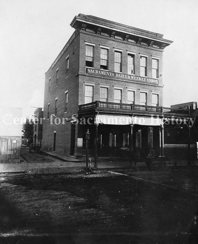
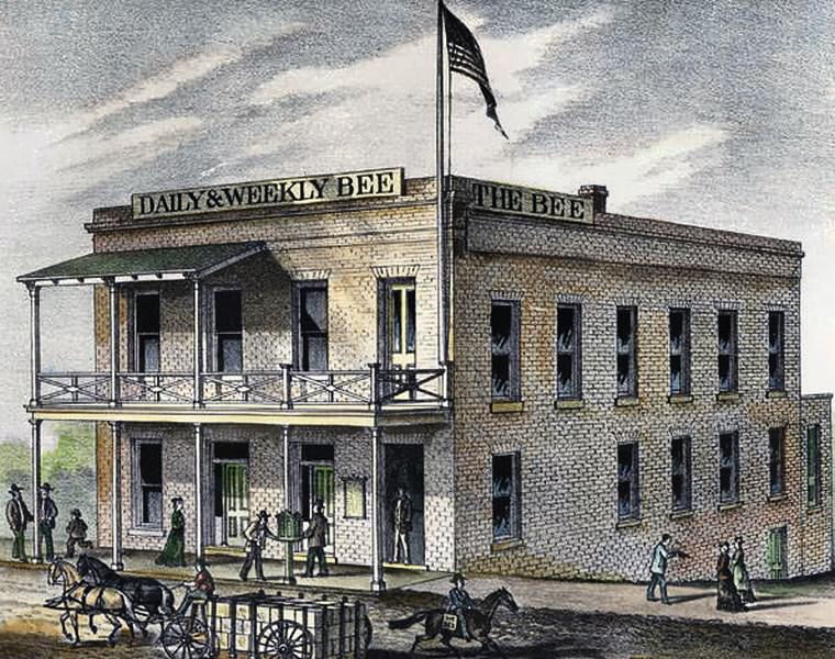
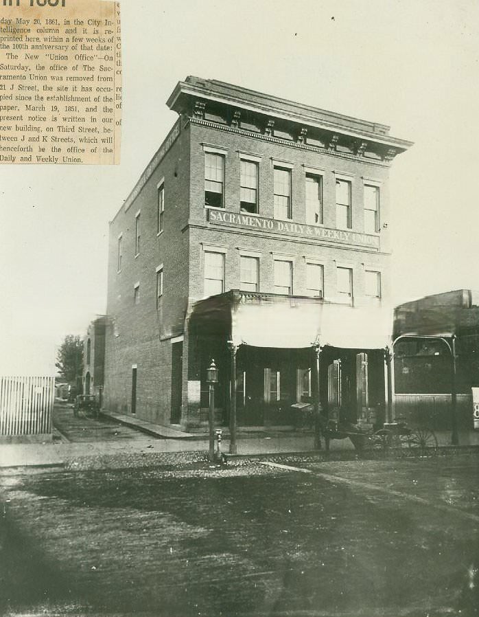
Sacramento’s press was well established by 1880. The Sacramento Bee operated out of its building at 1016 3rd Street, while the Sacramento Daily and Weekly Union had been running since 1851. Both papers covered the city’s rapid changes — from the shifting agriculture economy to political developments like the Chinese Exclusion Act — making them essential reading for residents navigating a city in transformation.
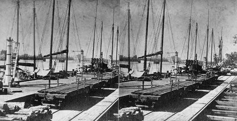
The relationship between the Sacramento River and the railroads was not one of competition but of coordination. Cargo arrived by water, transferred to rail, and moved inland. This network connected Sacramento’s farms, breweries, warehouses, and retail blocks to markets across California and the rest of the country. The river and rail together made Sacramento the commercial hub of the Central Valley.
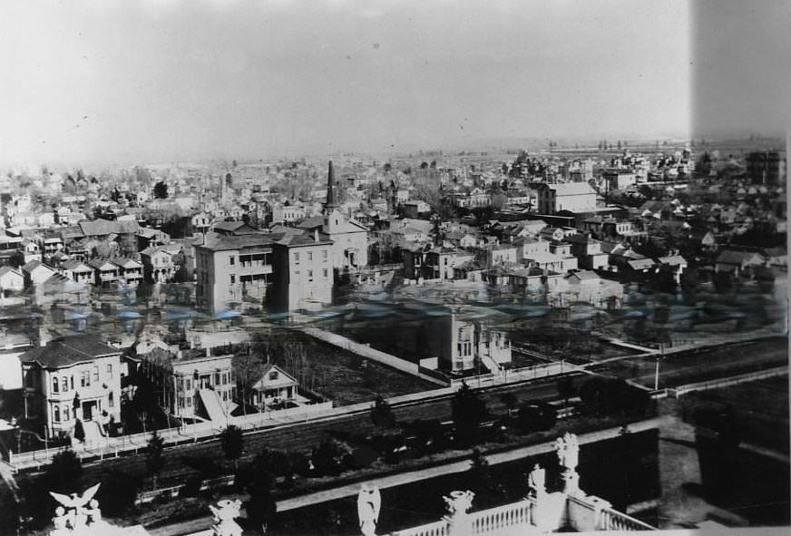
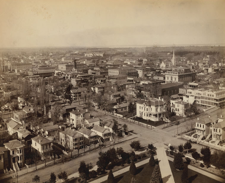
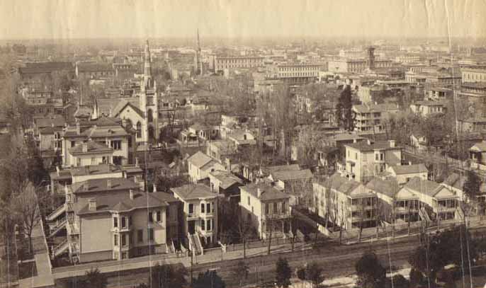
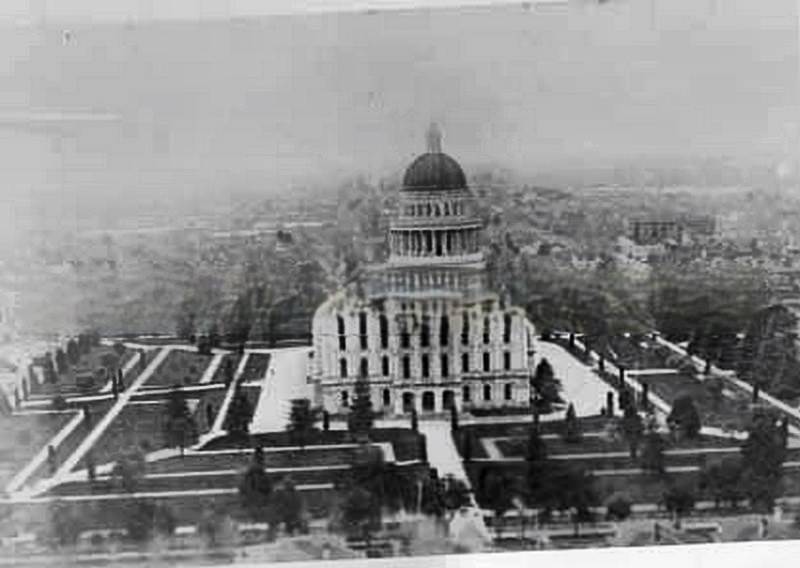
Photographed from atop the State Capitol, Sacramento in 1880 spread out in an orderly grid of Victorian homes, church steeples, and commercial blocks. The Capitol itself had been completed in 1874 and remained the dominant structure on the skyline. These aerial views from the dome give a sense of how quickly the city had grown — and how much open land still surrounded its edges.
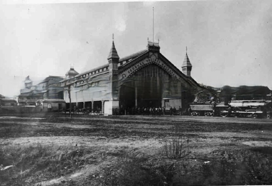
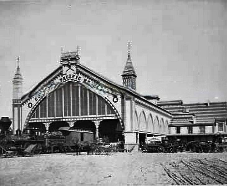
The Central Pacific Railroad’s depot was one of the most important buildings in Sacramento. It was the point of departure for passengers heading east over the Sierra Nevada and west toward San Francisco. The railroad had been the defining force in Sacramento’s economy since the transcontinental line was completed in 1869, and by 1882 it was operating as the Southern Pacific — a company that effectively controlled much of California’s transportation and political landscape.
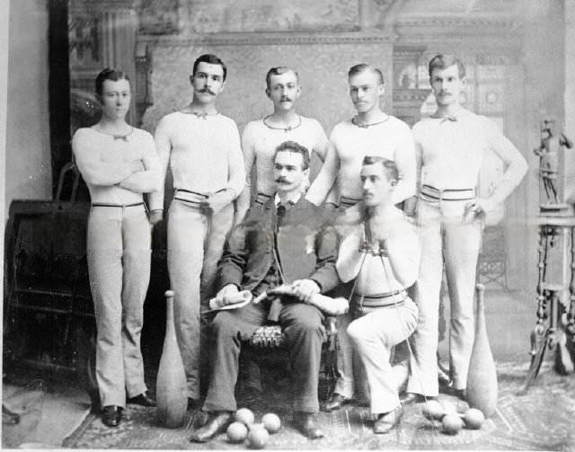
The Turn Verein was one of many fraternal and civic organizations that shaped Sacramento’s social calendar. Founded by German immigrants, the organization emphasized physical fitness, community bonds, and cultural pride. Members like Gustave Halgestein were part of a broader German-American presence in Sacramento that left a visible mark on the city’s businesses, breweries, and institutions throughout the 1880s.
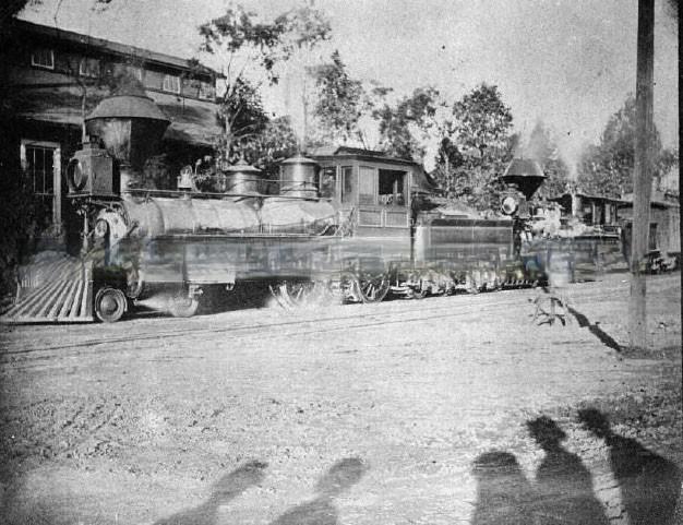
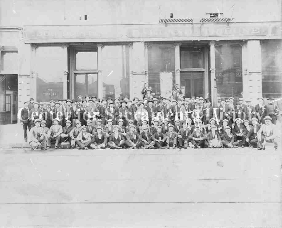
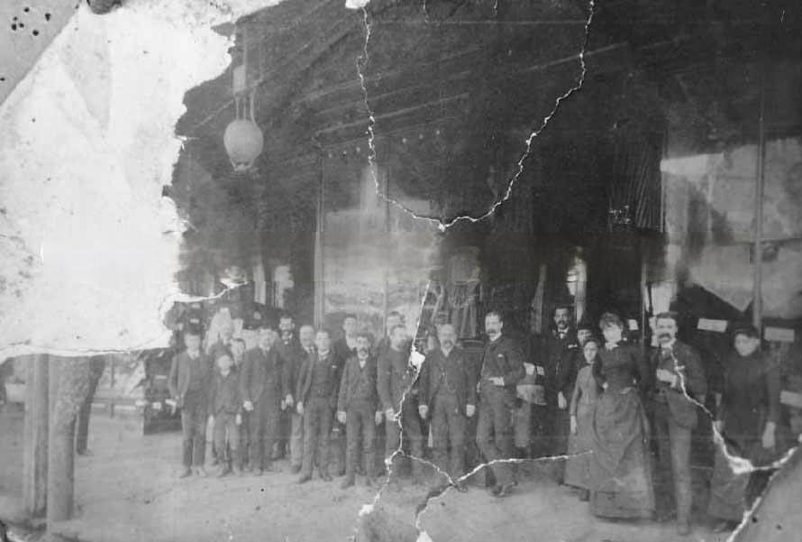
Trade and professional groups were active throughout the Sacramento region in the 1880s. Butchers, printers, hardware merchants, and livery operators all gathered at conventions and formed associations. These gatherings were both social and practical — a way to set standards, share information, and organize collectively in an era before formal labor protections.
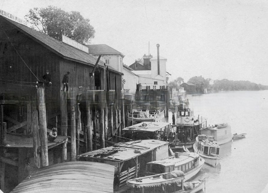
The Sacramento City Wharf handled a wide range of goods. By 1885, the American Fish Company was operating at the waterfront, taking advantage of the river’s access to fresh catches from the Sacramento and its tributaries. Fish, grain, fruit, timber, and manufactured goods all moved through the wharf, making it one of the busiest sections of the city’s commercial district.
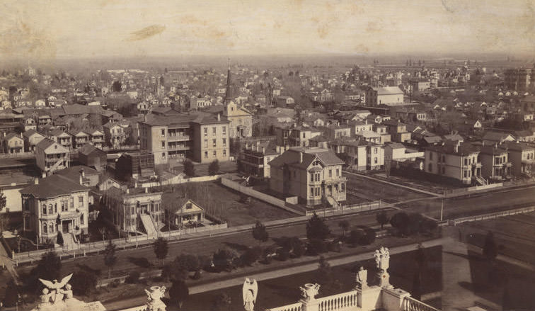
Looking northeast from the Capitol in 1880, Sacramento’s residential neighborhoods were filled with Victorian homes and church steeples. The Philip Scheld residence at 1105 L Street was typical of the well-built private homes that lined the streets near the Capitol. Churches anchored neighborhood blocks, and the orderly rows of houses reflected a city that had moved well past its Gold Rush origins and into a settled, prosperous era.
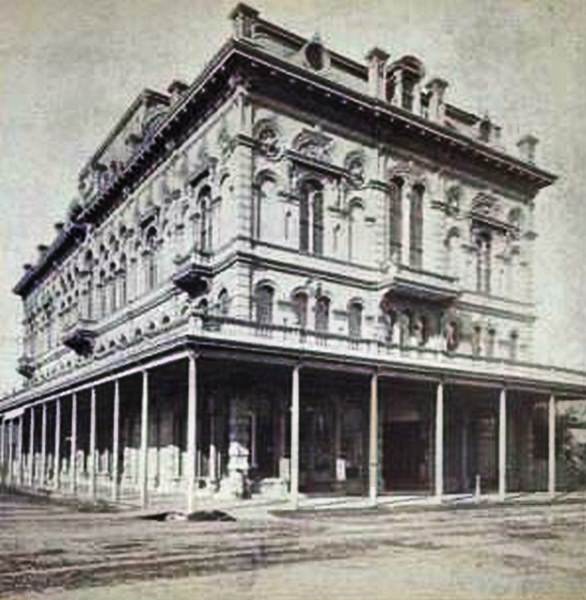
Fraternal organizations had a strong presence in 1880s Sacramento. The Odd Fellows’ Hall was one of several lodge buildings that served as gathering spaces for the city’s civic and social life. These organizations provided mutual aid, organized public events, and brought together men from across different trades and backgrounds under a common structure.
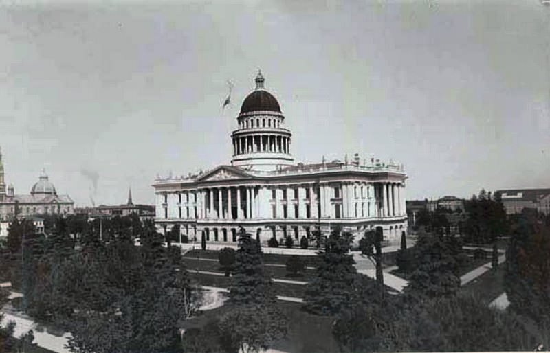
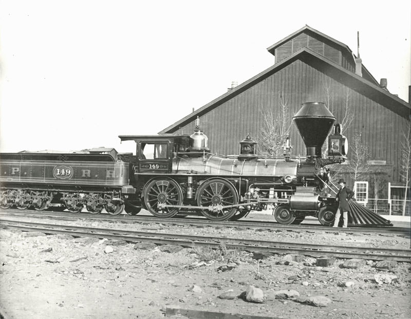
The Central Pacific Railroad’s locomotive fleet grew steadily through the 1880s. Engines were built and maintained at the Sacramento Shops, which employed hundreds of skilled workers. In 1889, the Shops completed “The Governor,” reported at the time to be the largest railroad engine in the world. Sacramento was not just a railroad hub — it was a center of railroad manufacturing.
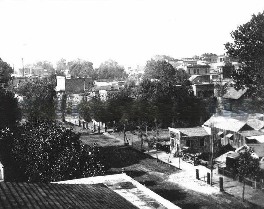
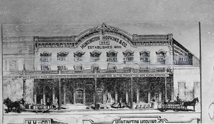
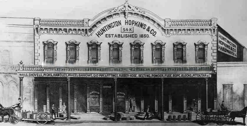
Huntington, Hopkins & Co. was one of Sacramento’s most historically significant businesses. The hardware store had been a key supplier to the Central Pacific Railroad during its construction and remained a major commercial enterprise through the 1880s. The firm’s connection to Collis Huntington and Mark Hopkins — two of the railroad’s founders — made it a landmark in the city’s business history.
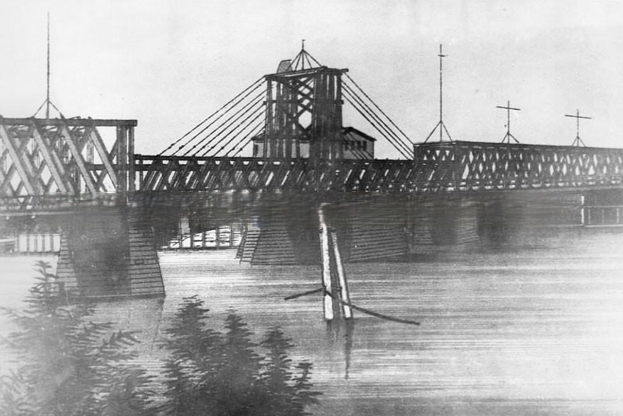
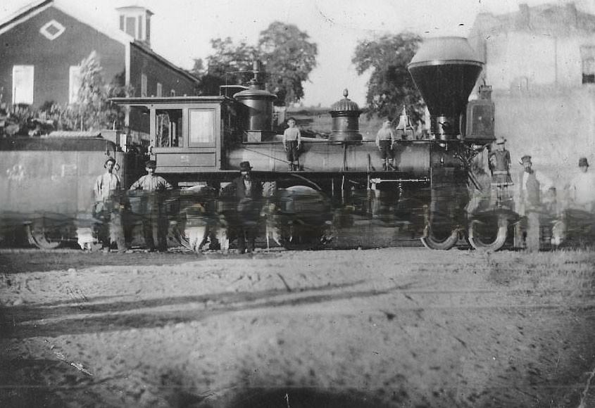
Rail lines branched out in multiple directions from Sacramento. The Sacramento and Placerville Railroad connected the city to the Sierra Nevada foothills, moving passengers and freight to mining towns and agricultural communities in the east. The Southern Pacific’s bridge across the Sacramento River carried trains westward. These connections made Sacramento a genuine railroad crossroads in the 1880s.
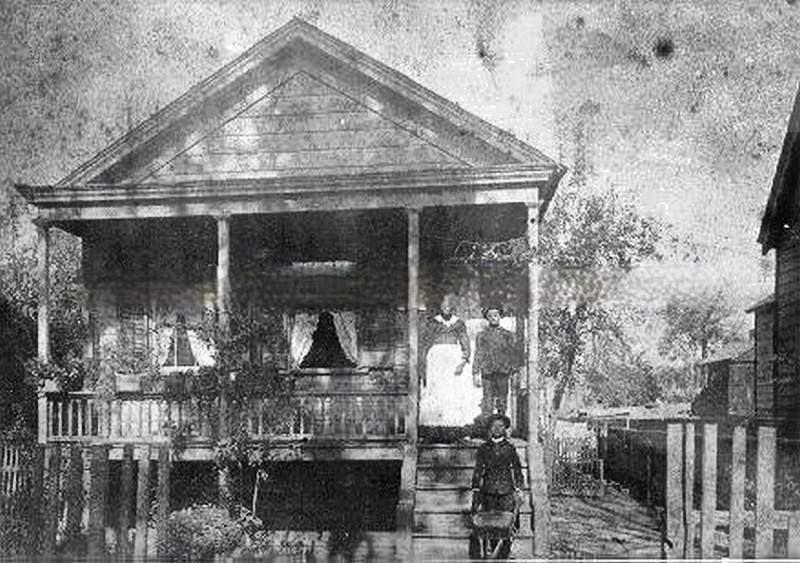
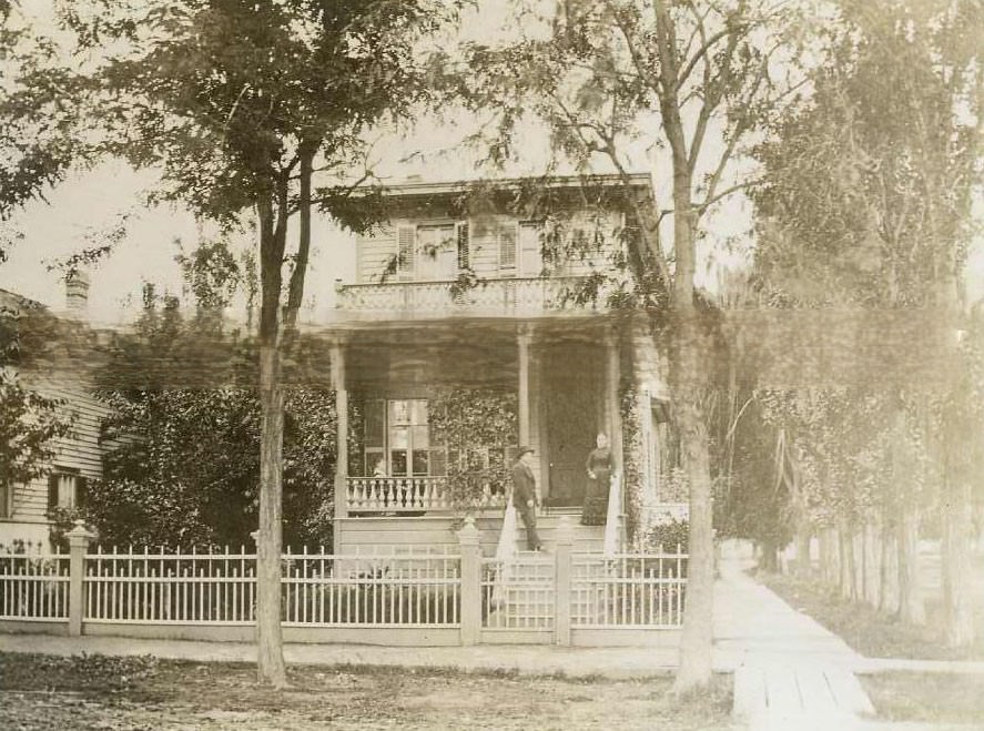
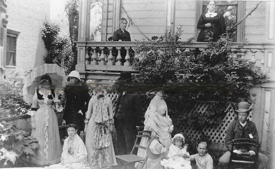
Domestic life in 1880s Sacramento is captured in photographs of private homes across the city. These were modest, well-kept wood-frame houses typical of the era — two stories, covered porches, and small yards. Families posed on staircases and in front yards, their homes reflecting the stability of a city that had grown far beyond its early tent-and-timber days.
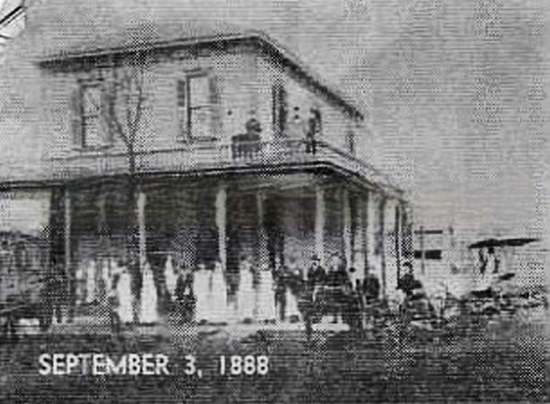
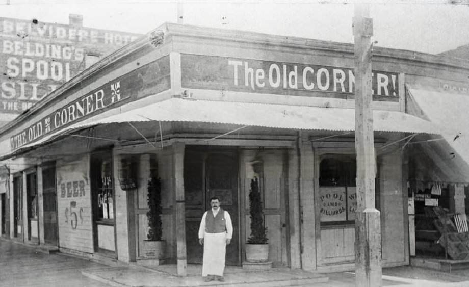
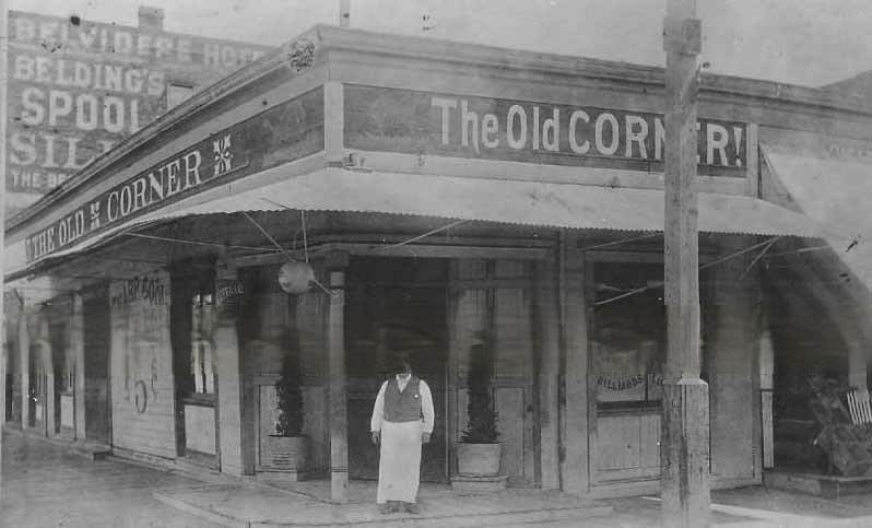
The Old Corner at 601 K Street was one of Sacramento’s well-known saloons in the 1880s. Its interior bar — captured in photographs from 1887 — showed the kind of detailed woodwork and shelving typical of Victorian-era drinking establishments. Saloons in this period served as informal meeting places where business, politics, and social life overlapped.
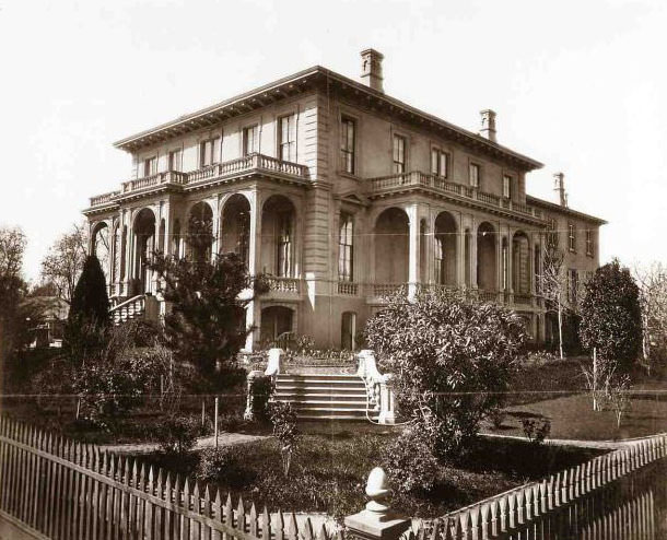
Edwin Bryant Crocker was one of Sacramento’s most prominent figures — a lawyer, judge, and brother of Charles Crocker, one of the Central Pacific’s founders. His house at 8th and F Streets was a substantial residence befitting his standing. By 1880, the Crocker Art Gallery — housed in an adjacent building — had already become a major cultural institution, one of the first public art museums west of the Mississippi.
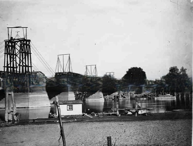
Infrastructure defined Sacramento’s place in California’s economy. The Central Pacific Railroad bridge across the Sacramento River was essential for connecting the transcontinental line to the Bay Area. Rail bridges, river wharves, and road networks were all expanding in the 1880s as Sacramento’s role as a distribution and transportation center deepened.
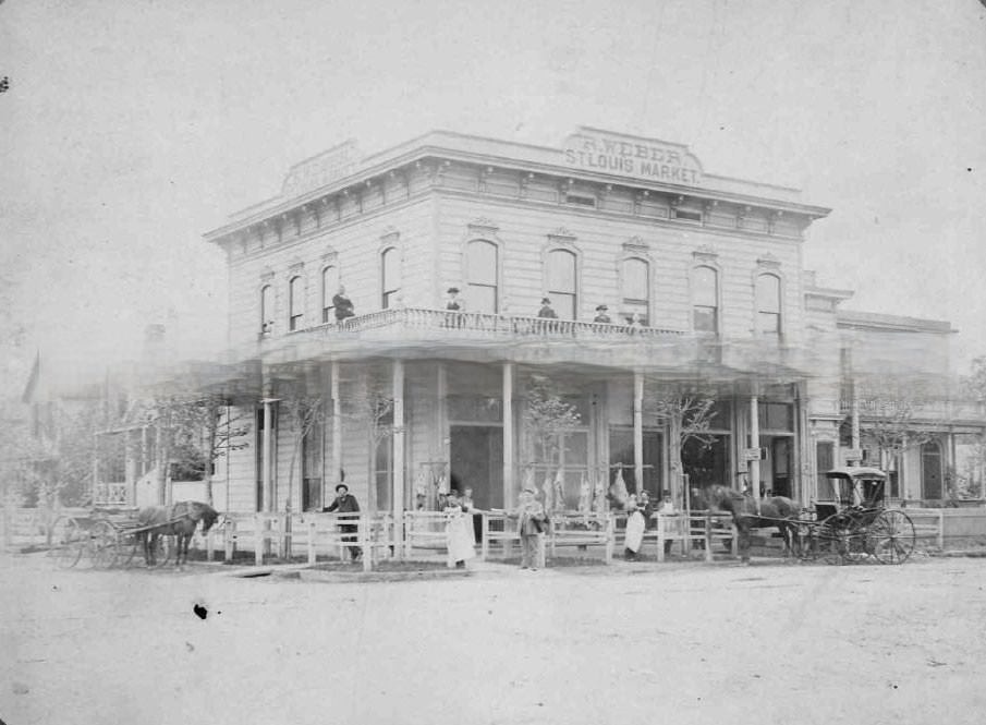
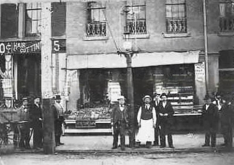
Specialty food businesses operated across Sacramento’s neighborhoods. Rudolph Weber’s St. Louis Market at 1030 H Street was one of dozens of butcher shops, bakeries, and grocers that served the city’s residents. Twelve workers posed proudly outside the market in 1885, representing a business that catered to a neighborhood customer base at a time when most shopping was done locally and on foot.
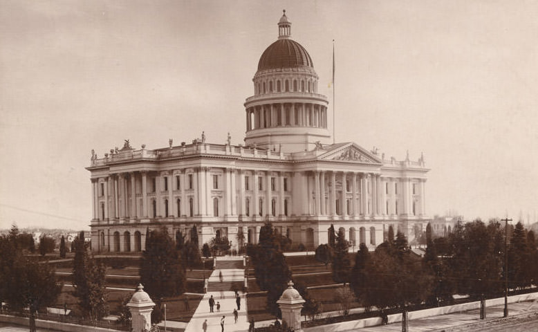
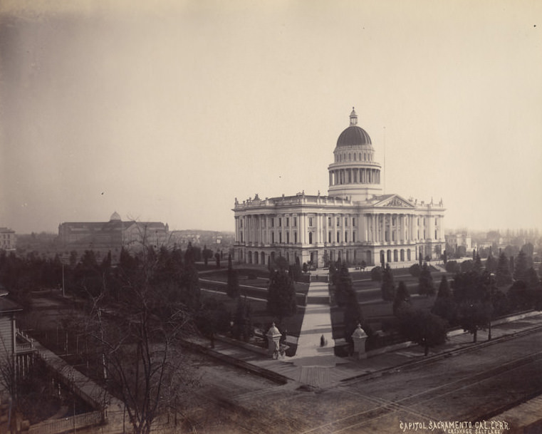
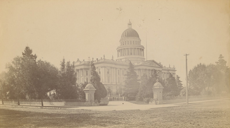
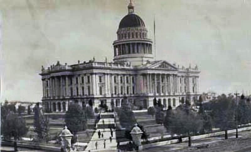
The California State Capitol was completed in 1874 and photographed extensively throughout the 1880s. Views from 10th and L Streets, from 10th and N Streets, and from various angles across the surrounding blocks show the building as a constant landmark in a changing city. Its dome served as a vantage point for some of the most detailed panoramic photographs of Sacramento taken during the decade.
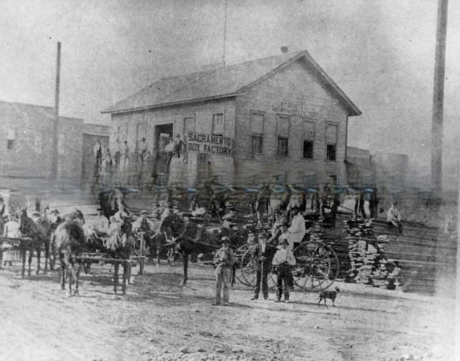
Manufacturing was a significant part of Sacramento’s economy in the 1880s. The Sacramento Box Factory on M Street produced the wooden boxes used to ship fruit from the region’s expanding orchards. As the fruit industry grew, so did the demand for packaging. The box factory sat close to the riverfront, where its products could be loaded directly onto boats or transferred to rail cars.
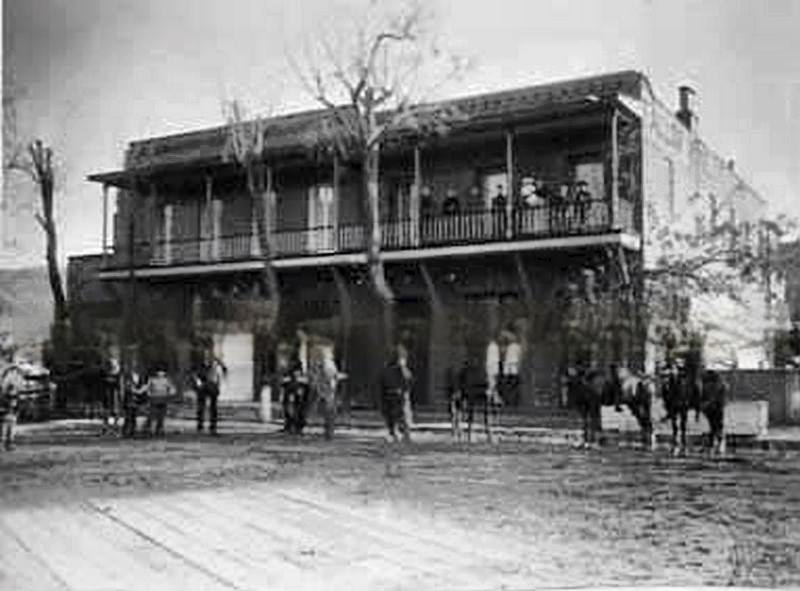
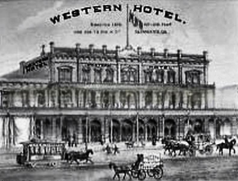
Hotels were busy in 1880s Sacramento. The city attracted legislators, railroad men, farmers, and travelers passing through on their way to and from the Sierra Nevada. Fallon’s Hotel and the Western Hotel were among the establishments serving this traffic. The State House Hotel also operated during this period, its trade card preserved alongside photographs of the building’s exterior.
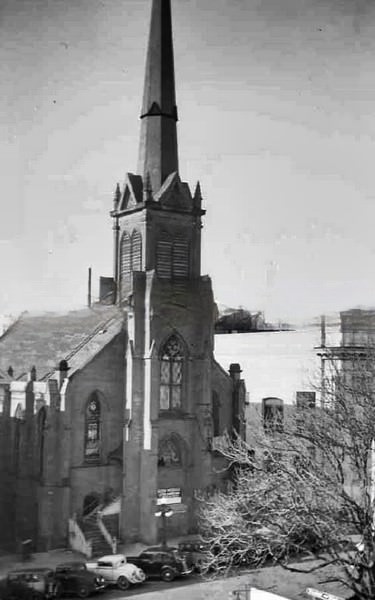
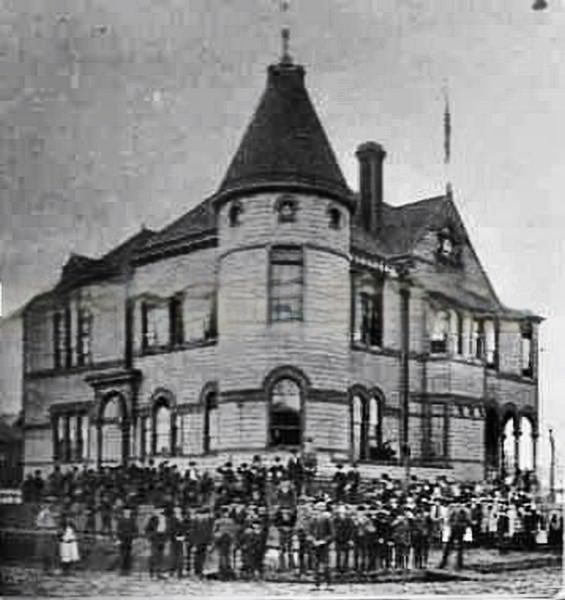
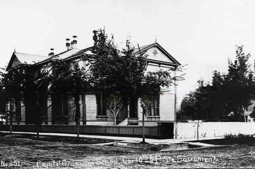
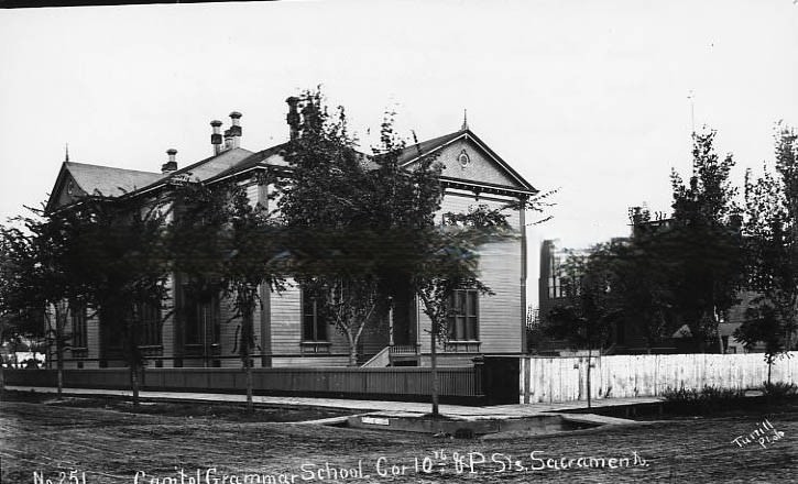
Sacramento’s public institutions expanded steadily through the decade. New grammar schools were built to serve the city’s growing population. Sutter Grammar School and Capitol Grammar School were both photographed in 1889, their brick exteriors and large windows reflecting the era’s belief in purpose-built educational architecture. Churches of multiple denominations — Methodist, Baptist, Congregational — anchored different neighborhoods across the city.
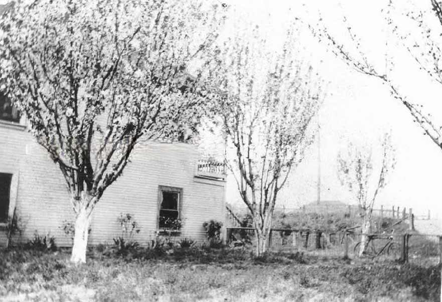
The fruit boom reshaped Sacramento’s rural landscape. Orchards spread across land that had previously grown wheat, and small farmhouses sat surrounded by trees in full bloom. This photograph from 1881 shows the early days of that transition — modest homesteads with fruit trees just establishing themselves on what had recently been grain-farming land.
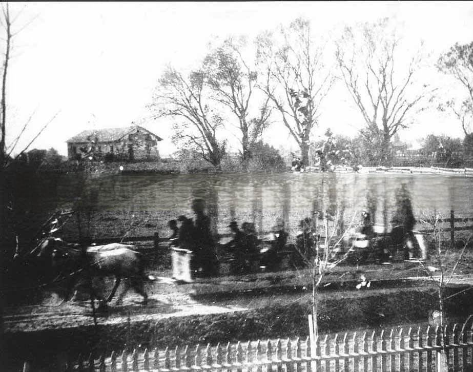
Sutter’s Fort — the original settlement that gave rise to Sacramento — had fallen into disrepair by the 1880s. Photographs from 1881 and 1889 show the central building in a state of neglect, with horse-drawn streetcars passing by on the street outside. The fort’s crumbling walls were a sharp contrast to the modern city growing around them.
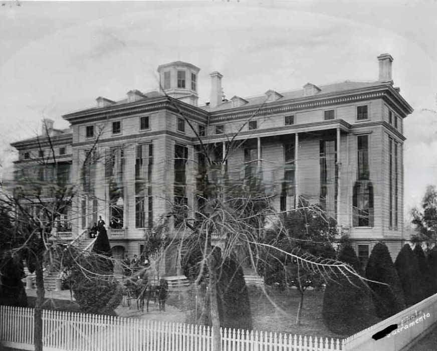
The Southern Pacific Railroad operated its own hospital in Sacramento by 1885. This was a common practice for large railroads of the era — their workers faced dangerous conditions on the line and in the shops, and providing medical care was a way to maintain the workforce. The hospital served railroad employees from across the network who were injured or fell ill while on duty.
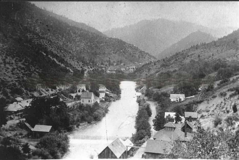
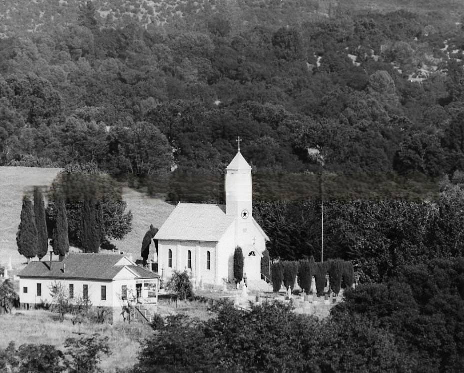
The Sierra Nevada foothills to the east of Sacramento were dotted with small mining and agricultural communities in the 1880s. These villages supplied Sacramento’s markets with timber, ore, and produce, while Sacramento supplied them with manufactured goods, hardware, and groceries. The railroad and stagecoach lines kept these communities connected to the city.
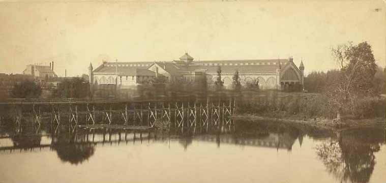
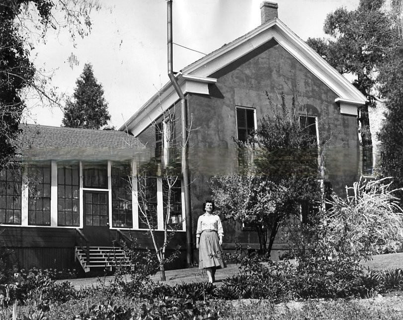
The Central Pacific depot sat next to China Slough — also known as Sutter Lake — on the city’s eastern edge. This waterway had long been a geographic feature of Sacramento’s layout, and the depot’s placement nearby reflected the practical logic of building rail infrastructure close to water. By 1882, the depot was one of the busiest in California.
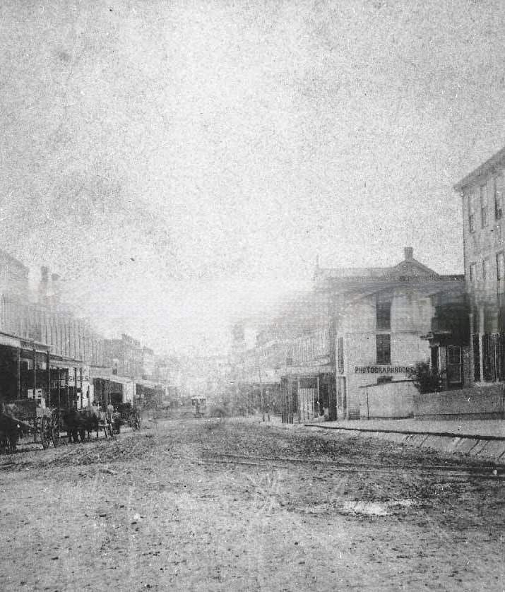
Residential streets away from the downtown commercial core were quieter but no less defined by the era’s architecture. Fifth Street looking south from Shawnee Street in 1884 showed a mix of wood-frame homes and modest lots, representative of Sacramento’s working-class and middle-class neighborhoods that stretched beyond the main commercial avenues.
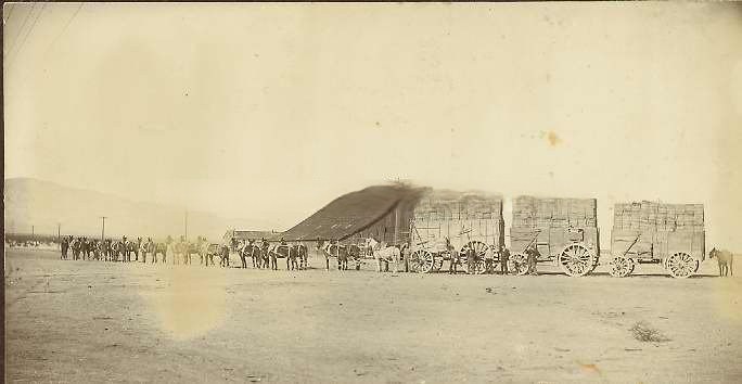
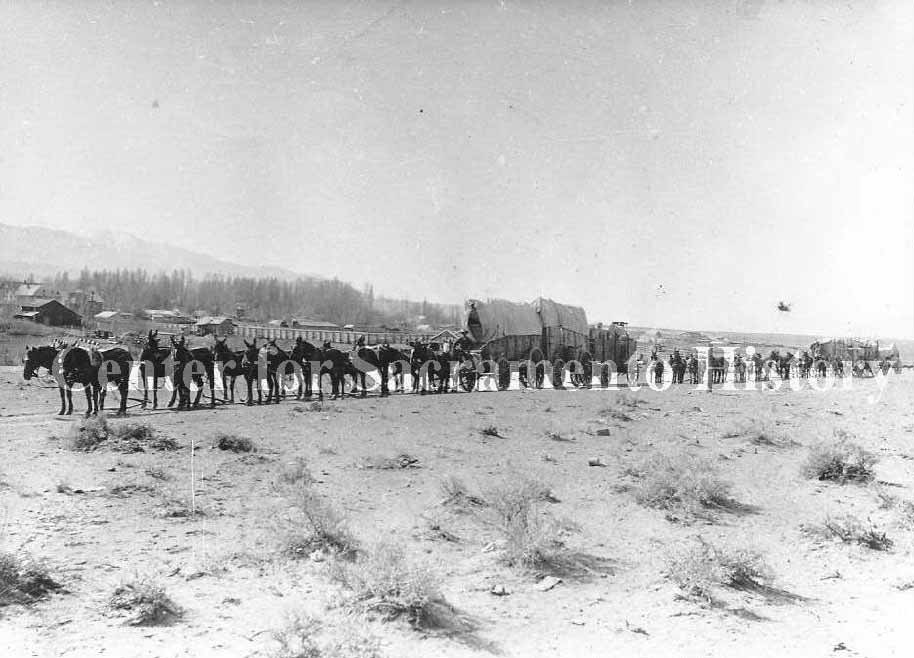
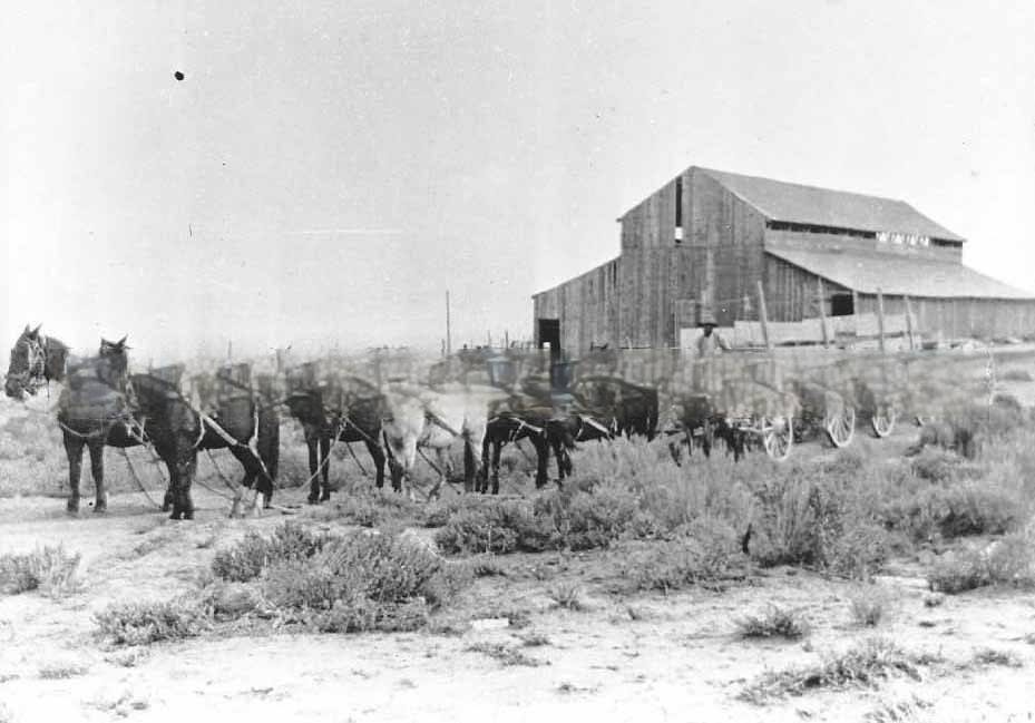
The broader California transportation network of the 1880s included more than just steam locomotives. In the southern part of the state, the San Bernardino Borax Manufacturing Company used 20-mule teams to haul borax across the Mojave Desert. These massive wagon teams — up to 165 feet long when fully hitched — were a defining image of California’s pre-automobile freight industry.
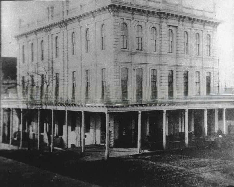
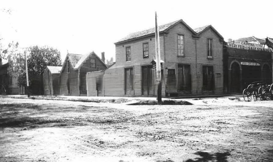
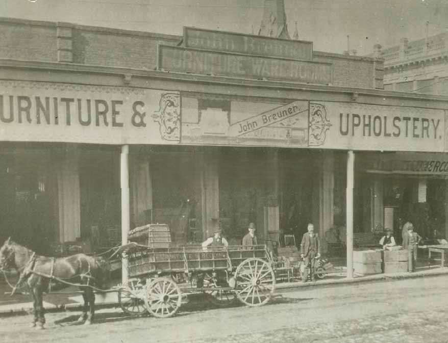
John Breuner’s furniture business was one of Sacramento’s most prominent retail operations. The company’s warehouse, photographed in 1882, showed a one-story brick building with goods stacked on the wooden sidewalk outside and a horse-drawn Breuner wagon parked in front. By 1883, the company had expanded its showrooms, reflecting the demand for home furnishings in a city with a growing middle class.
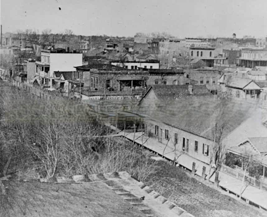
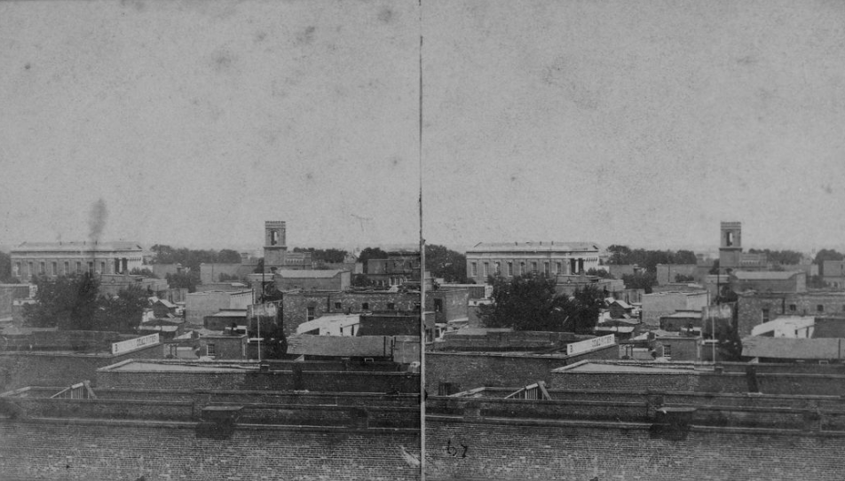
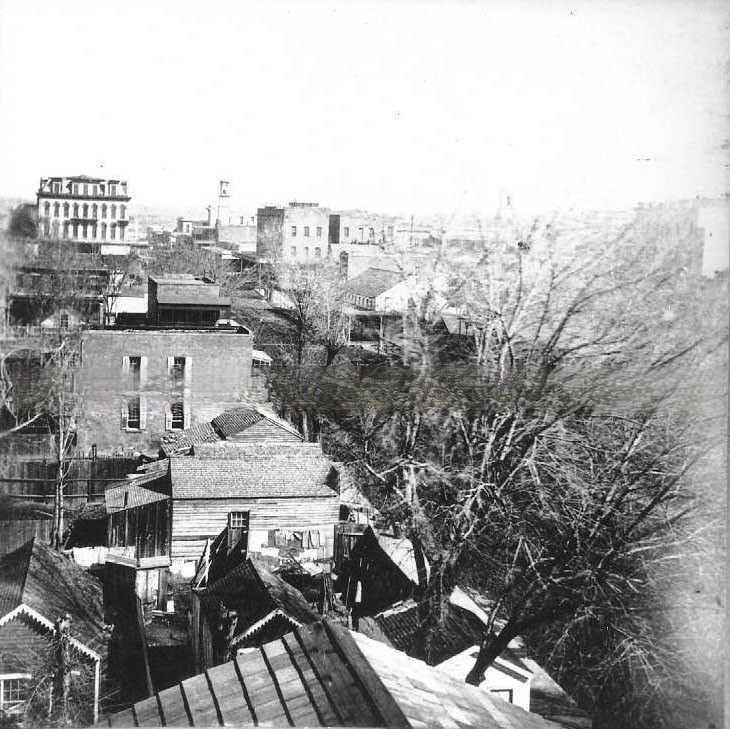
Elevated views of Sacramento in the early 1880s reveal a city still finding its shape. Streets were largely unpaved, and the mix of brick commercial buildings and wooden residential structures gave the cityscape a varied texture. The State Capitol dome rose above everything, serving as a reference point that oriented the grid of streets spreading out in every direction.
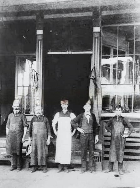
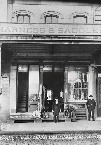
Specialty trades thrived in 1880s Sacramento. Jacob Griesel ran a harness shop at 1022 J Street, serving the city’s large population of horse owners — from livery operators and freight companies to private families with buggies. Harness making was skilled work, and Griesel was photographed both inside his shop and outside its facade on J Street in 1887.
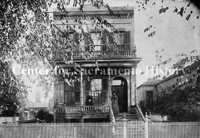
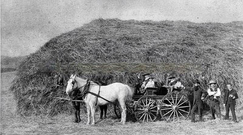
Private homes in Sacramento’s residential neighborhoods ranged from modest wood-frame cottages to substantial Victorian houses with ornate detailing. The Montfort home at 1519 7th Street, photographed in 1887, was representative of the comfortable middle-class residences that filled the blocks between the downtown commercial core and the city’s outer edges.

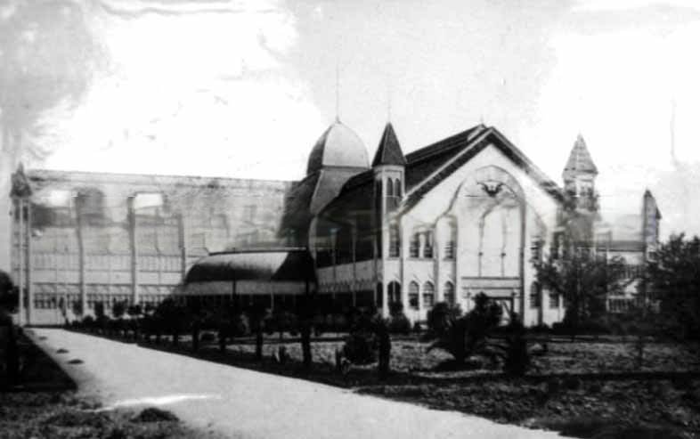
Sacramento hosted major agricultural events at the pavilion at 15th and L Streets and the State Fair Pavilion at 15th and M Streets. These venues showcased the region’s farming output at a time when the shift from wheat to fruit was actively underway. Exhibitors displayed produce, livestock, and equipment that reflected California’s ambitions as an agricultural powerhouse.
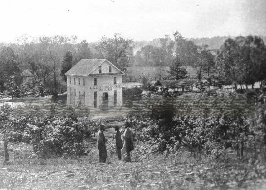
Civil War veterans were active in Sacramento’s civic life throughout the 1880s. Organizations like the Grand Army of the Republic held reunions and memorials in the city, and photographs of Civil War battlefields circulated widely in the era. The 1888 image of the Chickamauga battlefield reflects the broader national interest in documenting and remembering the war’s sites two decades after the fighting ended.
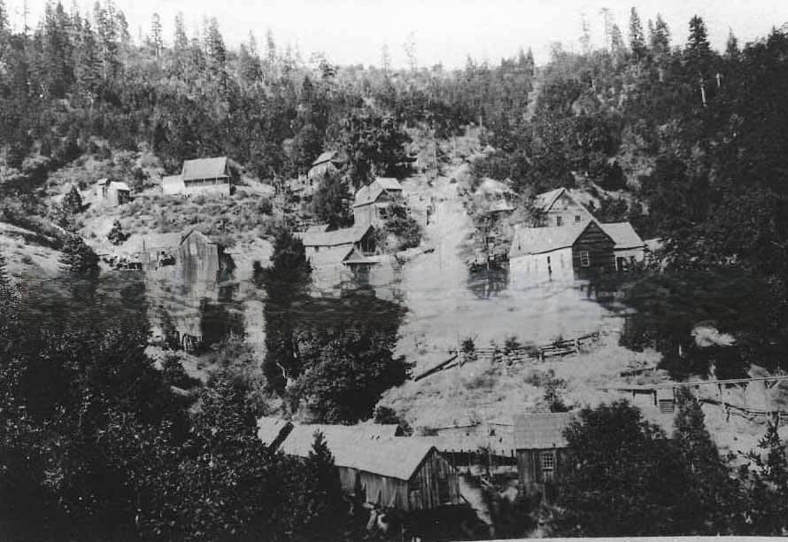
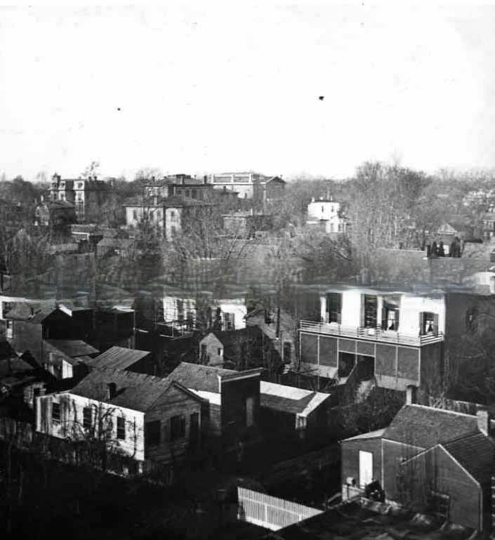
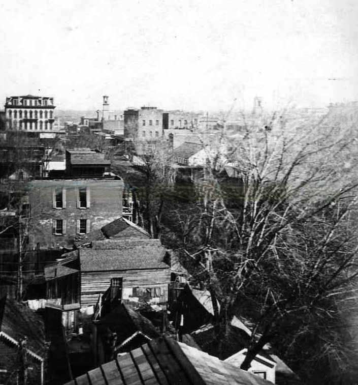
Looking southwest from the top of the Edward Johnson home at 5th and M Streets in 1884, Sacramento’s density was visible in the crowded rooflines and closely packed commercial and residential buildings. This private vantage point gave a ground-level perspective that differed from the Capitol dome views — more intimate, and more revealing of the city’s built fabric at street level.
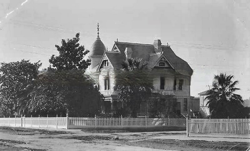
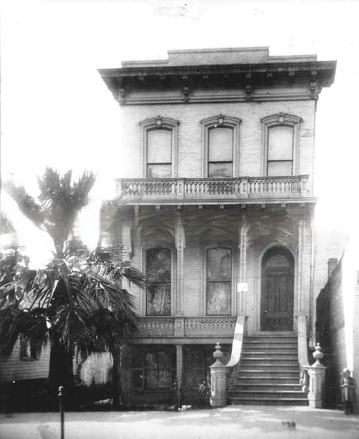
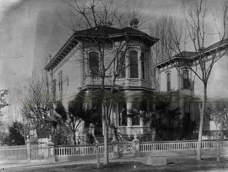
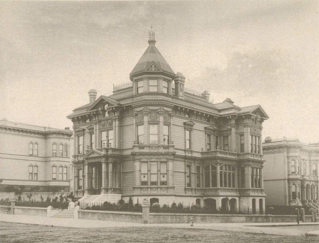
Victorian architecture was the dominant residential style in Sacramento during the 1880s. Houses with turrets, bay windows, decorative woodwork, and wraparound porches appeared across the city’s neighborhoods. The style reflected both prosperity and the availability of milled lumber from the Sierra Nevada, which made elaborate wooden detailing affordable for middle-class homeowners.
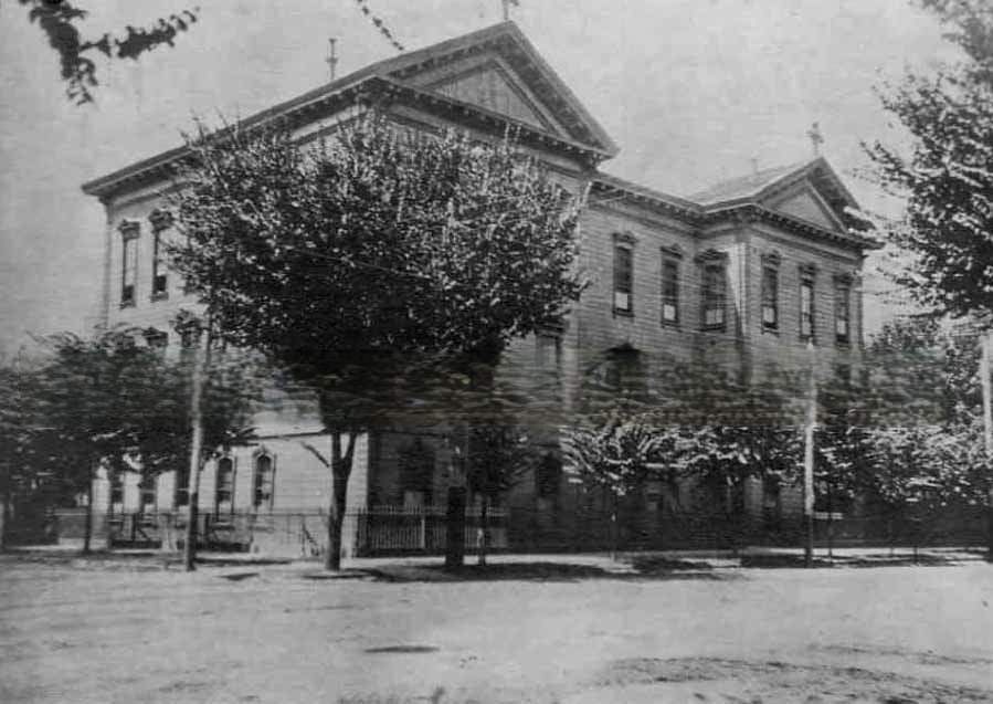
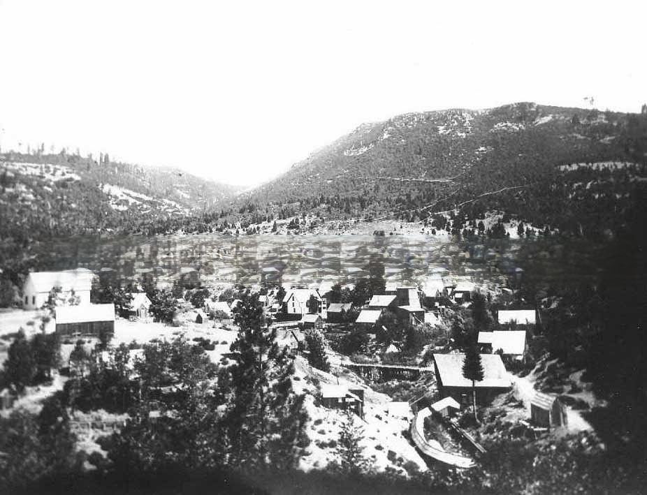
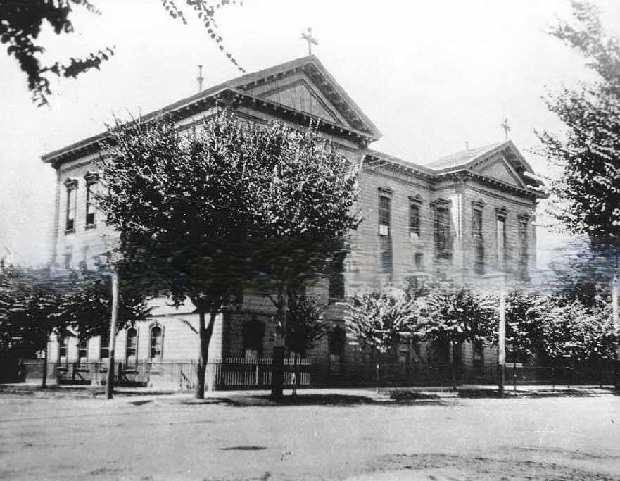
Education at all levels was expanding in Sacramento in the 1880s. Christian Brothers College at 12th and K Streets provided secondary and post-secondary education under Catholic administration. The campus was photographed in 1880 and again in 1884, showing a substantial brick institution serving Sacramento’s growing Catholic community alongside the city’s public grammar schools.
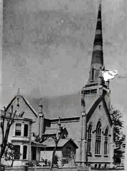
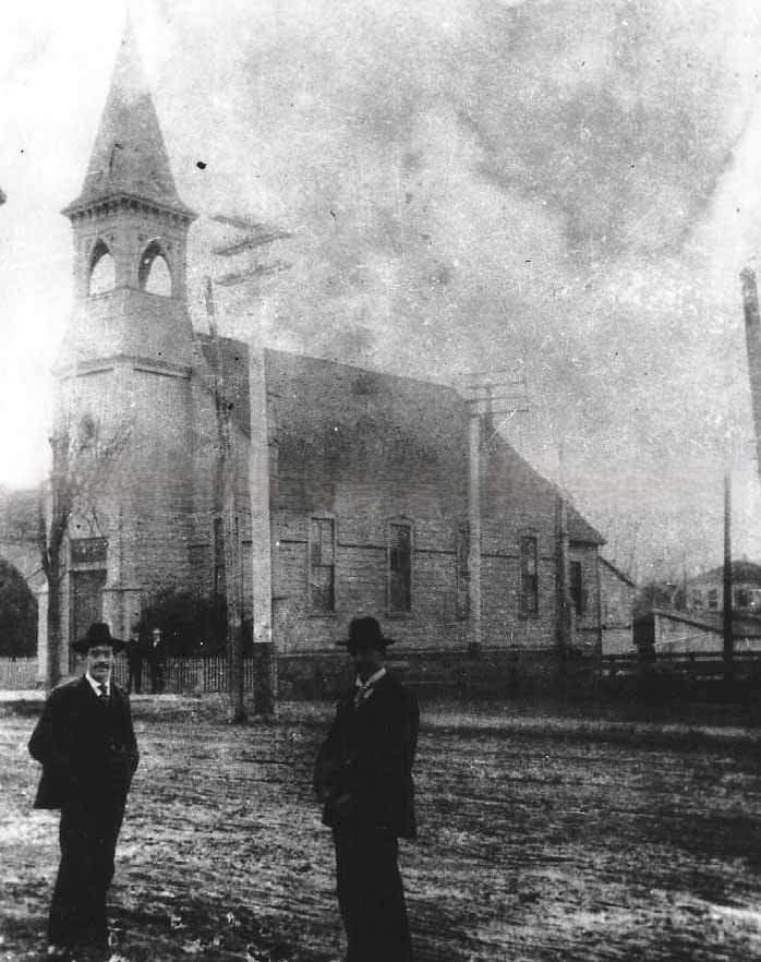
Sacramento’s churches in the 1880s represented a wide range of Protestant and Catholic denominations. The Baptist Church, photographed in 1887, and the Central Methodist Church, captured in 1886, were among the city’s many religious institutions. These buildings were significant architectural landmarks in their neighborhoods, often the largest structures on their blocks.
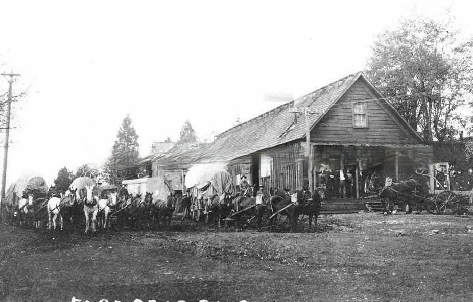
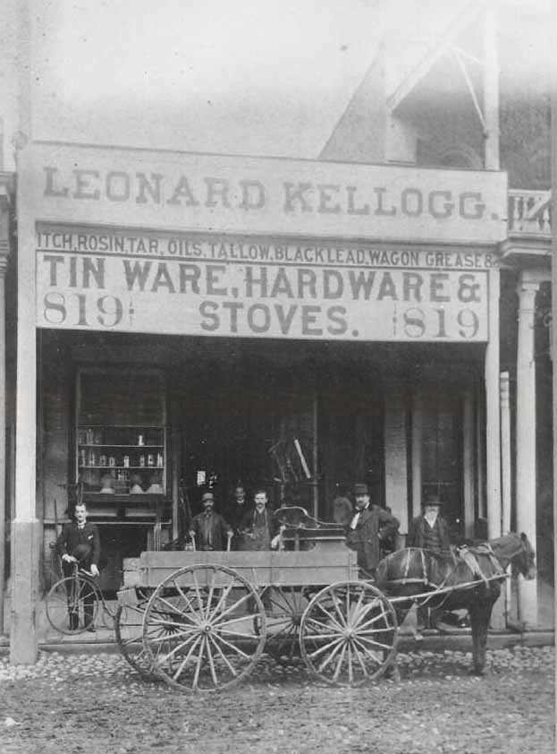
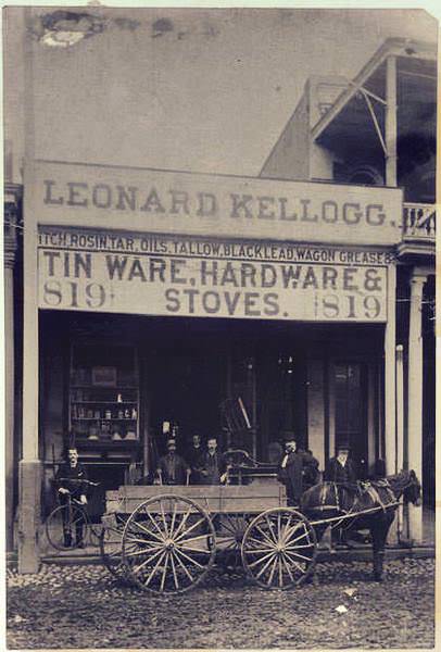
Hardware stores were essential businesses in 1880s Sacramento. Leonard Kellogg’s hardware store and C. Kellogg Hardware both operated during this period, supplying tools, building materials, and equipment to a city in constant construction. Photographs from 1883 and 1886 show men posed outside these stores, often with horse-drawn wagons loaded with goods parked along the wooden sidewalks.
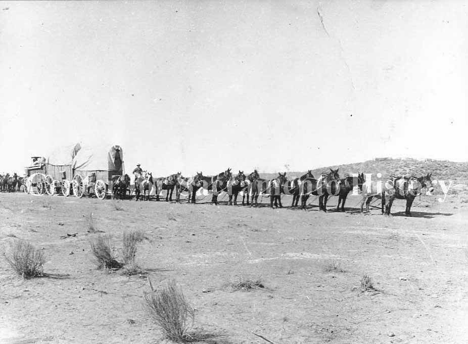
Freight hauling in the 1880s relied heavily on animal power. Multi-mule and multi-horse hitches pulled enormous loads through Sacramento’s streets and across the surrounding countryside. Twelve-mule and eight-horse hitches were used for the heaviest freight — grain, lumber, mining equipment, and agricultural supplies — connecting parts of the Central Valley not yet served by rail.
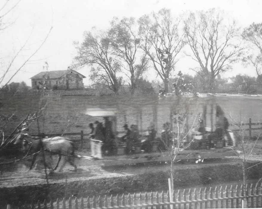
By 1889, horse-drawn streetcars ran past Sutter’s Fort on a regular schedule. The contrast between the crumbling adobe walls of the fort — a relic of California’s Mexican-era past — and the modern streetcar line running beside it captured the speed of Sacramento’s transformation. The fort would later be restored by the state, but in the late 1880s it sat in visible decay.
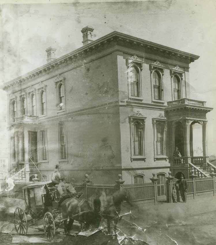
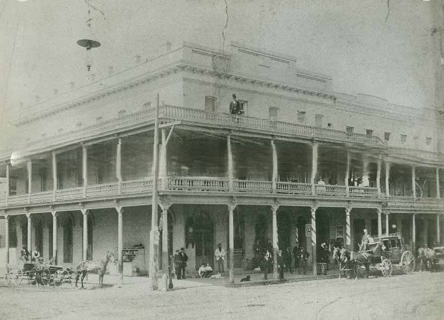
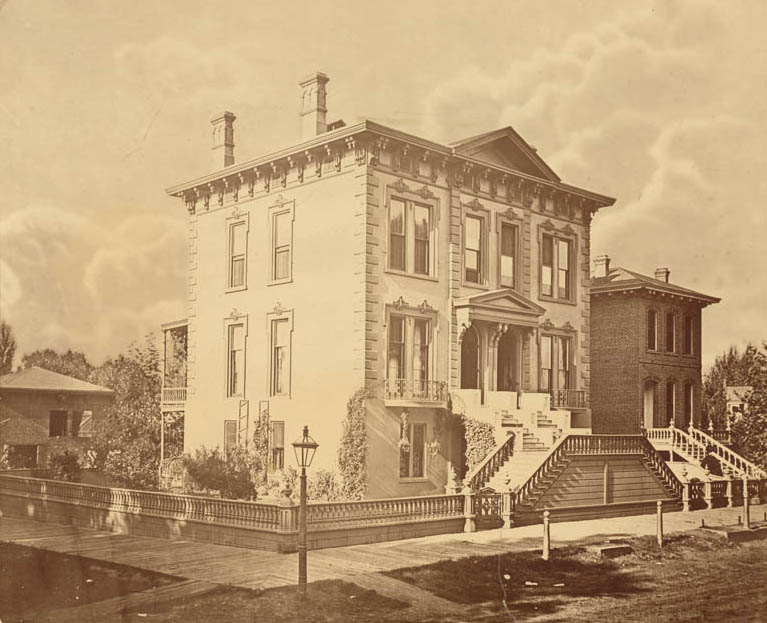
Wealthy Sacramento residents lived in substantial homes that reflected their standing. Raphael Oppenheim’s home, photographed in 1885, and the Knox family home at 916 G Street, captured in 1889, showed the upper end of Sacramento’s residential architecture. These were large, well-maintained properties, often with iron fences, carriage houses, and landscaped grounds.
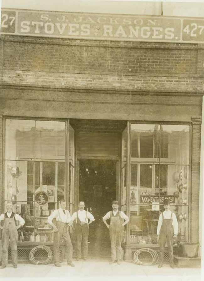
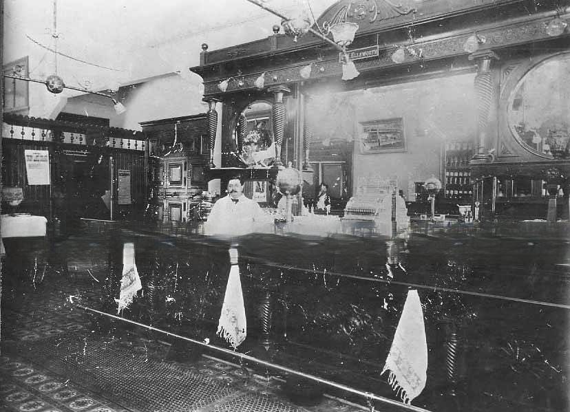
The interior of The Old Corner saloon at 601 K Street, photographed in 1887, showed a fully fitted Victorian bar with a polished counter, shelves of bottles, and ornate woodwork. Saloons of this caliber served both drinks and informal meals, and their interiors were often the most elaborately decorated spaces available to working men in the city.
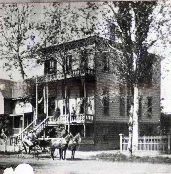
The horse and buggy remained the primary form of private transportation in Sacramento throughout the 1880s. Even as horse-drawn streetcars served the main commercial routes, most families who could afford it kept a horse and buggy for personal travel. Photographs of private homes frequently show a buggy parked outside, a standard feature of middle-class life in the era.
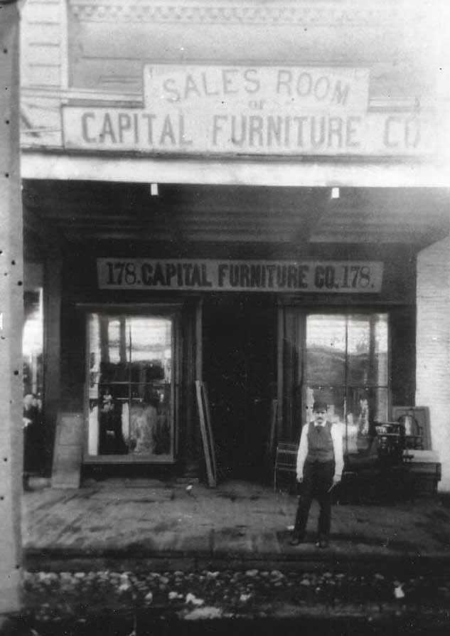
J Street was Sacramento’s main commercial corridor in the 1880s. Furniture showrooms, hardware stores, newspaper offices, saloons, and specialty shops lined the street from its western blocks near the waterfront to its eastern stretches toward the residential neighborhoods. The Capital Furniture Sales Room at 178 J Street was one of many businesses that competed for customers along this busy avenue.
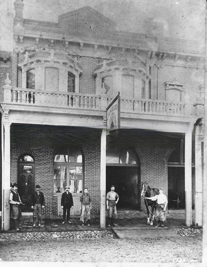
Livery stables were among the most important service businesses in Sacramento. They housed horses for hire, maintained carriages, and provided the city’s version of a taxi service for those who didn’t own their own animals. The Capital Livery and T.A. Stevens Livery Stable in Colfax were among the operations photographed during the decade, their staff posing with the horses in their care.
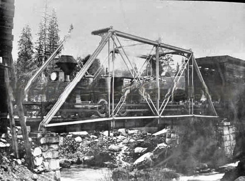
The Southern Pacific Railroad pushed its locomotives across demanding terrain in the 1880s. Locomotive No. 1254 was photographed at Soda Springs in 1886, high in the Sierra Nevada where the railroad climbed through mountain passes on its way east. Maintaining operations at this elevation through winter snows required significant engineering and labor resources that the railroad invested heavily in during the decade.
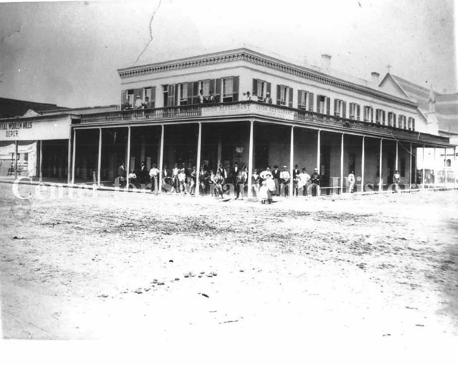
Manufacturing in Sacramento extended beyond rail equipment and box-making. The Capital Woolen Mills produced fabric for the regional market, and the Union Restaurant served meals to the city’s workers and visitors. Together, photographs of these businesses in 1881 show a city with a diverse economic base — not dependent on any single industry but built on the layered activity of trade, manufacturing, and services.
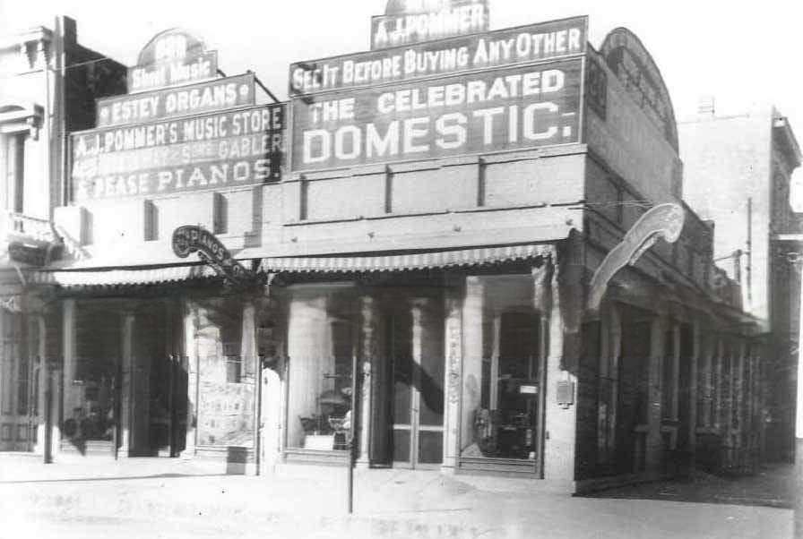
Cultural commerce was present on J Street alongside the hardware stores and grocers. A. J. Pommer’s business at 829 and 831 J Street sold pianos, organs, and musical goods in 1880 — a sign that Sacramento’s residents had disposable income and an interest in domestic music-making. Victorian households across the social spectrum placed a high value on musical instruments as both entertainment and status symbols.
By 1886, Sacramento was a fully formed city with established institutions, a developed commercial district, and a population that had grown significantly since the Gold Rush era. The photographs from this mid-decade period show a city that had moved well past its frontier origins — with gas lighting, brick buildings, paved sidewalks in the commercial core, and a functioning streetcar network.
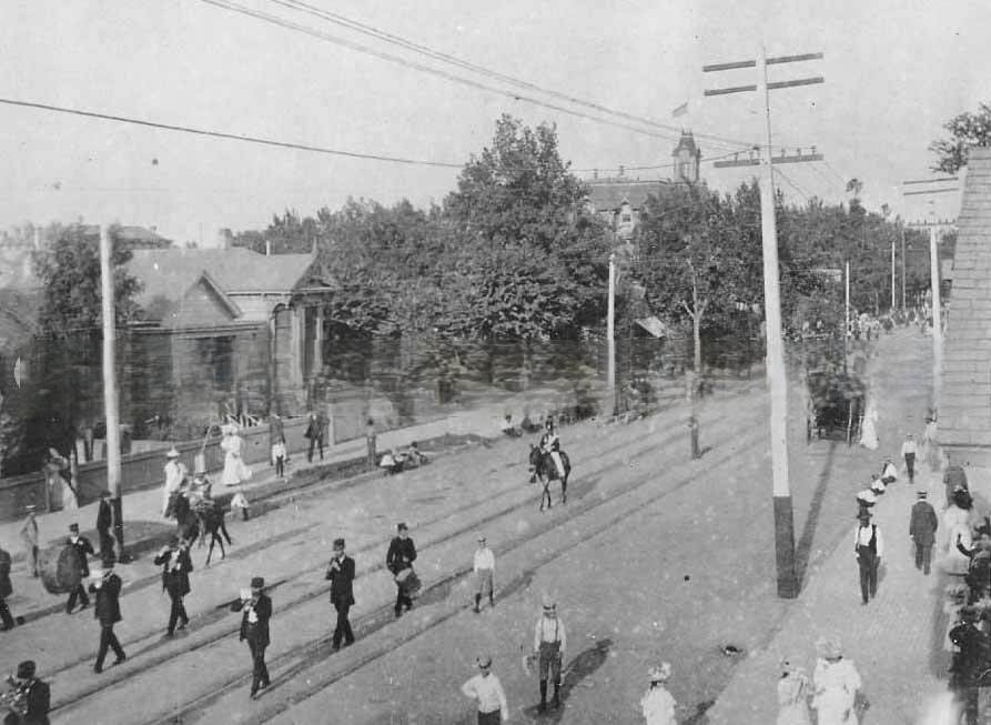
Public parades and celebrations were frequent in 1880s Sacramento. J Street served as the main parade route, wide enough to accommodate marching bands, civic organizations, and large crowds of spectators. The 1881 parade, like the Turn Verein events of 1885, drew people from across the city and surrounding communities to watch organized processions move through the downtown blocks.
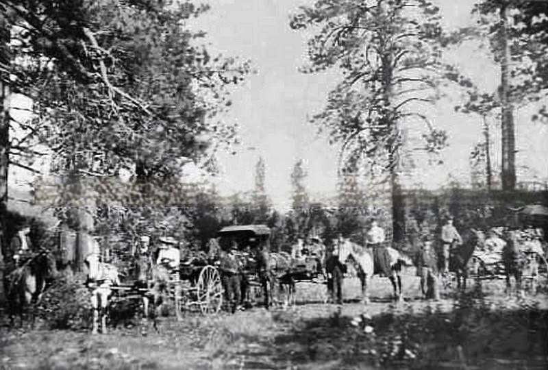
Travel beyond Sacramento’s city limits in the 1880s required horses, carriages, and stagecoaches. Camping trips into Nevada and the Sierra foothills were pursuits of those with the time and resources to make the journey. Samuel Luke Howe Sr.’s camping scene in Nevada, captured in 1880, shows the kind of recreational travel that wealthy Sacramento families undertook when rail lines didn’t reach their destination.
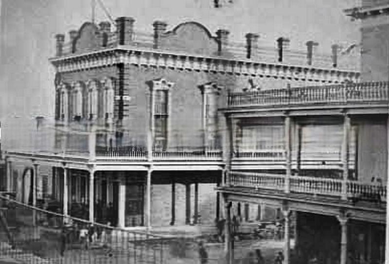
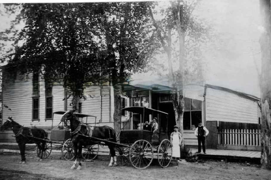
Neighborhood businesses like George Kuchler’s bakery in 1885 served Sacramento’s everyday needs. Bakeries, butcher shops, and grocery stores operated on nearly every commercial block, supplying fresh goods to a population that had no refrigeration in their homes and shopped daily. These businesses were the foundation of neighborhood commercial life in a city without supermarkets or chain stores.
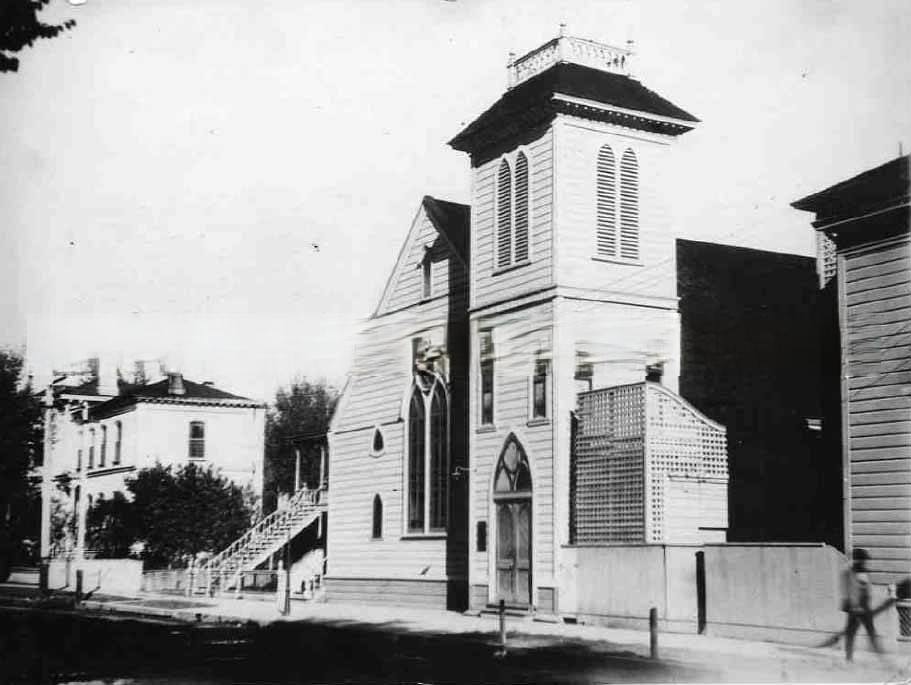
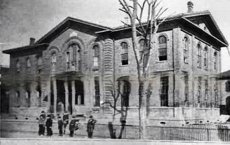
Public schools multiplied across Sacramento during the 1880s. Washington Elementary School, photographed in 1886, and Williams Grammar School showed the city’s commitment to public education in a decade when California was actively expanding its school system. These buildings were constructed with permanence in mind — brick or wood-frame structures designed to serve neighborhoods for decades.
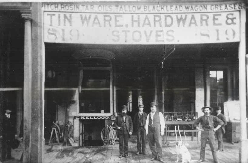
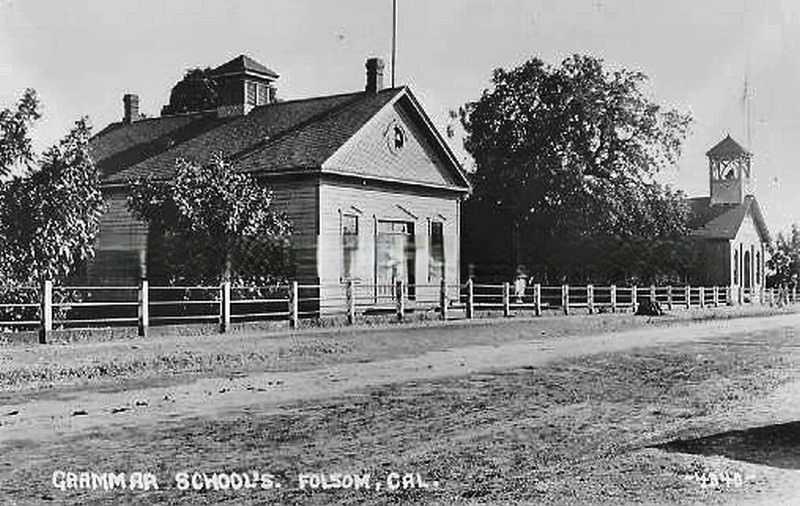
Folsom, east of Sacramento along the American River, had its own established institutions by 1880. Its grammar schools were photographed that year, showing a community that — while smaller than Sacramento — had the infrastructure of a settled town. Folsom’s proximity to the railroad and the river made it an important secondary center in Sacramento County throughout the decade.
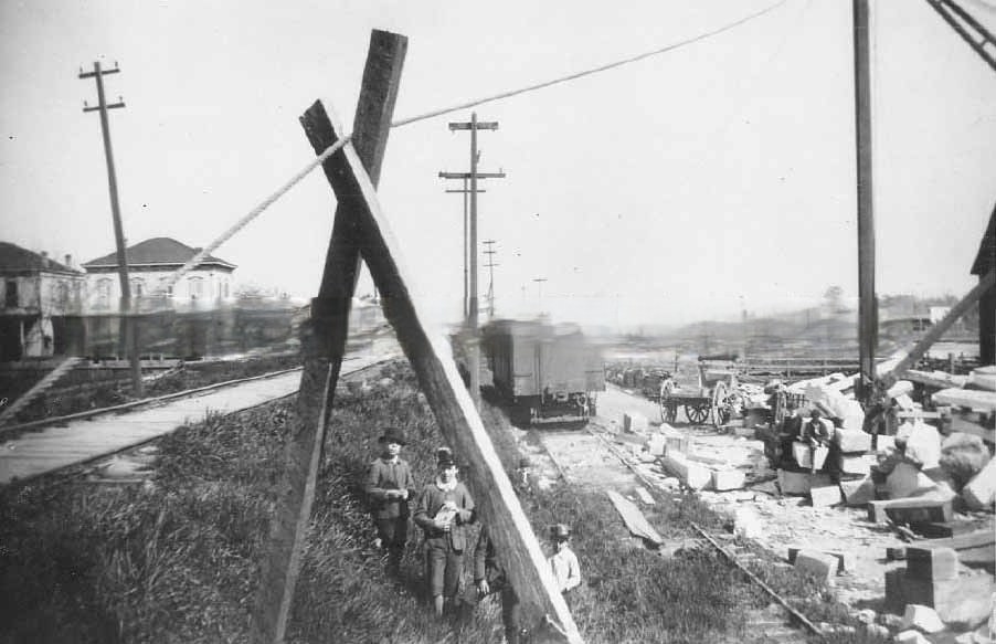
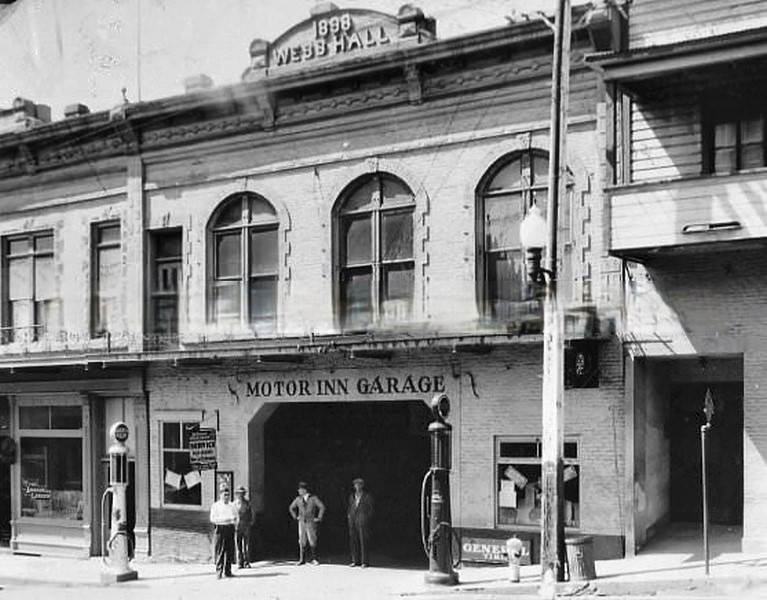
The range of businesses operating in Sacramento and its surrounding region in the 1880s was wide. Granite yards supplied construction materials for Sacramento’s expanding building program, while grocery stores like J. W. Keating’s served the daily needs of neighborhood residents. Every block had its own mix of trades, and photographs of storefronts from the period document their variety in precise detail.
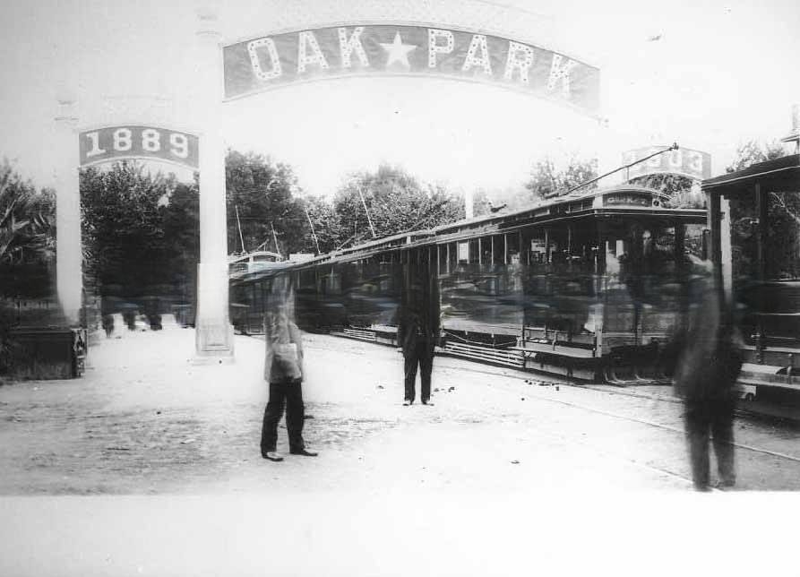
Oak Park, on Sacramento’s southern edge, was being developed as a residential suburb in the late 1880s. Photographed in 1889, it represented the outward expansion of the city as new streetcar lines made it possible for families to live further from the downtown commercial core while still accessing the city’s jobs and services. This pattern of suburban growth would accelerate in the following decades.
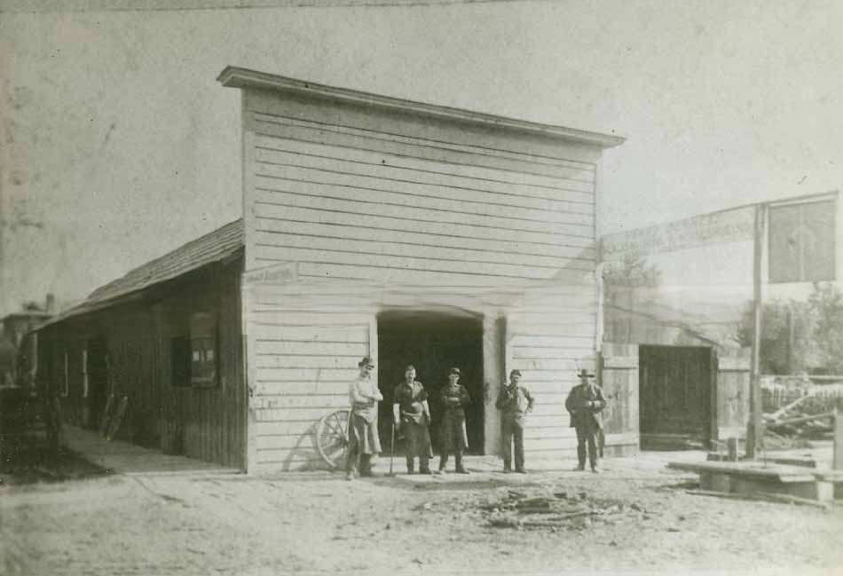
Blacksmithing and horseshoeing were essential trades in a city that ran on horse power. Henry Bennett’s blacksmithing shop in 1880 served horses pulling streetcars, freight wagons, private carriages, and farm equipment. The work was physically demanding and in constant demand, making blacksmiths among the most reliably employed tradesmen in Sacramento throughout the decade.
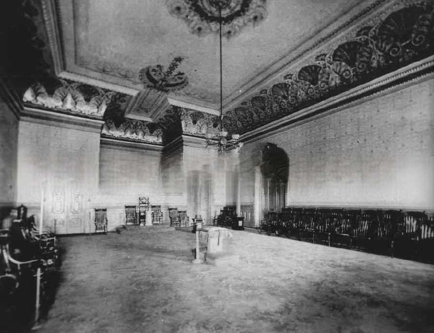
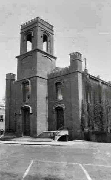
Lodge meeting rooms in Sacramento’s fraternal buildings were decorated in full Victorian style by 1881 — heavy draping, carved woodwork, patterned wallpaper, and gas lighting fixtures. These interiors served as meeting halls, social spaces, and ceremonial rooms for organizations like the Odd Fellows and the B.C.A.A.C., which maintained their own dedicated buildings across the city.
![The Margaurite [sic] Shows two-story residential building surrounded by wrought iron fence on corner of Seventh and Q Streets, Sacramento, 1884](https://www.bygonely.com/wp-content/uploads/2022/10/Sacramento_1880s_123.jpg)
The Marguerite at the corner of Seventh and Q Streets was a well-appointed two-story residential building surrounded by a wrought iron fence, photographed in 1884. Buildings of this type — standing on corner lots with fenced yards — represented a step above the standard wood-frame cottages that made up most of Sacramento’s residential stock. Wrought iron fencing was both a practical boundary and a marker of household prosperity.
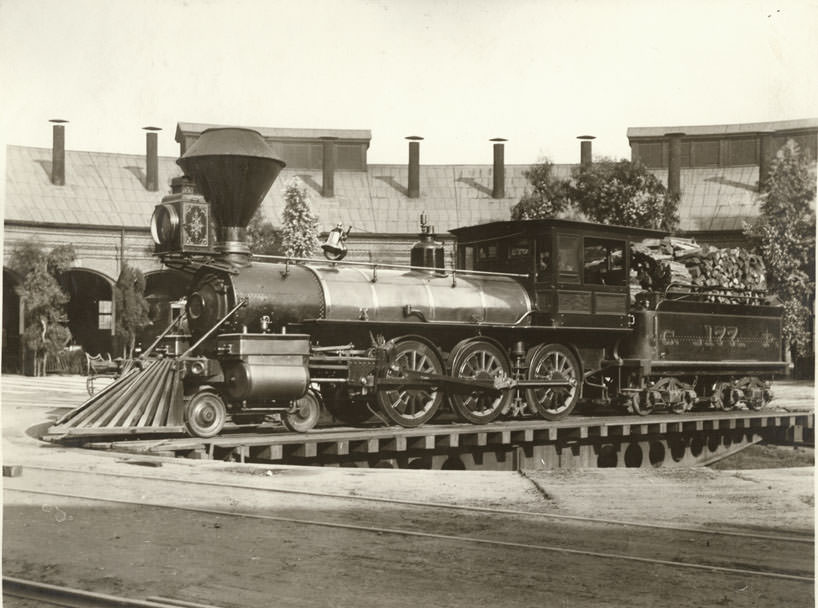
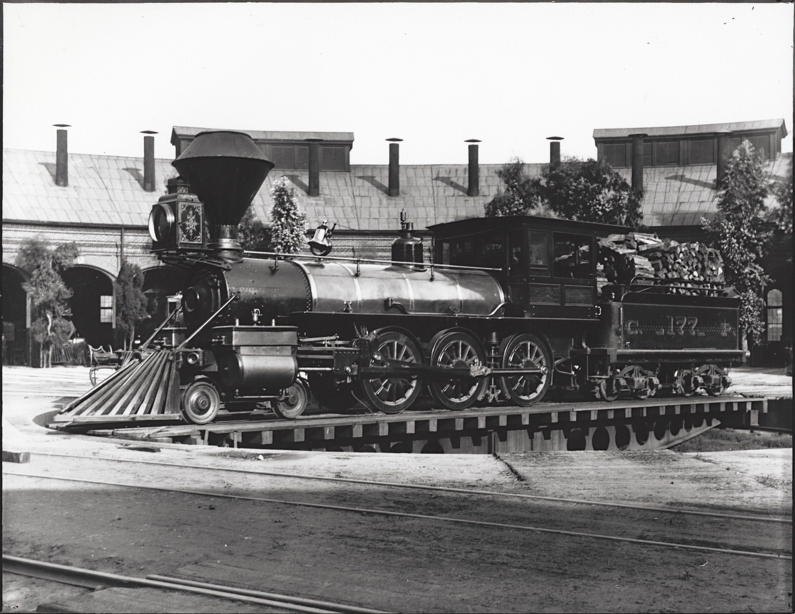
The Sacramento Shops built locomotive No. 177 in 1886 and placed it into service on August 7 of that year. It was later renumbered 1764 in 1891 and 2193 in 1901, before being scrapped in November 1916. The roundhouse at Sacramento was where these engines were serviced and turned, a massive facility that employed hundreds of mechanics, boilermakers, and laborers throughout the decade.
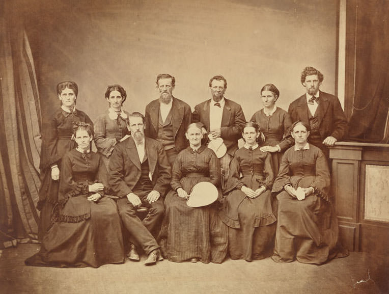
Sacramento’s pioneer families carried histories that stretched back to the city’s earliest days. Mary Lukens Conrad, born in 1808 and died in 1893, had settled in Sacramento where her family built the Eagle Hotel. After the hotel burned in 1852, the family moved to a farm in West Sacramento. By 1883, when this family photograph was taken, she represented the first generation of American settlers who had watched Sacramento transform from a Gold Rush outpost into a major California city.
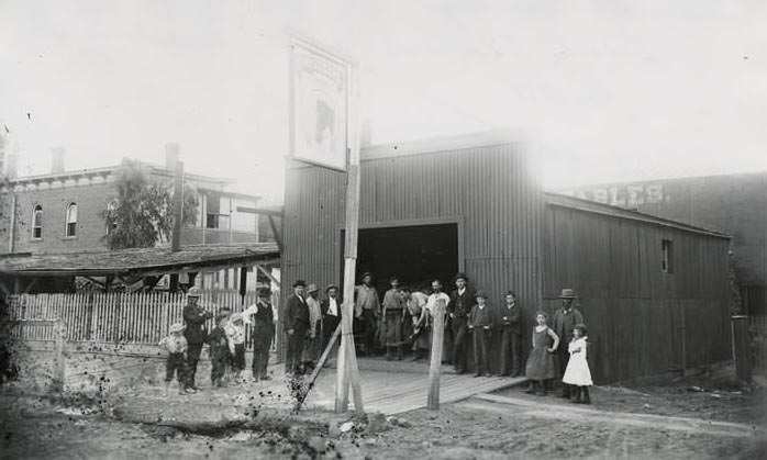
Not every Sacramento building in the 1880s was made of brick or fine timber. Working-class commercial buildings with corrugated metal siding occupied blocks closer to the waterfront and the rail yards. These practical, low-cost structures served warehousing, light manufacturing, and trades that didn’t need an impressive facade — a visible contrast to the decorated storefronts on J and K Streets.
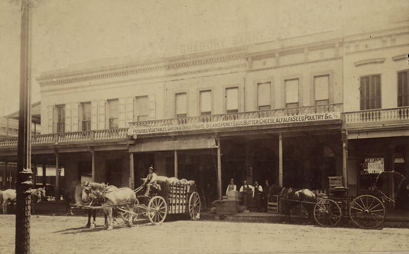
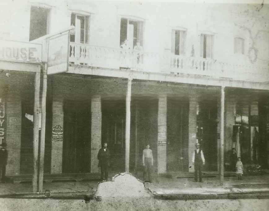
Gregory, Barnes & Company at 126/128 J Street was a produce, seed, and poultry business photographed in 1885. A horse-drawn wagon loaded with goods sat outside the two-story building, and men stood on the covered walkway alongside displayed merchandise. The Pioneer Bakery operated next door — a typical arrangement along J Street, where different food businesses clustered together to draw the same customer traffic.
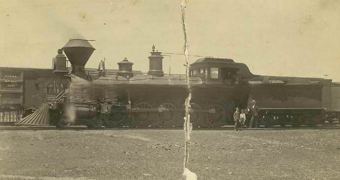
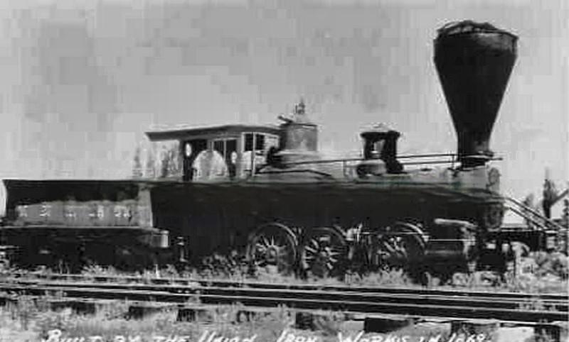
“The Governor,” completed at the Sacramento Shops of the Southern Pacific Railroad in 1889, was reported at the time to be the largest railroad engine in the world. It was one of the first built in Sacramento and represented the peak of locomotive engineering in the decade. The Sacramento Shops had grown into one of the most important railroad manufacturing facilities in the American West, and engines like The Governor were its most ambitious products.
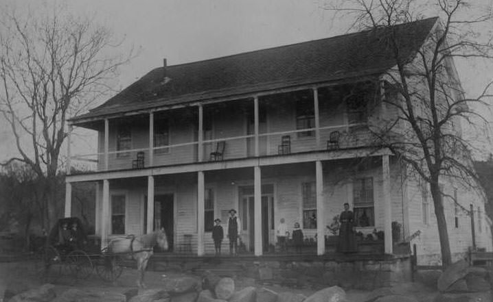
The Five Mile House marked the first stop on the eastern leg of the Pony Express out of Sacramento — a relay station where riders exchanged tired horses for fresh ones before pushing on toward the Sierra Nevada. The Pony Express had operated from April 1860 to October 1861, delivering mail by horseback before the transcontinental telegraph made the service obsolete. By 1880, when this photograph was taken, the building stood as a physical remnant of California’s pre-railroad communications era.
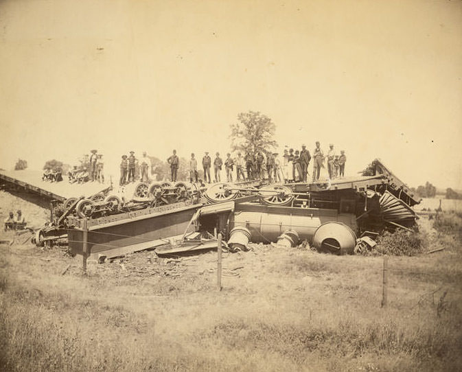
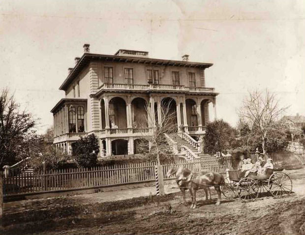
Railroad accidents were a documented reality of 1880s rail operations. The train wreck west of Folsom on June 15, 1889, involving an engine and flat cars, was one of numerous incidents recorded during the decade as rail traffic increased across the Sacramento region. The growth in freight and passenger volume brought both economic benefits and operational risks that railroads managed with varying degrees of success.
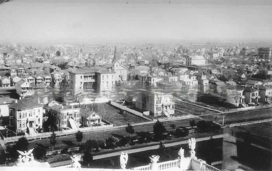
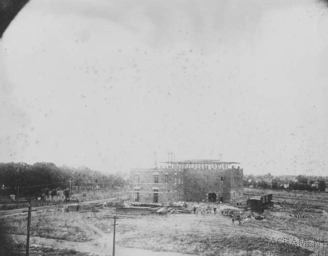
The Buffalo Brewery, under construction in 1889 at 1717 21st Street between Q and R Streets, was built at a cost of roughly $400,000 and described during construction as the most complete brewing establishment on the Pacific Coast. Its scale reflected Sacramento’s confidence in its own economic future at the end of the decade — a major capital investment in a city that had already proven it could support large industrial operations.
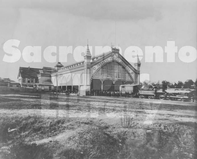
The Arcade Station on G Street between Second and Third Streets served as the Central Pacific’s three-track passenger depot in 1882. Known commonly as the Arcade Station, it handled the steady flow of passengers moving through Sacramento on the transcontinental line. Its three tracks could accommodate multiple trains simultaneously, reflecting the volume of rail traffic that passed through the city on a daily basis.
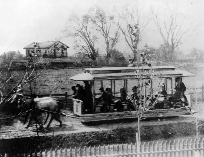
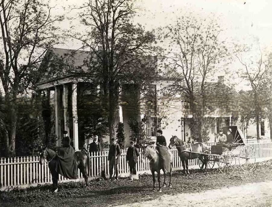
By 1888, J Street extended far enough east that the remains of Sutter’s Fort were visible on a knoll in the background of street-level photographs taken between 27th and 28th Streets. The McConnell Home at McConnell Station near the Cosumnes River, in colonial brick style, was one of the most recognized early Sacramento-area residences — a substantial property built by a family that had established itself on the land before Sacramento became the city it was in the 1880s.
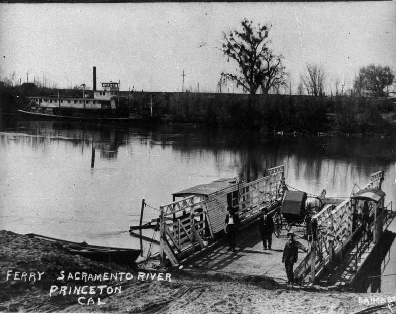
River crossings in the Sacramento area relied on ferries where bridges didn’t yet exist. The Sacramento River Ferry, photographed in 1885, carried people, animals, and goods across the river at points not served by the railroad bridges. Ferry operations were straightforward but essential links in the region’s transportation network, particularly for farming communities on the west side of the river.
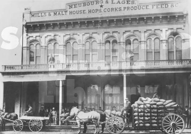
The Neubourg and Lages milling and malting business — also known as the Star Mills and Malt House — operated at 5th Street between J and K Streets, in a two-story brick structure complete with a basement malt floor. Founded in 1866 by Christopher Lages and Leonard Neubourg, the business supplied malt to Sacramento’s brewing industry. By 1880, it was a long-established operation in the heart of the commercial district.
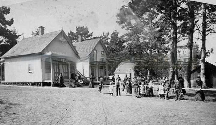
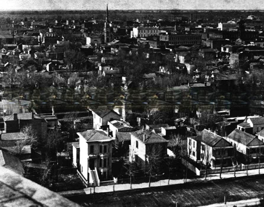
The northwest view from the Capitol dome in 1880 showed 9th, 10th, and L Streets in a clear grid, with the city’s rooftops stretching toward the Sacramento River in the distance. Pacific Grove, on the Monterey Peninsula, served as a retreat destination for Sacramento families like the Howes, who are pictured at the camp there in 1882 alongside twenty-six people including family members and John Stevens.
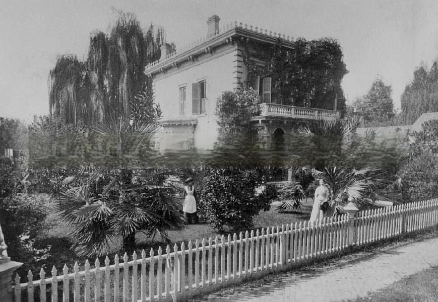
William F. Knox, who operated a railroad contracting firm in partnership with William Turton, lived at 916 G Street. The home was photographed in 1889, with one of the women standing outside likely being Miss Belle Knox, a resident of the property at the time. The house represented the comfortable circumstances of Sacramento’s business class — men who profited from the railroad economy without necessarily working the rails themselves.
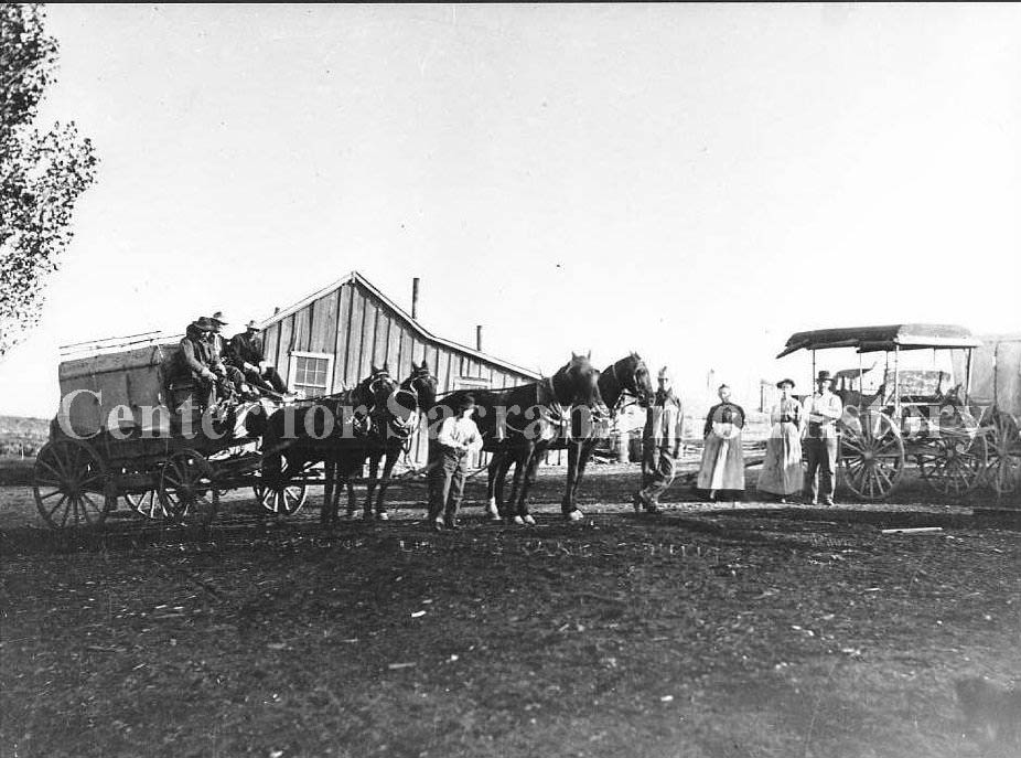
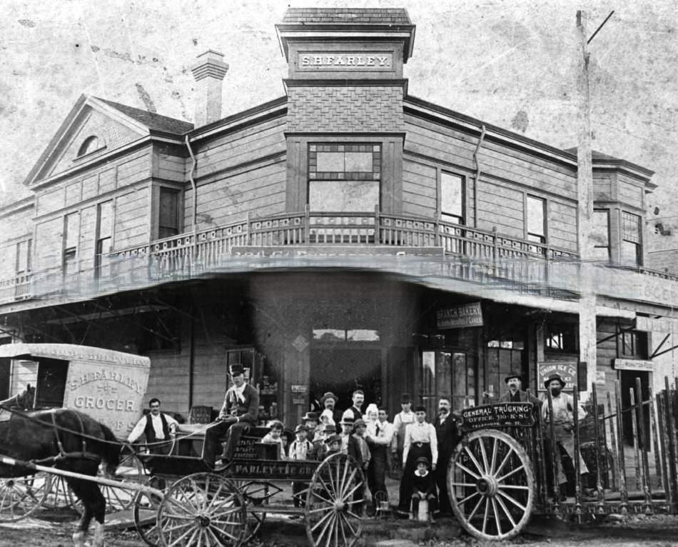
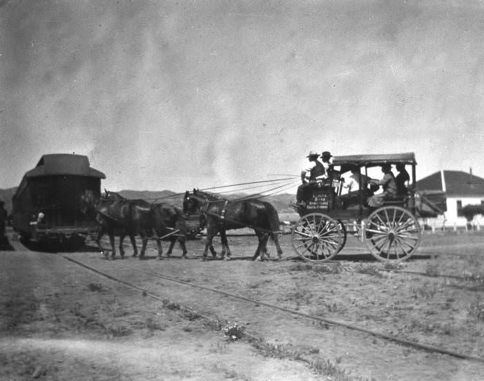
Stagecoaches remained in active use throughout the 1880s in areas not reached by rail. Two coaches photographed in 1881 — one hitched with four horses, one parked — show the equipment and scale of stage operations that connected Sacramento to outlying communities. The Sites-Fouts Springs stage stop was one of the relay stations on these routes, offering fresh horses and brief rest for drivers and passengers.
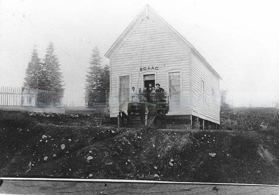
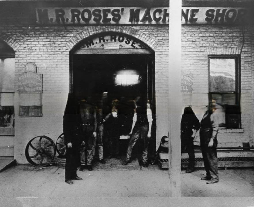
M. R. Rose’s Machine Shop and Capital Iron Works at 904-906 K Street operated for over thirty years. The 1888 photograph shows Marshall R. Rose on the far left, with his son Robert A. Rose fourth from the left among the assembled workers. Iron works of this kind produced the metal components needed by Sacramento’s construction, railroad, and agricultural industries — a quiet but essential part of the city’s industrial base.
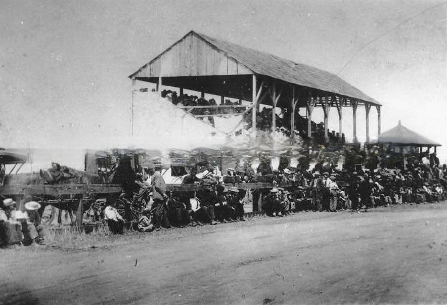
Horse racing was one of Sacramento’s major spectator sports in the 1880s. The 1885 photograph of the race track shows stands packed with seated spectators, more people standing along the rail, and horse-drawn buggies parked alongside the track. The race meet was a social event as much as a sporting one, drawing crowds from across the Sacramento Valley on designated race days.
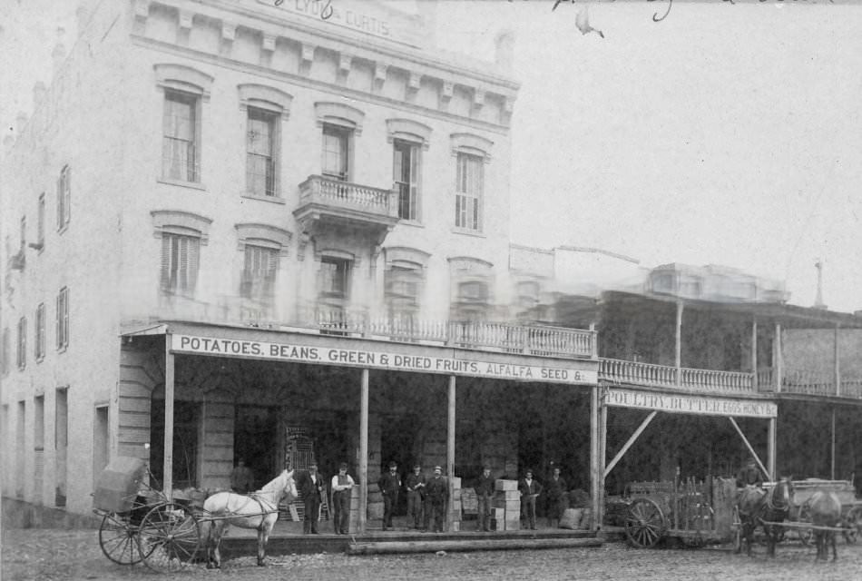

The Lyon & Curtis Building at 117 J Street was among the commercial properties close to the waterfront end of J Street, near Front and 2nd Streets. This block, closest to the Sacramento River, was particularly active with wholesale and retail trade in goods arriving by boat and departing by rail. Grocery and provisions stores nearby served the workers, travelers, and residents who populated this section of the city.
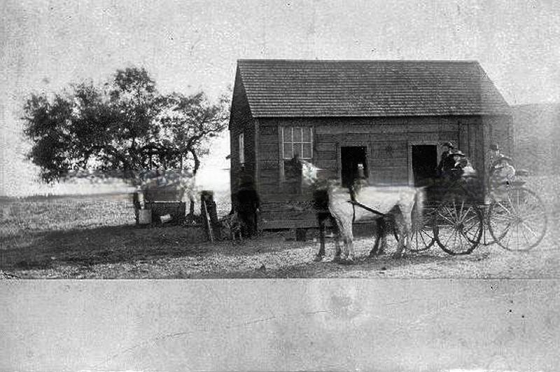
Rural Sacramento County in 1880 was a landscape of small farmhouses, open fields, and dirt roads. Many of these properties were in the early stages of the transition from grain to fruit farming. The modest country homes photographed during this period show the working farms that would, within a few years, be surrounded by irrigated orchards as the fruit boom took hold across the valley.
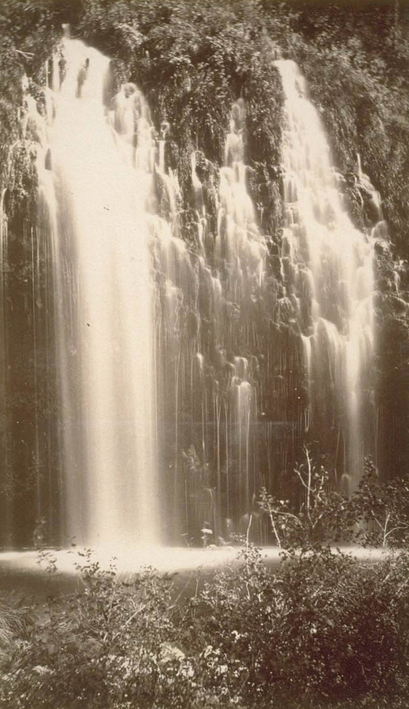
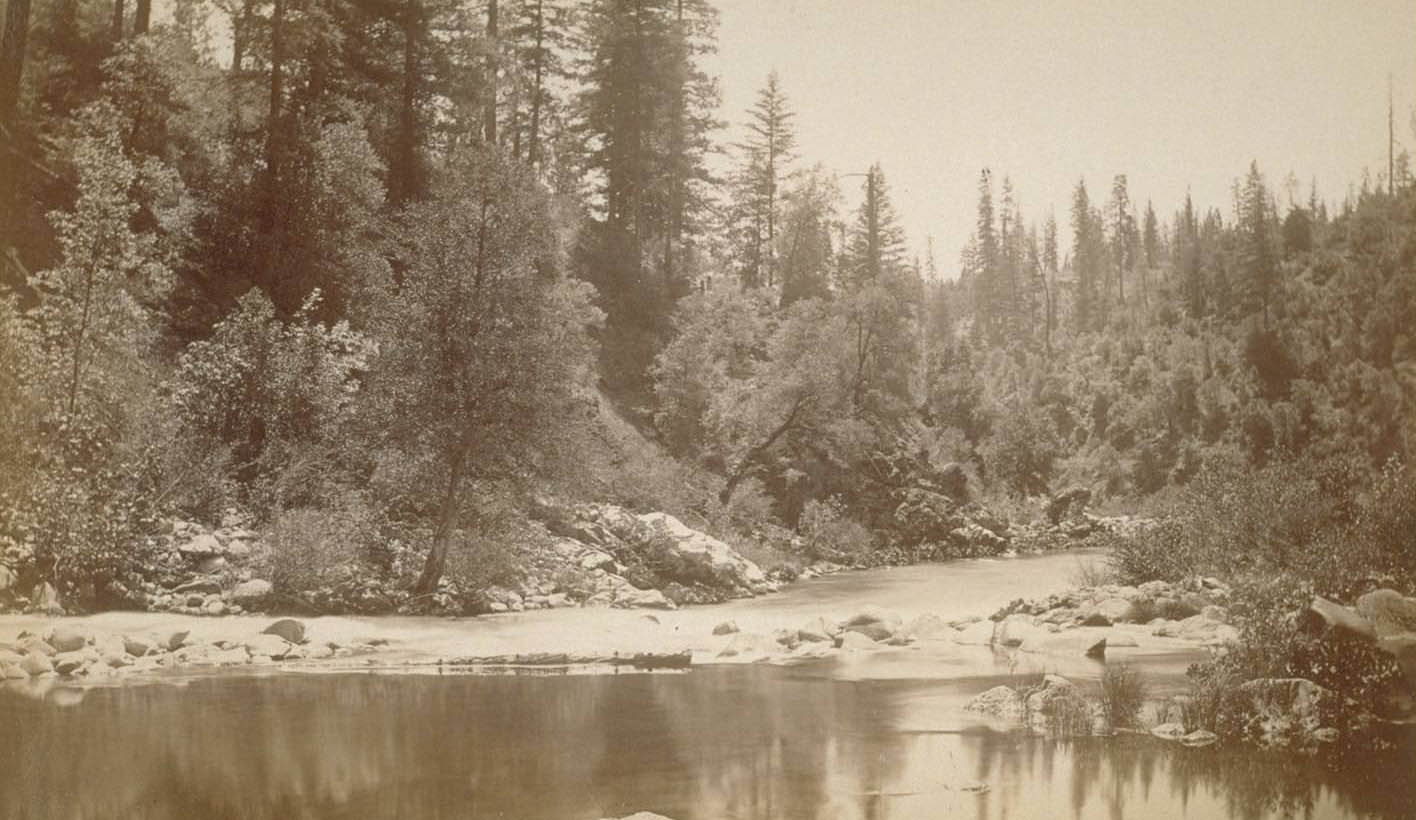
The Sacramento River above Soda Springs dropped through spectacular falls photographed in 1882. Soda Springs itself, high in the Sierra Nevada, was a railroad stop on the Central Pacific’s mountain route. These photographs of the river’s upper reaches documented the natural landscape that the railroad had cut through — terrain that had required enormous engineering effort to cross with a functioning rail line.
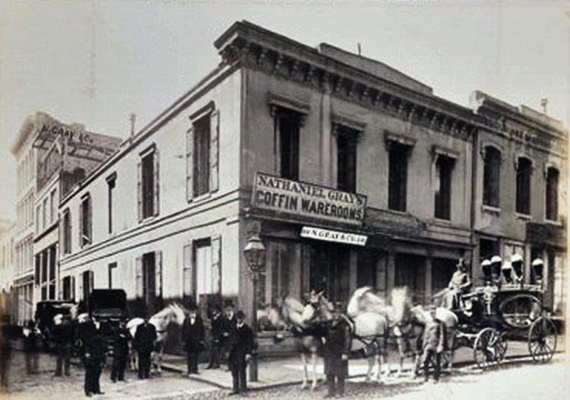
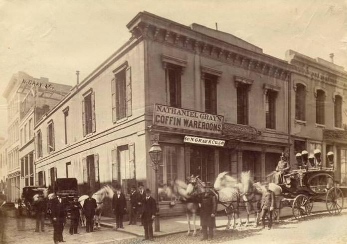
Undertaking was a significant trade in 1880s Sacramento, as it was in every American city of the period. Nathaniel Gray operated both a coffin wareroom, photographed in 1880, and N. Gray & Co. at 641-645 Sacramento Street, photographed in 1888. These businesses handled the funerary needs of a city with no shortage of deaths from accidents, illness, and the hazards of industrial work.
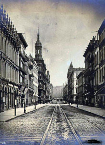
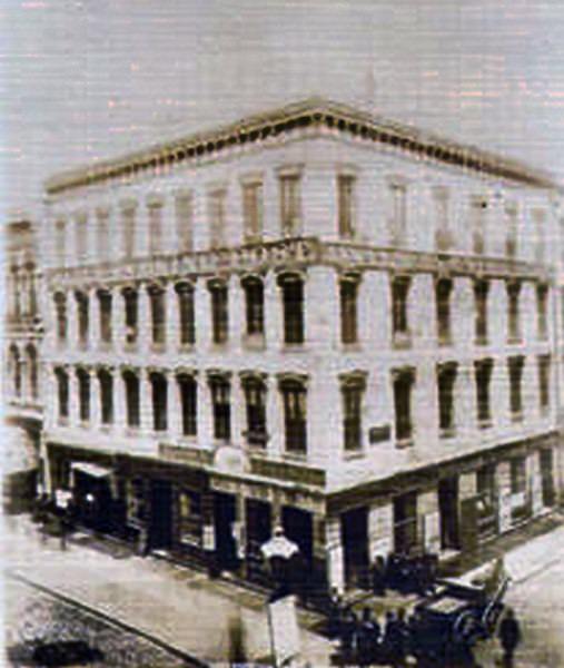
The intersection of Sacramento and Montgomery Streets in San Francisco appears in photographs from 1884, connected to Sacramento through the business networks and individuals who operated in both cities. Safe Deposit buildings, hotels, and printing houses lined these San Francisco streets, and Sacramento’s merchants, lawyers, and railroad men moved regularly between the two cities on the steamboat and rail connections that linked them.
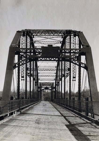
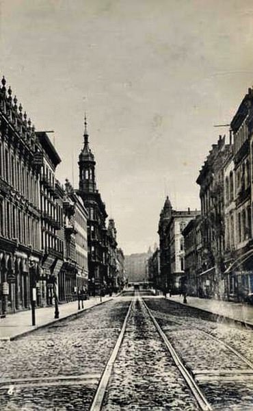
Bridge construction across California’s rivers accelerated in the 1880s. The Anderson Free Bridge, built of steel on concrete piers and photographed in 1884, represented the engineering standards of the era for road bridges. The Chico Free Bridge, photographed in 1882, served the northern Sacramento Valley. These structures made river crossings reliable and free for the public, replacing the ferries and toll bridges that had preceded them.
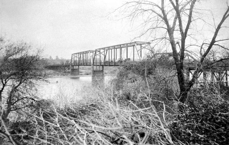
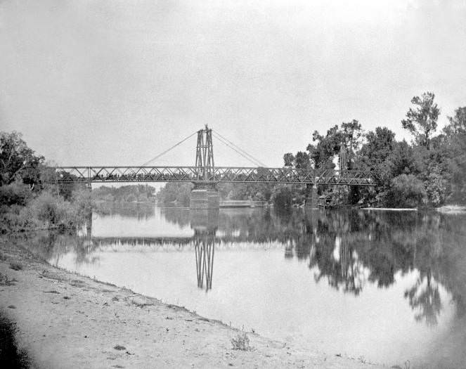
Multiple bridges crossed the Sacramento River and its tributaries in the 1880s, each serving a different purpose. Railroad bridges carried the heavy loads of freight trains. Road bridges allowed wagons, horses, and pedestrians to cross. Ferry operations filled the gaps where bridges didn’t yet exist. Together, these river crossings tied Sacramento’s agricultural hinterland to the city’s markets and processing facilities.
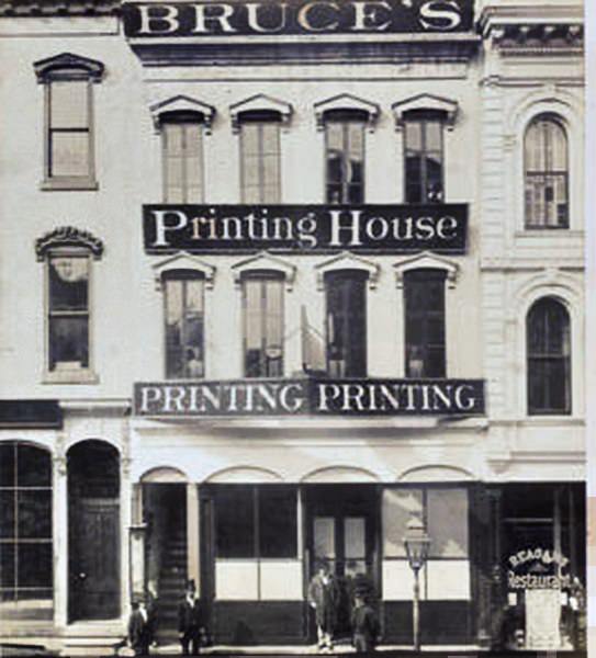
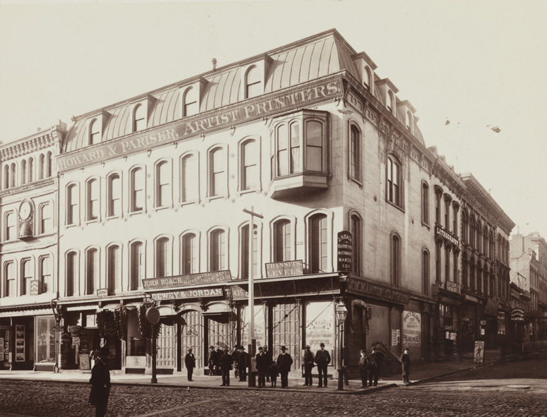
Printing houses and publishers were well represented in Sacramento’s commercial district. Bruce’s Printing House at 618 Sacramento Street and Howard & Pariser at 429 Montgomery Street in San Francisco were among the businesses that produced newspapers, books, blank books, and commercial printing for the region. The Sacramento Daily and Weekly Union building, photographed in both 1881 and in the 1880s more broadly, was the most prominent press building in the city.
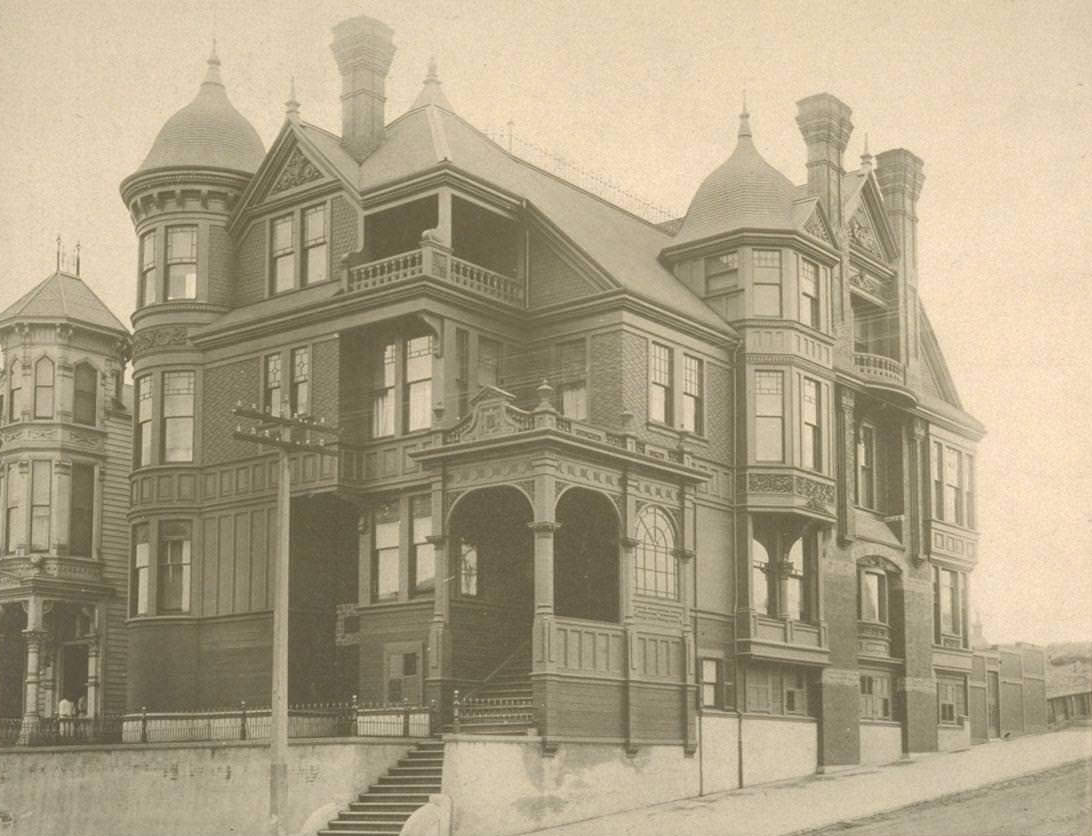
Affluent residents of San Francisco’s Van Ness Avenue corridor and Sacramento Street built substantial Victorian mansions in the 1880s. The residence of Charles Josselyn at the southwest corner of Gough and Sacramento Streets, photographed in 1887, and David N. Walter’s home at the northeast corner of Sacramento Street and Van Ness Avenue were among the larger private homes of the era — elaborate structures that reflected the wealth generated by railroad commerce, real estate, and trade.
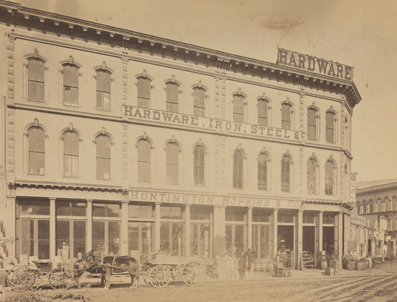
Huntington, Hopkins & Co. at the junction of Bush and Market Streets in San Francisco operated as the San Francisco arm of the hardware business connected to two of the Central Pacific’s founders. The firm supplied iron, steel, and hardware to the railroad and to the broader construction market throughout California. Its Sacramento connections were direct — both Collis Huntington and Mark Hopkins had been central to the railroad’s founding in Sacramento before moving their financial operations to San Francisco.
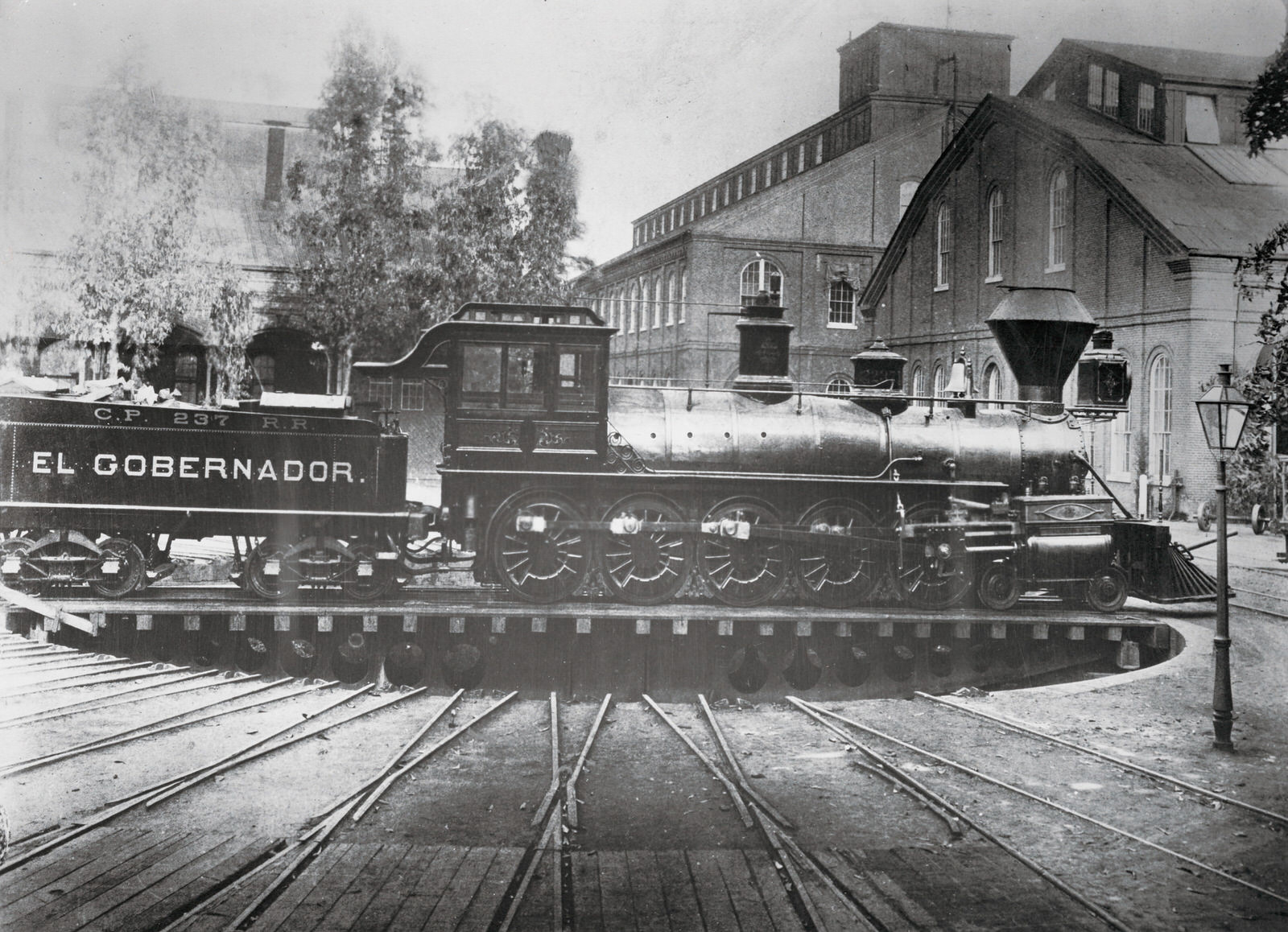
Central Pacific locomotive No. 237, photographed in 1883, was one of many engines in active service on the railroad’s expanding network during the decade. These locomotives pulled both passenger trains and freight, and their maintenance required the skilled workers at the Sacramento Shops — a facility that by the mid-1880s was one of the largest railroad repair and manufacturing operations in the western United States.
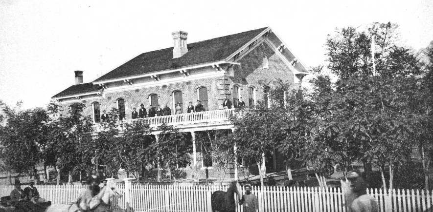
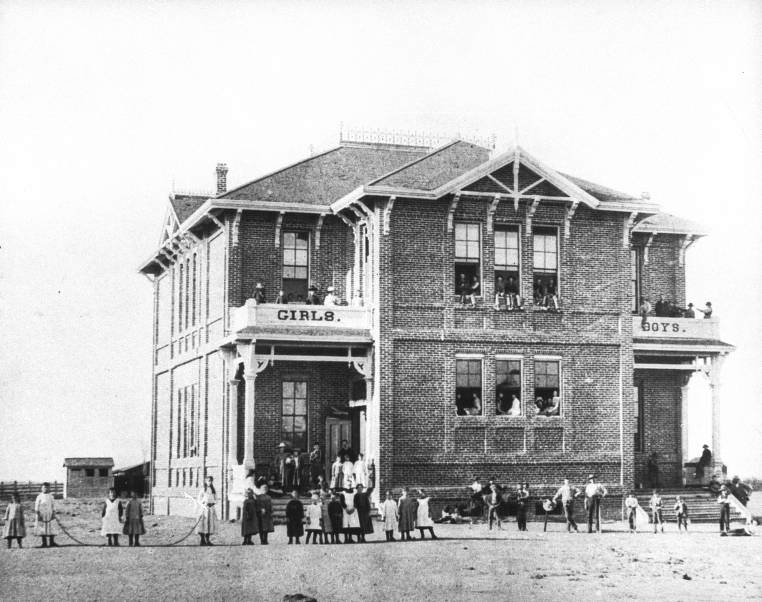
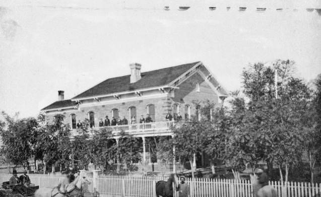
Williams, California — a small town in Colusa County northwest of Sacramento — had its own grammar school, first photographed in 1880 with students posed outside, and a more substantial school building photographed in 1889. W. H. Williams, for whom the town was named, had his home photographed in 1887 with a group posing on the balcony. These images document the growth of small Central Valley communities that were developing alongside Sacramento during the same decade.
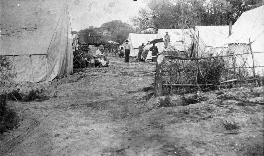
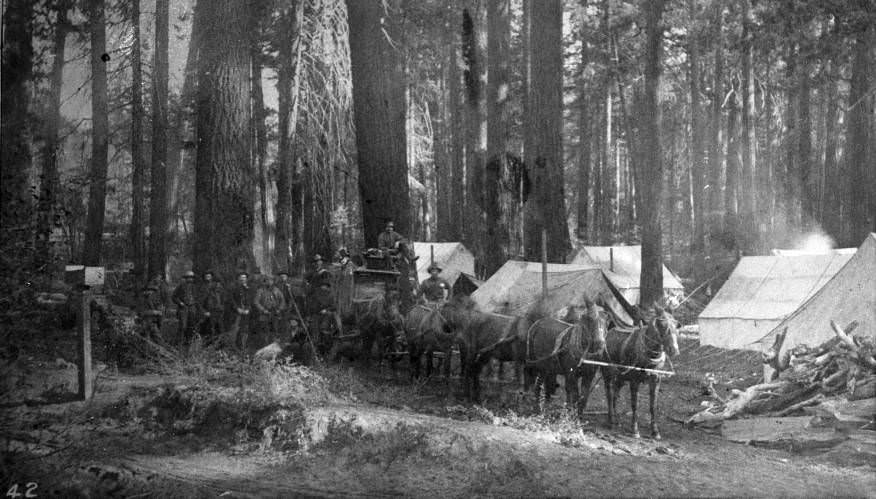
The Central Pacific Railroad was still conducting surveys in 1888, mapping routes and assessing terrain for potential new lines. Survey teams worked through the Sacramento River Canyon, bringing horses and equipment into rugged country to gather the data needed for engineering decisions. These surveys shaped the railroad’s expansion plans for the following decade.
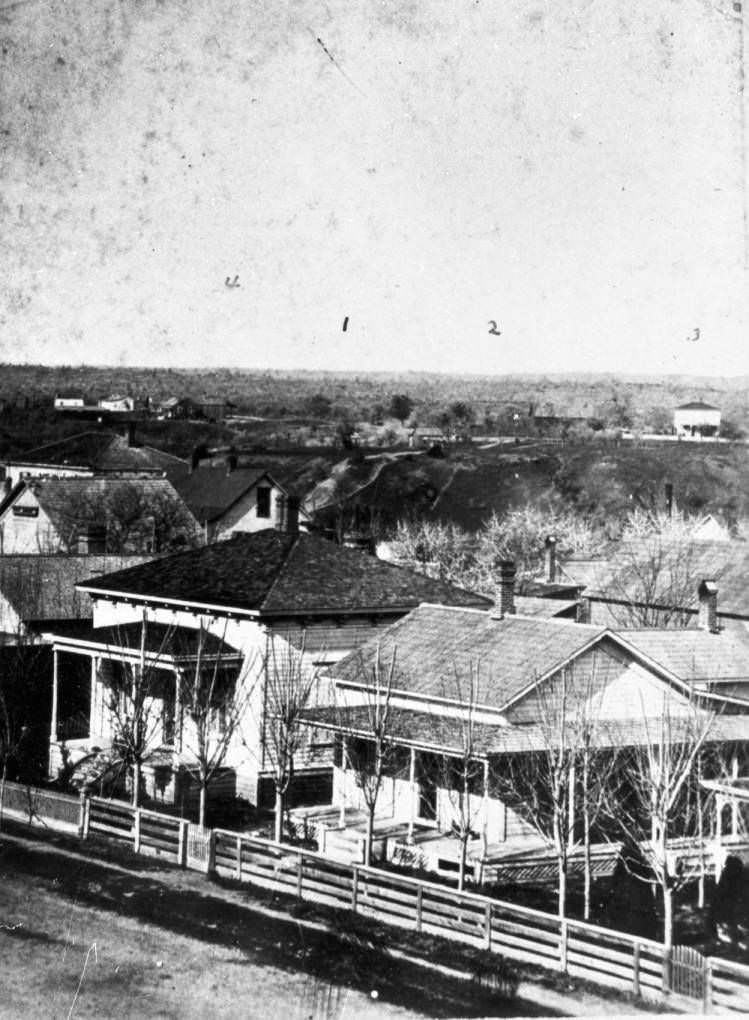
Private residences across Sacramento County ranged from simple farmhouses to well-built Victorian homes. The Duncan residence, photographed from the McCoy house in 1884, shows the kind of comfortable rural home that prosperous farming families occupied on the outskirts of the city. These properties sat at the edge between Sacramento’s urban core and its agricultural hinterland.
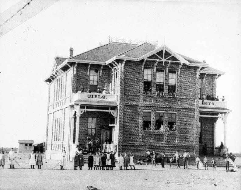
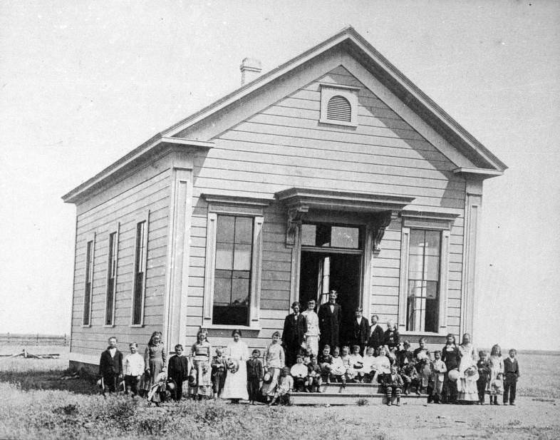
Grammar schools across the Sacramento Valley documented the reach of public education beyond the city’s core. Williams Grammar School in 1880 and its later replacement photographed in 1889 show the evolution of school facilities in a small Central Valley town over a single decade. These buildings served the children of farmers, shopkeepers, and tradesmen who were building communities across the valley floor.
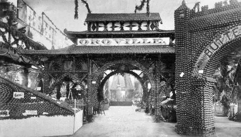
The Butte County Citrus Fair of 1887 showed the reach of the fruit industry north of Sacramento. Citrus and other fruit crops were being promoted across the Central Valley as the economic case for shifting away from wheat became clearer. Agricultural fairs like this one displayed the new crops and the techniques being used to grow them, drawing farmers and investors who were watching the transformation of California agriculture in real time.
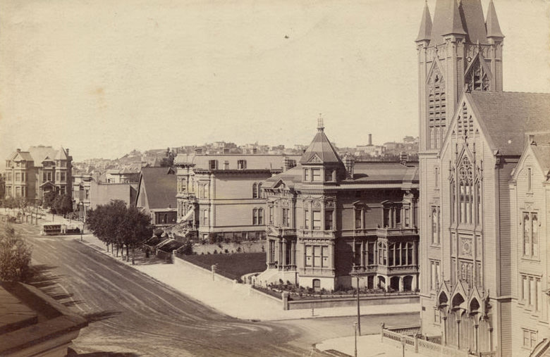
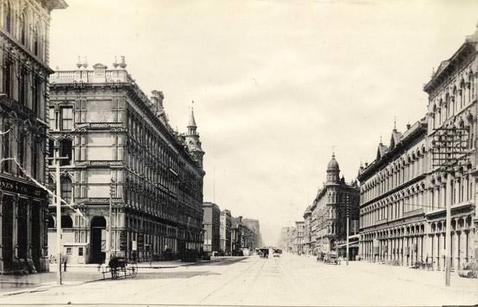
Van Ness Avenue in San Francisco, photographed in 1885, showed the First Presbyterian Church, the David N. Walter mansion, the Herman Liebes mansion, and St. Luke’s Church at Clay Street — with a Clay Street Hill Railroad cable car visible in the distance. San Francisco’s street life was connected to Sacramento’s through the steady movement of people, goods, and capital between the two cities that defined California’s economic geography in the 1880s.
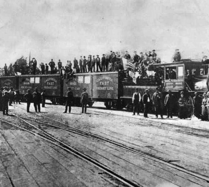
The first fast fruit train departed Sacramento in 1886 — a direct result of the refrigeration technology and railroad infrastructure that had made fruit farming economically viable. This single event marked the practical beginning of Sacramento’s role as a major fruit-shipping center. Refrigerated rail cars allowed perishable crops to reach markets in the eastern United States within days, opening a national customer base for California growers.
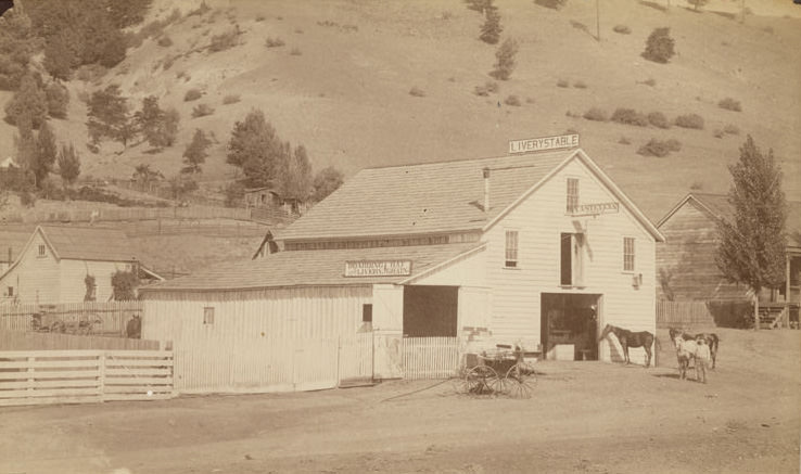
Colfax, a railroad town in the Sierra Nevada foothills east of Sacramento, had its own commercial infrastructure by the mid-1880s. T.A. Stevens Livery Stable in Colfax served travelers arriving by rail who needed horses or carriages to reach destinations not on the line. Towns like Colfax were nodes in a transportation network that blended rail, stage, and horse travel throughout the decade.
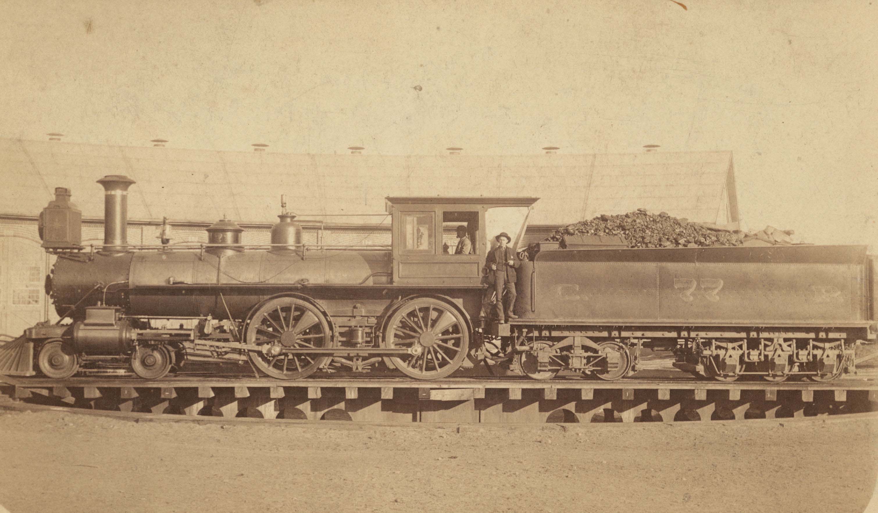
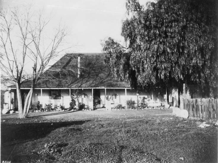
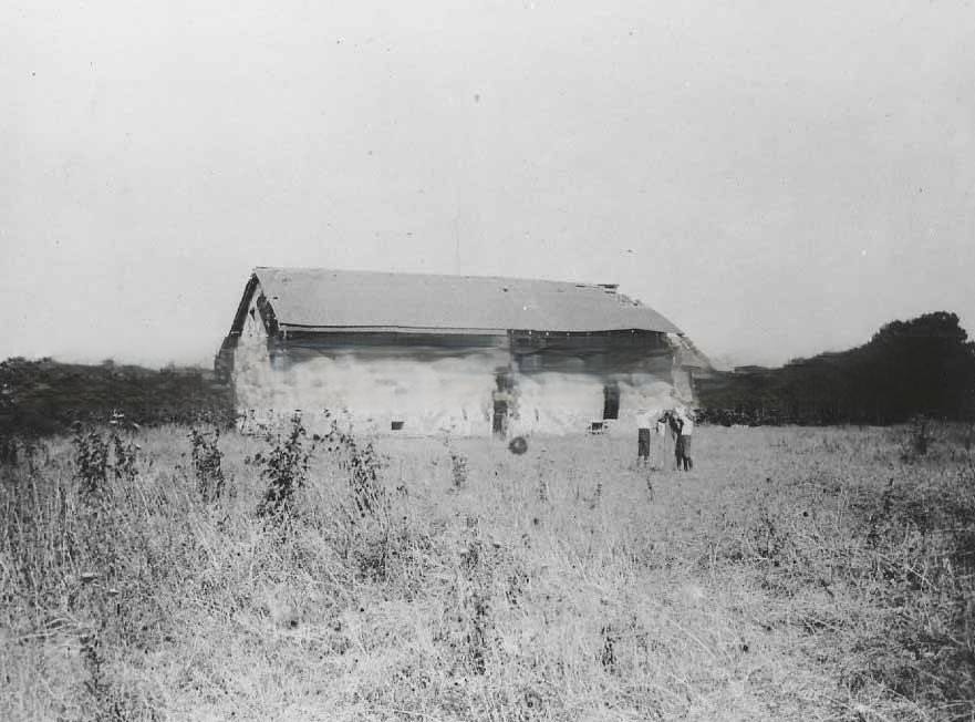
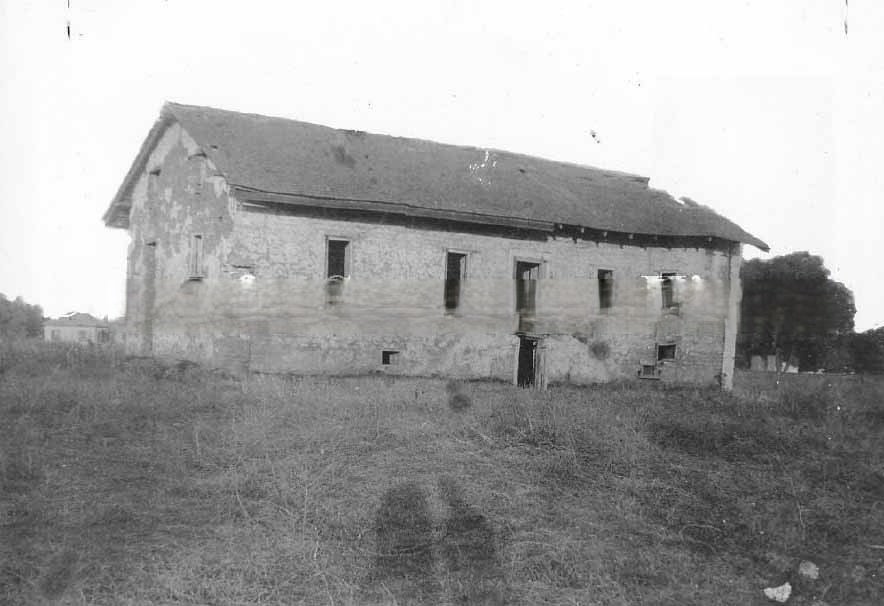
Central Pacific locomotive No. 77 and its crew, photographed in 1888, showed the human side of railroad operations — the engineers, firemen, and brakemen who kept the trains moving across California’s landscape. The Riviera Adobe, an old Spanish-era structure photographed in 1886 near Western Avenue, stood as a reminder of California’s layered history — a pre-Gold Rush adobe that had survived into an era of steam locomotives and electric streetcars, still visible on the edge of a landscape that had been completely transformed in the four decades since American settlement began.




