
At the beginning of the 20th century, the population of Portland, Oregon was nearly 100,000, and the city was developing with rapid economic growth and stable politics. In the 1890s, when the city annexed surrounding communities, its area grew, and the 1905 exposition celebrating the 100th anniversary of Lewis and Clark’s arrival brought national attention to the city. The Columbia River’s location at the junction of the main north-south route separating California from Puget Sound made Portland a valuable commercial center for producing forest, farm, and animal products of the Cascades, Willamette Valley, and Columbia River basin. The industry thrived after deepwater ports were constructed, the Northern Pacific transcontinental railroad was completed, and cheap hydroelectric power was introduced. Below are some stunning historical photos that will take you back to the 1900s in Portland.
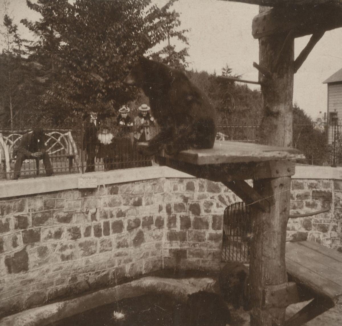
The “Bear Pit” at the Washington Park Zoo.
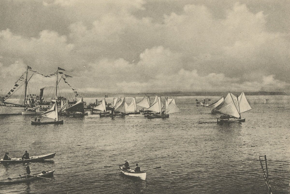
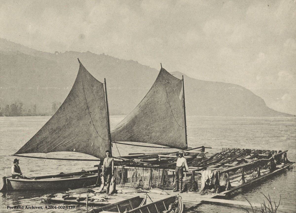
Gill netting on the Columbia River, 1900.
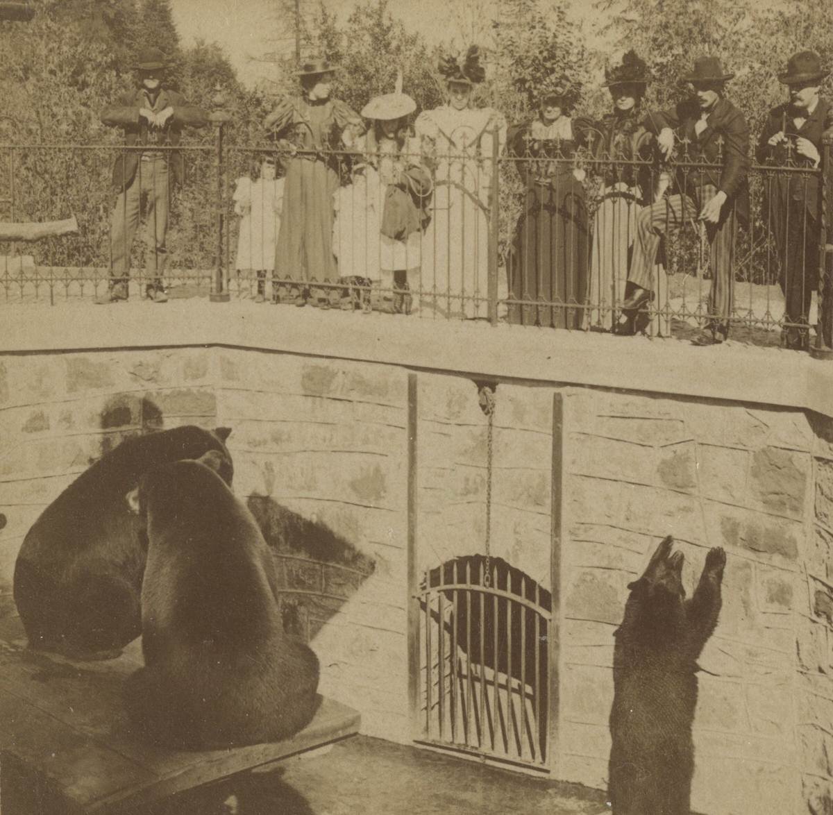
The “Bear Pit” at the old Washington Park Zoo, 1900.
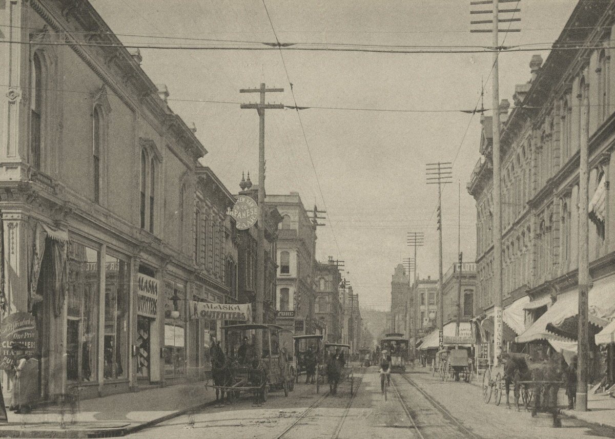
SW Morrison Street near SW 1st Avenue, 1900.
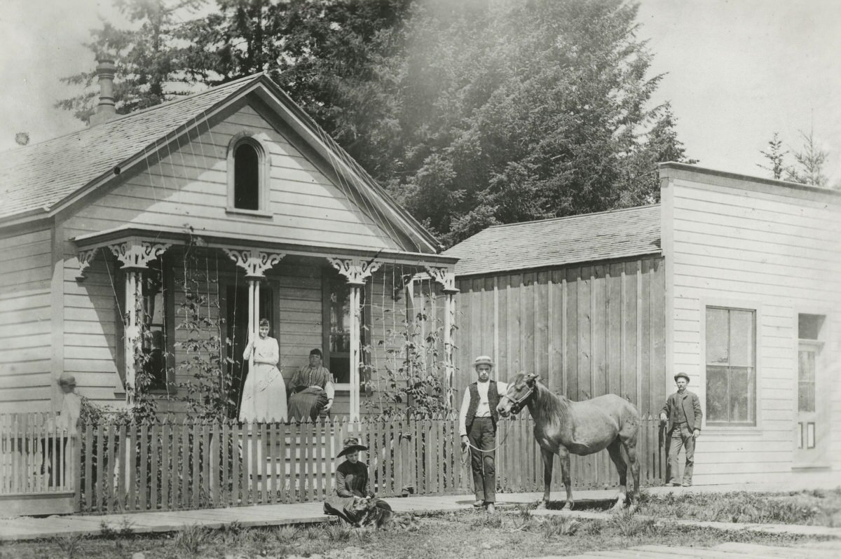
The first barber shop in Sellwood, located at SE Umatilla Street between SE 13th Avenue and SE 11th Avenue.
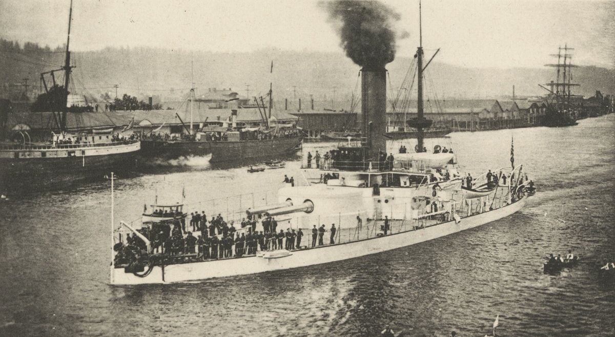
The Monitor “Monterey,” on the Willamette River.
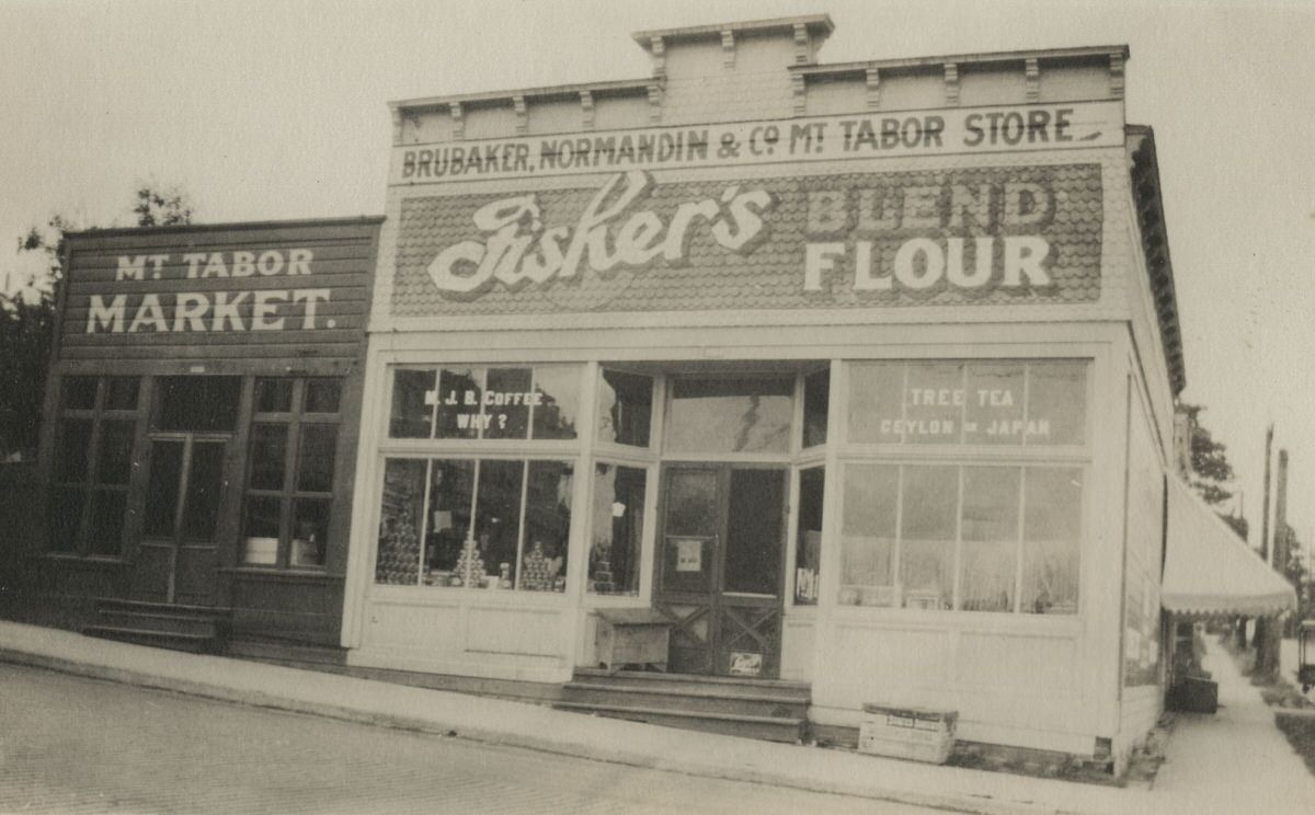
The Brubaker, Normandin, and Co. Mt. Tabor Store and the Mt. Tabor Market on the corner of SE Stark Street (Base Line Road) and SE 60th Avenue.
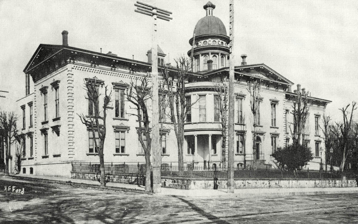
The 1864 Multnomah County Courthouse is shown here around the turn of the 20th century. The dome towered over the city at 106 feet tall. It was demolished in 1910 as the new and still-standing courthouse was built on the same site. This photo looks northwest at the corner of SW 4th and Main Street.
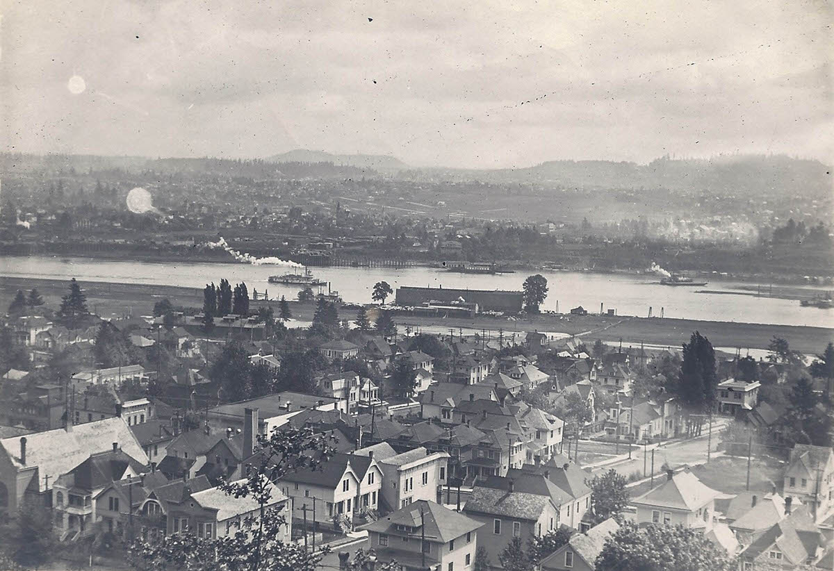
The intersection at the very bottom border, just left of center, is SW 1st and Whitaker. The church building in the lower left corner, at SW 1st and Gibbs, was a bookstore when it suffered a fire in 2010. It is all gone now.
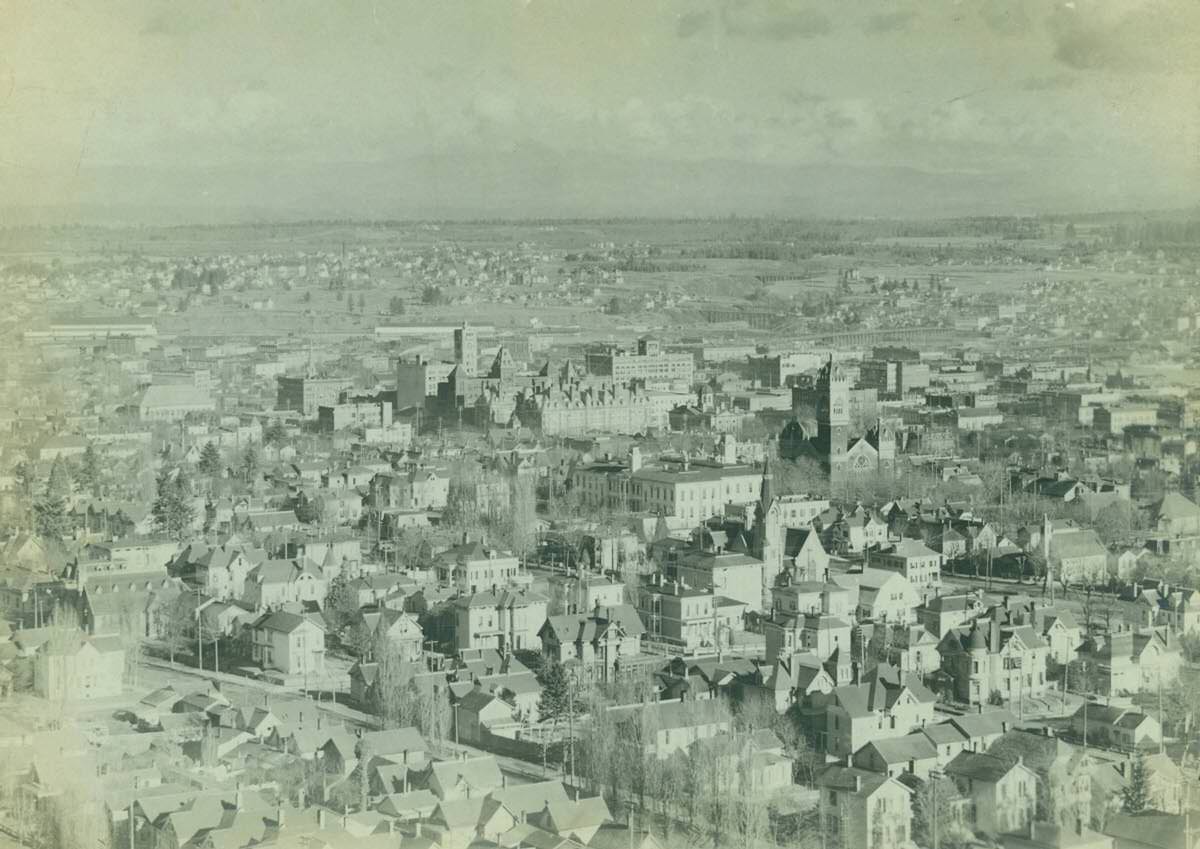
This turn-of-the-century image shows a large collection of homes, almost all gone now, with Ladd School in the center and the downtown skyline beyond that.
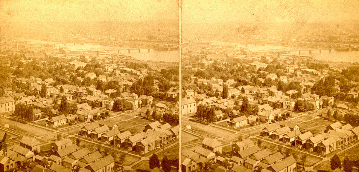
The main intersection in the lower left is 6th and Grant. The tiny sliver of the northwest corner of that intersection shows an old reservoir which can be seen on the Glover bird’s-eye illustration.
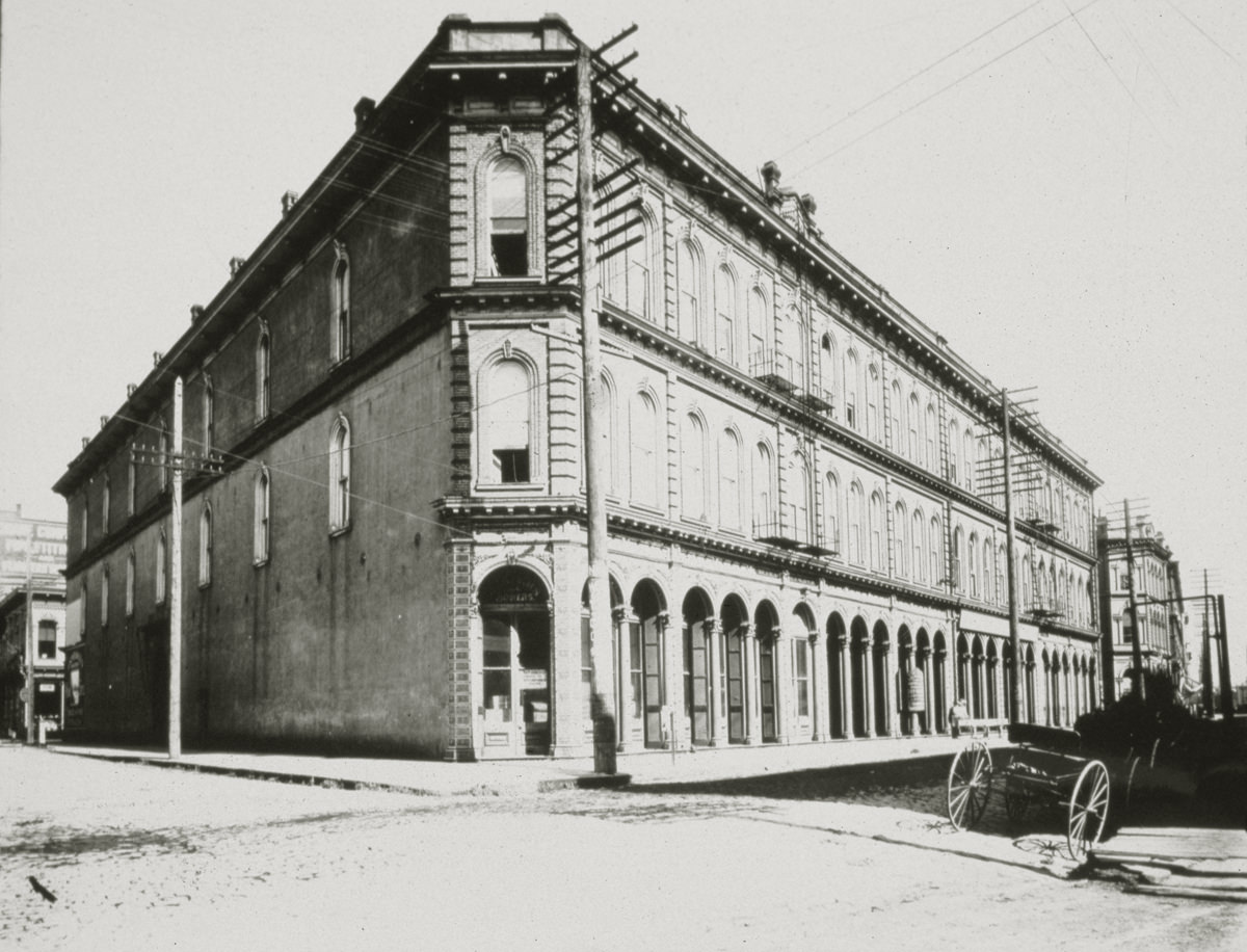
The 1869 Lewis & Flanders Block and the Ankeny Block were two buildings that shared the same external architectural detailing. They covered the entire block between SW Vine and Ash Streets, Front and 1st Avenue. Originally two stories, both buildings were increased to three stories at some point. The buildings were demolished in the 1940s and replaced with the Central Fire Station. Knapp, Burrell & Company were one-time occupants of the building.
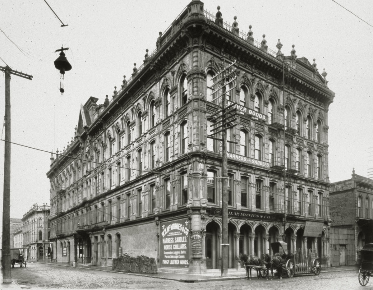
The 1884 Kamm Block was one of Portland’s most richly decorated cast-iron buildings. It was situated on the north side of SW Pine St. between Front and 1st Avenue; this undated photo looks northwest. The building had an imposing tower above its mid-block entry; an 1892 fire destroyed that. Another fire, this time in 1939, destroyed the eastern end of the building. The remaining 1st Avenue end was demolished in 1948.
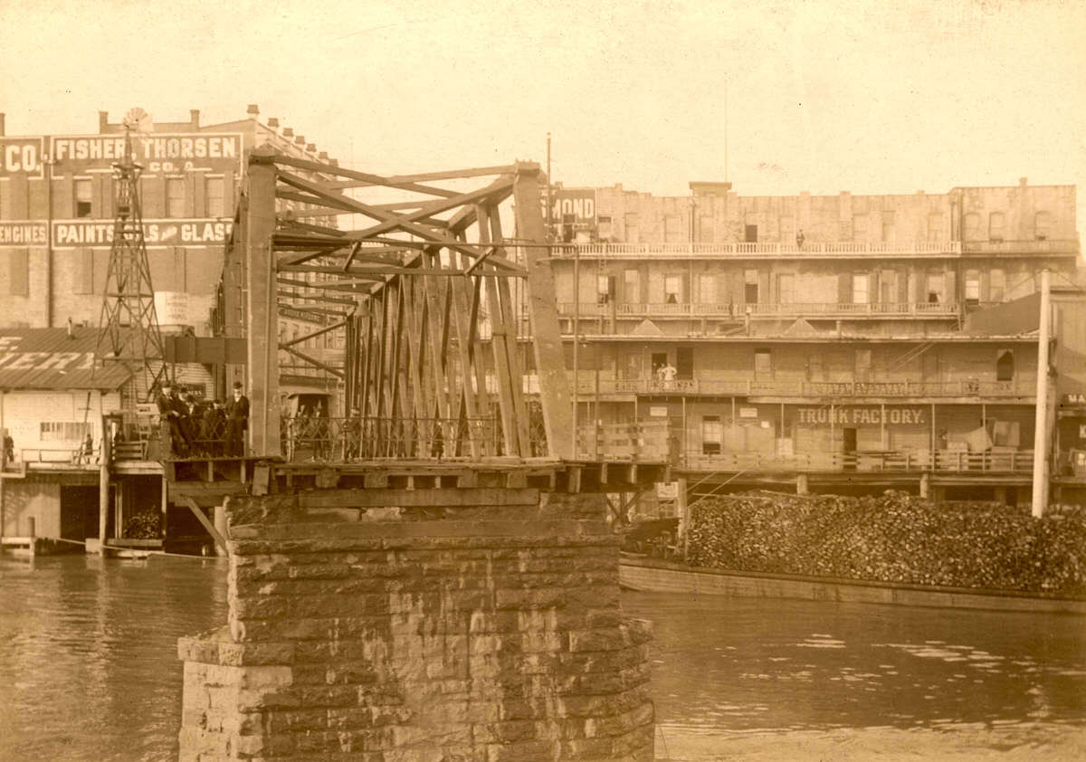
The Morrison Bridge completed in 1958 is actually the third Portland bridge to carry that name. The bridge shown here, a swing span bridge built in 1887, was Portland’s first bridge over the Willamette River and the longest west of the Mississippi River. The second Morrison Bridge, also a swing span, was completed in 1905. At that time it actually terminated on the west side at Morrison Street, as shown here (the present bridge lands between Alder and Washington).
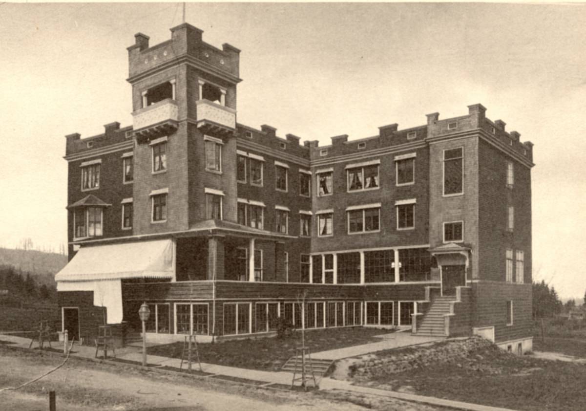
This photo shows the Hill Military Academy building circa 1901 as a brand new building at 2451 NW Marshall St. The area was very different from today’s densely populated neighborhood.
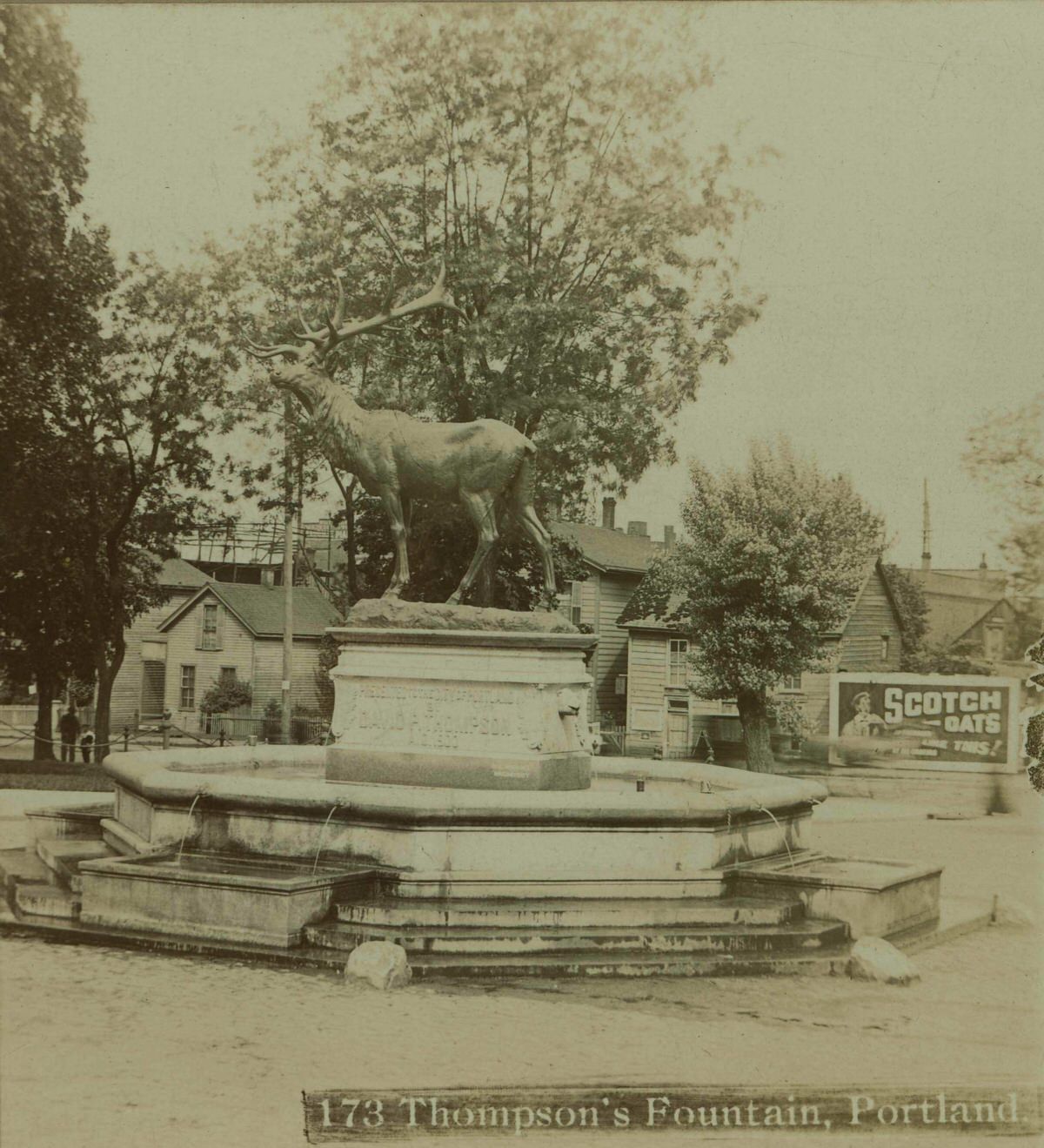
The Thompson Elk Fountain has stood in the middle of SW Main Street between 3rd and 4th Avenues since 1900. The statue was presented to the city by David P. Thompson, a former Portland mayor and civic leader. Single-family wood-framed homes lined the east side of 3rd in this 1901 photo, which is half of a stereoscopic image.
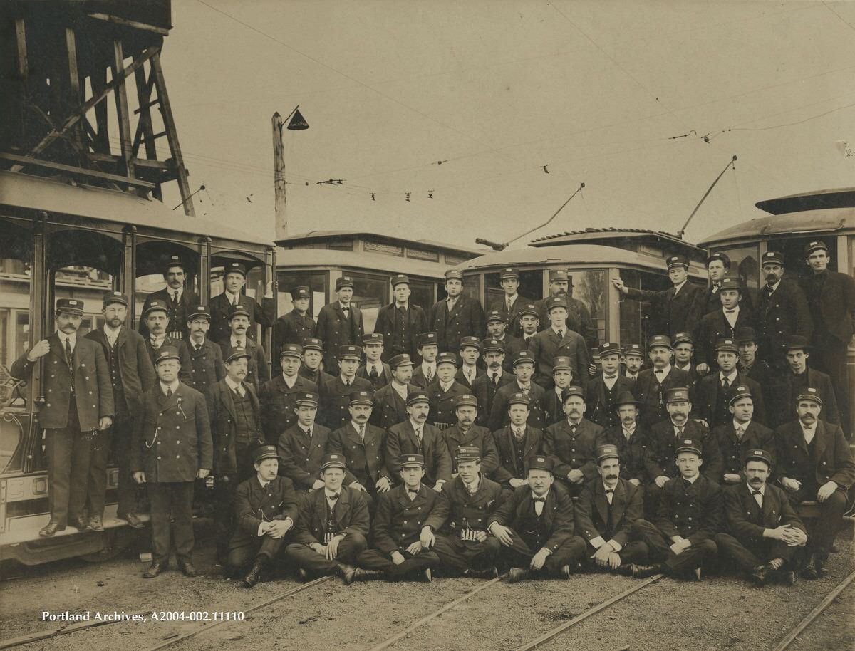
A group picture of the “Woodlawn Division Streetcar Boys,” who were employees of the Portland Traction Company, 1902.
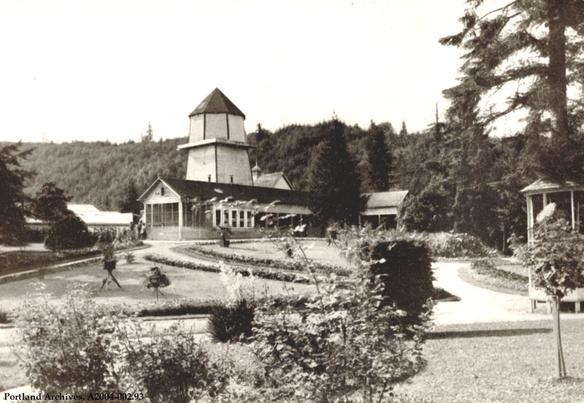
At the time this photo was taken, Washington Park was still called City Park. This image can be found in the book Oregon Scenic Beauties.
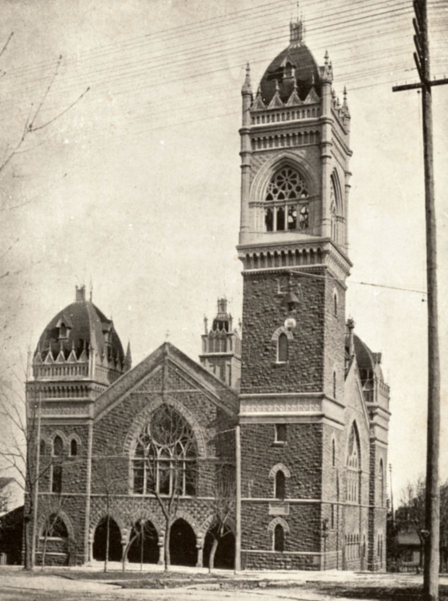
The First Congregational Church, at SW Park & Madison Street, is shown here seven years after its completion in 1895. It was designed to look similar to the Old South Church in Boston and for many years was the tallest building in Portland. The 175-foot bell tower still stands, but the smaller towers and cupola were removed in 1951 due to extensive damage.
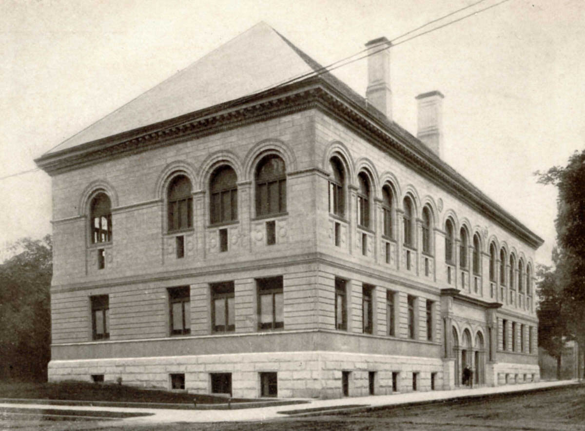
Before the Library Association of Portland opened their new Central Library on SW 10th in 1913, the library was in this building on SW Stark between Broadway and Park Ave. This 1902 view looks southwest at Stark and Broadway. In later years the Liberty Theater would be on this site, but the Bank of California occupies this block now.
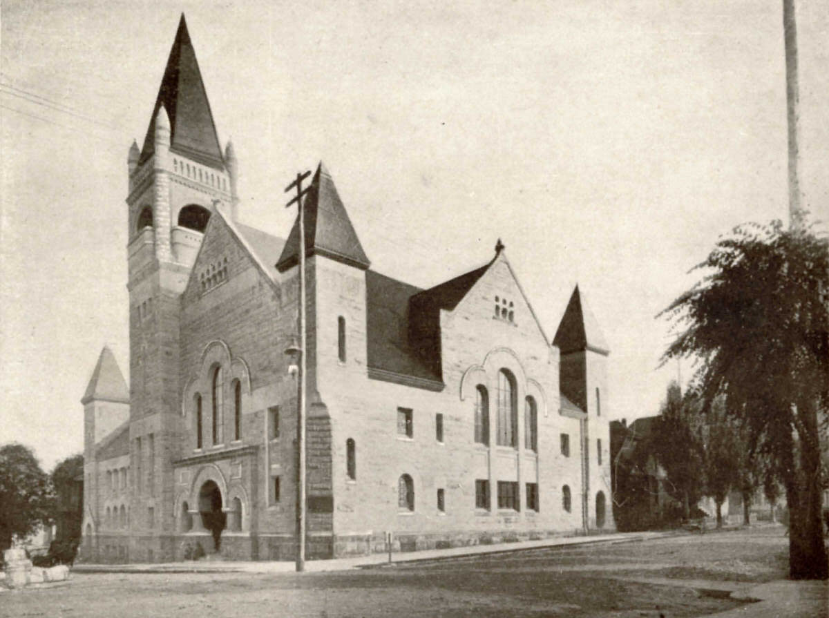
The First Baptist Church is still a landmark on the corner of SW 12th and Taylor Street. Completed in 1894, it was for many years referred to as the “white temple” because of the color of its sandstone blocks.
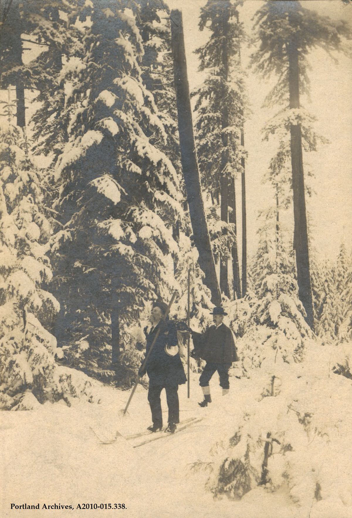
L. L. Hawkins and an unidentified man hiking Mt. Hood, 1903. The photograph is featured in “A Winter Ascent of Mt Hood.”
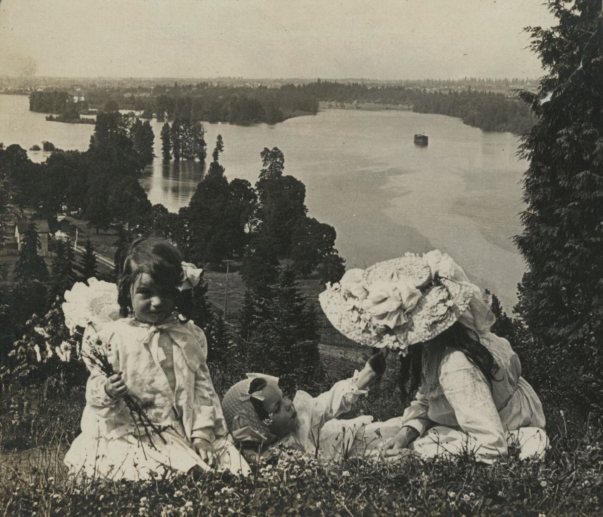
A view of the Willamette River from the River View Cemetery, 1903.
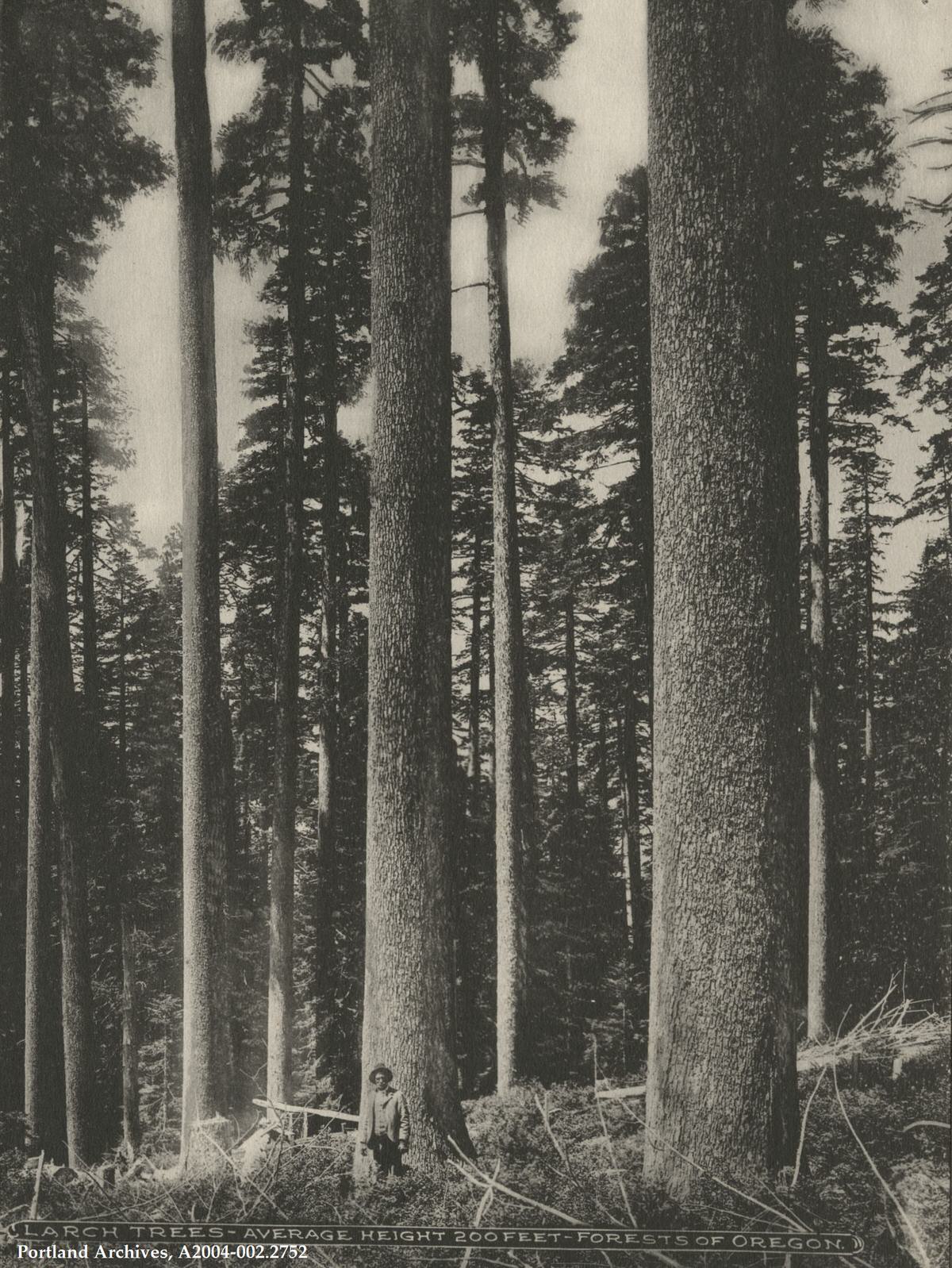
Man standing in front of larch trees, 1903. Noted on the photo: “Larch Trees – Average Height 200 Feet – Forests of Oregon.” The image comes from the souvenir book Scenic Wonders of Portland and Columbia River by Kiser Photographic Company.
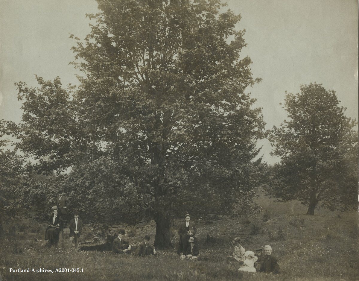
The Kern Park subdivision was platted in 1903 by the Sycamore Real Estate Company.
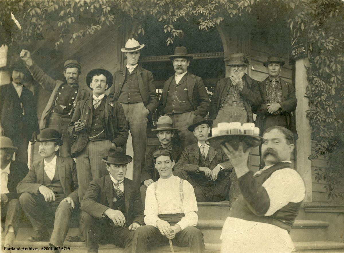
A group of men on the steps outside of Grohs Saloon, located on SW Macadam near the 7300 block, 1903.
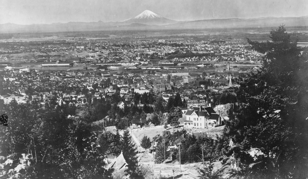
This 1903 image from Portland Heights encompasses Goose Hollow on the left, Union Station on the right, and Mount St. Helens in the distance. The large white residence near the center was the Monroe Bennett Rankin home. Mr. Rankin made his fortune in the timber industry and built this home in 1890 on the block bounded by SW 16th and 17th Streets, Clifton and Myrtle Avenues. It no longer exists, and the four homes now on that block date from the late 1930s.
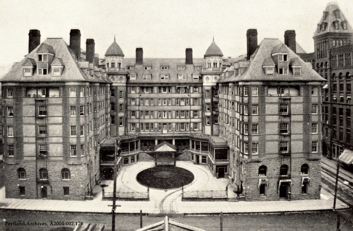
The Portland Hotel, 1904. This image comes from the souvenir book Oregon Scenery: Views of Portland and Glimpses of Oregon Scenery.
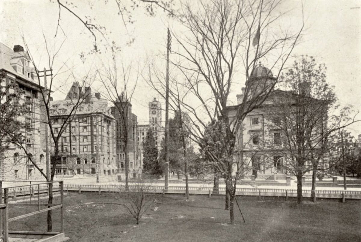
SW 6th Avenue from Henry Corbett’s yard, 1904.
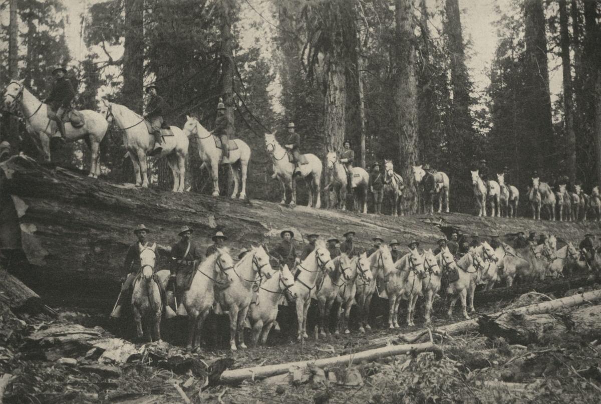
A troop of the United States Cavalry posing by a giant fallen tree.
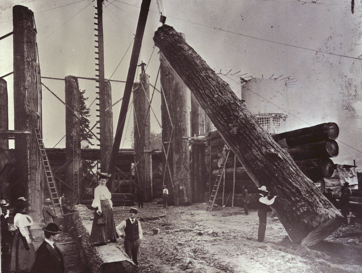
Construction of the old Forestry Building, 1904.
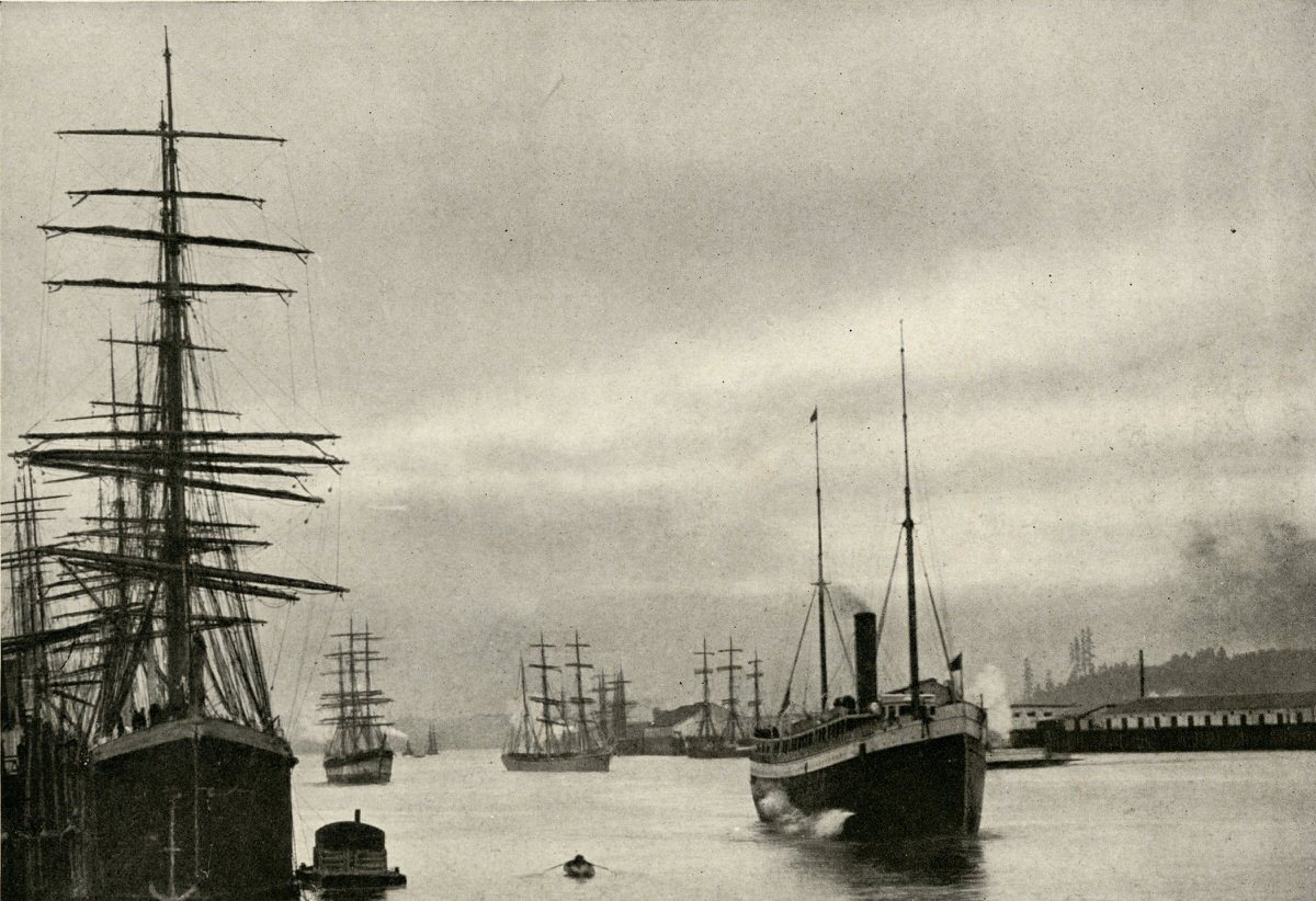
View of ships in the Portland Harbor on the Willamette River.
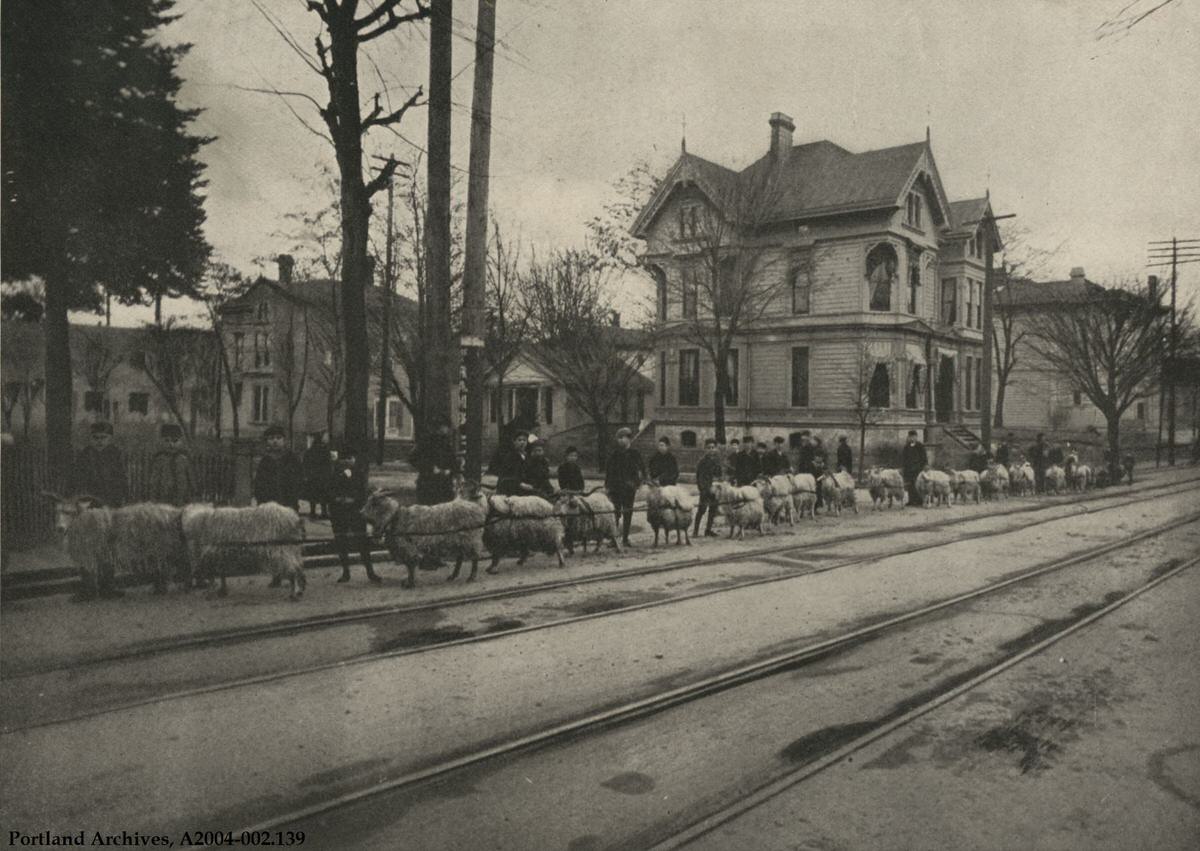
These goats are being trained for use in Alaska during the rush for the Klondike gold fields. This photograph was taken on Morrison Street and comes from a 1904 booklet titled In and About Portland Oregon.
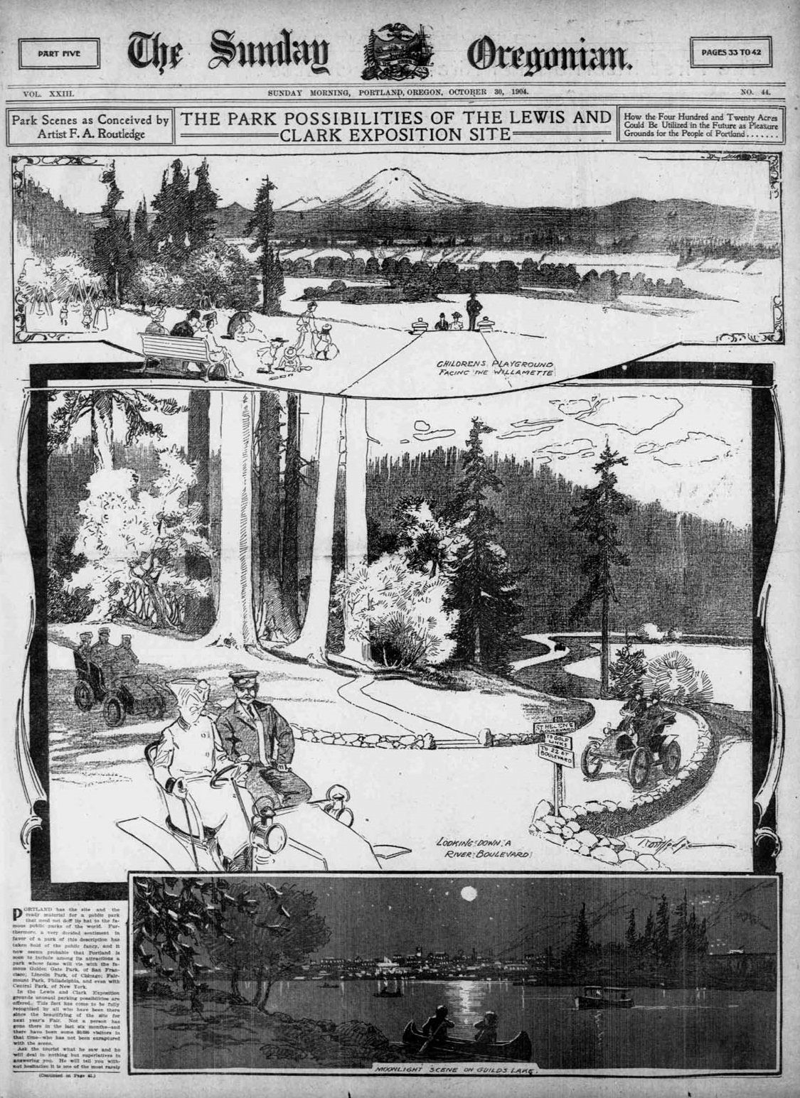
The Sunday Oregonian published these “Park Possibilities of the Lewis and Clark Exposition Site” illustrations in its October 30, 1904 edition.
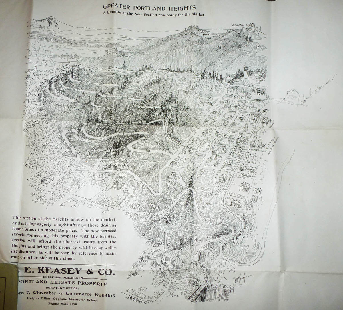
The D.E. Keasey & Co. real estate company distributed this hand-drawn illustration of Portland Heights and surrounding areas. The illustration shows Ford Street Bridge (Vista Avenue Viaduct) in the lower right, all the way to Council Crest and Castle Point in the distance.
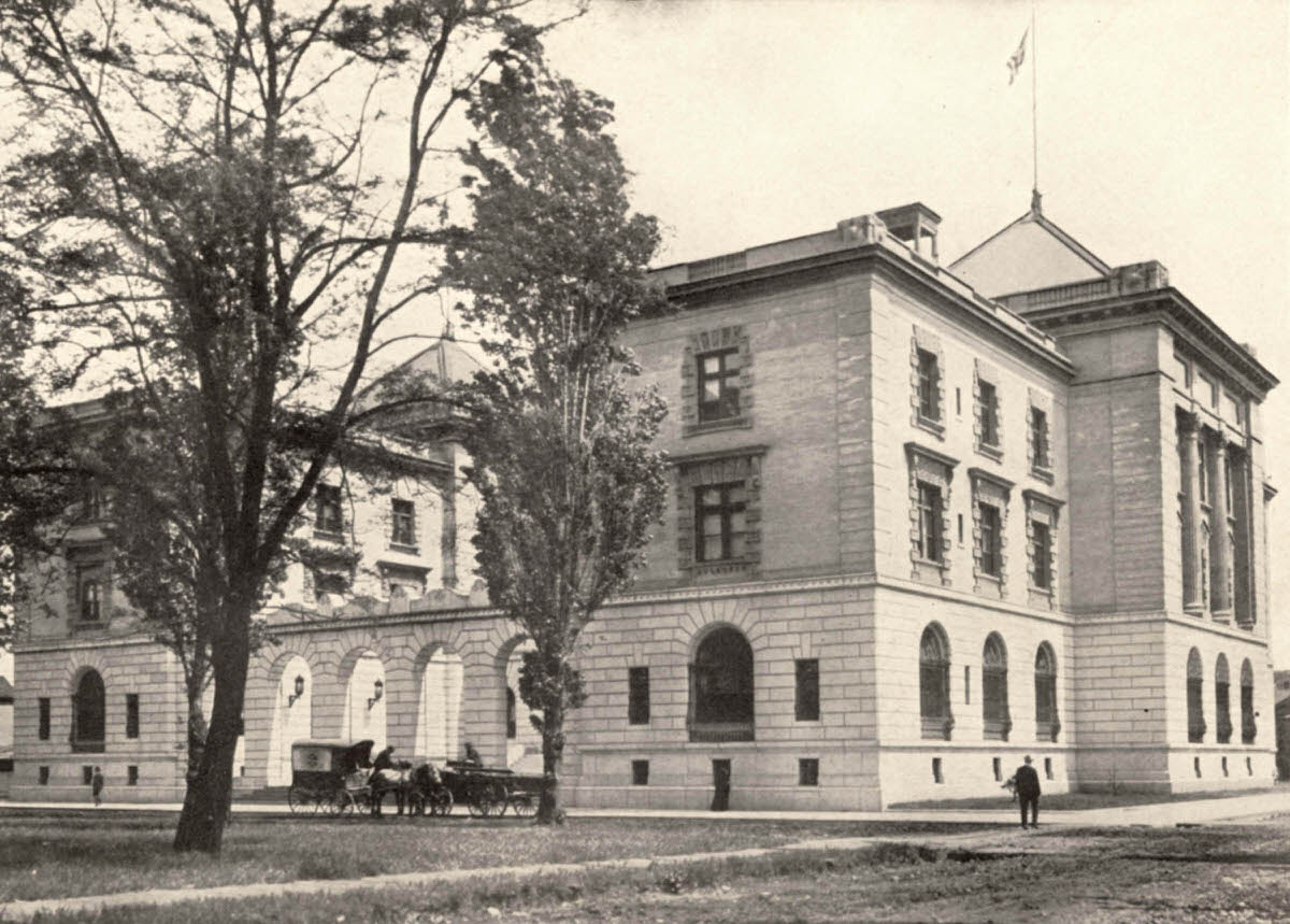
Since its opening in 1901, the US Custom House on NW 8th Avenue between Everett and Davis Streets has been home to the US Customs Service and the US Army Corps of Engineers. It is currently the site of the police headquarters in the TV program “Grimm.” The building recently sold at auction with future plans not yet announced. The streets appear to still be unpaved in this 1904 image.
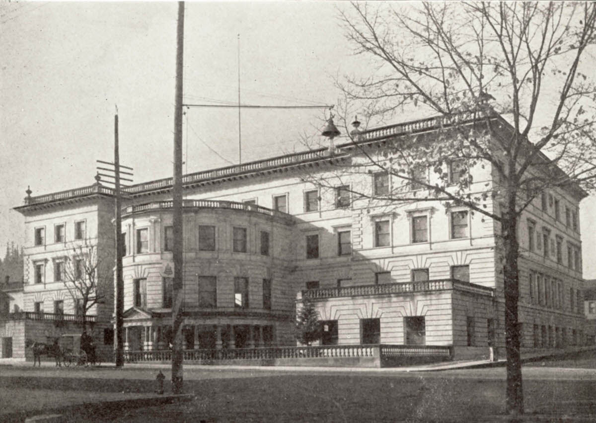
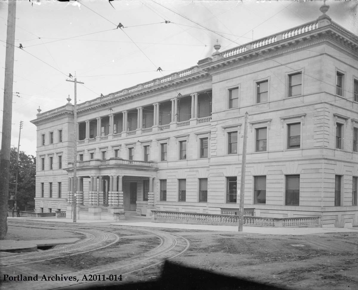
City Hall was over 10 years old when this image was taken. More than 100 years later it looks remarkably the same. This view is southwest from SW 4th and Madison.
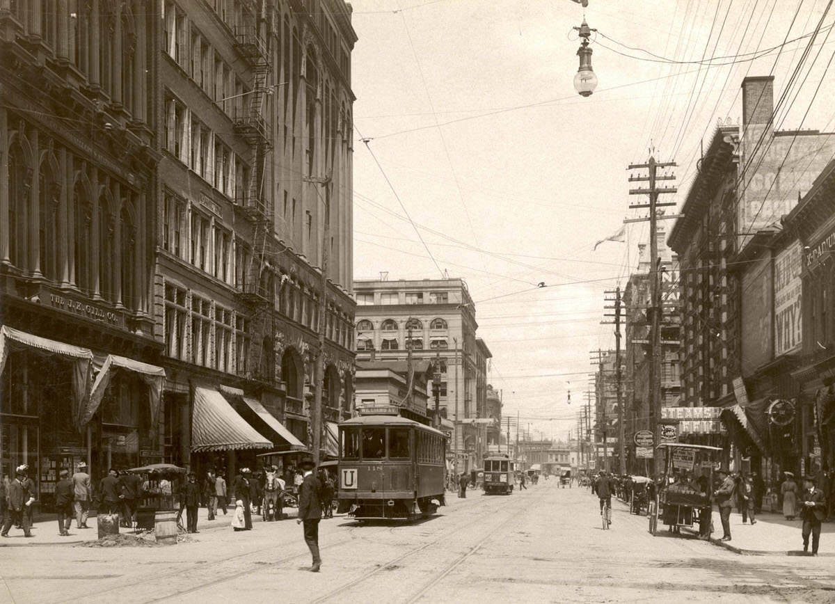
This 1904 image looks north up SW 3rd Avenue from Alder Street. The Hamilton and Dekum buildings (both still standing), the Chamber of Commerce Building, and the Ainsworth Building are visible on the left side of the street. On the right side, the Postal Building (still standing), the tower of the Abington Building (behind the pole), and the Worcester Building can be seen farther down the block.
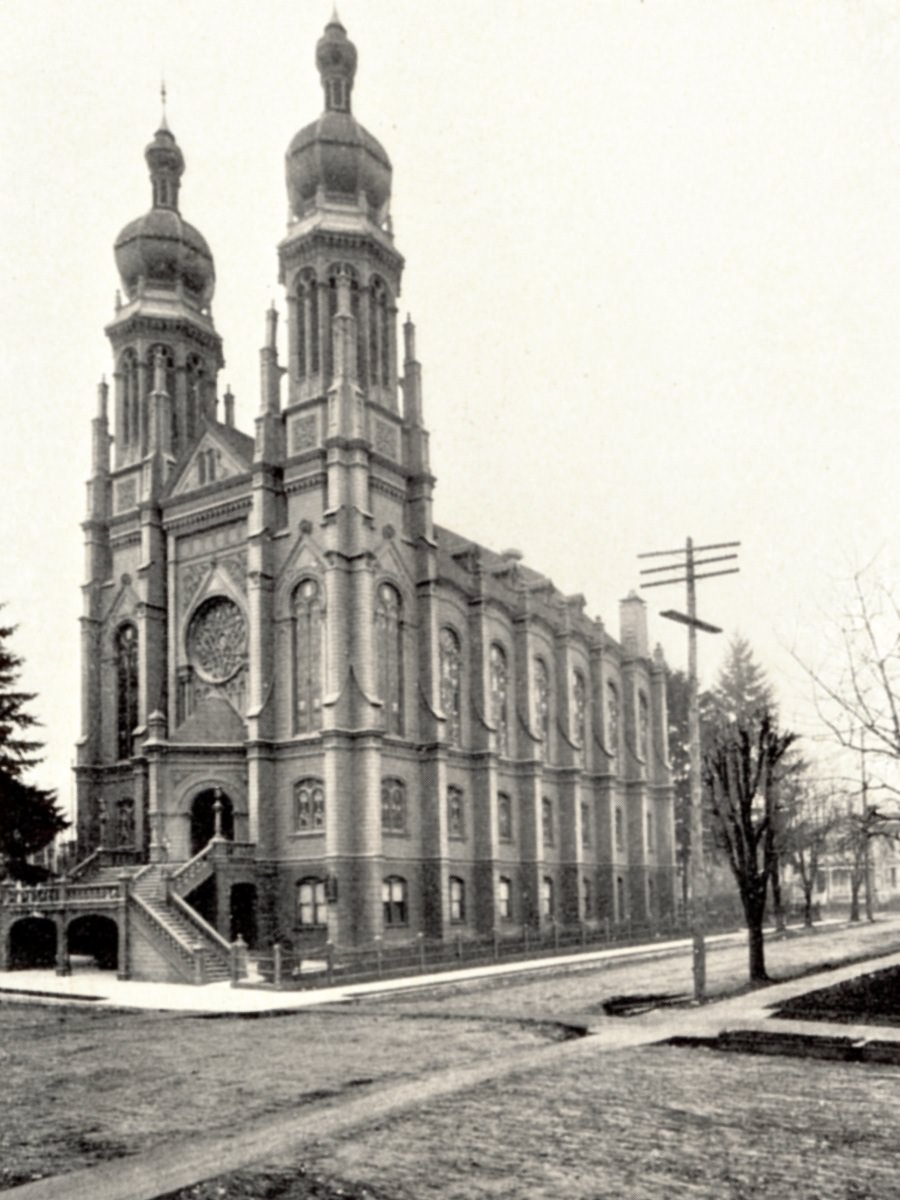
This Temple Beth Israel synagogue was built in 1888 on SW Main Street between 12th and 13th Avenues. Its two distinctive 125-foot towers were landmarks on Portland’s early skyline. It was destroyed by fire in 1928 and replaced by the congregation’s current building in Northwest Portland.
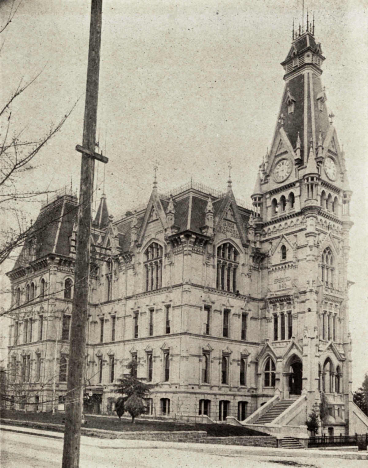
The magnificent old Portland High School was completed in 1885 and stood at SW 14th and Morrison until it was demolished in 1929. The school was renamed Lincoln High School in 1909 and moved to Lincoln Hall (now part of Portland State University) in 1912. Construction began in 1950 for Lincoln’s current Goose Hollow location.
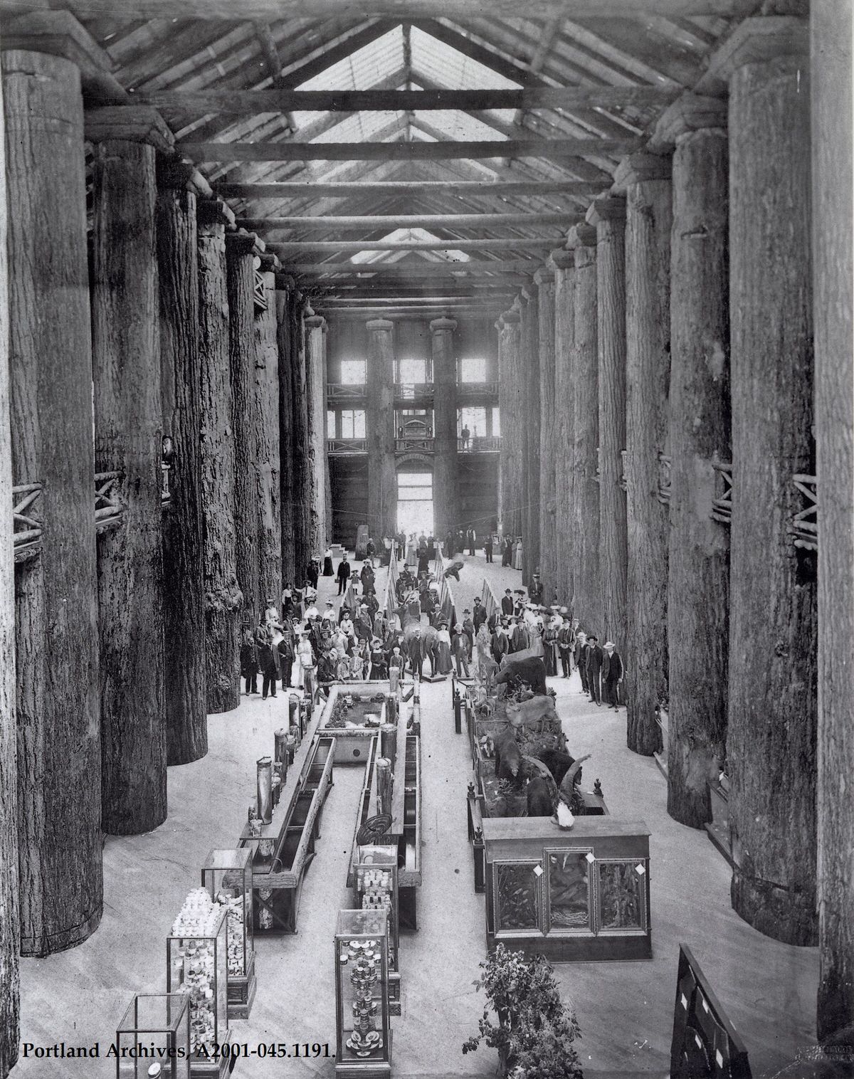
The interior of the Forestry Building, 1905.
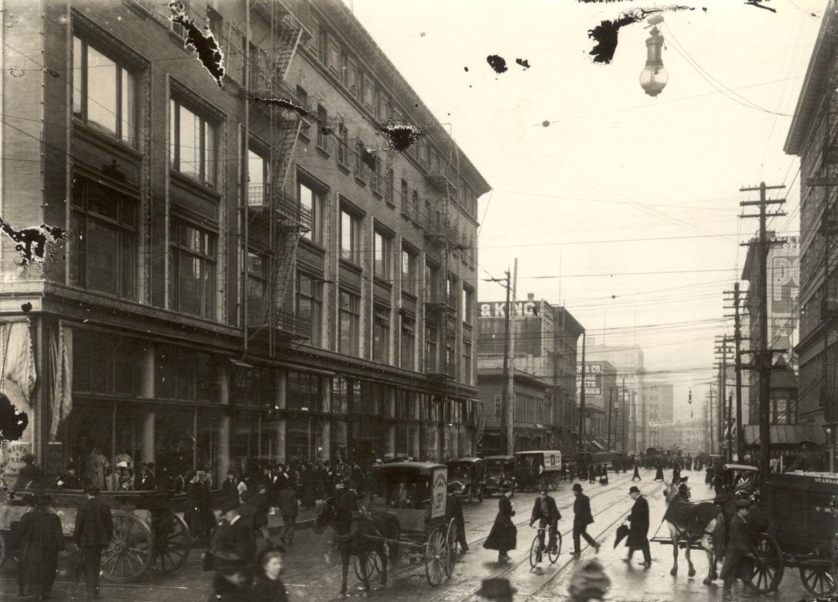
SW 5th Avenue looking north from Morrison Street, 1905.
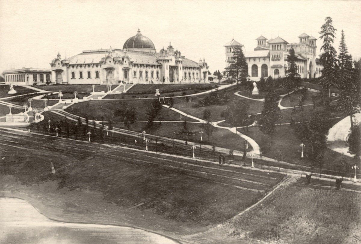
The main terrace at the Lewis and Clark Centennial Exposition, with views of the European and Agriculture Buildings, 1905.
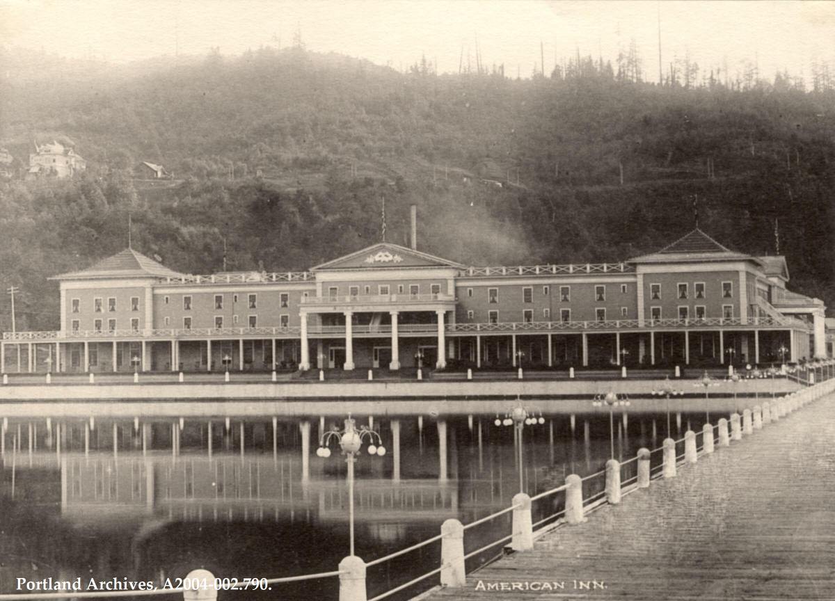
The American Inn at the Lewis and Clark Exposition, 1905.
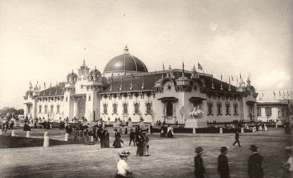
The Agriculture Building at the Lewis and Clark Exposition, 1905.
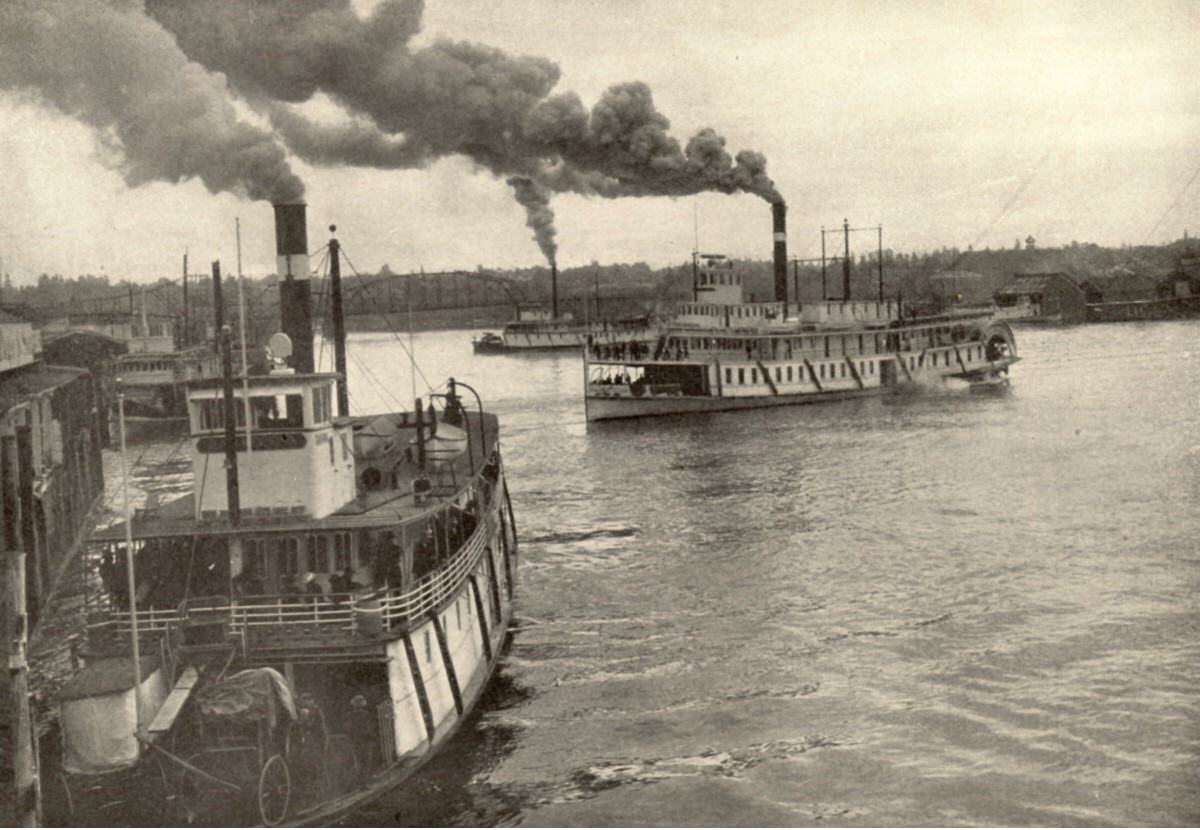
Ships in the Portland Harbor on the Willamette River, 1905.
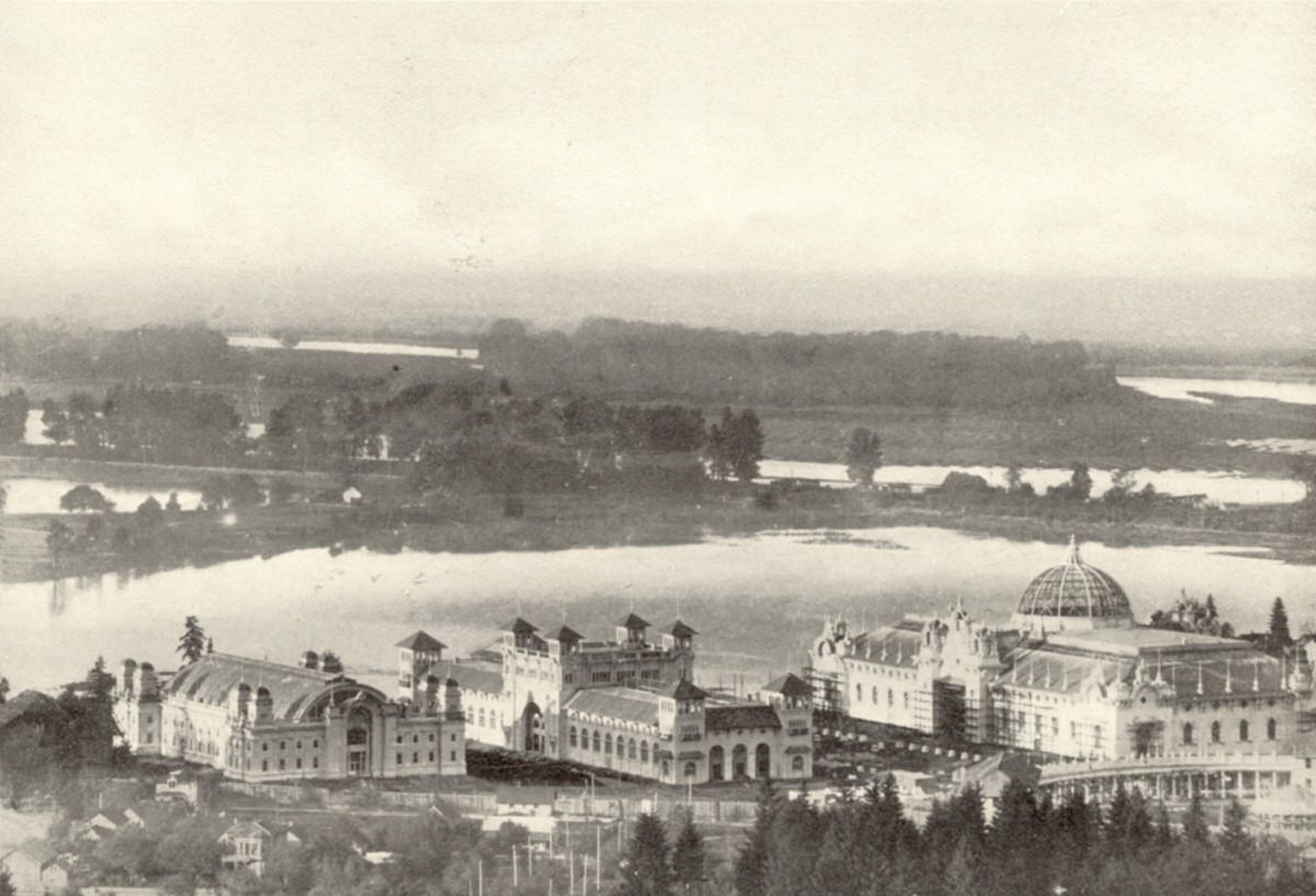
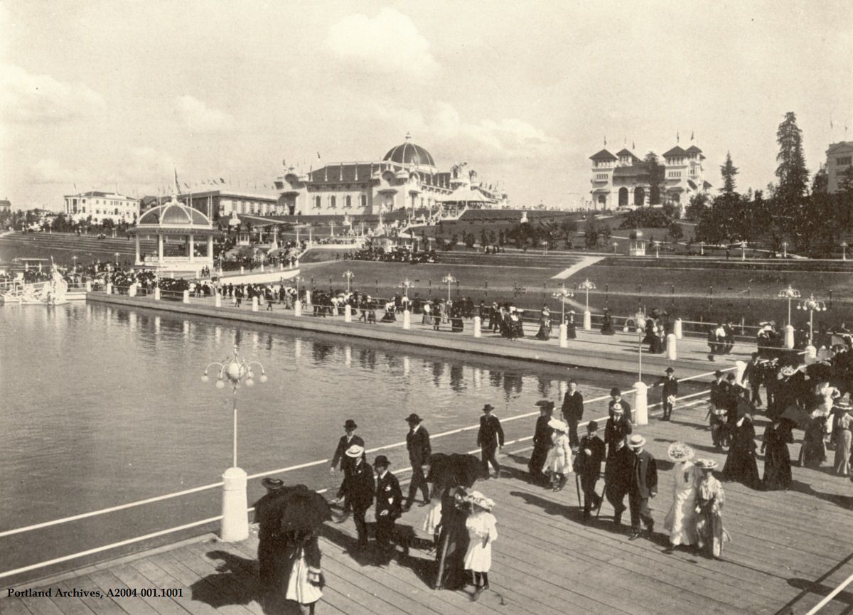
Buildings constructed for the Lewis and Clark Centennial Exposition, 1905. The building on the far right is the Agriculture and Horticulture building.
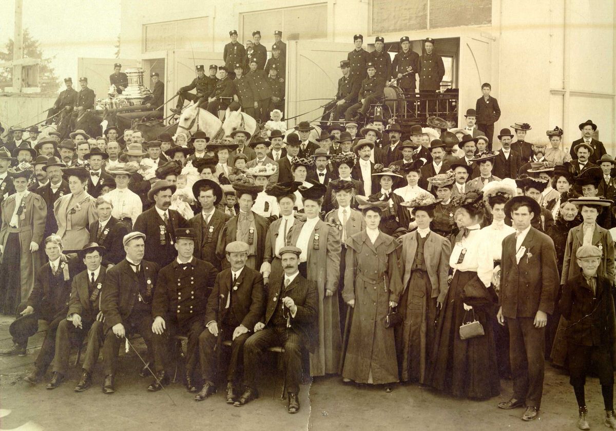
The Lewis and Clark Centennial Exposition’s Fire Department, 1905. Chief David Campbell is seated in the chairs in the middle front. Exposition Chief Benjamin Franklin Dowell is seated on the right front of the middle apparatus.
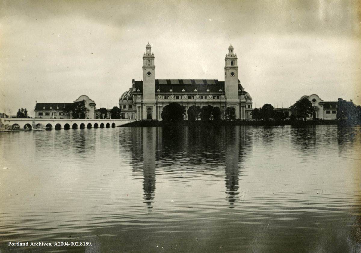
View of the Lewis and Clark Centennial Exposition, 1905.
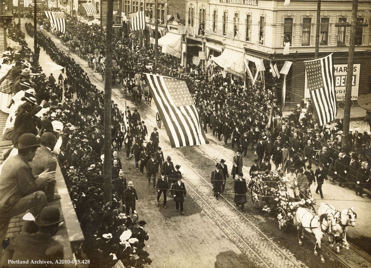
Parade for Theodore Roosevelt on SW 3rd Avenue, 1905.
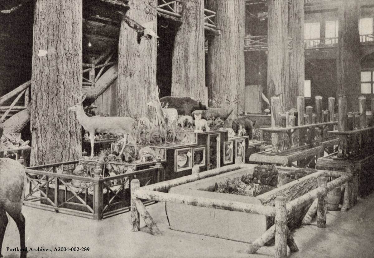
Exhibits within the Forestry Building during the Lewis and Clark Centennial Exposition, 1905.
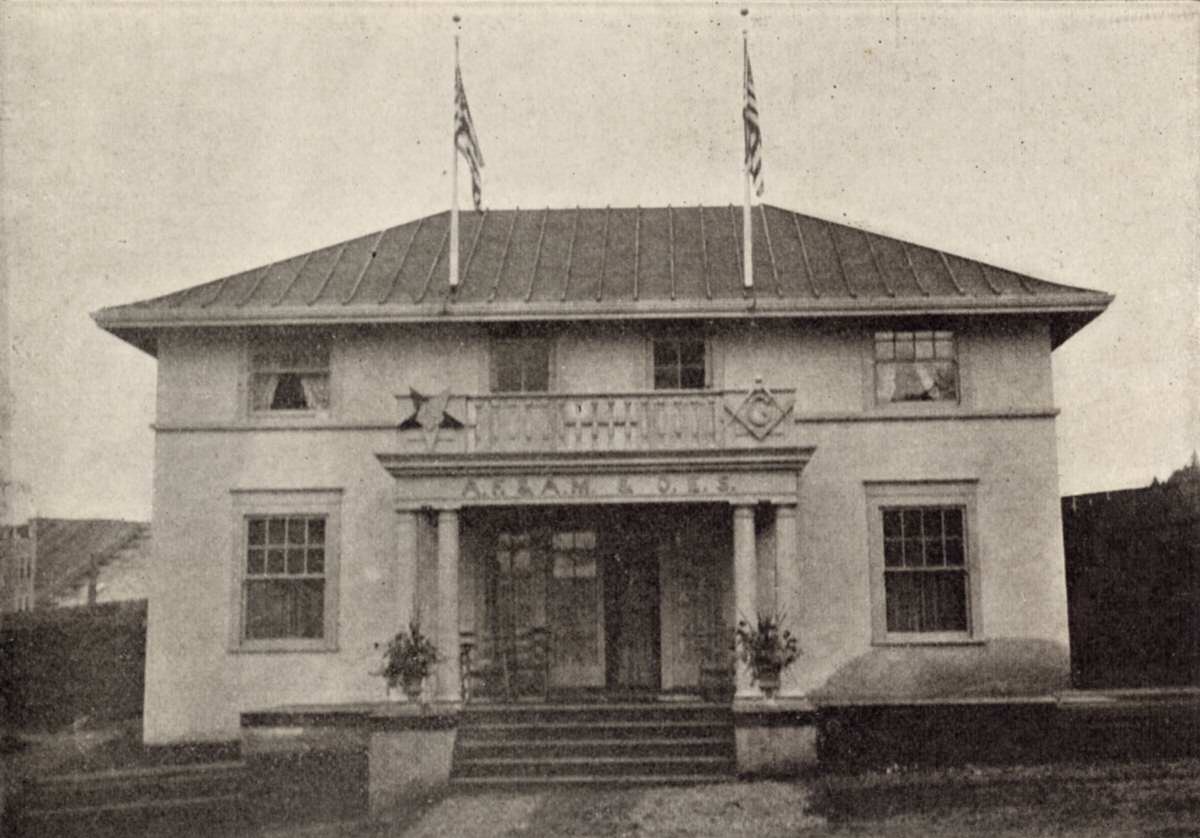
The Masonic Building, 1905. This image comes from the booklet Souvenir Picture Book: Sights and Scenes at the Lewis and Clark Centennial Exposition, Portland, Oregon.
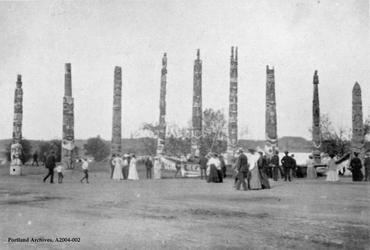
Alaska totem poles at the Lewis and Clark Centennial Exposition, 1905.
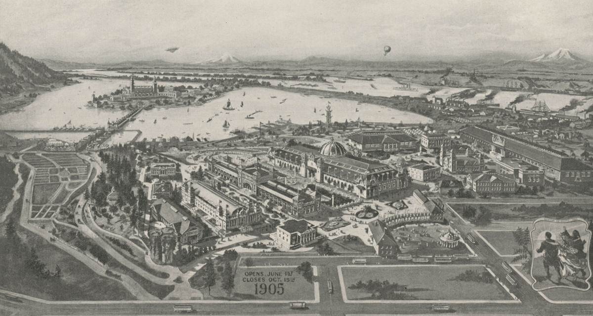
Bird’s eye view of Lewis and Clark Centennial Exposition grounds, 1905.
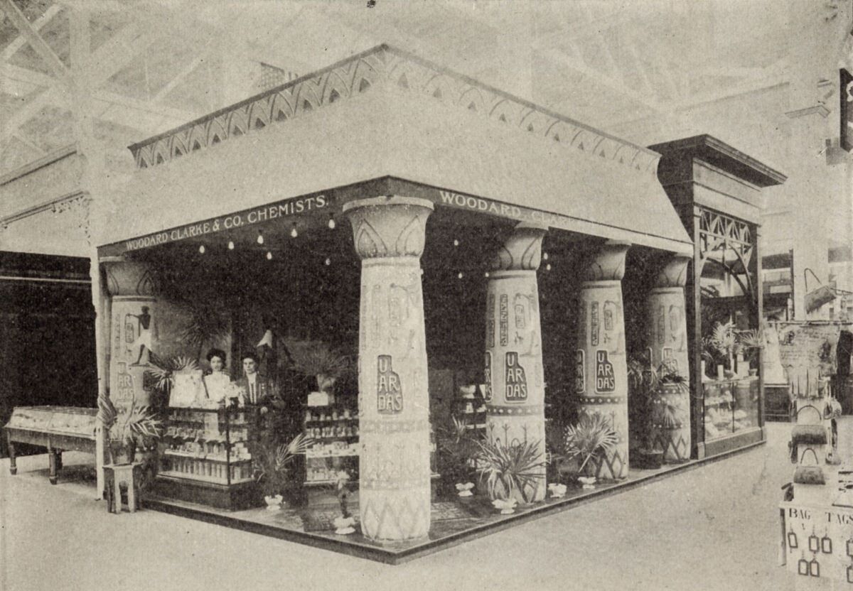
An exhibit in the Liberal Arts Building at the Lewis and Clark Exposition, 1905.
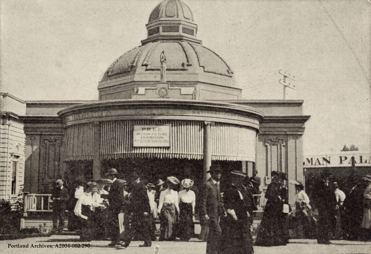
The National Cash Register Company’s Lecture Pavilion at the Lewis and Clark Centennial Exposition, 1905.
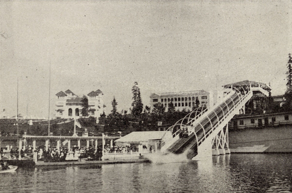
‘Shooting the Chutes’ at the Lewis and Clark Centennial Exposition, 1905.
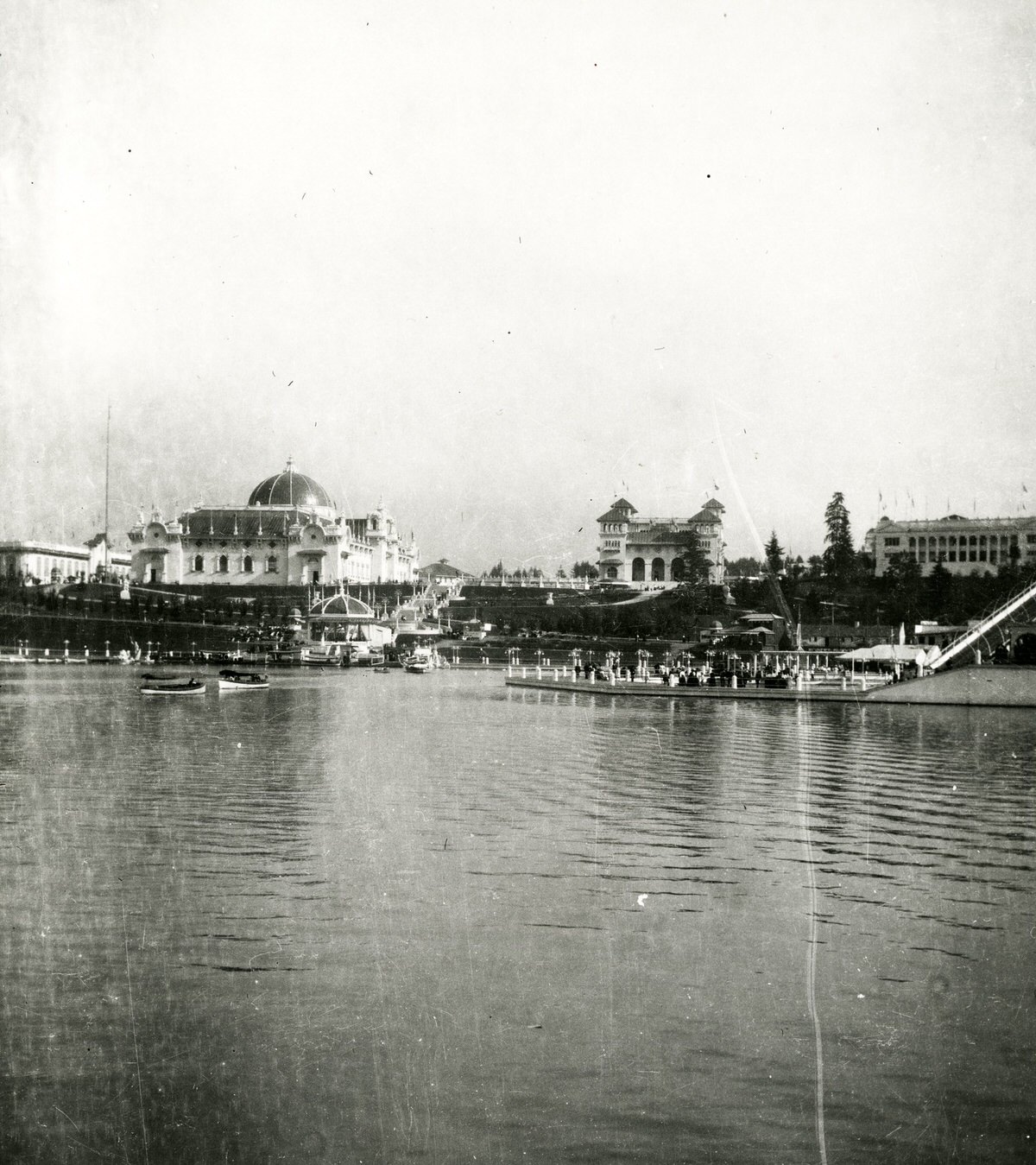
Guilds Lake and pavilions during the Lewis and Clark Centennial Exposition, 1905.
Lewis and Clark Centennial Exposition, 1905.

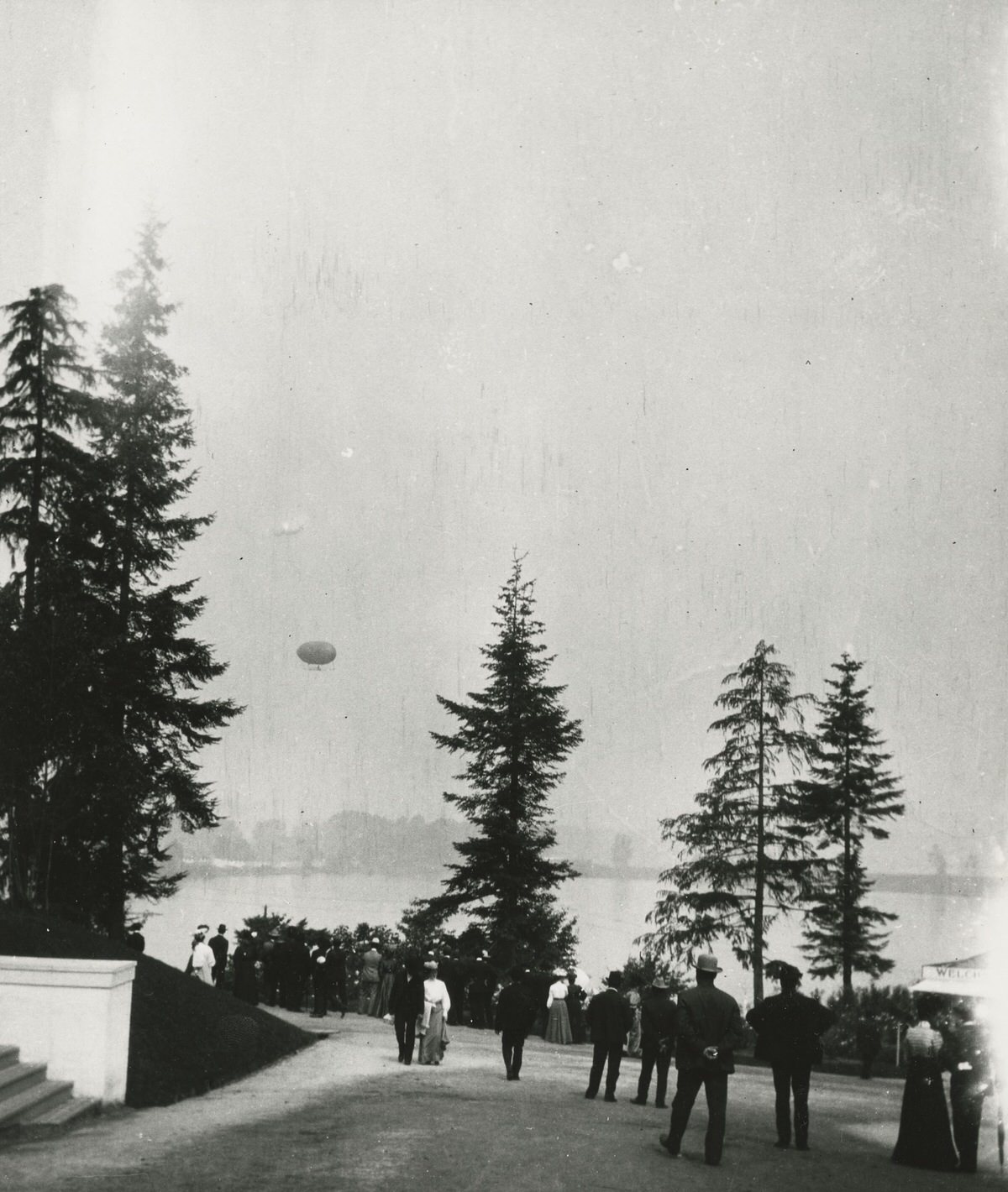
Guilds Lake and an air balloon during the Lewis and Clark Centennial Exposition, 1905.
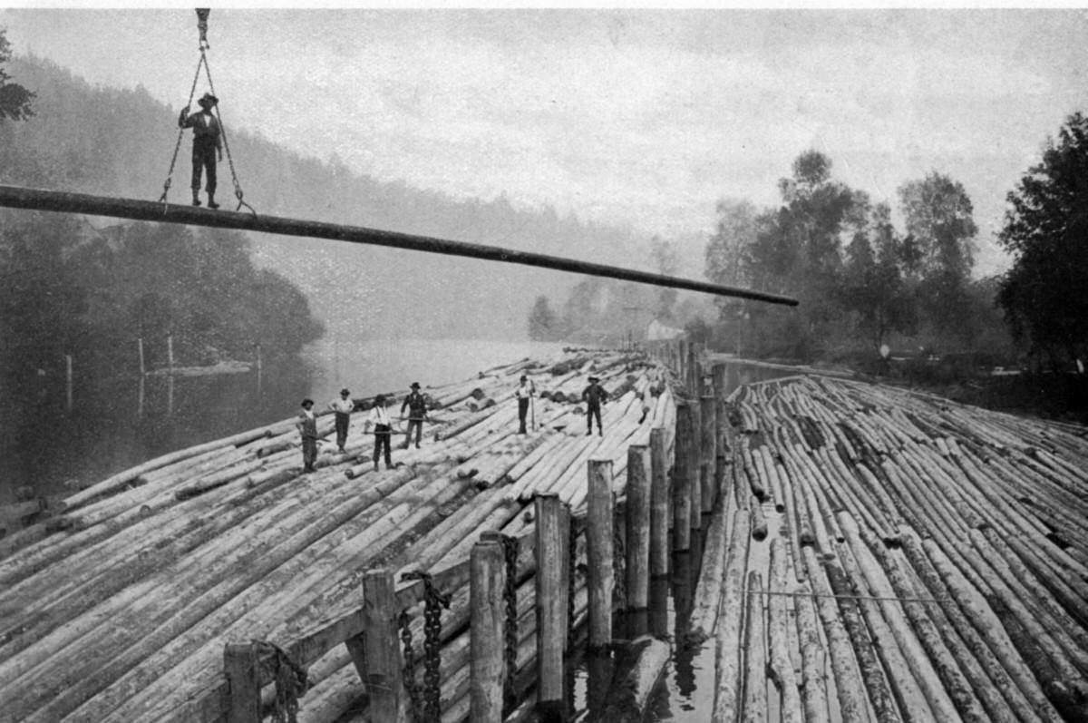
Men in the process of building a log raft, 1905.
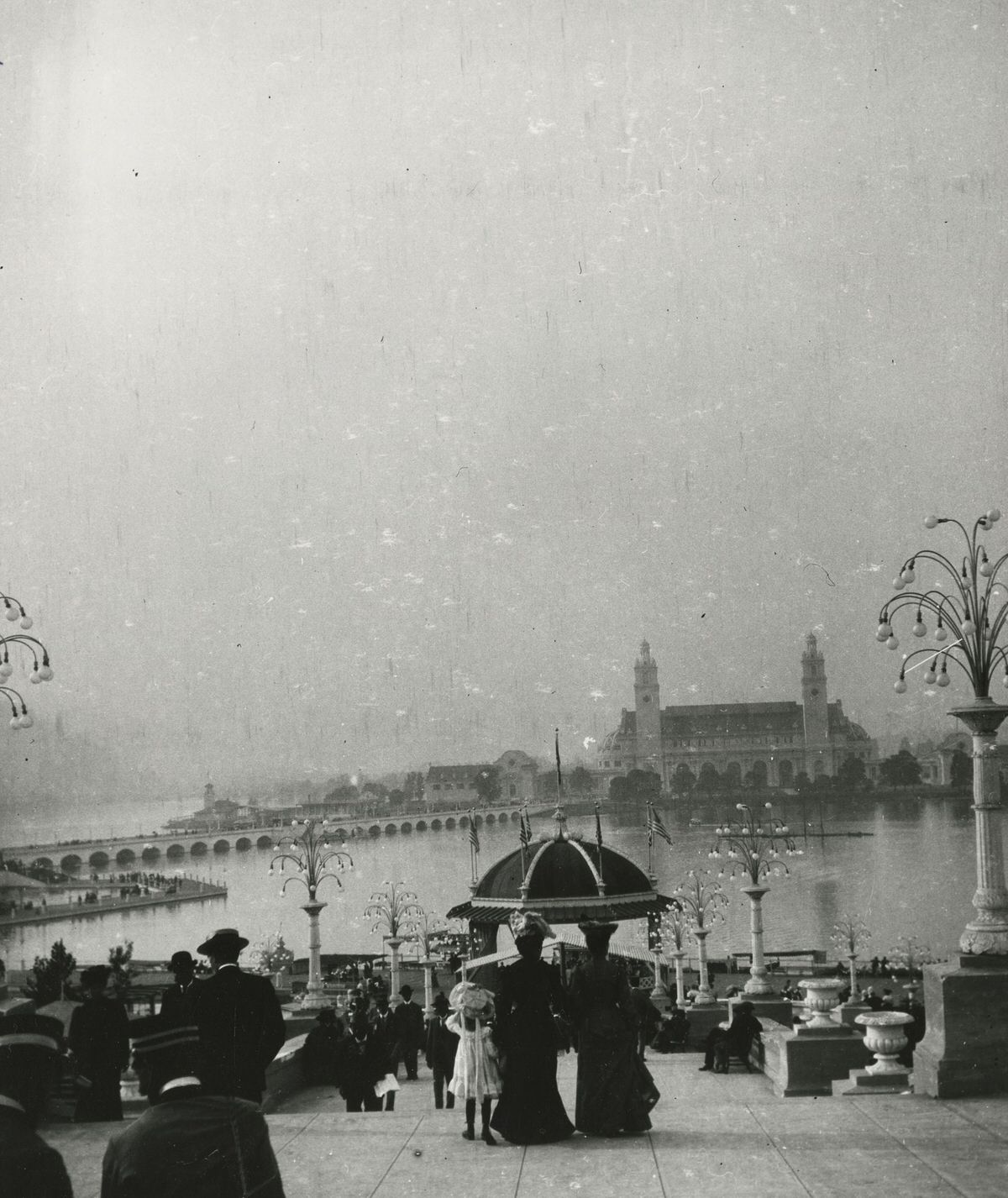
People taking in the view of Guilds Lake and the pavilions of the Lewis and Clark Centennial Exposition, 1905.
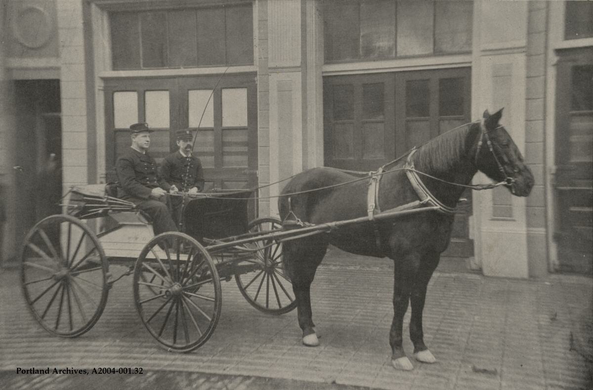
Fire Chief David Campbell and George Walker in the Chief’s buggy outside Station 1, 1905. Chiefs were driven around by a firefighter driver, but usually posed for pictures with reins in hand.
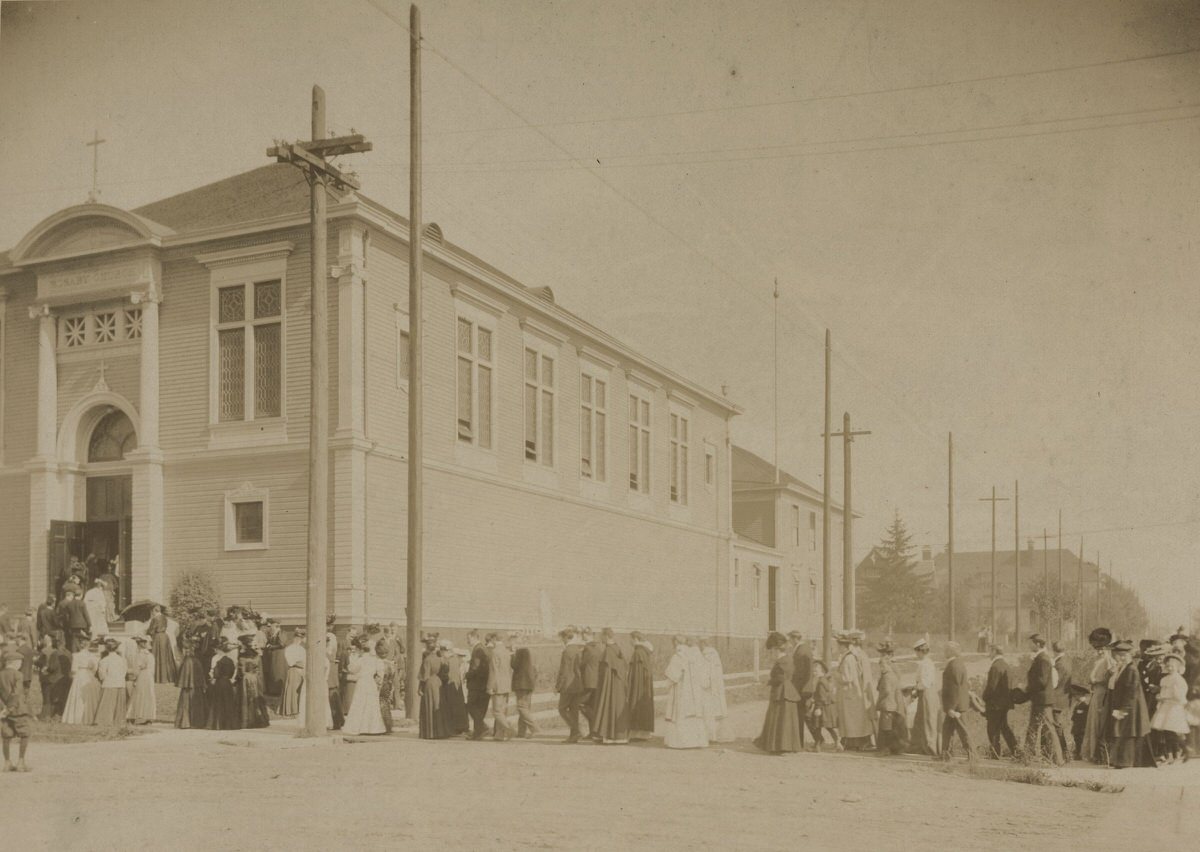
People entering the Holy Rosary Catholic Church located at 375 NE Clackamas Street, 1905.
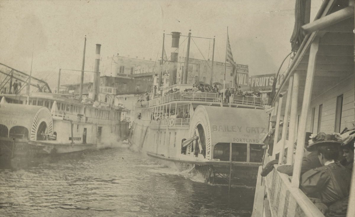
Steamboats at the west side of the waterfront, near the Morrison Bridge, before the harbor wall was built, 1905.
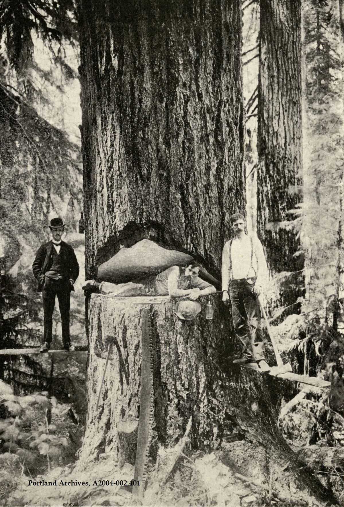
A logging team posing with a large fir tree, 1905.
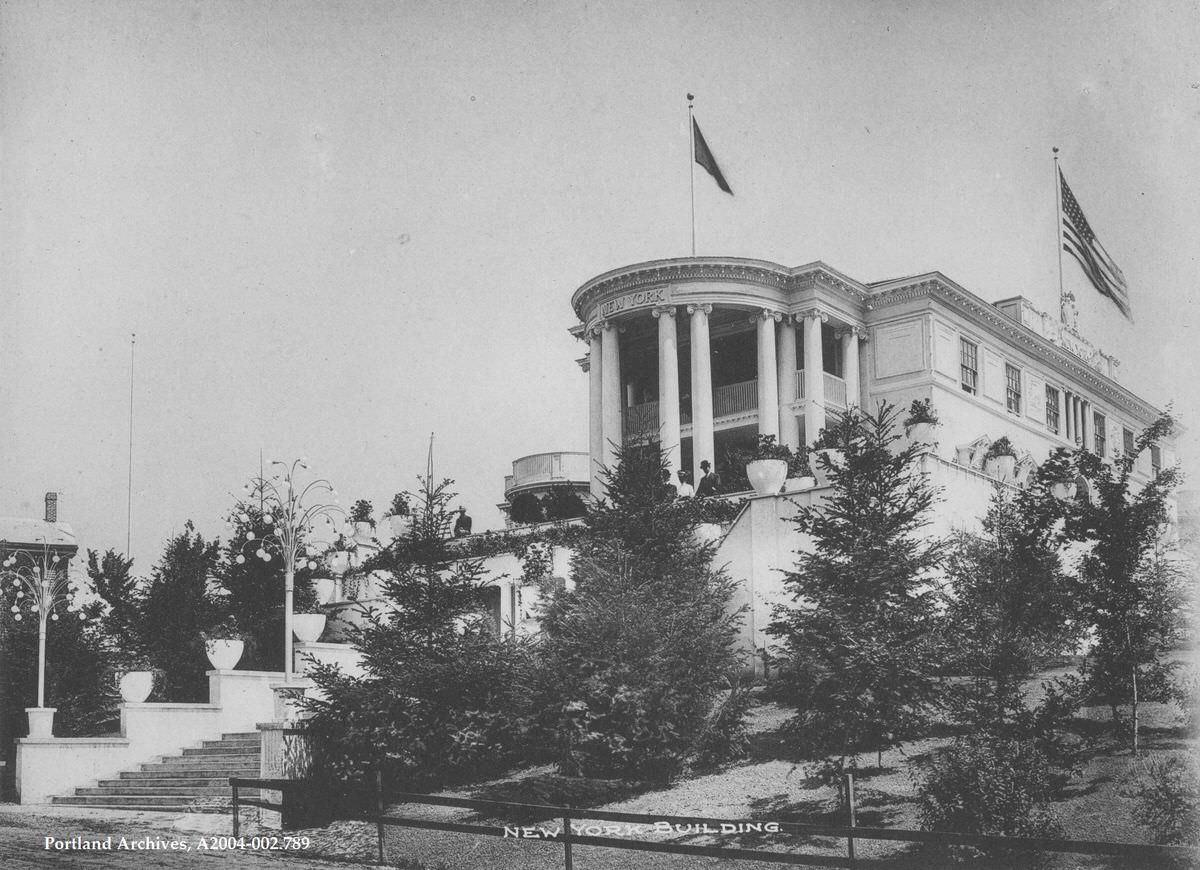
The New York Building from the Lewis and Clark Centennial Exposition, 1905.
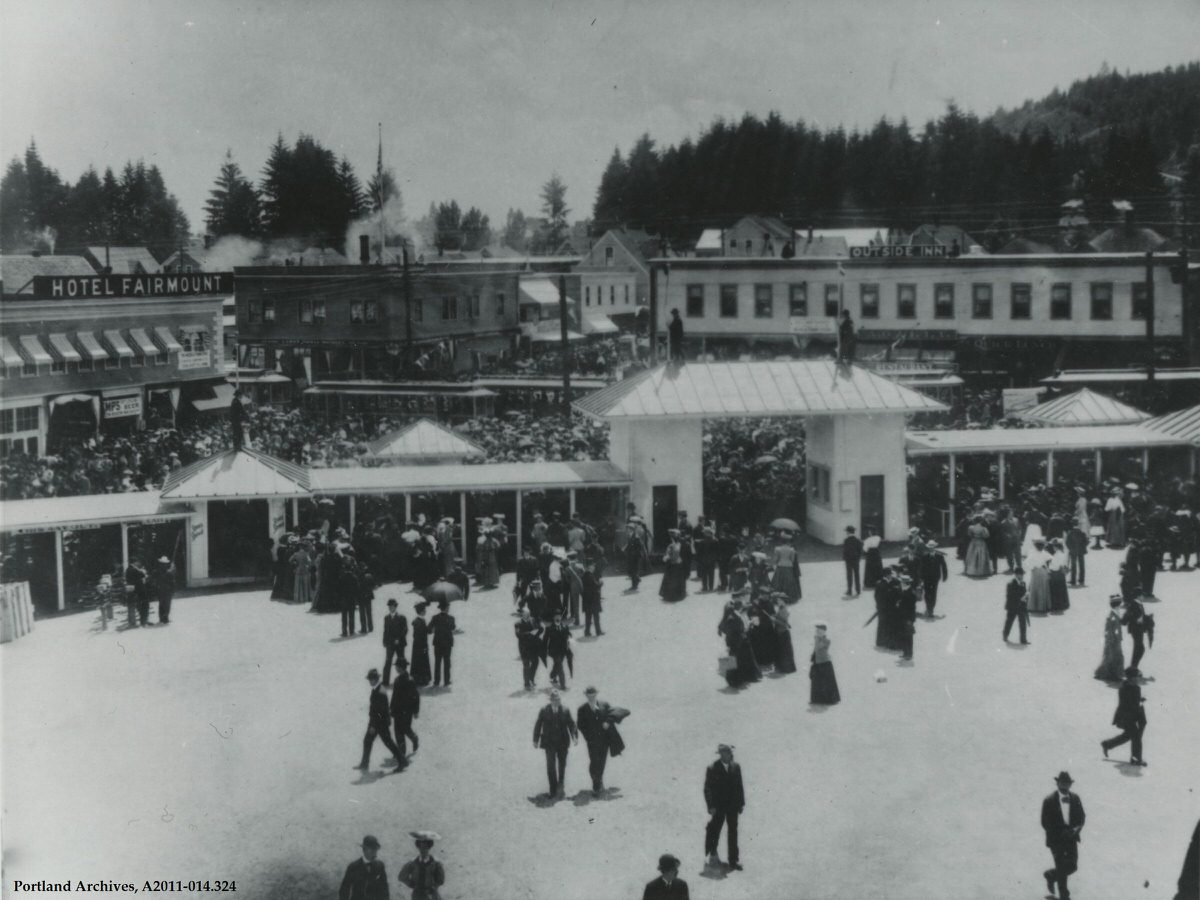
The main entrance to the Lewis and Clark Exposition, June 1905. The Hotel Fairmount and Outside Inn are visible.
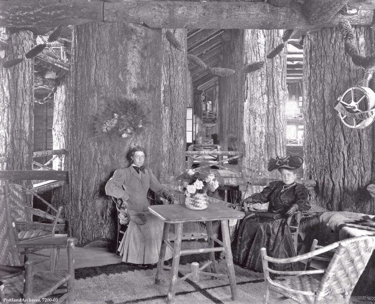
Two women sitting in the upper balcony of the Forestry Building, 1905. This image shows how massive the support logs were.
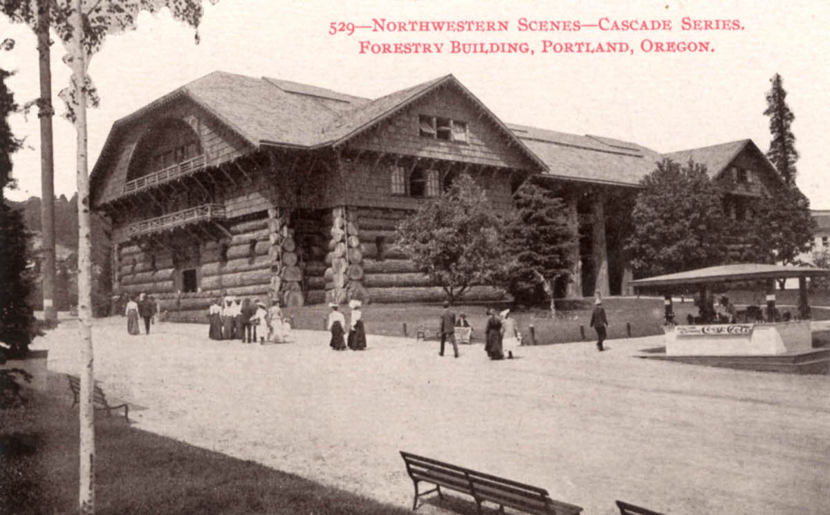
The Forestry Building is shown in 1905 during the Lewis & Clark Centennial Exposition, for which it was built. This view is likely due west; standing at the driveway to Old Forestry Commons on NW Upshur Street puts you in roughly the same spot today.
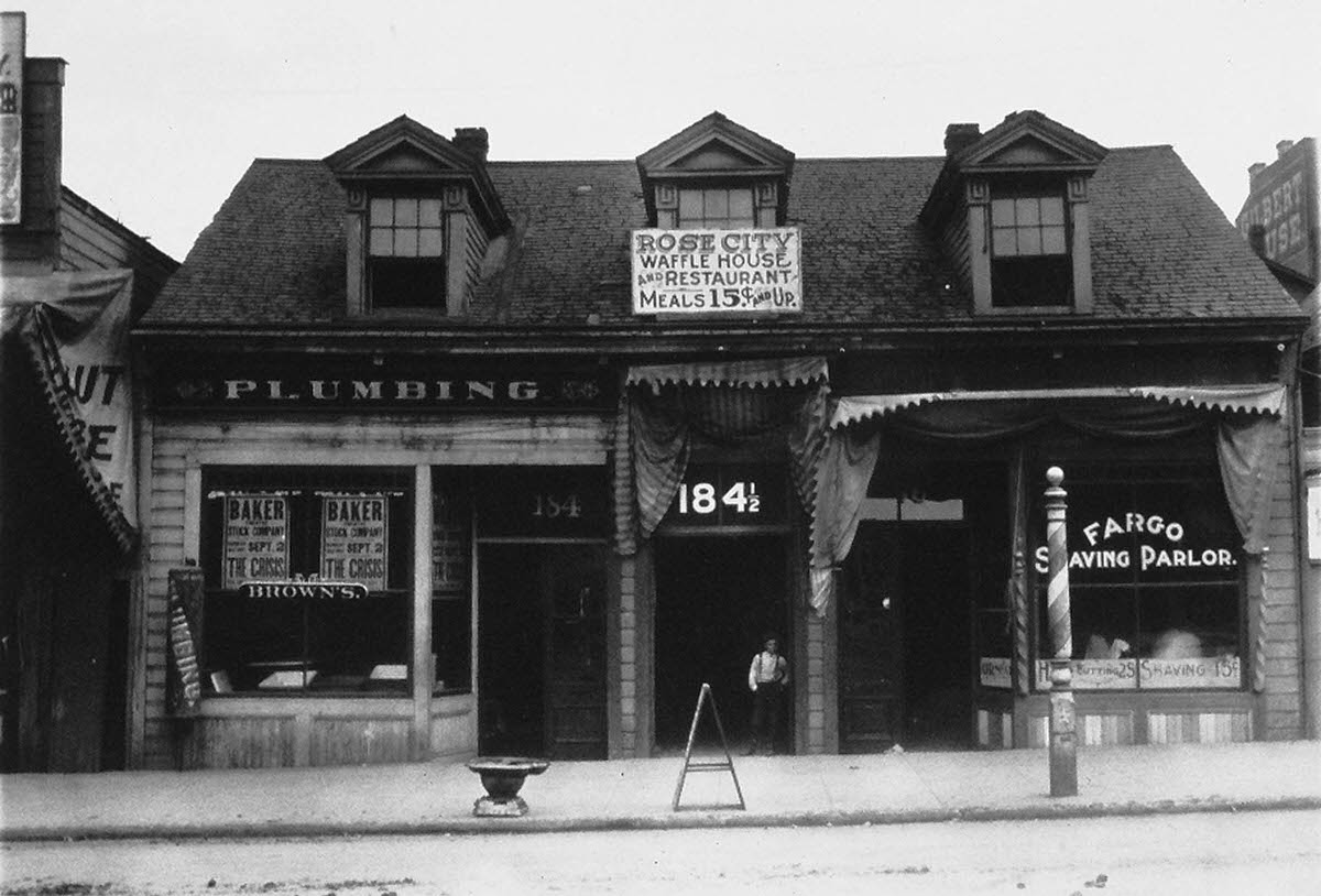
This building was originally the “Old Crosby House,” built in 1848 or 1849, the first frame residence in Portland. It was located on the east side of SW 4th Avenue between Yamhill and Taylor.
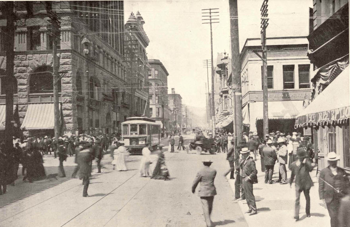
The streets and sidewalks were crowded with pedestrians and a few vehicles in this 1905 image. This view is west on SW Washington St. at 3rd Avenue. The Dekum Building is visible on the left, and the Oregon Pacific Building another block west still stands.





I’ve scrolled pretty far down… I wonder if goats were used in the Klondike gold rush.
It has been estimated that Larch trees were in abundance in this area around 1900.
Larch trees are pretty common in the area due to the presence of two Larch mountains.
These are just a novelty now to create a happy face in a sea of Douglas Fir.
There was much taxonomic confusion about Douglas Fir at the time. It was variously called “douglas spruce”, fir, larch, and even hemlock (that last confusion made permanent in its latin binomial Pseudotsuga menziesii). It is very doubtful that our current “Larch” mountains actually ever had any Larix species growing on them.
The 1970s were said to have been crime-ridden
It’s a real shame that the Portland Expo buildings didn’t survive
believe the IBM typewriter building survived, it moved and is the McMenamins St. Johns movie theater.
The real shame is the forestry building, it was gorgeous and lost due to a fire.
They were pretty, but most of them not built to last. Intentionally made with straw and plaster on skeleton beams to tear down shortly after.
Those poor bears.
Fascinating photos, but the bears in the zoo’s Bear Pit made me sad.
The pit was still there in the 1950s and was very scary to a little kid
I grew up near St. Louis, which was known for its “excellent” zoo (and free to the public). But when I was a kid, the bears and big cats were kept in horribly small cages. The bears got better digs by the ’70s, but the cats were still left to pace in their awful cages.
Finally, in the ’80s, the zoo opened Big Cat Country. Now the cats were free to roam, and the humans were restricted to cages (i.e., double chain-link tunnels run through the area, keeping folks away from the kitties).
I think there are still remnants of the bear pit in Washington park. From what I was told, most of it was filled in with earth, but the walls are still there and the tops are still exposed.
I was around 7/8 and that slip of a memory has remained all this time! Just bright sun, bears, and bars that didn’t seem like they kept any bears at bay
I wondered about that—where was it, do you think? Near the old elephant exhibit that’s now a picnic area/bathroom?
Pretty sure all these photos came from Goose Hollow Inn. No joke, happened to be there today and I recognize some.