Hey There! Before You Go. 😧
Get the best vintage content straight into your inbox!

Don't worry, we don't spam

Dirty and Polluted New York City in the 1970s: Vintage Photos Show the Another Side of NYC Before the Great Clean-up Began

New York City in the 1970s was a far cry from the gleaming skyline tourists flock to today. The air was thick with soot. Waterways were choked with industrial runoff. Entire city blocks sat abandoned, stripped of life and structure. This was not a city in transition — it was a city in crisis, and the evidence was everywhere you looked.

The air quality problem was severe enough to kill people. By the 1960s, pulmonary emphysema had become the fastest-growing cause of death in New York City. The culprits were well-known: coal-burning power plants, heavy-grade fuel oil burned by factories and heating systems, and the widespread practice of burning garbage in open incinerators. Those incinerators scattered ash and fine particles of waste across neighborhoods, coating surfaces and filling lungs. The sky over New York was not just gray — it was dangerous.
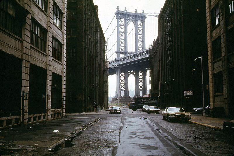
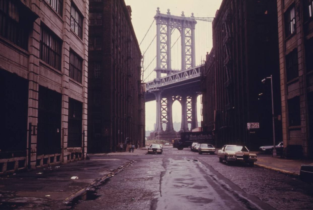
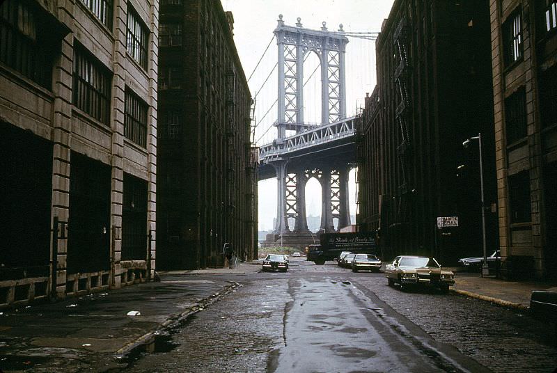
A street scene in Brooklyn, New York City, 1974

When the Environmental Protection Agency was established, one of its early priorities was documentation. Before any clean-up effort could take shape, the agency needed a clear visual record of the damage. To do that, the EPA commissioned freelance photographers to fan out across the country and capture environmental decay as it actually existed. That initiative became known as the Documerica project. In New York City, the photographers found no shortage of material.
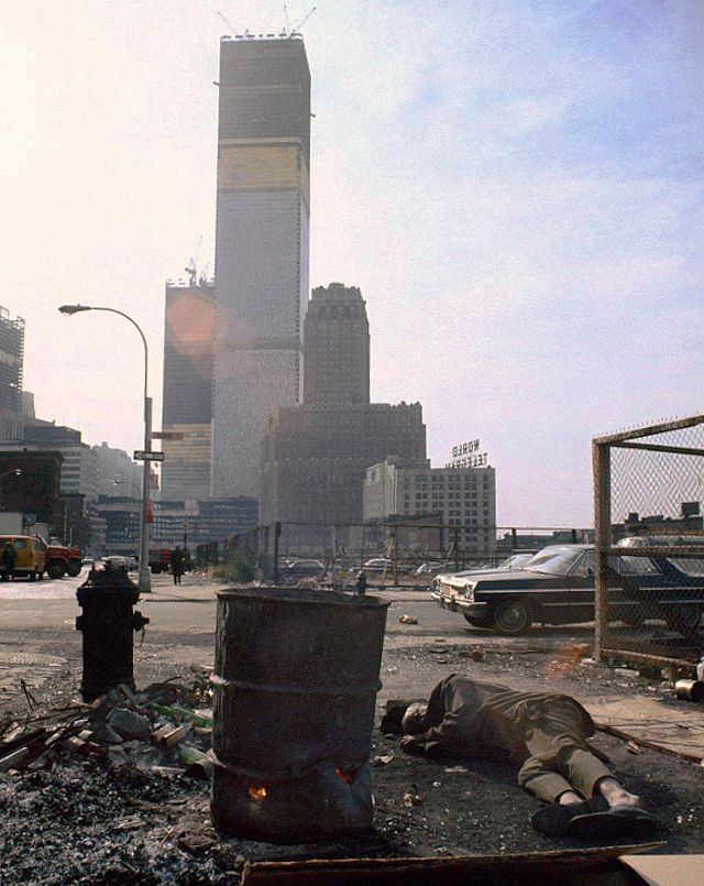
A homeless man sleeps next to a 50 gallon drum of burning scavenged wood, New York, 1970

The streets themselves told a bleak story. Pavement crumbled and peeled. Cars — many of them battered relics from the previous decade — shared roads that had barely been maintained. Canal Street, once a commercial artery, showed its age clearly by 1973, its asphalt splitting open while traffic rolled on.
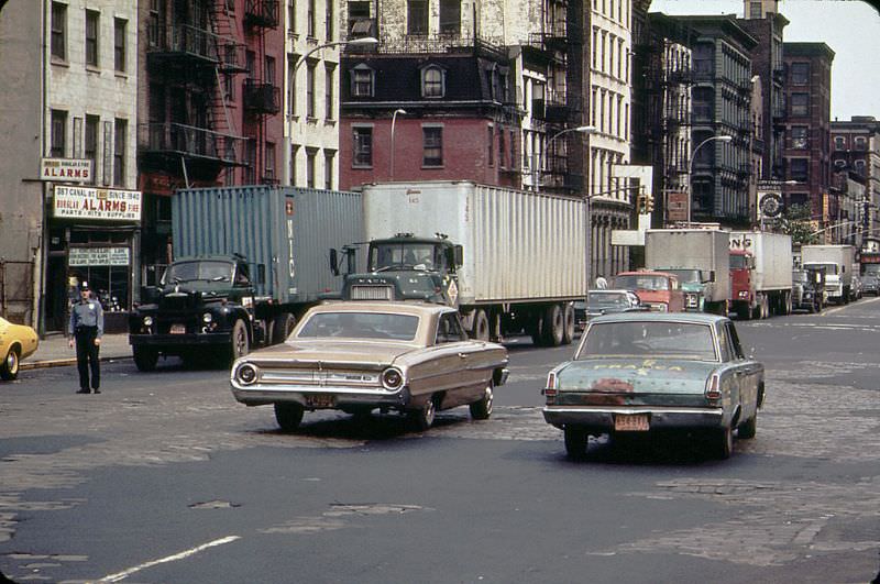
A 1960s Ford Galaxie and a battered early 1960s Plymouth Valiant cruise along Canal Street with peeling pavement, 1973

Abandoned vehicles were a signature image of the era. Cars were dumped on beaches, in vacant lots, and along roadsides with no expectation that anyone would remove them. At Plum Beach near Sheepshead Bay in Brooklyn, the rusted remains of a Triumph Spitfire lay scattered across the ground. These weren’t isolated incidents — they were routine.
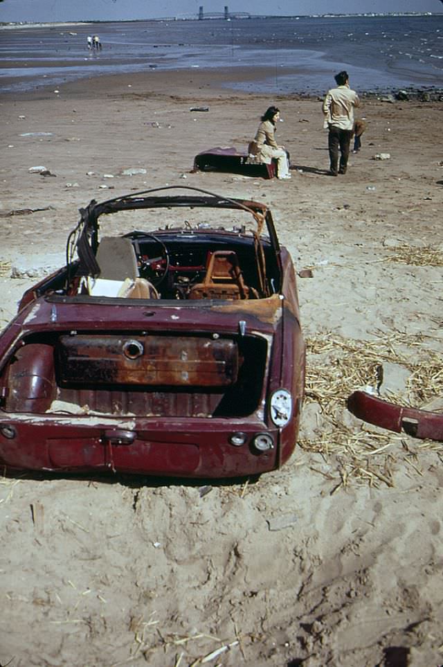
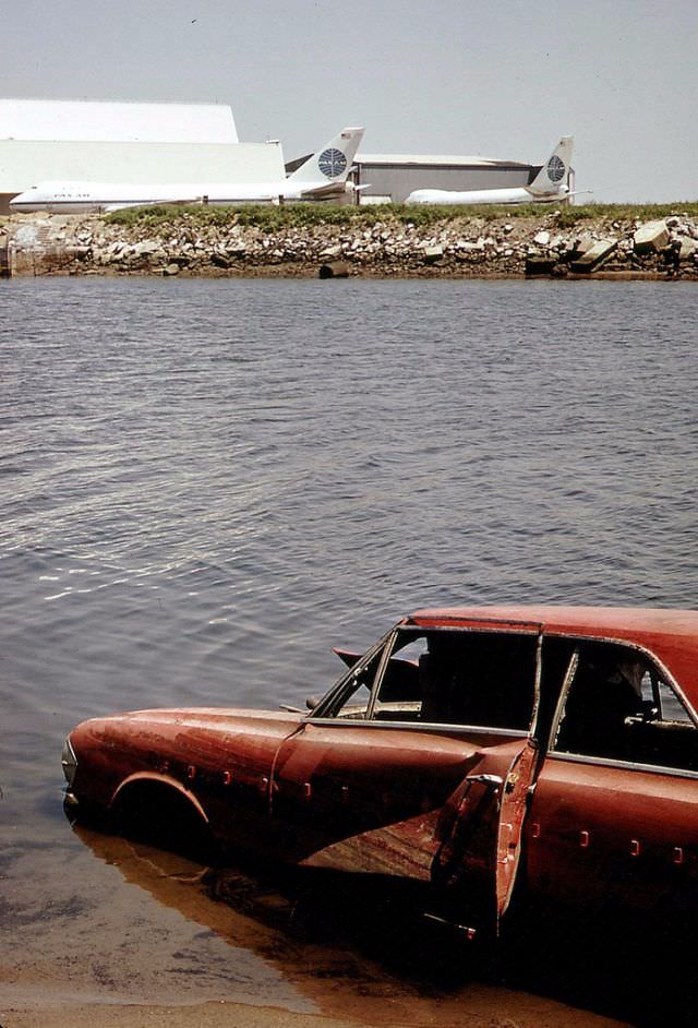
A lot of abandoned car chunks of a Triumph Spitfire at Plum Beach near Sheepshead Bay in Brooklyn, May 1973
An abandoned '64 Rambler, Queens, New York, June 1973
An abandoned ’64 Rambler, Queens, New York, June 1973

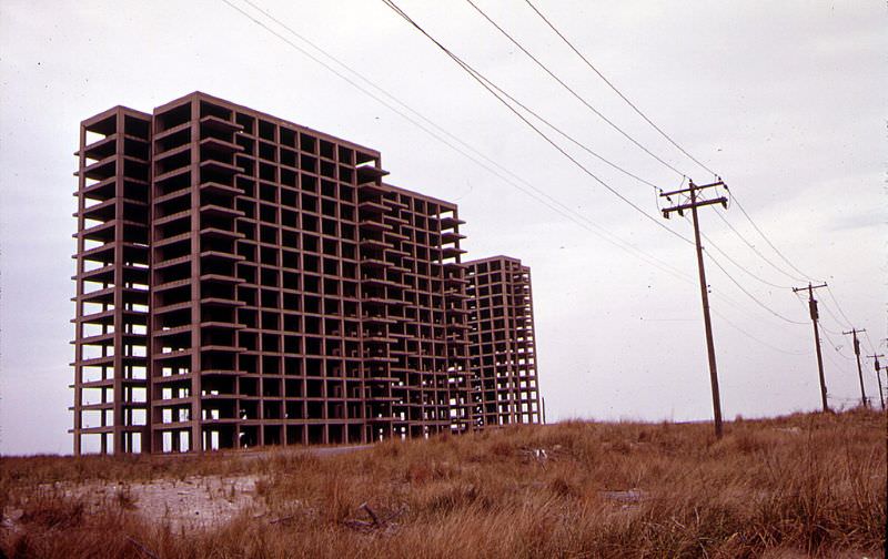
Breezy Point, a neighborhood at the western tip of the Rockaway Peninsula in Queens, became one of the most striking locations the Documerica photographers captured. The area was dotted with the skeletal frames of apartment buildings that had never been finished, left to rot by developers who abandoned their projects. Alongside these concrete husks sat burned-out cars, broken refrigerators, and other discarded debris.
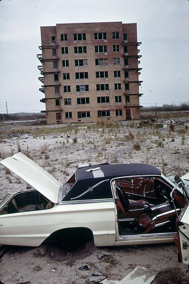
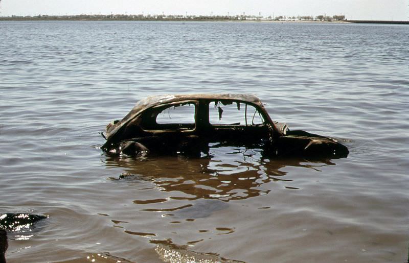
An abandoned 1960s Ford Thunderbird with broken-out windows and a torn vinyl roof, an abandoned apartment building completes the scene, Breezy Point, Queens, June 1973
An abandoned car at the river, Queens, New York, May 1973
Breezy Point in Queens, New York near the Atlantic Ocean with the abandoned skeleton of an apartment building that was never finished, June 1973

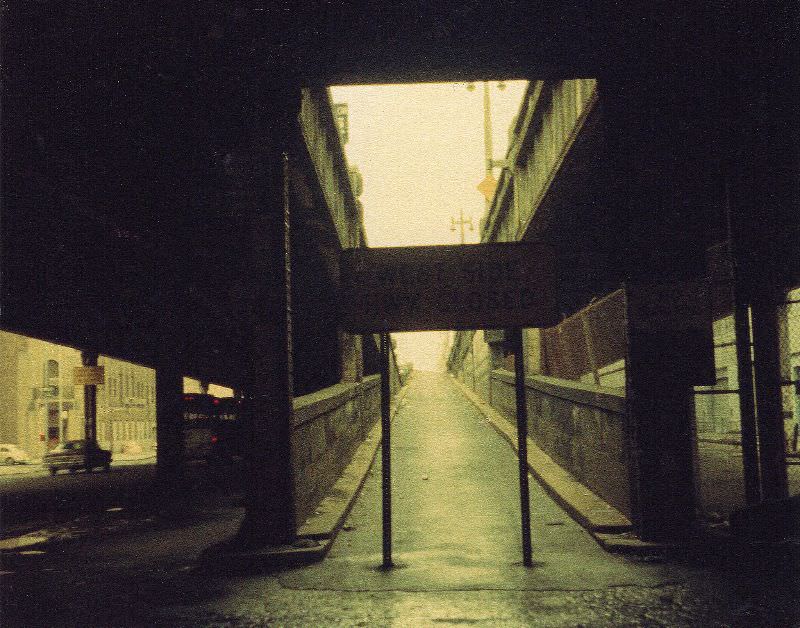
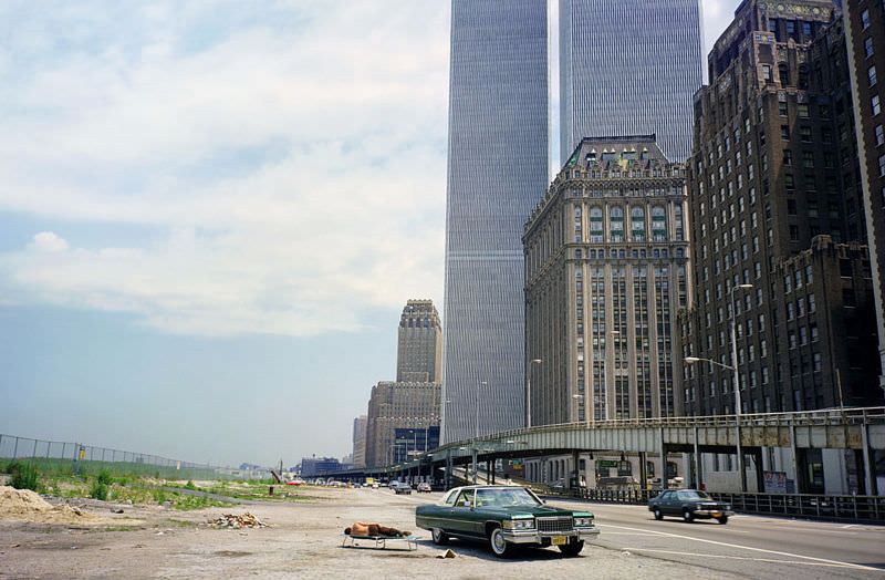
Lower Manhattan in the early 1970s presented its own version of urban decay. The West Side Highway, an elevated expressway running along the Hudson River, had partially collapsed in 1973 and was closed to traffic. Rather than being torn down quickly, it sat abandoned for years, a rusting overhead structure that shadowed the streets below. Beneath it, cobblestone roads carried what traffic remained.
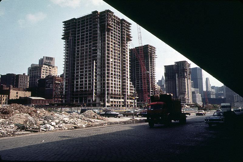
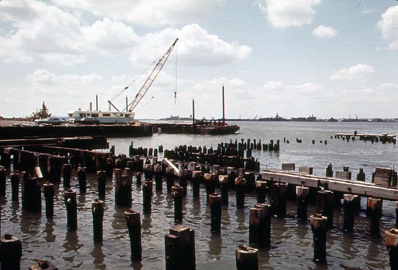
Construction of Independence Plaza North, cobblestoned West Street and Lower Manhattan from under the elevated West Side Highway, New York, June 1973
Ellis Island and industrial Jersey City shoreline across the Hudson with abandoned CRRNJ railroad terminal, June 1973
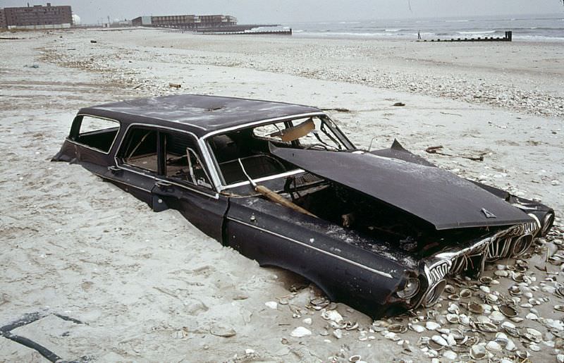
Half buried early 1960s Dodge Polara station wagon on the beach at the ocean side of Breezy Point in Queens, an abandoned apartment building at left distance, 1973

While some parts of the city crumbled, others were in the early and messy stages of construction. Independence Plaza North, a large residential development in what is now Tribeca, was rising from the ground in 1973. The contrast was sharp — construction cranes and fresh concrete stood just blocks away from pier ruins and cracked streets.
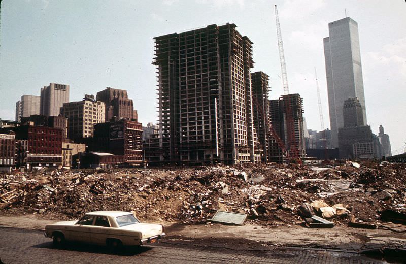
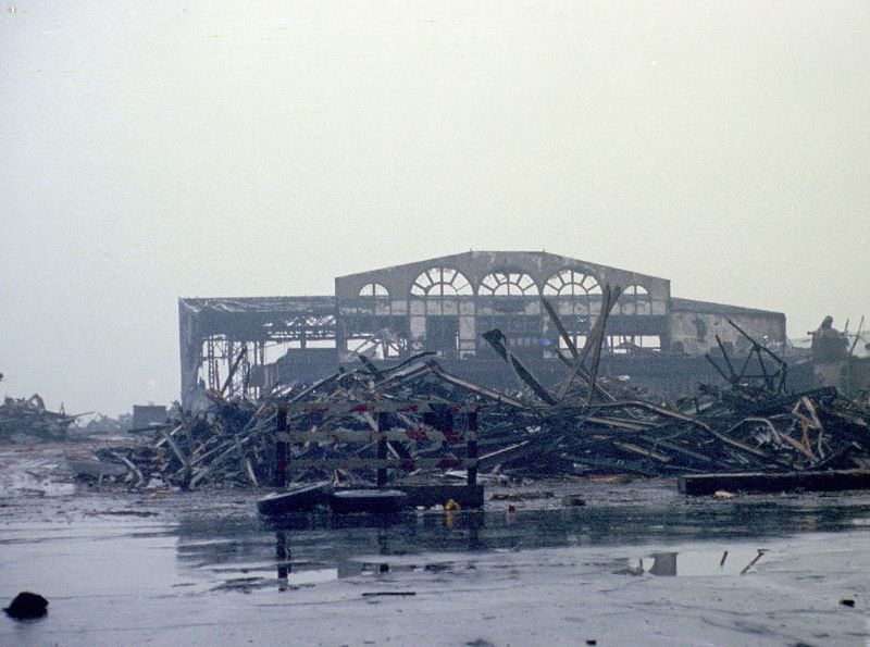
Independence Plaza North going up in what is now Tribeca in Lower Manhattan, June 1973
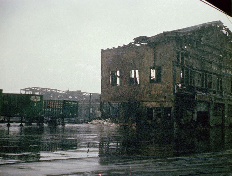
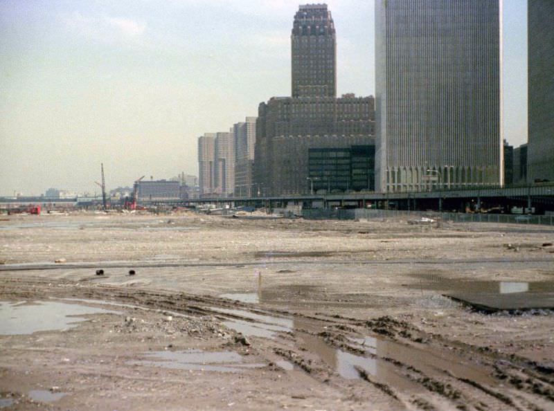
Pier ruins across West Street from the World Trade Center, Battery Park City and the World Financial Center would be built here in later years, March 1973
Ruins of old piers across West Street from the World Trade Center where is exactly the World Financial Center is now, March 1973

Back in Breezy Point, the scale of abandonment was staggering. A half-buried Dodge Polara station wagon sat on the oceanside beach. A burned-out 1965 Ford Mustang rested near an unfinished apartment building skeleton. Discarded refrigerators lined the area. The scene looked less like a neighborhood and more like a dump site that had been dropped beside the Atlantic.
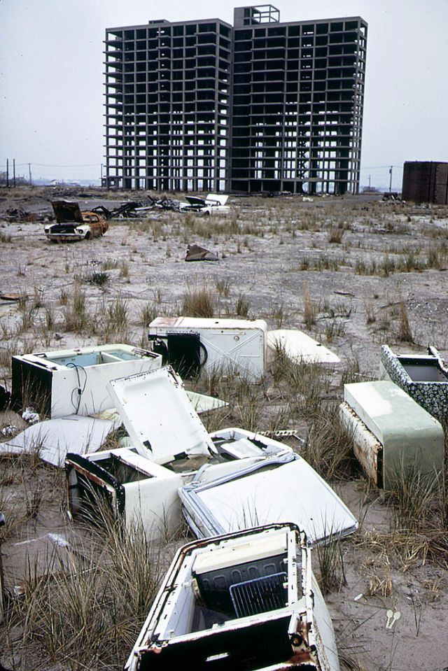
Skeleton of apartment building never completed, abandoned refrigerators and a burned out 1965 Ford Mustang, Breezy Point, Queens looking toward Brooklyn, 1973

Underground, New York’s subway system was in equally rough shape. By March 1973, graffiti covered virtually every surface inside the cars. Tags and murals sprawled across windows, doors, walls, and ceilings. The graffiti wasn’t just cosmetic — it was a symptom of the broader breakdown in city services. Maintenance had been cut, oversight had failed, and the subway had become a symbol of municipal dysfunction.
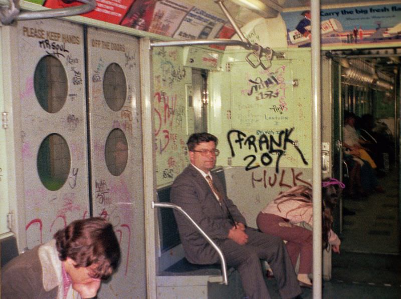
Subway 1973-style with graffiti, March 1973
A forlorn old industrial neighborhood in Brooklyn, 1974

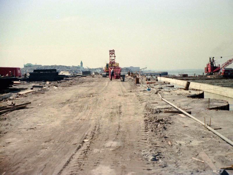
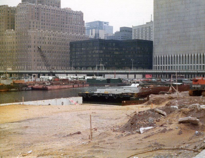
One of the most unusual construction projects of the era was Battery Park City. The land it sits on today didn’t exist in nature — it was created using soil and fill excavated from the World Trade Center construction site. Throughout the early-to-mid 1970s, Documerica photographers captured the slow transformation of that stretch of the Hudson shoreline from raw landfill and mud into something resembling usable ground. It was a massive, slow, and unglamorous process.
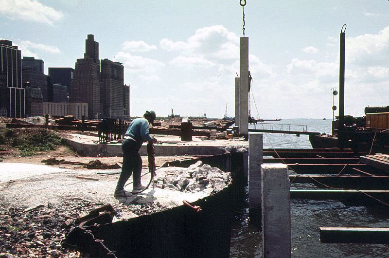
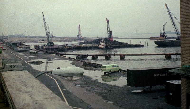
Battery Park City being built using land excavated from the World Trade Center construction site across West Street,April 1974
Battery Park City being created from soil dug out to build the World Trade Center, Statue of Liberty in the distance,March 1974
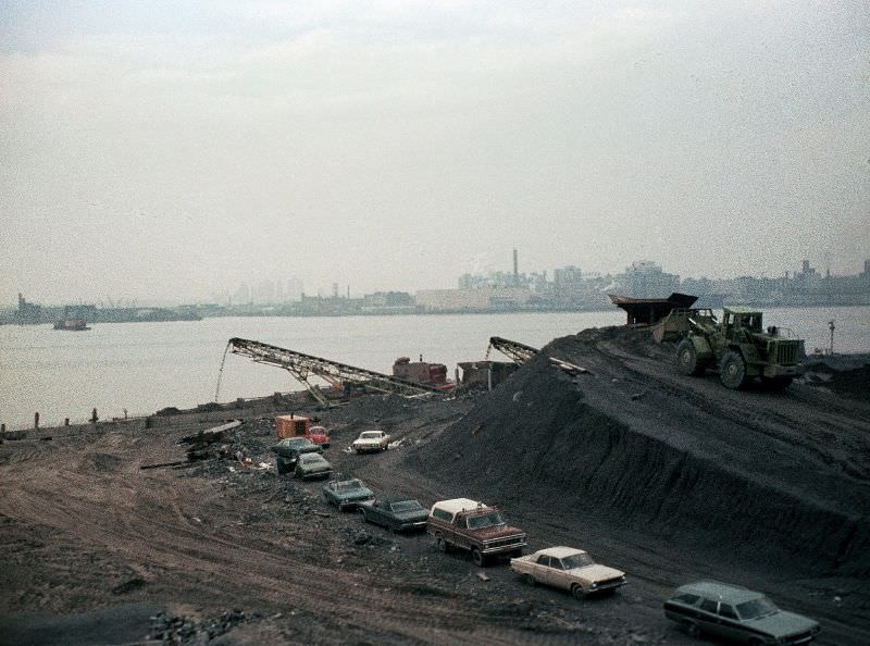
Battery Park City landfill edge by Hudson being constructed looking south to Pier A, 1974
Battery Park City landfill, NY Telephone Company, abandoned West Side Highway and the World Trade Center, 1974

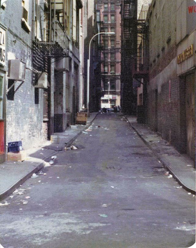
The streets of Lower Manhattan away from the waterfront were not much tidier. Theatre Alley, running off Ann Street and recognized as the narrowest street in Manhattan, was filled with litter and trash in March 1974. Nearby on Reade Street, cardboard boxes and commercial debris lined the sidewalks. These weren’t alleyways behind restaurants — they were public streets in the heart of the financial district.
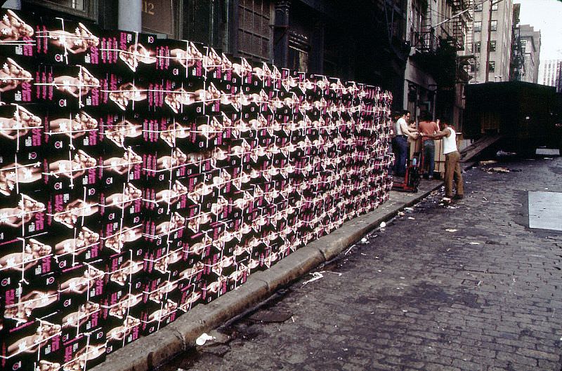
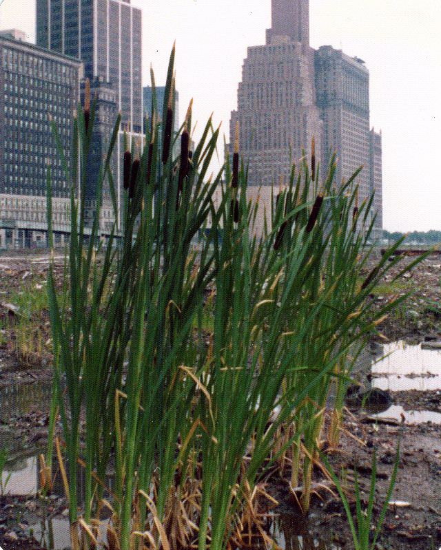
Boxes of Adam and Eve products on Reade Street looking east from West Broadway, New York, July 1974
The Battery Park City landfill muck, New York, June 1974
The hulking West Side Highway closed and abandoned, New York, June 1974
Theatre Alley downtown off Ann Street, the narrowest street in Manhattan, filled with the litter and trash, March 1974
World Trade Center (the dark building at Vesey and West St) from Battery Park City landfill, the West Side Highway crosses the whole view, April 1974

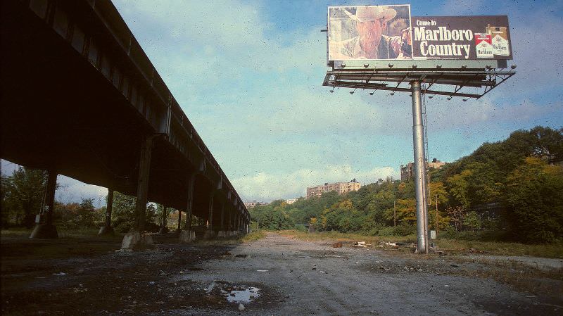
By 1975, the abandoned West Side Highway had become a landmark of neglect. Photographers documented it from multiple angles — from street level, from Pier A’s fire escape, and from the 58th floor of the World Trade Center. The views showed the highway cutting through a landscape of landfill, mud, and fog. A Marlboro billboard planted beneath the elevated structure at 150th Street carried a grim irony: ‘Welcome to Marlboro Country,’ it read, positioned in one of the most polluted corridors in the city.
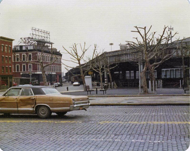
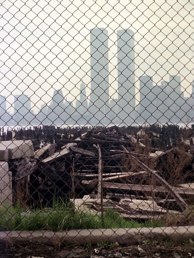
23rd St and abandoned West Side Highway, a battered Ford Galaxy 500 drives by on cobblestones, April 1975
Abandoned piers at Exchange Place in Jersey City and the World Trade Center across the Hudson in Lower Manhattan, April 1975
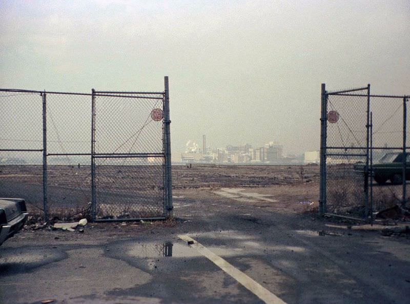
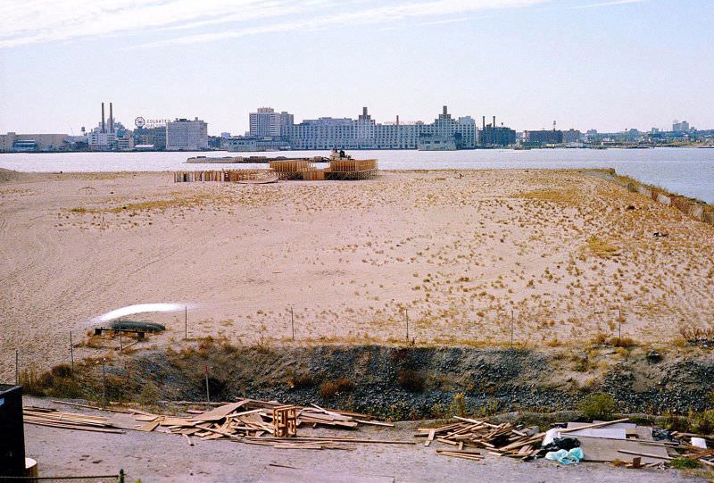
Battery Park City was just a lot of mud with a great view to the industrial skyline of Jersey City and the Colgate Clock, right across West Street from the World Trade Center, April 1975
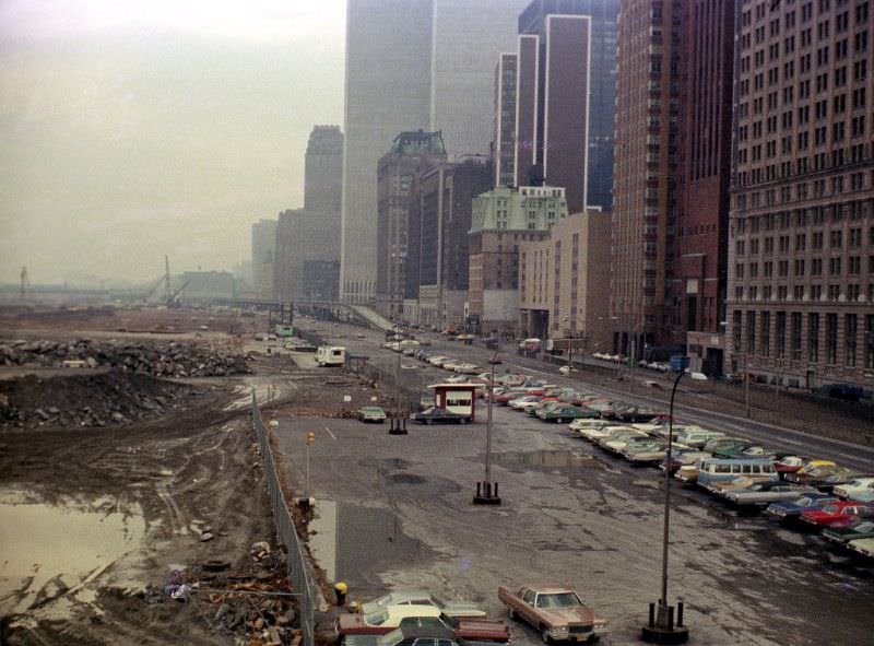
View from Pier A's fire escape, Battery Park City landfill, West Side Highway, World Trade Center and lots of colorful 1970s cars on a rainy, foggy day, 1975
View from Pier A’s fire escape, Battery Park City landfill, West Side Highway, World Trade Center and lots of colorful 1970s cars on a rainy, foggy day, 1975
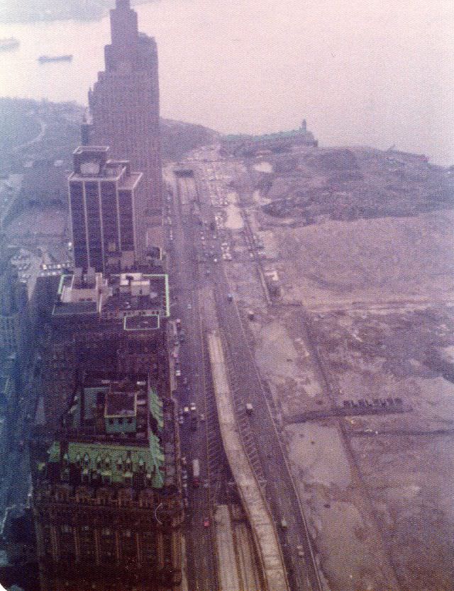
View from the 58th floor of the World Trade Center to the Battery Park City landfill, Pier A, end of the West Side Highway and New York Harbor on a foggy afternoon, March 1975
Where the beautiful Battery Park City esplanade along the Hudson is now, June 1975
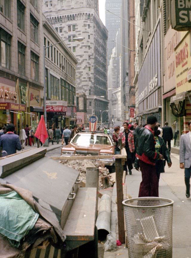
Nassau Street looking toward Wall Street, Lower Manhattan, 1976
The swampy fields of future Battery Park City, The World Trade Center hovers, New York, August 1976
The abandoned West Side Highway looking out at the completed Battery Park City landfill, New York, April 1978
Welcome to Marlboro Country' sign under the West Side Highway by 150th Street, New York, September 1979
Welcome to Marlboro Country’ sign under the West Side Highway by 150th Street, New York, September 1979

Despite the decay that surrounded them, New York’s residents continued their daily lives. The Documerica project didn’t only photograph pollution and ruin — it also captured people going about their summers in Brooklyn and Manhattan. At the Kosciusko public swimming pool in Bedford-Stuyvesant, crowds packed in on the July 4th holiday. East River Park drew families on hot summer afternoons. Children played at the beach in Reis Park. These images sit alongside the decay photos in the same archive, and together they paint a fuller picture of what city life actually looked like.
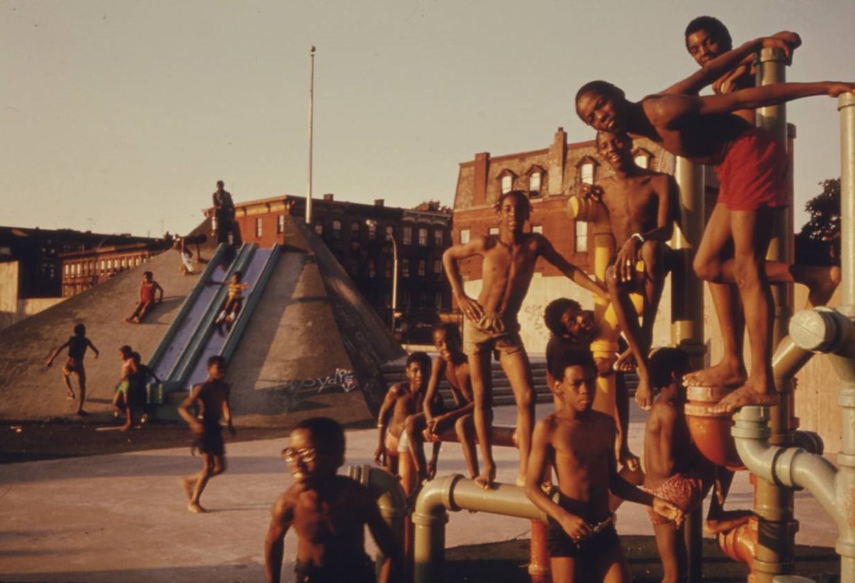
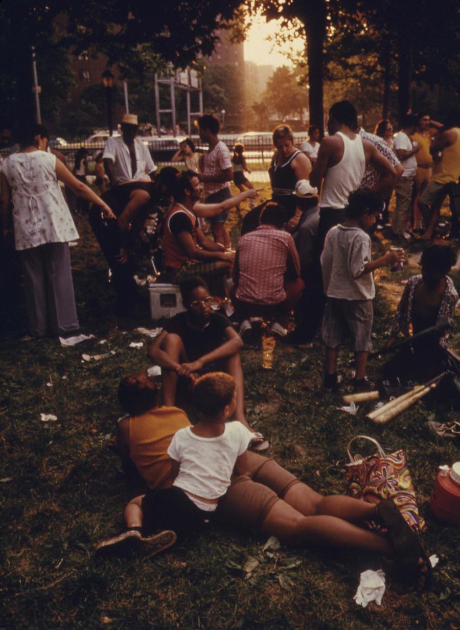
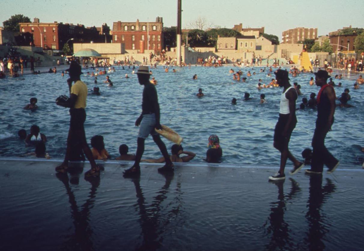
July 4th Holiday at the Kosciusko Swimming Pool in Brooklyn's Bedford-Stuyvesant District, July 1974.
July 4th Holiday at the Kosciusko Swimming Pool in Brooklyn’s Bedford-Stuyvesant District, July 1974.
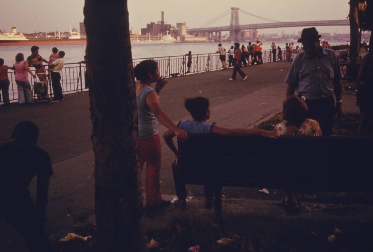
East River Park in Manhattan, July 1974.
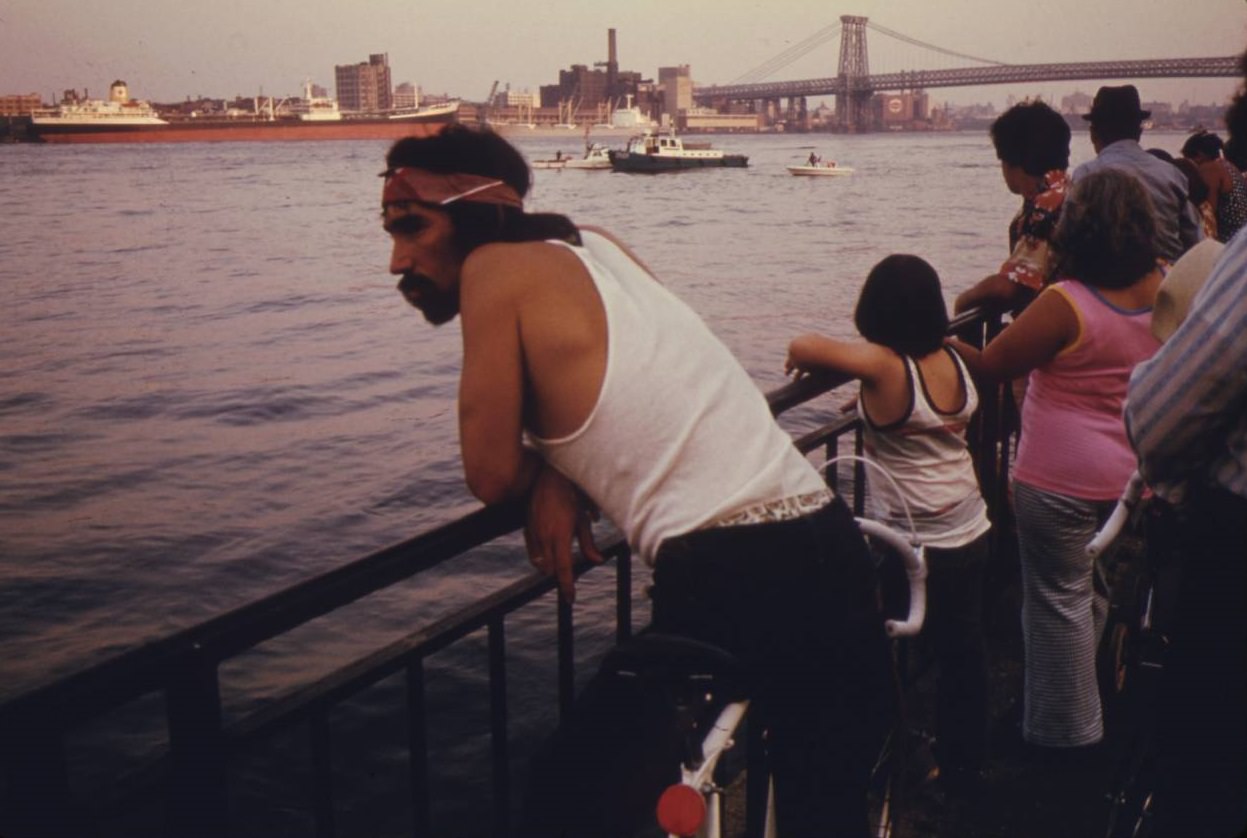
People looking at boat traffic on the East River with the Manhattan Bridge and NYC in the background, July 1974.
Lynch Park, Brooklyn, NYC, June 1974.
Manhattan Bridge tower in Brooklyn, June 1974.
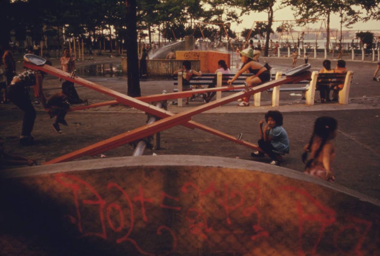
Playground in East River Park in Manhattan, July 1974.
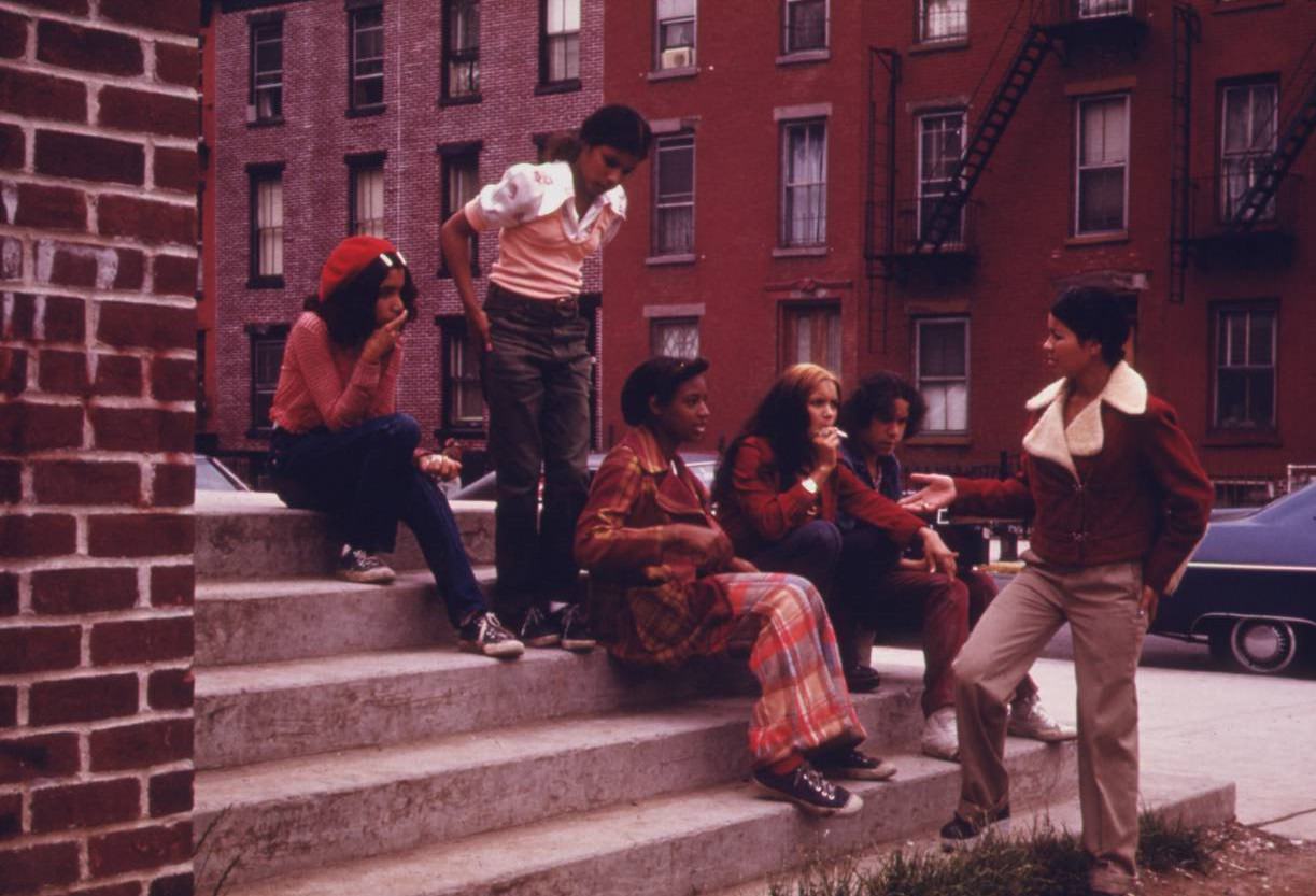
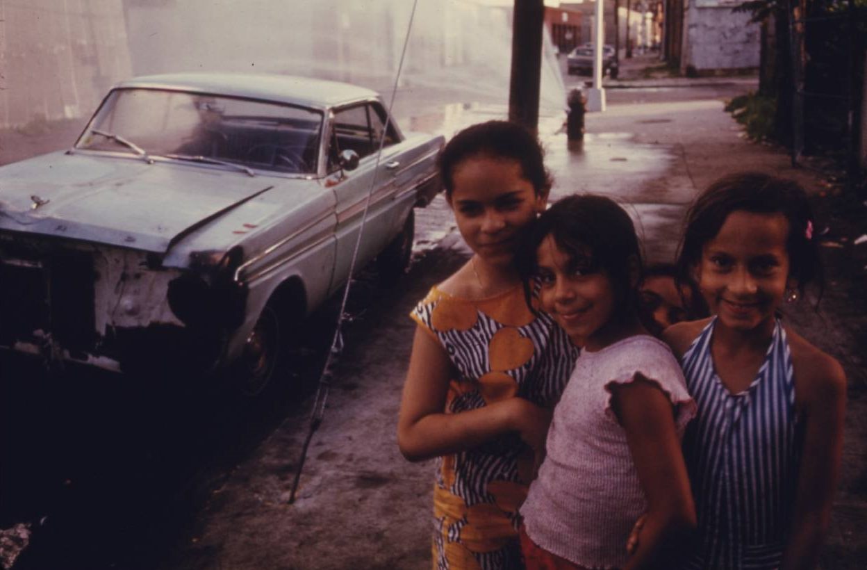
Three young girls in Brooklyn, July 1974.
The Kosciusko public swimming pool, Bedford-Stuyvesant district of Brooklyn, July 1974
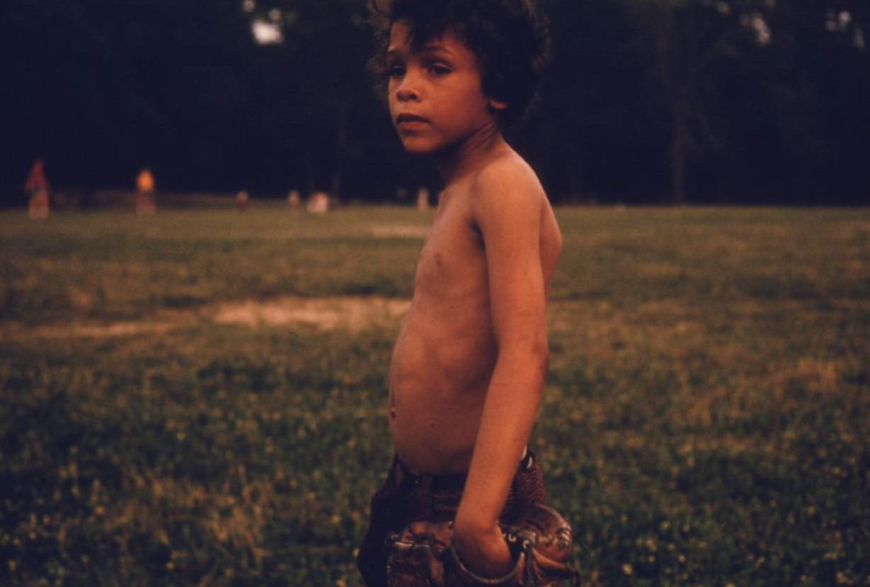
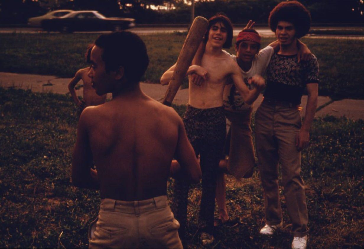
Puerto-Rican boy playing softball in Brooklyn's Hiland Park, July 1974.
Puerto-Rican boy playing softball in Brooklyn’s Hiland Park, July 1974.
East River Park in Manhattan, July 1974.
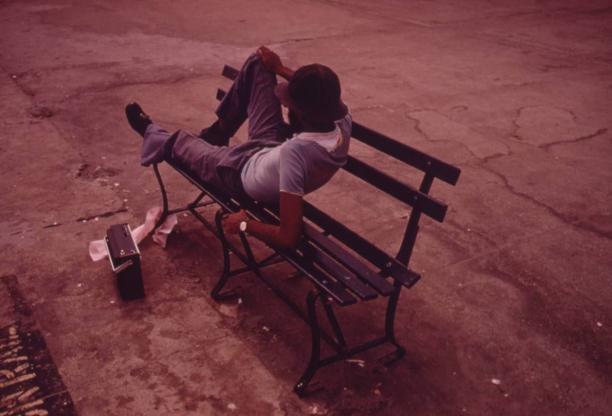
Man lounging on a park bench with his radio on the Reis Park boardwalk in NYC, July 1974.
Lynch Park in Brooklyn, June 1974.
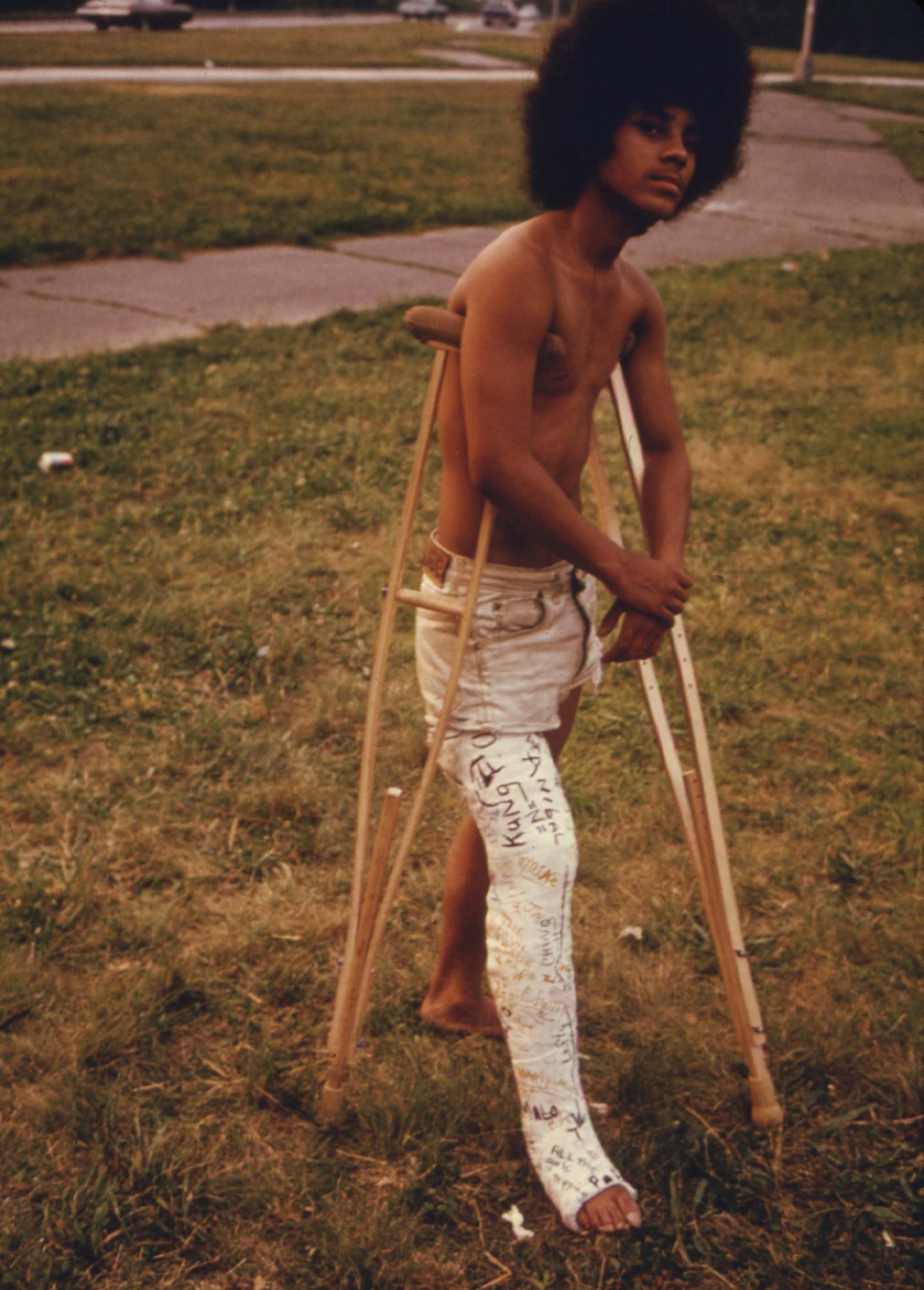
Young Man with His Leg in a Cast in Hiland Park of Brooklyn, July 1974.
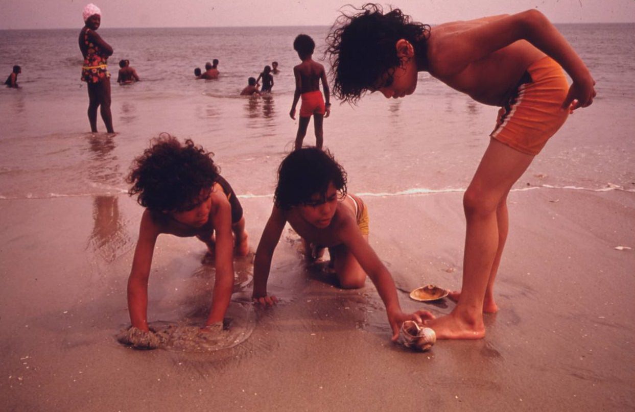
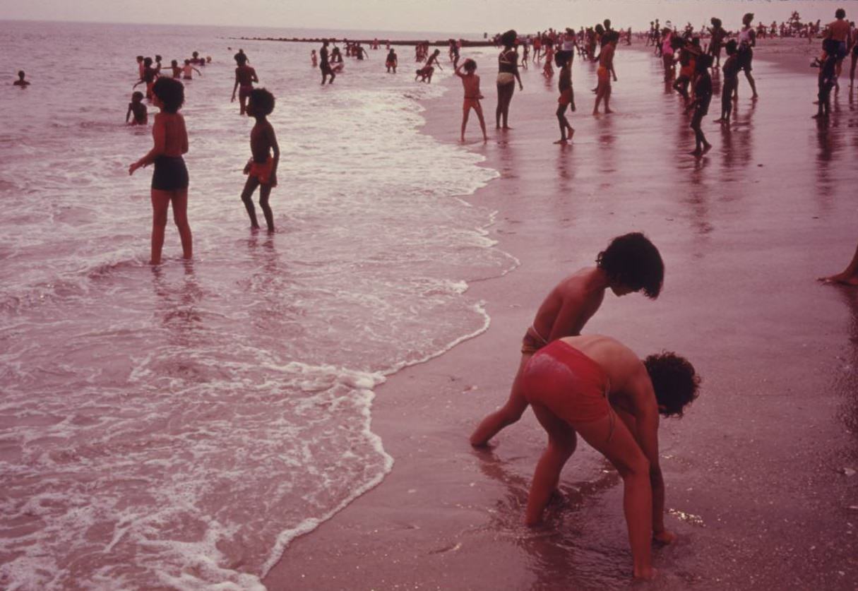
Children at the beach in Reis Park, Brooklyn, July 1974.

Brooklyn’s neighborhoods showed the full range of what the city had become. Some blocks, like those in Park Slope, retained their handsome brownstone rows. Others, like industrial stretches in Bushwick, were defined by elevated train tracks, cracked pavement, and storefronts barely hanging on. The Bedford-Stuyvesant district had its own community energy — boy scout leaders recruited among local youth, kids played softball in Hiland Park — but the physical environment around them was hard-worn.
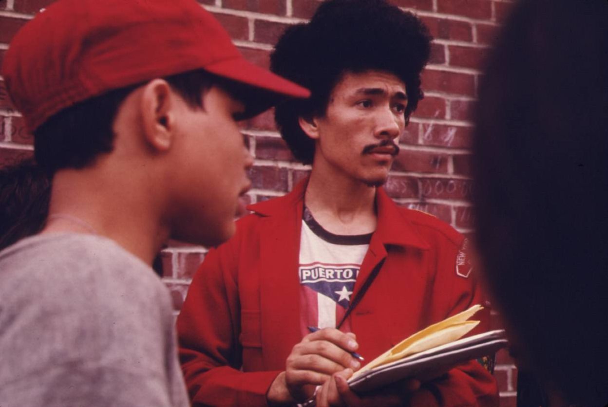
Boy scout leader recruiting among Latin Youths Bedford Stuyvesant district of Brooklyn, June 1974.
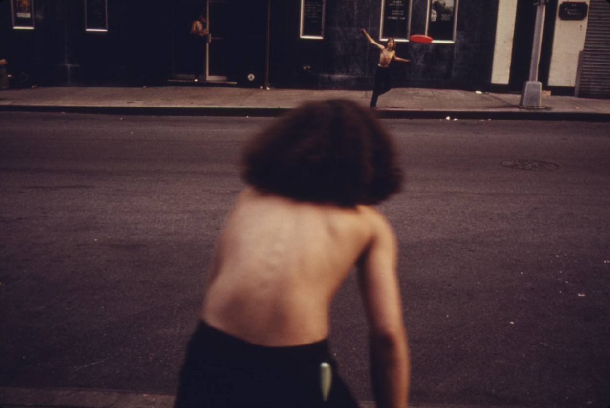
Boys playing frisbee across West 46th Street in Manhattan, July 1974.
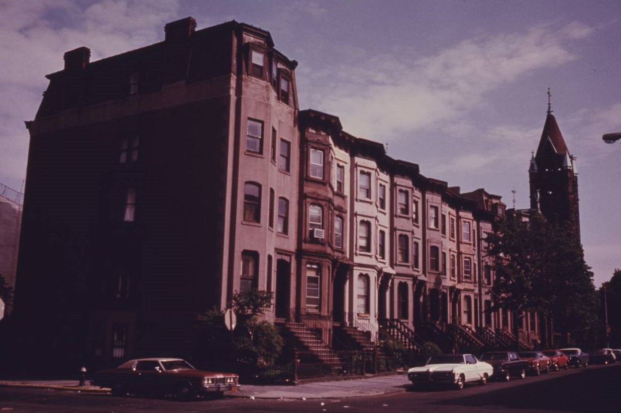
Block of brownstone residences in Park Slope of Brooklyn, June 1974.
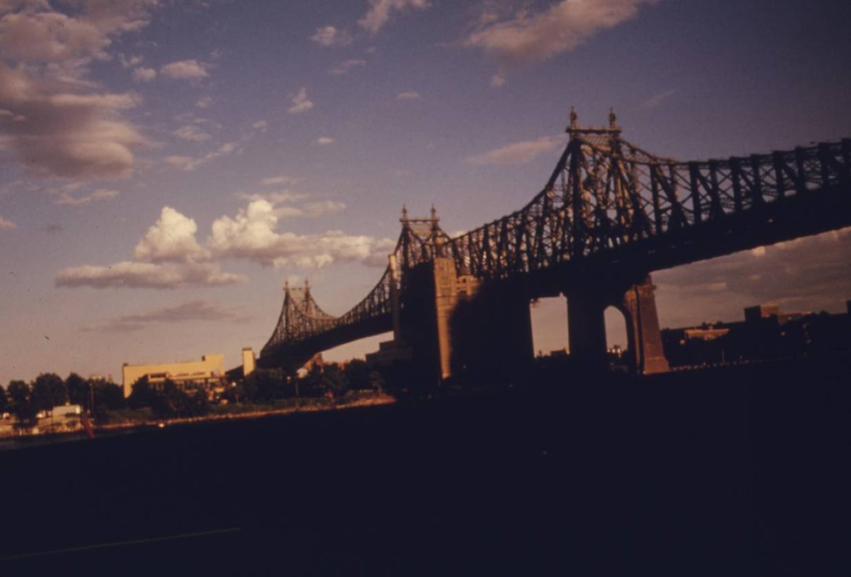
59th Street Bridge seen from the east side drive, Manhattan, August 1974.
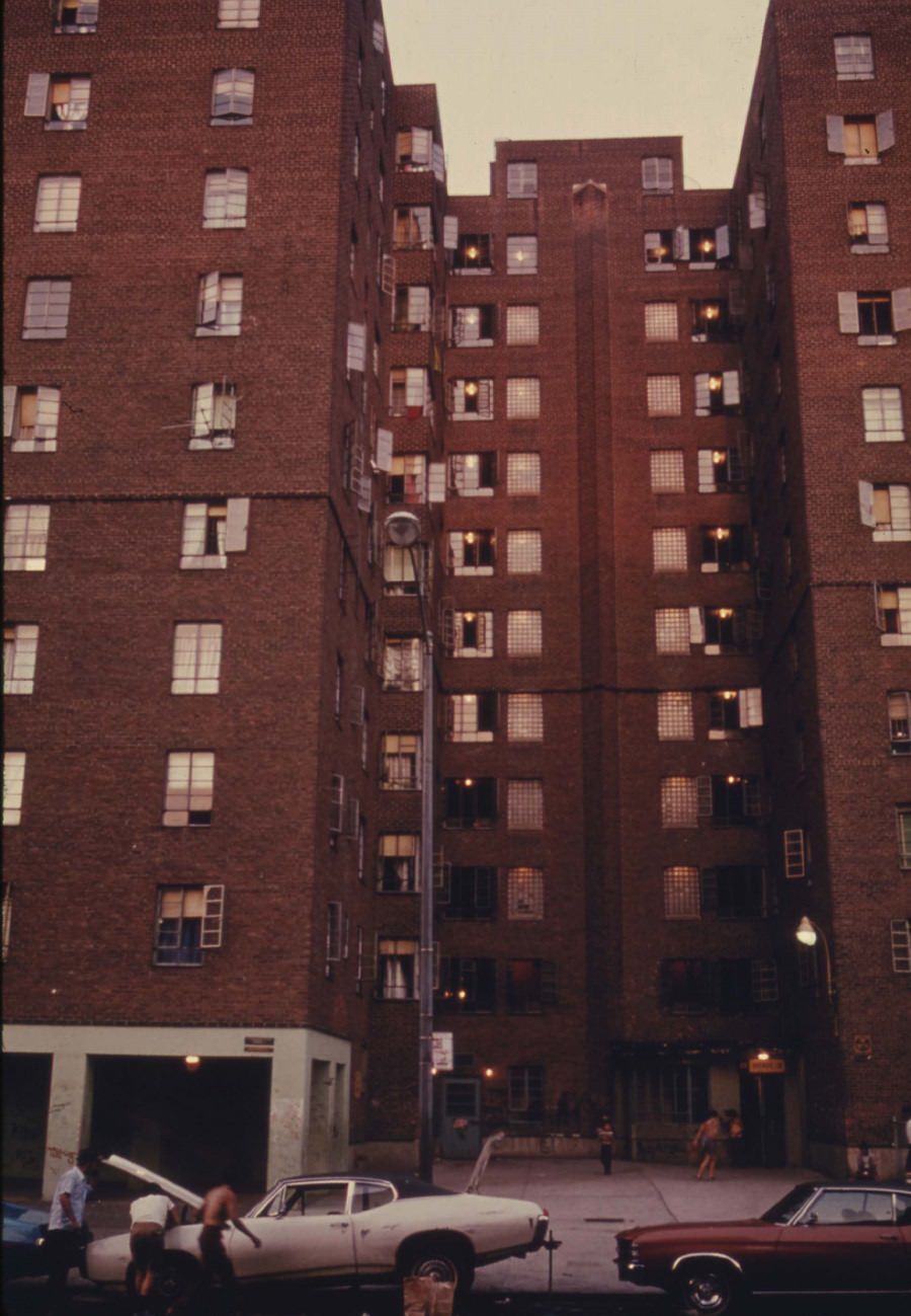
Avenue D housing project on the Lower East side of Manhattan, June 1974.
Children at the beach in Reis Park, Brooklyn, July 1974.
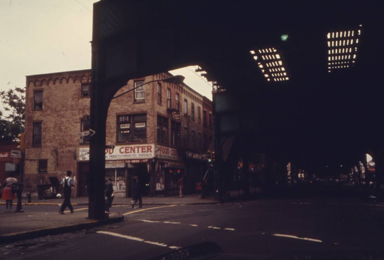
Elevated train tracks at Bushwick Avenue in Brooklyn, NYC, June 1974.
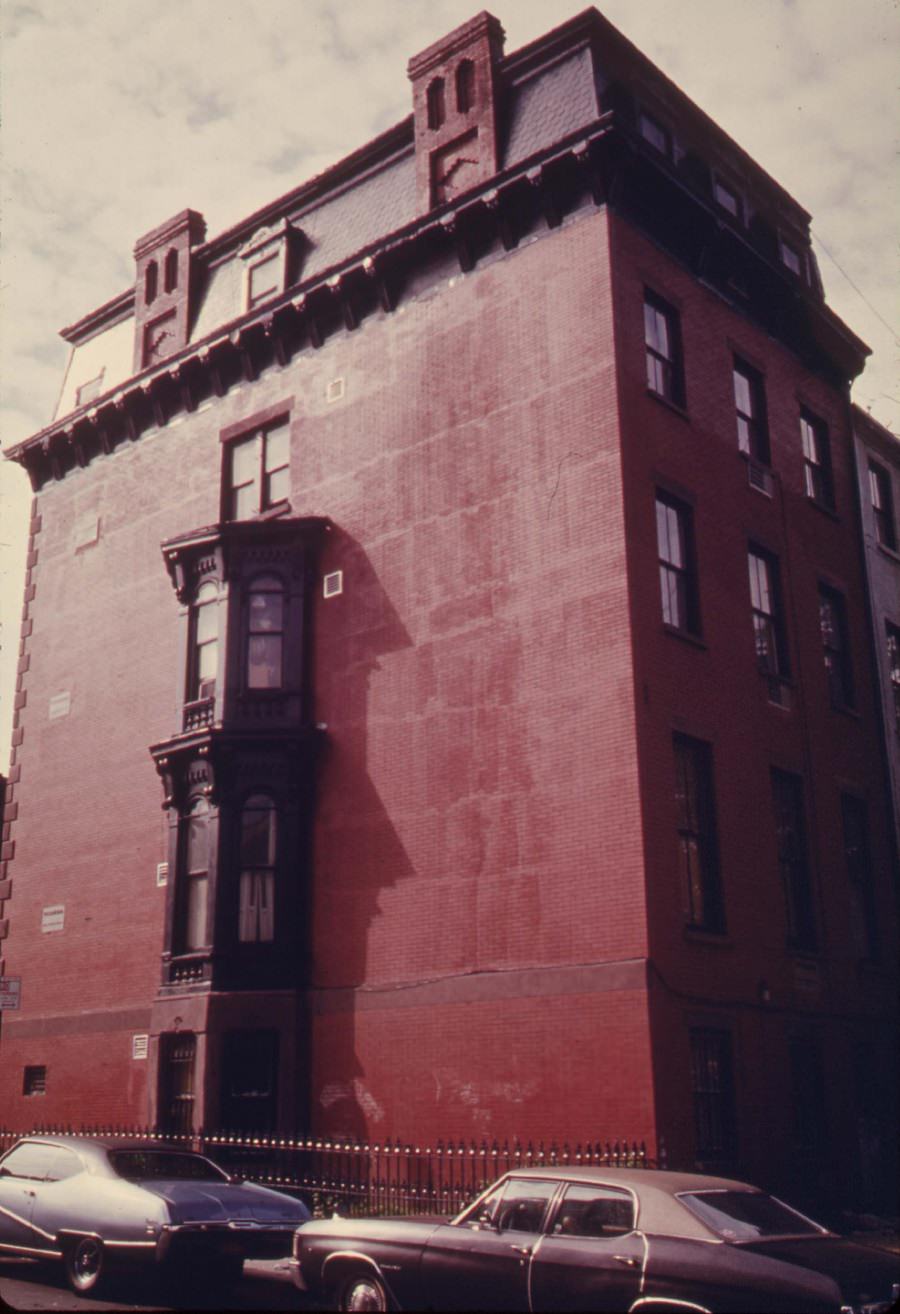
House in Park Slope, Brooklyn, June 1974.

Hell’s Kitchen on Manhattan’s west side was another neighborhood the photographers spent time in. It was a dense, working-class district where residents made the most of tight spaces. Men worked on their cars in the street. Kids played on sidewalks. The neighborhood had a gritty, lived-in character that the photos captured without any attempt to glamorize it. What you see in those images is exactly what was there.
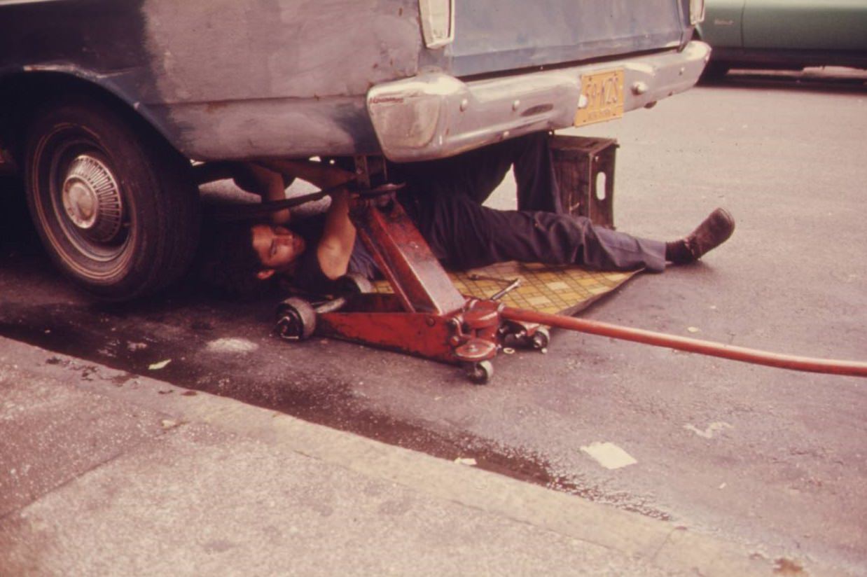
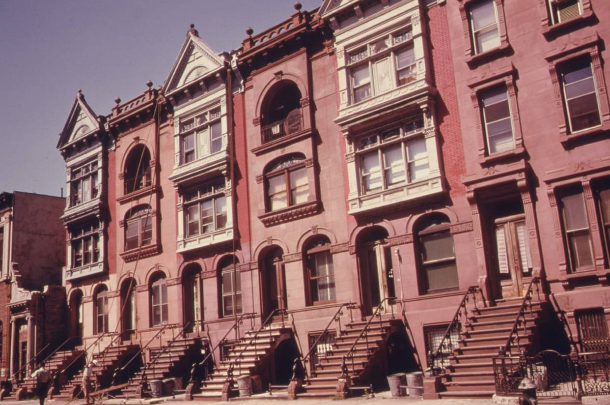
Man working on his car in Hell's Kitchen, NYC, June 1974.
Man working on his car in Hell’s Kitchen, NYC, June 1974.
Turn of the century brownstone apartments being gentrified, Brooklyn, July 1974.
Hell's Kitchen, Manhattan, July 1974.
Hell’s Kitchen, Manhattan, July 1974.
Three young girls on Bond Street, Brooklyn, July 1974.
Puerto-Rican boys playing softball in Brooklyn's Hiland Park, July 1974.
Puerto-Rican boys playing softball in Brooklyn’s Hiland Park, July 1974.

The Documerica archive holds thousands of images from across the United States, but the New York photographs carry a particular weight. They document a city that was fiscally strained, environmentally battered, and physically neglected — yet still very much alive. The photographers recorded it all without flinching: the soot, the rust, the mud, the graffiti, and the people living through all of it.
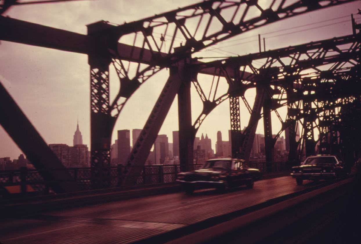

Williamsburg Bridge facing towards Manhattan, July 1974.
Enjoyed this post? Get new ones in your inbox.

1 thought on “Dirty and Polluted New York City in the 1970s: Vintage Photos Show the Another Side of NYC Before the Great Clean-up Began”

Leave a Comment

Your email address will not be published. Required fields are marked *

Share this Post 🥺

Please take a moment to share this content. Your support is greatly appreciated! 🙌🙏

Share this Post 🥺

Please take a moment to share this content. Your support is greatly appreciated! 🙌🙏
Scroll to Top
 
Hey Friend, Before You Go.. Please like & follow for more interesting content