
In the 1860s, Oakland was a city in motion. What had been a modest unincorporated community named for its sprawling native oak trees was transforming at a remarkable pace. By 1860, the town already had a post office, a sawmill, a sugar mill, and several other working enterprises. But the decade ahead would bring changes far bigger than anything seen before. The arrival of the railroad, the growth of schools and churches, and the rapid expansion of the street grid all reshaped the city block by block. The photographs collected here capture that transformation in extraordinary detail — street-level views, waterfront scenes, private residences, and public landmarks, all frozen in the years between 1860 and 1869.
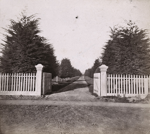
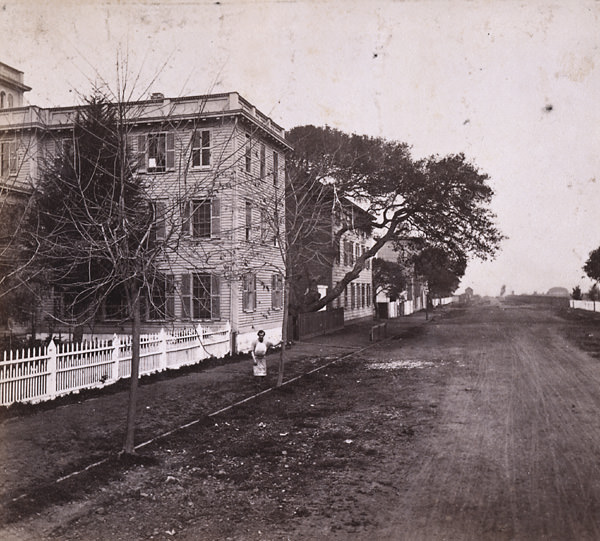
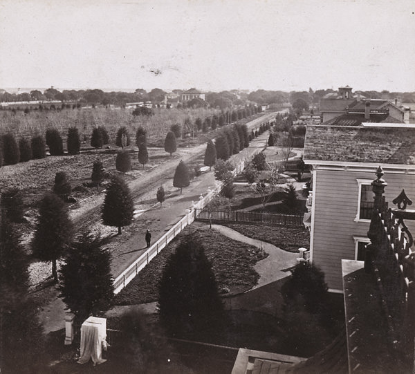
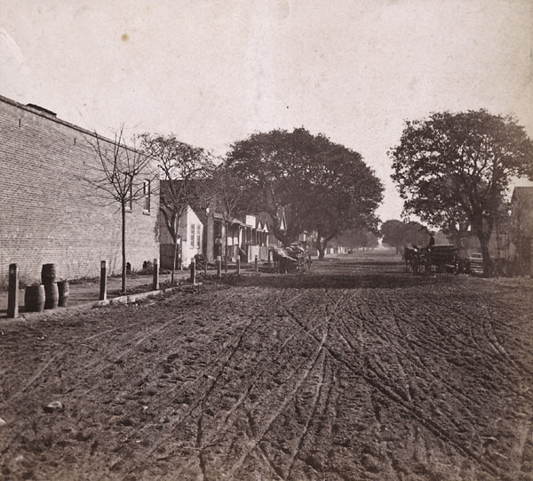
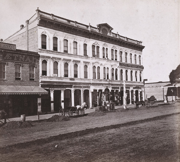
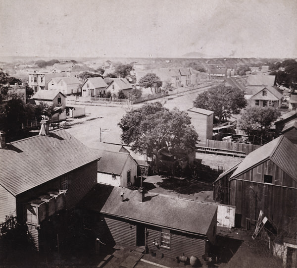
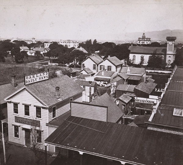
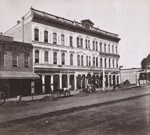
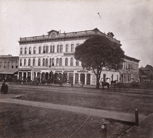
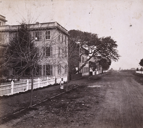
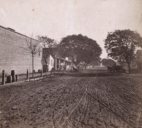
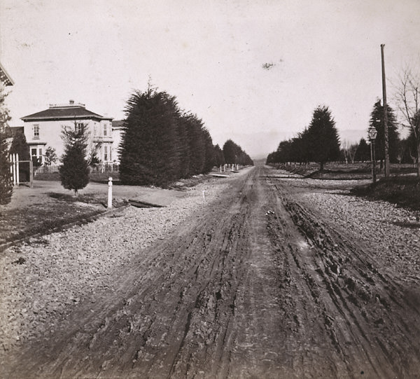
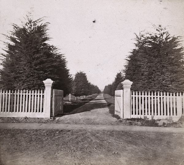
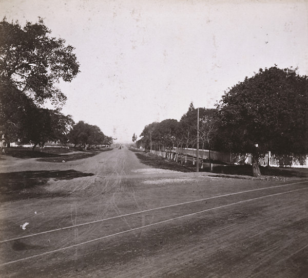
Oakland’s street life in the early 1860s was already taking on a recognizable urban shape. Broadway served as the city’s main artery, and the blocks fanning out from it — Julia, Jackson, Harrison, and Castro Streets — were filling in steadily with homes, businesses, and civic buildings. The shots taken from 12th Street looking north give a clear sense of how orderly and deliberate that growth was. Wide dirt roads lined with young trees and wooden structures defined the residential neighborhoods, while commercial blocks clustered closer to Broadway and the waterfront.
Education was a visible priority in early Oakland. Mrs. Blake’s Female Seminary on Washington Street between 11th and 12th was one of the earliest private schools in the city, offering formal instruction to young women at a time when such institutions were rare in the American West. Not far away, the Pacific Female College and Oakland College both stood along 12th Street, giving the corridor an academic identity that set it apart from the commercial center closer to the bay.
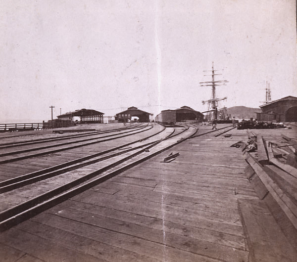
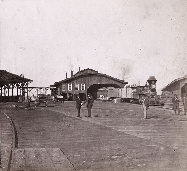
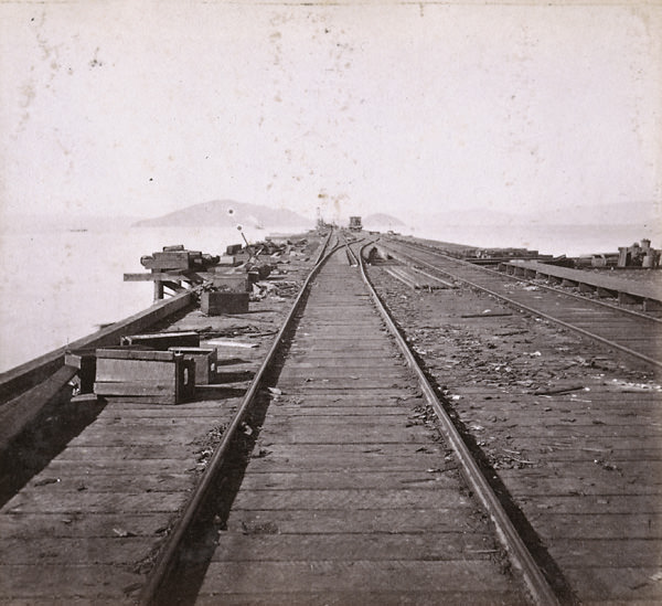
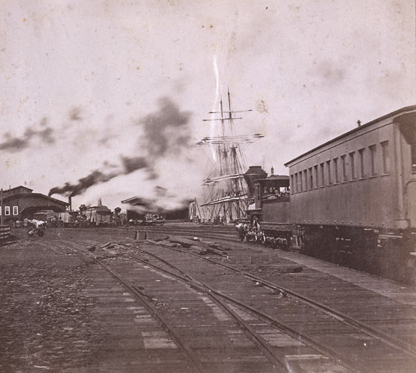
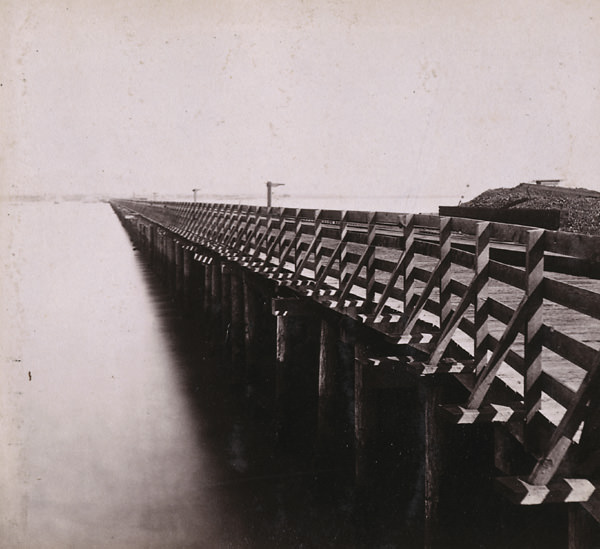
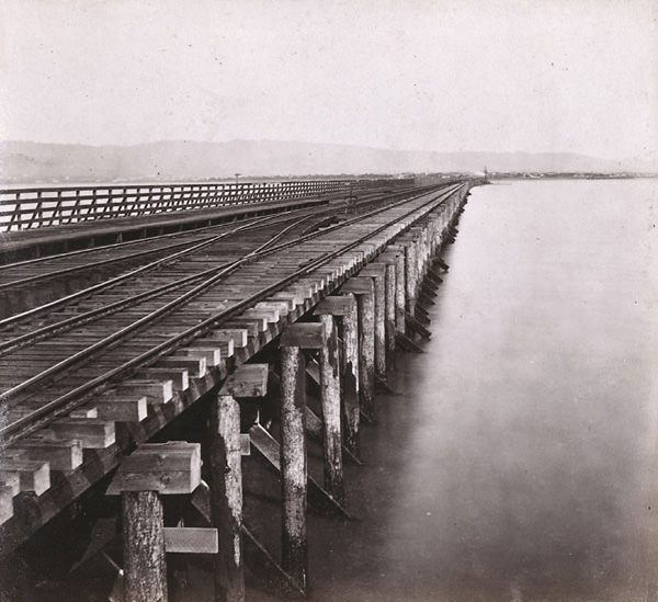
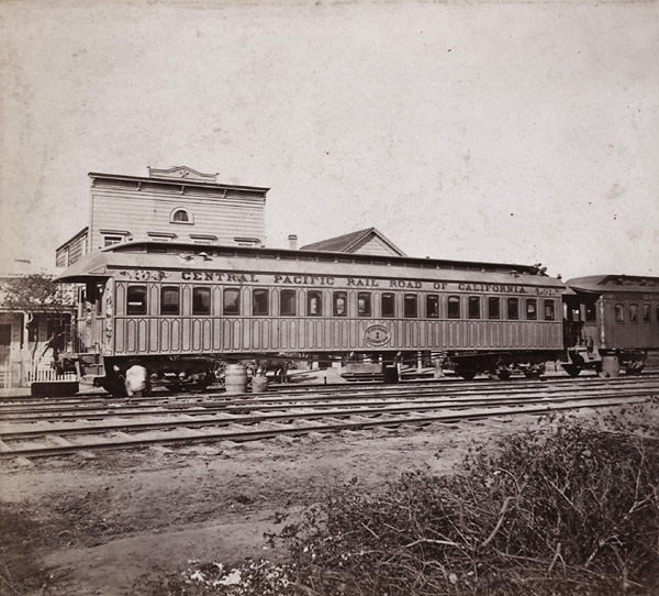
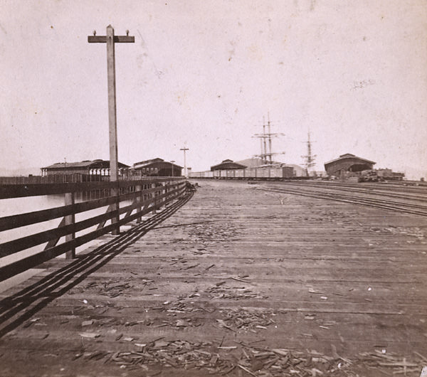
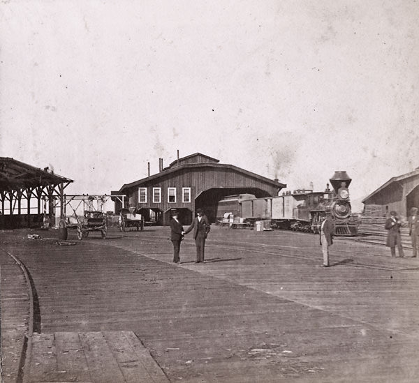
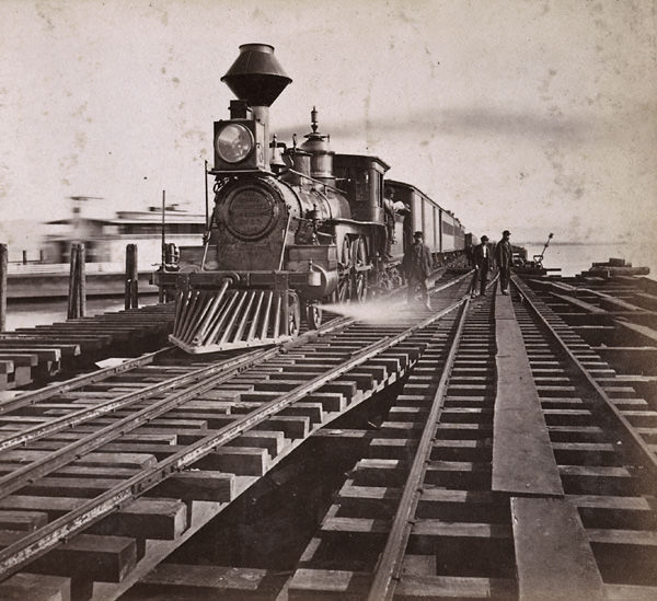
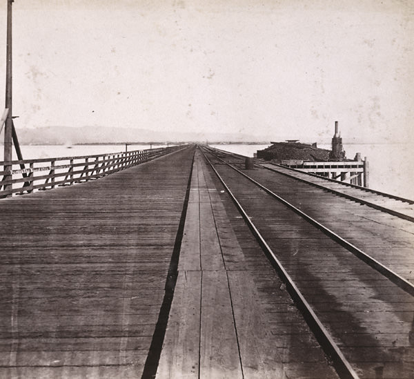
No single development defined Oakland’s 1860s more than the railroad. The Central Pacific Railroad established its western terminus on Third Street near Broadway, making Oakland the endpoint of the entire Transcontinental Railroad system. The Oakland Long Wharf at Oakland Point extended far into San Francisco Bay, allowing trains to roll directly to the water’s edge where passengers and freight transferred onto ferries bound for San Francisco. That connection — rail to ferry to city — made Oakland an essential link in California’s transportation network.
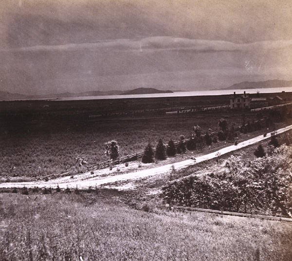
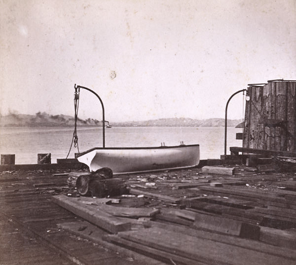
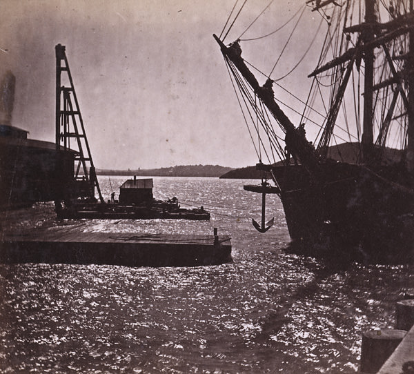
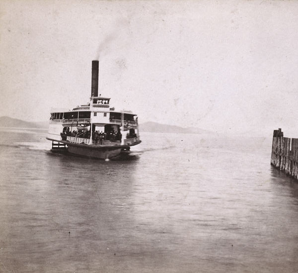
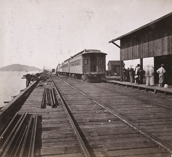
The wharf itself was a busy and photogenic place. Trains of cars lined the pier, ferry steamers pulled into the slip, and the skyline of San Francisco shimmered across the bay in the distance. Photographers of the era returned to Oakland Wharf repeatedly, capturing arrivals and departures from multiple angles — looking toward the city, looking toward Goat Island, and looking back toward Oakland from the end of the pier. These images document not just infrastructure, but the constant movement of people and goods that kept the waterfront alive.
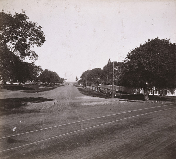
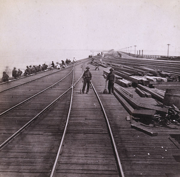
Beyond the wharf, Oakland’s road network stretched outward in several directions. San Pablo Road and Telegraph Road branched off from a common junction north of the city center, connecting Oakland to the wider East Bay. These routes were not yet paved — packed earth and wooden planking served most travelers — but they were well-traveled enough to warrant documentation. The junction photos from 1860 and 1861 show open, sun-bleached landscapes with only modest structures breaking the horizon, a stark contrast to the denser blocks closer to Broadway.
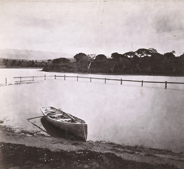
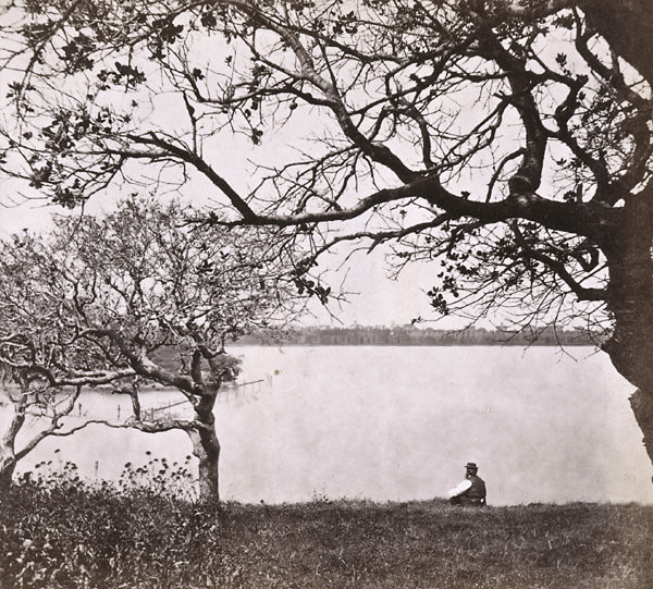
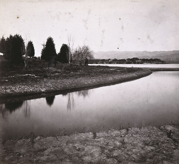
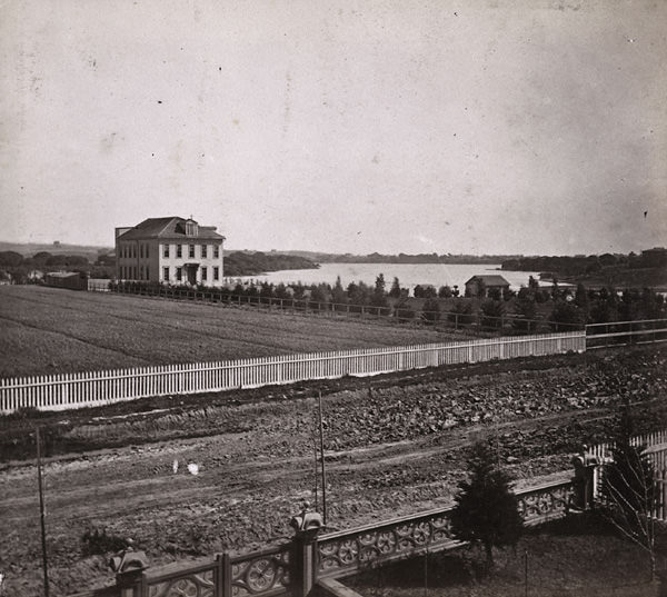
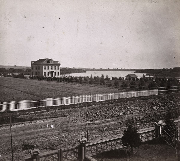
Lake Merritt was another defining feature of the city’s geography. In the 1860s it was still a tidal estuary connected to San Francisco Bay, fed by salt water and surrounded by marshland. Dr. Samuel Merritt, a prominent Oakland physician and later mayor, owned land along its banks and lent his name to the lake. Views from the eastern shore, western shore, and Jackson Street near his grounds all appeared in photographers’ catalogs during this period, reflecting both the lake’s natural beauty and its growing status as a social and civic landmark.
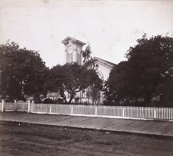
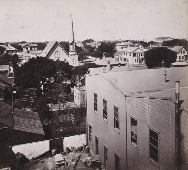
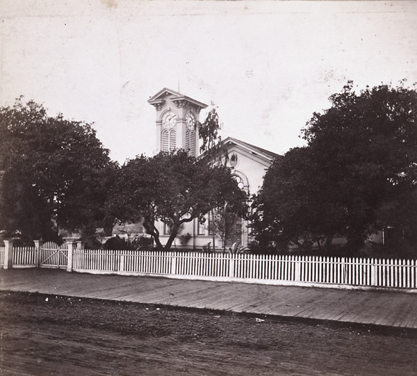
The Convent of the Sacred Heart overlooked Lake Merritt from a commanding position, and photos taken in 1861 and 1867 both show the building in relation to the water below. Religious institutions played a central role in Oakland’s civic life during this period, and the Congregational Church on Broadway was among the most prominent. Photographed in both 1860 and 1867, the church stood as one of the most recognizable structures in the downtown area.
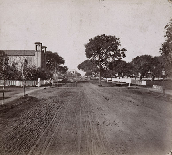
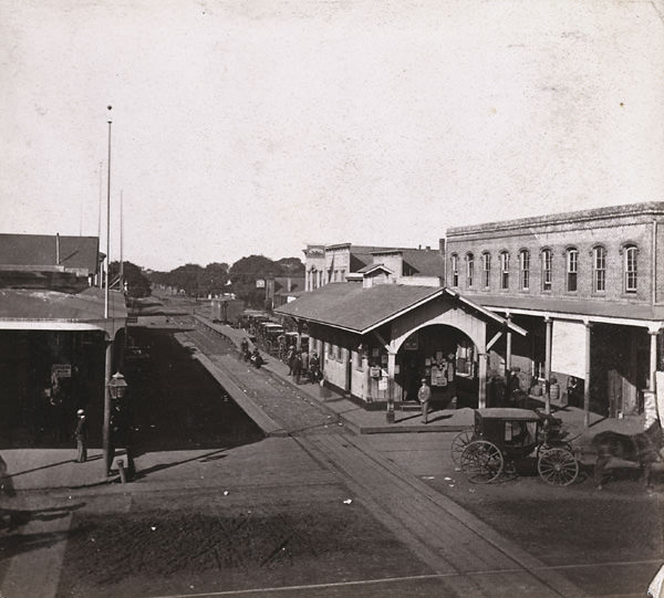
The year 1862 was particularly well-documented in the photographic record. Street scenes along Jackson, Julia, and 12th Streets from that year show a city that was building outward from a well-established core. Private residences with tidy yards and wooden fences lined the side streets, while Broadway and 12th Street had already taken on a more commercial and institutional character. The Broadway Railroad Station appeared in photographs from 1862 and again in 1867, marking it as a consistent point of activity and public interest.
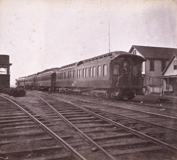
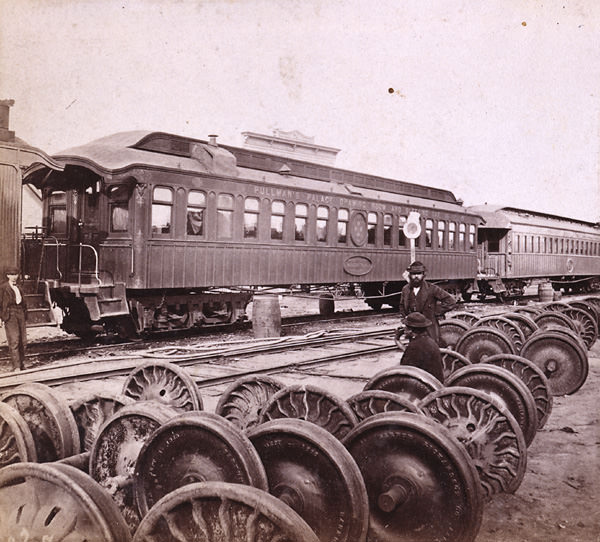
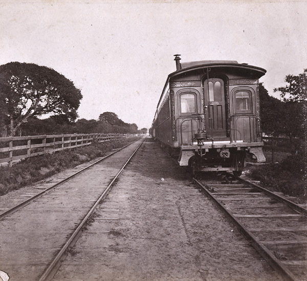
One of the most significant milestones of the decade came in 1869, when the Transcontinental Railroad was completed and Oakland Point became the official western terminus. The first terminus sat at the foot of Pacific Avenue, and photographs from both 1868 and 1869 document this historic site. Pullman’s Palace Cars — the luxury sleeping cars that made long-distance rail travel comfortable for wealthy passengers — were photographed at Oakland Point in 1869, marking the arrival of a new era in American travel.
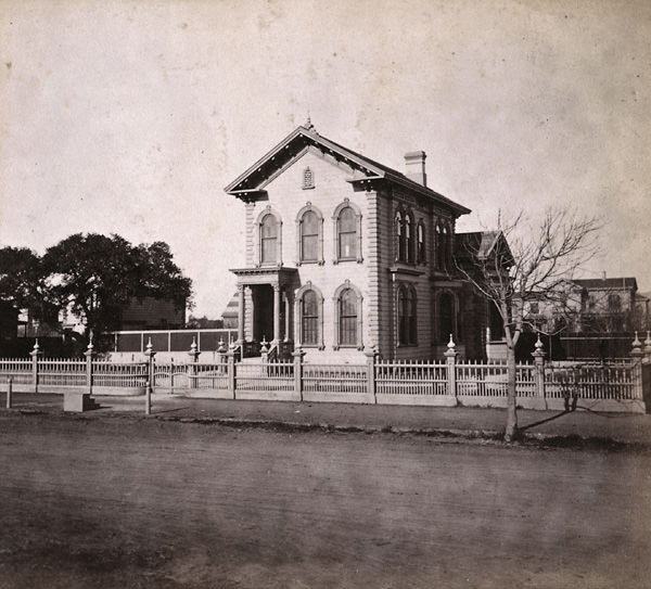
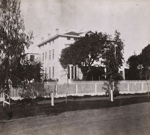
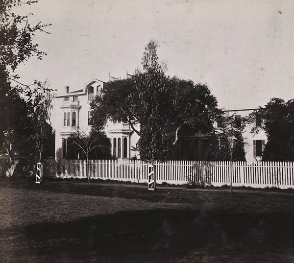
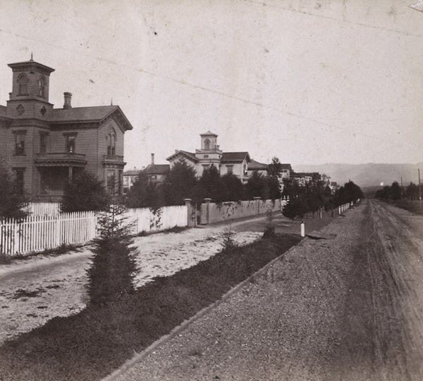
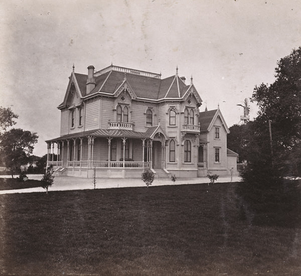
Alongside the grand civic and commercial buildings, photographers also documented the homes of Oakland’s middle and upper-class residents. Houses at the corners of Castro and 12th Streets and at 13th and Castro Streets appeared in 1862 photographs, showing the comfortable wooden homes that defined the residential neighborhoods of the era. The residence of G. W. Dam on Webster Street and the home of John Wedderspoon on Myrtle Street were also captured, providing a portrait of private life in 1860s Oakland.
The Wilcox Block on Broadway was one of the most photographed commercial buildings of the decade. Images taken from its rooftop offered sweeping panoramic views of Oakland looking north, south, east, west, and northeast — a series of vantage points that together constitute one of the most comprehensive visual records of any mid-19th-century American city. The earliest of these panoramas dates to 1861, and they continued through 1868, creating a remarkable year-by-year record of the city’s expansion.
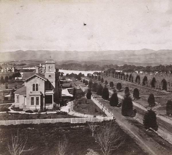
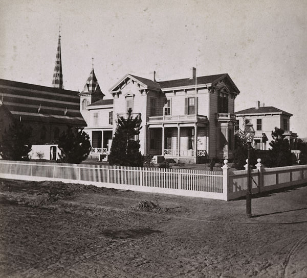
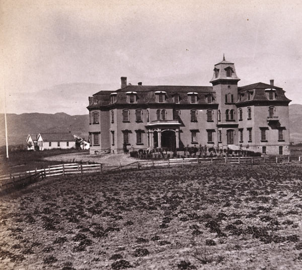
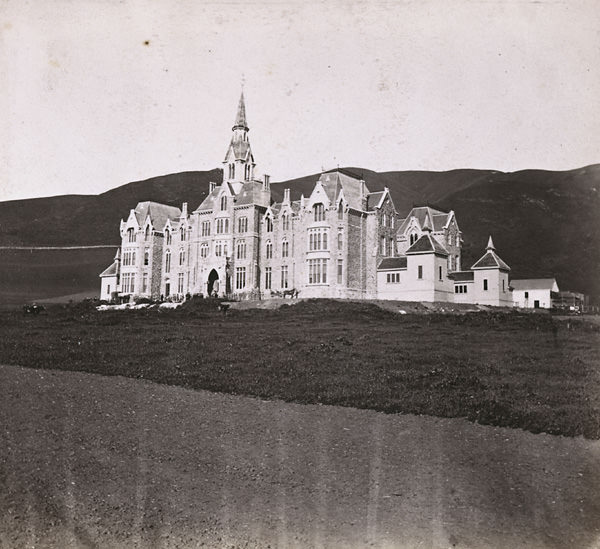
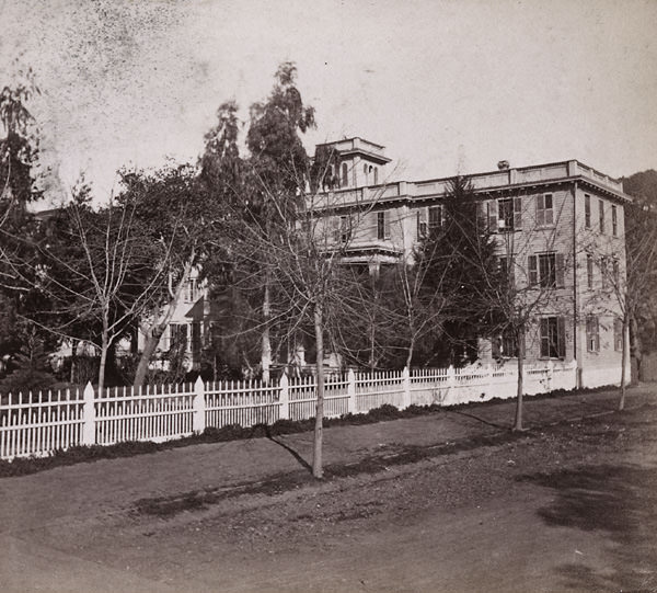
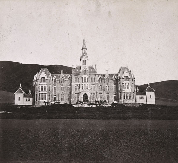
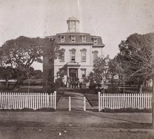
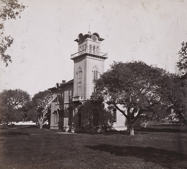
The Deaf, Dumb and Blind Asylum was another significant Oakland institution captured in photographs from 1863 and the broader 1860s period. The building was shown from both the front and south side, presenting a large and well-constructed facility that spoke to Oakland’s ambitions as a city capable of hosting major public institutions. The Oakland Military Academy, photographed in 1864 under the direction of Rev. D. McClure, was another institution that added to the city’s educational and civic infrastructure.
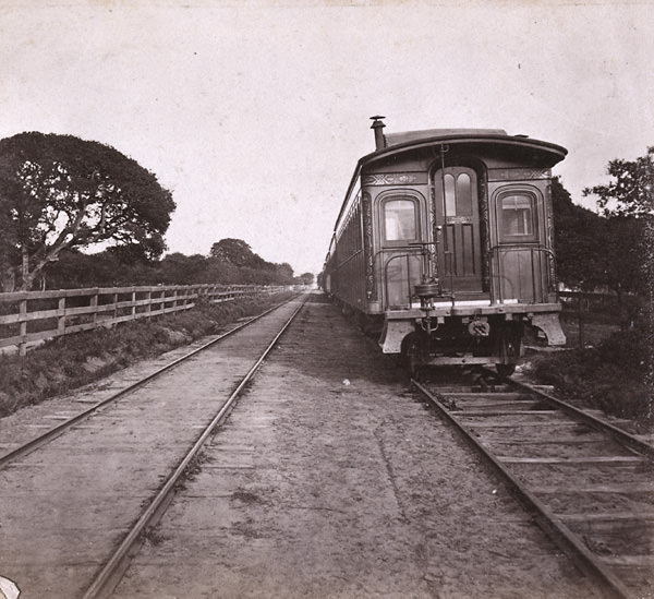
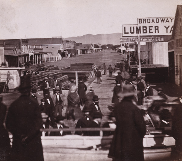
The forests that once covered the East Bay hills were long gone by the time these photographs were taken. Oakland’s first steam-powered sawmill had been erected in 1850, and three more followed by 1852. By 1853, more men were employed cutting redwoods in the East Bay than the total number of residents living there. By 1860, the original redwood forest had been entirely cleared. The timber industry that stripped those hills fueled Oakland’s early construction boom, and the lumber mills that processed the wood were among the first major industrial operations in the city.
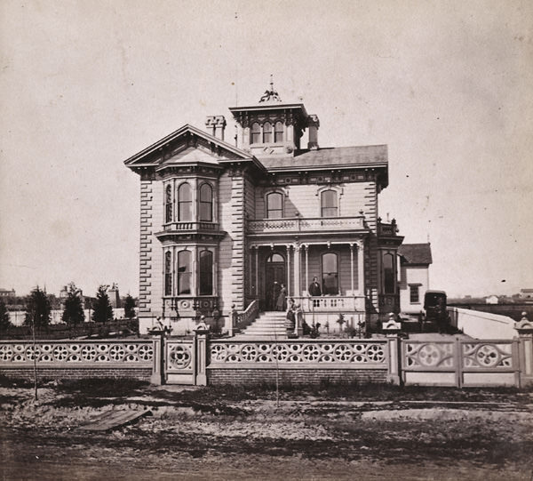
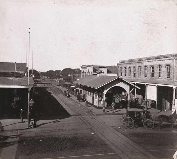
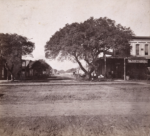
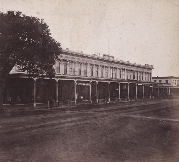
Broadway in the 1860s was a street undergoing constant change. Photographs from 1860 and 1867 both document the main thoroughfare, showing how commercial storefronts, public buildings, and street-level activity evolved over the decade. The Broadway Block appeared in images from 1864 and 1868, while the Wilcox Block on Broadway was captured in 1861, 1863, and 1868. Together, these images trace Broadway’s transformation from a modest main street into the backbone of a growing city.
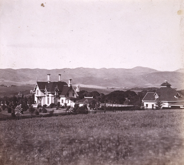
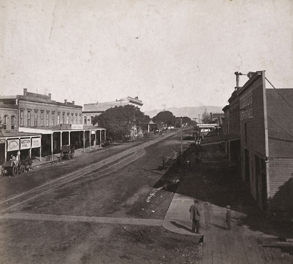
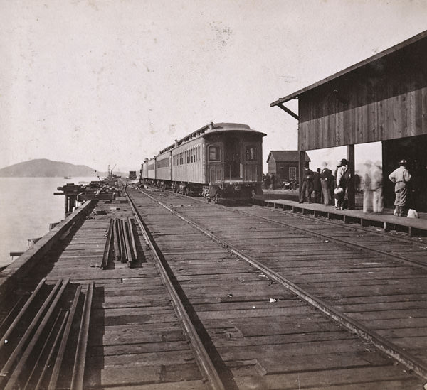
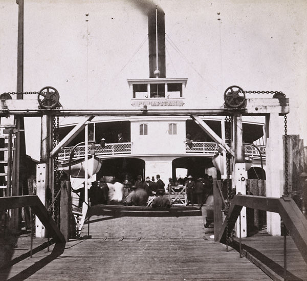
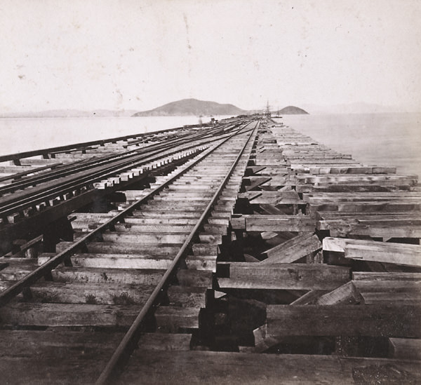
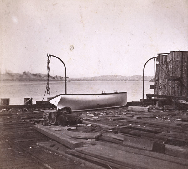
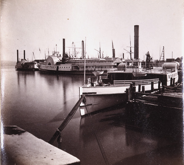
The railroad’s ferry connection across San Francisco Bay required its own dedicated infrastructure. Ferry steamers like the El Capitan operated between the Oakland Wharf and San Francisco, carrying passengers who had arrived by train. The Railroad Ferry Boat in the Slip, photographed in 1868, shows the mechanics of that transfer point. The Western Pacific Railroad Pier extended into the bay, and photographs from 1868 document it from multiple perspectives — from the ferry landing looking toward Oakland, and from the pier itself with Goat Island and San Francisco visible in the distance.
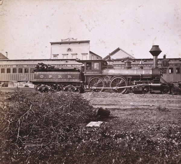
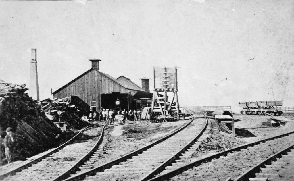
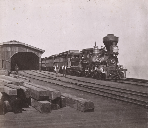
The Central Pacific also built a major rail yard and service facility in West Oakland during this period. The yard employed large numbers of workers and became one of the most important industrial sites in the East Bay. Photographs of the rail infrastructure — engines, cars, piers, and terminus buildings — document the scale of that operation. The Central Pacific Railroad Engine Eclipse, photographed in 1868, represents the kind of powerful locomotive that was pulling trains across the continent by the end of the decade.
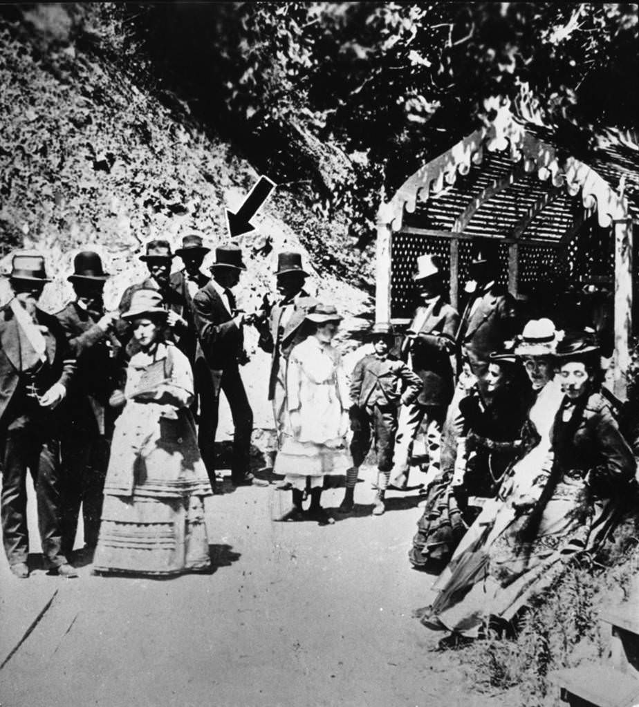
By 1867, Oakland had a City Hall to match its growing ambitions. The 1867 photograph of Oakland City Hall documents a building that reflected the city’s transition from frontier town to established municipality. That same year, Mark Twain was photographed at Piedmont White Sulphur Springs in Oakland — a reminder that the city attracted prominent visitors and had cultural amenities beyond its industrial and commercial functions. The city’s central district had continued shifting northward along Broadway, away from the original waterfront settlement.
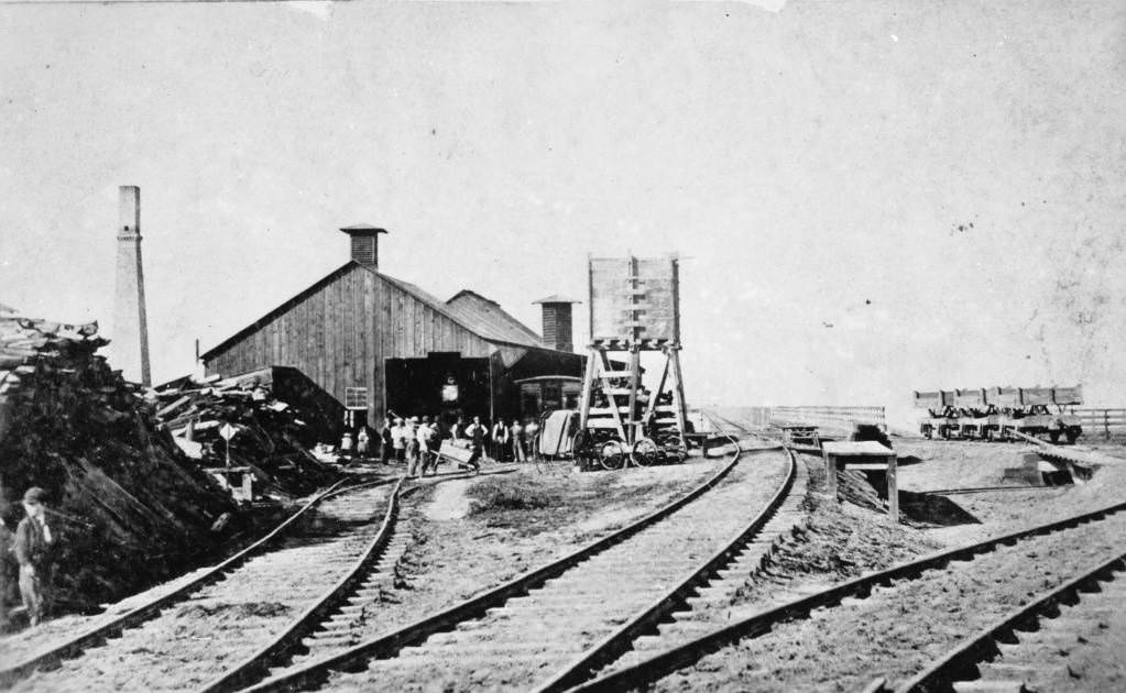
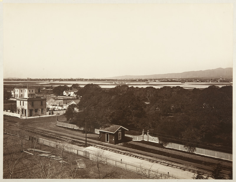
Smaller stations like the Encinal train station served the commuter lines that the Central Pacific — and later the Southern Pacific — operated along the East Bay shoreline. These stops connected the neighborhoods and smaller communities surrounding Oakland to the larger rail network centered at the Oakland Wharf terminus. The trains leaving the wharf bound for New York, documented in photographs from 1864 and the broader 1860s, made Oakland the literal starting point for transcontinental journeys.
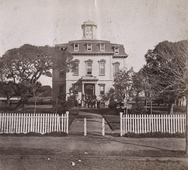
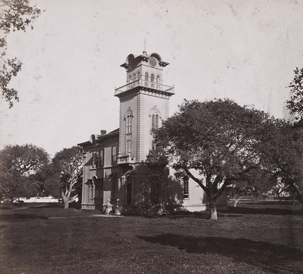
Oakland College and Oakland University, both situated along 12th Street, anchored the academic identity of that corridor. The Mansion House on the college grounds, photographed in both 1863 and 1865, served as a landmark building within the campus setting. The Harrison Street view looking north from 12th, showing the university buildings, was captured in the 1860s and again in 1867 — offering a before-and-after comparison of how the university district grew across the decade.
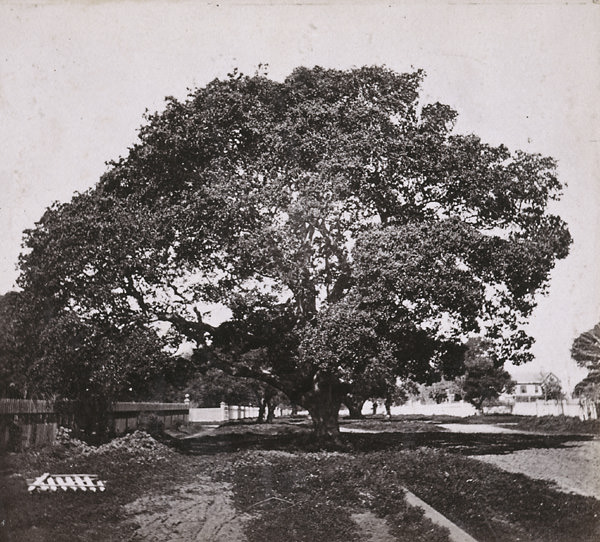
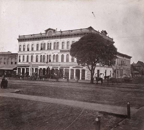
The image known as the “Pride of Oakland,” taken in 1861, captures a confidence that the city had already earned in its short existence. Oakland had grown from an unincorporated community into a structured city with working institutions, a connected transportation network, and a population that was growing each year. The Wilcox Block, shown from the front and north side that same year, was one of the commercial anchors of Broadway and a symbol of Oakland’s commercial ambition.
The Sacramento and Oakland steamers that operated on the bay and delta routes connected Oakland not just to San Francisco but to the interior of California as well. Sacramento was accessible by water, and the steamers that made that run were a regular sight from the Oakland waterfront. These connections — by rail, by ferry, and by river steamer — made Oakland one of the best-connected cities on the Pacific Coast by the late 1860s.
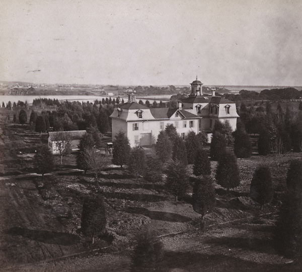
The views from Jackson Street looking east toward Dr. Merritt’s house and the lake behind it are among the most evocative of the period. The house, the water, and the hills beyond formed a composition that photographers returned to more than once. By 1864, Merritt’s property had become one of the most recognized private estates in the city, and his lake — still tidal and open in those years — was a defining natural feature of Oakland’s eastern neighborhoods.
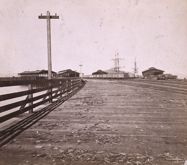
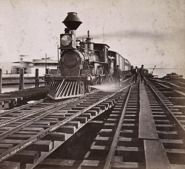
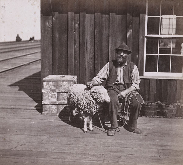
The arrival of trains at Oakland Wharf was a daily spectacle. Passengers stepping off long-distance eastern trains found themselves at the edge of San Francisco Bay, with the skyline of the city visible across the water. The Ferry Landing and Freight Shed at Oakland Wharf, photographed in 1864 and 1865, handled the transfer of both people and cargo between rail and boat. Decoy sheep photographed on the wharf in 1864 offer an unexpected reminder that livestock was also a significant part of the freight moving through the terminus.
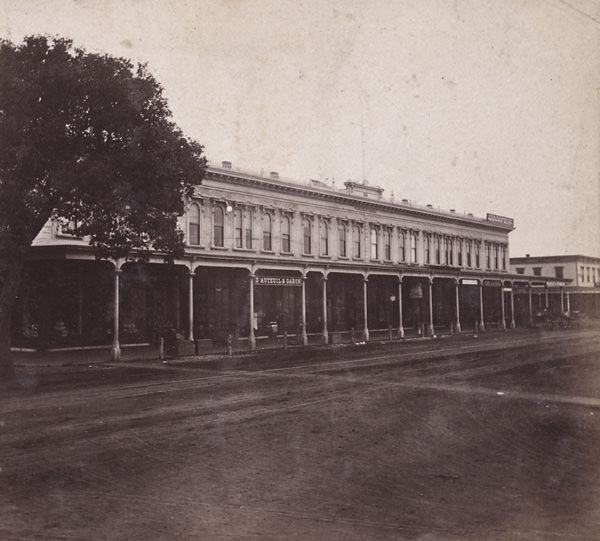
The 1860s panoramic views of Oakland taken from the Wilcox Block rooftop span the full decade and document every direction of the city’s growth. Looking northeast in 1861 and 1865, looking southwest with Goat Island in the distance in 1862, looking west in 1863, looking north in 1864, and looking east in 1868 — these images together form a visual time-lapse of a city expanding outward from its commercial core. Each successive photograph shows more buildings, more cleared land, and more streets running toward the horizon.
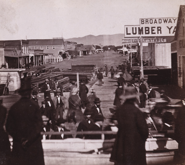
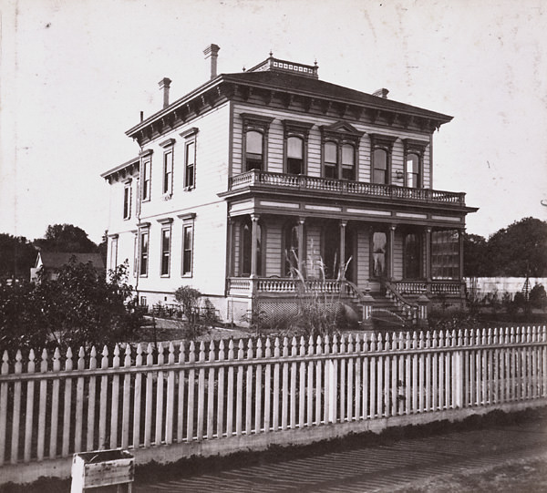
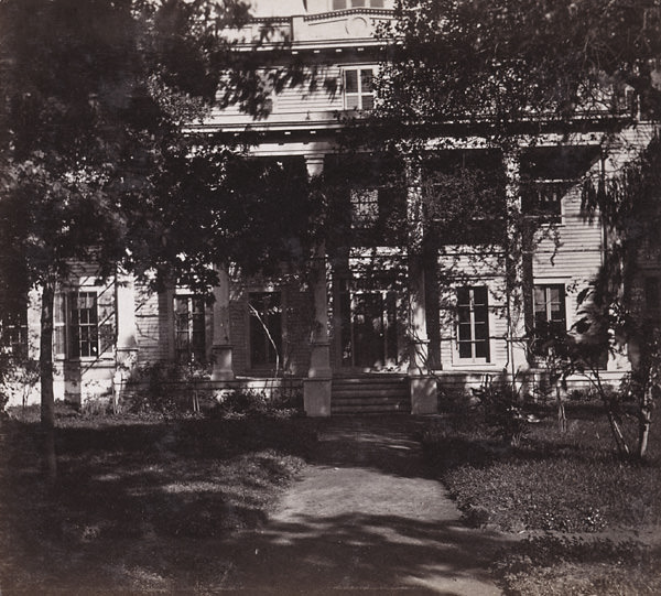
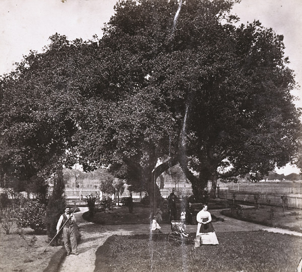
Individual residences captured in these photographs show the domestic side of Oakland’s growth. J. I. Spear’s home at the corner of Julia and 12th Streets, photographed in 1863, was typical of the substantial wooden houses that Oakland’s established families built during this period. The residence of J. B. Scotchler, shown beneath the oaks at Adeline and 12th Streets in 1867, is particularly notable — the native oak trees that gave Oakland its name are visible in the image, a living connection to the landscape that predated the city itself.
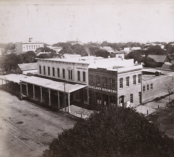
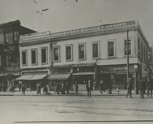
Market Street Plaza, photographed in 1866, documents one of Oakland’s public gathering spaces during the mid-decade period. The plaza and the streets surrounding it show the kind of open civic infrastructure that was standard in California cities of the era — wide intersections, wooden sidewalks, and low-rise commercial buildings fronting the public space. The 1867 Broadway photograph shows how much that main corridor had filled in since the 1860 view taken seven years earlier.
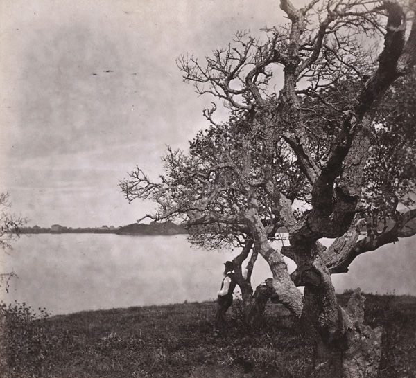
Lake Merritt’s western shore was the subject of a 1865 photograph, while the eastern shore view from 1862 and the general lake view from 1864 round out the visual record of this waterway. Scotchler’s Point on the lake, photographed in 1868, was named after J. B. Scotchler, whose property extended to the water’s edge. These lake views collectively show a body of water that was already becoming a focal point for residential development and public enjoyment, even before any formal effort was made to preserve it.
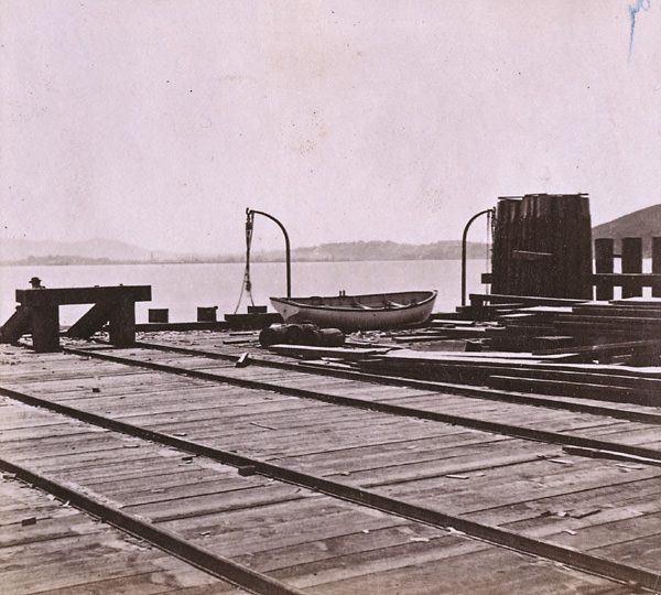
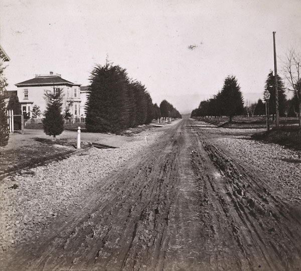
Photographs taken from the end of the Oakland Wharf looking back toward San Francisco show the full width of San Francisco Bay as it appeared in the 1860s. In 1863 and 1867, photographers positioned themselves at the pier’s end to capture this view. The reflections in San Francisco Bay, photographed from the wharf in 1864, show a calm day on the water with the distant city skyline mirrored in the bay’s surface. The Railroad Wharf looking toward Goat Island in 1862 and the Railroad Pier looking toward Oakland in 1863 and 1868 complete the visual record of the bay crossing.
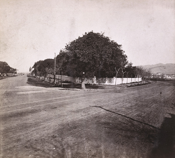
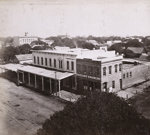
The luxury rail cars of the late 1860s represented the high end of transcontinental travel. The Palace Drawing-Room and Sleeping Car “Woodstock,” the Silver Palace Car, and the Pullman’s Palace Train all passed through Oakland Point. These cars were photographed in 1868 and 1869, capturing the gleaming interiors and polished exteriors that made long-distance rail travel an aspirational experience for wealthy passengers. The Central Pacific Railroad Engine Eclipse, also photographed in 1868, pulled these cars across the Sierra Nevada and into Oakland.
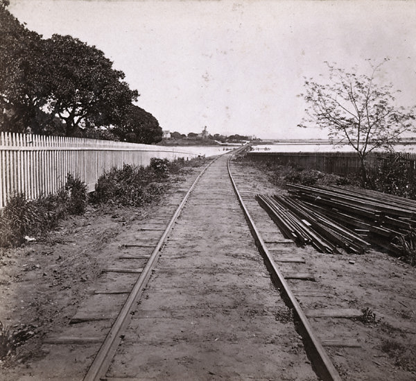
The creek view from 1861 offers a glimpse of Oakland’s natural waterways before they were fully channeled and built over. Estuary creeks ran through the flatlands between the hills and the bay, and in the early years of the city they were still visible features of the landscape. By the end of the decade, much of this natural drainage infrastructure had been obscured by development. These early photographs are among the few visual records of how that terrain appeared before urbanization claimed it.
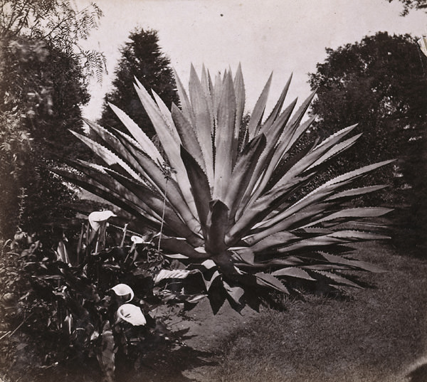
A century plant at Major Kirkham’s residence on Oak Street, photographed in 1868, stands as one of the more unusual images in this collection. The agave plant — known as the century plant for its long growing cycle — drew enough attention to be photographed and cataloged by number, reflecting the era’s interest in botanical curiosities. The image of Mark Twain at Piedmont White Sulphur Springs in 1867 is equally distinctive, placing one of America’s most famous writers within Oakland’s social landscape during the heart of his most productive years.
The arrival of the Eastern Train at Oakland Wharf, documented for the Western Pacific Railroad in both 1860 and 1865, marked a daily event that defined the rhythm of life at the terminus. Trains of cars on the wharf, photographed in 1861, and eastern-bound trains leaving Oakland Point, captured in both the 1860s broadly and specifically in 1867, bookend the decade’s most important transportation story. Oakland was not merely passing through this era — it was being built, shaped, and photographed into permanence.
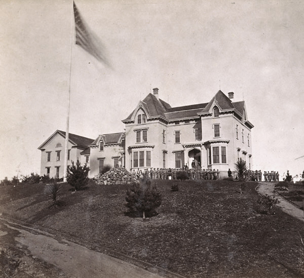
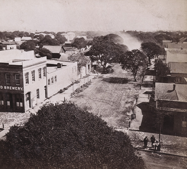
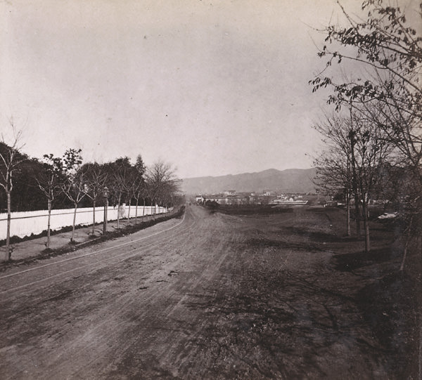
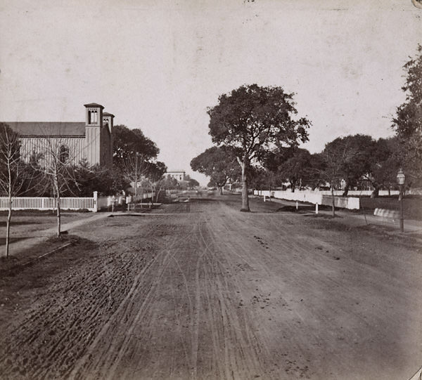





Looks so southern in some of these
Back when we used to say “hell of Oakland!” 🤣
Those pics were taken before a 6.8 earthquake on the Hayward fault in 1868. Hella shit been built since then. 😱
Any of those buildings still around?
I think a few.
There’s one where you can see a church over the roof of a building – I’m pretty sure that church is still there
Neat!
say what you will about the Deaf, Dumb and Blind Asylum, they sure play a mean pinball
That building goes so hard, what a loss.
So empty. Oakland Housing crisis since 1860
The birth of the town after the gold rush. Nice drop, very interesting.
This is 40 years before the Dunsmuir House was built. And 85 years after it was built, me & my buddies would ride our bikes up there to catch lizards & snakes.
Awesome photos! I’m inspired to learn more about the history of Oakland now. Fascinating.
I lived most of my life in the Bay Area, and now I’m living in the NYC Metro. Everything is green and verdant here–overgrown even–with lots of small hills. These pictures show just how flat everything is back in Oakland…back in the day.
Look at all that wide open space! And trees!
Love this! I’m actually reading a book right now on the geological history of Oakland. I find it really cool but I’m a nerd. Explains what the land used to look like, a history of the development, why different parts have different rocks essentially. But where downtown is now used to be a huge oak tree grove on top of a packed sand layer. Hence the name of the city. Cool to see these photos back where there were actual oak trees!
Rather amazing to consider that most of what one sees there was constructed in the preceding 18 years since the Gold Rush. Even if it was gentrification….
Also interesting that some many of those big buildings are schools.
Back when it was safe
Did this article insinuate that Oakland is actually located in Central Florida?? Or do I just need more coffee?
the old asylum was a real place in Fremont
The asylum was in Berkeley, where Clark Kerr Campus is today. It moved to Fremont in the 70s.
Anyone know the deal with the Decoy Sheep in #18?
Before we planted all the eucalyptus and have so much scotch broom, would there have been just more oak trees in the hills?
These are awesome! Thanks for sharing.
I wonder if any of these buildings and trees are still standing
These are great! There’s a lot of old photos on the second floor of the main Oakland Public Library outside of the Oakland History Center. It’s fun to find what still stands. Our city has/had some beautiful architecture!
These are wonderful! The ones of the lake with just trees around it! 😲