
New Mexico in the 1980s and 1990s was a state in transition. Its population was growing fast, fueled in large part by a wave of Californians who relocated there during the 1990s. Yet despite that growth and increasing income from oil, gas, and mineral resources, New Mexico remained one of the poorest states in the country. The gap between what the land produced and what residents earned defined daily life across the state. Small towns along old highway corridors held on, while cities like Albuquerque expanded. The photos from this era capture a New Mexico that was part old West, part modern America — and very much its own thing.
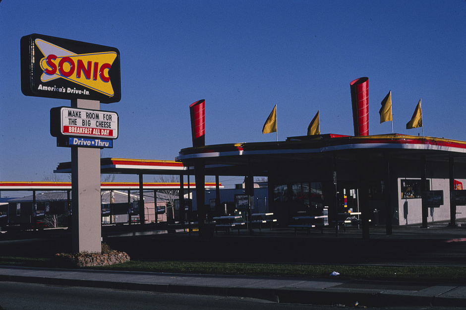
Route 66 was the backbone of commercial life in many New Mexico towns. Diners, motels, and gas stations lined the old highway for decades, and by the 1980s many of them were showing their age. Some had been replaced by national chains. Others survived as local landmarks, their signs faded but still standing. Albuquerque sat at the center of this stretch of road, and its Central Avenue — the old Route 66 corridor — remained one of the most photographed strips in the state.
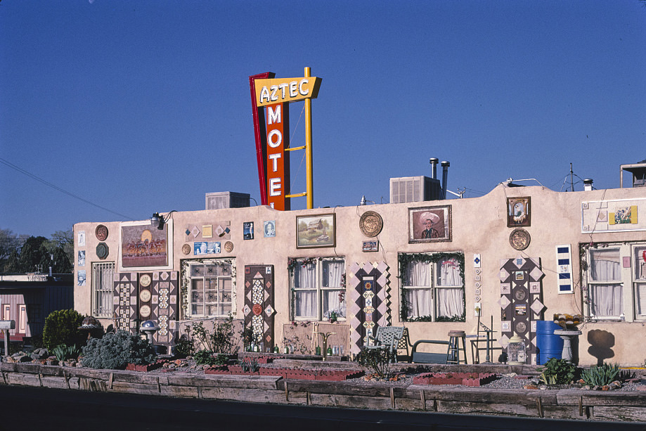
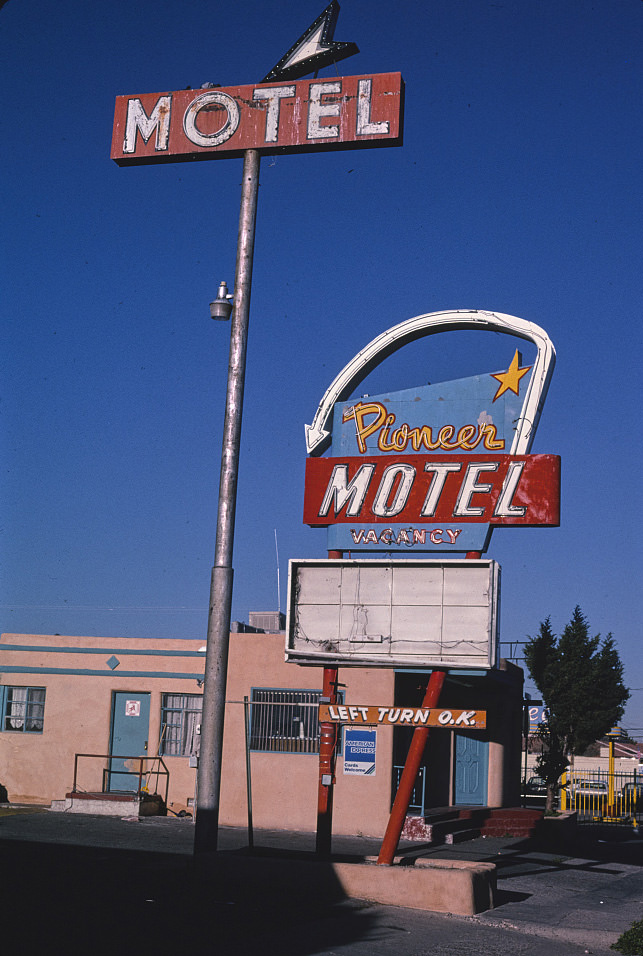
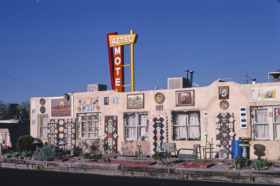
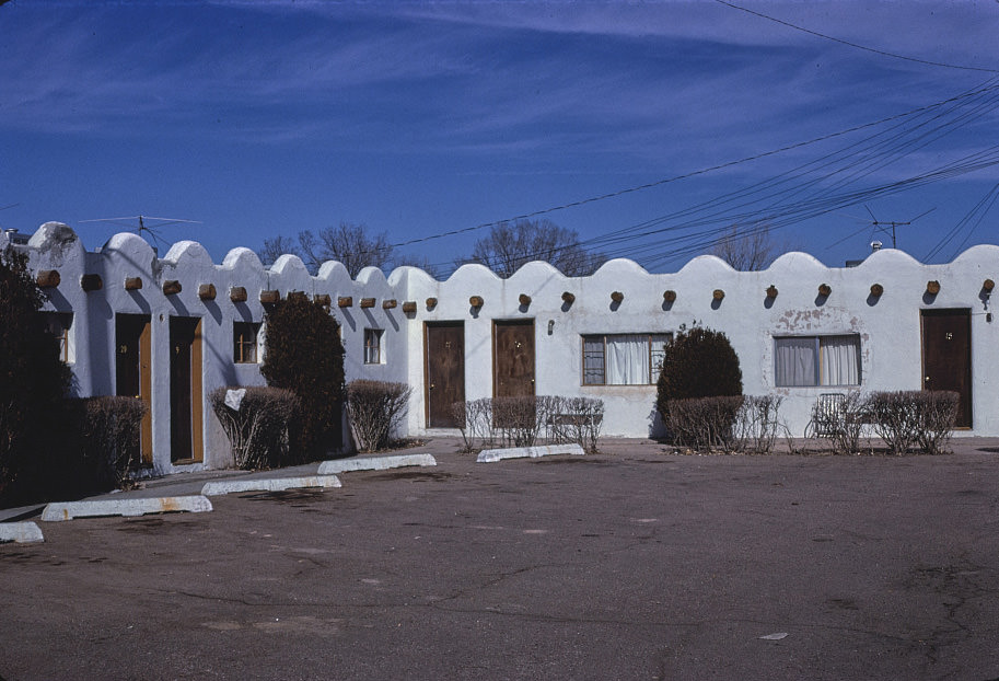
Albuquerque’s Route 66 corridor was dotted with motor courts and roadside motels that had been built during the postwar travel boom. By the time these photos were taken, many of them were caught between eras — too old to compete with newer lodging, but too embedded in the streetscape to disappear. The Aztec Motel on Route 66 was one of these survivors, its Southwestern styling still intact decades after it first opened.
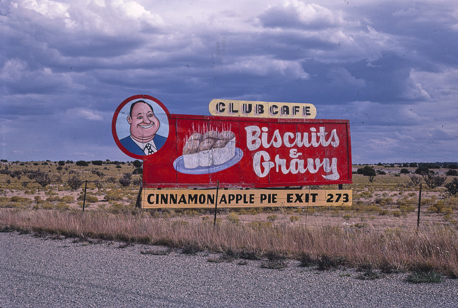
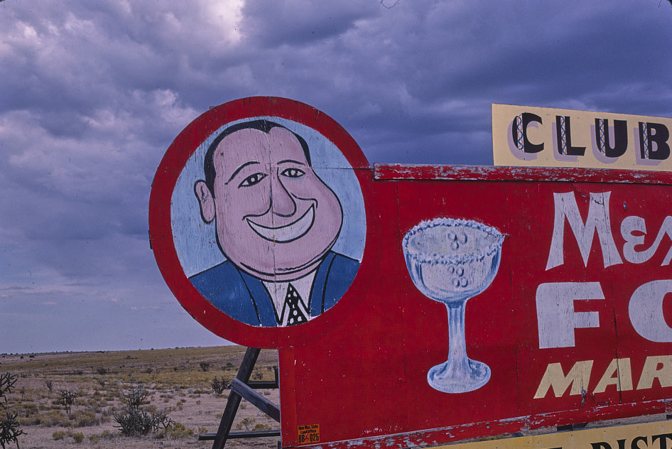
Santa Rosa, sitting along I-40 east of Albuquerque, had long been a stop for travelers crossing New Mexico. The Club Cafe was one of its most well-known roadside institutions, its round-faced logo becoming a fixture of the Route 66 landscape. By the late 1980s, places like the Club Cafe were already becoming relics. Interstate travel had changed the economics of highway diners, and many couldn’t keep up.
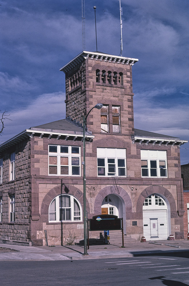
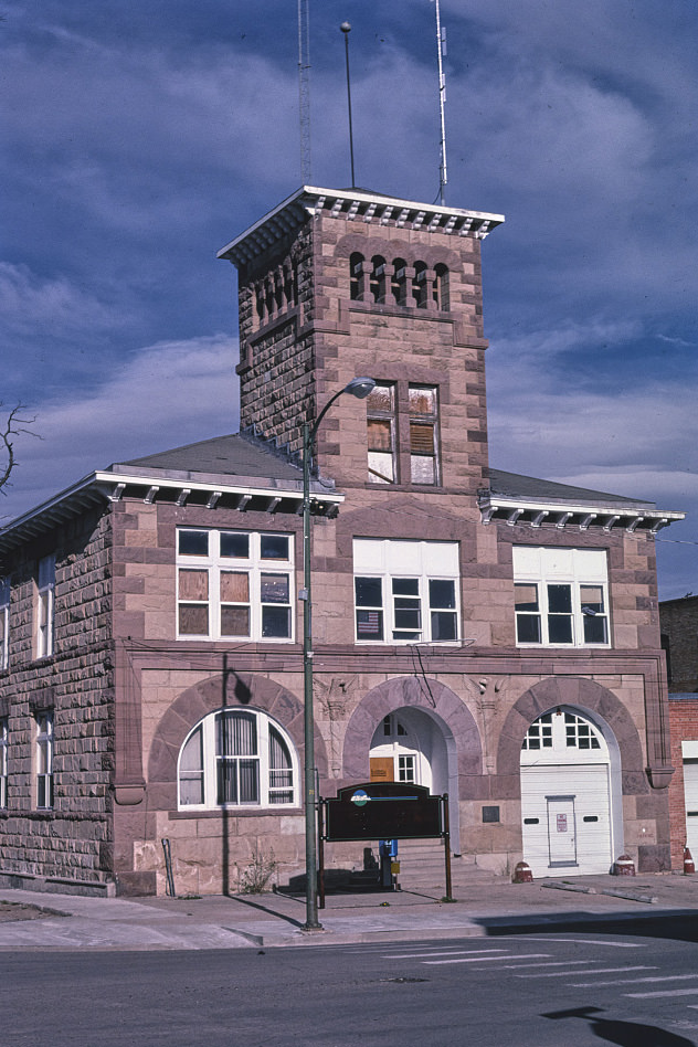
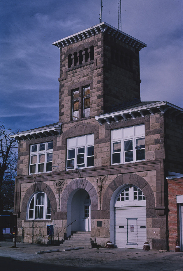
Las Vegas, New Mexico — not the Nevada city — sits in the northeastern part of the state and has one of the most intact collections of historic architecture in the Southwest. Its downtown blocks include buildings that date back to the late 1800s, many of which were still in active use through the 1990s. The old City Hall, converted to a fire department, was one of the more visible examples of the town’s layered history.
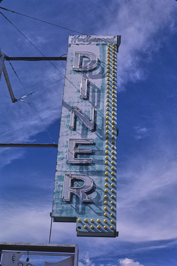
Grants, in western New Mexico, had grown rapidly after uranium was discovered nearby in the 1950s. By the 1980s, the uranium boom had collapsed, and the town was working through the economic aftermath. Its Route 66 commercial strip still carried the signs of better days — diners, theaters, and cafes that had served a much busier population. Photographers documented these signs and storefronts throughout the decade, preserving what was quickly becoming a vanishing streetscape.
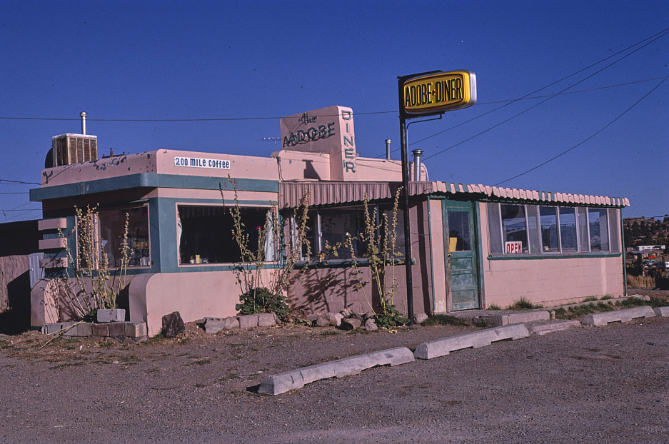
Out in the high desert of northern New Mexico, small roadside stops like the Adobe Diner in Tres Piedras served travelers navigating the remote stretches between towns. These were not tourist attractions — they were practical stops for locals and travelers who needed food or fuel before reaching the next population center. Many of them operated out of converted buildings or simple adobe structures that blended into the landscape.
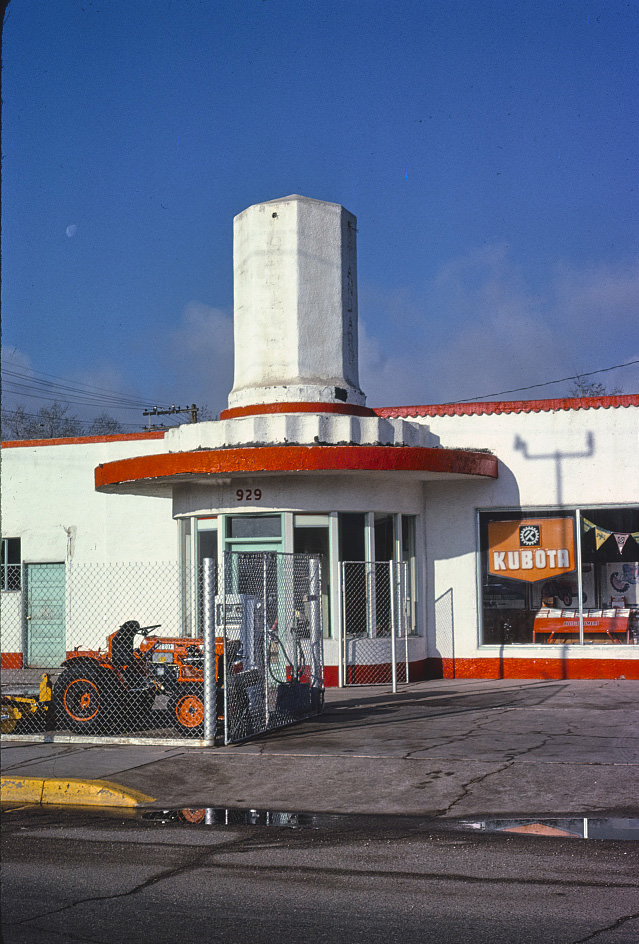
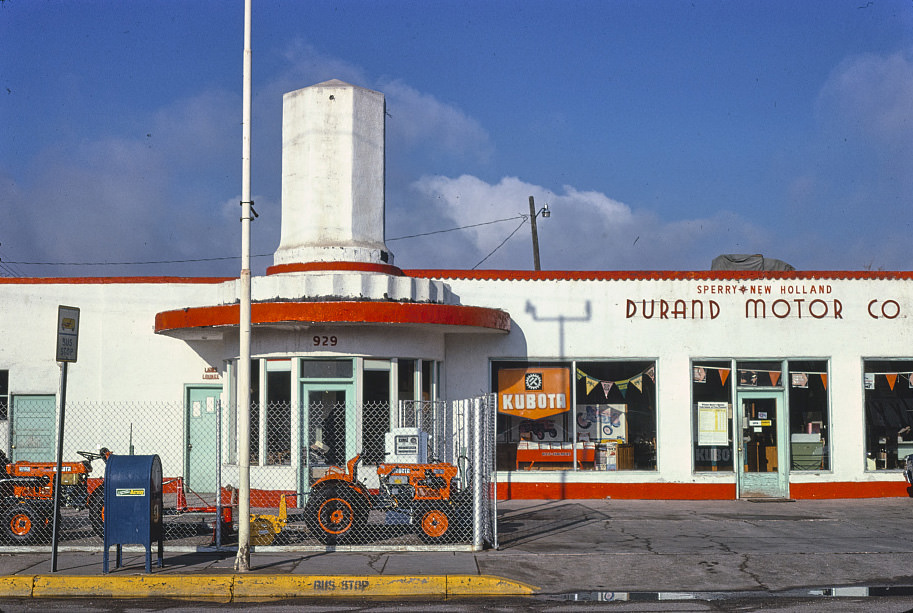
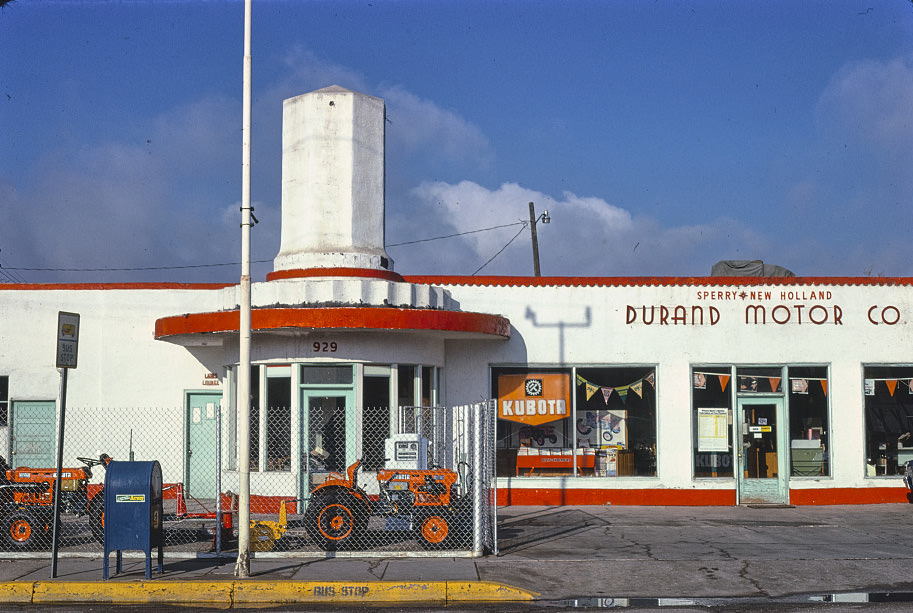
Albuquerque’s commercial landscape in 1980 still carried strong traces of its mid-century character. Auto dealerships and service shops occupied prominent corners along major streets, and the signage from earlier decades remained largely unchanged. Durand Motor Co. was one of many such businesses that anchored neighborhoods during this period, visible evidence of a city that had grown quickly after World War II and was still carrying the infrastructure of that era.
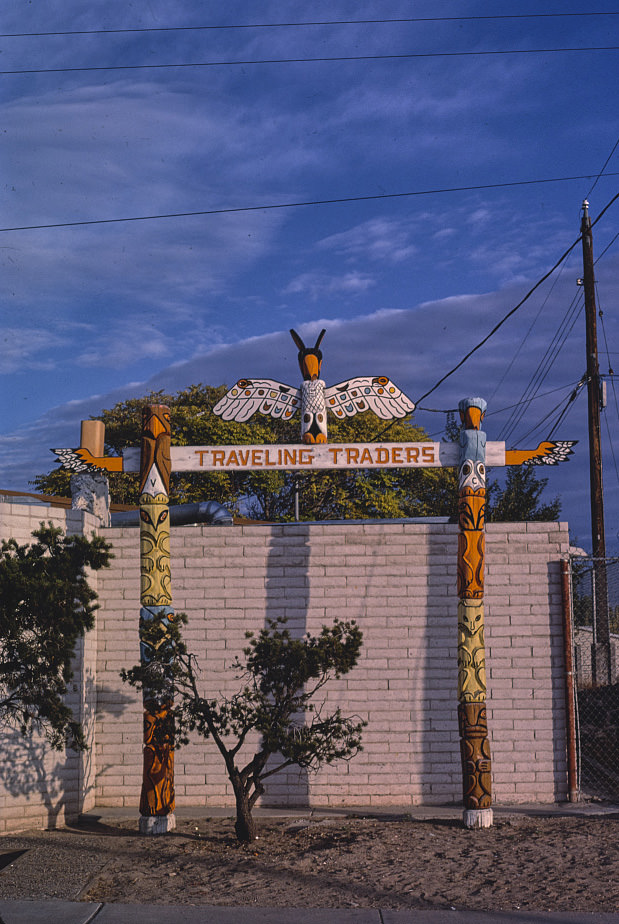
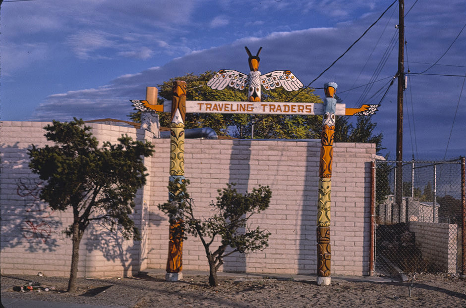
Central Avenue in Albuquerque was a commercial corridor unlike anywhere else in the state. It mixed jewelry shops, liquor stores, motels, and diners in a stretch that had been serving travelers and locals since the Route 66 heyday. By the mid-1980s, some blocks were struggling, while others stayed busy. Shops like Traveling Traders catered to a mix of tourists and locals looking for Southwestern goods.
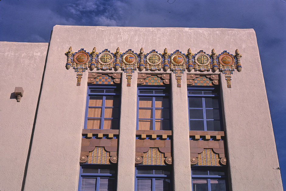
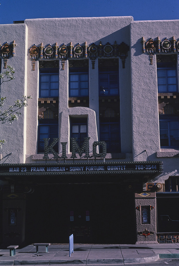
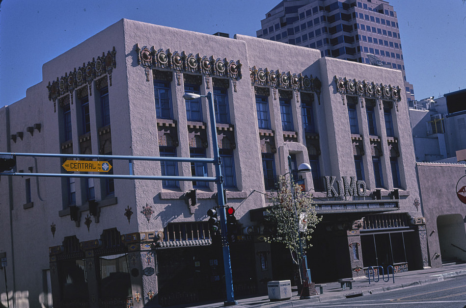
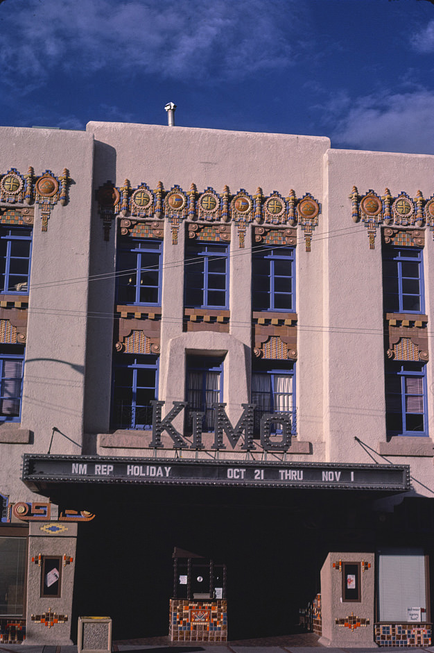
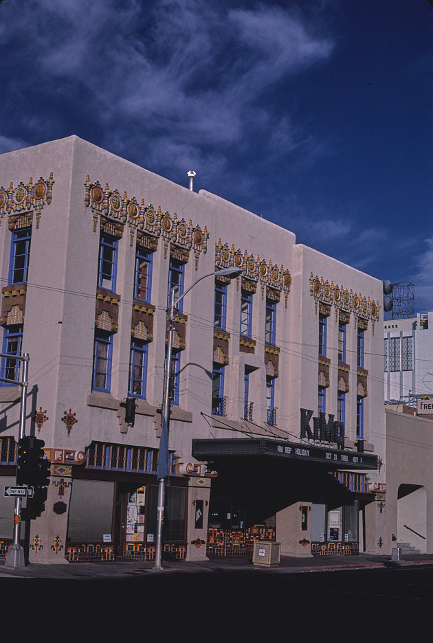
The KiMo Theater on Central Avenue in Albuquerque is one of the most distinctive buildings in New Mexico. Built in 1927 in a style that blended Pueblo Revival and Art Deco elements, it was photographed repeatedly throughout the 1980s and 1990s as preservationists and the public debated its future. The theater eventually underwent restoration, but for much of this period it stood as a symbol of both the city’s heritage and the difficulty of maintaining historic structures on a tight budget.
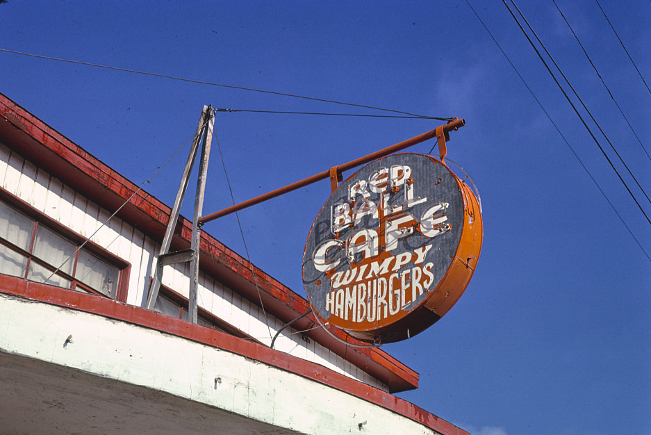
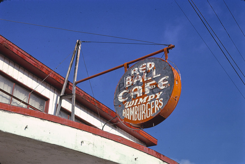
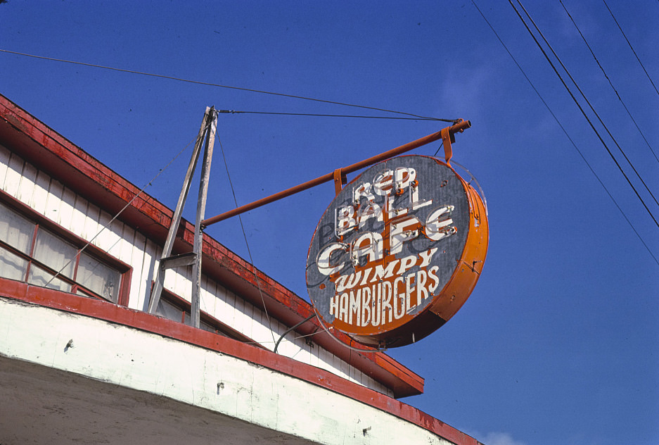
4th Street in Albuquerque ran parallel to Central Avenue and had its own collection of small businesses, signs, and diners. The Red Ball Cafe was a fixture on that street, its bold signage standing out against the flat commercial buildings around it. These small independent restaurants were common throughout New Mexico’s cities and towns in the early 1980s, though many wouldn’t survive the decade.
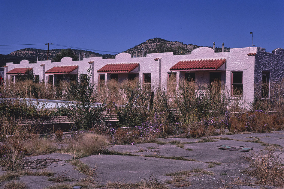
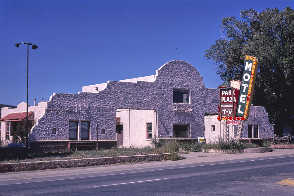
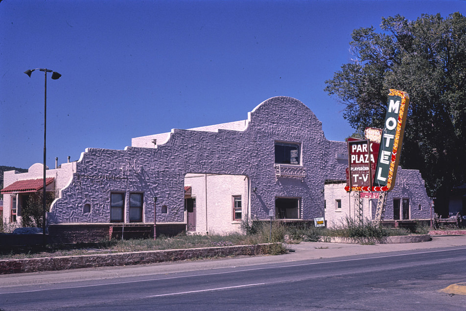
Raton, in the northeast corner of New Mexico near the Colorado border, served as a gateway town for travelers coming south through Raton Pass. Its South 1st Street commercial district held a mix of motels, shops, and local businesses that had grown up around the highway trade. The Park Plaza Motel was one of several lodging options that catered to travelers passing through on I-25.

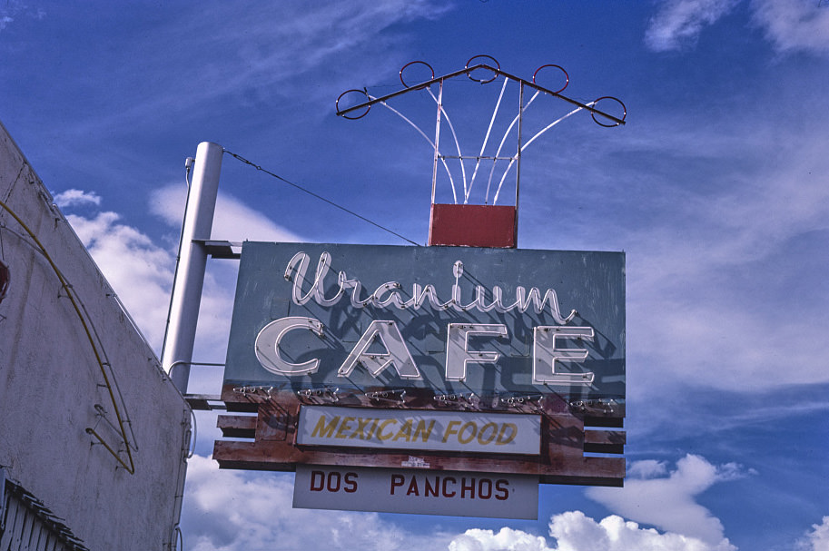
The Uranium Cafe in Grants was a direct product of the uranium mining boom that had transformed western New Mexico in the 1950s. The name itself tells the story of how deeply the industry shaped local identity. Even after the bust, the cafe kept its name — a reminder of what the town had once been. Along Route 66, these names and signs outlasted the economies that created them.

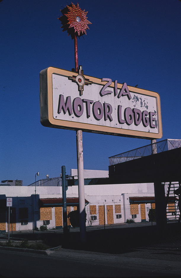
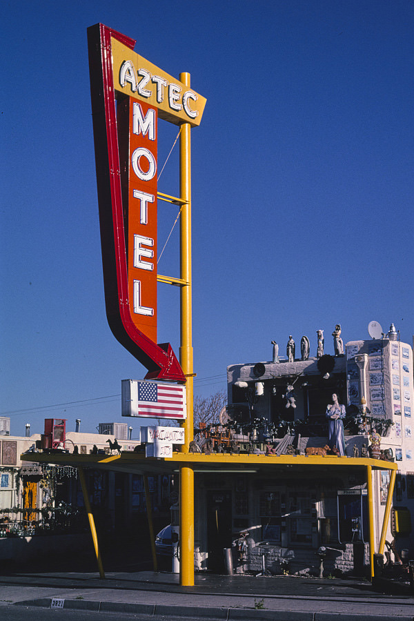
By the late 1990s, many of the Route 66 motels in Albuquerque had been operating for more than four decades. Their architecture and signage reflected mid-century design trends — bold geometric shapes, neon lettering, and Southwestern motifs. The Aztec Motel was photographed multiple times across the decade as researchers and documentarians tracked how these properties changed — or didn’t — over time.
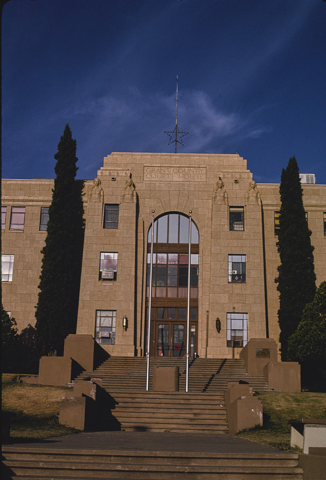
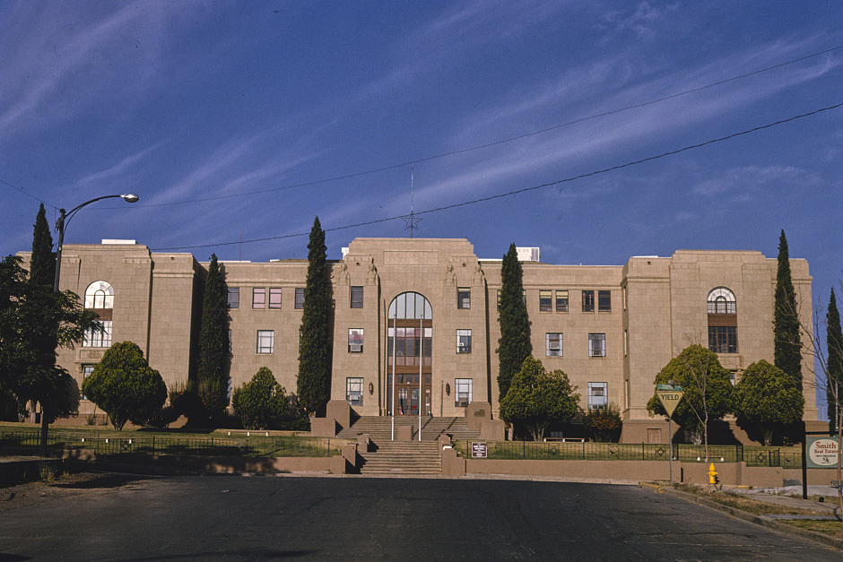
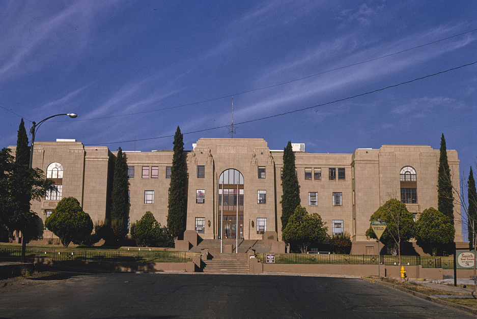
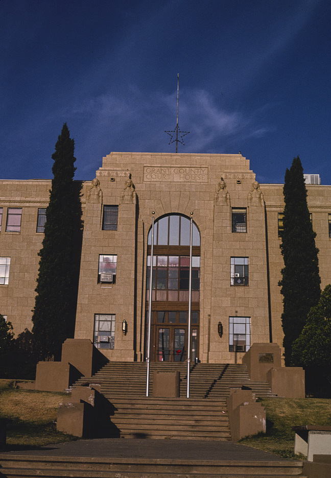
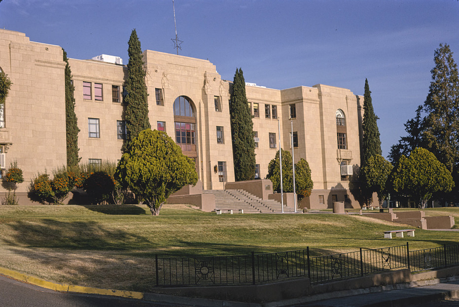
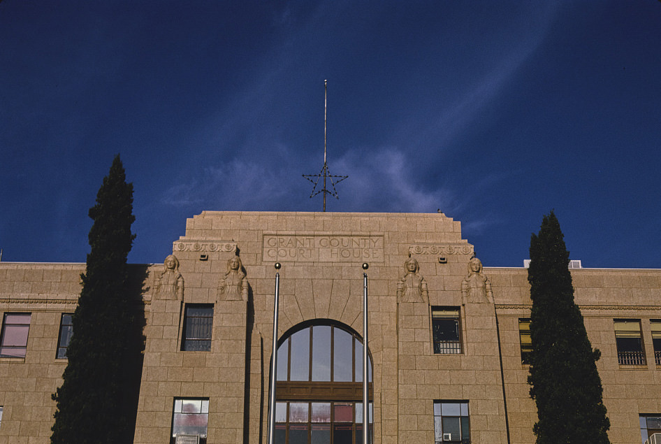
Silver City, the seat of Grant County in southwestern New Mexico, retained much of its Victorian-era commercial architecture through the 1990s. The Grant County Courthouse on Copper Street anchored the downtown, surrounded by a mix of local businesses. Silver City had avoided some of the economic whiplash that hit mining towns elsewhere in the state, and its downtown showed a stability that was rare in the region.
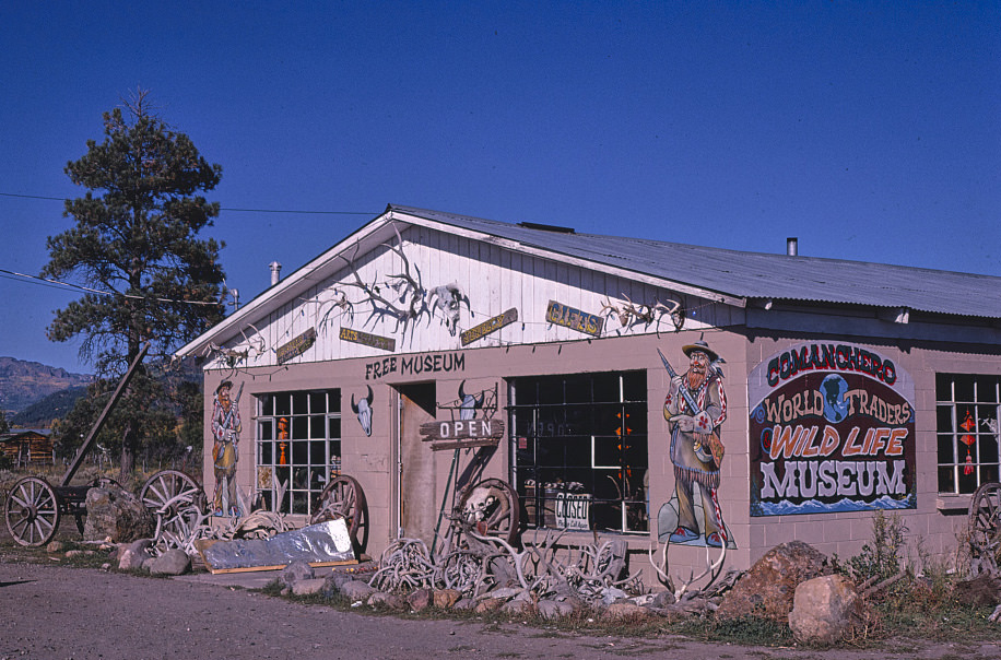
Tucumcari, in eastern New Mexico along Route 66, was famous for its roadside signs and motels. The town marketed itself heavily to travelers and built an identity around its highway culture. By the 1980s, that culture was fading as interstate traffic bypassed many of the old stops. But Tucumcari’s signs — for diners, gift shops, bars, and motels — remained some of the most photographed in the state.
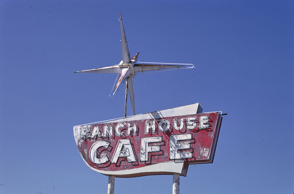
Vaughn, a tiny junction town on Route 285 in central New Mexico, existed almost entirely because of its location at a crossroads. The Ranch House Cafe served travelers who stopped there between destinations. Towns like Vaughn had little margin for economic shifts — when traffic patterns changed, the businesses along the highway felt it immediately.
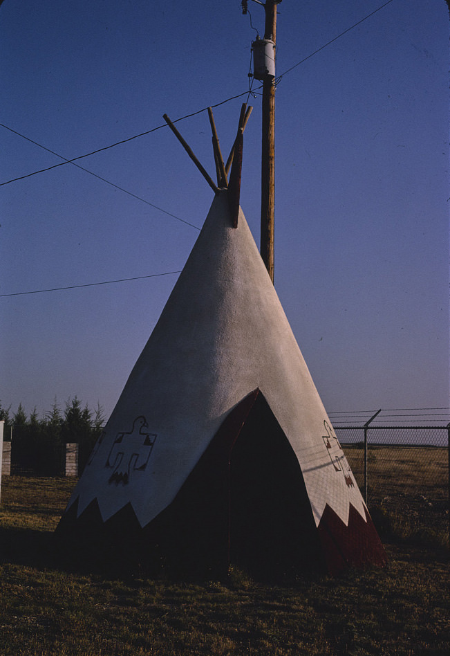
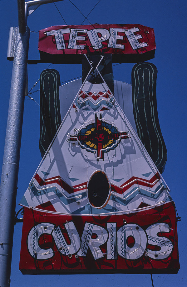
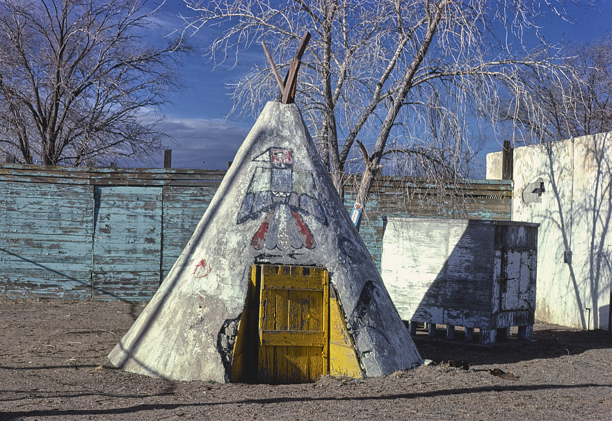
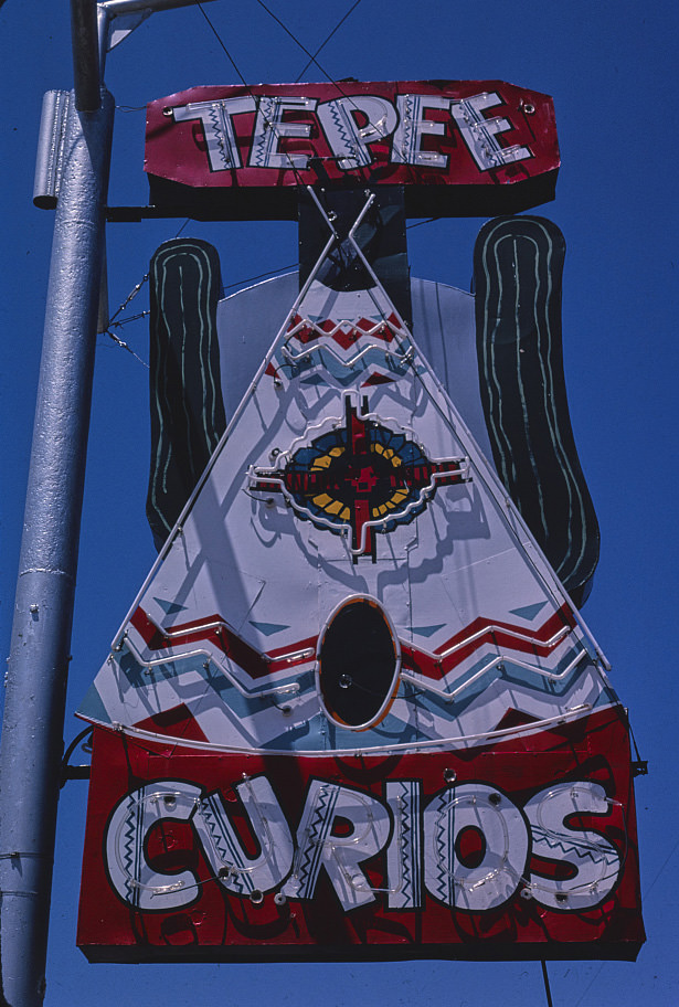
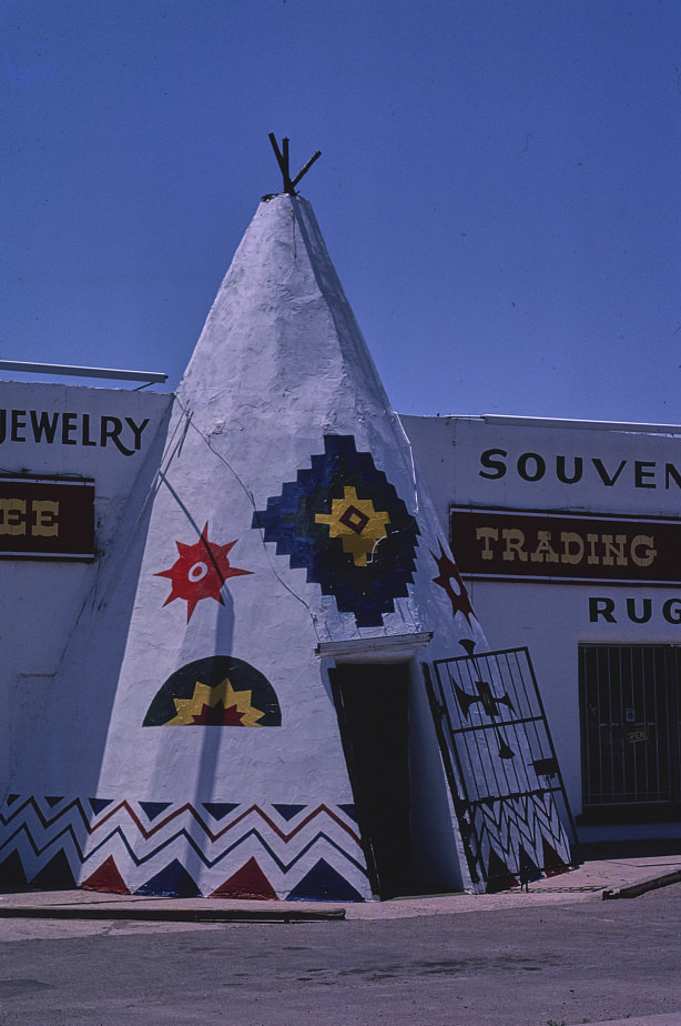
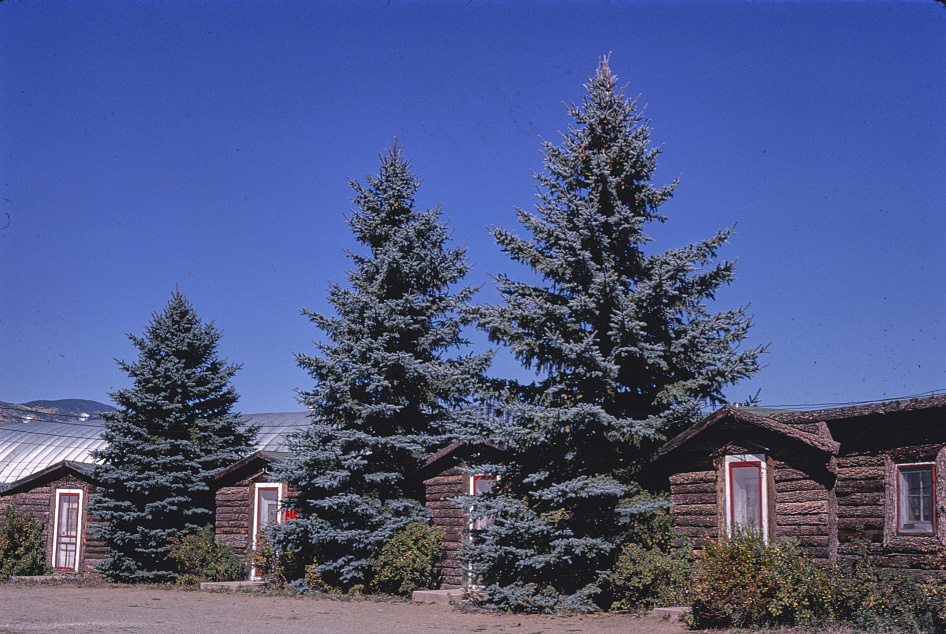
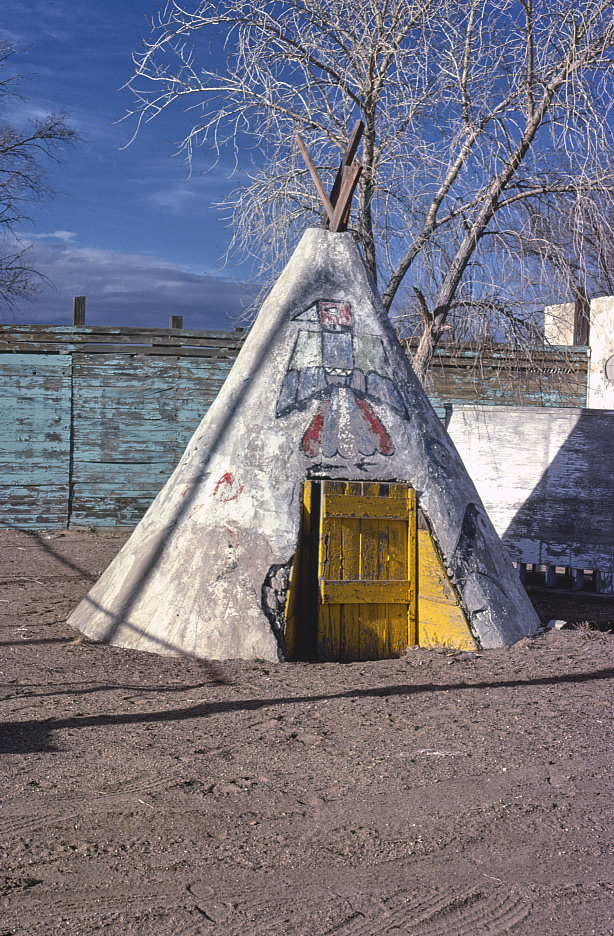
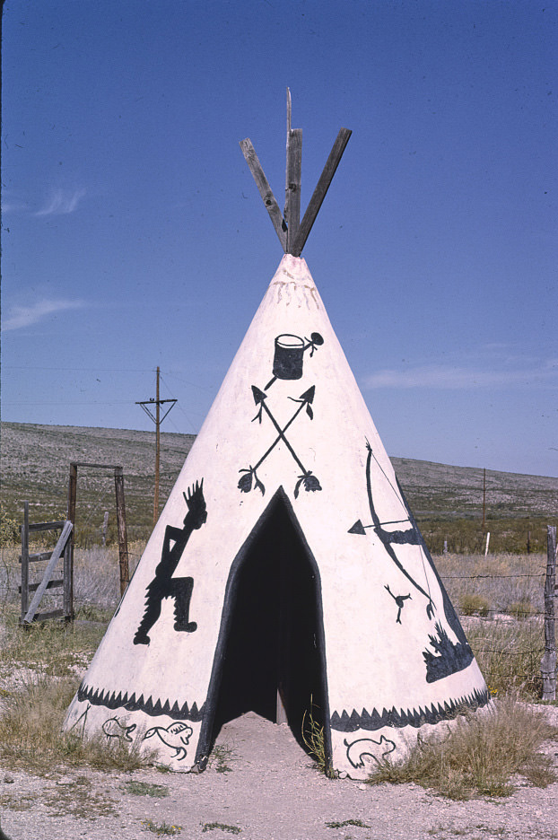
Roswell, in southeastern New Mexico, was known for its agricultural economy long before it became famous for other reasons. Alta’s Cactus Cave Gift Shop had been operating on Route 70 since 1944, and its teepee structure made it one of the more recognizable roadside stops in the region. Souvenir shops like this one served a steady stream of travelers heading through the Pecos Valley.
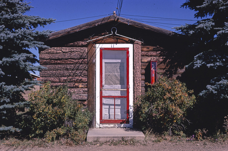
Eagle Nest, a small resort community in the Sangre de Cristo Mountains near the Cimarron Valley, catered to hunters, anglers, and outdoor tourists. The Horseshoe Motel was the kind of small, unpretentious lodging that served this trade — functional, affordable, and designed for people who came to spend time outside rather than inside. These mountain communities operated on a seasonal rhythm tied closely to wildlife hunting seasons and summer recreation.
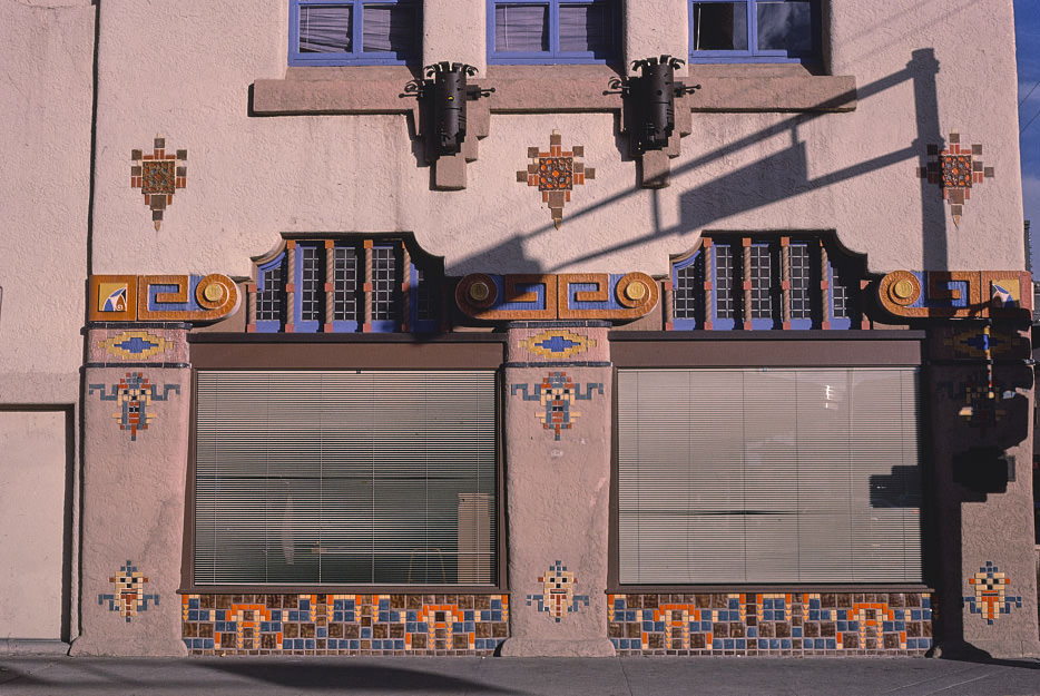
The KiMo Theater photographs from 1980 show the building before much of the restoration work that would come later. Its pueblo-influenced exterior, decorated with steer skulls and Southwestern geometric patterns, remained intact even as the building’s use shifted over the decades. Albuquerque’s downtown around it was also changing — some businesses closing, others adapting — and the theater became a reference point for how the city was evolving.
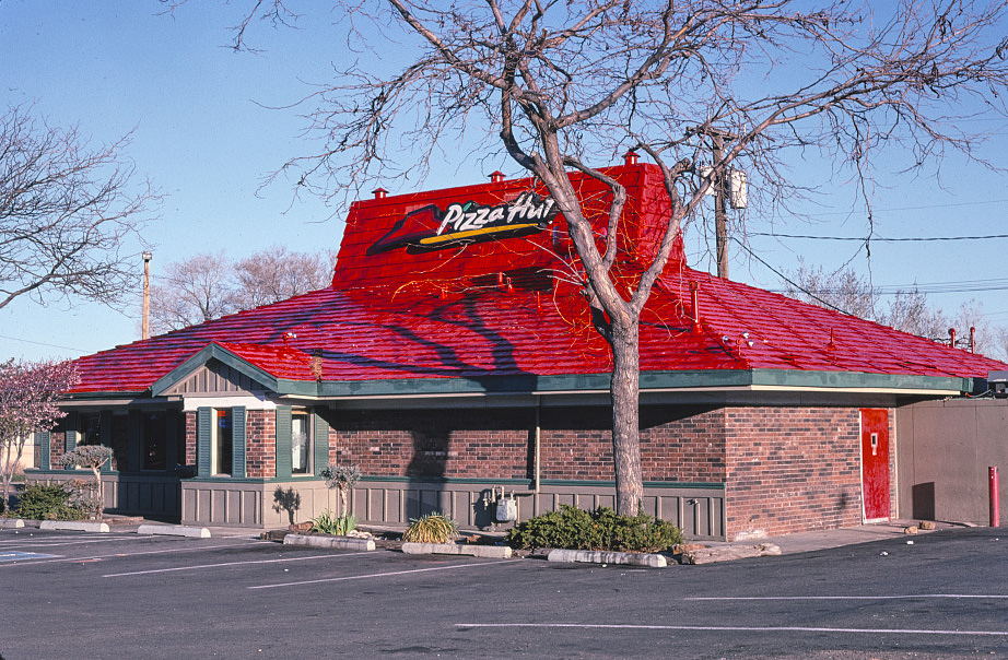
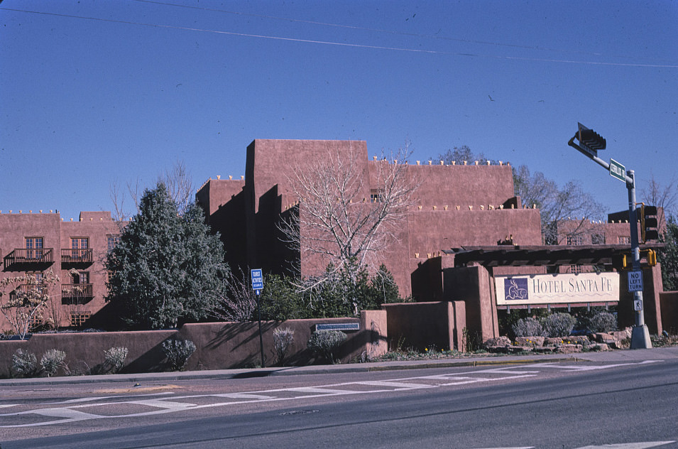
Santa Fe, the state capital, balanced its role as a cultural and historic center with the arrival of national chains and modern development throughout the 1980s and 1990s. The city enforced strict architectural guidelines that required new buildings to follow Pueblo Revival or Territorial styles, which meant that even chain restaurants had to adapt their designs. The result was a city that looked unlike any other fast food landscape in the country.
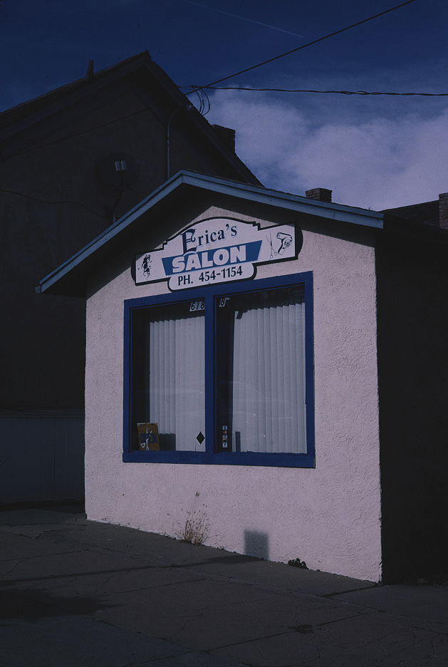
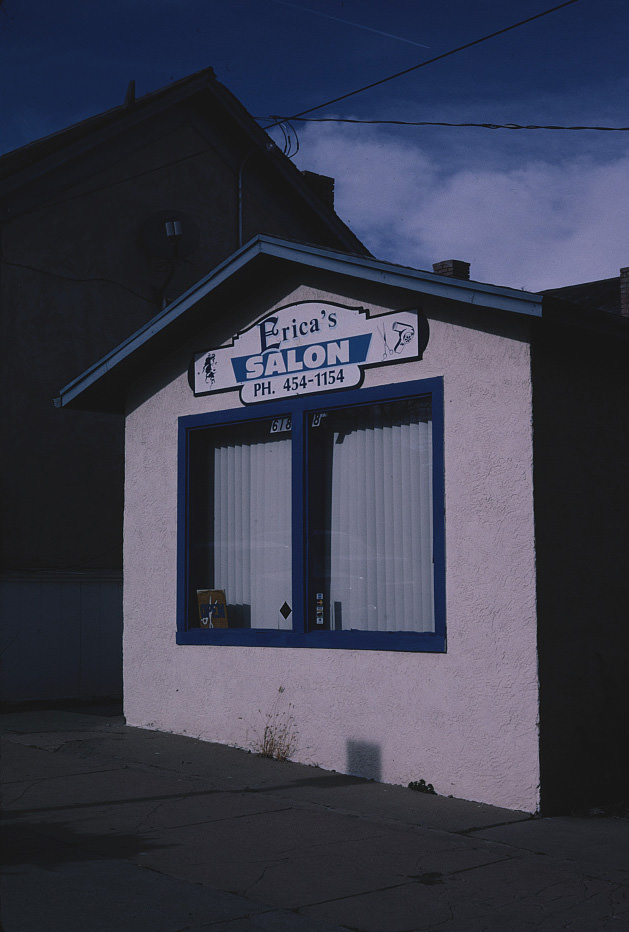
Las Vegas, New Mexico was photographed extensively throughout the 1990s, its downtown blocks providing a consistent visual record of a small city managing with limited resources. Erica’s Beauty Salon, documented across multiple years, represents the kind of small business that anchored neighborhood commercial strips across the state. These were not glamorous enterprises — they were the working infrastructure of everyday New Mexican life.
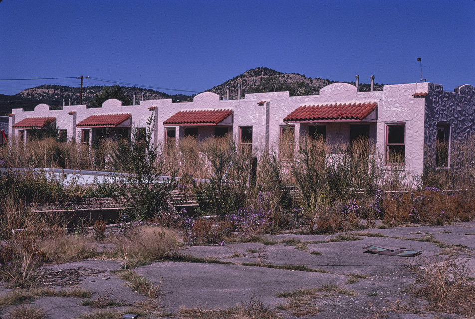
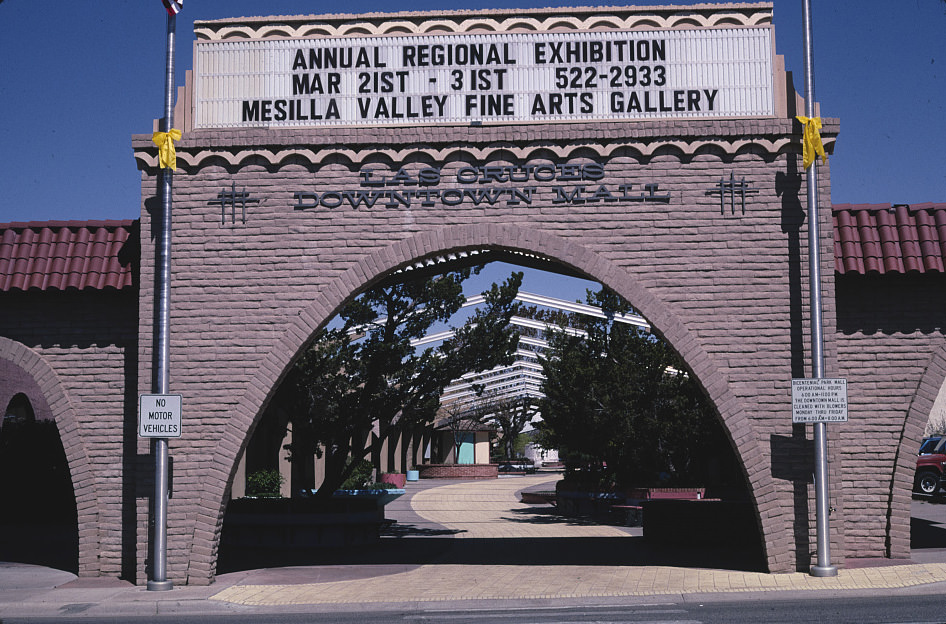
Las Cruces, in the Mesilla Valley near the Texas border, was one of New Mexico’s faster-growing cities during this period. Its downtown in the 1990s reflected that growth — a mix of established local businesses and newer development. The city’s proximity to El Paso and its position along I-25 gave it an economic energy that some of the more isolated New Mexico towns lacked.
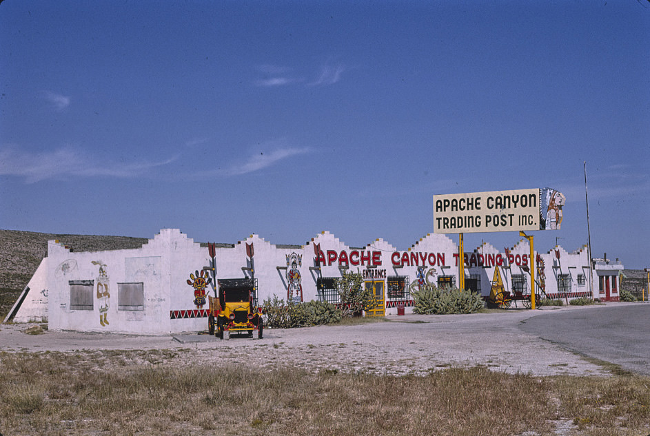
Whites City, near the entrance to Carlsbad Caverns National Park, existed almost entirely to serve park visitors. The Apache Canyon Trading Post was a central stop in this small commercial cluster, offering gas, souvenirs, and food to the tourists who passed through on their way to the caverns. By 1993, the park was drawing hundreds of thousands of visitors a year, and these roadside businesses depended entirely on that traffic.
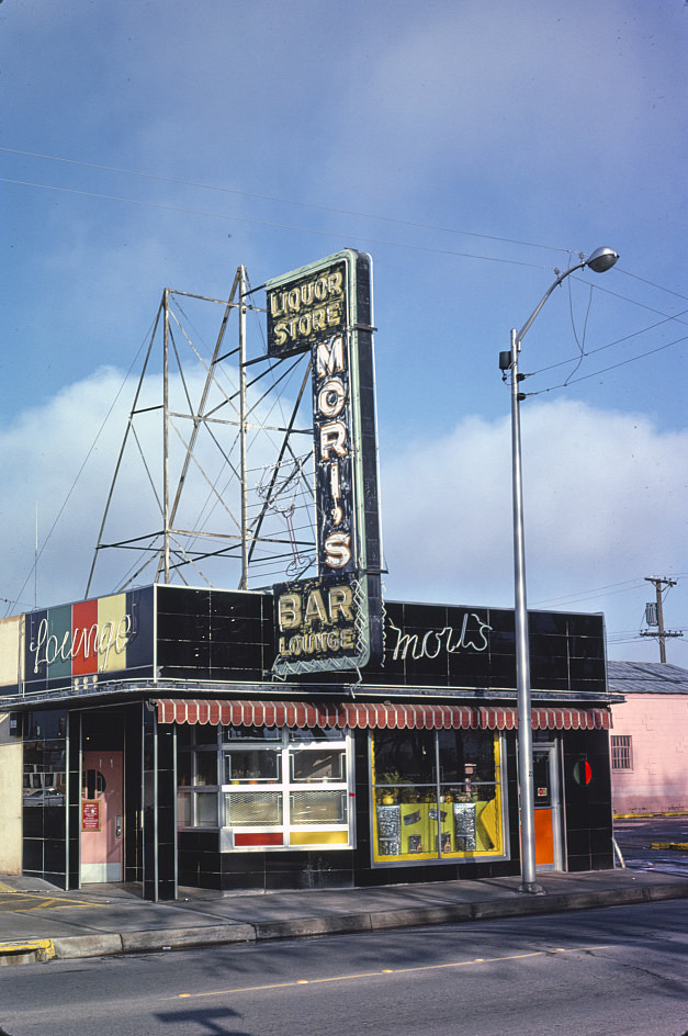
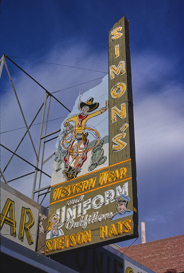
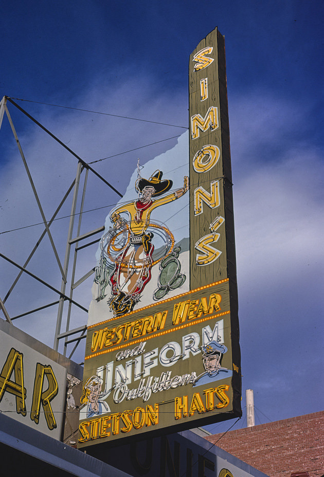
Albuquerque’s Central Avenue in 1984 still carried a strong mix of neighborhood bars, Western wear shops, and local retail. Western wear was not a novelty in New Mexico — it was practical clothing for a state where ranching and outdoor work remained significant parts of the economy. Shops like Simon’s Western Wear served working people as much as they served tourists looking for souvenirs.
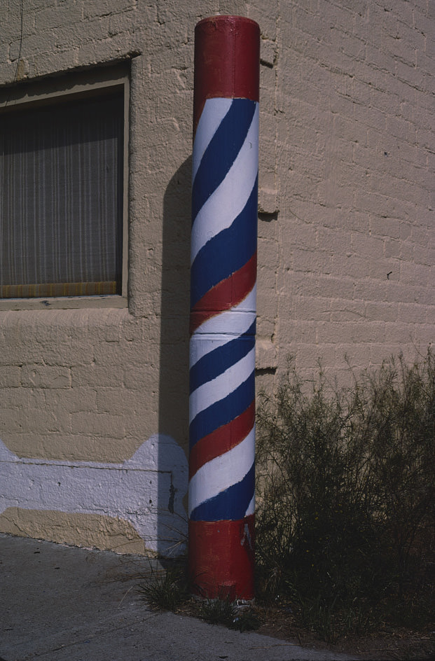
Portales, in the eastern plains of New Mexico near the Texas border, was a small agricultural community with a downtown that had changed little since the mid-century. The barber pole photographed there in 1982 is a simple but telling image — the kind of detail that reveals the pace of life in a town where national trends arrived slowly, if at all.
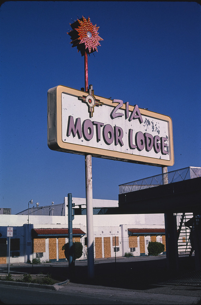
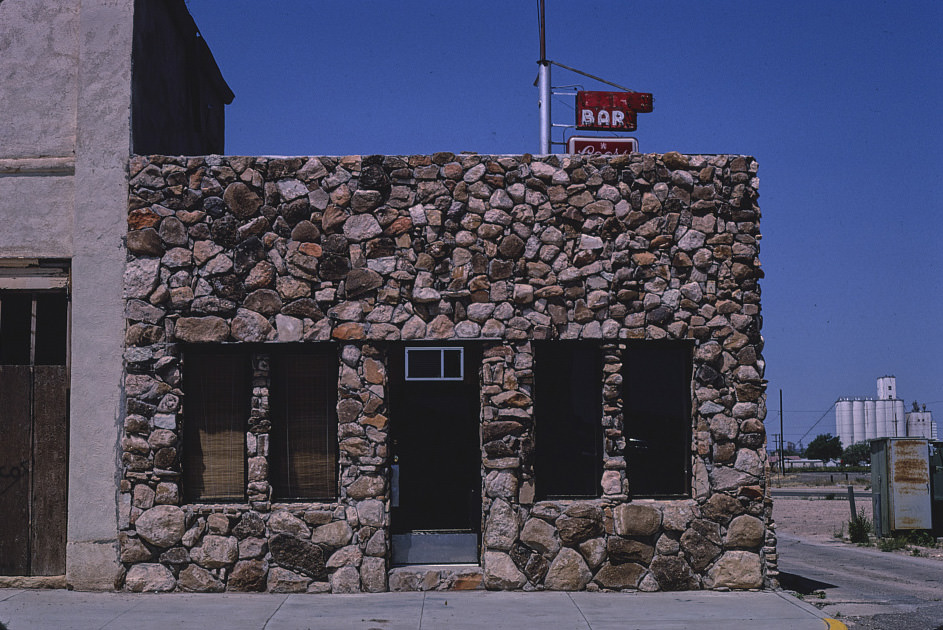
Tucumcari’s bars and diners in the early 1980s still drew on the highway traffic that Route 66 had once delivered reliably. By then, I-40 had absorbed most of that traffic, and the old commercial strip was quieter. The B&M Bar and similar establishments continued to serve the local population, but the traveler trade that had once sustained them was largely gone.
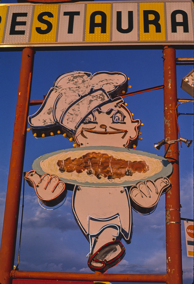
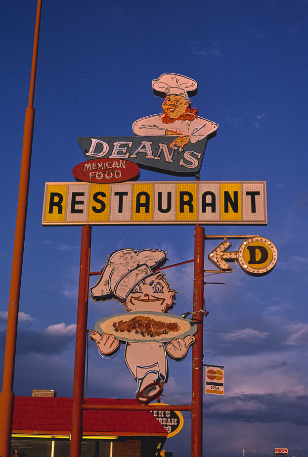
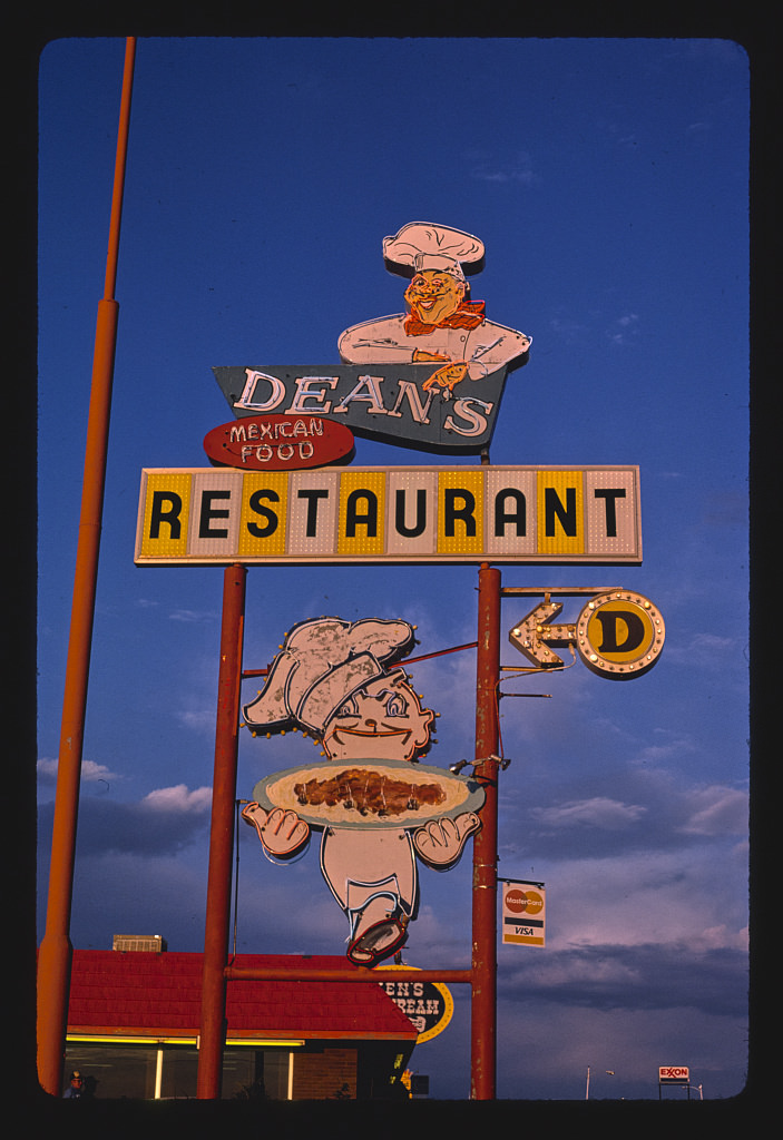
Dean’s Restaurant in Tucumcari had one of the more elaborate signs on the Route 66 corridor in eastern New Mexico. Its spoke sign and chef detail were documented multiple times throughout 1987, capturing a level of craftsmanship in roadside sign-making that was already becoming rare. These signs had been designed to catch the eye of passing motorists, and they still did — just for photographers instead of travelers looking for a meal.
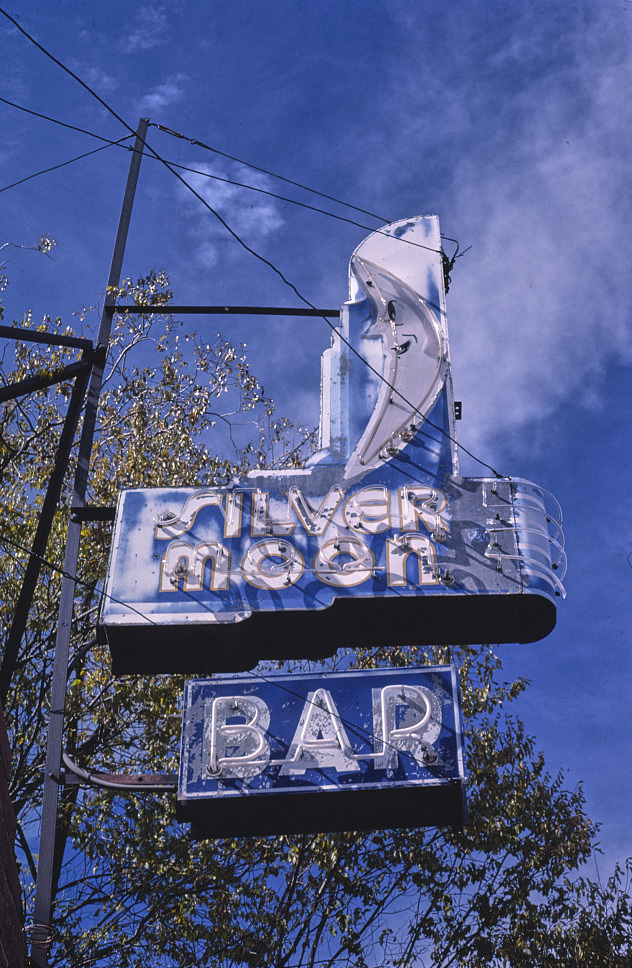
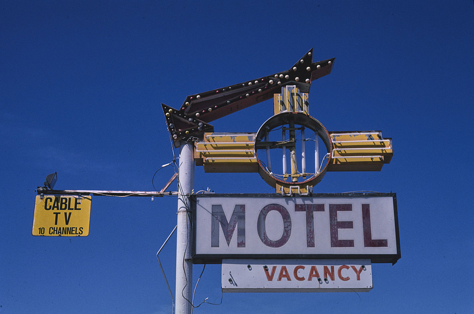
Grants in 1987 still showed traces of its Route 66 commercial past, even as the uranium economy that had briefly energized it sat in ruins. The Silver Moon Bar sign was one of many neon and painted signs that lined the old highway through town. By 1997, some of these signs were deteriorating, while others had been maintained simply because replacing them cost more than leaving them up.
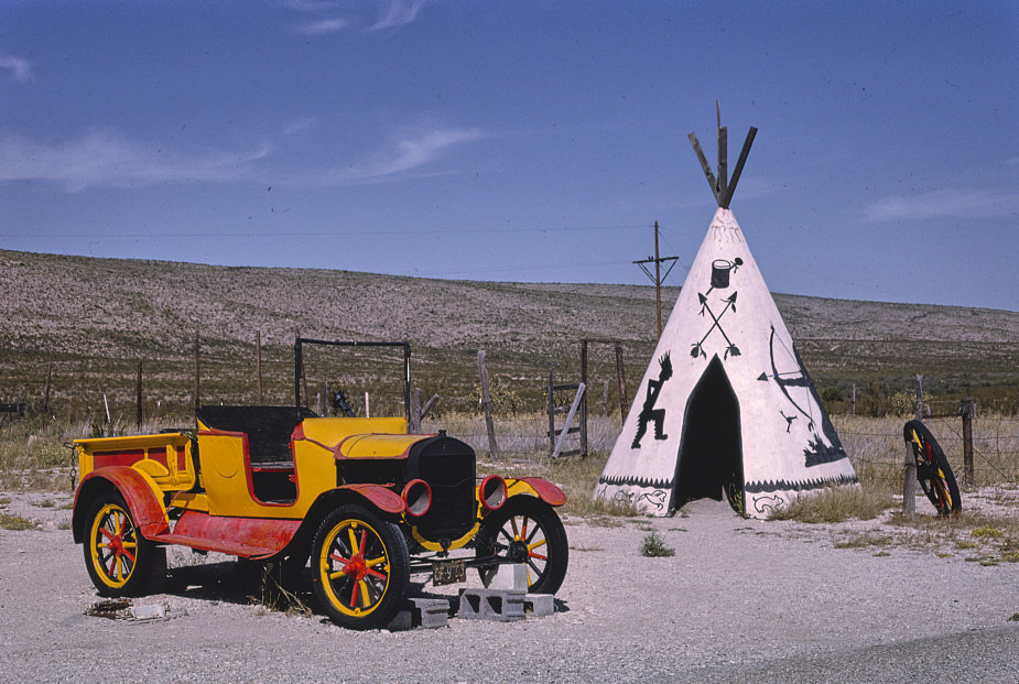
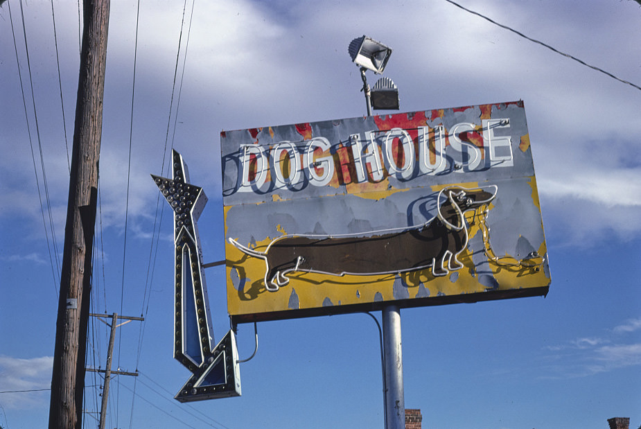
Trading posts near national parks and along major highways frequently used visual landmarks — teepees, giant figures, or unusual architecture — to pull in passing drivers. The Apache Canyon Trading Post near Whites City used exactly this approach, with a teepee structure visible from the road. This style of roadside marketing had deep roots in the Southwest, where the distances between towns were large and businesses needed to advertise from a long way off.
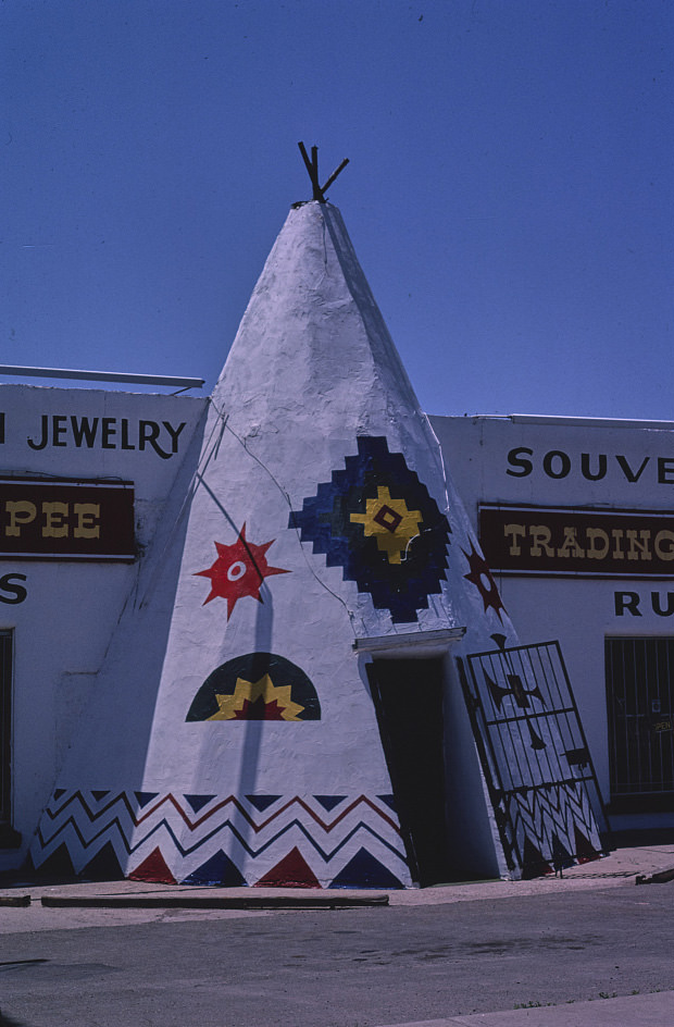
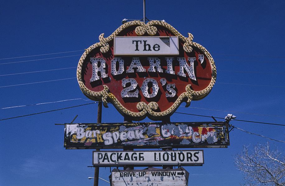
Jene’s Teepee Gifts in Tucumcari was a fixture on Route 66, its teepee imagery designed to appeal to tourists driving through the Southwest. In 1989, New Mexico became the first of only four states to adopt the English Plus resolution, which formally recognized the value of non-English languages alongside English. That policy reflected a state where Spanish, Navajo, and other languages were spoken daily, and where cultural identity was tied closely to language.
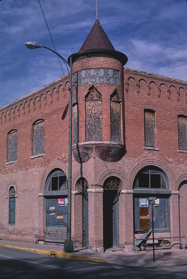
Las Vegas, New Mexico’s center blocks in the 1990s presented a streetscape that seemed relatively unchanged from earlier decades. The town had a historic plaza surrounded by late 19th- and early 20th-century commercial buildings, many of which were still occupied by local businesses. The city’s relative isolation from major urban centers helped preserve this character, even as New Mexico’s larger cities were modernizing rapidly.
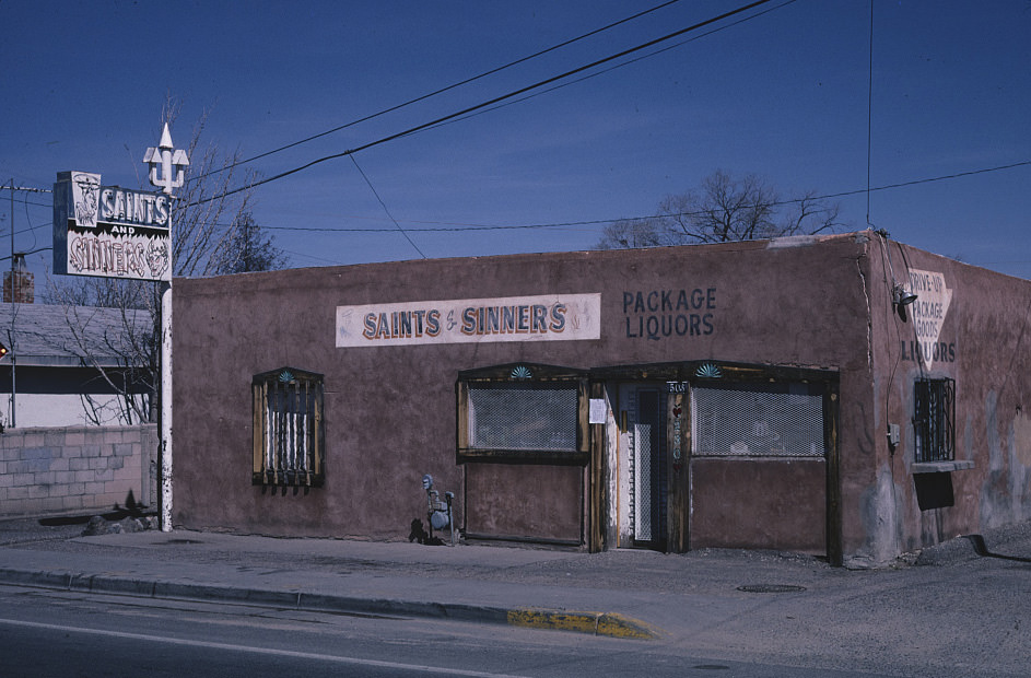
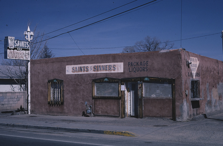
Espanola, in the Rio Grande valley between Santa Fe and Taos, was a working-class community that saw some of the more difficult social conditions in New Mexico during this period. Its commercial strip in the late 1990s reflected a town with limited resources. The Saints & Sinners Liquor Store was one of many small businesses along the main road, its name a piece of local humor in a town with a complicated relationship with poverty and substance abuse.
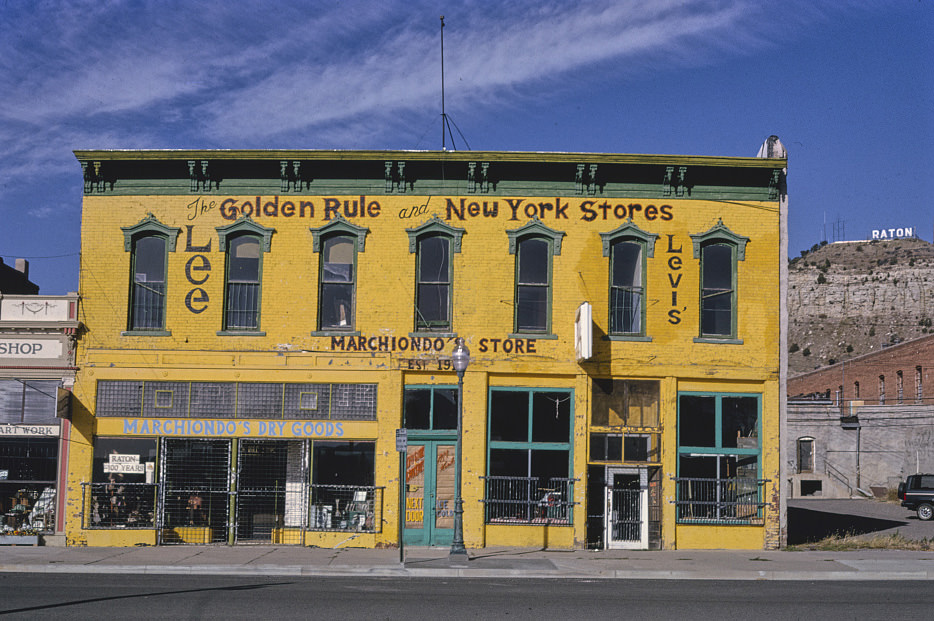
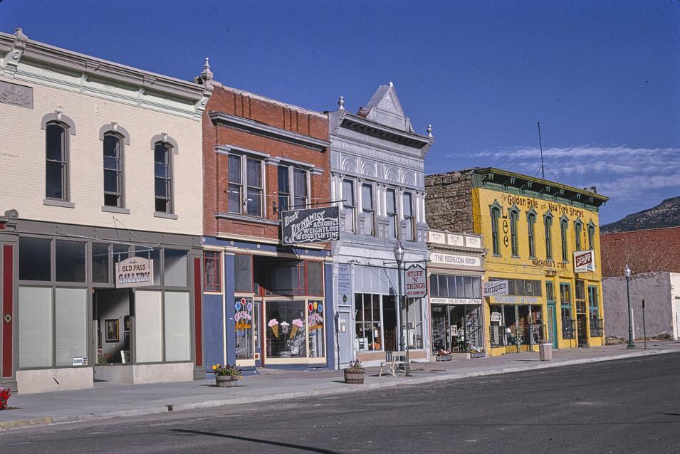
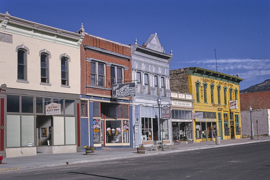
Raton’s South 1st Street held a variety of small retailers in the early 1990s, including old-fashioned general merchandise stores. The Golden Rule and New York Stores represented the kind of downtown retail that was disappearing across the country as big-box stores expanded into smaller markets. In towns like Raton, these shops had served the community for generations and continued to do so well into the decade.
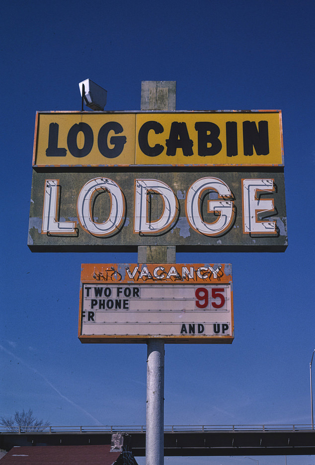
Gallup, in northwestern New Mexico near the Arizona border, served as a major trading hub for the Navajo Nation and surrounding communities. Its downtown and commercial strip carried a mix of pawn shops, trading posts, motels, and restaurants. The Log Cabin Lodge sign in 1999 was one of many surviving mid-century commercial signs in a city that had developed a strong visual identity tied to its role as the heart of Indian Country.
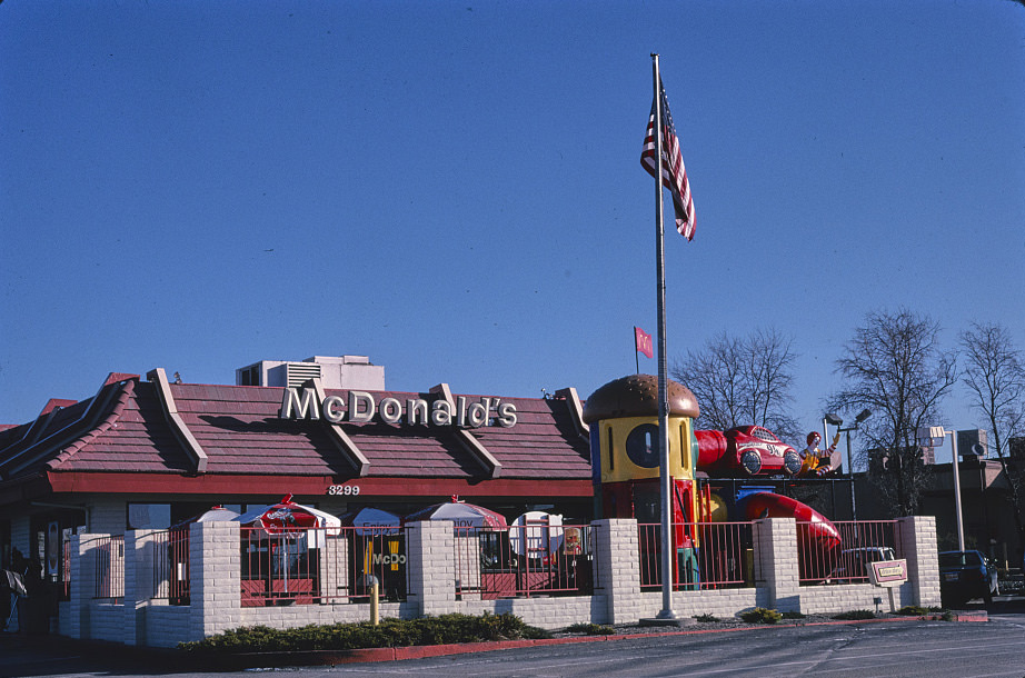
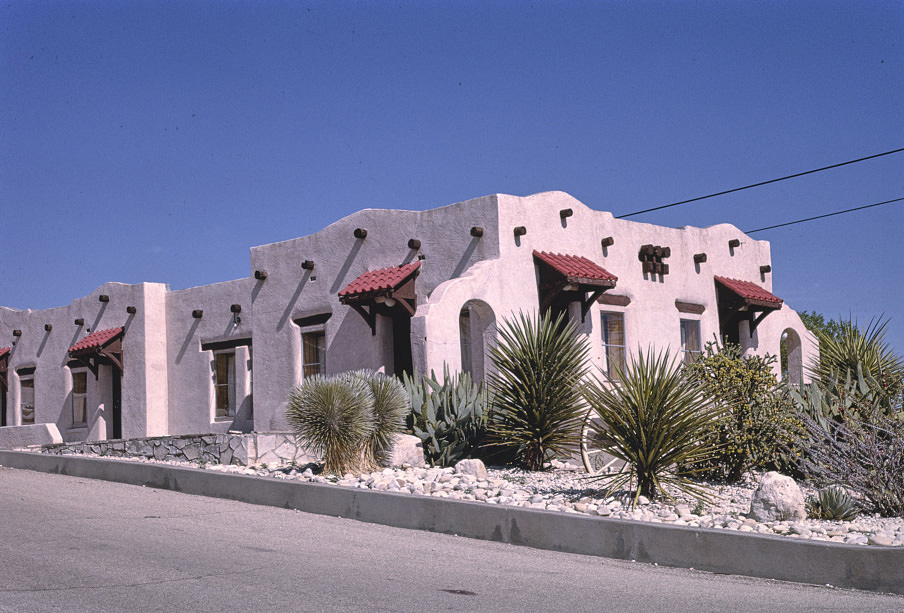
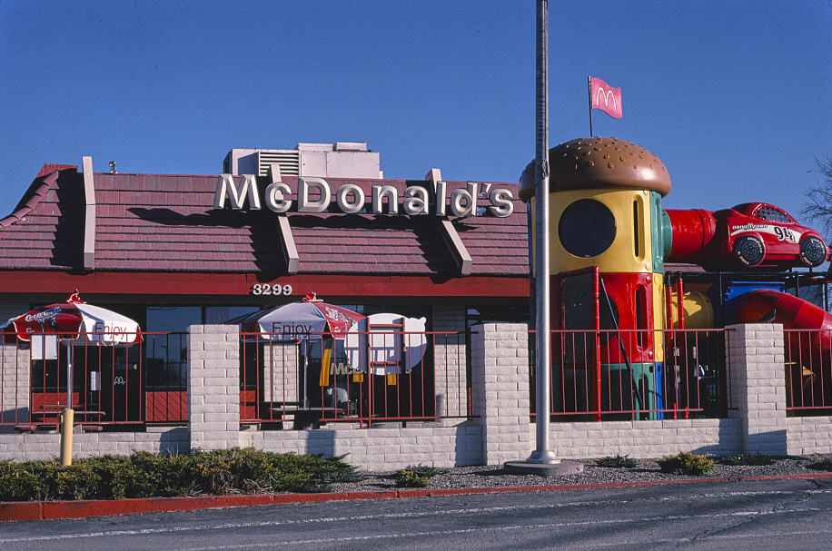
Santa Fe’s architectural rules shaped how chain restaurants appeared in the city, producing a version of McDonald’s that looked nothing like its counterparts in other states. The turquoise and adobe exterior required by the city’s design standards made national brands look local. This approach made Santa Fe one of the most architecturally consistent cities in the country, a quality that also drove tourism and real estate investment through the 1990s.
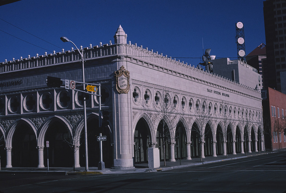
Albuquerque’s downtown core included several significant mid-century commercial and office buildings, some of which changed tenants and names over the decades while their physical structures remained. The Production Credit Building at 3rd and Gold, later the Occidental Life Company Building, was documented across multiple decades as the city’s downtown evolved around it. Albuquerque’s economy was more diversified than most New Mexico cities, supported by government, military, and university employment.
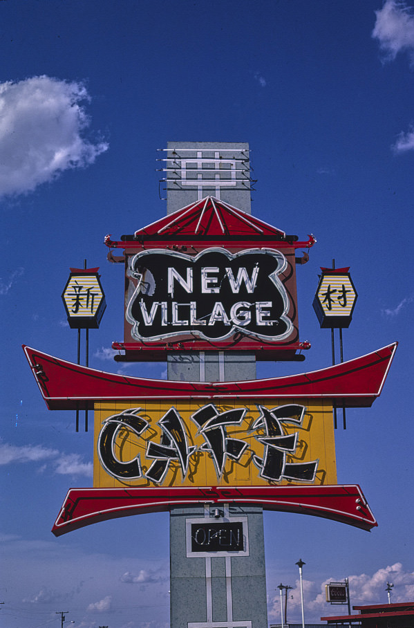
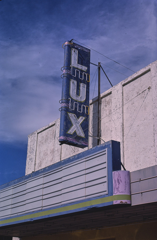
Hobbs, in the oil-producing Permian Basin near the Texas border, had a commercial culture tied closely to the petroleum industry. The New Village Cafe sign in 1985 reflects a town that was moderately prosperous by New Mexico standards, supported by oil and gas revenues even as prices fluctuated through the decade. Hobbs was one of the few New Mexico communities that didn’t depend heavily on federal spending or tourism.
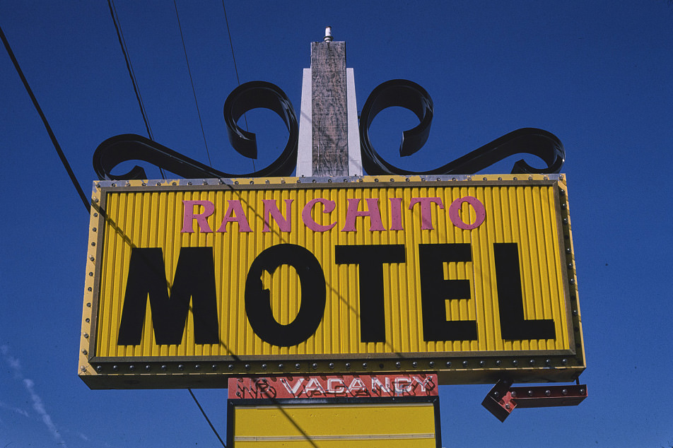
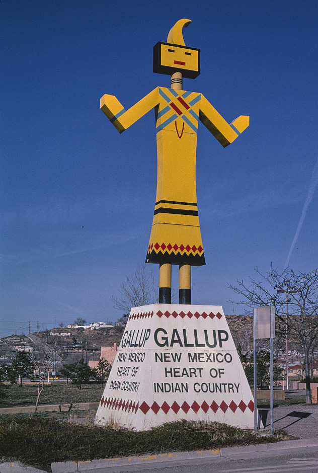
Gallup’s identity as the Heart of Indian Country was both a commercial slogan and a geographic reality. The city sat at the edge of the Navajo Nation and was the closest major commercial center for many Navajo and Zuni residents. Its motels, shops, and restaurants served this population alongside the travelers on I-40. The Gallup Kachina sign captured this dual identity — tourism branding layered over a genuine regional role.
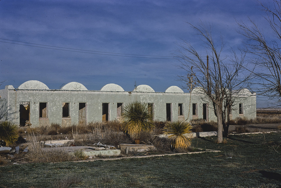
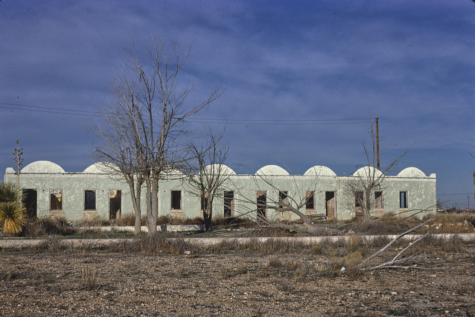
Lordsburg, in the boot heel of southwestern New Mexico, was a small railroad and highway town that served travelers on I-10 between El Paso and Tucson. The Hightower Motel and the nearby drive-in theater were among its few commercial landmarks in 1981. These small highway towns existed at the margins of the state’s economy, dependent on through traffic for their survival.
New Mexico’s clean air debates were particularly intense during this era. The state sat at the intersection of its dependence on the smokestack industries — primarily coal and copper smelting — and its booming scenic tourism economy. The Clean Air Act of 1967 and its subsequent amendments in 1970 and 1977 put direct pressure on industrial operations in the state, and New Mexico was repeatedly at the center of negotiations over how strictly those rules would be enforced.
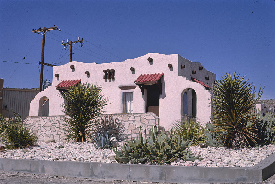
In March 1999, a major milestone arrived in southeastern New Mexico. The Waste Isolation Pilot Plant, located in the desert near Carlsbad, opened as the world’s first underground storage facility for radioactive waste. The site stored transuranic waste — materials contaminated with plutonium and other radioactive elements from nuclear weapons production. It was carved out of ancient salt deposits nearly 2,150 feet underground, and its opening marked the end of a decades-long political and scientific debate over where to put this material.
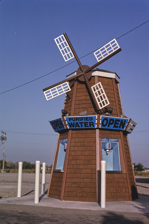
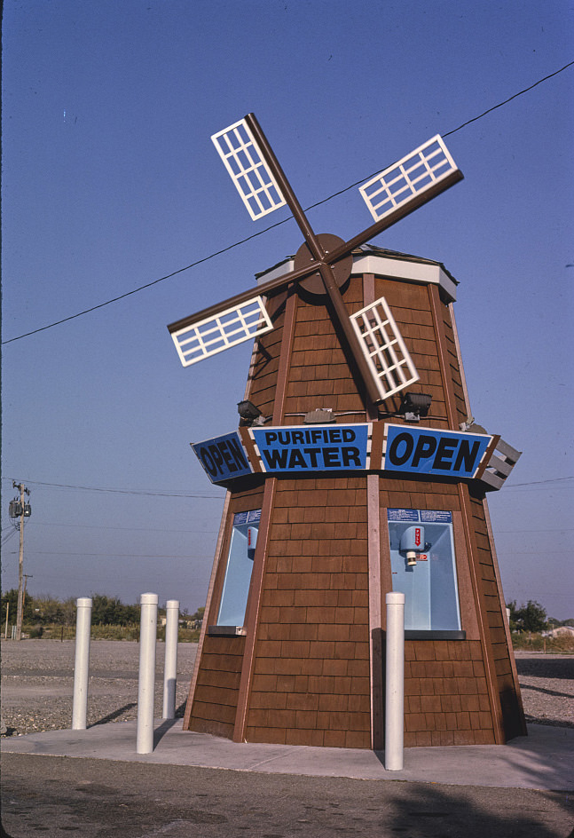
Water was a persistent concern across New Mexico, particularly in the drier eastern and southeastern regions. Improved irrigation techniques had helped expand agricultural production through the 1980s and 1990s, but groundwater depletion was already a long-term worry. The purified water windmill photographed in Roswell was a small visual reminder of how central water infrastructure was to life in the high desert.
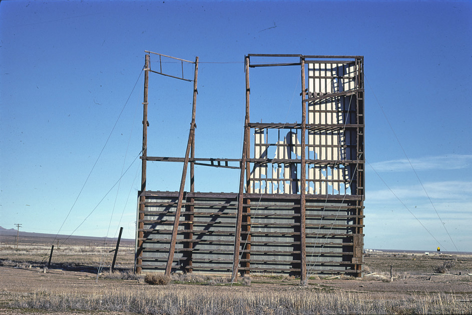
Drive-in theaters were still operating in several New Mexico towns in the early 1980s, including Lordsburg. These outdoor cinemas had been built during the postwar boom when car culture was expanding and cheap land was easy to find. By 1981, many were already closing, and those that remained operated with limited resources. The drive-in in Lordsburg was typical of these surviving venues — functional but fading.
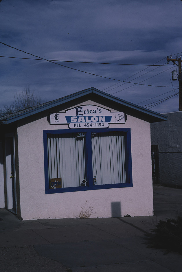
Las Vegas, New Mexico presented one of the most compelling visual records across these two decades. Photographers returned to the same streets and storefronts year after year, creating a time-lapse of a small city managing slow economic change. Erica’s Beauty Salon, documented in 1997, 1998, and 1999, became an unlikely recurring subject — a ground-level view of continuity in a place where continuity was itself a kind of achievement.
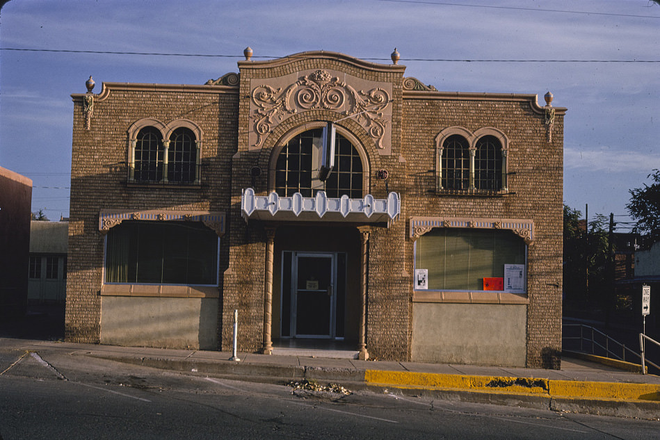
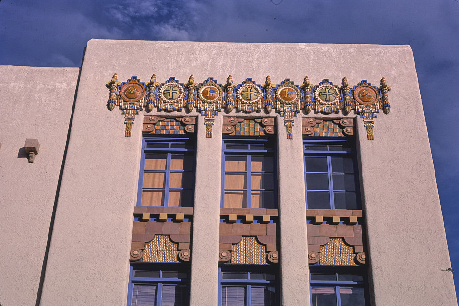
Silver City’s downtown in 1991 showed the range of institutions that kept a small mining city functional — the courthouse, the local newspaper, the power company, and a scattering of small businesses. The Texas-New Mexico Power Co. building on Broadway Street was a reminder that Silver City’s utilities were tied to a regional grid that crossed state lines, reflecting the economic geography of the border region.
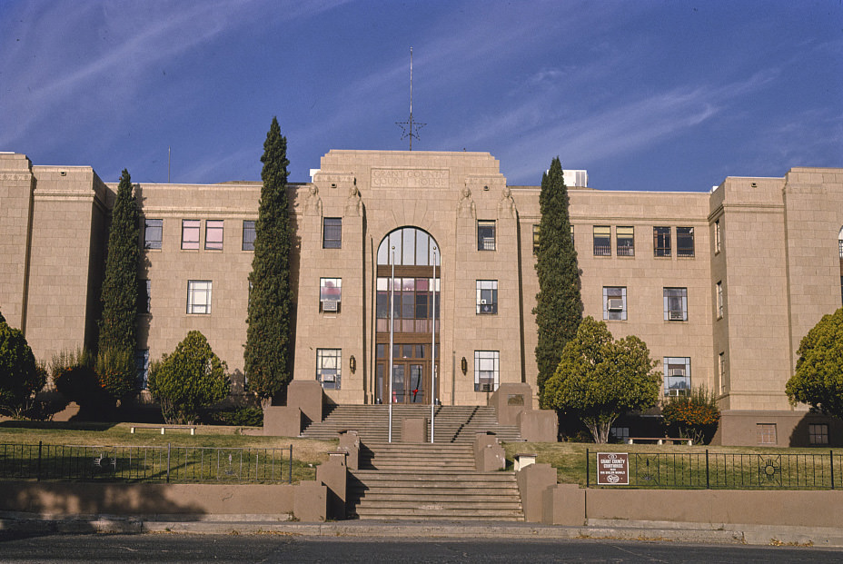
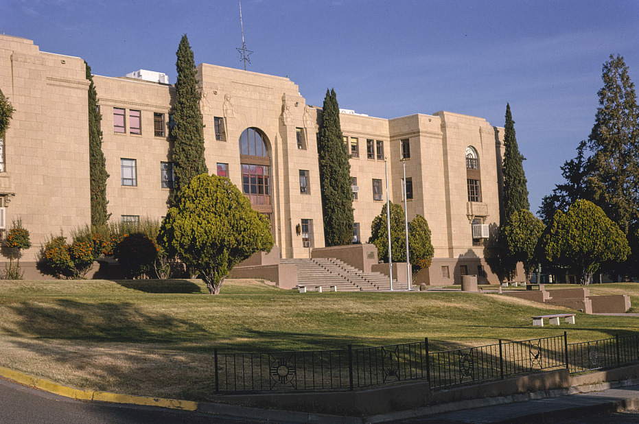
The Grant County Courthouse on Copper Street in Silver City was documented from multiple angles across several years. Its Romanesque Revival architecture stood in contrast to the surrounding commercial buildings, a remnant of the late 19th century ambitions of a silver-mining boomtown. By the 1990s, the courthouse was a well-maintained public building anchoring a downtown that had survived the end of the silver era.
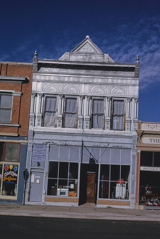
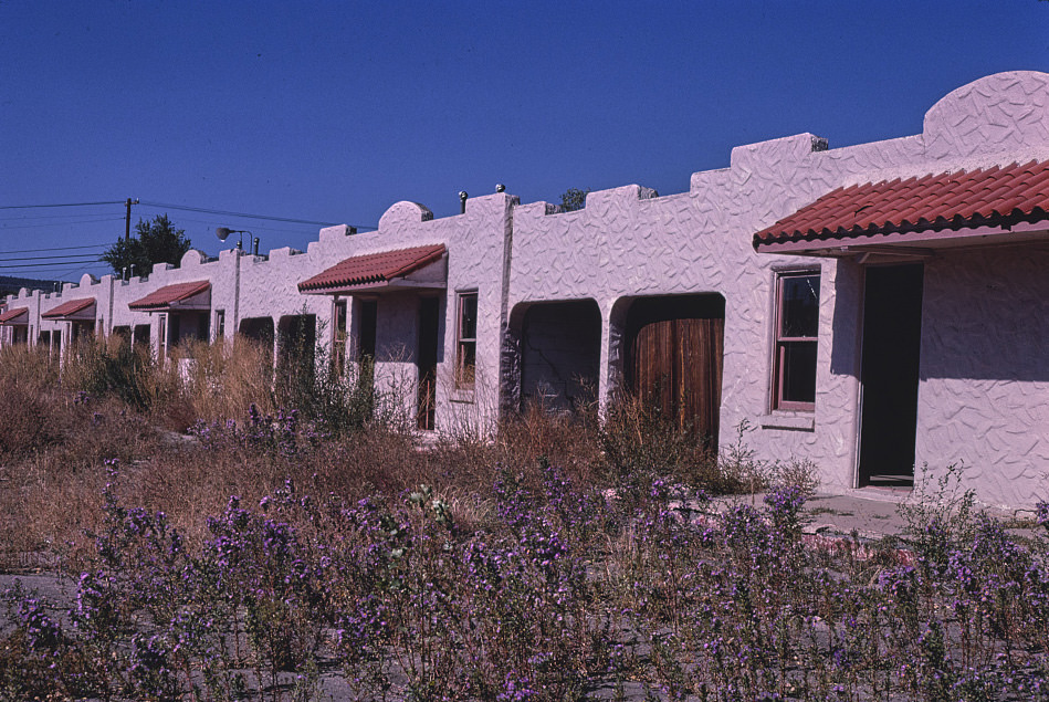
Raton’s South 1st Street in the early 1990s mixed general merchandise shops with the older commercial fabric of the town. Stuff n’ Things was the kind of eclectic small retailer that filled gaps in the local economy, selling a mix of goods that defied easy categorization. These shops were common in small New Mexico towns where residents had limited access to larger retail centers and needed a single local source for a wide range of items.
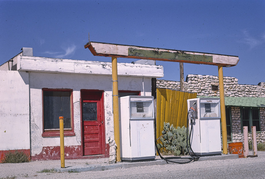
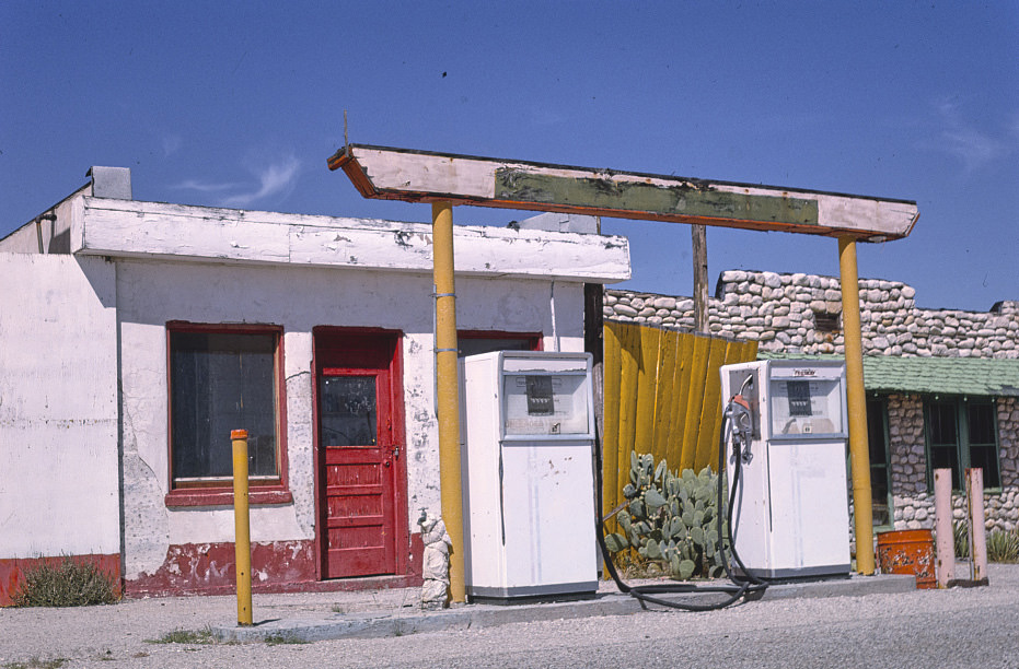
The Apache Canyon Trading Post near Whites City combined fuel, food, and souvenirs under one operation — a practical approach for a remote location where visitors needed multiple services at once. The gas station there served travelers heading to Carlsbad Caverns, and the trading post side offered the Southwestern crafts and trinkets that tourists expected. Operations like this were the economic backbone of many remote New Mexico communities near national parks.
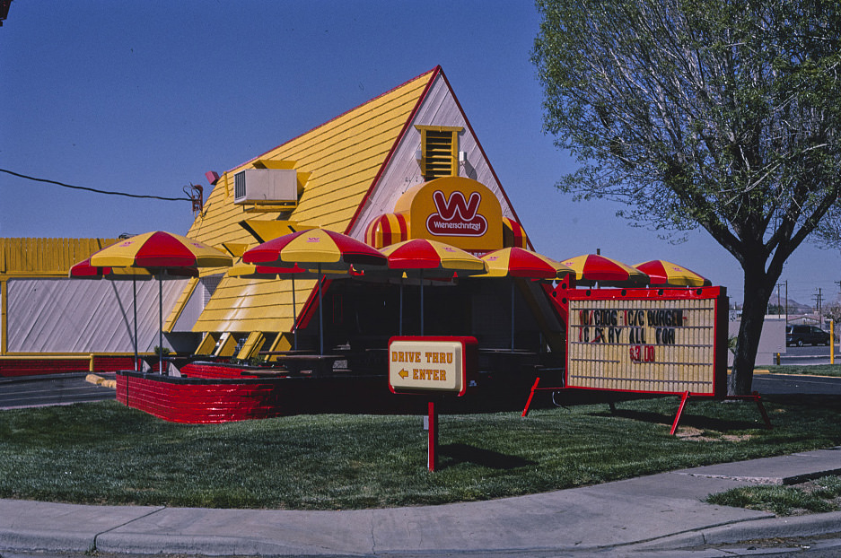
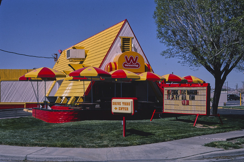
Las Cruces in the early 1990s showed the mix of regional and national commercial culture that characterized New Mexico’s larger cities. Wiener Schnitzel, a fast food chain with roots in Southern California, had established a presence there by 1991. Its appearance alongside local diners and Western wear shops reflected how national retail was gradually moving into markets that had once been served almost entirely by independent businesses.
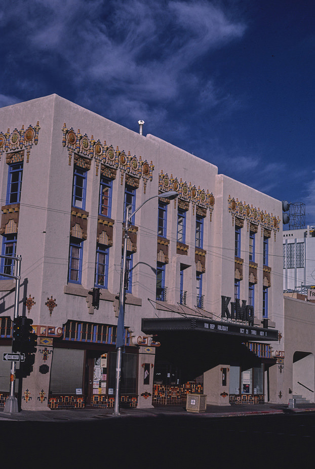
The KiMo Theater was photographed almost every year across this two-decade period, making it one of the most thoroughly documented buildings in the state. In 1988, it was still operating in a reduced capacity, its original movie-house function largely over but its presence on Central Avenue unchanged. The theater’s long photographic record shows both the building’s physical consistency and the changing city around it.
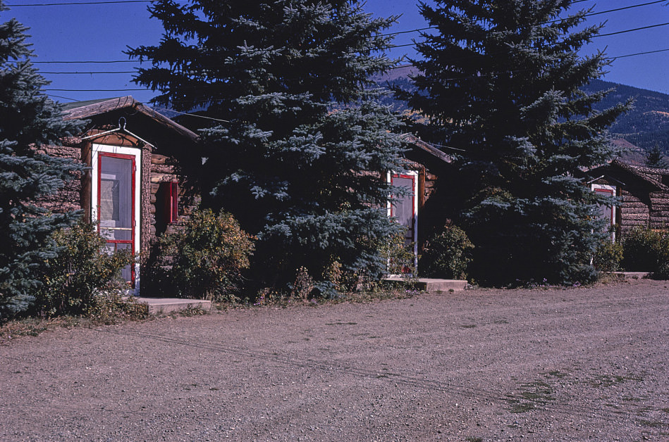
Eagle Nest in 1980 was a small mountain community that operated on a seasonal economy tied to outdoor recreation. The Horseshoe Motel served hunters and fishermen who came to the Cimarron Valley region, particularly during the fall hunting season. These mountain towns had a different rhythm than the highway communities along Route 66 — quieter in the off-season and intensely busy during the weeks when their primary customer base arrived.
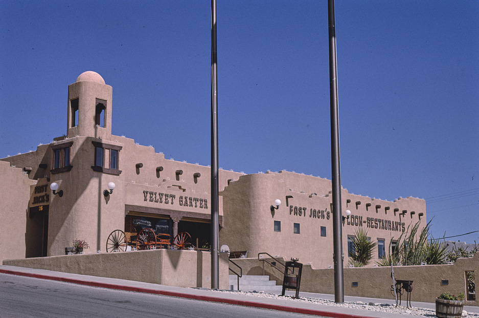
Whites City’s restaurant cluster in 1993 existed almost entirely to feed park visitors. The town had no real local population to support these businesses — everything there depended on tourism. This made Whites City an extreme example of a pattern found throughout New Mexico, where scenic tourism had become one of the state’s most important economic engines, particularly in areas where industrial and agricultural activity had declined.
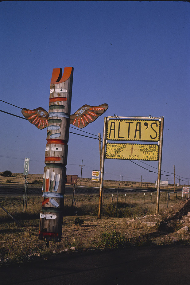
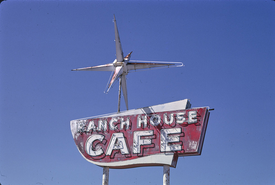
Route 285 through central New Mexico passed through some of the emptiest country in the state. Vaughn sat at its junction with US 60, a crossroads that gave the tiny town its only reason to exist. The Ranch House Cafe served the sparse traffic on both roads, and its survival into the 1990s was a testament to how long a business could persist when it served a genuinely captive audience — travelers with no other options for many miles in any direction.
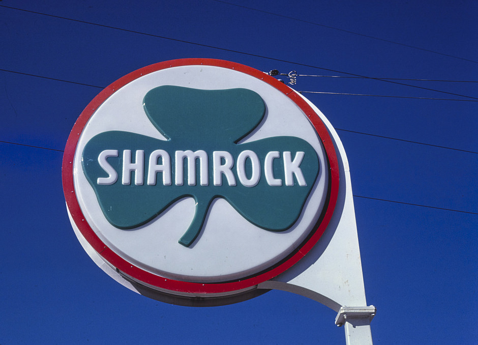
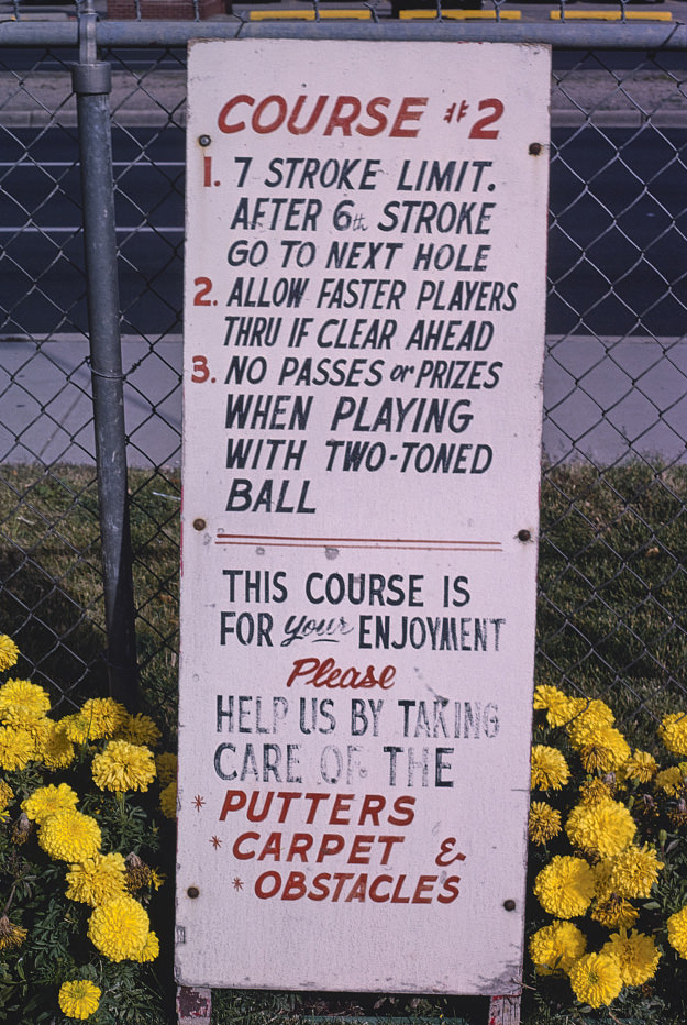
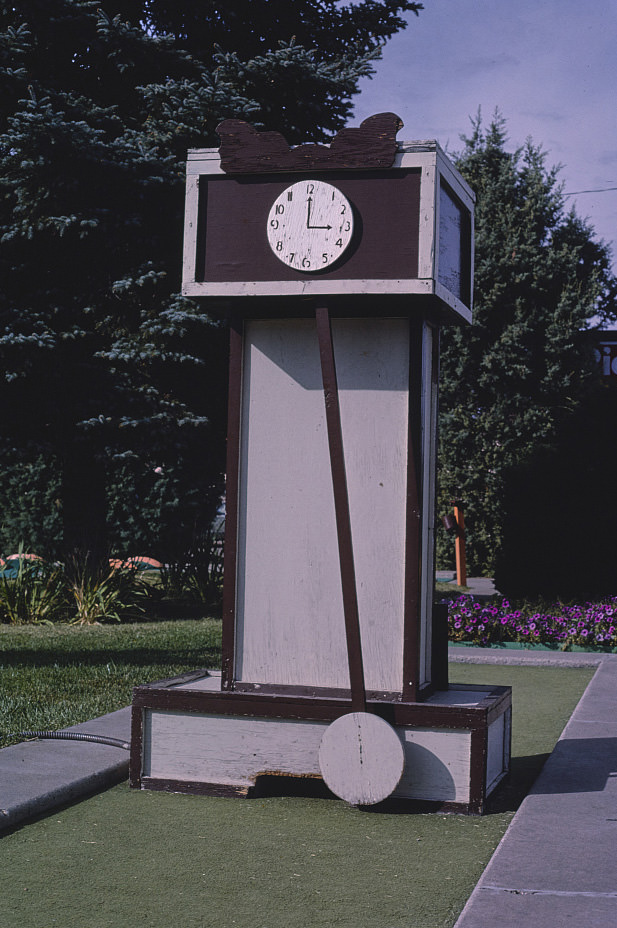
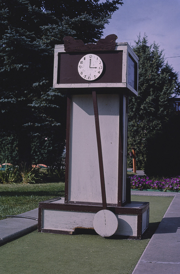
Albuquerque’s Leisure Twin Putt miniature golf course was photographed in 1987, its Big Ben replica and posted rules capturing a slice of suburban leisure culture. Miniature golf courses were a common feature of American cities in this era, and Albuquerque was no exception. The course represents the kind of family entertainment that existed alongside the Route 66 commercial culture — a city life that went beyond just diners and motels.
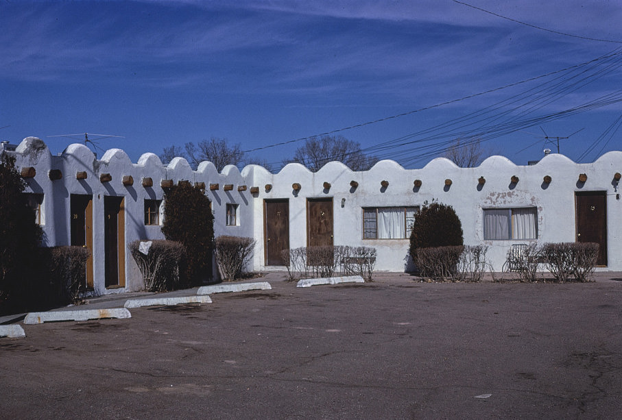
Santa Fe in 1981 still had a mix of modest local motels alongside its more upscale tourist accommodations. La Casa Judy Motel was representative of the simpler end of the market — small, affordable lodging that served travelers who came to Santa Fe before the city’s art market and tourism economy pushed prices significantly higher. Over the next two decades, many of these modest properties were replaced or converted as the city’s real estate values climbed.
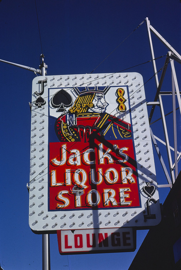
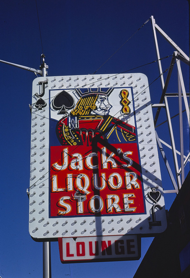
Central Avenue’s liquor store signs in the early 1980s were part of a commercial landscape that mixed services at all price points. Jack’s Liquor on Central Avenue was one of many such establishments on a street that had long served both travelers and neighborhood residents. The sign itself was a piece of mid-century commercial graphics — bold, simple, and designed to be read from a moving car.
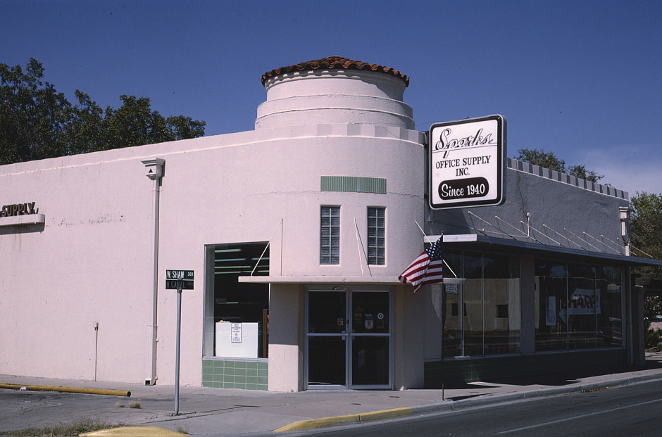
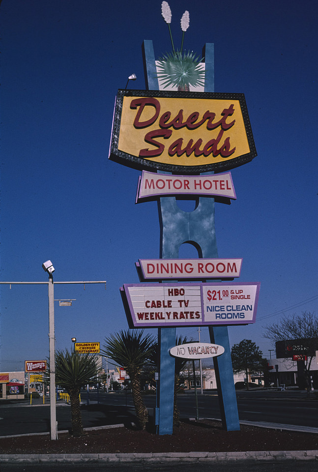
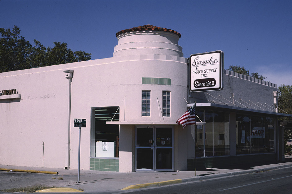
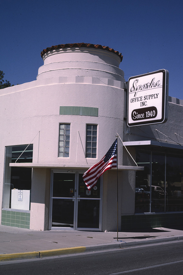
Carlsbad, in southeastern New Mexico, had an economy built on potash mining and tourism to Carlsbad Caverns. The Sparks Office Supply Co. was a local institution that served the region’s business community across multiple decades. Its survival into the 1990s, documented across several years of photographs, reflects Carlsbad’s relative stability compared to some of the other smaller New Mexico cities that were dealing with more severe economic pressures.
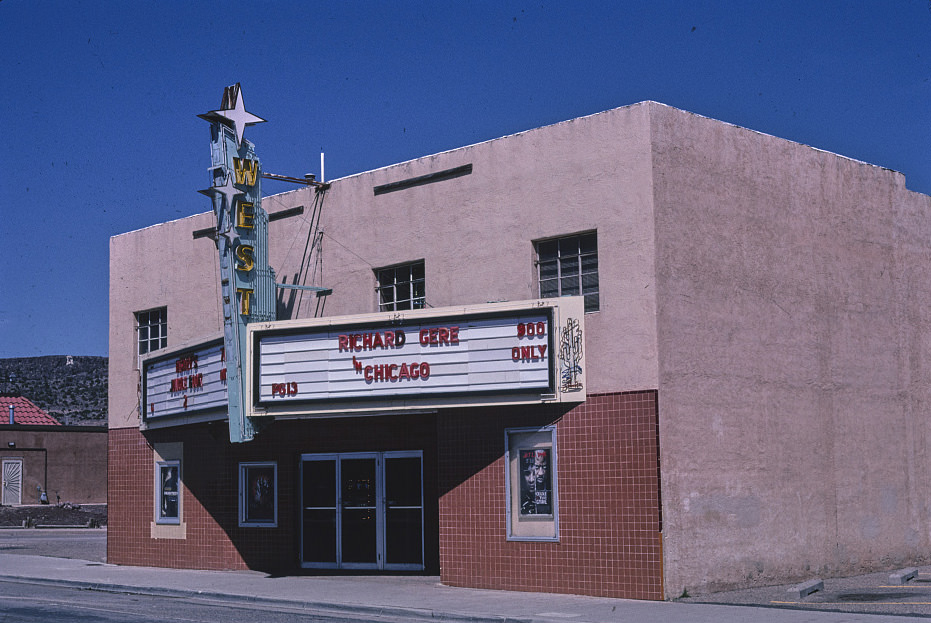
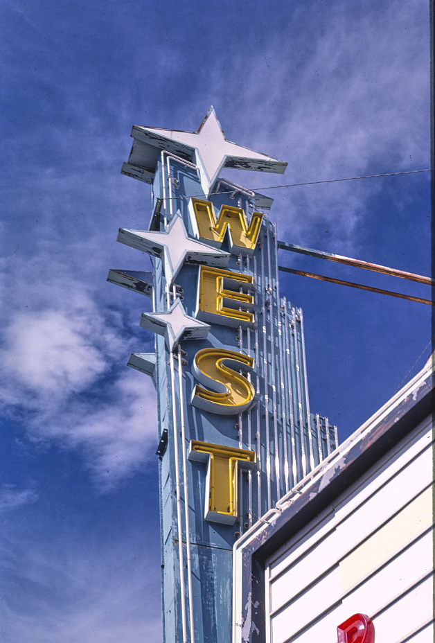
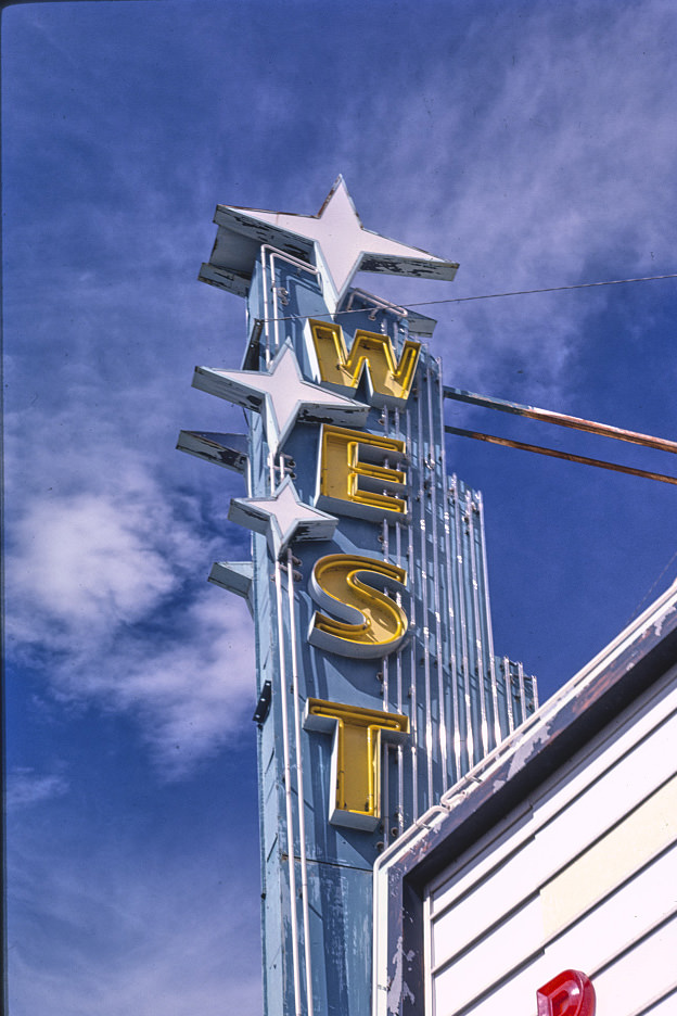
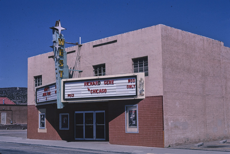
The West Theater in Grants was documented across the late 1990s as part of a broader effort to record the surviving movie theaters along the old Route 66 corridor. Many of these theaters had closed as multiplex cinemas expanded into regional markets, and those that remained were often in poor condition. The West Theater in 1997, 1998, and 1999 was photographed as a building that had outlasted its original purpose.
![City Electric Shoe Shop (old Theater?), Cole [i.e. Coal] Avenue, Gallup, New Mexico, 1999](https://www.bygonely.com/wp-content/uploads/2022/09/New_Mexico_1980s_and_1990s_117.jpg)
Gallup’s Coal Avenue in 1999 still held several converted commercial buildings whose original uses were no longer obvious. The City Electric Shoe Shop occupied what may have been an old theater building — a pattern common in small cities where movie houses had been repurposed as retail storefronts when audiences stopped coming. These conversions preserved the buildings while erasing their original function.
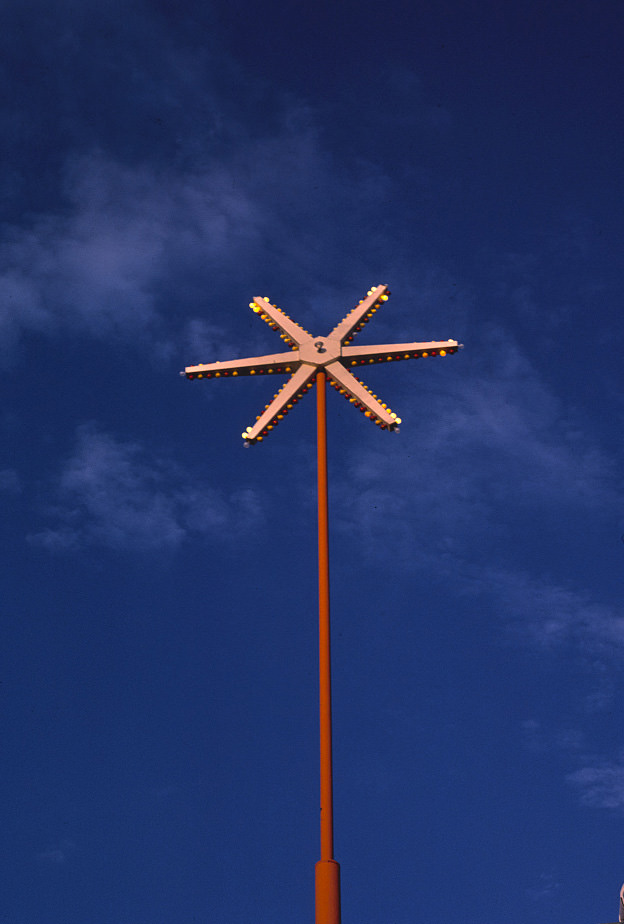
Dean’s Restaurant in Tucumcari was among the more heavily documented businesses along the New Mexico stretch of Route 66. Its signs were photographed from multiple angles and at different times of day in 1987, capturing the craftsmanship of roadside commercial design. The spoke sign format — a circular sign mounted on a pole with radiating spokes — was a specific style from the mid-century that was rarely being produced by the time these photographs were taken.
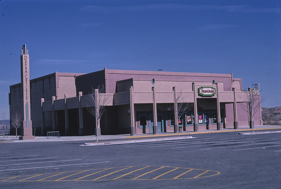
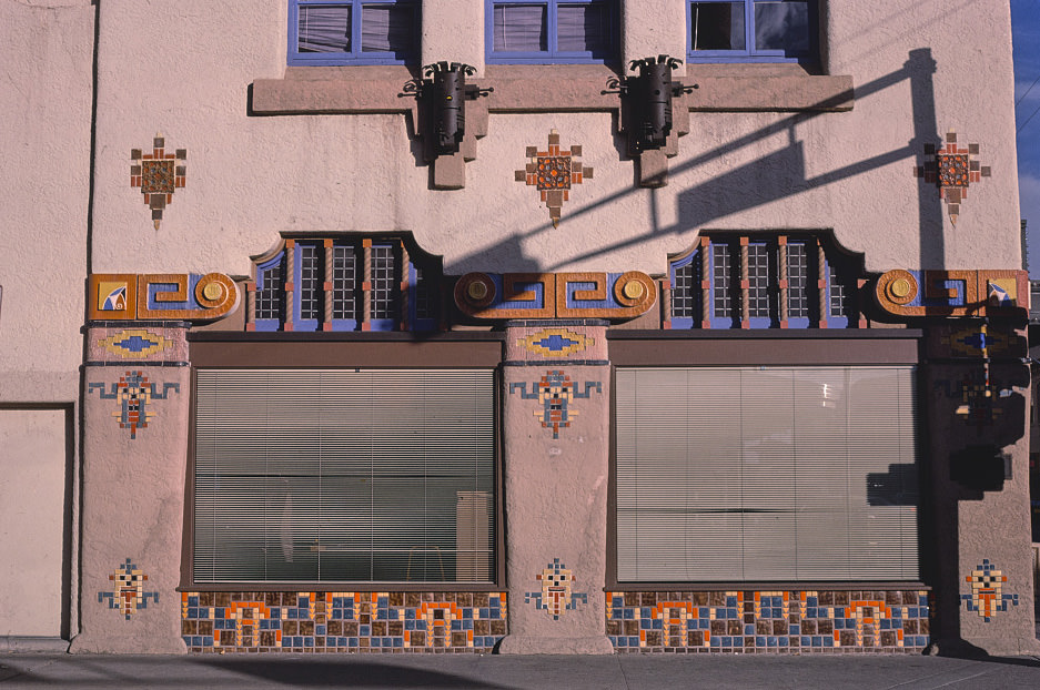
The Dream Catcher Theater in Espanola represented a different kind of New Mexico commercial culture — a contemporary multiplex built in the 1990s rather than a surviving relic from earlier decades. Its name drew on Native American imagery in a region where that imagery carried genuine local meaning. Espanola sat between Santa Fe and Taos in the Rio Grande valley, and the theater served a regional population that had limited entertainment options nearby.
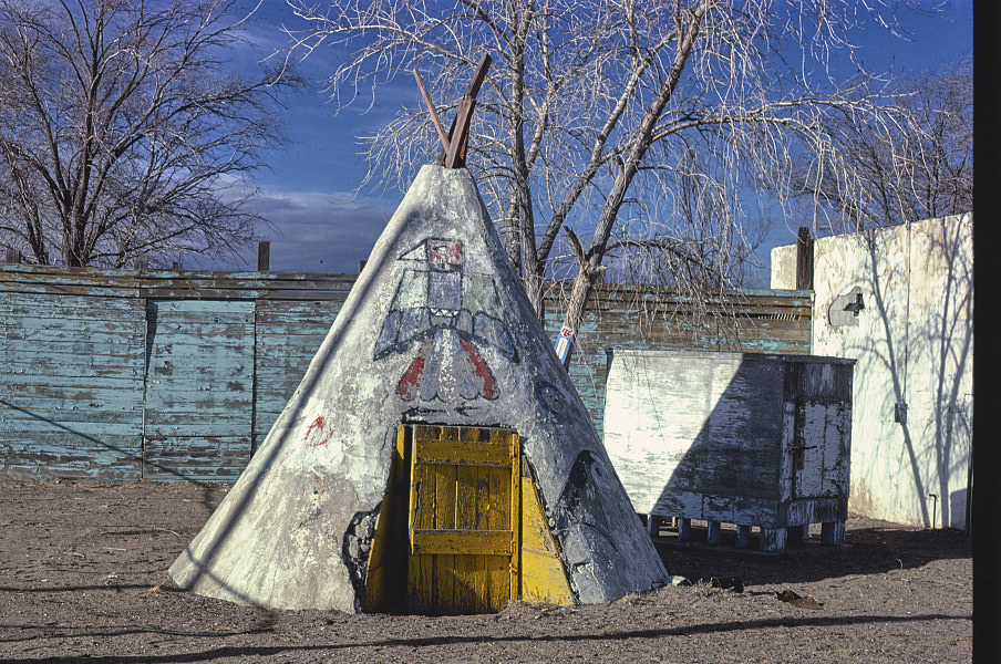
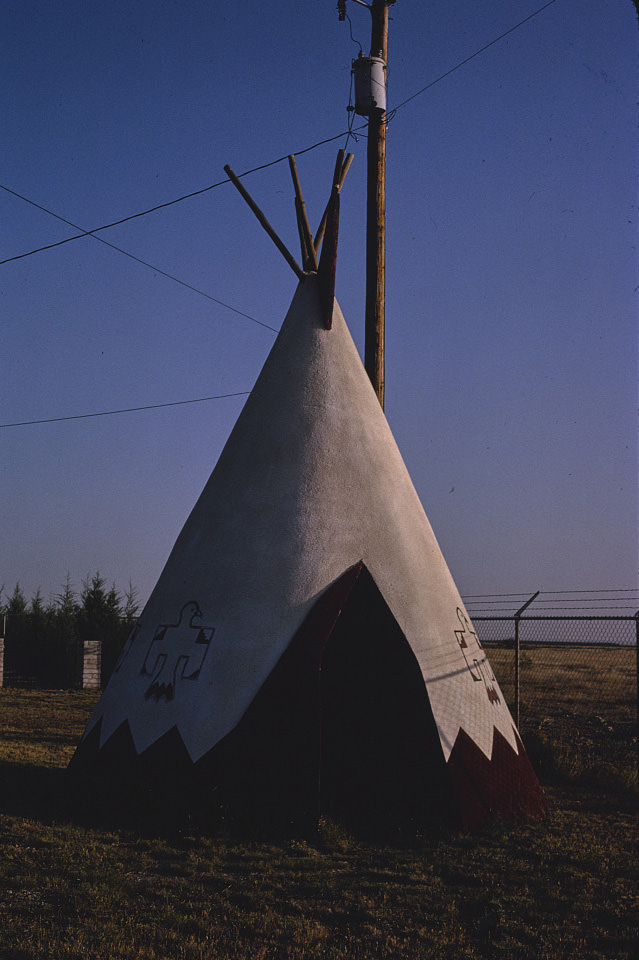
Teepee structures appeared at multiple points along the Route 66 corridor in New Mexico, used as decorative elements for gas stations, gift shops, and souvenir stands. They were a product of the highway tourism era, when roadside businesses competed for attention with visual novelty. The teepee shed on Route 66 in Albuquerque in 1987 was one of the more modest examples — a simple wooden structure using the form to signal its role as a souvenir stop.
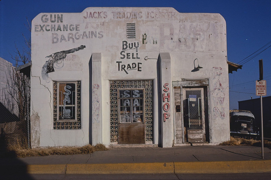
Carlsbad’s commercial landscape in the early 1980s reflected its dual economic base — local industry and park tourism. Jack’s Trading Center was the kind of general merchandise business that served both populations. The region around Carlsbad was also significant for its proximity to the area that would eventually become the Waste Isolation Pilot Plant site, though that facility was still years from opening when this photo was taken.
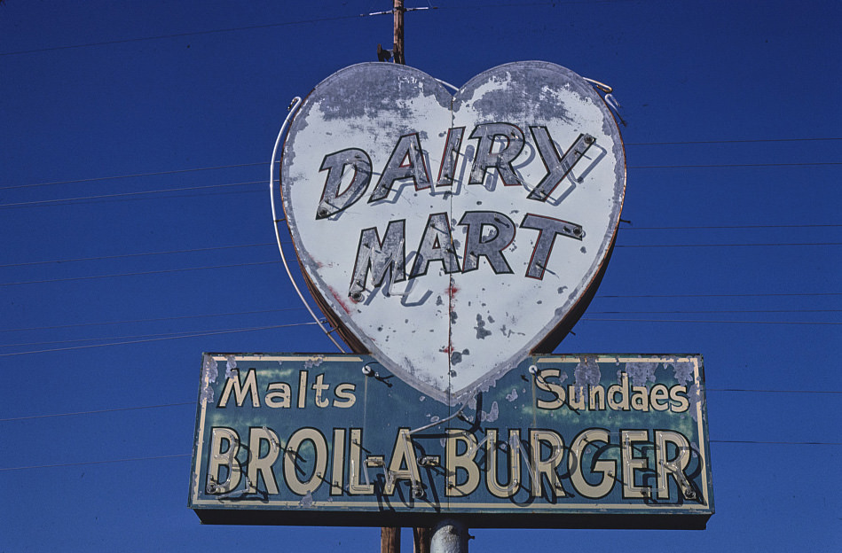
Artesia, in the Pecos Valley between Roswell and Carlsbad, was another small oil and agricultural town with a modest commercial strip. The Dairy Mart Drive-in sign in 1983 reflects the kind of local fast food culture that existed across rural New Mexico before national chains moved into smaller markets. These drive-ins served their communities directly, without the corporate infrastructure that would later standardize the fast food experience across the state.
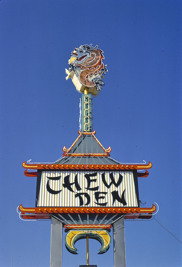
Roswell in 1981 was a regional center for southeastern New Mexico, its economy built on agriculture, ranching, and oil production. The Chew Den sign was one of many local commercial markers that reflected a city with its own distinct character, separate from the Route 66 tourism culture that dominated other parts of the state. Roswell’s national profile would change dramatically in the 1990s as interest in the 1947 UFO incident grew into a significant tourism draw.
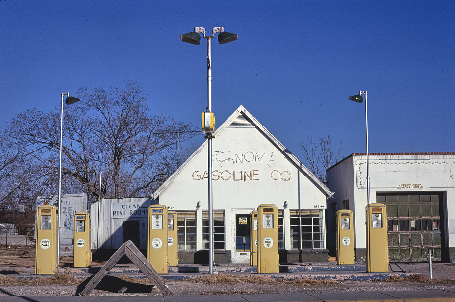

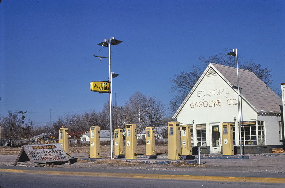
Independent gas stations like the Economy Gasoline Co. and the Malco pump on Route 285 in Carlsbad were still common across New Mexico in 1981. These were not affiliated with major national brands, and their prices and equipment reflected local ownership. The early 1980s oil price volatility hit small independent operators hard, and many of them would not survive the decade. These photographs capture a moment just before that shakeout.
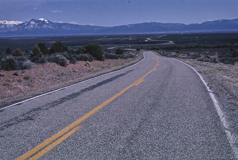
The highway junction near Taos in 1999 shows the infrastructure of New Mexico’s northern mountain region — a network of state roads that connected small communities to larger centers. Taos itself had grown significantly as an arts community and tourist destination through the 1980s and 1990s, but the roads leading to it still carried the character of the rural Southwest, with simple signage and minimal development at the junctions.
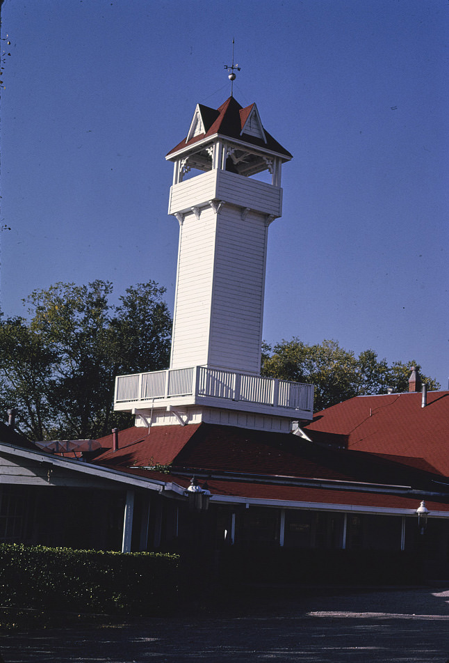
Tinnie, a tiny community in Lincoln County east of Ruidoso, was home to the Tinnie Silver Dollar Restaurant — a destination dining spot built into a historic mercantile building. It was far from the highway corridors that produced most of New Mexico’s roadside commercial photography, but its presence in the documentary record shows that photographers were moving through the entire state, not just the major routes.
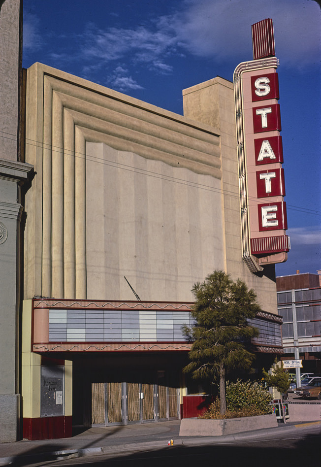
Albuquerque’s Central Avenue had several theaters in addition to the KiMo. The State Theater, documented in 1981, was one of several movie houses that had operated along the Route 66 corridor. By the early 1980s, downtown movie theaters were struggling everywhere in America as suburban multiplexes and home video changed how people watched films. The State Theater’s appearance in 1981 captures a building still in its original function, though not for much longer.
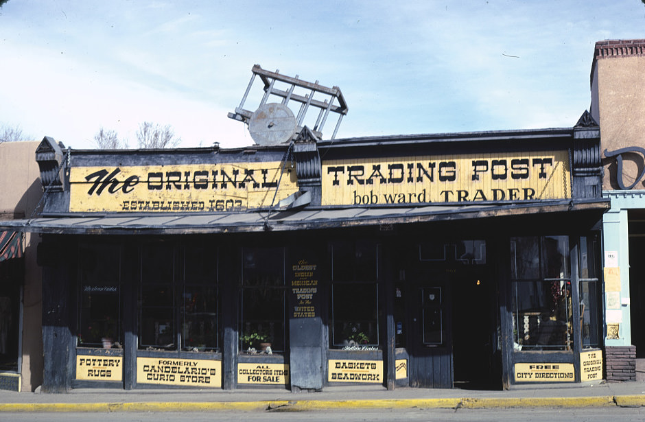
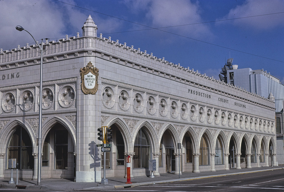
Santa Fe’s trading posts and galleries were central to its economy as early as the 1980s, selling Native American art, jewelry, and crafts to tourists who came specifically for that market. The Original Trading Post in 1981 was operating in a city that was already well established as an arts destination, drawing buyers from across the country. This market would expand dramatically through the 1980s and 1990s, reshaping Santa Fe’s demographics and real estate in the process.
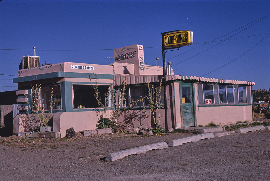
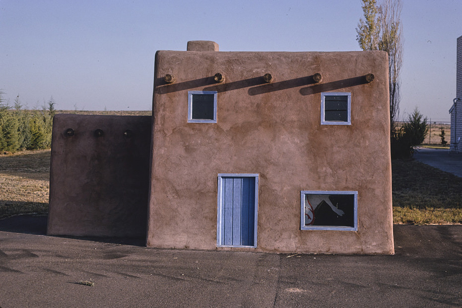
Alta’s Cactus Cave Gift Shop in Roswell maintained its operation from 1944 through the entire period covered by these photographs. Its adobe buildings and teepee structure on Route 70 became a consistent presence in the documentary record across multiple years and multiple photographers. The shop’s longevity reflected both the steady traffic on Route 70 and the durability of the souvenir trade in a state where tourism was one of the few reliable economic constants.
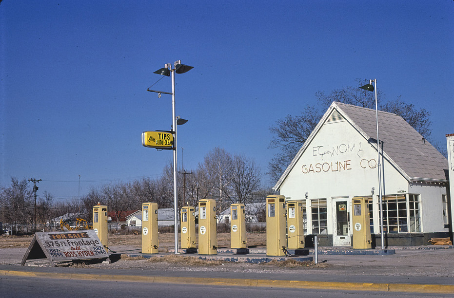
Gas stations in New Mexico during the early 1980s ranged from major brand franchises to small independent operators like Economy Gasoline Co. in Carlsbad. The independent operators often sold fuel at lower prices but offered fewer services, relying on volume and location rather than brand recognition. These businesses were concentrated in areas where travelers had limited choices, and their survival depended on controlling one of the few gas stops in a given stretch of road.
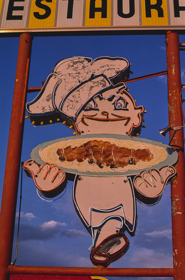
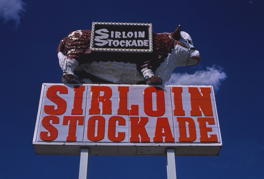
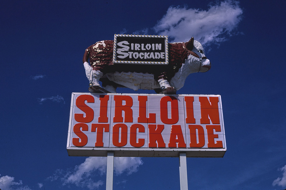
Hobbs in 1982 supported regional chain restaurants like the Sirloin Stockade, a sign of the town’s relative economic health compared to some of New Mexico’s more struggling communities. The oil industry in the Permian Basin had not yet experienced the severe 1980s price crash when this photograph was taken, and Hobbs still carried the prosperity of the energy boom years. That would change later in the decade as oil prices fell sharply.
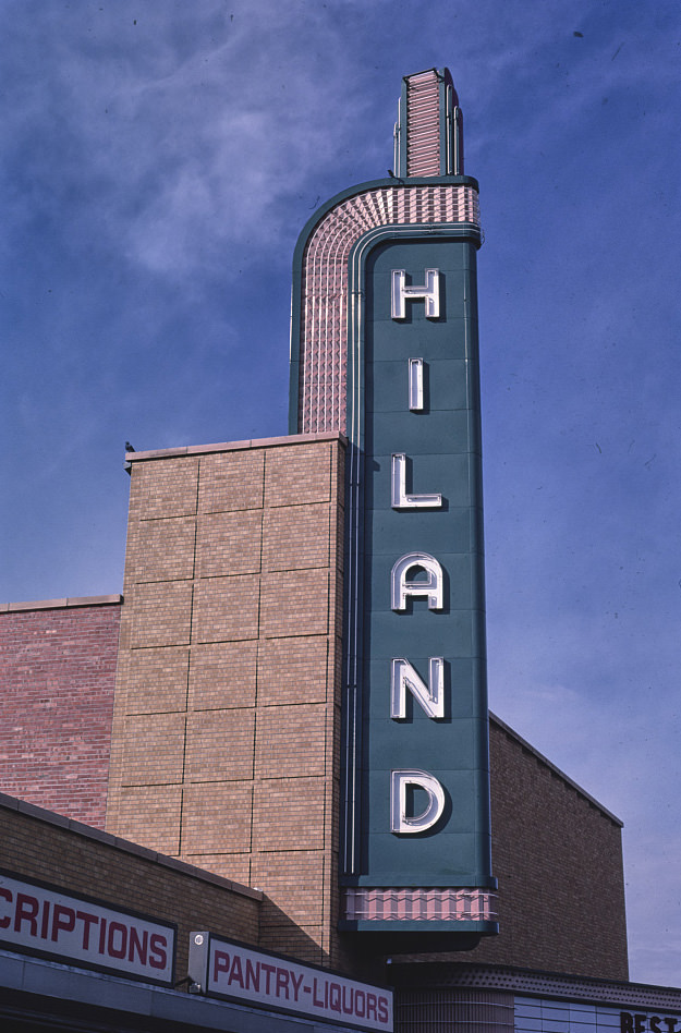
The Hiland Theater on Central Avenue in Albuquerque was another of the Route 66 corridor’s surviving movie houses, documented in 1987 as it continued to operate in a changing entertainment landscape. Central Avenue’s theaters represented different eras of Albuquerque’s development — the KiMo from the 1920s, the Hiland and State from later decades — each one a marker of the street’s history as the city’s main commercial artery.
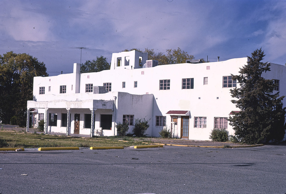
Albuquerque’s motel landscape in 1987 still included a range of mid-century properties that had been built to serve Route 66 travelers. The Casa Grande Motel was one of many such properties that had survived into the late 1980s, operating in a market that had become much more competitive as chain hotels expanded. These older motels competed on price and location, often serving extended-stay guests and local residents rather than the highway travelers they had originally been built for.
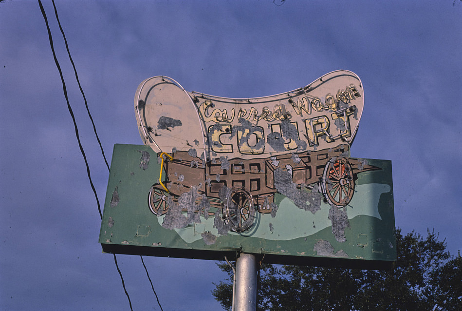
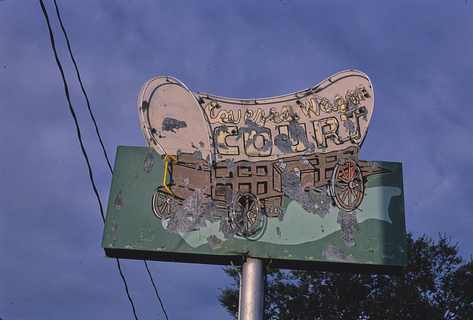
The Covered Wagon Court sign in Albuquerque in 1987 carried Western imagery that had been standard in New Mexico motel marketing since the 1940s. Covered wagons, teepees, and Southwestern geometric patterns were the visual vocabulary of the roadside tourism industry, designed to signal authenticity and regional character to travelers from outside the state. By 1987, this imagery was more nostalgic than promotional, but it remained on the signs because replacing them was an expense that small operators couldn’t justify.
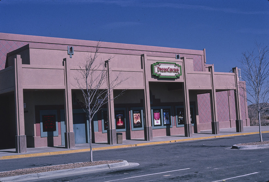
The Dream Catcher Theater in Espanola was documented from multiple angles in the late 1990s, representing the newer commercial architecture that was appearing in New Mexico’s smaller cities. Unlike the Route 66-era buildings that dominated so much of the state’s photographic record, the Dream Catcher was a product of the 1990s multiplex era — larger, more functional, and without the visual personality of the older theaters it had replaced in the local market.
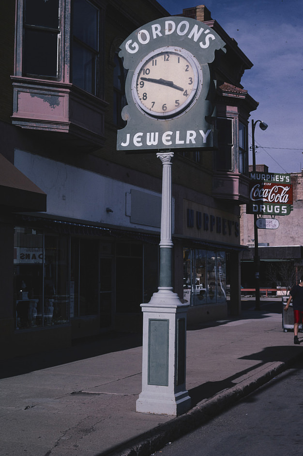
Gordon’s Jewelry Street Clock in Las Vegas, New Mexico was the kind of commercial landmark that anchored a downtown in a way that went beyond the business itself. Street clocks like this one were a Victorian-era tradition, placed by jewelers who used them to demonstrate precision and attract attention. The fact that it was still standing and being documented in 1997 says something about Las Vegas’s relationship with its own history — a city that held onto its past without necessarily planning to.
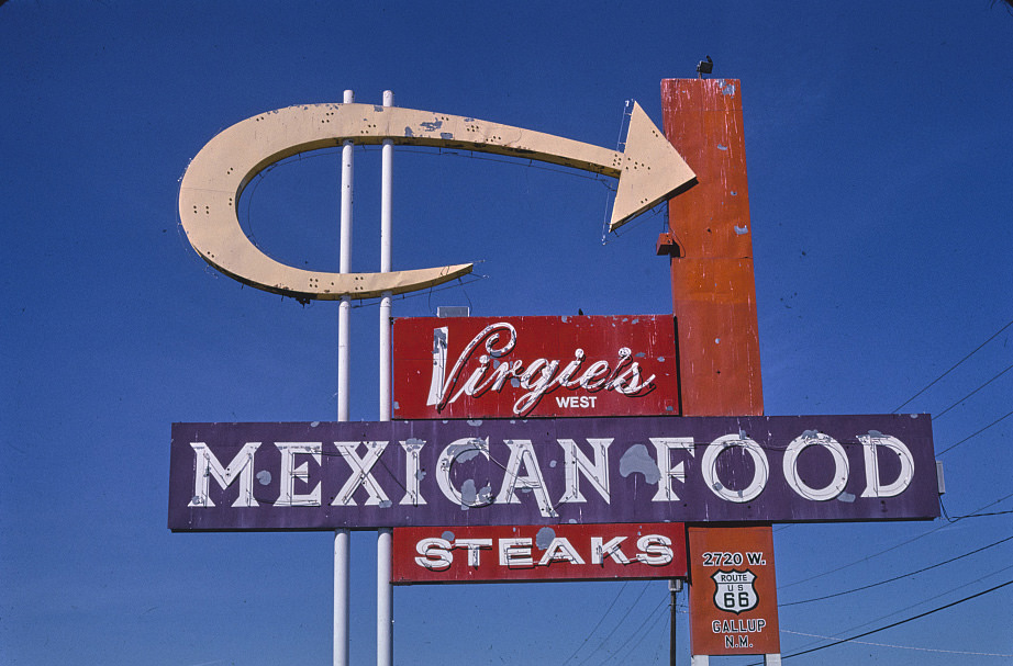
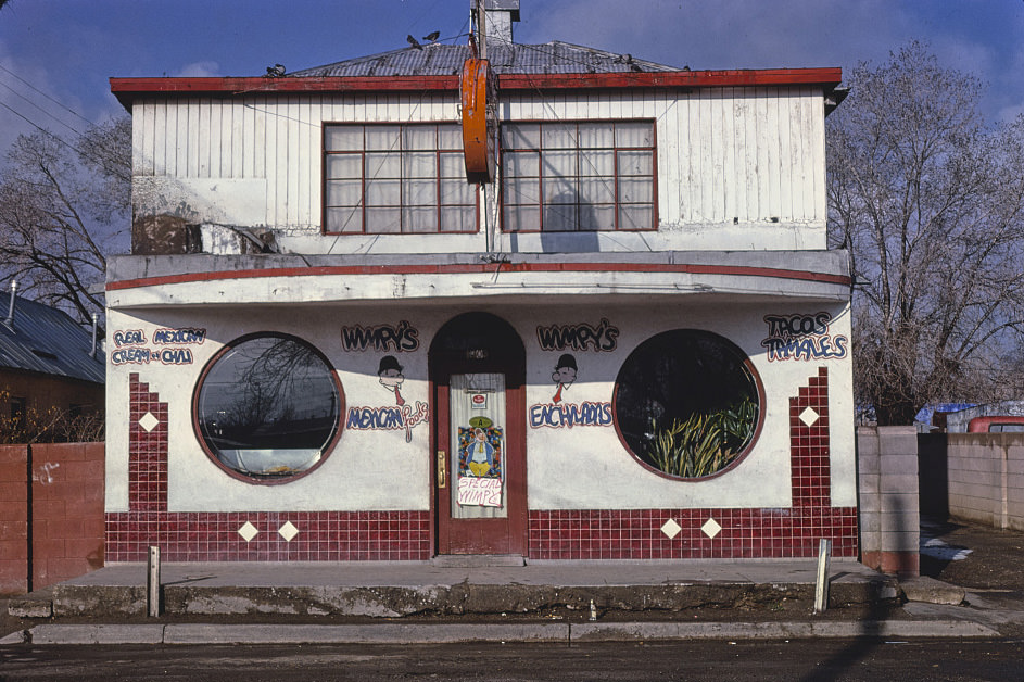
Mexican food restaurants were a constant across New Mexico’s commercial landscape, from Albuquerque’s Central Avenue to small highway towns like Grants. In a state with a majority Hispanic population and a deep culinary tradition tied to New Mexican cuisine — distinct from Tex-Mex or California Mexican food — these restaurants served as community institutions as much as commercial businesses. Virgie’s Mexican Food in Grants in 1998 was one of many such establishments documented throughout the two-decade period.
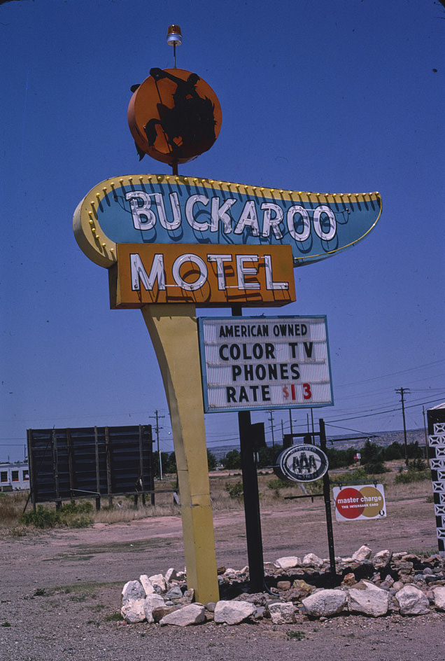
Tucumcari’s motel signs were among the most celebrated examples of mid-century roadside commercial design in the Southwest. The Buckaroo Motel sign, photographed in 1982, used Western imagery — the buckaroo being a term for a cowboy, derived from the Spanish vaquero — to market itself to passing travelers. These signs were designed before I-40 rerouted most traffic away from the old Route 66 alignment through town, and they continued to serve as the town’s public face long after the traffic that had justified them was gone.
New Mexico’s reliance on federal spending extended well beyond the wartime installations that had defined the state’s development during World War II. By the 1980s, the federal government continued to be one of the state’s largest employers through military bases, national laboratories, and national parks. Carlsbad Caverns, the White Sands Missile Range, Kirtland Air Force Base, and the Los Alamos and Sandia National Laboratories all drew federal dollars that circulated through local economies across the state.
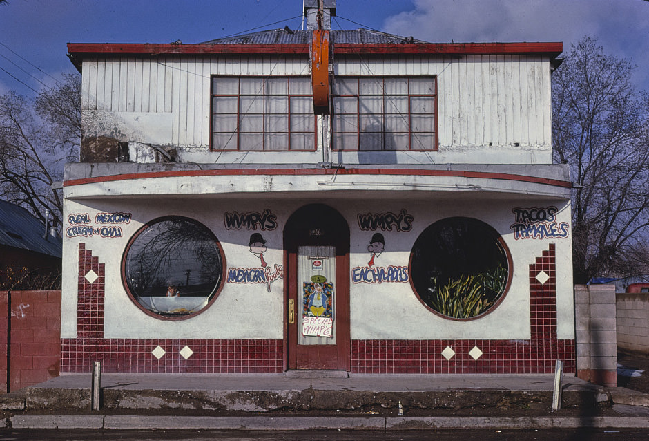
The Red Ball Cafe on 4th Street in Albuquerque was documented multiple times in the early 1980s, from its exterior signage to its building facade. These repeated visits suggest a systematic effort to document the city’s older commercial properties before they changed or disappeared. Albuquerque was growing rapidly in this period, and the pressure on older buildings along secondary streets was significant.
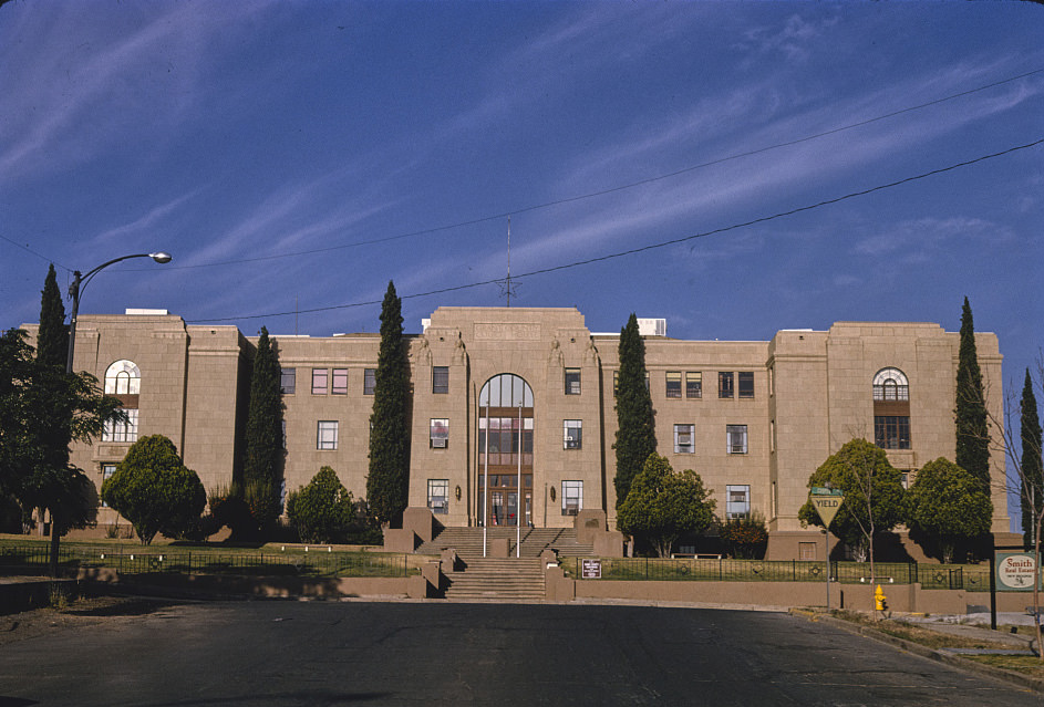
Silver City’s Copper Street in 1992 showed a downtown that had maintained its architectural character while adapting to new economic realities. The courthouse anchored the upper end of the street, while smaller commercial buildings stretched down the block, housing a mix of legal offices, local retail, and service businesses. Silver City’s mining heritage was visible in the bones of its downtown — buildings constructed during prosperous years that the town was still using, decades later, on a different economic basis.
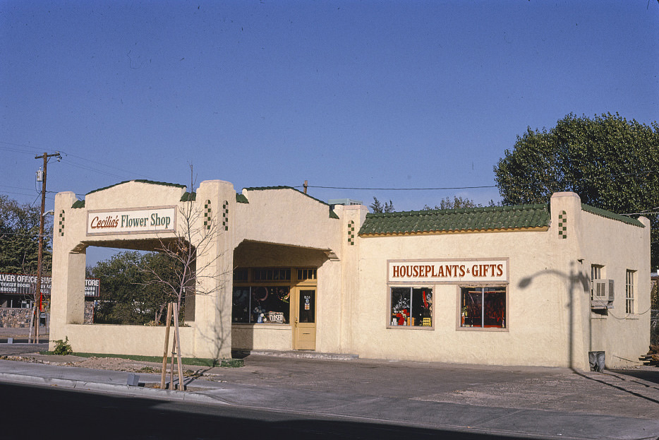
Building conversions were common across New Mexico’s small cities — old gas stations became flower shops, theaters became shoe stores, and motor courts became apartment buildings. Cecilia’s Flower Shop in Silver City, operating out of what had been a gas station, was a typical example of this adaptive reuse. New Mexico’s poverty meant that new construction was often not an option, and businesses made do with whatever structures were available.

The Horseshoe Motel in Eagle Nest was photographed multiple times in 1980, showing the property from different angles. Small mountain resort motels like this one operated in a tight market — they needed to fill rooms during the hunting and fishing seasons but had little revenue during the off-months. Their survival depended on keeping costs low and maintaining a loyal base of repeat customers who returned each season.
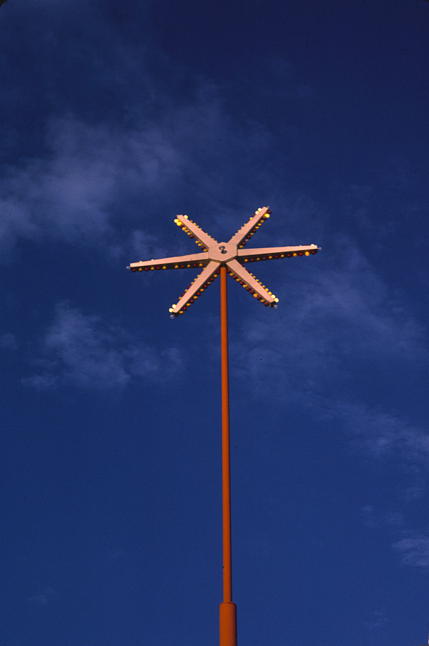
Dean’s Restaurant spoke sign was photographed from multiple distances and angles in 1987, making it one of the most thoroughly documented pieces of commercial signage in the entire New Mexico record. The spoke format, with its radiating arms and circular face, was a specific design choice that maximized visibility from multiple approach angles. Whoever built this sign understood how highway advertising worked — and the photographs preserve that understanding long after the sign itself has faded.
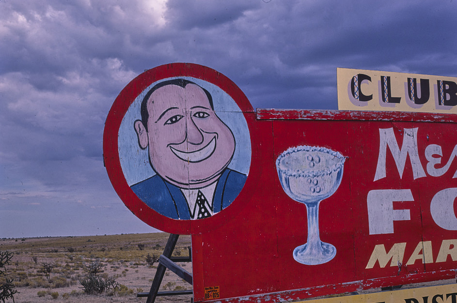
The Club Cafe’s famous sign near Santa Rosa was photographed from at least three different positions in 1987 and documented again in earlier and later years. The fat man logo that the Club Cafe used became one of the most recognized roadside images on the New Mexico stretch of Route 66. The restaurant itself closed in 1992, but its sign and the documentation surrounding it preserved its place in the state’s commercial history.
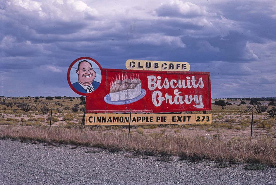
The photographs of the Club Cafe sign from different angles in 1987 capture not just the sign itself but the landscape around it — the wide shoulders of the old highway, the flat terrain, and the open sky that characterized the eastern New Mexico approach to Santa Rosa. This context is part of the documentary value of roadside photography: the sign is inseparable from the road that gave it meaning.
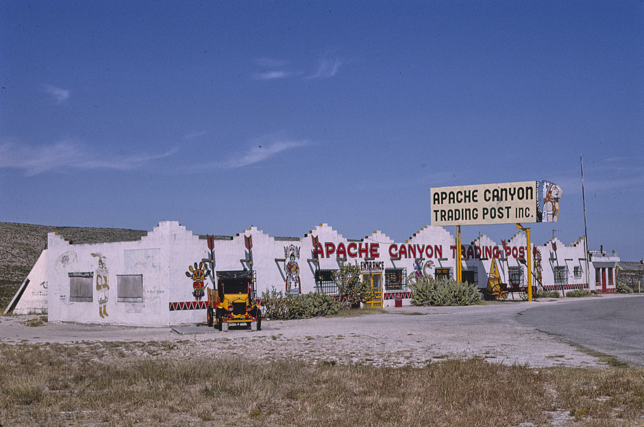
The Apache Canyon Trading Post’s storefront was documented twice in 1993, as part of the broader photographic survey of the Whites City commercial cluster. The trading post format — combining gas, food, souvenirs, and Native American crafts under one roof — was common throughout the Southwest, particularly near national parks and along major highways. These businesses served as the primary point of contact between tourists and local commercial culture.
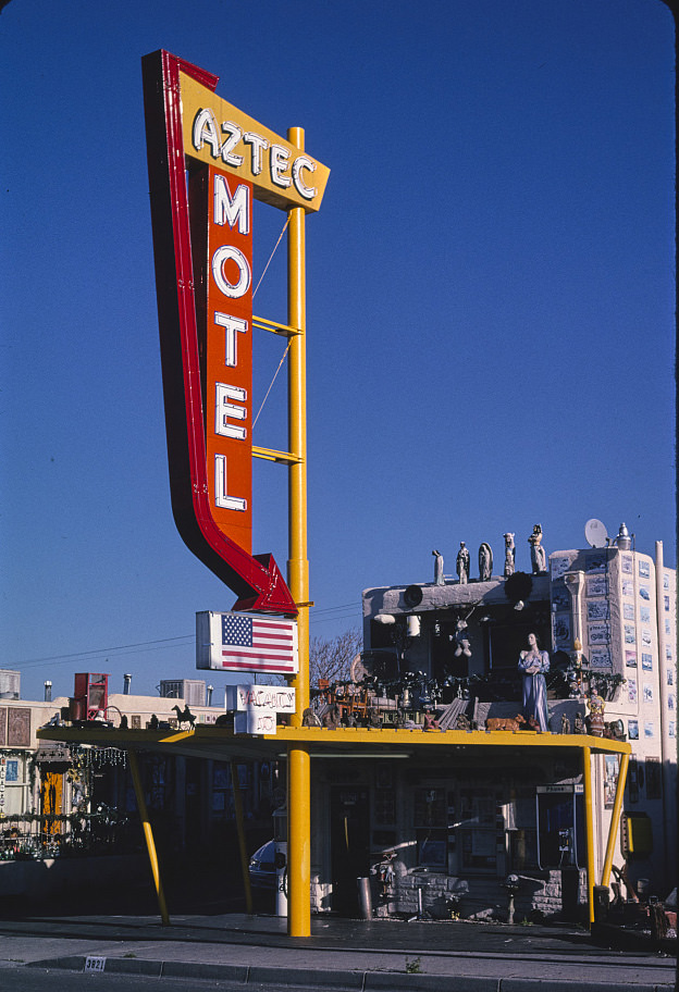
By 1999, the Aztec Motel on Route 66 in Albuquerque had been in operation for decades and was showing the wear of that history. Its office and sign were photographed as part of the ongoing documentation of the Route 66 commercial landscape, which had become a subject of serious historical interest as the 20th century drew to a close. The motel’s Southwestern-themed architecture, designed to appeal to mid-century travelers, had become a historical artifact in its own right.
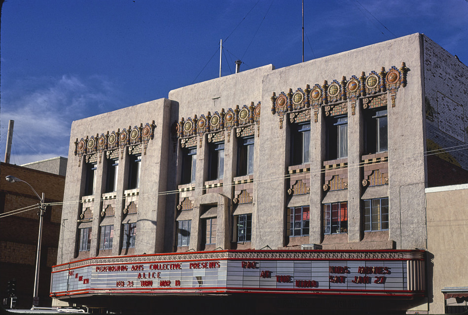
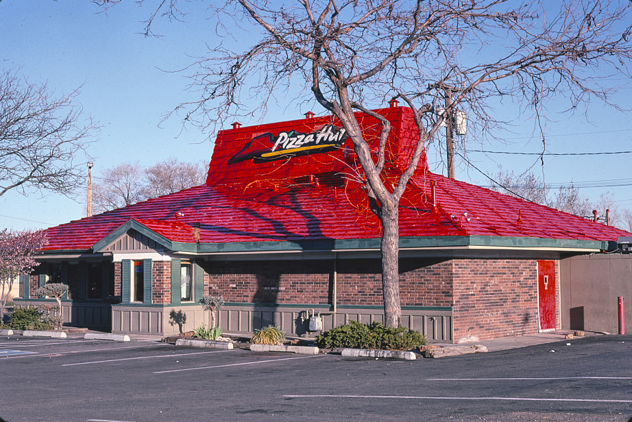
Santa Fe’s architectural requirements extended even to national pizza chains by 1999. The Pizza Hut there bore little visual resemblance to its standard prototype, its exterior adapted to meet the city’s design guidelines. This kind of regulatory control over commercial architecture was unusual in the United States, and it made Santa Fe a study in what a city looked like when it enforced consistent aesthetic standards across all new construction, regardless of the type of business involved.
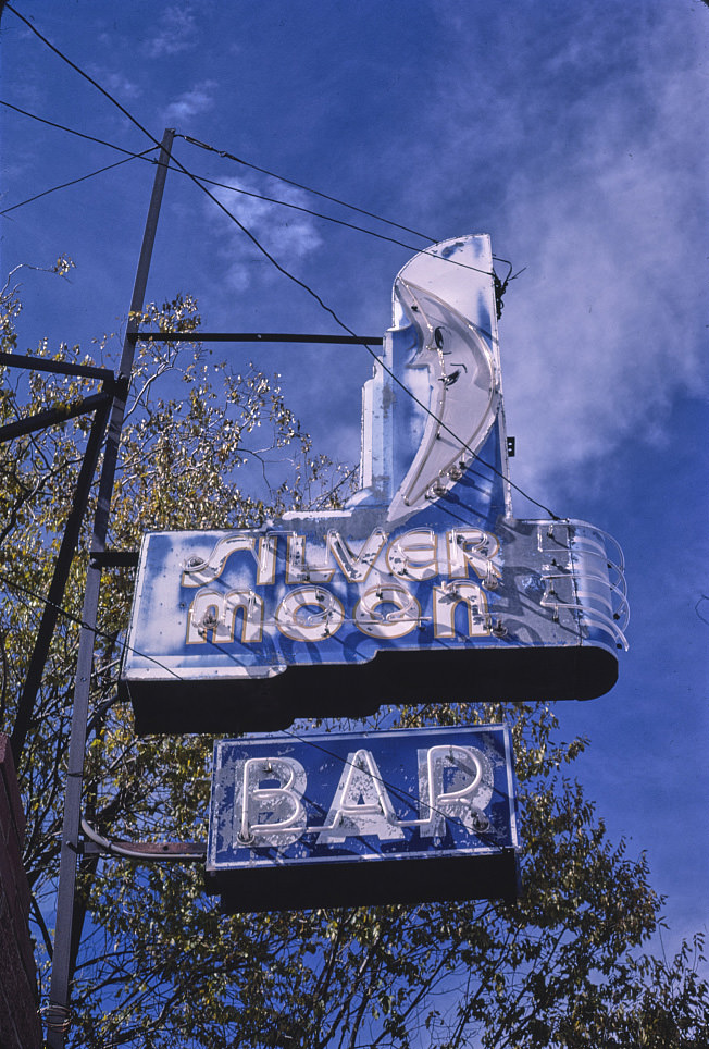
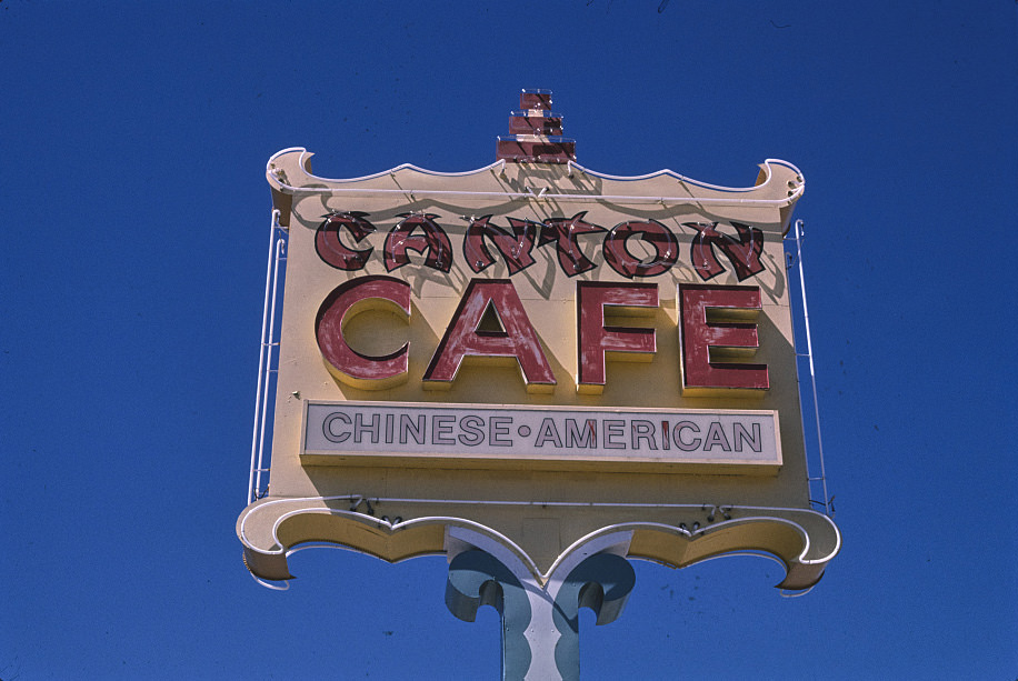
Grants in 1987 and again in 1998 showed a town working through the long aftermath of the uranium bust. Its Route 66 commercial strip still carried bars, cafes, and restaurants that had been there since more prosperous times, but the customer base had thinned considerably. The Silver Moon Bar sign and the Canton Cafe sign were both pieces of a streetscape that had been built for a larger population than the one it was serving by the late 1980s and 1990s.
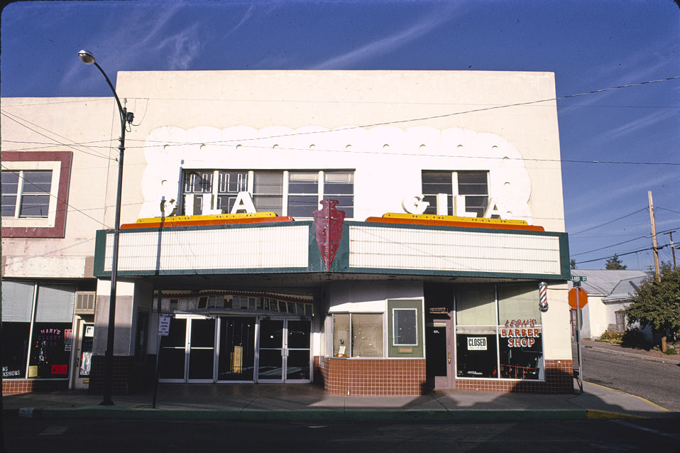
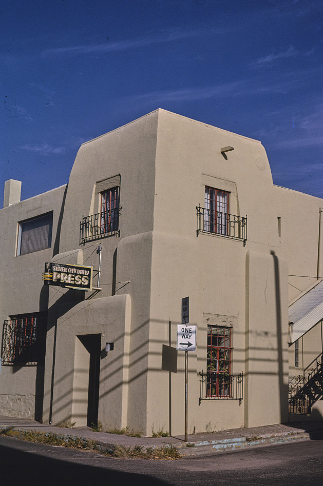
The Gila Theater on Bullard Street in Silver City, documented in 1993, was another of the surviving single-screen movie houses that the photographic surveys captured across New Mexico. Silver City’s theater sat in a downtown that had more continuity than most small New Mexico cities — its brick commercial buildings, its courthouse, and its local institutions like the Daily Press and the theater itself gave the city a completeness that told the story of a community that had managed to hold together through the economic shifts of the 20th century.





So, it still looks the same as it did three years ago?
Perhaps it looks slightly greener or whiter now. There was a lot of precipitation during the 90s.
Yeah but more sepia-toned
I recall that Wiener Schnitzel in Las Cruces! It was my go-to spot as a kid, and they served the best hot dogs.
New Mexico lost more service members in World War II than any other state” Not even close. What kind of article is this?
Could it be true per capita? You’re right that it’s obvious that it’s not true in nominal terms, but I’m not saying it is.
And those are just pictures of old signs, not photos from the 80s.
Parts of New Mexico look a lot like that in the 2020s
Wow the 1980s, did they even have photography way back then?
So…photos taken in the 1980s or 1990s of old signs and buildings from the 1930s-1950s? Weird.
Kinda not really
I lived in Las Cruces for most of the 90s. Those pics bring back some powerful memories. It’s still amazing to me how much that city has changed; it’s debatable if it’s changed for the better or not.
I was there from ’99 – ’03 and I don’t recognize it anymore.
If you don’t know these specific spots, this is still exactly what NM looks like. Maybe less 50s neon, but the ones still around look just like these. That’s fascinating.
Well, that made me feel old.
This whole thing is suspect. The Santa Fe Pizza Hut from 1992 (#31) is sporting a logo that didn’t exist until ’99.
Cool, they have a photo of the old Jack’s Liquor sign. They need one of it lit up at night though. That was always my favorite neon sign, I wonder if anyone saved it. I hate to think it just went into a landfill.
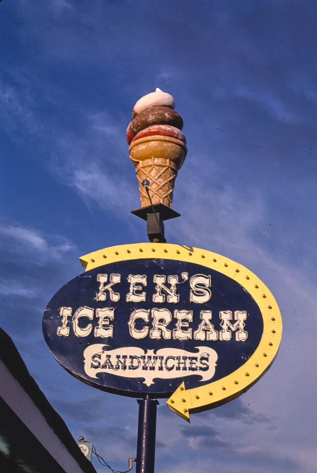
That Ken’s Ice Cream sign brings back memories. My grandpa’s restaurant was right next door and I used to go in there all the time as a kid.
I lived in mountainair from 89 to 91, and I remember going to Las Vegas for away games, and it was the most depressing, boarded-up shit town i had ever seen.
Today, it’s gorgeous. I see pictures of the town square online and I don’t recognize the place. Mountainair is still a hole, tho.
I remember a rodeo in LV in the late 80s and it was awesome, a true one (not like the touristy SF one), with two families squaring off, one with a Hispanic name and another one with an Irish name. I had a lot of fun and people were nice.
Thank you for sharing.
I wonder how many of the cool neon signs that aren’t around anymore got bought up by the Garcia Motors family and are sitting in storage in Albuquerque…
Anyone remember Eddie’s Inferno next to Furr’s. As a kid used to trip out on that design.
Very cool. Brings back some good memories