Lake Garda is the largest lake in Italy, stretching across three regions — Lombardy, Veneto, and Trentino-Alto Adige. Its name comes from the town of Garda, a settlement referenced in documents as far back as the eighth century. The lake has drawn travelers for centuries, and it’s easy to see why. Towering mountains frame its northern shores, while the southern end opens into a broad, gentler landscape dotted with historic towns. The collection of color photographs below, taken in the 1890s, captures this remarkable place at a time when photography itself was still a young art.
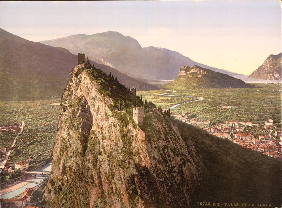
The lake’s history runs deep. Several major battles were fought along its shores and surrounding valleys. The Battle of Lake Benacus, fought in 268 AD, saw Roman forces clash with Gothic invaders near the lake. Centuries later, the lake witnessed fighting between Milan and the Venetian Republic as the two powers competed for control of northern Italy. During the Napoleonic era, the Battle of Rivoli in 1797 was fought just east of the lake, cementing French dominance in the region. Then in 1859, the Battle of Solferino — one of the bloodiest battles of the 19th century — took place near the lake’s southern shore. That battle led directly to the founding of the Red Cross. The town of Arco, sitting just north of the lake near the Sarca River valley, was one of the most photographed spots during the 1890s. Its dramatic ruined castle perches high on a limestone rock, overlooking a lush valley of olive trees and citrus groves.
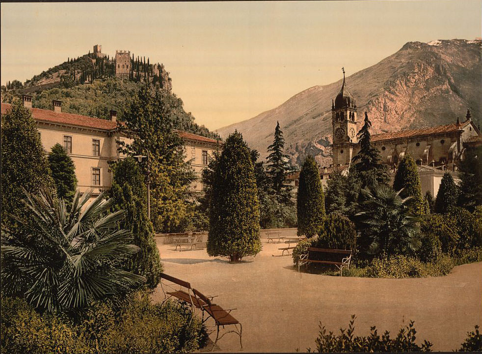
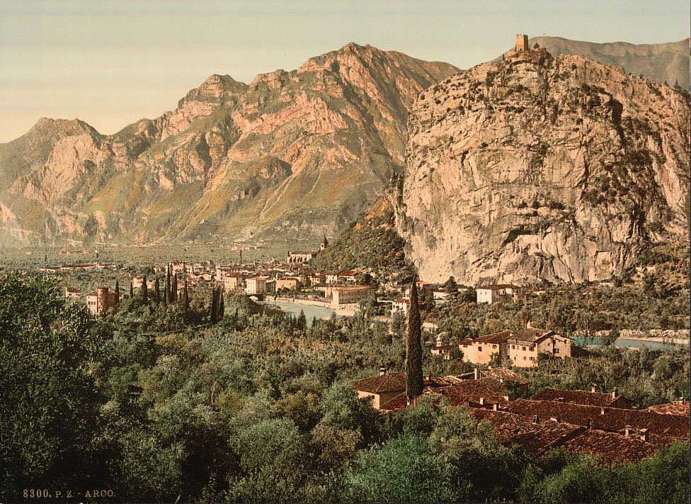
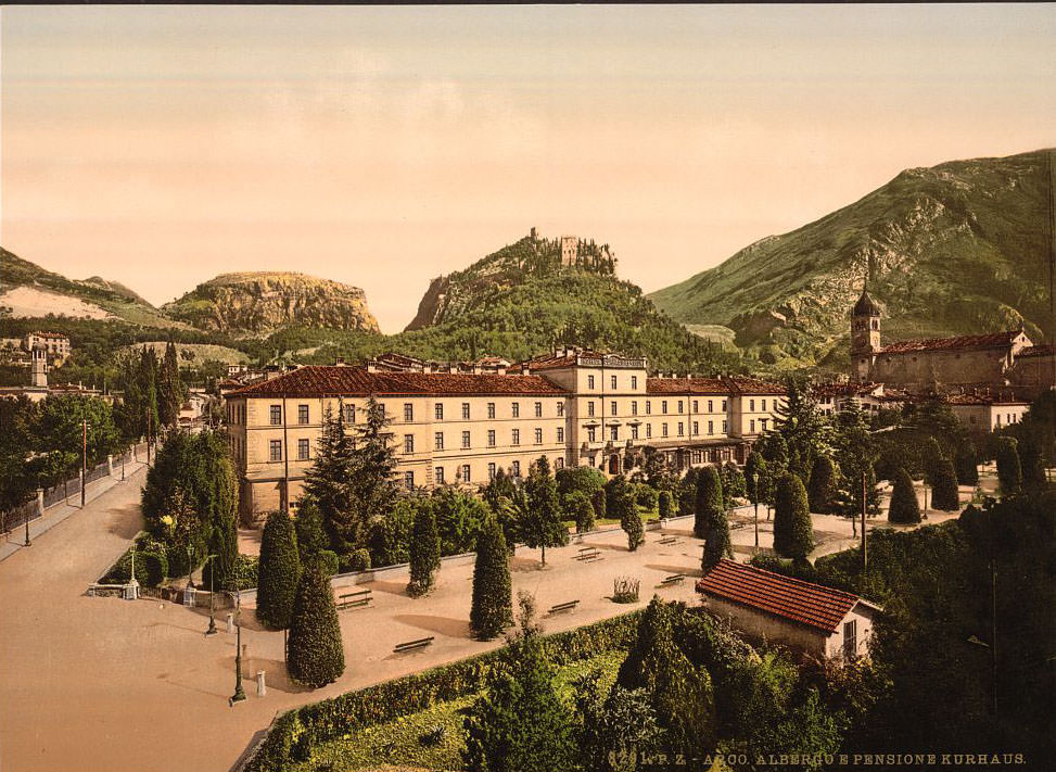
Arco sat at the northern tip of the lake and attracted wealthy European tourists throughout the late 19th century, largely because of its mild microclimate. Austrian Archduke Albert built his famous park there, and the town became a fashionable winter resort. Seen from the south, the combination of the rocky escarpment and the valley below made it a favorite subject for photographers of the era.
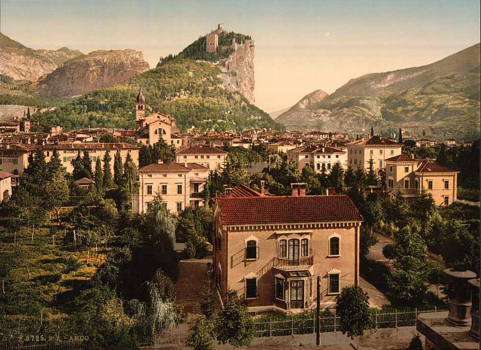
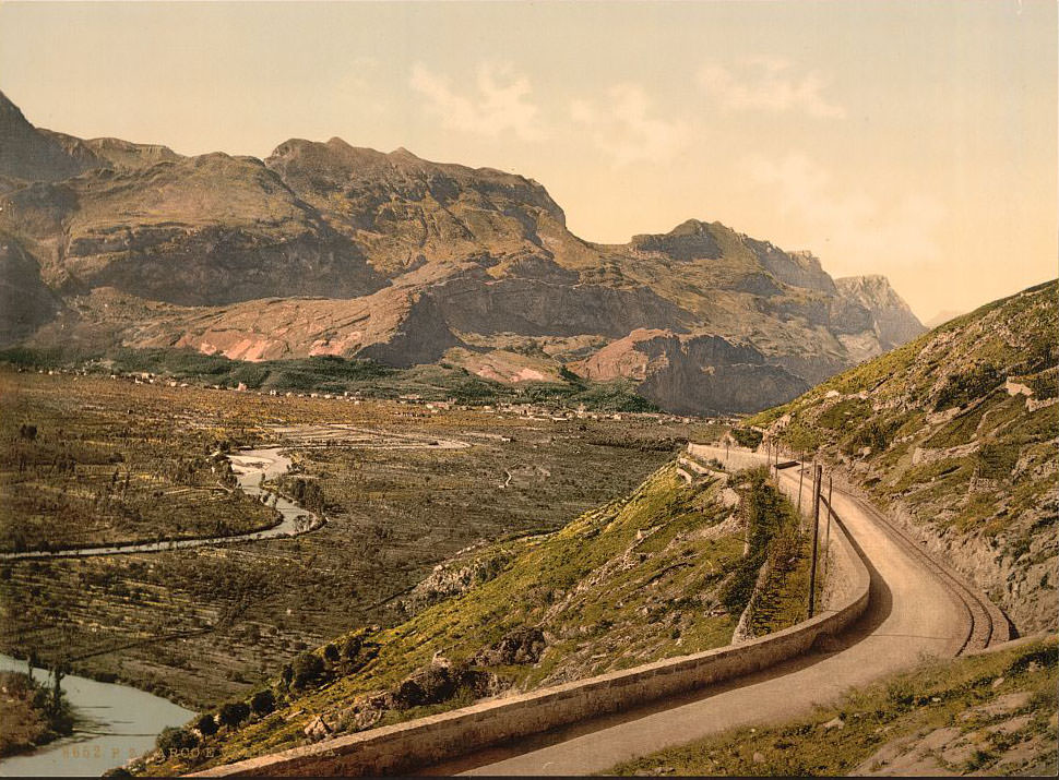
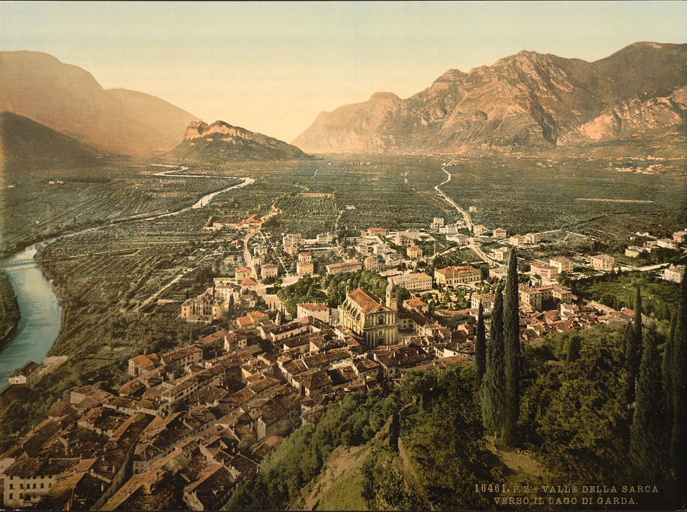
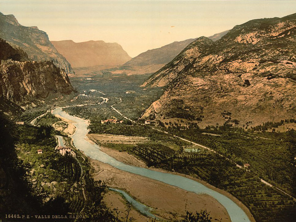
The Valley of Sarca, through which the Sarca River flows down from the Adamello range before feeding into the lake at Riva, provided some of the most dramatic scenery in the entire region. The valley narrows into steep gorges in places, with rocky cliffs rising sharply on either side.
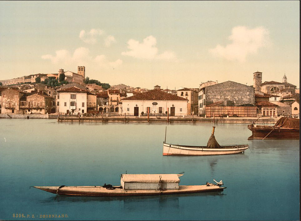
Moving south along the lake, Desenzano del Garda sits at the southwestern corner and serves as the lake’s main gateway from Milan. It is one of the oldest continuously inhabited towns on the lake, with Roman villa ruins dating back to the 1st century AD still visible today. The town’s harbor and broad promenade made it a natural stopping point for 19th-century travelers arriving by rail.
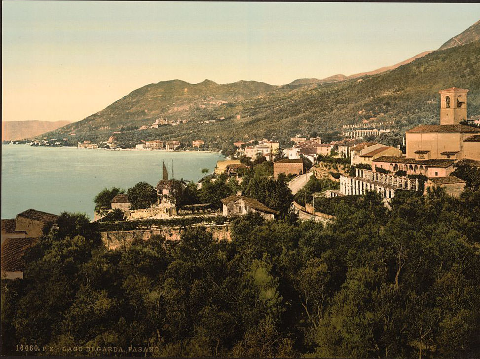
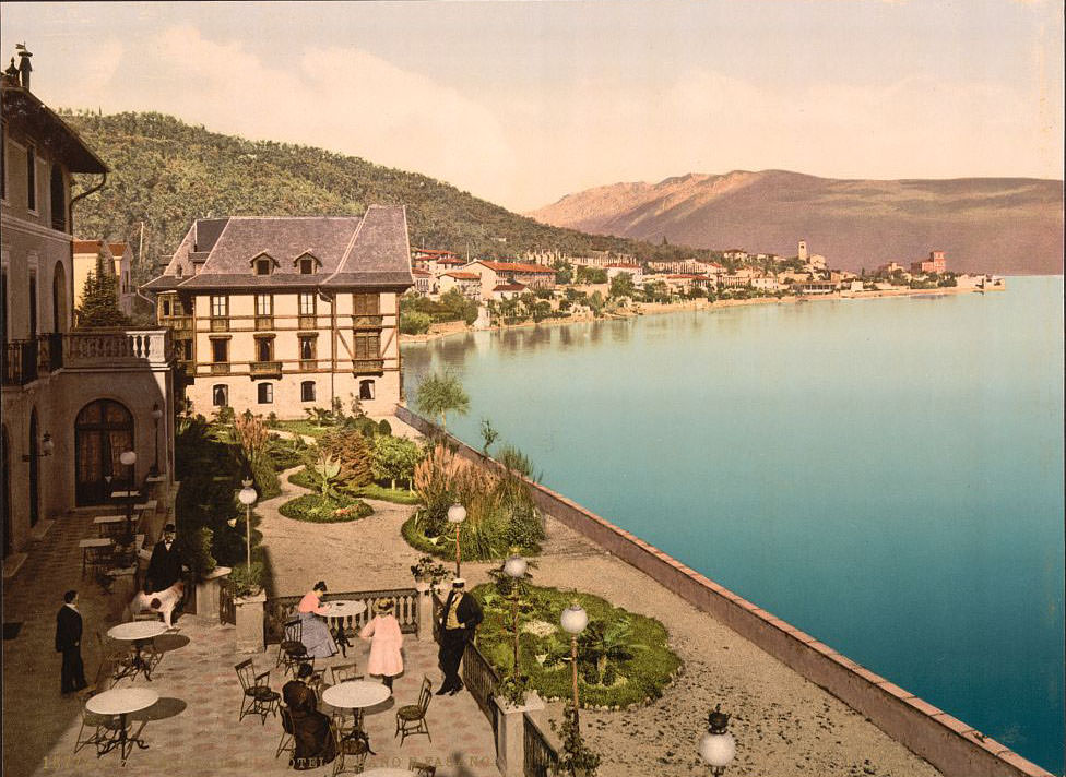
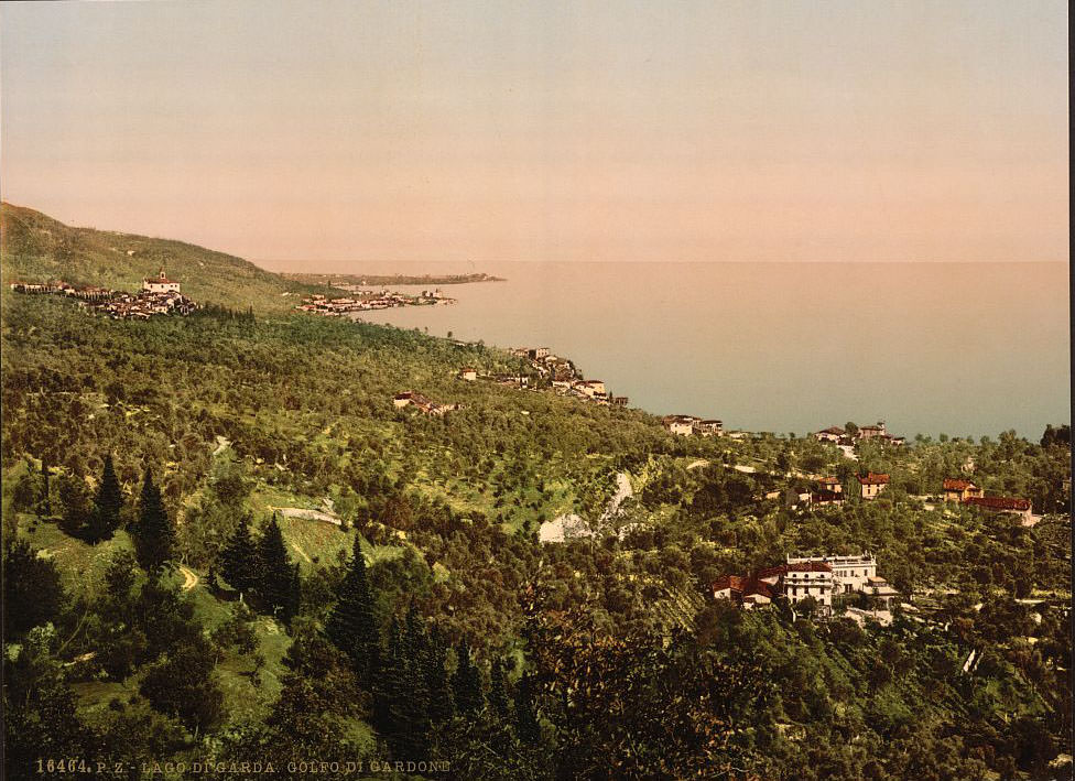
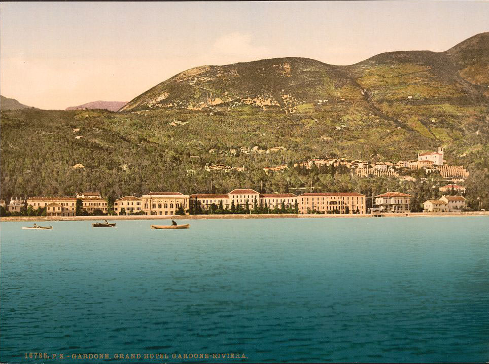
Fasano, a small hamlet on the western shore, sits above the lake with views stretching across the water toward the Venetian shore. Its steep hillside setting and terrace gardens made it particularly picturesque. Just to the south lies Gardone Riviera, which by the 1890s had become one of the lake’s most fashionable resort destinations. The Grand Hotel at Gardone was among the finest hotels in northern Italy and hosted royalty, diplomats, and wealthy tourists from across Europe.
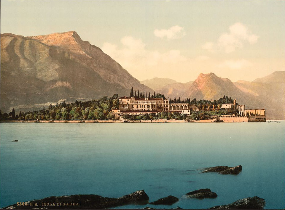
Gargnano, farther north on the western shore, is a quiet but historically significant town. During World War II, it would serve as the seat of Mussolini’s Italian Social Republic, but in the 1890s it was best known for its lemon-growing terraces and 13th-century Franciscan convent. The convent’s cloister features columns decorated with carved lemons — a testament to the fruit’s importance in the local economy. Isola di Garda, the lake’s largest island, lies just off the western shore near San Felice del Benaco. A grand neo-Gothic Venetian villa, built in the late 19th century, dominates the island and is surrounded by elaborate terraced gardens.
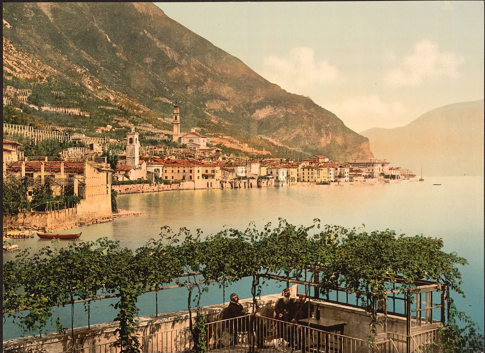
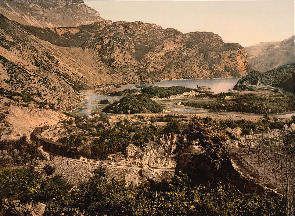
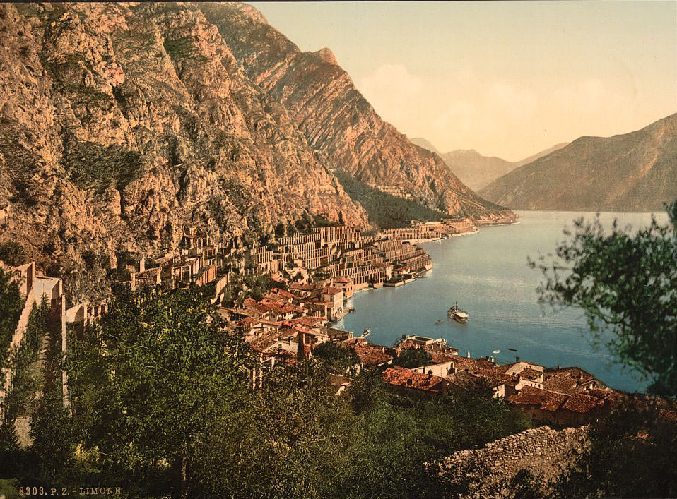
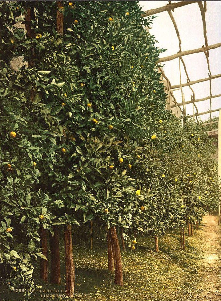
Lago di Loppio is a small lake sitting in a valley between Lake Garda and the Adige Valley. By the 1890s it was already shrinking due to drainage works, but it still held a striking appearance with its reedy shores and mountain backdrop. Limone sul Garda, clinging to the western cliffside, was famous throughout Europe for its lemon cultivation. The structured pergolas of the limonaie — stone pillars supporting wooden roofs used to protect the trees in winter — lined the terraced hillsides and gave the town its distinctive look.
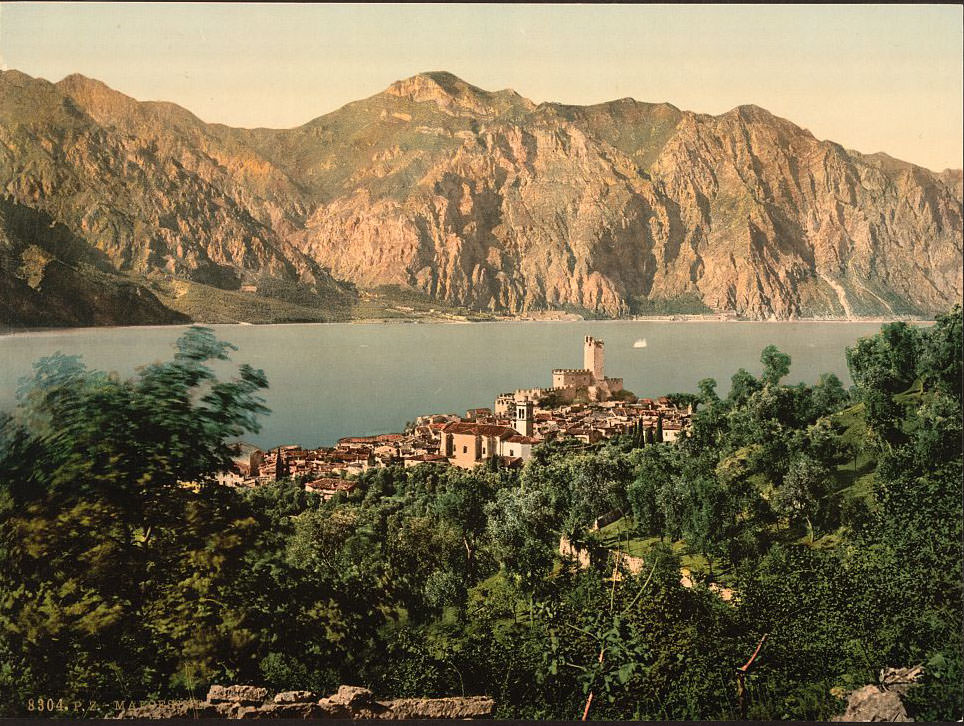
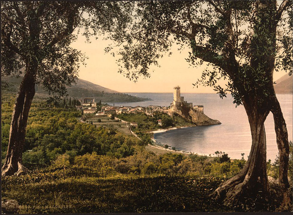
On the eastern shore, Malcesine is dominated by the Scaligero Castle, built by the Della Scala family of Verona in the 13th and 14th centuries. The castle sits directly on the water’s edge at the base of Monte Baldo, whose summit rises to nearly 2,200 meters. Goethe was arrested in Malcesine in 1786, suspected of being a spy when locals caught him sketching the castle — an episode he later described in his Italian Journey.
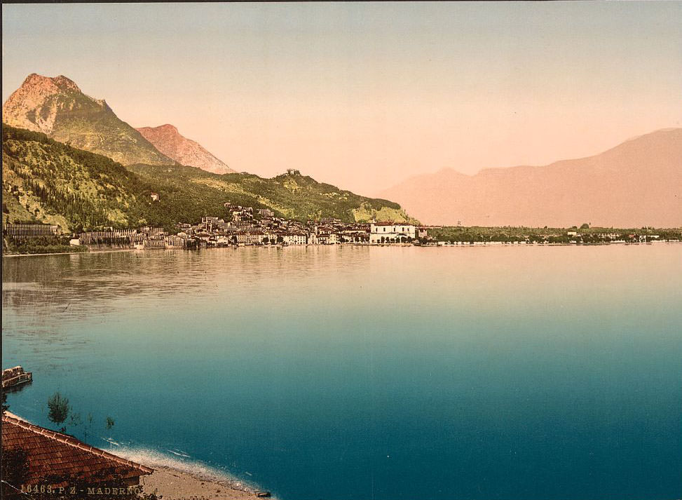
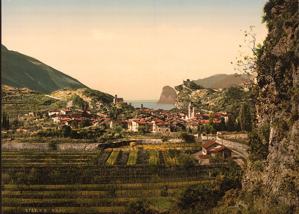
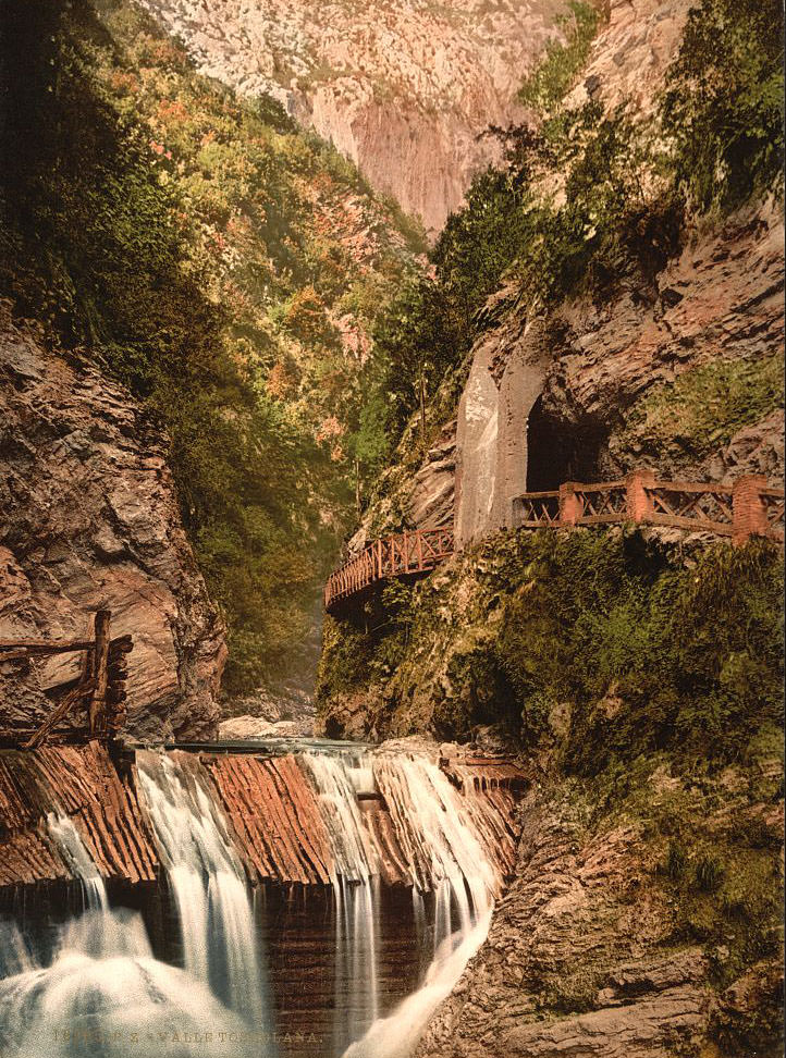
Toscolano-Maderno, twin towns joined by a shared stretch of shoreline, sit at the widest point of the western shore. The valley behind them, the Valle delle Cartiere, housed paper mills from the 15th century onward and was once one of the most important papermaking centers in Europe. Nago, perched on the plateau above Torbole, offered commanding views across the northern lake and down into the Sarca valley.
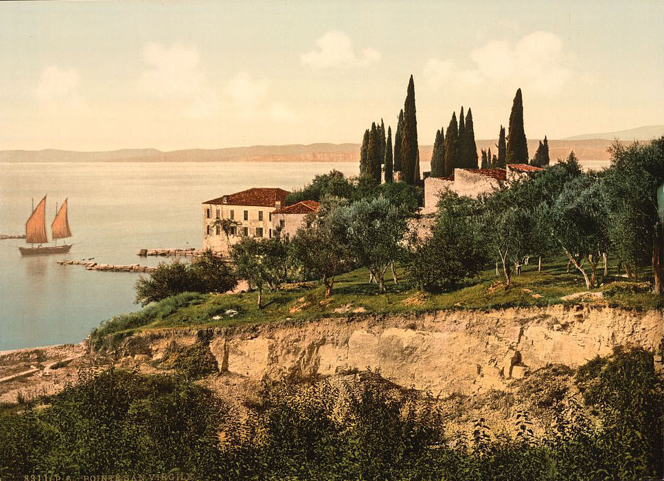
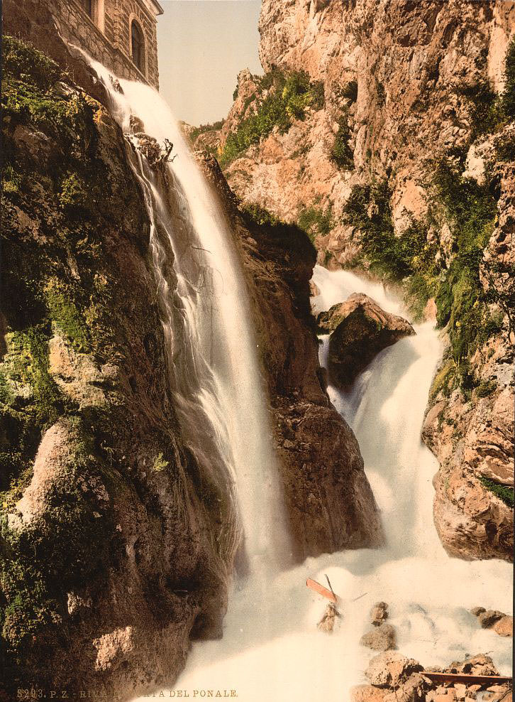
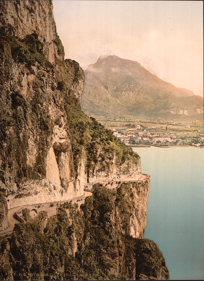
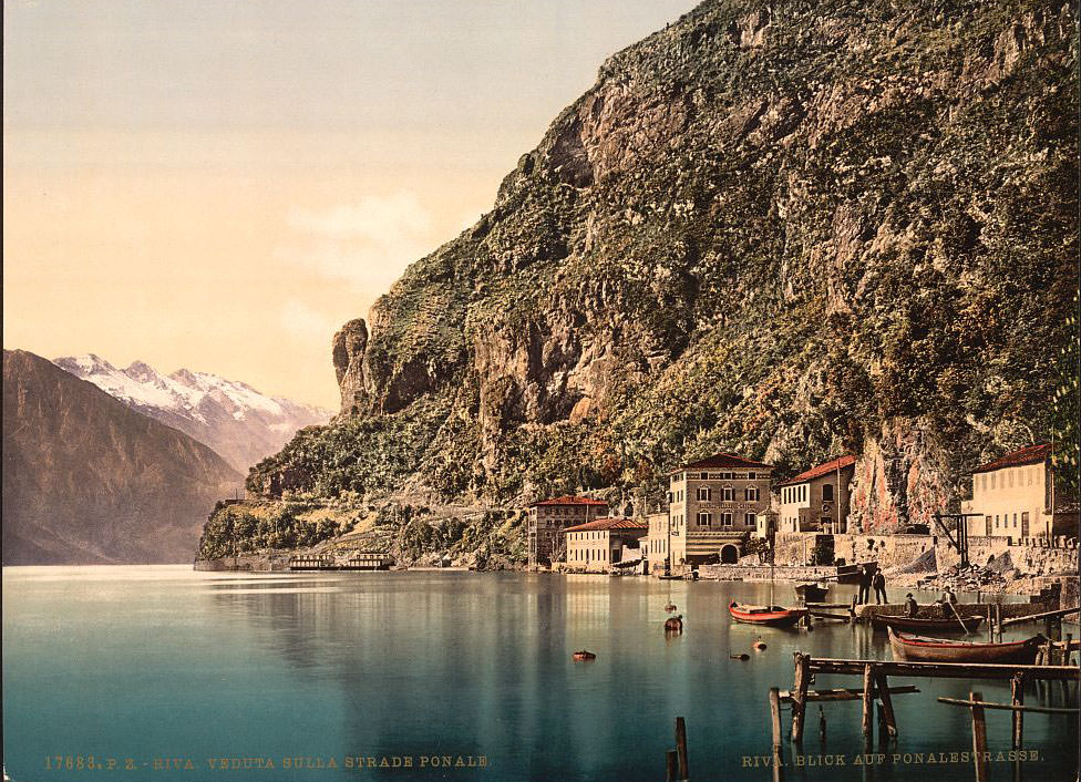
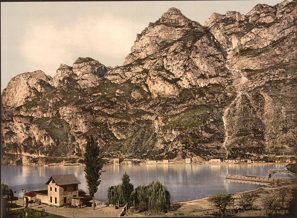
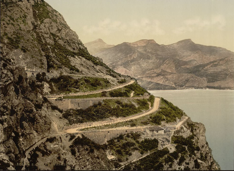
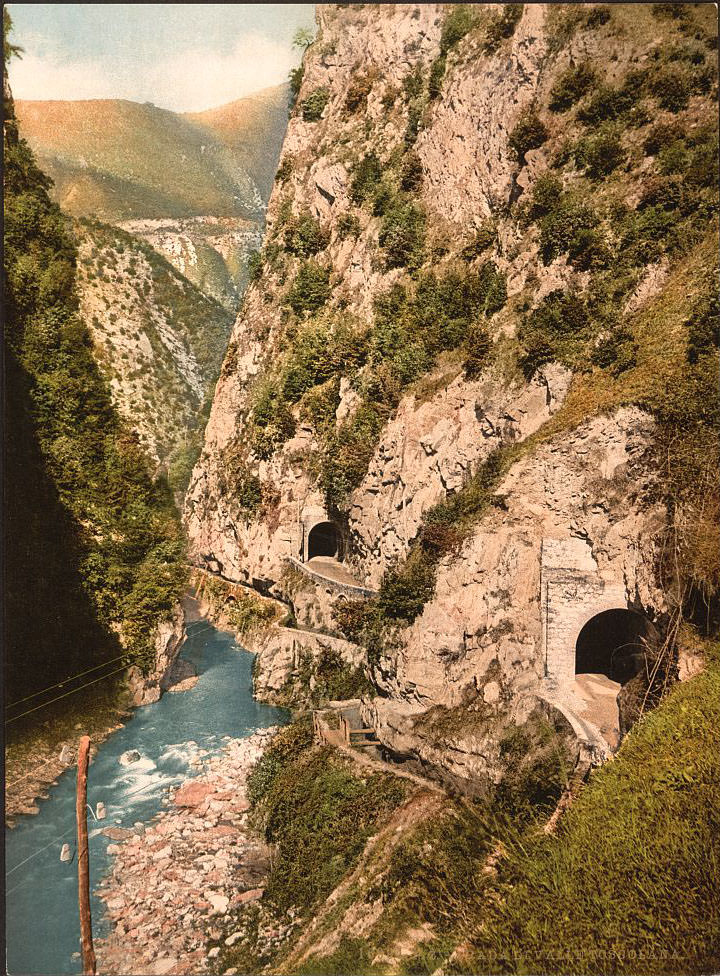
Punta San Vigilio, a narrow headland on the eastern shore, is one of the most serene spots on the entire lake. A 16th-century villa, a small church dedicated to Saint Vigilius, and a harbor sheltered by cypress trees give the point an almost theatrical beauty. The Ponale Waterfall, dropping dramatically into the lake near Riva, was one of the most celebrated natural sights at Lake Garda during the 19th century. The Ponale Road, carved into the cliffside above the western shore, was an engineering achievement of its era — connecting Riva to the Valle di Ledro through tunnels and sheer rock faces high above the water.
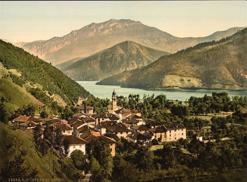
Pieve di Ledro sits above the lake at the head of Lake Ledro, reached via the Ponale Road. The area gained international attention in 1929 when Bronze Age pile dwellings were discovered beneath the lake’s waters. Riva del Garda, at the northernmost point of the lake, was part of the Austro-Hungarian Empire during the 1890s and served as a major tourist hub. Its harbor, dominated by the medieval Torre Apponale, welcomed steamboats carrying visitors from across Europe.
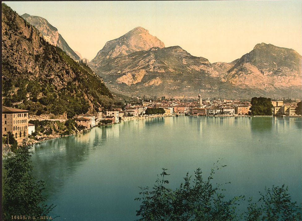
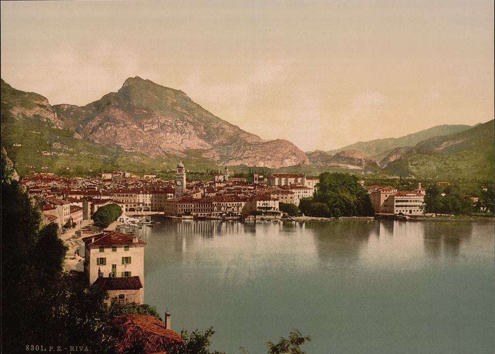
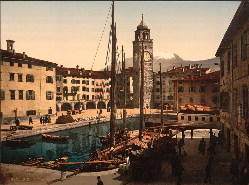
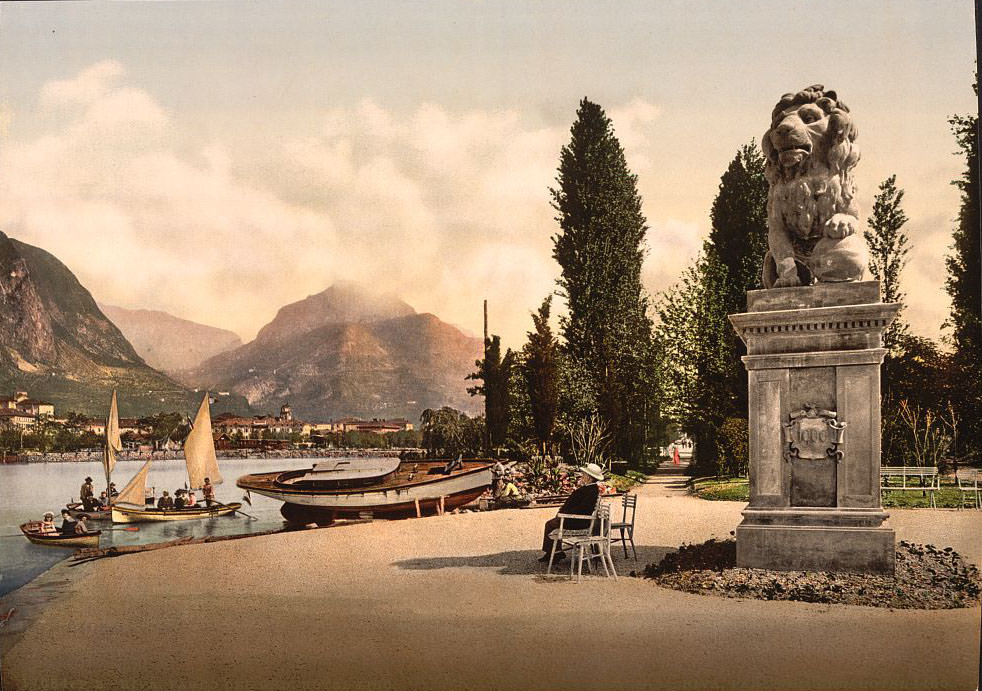
The Ponale Road connecting Riva to the Valle di Ledro was built between 1848 and 1851 under Austrian administration. It was blasted and chiseled out of sheer cliff faces hundreds of meters above the lake’s surface, passing through tunnels cut directly through the rock. For 19th-century travelers, riding along it by carriage was both thrilling and terrifying. The Hotel Lido at Riva provided a luxurious base for wealthy visitors, its park and lakeside position making it one of the most desirable addresses on the lake.
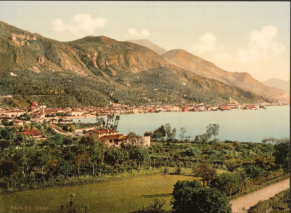
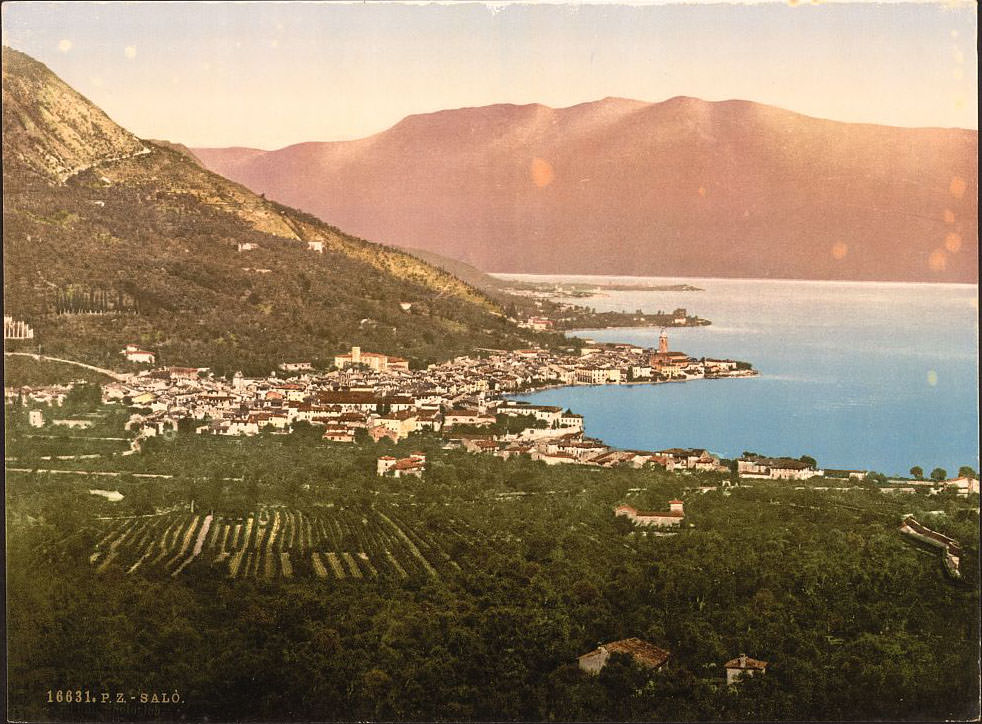
Salò, on the western shore, is a town of considerable historical weight. Its broad lakefront promenade and the elegant cathedral of Santa Maria Annunziata, begun in the 15th century, defined the town’s character in the 1890s. Salò was also the birthplace of the physician Gaspare Tagliacozzi, the 16th-century pioneer of reconstructive surgery. The Sarca River, feeding into the northern end of the lake near Torbole, carried glacial meltwater from the Alps down through the valley, and its delta was already a recognizable feature of the landscape in early photographs.
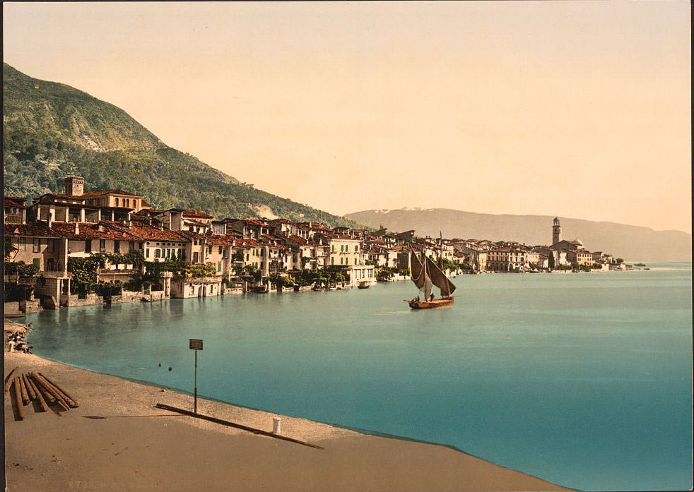
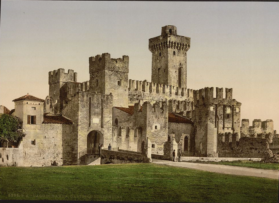
The Scaligero Castle at Sirmione, on the southern shore, is one of the best-preserved medieval fortresses in northern Italy. Built by the Della Scala lords of Verona in the 13th century, it guards the narrow peninsula of Sirmione with a moat that opens directly into the lake. The castle’s towers, battlements, and harbor entrance — where boats once passed through a fortified gate — remained largely intact through the 19th century and were a major attraction for travelers.
The Ponale Road appears repeatedly in this photograph collection, and for good reason. Viewed from different angles and at different points along its length, it offered constantly changing perspectives — sometimes looking down on the turquoise water far below, sometimes framing the white-peaked mountains to the north. It was one of the defining engineering and scenic achievements associated with Lake Garda in the 19th century.
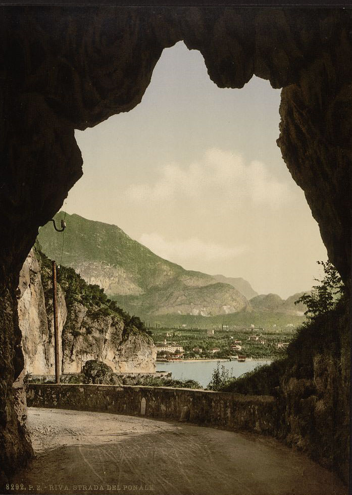
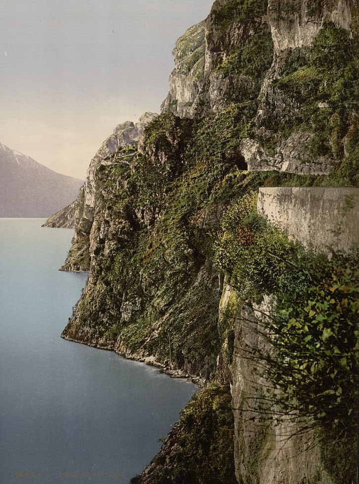
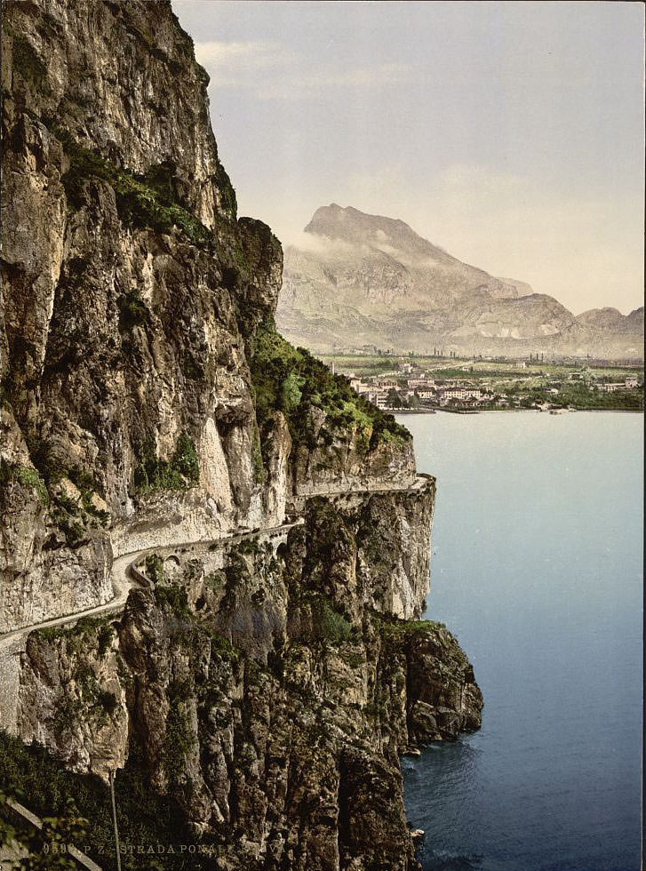
Tenno, a medieval hilltop village inland from Riva, sits below the slopes of Monte Baldo. Its stone-built streets and ancient character contrasted sharply with the resort towns along the shore. To the south, Toscolano-Maderno’s road network — featuring tunnels carved through the cliffs above the lake — demonstrated the kind of infrastructure built throughout the Garda region to connect otherwise isolated communities. The valley behind the twin towns remains one of the most striking inland landscapes visible from the western shore.
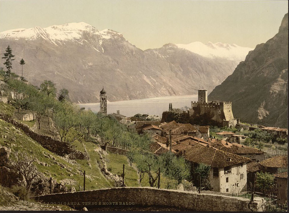
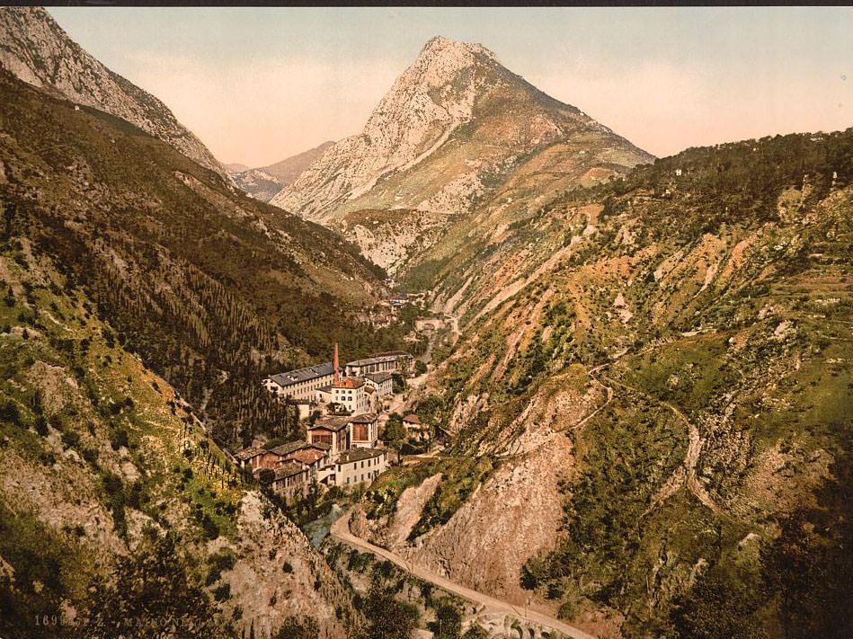
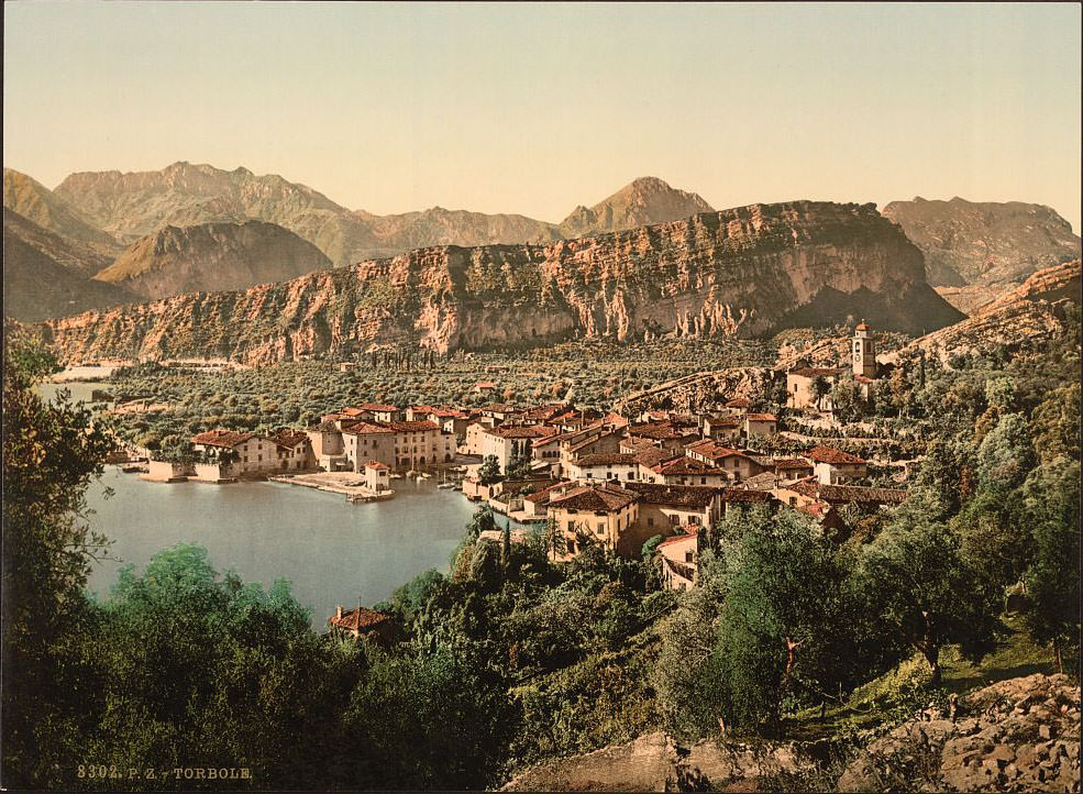
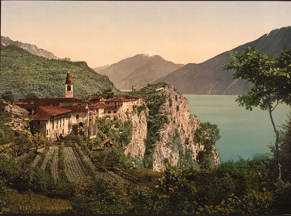
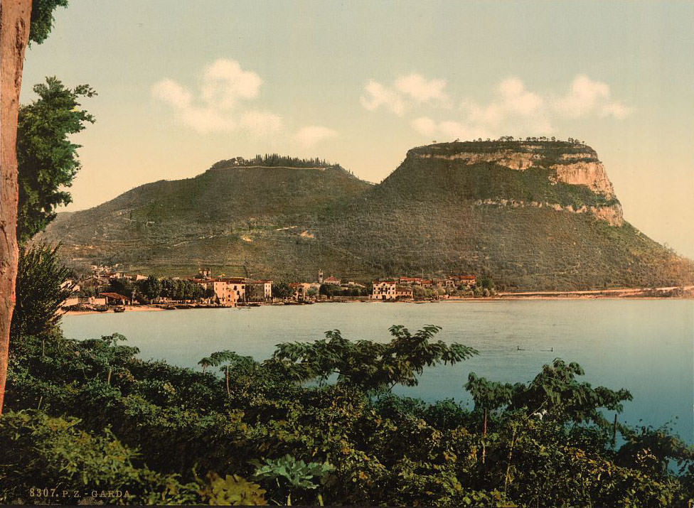
Torbole, at the northeastern corner of the lake, is a windy town where the lake narrows and the mountains close in. It has been a sailing and fishing town for centuries. Tremosine, a village perched on a high plateau above the western cliffs, offered one of the most extreme vantage points on the entire lake — looking straight down over sheer rock faces to the water hundreds of meters below. The Valley of Sarca, seen from within its depths, shows just how enclosed and dramatic the geography north of the lake truly was. The final image in this collection captures the open waterfront of Lake Garda itself — broad, calm, and framed by mountains — a view that drew photographers, painters, and travelers to its shores throughout the 19th century.