
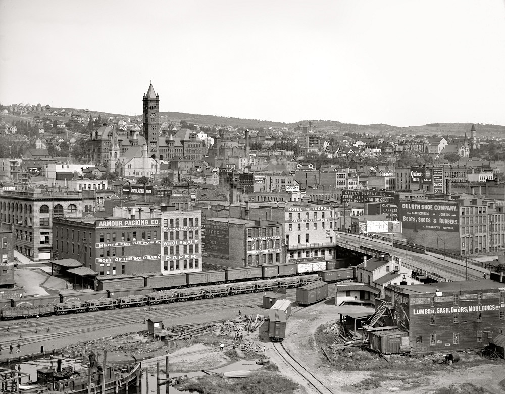
Duluth, Minnesota sits on the western tip of Lake Superior, one of the most strategic port locations in the entire United States. Long before European settlers arrived, the Sioux and Ojibway tribes lived throughout the region. By the mid-1800s, Duluth had begun drawing attention as a place with serious economic potential. Lumber, iron ore, and railroad access made it one of the fastest-growing cities in the country during the 19th century. The Panic of 1873 slowed things down, but only briefly. By the late 1870s, the boom was back.
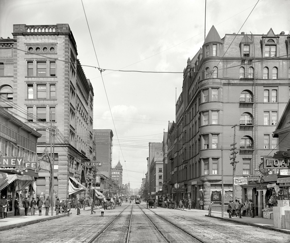
Superior Street was the beating heart of downtown Duluth. Lined with commercial buildings, streetcar tracks, and foot traffic, it captured the energy of a city on the rise. This photograph from 1902 shows the street in its early 20th-century form — busy, structured, and built for business.
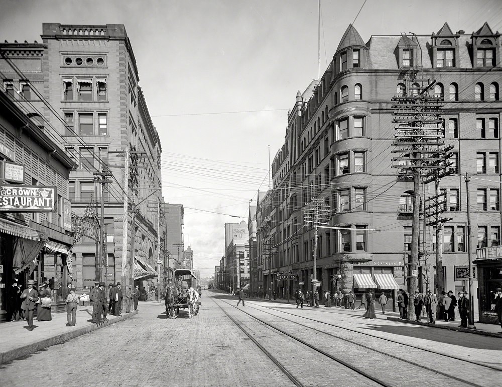
By 1905, Duluth was reported to have more millionaires per capita than any other city in the United States. Much of that wealth came from iron ore and lumber shipping through the port. European immigrants poured into the city during the early 1900s, drawn by steady wages in mining, dockwork, and construction. The population swelled, and the city’s skyline and street life reflected that growth. Hotels, banks, and civic buildings rose quickly to meet the demand of a thriving urban center.
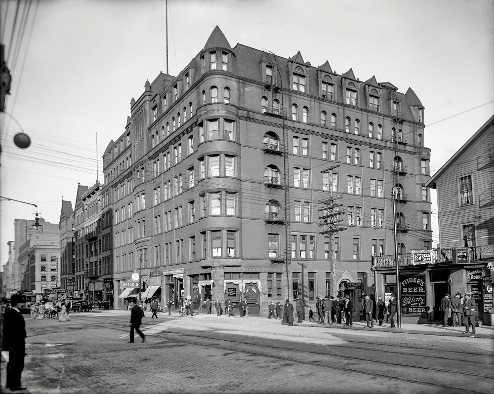
The Spalding Hotel was one of Duluth’s premier establishments during this era — a symbol of the city’s ambitions. Just two years earlier, in 1904, the city had seen the opening of the Bank of Duluth, its first bank. These institutions weren’t just practical — they signaled to outsiders that Duluth was a serious, permanent city worth investing in. Superior Street, photographed again here in 1904, continued to anchor that commercial identity.
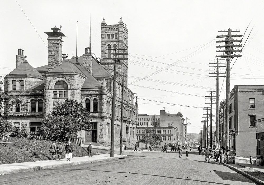
As downtown Duluth expanded, its civic infrastructure kept pace. The post office along First Street was one of several government structures that established the formal character of the city. This 1910 photograph shows how the built environment had matured — stone facades, organized street grids, and a sense of permanence that reflected over three decades of sustained growth.
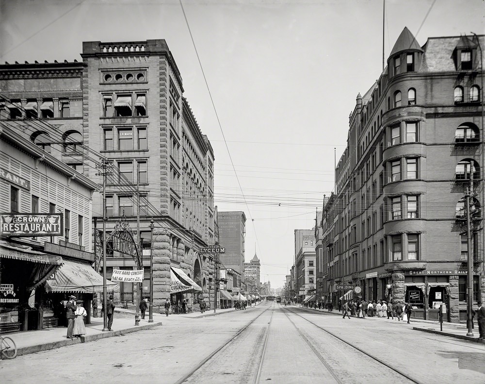
Superior Street remained the city’s main commercial corridor well into the early 1900s. Streetcars ran through its center, carrying workers and shoppers from one end of downtown to the other. The 1909 view of the street shows a city that had fully matured from its frontier roots into a functioning urban economy.
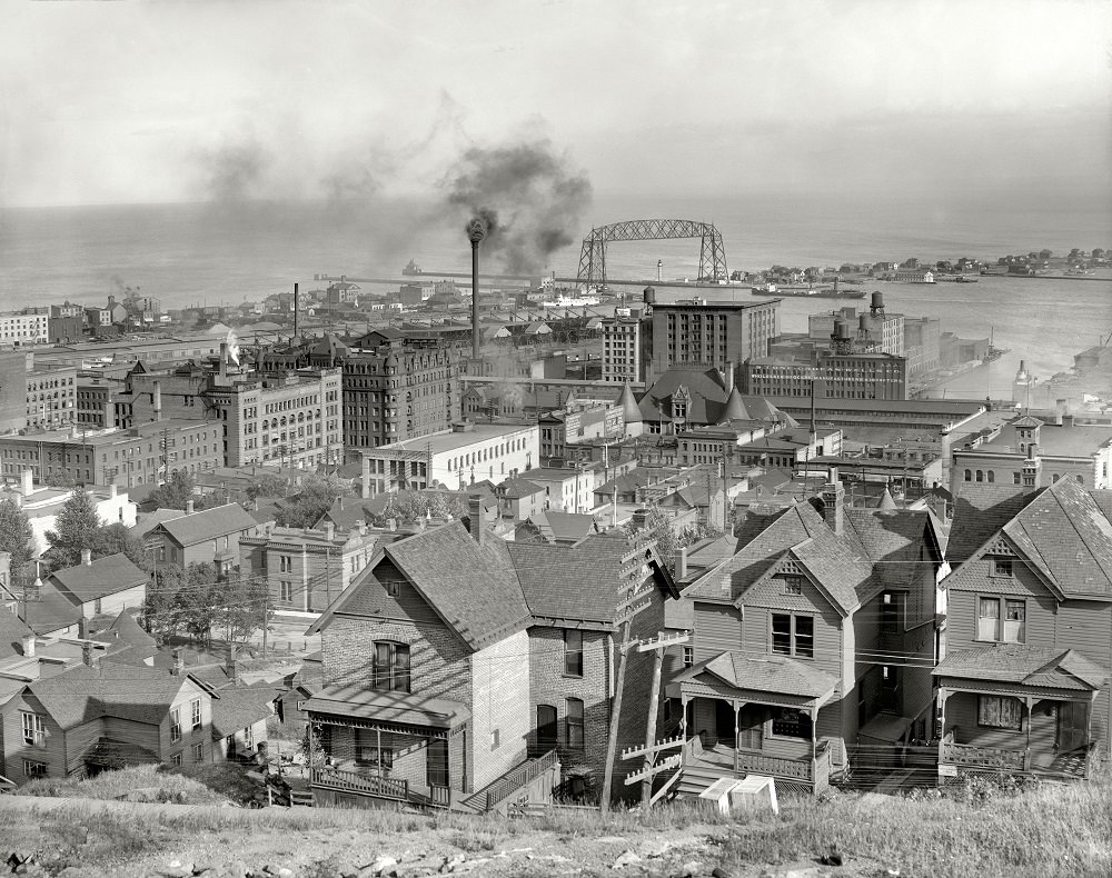
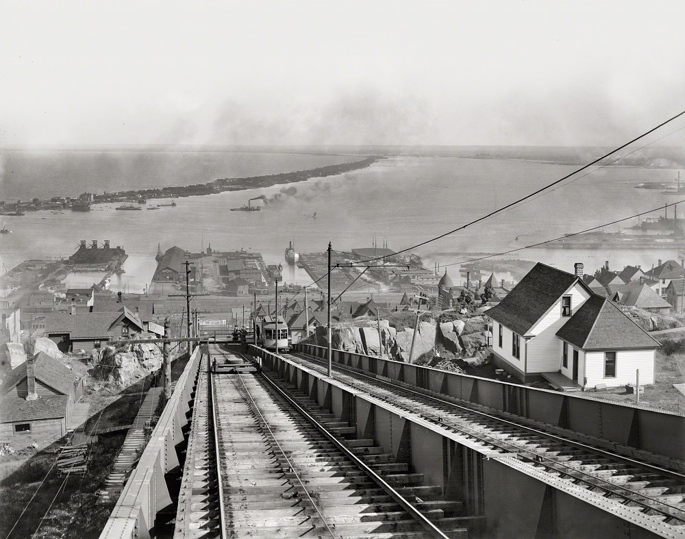
Duluth’s geography is dramatic. The city climbs steeply from the lakeshore up a rocky hillside, giving residents and visitors sweeping views of the harbor below. The Incline Railway was the practical solution to this terrain — a funicular system that carried people up and down the bluff. From its upper station, the full scale of Duluth’s port and city grid came into view.
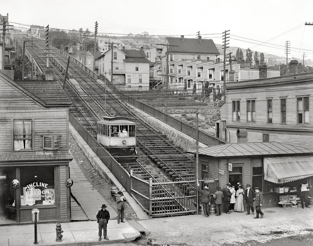
Looking down from Superior Street toward the Incline Railway gave passengers a sense of just how steep the hillside was. The railway connected the lower commercial district near the waterfront with the residential neighborhoods higher up. For a city built on a hillside, it was an essential piece of daily infrastructure.
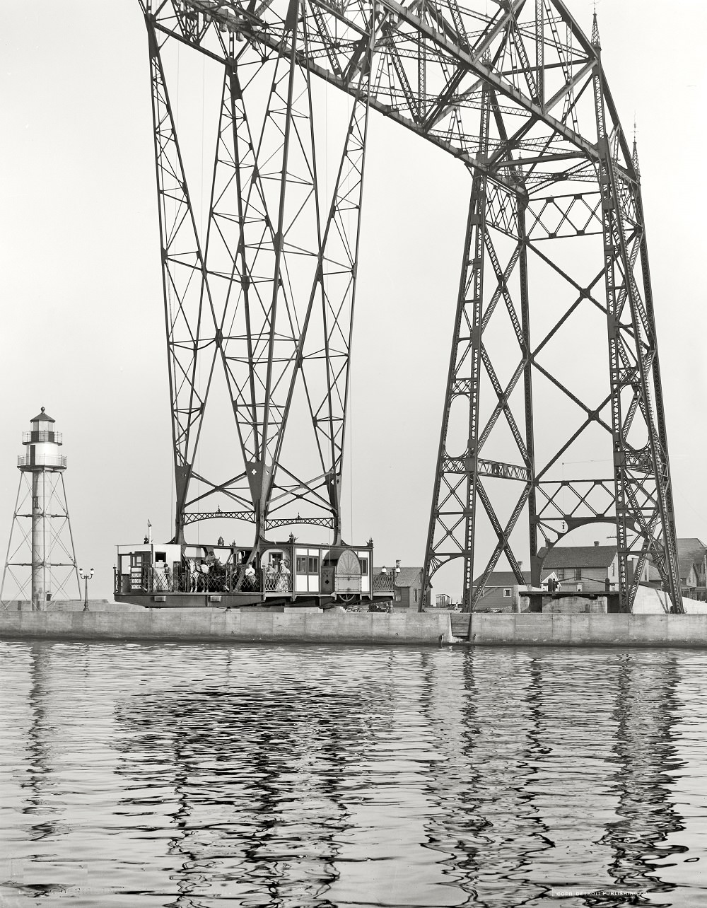
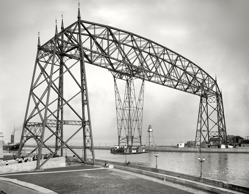
No structure defined Duluth’s waterfront more than its Aerial Bridge at the Ship Canal. Originally built as a transporter bridge — one of only a handful ever constructed in the United States — it carried a gondola car suspended from the upper span, ferrying people and vehicles across the canal between the mainland and Minnesota Point. This 1908 photograph captures the bridge in its original transporter configuration, before it was later converted to a lift bridge.
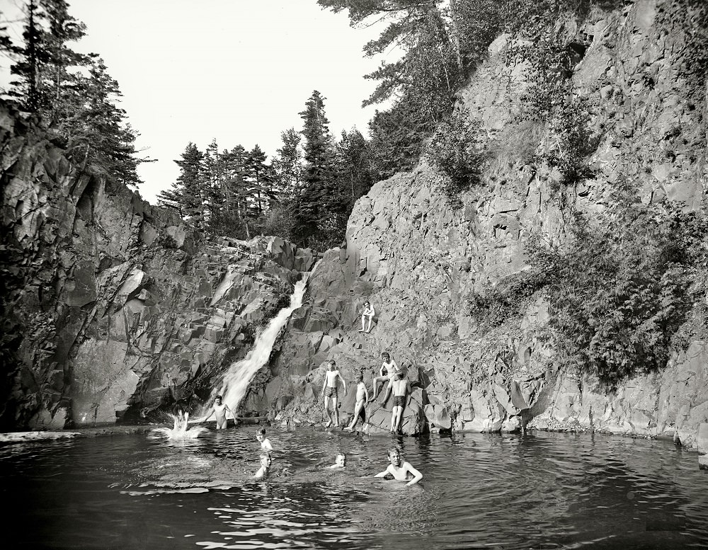
While the city’s industrial core was defined by steel and shipping, Duluth also had quiet natural spaces tucked within its borders. Lester Park, located along the Lester River on the eastern edge of the city, offered residents a retreat from the noise of downtown. Children swam in its rocky pools, and families gathered along its wooded banks.
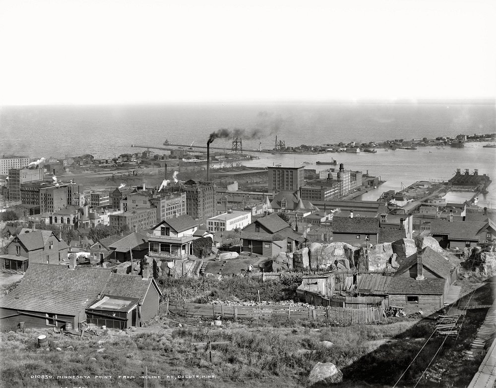
Minnesota Point is a long, narrow sandbar that separates the Duluth harbor from Lake Superior. Stretching nearly seven miles, it’s one of the longest freshwater sandbars in the world. From the elevated vantage point of the Incline Railway, its full length and the harbor’s layout came clearly into view — a perspective that showed just how much Duluth’s geography was shaped by water.
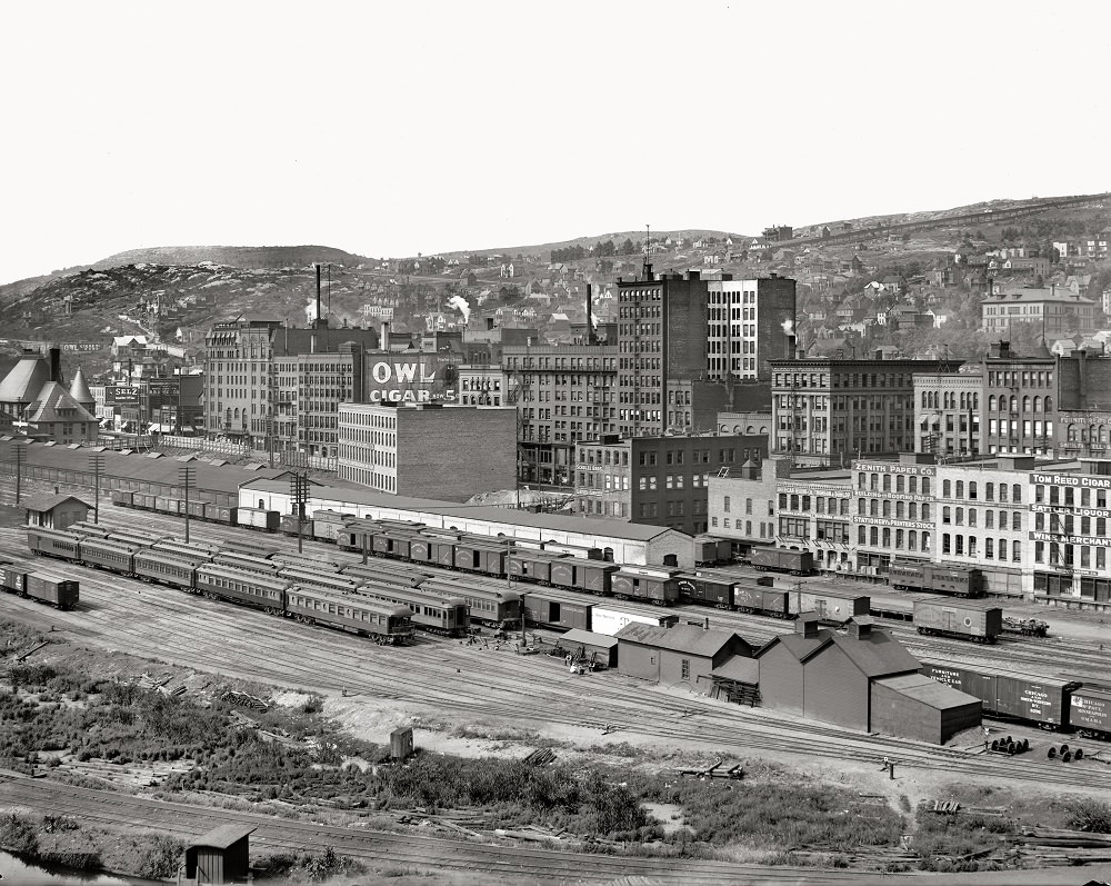
Duluth earned the nickname “The Zenith City of the Unsalted Seas” — a reference to its position as the westernmost Great Lakes port and its ambitions as an inland shipping powerhouse. The panoramic photographs taken in 1905 as part of the Zenith City series documented the city at its peak of early prosperity, capturing its streets, harbor, and hillside neighborhoods in remarkable detail.
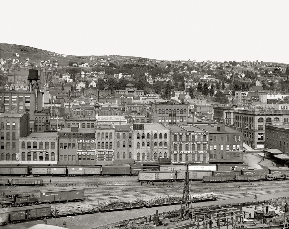
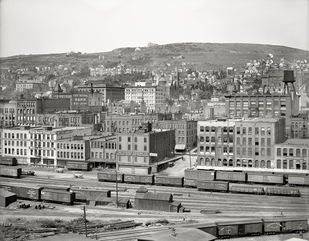
The harbor was the engine that drove everything. Grain elevators towered over the waterfront, storing wheat and other commodities bound for markets in the East. Iron ore from Minnesota’s Iron Range arrived by rail and was loaded onto massive lake freighters. The Incline Railway visible in the background of this 1905 image ties the industrial waterfront to the residential hillside — two very different worlds separated by a few hundred vertical feet.
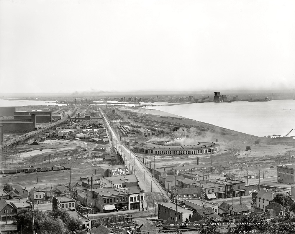
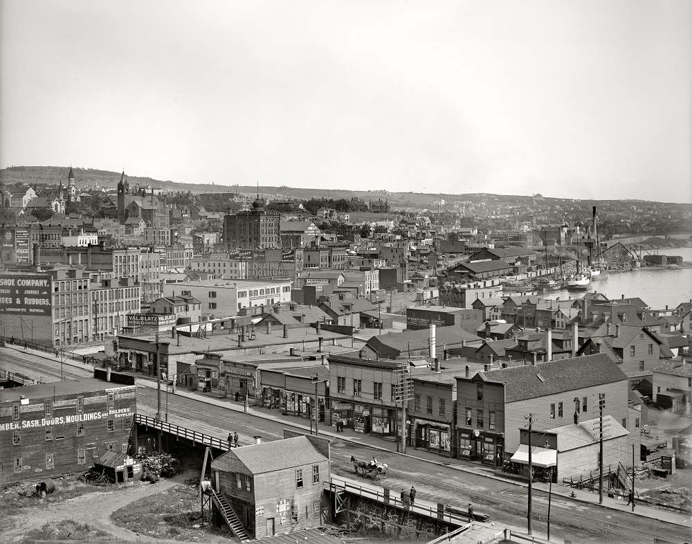
These 1905 views of Duluth document the city at a defining moment. The iron ore trade was at full strength, the railroad network was well-established, and immigrants from across Europe had settled into the neighborhoods climbing the hillside. The port handled an enormous volume of cargo, and the city’s population reflected the diversity of people who had come to work it.
The Aerial Bridge appeared in photographs across this period because it was genuinely remarkable. At the time of its construction, it was a cutting-edge engineering solution to a practical problem — how to connect Minnesota Point to the mainland without blocking ship traffic. The 1907 image shows the structure in the years before major modifications, still operating as the transporter bridge it was originally designed to be.
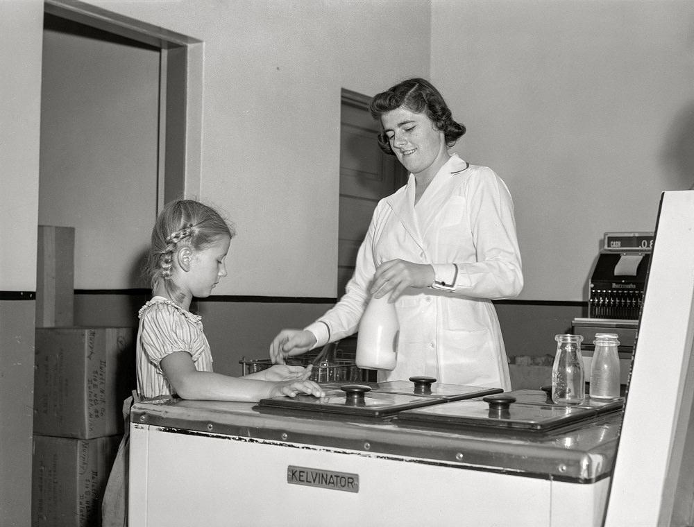
By 1941, Duluth was a very different city from the boomtown it had been four decades earlier. The economic pressures of the Great Depression had taken a toll, and the city’s population had stabilized. These photographs taken in August 1941 offer a street-level glimpse of everyday life — specifically, children interacting with the Duluth Milk Company. The images were likely taken as part of a documentary or public health effort, reflecting the era’s interest in childhood nutrition and local commerce.






Wow, some of these are really great.
That’s Eric Ringsred on the right
I don’t know why those milk pictures were included in this album, but I’m here for it.
Bring those fucking street cars back