
Cape Town in the 1960s was a city of sharp contrasts. Its streets buzzed with traders, schoolchildren, double-decker buses, and fishermen heading to the harbor. Table Mountain stood watch over it all, as it always had. But beneath the surface of daily life, a political system was tightening its grip — one that would change the city’s face forever. Apartheid, introduced in 1948, reached a new level of brutality during this decade, and Cape Town felt every bit of it.
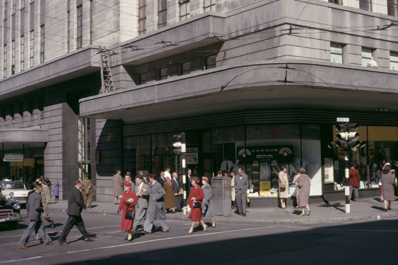
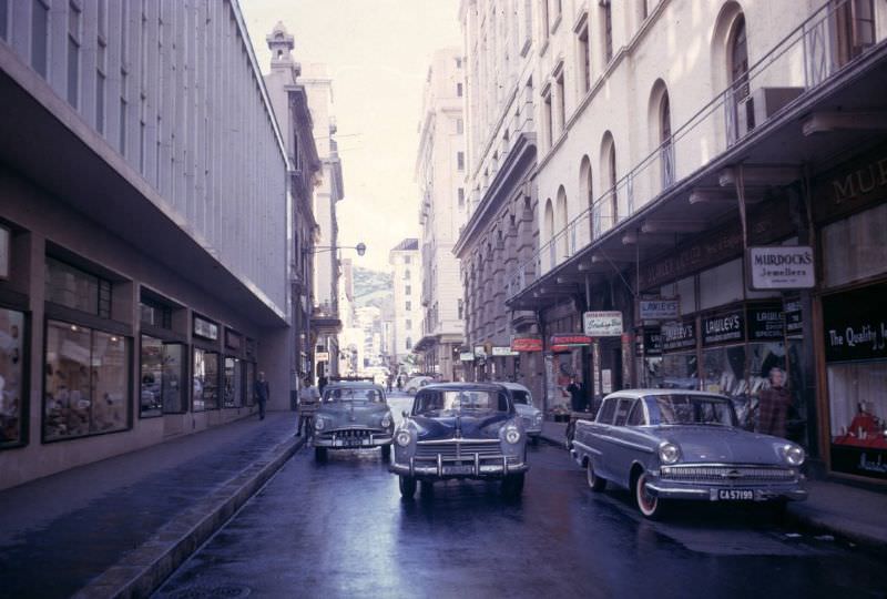
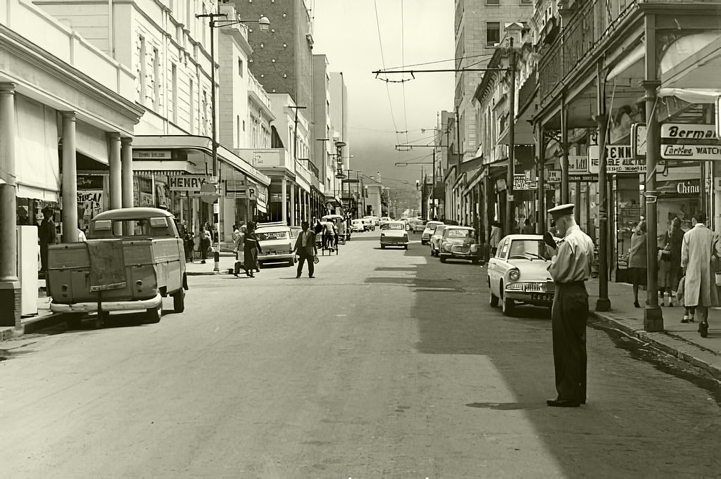
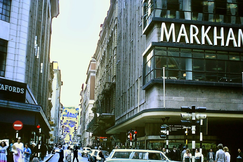
The city’s streets were alive with movement. Pedestrians crossed busy intersections, vendors called out to passersby, and the rhythm of urban life carried on. Adderley Street — Cape Town’s main commercial artery — was lined with department stores, hotels, and office buildings. Trams had already given way to buses, and the city was modernizing fast.
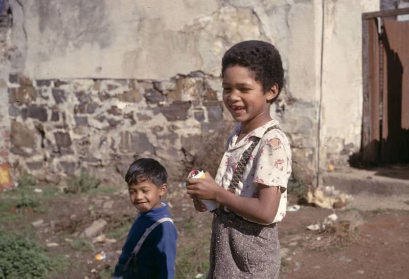
Cape Town had long been home to a richly diverse population. The Cape Malay community, descendants of enslaved people and political exiles brought from Southeast Asia by the Dutch in the 17th and 18th centuries, had deep roots in the city. Their presence was especially strong in the Bo-Kaap neighborhood, with its brightly painted houses climbing the slopes of Signal Hill.
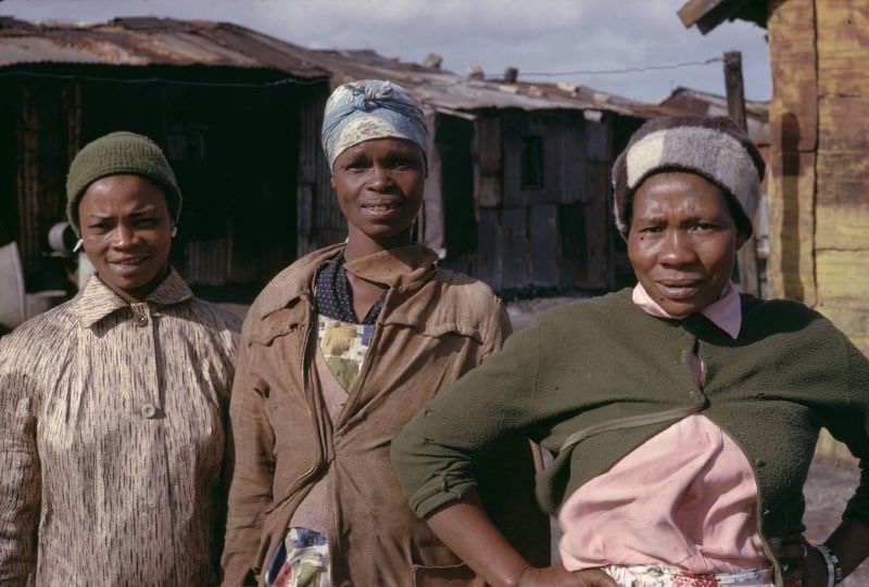
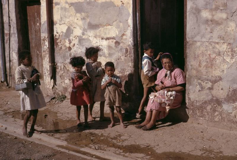
The reality of life under apartheid was impossible to ignore. Poor housing conditions were common in many non-white areas of the city. Families lived in cramped, inadequate structures while the government pursued policies that kept non-white residents locked out of wealthier areas. These were not the margins of Cape Town’s story — they were central to it.
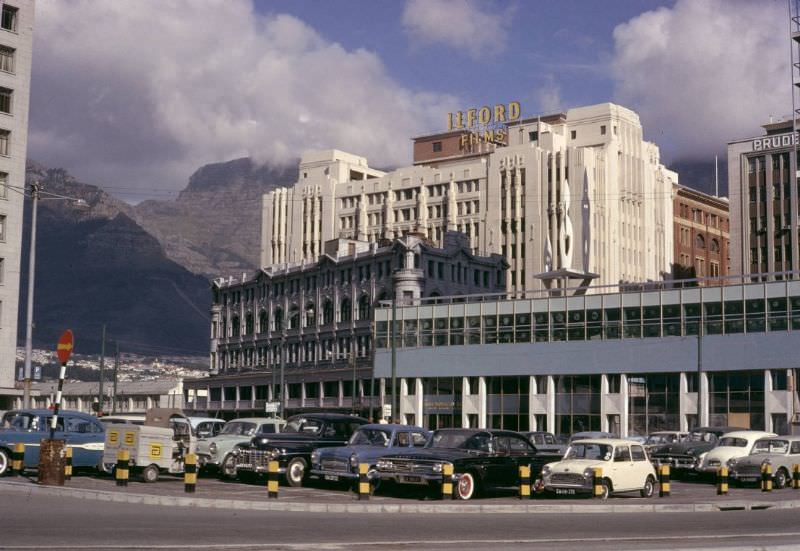
Cape Town’s City Hall, completed in 1905, remained one of the city’s most recognizable landmarks. Cars lined up along the Grand Parade in front of it — a public square that served as a marketplace, a parking lot, and, on significant days, a gathering point for the city’s residents. The Parade had hosted everything from markets to political rallies.
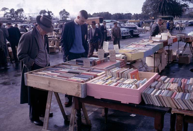
Street markets were a fixture of Cape Town life. Books, fresh produce, clothing, glassware, and all kinds of goods changed hands in the open air. These markets were social spaces as much as commercial ones — places where people from different walks of life crossed paths, bartered, and talked.
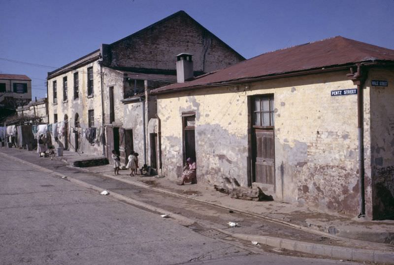
The housing conditions visible in these photographs reflect the direct consequences of apartheid legislation. The Group Areas Act of 1950 had designated specific zones for each racial group, forcing non-white residents into underdeveloped areas with poor infrastructure. Investment in these communities was minimal, and the physical state of neighborhoods like District Six and the Cape Flats reflected that neglect deliberately.
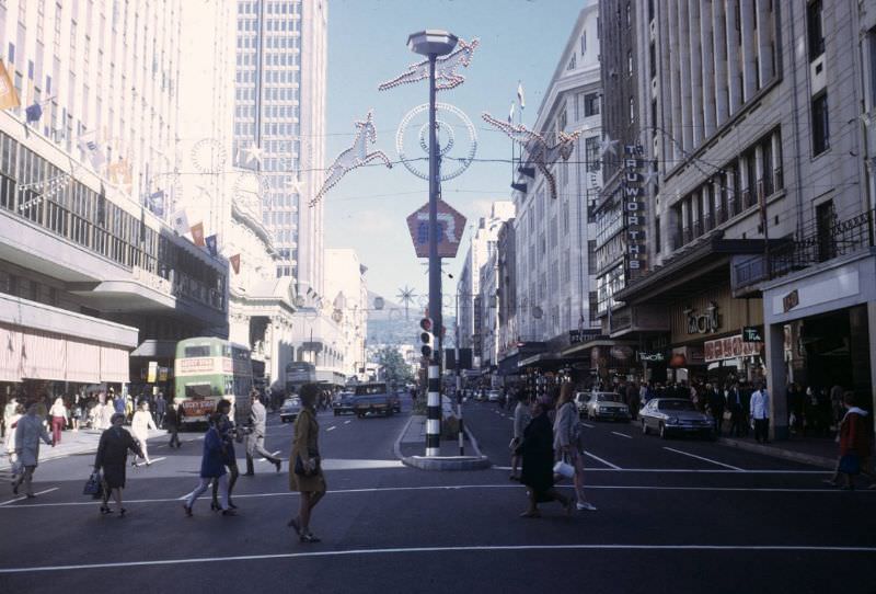
Despite the political climate, the streets of Cape Town remained busy from morning to night. Workers, students, traders, and families all shared the pavements. The city was dense, active, and in many ways, still functioning as the cosmopolitan port city it had always been — even as the laws of the land worked to divide its people.
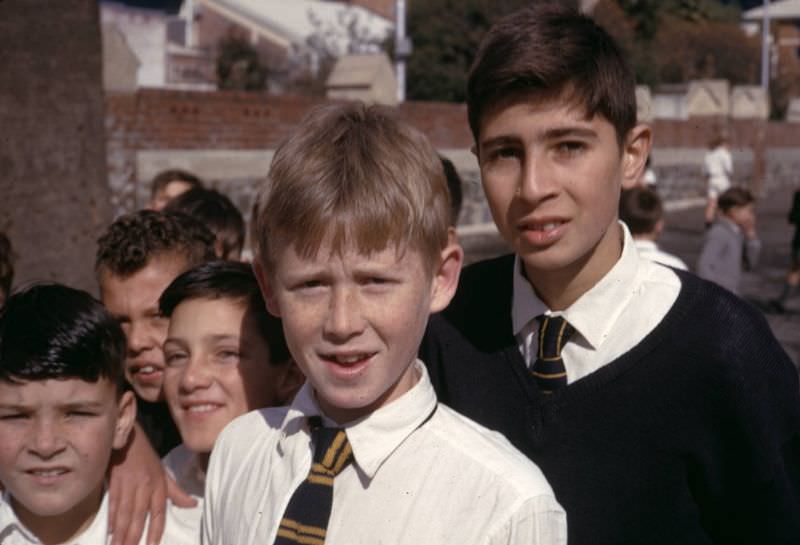
Education in 1960s Cape Town was shaped heavily by apartheid. The Bantu Education Act of 1953 had created a separate, inferior education system for Black South African children. Despite this, schooling continued across the city in various forms. Grassroots efforts pushed back against the limits imposed by the government, with community-led initiatives offering alternative paths to literacy and learning.
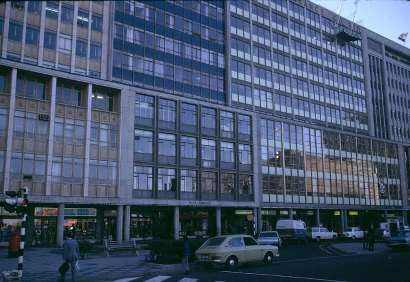
The University of Cape Town, South Africa’s oldest university, sat on the slopes of Devil’s Peak and remained a center of intellectual life throughout the decade. Students and faculty openly challenged apartheid policies, staging debates, protests, and organized actions. The campus was one of the few places where multi-racial interaction was more openly practiced, though not without conflict with the state.
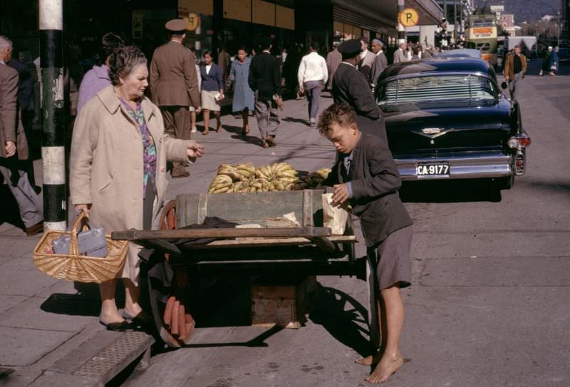
Street vending was a way of life for many in Cape Town. Children sold fruit at the roadside while adults ran stalls near the City Hall and along the Parade. The informal economy was a lifeline for families shut out of formal employment by racial restrictions. Every transaction on those pavements was an act of survival and resilience.
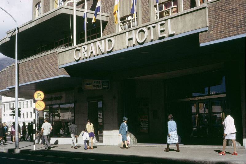
The Grand Hotel on Adderley Street, at the corner of Strand Street, was one of Cape Town’s most prominent establishments. Hotels like this catered primarily to white guests under apartheid. The city’s hospitality industry — its hotels, restaurants, and entertainment venues — was segregated, with strict rules governing who could enter and be served where.
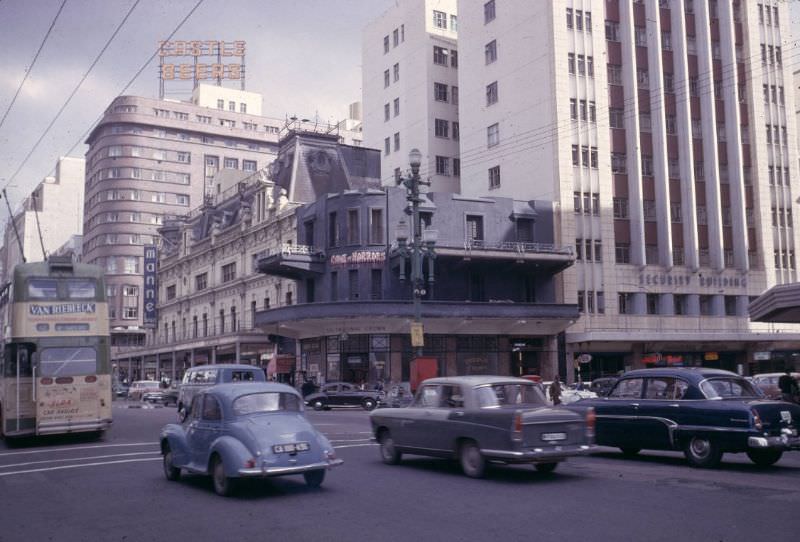
Looking at these street scenes, it’s easy to focus on the ordinary details — the storefronts, the fashions, the cars. But the context matters enormously. In 1966, the apartheid government declared District Six a whites-only area. Nearly 60,000 residents — a community that had existed for generations — were forcibly removed and relocated to the barren, windswept Cape Flats on the city’s outskirts.
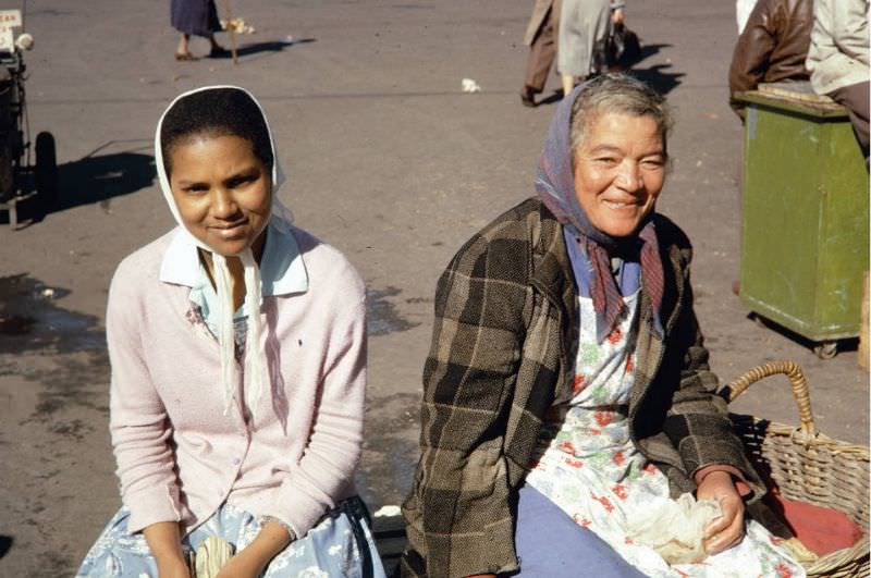
The markets near Cape Town’s City Hall attracted vendors and shoppers from across the city. Women sold fresh produce, flowers, and household goods. The Parade market was a beloved institution — a noisy, colorful gathering that continued regardless of the political tensions unfolding around it. These women were the backbone of a community economy that the apartheid state was working hard to dismantle.
The Pan Africanist Congress and the African National Congress both used Cape Town as an important base for their anti-apartheid operations during this period. The PAC had organized the Sharpeville protest in March 1960 — a mass demonstration against pass laws that ended in a police massacre of 69 people. Both organizations were subsequently banned by the government, forcing their activities underground.
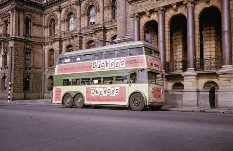
Double-decker buses were a familiar sight on Cape Town’s streets throughout the 1960s. The city’s public transport network was, like everything else, segregated. Separate buses or separate sections within buses were used by different racial groups. Getting to work, school, or the market required navigating a system designed to keep people apart at every turn.
The Cape Malay community maintained strong cultural traditions throughout the apartheid years. Family life, Islamic faith, and distinctive food and music traditions held communities together even as government policies worked to displace and dispossess them. The Bo-Kaap, where many Cape Malay families lived, became a symbol of cultural endurance against apartheid’s assault.
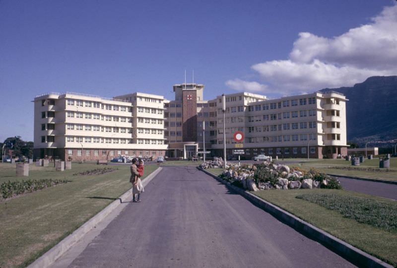
Cape Town’s Red Cross War Memorial Children’s Hospital, established in Rondebosch in 1956, was one of the city’s key medical institutions. Healthcare under apartheid was also segregated, with vastly different levels of care available to white and non-white patients. Hospitals like Groote Schuur, which would make world headlines in December 1967 when Dr. Christiaan Barnard performed the first successful human heart transplant there, served a racially divided patient population.
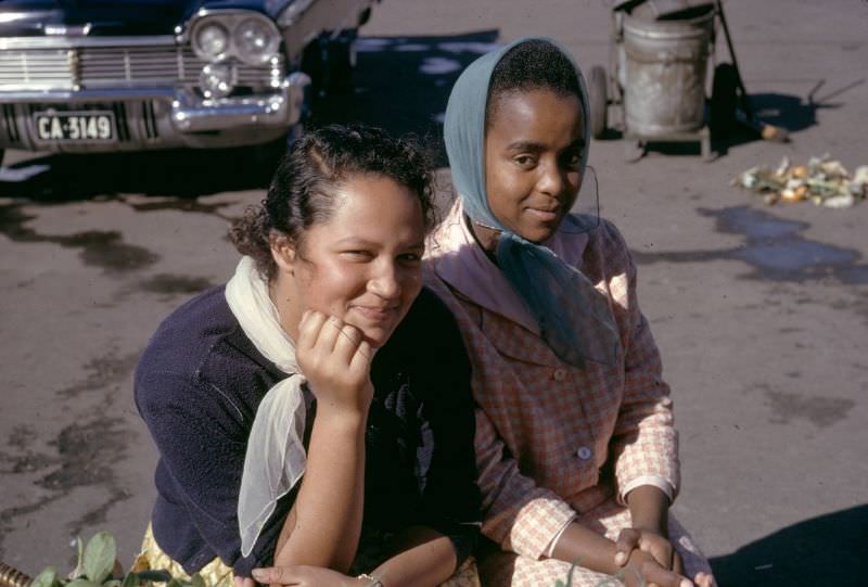
Cape Town’s markets were places where the city’s diversity was still visible, even as apartheid laws worked to separate communities. Girls and young women shopped and socialized in spaces that had existed long before the racial laws of the 20th century tried to redraw every boundary of public life. The markets near the Grand Parade were especially vibrant.
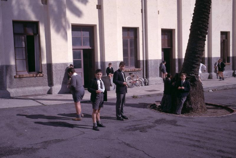
Cape Town’s Jewish community had roots stretching back to the 19th century, with significant immigration from Lithuania in the late 1800s and early 1900s. By the 1960s, the community was well established, with synagogues, schools, and cultural organizations scattered across the city. Like other white South Africans, Jewish families benefited from the privileges of whiteness under apartheid, though some members of the community were prominent anti-apartheid activists.
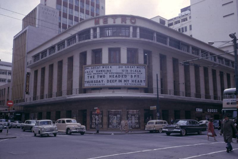
Entertainment in 1960s Cape Town was strictly segregated. Movie theaters operated separate screenings or entirely separate venues for different racial groups. The jazz scene that had taken off in the 1950s continued to thrive in the 1960s, with musicians using their art as a form of protest. Cape Town’s cultural life was creative and resilient, but it existed within the tight constraints of racial law.
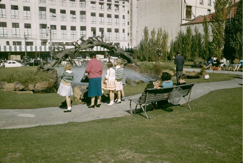
Public spaces like the Company Gardens — a historic green space at the heart of Cape Town established by the Dutch East India Company in the 17th century — remained popular gathering spots. Parks and outdoor spaces were also subject to racial segregation under apartheid, with separate benches, facilities, and in some cases, entirely separate parks designated for different racial groups.
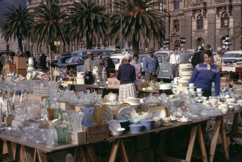
The markets around Cape Town’s City Hall sold everything from produce to secondhand goods. Traders displayed their wares on tables and on the ground, and buyers browsed at leisure. These open-air markets were one of the few genuinely mixed public spaces remaining in the city — commerce creating contact that the law otherwise tried to prevent.
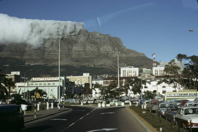
Table Mountain loomed over the city as it always had — flat-topped, ancient, and indifferent to the politics playing out below. It remained one of Cape Town’s defining features, visible from almost every part of the city and the harbor. Tourists still came to ride the cable car and take in the views, while the city at its feet was being fundamentally reshaped by apartheid.
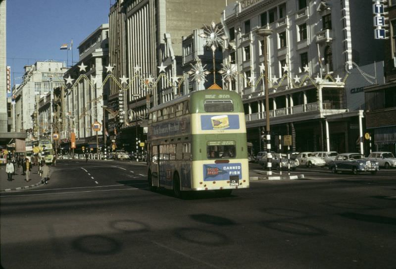
The double-decker buses that moved through Cape Town’s streets in the 1960s were a practical necessity for a growing city. The population was expanding, and so was the urban footprint. New suburbs were being developed — for white residents — on the fringes of the city, while non-white families were pushed further and further out toward the Cape Flats.
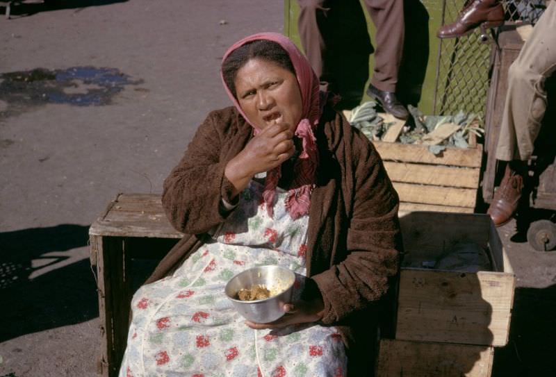
Women in Cape Town carried enormous burdens during this decade. They managed households under difficult economic conditions, raised children in the face of forced removals, and in many cases, were active participants in resistance movements. The women who appear in these photographs — in markets, on streets, in doorways — represent a community holding itself together under sustained pressure.
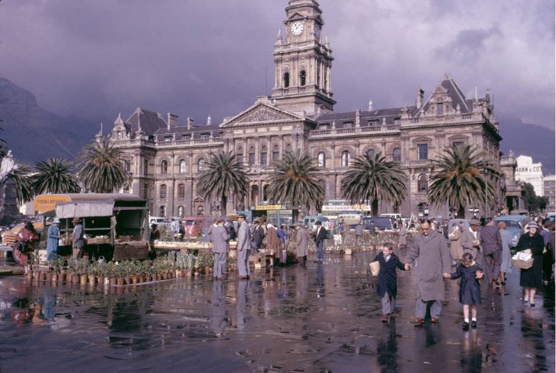
The Grand Parade market, directly across from the City Hall, was one of Cape Town’s busiest public spaces. It operated on a regular schedule, drawing hundreds of vendors and thousands of shoppers. Fruit stalls, clothing sellers, and food vendors filled the square with noise and color. It was the kind of place that reminded residents of what the city could be — open, shared, and alive.
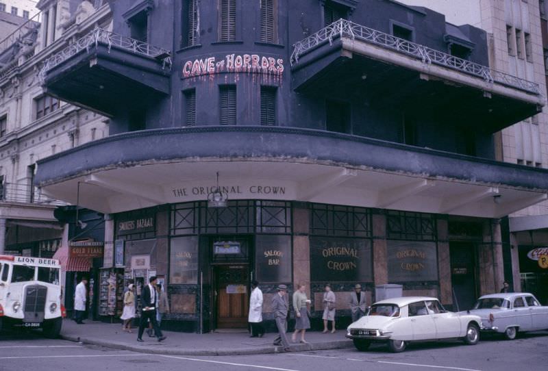
The cityscape was changing throughout the 1960s. Old Victorian and Cape Dutch buildings were joined by new modernist structures — office towers, apartment blocks, and public buildings in the stark concrete style of the era. The Foreshore, reclaimed from the sea in the 1940s, was still being developed, with ambitious road and building projects reshaping the land between the CBD and the harbor.
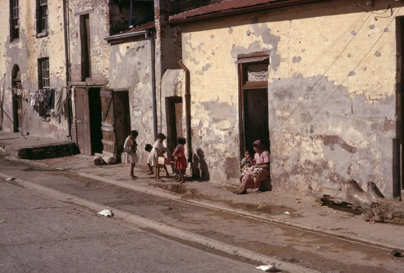
Slum conditions in Cape Town were a direct result of apartheid spatial planning. Areas designated for non-white residents received little to no investment in infrastructure or housing. Overcrowding was severe, sanitation was inadequate, and residents had virtually no legal recourse. These were not conditions that arose by accident — they were the intended result of government policy.
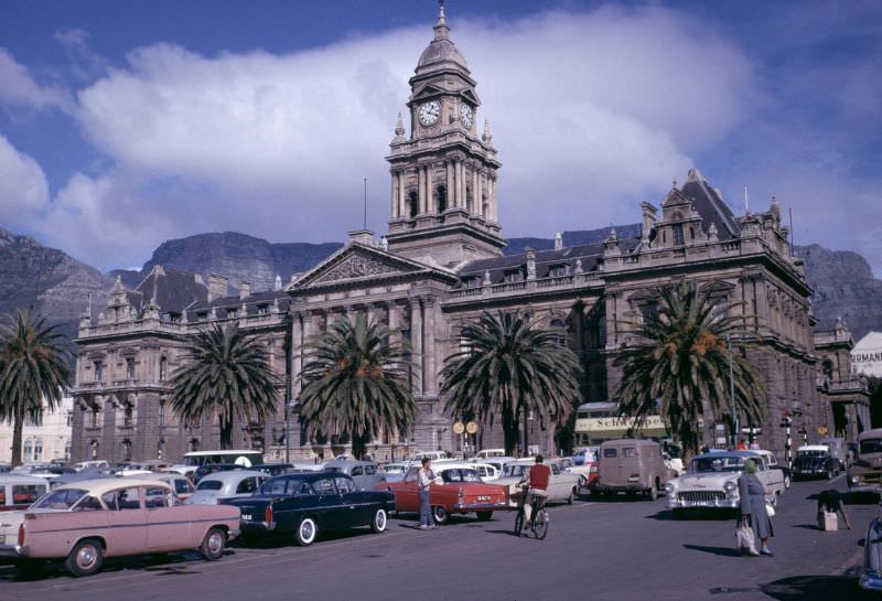
By the mid-1960s, car ownership among white South Africans was rising, a visible sign of the economic prosperity that apartheid’s racial economic policies concentrated in white hands. The cars parked across from City Hall tell one part of the story of 1960s Cape Town — one of growing consumer culture and modernization — while the slum photographs tell the other.
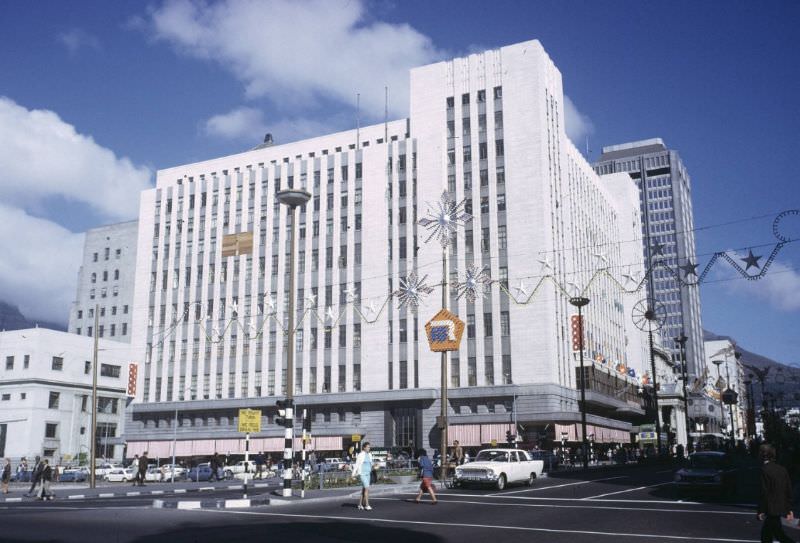
Cape Town’s commercial district remained active throughout the decade. Shops, hotels, banks, and offices occupied the older stone buildings of the CBD, while construction cranes were a constant presence as new towers went up. Adderley Street, Strand Street, and Darling Street were the main arteries of commercial life — busy, noisy, and full of the energy of a city in constant motion.
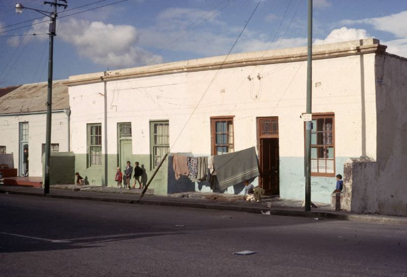
The forced removal of District Six’s residents, which began in earnest following the 1966 declaration, created one of the most painful chapters in Cape Town’s history. Nearly 60,000 people were uprooted from their homes and relocated to the Cape Flats — a flat, windswept area far from the city’s center — and their neighborhood was bulldozed. The land sat largely empty for decades afterward.
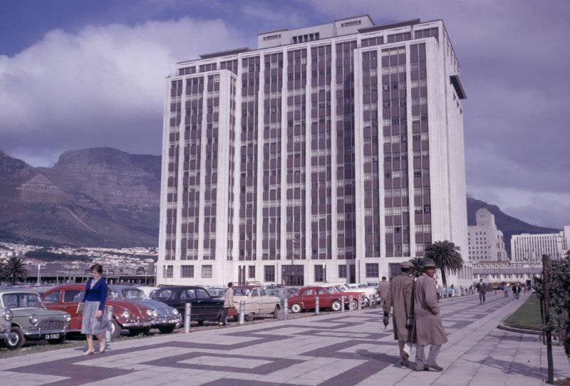
The new skyscrapers of the 1960s changed Cape Town’s skyline dramatically. The Sanlam Building — later known as the Naspers Centre — was among the most prominent new additions. These towers represented the economic ambitions of the apartheid state and its allied business community, rising against the ever-present backdrop of Table Mountain. The contrast between old and new was one of the defining visual signatures of the decade.
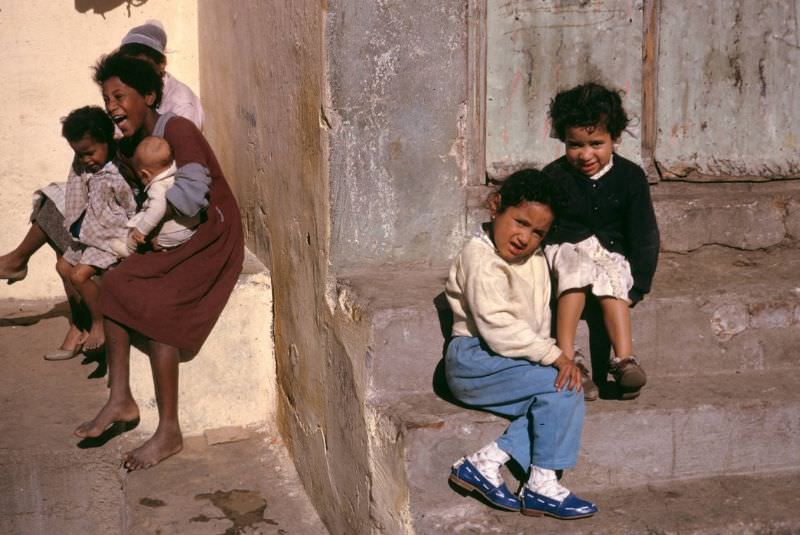
Children growing up in Cape Town’s Cape Malay community did so within a rich cultural environment that was simultaneously under threat. The Bo-Kaap’s cobblestone streets and colorful homes provided a distinct sense of identity and place. But the apartheid government’s Group Areas Act had already uprooted many families from other parts of the city, and the threat of further displacement was never far away.
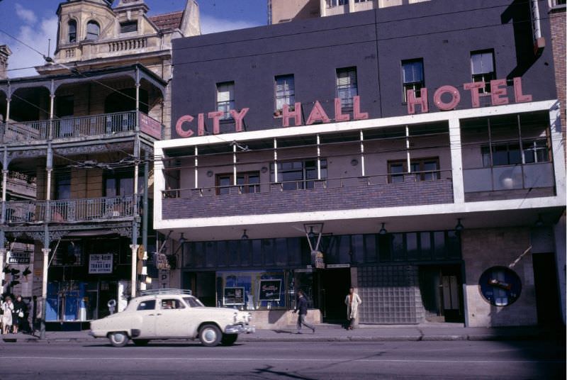
Hotels in Cape Town’s city center served a largely white clientele in the 1960s. The City Hall Hotel, like the Grand Hotel and the Carlton Hotel, was part of a hospitality landscape shaped entirely by racial segregation. Non-white guests were excluded from these establishments — a daily reminder of the apartheid state’s reach into every aspect of public life.
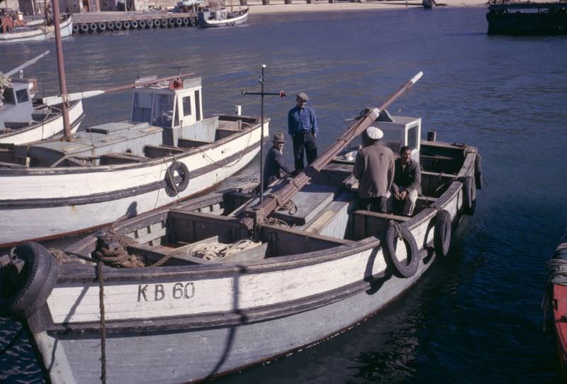
Cape Town’s harbor was one of the busiest on the African continent. Fishing boats, cargo ships, and passenger liners all used its docks. The fishing industry employed large numbers of Cape Malay and Coloured workers who lived in nearby areas. The harbor gave the city its character as a port — a place where goods and people from across the world arrived and departed.
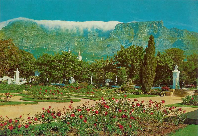
The Company Gardens in the heart of Cape Town dated back to 1652, when Jan van Riebeeck established a vegetable garden to supply Dutch East India Company ships. By the 1960s, it had long been a public park, complete with museums, a gallery, the South African Parliament, and the grand Mount Nelson Hotel at its edge. Squirrels and strollers were its regular inhabitants, even as the city around it underwent enormous political upheaval.
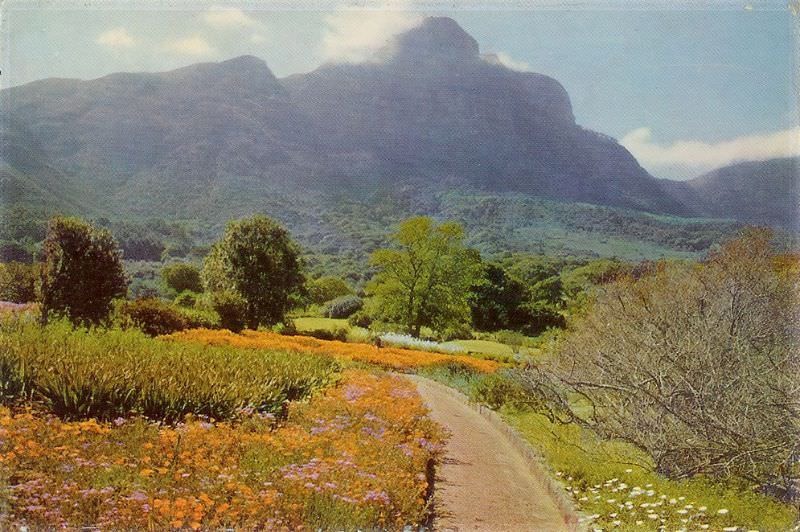
Kirstenbosch National Botanical Garden, established in 1913 on the eastern slopes of Table Mountain, was a world-class institution. Its collections of Cape fynbos — the unique plant life of the Western Cape — drew botanists and visitors from around the world. In 1965, it was still a place of relative natural quiet, the mountain rising steeply behind its carefully tended beds.
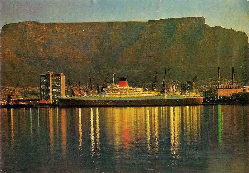
The Duncan Dock, opened in 1945, was Cape Town’s main deep-water harbor facility. Mailships connecting South Africa to Britain and Europe docked there regularly. The Union-Castle Line’s famous purple-hulled vessels were a fixture of the Cape Town harbor scene, departing Southampton and arriving in Cape Town on schedules that the city’s residents could set their watches by.
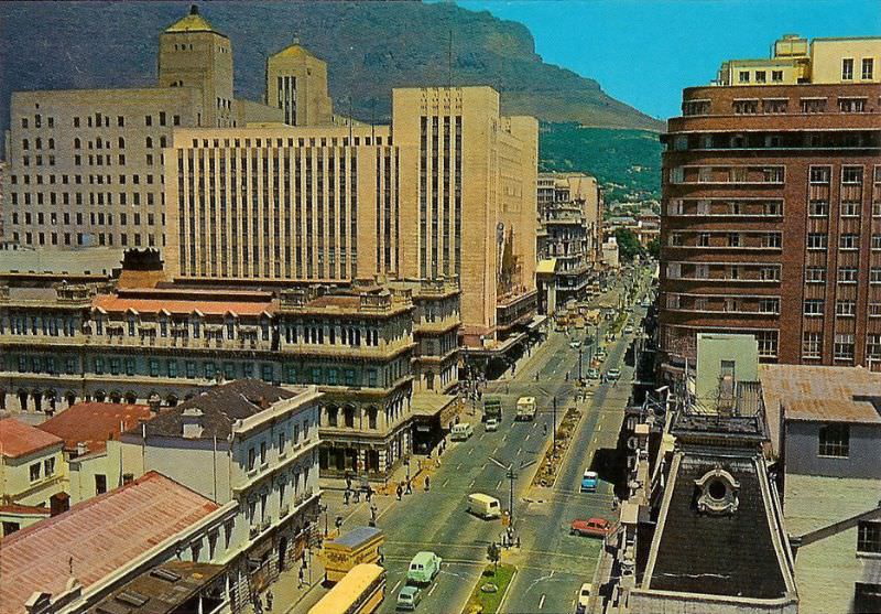
Adderley Street was Cape Town’s commercial spine. Named after Charles Adderley, a British parliamentarian who in 1849 opposed plans to use the Cape Colony as a dumping ground for British convicts, the street ran from the foreshore down toward the Company Gardens. Department stores, banks, and offices lined its pavements, and it was always busy with pedestrians and vehicles.
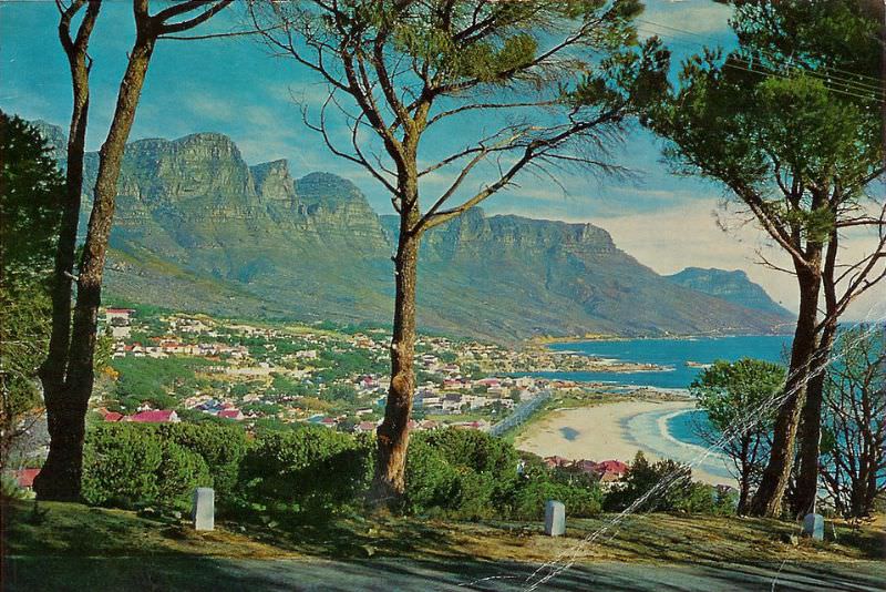
Camps Bay, on Cape Town’s Atlantic seaboard, was one of the city’s most beautiful neighborhoods. Its beach faced the open Atlantic, with the Twelve Apostles mountain range rising dramatically behind it. In 1966, it was a well-established suburb, popular with wealthier white Capetonians who came for the beach and the views. The road above the beach offered sweeping vistas that photographers and tourists found irresistible.
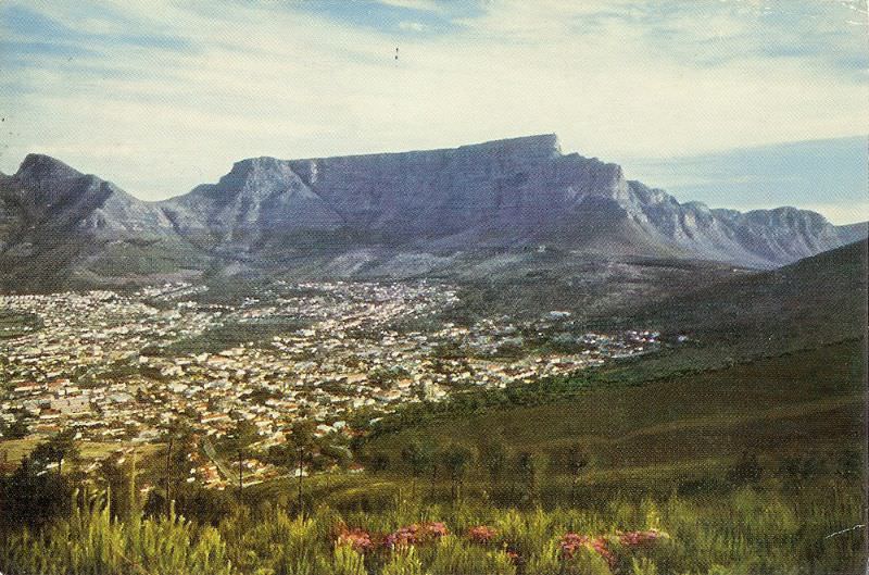
The city from above told its own story in 1966. The CBD’s grid of streets, the harbor’s geometric wharves, the Foreshore’s newer developments, and the mountain above it all — Cape Town’s geography was as distinctive as any city in the world. But from above, the stark division between the well-maintained white suburbs and the crowded, underserviced areas set aside for non-white residents was also visible.
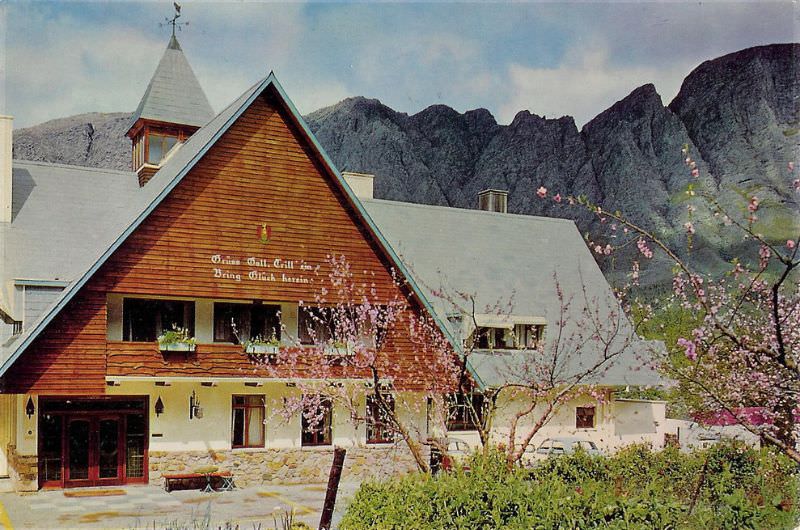
Franschhoek, in the mountains east of Cape Town, was one of the jewels of the Cape Winelands. Founded by French Huguenot refugees in the late 17th century, it retained its European character in its architecture, its vineyards, and its cuisine. The Excelsior wine estate was among the many farms producing wine in this narrow mountain valley, which remained a popular destination throughout the apartheid era.
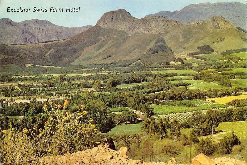
The view of Franschhoek from the mountain pass above it was — and remains — one of the most dramatic in the Western Cape. The valley spread out below, its vineyards and white-gabled Cape Dutch farmhouses visible against the mountain walls. The pass itself, winding down from the mountains, gave travelers arriving from the north a spectacular first view of the town.
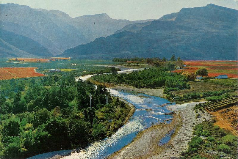
The Hex River Valley, northeast of Cape Town, was — and still is — one of South Africa’s most important table grape-growing regions. Surrounded by dramatic mountain ranges that carry snow in winter, the valley’s combination of fertile soil and a long, hot growing season made it ideal for fruit farming. In 1966, its farms were staffed largely by Coloured workers under conditions shaped by apartheid labor laws.
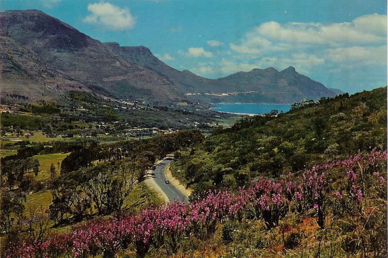
Hout Bay, a fishing village on the Atlantic coast south of Cape Town, was a working harbor town in the 1960s. Its fishing fleet was one of the most active on the Cape Peninsula, with snoek, rock lobster, and other fish landed at its quays daily. The surrounding mountains and the beach made it attractive to visitors, but at its heart it was a place of working boats and fishing families.
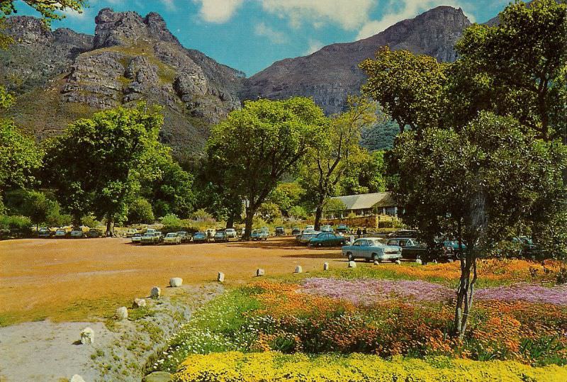
By 1966, Kirstenbosch was one of Cape Town’s most celebrated institutions. The parking area at the front of the garden’s main building shows how the site looked before later redevelopments changed its layout. The botanical garden was a place of genuine scientific importance as well as public enjoyment, maintaining one of the world’s finest collections of fynbos — the extraordinarily diverse plant kingdom of the Cape.
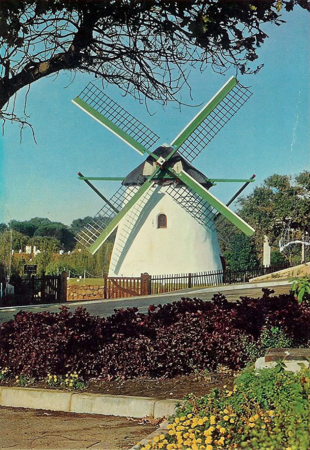
Mostert’s Mill, standing on the slopes below the University of Cape Town, was built in 1796 and is one of only two remaining windmills in South Africa. By the 1960s, it no longer operated as a working mill but had been preserved as a historical monument. It stood as one of the oldest surviving structures in Cape Town — a reminder of the city’s Dutch colonial origins.
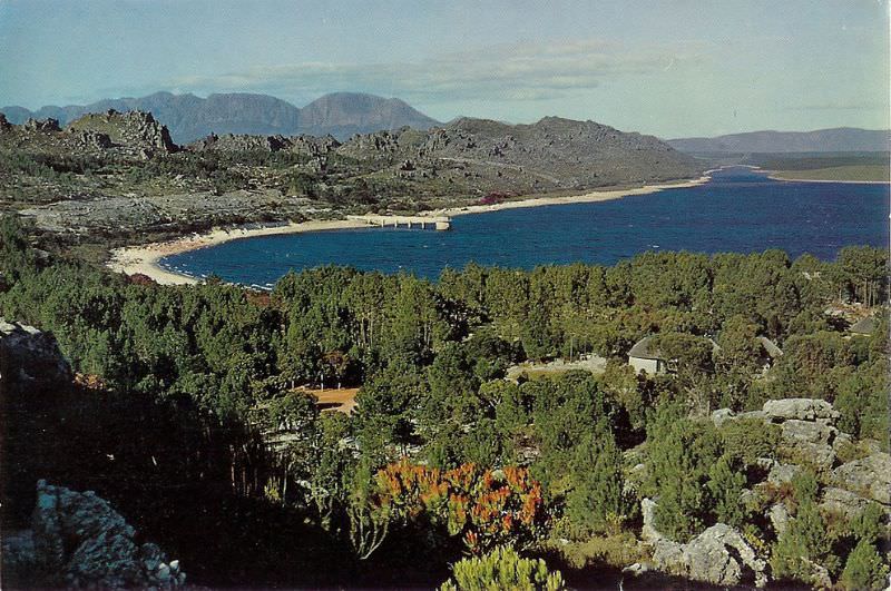
The Steenbras Dam, in the Hottentots Holland Mountains east of Cape Town, was a key part of the city’s water supply system. Completed in 1921, it impounded the waters of the Steenbras River to supply the growing city. The mountains surrounding it were dramatic and largely wild — a sharp contrast to the urban density of Cape Town just an hour’s drive away.
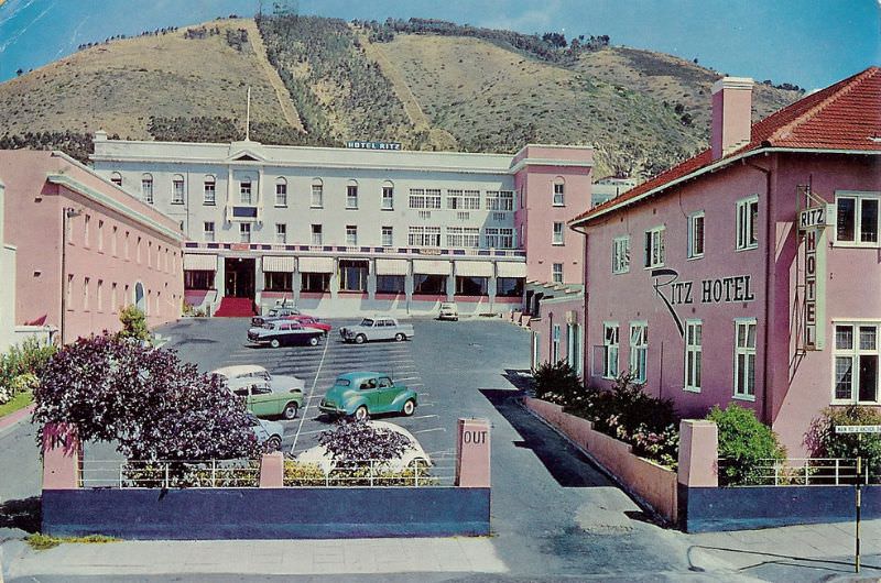
Sea Point, stretching along Cape Town’s Atlantic coast, was a densely populated residential suburb by the 1960s. The Ritz Hotel was one of its signature buildings — a tall, modern tower offering sea views from its upper floors. Sea Point’s Main Road was lined with shops, restaurants, and apartment blocks, making it one of the busiest non-CBD streets in the city.
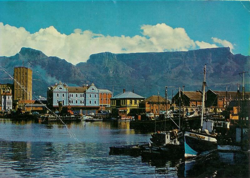
The Alfred Basin, the older part of Cape Town’s harbor complex, had been built in the 19th century and named after Prince Alfred, who visited the Cape in 1860. By 1967, it was still in active use alongside the newer Duncan Dock. The harbor complex as a whole was one of South Africa’s most important economic assets, handling enormous volumes of cargo and serving as a transit point for ships traveling between Europe and Asia.
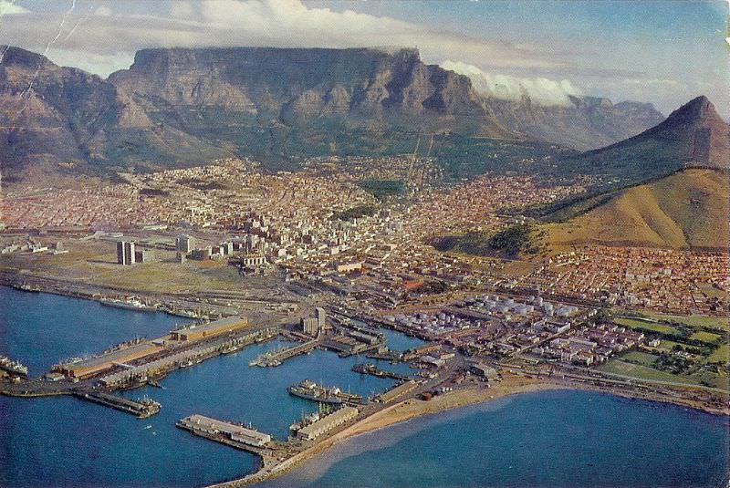
By 1967, Cape Town’s skyline was noticeably taller than it had been at the start of the decade. The Sanlam building and other commercial towers had reshaped the CBD’s profile. Construction was ongoing on several major projects, including the Nico Malan Theatre — later renamed the Artscape — which was taking shape on the Foreshore as the city’s primary performing arts venue.
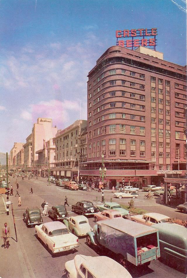
The Grand Hotel, at the corner of Adderley and Strand Streets, was one of Cape Town’s most prominent hospitality establishments. It was a meeting point for businessmen, politicians, and travelers passing through the city. The corner location, at the junction of two of the CBD’s busiest streets, gave it a central position in the life of the city.
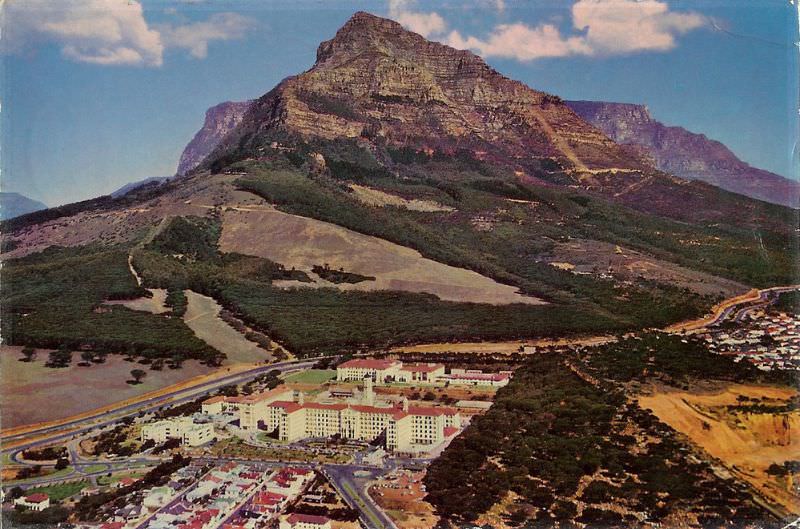
Groote Schuur Hospital, on the slopes of Devil’s Peak, made world history on December 3, 1967, when Dr. Christiaan Barnard and his team performed the first successful human-to-human heart transplant. The patient, Louis Washkansky, received the heart of 25-year-old Denise Darvall, who had been killed in a car accident. Washkansky survived for 18 days following the surgery. The achievement put Cape Town on the front pages of newspapers around the world.
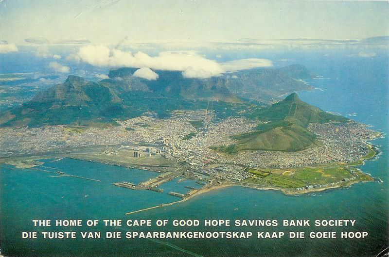
From 5,000 feet, Cape Town’s geography was laid out with extraordinary clarity. The mountain, the city bowl, the harbor, and the spreading suburbs beyond were all visible in a single frame. The Foreshore’s reclaimed land jutted out into Table Bay. The Cape Flats stretched flat and grey beyond the mountain’s eastern slopes — the landscape to which tens of thousands of displaced families had been sent.
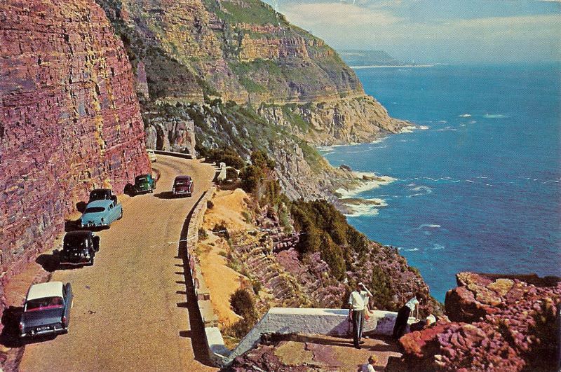
Chapman’s Peak, on the western side of the Cape Peninsula between Hout Bay and Noordhoek, offered some of the most dramatic coastal scenery in South Africa. The road cut into the cliffside above the sea — a route that combined engineering and natural spectacle. In 1968, the Chapman’s Peak Drive was already one of Cape Town’s most celebrated scenic routes, attracting visitors from across the country.
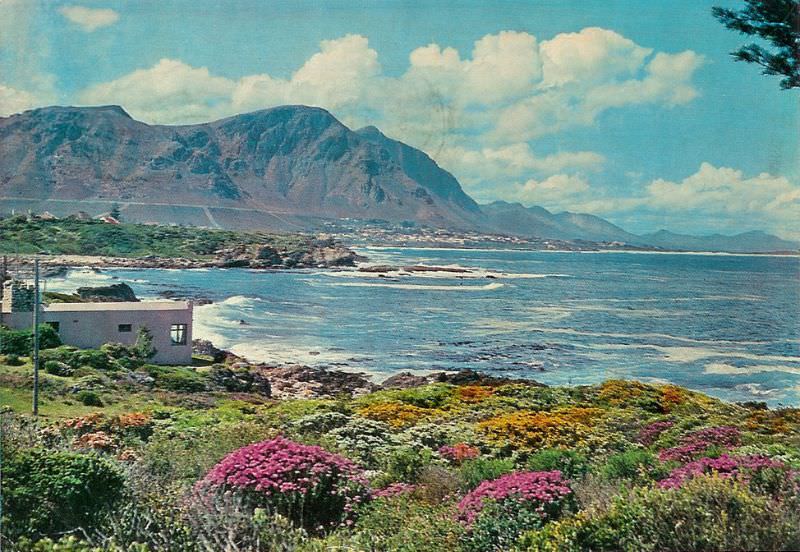
Hermanus, a coastal town about 120 kilometers east of Cape Town, was already establishing its reputation as one of the best land-based whale-watching destinations in the world. Southern right whales gathered in Walker Bay each year between June and December. The town’s cliff paths offered views directly down to the water, and by 1968, Hermanus was a popular destination for Capetonians escaping the city.
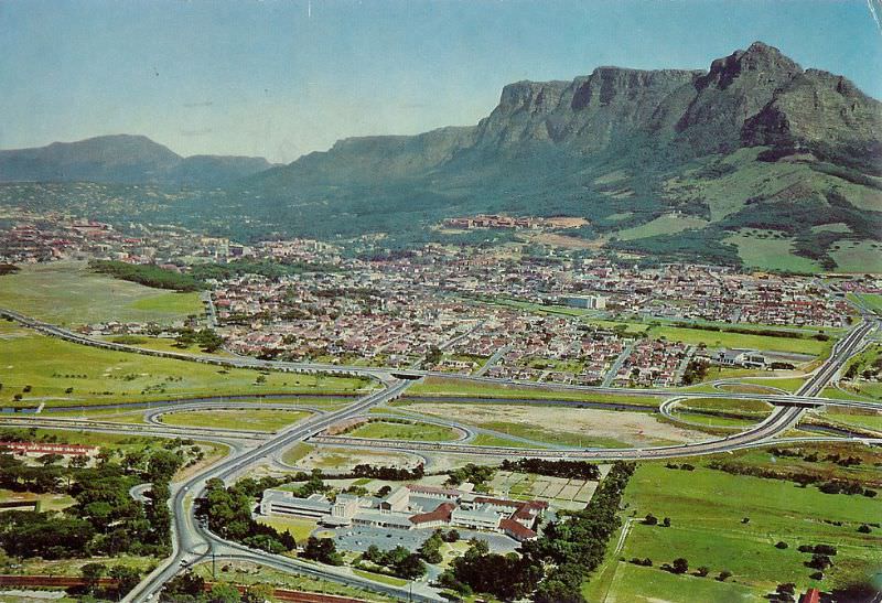
Mowbray, a suburb on the southern slopes of Devil’s Peak, was home to several medical institutions. St Joseph’s Sanitarium was among them — a facility operating in an era when South Africa’s healthcare system was deeply divided by race. The proximity of Mowbray to both Groote Schuur Hospital and the University of Cape Town made it part of a cluster of institutions that defined the southern suburbs’ character.
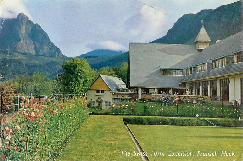
The Cape Winelands continued to attract visitors from Cape Town and beyond throughout the 1960s. The Swiss Farm Excelsior in Franschhoek was among the establishments catering to this tourism. The Winelands’ combination of mountain scenery, historic Cape Dutch architecture, and wine production gave the region a distinctive identity that set it apart from the political turbulence of the city.
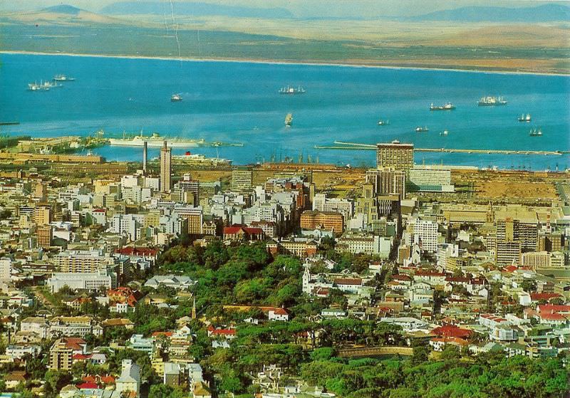
By 1969, Cape Town’s central business district had taken on a noticeably modern character. New office towers rose above the older stone buildings of the Victorian era, and construction of the Golden Acre shopping complex was beginning near the main railway station. The city was investing heavily in infrastructure for its white residents while its non-white population bore the costs of displacement and underdevelopment.
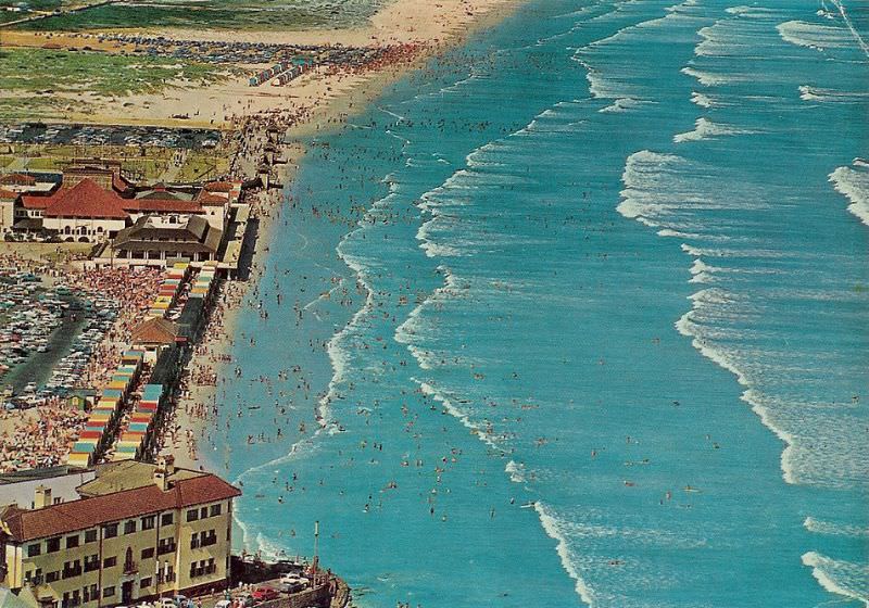
Muizenberg, on the False Bay coast east of Cape Town, was a popular beach destination. Its wide, sandy beach and gentle surf made it ideal for swimming and surfing. The famous row of brightly colored Victorian bathing boxes lining the beach were already a well-established landmark. The False Bay waters were warmer than those of the Atlantic side of the peninsula, making Muizenberg particularly popular with families.
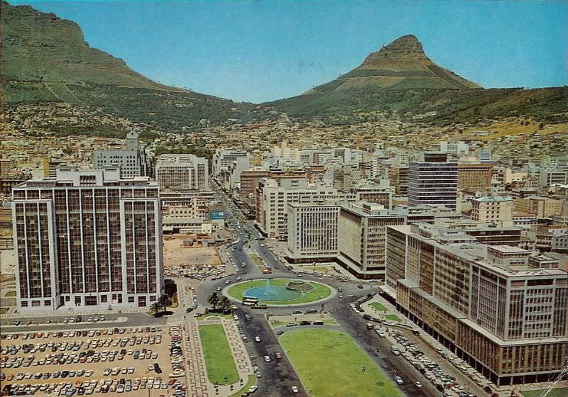
The Foreshore — the land reclaimed from Table Bay during the 1940s — was still a work in progress at the end of the 1960s. Large areas remained undeveloped, and ambitious road projects were underway, including the planned Foreshore Freeway. The freeway project, designed to connect the N1 and N2 highways through the city center via elevated concrete structures, was eventually abandoned mid-construction, leaving the iconic unfinished bridge piers that still stand today.
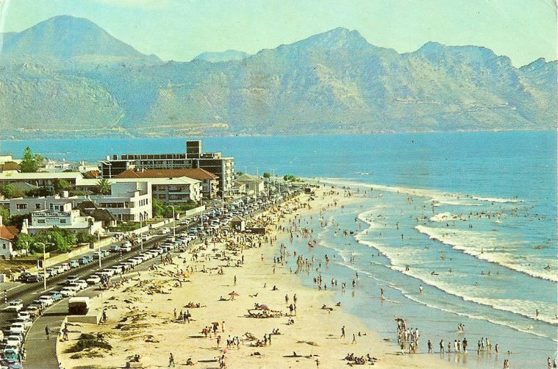
The Strand, on the coast of False Bay near Somerset West, was a popular beach resort for Capetonians. Its long beach and calm waters made it a favored destination for day trips and holidays. Like all public beaches in South Africa during this period, it was racially segregated — different sections of the beach were designated for different racial groups under the Reservation of Separate Amenities Act.
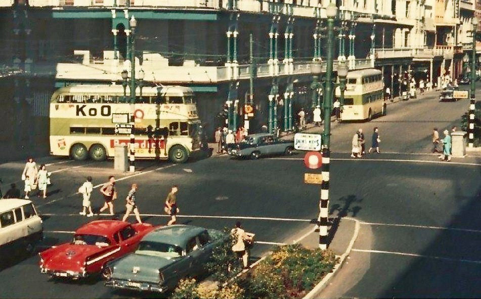
Cartwright’s Corner was a well-known commercial intersection in Cape Town’s city center. In 1960, the city was still processing the shock of the Sharpeville massacre, which had taken place on March 21 of that year. The government declared a state of emergency, banned the ANC and PAC, and arrested thousands of activists. The decade was beginning under conditions of intense repression.
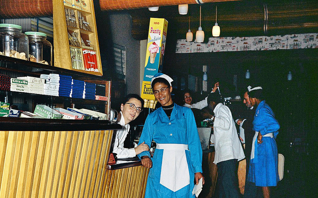
Restaurants in 1960s Cape Town operated under the Liquor Act and other apartheid legislation that determined who could be served where. Some restaurants maintained separate entrances and eating areas for different racial groups. Others were exclusively white. The experience of eating out in the city was fundamentally shaped by the color of a person’s skin.
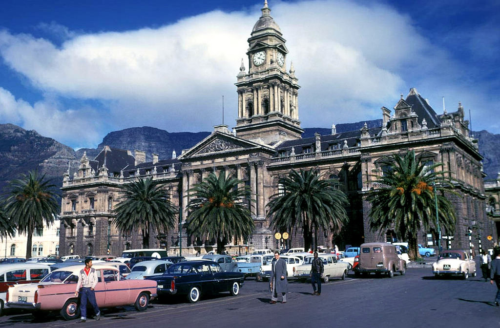
The Grand Parade on a winter’s day in 1961. Cape Town’s winters brought cold fronts and heavy rain in from the Atlantic — the city’s climate was decidedly Mediterranean, with most of its rainfall concentrated between June and August. Even on grey winter days, the Parade remained active, with market stalls operating and the City Hall presiding over the square in its solid Edwardian grandeur.
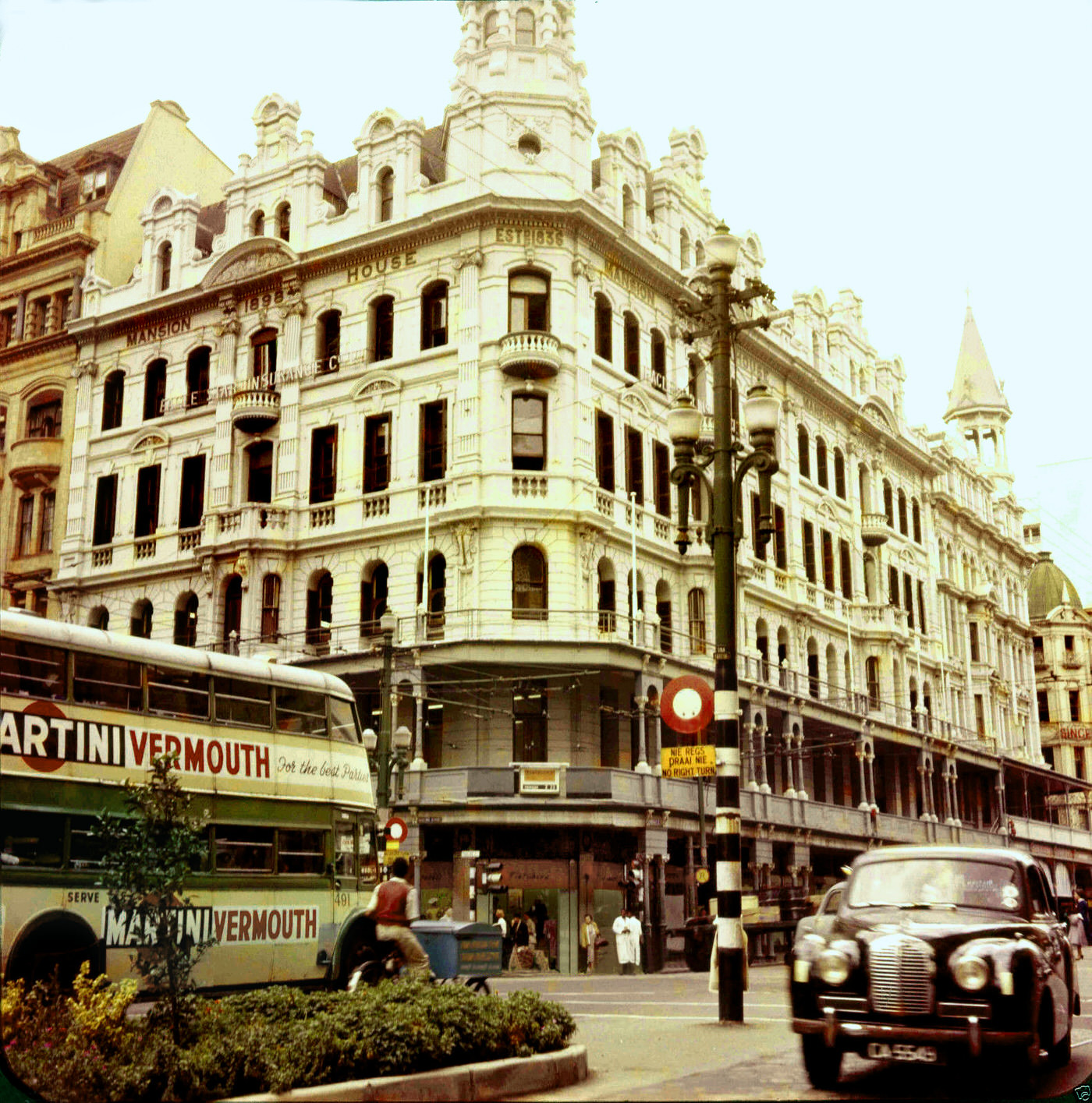
The Fletcher and Cartwright Building, on the corner of Darling and Adderley Streets, was one of Cape Town’s commercial landmarks. Its ground floor retail space was matched by offices above, and its corner position made it one of the most visible buildings on one of the CBD’s busiest intersections. Buildings like this defined the commercial character of central Cape Town for much of the 20th century.
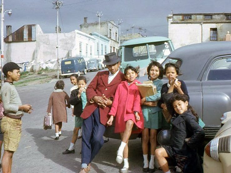
The Bo-Kaap, Cape Town’s historically Cape Malay neighborhood, climbed the lower slopes of Signal Hill above the city center. Its cobbled streets and brightly painted houses gave it an unmistakable character. By 1962, the Bo-Kaap had survived several decades of apartheid pressure, including the threat of relocation that had already destroyed other mixed-race communities. It remained a stronghold of Cape Malay culture and identity.
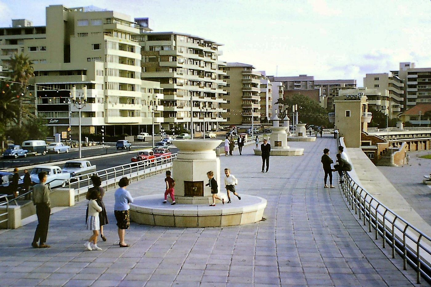
The Sea Point Pavilion pool, built along the rocky Atlantic shoreline, was one of Cape Town’s most popular swimming facilities. Fed by seawater, it offered a calmer swimming environment than the open ocean. In 1964, it was a whites-only facility — segregation applied to public pools just as it did to beaches, parks, and transport. The pool’s tidal setting, with waves crashing beyond the walls, made it a uniquely Cape Town experience.
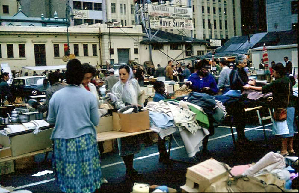
The Grand Parade market operated on specific days of the week, and Wednesdays and Saturdays were among the busiest. Traders came from across the Cape Peninsula to sell their goods, and shoppers arrived early to get the best picks. The market was one of the oldest institutions in the city — it had operated on the Parade since the 18th century, and by 1966 it was as busy as ever.
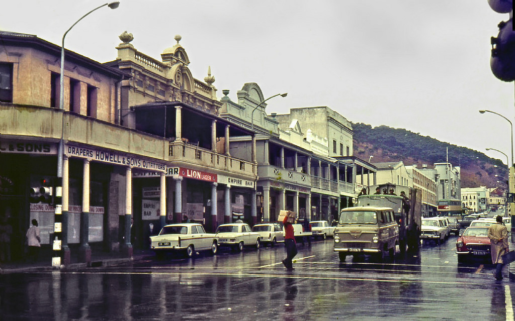
Winter in Cape Town brought storms off the Atlantic that could be genuinely fierce. The southeaster that tormented the city in summer gave way to northwesterly gales that drove heavy rain through the CBD streets. The mountain often disappeared entirely behind cloud for days at a time. For the residents of the Cape Flats, far from the shelter of the mountain, winter conditions were especially harsh.
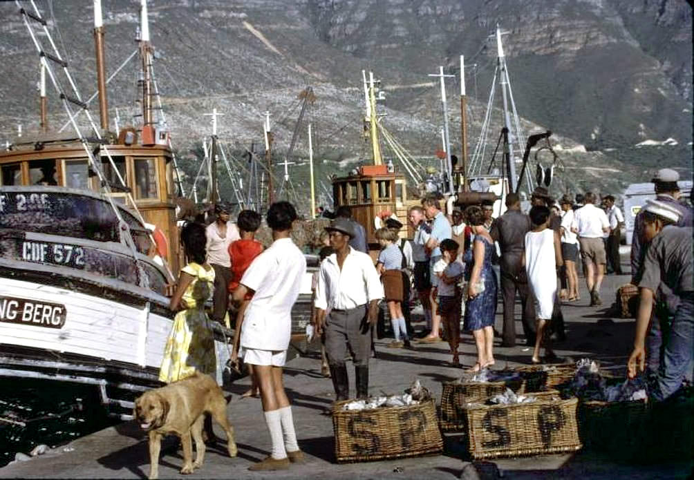
Hout Bay’s harbor in 1968 was a working fishing port, its quays stacked with crates and its waters busy with trawlers. The fish processing industry was an important employer in the community. Beyond the harbor, the valley opened up between the mountains — a landscape that was dramatic in any season, though the working life of the port was entirely practical and unglamorous.
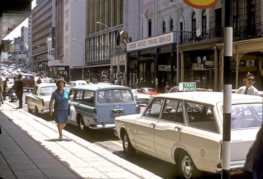
Strand Street was one of the CBD’s main east-west thoroughfares, running parallel to the harbor. It took its name from the fact that, before the land reclamation projects of the 20th century, the street had once run along the shoreline of Table Bay. By 1968, construction of the Strand Street extension was underway, widening and modernizing this key route through the city.
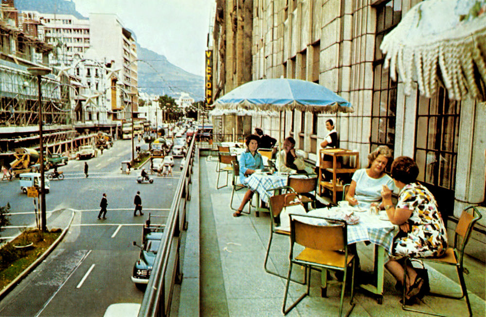
Stuttafords was one of Cape Town’s premier department stores — an upmarket retailer that had been serving the city’s wealthier residents for decades. Its Adderley Street premises were a landmark of the CBD. Shopping at Stuttafords was, under apartheid, largely a whites-only experience. The store’s balcony offered a vantage point over one of the city’s busiest streets.
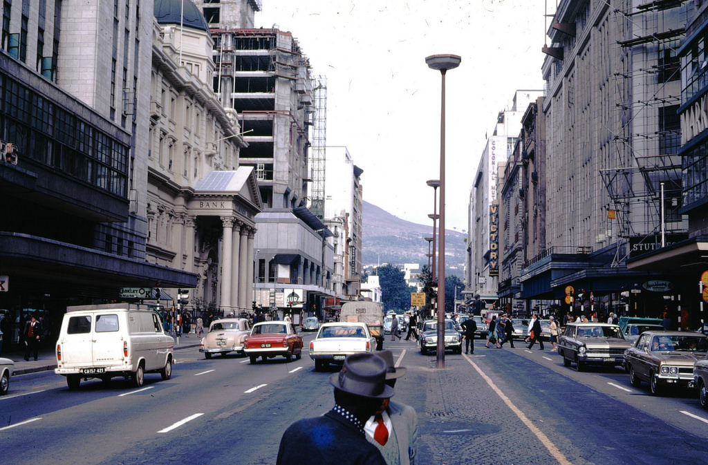
As the decade drew to a close, Adderley Street remained the most important commercial address in the city. Traffic — both vehicular and pedestrian — flowed heavily through it throughout the day. The Heerengracht Fountain at the northern end of the street was a regular meeting point, and the statue of Jan van Riebeeck nearby reminded passersby of the colonial origins of the city they were walking through.
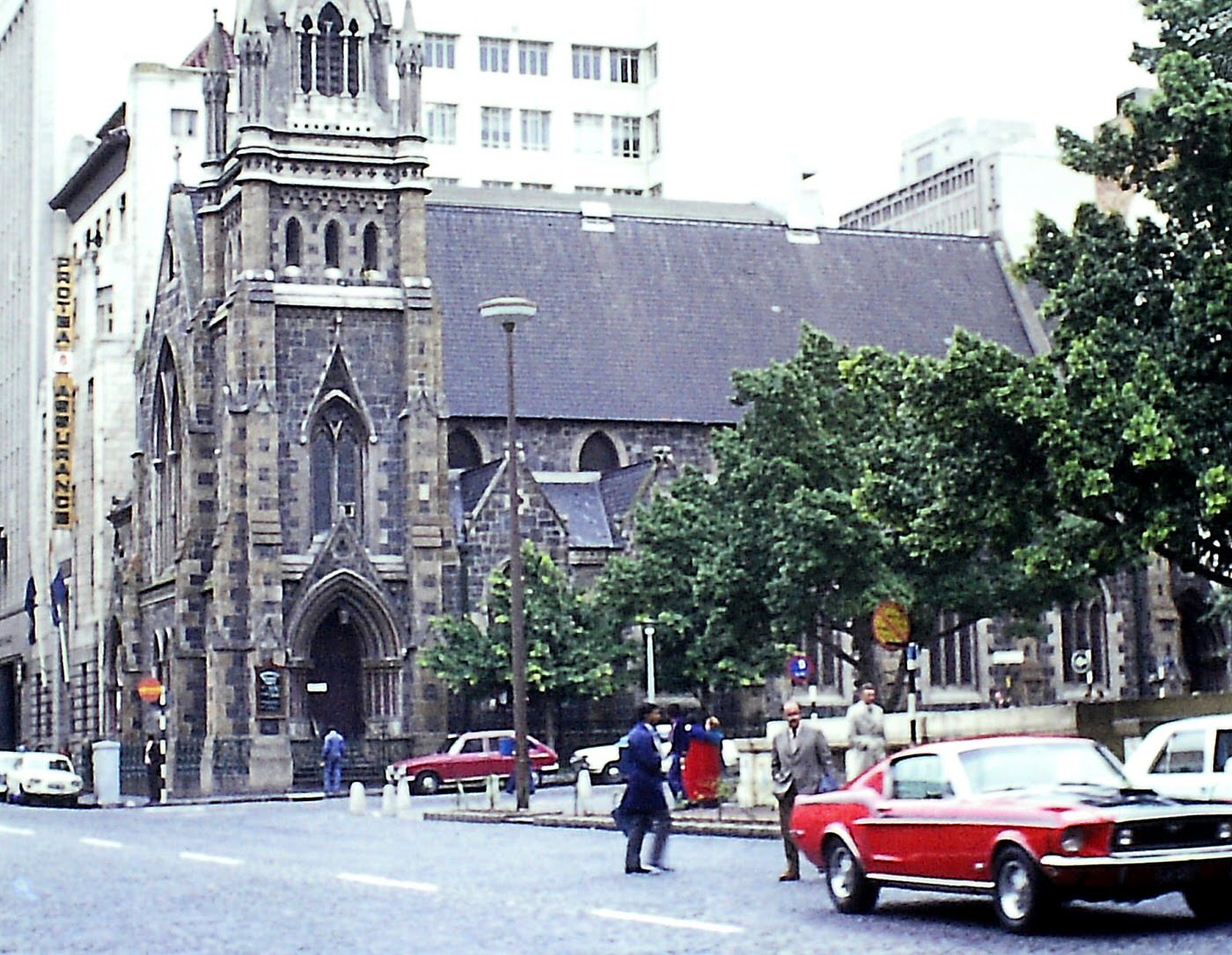
Greenmarket Square, one of Cape Town’s oldest public spaces, had served as a slave market in the 18th century before becoming a flea market and public gathering place. By 1969, it was ringed by historic buildings including the Old Town House, and its cobbles were regularly filled with market traders. It was a space that carried the full weight of Cape Town’s complex and often brutal history.
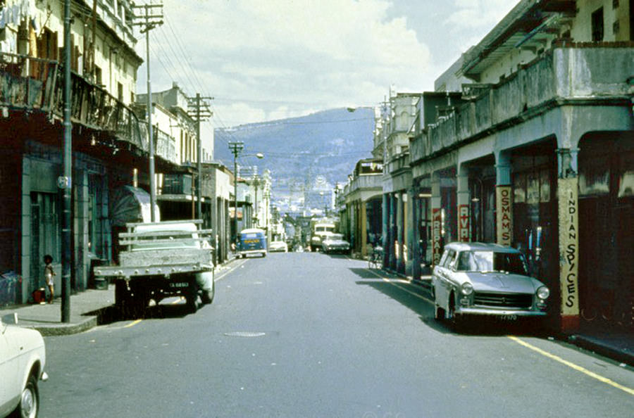
Hanover Street was the main artery of District Six — a neighborhood that by 1969 was living under sentence of death. The government had declared the area whites-only in 1966, and demolitions had begun. Hanover Street had been a vibrant commercial and residential strip, lined with shops, cafes, music venues, and the homes of the community that had built it over generations. These photographs are among the last records of it standing.
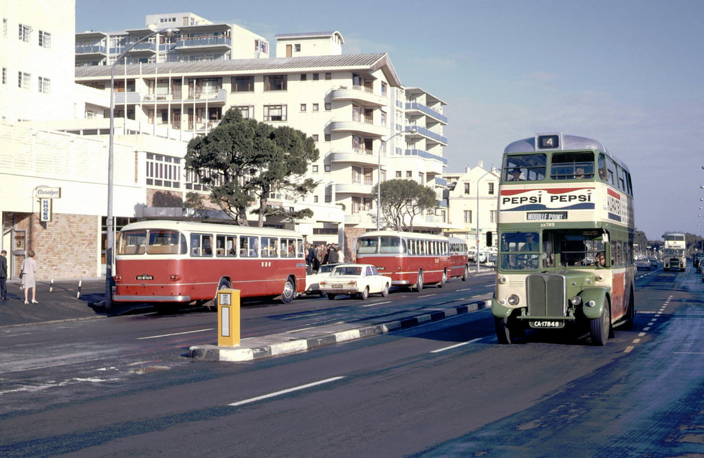
Green Point, between the city center and Sea Point along the Atlantic coast, was a mixed residential and commercial area in the 1960s. Its Main Road ran along the coastal edge, connecting the CBD to the suburbs beyond. By 1969, Green Point had a well-established character — its hotels, shops, and apartment buildings serving a local population that included working-class and middle-class white residents.
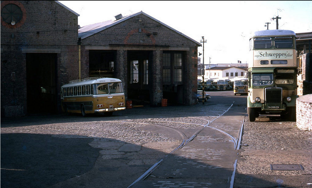
Cape Town’s transport infrastructure was expanding and modernizing throughout the 1960s. The Tollgate Depot was part of the city’s bus network, which provided public transport across the metropolitan area. The bus system, like all public services in apartheid South Africa, operated under the framework of racial segregation — with separate services or separate sections within services for different racial groups.
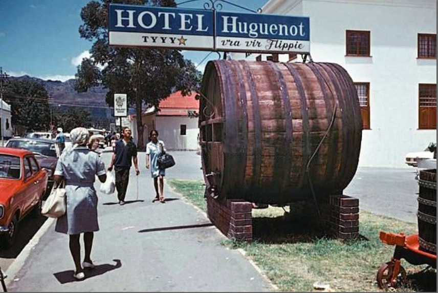
Franschhoek at the turn of the decade retained its character as a wine-producing valley town with strong French Huguenot heritage. The Huguenot Memorial Museum and Monument, commemorating the French Protestant refugees who had settled the valley in 1688 and 1689, stood at the end of its main street. The town’s wineries, restaurants, and mountain setting made it one of the Cape’s most visited destinations.
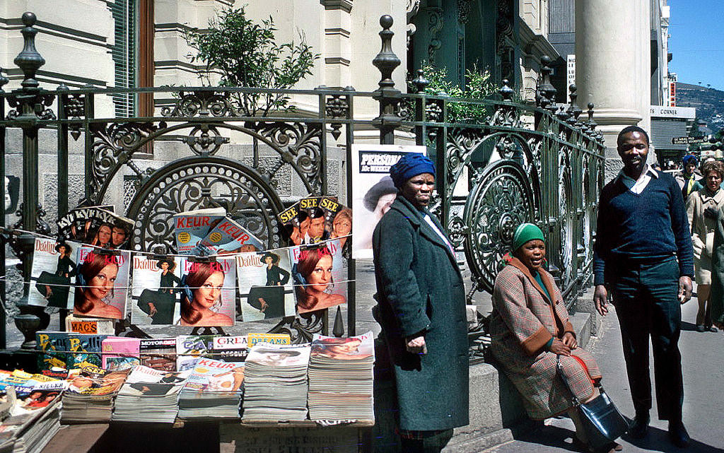
Street vendors selling magazines and newspapers were a common sight in Cape Town’s CBD. Press censorship under apartheid was extensive — publications that carried anti-apartheid content were regularly banned, and journalists who reported on the movement’s activities faced serious legal consequences. The magazines visible on street stalls in 1970 were those that had survived the government’s censorship process.
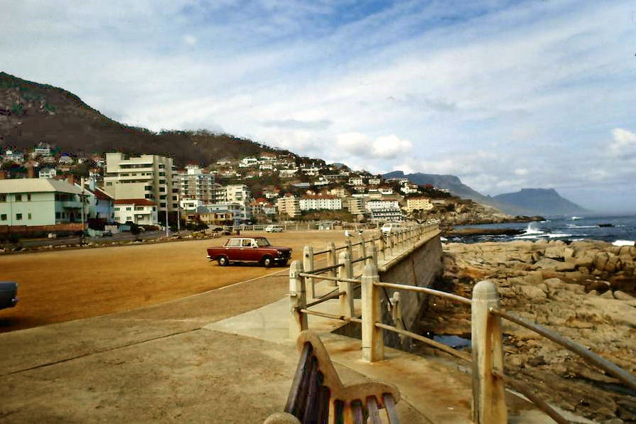
Sea Point’s densely built apartment blocks and hotels stretched along the Atlantic coast toward the quieter, more exclusive enclave of Bantry Bay. The view captures a suburb that had become one of the most densely populated residential areas in South Africa — a dense packing of high-rise buildings against the Atlantic shoreline, with the mountain rising steeply behind.
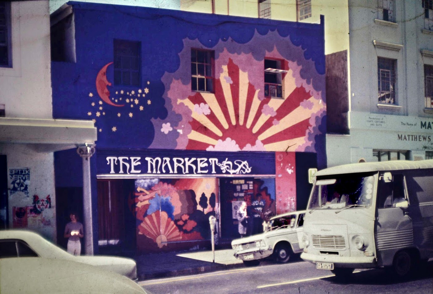
Loop Street, running parallel to Long Street in the CBD, was home to a variety of traders and businesses. Its market was another of the city’s informal commercial spaces where goods of all kinds could be bought and sold. By 1970, the decade of forced removals, demolitions, and apartheid-driven urban renewal had fundamentally reshaped many of Cape Town’s historic commercial and residential neighborhoods.
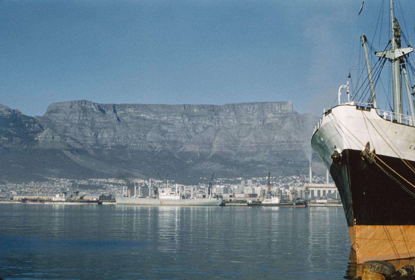
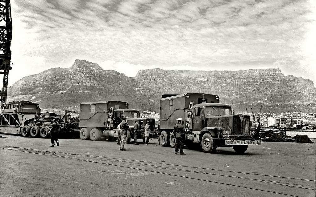
Cape Town’s harbor was the economic engine of the city. Cargo ships from around the world moored in its docks, loading and unloading goods that connected South Africa to global markets. Table Mountain rising behind the harbor gave the port one of the most dramatic backdrops of any city on earth. In 1960, the harbor was operating at full capacity — South Africa’s economy was growing rapidly, driven largely by mineral exports and manufacturing.
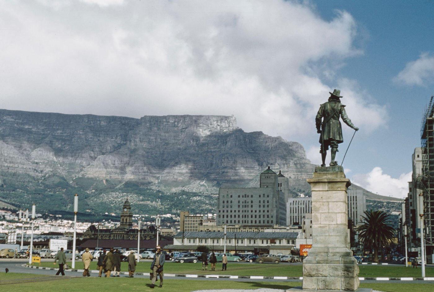
The statue of Jan van Riebeeck — the Dutch East India Company commander who established a refreshment station at the Cape in 1652, and whose arrival is considered the founding moment of modern Cape Town — stood at the end of Adderley Street where it met the Foreshore. For many non-white South Africans, the statue represented the beginning of a colonial dispossession that apartheid was continuing in updated form.
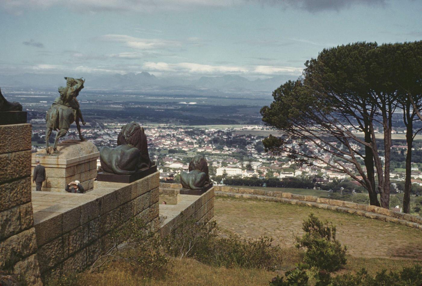
The Rhodes Memorial on Devil’s Peak, built to honor Cecil John Rhodes — the British colonial magnate who had served as Cape Prime Minister and whose mining empire had shaped southern Africa — looked east over the Cape Flats. From that vantage point, the suburbs of the southern peninsula stretched out toward the distant mountain ranges. Rhodes himself had left behind a complex legacy of colonial ambition and racial politics that apartheid was, in many ways, an extension of.
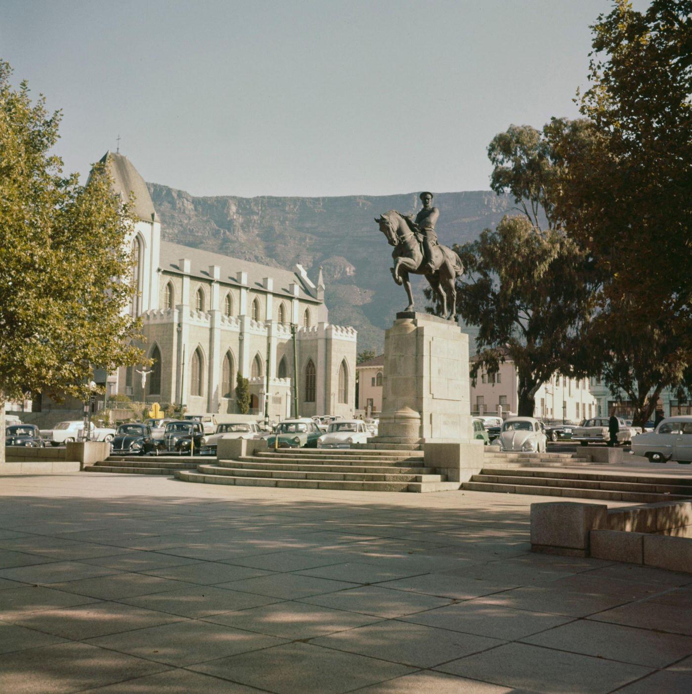
Cape Town’s Catholic Cathedral was part of a city with a rich variety of religious institutions. Churches of many denominations had been part of the city’s landscape since the earliest days of European settlement. Religious institutions in the 1960s occupied a complicated position with respect to apartheid — some church leaders were among the most vocal opponents of the system, while the Dutch Reformed Church provided apartheid with theological justification.
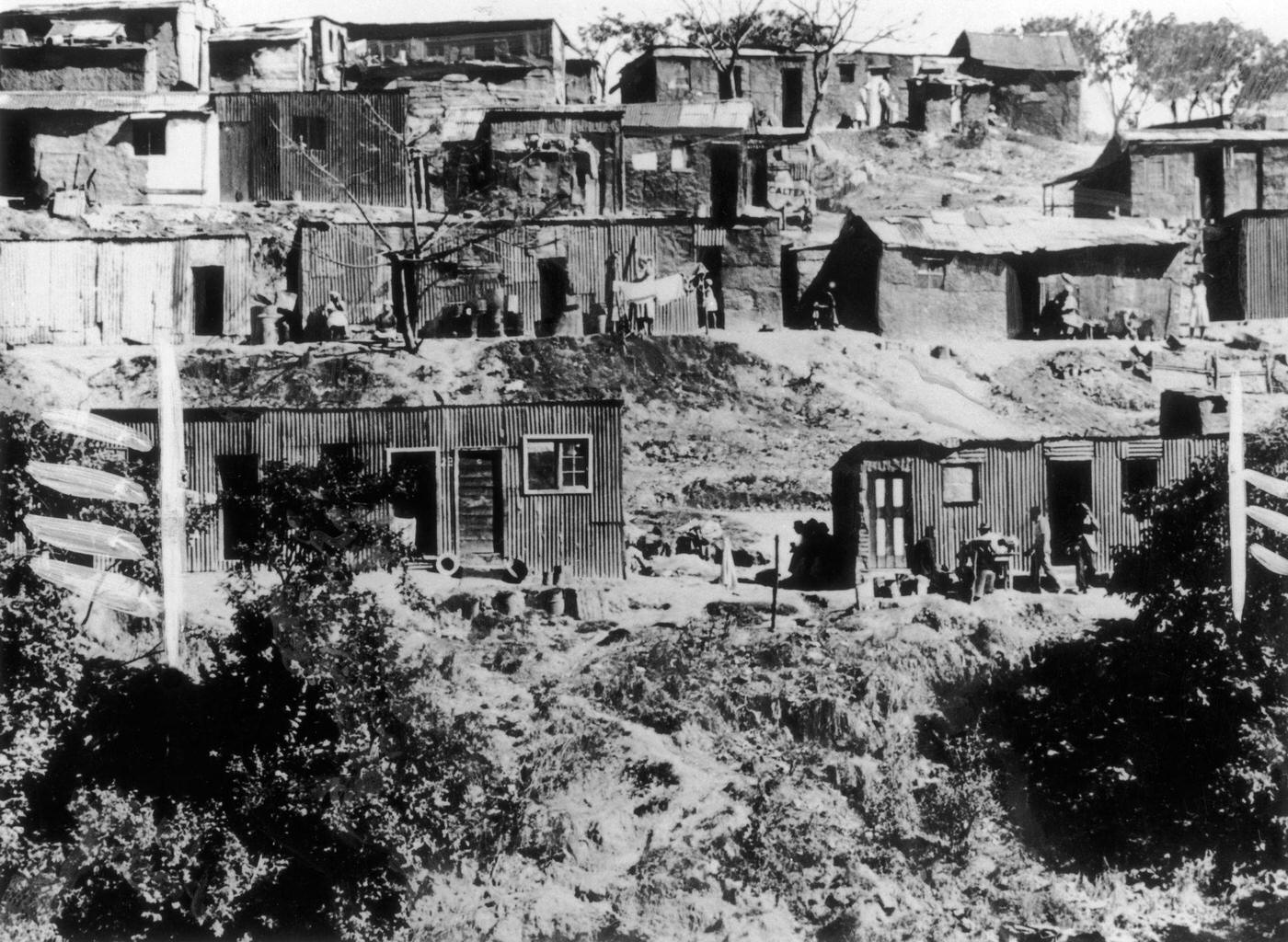
This photograph, taken just ten days after the Sharpeville massacre, documents the conditions in which Black South Africans lived on the outskirts of Cape Town. Ten days before this image was taken, police had opened fire on a crowd of Black protesters in Sharpeville, Transvaal, killing 69 people and wounding 180 more. The government’s response was to intensify repression rather than reform. This image shows the physical consequence of those policies — housing conditions that reflected the deliberate underdevelopment of Black communities.
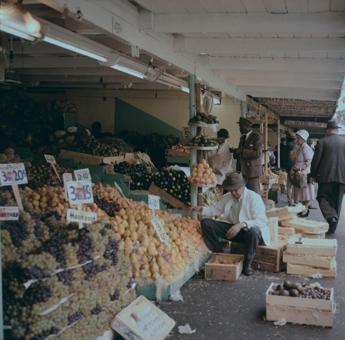
The fruit market near City Hall was a daily institution in 1960s Cape Town. Produce arrived from farms across the Western Cape — grapes from the Hex River Valley, citrus from the Citrusdal area, stone fruit from Ceres — and was sold at the stalls around the Grand Parade. The stallholder and customers in this image are part of a commercial tradition that had operated at this location for generations.
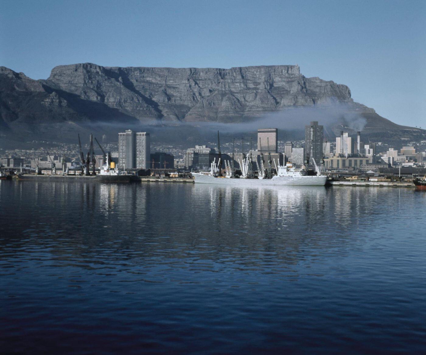
By 1965, the Port of Cape Town was one of the busiest in the southern hemisphere. Its strategic position on the route between Europe and Asia — on the sea lane around the Cape of Good Hope — gave it global importance. The harbor employed thousands of workers, most of them Coloured and Black South Africans who earned wages that reflected the racial hierarchy of the apartheid labor system.
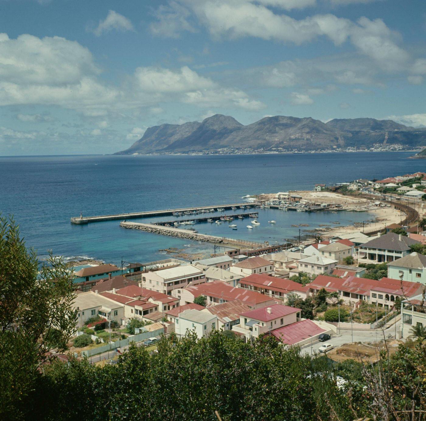
Kalk Bay, on the False Bay coast south of Cape Town, was a fishing village with a character entirely distinct from the city center. Its small harbor was home to a fleet of fishing boats, and its main street ran along the railway line above the water. The community was predominantly Coloured, with deep fishing traditions. The catch — particularly snoek — was sold fresh from the boats at the harbor wall.
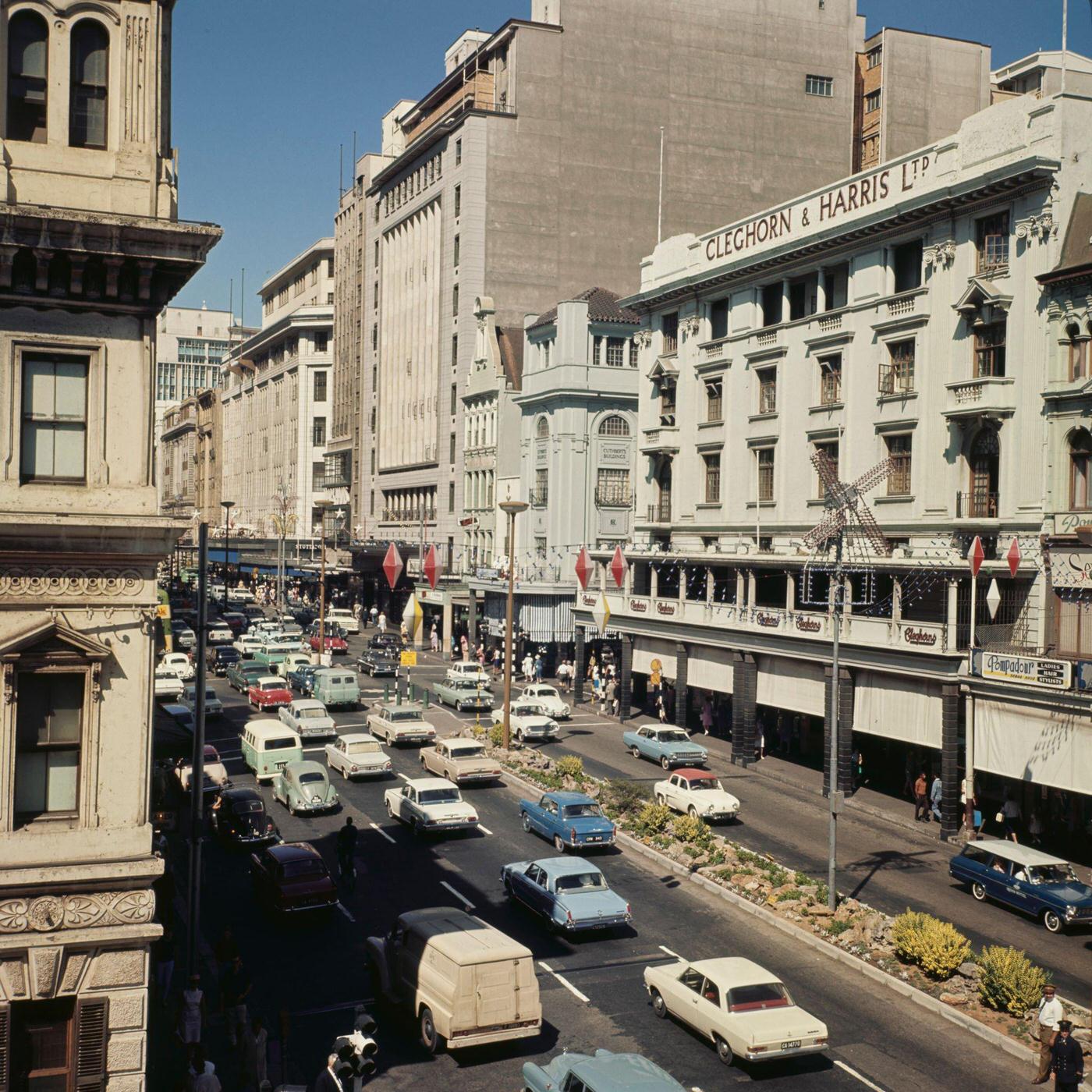
Cleghorn & Harris was one of Cape Town’s established department stores on Adderley Street. The pedestrian traffic passing its windows in 1966 included shoppers, office workers, and visitors navigating the city’s commercial heart. The store was part of a retail landscape that, under apartheid, operated on a basis of racial preference — non-white customers who could enter were often treated differently than white shoppers.
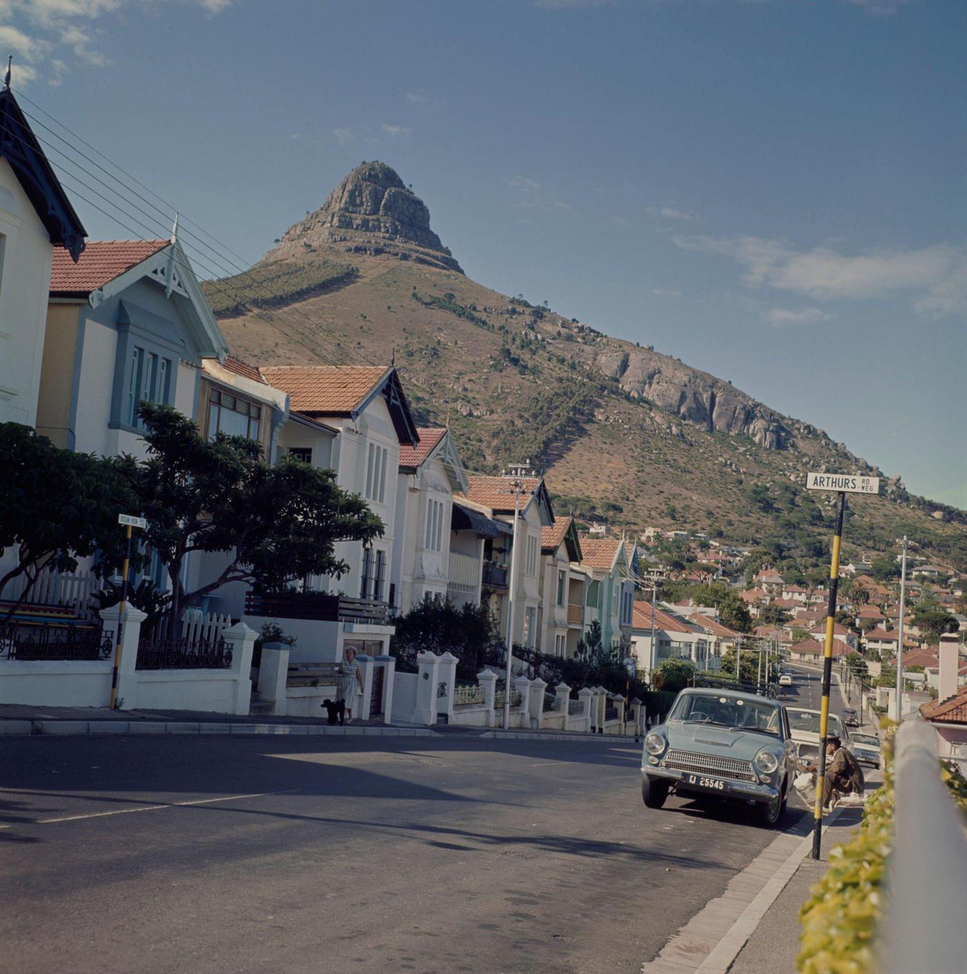
Sea Point in 1966 was one of Cape Town’s most densely populated suburbs, with apartment blocks rising alongside older Victorian homes. The suburb’s streets were busy with residents, shoppers, and beachgoers. Car ownership in this predominantly white suburb was high, and the rows of parked vehicles along Arthur’s Road reflected the relative prosperity of Sea Point’s residents compared to non-white areas of the city.
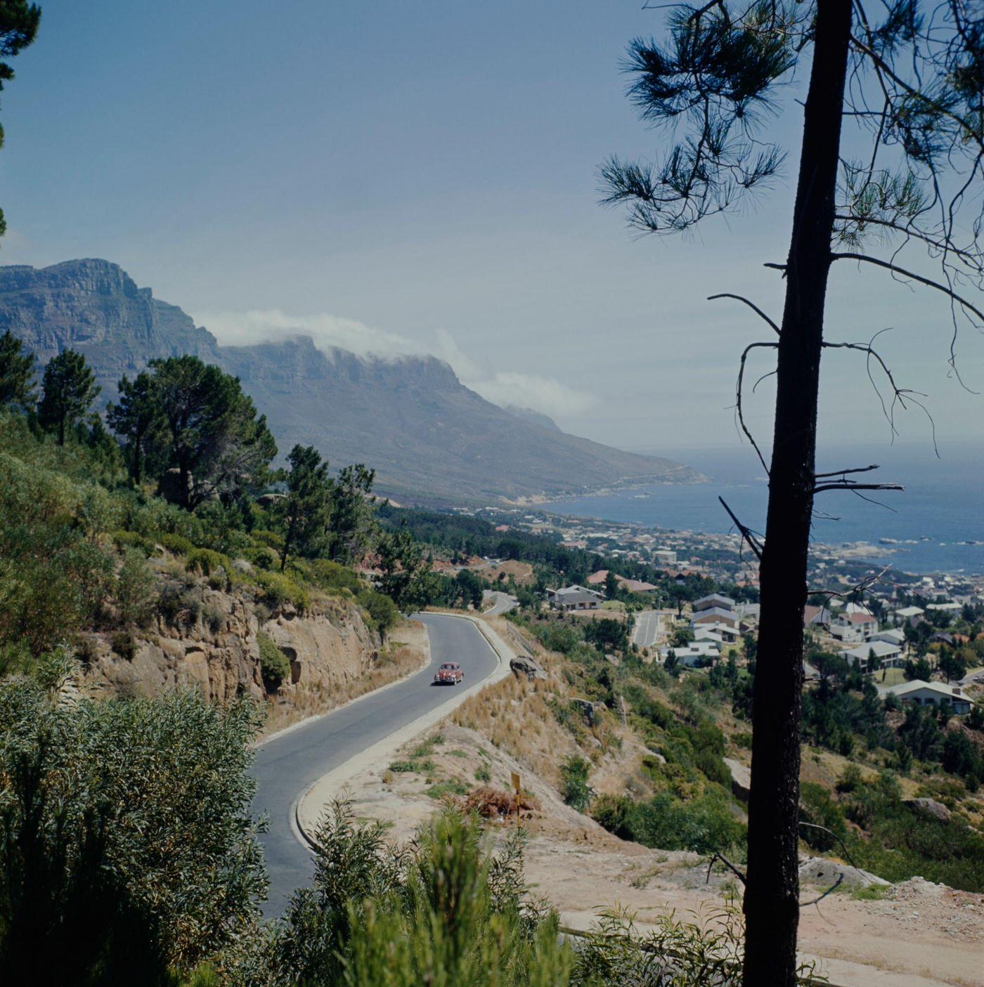
The road above Camps Bay — Kloof Road, winding along the Atlantic seaboard — offered dramatic views over the suburb and the ocean beyond. Camps Bay was an exclusive address in 1960s Cape Town, its beach and mountain setting making it one of the most desirable residential locations in the country. Access to it, like access to all the best parts of the city, was effectively reserved for white South Africans.
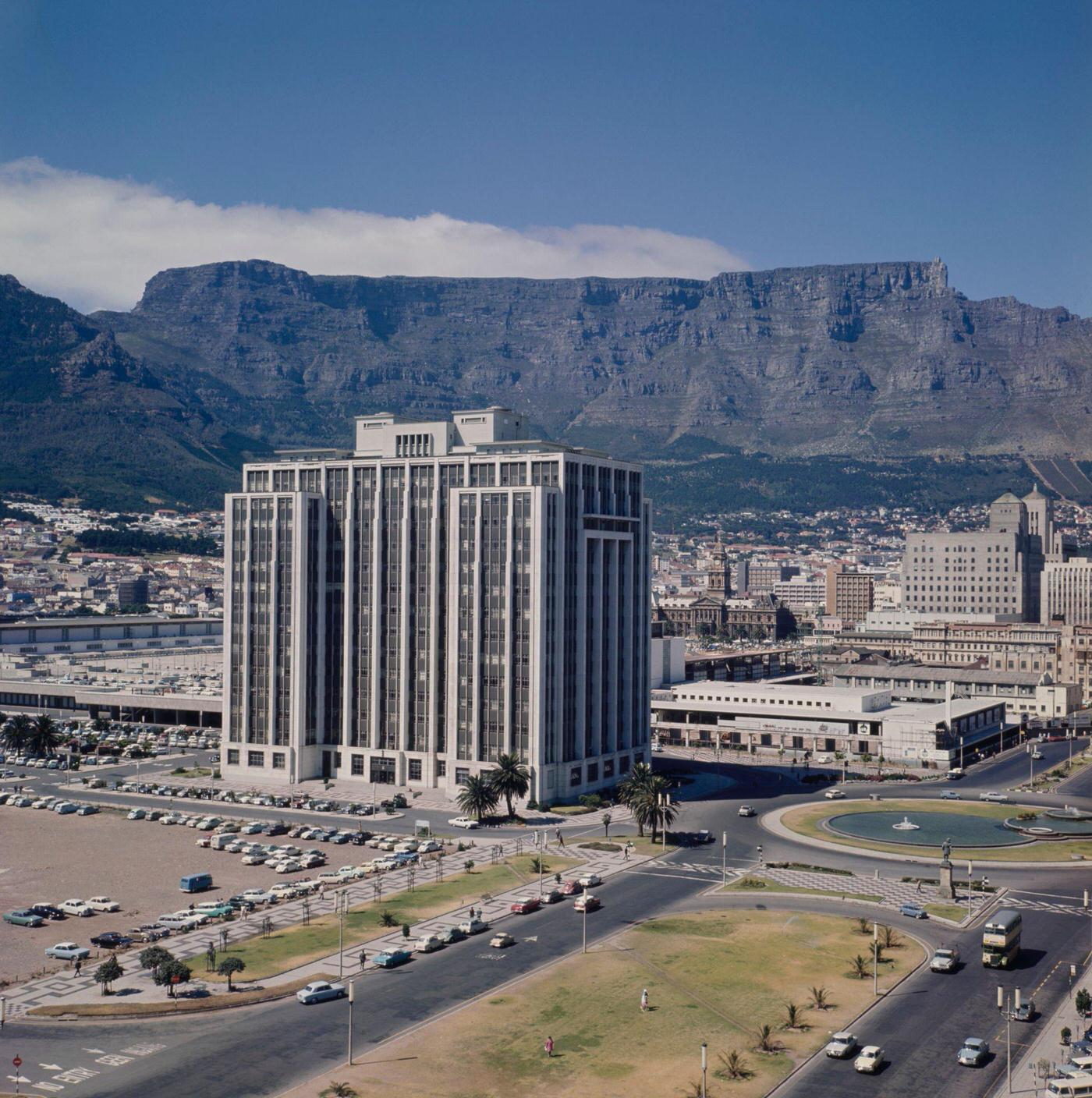
The Adderley Street Fountain, and the Heerengracht — named after the canal street in Amsterdam — were part of the civic landscape of the Foreshore. The traffic flowing through these streets in 1960 was heavier than it had ever been, as car ownership grew and the city expanded. Urban planners were already struggling to accommodate the volume of vehicles, and the road-building projects of the decade were a response to this pressure.
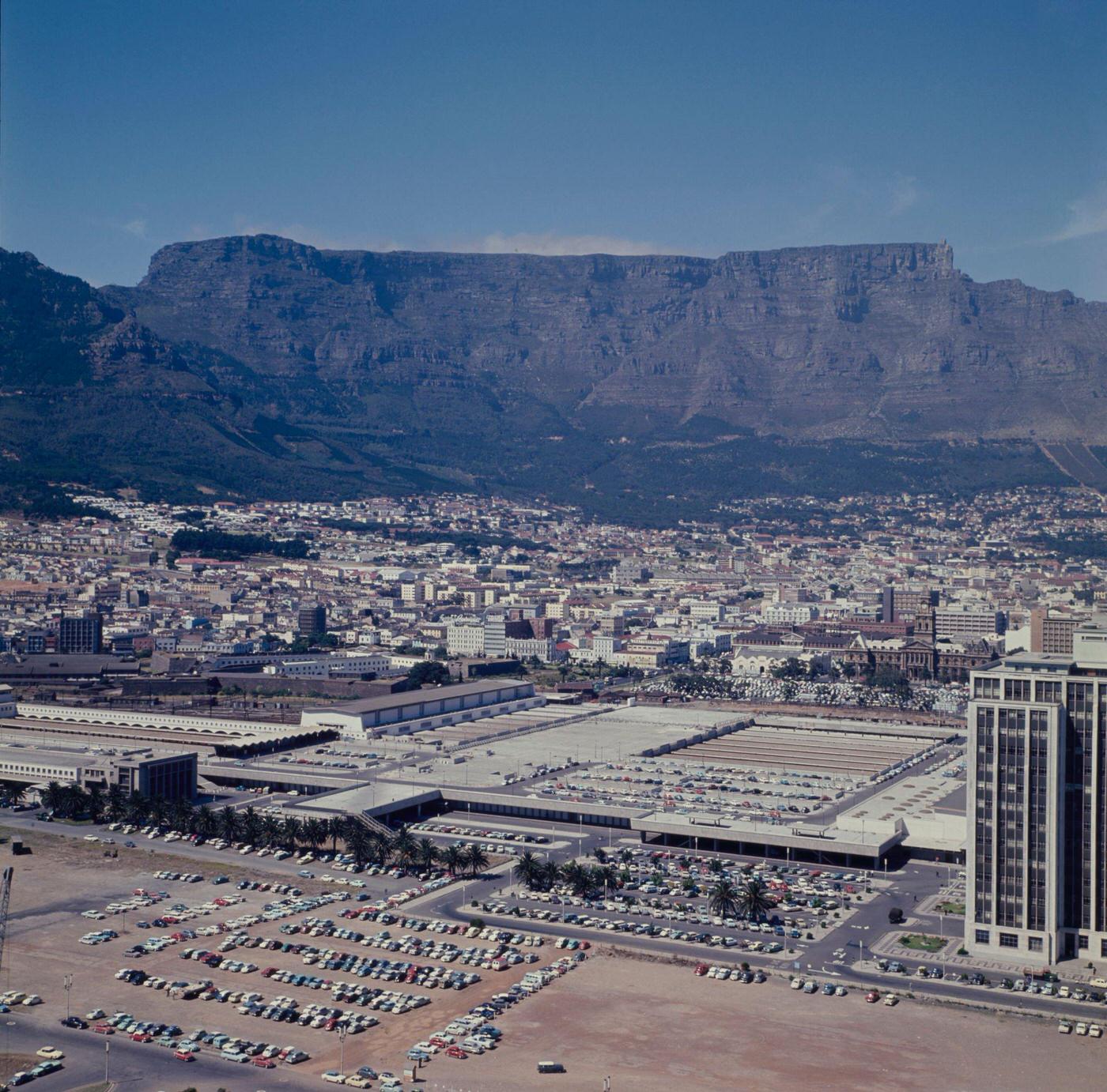
The Sanlam Building — which would later become the Naspers Centre — was among the tallest structures in Cape Town at the start of the 1960s. The aerial view from its upper floors showed the city’s compact grid, the Foreshore’s newer developments, and the harbor beyond. The building was a product of Afrikaner capital — Sanlam was one of the major Afrikaner financial institutions that had grown rapidly in the post-war years.
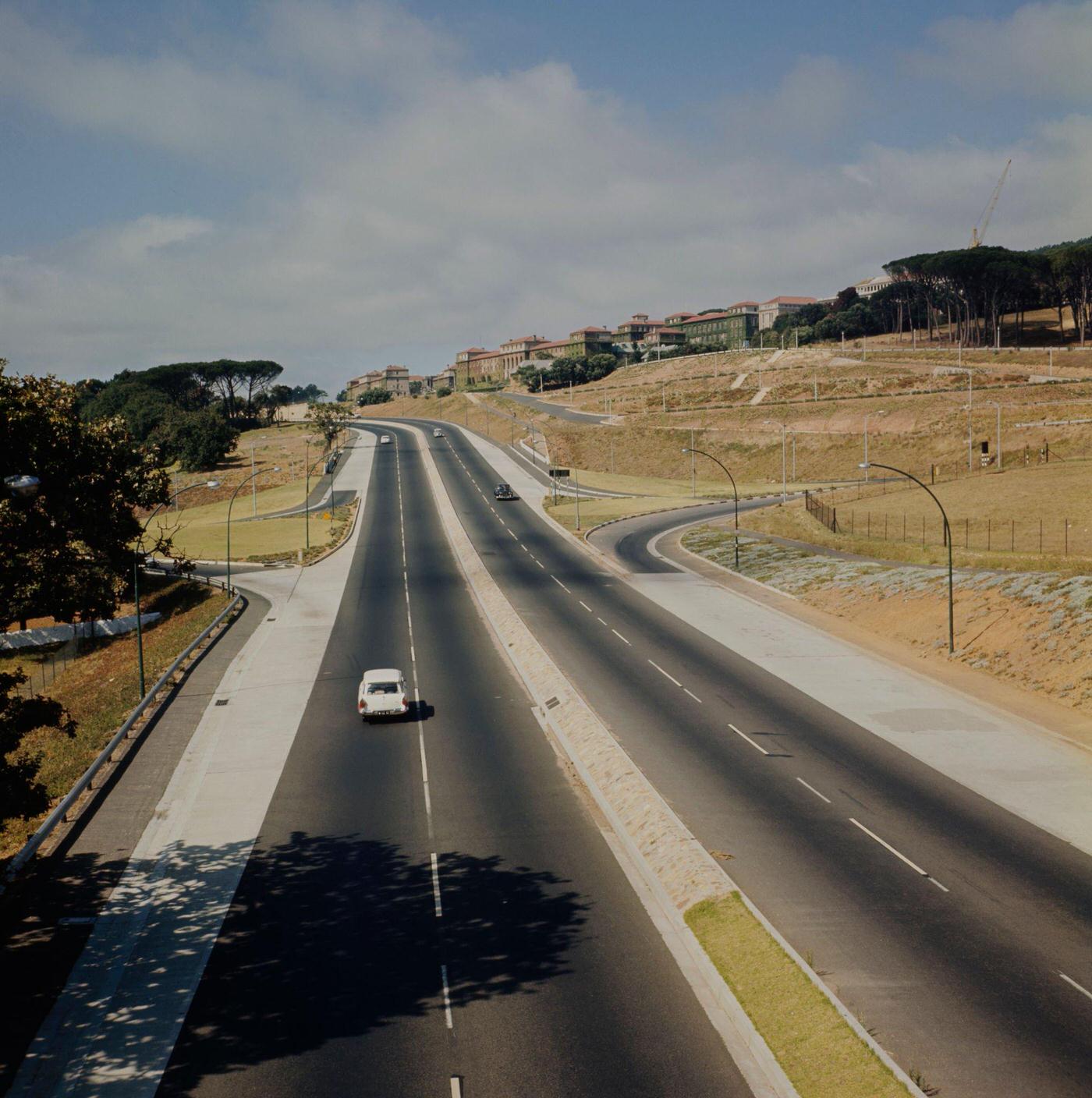
The University of Cape Town’s upper campus, set on the slopes of Devil’s Peak above Rondebosch, was one of the most architecturally striking university campuses in Africa. Rhodes Drive wound up through the pines to reach it. By 1966, UCT was one of the few South African universities that still admitted students of all races, making it a target of the apartheid government’s efforts to enforce racial separation in higher education.
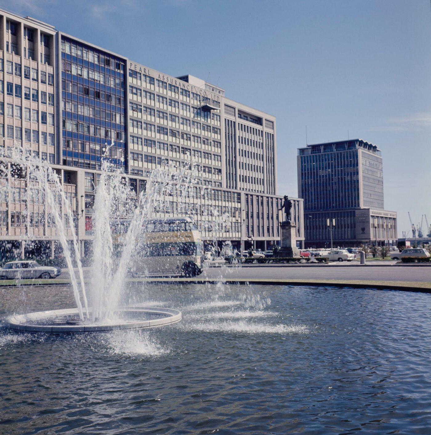
The Heerengracht Fountain was a central feature of the Foreshore’s urban design — an attempt to give the newly reclaimed land some of the civic character of the older parts of the CBD. By 1966, the Foreshore had been developing for nearly two decades since the land reclamation was completed, and its wide boulevards and modernist buildings gave it a feel very different from the tight Victorian grid of the older city center.
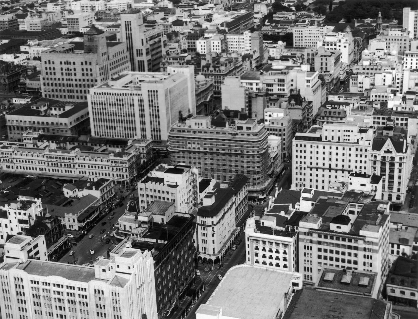
1966 was a pivotal year for Cape Town. It was the year District Six was officially declared a whites-only area, setting in motion the forced removal of nearly 60,000 of its residents. It was also the year that South Africa’s apartheid government faced mounting international condemnation, as the United Nations intensified its criticism of racial segregation. Within the country, however, the government was at the height of its power, and dissent was ruthlessly suppressed.
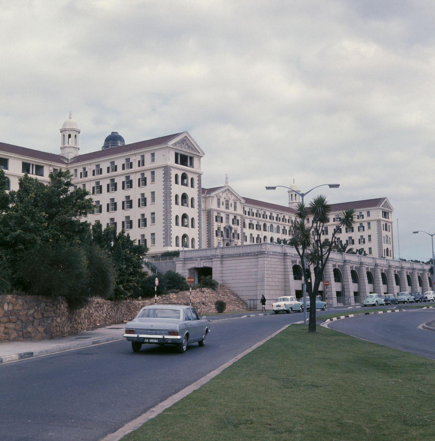
Groote Schuur Hospital’s profile rose dramatically in 1967 following the world’s first successful human heart transplant, performed there on December 3 by Dr. Christiaan Barnard. The hospital, built on the slopes of Devil’s Peak and endowed by Cecil John Rhodes to the state, was already one of the country’s foremost medical facilities. The transplant operation attracted global media attention and placed Cape Town at the center of a medical breakthrough that would reshape cardiac surgery worldwide.
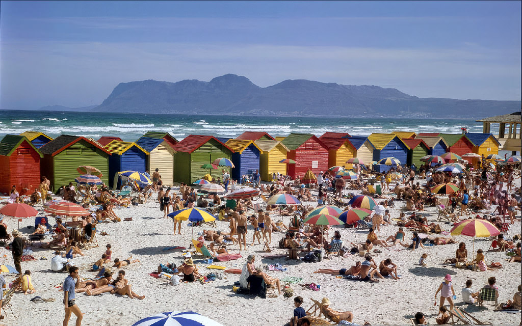
Muizenberg Beach in 1965 drew crowds of white families to its calm, warm waters. The beach was formally segregated under the Reservation of Separate Amenities Act — different sections designated for different racial groups. The brightly colored Victorian bathing houses lining the beachfront were an iconic part of the Muizenberg scene, a feature that would survive into the post-apartheid era.
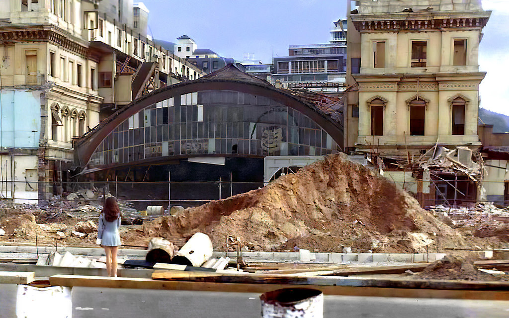
The demolition of Cape Town’s old railway station in 1968 was part of a broader program of urban renewal that was reshaping the city’s center. The old station, which had served the city since the 19th century, was being replaced by a new facility as part of the Golden Acre development. The demolition removed one of the city’s most historic structures in the name of modernization.
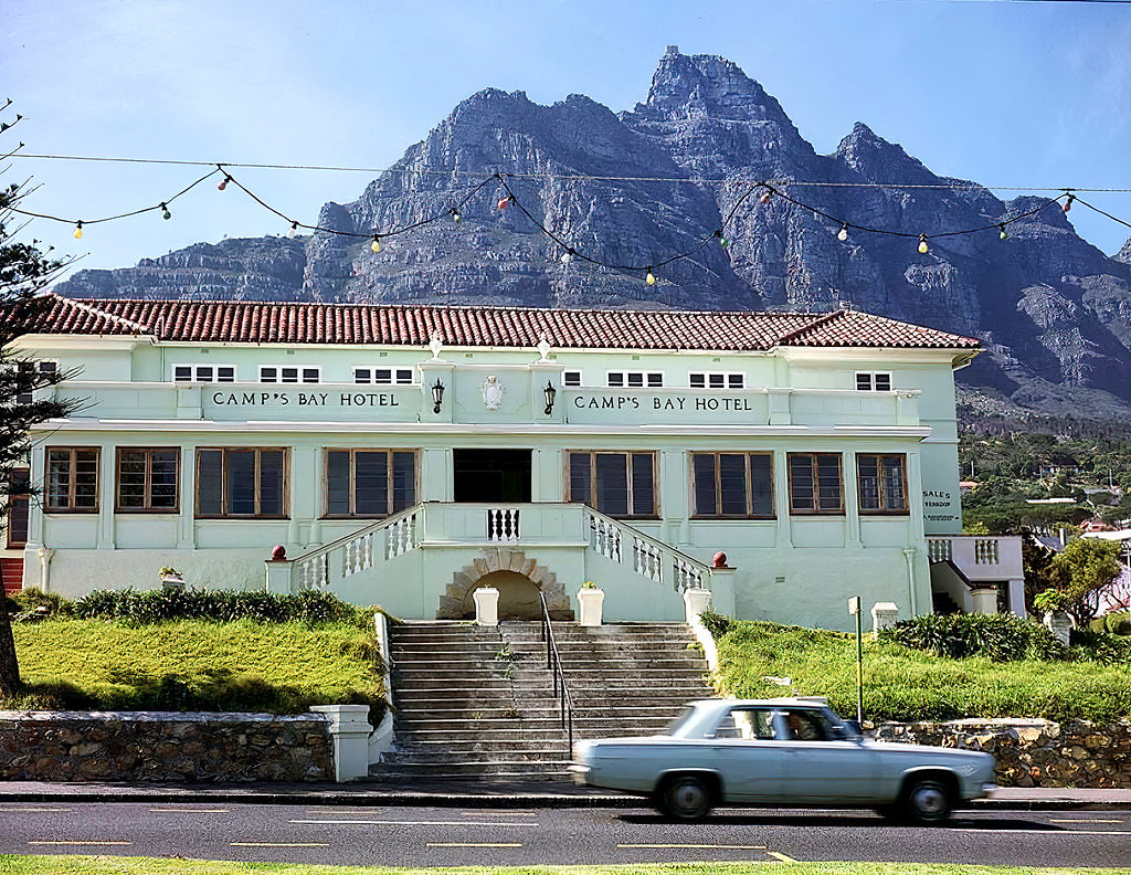
The Camp’s Bay Hotel was a longstanding landmark on the Camps Bay beachfront. Its demolition in 1968 and replacement by the Sonnekus apartment building was part of a broader pattern across Cape Town — older, lower-rise structures making way for apartment blocks and modern developments. The Sonnekus stands on the same site today, its name still connecting it to its predecessor.
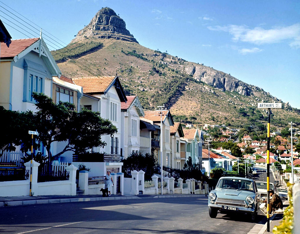
Ocean View Drive in Sea Point ran along the Atlantic coast, offering unobstructed views of the open ocean. The road separated the suburb’s dense residential development from the rocky shoreline below. In 1966, it was a popular route for Sunday drives and evening walks, particularly when the weather was calm. The Atlantic here could be spectacular — and in winter storms, genuinely violent.
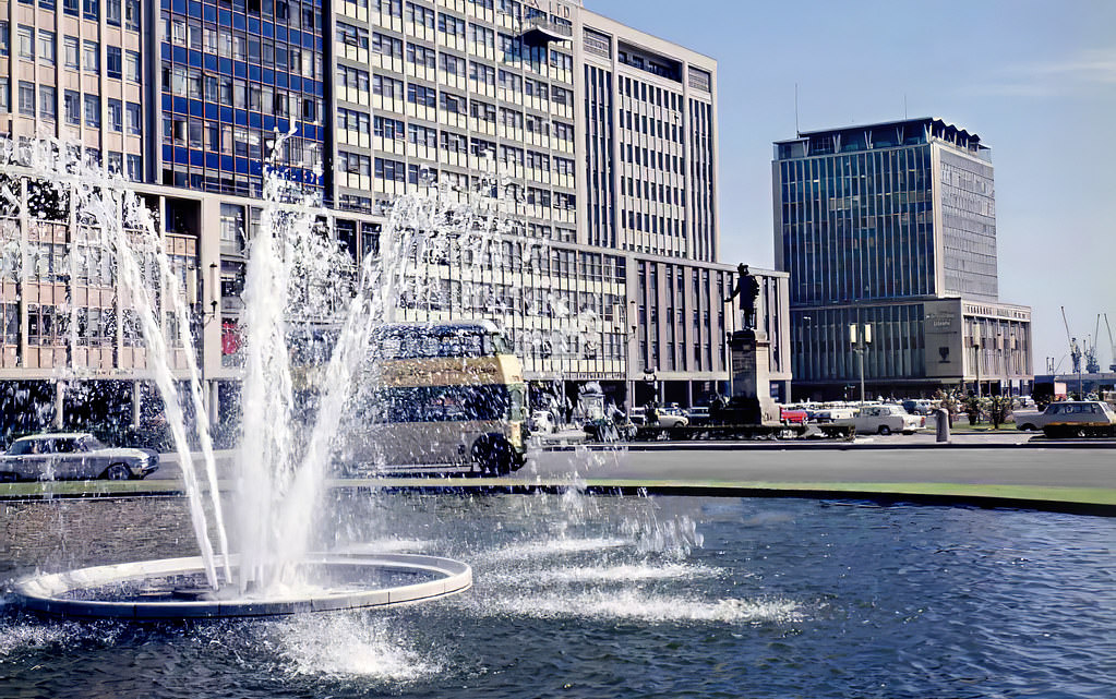
The Heerengracht Fountain stood at the junction of Adderley Street and the Foreshore’s main boulevard. It was one of the few pieces of public art on the newly developed Foreshore, giving some visual interest to an area that was otherwise dominated by roads, office buildings, and large open spaces yet to be developed. The fountain became a reference point for navigating the northern end of the city center.
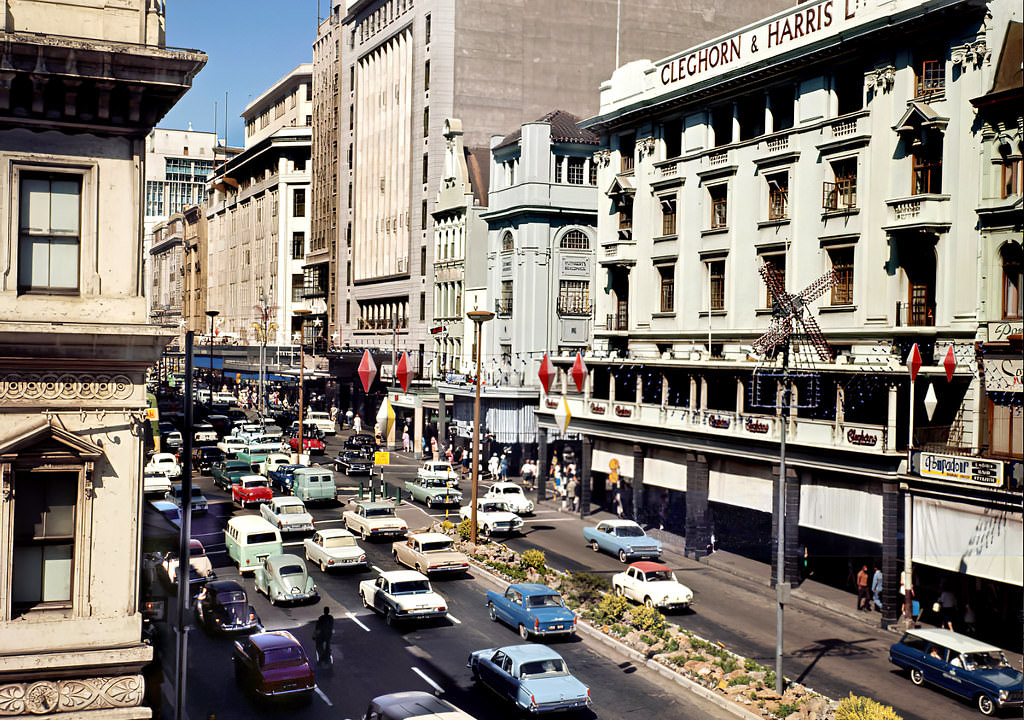
Cleghorn & Harris, photographed again here in 1966, was part of a cluster of department stores and retailers that made Adderley Street the city’s premier shopping destination. The store’s frontage was a familiar sight to generations of Capetonians who did their shopping in the CBD. Like most major retailers of the era, its operations were shaped by the racial commerce rules of apartheid.
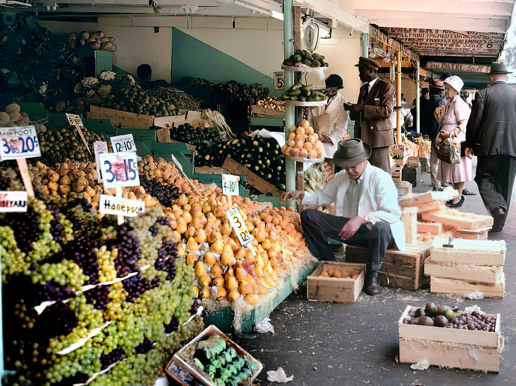
The fruit stalls on the Grand Parade sold some of the finest produce in the world — the Western Cape’s soils and climate produced exceptional fruit, and much of it found its way to these market stalls. Vendors set up their displays with care, stacking oranges, apples, grapes, and bananas in arrangements designed to attract buyers. The Parade market was as much a part of Cape Town as the mountain behind it.
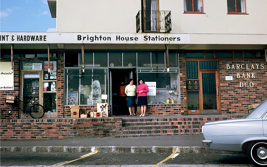
Even in a beachside suburb like Camps Bay, bookshops served a readership hungry for literature and ideas. Censorship under apartheid was strict — the Publications Control Board could ban books considered offensive, obscene, or politically dangerous. Many works of South African literature were banned, as were international titles dealing with race, communism, or anti-colonial themes. What could be sold in a Cape Town bookshop in 1968 was a carefully curated selection shaped by the censor’s hand.
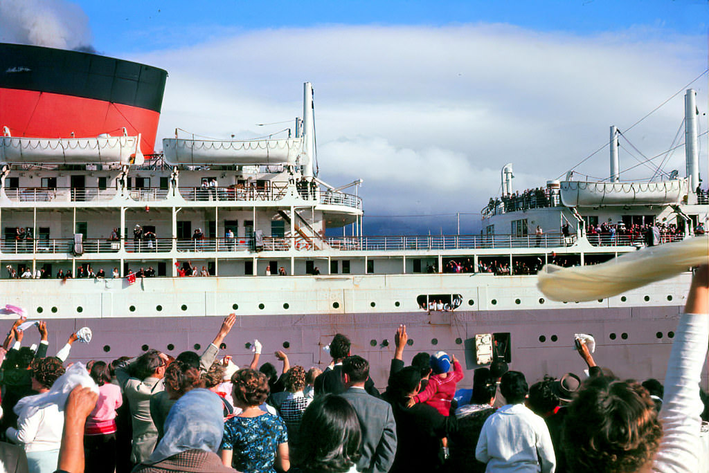
Farewell gatherings at the harbor were a regular feature of Cape Town life. The Union-Castle mailships departed regularly for Southampton, carrying passengers emigrating to Britain, returning tourists, and commercial travelers. For many Capetonians, a departure from the Cape Town docks was a major life event, and crowds gathered to see ships off. The city’s port gave it a connection to the wider world that was both commercial and deeply personal.
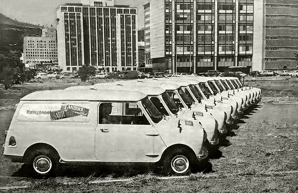
The Mini — introduced by British Motor Corporation in 1959 — had become a popular car across South Africa by 1965. A fleet of new Minis photographed in Cape Town speaks to the growing motorization of the city, and to the BMC assembly plant that would open at Blackheath in 1967 to produce vehicles locally. Car culture was becoming increasingly central to life in Cape Town’s white suburbs.
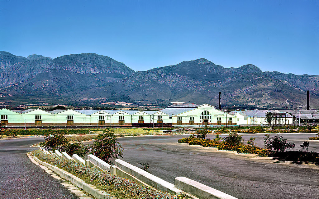
The KWV — Ko-operatieve Wijnbouwers Vereniging van Zuid-Afrika — was the cooperative organization that controlled the South African wine industry from its headquarters in Paarl. Established in 1918, the KWV set minimum prices, controlled production volumes, and effectively managed the entire wine supply chain. Its massive cellar complex in Paarl was the largest wine cellar in the world at the time — a monument to the scale of the Western Cape’s wine industry.
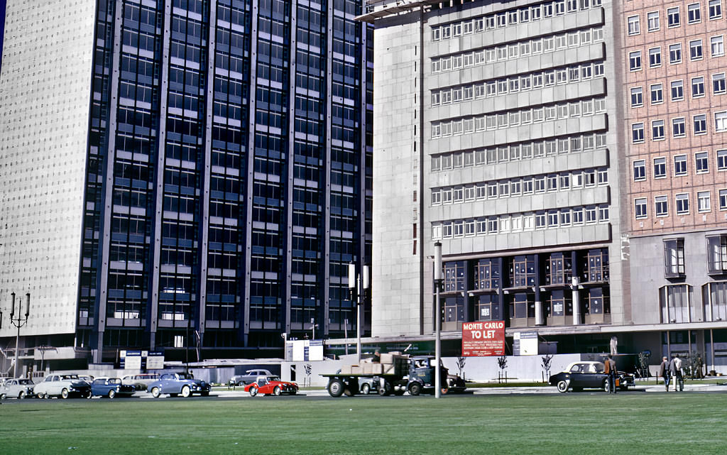
The Foreshore development was one of the most ambitious urban projects in Cape Town’s history. Completed in the 1940s, the reclaimed land was intended to provide room for the city’s expanding commercial and transport needs. By 1961, new office buildings and road infrastructure were rising on it. The scale of the project — and the grid of wide boulevards laid out across the new land — gave the Foreshore a character entirely distinct from the older city.
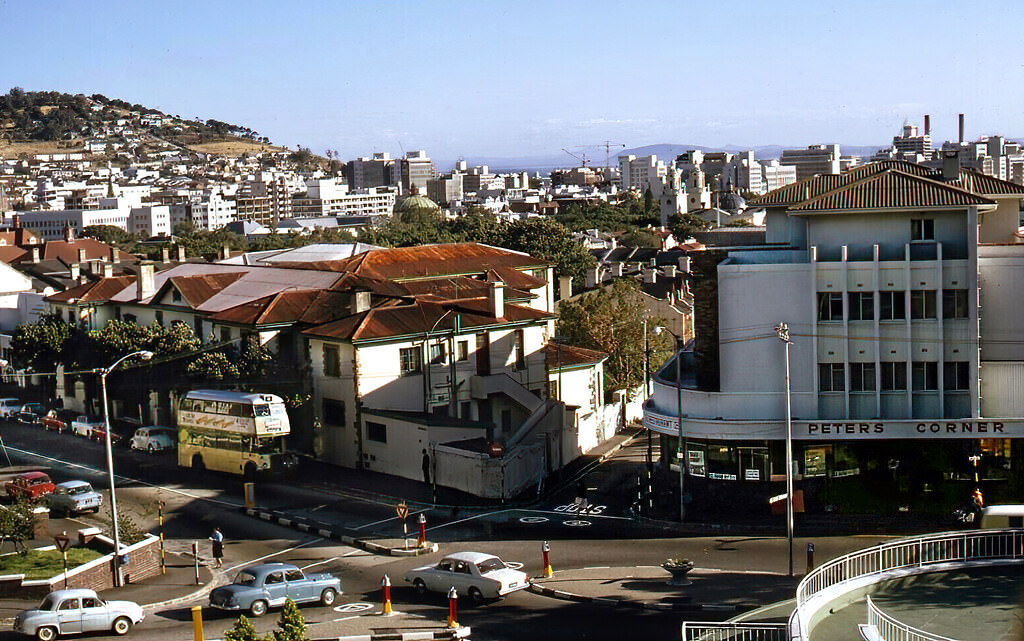
The view from the De Waal Hotel’s balcony in 1968 looked out over the intersection of Mill and Annandale Streets in the Gardens neighborhood — one of the older, more established parts of Cape Town, between the CBD and the southern suburbs. The hotel itself would later become the Sun Square, but in 1968 it was a functioning city-center hotel in a neighborhood of embassies, offices, and apartment buildings.
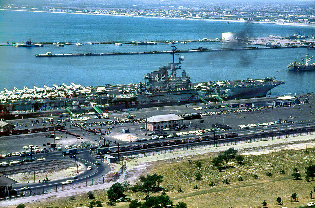
The USS Franklin D. Roosevelt, an American aircraft carrier, docked in Cape Town in February 1967. American naval vessels visited Cape Town regularly during this period, part of the strategic relationship between the United States and apartheid South Africa that persisted during much of the Cold War. The arrival of a carrier battle group was a significant event that drew attention to the harbor and to the geopolitics that placed Cape Town on major maritime routes.
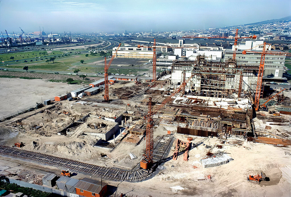
The Nico Malan Theatre — later renamed Artscape — was Cape Town’s main performing arts venue, under construction on the Foreshore in 1969. Named after a former Cape administrator, the complex included an opera house, a theater, and an arena. Like virtually all public entertainment venues in apartheid Cape Town, it was designed for white audiences. It would eventually open in 1971.

Cape Town’s Cenotaph War Memorial, near the City Hall, commemorated South Africans who died in the First and Second World Wars. Memorial events at the Cenotaph were annual occasions. The memorial stood in the city center as a reminder of South Africa’s participation in the two world wars — participation that had been deeply divisive, particularly during the second war, when Afrikaner nationalist sentiment was sharply divided over supporting Britain.
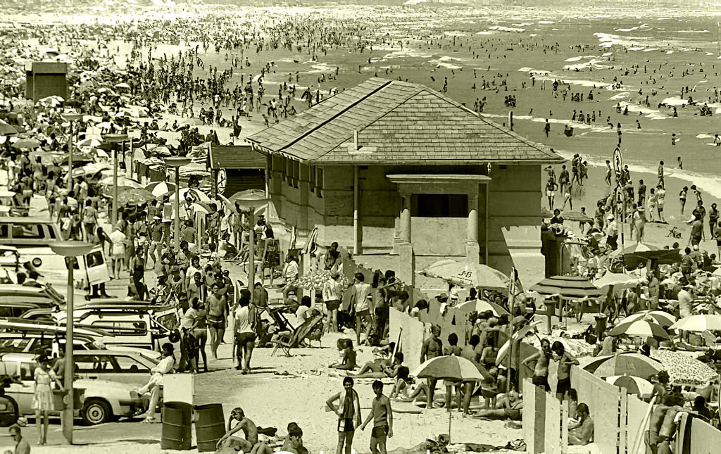
Muizenberg at the end of the decade remained a popular coastal resort. Its beach was broad and flat, its surf gentle enough for novice swimmers, and its waters among the warmest on the Cape Peninsula. The historic character of the town — it had been the site of the Battle of Muizenberg in 1795, when British forces defeated the Dutch Batavian Republic and seized the Cape Colony — added a layer of significance to its beach resort image.
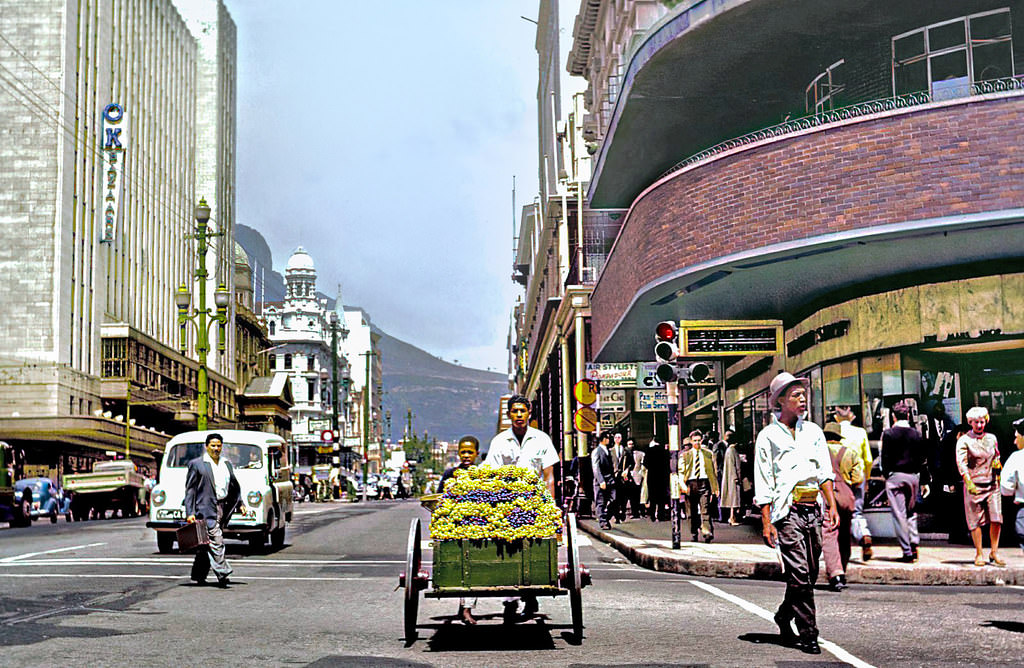
“Lekka drywe” — Afrikaans for “delicious grapes” — captures the language of the Cape’s street vendors in 1960. Afrikaans, a language that grew out of Dutch spoken at the Cape and enriched by contributions from Malay, Khoekhoe, and other languages, was the mother tongue of both Afrikaner and Coloured South Africans. On the streets of Cape Town, Afrikaans was the everyday language of commerce and community — a linguistic bridge across some of the racial lines the government was so determined to enforce.
Manual labor was the backbone of the Cape Town economy for working-class residents. Workers carrying heavy loads on Cape Town’s streets in 1966 did so within a labor system that paid non-white workers far less than their white counterparts for equivalent work. The Job Reservation Act reserved entire categories of skilled employment for white workers, keeping non-white workers locked into low-paid manual roles regardless of their abilities.
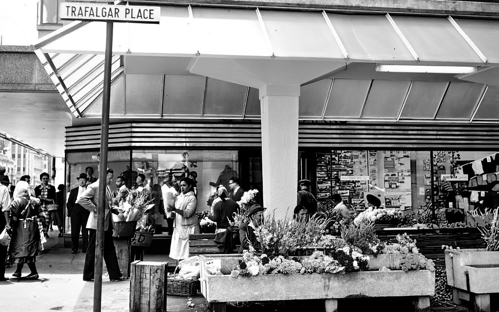
Cape Town’s flower sellers were a beloved institution. They operated mainly around the Grand Parade and along Adderley Street, selling blooms from the Cape’s extraordinarily diverse flora — proteas, leucadendrons, and other fynbos species mixed with cultivated flowers. The tradition of buying flowers from street sellers was deeply embedded in Cape Town’s culture, and the sellers themselves were a fixture of the city’s public landscape.
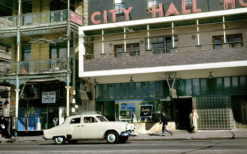
Darling Street ran east from Adderley Street through the CBD, passing the City Hall and the Grand Parade before continuing toward the older residential areas of the city. In 1961, it was a busy commercial street, its pavements crowded with workers and shoppers. The year 1961 was also the year South Africa left the Commonwealth and became a republic — a move that completed the Afrikaner nationalist project of breaking political ties with Britain.
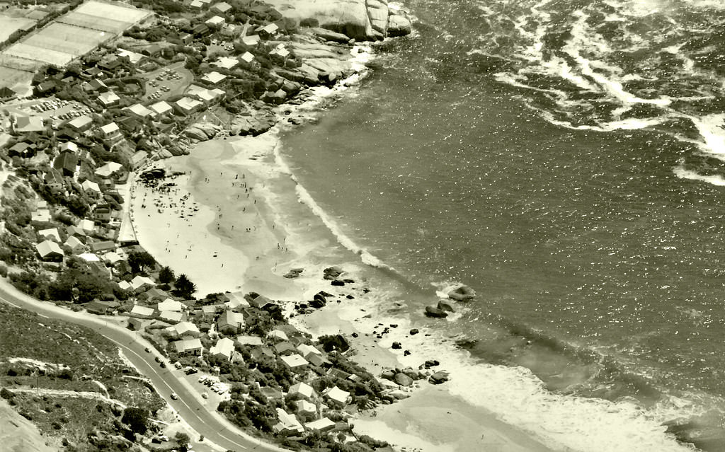
Clifton’s four beaches, sheltered from the southeaster wind by the rocky Twelve Apostles, were among Cape Town’s most exclusive. The waters here were fed by the cold Benguela Current and were bracing even in summer — but the shelter, the white sand, and the proximity to the city made Clifton fashionable. In 1962, Fourth Beach in particular was a popular gathering spot for Cape Town’s white residents.
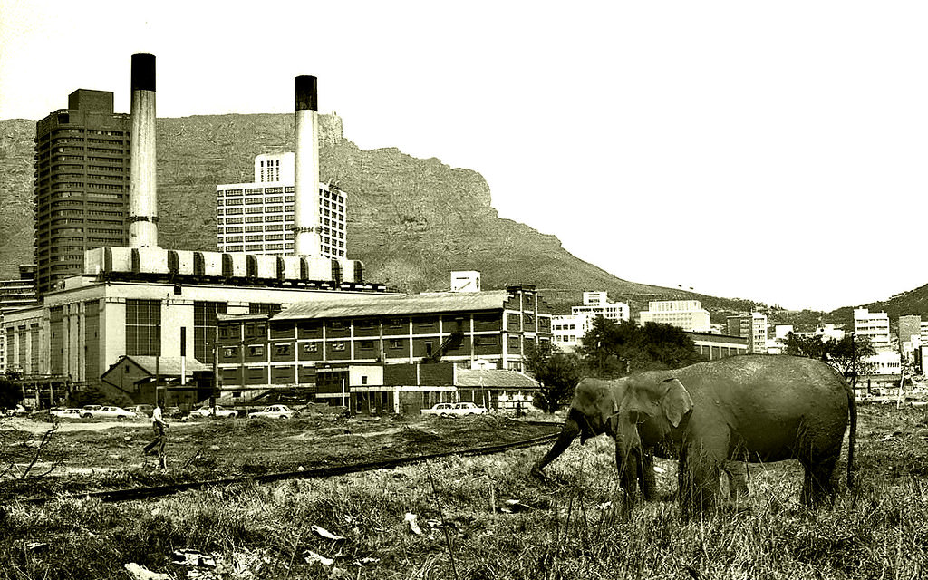
The Foreshore’s large open spaces were sometimes used for events like circuses, which set up their tents on the undeveloped land between the CBD and the harbor. The Boswell Wilkie Circus was among those that toured South Africa, bringing acrobats, animals, and spectacle to cities across the country. These traveling shows attracted crowds — in Cape Town, as elsewhere in South Africa, segregated into separate sections.
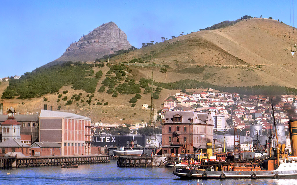
Signal Hill, rising above the Bo-Kaap and Sea Point, was one of Cape Town’s most prominent landmarks — a long, flat-topped ridge that separated the city bowl from the Atlantic seaboard. Its name came from the signal cannon that was fired daily at noon from its slopes (actually from nearby Lion’s Head) to allow ships in the harbor to set their chronometers. In 1962, Signal Hill offered sweeping views of a city that was being reshaped by politics and construction.
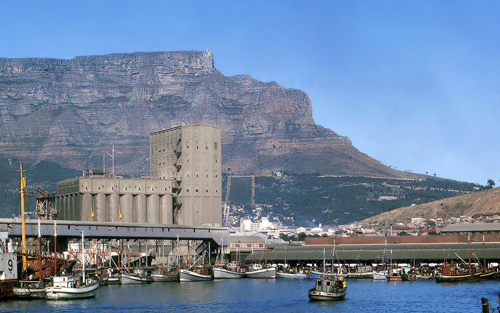
Cape Town’s grain silo complex at the harbor was one of the city’s most distinctive industrial structures. Grain from South Africa’s interior wheat-producing regions arrived by rail and was stored in the silos before being exported or milled. The massive cylindrical towers of the silo dominated the harbor skyline for decades. The complex would eventually be converted into the Zeitz Museum of Contemporary Art Africa — but in 1963, it was purely functional.
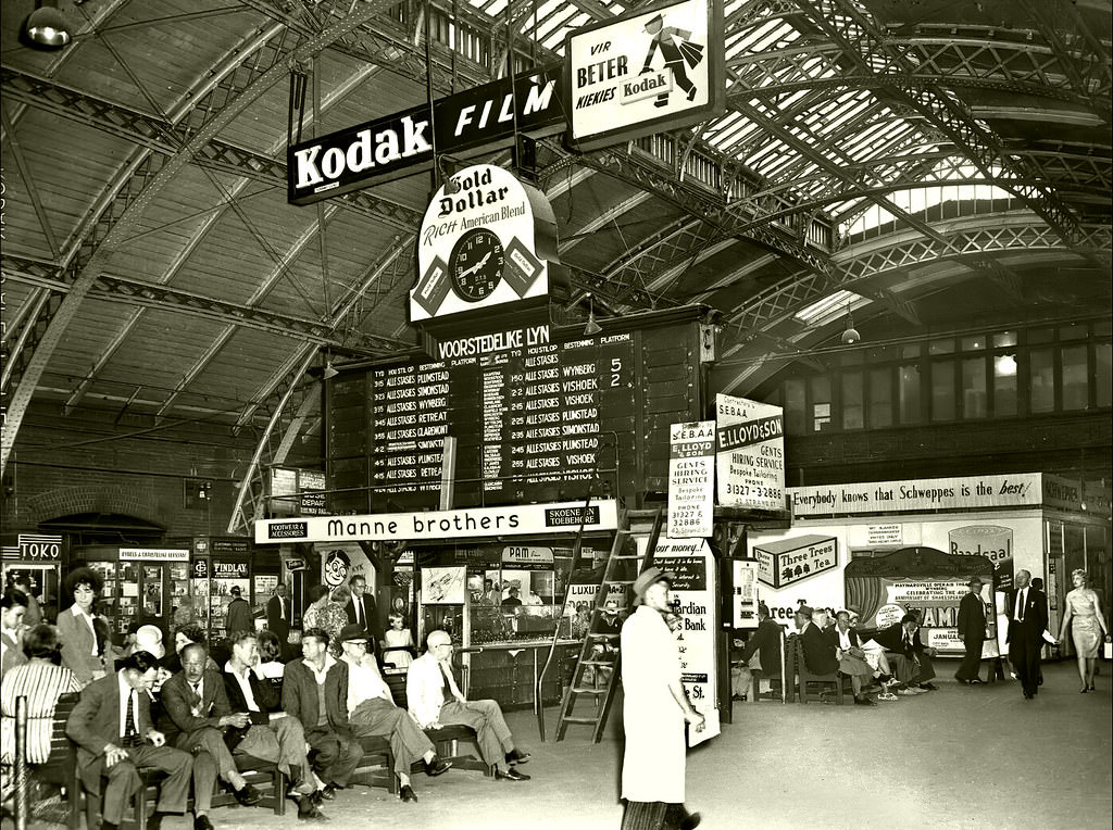
The clock at Cape Town’s railway station was a reference point for the city’s commuters. The station was the terminus of the rail network connecting Cape Town to Pretoria and Johannesburg in the north, and to the suburban communities of the Cape Peninsula to the south. By 1964, the old station building was approaching the end of its life — demolition would come in 1968 as part of the Golden Acre development.
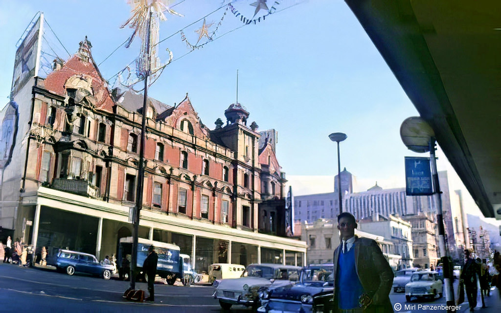
The South African Railways and Harbours administration was one of the largest employers in the country, and its offices at the Cape Town harbor were among its most important facilities. The Harbor Board managed the port’s operations — the allocation of berths, the movement of cargo, and the maintenance of the harbor infrastructure. Like all major government enterprises, it operated on strictly segregated employment lines.
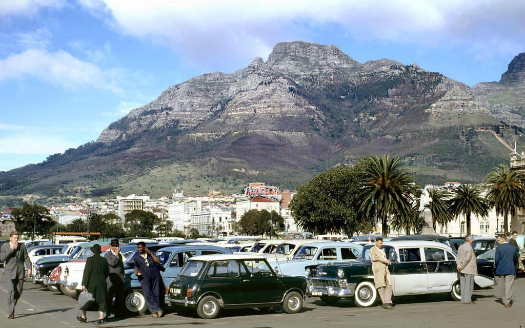
The Grand Parade served as a parking area on non-market days — a practical use of its large open space in an era when the CBD was still accessible by car and parking was still possible close to the city center. By 1962, the number of vehicles in Cape Town was rising steadily, and the pressure on city parking and road capacity was beginning to influence urban planning decisions.
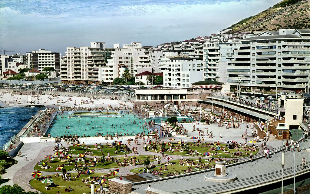
The Sea Point Pavilion and its tidal pools, photographed in 1967, show the Atlantic shoreline as it appeared before later coastal developments. The dense apartment buildings of Sea Point rise behind the pool complex, their flat-roofed modernist forms characteristic of the suburb’s postwar building boom. Sea Point had been transformed from a relatively low-density Victorian suburb into one of the most densely built residential areas in South Africa in just two decades.
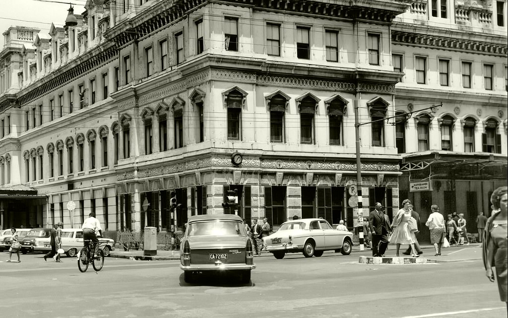
Cape Town’s old railway station, photographed here in 1964, was approaching the final years of its existence. The station had been the city’s main rail terminus since the 19th century, its Victorian architecture a contrast to the modernist buildings that were rising around it. Its demolition in 1968 cleared the way for the Golden Acre shopping complex — one of the largest urban redevelopment projects Cape Town had seen.
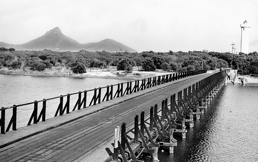
The Milnerton bridge crossed the Diep River lagoon at Milnerton, north of Cape Town, connecting the city to the northern suburbs and the West Coast. Milnerton was a quiet, predominantly white suburb in the 1960s, separated from Cape Town’s main urban area by the lagoon and the large stretch of beach on its oceanfront. The bridge was an essential link in the road network connecting the northern suburbs to the city.
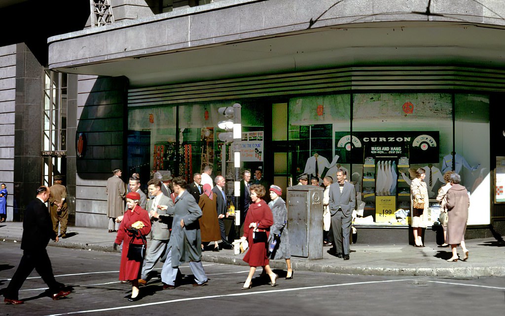
The corner of Castle and Adderley Streets was one of the busiest intersections in Cape Town’s CBD — and the Castle of Good Hope, South Africa’s oldest colonial building, was just a short distance away at the end of Darling Street. Pedestrians navigating this corner in 1962 were doing so in the shadow of both the city’s colonial past and the apartheid present — a dual legacy written into the very geography of the city center.
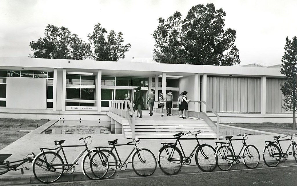
Bellville, a suburb to the northeast of Cape Town, was the center of the Cape’s Afrikaner community. The opening of a new public library there in 1964 reflected the investment the apartheid government directed toward Afrikaner communities. Bellville had its own municipality, its own civic institutions, and a strong Afrikaner cultural identity — its residents were among the core constituency of the National Party government.
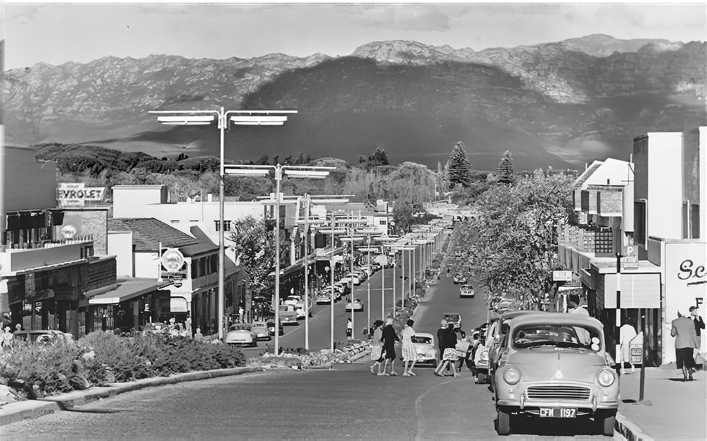
Somerset West, at the foot of the Helderberg mountains on the eastern edge of False Bay, was a prosperous white town in the 1960s. Its main street had the character of a well-maintained small town — shops, a hotel or two, and the kind of orderly commercial strip that reflected the relative affluence of its predominantly white population. The mountains behind it and the wine farms surrounding it gave Somerset West a distinctive setting.
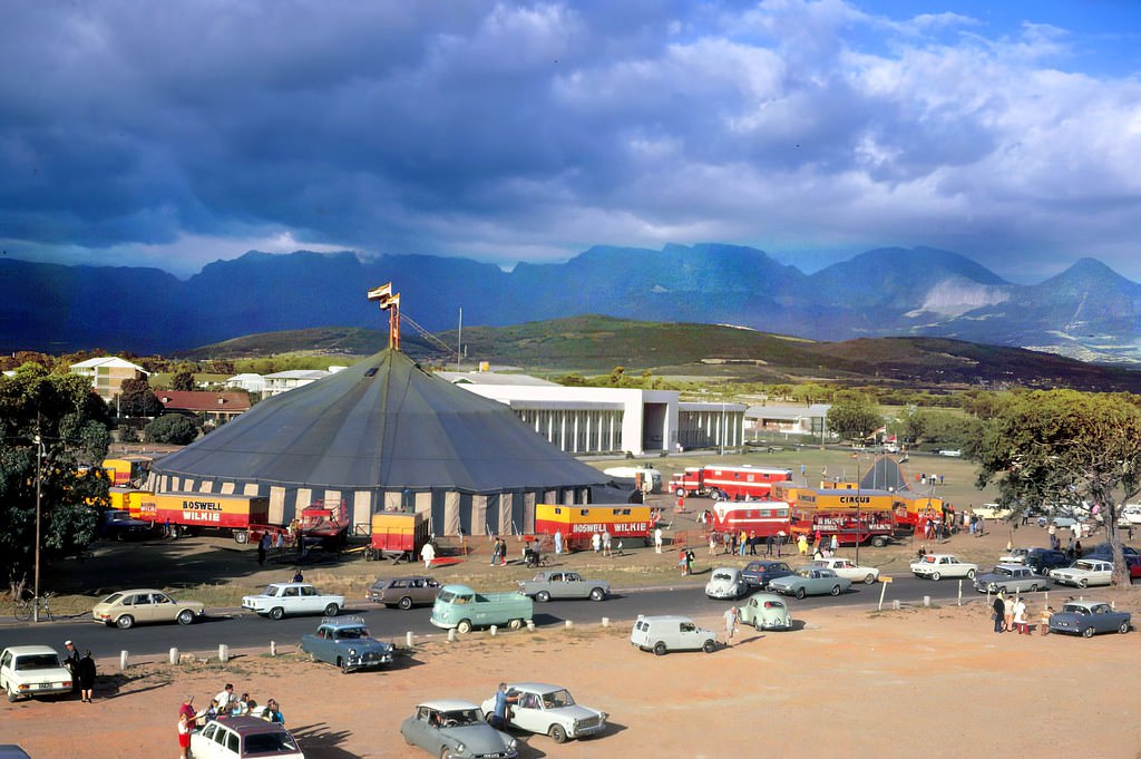
The Boswell Wilkie Circus, one of South Africa’s most famous traveling shows, performed at the Strand in 1968. The circus had been touring South Africa since the 1930s, bringing live entertainment to cities and towns across the country. Like all public entertainment in apartheid South Africa, circus performances were racially segregated — different sessions or separate seating sections for different racial groups.
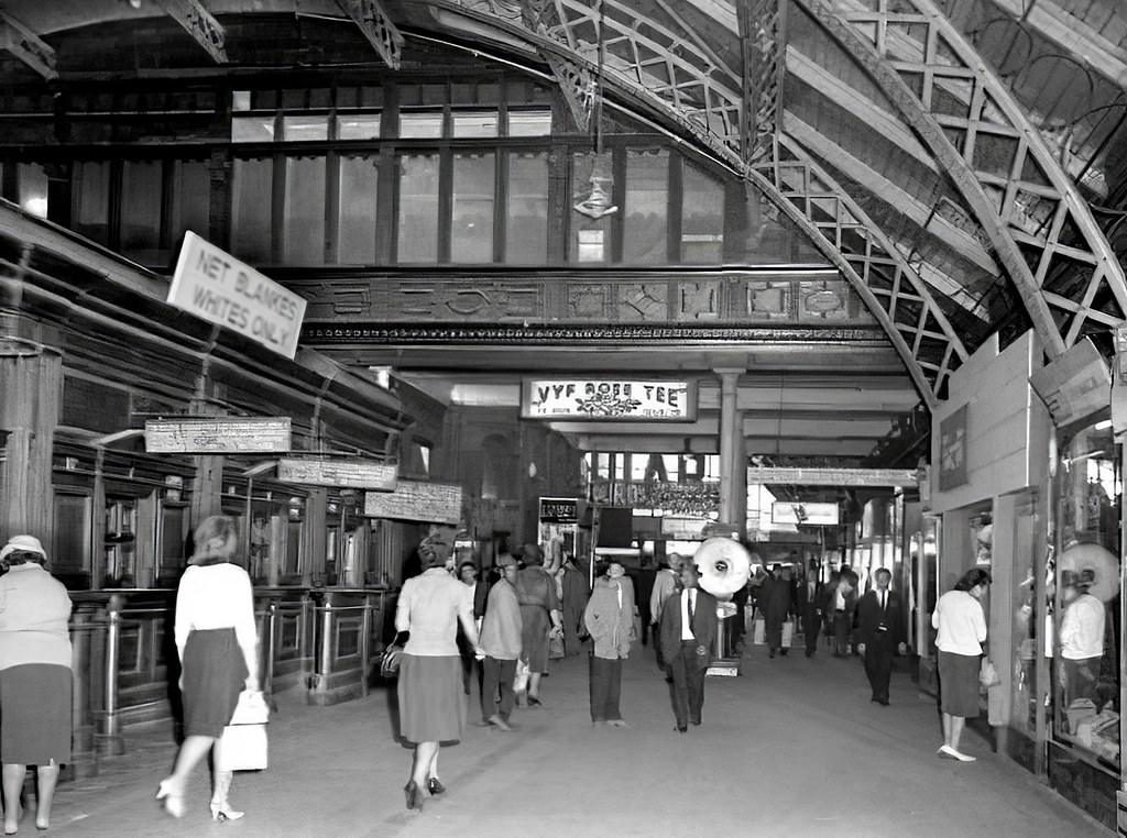
Another view of Cape Town’s old railway station in 1964 captures a building that was already considered outdated for the needs of a growing city. The station handled both long-distance intercity trains and suburban commuter services, and the volume of passengers using it daily was enormous. Its replacement was planned as part of a larger redevelopment of the city block it occupied.
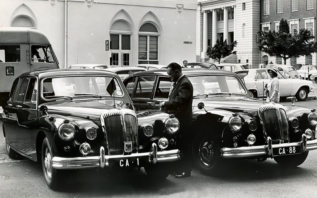
The Cape Town city mayor’s official vehicles in 1965 were a visible symbol of civic authority. The mayor’s office was one of the most powerful positions in city government — responsible for managing a city whose administration was, under apartheid, entirely in white hands. Municipal services, zoning decisions, and housing policy were all administered in ways that consistently prioritized white residents over non-white ones.
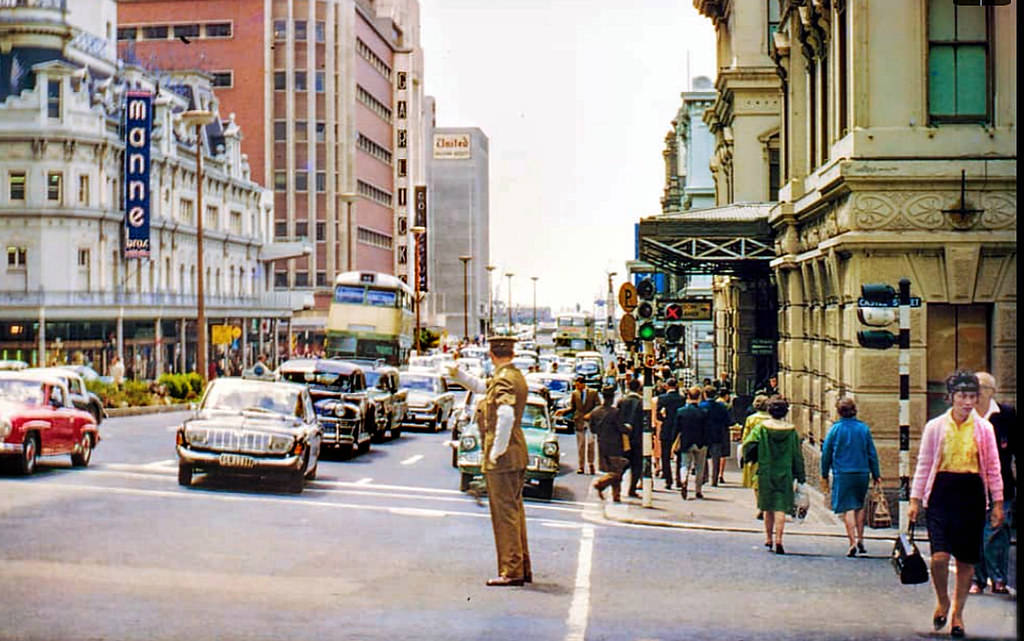
The intersection of Adderley and Castle Streets, photographed in 1965, shows the CBD at a moment of busy daily activity. By the mid-1960s, Cape Town’s commercial center was thriving — at least on the surface. The economic growth of the apartheid era disproportionately benefited white South Africans, and the prosperity visible on Adderley Street was not shared equally across the city.
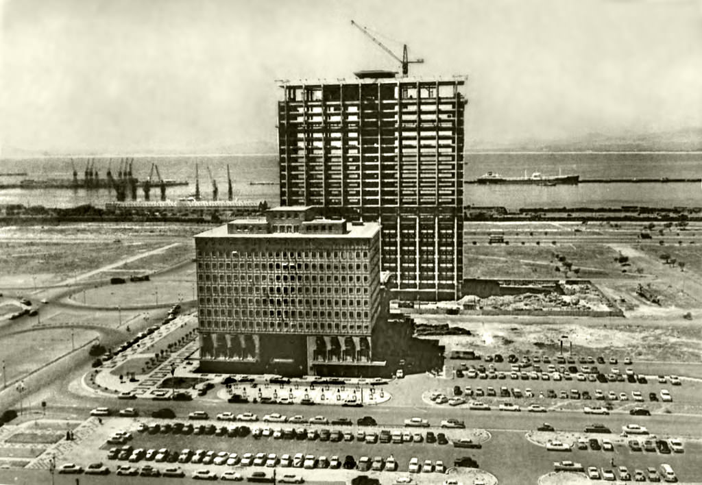
The construction of the Sanlam Building in 1961 was one of the most significant additions to Cape Town’s skyline during the decade. Sanlam — Suid-Afrikaanse Nasionale Lewensassuransie Maatskappy — was one of the largest Afrikaner financial institutions in the country, and its Cape Town tower was a statement of the growing economic power of Afrikaner capital. The building dominated the city’s central business district and is still standing today as the Naspers Centre.
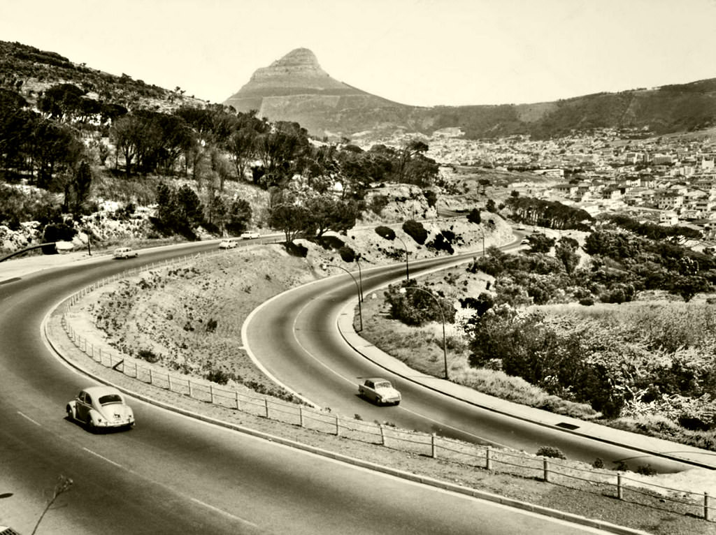
De Waal Drive wound along the lower slopes of Devil’s Peak, connecting the city center to the southern suburbs of Rondebosch, Newlands, and Claremont. The road offered views over the Cape Flats and the mountains beyond, and its alignment along the mountain’s edge gave it a character quite different from the flat suburban streets below. By 1962, it carried heavy traffic as residents of the southern suburbs commuted to work in the CBD.
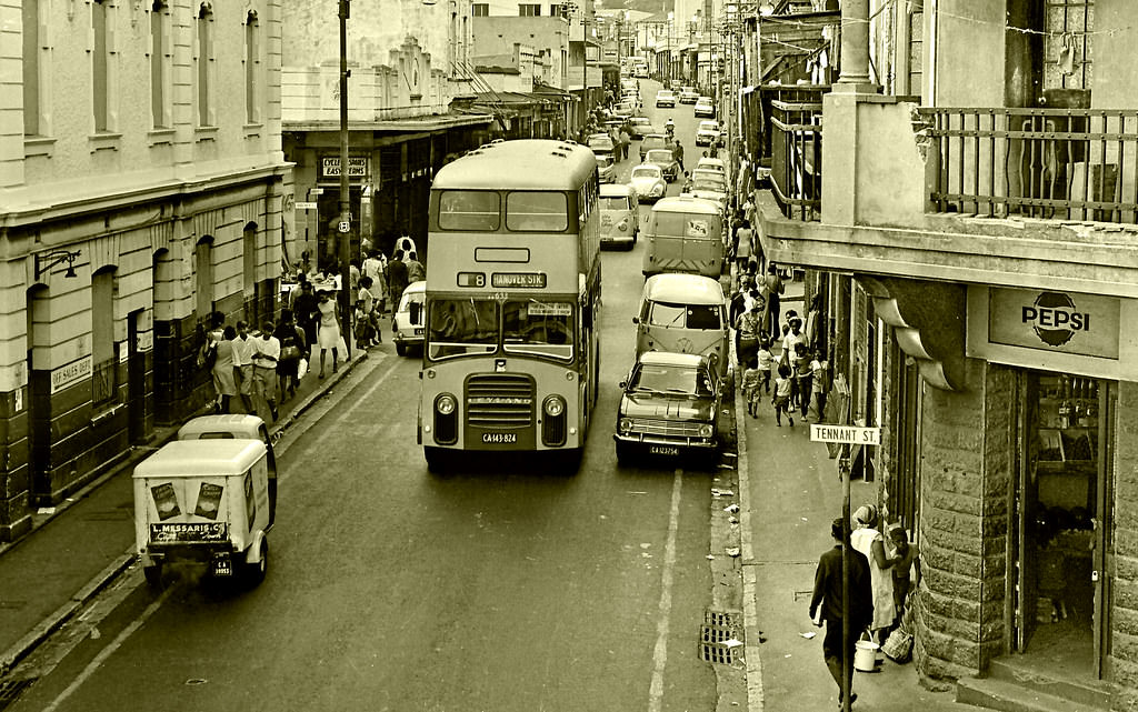
The corner of Hanover and Tennant Streets placed this photograph squarely in District Six — the neighborhood that had been declared white in 1966 and whose residents were being systematically removed. This intersection was part of a community fabric that had taken generations to build. The people who lived on these streets — shopkeepers, musicians, teachers, laborers — were being forced from their homes as this photograph was taken.
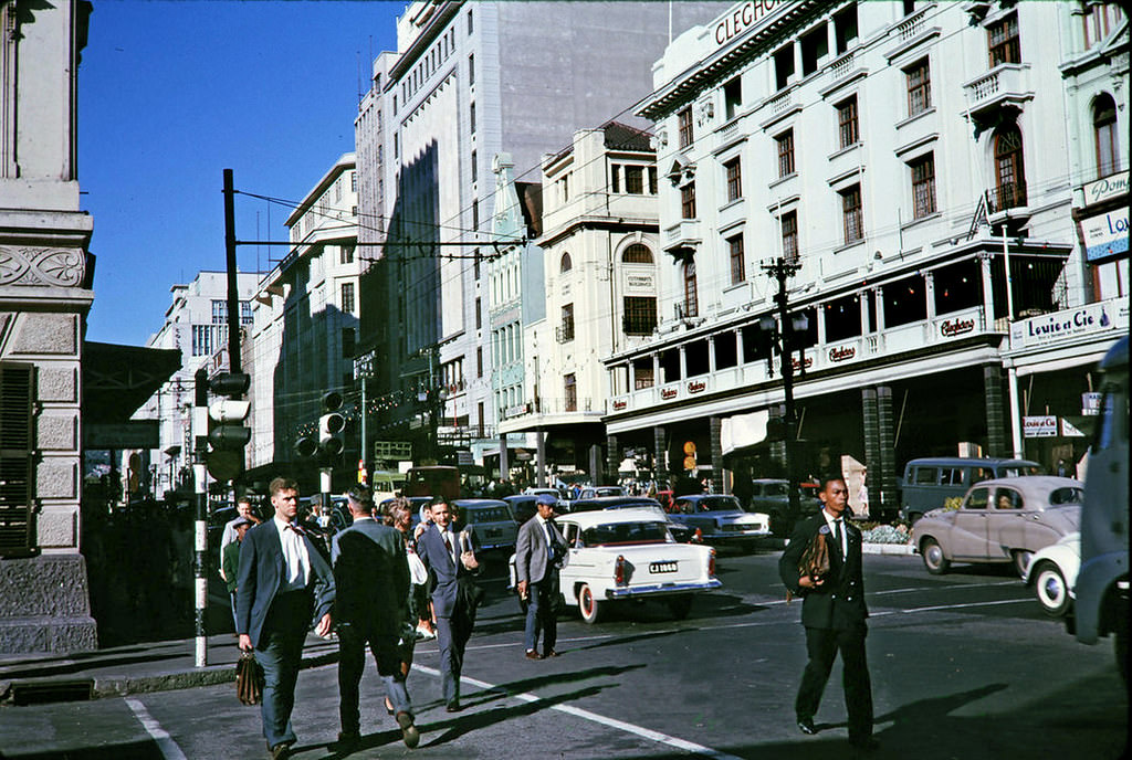
Adderley Street in 1963 was Cape Town’s main commercial artery, lined with shops, banks, and office buildings. The street’s character was defined by its mix of Victorian and Edwardian buildings at its southern end — near the Gardens — and the newer modernist developments toward the Foreshore. The street was closed to private vehicles for much of the day, making it primarily a pedestrian and bus thoroughfare.
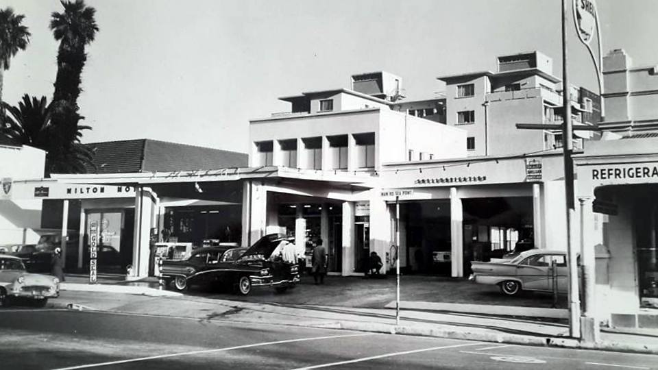
Car dealerships were expanding rapidly in Cape Town’s wealthier suburbs during the 1960s, as rising incomes among white South Africans drove demand for new vehicles. Milton Motors in Sea Point was one of many dealerships serving this growing market. The car industry was a significant part of the South African economy — and the BMC plant at Blackheath, which would open in 1967, was part of efforts to build local manufacturing capacity.
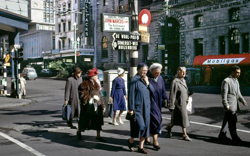
July 1961 — South Africa had become a republic in May of that year, severing its formal ties with the British Commonwealth after international pressure over apartheid made continued membership untenable. The country was now a republic governed entirely by its own laws, free from even the nominal restraint of Commonwealth membership. Life on Darling Street continued as normal, but the political environment was shifting significantly.
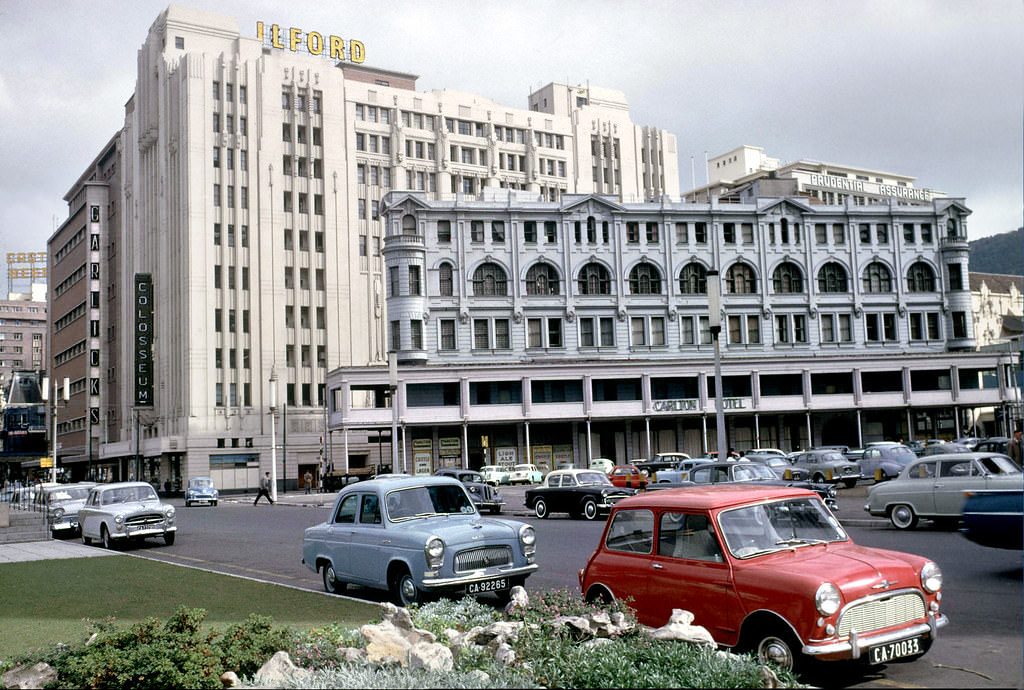
The Carlton Hotel was one of Cape Town’s established city-center hotels in 1961. Hotels like the Carlton operated within the framework of apartheid’s hospitality legislation, which effectively restricted their clientele to white guests. The hotel industry catered to the business travelers, tourists, and visiting officials who passed through a city that was, despite its troubled politics, an attractive destination.
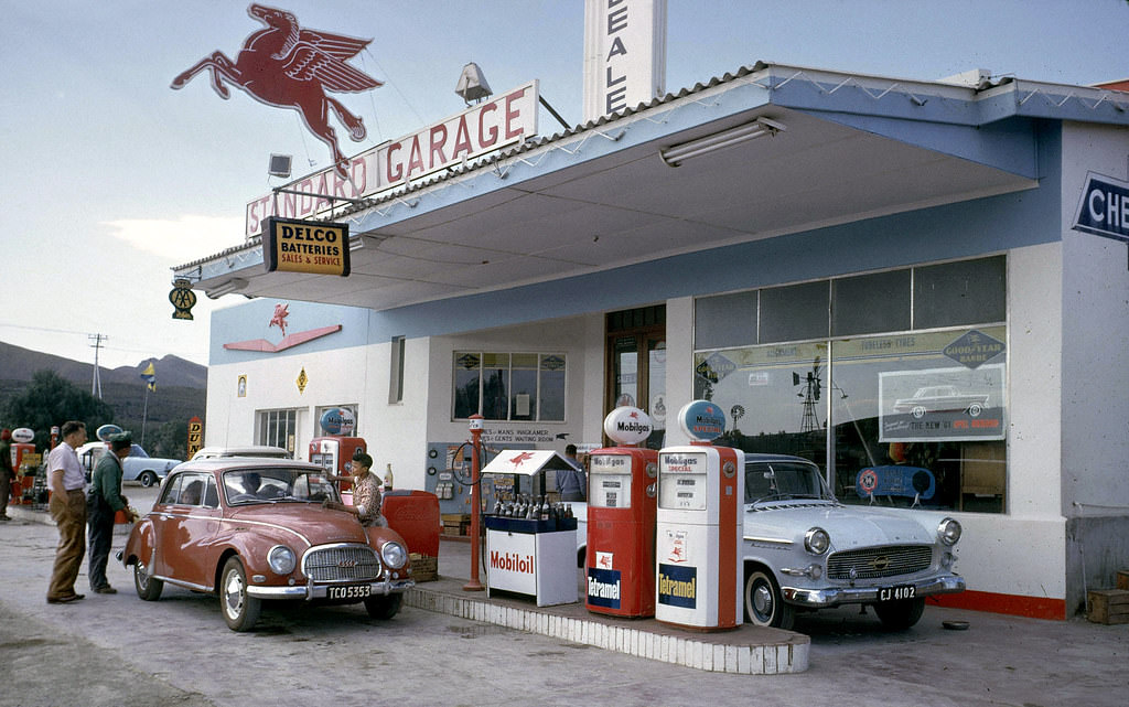
Paarl, the largest town in the Cape Winelands, was a significant center of Afrikaner culture and politics. It was in Paarl that the Genootskap van Regte Afrikaners — the Fellowship of True Afrikaners — had been founded in 1875, kick-starting the movement to standardize and promote Afrikaans as a written language. By 1961, Paarl was a prosperous farming and light industrial town, its service stations catering to the growing number of motorists on the national roads.
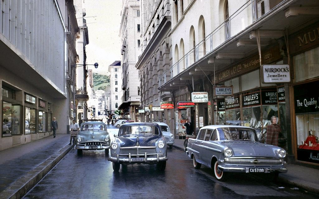
Longmarket Street, in the heart of the CBD, was a busy commercial artery in 1961. The section between St George’s Mall and Adderley Street was particularly active — close to major retail stores, banks, and the Church Square precinct. Cape Town’s CBD was a compact, dense environment where the architecture of two centuries existed side by side, the older buildings giving the newer ones context and scale.
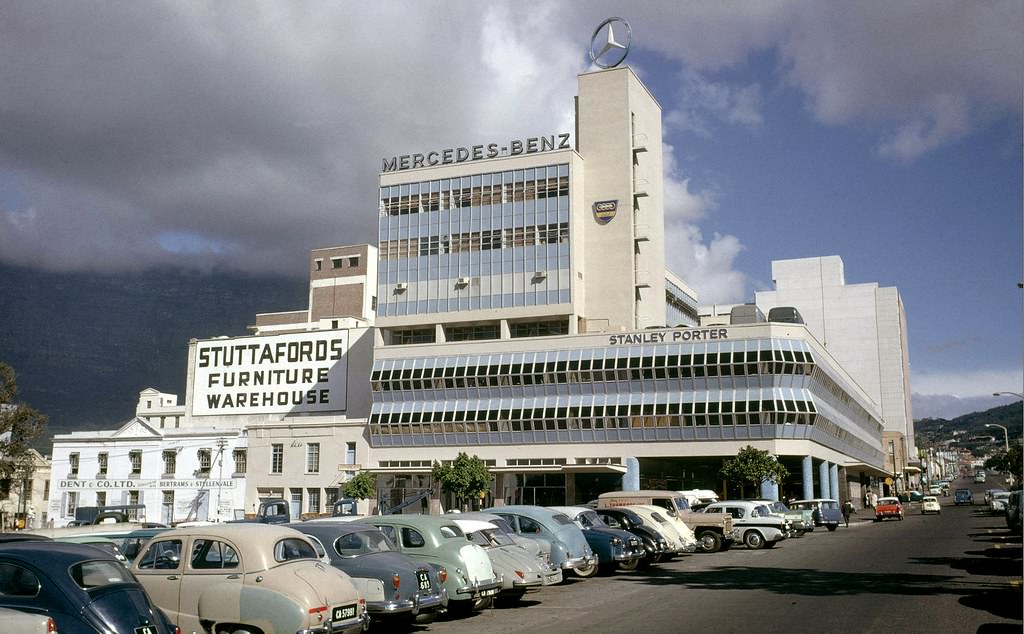
The Stanley Porter building on Buitenkant Street was one of the CBD’s commercial landmarks, its prominent Mercedes-Benz star a beacon visible from a distance. The building’s location on historic Riebeeck Square — one of the city’s oldest open spaces — connected it to Cape Town’s earliest urban fabric. Commercial buildings like this anchored specific neighborhoods of the CBD with consistent identities that residents and workers navigated by instinct.
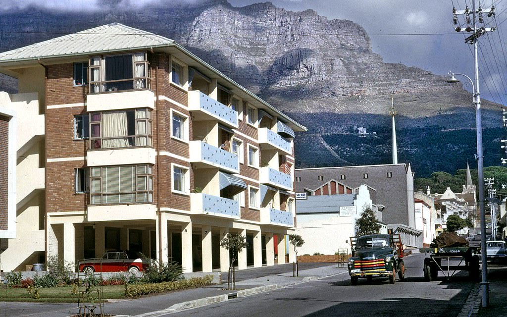
The Gardens neighborhood, between the CBD and the southern suburbs, was home to a mix of apartment buildings, hotels, and embassies in the 1960s. Sol-Mor Mansions on St John’s Street was typical of the apartment buildings that had gone up in the area in the interwar period — solid, well-built structures offering urban living within walking distance of the CBD and the Company Gardens.
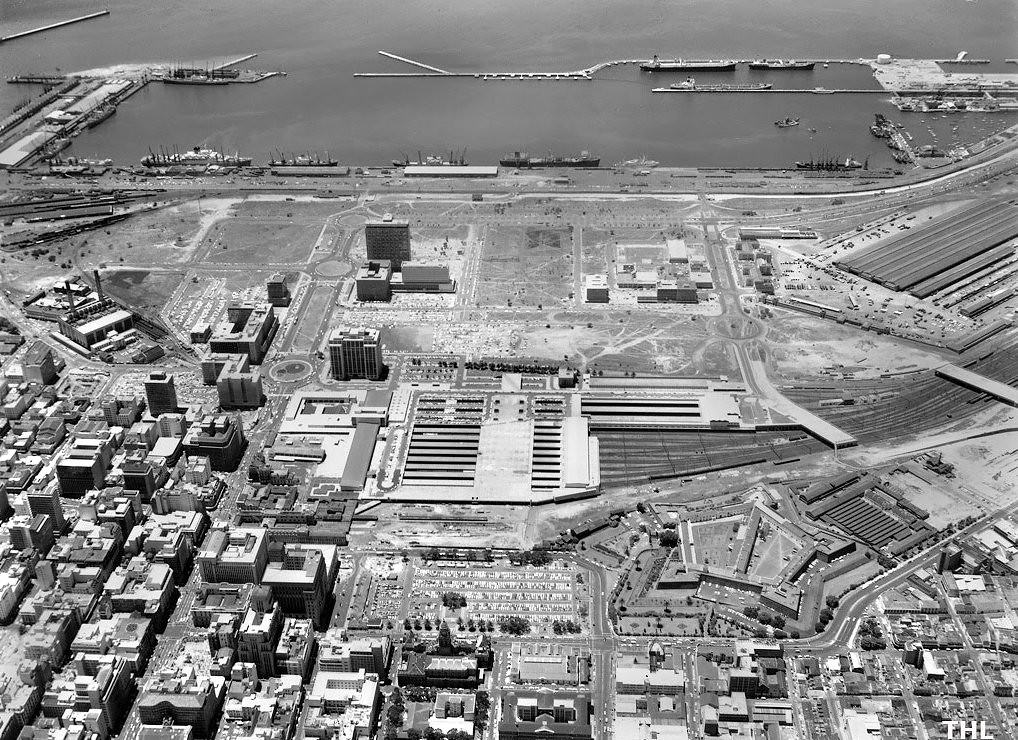
Cape Town’s central city in 1967 was in the middle of a decade-long construction boom. New office buildings were rising across the CBD, particularly on the Foreshore where land was more plentiful. The city’s economy was strong — apartheid’s labor policies kept wages low for non-white workers, which translated into high profits for white-owned businesses and substantial tax revenues for the state.
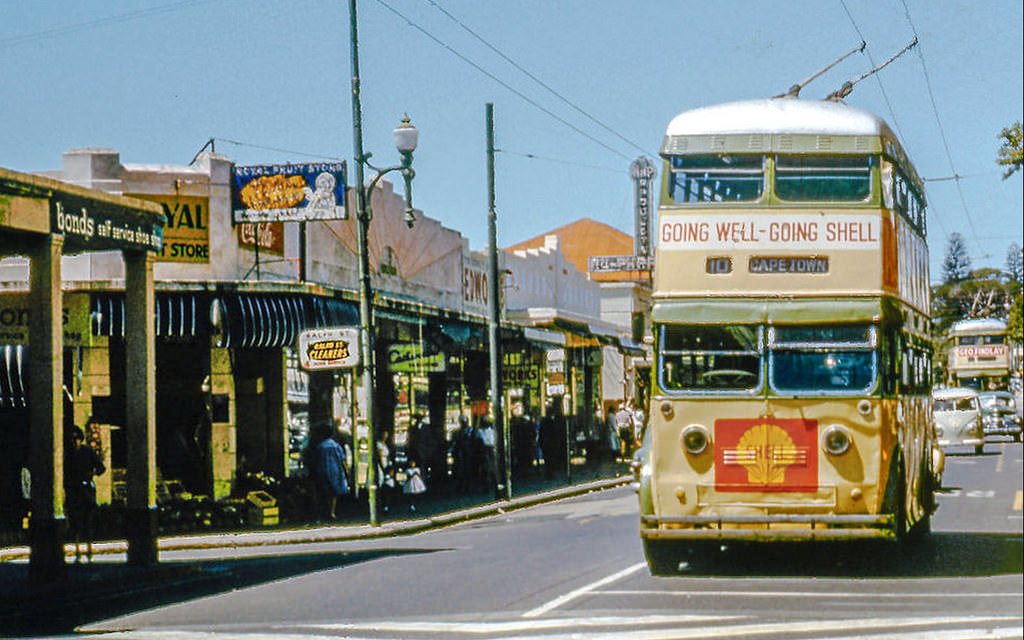
Claremont’s Main Road was one of the southern suburbs’ main commercial strips, lined with shops, cinemas, and restaurants. Claremont was a well-established middle-class suburb in 1962, its retail environment serving the growing population of the southern suburbs. The Cavendish Square shopping center, which would eventually become the hub of the area’s retail life, was still years in the future.
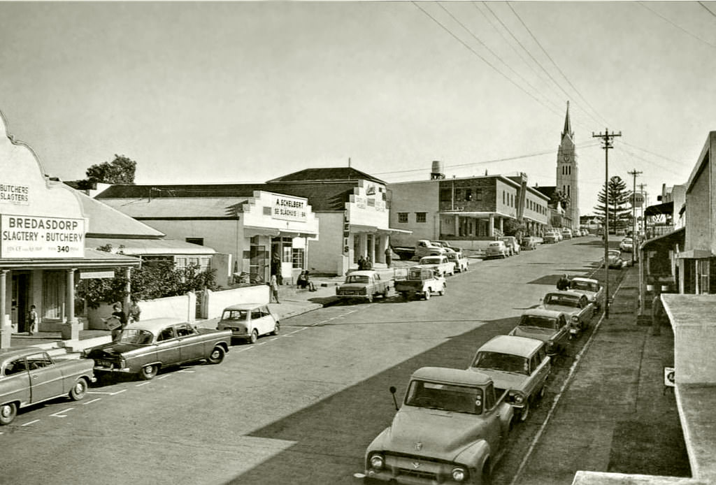
Bredasdorp, a small town in the Overberg region east of Cape Town, was a service center for the surrounding wheat and sheep farming district. Its Church Street was typical of small South African towns — a Dutch Reformed church at the center, surrounded by modest commercial buildings and the homes of the local farming community. The Overberg’s flat, wide landscapes were a sharp contrast to the mountains and coastline closer to Cape Town.
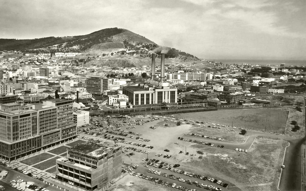
Roggebaai, at the northern edge of the CBD where it met the Foreshore, was a transitional zone between the city’s old commercial core and the newer reclaimed land development. By 1965, this area was undergoing significant change as the Foreshore development pushed further into the space that had previously been the edge of the city. The name Roggebaai — Rye Bay — referred to an inlet of Table Bay that had existed before the land reclamation.
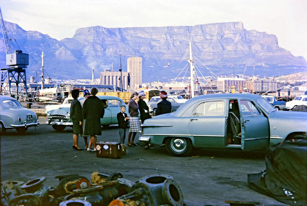
Welcoming parties at the harbor were a Cape Town tradition. When passenger ships arrived from Europe, crowds gathered on the quayside to meet returning relatives, greet arriving visitors, or simply watch the spectacle of a large liner maneuvering into its berth. The Union-Castle vessels in particular attracted these welcoming crowds — their arrival and departure was a regular rhythm in the life of the port city.
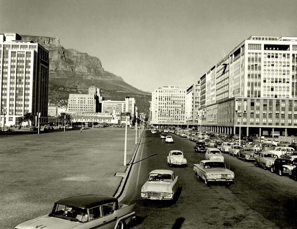
The Heerengracht boulevard — the main axis of the Foreshore development — was still relatively new in 1960. Designed as a grand processional route connecting the harbor to the CBD, it was lined with office buildings and featured the central fountain that gave it a formal civic character. The name honored the Heerengracht in Amsterdam, reflecting the Dutch colonial origins of the city at the Cape.
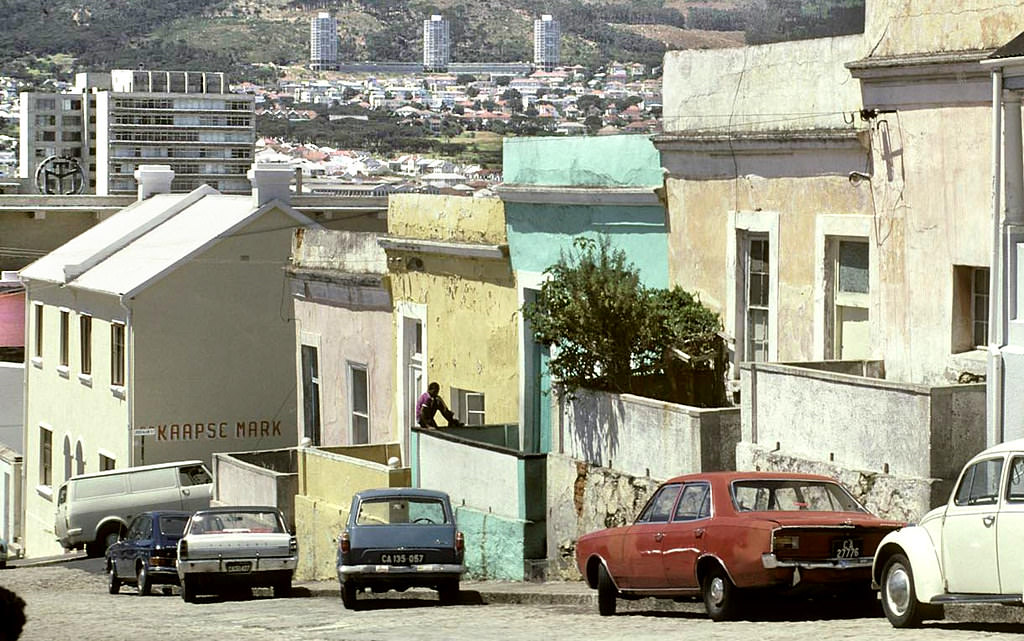
Leeuwen Street in the Bo-Kaap, photographed in 1969, shows the neighborhood as it appeared at the end of the decade. The Bo-Kaap’s survival as a Cape Malay community in the heart of Cape Town — while so many other mixed-race communities had been destroyed by forced removals — was remarkable. The neighborhood’s distinctive physical character, with its narrow streets and painted houses, had been shaped over two centuries of continuous occupation.
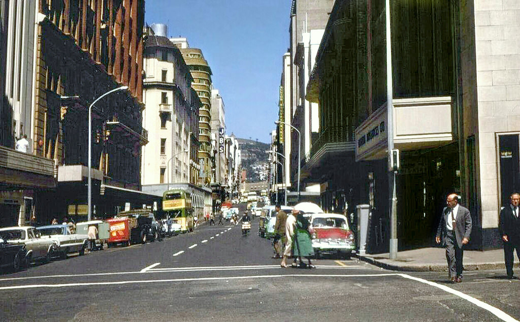
The corner of St George’s Street and Riebeeck Street was in the heart of the CBD’s commercial and office district. By 1968, this area was densely built with a mix of older Victorian commercial buildings and newer modernist office towers. The street names — St George’s, Riebeeck — reflected the city’s layered colonial history, with Dutch, British, and local references all present in the map of the CBD.
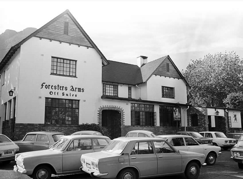
The Foresters Arms in Newlands was one of Cape Town’s most beloved pubs — a traditional English-style establishment in the leafy southern suburb known for its forests and the Newlands rugby and cricket grounds. Newlands was one of the wealthiest and most established of Cape Town’s southern suburbs, its tree-lined streets and Victorian homes making it a sought-after address. The Foresters Arms remained a local institution for decades.
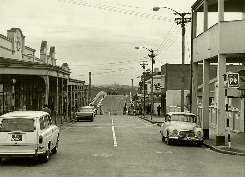
The construction of a new rail bridge at Observatory in November 1967 was part of ongoing investment in Cape Town’s commuter rail network. Observatory, a suburb south of the CBD, was home to the South African Astronomical Observatory — established in 1820 — as well as a working-class residential community. The suburb sat on the main suburban rail line running south to Simonstown.
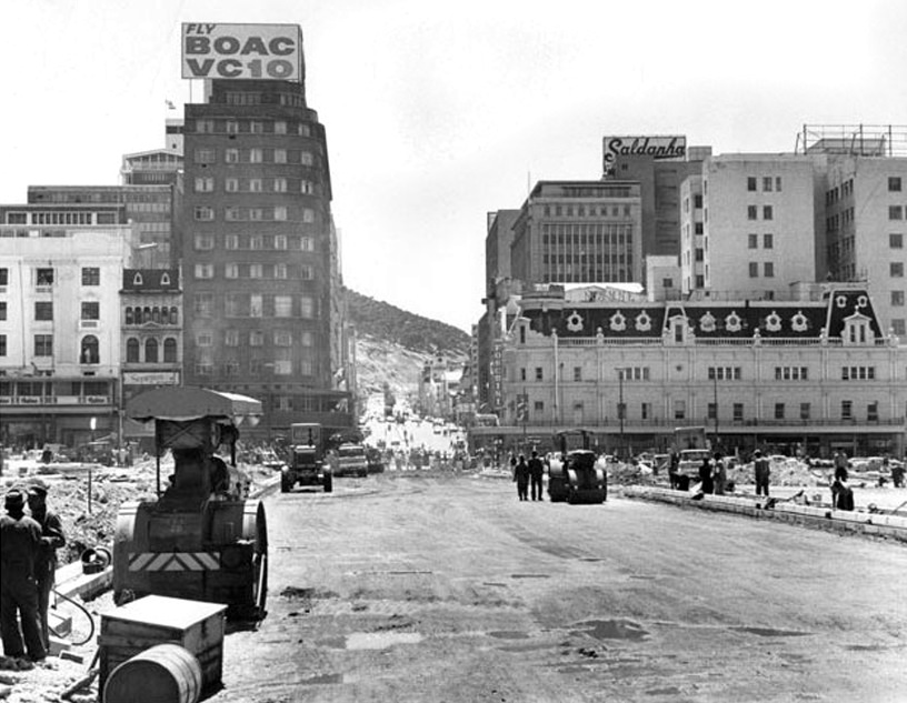
The extension of Strand Street in 1968 was part of a broader effort to improve traffic flow through the CBD and connect the city center more effectively to the Foreshore and the harbor. Road construction was a major theme of 1960s Cape Town — the growth of car ownership created pressure on the city’s Victorian-era street grid, and planners responded with road widening, new bypasses, and the ambitious freeway projects that were under development.
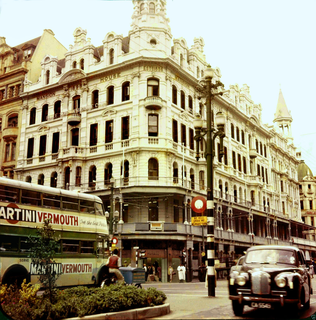
The Fletcher and Cartwright Building at the corner of Darling and Adderley Streets was one of the anchors of Cape Town’s retail district. Its prominent corner position made it one of the most visible commercial buildings in the city. The intersection it dominated was one of the busiest in Cape Town — a constant flow of pedestrians, buses, and vehicles passing beneath it throughout the day.
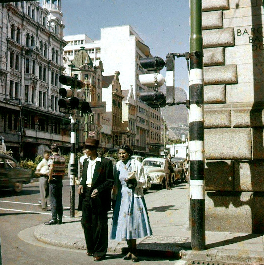
Shortmarket Street, running between Long Street and St George’s Mall in the CBD, was a busy pedestrian route in 1960. The street connected the retail heart of the CBD to the areas around Greenmarket Square, and its pavements were crowded with shoppers and office workers moving between destinations. The name referred to the short section of market that had historically operated on this block.
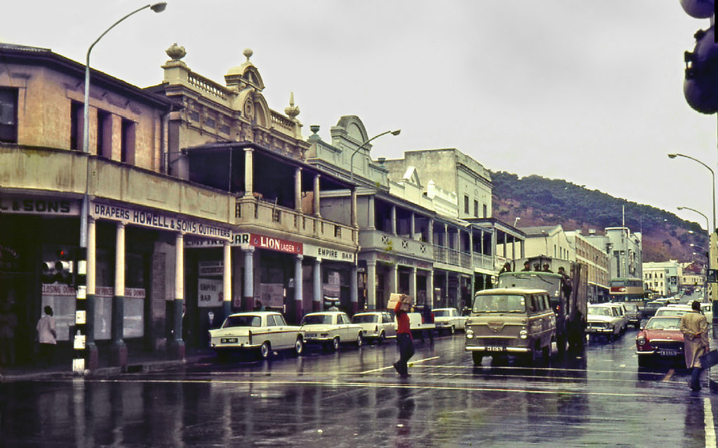
Cape Town’s winter of 1968 brought heavy rain and strong winds, as it did most years. The city’s Mediterranean climate concentrated its rainfall in the winter months — June, July, and August — often bringing severe weather off the Atlantic. For the residents of the Cape Flats, whose informal and under-built homes offered little protection from the elements, winter was a particularly difficult season.
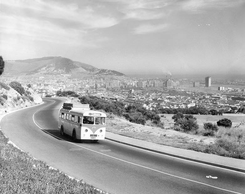
De Waal Drive in 1964 carried the traffic of thousands of commuters between the southern suburbs and the city center each day. The road’s position on the lower slopes of Devil’s Peak gave it a character quite unlike the flat suburban streets below — winding through stands of trees and offering intermittent views across the Cape Flats. Named after the politician and businessman David de Waal, it had been one of the city’s main arterial routes since the early 20th century.
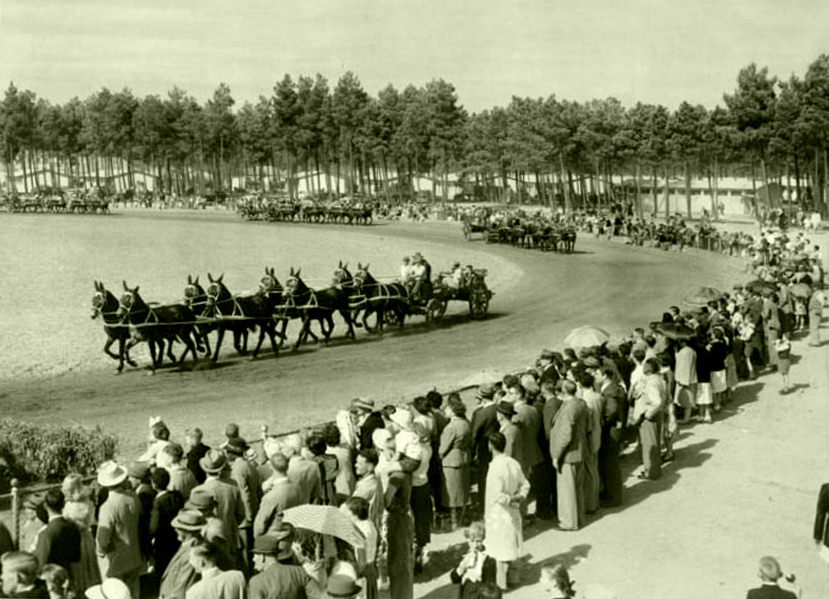
The Goodwood Show — the Royal Agricultural Show held at the Goodwood showgrounds north of Cape Town — was one of the most significant annual events in the Cape calendar. Farmers from across the Western Cape brought their livestock, produce, and equipment to compete and display. Mule teams, still in use on some farms in 1960, were a reminder that agriculture in the Cape was not yet fully mechanized.
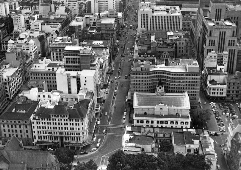
Looking north down Adderley Street in 1962 — toward the Foreshore and the harbor — the city’s commercial center was a dense mix of Victorian stone buildings and newer concrete structures. The street’s commercial vitality was undeniable: shops were busy, buses moved through regularly, and pedestrians filled the pavements. The city was prosperous, growing, and modernizing — while simultaneously enforcing the brutal racial policies that defined the era.
Plein Street, running along the edge of the parliamentary precinct in Cape Town, was where the South African Parliament sat — the legislature that passed every apartheid law in the country’s statute book. The Parliament building, a monumental colonial structure, dominated the southern end of Plein Street. In 1963, Parliament was in the process of extending apartheid legislation further, tightening the racial laws that governed every aspect of South African life.
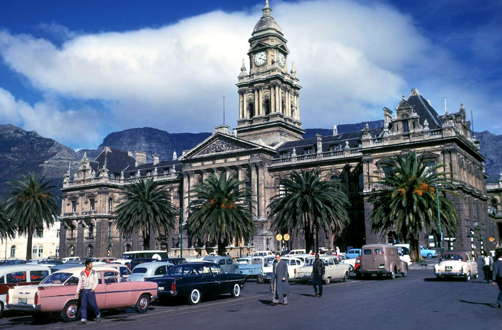
Another view of the Grand Parade in winter 1961 captures the square’s energy on a clear, cold day. Cape Town winters could be bright and beautiful between the storms — days of sharp blue sky and cold air when the mountain showed itself with extraordinary clarity. On those days, the Parade’s market attracted large crowds, drawn out by the sunshine despite the chill.
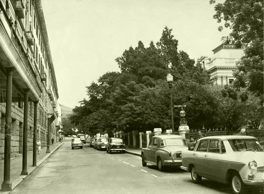
Parliament Street in 1962 was at the center of South Africa’s political geography. The Houses of Parliament, the Prime Minister’s residence (Tuynhuys), and various government buildings clustered in this precinct. Hendrik Verwoerd — the architect of apartheid’s most systematic implementation — was Prime Minister until his assassination in September 1966. In 1962, his government was pushing through some of the most repressive legislation in the apartheid canon.
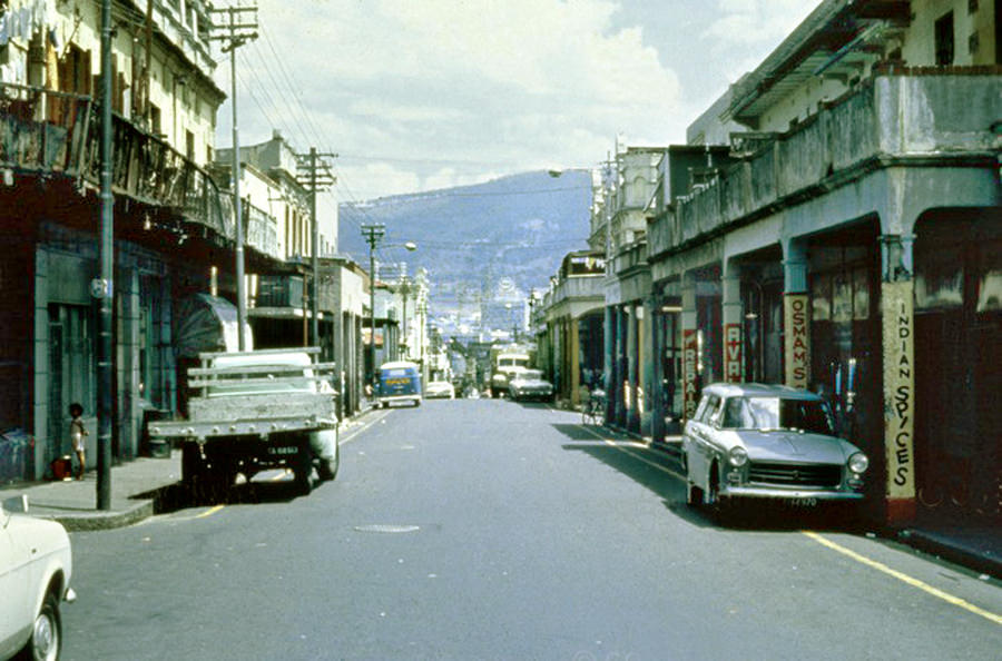
By 1969, Hanover Street in District Six was in the final years of its existence as a living neighborhood. Demolitions had been underway since the late 1960s, and the community was being systematically dismantled. The buildings visible in this photograph — shops, homes, institutions — represent a neighborhood that had existed for over a century and was being erased by government decree. Many of the people who lived on this street would spend the rest of their lives in the Cape Flats, carrying the memory of what had been taken from them.
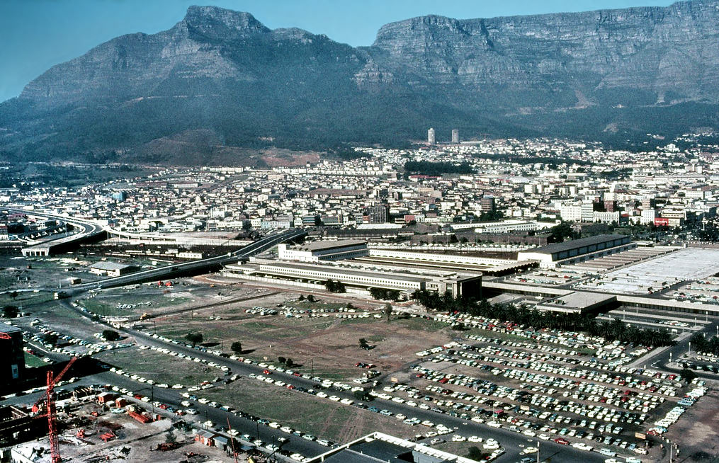
Looking southeast from Cape Town’s center in 1969, the view extended across the Cape Flats to the distant Hottentots Holland mountains. The flat expanse of the Cape Flats — where tens of thousands of forced removal victims had been relocated in hastily built township houses — was visible from the elevated parts of the city. The geography made the injustice literal and visible: the displaced could often see the mountain and the city they had been removed from.
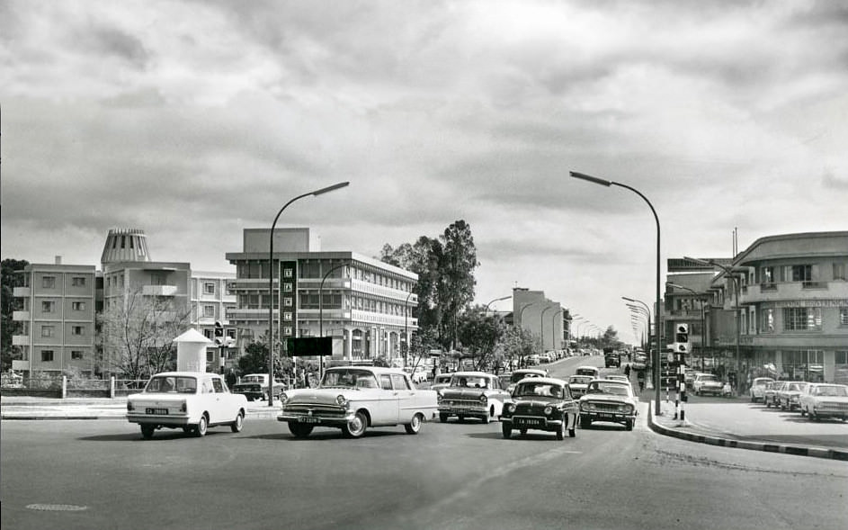
Voortrekker Road was the main commercial artery of Cape Town’s northern suburbs — Goodwood, Parow, Bellville, and beyond. It was a long, busy road lined with shops, factories, and service businesses, running northeast from the city center through the heart of the Afrikaner-dominated suburbs. By 1968, this corridor was heavily industrialized and heavily trafficked, serving both commuters and commercial vehicles.
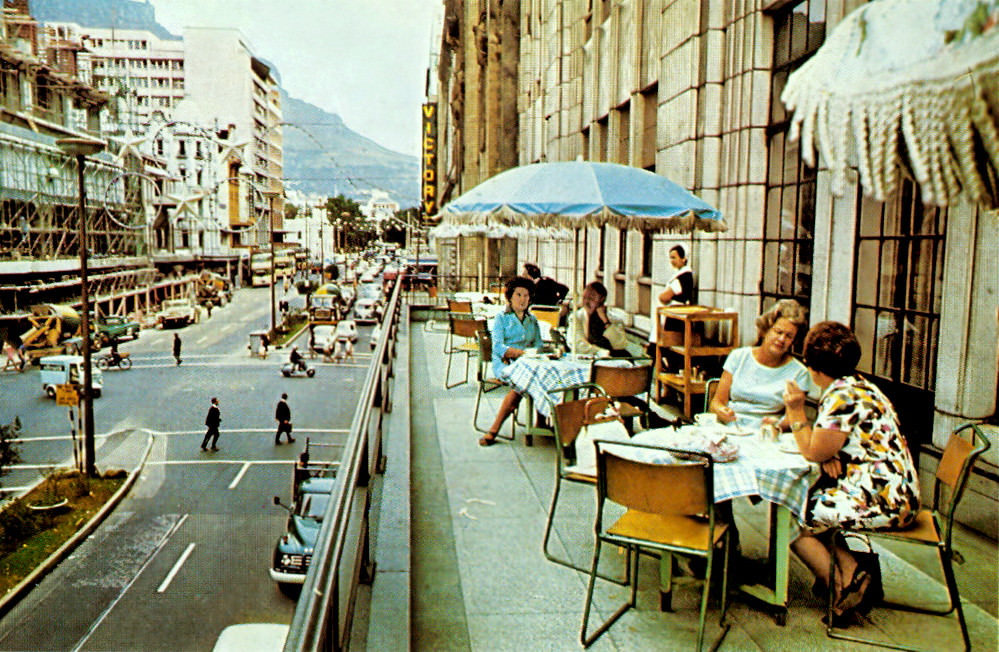
Stuttafords department store’s Adderley Street balcony offered a grandstand view of Cape Town’s busiest street. The store was one of the premier retail establishments in the city — its merchandise aimed squarely at the upper end of the white consumer market. Shopping at Stuttafords was an aspiration for many Capetonians, and the store’s prominent Adderley Street location made it one of the city’s most recognizable retail institutions.
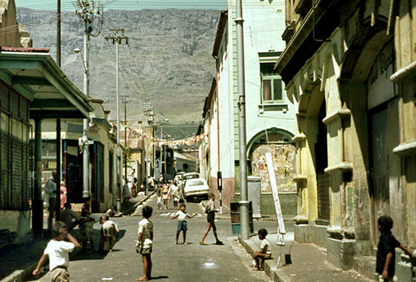
District Six in 1969 was a neighborhood in the process of being destroyed. The government had declared it white in 1966, and the forced removal of its nearly 60,000 residents was underway. Buildings were being bulldozed block by block. The land that remained after the demolitions sat largely empty for decades — a wasteland at the foot of Devil’s Peak that became a monument to the destructiveness of apartheid’s spatial policies.
Hout Street, in the CBD, ran between the older commercial blocks of the city center. Looking up it in 1969, the mix of older Victorian facades and newer concrete buildings was characteristic of a CBD in transition. The street’s name — Hout, the Afrikaans word for wood — referred to the timber that had been stacked and traded in the area during the earliest period of the Cape settlement.
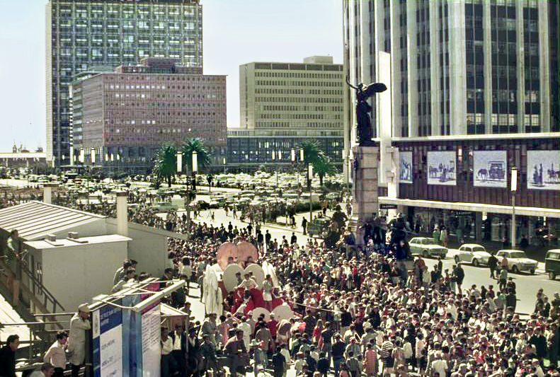
The University of Cape Town’s annual Rag — a fundraising parade through the city center — was one of the city’s most colorful annual events. Students decorated floats, dressed in costumes, and marched through the CBD collecting money for charity. UCT’s Rag was also an occasion for political expression — students used it to make statements about apartheid and other issues. In March 1968, Cape Town was watching Nelson Mandela serve his sixth year of a life sentence on Robben Island, just 11 kilometers from the city center.
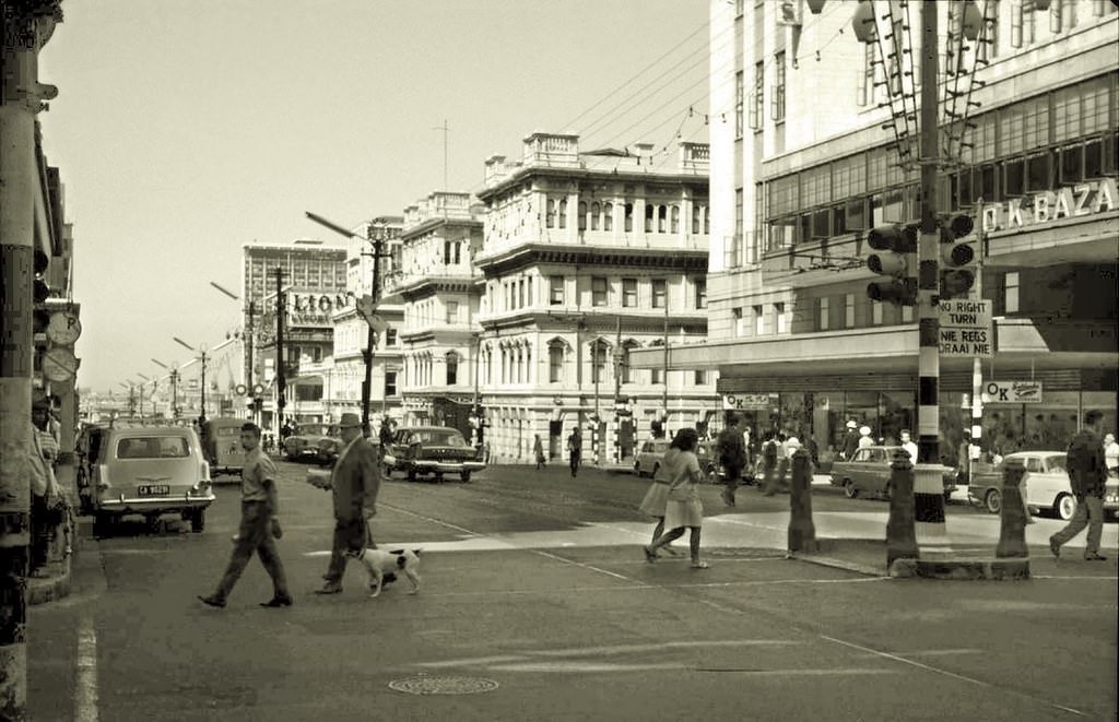
Adderley Street in 1963 photographed from a slightly different angle shows the street’s full commercial depth. The mix of pedestrians, buses, and private cars created a constant flow of movement. The street’s retail offerings ranged from upmarket department stores to smaller specialty shops, giving it a varied commercial character that drew shoppers from across the city and the peninsula.
Street-side grooming and barbering were common services in Cape Town’s commercial areas. Barbers set up in shops and stalls across the city, offering haircuts and shaves to working men. The informal service economy — shoe-shiners, food sellers, newspaper vendors, street barbers — was a vital part of the city’s fabric, providing livelihoods for people excluded from more formal economic participation by apartheid’s labor laws.
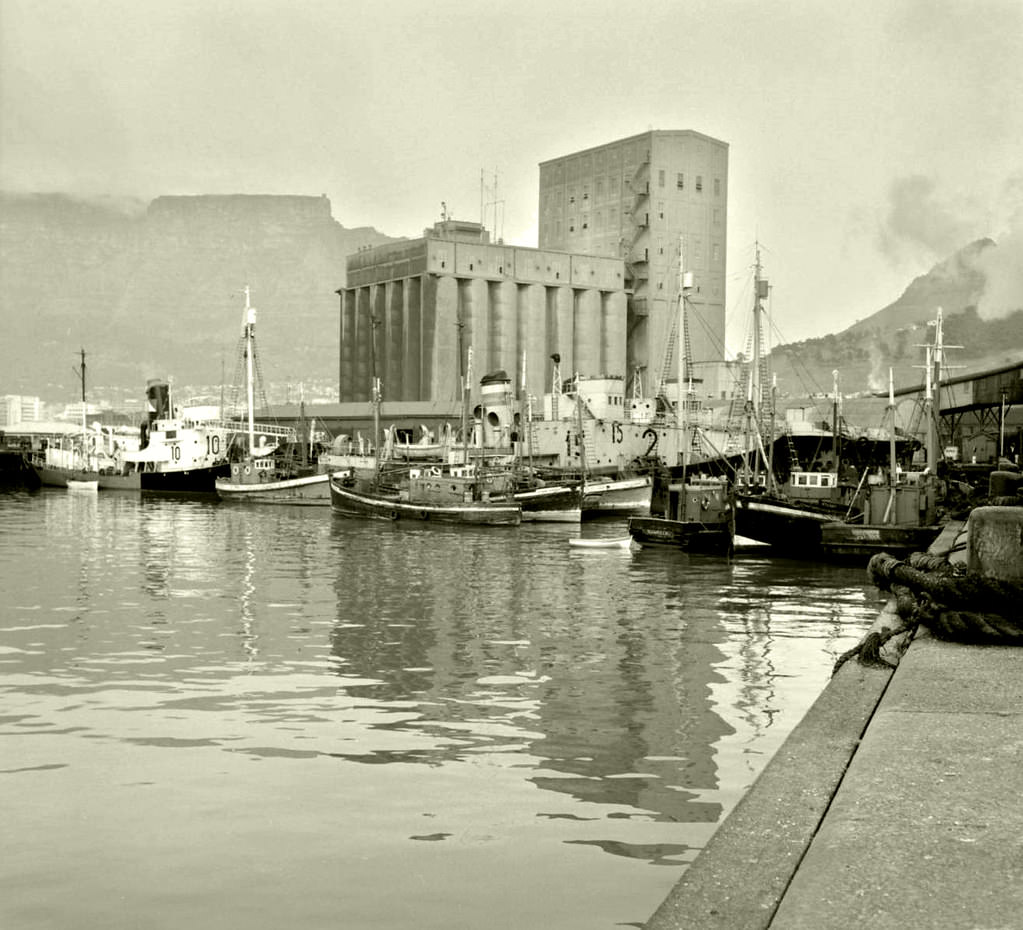
Cape Town’s grain elevator at the harbor — separate from but related to the grain silo complex — was part of the port’s food-handling infrastructure. Grain arriving by ship or departing for export moved through this facility. The harbor’s grain-handling capacity was an important part of South Africa’s agricultural export infrastructure, connecting the country’s interior wheat farms to international markets via the Cape.
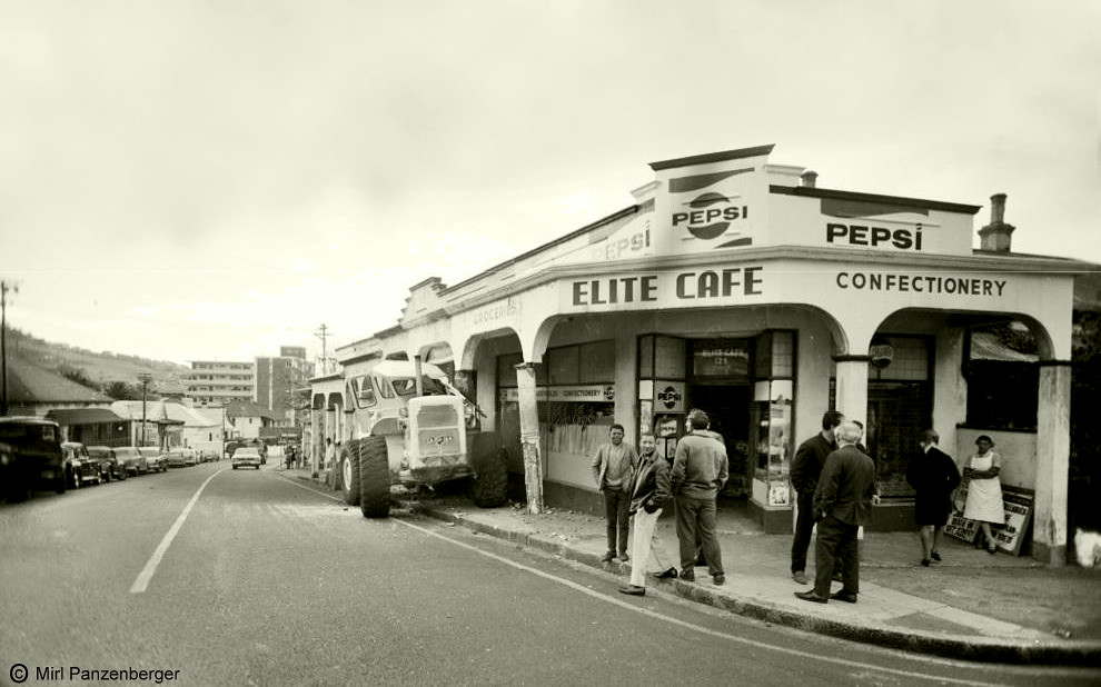
Kloof Street, climbing from the CBD up toward the southern suburbs, was one of Cape Town’s more challenging urban arteries. Its steep gradient and narrower roadway created traffic and infrastructure challenges — the “Kloof Street problem” of 1960 apparently referring to some specific engineering or traffic issue on this route. The street connected the Gardens neighborhood to the wealthier suburbs above, making it a significant commuter route.
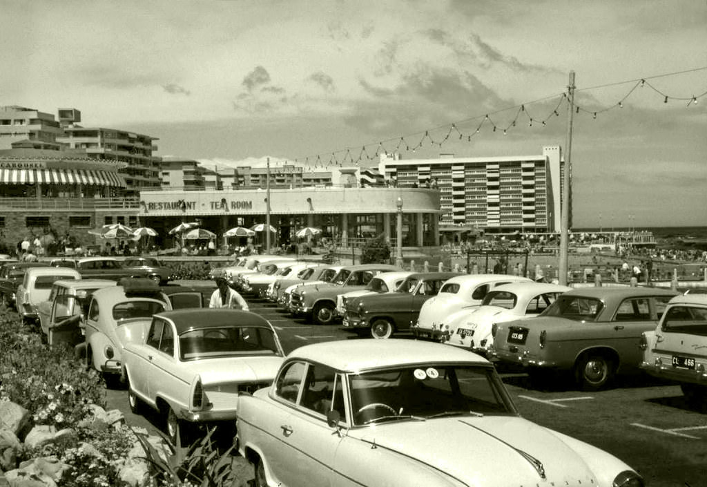
The Carousel in Sea Point was a popular entertainment venue — a fairground-style attraction that drew families to the beachside suburb. Amusement facilities like this were part of Sea Point’s character as both a residential suburb and an entertainment destination. The Atlantic shoreline, the swimming pool, and attractions like the Carousel made Sea Point one of Cape Town’s liveliest and most visited suburbs.
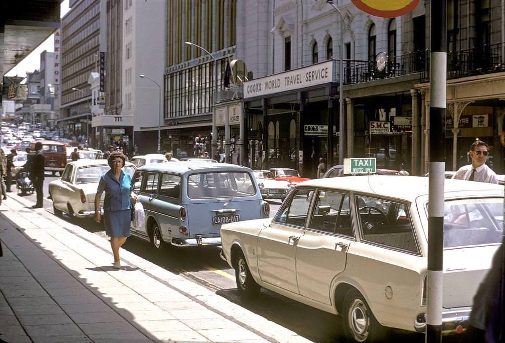
Strand Street in 1968, photographed during the construction of its extension, shows a city actively reshaping its own infrastructure. The street ran along what had once been the shoreline of Table Bay — today it sits several hundred meters inland, separated from the sea by the Foreshore’s reclaimed land. The construction work visible here was part of the broader effort to modernize the CBD’s road network.
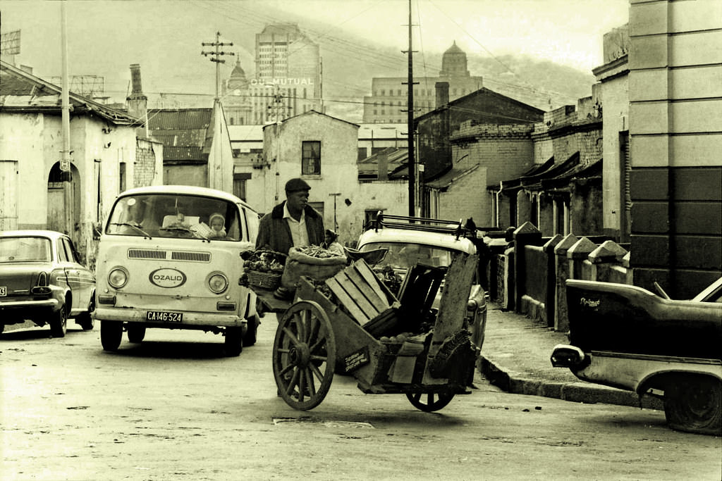
Another view of District Six in 1969 records what remained of a neighborhood that had been vibrant just three years earlier. The demolitions of the forced removal had already taken significant chunks out of the built fabric. Streets that had teemed with life — music from the jazz clubs, conversations in Afrikaans and English, the smells of Cape Malay cooking — were falling silent as buildings came down and families left.
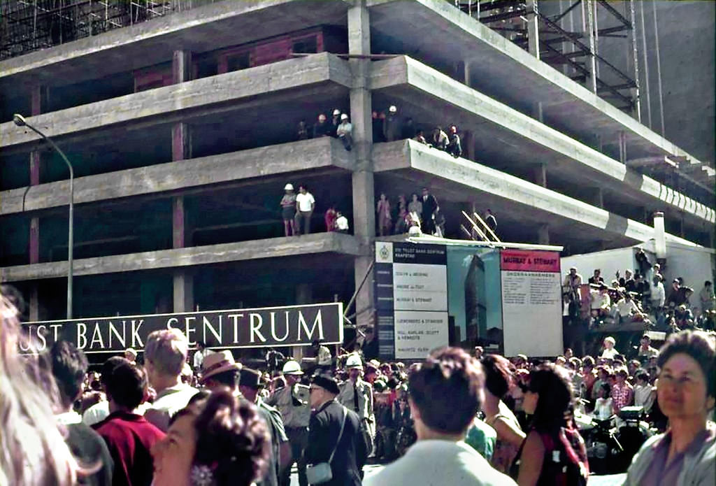
The Trust Bank Building, under construction in March 1968, was one of several major new office towers rising in Cape Town’s CBD during this period. Trust Bank — later absorbed into ABSA — was one of the major Afrikaner financial institutions that had grown rapidly in the post-war years. Its Cape Town headquarters building represented the confidence of Afrikaner capital at the height of the apartheid era’s economic boom.
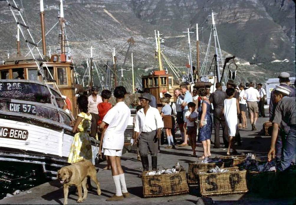
Hout Bay in 1968 retained the character of a working fishing village despite its growing popularity as a destination for day-trippers from Cape Town. The harbor was the center of economic life — its fish processing plant, cold storage facilities, and boat yards providing employment for the local community. The mountains surrounding the valley and the long beach at Chapman’s Bay gave Hout Bay a natural setting of exceptional beauty.
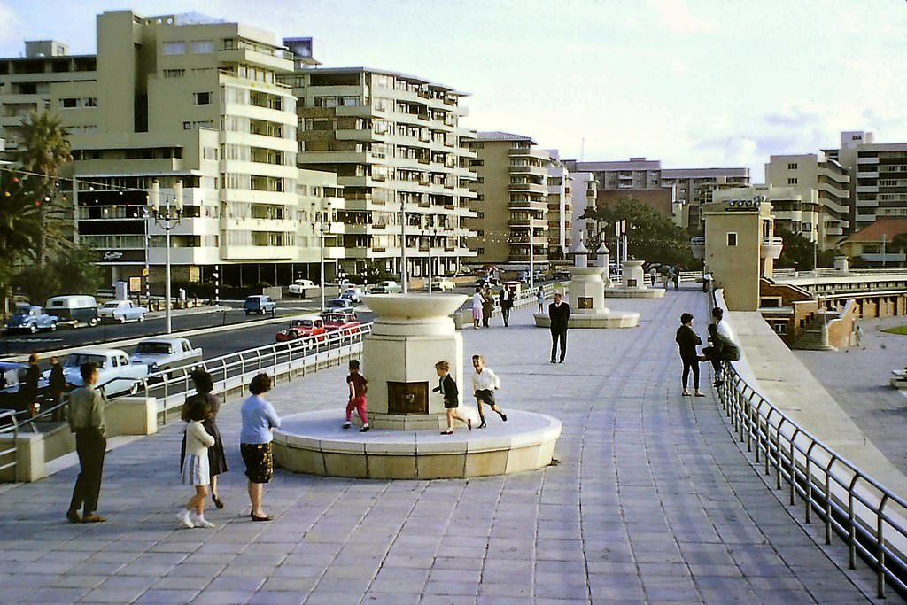
The Sea Point Pavilion pool in April 1964 — early autumn in the Cape — was still drawing swimmers before the winter closed in. The tidal pool, filled by seawater from the Atlantic, was a fixture of Sea Point’s social life. Its location on the rocky shoreline, with waves visible beyond the pool walls, gave it a dramatic setting. Under apartheid, the pool was designated for white users only — a restriction that remained in place until the 1980s.
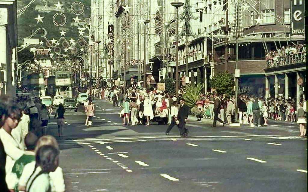
The UCT Rag procession through Cape Town’s streets attracted crowds of spectators who lined the route to watch the students’ floats and costumes. The Rag was a moment when the university’s community stepped outside the campus and into the city’s public life. It was also a moment when political commentary — particularly about apartheid — could be made in a slightly more public way than usual, embedded in the humor and spectacle of the student parade.
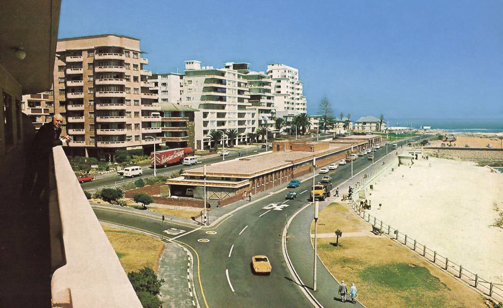
The Sea Point Aquarium was one of Cape Town’s popular public attractions in the 1960s. It showcased the marine life of the surrounding ocean — the cold, nutrient-rich waters of the Benguela Current supported an extraordinary diversity of fish, sharks, rays, and invertebrates. The aquarium was a place where Capetonians could encounter the underwater world of the sea that surrounded their city on three sides.
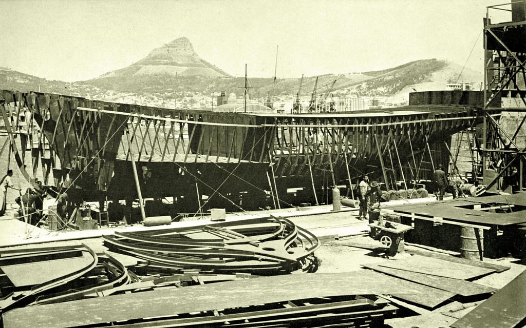
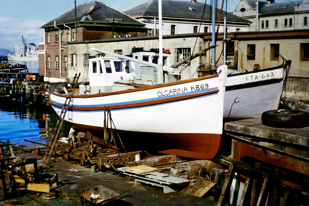
Shipbuilding and repair at Cape Town’s harbor was a significant industrial activity in the 1960s. The port’s facilities included dry docks capable of handling large vessels, and the ship repair industry employed significant numbers of skilled workers. The harbor’s strategic position made it an important maintenance stop for shipping traversing the route between Europe and Asia, particularly after the Suez Canal crisis of 1956 had demonstrated the route’s continued importance.
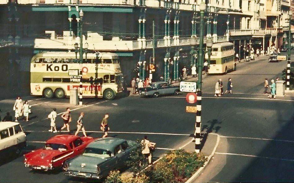
Cartwright’s Corner, photographed again from a slightly different angle in 1960, was a key reference point in the CBD’s commercial geography. It sat at the intersection of several important pedestrian and vehicle routes, making it a natural gathering and passing-through point. The building’s commercial tenants — shops and offices — benefited from the exceptional foot traffic that the corner location generated.
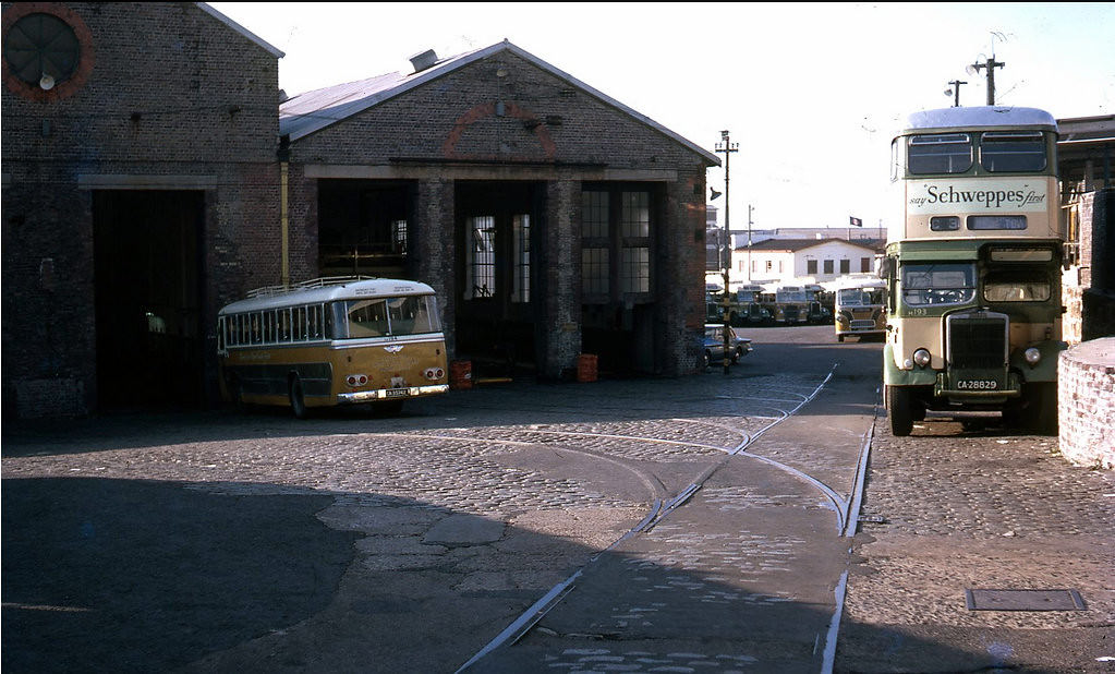
The Tollgate Depot in 1969 served as a hub for Cape Town’s municipal bus network. The city’s public transport system was undergoing changes during this period as the demand for suburban bus services grew with the expansion of the city’s residential areas. The depot’s operations were essential to keeping the buses running — maintaining vehicles, scheduling routes, and managing the workforce that drove and maintained the fleet.
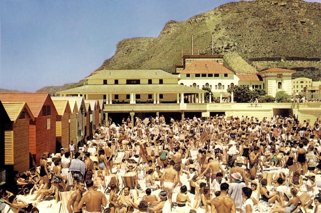
The Snakepit was a colloquial name for a section of Muizenberg’s beachfront — a gathering spot for the local surfing community. By the late 1960s, surfing was becoming increasingly popular in South Africa, with the warm False Bay waters of Muizenberg providing ideal conditions for beginners. The surfing culture that was developing at Muizenberg and across the Cape Peninsula in the late 1960s was one of the more explicitly integrated youth cultures of the apartheid era.
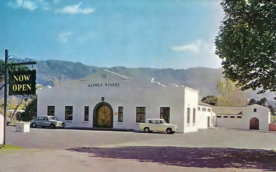
The Alphen winery in Constantia was part of one of the oldest wine-producing areas in South Africa. Constantia Valley, just south of Cape Town, had been producing wine since the late 17th century — the Grand Constance dessert wine produced there had been famous throughout Europe in the 18th and 19th centuries, reportedly enjoyed by Napoleon Bonaparte and Jane Austen. By 1968, the valley’s wineries were producing quality wines in a more modern style.
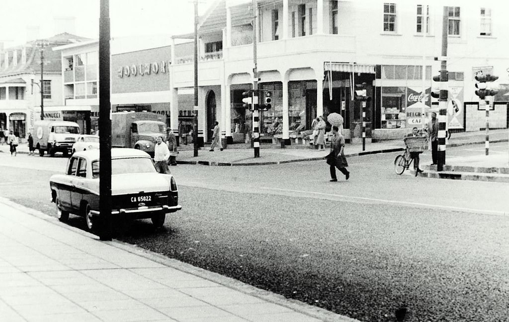
Main Road in Sea Point was the suburb’s commercial spine — lined with shops, restaurants, cafes, and apartment buildings. It was one of Cape Town’s most consistently busy streets, serving the dense residential population of Sea Point and the constant flow of visitors to the beachfront. The suburb’s mix of working-class Jewish families, Portuguese immigrants, and longer-established Capetonians gave it a diverse character unusual for a whites-only suburb under apartheid.
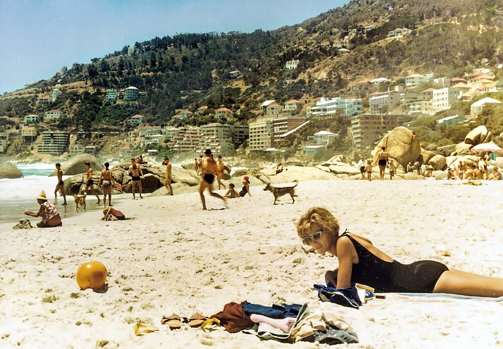
Fourth Beach at Clifton was one of Cape Town’s most fashionable gathering spots throughout the 1960s. Protected from the southeaster wind by the rocky outcrop of Lion’s Head, it offered conditions that the more exposed beaches of Sea Point and Camps Bay could not match. The water was cold — fed by the Benguela Current upwelling — but the shelter and the social scene made it enormously popular with Cape Town’s white residents.
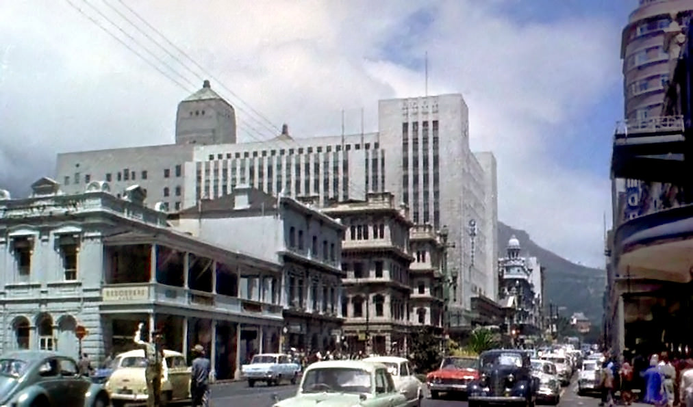
Traffic police directing vehicles at Adderley Street intersections in 1965 were a familiar sight in the CBD. Before traffic lights fully took over, officers on point duty managed the flow of vehicles at busy intersections — a physically demanding job that required constant attention and clear signals. The volume of traffic on Adderley Street by 1965 made effective traffic management essential to keeping the city moving.
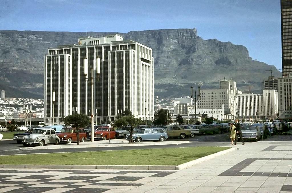
The Paul Sauer Building was one of the government office buildings in Cape Town’s parliamentary precinct. Named after a National Party politician, it housed administrative functions associated with the Cape’s provincial and national government. Government buildings in the parliamentary precinct were among the most secure and restricted in the city — places where the apartheid system’s legislative and administrative machinery operated.
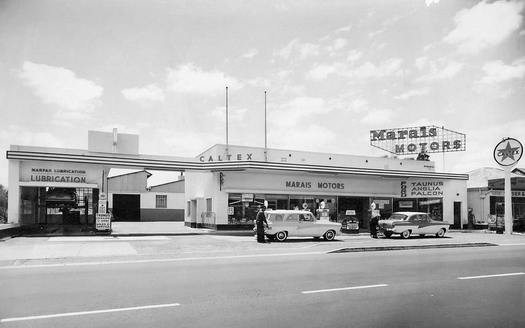
Voortrekker Road in Bellville in 1962 was a busy commercial strip serving the suburb’s growing population. Bellville was one of the fastest-growing areas in the Cape metropolitan region during the 1960s, as Afrikaner families moved out from the city center into the northern suburbs. The suburb had its own municipality and a strong civic identity built around Afrikaner cultural institutions.
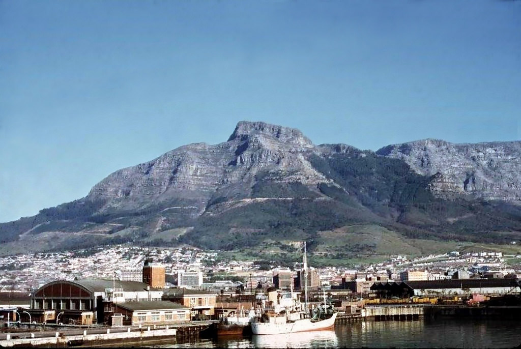
The slopes of Table Mountain in 1968 still carried significant stands of pine and other alien trees that had been planted in the 19th and early 20th centuries. The caption’s nostalgic note — “when Table Mountain still had a forest” — refers to the clearing programs that would eventually remove much of this alien vegetation in later decades as conservation priorities shifted toward restoring the mountain’s natural fynbos cover. In 1968, the trees were still a defining feature of the mountain’s lower slopes.
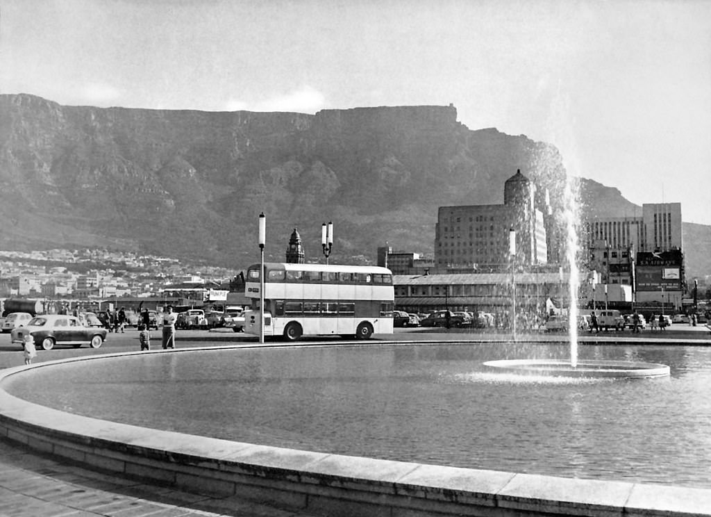
The opening of a new fountain in Cape Town in 1960 was a civic event — a small addition to the city’s public realm that marked a moment of municipal pride. Public fountains had been part of Cape Town’s landscape since the colonial period, providing drinking water before indoor plumbing became universal and serving as decorative features in public spaces. New civic infrastructure, however modest, was a regular feature of Cape Town’s development throughout the decade.
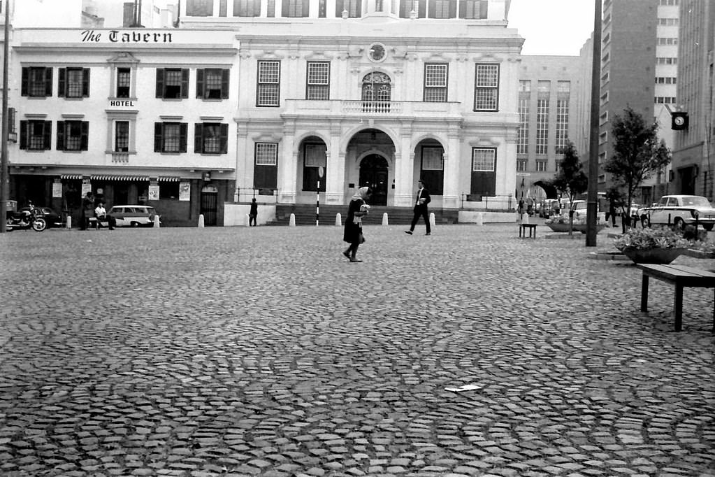
Greenmarket Square in 1967 was in regular use as a market space and public gathering point. The square was surrounded by some of Cape Town’s most historic buildings, including the Old Town House — a beautifully preserved 18th-century structure that had served as Cape Town’s first town hall. The combination of the historic architecture and the lively market activity made Greenmarket Square one of the city’s most distinctive public spaces.
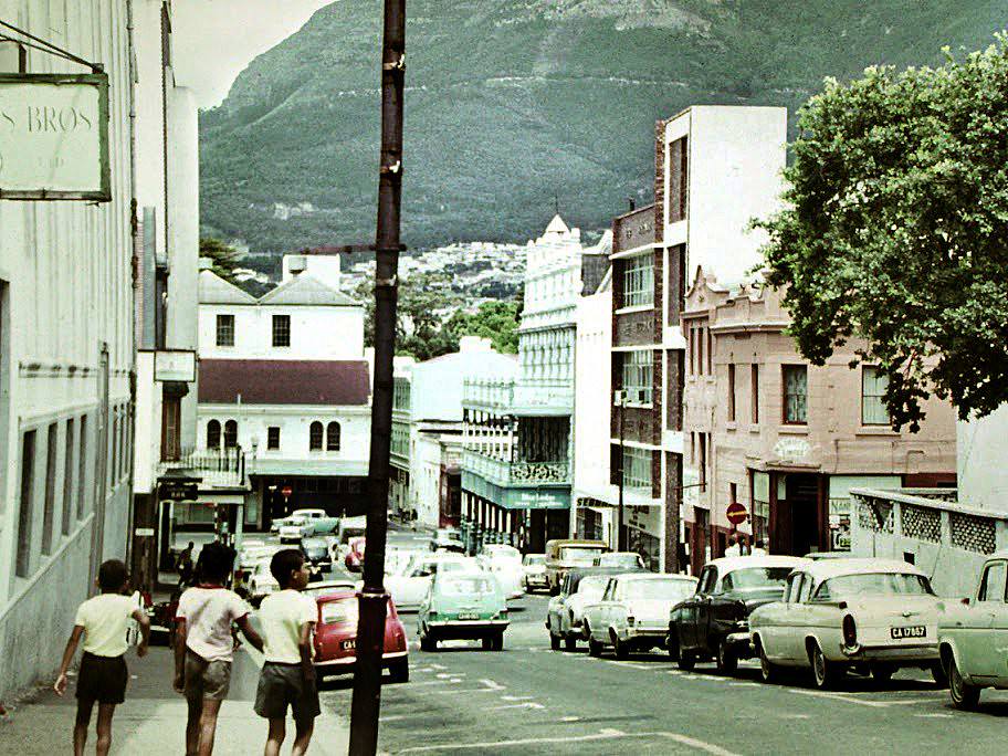
Bloem Street — Bloem being the Afrikaans word for flower — was a residential street in the Gardens neighborhood between the CBD and the southern suburbs. By 1967, this area had a mix of older Victorian houses and newer apartment buildings. Its proximity to the parliamentary precinct, the Company Gardens, and the major hospitals on the mountain slopes made it a convenient address for professionals and government workers.
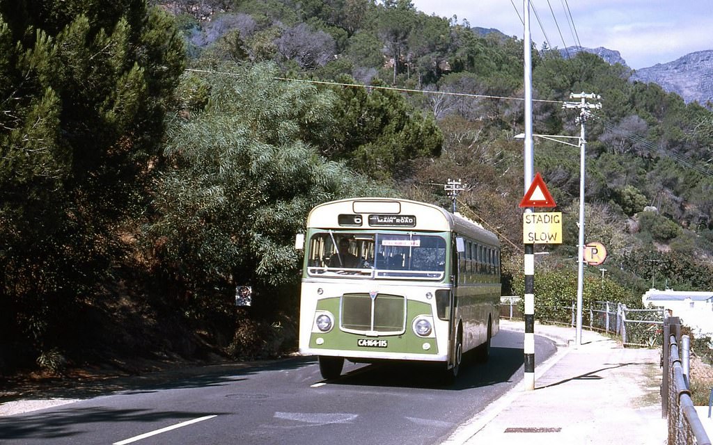
Kloof Road above Clifton was one of Cape Town’s most scenic drives — a winding route along the Atlantic seaboard that connected Sea Point to Camps Bay, offering dramatic views of the ocean and the Twelve Apostles mountain range. By 1969, the road was increasingly lined with luxury residential developments taking advantage of its exceptional views. Access to this part of Cape Town was, under apartheid, restricted to white residents.
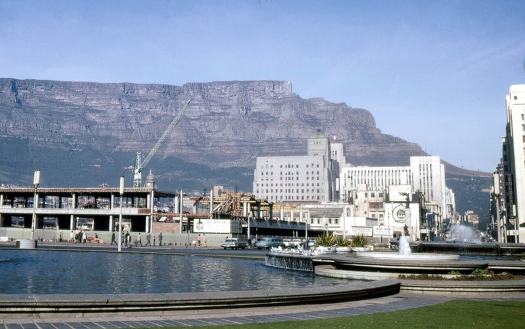
The “new” Cape Town station, beginning its construction in 1960 as part of the Golden Acre development, was intended to modernize the city’s main rail terminus. The project was one of the most significant urban redevelopment undertakings of the decade, combining a new rail station with a large commercial complex above it. The Golden Acre shopping center that eventually opened on the site in 1978 was one of the largest in South Africa.
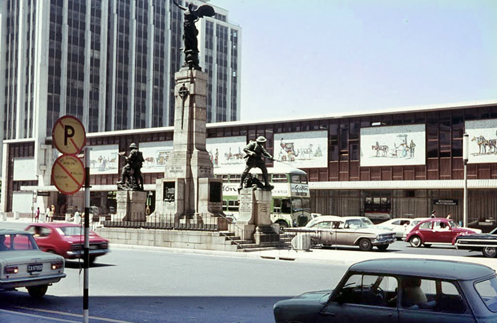
Cape Town’s war memorial stood near the City Hall as a monument to South Africans who gave their lives in the First and Second World Wars. Annual Remembrance Day ceremonies brought politicians, military officials, and veterans to the memorial. By 1969, the memorial was also a reminder of how much had changed since the Second World War — South Africa’s withdrawal from the Commonwealth, the deepening of apartheid, and the country’s increasing international isolation.
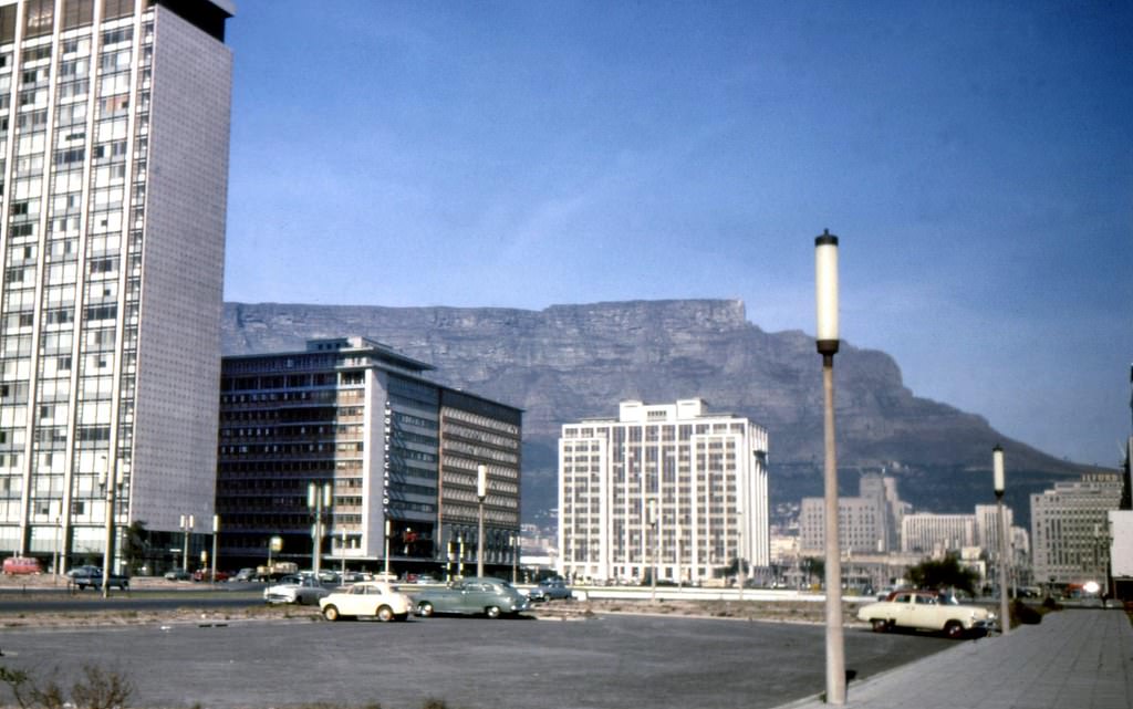
The Foreshore in 1962 was still very much a work in progress. Large areas of the reclaimed land remained undeveloped — open plots waiting for the office buildings, roads, and civic structures that planners had intended for them. The scale of the land reclamation was impressive: hundreds of hectares had been added to Cape Town’s urban area by removing the shallow waters of Table Bay’s southern shore.
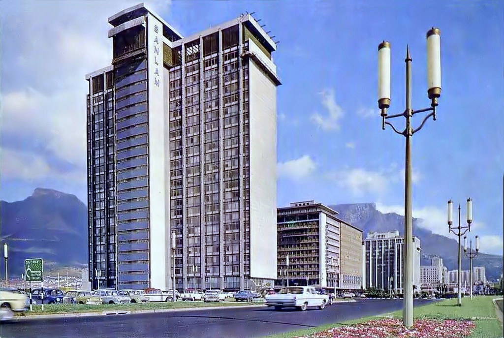
The Sanlam Centre — the building being referred to here as it neared completion — was one of the defining additions to Cape Town’s skyline in the early 1960s. Its height and modern design made it instantly recognizable, and it quickly became a reference point for navigating the CBD. The Sanlam company, as one of South Africa’s largest financial institutions, was deeply embedded in the apartheid economy — its growth during this period was built on the same racial economic structures that kept non-white South Africans impoverished.
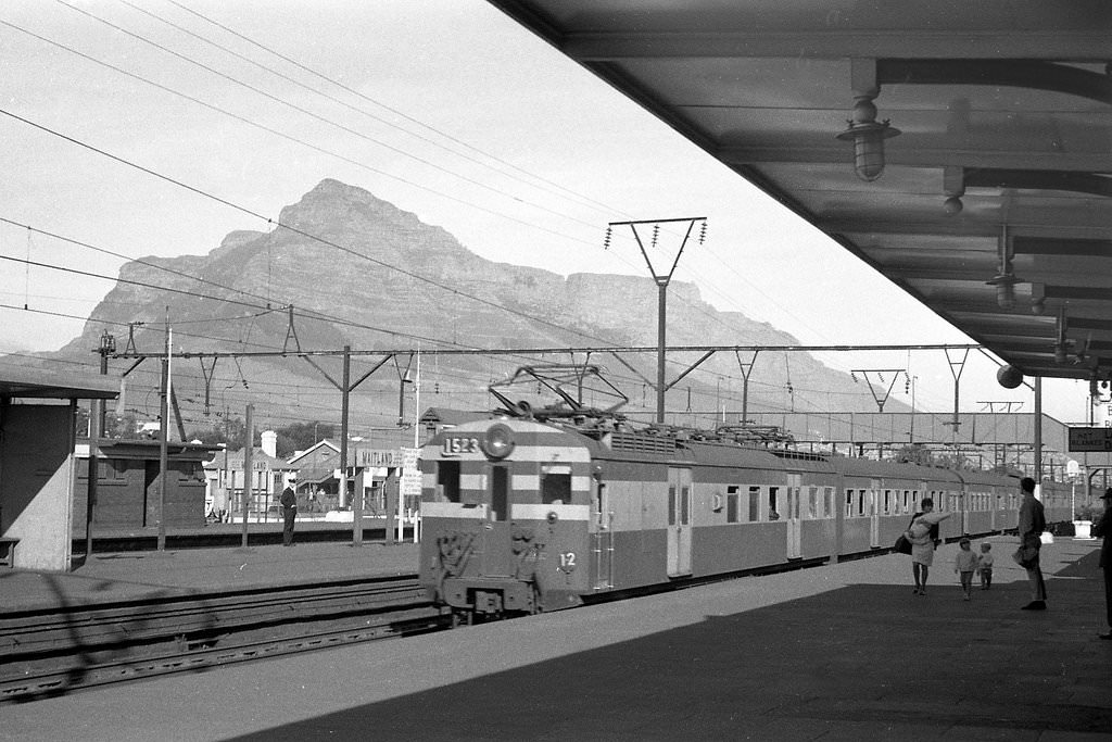
Maitland, a suburb between the CBD and the northern suburbs, was home to light industry and working-class residential areas. Its railway station was part of the main line running north from Cape Town toward Bellville and beyond. Maitland’s industrial character — it had abattoirs, factories, and transport depots — made it a working suburb rather than a fashionable residential address, though it was home to many working-class families.
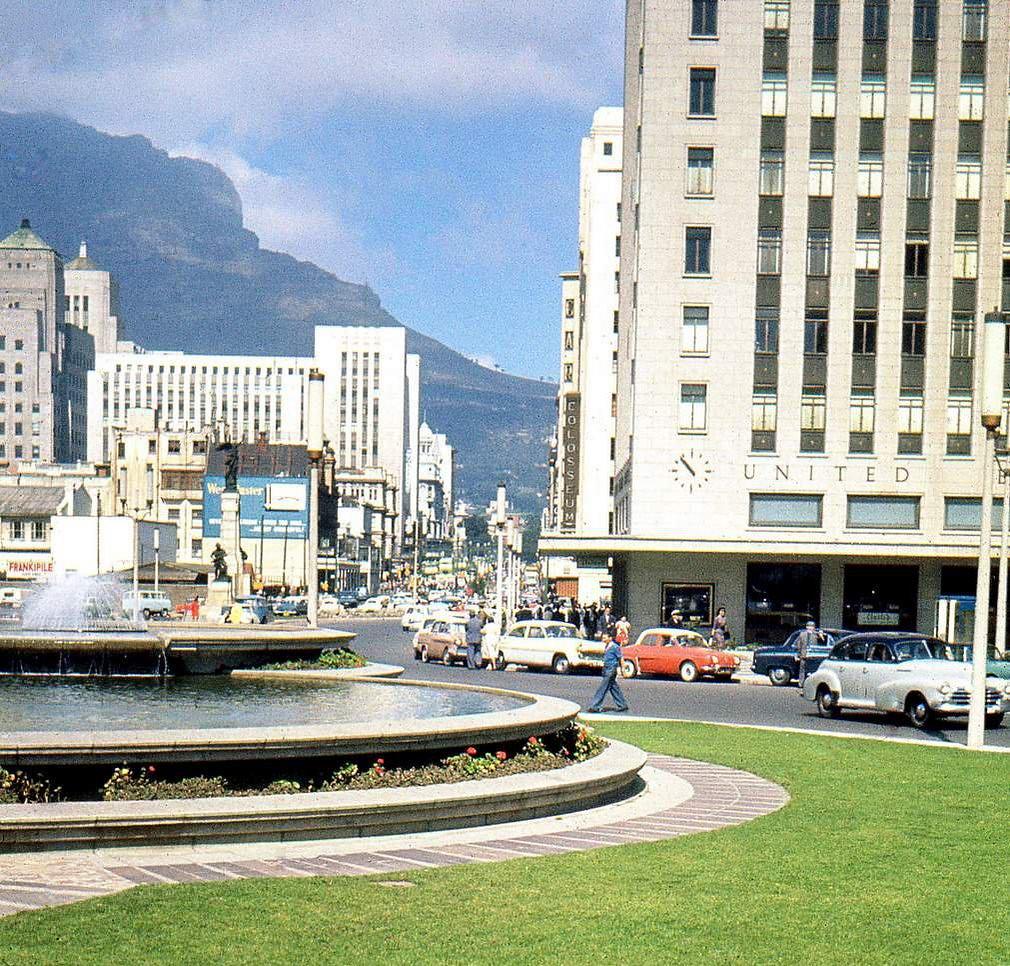
Adderley Street in 1962, photographed from yet another angle, shows the street’s consistent commercial vitality throughout the early part of the decade. The mix of older and newer buildings, the flow of pedestrians, and the presence of buses moving through the CBD all reflect a city that was economically active and physically changing. The political pressures of the apartheid system ran underneath this surface of commercial normality.
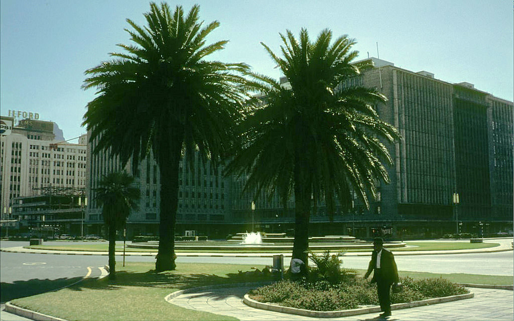
The Heerengracht in 1969, toward the end of the decade, showed how the Foreshore had developed since the early 1960s. New office buildings had risen along the boulevard, and the road infrastructure connecting the Foreshore to the CBD had been significantly improved. The Foreshore Freeway project — the ambitious elevated highway system intended to complete the city’s ring road — was under development, though it would ultimately remain unfinished.
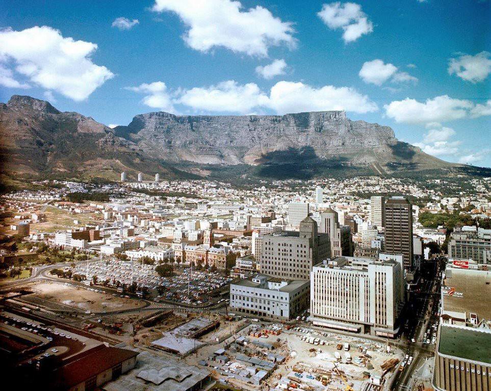
The construction of the Golden Acre shopping and transport complex was underway by 1969, one of the most significant urban development projects in Cape Town’s history. The development combined a new railway station, bus terminal, and large shopping mall on the site of the old station and adjacent properties. Excavations for the project uncovered remains of the original Dutch fort built by Jan van Riebeeck in 1652 — physical evidence of the city’s deepest colonial origins.
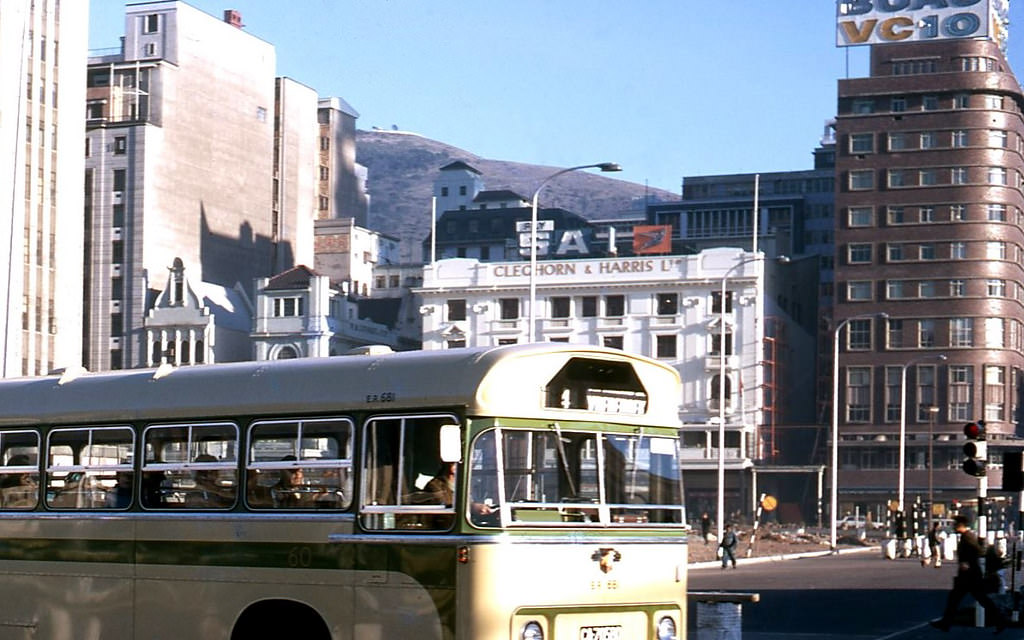
Looking along Adderley Street in 1969, the decade’s transformations were visible in the skyline. New towers had joined the older Victorian commercial buildings. Construction of the Golden Acre at the northern end of the street was adding to the visual complexity. The street that had defined Cape Town’s commercial life for over a century was entering a new phase — one that would dramatically change its character in the 1970s and beyond.

The St James Hotel, near the False Bay coastal village of the same name, served visitors to this quiet corner of the Cape Peninsula. St James, with its tidal pool and the famous rows of painted Victorian bathing boxes on its beach, was a gentler, more old-fashioned destination than the Atlantic seaboard beaches. The hotel catered to a clientele seeking a quiet coastal retreat within easy reach of Cape Town.
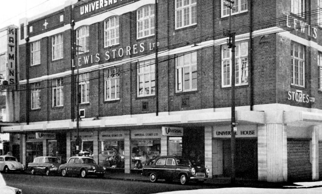
Woodstock, immediately east of the CBD along the foreshore, was one of Cape Town’s oldest industrial and working-class residential suburbs. Victoria Road ran through it toward the CBD — a busy route carrying workers, goods vehicles, and commuters. Woodstock’s factories and workshops made it an important part of the city’s manufacturing economy. Its mixed community of Coloured and white residents made it a target of apartheid’s Group Areas Act.
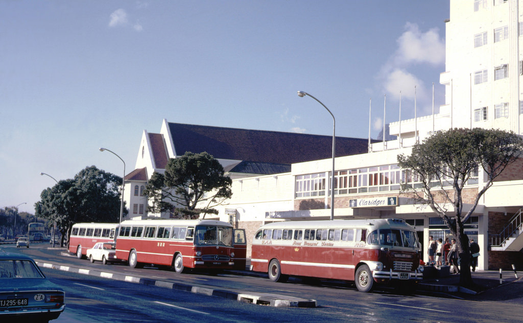
Claridges Hotel in Green Point was one of several hotels serving the Atlantic seaboard suburbs in the late 1960s. Green Point, between the CBD and Sea Point, was a compact suburb with a mix of residential and commercial properties. The hotel served visitors arriving for business or leisure — travelers whose experience of Cape Town was shaped by the same apartheid-era segregation that governed every other aspect of the city.
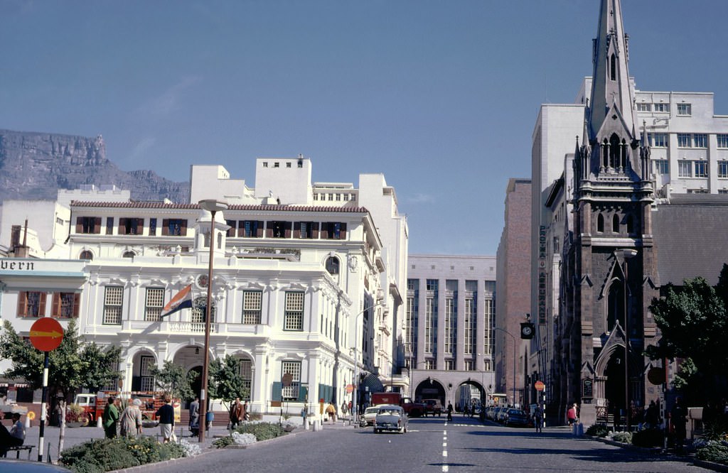
Greenmarket Square in 1969, at the close of the decade, was as active as ever. The market stalls filled the cobbled square between the Old Town House and the surrounding commercial buildings. The square had witnessed Cape Town’s entire modern history — it had been a produce market, a slave market, and a general public gathering place over more than two centuries. In 1969, it was simply a busy city-center market — but the weight of that history was present in every stone of its surface.
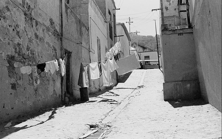
Korhaan Street in District Six in 1966 — the year the neighborhood was declared whites-only — gives a street-level view of the community that was about to be destroyed. The streets of District Six had their own geography, their own landmarks, their own history. Residents knew them by name and by memory. After the forced removals, those names and that knowledge became part of a collective memory carried by a displaced community across the Cape Flats.
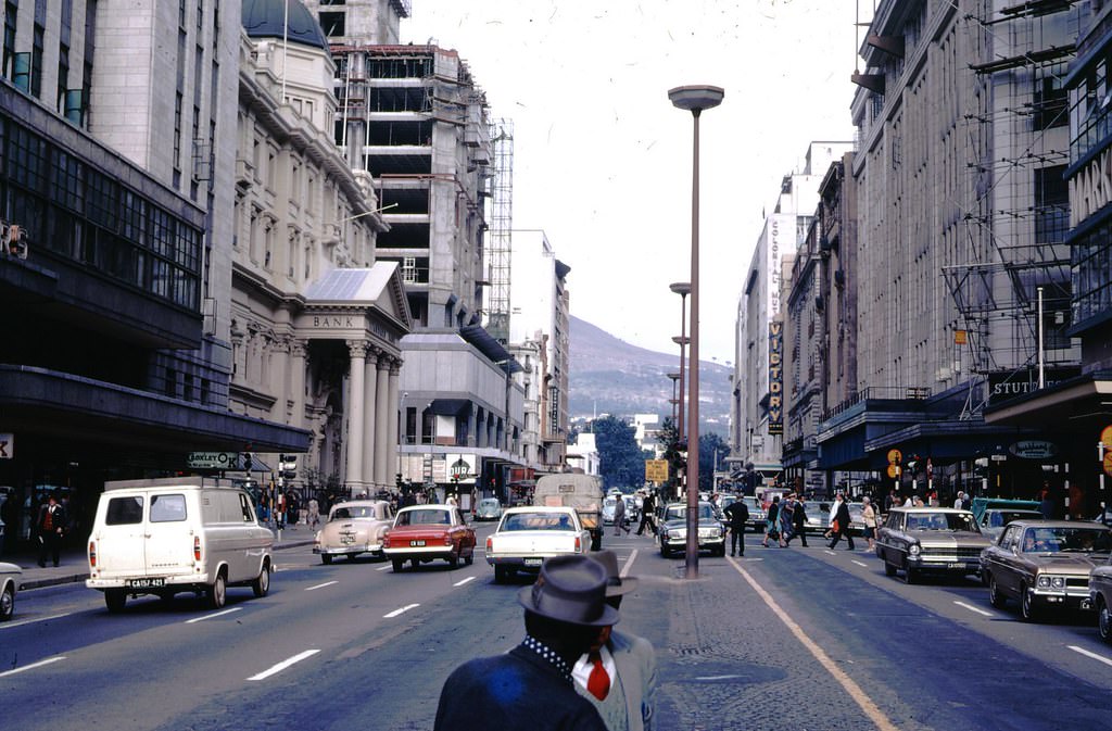
Adderley Street as the 1960s drew to a close remained Cape Town’s most important commercial address. The decade had brought significant physical changes — new buildings, new roads, new infrastructure — but the fundamental character of the street as the city’s main thoroughfare endured. What had changed most profoundly was invisible from the street level: the communities that had been destroyed, the people who had been displaced, and the political landscape that had been hardened.
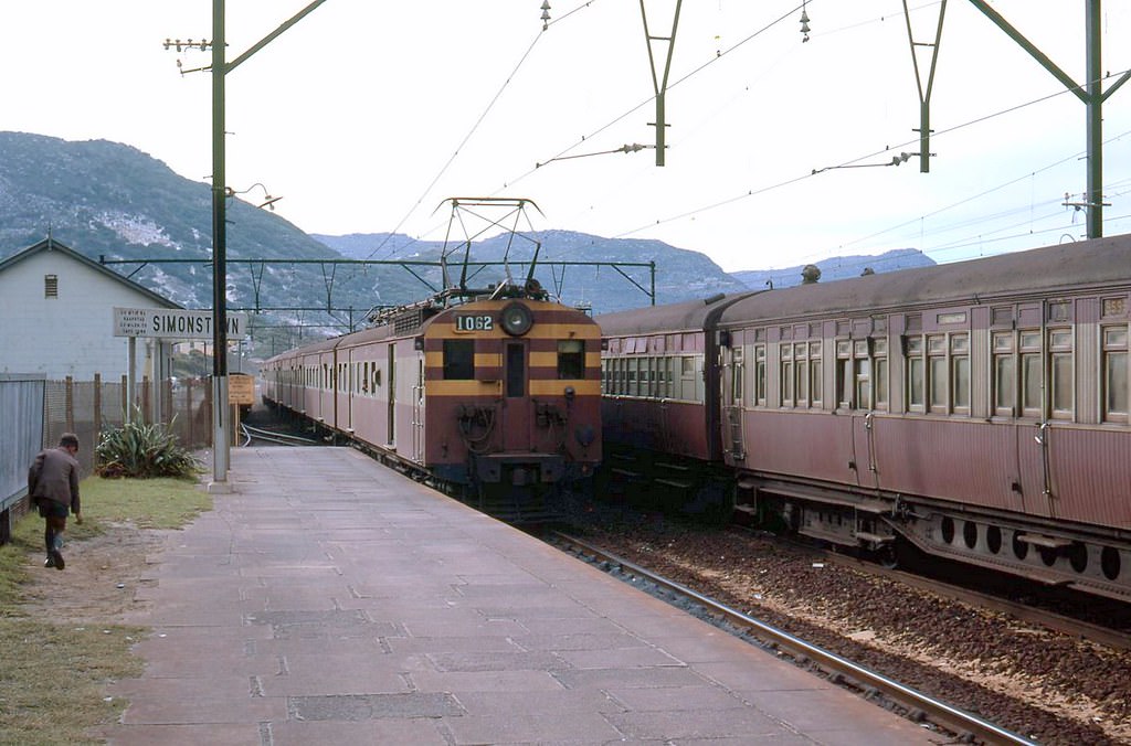
Simonstown, at the southern tip of the Cape Peninsula, was home to the South African Navy’s main base. The railway line running south from Cape Town terminated at Simonstown, its station serving both navy personnel and the small civilian population of the town. The line passed through some of the most beautiful coastal scenery on the peninsula — hugging the False Bay shoreline through Fish Hoek, Kalk Bay, and St James before reaching its terminus.
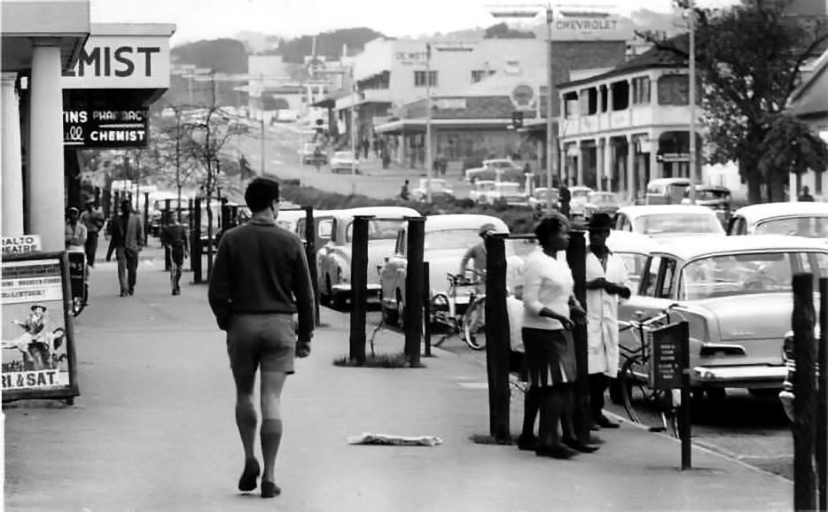
Somerset West’s Main Road in 1963 was the commercial center of a prosperous farming town at the foot of the Helderberg mountains. The town served the wine and fruit farms of the surrounding area, and its shops and businesses reflected the relative affluence of the white farming community. The mountains behind Somerset West — part of the Hottentots Holland range — rose dramatically, their slopes planted with orchards and vineyards.
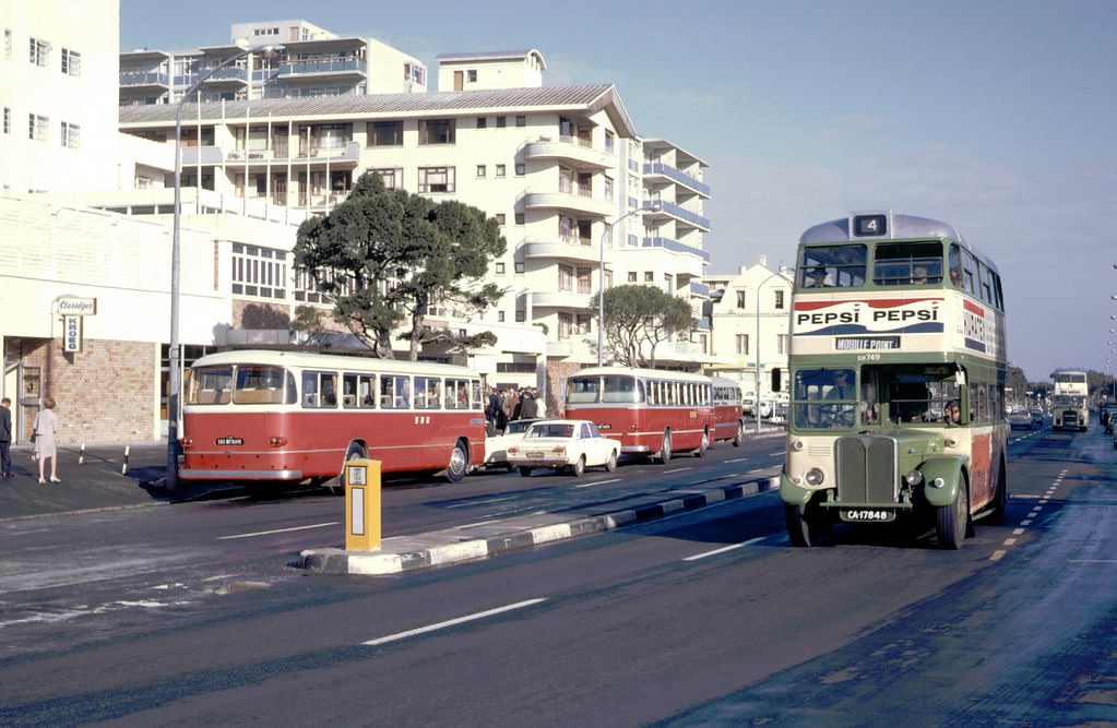
Main Road in Green Point in April 1969 shows a suburb in full commercial activity. Green Point’s Main Road connected the CBD to Sea Point, making it one of the most consistently trafficked routes in the city. The shops, hotels, and service businesses along it served both the local residential population and the steady flow of people moving between the city center and the Atlantic seaboard suburbs.
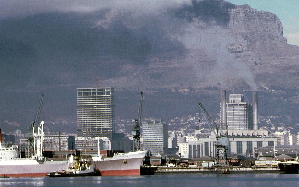
The Trust Bank Building, nearing completion in 1969, was one of the CBD’s newest and most prominent office towers. Trust Bank — a major Afrikaner financial institution — used its Cape Town headquarters to anchor its Western Cape operations. The building represented the continued growth of Afrikaner capital during the apartheid era, a financial sector that had been deliberately built up by the National Party government through preferential policies and procurement.
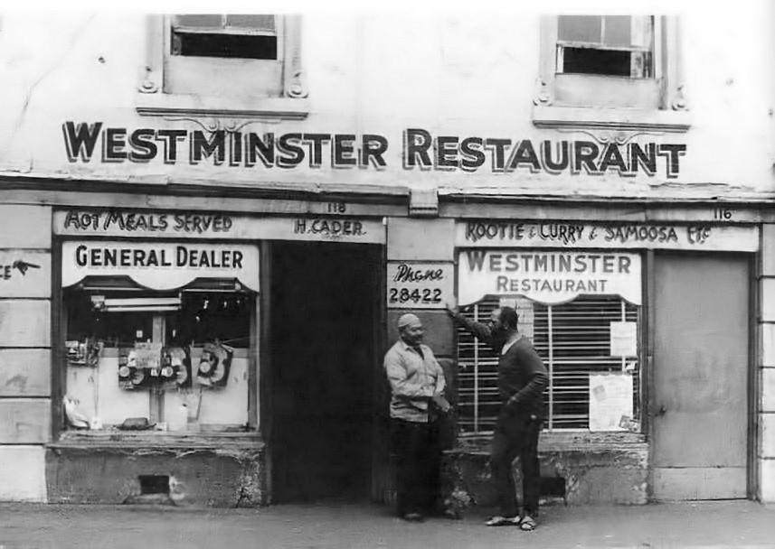
The Westminster Restaurant in District Six was one of the many eating establishments that made the neighborhood a vibrant destination for food and social life. District Six’s restaurant culture reflected its multicultural character — Cape Malay cooking, fish and chips, and other cuisines coexisted in a neighborhood where different communities had lived side by side for generations. Restaurants like this were part of what made District Six irreplaceable — and what made its destruction such a devastating loss.
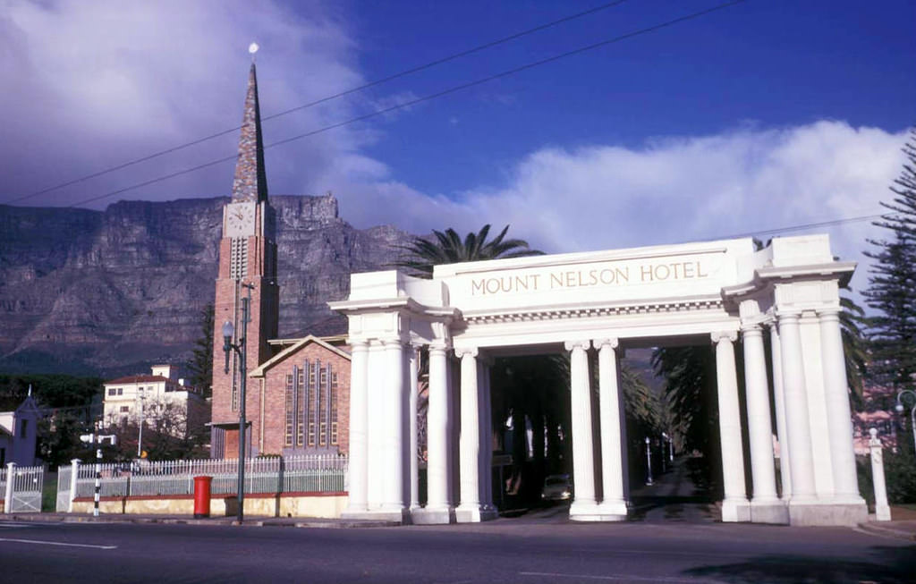
The Mount Nelson Hotel, at the foot of the Company Gardens on Orange Street, was Cape Town’s grandest hotel — a pink-painted Edwardian establishment that had been welcoming distinguished guests since 1899. Its long driveway, formal gardens, and high-ceilinged dining room gave it an atmosphere of colonial grandeur. In 1961, the Mount Nelson remained the most prestigious address in Cape Town for visiting dignitaries, business leaders, and wealthy tourists.
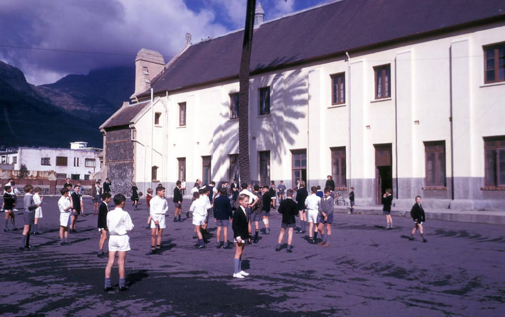
Children at a city school in Cape Town taking a break from class in 1961. Under apartheid’s education system, schools were strictly segregated by race. White children attended well-funded government schools with trained teachers and adequate materials. Non-white children attended schools with inferior resources under an education system explicitly designed — in the words of its architect, Hendrik Verwoerd — to train them only for the kinds of work the apartheid economy reserved for them.
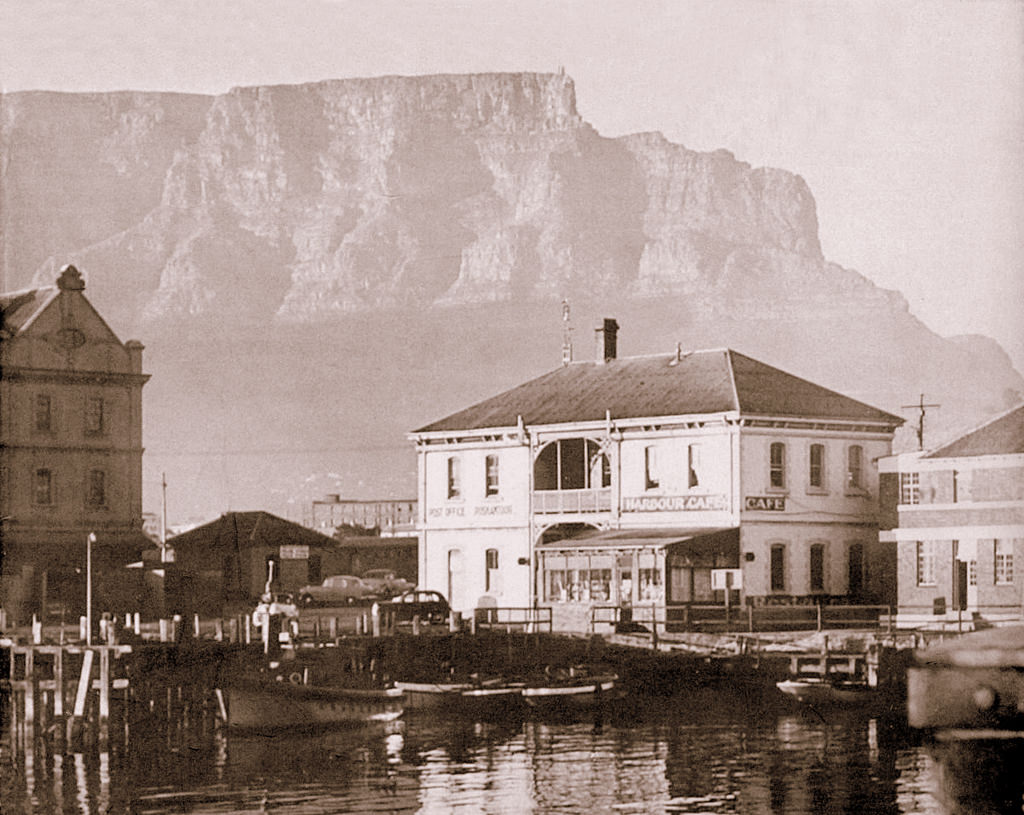
The Harbour Cafe in Cape Town, operating in 1960, catered to the workers, sailors, and visitors who moved through the port area. Harbor cafes served functional food to a working clientele — sailors from arriving ships, dock workers, truck drivers, and harbor employees. The port environment created its own social world, distinct from the commercial CBD a few blocks away.
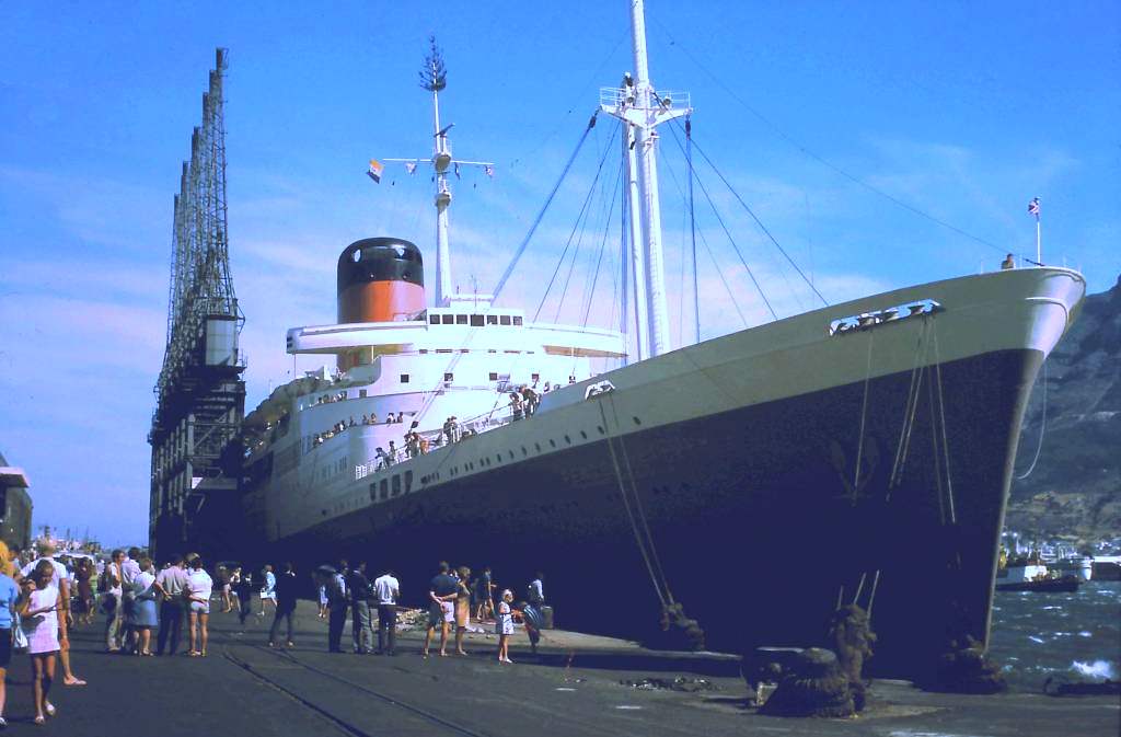
The MV Pendennis Castle was one of the Union-Castle Line’s passenger ships operating the Southampton-Cape Town mail route. Photographed in December 1969, her arrival in Cape Town marked the end of the decade — a decade that had seen the apartheid system deepen its hold on South Africa while Cape Town continued its dual life as both a beautiful city and a site of profound injustice. The Union-Castle ships had brought news, mail, and passengers between Britain and South Africa throughout the era.
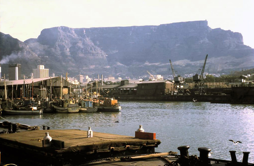
The Alfred Basin in 1969 was still in active use as part of Cape Town’s harbor complex. Named after Prince Alfred’s royal visit in 1860, during which the prince ceremonially tipped the first load of stone into the construction of the breakwater, the basin was one of the oldest parts of the modern harbor. By 1969, planning was already underway for the redevelopment of the Victoria and Alfred Waterfront that would transform this area in the 1990s.
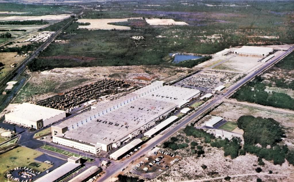
The British Motor Corporation’s assembly plant at Blackheath, which opened in 1967, was part of the expansion of South Africa’s motor vehicle manufacturing industry. The plant assembled vehicles — including the popular Mini — for the South African market, reducing the need for fully built-up imports. Blackheath, in the northern suburbs, was an industrial area well positioned on the rail and road networks connecting Cape Town to the interior.
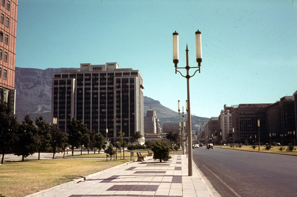
The Heerengracht in 1968 was in its most developed state yet, with office buildings lining the boulevard and road traffic flowing heavily through the Foreshore. The Foreshore Freeway project — intended to create an elevated highway connecting the N1 and N2 — was being planned during this period, with construction beginning in the early 1970s. The project would ultimately be abandoned, leaving the distinctive unfinished concrete piers that still mark the Cape Town skyline.
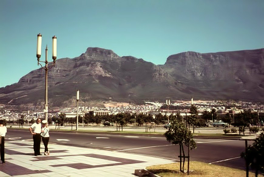
Hertzog Boulevard was one of the main roads on the Foreshore, named after Barry Hertzog, South Africa’s Prime Minister from 1924 to 1939. The boulevard ran through the newer part of the CBD, connecting the main road network to the harbor area. By 1968, it was carrying heavy traffic as the city’s road infrastructure struggled to accommodate the growing volume of vehicles on Cape Town’s streets.
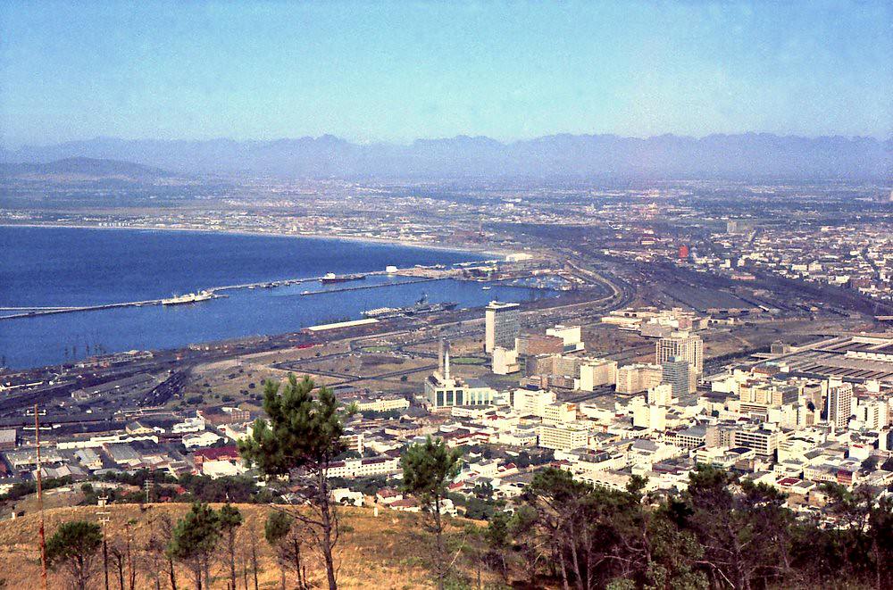
A broader view of the city in 1967 captures Cape Town at the midpoint of the decade — a city where construction cranes competed with mountain views, where the port hummed with activity, and where the daily life of a complex, diverse, and deeply unequal population unfolded on streets shaped by two centuries of colonial and then apartheid rule.
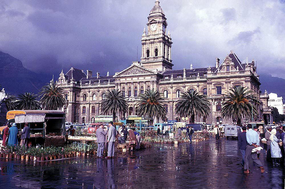
The Grand Parade on a rainy day in 1961 shows Cape Town in its winter character. The mountain was hidden behind cloud, the pavements were wet, and the market stalls that filled the square on dry days were absent or reduced. Rainy days on the Parade offered a more muted version of the square’s usual energy — fewer people, slower movement, the Victorian City Hall presiding over an emptier space.
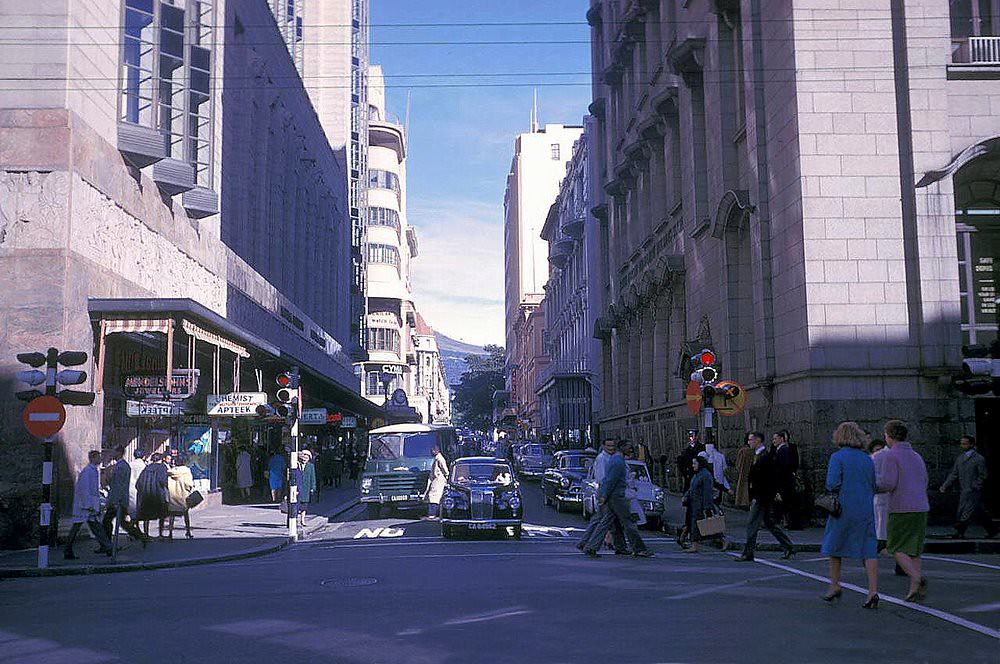
Parliament Street in 1961 ran alongside one of the most consequential buildings in South Africa’s history. The Houses of Parliament had been the site of apartheid’s legislative construction — the Population Registration Act, the Group Areas Act, the Suppression of Communism Act, and scores of other laws that systematically dismantled the rights of non-white South Africans had all been debated and passed within these walls.
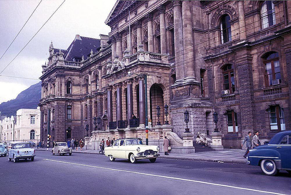
Cape Town’s City Hall, an Edwardian baroque building completed in 1905 in Italian Renaissance style, was one of the city’s most beloved structures. Its ornate facade overlooked the Grand Parade, and its interior housed the mayor’s parlour, the council chamber, and the magnificent concert hall where the Cape Town Philharmonic Orchestra performed. The City Hall was one of the few public buildings in 1960s Cape Town whose steps would later witness history — Nelson Mandela gave his first speech after his release from prison from its balcony in February 1990.

Leeuwen Street, in the Bo-Kaap above the city center, wound up the lower slopes of Signal Hill. In 1961, the Bo-Kaap was still an intact community — its Cape Malay residents not yet threatened with the forced removals that were destroying District Six and other mixed-race neighborhoods. The street’s cobblestones, steep gradient, and painted houses gave it a character unlike any other in Cape Town.
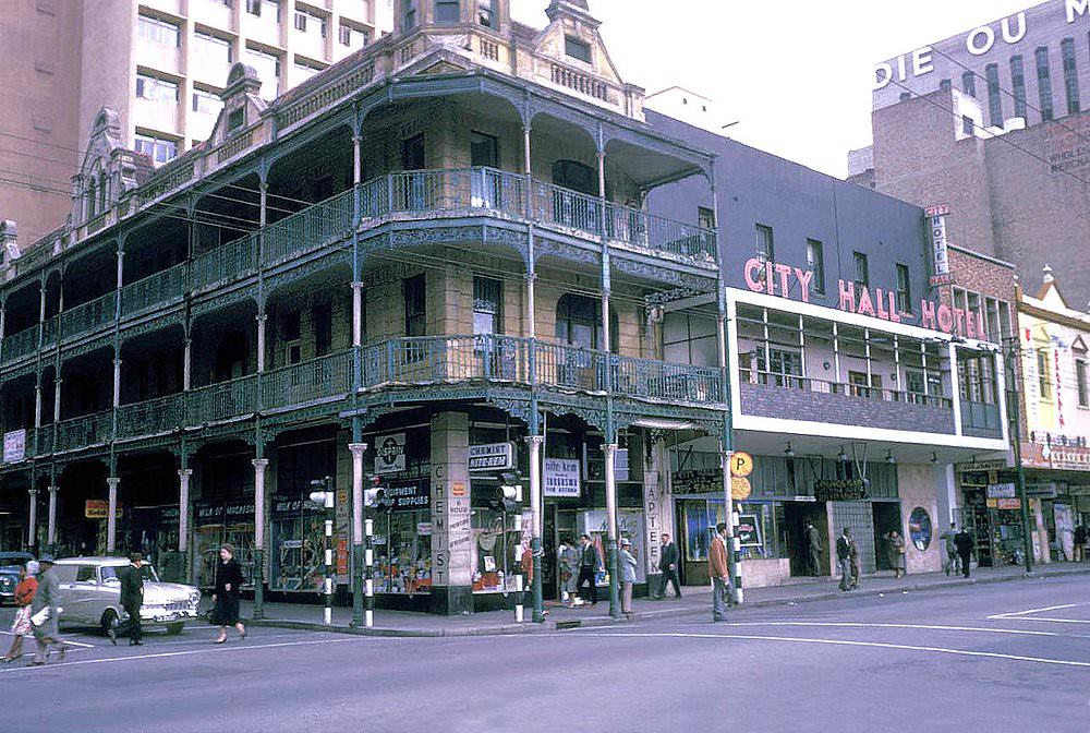
The City Hall Hotel in 1961 occupied a prime position near the Grand Parade. Hotels in this location catered primarily to commercial travelers passing through Cape Town — salesmen, government officials, and business people whose stay in the city was practical rather than touristic. The hotel’s proximity to the City Hall and the commercial CBD made it a convenient base for anyone with business in the city center.
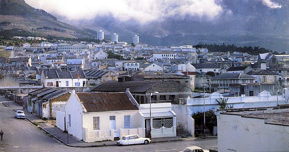
District Six in 1967 — one year after it was declared whites-only — was living in the shadow of the forced removals that had already begun. The neighborhood had been established in 1867 and had grown into one of Cape Town’s most vibrant communities — a cosmopolitan mix of freed slaves, artisans, merchants, and their descendants who had built a rich cultural life in the streets between the mountain and the harbor.
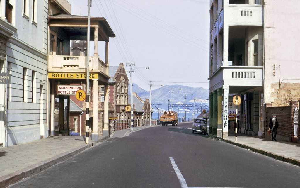
Muizenberg’s Main Road in 1963 ran parallel to the railway line and the beachfront, lined with the hotels, boarding houses, and shops that served the resort town’s visitors. Muizenberg had been a fashionable seaside resort since the late 19th century, when the completion of the railway line from Cape Town made it easily accessible. By 1963, it retained something of that resort character, though its beachfront was under the same apartheid segregation laws as every other public amenity in South Africa.
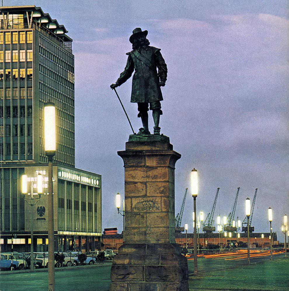
The Foreshore at dusk in 1967, photographed with Cape Town’s distinctive streetlights illuminating the boulevard. The Foreshore’s scale — its wide roads and open spaces — gave it a different character from the tight grid of the older CBD. At night, the lights of the harbor and the silhouette of Table Mountain above the city created a scene of remarkable beauty, the natural and built environments in dramatic relationship.
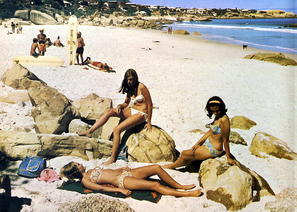
Clifton in 1967 showed the suburb’s characteristic combination of steep rocky terrain, luxury residential development, and the four beaches that made it famous. The suburb hung on the cliffs above the Atlantic, its houses clinging to the rock faces in ways that required extraordinary engineering. Access to the beaches was by steep staircase paths, and the combination of shelter, scenery, and social cachet made Clifton real estate some of the most valuable in South Africa.
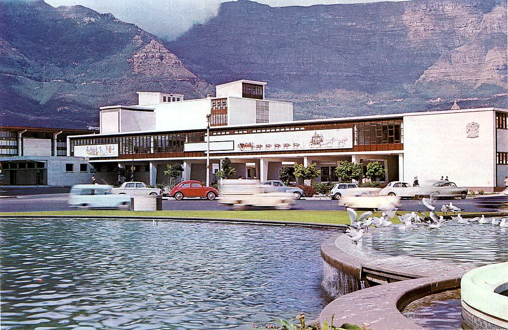
Work on Cape Town’s new railway station complex was progressing in 1966 as part of the Golden Acre development. The project involved the demolition of the old Victorian station and its replacement with a modern facility integrated into a large commercial complex. The railway station was the hub of Cape Town’s commuter rail network, which was carrying hundreds of thousands of passengers daily between the city center and the suburbs of the peninsula.
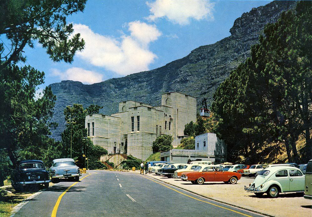
The lower cable car station at Tafelberg Road was the starting point for the Table Mountain Aerial Cableway — one of Cape Town’s most popular tourist attractions. The cable car had been operating since 1929, carrying visitors up to the top of the mountain in a few minutes. The views from the summit — of Table Bay, the Cape Flats, the mountain ranges beyond, and, on a clear day, as far as the Hottentots Holland mountains — were among the most dramatic in the world.
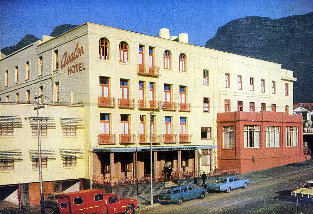
The Avalon Hotel, on the corner of Hope and Mill Streets in the Gardens neighborhood, was one of several hotels operating in that part of the city in the 1960s. The Gardens area’s proximity to the parliamentary precinct, the hospitals, and the CBD made it a convenient address for a range of city-center hotels. The Avalon served a clientele of business travelers and longer-staying guests who needed city-center accommodation.
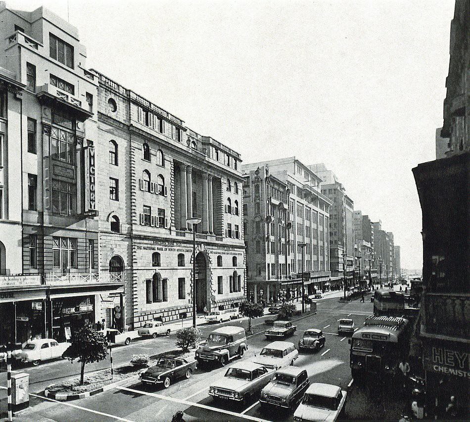
Adderley Street in 1965 was in the middle of the decade’s most active period of change. New buildings were rising, older ones were being modified or demolished, and the traffic was increasing. The mid-1960s were a period of economic growth for white South Africa — the apartheid economy was performing well by conventional measures, even as it was built on a foundation of racial exploitation that was storing up profound problems for the future.
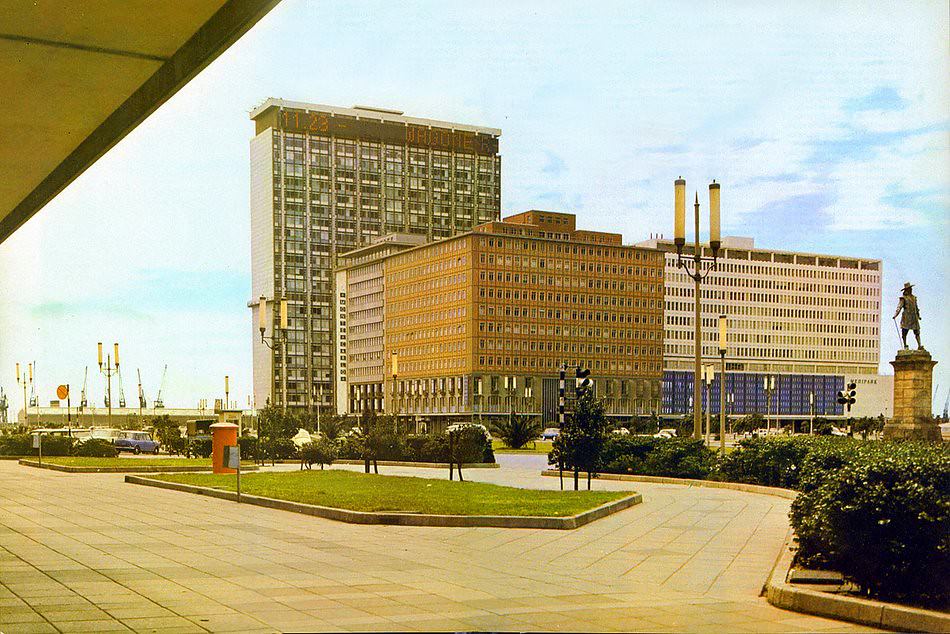
The Sanlam building, fully established in the Cape Town skyline by 1967, was a landmark that Capetonians navigated by. Its height and prominent position made it visible from many parts of the city. Sanlam’s growth in the post-war decades had been remarkable — the company had been founded in 1918 specifically to advance Afrikaner economic interests, and by the 1960s it had grown into one of South Africa’s largest financial institutions.
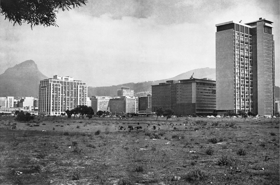
Despite the development that had taken place on the Foreshore since the land reclamation of the 1940s, large areas remained undeveloped in 1965 — the “wasteland” described in this caption a striking contrast to the ambition of the original planning. The Foreshore’s full development would take decades longer than its planners had anticipated, and some of its intended projects — including the freeway — would never be completed.
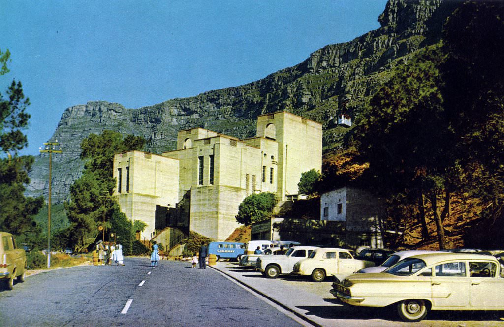
The lower cable station for the Table Mountain Aerial Cableway, photographed in 1965, shows the facility that welcomed thousands of visitors each year. The cable car had been upgraded over the decades since its 1929 opening, and the lower station had been developed to handle the tourist traffic it generated. Visitors came from across South Africa and from overseas to make the ascent — Table Mountain was one of the defining tourist experiences of any visit to Cape Town.
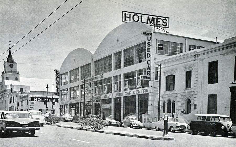
Strand Street in 1963, before the extension and construction works of the late 1960s, shows the road in its older configuration. The street was one of the CBD’s important east-west routes, connecting the older city center to the harbor area and the Foreshore. Its name — referring to the shoreline it had once run along — was one of those geographical memories embedded in the city’s map.
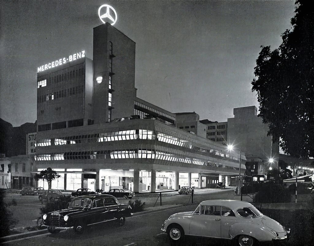
The Stanley Porter Mercedes-Benz dealership on historic Riebeeck Square was distinguished by its revolving blue Mercedes-Benz star — a beacon visible from a distance across the CBD. Riebeeck Square was one of Cape Town’s oldest public spaces, laid out in the 17th century and named after Jan van Riebeeck. The juxtaposition of the ancient square and the modernist revolving car brand logo captured something of the 1960s — old Cape Town meeting the consumer culture of the new era.
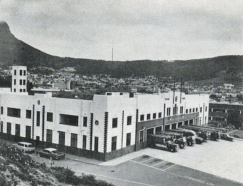
Cape Town’s central Fire Station was one of the city’s essential civic institutions. The fire service protected a city with a dense historic CBD, a busy harbor, and residential areas ranging from grand Victorian suburbs to crowded informal settlements. Fire was a constant risk — particularly in the non-white areas where housing was poor and overcrowding was severe. The Fire Station’s proximity to the CBD made it a rapid-response resource for the city center.
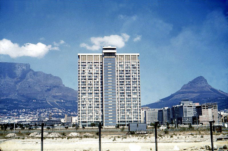
The Sanlam building photographed in 1962, shortly after its completion, shows the tower at an early stage of its tenure as a Cape Town landmark. The building’s modernist design — clean lines, large windows, a rectangular profile — was characteristic of the international style that was dominating commercial architecture across the world in the early 1960s. In Cape Town, it stood out sharply against the older, more ornate buildings of the Victorian CBD.
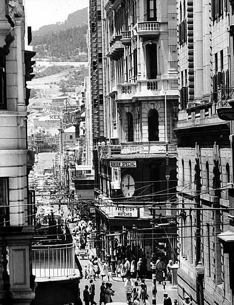
Darling Street in 1964 carried the traffic connecting the City Hall and Grand Parade area to the CBD’s commercial core. Named after Lieutenant-Governor Sir Charles Henry Darling, the street had been part of Cape Town’s urban fabric since the colonial period. By 1964, it was one of the busiest streets in the city, its pavements crowded with workers moving between the railway station, the market, and the shops and offices beyond.
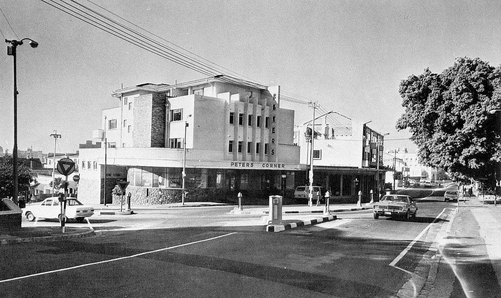
Peters Corner, photographed in the late 1960s, was one of those named intersections that served as reference points for navigating Cape Town’s CBD. The city’s commercial center had a collection of such named corners — Cartwright’s Corner, Peters Corner — that gave specific character to particular intersections and were used in daily conversation to describe locations. These named points were part of the informal geography of the city that locals carried in their heads.
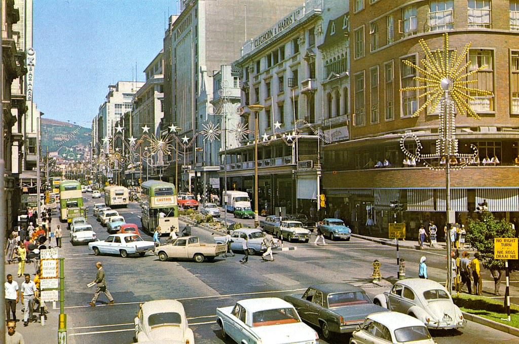
Adderley Street in 1967, the year Cape Town was in the global spotlight following the historic heart transplant at Groote Schuur Hospital. The city that year was simultaneously in the news for two very different reasons: the world’s first successful human heart transplant on one hand, and the ongoing forced removals from District Six on the other. The medical breakthrough celebrated South African expertise; the forced removals demonstrated the system’s brutality.
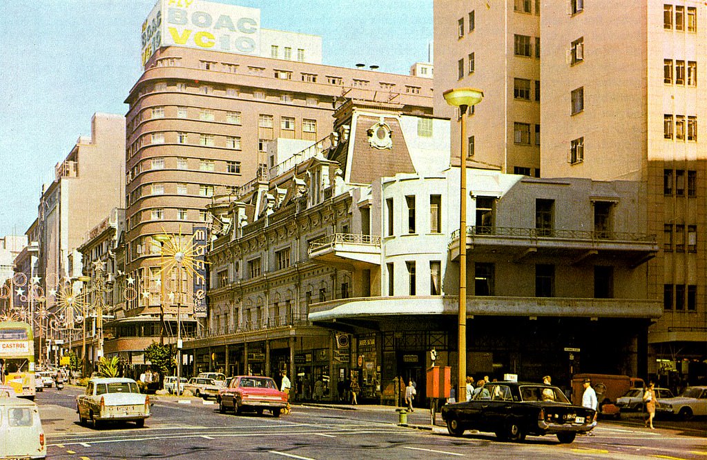
Another view of Adderley Street in 1967 captures the street at the peak of its 1960s commercial vitality. The department stores, banks, and office buildings lining it were doing brisk business in an economy that — for white South Africans — was performing well. The economic growth of the 1960s apartheid era was real; its distribution was grotesquely unequal, and its cost in human terms was incalculable.
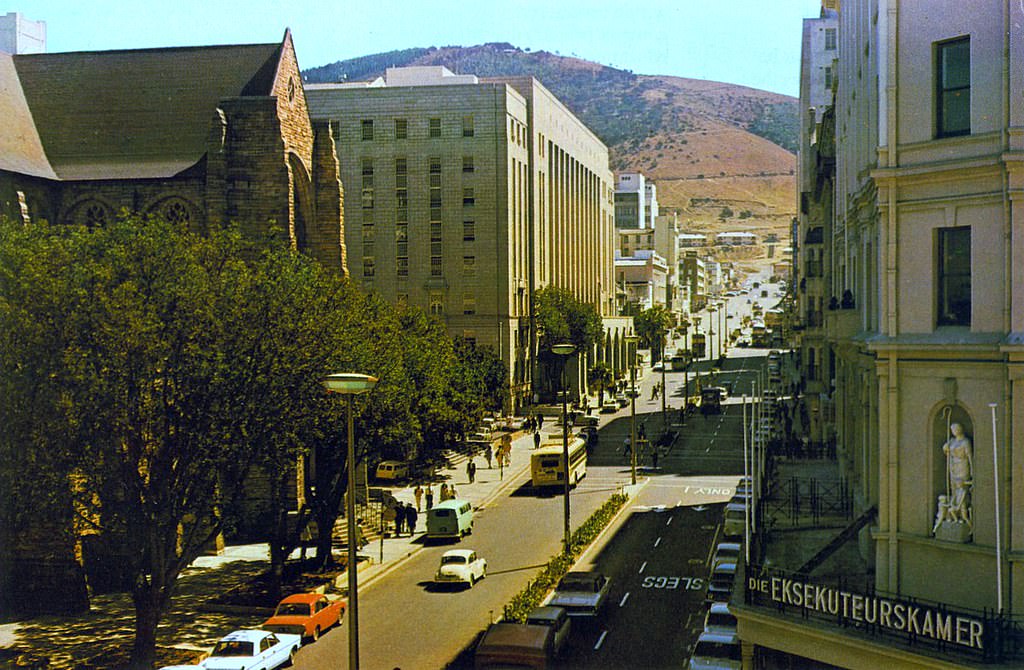
Wale Street ran from Long Street across the CBD toward the parliamentary precinct, connecting the commercial heart of the city to the governmental one. In 1967, this street was part of the daily geography of thousands of civil servants, lawyers, and politicians who worked in the buildings along and around it. The street’s name — possibly derived from an early landowner — was another of Cape Town’s historical geographical markers.
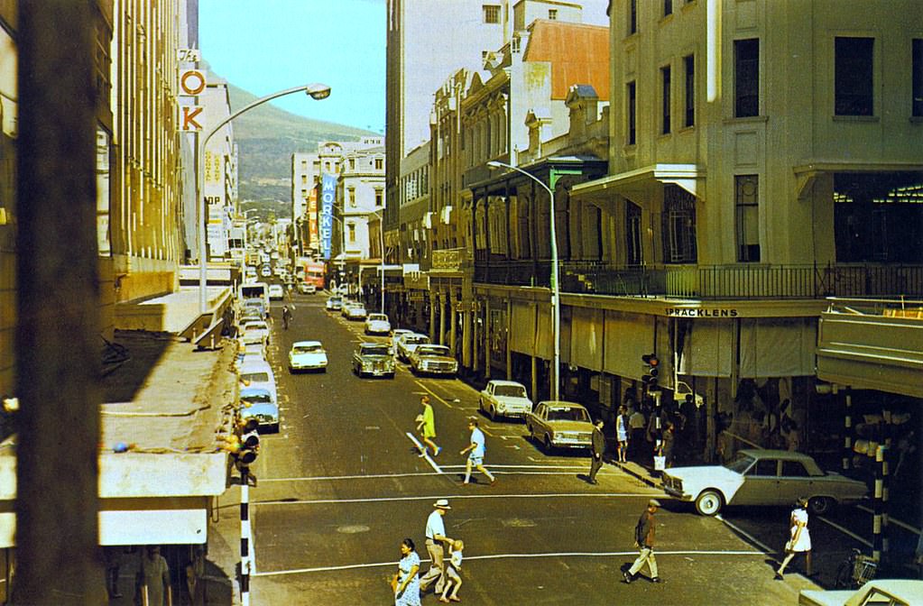
Plein Street in 1967 ran along the edge of the parliamentary complex — a street whose name simply meant “square” in Dutch, reflecting its original relationship to one of the open spaces of the early colonial settlement. By 1967, Plein Street was a busy government and legal district, its buildings housing parliamentary offices, law firms, and government agencies. The National Party government whose laws were made in the buildings along this street was at the height of its power.
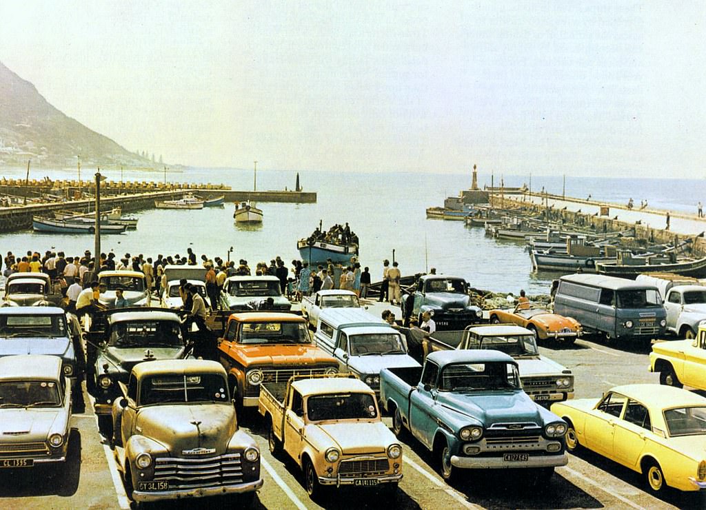
Kalk Bay harbour in 1967 was a working fishing port, its jetties and quays used daily by the fishing boats that had operated from this sheltered inlet for generations. The fishing community of Kalk Bay was predominantly Coloured, and the harbor was the economic heart of the village. Snoek — a long, fast-swimming predatory fish — was the primary catch, and on days when the boats came in loaded, buyers lined the quayside to purchase fish directly from the vessels.





It looks even more lively thank it is these days, with tourists and all.
Anyone from that era: What was it like back then comparted to now?
The good old days before the blight of the tampon buildings.