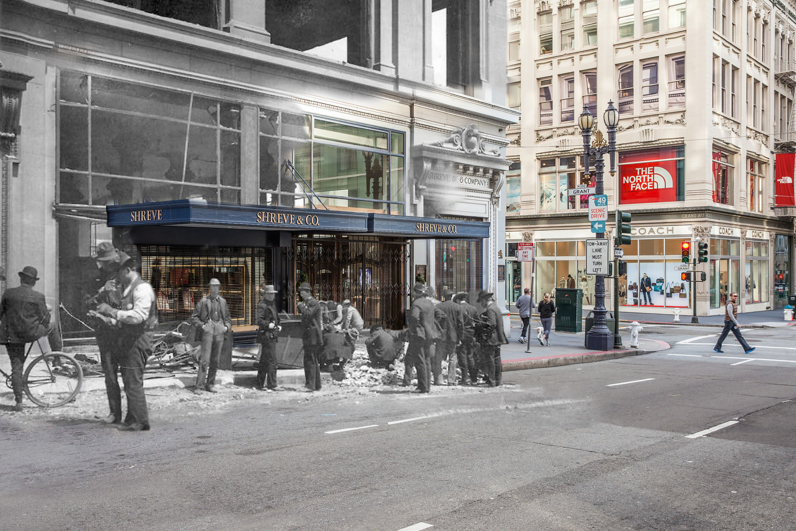
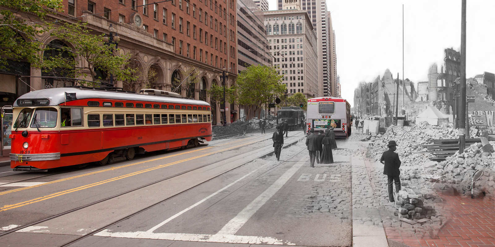
On April 18, 1906, a massive earthquake struck San Francisco before dawn, triggering fires that burned for three days. When it was over, more than 3,000 people were dead, 250,000 were homeless, and 28,000 buildings had been destroyed. The quake leveled over 80% of the city’s infrastructure. Facades crumbled into the streets, draft horses bolted in blind terror, and thick clouds of choking dust rose from collapsing brick walls. The fires that followed the initial shock proved just as deadly as the quake itself, consuming block after city block.
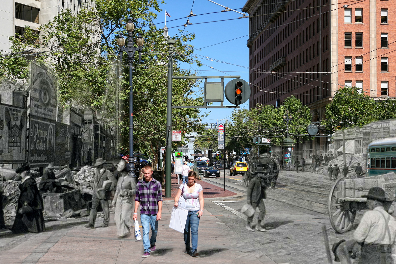
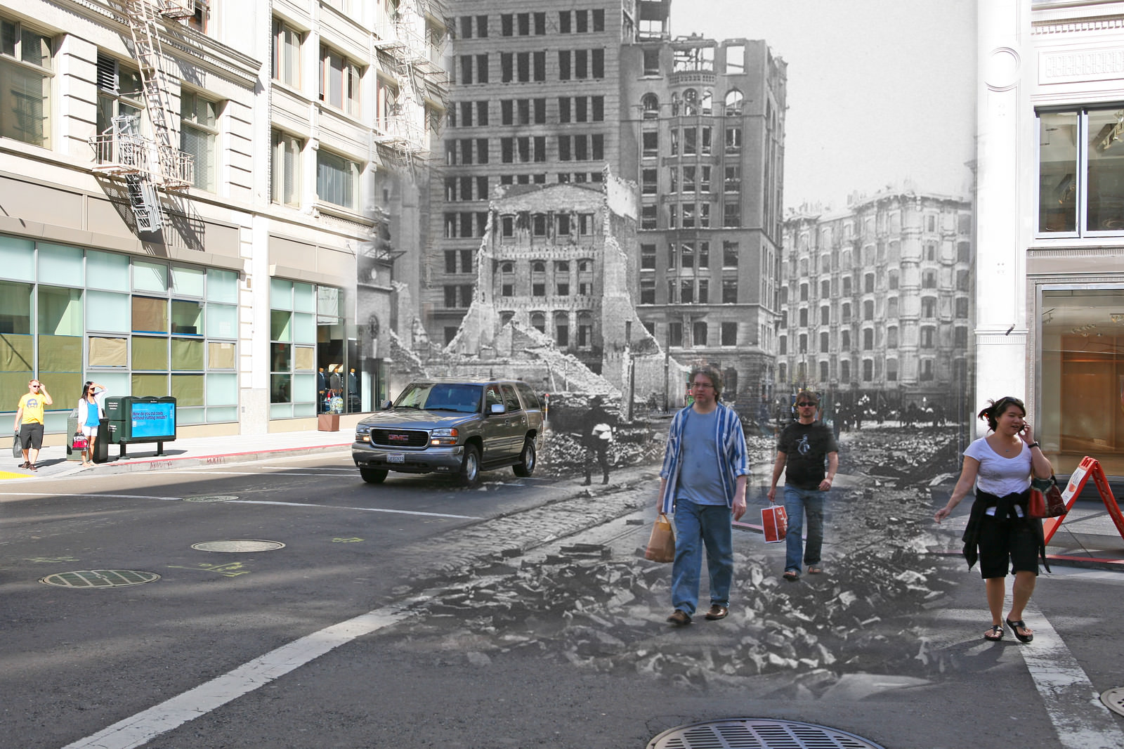
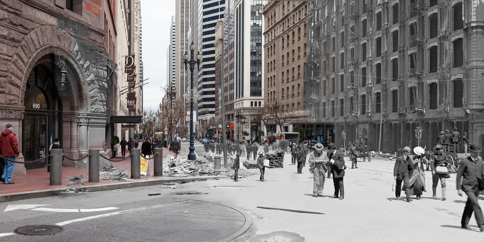
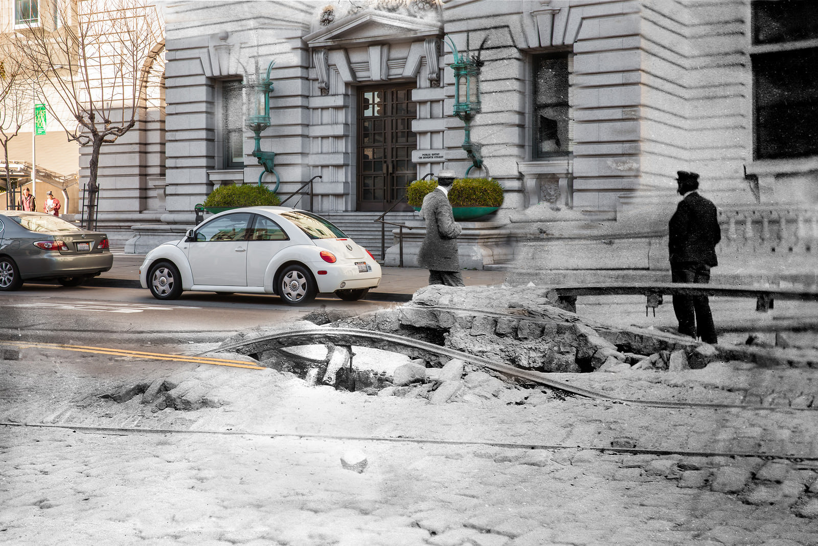
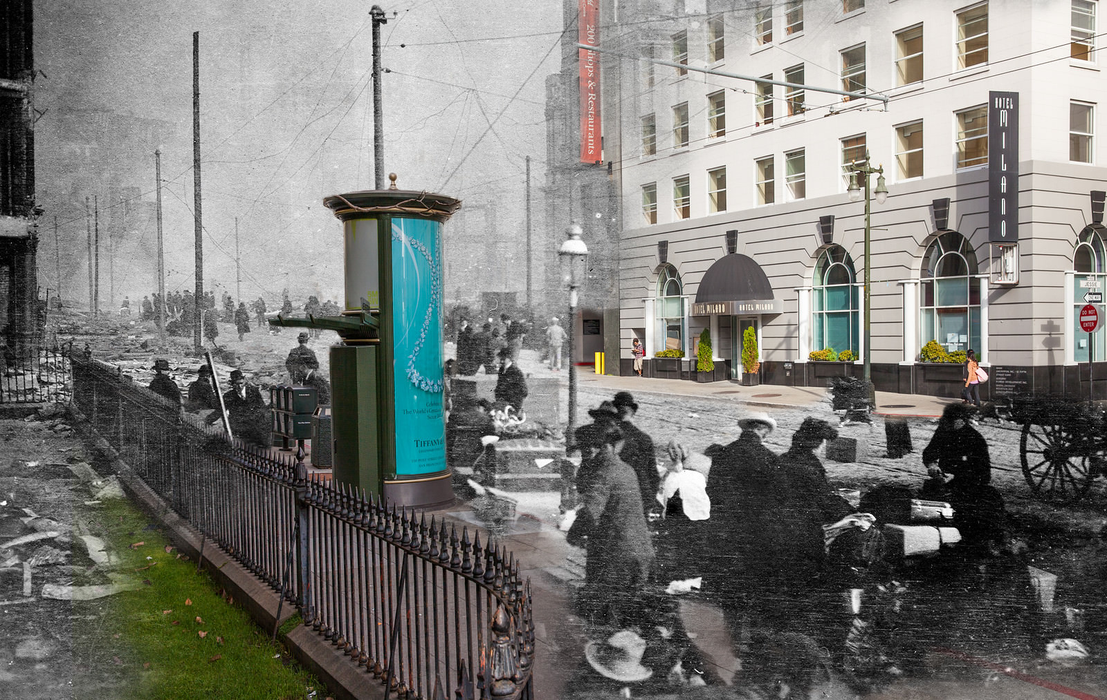
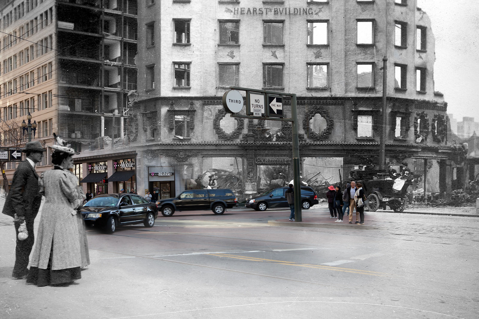
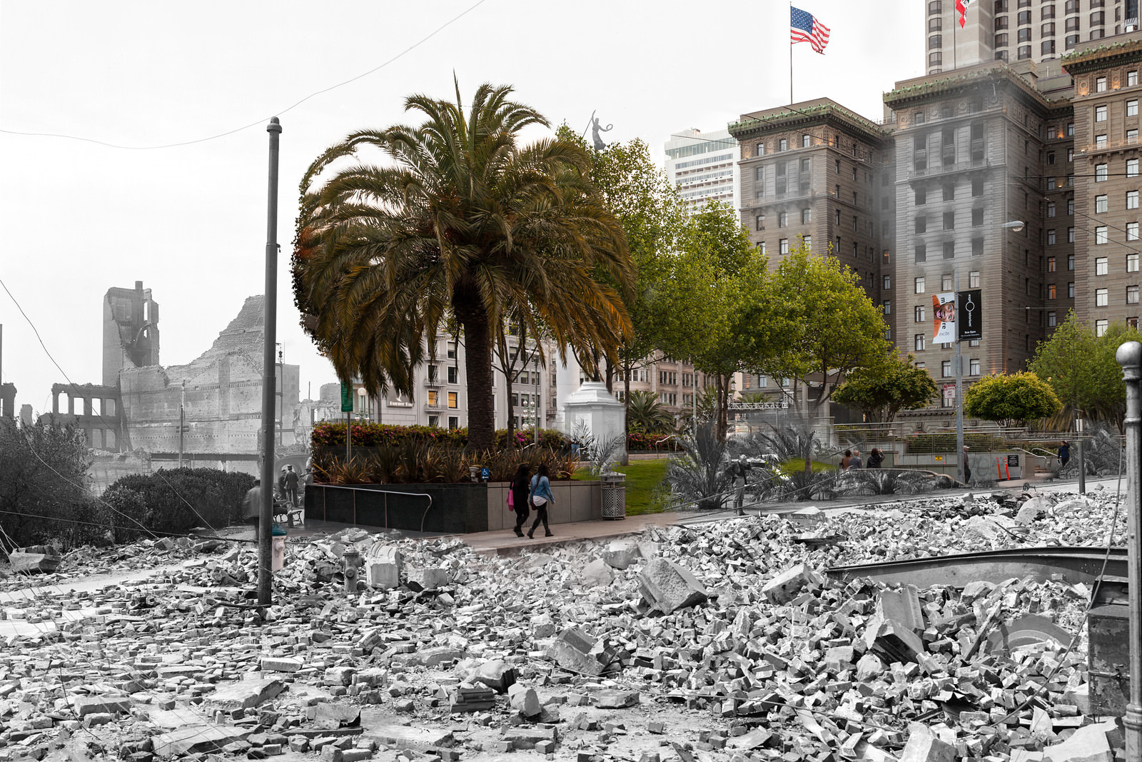
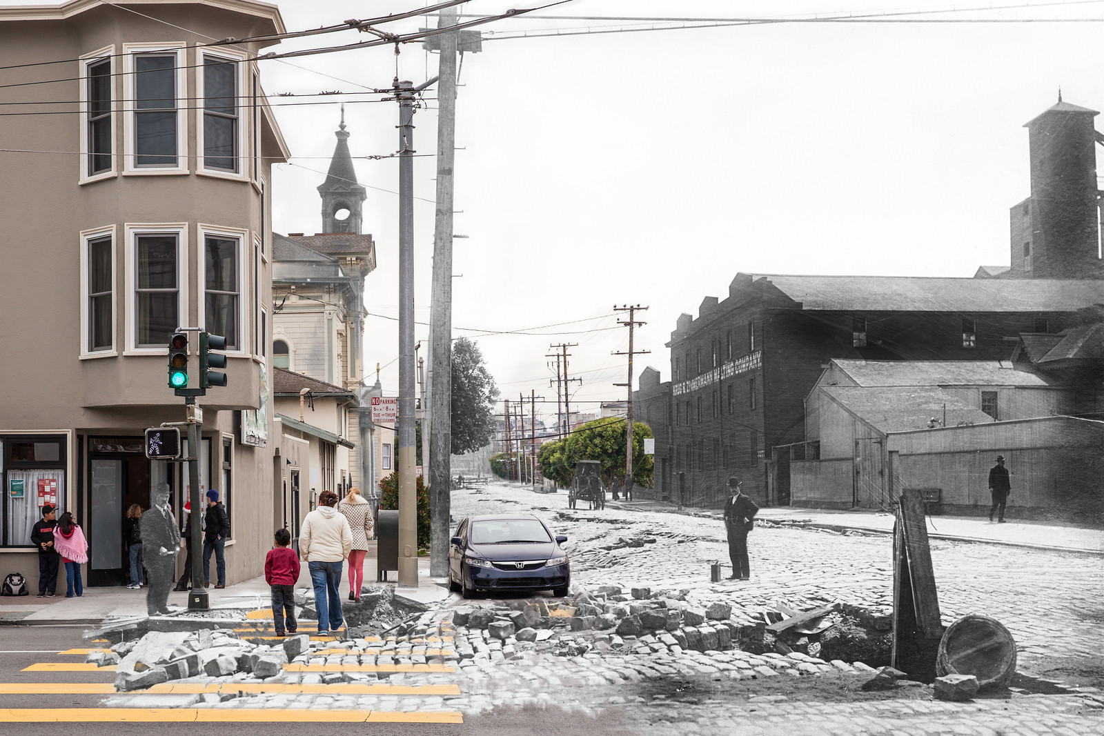
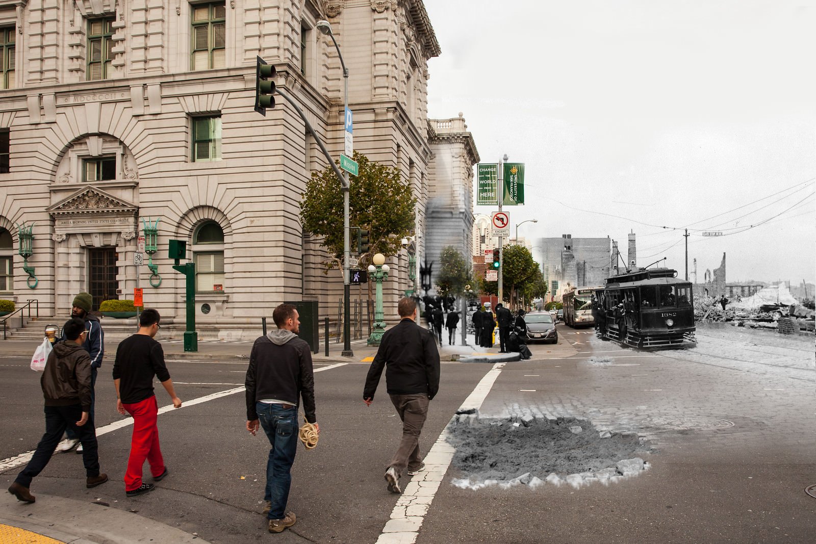
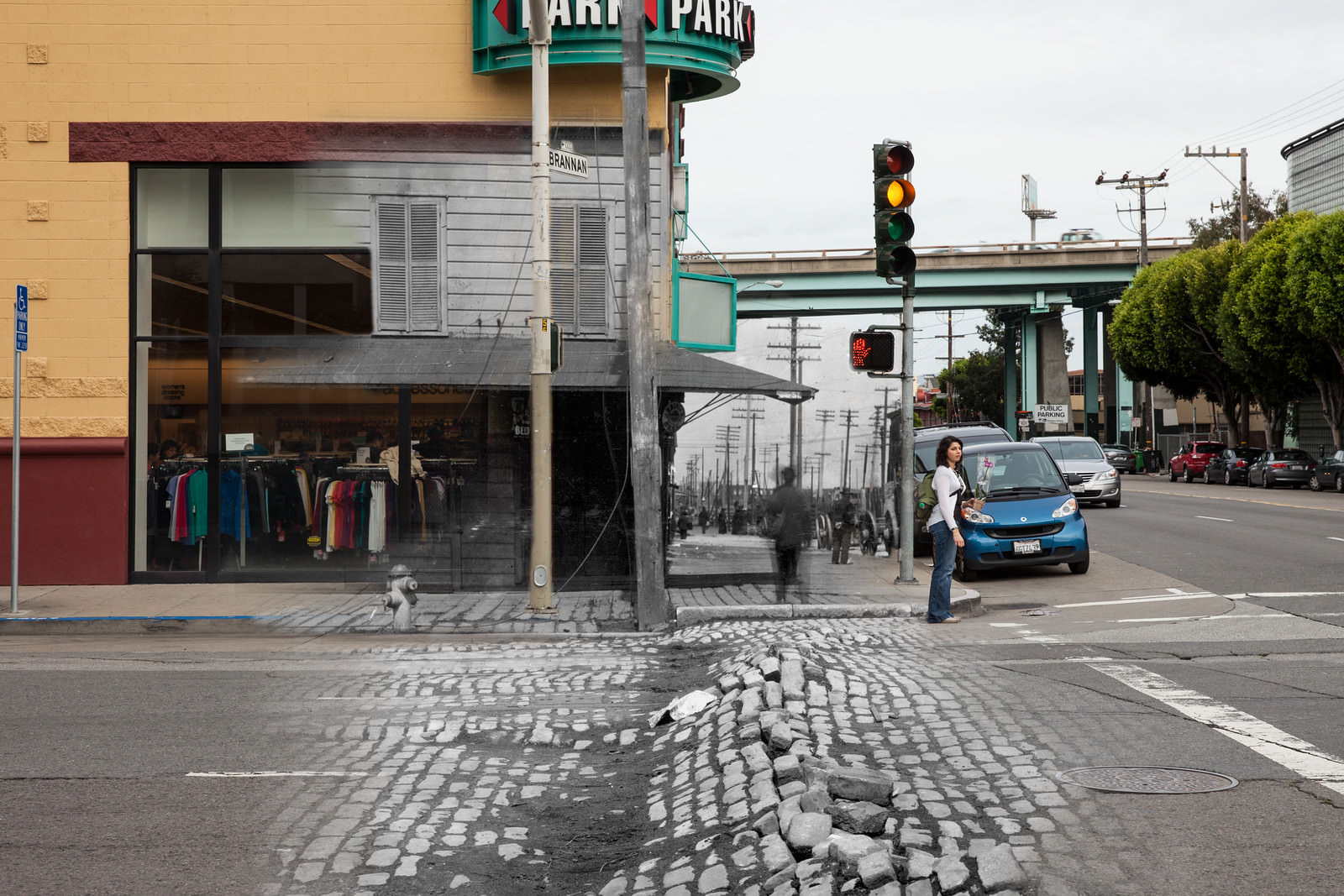
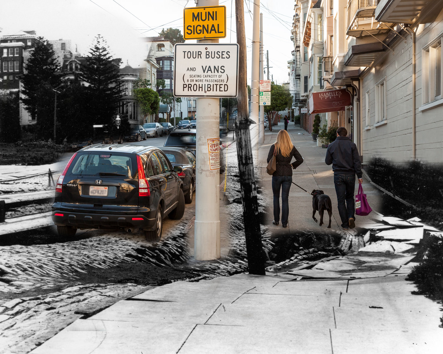
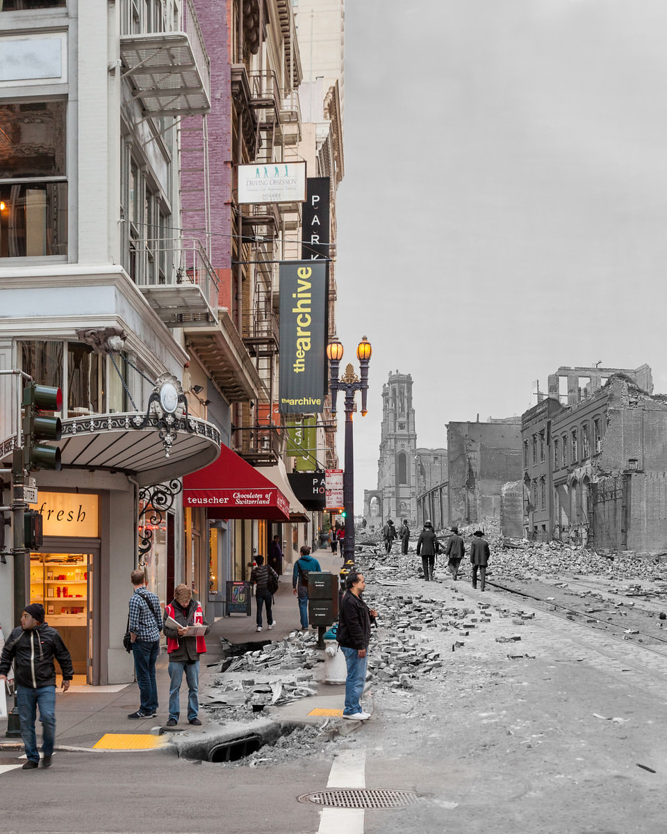
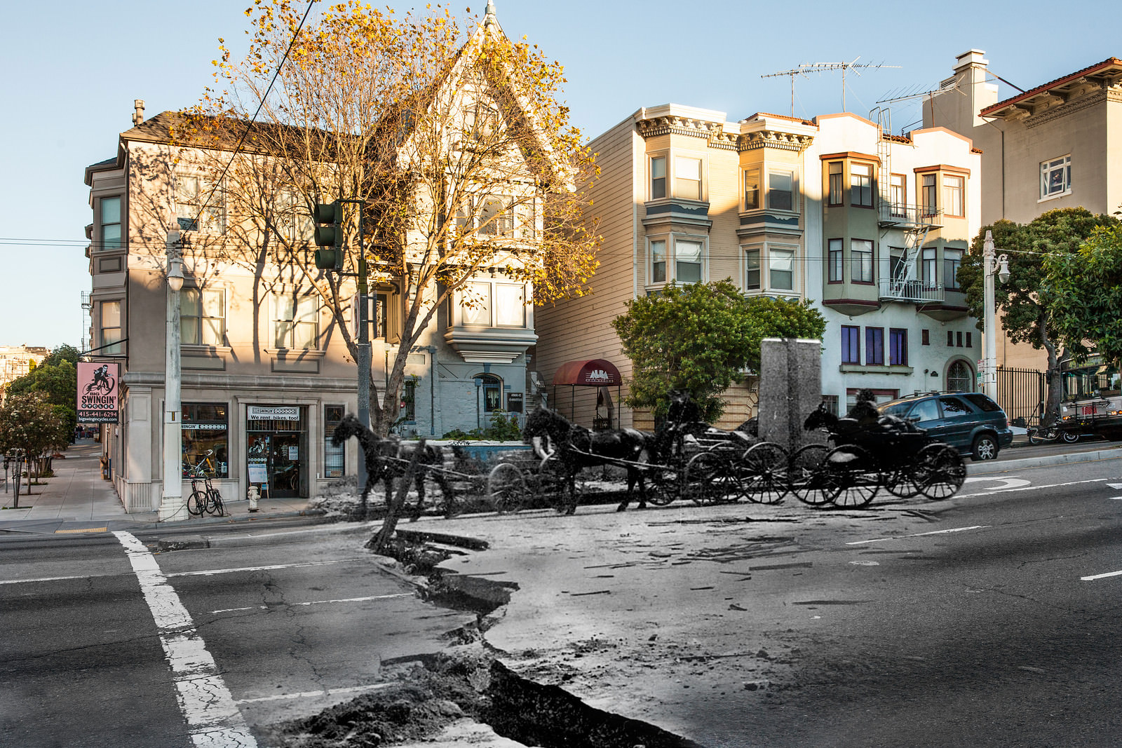
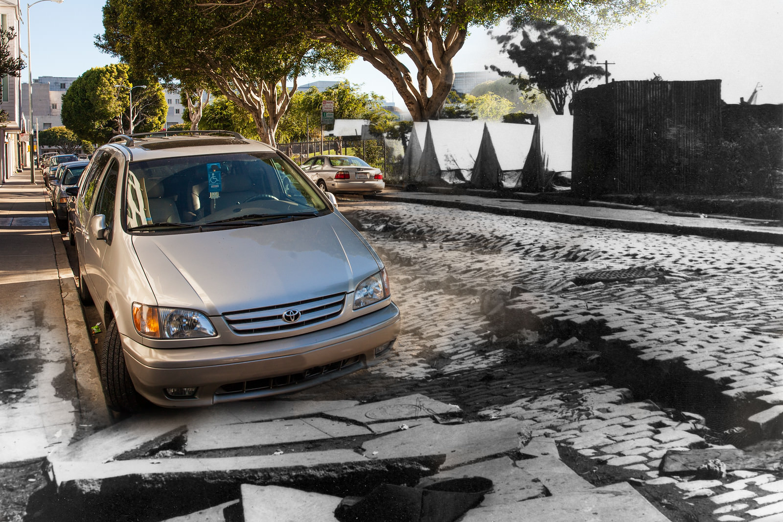
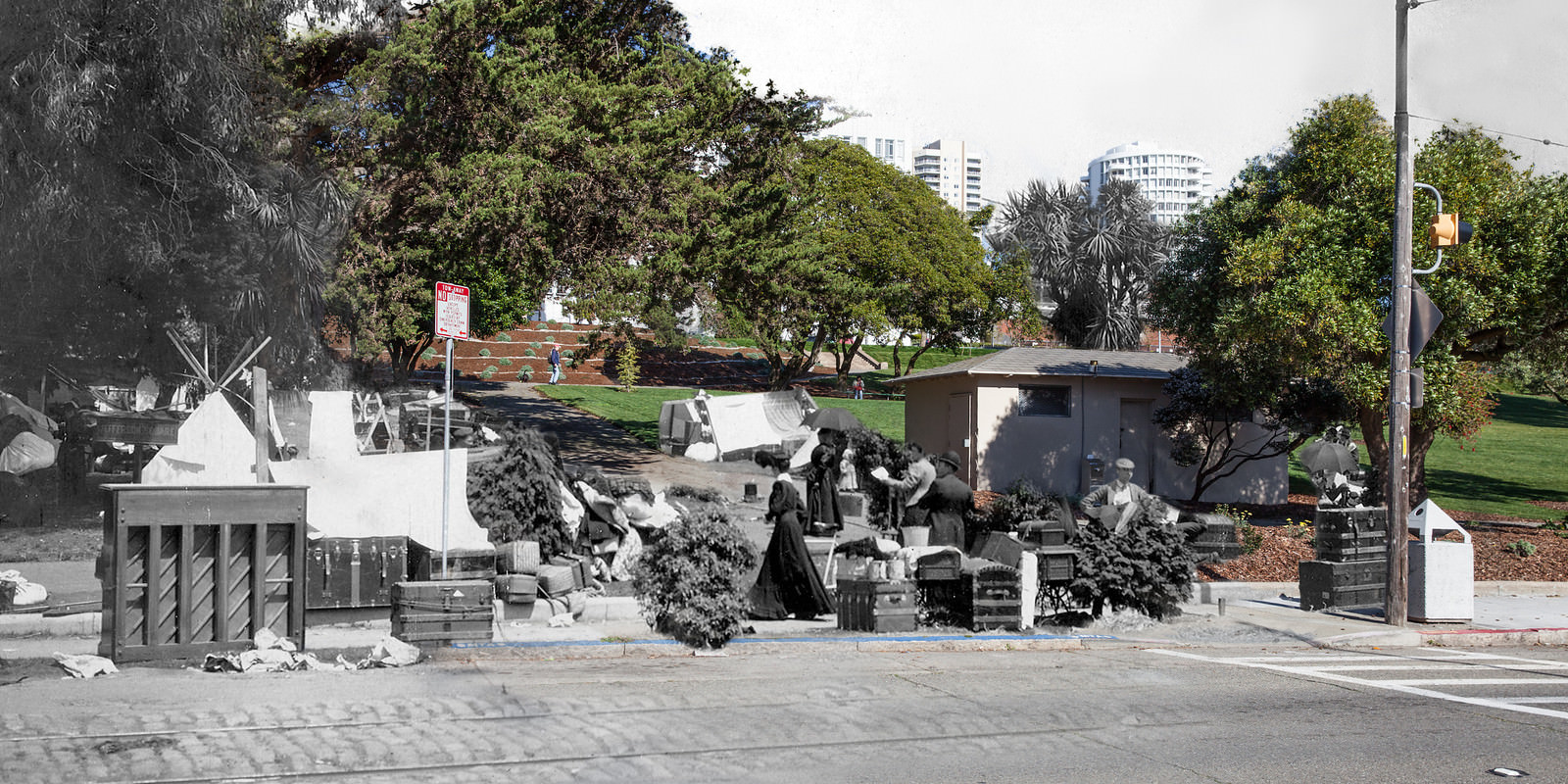
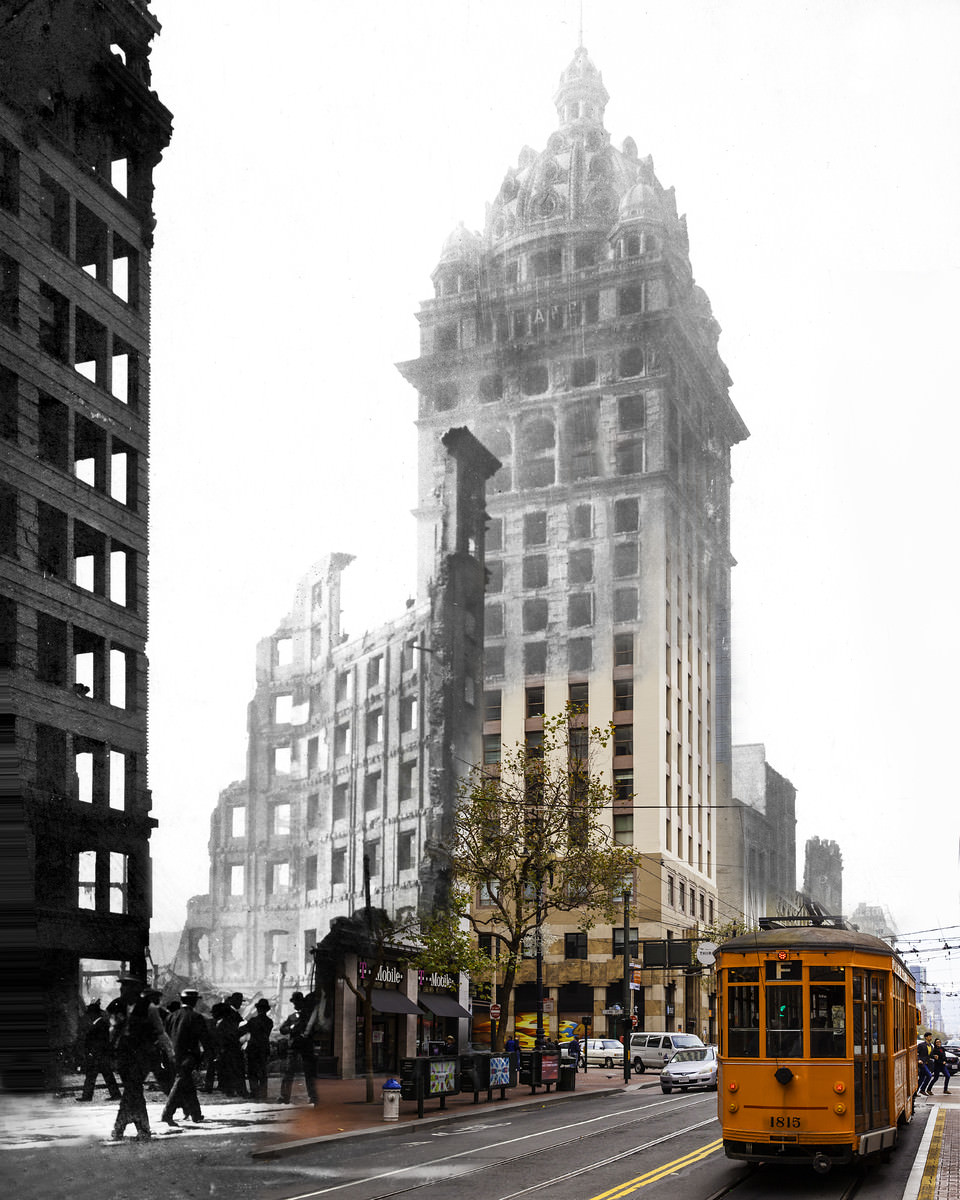
Artist and photographer Shawn Clover created a remarkable series of blended images that place the destruction of 1906 directly alongside present-day San Francisco. Each photograph merges an archival image of wreckage with a modern shot taken from the same vantage point. The result is a single frame where rubble and modern life coexist — a visual collision of past and present that makes the scale of the disaster immediately real. The images span the city, from its churches and hotels to its streets, parks, and shoreline.
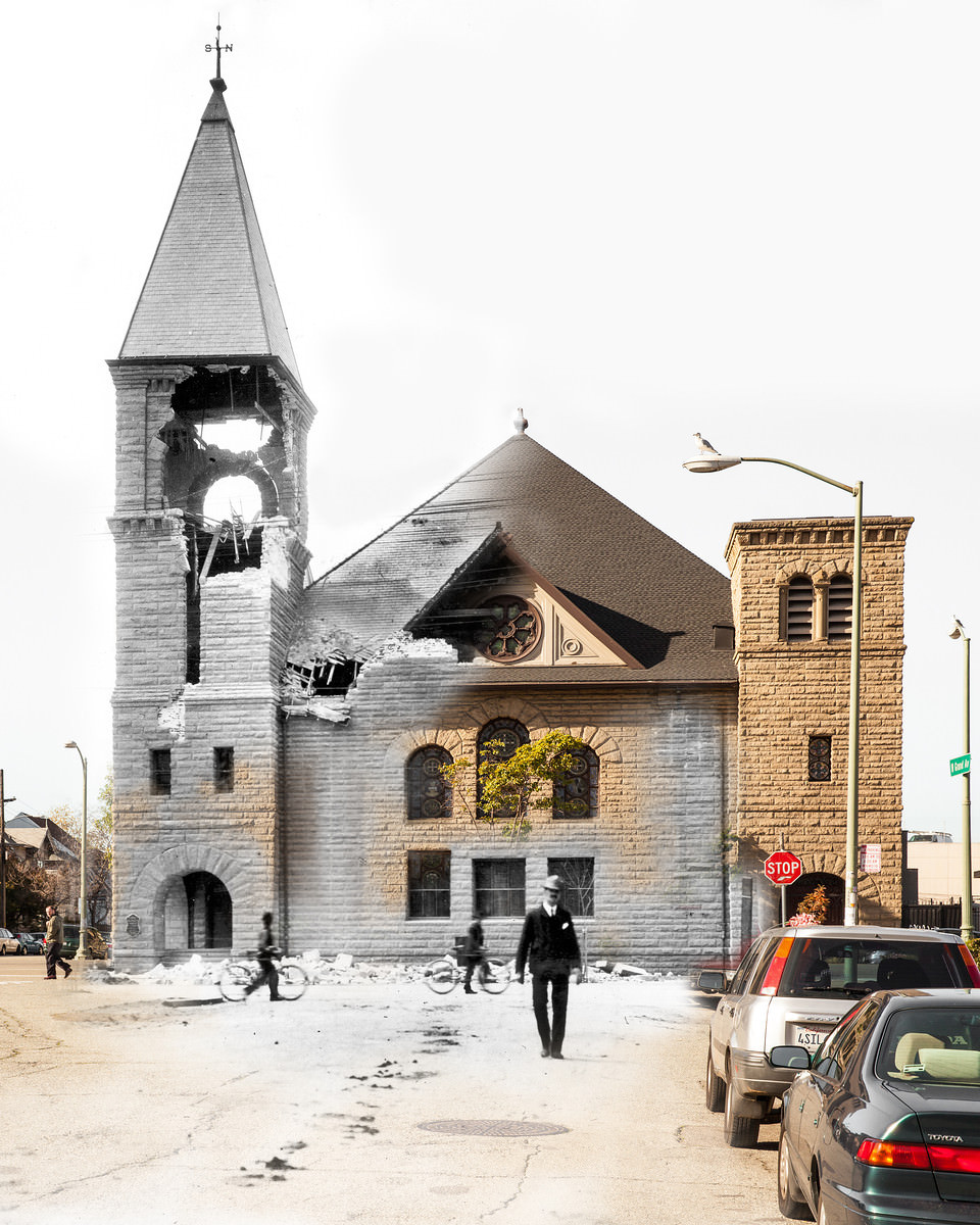
The earthquake’s reach extended well beyond San Francisco’s city limits. Communities along the bay and up the coast felt the full force of the tremors. The shoreline at Bolinas shifted dramatically, and in Point Reyes Station, the damage was both sudden and surreal.
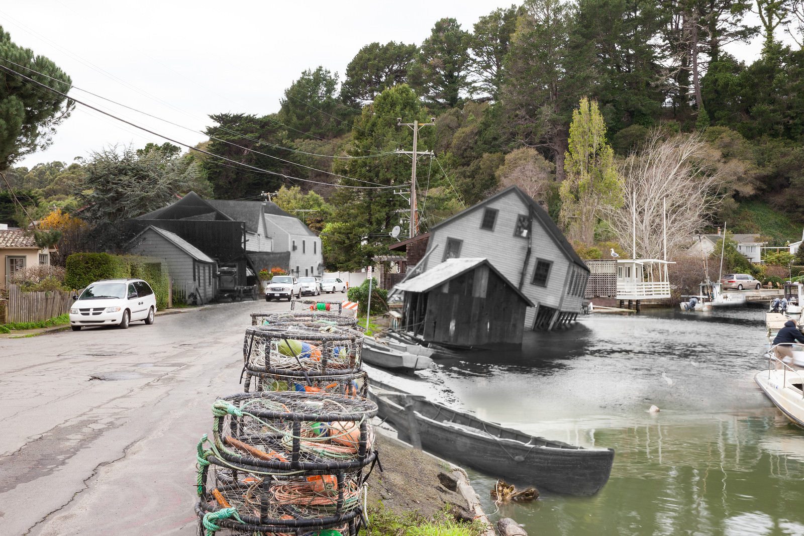
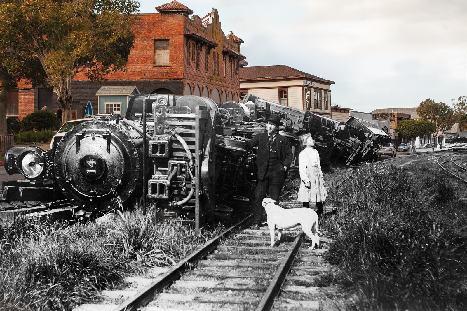
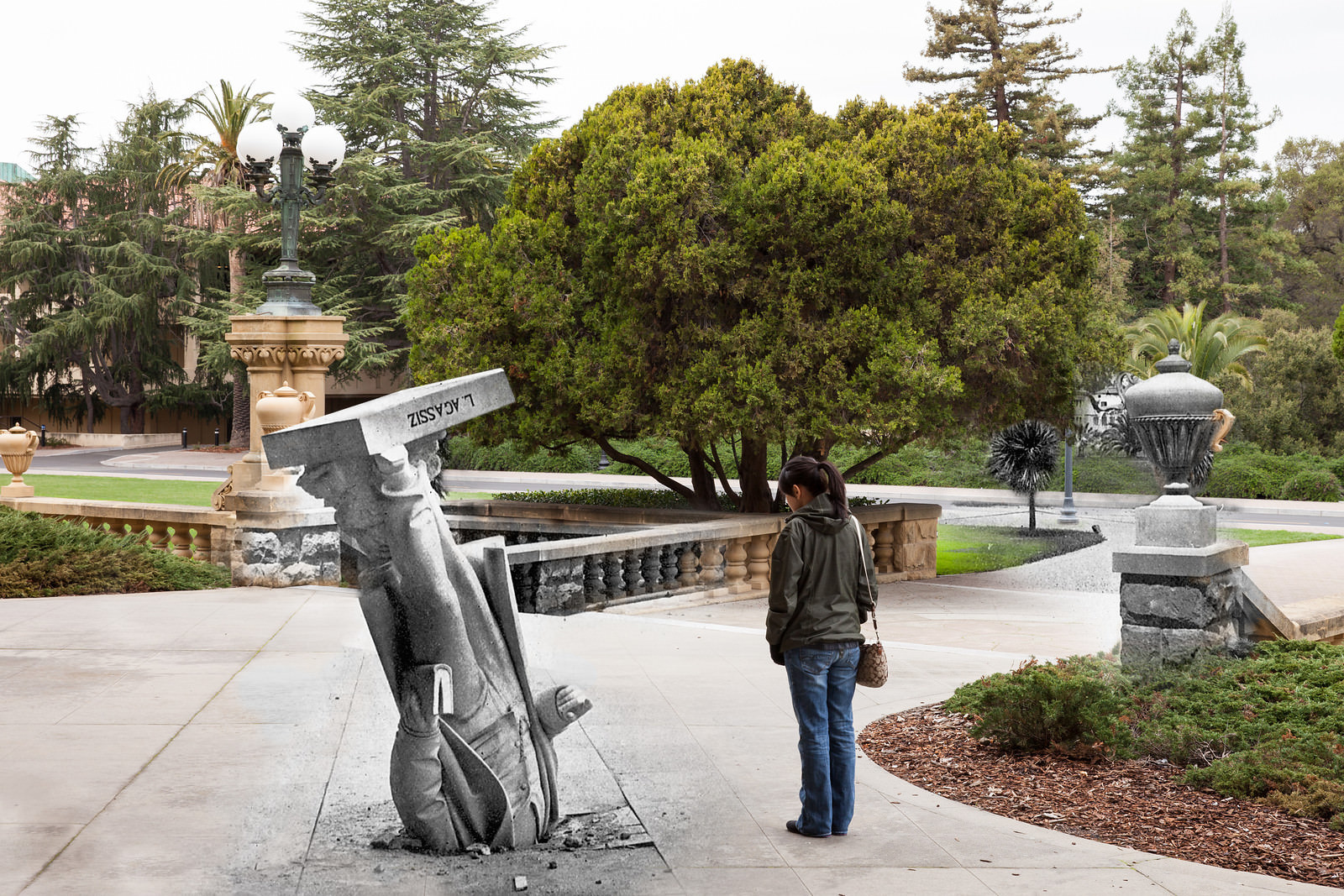
The earthquake struck at 5:12 A.M., catching most of the city asleep. The early morning timing meant that many people were still indoors when structures began to fail. At Stanford University, the campus took a severe beating. A statue of the Swiss geologist Louis Agassiz, mounted on the facade of the Zoology building, was thrown headfirst into the pavement below — a jarring image that became one of the most iconic symbols of the quake’s power.
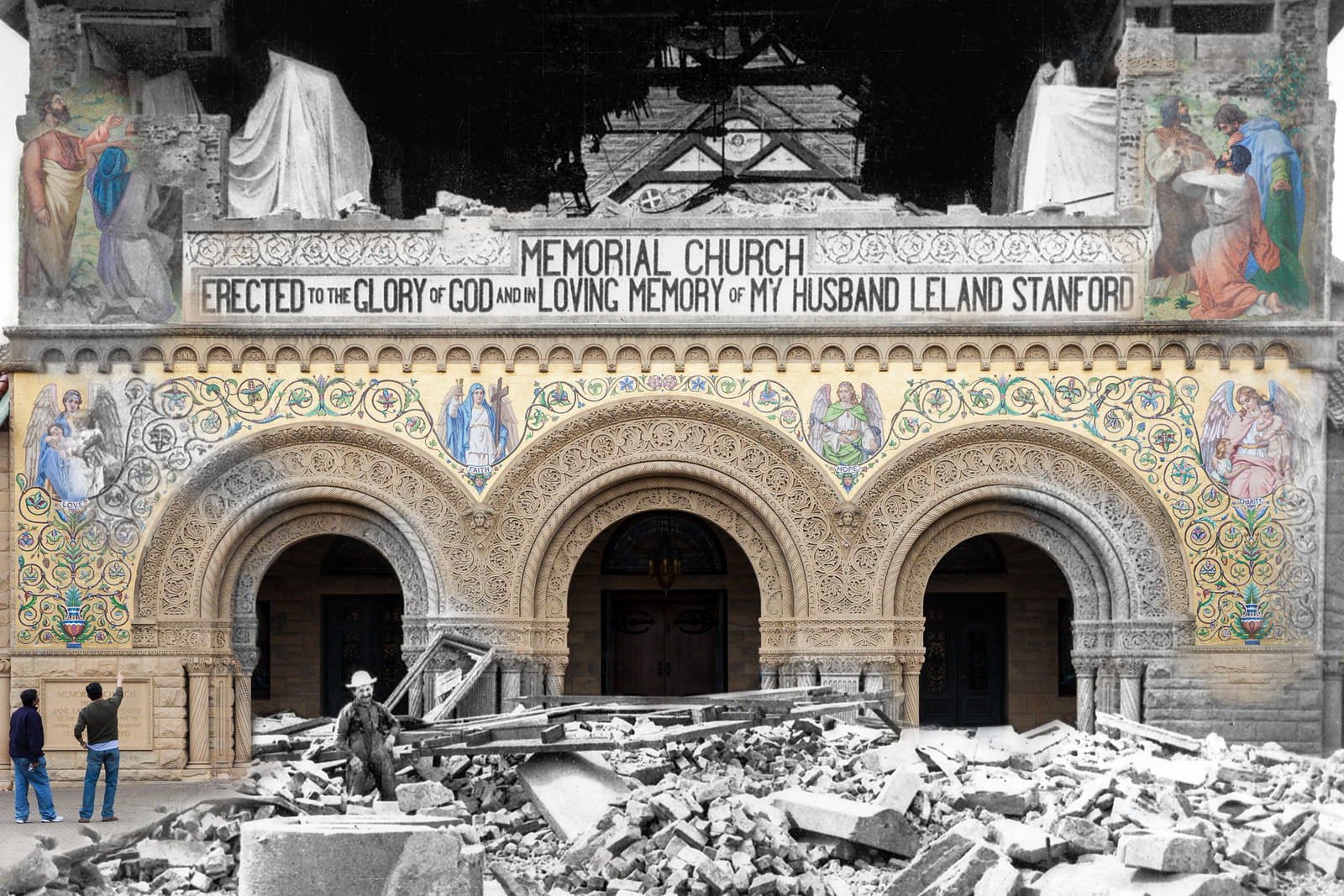
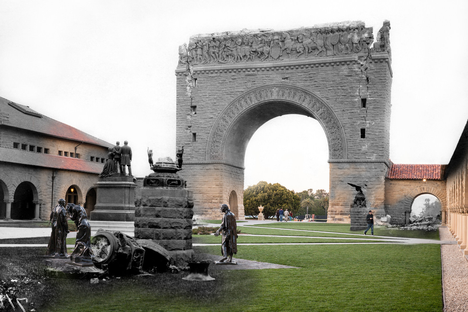
Stanford’s campus sustained some of the worst structural damage of any single location. The Memorial Church, which had been a centerpiece of the university, was left with a collapsed spire, cracked walls, and destroyed mosaics. Nearby, the Stanford Arch — a grand stone gateway — was also reduced to rubble.
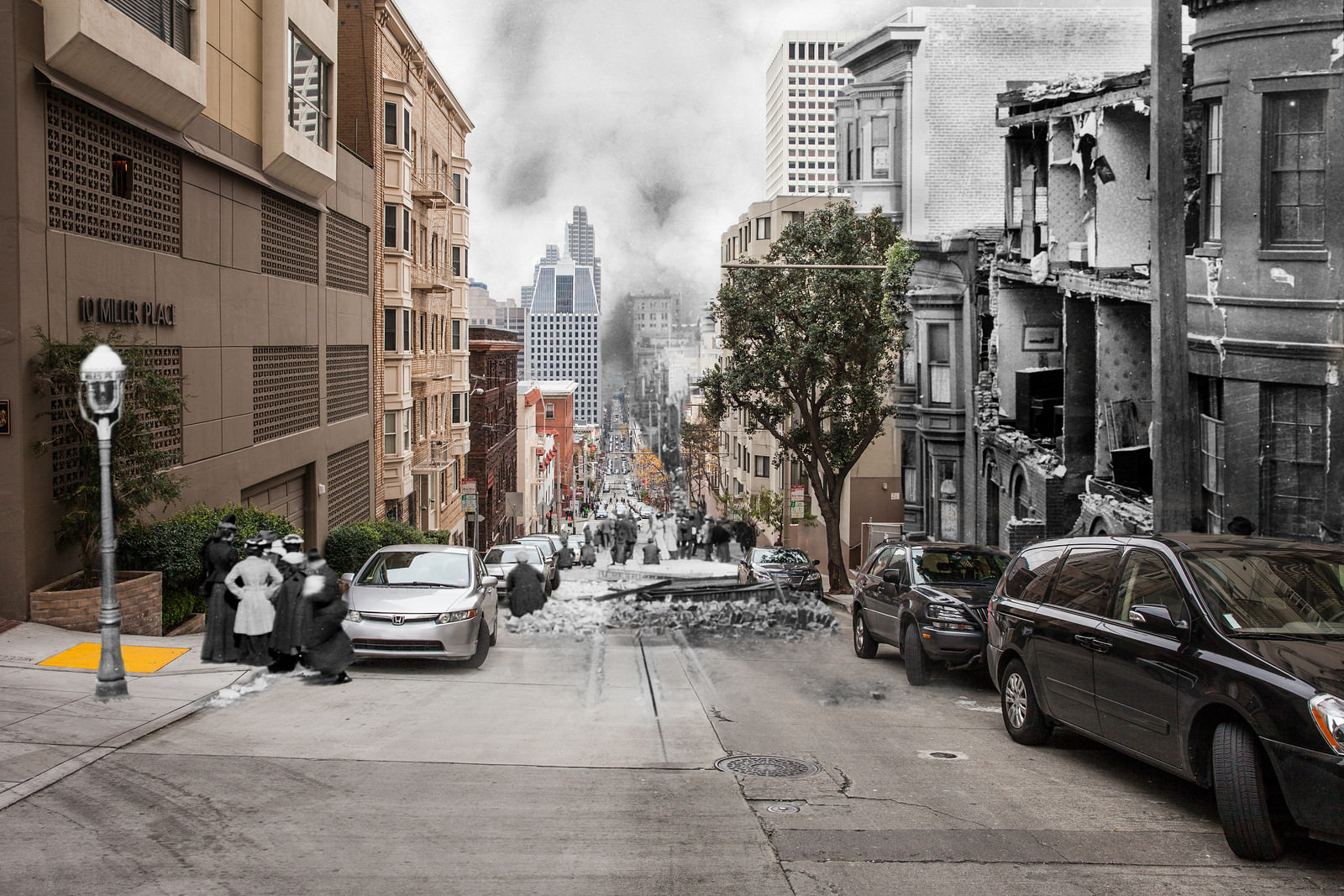
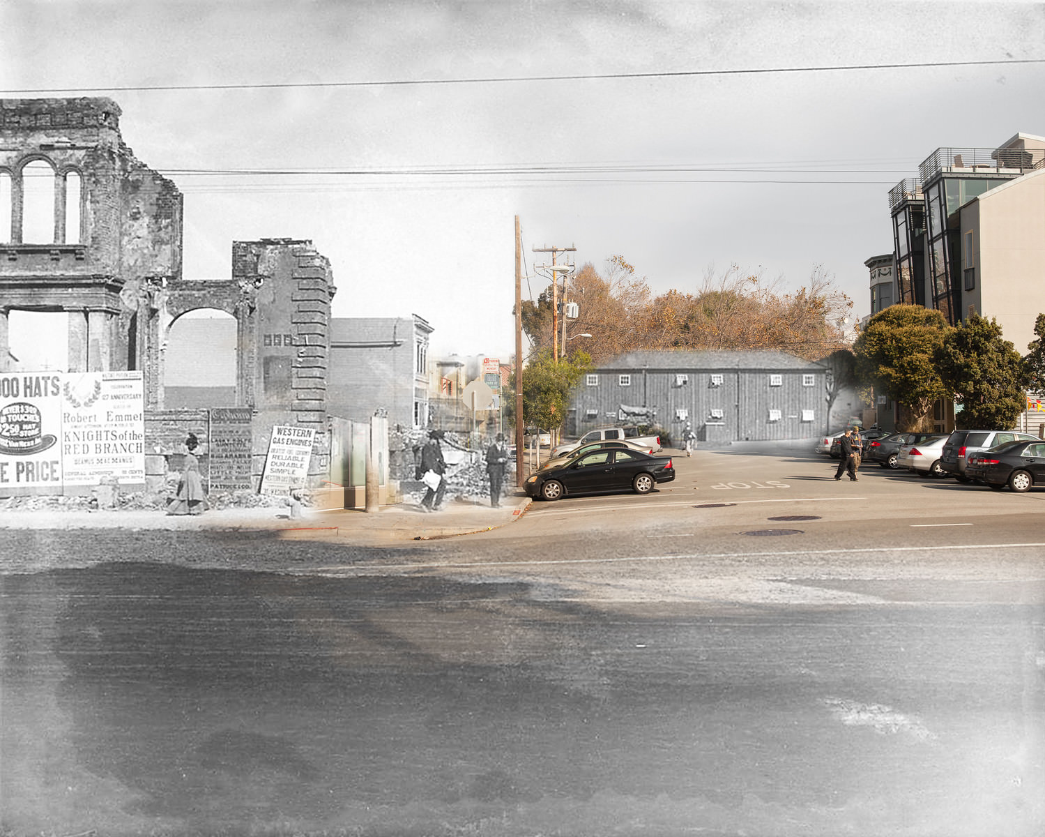
Back in the city, entire neighborhoods were flattened. Sacramento Street, one of the main corridors running east through the city, was buried under debris. The blended photographs of these streets are among the most striking in Clover’s series — modern pedestrians and parked cars appear to move through scenes of total ruin.
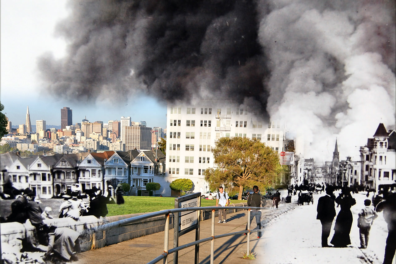
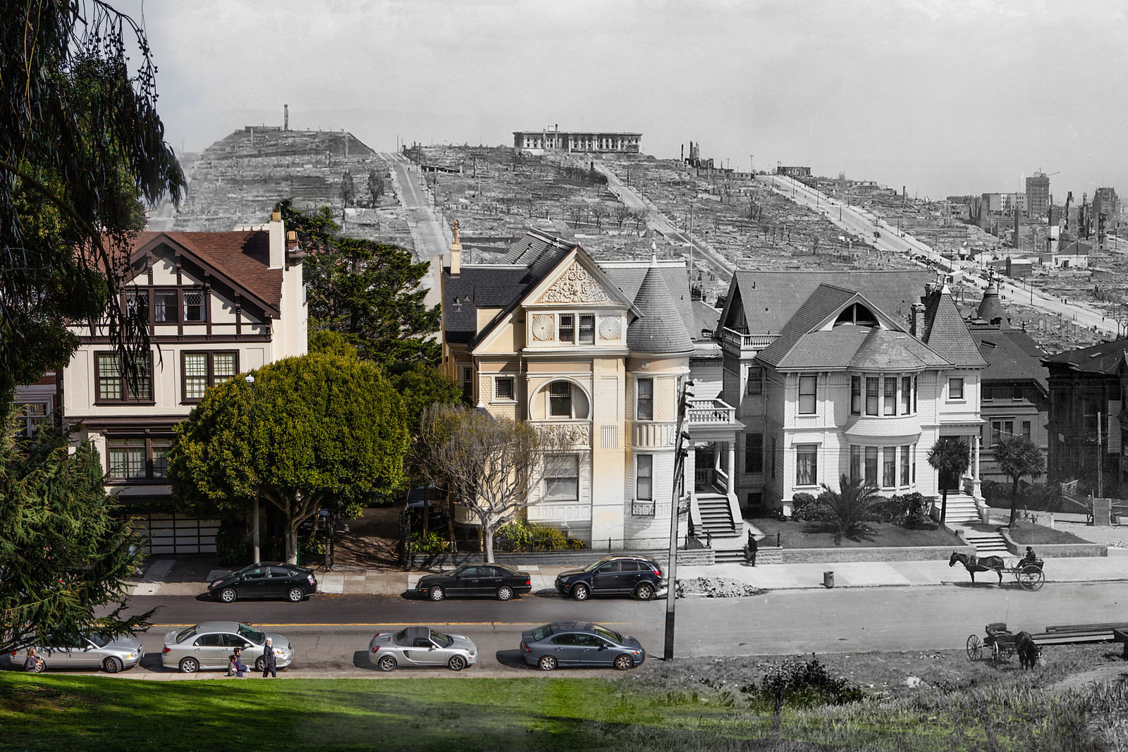
Not every part of the city burned. In the Western Addition, the famous Painted Ladies — a row of Victorian houses on Alamo Square — survived the fire that consumed so much of the neighborhoods around them. While the city smoldered in the distance, residents sought open ground. Mothers rested along the low wall of Alamo Square Park as their children played on the grass, refugees from a city in crisis.
Religion and fire crossed paths repeatedly during the disaster. Old Saint Mary’s Cathedral in Chinatown survived the earthquake itself but was gutted by the fire that swept through afterward. Its brick shell remained standing, a hollow monument to what had been lost. Nearby, the Fairmont Hotel on Nob Hill told a similar story — its grand exterior stood intact while the interior was destroyed by flames.
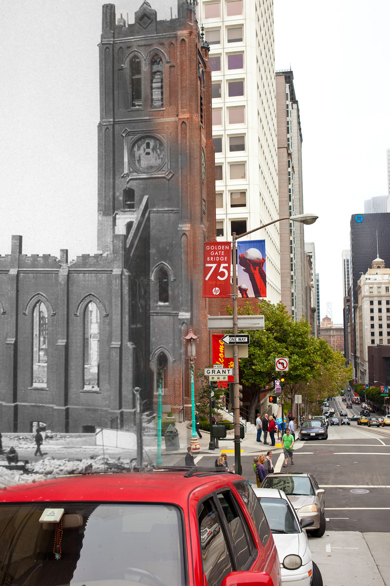
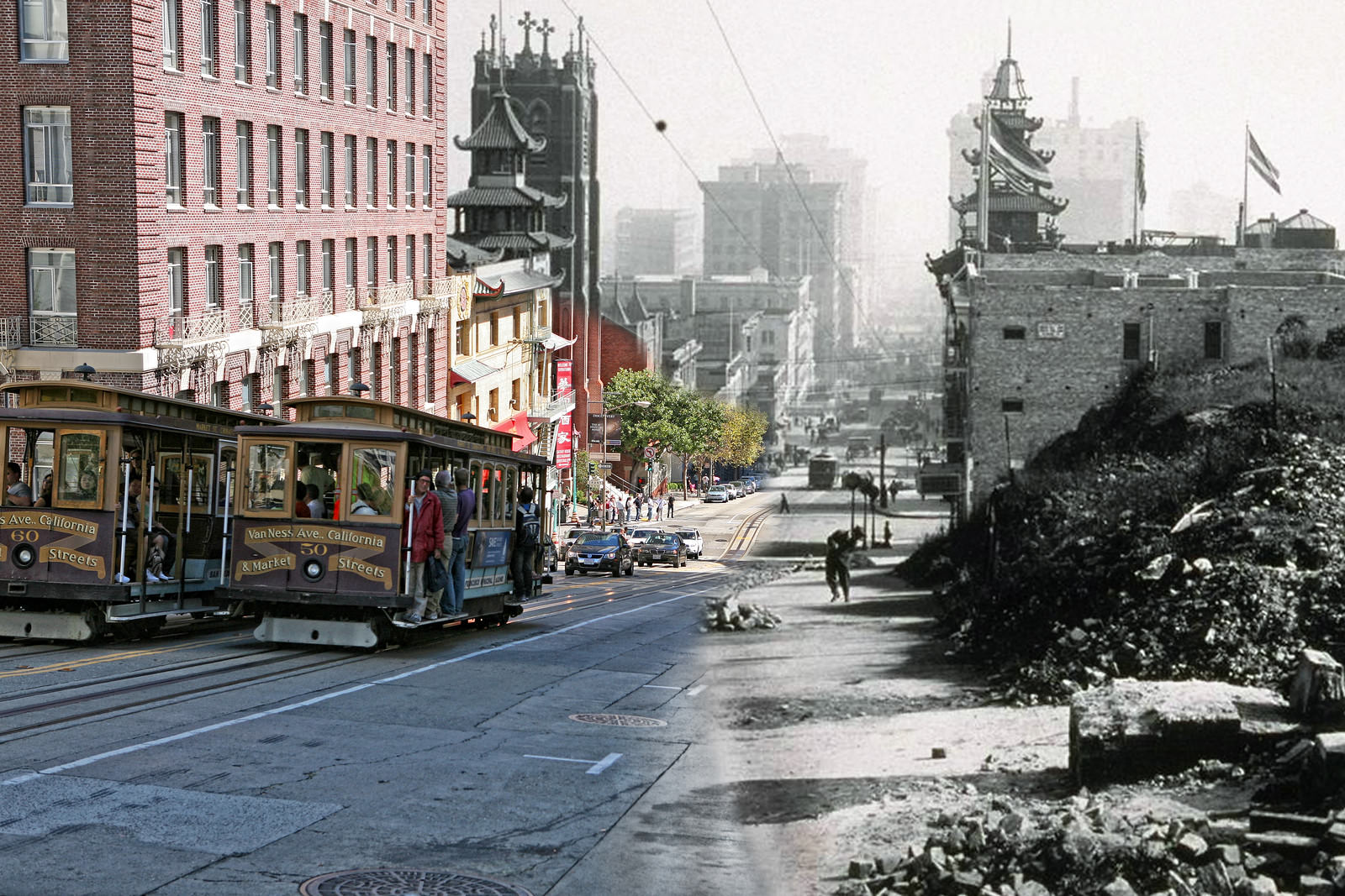
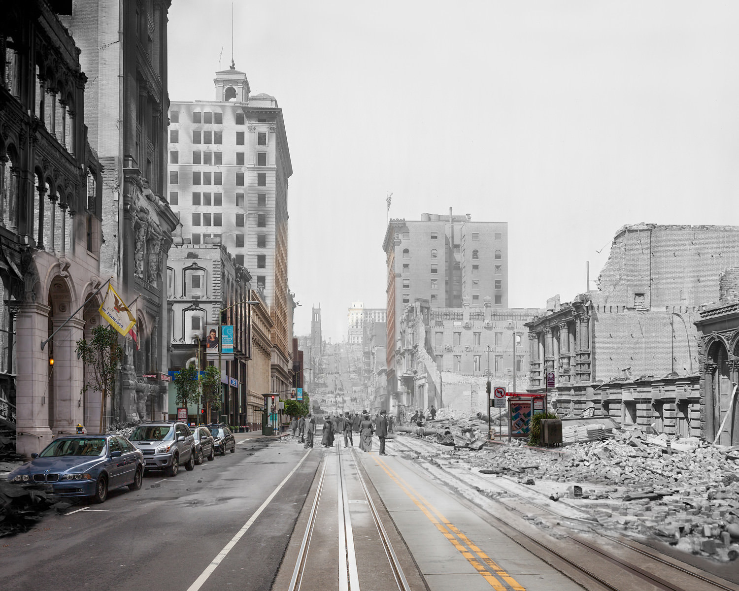
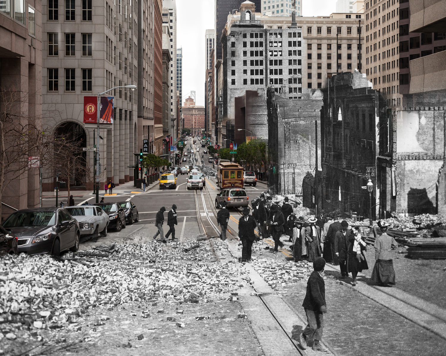
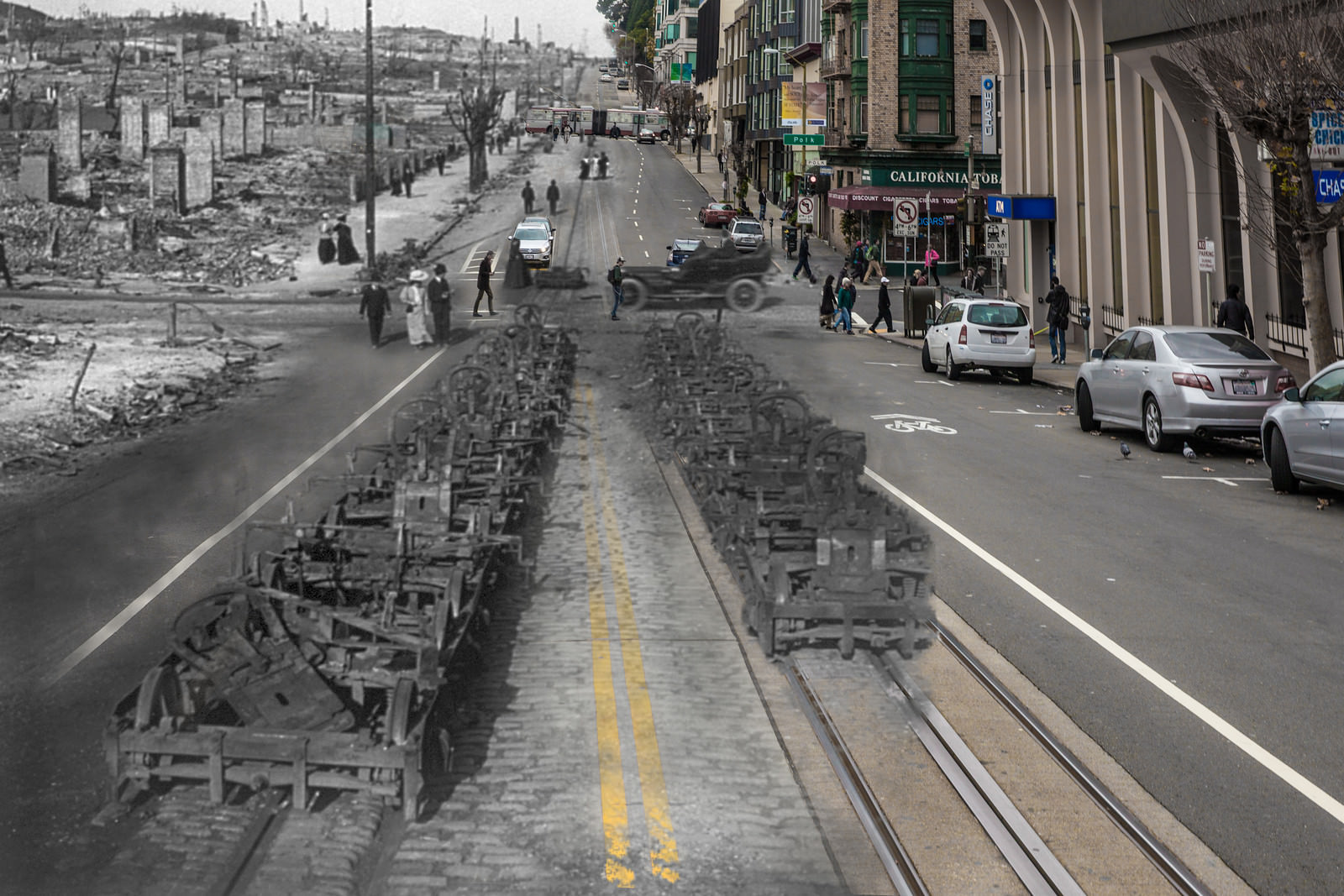
California Street, which climbs Nob Hill toward some of the city’s wealthiest addresses, was a scene of total devastation. Cable car lines were melted down to bare steel trucks on the road. The fires that burned through the stretch between Polk and Larkin Streets left almost nothing behind. Old St. Mary’s Cathedral, visible from the hill, was one of the few recognizable structures still standing in that direction.
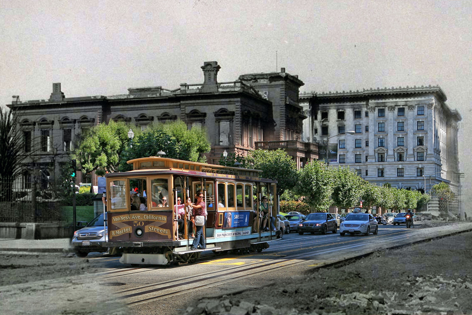
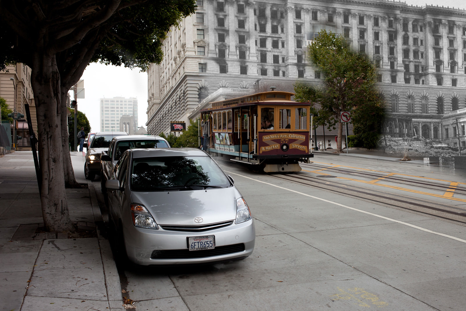
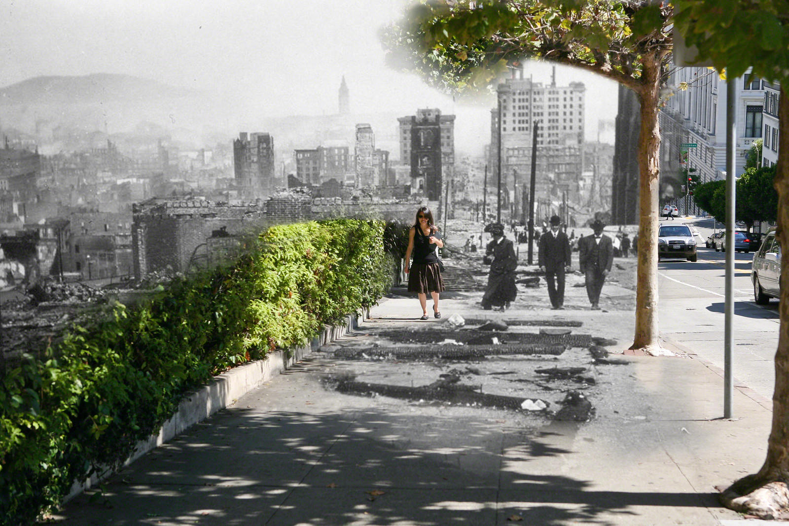
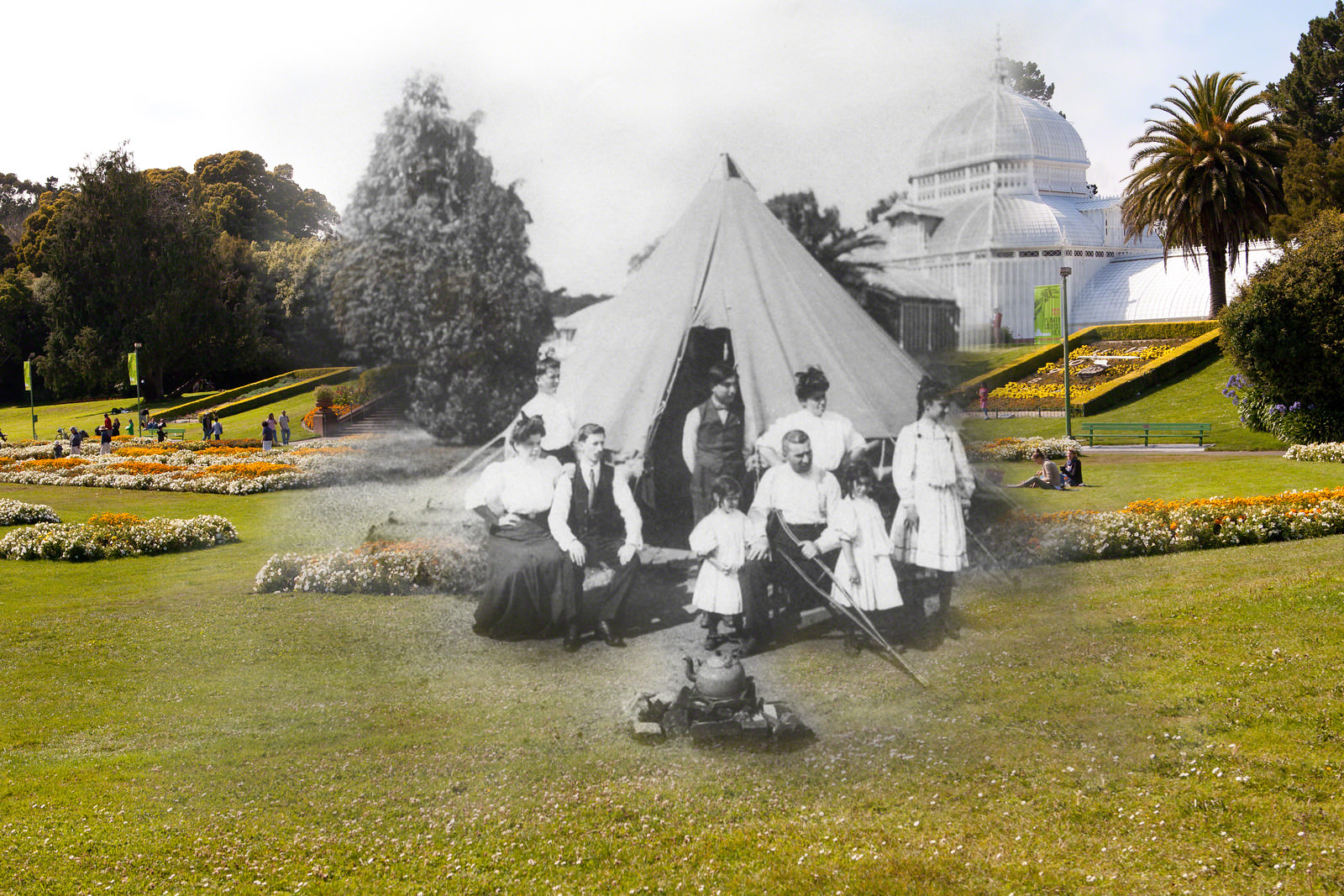
Golden Gate Park became a refuge for thousands of displaced residents. The Conservatory of Flowers, a grand Victorian greenhouse in the park, came through the disaster undamaged. Around it, rows of tents housed families who had nowhere else to go. The contrast between the ornate, intact glasshouse and the makeshift camp surrounding it captured the chaos of those early days.
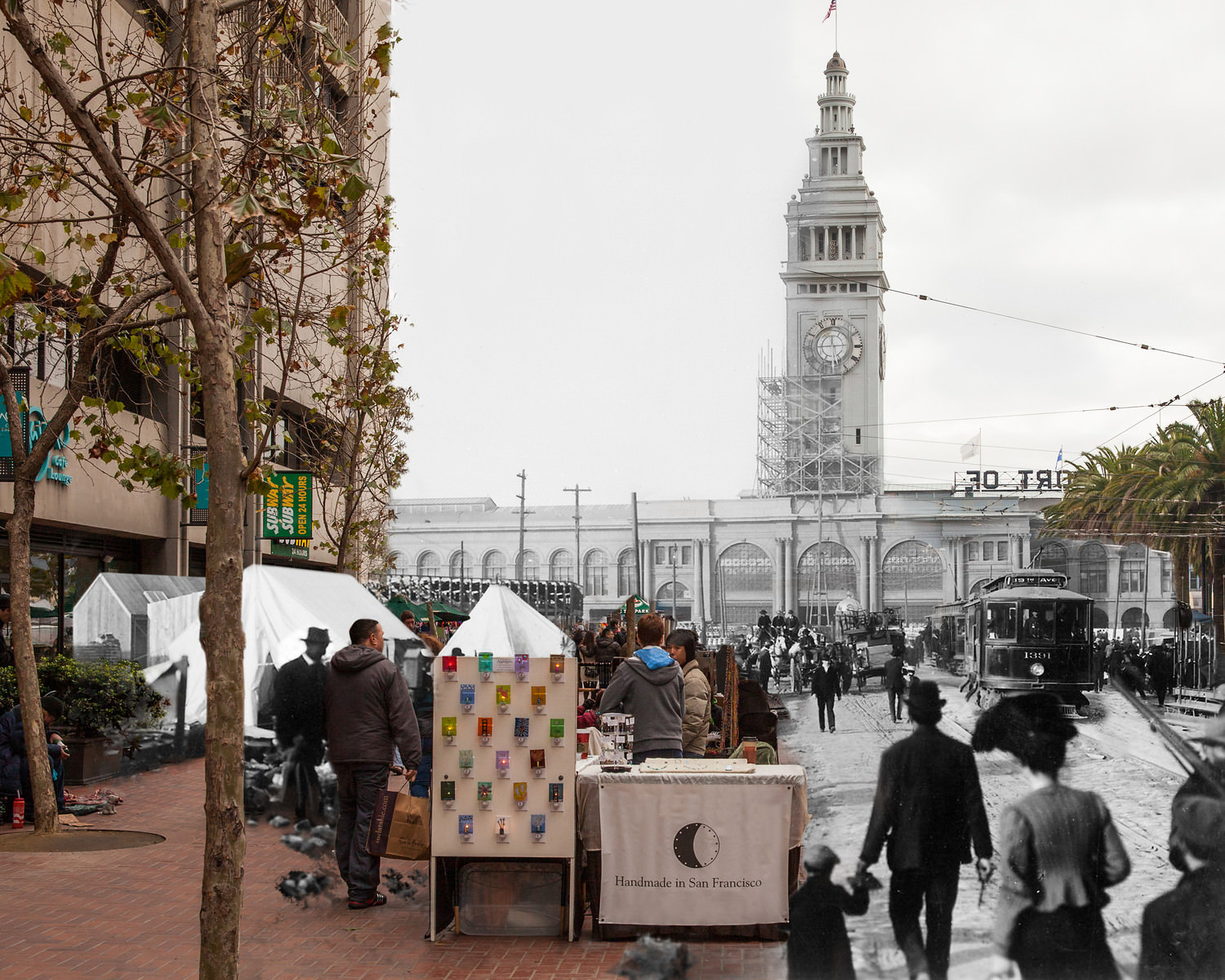
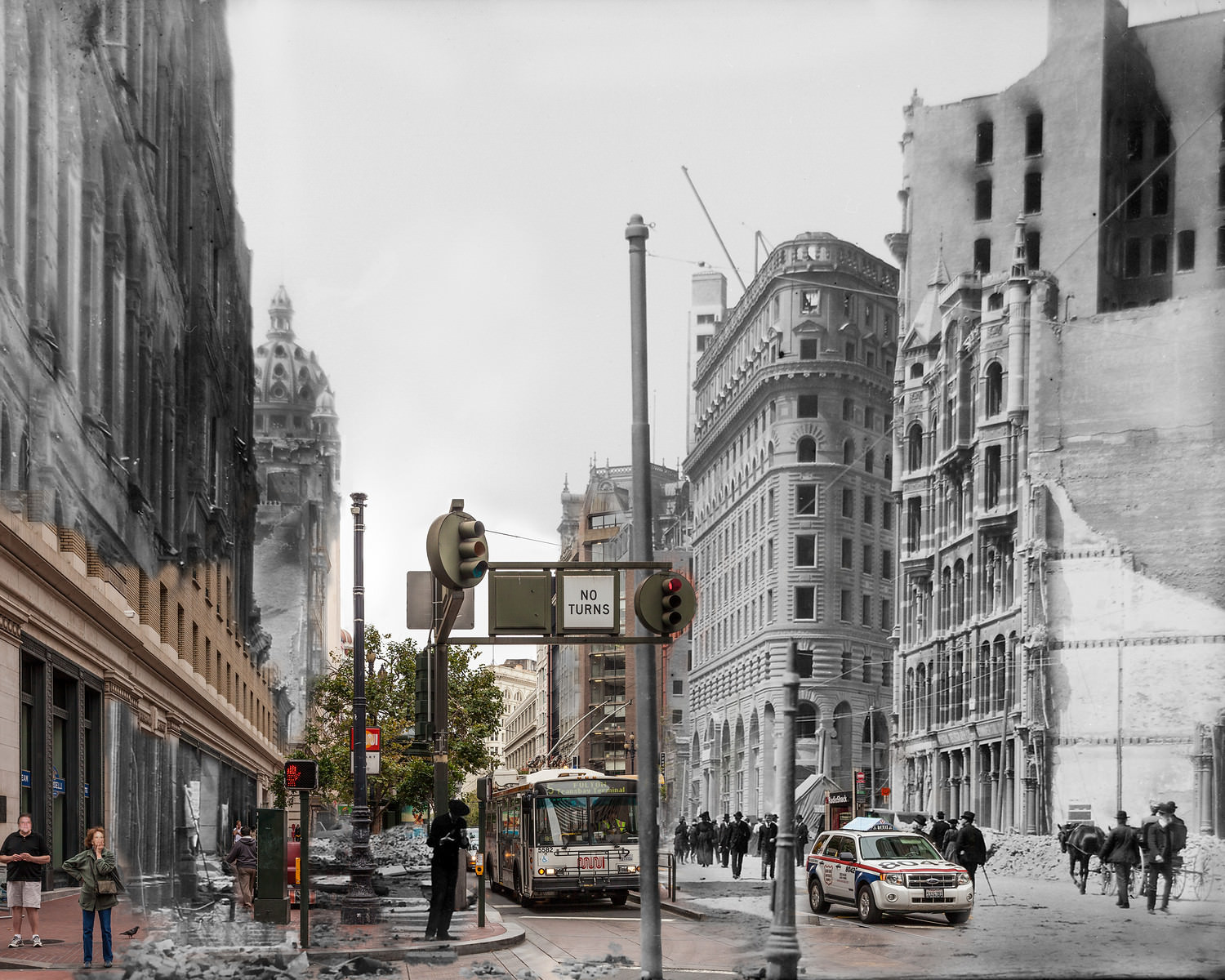
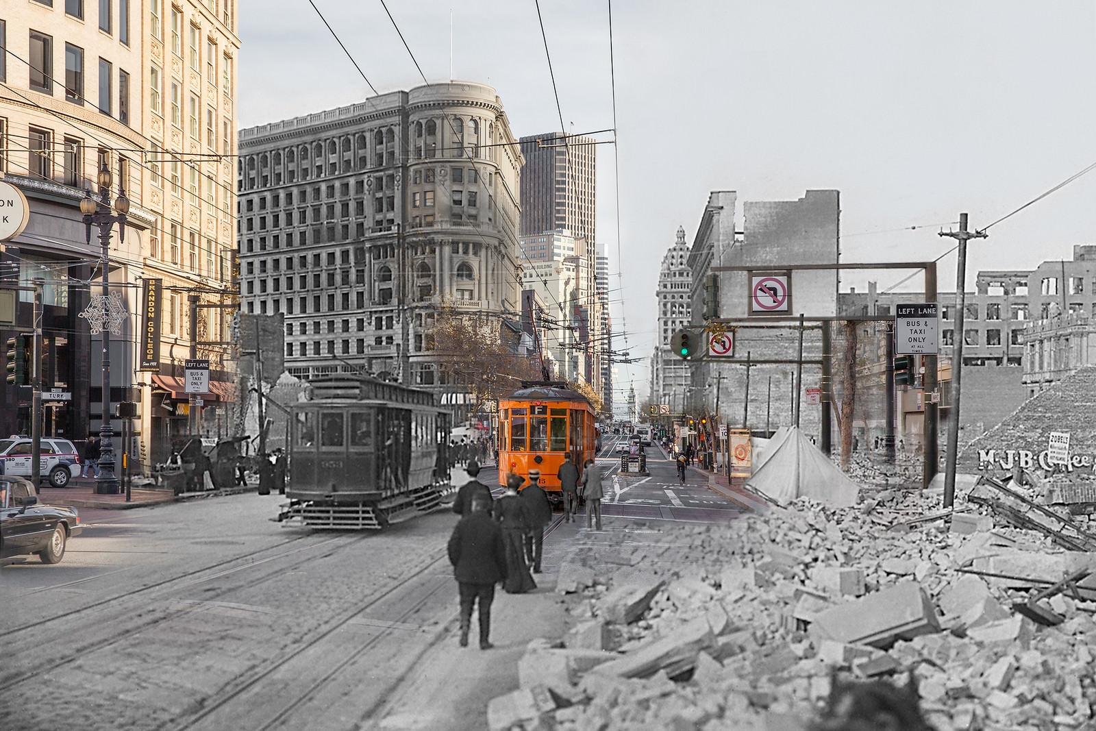
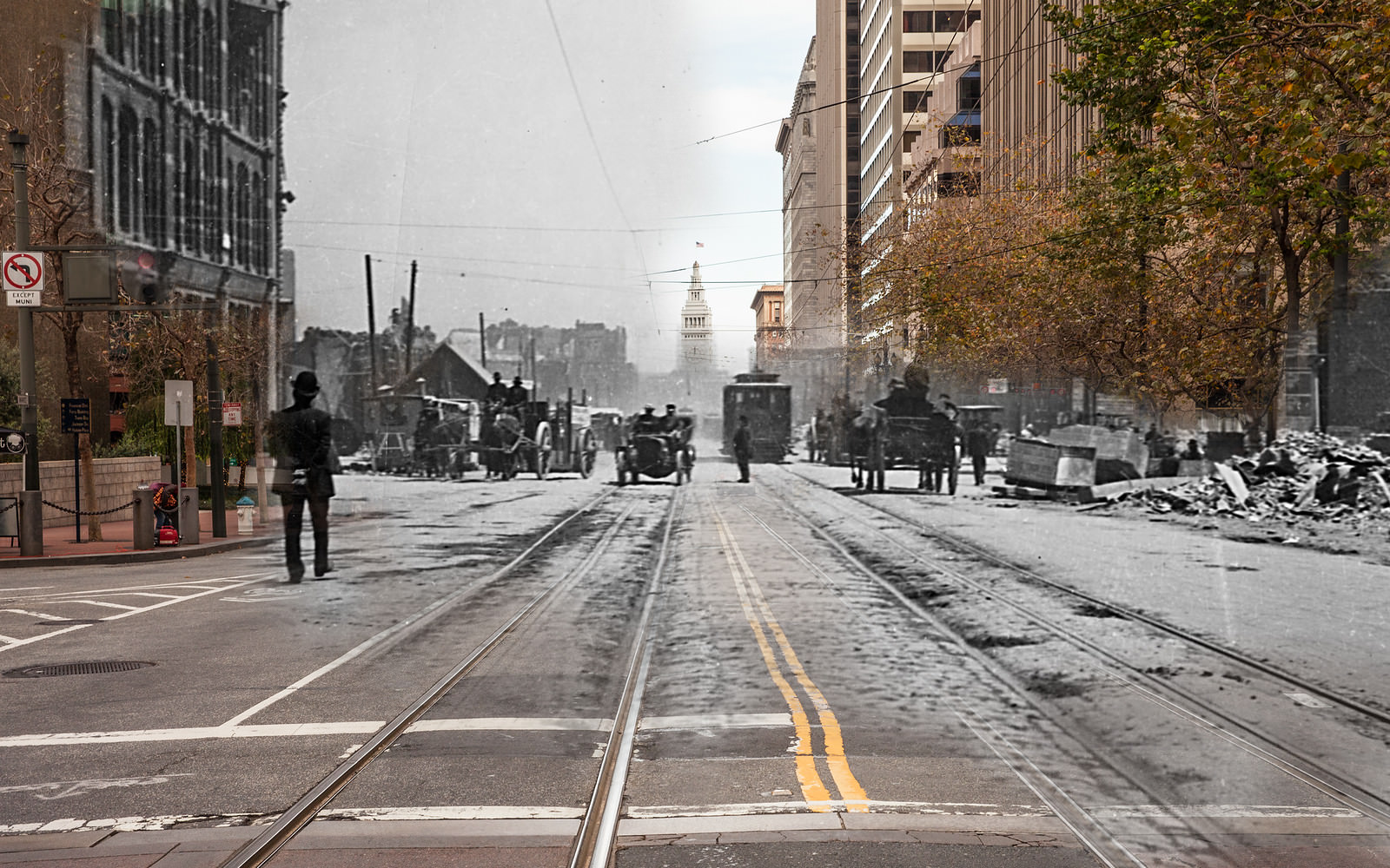
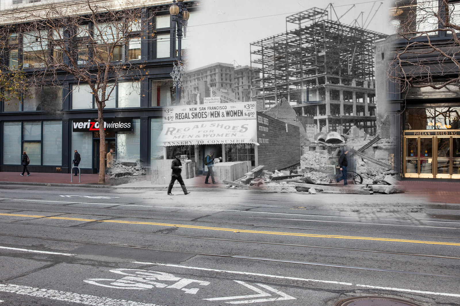
Recovery began almost immediately. Within days of the earthquake, workers were clearing rubble from major thoroughfares. On Market Street, streetcars were running again through cleared debris while vendors set up stalls at the foot of the road. The speed of the city’s response was remarkable given the sheer scale of what had been destroyed.
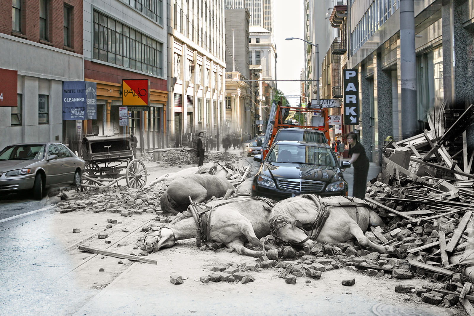
The human cost of the earthquake was visible everywhere on the streets. On Sacramento Street, horses killed by falling rubble lay in the road while daily life resumed around them. Clover’s blended photographs place a modern woman opening her car door directly beside the carcasses of draft horses — the kind of image that makes the passage of time feel both enormous and razor-thin.
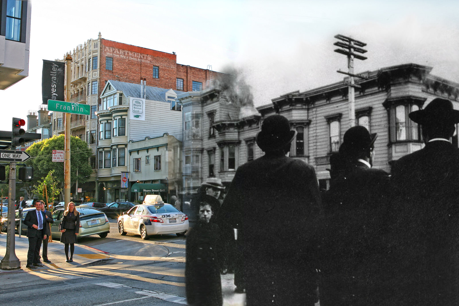
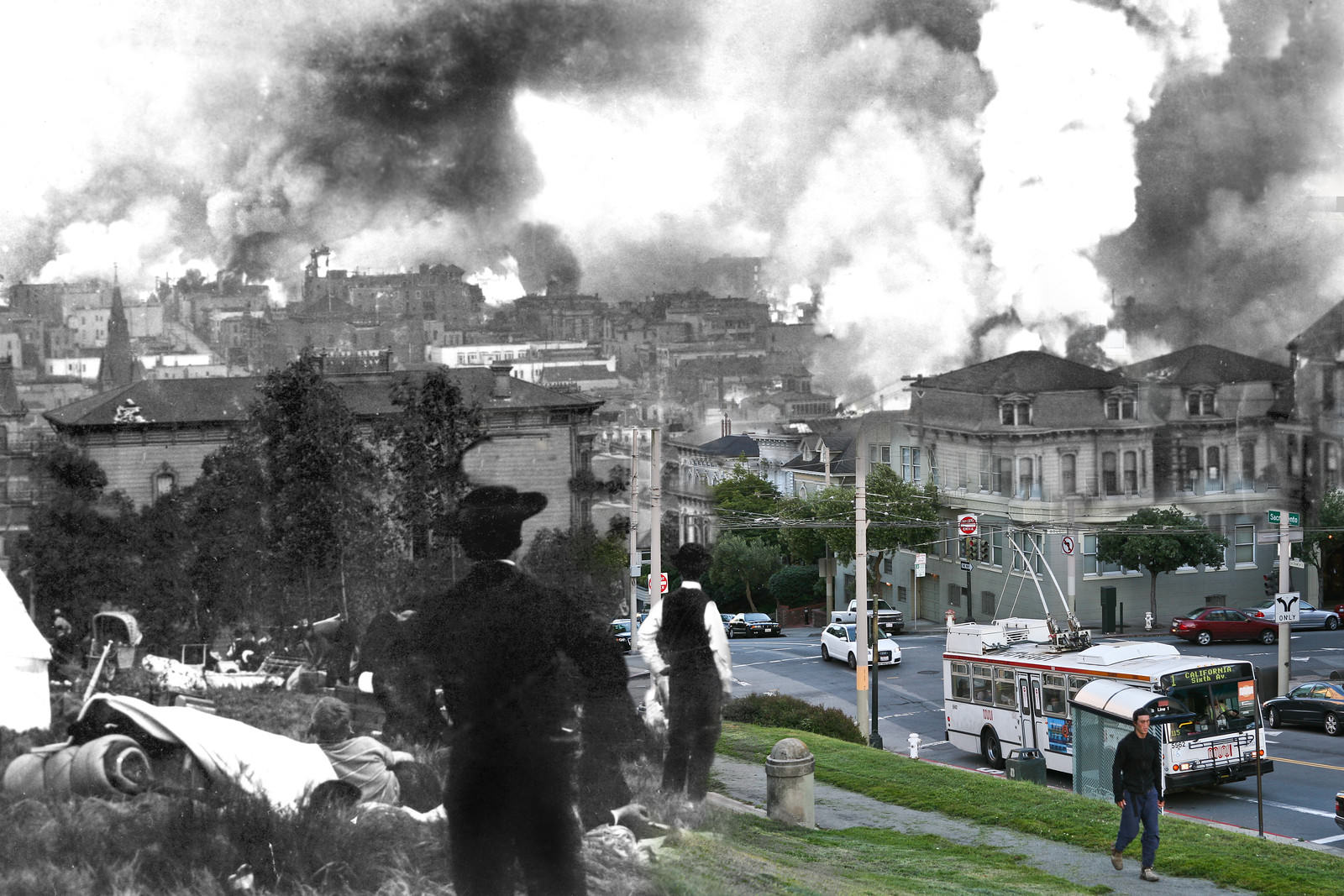
In some neighborhoods, fires were still burning as residents stood and watched. On the corner of Franklin and Hayes Streets, fire consumed a building while onlookers faced the camera — a mix of business people and at least one young child, standing just yards from the flames. At Lafayette Park, residents climbed the grass to get a clear view of the massive fires engulfing the lower parts of the city.
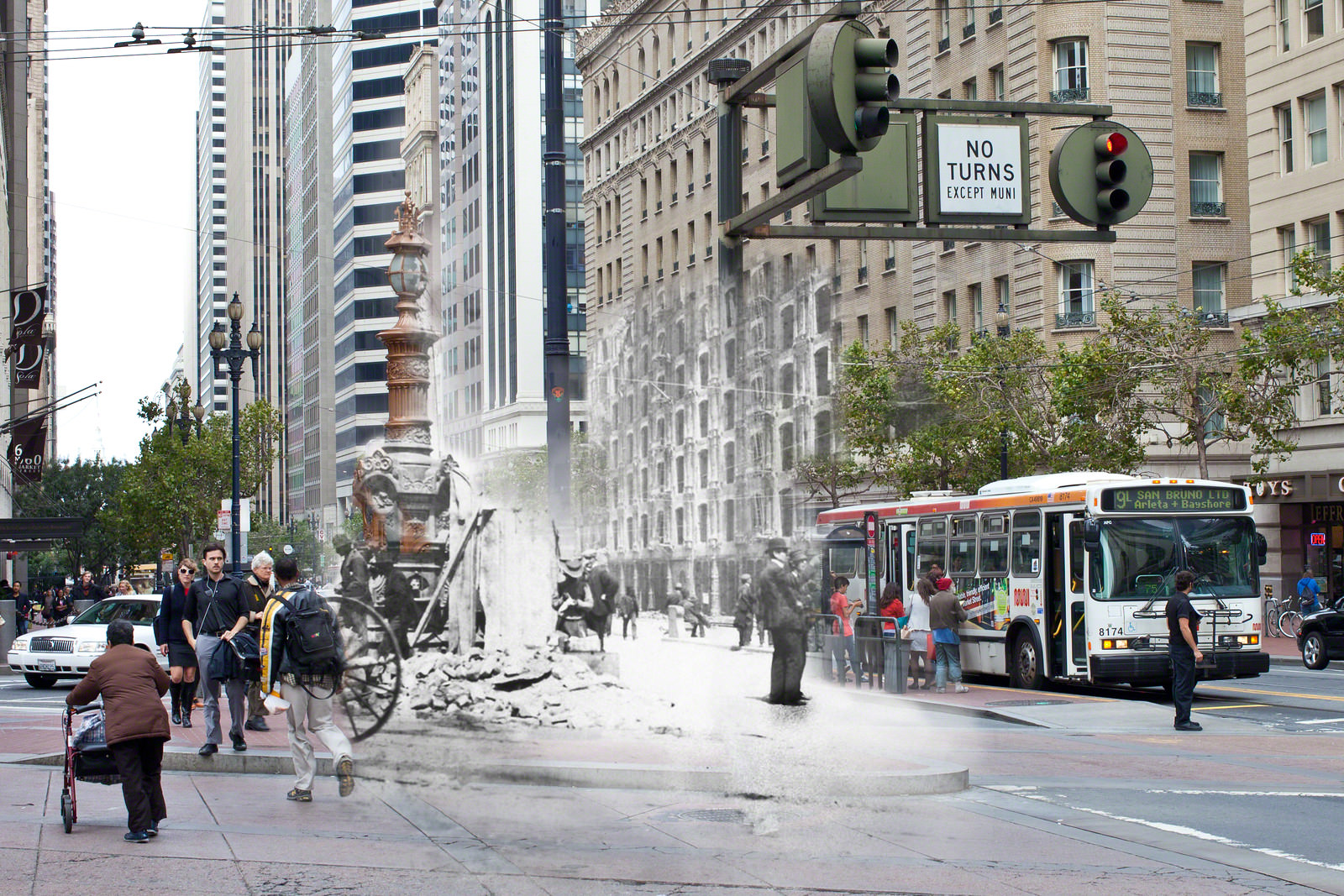
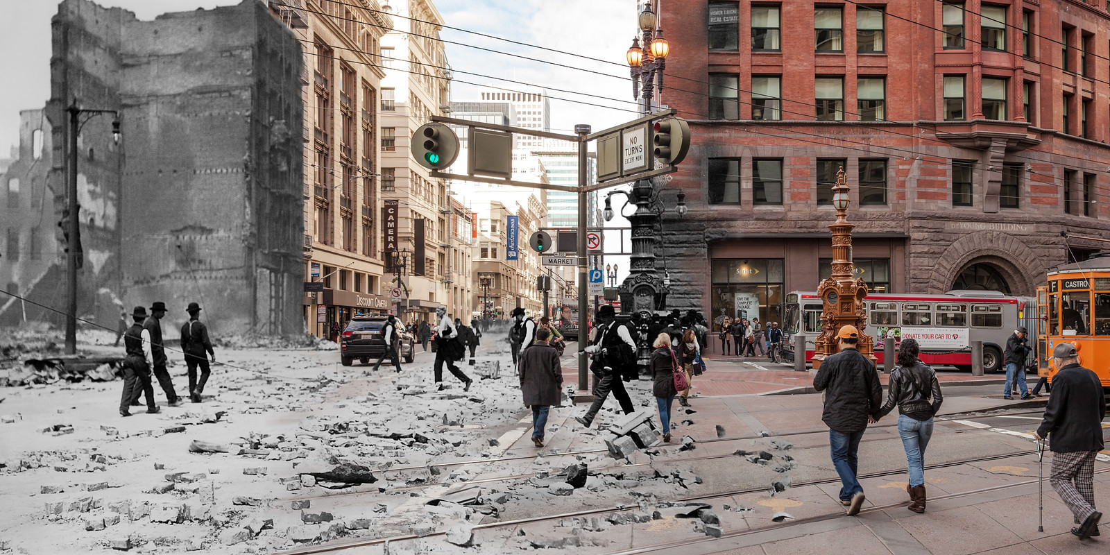
Lotta’s Fountain at the intersection of Market, Kearny, and Geary Streets served as a central meeting point for survivors searching for missing family members. It was one of the few landmarks left standing at that busy intersection, making it a natural gathering place in the chaos that followed. The Fountain still stands today.
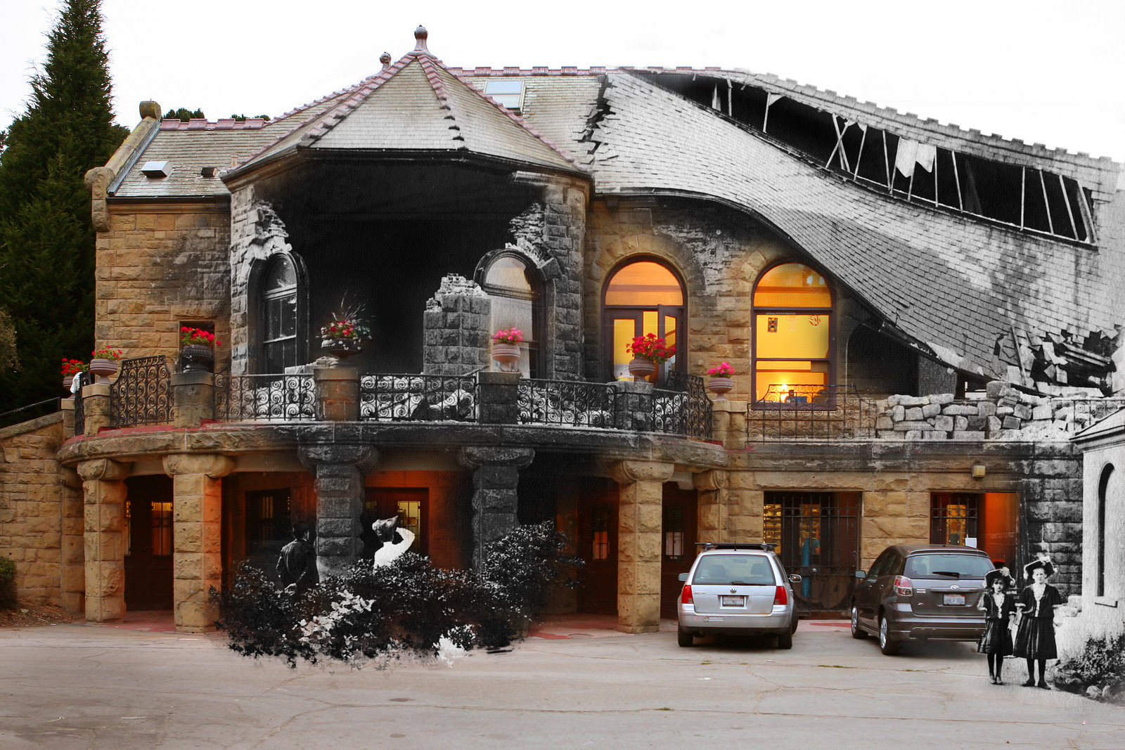
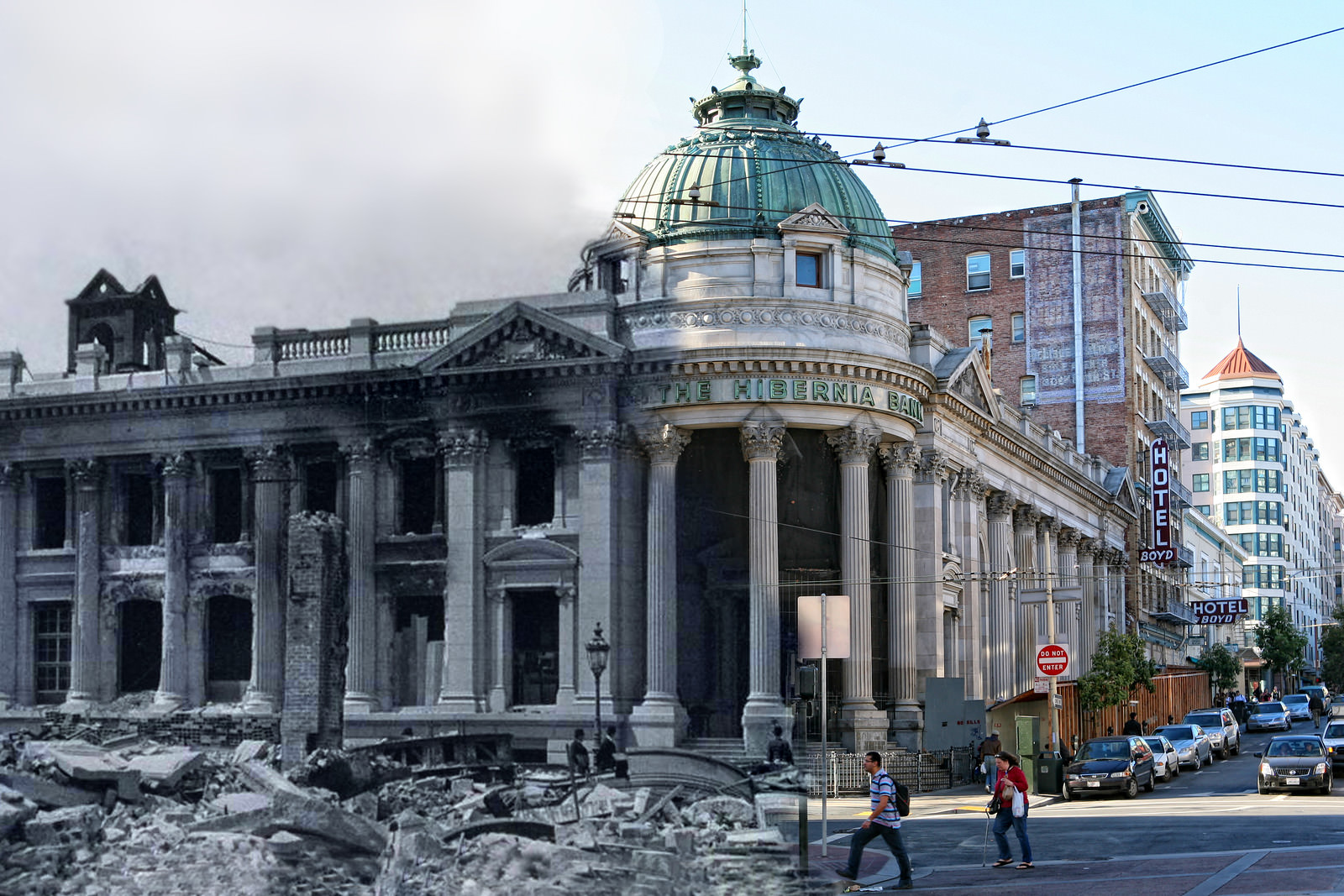
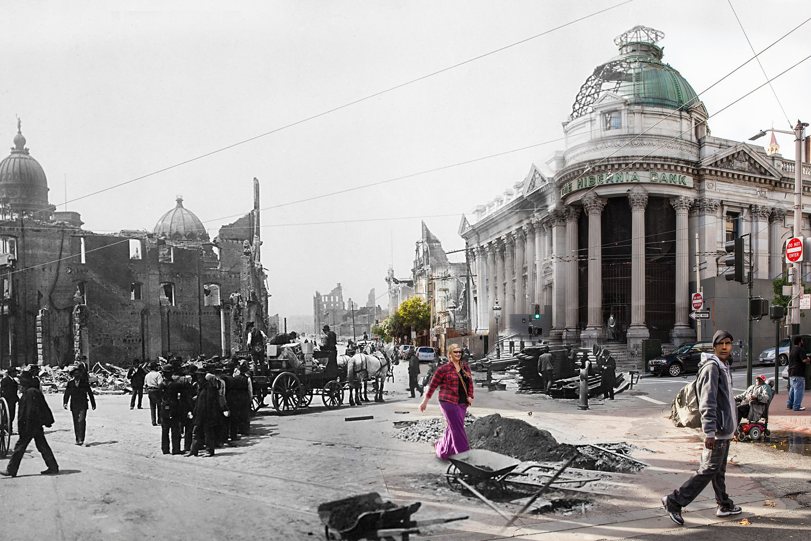
Golden Gate Park also housed the Sharon Building, which suffered partial damage in the quake. In Clover’s image, two girls stand before its crumbling facade while, in the present-day layer, students work on art projects inside the now-restored space. The Hibernia Bank on Market Street offered a similar contrast — burned out but structurally sound, its stone walls still rising above the rubble around it.
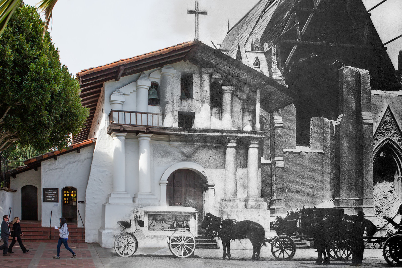
Mission Dolores, the oldest building in San Francisco, survived the earthquake intact. The original adobe church, built in 1776, held together while the newer brick church constructed beside it was destroyed. The contrast between the two buildings — one ancient and flexible, one modern and rigid — told a clear story about what materials could withstand the kind of violent ground movement the earthquake produced.
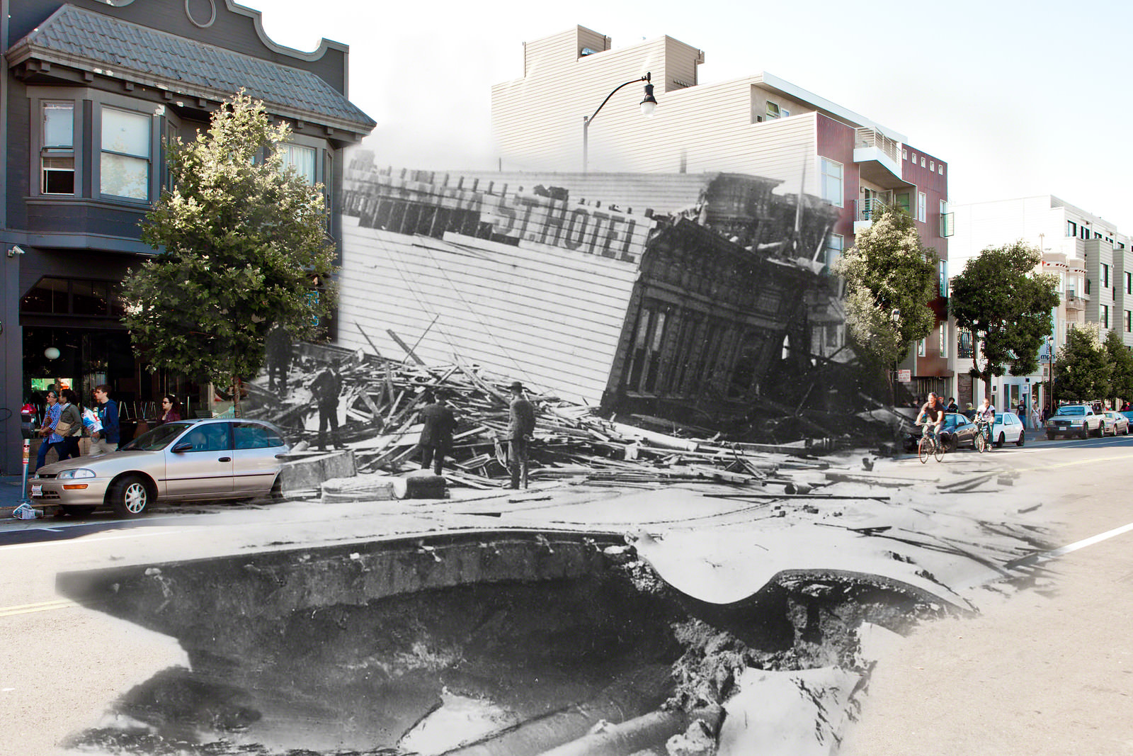
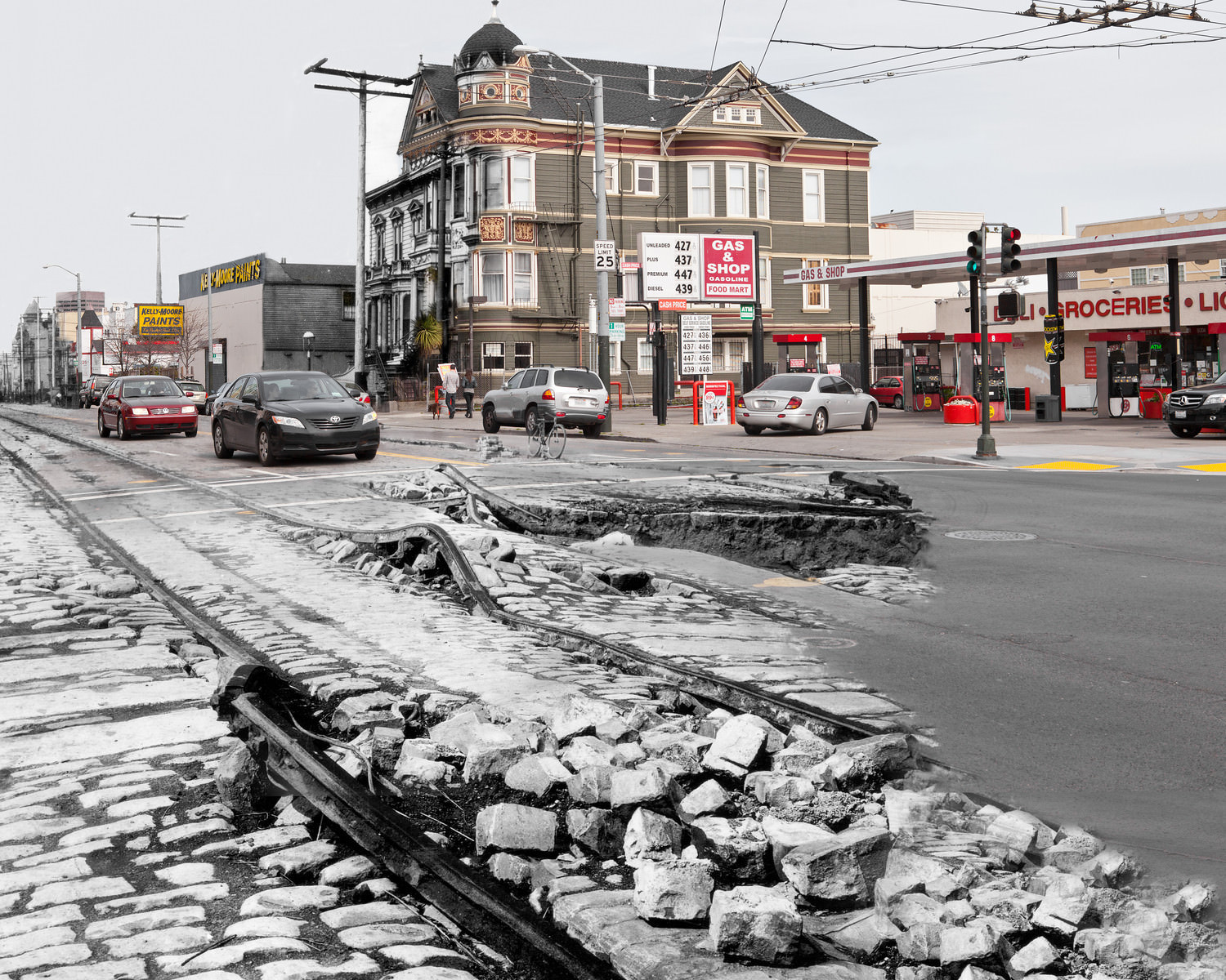
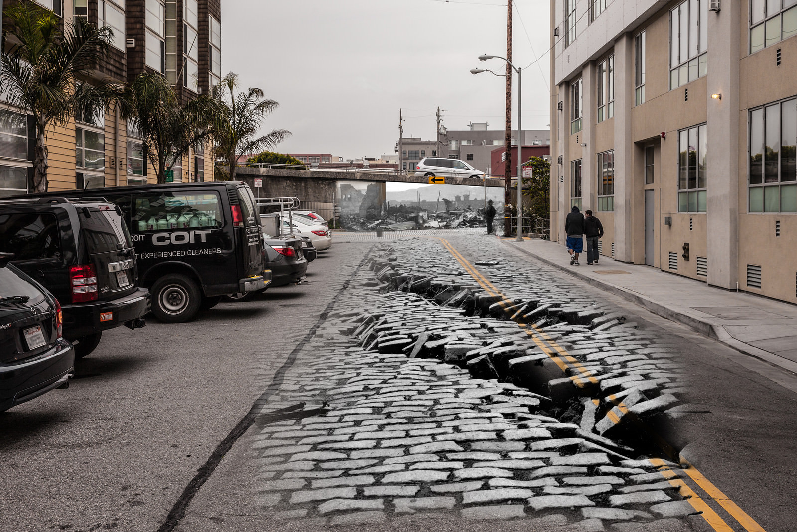
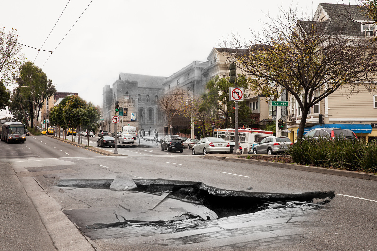
Some of the most dramatic destruction came from the ground itself giving way. The Valencia Street Hotel sank several feet into the earth as the soil beneath it liquefied during the quake. A massive sinkhole opened in the street directly in front of it. Elsewhere, on South Van Ness, the road buckled and warped, and on 18th Street at Van Ness, workers stuffed lumber and barrels into a sinkhole to warn passing horses and carriages of the drop.
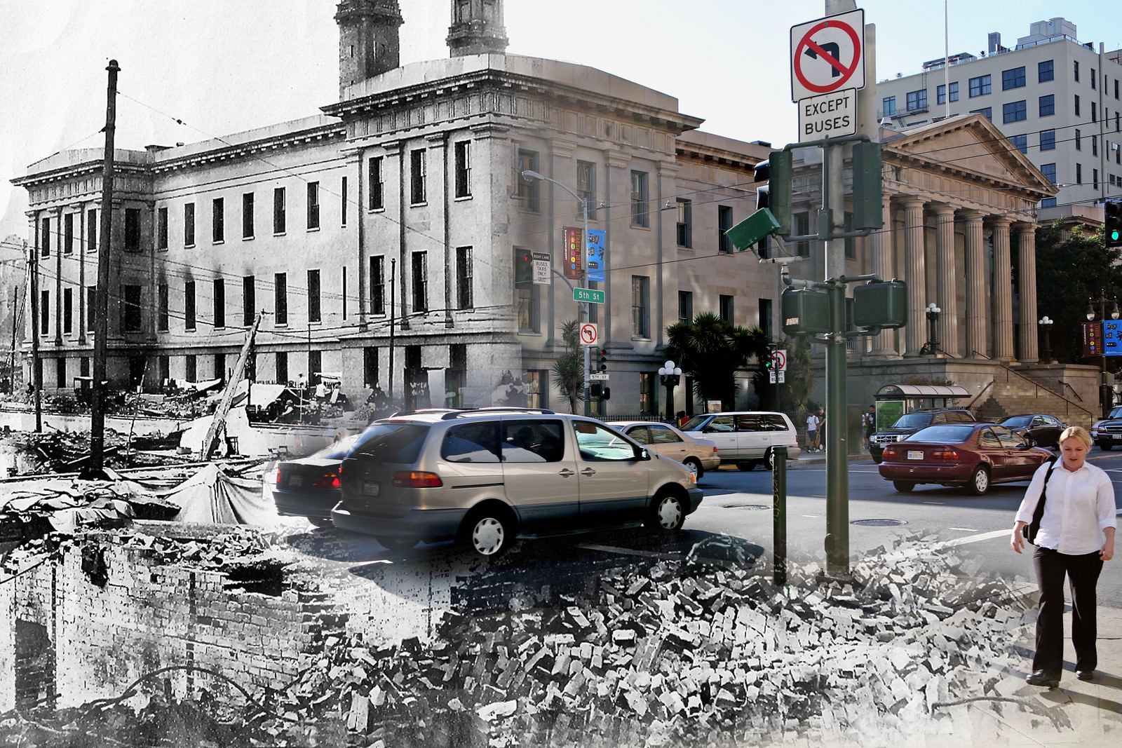
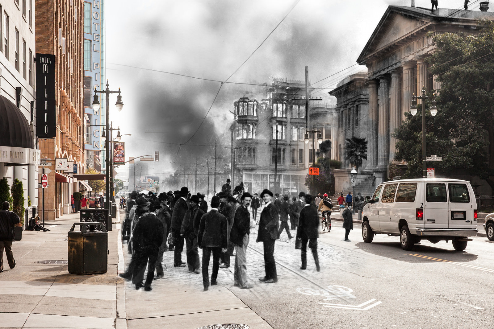
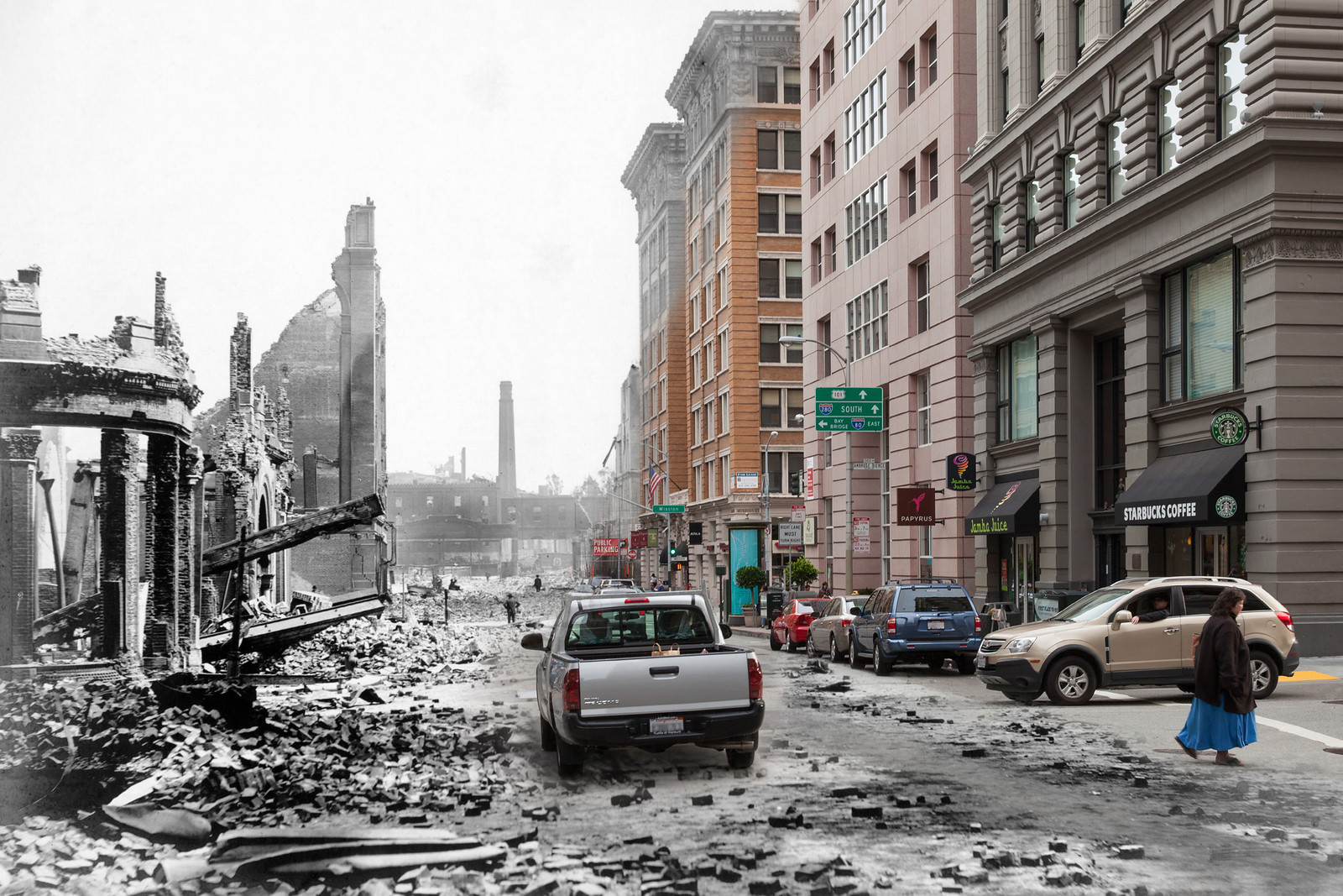
The United States Mint on Mission Street became one of the most remarkable stories of the disaster. While fire swept through the surrounding blocks, Mint employees and soldiers from the Army climbed to the roof and fought the flames directly, preventing the building from being consumed. The Mint held, saving millions of dollars in gold and silver coin. It stood like an island in a sea of ash and rubble.
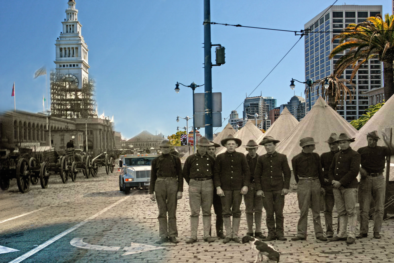
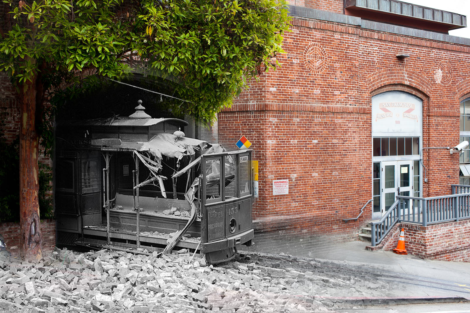
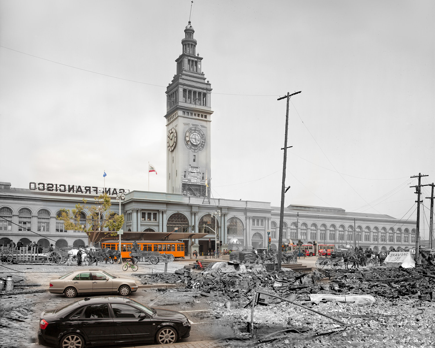
The city’s transit infrastructure took a direct hit. Cable car barn #455 was left half-collapsed, with the car itself resting partially inside the wrecked structure. The Ferry Building on the Embarcadero, by contrast, held up better than expected given that it sits on unstable made land at the water’s edge. Its tall clock tower remained standing, and it continued to serve as a critical point of entry and exit for survivors evacuating the city by boat.
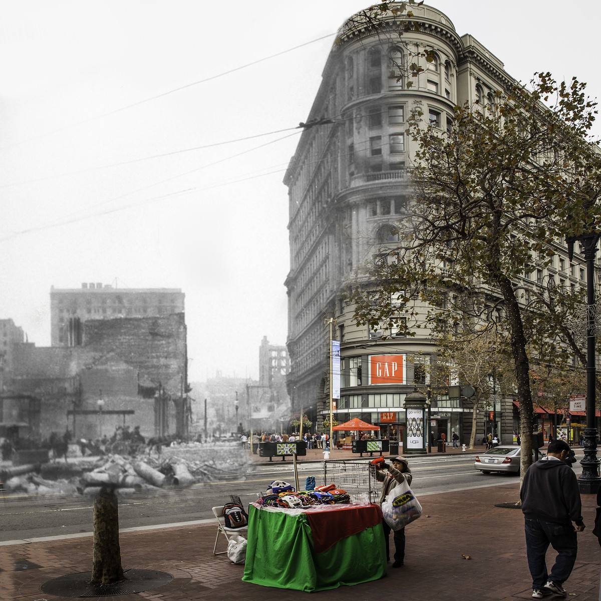
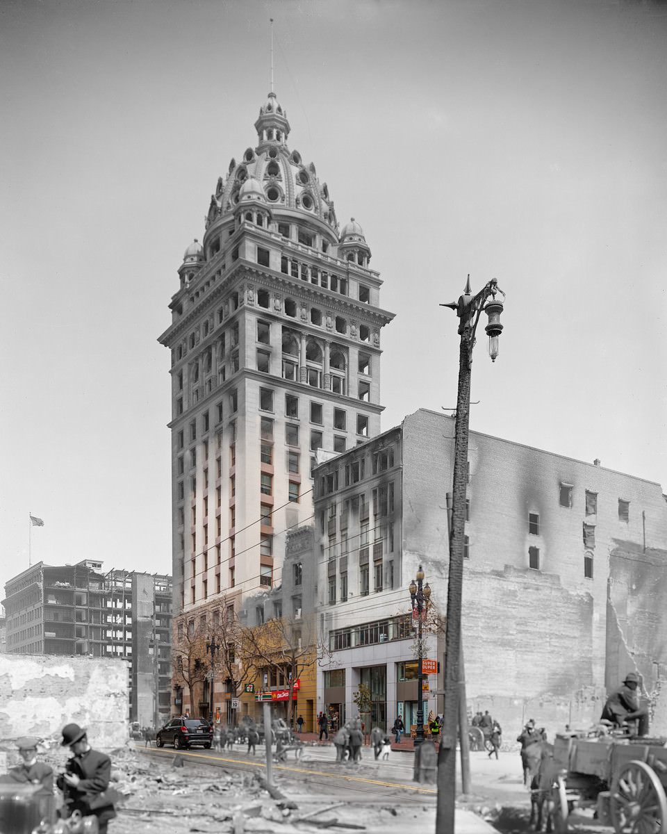
Throughout the city, certain buildings defied the destruction around them. The Rialto Building on New Montgomery Street remained upright amid the wreckage. The Flood Building on Market Street survived fire on all sides. The Call Building, one of the tallest structures in the city at the time, caught fire but its steel frame kept it standing. These buildings became anchors for the rebuilding effort that followed.
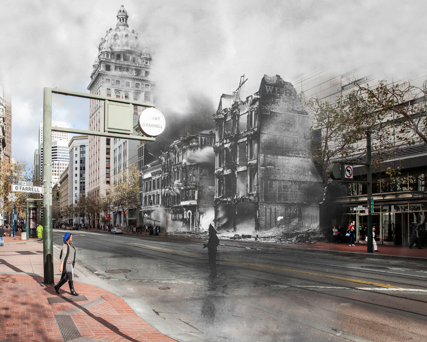
Market Street, the city’s main artery, was a focal point of both destruction and recovery. The Call Building, visible from many vantage points along the street, drew crowds who watched the fire inch closer and eventually enter the building. Spectators packed O’Farrell Street to watch the smoke billow toward it. Lotta’s Fountain and the Chronicle Building nearby stood at the center of the chaos, surrounded by burned-out shells of what had been commercial blocks.
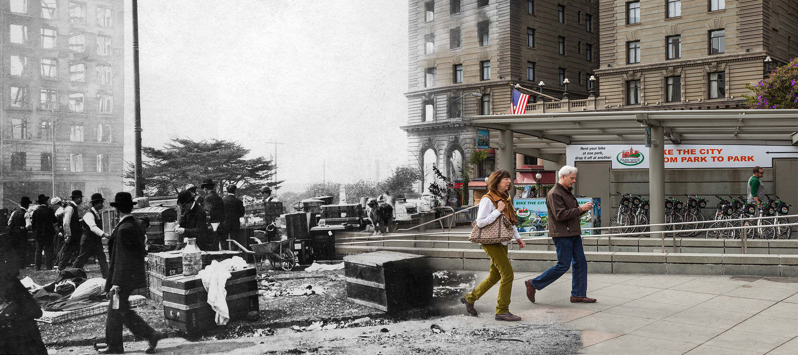
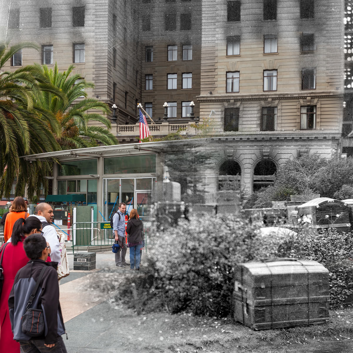
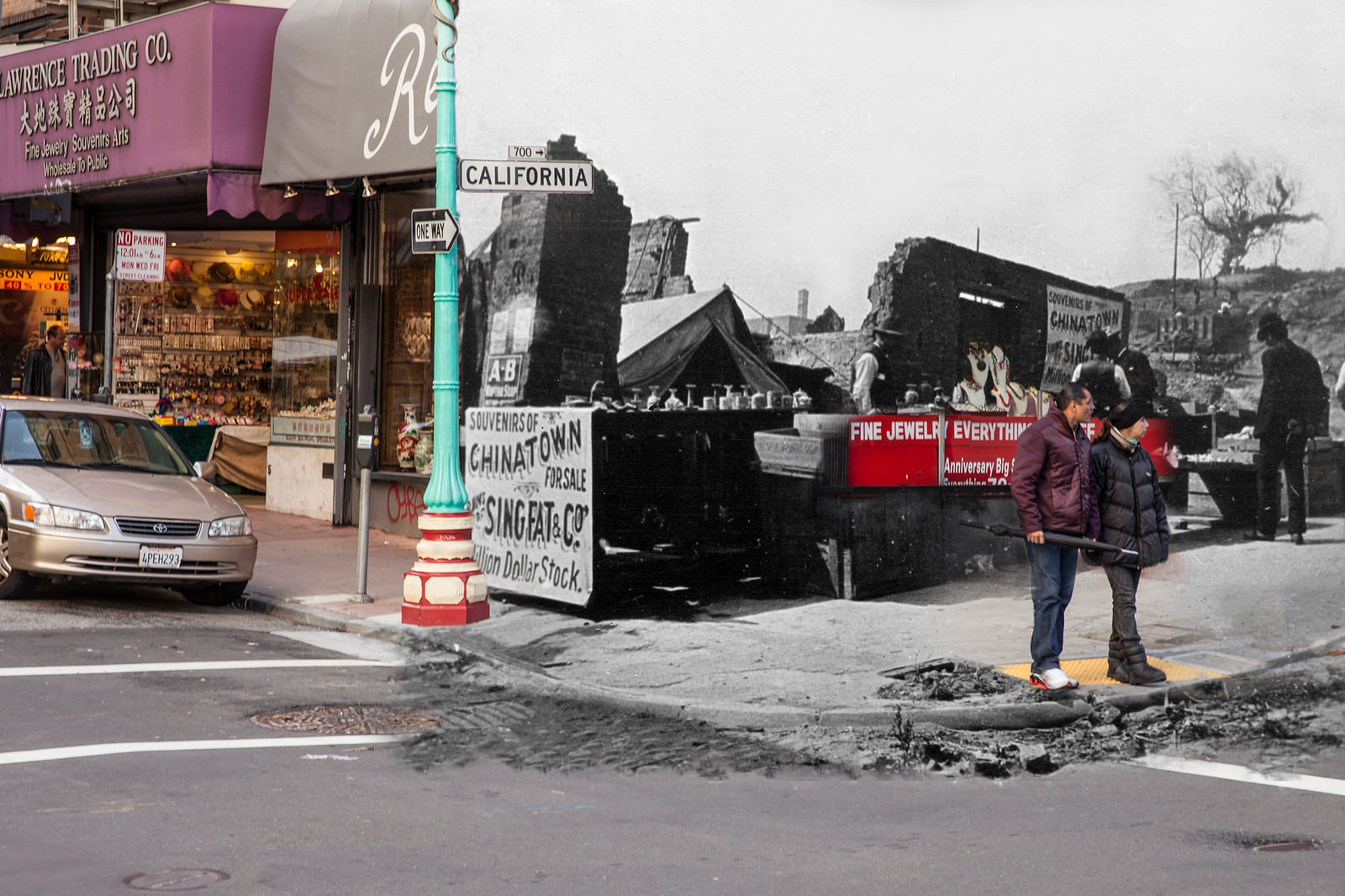
In Chinatown, some business owners moved quickly to reestablish themselves even before cleanup was complete. The Singfat store on the corner of California and Grant set up a temporary stand directly on top of the rubble to reclaim their commercial spot. It was an early sign of the determination that would define the city’s recovery across every neighborhood.
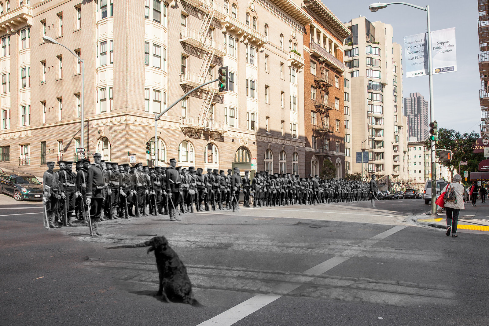
The military played a visible role in the days immediately after the earthquake. Sailors from the U.S. Navy cutter Bear assembled for duty at Bush Street and Jones Street while civilian life carried on around them. A dog, apparently lost in the chaos, watched the unit gather. Soldiers and sailors were deployed throughout the city to maintain order, assist with relief efforts, and help contain fires.
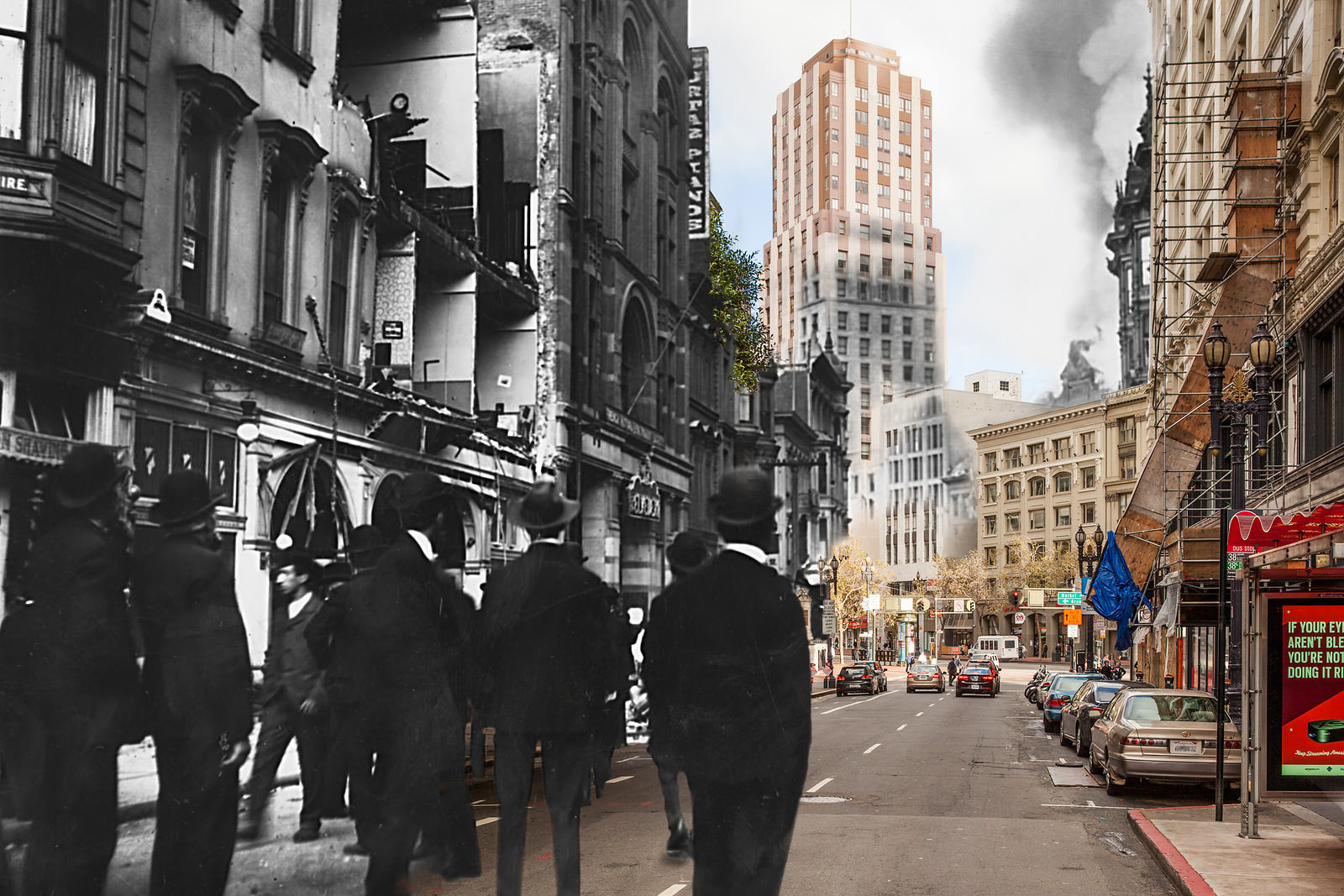
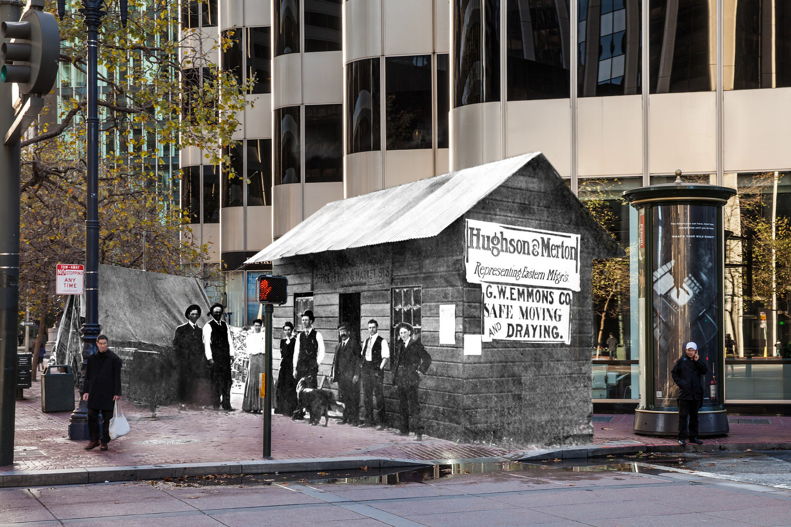
Commerce on Market Street resumed faster than almost anywhere else in the city. Hughson & Merton, a bicycle and buggy manufacturer that had also become the world’s first Ford automobile dealer, was among the first businesses to reopen on the street. Their quick return sent a signal that Market Street would not stay dark for long. Rebuilding was already underway on multiple fronts — physical, commercial, and civic — within weeks of the disaster.
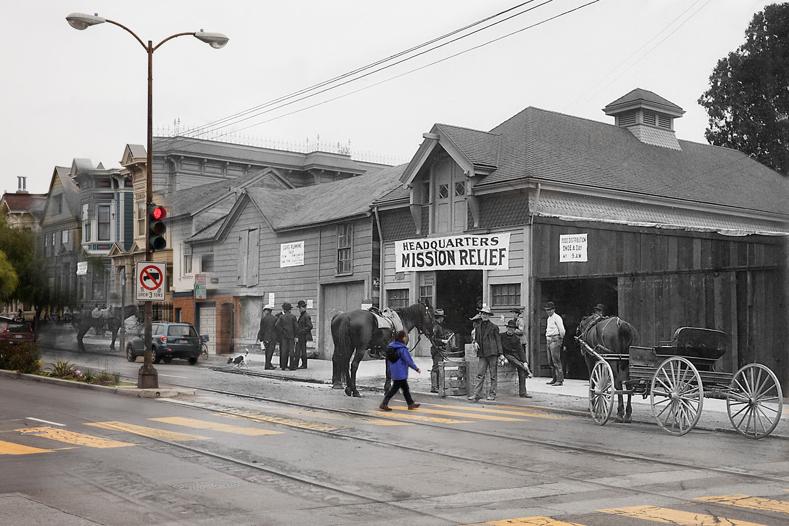
Relief operations were organized at locations across the city. The Mission Relief Headquarters at 25th and Guerrero Streets ran daily food distributions for displaced residents, photographed after each distribution as the crowd thinned out. The scale of the relief operation required both military logistics and civilian coordination, handling tens of thousands of people who had lost everything.
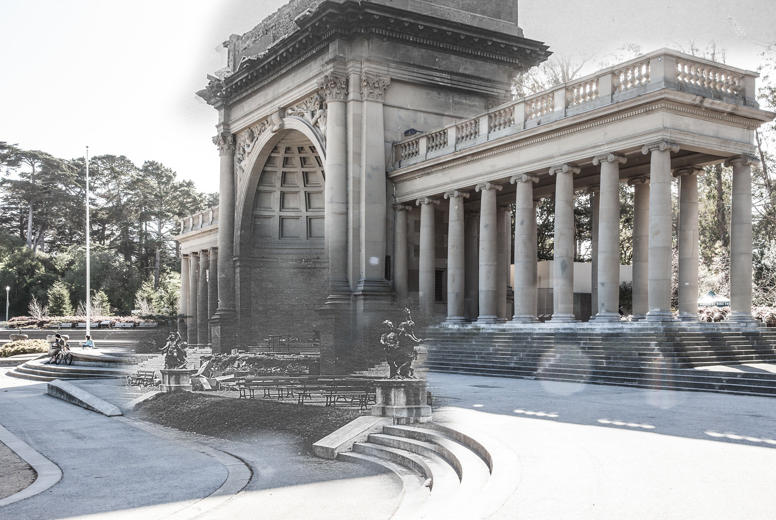
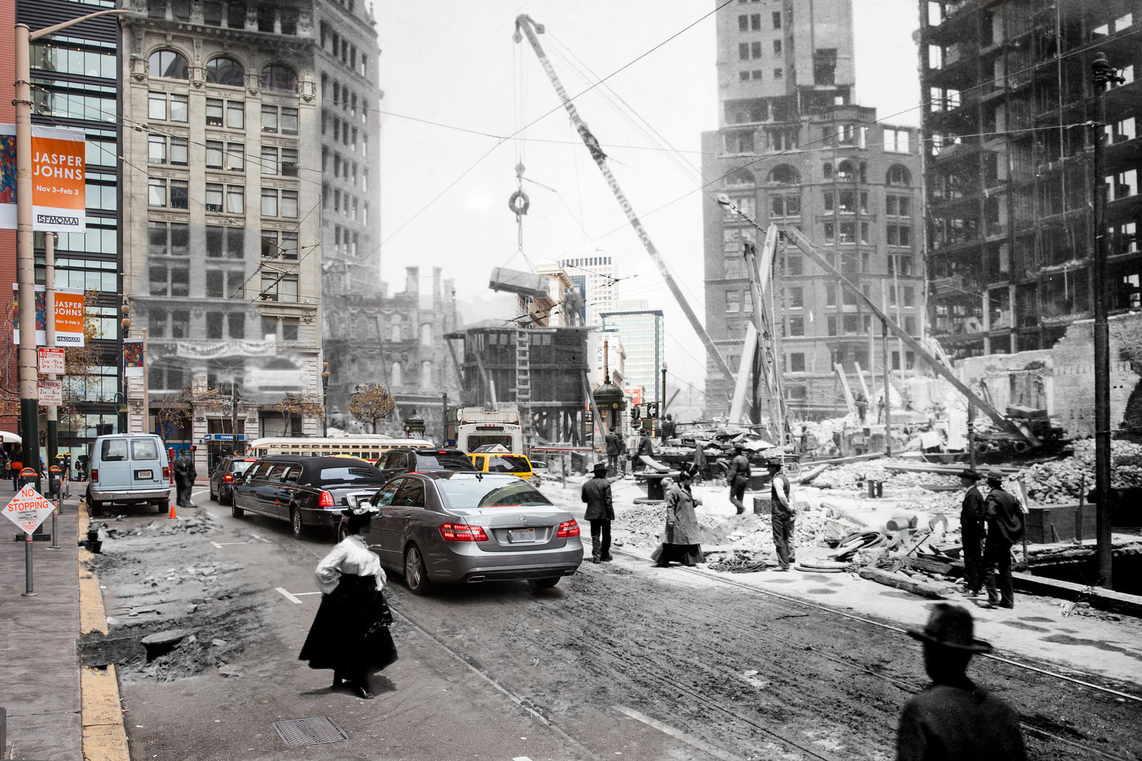
Construction began almost before the fires had fully cooled. The Sentinel Building on Kearny Street was already under construction in the months following the earthquake, photographed mid-build with the wreckage of surrounding blocks still visible. Debris clearing on 3rd Street and other main roads was a round-the-clock effort, with teams working to remove the millions of tons of rubble that blanketed the city.
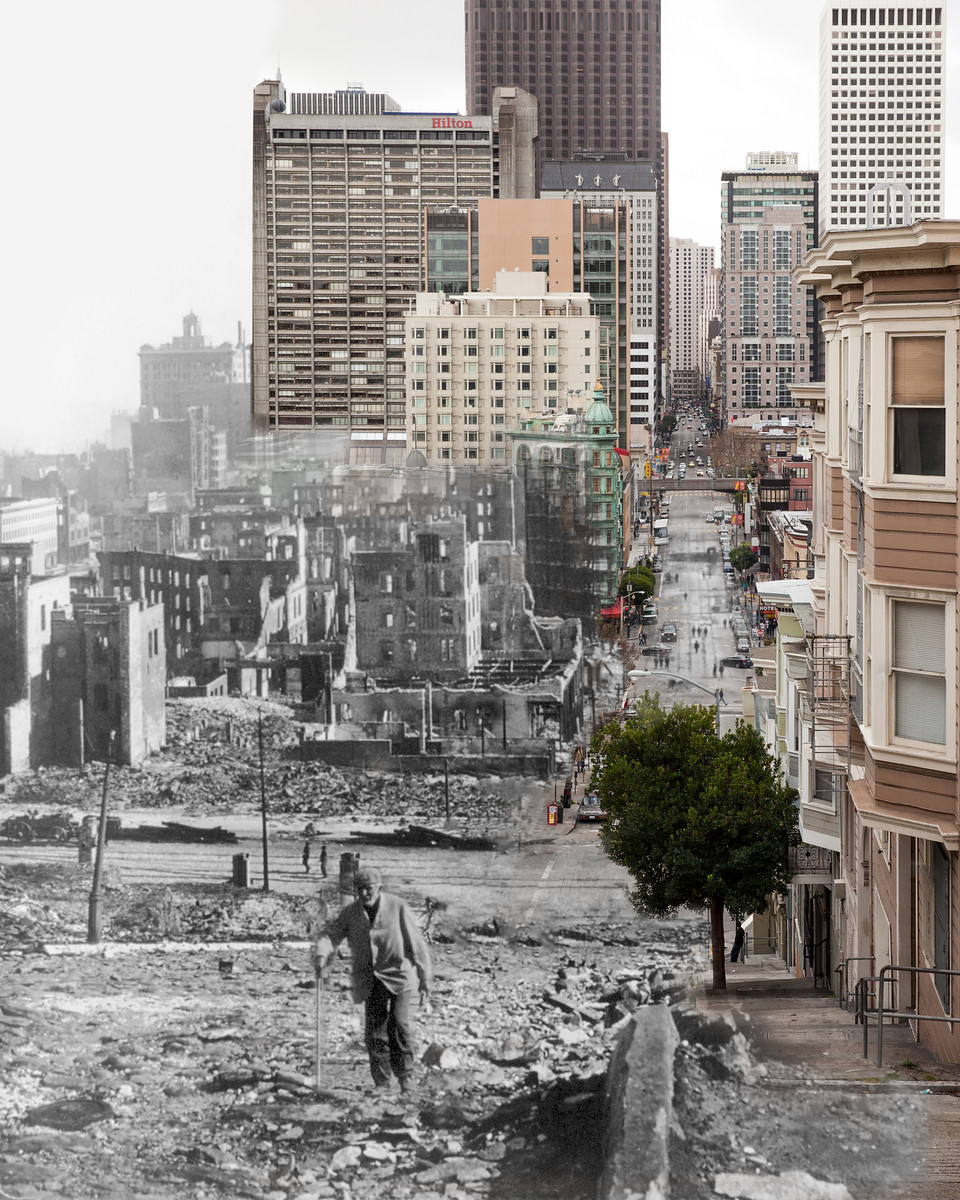
Along California Street, between Polk and Larkin, the cable car infrastructure was completely incinerated. Only the steel trucks — the wheeled frames beneath each car — remained on the road after the fires passed through. The tracks themselves were warped and covered in ash. Every wooden element had been consumed, leaving behind a bare, blackened corridor through what had been a busy residential and commercial stretch.
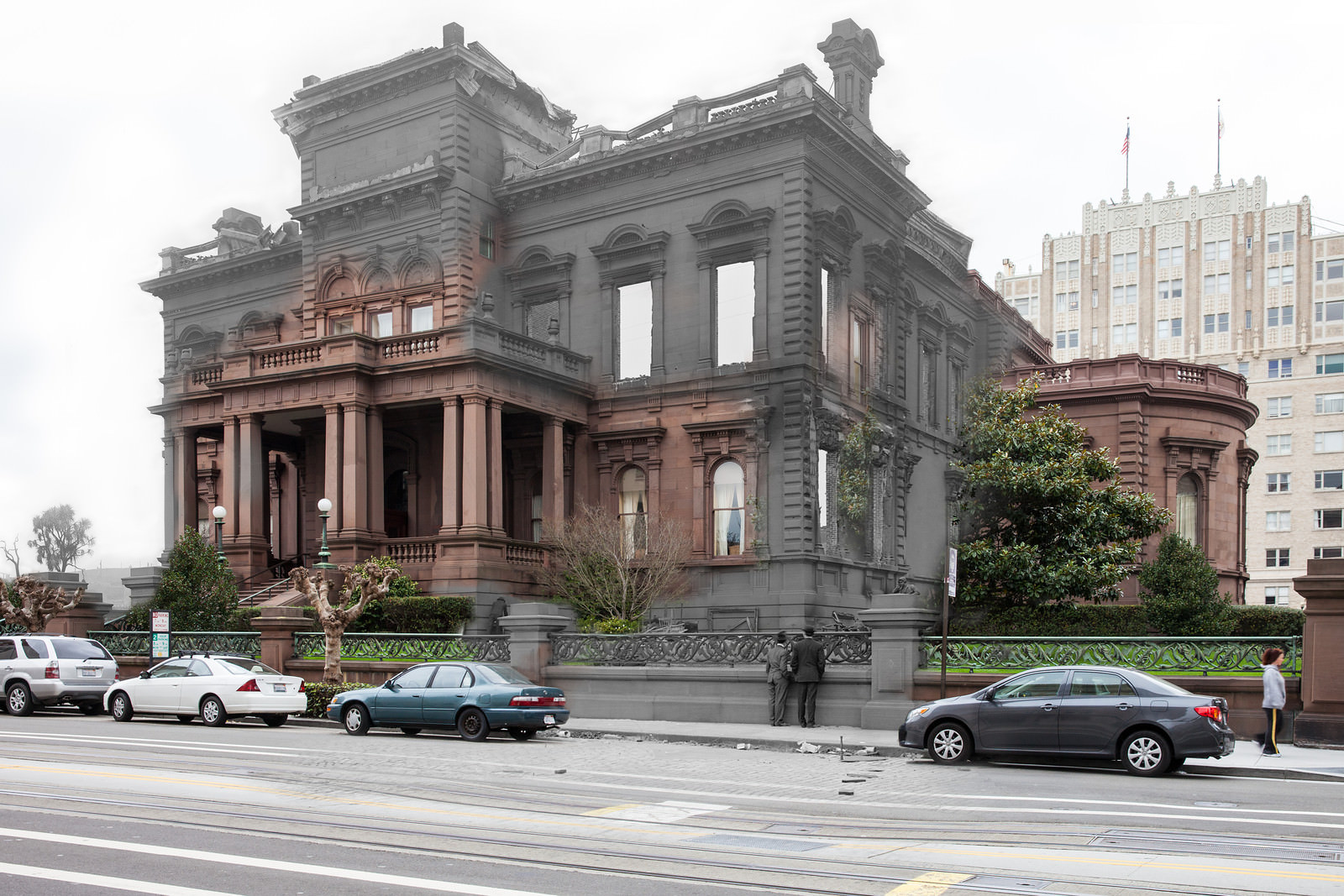
The earthquake disrupted the lives of San Francisco’s wealthiest residents just as thoroughly as its poorest. At the James Flood Mansion on Nob Hill, staff and onlookers salvaged furniture from the damaged interior and laid it out in the yard. Two men are photographed peering over the fence at the collection of rescued items — chairs, tables, and household objects pulled from one of the grandest homes in the city.
The death toll visible in the streets was documented plainly by photographers who moved through the ruins. At the intersection of Post and Grant Streets, photographer Richard Wigham recorded the charred remains of a human corpse while, nearby, Shreve Building employees returned to assess what could be salvaged from the ruins of their workplace. These photographs were taken without hesitation — the disaster demanded documentation, and those behind the cameras did not look away.