
At 5:12 in the morning on April 18, 1906, San Francisco was shaken apart. The earthquake that struck the Northern California coast that day was one of the deadliest natural disasters in American history. More than 3,000 people died. About 250,000 of the city’s roughly 400,000 residents were left without homes. When it was over, 28,000 buildings had been reduced to rubble, and damage was estimated at $500 million in 1906 dollars — a staggering sum at the time.
The shaking was felt across a massive stretch of California — from Eureka on the North Coast all the way south to the Salinas Valley. But the earthquake itself was only the beginning. What followed turned a disaster into a catastrophe.
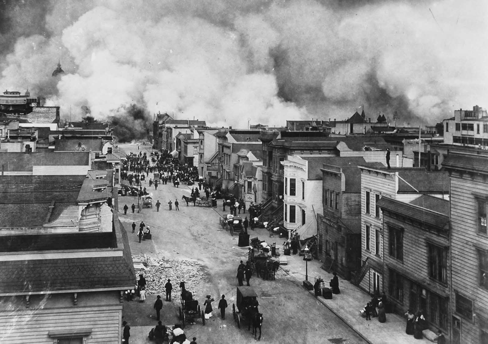
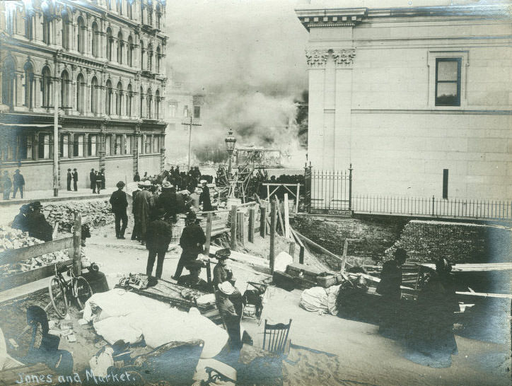
The earthquake ruptured the city’s water mains almost immediately. Firefighters arrived to find their hydrants dry. With no water to fight the flames, fires ignited across the city and burned without resistance. Three major blazes took hold — one south of Market Street, one north of Market Street, and one in the Hayes Valley neighborhood, just west of the already-destroyed City Hall. Driven by high winds, those three fires merged into a single firestorm that tore through neighborhood after neighborhood.
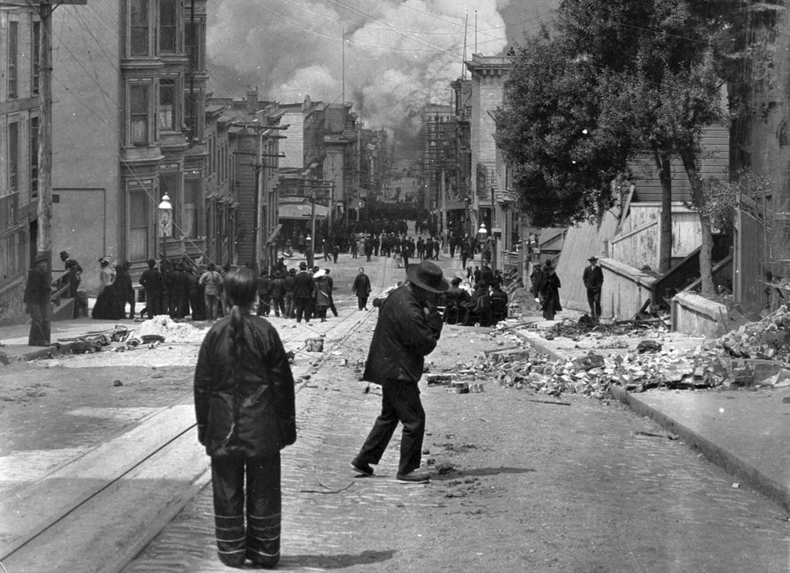
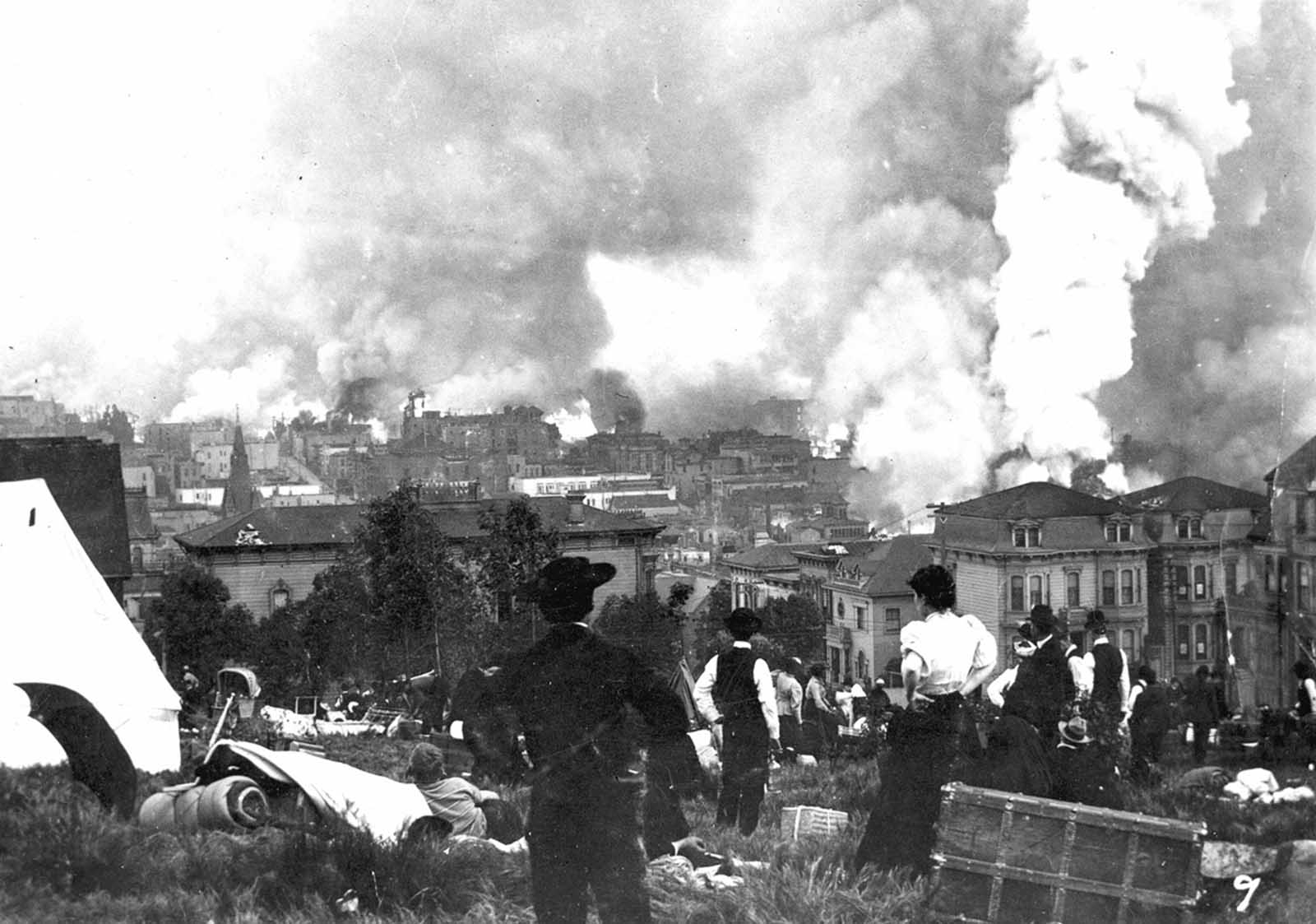
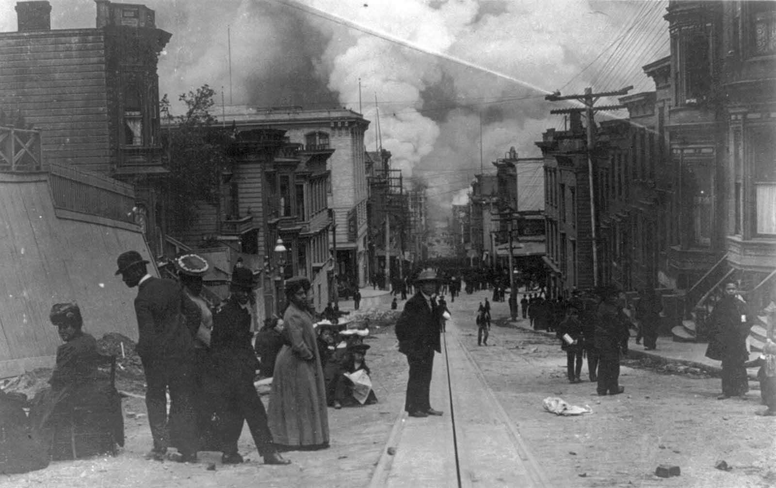
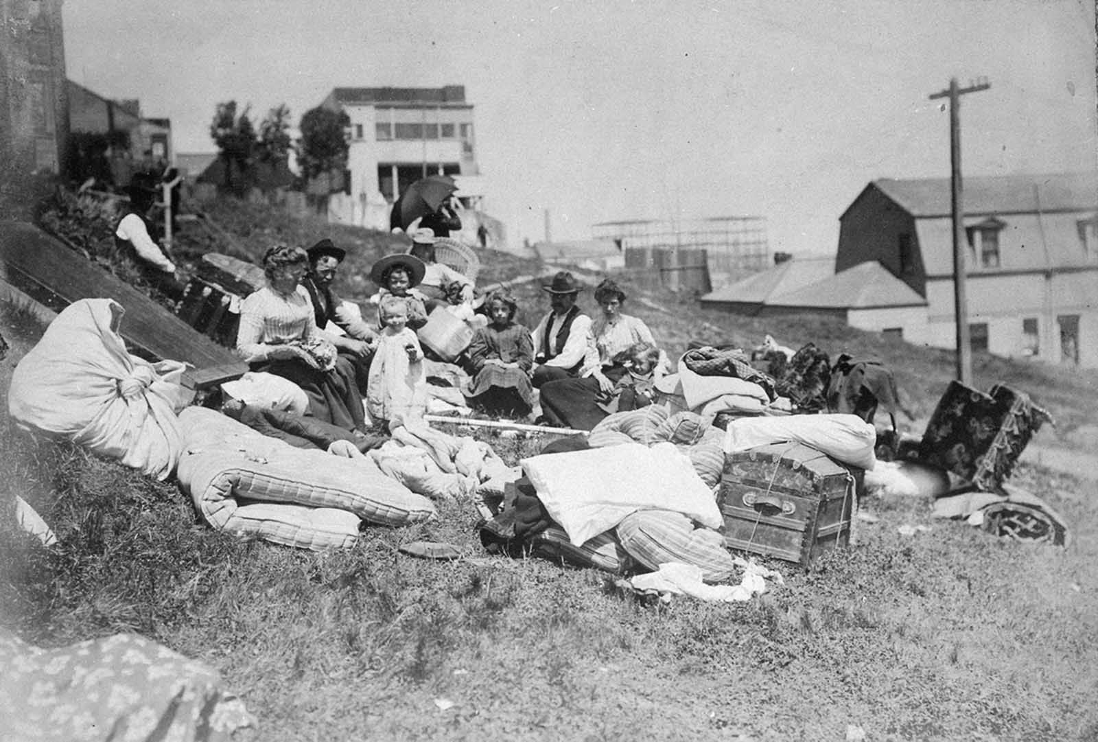
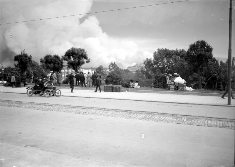
People stumbled into the streets in the early morning darkness to find their city on fire. Buildings that had survived the initial shaking were consumed by flames within hours. Residents watched from the sidewalks and hillsides as the fires advanced block by block. Many grabbed what they could carry and fled toward open ground — parks, plazas, and hilltops that offered temporary safety.
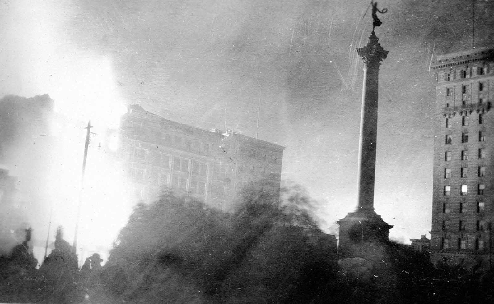
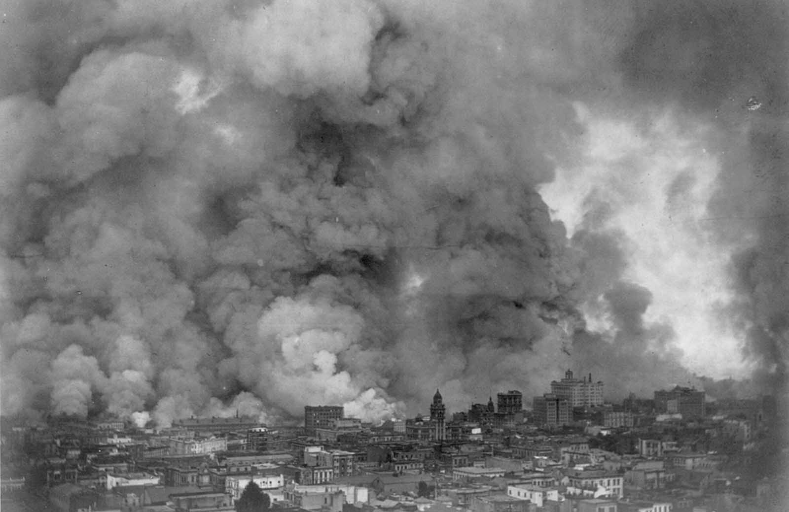
By nightfall on April 18, the sky over San Francisco glowed orange. Commercial buildings, hotels, churches, and homes burned with equal intensity. The fires did not distinguish between the wealthy neighborhoods of Nob Hill and the working-class blocks south of Market. Entire streets were consumed before dawn of the following day.
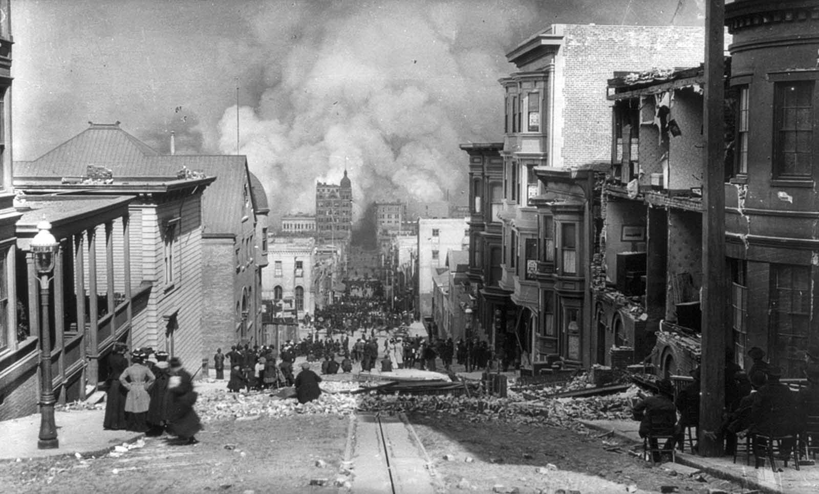
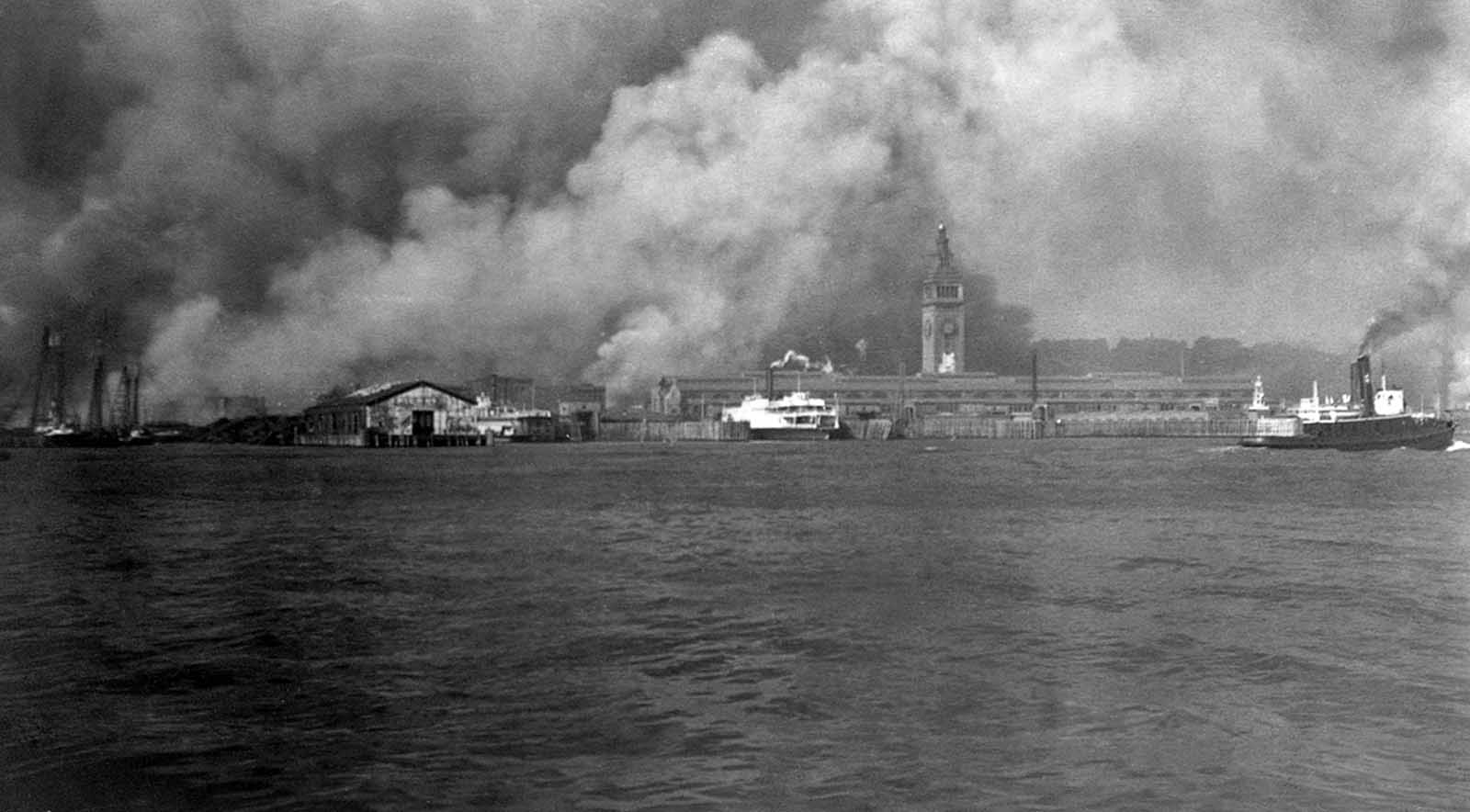
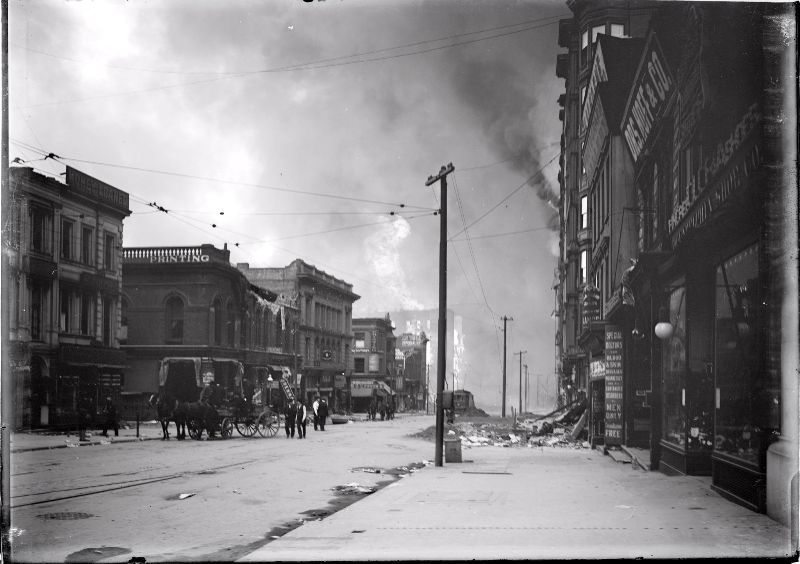
The waterfront, a vital artery of trade and commerce, was not spared. Smoke rose from burning buildings along the docks as the fires spread east toward the bay. Hotels that had stood as landmarks of the city’s prosperity went up in flames as residents and visitors alike fled into the streets.
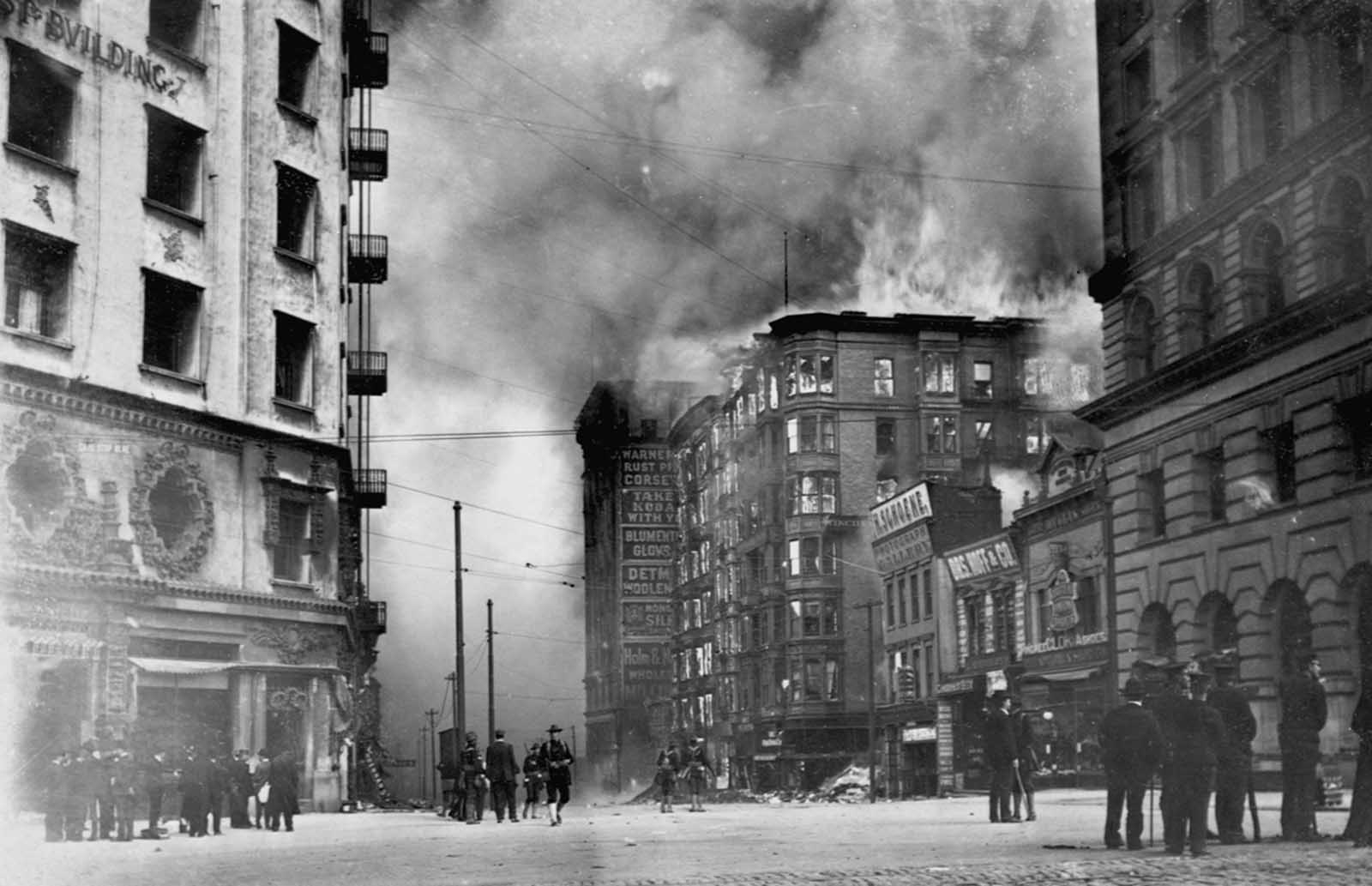
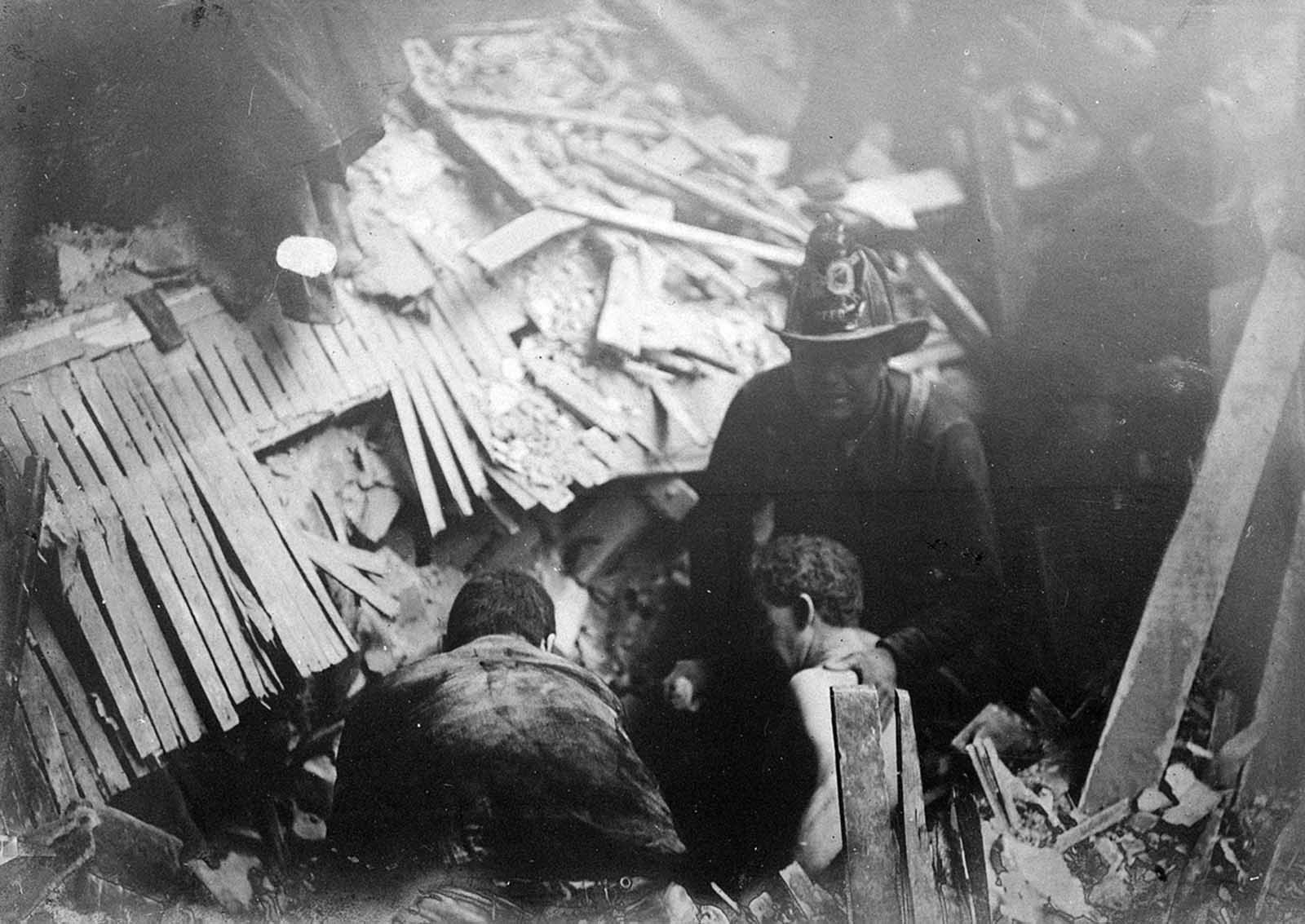
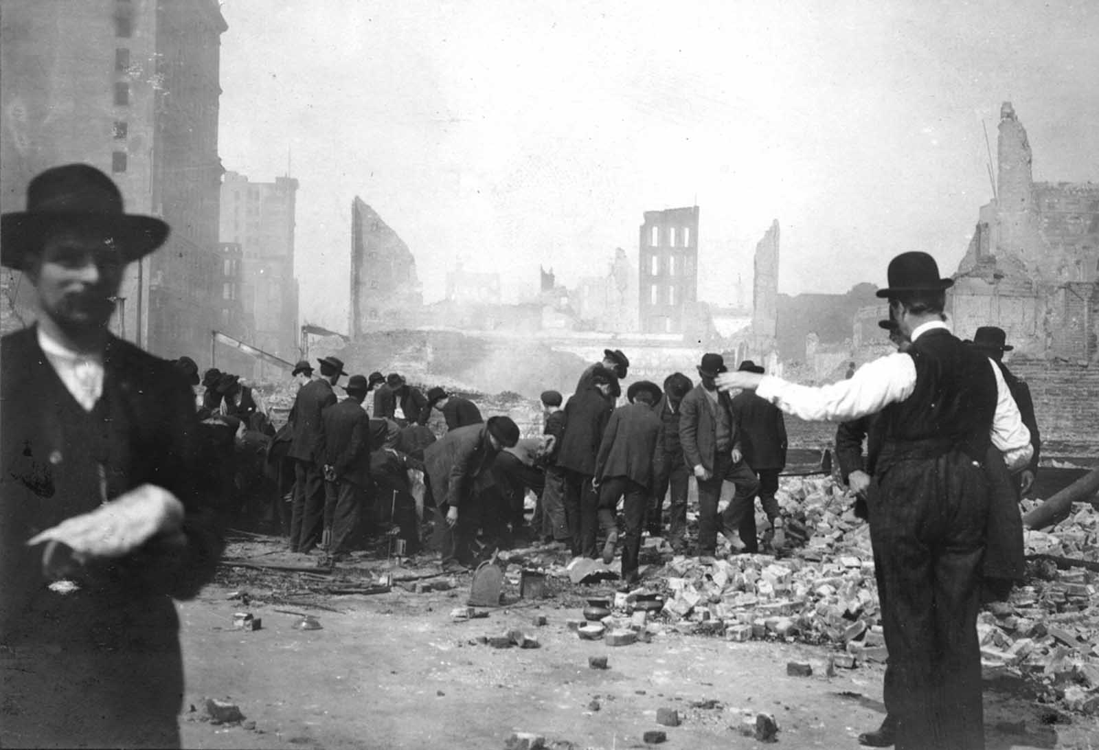
As the fires raged, rescue workers moved through collapsed structures searching for survivors. The scale of the destruction made systematic rescue nearly impossible. Rubble choked the streets, and the advancing fires forced teams to abandon some areas entirely before the work was finished.
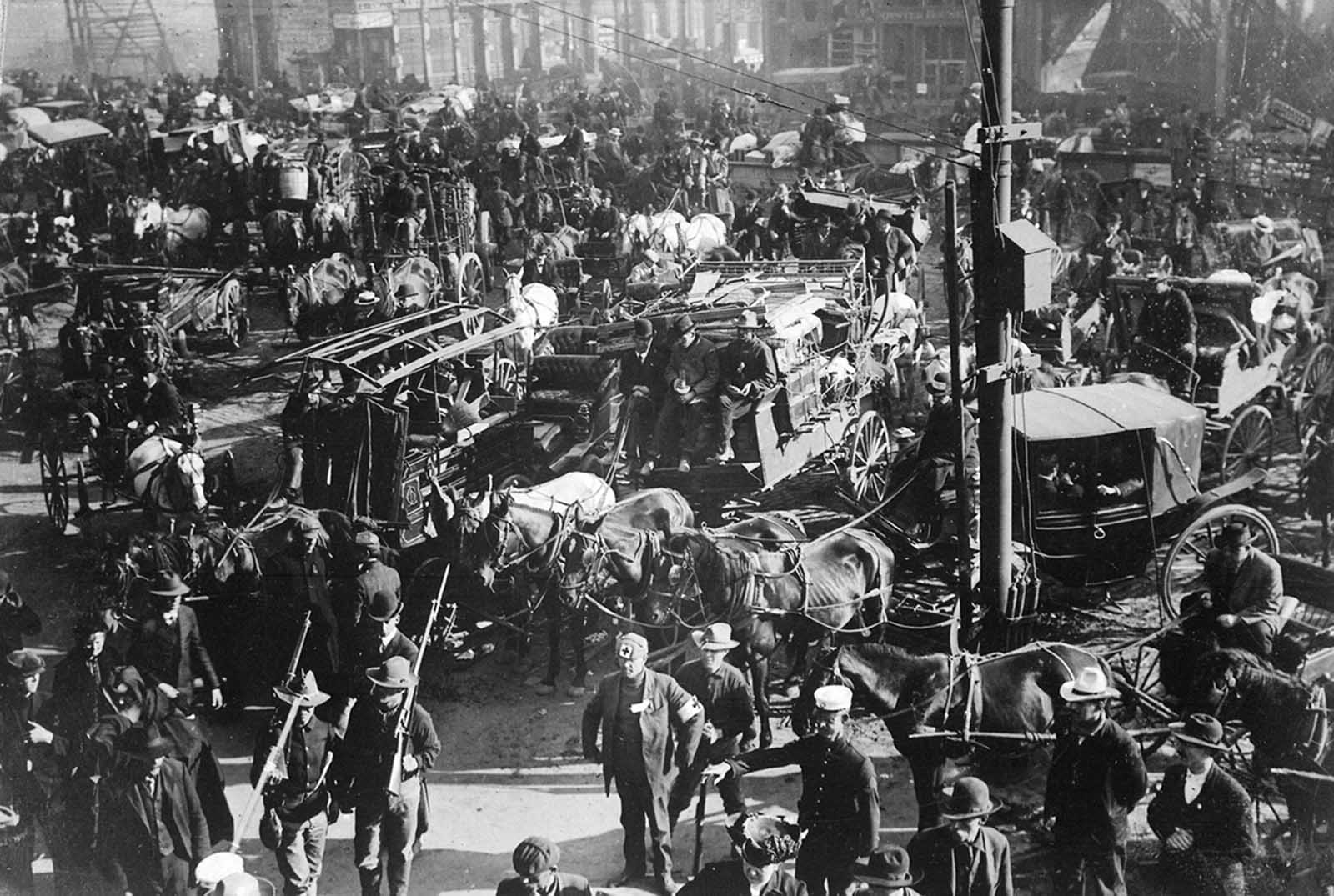
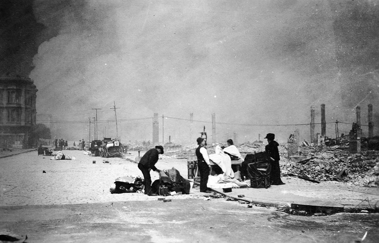
The disaster struck every community in San Francisco without exception. Families of all backgrounds found themselves displaced, gathering what belongings they could and moving to higher ground or open parks as smoke filled the lower districts.
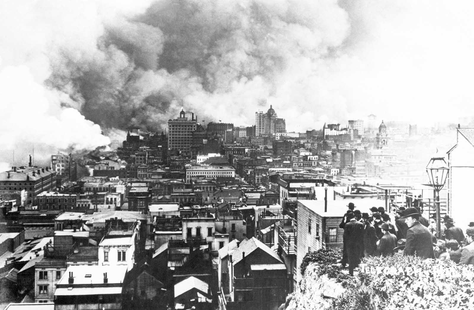
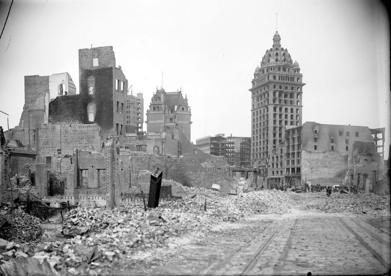
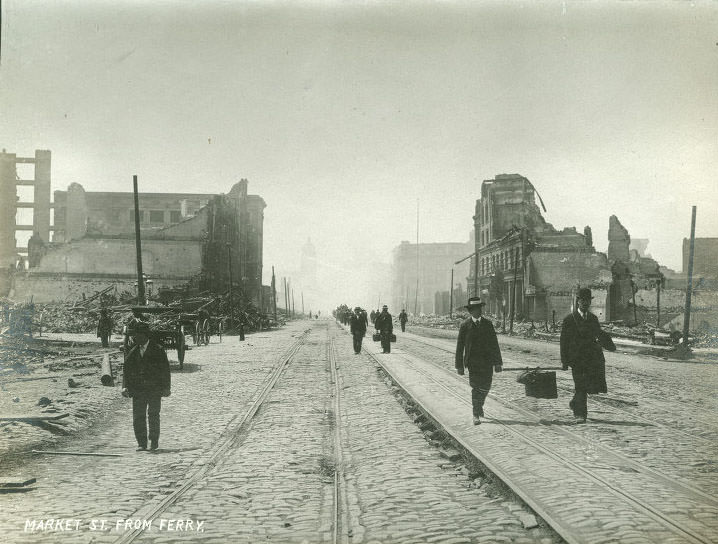
From Telegraph Hill, crowds gathered to watch the destruction spread across the city below. The U.S. Army deployed troops to Market Street and other major corridors to maintain order. Soldiers walked through streets where the ruins of landmark buildings still smoldered. The Call Building, one of San Francisco’s most recognized skyscrapers, burned in the distance as troops moved through the devastated downtown.
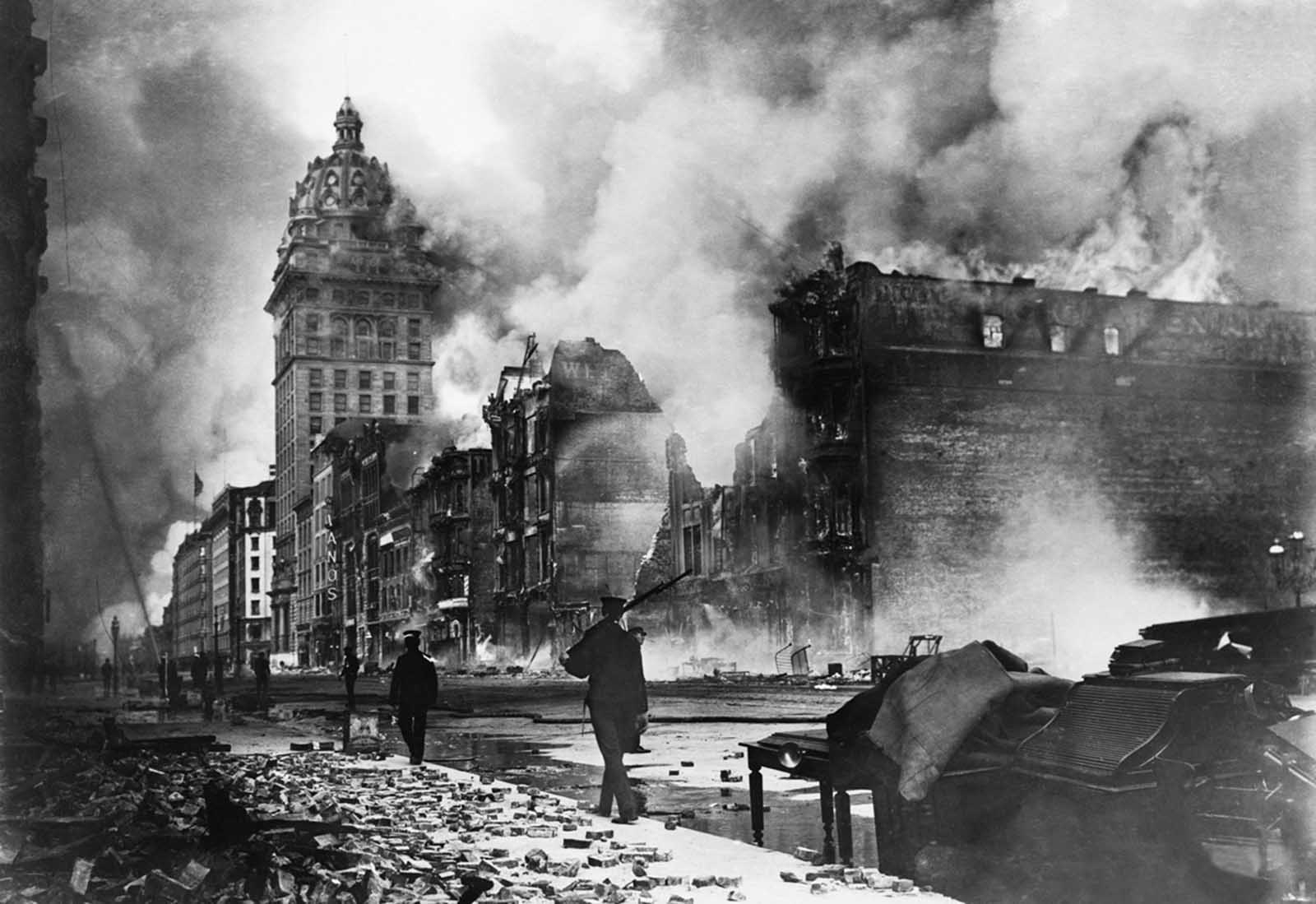
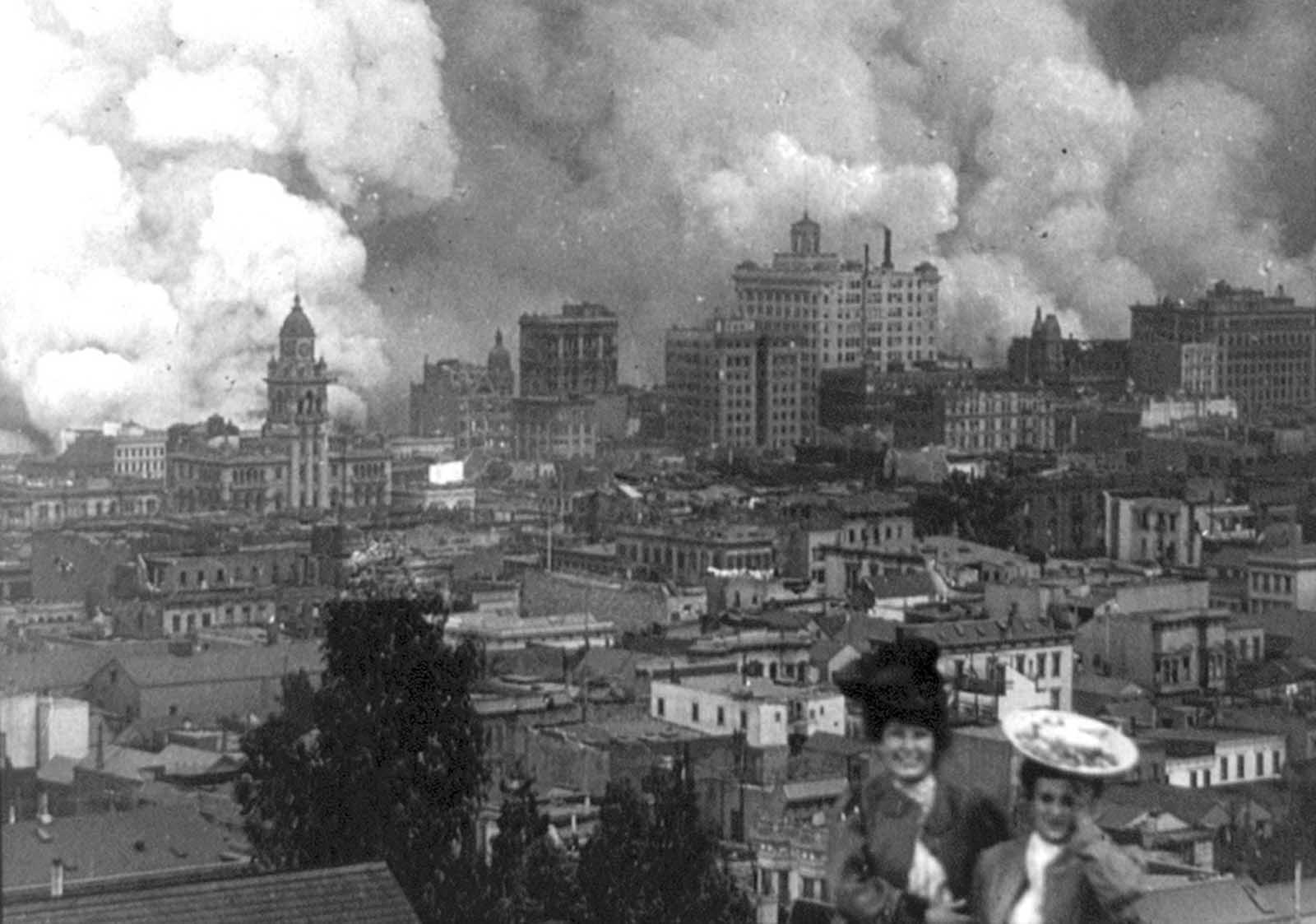
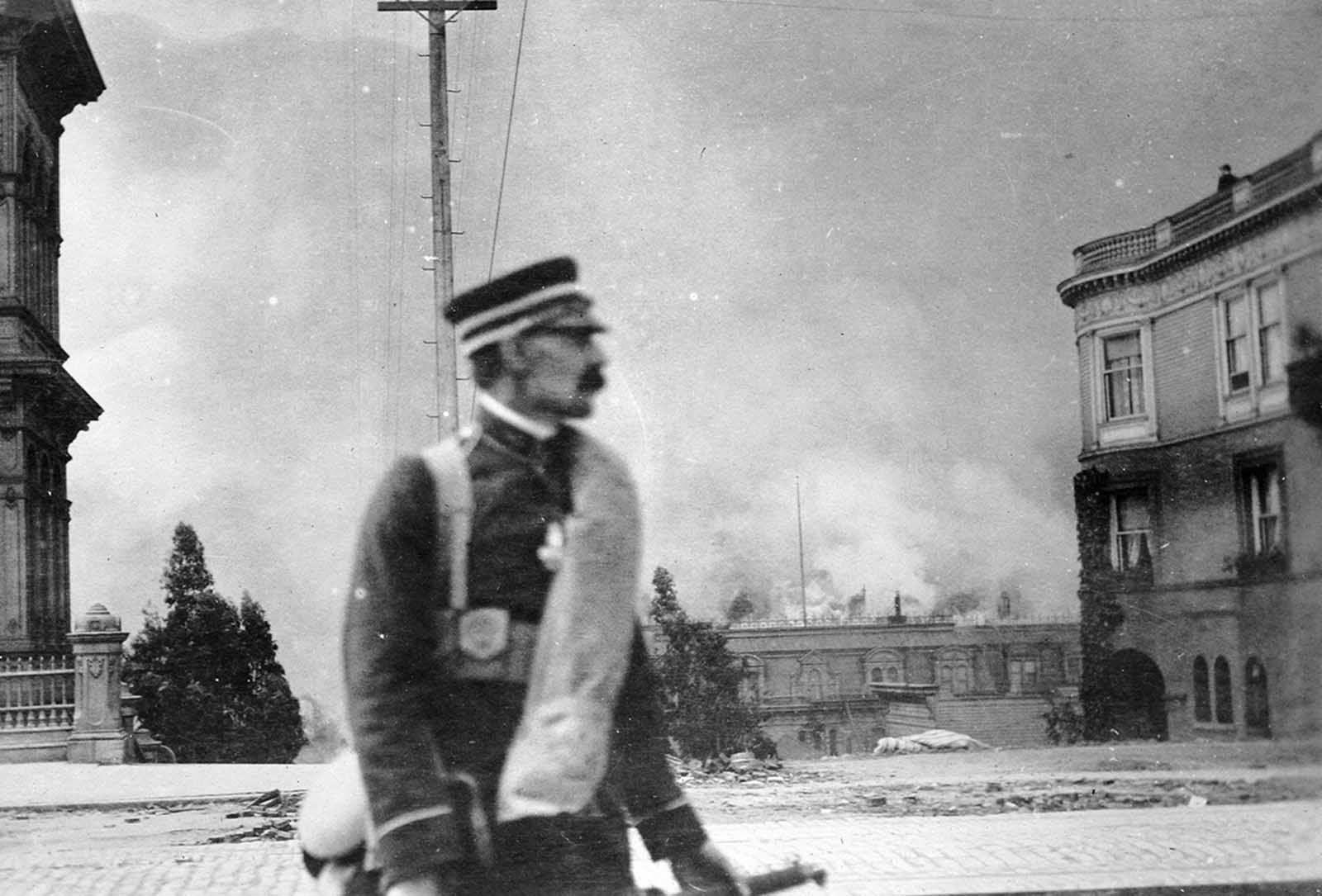
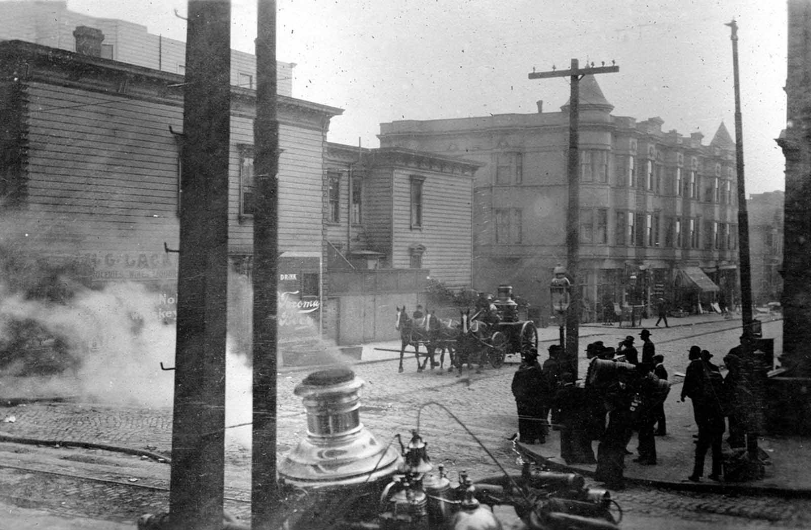
Fire crews worked with whatever tools remained available to them. With water mains broken across the city, horse-drawn engines were repositioned constantly in search of any available water source. The effort was largely futile against a fire of this scale, but crews continued working through the night and into the following days.
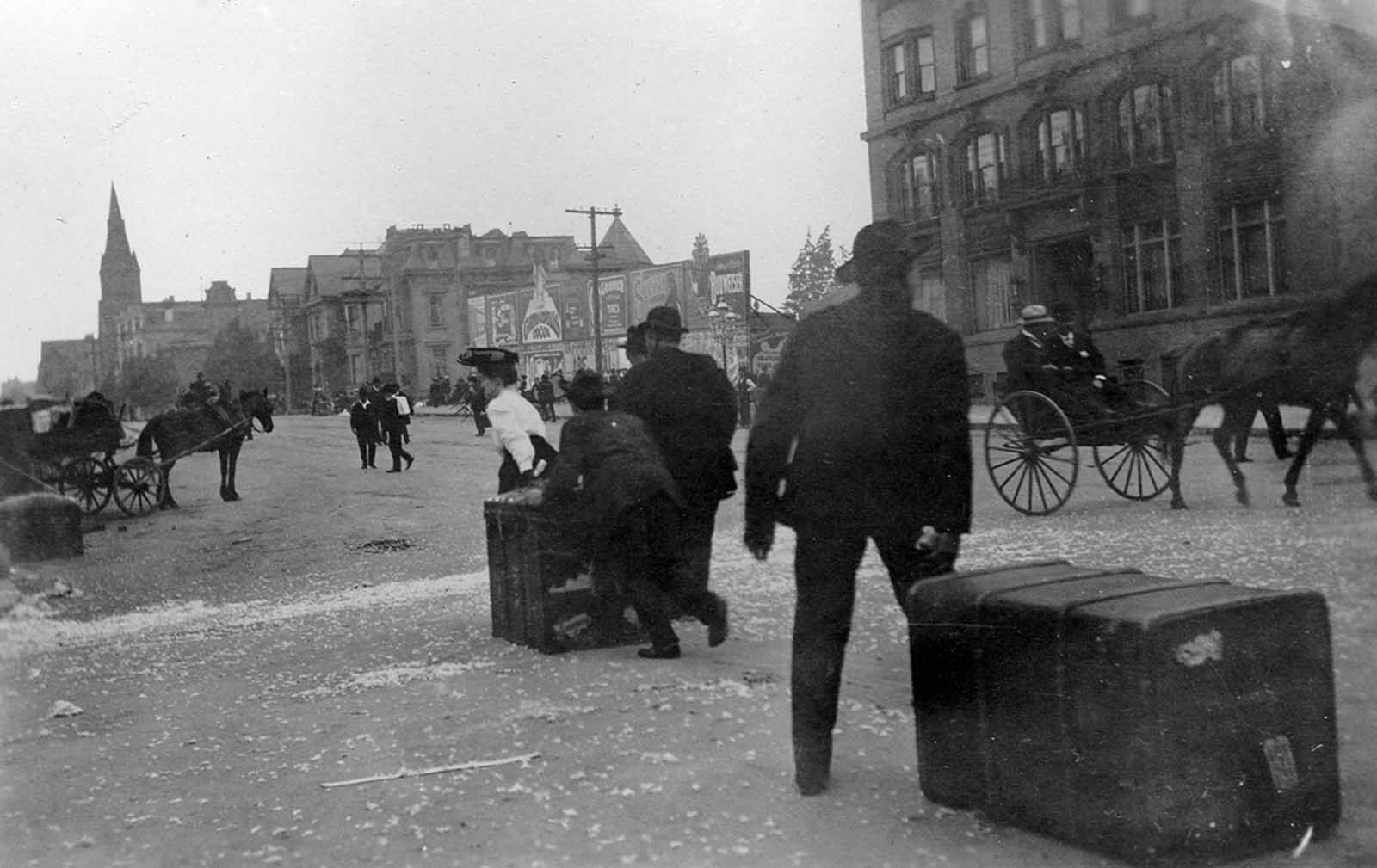
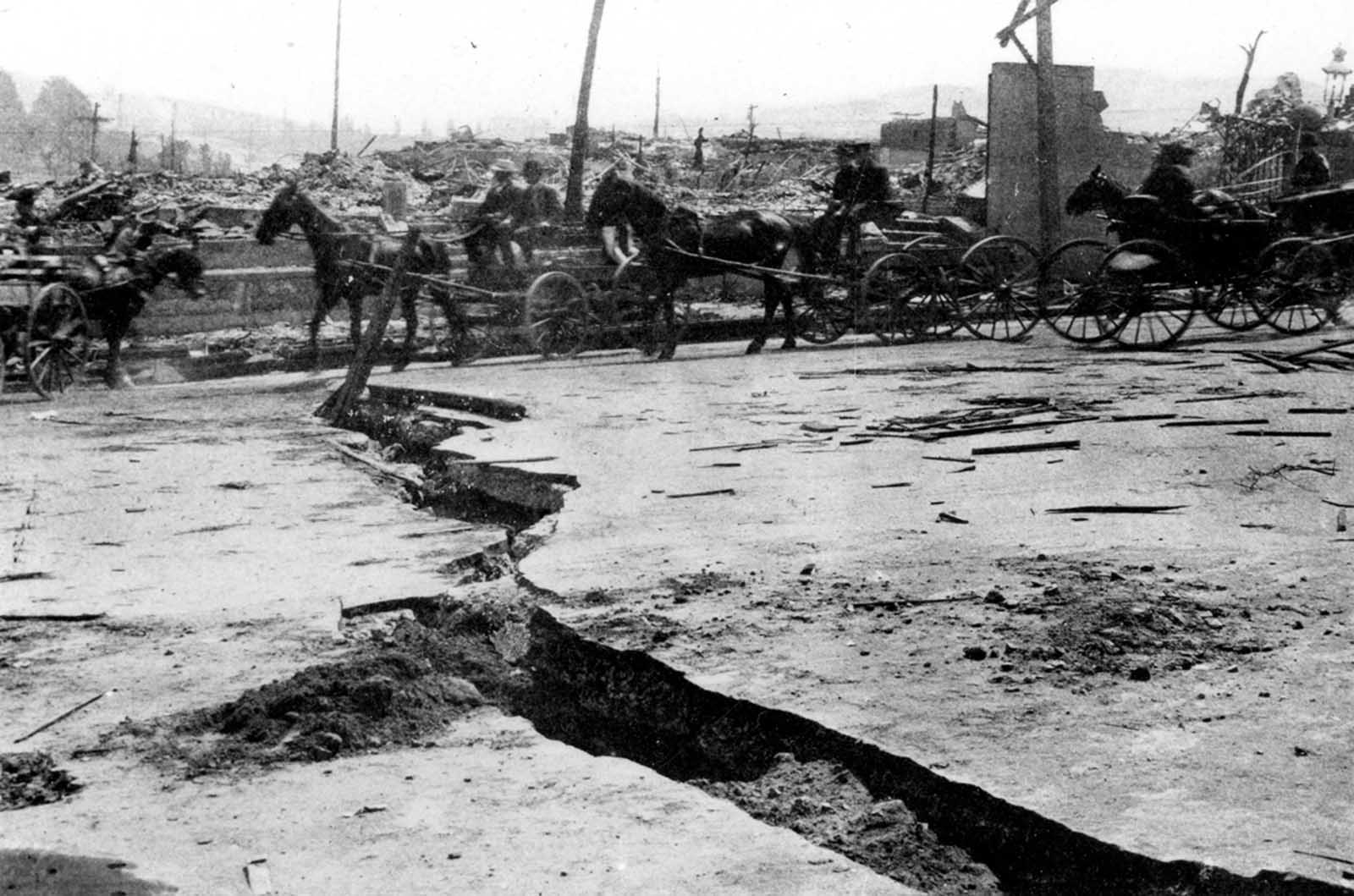
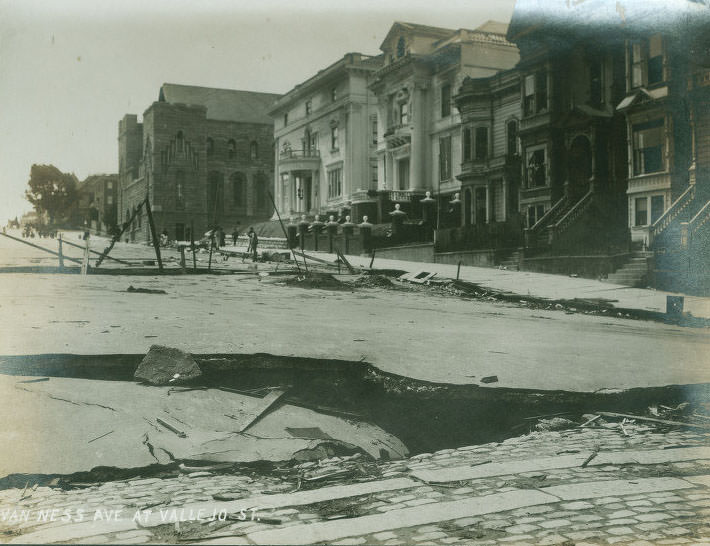
Along Van Ness Avenue, one of the city’s widest thoroughfares, residents dragged trunks and carts loaded with their belongings away from the advancing flames. The avenue was later used as a firebreak — buildings on one side were deliberately demolished with dynamite to create a gap wide enough to stop the fire’s westward advance. The tactic worked, but the cost was enormous. The earthquake itself had also cracked Van Ness Avenue’s asphalt paving where the road crossed over a filled-in ravine, leaving the street buckled and broken.
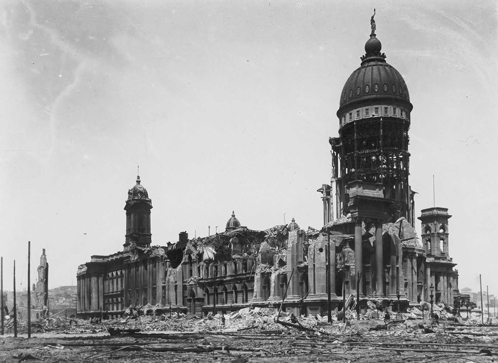
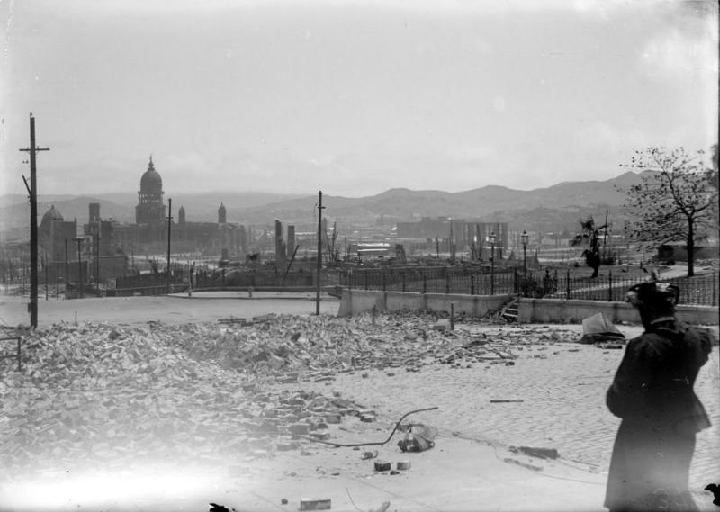
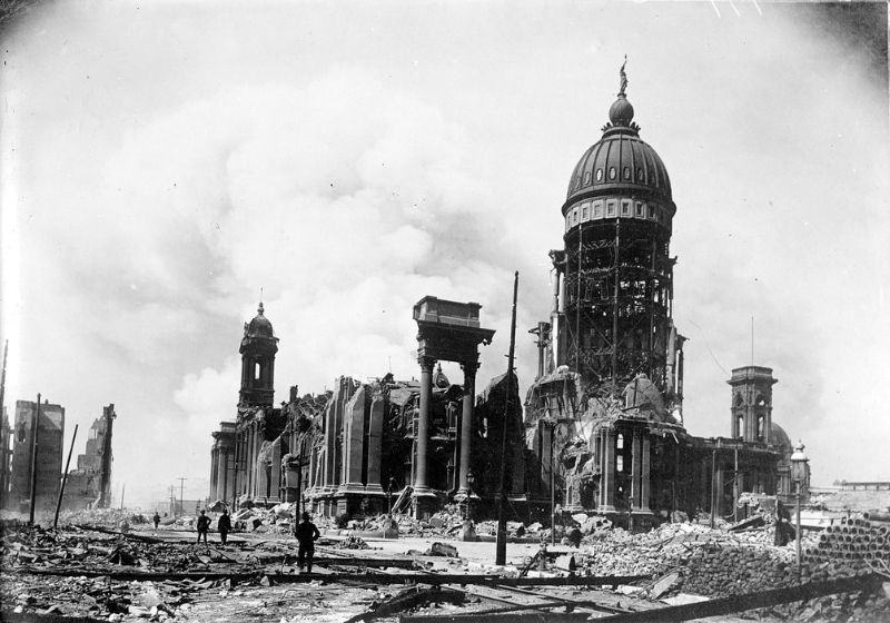
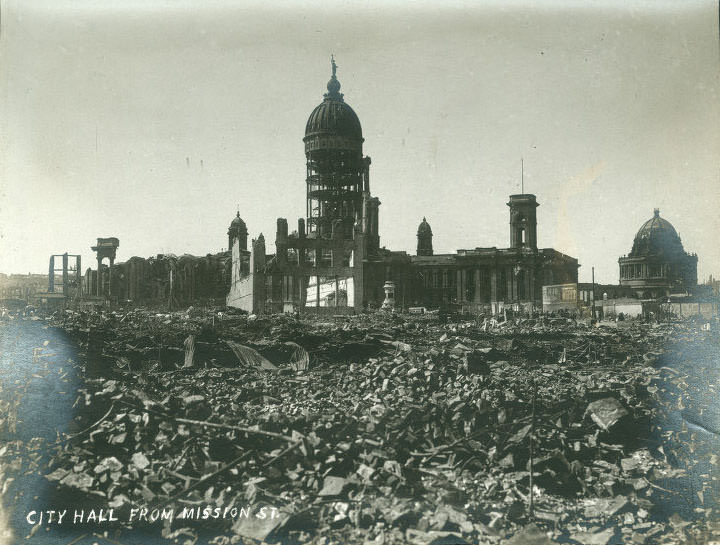
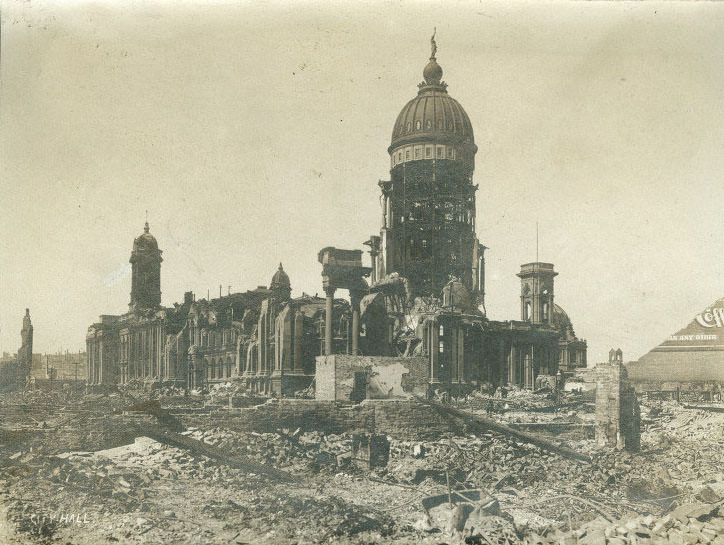
San Francisco’s City Hall, which had taken 27 years to build and cost $6 million, was gutted by the earthquake. Its grand dome survived, but the walls collapsed, leaving the skeletal frame exposed. The building became one of the most photographed symbols of the disaster. The destruction of City Hall was so complete that it raised serious questions about the construction quality — the building had been considered one of the finest in the American West.
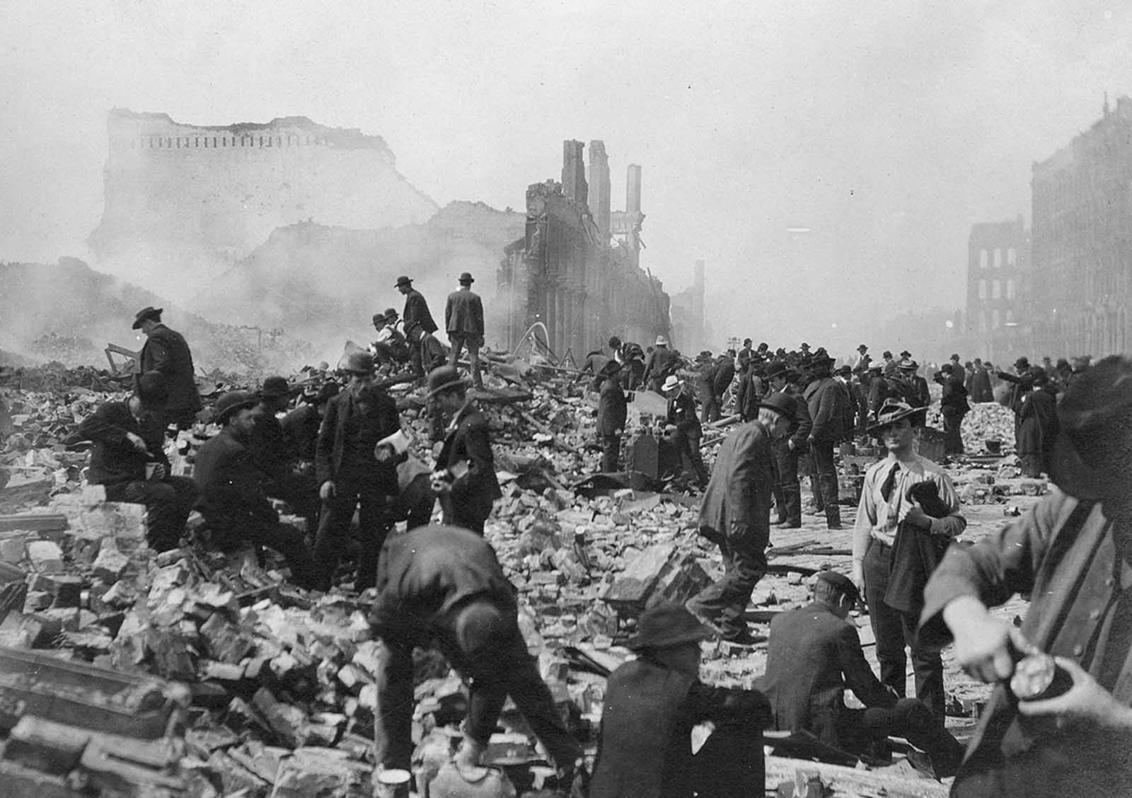
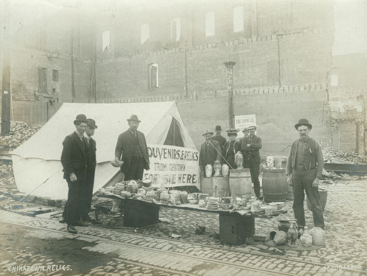
Not everyone who moved through the ruins was there to help. Souvenir hunters picked through the debris in the early stages of the disaster, removing objects and creating problems for military authorities trying to maintain control of the devastated areas. Looting was also reported at the corner of 4th and Market Streets, where a cash register was taken from destroyed premises.
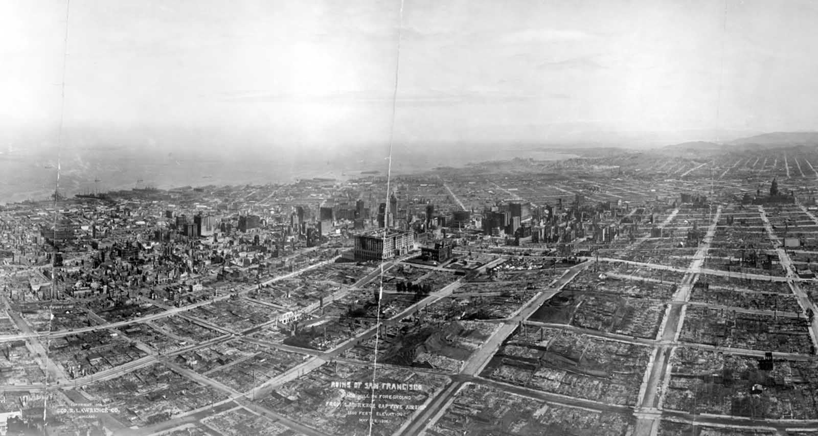
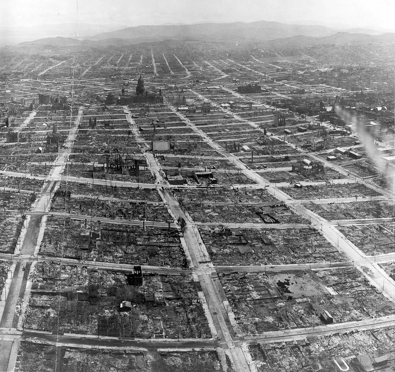
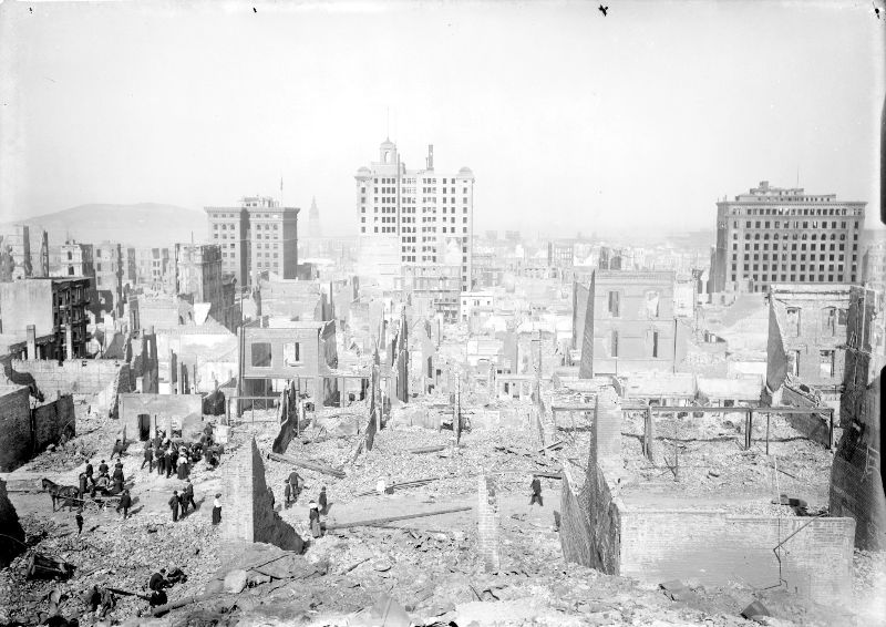
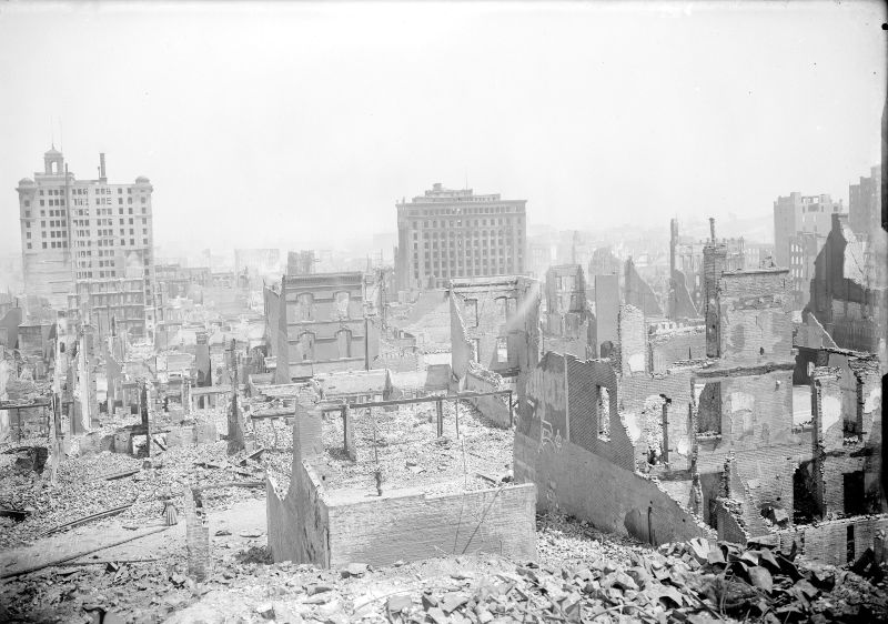
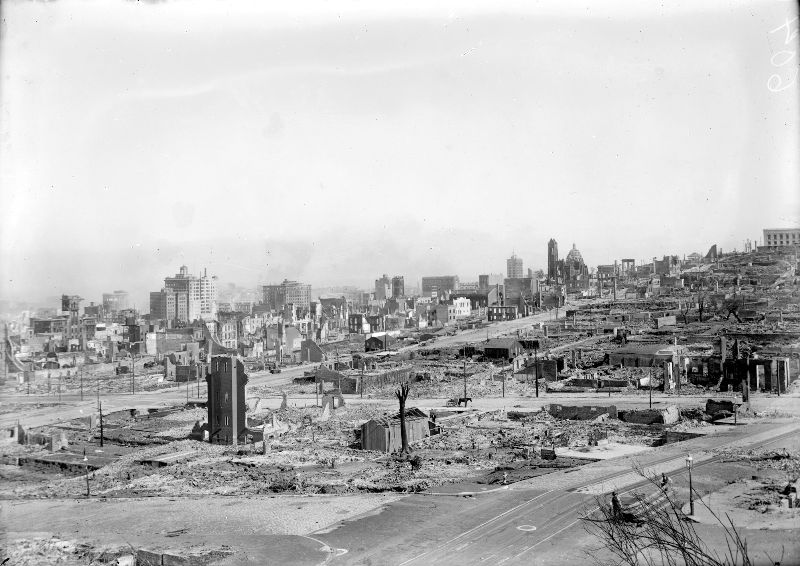
On May 29, 1906 — 41 days after the earthquake — photographer George Lawrence captured the full extent of the destruction from 1,500 feet above the city using a camera suspended from a captive airship. The aerial photographs revealed the true scale of the ruin: block after block of ash and rubble stretching in every direction. Nob Hill, once home to the city’s wealthiest residents, was a field of burned-out shells.
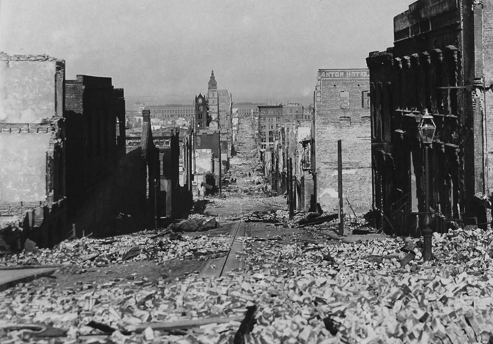
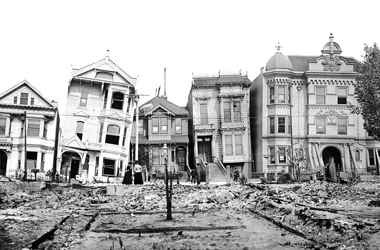
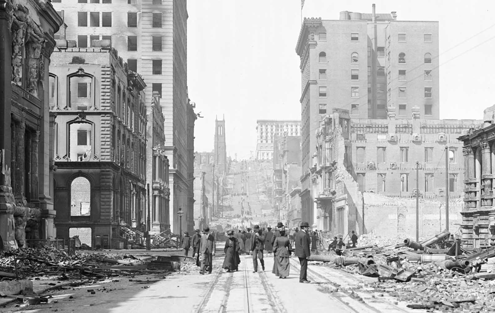
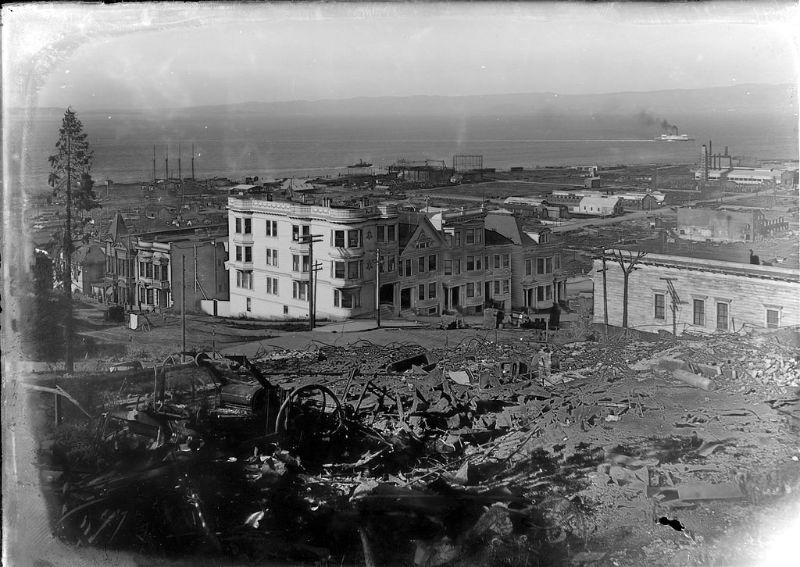
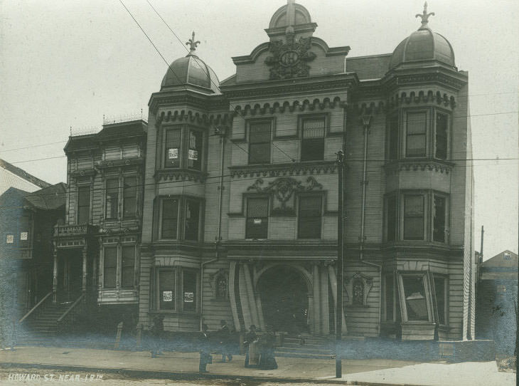
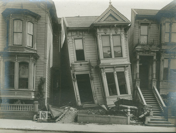
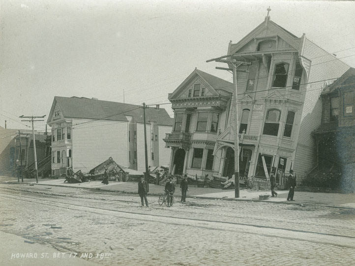
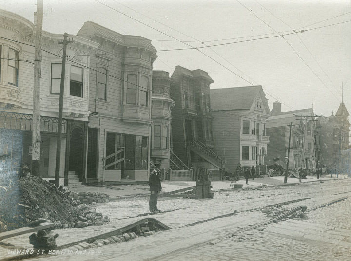
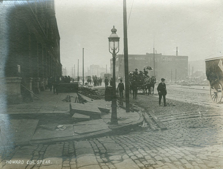
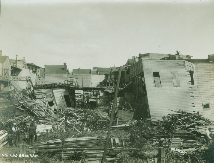
The earthquake’s damage was not uniform. Some streets were left with buildings tilted at sharp angles, their foundations shifted by the force of the shaking. On Valencia Street, the ground liquefied in places, swallowing structures and leaving rows of homes collapsed in on themselves. Howard Street saw wooden homes leaning dangerously, still standing but structurally destroyed.
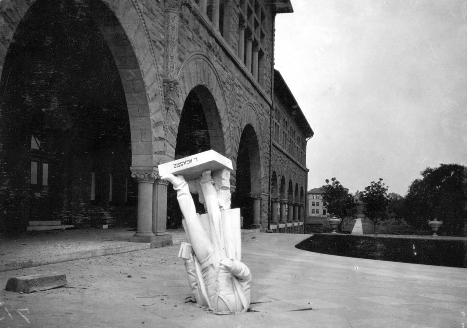
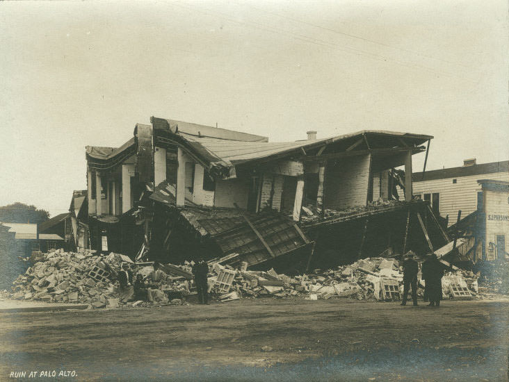
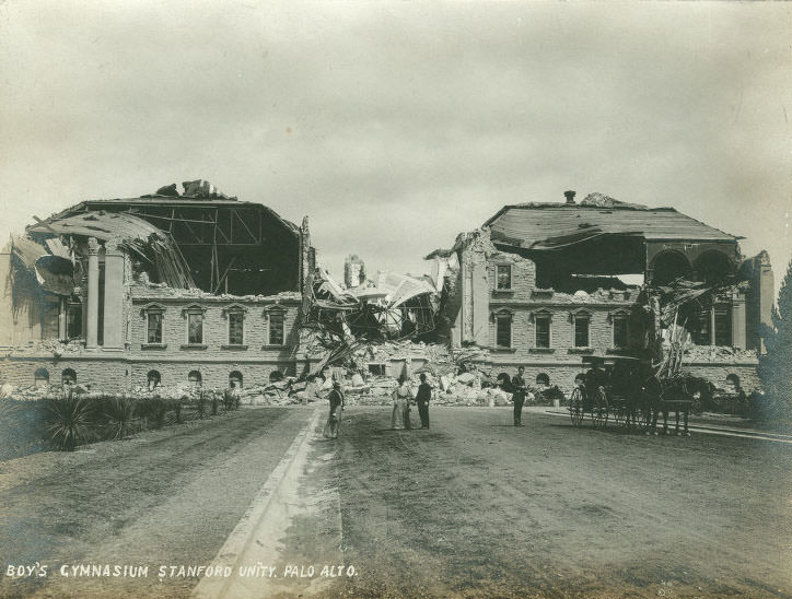
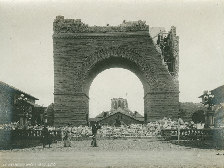
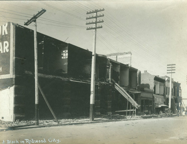
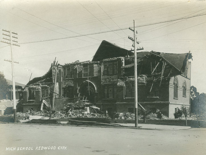
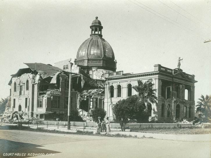
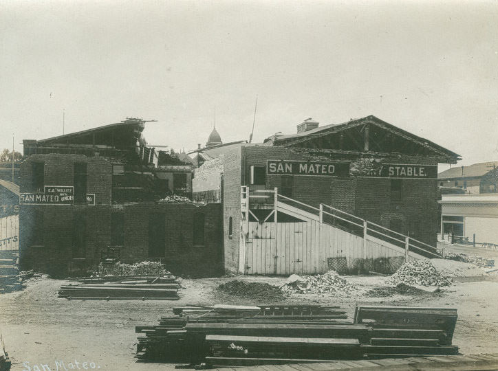
The earthquake reached well beyond San Francisco’s city limits. At Stanford University in Palo Alto, the shaking knocked the stone statue of naturalist Jean Louis Rodolphe Agassiz from the facade of the zoology building, driving it headfirst into the pavement below. Several university buildings were badly damaged, including the gymnasium. In Redwood City, the courthouse and high school were destroyed. The town of San Mateo also suffered significant structural damage.
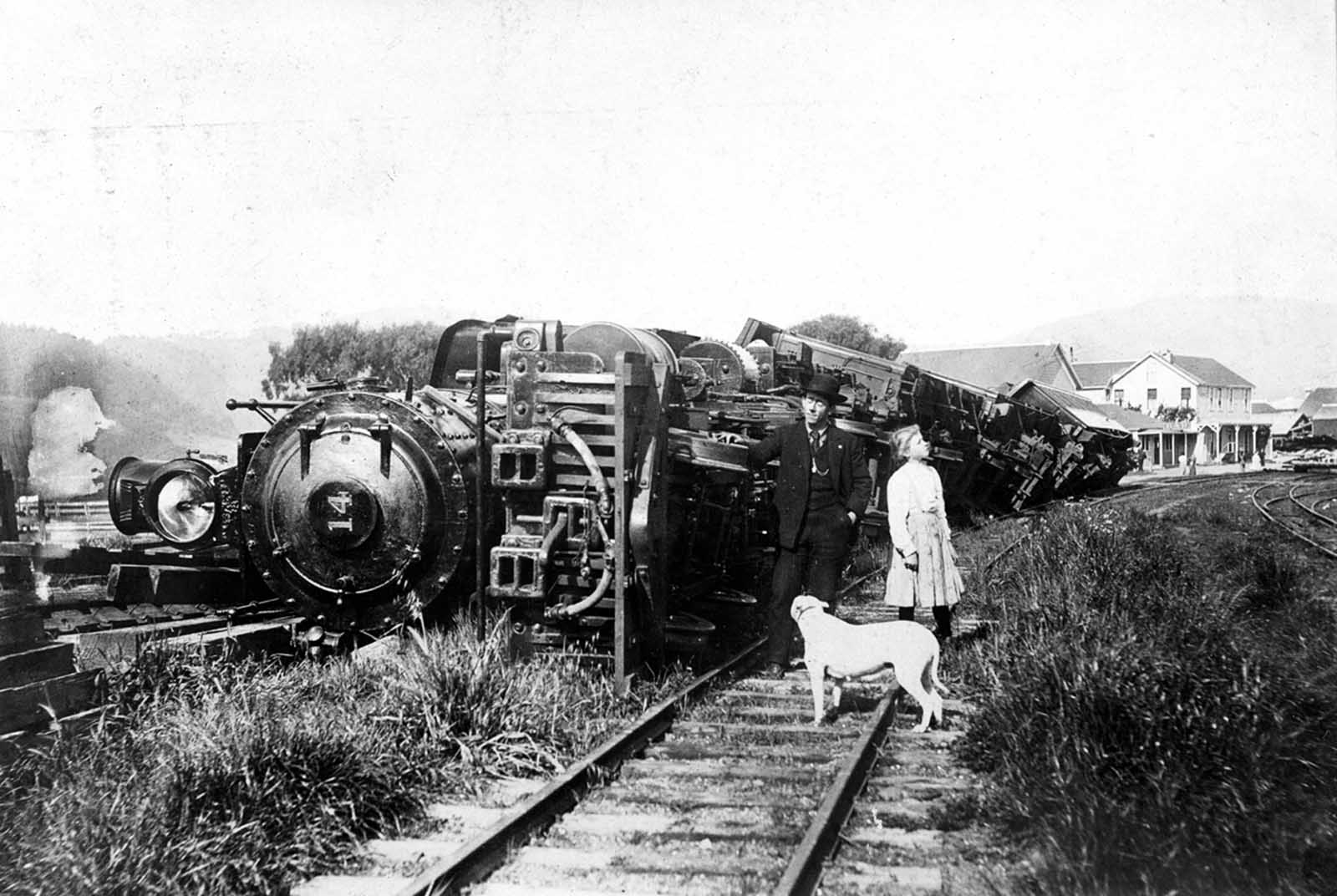
At Point Reyes Station, a train that had been sitting on a siding was thrown off the tracks entirely. The Point Reyes Hotel stood in the background, and beside it, a stone store had been shaken to rubble. The image captured just how far the destruction extended from the city itself — the earthquake’s effects were felt across the entire region.
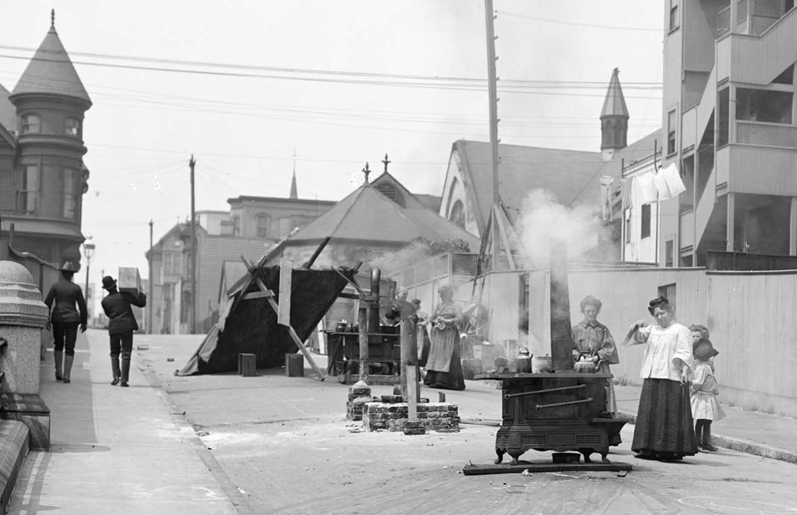
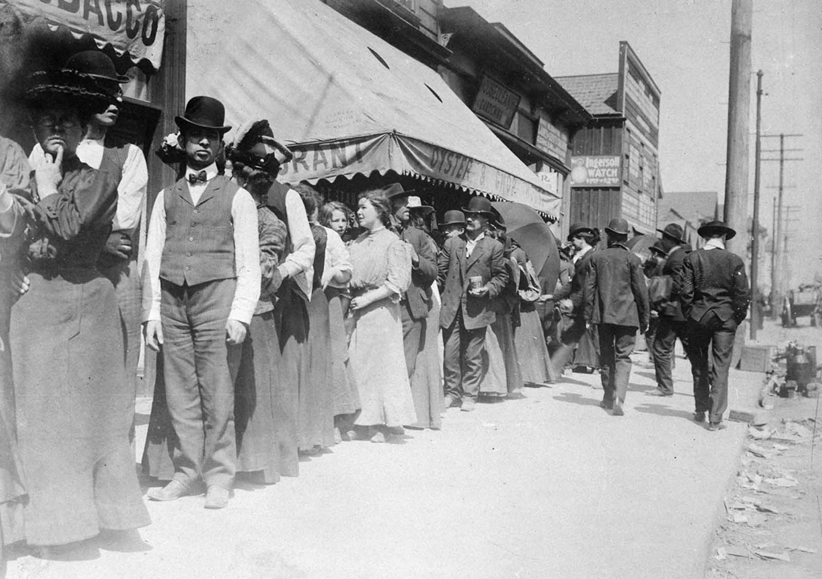
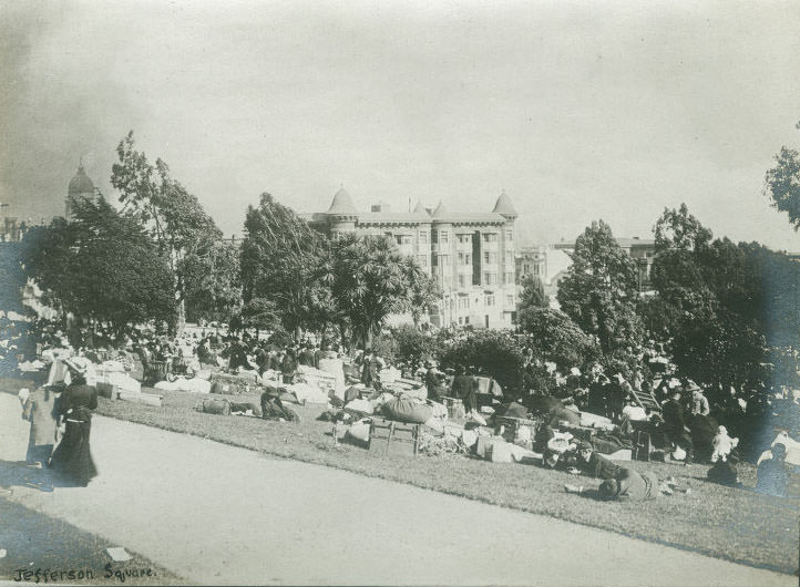
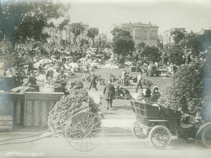
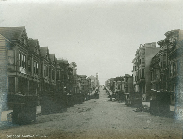
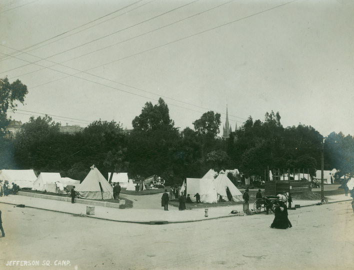
With most of the city’s buildings destroyed or unsafe to enter, daily life moved outdoors. Residents cooked meals on improvised stoves set up in the streets. Bread lines formed at aid distribution centers as food supplies were organized. The military and relief agencies worked to ensure that the 250,000 displaced residents received basic provisions. Outdoor cooking became common at locations across the city, including on Fell Street and in Jefferson Square.
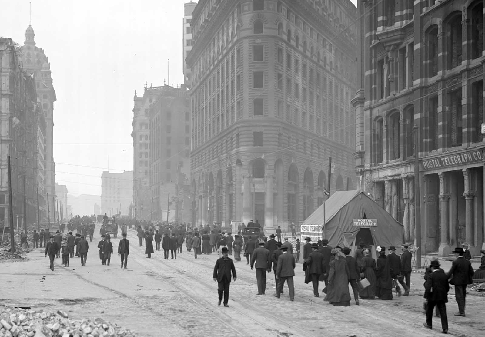
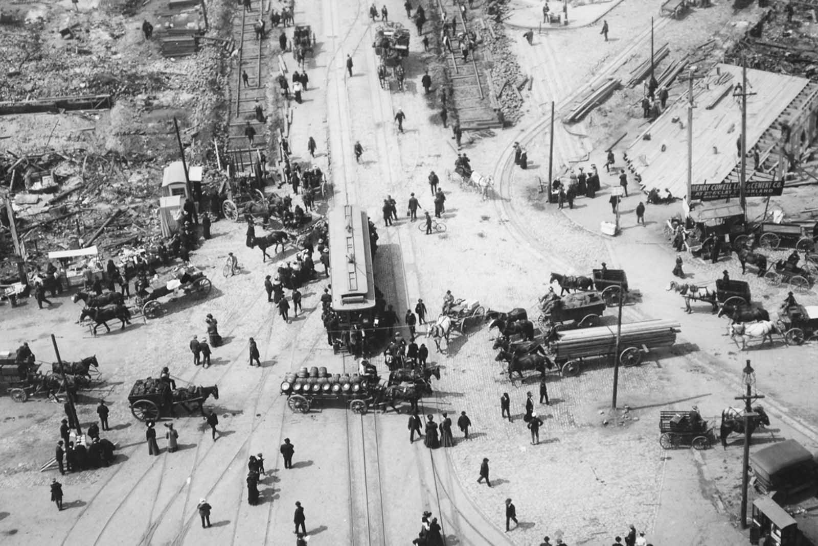
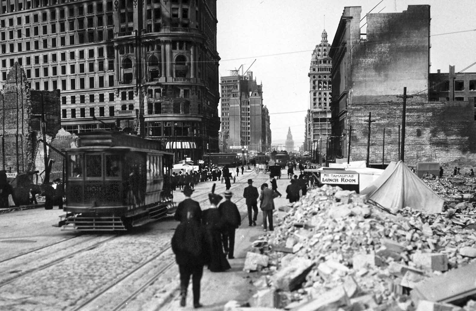
Communication infrastructure was rebuilt in makeshift form. A Postal Telegraph tent appeared on Market Street, serving as a temporary station for getting messages in and out of the city. The Ferry Building, one of the few major structures that survived relatively intact, became an important landmark in the recovery — its clock tower still stood while nearly everything around it had been reduced to ash.
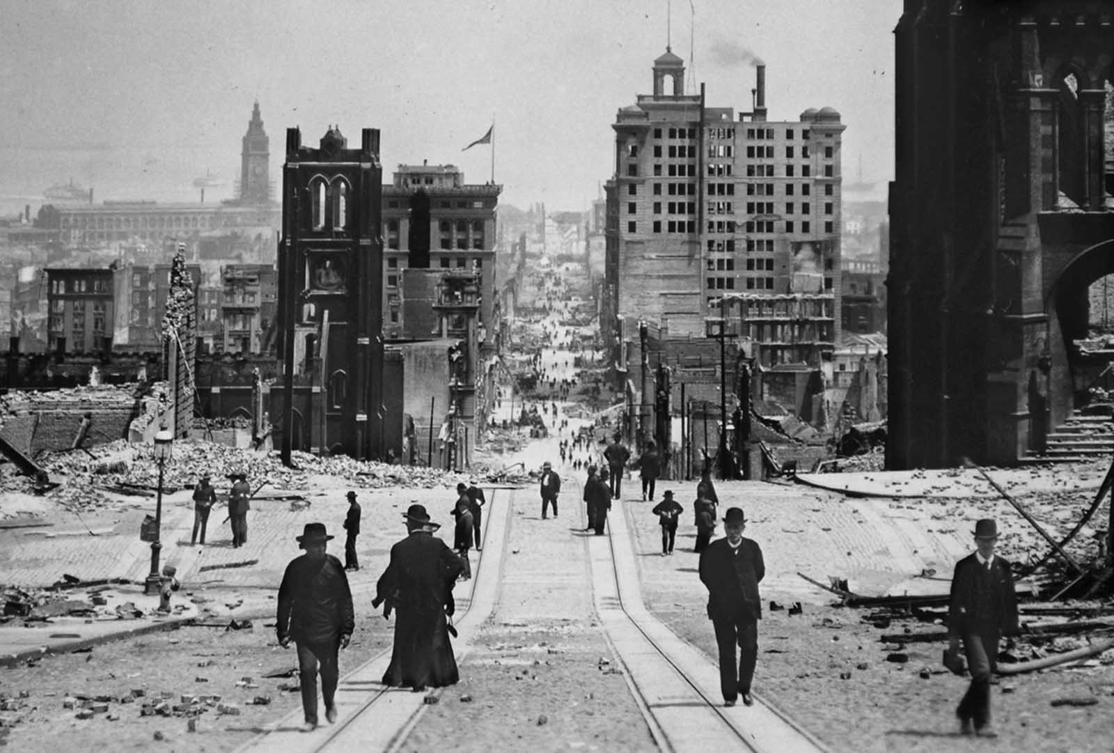
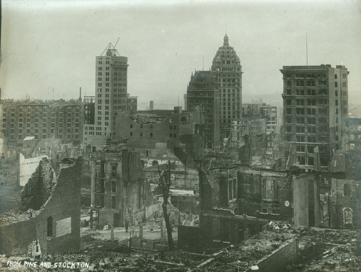
San Francisco’s Chinatown, located along Dupont Street (later renamed Grant Avenue), was completely destroyed. The neighborhood, which had been home to one of the largest Chinese communities in the United States, was burned to the ground. The financial district below it fared only marginally better — buildings like the Merchant’s Exchange survived structurally but were heavily damaged.
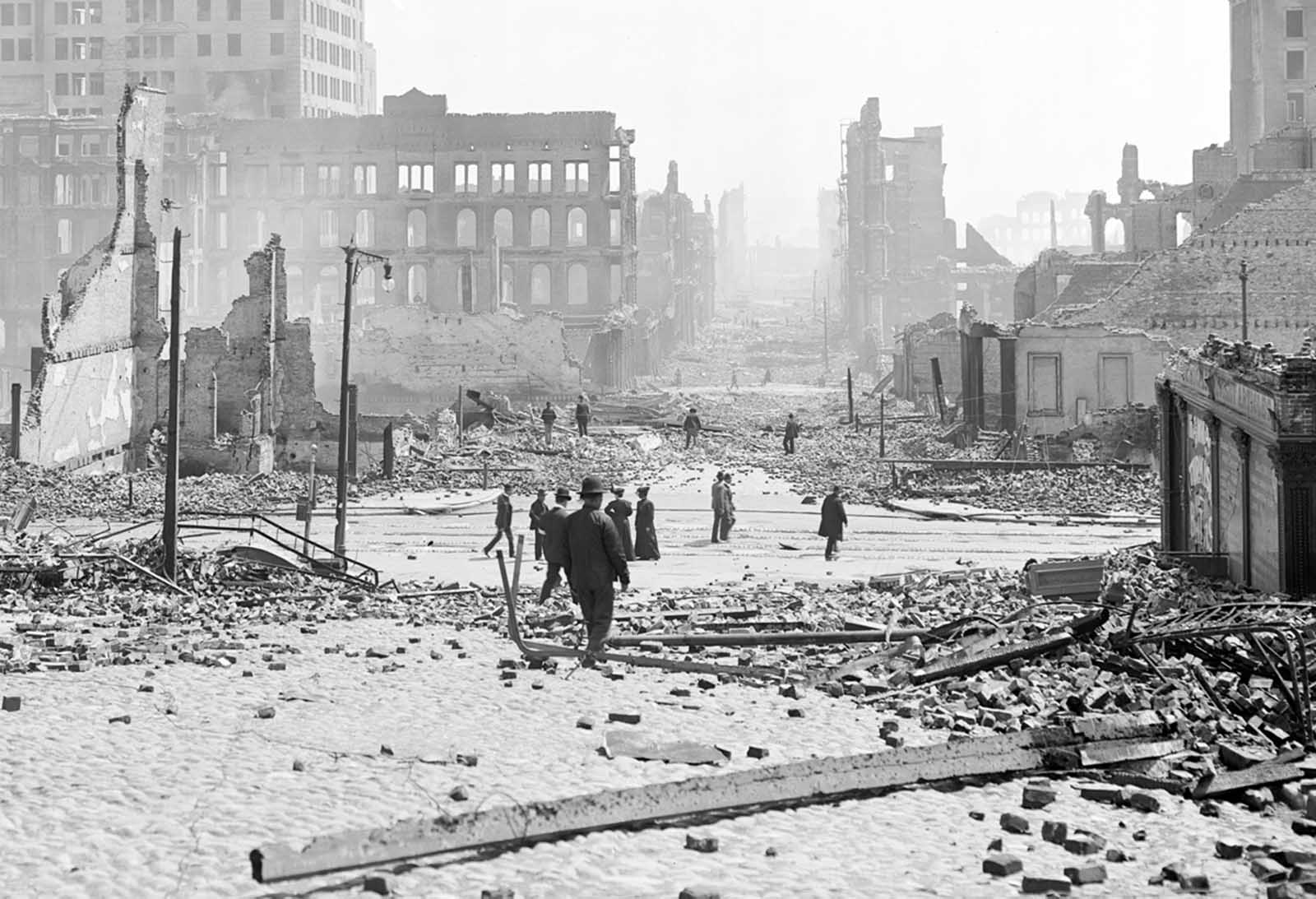
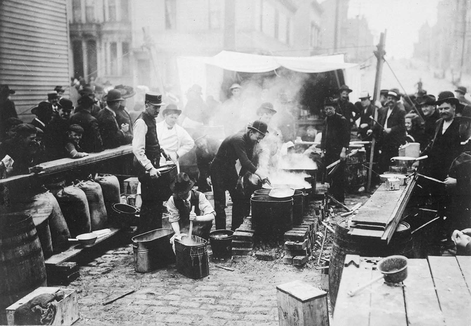
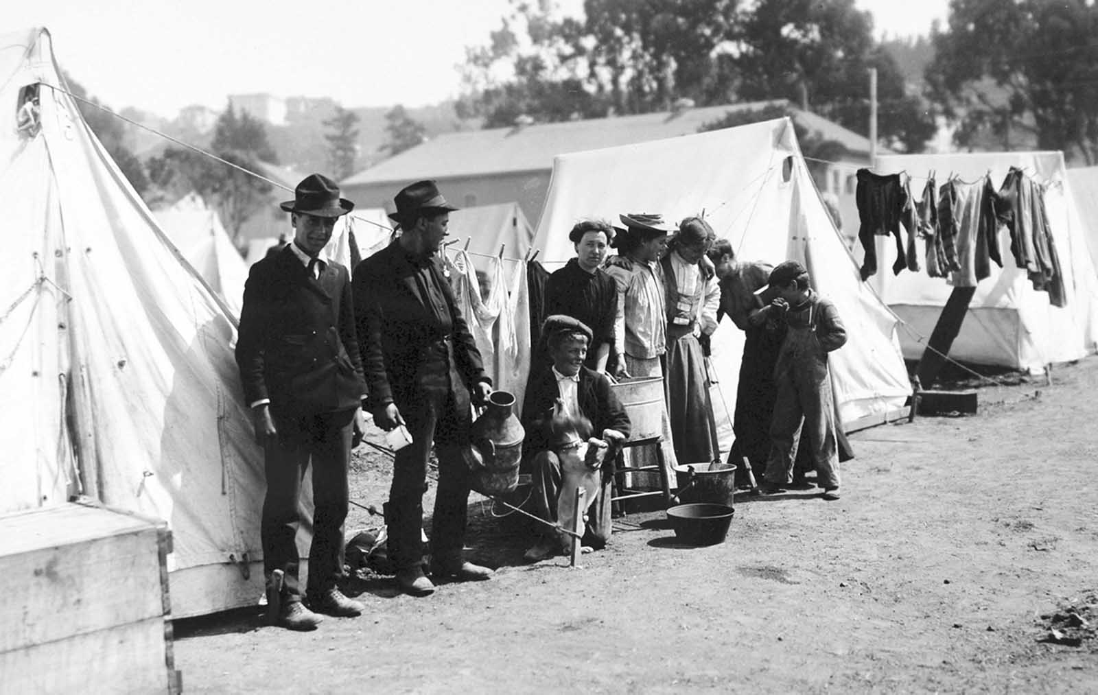
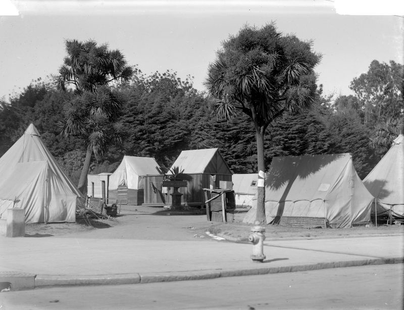
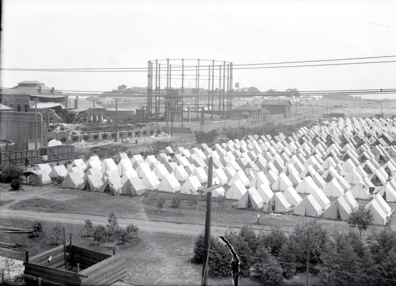
Feeding 250,000 displaced people required an enormous coordinated effort. Aid workers set up kitchens across the city to prepare hot food for refugees. Tent camps were established in parks and open spaces throughout San Francisco — Jefferson Square, Golden Gate Park, Portsmouth Square, the Presidio, and Lobos Square in the Marina all became temporary settlements housing thousands of residents with nowhere else to go.
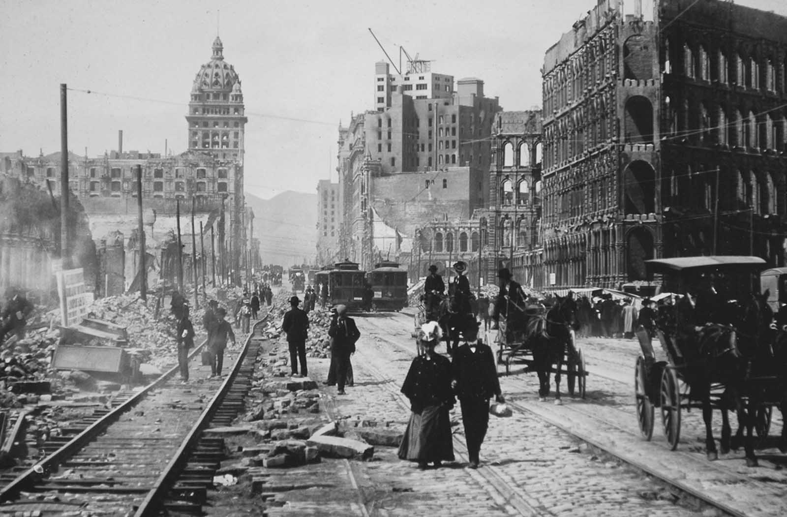
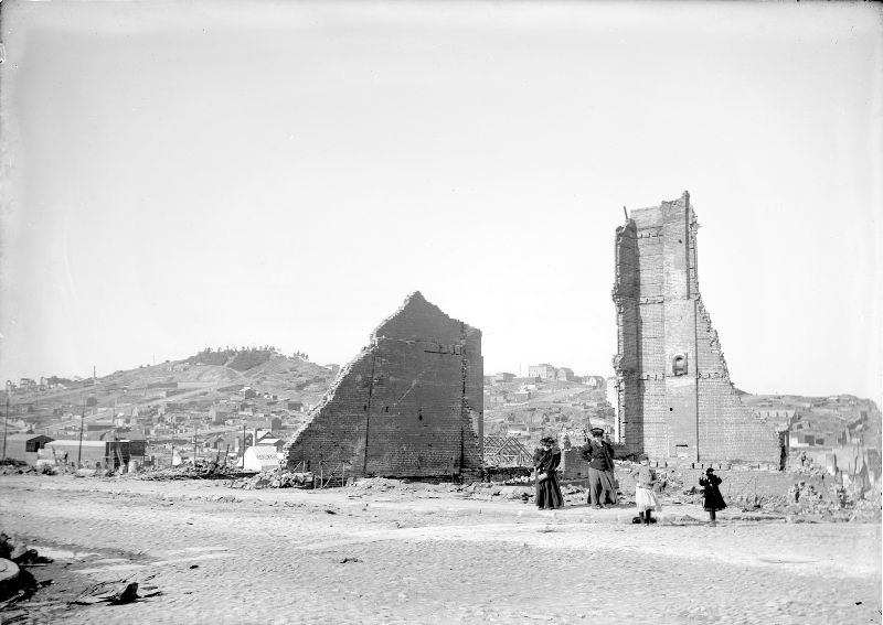
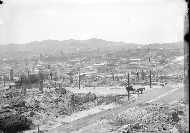
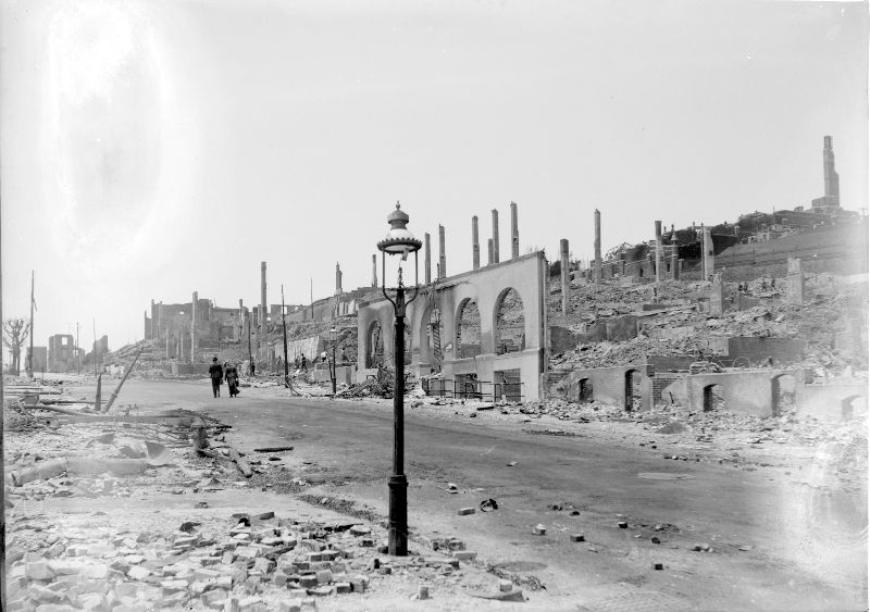
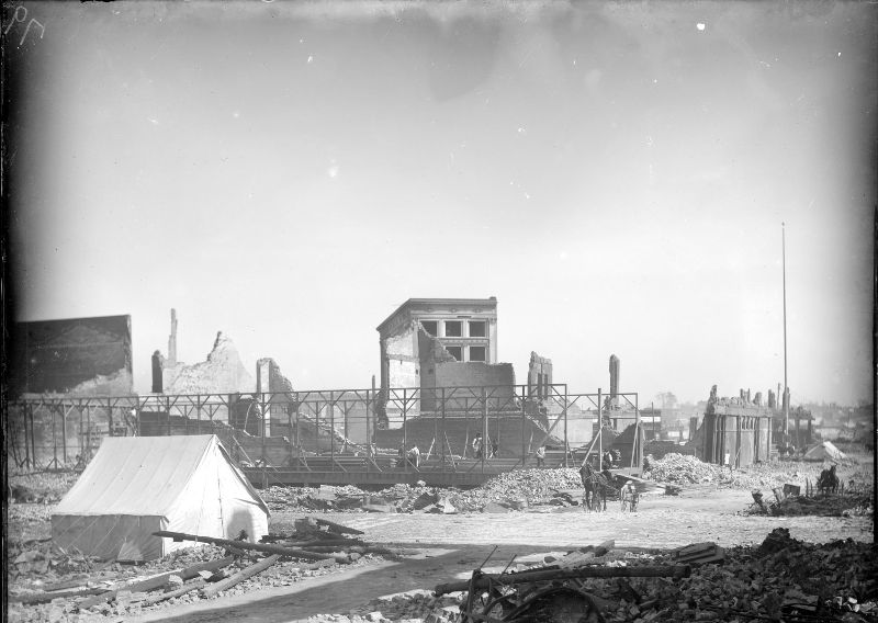
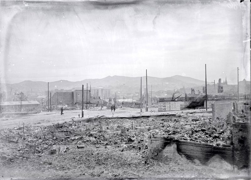
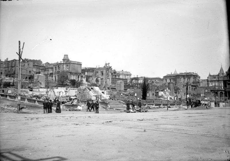
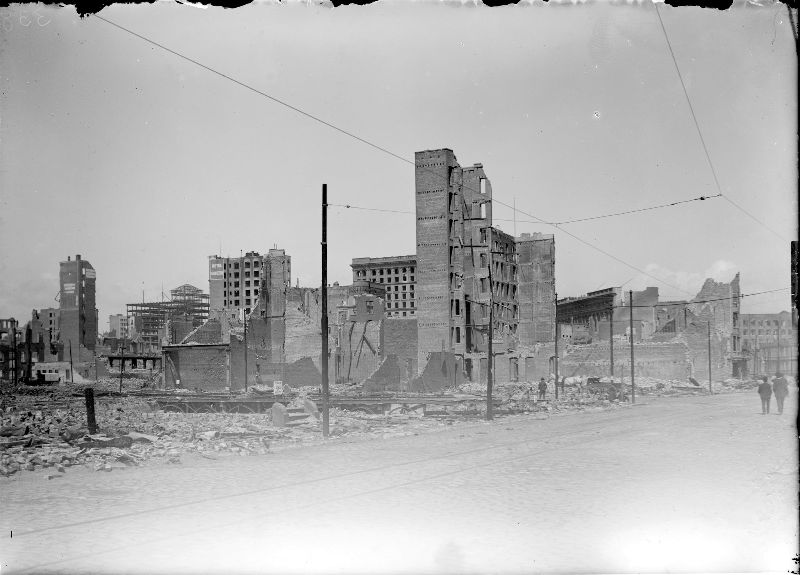
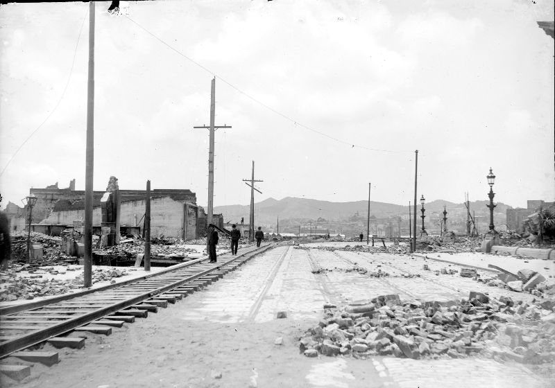
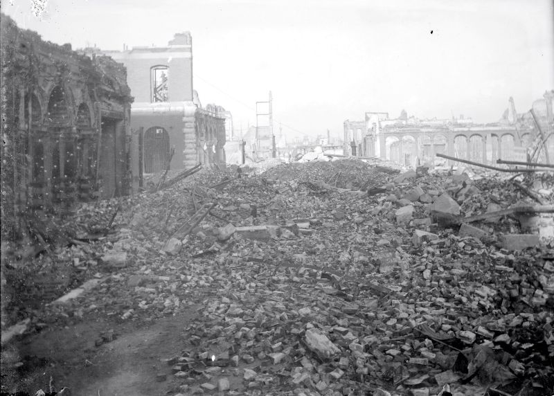
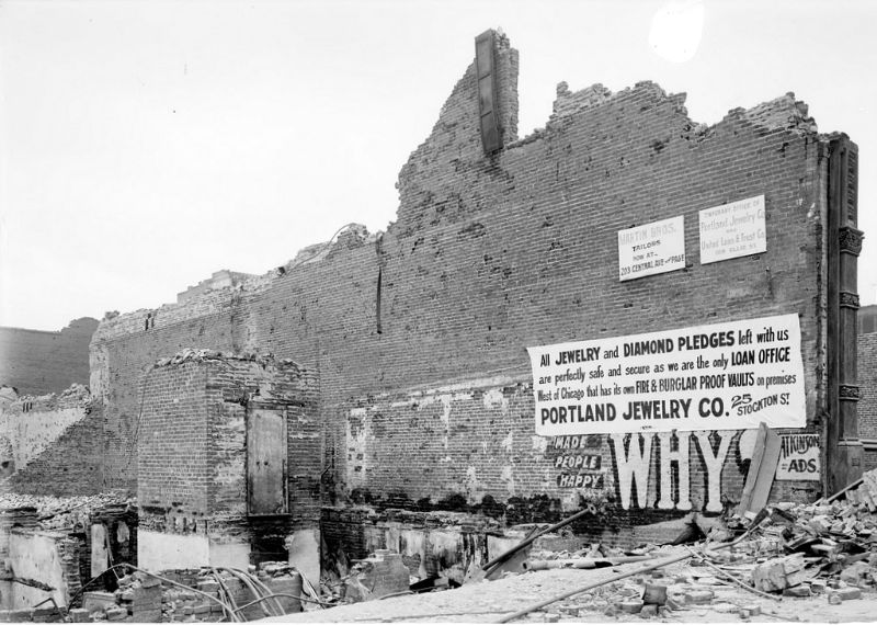
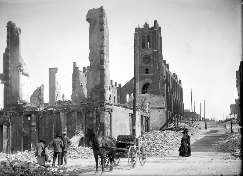
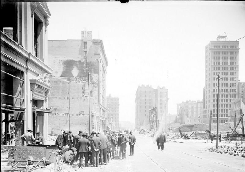
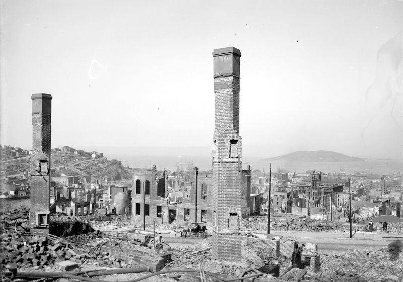
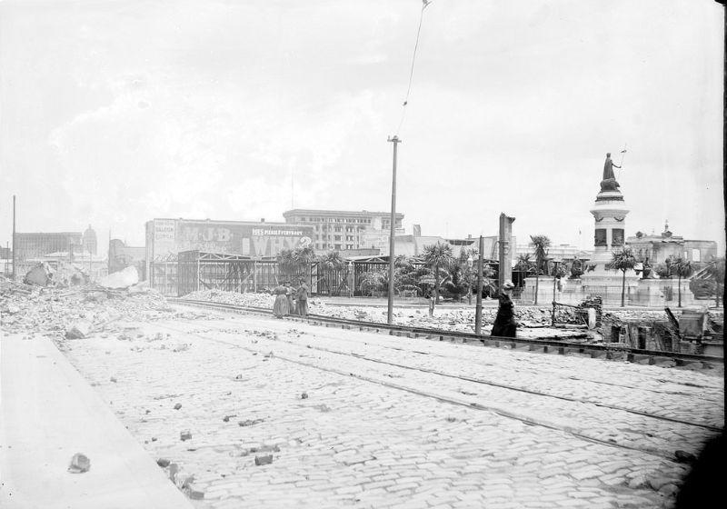
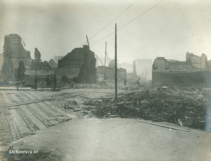
Market Street, which had been the commercial spine of San Francisco, was unrecognizable. From Battery Street to Powell Street, both sides of the boulevard were lined with ruined buildings. The Call Building, the Crocker Building, and dozens of other commercial properties were gutted. The street itself remained passable, but everything flanking it had been destroyed.
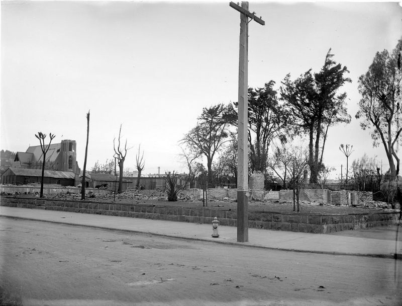
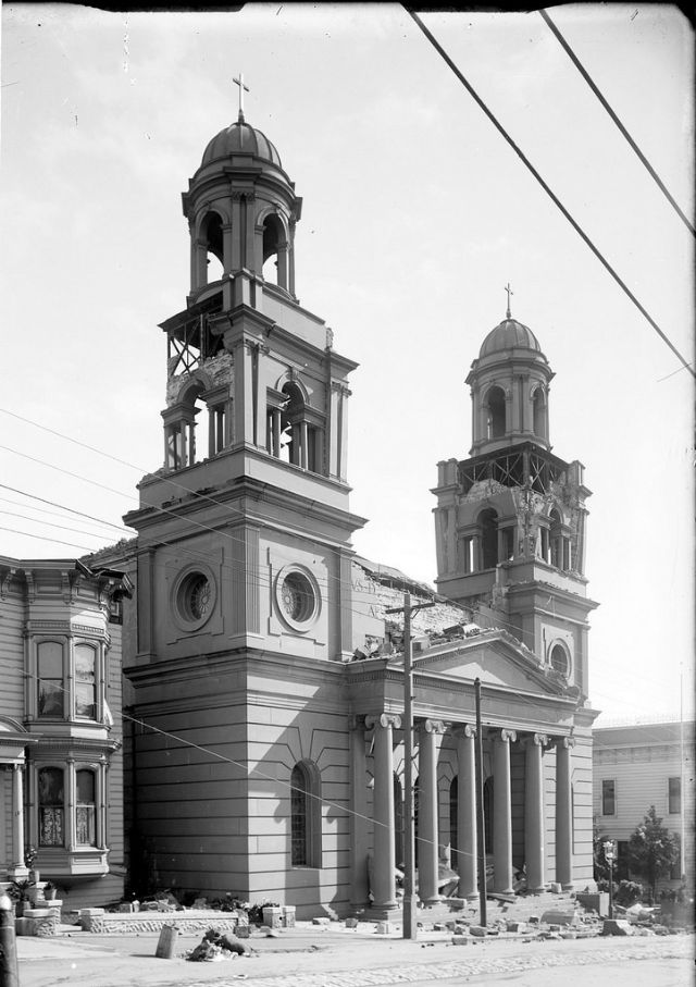
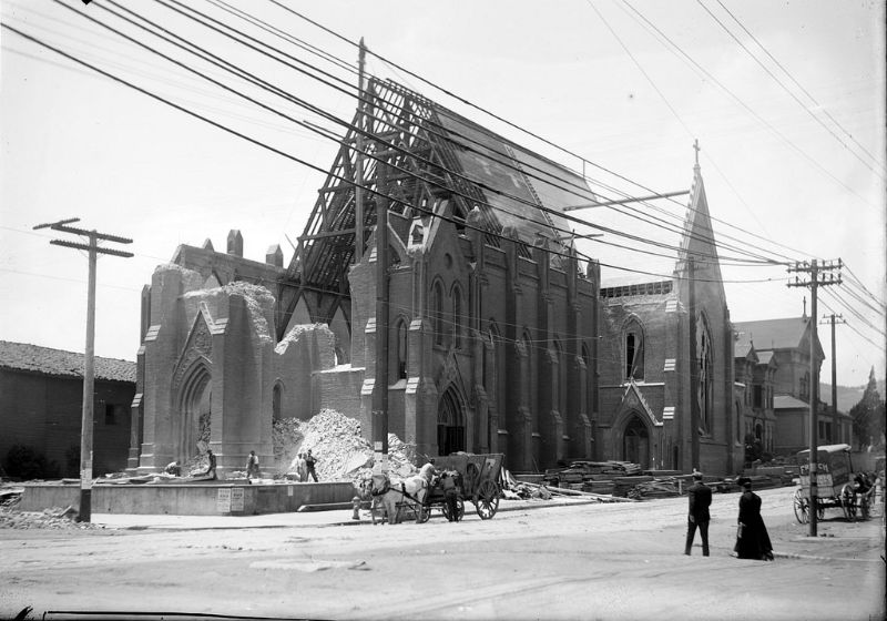
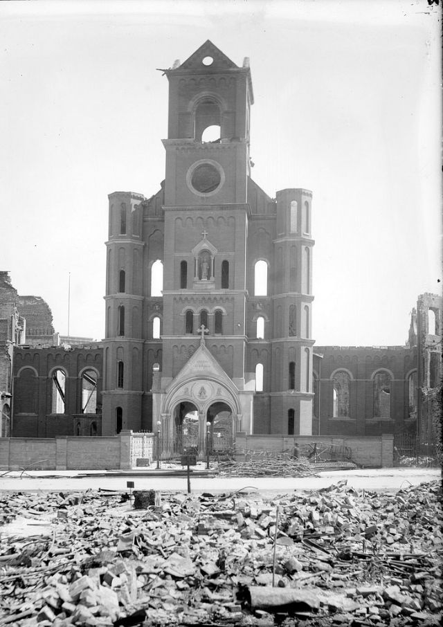
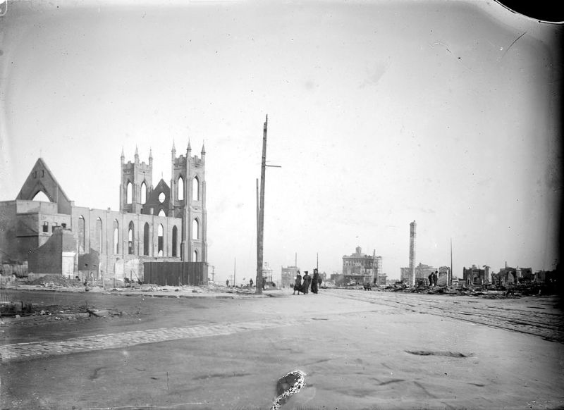
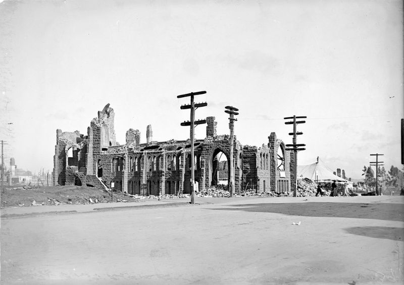
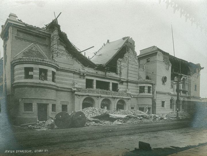
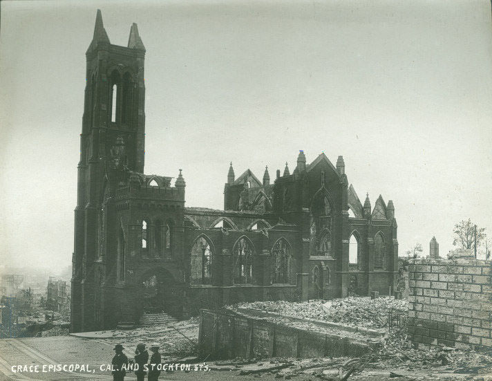
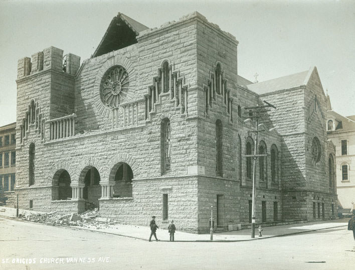
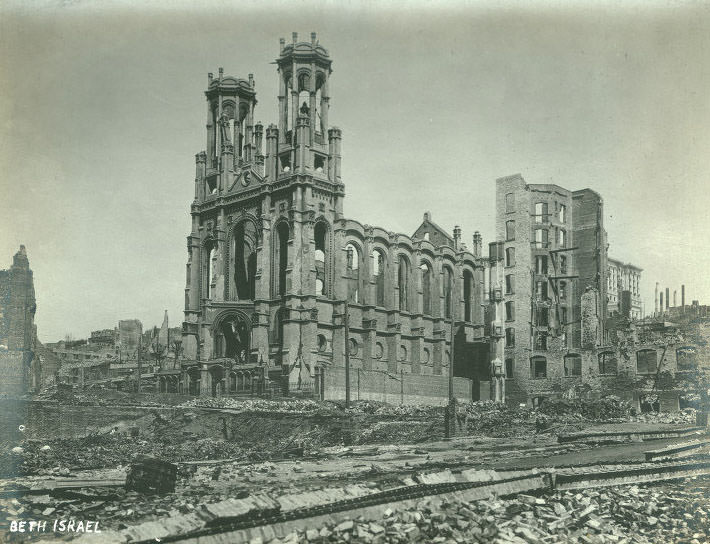
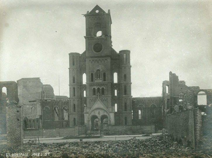
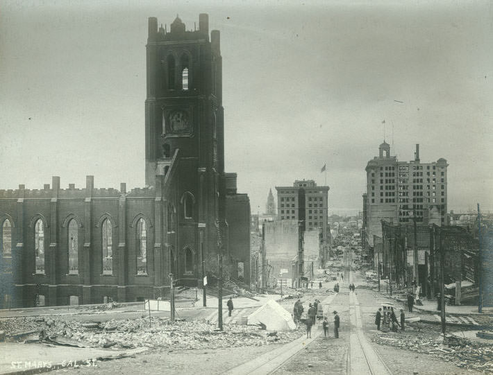
The disaster did not spare the city’s religious institutions. Churches across San Francisco were badly damaged or destroyed — Holy Cross, Saint Boniface, Saint Francis, Saint Luke, Saint Mary’s, Saint Brigid’s, Mission Dolores, Grace Episcopal, and Beth Israel all appeared in damage surveys. The Jewish Synagogue on Geary Street and multiple Catholic parishes were among the institutions that lost their buildings entirely.
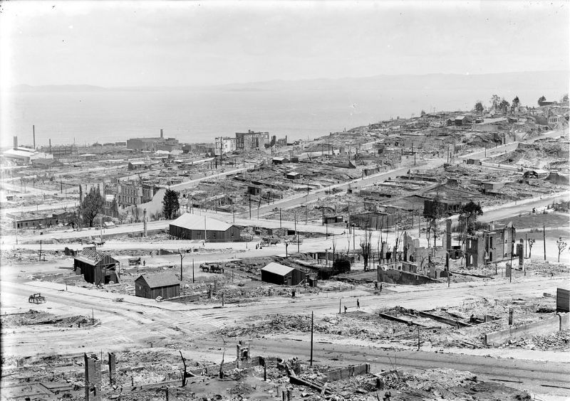
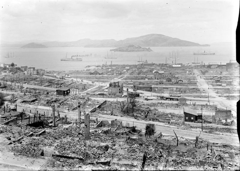
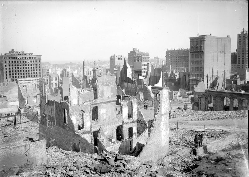
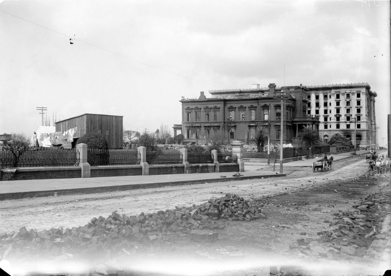
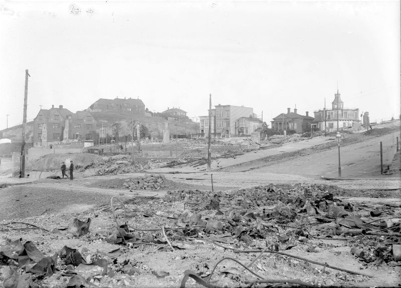
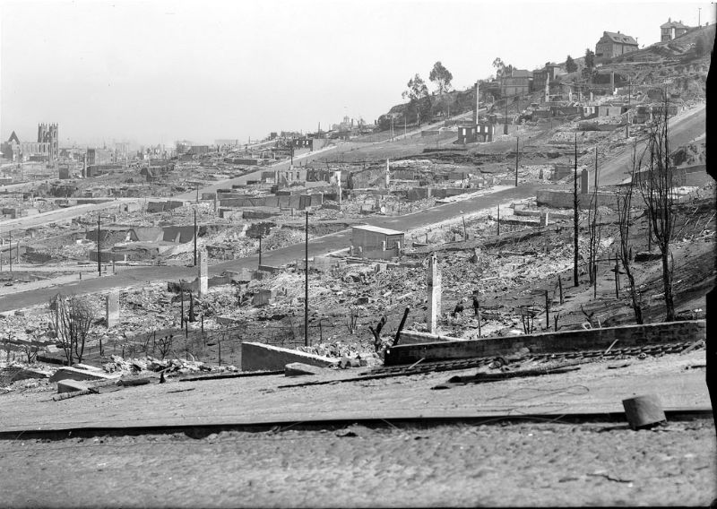
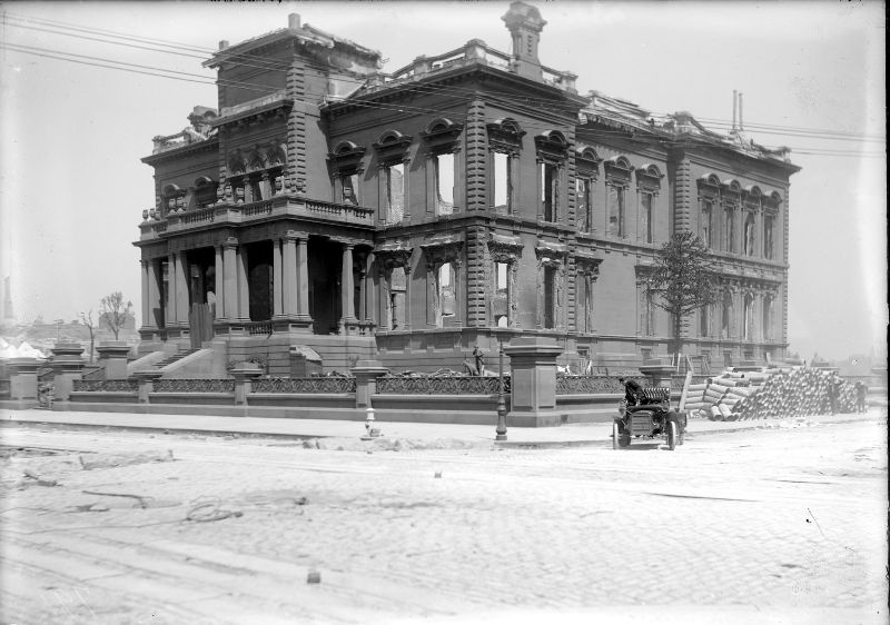
Nob Hill, which had been home to the grand mansions of San Francisco’s railroad and silver barons, was left as a field of burned foundations and collapsed walls. The Flood Mansion, built from sandstone, survived as a shell — its walls standing but its interior entirely gutted. The Fairmont Hotel, which had just been completed and was weeks away from its grand opening, was ravaged by fire. On the slopes below Nob Hill, the damage extended in every direction.
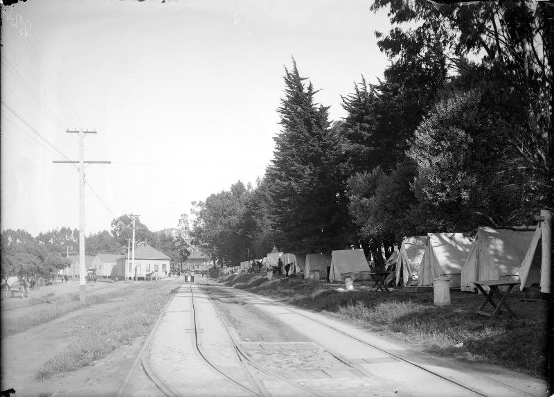
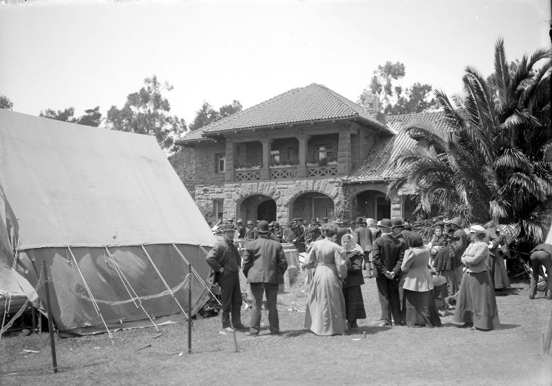
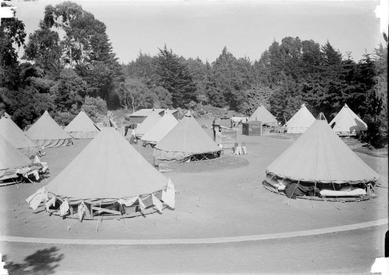
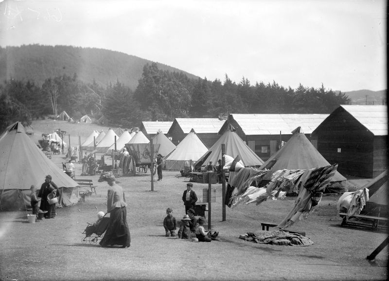
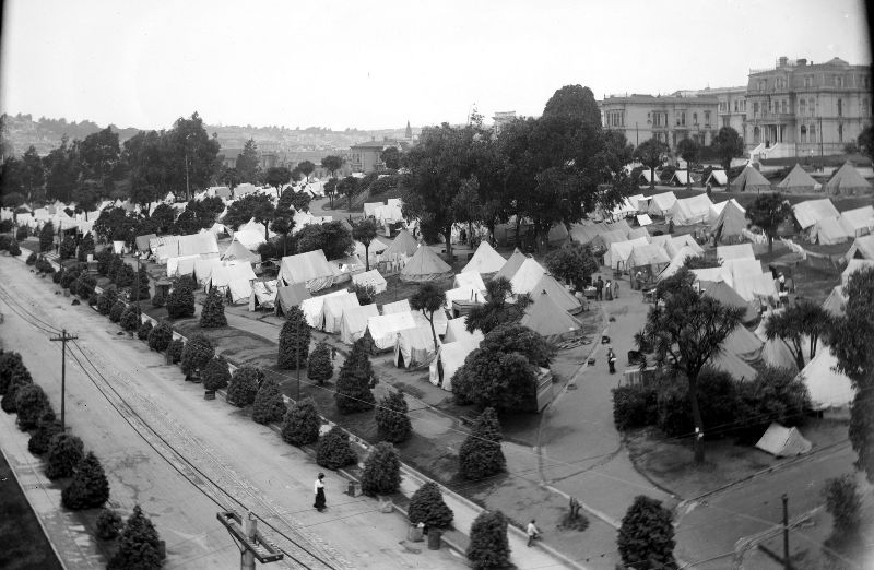
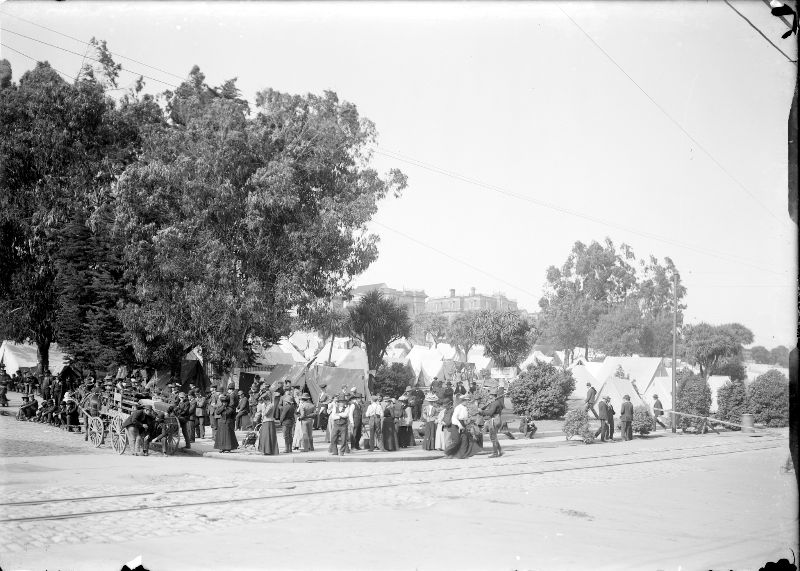
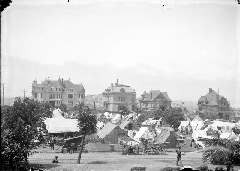
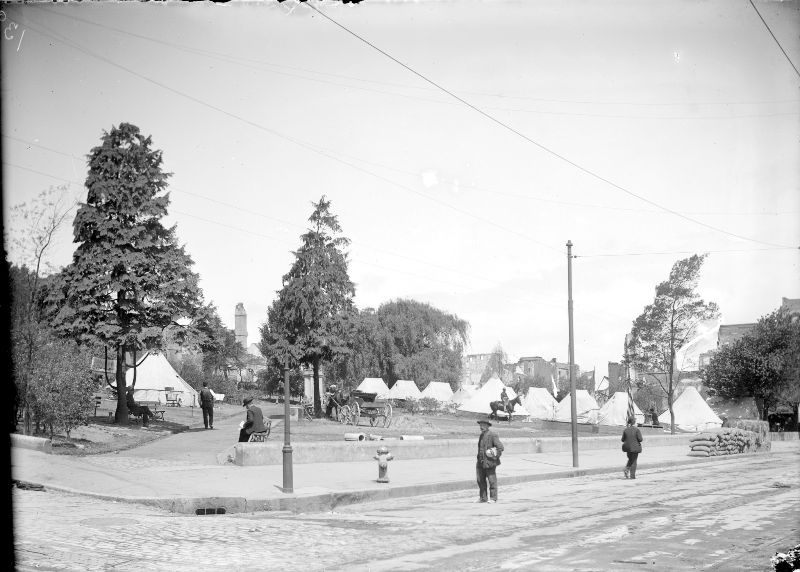
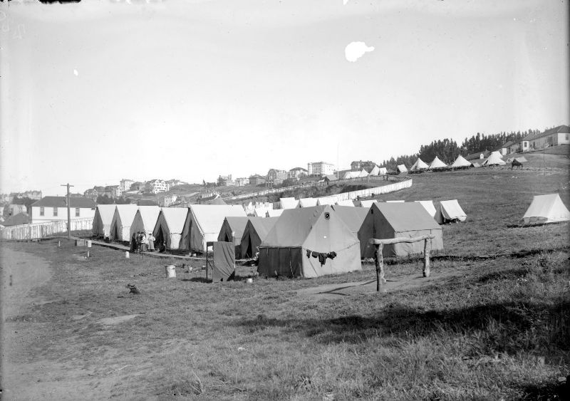
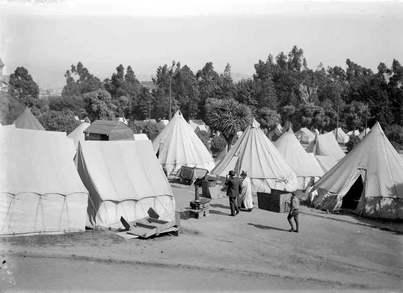
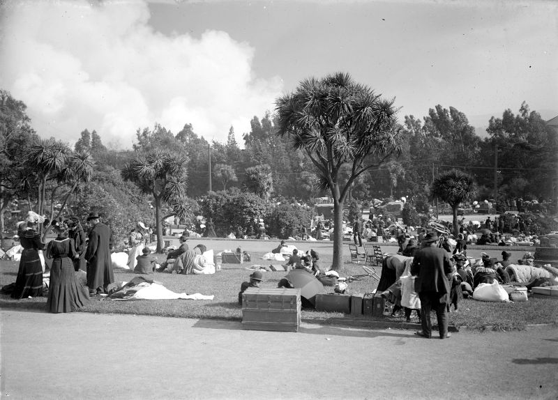
The refugee camps that formed across San Francisco’s parks and open spaces housed tens of thousands of people for weeks and months after the disaster. Golden Gate Park held some of the largest concentrations of displaced residents, with rows of tents stretching across its lawns near McLaren Lodge and throughout the park’s interior. Jefferson Square, Portsmouth Square, and the Presidio military reservation also became major camps. The Army administered food distribution, sanitation, and security across these settlements.
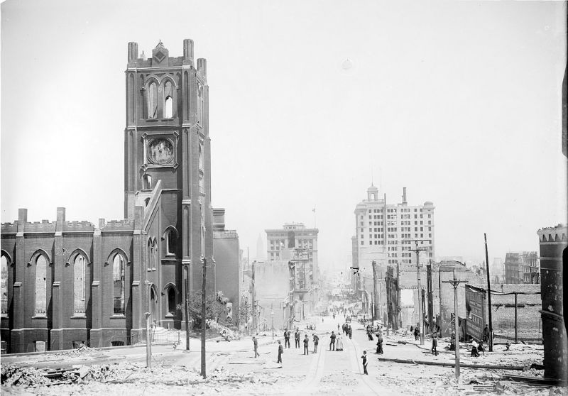
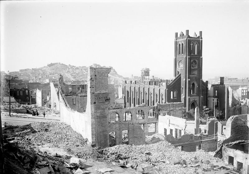
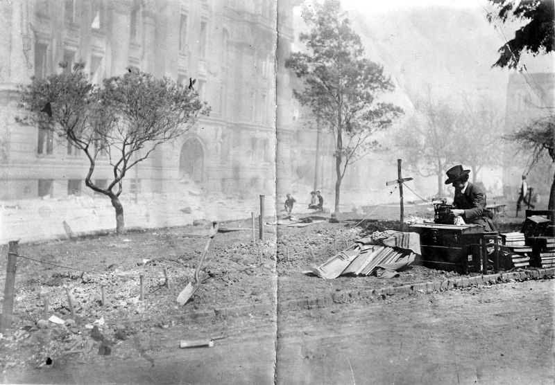
Business adapted quickly to the new reality. A street typist set up at an outdoor location to handle correspondence and paperwork for people who had no office to return to. It was one of dozens of improvisations that defined life in post-earthquake San Francisco — commerce and communication carried on in the open air while the city was rebuilt around them.
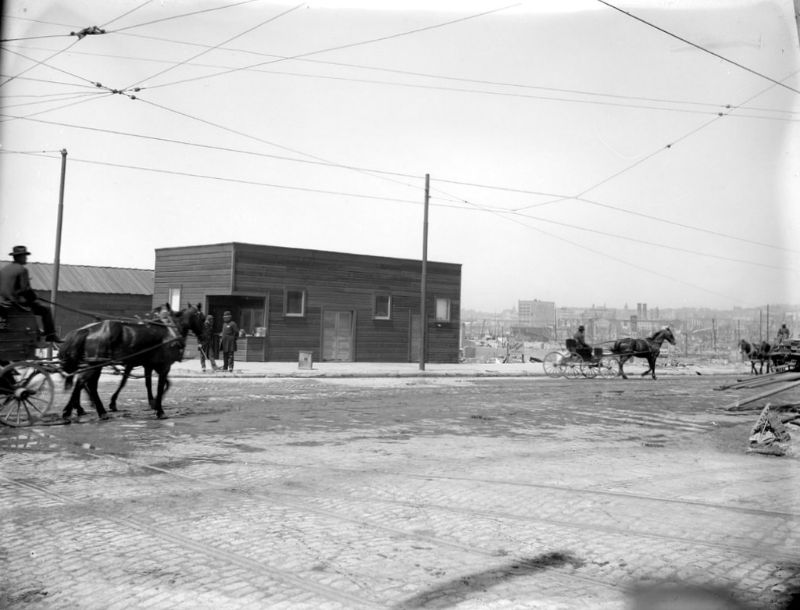
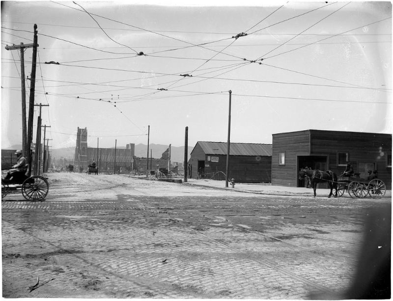
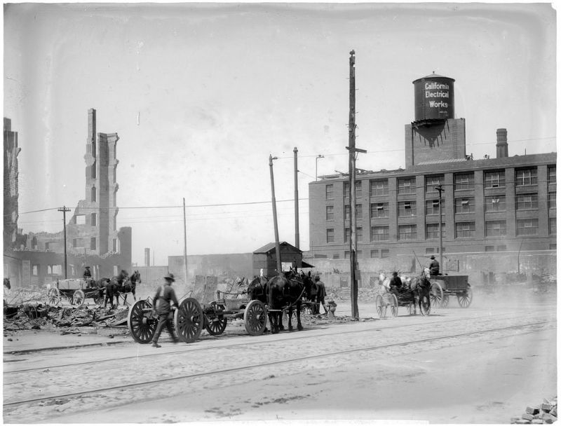
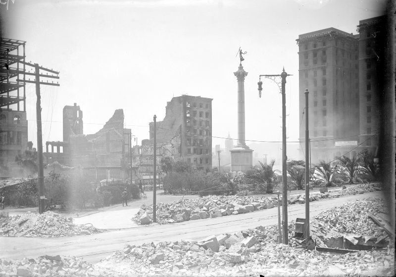
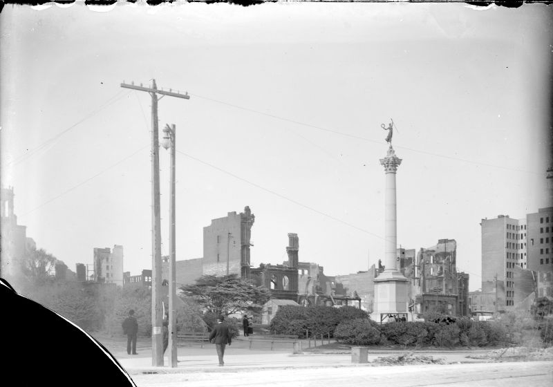
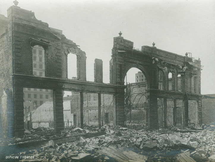
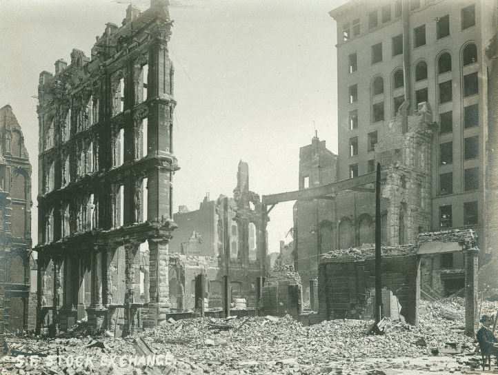
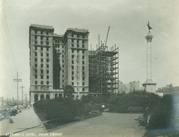
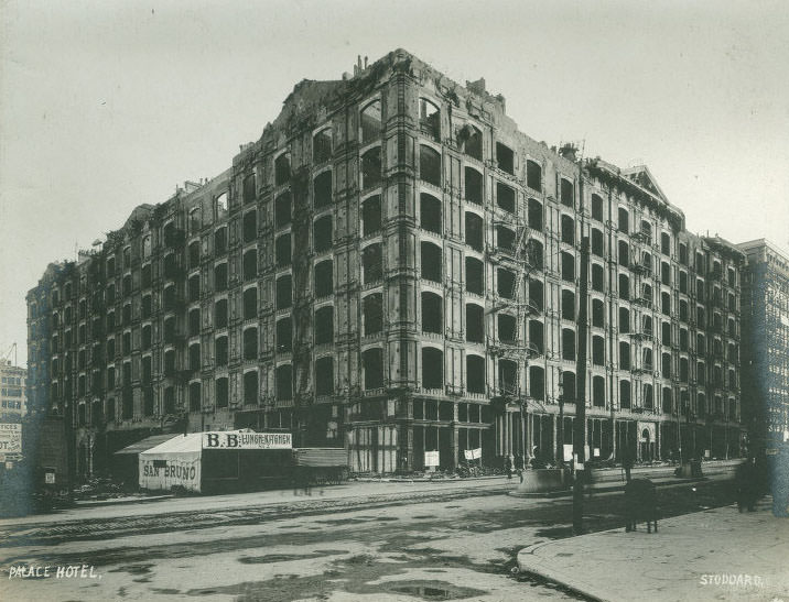
Union Square, the city’s central plaza, was surrounded by burned and collapsed buildings. The Saint Francis Hotel on the square’s western edge was badly damaged by fire. The Palace Hotel, one of the grandest hotels in the American West at the time, burned completely. Both structures had been considered showpieces of San Francisco’s prosperity. The Orpheum Theater and the San Francisco Stock Exchange were also destroyed.
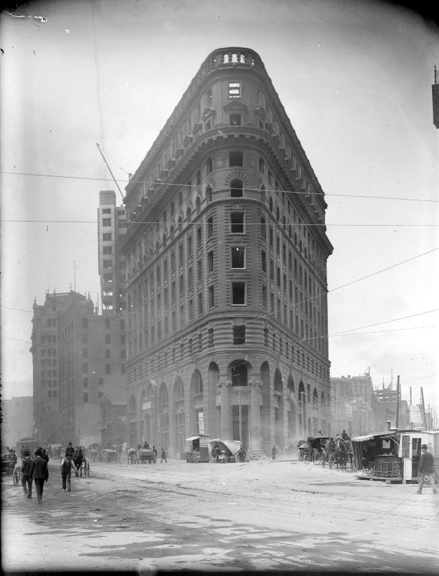
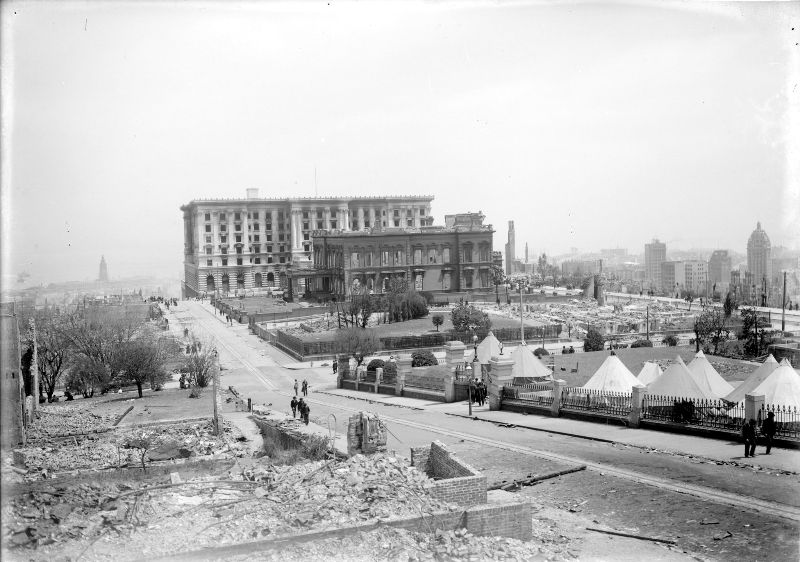
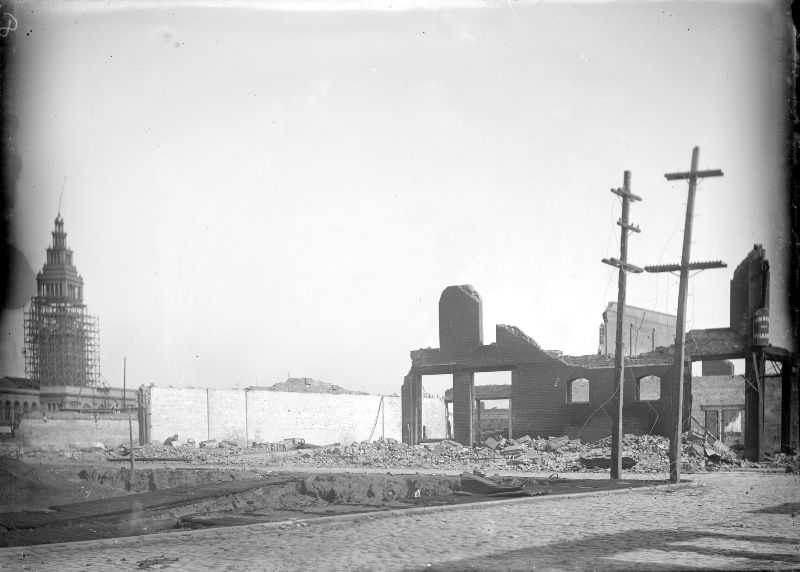
The Ferry Building on the Embarcadero became one of the most important structures in the immediate aftermath of the disaster. As the main point of entry and exit for the city, it handled a massive flow of refugees, relief workers, and supplies in the days following the earthquake. Its survival made it a symbol of what could still function amid the wreckage.
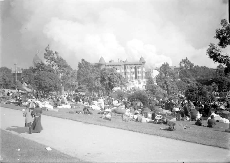
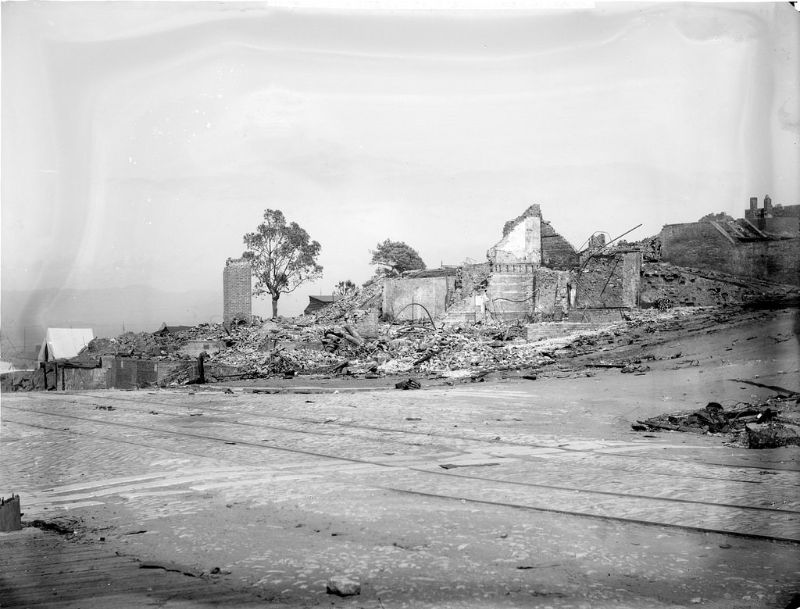
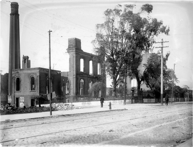
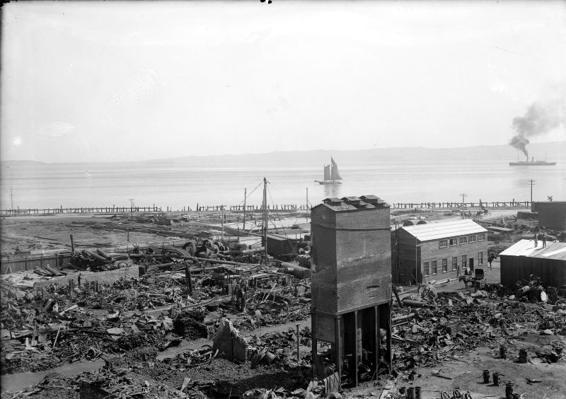
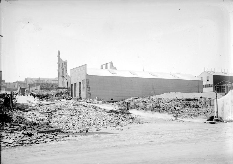
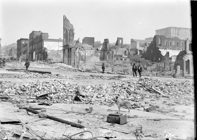
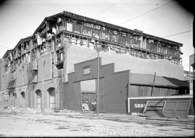
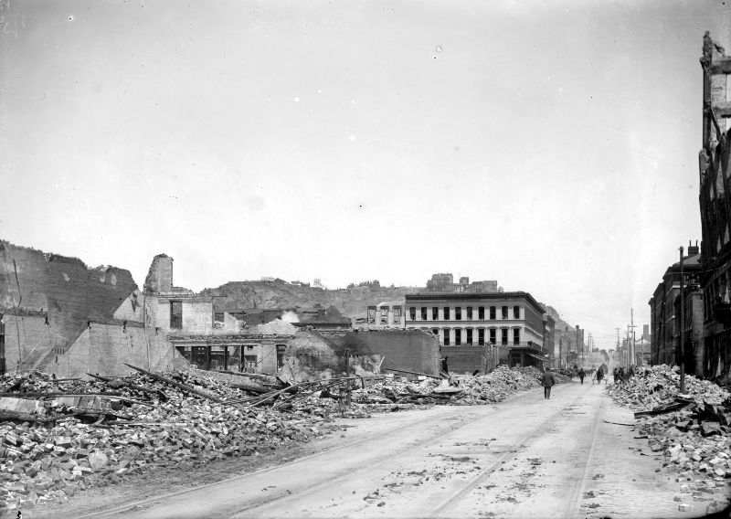
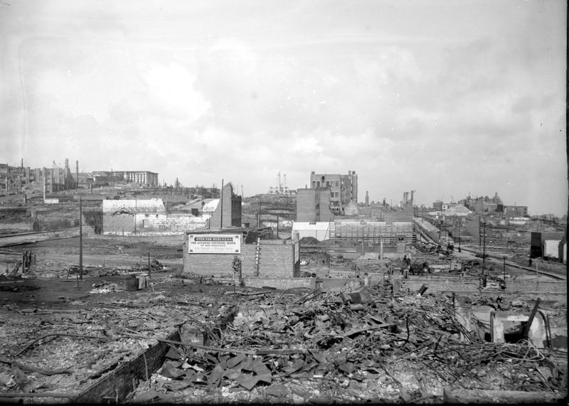
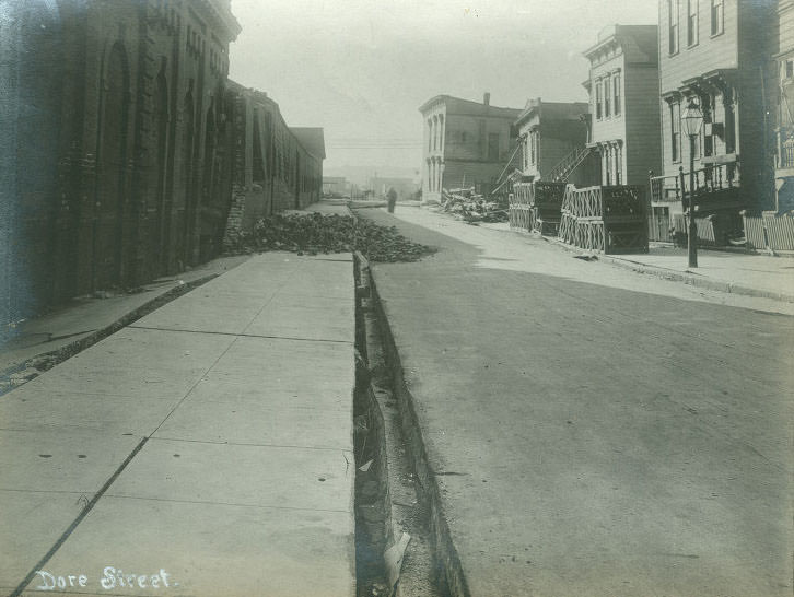
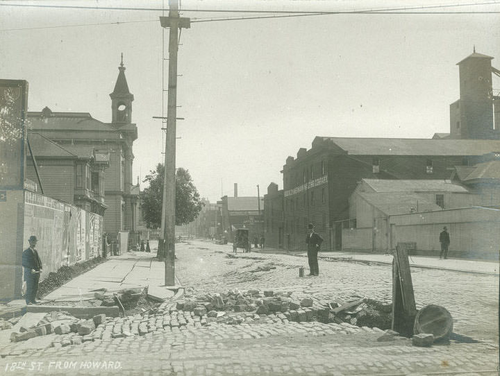
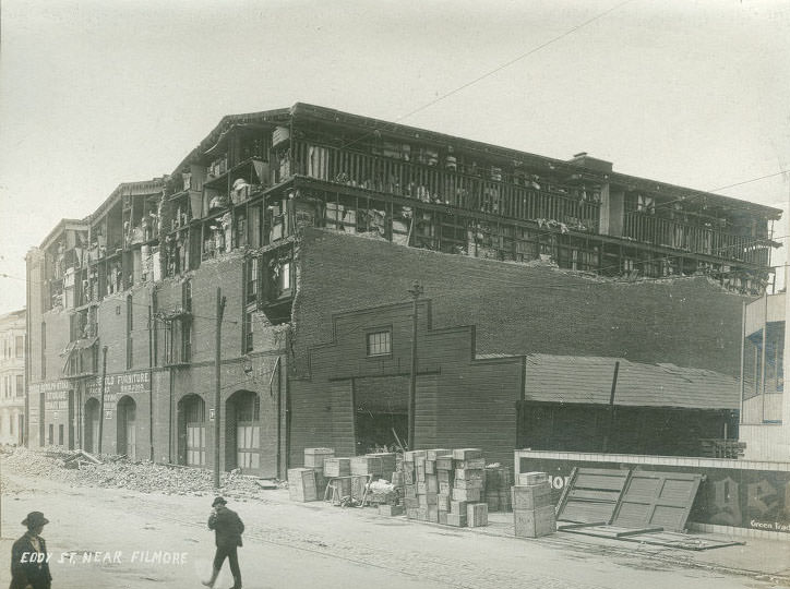
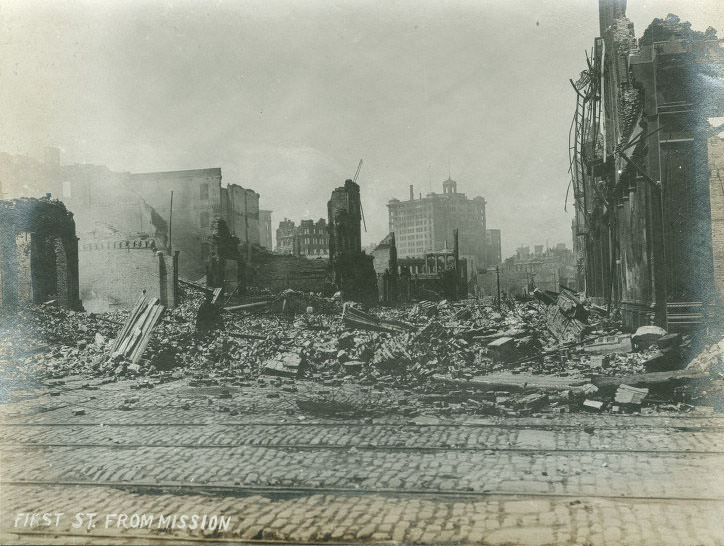
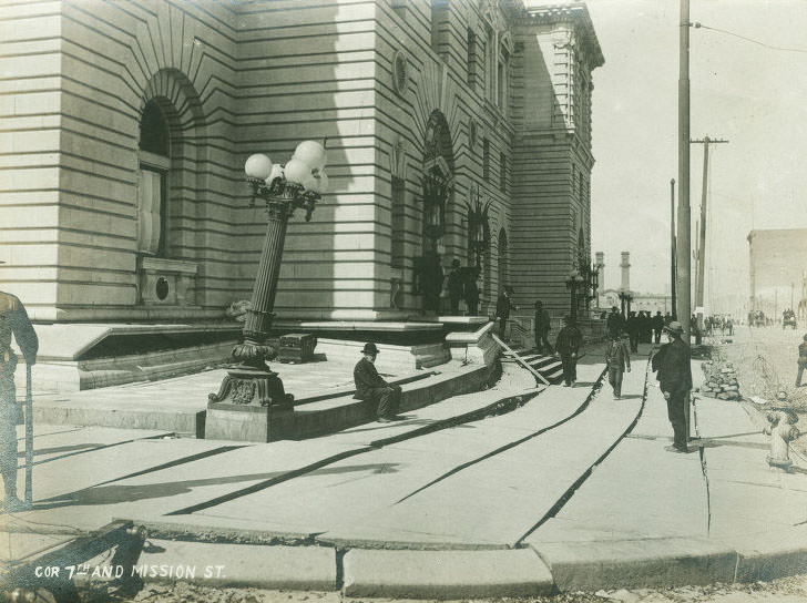
The area south of Market Street — densely packed with working-class housing, warehouses, and small businesses — suffered some of the worst structural damage in the entire city. Streets like Folsom, Howard, Brannan, and Mission were lined with collapsed buildings. The ground in this part of the city was largely built on filled-in tidal wetlands, which amplified the shaking and caused structures to fail more completely than they did on solid bedrock.
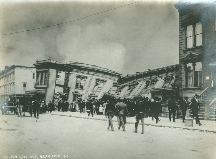
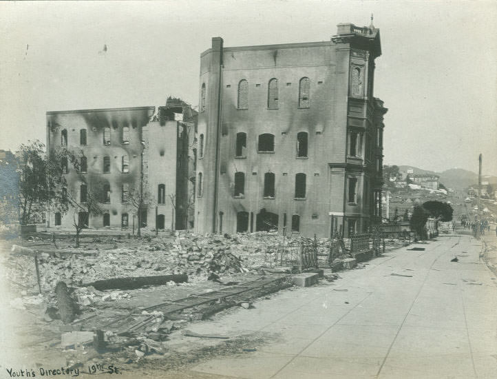
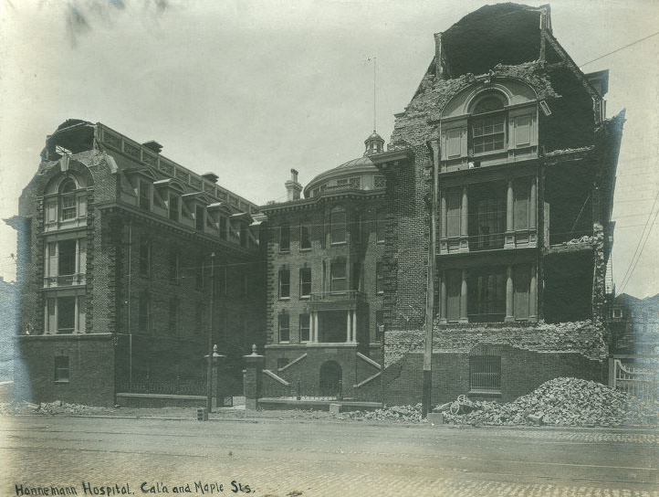
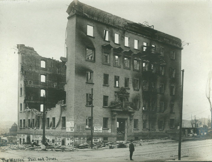
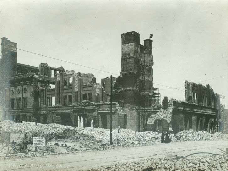
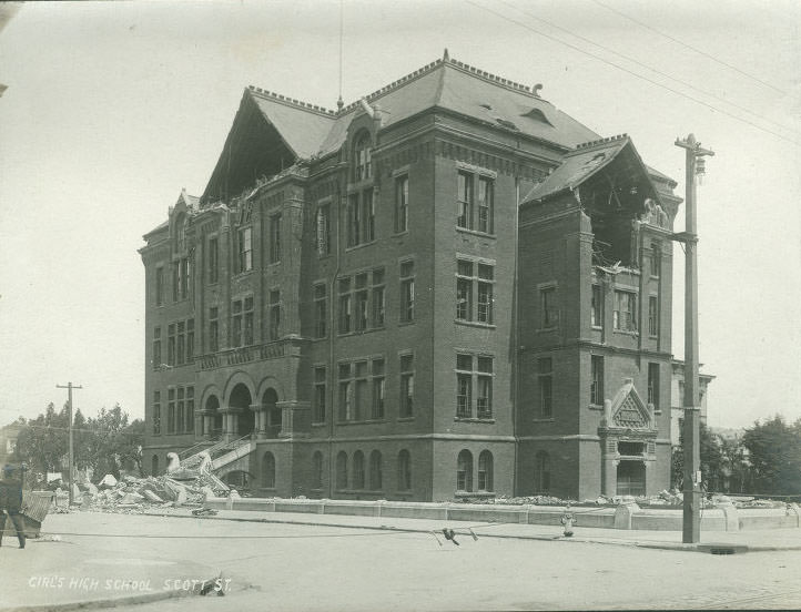
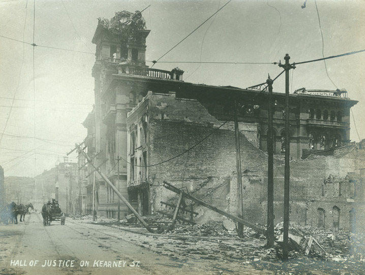
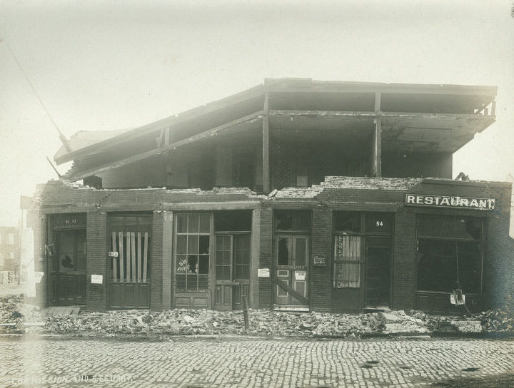
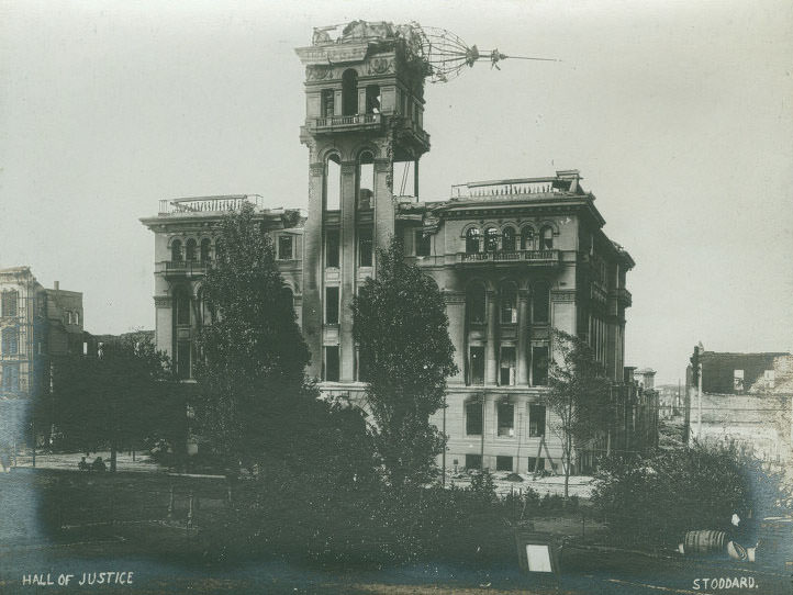
City institutions were not spared. The Hall of Justice on Kearney Street was heavily damaged. Hahnemann Hospital at California and Maple Streets was destroyed. The YMCA building on Mason Street was ruined. Schools, including the Girls’ High School on Scott Street, were reduced to shells. Public buildings that residents had relied on for services, justice, and community life were suddenly gone.
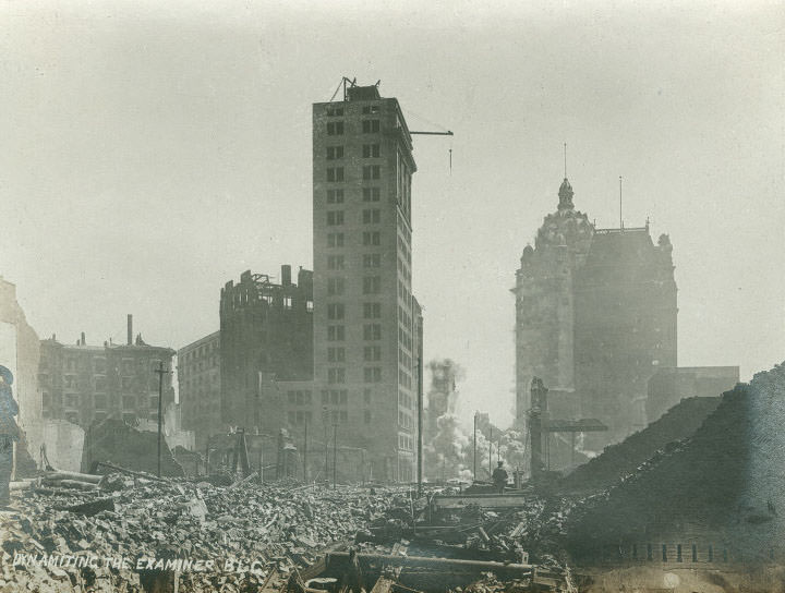
One of the most dramatic measures taken to control the fires was the deliberate demolition of buildings using dynamite. The Examiner Building was blown up as part of the effort to create firebreaks. The strategy was controversial — poorly executed blasts sometimes spread burning debris rather than stopping fires — but it was the only tool available to authorities without functioning water mains.
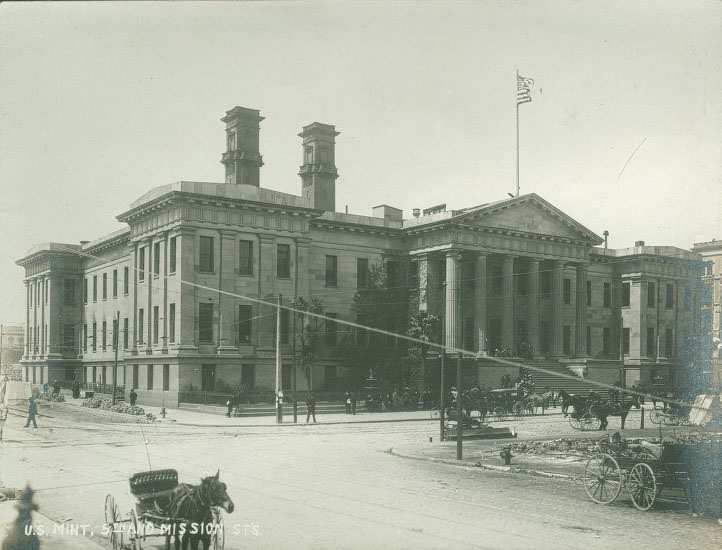
The U.S. Mint at 5th and Mission Streets was one of the few major buildings in the downtown area that survived both the earthquake and the fire. Mint employees and soldiers defended the building against the flames using rooftop hoses fed from the Mint’s own water storage, keeping it operational throughout the crisis. The building’s survival allowed it to continue functioning during the recovery period.
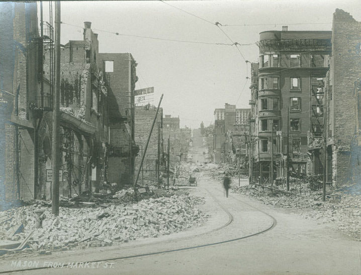
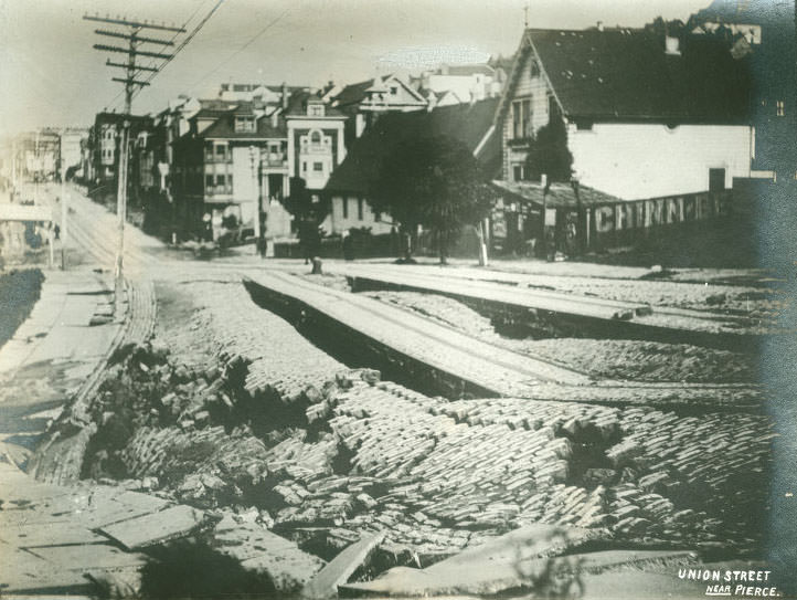
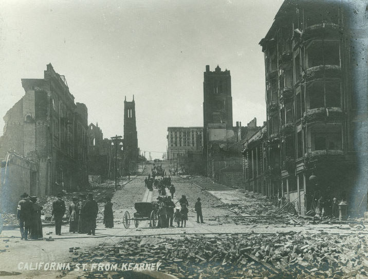
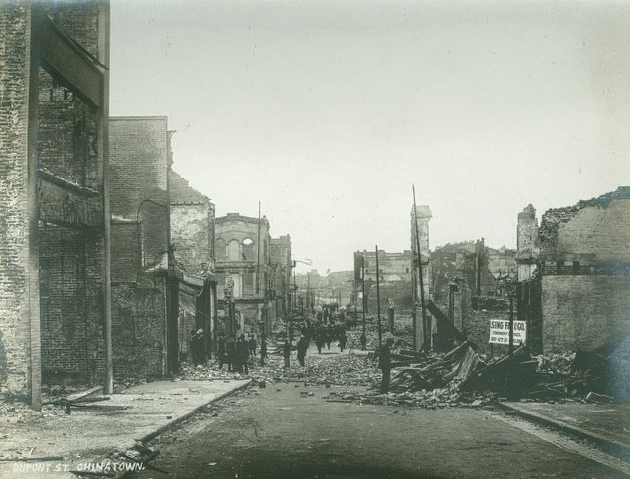
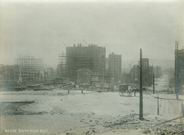
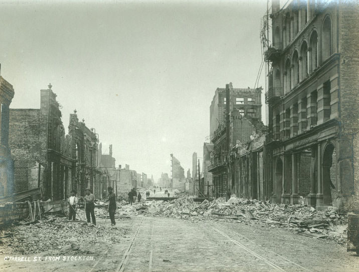
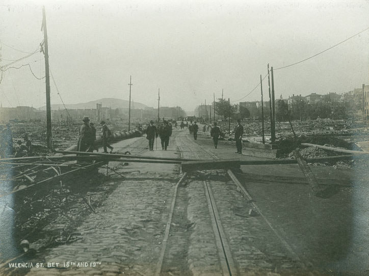
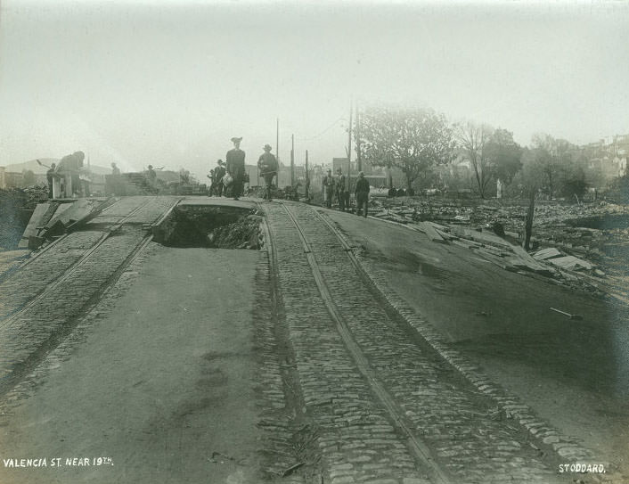
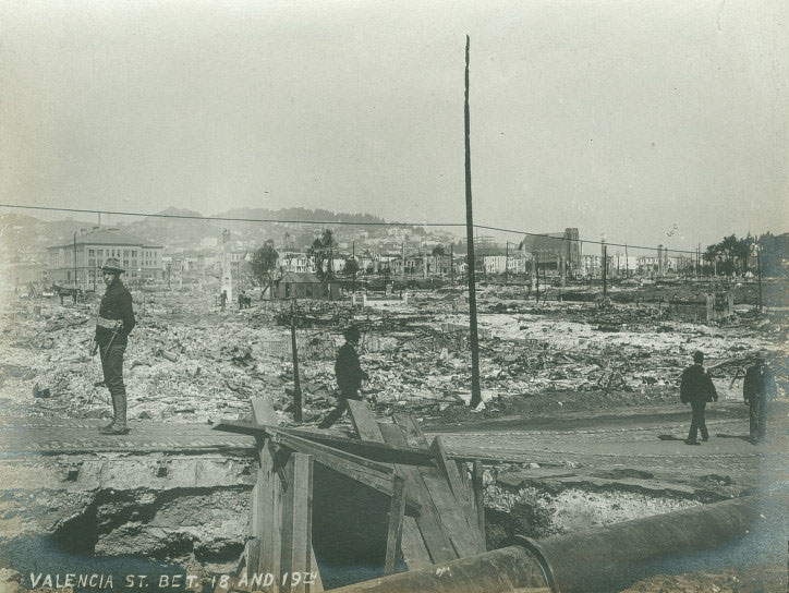
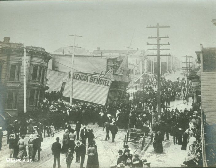
Valencia Street in the Mission District was among the most severely damaged corridors in the city. The street was built over an underground waterway, and the earthquake caused the ground beneath it to collapse and liquefy. Buildings sank into the earth, and the Valencia Street Hotel was swallowed almost entirely — all four floors dropped so that only the top story remained above street level. Dozens of people inside died.
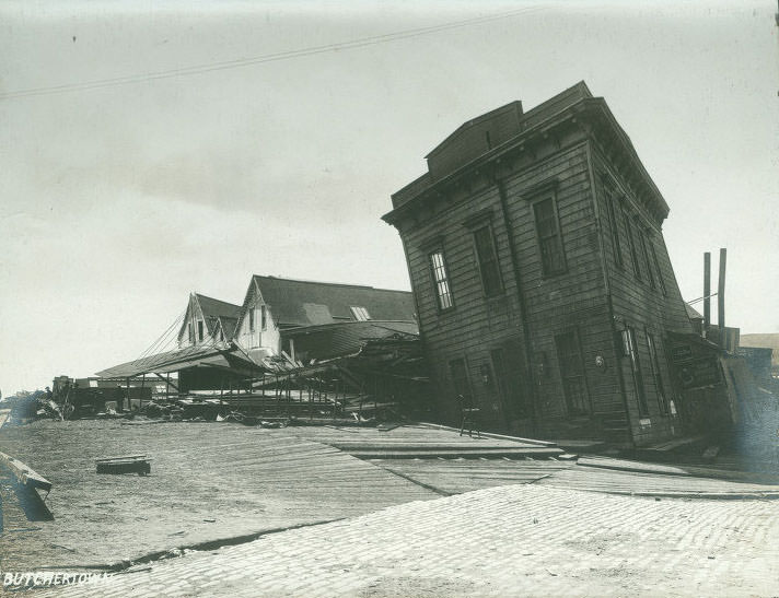
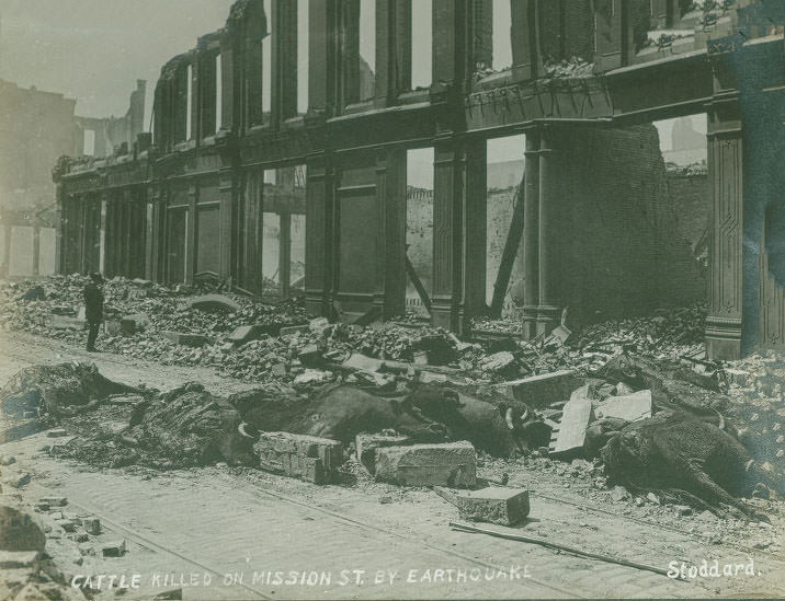
The destruction extended to the city’s industrial and commercial livestock areas. In Butchertown, the meatpacking and slaughterhouse district along the waterfront, the earthquake caused widespread structural damage. Cattle were killed on Mission Street by the earthquake’s force, their carcasses left in the road as rescue and relief efforts prioritized human survivors.
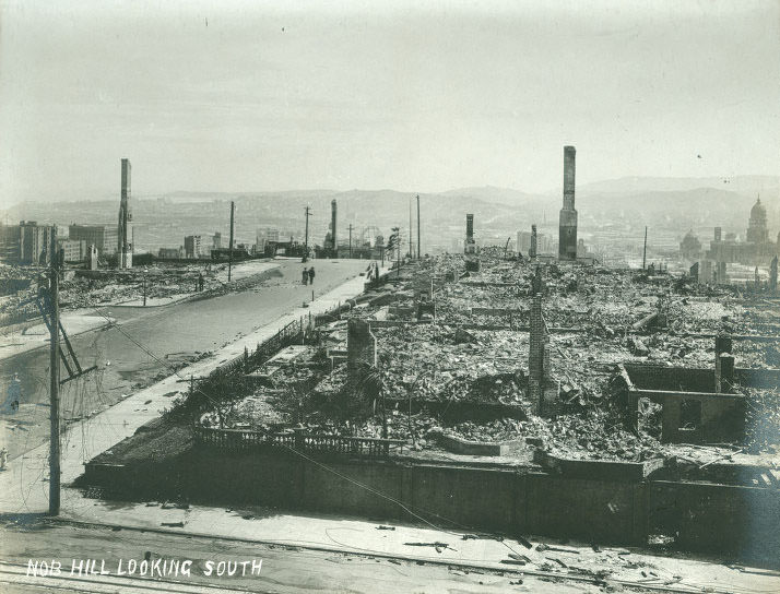
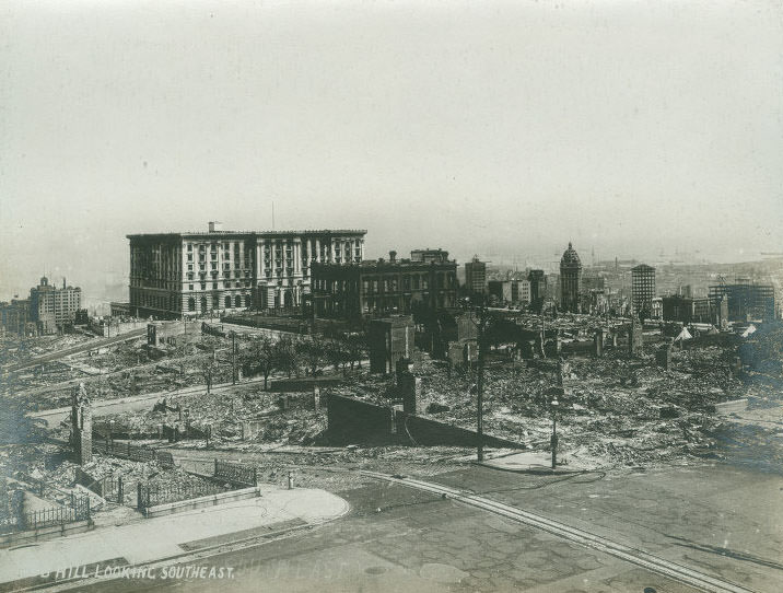
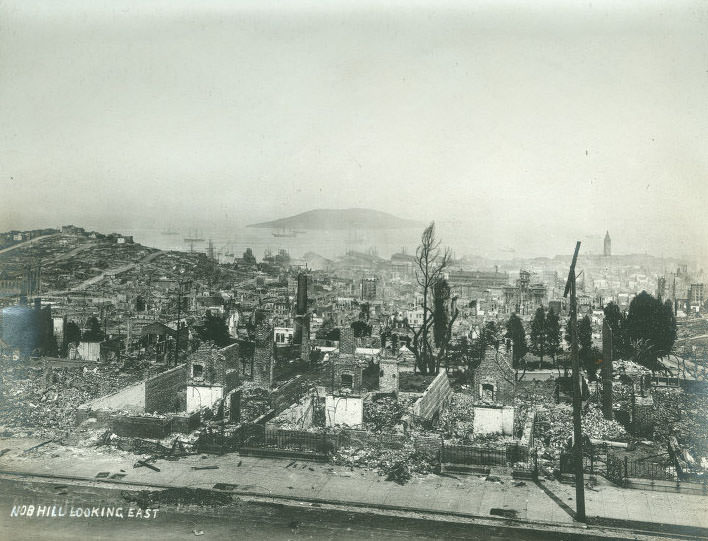
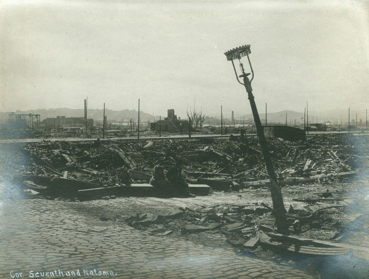
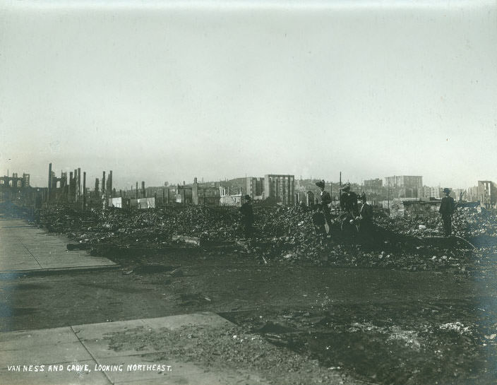
When the fires finally burned out, San Francisco counted its losses. Over 80% of the city had been destroyed. More than 3,000 people were confirmed dead, though the actual toll — particularly among the poor and immigrant communities whose deaths were less carefully recorded — was almost certainly higher. In the weeks that followed, a sign appeared that captured the city’s defiant tone: ‘Eat, Drink, and Be Merry — For Tomorrow We May Have to Go to Oakland.’ By 1915, San Francisco hosted the Panama-Pacific International Exposition, a world’s fair built on newly reclaimed land at the edge of the bay, demonstrating just how completely and quickly the city had rebuilt itself.





The dead horses made me sad.
San Francisco is now better equipped than ever to handle a massive earthquake. The destruction witnessed in 1906 will never occur again.
Cool Photo montage, kinda wish it was all black & white
I was wondering if there’s a way to view only the old photos without the overlay featured in the post.
I found it amusing how the elderly Asian woman in the photo doesn’t even glance back at the explosion.
It’s great to see the three people who just pulled up chairs and decided to sit and watch as everything falls apart.
Wow this is so fascinating!
Old photos of San Francisco make me pause and realize how much the city resembled a desert before the widespread planting of trees that began around the 1970s. The few trees that existed back then really stood out.
It’s difficult to imagine the level of damage and devastation that would result if an earthquake of that magnitude were to strike today.
The earthquake that recently hit Turkey had a similar magnitude to the one featured in this post. The earthquake in Turkey measured 7.8 while the one here was 7.9.
California has very strict building codes in place to withstand earthquakes. The reason Turkey is experiencing such severe consequences is due to their lack of preparation compared to the standards in California.
In the event of an 8.0 magnitude earthquake, building codes may not be enough. However, we can never predict when or if such an earthquake will occur.
Based on personal experience, I was in a 6.8 magnitude earthquake and witnessed minimal damage.
The Northridge earthquake was a reminder that even with building codes in place, earthquakes can still cause significant damage.
the Richter scale is logarithmic. The earthquake in Turkey had a magnitude of 7.8, which was ten times more violent than the 6.8 Nisqually quake that was experienced. Fortunately, California has implemented much stricter building codes, improved enforcement of those codes, and the population has become more aware of the importance of buildings that can survive large earthquakes.