
Education has been a top priority in Salt Lake City since its earliest days. The first Mormon families held classes in 1847 with pioneer Jane Dillworth in her tent, and by 1850 many schools had already been built across the valley. The territorial legislature created the office of the superintendent of schools in 1851. Throughout the latter half of the 19th century, intense debate over how children should be educated — shaped by both LDS church influence and the growth of private Protestant schools — defined the region’s educational landscape. Below are rare historical photos of schools in Salt Lake City from the early 20th century.
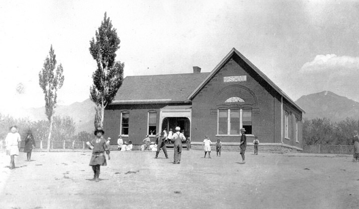
It was located at 11th East Street, County Road near East 14th South Street. Now 3225 South Highland Drive.
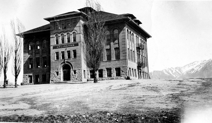
It was located at 157 South State Street, Murray. Now at 5025 South State Street, Salt Lake City.
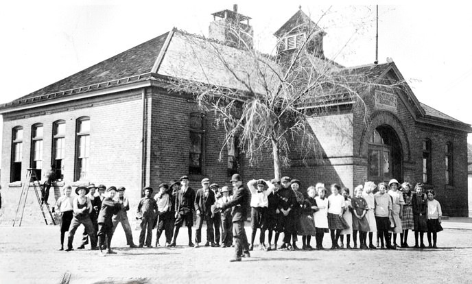
It was located at Chicago Street, between 17th North and Bartella Ave. Now 1651 Chicago Street.
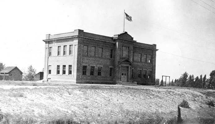
It was located at 92 South 2nd West Street, Murray. Now 4984 South 300 West, Salt Lake City.
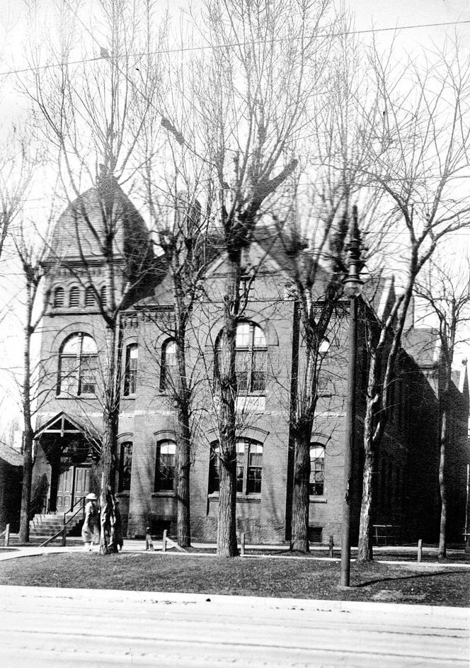
It was located at 733 East 1st South Street. Now 733 East 100 South.
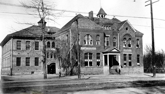
It was located at 1900 South State Street.
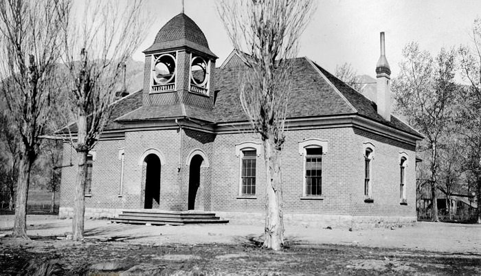
It was located at 21st South Street. Now 7200 South.
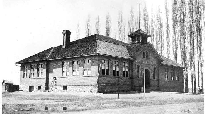
It was located at West Temple corner of 15th South Street. Now 3972 South West Temple.
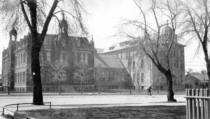
It was located at 4th East and 2nd South Streets. Now 400 East 200 South.
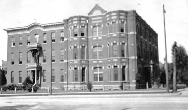
It was located at 146 South 1st West Street. Now 146 South 200 West.
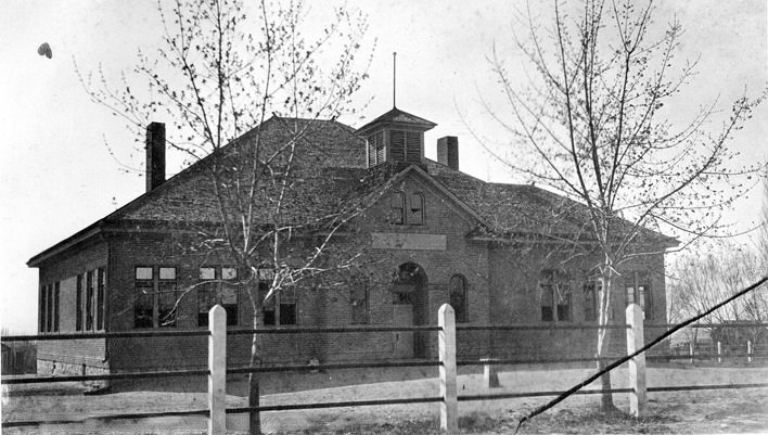
It was located at Utah State Historical Society.
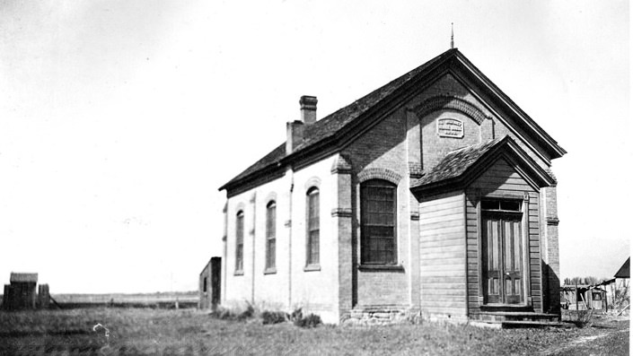
It was located at 14th South, half a mile west of Redwood Road. Now 2200 West 3500 South.
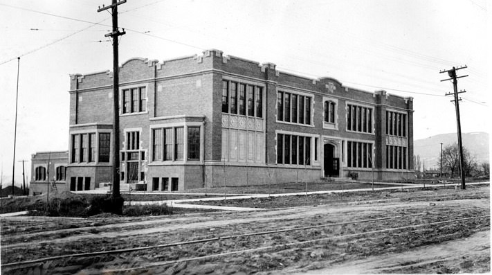
It was located at 7th South and 13th East Street. Now 650 South 1300 East.
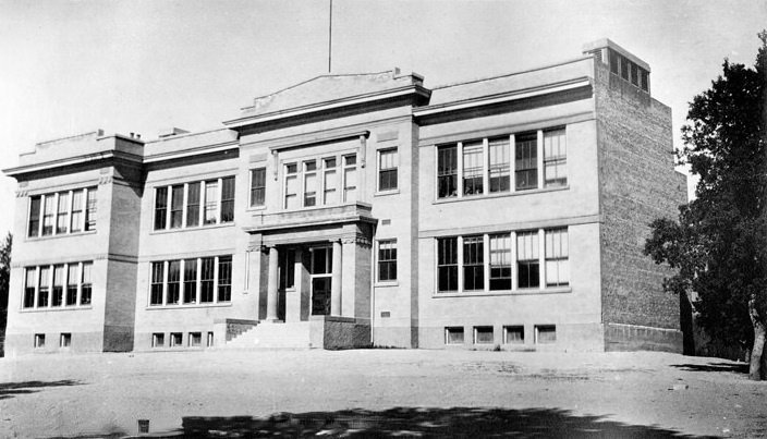
It was located at 12441 South 900 East.
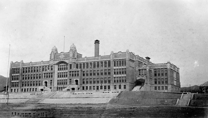
It was located at 13th East between 8th and 9th South. Now 840 South 1300 East.
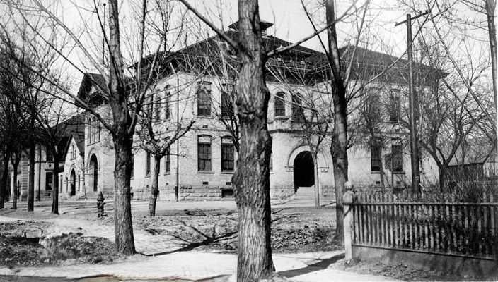
It was located at 7th East, near 16th South Street. Now 4300 South 700 East.
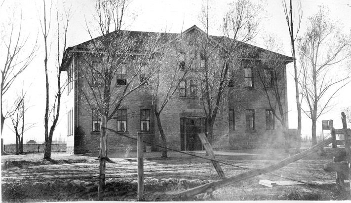
It was located at 11th East and 10th South Street. Now 1343 McLelland Street.
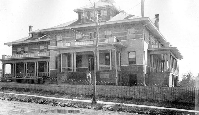
It was located at 1200 East 10th South Street. Now 1216 East 1300 South.
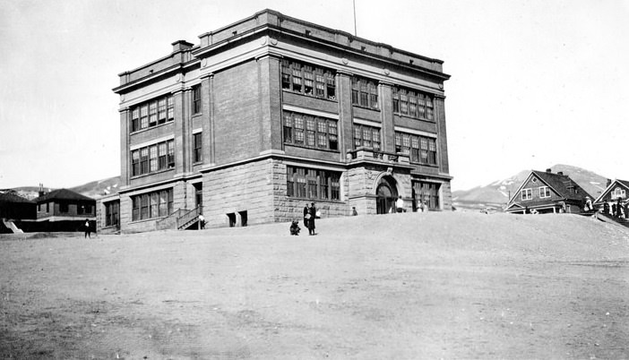
It was located at 9th Avenue at the corner of F Street. Now 431 9th Avenue.
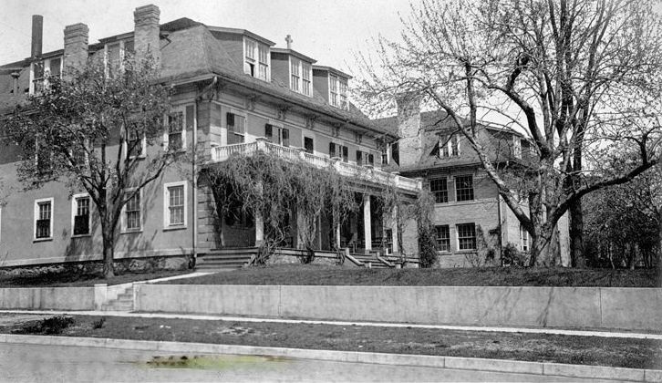
It was located at 205 1st (First) Avenue. Now Rowland Hall-St. Mark’s School.
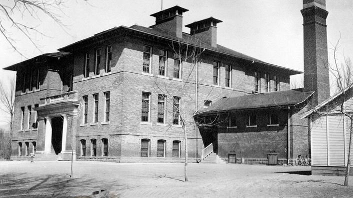
It was located at 9th East and 12th South Street. Now 2129 South 900 East.
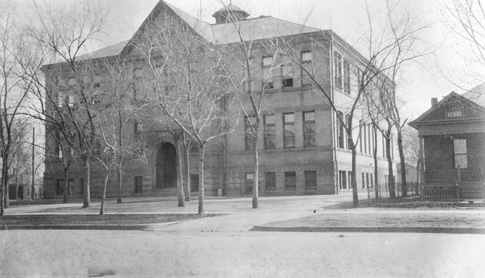
It was located at 805 West 2nd South Street. Now 805 West 200 South.
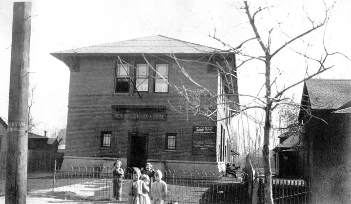
It was located at 731 West 1st South Street. Now 731 West 100 South.
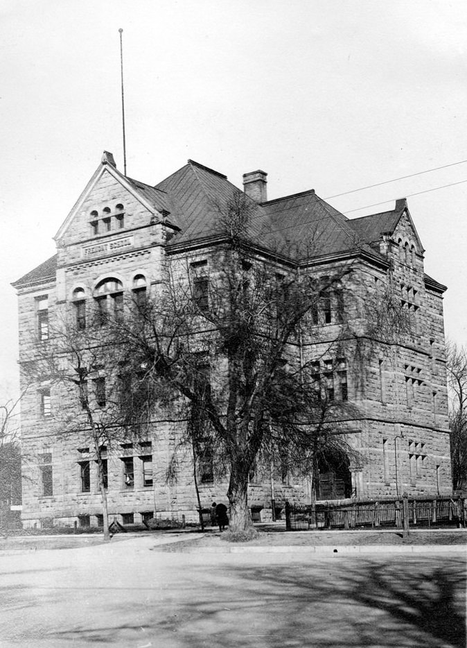
It was located at 153 South 2nd West Street. Now 153 South 300 West.
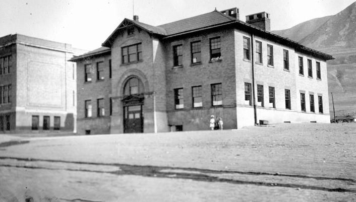
It was located at Utah State Historical Society.
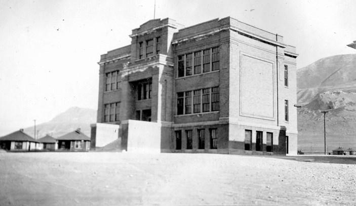
It was located at Utah State Historical Society.
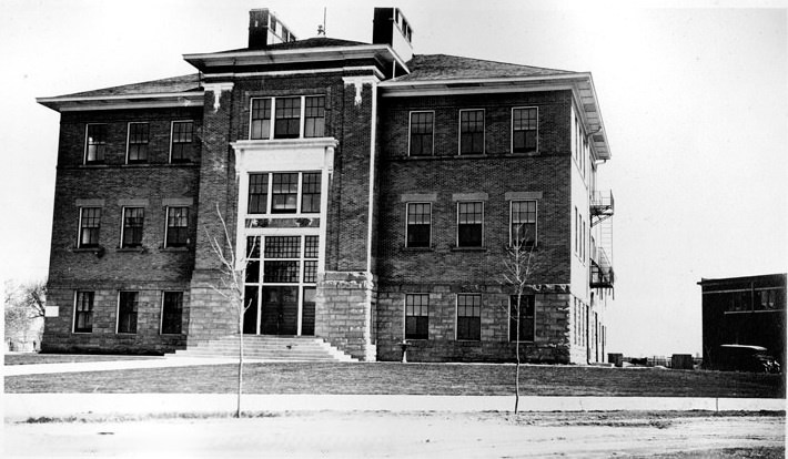
It was located at 14th South and 5th East Street. Now 3305 South 500 East.
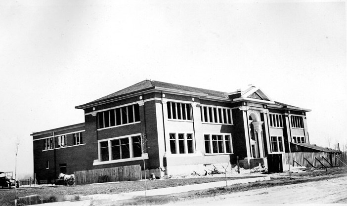
It was located at 14th South and 5th East Street. Now 3375 South 500 East.
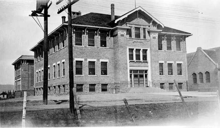
It was located at Main Street, corner of 14th South Street. Now 41 East 3300 South.
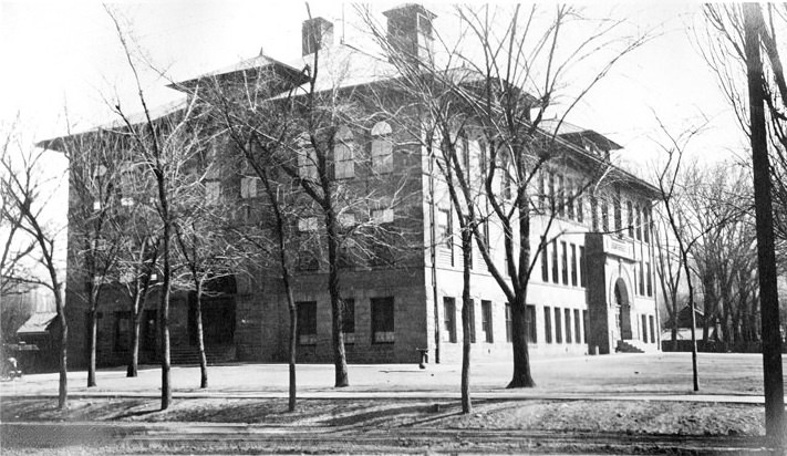
It was located at 625 South 1st West Street. Now 625 South 200 West.
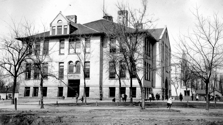
It was located at 8th South corner of 8th East Street. Now 770 East 800 South.
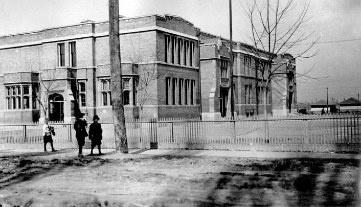
It was located at 7th East and 11th South Street. Now 1632 South 700 East.
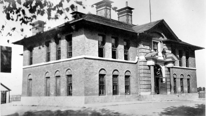
It was located in Utah, Salt Lake County, Magna. Now 2620 South 8300 West.
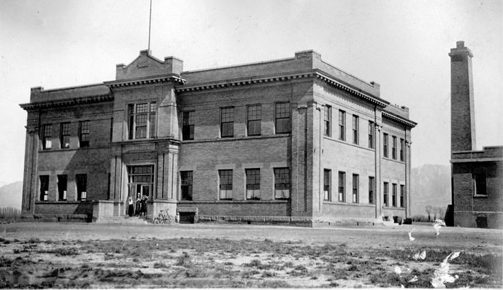
It was located at State Street near 18th South Street. Now 5403 South State Street.
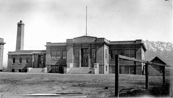
It was located at State Street near 18th South Street. Now 5403 South State Street.
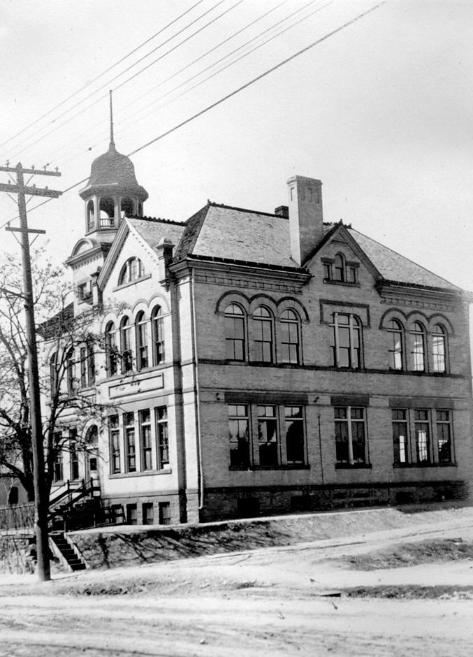
It was located at 12th South and 12th East. Now 1179 East 2100 South.
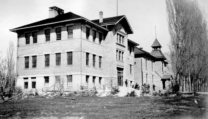
It was located at 17th South Street and Irving Road. Now 2300 East 4800 South.
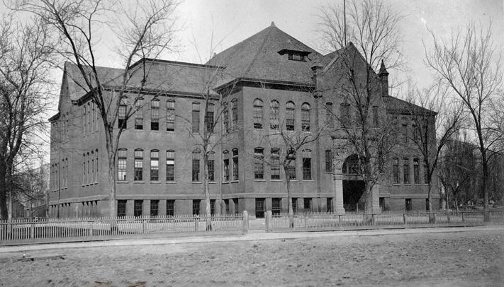
It was located at 750 West 1st North Street. Now 750 West 200 North.
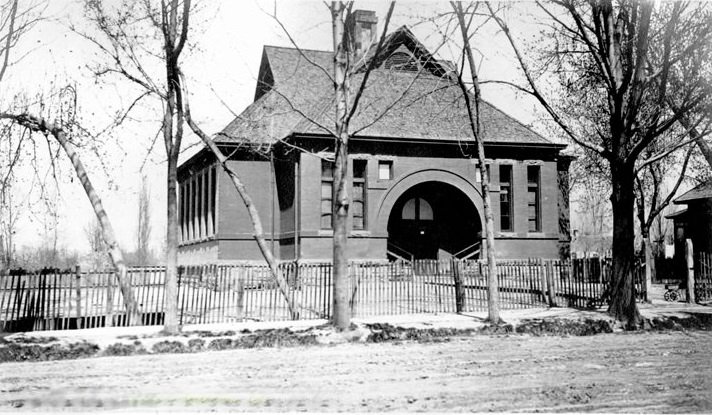
It was located at Forest Dale and Simpson Avenue. Now Utah State Historical Society.
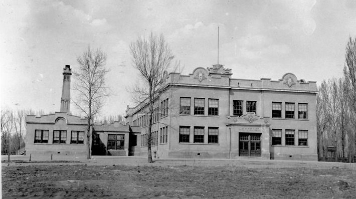
It was located at 1103 South West Temple Street.
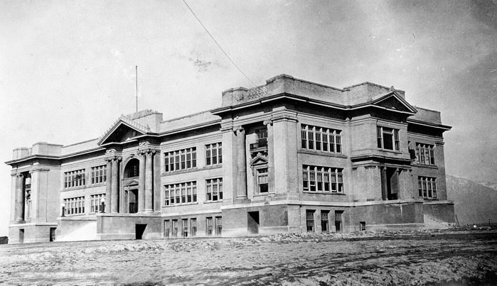
It was located at 9351 South State Street.
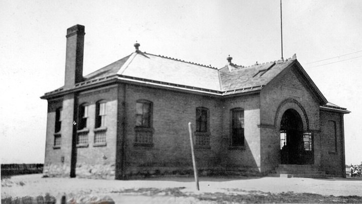
It was located at 6th North and 16th West Street. Now 675 North Redwood Road.
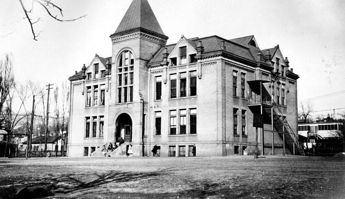
It was located between 1st and 2nd West, 1st North. Now 233 West 200 North.
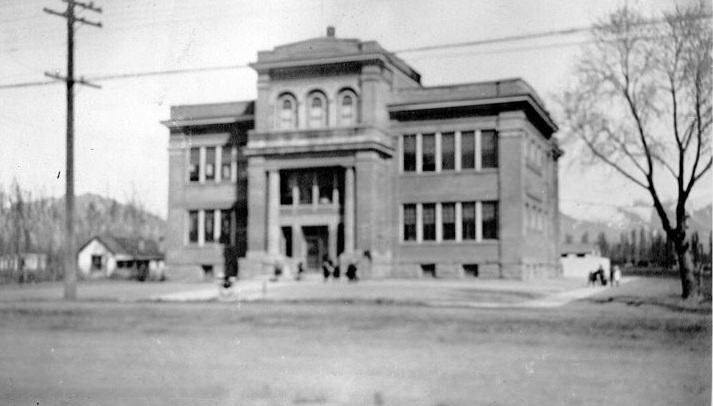
It was located at State Street between 12th and 13th South Street. Now 2465 South State Street.
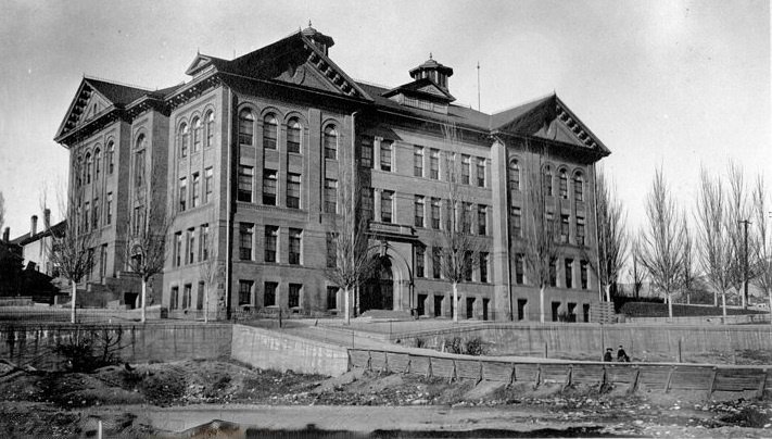
It was located at 135 North State Street. Now 135 North State Street.
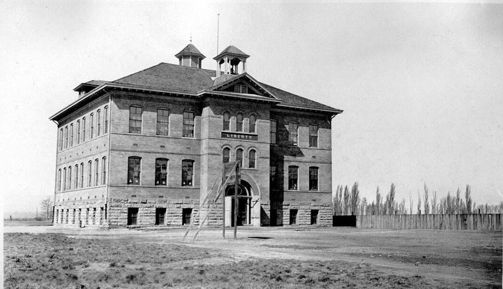
It was located at Liberty Avenue, west of State Street. Now 115 West 6100 South.
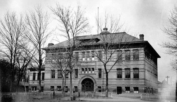
It was located at 440 West 5th South Street.
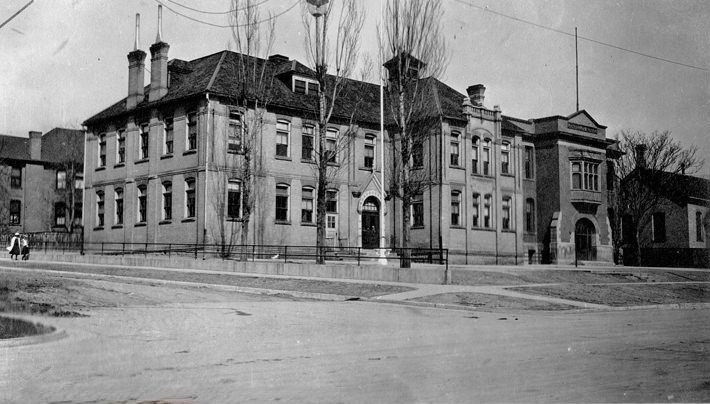
It was located at J Street and First Avenue. Now 661 1st Avenue.
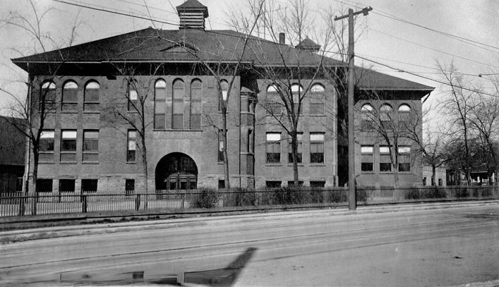
It was located at E Street between 2nd and 3rd Avenues. Now 119 E Street.
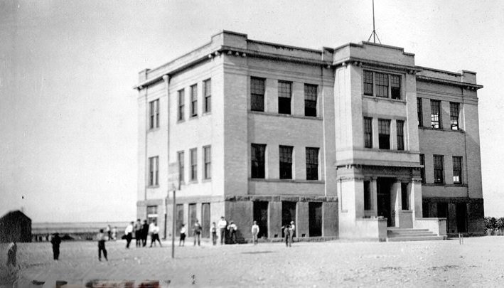
It was located at 2700 South 9180 West.
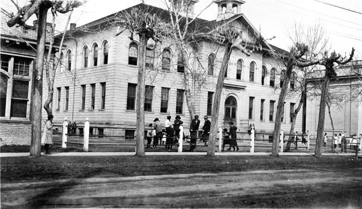
It was located at 441 East Center Street. Now 362 West Center Street.
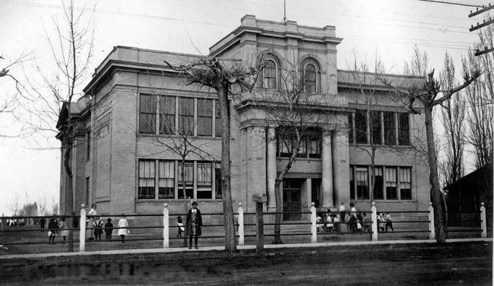
It was located at 441 East Center Street. Now 362 West Center Street.
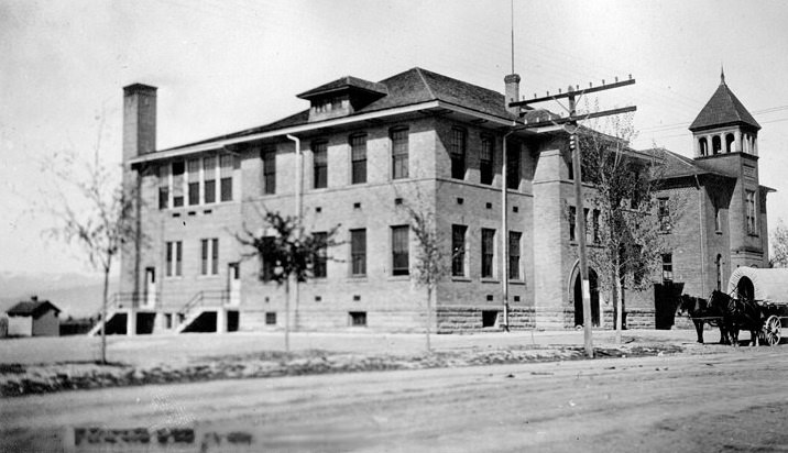
It was located at 4000 West 3500 South.
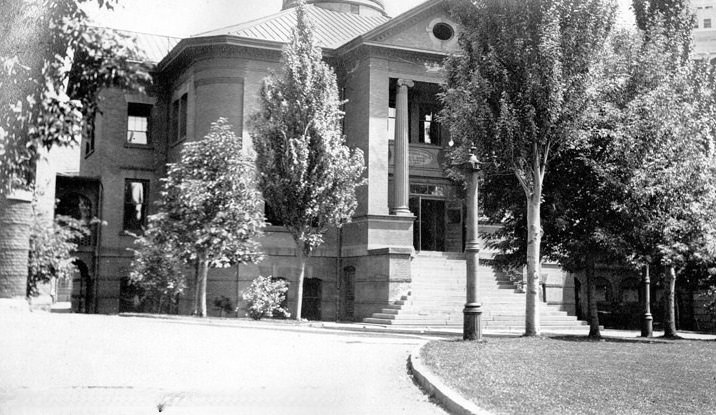
It was located at 74-76 North Main Street.
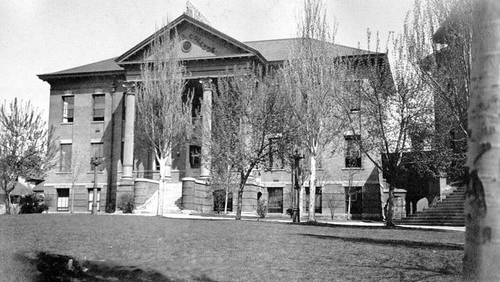
It was located at 74-76 North Main Street.
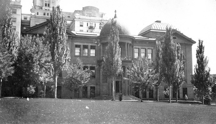
It was located at 74-76 North Main Street.
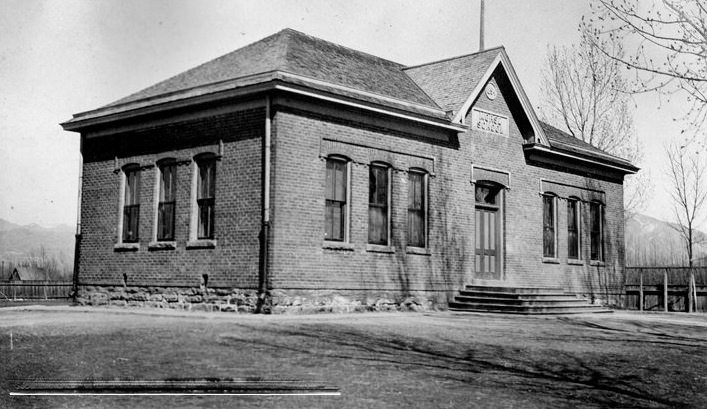
It was located at 11th South, corner of 2nd West Street. Now 290 West 1700 South.
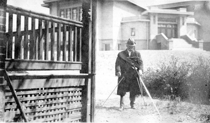
It was located at 9th Avenue, corner of B Street.
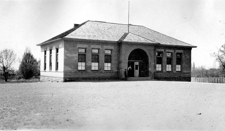
It was located at County Road near 15th South Street. Now 3792 South Highland Drive.
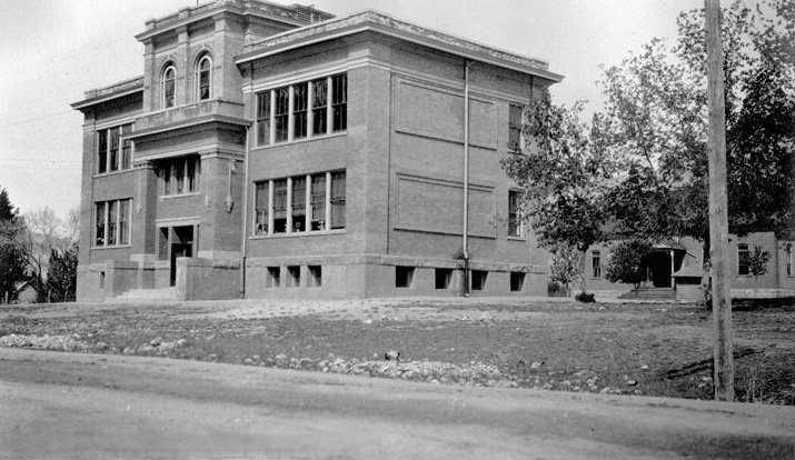
It was located at County Road, south of 18th South Street. Now 5835 South Highland Drive.
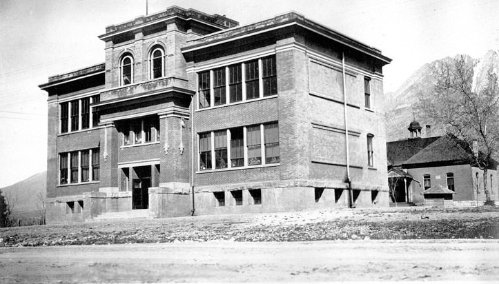
It was located at 13th East between 18th and 19th South Street.
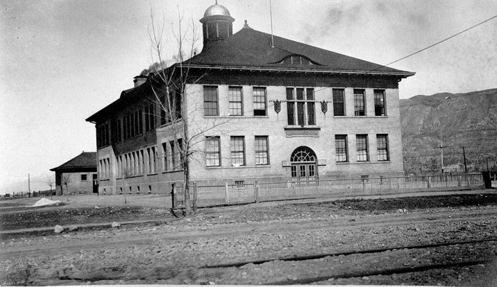
It was located at 4th North and 10th West Street. Now 1120 West 500 North.
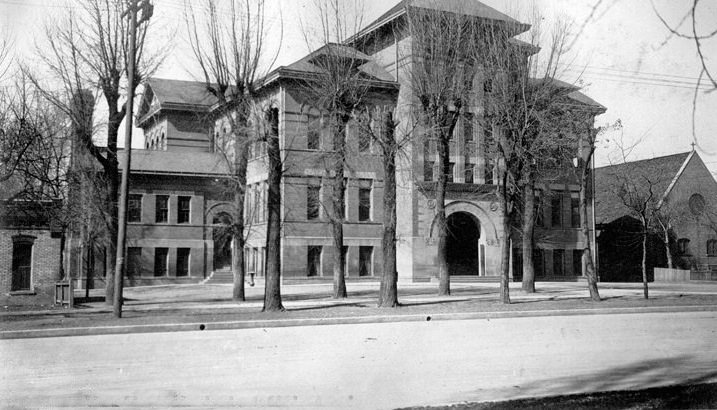
It was located at 350 4th East Street.
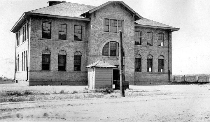
It was located at 21st East between 11th and 12th South Street. Now 1870 South 2100 East.
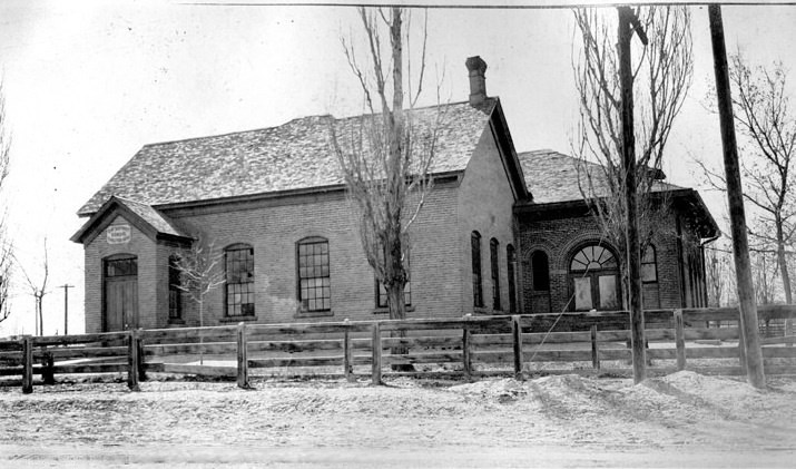
It was located at 17th South Street, 1.5 miles west of Redwood Road. Now 2200 West 4700 South.
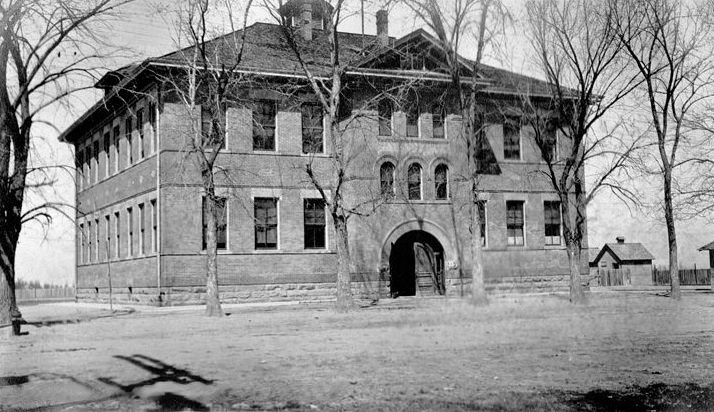
It was located at 17th South and Redwood Road. Now 4800 South Redwood Road.
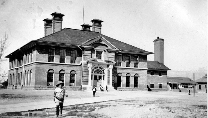
It was located at 8th South corner of Pueblo Street. Now 1460 West 900 South.
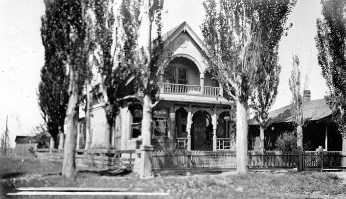
It was located at 1830 Euclid Avenue.
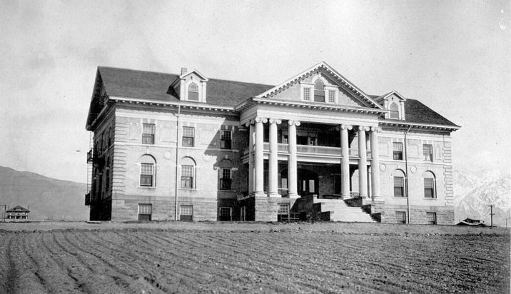
It was located at 1100 South 1300 East. Now 1840 South 1300 East.
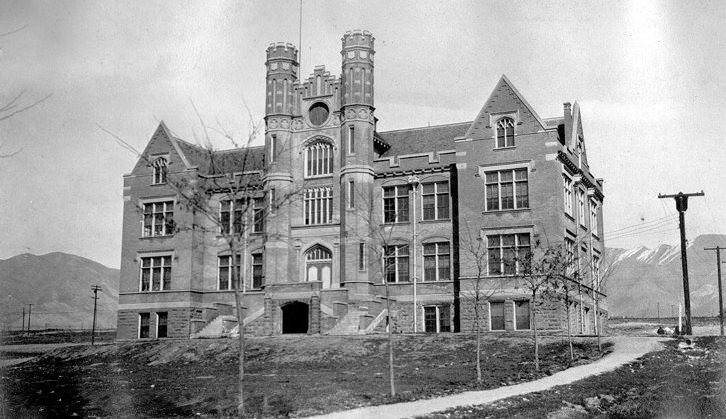
It was located at 11th South 13th East. Now 1840 South 1300 East.
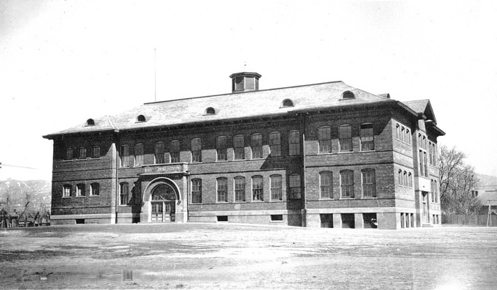
It was located at 8th West and 6th South Street. Now 604 South 900 West.
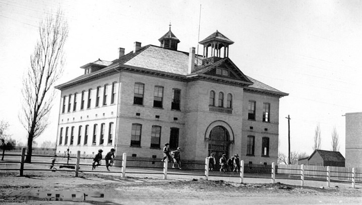
It was located at 12830 South Redwood Road.
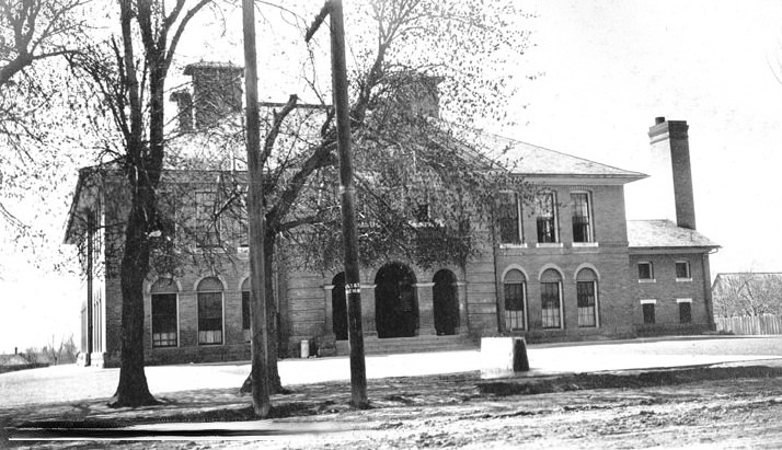
It was located at 9th East and 14th South. Now 3286 South 900 East.
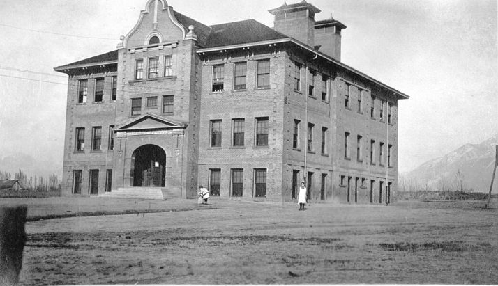
It was located at 8725 South 280 East.
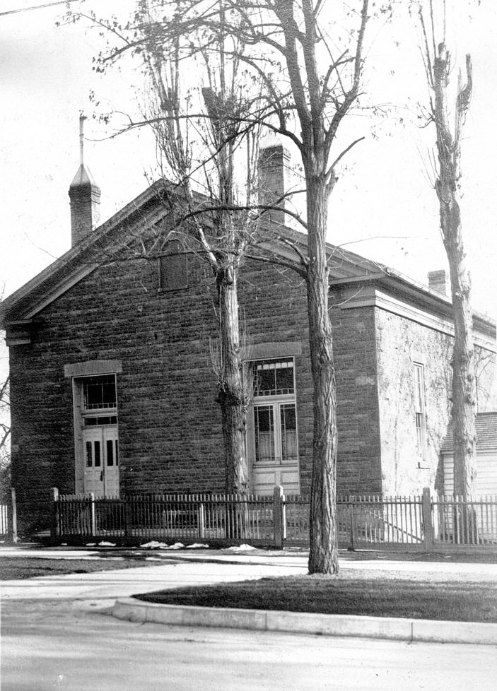
It was located at 424 East 1st South Street. Now Twelfth School.
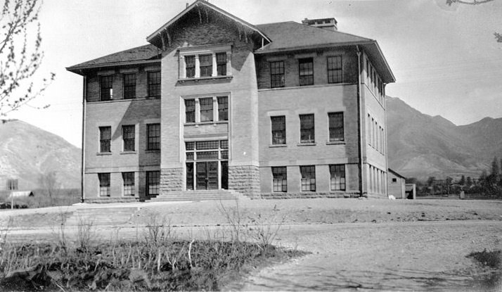
It was located at 14th South and 23rd East Street. Now 3357 South 2300 East.
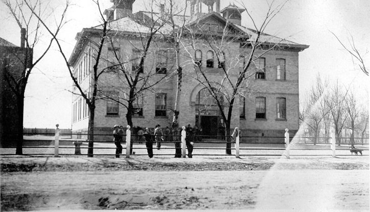
It was located at Utah State Historical Society.
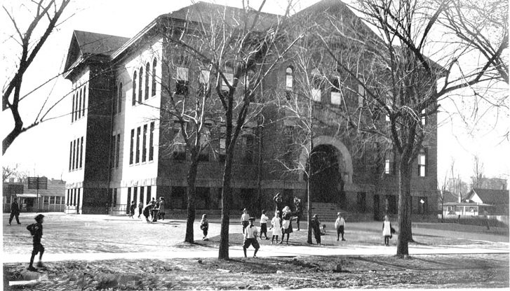
It was located at 640 3rd East Street. Now 640 South 300 East.
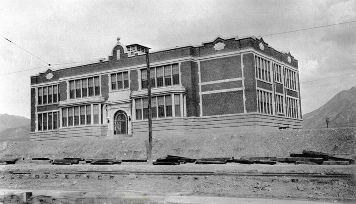
It was located at 10th South and 15th East Street. Now 1300 South 1500 East.
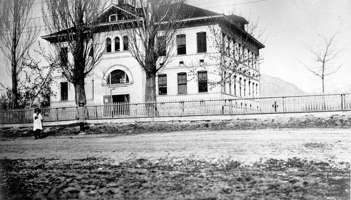
It was located at 700 East Union Avenue. Now 7245 South 700 East.
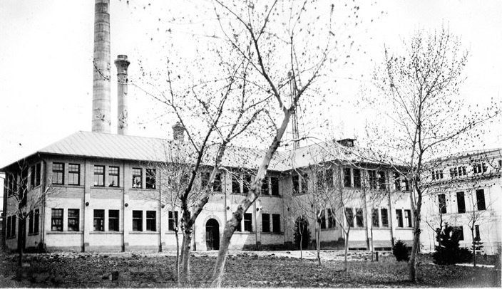
It was located at the east end of 2nd South, Presidents Circle. Now 200 South Presidents Circle.
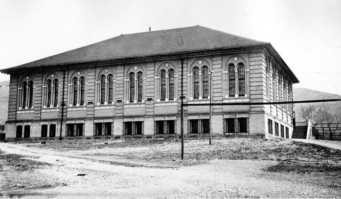
It was located at the east end of 2nd South, Presidents Circle. Now 200 South Presidents Circle.
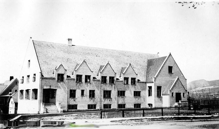
It was located at the east end of 2nd South, Presidents Circle. Now 200 South Presidents Circle.
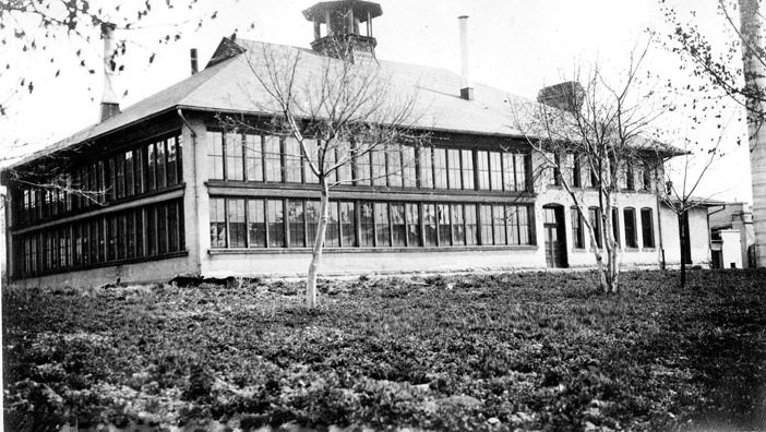
It was located at the east end of 2nd South, Presidents Circle. Now 200 South Presidents Circle.
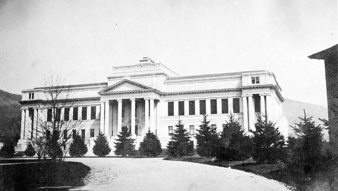
It was located at the east end of Second South, Presidents Circle. Now 201 South Presidents Circle (1440 East).
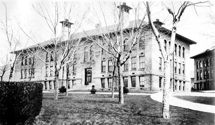
It was located at the east end of 2nd South, Presidents Circle. Now 155 S 1400 East.
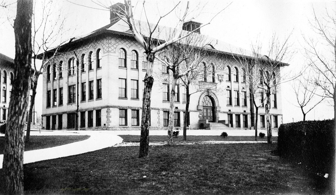
It was located at the east end of 2nd South, Presidents Circle. Now 201 South Presidents Circle (1440 East).
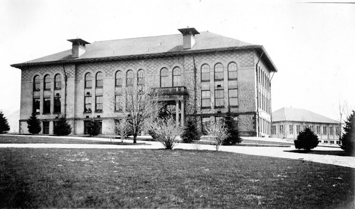
It was located at the east end of 2nd South, Presidents Circle. Now 1430 Presidents Circle.
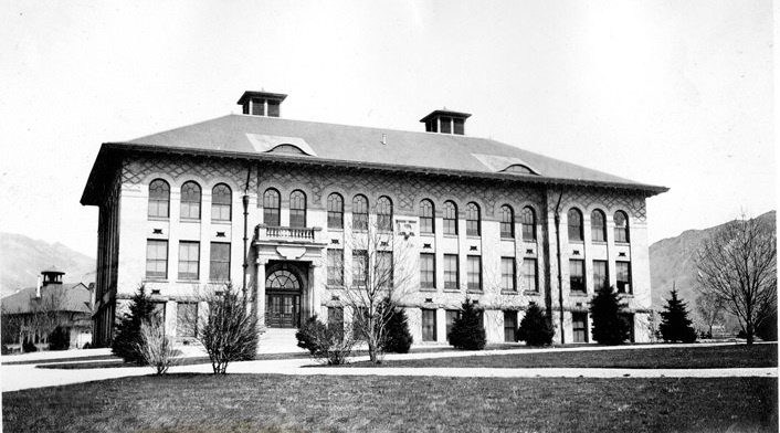
It was located at the east end of 2nd South, Presidents Circle. Now 1425 Presidents Circle.
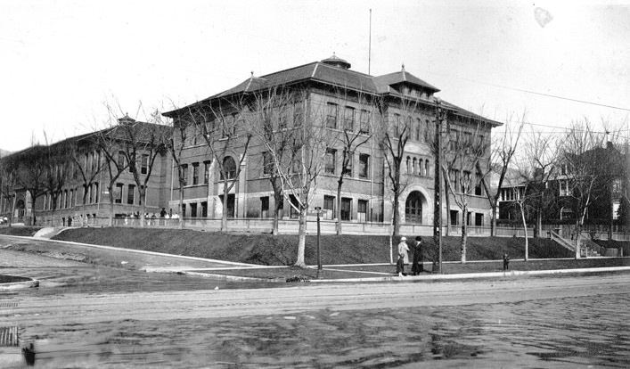
It was located at 1155 East South Temple.
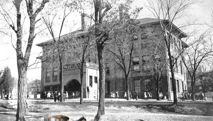
It was located at 1st West, corner of 4th North Street. Now 460 North 200 West.
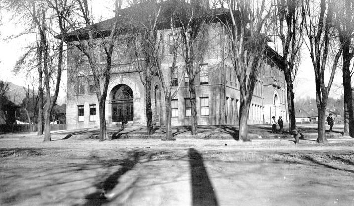
It was located at 421 8th East Street.
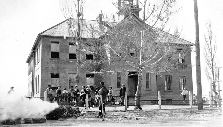
It was located at Utah State Historical Society.
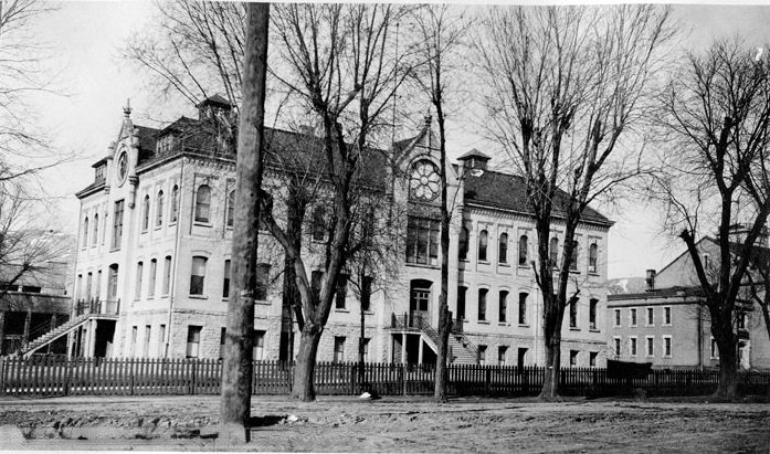
It was located at 2nd West 1st North. Now 364 West 200 North.
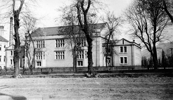
It was located at 2nd West 1st North. Now 344 West 200 North.
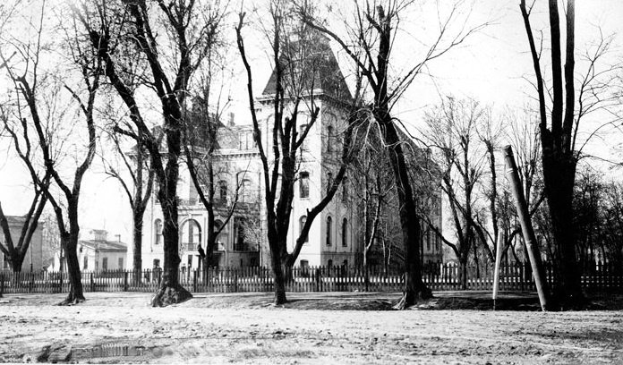
It was located at 2nd West 1st North. Now 322 West 200 North.
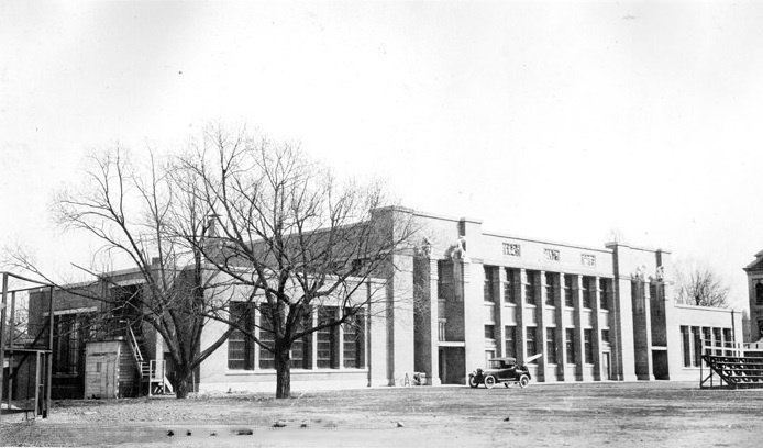
It was located at 2nd West 1st North. Now 242 North 400 West.
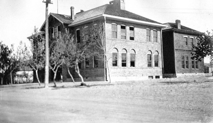
It was located at 14th South, 3 miles west of Redwood Road. Now 3500 South 6000 West.
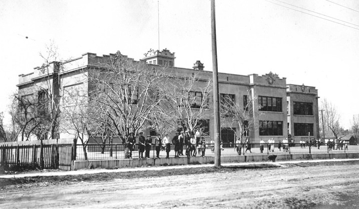
It was located at 1600 3rd East Street. Now 1568 South 300 East.
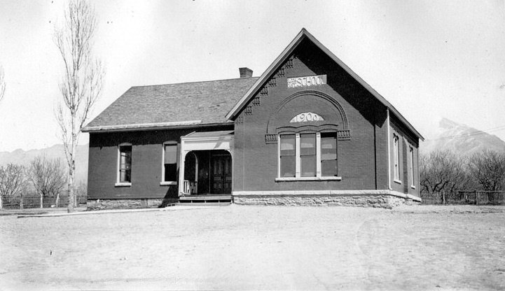
It was located at County Road near East 14th South Street. Now 3225 South Highland Drive.





Those are some great photos. There are still some of these lefts.
I enjoyed the pictures. My aunt worked out of the old Arlington School for 20 years.
Great pictures, love these.