Hey There! Before You Go. 😧
Get the best vintage content straight into your inbox!

Don't worry, we don't spam

Stunning Historical Photos Of Pittsburgh From 20th Century

Pittsburgh sits where the Allegheny and Monongahela rivers meet to form the Ohio River in western Pennsylvania. This location was no accident of settlement. The confluence made it one of the most strategically valuable spots in North America. Native peoples had lived in the region for centuries before European powers took notice. In 1758, French and British forces fought over control of the area, a conflict that would ultimately shape the future of the continent.

By 1815, Pittsburgh was already producing iron, brass, tin, and glass in large quantities. The Civil War accelerated that output dramatically, as demand for iron and armaments surged. The city’s natural resources — coal, water access, and a river network ideal for shipping — made it one of the fastest-growing industrial centers in the country throughout the 1800s.
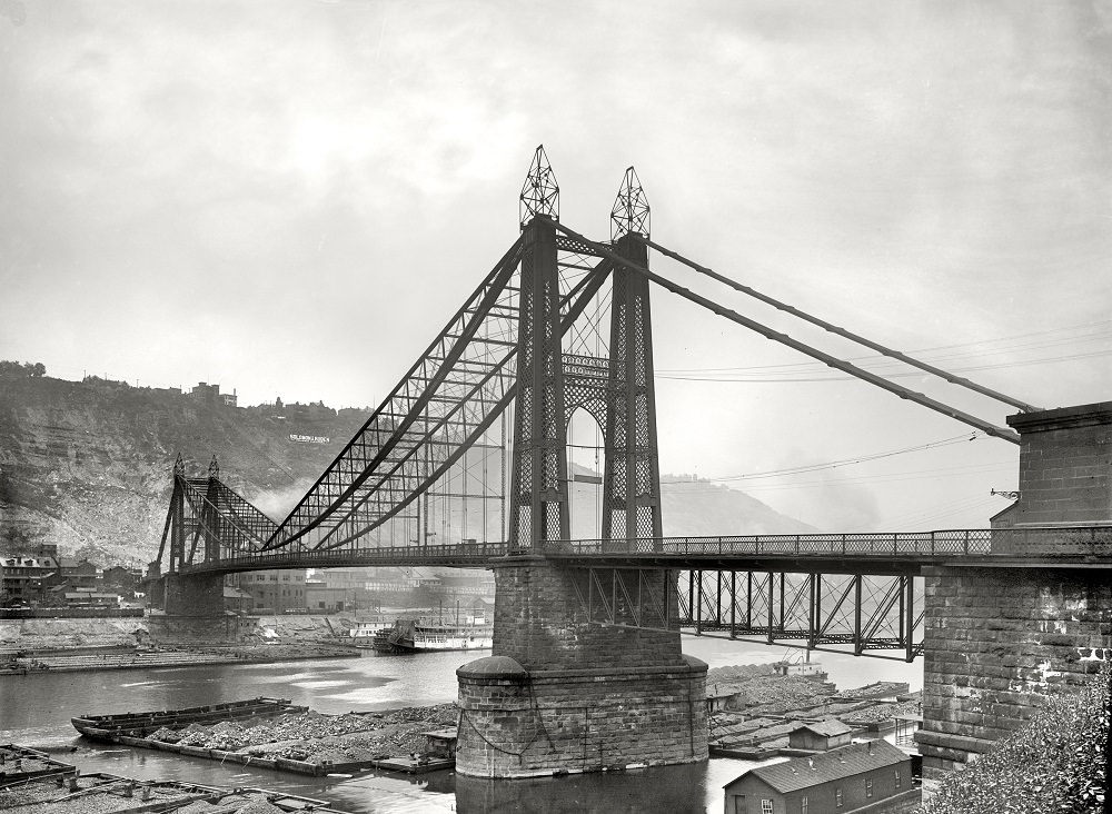
Point Bridge and coal barges, , Pittsburgh, 1900

At the start of the 20th century, Pittsburgh had a population of 321,616. Over the next five decades, that number more than doubled, surpassing 675,000 by the 1950s. The city’s streets, bridges, mills, and neighborhoods were bursting with activity. The photographs below document that world — the gritty, industrial, and sometimes beautiful Pittsburgh of the 1900s through the early 1940s.
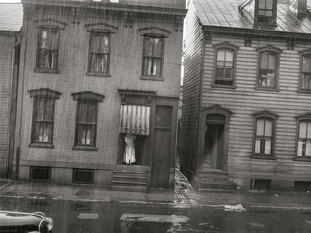
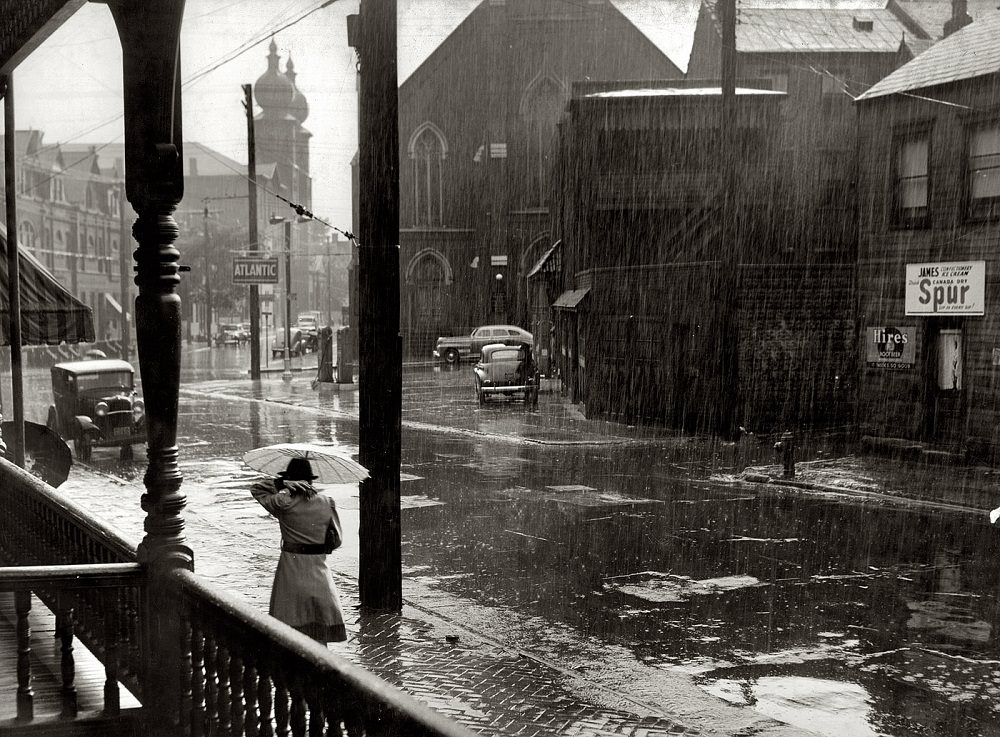
A Rainy street, Pittsburgh, Pennsylvania, June 1941

Rain was a common companion to Pittsburgh’s streets, and the city’s hills and valleys made every wet day feel more dramatic. The mill districts that spread across the lower elevations were dense with working-class housing, factories, and smoke. Life moved at a constant pace regardless of the weather.
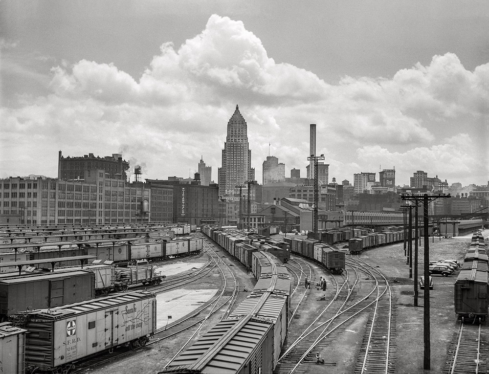
Pittsburgh, Pennsylvania. "Carloads of fruits and vegetables at city terminal, Pittsburgh, Pennsylvania, June 1941
Pittsburgh, Pennsylvania. “Carloads of fruits and vegetables at city terminal, Pittsburgh, Pennsylvania, June 1941
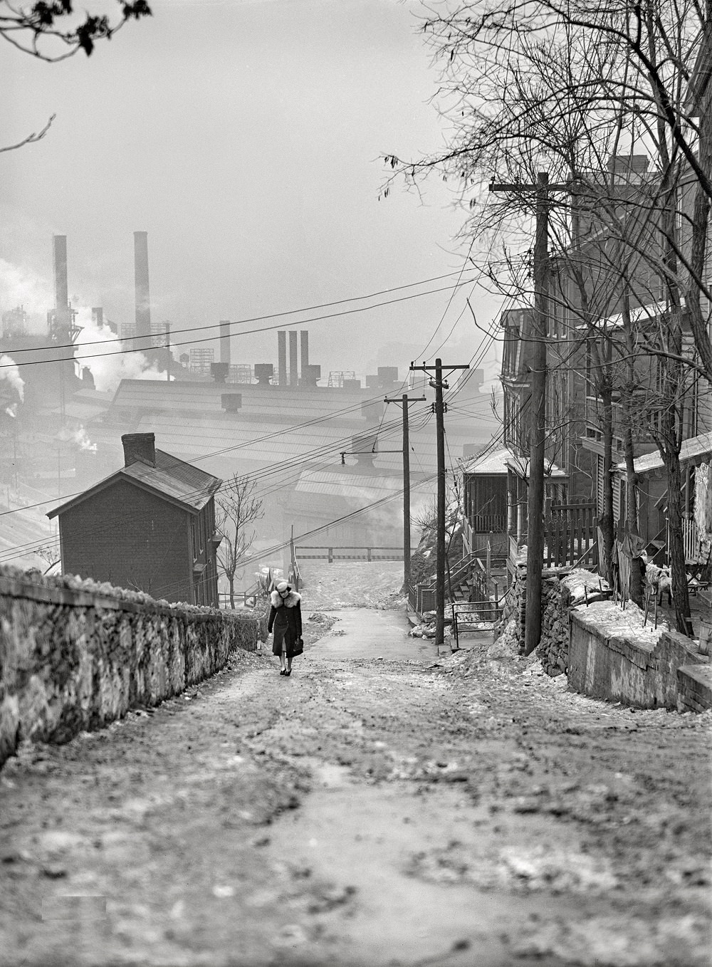
Street in the mill district in Pittsburgh, Pennsylvania, January 1941

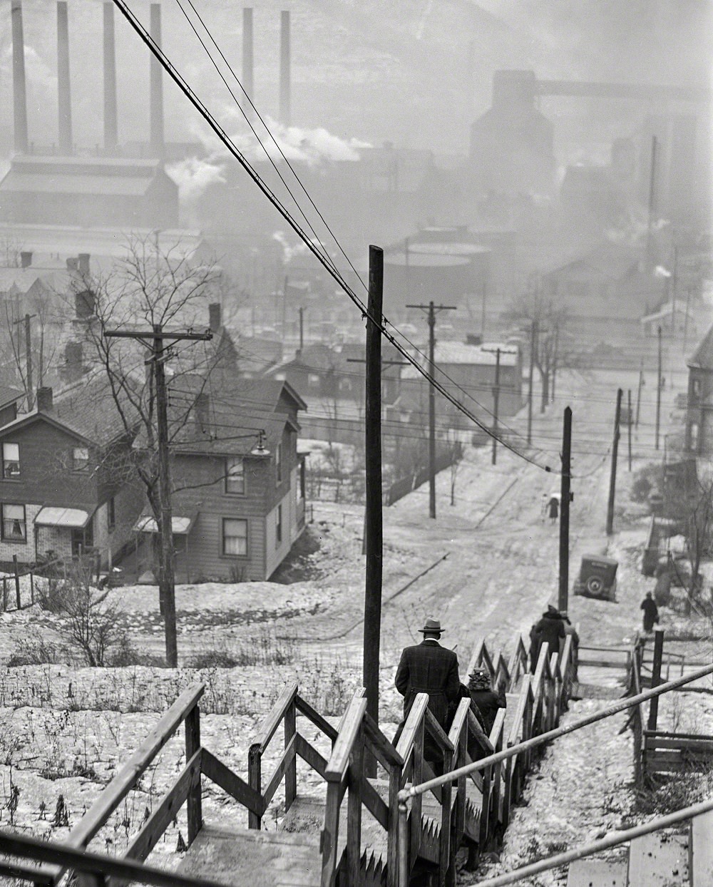
The mill districts were among the most densely packed parts of the city. Rows of narrow homes sat close to factory floors, and workers lived within walking distance of the furnaces and forges where they spent their days. The streets here carried the weight of both industry and daily life.
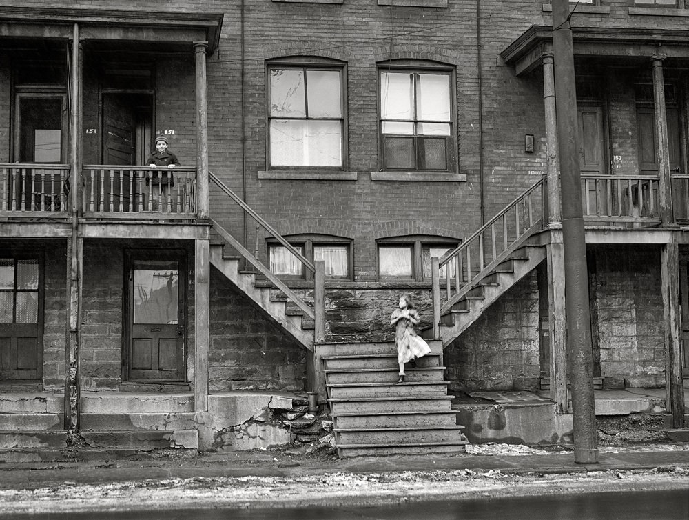
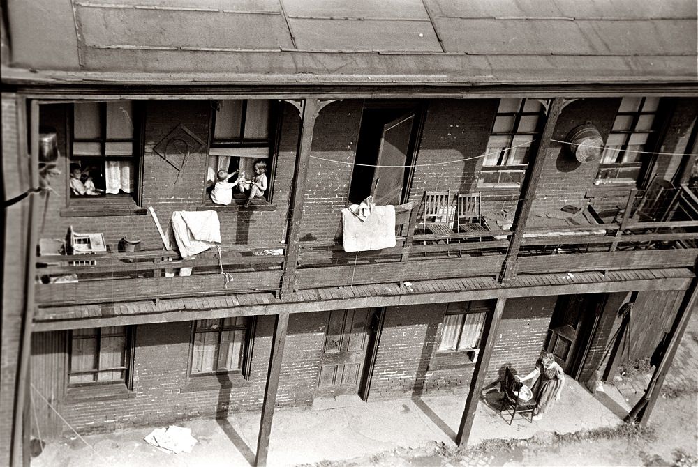
In a slum area of Pittsburgh, Pennsylvania, January 1941

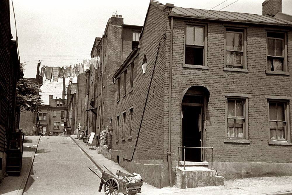
Not all of Pittsburgh’s growth translated into prosperity for its residents. Slum conditions in parts of the city were well-documented by the early 20th century. Overcrowded housing, limited sanitation, and poverty were visible realities in neighborhoods like The Hill and sections of the mill district. These areas housed many of the laborers who kept the city’s industries running.
Slums in Pittsburgh, Pennsylvania, July 1938
Houses on "The Hill" slum section of Pittsburgh, July 1938
Houses on “The Hill” slum section of Pittsburgh, July 1938
Pittsburgh slum dwelling, 1938

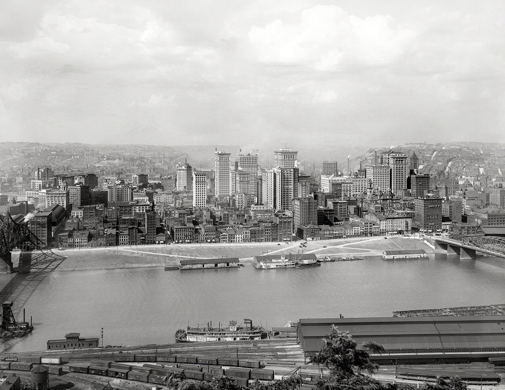
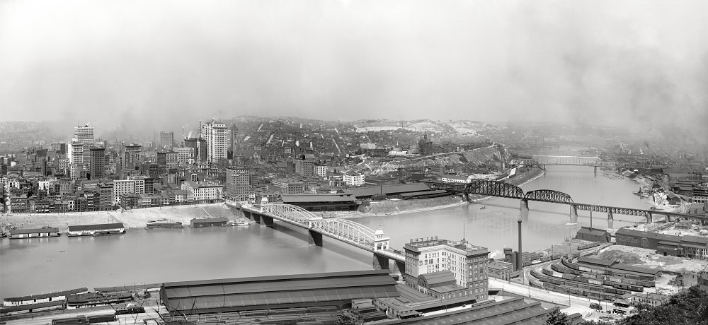
The Monongahela River was central to Pittsburgh’s identity. Its banks were lined with wharves, bridges, and industrial facilities that fed the city’s economy. The view from Mount Washington, high above the south shore, offered one of the most striking panoramas in American urban geography.
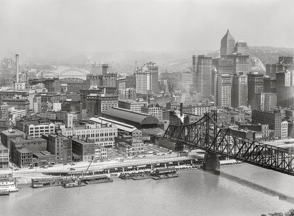
Pittsburgh along the Monongahela River, August 1941
Pittsburgh from Mount Washington. Monongahela River with Smithfield Street Bridge and Pan Handle Bridge, 1905
Pittsburgh, Pennsylvania, from Mount Washington, 1905

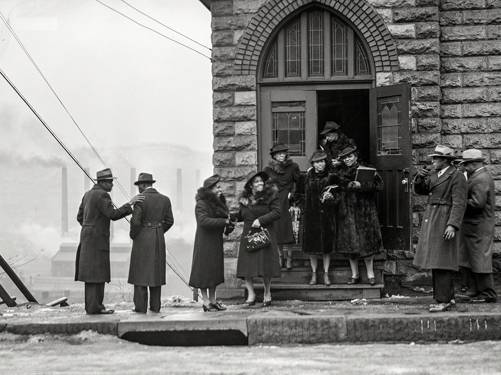
Pittsburgh’s immigrant communities built their own institutions throughout the city. Churches anchored neighborhoods and gave communities a sense of continuity amid the noise and upheaval of industrial life. Russian Orthodox, African American, and other congregations all established places of worship in proximity to the mills and factories where their members worked.
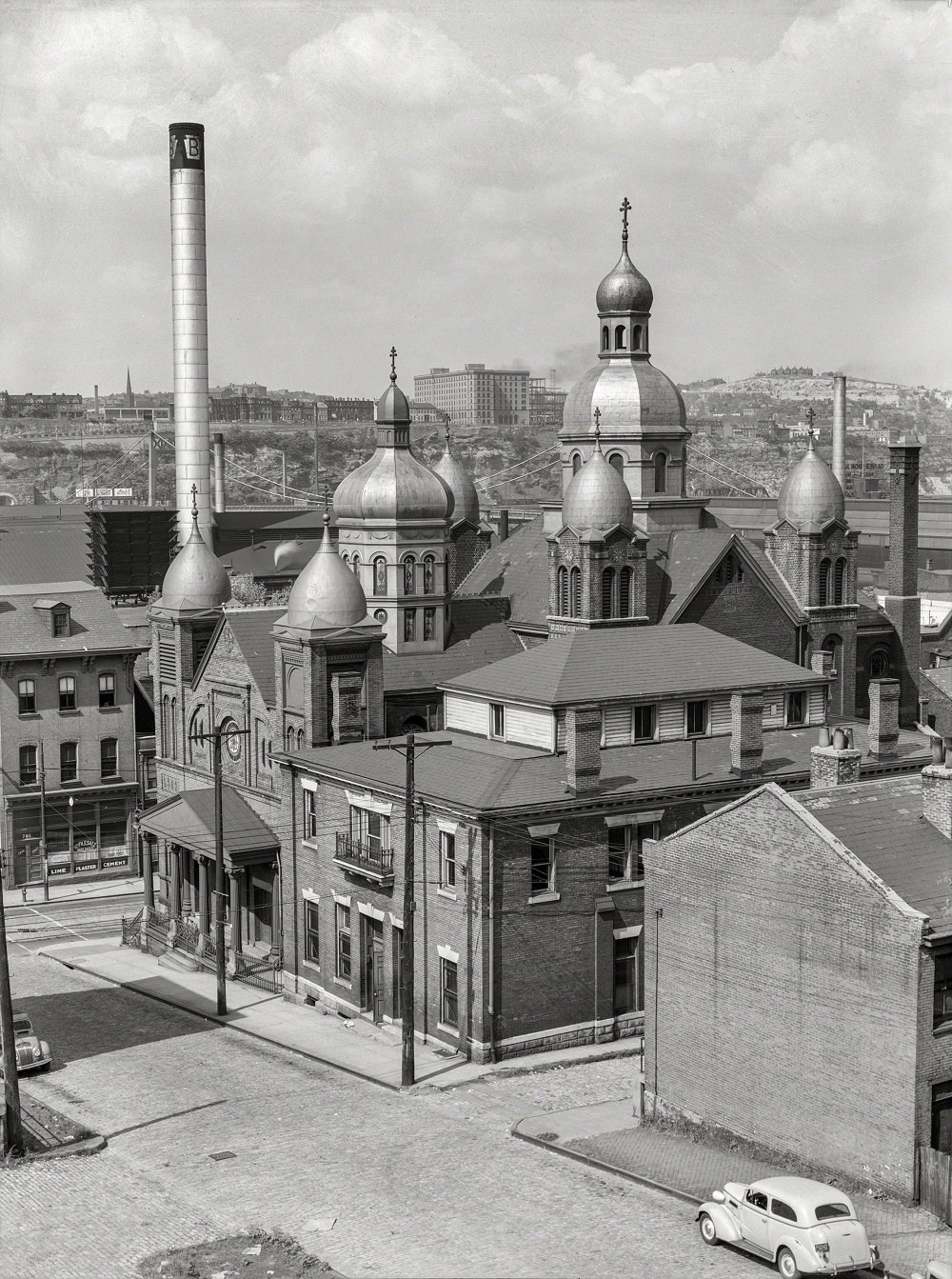
Russian Orthodox Church. Pittsburgh, Pennsylvania, July 1938
Negro church in mill district of Pittsburgh, Pennsylvania, January 1941
Mill district of Pittsburgh, Pennsylvania, January 1941

Along the Boulevard of the Allies, homes clung to the hillsides overlooking the Monongahela River. The terrain of Pittsburgh forced its residents to build upward and outward in ways that gave the city its distinctive, layered appearance.
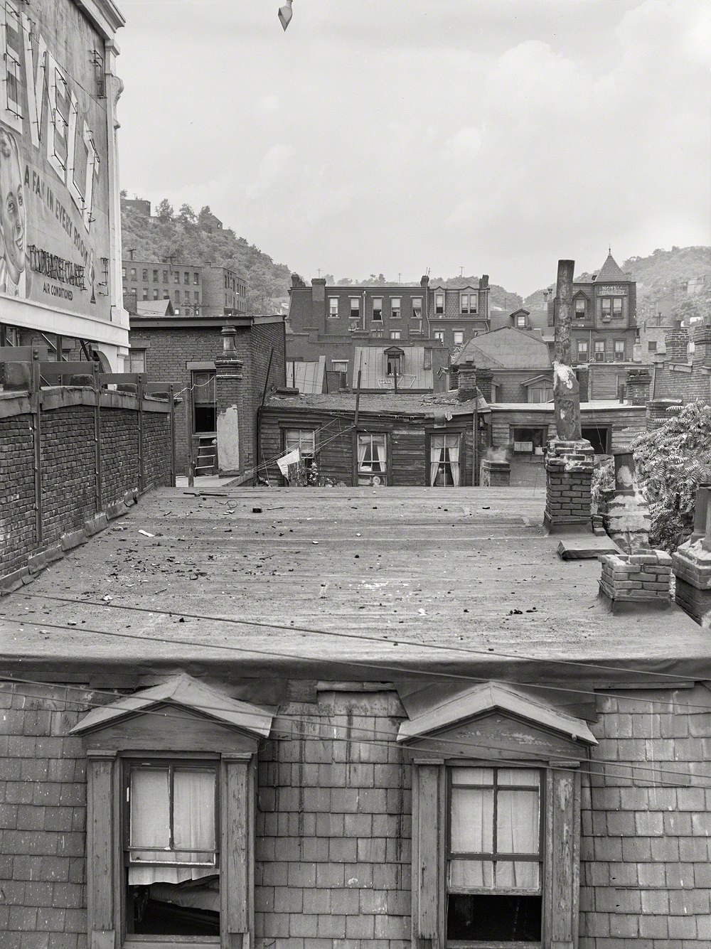
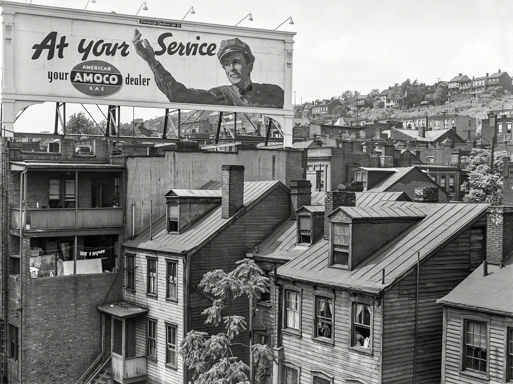
Houses along Monongahela River and Boulevard of the Allies, Pittsburgh, Pennsylvania, July 1938

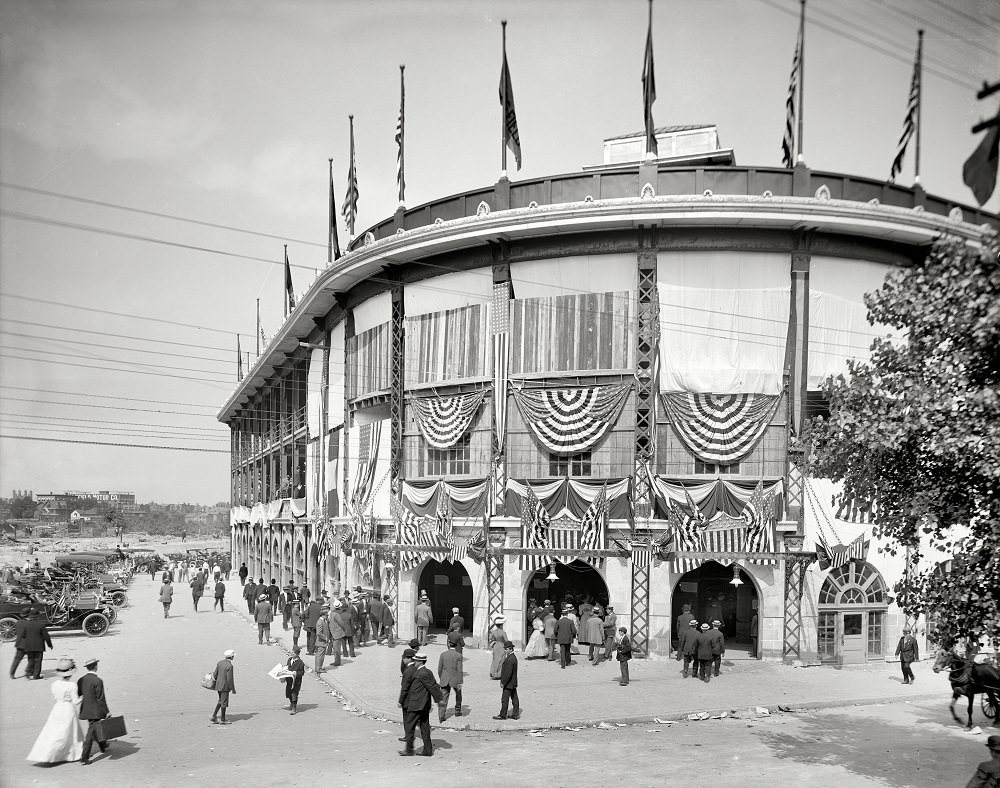
Forbes Field opened in 1909 and was one of the first modern baseball stadiums in the country. By 1910, it had already become a central landmark in Pittsburgh’s cultural life, hosting the Pittsburgh Pirates and drawing crowds from across the region.
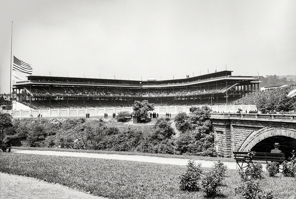
Forbes Field, Pittsburgh, 1910
Entrance to Forbes Field, Pittsburgh, 1912

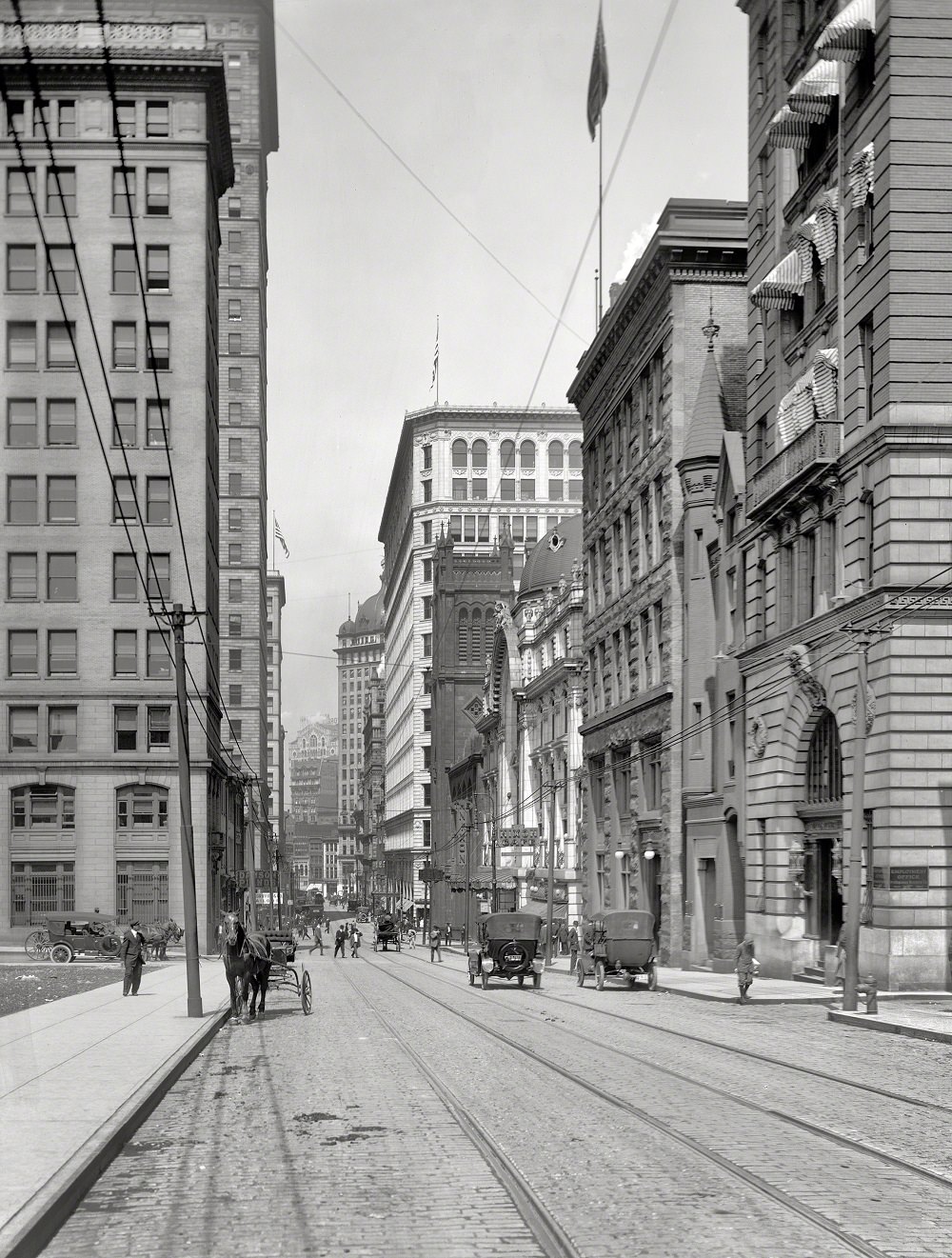
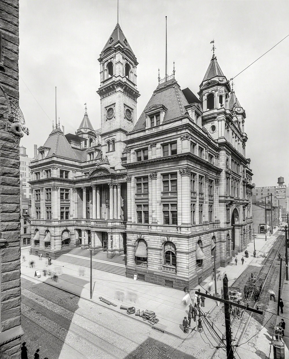
At the turn of the century, Pittsburgh’s downtown was already a dense collection of commercial buildings, banks, and public institutions. The early 1900s saw the city’s skyline begin to rise in earnest, with new construction pushing upward along Fifth Avenue, Wood Street, and the financial corridor of Fourth Avenue.
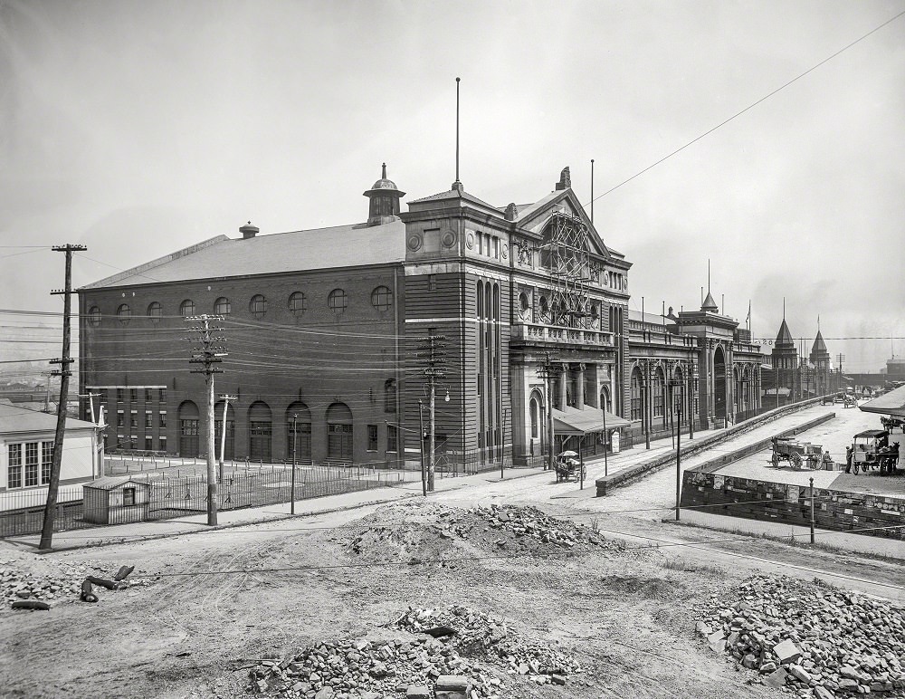
Exposition Hall, Pittsburgh, 1902
Post Office, Fourth Avenue and Smithfield Street, 1904
Fifth Avenue at Grant Street, South Pittsburg, 1904
Fifth Avenue, Pittsburg, 1904

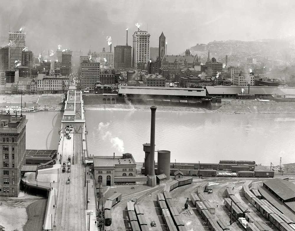
The Allegheny River formed Pittsburgh’s northern boundary, and the bridges spanning it were engineering achievements of their time. The Sixth Street Bridge, visible in photographs from 1903 and 1910, connected the downtown core to the North Side neighborhoods and reflected the city’s investment in infrastructure to keep commerce moving.
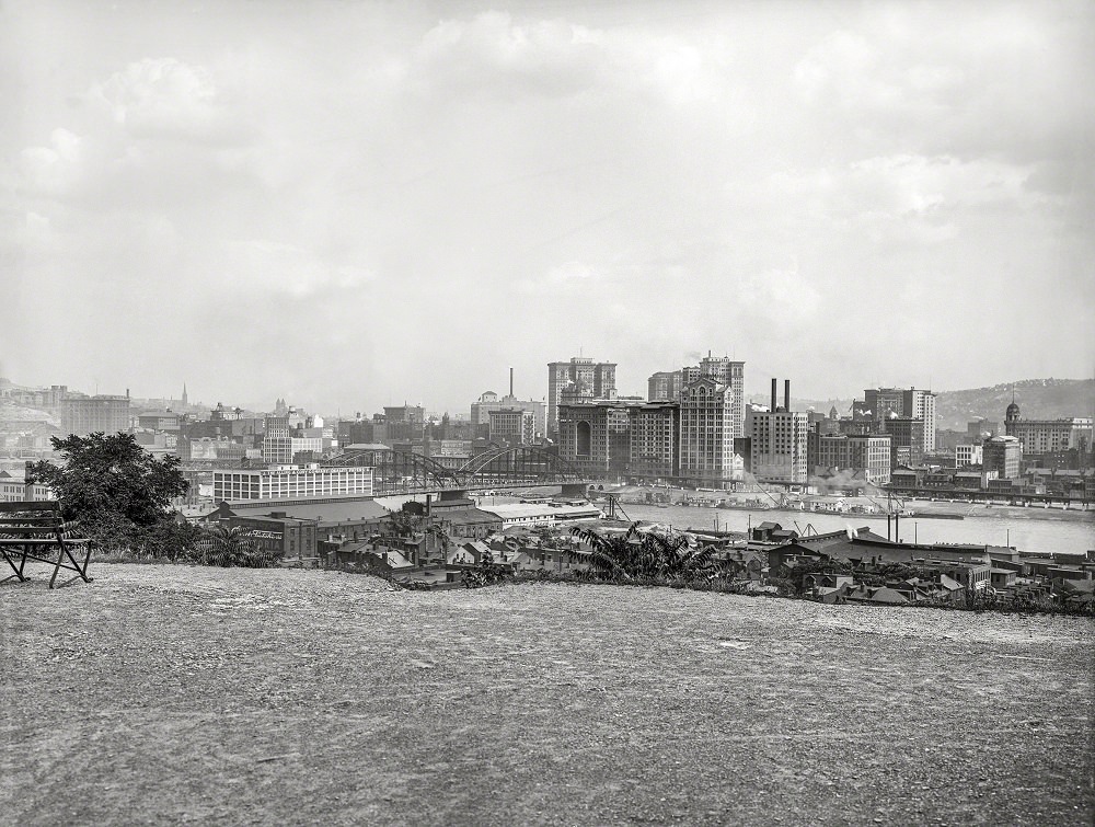
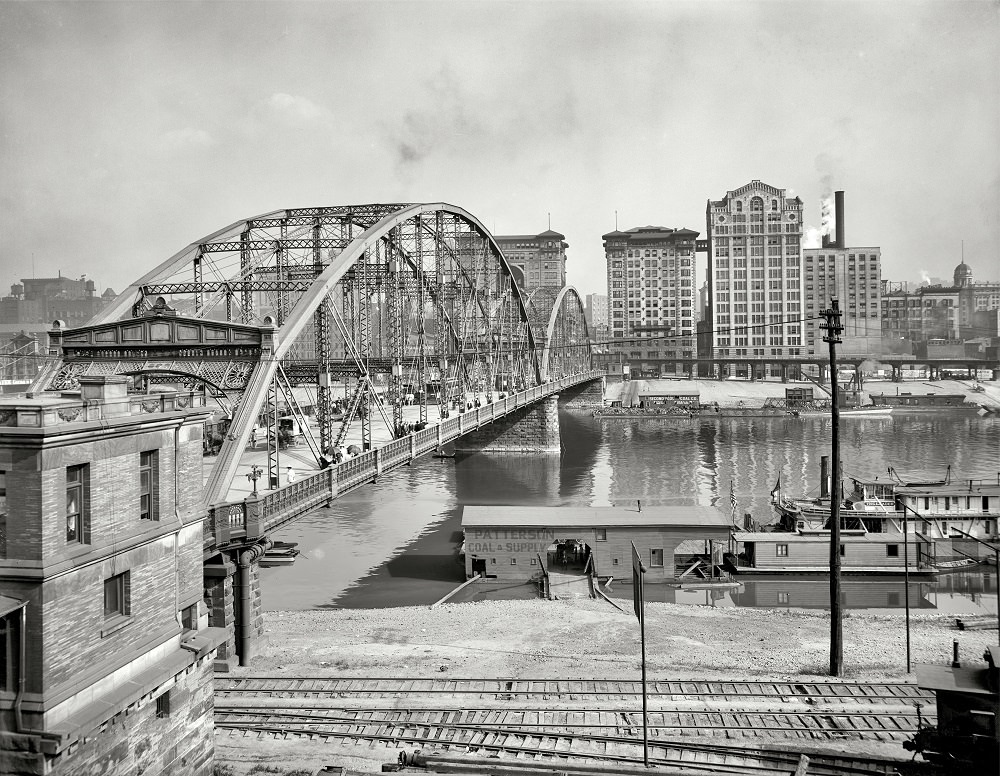
Sixth Street Bridge and skyscrapers across the Allegheny River, Pittsburgh 1903
Sixth Street Bridge over Allegheny River, Pittsburgh, Pennsylvania, 1910
Fourth Avenue at Stock Exchange, Pittsburgh, 1905

Wartime Pittsburgh in the early 1940s meant full employment and round-the-clock production. The Kroger warehouse and facilities like the Greyhound bus garage kept the city’s supply chains and transportation networks functioning under heavy wartime demand.
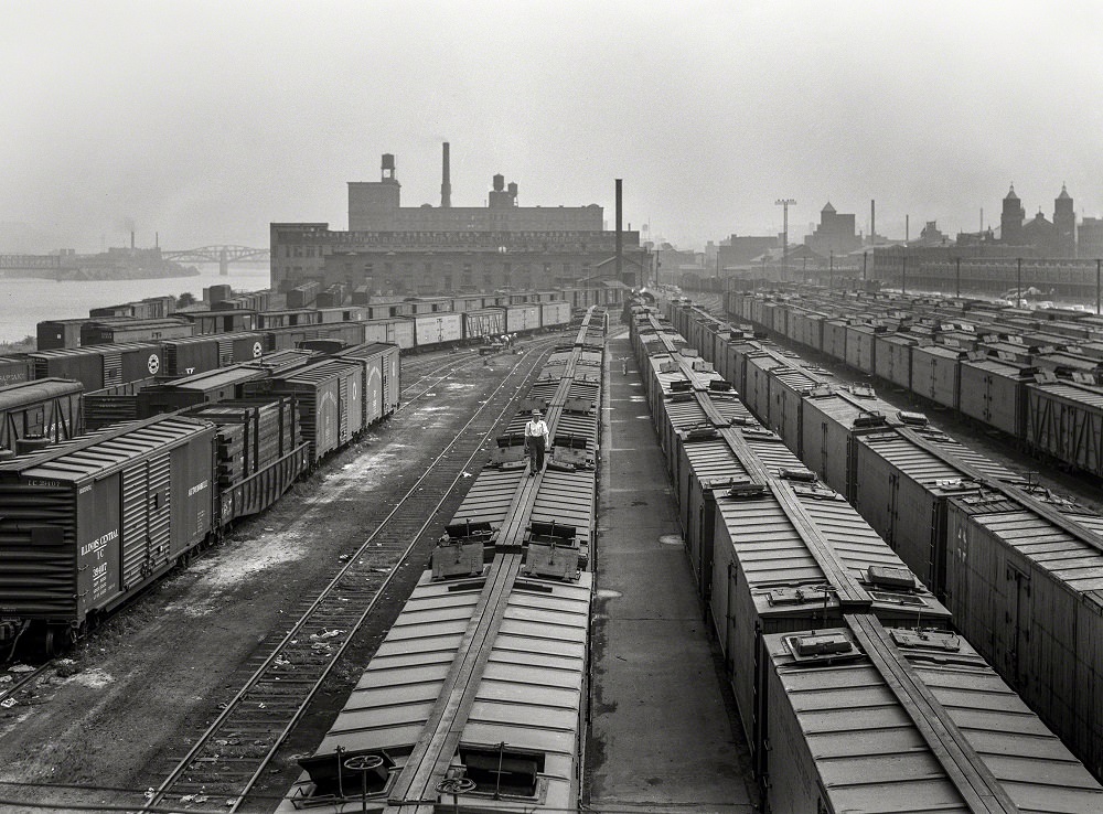
The Kroger warehouse in Pittsburgh, Pennsylvania, September 1942
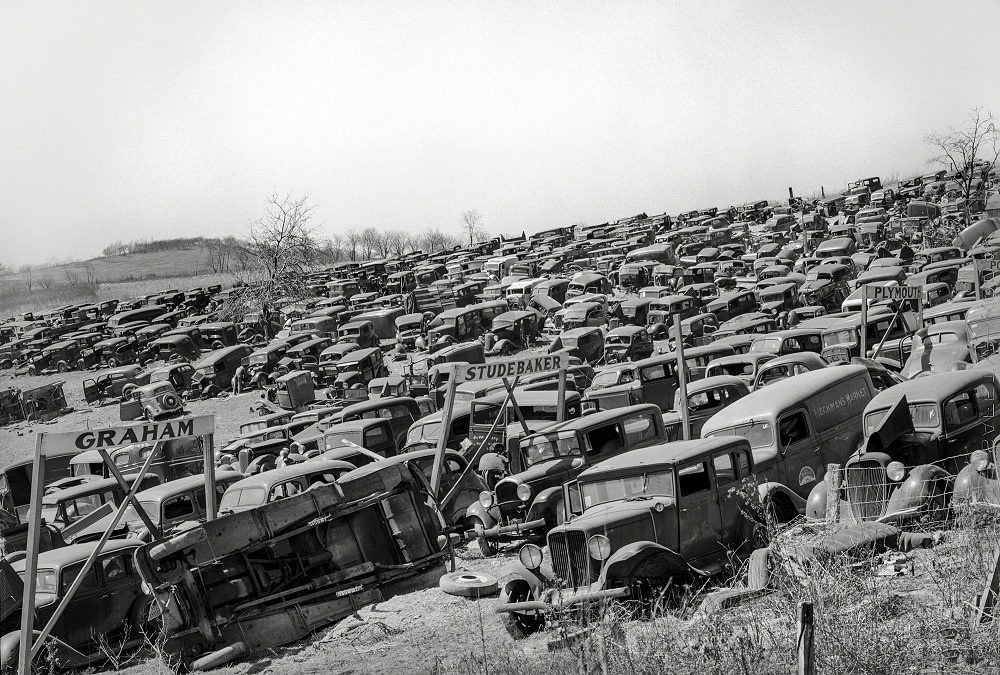
Wrecking yard at Irwin, Pennsylvania, 1941
A group of skyscrapers, Pittsburgh, 1912

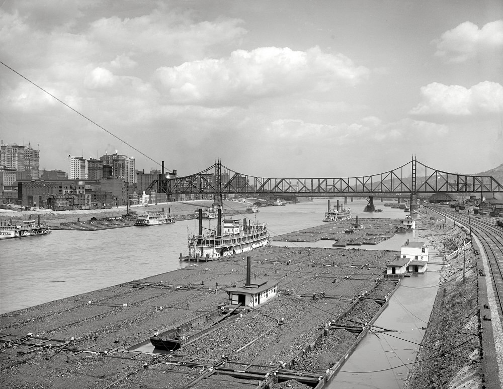
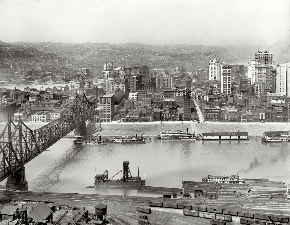
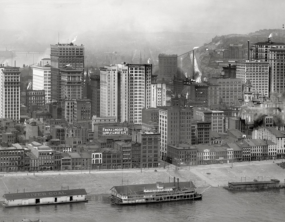
The Point — where the Allegheny and Monongahela rivers merge to form the Ohio — was a hub of river commerce for decades. Coal barges loaded here and shipped fuel to cities across the Midwest. The sheer volume of river traffic at this spot made it one of the busiest inland waterway junctions in the country.
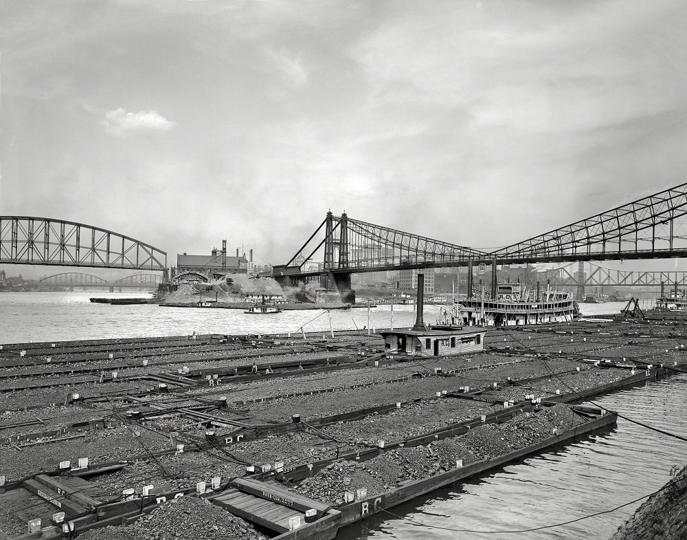
Coal barges at 'The Point' Confluence of Allegheny and Monongahela at start of Ohio River, Pittsburgh, 1912
Coal barges at ‘The Point’ Confluence of Allegheny and Monongahela at start of Ohio River, Pittsburgh, 1912
Coal barges at confluence of Allegheny and Monongahela rivers at Pittsburgh, Pennsylvania, 1910
A coal fleet, Pittsburgh, Pennsylvania, 1910

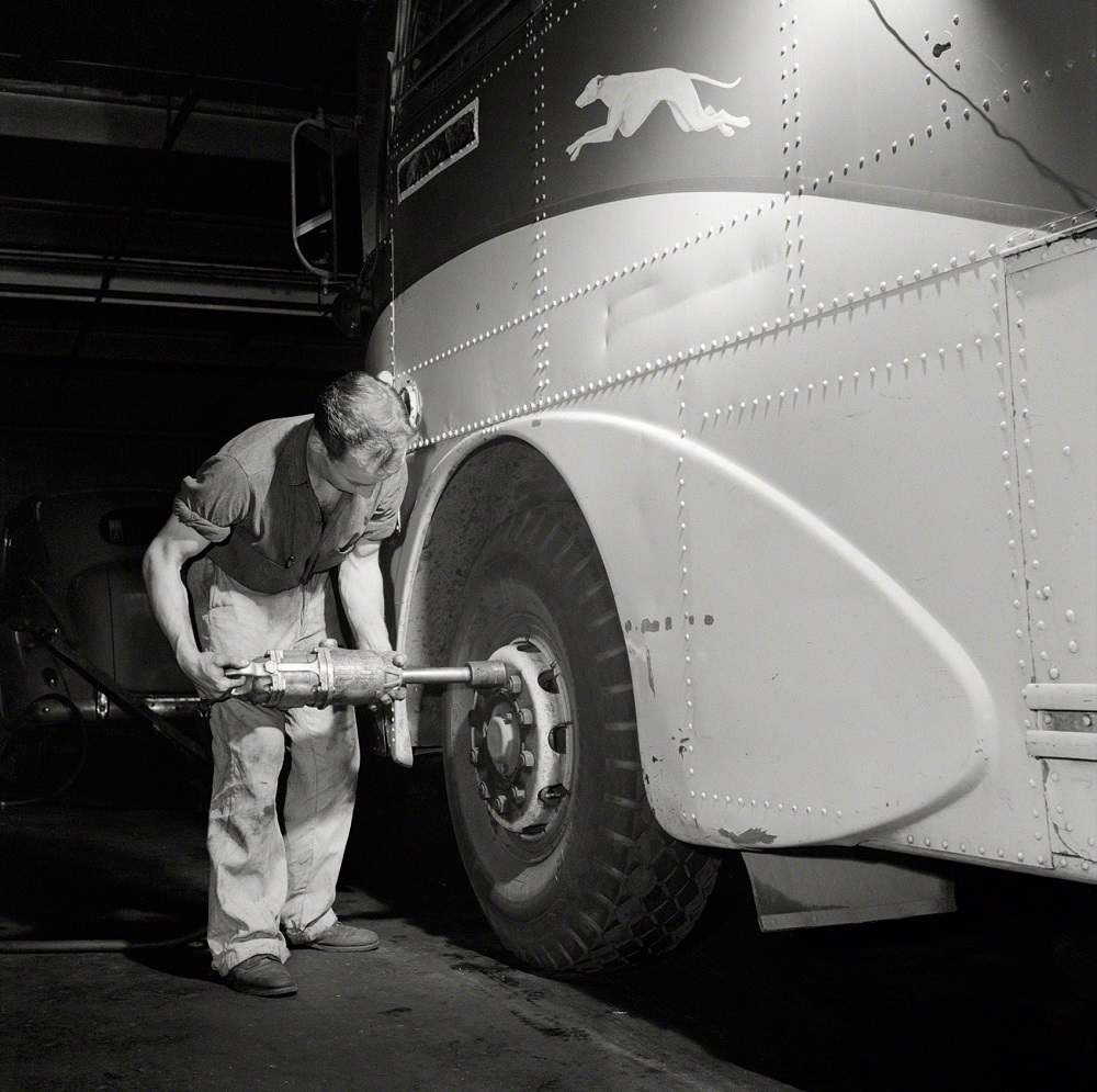
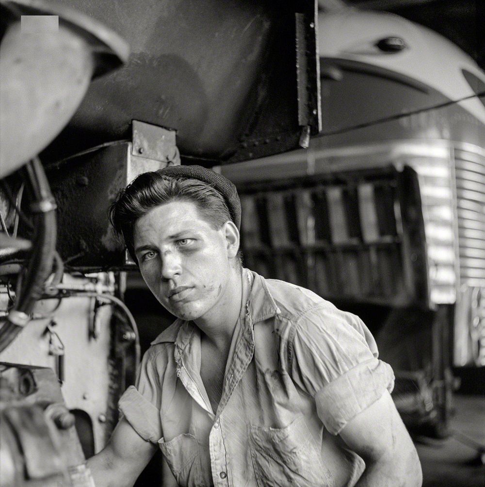
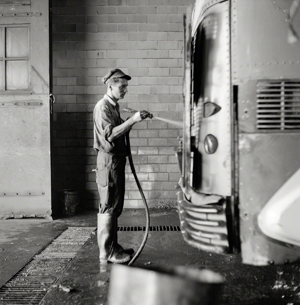
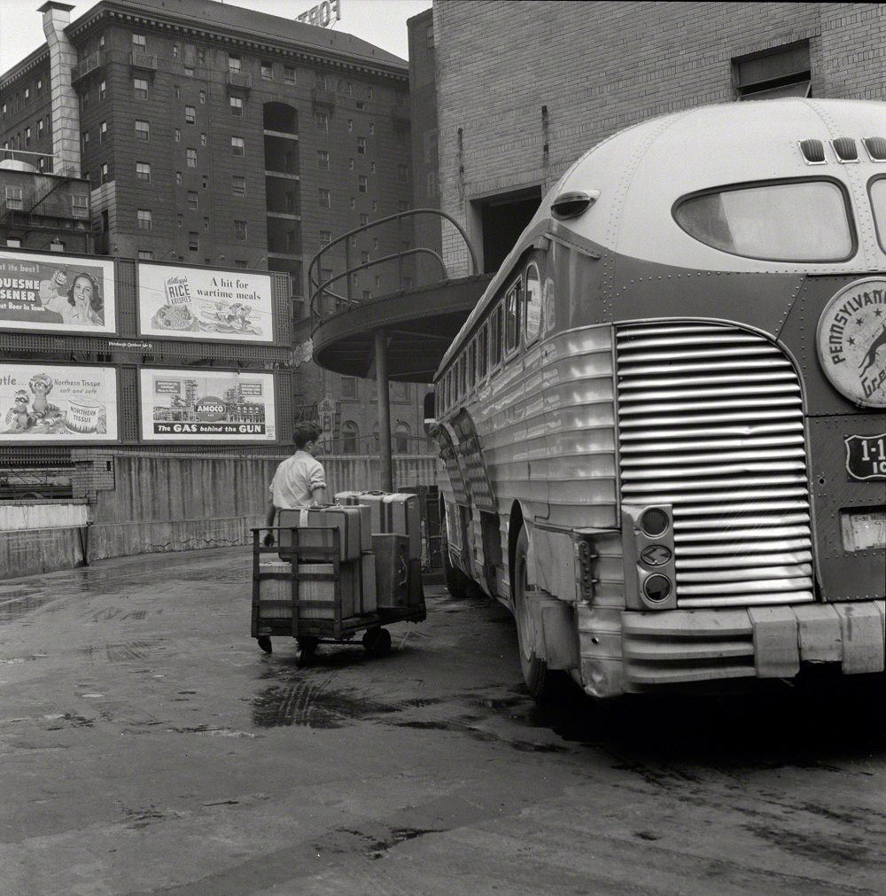
The Greyhound bus garage in Pittsburgh was a major operation during World War II. Mechanics kept a large fleet on the road under difficult conditions, servicing coaches that carried military personnel and civilians across the country.
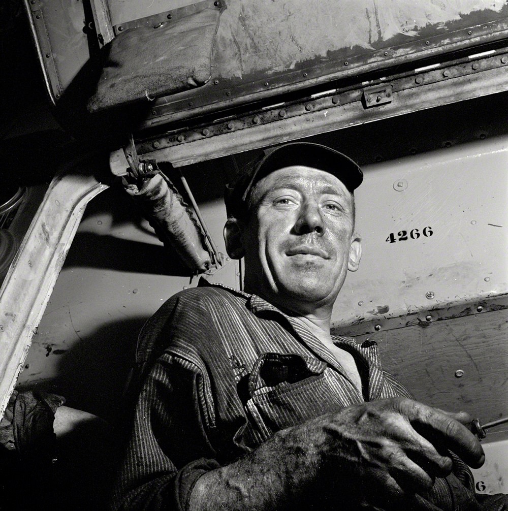
A mechanic at the Greyhound garage, Pittsburgh, September 1943
Bringing baggage from a bus, Pittsburgh, September 1943
Removing a tire from a bus at the Greyhound garage, Pittsburgh, September 1943
Mechanic in the Greyhound bus garage, Pittsburgh, September 1943
Bus serviceman washing a coach which has just come in from a run in the Greyhound garage, Pittsburgh, September 1943

Pittsburgh’s wharves along the Monongahela were active year-round. Steamboats and barges moved goods in and out of the city, and the riverfront was lined with warehouses and loading facilities. The Wabash Bridge and the various river crossings were critical links in this commercial network.
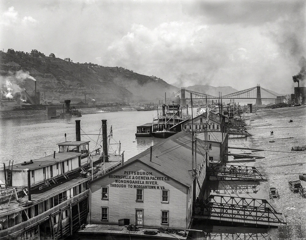
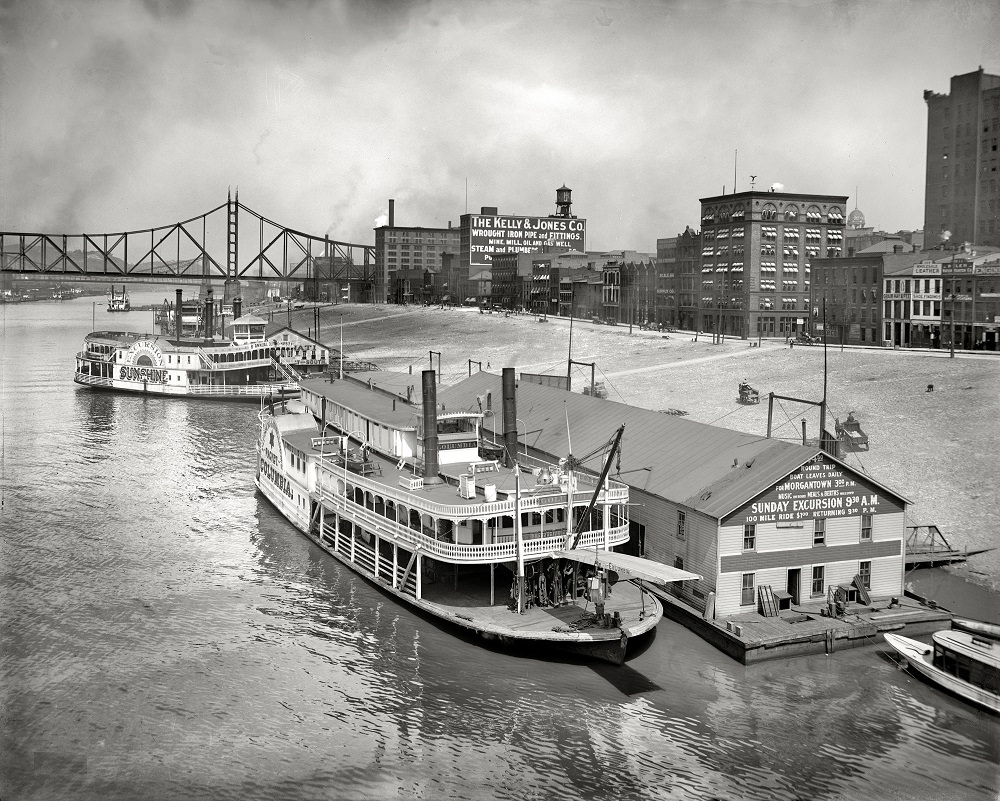
The Monongahela wharves, Pittsburgh, 1905
Monongahela River levee from Smithfield Street Bridge, Pittsburgh, 1910
Wabash Bridge, Monongahela River, Pittsburgh, Pennsylvania, 1908

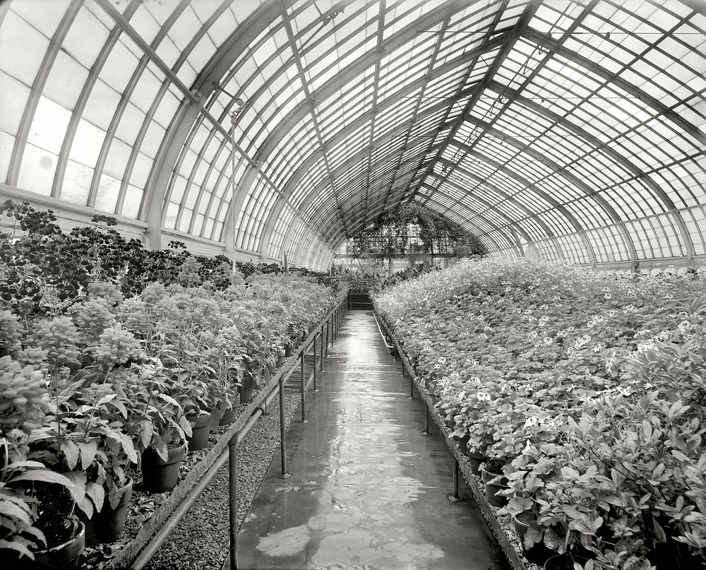
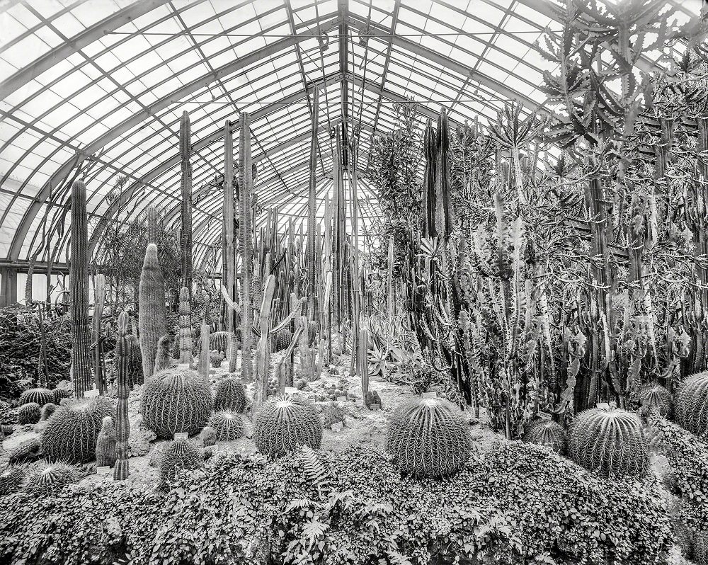
Schenley Park provided Pittsburgh residents with a public green space that stood in sharp contrast to the smoke and noise of the surrounding industrial districts. The Phipps Conservatory, located within the park, housed botanical collections and was a popular attraction. The Carnegie-Mellon campus nearby added an academic presence to the area.
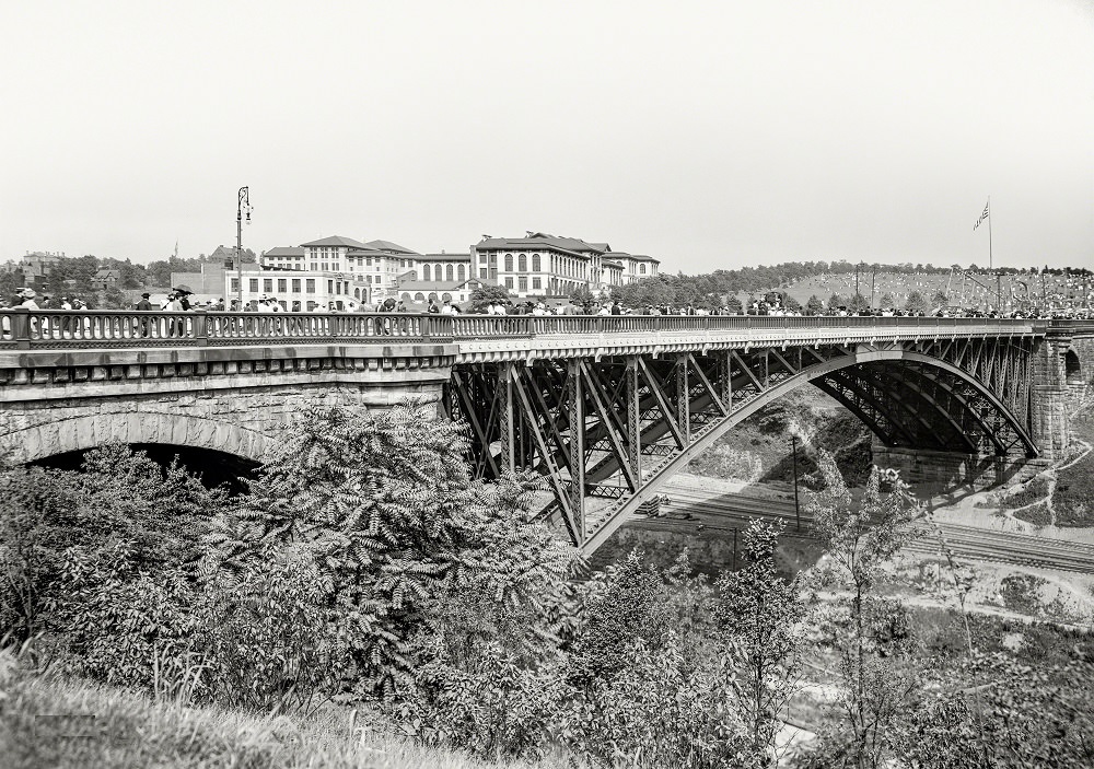
Schenley Park Bridge and the 'Tick' Carnegie-Mellon University), Pittsburgh, 1910
Schenley Park Bridge and the ‘Tick’ Carnegie-Mellon University), Pittsburgh, 1910
Cacti, Phipps Conservatory, Schenley Park, Pittsburgh, 1905
Phipps Conservatory, Schenley Park, , Pittsburgh, 1910

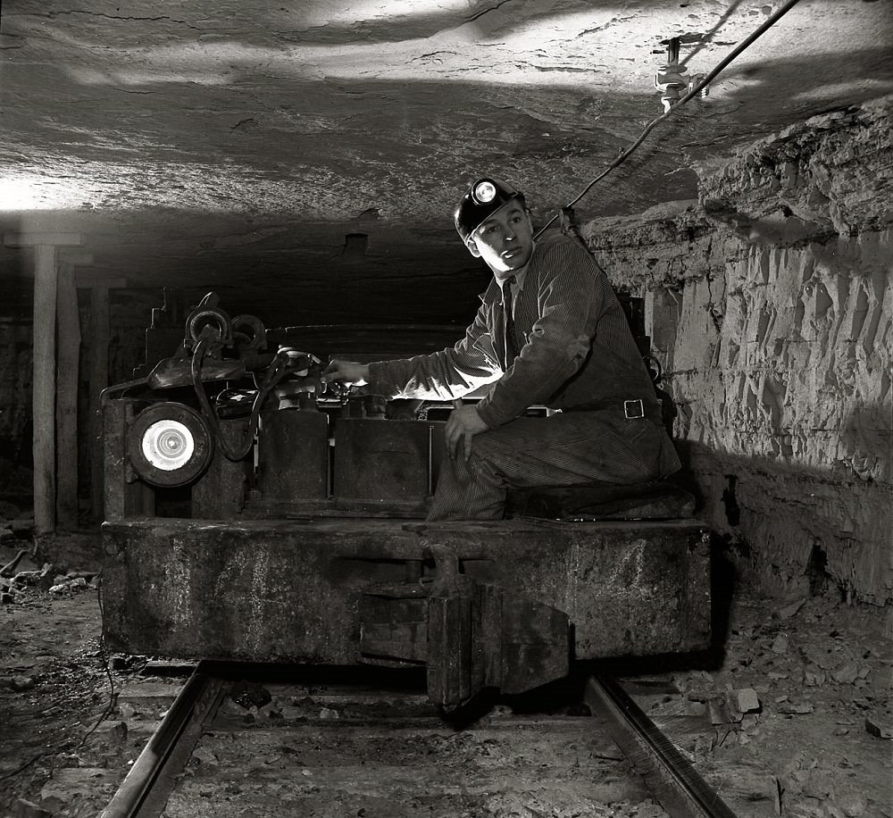
The Pittsburgh Coal Company’s Montour No. 4 mine, documented in November 1942, was one of the region’s major coal-producing operations. Mine cars ran off trolley cables underground, and the surface facilities spread across a wide industrial footprint. Coal from operations like this one powered steel mills and factories across the country.
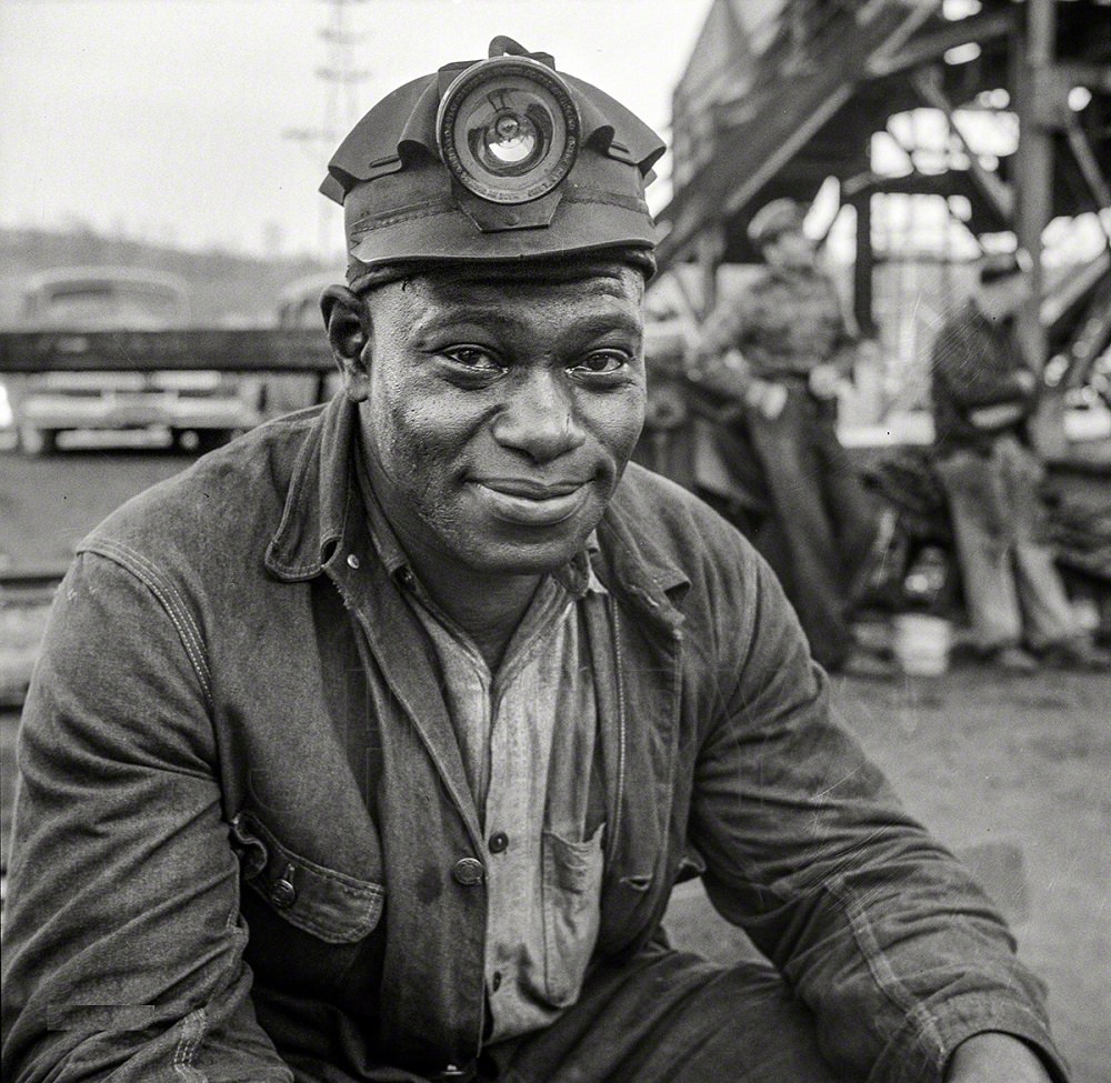
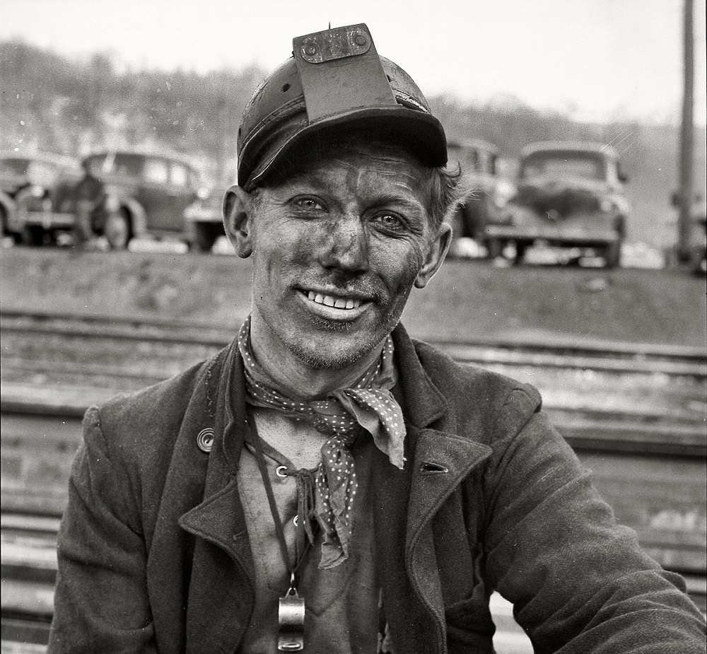
Pittsburgh (vicinity). Montour No. 4 mine of the Pittsburgh Coal Company, November 1942
Montour No. 4 mine of the Pittsburgh Coal Company, Pittsburgh, Pennsylvania,  November 1942
Montour No. 4 mine of the Pittsburgh Coal Company, Pittsburgh, Pennsylvania, November 1942
Montour No. 4 mine of the Pittsburgh Coal Co. Mine car operating off a trolley cable, Pittsburgh, Pennsylvania,  November 1942
Montour No. 4 mine of the Pittsburgh Coal Co. Mine car operating off a trolley cable, Pittsburgh, Pennsylvania, November 1942

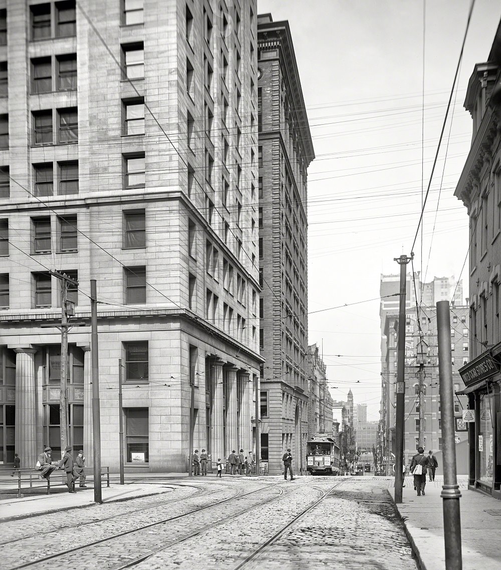
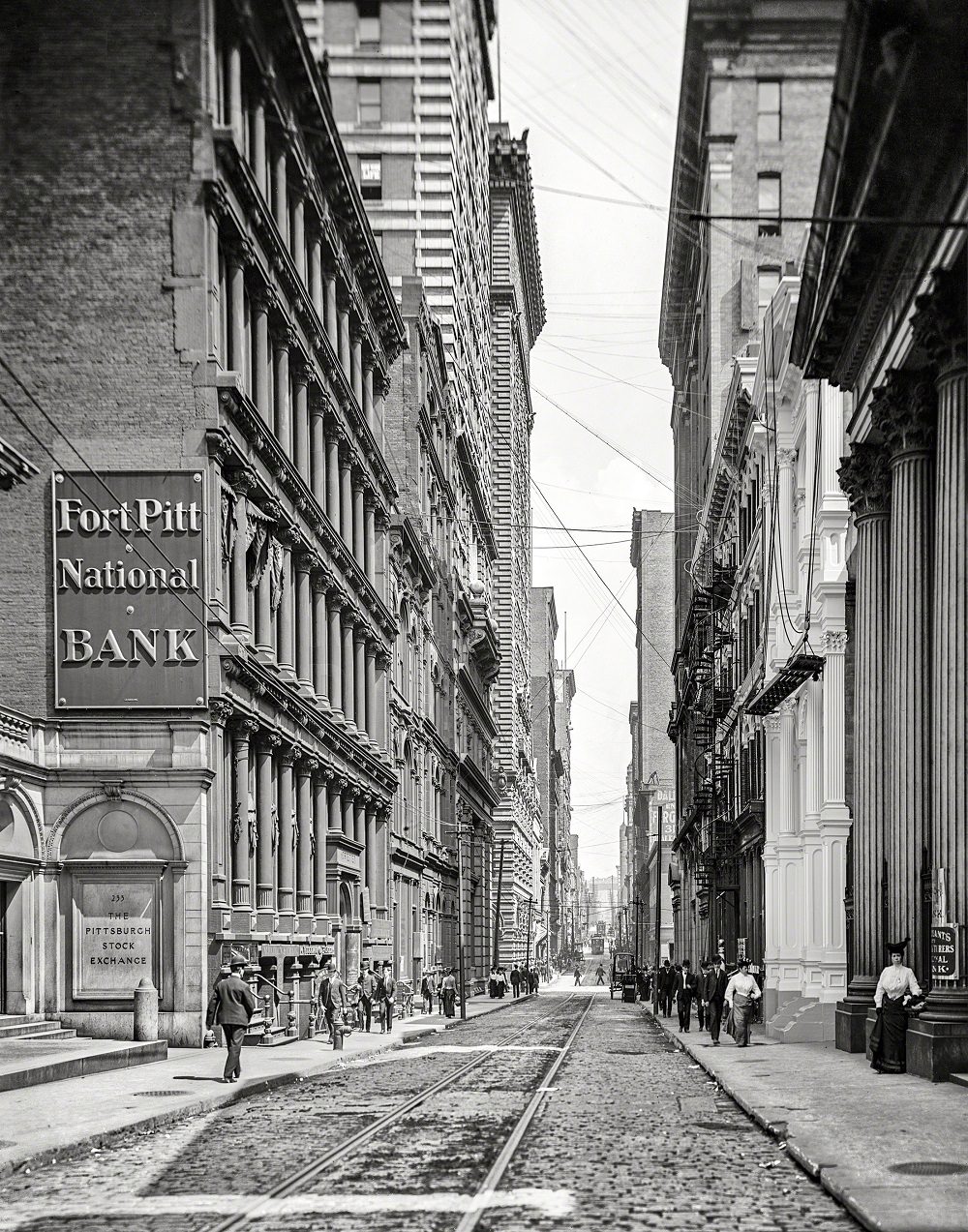
Fourth Avenue was Pittsburgh’s financial corridor, sometimes called the Wall Street of Pittsburgh. The Stock Exchange building anchored this stretch, surrounded by banks and commercial offices that managed the enormous wealth generated by the steel and coal industries.
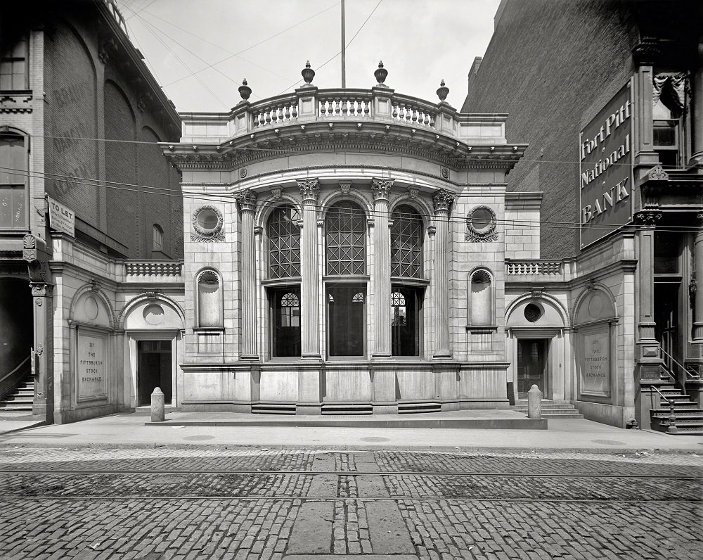
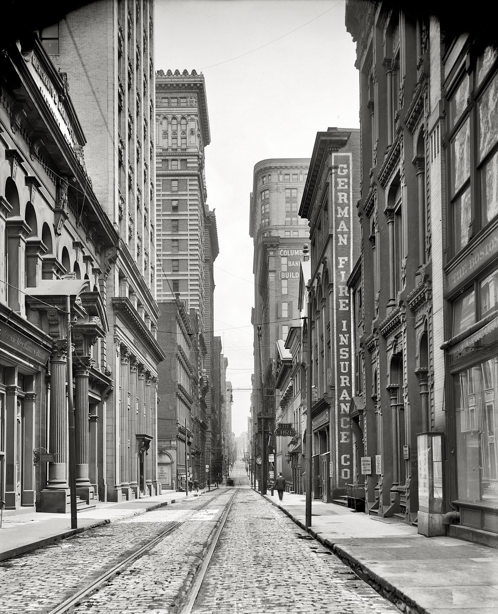
Pittsburgh Stock Exchange, Fourth Avenue, 1904
Pittsburgh Wall Street (4th Avenue), , Pittsburgh, Pennsylvania, 1905

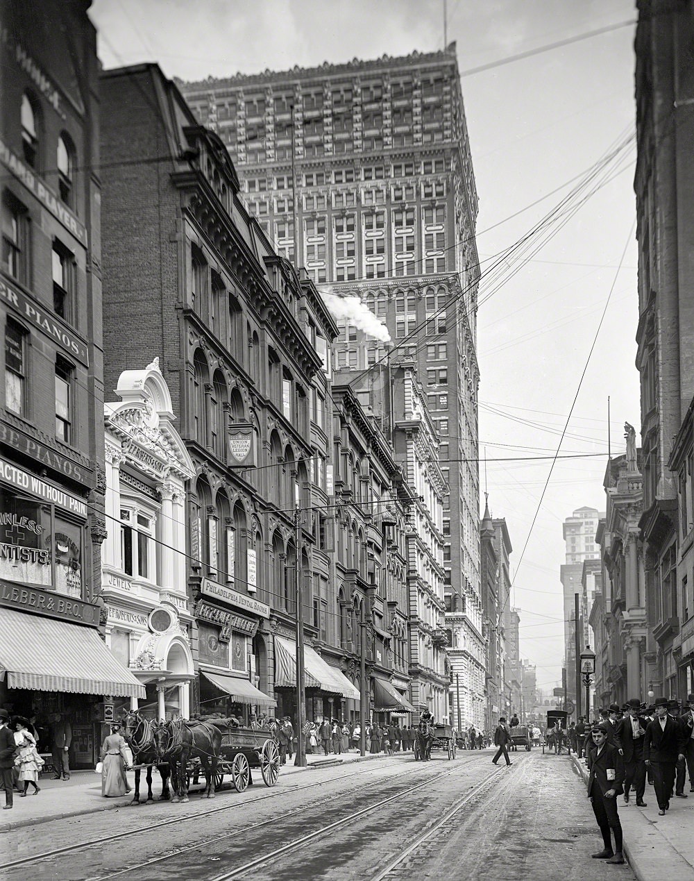
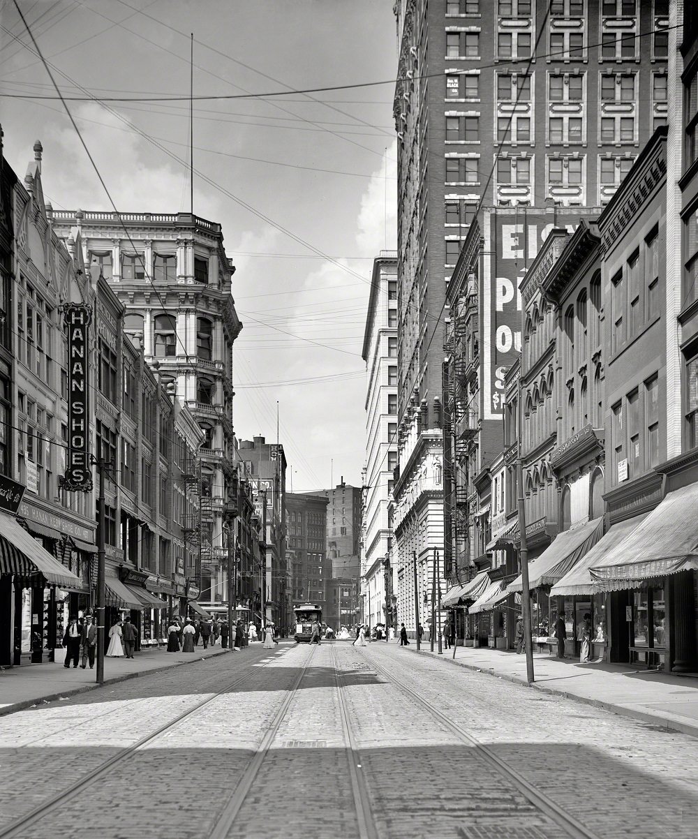
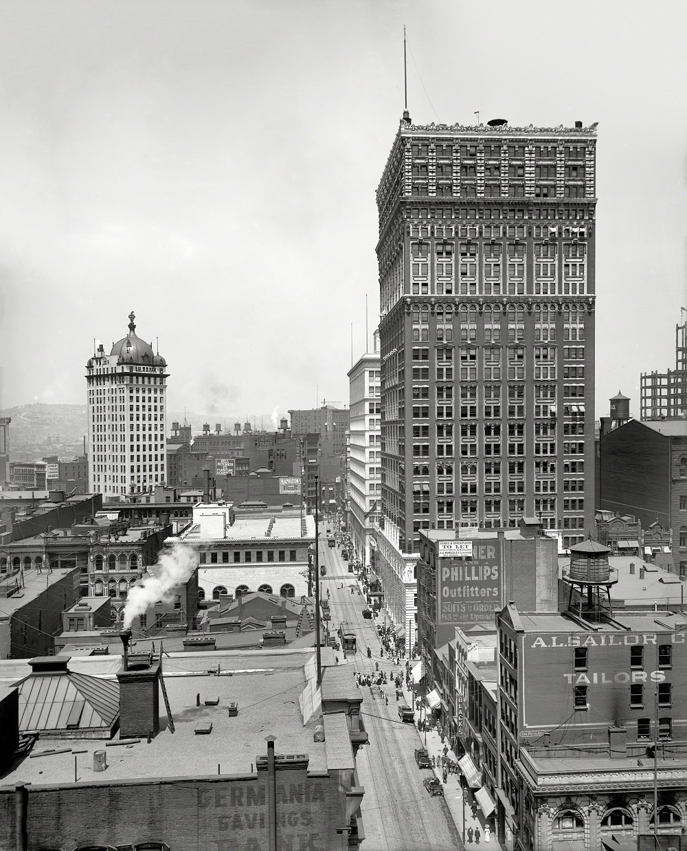
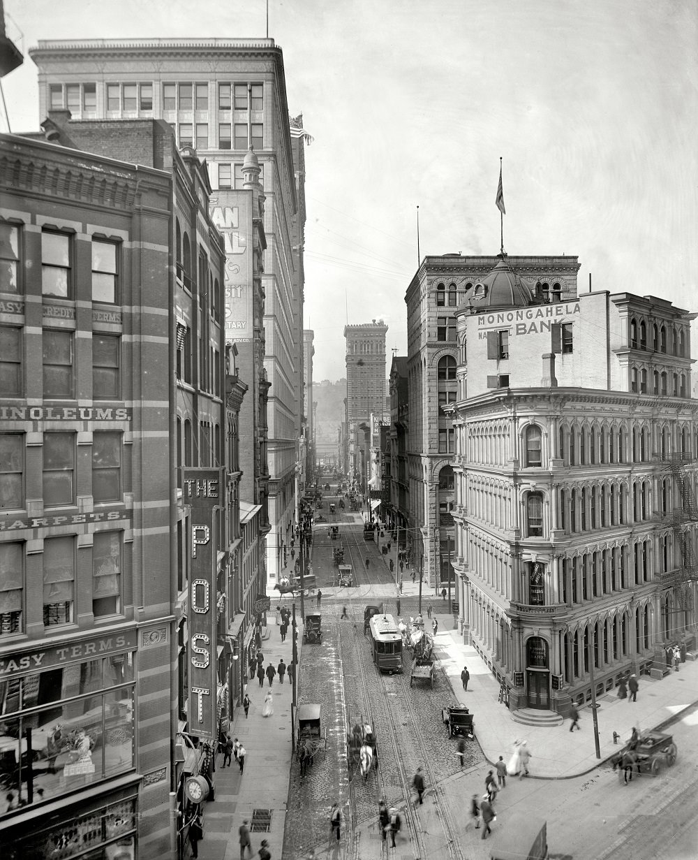
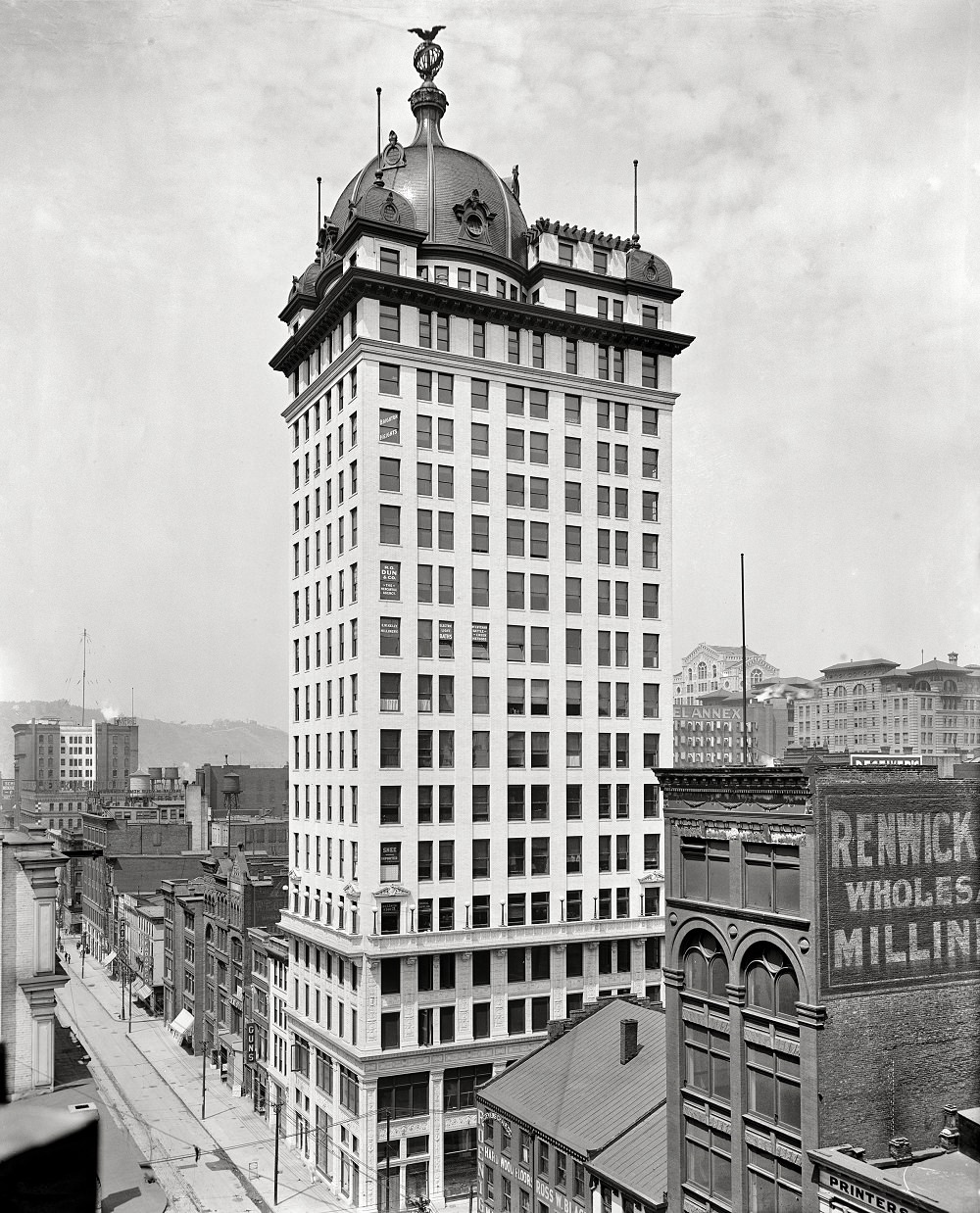
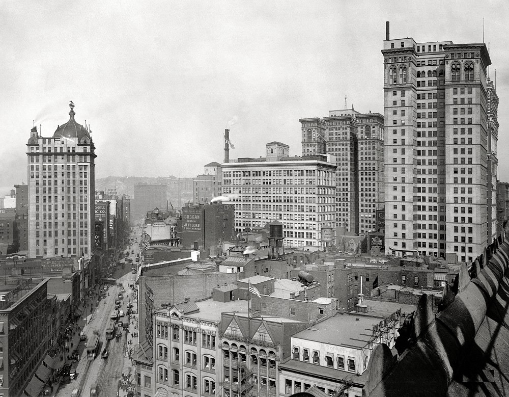
Wood Street was one of Pittsburgh’s main commercial arteries in the early 1900s. Photographs from 1905, 1908, and 1910 show a busy thoroughfare lined with storefronts, trolley tracks, and pedestrians. The Keenan Building, with its distinctive dome, stood as one of the more recognizable structures in the area.
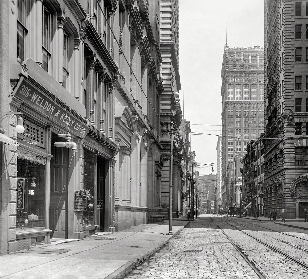
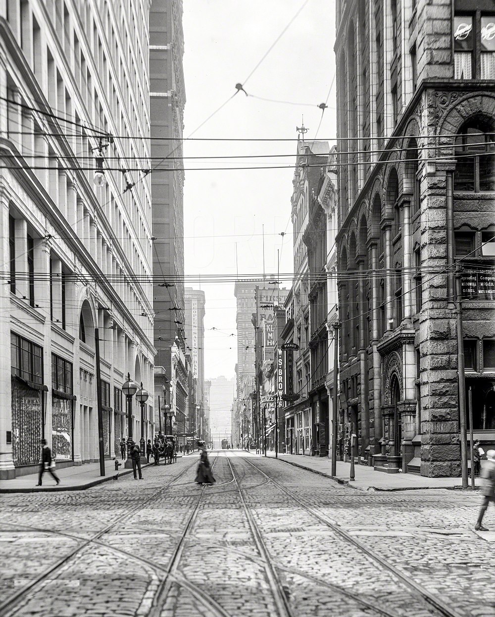
Wood Street, looking east, Pittsburgh, Pennsylvania, 1908
Wood Street, Pittsburgh, Pennsylvania, 1908
Wood Street, Pittsburg, 1905
Wood Street and the Farmers Bank. At left, the domed Keenan Building, Pittsburg, 1910
Wood Street from Liberty Avenue, Pittsburgh, Pennsylvania, 1910

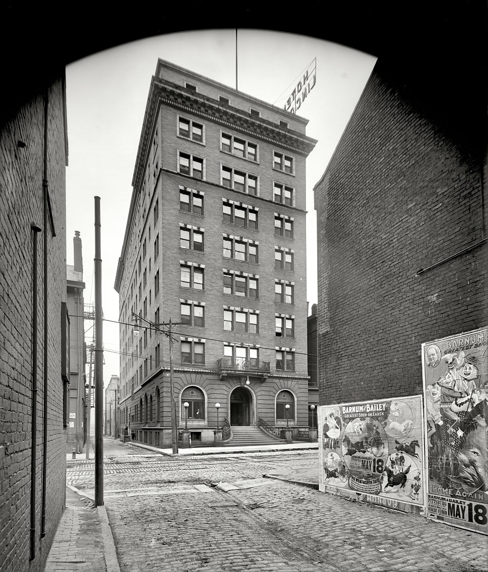
The Fort Pitt Hotel on Penn Avenue and the Hotel Lincoln were among the prominent lodging establishments serving Pittsburgh’s business travelers and visitors in the early 1900s. These buildings reflected the city’s growing commercial confidence and its status as a regional hub.
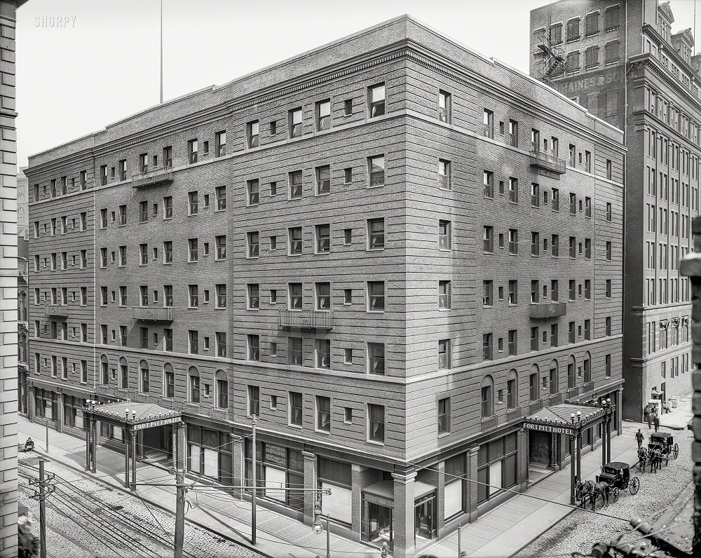
Fort Pitt Hotel, Penn Avenue, Pittsburg, 1905
Hotel Lincoln, Pittsburg, 1904

Fifth Avenue was the spine of Pittsburgh’s uptown district, lined with department stores, office buildings, and theaters. Kaufmann’s department store was a fixture on this street by 1908. The avenue gave the city a grand commercial corridor that stretched from the downtown core toward the east end.
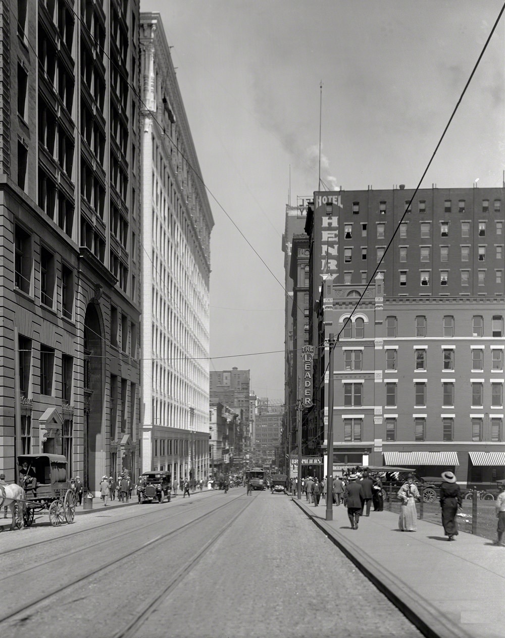
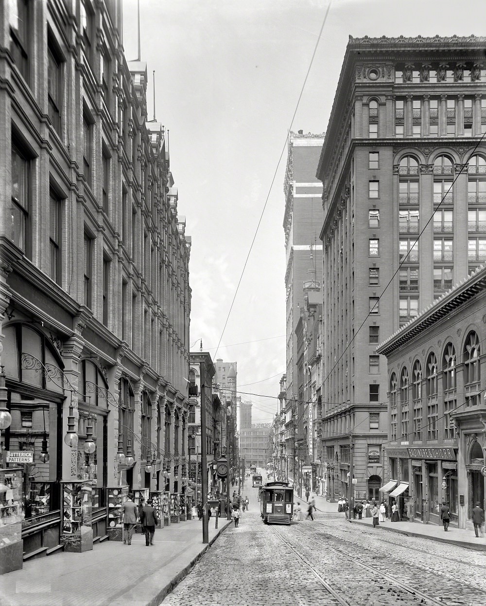
Fifth Avenue from Grant Street, Perpendicular Pittsburgh, 1908
Fifth Avenue looking north, On the left, Kaufmann's, Pittsburgh, 1908
Fifth Avenue looking north, On the left, Kaufmann’s, Pittsburgh, 1908
Fifth Avenue, Pittsburgh, Pennsylvania, 1908

Children growing up in Pittsburgh’s mill neighborhoods were surrounded by the sights and sounds of heavy industry from an early age. The steelworker’s son photographed in July 1938 was one of thousands of children whose family lives were shaped entirely by mill work and mill wages.
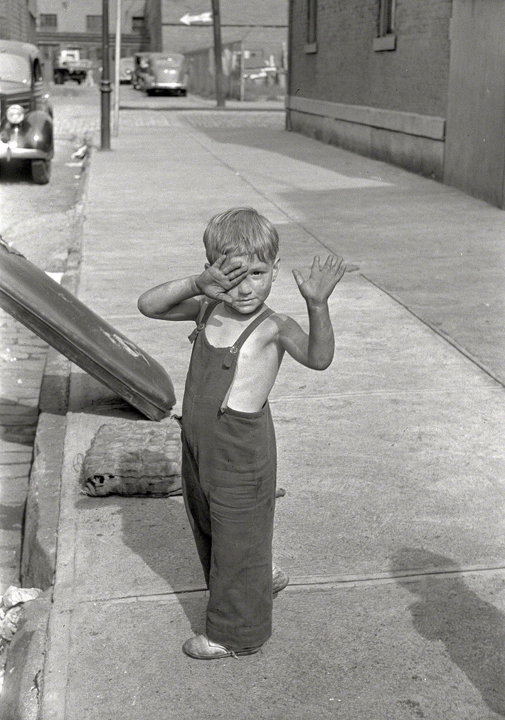
Steelworker's son, Pittsburgh, Pennsylvania, July 1938
Steelworker’s son, Pittsburgh, Pennsylvania, July 1938

The Bridge of Sighs in Pittsburgh was named after the famous enclosed bridge in Venice, Italy. Built to connect the Allegheny County Courthouse to the county jail, it allowed the transfer of prisoners between the two buildings without taking them through public streets. The 1903 photograph shows the bridge in full use.
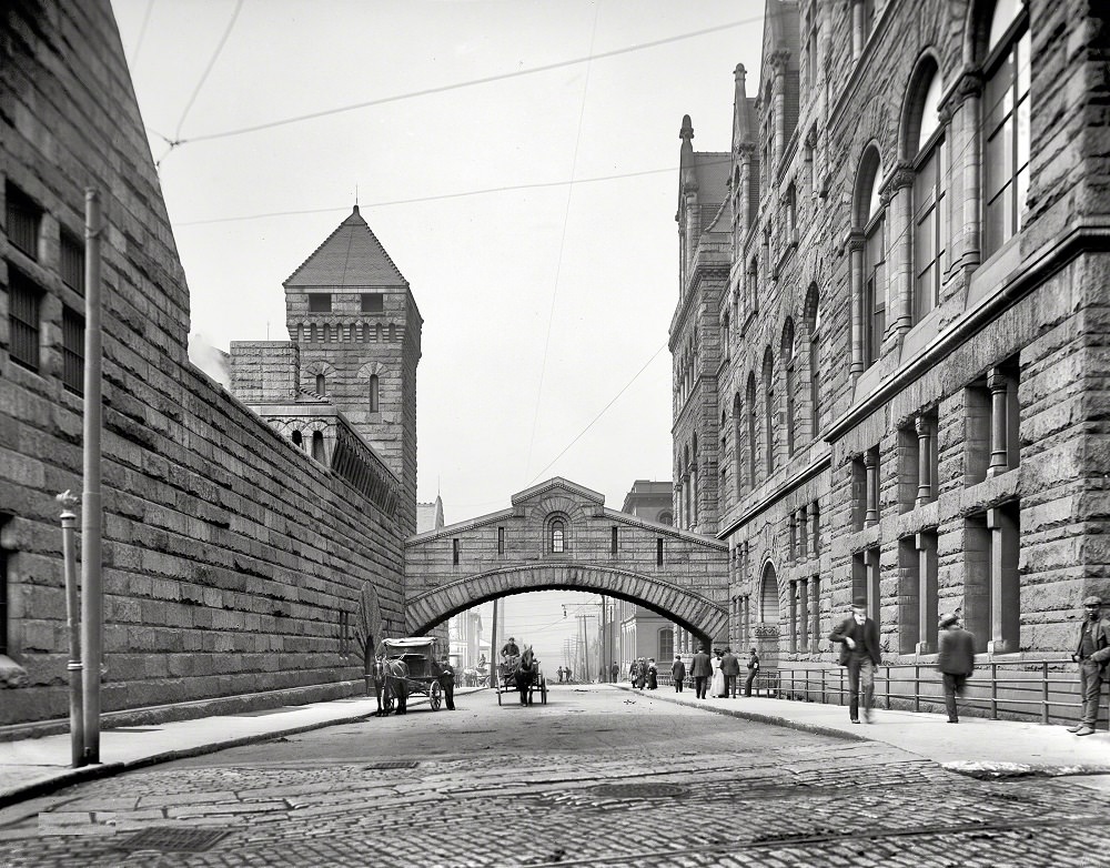
Bridge of Sighs, Pittsburgh. The bridge was named after the famous span in Venice, it was used to transport prisoners between the Allegheny County Courthouse and the jail, 1903

By the mid-1950s, Pittsburgh had begun a slow shift away from its peak industrial output. A 1956 color photograph from the Kermy Kodachrome cache captures the city at a transitional moment — still recognizably the industrial giant it had always been, but with signs of a changing urban landscape already visible.
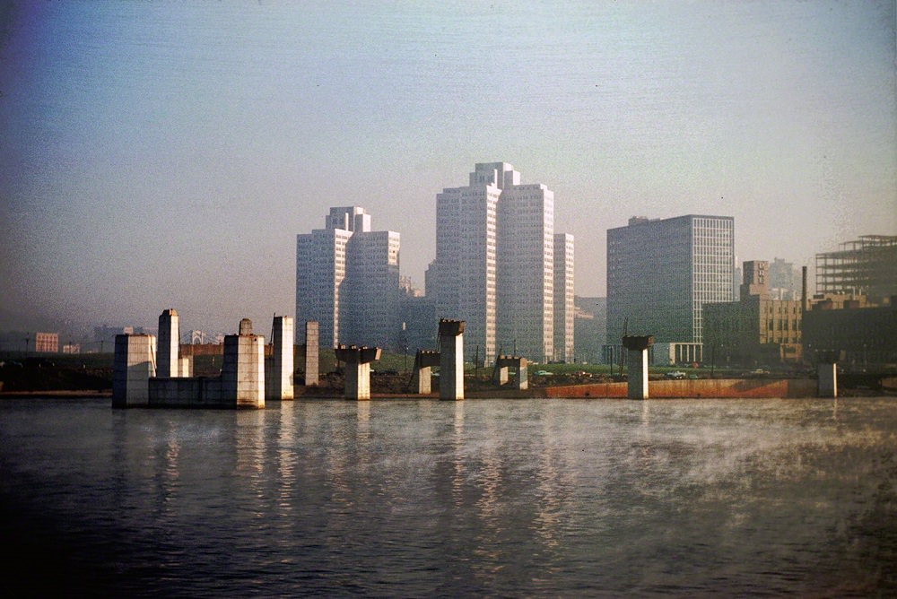
From the Kermy Kodachrome cache, Pittsburgh Nov 1956
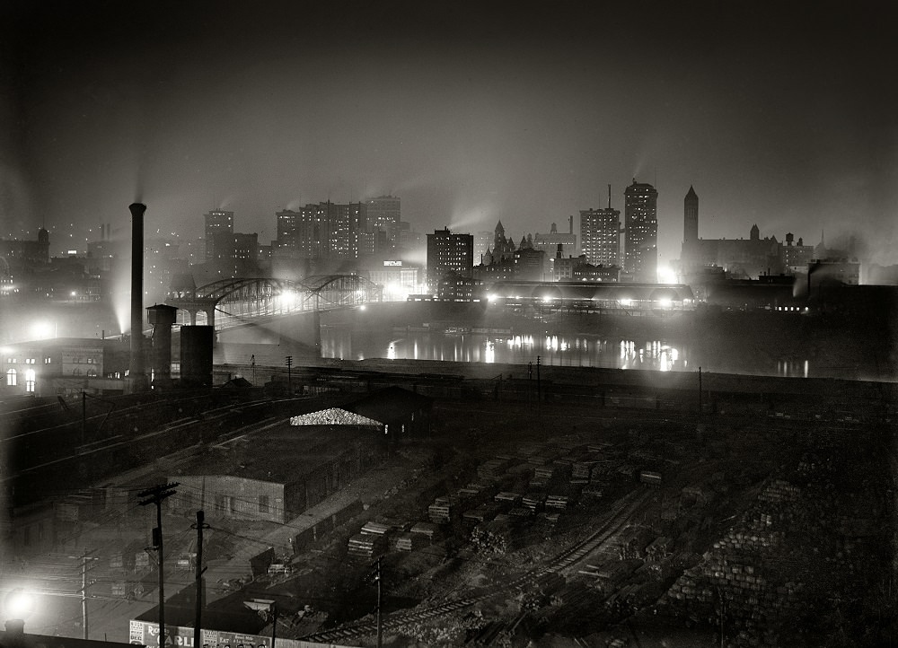
Pittsburgh by Night, 1907

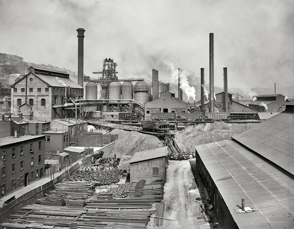
Pittsburgh’s mill streets in the early 1900s were working environments around the clock. The National Tube Works and the Carnegie Steel Company’s Lucy furnace were among the major industrial operations that defined this period. The furnaces ran continuously, and the neighborhoods around them carried the constant smell and sound of molten metal.
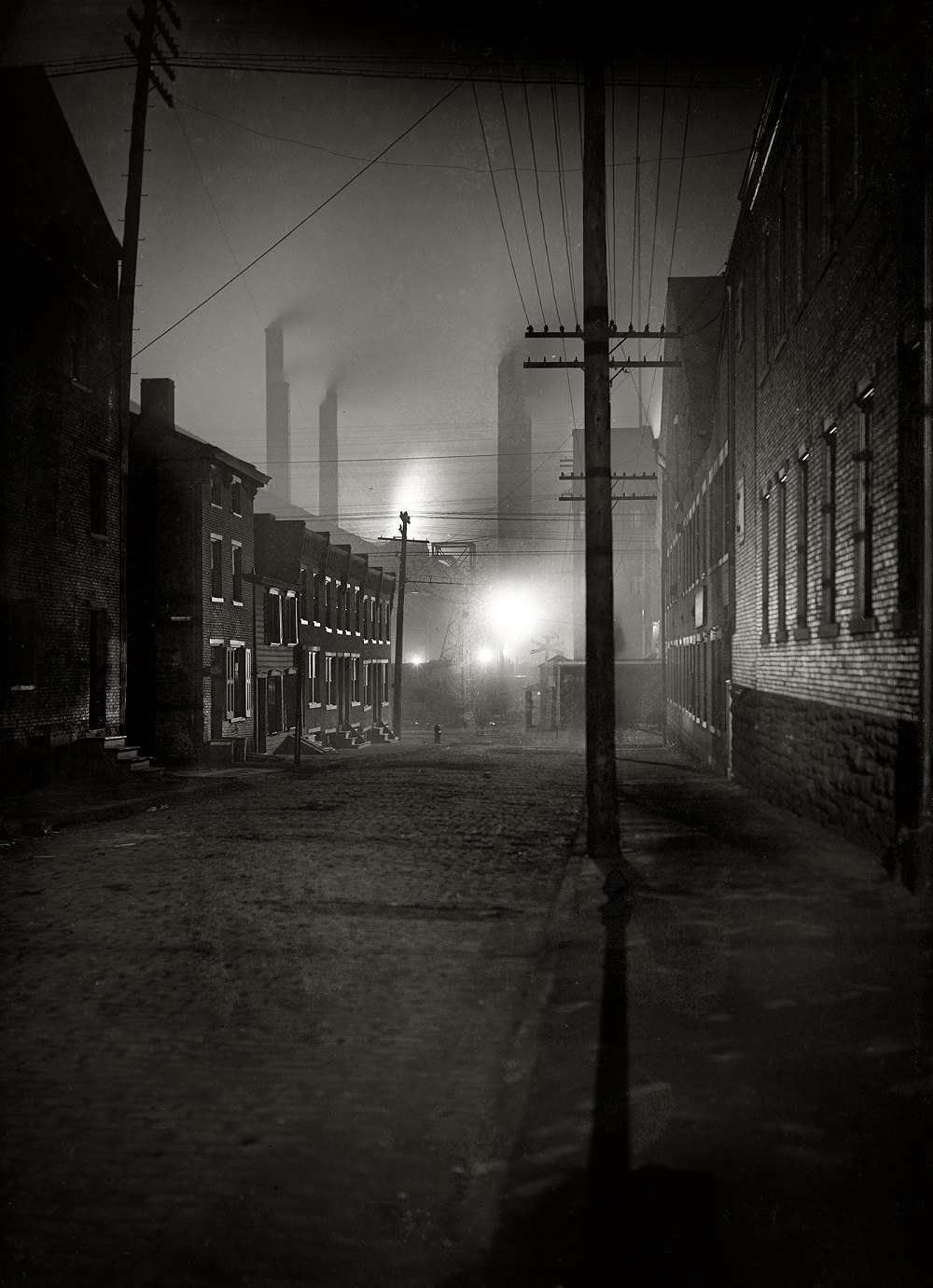
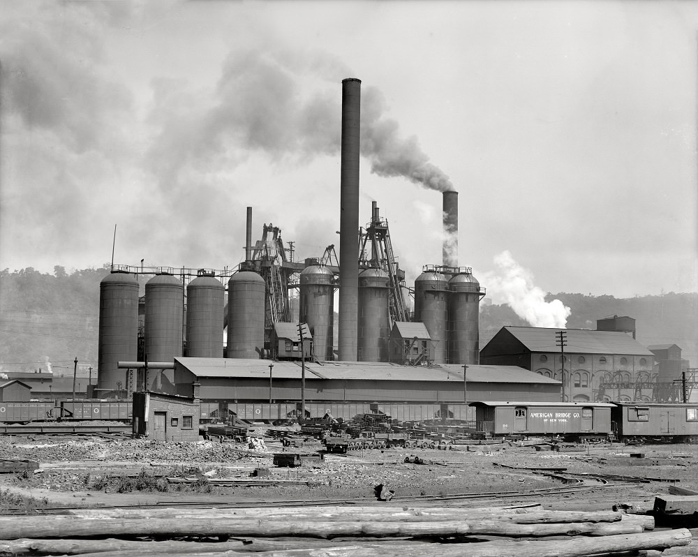
A Mill Street, Pittsburgh, Pennsylvania, 1907
Carnegie Steel Company, 'Lucy' furnace, Pittsburgh, 1908
Carnegie Steel Company, ‘Lucy’ furnace, Pittsburgh, 1908
Furnaces, National Tube Works, Pittsburgh, Pennsylvania, 1910

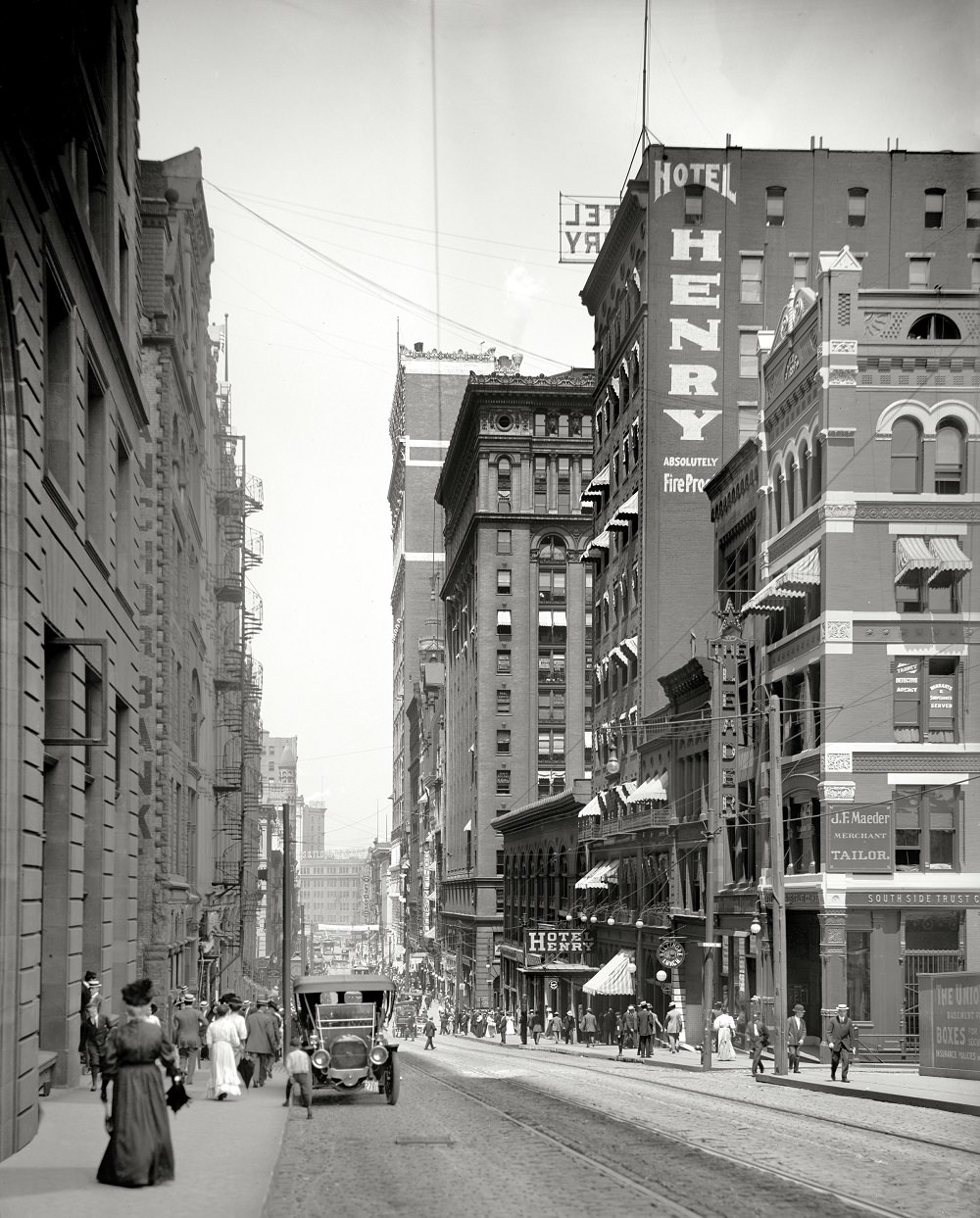
Liberty Avenue and Sixth Avenue were important commercial and entertainment corridors. The Nixon Theatre on Sixth Avenue was one of the city’s major performance venues in the early 20th century, drawing audiences from across the region.
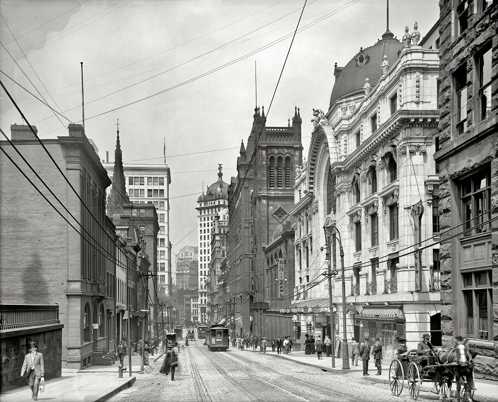
Liberty Avenue and skyscrapers, Pittsburgh, 1914
Nixon Theatre, Sixth Avenue & Cherry Alley, Pittsburgh, Pennsylvania, 1908
Sixth Avenue above the Nixon Theatre, Pittsburgh, Pennsylvania, 1914

Street medicine was a fixture of city life in the early 20th century. A quack doctor photographed in Pittsburgh in May 1938 represents a type of itinerant vendor who sold unregulated remedies to working-class residents who had limited access to formal medical care. These figures were common in American cities during the Depression era.
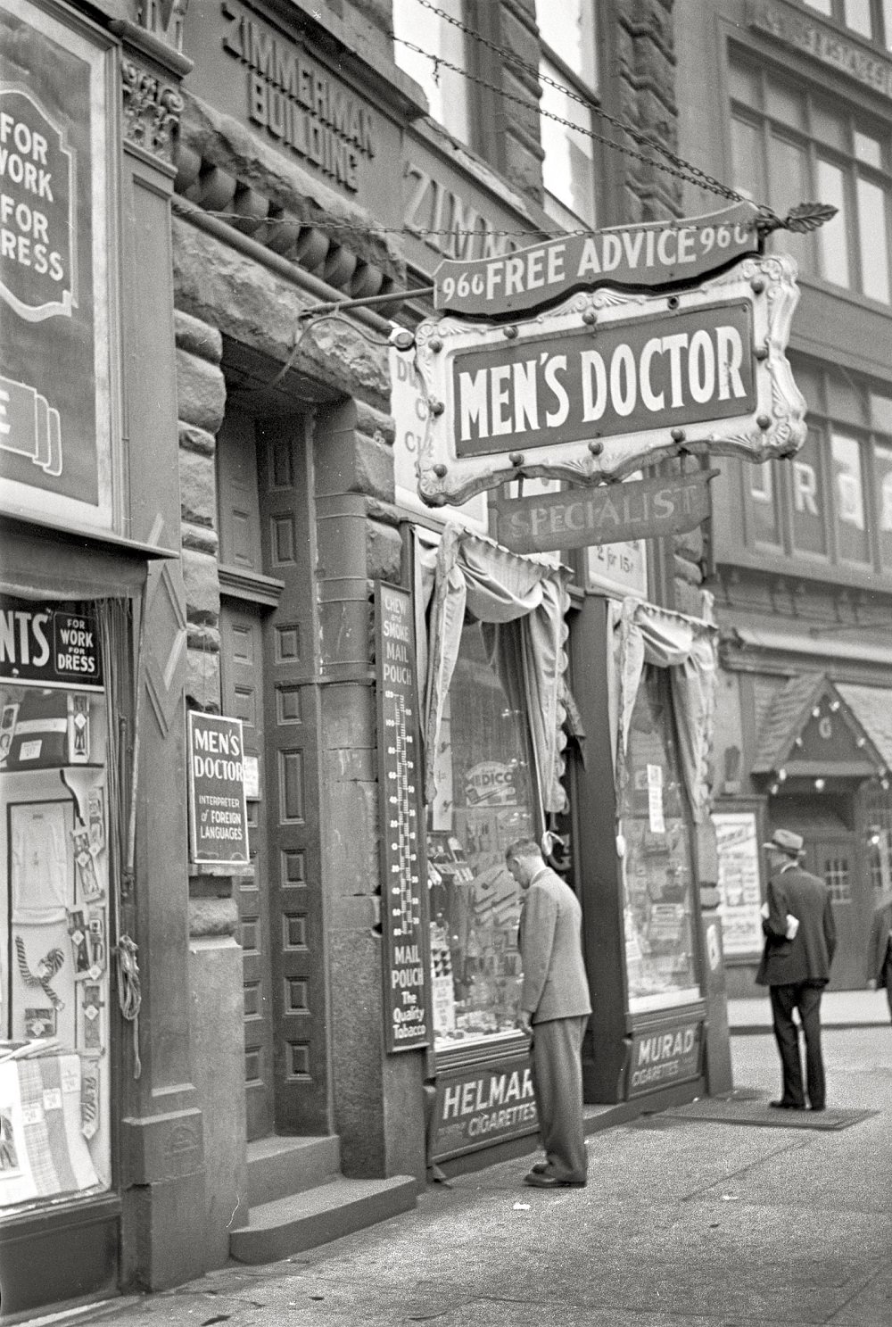
Quack doctor, Pittsburgh, Pennsylvania, May 1938
Continuing our tour of Pittsburgh, 1908
A group of skyscrapers, Pittsburgh, Pennsylvania, 1908

Smithfield Street and its surroundings formed a key node in downtown Pittsburgh. The post office anchored the intersection, and nearby commercial buildings housed a dense mix of businesses. These streets saw constant foot traffic from workers, shoppers, and commuters moving through the city.
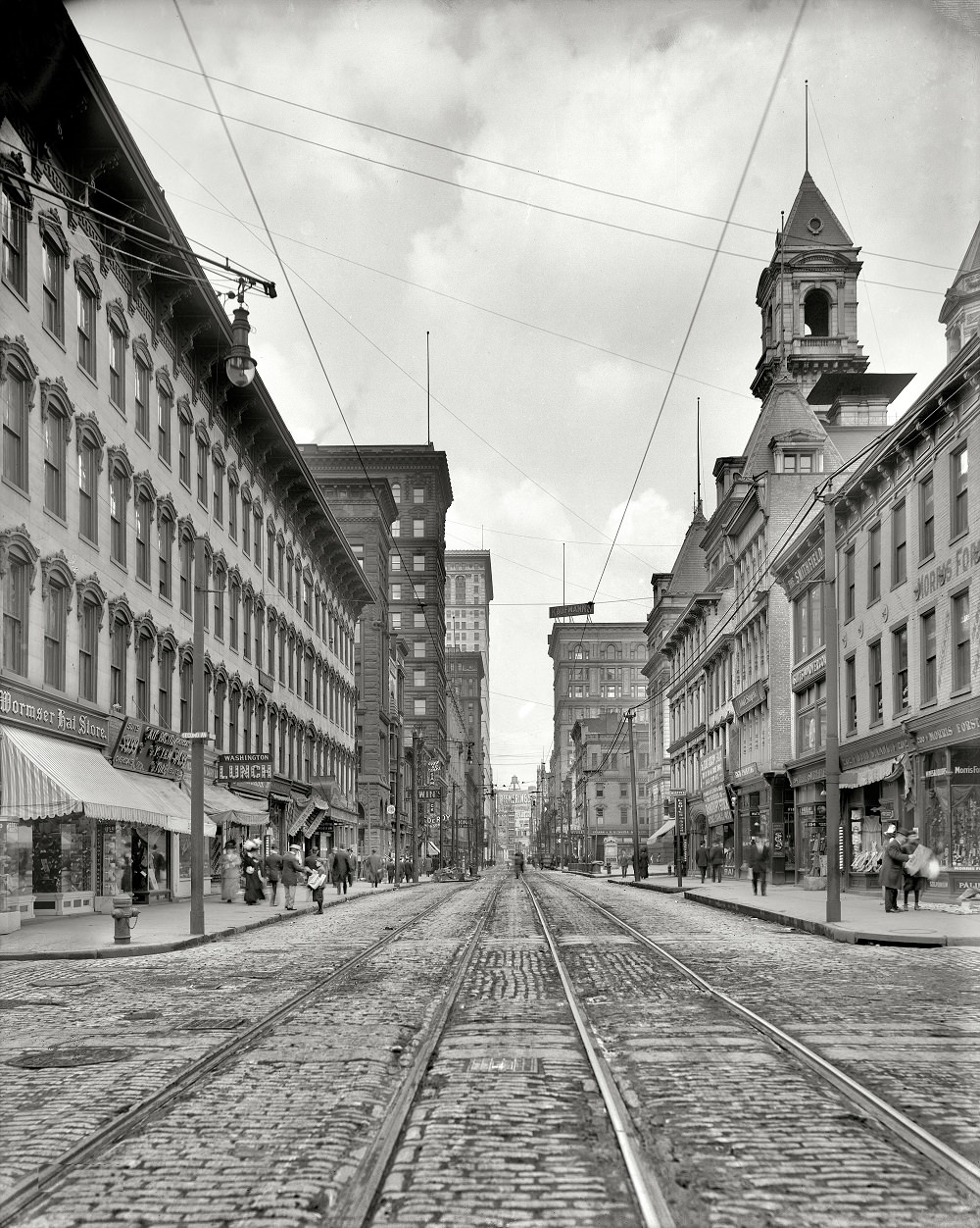
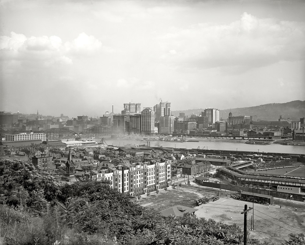
Smithfield Street and the Post Office, Pittsburgh, Pennsylvania, 1908
Pittsburgh waterfront, Allegheny River, 1910

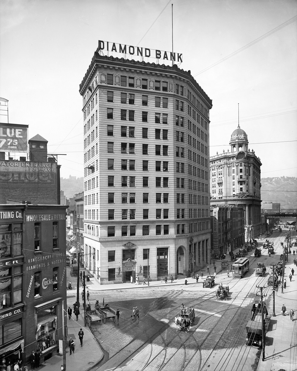
The Wabash Station and the Diamond Bank on Penn Avenue were landmarks of Pittsburgh’s early 20th-century downtown. The Wabash Terminal, opened in 1904, was a striking Beaux-Arts structure that served passengers on the Wabash Railroad until the line ceased operations in Pittsburgh.
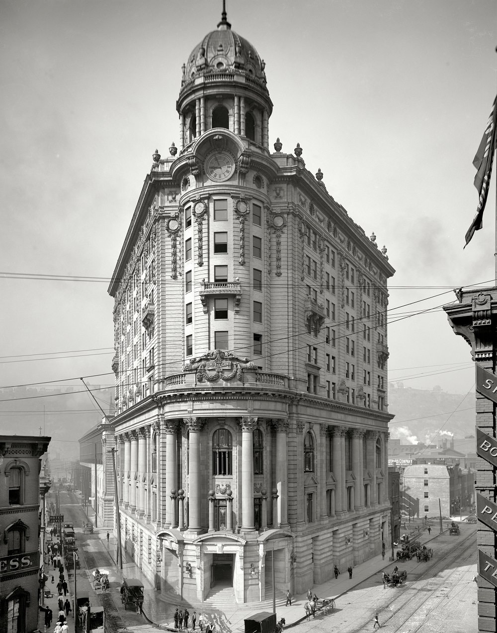
Wabash Station, Pittsburgh, Pennsylvania, 1905
Diamond Bank and Wabash Terminal, Pittsburgh, Pennsylvania, July 1909
T.J. Keenan Building, Tenth Floor, Pittsburgh, 1907

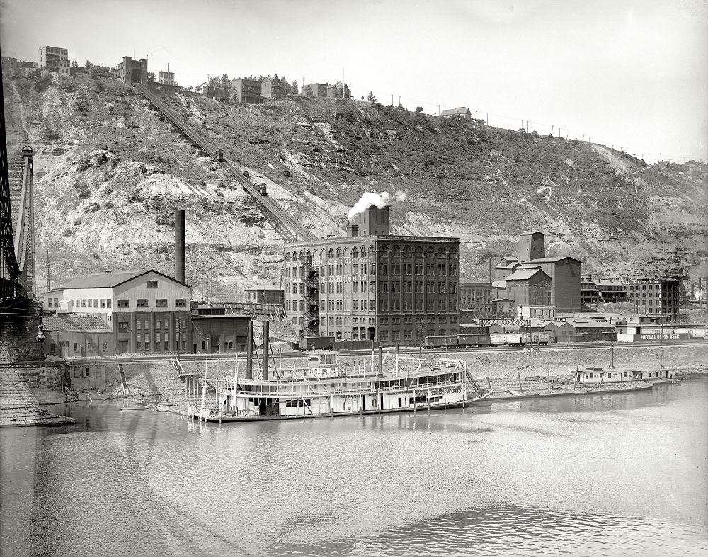
The Monongahela Incline, opened in 1870, carried passengers up the steep face of Mount Washington. By 1905, it was a well-established part of daily life for residents who lived on the hillside and worked in the valleys below. The Duquesne Incline operated on a nearby slope and offered views that stretched to the Ohio River and the Point Bridge.
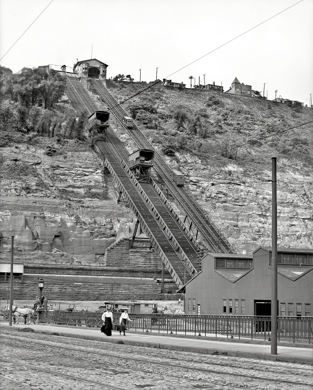
Monongahela Incline up Mount Washington, Pittsburgh, 1905
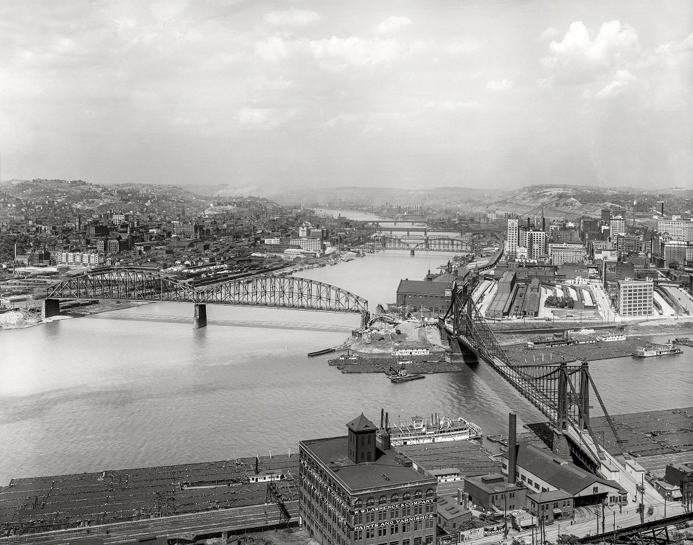
Duquesne Incline Railway. Mount Washington and the Ohio River feature in this view, which includes the Point Bridge, a paint and varnish factory, a riverboat and the Graham Nut Company, Pittsburgh, Pennsylvania, circa 1900-1910

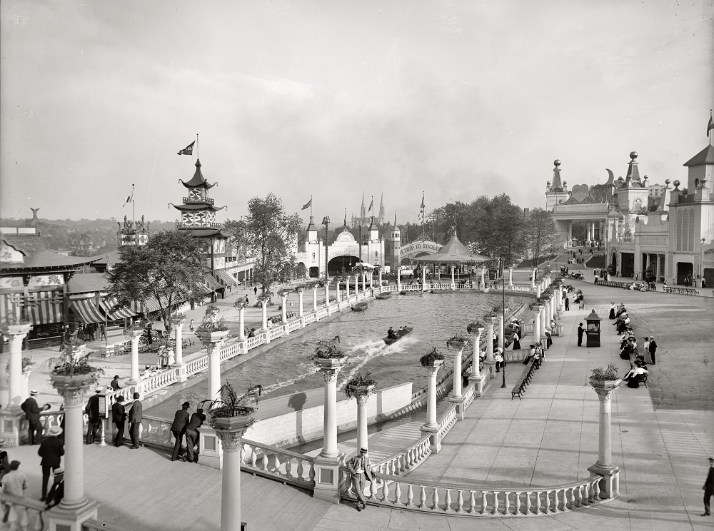
Luna Park was Pittsburgh’s major amusement park in the early 1900s. Located in the Schenley Farms area, it featured rides, lights, and attractions that drew crowds looking for entertainment away from the mills and factories. Its entrance was a well-known landmark in the city.
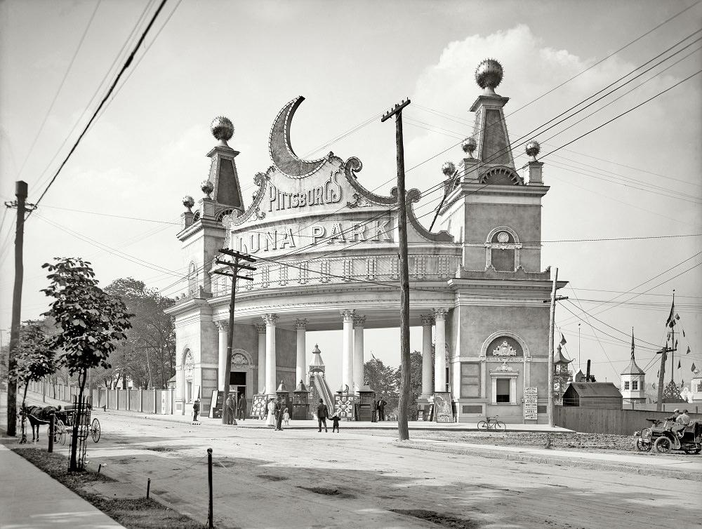
Entrance to Luna Park, Pittsburg, 1905
Luna Park, Pittsburg, 1905

The Pittsburgh waterfront along both rivers in 1936 still showed the full scale of the city’s river commerce. Barges, bridges, and industrial facilities lined the banks, and the confluence at the Point remained a center of activity decades after it had first driven the city’s growth.
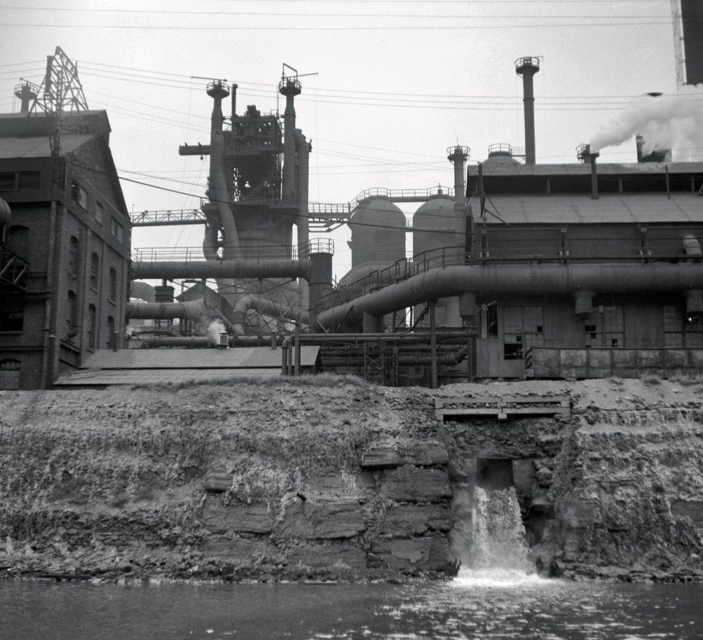
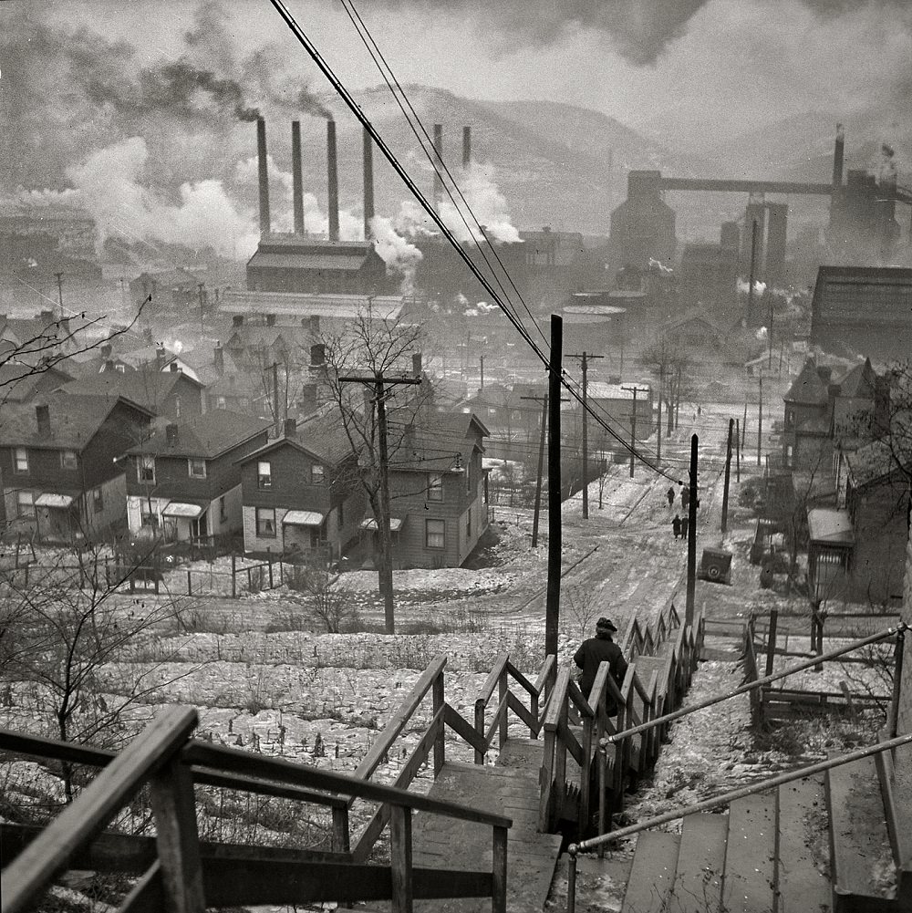
Pittsburgh waterfront, Monongahela and Allegheny Rivers, September 1936
Long stairway in mill district of Pittsburgh, Pennsylvania, January 1941

Union Station, photographed in 1902 by the Detroit Publishing Company, was a grand gateway into Pittsburgh for rail travelers. The Alvin Theatre on Fifth Avenue offered live performances and was one of several entertainment venues that gave the city a cultural life beyond its industrial identity.
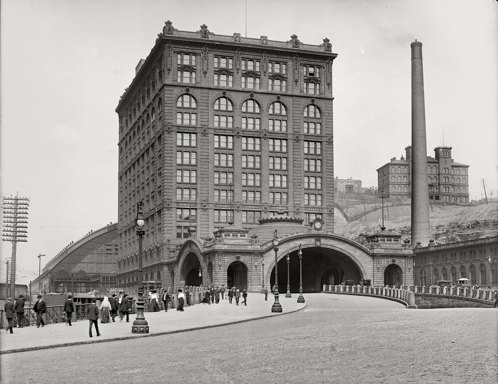
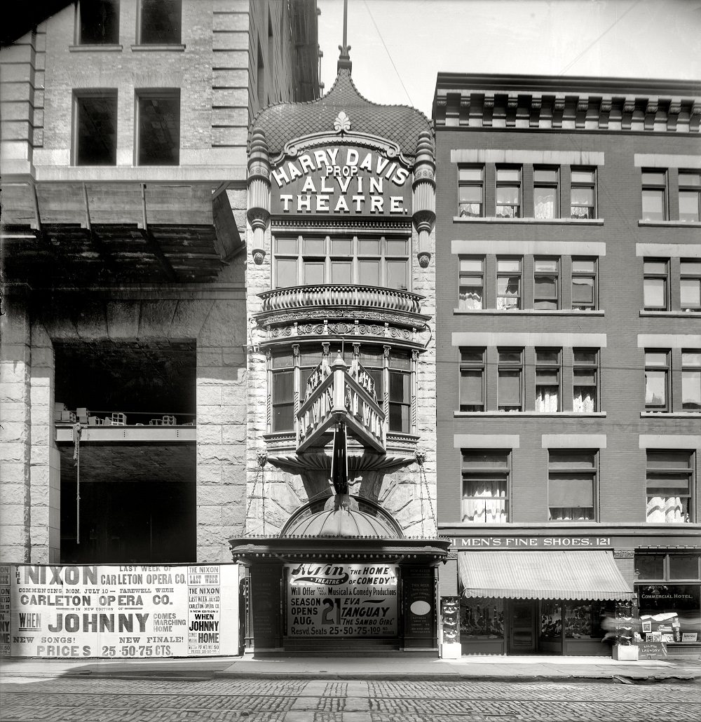
Union Station, Pittsburgh, Detroit Publishing Co, 1902
Alvin Theatre, Pittsburgh, 1905
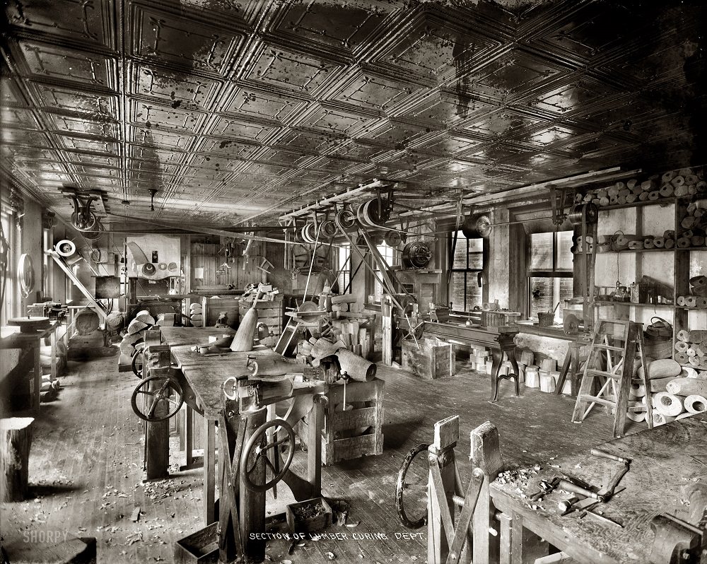
Section of lumber curing departmentm 1916

Research and industry overlapped in Pittsburgh in ways that shaped the broader American economy. Dr. Walter F. Rittman’s gasoline plant, photographed in 1915, represented the kind of applied science that refined the petroleum refining process at a time when the automobile industry was just beginning to transform American life.
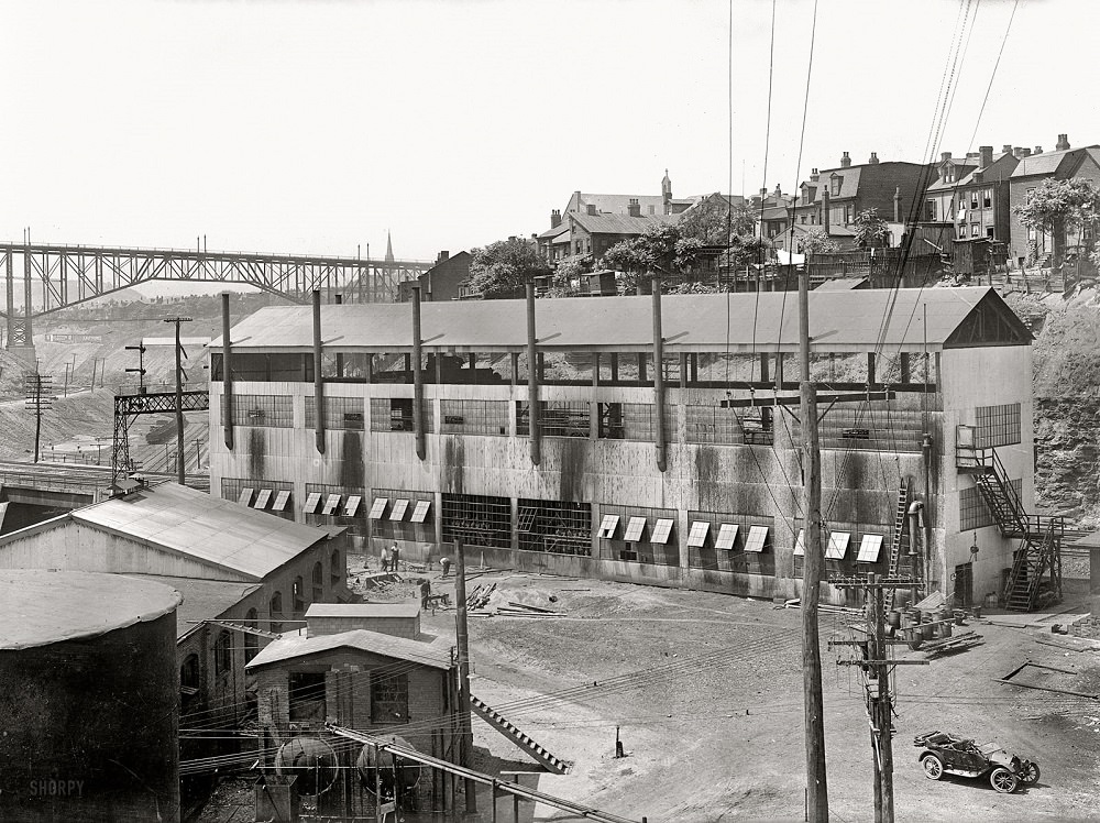
Dr. Walter F. Rittman. Gasoline plant at Pittsburg, 1915
Its Raining, Pittsburgh, Pennsylvania, June 1941

World War II brought military service into Pittsburgh homes directly. Navy Radioman John Marshall Evans and Sergeant French L, photographed in August 1942, represent the thousands of Pittsburgh men who left the mills and factories behind to serve in the armed forces during the war.
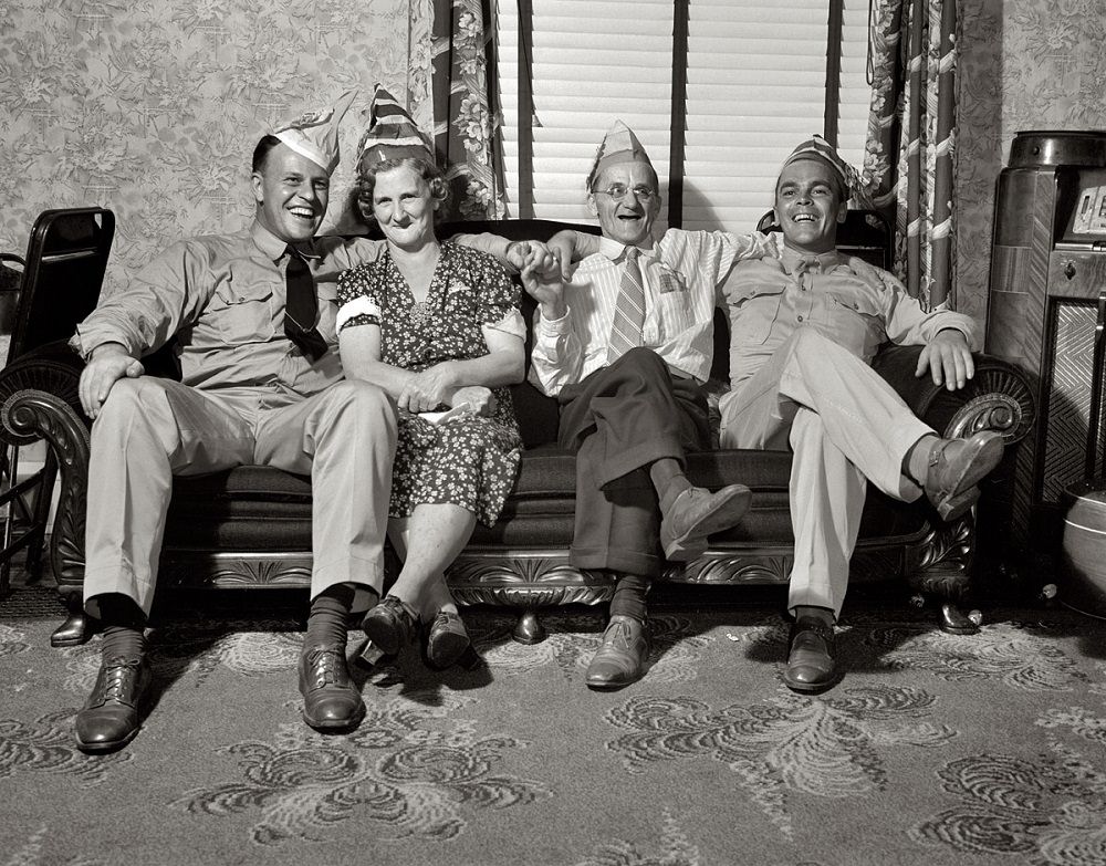
The comforts of home looked pretty good to Navy Radioman John Marshall Evans and Sergeant French L, Pittsburgh, August 1942

Pennsylvania Avenue’s commercial life was anchored by stores like Joseph Horne’s, one of Pittsburgh’s major department stores in the early 20th century. The intersection shown in a 1912 photograph captures the energy of a city at full stride — trolley lines, storefronts, and a skyline that was still pushing upward.
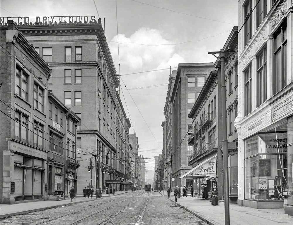

Pennsylvania Avenue and Joseph Horne's store, Pittsburgh, 1912
Pennsylvania Avenue and Joseph Horne’s store, Pittsburgh, 1912
Enjoyed this post? Get new ones in your inbox.

Leave a Comment

Your email address will not be published. Required fields are marked *

11 Comments

Share this Post 🥺

Please take a moment to share this content. Your support is greatly appreciated! 🙌🙏

Share this Post 🥺

Please take a moment to share this content. Your support is greatly appreciated! 🙌🙏
Scroll to Top
 
Hey Friend, Before You Go.. Please like & follow for more interesting content