
Richmond, Virginia, was founded in 1737 at the falls of the James River. It grew quickly into one of the most important cities in the American South. By the mid-19th century, it was a heavily industrialized hub filled with woolen mills, tobacco and cotton warehouses, and iron factories. When the Civil War broke out, Richmond became the capital of the Confederacy — a role that would shape its identity for generations. By the 1880s, Richmond had a population of over 60,000 people. The city was also home to a major transportation milestone: in January 1888, Richmond launched the first successful electrically powered trolley line in the United States, replacing the horse-drawn streetcars that had come before. By the early 1900s, an extensive electric streetcar network crisscrossed the city. In 1914, Richmond became the headquarters of the Fifth Federal Reserve District. When the Great Depression hit, the tobacco industry helped carry the city through its hardest years. The photographs below capture Richmond during two distinct eras — the immediate aftermath of the Civil War in 1865, and the bustling urban growth of the late 19th and early 20th centuries. Together, they offer a rare window into a city that was simultaneously rebuilding from war and racing toward modernity.
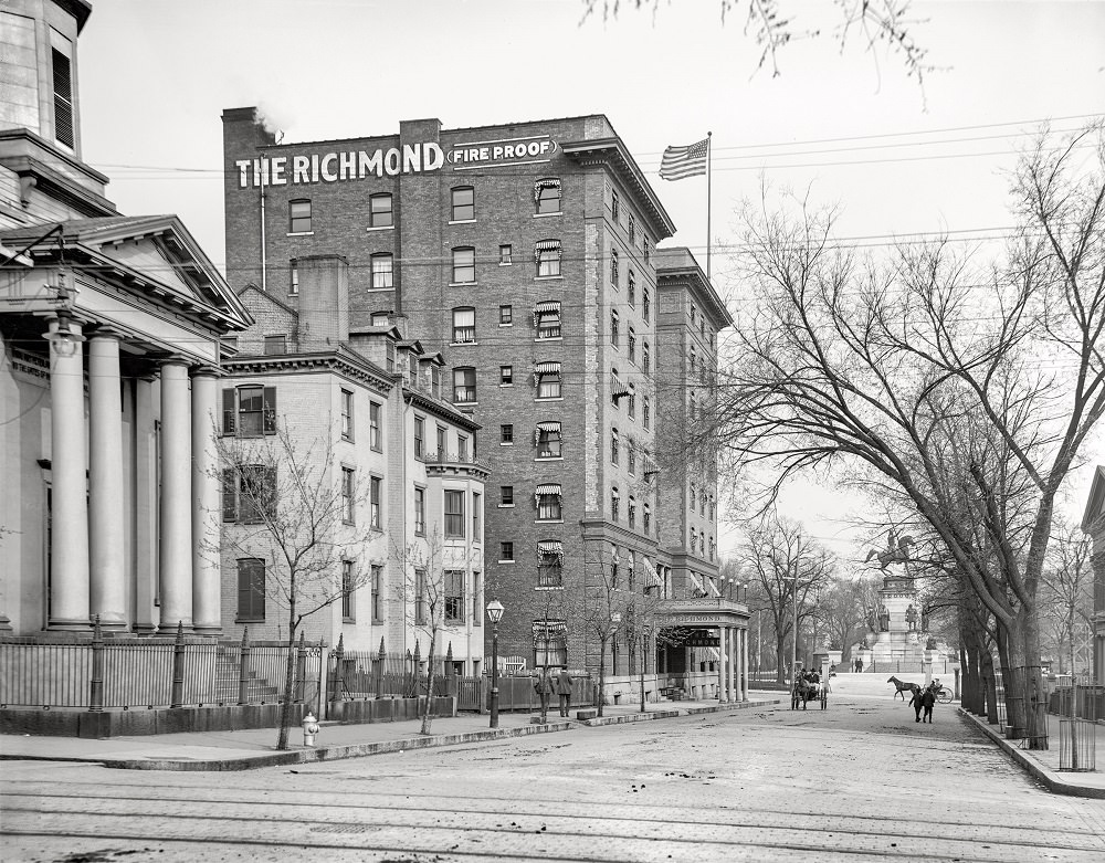
Grace Street was one of Richmond’s most recognizable thoroughfares in the early 1900s. Looking east from 8th Street toward Capitol Square, the scene reflects a city that had firmly reestablished itself as Virginia’s political and commercial center. Electric streetcar lines ran through these streets, connecting neighborhoods across the city.
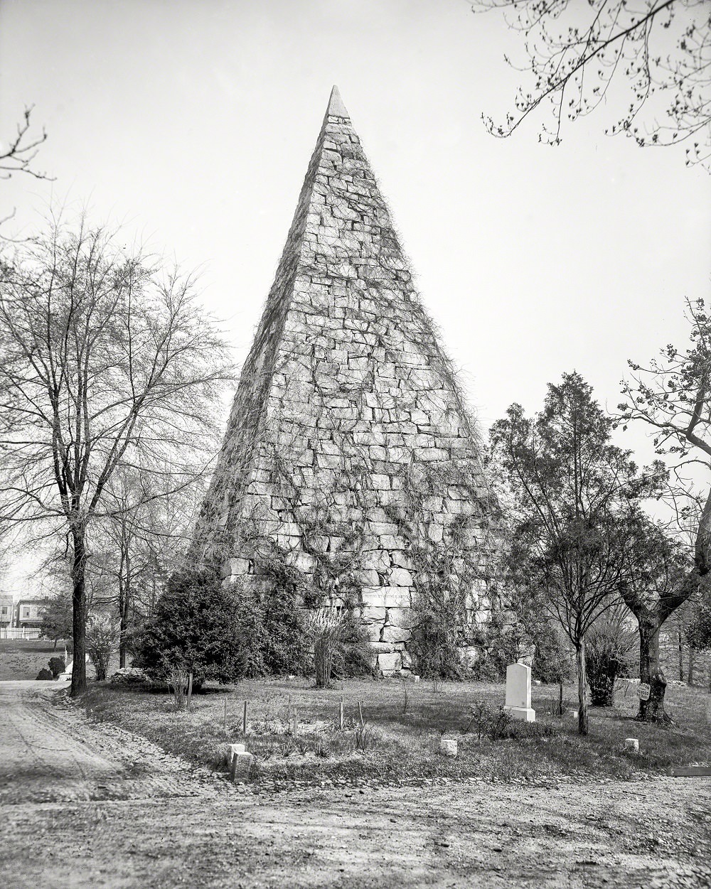
Hollywood Cemetery, established in 1847 along the banks of the James River, became the final resting place for thousands of Confederate soldiers. The Ladies Hollywood Memorial Association worked for decades to honor those dead with monuments and organized commemorations. The cemetery also holds the graves of two U.S. presidents — James Monroe and John Tyler.
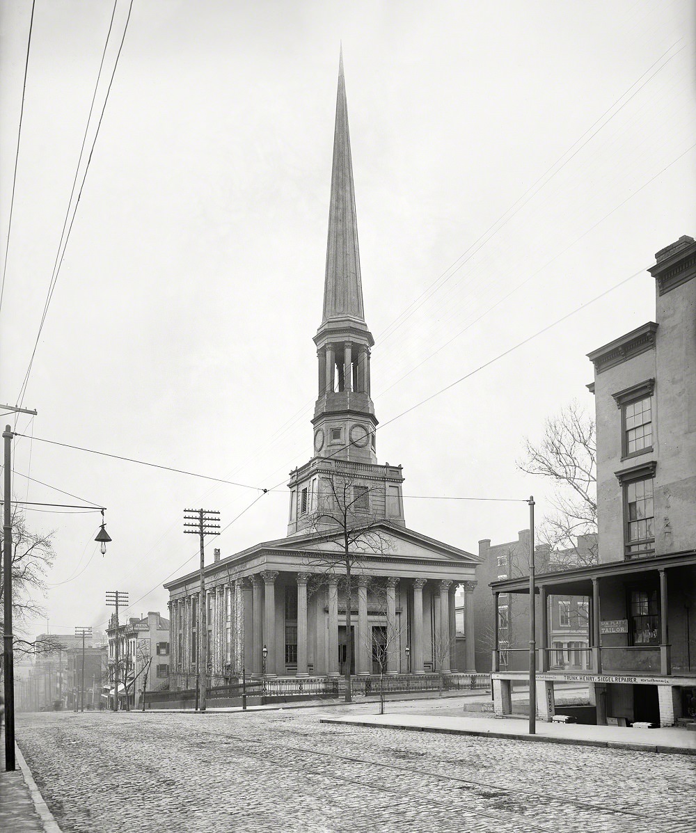
St. Paul’s Episcopal Church at Ninth and Grace Streets was one of Richmond’s most prominent houses of worship. Built in 1845, it sat directly across from Capitol Square. During the Civil War, Confederate President Jefferson Davis was attending services here on April 2, 1865, when he received word that the Confederate lines at Petersburg had broken — the message that forced the evacuation of Richmond.
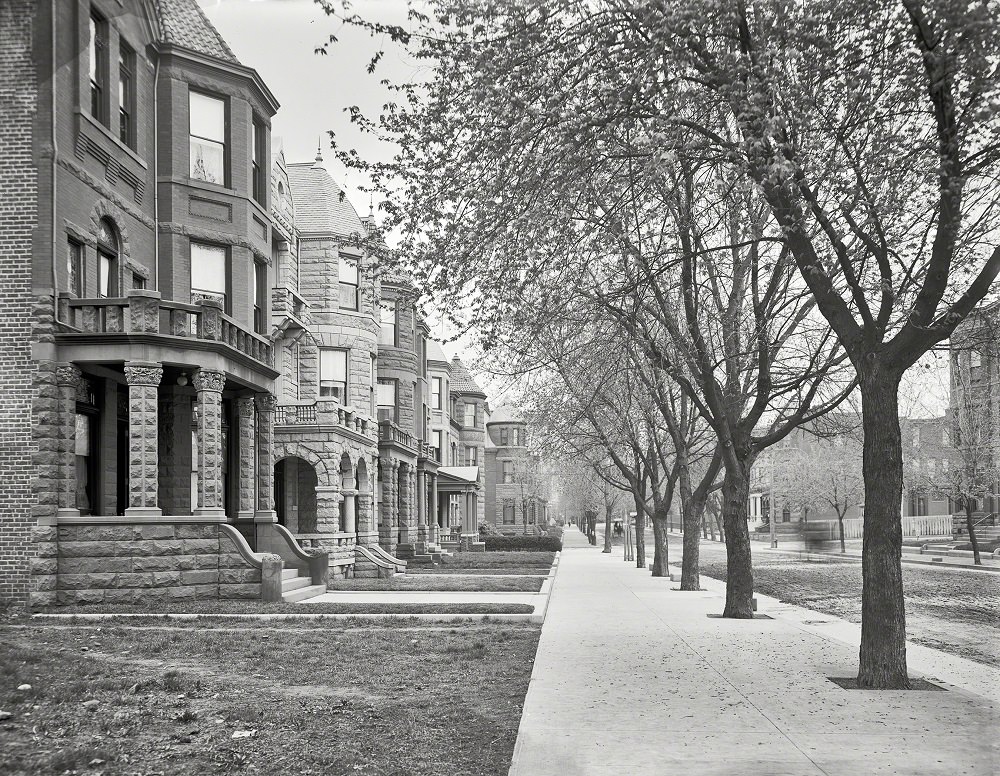
Franklin Street in 1905 showed the face of a prosperous Richmond. Tree-lined and anchored by substantial brick buildings, it was a street of merchants, professionals, and civic institutions. The architecture along Franklin reflected the confidence of a city that had moved well past the destruction of the Civil War.
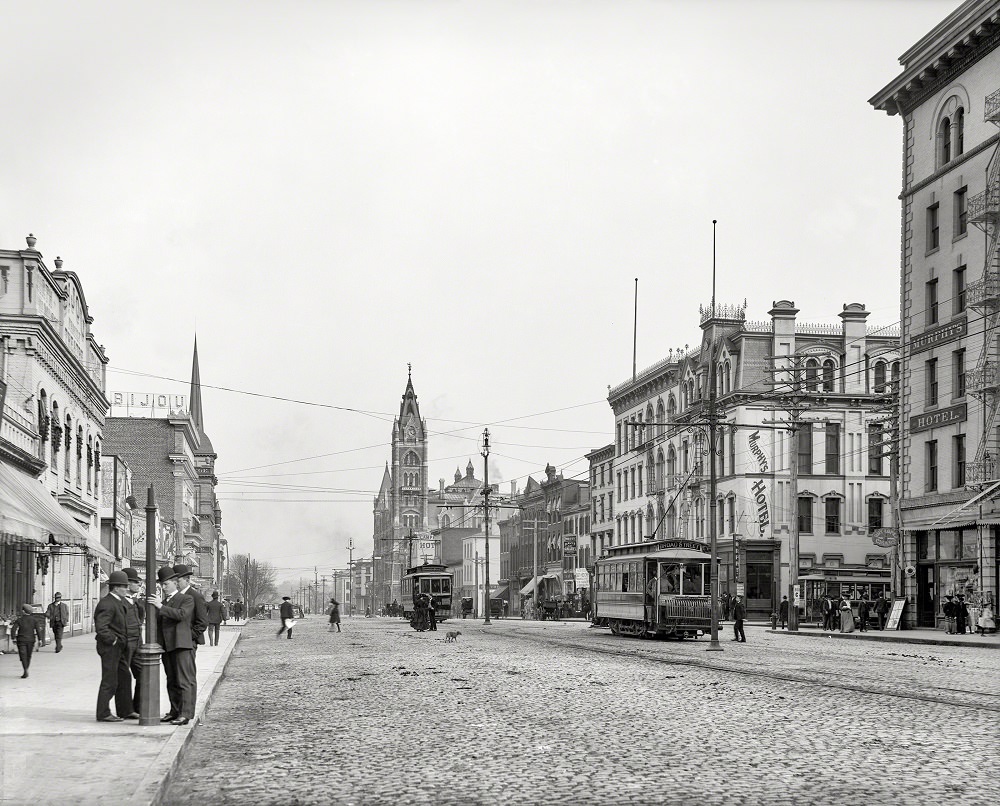
Broad Street was Richmond’s main commercial artery. Murphy’s Hotel stood as one of the city’s well-known lodging spots for travelers and businessmen passing through the capital. Electric streetcars shared the road with horse-drawn wagons, a common sight in American cities during this transitional period.
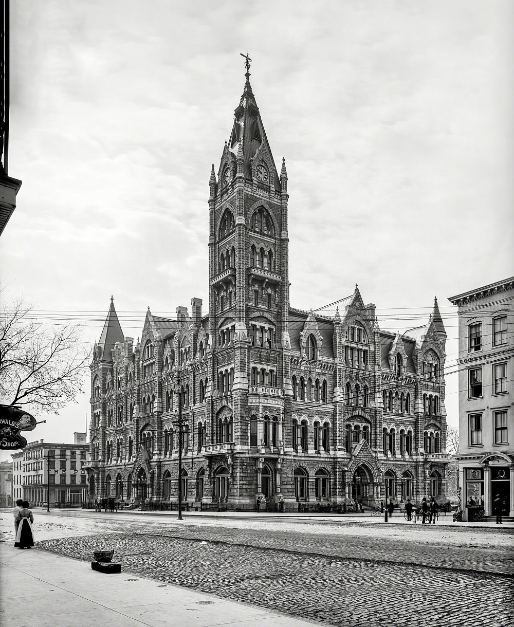
Richmond’s City Hall, photographed in 1905, was a Gothic Revival building completed in 1894. It replaced an earlier structure and stood as a symbol of the city’s civic ambitions. Its tall tower was a recognizable part of the Richmond skyline for decades.
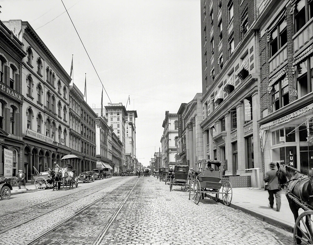
Main Street was the backbone of Richmond’s business district. Looking west from Twelfth Street around 1912, the scene captures a city in full commercial stride — storefronts, foot traffic, and the overhead wires of the electric streetcar system all visible in a single frame.
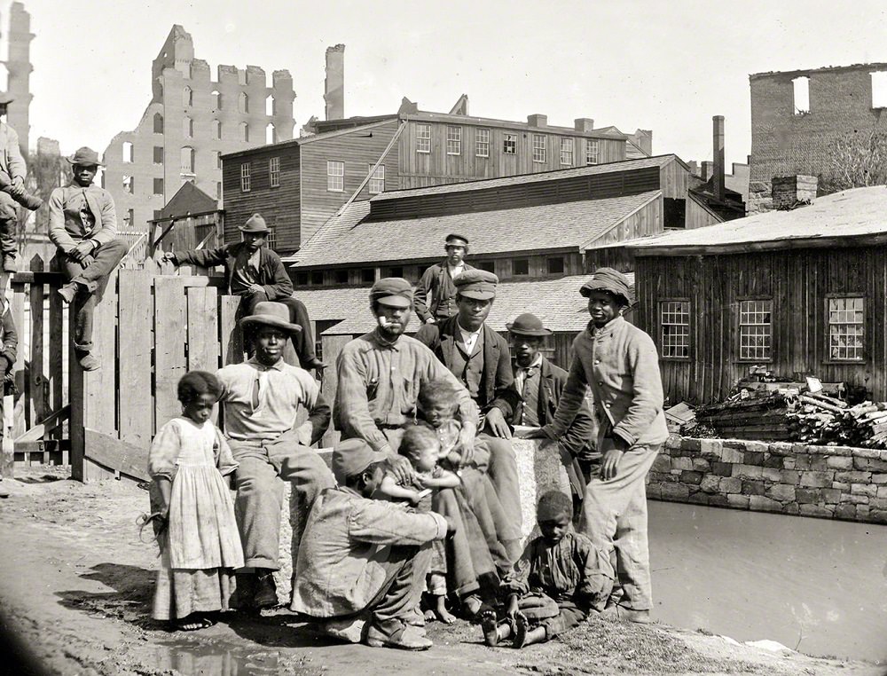
In the immediate weeks after the fall of Richmond in April 1865, formerly enslaved people — called “contrabands” under wartime Union policy — gathered in the city in large numbers. This photograph from June 9, 1865, shows a group of freedmen near the canal at Haxall’s Mill, one of Richmond’s major flour-milling operations along the James River. The end of the war brought enormous uncertainty alongside freedom, as thousands of Black Richmonders navigated a completely transformed legal and social landscape.
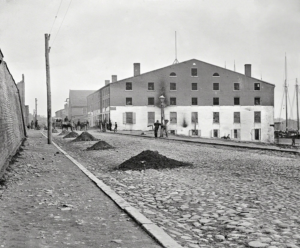
Libby Prison was a converted tobacco warehouse on Cary Street that the Confederacy used to hold captured Union officers during the war. Conditions inside were notoriously brutal — overcrowded, poorly ventilated, and chronically short of food and medicine. By the time Union forces entered Richmond in April 1865, Libby had become one of the most infamous symbols of Confederate prisoner treatment.
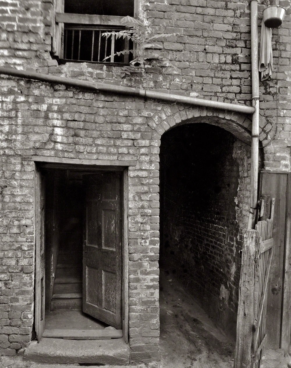
Edgar Allan Poe had deep ties to Richmond. His mother, the actress Eliza Poe, died in Richmond in 1811 when Poe was just two years old. He was subsequently taken in — though never formally adopted — by John and Frances Allan of Richmond, whose city shaped much of his early life. The house associated with his mother remained a point of historical interest well into the 20th century, as seen in this 1930 photograph.
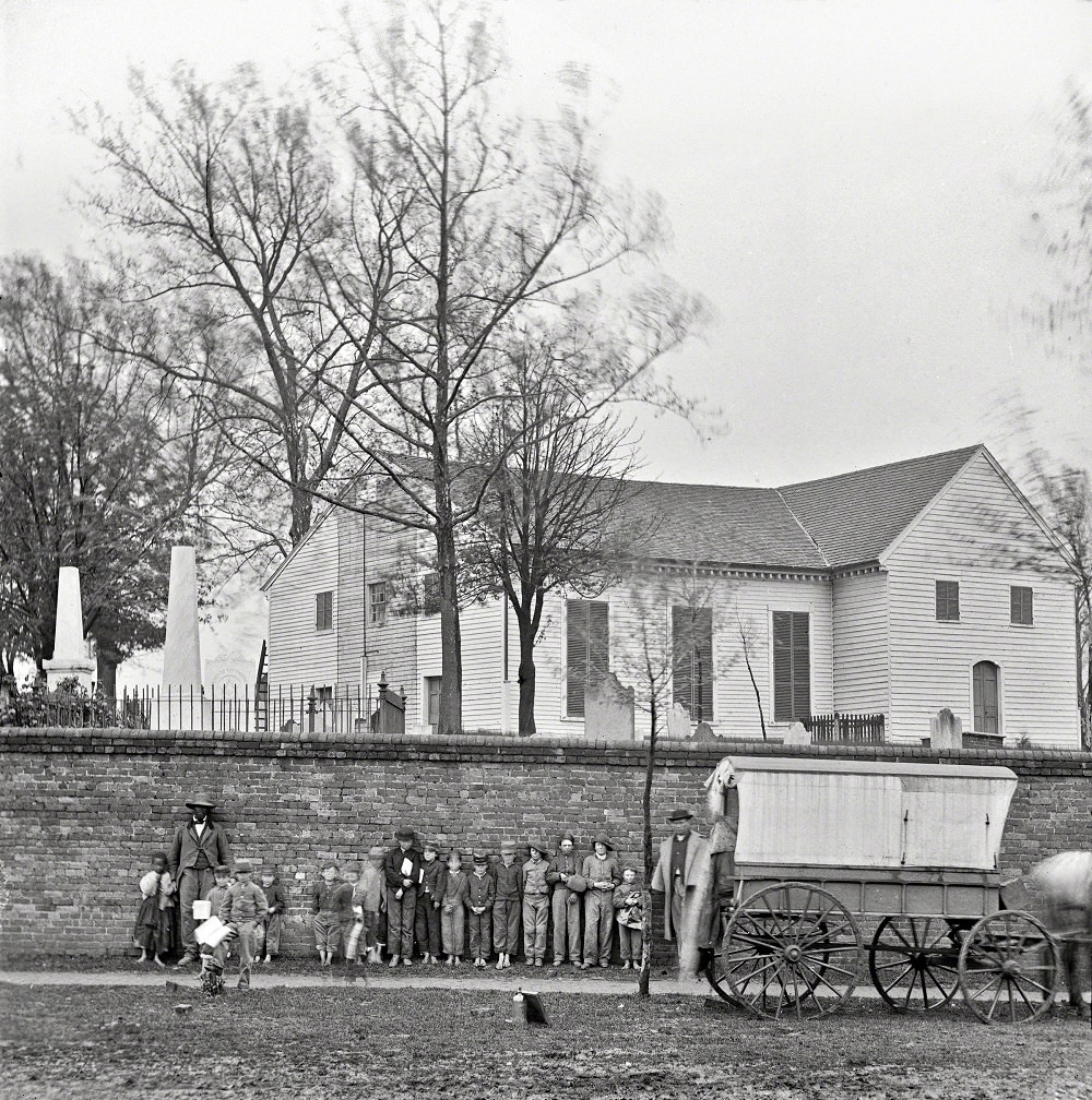
St. John’s Church, built in 1741, is one of the oldest standing structures in Richmond. It is the site where Patrick Henry delivered his famous “Give me liberty, or give me death” speech to the Second Virginia Convention in March 1775. By the time Union photographers captured this image in the spring of 1865, the church and its surrounding graveyard had stood through nearly 125 years of American history.
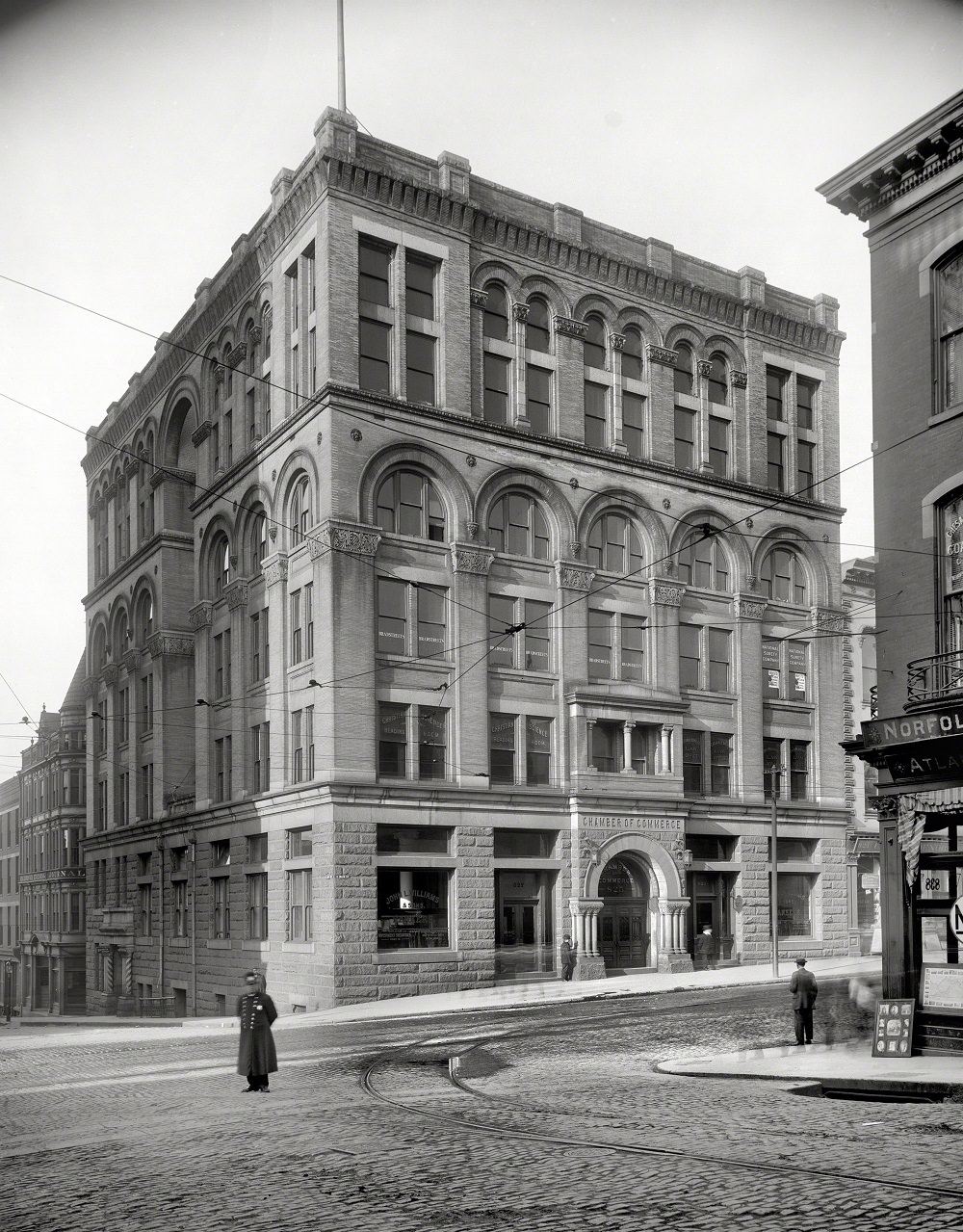
Richmond’s Chamber of Commerce building represented the city’s organized business community in the early 20th century. As tobacco manufacturing and banking grew in importance, the Chamber played a central role in shaping the city’s commercial policy and attracting outside investment.
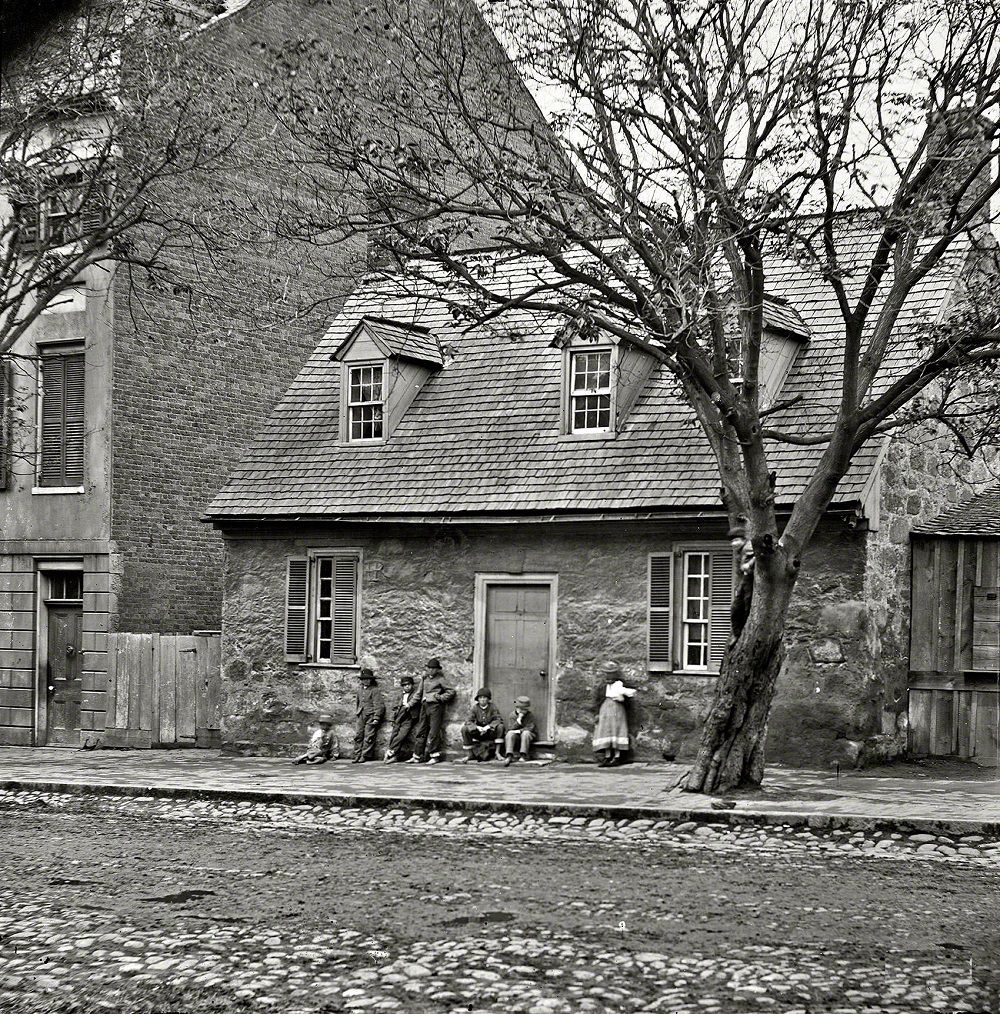
The Old Stone House on East Main Street is believed to be the oldest standing structure in Richmond, dating to around 1737. It earned the popular nickname “Washington’s Headquarters” from a local tradition that George Washington used it as a base during one of his visits, though the historical evidence for that claim is thin. The building later became the Edgar Allan Poe Museum.
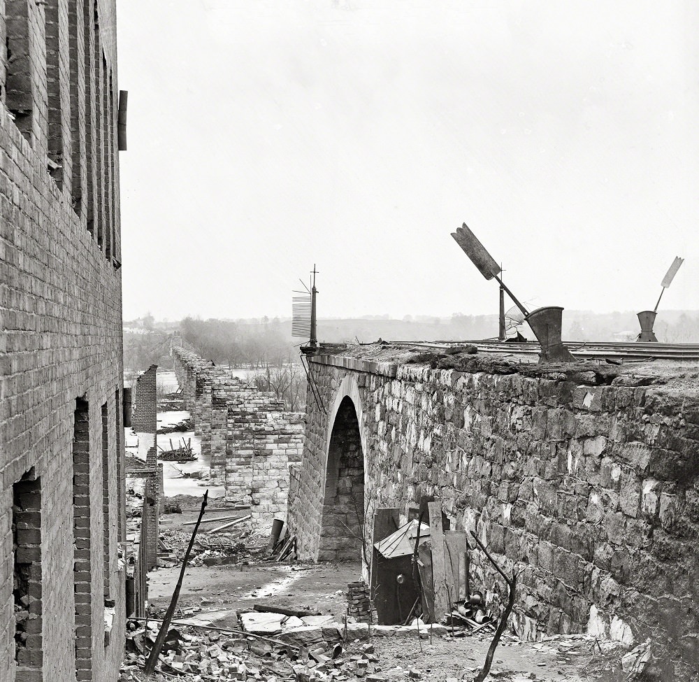
As Confederate forces abandoned Richmond on the night of April 2–3, 1865, they destroyed bridges and warehouses to prevent Union forces from using them. The Richmond & Petersburg Railroad bridge was among those demolished. Union photographers arrived within days to document the scale of the destruction — twisted iron and collapsed masonry left along the James River.
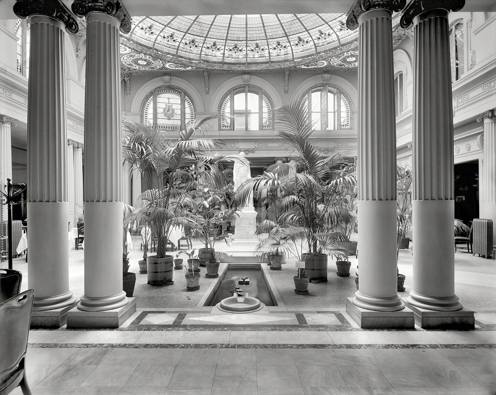
The Jefferson Hotel, which opened in 1895, was Richmond’s grandest lodging establishment. Its interior featured a famous palm court — sometimes called the Japanese Palm Garden — with live alligators kept in the fountain as a novelty attraction. The hotel drew wealthy guests and visiting dignitaries and stood as a marker of Richmond’s ambitions as a modern Southern city.
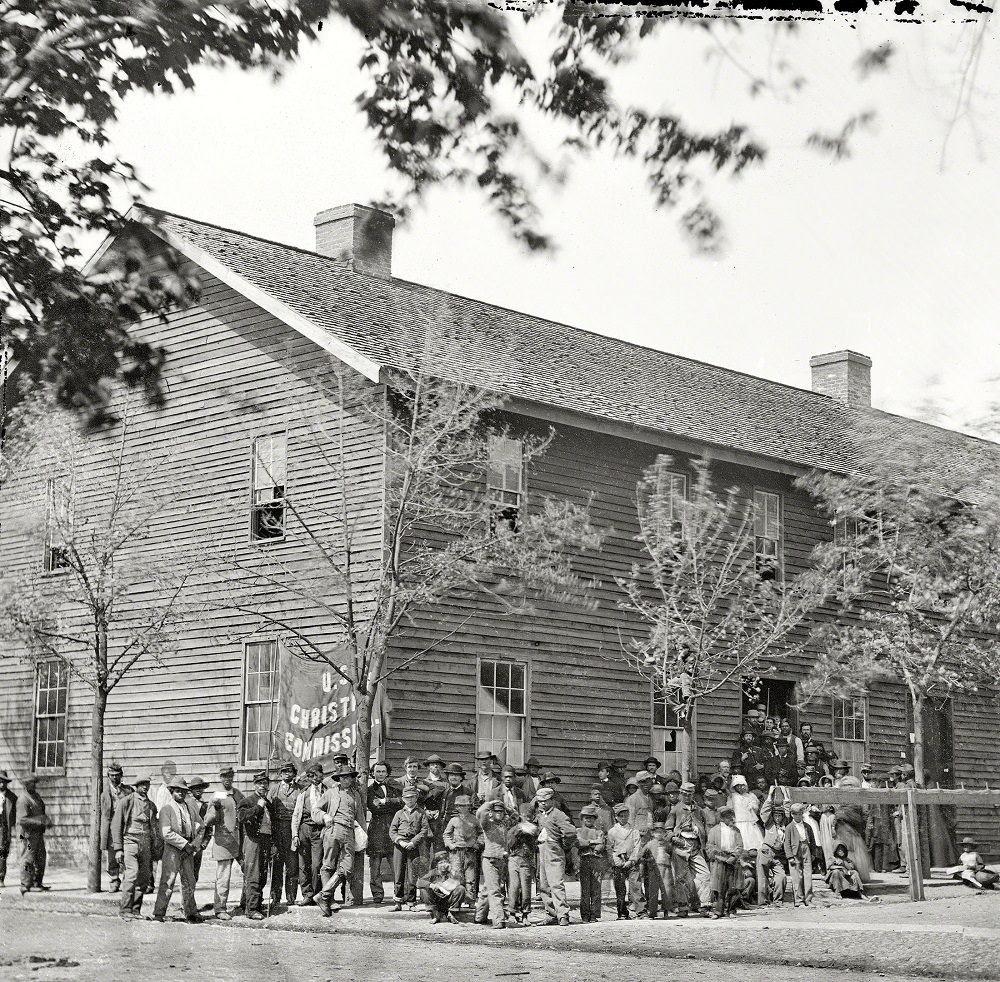
The U.S. Christian Commission was a civilian organization that provided aid — food, medicine, and religious materials — to Union soldiers and, after the war’s end, to freed people and displaced civilians. This April 1865 photograph shows a crowd gathered outside the commission’s Richmond headquarters, reflecting the enormous humanitarian needs that came with the city’s sudden transition from Confederate capital to occupied city.
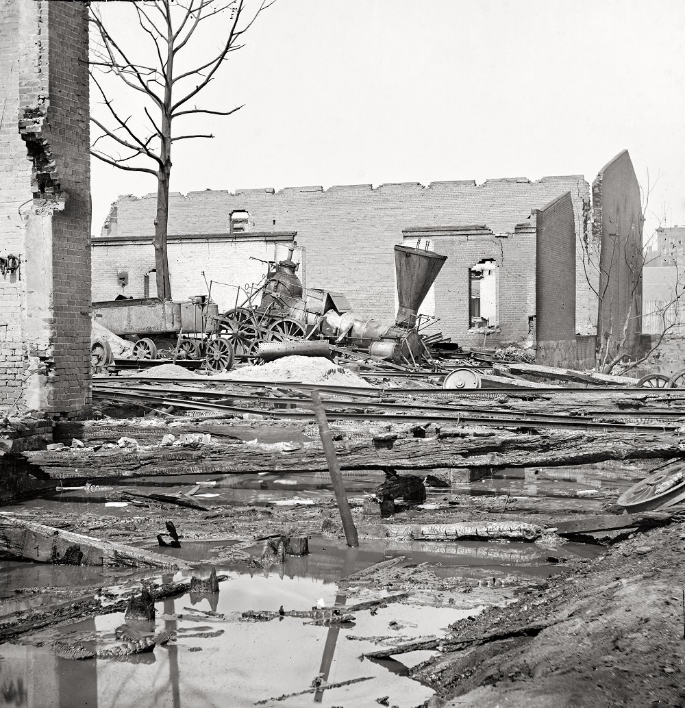
Alongside the bridge, retreating Confederate forces destroyed rolling stock and rail equipment to deny the Union army usable infrastructure. This photograph of a wrecked Richmond & Petersburg locomotive captures the deliberate destruction that defined Richmond’s final hours as the Confederate capital.
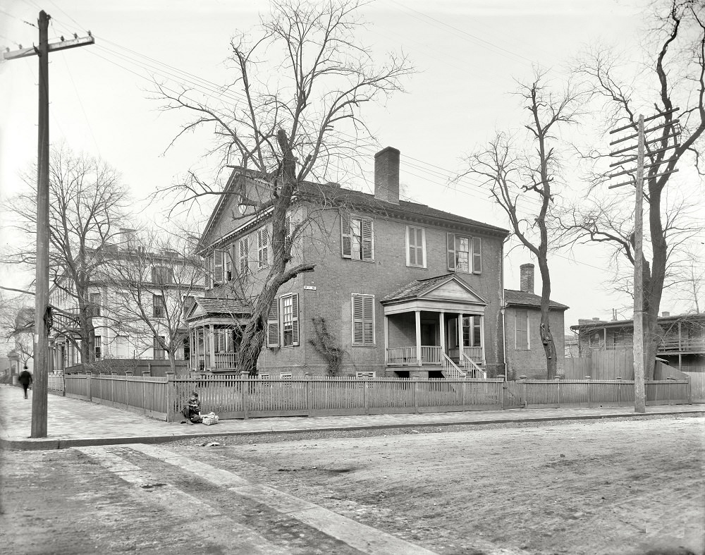
John Marshall served as Chief Justice of the United States from 1801 to 1835, making him the longest-serving chief justice in the Court’s history. His Richmond home, built in 1790, stood as a well-preserved landmark by the time this photograph was taken in 1906. Marshall’s decisions fundamentally shaped the power and structure of the federal judiciary.
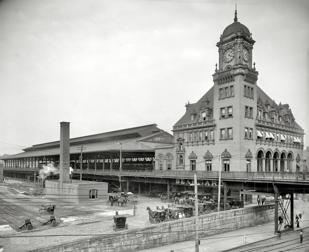
Main Street Station opened in 1901 and quickly became one of Richmond’s most distinctive landmarks. Its Flemish Renaissance Revival architecture and prominent clock tower set it apart from the surrounding blocks. The station served rail passengers arriving from and departing to cities across the Eastern Seaboard.
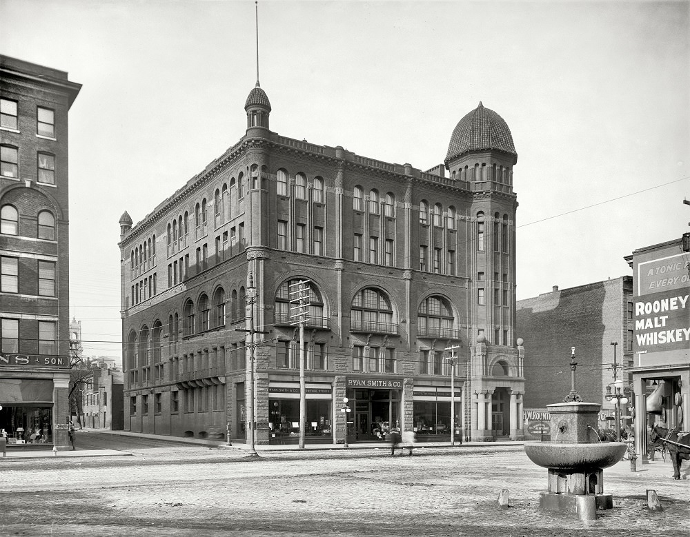
The Masonic Temple in Richmond was a substantial civic structure that hosted lodge meetings and public events. Fraternal organizations like the Masons were deeply embedded in the social and political life of Southern cities in the early 20th century, and Richmond’s temple reflected that prominence.
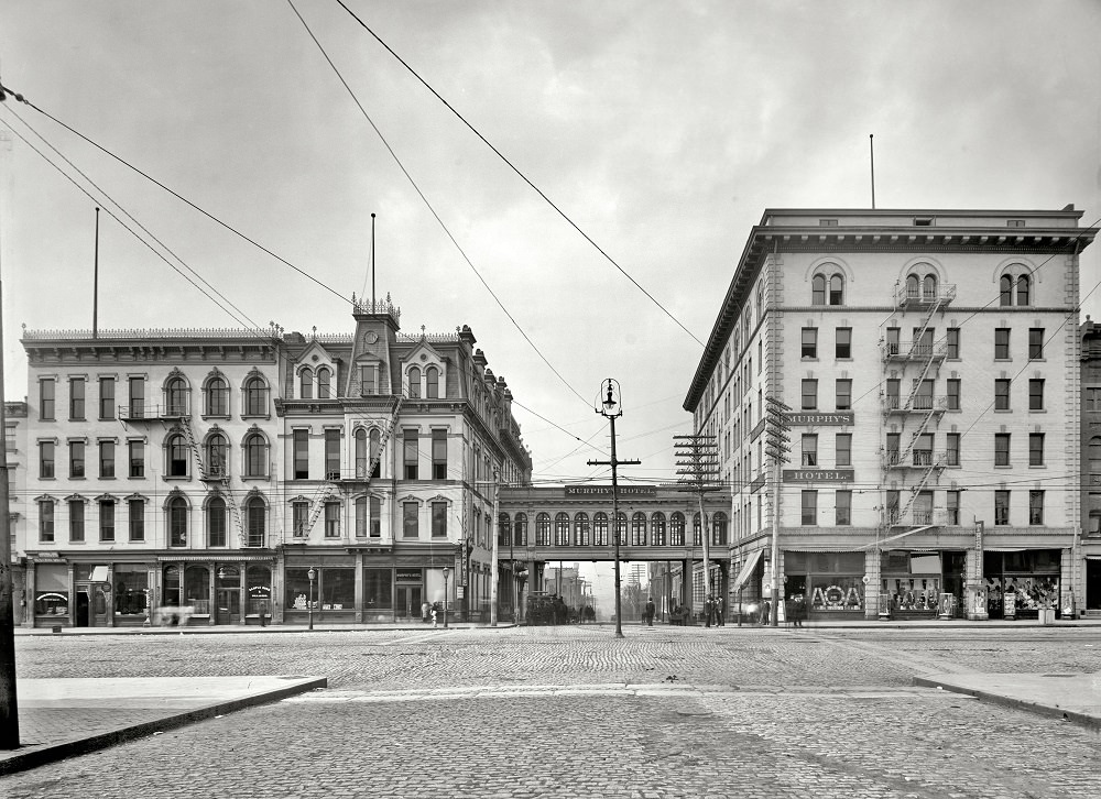
A closer view of Murphy’s Hotel shows the details of its street-level facade — signage, awnings, and the steady movement of pedestrians typical of a Richmond business day in 1905. Hotels like Murphy’s were central gathering points for the commercial and political life of the city.
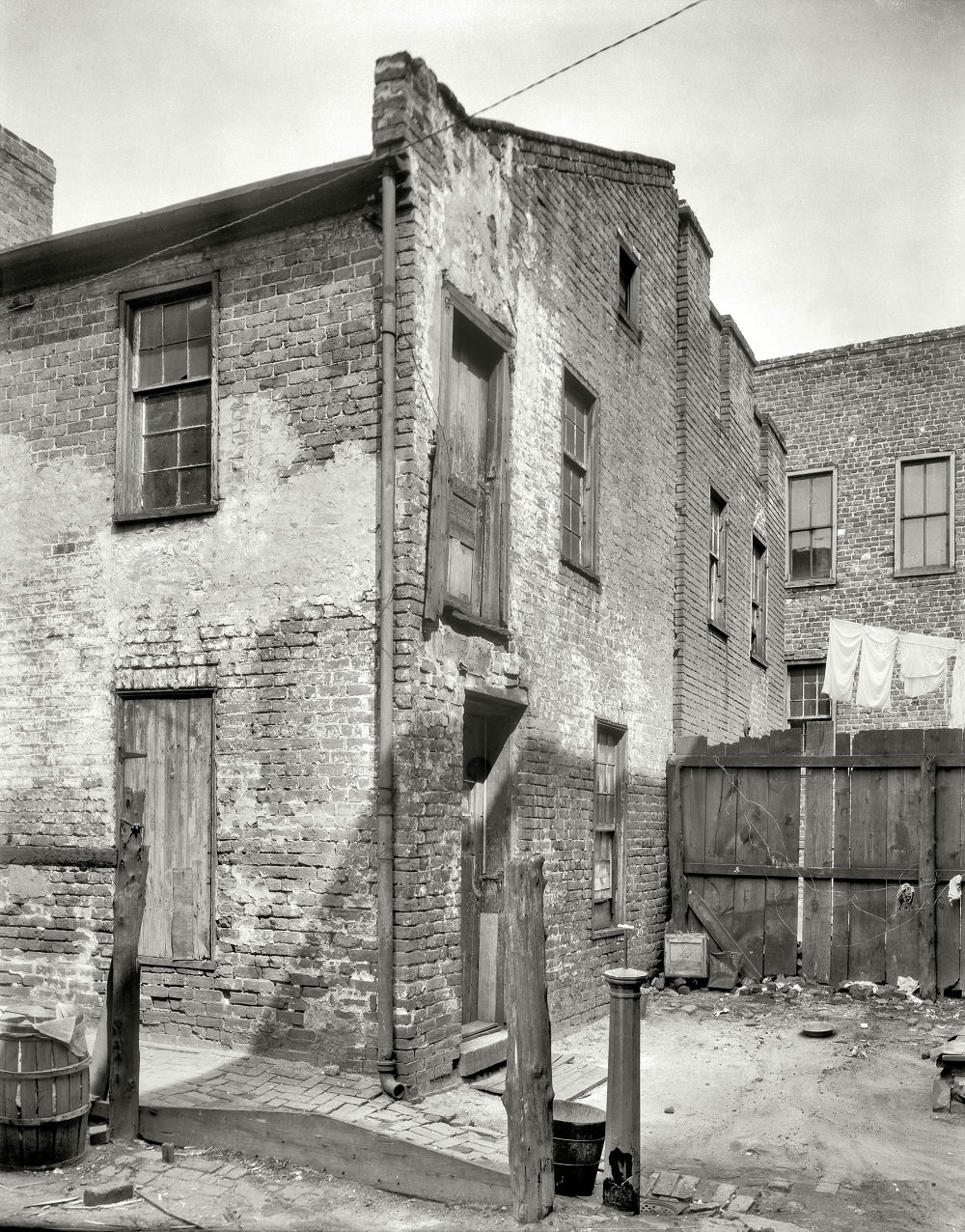
A second view of the house associated with Poe’s mother shows the structure as it appeared around 1930, preserved amid a changing urban streetscape. By this time, Richmond had fully embraced Poe as part of its historical identity, and sites connected to him drew steady public interest.
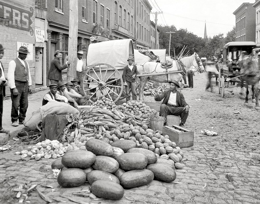
The Sixth Street Market was one of Richmond’s main public marketplaces in the early 1900s. Vendors sold produce, meat, and dry goods to residents from across the city. Open-air markets like this one were essential to daily life in urban areas before modern grocery stores became widespread.
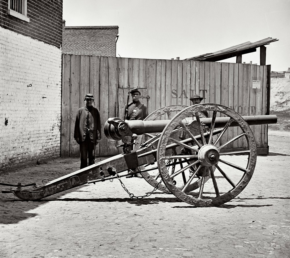
After Union forces secured Richmond, they catalogued and prepared Confederate war materiel for shipment north. This photograph shows a Federal soldier standing guard over a Whitworth gun — a British-made artillery piece prized for its accuracy — sitting on a Richmond wharf and awaiting transport. The image captures the systematic dismantling of the Confederate military apparatus in the days immediately following the war.
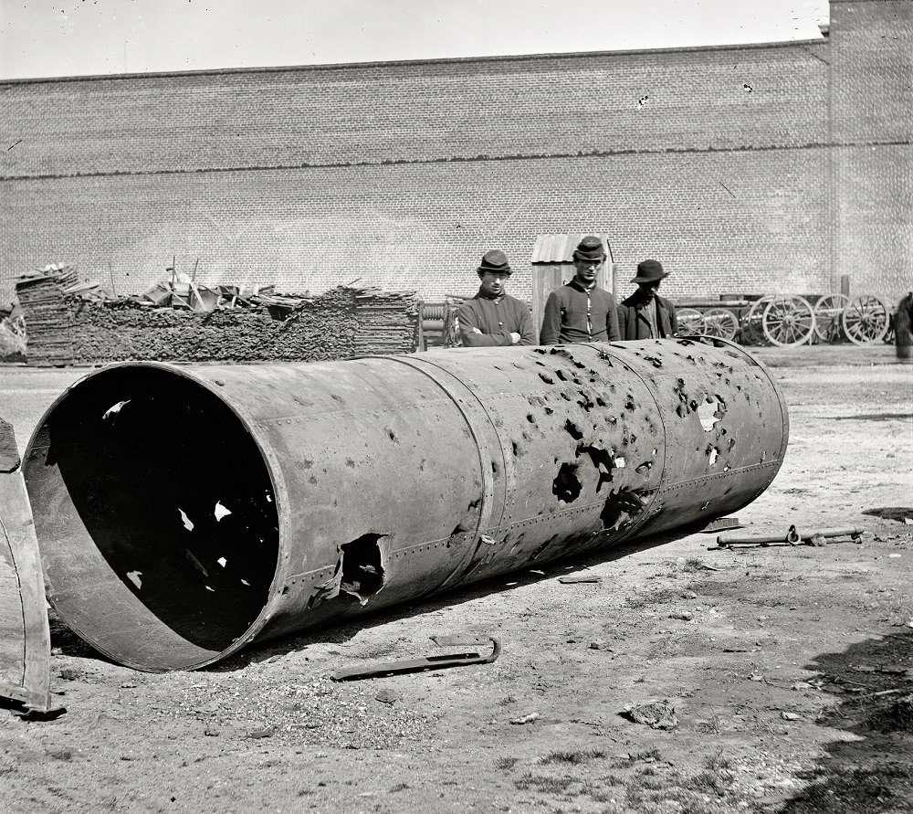
The C.S.S. Virginia No. 2 was a Confederate ironclad warship built on the James River to defend Richmond. When Confederate forces abandoned the city, the ship was scuttled and destroyed to prevent its capture. The battered smokestack left on the riverbank was all that remained when Union photographers arrived in April 1865.
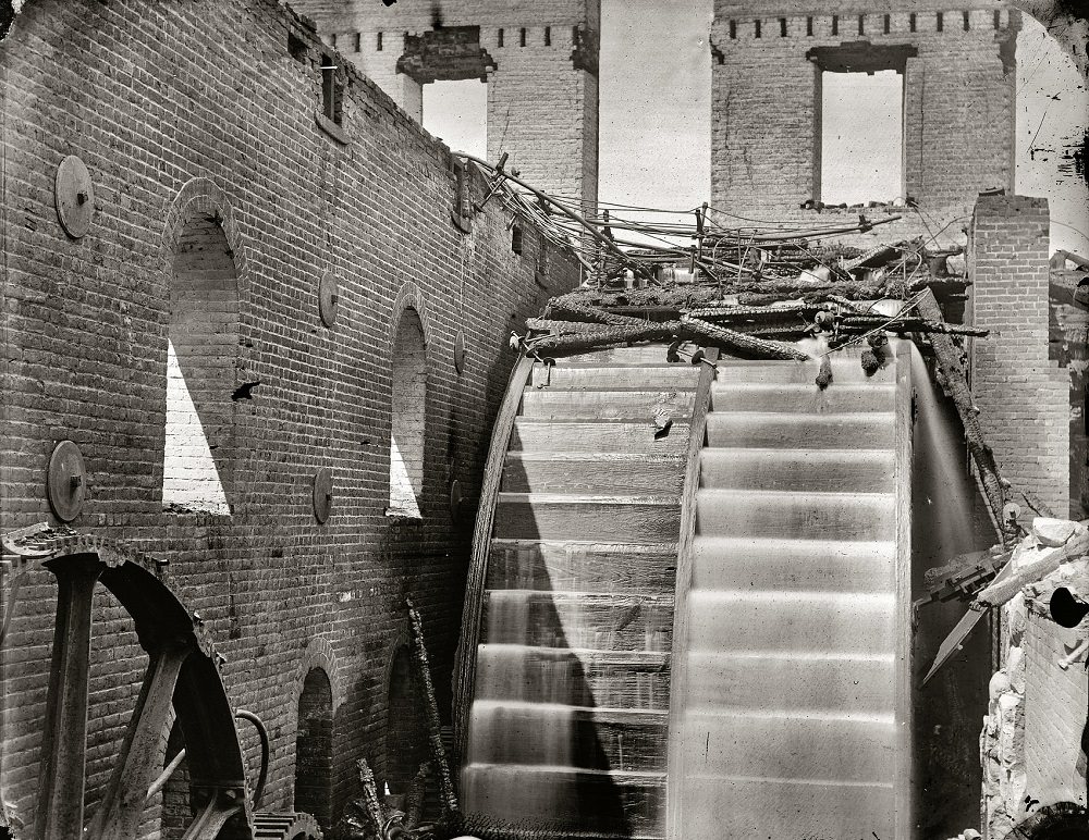
Gallego Mills was one of the largest flour mills in the world before the Civil War, a massive industrial complex on the banks of the James River. When retreating Confederate forces set fire to warehouses and supplies in April 1865, the blaze spread beyond its intended targets and consumed much of the city’s commercial district. Gallego Mills was among the casualties — reduced to skeletal brick walls and rubble.
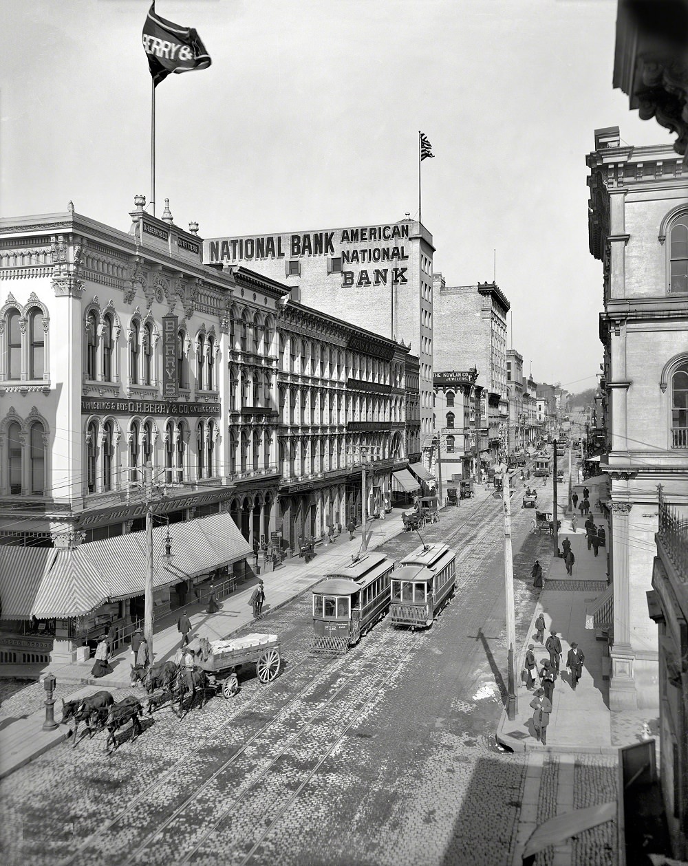
Looking along Main Street from Eleventh around 1905, Richmond’s commercial district appears fully rebuilt and active. Storefronts crowd both sides of the street, and the electric streetcar infrastructure is visible overhead. Forty years after the fires of April 1865, the district showed almost no outward trace of the destruction that had swept through it.
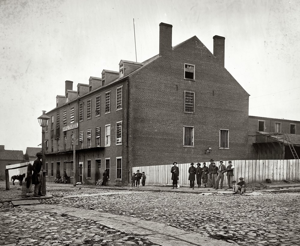
Castle Thunder was a Confederate military prison on Cary Street that held political prisoners, deserters, and civilians accused of disloyalty — a different population than the Union officers held at Libby Prison nearby. It had a reputation for harsh treatment and arbitrary punishment. After Richmond fell, Union forces used the building briefly for their own detention purposes.
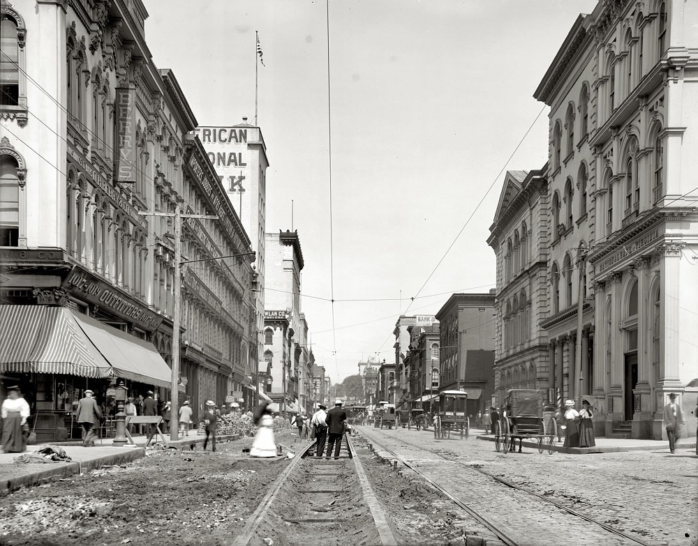
Another view of Main Street from Eleventh in 1905 shows the same bustling corridor from a slightly different vantage point. The density of signage and the pedestrian activity on the sidewalks underscore how thoroughly Richmond had rebuilt its commercial core by the early 20th century.
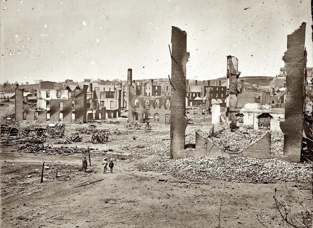
The fire that began on the night of April 2, 1865, burned through Richmond’s central business district and destroyed roughly 25 city blocks. Confederate soldiers set fire to tobacco warehouses and military supplies, but high winds spread the flames well beyond those targets. When Union troops entered the city on the morning of April 3, they helped suppress the fire. The destruction was extensive — banks, hotels, government buildings, and private homes all reduced to ash and brick.
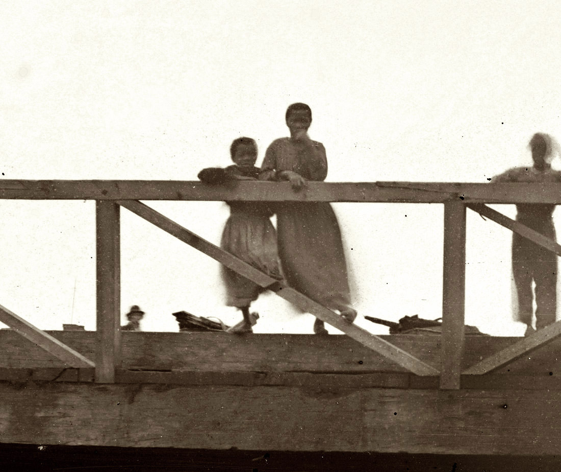
This close-up photograph from the Canal Bridge at Seventh Street in the spring of 1865 shows young women in the weeks following the city’s fall. The James River Canal had been a central artery of Richmond’s pre-war economy, used to move goods between the city and the broader Virginia interior. By the time this photograph was taken, the canal’s commercial role was already giving way to the expanded rail network.
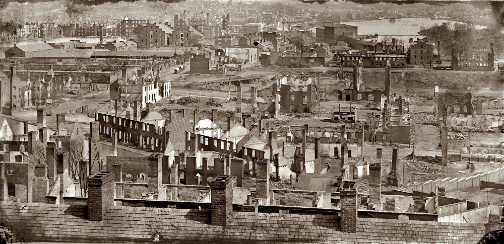
The burned districts along the James River showed the war’s final violence on Richmond’s landscape in stark terms. Factories, mills, and warehouses that had powered the city’s wartime economy stood as empty, scorched shells. Union photographers documented the ruins systematically, producing one of the most detailed visual records of Civil War urban destruction.
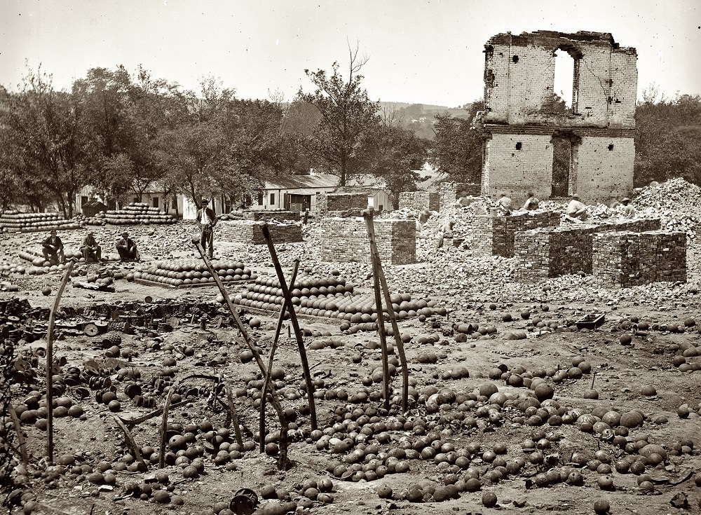
The State Arsenal held the Confederate government’s stored weapons and ammunition. When Richmond was evacuated, the arsenal was blown up or set ablaze, sending ammunition scattering across the surrounding streets. This April 1865 photograph shows the ruins — stacked and scattered rounds still visible among the debris, a dangerous remnant of the Confederate war effort left behind in the chaos of retreat.
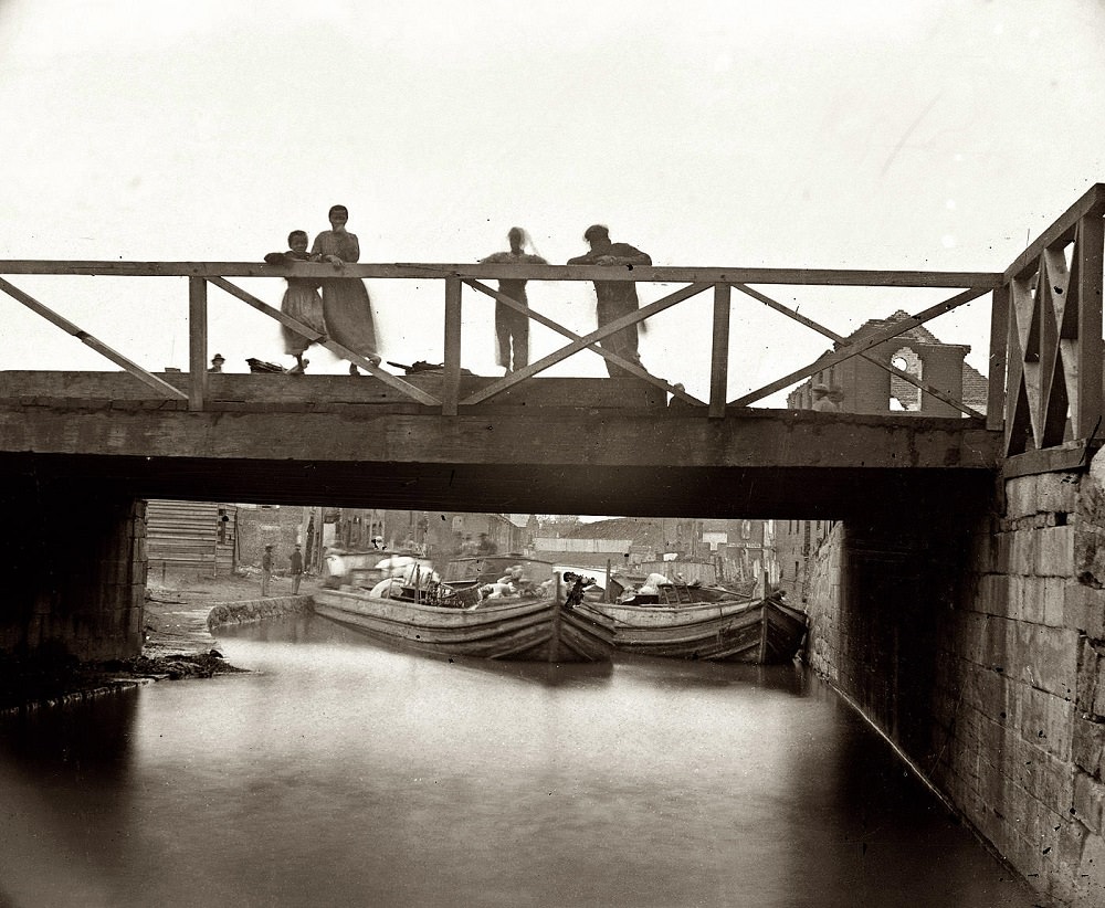
Children standing on the Canal Bridge at Seventh Street in the spring of 1865 appear in one of the quieter images from Richmond’s post-war months. The city’s civilian population — including many who had lived through the siege and the fire — had to navigate daily life amid physical ruin and an entirely new political order.
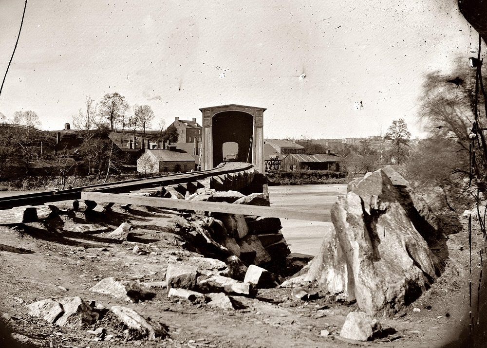
Belle Isle, a small island in the James River, had been the site of a large Confederate prisoner-of-war camp where thousands of Union enlisted men were held, often in open-air conditions with minimal shelter. The railroad bridge connecting it to the riverbank is photographed here from the south bank in the spring of 1865, after the camp had been abandoned and the Confederate garrison had fled.
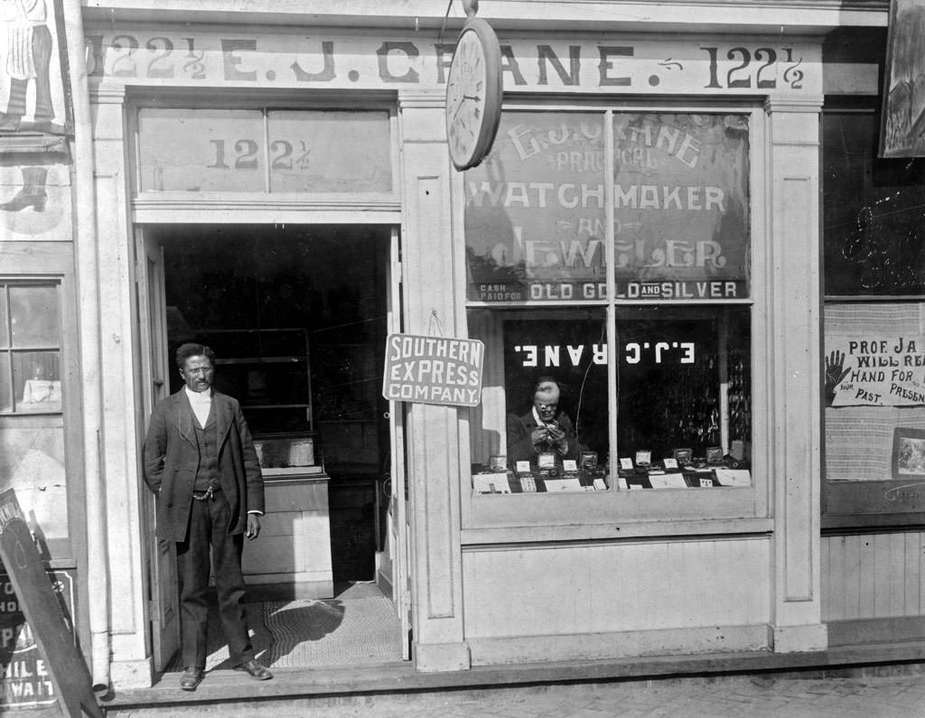
The E.J. Crane watchmaker and jewelry store, photographed in 1899, offers a ground-level view of Richmond’s retail life at the close of the 19th century. Display cases, signage, and the proprietor’s trade tools fill the frame — a glimpse into the small business world that made up much of the city’s commercial fabric long before department stores dominated the landscape.





There are so many old classic photos, but it bugs me that it is nearly impossible to find any good photos of shockoe creek without having to go through old newspaper articles, and even those are grainy. The canal basin has a few solid photos, but the creek remains elusive.
It’s really frustrating that there aren’t a lot of photos. However, I have found some literature detailing the dangers and hardships of life down there. There is extensive writing about how dirty and sickly it was down there near the state capital.
The book nonesuch place gave the best description/history of the creek. I realize urban planning wasn’t as sophisticated as it is today, but imagine if that creek had remained open instead of becoming an open then closed sewer. After finishing the pipeline, paddle through shockoe creek all the way up to the Oliver Hill Courthouse, then turn west around the diamond to the bacons quarter branch.
The structure of the John Marshall House is almost identical to the one I visited recently.
Yes, these are really amazing!
I’m not sure, but it’s possible that Poe’s mother’s house no longer exists.
What makes photos “rare?”
It’s rare to find photos from that era and of those places.
They really fucked this town up over the years