
Oakland sits on the eastern shore of San Francisco Bay, one of the most important port cities on the West Coast. Its Mediterranean climate brings warm, dry summers and mild winters. Long before it became an industrial hub, the region was home to the Costanoan people, who lived there when Spanish colonizers arrived in the 18th century. By the 20th century, Oakland had grown into a dense, working-class city shaped by the docks, railroads, steel yards, and the communities that served them.
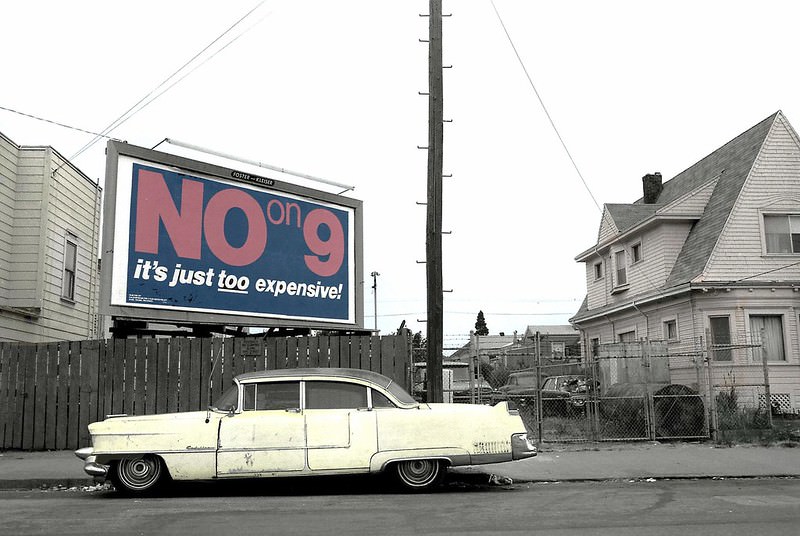
By the early 1970s, large parts of Oakland were struggling. Unemployment was high, poverty was concentrated in neighborhoods like West Oakland, and the city’s infrastructure in many areas had been neglected for years. Streets that had once been busy with commerce sat quiet, lined with aging Victorian homes and vacant storefronts. The photos below, taken by photographer Dave Glass between 1974 and 1989, document this era with striking clarity.
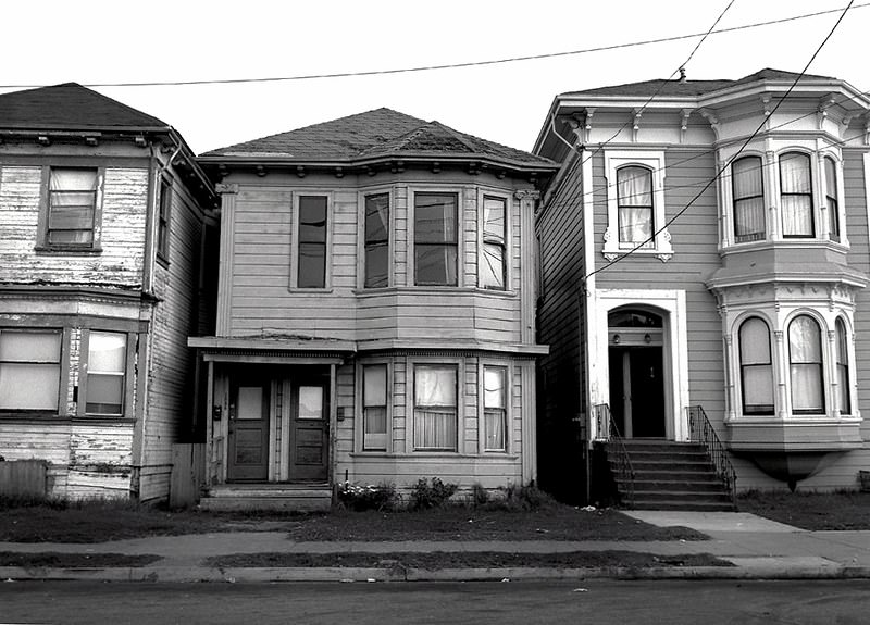
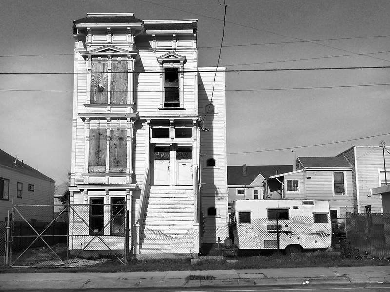
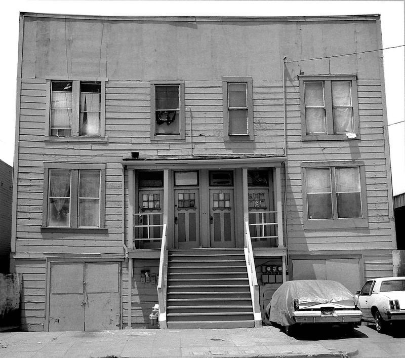
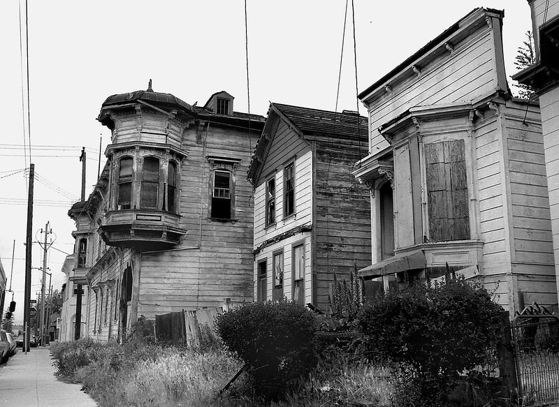
West Oakland bore the brunt of the city’s hardships during this period. Freeway construction in earlier decades had cut through established neighborhoods, displacing residents and leaving scars on the urban landscape. Many homes that survived were aging and poorly maintained. Rows of Victorian flats, once well-kept, began to sag and deteriorate as property values dropped and disinvestment set in.
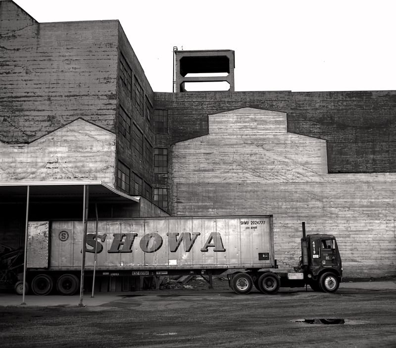
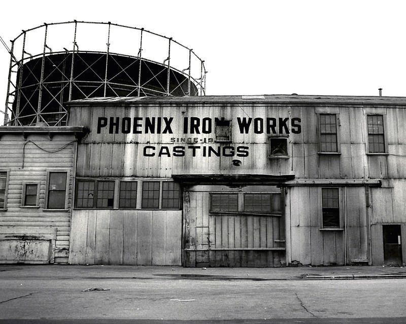
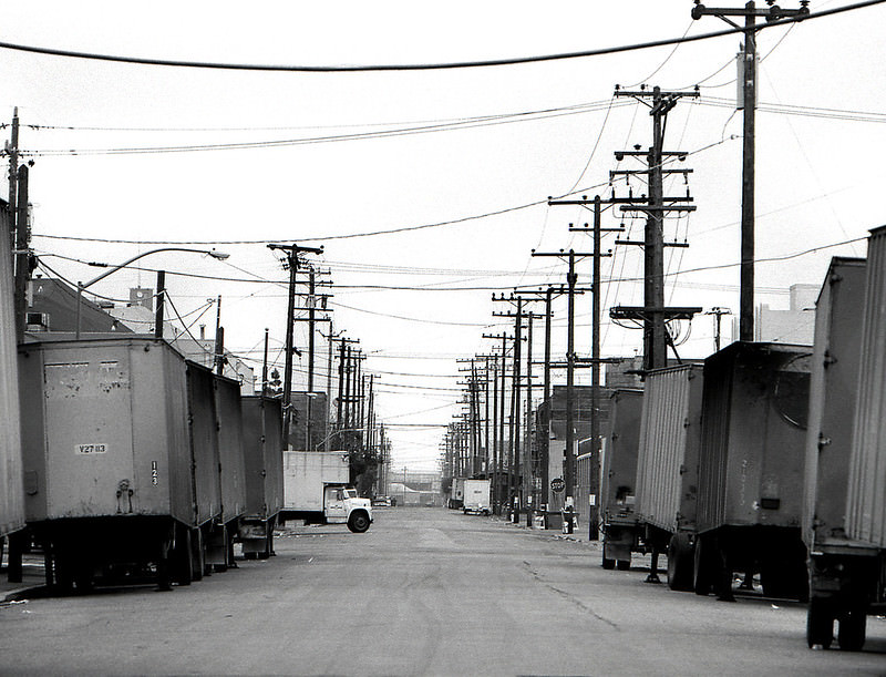
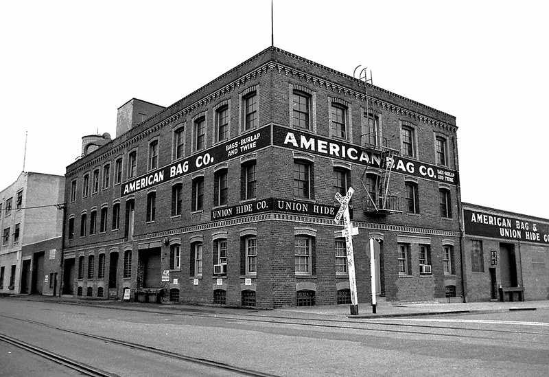
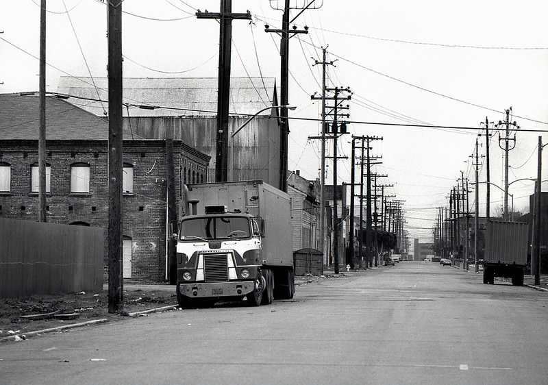
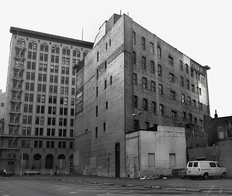
Near the waterfront, the Port of Oakland remained one of the city’s most vital economic anchors. Warehouses, ironworks, and storage facilities lined the areas near the docks, and the industrial character of that part of the city was unmistakable. Some of those buildings would later be repurposed — a storage building near the port, photographed in 1985, was eventually converted into the Phoenix Lofts at 737 2nd Street, completed in 1999.
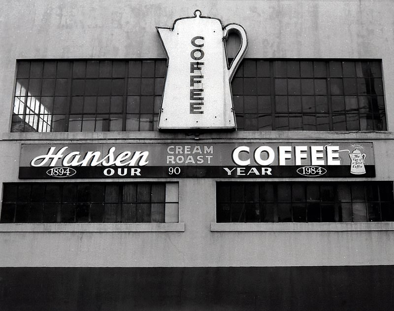
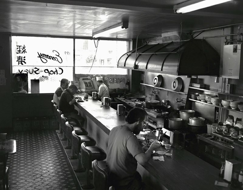
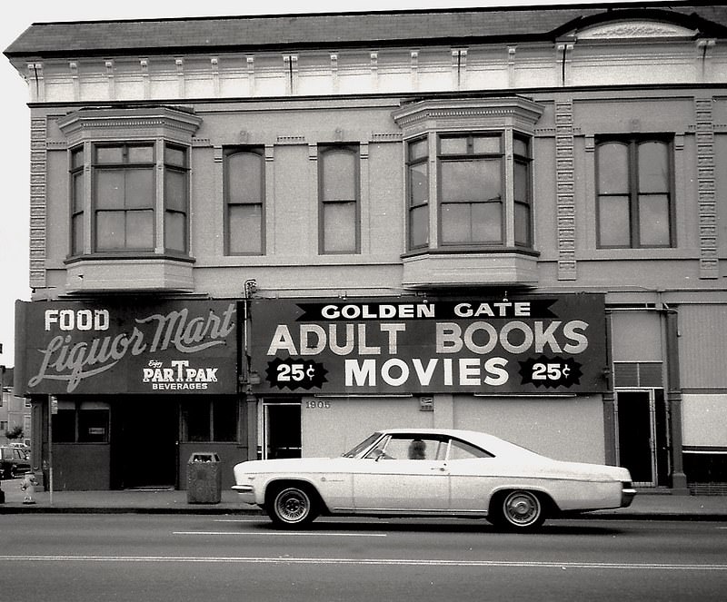
Small businesses defined the texture of Oakland’s commercial streets during these decades. Coffee companies, economy shops, corner markets, and laundromats served the everyday needs of local residents. San Pablo Avenue, one of the city’s main arteries, was lined with a mix of retail, service businesses, and adult establishments that reflected the character of urban commercial strips in American cities during the 1970s and 1980s.
Oakland’s drug trade became a national story during this era. Felix Mitchell, who operated out of the city’s housing projects, built the first known large-scale, franchise-style drug distribution network in the United States. His operation controlled the street-level sale of heroin and cocaine across the city. The murder rate in Oakland climbed to twice that of San Francisco and New York City. The violence reshaped daily life in many neighborhoods and strained the city’s police department and public services.
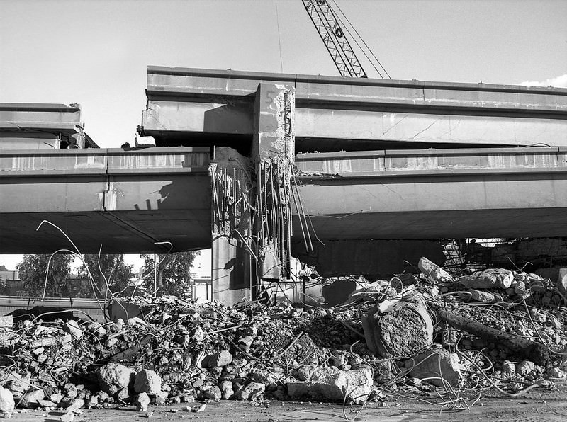
On October 17, 1989, the Loma Prieta earthquake struck the San Francisco Bay Area, causing catastrophic damage across Oakland. The Cypress Structure, a double-deck section of Interstate 880, collapsed entirely, killing 42 people. A section of the Bay Bridge also failed. The earthquake left parts of the city’s road network in ruins and triggered one of the most significant infrastructure rebuilding efforts in Oakland’s history.
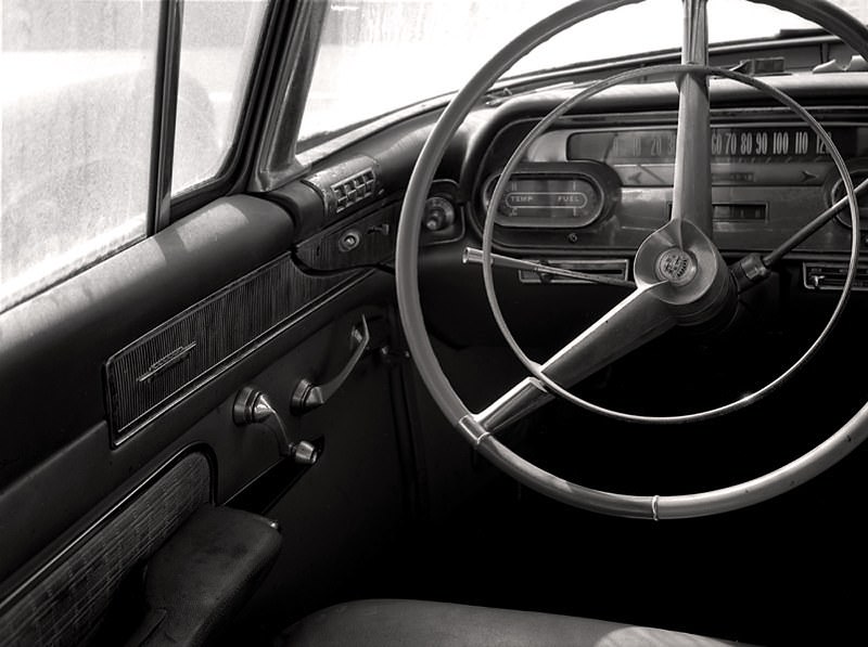
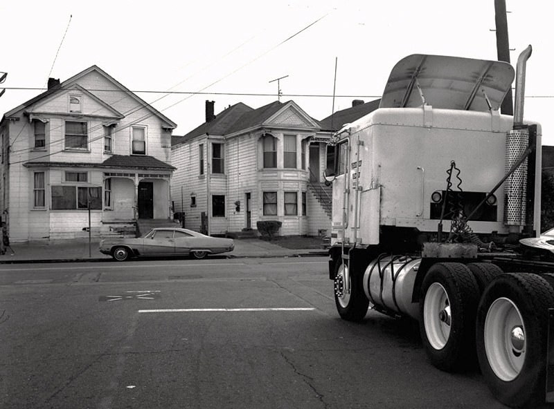
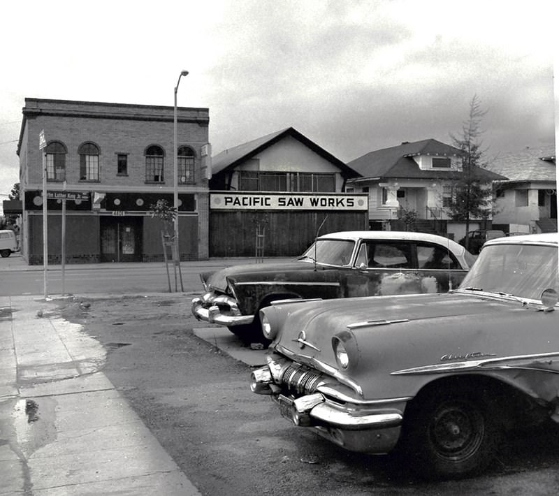
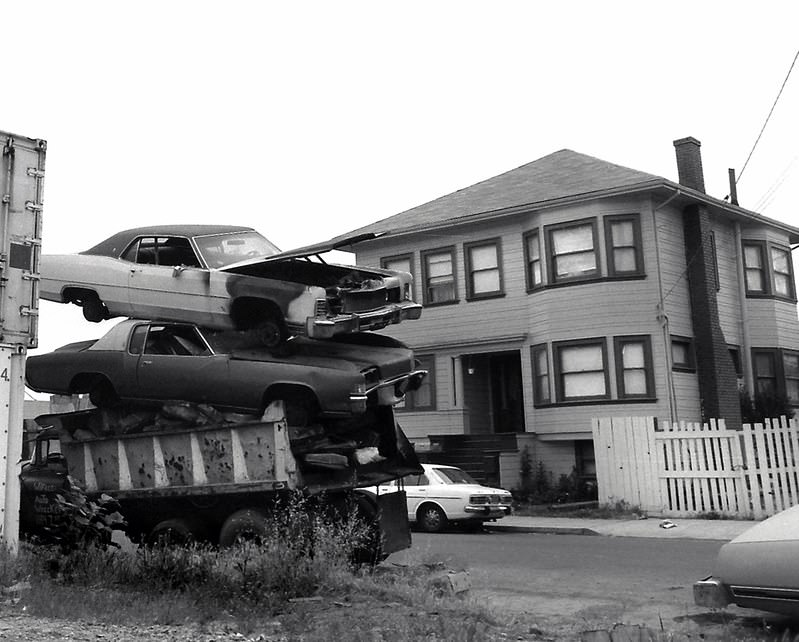
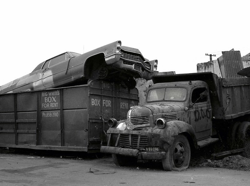
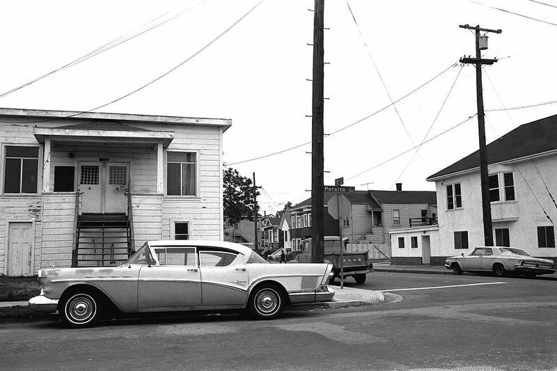
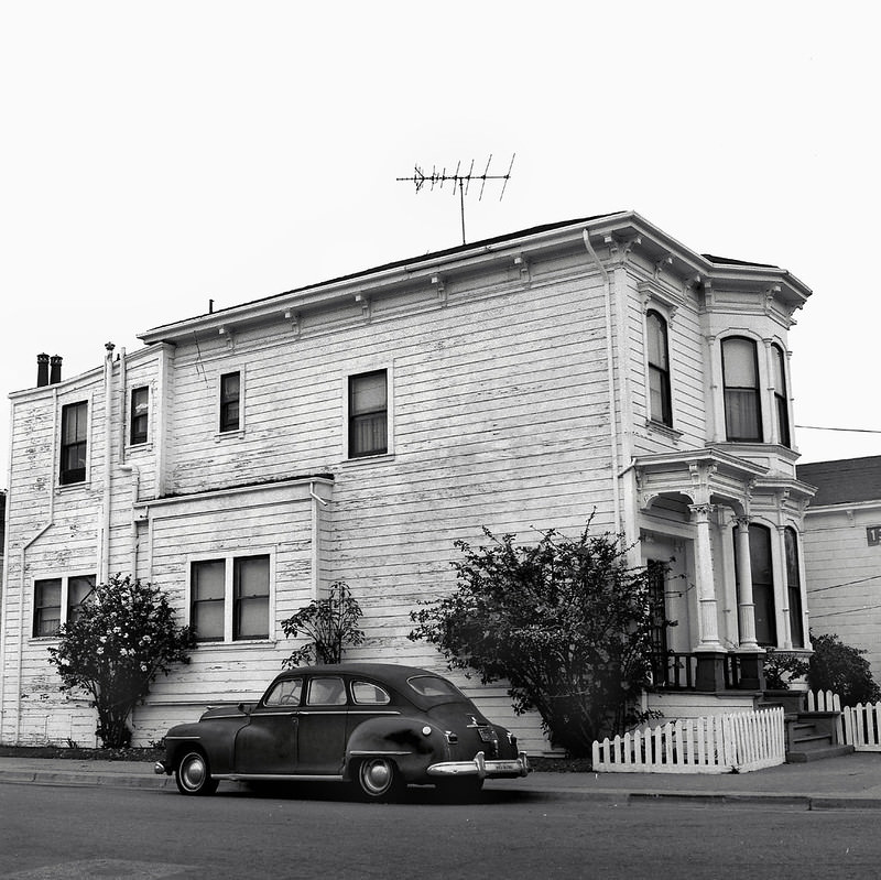
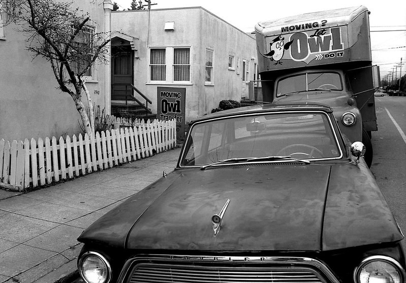
Cars appear frequently throughout Glass’s photographs, and not just as background detail. Classic American vehicles — a 1958 Cadillac, a 1957 Buick, a 1947 Dodge sedan, a 1961 Rambler American — show up parked on streets, sitting in salvage yards, or tucked against curbs in West Oakland. These cars, many of them already decades old when photographed, were still part of everyday life in the city’s working-class neighborhoods.
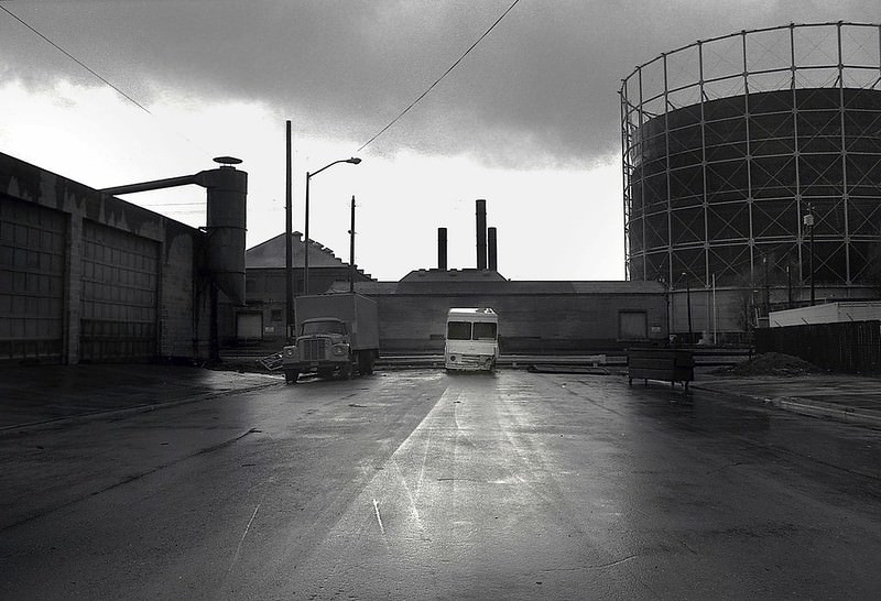
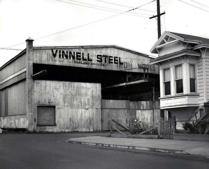
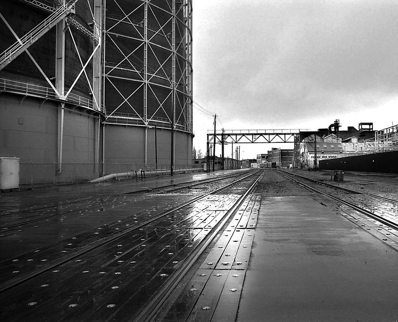
Oakland’s industrial district near the port was a working landscape of iron, steel, and rail. The Phoenix Iron Works and Vinnell Steel were among the operations active in the mid-1970s, and the surrounding area showed the density of industry that had long supported the city’s economy. Rail lines threaded between storage tanks and loading facilities, connecting the port to the wider freight network.
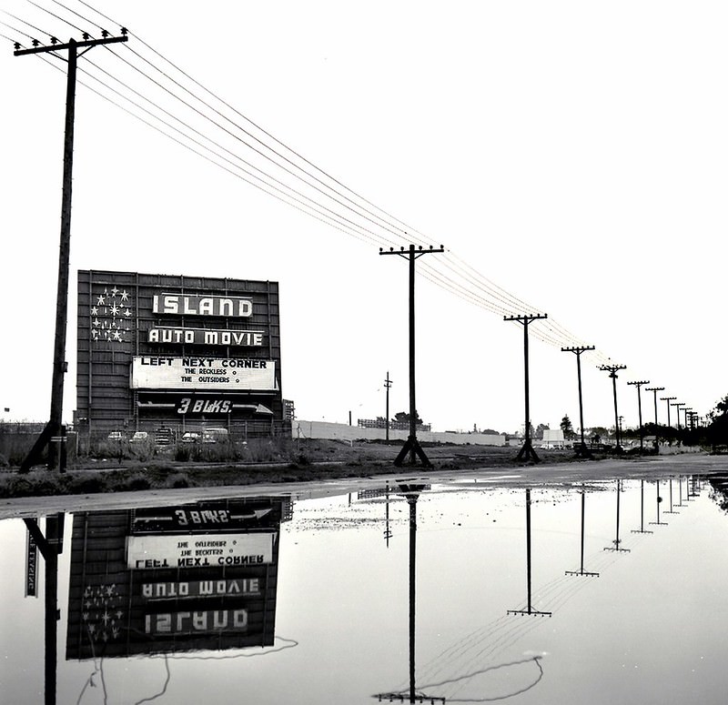
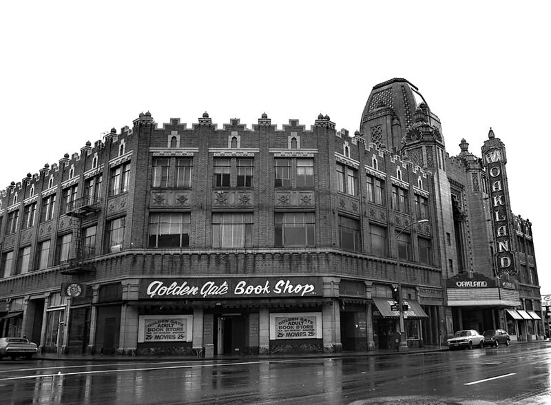
Entertainment in Oakland during this era ranged from the gritty to the grand. The Island Auto Movie in nearby Alameda offered the classic drive-in experience in 1983, while the Oakland Fox Theatre on Telegraph Avenue — photographed in 1978 — stood as one of the city’s most ornate surviving landmarks. The Fox had opened in 1928 as a lavish movie palace, and even in its years of decline it remained a striking fixture on the street.
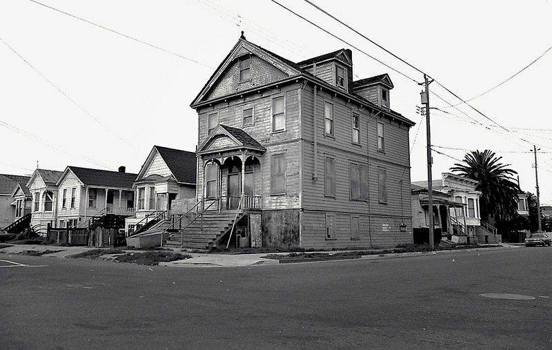
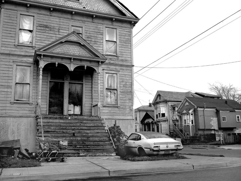
West Oakland’s residential streets in the mid-1970s showed a neighborhood caught between its past and an uncertain future. Rows of Victorian homes — some maintained, others clearly struggling — lined blocks where longtime residents had built community lives. By 1975, some of those rows were already marked for demolition, their fates sealed by urban renewal plans and freeway expansion projects that had been reshaping the area for years.
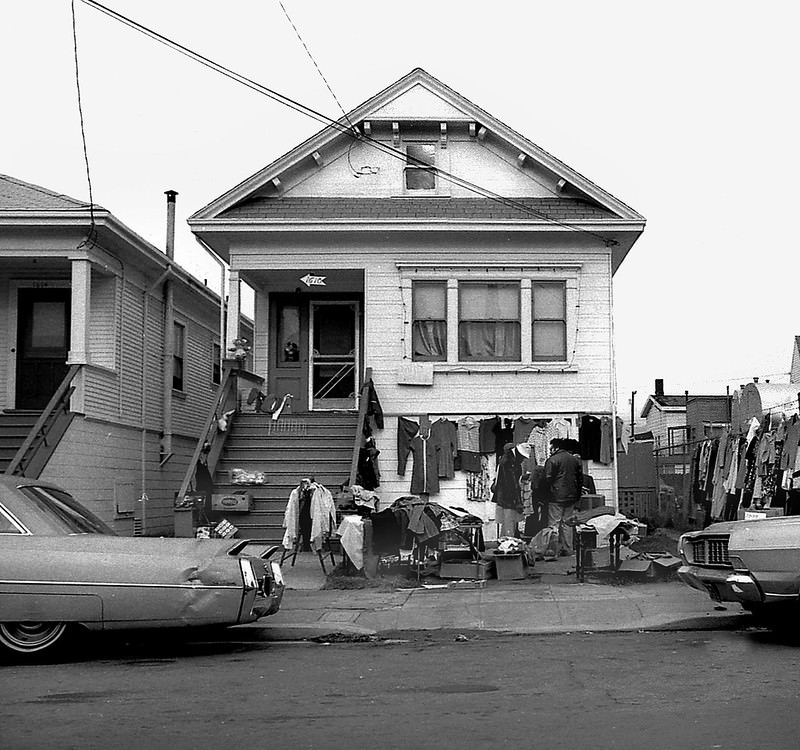
Street-level commerce in West Oakland served communities that larger retailers largely ignored. Sidewalk sales, corner stores, and local markets were woven into neighborhood life. A sidewalk sale photographed on a West Oakland street in 1977 shows residents and vendors operating in the kind of informal economy that filled the gaps left by disinvestment. These were not picturesque scenes staged for a camera — they were ordinary days in a neighborhood doing what it could with what it had.
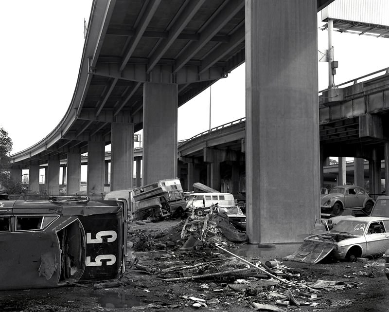
Below the Nimitz Freeway near 34th Street and Wood, an automobile graveyard had formed by 1986 — dozens of cars stacked and rusting under the elevated roadway. It was a scene that captured something about Oakland in those years: the freeway overhead, the abandoned machines below, and the industrial hum of a city moving through a difficult stretch of its history.
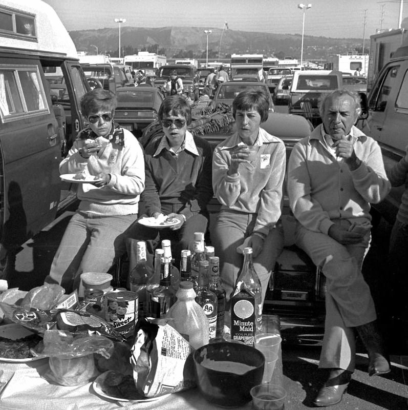
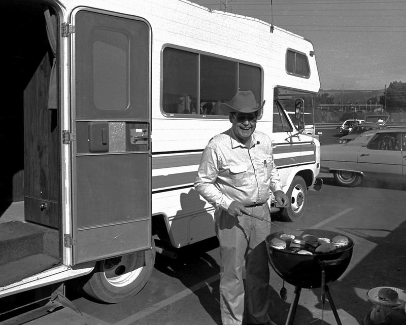
Oakland Raiders football gave the city’s residents a point of shared pride through the 1970s and 1980s. The Raiders were one of the dominant teams in the NFL during this era, winning Super Bowls in 1977, 1981, and 1984. On game days, the parking lots of the Oakland Coliseum filled with fans cooking on grills, tailgating for hours before kickoff. The atmosphere was loud, communal, and distinctly Oakland.
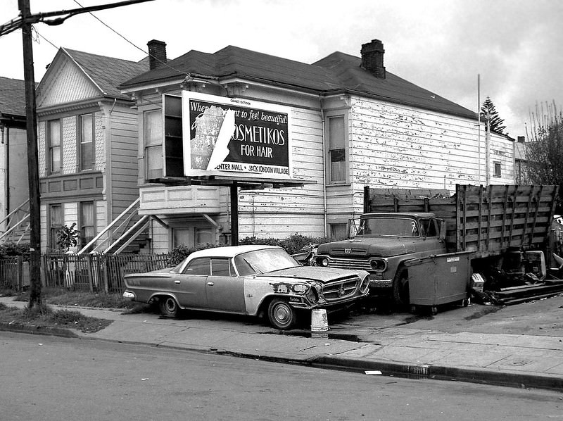
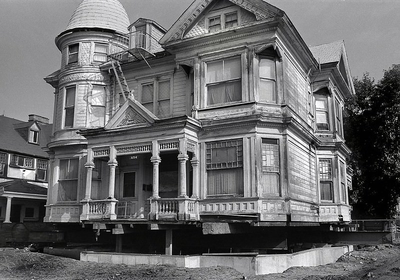
Scattered across the city’s older neighborhoods, Oakland’s Victorian architecture stood as a reminder of the city’s late 19th-century growth. The Remillard House in Preservation Park, a Queen Anne Victorian near 12th Street and Martin Luther King, survived into the 1980s as a preserved example of that era. Other Victorians were not so fortunate — derelict flats at 1610 14th Street, photographed in the 1980s, showed what happened when these buildings were left without maintenance or investment.
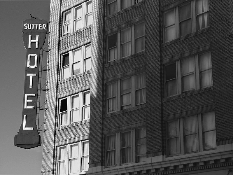
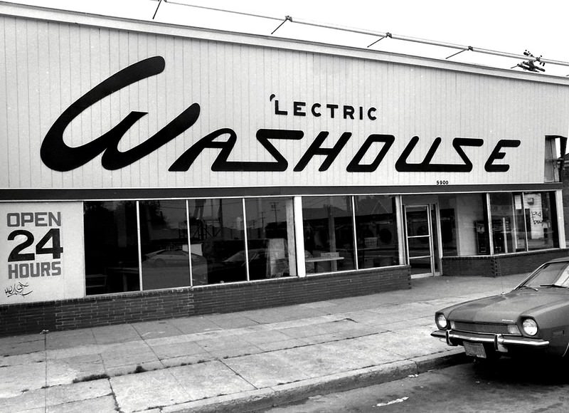
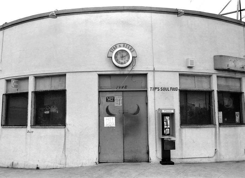
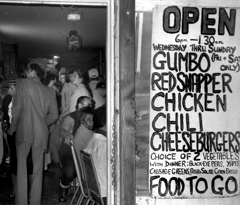
Certain businesses became local institutions through sheer consistency. The Lectric Washouse, a 24-hour laundromat at Telegraph and 59th Street, was one of those places. Photographed in 1987, it represented the kind of unglamorous but essential neighborhood business that kept functioning regardless of what was happening on the streets outside. Tip’s Soul Food on Center Street in West Oakland served a similar role — a neighborhood anchor, photographed in 1984, that fed the community around it.
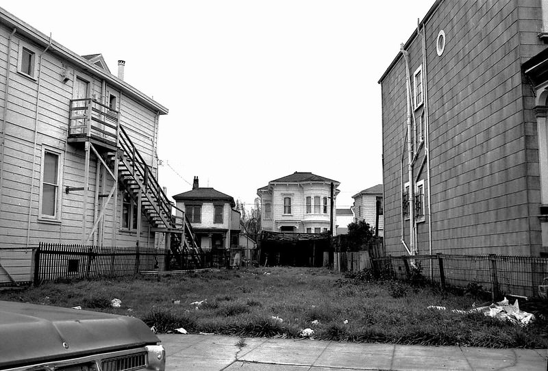
By the mid-1980s, Oakland remained one of the most crime-affected cities in the United States. The drug trade that Felix Mitchell had organized had fractured into competing factions after his arrest in 1985 and murder in federal prison in 1986, which made the violence more unpredictable rather than less. Vacant lots multiplied in West Oakland, and some streets showed the effects of decades of neglect in every cracked sidewalk and boarded window.
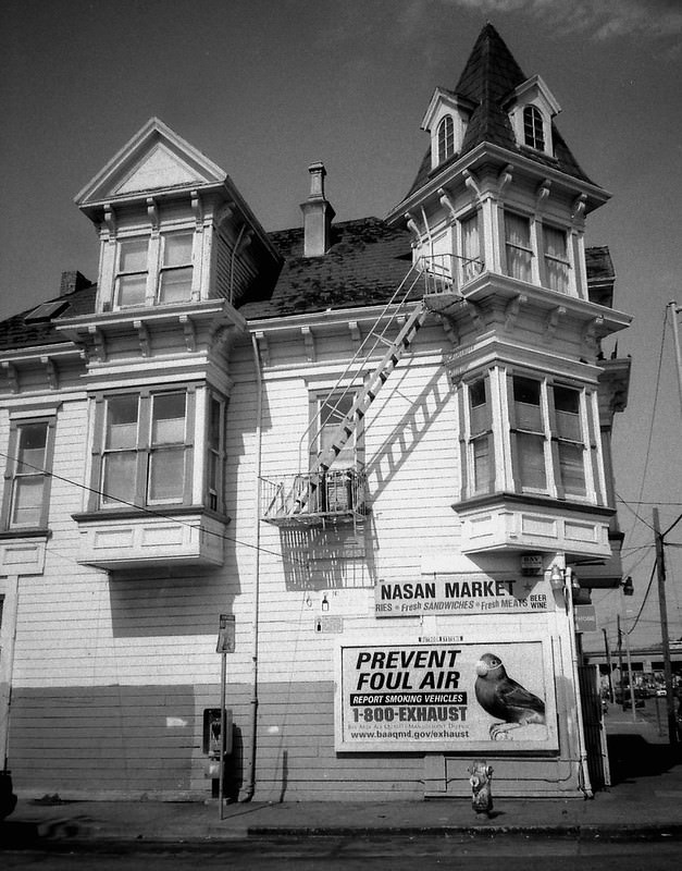
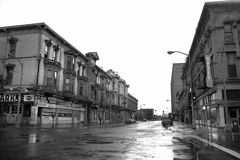
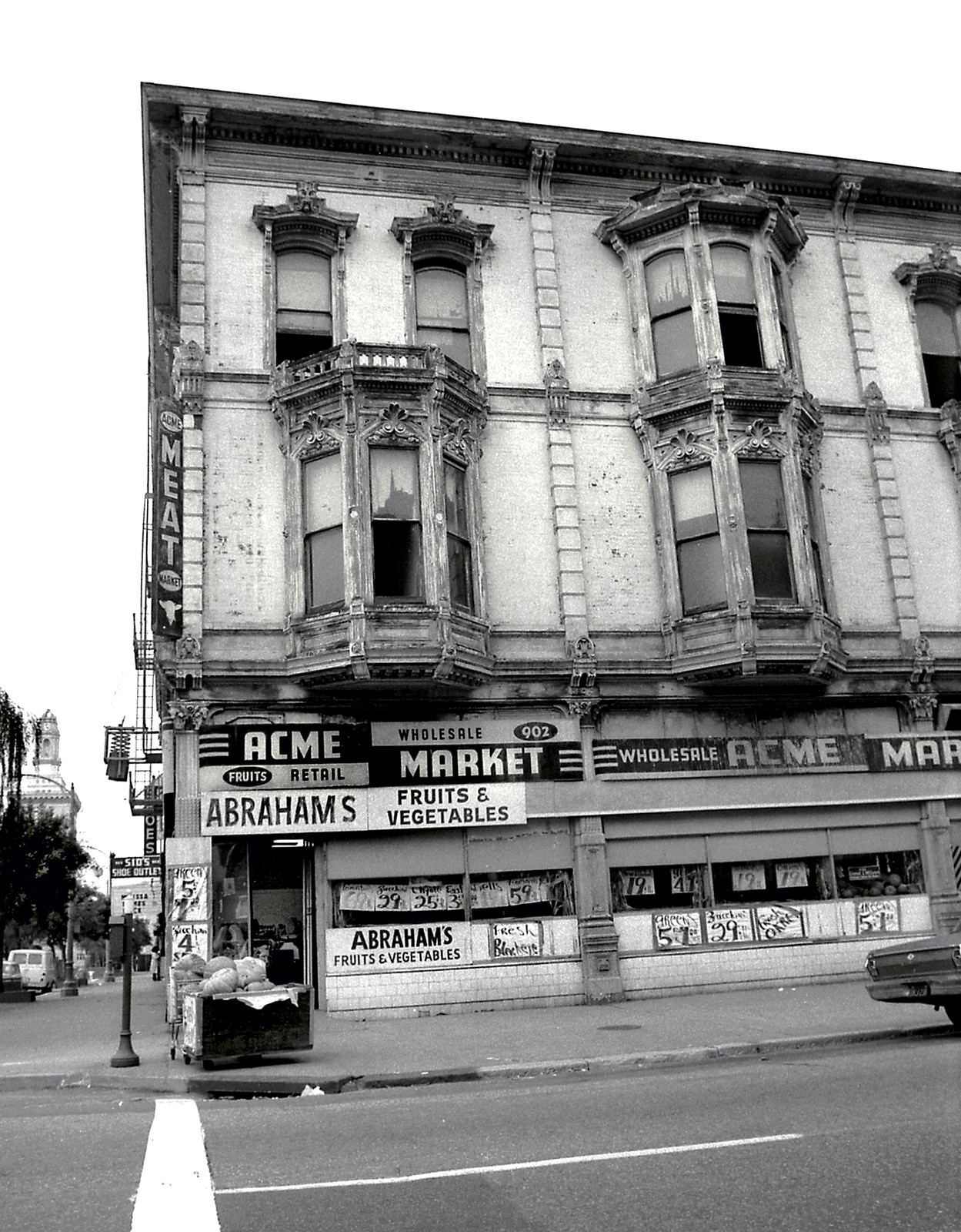
Corner markets and small grocery stores served blocks where large supermarkets never opened. Nasan Market on Adeline Street and Abraham’s Market at Washington and 9th Street were typical of the independent stores that operated throughout Oakland’s neighborhoods. They stocked what the community needed and stayed open when other options were not available. Their signs and storefronts are now part of the visual record of a city in a particular moment in time.
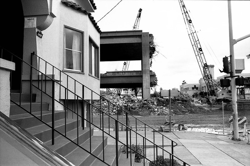
The Loma Prieta earthquake of October 1989 left a physical mark on Oakland that matched the scale of the social pressures the city had been managing for two decades. The collapse of the Cypress Structure on Interstate 880 was the deadliest single event of the earthquake. The damaged section was photographed repeatedly in the weeks that followed, and the demolition of the ruined elevated freeway at 14th Street and Mandela Parkway became a defining image of the era’s end.
Eli’s Mile High Club on Martin Luther King Jr Way was one of Oakland’s most enduring blues venues. Its back entrance, photographed in 1988, looks unassuming — a plain door on a working street. But inside, the club had hosted some of the best blues musicians in the country since the 1950s. It was the kind of place that existed in every corner of Oakland’s culture during these years: worn on the outside, vital on the inside, and deeply rooted in the city’s identity.





Mr. Budhh, you need to credit the photographer, Dave Glass, and link to his social media @daveglass_foto
Also, all these images are copyright protected and should not be used without permission.
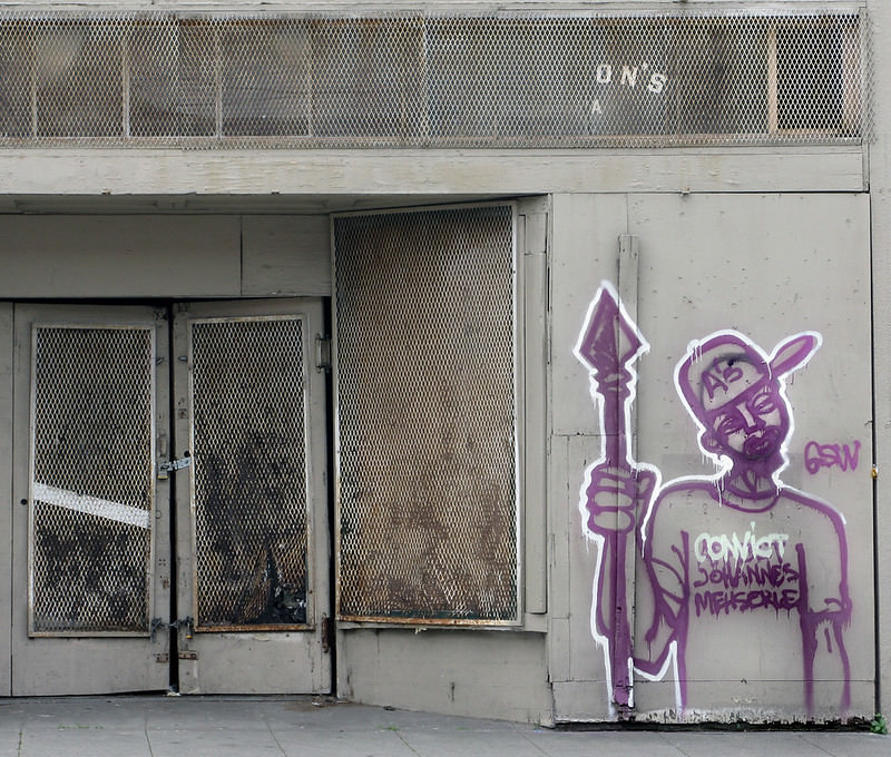
I think the one with the Oscar Grant graffiti probably isn’t actually from the ’80s, which makes these all pretty suspect.
It’s incredible how many of these photos, west Oakland ones specifically, look like they could’ve been taken last week… throw a few slightly newer cars in there
I love that the ‘electric Washouse hasn’t changed much (at least the exterior)
1980s is considered vintage?
Fuuuuck I’m old now
Despite the 80’s being over 100 years ago… some of us remember that time. Everything was black and white though. Color was not invented until 1987.
Oscar Grant was murdered in the 80s according to the last one.
I never liked driving on the Cypress structure when I was going to school down in Hayward. I was not at all surprised it collapsed. The concrete was flaking off those pylons and I thought to myself that the straight up and down rebar was not a good idea.
Totally sketchy, I can’t remember if that’s the structure where the ride was an up and down kind of bouncy roller coaster feel to it.
Didn’t realize I grew up in the black and white era.
Wished it showed East Oakland at the time. But pretty cool nonetheless.
We had color film in the 1970s and 1980s.
Spoiler alert: they still make black and white film.
Now i know why they call it Ghost Town
It seems like Oakland was super grim back in the day. I could sorta understand from talking to my parents.