
Harold Mayer was a geography professor at the University of Wisconsin-Milwaukee and one of the leading figures in urban geography during the twentieth century. His academic work focused on North American cities and transportation systems, with particular attention to Chicago, New York, Milwaukee, and British Columbia. Over the course of his career, Mayer built an extensive photographic archive that he used directly in the classroom to show students how cities were growing and changing around them.
During the 1950s and 1960s, Mayer made several trips to Chicago and photographed its streets, neighborhoods, commercial districts, and waterways. He shot many of these images on Kodachrome film, which was known for its sharp detail and rich, saturated colors. The result is a vivid visual record of a city in motion — one expanding outward into suburbs while its urban core remained dense and active. The photographs below offer a rare, full-color look at everyday Chicago life across nearly two decades.
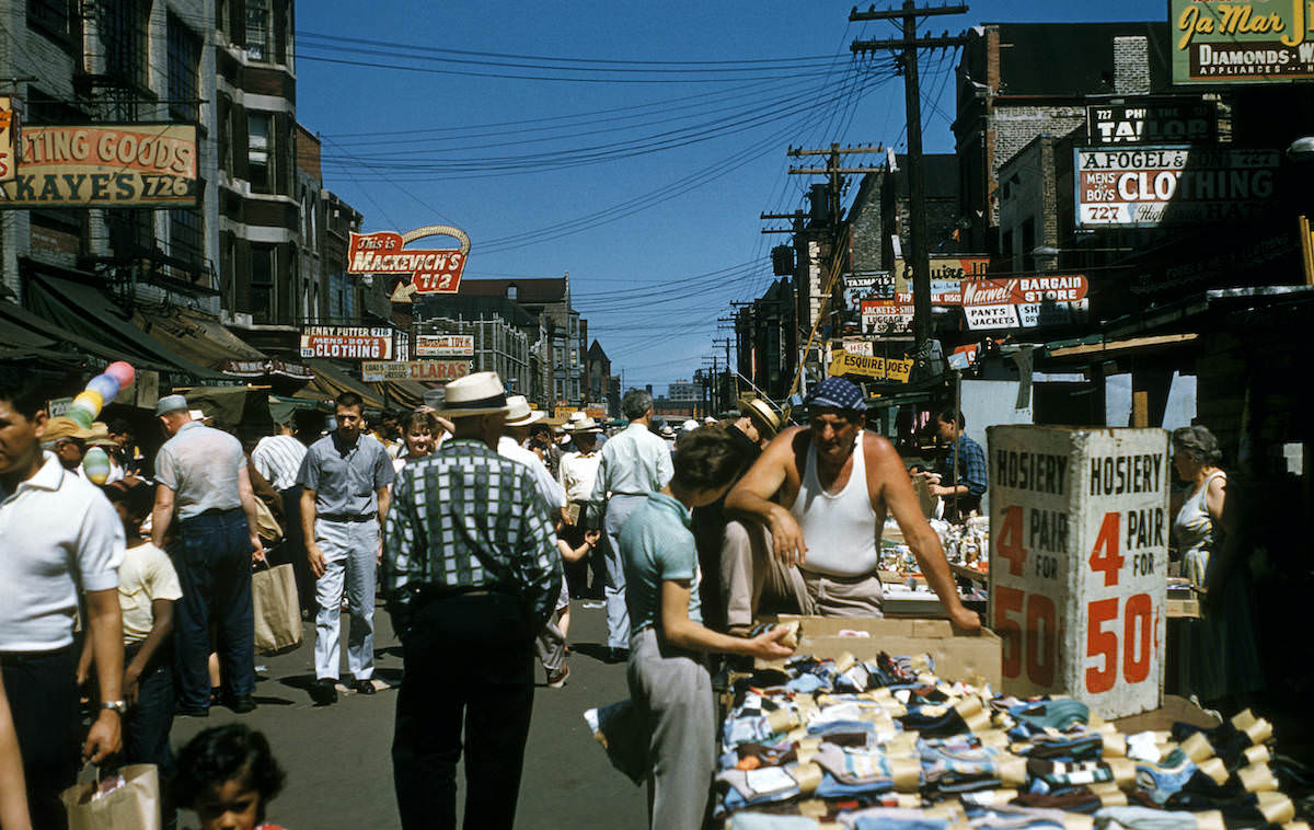
Maxwell Street was one of Chicago’s most famous open-air markets, drawing vendors and shoppers from across the city. By 1957, when Mayer photographed it, the market had been a fixture of Chicago street life for decades. Hawkers sold everything from food and clothing to tools and secondhand goods, and the street buzzed with the kind of foot traffic that defined urban commerce before the rise of the shopping mall.
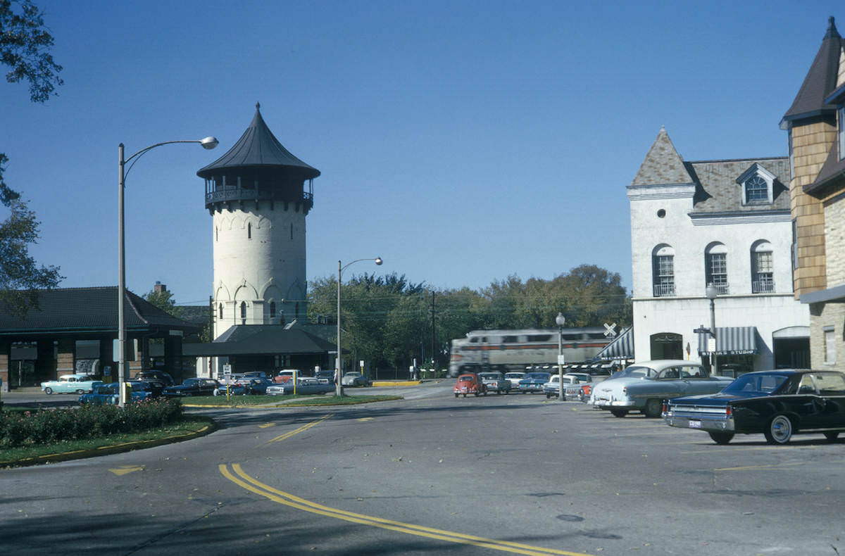
The Chicago region’s suburbs were undergoing rapid development throughout the early 1960s. Riverside, Illinois — one of the country’s first planned suburban communities — retained much of its original 19th-century character even as surrounding towns modernized. Mayer’s photograph of its water tower and business district captures the contrast between older civic infrastructure and the commercial activity building up around it.
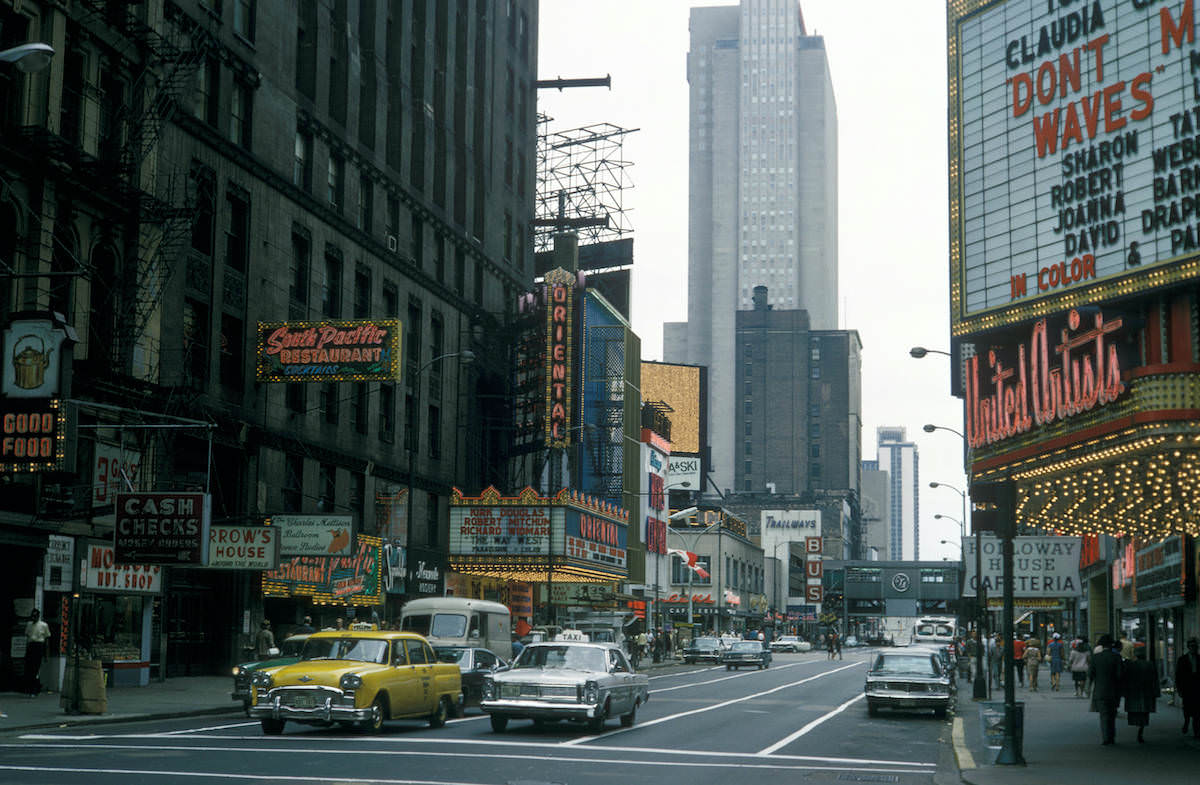
Downtown Chicago’s Randolph Street corridor was a hub of theaters, restaurants, and government buildings. Looking east from Dearborn Street in 1962, Mayer’s camera caught the energy of a busy urban street — storefronts with hand-painted signs, buses, and pedestrians moving through the heart of the Loop. The Kodachrome palette makes the scene feel immediate rather than historical.
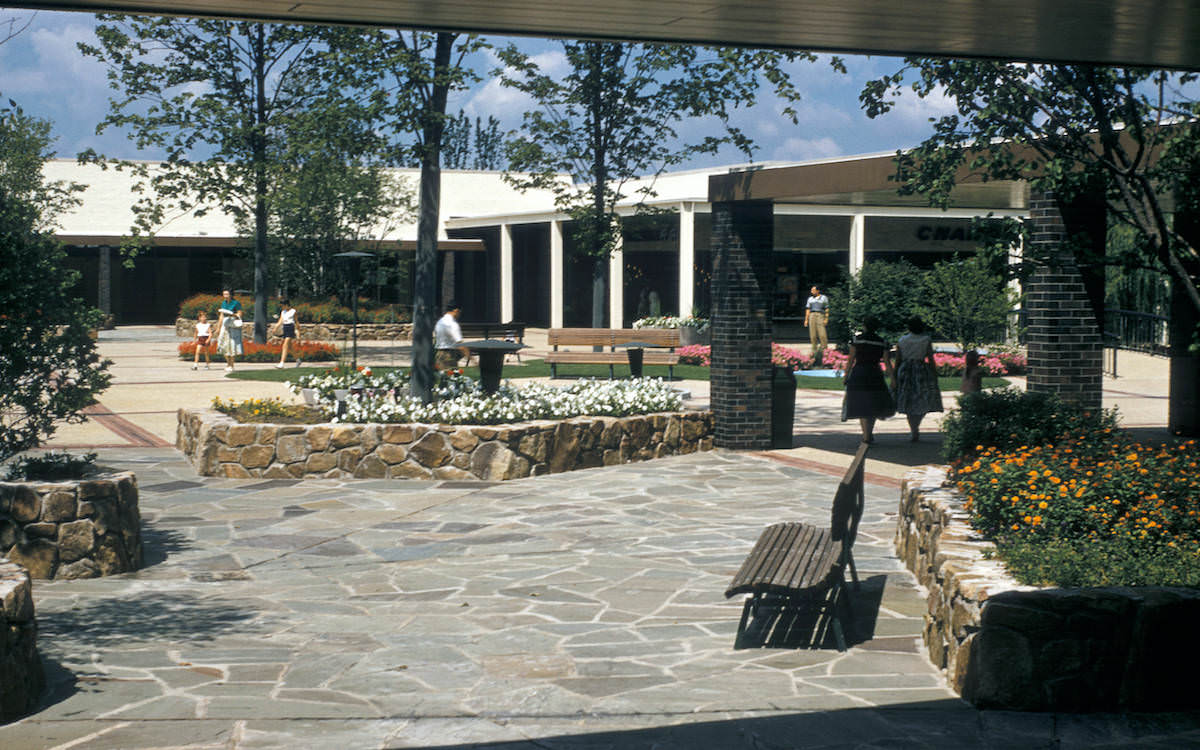
Shopping centers were reshaping suburban life across the United States in the postwar decades. Old Orchard in Skokie opened in 1956 and was one of the largest open-air regional malls in the Midwest at the time. Mayer documented it as a case study in how retail was decentralizing away from traditional downtown business districts and anchoring itself in newly built suburban corridors.
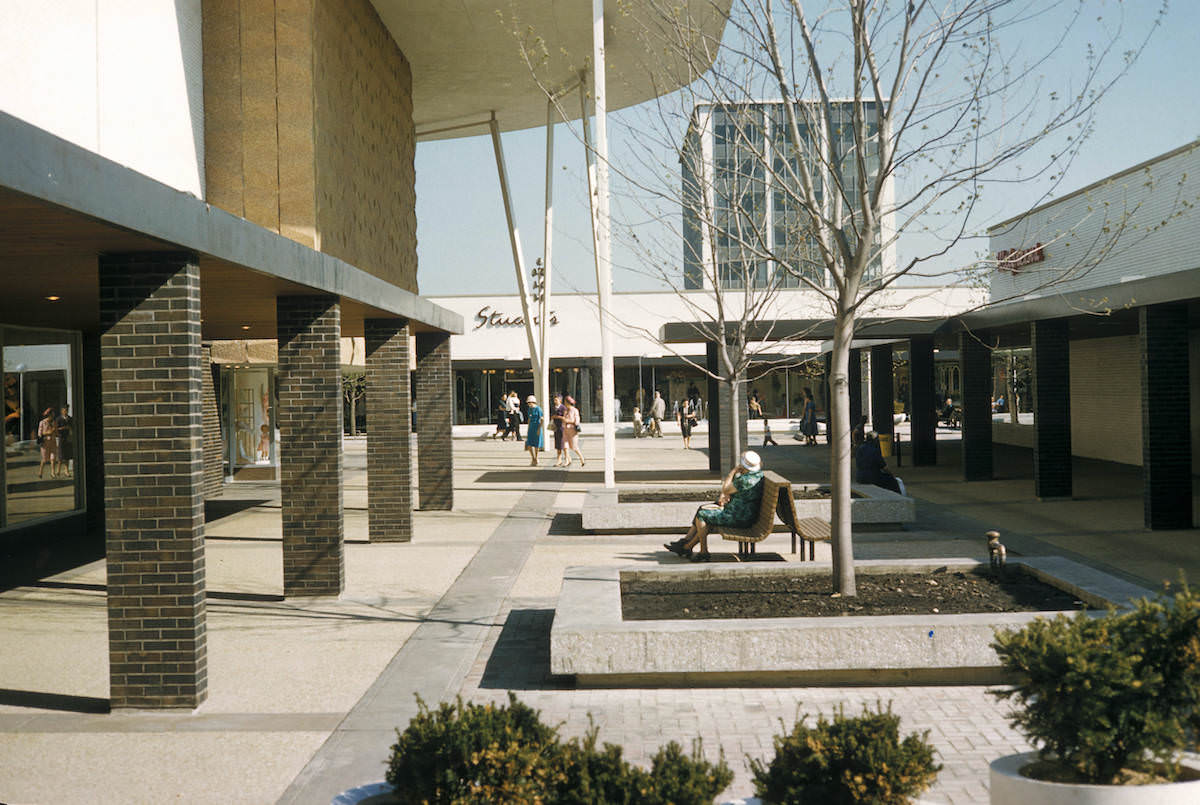
Oak Brook’s shopping center, photographed in 1962, represented another node in the growing web of suburban retail around Chicago. These developments were directly tied to the expansion of the highway system and rising car ownership, both of which Mayer studied closely in his academic work on urban transportation geography.
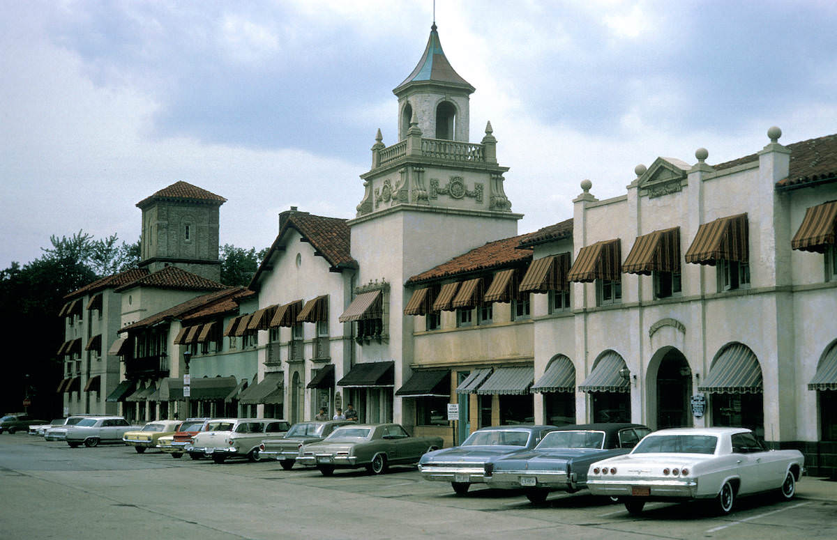
Mayer labeled the area around the Del Lago shopping center in Wilmette as ‘no man’s land’ — a telling description of the transitional zones that appeared between established neighborhoods and new commercial developments. These in-between spaces were a defining feature of mid-century suburban sprawl, and Mayer’s geographic training made him attentive to them in a way most photographers of the era were not.
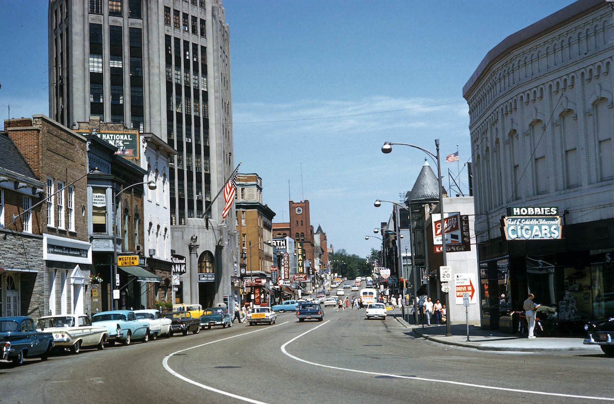
By 1967, communities like Elgin — located about 35 miles northwest of downtown Chicago — had developed their own central business districts to serve booming suburban populations. Mayer’s photograph of Chicago Street in Elgin shows a fully functioning commercial strip with its own identity, distinct from the city center but directly linked to it through commuter rail and highway connections.
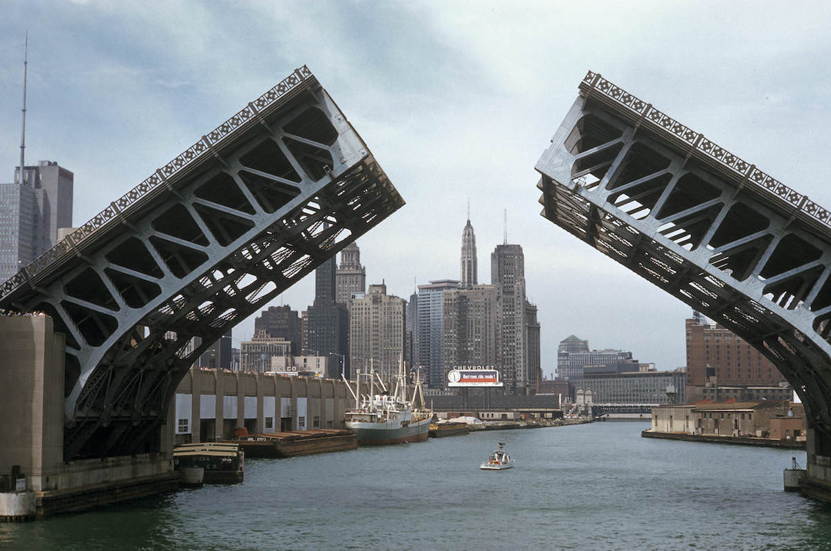
Chicago’s river infrastructure was a defining feature of the city’s industrial and commercial geography. The Chicago River’s drawbridges allowed large freight vessels to pass through the urban core, connecting Lake Michigan to the city’s network of waterways and rail yards. The Lake Shore Drive Bridge was one of the most photographed of these structures, and Mayer captured it with the clarity that Kodachrome film made possible.
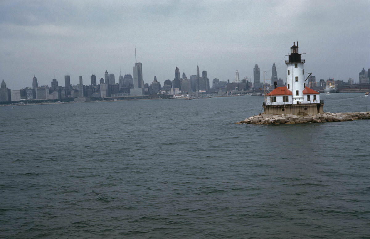
Chicago’s lakefront played a central role in the city’s economic life. The harbor handled significant commercial shipping traffic in 1959, and the Chicago Light marked the outer edge of the harbor entrance on Lake Michigan. Mayer’s photograph shows the industrial waterfront before it was extensively redeveloped for recreational use in later decades.
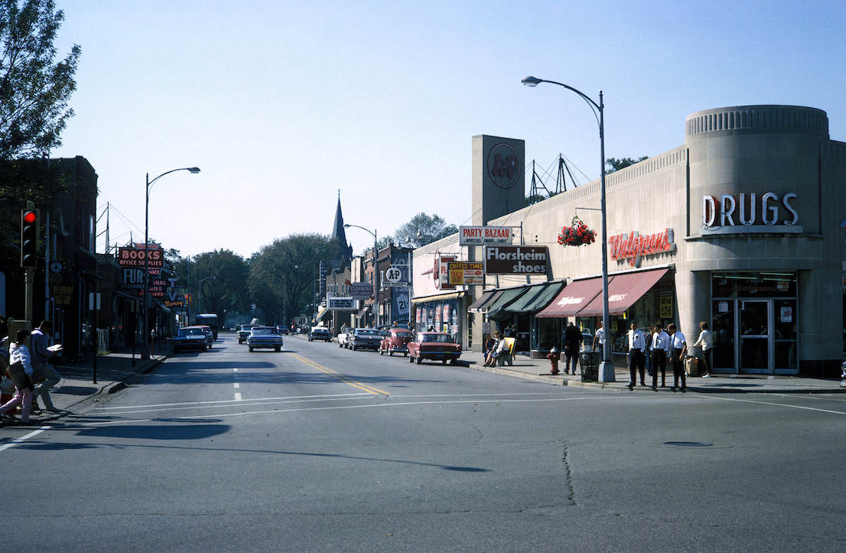
Skokie’s Lincoln Avenue business district in 1964 reflects the look of a maturing suburb — one that had moved past the early postwar construction phase and now had a settled commercial streetscape. Storefronts, signage, and parked cars fill Mayer’s frame, documenting the kind of everyday commercial strip that anchored mid-century suburban life across the Chicago metro area.
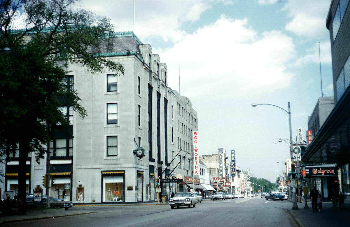
Oak Park, directly west of Chicago’s city limits, had one of the most established suburban business districts in the region. Looking east on Lake Street from Marion in 1960, Mayer captured a dense row of shops and commercial buildings that rivaled smaller downtown cores. Oak Park was also served by the CTA elevated line, making it one of the more transit-accessible suburbs in the area.
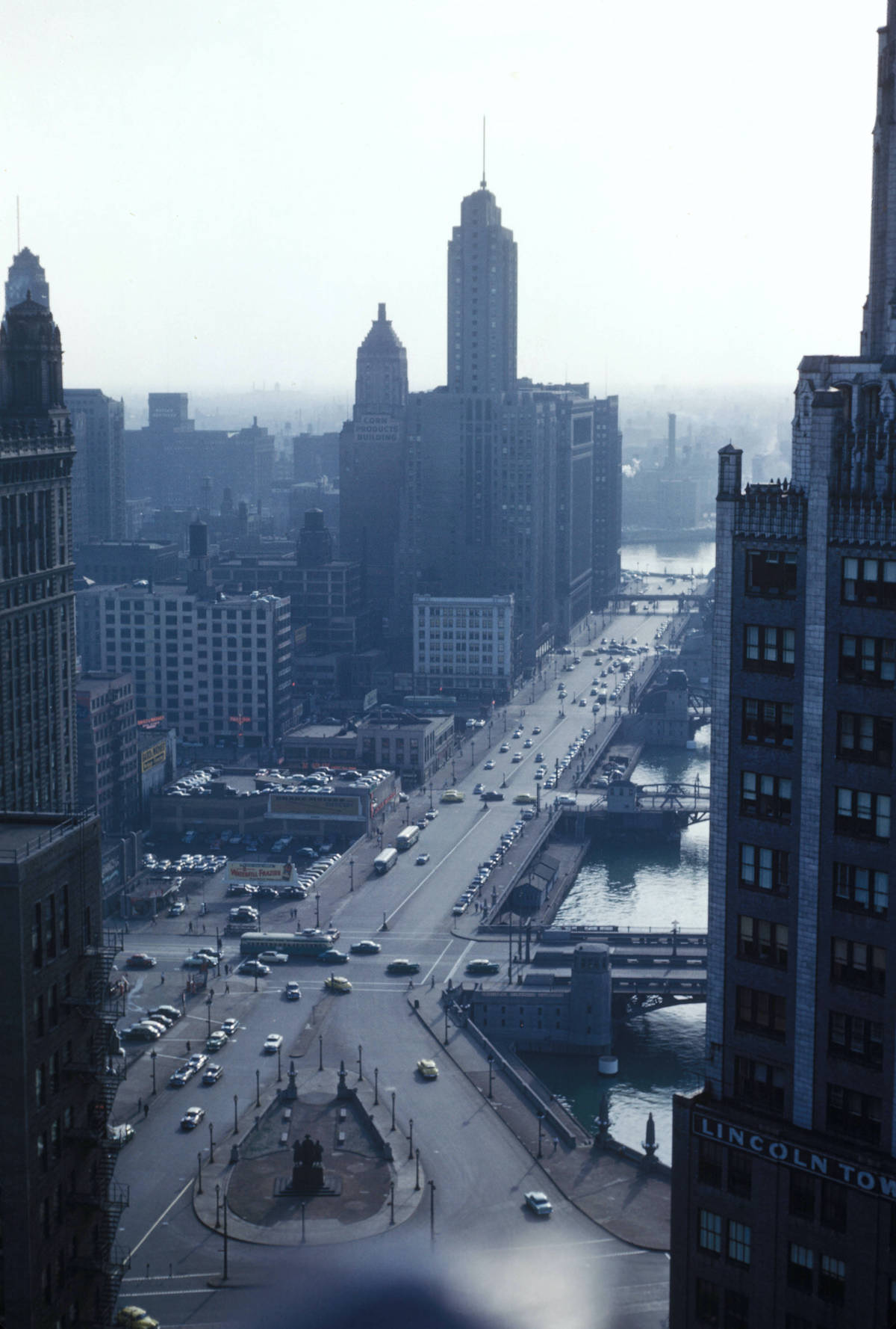
Wacker Drive runs along the Chicago River and was one of the city’s most important commercial streets. Photographed from the vantage point of 333 N. Michigan Avenue, the view stretches across a stretch of the city where architecture, commerce, and infrastructure converge. The Kodachrome rendering captures the deep blues of the sky and river against the stone facades of the buildings.
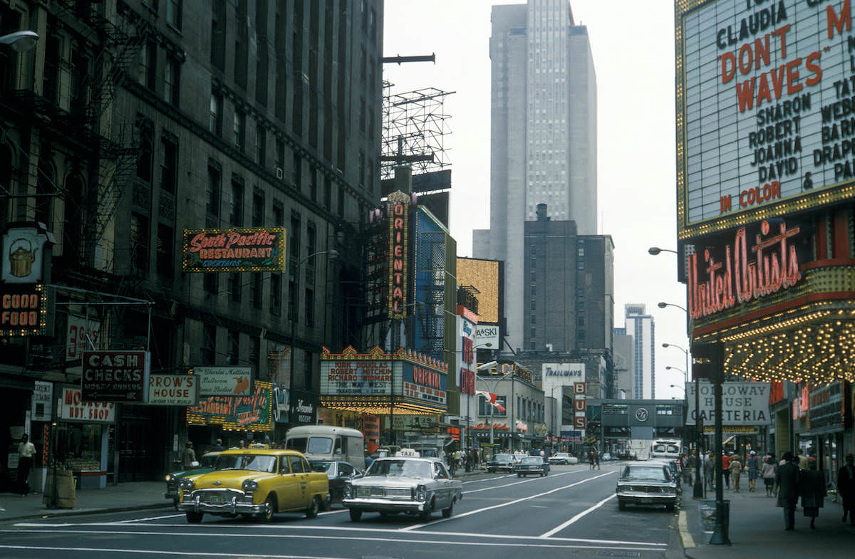
Mayer returned to the Randolph and Dearborn intersection more than once, photographing the same stretch of street at different times to track changes in signage, traffic, and land use. This second view of the corridor shows subtle differences in the streetscape, reflecting the kind of incremental urban change that Mayer’s academic work was designed to document over time.
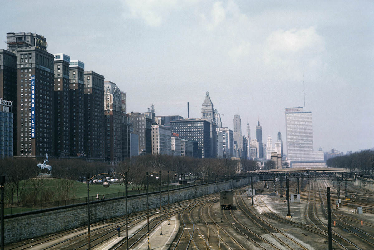
The Illinois Central Railroad ran along the lakefront south of the Loop, with its tracks largely hidden beneath Michigan Avenue’s grade level. By 1962, the Michigan Boulevard façade presented a clean, modern face to the street while the railroad infrastructure remained active below. This layering of transportation systems beneath commercial frontage was a feature of Chicago’s urban design that Mayer studied as part of his transportation geography research.
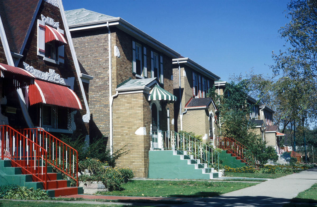
Residential Chicago away from the lakefront and downtown core had a distinct character — dense rows of two-flats, bungalows, and apartment buildings that housed the city’s working-class neighborhoods. The 4700 block of Hamlin Avenue on the city’s west side in 1964 shows this fabric clearly: modest brick housing with small yards, street trees, and parked cars lining the curb.
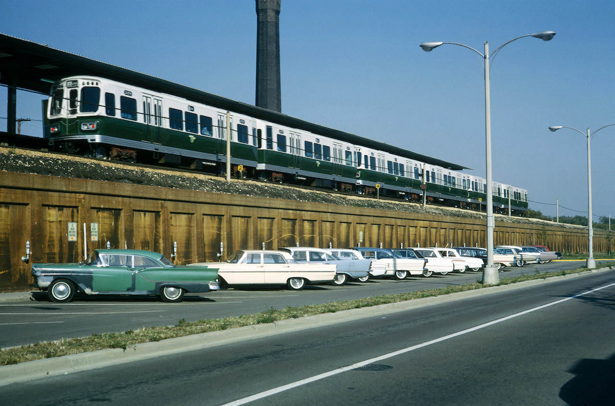
The Chicago Transit Authority’s Lake Street elevated line extended into Oak Park, and by 1964 the stations along the route had parking lots to accommodate suburban commuters arriving by car. This combination of rail transit and park-and-ride infrastructure was an early model of the transit-oriented suburb, and it placed Oak Park in a different category from communities that relied entirely on automobile access.
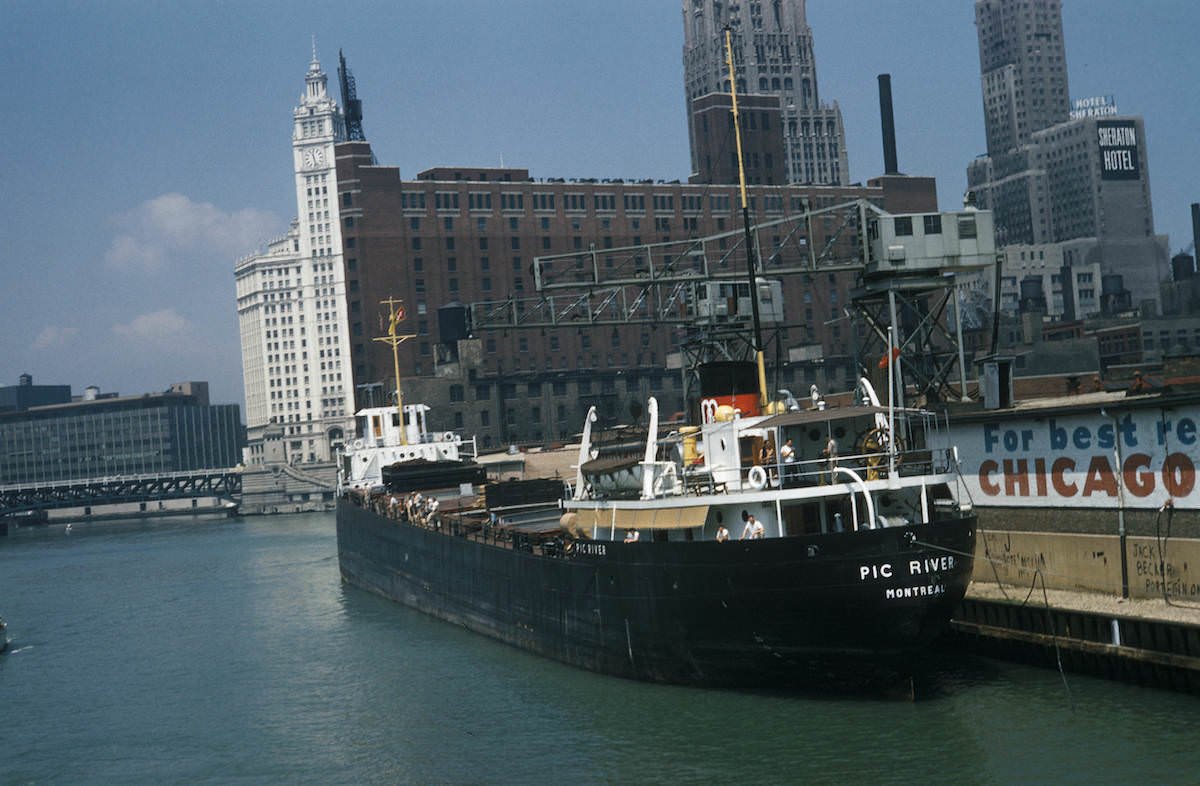
The Chicago Tribune maintained a wharf on the Chicago River near its Michigan Avenue headquarters. In 1959, the river still saw regular boat activity tied to commercial and media operations in the city. Mayer’s photograph of a boat docked at the Tribune wharf places the river firmly in the context of active urban industry rather than the recreational waterway it would later become.
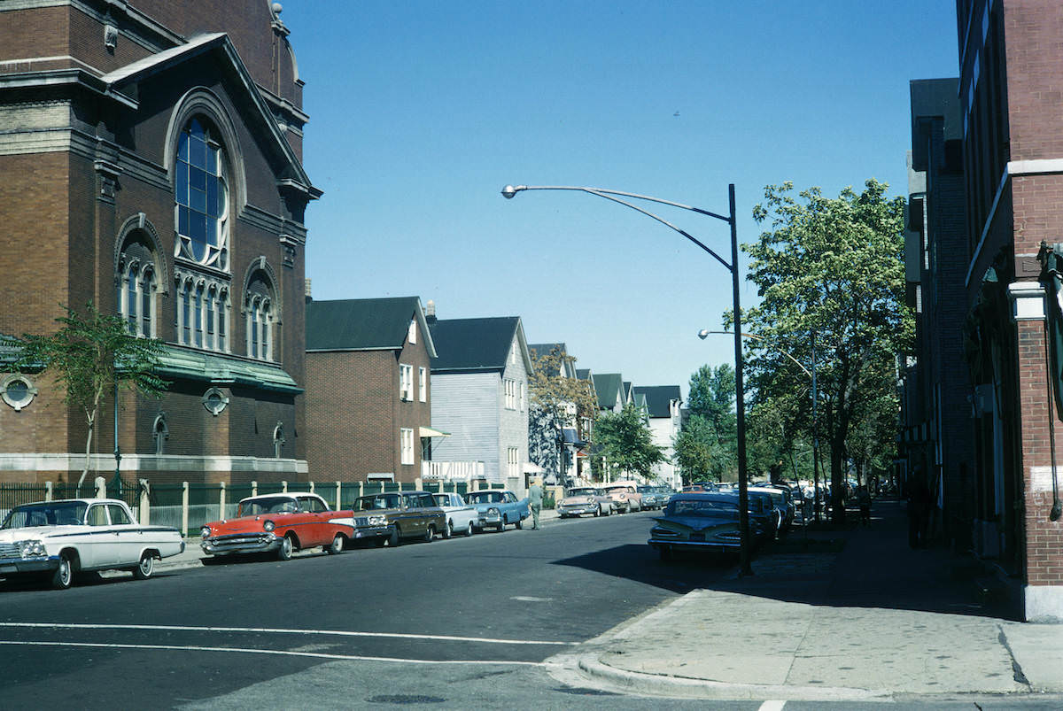
The Back of the Yards neighborhood, named for its location behind the Union Stock Yards, was one of Chicago’s most historically significant working-class communities. By 1964, the meatpacking industry that had built the area was in decline, but the residential streets remained densely populated. Mayer’s photograph of Hamilton Avenue looking north from 46th Street shows a neighborhood that retained its urban density and character even as the industrial base that created it was fading.




