
In the early 1920s, Los Angeles overtook San Francisco to become California’s largest city, and by the late 1920s its population had surpassed one million. The city grew into a powerhouse of oil production, manufacturing, aviation, and film, with more than 80 percent of the world’s film industry based there by 1921. These photographs document the streets, bridges, sewers, roads, and neighborhoods of a city in the middle of a remarkable transformation.
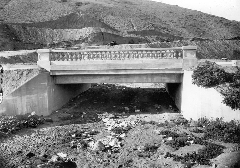
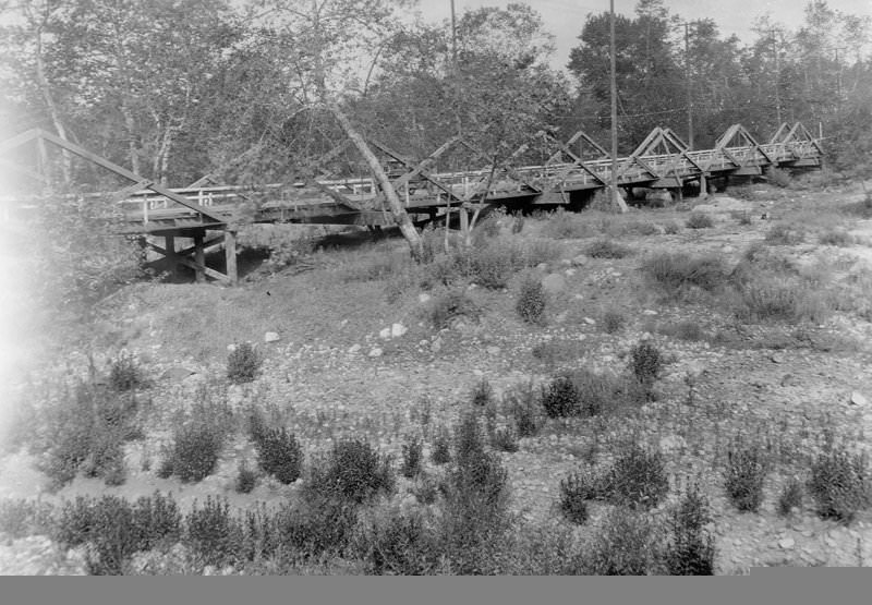
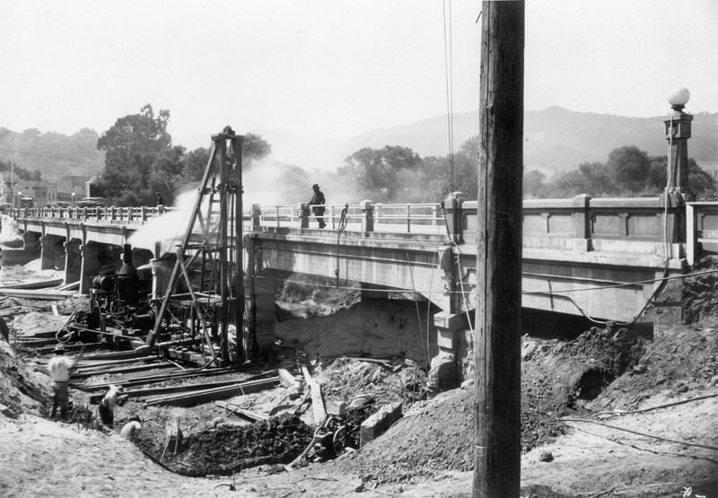
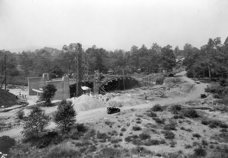
The Malibu Road Bridge Number 2 is located in Rancho Malibu, which was owned by May K. Rindge. The Southern Pacific Railroad applied to the Interstate Commerce Commission in 1904 for permission to build tracks connecting the Long Wharf in Santa Monica with their northern lines at Santa Barbara. A straight-line route was proposed through the Malibu ranch. To keep the large railroad company from coming through Rancho Malibu, the Rindges built a private railroad through the ranch, taking advantage of a loophole in ICC law that prevented condemnation of a right-of-way parallel to an already existing railroad. Rindge built 15 miles of standard gauge railroad called the Hueneme, Malibu, and Port Los Angeles Railway in 1908. It remained in use until the 1920s and was mainly used to ship grains and hides from the ranches via the Malibu Pier. The line ran from Las Flores Canyon to Yerba Buena Canyon in Ventura County, using the flat sand along the coast and crossing canyons with large trestle bridges.
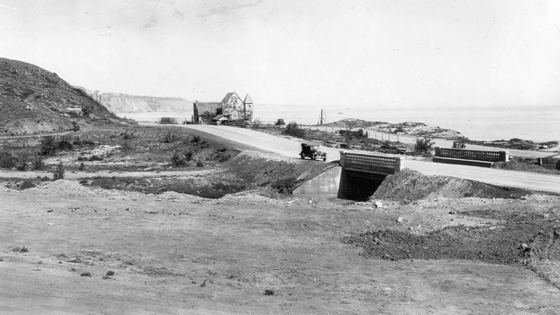
Malibu Road Bridge Number 2, bridge and county road, looking west. The Southern Pacific Railroad applied to the Interstate Commerce Commission in 1904 to build tracks linking the Long Wharf in Santa Monica with their northern tracks at Santa Barbara. A straight-line connection through the Malibu ranch was proposed. Because of a loophole in the ICC law, the Rindges decided to build a private railroad through Rancho Malibu to keep the larger railroad company out. May Rindge built 15 miles of standard gauge track called the Hueneme, Malibu, and Port Los Angeles Railway in 1908. It remained in service until the 1920s and was used mainly to ship grains and hides from ranch operations via the Malibu Pier. The line ran from Las Flores Canyon to a point near Yerba Buena Canyon in Ventura County, using flat, sandy land along the coast and crossing canyons with large trestle bridges.
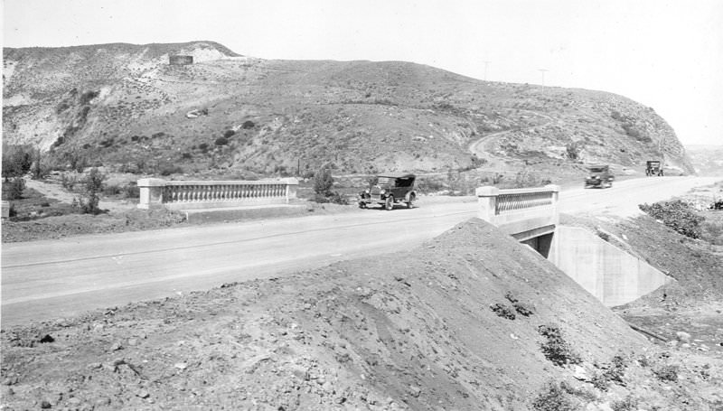
Los Angeles County condemned Rindge’s right-of-way and began building a road in 1919. Mrs. Rindge continued to fight in court and resist survey and construction work, but that only delayed the road. On November 3, 1921, the county road through Malibu Ranch was finally opened to the public despite May Rindge’s objections. Mrs. Rindge lost her case in the United States Supreme Court on June 11, 1923, and a road easement was granted to the State of California through the Malibu Ranch. In some places, the state highway right-of-way followed the county road; in others, it was built parallel to it. By 1925, the Superior Court awarded the state title to the right-of-way through the Malibu Ranch, and the final condemnation was issued two years later. Pacific Coast Highway, originally named Roosevelt Highway and renamed in 1969, opened to the public in June 1929 between Santa Monica and Oxnard, 22 years after the first court action.
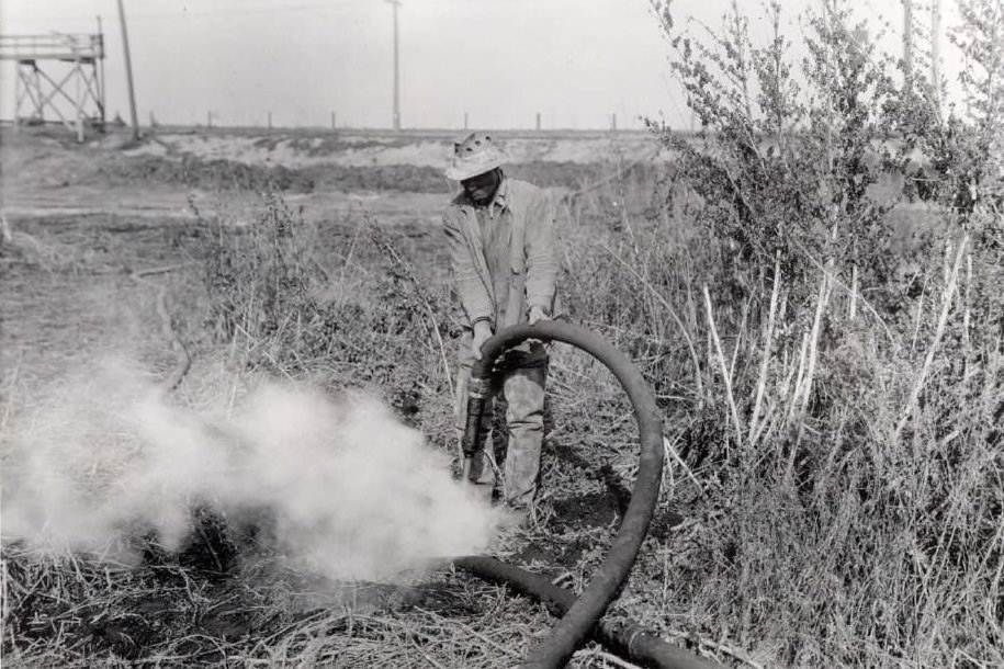
Peat fires began in July 1923 from a peat bog under an old river. The fire started as a relatively small, smoldering blaze that initially covered two acres and eventually grew to fifteen acres. Fires continued to erupt until four years later, when City Engineer Shaw diverted Centinela Creek into an eight-foot-wide by two-foot-deep channel through the peat bogs. A worker is shown jetting water at the active fires on the west side of the peat fire, above the floodwater pond.
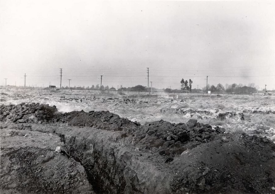
This is a view of the long-burning peat fire in Baldwin Hills, looking south from a point about 100 feet east of the corner, at the end of Exposition Boulevard and south of Airline Railway. The fire began in July 1923 from a peat bog under an old river. Starting as a relatively small, smoldering fire, it eventually spread to fifteen acres, causing widespread smoke and foul odors throughout the West Adams neighborhood of Los Angeles. The city was unable to put out the fires until City Engineer Shaw, in November 1927, diverted Centinela Creek into an eight-foot-wide by two-foot-deep channel through the peat bog beds.
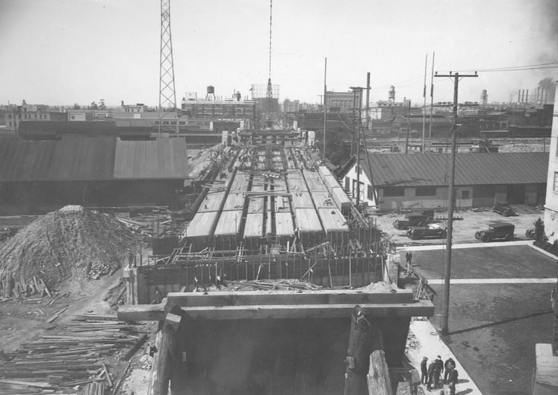
This is a view looking west from a tower on the east end of the Seventh Street Bridge. The bridge is part of a group of 12 river bridges recognized for their contribution to Los Angeles’ transportation history and their association with Chief Engineer Merrill Butler, a bridge designer of the time. These bridges were built between 1923 and 1928. In 2008, it was designated a Los Angeles Historic-Cultural Monument.
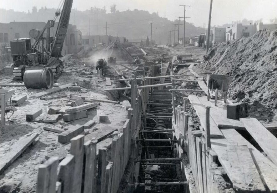
Construction is underway near the Glendale outfall sewer on Newell Street, in addition to the Verdugo Road and Glassell Avenue storm drains. Glendale joined Los Angeles’ sewer system in 1923.
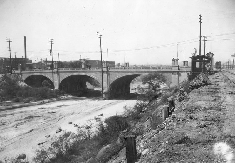
This is a view of the viaduct over Seventh Street. A total of 12 river bridges were built between 1923 and 1928, most of which are recognized for their role in the transportation history of Los Angeles and their association with Chief Engineer Merrill Butler, a prominent bridge designer of the era. In 2008, it was designated a Los Angeles Historic-Cultural Monument.
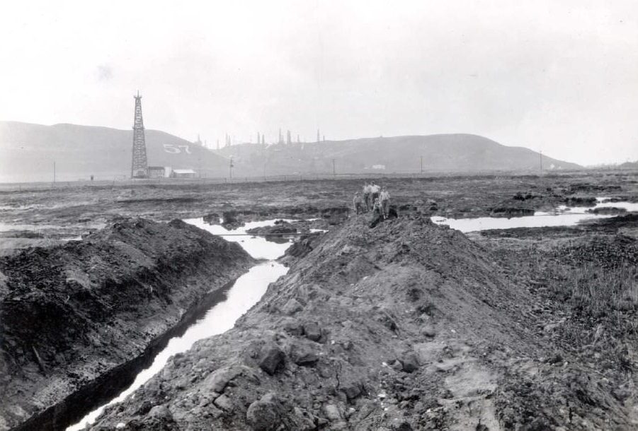
A peat fire that began in July 1923 under an old river started as a relatively small, smoldering fire that covered two acres and eventually spread to fifteen acres. After numerous fires erupted, City Engineer Shaw diverted Centinela Creek into an eight-foot-wide, two-foot-deep channel through the peat bog beds. This photo was taken south of Airline Railway, near the end of Jefferson Boulevard, looking east up the temporary flood channel, with boys walking along it. Oil wells in Baldwin Hills are visible in the background.
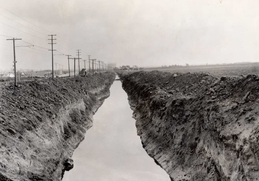
The fire began as a relatively small, smoldering blaze that covered two acres but eventually spread to fifteen acres, starting from a peat bog under an old river in July 1923. City officials were unable to put out the fires until City Engineer Shaw dug a channel eight feet wide and two feet deep through the peat bog beds in 1928.
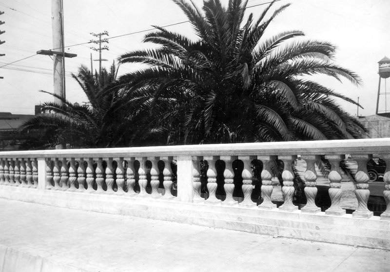
This is a view of the handrail on the Macy Street Viaduct. In Los Angeles, the Macy Street Viaduct is part of a group of 12 river bridges associated with Chief Engineer Merrill Butler, a prominent bridge designer of the era. Most of these bridges were built between 1923 and 1928. In 1979, it was designated a Los Angeles Historic-Cultural Monument.
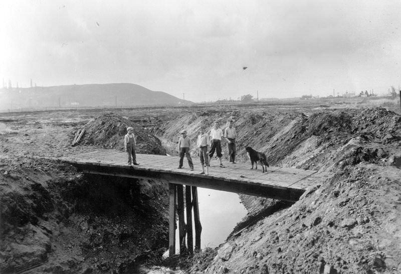
Three boys cross a temporary bridge over the Centinela Creek channel. The peat fire began in July 1923 from a peat bog under an old river, starting as a relatively small, smoldering fire that covered two acres and eventually grew to fifteen acres. City officials could not extinguish the many fires until City Engineer Shaw diverted Centinela Creek into an eight-foot-wide by two-foot-deep channel through the peat bogs.
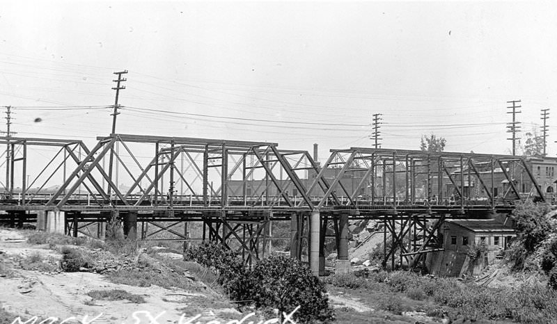
This bridge was built in 1909 to replace the first permanent river bridge built in Los Angeles in 1870, which had become poor by 1895. It originally carried Old Aliso Road, a segment of El Camino Real later known as Macy Street and now named Cesar Chavez Avenue. In July 1904, the bridge was finally demolished and replaced with the Macy Street Viaduct in 1928. The Macy Street Viaduct is one of 12 river bridges recognized for their role in Los Angeles’ transportation history and their association with Chief Engineer Merrill Butler, a major bridge designer of the era. Most of these bridges were built between 1923 and 1928.
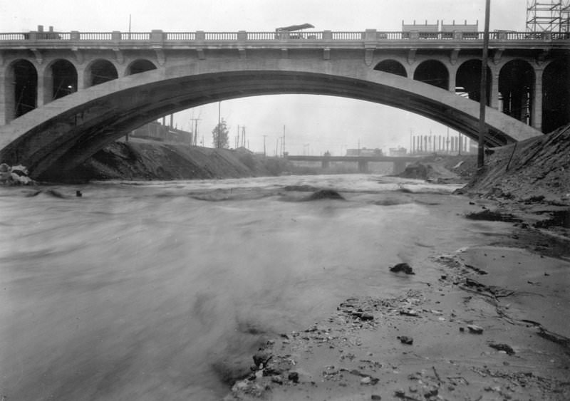
This is a view of the main span of the completed Macy Street Viaduct. This river bridge is part of a group of 12 river bridges notable for their role in the transportation history of Los Angeles and their association with Chief Engineer Merrill Butler, one of the most well-known bridge designers of the period.
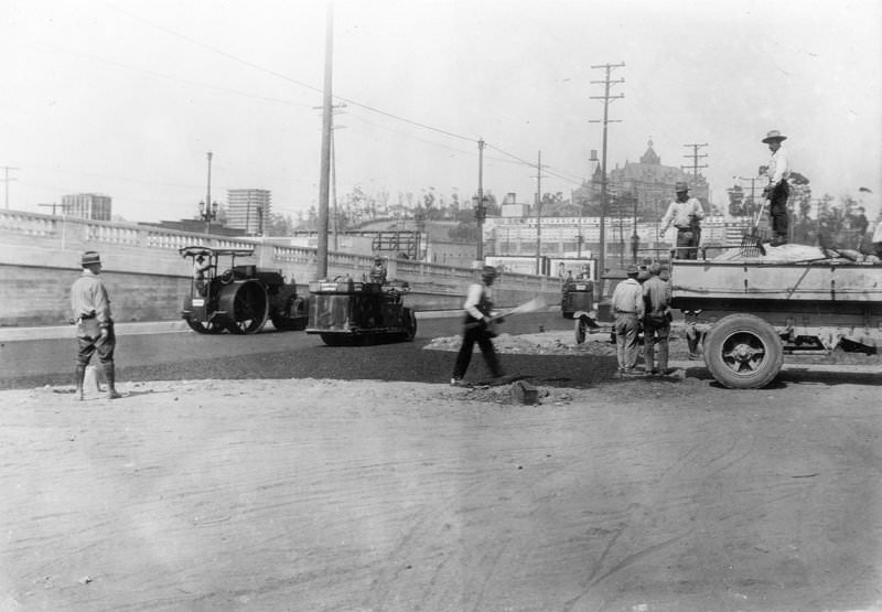
This view shows asphaltic concrete paving around the east end of the Seventh Street Bridge, looking northeast. This bridge plays an important role in the transportation history of Los Angeles and is one of 12 river bridges associated with Chief Engineer Merrill Butler, a prominent bridge designer of the time. Most of these bridges were built between 1923 and 1928.
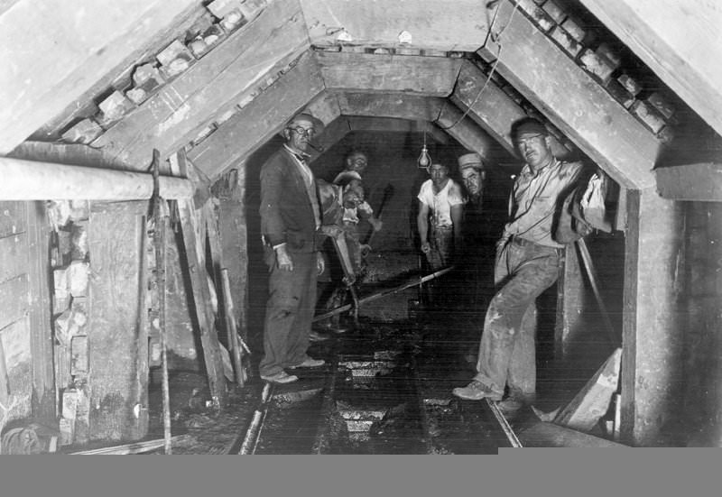
This photo shows additional construction on the North Outfall Sewer, specifically the sets and heading for a 3’6″ precast pipe drain at Lakeside Country Club, adjacent to Toluca Lake. At 55 miles, the North Outfall Sewer is the longest in the United States. It originates in Canoga Park, near the Los Angeles River, and winds along the river to downtown Los Angeles. It then passes Exposition Park and the Playa del Rey hills, crosses under Pershing Drive to Vista Del Mar Boulevard, and empties into the ocean-facing Hyperion Wastewater Treatment Plant.
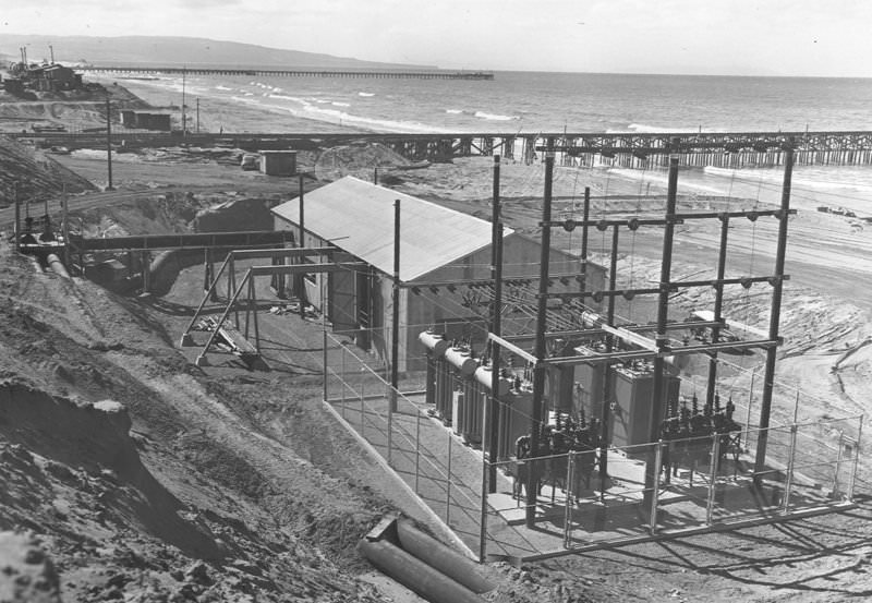
This is a view of construction at the Hyperion Sewage Treatment Plant. The new sewage screening plant, completed in 1950, replaced an aging plant built in 1924. The photo looks south at the transformer substation and pump house. The construction pier is visible in the background, and the Standard Oil Refinery pier is to the south. The Pacific Ocean is to the west of the construction, and El Segundo is to the east.
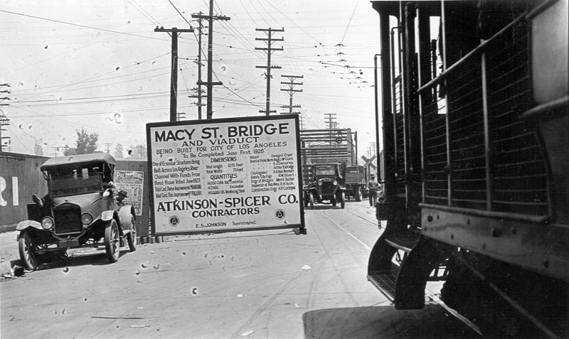
This is the Atkinson-Spicer Company Contractors construction sign for the Macy Street Viaduct and Bridge. Among a group of 12 river bridges, the Macy Street Viaduct is notable for its role in the transportation history of Los Angeles and its association with Chief Engineer Merrill Butler, a prominent bridge designer of the time. Macy Street provided an unobstructed crossing at high water, allowing the northern and eastern sections of the rapidly growing city to access the city center.
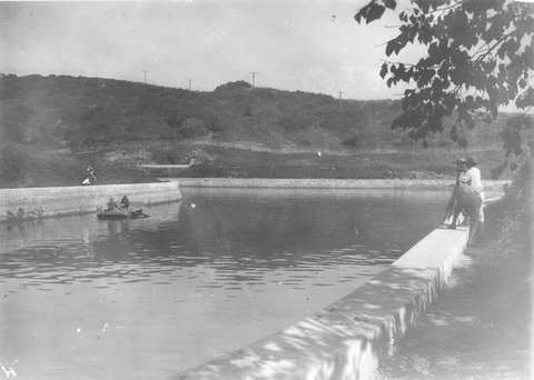
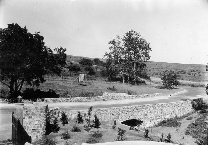
Bel Air Bridge, near St. Pierre Road and Beverly Glen Boulevard.
Avenue 60, Old Bridge, another view.
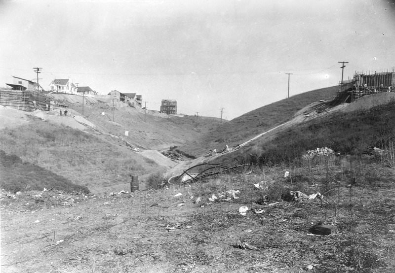
Franklin Avenue Bridge, the site at the beginning of construction, November 11, 1925.
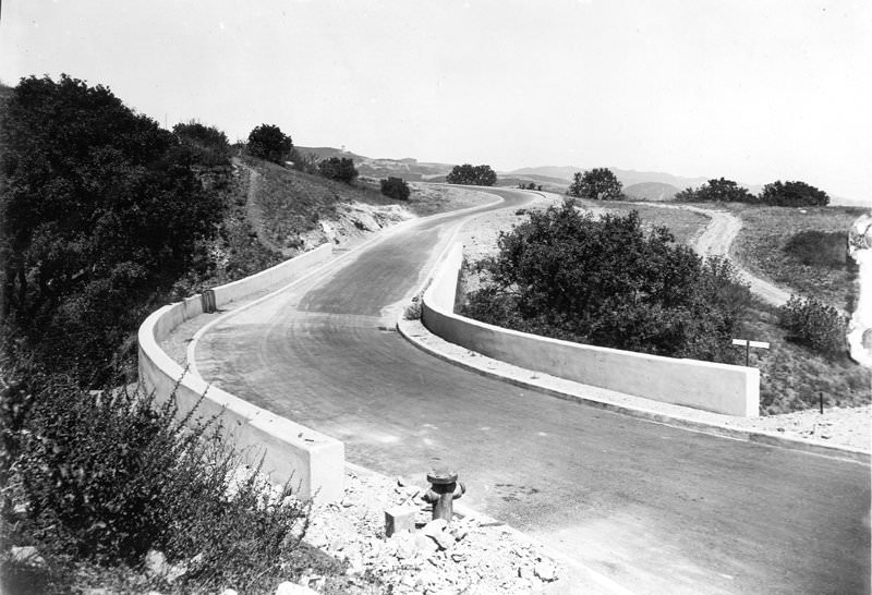
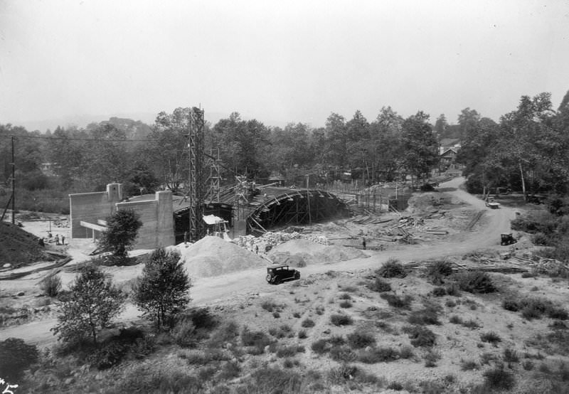
Construction under Universal City Bridge for Carl Laemmle’s Universal City Pictures on the former Taylor Ranch in Lankershim Township.
![[Factually Corrected] Tujunga Cumston Bridge, 1925](https://www.bygonely.com/wp-content/uploads/2021/10/Los_Angeles_1920s_28.jpg)
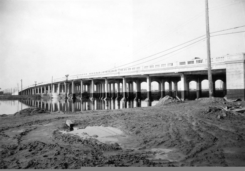
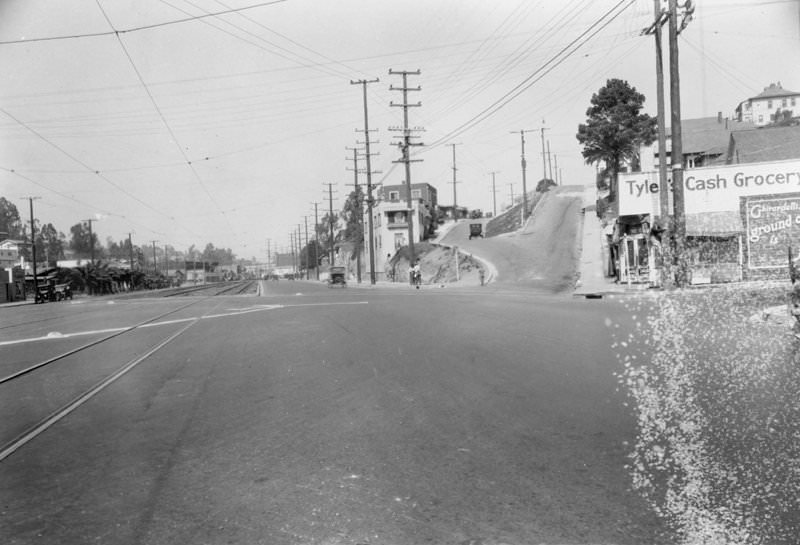
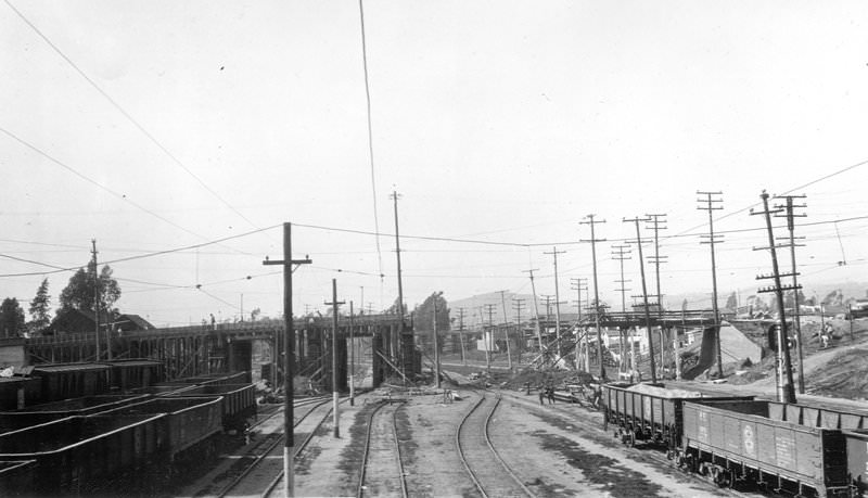
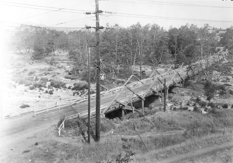
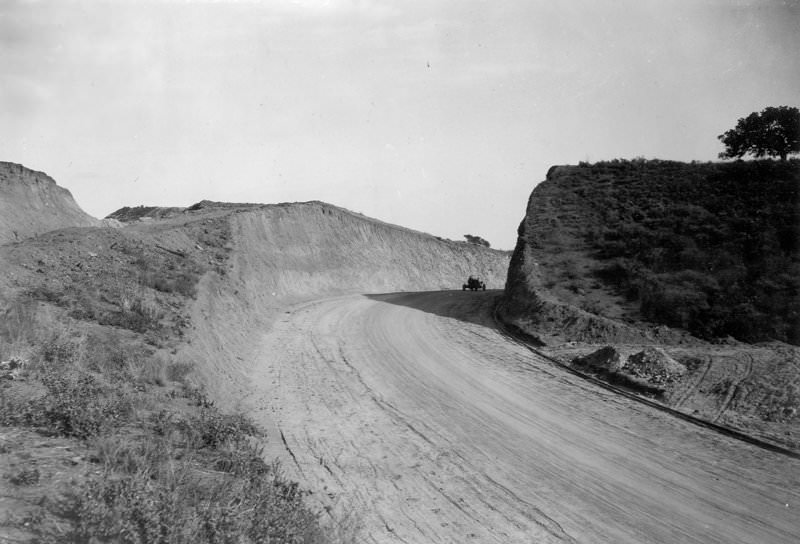
Sunset Boulevard Road Cut at Delfern Drive. This may have been preparatory work for roads to the new UCLA campus, which opened in 1929.
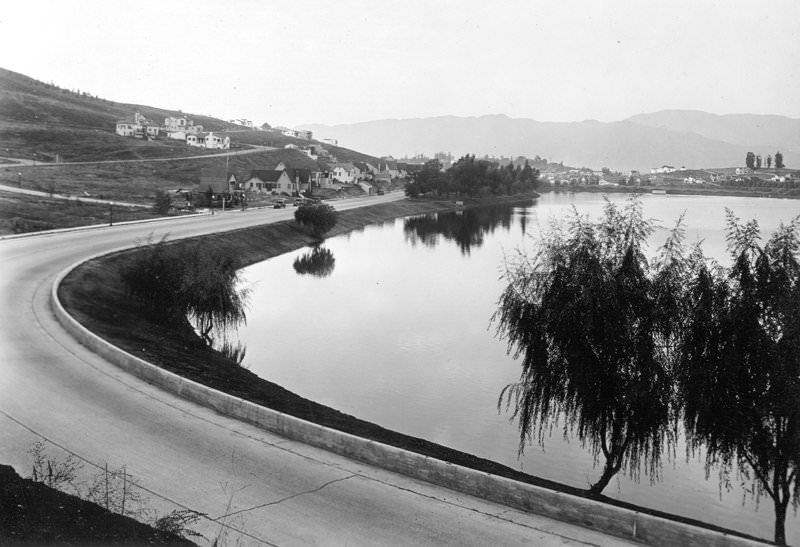
Looking north across Silver Lake from West Silver Lake Drive. In 1925, real estate developer George W. Dickinson and Company built a new housing project along the west shore of Silver Lake and named it West Silver Lake Drive. The “Moreno Highlands Lake Front homes” were completed between 1926 and 1927. The engineers working on the streets, curbs, and sewers referred to it as “Redesdale,” a street in the hills northwest of Silver Lake.
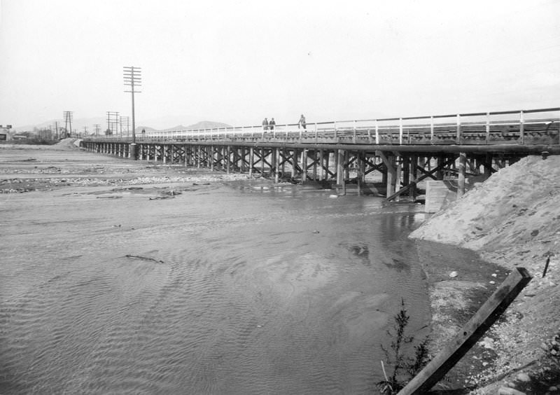
San Fernando Bridge over Big Tujunga Wash (San Fernando Road), with a view from the south end on the west side.
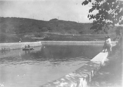
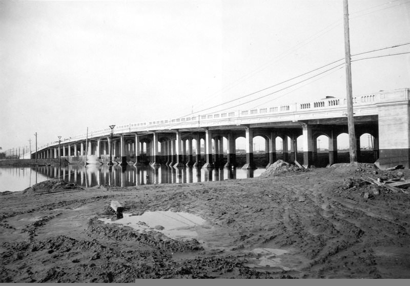
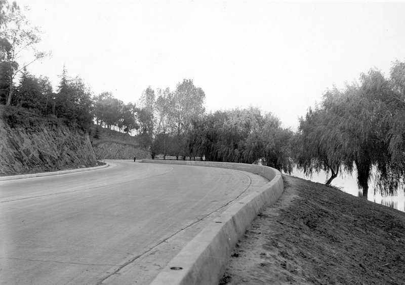
View of West Silver Lake Drive from near the Silver Lake Dam. George W. Dickinson and Company developed a new housing project along the west shore of Silver Lake in 1925, giving rise to West Silver Lake Drive. The “Moreno Highlands Lake Front homes” were completed in 1926–1927. Engineers working on the streets, curbs, and sewers referred to Redesdale Drive as a street in the hills northwest of Silver Lake.
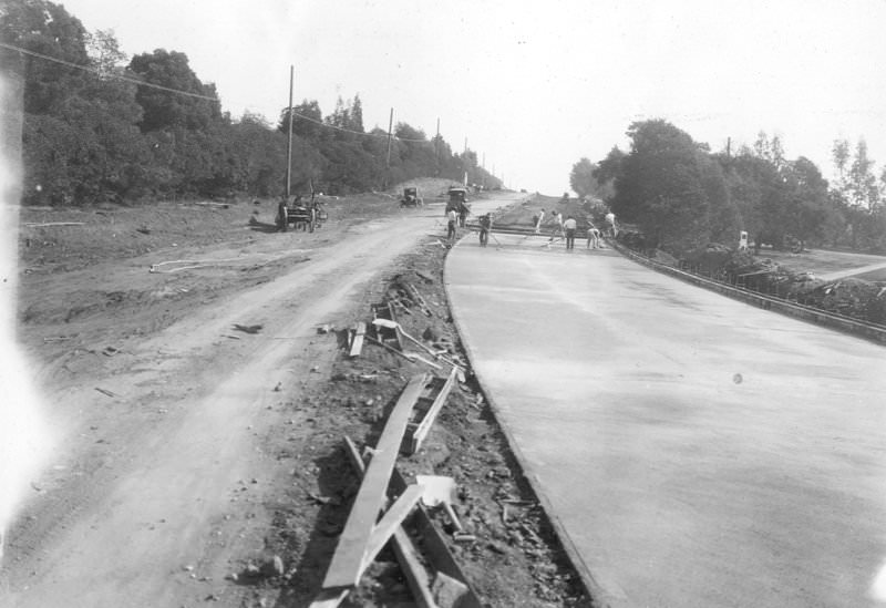
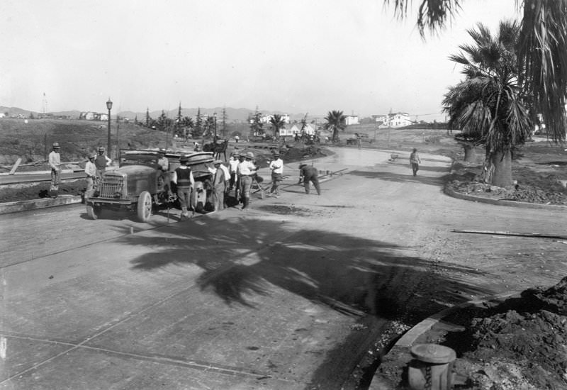
Wilshire Boulevard to Veteran Avenue, showing finishers doing final work after spreaders have moved.
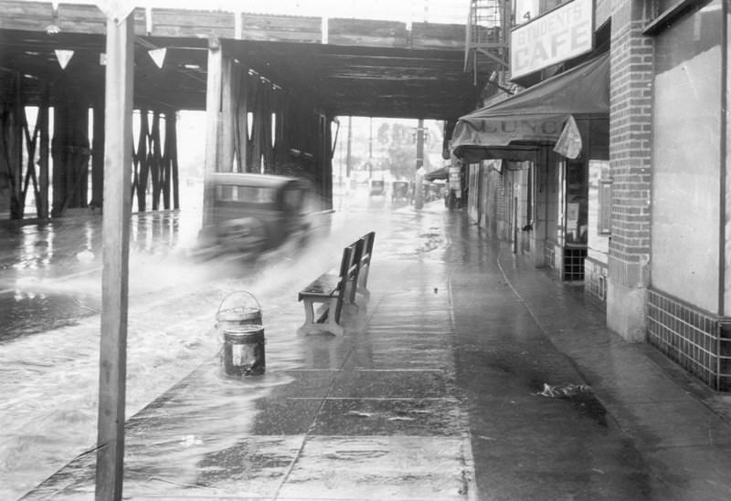
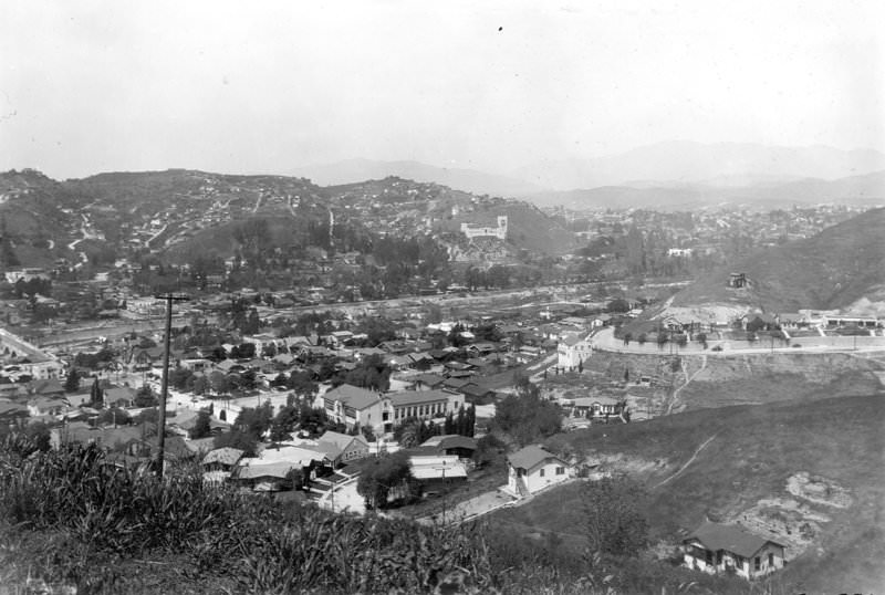
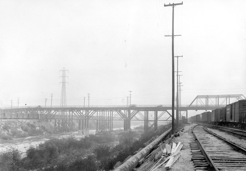
East Fourth Street Viaduct (old), general view of river spans of the highway structure from upstream on the westerly bank.
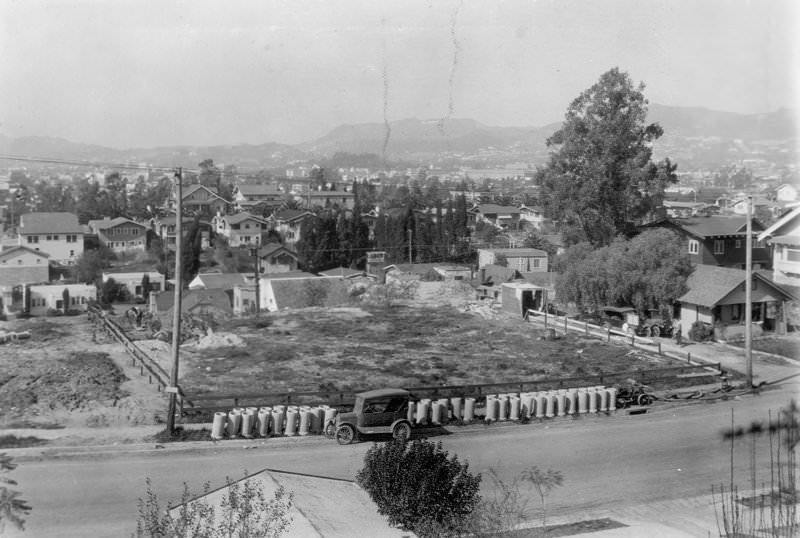
The Arroyo De La Sacatela storm drain passes through a tunnel. In the early 20th century, Sacatela Creek was a year-round stream in the Franklin Hills and joined Ballona Creek in Koreatown/Mid-City, between Westchester and Country Club Drive. Near what is today Beverly Boulevard and Madison Avenue, a seasonal stream flowed into Sacatela Creek from the Silver Lake Reservoir area. In 1929, the storm drain was built along the stream’s path and the creek was filled.
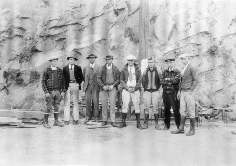
This photo shows inspectors, contractors, and employees at the Riverside Drive and Dayton Avenue Viaduct. It replaced the earlier Dayton Avenue Bridge, built in 1903. The Riverside Drive–Dayton Avenue Bridge, also known as the Riverside Drive–Figueroa Bridge, was renamed when Dayton Avenue was renamed North Figueroa to continue the original Figueroa Street. In 2008, the bridge was designated a Los Angeles Historic-Cultural Monument.
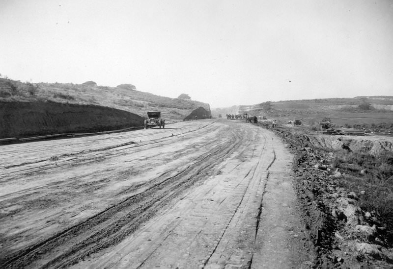
Subgrade of Sunset Boulevard, 400 feet west of Groverton Place, showing an unpaved road. This may have been preparatory work for roads to the new UCLA campus, which opened in 1929.
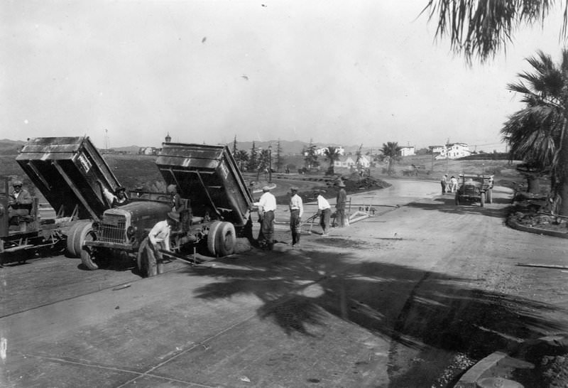
Trucks dumping concrete from the central mixing plant, with crew spreading concrete from trucks, on Wilshire Boulevard to Veteran Avenue.
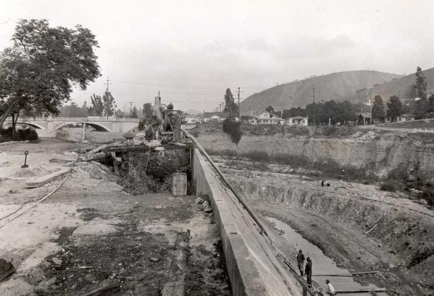
Arroyo Seco bank protection below Avenue 43 Bridge, looking north from the top of the bank.
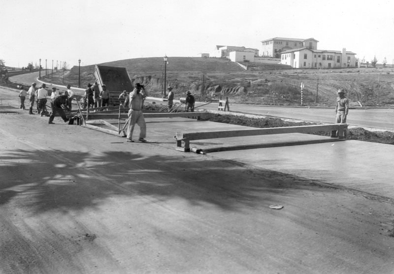
Wilshire Boulevard to Veteran Avenue, crew spreading concrete from the central mixing plant. Houses are visible on the hill east of Veteran.
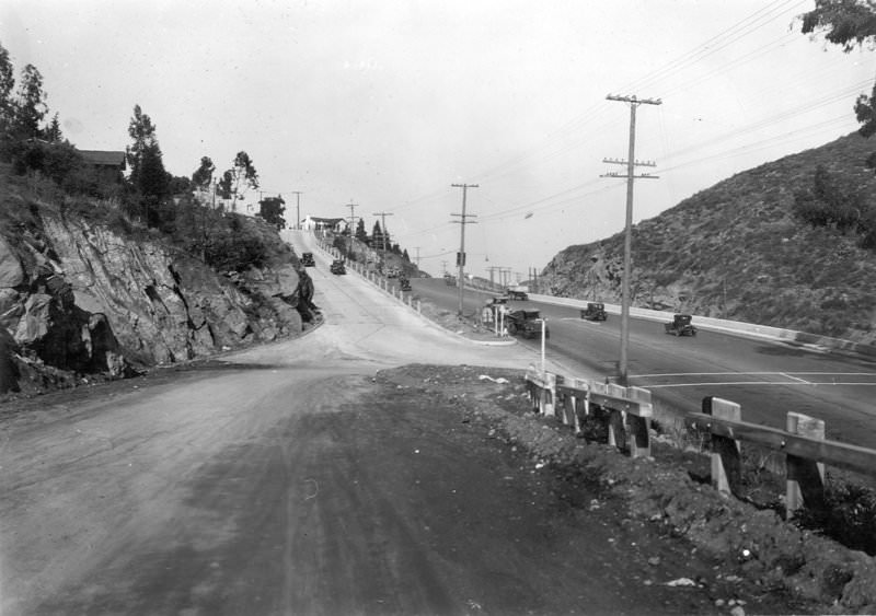
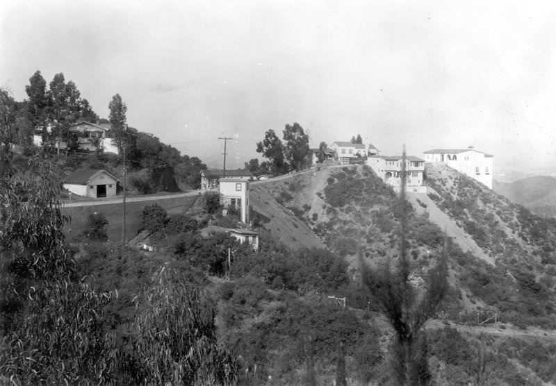
Woodrow Wilson Road, at its junction with Cahuenga Boulevard from Mulholland Highway. Mulholland Highway later became Mulholland Drive.
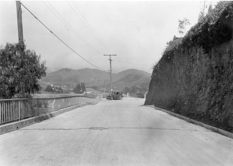
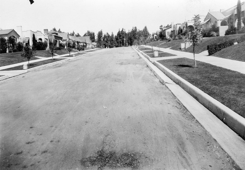
Woodrow Wilson Road, looking north from Loyal Terrace with Pacific View.
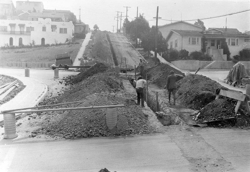
The Arroyo de la Sacatela storm drain is seen from Effie Street at Silver Lake’s west end. Sacatela Creek (also called Bimini Slough) and Bimini Hot Springs formed part of a year-round stream from Franklin Hills that joined Ballona Creek in Koreatown/Mid-City, between Wilton, Westchester, and Country Club Drive. The creek was filled after the storm drain was completed. The photograph shows a ditch with vertical dirt walls on both sides and wooden poles and planks in the left foreground. Piles of dirt are visible on each side of the ditch. Telephone poles are visible in the right background, and houses can be seen on both sides of the ditch. Two men are working on the storm drain.
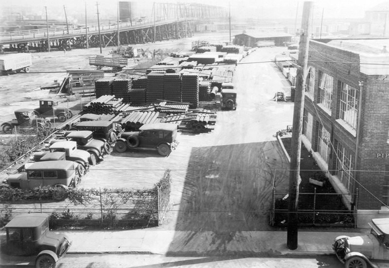
Looking east across Mateo Street from the roof of the Motor Freight Terminal building at the Fourth Street Viaduct.
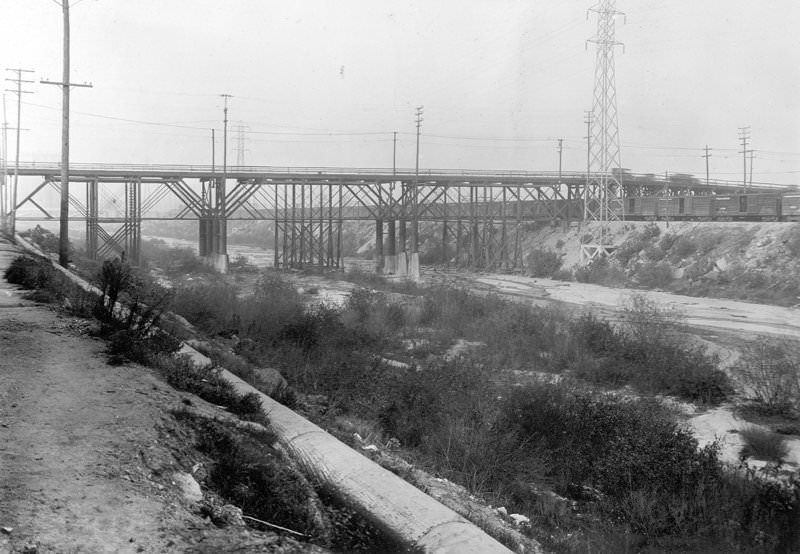
General view of the river spans of the Old East Fourth Street Viaduct, with railway trusses visible downstream on the west bank.
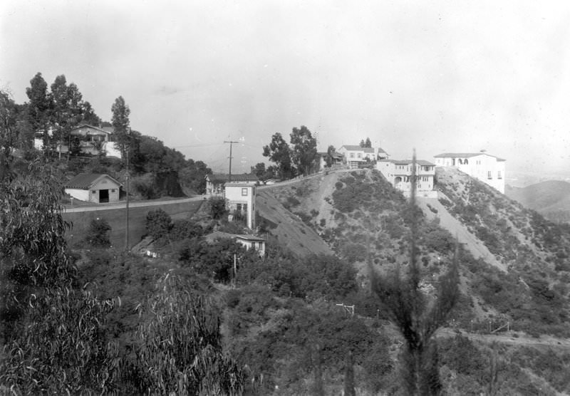
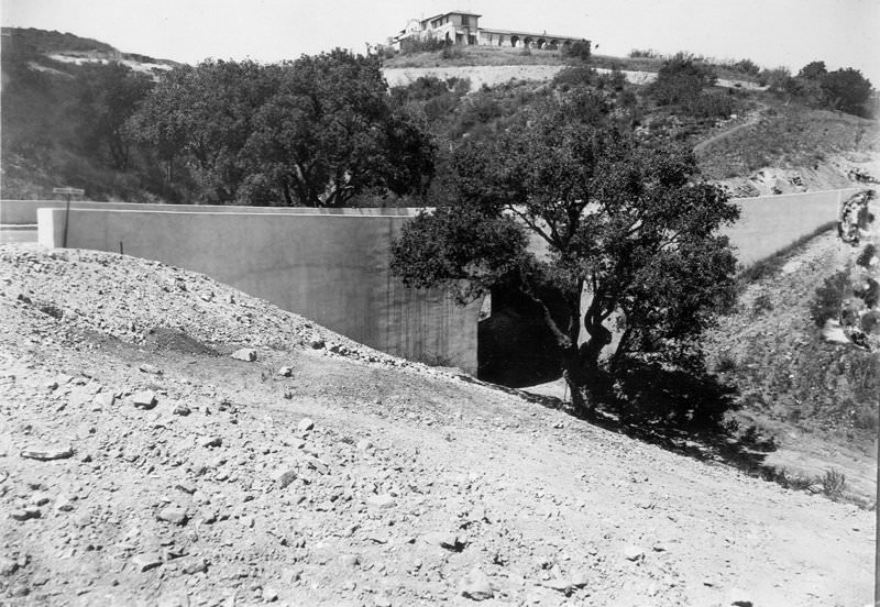
Pacific View Drive, looking west from Viso Drive, showing the retaining wall near the junction with Woodrow Wilson Road.
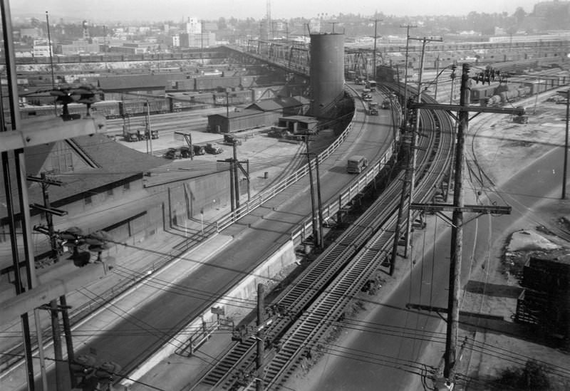
Fourth Street Viaduct, general view looking east from the roof at Fourth and Mateo Streets.
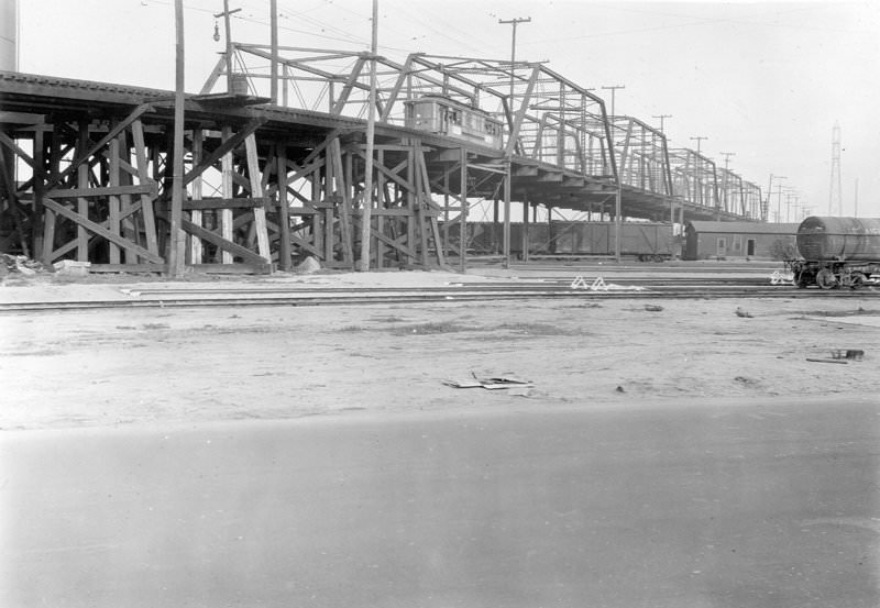
Old East Fourth Street Viaduct, showing railroad trusses over tracks west of the river.
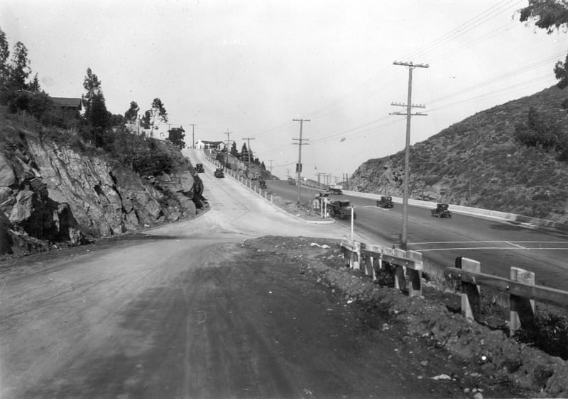
Woodrow Wilson Road, at its junction with Cahuenga Boulevard from Mulholland Highway. Mulholland Highway later became Mulholland Drive.
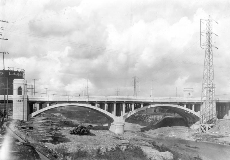
First Street Viaduct, view of river spans looking upstream from the west bank at track level.
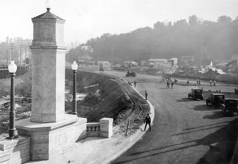
Paving of the road on the south approach at Riverside Drive on the Glendale-Hyperion Viaduct. Cars and people are walking on the paved road. The Glendale-Hyperion Viaduct and Bridge is 56 feet wide, 1,340 feet long, and has thirteen concrete arches. It has been a Los Angeles Historic-Cultural Monument since 1976. It was designed by Merrill Butler, the city’s chief bridge engineer in the 1920s, who was responsible for building most of the city’s historic bridges.
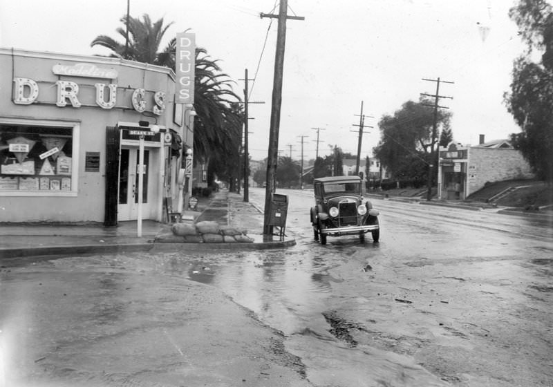
Echo Park Avenue, showing sandbag protection at Duane Street. Madeline Drugs is on the corner.
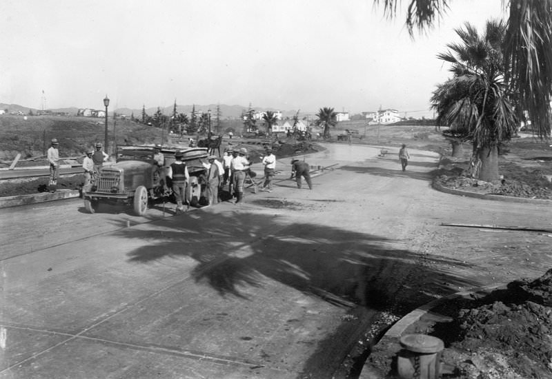
Wilshire Boulevard to Veteran Avenue, crew spreading concrete from trucks.
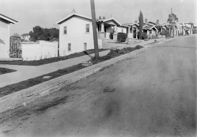
Aldama Street, northeast of Avenue 50, showing an uneven gutter in front of houses numbered 5039 and 5041.
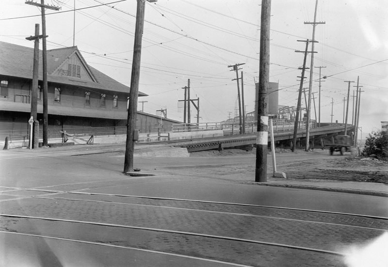
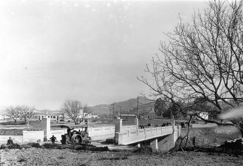
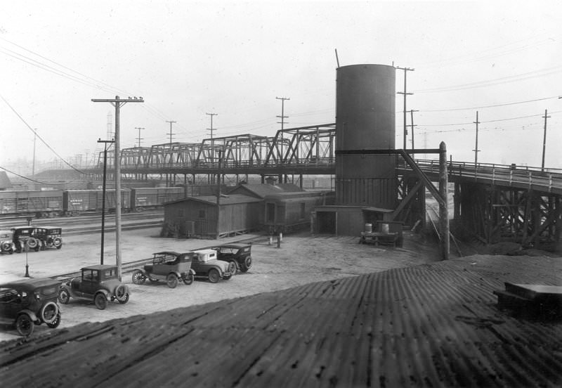
Old East Fourth Street Viaduct, viewed looking southeast from the window of a railroad building.
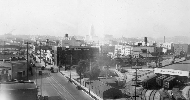
Looking west from the roof corner of the Maxwell House Coffee Company at Fourth and Mateo Streets, showing Fourth Street widened along with Fourth Place and the surrounding area.
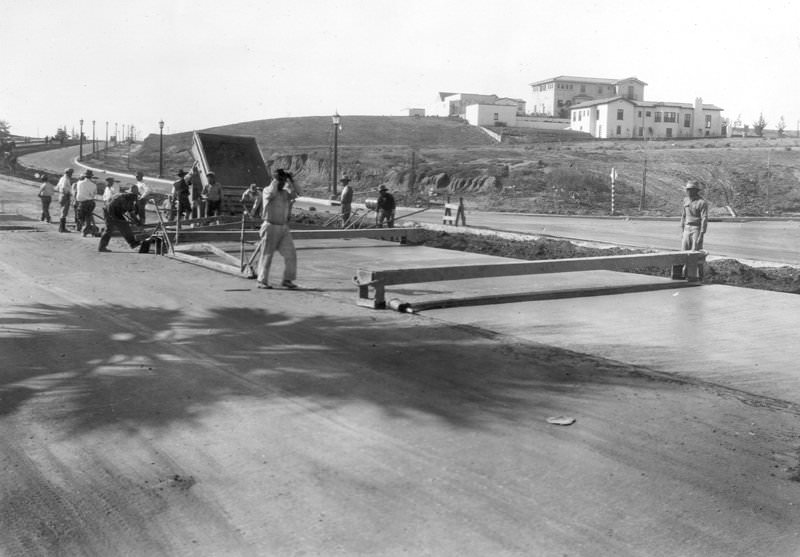
Wilshire Boulevard to Veteran Avenue, crew spreading concrete from the central mixing plant. Houses are visible on the hill east of Veteran.
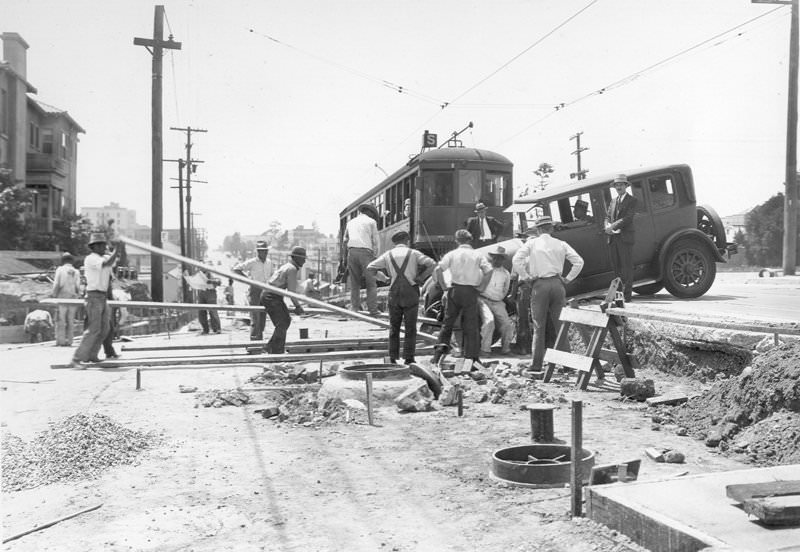
At Third Street and New Hampshire Avenue, an automobile has fallen into a cut in the street grade, and a streetcar is stopped west of the wrecked vehicle. Another man stands by the car with his hands folded and his hat firmly on his head, while the driver sits in the car.
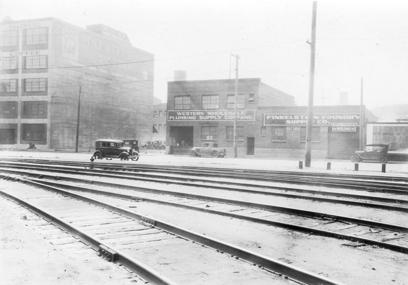
Located on the south side of East Fourth Street near the corner of Mateo Street: Finkelstein Foundry Supply Company and Western Wholesale Plumbing Supply Company.
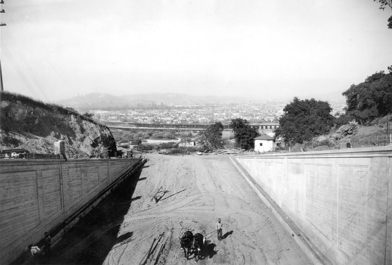
Looking east from the site of the bridge across the Los Angeles River at the Glendale-Hyperion Viaduct crossing at Waverly Drive. The Glendale-Hyperion Viaduct and Bridge is 56 feet wide, 1,340 feet long, and has thirteen concrete arches. It was designed by Merrill Butler, the city’s chief bridge engineer during the 1920s, who was responsible for most of its historic bridges.
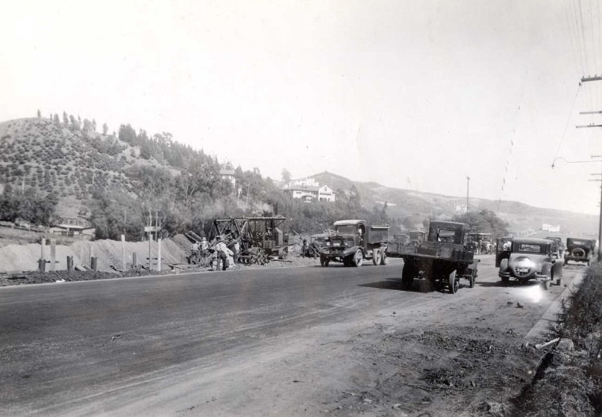
Cahuenga Boulevard sanitary sewer construction, looking southeast. Automobiles and trucks are visible in the scene.
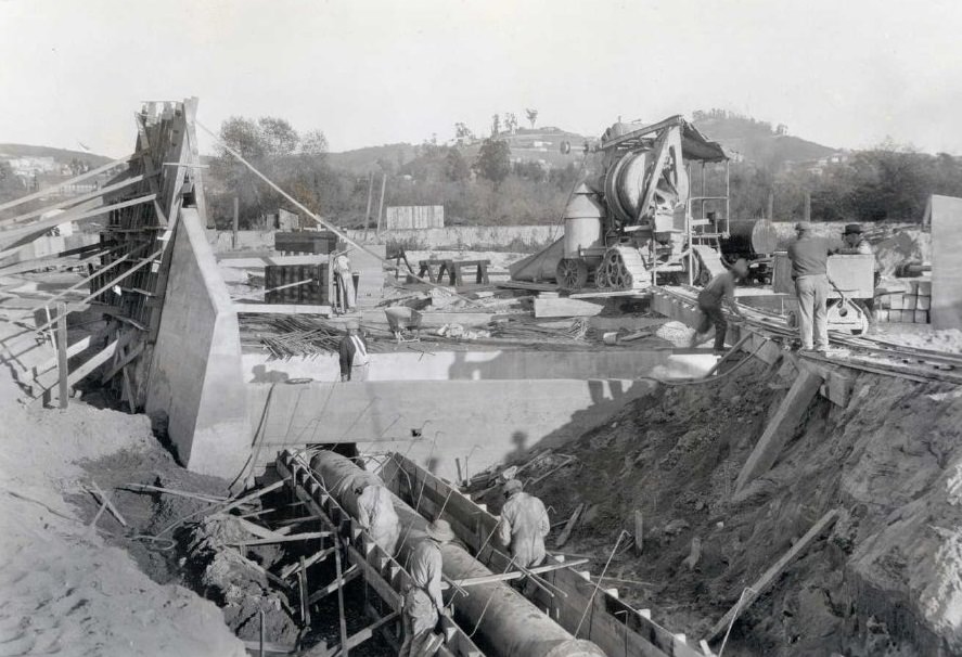
Verdugo and Glassell Avenue storm drain, showing workers placing steel for reinforcement of a twenty-four-inch cast iron sewer pipe.
View of Pico Street Viaduct at San Vicente Boulevard from the southern side, looking toward Los Angeles.
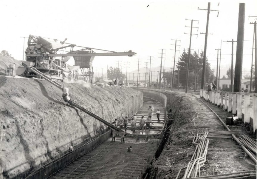
Verdugo Road and Glassell Avenue storm drain, showing the concrete base being placed on the boxing section, looking at 300 feet, with increased concrete flow to the box section.
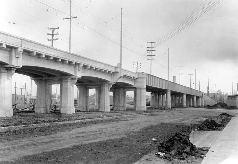
View of Pico Street Viaduct at San Vicente Boulevard from the southern side, looking toward Los Angeles.
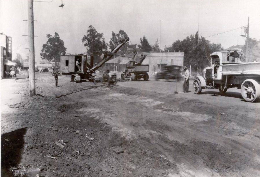
Lankershim Boulevard, surfacing and grading at Cahuenga near Universal City, looking east.
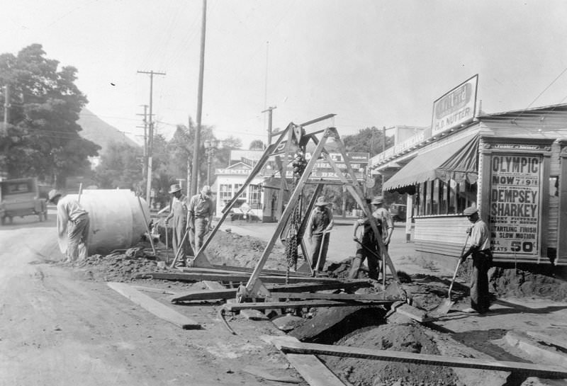
Laurel Canyon storm drain on La Brea Avenue, south of Hollywood Boulevard. A Dempsey-Sharkey fight at Olympic Stadium placard is visible, along with manual workers and a ditch.
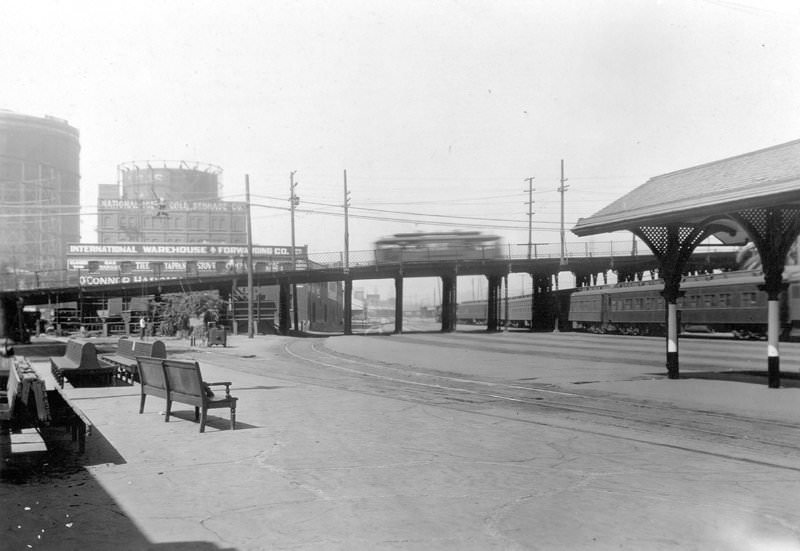
West approach to the original East First Street Viaduct. A bench, a railroad station, and Santa Fe and Union Pacific tracks are visible. The original steel bridge, built in 1889, would be replaced in 1928 by a new arch concrete bridge designed by engineer Merrill Butler.
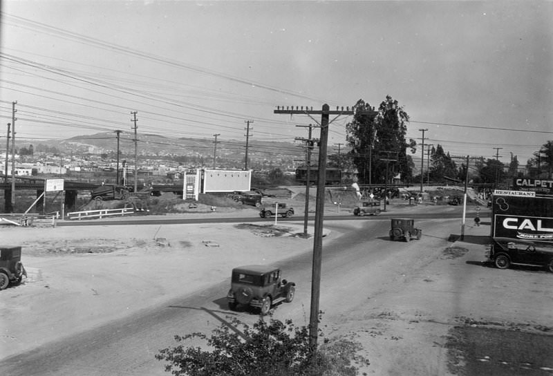
Looking east toward Riverside Drive during construction of the Hyperion-Glendale Bridge. The Glendale-Hyperion Viaduct is 56 feet wide, 1,340 feet long, and has thirteen concrete arches. Listed as a Los Angeles Historic-Cultural Monument in 1976, the bridge was designed by Merrill Butler, the city’s chief bridge engineer during the 1920s, who built most of the city’s historic bridges.
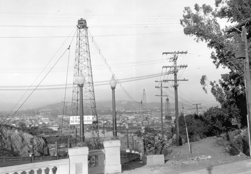
The Glendale-Hyperion Viaduct seen from the end of Waverly Avenue Bridge. A Los Angeles Historic-Cultural Monument since 1976, the bridge was designed by Merrill Butler, who served as the city’s chief bridge engineer in the 1920s and built most of the city’s historic bridges still standing. The Glendale-Hyperion Viaduct and Bridge is 56 feet wide and 1,340 feet long. It was completed in 1928 and has thirteen concrete arches.
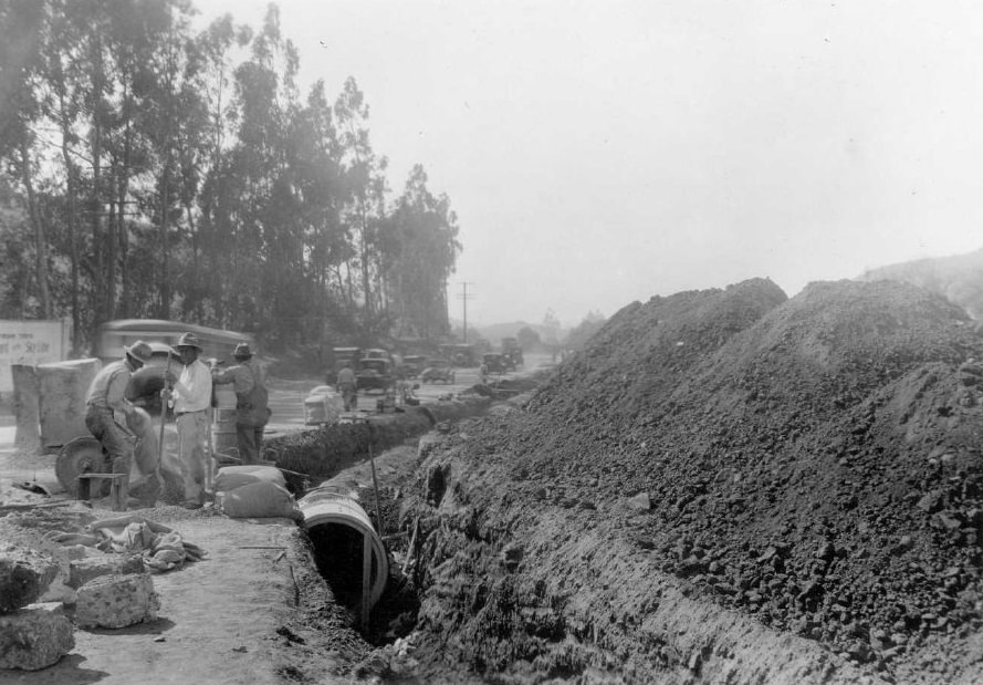
Cahuenga Boulevard, end of construction of the storm drain, looking east.
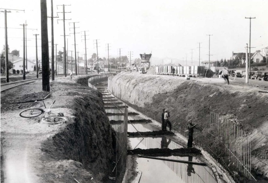
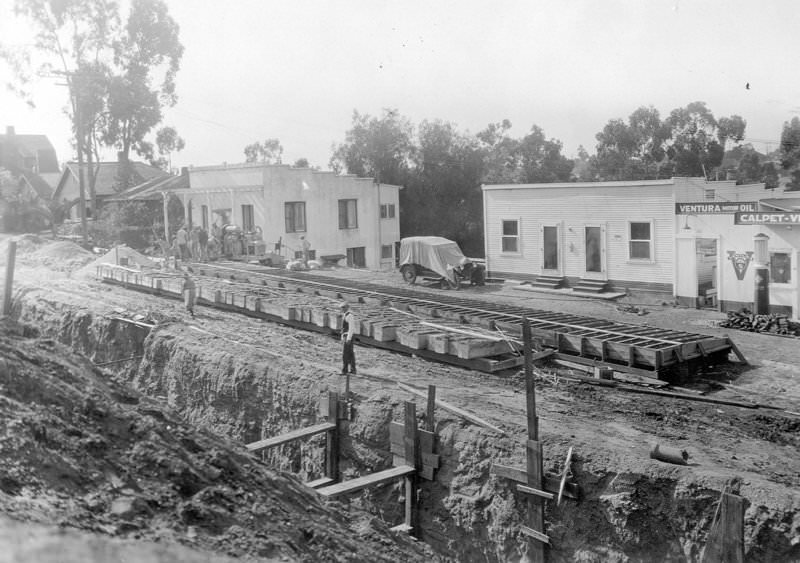
Verdugo Road and Glassell Avenue storm drain, showing the curing base of the boxing section along Los Angeles Railway tracks.
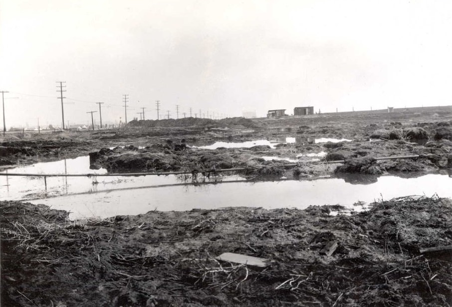
Looking across the easterly floodwater pond, showing the mass of peat left by washes caused by floodwaters from Centinela Creek, which the city engineer diverted into the bog.
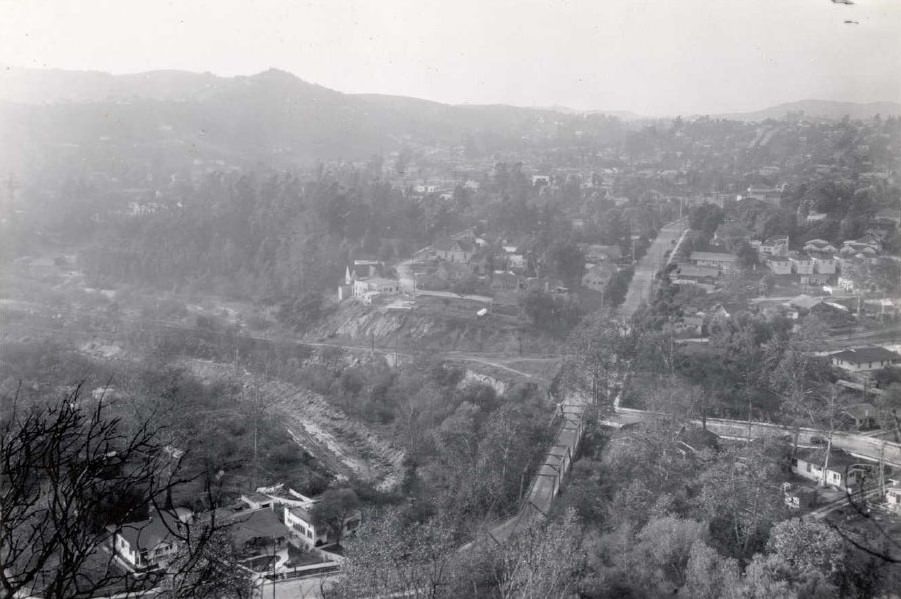
Excavation of Arroyo Seco below Avenue 52, viewed from the west bank.
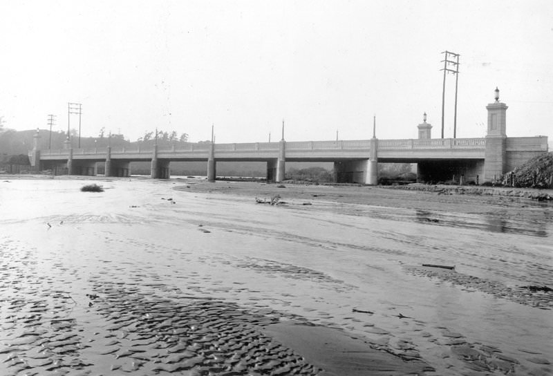
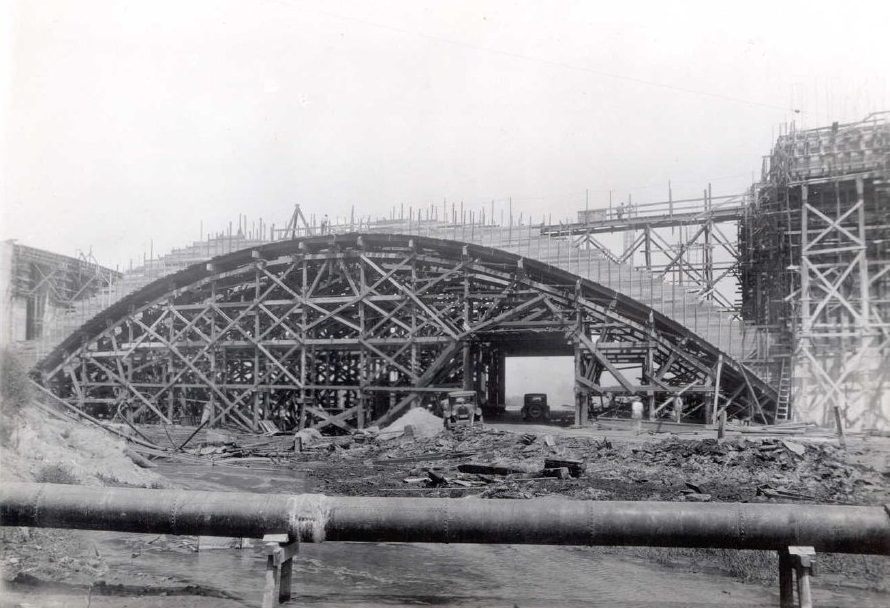
Viaduct and bridge over Dayton Avenue, showing a view of the main span from a downstream point in the stream bed. This concrete bridge replaced the earlier 1903 Dayton Avenue Bridge. The bridge was later renamed the Riverside Drive–Dayton Avenue Bridge, or Riverside Drive–Figueroa Bridge, when Dayton Avenue became North Figueroa as a continuation of the original Figueroa Street.
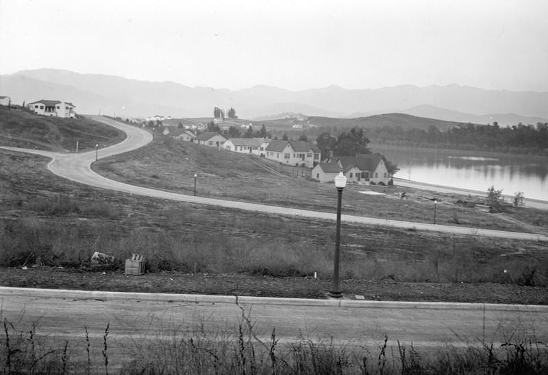
Redesdale Avenue looking northeast over Silver Lake.
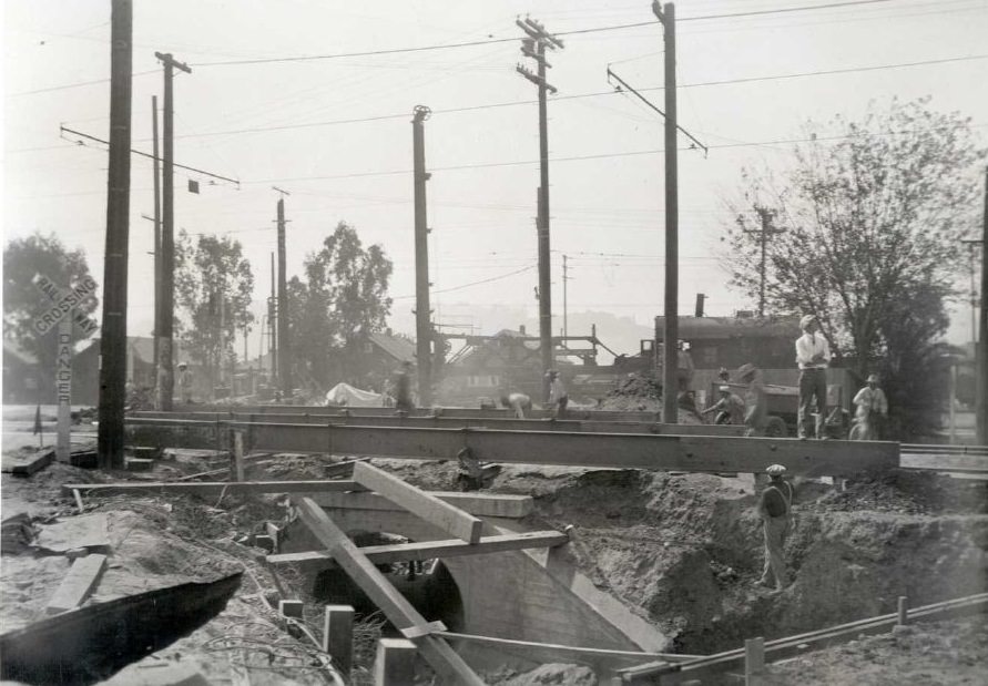
Los Angeles Railway tracks with an I-beam support used to remove old culverts, looking south toward San Fernando Road.
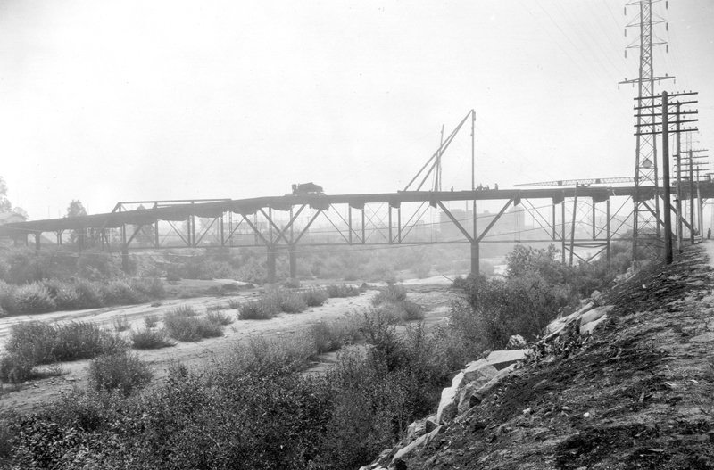
Looking downstream from the old North Spring Street Bridge, which was originally called the Downey Avenue Viaduct. The photo was taken during construction of the new Spring Street bridge and shows the Downey Avenue Bridge, which was built shortly after the Macy Street Bridge. Downey Avenue is now a portion of North Broadway east of the Los Angeles River.





The main LA Library downtown had a great exhibit of all these photos 7-8 years ago and was really cool to see in person
Pretty sophisticated back in the 20s.
Pic #11 is my old neighborhood, back when it was Edendale.
Today, it’s Echo Park/Silverlake at the intersection of Glendale Blvd, N Alvarado St, and Berkeley Ave.